

Surface Water Interaction Modelling Using Visual MODFLOW and GIS
Surface Water Interaction Modelling Using Visual MODFLOW and GIS
Surface Water Interaction Modelling Using Visual MODFLOW and GIS
- No tags were found...

Create successful ePaper yourself
Turn your PDF publications into a flip-book with our unique Google optimized e-Paper software.
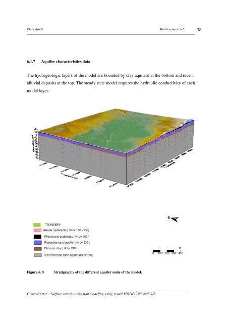
PHYLARESModel setup / ch.6__________________________________________________________________________________________386.1.7 Aquifer characteristics dataThe hydrogeologic layers of the model are bounded by clay aquitard at the bottom <strong>and</strong> recentalluvial deposits at the top. The steady state model requires the hydraulic conductivity of eachmodel layer.Figure 6. 5Stratigraphy of the different aquifer units of the model.______________________________________________________________________________________Groundwater – <strong>Surface</strong> water interaction modeling using visual <strong>MODFLOW</strong> <strong>and</strong> <strong>GIS</strong>


