

m^^iz$$m&'f - HKU Libraries - The University of Hong Kong
m^^iz$$m&'f - HKU Libraries - The University of Hong Kong
m^^iz$$m&'f - HKU Libraries - The University of Hong Kong
- No tags were found...

Create successful ePaper yourself
Turn your PDF publications into a flip-book with our unique Google optimized e-Paper software.
THE UNIVERSITY OF HONG KONGLIBRARY
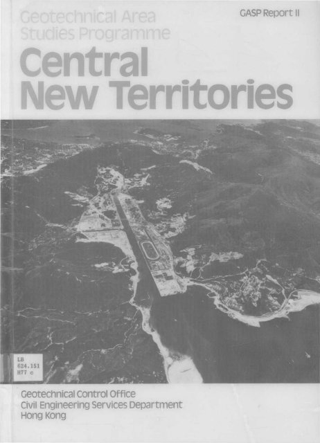
© Government <strong>of</strong> <strong>Hong</strong> <strong>Kong</strong>First published, September 1987This Report was prepared in the Planning Division <strong>of</strong> the Geotechnical Control Office by D. C. Cox,A. Hansen, P. D. Houghton, R. J. Purser and K. A. Styles.Address:Geotechnical Control OfficeEmpire Centre, 6th FloorTsim Sha Tsui East, Kowloon<strong>Hong</strong> <strong>Kong</strong>.This publication is available from:Government Publications Sales CentreGeneral Post Office Building, Ground FloorConnaught P!ace<strong>Hong</strong> <strong>Kong</strong>.Overseas orders should be placed with:Publications (Sales) OfficeInformation Services DepartmentBeaconsfieSd House, 4th FloorQueen's Road Central<strong>Hong</strong> <strong>Kong</strong>.Price in <strong>Hong</strong> <strong>Kong</strong>:HK$150.Price overseas: US$25 (including surface postage)Cover Photograph:Sha Tin Valley
Map <strong>of</strong> the Territory <strong>of</strong> <strong>Hong</strong> <strong>Kong</strong> Showing the Locations <strong>of</strong> the Geotechnical Area Studies.(Boundaries <strong>of</strong> the Regional Studies are shown by dashed lines and locations <strong>of</strong> District Studies are indicated by dark screens)
FOREWORDThis Report aims to provide an adequate geotechnicai basis for the planning and land use management <strong>of</strong>the Central New Territories, mainly by way <strong>of</strong> information presented on a series <strong>of</strong> maps at a scale <strong>of</strong>1:20 000. It is the second <strong>of</strong> twelve reports to be published as a result <strong>of</strong> the Territory-wide Geotechnicai AreaStudies Programme (GASP) carried out by the Geotechnicai Control Office between 1979 and 1985.GASP is based largely on terrain classification techniques using aerial photographs, together with fieldreconnaissance and the evaluation <strong>of</strong> a large number <strong>of</strong> existing site investigation records. It employs aunique system <strong>of</strong> terrain evaluation developed especially for <strong>Hong</strong> <strong>Kong</strong> conditions for the analysis andinterpretation <strong>of</strong> the available data.<strong>The</strong> GASP Reports were originally conceived as providing information almost solely for territorial land useplanning, for which purpose the mapping scale <strong>of</strong> 1:20000 is considered to be suitable. However, theinformation they contain also provides a good basis for engineering feasibility studies <strong>of</strong> large sites. <strong>The</strong>overall geotechnicai assessment <strong>of</strong> a study area is presented on a series <strong>of</strong> seven user-oriented maps. Four <strong>of</strong>these are supplied with this published Report—the Engineering Geology Map (EGM), Geotechnicai LandUse Map (GLUM), Physical Constraints Map (PCM), and Generalised Limitations and EngineeringAppraisal Map (GLEAM). <strong>The</strong> GLUM classifies the terrain into four classes according to the level <strong>of</strong>geotechnicai limitations, the PCM presents the major physical constraints that are likely to influencedevelopment, and the GLEAM delineates broad areas with potential for development from the geotechnicaiand planning points <strong>of</strong> view. In addition to the four maps accompanying this Report, the TerrainClassification Map, Landform Map and Erosion Map can be consulted in the Geotechnicai Information Unit<strong>of</strong> the Geotechnical Control Office.Users <strong>of</strong> GASP Reports should make reference to the new 1:20 000 scale <strong>Hong</strong> <strong>Kong</strong> Geological SurveyMaps and Memoirs which are being prepared by the Geotechnical Control Office. <strong>The</strong>se provide more up todate geological information than is available in this Report. <strong>The</strong> Geological Map which covers the Sha Tin area,together with the accompanying Memoir, has recently been published (Geotechnical Control Office, 1986;Addison, 1986).This Report was originally produced in May 1985, for use within the <strong>Hong</strong> <strong>Kong</strong> Government on the basis<strong>of</strong> information assembled during the period March 1980 to October 1984. This fact should be borne in mindby users, who should also note that the contents <strong>of</strong> the Report have for the most part not been updated.Further, although every effort has been made to ensure the accuracy <strong>of</strong> the information contained in theReport, this cannot be guaranteed. <strong>The</strong> Geotechnical Control Office cannot therefore accept any liability forerrors in the data or for misinterpretations made during the study.It must be emphasised that this document was prepared for general planning and resource evaluationpurposes. As a general rule, 1:20000 scale maps, particularly the GLUM, should not be used to evaluateparcels <strong>of</strong> land smaller than 3 hectares in size, and should never be interpreted, reproduced or enlarged toa scale greater than 1:20000. Failure to heed this warning could result in serious misinterpretation <strong>of</strong> theinformation they contain.<strong>The</strong> GASP study was undertaken by a team <strong>of</strong> specialist Geotechnical Engineers in the Planning & TerrainEvaluation Section <strong>of</strong> the Planning Division <strong>of</strong> the GCO, which included Messrs D. C. Cox, A. Hansen,P. D. Houghton, R. J. Purser and K. A. Styles. <strong>The</strong> Planning & Terrain Evaluation Section is led byMr K. A. Styles, and the Planning Division is under the direction <strong>of</strong> Dr A. D. Burnett.<strong>The</strong> Geotechnical Control Office acknowledges the co-operation and assistance given by the Commissioner<strong>of</strong> the Soil Conservation Service <strong>of</strong> New South Wales, Australia, who made available Mr P. D.Houghton, a specialist Aerial Photograph Interpreter, to participate in the study. Acknowledgements are alsodue to the Lands Department <strong>of</strong> the <strong>Hong</strong> <strong>Kong</strong> Government, who provided most <strong>of</strong> the aerial photographsused in the study, a few <strong>of</strong> which are reproduced in this ReportE. W. BrandPrincipal Government Geotechnical EngineerSeptember 1987
CONTENTSPageFOREWORD 31. INTRODUCTION1.1 <strong>The</strong> Central New Territories Geotechntcal Area Study 101.2 <strong>The</strong> Geotechnical Area Studies Programme 101.3 Aims <strong>of</strong> the Geotechnical Area Studies Programme 101.4 Organisation <strong>of</strong> the Report 111.5 Maps Produced within the Regional Study 111.5.1 General 111.5.2 Terrain Classification Map (TCM) 111.5.3 Landform Map (LM) 111.5.4 Erosion Map (EM) 121.5.5 Geotechnical Land Use Map (GLUM) 121.5.6 Physical Constraints Map (PCM) 121.5.7 Engineering Geology Map (EGM) 121.5.8 Generalised Limitations and Engineering Appraisal Map (GLEAM) 121.5.9 Computer-generated Maps 131.6 Suitability <strong>of</strong> the Maps for Technical and Non-Technical Use 131.7 GASP District Studies Relevant to the Study Area 131.8 Access to GASP Data 142. DESCRIPTION OF THE CENTRAL NEW TERRITORIES STUDY AREA 152.1 Geographical Location 152.2 Topography 152.3 Geology 152.3.1 General 152.3.2 Metamorphic Units—Tolo Harbour Formation 162.3.3 Volcanic Units—Repulse Bay Formation 162.3.4 Intrusive Igneous Units 172.3.5 Superficial Units 172.4 Geomorphology 182.4.1 General 182.4.2 Granitic Terrain 182.4.3 Volcanic Terrain 192.4.4 Colluvial Terrain 192.4.5 Alluvial Terrain 1 g2.5 Surface Hydrology 202.6 Vegetation 202.7 Erosion and Instability 212.7.1 General 212.7.2 Erosion 222.7.3 Instability 2241 0
2.8 Land Use2.8.1 Existing Development2.8.2 GLUM Class and Existing Land Use2.8.3 Future Development3. ASSESSMENT OF MATERIAL CHARACTERISTICS3.1 Description and Evaluation <strong>of</strong> Natural Materials3.1.1 General3.1.2 Characteristics <strong>of</strong> Fill and Reclamation3.1.3 Characteristics <strong>of</strong> Alluvium, Littoral and Marine Deposits3.1.4 Characteristics <strong>of</strong> Colluvium3.1.5 Characteristics <strong>of</strong> the Intrusive Igneous Rocks3.1.6 Characteristics <strong>of</strong> the Volcanic Rocks3.1.7 Characteristics <strong>of</strong> the Metamorphic Rocks4. GEOTECHNSCAL ASSESSMENT FOR PLANNING PURPOSES4.1 Geotechnical Limitations and Suitability for Development4.1.1 Introduction4.1.2 Land with Low to Moderate Geotechnical Limitations4.1.3 Land with High Geotechnical Limitations4.1.4 Land with Extreme Geotechnical Limitations4.2 Potential Development Areas4.2.1 General Planning Considerations4.2.2 Generalised Limitations and Engineering Appraisal Map (GLEAM) andDevelopment Potential4.2.3 Development Opportunities4.2.4 Assessment <strong>of</strong> Planning Strategies Using G EOT ECS5. CONCLUSIONS5.1 Materials and Land Resource Distribution5.2 Land Management Associated with Planning and Engineering Feasibility6. REFERENCESFIGURES 1-21PLATES 1-19APPENDIX A:A.1 BackgroundSYSTEM OF TERRAIN EVALUATION AND ASSOCIATEDTECHNIQUESA.2 Technique <strong>of</strong> Terrain ClassificationA.3 Terrain Classification MapA.3.1 Slope GradientA.3.2 Terrain Component and MorphologyA.3.3 Erosion and InstabilityA.4 Landform MapA.5 Erosion MapA.6 Physical Constraints MapA.7 Geotechnical Land Use MapPage23232325262626272828313334353535353535363636374547474749-5153-8183-102103104104104106106107107108108109
PageA.8 Engineering Geology Map 111A.8.1 Background 111A.8.2 Production <strong>of</strong> the Engineering Geology Map 111A.8.3 Colluvium Classification System 111A.8.4 Data Collection 111A.9 Generalised Limitations and Engineering Appraisal Map 113A.9.1 Introduction 113A.9.2 Derivation <strong>of</strong> the GLEAM 113A.9.3 Application <strong>of</strong> the GLEAM in Strategic Planning 113A.9.4 Application <strong>of</strong> the GLEAM in Engineering Feasibility and Detailed Planning 116A.9.5 Production <strong>of</strong> the GLEAM and Evaluation <strong>of</strong> Planning Strategies 117A.10 General Rules for the Use <strong>of</strong> the Maps and Associated Data 117A.11 Measurement, Analysis and Storage <strong>of</strong> Data (GEOTECS) 117APPENDIX B:DATA TABLES FOR THE CENTRAL MEW TERRITORIESGEOTECHNICAL AREA STUDY 119APPENDIX C: SUPPLEMENTARY INFORMATION 129C.1 Description <strong>of</strong> Geological Units 130C.1.1 Metamorphic Units—To/o Harbour Formation 130C.1.2 Volcanic Units—Repulse Bay Formation 130C.1.3 Intrusive Igneous Units 131C.1.4 Superficial Deposits 136C.2 Site Investigation Data 138C.3 Aerial Photographs 138C,4 Rainfall Data Relevant to the Central New Territories Study Area 138APPENDIX D:INFLUENCE OF ROCK MASS AND TERRAIN CHARACTERISTICSON PLANNING AND ENGINEERING IN HONG KONG 145D.1 Introduction 146D.2 Rock Mass Characteristics 146D.2.1 Mode <strong>of</strong> Generation and Texture 146D.2.2 Joints 146D.2.3 Porosity and Permeability 1470,2.4 Weathering and the Weathered Pr<strong>of</strong>ile 147D.2.5 Faults 151D.2.6 Boundaries 151D.3 Engineering Considerations for Development Planning 151•D,3.t General 151D.3.2 Geotechnical Constraints to Development 151D.3.3 Fill and Reclamation 151D.3.4 Geological Photolineaments 153D.3.5 Colluvial Deposits 154D.3.6 Boulders and Rockfalls 1556
PageD.3.7 Boulders below Ground 155D.3.8 Marine Deposits 155D.3.9 CutS/opes 155D.3.10 Maintenance <strong>of</strong> Natural Drainage 156D.3.11 Site Investigation 157D.4 Landform Model <strong>of</strong> the Terrain in <strong>Hong</strong> <strong>Kong</strong> 157APPEWDIX E: GLOSSARY OF TERMS 160-165MAP FOLDER — GEOTECHNICAL LAND USE MAP— ENGINEERING GEOLOGY MAP— PHYSICAL CONSTRAINTS MAP— GENERALISED LIMITATIONS AND ENGINEERING APPRAISAL MAP
List <strong>of</strong> FiguresFigure TitlePage1 Location Map <strong>of</strong> the Central New Territories Study Area 532 Satellite image <strong>of</strong> the Central New Territories Study Area 543 Central New Territories Study Area 554 Pie Charts <strong>of</strong> Selected Attributes <strong>of</strong> the Central New Territories 565 GEOTECS Plot—Slope Gradient 576 GEOTECS Plot—Geology 587 GEOTECS Plot—Vegetation 598 GEOTECS Plot—Erosion and Instability 609 GEOTECS Plot—Land Use 6110 GEOTECS Plot—Geotechnical Land Use Map 6211 GEOTECS Plot—Areas <strong>of</strong> Development Potential, Summarised from the GLEAM 6312 GEOTECS Plot—Squatters on Land with Potential for Development 6413 GEOTECS Plot—Distribution <strong>of</strong> Areas with Potential Use as Quarries 6514 Presentation <strong>of</strong> Maps 6715a Example <strong>of</strong> the Base Map 6915b Example <strong>of</strong> the Terrain Classification Map 6916a Example <strong>of</strong> the Geotechnical Land Use Map (GLUM) 7116b Example <strong>of</strong> the Terrain Classification Map superimposed on the GLUM 7117a Example <strong>of</strong> the Physical Constraints Map (PCM) 7317b Example <strong>of</strong> the Terrain Classification Map superimposed on the PCM 7318a Example <strong>of</strong> the Engineering Geology Map (EGM) 7518b Example <strong>of</strong> the Terrain Classification Map superimposed on the EG M 7519a Example <strong>of</strong> the Generalised Limitations and Engineering Appraisal Map (GLEAM) 7719b Example <strong>of</strong> the Terrain Classification Map superimposed on the G LEAM 7720a Example <strong>of</strong> the Landform Map (LM) 7920b Example <strong>of</strong> the Terrain Classification Map superimposed on the LM 7921 a Example <strong>of</strong> the Erosion Map (EM) 8121 b Example <strong>of</strong> the Terrain Classification Map superimposed on the EM 81List <strong>of</strong> MapsMapTitleGASP/20/11/1 Geotechnical Land Use Map Map FolderGASP/20/II/2 Engineering Geology Map Map FolderGASP/20/II/6 Physical Constraints Map Map FolderGASP/20/11/15 Generalised Limitations and Engineering Appraisal Map Map FolderList <strong>of</strong> PlatesPlate Title p age1 Oblique Aerial Photograph Looking Northwest across the Study Area 832 Oblique Aerial Photograph Looking Southwest towards Tsuen Wan and Tsing Yi Island 843 Oblique Aerial Photograph Looking Southwest across the Sha Tin Valley towards <strong>Hong</strong><strong>Kong</strong> Island 858
Plate Title Page4 Oblique Aerial Photograph Looking East across the Sha Tin Valley towards Sal Kung 865 Aerial Photographs <strong>of</strong> the Southwestern Portion <strong>of</strong> the Sha Tin Valley in 1954, 1964and 1983 876 Oblique Aerial Photograph <strong>of</strong> Wu Kwai Sha Tsui and Ma On Shan 897 Oblique Aerial Photograph Looking West across Lei Uk Tsuen towards the Lower ShingMun Reservoir 908 Oblique Aerial Photograph <strong>of</strong> Mining Operations near Ma On Shan 919 Aerial Photograph <strong>of</strong> the Sha Tin Valley 9210 Low Level Oblique Aerial Photograph Looking North across the Sha Tin Valley 9311 Dissected Upland Terrain and Boulder Strewn Sideslopes Northwest <strong>of</strong> Tsuen Wan 9412 Ridgecrest Erosion on the Needle Hill Granite 9513 Terraced Colluvium in the Shek Kwu Lung Valley 9614 Low Volcanic Hills surround an Extensive Drainage Plain Infilled with Colluvial Detritus 9715 Terraced Lenticular Colluvium to the East <strong>of</strong> Sha Tin Pass 9816 Upper Sideslope and Ridgecrest Terrain on Tai Mo Shan 9917 Alluvial Fan and Deltaic Deposits at Wu Kai Sha 10018 Unstable Terrain Associated with the Mine near Ma On Shan 10119 Construction in Progress to the South <strong>of</strong> the Sha Tin New Town Development 102List <strong>of</strong> TablesTableTitle1.1 GLUM Classification System 121.2 Value <strong>of</strong> the Maps Produced in a Regional GASP Report 131.3 GLUM Classes and Landslips within the GASP District StudiesLocated in the Central New Territories Regional Study Area 143.1 Description and Evaluation <strong>of</strong> Geological Materials 29-30
1.1.1 <strong>The</strong> Centra! New Territories Geotechnical Area StudyThis Report presents the results <strong>of</strong> a 1:20000 scale Regional Geotechnical Area Study <strong>of</strong> the Sha Tin toTsuen Wan area which was carried out in the Geotechnical Control Office between March 1980 and October1984. <strong>The</strong> area covered by the study, which is designated as GASP II, is shown in Figures 1 to 3.<strong>The</strong> study is based primarily on:(a) Terrain classification using aerial photograph interpretation (APS).(b) Examination <strong>of</strong> geotechnical data collected from existing site investigation records and availableliterature.(c) Field reconnaissance.Subsurface investigations were not carried out specifically for this study.This Geotechnical Area Study was based on the bedrock geology given on the 1:50 000 scale geologicalmap produced by Allen & Stephens (1971). <strong>The</strong> mapping <strong>of</strong> the superficial deposits was carried outindependently during the study.It should be noted that the Geotechnical Control Office is at present remapping the whole Territorygeologically to produce a new series <strong>of</strong> maps at a scale <strong>of</strong> 1:20 000, together with accompanying Memoirs.<strong>The</strong>se will supersede both the bedrock geology and the mapping <strong>of</strong> superficial deposits presented in thisReport. <strong>The</strong> new map which covers much <strong>of</strong> the area dealt with in this GASP Report (Geotechnical ControlOffice, 1986), and the accompanying Memoir (Addison, 1986) are available.1.2 <strong>The</strong> Geotechnical Area Studies Programme<strong>The</strong> Geotechnical Area Studies Programme (GASP) was initiated by the Geotechnical Control Office inSeptember 1979 with the aim <strong>of</strong> providing systematic geotechnical input for land management anddevelopment planning <strong>of</strong> the Territory <strong>of</strong> <strong>Hong</strong> <strong>Kong</strong>. <strong>The</strong> Programme encompasses the entire land area <strong>of</strong>the Territory at a scale <strong>of</strong> 1:20 000 and a number <strong>of</strong> selected areas at 1:2 500.<strong>The</strong> GASP areas were selected so that the results <strong>of</strong> each Study can be used for the planning andengineering feasibility <strong>of</strong> future development. For this purpose, the study results are summarised on a series<strong>of</strong> maps.<strong>The</strong> Geotechnical Area Studies were planned to be carried out in the following three phases:(a) Regional Study—Initial geotechnical assessment (at a scale <strong>of</strong> 1:20 000) based entirely upon aerialphotograph interpretation, site reconnaissance and existing geotechnical information.(b) District Study: Stage /—Initial geotechnical assessment (at a scale <strong>of</strong> 1:2 500), based entirely uponaerial photograph interpretation, site reconnaissance and existing geotechnical information, toprovide a more detailed assessment <strong>of</strong> specific areas identified in the Regional Studies.(c) District Study: Stage 2—Expanded geotechnical assessment, based upon the results <strong>of</strong> a Stage 1Study together with data obtained from a planned programme <strong>of</strong> site investigation.Twelve Regional Studies have been completed, which cover the Territory <strong>of</strong> <strong>Hong</strong> <strong>Kong</strong>. This is the second<strong>of</strong> the Reports to be published; ten others will follow in due course. A number <strong>of</strong> District Studies: Stage 1have been carried out whilst these Reports are only for use within Government, some information in mapform is available on request (see Section 1.7 and 1.8).1.3 Aims <strong>of</strong> the Geotechnical Area Studies Programme<strong>The</strong> Geotechnical Area Studies Programme (GASP) Reports produced for regional appraisal are designed fordevelopment planning and engineering feasibility at a scale <strong>of</strong> 1:20000. <strong>The</strong>y provide relatively specificphysical resource information for the assessment <strong>of</strong> geotechnical limitations and the engineering geologicalcharacteristics <strong>of</strong> the terrain for outline and strategic planning purposes.Nine terrain-related land resource factors are assessed in this study: slope angle, geological materials,terrain component, erosion and instability, slope aspect, relief, vegetation, existing land use and rainfall'All these factors are important for assessing the nature, degree and intensity <strong>of</strong> geotechnical constraintassociated with the terrain. <strong>The</strong>y are discussed in detail in Appendices A and C.In this Report; the maps are presented in both a technical and a non-technical format to make thegeotechnical information they contain usable by a wide readership. <strong>The</strong> non-technical aspects are designedfor planners, landscape architects, estate surveyors and land agents, while the more technical discussion isdesigned for civil and geotechnical engineers and engineering geologists.It should be noted that the need for appropriate site investigation is not obviated by the results <strong>of</strong> aGeotechnical Area Study.10
1.4 Organisation <strong>of</strong> the Report<strong>The</strong> main text contained in Sections 1 to 4, provides a summary <strong>of</strong> the study and its findings. <strong>The</strong> figuresare located after the references.Section 2 describes the topography, geology, geomorphoSogy, hydrology, vegetation, erosion and land use<strong>of</strong> the Central New Territories area. A detailed description <strong>of</strong> the Allen & Stephens (1971) geological units isprovided in Appendix C.Section 3 provides an assessment <strong>of</strong> the material characteristics and summarises the technical findings <strong>of</strong>the study. Section 4 provides a geotechnical assessment for development planning and discusses thesuitability for development <strong>of</strong> various parts <strong>of</strong> the study area from an engineering point <strong>of</strong> view.<strong>The</strong> conclusions are presented in Section 5, and Section 6 contains the cited references.<strong>The</strong> figures are designed to explain and demonstrate the system used for compiling the maps from the data.Figure 14 illustrates the system, and Figures 15 to 21 are extracts from the set <strong>of</strong> maps. <strong>The</strong> full size originals<strong>of</strong> these maps are held by the Geotechnical Control Office.A selection <strong>of</strong> maps, plans, stereopairs and photographs follow the example figures in the report, and theseare presented as Plates 1 to 19. <strong>The</strong>se plates, together with Figure 2, provide a visual impression <strong>of</strong> thestudy area.Appendix A provides details <strong>of</strong> the techniques used in the terrain evaluation system. Appendix B tabulatesthe terrain-related data from the study. Appendix C contains supplementary information on geology alongwith information on site investigations, aerial photographs and rainfall relevant to the Central New Territoriesstudy area. Appendix D discusses landform evolution and its relationship to engineering. A glossary <strong>of</strong> termsused in the Programme is presented in Appendix E.A copy <strong>of</strong> the Geotechnical Land Use Map (GLUM), the Physical Constraints Map (PCM), theEngineering Geology Map (EGM) and the Generalised Limitations and Engineering Appraisal Map (GLEAM)<strong>of</strong> the study area are contained in the accompanying Map Folder. Information relating to the preparation andlimitations <strong>of</strong> these maps is presented in Section 1.5 and in Appendix A.1.5 Maps Produced within the Regional Study1.5.1 GeneralMaps are available in two forms for a Regional GASP Report. <strong>The</strong>y are prepared in conventional line form,and the information they contain is also summarised within a computer data bank for the production <strong>of</strong>computer-generated plots.<strong>The</strong> conventional line maps are produced by standard cartographic processes, whereas the computer plotsare totally machine generated. <strong>The</strong> conventional line maps are either completely or partially derived from theinformation stored on the Terrain Classification Map. Figure A1 in Appendix A shows the relationshipbetween map type and the method <strong>of</strong> production.<strong>The</strong> computer-generated plots are referenced to the <strong>Hong</strong> <strong>Kong</strong> Metric Grid, and information is storedwithin a grid cell framework. Computer-generated plots can be produced at various scales from 1:20 000 to1:100000.Currently, there are seven conventional line maps produced at a scale <strong>of</strong> 1:20 000 for each regional studyarea. <strong>The</strong> broad characteristics and purpose <strong>of</strong> each map is listed below. <strong>The</strong>re are a number <strong>of</strong> general rulesfor the use <strong>of</strong> these maps, and these are discussed at Appendix A.10.1.5.2 Terrain Classification Map (TCM)This map records the general nature <strong>of</strong> the geological material (insitu, colluvial, alluvial, etc), slope angle,terrain component, erosion and instability. It forms the basis <strong>of</strong> the mapping system and is not designed forgeneral distribution. <strong>The</strong> map is produced by aerial photograph interpretation and field work. An example isprovided in Figure 15b.1.5.3 Landform Map (LM)This map is totally derived from the Terrain Classification Map, and it summarises the broad terrain pattern;slope angle and terrain component are delineated at a scale <strong>of</strong> 1:20 000. It is designed for the use <strong>of</strong> technicaland non-technical users who require general landform data for planning purposes. An example is presentedin Figure 20a.
1.5.4 Erosion Map (EM)This map is totally derived from the Terrain Classification Map, and it delineates the broad pattern <strong>of</strong> erosionand instability at a scale <strong>of</strong> 1:20000. It is designed for technical or non-technical users who requireinformation regarding the general nature, degree and intensity <strong>of</strong> erosion and instability for planning and/orengineering purposes. An example is presented in Figure 21 a.1.5.5 Geotechn/ca/ Land Use Map (GLUM)This map is totally derived from the Terrain Classification Map, and it delineates the general level <strong>of</strong>geotechnical limitation associated with the terrain at a scale <strong>of</strong> 1:20000. It is designed for non-technicalusers who require general information relating to geotechnical difficulty <strong>of</strong> the terrain for developmentplanning. A copy <strong>of</strong> the GLUM Classification System is presented at Table 1.1, and a detailed discussionis provided in Appendix A.7. An example <strong>of</strong> the map is provided in Figure 16a, and a copy <strong>of</strong> the map sheetis located in the Map Folder.Table 1.1GLUM Classification SystemCharacteristics <strong>of</strong>GLUM ClassesClass SClass 1 1Subclass IISClass II IClass IVGeotechnical LimitationsLowModerateHighExtremeSuitability for DevelopmentHighModerateModerate - LowLowProbablyUnsuitableEngineering Costs forDevelopmentLowNormalNormal- HighHighVery HighIntensity <strong>of</strong> SiteInvestigation RequiredNormalNormalIntensiveVery IntensiveTypical Terrain Characteristics(Some, but not necessarily all<strong>of</strong> the stated characteristicswill occur in the respectivePlacetGentle slopes andinsitu soils.Minor erosion onflatter slopes.Undisturbedterrain (minorcut and fillonly).Flat to moderateslopes.Colluvial soilsshowingevidence <strong>of</strong>minor erosion.Insitu soils whichmay be eroded.Reclamation.Rock outcrops.Poor drainage.Cut and fill slopes<strong>of</strong> low height.Floodplain subjectto periodicflooding andinundation.Steep slopes.Colluvial andinsitu soilsshowingevidence <strong>of</strong>severe erosion.Poor drainage.Cut and fill slopes<strong>of</strong> moderateheight.Combination <strong>of</strong>characteristicssuch as steepto very steepslopes, generalinstability oncolluvium,severe erosion,poor drainage,high cut andfill slopes.Note: This classification system is intended as a guide to planners and is not to be used for a detailed geotechnical appraisal <strong>of</strong>individual sites.1.5.6 Physical Constraints Map (PCM)This map is totally derived from the Terrain Classification Map, and it presents the major physical landresource constraints at a scale <strong>of</strong> 1:20 000. It is designed for technical or non-technical users who requireinformation relating to the types <strong>of</strong> physical constraints which affect the terrain. It should be used inconjunction with the GLUM but is designed to stand alone as an assessment <strong>of</strong> the physical resources forgeneral planning and engineering purposes. An example <strong>of</strong> this map is presented in Figure 17a and isdiscussed in detail in Appendix A.6. A copy <strong>of</strong> the map sheet is located in the Map Folder.1.5.7 Engineering Geology Map (EGM)Some <strong>of</strong> the information in this map .is derived from the Terrain Classification Map, and some is compiled fromother geological sources. This map displays the broad pattern <strong>of</strong> geological materials at a scale <strong>of</strong> 1:20 000.It is designed for technical users who require engineering geological information for strategic planning andengineering purposes. An example is presented in Figure 18a and is discussed in detail in Appendix A.8.A copy <strong>of</strong> the map is located in the Map Folder.1.5.8 Generalised Limitations and Engineering Appraisal Map (GLEA M)This map is prepared by an assessment <strong>of</strong> the terrain information recorded in the Terrain Classification Map,GLUM, PCM, EGM and current land management This map evaluates the engineering-related factors whichinfluence the potential <strong>of</strong> the terrain for future development. Areas with potential are identified at a scale <strong>of</strong>1:20 000. <strong>The</strong> GLEAM is designed for technical and non-technical users who require information relating tothe engineering suitability <strong>of</strong> the terrain for development. An example <strong>of</strong> the map is presented in Figure 19a,and a detailed discussion is provided in Section 4.2 and in Appendix A.9. A copy <strong>of</strong> the map is located inthe Map Folder.12
1.5.9 Computer-generated MapsInformation from the Terrain Classification Map and other sources is summarised within the GeotechnicalTerrain Classification System (GEOTECS). Land resource information is stored in a data bank managementsystem which is referenced to the <strong>Hong</strong> <strong>Kong</strong> Metric Grid.GEOTECS enables the rapid production <strong>of</strong> computer-generated plots which assist in the correlation <strong>of</strong>terrain attributes and other data on a Territory-wide basis. GEOTECS enables the interaction between landresources to be investigated, and permits the development <strong>of</strong> planning and engineering strategies. Computergeneratedplots or tables can be based on any attribute or combination <strong>of</strong> attributes stored within the system.GEOTECS records data on a two-hectare grid cell basis and is recommended for use at a scale <strong>of</strong> approximately1:50 000 for strategic planning and resource inventory purposes.A number <strong>of</strong> computer-generated plots are presented which demonstrate the flexibility and multifunctionalapplication <strong>of</strong> GEOTECS as a tool for resource evaluation.1.6 Suitability <strong>of</strong> the Maps for Technical and Non-Technical Use<strong>The</strong> maps accompanying this Report are designed for a range <strong>of</strong> users with quite different pr<strong>of</strong>essionalbackgrounds, in Table 1.2, each map is assessed in relation to its expected value to a variety <strong>of</strong> potentialusers. A number <strong>of</strong> pr<strong>of</strong>essional groups which require geotechnical information (technical or non-technical)are highlighted. <strong>The</strong> list <strong>of</strong> five disciplines given in the table is by no means exhaustive, but it illustrates thepotential <strong>of</strong> the maps for different requirements. A three-class user recommendation (Fundamental, Usefuland Background) indicates the relative value <strong>of</strong> each map to users.Table 1.2Value <strong>of</strong> the Maps Produced in a Regional GASP ReportValue <strong>of</strong> the Maps Produced at 1 :20 000 ScaleforRegional Assessment(<strong>of</strong> sites generally greater than 1 0 ha in size)Type <strong>of</strong> Map— StrategicPlanner—TownPlanner— LandscapeArchitect—EstateSurveyor— LandAgent—CivilEngineer— GeotechnicalEngineer— EngineeringGeologistGLUM*FundamentalFundamentalFundamentalFundamentalUsefulPCM*FundamentalFundamentalBackgroundFundamentalFundamentalEGM*BackgroundBackgroundBackgroundFundamentalFundamentalGLEAM*FundamentalFundamentalFundamentalFundamentalFundamentalLMUsefulUsefulBackgroundBackgroundBackgroundEMUsefulUsefulBackgroundUsefulUsefulTCMBackgroundBackgroundBackgroundBackgroundBackgroundGEOTECSFundamentalUsefulFundamentalUsefulFundamental* Located in the Map Folder accompanying this Report1.7 GASP District Studies Relevant to the Study AreaOne GASP District Study: Stage 1 has been undertaken within the study area at a scale <strong>of</strong> 1:2 500. <strong>The</strong> areacovered is shown in Figure 3. Approximately 243 ha <strong>of</strong> the geotechnically problematical terrain within theTsuen Wan area have been assessed, and the results are summarised in a general form in Table 1.3. Some 50%<strong>of</strong> the terrain evaluated is subject to high to extreme geotechnical limitations. As an indication <strong>of</strong> themagnitude <strong>of</strong> the slope stability problem associated with this terrain/ more than 160 landslips were recordedduring the District Study.Although District GASP Reports are not available to the public, some <strong>of</strong> the maps produced at 1:2 500scale are available through the Geotechnical Information Unit <strong>of</strong> the Geotechnical Control Office.13
Table 1.3 GLUM Classes and Landslips within the GASP District Study Located inthe Central New Territories Regional Study AreaStudy AreaDistrictStage 1GASPReport No.Geotechnical Limitation(GLUM Class— ha)Low Moderate High ExtremeI II III IVNo. <strong>of</strong>LandslipsTotal Area(ha)North Tsuen Wan1145.8 76.2 96.1 24.8163242.91.8 Access to GASP DataMuch <strong>of</strong> the data used in preparation <strong>of</strong> this Report and the maps not included in the accompanying Folderare available through the Geotechnical Information Unit (GIU) <strong>of</strong> the Geotechnical Control Office.A number <strong>of</strong> large scale (1:2 500) maps produced within the GASP District Stage 1 Programme are alsoavailable.14
2. OF THE STUDY AREA2.1 Geographical Location<strong>The</strong> study area occupies approximately 13 368 ha situated in the central part <strong>of</strong> the New Territories as shownin Figure 1 and 2. It includes the major New Towns <strong>of</strong> Sha Tin and Tsuen Wan and, in addition, Kwai Chungand Tsing Yi Island.<strong>The</strong> study area has common boundaries with the following Regional 1:20 000 GeotechnicaS Area Studies;West New Territories (GASP III), North West New Territories (GASP IV), North New Territories (GASP V),East New Territories (GASP IX) and <strong>Hong</strong> <strong>Kong</strong> and Kowloon (GASP I).<strong>The</strong> eastern boundary is formed by the Ma On Shan to Tate's Cairn ridgecrest and the southern boundary isformed by the ridgecrest extending from Tate's Cairn through Lion Rock and Beacon Hill to the sea at Lai ChiKok. <strong>The</strong> western boundary follows the ridgecrest from Approach Beach, north through Shek Lung Kung andLin Fa Shan and eastwards to Tai Mo Shan. <strong>The</strong> boundary runs north from Tai Mo Shan to Ng Tung Chai andthen continues eastwards following irregular ridgelines to the sea to the north <strong>of</strong> Tsiu Hang. <strong>The</strong> island <strong>of</strong>Tsing Yi is included in this study.2.2 Topography<strong>The</strong> majority <strong>of</strong> the area consists <strong>of</strong> two large basins, with the slopes <strong>of</strong> Tai Mo Shan draining southwards, andthe Sha Tin valley generally draining to the northeast. Tai Mo Shan (957 m) dominates the landscape in theCentral New Territories. Gently convex upper slopes on this mountain give way to steep upper sideslopes onboth the northern and southern sides. Irregular ridges extend to the east and southwest <strong>of</strong> the main summit.Several parts <strong>of</strong> the southwest ridge exceed 500 m in elevation but still possess gentiy to moderately steep(15 to 30°) sideslopes with extensive midslope benches. <strong>The</strong> eastern ridge is <strong>of</strong>fset approximately 700 m tothe north from the southwest ridge and dips in the direction <strong>of</strong> Lead Mine Pass. Several major spurs trendapproximately north to south under the influence <strong>of</strong> the drainage pattern.Shing Mun (Jubilee) Reservoir lies along the fault controlled valley that continues through Lead MinePass. Needle Hill (532 m), forms the summit <strong>of</strong> the ridgeline to the east <strong>of</strong> the Shing Mun Reservoir. <strong>The</strong>Lower Shing Mun Reservoir separates Needle Hill from the low, undulating relief <strong>of</strong> the Kam Shan CountryPark. Kam Shan (369 m), forms the summit <strong>of</strong> a minor southwest trending ridge, parallel to the Needle Hillridgeline.To the north <strong>of</strong> Sha Tin, up to and including the Tai Po Kau Nature Reserve, the relief extends to 647 m atGrassy Hill as long, moderately steep to gentle slopes (up to 35°). Many wide drainage plains exist within theupper parts <strong>of</strong> the valleys which have been extensively used for cultivation.On the southeast side <strong>of</strong> the Sha Tin valley, the Ma On Shan to Tate's Cairn ridge has many steep-sidednorthwest spurs extending from the main northeast trending irregular ridgeline. <strong>The</strong> main peaks are Ma OnShan (702 m), the Hunch Backs, Ngong Ping Shan (536 m), Wong Ngau Shan (604 m), and Tate's Cairnwith an elevation <strong>of</strong> 577 m.<strong>The</strong> main summits along the Tate's Cairn to Eagle's Nest ridgeline are Lion Rock (495 m) and Beacon Hill(452m).2.3 Geology2.3.1 General<strong>The</strong> regional geology can be described simply as a sequence <strong>of</strong> faulted, folded, mildly metamorphosedvolcaniclastic rocks (Repulse Bay Formation) that are extensively intruded by younger igneous rocks andpartially overlain by a variety <strong>of</strong> superficial deposits. <strong>The</strong> volcanic rocks occur as ro<strong>of</strong> pendants puncturedlocally and regionally by the underlying granitic batholith. <strong>The</strong> granitic rocks occupy a broad band trendingnortheast to southwest in the Sha Tin valley and around Tsuen Wan and Tsing Yi Island. <strong>The</strong> Repulse BayFormation occurs principally on the upper slopes <strong>of</strong> this valley in the northwest quadrant <strong>of</strong> the study area.<strong>The</strong>se relationships are illustrated in the geological cross-sections presented in Figure C1 in Appendix C.<strong>The</strong> locations <strong>of</strong> the various geological materials are presented in the Engineering Geology Map located inthe Map Folder <strong>of</strong> this Report. <strong>The</strong> general distribution <strong>of</strong> the major geological units is summarised in theGEOTECS Plot in Figure 6.15
<strong>The</strong> geological boundaries for the bedrock geology are based on those mapped by Alien & Stephens(1971). <strong>The</strong> boundaries for the superficial deposits are drawn from aerial photograph interpretation,fieldwork and a review <strong>of</strong> borehole information carried out for this study (Styles, 1983).<strong>The</strong> GeotechnicaS Control Office is currently preparing a new series <strong>of</strong> geological maps at a scale <strong>of</strong>1:20 000 which will result in a more precise definition <strong>of</strong> the distribution <strong>of</strong> the geological units within theTerritory. A considerable portion <strong>of</strong> the study area has been remapped as part <strong>of</strong> the revised GeologicalSurvey <strong>of</strong> <strong>Hong</strong> <strong>Kong</strong> (Geotechnical Control Office, 1986; Addison, 1986).As a precursor to the geological remapping programme Bennett (1984 a, b, c) reviewed the superficialdeposits, weathering, stratigraphy, tectonic history and metamorphism in the Territory. Further generalgeological information is presented by Atherton & Burnett (1986) and Brand (1985). From an historicalviewpoint Davis (1952) is still <strong>of</strong> considerable interest.On the basis <strong>of</strong> this GASP study, the relative proportions <strong>of</strong> the geological materials are graphicallyillustrated in Figure 4, and the percentages are presented in tabulated form in Table B6 in Appendix B.<strong>The</strong> bedrock materials have generally been subjected to severe weathering. <strong>The</strong> depth <strong>of</strong> decompositionis determined by the relative resistance <strong>of</strong> the individual lithological units and groundwater regimes inassociation with the local geological structure. <strong>The</strong> Tolo Harbour Formation appears to be the most deeplyweathered and weathering fronts, in excess <strong>of</strong> 90 m below sea level, have been reported in Tide Cove.<strong>The</strong> nature <strong>of</strong> the individual rock types is summarised below, but more detailed geological descriptionsare given in Appendix C. <strong>The</strong>ir general engineering behaviour and planning significance are discussed inSection 3.1 and summarised in Table 3.1.2.3.2 Metamorphic Units—Tolo Harbour FormationAlthough this formation does not outcrop on land within the study area, it has been encountered under areas<strong>of</strong> recent or proposed reclamation in the northeast <strong>of</strong> Tide Cove adjacent to the Ma On Shan New TownDevelopment. From the limited information obtained from site investigation it appears to consist <strong>of</strong> verydeeply weathered black shales and quartzites. <strong>The</strong> weathered products are generally overconsolidatedblack sulphurous clays and silts.2.3.3 Volcanic Units—Repulse Bay Formation<strong>The</strong> Repulse Bay Formation within the study area is subdivided on the basis <strong>of</strong> major lithotypes by Allen &Stephens (1971) into the following classes:(i) Undifferentiated Volcanic Rocks (RB)A small area (159 ha) north <strong>of</strong> Buffalo Hill has been designated as Undifferentiated Volcanic Rocks.Weathering and material properties are expected to be similar to the rocks in the 'DominantlyPyroclastic Rocks with Some Lavas' unit.(ii) Sedimentary Rocks and Water-laid Volcaniclastic Rocks (RBs)This unit occupies 2.7% (357 ha) <strong>of</strong> the study area principally in the north and northeast regionaround Tide Cove, with small outcrops on Tsing Yi Island and at Tsuen Wan. A wide variety <strong>of</strong>sedimentary rocks have been noted including orthoquartzites and cleaved grey shales. Weatheringand jointing vary considerably within the rock type; the quartzites having the thinnest soils and thewidest joint spacing.(iii) Acid Lavas (RBv)Horizons <strong>of</strong> dense, dark, columnar jointed rhyodacitic lava flows occur in the eastern part <strong>of</strong> the studyarea near Shek Na Shan. Only 0.8% (104 ha) <strong>of</strong> the study area is underlain by this rock unit. <strong>The</strong> rockis subject to shallow weathering and has moderately close, smooth joints.(iv) Mainly Banded Acid Lavas, some Welded Tuff (RBvb)This very minor rock unit occupies only 0.2% (20 ha) and occurs to the north <strong>of</strong> Pyramid Hill. It is adark, finely banded rhyodacitic lava similar to the above unit(v) Coarse Tuff (RBc)This rock unit occupies 11.7% (1 571 ha) <strong>of</strong> the study area and is mainly located around Tai MoShan and in a broad belt west <strong>of</strong> Tsuen Wan. <strong>The</strong> rock is generally a coarse tuff with light euhedralcrystals <strong>of</strong> feldspar set in a fine dark matrix with occasional bombs. <strong>The</strong> rock usually occurs in thick,unstratified deposits. Weathering is moderately deep and joints are generally smooth.(vi) Agglomerate (RBag)This rock unit occupies 1.2% (155 ha) <strong>of</strong> the study area to the north <strong>of</strong> Tsuen Wan. It has a typicallylight greenish-grey fine matrix containing blocks and lapilli <strong>of</strong> a variety <strong>of</strong> different rock types.Jointing tends to be widely spaced and smooth and the rock is subject to moderately deepweathering with corestones.16
(vii) Pyroclastic Rocks with Some Lavas (RBp)Approximately 15.3% (2 050 ha) <strong>of</strong> the study area is underlain by this rock unit with the principaloccurrences in the north and west. <strong>The</strong> most common rock type is a fine-grained, grey to dark greyrhyodacitic tuff. Weathering tends to be shallow compared with the granitic rocks and jointing issmooth and closely spaced.2.3.4 Intrusive Igneous Units<strong>The</strong> igneous rocks which intrude the above volcanscs are subdivided by Allen & Stephens (1971) on thebasis <strong>of</strong> ftthology, age and intrusive relationships, as follows:(i) Tai Po Granodiorite (XT)This is considered to be the oldest <strong>of</strong> the intrusive rocks and occurs northeast <strong>of</strong> Tsuen Wan and onTsing Yi Island. It occupies approximately 1.9% (253 ha) <strong>of</strong> the study area. <strong>The</strong> rock is a dark,coarse-grained, grey intrusive igneous rock that exhibits moderate to deep weathering, has widelyspaced tectonic joints and rough sheeting joints.(ii) Sung <strong>Kong</strong> Granite (SK)This rock unit outcrops over a large area (11.3%, 1 514 ha) in the southern and central portions <strong>of</strong>the district and is centred on Sha Tin. Coarse and medium-grained phases are present. It consists <strong>of</strong>a pale grey to pink, porphyritsc granite subject to deep weathering with widely spaced, smoothtectonic joints and rough sheeting joints.(iii) Cheung Chau Granite (CC)This rock unit occupies a large proportion (8.1%, 1 081 ha) <strong>of</strong> the northern shore <strong>of</strong> Tide Cove, TsingYi Island and the headland at Wu Kwai Sha Tsui. It consists <strong>of</strong> a pale grey to pink, coarse-grained,porphyritic granite that is subject to deep weathering and contains moderately to widely spaced,smooth tectonic joints and rough sheeting joints.(iv) Ma On Shan Granite (MS)This rock unit occupies 2.6% (351 ha) <strong>of</strong> the study area, principally around Ma On Shan. It consists<strong>of</strong> a grey, fine-grained, porphyritic granite subject to deep weathering and contains moderately towidely spaced smooth tectonic joints and rough sheeting joints.(v) Feldspar Porphyry (La)This rock unit, underlying 2.6% (351 ha) <strong>of</strong> the study area, can be found on Tsing Yi Island and inTsuen Wan. It generally consists <strong>of</strong> a dark, fine-grained rock with numerous large, well-formedcrystals <strong>of</strong> feldspar. <strong>The</strong> rock usually occurs in a complex swarm <strong>of</strong> separate dykes. Weathering isnormally less deep than the granites and jointing is more closely spaced.(vi) Quartz Monzonite (Mo)This rock unit is rare in the study area, occupying 0.1% (16 ha). It is present in the form <strong>of</strong> elongatedyke-like bodies that trend northeast. It is a grey, medium-grained, feldspathic igneous rock subjectto moderately deep weathering, extensive boulder development with moderately spaced smoothtectonic joints and rough sheeting joints.(vii) Needle Hill Granite—Fine-grained Porphyritic Phase (NH)This extensively exposed rock unit occurs in the southwest near Tsuen Wan and occupies 5.2%(698 ha) <strong>of</strong> the study area. It consists <strong>of</strong> a pink, porphyritic, fine to medium-grained granite that issubject to deep weathering and contains moderately to widely spaced smooth tectonic joints.(viii) Dolerite (D)This rock type is rare (less than 0.1%) within the study area and occurs in dykes near the JubileeReservoir, south <strong>of</strong> Shek Lau Tung and on Tsing Yi Island. It is a dark, strong, basic igneous rock thatweathers to a red clay. Jointing tends to be closely spaced and normal to the dyke walls.In total the intrusive igneous rocks outcrop across 4 021 ha and cover approximately 30.1% <strong>of</strong> the area.Many members <strong>of</strong> the intrusive igneous rock suite have similar physical properties and, from a generalengineering point <strong>of</strong> view, appear to behave in a similar manner.2.3.5 Superficial UnitsIn addition to the solid geology, both natural and man-made superficial deposits constitute some 32,8%(4 931 ha) <strong>of</strong> the land surface. <strong>The</strong>se superficial deposits are classified as follows:(i) Colluvium<strong>The</strong> colluvial materials occur over 2 591 ha or 19.4% <strong>of</strong> the study area. <strong>The</strong>se deposits are formed bygravity transport <strong>of</strong> rock and soil debris down slope, and occur as recent or relict deposits. <strong>The</strong>y arevery heterogeneous in their physical properties and, in this Report, are subdivided only on the basis<strong>of</strong> the parent rock type as follows:17
(a) Volcanic coiluvium (Cv)—This material occupies 10.1 % (1 353 ha) <strong>of</strong> the study area, mainly inthe northwest.(b) Granitic coiluvium (Cg)—<strong>The</strong> largest deposits <strong>of</strong> this material occur in the Sha Tin Valley. Itcovers some 5.5% (738 ha) <strong>of</strong> the study area.(c) Sedimentary coiluvium (Cs)—This material covers some 106 ha (0.8%) <strong>of</strong> the study area and ismost common on the sideslopes <strong>of</strong> the Hunchbacks.(d) Mixed coiluvium (Cm)—This category contains all colluvium <strong>of</strong> mixed geological origin andmakes no distinction between relative proportions <strong>of</strong> the parent materials. It occupies 3%(394 ha) <strong>of</strong> the study area.(ii) AlluviumAn extensive area <strong>of</strong> alluvium is present to the southwest <strong>of</strong> Sha Tin and northwest <strong>of</strong> Tsuen Wan.<strong>The</strong>se deposits contain recent sandy gravelly alluvium overlying older alluvial clays, silts and sands,A total <strong>of</strong> 216 ha (1.6%) <strong>of</strong> the area is covered by these materials.Beneath Tide Cove and, to a lesser extent beneath Rambler Channel, older alluvium is present underthe marine deposits. <strong>The</strong> old alluvium is stratified and contains beds <strong>of</strong> silt clay and sandy gravel.(iii) Marine DepositsOn the sea bed and beneath reclamation, deposits <strong>of</strong> s<strong>of</strong>t marine muds and shelly sands may befound.(iv) Littoral DepositsLittoral deposits <strong>of</strong> medium dense sand and gravel may be found near Wu Kwai Sha Tsui, PakShek Kok and beneath some areas <strong>of</strong> reclamation. <strong>The</strong>se deposits form only 0.1% (14 ha) <strong>of</strong> thesurface <strong>of</strong> the study area.(v) ReclamationAlong the coastal areas <strong>of</strong> Tsing Yi Island, Tsuen Wan and Sha Tin extensive reclamation has takenplace, Approximately 7.6% (1 022 ha) <strong>of</strong> surface <strong>of</strong> the study area is covered by reclamation. <strong>The</strong>material used for reclamation is highly variable in nature and may contain weathered and fresh rocks,old sea walls, mine waste and or refuse.(vi) FillAssociated with site formation and other engineering construction practices, fill has been placed overa total <strong>of</strong> 7.6% (1 010 ha) <strong>of</strong> the study area. <strong>The</strong> engineering behaviour <strong>of</strong> the material depends to agreat extent on the degree <strong>of</strong> compaction at the time <strong>of</strong> emplacement.<strong>The</strong> Central New Territories study area contains a wide variety <strong>of</strong> geological materials, and the engineeringbehaviour <strong>of</strong> foundations and slopes can be expected to vary accordingly.A description <strong>of</strong> the geology <strong>of</strong> the entire Territory is available in the Report <strong>of</strong> the Geological Survey <strong>of</strong><strong>Hong</strong> <strong>Kong</strong> (Allen & Stephens, 1971). This work is, <strong>of</strong> course, updated by the revised geological mapping(Geotechnical Control Office, 1986; Addison, 1986). A detailed description <strong>of</strong> the rock units is presented inAppendix C.2.4 Geomorphology2.4.1 General<strong>The</strong> geomorphology <strong>of</strong> the Sha Tin to Tsuen Wan area reflects a complex Quaternary history <strong>of</strong> erosional anddepositional response to climatic change and sea level (eustatic) fluctuations superimposed on the majorgeological units. Individual landforms are continually evolving, as determined by the local balance betweenrapid weathering rates and denudation from intense seasonal rainfall. A description <strong>of</strong> the mechanics <strong>of</strong> theweathering process and its engineering significance are contained in Appendix D.Table B5 in Appendix B provides data on the distribution <strong>of</strong> the major landform units. <strong>The</strong> distribution <strong>of</strong>slope gradients is illustrated in the GEOTECS Plot Figure 5.<strong>The</strong> various geological materials weather, erode or are deposited in different ways. <strong>The</strong> regionalgeomorphology can therefore be described in subdivisions relating terrain type to either bedrock geology orsuperficial materials. <strong>The</strong>se basic subdivisions refer to granitic, volcanic, colluvial and alluvial terrain.2.4.2 Granitic TerrainMuch <strong>of</strong> this consists <strong>of</strong> deeply dissected terrain, particularly on the slopes to the east and south <strong>of</strong> Sha Tin.Stream incision has produced long straight sideslopes with small basal concavities and narrow ridgeconvexities. In the areas <strong>of</strong> lower relief associated with the Kam Shan Country Park, the ridgecrests are morerounded, possibly as an indication <strong>of</strong> deeper weathering, but the major fault controlled valleys are still deeplyincised and possess only shallow weathering mantles.18
Many <strong>of</strong> the ridgecrests are subject to gullying <strong>of</strong> the granular soils, and in some cases Incision may haveoriginated along footpaths. Many large, rounded corestones exist on the slopes, particularly along ridgecrests.Although rock outcrops occur sporadically across the terrain, more continuous outcrops are found along thesteeper drainage lines and as small cliffs on the steepest slopes. <strong>The</strong> distribution <strong>of</strong> slopes steeper than 30degrees is shown on the Physical Constraints Map.Granitic terrain also exists on the southern and eastern sides <strong>of</strong> Tsing Yi Island. <strong>The</strong> volcanic rocks thatform the rest <strong>of</strong> the island have been extensively intruded by feldspar porphyry dykes with the result thatparts <strong>of</strong> the terrain have a morphology similar to the rounded morphology <strong>of</strong> granitic areas <strong>of</strong> low relief. Deepweathering <strong>of</strong> ridgecrests is common and many boulders occur on sideslopes.<strong>The</strong> terrain formed on the outcrops <strong>of</strong> Tai Po Granodiorite is characterised by steep slopes and narrowridgecrests due to deep dissection. Weathering depths decrease markedly from the ridgecrest to the drainagelines.2.4.3 Volcanic TerrainAlthough many areas <strong>of</strong> steep, dissected volcanic terrain exist, small upland catchments occur above the level<strong>of</strong> slope oversteepening. <strong>The</strong>se contain shorter, gentle slopes on the valley-sides, with colluvial infill in thevalley floors and larger sideslope depressions. However, over much <strong>of</strong> the terrain, active erosion is occurringin the form <strong>of</strong> landslips including rockfaISs, soil creep and slopewash, as the slopes are steep, <strong>of</strong>ten in excess<strong>of</strong> 35 degrees. <strong>The</strong> terrain is typically irregular in morphology with large rock exposures through a generallythin veneer <strong>of</strong> boulder scree deposits and clayey soil with a high percentage <strong>of</strong> rock fragments. Largeboulders <strong>of</strong> volcanic rock are scattered over these upper slopes.<strong>The</strong> area to the south <strong>of</strong> the summit <strong>of</strong> Tai Mo Shan and its southwest trending ridge contains the largestarea with moderate slope angles, as shown in the GEOTECS Plot at Figure 5.2.4.4 Colluvial TerrainColluvial deposits exist over approximately 19.4% <strong>of</strong> the terrain in the study area. Deposits are delineated ifthey are <strong>of</strong> significance to engineering at a scale <strong>of</strong> 1:20000 (Styles, 1983). <strong>The</strong> mapped distribution isshown on the Physical Constraints Map and, the Engineering Geology Map, and is summarised on theGEOTECS Plot in Figure 6. A breakdown <strong>of</strong> the 2 591 ha <strong>of</strong> colluvial terrain according to slope angle is alsosummarised in Table B5 in Appendix B. Approximately 1 113 ha is less than 15° in slope angle and 275 hais steeper than 30°. <strong>The</strong>re is 1 203 ha within the 15 to 30° slope range. Almost 30% <strong>of</strong> the deposits whichoccur within the latter slope range are located on terrain which is subject to possible groundwater flow.Colluvial deposits exist over much <strong>of</strong> the footslope terrain in the study area and occur as extensive blankets,such as at Wu Kai Sha and Wong Nai Tau. Some <strong>of</strong> the colluvial deposits may reach 30 m in thickness butthey are <strong>of</strong>ten deeply dissected by valleys which contain many boulders. <strong>The</strong>se boulders have been exhumedby erosion <strong>of</strong> the colluvial mass or may have been deposited by recent landslip activity. <strong>The</strong> amount <strong>of</strong>incision into the colluvial fans is dependent on the gradient and catchment area <strong>of</strong> the drainage system.Boulders are common on the surface <strong>of</strong> the majority <strong>of</strong> colluvial deposits,Streams which exist in bedrock areas may disappear underground upon reaching colluvial deposits. Largenatural 'tunnels' or 'pipes' occur as voids in the colluvium (Nash & Dale, 1983). <strong>The</strong> build-up <strong>of</strong> pore waterpressures within colluvium during periods <strong>of</strong> rainfall is an important factor in the stability <strong>of</strong> the material.Some areas <strong>of</strong> colluvium display a hummocky, irregular surface which may reflect potential or previousinstability. <strong>The</strong>se areas are identified on the Physical Constraints Map and Engineering Geology Map.2.4.5 Alluvial Terrain<strong>The</strong> alluvial terrain is usually flat or gently sloping. <strong>The</strong>re is a complex interrelationship between colluviumand alluvium and lobes <strong>of</strong> colluvium frequently interdigitate within the alluvial plain.Some alluvium is obscured by disturbed terrain, and this is reflected separately in the area calculations(Table B5 in Appendix B). <strong>The</strong> terrain in these areas is usually flat or gently sloping but may also have aveneer <strong>of</strong> fill. Colluvial lenses or more extensive detrital bodies may also exist within the alluvial sequence,and both deposits may extend below the marine deposits.<strong>The</strong> alluvial and colluvial deposits started to infill the major valleys following the cessation <strong>of</strong> downwardincision produced by the lowering <strong>of</strong> sea level during the Pleistocene. As sea level was lowered by up to80 m, it is probable that the alluvium or colluvium could extend below present sea level to a depth up to thisfigure. <strong>The</strong> actual depth is dependent on how far sea level fell and on how much incision occurred beforethe onset <strong>of</strong> rising sea level.Sea level has also been slightly higher than at present, leaving small raised beach and raised alluvial terracefeatures in various parts <strong>of</strong> the lowland terrain. Although no such landform has been positively recognisedduring this study, there is evidence on Lantau and in the northwest New Territories. This possibility shouldbe considered during the interpretation phase <strong>of</strong> any site investigation,19
<strong>The</strong> most common occurrence <strong>of</strong> this terrain is as the broad flat base to large valleys such as at Sha Tin.However, some areas <strong>of</strong> alluvium occur as small isolated plains drained by streams with restricted outlets. Anexample <strong>of</strong> this type <strong>of</strong> terrain occurs on the high plateau below the Hunch Backs.2.5 Surface Hydrology<strong>The</strong> natural drainage regime has been greatly modified by development and the need to provide watersupplies to the urban areas. From the mean annual rainfall data incorporated in the GEOTECS data base it isestimated that an average <strong>of</strong> 329 million m$ <strong>of</strong> water falls within the Central New Territories study area perannum. Major modifications to the drainage system have included the creation <strong>of</strong> six large reservoirs, theconstruction <strong>of</strong> extensive catchwaters, development on footslope terrain and the formation <strong>of</strong> large areas <strong>of</strong>reclamation.<strong>The</strong> main modification to the drainage system that is associated with development involves the covering <strong>of</strong>large areas with effectively impermeable materials. This has resulted in larger volumes <strong>of</strong> surface run<strong>of</strong>f asinfiltration is reduced, and a shorter time to peak discharge following the onset <strong>of</strong> rainfall. A high density <strong>of</strong>drains to remove the large volumes <strong>of</strong> storm run<strong>of</strong>f are provided within the area. In addition, some naturaldrainage paths are channelised to improve their efficiency <strong>of</strong> discharge beyond the developed areas.<strong>The</strong>re are six reservoirs in the study area, the Shing Mun (Jubilee), the Lower Shing Mun and four smallerreservoirs in the Kam Shan Country Park. <strong>The</strong>se are supplied by an extensive network <strong>of</strong> catchwaters and withthe aid <strong>of</strong> several water tunnels form part <strong>of</strong> a complex water management system.<strong>The</strong> boundaries <strong>of</strong> the major natural catchments are indicated on the Engineering Geology Map and areclassified in accordance with the method devised by Strahler (1952) which is described in Appendix A. 8.<strong>The</strong> largest catchment is formed by the Shing Mun and Sha Tin valleys. <strong>The</strong> southeastern slopes <strong>of</strong> Tai MoShan, the southwestern slopes <strong>of</strong> Grassy Hill and the western slopes <strong>of</strong> Needle Hill form the naturalcatchment for the Shing Mun (Jubilee) Reservoir. Apart from the upper valley, the Lower Shing MunReservoir has only a small natural catchment. <strong>The</strong> majority <strong>of</strong> streams that flow into the lower reaches <strong>of</strong> theShing Mun River are subparallel, with long elongate catchments which drain moderately steep sideslopes.Two fifth order catchments exist in the Sha Tin valley, one draining the eastern slopes <strong>of</strong> Grassy Hill and theother draining the slopes from Tate's Cairn to Turret Hill. Another fifth order catchment drains the slopes fromTurret Hill to Ma On Shan and currently discharges into Tide Cove, however further reclamation will result inthis stream discharging into an extension <strong>of</strong> the Shing Mun River Channel. <strong>The</strong>se three catchments areapproximately equal in size and shape with a well developed pattern <strong>of</strong> dendritic drainage. Run<strong>of</strong>f isconcentrated along the lower reaches <strong>of</strong> the streams with resultant high peak discharges.<strong>The</strong> Kam Shan Country Park has a very high drainage density, producing a fifth order catchment within acomparatively small area. However, the resultant discharge within the natural drainage system throughButterfly Valley has been modified by the presence <strong>of</strong> the four reservoirs within the drainage basin.Directly south <strong>of</strong> the summit <strong>of</strong> Tai Mo Shan an elongate fourth order basin drains through Lo Wai. Steepslopes and the high annual rainfall on Tai Mo Shan (Appendix C.4) result in high discharges from thiscatchment <strong>The</strong> catchments which drain the ridge that trends southwest from Tai Mo. Shan have more gentleslope angles and longer drainage paths. Times to peak discharge are expected to be longer. <strong>The</strong> drainagepattern is slightly elongate in nature resulting in a spreading <strong>of</strong> the times to peak discharge in the mainchannel and nullah that carries the flow through Tsuen Wan.For the most part, Tsing Yi Island has a radial drainage pattern. However, one small fifth order catchmentexists which drains the northeast <strong>of</strong> the island and discharges into Tsing Yi Bay.Two subcatchments exist on the northern slopes <strong>of</strong> Tai Mo Shan and Grassy Hill. <strong>The</strong>se catchmentsultimately drain through Tai Po. Slopes are steep, with a moderately dense drainage pattern. <strong>The</strong> remainder <strong>of</strong>these catchment areas are contained with in the North New Territories (GASP V) Study Area.2.6 Vegetation<strong>The</strong> vegetation <strong>of</strong> the study area is considerably affected by human activities and the present patternrepresents significant variation from the natural regime. In this Report, a nine class classification system isused to distinguish broad categories <strong>of</strong> vegetation type. <strong>The</strong> spatial distribution <strong>of</strong> these groups is illustratedin the GEOTECS Plot in Figure? whilst Figure 4 shows their relative proportions. About 25.9% (3458 ha) <strong>of</strong>the study area is devoid <strong>of</strong> vegetation due to man's disturbance. Denudation within the study area is generallythe result <strong>of</strong> site formation and, to a lesser extent, man induced soil erosion. <strong>The</strong> data is presented in Table B7at Appendix B.<strong>The</strong> vegetation classes are as follows:(i) Grass/andThis class generally consists <strong>of</strong> indigenous or introduced grass species which occur naturally or afterthe clearing <strong>of</strong> shrubland or woodland. Grassland occupies 3 696 ha (27.6%) <strong>of</strong> the study area andoccurs on the slopes <strong>of</strong> Tai Mo Shan, Ma On Shan and Pyramid Hill. However, scattered areas <strong>of</strong>grassland occur throughout the undeveloped areas <strong>of</strong> the district.20
(ii)CultivationThis class occupies 453 ha (3.4%) <strong>of</strong> the study area. Most <strong>of</strong> the agricultural activity has now ceasedbut some horticulture remains around Chuen Lung, Yuen Tun Ha and Wo Sheung Tun.(i i i) Mixed Broad leaf WoodlandThis class may contain a wide variety <strong>of</strong> native and exotic species. Extensive areas <strong>of</strong> woodlandoccur on the hills above Tsuen Wan and to the west <strong>of</strong> the Jubilee Reservoir. Other large areas <strong>of</strong>woodland occur on the Hunch Backs and in the Tai Po Kau Nature Reserve. A total <strong>of</strong> 2383 ha(17.8%) is covered by this class.(iv) Shrub/and (Less than 50% Ground Cover)Shrubland occurs as regrowth on areas which have been affected by disturbance <strong>of</strong> one form orother. Shrubland generally develops after grassland, particularly in areas protected from hill fires.This class occupies 1 467 ha (11.0%) and is most common near Tai Shui Hang and above the TurretHill quarry.(v) Shrub/and (Greater than 50% Ground Cover)This class is similar to the above but is characterised by denser growth. It covers 1 377 ha (10.3%)and is scattered throughout the undeveloped land. Along the western shoreline <strong>of</strong> the JubileeReservoir and the southern shoreline <strong>of</strong> the Lower Shing Mun Reservoir there are extensive areas <strong>of</strong>this class.(vi) No Vegetation on Natural TerrainPredominantly bare soil which is presently, or has in the recent past been affected by moderate orsevere soil erosion is usually marked by an absence <strong>of</strong> vegetation. This terrain occupies 171 ha(1.3%) <strong>of</strong> the study area, mainly on ridge and spur crests and upper sideslopes.(vii) No Vegetation due to Man's DisturbanceApproximately 3 458 ha (25.9%) <strong>of</strong> the study area is affected by development and associatedactivities. Existing development is discussed in Section 2.8.1.(viii) Rock OutcropAreas <strong>of</strong> rock outcrop may contain sparse intermittent grass and Shrubland vegetation but the terrainis predominantly rock with little soil. Rock outcrop is not a common class in this area and isrestricted to the hills such as Ma On Shan and Pyramid Hill. A total <strong>of</strong> 116 ha (0.9%) is mapped.(ix) WaterbodiesNatural streams, man-made channels and reservoirs occupy some 247 ha <strong>of</strong> the study area.Vegetation cover influences the intensity <strong>of</strong> denudational processes, both by its effect on hillslopehydrology and by exerting a degree <strong>of</strong> control on the shear strength <strong>of</strong> the soil mantle. A well developedvegetation cover acts to trap precipitation on both the plants and in the soil litter, thus reducing both volumeand velocity <strong>of</strong> surface run<strong>of</strong>f. This protects the soil from erosion but promotes infiltration, which mayhave a detrimental effect on stability. Evapotranspiration rates are also improved by a healthy vegetationcover. Root systems act to bind the soil together, thus increasing the shear strength <strong>of</strong> the soil mantleand reducing the hazard <strong>of</strong> shallow slope failures (Carson & Kirkby, 1972). One significant effect <strong>of</strong>a substantial vegetation cover is that it reduces the degree <strong>of</strong> erosion on undisturbed natural terrain.<strong>The</strong> majority <strong>of</strong> the erosion observed on the natural terrain is associated either with minor disturbanceby man (footpaths triggering gullying) or with minor gullying associated with the headward extension <strong>of</strong>drainage lines.<strong>The</strong> variation in the vegetation pattern across the area is a product <strong>of</strong> the relationship between the soils, themicroclimate (aspect, exposure and elevation) and human influence. Hill fires have reduced woodlandvegetation to shrubland or grassland over much <strong>of</strong> the terrain. Even the low broadleaf woodland which doesexist <strong>of</strong>ten has a high density <strong>of</strong> thin young trees, with a dense shrub ground cover associated with regrowthrather than the more open woodland associated with native stands.Vegetation in <strong>Hong</strong> <strong>Kong</strong> is characterised by a wide range <strong>of</strong> species; approximately 2 350 species occur inthe Territory, according to Thrower (1970), In fact, there are representatives <strong>of</strong> some 50% <strong>of</strong> the world's441 plant families. This may have implications for the use <strong>of</strong> vegetation as a means <strong>of</strong> controlling erosionand surface instability because it indicates that growing conditions, at least for part <strong>of</strong> the year, are suitablefor an extremely large number <strong>of</strong> species. Many <strong>of</strong> the strains used successfully to control erosion in othercountries may be suitable for use within the Territory.2.7 Erosion and Instability2.7.1 Genera/<strong>The</strong> surface condition <strong>of</strong> the terrain is classified on the basis <strong>of</strong> the major forms <strong>of</strong> erosion, <strong>The</strong> presence <strong>of</strong>slope failures or instability is also recorded within this attribute.21
Areas subject to erosion are classified as 'sheet', 'rill' or 'gully' erosion. Each <strong>of</strong> these classes is subdividedinto three subclasses: minor, moderate or severe. Instability is subdivided into the basic classes <strong>of</strong> 'welldefinedlandslips', 'coastal instability' and 'general instability'. A final category <strong>of</strong> 'no appreciable erosion'is used for those areas that show no evidence <strong>of</strong> either instability or erosion.<strong>The</strong> areas affected by the severe forms <strong>of</strong> erosion and slope instability are shown on the PhysicalConstraints Map and the latter on the Engineering Geology Map. A summary <strong>of</strong> the distribution <strong>of</strong> erosionand instability is given in the pie charts in Figure 4, tabulated in Table B2 at Appendix B, and illustratedin the GEOTECS Plot in Figure 8.Erosion and instability affect 40.8% (5449 ha) <strong>of</strong> the study area. However, approximately 27.9%(3 724 ha) <strong>of</strong> the study area is currently developed, within which erosion is restricted to unprotectedplatforms and slopes. In addition to this, approximately 171 ha <strong>of</strong> natural terrain is subject to erosion.2.7.2 Erosion(i) Sheet ErosionThis form <strong>of</strong> erosion produces extensive areas <strong>of</strong> bare ground devoid <strong>of</strong> vegetation. Within the studyarea, sheet erosion occurs around Needle Hill and along the hills northwest <strong>of</strong> Sha Tin and, toa lesser extent, on Turret Hill. A total <strong>of</strong> 963 ha (7.2%) <strong>of</strong> the study area is affected.(ii) Rill ErosionThis form <strong>of</strong> erosion is usually associated with cut and fill batters but may also occur on naturalterrain. St is characterised by numerous subparallel drainage rivulets, which produce a striatedappearance and result in significant soil loss. Within the study area, it is a minor class affecting lessthan 0.5% (63 ha) <strong>of</strong> the terrain. No geographic pattern is discernible.(iii) Gully ErosionThis form <strong>of</strong> erosion produces deep dissection <strong>of</strong> the surface with consequent disruption <strong>of</strong> drainageand may precipitate slope instability. It is commonly associated with drainage lines and affects 8.0%(1 073 ha) <strong>of</strong> the study area.When all the forms <strong>of</strong> erosion are considered together, they account for a significant level <strong>of</strong> soil loss. <strong>The</strong>seerosional forms do not in themselves constitute slope instability, but they indicate areas that may becomeunstable if adequate consideration is not given to drainage and other geotechnical factors during developmentand redevelopment.2.7.3 Instability<strong>The</strong> term 'instability' is used in this Report to refer to 'well-defined landslips' and terrain over which there is'general instability'. It provides an indication <strong>of</strong> the inherent weakness <strong>of</strong> the terrain and/or the occurrence<strong>of</strong> unfavourable groundwater conditions. Expensive slope stabilisation works may be required to permitdevelopment <strong>of</strong> natural unstable areas.<strong>The</strong> term 'well-defined landslip' refers to the scar and debris associated with a slope failure. Only landslipslarger than 1 ha are delineated at the mapping scale <strong>of</strong> 1 ;20 000. It is difficult to define very small featuresand individual landslip scars within a terrain classification system designed for use at 1:20000 scale,because, <strong>of</strong>ten these features are too small in comparison to the size <strong>of</strong> the basic mapping unit. <strong>The</strong>refore,where large numbers <strong>of</strong> small landslips or other evidence <strong>of</strong> instability occur on insitu or colluvial terrain,the landform is classified as being subject to 'general instability'.Slope instability <strong>of</strong> some form or other is relatively common within the study area. Approximately 3 350 ha<strong>of</strong> the terrain displays some form <strong>of</strong> instability, and this represents 25.1 % <strong>of</strong> the study area.(i) Well-defined LandslipsWithin the study area, 'well-defined landslips' occupy only 18 ha (0.1%) <strong>of</strong> the land surface. <strong>The</strong>largest landslips are located near the now abandoned Ma On Shan Mine.(ii) CoastallnstabilityThis form <strong>of</strong> instability is usually associated with marine erosion and undercutting <strong>of</strong> coastal slopes.<strong>The</strong>re is extensive reclamation along the coastal margins within the study area and therefore, thisform <strong>of</strong> instability is not common, only 8 ha are affected. Evidence <strong>of</strong> this form <strong>of</strong> instability occursalong the north coast <strong>of</strong> Tsing Yi Island.(iii) General Instability—RecentThis form <strong>of</strong> instability relates to colluvial and insitu terrain where many failures and other evidence<strong>of</strong> instability occur, but it is not possible to show them as discrete units on a 1:20 000 scale mapdue to their small size. This class occupies 3 229 ha (24.2%) <strong>of</strong> the study area and is common in theShmg Mun Country Park/around the Hunch Backs and on Tsing Yi Island.22
(iv) General Instability—RelictThis form <strong>of</strong> instability occupies 0.7% (94 ha) <strong>of</strong> the area, but it does not appear to follow anyparticular geographical pattern. This class is no less important in terms <strong>of</strong> constraints upondevelopment than general instability-recent as it may be reactivated by construction or earthworks.2.8 Land Use<strong>The</strong> general relationships between geology, erosion and instability are discussed sn Section 3.1.2.8.1 Existing DevelopmentWithin the Central New Territories study area there are a number <strong>of</strong> areas where large scale 'New TownDevelopment 7 is occurring or is planned. It also contains very large areas <strong>of</strong> essentially undisturbed terrainwithin the bounds <strong>of</strong> Country Parks or Nature Reserves. Existing land use has been mapped using aerialphotographs in combination with other sources within this Report and is stored in the GEOTECS inventory.Linear features such as roads, railways and streams tend to be under-estimated in the inventory because theyrarely occupy the largest proportion <strong>of</strong> the 2 ha grid cell which forms the basic unit <strong>of</strong> the data bank. <strong>The</strong>GEOTECS Plot in Figure 9 shows the approximate distribution <strong>of</strong> existing land use groups within the studyarea. <strong>The</strong> distribution <strong>of</strong> existing land use with respect to geotechnical limitations (GLUM class) is discussedin Section 2.8.2. <strong>The</strong> distribution <strong>of</strong> broad land use groupings is shown in the pie chart at Figure 4 and issummarised in Table B12 in Appendix B.To ease population pressure on the older urban areas New Towns have been established with a highproportion <strong>of</strong> residential development. Public housing estates occupy approximately 261 ha (2.0%) andmulti-storey private residential development and mixed commercial and residential development occupies afurther 189 ha (1.4%). Low intensity residential development occupies a further 549 ha (4.1%). In total,residential classes form 7.5% <strong>of</strong> the study area and comprise the largest group <strong>of</strong> the 'developed' classes.Industrial development covers 218 ha (1.6%) and is primarily concentrated around Kwai Chung and TsingYi Island with smaller but rapidly expanding areas in Sha Tin. <strong>The</strong> extensive container wharf facilities at KwaiChung and Tsing Yi occupy some 127 ha <strong>of</strong> study area and are associated with industrial activity. <strong>The</strong>exclusively commercial development occurs in the older parts <strong>of</strong> Tsuen Wan and Tai Wai and is associatedwith 10 ha <strong>of</strong> land.Squatters occur around the east <strong>of</strong> Sheung Kwai Chung below Ma Tsz Keng and north <strong>of</strong> Tsuen Wan. Atotal <strong>of</strong> 104 ha is occupied by squatters and this represents 0.8% <strong>of</strong> the study area. <strong>The</strong>re are difficulties indistinguishing squatters from other single storey village development using aerial photographic interpretation,therefore the actual area occupied by squatters is probably somewhat higher.<strong>The</strong> largest recreational facility within the study area is the Sha Tin Racecourse. Smaller recreationalfacilities are scattered throughout the urban area. A total <strong>of</strong> 179 ha <strong>of</strong> recreation facilities are mapped in thestudy area.Small areas devoted to horticulture remain at Lok Wu Sha, Ngau Wu Tok, Chuen Lung and Ta Tit Yan.Many <strong>of</strong> these cultivated area are sites <strong>of</strong> potential or planned development and may disappear in the future.At the time <strong>of</strong> data collection, approximately 465 ha (3.5%) was under cultivation.<strong>The</strong> extent <strong>of</strong> current land development and the area under temporary use provides an indication <strong>of</strong> thecurrent level <strong>of</strong> construction activity, A total <strong>of</strong> 432 ha (3.2%) is subject to site formation or is allocated totemporary use pending construction. Most <strong>of</strong> this development and temporary allocations are in the Sha TinNew Town area but a large portion <strong>of</strong> Tsing Yi Island is also included.Land used for water storage and treatment covers 147 ha (1.1%) and this principally represents the largestorage areas <strong>of</strong> the Jubilee Reservoir, the Lower Shing Mun Reservoir and the smaller reservoirs in the KamShan Country Park.Outside the developed areas there are 5370 ha (40.2%) <strong>of</strong> Country Park and 3760 ha (28.1%) <strong>of</strong>undesignated undeveloped land. <strong>The</strong>se two classes constitute the largest proportion <strong>of</strong> the study area andtheir development potential is discussed in Section 4.2.2. <strong>The</strong>ir distribution is shown in the GEOTECS Plot inFigure 9.2.8.2 GLUM Class and Existing Land Use<strong>The</strong> distribution <strong>of</strong> GLUM classes is shown in the Geotechnical Land Use Map contained in the MapFolder. <strong>The</strong> general distribution <strong>of</strong> the four classes is shown in the pie chart in Figure 4. <strong>The</strong> relationshipbetween existing land use and GLUM class is tabulated in Table B13 in Appendix B. <strong>The</strong> following is asummary <strong>of</strong> the geotechnical characteristics <strong>of</strong> the terrain associated with the current principal land uses,(i) Natural and Undeveloped AreasSome 9 644 ha (72.1%) <strong>of</strong> the area is undeveloped, and <strong>of</strong> this some 33.7% is subject to highgeotechnical limitations (GLUM Class III), 34.9% is affected by extreme geotechnical limitations(GLUM Class IV), 29.0% is influenced by moderate geotechnical limitations (GLUM Class II) and2.2% has low geotechnical limitations (GLUM Class I).23
SquattersSquatters appear to be located on 104 ha and this represents only 0.8% <strong>of</strong> the study area.Approximately 58.7% <strong>of</strong> the terrain occupied by squatters is classified as subject to high to extremegeotechnical limitations. <strong>The</strong> distribution <strong>of</strong> squatters on land with potential for development,within the Central New Territories study area, is illustrated in the GEOTECS Plot in Figure 12. in thestudy area, it is difficult to distinguish between squatters and single storey village developmentsusing aerial photograph interpretative techniques. <strong>The</strong>re are an additional 333 ha occupied by singlestorey residences which, in fact, may be squatters. When both land uses are combined thedistribution <strong>of</strong> GLUM classes is as follows; 0.9% GLUM Class 1, 40.3% GLUM Class II, 48.1%G LU M Class 111 and 10.7% G LU M Class IV.ResidentialExcluding squatters and single storey development approximately 4.0% <strong>of</strong> the area is occupied byresidential development. This development is concentrated on the lower footslope terrain andreclamation and is associated with the New Towns. Consequently, a high proportion <strong>of</strong> landoccupied by residential development occurs on GLUM Classes I & II. <strong>The</strong> GLUM class distributionis 4.1% in GLUM Class I, 63.4% in GLUM Class 11, 31.8% in GLUM Class 111 and 0.7% in GLUMClass IV.Two storey village houses in remote locations account for some 60.6% <strong>of</strong> the residential land inGLUM Classes III & IV.(iv) Commercial and IndustrialWithin the area there are 346 ha used for commercial or industrial purposes (2.6%). <strong>The</strong> GLUM classdistribution is 7.8% in GLUM Class I, 75.7% in GLUM Class II, and 16.5% in GLUM Class III. <strong>The</strong>location <strong>of</strong> industrial and commercial activities on reclamation in Tsuen Wan and Sha Tin is reflectedby the high proportion <strong>of</strong> GLUM Class II terrain.(v) RecreationalSporting facilities and urban recreational areas occupy 179 ha. <strong>The</strong>se areas tend to be concentratedon reclamation and this is reflected in the high proportion <strong>of</strong> GLUM Class II terrain. <strong>The</strong> GLUM classdistribution is 1.1% GLUM Class I, 87.7% GLUM Class II, and 11.2% GLUM Class III.(vi) Community and InstitutionalCommunity institutions, such as schools and hospitals, occupy only 0.5% (63 ha). <strong>The</strong> location<strong>of</strong> the Chinese <strong>University</strong> on steep terrain results in a relatively high incidence <strong>of</strong> GLUM Class 111terrain in this group. GLUM Class II terrain occupies 71.4% and GLUM Class III terrain occupies28.6% <strong>of</strong> the useful area. Large artificial slopes have been assigned to a separate Land Usecategory.(vii) Cemeteries<strong>The</strong>se only occupy a small proportion <strong>of</strong> the study area (0.2%). <strong>The</strong>y involve little disturbance to thenatural terrain and generally occur on GLUM Class III terrain.(viii) TransportationRoads and railways occupy a significant proportion <strong>of</strong> the urbanised area but are rarely mappedas discrete units, because, they usually occupy only a small proportion <strong>of</strong> the basic 2 ha gridcell. A total <strong>of</strong> 396 ha is mapped for transportation services. <strong>The</strong> GLUM class distribution is10.9% in GLUM Class I, 69.2% in GLUM Class II, 19.4% in GLUM Class III, and 0.5% in GLUMClass IV.(ix) Service FacilitiesThis group includes service reservoirs and sewage treatment works, however, the large water supplyreservoirs are unclassified within the GLUM system. One large sewage treatment plant is located onreclamation and is therefore classified as GLUM Class II, another is located on a cut and fill platformat the southwestern end <strong>of</strong> the Sha Tin valley. <strong>The</strong> service reservoirs have been designated as G LUMClass III.(x) Quarries and Borrow AreasThis land use group occupies approximately 105 ha, although some former borrow areas are nowused for construction purposes or are classified as incomplete development, or artificial slopes. <strong>The</strong>borrow areas are mainly on GLUM Classes II and (II terrain whereas the quarry floors are principallyclassified as GLUM Class II terrain.(xi)Incomplete DevelopmentConstruction zones, areas <strong>of</strong> vacant reclamation and other temporary uses occupy approximately955 ha (7.1%) <strong>of</strong> the area. <strong>The</strong> intensive construction activity with in the New Town areas isreflected by this figure. <strong>The</strong> GLUM Class distribution is 7,9% in GLUM Class I 79 0% in GLUMClass II, 12.0% in GLUM Class III, and 1.1% in GLUM Class IV.24
2.8.3 Future DevelopmentDevelopment principles for the Central New Territories are presented within the '<strong>Hong</strong> <strong>Kong</strong> PlanningStandards and Guidelines' (H KPSG). <strong>The</strong> future development <strong>of</strong> natural terrain and the upgrading <strong>of</strong> existingdevelopment are expected to achieve these standards, in as much as available Sand, suitability <strong>of</strong> terrain andlocal requirements allow.<strong>The</strong> statutory requirements for the type <strong>of</strong> development current and proposed, are set out in OutlineZoning Plans (OZP), where they exist and more detailed intentions are defined in Outline DevelopmentPlans (ODP).Statutory restrictions on development as in Country Parks and designated 'green belt' areas, together withthe natural constraints <strong>of</strong> the terrain, result in limiting the availability <strong>of</strong> land for developmentWithin the study area there are two large nucleii <strong>of</strong> current and planned development. <strong>The</strong>se are the Sha Tinand Tsuen Wan New Towns. In addition to these major areas, substantial areas <strong>of</strong> development are located onTsing Yi Island and near Ma On Shan.Large reclamations are planned for the north and east <strong>of</strong> Tsing Yi Island, and across the channel, at TsuenWan. Reclamation is also underway near Ma On Shan and northwest <strong>of</strong> the Chinese <strong>University</strong>. Once groundsettlement has occurred these areas should have few physical restrictions for future development. Adjacent tothe reclamation near Ma On Shan, extensive developments are proposed on the terrain that has beenextensively altered by borrow activities.Developments proposed for Tsing Yi Island include extensive cut platforms and reclamation out to NgaYing Chau. Two bridges are proposed and the north <strong>of</strong> the island has been considered as a link to NorthLantau. A new northeast to southwest road is also planned that will aid access to areas <strong>of</strong> potentialdevelopment.<strong>The</strong> Ma On Shan New Town will involve major new construction <strong>of</strong> high and medium density residentialdevelopment with associated community facilities.25
3. ASSESSMENT OF3.1 Description and Evaluation <strong>of</strong> Natural Materials3.1.1 GeneralPlanning and engineering are influenced by the distribution and nature <strong>of</strong> geological materials. A widevariety <strong>of</strong> geological materials are present in the study area, and the nature and extent <strong>of</strong> their influence variesaccordingly. <strong>The</strong> general properties <strong>of</strong> the rocks occurring in the study area are summarised in Table 3.1. <strong>The</strong>yare described in engineering geological terms and are broadly assessed from an engineering view point. <strong>The</strong>various geological materials (columns 1 to 4) are described by their Sithology (column 5) and their typicaltopography and weathering pattern (columns 6 and 7). Each material is also evaluated in terms <strong>of</strong> itsengineering properties (column 8) and engineering performance (column 9). <strong>The</strong> suitability for borrow andpossible uses <strong>of</strong> the material are given in column 10.Particular attention should be paid to the following points. Firstly, the lithology <strong>of</strong> the material (column 5)is given for an unweathered sample. Secondly, the topographic form (column 6) with which the material is<strong>of</strong>ten associated, may provide a clue for its recognition and may provide an initial indication <strong>of</strong> the type <strong>of</strong>material underlying a particular site. Thirdly, the weathering potential <strong>of</strong> the material (column 7) may assist inestimation <strong>of</strong> cut and fill volumes, credibility and vegetation regrowth potential. It should be noted that thedepth <strong>of</strong> weathering may be related to the form <strong>of</strong> the local terrain. Finally, the quantitative information onengineering properties included in column 8 should be used for preliminary guidance and information onlyand should not be used for design purposes.Each rock type has its own range <strong>of</strong> material characteristics, but many <strong>of</strong> these overlap. Similar engineeringbehaviour may occur in dissimilar rock types. <strong>The</strong> material characteristics which effect the way in which theycan be used are:(i) WeatheringWithin the regional context, it is important to appreciate the influence <strong>of</strong> local features ondetermining the actual depth <strong>of</strong> weathering at a particular location. <strong>The</strong> descriptions given incolumn 7 <strong>of</strong> Table 3.1 are for general guidance only. For example, volcanic rocks normally weatherto depths <strong>of</strong> about 10m but rock outcrops such as on Ma On Shan or Pyramid Hill are devoid <strong>of</strong>weathered material. Investigations for reclamation associated with the Ma On Shan New TownDevelopment have revealed evidence <strong>of</strong> weathering in excess <strong>of</strong> 90 m below Principal Datum.During the construction <strong>of</strong> water tunnels from Plover Cove to the Lower Shing Mun Reservoirweathering was encountered 300 m below the surface.For any given rock type, the depth <strong>of</strong> weathering is largely controlled by the joint spacing, lithologyand rate <strong>of</strong> erosion. <strong>The</strong> volume <strong>of</strong> fresh rock remaining after a weathering front has penetrated agiven distance into a joint bounded block will depend on the original spacing <strong>of</strong> the joints. A largervolume <strong>of</strong> fresh rock usually remains in a widely jointed rock mass than in one which is narrowlyjointed after being weathered for the same length <strong>of</strong> time.Another factor that may be important in the weathering process is the presence <strong>of</strong> hydrothermallyaltered material. Chemical changes in the rock caused by the infiltration <strong>of</strong> hot fluids at depthincrease the susceptibility to weathering. In some cases, the products <strong>of</strong> the alteration closelyresemble those <strong>of</strong> weathering.Erosion removes the s<strong>of</strong>t products <strong>of</strong> weathering and reduces the actual thickness <strong>of</strong> the weatheredpr<strong>of</strong>ile. Major stream courses, if not filled with colluvium or alluvium, generally have fresh rockexposed in their beds due to incision <strong>of</strong> the weathered pr<strong>of</strong>ile. In areas <strong>of</strong> active coastal erosion, theweathering pr<strong>of</strong>ile is usually absent but may be developed beneath the marine and/or <strong>of</strong>fshoreterrestrial deposits remnant from a previous sea level.In the Territory, weathering is largely a chemical process that transforms hard rock to s<strong>of</strong>t soil, andthus the engineering character <strong>of</strong> a particular site is affected by its local weathering. On a larger,planning scale, the average depth <strong>of</strong> weathering influences the availability <strong>of</strong> s<strong>of</strong>t borrow materials,the ease <strong>of</strong> site formation, the general cost <strong>of</strong> foundations and the stability <strong>of</strong> slopes.An idealised weathering pr<strong>of</strong>ile is presented in Table A3 in Appendix A.(ii) Erosion, Instability and Geology<strong>The</strong> different geological materials are subject to various degrees <strong>of</strong> erosion and instability (Randall& Taylor, 1982; Rodin et at, 1982; Richards & Cowland, 1986). This is reflected in the relativeproportions <strong>of</strong> the various geological materials present in eroded or unstable areas and, conversely,the proportions <strong>of</strong> erosion and instability occurring within each geological class. <strong>The</strong>se factors areillustrated in Figures 4 and 8 and tabulated in Appendix B, Table B11. <strong>The</strong> Area Instability Indexpresented m the table indicates the percentage <strong>of</strong> each rock type affected by instability.26
Before interpreting these results, it must be remembered that factors other than geology influenceerosion and instability. In the Central New Territories study area, the activities <strong>of</strong> man have greatlymodified the susceptibility <strong>of</strong> the terrain to erosion and instability. In addition, the proximity to thesea, slope angle, aspect, geology, vegetation and microclsmatic variations all contribute to thedegree <strong>of</strong> erosion. <strong>The</strong>re is a wide difference in the extent <strong>of</strong> the rock units, and consequently thesample size <strong>of</strong> some material types is too small for generalisation.Material Resources<strong>The</strong> wide variety <strong>of</strong> geological materials found in the study area all have some potential for use inengineering activities. <strong>The</strong> geological suitability <strong>of</strong> these materials is summarised in column 10 <strong>of</strong>Table 3.1, but other factors also have to be considered when making any recommendationregarding suitability for use. <strong>The</strong>se factors are: suitability <strong>of</strong> terrain and how it affects adjacent areas(e.g. instability), volume <strong>of</strong> material available, ratio <strong>of</strong> hard and s<strong>of</strong>t materials, environmentalconsiderations, accessibility potential for development or reinstatement and finally, possible effecton water catchments.A broad division can be based on whether the material is 's<strong>of</strong>t' or 'hard', and this relates to the mode<strong>of</strong> extraction. S<strong>of</strong>t material can be economically extracted in volume by machine methods. Hardmaterial requires blasting prior to extraction. In Section 4.2.4 <strong>of</strong> this Report, a method <strong>of</strong> identifyingpotential quarry sites is given in the GEOTECS Plot in Figure 13.Table 3.1 presents, in summarised form, the general characteristics <strong>of</strong> the various geological materials andhow they influence engineering and planning activities. <strong>The</strong> characteristics <strong>of</strong> each material are affected bylocal conditions, and the comments presented in the table are intended for general guidance only.In terms <strong>of</strong> general engineering behaviour, the geological materials <strong>of</strong> the study area are broadly classifiedinto six groups:(a) Man-made deposits—fill and reclamation.(b) Recent deposits—alluvium, littoral and marine deposits.(c) Colluvium.(d) Intrusive igneous rocks.(e) Volcanic and volcaniclastic rocks.(/) Metamorphic rocks.3.1.2 Characteristics <strong>of</strong> Fill and Reclamation<strong>The</strong> materials in this group have been placed by man and are therefore the youngest <strong>of</strong> all the materials in thestudy area. <strong>The</strong>ir nature is controlled not only by their source, but also by the method <strong>of</strong> placement andcompaction.<strong>The</strong> engineering standards applied to these materials have varied over the years and the older fill depositsmay be inadequately compacted and contain voids and or large blocks <strong>of</strong> masonry. <strong>The</strong> material forland-based fill has usually been obtained from nearby site formation works, such as the current large scaledevelopments on Tsing Yi Island, and may consist in part, <strong>of</strong> the weathered local rock type together withconstruction debris. Areas <strong>of</strong> older reclamation may incorporate materials obtained from further afield. In theolder areas <strong>of</strong> reclamation lateral and vertical variability in material behaviour should be anticipated. <strong>The</strong>presence <strong>of</strong> old structures, such as foundations or old sea walls should be checked by consulting archivaldata.Reclamation materials, in a loose, permeable and saturated state may have water related problems, groutingor dewatering may be necessary in deep foundations. It should also be noted that dewatering may be inducesettlement in adjacent structures. Where water problems occur basements may require 'tanking' or otherwater-resistant designs.Within this study, a large area <strong>of</strong> reclamation consists <strong>of</strong> sanitary landfill. This material, mixed with layers <strong>of</strong>natural borrow may be subject to large and unpredictable settlements.Fill is a natural material that provides site formation above the general level <strong>of</strong> the terrain. <strong>The</strong> location <strong>of</strong> fillis shown on the Engineering Geology Map contained in the Map Folder accompanying this Report. Commonproblems with old fill slopes are due to the practice <strong>of</strong> 'end-tipping'. Fill material was simply tipped downslope and allowed to accumulate at its angle <strong>of</strong> repose, in much the same way as natural colluvium. <strong>The</strong>resultant poor compaction and loose structure resulting from this practise has made old fill slopes susceptibleto liquefaction through rainwater infiltration, blockage <strong>of</strong> pre-existing natural drainage channels or fromfracture <strong>of</strong> water mains.When carrying out site investigations in areas <strong>of</strong> fill, it is <strong>of</strong>ten advisable to consult old aerial photographs inorder to determine the age and extent <strong>of</strong> the deposit. Standard Penetration Tests may give a guide to27
material density but undisturbed samples are required in order to test the shear strength parameters. Specialnote should be taken <strong>of</strong> the relative density <strong>of</strong> the material. Fill and reclamation are also discussed inAppendix D.3.3.3.1.3 Characteristics <strong>of</strong> Alluvium, Littoral and Marine DepositsIn the study area, these natural materials occur as thin, flat-lying recent deposits that have poorly developedor no weathering pr<strong>of</strong>ile. <strong>The</strong>y form complex coastal and submarine stratigraphies due to the fluctuations insea level during the last 10 000 years. In geological terms they are immature.<strong>The</strong>re is a wide range in the particle size distribution in this group.<strong>The</strong> alluvial material is predominantly a cobbly sand with poor stratification and is usually in a loosecondition. <strong>The</strong> littoral deposits consist <strong>of</strong> well-sorted coarse sands that are usually well-compacted due towave action, but are subject to marine erosion. Marine deposits in the study area are variable with some areas<strong>of</strong> sand that have been commercially extracted, and other areas <strong>of</strong> highly compressible marine mud. Many <strong>of</strong>the marine deposits have plasticity indices that plot above the 'A' line with values in excess <strong>of</strong> 50% and are,therefore, highly plastic. No incidence <strong>of</strong> erosion was evident on the terrestrial deposits but alluvium iserodible if hydrological conditions are adversely altered by construction activity.All steep-sided excavations require strutting as these superficial materials have little cohesion. <strong>The</strong>re is littlenatural instability in these materials due mainly to their intrinsically low slope angle. <strong>The</strong>se various depositsexhibit a wide range <strong>of</strong> shear strengths; the lowest values correspond to the marine muds and the highestvalues to alluvial horizons. Consolidation is rapid in the alluvium and littoral deposits, but may be very slowand <strong>of</strong> a high magnitude in the marine deposits. <strong>The</strong> absolute magnitude <strong>of</strong> settlement is largely dependenton the imposed load, local groundwater conditions and the local stratigraphy. Undisturbed samples arerequired for laboratory tests to determine the material strength characteristics applicable to individual sites.Site investigations in alluvium may be enhanced by the application <strong>of</strong> geophysical techniques such asresistivity or shallow seismic refraction. Offshore, marine seismic techniques are useful in obtaining pr<strong>of</strong>iles <strong>of</strong>marine sediments.None <strong>of</strong> the materials in this group have high bearing capacities and all large loads need to be transferred tounderlying bedrock. Low to moderate loads can be accepted on raft foundations but problems <strong>of</strong> differentialsettlement may be experienced. <strong>The</strong> appropriate piling technique used to transfer high loads will bedependent on the overall stratigraphy but nearly all members <strong>of</strong> this group are amenable to driven piles. <strong>The</strong>materials in this group are easily excavated by machine methods. Marine deposits <strong>of</strong> sand, such as those inTide Cove, have been extracted or covered by reclamation and the marine silts and clays are generallyunsuitable as hydraulic fill. <strong>The</strong> siting <strong>of</strong> villages and proposed large scale developments such as the Ma OnShan New Town on areas <strong>of</strong> alluvium generally precludes the use <strong>of</strong> these areas as sources <strong>of</strong> fill.From a planning point <strong>of</strong> view, this group <strong>of</strong> materials, although not free <strong>of</strong> problems, is generally suitablefor development, with the exception <strong>of</strong> littoral deposits which are subject to marine erosion.3,1.4 Characteristics <strong>of</strong> ColluviumColluvium is a complex heterogeneous material which is highly variable in its engineering character. <strong>The</strong>distribution is described in Sections 2.3 and 2.4 and in Appendix C.1.3.As well as being derived from a range <strong>of</strong> rock types, generally colluvium is deposited intermittently over aperiod <strong>of</strong> time. This intermittent deposition results in considerable variation in the degree <strong>of</strong> weathering <strong>of</strong> itsconstituent boulders and detrital fragments.Relict colluvium may be considerably weathered but recent colluvial deposits, especially those occurring inthe beds <strong>of</strong> fast flowing streams, may contain very little weathered material. Relict colluvium, in a lobe nearWu Kai Sha, is considerably weathered and has significantly different geotechnical properties compared tothe fresh bouldery colluvium found in streambeds on Tsing Yi Island.Colluvial materials occur <strong>of</strong>fshore and beneath areas <strong>of</strong> reclamation, this indicates a response <strong>of</strong> thedepositional environment to past changes in sea level. This colluvial deposit can be traced <strong>of</strong>fshore ininvestigation records for the Sha Tin Area B reclamation. A relict deposit <strong>of</strong> weathered colluvium also occursbeneath the Sha Tin Sewage Treatment Works.From an examination <strong>of</strong> Tables B10 and B12 it appears that colluvium has a higher incidence <strong>of</strong> erosioncompared to insitu materials. This may reflect the mode <strong>of</strong> origin <strong>of</strong> these materials and the fact that colluvialdeposits frequently occur in drainage lines, where they are subject to erosion by streams and are generallysubject to a high water table. <strong>The</strong>re does not appear to be any difference in the susceptibility to erosion <strong>of</strong>granitic colluvium as compared to colluvium derived from volcanic rocks.28
Table 3.1Description and Evaluation <strong>of</strong> Geological MaterialsMATERIAL DESCRIPTIONEVALUATION OF MATERIALType Age Symbol Map Unit General Lithological Description Topographic Form Weathering and Soil Development Material PropertiesEngineering Comment(Stability, Foundation, Hydrogeology)Material Uses andExcavation CharacteristicsRECLAMATION/FILLGenerally local or imported borrow <strong>of</strong>colluvium, decomposed volcanics or plutonicsand crushed quarry rock. Often a mixture<strong>of</strong> silt, sand, gravel and cobbles. Somebuilding waste, mine waste or sanitary fillalso included.Extensive planar deposits adjacent tocoast (reclamation) or as platforms andadjacent slope (fill) in otherwiseundulating terrain.<strong>The</strong>se materials placed by man have no soil(pedogenic) or weathering pr<strong>of</strong>ile but maycontain weathered rocks or be underlain bynatural superficial deposits and/or apre-existing weathered pr<strong>of</strong>ile.<strong>The</strong>se materials are highly variable dependent on source <strong>of</strong>fill. Generally they can be described as low fines, lowplasticity granular cobbly soils. Relative density isdependent on method and degree <strong>of</strong> compactive effort.0 s 25 - 35°. Properties for sanitary landfill cannotbe quantified.Few problems if properly compacted. Old fill slopes maybe poorly compacted and subject to failure. Steepexcavations require support. High groundwater requiresspecial drainage. Low bearing pressures can be accepteddirectly, high loads need raft, spread or pile foundations.Settlement problems minor except in sanitary fill, whichmay have associated leachate and gas problems.<strong>The</strong>se areas, when properly formed, provideplatforms with high development potential.Care should be taken in excavation <strong>of</strong> sanitaryandfill when biodegradation is incomplete.LITTORAL DEPOSITSEssentially beach and dune sand withoccasional gravel horizons.Deposits are very local in nature andgenerally confined to the intertidal zone,forming beaches and sandbars. Occasionallyraised beaches may occur.Generally sand sized granular material, <strong>of</strong>ten uniformlygraded and well rounded.Too restricted in size and distribution to be <strong>of</strong>significance.Main development potential is as beaches forrecreational purposes. Excavation <strong>of</strong> thesematerials usually prohibited.ALLUVIAL DEPOSITSGenerally brownish-grey silty sand withsubangular gravel. Occasionally containscobble and boulder horizons.Material forms broad floodplains withlocal fan deposits upslope. May be presentmore continuously as horizons interdigitatedwith marine muds or forming channel infilldeposits.In subaerial locations very minordevelopment <strong>of</strong> soil horizon. Relictdeposits may be more weathered. Very olddeposits may contain completely weatheredboulders.Very variable soil type which is <strong>of</strong>ten sandy and gravelly atits base and clayey towards its top. Clay fraction variesfrom 5 - 40% and silt 15 - 55%. SPTs range from 5 to 15as depth and granular content increase. Material variesfrom medium to non-plastic.c 1 s 0 - 10 kPa, 0' s 20 - 25°.Materials are usually saturated and <strong>of</strong> a low density - claylayers are normally consolidated. Buried channels maypose local problems <strong>of</strong> high water flows into tunnels orexcavations. Steep excavations require support.Land deposits easily excavated. Marinedeposits <strong>of</strong>ten form reasonable hydraulic fill.Excavation by cutter, suction or bucketdredger.MAR INESEDIMENTSUsually dark grey silty sand or clay withtraces <strong>of</strong> shell fragments, and some sandhorizons, especially near shore.Seabed sediments <strong>of</strong> variable thickness(0-10's <strong>of</strong> metres) below low tide mark.Usually a s<strong>of</strong>t to very s<strong>of</strong>t normally consolidated soil with Material is poor to unsatisfactory for hydraulic fill. Ita high moisture content and high plasticity (LL > 50%),is also poor as a foundation because <strong>of</strong> settlement andclay content ranges from 20 - 35% > silt content frombearing capacity problems. May be susceptible to50 - 70%. Cu < 10 kPa, c 1 s 0 - 5 kPa, 0' ~ 25°. SPT < 10 mud wave if fill is end-tipped onto it. Consolidation maybut increases with depth.be aided by wick drains and/or surcharge loading.Easily excavated using bucket or possiblysuction dredger where necessary.Sandy deposits may be used In constructionbut silt and clay may pose problems <strong>of</strong>disposal.VOLCANIC DERIVEDGRANITIC DERIVEDComposed <strong>of</strong> a range <strong>of</strong> materials which varyfrom boulder colluvium, to gravellycolluvium with clay and sand, to finertextured gravelly sands and clay slopewash.<strong>The</strong> boulder colluvium with sand and graveloccurs on the higher sideslopes, while thegravelly sands, sandy silts and clays areto be found on the middle to lower sideslopesand on foots lopes.Mainly occupies the lower sideslope andfootslope terrain and may underlie much <strong>of</strong>the alluvial floodplain. Generally gentleto moderately steep, broad, low, rounded,dissected autwash-fans and interfluves withundulating and hummocky surfaces; elsewhereirregular planar to shallow concavecolluvial foots lopes, leading upslope togentle to moderately steep outwash slopes.Colluvium can occur as independent deposits<strong>of</strong> a unique age such that one depositoverlies another. <strong>The</strong> older deposits may besubject to severe weathering and may becompletely decomposed to a mottled, colouredsand silt or clayey silt similar to theinsitu residual deposits <strong>of</strong> their parentmaterials. <strong>The</strong> depth <strong>of</strong> such weathering maybe in the order <strong>of</strong> 10 m or more.Only very general guidelines can be given for the matrix orfiner components <strong>of</strong> this variable material. MC's average20 - 30%, DD varies from 1 300 to 1 700 kg/m 3 . Gradingranges from 2 - 40% clay, 10 - 60% silt, 40 - 80% sand andmedium gravel. Plasticity varies from PL 22 - 28%,LL 28 - 40%. Typical shear strength values are c 1 s 0 - 5kPa, {?' s 29 - 42°. Standard compaction values :OMC £ 17 - 20%, MOD s 1 630 - 1 750 kg/m 3 . CBR s 3 - 8%.Material that has moved in its geologic past and is prone toreactivation if not carefully treated by such measures aslow batter angles, drainage, and surface protection,especially when saturated. Has low to moderate bearingcapacity characteristics but should always be carefullydrained because it may be susceptible to failure when wet.Voids may cause settlement <strong>of</strong> roads, services and buildings.Tunnelling probably difficult.SI difficult and expensive.May be used for borrow clue to its ease <strong>of</strong>excavation by machine, broad gradingcharacteristics and relative ease <strong>of</strong> accesson hillsides. Some stream fill boulderydeposits will be <strong>of</strong> limited use.Large boulders may require blasting orsplitting.Black to very dark grey, fine to mediumgrained rock. Smooth joints normal toboundaries result from cooling.Forms linear shallow depressions or ridgesdue to differential weathering compared tocountry rocks.Weathers deeply to a dark red silty clay.No laboratory information available. Weathered mantle wi11contain a high proportion <strong>of</strong> clay and iron oxides leadingto low 0' values.Intact rock strength will be very high.Restricted extent precludes detailed comment. Weatheredmantle will have low relative permeability and will affectnear-surface groundwater hydrology. Sub-vertical dykes maydam groundwater leading to unnaturately high groundwaterlevels.Restricted extent precludes deliberate borrowor quarry activities - weathered materialwould make poor fill but fresh rock wouldmake suitable high density aggregate orra!Iway ballast.FINE GRAINEDPORPHYRITICPHASEFine grained, pink, with phenocrysts<strong>of</strong> quartz and potassium feldspar invarying proportions. Pyrite is a commonaccessory mineral. Jointing is similarto other granites.Occurs as strongly dissected midslopeplateau <strong>of</strong> extensively eroded graniteridqes and spurs. Narrow but rounded ridgeand spurcrest. Moderate to steep planardissection slopes.Shallow to deep residual soils over deeplyweathered granite. Local occurrence <strong>of</strong>less weathered rock outcrop and/or massiveboulders on upper sideslopes andincised gully floors.<strong>The</strong> near surface decomposed material has a DD s 1 350 - 1 400kg/m 3 , MC s 17 - 32%, Permeability, K s 24 - 0.1 x 10"* 6 m/s.c' s 0 - 30 kPa0' s 34 - 44°Fresh rock properties similar to other granites.Unstable areas result from deep weathering and jointcontrolled rock slopes. Extensive rill and sheet erosionaffects the weathered mantle. Bearing capacitycharacteristics are generally favourable for moderate tohigh loads. Materials are generally free draining.Used as a source <strong>of</strong> borrow and aggregate,the former requiring machine excavation andthe latter blasting. Molybdenummineralisation has been mined.QUARTZMONZONITEGrey to pinkish-grey, fine to mediumgrained, porphyritic, strong acid plutonicigneous rock. Phenocrysts are plagioclase.Generally displays wide rough joints.Dissected essentially planar-concave terrainforming strong relief.Shallow to deep residual soil overmoderately weathered rock. Corestonesextensive.Coarser grained fresh rock has an unconfined unlaxialcompressive strength <strong>of</strong> 100 - ISO MPa and a DD <strong>of</strong>2 600 - 2 750 kg/m 3 .Point Load, ls(50) a 5 - 8 MPa.Relatively unknown rock type, comments as for granitesbut more care required with weathered materials becauselikely to be slightly more clayey. Several troublesomecase histories noted.Material can be scraped for borrow whenweathered. Fresh rock must be blasted. Not<strong>of</strong>ten used for aggregate, but after testingto establish characteristics should besatisfactory. Should have good asphaltadhesion characteristics.QUARTZPORPHYRYFELDSPARPORPHYRYGrey to greenish-grey when fresh, weathersto a pale pink. Fine groundmass with upto 20% large phenocrysts <strong>of</strong> quartz andminor feldspar.Grey to greenish-grey. Fine grainedgroundmass with up to 20% large (8-10 mm)phenocrysts <strong>of</strong> feldspar.Generally occur as linear structuralfeatures transecting the volcanic andgranite units. May be <strong>of</strong> slightlydepressed or elevated topographic form dueto variable resistance to erosion comparedto country rocks. This geologicalstructure <strong>of</strong>ten controls local surfacerun<strong>of</strong>f and may act as locii for subsurfacewater concentration.Weathers more rapidly than country rocks.Develops a thick reddish soil. Weatheringdepths are generally in the range 7 - 15 m,No laboratory information available. V/eathered mantleshould contain coarse quartz sand along with silt and clay.Fresh rock parameters should be similar to granites.Little laboratory Information available. Parameters shouldbe similar to granite but with a higher proportion <strong>of</strong> clay.Due to restricted outcrop, these rocks are unlikely toaffect engineering activity to any great extent. <strong>The</strong>surface hydrology can be affected by these rocks withdrainage network aligning with the strike <strong>of</strong> the dykes.Subsurface hydrology and foundation levels will be affectedby the variable rockhead.Restricted extent precludes deliberate borrowor quarry activities. May be suitable asaggregate when fresh.Excavation conditions may be difficult andexpensive.29
Table 3.1Description and Evaluation <strong>of</strong> Geological Materials (Continued)MATERIAL DESCRIPTIONEVALUATION OF MATERIALTypeAgeSymbolMap UnitGeneral Lithological DescriptionTopographic FormWeathering and Soil DevelopmentMaterial PropertiesEngineering Comment(Stability, Foundation, Hydrogeology)Material Uses andUPPER JURASSICMSccSKo1sa.1MA ON SHANGRANITECHEUNG CHAUGRAN 1 TESUNG KONGGRANITEGrey to pinkish-grey fine grained porphyriticfeldspar. Generally displays smooth tectonicjoints.Pale grey or pink, medium to coarsegrained, sparingly porphyriticgranite. Potassium feldspar is prevalentin this widely spaced rough jointed rockwhich is difficult to distinguish from<strong>Hong</strong> <strong>Kong</strong> Granite.porphyritic granite. Mediumgrained and non-porphyri tic phases exist.Generally displays widely spaced joints.broad convex hillcrests are common withhigh level infi lied val leys. Occasionallyoccurs as steep to precipitous terrain.Drainage is dendritic in nature althoughstructural control does dislocate thegeneral pattern. Sheet and gully erosionis common on hillcrest and sides lopeterrain.<strong>The</strong> near surface completely decomposed material has aDD s 1 200 - 1 400 kg/m 3 and is usually only 35 - 50%saturated. <strong>The</strong> material is a silty sand containing up to20% silt with some fine gravel. Typical shear strengthRock sometimes produces a poor, thin (< 1 m) values are c' s 0 - 10 kPa, 0 1 s 32 - ^0".soil (pedogenic) horizon. At depth thedecomposed rock is a silty sand with variable Strength characteristics <strong>of</strong> fresh rock an* dependent onfine gravel content. Depth <strong>of</strong> weathering joint strength as unconf ined compressive strength in order <strong>of</strong>i.e. s<strong>of</strong>t material, is <strong>of</strong>ten great and an 100 - 150 MPa. DD s 2 500 - 2.600 kg/m 3 , tangent modulusaverage <strong>of</strong> 18 m has been quoted.s 30 000 - 60 000 HPa. Point Load ls(50) s 5 - 8 MPa.Weathering to produce corestones is common.Joint c 1 s 0 kPa, 0 1 s 40°, roughness angles 5 - 10°(tectonic joints), 10 - 15° (sheet joints).Stability <strong>of</strong> the weathered material can be suspect, i.e.Zones A & B, where soil type failures may occasionallyoccur. Insitu material is subject to severe erosion.Special care must be taken in establishing adequate surfaceprotection on newly formed slopes. Bearing capacitycharacteristics are good for moderate to high loads.Generally free draining.Rock is prone to discontinuity controlled failure In thefresh to moderately weathered state.When weathered, the material can be machineexcavated to considerable depth and is thusstrongly favoured as a source <strong>of</strong> granularborrow.When fresh or slightly weathered, blastingis required. <strong>The</strong>se rocks are highlyfavoured for aggregate production.XTzTAI POGRANODIORITEGrey to dark grey, coarse to mediumgrained, porphyritic granitoid rock. Largewell formed crystals <strong>of</strong> white feldspar up to15 mm are present in a coarse grained matrix.Matrix minerals are potassium feldspar,plagioclase, biotite and minor quartz.Xenoliths are common. Jointing is similarto granites in that rough sheeting joints andwidely spaced tectonic joints are present.Forms extensive areas <strong>of</strong> moderate reliefwith col luvial and boulder cover. Broadconvex hillcrests and well vegetated slopes.Average depth to Zone C is approximately15 m but can be over Ao m.Boulders and corestones are common inweathered zones. Weathering product issubangular silty sand.Little test data available for study area but decomposedgranodlorite has the following general properties :DD s 1 300 - 1 700 kg/m 3 , clay content 2 - 8%, silt content30 - 551, sand 40 - 60%, MC s 15? - 35%. Plasticity variesfrom non plastic to PL 27 - 37%, LL kO - 50%. c 1 s 0 - HkPa, 0' * 33 - 42°. Standard compaction values : OMC16 - 22%, MDD 1 690 - 1 780 kg/m 3 , CBR * 8 - 20%. Freshgranodiorite has an unconf ined compressive strength <strong>of</strong> 125-175MPa and a DD <strong>of</strong> 2 600 - 2 700 kg/m 3 . Point Load Is (50)s 6 - 3 MPa.Relatively unknown rock type in study area, comments as forgranites but a little more care required with weatheredmaterials because they are likely to be slightly moreclayey.Special care must be taken in establishing adequate surfaceprotection on newly formed slopes.Because <strong>of</strong> the low to moderate content <strong>of</strong>quartz in the clay, weathered zone could beused for making bricks.Weathered zone material may be used for fill..Fresh rock Is suitable for aggregate. Lowerquartz content makes this material suitablefor ashphaltlc concrete.I BEDROCKI LOWER TO MIDDLE JURASSICI PERMIANRBRBsRBvRBvbRBcRBagRBpTHM0zU3>CCX0oENTARY, VOLCANICLASTILUIHETASEDIMENTzoLt_IgDIFFERENTIATEDVOLCANICSSEDIMENTS ANDWATER- LA IDVOLCAMICLASTICSACID LAVASMAINLY BANDED ACIDLAVAS, SOME WELDEDTUFFSCOARSETUFFAGGLOMERATEDOMINANTLYPYROCLASTICSTOLO HARBOURFORMATIONRock types uncertain but probably similar toRBp.Generally a hard, thinly banded black andgrey si Itstone and black shale, interbeddedwith volcanic sandstones and tuffs, sometimescherty. Very closely spaced joints in someunits. Some areas <strong>of</strong> orthoquartzite anddolomite, altered by hydrothermal activity.Dark green or bluish-grey, fine grained withlight phenocrysts, banded, strong rhyolite.<strong>The</strong> rock <strong>of</strong>ten displays closely spaced smoothjoints.Amygdaloidal banded rhyol ite, banded trachyandesite,spherulitic rhyolite and ignimbrite.Displays closely spaced smooth joints.Grey to dark grey, fine matrix with coarseForms massive beds <strong>of</strong> crystal tuff with nointernal stratification. Jointing tends tobe moderately closely spaced and smooth.Tuff breccia, lap! Hi breccia and blocks <strong>of</strong>sediments in a coarse lapilli matrix.Volcanic bombs over 600 mm can be found.Jointing is closely spaced and smooth.<strong>The</strong> principal rock type is grey to dark greyfine grained rhyodacitic tuff but weldedtuffs, coarse tuffs, lavas and sedimentaryrocks may also be found in this unit.pg<strong>The</strong> main rock types are block shales, thinlybanded shale and mudstone. Low grademetamorphism has converted some rocks toquartzite. This unit is structurally complexwith numerous closely spaced smooth tectonicjoints. It is also folded and faulted.Massive volcanic peaks with deeply dissectedslopes forming a system <strong>of</strong> subparallel ridqesand spurs. Crests are narrow and sharplyconvex with steep to very steep valley slopesRock outcrops are common on the upper slopes.Forms steep narrow ridges with deepstructurally controlled gullies. Rock outcropcommon .Massive volcanic peaks with deeplydissected slopes forming a system <strong>of</strong>subparallel ridges and spurs. Crests arenarrow and sharply convex with steep tovery steep valley slopes. Rock outcropsare common on the upper slopes.Does not occur on the surface in thisstudy. It has been encountered beneathTide Cove.* <strong>The</strong> property values presented are only approximate and are given withoutprejudice for general information- <strong>The</strong>se properties should not be takenas design values. <strong>The</strong> latter should be determined where necessary byseparate careful site Investigation and laboratory analysis/Rock usually produces a thin (< 1 m) soilhorizon, followed downwards, especiallyon lower slopes, by yellowish brown sandycompletely weathered material overlyingless weathered, locally strongly jointedrock below an average depth <strong>of</strong> 11 m. Onsteep, high slopes considerable rockexposure, with a thin soil or thin weatheringoccurs.Shallow to moderately deep, reddish tobrown, fine, sandy to silty clay, i.e.residual soil sometimes with ferrugineousgravel and weathered rock fragments,overlying completely to highly weatheredrock which grades into less weatheredfrom 5 - 20 m.Rock usually develops a thin (< 1 m) soilhorizon and a thin (< 10 m)weathered zone before passing rapidly intomoderately to slightly weathered bedrock.Rock usually produces a thin (< 1 m) soilhorizon, followed downwards, especially onlower slopes, by yellowish brown sandycompletely weathered material overlying lessweathered, locally strongly jointed rockbelow an average depth <strong>of</strong> 11 m. On steep,high slopes considerable rock exposure, withthin soil or thin weathered zone.Palaeosol developed beneath old alluvium.Weathering may be up to kQ m thick extendingto - 90 mPD ,<strong>The</strong> near surface completely decomposed material has aDD s 1 500 kg/m 3 and a saturation greater than 70%.Gradings are variable but 20 - 40% silt, 10 - 20% clay and40 - 60% fine sand is common. Plasticity varies from PL22 - 32%, LL 35 - 60%. Typical shear strength values are :c' s 0 - 10 kPa,fif 1 s 30 - 35".Fresh rock properties are approximately as follows :unconf Ined compressive strength s 150-250 MPa. Jointstrength parameters are c 1 s 0 kPa,flf 1 a 30°, roughnessangles a 5 - 10°. DD = 2 500 - 2 700 kg/m 3 . Point LoadIs (50) £ 6 - 12 MPa. Tangent modulus a 30 000 - 60 000 MPa.No test data available but likely to be variable, dependenton individual stratigraphic unit.No laboratory results available but should be similar toother volcanics as below.Little Information available. SPT a 20 - 100.Stability <strong>of</strong> weathered material and also <strong>of</strong> highly jointedrock masses may be suspect, especially during orImmediately after prolonged heavy rainfall. Failures arequite common, especially in over-steepened slopes. Rapidsurface run<strong>of</strong>f Is common.Stability <strong>of</strong> rock slopes controlled by relatively closespaced discontinuities In moderately weathered to freshrock mass.- Few opportunities for creation <strong>of</strong> platforms; usable sitesmay be small and fragmented.- Access route selection hampered by terrain.- Tunnelling probably easier than in granitoids.Deep weathering and close jointing should be anticipatednear structural geological lineaments.<strong>The</strong> sediments are bedded and fissile and weather relativelyrapidly when exposed, to a grey silt. Some stabilityproblems may arise.rock masses may be suspect, especially during or Immediatelyafter prolonged heavy rainfall. Failures ar© quite common,especially In over-steepened slopes. Rapid surface run<strong>of</strong>f<strong>The</strong> near surface completely decomposed material has aIs common.Stability <strong>of</strong> rock slopes controlled by relatively clos«Gradings are variable but 20 - 40% silt, 10 - 20% clay and spaced discontinuities In moderately weathered to fresh40 - 60% fine sand Is common. Plasticity varies from PL rock mass,22 - 32%, LL 35 - 601, Typical shear strength values are : - Few opportunities for creation <strong>of</strong> platforms; usable sitesc' a 0 - 10 kPa, 0' a 30 - 35 .may be small and fragmented,Fresh rock properties are approximately as follows :- Access rout© selection hampered by terrain.unconflncd compressive strength * 150 - 250 MPa. Joint - Tunnelling probably easier than In granitoids.strength parameters are c' « 0 kPa, 0P • 30°, roughness Deep weathering and close jointing should be anticipatedangles a 5 - 10 , DD a 2 500 - 2 700 kg/m 3 . Point Load near structural geological lineaments.Is (50) a 6 - 12 MPa. Tangent modulus « 30 000 - 60 000 MPa.If encountered In foundations the weathered material willbe <strong>of</strong> low strength and contain sulphur. Acid attack onsteel piles may occur.Abbreviations, , .„ , ,, , mPD - metres above Principal Datumc' - effective cohesion - kPa - kllc-pascal , f( 50) . polnt , o@d $tw» 8th i n
Erosion in coiluvium may sometimes result in the undercutting <strong>of</strong> contained boulders which subsequentlymove down slope. Internal erosion may also take place within the deposits, and voids may pose a hazard toearthworks and engineering design. <strong>The</strong>se voids may occur as tunnels which act as major subsurfaceconduits for water movement (Nash & Dale, 1983).One <strong>of</strong> the engineering problems associated with coiluvium in <strong>Hong</strong> <strong>Kong</strong> is instability. As this materialconsists mainly <strong>of</strong> the debris <strong>of</strong> past landslips, it accumulates at its angle <strong>of</strong> repose. Although these depositsmay settle and become more dense with time they are liable to subsequent movement if disturbed, whether bystream undercutting or by man.Slope failures in coiluvium are <strong>of</strong>ten characterised by narrow landslip scars (less than 15 m in width) withextensive debris trails. Length to width ratios are generally 4 to 6:1 for coiluvium. From the GEOTECS datapresented in Table B12 and in Figures 4 and 8, volcanic coiluvium appears to have a higher proportion <strong>of</strong>instability compared to other colluvial materials. This is possibly a result <strong>of</strong> the steeper slope anglesassociated with both the parent rock type and the volcanic colluvsal terrain.In general, coiluvium is unsuitable as a founding material for large structures and it is normal for caissonsto be excavated through to the underlying rock. <strong>The</strong> presence <strong>of</strong> large boulders in the coiluvium can make thisa difficult process. Some boulders within colluviaS deposits may be in excess <strong>of</strong> 5 m in diameter and needto be identified as detrital and not as bedrock.Coiluvium is <strong>of</strong>ten highly permeable, especially in 'bouldery' colluvial streambeds. Older weathereddeposits may be less permeable, but the presence <strong>of</strong> internal erosion tunnels may give rise to complexgroundwater patterns. Streams which exist over bedrock frequently disappear beneath areas <strong>of</strong> colluvium.<strong>The</strong> presence <strong>of</strong> tunnels or "pipes" may severely disrupt the groundwater and site investigations thatinvolve the installation <strong>of</strong> piezometers in coiluvium need to be carefully interpreted, to avoid generating aninappropriate groundwater model.An aid to anticipating the presence <strong>of</strong> these pipes is to observe the behaviour <strong>of</strong> streams that intercept thecolluvial mass. If these streams disappear underground, such as the area north <strong>of</strong> Tsuen Wan, then there is areasonable chance that subterranean pipes are present.Boreholes and trial pits are used to obtain samples and exposures for the classification <strong>of</strong> colluviaS deposits.Care should be taken, however, to use drilling methods that will not result in a loss <strong>of</strong> matrix material. Trial pits<strong>of</strong>ten provide more reliable information when dealing with colluvium, but these are practical only in shallowdeposits. Where the matrix percentage is high, appropriate laboratory tests may be carried out on undisturbedsamples to provide strength and compressibility data for design. Where the boulder percentage is high,however, it may be necessary to rely on more empirical relationships for stability assessment.Colluvium is <strong>of</strong>ten up to 30 m thick and is essentially unconsolidated; therefore it has some potential for useas a s<strong>of</strong>t borrow material. An area north <strong>of</strong> Wu Kwai Sha has been worked extensively for borrow andreclamation. As stated earlier, these deposits usually occur at the base <strong>of</strong> steep slopes and are the result <strong>of</strong> theaccumulation <strong>of</strong> landslip debris, any excavation for borrow may destabilise the adjacent terrain. Oldercolluvial deposits may have suitable grading characteristics for use as fill but the younger streambed deposits,generally lacking in matrix, are probably unsuitable. Excavation by machine methods could be difficult if largeboulders are encountered.On a planning scale, the presence <strong>of</strong> large areas <strong>of</strong> colluvium acts as a major constraint on the overall layout<strong>of</strong> a project. Problems can be minimised by avoiding designs that require large cut slopes in this material,3.1.5 Characteristics <strong>of</strong> the Intrusive Igneous Rocks<strong>The</strong> intrusive igneous rocks that underlie much <strong>of</strong> the urbanised portion <strong>of</strong> the study area are <strong>of</strong> similar originand consequently have similar engineering characteristics. A large amount <strong>of</strong> site investigation and laboratoryinformation is already available, and these materials are generally quite well understood (Lumb 1962 a & b,1965, 1983).Amongst these rocks, a division can be made between dyke rocks and those occurring in large intrusivebodies. <strong>The</strong> dyke rocks generally are <strong>of</strong> limited width although they may cause localised variations inweathering depths and groundwater conditions. Usually they are not <strong>of</strong> great engineering significance exceptwhen they occur as a dyke swarm, as on Tsing Yi Island. In this case, rapid local variation in groundconditions may result in a complex piezometric surface.<strong>The</strong> various granite intrusions, tend to have similar jointing patterns. Joints in these rocks generally rangefrom medium to very widely spaced but tend to be widely spaced overall. Two distinct joint groups arepresent: sheeting joints and tectonic joints. <strong>The</strong> sheeting joints tend to be rough and wavy, orientatedsubparallel to the topography and spaced at about 1 to 3 m intervals. <strong>The</strong>y are best developed near thesurface. Tectonic joints are generally orientated normal to the sheeting joints, smooth to moderately roughand spaced in the order <strong>of</strong> 1 m apart On weathering, both joint groups are <strong>of</strong>ten preserved as relict featureswith coatings <strong>of</strong> limonite, manganese dioxide or thin layers <strong>of</strong> clay.31
As with the volcanic rocks, the frequency <strong>of</strong> tectonic joints increases markedly in the vicinity <strong>of</strong>photolineaments. Due to the impermeability <strong>of</strong> the fresh rock, joints are probably the major conduits <strong>of</strong>groundwater flow below the weathered mantle.Despite the wider joint spacing compared to the volcanics, the intrusive igneous rocks <strong>of</strong> this study areatend to weather to a greater extent and depth. This is primarily due to the higher porosity and rockpermeability <strong>of</strong> the granitic rocks. Weathering in these rocks has been the subject <strong>of</strong> recent study in <strong>Hong</strong><strong>Kong</strong> (Hencher & Martin, 1982); consequently, only a summary is presented here.As stated in Section 3.1.1, an extremely wide range <strong>of</strong> depths <strong>of</strong> weathering <strong>of</strong> intrusive igneous rocksoccurs within the study area. In general, for similar locations in the terrain, these rocks are weathered toapproximately twice the depth <strong>of</strong> volcanic rocks.<strong>The</strong> intrusive igneous rocks normally weather inwards away from discontinuities, and quite thickweathering zones may occur along joints even in Zone C rock. Within the pr<strong>of</strong>ile, large boulders aredeveloped due to the wide joint spacing, and these may be concentrated on the surface by the erosion andremoval <strong>of</strong> the s<strong>of</strong>t completely decomposed material. As a result <strong>of</strong> weathering, joints lose their effectiveroughness which, combined with the concentration <strong>of</strong> clay minerals, leads to a reduction in shear strength.<strong>The</strong> intact rock becomes weaker and more porous.<strong>The</strong> completely decomposed rock disintegrates into a silty clayey sand, with the grading depending on theoriginal rock type. Weathered monzonite and Tai Po Granodiorite have higher concentrations <strong>of</strong> claycompared to other members <strong>of</strong> this group with the exception <strong>of</strong> dolerite. This is probably due to the lower freequartz content <strong>of</strong> the original rocks.As the residual soil is predominantly sandy, it is highly erodible in nature. <strong>The</strong> GEOTECS data presented inFigures 4 and 8 and in Tables B10 and B11 indicate relatively high levels <strong>of</strong> erosion within the intrusiveigneous rocks when compared to the other rock types, although there appear to be significant differencesbetween the individual intrusive rocks. When exposed during excavation, the Tai Po Granodiorite appearssusceptible to erosion. This may be due to the dispersive properties <strong>of</strong> the clays and the grain size distribution<strong>of</strong> the weathered material.in general, instability in these rocks is not as extensive as in colluvium or volcanic materials. Landslips donot appear to have the same impact on the terrain and tend to form small rotational or joint-controlled failuresassociated with natural terrain or cut slopes. Length to width ratios are generally 1 to 2:1.Permeability in these materials varies with weathering. Completely decomposed rock that has beeneiuviated (clay content washed out) may be highly permeable. A transition from porous flow to jointcontrolledflow occurs from weathered to unweathered rock. <strong>The</strong>se materials may be subject to tunnelerosion (piping), especially in the residual soils or newly exposed completely weathered material (Nash &Dale, 1983).<strong>The</strong> bearing capacity <strong>of</strong> the highly weathered granite will probably be satisfactory for low to moderateloading, but on occasions an open porous structure may result in low insitu densities, resulting in settlementproblems for surface footings. Artificial lowering <strong>of</strong> groundwater during construction can also adverselyaffect steep cuttings and predicted settlements. A further problem for the construction <strong>of</strong> deep foundationsor trench excavations below the groundwater table is the potential for piping within the coarse-grained,loose or medium dense decomposed granite. This may lead to problems with bored piles and otherfoundation problems.Site investigations in the granite should identify weathering grades as well as the nature and orientation <strong>of</strong>joints. Standard Penetration Tests (SPT) can give useful information in those materials, which can be difficultto sample and test and which collapse on loading or wetting. Block sampling and air-foam drilling may be <strong>of</strong>particular value in these circumstances. (Brand & Phillipson, 1984; Phillipson & Chipp, 1981,1982). Wheredeep foundations are envisaged, boreholes should be drilled to well below the proposed bearing level, asweathering can be irregular with zones <strong>of</strong> completely weathered soil underlying less weathered material.For the construction <strong>of</strong> slopes in Zone D or Zone C granite, which has high intact rock strength andrelatively lower discontinuity strength, direct shear tests should be carried out to determine shear strengths <strong>of</strong>discontinuities. In Zone A or B, the strength and compressibility <strong>of</strong> the intact decomposed materials are moreimportant, and these should be investigated by appropriate laboratory tests.This group <strong>of</strong> rocks is extensively used for construction materials. <strong>The</strong> deeply weathered material is easilyextracted by machine methods for use as s<strong>of</strong>t borrow, and the underlying rock is highly favoured for theproduction <strong>of</strong> crushed aggregate. In the Sha Tin area a number <strong>of</strong> site formation excavations have producedlarge volumes <strong>of</strong> fill for reclamation work. A quarry at Turret Hill was used as a source <strong>of</strong> rip-rap for the PloverCove Reservoir and as a source <strong>of</strong> aggregate. At Lok Wo Sha (White Head) quarrying and site formation workproduced rock fill for the Sha Tin to Tai Po Road reclamation work. Approximately 160 000 tonnes wereextracted during 1982.No other quarries are active within the study area, although a number <strong>of</strong> abandoned sites exist. A formerlarge quarry at Kwai Chung is being developed for use as a public housing estate.32
Granitic rocks are generally favoured for aggregate production due to the relative ease <strong>of</strong> crushing andshape characteristics (Brand et ai, 1984). Problems, however, have been experienced with poor asphaltadhesion when these materials are used for road pavement This is primarily due to the high free quartzcontent. Rock types such as monzonite and the Tai Po Granodiorite, which have a significantly lower quartzcontent and similar crushing characteristics, may be more suitable for this purpose and should be consideredfor quarrying.From a planning point <strong>of</strong> view, granitic rocks are generally favoured. <strong>The</strong>y require more site formationcompared to the flat superficial deposits, but the moderate slope angles, ease <strong>of</strong> excavation, high yield <strong>of</strong> filland general stability <strong>of</strong> slopes is reflected in the extensive development which already exists on these rocks.3.1.6 Characteristics <strong>of</strong> the Volcanic Rocks<strong>The</strong> location and type <strong>of</strong> volcanic and volcaniclastic rocks found in the study area are discussed in Section2.3.3 and in Appendix C.1.1. Excluding the minor sedimentary member, these rocks tend to have similarmaterial characteristics.<strong>The</strong> engineering behaviour <strong>of</strong> the rock mass is controlled by a combination <strong>of</strong> factors. <strong>The</strong> major factorsare: the frequency, orientation and roughness <strong>of</strong> joints and other discontinuities; the degree and extent <strong>of</strong>weathering; cleft water pressures and permeability characteristics.<strong>The</strong> volcanic rocks <strong>of</strong> the Repulse Bay Formation are generally well jointed. Joint spacing (GeologicalSociety <strong>of</strong> London, 1977) commonly ranges from 'moderately narrow' (20 to 60 mm) to 'wide' (200 to 600mm) or, more rarely, Very widely' spaced (600 to 2 000 mm). Small outcrops that have a joint spacing <strong>of</strong>greater than 2 m tend to stand out on hillsides and ridges as tors. Locally, the joint spacing is very variable,<strong>of</strong>ten ranging from wide to narrow over distances <strong>of</strong> less than 10 m. Most exposures contain several sets <strong>of</strong>joints, each set exhibiting a range <strong>of</strong> orientations. This range is generally related to the persistence <strong>of</strong> thejoints, with less persistent joints being the most variable in orientation. Joints can sometimes be seen tocurve in larger exposures. Persistent joints which exist in well-defined sets tend to be fairly smooth, althoughthey are occasionally striated. Smaller, discontinuous joints are <strong>of</strong>ten irregular and stepped and are <strong>of</strong> lessengineering significance. Many <strong>of</strong> the joints are steeply inclined and may result in 'unfavourable' orientationsin relation to construction. Small wedge and joint controlled failures are visible along the Tsing Yi Road. Siteinvestigations for projects involving rock cut slopes should be designed to identify and define the dominantjoint sets prior to engineering design.In these rocks, weathering tends to be relatively shallow, with average depths in the order <strong>of</strong> 8 to 10 m. <strong>The</strong>volcaniclastic rocks are generally more deeply weathered, and up to 20 rn <strong>of</strong> weathered material is common.As discussed in Section 3.1.1, the depth <strong>of</strong> weathering is largely dependent on the joint spacing. Alongphotolineaments (shown on the Engineering Geology Map), very close jointing may be encountered whichlocally depresses the weathering pr<strong>of</strong>ile. This effect increases the credibility <strong>of</strong> the material by streams. <strong>The</strong>sestreams tend to preferentially follow such lines <strong>of</strong> weakness and can be seen on aerial photographs aslineaments. A major lineament in this study area passes through Tide Cove from Lai Chi Kok and correspondswith a major valley, now filled with alluvium and marine deposits. Characteristics <strong>of</strong> other lineaments arerevealed by tunnelling records and many faults and crushed seams encountered in these excavations can berelated to surface photogeological lineaments. In addition, there are a number <strong>of</strong> hydrothermally alteredzones <strong>of</strong> white clay (kaolinite) and green mica (chlorite). Although the hydrothermally altered zones are notthe result <strong>of</strong> weathering but rather the product <strong>of</strong> the granite batholith emplacement into the volcanic countryrock, the effect is to produce a zone <strong>of</strong> weak erodible material similar to a joint controlled weathering pr<strong>of</strong>ile.Very little water inflow has been reported along these altered zones.On weathering, the volcanic rocks tend to produce a clayey silt with minor sand and a fairly uniform pr<strong>of</strong>ile.<strong>The</strong> coarse tuffs, if widely jointed, may produce corestones and boulders in a similar manner to granitic rocks.<strong>The</strong> higher clay contents <strong>of</strong> the weathered materials tend to reduce the incidence <strong>of</strong> erosion in these rockseven though they occur on steep slopes. <strong>The</strong> GEOTECS data in Tables B10 and B11 and Figures 4 and 8indicate that, except for the more deeply weathered coarse tuffs, the Repulse Bay Formation rocks show ageneral trend <strong>of</strong> relatively low incidence <strong>of</strong> erosion. Due to the large statistical sample and the relative lack <strong>of</strong>major urban development on these rocks, this is probably a good reflection <strong>of</strong> the erodibility <strong>of</strong> thesematerials. <strong>The</strong> incidence <strong>of</strong> instability, as measured by GEOTECS, is slightly above the average compared tothe mean for the insitu terrain in the study area. <strong>The</strong> morphological forms associated with slope failure involcanics are similar to those in colluvium, in that they are characterised by small landslip scars with extensivedebris deposits. That is, they are characterised by large length to width ratios (4 or5:1).When fresh, these rocks generally have a high strength, but the presence <strong>of</strong> joints substantially reduces theeffective mass strength. Due to their fine grain and relatively high strength, these rocks are difficult to crushand are not currently used for aggregate production. <strong>The</strong> narrow joint spacing in many <strong>of</strong> the volcanic rocksmay produce fragments unsuitable for aggregate when crushed. <strong>The</strong> weathered mantle may be suitable fors<strong>of</strong>t borrow, but the shallow weathering depths will limit the potential yield from most sites.33
<strong>The</strong> steep terrain and thin weathered mantle may make many areas <strong>of</strong> volcanic rock unsuitable forintensive development. Large volumes <strong>of</strong> excavation, much <strong>of</strong> it requiring blasting, would be necessary forsite formation, and the resulting slopes may be subject to joint-controlled instability. However, where theserocks occur on flat to gently sloping terrain, their foundation depths are fairly shallow. Recent developmentson Tsing Yi Island have been carried out partly in coarse tuff and shallow stripping depths have beenencountered.Site investigations in the volcanic rocks should be designed to determine the depth and degree <strong>of</strong>weathering, the frequency and orientation <strong>of</strong> jointing and the position and seasonal fluctuations <strong>of</strong> the watertable. <strong>The</strong> Standard Penetration Test can be a useful indicator <strong>of</strong> the depth <strong>of</strong> successive zones <strong>of</strong>decomposition <strong>of</strong> the rock mass. Direct shear tests on the discontinuities <strong>of</strong> Zone C/D rocks, and direct shearand triaxial tests on Zone A/B rocks, can be used to determine the shear strengths <strong>of</strong> joints and soil matrix. Itshould be noted that, because most failures <strong>of</strong> insstu material are shallow, the overburden pressure on a failureplane is probably quite low. Representative shear strength parameters should therefore be obtained fromlaboratory triaxial tests carried out at appropriately low confining pressures.3.1H Characteristics <strong>of</strong> the Metamorphic RocksVery Sittle is known about these rocks within the study area. Dark metamorphosed sulphurous shales andquartzites occur <strong>of</strong>fshore in an area planned for reclamation. <strong>The</strong>se rocks are deeply weathered and occurbeneath, up to 40 m <strong>of</strong> marine deposits and old alluvium. <strong>The</strong>y decompose to a very dense clayey silt that hasSPT values ranging from 20 up to 120. <strong>The</strong> upper value indicates that driven piles may terminate within it.It should be noted that the sulphur derived from pyrites may produce an acid groundwater that could reactwith steel piles or concrete. Chemical analysis <strong>of</strong> the groundwater may indicate the nature and extent <strong>of</strong> thispotential problem.34
4. FOR PURPOSES4.1 Geotechnical Limitations and Suitability for Development4.1.1 Introduction<strong>The</strong> Geotechnical Land Use Map (GLUM) indicates the general levels <strong>of</strong> geotechnical limitation associatedwith the terrain. <strong>The</strong>se in turn reflect the basic suitability <strong>of</strong> the land for development from a geotechnicalpoint <strong>of</strong> view. A copy <strong>of</strong> the Geotechnical Land Use Map is described in detail in Appendix A7 and isenclosed in the Map Folder which accompanies this Report.<strong>The</strong> distribution <strong>of</strong> the four GLUM classes is summarised in the pie diagram presented in Figure 4 and atTable B9 in Appendix B.<strong>The</strong> Generalised Limitations and Engineering Appraisal Map (GLEAM) identifies parcels <strong>of</strong> Sand withpotential for development from a geotechnical point <strong>of</strong> view. <strong>The</strong> geotechnical limitations and other planningconstraints such as, provision <strong>of</strong> access, presence <strong>of</strong> Country Parks and designated Green Belt arehighlighted.4.1.2 Land with Low to Moderate Geotechnical LimitationsWithin the study area, there exists a relatively small area (414 ha) with low geotechnical limitations andapproximately 4996 ha with moderate geotechnical limitations. Terrain with low to moderate limitations(GLUM Classes I & II) forms 40.4% <strong>of</strong> the study area. Some 1 901 ha <strong>of</strong> the GLUM Class I & \\ terrain isdeveloped and 3 509 ha <strong>of</strong> the GLUM Classes I & II terrain is substantially undeveloped.Land with a low degree <strong>of</strong> geotechnical limitations is expected to require only normal geotechnicalinvestigation, with the costs <strong>of</strong> site formation, foundation and drainage work being relatively low. This terrainconsists typically <strong>of</strong> gently sloping untransported (insitu) rock or residual soil. Development <strong>of</strong> land withmoderate geotechnical limitations probably requires a normal site investigation but, in certain situations,foundation conditions could be more complex than for GLUM Class I, and costs <strong>of</strong> site formation, foundationand drainage works should not be high. GLUM Class II terrain includes those areas where instability orerosion are not problems: insitu terrain <strong>of</strong> moderate steepness or flat or gently sloping alluvial terrain. Areas <strong>of</strong>reclamation are also included in GLUM Class II.<strong>The</strong> major areas <strong>of</strong> GLUM Classes I & II terrain outside <strong>of</strong> the developed parts <strong>of</strong> the Central New Territoriesstudy area are discussed in the description <strong>of</strong> potential development areas in Section 4.2. <strong>The</strong>re are extensiveareas <strong>of</strong> these classes north <strong>of</strong> Tsuen Wan and Kwai Chung, in the Shing Mun and Tai Mo Shan CountryParks, around the Kowloon Reservoir and northwest <strong>of</strong> Ma On Shan.4.1.3 Land with High Geotechnical LimitationsApproximately 31.6% (4225 ha) <strong>of</strong> the study area has a high level <strong>of</strong> geotechnical limitation (GLUMClass III) and <strong>of</strong> this, some 855 ha is currently developed.GLUM Class III terrain is expected to require intensive geotechnical investigation, and the costsassociated with site investigation, site formation, foundation and drainage work will probably be high.Typical GLUM Class III land is steeper than 30° on insitu terrain without evidence <strong>of</strong> instability, and atgentler gradients where instability or colluvium are present. GLUM Class III terrain is likely to. exhibitsubsurface variations in material pr<strong>of</strong>ile and drainage regime which need to be determined during siteinvestigation.Small areas <strong>of</strong> GLUM Class II! terrain may be included within the Potential Development Areas (PDA)shown on the GLEAM if they are unlikely to adversely affect the overall development opportunities <strong>of</strong> thearea.4.1.4 Land with Extreme Geotechnical LimitationsApproximately 26% (3472 ha) <strong>of</strong> the area is classified as GLUM Class IV, This terrain should not bedeveloped if alternatives exist. Only 84 ha (2.4%) <strong>of</strong> this class occurs within areas <strong>of</strong> existing development.Intensive site investigation would be required at the planning stage and prior to detailed design to minimisethe hazard <strong>of</strong> slope failure. Although investigation costs are expected to be very high, they would probably berelatively minor in comparison to the costs <strong>of</strong> site formation, foundation and drainage works and the costsassociated with maintenance and remedial treatmentTerrain attributes which contribute to the designation <strong>of</strong> GLUM Class IV include steep insitu and colluvialterrain and areas with evidence <strong>of</strong> instability. Extensive areas <strong>of</strong> this terrain are present to the north <strong>of</strong> Ma OnShan, northwest <strong>of</strong> the Shing Mun Reservoir and to the east <strong>of</strong> Sha Tin.35
Reference should be made to the Geotechnical Land Use Map, Engineering Geology Map and PhysicalConstraints Map (PCM) for identification <strong>of</strong> factors influencing development opportunities. In particular, thePCM shows the nature <strong>of</strong> any constraint. If a constraint is identified on the PCM and the constraint occurswithin a potential development area, then the area <strong>of</strong> constraint is also shown on the GLEAM.4.2.3 Development Opportunities<strong>The</strong>re are 28 areas within the study area which have potential for development from a geotechnicaf point <strong>of</strong>view. <strong>The</strong>se areas constitute approximately 3 300 ha <strong>of</strong> land.Area 1Area 2Area 3Tsing Yi Island (140 ha approx.) Within the undeveloped parts <strong>of</strong> this Island, a number <strong>of</strong> sitesexist that have development potential from a geotechnical <strong>of</strong> view. <strong>The</strong>se sites occur in the northnear Shek Wan, Yim Tin Kok, Sai So Wan, Tai Shan Ha and Lam Tin.<strong>The</strong>se sites are 65% underlain by volcanic rocks and the remaining 35% are underlain by graniticrocks. <strong>The</strong> localised depth <strong>of</strong> weathering at these sites largely depends on the geology, thepresence <strong>of</strong> structural geoSogicaS discontinuities and the rate <strong>of</strong> erosion. As a generalisation, thevolcanic rocks are less deeply weathered than the granitic rocks for any given geormorphologicalsituation. <strong>The</strong>re are exceptions, such as the porphyry dyke swarm south <strong>of</strong> Ng Kok Wan, where therocks, although granitic, have a weathering thickness similar to the volcanics. <strong>The</strong>re are somesmall deposits <strong>of</strong> colluvium which account for about 6% <strong>of</strong> the PDA. <strong>The</strong>se deposits have slopeangles generally less than 15° and slope instability should not be a problem, but unusualgroundwater conditions should be anticipated. Care is also required not to destabilise adjacentsteep colluvial terrain such as at Kan Chuk Kok.<strong>The</strong> majority <strong>of</strong> the area is classified as GLUM Class I or II terrain with the colluvial deposits beingdesignated GLUM Class III.Much <strong>of</strong> the land defined on the GLEAM as Area 1 is already planned for future use.Ha Fa Shan (110 ha approx.) This area occupies the hillsides and ridgecrests above Yau KomTau, Shek Lung Kung and the valley floor to the north <strong>of</strong> Ha Fa Shan.It is entirely underlain by rocks <strong>of</strong> the Repulse Bay Formation but includes a sedimentary unit. <strong>The</strong>volcanic rocks are generally coarse-grained with some very coarse agglomerates. <strong>The</strong> weatheringdepths in each <strong>of</strong> the different units <strong>of</strong> the Repulse Bay Formation vary considerably, with thesedimentary unit being the deepest. South <strong>of</strong> Yau Kom Tau, an extensive deposit <strong>of</strong> colluvium hasslope angles mainly in the range <strong>of</strong> 5 to 15°. This area has some existing development in the form<strong>of</strong> two and three storey residences.South <strong>of</strong> Ha Fa Shan, large boulders are present on upper slopes that may affect the PDA. <strong>The</strong>areas underlain by agglomeratic rocks tend to have a high incidence <strong>of</strong> boulders at the surface.<strong>The</strong> presence <strong>of</strong> structural geological discontinuities, shown as photogeological lineaments onthe GLEAM, will locally depress the weathered pr<strong>of</strong>ile in these rocks which is normally in therange <strong>of</strong> 5 to 10 m. Some corestones should be anticipated. <strong>The</strong> relatively shallow weathering <strong>of</strong>the volcanic rocks in this area may result in only minor amounts <strong>of</strong> s<strong>of</strong>t fill in excess <strong>of</strong> local siteformation requirements.To the north <strong>of</strong> Ha Fa Shan, a valley is infilled with colluvium and may have high groundwaterlevels.<strong>The</strong> development <strong>of</strong> this PDA could be assisted by the construction <strong>of</strong> a road along the ridgelinewhich forms the western boundary <strong>of</strong> the study area, connecting with Tsuen Wan by way <strong>of</strong> ShekLung Kung and Ha Fa Shan. This would also aid the development <strong>of</strong> PDA's in the adjacent WestNew Territories Geotechnical Area Study (GASP III).Area 2 could be developed with narrow stepped platforms in order to minimise the amount <strong>of</strong> hardrock excavation and to reduce the height <strong>of</strong> steep cut slopes.About 60% <strong>of</strong> the PDA is within Country Park and the south facing slopes, above the Castle PeakRoad are upslope <strong>of</strong> a catchwater.Pak Shek—Sheung Fa Shan (105 ha approx.) This site is consists <strong>of</strong> hillcrest and sideslopeterrain and an extensive valley floor that extends from Sheung Fa Shan to a catchwater to the west<strong>of</strong> Tso Kung Tarn. Overall, the slopes are moderately steep with about 70% having gradients in therange <strong>of</strong> 15 to 30°. Approximately 20% <strong>of</strong> the slope angles are in the range <strong>of</strong> 5 to 15° and theremaining 10% are in the 0 to 5° range. <strong>The</strong> GLUM class distribution is 10% in GLUM Class I,70% in GLUM Class II and 20% in GLUM Class III. <strong>The</strong> GLUM Class III terrain corresponds to thecolluvial deposits on the valley floor.About 20% <strong>of</strong> the area is underlain by granitic rocks and the balance is underlain by volcanicrocks. <strong>The</strong> areas <strong>of</strong> granitic terrain are likely to be more deeply weathered and may have potential37
Area 4Area 5for s<strong>of</strong>t fill. In the granitic areas near Pak Shek Kiu, old mines are present Abandoned tunnels andshafts may pose a hazard in this area. <strong>The</strong> ore mined in this area was molybdenum sulphide andtherefore acidic groundwater is likely.An additional constraint in this area is the presence <strong>of</strong> high voltage transmission lines andassociated pylons.<strong>The</strong>re is a risk <strong>of</strong> flooding <strong>of</strong> the valley floor during high intensity rainfall. <strong>The</strong> development <strong>of</strong> thispart <strong>of</strong> the PDA may be aided by the entrapment <strong>of</strong> the stream and the use <strong>of</strong> s<strong>of</strong>t fill from thegranitic areas to raise the general ground level.<strong>The</strong> eastern part <strong>of</strong> the PDA is adjacent to Route TWISK and access is not difficult. In the westthere is a sealed single lane restricted road that follows a ridgeline. This could enable access to thewestern portion as well as providing a road link to Area 2.About 80% <strong>of</strong> the PDA is within Country Park and the remainder is unused. All parts <strong>of</strong> this areaare within a water catchment.Large platforms could be constructed in granitic terrain and developed in conjunction with thelarge PDA's occurring in West New Territories area. A less dramatic method for the development<strong>of</strong> volcanic terrain could involve the construction <strong>of</strong> narrow terraces conformable with the terrain.Chuen Lung (245 ha approx.) This very large area <strong>of</strong> land, that is generally geotechnicallysuitable for development is bounded to the north by the boundary <strong>of</strong> the study area. <strong>The</strong> naturalextension <strong>of</strong> this PDA is within the North West New Territories 1:20000 Geotechnical AreaStudy (GASP IV).About 80% <strong>of</strong> Area 4 is within Country Park and the remainder is used as a village site, withassociated agriculture around Chuen Lung.<strong>The</strong> PDA ranges in elevation from about 200 m in the south up to 780 m in the north near Tai MoShan. <strong>The</strong> slope angles are generally moderately steep with about 86% in the 15 to 30° range,12% in the 5 to 15° range and only 2% in the 0 to 5° range.<strong>The</strong> entire site is underlain by volcanic rocks and therefore weathering depths are expected to beshallow and the potential for s<strong>of</strong>t borrow is low. <strong>The</strong> occurrence <strong>of</strong> coarse tuff near Tai Mo Shanaccounts for a number <strong>of</strong> large core boulders that may threaten any development down slope. Inthe valley around Chuen Lung there are extensive deposits <strong>of</strong> colluvium and these occupy about15% <strong>of</strong> the PDA. <strong>The</strong>se areas <strong>of</strong> colluvium require care during site formation due to possible highwater tables and the potential for flooding.<strong>The</strong>re is no apparent instability within this PDA, however, some instability is present to the south<strong>of</strong> Ngau Liu which may endanger development in the valley below. Erosion is limited to minorgullying in the streambeds. <strong>The</strong> GLUM class distribution is 5% GLUM Class I, 85% GLUM ClassII and 10% GLUM Class 111. <strong>The</strong> overall development opportunities <strong>of</strong> this site would require anintegrated approach that carefully balances cut and fill volumes, as the latter is scarce. Access iscurrently available by way <strong>of</strong> Route TWISK and a number <strong>of</strong> minor restricted roads. As well asupgrading <strong>of</strong> restricted roads, new road construction would be required in order to gain access toNgau Liu.North <strong>of</strong>Kwong Pak Tin (100 ha approx.) This area is to the east and south <strong>of</strong> Area 4 and consistsmainly <strong>of</strong> sideslope and hillcrest terrain, it is well wooded and about 70% lies within Country Park.<strong>The</strong> PDA contains a cemetery and some squatters exist in the southern part <strong>of</strong> the area. Highvoltage electrical transmission lines and a catchwater pass through the south <strong>of</strong> the area.<strong>The</strong> elevation ranges from a low <strong>of</strong> 100 m near Lo Wai up to a maximum <strong>of</strong> 740 m nearTai Mo Shan.<strong>The</strong> site is underlain entirely by volcanics and minor colluvium. Some boulders occur in the northbut are less common in the south. <strong>The</strong>re is no apparent instability within the area and adjacentinstability should not be a problem, as it is down slope <strong>of</strong> the site.Slope angles are generally moderately steep with approximately 91 % in the range <strong>of</strong> 15 to 30°, 7%in the range <strong>of</strong> 5 to 15° and only 2% in the 0 to 5° range. <strong>The</strong> GLUM class distribution is: 3% inGLUM Class I, 94% in GLUM Class II, and 3% in GLUM Class III.Access is already available in the south around Lo Wai, but the northern areas are served only by anarrow restricted road that would require upgrading to permit development. <strong>The</strong> area could bedeveloped in conjunction with Area 4, with low density housing on large plots, This would alsominimise the detrimental effects caused by development on the vegetation within the PDA.38
Area 6Area 7Area 8Area 9Tai Mo Shan (135 ha approx.) Despite the high elevation <strong>of</strong> this site, the terrain is favourable fordevelopment from a geotechnical point <strong>of</strong> view. It consists <strong>of</strong> mainly grass covered ridgecrest andsideslope terrain, underlain by volcanic rocks. About 5% <strong>of</strong> the area is covered by colluviurn whichoccurs mainly along the drainage Sines. <strong>The</strong> elevation varies from a low <strong>of</strong> 500 m rising to 957 m atTai Mo Shan (the highest point in the Territory).A wireless station is situated on the summit <strong>of</strong> Tai Mo Shan but otherwise the terrain isundeveloped Country Park.Slope angles are moderately steep with 40% between 5 to 15° and the balance <strong>of</strong> 60% in the range<strong>of</strong> 15 to 30°. <strong>The</strong> GLUM classes distribution is: 11% in GLUM Class I, 81% in GLUM Class II and8% in GLUM Class III. <strong>The</strong>re is no instability apparent within the PDA but the terrain to the west isvery steep and unstable. On the slopes <strong>of</strong> Tai Mo Shan, there are large boulders <strong>of</strong> coarse tuffwhich may influence future development.Existing vehicular access consists <strong>of</strong> a narrow restricted road that joins Route TWSSK.Tai Mo Shan Country Park (240 ha approx.) This is a very large PDA which coincides with amajor east to west trending ridgeline in the Tai Mo Shan and Shing Mun Country Parks. <strong>The</strong>underlying geology consists entirely <strong>of</strong> volcanics and only about 5% <strong>of</strong> the PDA is covered bycolluvium. Access will be difficult, but despite the remote location, this area has a high potentialfor development because it is generally free from geotechnical constraint. Vegetation consistsmostly <strong>of</strong> grassland but some woodland occurs in the south. Some minor gully erosion is presentbut no natural instability is apparent.A number <strong>of</strong> structural discontinuities dissect the area and these are shown as photogeologicallineaments on the GLEAM. <strong>The</strong>se features are likely to be associated with more intenseweathering and groundwater concentration. Normal weathering is expected to be in the order <strong>of</strong>10 to 15 m. Slope gradients are mostly in the range <strong>of</strong> 15 to 30° (85% <strong>of</strong> the PDA). Approximately7% is in GLUM Class I, 90% in GLUM Class II and only 3% in GLUM Class III.Access would need to be improved by upgrading either the Tai Mo Shan road or the restrictedroad from Tai Po Kau to Lead Mine Pass. Within the area, a major route could be developed alongthe ridgecrest with spur roads to serve the northern and southern ridges and sideslope terrain.Many alternative layouts <strong>of</strong> terraced platforms are possible, but narrow elongate sites, constructedby excavations that blend with the natural terrain, should be considered. <strong>The</strong>re is likely to be anexcess <strong>of</strong> s<strong>of</strong>t fill if a linear layout were to be adopted.North <strong>of</strong> Wo Yi Hop (160 ha approx.) This is a fragmented area that geotechnically has somepotential for development. It consists <strong>of</strong> a number <strong>of</strong> discrete sites on upland and lowland terrainseparated by land with high to extreme geotechnical limitations. Any development <strong>of</strong> theridgecrest and upper sideslopes will have problems associated with access. <strong>The</strong> upland sitesmainly consist <strong>of</strong> elongate sections <strong>of</strong> ridgecrest terrain trending north to northwest Access couldbe developed by following these ridges.<strong>The</strong> lowland sites form a broad colluvial valley floor with some low angle insitu sideslopes at themargins <strong>of</strong> the PDA, <strong>The</strong> area below the catchwater has been studied in greater detail in the NorthTsueh Wan District Stage I study.Approximately 80% <strong>of</strong> the PDA lies within the Shing Mun Country Park, with the southern regioncontaining some village development and associated agriculture. <strong>The</strong> sites in the valley at Lo Waimay be subject to flooding as the catchment <strong>of</strong> the established stream is quite large.<strong>The</strong> major rock type underlying these sites is volcanic, although some dykes <strong>of</strong> feldspar porphyryoccur north <strong>of</strong> Wo Yi Hop. Recent geological mapping indicates that some isolated bodies <strong>of</strong>granodiorite may also be present. Approximately 10% <strong>of</strong> the area is covered by colluvium whichprincipally occurs in the stream channels. <strong>The</strong>re is also a large fan deposit <strong>of</strong> colluvium at SanTsuen.No natural instability is apparent within the sites but much <strong>of</strong> the adjacent terrain is potentiallyunstable. <strong>The</strong> only erosion noted is minor gullying along the stream courses.North <strong>of</strong> Yin Ngam (55 ha approx.) <strong>The</strong> northern limit <strong>of</strong> this PDA is formed by the boundary <strong>of</strong>the study area and its natural extension occurs within the North New Territories (GASP V) area.<strong>The</strong> PDA is composed essentially <strong>of</strong> grass covered hiltcrest and sideslope terrain and the floor <strong>of</strong>an east to west trending valley filled with colluvium.<strong>The</strong> underlying rocks are volcanic and the general depth <strong>of</strong> weathering is expected to be in therange <strong>of</strong> 5 to 10 m. A structural geological discontinuity occurs along the axis <strong>of</strong> the valley floorand locally, deeper weathering can be expected.39
Within the area, 85% is in the slope range <strong>of</strong> 15 to 30% 10% is in the range <strong>of</strong> 5 to 15° and 5%varies from 0 to 5°. <strong>The</strong> GLUM class distribution is: 4% in GLUM Class I, 88% GLUM Class II and8% GLUM Class 111.<strong>The</strong> southern slopes above the valley exhibit evidence <strong>of</strong> instability and slope failure couldinfluence development down slope.Access to this area would be difficult as the only practical route is along the valley floor from LoLau Uk. Instability and the risk <strong>of</strong> flooding may reduce the suitability <strong>of</strong> this route.<strong>The</strong> PDA is currently undeveloped but some 70% is within the bounds <strong>of</strong> the Tai Mo ShanCountry Park.Area 10 Ta Jit Yan (55 ha approx.) This PDA is close to Area 9 but mainly consists <strong>of</strong> valley floor terrain.<strong>The</strong> small villages <strong>of</strong> Ta Tit Yan and Yuen Tun Ha area located within this PDA. <strong>The</strong> area is entirelyunderlain by volcanics and about 25% is covered by colluvium. <strong>The</strong> valley floor is expected to besubject to short duration flooding and any development in this area will require the entrainment <strong>of</strong>the stream and the raising <strong>of</strong> the general ground level.<strong>The</strong> slope angle distribution is 75% in the 15 to 30° range and the remaining 25% is in the range<strong>of</strong> 5 to 15°. Colluvium accounts for the 25% <strong>of</strong> 5 to 1 5° range <strong>of</strong> slope angles and thus the GLUMclasses are 25% in GLUM Class 111 and 75% in GLUM Class II. <strong>The</strong> areas <strong>of</strong> colluvium will requireextra care during site formation as the groundwater table is expected to be high.A large diameter water tunnel occurs in the north and there is also a high voltage transmission linein the same region.Existing vehicular access is in the form <strong>of</strong> a minor road to Lo Lau Uk which would requireupgrading to facilitate further development.Area 11 Sh'mg Mun Country Park (120 ha approx.) <strong>The</strong> area around the Shing Mun Reservoir mostlyconsists <strong>of</strong> steep, unstable terrain. However, within the reservoir catchment there are someisolated sites that could be developed. Area 11 is composed <strong>of</strong> numerous small units <strong>of</strong> a variety<strong>of</strong> terrain types, each suitable for development from a geotechnical point <strong>of</strong> view. <strong>The</strong> largerparcels occur in the northwest and are mainly covered by colluvium with slopes in the range <strong>of</strong> 5to 15°. <strong>The</strong>y are classified as GLUM Class 111 terrain and would require careful investigation anddesign in order to minimise the hazard <strong>of</strong> slope failure associated with the adjoining steepcolluvial deposits. <strong>The</strong> majority <strong>of</strong> the small sites are underlain by volcanic rocks and thereforeweathering depths are expected to be relatively shallow.All <strong>of</strong> the sites are within the Shing Mun Country Park and have a thick cover <strong>of</strong> woodlandvegetation.<strong>The</strong> existing vehicular access consists <strong>of</strong> a number <strong>of</strong> sealed single lane restricted roads.Area 12 Tai Po Kau Nature Reserve (75 ha approx.) This PDA is comprised <strong>of</strong> mainly ridgecrest andsideslope terrain that has a thick cover <strong>of</strong> woodland vegetation. A colluvium filled valley occurs inthe east. <strong>The</strong> PDA is entirely underlain by volcanic rocks and approximately 5% <strong>of</strong> the area iscovered by colluvium.<strong>The</strong> slope angle distribution is: 15% in the 5 to 15° range and 85% in the 15 to 30° range. About95% <strong>of</strong> the area is classified as GLUM Class II with the remaining 5% as GLUM Class III. <strong>The</strong>GLUM Class 111 terrain corresponds to the colluvial deposits in the valley. <strong>The</strong>se deposits areexpected to be subject to high groundwater tables and periodic flooding.Although no natural instability is evident within the PDA, the surrounding terrain is steep andexhibits slope failure.<strong>The</strong> existing vehicular access consists <strong>of</strong> a narrow restricted road that connects with Tai Po Kau.Part <strong>of</strong> the existing route passes over unstable terrain and any upgrading may require partialrealignment. Two large diameter water tunnels are present within the PDA but these are located atconsiderable depth.<strong>The</strong> PDA is currently undeveloped but about 80% occurs within the Tai Po Kau Nature Reserve.Area 13 North <strong>of</strong> Cheung Lek Me/ (60 ha approx.) This area consists <strong>of</strong> two ridgecrests in the east <strong>of</strong> theTai Po Kau Nature Reserve that extend eastwards toward Sha Tin New Town. <strong>The</strong> PDA has athick cover <strong>of</strong> woodland vegetation and no appreciable erosion is evident. <strong>The</strong> elevation <strong>of</strong> the siteranges from about 100 m near Hang Hau up to 408 m on the northern ridge. <strong>The</strong> northernboundary is formed by the limit <strong>of</strong> the study area and the natural extension <strong>of</strong> this PDA is withinthe North New Territories (GASP V) study area.40
<strong>The</strong> area is entirely underlain by volcanic rocks and a number <strong>of</strong> major structural geologicaldiscontinuities occur within the PDA.Within the area 17% occurs in the slope range <strong>of</strong> 5 to 15° and 83% occurs in the 15 to 30° range.<strong>The</strong> GLUM class distribution is: 10% in GLUM Class III and 90% in GLUM Class II. <strong>The</strong> GLUMClass III terrain is represented by coSIuvium in the valley between the two major ridges and thearea around the village <strong>of</strong> Nim Au.Access to this PDA would provide geotechnical problems as the surrounding hillsides are steepand unstable. <strong>The</strong> nearest major road is the Tai Po Road at Tai Po Met and a minor restricted roadextends to the western edge <strong>of</strong> the PDA.Area 14 Tai Po Mel (30 ha approx.) Northwest <strong>of</strong> the Chinese <strong>University</strong> and east <strong>of</strong> the Tai Po Road, anumber <strong>of</strong> small areas with potential for development combine to form this PDA. <strong>The</strong>se sites arecurrently used for low density village type housing or agriculture.All the individual sites are underlain by volcanic rocks and a high proportion are covered bycolluvium or alluvium. <strong>The</strong> sites with a mantle <strong>of</strong> superficial deposits are likely to have complexsubsurface geology and high groundwater levels.<strong>The</strong> individual sites range in elevation from sea level up to 200 m. Slope angles occur as follows:75% in the 15 to 30° range and the remaining 25% in the 5 to 15° range. Approximately 80% <strong>of</strong> thePDA is classified as GLUM Class II and 20% is classified as GLUM Class 111 terrain.<strong>The</strong>re is some likelihood <strong>of</strong> flooding in the low-lying alluvial areas.Area 15 Grassy Hill—Needle Hill (210 ha approx.) This large area primarily consists <strong>of</strong> the long narrowridgecrest extending from the Lower Shing Mun Reservoir to Grassy Hill. Much <strong>of</strong> this PDA maybe suitable for use only as a transport corridor due to its elongate nature. <strong>The</strong>re are some largeareas free <strong>of</strong> major geotechnical constraint in the north around Grassy Hill that are suitable forlarge scale intensive development. <strong>The</strong>se areas are underlain by volcanics whereas the narrowridgecrest to the south is underlain by granitic rocks. <strong>The</strong> steep sideslopes exhibit evidence <strong>of</strong>instability. A number <strong>of</strong> major structural geological discontinuities pass through the PDA. <strong>The</strong>largest <strong>of</strong> these features represents the contact between the volcanic and granitic rocks. <strong>The</strong>granitic terrain is commonly subject to moderate gully and sheet erosion but this should notinhibit development if adequate provision is made for drainage.Slope angles are mostly in the range <strong>of</strong> 15 to 30° with only 5% between 5 and 15°. This 5%represents scattered deposits <strong>of</strong> colluvium which are classified as GLUM Class III terrain with theremaining 95% classified as GLUM Class II occurring on the moderately sloping insitu terrain.Approximately half <strong>of</strong> the PDA lies within a Country Park and the remainder is undevelopedexcept for some minor agriculture.<strong>The</strong> existing vehicular access consists <strong>of</strong> a single lane restricted road that terminates at NeedleHill.Area 16 Kau To Shan (60 ha approx.) This PDA is adjacent to large scale development in the Sha TinNew Town and consists largely <strong>of</strong> ridgecrest terrain, including Cove Hill and a drainage plain nearthe villages <strong>of</strong> Kau To and Lok Lo Ha. A small proportion is used for low density village typeresidential development but the majority is unused land partly zoned as a Green Belt.<strong>The</strong> area around Ho Tung is underlain by granitic rocks but most <strong>of</strong> the northern part <strong>of</strong> the PDA isunderlain by volcanic rocks. <strong>The</strong> contact between the two rock types is marked by a majorstructural geological lineament that is deeply weathered and hydrothermally altered. Valleybottoms are commonly filled with colluvium and alluvium and probably exhibit high groundwaterlevels and are subject to flooding. <strong>The</strong> PDA ranges in elevation from about 10m adjacent tothe reclamation near the Sha Tin Race Course up to 400 m at Cove Hill. Slope angle distribution is:10% in the range <strong>of</strong> 5 to 15° and 90% in the range <strong>of</strong> 15 to 30°, Approximately 95% <strong>of</strong> the area isclassified as GLUM Class II terrain with only 5% as GLUM Class III.<strong>The</strong>re is no apparent natural instability within the PDA but adjacent southern slopes do showevidence <strong>of</strong> past instability. Moderate to severe sheet erosion affects the granitic terrain but this isunlikely to affect development provided that adequate drainage is provided.This PDA has considerable potential as it is close to existing development at Fo Tan Heights andKau. To. Access is already established and development <strong>of</strong> the PDA could be assisted by anadditional road along the ridgecrest to Cove Hill.Area 17 East <strong>of</strong> Sha Tin (155 ha approx.) A number <strong>of</strong> parcels <strong>of</strong> land comprise this area and arescattered on hills and in valleys to. the east <strong>of</strong> Sha Tin. <strong>The</strong> largest areas are south <strong>of</strong> Wong ChukYeung, north <strong>of</strong> Tung Lo Wan and west <strong>of</strong> PakTin. Both narrow ridgecrest terrain and confinedareas <strong>of</strong> valley floor terrain are included in this PDA.41
<strong>The</strong>se parcels are ail underlain by granitic rocks which are subject to deep weathering and varyingdegrees <strong>of</strong> sheet erosion, if these sites are considered as a whole, about 25% <strong>of</strong> their surface area iscovered by colluvium. <strong>The</strong> largest deposits <strong>of</strong> colluviunrs occur west <strong>of</strong> Pak Tin near the village <strong>of</strong>Heung Fan Liu. This area will require careful development to avoid destabilisation <strong>of</strong> adjacentsteep coIluviaS slopes. Cut slopes in the area will also require modest slope angles to avoidproblems <strong>of</strong> instability.Within the PDA slope angles are: 22% in the range <strong>of</strong> 5 to 15° and 78% in the range <strong>of</strong> 15 to 30°.Approximately 30% <strong>of</strong> the PDA is classified as GLUM Class III terrain due to the presence <strong>of</strong> largeareas <strong>of</strong> colluvium with the remaining 70% classified as GLUM Class II.Most <strong>of</strong> the adjacent terrain is potentially unstable and access to many <strong>of</strong> the smaller sites wouldbe difficult <strong>The</strong> larger parcels, as listed above, are near existing developments and could bedeveloped without construction <strong>of</strong> extensive access links. <strong>The</strong> narrow ridgecrest and valley floorsites could be used as transport corridors. As all the sites in this PDA are underlain by graniticrocks, the anticipated depth <strong>of</strong> weathering suggests that there is some potential for s<strong>of</strong>t fill.Area 18 Kam Shan Country Park (250 ha approx.) This large area to the southeast <strong>of</strong> Kwai Chung hasconsiderable potential for development with a minimum <strong>of</strong> geotechnical limitations. However,large parts <strong>of</strong> this PDA are within Country Park or water supply catchments.<strong>The</strong> area is entirely underlain by granitic rocks and weathering depths will probably be in the order<strong>of</strong> 15 to 30 m on hillcrests and sideslopes. Approximately 5% <strong>of</strong> the area is covered by colluviumwhich principally occurs along stream courses. <strong>The</strong>se is also a deposit <strong>of</strong> alluvium at Kau Wa Keng.Approximately 15% <strong>of</strong> the PDA has slope angles in the range <strong>of</strong> 5 to 15° and the remaining 85% isin the range <strong>of</strong> 15 to 30°. <strong>The</strong> GLUM class distribution is: 10% in GLUM Class I, 80% in GLUMClass II and 10% in GLUM Class III.<strong>The</strong> area is dissected by closely spaced drainage lines that follow structural geological discontinuities,and subdivide the PDA into separate sections. <strong>The</strong> terrain that divides these sections ismainly GLUM Class HI and, as the PDA consists <strong>of</strong> granitic rocks, these ridges could provide s<strong>of</strong>tborrow for site formation. Very little natural instability is evident in this part <strong>of</strong> the study area. Thickwoodland vegetation has prevented any extensive erosion.<strong>The</strong> existing vehicular access consists <strong>of</strong> a major highway along the southern boundary (Tai PoRoad) and a minor restricted road from the Tai Po Road to Smugglers' Pass. A high voltageelectrical transmission line crosses the PDA and a number <strong>of</strong> large diameter water tunnels are alsopresent.Four water supply reservoirs and their associated catchments occur within the PDA.Area19 South <strong>of</strong> the Byewash Reservoir (100 ha approx.) This area, immediately to the south <strong>of</strong> Area18, consists <strong>of</strong> granitic ridgecrest and sideslope terrain and colluvium filled valley floor terrain.Approximately 15% <strong>of</strong> the area is covered by colluvium with the largest deposit occurring west <strong>of</strong>the Sha Tin Water Treatment Works. <strong>The</strong>se areas <strong>of</strong> colluvium may have high water tables and cutslopes would require careful investigation and design.<strong>The</strong> vegetation in the PDA is thick woodland and this has prevented the development <strong>of</strong> anysignificant soil erosion.Approximately 20% <strong>of</strong> the slopes in the area are in the range <strong>of</strong> 5 to 15° and the remaining 80% arein the range <strong>of</strong> 15 to 30°. GLUM Class I occupies 5% <strong>of</strong> the area, GLUM Class II some 80% andGLUM Class III a further 10%.Weathering is expected to be relatively deep on the hillcrest and sideslopes and consequently thePDA has some potential as a source <strong>of</strong> s<strong>of</strong>t fill.<strong>The</strong> Tai Po Road passes through this PDA. A high voltage electrical transmission line is presentwest <strong>of</strong> the Sha Tin Water Treatment Works.Approximately half <strong>of</strong> the PDA is within the Kam Shan Country Park but otherwise the area isunused, except for squatters in Butterfly Valley.Area 20 Sheung Kwai Chung (55 ha approx.) To the west <strong>of</strong> Sheung Kwai Chung and Kwai Chungthere are a number <strong>of</strong> small sites with potential for development from a geotechnical point <strong>of</strong> view.Included in this PDA is Smugglers' Ridge, adjacent ridgecrest terrain, and a number <strong>of</strong> isolatedparcels <strong>of</strong> moderately sloping sideslope terrain and small valleys.All <strong>of</strong> these sites are underlain by granitic rocks and about 5% <strong>of</strong> the area is covered by colluvium.A number <strong>of</strong> major structural geological discontinuities pass through the area and these areprobably associated with zones <strong>of</strong> deep weathering.42
Approximately 5% <strong>of</strong> the terrain has slope angles within the range <strong>of</strong> 0 to 5°, 10% are in the range<strong>of</strong> 5 to 15° and 85% are in the range <strong>of</strong> 15 to 30°. GLUM Class occupies 10% <strong>of</strong> the area, Class II,85%, and the remaining 5% is GLUM Class III. Much <strong>of</strong> the adjacent terrain is unstable and theprovision <strong>of</strong> access would be difficult due to geotechnical constraints. <strong>The</strong> only existing vehicularaccess in the area consists <strong>of</strong> a narrow restricted road from Lei Muk Shue to the Shing MunReservoir. Some <strong>of</strong> the small parcels <strong>of</strong> land in the PDA are adjacent to existing development inthe Kwai Chung district.A high voltage transmission line passes through the area as does a large diameter water tunnel.About 30% <strong>of</strong> the area is within Country Park.Area 21 Lion Rock Country Park (100 ha approx.) This PDA consists <strong>of</strong> a number <strong>of</strong> parcels <strong>of</strong> terraingeotechnicalfy suitable for development which are separated by steep unstable land. Most <strong>of</strong> thepotential sites occur on ridgecrests, although some coSluvial valley terrain near Shap Yi Wat andSan Tin Wai is included.This PDA is underlain by granitic rocks and about 10% <strong>of</strong> the surface is covered by colluvium.<strong>The</strong>re are a number <strong>of</strong> quartz monzonite dykes and structural geological discontinuities occuralong the valley floors.Approximately 5% <strong>of</strong> the slopes in the area range from 0 to 5°, 15% range from 5 to 15° and 80%range from 15 to 30°. Some 7% <strong>of</strong> the terrain is classified as GLUM Class I, 83% as GLUM Class IIand 10% as GLUM Class III. <strong>The</strong> areas <strong>of</strong> GLUM Class III correspond to colluvial terrain. <strong>The</strong>seareas may be subject to high groundwater levels, flood risk and possibly lower strength <strong>of</strong> thecolluvium in comparison with the insitu weathered materials.Those parts <strong>of</strong> the PDA that are adjacent to existing development in the Sha Tin New Town areacould be developed with a minimum <strong>of</strong> access construction. <strong>The</strong> terrain near Shap Yi Wat couldbe reached from the Sha Tin Pass Road and the north trending valley could form a transportcorridor to connect this site with Sha Tin New Town.Area 22 West <strong>of</strong> Tat Wai (50 ha approx.) Most <strong>of</strong> this area is already developed and comprises ridgecrestterrain such as Sha Tin Heights, the colluvial terrain west <strong>of</strong> Mei Lam, and land adjacent to theKowloon-Canton Railway line. <strong>The</strong>re are also some formed, but unused cut platforms within thebounds <strong>of</strong> this PDA. <strong>The</strong> area is underlain by granitic rocks and approximately 20% is covered bycolluvium. <strong>The</strong>re are also small fill slopes associated with the existing development. Extensiveareas <strong>of</strong> fill occur on alluvium. A feldspar porphyry dyke occurs in the PDA and possibly has athinner weathering pr<strong>of</strong>ile than the host granite.Approximately 50% <strong>of</strong> the slopes in the area range from 0 to 5°, 30% range from 5 to 15° and 20%range from 15 to 30°. <strong>The</strong> GLUM class distribution is: 15% GLUM Class I, 75% GLUM Class IIand 10% GLUM Class 111 terrain. Some instability is apparent on the slopes south <strong>of</strong> Sha TinHeights and to the east <strong>of</strong> the Lower Shing Mun Reservoir Dam, Debris flows from these areasmay influence future construction down slope.Area 23 Ngau Au Shan (120 ha approx.) Although a large proportion <strong>of</strong> the land in this PDA is coveredby colluvium and is GLUM Class III terrain, development should be feasible. <strong>The</strong> area consists <strong>of</strong>a small portion <strong>of</strong> ridgecrest and sideslope terrain to the north <strong>of</strong> Ngau Au Shan and extensivevalley floor terrain to the southwest.Approximately 10% <strong>of</strong> the PDA is underlain by volcanics which principally occur in the south. <strong>The</strong>remainder is underlain by granitic rocks. Structural geological discontinuities correspond withmost <strong>of</strong> the larger streams. Approximately 10% <strong>of</strong> the slope angles are in the range <strong>of</strong> 0 to 5°, 55%are in the range <strong>of</strong> 5 to 15° and 35% are between 15 and 30°. <strong>The</strong> GLUM class distribution is:10% in GLUM Class I, 55% in GLUM Class II and 35% in GLUM Class III, No major instability isevident but the slopes below Tate's Cairn are unstable and may influence future development nearKwun Yam Shan.About half <strong>of</strong> the PDA is within the Lion Rock Country Park and the rest is partly used as villagesites and for associated agriculture. <strong>The</strong> villages <strong>of</strong> Mau Tso Ngam and Tso Tui Ha are alsoincluded.Existing vehicular access consists <strong>of</strong> a narrow road from Tate's Cairn which would requiresubstantial reconstruction to permit development <strong>of</strong> the area. An alternative would be to constructa new road connecting with the Sha Tin New Town by way <strong>of</strong> the ridgecrest terrain from Lo ShueTin to Wong Nai Tau.During development cut slopes in colluvium should be minimised and advantage could be made<strong>of</strong> the availability <strong>of</strong> s<strong>of</strong>t fill in granitic areas. <strong>The</strong> colluvial deposits may contain erosion tunnelsresulting in complex groundwater hydrology.43
Area 24 Shek Kwu Lung (160 ha approx.) This area consists <strong>of</strong> mainly colluvsal valley floor aroundWong Nai Tau and Tai Lam Liu and some sideslope terrain on Turret Hill and near Turret Pass. Asthe PDA consists mainly <strong>of</strong> colluvium, considerable care will be required during development dueto expected low material strength and complex groundwater conditions. <strong>The</strong> underlying solidgeology consists mainly <strong>of</strong> granitic rocks although the far eastern portion may be underlain byvolcanics. A large structural geological discontinuity coincides with the alignment <strong>of</strong> the valleyfloor.Slope angles are generally gentle within the area, 5% <strong>of</strong> the terrain lies in the range <strong>of</strong> 0 to 5°, 80%is in the range <strong>of</strong> 5 to 15° and 15% is in the range <strong>of</strong> 15 to 30°. <strong>The</strong> GLUM class distribution is:10% in GLUM Class I, 25% GLUM Class II and 65% GLUM III. Approximately 75% <strong>of</strong> the PDA iscovered by colluvium. <strong>The</strong>re are extensive areas <strong>of</strong> instability to the east <strong>of</strong> this PDA and care willneed to be exercised to prevent destabilisation during any site formation.Cut slopes in areas <strong>of</strong> colSuvium should be formed with due care, and drainage provision shouldbe designed for the possible presence <strong>of</strong> erosion tunnels.<strong>The</strong> existing access consists <strong>of</strong> a narrow public road that could be improved without majorgeotechnical constraint. <strong>The</strong> PDA is currently used for low density village type residentialdevelopment with some southern sections extending into Country Park.<strong>The</strong> granitic sidesiope terrain in the north <strong>of</strong> the PDA may provide a source <strong>of</strong> s<strong>of</strong>t fill that could beused to develop platforms in the colluvial areas. This would result in a minimum <strong>of</strong> disturbance tothe colluvium and the formation <strong>of</strong> platforms on sideslope terrain.Area 25 North <strong>of</strong> Turret Hill (50 ha approx.) <strong>The</strong> majority <strong>of</strong> this PDA consists <strong>of</strong> hillcrest and sideslopeterrain to the north <strong>of</strong> Turret Hill although small areas <strong>of</strong> valley floor terrain are present near ShekMun and A Kung Kok. A large formed platform is surrounded by this PDA.<strong>The</strong> underlying geology is granitic and weathering depths in the order <strong>of</strong> 15 to 20 m are probable.<strong>The</strong> natural drainage in the area is dense and streams tend to follow structural geologicaldiscontinuities. <strong>The</strong>se lineaments are likely to be accompanied by local areas <strong>of</strong> intensely fracturedand deeply weathered rock. Colluvial deposits are mainly located within stream channels andcover about 10% <strong>of</strong> the PDA.<strong>The</strong> distribution <strong>of</strong> slope angles in the area is: 5% range from 0 to 5°, 20% range from 5 to 15° and75% range from 15 to 30°. Approximately 10% <strong>of</strong> the area is classified as GLUM Class I, 80%GLUM Class 11 and 10% as GLUM Class III terrain. <strong>The</strong> PDA ranges in elevation from about 10 mnear A Kung Kok up to 400 m on Turret Hill.Much <strong>of</strong> the area is subject to moderate to severe sheet erosion and weathered surfaces will needto be protected during construction to minimise soil loss. No natural instability is evident withinthe PDA but many adjacent slopes exhibit old landslips. This instability may influence access intothis PDA.<strong>The</strong> existing vehicular access in confined to the haul road used to service the large cut platform.A new route could be constructed in conjunction with the development <strong>of</strong> the northern sector <strong>of</strong>Area 24.This area is currently unused except for a small area in the northwest that is within Country Park.Area 26 Mau Ping (50 ha approx.) This area occupies valley floor terrain around Mui Tsz Lam, Mau Pingand Wong Chuk Shan and ridgec.rest terrain near Shek Nga Shan, Buffalo Hill and along theboundary <strong>of</strong> the study area. <strong>The</strong> natural extension <strong>of</strong> this terrain occurs within the East NewTerritories Geotechnical Area Study (GASP IX).<strong>The</strong> section near Mui Tsz Lam is underlain by granitic rocks but most <strong>of</strong> the area is underlain byvolcanics. Approximately 40% <strong>of</strong> the PDA is covered by colluvium and a further 5% is covered byalluvium. Major structural geological discontinuities cross the PDA and correspond with the axes<strong>of</strong> the principal valleys. <strong>The</strong> occurrence <strong>of</strong> these lineaments suggest that complex groundwaterconditions should be expected along the valley floor.Slope angles are generally gentle within the area, 5% are in the range <strong>of</strong> 0 to 5°, 50% are in therange <strong>of</strong> 5 to 15° and 45% are in the range <strong>of</strong> 15 to 30°. <strong>The</strong> GLUM Classes range from 10% inGLUM Class I 50% in GLUM Class II and 40% in GLUM Class 111. <strong>The</strong> areas <strong>of</strong> GLUM Class III arecovered by colluvium and the design <strong>of</strong> any proposed development should consider thedifficulties associated with this material.A large diameter water tunnel crosses the PDA and an associated catchwater is located in thenorthwestern sector. <strong>The</strong>re is an existing road to the area near Mui Tsz Lam but access would needto be developed to the eastern portion <strong>of</strong> the PDA. Access could be constructed along the valleyfloor connecting the two major areas within this PDA.44
Most <strong>of</strong> the ridgecrest terrain falls within Country Park. Valley terrain is either unused or forms thesites <strong>of</strong> existing low intensity village-type residential development and associated agriculture.Area 27 Ma On Shan Country Park (215 ha approx.) This large PDA has considerable potential fordevelopment from a geotechnscal point <strong>of</strong> view, it consists <strong>of</strong> a variety <strong>of</strong> terrain types and rangesin elevation from 120 m up to 500 m. <strong>The</strong> vegetation is restricted to a grass cover on most <strong>of</strong> theterrain.<strong>The</strong> area is underlain by volcanic rocks in the eastern portion near Pyramid Hill and by graniticrocks northwest <strong>of</strong> Luk Chau Au. A body <strong>of</strong> granitic rock is enclosed by volcanic rocks nearNgong Ping, where a dyke <strong>of</strong> deeply weathered quartz monzonite is present. This site is partlycovered by a deposit <strong>of</strong> alluvium. About 6% <strong>of</strong> the total area is covered by colluvium whichoccurs as scattered deposits on the hillsides and along stream courses. To the north <strong>of</strong> Ma OnShan Tsuen and adjacent to a stream course are large spoil tips, the product <strong>of</strong> earlier miningoperations. <strong>The</strong>se waste tips are unlikely to have been adequately compacted. <strong>The</strong>y may be asource <strong>of</strong> rockfill for use in any future site formation activity. A number <strong>of</strong> structural geologicaldiscontinuities traverse the PDA and these are probably associated with zones <strong>of</strong> deeperweathering and groundwater concentration.Only about 1 % <strong>of</strong> the PDA has slope angles in the range <strong>of</strong> 0 to 5°, 1 5% is in the range <strong>of</strong> 5 to 15°and the remaining 84% is in the range <strong>of</strong> 15 to 30°. <strong>The</strong> GLUM class distribution is: 4% in GLUMClass I, 90% in GLUM Class II and 6% in GLUM Class III.Within the PDA, no evidence <strong>of</strong> past instability is apparent but some adjacent areas are potentiallyunstable. To the southeast <strong>of</strong> Ma On Shan Tsuen, a disused iron ore mine is surrounded byunstable slopes and development is not recommended in its immediate vicinity. <strong>The</strong> graniticterrain is subject to minor and moderate sheet erosion and some minor gully erosion has beennoted in stream courses.Approximately 85% <strong>of</strong> the PDA is within the Ma On Shan Country Park and the remainder isunused. A catchwater is present below Pyramid Hill and another is located beneath Luk Chau Au.<strong>The</strong> granitic terrain could be developed by way <strong>of</strong> large cut platforms. This would yield largevolumes <strong>of</strong> s<strong>of</strong>t fill suitable for reclamation. <strong>The</strong> volcanic areas are not expected to yield an excess<strong>of</strong> s<strong>of</strong>t materials and would be more amenable to narrow cut platforms conformable with thegeneral trend <strong>of</strong> the terrain.Area 28 Southeast <strong>of</strong> the Ma On Shan New Town (95 ha approx.) This area consists <strong>of</strong> a number <strong>of</strong>discrete parcels <strong>of</strong> land that abutt the boundary <strong>of</strong> the proposed Ma On Shan New Town. <strong>The</strong>yrepresent areas that could be used to enhance the resources <strong>of</strong> this major development.<strong>The</strong> PDA consists <strong>of</strong> some ridgecrest and sideslopes and large colluvial deposits on the footslopeterrain. <strong>The</strong> vegetation mainly consists <strong>of</strong> dense scrubland and woodland which has preventedsevere erosion. <strong>The</strong> underlying rocks are granitic in the west and volcanic rocks underlie theeastern parts <strong>of</strong> the PDA. <strong>The</strong> contact between these rock types is frequently obscured by theoverlying colluvium. Colluvium covers about 42% <strong>of</strong> this PDA and has been used for s<strong>of</strong>t fill.Waste from the old Ma On Shan Mine has been dumped in this area. <strong>The</strong> material may be suitable,however, as a source <strong>of</strong> rock fill for use in site formation.<strong>The</strong> distribution <strong>of</strong> slope angles is: 4% in the range <strong>of</strong> 0 to 5°, 43% in the range <strong>of</strong> 5 to 15° and 53%in the range <strong>of</strong> 15 to 30°. Approximately 58% <strong>of</strong> the area is classified as GLUM Class II terrain andthe balance <strong>of</strong> 42% is classified as GLUM Class III. <strong>The</strong> GLUM Class III terrain corresponds to thecolluvial terrain which mainly occurs near Cheung Muk Tau. It should be feasible to develop thisland provided that the anticipated problems <strong>of</strong> high groundwater tables, the presence <strong>of</strong> erosiontunnels, low material strengths and steep unstable adjacent slopes are considered in the planningand engineering design stages.About 50% <strong>of</strong> the area is within the Ma On Shan Country Park and the remainder is unused. To thesouth <strong>of</strong> Cheung Muk Tau, there are some areas that were previously used for agriculture but arenow abandoned.When the Ma On Shan New Town is completed, access to the PDA will be relatively easy. At thetime <strong>of</strong> preparation <strong>of</strong> this report the existing vehicular access consisted <strong>of</strong> an unsealed roadwhich connects Wu Kwai Sha with Ma On Shan Tsuen.4.2.4 Assessment <strong>of</strong> Planning Strategies Using G EOT ECSAny search for areas suitable for a proposed land use requires an initial shortlisting <strong>of</strong> potential sites. Wherethe initial assessment <strong>of</strong> suitability can be defined in terms <strong>of</strong> the existing terrain and the existing land use,GEOTECS may be used to prepare computer-generated plots which indicate areas fulfilling any givenstrategy (Styles et.al, 1986), Computer-generated plots are used to illustrate various aspects <strong>of</strong> this Report.GEOTECS is discussed in Section 1.5.9 and described in detail in Appendix A.11.45
<strong>The</strong> following considerations are Important for the satisfactory use <strong>of</strong> the system:(a) <strong>The</strong> highlighting <strong>of</strong> areas using GEOTECS provides only an initial assessment <strong>of</strong> potential orsuitability. <strong>The</strong> results do not necessarily reveal all the options available.(b) Factors other than those included in GEOTECS will influence any planning decision.(c) <strong>The</strong> applicability <strong>of</strong> any such assessment depends on the selection <strong>of</strong> relevantGEOTECS attributes for the strategy.(d) Each two-hectare grid eel! in the GEOTECS system is independent <strong>of</strong> adjacent cells.(e) <strong>The</strong> land information stored within GEOTECS is designed for geotechnical, geological andengineering applications. It should be used to gauge the general distribution <strong>of</strong> specific attributesand/or combinations <strong>of</strong> attributes.One <strong>of</strong> the advantages <strong>of</strong> the GEOTECS approach is that it enables a set <strong>of</strong> primary options to be derivedregardless <strong>of</strong> individual local knowledge or preference. It assesses the terrain in a systematic manneraccording to the criteria selected from the various terrain-related attributes. Two examples are provided toillustrate the application <strong>of</strong> GEOTECS for planning and engineering purposes.(i) Development Potential in Squatter AreasAn initial assessment <strong>of</strong> the suitability <strong>of</strong> the terrain for development is used as the basis for theGLEAM (see Appendix A.9). Using the GLEAM criteria to determine 'potential' terrain and relating itto the presence <strong>of</strong> squatters, the GEOTECS Plot in Figure 12 has been produced. <strong>The</strong> squatter areaswhich could be cleared to provide land suitable for development are shown.Squatters occur on approximately 131 ha within the study area. Some 38 ha <strong>of</strong> this terrain haspotential for development from a geotechnical point <strong>of</strong> view. <strong>The</strong> GEOTECS symbol ( + ) also showsthe general location <strong>of</strong> 1 400 ha <strong>of</strong> land with development potential on undesignated natural terrainoutside <strong>of</strong> the Country Parks. Squatters occur on approximately 93 ha <strong>of</strong> geotechnically difficultterrain (GLUM Classes III & IV).A number <strong>of</strong> options could be derived for squatter management using GEOTECS. In this example,opportunities for new development <strong>of</strong> terrain adjacent to existing squatter areas or squatter areaswith potential for redevelopment are highlighted.(ii) Potential Quarry Sites<strong>The</strong> GEOTECS Plot in Figure 13 indicates areas which exhibit quarry potential on the basis <strong>of</strong>several terrain attributes. <strong>The</strong> selection criterion for areas without intensive existing land use isprimarily those units with convex, straight or cliff slopes less than 40° in gradient. As a secondarycriterion, areas are also selected on the basis <strong>of</strong> slope angle alone. <strong>The</strong>se selection criteria enablequarry potential to be maximised between the existing ground surface and the final quarry face.Thus, groups <strong>of</strong> several units with optimum potential or with occasional secondary potential maymake suitable sites. Bedrock geology is not used in the initial assessment presented in the GEOTECSPlot in Figure 13, although it must be incorporated for advanced planning. Once potential rock typesare selected, they can be added to the GEOTECS strategy for the production <strong>of</strong> a further plot.Hence, the refinement <strong>of</strong> alternative quarry sites is possible.Approximately 1 800 ha <strong>of</strong> undesignated natural terrain has potential for quarry sites. A further3 230 ha with potential for quarrying occur within existing Country Parks or are under cultivation.<strong>The</strong>se figures indicate that many options exist, but these options would be severely reduced whenrock type is specified.46
5.<strong>The</strong> findings reached during the Centra! New Territories area study are presented on a series <strong>of</strong> physicalresource, planning and engineering maps produced at a scale <strong>of</strong> 1:20000. <strong>The</strong> major maps are: theGeotechnical Land Use Map (GLUM), the Physical Constraints Map (PCM), the Engineering GeologyMap (EGM), and the Generalised Limitations and Engineering Appraisal Map (GLEAM).<strong>The</strong> major conclusions fall very broadly into two categories which relate firstly to materials and Sandresource distribution, and secondly to land management associated with planning and engineeringfeasibility.5.1 Materials and Land Resource Distribution(a) Slope instability <strong>of</strong> some form or other is relatively common within the study area. Approximately3 350 ha <strong>of</strong> the terrain (25.1 %) is associated with or affected by instability. Instability is associatedwith most <strong>of</strong> the geological materials. Slope failures in the colluvium and volcanics are generallycharacterised by small landslip scars with extensive debris trails. In the case <strong>of</strong> volcanic rocks, this isprobably due to the relatively steep slopes on which failure occurs. Landslips on the intrusiveigneous rocks are also common but tend to be relatively small rotational or joint controlled failures,<strong>of</strong>ten associated with cut slopes. Slope failures in intrusive igneous rocks usually cause less impacton the terrain than failures in volcanic rock or colluvium.(b) <strong>The</strong> geology <strong>of</strong> the area is complex, and several aspects require careful investigation. Weatheringdepths are variable, with very deep weathering occurring in some granitic areas. <strong>The</strong> competitionfrom alternative land uses restricts the future excavation <strong>of</strong> borrow and rock materials, and the studyarea is a net importer <strong>of</strong> borrow materials. <strong>The</strong>re are numerous photolineaments present, many <strong>of</strong>which are likely to be faults, shear zones, major joint zones or dykes. Surface erosion is morepronounced on the granitic terrain than on the volcanics.(c) Approximately 2 591 ha <strong>of</strong> the footslope terrain is covered by extensive colluvial deposits; 25.3% <strong>of</strong>the colluvium is affected by instability. Significant geotechnical limitations should be anticipated onzones <strong>of</strong> run<strong>of</strong>f and surface drainage across the colluvium, which occupy some 39.1% (1 014 ha) <strong>of</strong>the generally low angle colluvial footslope terrain.(d) <strong>The</strong> granitic terrain has a slightly lower proportion <strong>of</strong> GLUM Classes I & II (41.9%) than thevolcanics (45.4%). Of the 2 591 ha <strong>of</strong> colluvial terrain which occurs within the study area, some96.9% is subject to high to extreme geotechnical constraints (GLUM Classes III & IV).(e) Approximately 30.8% <strong>of</strong> the study area is characterised by slopes which have gradients between0 and 15°. A further 65.5% <strong>of</strong> the terrain has slope gradients between 15 and 40° and 3.7% is steeperthan 40:(/) <strong>The</strong>re is approximately 1 000 ha <strong>of</strong> reclamation (7.5%) within the study area and additionalreclamation is associated with the Ma On Shan New Town. <strong>The</strong> siting <strong>of</strong> development on extensivereclamation that is underlain by thick compressible marine sediments may give rise to foundationproblems and settlement <strong>of</strong> services. This aspect will require careful design and control duringconstruction.(g) Approximately 27.9% <strong>of</strong> the study area is currently developed in some form or other. Squattersoccupy 0.8% <strong>of</strong> the area, and 40.2% is allocated to Country Park. <strong>The</strong> remaining 72.1 % consists <strong>of</strong>undeveloped natural terrain.5.2 Land Management Associated with Planning and Engineering Feasibility(a) Within the Territory, a number <strong>of</strong> large landslips during the last 20 years have resulted inconsiderable loss <strong>of</strong> life and very substantial property damage (So, 1971; Lumb, 1975; Brand,1984). Landslips have occurred in developed areas, squatter villages and natural terrain (Government<strong>of</strong> <strong>Hong</strong> <strong>Kong</strong>, 1972 a &b, 1977). Slope instability not only poses a threat to life and propertybut also diminishes the viability for development <strong>of</strong> the natural terrain which remains undeveloped.In the Central New Territories study area, the geotechnical constraints associated with the terrain areimportant factors for land management purposes and engineering feasibility.(b) Opportunities do exist for urban expansion in the study area, but it is unrealistic to envisage thatfuture development can avoid areas with geotechnical limitations. <strong>The</strong> Generalised Limitations andEngineering Appraisal Map (GLEAM) recognises this fact and delineates 28 areas which haveoverall potential for development from a geotechnical point <strong>of</strong> view. <strong>The</strong>se represent a total <strong>of</strong> 3 300ha or 25% <strong>of</strong> the terrain. Some areas <strong>of</strong> GLUM Class Ill/and possibly Class IV, terrain occur withinthese areas, but an integrated approach to planning and engineering design should minimize thehazard <strong>of</strong> slope failure.47
(c) If areas are selected for intensive development on GLUM Classes III & IV terrain, they should besubject to terrain classification at a scale <strong>of</strong> 1:2 500 (District Study, Stage 1) or a comparable level<strong>of</strong> investigation.(rf) This study indicates that there is 4 274 ha <strong>of</strong> currently undisturbed natural terrain, which does notinclude Country Park. Of this figure, GLUM Classes I & II occur on some 28.1% (1 203 ha) <strong>of</strong> theterrain, and 3 053 ha is associated with high to extreme geotechnical limitations (GLUM Classes III& IV). <strong>The</strong>re is approximately 5 370 ha <strong>of</strong> land within the Country Parks and <strong>of</strong> this figure 1 808 hais classified as either having low or moderate geotechnical limitation (GLUM Classes I & II).(e) Physical land resources are considered basic input for planning and land use management. <strong>The</strong>other constraints on the suitability <strong>of</strong> an area for development should be assessed in sympathy withthe physical land resource information.48
6.Addison, R. (1986). Geology <strong>of</strong> Sha Tin. GeotechnicaS Control Office, <strong>Hong</strong> <strong>Kong</strong>, 85 p. (<strong>Hong</strong> <strong>Kong</strong>Geological Survey Memoir, No. 1).Allen, P. M. & Stephens E. A. (1971). Report on the Geological Survey <strong>of</strong> <strong>Hong</strong> <strong>Kong</strong>. <strong>Hong</strong> <strong>Kong</strong>Government Press, 116 p. (& 2 maps).Atherton, J. M. & Burnett A. D. (1986). <strong>Hong</strong> <strong>Kong</strong> Rocks. Urban Council, <strong>Hong</strong> <strong>Kong</strong>, 151 p.Bennett, J. D. (1984a). Review <strong>of</strong> Superficial Deposits and Weathering in <strong>Hong</strong> <strong>Kong</strong>. Geotechnicai ControlOffice, <strong>Hong</strong> <strong>Kong</strong>, 51 p. (GCO Publication no. 4/84).Bennett, J. D. (1984b). Review <strong>of</strong> <strong>Hong</strong> <strong>Kong</strong> Stratigraphy. Geotechnicai Control Office, <strong>Hong</strong> <strong>Kong</strong>, 62 p.(GCO Publication no. 5/84).Bennett, J. D. (1984c). Review <strong>of</strong> Tectonic History, Structure and Metamorphism <strong>of</strong> <strong>Hong</strong> <strong>Kong</strong>. GeotechnicaiControl Office, <strong>Hong</strong> <strong>Kong</strong>, 63 p. (GCO Publication no. 6/84).Brand, E. W. (1984). Landslides in Southeast Asia: a state-<strong>of</strong>-the-art report. Proceedings <strong>of</strong> the FourthInternational Symposium on Landslides, Toronto, vol. 1, pp. 17-59. (Addendum, vol. 3, pp 105-106).Brand, E. W. (1985). Bibliography on the Geology and Geotechnicai Engineering <strong>of</strong> <strong>Hong</strong> <strong>Kong</strong> toDecember 1984. Geotechnicai Control Office, <strong>Hong</strong> <strong>Kong</strong>, 76 p. (GCO Publication no. 1/85).Brand, E. W., Burnett, A. D. & Styles, K. A. (1982a). <strong>The</strong> Geotechnicai Area Studies Programme in <strong>Hong</strong><strong>Kong</strong>. Proceedings <strong>of</strong> the Seventh Southeast Asian Geotechnicai Conference, <strong>Hong</strong> <strong>Kong</strong>, vol. 1,pp 107-123.Brand, E. W., Maunder, C. A. & Massey, J. B. (1984). Aggregates in <strong>Hong</strong> <strong>Kong</strong>. Proceedings <strong>of</strong> theInternational Symposium on Aggregates, Nice, France. (Published in Bulletin <strong>of</strong> the InternationalAssociation <strong>of</strong> Engineering Geology, no. 29, pp 11-16).Brand, E. W. & Phillipson, H. B. (1984). Site investigation and geotechnical engineering practice in <strong>Hong</strong><strong>Kong</strong>. Geotechnicai Engineering, vol. 15, pp 97-153.Brand, E. W., Styles, K. A. & Burnett, A. D. (1982b). Geotechnicai land use maps for planning in <strong>Hong</strong> <strong>Kong</strong>.Proceedings <strong>of</strong> the Fourth Congress <strong>of</strong> the International Association <strong>of</strong> Engineering Geology, New Delhi,vol. 1,pp 145-153.Burnett, A. D. Brand, E. W. & Styles, K. A. (1985). Terrain evaluation mapping for a landslide inventory in<strong>Hong</strong> <strong>Kong</strong>. Proceedings <strong>of</strong> the Fourth International Conference and Field Workshop on Landslides,Tokyo, pp 63-68.Burnett, A. D. & Styles, K. A. (1982). An approach to urban engineering geological mapping as used in <strong>Hong</strong><strong>Kong</strong>. Proceedings <strong>of</strong> the Fourth Congress <strong>of</strong> the International Association <strong>of</strong> Engineering Geology,New Delhi, vol. 1, pp 167-176.Carson, M. A. & Kirkby, M. J. (1972). Hillslope Form and Process. Cambridge <strong>University</strong> Press, London,475 p.Davis, S. G. (1952). <strong>The</strong> Geology <strong>of</strong> <strong>Hong</strong> <strong>Kong</strong>. Government Printer, <strong>Hong</strong> <strong>Kong</strong>, 231 p.Geological Society <strong>of</strong> <strong>Hong</strong> <strong>Kong</strong> (1984). Abstracts <strong>of</strong> the Conference on Geological Aspects <strong>of</strong> SiteInvestigation, <strong>Hong</strong> <strong>Kong</strong>, edited by W. W. S. Yim & I. M. McFeat-Srnith Geological Society <strong>of</strong> <strong>Hong</strong><strong>Kong</strong>, Abstracts no. 2, 50 p.Geological Society <strong>of</strong> London (1970). <strong>The</strong> logging <strong>of</strong> rock cores for engineering purposes. (Geol. Soc.Working Party Report). Quarterly Journal <strong>of</strong> Engineering Geology, vol. 3, pp1-24,Geological Society <strong>of</strong> London (1972). <strong>The</strong> preparation <strong>of</strong> maps and plans in terms <strong>of</strong> engineering geology.(Geol. Soc. Working Party Report). Quarterly Journal <strong>of</strong> Engineering Geology, vol. 5, pp 295-382.Geological Society <strong>of</strong> London (1977). <strong>The</strong> description <strong>of</strong> rock masses for engineering purposes. (Geol. Soc.Working Party Report). Quarterly Journal <strong>of</strong> Engineering Geology, vol. 10, PP 355-388,Geotechnicai Control Office (1982). Mid-levels Study: Report on Geology, Hydrology and Soil Properties.Geotechnicai Control Office, <strong>Hong</strong> <strong>Kong</strong>, 2 vols, 266 p. plus 54 drgs.Geotechnicai Control Office (1984), Geotechnicai Manual for Slopes. (Second edition). GeotechnicaiControl Office, <strong>Hong</strong> <strong>Kong</strong>, 295 p.Geotechnicai Control Office (1986). Sha Tin: solid and superficial geology. <strong>Hong</strong> <strong>Kong</strong> Geological SurveyMap Series HGM 20, sheet 7, 1:20 000. Geotechnicai Control Office, <strong>Hong</strong> <strong>Kong</strong>.49
Government <strong>of</strong> <strong>Hong</strong> <strong>Kong</strong> (1972a). Interim Report <strong>of</strong> the Commission <strong>of</strong> Inquiry into the RainstormDisasters, 1972. <strong>Hong</strong> <strong>Kong</strong> Government Printer, 22 p.Government <strong>of</strong> <strong>Hong</strong> <strong>Kong</strong> (1972b). Final Report <strong>of</strong> the Commission <strong>of</strong> Inquiry into Rainstorm Disasters,1972. <strong>Hong</strong> <strong>Kong</strong> Government Printer, 94 p.Government <strong>of</strong> <strong>Hong</strong> <strong>Kong</strong> (1977). Report on the Slope Failures at Sau Mau Ping, August 1976. <strong>Hong</strong> <strong>Kong</strong>Government Printer, 105 p. (& 8 drgs).Hansen, A. (1984a). Landslide hazard analysis. Slope Instability, edited by D. Brunsden & D. B. Prior,pp 523-602. John Wiley & Sons, Chichester, UK.Hansen, A. (1984b). Engineering geomorphology: the application <strong>of</strong> an evolutionary model <strong>of</strong> <strong>Hong</strong> <strong>Kong</strong>'sterrain. Zeitschrift fur Geornorphologie t supplementary vol. 51, pp 39-50.Hansen, A. & Nash, J. M. (1984). A brief review <strong>of</strong> soil erosion in <strong>Hong</strong> <strong>Kong</strong>—causes, effects and remedialmeasures. Proceedings <strong>of</strong> the Conference on Geological Aspects <strong>of</strong> Site Investigation, <strong>Hong</strong> <strong>Kong</strong>,pp 139-150. (Published as Geological Society <strong>of</strong> <strong>Hong</strong> <strong>Kong</strong>, Bulletin no. 2)Hencher, S. R. & Martin, R. P. (1982). <strong>The</strong> description and classification <strong>of</strong> weathered rocks in <strong>Hong</strong> <strong>Kong</strong>for engineering purposes. Proceedings <strong>of</strong> the Seventh Southeast Asian Geotechnical Conference, <strong>Hong</strong><strong>Kong</strong>, vol. 1, pp 125-142. (Discussion, vol. 2, pp 167-168).Leach, B. (1982). <strong>The</strong> development <strong>of</strong> a groundwater recharge model for <strong>Hong</strong> <strong>Kong</strong>. Journal <strong>of</strong>Hydrological Sciences, vol. 4, pp 469-491.Leach, B. & Herbert, R. (1982). <strong>The</strong> genesis <strong>of</strong> a numerical model for the study <strong>of</strong> the hydrogeology <strong>of</strong> a steephillside in <strong>Hong</strong> <strong>Kong</strong>. Quarterly Journal <strong>of</strong> Engineering Geology, vol. 15, pp 243-259.Lumb, P. (1962a). General nature <strong>of</strong> the soils <strong>of</strong> <strong>Hong</strong> <strong>Kong</strong>. Proceedings <strong>of</strong> the Symposium on <strong>Hong</strong> <strong>Kong</strong>Soils, <strong>Hong</strong> <strong>Kong</strong>, pp 19-32 (& 1 drg).Lumb, P. (1962b). <strong>The</strong> properties <strong>of</strong> decomposed granite. Geotechnique, vol. 12, pp 226-243.Lumb, P. (1964). Report on the Settlement <strong>of</strong> Buildings in the Mong Kok District <strong>of</strong> Kowloon, <strong>Hong</strong> <strong>Kong</strong>.<strong>Hong</strong> <strong>Kong</strong> Government Printer, 22 p. (& 8 drgs).Lumb, P. (1965). <strong>The</strong> residual soils <strong>of</strong> <strong>Hong</strong> <strong>Kong</strong>. Geotechnique,vQ\. 15, pp 180-194. (Discussion, vol. 16,1966, pp 78-81 & 359-360).Lumb, P. (1972). Building settlements in <strong>Hong</strong> <strong>Kong</strong>. Proceedings <strong>of</strong> the Third Southeast Asian Conferenceon Soil Engineering, <strong>Hong</strong> <strong>Kong</strong>, pp 115-121. (Discussion, pp 394-396).Lumb, P. (1975). Slope failures in <strong>Hong</strong> <strong>Kong</strong>. Quarterly Journal <strong>of</strong> Engineering Geology, vol. 8, pp 31-65.Lumb, P. (1983). Engineering properties <strong>of</strong> fresh and decomposed igneous rocks from <strong>Hong</strong> <strong>Kong</strong>.Engineering Geology, vol. 19, pp 81-94.Moye, D. G. (1955). Engineering geology for the Snowy Mountain Scheme. Journal <strong>of</strong> the Institution <strong>of</strong>Engineers Australia, vol. 27, pp 281-299.Nash, J. M. & Dale, M. J. (1983), Geology and hydrogeology <strong>of</strong> natural tunnel erosion in superficial depositsin <strong>Hong</strong> <strong>Kong</strong>. Proceedings <strong>of</strong> the Meeting on the Geology <strong>of</strong> Surficial Deposits in <strong>Hong</strong> <strong>Kong</strong>, <strong>Hong</strong><strong>Kong</strong>, pp 61-72. (Published as Geological Society <strong>of</strong> <strong>Hong</strong> <strong>Kong</strong>, Bulletin no. 1)Phillipson, H. B. & Chipp, P. N. (1981). High quality core sampling—recent developments in <strong>Hong</strong> <strong>Kong</strong>.<strong>Hong</strong> <strong>Kong</strong> Engineer, vol. 9, no. 4, pp 9-15.Phillipson, H. B. & Chipp, P, N. (1982). Airfoam sampling <strong>of</strong> residual soils in <strong>Hong</strong> <strong>Kong</strong>. Proceedings <strong>of</strong> theASCE Speciality Conference on Engineering and Construction in Tropical and Residual Soils, Honolulu,Hawaii, pp 339-356,Randall P. A. & Taylor, B. W. (1982). Engineering geology in the Mid-levels Study, <strong>Hong</strong> <strong>Kong</strong>. Proceedings<strong>of</strong> the Seventh Southeast Asian Geotechnical Conference, <strong>Hong</strong> <strong>Kong</strong>, vol. 1, pp 189-204,Richards, L R. & Cowland, J. W. (1986). Stability evaluation <strong>of</strong> some urban rock slopes in a transientgroundwater regime, in Rock Engineering and Excavation in an Urban Environment, proceedings <strong>of</strong> aconference held in <strong>Hong</strong> <strong>Kong</strong>. Institution <strong>of</strong> Mining and Metallurgy, London, pp. 357-363.Rodin, S., Henkel, D. J. & Brown, R. L. (1982). Geotechnical study <strong>of</strong> a large hillside area in <strong>Hong</strong> <strong>Kong</strong>.<strong>Hong</strong> <strong>Kong</strong> Engineer, vol. 10, no. 5, pp 37-45;Ruxton, B. P. (1960). <strong>The</strong> geology <strong>of</strong> <strong>Hong</strong> <strong>Kong</strong>. Quarterly Journal <strong>of</strong> the Geological Society <strong>of</strong> London,vol. 115, pp-233-26.0.Ruxton, B. P. & Berry, L (1957). Weathering <strong>of</strong> granite and associated erosional features in <strong>Hong</strong> <strong>Kong</strong>.Bulletin <strong>of</strong> the Geological Society <strong>of</strong> America, vol. 68, pp 1263-1291,50
So, C. L (1971). Mass movements associated with the rainstorm <strong>of</strong> June 1966 in <strong>Hong</strong> <strong>Kong</strong>. Transactions<strong>of</strong> the Insitute <strong>of</strong> British Geographers, no. 53, pp 55-65.Strahler, A. N. (1952). Dynamic basis <strong>of</strong> geomorphology. Bulletin <strong>of</strong> the Geological Society <strong>of</strong> America,vol. 63, pp 923-938.Styles, K. A. (1982). Aerial photograph interpretation—terrain classification. Proceedings <strong>of</strong> the SeventhSoutheast Asian Geotechnical Conference, <strong>Hong</strong> <strong>Kong</strong>, vol. 2, pp 149-158.Styles, K. A. (1983). Delineation <strong>of</strong> colluvial deposits in <strong>Hong</strong> <strong>Kong</strong> using the technique <strong>of</strong> terrainclassification. Proceedings <strong>of</strong> the Meeting on the Geology <strong>of</strong> Surficial Deposits in <strong>Hong</strong> <strong>Kong</strong>, <strong>Hong</strong> <strong>Kong</strong>,pp 103-113. (Published as Geological Society <strong>of</strong> <strong>Hong</strong> <strong>Kong</strong>, Bulletin no. 1)Styles, K. A. & Burnett, A. D. (1983). <strong>The</strong> assessment <strong>of</strong> hydrogeological features using the technique <strong>of</strong>terrain classification. Proceedings <strong>of</strong> the ESCAP-RMRDC Workshop on Hydrogeological Mapping in Asiaand the pacific Region, Bandung, Indonesia, vol. 7, pp 121-144.Styles, K. A. & Burnett, A. D. (1985). Geotechnical Area Studies Programme and land planning in <strong>Hong</strong><strong>Kong</strong>. Planning and Development, vol. 1, no. 2, pp 13-23.Styles, K. A., Burnett, A. D. & Cox, D. C. (1982). Geotechnical assessment <strong>of</strong> the terrain for land managementand planning purposes in <strong>Hong</strong> <strong>Kong</strong>. Proceedings <strong>of</strong> the First International Symposium on Soil,Geology and Landforms: Impact on Land Use Planning in Developing Countries (Landplan), Bangkok,pp F16.1-F16.9.Styles, K. A., Hansen, A. & Burnett A. D. (1986). Use <strong>of</strong> a computer-based land inventory for delineation <strong>of</strong>terrain which is geotechnically suitable for development. Proceedings <strong>of</strong> the Fifth International Congress<strong>of</strong> the International Association <strong>of</strong> Engineering Geology, Buenos Aires, Argentina, vol. 6, pp 1841-1848.Styles, K. A., Hansen, A., Dale, M. J. & Burnett, A. D. (1984). Terrain classification methods for developmentplanning and geotechnical appraisal: a <strong>Hong</strong> <strong>Kong</strong> case. Proceedings <strong>of</strong> the Fourth InternationalSymposium on Landslides, Toronto, vol. 2, pp 561-568.Thrower, L B. (1970). <strong>The</strong> vegetation <strong>of</strong> <strong>Hong</strong> <strong>Kong</strong>. Proceedings <strong>of</strong> the Royal Asiatic Society, vol. 10,pp21-43.Vail, A. J. & Beattie, A. A. (1985). Earthworks in <strong>Hong</strong> <strong>Kong</strong>—their failure and stabilisation. Proceedings <strong>of</strong>the International Symposium on Failures in Earthworks, London, pp 15-28.51
HAVE^DOUBLErv> 7 UScale1:200 000Location Map <strong>of</strong> the Central New Territories Study Area Fig. 1
~?m^^iz$$m&' f ; v> ;,'2r„' •; •*?< ^#'/
TERRITORIESS ~/Shi Chau Yuen Nai TauC3INNERPORT SHELTERmPORT SHELTERCVTang LungChauBOUNDARYOF STUDY AREAStonecuttersIslandrfni Kau YiChauGASP District Studies : Stage 1 (1:2 500 scale)Scale 1:1 00 000 Central New Territories Study Area Fig. 355
CLASS IV (26.0%) /UNCLASSIFIED (2.0%)CLASS 1 (3.1%)WATER SUPPLY (1.2%)SPORTS AMD RECREATION (1.3%)COMMERCIAL AND INDUSTRIAL (2.1%)LARGE ARTIFICIAL SLOPES (2.4%)TRANSPORT (3.0%)-^SQUATTERS AND SINGLESTOREY HOUSING (3.2%)}AGRICULTURE (3.5%)-NATURAL STREAMS AND ARTIFICIAL CHANNELS (0.9%)-QUARRIES AND BORROW AREAS (0.8%)-COMMUNITY AND INSTITUTIONAL (0.5%)-CEMETERIES (0.2%)-MILITARY < (0.1%)40°-60°(3.6%)>60°RESIDENTIAL (4.9%)INCOMPLETEDEVELOPMENT(7.7%)CLASS III (31.6%)CLASS I! (37.3%)UNDISTURBEDNATURAL TERRAIN(28.1%)DevelopedUndevelopedGLUM Land Use Slope Gradient. ALLUVIUM (1.6%)RECLAMATION (7.6%HMARINE DEPOSITS (0.6%)jr- LITTORAL DEPOSITS (0.1%)WATERBODIES (1.CULTIVATION (3.4%)NO VEGETATION ON NATURAL TERRAIN (1,3%)ROCK OUTCROPS (0.9%)INSTABILITY(25.1%)SHRUBLAND>50%CANOPY COVER (10.3%)Well-defined Landslips andCoastal Instability (0.2%)NO APPRECIABLE EROSION(59.2%)SHRUBLAND
4BAAAPJBAAABAA[DP) •AAA •BAB-BAAQQ$K;£BEA;£AAPJABBEBAAAAn][[IAA4 4PJA AQi PJP1P1P1AAA fpjApjL T ]A i HA -,n 4 pi 4 ipi+ •4 (!|HM'1APJA4 - 4 4 4 + 4- 111 A -- f 4-HBi'JllJPJ • • MAM 1 ]- • •DApj t- » pim i PJPIPJAPJPIA - iAA++AAAAAA+ • AA-j-4 A-f AAEAAAAHPJB^AJIIPJA A A['JPJC][DQ[IlAtDA AAAAAAA f APJPJAPIA4 • -AMAAAAABAAAAAAA • A A+ A + A AAA A + AQA A AEPJQFJ AQQQEIIA4 Affl A-f -4- A A A AAPJAl'JL'14- A^pJ A A - A -AAAntDnnQAHDAAAA+A + A+AAAA-f AApJAnPJtlSCinAAA-l AxiCIA it3L T ]AQA!!lll!pH HAII1S3 f Pl*[qA • • •AAAAAAHHIIJAAAA&AAAAAPJAAAAAAAAIIiOa+AAQPjnA f AnAPFJ&tDPJnAAnA-} APF)lI]rjAAf Q • •• AAAAAB4-AAAAA ++A+[DBBEBDAA + [I][riA + AO^A + i AAPJAHQ » AEBB4BAAA f- f 4 QA *kABEB - -A + AHADH+AAAA ^O]4-A4AAAA4-+0]QAAAAAH[nHAAAAAAQAAAAA• • • 4 1 4 1 PlPl*>• f I PI M I » PIAPJ f• i APIA 4 S )('] I PI I I PI/ A4 4 *> f *>P1 t f 4 I'JI'J',A4 4 AA4P1 + P1PIPHM4' '•' -- ? --]|')|'|,» AAABA+AAA+AAQBAAA +AA4-4-A+ - AAQQAAQAAAAA+ - AAA AQA+ AQAA A AQQAA|I]-fA A A+ AnA+-f AAAA + nA+++A!IJEAAAAA[[lJ£03AAAA + + AAA + B++A^E3B-QBDA •• USAPJA » AUl ^ *- A t P1PJ t- A-t A t• •n *^AQ I A AAA 4 APJPJ* A Al'JPJP) 4-A AA A A4 4 P1A » P]• • - • APJ f AC) • A AAA • P_R PJAPinPKMPjn *^ AAA," A A[']Q• 0] • QQQ •••{!!• APJHF!/ AA4 • HBt'JPJB 4 P1PJPJP1PJA *> A ^ 4-4 * A- - • AP] • i')4 • P] 4 API - 4 4 ABB • A4 4 OH PH A • I ( A \• • • APIPJAPJ *>PlAP1DA4-nP]PJP]4 *>PF] SA -) A • AAA A> •'- • • • • UFJAEH AABBP) • APIPJl'll'iA.* -P]AA4 A A.' A- A A„ _~~Dm++BBDBDnAnmaAAQApjpjAHApjpj[I][IlL T ]AA +PJAAAEBJ-f-ApjAEEPKL'lPJPJAplA/- SAAA~ ~E~~ ABB^E)tSAEDaAEEEBBEAEAE4BEA[DAA+ - 4-4QEABAA \Apj|l) f ABPJ+ApjpmL 1 JP]B014-E4-AC]C]AA{IlAnE1AAnAA4-A[3aAAAA4-4-Qn]CIC3A+C3DAAAAAA • AACJA4-QABAAQA4- • • •A-!-AAA=K^a+ ....4-+A+AA4- • • • •A4-4-AHA4--4-4-AAAA4- • -'AAAAAAA ~"-~BA^(EBBABBEBBBBAE4-BAB4-QAA + + BB • • -A- • i | BA4+[ T ]APJPJPJP1AP]PJPJP|A 4 A *iAAAABBAAAAA + BAAQAQ-~~ABBBA[I]AAEPJAHABBQDPJ4-AAA + 4-A4-BA • • • • - • • 1114 4 4 4 • 4 • f • 44 4 f 4 4 PJ *iBP]A4 A AA A * !AAA+ + + A + QB4-ABBC]AA~~ ~ ~?K ABAPJBA + HHQB4-Q i PJCH • • PJAAAAA - • • • ~ • 4 i 44A-4 4 f 44 A 4 Pi 4 { B!L'P11 T 1P1BBA4 PJP1P!~ • ' ' AAA A • - • • - .... A ... . pjAA • A 4 4 A'BAAAClPJBPlPlfilPlABA , 4 (TRI]^QHAEAA+ + +++E+4-E4-E4-+ + AEAnn*'BESC3ABBEAn]ABA+~- • -A- -- -- EAAA++4-4-EBBn4-AAEE4-EBBEAAB~BBnBBBABBB^EE4-ABE •-- —- — ^ - - - - m^AClEAAApJ- ~BEBHBB • A • A • • - BE • 4-aB^AnmEAAnADDO-Epjam-r'•~ 4 4-A- AAA «-APJ- BA + nt AAmnLMtllBAEnPlPIAAAi*44 + A- fAnpJPJAPlJPJAfAPJ^ + tlJQ^n^AAplPlPja^PinA "-AA-A- • • . . PJ4 4-[II[Lj4-AAAA ! tPJPJP![ I J[ T l 4 PJA • 0111)4 *»PilH A[l|•BBBB • AAAP14 AB4.AB4 +PJAAAAPJAPJP1• i-jci-t-i--i-d4-BBBB+DEABBA + ABE5K AE+BB • 4-A• • E4 • • AI3PJG3EE4 J-^BA f-E4 * PJQ-t- • AAAdj • AAA • • • 4 A+BB4-BB • + t-BnEP]ABA4 4444.* AA + AA + + + A ^ AAA + BAAABBBBB • A + +AA + A4-B4A44-AC34-4-ID4-4-4-E1A -A A A4-Offi3QC3C]ED4-G AQQ A A A AQQAA4-QBEJAA4-f AA • • • 4-5KQ034-AA4-AAA AAQ + AA - - 4- •QQQAA4-4-ACIAA4-A4- ........• • A+QAAACJA4-+D • 03004- • • •0][!]nj4-4-£QEC]AfI] • [D4-4-4- • -f 4- *+ + AHAAA • • • + + AAAAAP]5fe'AQlI!ID + A + + BCI01QBDAAAA • • • A • AA • A APJ • • f EEBBE A AQB t BBEHA4 + f-A *v f (AtA+ ^,^i^^+,&[Tj. . +A^A + AA^^HEBQ44--(- ' AAEAQAA • A • • • • PJQA A ABPJPJBAEBBBA t -EAEtPJ-t hEAEI i f 4 AA 4 PJ• • ++mAAAA^, AE-. *tm! '. '. ! '. '. +EAE5KEBA+B4-A+BBA+EAA+E+ + + • 4-434-AEEEEAEEBA+rjnB + E4-4- • 4 4 A • 4 4 A 4 lEHPSPlPP t II1BAE4- . . 4. AAAE^AAtD- QEQ4- • BBBAAB4-4AABAABBA + A01ABAA + BADEB+4-BAB t PJAAAADAAPJPJElLD^PfpJPlPJAAA4-• AA. ++ .SYMBOLMEANING%TOTAL• AB5KB4-E •• • AA + A- -• • +?RA+ • •0-5° SLOPE GRADIENT• C3C3AE3I3C3DAA+ •5-15° SLOPE GRADIENT 14,815-30° SLOPE GRADIENT 32.6(1330-40° SLOPE GRADIENT 32.9> 40" SLOPE GRADIENT 3.7ARTIFICIAL CHANNEL,RESERVOIR OR PONDScale1:100000GEOTECS Plot - Slope Gradient Fig. 5
F F A R Rx, v v R R flv A >- ( R R R RRRRRRRRRR*4. + 4.44+ + F R R - R R F * + A A *4 F F- F R R R •» R R * R R R H R K R V + A A 4- * +0100RAV v AA« ^FF« + + F * + + + + --- F -
014444A4444444C4 1c4444 -fDCEaaaamAcn3nnnaAa4-AQCJ4CJH4-D4Q44 4444444Q4OC1C C444QCiDAQ4-C]lI][I]C3lD nBCH-4-ADDDDD4-4am444444444-4-44BaD4C44'44QDAa444mQDm'4'mm[DDCACDCDD44A44QQ44 l B4[D444444444-4 1 4>[D44D[I]C A 4-4 444 4A444-4D[llD[I]n444'4 1 C][DiI) [1)4^04 C 444444QEDQ44 404 4444 44-4 44D+4EEE4H44444444444• *444444444Qn444444444[IIH4A44'4II]DQ4 44 A4-4- 4Dn4-4444DBB444-444EB44QB4444C4-44[D[I]C44D C D ODaDEDDOn]DlIl4'?'Q"QDBDDBB1I]444444DC C4444SHC C44QC]4444-*4'C Cmn]ElDBBD[ISC34444 n C CQ44C4QC C DQ4444444;£D C4*44-A44AAA4>4>AA44444444444C]BE044B44JI;[D[IJBn]B[DBBBnE44C CBC C 4BC C CBC4D444444 44-4>
4?s*-# ••*••••• #rf • jf* • • • ytA-jX^fXXXXil-44-* * •* •#*##**#*' • #*# •C 3^rf*#3-- •;*•*&*• ,4 s ;*,*#%*- • • • • *'>4-G * *r*#•# r.G • • *r,#• • -^G • • • • GG • • • •? G G G G * - • (,4Jir-±t-f— ••*••* S • S • ' & G ;" • • 4= • G • • — *#G • & • jK-f^y#X.#*-#-# j 'j^ •#4- • 4 4-^-* -G • f G • 4 + * t ^ •^ . *•{, . .' .'', '^^G 4 f f, • • • tj * 4 ^ * 4'4 * * * ^!,•*G G G ' +-4-{,#3*- • • * ¥*'G - • dlj t;b: :?|s-***I!*s' •j«S • • • • • • • • GG; GS • • SJIf • • "• • G • G • • • • • • • SSSSSS • G • SG/ •^^JKSS • • • • S • SGGG5K5K • • G • *• SS • • • — • • • •SGGJKS- -*SGSSSS- • • •-• • •• S G • * S • • '.'..'.'.• -7KSGSGG • S ..... 5K.GGG--G-G---GGS-S .....•••S---G3KS----GGS5KS5K• • • S • G • • G G • • S G • • R R •SG-GS- -6G- • • -S • • • •-3K3KGSS •#*••• S ••• ......• SSSSSRGGGG • • .........•-G-G-SGSS---- ........ . . . s G- GSSSS • - -. ... -s =* — w'~ G • G?SRRSRSS• RR••GGRSS-GG- G - - G - G & G * • • # S • G •• -GG-&G ~- • • •#• • •*'• • -R-GG-G- * -^ • •••• ^••••G--SS •*•*•*- . G •!•*••GS5K-~~'^"~~~- - • ' 5KG • • -^^>K;*i**^- • •SYMBOLMEANINGNO APPRECIABLE EROSIONSHEET EROSION%TOTAL57.47.2RILL EROSION0.5GULLY EROSION8.0-I-WELL-DEFINED LANDSLIPSAND COASTAL INSTABILITY°' ZGENERAL INSTABILITYSTREAM, CHANNEL,RESERVOIR OR POND1 ' 8Scale1:100000GEOTECS Plot - Erosion and instability Fig. 8
0>AXAAEQ-AAZKXAXAAASxx-•-a-asDS-•-s-a OSD" ".S??ASESAXXXXXX XDAXXXSEX• XXXXXXXXXAAXXXXXXXS•••XXXXXXXXaXAXEXSEXXXX•XXXEXSASSSXSXXSX••XAAABSSXT RRDDXXXXT noonXRAXARADODSSXXAXAX#T TO• XXXRXAXXAAATEXXHEDZZZZXETTOR»CXCCX»~ACC»*»X*AS .SAX- • -SSSSSSXSSAS;*#*XXSXEDTX-XAXSXXSESXXAAA&DDDDXSDTXXXSXXXXXA AXR ADXRR TAEXSESESSEERAAAODDRETAASAAXXAAAAAA AAASSEXXXXXXXXXZXZEEESXE0 RD ADR D T AAAAA~-DTA&AA- ~T AAAAA~DAAAA~«-DDX* #»SSXSXXD*XXXDDDTSXXXXSC ~ ~ ~ D D D DSSSSXXXXSSSSS•is:.XAXCAXXXKXXXXXXXXOUDXXXXXXXXXXXXXXDDDXXXXX-••xxxxxL)L)XX**X- • • •D AiaSD**jUKXXX-»»jDoinxnDCDXDDIDXXX1XX •DDXXX'DCDRRRDD-D T RD***** XEZZZZZZX(DZZXZDnmZDDRRITRRpD~RDIDDK^__i=:= TSE= = ;..i, = = = i;..XSSSSSES~DXSEESSEEESQSaXEXXCinmDSRTDDRAAAA ASA AXXXX•••• ASSESSED sGXAQCDSEKeXEEERaXT 00 sRRT • SS • «* ElIIIIIIIIlRlIICDi!iDaQaRDDaADDO :: -RDDOODDDDTRAASRSAAASX TEE^----- SSSDRRDOEG3SXE03SR AODDRR* «RR#XXX • ^ ffSSSXXSXSSRR AXSSOD~~XXRRADDD'-~RRRD T T CC T ASRROXSSS A AX •~ DS ----- I -EassnnRR _ __ AQD AR RSSR Rszsexx^zzsEzsaAamnDRRR-l l IDDD--RRRDRAR-DDDTTRR1 1RR--ARRRDDD,..„.. . , Ti ##CRR-R-DDDDDRRRDTRRR~RRRRTDDDRQSE*RRRRTADDDDTD-RRDQDRDT TSDI RRRRRTTRDDXRRRR1XXXTARRDQXTDDTDDDSSDDDT • • ##"AARRTRRRT RCRRR^AAI » i i RRRRRODRTRRRRRDDTRRR111TII1 RROARRRRDDRRRRRRRRI 1 1R«?DS-AIM issRRRRR*! I I 1RRRA- -1 1 RRRf RRRRRRIX » sRRRsR!RRRRRSXRRRRRE1DDDXSSS•••ITDSSSSAADRRRI]1»SXXX~1AAADRRRSSSSSS- RSASSSSSYMBOLMEANINGRESIDENTAL (AND MIXEDCOMMERCIAL/RESIDENTIAL)COMMERCIAL AND INDUSTRIAL%TOTAL4.92.1f XDDDDDDRRRXXs ssffSffTfilTAXXXXXAXXSXXEXSROTISXXXXXXXSSSSXR R RT T T TXSSXSXSXESR T 0t TXSTT !f!T SS.XXXTOT T T T T DRTSRRDSDDSQSTSSTT TTDR*ZDOR»D#DXZ-*^TTTTTTRRsSDSffSDTT TTTR###DDS"T TOXTTTOR»A%RR wX-xXDRRXXXIRTCSAAEDQ-T SC CRAXXEDDTCCSCOMMUNITY ANDINSTITUTIONALINCOMPLETE DEVELOPMENT(INCLUDING TEMPORARYRESETTLEMENT AREA)SQUATTERS AND SINGLESTOREY HOUSINGSPORTS AND RECREATIONAL0.57.73.21.3is #11 ]nil n)*1 1 1 1NATURAL STREAMS ANDARTIFICIAL CHANNELSTRANSPORTWATER SUPPLY {+ RESIDEN-TIAL, SEWAGE & TREATMENT)MILITARY (UNSPECIFIED)3.0QUARRIES ANDBORROW AREAS0.8Scale1:100000GEOTECS Plot - Land Use Fig. 9
+ + ® m+ *-*=[_! 5-Bailie]*;*- + * * -*;*#* *n l * 1| ij4-b'i i**-r^';f'•+-*'* + * + * n+ t s^Hi'i-H j * + *- *spr^** =**•**•*•*- -»-^n^f Pin**+ i T )nn** *;*_•+ *-*=> *** * * ^n**.t * *. r * * * r id'H!! 1 . 1 !!!' .V.,*,.a-* -^^^^-^rj-f---^ 11^-^4+u-*-^*!!]^-*!^^},ci-+-+-4-rD-t 4- + **QO^ + **r'j"--4-*--** + *•^D T rf* + * + * + + *lL|i[]+ +IL1++ fDOj + L Mil ^*C3- + * +O + +H3 + • + +oaaaaa* c ++ 00 + + aatDD*ann]Q+[!3^*-D * +a-*DQO][ii^>^c]imj , .£. . a ± ++ iS a i,H^^^m^^>c< +» +* -tilrsri+ HJDQQCIti! * QDQQ^• -a* • no + cJH* + + +n+ + + + + +^nn]+H+ •a++oa++aa+ + + + +a+ + *--;*: a + #
• ^£Q;*c$ •£•••£. 4,. . . 4,. 4,.. 4.4, .. . . 4,4,4,.... 4,. 4,4,,4,4,4.4. . 4. . . . . 4,4, . ^4,4,, . 4, . 4,4, . 4,4,4,4.4. . . . 4,4.4,4,4, . . . J£i£ . . . ...4.. 4,. 4,. 4,... 4^. . 4, . . 4,4,4,4,4,4,4, . . 4,4,4, . 4,4. . . 4,4,4, ...... 4.4,4.4.4,^ .4,4,4.4,4,4,4,4,4,4,4,4,4,4,4,4,4,4,4,4,4, ...... 4, . 4, . •&%%•4, ... 4, . 4,4,4,4,4, .4,4,4.4,4,4,4,4,.4,. .4,. .4,4.-4,4,4, . 4,4,4,4,4,4,4.4,4.4, . . .4, 4,4.^^4, .. 4, ....:£...•£.. 4, . . 4,4,4.4, . 4,4,4.4,4,4,4,4, .-'.4,4,4,4,4, 4.4,4,. .4,4,^.^4,4,4,4,4,•aL'J • CHI]QLiiatuaa*•mm• ram^m^aaamiD • aa!H^a[DtDO][DPJtI]El. ammm • • EEEDEman.•••a • • • • LM4-QCi 444 4 L'14 **lUn- • * * • 4, •lUIUlIH .44,**-4-*+-..IDPJl') - • *-*VT' • -I- • 44 • •m • • nn 4 4>4> • 4-1 4- • • •4,4,4,4,. 4.4,4,. . .^4.4,4,4,4,,4.4,4,4,4,4,4,. . .4,4,4,4,4,^4, , 4,4,4,4,4,4. . 4,4,13 . . 4,4,4,^4.4,4,4,4,4,4, .44 1 •4,4,4,4, .4'4'4 1 4' 4»4"l' • - 4-4-5K. 4,4, . 4, . . 4,4,4, .• ;*?••>4> • 4- 4" • 4-4- • 4- • 4- • 4*4" • 4-4- - * • •4,, . 4,4.. , ,4, +f•0+**•*•++• • • • 4, . 4,4, . 4, . 4.4-4-4* -4" • • • • 4- • 4* • 4-4- • •*4,4, . . . 4,4,4, . . . . 4, . . ^ .**•**;•••• 4*4>4> • • • •[3K4> • 4>B4>Q • 4>4>44» - • • 4"?4, . 4,4, . . 4, . 4,4, % . . . %. 4, . ^0^^4,4,4,13 . 4,4,4,4,4,. 4,4, .4,4,4,4,4, . . 4,4,• 4-B • • 4 s - ftyfM • '% • 5K •• ^ammmma• mtumammmaaa^aatDn*EDoma "• a •.4,4,4.4.4 . _. . 4,4,4.4,4. 4, . .• • • •*EEE.**;* • • • • 4- • • • • 4-4>4>4*4-
O)44 • • •4 • 4 • +++ • ...+•+..+. + ..+• • 4- +... 4-4• • • • 4 • • • • 4 4 • • • 44 - • 4 • • •4•4444 4-.-4 44 ....4 1- 4 ... 44 ^ . 444-4-4444 •• • 44 . . 4 .. 4- . 4 • 4 •• 4 • 4- • • 444 4444 ... 4 . 44 . 44 ... 444 4 ... 4444 • 4 • • • 4 • 4 ••• I- • •• •• 4444-4+ • ++4 4 ... 4444 • ••• +44 + 44.4.. 44 . . 4-44 . . • • 4 • • 4- +4- - + • ++4 •• 4 • 4- • 4 4 . . 4 .. 4 . 4 . .. • 4- • • 4, , . 4 + 4 .... + . 44 . 4 .. 44 .... 444 .... 44444- .4 4-4 •• 44t-4• • 4 • 44 • 4-4444- • • • 44444 • • • 44 4 4.4.4.4 ^44 S • • •. . + . . + + + 4-+ + + . . + + + . +4- . . + 4-4 4444-4+ • 4 • 44- .......+ + +++ + + ++ + 4444.444444 4 ,4.4. 4.44 . . 4444 . . . 4 . 44444 . 444.444.44 . 4 . . 4 . . 44 4 4-4- • • 4 '444 + • • + + + • + + + + + + + 44+ • • • + +44- • 4-4 • • 4 • •. 4- .......... 4 .. 4+ + + • + + + + + + + + ...++..-• 4- •+•••• +4 . . 444 .4.4.4. . 44444 444 . . 4-44 • + + + ++44+ .. + .,++. + . , .. + ++++ . +++ , ,++,. + .. +++4444 + + + + + + + .. + . + . + ...••. 44- • 44 ....... 4444 • • 4-4-4 444444444 • 4 .... 444 • 444 • 4444 444 • • 44 44 ... 4 ....444444 - 444 •• • • 4444444444 44 • •• + + +44 . 4444444 . , . 444+444++++ + + . . + + + 4 +++ 4 • 4 • •+4++ 444. + . + . + .... ......4''-++++• + • + • •+++ + +. . 44+ . 44 . +++ ..... ++ . ++++++ ...... ++ . . 44 . 4 '4•++++•+ . . 4 . . . 44 . 444+ • +• •4+++++++++- •+•+++•• '+44+ ........... 4++ •++++• -4- 4- 4+++++.++, + + +, +++ 4 ..... 444 .4 .44 . 4 . + . 44.4 .............+ . ++++ ...., + .. + .... ++4+ • 4 ..... + • + • ++ ' - ++T,++TT.++++T.+T. .4-++ 4,4+. . + - • ..++, - •+ + + ---- + • • ++++++++++ , +++ , + ..... +++ .... + + + .... ++ . 44 . +44 ........ 4. + . .+++++ •++ ..... + •++• •+•+4++ • + • +++ • • ++ ....... + •+++++•++4--. 44 . . 4 .4:4.7.+ .++.++++ T ..++,,..+T++.++++++++. .++4444. 4444444. 4444444-4-++++++++ ++•+++• • .++-4+++- ++. + . 4++++ .•• + •• ++- + -4---4++ ... 4 ....•++• • • + • ++++ • • •• + • + • +++:. + . .T. ... +.++^^. .++. + .+ ......... ++.,,4- • -aa-++.• + ••- -4 .......+ ...++++... +,4. . .4.44. .4. ..,.+. + ... + ......++..++ ......• • • + • • • • + • -4-+- + • 4f • • • 4 4 •4 • 4•• -4+ M-4+ • 4 • 4444 • 4- • 44-4 4 . 4 4^ 4 4 . .+ + . . 4 . + . 44 4 4 4 . 4 4 4 4 . .4 4- f • 4 • • 4- • 4 •14 • 4 • • • • 4 • •4-4-44-4 ...... • • • - +4 • 4 ........ 4++........++. 4444 ........ 4.444- • 4 • • 4 ...... f 4 + 4-4- • 4 .............. f ........ 44444+ . . + . 4. . 4 + ^ 4.++... + + + . . . . 4 . . 4 . + + + + • • • • • • 4 -4 +... 4 ...... + + + 4 ......... 4 + + + + 4 • • • +44• •+++.+• - -+ + 4 ..... + ---- +4-4-4-4-4-4 • ; f •4 . . +4 . . . 4 . . 4 ............. 44.44.• 4-4-. 4-4 ....... 4-4- • ; • ; ....... • • • • 4 - 4 4+ + + + . + .+4.4. • 44+4 • • + • • • • + • 4 • 44-1+4++++• i; + -•+•++- : h ; * • + • • •++• 'tt ...... • • •+•+•++ 1'i+lt'Uttt •++ 44+•+++• •+ + +• + • • • + • • • + •+ + + + + +u" 4 f +..... "*'.; 44444 till ..." 4 + .......... 4 ;.'+ • • + + + • • + + + .......... + .... 4••• 4+++ • • + + + •. 3BK++ ..... + . . + , +++ ...4++...44.-+4+4••+4•-44-44-•••4+.+..4..444..4..4.44.4. 444 .4 f- . 44 . 4 .... 44 f-++44. + .4++. .4. . . .44444^4+44+44- • -4-4-++... + . + . +44 . 444 .44•++ ..... ++••• + • + •++•++SYMBOLCDMEANINGDEVELOPMENT POTENTIALIN SQUATTER AREADEVELOPMENT POTENTIALIN UNDISTURBED AREADEVELOPMENT CONSTRAINTIN SQUATTER AREANOT APPLICABLE0.428.90.470.3. nn1 '. i UU UuuGEOTECS Plot - Squatters on Land with Potential for Development Fig. 12
MMHMM-XMh H H M M 1-1M H H * * 'M ++ CCC + + •• MMMtiCC• +CCCCMMMCCCC •- + • H- CMNMCXCX^XX• • C + CMMMM-*CXXMM+X^fcCCCCCXCCC +XXX^-'+3K3K+'ietCCCCC«StXiJiCC*X + X + XXXX+ • • •X««*--f--n*CXC
I1 Fig. 1Location map <strong>of</strong>the Central NewTerritories AreaFig. 2Satellite Image<strong>of</strong> the Central NewTerritories AreaFig. 3Reduced scale BaseMap <strong>of</strong> the CentralNew Territories Area1 :200 0001 :250 0001:100000Fig. 15 to 21 show A4 size inset examples <strong>of</strong> a typical set <strong>of</strong> GASP Maps (1:20 000)16aGeotechnical Land Use Map (GLUM)Fig.16bTerrain Classification Map Superimposedon the GLUM17aPhysical Constraints Map (PCM)Fig. 15aBase MapFig.17bTerrain Classification Map Superimposedon the PCM18aEngineering Geology Map (EGM)Fig.18bTerrain Classification Map Superimposedon the EGMFig. 15bTerrainClassificationMap(TCM)Fig.Fig.19a19b20a20bGeneralised Limitations and EngineeringAppraisal Map (GLEAM)Terrain Classification Map Superimposedon the GLEAMLandform Map (LM)Terrain Classification Map Superimposedon the LM21 aErosion Map (EM)Fig.21 bTerrain Classification Map Superimposedon the EMFull size Central New Territories map sheets in the Map Folder (1:20 000):GeotechnicalLand Use Map(GLUM)PhysicalConstraints Map(PCM)EngineeringGeology Map(EGM)GeneralisedLimitations andEngineeringAppraisal Map(GASP/20/11/1)(GASP/20/II/6)(GASP/20/II/2)(GASP/20/11/15)Presentation <strong>of</strong> Maps Fig. 1467
LEGEND FOR TERRAIN CLASSIFICATION MAP (Fig. 15b)SLOPE GRADIENT0 - 5°5-15°15 ~ 30°30 - 40°40 - 60°> 60°TERRAIN COMPONENTCrest or ridgeSldeslope-stra ight-concave-convexFootslope-straight-concave-convexDrainage p]ainFloodplainCoastal plainLittoral zoneRock outcropCut - straight- concave- convexFil1-straight-concave-convexGeneral disturbed terrainReclamat ionAlluvial plainWaterbodies - Natural stream-Man-made channel- Water storage dam- Fish pondEROSIONNo appreciable erosionSheet erosion-minor-moderate-severeRill eros ion - minor- moderate- severeGully erosion-minor-moderate-severeWei1-defined landslip> 1 ha in sizeGeneral ) recentinstabi1ity ) re] ictCoastal instability68
W TP flj? W-fi I OIM INUIIixTYa-n' K o mnOLl w \ \ » . < Shan '\\ChcungShueTauV^..V*u^N : '.' r , P,,n0 Shue ^ San Uk - ifN^Tsuen Ura*3Scale1:20 000Example <strong>of</strong> the Base MapFig. 15aScale1:20 000Example <strong>of</strong> the Terrain Classification MapFig. 15b69
LEGEND FOR GEOTECHNICAL LAND USE MAP (Fig. 16a)Class 1 - Low Geotechnlcal LimitationsClass II - Moderate Geotechnical LimitationsClass IIS - Moderate Geotechnical Limitations (including flooding)Class II! - High Geotechnical LimitationsClass IV - Extreme Geotechnical LimitationsWater-bodies (streams, man-made channels, storage dams) )Ponds)) UnclassifiedLittoral zone (generally subject to tidal action) )LEGEND FOR TERRAIN CLASSIFICATION MAP (Fig. 16b)SLOPE GRADIENT0 - 5°5-15°15 - 30°30 - 40°40 - 60°> 60°TERRAIN COMPONENTC£D£Crest or ridgeASideslope-straightE-concave €-convexDFootslope-straightE-concaveF-convexGDrainage plainHFloodplain |Coastal plain KLittoral zoneLRock outcropMCut - straightK- concave 0- convex ?Fill-straightR-concaveS- convex 7General disturbed terrainVReclamation 2Al1uvial plain XWaterbodtes - Natural stream 1- Man-made channel 2- Water storage dam 3- Fish pond kEROSIONNo appreciable erosionSheet erosion-minor-moderate-severeRill erosion - mi nor- moderate- severeGully erosion-minor-moderate-severeWell-defined landslip> lha in sizeGeneral ) recentinstabi1ity ) relictCoastal instabi1i ty70
Scale1:20 000Example <strong>of</strong> the Geotechnical Land Use Map (GLUM) Fig. 16a Scale1:20 000Example <strong>of</strong> the Terrain Classification Map Superimposed on the GLUMFig. 16b71
LEGEND FOR PHYSICAL CONSTRAINTS MAP (Fig. 17a)Zones <strong>of</strong> colluvium which are subject to overland flow and periodic inundation. Evidence <strong>of</strong>unusual groundwater regime (delineated as drainage plain on Landform Map)Floodplain - subject to overland flow and regular inundation. Evidence <strong>of</strong> unusual groundwaterregime (delineated as floodplain on Landform Map)KXXXX3 Zones <strong>of</strong> general instability associated with predominantly colluvial terrainZones <strong>of</strong> general instability associated with predominantly insitu terrainSlopes on insitu terrain which are generally steeper than 30° (other than thosedelineated as colluvial or unstable)Disturbed terrain - extensive cut and fill batters which generally exceed 30°Instability on disturbed terrainWaterbodies (streams, man-made channels, storage dams)PondsModerate or severe gully erosion (may be superimposed upon otherLittoral zone (generally subject to tidal action)constraints)LEGEND FOR TERRAIN CLASSIFICATION MAP (Fig. 17b)SLOPEGRADIENT0 - 5°5-15°15-30°30 - 40°kO - 60°> 60°TERRAIN COMPONENTCODECrest or ridgeASideslope-straightB-concavec-convexDFootslope-straightE-concavef-convexeDrainage plainHFloodplainiCoastal plain f lha in sizeGeneral ) recentinstability ) relictCoastal instability72
Scale1.20 000Example <strong>of</strong> the Physical Constraints Map (PCM) Fig. 17a Scale1:20 000Example <strong>of</strong> the Terrain Classification Map Superimposed on the PCMFig. 17b
LEGEND FOR ENGINEERING GEOLOGY MAP (Fig. 18a)FillReclamationLittoral depositsAlluvium (undifferentiated)Colluvium (undifferentiated)Undifferentiated volcanic rocks )Sedimentary rocks andwater-laid volcaniclastic rocks )Acid lavas )Mainly banded acid lavas andsome welded tuffsCoarse tuffRepulse Bay FormationSung <strong>Kong</strong> GraniteTaf Po GranodioriteFeldspar porphyry dykeQuartz porphyry dykeDolerite dykeQuartz monzonite and porphyriticadamel1iteQuartz veinsGeological boundary (solid)Geological boundary (superficial)FaultAgglomerateDominantly pyroclastic rockswith some lavasTolo Harbour FormationNeedle Hill Granite : fine-grained porphyritic phaseQuartz monzonite and porphyritic adamelliteMa On Shan GraniteCheung Chau GraniteGeolog i ca1 photoli neamentGeneralinstabilityA« Geological cross-section line___Catchment boundary (orderindicated by number <strong>of</strong> dots)Isopach <strong>of</strong> submarine superificaldeposit (in metres)Depthin fathomsLEGEND FOR TERRAIN CLASSIFICATION MAP (Fig. 18b)SLOPE GRADIENT0 - 5°5 - 15°15-30°30 - 40°40 - 60°> 60°TERRAIN COMPONENTCODECrest or ridgeASideslope-straightB-concave-convexcoFootslope-straightE-concave-convexFGDrainage plainFloodplainHiCoastal plainLittoral zoneKf_Rock outcropMCut - straightf-j- concave- convexopFill-straight-concaveR$-convexjGeneral disturbed terrain yReclamation 2Alluvial plain xWaterbodies - Natural stream 1- Man-made channel 2- Water storage dam- Fish pond34EROSIONNo appreciable erosionSheet erosion-minor-moderate-severeRi 11 erosion - minor- moderate- severeGully erosion-minor-moderate-severeWell-defined landslip> 1 ha In sizeGeneral ) recentinstabi1ity ) relictCoastal instabi1ityCODE.74
Scale1:20 000Example <strong>of</strong> the Engineering Geology Map (EGM)Fig. 18aScale1:20 000Example <strong>of</strong> the Terrain Classification Map Superimposed on the EGMFig. 18b
LEGEND FOR GENERALISED LIMITATIONS AND ENGINEERING APPRAISAL MAP (Fig. 19a)DEVELOPMENT PLANNING ZONES :ABBREVIATIONS :1 1 Zone <strong>of</strong> potential for developmentj j (assessed in geotechnical terms)j x :, xvy T i Zone <strong>of</strong> local geotachnical constraints1 s*8 1 (identified on PCM) within general PDAZone <strong>of</strong> constraints for development(assessed principally in geotechnical terms)PPl fHPTrfl Zone <strong>of</strong> existing development (base 1 on1 ) \ Jl, J principal use <strong>of</strong> GEOTECS 2 ha unit)* • w » • Country Park boundarycont.devt.gran.instab.mod.pot.sed.controldevelopmentgraniteinstabilitymoderatepotentialsedimentarycNOTECatchwaterHigh voltage power1 inesNumerals on map refer to relevant generalplanning/engineering notessh.st.vole.shallowsteepvolcanicFEATURES OF ENGINEERING SIGNIFICANCE :— * Geological photol Ineament B*—— R —* Ridgeline \\\\:=D=Di= Drainage, incised drainageColluvium (also in 'zone <strong>of</strong> 60° 6 -concave-convexDrainage plainFloodplainCoastal plainLittoral zoneRock outcropCut - straight- concave- convexFill-straight-concave-convexGeneral disturbed terrainReclamationAlluvial plainWaterbodies - Natural stream-Man-made channel-Water storage dam- Fish pondCODEEROSIONA No appreciable erosionB Sheet erosion-minorC-moderateD-severeE Rill erosion - minorF- moderateG- seve'reH Gully erosion-minor1 -moderateK-severeL Well-defined landslipM > lha in sizeN General ) recent0 instability ) rel ictP Coastal instabi 1 ityRSTV2X1234123I*56789anrw76
Scale1:20 000Example <strong>of</strong> the Generalised Limitations and Engineering Appraisal Map(GLEAM)Fig. 19aScale1:20 000Example <strong>of</strong> the Terrain Classification Map Superimposed on the GLEAMFig. 19b77
LEGEND FOR LANDFORM MAP (Fig. 20a)SLOPE GRADIENTCODE0 - 5° (gently sloping)15 - 15° (gently-moderately sloping) 215 ~ 30° (moderately sloping) 330 - 40 (steep)440 - 60° (mountainous)> 60° (precipitous)Crest or ridgeSideslope -insituFootsiope - colluviumDESCRIPTIONDrainage plain- colluvium subject to overland flow and regularinundation. Unusual groundwater regime.Alluvial plain- includes raised terraces.Flood plain- portion <strong>of</strong> alluvial plain subject to overland flowand regular inundation. Unusual groundwater regime.Disturbed terrain - cutDisturbed terrain - fillCliff and rock outcropReclamationWaterbodies (Streams, man-made channels, storage dams)PondsLittoral zone(generally subject to tidal action)CODE123LEGEND FOR TERRAIN CLASSIFICATION MAP (Fig. 20b)SLOPE GRADIENT0 - 5°5 - 15°15 - 30°30 - 40°40 - 60°> 60°TERRAIN COMPONENTCOD£Crest or ridgeASideslope-straightB-concaveC-convexDFoots lope-straightE-concaveF-convexGDrainage plainHFloodplain |Coastal plain KLittoral zoneLRock outcropMCut-straightN- concave 0- convex PFill-straightR-concaveS-convexTGeneral disturbed terrainVReclamationZAlluvial plain XWaterbodies - Natural stream 1- Man-made channel 2-Water storage dam 3- Fish pond 4EROSIONNo appreciable erosionSheet erosion-minor-moderate-severeRi 11 erosion - minor- moderate- severeGully erosion-minor-moderate-severeWell-defined landslip> "lha in sizeGeneral ) recentinstability ) relletCoastal instabilityCODE_I23456778
Example <strong>of</strong> the Landform Map (LM)Scale1:20 000Example <strong>of</strong> the Terrain Classification Map Superimposed on the LMFig. 20b79
LEGEND FOR EROSION MAP (Fig. 21a)No appreciable erosionMinor sheet erosionModerate sheet erosionSevere sheet erosionMinorri11 erosionModerate to severerill erosionMinor gully erosionModerate to severe gully erosionZones <strong>of</strong> general instability associatedwith predominantly insltu terrainZones <strong>of</strong> general instability associatedwith predominantly colluvial terrainWaterbodies (streams, man-madechannels, storage dams)PondsLittoral zone (generally subject totidal action)LEGEND FOR TERRAIN CLASSIFICATION MAP (Fig. 21 b)SLOPE GRADIENT0 - 5°5 - 15°15-30°30 - 40°40 - 60°> 60°CODE TERRAIN COMPONENT CODECrest or ridgeASideslope-straight 3-concavec-convexpFootslope-straightE-concaveF-convexQDrainage plainHFloodplainjCoastal plain i 1 ha in sizeGeneral ) recentinstability ) rel ictCoastal instabi1ity£22!123456789a80
Scale1:20 000Example <strong>of</strong> the Erosion Map (EM)Fig. 21 aScale1:20 000Example <strong>of</strong> the Terrain Classification Map Superimposed on the EMFig. 21 b81
Plate 1. Oblique Aerial Photograph Looking Northwest across the Study Area. (1983/48681)83
Plate 2.Oblique Aerial Photograph Looking Southwest towards Tsuen Wan and Tsing Yi Island.(1983/48739)84
Plate 3.Oblique Aerial Photograph Looking Southwest across the Sha Tin Valley towards <strong>Hong</strong> <strong>Kong</strong>Island. (1983/48628)85
Plate 4. Oblique Aerial Photograph Looking East across the Sha Tin Valley towards Sai Kuna(1983/48753)86
a. <strong>The</strong> Terrain in 1954 b. <strong>The</strong> Terrain in 1964 c. <strong>The</strong> Terrain in 1983Plate 5. Aerial Photographs <strong>of</strong> the Southwestern Portion <strong>of</strong> the Sha Tin Valley in 1954, 1964 and 1983.(1954/81A/RAF552-0078; 1964/2579; 1983/47114)
Plate 6.Oblique Aerial Photograph <strong>of</strong> Wu Kwai Sha Tsui and Ma On Shan. (1981 /3939S)89
mmiPlate 7. Oblique Aerial Photograph Looking West across Lei Uk Tsuen towards the Lower Shing MunReservoir. (1978/21057)90
Plate 8.Oblique Aerial Photograph <strong>of</strong> Mining Operations near Ma On Shan. This photograph was taken in1963 whilst the Ma On Shan Mine was in production. <strong>The</strong> mine tailing dumps have now beencovered by reclamation. (1963/5309)91
Plate 9. Aerial Photograph <strong>of</strong> the Sha Tin Valley. (1981 /39179)92
Plate 10. Low Level Oblique Aerial Photograph Looking North across the Sha Tin Valley. (1983/47567)93
Plate 11. Dissected Upland Terrain and Boulder Strewn Sideslopes Northwest <strong>of</strong> Tsuen Wan.Predominantly coarse-grained pyroclastic rocks and coarse tuffs <strong>of</strong> the Repulse Bay Formation areshown in this Plate. Numerous large residual corestones and tors at bottom-left indicate thepresence <strong>of</strong> the Repulse Bay Formation Agglomerate. <strong>The</strong>se boulders may influence futuredevelopments down slope. <strong>The</strong> extensive valley floors and footslopes are liable to flood duringstorm periods. Stream entrainment infilling and platforming may render these lowerlying areassuitable for development. (GCO/OAP 1980/2866).94
Plate 12. Ridgecrest Erosion on the Needle Hill Granite. <strong>The</strong> Needle Hill Granite is less susceptible toerosion than other coarser—grained granites in <strong>Hong</strong> <strong>Kong</strong>. <strong>The</strong> resultant topography iscorrespondingly less rounded with moderately steep sideslopes. Gully erosion, occasionallysevere, is generally confined to ridgecrests and spurlines. (GCO/OAP 1981 /4897).95
Plate 13.Terraced Colluvium in the Shek Kwu Lung Valley. Colluvial valley and footslope terrain has beenextensively terraced for agricultural purposes. <strong>The</strong> underlying geology consists essentially <strong>of</strong>granitic rocks with surrounding volcanic sideslope terrain. Slope angles are relatively low andlocal instability is usually associated with drainage incision and undercutting <strong>of</strong> valley floorcolluvium. Complex groundwater conditions are expected in colluvial terrain <strong>of</strong> this nature. <strong>The</strong>Plate shows portion PDA 24—Shek Kwu Lung. (GCO/OAP 1982/7893).96
1 S';: ; f -;,Plate 14.Low Volcanic Hills surround an Extensive Drainage Plain Infilled with Colluvial Detritus. Erosionis restricted to streambed incision. Entrainment <strong>of</strong> natural drainage and special provision foranomalous subsurface water conditions could render this area suitable for future development(Part <strong>of</strong> PDA 4—Chuen Lung).97
P/ate 75.mB «' •" • 11 MjTerraced Lenticular Colluvium to the East <strong>of</strong>Sha Tin Pass. Extensive valley floor colluvial depositshave been terraced for agricultural purposes. Complex groundwater conditions are probable inthese materials. Structural geological discontinuities coincide with the valley floor alignment, anddifferentially weathered (deep) insitu materials are likely.98
Plate 16.Upper Sideslope and Ridgecrest Terrain on Tai Mo Shan. Grass and shrub covered volcanicridgecrest and upper sideslope terrain at Tai Mo Shan provide opportunities for future developmentfrom a geotechnical view point (Part <strong>of</strong> PDA 6—Tai Mo Shan).99
Plate 17. Alluvial Fan and Deltaic Deposits at Wu Kai Sha. <strong>The</strong> area is part <strong>of</strong> the Ma On Shan New TownDevelopment. Recent alluvial sands and gravels overlying older clays silts and sands predominatein these flat-lying superficial deposits. Some interdigitation <strong>of</strong> these materials with colluvial fandeposits is expected on footslope and drainage plain terrain in the middle-left <strong>of</strong> the Plate.(GCO/OAP 1983/9000).100
BBBBI BHHH........ ... :,.;, • Ill I - .• . • • • iliBBBH
Plate 19.Construction in Progress to the South <strong>of</strong> the Sha Tin New Town Development. Large platformshave been created in deeply weathered granitic terrain (Sung <strong>Kong</strong> Granite) to yield fill forreclamation. <strong>The</strong> formed platforms (Area 57, Area 52b and 52c) are for residential development.(GCO/OAP 1982/7895).102
AOF EVALUATION ASSOCIATED TECHNIQUESPageA.1 Background -j04A.2 Technique <strong>of</strong> Terrain Classification 104A.3 Terrain Classification Map 104A.3.1 Slope Gradient 106A.3.2 Terrain Component and Morphology 106A.3.3 Erosion and Instability 1Q7A.4 Landform Map 107A.5 Erosion Map 108A.6 Physical Constraints Map 108A.7 Geotechnscal Land Use Map 109A.8 Engineering Geology Map 110A.8.1 Background 110A.8.2 Production <strong>of</strong> the Engineering Geology Map 111A.8.3 Colluvium Classification System 111A.8.4 Data Collection 111A.9 Generalised Limitations and Engineering Appraisal Map 113A.9.1 Introduction 113A.9.2 Derivation <strong>of</strong> the GLEAM 113A.9.3 Application <strong>of</strong> the GLEAM in Strategic Planning 113A.9.4 Application <strong>of</strong> the GLEAM in Engineering Feasibility and Detailed Planning 116A.9.5 Production <strong>of</strong> the GLEAM and Evaluation <strong>of</strong> Planning Strategies 117A.10 General Rules for the Use <strong>of</strong> the Maps and Associated Data 117A.11 Measurement, Analysis and Storage <strong>of</strong> Data (GEOTECS) 117List <strong>of</strong> FiguresFigureA1 Technique <strong>of</strong> Data Acquisition and Derivation <strong>of</strong> Maps 105A2 Derivation <strong>of</strong> Generalised Limitations and Engineering Appraisal Map 114List <strong>of</strong> TablesTableA1 Terrain Classification AttributesA2 GLUM Classification System 1° 9A3 Rock Weathering SystemA4 Criteria for Initial Assessment <strong>of</strong> GLEAM Potential/Constraint Boundaries 116r12A5Notes on Features Indicated on the GLEAM116103
AOFTECHNIQUESA.IBackgroundTerrain evaluation involves the identification <strong>of</strong> iandform and terrain related features. This technique is usedboth to identify land use limitations and to assess in broad terms overall Sand use suitability. It is used as aplanning tool and has a major application in the field <strong>of</strong> geotechnical engineering. In this Geotechnical AreaStudy, a systematic approach is used to collect, characterise and rationalise the natural variations whichoccur across the terrain. <strong>The</strong> structure and presentation <strong>of</strong> the terrain evaluation system used in this Reportis illustrated in Figure 14.<strong>The</strong> mechanism <strong>of</strong> producing a summary or inventory <strong>of</strong> physical Sand resources is known as terrainclassification. This involves the systematic classification <strong>of</strong> the terrain to form a two-dimensional Iandformmodel. <strong>The</strong> Terrain Classification Map forms:(a) <strong>The</strong> framework for the evaluation <strong>of</strong> the basic physical resource data designed specifically forgeotechnical engineering purposes,(b) <strong>The</strong> basis for the user-oriented derivative maps, particularly the Geotechnical Land Use Map(GLUM), the Physical Constraints Map (PCM) and the Generalised Limitations and EngineeringAppraisal Map (GLEAM). <strong>The</strong>se maps are designed specifically for planning and land usemanagement purposes and do not require specialist geotechnical interpretation.A flow-chart depicting the basic technique <strong>of</strong> data acquisition and map production is shown in Figure A1.<strong>The</strong> GAS Programme is discussed by Styles & Burnett (1983, 1985), Styles et al (1982, 1984, 1986),Brand etal (1982 a & b), Burnett & Styles (1982) and Burnett etal (1985).A.2 Technique <strong>of</strong> Terrain ClassificationTerrain classification involves the systematic mapping and delineation <strong>of</strong> terrain characteristics. <strong>The</strong> majortool for the collection <strong>of</strong> these data is aerial photograph interpretation (API). This technique enables thestereoscopic examination <strong>of</strong> the terrain in a uniform and systematic manner. Aerial photograph interpretationgreatly aids the collection <strong>of</strong> physical resource information, the types <strong>of</strong> data which can be derived from aerialphotographs being many and varied. Any object or feature which can be recorded as a photographic imagecan be identified using API. <strong>The</strong> techniques are well established in the earth sciences for the delineation <strong>of</strong>resource data.<strong>The</strong> main benefit <strong>of</strong> API lies in the significant reduction in the amount <strong>of</strong> field work, with consequentincreased speed and uniformity <strong>of</strong> data acquisition (Styles, 1982). Access into, and evaluation <strong>of</strong>, difficultterrain can also be simplified using API.In systematic mapping studies, the fundamental requirements for efficient API and terrain classification arethorough ground control and field reconnaissance.In this study, three characteristics (attributes) are delineated on the 1:20 000 scale Terrain ClassificationMap, <strong>of</strong> which an example is given in Figure 15b. <strong>The</strong> three terrain attributes adopted for the analysis are:(a) Slope gradient.(b) Terrain component and morphology.(c) Erosion and instability.<strong>The</strong> complete terrain classification schedule is presented in Table A1. <strong>The</strong> information is presented inalphanumeric form, which enables the efficient delineation <strong>of</strong> multi-attribute map units. This methodminimises the possibility <strong>of</strong> misinterpretation <strong>of</strong> map units by reducing the number <strong>of</strong> work sheets and bysimplifying the production <strong>of</strong> derivative maps. As an example, a map unit designated as '2Ga' represents aconvex slope, at an angle <strong>of</strong> 5-15°, composed <strong>of</strong> colluvium, in a footslope location, which contains awell-defined recent landslip.<strong>The</strong> data collected in this study forms part <strong>of</strong> the Territory-wide programme <strong>of</strong> systematic terrainclassification at a scale <strong>of</strong> 1:20000. <strong>The</strong> physical resource information is integrated into a data bankmanagement system known as the Geotechnical Terrain Classification System (GEOTECS). GEOTECS isdiscussed briefly in Sections 1.5.9 and A.11.A.3 Terrain Classification MapA brief description is given below <strong>of</strong> the three terrain attributes which are included in the terrain classification(refer to Table A1). <strong>The</strong> Terrain Classification Map is a work sheet and data base for the collection <strong>of</strong> landresource data and is not intended for use outside the GCO.104
GeneralisedLimitations andEngineeringAppraisal MapGeological andEngineering—««~ Field WorkAerialPhotographInterpretation(API)TerrainClassificationMapfGeotechnicaiLand UseMapOther x.Derivative 'MapsPhysicalConstraintsMapSelect combination <strong>of</strong>terrain classification* attributes for particularpurpose, and extractmap.LandformMapField WorkErosionMapEngine enngGeologyMa PGeologicalY / WorkDistrict Studies1:2 500EngineeringDataSheetExistingDataSearchSurfaceHydrologyMapVegetationMapTechnique <strong>of</strong> Data Acquisition and Derivation <strong>of</strong> MapsFig. A1105
Table A1Terrain Classification AttributesSlope Gradient Code j Terrain ComponentCodeEros/ on and InstabilityCode0-5° 1 j Hillcrest or ridge5-15° 2 Sideslope1 5-30° 330—40° 440-60° 5Footslope>60° 6Drainage plainFloodplainCoastal plainLittoral zoneRock outcropCutFill— straight— concave— convex— straight—concave— convex— straight— concave— convex— straight— concave— convexGeneral disturbed terrainAlluvial plainReclamationWaterbodies:Natural streamMan-made channelWater storageFish pondABCDEFGHIKLMN0PRSTVXz1234No appreciable erosionSheet erosion — minor— moderate— severeRill erosion— minor— moderate— severeGully erosion — minor— moderate— severeWell-defined recent landslip,>1 ha in sizeDevelopment"! — recent<strong>of</strong> general >instability J — relictCoastal instability123456789anrwNotes: 1. In this classification, all footslope and drainage plain terrain corresponds to colluvium (terrain componentsE, F, G, H).2. Disturbed colluvial terrain is indicated by underlining the landform code (terrain components N, 0, P, R, S, T,V).3. Disturbed alluvial terrain is indicated by double underlining the landform code (terrain components N, 0, P, R,S,T,V).A.3.1Slope GradientSlope gradient is classified in degrees and is divided into six groups according to the schedule defined inTable A1, <strong>The</strong> slope angle <strong>of</strong> each terrain unit is measured along the direction <strong>of</strong> greatest declivity. Thisdirection, which is normal to the contour, enables the identification <strong>of</strong> the most limiting slope angle.A.3.2Terrain Component and Morphology<strong>The</strong> terrain component attribute describes the physical appearance <strong>of</strong> the slope. <strong>The</strong> terms used areessentially morphological descriptions and do not necessarily infer the geomorphological processes whichare occurring on a slope. <strong>The</strong> terrain definitions adopted in this study are presented in the Glossary <strong>of</strong> Termsin Appendix E.<strong>The</strong>re are the following 13 major terrain component classes:(a) Hillcrest (Code A).(b) Sideslope (Codes B, C, D),(c) Footslope (Codes E, F, G).(d) Drainage plain (Code H).(e) Alluvial plain (Code X).(0 Floodplain (Code I).(g) Coastal plain (Code K).(/?) Littoral zone (Code L).(/) Cliff or rock outcrop (Code M).(/) Cut slope (Codes N, 0, P).(k) Fill slope (Codes R, S,T).(/)' General disturbed terrain (Code V).(m) Reclamation (Code Z).106
In this study, all the footsSope and drainage plain terrain consists <strong>of</strong> colluvium, and all the flood and alluvialplains consist <strong>of</strong> alluvium, whereas all the sideslope terrain consists <strong>of</strong> insitu geological materials. Othercolluvial and alluvial subclasses occur in the cut slope, fill slope and general disturbed terrain components(Table A1).<strong>The</strong> terrain component classes also indicate the general shape <strong>of</strong> the slope pr<strong>of</strong>ile. <strong>The</strong> basic morphologicalclasses are straight concave and convex.A.3.3 Erosion and Instability<strong>The</strong>se attributes describe the surface condition <strong>of</strong> the terrain on the basis <strong>of</strong> the major forms <strong>of</strong> terraindenudation. Slope failure and slope instability are indicated under this attribute. <strong>The</strong> five major erosionclasses are:(a) No appreciable erosion (Code .)•(b) Sheet erosion (Codes 1, 2, 3) is divided into three subclasses. Where vegetation is absent, thesoil surface is subject to sheet erosion. Minor to severe sheet erosion appears as varying tonesin aerial photographs. Severe sheeting appears as a highly reflectant white tone, which indicatesthe absence <strong>of</strong> almost all ground cover. Sheet erosion is classified in terms <strong>of</strong> the approximateproportion <strong>of</strong> bare ground. This type <strong>of</strong> erosion usually precedes rill and gully erosion.(c) Rill erosion (Codes 4, 5, 6) is a form <strong>of</strong> denudation which occurs typically on exposed cut and fillslope batters. It is characterised by subparallel drainage rivulets which produce a typically striatedappearance and result in significant soil loss.(d) Gully erosion (Codes 7, 8, 9) <strong>of</strong>ten results in severe disruption <strong>of</strong> the terrain surface. Gully erosionproduces significant hydrologies! problems due to infiltration and concentration <strong>of</strong> water flow, andmay lead to slope failure. This class is divided into the three subclasses: minor, moderate and severe.(e) Instability (Codes a, n, r, w) is divided into subclasses which relate to well-defined landslips andzones <strong>of</strong> general instability. <strong>The</strong> latter term relates to colluvial and insitu terrain where many failuresand other evidence <strong>of</strong> instability occur, but due to their small size, it is not possible to delineatethem as discrete map units on a 1:20 000 scale map.A.4 Landform Map<strong>The</strong> Landform Map provides a simple model <strong>of</strong> the broad geomorphological classes and delineates the extentand distribution <strong>of</strong> the major terrain units within the study area. <strong>The</strong> Landform Map (example in Figure 20a)extracts from the Terrain Classification Map the significant terrain component and slope gradient classes.This information is presented as a separate map. In this form it is easier to appreciate, understand andinterpret the pattern <strong>of</strong> landform distribution.<strong>The</strong> Landform Map uses a numeric code to classify the study area into parcels or zones <strong>of</strong> particularlandform character. <strong>The</strong> broad terrain features are:(a) Hillcrest or ridge.(b) Sideslope (by definition consisting <strong>of</strong> insitu materials).(c) Footslope (by definition consisting <strong>of</strong> colluvial materials).(d) Drainage plains (colluvial areas subject to overland flow and regular inundation <strong>of</strong>ten associatedwith unusual groundwater regimes).(e) Alluvial plain (including raised terraces).(f)Floodplain (those portions <strong>of</strong> the alluvial plains which are subject to overland flow and regularinundation and possibly unusual groundwater regimes).(g) Disturbed cut terrain (by definition man-made cuts, e.g. construction sites, quarries, borrow areas,utility corridors).(/?) Disturbed fill terrain (by definition man-made-fills, e.g. construction sites, fill platforms).(/') Cliff and rock outcrop.It should be noted that areas <strong>of</strong> alluvium are indicated with a light stipple on the map. Floodplain withinthe alluvium is shown with a diagonal hatch.107
In addition to these broad fandform units, the map also shows slope gradient information. This isincorporated into the iandform classes so that it is possible to establish the average slope angle <strong>of</strong> the terrain.Finally, the Landform Map shows by means <strong>of</strong> various symbols: reclamation, waterbodies (i.e. streams,channels and dams), ponds and the littoral zone.A.5 Erosion Map<strong>The</strong> Erosion Map is derived from the Terrain Classification Map and delineates the major forms <strong>of</strong> erosionwithin the Central New Territories. <strong>The</strong> pattern <strong>of</strong> erosion can be related to the weathering characteristics <strong>of</strong>the geological units and to land use (Hansen & Nash, 1984). An example <strong>of</strong> this type <strong>of</strong> map is given inFigure 21.<strong>The</strong> map is important because it presents the general pattern <strong>of</strong> instability associated with the colluvial andinsstu terrain. <strong>The</strong> following features are also shown:(a) No appreciable erosion (Code .)•(b) Minor sheet erosion (Code 1).(c) Moderate sheet erosion (Code 2).(d) Severe sheet erosion (Code 3).(e) Minor rill erosion (Code 4).(/) Moderate to severe rill erosion (Code 5).(g) Minor gully erosion (Code 6).(/?) Moderate to severe gully erosion (Code 7).(/) General instability associated with insitu terrain (Codes a, n, r, w).(/) General instability associated with colluvial terrain (Codes a, n. r, w).In common with all the other maps in the series, the areas <strong>of</strong> waterbody, pond and littoral zone are alsoshown.<strong>The</strong> Erosion Map provides a simple reference, not only to those areas showing general instability in theform <strong>of</strong> landslips, but also to the other forms <strong>of</strong> denudation.A.6 Physical Constraints Map<strong>The</strong> Physical Constraints Map (PCM) presents the major physical constraints which will influencedevelopment in the area. It is extracted from the Terrain Classification Map and is designed specifically tosupplement the GLUM. An example is presented in Figure 17.This is an interpretative map which synthesizes the natural physical constraints for land use management,planning and engineering purposes. <strong>The</strong> GLUM is a basic assessment <strong>of</strong> the geotechnical limitationsassociated with the terrain, whereas the Physical Constraints Map delineates the type <strong>of</strong> constraint.Obviously, areas that remain unclassified (blank) on the PCM are most suitable for development from ageotechnical point <strong>of</strong> view. <strong>The</strong>se areas will correspond to Class I and Class II in the GLUM system.<strong>The</strong> major constraints which are shown on the map are:(a) Zones <strong>of</strong> general instability associated with predominantly colluvial terrain.(b) Zones <strong>of</strong> general instability associated with predominantly insitu terrain.(c)Colluvium.(d) Zones <strong>of</strong> colluvium which are subject to overland flow and periodic inundation (delineated asdrainage plain on the Landform Map).(e) Slopes on insitu terrain which are generally steeper than 30° (other than those delineated ascolluvium or unstable).(0 Floodplain (subject to overland flow and regular inundation and delineated as floodplain on theLandform Map).(g) Disturbed terrain (extensive cut and fill batters which generally exceed 30°),(/?) Major waterbodies.(/) Moderate and severe gully erosion.(/) Instability on disturbed terrain.108
A.7 Geotechrsical Land Use Map<strong>The</strong> Geotechnica! Land Use Map (GLUM) represents a systematic method <strong>of</strong> interpreting and synthesizingterrain classification and geotechnicaS data into a format suitable for land management purposes (Table A2).<strong>The</strong> GLUM is therefore suitable only for planning purposes. Further limitations on the use <strong>of</strong> the GLUM arepresented later in this section and must not be overlooked.Table A2GLUM Classification SystemCharacteristics <strong>of</strong>GLUM ClassesClass 1Class IISubclass IISClass IIIClass IVGeotechnical LimitationsLowModerateHighExtremeSuitability for DevelopmentEngineering Costs forDevelopmentIntensity <strong>of</strong> SiteInvestigation RequiredTypical terrain characteristics(Some, but not necessarily all<strong>of</strong> the stated characteristicswill occur in the respectiveClass)HighLowNormalGentle slopes andinsitu soils.Minor erosion onflatter slopes.Undisturbedterrain (minorcut & fill only).ModerateNormalFlat to moderateslopes.Colluvialsoils showingevidence <strong>of</strong>minor erosion.Insitu soils whichmay be eroded.Reclamation.Rock outcrops.Poor drainage.Cut & fill slopes<strong>of</strong> low height.NormalModerate- LowNormal - HighFloodplainsubject toperiodicflooding andinundation.LowHighIntensiveSteep slopes.Colluvial & insitusoils showingevidence <strong>of</strong>severe erosion.Poor drainage.Cut & fill slopes<strong>of</strong> moderateheight.ProbablyUnsuitableVery HighVery IntensiveCombination <strong>of</strong>characteristicssuch as steepto very steepslopes, generalinstability oncolluvium,severe erosion,poor drainage,high cut &fillslopes.Note: This classification system is intended as a guide to planners and is not to be used for a detailed geotechnical appraisal <strong>of</strong>individual sites.<strong>The</strong> GLUM is derived from the Terrain Classification Map. <strong>The</strong> slope, terrain component and erosionattributes described in Table A1 are considered in evaluating the general level <strong>of</strong> geotechnical limitation.A GLUM class is assigned to each combination <strong>of</strong> attributes to represent the limitation which is likely to beimposed on development. An appropriate GLUM class can therefore be allocated to each landform unitidentified during the terrain classification <strong>of</strong> the study area. <strong>The</strong>se are represented on the GLUM, an example<strong>of</strong> which is presented in Figure 16. <strong>The</strong>re are four GLUM Classes.(i) Class /—Lo w Geotechnical Limitations<strong>The</strong>se areas are characterised by a low level <strong>of</strong> geotechnical limitation, and consequently have thehighest suitability for development Costs <strong>of</strong> site formation, foundation works and drainage worksare expected to be low. Only normal geotechnical investigations will probably be required andinvestigation costs are expected to be low.(ii) Class II—Moderate Geotechnical Limitations<strong>The</strong>se areas are characterised by moderate geotechnical limitations, and consequently are <strong>of</strong>moderate suitability for development although the terrain conditions are more complex than inClass I. Costs <strong>of</strong> site formation, foundation works and drainage works will not be high. It is probablethat normal geotechnical investigations only will be required, and investigation costs are notexpected to be high.Class IIS is a subclass defined specifically for the 1:20 000 scale studies. <strong>The</strong>se areas are likely to beaffected by periodic inundation and flooding. Although this factor alone will not significantly affectthe geotechnical constraints associated with this flat, low lying terrain, the general suitability fordevelopment can be considered moderate to low.(iv)Class Ill—High Geotechnical Limitations<strong>The</strong>se areas are characterised by high geotechnical limitations, and consequently are <strong>of</strong> low suitabilityfor development. Costs <strong>of</strong> site formation, foundation works and drainage works can be expected to behigh. Intensive geotechnical investigations will be necessary, and investigation costs will be high.Class IV—Extreme Geotechnical Limitations<strong>The</strong>se areas are characterised by extreme geotechnical limitations, and consequently developmentshould be avoided if possible. In normal circumstances these areas would not be considered fordevelopment |f development <strong>of</strong> these areas is unavoidable, the costs <strong>of</strong> site formation, foundationworks and drainage works will be very high. It is unlikely that the threat to development fromnatural hazards can be completely eliminated. Very intensive geotechnical investigations will benecessary both at the planning stage and prior to detailed design, and investigation costs will beextremely high.109
<strong>The</strong> above descriptions are summarized in Table A2. Typical terrain characteristics which may be expectedin each class are also given in the table, but it should be noted that not all <strong>of</strong> these characteristics neednecessarily be present in any one particular map unit.<strong>The</strong> following important aspects <strong>of</strong> the GLUM must be noted:(a) <strong>The</strong> GLUM contains geotechnical information adequate only for planning purposes.(b) <strong>The</strong> descriptions <strong>of</strong> the four GLUM classes should be taken only as a guide to the general level <strong>of</strong>geotechnical limitations associated with the terrain and consequent suitability for development.(c) <strong>The</strong> GLUM class system assists in the assessment <strong>of</strong> the suitability <strong>of</strong> land for development froma geotechnical point <strong>of</strong> view. 'Development' is taken to mean high density residential, industrial,institutional and community uses. Further assistance in identifying larger areas with developmentpotential is available within the GLEAM.(d) <strong>The</strong> GLUM should not be used for engineering judgement <strong>of</strong> individual sites, nor does it obviatethe need for adequate site investigation prior to the development <strong>of</strong> a particular parcel <strong>of</strong> land. Whenused in conjunction with the Engineering Geology Map and Physical Constraints Map, however,the GLUM will help to identify the major constraints which are present or are likely to occur on aparticular parcel <strong>of</strong> land. <strong>The</strong> GLEAM will assist in evaluating the impact <strong>of</strong> local geotechnicalconstraints on those areas with development potential.(e) <strong>The</strong> GLUM classes provide only an indication <strong>of</strong> the extent and relative costs <strong>of</strong> the geotechnicalinvestigations required for the development <strong>of</strong> a parcel <strong>of</strong> land. <strong>The</strong> particular local groundconditions, the nature <strong>of</strong> the intended development and existing knowledge <strong>of</strong> the site and itssurroundings will govern the final extent and cost <strong>of</strong> investigation.(/) A GLUM class is assigned to a parcel <strong>of</strong> land directly from the terrain classification. In assigningthe GLUM class, no consideration is given to the nature <strong>of</strong> adjoining parcels <strong>of</strong> land. In using theGLUM, therefore, it must be remembered that a parcel <strong>of</strong> land will be affected by the classes <strong>of</strong> landalong its boundaries. Again, reference to the PCM and EGM will assist in determining more generalconditions.(g) <strong>The</strong> GLUM system is based essentially on the classification <strong>of</strong> the terrain by its surface features.<strong>The</strong>refore, the GLUM does not provide reliable information about the deep subsurface geologyor the subsurface hydrology, and detailed site investigation at a particular location might revealsubsurface conditions not predicted by the GLUM.(/?) Conservative GLUM classes are assigned to fill areas.(/) In this Report, the GLUM is designed as a broadscale planning tool for use at a scale <strong>of</strong> 1:20 000.It should only be used to assess the genera/ level <strong>of</strong> geotechnical limitations associated with arelatively large parcel <strong>of</strong> land rather than with an individual site. As a general rule, it should notbe used to evaluate parcels <strong>of</strong> land smaller than 3 ha in size. An area designated a particular classat 1:20000 scale (Regional Study) may consist, in part, <strong>of</strong> very small areas <strong>of</strong> other classes ifexamined at 1:2 500 scale (District Study). This is due to the size <strong>of</strong> the terrain classification mapunits at 1:20000 scale as opposed to 1:2 500. At the latter scale, the average area <strong>of</strong> each mapunit is approximately 0.7 ha, whereas the average area <strong>of</strong> each map unit at 1:20000 scale isapproximately 2 ha. <strong>The</strong>refore, the GLUM presented in a Regional Study must never be interpreted,reproduced or enlarged to scales larger than 1:20000. Failure to heed this warning will result inserious misinterpretation <strong>of</strong> the GLUM.In the derivation <strong>of</strong> GLUM class, the pre-existing slope angles <strong>of</strong> the terrain are inferred where the naturalslope pr<strong>of</strong>ile is destroyed by cut and fill operations. <strong>The</strong> pre-existing slopes are determined from aerialphotography <strong>of</strong> the site (if available) taken before disturbance, or by extrapolation from undisturbed slopesabove, below or adjacent to the disturbed area. However, where quarry or construction operations increasethe gradient <strong>of</strong> the constructed slope, the new slope gradient is recorded. Modification <strong>of</strong> the natural terrainmay increase the geotechnical limitations, with a resultant increase in the costs associated with its use.A.8 Engineering Geology MapA.8.1Background<strong>The</strong> compilation and assessment <strong>of</strong> data for the Engineering Geology Map is undertaken during and afterthe terrain classification phase <strong>of</strong> a Geotechnical Area Study,<strong>The</strong> comments made in this Report with regard to the engineering geology <strong>of</strong> the Central New Territoriesare intended for use at a planning level and are based on the following:(a) Extraction <strong>of</strong> selected information from the API source data; this was supplemented by limited fieldreconnaissance.110
(b) Records <strong>of</strong> a limited amount <strong>of</strong> reliable site investigation data; this assisted the establishment <strong>of</strong> athree-dimensional appreciation <strong>of</strong> the geology and hydrology <strong>of</strong> the study area.A.8.2 Production <strong>of</strong> the Engineering Geology Map<strong>The</strong> Engineering Geology Map was compiled from selected information from the Terrain Classification Map,to which was added various existing data (Appendix C) and information collected during the fieldreconnaissance. <strong>The</strong> Engineering Geology Map presents on one map the bedrock and superficial geology <strong>of</strong>the area and indicates the general geomorphoiogy and material properties <strong>of</strong> the lithological units.<strong>The</strong> Engineering Geology Map for the Central New Territories GASP is contained in the Map Folderaccompanying this Report and an example is located at Figure 18. Note that this map will be supersededduring the remapping <strong>of</strong> the geology <strong>of</strong> the Territory (See Section 1.1).<strong>The</strong> data selected for inclusion on the Engineering Geology Map in this Report are:(a) Boundaries <strong>of</strong> major lithologies and superficial deposits.(b) Major photolineaments.(c) Major topographic features.(d) Isopachs <strong>of</strong> submarine superficial deposits.(e) Boundaries <strong>of</strong> major catchments.(f) Zones <strong>of</strong> general instability.(g) Zones <strong>of</strong> reclamation.<strong>The</strong> catchment boundaries are indicated on the Engineering Geology Map according to the methodsuggested by Strahler (1952). By this system, all streams without tributaries are designated <strong>'f</strong>irst order'streams. When two first order streams join, the resulting stream rises to second order status, and two secondorder streams, on joining, produce a third order stream. Thus, a unit increase in order takes place downstream<strong>of</strong> the junction <strong>of</strong> two streams with the same order. A stream <strong>of</strong> higher order has a larger number <strong>of</strong> tributaries,a higher discharge, and usually a broader valley than a stream <strong>of</strong> lower order.A.8.3 Colluvium Classification SystemA simple classification system is used to aid in the delineation and the description <strong>of</strong> colluvial deposits.This classification system is a simplified form <strong>of</strong> the system which was originally used in the colluviummapping project undertaken on a Territory-wide basis by the GCO in 1979. <strong>The</strong> system is based on the origin<strong>of</strong> the major (usually the cobble and boulder) component <strong>of</strong> the colluvium and is divided into materialswhich are:(a) Essentially volcanic derived.(b) Essentially granite derived.(c) Essentially metasediment derived.(
Table A3Rock Weathering SystemZones <strong>of</strong> Decomposition Seenin Exposures(based on Ruxton & Berry, 1957)Zone A — Structureless sand, silt andclay. May have bouldersconcentrated at the surface.ProbableJudgement <strong>of</strong>Zones Based onDrillcore OnlyZone AB—Predominantly grades IV or Vmaterial with core boulders <strong>of</strong>grades I, II or III material. <strong>The</strong>boulders constitute less than50% <strong>of</strong> the mass and arerounded and not interlocked.Zone BZone C—Predominantly core boulders<strong>of</strong> grades I, II and III materialseparated by seams <strong>of</strong> gradesIV and V. <strong>The</strong> core bouldersconstitute more than 50% <strong>of</strong>the mass and are rectangular.ZoneCZone D — Material <strong>of</strong> grades I or IIconstitutes more than 90% <strong>of</strong>the mass.Zone DClassification <strong>of</strong> Weathering Pr<strong>of</strong>ile <strong>of</strong> Igneous Rock,as Seen in Exposures and DrillcoresGrade Degree <strong>of</strong> Decomposition^ Diagnostic Features in Samples and CoresVISoilCompletely decomposedNo recognisable rock texture; surface layer contains humusand plant roots.Rock completely decomposed by weathering in place, buttexture still recognisable.IV Highly decomposed Rock weakened so that fairly large pieces can be brokenand crumbled in the hands.III Moderately decomposed Large pieces (e.g. NX drill core) cannot be broken by hand.Slightly decomposedStrength approaching that <strong>of</strong> fresh rock - slight staining.Fresh rockClassification <strong>of</strong> the Degree <strong>of</strong> Decomposition fromWeathered Rock <strong>of</strong> Igneous Origin (after Moye, 1 955).112
A.9 Generalised Limitations and Engineering Appraisal MapA.9.1IntroductionLong-term strategic development planning requires an early and fundamental appreciation <strong>of</strong> areas suitablefor extensive and/or intensive development Development in the study area has been influenced by thegeotechnical constraints associated with the terrain since the start <strong>of</strong> urban expansion in <strong>Hong</strong> <strong>Kong</strong>. Withthe obvious shortage <strong>of</strong> suitable terrain and the continuing pressure for expansion, it is essential thatgeotechnical influences are considered in detail at the start <strong>of</strong> any planning or engineering project. <strong>The</strong> mapsproduced within the GAS Programme are fundamental to this approach.<strong>The</strong> Generalised Limitations and Engineering Appraisal Map (GLEAM) is intended to extend the guidanceon geotechnical problems given in the GLUM, the PCM and the EGM. It enables the planner or engineer totake a broader view <strong>of</strong> the opportunities for development in geotechnical terms. In addition, it highlights thefeatures <strong>of</strong> the terrain which represent geotechnical constraints but are not considered detrimental to theoverall development potential <strong>of</strong> the terrain.<strong>The</strong> derivation <strong>of</strong> the GLEAM and its implications for planning and engineering are described below.A.9.2 Derivation <strong>of</strong> the GLEAM<strong>The</strong> GLEAM is derived from the Terrain Classification Map with further detailed aerial photograph interpretationand fieldwork. During its production, use is made <strong>of</strong> the GLUM, the PCM and the EGM. <strong>The</strong>general sequerfce is summarised in flowchart form in Figure A2.<strong>The</strong> GLEAM identifies areas <strong>of</strong> potential for development. Continuous areas <strong>of</strong> already developed land areexcluded from comment 'Man-made' restrictions such as Country Parks, catchwaters and catchments aredelineated, and principal access routes which would ease expansion are also shown.An initial estimate <strong>of</strong> the boundary between geotechnical potential and constraint is made from the TerrainClassification Map. Potential areas are those generally less than 30° in insitu materials and 15° in fill andcolluvium, where instability is not identified and erosion is limited. Slopes steeper than 30° would requireextensive cuts or high retaining structures to provide useful platforms, and platforms constructed in fill orcolluvial slopes would require long back slopes to achieve a suitable level <strong>of</strong> safety. Instability indicates thatthe natural slope is liable to present a hazard, and lines <strong>of</strong> excessive erosion would require entrainment <strong>of</strong>stream courses to avoid the risk <strong>of</strong> blockage, flooding and destabilising infiltration. <strong>The</strong> criteria used for initialassessment <strong>of</strong> the potential or constraint boundary are shown in Table A4.To a certain extent, the constraints outlined above are similar to those identified in the Physical ConstraintsMap and in GLUM Classes 111 & IV, but their interpretation depends on the local situation and the nature <strong>of</strong>the engineering problem which is presentIn generalising the boundary between potential and constraint, small areas which have geotechnicalconstraint are included where they do not contradict the overall assessment <strong>of</strong> potential. In these cases,the nature <strong>of</strong> the constraint is reflected in the engineering notes, and the area is highlighted on the mapas a stipple.Further interpretation <strong>of</strong> the engineering geology and physical constraints is made using oblique andvertical aerial photographs. In this way, the boundaries are refined, and the basic engineering notes areprepared for the GLEAM,<strong>The</strong> engineering notes are presented in the form <strong>of</strong> standard symbols which are described in the legend.<strong>The</strong>y highlight local geotechnical constraints which would influence layout or the design details <strong>of</strong> a project.General constraints identified on the Physical Constraints Map are shown as a background to these notes.<strong>The</strong> features indicated on the GLEAM are described and discussed in note form in Table A5. <strong>The</strong> production<strong>of</strong> the G LEAM is supplemented by field checks <strong>of</strong> pertinent areas.An appreciation <strong>of</strong> the non-geotechnical considerations <strong>of</strong> the potential development areas and <strong>of</strong> theimplications <strong>of</strong> geotechnical suitability on planning considerations enables specific planning opportunitiesto be highlighted. <strong>The</strong>se factors include the necessity for access across difficult terrain, visual intrusion orsevere influence on natural environment resulting from construction works.Hence, the GLEAM is a map that is designed to provide a broad indication <strong>of</strong> development opportunitiesassessed from a geotechnical point <strong>of</strong> view and to identify geotechnical considerations with local implicationsfor planning and engineering.A.9.3 Application <strong>of</strong> the GLEAM in Strategic Planning<strong>The</strong> general boundaries between areas <strong>of</strong> 'Potential' and 'Constraint' should be used at a strategic planningstage to enable .new development to be placed where it can most effectively use the opportunities providedby the terrain, and where it will be relatively unhindered by geotechnical difficulties. Where difficultiescannot be avoided, they are clearly indicated. Where large areas are suitable for development, the nature andscale <strong>of</strong> development should be planned to utilize all available opportunities.113
SYSTEMATICATERRAIN CLASSIFICATION /GROUPING OFTERRAIN ATTRIBUTESGEOTECHNICALLAND USE MAPPHYSICALCONSTRAINTS MAPENGINEERINGGEOLOGY MAPGEOTECSSCREEN OFDEVELOPMENTAREASPRIMARY ESTIMATE OFGLEAM BOUNDARIESDETAILED TERRAINASSESSMENT, CONCENTRATEDON "POTENTIAL" AREASUSING STEREO AIR PHOTOSAND OBLIQUESRECOGNITION OFNON-GEOTECHNICALCONSTRAINTS OROPPORTUNITIESi.e. ACCESS,VISUAL ASPECTSBOUNDARY REVISEDAND REFINEDANDENGINEERINGNOTES ADDEDnFIELD CHECKINGCONSEQUENT ADDITIONOR REVISION ^AREA-SPECIFICPLANNING GUIDELINES& OPPORTUNITIES NOTEDGLEAMDerivation <strong>of</strong> Generalised Limitations and Engineering Appraisal MapFig.A2
Table A4Criteria for Initial Assessment <strong>of</strong> GLEAM Potential/Constraint BoundariesErosion/Instability ClassificationTerrainComponent*Slope Gradient*Erosion"Instability*(8,9)(a, n, r, w)YesYesNo2,3YesNoNoB, C, D, MN, 0, P4,5,6YesNoNoNoNoNo1,2E, F, G, H, I AK A , R, S, T, X A3, 4, 5, 6YesNoNoNoNoNo1,2YesNoNoN,0, P*R, R,ST, V, VSubject tointerpretationNoNo4,5,6NoNoNo1,2 Yes Yes NoYes - Potential developmentNo = Constraint!Note: * See Table A1 for description <strong>of</strong> terrain classification codes.ATerrain components I, K and X are only mapped at slope gradients <strong>of</strong> 1 and 2.** <strong>The</strong> potential/constraint boundary is subject to interpretation, <strong>The</strong>se terrain components aregenerally unlikely to occur outside developed or developing areas which are not consideredin the GLEAM.tAll initially derived potential/constraint boundaries are subject to revision on assessment<strong>of</strong> the overall area, in particular erosion classifications 8 and 9. Instability is generallyassessed as constraint115
Piecemeal development <strong>of</strong>ten results in considerable wastage <strong>of</strong> potential development land. Individualdevelopers could be encouraged to conform to an outline site layout which maximises the use <strong>of</strong> the siteresources.Notes are incorporated on the GLEAM which assess in general, but in geotechnically based terms, thedevelopment opportunities <strong>of</strong> potential areas. <strong>The</strong>se are prepared without detailed consideration <strong>of</strong> otherplanning constraints (political, socio-economic, aesthetic) which may influence the area but, nevertheless,the geotechnical constraints are <strong>of</strong> fundamental significance to the potential <strong>of</strong> an area for development.A.9.4Application <strong>of</strong> the GLEAM in Engineering Feasibility and Detailed PlanningAfter the identification <strong>of</strong> areas for development, planners, architects and engineers prepare the form, layoutand design details <strong>of</strong> the scheme. At this stage, the GLEAM is also <strong>of</strong> value because it indicates theparticular nature <strong>of</strong> local geotechnical difficulties which influence the design aspects <strong>of</strong> the project andwhich require consideration in preliminary layout and design. Details such as the limitations on site formationand the requirement for retaining structures, the optimum foundation type, special provisions for subsurfacedrainage and entrainment <strong>of</strong> natural drainage, the threat <strong>of</strong> boulders or rock instability, inconsistency in soilproperties or local rock structures, are all important for planning and design. <strong>The</strong>y must be considered in theinitial stages <strong>of</strong> planning if the optimum development <strong>of</strong> sites is to be achieved. Often, designs reach anadvanced stage before major geotechnical constraints are identified.Table A5 incorporates notes on the engineering implications <strong>of</strong> local features highlighted on the GLEAM.Further discussion <strong>of</strong> the engineering aspects <strong>of</strong> terrain features and <strong>of</strong> the interaction between landformingprocesses <strong>of</strong> relevance to construction work are included in this Report.Table A5Notes on Features Indicated on the GLEAM1. Colluvium• indicated where expected to be deep or irregular.• extent <strong>of</strong> colluvium is shown on PCM & EGM.• notes on colluvium are given in Sections 3.1.2 and Appendix D.3.5.2. Drainage• indicated where expected to be subject to large flows,• masked drainage or hidden drainage indicated where ephemeral flows may cause problems or where original drainagepattern may still exist beneath surface disturbance.• may pose the risk <strong>of</strong> "piping pressures or leaching <strong>of</strong> materials.• ephemera! flows together with smooth surface contours may indicate deeper weathering and may be associated with astructural weakness, thus forming a geological photolineament3. Incised drainage• may be associated with structural weakness.• in weathered material, may present local oversteepening.4. Structure« local surface indication <strong>of</strong> jointing pattern, or localised resistance to weathering or movement andtherefore not necessarily a weakness.NOTE: When 'terrain associated with Drainage and Structure' or similar is noted - this is the surface result <strong>of</strong> drainageforming a 'pattern', recognisable from vertical aerial photographs, associated with a jointing or local faulting pattern.5. Weathering• indicated where surface features, i.e. smoothness <strong>of</strong> terrain, or extensive gullying, show that deep weathering may beexpected.• in general, deeper weathering is associated with granitic terrain, and occurs beneath ridge and spur lines.6. 'Control'• terrain influenced by features as noted, i.e. D & S cont. = Drainage & Structure Control7. Instability• indicated where the natural landform exhibits instability which poses a threat to development unless accommodated,8. Steep slopespresence <strong>of</strong> a stee P er slope would result in extensive cuts or high walls being necessary to produce• tends to restrict site formation possibilities.«9. Lineament• identified from aerial photography.• indicates a structural weakness or strength through an anomaly in the surface features.• lineaments (some) also shown on EGM.• further notes on lineaments in 2,118
<strong>The</strong> information presented in the GLEAM, because it is interpretative in nature, cannot be conclusive in itsapplication to a particular engineering project; nor from the nature and scale <strong>of</strong> the study can the commentsbe exhaustive. <strong>The</strong> GLEAM does indicate areas <strong>of</strong> potential for development whilst clearly defining the majorgeotechnical restrictions which are likely to influence planning and engineering feasibility.A.9.5 Production <strong>of</strong> the GLEAM and Evaluation <strong>of</strong> Planning StrategiesUsing the Geotechnical Terrain Classification System (GEOTECS) described in Section 1.5.9, it is possible toconstruct various strategies based on priorities <strong>of</strong> land utilisation in combination with the systematic datacollected in the terrain classification process.Particular types <strong>of</strong> existing Sand use can be isolated, and the engineering suitability or potential for anintended use can be evaluated. This can be achieved by the selection <strong>of</strong> appropriate terrain attributes. <strong>The</strong>attributes include: geology, slope angle, aspect, terrain component, erosion and instability, GLUM, relief,vegetation and land use.Typical strategies and the computer maps are described in Section 4.2.5. <strong>The</strong> potential for development <strong>of</strong>squatter areas or possible quarry sites assessed in geotechnical terms are provided as examples.<strong>The</strong> maps produced using GEOTECS are conceptual in nature, and further study <strong>of</strong> any potentialdevelopment area is essential. Nevertheless, the mechanism <strong>of</strong> land resource appraisal afforded by theGEOTECS approach provides a powerful tool for land management purposes and engineering feasibility.A.10 General Rules for the Use <strong>of</strong> the Maps and Associated Data<strong>The</strong>re are several basic rules regarding the use <strong>of</strong> the maps produced in the GAS Programme. Failure to heedthese rules may result in the serious misinterpretation <strong>of</strong> the maps produced in this Report. <strong>The</strong> rules are:(a) <strong>The</strong> maps are designed for use at a scale <strong>of</strong> 1:20 000. <strong>The</strong>y should never be enlarged to scales largerthan the published scale.(b) <strong>The</strong> type <strong>of</strong> information shown on the map is designed for users who require data at 1:20 000 scale.<strong>The</strong> information presented on the 1:20 000 maps may not be valid at larger scales.(c) <strong>The</strong> conventional line maps produced for use at a scale <strong>of</strong> 1:20 000 should not be used to evaluateparcels <strong>of</strong> land smaller than about 3 ha in size.(d) <strong>The</strong> GEOTECS plots must never be used to evaluate specific small sites (less than 5 ha in size). <strong>The</strong>yare designed for broad planning and engineering feasibility studies. GEOTECS plots should notbe used at a scale larger than 1:20 000.A.11 Measurement, Analysis and Storage <strong>of</strong> Data (GEOTECS)A data bank has been established for each <strong>of</strong> the GASP areas. This facilitates the examination and analysis<strong>of</strong> the distribution <strong>of</strong> the physical resource attributes occurring in the area and their planning and engineeringimplications. It also provides a method <strong>of</strong> investigating the interrelationships among various attributes whichoccur within the areas.<strong>The</strong> terrain classification for this study is part <strong>of</strong> the small-scale (1:20 000) systematic terrain classificationwhich has been completed for the entire Territory <strong>of</strong> <strong>Hong</strong> <strong>Kong</strong>. <strong>The</strong> GASP II data bank consists <strong>of</strong> 6 553grid cells, each <strong>of</strong> which covers approximately 2.04 hectares (49 cells per grid kilometre square) and isreferenced to the <strong>Hong</strong> <strong>Kong</strong> Metric Grid. This programme, which is known within the Geotechnica!Control Office as the Geotechnical Terrain Classification System (GEOTECS), is discussed briefly in Section1.5.9. Nine natural resource attributes are recorded for each grid cell. <strong>The</strong> attributes are: slope gradient,terrain component, erosion and instability, aspect, relief, superficial and bedrock geology, existing land use,and vegetation.<strong>The</strong> area measurements are calculated on the number <strong>of</strong> grid cells which occur within the study area. <strong>The</strong>area occupied by a particular attribute is measured by recording the Terrain Classification Map unit whichoccupies the largest proportion <strong>of</strong> each cell.<strong>The</strong> measurement <strong>of</strong> irregular shaped map units by a regular graticule inevitably results in someinaccuracies in area calculation. However, there is an overall 'averaging' effect which minimise the errorsinherent in this method. Errors are limited to a few percent in total and, in comparison with inaccuraciesprevalent in the area measurement <strong>of</strong> steeply sloping terrain are considered insignificant.On completion <strong>of</strong> the manual coding process, the data is stored for use in the computer. <strong>The</strong> attributemeasurements are sorted, correlated and tabulated. <strong>The</strong> resulting tables can be broadly classified intothree groups:117
(a) Single attribute tables which present the total area <strong>of</strong> each attribute under consideration, e.g slopegradient (Tables B1, B2, B3, B5, B6, B7, B9 and B12).(b) Single attribute correlations which present the tabulated relationships between one single attributeand another, e.g. slope gradient versus aspect (Tables B4, B8 and B13).(c) Multiple attribute correlations which present the relationship between a combination <strong>of</strong> two or moreattributes and a third attribute, e.g. slope gradient/aspect versus erosion (Tables B10 and B11)Within the framework <strong>of</strong> these tables, it is possible to define a multi-attribute unit based on anyuser-defined combinations <strong>of</strong> attributes.118
APPENDIX BTableDATA TABLES FOR THE CENTRAL NEW TERRITORIESGEOTECHNICAL AREA STUDYB1 Slope Gradient 120B2 Erosion and Instability 120B3 Aspect 120B4 Aspect and Slope Gradient 121B5 Landform 121B6 Geology 122B7 Vegetation 122B8 Geology and GLUM Class 123B9 GLUM Class 123B10 Slope Gradient, Aspect, Geology, Erosion and Instability 124-125B11 Geology, Erosion and Instability 126B12 Existing Land Use 127B13 Existing Land Use and GLUM Class 128Page119
Table B1Slope GradientSlope Gradient%<strong>of</strong> Total AreaArea (ha)0- 5°*5-15°15-30°30-40°40-60°>60°16.014.832.632.93.60.121361 9834358439448314100.013368* Approximately 120 ha <strong>of</strong> uncovered reservoirs and ponds are included in the 0-5° Class.Table B2Erosion and InstabilityErosion% <strong>of</strong> Total AreaArea (ha)Instability—well-defined landslips and coastal instability—general instability0.224.9273323coexa
Table B4 Aspect and Slope GradientAspect5-15°1 5-30°Slope Gradient30-40°40-60°>60°Tr>falArea (ha)NorthNortheastEastSoutheastSouthSouthwestWestNorthwest23619419033728422224527532246153782657365747450854567946161239350256363935108394537617386222020421 1401 4441 2281 8201 2891 4421 3591 5100-5° (Flat/Unclassified)213613368Table B5LandformTerrain (Landform)Slope Gradient% <strong>of</strong> Total AreaArea (ha)HillcrestSideslopeCliff/Rock outcropFootslope (colluvium)Drainage plain (colluvium)Alluvia! plainFloodplainLittoral zoneCut platforms insitucolluviumalluviumCut slopes insitucolluviumalluviumFill platforms insitucolluviumalluviumFill slopesinsitucolluviumalluviumReclamationGeneral disturbed terrain/platforms: insituGeneral distrubed terrain/slope; insitu: colluvium; alluviumNatural streamMan-made channelWater storage0- 5°5-15°1 5-30°30-40°>40°0-30°>30°0- 5°5-15°15-30°30-40°>40°0- 5°5-15°15-30°30-40°>40°0- 5°0- 5°>5°0-1 5°0- 5°0- 5°0- 5°>5°>5°>5°0- 5°0- 5°0- 5°>5°>5°>5°0-30°0- 5°>5°>5°>5°4.4
Table B6GeologyGeological Unit% <strong>of</strong> Total AreaArea (ha)Alluvium: undifferentiatedColluvium: volcanic: granitic: sedimentary: mixedLittoral depositsMarine depositsReclamationFillRepulse Bay Formation: undifferentiated volcanics: sedimentary rocks and waterlaid volcanics: acid lavas: mainly banded acid lavas, some welded tuffs: coarse tuff: agglomerate: dominantly pyroclastics and some lavas1.610.15.50.83.00.10.67.67.61.22.70.80.211.71.215.32161 35373810639414781 0221 010159357104201 5711552050Needle Hill Granite (Fine grained phase)<strong>Hong</strong> <strong>Kong</strong> GraniteQuartz MonzoniteFeldspar PorphyryMa On Shan GraniteCheung Chau GraniteSung <strong>Kong</strong> GraniteSung <strong>Kong</strong> Granite (Medium grained phase)Tai Po Granodiorite5.300.10.72.68.17.24.11.9716016903511 081967547253100.013368Approximately 22 ha <strong>of</strong> reclamation and 22 ha <strong>of</strong> fill are associated with Man-made channels, and approximately 120 ha <strong>of</strong> uncoveredreservoirs have been categorised as possessing alluvial deposits.Table B7VegetationVegetation% <strong>of</strong> Total AreaArea (ha)GrasslandCultivationMixed broadleaf woodlandShrubland (50%)No vegetation on natural terrainNo vegetation due to disturbance <strong>of</strong> terrain by man*No vegetation due to rock outcropZoological and botanical gardensWaterbodies27.63.417,811.010,31.325.90.901,8369645323831 4671 37717134581160247Approximately 69 ha <strong>of</strong> uncovered reservoirs are included in this class.100.013368122
Table B8Geology and GLUM ClassGeological Unit1Area in GLUM Class (ha)IIHIIVUnclassifiedAlluvium: undifferentiatedColluvium: volcanic: granitic: sedimentary: mixedLittoral depositsMarine depositsReclamationFillRepulse Bay Formation: undifferentiated volcanics: sedimentary rocks and waterlaidvolcanics: acid lavas: mainly banded acid lavas, somewelded tuffs: coarse tuffs0000000002200739161685100976566337831127920784465752920024408399442036505632572351000148518331834112500001478222200000; agglomerate: dominantly pyroclastics andsome lavas44969859613022184000Needle Hill Granite (Fine grained phase)242831622470<strong>Hong</strong> <strong>Kong</strong> Granite00000Quartz Monzonite08620Feldspar Porphyry22037310Ma On Shan Granite2112139980Cheung Chau Granite823693063240Sung <strong>Kong</strong> Granite743303612020Sung <strong>Kong</strong> Granite (Medium grained phase)671841611350Tai Po Granodiorite33102102160414499642253472261Approximately 22 ha <strong>of</strong> reclamation and 22 ha <strong>of</strong> fill are associated with Man-made channels and hence have a GLUM designation <strong>of</strong>Unclassified.Table B9GLUM ClassGLUM Class% <strong>of</strong> Total AreaArea (ha)IIIIISIIIIVUnclassified3.136.80.531.626.02.041449237342253 472261100.013368123
iTable 810Slope Gradient, Aspect Geology, Erosion and InstabilitySlopeGradient! * NoAsnertAspecti,SurfaceGeo|0gyAppreciableErosion| (ha)Appreciable Erosion (ha) j Instability (ha)Sheet Rill Gully WDL* Gl*Area(ha)AreainstabilityIndex0-5°V 2 4 2 0G 206 16 | 0c,ot FlatCA1292042000L 6 6 0F 1 387 16 1000372010oooooooooooo26222168206121 423o :000 !005-15°15-30°NNEESEsSWWNWNNEESESSWWNWV 8G55C 86LF222V18G39C 78F 14V33G33C 57F 27V39G19C46A 4F 23V49G 63C 690AF 29V 39GCAF 2251247V 14GC 33800AF 39V10G 47CF 13527V67G 67CF 5324V 116GCF 656133V149G80C98F20V 298G 118C 84F 41V159G 94C 47F31V 245GCF 845127V110G 104Cp 5518VGCF11012055316104004404410005620200000000004000000000000010 000040282204 00002 00 0842 0002018 24 0026012 02 00416014 04 02039039 24 080470556 206035059 28 00420045 020 044246012168066000240390020310002000037002024006031000041000241010020035214045416043445033822041829029818018102000000000000000000000000000000000000000000000000000000000000000000000000000000000020002000040000200002000000204901212860244590202800181035012053012103701888001465129222244310918374779279051137851637910503551328824924531270411057180298187126261699116337234102177224001652134925716911037333153141311711671122215016216133000000000000.030000.0100000.040000.0200000.02000000.0200.3900.070.130.5300.100.040.3300.050.010.3800.070.060.3200.0400.3800.070.060.3300.120.050.500For legend see Table B10 (continued) on page 125.124
Table B10Slope Gradient, Aspect Geology, Erosion and Instability (Continued)SlopeGradientAspectNNEESE30-40°SswNWNNEESE>40 4SSWWNW/SurfaceGeologyVGCFVGCFVGCFVGC pVGCFVGCFVGCFVGCFVGCVGCVGCVGCVGCVGCFVGCFVGCFNoAppreciable Erosion (ha)Instability (ha)AppreciableErosionfha? i Instability(ha)(ha)Sheet RiiiGully WDL* Gl*j Index714 0140 131 220 0.601046 2140133259 I 0.5116 000039 55 0.714200028 0.25712010 0 247 330 0.7513360 86 0 135 282 0.4822 00 035 636 0.566000000536080 169 236 0.7278 8016 0 102 204 0.50060 00 012012 1.0020008 084180120 210 324 0.6510216022160 116 252 0.4620 00 18020 0.90102 00 14 05714012484 171 0.4973 24214 090 203 0.444 002008144 0.57200020.580180160 116 230 0.509243 018 073 226 0.32104 02 016232 0.508020012 0.179680182 116 240 0.4811635 024 2 102 279 0.3710602 080 0 12 30 0.4020 010 0576060235 304 0.771100014 2165291 0.5710 0 0 60 020 366 0.562 0 2 020.332000 016 18 0.8910202 04 18 0.220000000 _440025363 0.841620 0 027 45 0.60000 0 20 2 1.008200 0616 0.3814000 010 24 0.420000000 —2400 0410 0.4022 002 010 34 0.290 000000 —00 00 0 1414 1.00800 02 00 12222 0.540002 1.00200061220 0.6024 0 0 00 1438 0.370 0 0 00 000002002 04002 22432 0.7527002 010 39 0.26000 000006 —402 000220023541 0.8529 00001800 47 0.3800 000 0 0000 0 0 ~Note: V=volcanic rocksG 53 granitic rocksA-alluviumL«littoral depositsWDL=well defined landslips and coastal instabilityGl=general instabilityC^colluviumF=fill and reclamation125
Table B11Geology, Erosion and InstabilityGeological UnitNoAppreciaableErosion(ha)SheetAppreciable Erosion (ha)RillGullyInstability (ha)WDLGlTotalArea(ha)AreaInstabilityIndex|ReclamationFill9569572927271610200081 0221 01000.01Alluvium:— undifferentiatedLittoral Zone214806002000002161400Colluvium:— volcanic64752022824241 3530.18—granitic— sedimentary— mixed4205723163100001512510600016121477381063940.220.200.12Repulse Bay Formation:— undifferentiatedvolcanics692060821590.52—sedimentary rocks andwaterlaid volcanics1361901891753570.52— acid lavas5700160311040.30— mainly banded acidlavas some welded tuffs—coarse tuff— agglomerate— dominantly pyroclasticsand some lavas1280010494501721210802000212101040604837929889201 57115520500.400.250.190.44Needle Hill Granite (Finegrained phase)<strong>Hong</strong> <strong>Kong</strong> GraniteQuartz MonzoniteFeldspar PorphyryMa On Shan GraniteCheung Chau GraniteSung <strong>Kong</strong> GraniteSung <strong>Kong</strong> Granite(Medium grainedphase)Tai Po Granodiorite30601439141561685288194116001690118619422400021200039006225317291700002400025102299433320413620716016903511 0819675472530.35_0.130.320.270.310.210.250.08Approximately 78 ha <strong>of</strong> marine deposits in the floor <strong>of</strong> the Shing Mun River Channel have been excluded from this Table.126
Table B12Existing Land Use (From aerial photograph interpretation by the Geotechnical Control Officein 1982)Existing Land UseArea (ha)Existing Land UseArea (ha)Government housing estate261Quarries - government0IPrivate development61Quarries - private332 Storey development216Quarries - borrow721 Storey development333Oil storage29Temporary resettlement area71Power station26intermixed0Cemetery20 |Industrial218Prison0Commercial10Service reservoir10Commercial/residential118Incinerator0Park45Horticulture465Sports complex59Undefined agriculture0Golf course0Dairy farm0Race course75Undisturbed areas3760Beach0Country park5370Zoological & botanical gardens0Water storage120School and <strong>University</strong>41Natural stream4Hospital14Man-made channel123Temple0Squatters - low intensity51Police/fire station8Squatters - medium intensity49Airport runway0Squatters - high intensity4Airport facilities0Construction594Wharves127Reclamation257Railway61Temporary land fill47Roads208Temporary land use57Sewerage works27Artificial slopes318Military6Total1 3 368127
Table B13Existing Land Use and GLUM ClassArea in GLUM Class (ha)Existing Land UseIIIillIVUnclassifiedGovernment housing estatePrivate development2 Storey development1 Storey developmentTemporary resettlement areaIntermixedIndustrialCommercialCommercial/residentialParkSports complexGolf courseRace courseBeachZoological and botanical gardensSchool and <strong>University</strong>HospitalTemplePolice/fire stationAirport runwayAirport facilitiesWharvesRailwayRoadsSewerage worksMilitaryQuarries - governmentQuarries - privateQuarries ~ borrowOil storagePower stationCemeteryPrisonService reservoirIncineratorHorticultureUndefined agricultureDairy farmUndisturbed areasCountry parkWater storageNatural streamMan-made channelsSquatters - low intensitySquatters- medium intensitySquatters - high intensityConstructionReclamationTemporary land fillTemporary land useArtificial slopes8410420210602000000000016423000648100000600721330000006700801984796133610163108937450750023140800111351282560274921160000142009461 6750001823245724516371855101061678034023812000018000000225520001900200100280001 4061 559000251626812251025300429000000000000000000020000000000037001 3222003000810020624700000000000000000000000000000000000000140120412300000000Total 13368414499642253472261128
cINFORMATIONPageC.1 Description <strong>of</strong> Geological Units 130C.1.1. Metamorphic Units ~~ Tolo Harbour Formation 130C.1.2 Volcanic Units - Repulse Bay Formation 130C. 1.3 Intrusive Igneous Units 131C. 1.4 Superficial Deposits 136C.2 Site Investigation Data 138C.3 Aerial Photographs 138C.4 Rainfall Data Relevant to the Central New Territories Study Area 138List <strong>of</strong> FiguresFigureC1 Geological Cross-sections - Central New Territories 133C2Distribution <strong>of</strong> Site Investigation Reports Held in the Geotechnical Information Unit(GIU) 139C3 Mean Annual Rainfall Isohyets (1952-1976) 140C4 Summary <strong>of</strong> Mean Monthly Rainfall Data 141C5 Locations <strong>of</strong> Rainfall Stations 142List <strong>of</strong> TablesTableC1 Intrusive Igneous Rock Types in <strong>Hong</strong> <strong>Kong</strong> (Allen & Stephens, 1971) .132C2 Selection <strong>of</strong> Aerial Photographs 143-1.44129
cC.IC.1.1Description <strong>of</strong> Geological UnitsSUPPLEMENTARYMetamorphic Units - To/o Harbour FormationWithin the study area there is no surface outcrop <strong>of</strong> the Tolo Harbour Formation. It is suspected, however, <strong>of</strong>being present beneath marine and old alluvial deposits in the floor <strong>of</strong> Tide Cove. <strong>The</strong> evidence for its presenceis from site investigations carried out for the reclamation for the Ma On Shan New Town.From interpretation <strong>of</strong> borehole information, the approximate boundaries <strong>of</strong> the subsurface extent <strong>of</strong> theblack metamorphosed shales and quartzites have been determined. This group <strong>of</strong> rocks appears to be faultbounded to the south by the continuation <strong>of</strong> the major discontinuity passing through Tai Shui Hang andcontinuing just to the north shore <strong>of</strong> the Chinese <strong>University</strong>. <strong>The</strong> eastern boundary appears to be formed bythe major discontinuity passing through the central axis <strong>of</strong> Tide Cove. <strong>The</strong> subsurface northern limit <strong>of</strong> theTolo Harbour Formation is unknown, although similar rocks outcrop on Centre Island. <strong>The</strong> rocks on CentreIsland are assigned by Allen & Stephens (1971), to the Tolo Harbour Formation and on this basis themetamorphic rocks encountered beneath the sea floor are tentatively assigned to the same unit.C. 1.2 Volcanic Units - Repulse Bay Formation<strong>The</strong> Repulse Bay Formation consists <strong>of</strong> a succession <strong>of</strong> coarse tuffs, welded tuffs and lavas rich in quartzwhich were deposited during regional volcanic activity in the Middle Jurassic period (approximately 160million years ago). During periods <strong>of</strong> volcanic inactivity, thin sequences <strong>of</strong> sedimentary rocks were depositedin steams and lakes. <strong>The</strong>se sedimentary rocks are now irregularly distributed throughout the volcanics.With the cessation <strong>of</strong> volcanic activity, the Repulse Bay Formation has been faulted, folded and subjectedto local metamorphism by the intrusion <strong>of</strong> a large multi-phase granitic batholith.<strong>The</strong> Formation was classified into six lithological units (Allen & Stephens, 1971) together with a category<strong>of</strong> 'Undifferentiated Volcanic Rocks'. Each <strong>of</strong> these units is discussed in detail below. <strong>The</strong> boundariespresented in the Engineering Geology Map (EGM) have been partially amended by the revised geologicalmapping <strong>of</strong> the area (Addison 1986, Geotechnical Control Office, 1986). Rapid horizontal and verticalchanges in rock type are expected due to the nature <strong>of</strong> volcanic deposits.(i) Undifferentiated Volcanic Rocks (RB)<strong>The</strong> area to the north <strong>of</strong> Buffalo Hill has been mapped as Undifferentiated Volcanic Rocks. <strong>The</strong> rocktypes in this unit consist <strong>of</strong> banded lavas and fine-grained pyroclastic rocks but other members <strong>of</strong> theRepulse Bay Formation may be present.(ii) Sedimentary Rocks and water-laid Vo/canic/ast/c Rock (RBs)Sedimentary rocks principally occur in the north and northeast around Tide Cove, although smalloutcrops are located at Tsuen Wan and on Tsing Yi Island.<strong>The</strong> largest area <strong>of</strong> sedimentary rocks occurs east <strong>of</strong> Tide Cove and extends from the Ma On ShanMine northwards towards Nai Chung. <strong>The</strong> dominant rock type is a white, structureless orthoquartzite,but below ground dolomitic limestone is the host rock to the skarn deposit <strong>of</strong> magnetite previouslyworked in the Ma On Shan Mine. Shale, siltstone and fine sandstone also occur in the area. Along thecoast <strong>of</strong> Three Fathoms Cove there is a thick succession <strong>of</strong> similar rocks. Further west near the pier atNai Chung, there is an outcrop <strong>of</strong> cleaved grey shale, hornfelsed shale, thinly bedded sandstone and abreccia containing fragments <strong>of</strong> quartz, quartzite and subordinate siltstone and silty shale. <strong>The</strong>sesediments may form a single sedimentary horizon. <strong>The</strong> general lack <strong>of</strong> volcanic detritus suggests thatthey formed from sediments deposited before the major period <strong>of</strong> volcanic activity and may belong tothe older Bluff Head Formation.(iii) Coarse Tuff (RBc)Extensive areas <strong>of</strong> coarse tuff occur around Tai Mo Shan in the northwest <strong>of</strong> the study area and in abroad belt west <strong>of</strong> Tsuen Wan. A large proportion <strong>of</strong> Tsing Yi Island is composed <strong>of</strong> this rock type and asmall outcrop occurs to the northwest <strong>of</strong> lower Tide Cove.This rock unit generally forms thick massive beds with no internal stratification. Small and mediumsized volcanic bombs frequently occur in this unit along with lapilli, <strong>The</strong> origins <strong>of</strong> these rocks may beattributed to explosive volcanic episodes. <strong>The</strong> rock is generally grey with large, well formed crystals <strong>of</strong>quartz and white feldspar, which are clearly visible. In some areas, especially around Tai Mo Shan,these rocks have been confused with porphyritic intrusive rocks.130
Jointing within this rock type is usually moderateiy-wideiy spaced and the joint surfaces are usuallysmooth. Weathering is similar to other volcanic rocks, with the exception that a coarse sandy soil mayresult and core boulders are sometimes developed due to a wider than normal joint spacing.(iv) Dominantly Pyroclastic Rocks with Some Lavas (RBp)This Sithological unit occupies a large proportion <strong>of</strong> the north and west <strong>of</strong> the study area with lesseroccurrences near the eastern boundary.<strong>The</strong> unit is a broad grouping <strong>of</strong> varying rock types including welded tuffs, lapilli tuffs, coarse tuffs,fine tuffs, banded tuffs as well as lavas and sedimentary rocks. It contains rock types found in othermapped units <strong>of</strong> the Repulse Bay Formation. <strong>The</strong> principal rock type is a fine-grained grey to dark greyrhyodacitic tuff.<strong>The</strong> field exposures are generally closely jointed with extensive planar, smooth joints forming anumber <strong>of</strong> distinct sets. <strong>The</strong> weathering depths vary with grain size and the topography but they aregenerally less than those encountered in the intrusive igneous suite <strong>of</strong> rocks. <strong>The</strong> weathering processtends to produce a pale clayey, silty soil.(v) Acid Lavas (RBv)Horizons <strong>of</strong> dense, columnar jointed, rhyodacitic lava flows occur in the eastern part <strong>of</strong> the study areaaround Shek Nga Shan.<strong>The</strong> main rock type is a purplish-grey acid extrusive rhyolite. It is exposed around Buffalo Hill andcontains prominant euhedral phenocrysts <strong>of</strong> potassium feldspar and less conspicuous, small phenocrysts<strong>of</strong> albite and quartz. <strong>The</strong> rock is sometimes streaky in appearance with some apparent folding <strong>of</strong>the streaks. This structure is most probably due to flow <strong>of</strong> material and it is likely that some <strong>of</strong> thestreaks are stretched vesicles. <strong>The</strong>re is considerable deuteric alteration in parts <strong>of</strong> the flow; and manyphenocrysts are fragments <strong>of</strong> euhedral crystals and exhibit a high degree <strong>of</strong> resorption.Weathering depths are moderately shallow with a fine grey, silty clay being produced. Jointing ismoderately to closely spaced with tectonic and cooling fractures present.(vi) Mainly Banded Acid Lavas, Some Welded Tuffs (RBvb)<strong>The</strong> main rock type <strong>of</strong> this unit it is an amygdaloidal banded rhyolite exposed on a ridge above NamShan and Wong Chuk Yeung southeast <strong>of</strong> Pyramid Hill. Small spherulites are present throughout therock but large amygdales, measuring as much as 500 mm in diameter, occur in zones. Thin contortedbanding is a common feature. <strong>The</strong> rock crops out again on the peak <strong>of</strong> Pyramid Hill and along the ridgetop. Locally, it is extremely contorted, folded and brecciated. <strong>The</strong> rock commonly has closely spacedjoints and moderate to shallow weathering. Large, steep cliffs <strong>of</strong> this unit occur on Pyramid Hill.(vii) Agglomerate (RBag)Agglomerate, breccia and tuff-breccia are generally uncommon rocks in <strong>Hong</strong> <strong>Kong</strong> but a moderatelylarge area <strong>of</strong> mainly tuff-breccia extends from Pak Shek Kiu eastwards to the head <strong>of</strong> the large valleynorth <strong>of</strong> Tsuen Wan. <strong>The</strong> unit near Tsuen Wan is mainly tuff-breccia or blocky lapilli tuff but gradesimperceptibly into coarse tuff or even fine tuff in places. <strong>The</strong> rock has a greenish grey, fine-grainedmatrix containing blocks and lapilli <strong>of</strong> fine tuff, quartzite, some porphyritic lava and, most abundantly,coarse tuff. <strong>The</strong> individual blocks are most apparent on weathered surfaces.C.1.3Jointing is moderately to widely spaced and the surfaces are smooth. Weathering and its products aregenerally similar to the other units <strong>of</strong> the Repulse Bay Formation, in that a fairly shallow light colouredsilty clay soil is produced. Large residual corestone boulders frequently occur on the surface.Intrusive Igneous UnitsA number <strong>of</strong> distinct intrusive rock types occur within the study area which constitute the complexmulti-phase batholith which underlies most <strong>of</strong> the Territory. <strong>The</strong>y form a succession <strong>of</strong> phases <strong>of</strong> injectionwhich began with the Tai Po Granodiorite and concluded with the emplacement <strong>of</strong> doleritic dykes. Fivediscrete phases are summarised in Table C1. <strong>The</strong> <strong>Hong</strong> <strong>Kong</strong> Granite and the Fan Lau Porphyritic Granite arethe main intrusive rock types not exposed within the Central New Territories study area.131
Table C1 Intrusive Igneous Rock Types in <strong>Hong</strong> <strong>Kong</strong> (Allen & Stephens, 1971)PhaseIgneous Rock TypePresent in Study Area:1Tai Po GranodioriteYes2Fan Lau Porphyritic GraniteMa On Shan GraniteCheung Chau GraniteSung <strong>Kong</strong> GraniteNoYesYesYes3Quartz MonzoniteFeldspar Porphyry Dyke SwarmYesYes4Granophyric MicrograniteNeedle Hill Granite<strong>Hong</strong> <strong>Kong</strong> GraniteNoYesNo5DoleriteYesTai Po Granodiorite (XT)This rock type occurs on Tsing Yi Island, northeast <strong>of</strong> Tsuen Wan near the Jubilee Reservoir and in aminor outcrop to the northeast <strong>of</strong> the study area, near Tsiu Hang. Other small occurrences are to thewest <strong>of</strong> Tai Mo Shan and on Route TWISK.<strong>The</strong> rock is usually coarse or medium-grained, grey to dark grey and porphyritic in nature. Largewell-formed crystals <strong>of</strong> white feldspar up to 15 mm in length are present in a coarse matrix <strong>of</strong> 2 to 5 mmcrystals <strong>of</strong> potassium feldspar, plagioclase, biotite, amphibole and <strong>of</strong> occasional remnants <strong>of</strong> volcanicboulders and cobbles that are partly absorbed by the magma (xenoliths). <strong>The</strong>se appear as patches <strong>of</strong>fine-grained dark rock rarely larger than 600 mm in size.<strong>The</strong> jointing in the Tai Po Granodiorite is similar to other granitic rocks in that it is widely spaced andirregular. In addition to the tectonic joints, sheeting joints that are subparallel with topography are alsopresent as a result <strong>of</strong> vertical stress relief.<strong>The</strong> weathering is generally deep and produces a sandy clayey silt. <strong>The</strong> slightly lower quartz content,compared to granite, reduces the quantity <strong>of</strong> sand sized fragments and slightly increases the plasticity<strong>of</strong> the soils, which are usually red in colour due to the high content <strong>of</strong> iron-rich minerals.(ii) Sung <strong>Kong</strong> Granite (SK)This rock tyye occurs in a large area in the southern and central parts <strong>of</strong> the Sha Tin New TownDevelopment. It is subdivided into a coarse-grained (SK) phase, and a medium-grained (SKm) phase.<strong>The</strong> Sung <strong>Kong</strong> Granite is typically coarse-grained grey to dark grey and porphyritic, but even in smallareas this may grade into varieties with no phenocrysts, or no dark minerals, or a super-abundance <strong>of</strong>quartz. <strong>The</strong> medium-grained phase may be porphyritic or non-porphyritic.<strong>The</strong> phenocrysts <strong>of</strong> potassium feldspar are usually squat and may reach 40 mm in length. Biotite is theusual conspicuous dark mineral and it occurs throughout the rock. Pools <strong>of</strong> quartz may exceed 10 mmin diameter and give the rock the appearance <strong>of</strong> being very coarse-grained. Xenoliths, usually <strong>of</strong> darkrocks, may be present.This rock unit is difficult to distinguish from other granites except when weathered, as the coarsequartz particles become prominent As with most granitic rocks, it has widely spaced irregular tectonicjoints and shallow open irregular sheeting joints. <strong>The</strong> weathering is <strong>of</strong>ten deep and the rock tends toproduce large corestones and boulders.(iii) Cheung Chau Granite (CC)This rock type occupies a large proportion <strong>of</strong> the north shore <strong>of</strong> Tide Cove and is also present on TsingYi Island and on the headland at Wu Kwai Sha Tsui. Small outcrops occur along the southernboundary <strong>of</strong> the study area.132
6040Marine deposit - sands, silts and claysVertical Exaggeration x 10-77=^20GravelOm ri-20 Hf>__*>._-J^Om-20Sands> AlluviumSection C-C'Clays and siltsCompletely decomposed granite600No Vertical Exaggeration600Moderately weathered to fresh undifferentiated granite400200tBB400200Completely weathered Tolo Harbour FormationOmOm-200-200-400Section B-B'-400METRES 500t=20OmVertical Exaggeration x 10M 1Tr ==I 5nrl IU-20-40-60rrK-80Section A-A'Geological Cross-sections- Central New Territories133
Moderately weathered to fresh Tolo Harbour FormationDominantfy pyroclastic rocks with some lavasCoarse tuffsCheung Chau GraniteTai Po Granodiorite• <strong>The</strong>se cross sections are scaled schematic diagrams only. <strong>The</strong> illustratedrelationships in sections A-A' and C-C' are interpreted from selectedsite investigation data held in the Geotechnical information Unit (G1U)<strong>of</strong> the GCO. <strong>The</strong> relationships in section B-B'are consistent with thosepresented in Allen and Stephens (1971) apart from the postulated outcrop<strong>of</strong> Tai Po Granodiorite, which has been interpreted from the Tunnel Logs<strong>of</strong> the Plover Cove Water Scheme (Government <strong>of</strong> <strong>Hong</strong> <strong>Kong</strong>j that areheld by the GIU.> All heights are in metres above Principal Datum which is approximately1.20m below Mean Sea Level.r r r ReclamationScale 1:200001000 2000 3 000 METRES==iATTENTION : USERS<strong>The</strong> bedrock geology shown onthis sheet is that <strong>of</strong> Allen'&Stephens (1971). Geologicalremapping <strong>of</strong> the Territory iscurrently underway and newgeological maps at a scale <strong>of</strong>1:20 000 and their accompanyingmemoirs should be consultedwhere available.Compiled:Scale:R. Purser1:20000Drawn:Date:S. B. HoMarch 1984Fig.d.
<strong>The</strong> rock is pale grey or pink when fresh and is generally medium to coarse-grained (3 to 5 mm) withvery few feldspar phenocrysts. It contains similar minerals to the other granites and is distinguishedonly by its relationship and boundaries with other intrusive phases. It tends to be characterised bya more extensive system <strong>of</strong> quartz veins, some <strong>of</strong> which contain mineralisation. Molybdenite andwolframite are commonly associated with these veins.In common with other granites, the Cheung Chau Granite weathers rapidly and deeply to produce apale brown to white silty sand. <strong>The</strong> resulting topography is particularly susceptible to erosion, withridgelines incised by numerous gullies, whose formation is pronounced where the ridgecrests aredenuded <strong>of</strong> vegetation. Jointing is similar to the other granitic rocks.(iv) Ma On Shan Granite (MS)This study area contains the type area for this granite. It is located on the southwest side <strong>of</strong> Ma OnShan where the granite forms a large body bounded to the south by a discontinuity, which is probablya fault Smaller outcrops occur along the southern boundary <strong>of</strong> the study area.<strong>The</strong> rock is pale pink to grey, fine-grained porphyritic with phenocrysts <strong>of</strong> feldspar up to 8 mm inlength. Dark minerals such as biotite cannot normally be seen with the un-aided eye. <strong>The</strong> finer grainsize <strong>of</strong> the groundmass assists in distinguishing it from the previously discussed granitic rocks.<strong>The</strong> Ma On Shan Granite tends to weather rapidly to produce a fine sandy clay soil which is subject tosheet and gully erosion. Jointing is similar to other granitic rocks.(v) Quartz Monzonite (Mo)This rock type is not very extensive and principally occurs in elongate dyke-like northeast trendingbodies in the southeast sector <strong>of</strong> the study area. <strong>The</strong> largest <strong>of</strong> these bodies extends from the portal <strong>of</strong>the Lion Rock Tunnel Road to Tsang Tai Uk.<strong>The</strong> rock is grey or pinksh grey, fine to medium-grained and porphyritic in nature. <strong>The</strong> coarse-grainedphenocrysts are composed <strong>of</strong> pink or white feldspar with occasional quartz. <strong>The</strong> rock is uniform inappearance from one outcrop to another.<strong>The</strong> monzonite is more resistant to weathering and erosion than any <strong>of</strong> the granites, and areas <strong>of</strong>outcrop are characterised by an abundance <strong>of</strong> boulders. <strong>The</strong> weathering products <strong>of</strong> this rock havehigh plasticity and are <strong>of</strong>ten troublesome when encountered during construction.(vi) Feldspar Porphyry Dyke Swarm (La)This rock type is most extensive on Tsing Yi Island where three east to northeast trending bodiesdissect the Island. A small outcrop ocurs north <strong>of</strong> Tsuen Wan and an elongate body is located atNeedle Hill. Numerous individual dykes also occur. <strong>The</strong> rocks are generally composed <strong>of</strong> a fine darkgroundmass with large euhedral phenocrysts <strong>of</strong> potassic feldspar. <strong>The</strong> dykes vary in thickness from afew centimetres to over 25 metres.Due to the fine matrix, weathering tends to be shallower than the granites but deeper than thevolcanics. This results in contrasting topographic expression dependent on the country rock intowhich the dykes intrude.Jointing may be complex with cooling, tectonic and sheeting joints present in the one location.(vii) Needle Hill Granite (NH)This rock unit occurs in the southwest quadrant <strong>of</strong> the study area, east and northeast <strong>of</strong> Tsuen Wan.<strong>The</strong>re are two phases <strong>of</strong> Needle Hill Granite; a fine-grained porphyritic phase and a medium-grainedporphyritic phase which appear to grade into each other. <strong>The</strong> fine-grained variety is the only phasepresent in this study area.<strong>The</strong> main rock type is pink with phenocrysts <strong>of</strong> quartz and potassium feldspar, but the rock is far fromuniform. Varieties with sparse phenocrysts and a fine-grained matrix grade into varieties withnumerous phencrysts or into a rock with sparse, small phenocrysts and a matrix with a grain sizebetween 1 and 2 mm. Quartz veins are <strong>of</strong>ten plentiful and veins <strong>of</strong> pegmatitie are frequent near themargins.<strong>The</strong> rock type weathers in a similar manner to other granites and jointing consists <strong>of</strong> smooth,moderately to widely spaced tectonic joints and rough irregular sheeting joints that are orientatedsubparallel to the topography.(viii) Dolerite (D)South <strong>of</strong> Shek Lau Tung a kilometre long dyke <strong>of</strong> dolerjte occurs and, in-addition/another small dyke islocated on the southern shore <strong>of</strong> the Jubilee Reservoir. <strong>The</strong>re are numerous other outcrops that werenot mapped by Allen & Stephens (1971) due to their small extent.<strong>The</strong>se dolerite dykes form an igneous phase, mineralogically and chronologically distinct from any <strong>of</strong>the previously discussed igneous rocks but still conformable with the same structural controls. <strong>The</strong>rock is undersaturated in silica with no free quartz. It is fine to medium-grained, black in colour and hasa chilled margin about 10 mm thick. Dolerite dykes are rarely more than 10 m thick and on,weatheringdecay to dark red clayey soils. Jointing tends to be closely spaced and perpendicular to the dyke walls.135
C. 1.4 Superficial DepositsWithin the study area, the superficial deposits form a complex interrelated sequence. <strong>The</strong> deposits may besubdivided on the basis <strong>of</strong> their age, genetic origin, geographic location and material characteristics. From anengineering point <strong>of</strong> view the latter two are important.All the superficial deposits are, geologically speaking, very young but represent various events in the recentgeological history <strong>of</strong> this region. <strong>The</strong> level <strong>of</strong> the sea has fluctuated with the cyclic advance and retreat <strong>of</strong> theIce caps. This changing sea level has had a marked effect on the deposition and erosion <strong>of</strong> superficialmaterials around <strong>Hong</strong> <strong>Kong</strong>. <strong>The</strong> materials can be classified on a broad generic basis.(i) ColluviumColluvium results from the concentration <strong>of</strong> material that is transported down slope through theinfluence <strong>of</strong> gravity. Deposits may be formed by soil creep, slope failure, boulder fall and local slopewash. Colluvium is distributed primarily as broad fan deposits on footslopes associated with steepmountainous terrain, but it is frequently found in lenticular deposits associated with drainage lines.Colluvial deposits consist <strong>of</strong> a wide range <strong>of</strong> materials, from silty and sandy fine slopewash typical <strong>of</strong>the granites, through sandy cobble and sandy boulder deposits to boulder fields. In some cases, voidsand tunnels occur within the colluvium along drainage paths and beneath stream courses. <strong>The</strong>re isusually little or no surface expression <strong>of</strong> these subsurface features.<strong>The</strong> colluvium derived from the volcanics (Cv) is characterised by a diverse variety <strong>of</strong> cobble andboulder size fragments within a matrix <strong>of</strong> fine material. <strong>The</strong>re is generally no apparent uniformity inweathering <strong>of</strong> the detrita! fragments, although in some <strong>of</strong> the older (relict) deposits, completeweathering may be evident.Surrounding Tide Cove, steep unstable hillslopes have developed numerous lobes <strong>of</strong> colluvim. <strong>The</strong>coliuvial deposits extend beneath the sea at Wu Kwai Sha and are overlain by more recent marinedeposits <strong>of</strong> shelly silt and clay. It is apparent in other parts <strong>of</strong> the Territory that colluvium may be <strong>of</strong> avariety <strong>of</strong> ages. <strong>The</strong> coliuvial material that has been covered by marine deposits at Wu Kai Sha wasprobably deposited at least 10 000 years ago, prior to the last major rise in sea level. <strong>The</strong> coliuvialdeposits are younger than the 'old' alluvium which has been dated at around 50 000 years BP. <strong>The</strong>rock fragments in the deposits are highly weathered. <strong>The</strong>re is a large bed <strong>of</strong> boulders, cobbles andgravels beneath the Sha Tin Sewage Treatment Works. <strong>The</strong>se materials may be <strong>of</strong> alluvial origin orrepresent streambed colluvium. <strong>The</strong> individual boulders are commonly highly weathered and thedeposit consolidated. <strong>The</strong> debris resulting from recent landslips, which is also classified as colluvium,may be very recent.This range <strong>of</strong> ages results in a variety <strong>of</strong> material properties ascribed to the general class <strong>of</strong> colluvium.<strong>The</strong> older deposits have undergone a change in their particle size distribution as clay is produced in theweathering process. Consolidation also takes place with time and increases the insitu density. <strong>The</strong>younger deposits may also have a high clay content derived from the weathered mantle but thisfraction maybe removed if the deposit occurs within a drainage line. Fine material is removed leaving acoarse bouldery deposit similar to those found on Tsing Yi Island and in the streams draining theslopes <strong>of</strong> Tai Mo Shan.An additional consideration is the nature <strong>of</strong> the parent rock type from which the colluvium wasderived. Colluvium may be classified on the basis <strong>of</strong> the lithology <strong>of</strong> its constituent particles. A broaddistinction can be made between colluvium derived from volcanic rocks, intrusive igneous rocks andthose from a mixture <strong>of</strong> both major rock groups. <strong>The</strong> colluvium derived from volcanic rocks will, ingeneral, have more angular rock fragments in a fine silty matrix whereas granitic material will containmore coarse silty sand, with rounded weathered rock fragments. Colluvium frequently occurs withinor adjacent to drainage lines and is commonly eroded and transported to be redeposited as alluvium.<strong>The</strong> transition from colluvium to alluvium is gradational as illustrated by the interdigitation <strong>of</strong> coliuviallobes into the small alluvial plains at Hang Hau and Cheung Muk Tau.(ii) Alluvium<strong>The</strong>se deposits include all material deposited by flowing water and includes coliuvial debris that hasbeen reworked by stream flow. Alluvium may be divided on the basis <strong>of</strong> its age, depending on whetherthe deposit predates or post-dates the Holocene marine trangression.<strong>The</strong> marine sediments in Tide Cove are underlain by 'old' alluvial sediments. <strong>The</strong>se alluvial sediments aretypically fluviatile within Tide Cove, although the deeper deposits that extend into Tolo Harbour maybe lacustrine in character. <strong>The</strong> fluviatile deposits generally consist <strong>of</strong> sands and gravels with minor silt.<strong>The</strong> deposits are <strong>of</strong>ten crudely stratified with a clay horizon (possibly an esturine or mangrove swampdeposit) intermittently developed immediately below the marine deposit, Predominantly sands andgravelly sands occur with a basal gravel layer <strong>of</strong> variable thickness at around 10 to 20 m below PD.136
Within Tide Cove itself, this basal layer is the final horizon which rests either on weathered graniteor, as at the Sha Tin Sewage Treatment Works, on relatively fresh rock.Further out to sea, beneath Tolo Harbour, the alluvial sediments deepen and a succession <strong>of</strong>well-stratified silts and sands occur, these seem to underlie a gravel horizon. <strong>The</strong> deposits may belacustrine in nature deposited when Tolo Harbour was essentially a fresh water lake and may representthe oldest <strong>of</strong> the alluvial sediments.<strong>The</strong> most extensive recent alluvium in the study area is within the Sha Tin Valley and have beendeposited by the Shing Mun River. Lesser deposits occur near Lok Wo Sha, on the coast near theChinese <strong>University</strong>, northeast <strong>of</strong> Tsuen Wan and on Tsing Yi Island. In the Sha Tin Valley, the extensivealluvial plain is underlain, in part by older alluvium and colluvial fans interfinger into it on the valleysides. <strong>The</strong> younger deposits <strong>of</strong> alluvium overlay the marine deposits as shown in Figure C1.<strong>The</strong> younger deposits <strong>of</strong> alluvium consist mainly <strong>of</strong> poorly sorted sandy gravel. <strong>The</strong> gravel particlesconsist generally <strong>of</strong> fresh rock fragments. <strong>The</strong> deposits can be up to 10 m thick and partially overlie theinterdigitated colluvial fans. <strong>The</strong> colluvium located in stream courses is <strong>of</strong>ten transported andredeposited as alluvium and some deposits mapped as colluvium may be intermediate betweencolluvium and alluvium. If fluvial transport has taken place, even for a short distance, a change in theparticle size distribution occurs within the material and this would modify the engineering behaviour.Fine silt and clay sized particles will be removed and the remaining coarse fraction may have a muchhigher permeability, a lower cohesion and possibly a higher angle <strong>of</strong> friction.A further large area <strong>of</strong> alluvium occurs on the high plateau at Ngong Ping. This type <strong>of</strong> deposit hasformed by the infilling <strong>of</strong> high valleys with restricted drainage outlets probably associated with changein sea level and possible tectonic uplift.Littoral Deposits<strong>The</strong>se materials are formed by wave and tidal action with some aeolian transportation above high tidelevel. Along the pre-reclamation coastline <strong>of</strong> the study area, littoral deposits <strong>of</strong> well-sorted quartzsands and shell fragments have been deposited by wave and wind action. <strong>The</strong>y are usually adjacent tosmall alluvial plains or colluvial fans in sheltered areas. Most <strong>of</strong> these deposits are now covered byreclamation but two large beaches remain at Lok Wo Sha. In many areas, such as to the west <strong>of</strong> TsingYi Island, littoral deposits do not occur due to the rocky coastline and high current velocities. Abovethe high tide level at Lok Wo Sha, sand has been deposited by wind action. <strong>The</strong>se wind blownmaterials have a different particle size distribution and a lower density than the littoral deposits.(iv) Marine Deposits<strong>The</strong>se materials have formed within a marine environment and have not been exposed to theatmosphere even at low tides. <strong>The</strong> marine sediments within this study area have probably beendeposited in the last 10000 years and consist <strong>of</strong> grey shelly silts, clays and sands. <strong>The</strong>y representdeposits formed during the major rise in sea level at the end <strong>of</strong> the last ice age. <strong>The</strong>se sediments <strong>of</strong>tenhave a distinctive odour. <strong>The</strong> marine deposits are normally consolidated and the silt and clay layers aregenerally subject to large settlements when surcharged. <strong>The</strong> sand horizons do not settle markedly,however, but the settlement that does occur is usually rapid due to high permeabilities.Although the marine deposits are fairly uniform in thickness at about 10 m, they vary considerably inparticle size and degree <strong>of</strong> consolidation. Within Tide Cove, the natural periodic high water velocitiesresulting from discharge from the Shing Mun River or from storm surges, have resulted in a generallysandy sequence. <strong>The</strong>se sands have been extracted in the past for the construction industry. Marinedeposits west <strong>of</strong> Tsing Yi Island are similar. In the sheltered areas between Tsing Yi Island and themainland, silty clay deposits seem to predominate. In the main body <strong>of</strong> Tolo Harbour, where currentvelocities are low, the marine sediments are generally fine-grained,(v) Man-Made Deposits<strong>The</strong>re are large areas <strong>of</strong> man-made deposits. Due to the high level <strong>of</strong> construction activity in the studyarea, <strong>The</strong>se deposits include all material placed by man such as reclamation, waste dumps andterrestrial fill.Reclamation <strong>of</strong> land from the sea is common within the Territory due to constraints imposed by thenatural topography and increasing population. <strong>The</strong> construction <strong>of</strong> the Tsuen Wan and Sha Tin NewTowns and the industrial developments <strong>of</strong> Tsing Yi and Kwai Chung have required extensivereclamation works, with fill being derived from a wide variety <strong>of</strong> sources. In addition to dumped rockand soil, the areas <strong>of</strong> reclamation may contain refuse and old buried concrete or masonry sea walls.Northeast <strong>of</strong> Tsing Chau, a large controlled tip is being formed that may be used later as an urban park.<strong>The</strong> tip is composed <strong>of</strong> s<strong>of</strong>t compressible domestic and industrial waste together with weatheredgranitic material derived from adjacent site formation works. <strong>The</strong> material characteristics <strong>of</strong> the wastetip will probably be highly variable and as a result the tip may be subject to large and unpredictablesettlements,137
Some parts <strong>of</strong> the study area are now covered by man-made structures. During construction, thenatural terrain has been modified by cut and fill activities.Fill for the preparation <strong>of</strong> most sites is probably derived from within the vicinity <strong>of</strong> the site. However, itis possible that some fill may contain imported material that is geologically different to that which isfound on or near the site.<strong>The</strong> method and degree <strong>of</strong> compaction <strong>of</strong> these fill deposits varies, depending primarily on the time atwhich it was placed. <strong>The</strong> large deposit <strong>of</strong> rockfiIS near Ma On ShanTsuen dumped during the life <strong>of</strong> theMa On Shan Mine was probably placed without compaction, whereas the material currently beingplaced is compacted to conform to current engineering standards.<strong>The</strong> engineering characteristics <strong>of</strong> fill will vary dependent on the quality and type <strong>of</strong> material and themethod <strong>of</strong> placement.C.2 Site Investigation Data<strong>The</strong> general intensity <strong>of</strong> the coverage by site investigations <strong>of</strong> the study area is, illustrated in Figure C2. <strong>The</strong>listing <strong>of</strong> site investigations is not comprehensive, as it includes only investigations completed on behalf <strong>of</strong>the <strong>Hong</strong> <strong>Kong</strong> Government Investigations carried out by private organisations and any investigationscompleted after December 1983 are not included.<strong>The</strong> Geotechnical Control Office GIU Report entry and retrieval system is based on a master grid marked onreference sheets. Each grid block is provided with an index card listing all the reports held within thatindividual grid block.C.3 Aerial Photographs<strong>The</strong> Central New Territories study area has been extensively photographed from the air, and a very largenumber <strong>of</strong> vertical and oblique photographs are available from the Map Sales Office <strong>of</strong> the Buildings & LandsDepartment An abbreviated list <strong>of</strong> photographs is presented in Table C2.C.4 Rainfall Data Relevant to the Central New Territories Study AreaA general appreciation <strong>of</strong> the annual and monthly rainfall distributions for the Central New Territories can beobtained from Figures C3 and C4. Figure C3 is a reproduction <strong>of</strong> the mean annual rainfall isohyets for theyears 1952 to 1976, published by the Royal Observatory. Figure C4 is a histogram <strong>of</strong> monthly rainfall for fourselected Royal Observatory rainfall stations. <strong>The</strong>re are a total <strong>of</strong> 18 rainfall stations within the study area thelocations <strong>of</strong> which are indicated on Figure C5. Detailed monthly and annual rainfall information for thesestations is available from the Royal Observatory.138
<strong>of</strong> Reports4 - 6per §riil black held 7 __ 12in fill)CDScale1:100000Distribution <strong>of</strong> Site Investigation ReportsHeld in the Geotechnical Information Unit (GIU)
OROYAL OBSERVATORY, HONG KONGMIAN ANNUAL RAINFALL CHART1952 -ISOHYETS ARE IN MILLIMETRESMean Annual Rainfall Isohyets (1952-1976)Fig. C3
RAINFALL(mm)ro14s*en c33Q)CD3O 33392.3'S"•n
CENTRAL NEW TERRITORIESISJLocations <strong>of</strong> Rainfall StationsFig. C5
Table C2Selection <strong>of</strong> Aerial PhotographsYear19831982198119801979197819771976197519741973197219671964Photograph Serial Number47236-4724947144-4714847108-4712047077-4708744654-44662*44621-44631*44587-44596*44557-44567*44532-44539*39067-3907239456-3946139241-3924939211-3922039176-3918639164-3916539141-3914239098-3910838130-3813833465-3347128621-2862928232-28239281 97-2820928159-2817028099-281 1 028068-2807425839-2584724378-24379*24380-24385*24360-24365*20744-20748*20725-20733*20705-2071 1 *20658-20663*1 9892-1 989716576-1658416546-1655516518-1652616480-164881 5985-1 599415958-1596411992-1199711789-1179611749-1175811721-1172810081-1008510071-100809779-97839838-9845981 0-981 79575-95799580-95838260-82618256-82598246-82538012-80147984-79897962-79677959-79617939-79427936-79385496-54995492-54945483-54865479-54822312-23145529-55415506-55165424-54295350-53635341-53495313-55575285-5294143Photograph Scale (Approx.)1:400001 :40 0001 :40 0001 :40 0001:200001 :20 0001 :20 0001 :20 0001 :20 0001 :20 0001 :20 0001 :20 0001 :20 0001 :20 0001:200001:200001 :20 0001 :20 0001:200001 :20 0001:200001 :20 0001:200001:200001:200001 :20 0001:200001 :20 0001:200001:250001:250001 :25 0001 :25 0001:200001 :25 0001:250001 :25 0001:250001:250001 :25 0001:250001:250001:250001:250001 :25 0001:250001 :25 0001 :25 0001 :25 0001 :25 0001 :25 0001:250001 :25 0001 :25 0001:250001:250001 :25 0001 :25 0001 :25 0001 :25 0001 :25 0001 :25 0001 :25 0001 :25 000Variable1:250001:250001:80001:36001 :3 6001 :3 6001 :3 600
Table C2Selection <strong>of</strong> Aerial Photographs (Continued)YearPhotograph Serial NumberPhotograph Scale (Approx.)19641963194919451924Note: "indicates aerial photographs used during systematic terrain classification5263-52675131-51574976-49844957-49764951-49554892-49114870-48904663-46734602-46234472-4481441 8-44484332-43354192-421441 84-41 904165-41724092-40973791-38053756-37663737-37523726-3728371 2-37243363-33753160-31723111-31293087-31073076-30853050-30613021-30472993-30192951-2955*2635-3644*2605-261 2*2575-2582*2303-23232255-22772195-22252169-21938332-83398291-83208227-82328216-82187751-77577749-77296423-6437641 7-64216139-61435754-57625700-57295640-5646561 8-56395467-54835442-5455541 6-54345385-54095338-53615329-53051266-12761210-12201116-11181108-11140610-06220551-05600498-05120466-04800237-02400230-02355156-5161 (81 A/1 25)5079-5081 (81 A/1 18)5060-5085 (81 A/1 18)5001 -5020 (81 A/1 18)4106-4109(681/5)4059-4075(681/5)4017-4030(681/5)3163-3174(681/4)26-27 (H24)16-20(.H24)1-19 (H51)4-5 (H24)1-7 (H24)1-3 (HI 9)1441:36001:36001:36001:36001:36001:36001:36001:36001:36001:36001:36001:36001:36001:36001 :3 6001 :3 6001:36001:36001 :3 6001 :3 6001 :3 6001 :3 6001 :3 6001 :3 6001 :3 6001 :8 0001 :5 4001 :5 4001 :5 4001 :25 0001 :25 0001 :25 0001 :25 0001 :5 4001 :5 4001 :5 4001 :5 4001 :8 0001 :8 0001 :8 0001 :8 0001 :8 0001 :8 0001 :8 0001 :8 0001 :8 0001:54001:54001:54001 :8 0001 :8 0001 :8 0001:80001 :8 0001:80001:80001:140001:140001 :8 0001:80001:140001:140001:140001:140001:140001:140001:11 6001:11 6001:11 6001:11 6001:120001:120001:120001:120001:140001:140001:140001:140001:140001:14000
DOF AND CHARACTERISTICS ONIN HONG KONGD.1 Introduction 146D.2 Rock Mass Characteristics 146D.2.1 Mo<strong>of</strong>e o/ Generation and Texture 146D.2.2 Jo//7fc 146D. 2.3 Porosity and Permeability 147D.2.4 Weathering and the Weathered Pr<strong>of</strong>ile 147D.2.5 Faults 151D.2.6 Boundaries 151D.3 Engineering Considerations for Development Planning 151D.3.1 General 151D.3.2 Geotechnical Constraints to Development 151D. 3.3 Fill and Reclamation 151D.3.4 Geological Photolineaments 153D.3.5 Colluvial Deposits 154D.3.6 Boulders and Rockfalls 155D.3.7 Boulders below Ground 155D.3.8 Marine Deposits 155D.3.9 O/f S/opes 155D.3,10 Maintenance <strong>of</strong> Natural Drainage 156D.3.11 Site Investigation 157D.4 Landform Model <strong>of</strong> the Terrain in <strong>Hong</strong> <strong>Kong</strong> 157List <strong>of</strong> FiguresFigureD1 Influence <strong>of</strong> Landforming Processes 148D2 Rock Mass Characteristics 145)D3 Landforming Processes ^0D4 Hillslope Model158145
DINFLUENCE OF ROCKINOND.1 Introduction<strong>The</strong> descriptions <strong>of</strong> the material characteristics and properties which are contained in this Appendix areintended to give planners and engineers a background understanding <strong>of</strong> the components <strong>of</strong> the Territory'sterrain and materials. <strong>The</strong>se components are described in the context <strong>of</strong> natural landforrn evolution.Consideration <strong>of</strong> the significance <strong>of</strong> natural landform evolution will allow interpretation <strong>of</strong> the terrain as itrelates to engineering properties and behaviour and their influence on development. <strong>The</strong> informationcontained in this Appendix is presented as background to Section 3.D.2 Rock IVIass Characteristics<strong>The</strong>se sections outline the principal reasons for the differing rock mass characteristics and their influence onthe development and behaviour <strong>of</strong> weathered rock and soil, both in the evolution <strong>of</strong> natural terrain and intheir relevance to engineering. In this context they are relevant at the planning stage <strong>of</strong> a project as theyare capable <strong>of</strong> influencing the engineering feasibility <strong>of</strong> a particular form <strong>of</strong> project through construction cost,ancillary works and long-term maintenance. Particular problems, if anticipated at the earliest stages, can beavoided or accommodated with the minimum disruption, delay or expense. <strong>The</strong> main discussion on theplanning and engineering significance <strong>of</strong> geotechnical problems is given in Sections 3 and 4.<strong>The</strong> portion <strong>of</strong> Figure D1 devoted to Rock Mass Characteristics, and reproduced in Figure D2, shows insequence the factors which contribute to rock properties and which, through mass strength and structure,permeability and chemical stability, contribute to the control <strong>of</strong> landforming processes and engineeringperformance. <strong>The</strong> succeeding sections explain in general terms how the variations in rock mass characteristicsarise. <strong>The</strong>y are not intended to be thorough from the geological point <strong>of</strong> view. Detailed geologicaldescriptions <strong>of</strong> the particular rock types are given in Appendix C.1. <strong>The</strong> engineering properties such asstrength or permeability are not specified in quantitative terms. Significant differences in the engineeringproperties <strong>of</strong> the individual rock types may occur, and these are indicated in Section 3.1 and in Table 3.1.However, the principal rock types exposed in the study area, the granites and volcanics, exhibit characteristictrends <strong>of</strong> mass behaviour. It is the qualitative differences in performance and characteristic terrain whichcan be interpreted at the planning stage to improve the quality <strong>of</strong> any planning decision.D.2.1Mode <strong>of</strong> Generation and TextureIt is the mode <strong>of</strong> generation <strong>of</strong> the rock which is <strong>of</strong>ten the major factor which controls the subsequentdevelopment <strong>of</strong> mass characteristics.<strong>The</strong> mode <strong>of</strong> generation influences the grain or crystal size and texture and, hence, the intact strength,physical stability and intact porosity. Weathering is in part a direct function <strong>of</strong> porosity combined withchemical stability, which is related to mineralogy and mode <strong>of</strong> generation.<strong>The</strong> tectonic history is related to the mode <strong>of</strong> generation <strong>of</strong> the rock, and on this depends the development<strong>of</strong> mass structure over a broad range <strong>of</strong> scale. Joints and faults are the result <strong>of</strong> the release <strong>of</strong> stresses built upduring cooling, burial, intrusion, tectonic movement and unloading.D.2.2 JointsJoints are small fractures involving minimal movement which generally occur at close spacings in thevolcanics and wider spacings in the granites. Differences between volcanic and granite jointing occur andthese enable the nature <strong>of</strong> potential stability problems to be anticipated. Jointing directly influences masstransport through mass strength and structural control, and indirectly through permeability and groundwaterflow. In this latter respect, it directly influences weathering development and the form <strong>of</strong> the weatheredpr<strong>of</strong>ile.Volcanic rock is subject to a variety and range <strong>of</strong> tectonic stresses, which generally result in intense jointing<strong>of</strong> the rock. <strong>The</strong> volcanic joints, at 0.2 to 1 m spacing, are <strong>of</strong>ten not laterally extensive (<strong>of</strong> the order <strong>of</strong> 5 m),and their orientations appear to be fairly random. This generally has the effect <strong>of</strong> allowing fairly uniformpermeation <strong>of</strong> groundwater through the rock mass, although groundwater flow may be locally restricted.By contrast to the volcanics, joints in granitic rock are <strong>of</strong>ten spaced from 2 to 10 m and are laterallyextensive. <strong>The</strong>ir wide spacing and open nature tend to concentrate groundwater flow in the joints. Extensive'sheeting joints', parallel to the ground surface, are characteristic. Being tension cracks, the granite sheetingjoints are rough and thus usually have a high apparent angle <strong>of</strong> friction.146
<strong>The</strong> more randomly oriented, smoother, volcanic joints will influence the stability <strong>of</strong> cut faces although thismay only result in surface 'unravelling'. Granite joints by contrast are less likely to bring about failure in rockunless steeply inclined, due to their high roughness or vertical orientation. Note, however, that weathering onjoint planes effectively reduces their roughness, thereby decreasing stability.D.2.3Porosity and PermeabilityNeither the porosity nor the permeability <strong>of</strong> the rock or soil mass have a significant bearing on large-scaleplanning decisions. However, the groundwater regime can adversely influence stability if changes <strong>of</strong>permeability occur, for instance in the construction <strong>of</strong> piled foundation or basements. Lumb (1964, 1972)discussed building settlements within the Territory.Porosity relates to the capacity <strong>of</strong> rock or soil to hold liquid, and is thus an important factor in determiningthe rate <strong>of</strong> weathering. Permeability controls the rate <strong>of</strong> throughflow, which influences weathering and alsostability through water pressure. Mass permeability is influenced by jointing in granites, since flow tends tobe concentrated in the open joints, whilst in volcanics, water permeation is more uniform. Hence, bothporosity and permeability are important factors in weathering decomposition and in the nature <strong>of</strong> theweathered pr<strong>of</strong>ile,D.2.4Weathering and the Weathered Pr<strong>of</strong>ile<strong>The</strong> weathering process and its products exert a significant influence on the performance <strong>of</strong> the materialsand on their response to transport processes. At the planning stage, therefore, consideration <strong>of</strong> theweathering process and its effects will help to produce feasible layouts for projects, so that they are lessinfluenced by geotechnical threat and, hence, less costly to construct and maintain.<strong>The</strong> nature <strong>of</strong> weathering and its problems may <strong>of</strong>ten be inferred from the shape <strong>of</strong> the terrain, its geologyand evidence <strong>of</strong> existing landforming processes, factors which are all discussed or presented in this Report<strong>The</strong> factors shown in Figure D3, some <strong>of</strong> which are discussed above, all exert varying influences on theweathering process. <strong>The</strong> rate <strong>of</strong> weathering breakdown is usually a function <strong>of</strong> rock porosity and permeabilityin conjunction with active and fluctuating groundwater flow. <strong>The</strong> differing chemical stability <strong>of</strong> variousminerals comprising the rock results in non-uniform breakdown <strong>of</strong> the rock.<strong>The</strong> weathered product <strong>of</strong> granitic rock is a loose, granular quartz soil because feldspars are broken downduring weathering. <strong>The</strong> proportion <strong>of</strong> clay in the weathered soil depends on the balance between eluviationand deposition, which is related to the terrain. <strong>The</strong> texture <strong>of</strong> weathered granite makes it particularlysusceptible to erosion on ridgecrests and other situations where natural vegetation is removed. By contrast,the weathered volcanic rocks have a higher proportion <strong>of</strong> silt size particles and, due to their clay content, tosome extent are more resistant to erosion.Weathering progresses as a function <strong>of</strong> porosity and permeability. Mass permeability is important indetermining the nature <strong>of</strong> the weathered pr<strong>of</strong>ile. Table A3 in Appendix A shows schematically theconstituents <strong>of</strong> a complete weathering pr<strong>of</strong>ile in granitic rock. Water flowing through the joints initiatesbreakdown <strong>of</strong> the intact rock away from the joints and leaves core boulders <strong>of</strong> relatively unweathered materialin a matrix <strong>of</strong> weathered soil. This particular problem is associated with boulders in granite and graniticcolluvium. As weathering progresses, the depth <strong>of</strong> completely weathered material increases (Zone A) until, inan old pr<strong>of</strong>ile, Zones B and C may be almost completely absent. <strong>The</strong> depth <strong>of</strong> Zone D is thought to be relatedto the lowest depth <strong>of</strong> active groundwater flow, although weathering by other processes, whilst not likely tobe active at present in <strong>Hong</strong> <strong>Kong</strong>, may operate below this depth. <strong>The</strong> depth <strong>of</strong> the weathered pr<strong>of</strong>ile ingranite may exceed 90 m, which is considerably greater than that established in volcanic rock.In volcanic rock, where the joint spacing is close and mass permeability is therefore more uniform than ingranite, weathering appears to progress more uniformly, so that corestones are not <strong>of</strong>ten evident. <strong>The</strong> reasonsfor the generally thinner depth <strong>of</strong> the weathered mantle and for the rapid change from unweathered tocompletely weathered rock in volcanics are uncertain and are not widely considered in the literature. <strong>The</strong>ymay be due to topographic and hydrological factors prevailing during earlier climatic periods as well as tomaterial properties.Time, climatic change and the landform type combine with the physical characteristics outlined above toinfluence the processes and the present condition <strong>of</strong> the terrain. <strong>The</strong>se are important variables, since theymay introduce apparent anomalies into the weathered pr<strong>of</strong>ile. Weathering pr<strong>of</strong>iles and landform patternsform over considerable periods <strong>of</strong> time and are balanced between the processes <strong>of</strong> weathering and erosion.Hence, rejuvenation or abandonment <strong>of</strong> an established weathering pr<strong>of</strong>ile, removal <strong>of</strong> portions <strong>of</strong> aweathered mantle, or deposition and subsequent weathering <strong>of</strong> a colluvialblanket may result in a changein this balance. <strong>The</strong>se changes <strong>of</strong>ten result from altered hydrological conditions. Although certain inferencesmay be made from the shape <strong>of</strong> the terrain as to trends in depth <strong>of</strong> the weathered pr<strong>of</strong>ile (Ruxton & Berry,1957, Ruxton, 1960), the current terrain may be the result <strong>of</strong> more recent transport processes, as describedin Appendix D.3,147
NATURAL AND MAN-MADEINFLUENCES ON LANDFORMEVOLUTION IN HONG KONG ;THE ENGINEERING CHARA -CTERIST1CS AND PROCESSESWHICH INFLUENCE LANDUSE POTENTIAL , AND THEIREVALUATION WITHIN THEGAS PROGRAMME.NATURAL LANDFORMING INFLUENCES :SUBSURFACE & SURFACE VARIABLES.LASS[STRENGTHSTRUCTUREPERME -ABILITYCHEMICALSTABILITYLANDFORMING PROCESSES :RELATIVE INFLUENCE OF HYDROLOGY,STRUCTURE & WEATHERING ON TYPES OFTRANSPORT PROCESS. (BACKGROUNDTRIANGLES SHOW PROPORTION OFINFLUENCE OF CONTROL).LANDFORM :INDICATED AS PRODUCTS OF VARIOUSLANDFORMING PROCESSES.GEOTECHNICAL AREA STUDIES :CLASSIFICATION OF TERRAIN & ENGINEERINGMATERIALS, INTERPRETATION OF LANDFORMIN TERMS OF GEOTECHNICAL POTENTIAL &CONSTRAINT FOR STRATEGIC PLANNING &ENGINEERING FEASAB1LITY STUDIES. GASPROVIDES PRELUDE TO SITE SPECIFICINVESTIGATION.INFORMATIONEVALUATED INGEOTECHNICALAREA STUDY(1:20000)INFLUENCES ON LAND USE :POTENTIAL, CONSTRAINT, DEVELOPMENTREQUIREMENTS.LAND USE CHART :INTENSITY OF SHADING INDICATESENGINEERING INFLUENCE OF PARTICULARLAND USE ON8HYDROLOGICAL CONTROL _.„STRUCTURAL CONTROL THROUGHMODIFICATION OF LANDFORM :Q SLIGHT-(§) MODERATEflVSIGNIFICANTLEGEND :BOXES INDICATE :CAUSE OR PRODUCTARROWS INDICATE :INFLUENCE, PROCESS, OR MECHANISMCIRCLES INDICATE :HUMAN INVOLVEMENTInfluence <strong>of</strong> Landforming ProcessesFig. D1148
ROCKMASSCHARACTERISTICSJOINTSFAULTSBOUNDARIESMASSSTRENGTHSTRUCTUREPERME-ABILITYCHEMICALSTABILITY\. ^\ ^\ ^\ ^INFLUENCE ON WEATHERING AND TRANSPORTPROCESSES THROUGH HYDROLOGICAL ANDSTRUCTURAL CONTROL.SUMMARY OF ROCKMASS CHARACTERISTICS WHICH ARE SIGNIFI-CANT IN INFLUENCING NATURAL LANDFORM AND ENGINEERINGWORKS IN HONG KONG.(EXTRACT FROM FIG.D1)Rock Mass CharacteristicsFig. D.2.149
ROCKMASS AND LANDFORM INFLUENCESON WEATHERING, HYDROLOGY & STRUCTUREPROCESS • WEATHERINGINSITU-V/V7 ~*OL
D.2.5FaultsA fault is a fracture in rock along which there is an observable amount <strong>of</strong> displacement. Faults rarely occur inisolation, and more extensive faults or fault zones <strong>of</strong>ten display associated local shattering <strong>of</strong> the rock. Hencethey may cause concentration <strong>of</strong> groundwater flow which permits deeper weathering to occur, if so, they<strong>of</strong>ten become observable in surface reconnaissance and from aerial photograph interpretation as photogeoSogicallineaments.D.2.6BoundariesGeological boundaries are <strong>of</strong>ten reflected geomorphologicaily and are sometimes enhanced by changes invegetation. <strong>The</strong>y commonly control the local hydrological regime and this, together with the local variationsin structure and rock properties, is <strong>of</strong> significance in engineering work. Many geological boundaries in <strong>Hong</strong><strong>Kong</strong> are also faulted.D.3 Engineering Considerations for Development PlanningD.3.1GeneralGeotechnical problems will be minimised if development takes place in a manner which reflects the basicsuitability <strong>of</strong> the terrain for a particular use. <strong>The</strong> following sections discuss the engineering significance <strong>of</strong> themajor terrain-related factors which influence the suitability <strong>of</strong> land for development. <strong>The</strong> discussion relates tothose features which are particularly important for planning and engineering feasibility.In the Territory, the relief <strong>of</strong> the terrain is dramatic, and the pressures for development are very high. Aconsiderable portion <strong>of</strong> the currently developed terrain and natural terrain with potential for development issubject to high to extreme geotechnical limitations. <strong>The</strong>se limitations are <strong>of</strong>ten associated with, or are relatedto, either natural or man-made features. For example, Vail & Beattie (1985) discuss the failure andstabilization <strong>of</strong> earthworks in the Territory. Further development within the study area will necessitate theutilisation <strong>of</strong> natural or man-made terrain which has geotechnical limitations. Some <strong>of</strong> these featurescontinually recur across the landscape and have similar engineering problems. This section seeks to identifythe major constraints associated with a number <strong>of</strong> engineering geological factors.D.3.2Geotechnical Constraints to DevelopmentWithin the study area, slope instability is a major geotechnical constraint to development. Instability may beassociated with moderate to steeply sloping insitu or colluvial terrain or with land which has been disturbedby man. Landslips and other forms <strong>of</strong> slope instability are common occurrences on both natural andman-made terrain in <strong>Hong</strong> <strong>Kong</strong>. A number <strong>of</strong> serious landslip disasters have resulted in considerable loss <strong>of</strong>life and extensive property damage.Rock toppling, rock slides and boulder falls are essentially structure controlled, although movement whichis usually sudden and without warning, may be initiated by groundwater pressure. Structural control is alsoaffected by man's influence, because construction exposes release joints along which sliding may occur.Boulder falls usually require the erosion <strong>of</strong> weathered material or decomposition along planes <strong>of</strong> weaknessthrough hydrological influence.Landslips in weathered material pose a considerable hazard, but they are <strong>of</strong>ten preceded by signs <strong>of</strong>distress. Although largely controlled by relict jointing in moderately weathered material, natural failure is<strong>of</strong>ten precipitated by the subsurface water regime in conjunction with landslip-prone topography. Leach(1982) and Leach & Herbert (1982) studied the question <strong>of</strong> groundwater flows on <strong>Hong</strong> <strong>Kong</strong> Island.Whilst erosion alone does not pose as great a hazard as slope instability, it can cause severe problems forengineering work. In addition, changes to the terrain and hydrology through construction or earthworks maycause erosion which may create conditions conducive to mass movement <strong>The</strong> loose structure <strong>of</strong> weatheredgranites make these more susceptible to erosion than the volcanics when vegetation is removed. Evidence <strong>of</strong>this occurs in the denuded, eroded and bouldery upper sideslopes <strong>of</strong> the granitic terrain, where landslipsare common at the heads <strong>of</strong> drainage lines. <strong>The</strong> debris from such landslips may travel at high velocity forconsiderable distances, blocking drains and resulting in surface water infiltration.Deep weathering may be present particularly where it is accelerated by shattered rock structure oractive subsurface groundwater. Although weathering is not a severe constraint it may pose considerabledifficulties during construction, especially if very localised. Localised problems associated with geologicalphotolineaments are discussed in Section D.3.4.<strong>The</strong> following sections outline a number <strong>of</strong> specific problem areas which are important for planning andengineering feasibility.D.3.3 Fill and ReclamationFill is soil or rock which has been used to provide site formation above the level <strong>of</strong> the natural terrain. <strong>The</strong>nature <strong>of</strong> the fill depends on the source material, the natural terrain, and the quality and control <strong>of</strong>construction. <strong>The</strong>se factors, together with the history <strong>of</strong> filling, influence the engineering characteristics <strong>of</strong>the material,151
<strong>The</strong> locations <strong>of</strong> fill and reclamation are shown on the Engineering Geology Map and the PhysicalContraints Map. Large areas <strong>of</strong> fill are associated with the Housing Estates which occur on the Sha Tin Valleyfootslopes. Areas <strong>of</strong> Fo Tan and Ma On Shan are located on fill.<strong>The</strong> nature and the engineering problems associated with fill can be categorised into the following:(I) Cut and Fill Platforms on Steep TerrainThis technique is used in <strong>Hong</strong> <strong>Kong</strong> to provide level building platforms on otherwise steep terrain. Atypical example is in the Sha Tin district where numerous cut slopes, platforms, fill slopes or retainingwalls mask the natural slope pr<strong>of</strong>ile. Plate 19 shows the extensive development in this area, much <strong>of</strong> iton slopes approaching 30° in gradient.Since the disastrous fill slope failures at Sau Mau Ping in 1972 and 1976 (Government <strong>of</strong> <strong>Hong</strong> <strong>Kong</strong>,1977), fill has been recognised as a potentially hazardous engineering material. Consequently, recentfill platforms and slopes are designed and constructed to stringent requirements. Common problems inolder fills on steep terrain are due to the fact that many were 'end tipped'. This results in:(a) Poor compaction - a generally loose structure makes the fills susceptible to liquidation resultingfrom infiltration <strong>of</strong> rainwater, movement <strong>of</strong> groundwater, through flow or from fractured watermains. This leads to sudden loss <strong>of</strong> strength and failure <strong>of</strong> the slopes. Loose fill is also liable tosettlement and possible lateral movement on loading.(b) Stratification parallel to the natural slope - this enables the infiltration <strong>of</strong> water from the levelplatform into the fill and also creates inclined planes <strong>of</strong> potential weakness liable to preferentialfailure.Old fill has <strong>of</strong>ten been tipped into unprepared natural drainage lines, and the natural groundwaterregime may persist beneath the fill, leading to infiltration and instability. <strong>The</strong> material behaviour is alsosubject to the variability <strong>of</strong> the source material. Completely weathered rock would result in a fairlyuniform fill, whilst fill <strong>of</strong> less weathered rock may contain boulders and voids.Areas <strong>of</strong> fill platform are used in the Tsuen Wan and Sha Tin areas for industrial and high densityhousing. Although they are generally located on more gently sloping terrain than those discussedabove, they are very extensive in nature and obliterate the natural drainage pattern. Most <strong>of</strong> these areasare designed for their current land use.(ii) Fill on Low Lying TerrainFew engineering problems are envisaged in these areas, with the exception <strong>of</strong> settlement. Largebuildings are generally piled. Deep excavations may experience difficulties due to high groundwatertables in underlying alluvium.(iii) Land Reclaimed from the SeaAlmost all <strong>of</strong> the coastal areas are modified by reclamation and considerable recent and proposeddevelopment is based on these areas.<strong>The</strong> historial development <strong>of</strong> reclamation is recorded on the Engineering Geology Map and isillustrated in Plate 5.Although most areas <strong>of</strong> reclamation are subject to current or proposed development, it is relevant tonote that older reclamation materials may be very variable in quality. <strong>The</strong> following engineeringproblems should be anticipated during development in areas <strong>of</strong> reclamation:(a) Lateral variability <strong>of</strong> materials—the extension <strong>of</strong> reclamation areas over a long time may result inmaterial <strong>of</strong> differing sources and quality being present. Borehole samples should be examined andinterpreted with this in mind.(b) Variability <strong>of</strong> materials with depth—reclamation materials may vary with depth and cause localartificial aquifers and dense or loose zones. <strong>The</strong>se should be anticipated in the choice <strong>of</strong>construction method and evaluated during site investigation. Boulders, timbers and otherextraneous materials may be present in older areas. <strong>The</strong>se may require localised measures duringconstruction, such as hand-dug excavations. Better quality, more uniform material may allowdriven piles for low structures such as warehouses, or larger diameter mechanically excavatedsleeved caissons for heavier structures.(c) Presence <strong>of</strong> old structures—within areas <strong>of</strong> reclamation, features such as old foundations and seawalls may occur. Consultation <strong>of</strong> archive sources may help avoid local difficulties or anticipatesetbacks during the critical foundation construction period.(c/) Dewatering problems—the reclamation material, in its loose, permeable, saturated stage, is likelyto have water problems which may cause heaving in deep excavations. Grouting or dewateringmay therefore be necessary, Dewatering may cause settlement problems in adjacent slabs andunpiled structures. Permanent or temporary impermeable barriers to water flow, such as continuouswalling, may also cause problems to-adjacent buildings by interrupting groundwater flowand raising water levels.152
(e) Basements—these require tanking or water resistant design. External drainage may be necessaryto prevent increase in water levels if drainage paths are blocked.(f)Settlement—unpiSed structures are subject to settlement and should be designed to redistributeloads or else to be flexible. Foundation stresses are subject to variation from fluctuating waterlevels in response to the tide. Piled structures may require design for negative friction in recent ordeep reclamation.(g) Underlying materials—the problems <strong>of</strong> construction on reclamation may be aggravated by considerabledepths <strong>of</strong> marine or alluvial deposits and weathered bedrock. <strong>The</strong> depth <strong>of</strong> these willvary depending on the original ground pr<strong>of</strong>ile. <strong>The</strong> general depth <strong>of</strong> underlying materials maybe determined from site investigation, whilst local variation may be identifiable in the features<strong>of</strong> the old coastline and the onshore terrain.(iv) Sanitary LandfillSanitary landfills are used for the disposal <strong>of</strong> domestic refuse. Typical engineering problems associatedwith the development <strong>of</strong> sanitary landfills include:D.3.4(a) Heterogeneous materials which are difficult to remove.(b) Unpredictability <strong>of</strong> stability <strong>of</strong> landfill slopes and embankments.(c) Unpredictable, large settlements.(d) Fire hazard from methane gas emission.(e) Erratic water flows within landfill.(/) Noxious leachates, posing pollution problems and chemical attack <strong>of</strong> concrete and steel.For these reasons, recently completed sanitary landfills and adjacent platforms are probably unsuitablefor development other than as open space or recreation areas.Geological PhotolineamentsMajor geological photolineaments are shown on the Engineering Geology Map for the study area. <strong>The</strong>sefeatures and some more minor lineaments are also shown on the GLEAM if they are significant in theengineering feasibility <strong>of</strong> potential development areas.Lineaments are the surface expression <strong>of</strong> subsurface structural features and, hence should be carefullyexamined during planning and engineering feasibility. Differences in rock type, structure or strength areamplified by the landforming processes to produce contrasts in erosion or vegetation, or linear patterns inrelief or drainage. Such contrasts are readily identified using API and are <strong>of</strong>ten apparent during sitereconnaissance. It should be noted that structural features causing lineaments will probably continuebeneath superficial deposits such as alluvium, colluvium or fill and their influence should be anticipated infoundation works through these materials.In general terms, contrasts in the terrain area reflection <strong>of</strong> the resistance or susceptibility <strong>of</strong> the underlyingmaterial to erosion. Surface features are <strong>of</strong>ten good indicators <strong>of</strong> local engineering characteristics.Lineaments tend to be localised and therefore they may <strong>of</strong>ten be avoided during the layout and designstages <strong>of</strong> an engineering projectEngj neer j n g factors which are <strong>of</strong>ten associated with lineaments may be classified into the following:(i) Deep WeatheringShatter and shear zones in the rock tend to concentrate water flow and result in deep weathering.Localised rock shattering may be due to faulting and is likely to appear as a major lineament. <strong>The</strong>GLEAM shows the influence <strong>of</strong> structure on drainage in this area; foundation difficulties may occurdue to rapidly changing ground conditions.Many <strong>of</strong> the lineaments are major features which are continuous across the study area.(ii) SlickensidingSlickensiding is evidence <strong>of</strong> larger scale movements in rock and soil. Smoothing and striation on afault plane render it more susceptible to failure if a cut slope were to intercept and release aslickensided joint. Whilst this problem may not be obvious prior to excavation, it should be anticipatedwhere fault lineaments are indicated.(iii) Changes in Rock Mass Structure and PropertiesSmaller scale lineaments are <strong>of</strong>ten identified from preferential drainage caused by a weakness oradjacent strength <strong>of</strong> the rock mass. This may be due to variation in the rock itself or in its structure.Where the lineament is evidence <strong>of</strong> a structural weakness, problems may be encountered in thefounding <strong>of</strong> caissons and in the construction <strong>of</strong> rock cut slopes.153
Small scale, as well as major, lineaments may be associated with anomalies in the general pattern <strong>of</strong>weathering depth which may cause differential settlements <strong>of</strong> raft foundations.Regular patterns <strong>of</strong> lineaments are evidence <strong>of</strong> the regional pattern <strong>of</strong> structure present at smaller scale.Engineering works in the area may experience instability problems on cut slopes at particularorientations.In areas <strong>of</strong> active coastal erosion, the local rock structure is <strong>of</strong>ten apparent from the pattern <strong>of</strong> erosionand instability. This is shown on the GLEAM and <strong>of</strong>ten confirms the pattern <strong>of</strong> lineaments and thelocal structure.Boundaries between rock types may or may not form lineaments, partly depending on whether theyare faulted or not. Identified rock boundaries are shown on the Engineering Geology Map and theGLEAM. Changes in structure are likely at granite/volcanic boundaries due to cooling stresses, and instrength and weathering due to contact metamorphism.(iv) Preferential Groundwater Flow<strong>The</strong> preceding engineering features <strong>of</strong> lineaments are usually associated with preferential groundwaterflow, both at and below the surface. This should be a consideration in the construction <strong>of</strong> fills invalleys where the subsurface hydrology may be largely unaffected inspite <strong>of</strong> surface water entrainment(v) Seismic InfluenceSome lineaments are identified on the Engineering Geology Map (after Allen & Stephens, 1971) asfaults, and other major lineaments may also have been caused by ground movements.D.3.5Colluvial DepositsColluvium is a transported material, whose nature and engineering characteristics depend on the origin <strong>of</strong> thematerial, the conditions <strong>of</strong> its deposition and its subsequent history. Various types <strong>of</strong> colluvium exist withinthe study area, and their location, nature and material properties are discussed in Sections 2.3, 2.4 and 3.1.4.<strong>The</strong> extent <strong>of</strong> colluvium as identified by terrain classification is shown on the Engineering Geology Map,Colluvium need not necessarily be regarded as a constraint for engineering. Relict colluvium in acompletely weathered state may be strengthened by overconsolidation and be virtually indistinguishable inmaterial behaviour from its weathered parent However, colluvium is inherently variable and, as demonstratedby the Po Shan Road disaster in 1972, when a portion <strong>of</strong> a large colluvial slope failed, it is usually anextremely difficult material to assess in engineering terms.Engineering factors which are <strong>of</strong>ten associated with colluvium may be classified into the following:(i) Physical PropertiesColluvium is subject to local variations <strong>of</strong> structure, density, strength and water content, bothhorizontally and vertically. In particular, concentrations <strong>of</strong> subsurface water flow may result in voidsand pipes caused by the removal <strong>of</strong> fines, and in local piezometric variation. Stratification <strong>of</strong> thesedeposits may cause perched water tables and variations in the strength pr<strong>of</strong>ile. Settlements under loadmay be unpredictable. Hence, heavily loaded structures should be founded on caissons through tobedrock. In situations were loading <strong>of</strong> the colluvium could cause instability, measures should betakento ensure that loads are not transferred to the colluvium. <strong>The</strong> variable nature <strong>of</strong> colluvium will usuallyrequire the use <strong>of</strong> hand dug caissons. As discussed for boulder colluvium in Section 3.1.4, measuresshould be taken to avoid any adverse influence on the groundwater regime.(ii) Water Conditions<strong>The</strong> potential for localised flows and perched water tables should be anticipated if piezometers are tobe installed. A single piezometer within the pr<strong>of</strong>ile is seldom adequate to determine the groundwaterregime, and the location <strong>of</strong> piezometers should be based on the observations <strong>of</strong> the site investigation.In particular, the water pressures should be monitored and interpreted, if significant to design, withrespect to strata within the pr<strong>of</strong>ile. Pressures in underlying weathered material are also important.(iii) Stability<strong>The</strong> stability <strong>of</strong> cut slopes is very susceptible to local variations in strength and water pressure. Since itmay not be possible to define these fully from the site investigation, the progress <strong>of</strong> excavations shouldbe closely monitored to accommodate local variation.Particular attention should be paid to material boundaries, voids and seepage zones. <strong>The</strong>se may rendermodelled design conditions doubtful. Many <strong>of</strong> the cuts in colluvium on the Sha Tin footslopes showzones <strong>of</strong> water seepage. Local instability in natural oversteepened colluvial slopes results fromemerging groundwater. In cuts in colluvium such conditions may lead to progressive collapse <strong>of</strong> aloose soil structure upslope with considerable debris flow.154
(iv) S/te InvestigationIn heterogeneous deposits such as extensive recent coiluvium and boulders, site investigation alonecannot reveal a comprehensive model <strong>of</strong> the ground, nor can appropriate strength values be accuratelyassessed. Carefully monitored trial caissons are <strong>of</strong>ten justified in colluvial deposits. Attention shouldbe paid to variations in bedrock and its level in boreholes to ensure that foundations do not rest onboulders.D.3.6Boulders and RockfallsBoulder and rockfalls are a feature <strong>of</strong> the wet season in <strong>Hong</strong> <strong>Kong</strong> and have on occasion resulted in loss <strong>of</strong>life and considerable property damage.Boulders are large blocks <strong>of</strong> rock which <strong>of</strong>ten result from wide joint spacing. <strong>The</strong>y occur <strong>of</strong>ten in graniticrocks as the unweathered remnant corestones between completely weathered joints. If exposed on steephillsides or in drainage lines, they may be liable to movement.Adverse jointing and exposed location may result in potential rockfalls in both granitic and volcanicterrain. In this case, weathering, except as a local weakening <strong>of</strong> the joints, is not a major contributing factor.In granitic rock, the presence <strong>of</strong> extensive sheeting joints also contributes to the rockfall potential.Boulders, joint blocks and wedges may also be present in r or as exposed remnants <strong>of</strong>, both granitic andvolcanic colluvium. Large colluvial granite boulders rest on the slopes <strong>of</strong> Beacon Hill.Boulders may also exist in drainage lines where they are likely to be restrained and interlocked. However,high flows caused by torrential rain is liable to increase the likelihood <strong>of</strong> movement. Boulders in drainagelines may also trap detritus and torrential flows may cause mud or debris flows.In areas with potential for development, boulders and rock outcrops are indicated on the GLEAM wherethey are obvious in aerial photographs. In many situations, boulders are hidden from view by densevegetation.Engineering solutions to the boulder and rockfall problem depend largely on the local situation, but mayconsist <strong>of</strong> one or a combination <strong>of</strong> the following:D.3.7(a) Removal—isolated boulders may be removed from the slope if the situation permits. This could beachieved by blasting or excavation.(b) Restraint—it may be possible to restrain or support isolated boulders and rock wedges bybuttressing, anchoring, or cable support.(c) Protection—in areas with long slopes and many potentially unstable boulders or blocks <strong>of</strong> smallto moderate size, identification and removal <strong>of</strong> critical boulders may not be warranted or maydetrimentally affect stability. In such cases, general protection measures may be more appropriate,such as sterile zones, trap ditches or bunds, catch fences, protection nets or deflection barriers.Boulders below GroundIn the granites and colluvium <strong>of</strong> the study area, boulders are <strong>of</strong>ten present within the weathered matrix. Siteinvestigation and construction <strong>of</strong> load bearing foundations should examine these features. For deepfoundations, hand excavation may be required. Blasting <strong>of</strong> boulders in caissons or cuttings may causeloosening or collapse <strong>of</strong> the surrounding matrix. Variations in the bedrock level and in the bedrock materialmay also indicate the presence <strong>of</strong> boulders.In bouldery colluvium, voids are likely beneath boulders as a result <strong>of</strong> the nature <strong>of</strong> deposition or due towashing out <strong>of</strong> the matrix in underground drainage lines. This poses particular problems for the construction<strong>of</strong> deep foundations through these materials.D.3.8Marine DepositsMarine deposits are not considered in detail from an engineering point <strong>of</strong> view in this Report, except inrelation to reclamation. <strong>The</strong>ir geological characteristics are discussed in Appendix C.D.3.9Cut SlopesCut slopes and/or slope support structures are an aspect <strong>of</strong> most large-scale developments in <strong>Hong</strong> <strong>Kong</strong>.Different considerations govern the use and design <strong>of</strong> slopes depending on the geological material, its stateand structure. Hence, the overall form <strong>of</strong> a development should also relate to the engineering opportunities <strong>of</strong>the terrain,155
<strong>The</strong> height and angle <strong>of</strong> a cut slope is a matter for design based on a model <strong>of</strong> the rock or soil strength andstructure as determined by site investigation. Preliminary assessment <strong>of</strong> the size and form <strong>of</strong> slopes andretaining structures may be made on the basis <strong>of</strong> the engineering properties <strong>of</strong> the local rock type, as indicatedon the Engineering Geology Map and in the Materials Table (Table 3.1). At the planning stage, flexibility <strong>of</strong>layout should be retained, especially where large cuts are involved, so that local variations in strength andstructure can be accommodated in design. Lineaments and structural control are indicated on the GLEAM.Structural control may indicate shallow bedrock, and the structure will influence the stability <strong>of</strong> cuts in rock.Lineaments indicate a local structural feature which may influence the final slope design, probably requiringa shallower angle cut on the weaker rock zone.In large developments on steep terrain, a more geotechnically economical use <strong>of</strong> the site can be made byproviding a stepped site formation which follows the terrain, rather than a large level formation with very largecuts. <strong>The</strong> benefits <strong>of</strong> this approach occur in different ways, for each <strong>of</strong> the major geological materialsoccurring on steep terrain:(i) Volcanic TerrainWeathering depths <strong>of</strong> less than 15 m are generally noted for steep volcanic terrain in the study area,with rapid transition from weathered to fresh rock. In such terrain, structures can economically befounded at shallow depths and large fresh rock cuts avoided. Where fresh rock cuts are formed, thejointing <strong>of</strong> the rock may cause some surface unravelling, and net protection or a safety zone may berequired to maximize slope angles. Locally persistent or unstable joints may require shallower angledcuts or support measures.(ii) Granite TerrainConsiderable depths <strong>of</strong> various grades <strong>of</strong> weathering are encountered in the granitic areas. Largestructures founded in this terrain will generally require caisson foundations to bedrock. If large flat siteformations are to be created in steep granitic terrain, major cuttings and retaining structures should beprovided through a range <strong>of</strong> weathered rock. <strong>The</strong> only advantage <strong>of</strong> this is that shallower caissons canbe used, and that extensive flat areas can be created.<strong>The</strong> design <strong>of</strong> cut slopes in less weathered granite (less than Grade III) may require empiricalapproximations to model the strengthening influence <strong>of</strong> boulders. In cuts in fresh rock, sheeting jointsare likely to be encountered which require additional support or the draining <strong>of</strong> water. <strong>The</strong>se localmeasures enable steep cuts to be made in fresh granite, but the particular form <strong>of</strong> additional supportcannot be determined in advance.(iii) Colluvial Terrain<strong>The</strong> creation <strong>of</strong> extensive cuts in colluvium should be avoided. Aspects <strong>of</strong> the material affectingstability are noted in Section 3.1.4. Colluvium overlies the insitu rocks in almost all the potentialdevelopment areas outlined in this Report Colluvium has been associated with a number <strong>of</strong> seriousslope failures in the Territory, and there are many instances where local failure has occurred on cutsformed for development platforms on steeper terrain.D .3.10 Maintenance <strong>of</strong> Natural DrainageIn colluvial areas and in the vicinity <strong>of</strong> man-made fills, where stability <strong>of</strong> excavations and slopes is particularlysensitive to water pressure and localised erosion, the pattern <strong>of</strong> natural drainage should be maintained as faras is practicable.Diversion <strong>of</strong> natural drainage, if poorly maintained or <strong>of</strong> inadequate capacity, may cause overtopping <strong>of</strong>channels with consequent erosion and infiltration on slopes during heavy rains when stability is mostvulnerable. Many streams in the study area carry large amounts <strong>of</strong> silt from surface wash, which is <strong>of</strong>tendeposited on bends or flatter sections <strong>of</strong> entrainment schemes.<strong>The</strong> pattern <strong>of</strong> subsurface flow beneath any superficial or partly weathered material is unlikely to beaffected by most surface water entrainment schemes. Subsurface flows may enter fill in valleys from beneath,even though surface drainage reduces infiltration. It is possible that the fill slope failures at Sau Mau Pingwere the result <strong>of</strong> such subsurface flows.Even in situations where the natural drainage pattern is not significantly altered, an impermeable surfacecover such as a large paved area can considerably increase the quantity <strong>of</strong> surface run<strong>of</strong>f and reduce the time<strong>of</strong> concentration. Flooding and consequent infiltration <strong>of</strong> slopes may become a problem even though, in thenatural terrain, it is not the case. Old nullahs located in developing areas are <strong>of</strong>ten subject to overtopping inintense rain for this reason.<strong>The</strong> natural and post-development hydrology requires careful investigation and design due to theirinfluence on slope stability.156
D.3.11Site InvestigationA 'desk study' is a necessary preliminary to any site investigation. <strong>The</strong> GASP report summarises, interpretsand presents much <strong>of</strong> the information which would be reviewed in a desk study and, in addition, is reinforcedby field reconnaissance.<strong>The</strong> 1:20 000 GASP Report is designed for use at a strategic planning and engineering feasibility studystage. <strong>The</strong> GLUM indicates the general level <strong>of</strong> site investigation envisaged for each class <strong>of</strong> map unit and issummarised in Table A2. Information on the engineering geological characteristics, the local geological andterrain constraints, and the general suitability <strong>of</strong> an area are shown on the EGM, PCM and GLEAM. Only indetermining the engineering feasibility <strong>of</strong> a large uninvestigated area should a preliminary site investigationbe based only on a 1:20 000 GASP Report.When interpreting the GLUM with regard to site investigation, the following points should be considered:(a) In the study area, extensive site investigation for a range <strong>of</strong> engineering projects is available. Some<strong>of</strong> the reports are accessible in the GCO's Geotechnical Information Unit (GIU), and many providea great deal <strong>of</strong> the background geotechnical information necessary for a new project. Figure C2gives an indication <strong>of</strong> the distribution and intensity <strong>of</strong> site investigation records held in the GIU,(b) A field reconnaissance <strong>of</strong> the site and the surrounding area is a necessary preliminary to planninga site investigation. On undisturbed sites, much can be inferred with regard to the strength <strong>of</strong>underlying materials, the pattern <strong>of</strong> superficial deposits, and local weaknesses in rock from siteobservations <strong>of</strong> the contrasts in landform and the pattern <strong>of</strong> drainage on and around the site.(c) <strong>The</strong> site investigation should be designed to highlight the scope <strong>of</strong> any available information, theanticipated material, its nature and variability, and the type and form <strong>of</strong> the engineering project.(d) Approximately 243 ha <strong>of</strong> the study area has been evaluated at a scale <strong>of</strong> 1:2 500 within the GASPDistrict Stage 1 Study Programme. <strong>The</strong> EGM and Engineering Data Sheet (EDS) produced forthis study should be used to aid the design <strong>of</strong> site investigation.D.4 Landform Model <strong>of</strong> the Terrain in <strong>Hong</strong> <strong>Kong</strong>Landforms are the product <strong>of</strong> the local balance between weathering, erosion and deposition and arecontinually evolving. <strong>The</strong> mechanics <strong>of</strong> the system and its various components are shown in Figure D1 anddescribed in Appendix D.3.1 (Hansen, 1984 a & b). This section discusses the significance <strong>of</strong> the sequence<strong>of</strong> landform evolution to the engineering properties <strong>of</strong> the materials within the study area. This is achieved interms <strong>of</strong> their distribution and thickness, Many <strong>of</strong> the geomorphological processes act at rates that engineersconsider insignificant. However an understanding <strong>of</strong> the evolutionary system will aid an engineeringappreciation <strong>of</strong> the terrain, because the consequences <strong>of</strong> slope processes affect the materials with which anengineer constantly deals. Figure D4 provides a simplified hillslope model and relates to the following textSlopes that are too steep for the weathered material to remain stable are subject to periodic failure. <strong>The</strong>magnitude <strong>of</strong> failure may be isolated and small or catastrophic in nature. <strong>The</strong>refore, the recognition <strong>of</strong> slopeprocess is important in order to highlight the landslip hazard. <strong>The</strong> origin <strong>of</strong> many <strong>of</strong> the oversteepened inlandslopes in <strong>Hong</strong> <strong>Kong</strong> lies in the consequences <strong>of</strong> the fall in sea level that resulted from the growth <strong>of</strong> theice sheets during the Pleistocence. During this period, the sea level fluctuated dramatically; there is evidencein southern China that stream incision occurred and produced oversteepened slopes adjacent to thechannels. Gradually, the incision progressed inland, taking advantage <strong>of</strong> structural weaknesses in theunderlying geology, with the result that many valleys are narrow with steep sides. <strong>The</strong> increased rate <strong>of</strong>erosion removed much <strong>of</strong> the weathered mantle adjacent to the streams. This, in part, explains the occurrence<strong>of</strong> shallow weathering depths and slightly weathered bedrock along the floors <strong>of</strong> many incised valleys inthe Territory.Drainage courses are the main axes <strong>of</strong> erosion within a valley. <strong>The</strong> density <strong>of</strong> drainage pattern responds toand is influenced by the materials and structural control. Incision and removal <strong>of</strong> material creates oversteepenedsideslopes adjacent to the drainage lines by erosion and slope failure. This process continues toinduce oversteepening <strong>of</strong> the terrain, which causes lateral recession <strong>of</strong> the hillsides. Oversteepeningprogresses upslope through erosion by instability, as the depth <strong>of</strong> weathered mantle increases to a limitingvalue. <strong>The</strong> terrain on either side <strong>of</strong> the oversteepened slope section contains different associations <strong>of</strong>landforms (as shown in Figure D4) as each part <strong>of</strong> the slope is reacting to a different set <strong>of</strong> denudationalconditions. Below the oversteepened sideslopes, the landforms are comparatively young. Boulders in thecolluvium, deposited as a result <strong>of</strong> landslips and slopewash from the oversteepened slope, are generallyunweathered. <strong>The</strong> oversteepened sideslopes contain many landslip scars, <strong>of</strong>ten as recent and relict features,as well as rock outcrops protruding through the thin soils. Above the level <strong>of</strong> slope oversteepening, thelandforms are generally much older. Thus, the spurlines are more deeply weathered and may possess a relictcolluvial cover with boulders that are decomposed insitu. In some situations in the study area, youngercolluvium overlies older relict deposits. Stream incision occurs at a faster rate than the upslope migration <strong>of</strong>the oversteepened slopes. This promotes instability adjacent to. the stream channels through undercutting.Erosion may result in the exhumation <strong>of</strong> corestones or boulders which are either distributed across the terrainor are concentrated within drainage lines.157
Ridgecrest gullying-Boulders from rock outcrop-Weathering front - Limit <strong>of</strong> weathering-Younger colluvium over relict colluvium-Stream eroding into superficial depositsOversteepened sideslopes-Younger coMuvial footslopesIntersecting stress relief(sheeting) jointsAlluvial floodplainPresent sea level 1-Hillslope ModelFig. D4158
Irregularities in slope pr<strong>of</strong>ile can also be the result <strong>of</strong> variations in the resistance to erosion <strong>of</strong> the underlyingrock types. <strong>The</strong> existence <strong>of</strong> dykes, faults or more resistant strata are examples. However, these featuresusually result in a different spatial distribution <strong>of</strong> landforms and may can be distinguished through the carefuluse <strong>of</strong> aerial photograph interpretation and field mapping.Provided that the debris resulting from the erosion <strong>of</strong> the oversteepened slope is continually transportedaway from the slope, instability will continue regardless <strong>of</strong> changes to the denudational system downslope. Ifthe debris is not removed as fast as it is being deposited, colluvial fans form. If sediment supply decreasesor base level is lowered, then incision <strong>of</strong> the fans results.With the retreat <strong>of</strong> the ice sheets at the end <strong>of</strong> the Pleistocene, the sea level gradually rose. <strong>The</strong> deepenedvalleys became sediment traps for the material that was eroded from the sideslopes. Great thicknesses <strong>of</strong>alluvium (mainly sands and silts with occasional gravel lenses) accumulated, particularly in the lowerreaches <strong>of</strong> the valleys in which there was an abundant sediment supply. Alluvium at the sides <strong>of</strong> these valleysis interlayered with colluvium deposited by landslips. As both alluvium and colluvium were deposited duringthe period <strong>of</strong> lower sea level they may both exist beneath, as well as intercalating with marine sediments.159
AERIAL PHOTOGRAPH INTERPRETATIONAPPENDIX EGLOSSARY OFTechnique <strong>of</strong> interpreting data from aerial photographs which are viewed stereoscopically. This methodenables the evaluation <strong>of</strong> the terrain in three-dimensions.AGGLOMERATEPyrociastic rock consisting mainly <strong>of</strong> fragments greater than 60 mm in diameter; rounded pyroclasticspredominate.ALLUVIUMSediment transported and deposited by a river or stream.ALLUVIAL FANMass <strong>of</strong> sediments deposited at a point along a river or drainage Sine where there is a decrease in gradient.<strong>The</strong> fan is thickest at its point <strong>of</strong> origin and thins rapidly in a downstream direction.AQUIFERWater-transmitting rock or soil. Type aquifers are those which are normally associated with hightransmissivity such as sandstone, limestone and chalk and are <strong>of</strong>ten used for water supply purposes.AREA INSTABILITY INDEXProportion <strong>of</strong> a particular area <strong>of</strong> land which is affected by instability.ASPECTDirection in which a slope faces.BATHOLITHLarge intrusive igneous rockmass.BEDROCK (-SOLID GEOLOGY)Insitu rock exposed at the surface or underlying any superficial material such as topsoil, residual soil,alluvium or colluvium.BLOCKSSolid pyroclastic fragments greater than 60 mm ejected from volcanoes by volcanic action.BOMBSPartially or wholly molten pyroclastic fragments greater than 60 mm ejected from volcanoes by volcanicaction. <strong>The</strong>se fragments <strong>of</strong>ten acquire distinctive shapes or surface textures during ejection and subsequenttransport.BRECCIARock consisting <strong>of</strong> coarse grained (>60 mm) angular fragments implying minimal transport <strong>of</strong> materialBreccias are poorly sorted and commonly contain rock fragments derived from a restricted source. Also seeFAULT BRECCIA.CATCHMENT AREAArea from which a river or stream collects surface run<strong>of</strong>f. Often used synonymously with DRAINAGEx y yBASIN.CHLORITISATIONReplacement by, conversion into, or introduction <strong>of</strong> chlorite into the rock substance.160
CHUNAMCement-lime stabilised soil used as a plaster to protect the surfaces <strong>of</strong> excavations from erosion andinfiltration. <strong>The</strong> recommended mix for chunam plaster, the proportions being measured by weight is onepart Portland cement three parts hydrated lime and 20 parts clayey decomposed granite or volcanic soil.COASTAL PLAINTerrain component defined as flat terrain lying between the littoral zone and mountain footslopes.COLLUV1UMHeterogeneous deposit <strong>of</strong> rock fragments and soil material transported downsfope through the influence<strong>of</strong> gravity, including creep and local slopewash.COUNTRY ROCK ( = HOST ROCK)General term applied to rocks penetrated by and surrounding an igneous intrusion.CUT SLOPE AND CUT PLATFORMSurface which remains after volume <strong>of</strong> soil and/or rock has been excavated. Within the terrain classificationsystem, such units with gradients in excess <strong>of</strong> 5° are cut slopes, while those with gradients less than 5° arecut platforms.DETRITALTerm applied to any particles <strong>of</strong> minerals or, more commonly, rocks which are derived from pre-existingrocks by processes <strong>of</strong> weathering and/or erosion.DIP (or TRUE DSP)Angle <strong>of</strong> a plane to the horizontal, measured in a direction perpendicular to the strike <strong>of</strong> the plane.DIP DIRECTIONDirection or azimuth <strong>of</strong> dip.DISCONTINUITYInterruption, usually <strong>of</strong> a planar nature, to the homogeneity <strong>of</strong> a rockmass (i.e. joints, faults). <strong>The</strong>description and classification <strong>of</strong> discontinuities is given in the 'GeotechnicaS Manual for Slopes' producedby the Geotechnical Control Office. (1984).DISTURBED TERRAINTerrain component defined as land permanently altered from its original state by man. Cut and fill slopesare usually designated as 'disturbed terrain'.DRAINAGE PLAINTerrain component defined as an area subject to periodic overland flow <strong>of</strong> water, and within the GASPit is defined as colluvial in nature. It may be an area <strong>of</strong> spring activity. In some situations, drainage plainsmay include deeply incised drainage channels.DURICRUST (=HARD PAN)Near surface cemented layer occurring in soils or weathered rocks as a result <strong>of</strong> groundwater action. <strong>The</strong>cementing agent may be siliceous, calcareous, ferruginous or aluminous.DYKEWall-like body <strong>of</strong> igneous rock which is discordant i.e. cuts across bedding or structural planes <strong>of</strong> the hostrock. Usually near vertical A set <strong>of</strong> dykes in a parallel or radial pattern constitutes a DYKE SWARM.EPHEMERAL STREAMStream which only flows for short periods <strong>of</strong> the year.EROSIONNatural process which involves the wearing away and/or removal <strong>of</strong> the land surface by the action <strong>of</strong> atransporting medium or its entrained debris. <strong>The</strong> agents <strong>of</strong> transportation can be water, wind or gravity.161
FABRICOverall appearance <strong>of</strong> a rock or soil exposure or hand specimen resulting from the combined features <strong>of</strong>texture and structure.FAULTFracture in rock along which there has been an observable amount <strong>of</strong> displacement.FAULT BRECCIAAssembly <strong>of</strong> broken fragments formed by crushing or grinding along a fault plane.FILL SLOPE AND FILL PLATFORMSurface which is artificially constructed from soil or rubble transported by man. Within the terrainclassification system, such units with gradients in excess <strong>of</strong> 5° are fill slopes, while those with gradientsless than 5° are fill platforms.FLOODPLAINTerrain component defined as a flat area in alluvial terrain which is subject to periodic inundation.FOOTSLOPETerrain component, which is essentially a zone <strong>of</strong> deposition and which usually occupies a basal positionin the terrain. Within the Regional GASP, footslopes are defined as being colluvial in nature.GENERAL INSTABILITYTerrain attribute defined for use in 1:20 000 scale GASP mapping to describe areas where large numbers<strong>of</strong> small landslips or other instability occur.GENERALISED LIMITATIONS AND ENGINEERING APPRAISAL MAP (GLEAM)Map which delineates potential development areas in terms <strong>of</strong> geotechnical and other constraints.GEOTECHNICAL AREA STUDY PROGRAMME (GASP)Geotechnical study <strong>of</strong> a specific area by the GCO on the basis <strong>of</strong> systematic terrain classification usingaerial photograph interpretation, fieldwork and engineering assessment,GEOTECHNICAL LAND USE MAP (GLUM)Map which delineates the general geotechnical limitations <strong>of</strong> the terrain for planning purposes.GULLY EROSIONTerrain attribute, characterised by incised drainage channels formed by the removal <strong>of</strong> soil or decomposedrock by the surface flow <strong>of</strong> water.HILLCRESTTerrain component, which is convex in shape. <strong>The</strong> terrain surrounding this component falls away in alldirections.HYDROGRAPHGraph showing the volume <strong>of</strong> stream (or channel) discharge against time, A <strong>'f</strong>lash/ hydrograph has asteep rising limb and indicates a very rapid increase <strong>of</strong> discharge following rainfall.IGNIMBRITES (=WELDED TUFFS)Chiefly a fine-grained rhyolitic tuff formed mainly <strong>of</strong> glass particles (shards), in which crystals <strong>of</strong> quartz,feldspar and sometimes other minerals are embedded. <strong>The</strong> glass shards are welded or bent around thecrystals, having been viscous when deposited. <strong>The</strong> glass shards are <strong>of</strong>ten devitrified,162
INCISED DRAINAGE CHANNELTerrain component consisting <strong>of</strong> the channel and banks <strong>of</strong> a drainage line. Identification <strong>of</strong> this feature islargely dependent upon the scale <strong>of</strong> the survey and scale <strong>of</strong> the aerial photograph.INDURATIONProcess by which a s<strong>of</strong>t soil or rock material becomes hard. Generally includes hardening by baking,pressure or cementation.1NS1TU MATERIALMaterial in original position <strong>of</strong> formation as opposed to loose, disconnected, transported or derivedmaterial.INTRUSIONBody <strong>of</strong> igneous rock which has forced itself into pre-existing rocks, either along some definite structuralfeature or by deformation and cross-cutting <strong>of</strong> the invaded rock.LAND CAPABILITYCapacity or potential <strong>of</strong> a parcel <strong>of</strong> Sand to sustain a particular use.LANDFORMGeneral shape and characteristic morphology <strong>of</strong> the land surface.LANDSLIP ( = LANDSLIDE)General name for downhill movements <strong>of</strong> soil or rock involving shear failure. Term is generally restricted t<strong>of</strong>ailures in soils. Rock failures are more commonly termed ROCKSLIDES or ROCKFALLS.LAP1LLSPyroclastic fragments measuring between 2 and 60 mm ejected from volcanoes by volcanic action.LENTICULAR COLLUVIUMColluvial deposit which is essentially confined by valley sideslopes or is marginal to a natural drainage line.<strong>The</strong>se deposits are usually ribbon shaped features.LITHOLOGYGeneral physical character <strong>of</strong> a rock, including mineral constituents, texture and structure,LSTHOSTRATIGRAPHYStratigraphy based only on the physical and petrographic features <strong>of</strong> rocks (as opposed to a biological orage basis).LSTHOTYPERock defined on the basis <strong>of</strong> certain selected physical characteristics.LITTORAL ZONETerrain component, defined as the area between the highest and lowest levels <strong>of</strong> spring tides, i.e. beach,MANTLE ( = REGOLITH)Weathered rock material overlying fresh rock.MASS WASTINGGeneral term for the dislodgement and downslope movement <strong>of</strong> soil and rock material.MATRIXFiner grained fraction within a soil or rock containing large particles.MAXIMUM DRY DENSITYDensity obtained using a specific amount <strong>of</strong> compaction at the optimum moisture content (BritishStandard Test BS 1377).163
NATURAL SLOPEArea <strong>of</strong> sloping ground substantially unaltered by man.OUTCROPPart <strong>of</strong> a geological formation or rock that appears at the ground surface. <strong>The</strong> exposure <strong>of</strong> bedrock or strataprojecting through the overlying cover <strong>of</strong> detritus or soil.PEGMATITEIgneous rocks <strong>of</strong> very coarse texture found usually as dykes or veins associated with a large mass <strong>of</strong>plutonic rock <strong>of</strong> finer grain size (e.g. granite).PERENNIAL STREAMStream that flows throughout the year.PHYSICAL LAND RESOURCESPhysical characteristics <strong>of</strong> land.POLYCYCLiCMany cycles <strong>of</strong> development.PYROCLASTIC ROCKVolcanic rock composed <strong>of</strong> rock fragments (including molten material and fragments <strong>of</strong> country rock)explosively ejected from a volcano. TUFF is a general name for consolidated pyroclastic ash.RECLAMATIONArea <strong>of</strong> land reclaimed from the sea.RELICTTerm used to describe remnants <strong>of</strong> earlier landscapes or surface deposits. Also used to describe traces <strong>of</strong>lithological features in residual soil.RESIDUAL SOILSoil resulting from the weathering <strong>of</strong> rock insitu.RILL EROSIONTerrain attribute characterised by subparallel sets <strong>of</strong> small narrow channels formed by the concentration <strong>of</strong>surface run<strong>of</strong>f.ROCK EXPOSURE (=ROCK OUTCROP as defined for Terrain Classification)Discrete area <strong>of</strong> rock exposed at surface.ROOF PENDANTMass <strong>of</strong> older country rock forming the ro<strong>of</strong> <strong>of</strong> a major igneous intrusion (e.g. a granite batholith). Ona map, a ro<strong>of</strong> pendant is completely surrounded by the rock <strong>of</strong> the batholith.SCREE (=TALUS)Debris resulting from the mechanical weathering <strong>of</strong> rock which accumulates at the foot <strong>of</strong> a cliff or a steepslope.SESQUIOXIDESOxides <strong>of</strong> iron and aluminium (e.g. Fe 2 0 ? & AI(OH) 3 ) which are generally mobilized as ions in solution bygroundwater and which, upon precipitation, <strong>of</strong>ten act as the cementing agent in the formation <strong>of</strong> duricrustSHEET EROSIONTerrain attribute, characterised by the removal <strong>of</strong> the surface layers <strong>of</strong> soil by wind or water.164
SHEETING JOINTDiscontinuity produced by pressure release or exfoliation. Sheeting joints may separate large rock masses,e.g. <strong>of</strong> granite into tabular bodies or lenses, roughly parallel with the rock surface. Often persistent for largedistances and generally following the shape <strong>of</strong> the landform.SIDESLOPETerrain component, used to describe the terrain between footslope and hillcrest. This terrain unit is usuallyerosional.STRIKEAzimuth <strong>of</strong> a horizontal line drawn on a bedding plane. Strike is at right angles to the direction <strong>of</strong> true dip.STRUCTURERelationship between different features (and their causes) in a rock mass or soil, e.g. bedding, jointing,cleavage, faulting, contacts between different lithologies and, in a regional context, the geographicaldistribution <strong>of</strong> these features.TECTONICRelating to a period <strong>of</strong> deformation or mountain building e.g. granite emplacement. Post-tectonic refers toevents occurring after a particular deformation period. Syntectonic implies an event taking placecoextensively with a definite period <strong>of</strong> deformation, intrusion, etc.TERRAIN ATTRIBUTECharacteristic <strong>of</strong> the terrain as defined within the terrain classification system. (Refer to Table A1).TERRAIN CLASSIFICATIONSystematic terrain evaluation based on the use <strong>of</strong> terrain attributes for the production <strong>of</strong> a landscape modelfor engineering or other purposes.TERRAIN COMPONENTGeomorphological unit, e.g. hillcrest, floodplain. One <strong>of</strong> the attributes by which terrain is classified.TERRAIN EVALUATIONAssessment <strong>of</strong> an area <strong>of</strong> ground for engineering or other purposes. <strong>The</strong> technique <strong>of</strong> aerial photographinterpretation is used to assess the landscape features.TEXTURETORRelationship between the grains <strong>of</strong> minerals forming a rock, mainly in terms <strong>of</strong> size, shape and arrangement.Landform characterised by an elevated pile <strong>of</strong> rock slabs or loose boulders formed by weathering anderosion <strong>of</strong> insitu materials.TUFFGeneral rock name given to consolidated pyroclastic ash. Tuffs are classified as being essentially vitric(>50% glassy fragments), lithic (>50% rock fragments) or crystal (>50% crystal fragments) in composition,and fine (60 mm) in size.VOLCANICLASTICClastic rock containing volcanic material in any proportion without regard to its origin or environment165
UNIVERSITY OF HONG KONG LIBRARYThis book is supplemented by special materials(e.g. illustrations, phonodiscs, maps). In order to preventloss or damage these materials are kept separately. Foruse <strong>of</strong> the materials please enquire at the specialcollections counter stating the call number <strong>of</strong> this book.
This book is due for return or renewal on the date shownunless previously recalled. Fines may be incurred for latereturn.DATE DUE1 ? FEB 19-5.tfR/TO15. MAM. 20
XD2fiM c l73SLB 624.151 H77 c<strong>Hong</strong> <strong>Kong</strong>. GeotechnicalControl Office.Central New Territories/1987.[LB] 624.151 H77c


