here - Sandgate Parish Council
here - Sandgate Parish Council
here - Sandgate Parish Council
- No tags were found...

Create successful ePaper yourself
Turn your PDF publications into a flip-book with our unique Google optimized e-Paper software.
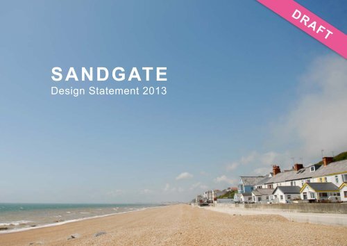
SANDGATEDesign Statement 2013DRAFT
ForewordAs a <strong>Sandgate</strong> resident, Chairman of the <strong>Parish</strong> <strong>Council</strong> and Leader of Shepway District <strong>Council</strong> I amdelighted to fully endorse this, the first Village Design Statement in Shepway.Bringing communities together in today’s world has never been more difficult. The <strong>Sandgate</strong> communityhas worked hard following the outcomes of the <strong>Sandgate</strong> <strong>Parish</strong> Plan to prepare this Design Statement andto set down key design principles for their parish in one comprehensive document. The <strong>Sandgate</strong> DesignStatement represents the wishes of a community passionate about the protection of its built heritage and itsoutstanding natural setting of wooded hillsides and long coastline, but at the same time eager to enhanceits environment in challenging economic times.For a small parish, <strong>Sandgate</strong>’s history is particularly rich and varied, while periods of land instabilityover many centuries have also shaped the character and appearance of many parts of the parish. ThisDesign Statement outlines such historical and topographical background in brief and provides guidancefor householders, planners, developers and other statutory bodies as they consider future development inthe <strong>Parish</strong> of <strong>Sandgate</strong>. It complies with the Shepway District Core Strategy and has been adopted as aSupplementary Planning Document to it. As such it forms a material consideration in the determination ofall planning applications in the parish of <strong>Sandgate</strong>.I hope it will help make <strong>Sandgate</strong> a better place and that you find it both interesting and useful.<strong>Council</strong>lor Robert Bliss,Leader of Shepway District <strong>Council</strong>Chairman <strong>Sandgate</strong> <strong>Parish</strong> <strong>Council</strong>Front cover: <strong>Sandgate</strong> Beach at Coastguard Cottages, looking WestRear Cover: Perfect Rainbow, <strong>Sandgate</strong> Beach looking EastOpposite page: <strong>Sandgate</strong> Seafront, Granville Parade, on the annual Regatta daySANDGATE DESIGN STATEMENT 20133
Contents1. Introduction 52. Aims of this Design Statement 83. Planning Policy Context 94. The Development of <strong>Sandgate</strong> 105. <strong>Sandgate</strong> Conservation Areas 126. Character Areas 16• Coolinge Lane Character Area 18• The Corniches Character Area 20• Enbrook Valley Character Area 22• Escarpment Character Area 24• The Esplanade Character Area 26• High Street Character Area 28• Radnor Cliff Character Area 30• <strong>Sandgate</strong> Hill and Military Rd Character Area 32• Seafront Character Area 34• Shorncliffe Camp Character Area 367. Land Instability 408. <strong>Sandgate</strong>’s Natural Landscapes 429. Improving the Public Realm of <strong>Sandgate</strong> High Street 4610. Traffic and Parking 4811. Design Principles 5012. Developers Checklist 5313. <strong>Sandgate</strong> <strong>Parish</strong> <strong>Council</strong> Action Points 5314. Community Engagement 5415. Acknowledgements 55Opposite: Steps opposite Sir John Moore Memorial, Esplanade with views to thewooded Shorncliffe Escarpment above4 SANDGATE DESIGN STATEMENT 2013
Aims of the <strong>Sandgate</strong> Design StatementT<strong>here</strong> is widespread and growing local concern at theincreasing threat to the highly attractive and historicbuilt environment of <strong>Sandgate</strong> by unsympathetic newdevelopment in recent years. One of the principal actionsproposed in the <strong>Sandgate</strong> <strong>Parish</strong> Plan (2010) t<strong>here</strong>forewas the production of a Village Design Statement to“ensure that the wishes of the <strong>Sandgate</strong> Community willhave a persuasive influence on the future developmentof the village”.Village and Town Design Statements focus specificallyon design and local distinctiveness. They have beenpromoted by the government for over 20 years as away for communities to have a stronger voice in theplanning decisions that affect their towns and villagesdirectly. Over 50 Village Design Statements are in useacross Kent.Such community-produced Design Statements have aclear and narrow frame of reference: the design of newdevelopment 1 . It has thus always been the intention thatthey have a close ‘fit’ with the statutory planning systemin order to maximise their effectiveness.Village and Town Design Statements have proved tobe highly useful and effective in planning decisions andappeals and a popular method of recording, celebratingand enhancing what a local community feels are thedistinctive features that make their town or village unique.The <strong>Sandgate</strong> Design Statement is based on extensivesurvey work, consultation and analysis by residents andbusinesses in the <strong>Parish</strong>. Shepway District <strong>Council</strong> hasalso provided welcome support throughout the process.A series of 11 Design Principles have been produced asa result of this work. These are scattered throughout theDesign Statement and are listed again in full towards theend of this document.It is the fervent wish of all those who have worked on thisDesign Statement that it is used by all those planning tobuild in the parish, together with those responsible formaking decisions on development proposals, to ensurethat new development accords with the <strong>Sandgate</strong> DesignStatement and its Design Principles and is of high andappropriate, quality and design.SDS 1Compliance withthe <strong>Sandgate</strong>Design StatementAll applications for newdevelopment in <strong>Sandgate</strong>parish should include astatement demonstrating howthey have complied with thePrinciples of the <strong>Sandgate</strong>Design Statement.1For the purposes of this Design Statement ‘development’ refers to both new development as well as alterations and extensions to existing buildings.SANDGATE DESIGN STATEMENT 20135
Planning Policy ContextSDS 2“To be successful, any new development needs to be based on a good understanding of local context… The positive features of the area should be identified and reinforced in any new proposal.”The <strong>Sandgate</strong> Design Statement has been prepared by thecommunity of the parish of <strong>Sandgate</strong> to supplement thepolicies of the Shepway District Core Strategy (2013), theadopted guidance of the Kent Design Guide (2006), and incompliance with the National Planning Policy Framework(2012). In this it has been supported by the Local PlanningAuthority, Shepway District <strong>Council</strong>, through its activemembership on the Steering Group. The <strong>Sandgate</strong> DesignStatement conforms with national, regional and localplanning policies which promote the importance of highquality design.In the National Planning Policy Framework (NPPF) thegovernment makes clear that it attaches great importanceto ‘local character’ in design of new development,“Developments should respond to local character and history,and reflect the identity of local surroundings and materials,while not preventing or discouraging appropriate innovation.” 2Kent Design Guide, 2006The NPPF t<strong>here</strong>fore includes within its Core PlanningPrinciples the requirements that planning empowers localpeople to shape their surroundings and seek to securehigh quality design, taking account of the different roles andcharacter of distinctive areas. The Shepway District CoreStrategy (Policy SS3) requires that all new developmentsdeliver “an insistence on high quality and sustainable design”,while Saved Policy BE1 3 requires that a high standard oflayout, design and choice of materials will be expected for allnew development. Materials should be sympathetic to thosepredominating locally in type, colour and texture.Development should accord with existing development inthe locality, w<strong>here</strong> the site and surrounding developmentare physically and visually interrelated in respect ofbuilding form, mass, height, and elevational details. Forlarge, complex or sensitive sites, a design statement willbe required to include consideration of local landscapecharacter and distinctiveness.Compliancewith theDevelopmentPlanDevelopment shouldbe consistent with theNational Planning PolicyFramework (2012), thepolicies of the ShepwayDistrict Core Strategy(2013), the Saved Policiesof the Shepway DistrictLocal Plan (2006), theprinciples and objectivesof Kent Design (2006) andof this Design Statementand should acknowledge,preserve and enhance thebuilt and natural heritageof the parish of <strong>Sandgate</strong>.2National Planning Policy Framework, DCLG 20123This Policy has been saved because it sets out basic design principles in keeping with the requirements of PPS1. In addition the Kent Design Guide SPDwhich was adopted against this policy needs the maximum possible lifespan.6 SANDGATE DESIGN STATEMENT 2013
FERNE WFOLKESTONEWESTBRAMBLEY CRESCENTCOLLINGWOODRISEFRE MANTLE ROADWALMER WAYSANDWICH CLENBROOKROSS WAYROADREDMILL CLVINCENT CLDIGBY RDHYTHECLROMNEY AVENUEEVERSLEY WAYWEST ROADNORTH ROAD B2063Shorncliffe CampNORMILITARY ROADTH CLB2063OXENDEN ROADRecreationGroundMILITARY ROADT ER ROADVALLE Y ROADCHICHESFENNER CLMEADOWBROOKME ADOWBROOKBYBROOK WAYCHALCROFT RDENBROOK ROA DDARLEY CLOSENST PAULʼS W AYSOUTHERNWOOD RISEHIGHLAND CLSagaMartelloTower 5SchSchC OLINGE LANETHE ACE RSST. STEPHE NS WAYMartelloTower 9TEMERAIREALEXANDER CO RNICHELO WER CORNICHEHEIGHTSOldRedoubtHOSPITAL HILLH ELENA CORNICHEU PPMartelloTower 8E R CORNICHETHE CORNICHECASTLE BAYSUNNYSIDE ROADW EA259 SANDGATE ESPLANADELPLINGTONLACE•1PROWESTLAWNGDNSSPECTRDMartelloTower 7ENCOMBEHILLSIDEA259MartelloTower 6WILBERFORCE RDTHE CRESCENTBYBROOK FIELDUNDERCLIFFNORTH LSANDGATE HIGH STREETGRAB2063GOUGH RD•2•3N VILLE PARADE•4A259CASTLE RDVLISTER W AYIC ARAGE ROADVICARAGE RDRADNORSANDGATE HILLC LI F FC R E SCENTRIVIERA RDRADNOR CLIFF<strong>Sandgate</strong> <strong>Parish</strong> MapKey•1. BREWERS HILL•2. PARADE ROAD•3. GRANVILLE ROAD•4. LACHLAN WAYMAINTENANCE GANGWAYTREE PRESERVATION ORDERSFOOTPATHSNATIONAL CYCLE ROUTE 2PROPOSED NATURE RESERVE AREASANDGATE DESIGN STATEMENT 20137
Development of <strong>Sandgate</strong><strong>Sandgate</strong> is a parish that is both distinctive and diverse incharacter. Situated between the towns of Folkestone andHythe, its largely linear layout stretches along two miles ofcoastline, from w<strong>here</strong> a number of deep valleys extend inlandup the steep, largely wooded escarpment which runs parallelwith the sea, providing a dramatic setting for the village itself.Historically, the origins of <strong>Sandgate</strong> lie with its Castle, built inthe 16 th century, along with those at Walmer, Deal, Sandownand Camber, on the orders of Henry VIII as a defence againstthe growing threat from France and Spain.Early maps confirm that <strong>Sandgate</strong> Castle stood in relativeisolation until the late 18 th Century, when a thrivingshipbuilding industry began taking advantage of the longcoastline and direct access to the English Channel.More rapid expansion of the village occurred with thedevelopment of a large garrison at Shorncliffe Camp on theescarpment above <strong>Sandgate</strong>, temporary wooden barracksbeing replaced in 1804 by more solid stone structureshousing cavalry and artillery, in addition to the ShorncliffeRedoubt. Further fears of invasion, this time by Napoleon,prompted the construction of a chain of Martello Towersalong this stretch of coast, including five in this parish andthe construction of the Shorncliffe Redoubt and Garrison onthe escarpment above the village to defend the coast. Theestablishment of such a military base led to fine officer’sdwellings, shops, taverns and other services springing up inthe village below to support the occupants of the camp, andto cater for their entertainment.In 1828 Lord Radnor built the Lower <strong>Sandgate</strong> Road (knownalso as Radnor Cliff) along the foot of the Undercliff to provideimproved access from Folkestone Harbour to <strong>Sandgate</strong>. The1840 Tithe Map shows much development that would berecognisable today, though as expected, it is mainly singledepth fronting the High Street. During the 1830’s and 50’sgroups of early Victorian Italianate houses were built alongthe undercliffs <strong>here</strong> expanding the village and making full useof the wonderful sea views.By the early 20 th century the village had become an attractivecoastal settlement appealing to many well-known artists andwriters of the time. It was also home to a number of hospitals,including the Female Hospital on Hospital Hill, which featuredin a book by Florence Nightingale, the Shorncliffe MilitaryHospital and the Helena Hospital for the military familiesand their families, as well as the Star and Garter Home atEnbrook House for seriously disabled ex-servicemen; alltaking advantage of the presumed health benefits of the seaair. <strong>Sandgate</strong> also developed as a highly attractive seasideresort. Many social reformers and celebrities of literature andthe arts visited or made their home in the village including HGWells, John Ruskin, Mary Shelley, William Wilberforce andJocelyn Brooke.SDS 3Footpaths andAlleywaysThe historic narrow lanesrunning inland from thesea and connecting theseafront and hillsidesto the High Street andthe Esplanade are animportant feature in thegrain and built characterof this parish. Theirexisting layout andcharacter, together withthe views of the sea andthe wooded escarpmentthat they provide,should be retained andrespected, and w<strong>here</strong>possible enhanced, inany new development.8 SANDGATE DESIGN STATEMENT 2013
Above left: Three Centuries of Development in <strong>Sandgate</strong> 1815,1903, 2007 (watercolour by Euan Williamson) seen from the same view point at the end of the Leas looking WestRight: The Old Fire Station, <strong>Sandgate</strong> High StreetSANDGATE DESIGN STATEMENT 20139
<strong>Sandgate</strong> has a very rich and varied community life with a wide rangeof Clubs and Societies. The <strong>Sandgate</strong> Society, established in 1962, isdedicated to preserve, maintain and enhance the character and amenityof <strong>Sandgate</strong>. The <strong>Sandgate</strong> Heritage Trust was established in 1982 andsaved the Old Fire Station building on the High Street w<strong>here</strong> The <strong>Sandgate</strong>Society is based and which houses a large collection of archives, books,postcards, documents and photographs of the village. The Folkestone &Hythe Operatic and Dramatic Society formed in 1902 is based in the parishat the Tower Theatre, formerly St Mark’s Church for the Shorncliffe garrison,the scouts (first formed <strong>here</strong> in 1908) and cubs are based at the Undercliff,while the Folkestone Rowing Club on Granville Parade is one of manyorganisations utilising the excellent access to the sea that <strong>Sandgate</strong> offers.Since 1999 Enbrook Park has been home to the headquarters of the SagaGroup with a contemporary group of buildings designed by the notedarchitects Michael Hopkins and Partners. In 2010 the <strong>Sandgate</strong> CommunityTrust was established to work to preserve, restore and enhance theheritage of the <strong>Parish</strong> and it has also been instrumental in establishinga high-speed broadband network for the village. Community eventstake place throughout the year with the annual August bank holiday SeaFestival being an increasingly popular event drawing in visitors to enjoythe wonderful built and natural environment, which gives <strong>Sandgate</strong> itsparticularly special sense of place.Top: Saga Pavillion, Michael Hopkins and Partners, 1999Bottom: Bottom of <strong>Sandgate</strong> Hill, <strong>Sandgate</strong> High Street with the original St Paul’s Church, from anengraving by G.S.Shepherd 182910 SANDGATE DESIGN STATEMENT 2013
Top:View of <strong>Sandgate</strong> looking East, from Coastguard Cottages (with the Saga Headquarters building above) to Radnor Cliff.Bottom left: <strong>Sandgate</strong> Castle and <strong>Sandgate</strong> High Street towards Hythe 1733Bottom right: <strong>Sandgate</strong> Castle and Foreshore looking East from a watercolour by Lt. Col. WH Ford c.1811SANDGATE DESIGN STATEMENT 201311
<strong>Sandgate</strong> Conservation AreasMap KeyA Conservation Area is, in law, an area of specialarchitectural and historic interest. The <strong>Sandgate</strong> HighStreet and Esplanade Conservation Areas were originallydesignated on 15 th September 1972, with amendments tothe former passed on 25 th August 1976. In 2009 both the<strong>Sandgate</strong> High Street and the Esplanade ConservationAreas were revised and extended following the firstindependent <strong>Sandgate</strong> Conservation Area Appraisal (theboundaries of these two Conservation Areas are shown onthe maps that follow on pages 9 and 10).The Planning (Listed Buildings and Conservation Areas) Act1990 requires Planning Authorities to pay special attention tothe desirability of 'preserving or enhancing the characteror appearance' of a Conservation Area, or in the case oflisted buildings, to have special regard for their preservationin the exercise of their powers under the Planning Acts. Anyproposed development which conflicts with these objectivesshould normally expect to be refused.The 21 Conservation Areas in Shepway District are subjectto Saved Policy BE4 4 which requires that the DistrictPlanning Authority will• refuse Conservation Area Consent for the demolitionof buildings which contribute to the character orappearance of a Conservation Area• refuse proposals for infill or backland developmentwhich would adversely affect the character of aConservation Area• require the height, scale, form and materials of newdevelopment, including alterations or extensionsto existing buildings, to respect the character ofConservation Areas and• seek to retain materials, features and details of unlistedbuildings or structures which preserve or enhance thecharacter or appearance of Conservation Areas as wellas the historic patterns, plot boundaries, building lines,open spaces, footways, footpaths and kerbs which areessential to the character or appearance ofConservation Areas.In addition to the built elements of Conservation Areas thePlanning Authority will require applications to protect trees,verges and hedgerows that enhance both the setting andcharacter of Conservation Areas. Only proposals to preserveor enhance the character or appearance of ConservationAreas, including the removal of buildings, structures, andfeatures, which detract from those Areas, will be encouraged.ScheduledmonumentsListed buildingsBuildingsrecommended forlisted status reviewEnhancementopportunityLocal buildings ofmeritNegative buildingsNotable wallConservation areaboundarySeaSand/shingle4This policy has been saved because although it partly duplicates Listed Building and Conservation Area legislation and National guidance, conservation areaappraisals are framed with direct reference to this policy. It is essential to conservation management that their continued effective operation is ensured.12 SANDGATE DESIGN STATEMENT 2013
SANDGATE EAST CA HISTORIC ENVIRONMENT ANALYSIS 2009<strong>Sandgate</strong> East Conservation Area with Historic Environment Analysis, 2009SANDGATE DESIGN STATEMENT 201313
<strong>Sandgate</strong> West Conservation Areawith Historic Environment Analysis, 20092009For map key see page 1214 SANDGATE DESIGN STATEMENT 2013
SDS 4ConservationAreasAll development proposalsin or affecting the settingof the ConservationAreas in <strong>Sandgate</strong> shouldpreserve or enhance thecharacter and appearanceof the ConservationArea. Applications shoulddemonstrate as part ofHeritage Asset Statementshow the <strong>Sandgate</strong>Conservation AreaAppraisal has shaped thedevelopment’s design.The <strong>Parish</strong> <strong>Council</strong> willseek the implementationof a ManagementStrategy for the <strong>Sandgate</strong>Conservation Areas asrecommended in theAppraisal at the earliestopportunity.The National Planning Policy Framework (2012) requiresall proposals affecting heritage assets 5 to include as part ofan application a Heritage Asset Statement describing thesignificance of the heritage asset, including any contributionmade by their setting. Planning Authorities are requiredto take such Statements into account when determiningplanning and listed building consent applications, in orderto avoid or minimise conflict between the conservation ofheritage assets and any aspect of the proposal.<strong>Sandgate</strong> <strong>Parish</strong> has 6 Scheduled Ancient Monumentsand 80 listed buildings; the majority being found in the twoConservation Areas. Many of these are residential propertiesdating from the late 18th Century, and are in generally goodstates of preservation. These include a number of timberframed and weather-boarded buildings, which contribute tothe Conservation Areas domestic scale seaside character.Many of the listed buildings occur within groups and arelisted for their group value, such as the eight early VictorianItalianate Marine Villas at Radnor Cliff dating from 1847.In addition, the Conservation Area Appraisal identified anumber of buildings of particular local townscape merit,including the Chichester Memorial Hall, the Little Theatre(since converted into dwellings) and several houses.Of these, the pair of houses at Nos. 1 and 3 High Street,No. 61 High Street and the terrace at Nos. 91-99 HighStreet are considered to merit review by English Heritagefor statutory listing, the latter on account of retaining a finegroup of original shop fronts. Coastguard Cottages havealso long been an important element of the streetscene of<strong>Sandgate</strong> due in part to their attractive integral uniformity.In Radnor Cliff and The Riviera recommended buildings ofmerit include: 17/19, 27, 31/33, 41, and 57 Radnor Cliff, and6, 14/16 (Beaulieu/Seaholme) on The Riviera.Negative buildings in the Conservation Areas have alsobeen noted on the maps. These are almost entirelybuildings of modern form and massing, or buildings whichhave been so altered as to have lost any resemblance totheir originally intended or traditional appearance.For Conservation Area designation to be effective annualreviews together with 5 yearly updates are recommendedby English Heritage. Consideration should be given toencourage a <strong>Parish</strong> <strong>Council</strong>lor to have special responsibilityfor the <strong>Sandgate</strong> Conservation Areas i.e. to become<strong>Sandgate</strong>’s Heritage Champion including undertakingtraining provided by HELM (Historic Environment –Local Management).5Heritage Assets include Conservation Areas, Listed Buildings, Scheduled Ancient Monuments and locally listed buildingsSANDGATE DESIGN STATEMENT 201315
Character Areas<strong>Sandgate</strong> is a diverse parish with its buildings originating from many distinctarchitectural periods. As a result buildings and streets exhibit an attractive andunusually rich range of characteristics and styles.Development pressures in the past have however unfortunately resulted inschemes which have often failed to reflect the scale, quality and detailing oftheir immediate built context. Many of such developments were classified asnegative buildings in the <strong>Sandgate</strong> Conservation Area Appraisal. This situationis of great concern to the local community which values, and works activelyto protect, <strong>Sandgate</strong>’s environment, amenities and sense of place. It is theoverarching aim of this Design Statement t<strong>here</strong>fore that such inappropriatedevelopments cease and that the character and appearance of the parish, itsstreetscapes and its exceptional environmental setting is acknowledged andrespected in all new development <strong>here</strong>.Given the wide variety of architectural styles and built characteristics acrossthe parish it was decided to divide the parish into different Character Areas forthe purpose of this Design Statement, each being made up of streets ofbroadly similar architectural style and origins with its own particular identityand co<strong>here</strong>nt sense of place.Each Character Area has been surveyed by local residents during thepreparation of this document and the results have been discussed and agreedwith a wide range of agencies and statutory consultees. The following pagesset out the dominant and distinctive characteristics of each of these Areas;characteristics which the Design Statement urges new development to respectand reflect.SDS 5Character AreasDevelopment should beappropriate to the scale,materials, ridge heights,boundary treatments anddetailing of its Character Area,with attention to ornamentation,doors and door canopies,windows, rooflines, massingand orientation while notpreventing or discouragingappropriate innovation. Inparticular the scale ofnew buildings should beappropriate to the setting suchthat they do not overwhelmneighbouring properties. Aconfused application ofarchitectural styles or historicimitation inappropriate to thebuilt context of the site will notbe acceptable. Massing andorientation should ensure thatphysical barriers closing viewsto the sea or the woodedescarpments are not created.SDS 6Street SceneDetailingFor all applications in the<strong>Parish</strong> developers shouldprovide elevation drawingsto scale that accurately showthe proposed developmentin relation to neighbouringbuildings, its overallsurroundings and the streetscene in order to ensure thatnew development reflectsand enhances the builtcharacter of the CharacterArea in which it is locatedand respects the rooflineand building height ofadjacent buildings.16 SANDGATE DESIGN STATEMENT 2013
FERNE WFOLKESTONEWESTBRAMBLEY CRESCENTWEST ROADNORTH ROAD B2063Shorncliffe CampShorncliffe CampAreaNORMILITARY ROADTH CLIndustrialAreaROSS WAYB2063ENBROOKROADOXENDEN ROADRecreationGroundMILITARY ROADMartelloTower 6COLLINGWOODT ER ROADVALLE Y ROADCHICHESREDMILL CLVINCENT CLRISEFRE MANTLE ROADDIGBY RDEnbrook ValleyAreaFENNER CLMEADOWBROOKME ADOWBROOKBYBROOK WAYBYBROOK FIELDCHALCROFT RDENBROOK ROA DB2063DARROMNEY AVENUELEY CLOSENST PAULʼS W AYWALMER WAYHYTHECLSOUTHERNWOOD RISEHIGHLAND CLSANDWICH CL<strong>Sandgate</strong> Hill andMilitary Road SagaAreaEVERSLEY WAYCoolingeLaneAreaMartelloTower 5SchSchC OLINGE LANETHE ACE RSST. STEPHE NS WAYRADNORSANDGATE HILLC LMartelloTower 9TEMERAIREHEIGHTSHOSPITAL HILLThe CornichesAreaALEXANDER CO RNICHELO WER CORNICHEH ELENA CORNICHEMartelloTower 8U PPE R CORNICHETHE CORNICHECASTLE BAYSUNNYSIDE ROADW EMartelloTower 7A259 SANDGATE ESPLANADELPLINGTONLACE•1The EsplanadeAreaPROWESTLAWNGDNSSPECTRDThe EscarpmentAreaENCOMBEHILLSIDEA259WILBERFORCE RDTHE CRESCENTUNDERCLIFFNORTH LSANDGATE HIGH STREETGRAGOUGH RD•2•3The High Street AreaN VILLE PARADE•4A259CASTLE RDSeafront AreaVLISTER W AYIC ARAGE ROADVICARAGE RDI F FC R E SCENTRadnor CliffAreaRIVIERA RDRADNOR CLIFF<strong>Sandgate</strong> Character AreasKey•1. BREWERS HILL•2. PARADE ROAD•3. GRANVILLE ROAD•4. LACHLAN WAYMAINTENANCE GANGWAYTREE PRESERVATION ORDERSFOOTPATHSNATIONAL CYCLE ROUTE 2PROPOSED NATURE RESERVE AREASANDGATE DESIGN STATEMENT 201317
Coolinge LaneCharacter AreaIncludingSt Stephen's Way andEversley WayUntil the middle of the nineteenth century,Coolinge Lane was a narrow rural trackrunning from Martello Tower no.5 at thesouthern end to Coolinge Farm with itsassociated buildings at the other. Thecoming of the railway to Folkestone led tobuilding at the northern end of the Lanewhich today lies just outside <strong>Sandgate</strong><strong>Parish</strong> in the vicinity of Folkestone Westrailway station, while by 1914 five privateschools had moved into purpose builtbuildings with spacious grounds at the<strong>Sandgate</strong> Hill end of Coolinge Lane. Thesebuildings were all acquired by Kent County<strong>Council</strong> after the Second World War anddominated the Lane for the greater part ofthe 20 th Century.The parish boundary runs along the Lanewith the west side, as far north as RomneyAvenue. This area is still characterisedby fine early twentieth century detachedproperties with close links to educationaluses including Coolinge Lodge, StChristophers, Swanscombe and Red Hayand by large attractive school buildingsincluding St Stephens (1892) and PenfoldHouse (1904) which along with the MartelloTower are on the site of the FolkestoneSchool for Girls. This side of the road ischaracterised by properties adjacent to thelane but with large open areas and playingfields behind. Sadly “Clewer”, formerlya beautiful Edwardian school buildingand its neighbour, “White Lodge” havebeen demolished and currently fourteensomewhat unremarkable executive typehouses are being erected on this site.<strong>Sandgate</strong> Primary school is located <strong>here</strong>,a fairly typical 1972 single storey, flatroofed, school building with associatedplaying fields. Eversley College, formerlya KCC school, with extensive groundsfronting the Lane was acquired by LandcapDevelopment and Quinn Estates Ltd andredevelopment is to be expected.18
Key DesignCharacteristicsTop row: 36-38 Coolinge LaneMiddle row: Coolinge House; <strong>Sandgate</strong> Primary SchoolBottom row: 32-30 Coolinge LaneGARDENS AND BOUNDARYTREATMENTS:front gardens, usually small. Nofences. Low red brick walls with hedgeplanting. Off street parking provisionexcept at the northern end of the Lane.SCALE:2 and 3 storey, large, detachedROOFS:pitched with peg tiles. Dormers notcharacteristic.DOORS:various, no prevailing colour, porchesWALLS:mix of red brick, tile hanging and weatherboarding with white and cream renderdeployed also. Brick quoin detailing usedat the northern end of the Lane. Someattractive tiling detailing.WINDOWS:multi-paned sash, predominantly upvcDISTINCTIVE FEATURES:grass verges and tree-lined roadcreate strong landscaped character.Interesting recent architecturaladditions in modern style. Quantityof road markings has taken away thesemi-rural character of the Lane.
The CornichesCharacter AreaIncludingLower CornicheAlexandra CornicheHelena CornicheTemeraire Heightsthe Corniche andUpper CornicheThe Corniches lie on a steep and sensitivehillside site, with an important woodlandbackdrop (colloquially known as theShorncliffe Escarpment), overlooking<strong>Sandgate</strong> itself and Hythe Bay towardsDungeness and occupying the site of theformer 434 bed Shorncliffe Military Hospital.A report from 1858 describes the hospitalas being situated on a steep hill slopingtowards the sea, considerably below thelevel of Shorncliffe camp itself. Consisting offive parallel ranges of wards and offices ofwood and brick it was built on terraces cutout of the hill slope, rising rapidly onebehind the other.A Corniche is a road on the side of a cliff ormountain, with the ground rising on one sideof the road and falling away on the other.The word comes from the French route àcorniche or road on a ledge. The word alsorefers in the Arabic language, in general, toa headland formed at a land’s end, whichdescribes a most remote geographicalborder of a mainland by a water line, with anatural corner, usually, or a cliff. In Lebanonand Egypt, the word typically describes awaterfront promenade usually paralleledby a main road, such as the renownedCorniche in Beirut. In Cairo, the Cornichethe French word borrowed into (”شينروك“)Arabic; runs alongside the River Nile. Luxor,Aswan and Maadi all have such Corniches.However, Alexandria’s Corniche in Egyptforms a notable exception: it runs along theharbour. In the Gulf States, the Cornicheoften runs along the coast.The housing now on the site was built from1980 onwards with the latest developmentstowards the bottom of the hill (Alexandraand Lower Corniche) being built in 2004on the site of the Napoleonic Battery WallGun Emplacement (a Scheduled AncientMonument) which later became <strong>Sandgate</strong>Railway Station and sidings. The wall isthought to have been built in about 1804 andwould have been surmounted by 2 banksof 4 gun emplacements designed to carry32 or 64 pounder guns built to protect theMilitary Canal Sluice at Seabrook. Althoughthe guns themselves have long gone, thefoundations of the eight gun emplacementsstill remain and are now protected under alayer of topsoil in residents’ gardens.The housing is predominantly of aMediterranean style not found elsew<strong>here</strong>in the parish, with white rendered facadesand red interlocking tiled roofs. Almost allof the properties benefit from excellent seaviews with many exploiting this through theincorporation of balconies.20
Key DesignCharacteristicsTop row: Benvenue & Westerleys, Helena CornicheMiddle row: Tsunami & Welbeck, Helena Corniche;View through private gates, Temeraire HeightsBottom row: 15-17 Alexandra Corniche;4-12 Lower CornicheGARDENS AND BOUNDARYTREATMENTS:small front gardens, with low brick boundarywalls and off street parkingDISTINCTIVE FEATURES:Mediterranean design not typical of the restof the <strong>Parish</strong>, balconies a characteristicfeature <strong>here</strong>SCALE:two and three storeyROOFS:pitched, dormer windows, chimneys,Spanish style red tilingWALLS:red and yellow brick, painted render, someupvc weatherboardingWINDOWS:casement, upvc. Bay windows prevalentDOORS:various styles, mostly white, porches
Enbrook ValleyCharacter AreaIncludingEnbrook RdSouthernwood RiseHighland CloseDarnley CloseSt Paul's WayMeadowbrookChalcroft RdOxenden RdFenner CloseVincent CloseRomney AveSandwich CloseWalmer WayFreemantle RdBrambley CrescentCollingwood RiseRedmill Close andDigby Rd<strong>Sandgate</strong>’s Enbrook Valley, also knownas Golden Valley, which lies inland fromEnbrook Park gets its local name from theabundance of gorse which used to grow onthe slopes and the Enbrook Stream whichruns through it and out to sea at <strong>Sandgate</strong>beach. Initially very much part of <strong>Sandgate</strong>it then became absorbed into Folkestoneand Cheriton for administrative purposes,before more recently becoming part of<strong>Sandgate</strong> <strong>Parish</strong> again.Over time the gorse has been replacedby a widely diverse residential area witha distinctive open-plan style. The areais characterised by townhouses withbungalows, blocks of flats and, morerecently, terraces of executive style housesadding to a diverse mix of housing design.The community <strong>here</strong> is now well-establishedwith a small hub of shops arrangedcentrally around two sides of a large rathernondescript car park w<strong>here</strong> residents andshoppers can park and a network of greenspaces, all of which give this Area a selfcontainedcharacter within the wider parish.Given the level of recent additionaldevelopment in Enbrook Valley urgentconsiderations should be given to theupgrading of the Digby Roadcommercial area.The Enbrook valley is integral to thelandscape of the <strong>Parish</strong> and is linked to<strong>Sandgate</strong> High Street and seafront by theattractively landscaped Enbrook Park withits network of recently upgraded footpaths,offering much to visitors and newcomersto the area, and classified as a LocalLandscape Area by the Local planningAuthority.22
Key DesignCharacteristicsTop row: Enbrook Court, Enbrook RdMiddle row: 37-43 Enbrook Rd; 174-162 Enbrook RdBottom row: Digby Road shopping centre and car park,Enbrook Valley; 85-87 Enbrook RdGARDENS AND BOUNDARYTREATMENTS:good sized front gardens largely laid tograss, giving open character. Off streetparking provision typicalDISTINCTIVE FEATURES:open plan layoutSCALE:one, two and three storey, semi-detachedand terracedROOFS: pitched, concrete tiles. Dormerwindows not characteristicWALLS:brick – mostly yellow, weather boarding whiteand greenWINDOWS:casement, painted or upvcDOORS:various, porches and porticos. Widespreaduse of upvc
The EscarpmentCharacter AreaINCLUDINGundercliffencombeWILBERFORCE RDHILLSIDENorth Lane ANDTHE CRESCENTThe steep slope north of <strong>Sandgate</strong> HighStreet and Esplanade establishes theform of development <strong>here</strong> which is one ofnarrow streets winding up the escarpmentor running parallel to <strong>Sandgate</strong> High Street.On a platform immediately below the crestof the escarpment are the large detachedproperties of the Undercliff. These arepredominantly early Victorian villas andalthough t<strong>here</strong> is no common architecturalstyle a unifying theme is provided by thecomparatively large size of each and theirstuccoed exteriors. From a distance theUndercliff buildings are seen to rise out of thewooded escarpment while the smaller, morerecent properties are hidden by tree cover.Further west lies Encombe Estate, formersite of Encombe House which was alsosituated immediately below the crest ofthe hill. This area, like the Undercliff, isstrongly defined by its backdrop of a skylineof trees. In the 1920s Encombe Housewas altered by the architect Basil Ionidesincluding Enbrook Lodge and adding theBathing House now known as SerenaCottage. In 1924 Country Life wrote ‘t<strong>here</strong>sult is as satisfactory as it is fresh.Enbrook to my mind, is the most successful“modern” villa that has been built in thiscountry, using the word villa in its classicsense’. Above Encombe Lodge is a moderndevelopment laid out on estate lines, withbuildings of similar design. Between thesedevelopments and the escarpment, modernhouses have been built on the formerEncombe Estate. T<strong>here</strong> is no commonarchitectural style <strong>here</strong> and a unifyingapproach would be desirable. The Encombearea as a whole is the most notorious partof <strong>Sandgate</strong> for earth movements and ischaracterised by collapsed walls, distortedfencing and a proliferation of cracks andfissures particularly evident in the retainingwalls roads and paths. In 1998 the EncombeStabilisation Scheme was undertaken withdowelling installed along 400m of the beachfront to support the toe of the landslip area.It is vital t<strong>here</strong>fore that any developmentproposals <strong>here</strong> are required to addressland stability issues as a part of anyplanning application.Wilberforce Road and The Crescent formthe main spine of the lower slopes of thisArea, running parallel with and to the northof <strong>Sandgate</strong> High Street. These roads,together with North Lane and Hillside havetall buildings directly fronting the roads and,along the south sides of The Crescent andWilberforce Road, many houses are enteredat first floor level. The Crescent comprisesa number of substantial Edwardian terracesof between three and four storeys forming awell-defined enclave.Hillside car park on Wilberforce Roadprovides welcome off road parking facilitiesin this part of the parish. It has recentlybeen resurfaced and provides direct publicfootpath links up to Encombe and thewooded escarpment above.24
Key DesignCharacteristicsTop row: Encombe LodgeMiddle row: Walking on the Escarpment(Martello 6 in distance); 1-3 Mariners Gate, EncombeBottom row: Undercliffe House; 21-24 Wilberforce RoadSCALE:detached with three storey along TheUndercliff and a mix of single, two andthree storey found in EncombeROOFS: pitched, slate, dormers andchimneys present. Ornate chimneys onseveral houses of The UndercliffWALLS:painted render, some brick and renderWINDOWS:sashDOORS:multi-panelled, white; porticos a feature onThe UndercliffGARDENS AND BOUNDARYTREATMENTS:small front gardens and large rear gardens.Fences and walls used as boundariesDISTINCTIVE FEATURES:Sea views and green wooded backdropdistinctive elements of the character <strong>here</strong>.
The EsplanadeCharacter AreaINCLUDINGProspect RdSunnyside RdCastle Bay andBrewers HillThis Character Area is a long linear one,contained by the lower escarpment slopeson its northern side and the sea, whichstretches out along its southern edge as faras the westerly extent of the parish.Two lovely Grade II listed, clapboardedRegency houses and a number of earlyVictorian Grade II listed stuccoed terracesoverlooking the coast remain, reminiscentof the grand seaside feel of that period.Balconies and verandahs characterisethe façades. These have been particularlyprone to disrepair and their removal,coupled with ground movement disturbanceof foundations, and a number of visuallyconflicting infill developments over the years,has led to a regrettable decline in the qualityof the environment in this highly prominentand visually significant part of the <strong>Parish</strong>.That said, the massive improvementsin the sea defences has resulted in thestabilisation of a significant part of thewestern escarpment, and people are buyingand improving existing properties becausethey recognise their merits and the charm of<strong>Sandgate</strong> itself.Behind the Esplanade, t<strong>here</strong> are manysmall no-through roads climbing the hillside(one or two of which are still unadopted).Here, sheltered from the noise of themain road and the gales, you will find aneclectic mixture of buildings. They range inarchitectural style from 18 th and 19 th Centuryhouses and mews cottages (some sportingornate Kent peg-tiled roofs), through one ofthe lost pubs of <strong>Sandgate</strong> (now a dwelling),to Edwardian, Art Deco, and even one rathersplendid thatched house, and many moremodern houses. Here and t<strong>here</strong> you willfind exquisite glimpses of past eras. At thewestern end of the esplanade and just to theeast of Brewers Hill are two stretches of theNapoleonic wall that together with the RoyalMilitary Canal and the Seabrook Redoubt,formed part of the defences againstinvasion by the French in the late 18 th and19 th Centuries.Looking at the view down the steppedBrewers Hill to the sea you might almostthink that you were somew<strong>here</strong> in Cornwalla century ago. Look up Seaview Terraceand, with a bit of imagination, one canpicture the cottages occupied in past timesby smugglers and fishermen: walk pastQueens Mews cottages and aroundthe corner into Upper Wellington Placeand imagine people living in these housesin the 18 th Century. Everyw<strong>here</strong> you willfind character, and t<strong>here</strong> are at least 10listed buildings in this western part of<strong>Sandgate</strong> alone.However, this charming end of the villageis constantly under threat from theunsympathetic infilling of gardens andgreen spaces, and the demolition of soundbuildings to replace them with flats, flatsand more flats. It is vital this prominent andvisually significant end of the <strong>Parish</strong> is givenstrong protection.26
The High StreetCharacter AreaINCLUDINGGOUGH RDViewed from <strong>Sandgate</strong> Hill, the High Streetappears as a gently curving ribbon ofbuildings at the foot of the steeply slopingescarpment. Although t<strong>here</strong> is considerablevariety in the detailed design of buildingsalong the High Street, they are seen, asthe 1975 <strong>Sandgate</strong> Study: an InformalDistrict Plan (Shepway District <strong>Council</strong>)concludes, to coalesce into a cohesivewhole with common building heights,forms, elevational details and building linesproviding an overall unifying theme. It is onlyw<strong>here</strong> buildings have not respected thesepredominant layout characteristics that thestreet scene has been interrupted to thedetriment of the overall form.<strong>Sandgate</strong> High Street has a strongcommercial character with a wide range ofbuilding styles and a number of particularlyfine individual and groups of buildings whichcontribute positively, both in themselves,and the important streetscape contributionthey afford to views along the street. Theseinclude the neo-Georgian brick ChichesterHall and Jubilee Clock, weather boardedVine Cottage, the late 18 th Century 43 HighStreet with its interesting and well preserved19 th Century shopfront, the Ship Inn, theCoastguard Terrace with its provenancereflected in its fine ornamental plasterworkof Crown and Anchor and oak leaf scrolldetailing, the Old Fire station and Librarynow home to The <strong>Sandgate</strong> Society with itsdistinctive red double doors, oriole windowand fish scale bell-cote, the recent awardwinningSeafront House at 127 High Streetby Guy Holloway Architects and a number offine shopfronts, including Nordens.Shopfronts are a distinctive and importantelement of the streetscape <strong>here</strong>. Still largelytraditional in form, shopfronts along the HighStreet are, as noted in the ConservationArea Appraisal, mainly painted softwood,some with iron columns or mullions, stoneor timber pilasters and brackets, paintedtimber fascias and hand-written shop signs.Occasional projecting hanging signs arealso present generally on pubs.Gough Road draws much of its builtcharacter from its relationship with theHigh Street. Any original character hassadly been largely lost and it is nowdominated by ancillary storage and servicingaccommodation together with garaging forHigh Street properties.28
Radnor CliffCharacter AreaINCLUDINGRadnor Cliff CrescentLister WayVicarage Road andthe RiveriaThis area falls within the <strong>Sandgate</strong> HighStreet Conservation Area and includes, onThe Riviera and Radnor Cliff Crescent, anumber of distinguished later Victorian andEdwardian houses, two of which are listed,including the house built by CFA Voysey forHG Wells in 1898. The area also containsten buildings of Merit as identified by the<strong>Sandgate</strong> Conservation Area Appraisal froma similar period, seven of which are locatedon Radnor Cliff, and three on The Rivieraincluding ‘Beaulieu’ and ‘Seaholme’.The <strong>Sandgate</strong> Conservation AreaAppraisal highlights the importance of thehomogenous character of the Western endof Radnor Cliff and Radnor Cliff Crescent,which remains co<strong>here</strong>nt and distinctive, incontrast to the highly diversified characterof the Eastern end of Radnor Cliff whichcontains a number of unsympatheticallydesigned infills and variations in quality,including Marine Point classified as anegative building.The views from and relationship with thebeach and seafront below are especiallyimportant <strong>here</strong>, as is the landform andplanting to the foreground and the protectedwooded escarpment backdrop. “A vitalcomponent of the Radnor Cliff area’scharacter.. is its dramatic hillside settingand planting. Views into or out of this areaand gaps between houses are important toits setting”.The low density of much of the developmentin this Area is a significant feature ofits character and appearance. Suchcharacteristics have led in the pastto redevelopment pressures and theconsequent construction of large infill blocks,out of keeping in scale and detailing with thesurrounding built form. The Local PlanningAuthority currently defines this part of theDistrict as an Area of Special Character forits special environmental quality, includingimportant skylines and detached houses inlarge gardens with much mature vegetationwhich contributes significantly to theattractive appearance and character oftheir surroundings. The community stronglysupports the protection of such Areas fromdevelopment which fails to make a positivecontribution to the special character andappearance of the area.The very evident environmental quality andsensitivity, together with the quiet residentialcharacter of this Area, requires that thedesign of new development should be of ahigh standard commensurate with protectingthe Area’s amenity and built context, andin scale, massing and orientation shouldensure that physical barriers closing viewsto the sea or wooded escarpment are notcreated and that any opportunity to undosuch barriers that have been erected in thepast is given appropriate consideration.30
Key DesignCharacteristicsTop row: View looking East down Radnor Cliff,27 in foregroundMiddle row: Radnor Cliff & The Riviera from the sea;16-18 Radnor Cliff from the beachBottom row: View of Eastern end of Radnor Cliff towardsthe coastal path; View of The Riviera looking EastDOORS:various, mostly panelled. Porches typicalon Radnor Cliff Crescent and The Riviera.Porticos characteristic of Radnor Cliff.GARDENS AND BOUNDARYTREATMENTS:small front gardens with low ragstoneboundary walls. Some off street parking inRadnor Cliff, Radnor Cliff Crescent and TheRiviera. Eastern end of Radnor Cliff heavilycongested with parked cars.SCALE:two and three storey, with more than threestoreys mostly found along the Eastern end ofRadnor Cliff. Properties are mainly detachedand semi-detached. Density of development ischaracteristically low on the wooded hillsides tothe north of Radnor Cliff, while at the Easternend of the sourthern side, higher densitydevelopment in the form of purpose-built blocksof flats prevails.WINDOWS:painted, predominantly sash.WALLS:majority are of painted render with a few usingred/brown brick. Some brick detailing. Whiteweatherboarding present on The RivieraROOFS:Majority are pitched using of peg tiles andslate, apart from several flat roofed largerscale buildings at the Eastern end of RadnorCliff. Properties mostly have chimneys. Dormerwindows are prevalent in some period properties.
<strong>Sandgate</strong> HillandMilitary RoadINCLUDINGBybrook FieldBybrook WayChichester RdValley Rd andsouthern part of Enbrook Rd<strong>Sandgate</strong> Hill and Military Road descendfrom the escarpments and meet at theVillage Green and <strong>Sandgate</strong> War Memorial,at the eastern end of <strong>Sandgate</strong> High Street.T<strong>here</strong> are excellent views of the historicform of the original village of <strong>Sandgate</strong>and tempting glimpses of the sea fromboth roads. From Military Road t<strong>here</strong> areimportant views of the row of cottages nextto the Castle, and from <strong>Sandgate</strong> Hill theRomney Marsh coastline together withparticularly attractive sunsets.The High Street rises to become <strong>Sandgate</strong>Hill near the listed former Primary School,which has now been converted into flats,and St Paul's <strong>Parish</strong> Church - both in theGothic Revival style. Development on<strong>Sandgate</strong> Hill lies on both sides of theroad, linking <strong>Sandgate</strong> with the west end ofFolkestone. At the foot of the northern sideof the hill are two pairs of weatherboardedshipbuilders’ cottages dating from thelate 18 th Century and Enbrook Park, siteof the Saga Group’s offices designed byMichael Hopkins and Partners. EnbrookPark surrounds the Saga complex as anattractive and valuable open space onrising ground. Although alien to the scaleand materials of the Conservation Area theConservation Area Appraisal notes that theSaga complex is of high quality and thatthe development of which has helped topreserve and enhance Park landscape.The building frontage on the south sideis less pronounced with significant gapsbetween detached houses set in largemature gardens. Buildings on this side areof mixed architectural styles. Many of thehomes are built into the slopes, with tallragstone walls bordering the roadside.Military Road is made up of more recentresidential properties on its western side.Built mainly between the two wars, these areset above the road on a short embankment,with ragstone boundary walls, with garagesor parking places at the rear. Propertiesoff Enbrook Road to the north date from asimilar period. A number of mature treescontinue the woodland from the escarpmentthrough to Enbrook Park, w<strong>here</strong> t<strong>here</strong> areunrivalled views as the park descendstowards the sea.32
Key DesignCharacteristicsTop row: Darnley Cottage, <strong>Sandgate</strong> HillMiddle row: 29-31 Military Road; Enbrook ParkBottom row: 42-40 <strong>Sandgate</strong> Hill; 32-30 <strong>Sandgate</strong> HillWALLS:red brick, painted render. Small amounts ofpainted weatherboarding on <strong>Sandgate</strong> Hill.WINDOWS:sash, painted, multi paned. Bay windowsDOORS:6 panelled. Porticos present.GARDENS AND BOUNDARYTREATMENTS:medium sized front gardens. Boundaries ofhigh ragstone walls or hedges. Off streetparking not a characteristic of this area.DISTINCTIVE FEATURES:instances of wooden balconies and interestingdecorative finials. Mature planting.SCALE:two and three storey, semi-detachedROOFS:peg tiles, slate, profiled concrete. Dormerwindows prevalent. Properties havechimneys.
SeafrontCharacter AreaINCLUDINGGranville ParadeCastle RdLachlan WayMartello TerraceGranville Road EastParade RoadGilbert Place andSea WalkThis Area comprises the developmentbehind the High Street between GranvilleRoad West and Lister Way, includingGranville Parade and <strong>Sandgate</strong> Castle. It isan area of mixed development styles andcharm arising from its dramatic location atthe edge of the sea and its more intimatescale compared to other parts of the<strong>Parish</strong>, with small lanes and cottage styleterraced houses. Granville Parade is apopular and ideal setting for communityevents with its wide promenade, extensivesea frontage and backdrop of interesting19 th Century buildings. It hosts the stronglysupported Folkestone Rowing Club regattasand <strong>Sandgate</strong> Sea Festival, events whichare important elements of the local socialcalendar. It suffers however from a poorsense of place, given the dominance of t<strong>here</strong>ar aspects of High Street properties whichdetract from the unrivalled coastal identityand views of the sea.The eastern part of this Character Areais dominated by the Castle, an AncientMonument, listed Grade I, and historically,the most important building in the parish.<strong>Sandgate</strong> Castle has had a long and mixedhistory. Built in 1539-1540 at the same timeand as part of the same series of defencesas Sandown, Deal and Walmer Castles, itoriginally comprised a large central towersurrounded by 3 smaller towers connectedwith each other by a curtain wall andcovered galleries, with an outer curtainwall and gate-tower on the north and arectangular building connecting the latterto the central tower. In 1805 the tops ofthe towers were removed and the centraltower was converted into a Martello tower.After the Napoleonic threat the Castle fellgradually into poor condition and virtualdisuse. From 1855 to 1857 it served as aprison for German Crimean War prisoners.It has been periodically vacant since then,and put to a mixture of uses ranging fromrestaurant to a museum. It is now a privatedwelling. Unfortunately its open settinghas been irretrievably lost by recent infilldevelopment and sadly this most significantof local buildings is no longer open tothe public.East of the Castle larger residentialproperties front Castle Road with gardensextending to the beach while to the westCastle Road Car Park provides welcomeparking facilities for visitors to the area.34
The ShorncliffeCampCharacter AreaShorncliffe Garrison is located on level landat the top of the <strong>Sandgate</strong> Escarpmentand, as stated previously in this DesignStatement, is an important element of theparish’s military and built heritage, withthe major part of the Camp lying within<strong>Sandgate</strong> <strong>Parish</strong>. Situated on a plateau, thisCharacter Area enjoys far reaching views tothe north towards the Downs, south across<strong>Sandgate</strong> to the sea and west into SeabrookValley and Seabrook. Within the Camp thelandscape is characterised by large openspaces, military and non-military buildingswith tree lined avenues. Shorncliffe Garrisonis currently subject to a major Ministry ofDefence rationalisation project which aims toreduce and improve the Garrison estate whilereleasing 70 hectares for redevelopment.The area south of North Road is in <strong>Sandgate</strong>and includes sites to be released bythe MOD as well as the Sir John MooreBarracks which will remain for militaryuse. Currently dominated by militarydevelopment, it is characterised by largescale, often simple form, buildings inregimented groups, located in extensiveareas of open land. The landscape isdistinctive with mature tree planting, eitherin parkland or linear distribution, being animportant element of its character and onewhich should be protected and enhancedin any new development. A number of thebuildings are of some architectural qualityincluding the former library at SomersetBarracks and the listed former garrisonchurch now the Tower Theatre.Also in this Character Area is the nationallysignificant Shorncliffe Redoubt, a ScheduledAncient Monument which has played a keyrole in the military history of this country.The Redoubt was constructed at the endof the 18 th Century as an integral part ofa programme of military developments toprotect the South Coast against invasionby Napoleon Bonaparte. It is however likelythat due to its prominent position and easeof defence that Shorncliffe was used fordefence of the coast from very early times,probably back to the Roman occupationand maybe back beyond and had beena site of vigilance and defence in everyconflict that threatened our shores. Builtto a design by Colonel William Twiss, theramparts and ditches overlook the EnglishChannel and inland to the Seabrook Valley.Sadly, the surviving portion of the Redoubt isbeing badly eroded. Apart from its physicalimportance, it is also recognised as thebirth place of the modern army. Under SirJohn Moore, soldiers, including the newlyformed Rifle Corps, were trained usingnew weapons and tactics to form the LightDivision, whose methods were to defeatNapoleon at Waterloo and are still used byforces today.36
Key DesignCharacteristicsFinal images to be agreed –indicative images included only on this pageSCALE:two/three storey semi-detached and terracedROOFS:pitched, slate particularly on historic buildings,concrete tiles. Some decorative ridge tilingand brick parapets, chimneysGARDENS AND BOUNDARYTREATMENTS:front gardens, open character dominating,houses set back, boundary treatments lowDISTINCTIVE FEATURES:parkland, mature planting. Military focused designand streetscapes. Long tree lined avenues withsignificant views west across Seabrook valleyand south across Escarpment to the seaWALLS:red brickWINDOWS:sash, casement, paintedDOORS:various
The ShorncliffeCampCharacter Development AreaThe Redoubt was also important in WW1 as a training campfor soldiers heading to France including several thousandCanadian men, and the training trench system they dug isstill visible today, although also being eroded. Just below t<strong>here</strong>doubt are some remnants of WW2 usage including “PillBoxes”, and the site also has links with Brigadier Bernard LawMontgomery, of Desert Rat fame who served at Shorncliffe.Strategic Site Policy for Shorncliffe Garrison (SS7) in theShepway Core Strategy states that the built context for anyredevelopment of this area is the adjacent area of Cheriton andthat redevelopment <strong>here</strong> should integrate fully and sensitivelywith both it and the Seabrook Valley. However, the Camp andMOD land holding <strong>here</strong> is equally important to the setting of<strong>Sandgate</strong> <strong>Parish</strong>, covering as it does the full extent of thecrest of the <strong>Sandgate</strong> Escarpment, which forms the woodedbackdrop and skyline of the settlement of <strong>Sandgate</strong> below. ThisEscarpment is currently protected as a Local Landscape Area.In addition the parts of the escarpment that lie to the north ofHospital Hill are designated as a Site of Nature ConservationInterest. It is very important to the setting and character of<strong>Sandgate</strong> that these environmental designations are upheldin order to protect or enhance the landscape character andfunctioning of the Escarpment as a green buffer <strong>here</strong> and thatthe wooded skyline and escarpment, such a vital componentof the character and setting of <strong>Sandgate</strong>, is not altered by anyadditional development at the Camp.This Character Area will, under proposed Policies, seesignificant levels of additional residential properties in thecoming years. Density will be an important aspect of thedesign of new development <strong>here</strong>, given its well establishedattractive and distinctive open plan and lower densitycharacter. It is important that such distinctive elementsof the Area’s built character can be reflected in the newdevelopment <strong>here</strong> which should be the subject of a coordinatedoverarching masterplan.SDS 7ShorncliffeGarrisonRedevelopmentThe Shorncliffe Garrison,so long an integral partof the character andhistory of the settlementof <strong>Sandgate</strong>, is allocatedfor redevelopment inthe Shepway DistrictCore Strategy 2013. Anyproposals coming forwardfor consideration as partof the masterplanning ofthis allocation should takeaccount of the <strong>Sandgate</strong>Design Statement andits Design Principles. Inaddition, the communityseeks the protection of boththe mature planting withinand bordering the site whichin part creates the distinctivewooded skyline to <strong>Sandgate</strong>,and the existing low densityand open hill-top characterwhich affords a permeabilityto the built character <strong>here</strong>,allowing for long views out tothe Downs, Seabrook Valleyto the west and the sea tothe south from this site.38
Shorncliffe Garrison, Folkestone, Strategic SitePotential AllotmentsNOT TO SCALE‘The Stadium’ open space retainedwith expanded and upgradedchanging facilitiesCheritonPrimary SchoolImproved bus servicesand access between site,Cheriton and elsew<strong>here</strong>St MartinsPrimary SchoolSSSINew pedestrian/cycle linksRetention and conversionof Officers’ Mess buildingCommunity hub areaincluding Primary SchoolPublic and retained naturalopen spaceSeabrookValleyTowerTheatreSir John Moore BarracksMilitaryCemeteryNTop left: Historic Plan of The Redoubt, c.1800Bottom left: Re-enactment of Sir John Moore's Light Brigade and his RiflemenRight: Masterplan proposal for Shorncliffe GarrisonKeyCore Principle for Masterplanning (see policy SS7 wording)Retained Retained Military Military Land Land & Improved & ImprovedFacilities FacilitiesResidential Residential Core Core Areas AreasFormal Formal Open Open Space/ Space/ Recreation RecreationNatural Natural Open Open Space SpaceLocation Location for New for New Primary Primary School School(inc. (including dual use dual open use space) open space)New Changing Facilities & ArmyCadet HutNew Changing Other New Facilities Community & Army Facilities Cadet HutOther Main New Focal Community Point of Facilities Mixed ActivityMain Improved Focal Point Pedestrian/Cyclistof Mixed ActivityConnectivityImproved Pedestrian/ Cyclist ConnectivityJunctionJunctionImprovementsImprovementsLong Long Range Range Views Views Retained Retained and andLandscape Landscape Enhanced EnhancedSANDGATE DESIGN STATEMENT 201339
Land Instability<strong>Sandgate</strong> is a community set in a natural landscape of outstanding beauty.It comprises two major escarpments to the north (known historically as RadnorCliff and the Shorn Cliff) and the sea to the south – hence its long linearcharacter. Both escarpments have a complex geology. Upper greensandlayers (sand and sandstone derived from prehistoric shallow marine sedimentknown as the Hythe, <strong>Sandgate</strong> and Folkestone beds) lie over softer Gault clays(known as the Atherfield or Weald clays).A NW/SE slip plane overlays the hard Hythe beds. Interlaced with these layersare the numerous documented and undocumented underground springs andrivulets that, together with the long shore drift that scours the shingle affectingthe toe-weighting element of the beach, predisposes the slopes to instability.The landslip areas of <strong>Sandgate</strong> tend to be of a type that requires that t<strong>here</strong>should be no sudden increase or decrease in the surface loading. Proposedworks for future development are likely to require carefully engineered solutionsbased on the specific conditions on the site and adjoining land. In 1991 researchfor Shepway District <strong>Council</strong> concluded that landslip movement in the Encombearea is influenced by a combination of factors, in particular the amount of shingleremoved or left remaining on the foreshore, and that t<strong>here</strong> is a clear relationshipbetween land displacement and rainfall, especially following a wet winter. Theconsultants recommended that the landslip mass should be anchored by 164piles installed along a 400m section of beach from Coastguard Cottages toSeabrook as a retaining force tying the toe of the Encombe landslip to thestable strata beneath. This was completed at a cost of £2.5 million funded byCentral Government, KCC, Southern Water and Shepway and is known as theEncombe Landslip Stabilisation Scheme. Thus, any engineering solutions mustensure that the weight of construction does not destabilize the land.Monitoring since then has shown that the engineering works are actingeffectively to stabilise the landslip. The situation at Encombe has been greatlyimproved but t<strong>here</strong> can be no guarantee that further slippage will not occurin the future. Local Plan policy acknowledges the susceptibility of areas of<strong>Sandgate</strong> to land instability and that problems have occurred including damageto buildings due to land slippage. The Plan currently requires that “planningpermission for development within the area defined on the Proposals Map willnot be granted unless investigation and analysis is undertaken which clearlydemonstrates that the site can itself be safely developed and that the proposeddevelopment will not have an adverse effect on the slip area as a whole” 6 .In addition, a condition known as the Latchgate Condition is attached to newbuilding permissions requiring developers to obtain specialist advice on thesuitability of land for development and to carry out such works as are necessaryfor ensuring the stability of the site or the adjoining land. Although the currentpolicy approach to this issue is focused on the Encombe area of the ShornCliff escarpment, in reality landslips are known to have occurred on other partsof both the Radnor Cliff and the Shorn Cliff escarpments and their undercliffsand t<strong>here</strong>fore the Latchgate Condition is applied to proposals based on latestgeotechnical maps and not the boundaries of this policy on the Proposals Map.It is important to be aware that pre-commencement and site clearance worksalso can, and do, act to destabilise sites. The <strong>Parish</strong> and District <strong>Council</strong>sare working to examine ways of addressing this matter, including theencouragement of the early submission of specialist soil reports. Owners ofadjoining properties should have easy access to such reports, together with anawareness of the Party Wall Act that they are entitled to enact via their solicitors.6Saved Policy BE19, Shepway District Local Plan 200640 SANDGATE DESIGN STATEMENT 2013
SDS 8Development inareas of increasedlandslip riskDevelopment of areas of known andpotential land instability in the <strong>Parish</strong>will only be permitted to commenceif the Local Planning Authorityis satisfied that the site can bedeveloped and used safely and thatthe works will not add to the instabilityof the site or adjoining land and thatstabilisation measures required areenvironmentally acceptable.Development that is likely to makeland elsew<strong>here</strong> unstable will notbe permitted unless it can bedemonstrated that the concernis unfounded or environmentallyacceptable remediation measurescan to be carried out. Applicants maybe required to submit a soil stabilityreport before applications can bedetermined. Stabilisation works mayinvoke the need for an EnvironmentalImpact Assessment and will besecured by use of planning conditionsor by legal agreement.Top: Extract from the British Geological Survey Map of <strong>Sandgate</strong> ( shaded areas indicate potential land instability)Bottom left: Two Houses affected by the March 1893 Landslip in <strong>Sandgate</strong> High StreetBottom right: December 2012 Landslip from land adjacent to No 5 Radnor Cliff piles into a passing carSANDGATE DESIGN STATEMENT 201341
<strong>Sandgate</strong>’s Natural LandscapesHuman wellbeing is intimately connected with our natural environment. Evidence from the UK NationalEcosystem Assessment supports what many feel instinctively: regular opportunities to experience naturehave positive impacts on mental and physical health, learning and relationships between neighbours.Nature can benefit us at all stages in our lives. 7<strong>Sandgate</strong> is a community set in a natural landscape of outstanding beauty.The strongly evocative openness of the sea and coastline is, as the <strong>Sandgate</strong>Conservation Area Appraisal states, a priceless amenity, as demonstratedby the evident competition for buildings which look out upon it. This longcoastline and the wooded escarpments which run largely parallel to it haveshaped the layout of the settlement and the design of the buildings <strong>here</strong> forcenturies. These wooded hillsides are particularly vulnerable to developmentpressures given their dominant low density character and their attractivelocation and views afforded from such coastal settings. Although the beach,and sea, is perhaps more readily visible and visited, the wooded hillsides thatprovide the strong backdrop for the character and appearance of <strong>Sandgate</strong>are equally significant and their preservation and enhancement is at the heartof this Design Statement. Given the problems of land instability along theescarpments the existing woodlands also have a vital role, as promoted byDefra, the Forestry Commission and the Environment Agency, in reducingsurface water run-off and soil erosion.The valuable ‘lungs’ provided by the woodland north of Encombe, theUndercliff, the Corniches and Radnor Cliff, and of Enbrook Park also giveimportant green edges, backdrops and leisure opportunities for people in aparish in which t<strong>here</strong> is almost no other planting. The woodland especially,having only low level management, allows natural ecology to take its coursewith little disturbance and consequent benefits for the biodiversity of thisarea. The value of these wooded escarpment areas was recognized in the<strong>Sandgate</strong> Study conducted by Shepway District <strong>Council</strong> in 1975 “This area iscomparatively steep and was not developed by the military authorities. Beingin its natural state and overgrown with shrubs and bushes, it contributesstrongly to the amenity of the high slopes and should remain free ofdevelopment. Its use as open space would be appropriate” and in 2004 bythe Inspector into the Shepway District Local Plan Review, “I recognise that,particularly in hilly areas such as <strong>Sandgate</strong>, some areas of open space maybe of high public visual amenity value but access may be limited for somemembers of the community, such as elderly people, because of the steepslopes. It does not follow that the amenity value of such land would thus begiven a lesser weight: rather that in some areas it is the value of the land interms of visual amenity that is of most importance”.With regard to the Radnor Cliff escarpment the Conservation Area Appraisalemphasises “A vital component of The Radnor Cliff area’s character forexample is its dramatic hillside setting and planting. Views into or out of this7The Natural Choice: securing the value of nature presented to Parliament by the Secretary ofState for Environment, Food and Rural Affairs, June 2011Opposite: Detail from a hand painted Map of <strong>Sandgate</strong> by Phillip Rutt, ARC Creative Design Ltd,shows part of <strong>Sandgate</strong>’s extensive natural landscape found on the Shorncliffe escarpment.42 SANDGATE DESIGN STATEMENT 2013
area and gaps between houses are important to itssetting. Any infill or development proposals shouldreflect the rhythm of existing plot sizes and thevolumes of houses”.The contribution of the <strong>Sandgate</strong> Escarpments tothe environmental quality and identity of this localityis recognized by the Local Planning Authorityand has been designated as a Local LandscapeArea w<strong>here</strong> Saved Policy CO5 requires thatProposals should protect or enhance the landscapecharacter and functioning of Local LandscapeAreas. The District Planning Authority will not permitdevelopment proposals that are inconsistent withthis objective. In addition the District <strong>Council</strong> hasdesignated an area north west of Encombe as aProposed Local Nature Reserve in order to reaffirmthat the principle function of this parcel of <strong>Council</strong>owned land is for the quiet enjoyment of nature andto provide an opportunity to draw in externalfunding to help with the management of this partof the escarpment.Enbrook Park is situated in the centre of the <strong>Parish</strong>and is owned by Saga Group Ltd which permitspublic access. The Park covers 11 hectaresalong the Enbrook Stream with a network offootpaths wending their way through the maturewoodland, informal parkland and cultivated areasthat surrounds Saga’s large modern headquartersbuilding and leisure pavilion. Wildlife is protectedand interpretive panels guide walkers <strong>here</strong>.The importance of the natural environmentand wooded escarpments in the character andappearance of the parish is reflected in the numbersand distribution of Tree Preservation Orders (seeoverleaf). A general TPO was enacted in 1973 thatgave protection to trees in six areas of <strong>Sandgate</strong>.This was further extended in 2011 to the entireeastern Escarpment area. The <strong>Parish</strong> <strong>Council</strong> willconsider the suggestion of a Tree ManagementScheme with advice from Shepway’s arboriculturalofficer to ensure that the longevity of the woodlandis actively preserved and enhanced.In addition to the extensive informal coastal andwooded areas, <strong>Sandgate</strong> <strong>Parish</strong> has four importantareas of more formal open space. The NationalPlanning Policy Framework (2012) recognises theimportance of open spaces and states that existingopen space, sports and recreational buildingsand their adjoining land, including playing fields,should not be built on except under exceptionalcircumstances. In 2012 the <strong>Sandgate</strong> <strong>Parish</strong><strong>Council</strong> agreed to a 40 year lease of the MilitaryRoad Recreation Ground, Military Green, the WarMemorial, and Wilberforce Green. This has ensuredthat these areas are given greater protection andalready the recreation ground has had a petanquepitch built and funding has been secured for a multiusegames area facility. This initiative will put theseinvaluable pieces of land under the control of the<strong>Parish</strong> <strong>Council</strong> which will be working to ensure thata consistent programme of usage is maintainedand encouraged.SDS 9Protection of the woodedescarpmentsThe low density of development on thewooded escarpments of the parish isa significant contributor to the overallcharacter and appearance of <strong>Sandgate</strong>and the visual amenity of the wider area.Development proposals that would result inthe intensification of development, the lossof existing well-established vegetation orharm to the special environmental quality ofthese wooded hillsides should be rejected.In addition, the existing mature woodedskyline of the Shorncliffe and Radnor Cliffescarpments is a particularly distinct andwell-established landscape characteristicand should be preserved and enhancedwith additional appropriate plantingw<strong>here</strong> possible to protect the positive anddistinctive contribution that the woodedskyline makes to the environmentalcharacter and appearance of <strong>Sandgate</strong>.The community supports the currentdesignation of woodland at Encombe as aProposed Local Nature Reserve and willwork with the Local Planning Authority andNatural England to progress its declarationas a LNR and the implementation of amanagement plan to ensure enhancedopportunities for public use and enjoyment.44 SANDGATE DESIGN STATEMENT 2013
FERNE WFOLKESTONEWESTBRAMBLEY CRESCENTMartelloTower 9TEMERAIRETPO 11/2012ALEXANDER CO RNICHELO WER CORNICHEHEIGHTSWEST ROADOldRedoubtHOSPITAL HILLH ELENA CORNICHETPO 07/2010NORTH ROAD B2063Shorncliffe CampTPO 14/201232MartelloTower 7A259 SANDGATE ESPLANADEKeyMartelloTower 8U P•1. BREWERS HILL•2. PARADE ROAD•3. GRANVILLE ROAD•4. LACHLAN WAYPTPO 12/2010E R CORNICHETHE CORNICHETPO 12/2012CASTLE BAYSUNNYSIDE ROADW ELPLINGTONLACE•1PROWESTLAWNGDNSMAINTENANCE GANGWAYSPECTRDTREE PRESERVATION ORDERSFOOTPATHSNATIONAL CYCLE ROUTE 2NORMILITARY ROADTH CLTPO 08/2002ENCOMBEHILLSIDEA259ROSS WAYB2063RecreationGroundTPO 02/1964Martello MartelloTower Tower 6ENBROOKROADMILITARY ROADWILBERFORCE RDOXENDEN ROADCOLLINGWOODT ER ROADVALLE Y ROADCHICHESREDMILL CLVINCENT CLTHE CRESCENTRISEUNDERCLIFFSANDGATE HIGH STREETFRE MANTLE ROADFENNER CLDIGBY RDMEADOWBROOKME ADOWBROOKBYBROOK WAYBYBROOK FIELDCHALCROFT RDGRAENBROOK ROA DTPO 03/1978NORTH LB2063NDARGOUGH RD•2N VILLE PARADEHYTHEROMNEY AVENUELEY CLOSEST PAULʼS W AY•3WALMER WAYPROPOSED NATURE RESERVE AREA SANDGATE DESIGN STATEMENT 201345CLSOUTHERNWOOD RISEHIGHLAND CLSANDWICH CLTPO 23/1998SagaSagaEVERSLEY WAYMartelloTower 5TPO 07/1975•4A259CASTLE RDSchTPO 02/2010 SchVLISTER W AYVC OLINGE LANETHE ACE RSST. STEPHE NS WAYTPO 20/2002TPO 01/1985IC ARAGE ROADICARAGE RDRADNORSANDGATE HILLC LI F FTPO 16/2010C R E SCENTRIVIERA RDRADNOR CLIFFTPO 04/2009Tree Preservation Orders, public footpaths andcycle routes around <strong>Sandgate</strong>
Improvements to the Public Realmof <strong>Sandgate</strong> High StreetThe public realm in <strong>Sandgate</strong>, particularly along theHigh Street and seafront areas, is poor. The <strong>Sandgate</strong>Conservation Area Appraisal concluded that street furnitureand surfacing generally displays standard engineeringsolutions which tend to conflict with the traditional buildingsin design, materials and scale. Roadways are entirelytarmac surfaced. Footways to <strong>Sandgate</strong> High Street aremainly concrete paving, with ad-hoc materials at crossings.Footways to side streets w<strong>here</strong> present are typically tarmac.Street lighting is standard highway type, with the exceptionof a single lamp standard outside the Old Fire Station.Standard signage and yellow lines are geared to vehiclemovements and parking restrictions and are frequently leftin place when their original purpose, and signage, has gone.The Conservation Area Appraisal t<strong>here</strong>fore recommendedthat “a comprehensive audit of street furniture and signswould be an essential preliminary towards de-cluttering thepublic realm” 8 .In addition, although not strictly public space, the forecourtsand rear yards of Riviera Court and Sir John Moore Courtin the centre of <strong>Sandgate</strong> High Street present an unrelievedbleak aspect to both the High Street and the seafront whichdegrade a large surrounding area. “Enhancement of the8<strong>Sandgate</strong> Conservation Area Appraisal, CAP for Shepway District <strong>Council</strong>, para 859<strong>Sandgate</strong> Conservation Area Appraisal, CAP for Shepway District <strong>Council</strong>, para 7410Shepway District Core Strategy, paragraph 5.75public realm would, from wide experience in many historicand other centres, bring substantial benefits.” 9The urgent need to improve the public realm of <strong>Sandgate</strong>High Street is acknowledged in the Shepway District CoreStrategy 2013 which recognises it as a Local Centre andcategorises the upgrading of <strong>Sandgate</strong> High Street “to aidthe viability of local centre and offset impact of traffic” asStrategically Necessary Infrastructure (Appendix 2 Table 6.2)to be delivered in the period 2016-21. “As well as the needto address traffic related issues identified in the ShepwayTransport Strategy, public realm upgrades [at <strong>Sandgate</strong>]could include improvements to the beach area and theupgrading of existing and provision of new facilities” 10 .This issue has been proactively pursued by the <strong>Sandgate</strong><strong>Parish</strong> <strong>Council</strong> who commissioned Mark Hanton Studioin March 2012 to develop a programme of public realmenhancements linking <strong>Sandgate</strong> High Street to the seafrontand shaping a more direct relationship with the beach alongGranville Parade as a basis for funding bids and the deliveryof urgently needed works. An extract of these indicativeproposals are shown opposite. The full scheme is on displayin <strong>Sandgate</strong> Library.SDS 10Public RealmImprovements to<strong>Sandgate</strong> HighStreetRoadside signage, streetfurniture and general clutteralong the High Street willbe audited and the removalof redundant furniture andsignage actively pursued withthe appropriate authorities.The <strong>Parish</strong> <strong>Council</strong> willwork with the County andDistrict <strong>Council</strong>s to ensurethe delivery of appropriatehigh quality public realmimprovements along the HighStreet and associated seafrontareas in accordance with thetimetable set out in Table 6.2of the Shepway district CoreStrategy and the indicativelandscaping programmeproposed in Figure 9 of thisDesign Statement.46 SANDGATE DESIGN STATEMENT 2013
Paving material carried throughcrossings to reinforce pedestrianpriorityRe-confi gured kerb alignment to create a pinch point crossingand provide increased pedestrian space and freedom ofmovement around main squareWide raised table for easier pedestrian crossing of High Street(type of crossing to be agreed with Highway Authority)Row of proposed trees along road alignmentwith shrub planting below to provide attractivefrontage to the road corridor and visually bufferthe Riviera car park and building mass behind.Proposed focal building/folly acting as tourist information board, bin store forRiviera, and ay other community use required.‘Shared Space’ type street character along Granville Parade, with fl ush kerbsand stone sett paving to give a pedestrian friendly environment and directaccess to the beach front.Same materials taken through to Riviera carpark to provide a unifi ed publicrealm environment and feel/character of a large village squareExisting road alignment shown dashedKey*Focal Building***Resurfaced PathResurfaced Access RoadResurfaced Access RoadResurfaced Patht of proposed stone flExisting road alignment shown dashedResurfaced PathProposed beach huts providescreening of unsightly car parkto rear.New tree plantingon road alignmentto provide attractivefrontage to Sir JohnMoore CourtProposed traffi c calming solutions:• Reduced road width to create pinchpoint at village centre• Increased pedestrian areas to givegreater freedom to move• Proprietary bonded gravel roadsurfacing• Wide raised table for pedestriancrossingOutside dinning area for Ship or new kiosk and within toilet blockDecked area to enhance seaside character and provide fl ushwide access to toilet/kiosk and integrate this block into theParade areaNew Kiosk selling ice creams, drinks and snacksMass border planting of Tamarix to provide attractive edge topublic realm improvements and enhance seaside characterSANDGATE DESIGN STATEMENT 201347
Top left: Buses turn dangerously at the junction of <strong>Sandgate</strong> Hill and Coolinge LaneBottom left: Cars double park on Castle Road forcing pedestrians to walk in the middle of the roadTop right: Wilberforce Road car park – no parking charges, always nearly fullBottom right: Castle Road car park – parking charges, always nearly empty48 SANDGATE DESIGN STATEMENT 2013
Traffic and ParkingThe <strong>Sandgate</strong> Conservation Area Appraisal makesclear that heavy through traffic is a principal cause ofcharacter and environmental degradation in <strong>Sandgate</strong>.In the longer term, structural stability and the abilityto keep old buildings in good repair are adverselyaffected. Stakeholders who took part in this Appraisalconsidered that further speed restriction, trafficcalming measures, replacement of standardhighway lighting and other measures with moresensitive installations would promote more localenhancement initiatives.Historically, <strong>Sandgate</strong> has been on the major coastalroute to the ports and t<strong>here</strong>fore has had to cope withcross channel traffic travelling through the centreof the village. With the opening of the M20 and theChannel Tunnel most of the traffic bound for Doverthat used the A259 trunk road through the parishdisappeared and the road has now been de-trunked.However <strong>Sandgate</strong> has been left with a legacy of anextremely busy road running through its heart withlittle if any traffic calming measures along its principlethoroughfare together with outdated and inappropriateparking restrictions.Surveys and observations over the last four yearshave clearly shown that residents would like <strong>Sandgate</strong>to be a place w<strong>here</strong> visitors can park with ease toshop and to eat and not be plagued by speedingtraffic. The implementation of a 20mph zone alongthe High Street (Twenty Is Plenty) is currently beinginvestigated with the full support of Kent Police.A parking survey will be completed in 2013 by the<strong>Parish</strong> <strong>Council</strong>. This will seek to rationalise parkingand remove restrictions which date to the time whenthe A259 was a trunk road. Inconsiderate parkingacross the parish will also be included in this survey.The <strong>Parish</strong> <strong>Council</strong> will work closely with the District<strong>Council</strong> and the local community to present localknowledge and local environment issues to producean up-to-date street by street plan which representsthe needs of the village today and for the future.SDS 11Traffic and ParkingThe <strong>Parish</strong> <strong>Council</strong> will seek and supportthe reduction in speed limits along theA259 to protect the built character of<strong>Sandgate</strong> High Street and the Esplanadeand the safety of those using these partsof the parish. The implementation of acommunity transport scheme in the parishas outlined above is also supported.With regard to car parking, if <strong>Sandgate</strong>is to thrive as a sustainable communityappropriately located, time-limited freepublic parking should be made availableand maintained. Given the denselydeveloped character of much of theparish, all planning applications shoulddemonstrate adequate off-road parkingprovision. The provision of private offstreetparking through the conversion offront gardens should be resisted in theConservation Areas as such alterationsto the streetscapes are detrimental tothe character and appearance of thesehistoric environments. Any such proposalsin other parts of the parish should beSUDS compatible and composed ofpermeable materials and be sensitive tothe immediate built context of the site.SANDGATE DESIGN STATEMENT 201349
<strong>Sandgate</strong> Design PrinciplesSDS 1Compliance with the <strong>Sandgate</strong>Design StatementAll applications for new development in <strong>Sandgate</strong>parish should include a statement demonstrating howthey have complied with the Principles of the <strong>Sandgate</strong>Design Statement.SDS 2Compliance with theDevelopment PlanDevelopment should be consistent with the NationalPlanning Policy Framework (2012), the policies of theShepway District Core Strategy (2013), the SavedPolicies of the Shepway District Local Plan (2006), theprinciples and objectives of Kent Design (2006) andaof this Design Statement and should acknowledge,preserve and enhance the built and natural heritage ofthe parish of <strong>Sandgate</strong>.SDS 3Footpaths and AlleywaysThe historic narrow lanes running inland from the sea andconnecting the seafront and hillsides to the High Street andthe Esplanade are an important feature in the grain andbuilt character of this parish. Their existing layout, characterand the views of the sea and the wooded escarpment thatthey provide should be retained and respected, and w<strong>here</strong>possible enhanced, in any new development.SDS 4Conservation AreasAll development proposals in or affecting the setting of theConservation Areas in <strong>Sandgate</strong> should preserve or enhancethe character and appearance of the Conservation Area.Applications should demonstrate as part of Heritage AssetStatements how the <strong>Sandgate</strong> Conservation Area Appraisalhas shaped the development’s design. The <strong>Parish</strong> <strong>Council</strong>will seek the implementation of a Management Strategy forthe <strong>Sandgate</strong> Conservation Areas as recommended in theAppraisal at the earliest opportunity.50
SDS 5Character AreasDevelopment should be appropriate to thescale, materials, ridge heights, boundarytreatments and detailing of its Character Area,with attention to ornamentation, doors anddoor canopies, windows, rooflines, massingand orientation. In particular the scale of newbuildings should be appropriate to the settingsuch that they do not overwhelm neighbouringproperties. A confused application ofarchitectural styles or historic imitationinappropriate to the built context of the site willnot be acceptable. Massing and orientationshould ensure that physical barriers closingviews to the sea or the wooded escarpmentsare not created.SDS 6Street Scene DetailingFor all applications in the <strong>Parish</strong> developersshould provide elevation drawingscomprehensively and accurately showingthe proposed development in relation toneighbouring buildings, its overall surroundingsand the street scene in order to ensure thatnew development reflects and enhances thebuilt character of the Character Area in whichit is located and respects the roofline andbuilding height of adjacent buildings.SDS 7Shorncliffe Garrison RedevelopmentThe Shorncliffe Garrison, so long an integral part of the character andhistory of the settlement of <strong>Sandgate</strong>, is allocated for redevelopmentin the Shepway District Core Strategy 2013. Any proposals comingforward for consideration as part of this allocation should take accountof the <strong>Sandgate</strong> Design Statement and its Design Principles. Inaddition, the community seeks the protection of both the matureplanting within and bordering the site which in part creates thedistinctive wooded skyline to <strong>Sandgate</strong>, and the existing low densityand open hill-top character which affords a permeability to the builtcharacter <strong>here</strong>, allowing for long views out to the Downs, SeabrookValley to the west and the sea to the south from this site.SDS 8Development in areas of increasedlandslip riskDevelopment of areas of known and potential land instability in the<strong>Parish</strong> will only be permitted to commence if the Local Planning Authorityis satisfied that the site can be developed and used safely and that theworks will not add to the instability of the site or adjoining land and thatstabilisation measures required are environmentally acceptable.Development that is likely to make land elsew<strong>here</strong> unstable will not bepermitted unless it can be demonstrated that the concern is unfoundedor environmentally acceptable remediation measures can to be carriedout. Applicants may be required to submit a soil stability report beforeapplications can be determined. Stabilisation works may invoke the needfor an Environmental Impact Assessment and will be secured by use ofplanning conditions or by legal agreement.SANDGATE DESIGN STATEMENT 201351
SDS 9Protection of the wooded escarpmentsThe low density of development on the wooded escarpments of the parish is asignificant contributor to the overall character and appearance of <strong>Sandgate</strong> andthe visual amenity of the wider area. Development proposals that would result inthe intensification of development, the loss of existing well-established vegetationor harm to the special environmental quality of these wooded hillsides shouldbe rejected.In addition the existing mature wooded skyline of the Shorncliffe and Radnor Cliffescarpments is a particularly distinct and well-established landscape characteristicand should be preserved and enhanced with additional appropriate planting w<strong>here</strong>possible to protect the positive and distinctive contribution that the wooded skylinemakes to the environmental character and appearance of <strong>Sandgate</strong>.The community supports the current designation of woodland at Encombe as aProposed Local Nature Reserve and will work with the Local Planning Authority andNatural England to progress its declaration as a LNR and the implementation of amanagement plan to ensure enhanced opportunities for public use and enjoyment.SDS 10Public Realm Improvements to<strong>Sandgate</strong> High StreetRoadside signage, street furniture and general clutter along the High Street willbe audited and the removal of redundant furniture and signage actively pursuedwith the appropriate authorities. The <strong>Parish</strong> <strong>Council</strong> will work with the Countyand District <strong>Council</strong>s to ensure the delivery of appropriate high quality publicrealm improvements along the High Street and associated seafront areas inaccordance with the timetable set out in Table 6.2 of the Shepway district CoreStrategy and the indicative landscaping programme proposed in Figure 9 of thisDesign Statement.SDS 11Traffic and ParkingThe <strong>Parish</strong> <strong>Council</strong> will seek andsupport the reduction in speed limitsalong the A259 to protect the builtcharacter of <strong>Sandgate</strong> High Streetand the Esplanade and the safety ofthose using these parts of the parish.The implementation of a communitytransport scheme in the parish asoutlined above is also supported.With regard to car parking, if<strong>Sandgate</strong> is to thrive as a sustainablecommunity appropriately located,time-limited free public parking shouldbe made available and maintained.Given the densely developedcharacter of much of the parish,all planning applications shoulddemonstrate adequate off-roadparking provision. The provision ofprivate off-street parking through theconversion of front gardens shouldbe resisted in the ConservationAreas as such alterations to thestreetscapes are detrimental to thecharacter and appearance of thesehistoric environments. Any suchproposals in other parts of the parishshould be SUDS compatible andcomposed of permeable materialsand be sensitive to the immediatebuilt context of the site.
<strong>Sandgate</strong> <strong>Parish</strong> <strong>Council</strong> Action PointsThe SDS is a <strong>Parish</strong> <strong>Council</strong> Document and,as such, the <strong>Council</strong> is completely committedto its success.Outlined below are specific action pointscontained in the document, which will enablethe <strong>Parish</strong> <strong>Council</strong>, with the help of the localcommunity to monitor progress.SDS 4 – Conservation Areas (p12 - 15)The <strong>Parish</strong> will• seek the implementation of a ManagementStrategy for the <strong>Sandgate</strong> ConservationAreas as recommended by theConservation Area Appraisal documentand English Heritage at the earliestopportunity.SDS 7 – Shorncliffe GarrisonRedevelopment and Shorncliffe CampDevelopment (p37 and 38)The <strong>Parish</strong> will• delegate responsibility to the <strong>Parish</strong>Shorncliffe Committee to monitor andwork with all relevant bodies as thesedevelopments progress• actively pursue improvements tolocal infrastructure to accommodatethe anticipated increased <strong>Sandgate</strong>population.Land Instability (p40)The <strong>Parish</strong> will• pursue a review of issues surrounding landslipas a matter of priority through the processof preparing the Shepway DevelopmentManagement Development Plan Document(DPD)• consider an amendment to the Local ValidationChecklist in line with national advice.• review the boundary to which policy BE19applies and its extension to cover all areas ofincreased landslip risk in <strong>Sandgate</strong> as defined bythe latest British Geological Map.SDS 8 – The Natural Landscape andProtection of the wooded escarpments (p44)The <strong>Parish</strong> will• consider the suggestion of a Tree ManagementScheme with advice from Shepway’sarboricultural officer to ensure longevity of thewoodland is actively preserved and enhanced• following the adoption of the Military RoadRecreation Ground, the War Memorial,Wilberforce Green and Village Green on a40 year lease we will work to ensure that aconsistent programme of usage is maintainedand encouraged.SDS 10 – Public realm Improvements to<strong>Sandgate</strong> High Street (p46)The <strong>Parish</strong> commissioned the work of MarkHanton in March 2012 to develop a programmeof public realm improvements, which would link<strong>Sandgate</strong> High Street to the seafront. This projectwill form the basis for future funding bids and willinspire the delivery of urgently needed works.The <strong>Parish</strong> will• seek a provisional costing for the scheme• work with relevant bodies to support aprogrammed approach to these improvementsand support applications from funding bodies.SDS 11 – Traffic and Parking (p49)The <strong>Parish</strong> will• seek the views of the community and presentthem to SDC• seek and support the reduction in speed limitsalong the A259 and support ’20 is plenty’ toprotect the built character of <strong>Sandgate</strong> HighStreet and the Esplanade and the safety ofthe community• support the community transport scheme inthe parish.SANDGATE DESIGN STATEMENT 201353
Developer’s ChecklistIf you are considering any sort of building work in <strong>Sandgate</strong> please take a few moments to look through the following checklists before formulating your plans:DevelopersWill what you are planning:□ Blend in with the landscape?□□ Blend in with the surroundings in terms ofscale, density, character and building numbers?Provide new and preserve existing vistas?□□Encourage pedestrian access and link in withexisting footways?□□Include high quality street furniture appropriatefor its setting?Architects and Designers of New BuildingsPlease ask yourself the following questions aboutthe building or extension which you are planning:□□Is its position and size in keeping withneighbouring buildings?□Area and the style of building?□□ Is the roof height and pitch appropriate for the□ Are the construction materials in commonuse in <strong>Sandgate</strong> and the Character Area inparticular and is their colour appropriate?□□Are the type of windows to be used appropriatefor the building and the Area, and is their sizeand proportion in keeping?□□Are the parking arrangements sufficient, safeand inconspicuous so that, for example, thegarage does not dominate the frontage?□□Will t<strong>here</strong> be sufficient storage to allow thegarage to be used for its proper purpose andavoid on-street parking?□□Are you retaining all existing hedgerows andnative trees and respecting the boundarytreatments of the Character Area?□□Will what you are proposing harmonisewith existing buildings and make a positivecontribution to the character of the area?HouseholdersIf you are considering altering the exterior of yourproperty, or changing any external detail of thebuilding, its paintwork, signs, garden or surrounds,please undertake your own design assessment bystudying each elevation or aspect of the buildingand asking yourself the following:List the distinctive features of the property.□□Are t<strong>here</strong> any particular features which areout of character with the building itself or withneighbouring properties or with the CharacterArea as set out in this Design Statement?□□Is what I am proposing in accordance with theDesign Principles of this Design Statement?□□Does what I am proposing enhance distinctivefeatures and/or help remove uncharacteristicones?□□Will it make a positive contribution to thecharacter of the Area?54 SANDGATE DESIGN STATEMENT 2013
Public Engagement(To be updated following this Consultation Period)AcknowledgementsProduction of this document was a result of recommendations madein the <strong>Parish</strong> Plan 2010 that followed an extensive public consultationprocess with the residents of <strong>Sandgate</strong>.The <strong>Parish</strong> Plan processFirst public meeting held 30/10/2008, Feb 2009 Steering Groupsformed, February – June - Steering Groups held several meetings,Second public meeting held June 2009, Stand at the Sea and FoodFestival 28/8/2009, Three public consultation meetings held Septemberand October 2009, Questionnaire issued to all residents November2009, Analysis of questionnaire January/February 2010, April 2010 –Draft Launch and June 2010 Public launch of Final Document.Residents strongly indicated that a Village Design Statement wasneeded in order to address issues of <strong>Sandgate</strong>’s built environment andconservation areas. Thus the <strong>Parish</strong> <strong>Council</strong> committed to productionof a Design Statement at their meeting in the Spring of 2010.Subsequently a <strong>Sandgate</strong> Design Group was set up in May 2009and a Planning Consultant (Catherine Hughes) engaged to guide theprocess and its subsequent adoption by Shepway District <strong>Council</strong> as aSupplementary Planning Document.Further consultations were held concerning aspects of the VillageDesign Statement with <strong>Sandgate</strong> residents and businesses.The Village Design Consultation timetable was as follows:-Farmer’s Market – July 2012, Sea Festival – August 2012, CoffeeShop – Hub – September – October 2012 and <strong>Sandgate</strong> Library –September – November 2012.Shepway District <strong>Council</strong><strong>Council</strong>lor Robert Bliss – adviceand guidance on the processPiran Cooper – attendance atmeetings and provision of mapsDavid Shore – advice on mapsChris Lewis, Lisette Patching andMark Aplin – advice and guidanceon planning issuesThe <strong>Sandgate</strong> Design GroupIan Barker – residentPiran Cooper – SDC OfficerMarjorie Findlay-Stone –<strong>Sandgate</strong> <strong>Parish</strong> <strong>Council</strong>lorMelita Godden – residentJane Hartmann-Jemmett –residentCatherine Hughes MRTPI –Planning Consultant,Catherine Hughes AssociatesColin Jinks – residentRoger Joyce – <strong>Sandgate</strong> SocietyRosemary Sanders – residentGrahame Wickenden – residentGeological &Conservation Area MapsHMSO Ordnance Survey © CrownCopyright 100053656 2013ImageryMelanie Chalk – residentDavid Cowell – <strong>Sandgate</strong> Community TrustMark Hanton StudioGeoff Miles – residentNebulo Strata – Document Design,Publication and cover imagesPhilip Rutt – ARC Creative Design LtdChris Shaw – The Shorncliffe TrustThe <strong>Sandgate</strong> Design GroupJack Warshaw – Conservation, Architectureand Planning (CAP)Euan Williamson – Illustration (p9)Contributions to textDavid Cowell – <strong>Sandgate</strong> Community TrustSue Law – Shorncliffe TrustHilary Tolputt – residentEuan Williamson – President of the<strong>Sandgate</strong> SocietyThe <strong>Sandgate</strong> Design GroupConsultationsLOAF, <strong>Sandgate</strong> High StreetGolden Arrow, Enbrook ValleyTrustees of Chichester Hall<strong>Sandgate</strong> Librarian and <strong>Parish</strong> ClerkCopyright© <strong>Sandgate</strong> <strong>Parish</strong> <strong>Council</strong> (document)© Third party providers (images)SANDGATE DESIGN STATEMENT 201355
<strong>Sandgate</strong> <strong>Parish</strong> <strong>Council</strong> For adoption by Shepway District <strong>Council</strong> as a Supplementary Planning Document in June 2013