ãã¡ã - å°ç観測ç 究ã»ã³ã¿ã¼ - å®å®èªç©ºç 究éçºæ©æ§
ãã¡ã - å°ç観測ç 究ã»ã³ã¿ã¼ - å®å®èªç©ºç 究éçºæ©æ§
ãã¡ã - å°ç観測ç 究ã»ã³ã¿ã¼ - å®å®èªç©ºç 究éçºæ©æ§

Create successful ePaper yourself
Turn your PDF publications into a flip-book with our unique Google optimized e-Paper software.
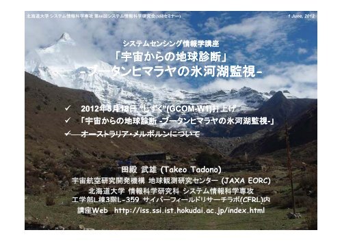
北 海 道 大 学 システム 情 報 科 学 専 攻 第 66 回 システム 情 報 科 学 研 究 会 (SSIセミナー)1 June, 2012IST, SSI, Hokkaido Universityシステムセンシング 情 報 学 講 座「 宇 宙 からの 地 球 診 断 」-ブータンヒマラヤの タ ヤ 氷 河 湖 監 視 - 2012 年 5 月 18 日 “しずく”(GCOM-W1)打 上 げ「 宇 宙 からの 地 球 診 断 -ブータンヒマラヤの 氷 河 湖 監 視 -」」オーストラリア・メルボルンについて田 殿 武 雄 (Takeo Tadono)宇 宙 航 空 研 究 開 発 機 構 地 球 観 測 研 究 センター (JAXA EORC)北 海 道 大 学 情 報 科 学 研 究 科 システム 情 報 科 学 専 攻工 学 部 L 棟 3 階 L-359 サイバーフィールドリサーチラボ(CFRL) 内講 座 Web http://iss.ssi.ist.hokudai.ac.jp/index.htmlEORC Earth Observation Research Center
IST, SSI, Hokkaido Universityブータン 王 国 ってどこ?EORC Earth Observation Research Center
IST, SSI, Hokkaido Universityブータン 王 国 ってどこ?EORC Earth Observation Research Center
IST, SSI, Hokkaido UniversityMt. Everest↓ブータン 王 国 ヒマラヤ 山 脈 南 麓標 高 : 北 部 7,000m 級 , 南 部 100m 中 国 ・インドに 隣 接2006 年 北 側 国 境 線 が 変 更 国 土 :38,400 km 2 ( 九 州 と 同 程 度 )大 半 が 山 岳 地 形 人 口 : 約 697,000 人 首 都 :ティンプー 国 教 :チベット 仏 教 基 幹 産 業 : 農 業 , 観 光 業 に 力水 力 発 電 による 電 力 をインドへ 輸 出• 国 民 総 幸 福 量 (Gross National Happiness,GNH)が 豊 かさの 指 標• 2011 年 11 月 5 代 ワンチュク 国 王 , ペマ 王妃 来 日ベンガル 湾EORC Earth Observation Research Center
IST, SSI, Hokkaido Universityブータンで 今 , 何 が 起 きているか?198419992010ガンリンチェンゼー 峠 北 方 氷 河 の 縮 小 の 様 子( 写 真 提 供 :1984EORC月 原 敏 博 , 1999, 2010 内 藤 望 )Earth Observation Research Center
1. 氷 河 上 の 池 2. 拡 大 過 程 にある 氷 河 湖ブータンで 今 , 何 が 起 きているか?IST, SSI, Hokkaido UniversityEORC Earth Observation Research Centerツォ・ロルパ 氷 河 湖3. 拡 大 を 終 えた 氷 河 湖 :1998 年 決 壊 Nishimura and Fujita, 2009
IST, SSI, Hokkaido University氷 河 湖 の 形 成 ・ 拡 大Changing lake sizefrom 1975 to 2000at Imja Glacial lake,Nepal1975197719871991199319952000Yabuki, 2002EORC Earth Observation Research Center
IST, SSI, Hokkaido University(a) 世 界 平 均 地 上 気 温100 年 間 に0.74℃ 上 昇地 球 温 暖 化 が 原 因 ?IPCC 第 4 次 評 価 報 告 書 (2007)IPCC 第 4 次 評 価 報 告 書 ( 気 象 庁 訳 )(b) 世 界 平 均 海 面 水 位「 気 候 システムの 温 暖 化 には 疑 う余 地 がない。このことは、大 気 や 海 洋 の 世 界 平 均 温 度 の 上 昇 、雪 氷 の 広 範 囲 にわたる 融 解 、世 界 平 均 海 面 水 位 の 上 昇(c) () 北 半 球 積 雪 面 積 の 経 年 変 化が 観 測 されていることから今 や 明 白 である」出 典 :IPCC 第 4 次 評 価 報 告 書 第 1 作 業 部 会 報 告 書 政 策 決 定 者 向 け 要約 ( 気 象 庁 訳 ) IPCC: 気 候 変 動 に 関 する 政 府 間 パネルEORC Earth Observation Research Center
IST, SSI, Hokkaido University何 が 問 題 か?氷 河 湖 決 壊 洪 水 (GLOF):Glacial Lake Outburst Flood > 下 流 の 住 民 に 被 害ブータン,ネパール, 中 国 , 南 米 アンデスなどで 発 生 中 国 ツァン・ツァンポ 氷 河 湖 (1981 年 ):50km 下 流 まで 壊 滅 的 な被 害 , 3つのコンクリート 橋 を 破 壊 , 再 建 に300 万 USドル ブータン・ルナナ 地 方 (1957, 1969, 1994 年 ): 古 都 プナカ・ゾンを破 壊 , 洪 水 はベンガル 湾 まで 達 する ブータン・ディグツォ 氷 河 湖 (1985 年 ): 小 型 水 力 発 電 所 ,14の 橋を 破 壊 ネパール:1977-1998 年 の 間 に5 回 のGLOF 発 生 氷 河 湖 の 現 状 ・ 実 態 が 把 握 されていない• 現 地 へのアクセスが 困 難• 拡 大 プロセスが 分 からない いつ 決 壊 するか 分 からない• 客 観 的 な 危 険 性 が 分 からない 洪 水 に 対 する 準 備 がなされていないTsho RolpaNishimura and Fujita, 2009EORC Earth Observation Research Center
IST, SSI, Hokkaido University過 去 の 氷 河 湖 調 査 レポート (ICIMOD)国 際 総 合 山 岳 開 発 センター(ICIMOD): 氷 河 湖 インベントリ( 台 帳 )“ 危 険 な 氷 河 湖 ” (Potentially dangerous lakes) 20 in Nepal, 24 in Bhutan Criteria is not clear Not direct measurements Landsat bases inventory : not accurate and newMool et al. (2001a, b)NepalBhutanon GoogleEarthEORC Earth Observation Research Center
IST, SSI, Hokkaido UniversityJICA/JST「ブータンヒマラヤ 氷 河 湖 決 壊 洪 水 (GLOF)」2009-2011 年 度 「 地 球 規 模 課 題 国 際 科 学 技 術 協 力 (SATREPS)」 課 題主 要 メンバー・プロセス 班 : 名 古 屋 大・ 衛 星 班 :JAXA・アセス 班 : 地 球 システム 科 学氷 河 湖 の 観 測 ・ 分 析 能 力 の 向 上 ,危 険 度 の 高 い 氷 河 湖 下 流 における 災 害 対 策氷 河 湖 の 客 観 的 な 危 険度 評 価 が 可 能 となる洪 水 被 害 軽 減 対 策・ ハザードマップ 作 成・ 早 期 警 戒 システムの 提 案太 字 : 衛 星 データ 利 用現 地 C/P(ブータン 政 府 地質 鉱 山 局 )への 技 術 移 転氷 河 湖 の 決 壊 流 出 解 析 ・洪 水 氾 濫 解 析 が 向 上氷 河 湖 決 壊 ・ 災 害 分 析・ 現 地 調 査・ 決 壊 モデル 構 築 , 洪 水 シミュレーション・ 流 域 社 会 調 査氷 河 湖 決 壊 危 険 度 評 価氷 河 湖 拡 大 メカニズム 解 析・ 衛 星 データによる 危 険 度 の 詳 細 観 測 と 評 価・ 気 候 学 的 解 析・ 過 去 のGLOF 氷 河 湖 再 評 価・ 拡 大 履 歴 情 報 収 集EORC Earth Observation Research Center
IST, SSI, Hokkaido UniversityJICA/JST「ブータンヒマラヤ 氷 河 湖 決 壊 洪 水 (GLOF)」2009-2011 年 度 「 地 球 規 模 課 題 国 際 科 学 技 術 協 力 (SATREPS)」 課 題プロセス 班 衛 星 班 アセス 班主 テーマ現 地 測 量 観 測 、 氷 河 湖 拡 大衛 星 データの 解 析氷 河 湖 決 壊 洪 水 の 影 響 評 価メカニズムの 解 析実 施 項 目 - 危 険 な 氷 河 湖 の 抽 出 - 衛 星 データセットの 提 供 - 堰 き 止 めモレーンの 物 理 探 査- 決 壊 リスクの 評 価- 現 地 観 測- 氷 河 湖 拡 大 過 程- 氷 河 湖 (とその 拡 大 に 関 する)インベントリ 作 成- 衛 星 データ 解 析 研 修- 洪 水 解 析- 社 会 調 査 とハザードマップ 作 成- 早 期 警 戒 システムの 提 案- ハザードマップ 作 成 研 修日 本 側 組 織 名 古 屋 大 学北 海 道 大 学( 独 ) 宇 宙 航 空 研 究 開 発 機 構( 財 )リモート・センシング ト 技 術 セ( 株 ) 地 球 システム 科 学弘 前 大 学立 教 大 学( 独 ) 防 災 科 学 研 究 所広 島 工 業 大 学ンター新 潟 大 学総 合 地 球 環 境 学 研 究 所日 本 大 学帝 京 平 成 大 学群 馬 大 学( 独 ) 海 洋 研 究 開 発 機 構 ( 独 ) 海 洋 研 究 開 発 機 構 慶 應 義 塾 大 学ブータン 側 組 織 ブータン 地 質 鉱 山 局 ブータン 地 質 鉱 山 局 ブータン 地 質 鉱 山 局EORC Earth Observation Research Center
IST, SSI, Hokkaido University「 地 球 規 模 課 題 国 際 科 学 技 術 協 力 (SATREPS)」1. 環 境 ・エネルギー 分 野2. 生 物 資 源 分 野3. 防 災 分 野4. 感 染 症 分 野JICA+JST 総 額 :1 億 円 程 度 / 年採 択 率 10% 程 度EORC Earth Observation Research Center
IST, SSI, Hokkaido University衛 星 班 の 目 的Objectives of Remote Sensing Group (or Satellite Data Analysis Group)• Research and Analysis for Glacial Lake Expansion History using TerrainInformation Derived by Satellite Data Terrain analysis using satellite data for the past Glacial Lake Outburst Floods(GLOFs) Base map analysis using Terra/ASTER collaboration with Process StudyGroup Extract precise terrain information and validation using ALOS/PRISM Development of Glacial l Lake Inventories based on multi-temporal, t l orthorectifiedsatellite imageries (CORONA/KH-9, Hexagon, SPOT, Landsat,JERS-1/OPS, ASTER, PRISM, AVNIR-2, (PALSAR)) Application of flood analysis and hazard maps generation collaboration withAssessment Group Provisions of technical trainings and systems for Remote SensingOut Products:‣ Precise digital map in the entire states of Bhutan > Pan-sharpened image‣ Precise digital elevation data in Bhutan > PRISM Digital Surface model (DSM) mosaic‣ ALOS-based Glacial lake inventory‣ Analysis results of glacial lake expansion history‣ Trainings / OJT on satellite data analysis as technology transferEORC Earth Observation Research Center
IST, SSI, Hokkaido University客 観 的 な“ 危 険 度 評 価 ” 湖 面 の 高 さと 河 床 の 高 さ モレーンダム 堤 体 の 厚 さと 斜 面 勾 配 現 地 調 査 にもとづく 堤 体 の 強 さBed is lower than water level of GLFujita et al., 2008Inclination is extremely highEORC Earth Observation Research Center
IST, SSI, Hokkaido University客 観 的 な“ 危 険 度 評 価 ” 湖 面 の 高 さから 堤 体 端 部 の 角 度 を 指 標• -10 度 以 下 と 仮 設 定 高 分 解 能 の 地 形 情 報 (DEM)が 必 要 過 去 GLOF 発 生 前 の 地 形 情 報 で 検 証Fujita et al., 2008, 2012LunanaTsho RolpaImjaヒマラヤの 氷 河 湖 (2400)について 推 定 された 潜 在 的 洪 水 水 量EORC Earth Observation Research Center
IST, SSI, Hokkaido University陸 域 観 測 技 術 衛 星 ALOS ‘Daichi’ Operation:24 Jan. 2006 by H-2A Rocket #8 PRISM12 May 2011 Mission ended~22 Apr. 2011: Low Load Mode (LLM)> 1,934 days=5.3 years Objectives:• Cartography (1/25,000 scale)• Regional environmental monitoringAVNIR-2• Disaster monitoring, etc.PALSAR Instruments:PRISMAVNIR-2PALSARPanchromatic Remote sensingInstrument for Stereo MappingAdvanced Visible and Near-InfraredRadiometer type 2Phased Array type L-bandSynthetic Aperture RadarPRISM can acquire triplet stereoimageries by nadir-, forward, andbackward-radiometers with 2.5mspatial resolution in 35kmswath.AVNIR-2 can observe with 10mresolution in 70km swath, and itcan be changed the observationarea by pointing capabilitywithin +/-44 deg. in across track.PALSAR can acquire the datain not only daytime but alsonighttime as well as cloudyand rainy whether conditions.EORC Earth Observation Research Center
IST, SSI, Hokkaido UniversityALOSによる 氷 河 湖 インベントリの 作 成正 射 投 影 画 像2.5m 擬 似 カラー 画 像ALOS PRISM/AVNIR-2による 氷 河 湖 インベントリ 作 成 のフローチャート過 去 の 衛 星 データ 処 理 には,ALOS PRISM DSM/ORIを 基 準 (ベースマップ)とする* DSM: digital surface model, 数 値 標 高 データの 一 種EORC Earth Observation Research Center
IST, SSI, Hokkaido UniversityPRISM/AVNIR-2パンシャープンモザイクColor composite image with 2.5 m resolution* Color dots: extracted glacial lakes(733 lakes in total)EORC Earth Observation Research Center
IST, SSI, Hokkaido UniversityPRISM/DSMモザイク精 度 検 証 のエリアPRISM DSM mosaic in Bhutan- 10 m resolution- Black: masked area due to cloudsEORC Earth Observation Research Center
IST, SSI, Hokkaido University検 証 用 データ 取 得 のための 現 地 調 査 2010What we do?- Ground control points (GCPs) for calibration : GCP- Continuous GPS measurement for DSM validation : GPS- Surface spectral measurement at GLs for validation : SS- Ground truth (measurement) of GLs (and glaciers) : GL- Tree samplings : TreeSimultaneous observation with PRISM/AVNIR-2onboard ALOSDate Sensor RSP Pointing Where we are?2010/10/03 PRISM 156D +1.2 > -1.2 Tampe La11:06-07(LT) 07(LT) AVNIR-2 156D 0.0 Tampe LaEORC Earth Observation Research Center
IST, SSI, Hokkaido University2010 衛 星 班 現 地 調 査 スケジュール ( 計 画 )Plan of field survey in Mangde Chu upper stream by Remote Sensing Group9/23( 木 )9/24( 金 )-1. Japanese member (1) leave from Japan0. AM: arrive in Thimphu, discussion and pre-orientation of field survey at DGM GCP/ stay in Thimphu (EL 2,300 m)9/25( 土 ) 1. Preparation | Japanese member (2) leave from Japan / Thimphu GCP9/26( 日 ) 2. Preparation | AM: arrive in Thimphu / Thimphu9/27( 月 ) 3. Preparation, 14:30 JICA Office, 16:00- Briefing / Thimphu9/28( 火 ) 4. Leave from Thimphu (8:00 YGH, 9:00 DGM) / Sephu (2,300) GCP9/29( 水 ) 5. move / northern Jyeri (2,700) GPS9/30( 木 ) 6. move / Maurothang (3,700) GPS10/1( 金 ) 7. acclimatization / Maurothang g( (3,700)10/2( 土 ) 8. move / southern Om Tsho (3,900) GPS10/3( 日 ) 9. move via. Tampe La (4,660 m), ALOS acquisition / Tampe Tsho (4,650) GL/SS10/4( 月 ) 10. move / Tshotshotang (4,400) GPS10/5( 火 ) 11. move GL/SS / Yango or near Methatshota (4,900) GPS10/6( 水 ) 12. Survey for Methatshota / near Methatshota (4,900) GL/SS10/7( 木 ) 13. Survey for Methatshota / near Methatshota (4,900) GL/SS10/8( 金 ) 14. move / Tshotshotang (4,400)10/9( 土 ) 15. move / TampeTsho (4,650)10/10( 日 ) 16. move via. Tampe La (4,660 m) / Maurothang (3,700)10/11( 月 ) 17. move / Sephu (2,700)10/12( 火 ) 18. move to Thimphu / Thimphu (2,300)10/13( 水 )10/14( 木 )10/15( 金 )19. Debriefing of field survey | Leave (1) Ukita / Thimphu (2,300)20. Leave from Bhutan21. Arrive to Japan- Assenting days are scheduled double of usual trekking plan until Tampe La.EORC Earth Observation Research Center
IST, SSI, Hokkaido University2010 衛 星 班 現 地 調 査 スケジュール ( 実 際 )Report of field survey in Mangde Chu upper stream by Remote Sensing Group9/23( 木 )9/24( 金 )-1. Japanese member (1) leave from Japan0. AM: arrive in Thimphu, discussion and pre-orientation of field survey at DGM GCP/ stay in Thimphu (EL 2,300 m)9/25( 土 ) 1. Preparation | Japanese member (2) leave from Japan / Thimphu GCP9/26( 日 ) 2. Preparation | AM: arrive in Thimphu / Thimphu9/27( 月 ) 3. Preparation, 9:30 Briefing,14:30 JICA Office / Thimphu9/28( 火 ) 4. Leave from Thimphu (8:00 YGH, 9:00 DGM) / Sephu (2,650) GCP9/29( 水 ) 5. move / Jyeri (3,230) GPS, GCP9/30( 木 ) 6. move / Northern Maurothang (3,520) GPS10/1( 金 ) 7. move / Southern Om Tsho (3,800) Tree10/2( 土 ) 8. Stay / Southern Om Tsho (3,800) GPS, Tree10/3( 日 ) 9. Stay, ALOS acquisition / Southern Om Tsho (3,800) SS10/4( 月 ) 10. 2 Japanese went down, move via. Tampe La (4,660 m) / Tampe Tsho (4,200) GPS10/5( 火 ) 11. Stay SS / Tampe Tsho (4,200)10/6( 水 ) 12. Other member went down / Maurothang (3,520)10/7( 木 ) 13. move / Sephu (2,650)10/8( 金 ) 14. Move to Thimphu, 18:00- Meeting@DGM / Thimphu10/9( 土 ) 15. 3 Japanese member left from Bhutan | Packing / Thimphu10/10( 日 ) 16. Reporting / Thimphu10/11( 月 )10/12( 火 )10/13( 水 )17. 2 Japanese member left from Bhutan18. Arrive to Japan19. (Debriefing of field survey)Blue colored characters show modified from the original schedule.EORC Earth Observation Research Center
IST, SSI, Hokkaido University2010 衛 星 班 現 地 調 査 スケジュール ( 結 果 )• Unfortunately, we could not reach to Methatshota‣ The horses could not go down a slope from Tempe Tsho to Tshotshotang‣ It will be possible to go up it > Main Team will be passed‣ We had to only select to back‣ It seems to be logistic problems (we have questions to the agent as well asJICA), therefore we hope that they should be clarified for the feature‣ Even so, the objective have been achieved ~70% in the field survey‣ All member could be back safety> We tried to go to 2 nd field survey on May, 2011EORC Earth Observation Research Center
IST, SSI, Hokkaido UniversityGCP #1 : Paro - Thimphu-3-53 5 GCP areas have to select in scene / RSP path- 2-4 points measurement / area, 10 – 20 minutes / area- Candidate area / point were selected: Red colored points were measured- Main: Geo-XT, Sub: Geo-XH, some: combine- Measurer, keeper, photo : 2-3 persons- Not depends on weather (except for snow?)Paro2thimpthimp2sephu-01paro2thimp-01paro2thimp-02pparo2thimp-05paro2thimp-03EORC Earth Observation Research Center
IST, SSI, Hokkaido Universityparo2thimp-01GCP #1 : Paro – Thimphu (24-25 Sep. 2010)1paro2thimp-03Chip image1paro2thimp-02Chip imageparo2thimp-05EORC Earth Observation Research Centerparo2thimp
IST, SSI, Hokkaido UniversityPRISM and AVNIR-2 on Oct. 3, 2010ALOSとの 同 期 観 測 (3 Oct. 2010)Small Om Tsho- Surface reflectanceSouthern Om Tsho Camp Site- GCP with targetEORC Earth Observation Research Center
地 表 面 分 光 放 射 の 計 測 ( 特 に 湖 水 の 色 に 着 目 )IST, SSI, Hokkaido UniversityMethatshotaYangoThempe TshoSmall Om Tsho- 5 GLs were selected as candidate: Two lakes were measured- Several points (< 3 as much as possible) may select at GL- 10 min/point, 1 – 2 hours / GL? (discussion)- MS-720#1 for target, MS-720#2 for whiteboard- GPS measurement at point- Simultaneous measurement at Small Om Tsho on Oct. 3- Measurer#1, #2, keeper, photo : 3-4 persons-Stable fine or cloudy, No rainfall and snowfall- Surrounding areas are also measured > asked to Main Team- GL measurement are conducted in same time (2 persons)- Moraine sampleEORC Earth Observation Research Center
IST, SSI, Hokkaido University地 表 面 分 光 放 射 の 計 測2) Target by #1, and white board by #21) White board measurement by #1, #22010/10/03 Small Om Tsho14:10:00 (JST), 11:10:00 (LT) >1) WB #1 and #2Similar shape and energy14:20:00 00 (JST), 11:20:00 00 (LT) >2) Water #1 and WB #23) Calculate surface reflectance at eachtime, and compare with AVNIR-2 aswell as each lakeWater surfaceSimilar shape,different energydue to cloudsEORC Earth Observation Research Center
IST, SSI, Hokkaido University検 証 用 データ 取 得 のための 現 地 調 査 2011調 査 スケジュール5/5 Paro -> Drugyel(2580) -> Shana(2850)5/65/7Shana -> Thangthangka (3610)Thangthangka (walk around foracclimatization)5/8 Jangothang (4080)5/9 Jangothang survey for glacier and lakes5/10 Lingshi (4010)5/11 Lingshi survey for glacier and lakes5/12 rest day5/13 Shodu (3750)5/14 Barshong (3720)5/15 Dl Dolam Kensho (3290)5/16 Thimphuジョモラリ、リンシ 氷 河 湖 調 査積 雪 により、Lingshiより 先 のアクセスが 不 可 であったため、Drugyel 側 へ 戻 るルートを 取 った。【 調 査 期 間 】 【 参 加 メンバー】2011 年 5 月 5~16 日【 目 的 】1. 衛 星 画 像 解 析 結 果 の 検 証 用 データ 取 得(GCP 取 得 ・ 湖 水 の 分 光 放 射 計 測 )2. 拡 大 する 氷 河 湖 の 現 況 調 査( 湖 岸 線 のGPS 測 量 など)日 本 側 :小 森 次 郎 、 山 之 口 勤 、 冨 山 信 弘ブータン 側 :Ms. Sonam Lhamo, Ms. Pema Deki, Mr.Phuntsho TsheringEORC Earth Observation Research Center
IST, SSI, Hokkaido UniversityGCP 計 測GCP 候 補GCP 候 補 ( 重 点 )全 GCP 候 補 17 点 のうち、7 点(No.4,7,8,10,12,13,15)を 取 得EORC Earth Observation Research Center
IST, SSI, Hokkaido University湖 水 の 分 光 放 射 計 測EORC Earth Observation Research Center
IST, SSI, Hokkaido University湖 岸 線 のGPS 測 量歩 行 による 計 測Holy lakeWestan lakeKarma lakeボートによる 計 測決 壊 の 痕 跡 ?約 12mの 水 位 低 下EORC Earth Observation Research Center
IST, SSI, Hokkaido UniversityPRISM DSMモザイクの 精 度 検 証Magnified PRISM DSM mosaic and location ofGPS measurements points (yellow: continuousmeasurement in 2010; red: CPs in 2010; andblue: CPs in 2011).The points within +/-30 m errors compared with thePRISM DSM were selected due to condition andaccuracy of GPS.Comparison of height between the GPS measurementsand PRISM DSM (red: continuous measurement in 2010;green: CPs in 2010; and blue: CPs in 2011).Total: 3,268 pointsBias=2.28m, STDEV=7.79m, RMSE=8.12m* Acknowledge to Prof. Naito, Prof. Sawagaki, Dr. Yamaguchi, Prof. Jiro Komori, and Prof. FujitaEORC Earth Observation Research Center
IST, SSI, Hokkaido UniversityPRISM DSMモザイクの 精 度 検 証 (2)Error of PRISM DSM(Low correlation)Error of SRTM-3(Miss-interpolation)+30m Histogram of height differencebetween PRISM DSM and SRTM-3.+/‐0mVoid data in SRTM‐3‐30mHeight difference (i.e., PRISM DSM minus SRTM-3) in the BhutanHimalayas. The black colors indicate the masked areas in the PRISMDSM, while the green indicates the void data areas in SRTM-3.Total: 738,107,875 pointsBias=-0.44m, STDEV=20.71m, RMSE=20.72mVisual comparison between PRISMDSM (left) and SRTM-3 (right).EORC Earth Observation Research Center
IST, SSI, Hokkaido University氷 河 湖 インベントリの 精 度 検 証Comparison of lake polygons at Metatsota glacial lake among the ALOS-based inventory (yellow) , the ground-basedGPS measurements in 2010 (green), and ICIMOD inventory 2000 (red) at Metatsota lake. We confirmed that 9.5 m(averaged error), and 11.9m (RMSE) accuracy of the ALOS-based inventory compared with the GPS measurement.References: Ukita et al. (2011) Annals of Glaciology, 52(58), pp.65-71 2011;Tadono et al. (2012) Bhutan Geology, in press?* Acknowledge to Prof. Naito, Prof. Sawagaki, Dr. Yamaguchi, and Prof. KomoriEORC Earth Observation Research Center
IST, SSI, Hokkaido University氷 河 湖 インベントリの 精 度 検 証 (2)The western lake- Good geolocation- Similar shapesKarma lake- Good geolocation- Larger shapes> Seasonal change> Careful inexpansion historyComparison of polygons between the ALOS-based inventory (yellow) andthe ground-based GPS measurements (green) at two lakes in 2011.Reference: Tadono et al. (2012) Global Environmental Research, in pressEORC Earth Observation Research Center
IST, SSI, Hokkaido University氷 河 湖 拡 大 履 歴 の 解 析Historical satellite data- Hexagon (1974, purple)- SPOT (1989, blue)- Landsat-7/ETM+ (2000, red)- ALOS (2011, yellow)Example of analysis of glacial l lake expansion history using multi temporal satellite imagesin Kuri Chu. The color polygons show extracted lake areas in individual image, and timetrend of area changes (right).EORC Earth Observation Research Center
IST, SSI, Hokkaido Universityモレーンダムの 堤 体 : 物 理 探 査対 象 氷 河 湖 における 物 理 探 査 結 果 (Ohashi et al., 2012)(a)ツォジョ 氷 河 鳥 瞰 図 , (b)ツォジョ 氷 河 , (c)ザナムC EORC湖 , (d)メタツォタ 湖Earth Observation Research Center
IST, SSI, Hokkaido University氷 河 湖 の 湖 盆 図 作 成 と 水 量 推 定ザナムCの 湖 盆 図b)は 中 央 線 沿 い(a 図 中 の 黄 色 線 )の 水 深 分 布 (Fujita et al., 2012)各 対 象 氷 河 湖 外 観 および 断 面 (Koike & Takenaka, 2012)(a)ルゲ 湖 , (b)ザナムB 湖 , (c)ザナムC 湖 , (d)メタツォタ 湖EORC Earth Observation Research Center
IST, SSI, Hokkaido University洪 水 シミュレーションとハザードマップ 作 成メタツォタ 湖 の 決 壊 ハイドログラフメタツォタ 湖 からの 距 離 とピーク 流 量 との 関 係メタツォタ 湖 決 壊 洪 水 を 想 定 した 場 合 のジーザム 村 , ティンティビ 村 における 浸 水 予 測 図 (Koike and Takenaka, 2012)EORC Earth Observation Research Center
IST, SSI, Hokkaido University土 砂 崩 れインベントリPotential hazards induced by GLOFs,floods, and earthquakes• Assessment Group conducted trainings to identifypotential of dangerous landslide areas using PRISMstereo pair images.EORC Earth Observation Research Center1: Rock creep 2: Landslide 3: Scarp 4. TerraceHigaki and Sato (2012)
IST, SSI, Hokkaido UniversityALOS to ALOS-2 and ALOS-32006 2011 2013 2015 2018 2020ALOS(Optical imager & SAR)ALOS‐2 (SAR)ALOS‐3 (Optical )ALOS(Optical imager & SAR)2006 - 2011ALOS-2 (SAR)JFY2013ALOS-3 (Optical imager)EORC Earth Observation Research Center
IST, SSI, Hokkaido UniversityALOS-2 SpecificationSun-Synchronous Sub-RecurrentOrbitAltitude: Approx. 630kmLST: 12:00 in descending orbitDesign LifeLaunchSatelliteTargetRocketMassSolar Paddle5 yearsJFY2013H-2AApprox. 2 tonTwo-wings type panelALOS-2: SAR SatelliteAugust, 2009: Project Team was established~December 2009: Preliminary Design Phase~October 2010: Critical Design PhaseNow: manufacturing EMALOS-2 Research Announcement(RA) will release on July 2012.The detail will publish on Web.Mission Data TransmissionMission SensorFrequencyFineMajorObservation BasicModeWideMission ObjectivesDirect / via. Data Relay SatelliteSynthetic Aperture Radar (SAR)L-band (1.2GHz)Resolution: 1-3 m, Width: 25 kmResolution: 3 / 6 / 10 mWidth: 50 / 50 / 70 kmResolution: 100 m, Width: 350 kmCrustal change, volcano monitoring,surface deformationSea ice, river, forest and agriculturemonitoring etc.EORC Earth Observation Research Center
IST, SSI, Hokkaido UniversityALOS-3 Specification (TBD)HISUI (Multi)Sun-Synchronous Sub-Recurrent, 60 daysHISUI (Hyper)OrbitAltitude: 618 kmLST: 10:30 in descending orbitDesign LifeLaunch5 yearsTarget JFY 2017Rocket H-2APRISM-2 (Backward)PRISM-2 (Nadir)ALOS-3: Optical Sensor Satellite 50km swath / 0.8m GSD = 62,500 pxls 11 bits quantizationSatelliteMassSolar PaddleApprox. 2 tonTwo-wings type panelMission i Data Transmissioni Direct / via. Data Relay SatelliteMission SensorPanchromaticMulti spectralOptical instrumentsNadir: 0.8 m resolution, 50 km widthBackward:
![4.12.2a_Tibet_Wu Guoxiong Tibet-CEOP.ppt[]](https://img.yumpu.com/35802437/1/190x135/4122a-tibet-wu-guoxiong-tibet-ceopppt.jpg?quality=85)