Works Approval Report.pdf - the National Capital Authority
Works Approval Report.pdf - the National Capital Authority
Works Approval Report.pdf - the National Capital Authority

Create successful ePaper yourself
Turn your PDF publications into a flip-book with our unique Google optimized e-Paper software.
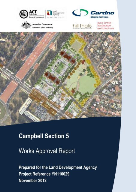
Campbell Section 5<strong>Works</strong> <strong>Approval</strong> <strong>Report</strong>Prepared for <strong>the</strong> Land Development AgencyProject Reference YN110029November 2012
Campbell Section 5 - <strong>Works</strong> <strong>Approval</strong> Project Ref: 110029Prepared for <strong>the</strong> Land Development AgencyCardno (NSW/ACT) Pty LtdABN 95 001 145 035Level 2, 14 Wormald StreetSymonstonCanberraACT 2609 AustraliaTelephone: 02 6112 4500Facsimile: 02 6112 4599International: +61 2 61124500cardno@cardno.com.auwww.cardno.com.auDocument ControlVersion Date Author Reviewer1 (DRAFT) July 2012 R Marsden G Taylor2 November 2012 R Marsden G Taylor"© 2012 Cardno (NSW/ACT) Pty Ltd All Rights Reserved. Copyright in <strong>the</strong> whole and every part of thisdocument belongs to Cardno (NSW/ACT) Pty Ltd and may not be used, sold, transferred, copied orreproduced in whole or in part in any manner or form or in or on any media to any person without <strong>the</strong> priorwritten consent of Cardno (NSW/ACT) Pty Ltd.November 2012 Cardno i
Campbell Section 5 - <strong>Works</strong> <strong>Approval</strong> Project Ref: 110029Prepared for <strong>the</strong> Land Development AgencyProject informationProject DescriptionProject name Campbell Section 5Project locationCampbell, Canberra, ACTClientClient nameClient addressClient contactLand Development AgencyGround Floor TransACT House470 Northbourne AvenueDickson ACT 2602Michael PrendergastPhone: (02) 6205 3001Email: MichaelJ.Prendergast@act.gov.auProject managementConsultantNominated contactsCardnoLevel 2, 14 Wormald StreetSymonston ACT 2609Phone: (02) 6112 4500Facsimile: (02) 6112 4599John Foster (Project Director)Email: John.Foster@cardno.com.auGreg Taylor (Project Manager)Email: Greg.Taylor@cardno.com.auNovember 2012 Cardno ii
Campbell Section 5 - <strong>Works</strong> <strong>Approval</strong> Project Ref: 110029Prepared for <strong>the</strong> Land Development AgencyTable of ContentsExecutive Summary .................................................................................................................. vi1 Introduction ...................................................................................................................... 11.1 <strong>Report</strong> objectives .............................................................................................. 11.2 Proponents ....................................................................................................... 11.3 Background ...................................................................................................... 21.4 Site Description ................................................................................................ 31.5 Planning concepts and objectives .................................................................... 31.6 Scope of works ................................................................................................. 51.7 Reference documentation ................................................................................ 61.8 Standards and design information .................................................................... 72 Design Objectives ............................................................................................................ 83 Location and Context ..................................................................................................... 104 Concept Elements .......................................................................................................... 114.1 Planning Design Code and Guidelines........................................................... 114.1.1 Public Space ................................................................................................... 114.1.2 Building Form ................................................................................................. 124.1.3 Site Access and Set-backs ............................................................................. 134.1.4 Building Height ............................................................................................... 144.1.5 Building Facades ............................................................................................ 154.1.6 Parking ........................................................................................................... 154.1.7 Materials ......................................................................................................... 154.1.8 Landscape ...................................................................................................... 164.1.9 Heritage .......................................................................................................... 164.1.10 Lighting ........................................................................................................... 184.1.11 Indicative Development Streetscape .............................................................. 185 Heritage, Environment and Contamination .................................................................... 215.1 Heritage .......................................................................................................... 215.2 Environment and Sustainability ...................................................................... 225.2.1 Walking, Cycling and Public Transport ........................................................... 225.2.2 Reduction of Urban Heat ................................................................................ 235.3 Water Sensitive Urban Design (WSUD)......................................................... 245.4 Biodiversity ..................................................................................................... 275.5 EPBC Requirements ...................................................................................... 285.6 Contamination ................................................................................................ 286 Transport, Traffic and Planning ..................................................................................... 306.1 Traffic Summary ............................................................................................. 306.2 External Intersection Summary ...................................................................... 306.3 Parking ........................................................................................................... 306.3.1 Development code parking requirements....................................................... 306.3.2 Parking Proposal ............................................................................................ 317 Landscape ..................................................................................................................... 347.1 Introduction ..................................................................................................... 34November 2012 Cardno iii
Campbell Section 5 - <strong>Works</strong> <strong>Approval</strong> Project Ref: 110029Prepared for <strong>the</strong> Land Development Agency7.2 Tree Assessment ............................................................................................ 347.3 Proposal ......................................................................................................... 367.3.1 Streets and Urban Plazas .............................................................................. 367.3.2 Pedestrian Plazas ........................................................................................... 387.3.3 Materials ......................................................................................................... 397.3.4 The Park ......................................................................................................... 417.3.5 Swale .............................................................................................................. 427.3.6 Trees............................................................................................................... 427.3.7 Open space .................................................................................................... 437.3.8 The Green ...................................................................................................... 437.3.9 Materials ......................................................................................................... 448 Civil, Infrastructure, Servicing and Construction Management ..................................... 458.1 Additional Studies ........................................................................................... 458.1.1 Survey............................................................................................................. 458.1.2 Geotechnical investigation ............................................................................. 458.1.3 Utilities investigation ....................................................................................... 458.2 Drainage ......................................................................................................... 458.2.1 Flood Study and Road Drainage .................................................................... 458.2.2 Existing Catchment Conditions ...................................................................... 468.2.3 Proposed Development Conditions ................................................................ 488.3 Overview of Public Realm Street Design and Road Geometry ...................... 538.3.1 Layout ............................................................................................................. 538.3.2 Existing alignments ......................................................................................... 538.3.3 Existing intersections ...................................................................................... 538.3.4 Work by ACT and Australian Governments ................................................... 538.3.5 Design speed and speed control .................................................................... 538.3.6 New road horizontal alignments ..................................................................... 548.3.7 New road vertical alignments ......................................................................... 548.3.8 Verge treatment .............................................................................................. 558.3.9 Tree planting ................................................................................................... 558.3.10 On-street parking ............................................................................................ 558.3.11 Cycling facilities - Constitution Avenue .......................................................... 578.3.12 Cycling facilities - Campbell Section 5 internal streets ................................... 578.3.13 Block driveway access, servicing and waste collection ................................. 578.4 Proposed Road Geometry .............................................................................. 588.4.1 Road 1-(A) and Road 2-(A) ............................................................................ 588.4.2 Road 1-(B) ...................................................................................................... 618.4.3 Road 1-(C) ...................................................................................................... 638.4.4 Road 3 ............................................................................................................ 658.4.5 Anzac Park East ............................................................................................. 678.4.6 Road 2-(C) ...................................................................................................... 698.4.7 Road 2-(B) ...................................................................................................... 718.4.8 Creswell Street ............................................................................................... 738.4.9 Constitution Avenue ....................................................................................... 758.5 Proposed Intersections ................................................................................... 758.5.1 Internal to site ................................................................................................. 758.5.2 External to site ................................................................................................ 758.5.3 Constitution Avenue / Anzac Park East .......................................................... 758.5.4 Constitution Avenue / Creswell Street ............................................................ 768.5.5 Constitution Avenue / Wendouree Drive / Road 3 ......................................... 768.5.6 Creswell Street / Getting Crescent / Road 2-(C) ............................................ 768.6 Traffic signals ................................................................................................. 768.7 Traffic control devices..................................................................................... 768.8 Pavement design ............................................................................................ 768.9 Street lighting .................................................................................................. 77November 2012 Cardno iv
Campbell Section 5 - <strong>Works</strong> <strong>Approval</strong> Project Ref: 110029Prepared for <strong>the</strong> Land Development Agency8.10 Temporary traffic management ...................................................................... 778.11 Retaining walls and structures ....................................................................... 778.12 Site Servicing .................................................................................................. 788.12.1 Existing External Services .............................................................................. 788.12.2 Sewerage ....................................................................................................... 788.12.3 Water .............................................................................................................. 788.12.4 Electricity ........................................................................................................ 798.12.5 Gas ................................................................................................................. 808.12.6 Telecommunications ....................................................................................... 808.12.7 Waste.............................................................................................................. 819 Cost Estimate ................................................................................................................. 8210 Consultation ................................................................................................................... 8310.1 Public Consultation ......................................................................................... 8310.2 Consultation with Authorities .......................................................................... 8411 The <strong>National</strong> <strong>Capital</strong> Plan ............................................................................................ 105AppendicesAppendix 1Appendix 2Appendix 3Appendix 4Appendix 5Appendix 6Appendix 7Appendix 8Appendix 9Appendix 10Appendix 11Statement of Heritage ImpactCardno Traffic Analysis and Road Hierarchy <strong>Report</strong>Contamination <strong>Report</strong> on RAPPavement DesignWSUD and Irrigation Schematic ProposalsProposed Block Area SchedulesJILA Tree <strong>Report</strong>Waste Management PlanConsultation Outcomes <strong>Report</strong>Proposed paving, street furniture, exercise and play equipmentStreet Tree ProvisionsNovember 2012 Cardno v
Campbell Section 5 - <strong>Works</strong> <strong>Approval</strong> Project Ref: 110029Prepared for <strong>the</strong> Land Development AgencyExecutive SummaryBackgroundCardno has been commissioned by <strong>the</strong> Land Development Agency (LDA) to obtain <strong>Works</strong> <strong>Approval</strong>for <strong>the</strong> Campbell Section 5 development.Cardno working in partnership with its sub-consultants Hill Thalis Architecture + Urban Projects,Jane Irwin Landscape Architecture (JILA), The Expert Client (TEC), CB Richard Ellis (CBRE),LANDdata, and Douglas Partners, has produced this <strong>Works</strong> <strong>Approval</strong> <strong>Report</strong> and associateddrawings to outline <strong>the</strong> proposals for <strong>the</strong> Campbell Section 5 project for <strong>the</strong> provision of access andservicing to <strong>the</strong> future sub-division of <strong>the</strong> site.This document addresses: Objective and Background Information Design Objectives Concept Elements Heritage and Environment Transport and Traffic Landscape Civil Infrastructure Costs Consultation <strong>National</strong> <strong>Capital</strong> PlanCampbell Section 5 is a pivotal site located at <strong>the</strong> junction of <strong>the</strong> Griffin axis along ConstitutionAvenue and Anzac Parade.It is <strong>the</strong> aim of <strong>the</strong> LDA that <strong>the</strong> Campbell Section 5 development will create a high quality, urbanestate that will stand as an exemplar project worthy of its high profile location.The development will involve creating public realm and upgrading existing infrastructure to support<strong>the</strong> mixed use development.Adhering to <strong>the</strong> Canberra Central Design Manual, <strong>the</strong> project team has advanced a design to createa vibrant and sustainable development that achieves Government Policy and addresses communityneeds.This report does not address comments received from <strong>the</strong> public consultation for Amendment 74 to<strong>the</strong> <strong>National</strong> <strong>Capital</strong> Plan. Fur<strong>the</strong>rmore, this report and associated drawings does not consider worksto <strong>the</strong> Constitution Avenue kerb or carriageway as <strong>the</strong>se will be addressed under a separate <strong>Works</strong><strong>Approval</strong> submission to <strong>the</strong> NCA.November 2012 Cardno vi
Campbell Section 5 - <strong>Works</strong> <strong>Approval</strong> Project Ref: 110029Prepared for <strong>the</strong> Land Development AgencyPAGE INTENTIONALLY BLANKNovember 2012 Cardno vii
Campbell Section 5 - <strong>Works</strong> <strong>Approval</strong> Project Ref: 110029Prepared for <strong>the</strong> Land Development Agency1 Introduction1.1 <strong>Report</strong> objectivesThe objective of this report and accompanying Civil and Landscape drawings is to providedocumentation to support <strong>the</strong> <strong>Works</strong> <strong>Approval</strong> application to <strong>the</strong> <strong>National</strong> <strong>Capital</strong> <strong>Authority</strong> (NCA).An earlier draft of this report and drawings was used for consultation with <strong>the</strong> LDA, <strong>the</strong> NCA, TAMS,Roads ACT, and o<strong>the</strong>r statutory authorities and stakeholders.The design addresses <strong>the</strong> following:high quality landscaping and public realm place-making;safe and efficient arrangements for pedestrians and cyclists;access to <strong>the</strong> proposed mixed use development within Campbell to a satisfactory level ofservice;internal road and intersection arrangements that will operate efficiently to a level of serviceappropriate to <strong>the</strong> categories of <strong>the</strong> roads involved;allowance for all services including stormwater and management of overland flow;WSUD initiatives to recycle and reuse stormwater/rainfall and to minimise <strong>the</strong> impact of <strong>the</strong>development on <strong>the</strong> environment.Two sets of drawings titled: Campbell Section 5 <strong>Works</strong> <strong>Approval</strong> Civil Engineering <strong>Works</strong>, andCampbell Section 5 <strong>Works</strong> <strong>Approval</strong> Landscape <strong>Works</strong>, have been prepared and should be read inconjunction with this report.1.2 ProponentsThe following parties are involved with <strong>the</strong> project:Role Organisation ContactClient Land Development Agency Michael PrendergastLead Consultant Cardno Greg TaylorSub-consultantsEngineering Survey LANDdata David SloanGeotechnical Investigation Douglas Partners Michael JonesLandscape Architecture Jane Irwin Landscape Architects (JILA) Jane IrwinArchitects Hill Thalis Architecture + Urban Projects Philip ThalisStreet light design ActewAGL Subhash RewalConsultation The Expert Client John TaitCost consultants CB Richard Ellis Adam HaworthTable 1.1 – Project StructureNovember 2012 Cardno 1
Campbell Section 5 - <strong>Works</strong> <strong>Approval</strong> Project Ref: 110029Prepared for <strong>the</strong> Land Development Agency1.3 BackgroundCardno has been engaged by <strong>the</strong> ACT Government’s Land Development Agency (LDA) to provideengineering consultancy and construction supervision services for a mixed-use, urban developmentin Campbell. The proposed development is located within <strong>the</strong> <strong>National</strong> <strong>Capital</strong> <strong>Authority</strong>’s (NCA’s)planning jurisdiction and <strong>the</strong>refore requires NCA <strong>Works</strong> <strong>Approval</strong>.Cardno with its appointed sub-consultants Hill Thalis Architecture + Urban Projects, Jane IrwinLandscape Architecture (JILA), The Expert Client (TEC), CB Richard Ellis (CBRE), LANDdata, andDouglas Partners have produced this <strong>Works</strong> <strong>Approval</strong> report and associated drawings.In 2011, <strong>the</strong> LDA consulted with <strong>the</strong> NCA to discuss <strong>the</strong> development of Campbell Section 5. TheNCA supported <strong>the</strong> general proposal to reconsider <strong>the</strong> land use boundaries for Campbell Section 5,with a view to reducing <strong>the</strong> impact of a multi-storey development on adjacent single storey housing.The NCA agreed to prepare an amendment to <strong>the</strong> <strong>National</strong> <strong>Capital</strong> Plan (NCP) reflecting <strong>the</strong>sechanges.The LDA prepared a number of Concept Options for <strong>the</strong> development of <strong>the</strong> site, based on <strong>the</strong>design principles of <strong>the</strong> NCP. Through community engagement, including a Project ReferenceGroup, a Preferred Concept Master Plan was developed. The Concept Master Plan was fur<strong>the</strong>rdeveloped into a Draft Master Plan, which has informed <strong>the</strong> necessary changes to <strong>the</strong> NCP.The Draft Master Plan <strong>Report</strong>, prepared by Hill Thalis Architecture + Urban Projects and Jane IrwinLandscape Architecture for <strong>the</strong> LDA, is available on <strong>the</strong> NCA website at www.nationalcapital.gov.au.In June 2012, a draft of this report and drawings was distributed to <strong>the</strong> LDA, NCA, TAMS and o<strong>the</strong>rkey stakeholders for comment. The feedback attained from this consultation has been incorporatedinto <strong>the</strong> design where possible. Generally, <strong>the</strong> design does meet <strong>the</strong> stakeholder requirements,although areas that may be deemed deficient include <strong>the</strong> location of new street trees in <strong>the</strong> vergeand some tree species selection. The stakeholder comments and project team responses can befound in Section 10 of this report.Several road improvement projects adjacent to <strong>the</strong> Campbell Section 5 development are due to beundertaken and completed by <strong>the</strong> NCA, ACT Government and ASIO prior to <strong>the</strong> works outlined inthis report. It is expected that <strong>the</strong> proposed timing of <strong>the</strong> Campbell Section 5 works should avoid anysignificant construction co-ordination issues.Cardno has been advised of long-term proposals (>8 years) by <strong>the</strong> NCA and ACT Government forextensive changes to Constitution Avenue fronting <strong>the</strong> Campbell Section 5 development. It isintended that a planted WSUD median be introduced along Constitution Avenue toge<strong>the</strong>r withalterations to <strong>the</strong> carriageway and sou<strong>the</strong>rn verge.November 2012 Cardno 2
Campbell Section 5 - <strong>Works</strong> <strong>Approval</strong> Project Ref: 110029Prepared for <strong>the</strong> Land Development Agency1.4 Site DescriptionCampbell is an established residential suburb situated between Mt Ainslie and Lake Burley Griffin.Campbell Section 5 is unleased Territory Land. It is approximately 6.4 ha in size and is bounded byConstitution Avenue to <strong>the</strong> south, Anzac Park East to <strong>the</strong> west, and Page, Chowne and CreswellStreets to <strong>the</strong> north and east. Constitution Avenue and Anzac Parade are identified in <strong>the</strong> NCP asMain Avenues. The site is located approximately 1.5 kilometres from City Hill and 2.5 kilometresfrom Parliament House.Campbell Section 5 and sites abutting Constitution Avenue to <strong>the</strong> south are Designated Areas under<strong>the</strong> NCP. Constitution Avenue is <strong>National</strong> Land managed by <strong>the</strong> NCA.Built form near Campbell Section 5 includes <strong>the</strong> Commonwealth New Building Project underconstruction on Section 49 Parkes, <strong>the</strong> Anzac Park East portal building to <strong>the</strong> south, and <strong>the</strong> SAABoffices on <strong>the</strong> corner of Constitution Avenue and Creswell Street. Single residential homes arelocated to <strong>the</strong> north and east of <strong>the</strong> site.Anzac Parade is located to <strong>the</strong> west of <strong>the</strong> site. Parallel with Campbell Section 5 western boundaryare <strong>the</strong> Air Force, Rats of Tobruk and New Zealand memorials, and a space reserved for <strong>the</strong>Australian Peacekeeping memorial. The site is separated from <strong>the</strong> Parade by three rows of matureblue gums lining Anzac Parade.1.5 Planning concepts and objectivesThe planning concepts defining <strong>the</strong> proposed development at Campbell Section 5 are: Vibrant and sustainable urban communitiesCanberra has evolved successful traditions of urban development that deserve recognition. The bestdevelopments have evolved over time into diverse and sustainable urban communities - mixing localshopping, convenient access to parks and public transport with a variety of housing choice withincomfortable walking range. Successful Canberra examples include Kingston and Manuka.Progressive urban design practice must be predicated on a clear methodology that producespositive urban projects ra<strong>the</strong>r than restrictive regulation. The combination of <strong>the</strong> following urbanelements is critical in providing a contemporary Australian society. Public TransportIn Canberra as in o<strong>the</strong>r cities, public transport can provide a legible and sustainable metropolitanframework, while being <strong>the</strong> catalyst around which local communities develop. Unlike <strong>the</strong> car, publictransport encourages a local pedestrian culture that supports retail and community uses and streetlife. Health research has focused on <strong>the</strong> benefits of walking and cycling as part of daily commuting incontrast to <strong>the</strong> disbenefits of driving.The Sustainable Transport Action Plan envisages that by 2031 Constitution Avenue will be servicedby a Rapid Line Bus/Light Rail Service and a Frequent Line Bus Service. If implemented, <strong>the</strong> site willbe well connected to a Regional and Local transport network.November 2012 Cardno 3
Campbell Section 5 - <strong>Works</strong> <strong>Approval</strong> Project Ref: 110029Prepared for <strong>the</strong> Land Development Agency Street PatternStreets are an enduring cultural tradition, and Canberra has many memorable streets of varioustypes that are characterised by wide reservations and generous tree planting. Streets should not bedominated by <strong>the</strong> motorcar but instead provide for a balance of transport modes including walking,cycling and local bus services. The street pattern provides orientation and address, and should havea clear and legible hierarchy and must be flexible over time.Currently <strong>the</strong> streets surrounding Campbell Section 5 include two of <strong>the</strong> most important structuralAvenues in Canberra – Anzac Parade and Constitution Avenue. Opportunities for improving <strong>the</strong>existing street character should be made with regard to extensive work previously undertaken forenhancements through <strong>the</strong> NCP and <strong>the</strong> Griffin Legacy. It is important on such a key site that thisland is appropriately valued and planned, and that urban capable land is not used profligately. Thedesign of new streets should carefully relate to <strong>the</strong> local topography; should be enhanced byintegrated water management and landscape strategies; and should seek to make strategicconnections to <strong>the</strong> existing adjacent urban area of Campbell as well as o<strong>the</strong>r nationally significantsites in <strong>the</strong> vicinity.Community FacilitiesPublic works should express community aspirations. The judicious placement and design of parksand squares, community buildings, community services and artworks make <strong>the</strong> environment morememorable and purposeful, adding a sense of generosity and civility to <strong>the</strong> urban landscape.Campbell Section 5 provides many opportunities for community facilities as an integrated part ofopen space and public domain strategies. There is obvious potential for public and communal usesin <strong>the</strong> park in <strong>the</strong> nor<strong>the</strong>ast portion of <strong>the</strong> site. Consideration to improving <strong>the</strong> existing urban interfaceto Constitution Avenue and Anzac Parade will help to define its cultural significance more sharply.The site is proximate to existing recreational open space resources and monuments of nationalsignificance and strong links should be provided to this existing cultural infrastructure.Public DomainThe public domain is <strong>the</strong> framework for community life and to a large extent determines <strong>the</strong> image ofa place. Streets, parks and civic spaces will create a network for walking, cycling, casualsocialisation and active recreation. The public domain should foster landscape planting instreetscapes and parks that provide links to <strong>the</strong> natural environment – remnant, adjacent and preexisting.In Canberra, <strong>the</strong>re is a particularly strong cultural landscape inventory, which has become astrong and memorable characteristic of <strong>the</strong> city’s identity. Urban projects in Canberra should protectand supplement this fine cultural asset.Water Sensitive Urban DesignLandscape character and environmental systems are increasingly ‘hot’ issues in urban design.Multifunctional landscapes are being designed to contribute to environmental sustainability andamenity – to retain and distribute water; to contribute to air quality; and to ameliorate climate change.The existing drainage corridor that bisects <strong>the</strong> site provided an opportunity to reconsider <strong>the</strong>character of this feature and to propose new types of streets that collect and treat water in an openlylegible and celebratory manner - and that also contribute to <strong>the</strong> creation of a site-specific andneighbourhood-specific character.November 2012 Cardno 4
Campbell Section 5 - <strong>Works</strong> <strong>Approval</strong> Project Ref: 110029Prepared for <strong>the</strong> Land Development AgencyThe site is part of <strong>the</strong> catchment for Lake Burley Griffin with an existing stormwater pipe runningthrough <strong>the</strong> centre of <strong>the</strong> site. This provides opportunity for Water Sensitive Urban Design (WSUD)initiatives to be incorporated in <strong>the</strong> site, through <strong>the</strong> provision of a wetland retention system within<strong>the</strong> open space. The wetland is designed to address water quality through reticulation and storage.Urban BlocksWithin Campbell Section 5, <strong>the</strong> development blocks are subdivided into lots defined by <strong>the</strong> newstreet network. They constitute <strong>the</strong> developable area of <strong>the</strong> city that should relate to <strong>the</strong>ir locationand surroundings. The dimensions of blocks are critical in determining <strong>the</strong> permeability of an areaand in allowing a variety of functions and building types. The layout of <strong>the</strong> block is also important forestablishing <strong>the</strong> location and impacts of private car parking and allowing an enduring landscape ofmature trees.A revised subdivision pattern agreed under NCP Planning Amendment 74 for Campbell Section 5better suits <strong>the</strong> anticipated short term uses, but most importantly, allows for greater flexibility ofbuilding type and use in <strong>the</strong> long term.SubdivisionWithin Campbell Section 5, a varied and responsive approach to subdivision lot structure in differentparts of <strong>the</strong> site will be critical to <strong>the</strong> success of <strong>the</strong> project. Differing building types, specific frontageand depth dimensions help to determine site densities. Building typesHistorically Australian suburbs have been developed with a limited number of residential housingtypes, usually linked to a particular subdivision pattern; <strong>the</strong> row or terrace house; <strong>the</strong> villa orfreestanding house; and <strong>the</strong> residential flat building. As society’s needs become more complex anddiverse, <strong>the</strong>se types must be expanded to create flexible and relevant housing models. The modelsemployed across <strong>the</strong> site must address varied and distinct urban characters.Campbell Section 5 presents a complex situation that is unusual, in <strong>the</strong> sense that it alreadycontains a range of mixed uses in <strong>the</strong> near vicinity - including residential, commercial, public,institutional and diplomatic. Accordingly, any proposed public domain and subdivision pattern mustenable <strong>the</strong> precinct to accommodate a variety of building types, including mixed use buildings and toenhance this diversity of use.1.6 Scope of worksThe scope of design services undertaken includes:Consultation with Client and Stakeholders to ensure planning objectives are met.To obtain approvals from relevant service authorities to support <strong>the</strong> <strong>Works</strong> <strong>Approval</strong>submission.Geotechnical and Environmental investigations within <strong>the</strong> vicinity of <strong>the</strong> works.Remediation of contaminated material.Detail survey to inform <strong>the</strong> design.Fur<strong>the</strong>r traffic analysis to supplement studies already undertaken.November 2012 Cardno 5
Campbell Section 5 - <strong>Works</strong> <strong>Approval</strong> Project Ref: 110029Prepared for <strong>the</strong> Land Development AgencyAnalysis of <strong>the</strong> impact of <strong>the</strong> design on Constitution Avenue and <strong>the</strong> longer term objectivesfor government investment in Constitution Avenue creating a precinct.Internal roads and intersection design.Design of <strong>the</strong> streetscape, park and intersections through to <strong>Works</strong> <strong>Approval</strong> stage.Liaison with <strong>the</strong> NCA, TAMS, Roads ACT and asset owners for approvals.Hydrological analysis to determine flood levels from catchment areas and <strong>the</strong>n designappropriate stormwater infrastructure to detain and control <strong>the</strong> release of stormwater.Construction staging to maintain safety and access requirements.Assessment of all accessibility requirements.A review and design of all on-road/off-road cycleway/pedestrian path routes.Incorporation of WSUD initiatives including; stormwater overland flow path, retention andreuse; public realm tree planting and bioswale/rain garden; and design guidelines and deedconditions for adoption of WSUD within <strong>the</strong> blocks.Irrigation of grassed areas in <strong>the</strong> park.Landscape design for streetscape and park area.Preparation of street lighting design.Concept Temporary Traffic Management plans that are commensurate with <strong>the</strong> surroundingtraffic conditions and access requirements.Preparation of Traffic Control Device drawings.A preliminary cost estimate for all works to be constructed.1.7 Reference documentationThe following documents were referred to during <strong>the</strong> design and development of <strong>the</strong> project: <strong>National</strong> Standards and guidelines including Austroads and Australian Standards NCA Constitution Avenue Public Realm Handbook <strong>National</strong> <strong>Capital</strong> Plan Amendment 60 & Amendment 74 Cardno Constitution Ave / Anzac Parade Intersections (CAAPI) design documentation Campbell Section 5 Draft Urban Design Guidelines Canberra Central Design Manual NCA Urban Design Guidelines Territory and Municipal Services Standard Specification for Urban Infrastructure <strong>Works</strong> Territory and Municipal Services Design Standards for Urban Infrastructure AECOM PSP Constitution Ave ACT Government Territory Plan including residential sub division development code ActewAGL Water and Sewage Standards Development Control Code for Best Practice Waste Management in <strong>the</strong> ACT (1999)November 2012 Cardno 6
Campbell Section 5 - <strong>Works</strong> <strong>Approval</strong> Project Ref: 110029Prepared for <strong>the</strong> Land Development Agency1.8 Standards and design informationIt is <strong>the</strong> intention of <strong>the</strong> client that <strong>the</strong> Campbell Section 5 project be a high quality, urbandevelopment creating a vibrant community where <strong>the</strong> pedestrian and cyclist are prioritised.In line with <strong>the</strong> client brief, Cardno has reviewed <strong>the</strong> design standards for Canberra and taken anobjective view on <strong>the</strong>ir appropriateness for application to an urban mixed use development.The design was built on engineering first principles, with knowledge and experience from o<strong>the</strong>rAustralian cities applied to this project.Table 1.2 summarises <strong>the</strong> design standards consulted in this project:StandardACTEWAustralian StandardsAUSTROADS<strong>National</strong> <strong>Capital</strong> <strong>Authority</strong>RTATAMSTerritory PlanSectionWater and sewerage standards1158 (all sections) Lighting for Roads and PublicSpaces1428 (all sections) Design for access and mobility1742 (all sections) Manual uniform Traffic ControlDevices2890 (all sections) Parking facilitiesGuide to Road DesignPart 3 – Geometric DesignPart 4 – Intersections and Crossings – GeneralPart 4A – Unsignalised and Signalised IntersectionsPart 4B – RoundaboutsPart 6A – Pedestrian and Cyclist PathsGuide to traffic ManagementPart 6 – Intersections, Interchanges and CrossingsConstitution Avenue Public Realm Handbook<strong>National</strong> <strong>Capital</strong> Plan Amendment 60 & Amendment74Urban Design GuidelinesDraft outdoor lighting policyRoad Design GuideCanberra Central Design ManualDesign Standards for Urban InfrastructureDevelopment control code for best practice wastemanagement in <strong>the</strong> ACTAccess and Mobility General CodeParking and Vehicular Access General CodeResidential Subdivision Development CodeTable 1.2 – Design StandardsNovember 2012 Cardno 7
Campbell Section 5 - <strong>Works</strong> <strong>Approval</strong> Project Ref: 110029Prepared for <strong>the</strong> Land Development Agency2 Design ObjectivesCampbell Section 5 occupies a pivotal site at <strong>the</strong> junction of two major Griffin axes between <strong>Capital</strong>Hill and Mount Ainslie, and Civic and Russell. Few sites, by location, are awarded <strong>the</strong> opportunity toreinforce this dominant Canberra Legacy.The Griffin’s early plans proposed a grand boulevard linking <strong>the</strong> Municipal Centre (Civic) with <strong>the</strong>Market Centre (Russell) – Constitution Avenue. Whilst this avenue was realised in almost all itsentirety, <strong>the</strong> scale and density has not been achieved. The centre of Russell failed to develop asGriffin intended and hence <strong>the</strong> connection, activity and grandeur along this route has sadly not beenrealised. Early plans envisaged a destination and waterfront square for <strong>the</strong> junction of <strong>the</strong>seimportant axes. Fur<strong>the</strong>r erosion of <strong>the</strong> status of this boulevard occurred with <strong>the</strong> creation of ParkesWay - dividing Constitution Avenue from <strong>the</strong> Waterfront Parklands and <strong>the</strong> more extensive group ofpublic buildings in <strong>the</strong> landscape associated with <strong>the</strong> waterfront square.The remnants and intent of <strong>the</strong> original plan offer important cues to <strong>the</strong> development of ConstitutionAvenue into a primary urban spine with an enriched public domain and presence. The Master Planacknowledges and enhances <strong>the</strong> axes by <strong>the</strong> robust resolution of Campbell Section 5 as a keystructural element in Canberra’s urban fabric.Campbell Section 5 sits adjacent to Constitution Avenue and Anzac Parade, forming <strong>the</strong> southwestcorner of Campbell. As such, a priority in arriving at <strong>the</strong> Master Plan and subsequent design was <strong>the</strong>exploration of <strong>the</strong> ways in which this residual area can be knitted back into <strong>the</strong> surrounding urbanfabric – transforming it into a cohesive urban precinct and linking <strong>the</strong>se distinctive neighbourhoods.The Master Plan makes considered responses to <strong>the</strong> existing public domain networks andresidential character of Campbell with a proposed shift in land use and open space boundaries. NCPAmendment 74 permits many design improvements of benefit to <strong>the</strong> site and to <strong>the</strong> greater area ofInner Canberra.Campbell Section 5 is within a recreational open space corridor that runs along <strong>the</strong> Lake BurleyGriffin Edge and to larger Canberra open space networks. The north and eastern parts of CampbellSection 5 will contain generous open spaces that separate existing areas from <strong>the</strong> newdevelopment. This open space and park area is contained by public streets to define <strong>the</strong> new urbanfootprint and draw lakeside open space networks into <strong>the</strong> existing urban footprint. The project hasintegrated stormwater capture and treatment to enhance quality of flows into <strong>the</strong> lake and allowopportunities for reuse in <strong>the</strong> open spaces and within private development blocks.The Master Plan provides a contemporary, yet subtle acknowledgement of <strong>the</strong> intent of <strong>the</strong> earlyGriffin plan and works undertaken subsequently in The Griffin Legacy. Significant support has beengauged throughout <strong>the</strong> consultation process for this approach and key <strong>the</strong>mes of streetscape andamenity, open space provision and built form have benefited from iterative design betweencommunity engagement sessions.The alignment and vistas along Constitution Avenue has been highly considered in <strong>the</strong> layout anddevelopment of <strong>the</strong> Master Plan and subsequent design. Opportunities for response to <strong>the</strong> axistowards <strong>the</strong> Parliament House spire are integral to <strong>the</strong> plan. Extensive research and engagementNovember 2012 Cardno 8
Campbell Section 5 - <strong>Works</strong> <strong>Approval</strong> Project Ref: 110029Prepared for <strong>the</strong> Land Development Agencyhas allowed a unique place-based approach to defining <strong>the</strong> response to this nationally importantvista.The eastern edges of Campbell Section 5 provide great opportunities for public and communityprogrammes to invigorate <strong>the</strong> Avenue Precinct as well as complement <strong>the</strong> existing suburb ofCampbell. The open space and park area is designed to sustain varied public and intimate urbanspaces as well as to function environmentally on a regional level.November 2012 Cardno 9
Campbell Section 5 - <strong>Works</strong> <strong>Approval</strong> Project Ref: 110029Prepared for <strong>the</strong> Land Development Agency3 Location and ContextThe sou<strong>the</strong>rn boundary of Campbell Section 5 forms a major frontage to Constitution Avenue,making it an important piece in <strong>the</strong> realization of Constitution Avenue as an urban boulevard. Thisedge will be an introduction to Civic, and will share <strong>the</strong> similar function and character of <strong>the</strong> citycentre.To <strong>the</strong> north and east are <strong>the</strong> suburban areas of Page, Chowne and Creswell Streets, which supportlow density, mostly single storey housing. These existing streets generally have a relatively narrowcarriageway and wide grass verges on both sides. A stand of deciduous trees provides a lightvegetative screen defining a perimeter separating <strong>the</strong>se suburban streets from <strong>the</strong> site.To <strong>the</strong> west is Anzac Park East, which is a peripheral access street for Anzac Parade. It is relativelynarrow, with parking on one side. The wide median between this peripheral road and Anzac Paradesupports a dense stand of mature Eucalypts and a series of monuments. Anzac Park East isseparated from <strong>the</strong> site by a very dense stand of Conifers.Constitution Avenue forms <strong>the</strong> sou<strong>the</strong>rn boundary with a stand of Stone Pines dominating this edge.The site rises up to three metres above Constitution Avenue on a grass slope that diminishes fromwest to east.The site is a broad grassy area with character evolved from past agricultural uses that includes asmall farm dam at <strong>the</strong> low point toward <strong>the</strong> centre of <strong>the</strong> site. This dam has been filled with somecontaminated material; Appendix 3 includes details of <strong>the</strong> contamination. Traces of <strong>the</strong> originaldrainage systems are evident in <strong>the</strong> topography of <strong>the</strong> site.Figure 3.1 - The Study Area in Inner Canberra showing placement in proximity to Civic and Lake BurleyGriffin and <strong>the</strong> structuring elements of Anzac Parade and Constitution AvenueNovember 2012 Cardno 10
Campbell Section 5 - <strong>Works</strong> <strong>Approval</strong> Project Ref: 110029Prepared for <strong>the</strong> Land Development Agency4 Concept Elements4.1 Planning Design Code and GuidelinesThe detailed conditions in this section have been extracted from NCP Amendment 74. They ensurethat <strong>the</strong> planning, design and development of Section 5 Campbell integrate with <strong>the</strong> establishedresidential suburb of Campbell and contribute to <strong>the</strong> character of Constitution Avenue.All residential and commercial development proposed for Section 5 Campbell is subject to publicnotification and consultation.Figure 4.1 – Illustrative Development Plan4.1.1 Public SpaceThe overall structure of public space is to respond to <strong>the</strong> established network of streets, parks andpublic spaces, and enhance <strong>the</strong> connectivity, accessibility and legibility of this network. At a finerscale, public spaces are to respond to site topography through designs that resolve access anddrainage.The design of public space is to provide increased amenity for residents within and adjacent to <strong>the</strong>site, through improvements to passive surveillance and visual permeability.The general arrangement of streets and sections is shown in Figure 4.2.November 2012 Cardno 11
Campbell Section 5 - <strong>Works</strong> <strong>Approval</strong> Project Ref: 110029Prepared for <strong>the</strong> Land Development AgencyFigure 4.2 – General Arrangement4.1.2 Building FormIt is proposed that building forms will respond to <strong>the</strong> scale and pattern of development onConstitution Avenue, and <strong>the</strong> proposed network of public space will achieve a transition thatresponds to <strong>the</strong> established residential urban form.The built form is to be positioned along <strong>the</strong> Constitution Avenue and Anzac Park East axes. Thisaffords <strong>the</strong> largest and best-proportioned park layout ensuring high amenity and <strong>the</strong> greatest lengthof park frontage for existing and new residents.The built form is to change across <strong>the</strong> site to reflect varied built outcomes:Heights are varied and calibrated to give a stepped relief and setback to all park frontages;A stepped and progressive response to building height is proposed along Anzac Park Eastof 25m, 19m, and 10m as it approaches Page Street;November 2012 Cardno 12
Campbell Section 5 - <strong>Works</strong> <strong>Approval</strong> Project Ref: 110029Prepared for <strong>the</strong> Land Development AgencyConstitution Avenue and <strong>the</strong> park have a direct connection through a generous publicsquare opening to <strong>the</strong> north; andThe design ensures that 100% of existing residences maintain a park frontage.Building designs are to provide controlled solar gain and cross-ventilation, to reduce energyconsumption and improve <strong>the</strong> amenity for building occupants. The maximum permissible buildingdepths for residential buildings as measured across <strong>the</strong> floor plate are shown on Figure 4.3 and arein accordance with NCP Amendment 74. Minor departures may be permitted where it can bedemonstrated that optimum solar gain and cross ventilation is achieved and where it can bedemonstrated to improve <strong>the</strong> public domain.Amalgamation of sections will not be permitted where building forms adversely impact pedestrianmovement or visual access. Building elements (o<strong>the</strong>r than awnings) are not to be built over roads.Figure 4.3 – Building depth4.1.3 Site Access and Set-backsPrimary vehicle access to Campbell Section 5 will be from Constitution Avenue and its intersectionwith Wendouree Drive, with <strong>the</strong> exception of basement car parks. Service entries will be locatedaway from primary frontages of Constitution Avenue, Anzac Park East and new roads boardingOpen Space, to minimise <strong>the</strong>ir impact on <strong>the</strong> streetscape. Access to service rooms and areas shouldbe achieved within buildings to minimise adverse impacts on public space.Pedestrian access to each building is to be provided at adjacent ground level, whilst maintainingprivacy for private residences and passive surveillance.November 2012 Cardno 13
Campbell Section 5 - <strong>Works</strong> <strong>Approval</strong> Project Ref: 110029Prepared for <strong>the</strong> Land Development AgencyDirect pedestrian access from <strong>the</strong> public domain is to be provided to each ground floor unit ortenancy where <strong>the</strong>re is a clear relationship to <strong>the</strong> public domain. The levels of ground floor entriesshall be:Not less than <strong>the</strong> finished level of <strong>the</strong> footpath; andNot more than 450mm above <strong>the</strong> footpath level.The required building setbacks are shown in Figure 4.4. Balconies and o<strong>the</strong>r articulation elementsmay encroach into <strong>the</strong> setback zone. Any such encroachments must not exceed 30% of <strong>the</strong> setbackarea and are not permissible on <strong>the</strong> ground floor. Encroachments within <strong>the</strong> setback area must notinclude internal habitable space.Figure 4.4 – Building setbacks4.1.4 Building HeightOverall building heights will comply with those shown in Figure 4.5 as per NCP Amendment 74.Minor departures from heights shown in Figure 4.5 will only be considered where it can bedemonstrated that <strong>the</strong> mass and bulk of buildings is not significantly increased, and where itenhances <strong>the</strong> architectural quality of <strong>the</strong> building, and fosters energy efficiency, indoor amenity,appropriate urban scale, and adds visual interest to <strong>the</strong> skyline. Building design is to take advantageof natural light and orientation for occupants and visitors.November 2012 Cardno 14
Campbell Section 5 - <strong>Works</strong> <strong>Approval</strong> Project Ref: 110029Prepared for <strong>the</strong> Land Development AgencyFigure 4.5 – Building heights4.1.5 Building FacadesStreet corners are to be expressed by giving visual prominence to parts of <strong>the</strong> building façade suchas a change in articulation, material or colour, roof expression and/or increased height.Building articulation, material and colour must be sympa<strong>the</strong>tic to <strong>the</strong> heritage values of <strong>the</strong> adjacent<strong>National</strong> and Commonwealth Heritage listed places.Building entries are to be clearly identified through building form, material and colour.The use of built form elements such as balconies, projections, awnings and hoods are encouragedto provide shelter and to ameliorate wind and downdraft in public spaces.4.1.6 ParkingA minimum of 150 on-street visitor parking spaces shall be provided above ground.Ground level or above ground parking structures are not permitted.4.1.7 MaterialsMaterials shall be selected for <strong>the</strong>ir permanence and durability. Materials shall not be highlyreflective, to avoid glare and focused transfer of heat. Materials shall have potential for recycling.November 2012 Cardno 15
Campbell Section 5 - <strong>Works</strong> <strong>Approval</strong> Project Ref: 110029Prepared for <strong>the</strong> Land Development Agency4.1.8 LandscapeTrees planted within <strong>the</strong> road reserve should be consistent with <strong>the</strong> existing landscape character ofCampbell and provide continuous canopy to shade roads and footpaths in summer. Trees plantedwithin road reserves must be capable of achieving <strong>the</strong> heights and canopy spread shown in <strong>the</strong>indicative streetscape cross sections of <strong>the</strong>se detailed conditions at maturity.The landscape zone within blocks is consolidated to provide for substantial mature plantings that willafford privacy to neighbours and maintain winter sunlight to properties where available. Landscapeplantings within each block must include a selection of large scale trees, capable of reaching aminimum 15 metres in height when mature. Deep soil space to be provided is shown in Figure 4.6.Figure 4.6 – Preferred approximate deep soil landscape locations4.1.9 HeritageDevelopment of Section 5 Campbell shall respect <strong>the</strong> cultural heritage values of <strong>the</strong> <strong>National</strong> andCommonwealth Heritage listed places in <strong>the</strong> vicinity of <strong>the</strong> site. Anzac Park EastOff-site landscaping is required to assist in reducing <strong>the</strong> visibility of building form from Anzac Parade,and in providing a green backdrop to memorials.Existing Arbutus unedo in <strong>the</strong> south eastern verge of Anzac Park East shall be retained to provide adense evergreen screen. Trees may be removed to allow construction of new streets. ExistingArbutus unedo are to be interplanted with Eucalyptus cinerea to add a second canopy layer.Where gaps exist in <strong>the</strong> rows of Eucalyptus bicostata on Anzac Parade, new plantings are requiredto match <strong>the</strong> existing plantings on <strong>the</strong> western side of Anzac Parade.The landscape treatment at <strong>the</strong> corner of Constitution Avenue and Anzac Parade/Anzac ParadeEast shall generally be in accordance with Figure 4.7.November 2012 Cardno 16
Campbell Section 5 - <strong>Works</strong> <strong>Approval</strong> Project Ref: 110029Prepared for <strong>the</strong> Land Development Agency<strong>Works</strong> <strong>Approval</strong> will not be granted for residential and commercial development on CampbellSection 5 until such time as off-site landscape works on Anzac Park East and Anzac Parade havebeen completed. Section 5Particular attention shall be given to <strong>the</strong> building form/façade at <strong>the</strong> corner of Anzac Parade Eastand Constitution Avenue. The design of <strong>the</strong> buildings should be articulated using a variety ofmassing; solids and voids; and materials and colours to ameliorate any impacts on <strong>the</strong> adjacent<strong>National</strong> and Commonwealth Heritage listed places.Buildings should not intrude on <strong>the</strong> public appreciation of <strong>the</strong> eastern handle of <strong>the</strong> New ZealandMemorial as <strong>the</strong> gateway to <strong>the</strong> Memorial Parade or interrupt <strong>the</strong> symmetrical characteristics of <strong>the</strong>East and West portal buildings in framing <strong>the</strong> Parliament House Vista.The architectural design of <strong>the</strong> buildings on Block C must be sympa<strong>the</strong>tic to <strong>the</strong> heritage values of<strong>the</strong> adjacent <strong>National</strong> and Commonwealth Heritage listed places.Figure 4.7 – Landscape treatment at <strong>the</strong> corner of Constitution Avenue and Anzac Parade/Anzac Park EastNovember 2012 Cardno 17
Campbell Section 5 - <strong>Works</strong> <strong>Approval</strong> Project Ref: 110029Prepared for <strong>the</strong> Land Development Agency4.1.10 LightingThe impact of outdoor lighting in proximity to Anzac Parade and <strong>the</strong> memorials shall be minimised.Heritage Management Plans for <strong>National</strong> and Commonwealth Heritage listed places shall beconsidered in developing external lighting designs. The colour and finish of light poles and o<strong>the</strong>r lightfittings shall be sympa<strong>the</strong>tic to <strong>the</strong> heritage values of <strong>the</strong> adjacent <strong>National</strong> and CommonwealthHeritage listed places.New building façade lighting installations shall use full cutoff light fittings that are carefully integratedinto <strong>the</strong> building’s structure. External lighting to building entrances, window displays and signageshall be restricted to assist in providing a dramatic backdrop. Consideration will be given to buildinglighting where it contributes to identity, legibility, silhouette, architectural expression, and façadearticulation.All street and footpath lighting is to be full cutoff to ensure that light spill is minimised.4.1.11 Indicative Development StreetscapeThe following indicative development streetscape sections are provided to illustrate <strong>the</strong> relationshipbetween public space, landscape and transport uses:Figure 4.8 – Street sections planNovember 2012 Cardno 18
Campbell Section 5 - <strong>Works</strong> <strong>Approval</strong> Project Ref: 110029Prepared for <strong>the</strong> Land Development AgencyFigure 4.9 – Section 1: Road 3Figure 4.10 – Section 2: Road 2-(B) & Road 2-(C)Figure 4.11 – Section 3: Road 1-(B)November 2012 Cardno 19
Campbell Section 5 - <strong>Works</strong> <strong>Approval</strong> Project Ref: 110029Prepared for <strong>the</strong> Land Development AgencyFigure 4.12 – Section 4: Road 1-(C)Figure 4.13 – Section 5: Road 1-(A) and Road 2-(A)Figure 4.14 – Section 6: Anzac Park EastNovember 2012 Cardno 20
Campbell Section 5 - <strong>Works</strong> <strong>Approval</strong> Project Ref: 110029Prepared for <strong>the</strong> Land Development Agency5 Heritage, Environment and Contamination5.1 HeritageThe Statement of Heritage Impact prepared by Architects and Heritage Consultants Lovell Chen,identifies elements of significance pertaining to Campbell Section 5. This document is provided asAppendix 1 of this <strong>Works</strong> <strong>Approval</strong>.Campbell Section 5 is not a listed heritage place in <strong>the</strong> ACT Heritage Register, and is not included in<strong>the</strong> Commonwealth Heritage List or <strong>the</strong> <strong>National</strong> Heritage List.The <strong>National</strong> Trust of Australia (ACT) has likewise not classified <strong>the</strong> site; however, Campbell Section5 abuts <strong>the</strong> Parliament House Vista, and is identified as an ‘associated place’ in <strong>the</strong> ParliamentHouse Vista Area Heritage Management Plan (2010).Points in <strong>the</strong> Statement of Heritage Impact include:Built legacies of colonial era settlement and land use at <strong>the</strong> south end of <strong>the</strong> present AnzacParade - St John’s Anglican Church and School house and Blundell’s; The Griffin scheme – planned by Walter and rendered by his wife Marion Mahoney Griffin –described an organic city design, reflecting its intimate relationship with <strong>the</strong> landscape;The two Portal Buildings, also known as Anzac Park East and Anzac Park West. The PortalBuildings are approximately 28m high to <strong>the</strong> parapet of <strong>the</strong>ir six-storey wings; andBuilt form in <strong>the</strong> immediate vicinity of Campbell Section 5 including <strong>the</strong> new ASIOheadquarters and approved development to <strong>the</strong> east of Section 5.Based on a detailed assessment of <strong>the</strong> Preferred Concept Master Plan, Lovell Chen’s reportconcludes that:Campbell Section 5 is not subject to any heritage controls or classifications;Development to <strong>the</strong> west of <strong>the</strong> site was not anticipated by NCP Amendment 60. However,<strong>the</strong> lower heights of Blocks 1 and 2 respond appropriately to <strong>the</strong> height of <strong>the</strong> canopy of <strong>the</strong>Anzac Parade Blue gums (which are to be maintained over time), and existing residentialdevelopment to <strong>the</strong> north and east. This is consistent with <strong>the</strong> objectives of NCPAmendment 60. It is noted that glimpsed views of built form to <strong>the</strong> rear of screening trees isan existing condition of <strong>the</strong> Vista north of Lake Burley Griffin;The approach to built form, in terms of height, siting and mass, and landscaping will result inminimal visual impacts on <strong>the</strong> associated heritage place (Parliament House Vista), and willpromote a fuller understanding of Walter Burley Griffin’s objective for <strong>the</strong> Municipal Axis asCanberra’s ‘high street’; andThe limited visibility resulting from <strong>the</strong> proposed development is an acceptable balance of<strong>the</strong> requirement to respect <strong>the</strong> existing character of <strong>the</strong> Parliament House Vista, and deliverGriffin’s vision for Constitution Avenue as <strong>the</strong> base of <strong>the</strong> <strong>National</strong> Triangle.November 2012 Cardno 21
Campbell Section 5 - <strong>Works</strong> <strong>Approval</strong> Project Ref: 110029Prepared for <strong>the</strong> Land Development AgencyFigure 5.1 – Aerial view of Campbell Section 5, c. 1958.Present day edge streets are visible5.2 Environment and Sustainability5.2.1 Walking, Cycling and Public TransportThe promotion of sustainable communities aims to improve <strong>the</strong> health of residents whilst reducingreliance on <strong>the</strong> motor vehicle over <strong>the</strong> life of <strong>the</strong> city.Design of <strong>the</strong> public domain has incorporated <strong>the</strong> following initiatives to enhance environmentalhealth and long-term sustainability. A good example of <strong>the</strong>se proposals working in harmony isillustrated in Figure 5.2.Urban blocks are to be arranged to enhance walkability within <strong>the</strong> site, and connections are made:Between <strong>the</strong> monuments and ceremonial spaces of Anzac Parade and <strong>the</strong> lakefrontparklands;Between <strong>the</strong> suburb of Campbell and adjoining parklands;To transit options on Constitution Avenue for visitors and residents; andTo cycle routes on Constitution Avenue and cycle links to <strong>the</strong> lake.November 2012 Cardno 22
Campbell Section 5 - <strong>Works</strong> <strong>Approval</strong> Project Ref: 110029Prepared for <strong>the</strong> Land Development AgencyFigure 5.2 – High quality public domain provisions for pedestrians and cyclists enliveninglocal retail; a possible treatment for Road 3 into Campbell Section 55.2.2 Reduction of Urban HeatPlanting of streets and <strong>the</strong> park will reduce urban heat island effects generated by large open areasand expanses of paving. Street planting is to provide maximum canopy cover in summer, whilstplanting within <strong>the</strong> park is distributed to create at least 50% canopy cover in summer.All new streets have generous tree planting proposed. Species selection will include a highproportion of large-scale trees to ensure effective cover.The proportions of blocks proposed in NCP Amendment 74 are complemented by <strong>the</strong> park toprovide an urban environment that allows buildings to release stored heat.The use of common roof gardens is promoted through <strong>the</strong> Master Plan to reduce <strong>the</strong> exposed hardsurfaces of masonry and roof elements that traditionally absorb diurnal radiation.The above measures also reduce <strong>the</strong> reliance on mechanical heating and cooling, lowering <strong>the</strong>overall strain on <strong>the</strong> environment and fossil fuel consumption. An example of <strong>the</strong> proposedstreetscape is shown in Figure 5.3.November 2012 Cardno 23
Campbell Section 5 - <strong>Works</strong> <strong>Approval</strong> Project Ref: 110029Prepared for <strong>the</strong> Land Development AgencyFigure 5.3 – Tall, mature street trees will provide a dense canopy cover in summer5.3 Water Sensitive Urban Design (WSUD)In a water-sensitive precinct, <strong>the</strong> dynamic interactions between water supply, wastewater quality andquantity, stormwater quality and quantity, land use, climate, social capital and <strong>the</strong> receivingwaterways (rivers and bays) are strategically integrated into <strong>the</strong> planning and design process of <strong>the</strong>urban landscape across <strong>the</strong> full spatial scale, from <strong>the</strong> building scale to whole-of city planning.The water sensitive design strategy for <strong>the</strong> Campbell Section 5 site is framed by <strong>the</strong> followingconcepts and design principles:Water efficiency and access to fit-for-purpose water supplyQuality of public spacesClean and healthy water environmentEffective drainage and flood mitigationEfficient and low energy systemsMitigating urban heatNovember 2012 Cardno 24
Campbell Section 5 - <strong>Works</strong> <strong>Approval</strong> Project Ref: 110029Prepared for <strong>the</strong> Land Development AgencyFigure 5.4 – Three process WSUD systemA water sensitive design specialist, Professor Tony Wong of Monash University, has been engagedseparately by <strong>the</strong> LDA to assist in <strong>the</strong> WSUD design.The WSUD concept divides <strong>the</strong> system into three parts that are illustrated in Figure 5.7:Figure 5.5 – Conceptual sections demonstrating <strong>the</strong> three systems proposedNovember 2012 Cardno 25
Campbell Section 5 - <strong>Works</strong> <strong>Approval</strong> Project Ref: 110029Prepared for <strong>the</strong> Land Development Agency1. PARK SYSTEMThis system takes water out of <strong>the</strong> main stormwater line that collects water from <strong>the</strong> 100hacatchment up to <strong>the</strong> War Memorial, (refer Appendix 5 for schematic design which forms <strong>the</strong>basis for <strong>the</strong> design). The system treats <strong>the</strong> water in <strong>the</strong> following ways:A – Everyday low flows (approx. 1 l/sec – 250 l/sec) will be conveyed through <strong>the</strong> site in avegetated swale and detained in a bioswale wetland within <strong>the</strong> retarding basin.Microorganisms in <strong>the</strong> wetland will help to improve water quality. Water is to be extractedfrom <strong>the</strong> wetland and treated in <strong>the</strong> bridge abutment for reuse to irrigate landscaped areas.B – Storm flows will run through <strong>the</strong> wider swale before being stored in <strong>the</strong> retarding basin.This water will be filtered through vegetation and <strong>the</strong>n released back into <strong>the</strong> stormwaterpipe network, ultimately discharging into Lake Burley Griffin.C – Flood flows will be retained on site protecting buildings and infrastructure. This water willbe filtered through vegetation, before being gradually discharged into Lake Burley Griffin.Examples of planted swales are shown in Figures 5.6 and 5.7.Figure 5.6 – Planted swaleNovember 2012 Cardno 26
Campbell Section 5 - <strong>Works</strong> <strong>Approval</strong> Project Ref: 110029Prepared for <strong>the</strong> Land Development AgencyFigure 5.7 – Swale as dry creek bed2. STREET SYSTEMD – Stormwater from <strong>the</strong> new street network will be harvested by rain gardens medians,areas of permeable paving, or piped into <strong>the</strong> retention basin. This water will be filteredthrough vegetation in <strong>the</strong> bioswale wetland before release into Lake Burley Griffin. Refer toAppendix 5 for a schematic that forms <strong>the</strong> basis for <strong>the</strong> design.3. BLOCK SYSTEM – BY SUB-DEVELOPERSE – Sub-developers of <strong>the</strong> Blocks will need to apply for NCA <strong>Works</strong> <strong>Approval</strong> and complywith <strong>the</strong> Building Code of Australia (BCA) incorporating sustainability into <strong>the</strong> design. It islikely that rain water captured from roofs will be stored within <strong>the</strong> blocks for reuse in toiletflushing, car washing, and watering of landscaped areas. These strategies to reuse roofwater are outside <strong>the</strong> scope of <strong>the</strong> Campbell Section 5 project and are included to illustrate<strong>the</strong> typical WSUD arrangements in a completed urban development. Some of <strong>the</strong>serequirements could be included under deed lease agreements for <strong>the</strong> sale of individualblocks.5.4 BiodiversityThe site currently consists of grouped plantings of Conifers and deciduous exotic trees clustered at<strong>the</strong> edges; however, <strong>the</strong>re is a limited range of species, with no locally indigenous speciesrepresented, and a mix of exotic weed and nuisance trees. Some native grassland is present butgenerally, <strong>the</strong> ground cover consists of exotic grassland weed species.The proposed park will support a range of specific planted environments, to increase biodiversityand habitat opportunity. Local indigenous trees, shrubs, grasses and wildflowers will be part of <strong>the</strong>mix, forming an extension of ecologies present in Legacy Park and <strong>the</strong> hills beyond.November 2012 Cardno 27
Campbell Section 5 - <strong>Works</strong> <strong>Approval</strong> Project Ref: 110029Prepared for <strong>the</strong> Land Development AgencyA range of diverse areas within <strong>the</strong> park allows for a balance between activities and encouragesdiversity. A change in maintenance requirements will allow for longer grasses, wildflowers andgreater habitat opportunity.The project has <strong>the</strong> opportunity to be a precedent for urban biodiversity and to promote benefits to<strong>the</strong> wider Inner Canberra Region.Figure 5.8 – Multiple layers of native vegetation promote biodiversity5.5 EPBC RequirementsOn 24 February 2012 <strong>the</strong> Land Development Agency (LDA) lodged a referral under <strong>the</strong>Commonwealth Environment Protection and Biodiversity Conservation Act 1999 (EPBC) for <strong>the</strong>proposed development of Campbell Section 5. The referral advised <strong>the</strong> Commonwealth thatdevelopment of <strong>the</strong> site impacts threatened species and communities.On 28 March 2012, <strong>the</strong> Commonwealth advised that <strong>the</strong> delegate had determined that <strong>the</strong> proposedaction was a Controlled Action under <strong>the</strong> EPBC Act. As a result, <strong>the</strong> project will need to be assessedthrough Preliminary Documentation. The assessment includes a public consultation phase thatbegan on 19 November 2012.5.6 ContaminationInvestigations were conducted by Douglas Partners Pty Ltd in 2011 to establish <strong>the</strong> extent and typeof contamination within <strong>the</strong> site. The field and laboratory testing revealed that <strong>the</strong> followingcontaminants are present:bonded asbestos (asbestos containing material – ACM), concentrations of heavy metals(exceeding <strong>the</strong> Ecological Investigation Levels),anthropogenic materials such as builder’s rubble,rubbish and/or household waste,November 2012 Cardno 28
Campbell Section 5 - <strong>Works</strong> <strong>Approval</strong> Project Ref: 110029Prepared for <strong>the</strong> Land Development Agencylong chain hydrocarbon, andlead contamination.The report concluded that additional investigations are required to more fully assess <strong>the</strong> extent ofcontamination within tree drip lines and identified ecological habitats.Contaminated material will be remediated from <strong>the</strong> site before <strong>the</strong> proposals in this report areimplemented.In consultation with <strong>the</strong> EPA, a Remediation Action Plan has been prepared and submitted forapproval. Concurrently with this process, a Waste Disposal Plan has been submitted.An accredited Environmental Auditor has been engaged to audit past, present and future works on<strong>the</strong> site.A community consultation strategy will be implemented to keep surrounding residents and <strong>the</strong>broader community aware of <strong>the</strong> remediation process.November 2012 Cardno 29
Campbell Section 5 - <strong>Works</strong> <strong>Approval</strong> Project Ref: 110029Prepared for <strong>the</strong> Land Development Agency6 Transport, Traffic and Planning6.1 Traffic SummaryThe design for <strong>the</strong> Campbell Section 5 development has undergone several iterations, andamendments have been lodged to amend <strong>the</strong> NCP and permitted land use. A traffic analysis waspreviously completed by AECOM and <strong>the</strong> Traffic Analysis and Road Hierarchy <strong>Report</strong> by Cardno(Appendix 2) builds upon this advice.Cardno undertook a comparison of <strong>the</strong> net impact with respect to traffic movements and parkingrequirements for two land use scenarios for Amendment 74 to <strong>the</strong> NCP.The conclusion of this traffic advice is that changing <strong>the</strong> land use to <strong>the</strong> L-Shape, has a negligibleeffect on net traffic and parking generation. The benefit of <strong>the</strong> proposed layout of <strong>the</strong> site is thatvehicles are encouraged to utilise Anzac Park East in preference to Creswell Street, which is a localstreet designed to facilitate local movements only.6.2 External Intersection SummaryThe performance of a key external intersection, <strong>the</strong> proposed roundabout at Getting Crescent /Creswell Street / Campbell Section 5 Access (Road 2-(C)) associated with <strong>the</strong> Campbell Section 5estate, has been assessed to inform <strong>the</strong> design and to highlight future capacity constraints.The results of this preliminary assessment indicate that <strong>the</strong> proposed roundabout at GettingCrescent / Creswell Street / Campbell Section 5 Access (Road 2-(C)) performs satisfactorily duringboth peak periods for <strong>the</strong> projected 2021 design period.6.3 Parking6.3.1 Development code parking requirementsAmendment 74 to <strong>the</strong> NCP revised conditions for <strong>the</strong> provision of car parking associated with <strong>the</strong>Campbell Section 5 development. The Traffic Analysis and Road Hierarchy <strong>Report</strong> undertaken byCardno considers <strong>the</strong> parking requirements for <strong>the</strong> Campbell Section 5 development. Table 6.1summarises <strong>the</strong> car parking rates required under Amendment 74.November 2012 Cardno 30
Campbell Section 5 - <strong>Works</strong> <strong>Approval</strong> Project Ref: 110029Prepared for <strong>the</strong> Land Development AgencyLand Use(s)ResidentialOfficeAdministrative Use, Bank; Child CareCentre; Consulting Rooms; Co-operativeSociety; Health Centre, PersonalService EstablishmentBar, Café, Restaurant, RetailHotel, MotelAmendment 74 Car Parking RateOne space per dwelling and one visitor space per fourdwellings or part <strong>the</strong>reof.One space per 100 square metres of gross floor area.Two spaces per 100 square metres of gross floor area.Two and a half spaces per 100 square metres of grossfloor area.One space per employee, plus one space per guestroom or unit for establishments up to 36 units; or,25 spaces plus 0.3 spaces per guest room forestablishments of more than 36 units.Table 6.1 – NCP Amendment 74 Minimum Car Parking Rates for New DevelopmentsNCP Amendment 74 also notes:A higher on-site and/or off-site parking provision for any use may be required by <strong>the</strong><strong>Authority</strong> after taking into account <strong>the</strong> relationship between on-site parking, off-site parkingopportunities, <strong>the</strong> capacity of public transport in <strong>the</strong> area at <strong>the</strong> time of development, andanticipated future levels of public transport.Additional parking shall be provided for vehicles associated with reduced consumption ofenergy. These include bicycles, motorcycles, small cars, electric cars and vehicles ownedand operated under car-sharing schemes.6.3.2 Parking ProposalIt is an important objective of <strong>the</strong> development to encourage alternative modes of transportation andto reduce dependency on private motor vehicles; this particularly applies to business commuting.The Campbell Section 5 development is predominantly a residential development with almost 90%gross floor area proposed for residential use. Therefore, it is not expected that <strong>the</strong> Campbell Section5 development will generate a significant level of commuter parking.The current block yield calculations (Appendix 6) for Campbell Section 5 are used in Table 6.2 tocalculate <strong>the</strong> revised minimum car parking requirements based on <strong>National</strong> <strong>Capital</strong> Plan Amendment74. The exact distribution of floor area by use is unknown and is subject to sub-developer planningapprovals.November 2012 Cardno 31
Campbell Section 5 - <strong>Works</strong> <strong>Approval</strong> Project Ref: 110029Prepared for <strong>the</strong> Land Development AgencyLand Use(s)Amendment 74 CarParking RatesResidential 650(520 + 130 visitor)NotesAssume 520 apartmentsOffice 25 Assume 5,000m 2 of commercial,split 50:50 Office :Administrative Use, Bank, etc.Administrative Use, Bank; Child CareCentre; Consulting Rooms; CooperativeSociety; Health Centre,Personal Service Establishment50 Assume 5,000m 2 of commercial,split 50:50 Office AdministrativeUse, Bank, etc.Bar, Café, Restaurant, Retail 63 Assume 2,500m 2 of retailHotel, Motel 65(25 + 30 +10)Assume 100 key hotel with 10staffTOTAL 853Table 6.2 – NCP Amendment 74 Minimum Car Parking Requirements for Campbell Section 56.3.2.1 On-street parkingIt is proposed that <strong>the</strong> arrangement of on-street parking will yield 174 publically available car parkingspaces as shown on drawing 110029/C1952 and in Table 6.3.BlockOn-street parkingBlock A 27Block B 58Block C 26Block D 18Block E 10Park Area 35Total 174Disabled 6Motorcycle 5Table 6.3 – On-street Parking ProposedAdditionally, disabled and motorcycle parking is required under <strong>the</strong> Parking and Vehicular AccessGeneral Code. Disabled parking spaces are to comprise a minimum of 3% of <strong>the</strong> total number of onstreetparking spaces, and motorcycle parking for three motorcycles should be provided per 100 carparking spaces. Provision has been made for six disabled and five motorcycle parking spaces.November 2012 Cardno 32
Campbell Section 5 - <strong>Works</strong> <strong>Approval</strong> Project Ref: 110029Prepared for <strong>the</strong> Land Development Agency6.3.2.2 Off-street parkingFrom Tables 6.2 and 6.3, it can be shown that at least 679 parking spaces (853-174) are requiredwithin <strong>the</strong> Blocks to provide <strong>the</strong> total minimum parking as set out by Amendment 74.The following assumptions have been made to estimate <strong>the</strong> off-street basement parking stockpossible within <strong>the</strong> development block boundaries:Each parking space requires 25m 2 of basement area Servicing and waste collection areas including access require 300m 2 Basement footprints = Block boundaries (except on Constitution Avenue where <strong>the</strong> 6.5msetback is assumed to be unusable due to proposed landscaping and tree planting. However,<strong>the</strong> developer may construct basement parking to boundary if landscape works allow <strong>the</strong>rebyincreasing <strong>the</strong> basement parking)The total floor area of all <strong>the</strong> Blocks has been assessed as approximately 20,500m 2 ; Table 6.4provides an estimate of <strong>the</strong> possible basement parking per level. The actual level of off-streetparking is to be determined by <strong>the</strong> block sub-developers through planning approvals.BlockPossible Basement ParkingPer LevelBlock A 71(2094m 2 – Servicing area) / 25Block B 268(7021m 2 – Servicing area) / 25Block C 200(5305m 2 – Servicing area) / 25Block D 144(3916m 2 – Servicing area) / 25Block E 73(2125m 2 – Servicing area) / 25Total 756Table 6.4 – Estimated Basement Parking Per FloorIt should be noted that <strong>the</strong> minimum parking requirements for Campbell Section 5 developmentshould not be considered in isolation; at present, Anzac Park East is utilised by commuter parkingover-spilling from trip generators near <strong>the</strong> Campbell Section 5 site.November 2012 Cardno 33
Campbell Section 5 - <strong>Works</strong> <strong>Approval</strong> Project Ref: 110029Prepared for <strong>the</strong> Land Development Agency7 Landscape7.1 IntroductionThe site is bounded by streets on all sides. To <strong>the</strong> north and east are <strong>the</strong> suburban streets of Page,Chowne and Creswell, with relatively narrow carriageways, and wide grass verges on both sides.This perimeter has a stand of deciduous trees on <strong>the</strong> edge, which provides a fairly consistent lightvegetative screen to <strong>the</strong> site.To <strong>the</strong> west is Anzac Park East, which is a peripheral access road for Anzac Parade. It is relativelynarrow, with parking on one side. The wide median between <strong>the</strong> peripheral road and Anzac Paradesupports a dense stand of mature Eucalypts and a series of monuments. This road is separatedfrom <strong>the</strong> site by a very dense stand of conifers.Constitution Avenue forms <strong>the</strong> sou<strong>the</strong>rn boundary. The site sits up to three metres above <strong>the</strong>Avenue on a grass slope that diminishes from east to west. A stand of Stone Pines dominates thisedge.The site is a broad grassy area with a strong edge defined by <strong>the</strong> stands of trees. The current sitecharacter has evolved from past agricultural uses, which included a small farm dam at <strong>the</strong> low pointtoward <strong>the</strong> centre of <strong>the</strong> site. This dam and some of <strong>the</strong> surrounding area has been used to illegallydump builders’ rubble, including material containing some contaminants. Traces of <strong>the</strong> originaldrainage system are evident in <strong>the</strong> topography of <strong>the</strong> site.Local residents use <strong>the</strong> site mostly for dog walking, evidenced by well-worn beaten earth pathsrunning along <strong>the</strong> edges under <strong>the</strong> deciduous trees. Tracks are also formed where people cutthrough <strong>the</strong> field from Constitution Avenue to Campbell, and to Anzac Park East and Anzac Parade.Predominantly, <strong>the</strong> site is valued by Campbell residents as a green edge to <strong>the</strong>ir suburb, and abuffer to development along Constitution Avenue.7.2 Tree AssessmentA tree report was completed for <strong>the</strong> existing trees on Campbell Section 5 based on an Arboristsassessment, both are attached as Appendix 7. Arborist investigations found that:The stand of Pinus radiata adjacent to Anzac Park East in <strong>the</strong> north west are generallysenescent and should be removed for public safety. These trees are also classed as a weedor nuisance plant in Canberra;The Cupressus arizonica adjacent to Anzac Park East in <strong>the</strong> west are a common tree inCanberra that does well in <strong>the</strong>se conditions, and toge<strong>the</strong>r <strong>the</strong> trees form a fine stand;The Pinus pinea in <strong>the</strong> south west of <strong>the</strong> site along Constitution Avenue are less common,and toge<strong>the</strong>r form a fine stand;The deciduous trees along perimeter of <strong>the</strong> site adjacent to Page, Chowne and CreswellStreets are generally healthy and robust in this situation and were planted later than o<strong>the</strong>rtrees. Removal of some weedy tree species is necessary;There are three groups of Quercus sp. toward <strong>the</strong> centre of <strong>the</strong> site that are consideredsignificant for age and form; andNovember 2012 Cardno 34
Campbell Section 5 - <strong>Works</strong> <strong>Approval</strong> Project Ref: 110029Prepared for <strong>the</strong> Land Development AgencyThe Arbutus unedo immediately adjacent to Anzac Park East may be among <strong>the</strong> oldesttrees on site. They have an interesting, quite rare form. Weed removal is needed between<strong>the</strong> trees, and within existing canopiesThe stands of trees have been considered for potential integration into, or impact on <strong>the</strong> new urbanform for Campbell Section 5. This assessment considers Arborist findings, but also takes intoaccount <strong>the</strong> form of tree groups and suitability in an urban environment. The juxtaposition of existingtrees and built form has been tested, to determine <strong>the</strong> impact of trees on potential building layouts.The results of this investigation are contained in The Tree <strong>Report</strong> for Campbell Section 5, appended,and summarised below:Pinus radiata (Tree Group 11 on plan C2011) should be removed for urban safety, andreplaced with o<strong>the</strong>r, longer lived trees.The stand of Cupressus arizonica (Tree Group 10a & 10b on plan C2011) is extremelydense, and will get taller. The form has limited pedestrian access/use and creates furtivespaces unsuited for public parkland. The width of <strong>the</strong> stand inhibits building or private openspace along this edge. The width cannot be reduced, as shading has reduced foliage on <strong>the</strong>sou<strong>the</strong>rn side of each row. This group should be removed and replaced with trees bettersuited to urban development.The stand of Pinus pinea (Tree Group 9 on plan C2011) is for <strong>the</strong> most part 1 – 2.5 metresabove Constitution Avenue. Retention of <strong>the</strong>se trees would significantly alienate <strong>the</strong>proposed built edge from <strong>the</strong> street. The group is tall and dense and if retained would createa 30 metre built set back. It would be extremely difficult to thin <strong>the</strong> group and retain goodform of individual trees. This group should be removed to allow appropriate developmentalong Constitution Avenue.The stand of deciduous trees along <strong>the</strong> nor<strong>the</strong>rn and eastern edges (Tree Groups 1 to 7 onplan C2011) creates a good separation between <strong>the</strong> existing and new residential areas, andis considered to make a valuable contribution to this urban setting. The trees have a lighterform, giving shade in summer and allowing sunlight to <strong>the</strong> park in winter. This form canaccommodate pedestrian use and access, and filters ra<strong>the</strong>r than blocks views, retainingvisual surveillance of <strong>the</strong> park for personal security. This stand should be retained andprotected.The Arbutus unedo, (Tree Group 13 on plan C2011) along ANZAC Park East should beretained, underpruned to better accommodate pedestrian access and weeds removed.The three groups of Quercus sp. (Trees 171 to 173, and 176 to 183 on plan C2011) will beaffected by decontamination, and are proposed for removal.The proposal includes a substantial number of new trees that outweigh <strong>the</strong> number proposed forremoval; refer to Tree Management Plan C2012 and Landscape Master Plan C2020. New plantingwill create greater amenity and biodiversity than <strong>the</strong> existing stands.November 2012 Cardno 35
Campbell Section 5 - <strong>Works</strong> <strong>Approval</strong> Project Ref: 110029Prepared for <strong>the</strong> Land Development Agency7.3 ProposalThe proposal aims to create a multi-use versatile site that supports new and existing communities.The public domain will provide an appropriate setting for a high quality, high density, and inner urbansubdivision development. Public domain design makes a considered response to <strong>the</strong> site as a majornew piece of Constitution Avenue, and as an edge to <strong>the</strong> existing suburb of Campbell. The characterof streets reflects <strong>the</strong> detail and materials of Canberra central streets, but with a density andcharacter of landscape that suits <strong>the</strong> suburban edge.New streets, plazas and <strong>the</strong> park maximise open space benefit to <strong>the</strong> new and existing communities.Traffic considerations have been balanced by ensuring amenity for pedestrians and cyclists, tocreate a network of safe, delightful, and walkable streets that promote good health and wellbeing.Existing walking trails have been maintained at <strong>the</strong> park edges, and opportunities for walking andcycling enhanced with paths into and through <strong>the</strong> site. It is expected that <strong>the</strong> paths will be used alsoas a link between Anzac Parade and <strong>the</strong> lake, via a safe dedicated crossing at Road 3.The design of <strong>the</strong> park responds to both <strong>the</strong> existing site landform, and to <strong>the</strong> aspirations of existingresidents of Campbell, and o<strong>the</strong>rs who contributed to community information sessions. Campbelland Reid already support a number of small parks, and larger open spaces for organised recreation.These existing reserves tend to be very sparse, informal spaces with traditional facilities – a clusterof play equipment, picnic tables etc.The new park will cater to a much greater density of population than existing parks, and will alsoserve people working in <strong>the</strong> new commercial spaces of Campbell Section 5 and adjacentdevelopments, as well as visitors to Anzac Parade. It needs to be robust and diverse, providingflexibility of use. Development of <strong>the</strong> space from field to park also offers an opportunity to integratelandscape and water sensitive urban design, contributing environmental benefits that extend beyond<strong>the</strong> site.7.3.1 Streets and Urban PlazasThe structure of streets and open spaces provides legibility within <strong>the</strong> development and enshrinesaccess as a genuine piece of <strong>the</strong> city. Walkable, connective streets provide a continuity of viewcorridors linking with existing streets in Campbell.Two new generous streets terminate on axis with memorials, in <strong>the</strong> form of landscaped outdoorrooms to reinforce <strong>the</strong> importance of ANZAC Parade and its memorials. This preserves and framesview corridors to <strong>the</strong>se permanent public monuments and provides a setting in which <strong>the</strong> urban formallows <strong>the</strong>m to be read with a background of sky and vegetation.The alignment to ANZAC Parade memorials is unique to <strong>the</strong> Preferred Concept Master Plan andhighly supported throughout <strong>the</strong> consultation process. It acts to reinforce <strong>the</strong> civic structure of InnerCanberra as it evolves over time.New park-edge streets provide <strong>the</strong> longest perimeter of park frontage and define <strong>the</strong> boundary with<strong>the</strong> public domain, creating a legible address for <strong>the</strong> park.November 2012 Cardno 36
Campbell Section 5 - <strong>Works</strong> <strong>Approval</strong> Project Ref: 110029Prepared for <strong>the</strong> Land Development AgencyThe existing streets of Getting Crescent and Wendouree Drive are connected into <strong>the</strong> site. Thealignments of Chowne Street and Rankin Street are aligned to Road 1-(B) & 1-(C) and Road 3respectively to continue contextual public domain access and view corridor alignments.1 Road 2-(B) and Road 2-(C):Extend from Getting Crescent as a park-edge street;Nor<strong>the</strong>rn verge makes a generous edge extension to <strong>the</strong> park;Support large deciduous trees, commensurate with building height in <strong>the</strong> street reserve, andbuildings with a landscaped setback; andTerrace buildings can be adaptable for home office or small business at ground floor.2 Road 3:Is <strong>the</strong> only link into <strong>the</strong> site from Constitution Avenue with full traffic access;Links <strong>the</strong> new park with <strong>the</strong> greater open space network of Lake Burley Griffin;Functions as a water street treating runoff and forming a natural path to <strong>the</strong> Lake;Has smaller scale deciduous trees in street verge and large scale native evergreens within<strong>the</strong> central swale; andGround floor activity such as cafes, retail and employment space is encouraged.3 Road 1-(B):A broad park edge street with a structured urban edge opening onto <strong>the</strong> park;Reinforced by built form at <strong>the</strong> corners and steps back in <strong>the</strong> centre;In a privileged setting and provides opportunities for a cafe opposite <strong>the</strong> park; andLined with large scale native evergreen trees planted in <strong>the</strong> parking lane along <strong>the</strong> builtedge. Park edge planting has large deciduous trees to define <strong>the</strong> street. Views undercanopies reinforce <strong>the</strong> connection between street and park.4 Road 1-(C):Not connected to Constitution Avenue for vehicles, but terminates in a small plaza whichextends <strong>the</strong> Avenue as public domain;A slower vehicle speed street with narrow carriageway;Planted within <strong>the</strong> parking lane with tall native evergreen trees and interplanted within <strong>the</strong>verge with broad deciduous trees, it maintains generous footpaths; andActivated at ground floor including clothing and homewares, books, cafes, etc.5 Road 1-(A) and Road 2-(A):Park-to-park streets, terminating at one end by a memorial and ANZAC Parade, and at <strong>the</strong>o<strong>the</strong>r by <strong>the</strong> new park;Wide street reservations allowing multiple rows of planting;Generously centre-landscaped for robust deciduous planting;Distinct in character and spatial definition to reinforce built form. The triple row of plantingensures a high degree of vegetation and shade over <strong>the</strong> wide street and also to buildingfaces in summer months. Large deciduous species should be commensurate in scale withtrees on Anzac Parade. They provide seasonal colour and allow solar penetration in winter;and;Planted with species to heighten <strong>the</strong> experience and backdrop to <strong>the</strong> memorials.November 2012 Cardno 37
Campbell Section 5 - <strong>Works</strong> <strong>Approval</strong> Project Ref: 110029Prepared for <strong>the</strong> Land Development Agency6 ANZAC Park East: Is calibrated to mediate <strong>the</strong> built frontage to ANZAC Parade with setbacks of up to 8m;Maintaining <strong>the</strong> existing row of Strawberry Trees in <strong>the</strong> verge, to be interplanted with talleucalypts;Is comprised of new layers of planting in <strong>the</strong> public and private domain with generouscourtyards which extend <strong>the</strong> landscape of <strong>the</strong> public domain; andProvides dedicated parking along <strong>the</strong> eastern side of <strong>the</strong> street.7.3.2 Pedestrian PlazasStreets in Campbell are named after military personnel. The Nor<strong>the</strong>rn Square and Constitution Plazaare centered on <strong>the</strong> alignment of Chowne Street; Chowne Street is named in honour of AlbertChowne.Albert Chowne was awarded <strong>the</strong> Victoria Cross posthumously in 1945 for action near Dagua, NewGuinea, clearing <strong>the</strong> way for 6th Division’s advance to and capture of Wewak. His Victoria Cross ison display at <strong>the</strong> Australian War Memorial.‘On 25 March 1945, Chowne, seeing <strong>the</strong> leading platoon in his company’s attack onJapanese positions run into trouble, left cover and charged <strong>the</strong> enemy. He managed toknock out two machine guns before being killed. Chowne’s actions enabled <strong>the</strong> attack tocontinue and, according to his citation, paved <strong>the</strong> way for <strong>the</strong> 6th Division’s advance onWewak.’ 1The Victoria Cross medal is linked to <strong>the</strong> suspender bar with a V shaped clip that stands for‘Victoria’. V shaped segments are omitted from <strong>the</strong> permeable paving palette to serve as tree pits.The influence of Chowne and his Victoria Cross gently permeate <strong>the</strong> established order of <strong>the</strong> urbanpalette in <strong>the</strong> plaza spaces. THE NORTHERN SQUARETo <strong>the</strong> nor<strong>the</strong>rn end of <strong>the</strong> park, a small plaza forms a link between <strong>the</strong> two green spaces of <strong>the</strong> parkand provides opportunities for shaded seating. This plaza is defined by a bosque of randomly placedtall eucalypts set within a surface of granite and permeable paving, furnished with customisedfurniture and lighting. CONSTITUTION PLAZAA small pedestrian plaza mediates <strong>the</strong> levels between Constitution Avenue and Road 1C. Accessibleramps, customised furniture, walls, lighting and paving will provide a high quality space that services<strong>the</strong> surrounding active ground floor uses. This space will become part of <strong>the</strong> public domain of bothCampbell Section 5 and Constitution Avenue, and will reflect <strong>the</strong> materials and character ofConstitution Avenue. Paper Birch trees will form a seasonal feature within this plaza through <strong>the</strong>irdeciduous nature and distinctive bark pattern.1 Quotation from Australian War Memorial People Profiles: www.awm.gov.au/people/8242.aspNovember 2012 Cardno 38
Campbell Section 5 - <strong>Works</strong> <strong>Approval</strong> Project Ref: 110029Prepared for <strong>the</strong> Land Development Agency7.3.3 MaterialsThe materials palette for streets has been based around <strong>the</strong> Canberra Central Design Manual, toreflect <strong>the</strong> importance of Campbell Section 5 as a link to Civic, and to reinforce <strong>the</strong> urban characterof streets. Materials will be robust and long lasting, incorporating a mix of concrete and stone. Thefurniture for streets will be off <strong>the</strong> shelf products. The urban plazas will employ some inbuilt andcustom furniture. Furniture, exercise and play equipment is included in Appendix 10. Pavingmaterials are listed in Tables 7.1, 7.2, and 7.3.Table 7.1 – Schedule of Paving 1November 2012 Cardno 39
Campbell Section 5 - <strong>Works</strong> <strong>Approval</strong> Project Ref: 110029Prepared for <strong>the</strong> Land Development AgencyTable 7.2 – Schedule of Paving 2Table 7.3 – Schedule of Paving 3November 2012 Cardno 40
Campbell Section 5 - <strong>Works</strong> <strong>Approval</strong> Project Ref: 110029Prepared for <strong>the</strong> Land Development Agency7.3.4 The ParkDesign of <strong>the</strong> park has built on <strong>the</strong> existing form of <strong>the</strong> landscape – topography and retainable trees;to create a simply laid out, gently moulded landscape that is amenable and flexible in its functionalpotential.The broad swale and path that form <strong>the</strong> baseline for <strong>the</strong> park follow roughly <strong>the</strong> existing drainagelines that have been left over from a pre-existing drainage system. The layout of paths takes <strong>the</strong>patterns of natural stream orders, in a <strong>the</strong>matic reflection of <strong>the</strong> movement of water through <strong>the</strong> site.The paths and swale symbolically and physically connect <strong>the</strong> upper catchment of Campbell withLake Burley Griffin.The park accommodates a range of uses, which have been determined and refined with input from<strong>the</strong> Campbell community and <strong>the</strong> ACT Government. The region is already well provided withrecreation facilities, with sports fields provided at <strong>the</strong> Campbell Neighbourhood Oval and Reid Oval,and <strong>the</strong> extensive network of passive recreation facilities of <strong>the</strong> lake foreshores within easy reach.The new park caters for local and informal use, with <strong>the</strong> flexibility to adapt to different uses. A varietyof areas provides:a broad open grassed area for informal games, which may also accommodate ga<strong>the</strong>rings forevents;walking and cycling, including toddler cycling;a series of play and exercise spaces;intimate shaded spaces for picnics and retreat;a more formal green, within a contained and more intimately scaled space.The use of some spaces could be expected to evolve with <strong>the</strong> growth of <strong>the</strong> community.The park generally has a naturalistic and informal character, with sinuous paths and swales, and agently sculpted topography. This character will be reinforced through <strong>the</strong> random patterns of treeplanting, which will combine locally native trees with colourful deciduous exotics. The existing roughgrass forest floor will be maintained beneath existing trees, and enhanced with a broader planting oflocal native grasses and wildflowers.Very large deciduous trees, and conifers, will be used to define points along <strong>the</strong> path, and along <strong>the</strong>main terrace edge.Figure 7.1 shows a sketch of <strong>the</strong> how <strong>the</strong> park area could look.November 2012 Cardno 41
Campbell Section 5 - <strong>Works</strong> <strong>Approval</strong> Project Ref: 110029Prepared for <strong>the</strong> Land Development AgencyFigure 7.1 – Artists impression of Park AreaThe elements of <strong>the</strong> park have been defined by spatial and functional character as outlined below.7.3.5 SwaleThe central organizing element of <strong>the</strong> park is a swale running roughly northwest to sou<strong>the</strong>astthrough <strong>the</strong> main section of <strong>the</strong> park, terminating in a broad wetland area on <strong>the</strong> site of a former farmdam. The swale follows <strong>the</strong> general line of <strong>the</strong> former drainage alignment. It accommodates overlandflow in <strong>the</strong> upper portion, and acts as a filter for stormwater in <strong>the</strong> lower section.The swale changes character along its length, as a response to function and to adjacent uses. Theupper section accommodating overland flow begins as a broad grassy swale, with a turf bank side,and with grasses and reeds in <strong>the</strong> base of <strong>the</strong> swale. A dry creek bed is created beside <strong>the</strong> first playpod, with planted sides and a gravel base, and concrete stepping-stones joining <strong>the</strong> pod to <strong>the</strong> path.In <strong>the</strong> lower section, <strong>the</strong> swale has a traditional form of planted sides and base, with a highproportion of reed planting. Bridges connect <strong>the</strong> two sides of <strong>the</strong> swale.WSUD initiatives are included in Appendix 5 of this report.7.3.6 TreesSmall forests spatially define <strong>the</strong> site, provide shade and shelter, and visually separate <strong>the</strong> built areafrom <strong>the</strong> existing suburb. Forests have a diverse character across <strong>the</strong> site:November 2012 Cardno 42
Campbell Section 5 - <strong>Works</strong> <strong>Approval</strong> Project Ref: 110029Prepared for <strong>the</strong> Land Development AgencyExisting tree grouping along <strong>the</strong> nor<strong>the</strong>rn and eastern edge of <strong>the</strong> park form a linear deciduousforest. The forest is well used, with a beaten earth path on <strong>the</strong> forest floor. A native sub-alpine forestsupplements <strong>the</strong> existing edge, enhancing <strong>the</strong> screening capacity of <strong>the</strong> deciduous trees.On <strong>the</strong> western edge of <strong>the</strong> park, a formal avenue of Pines and Oaks provide a shaded naturalcolonnade between <strong>the</strong> park edge street and <strong>the</strong> open space.Down <strong>the</strong> western slopes of <strong>the</strong> park, ornamental flowering Apple trees provide seasonal colour anda change in scale.Within <strong>the</strong> swale and along <strong>the</strong> main path spine, a range of trees provide shade for <strong>the</strong> play podsand contribute to <strong>the</strong> functioning of <strong>the</strong> swale as species which tolerate inundation. Along this mainspine Oaks provide a reference to <strong>the</strong> previous planting on <strong>the</strong> site. At <strong>the</strong> south eastern end of <strong>the</strong>wetland retention area a cluster of Dawn Redwood trees form a seasonal statement through redfoliage.The south eastern corner of <strong>the</strong> park is defined by a tall eucalypt forest, this functions as both ascreening area for <strong>the</strong> proposed buildings, but also creates intimate spaces for smaller pathwaysinto <strong>the</strong> park. Dark and light bark eucalypts create a feature of texture and colour as <strong>the</strong> paths moveinto <strong>the</strong> park.Along <strong>the</strong> urban park edge to <strong>the</strong> south and east of <strong>the</strong> park Pines form a sculptural feature within<strong>the</strong> hardscape of paving and furniture.The nor<strong>the</strong>rn village green is complimented by both existing deciduous planting on both its nor<strong>the</strong>rnand eastern sides, while a new bosque of Maples to <strong>the</strong> west completes this formal park space.7.3.7 Open spaceA range of grasslands are proposed for <strong>the</strong> site dictating formal active uses and more informal areasof <strong>the</strong> park. Grassed terraces mediate <strong>the</strong> level change along <strong>the</strong> western side of <strong>the</strong> park andmerge with wetland planting at <strong>the</strong> lowest point. Native grasses, slashed at a high level run around<strong>the</strong> nor<strong>the</strong>rn boundary of <strong>the</strong> park under existing trees and are intersected at points by beatenwalking tracks and deco gravel paths. The central circular field provides a mown turf for active uses.7.3.8 The GreenThe north western corner is an intimate space, slightly removed from <strong>the</strong> system of parks and moreactive uses of <strong>the</strong> main park area. This area will become a traditional green; a grassed space withseating, that encourages passive use, and a space to withdraw. It will create a green buffer across<strong>the</strong> narrowest part of <strong>the</strong> park, and provide amenity for visitors to ANZAC Parade, in <strong>the</strong> form ofseating, shade, and bins. Additionally, it could be used as a function or organising space for ANZACevents.November 2012 Cardno 43
Campbell Section 5 - <strong>Works</strong> <strong>Approval</strong> Project Ref: 110029Prepared for <strong>the</strong> Land Development Agency7.3.9 MaterialsMaterials for paths and light structures will be plain, robust and durable, and complementary to <strong>the</strong>naturalistic quality and <strong>the</strong>me of water flow:FRP and concrete bridges and structures;concrete paths;gravel and concrete blocks along <strong>the</strong> ‘stream’ and as play elements; andsmall scale recycled brick paths through trees.Throughout <strong>the</strong> parklands and public domain areas of Campbell Section 5 a focus has been placedon providing a sustainable and maintainable public environment. This has been carried through <strong>the</strong>design in a number of ways:Selection of materials based on durability, ease of maintenance and sustainable materialsourcing;Emphasis on providing a range of habitat opportunities throughout <strong>the</strong> park for urban wildlifethrough meadow and native grass areas, provision of forested areas both native and exotic,and a permanent wetland area;Water management systems within <strong>the</strong> blocks, throughout <strong>the</strong> streets and as a central focuswithin <strong>the</strong> park provide best practice initiatives for recycling, cleaning, and reusing water.Swales, wetlands, rainwater collection, storm water day-lighting and porous paving are allstrategies for improving <strong>the</strong> quality of water moving through <strong>the</strong> site;By providing areas of mown turf and areas of longer native grass within <strong>the</strong> parkmaintenance is focused on high activity areas while o<strong>the</strong>r sections of <strong>the</strong> park requirereduced maintenance regimes; andMaterial selection within <strong>the</strong> public domain reflects <strong>the</strong> direction established in <strong>the</strong> CanberraCentre design manual. Lighting, furniture and paving has been selected to ensure ease ofmaintenance and replacement while still providing a distinctive and high quality urbanprecinct.Schedules of proposed exercise and play equipment included in Appendix 10 of this report.November 2012 Cardno 44
Campbell Section 5 - <strong>Works</strong> <strong>Approval</strong> Project Ref: 110029Prepared for <strong>the</strong> Land Development Agency8 Civil, Infrastructure, Servicing and ConstructionManagement8.1 Additional Studies8.1.1 SurveyA detail survey was carried out by LANDdata Surveys Pty Ltd in September 2011. All existing roadinfrastructure such as kerbs, signs, stormwater drains etc. were identified. In addition, all vergefeatures such as service covers, power poles, trees, footpaths etc. were located.8.1.2 Geotechnical investigationContaminationA geotechnical contamination investigation was completed by Douglas Partners Pty Ltd in April2011. Following this, a Remediation Action Plan (RAP) was prepared. A copy of this environmentaland geotechnical report is included in Appendix 3. Ground ConditionsA Geotechnical Investigation was undertaken by Douglas Partners to establish civil engineeringground conditions. This investigation, laboratory testing and associated report providedrecommendations on:Sub-surface conditions;Excavation conditions;The use of <strong>the</strong> site soils as fill and fill construction procedures;Pavement sub-grade conditions and design CBR values;Allowable bearing pressures and settlement performance;Geotechnical factors relevant to construction and site drainage, including batter slopes.8.1.3 Utilities investigationA Dial Before You Dig (DBYD) investigation has been carried out and existing services are detailedon <strong>the</strong> General Arrangement Plans (Drawings 110029/C1201 - 08). In addition, potholing serviceswere conducted in October 2012 to better understand <strong>the</strong> underground site constraints.8.2 Drainage8.2.1 Flood Study and Road DrainageIntroductionCampbell Section 5 is located in a stormwater catchment area of approximately 109ha as shown inFigure 8.1. The stormwater pipe infrastructure within <strong>the</strong> Campbell Section 5 site is <strong>the</strong> responsibilityof <strong>the</strong> NCA as it falls within NCA land, although upstream and downstream of <strong>the</strong> site TAMS isresponsible for <strong>the</strong> network.November 2012 Cardno 45
Campbell Section 5 - <strong>Works</strong> <strong>Approval</strong> Project Ref: 110029Prepared for <strong>the</strong> Land Development AgencyEasternCatchment230 haCampbell S5Catchment109 haFigure 8.1: Campbell Section 5 Catchment8.2.2 Existing Catchment Conditions Overland flowThe Campbell Section 5 site currently experiences a combined overland flow in a 100 year ARIstorm event of up to 4.8m 3 /s from its intersection with Anzac Park East and Page Street at <strong>the</strong>northwest of <strong>the</strong> site, down to its intersection with Creswell Street and Constitution Avenue in <strong>the</strong>sou<strong>the</strong>ast corner. The principal sources of this overland flow are along Anzac Park East from itsintersection with Blamey Crescent and overflows from road low points adjacent to <strong>the</strong> site in AnzacPark East, Chowne Street and Creswell Street.The stormwater pipe network in Campbell was built in <strong>the</strong> early 1930s and has very little capacitycompared to current design standards. It is estimated that <strong>the</strong> network surcharges in storm eventsgreater than approximately a 6 month ARI, resulting in localised ponding of water on Anzac ParkEast and on Constitution Avenue at its intersection with Creswell Street. In <strong>the</strong> more severe rainevents (greater than 6 month ARI), flooding occurs on Constitution Avenue near its junction withCreswell Street.November 2012 Cardno 46
Campbell Section 5 - <strong>Works</strong> <strong>Approval</strong> Project Ref: 110029Prepared for <strong>the</strong> Land Development AgencyAnalysis of <strong>the</strong> trunk stormwater network has shown that flooding on Constitution Avenue is largely aresult of overland flow from <strong>the</strong> larger adjacent catchment to <strong>the</strong> east of <strong>the</strong> site and overland flowalong Anzac Parade from Blamey Crescent into Constitution Avenue from <strong>the</strong> west. Overland flowfrom <strong>the</strong> eastern catchment is approximately double that generated by <strong>the</strong> Campbell Section 5catchment. It should be noted that, even if <strong>the</strong> overland flow from Campbell Section 5 werecompletely eliminated, flooding would still occur on Constitution Avenue via overland flows fromAnzac Parade and <strong>the</strong> eastern catchment.Elimination of flooding on Constitution Avenue in a 100 year ARI storm event by detainingstormwater in <strong>the</strong> upstream and adjacent catchments and/or increasing <strong>the</strong> capacity of <strong>the</strong>stormwater network downstream of Constitution Avenue to Lake Burley Griffin are outside <strong>the</strong>reasonable scope of this project. However, proposed improvements within <strong>the</strong> Campbell Section 5site will reduce <strong>the</strong> amount of overland flow reaching <strong>the</strong> Constitution Avenue/Creswell Streetintersection low point and <strong>the</strong>reby provide some reduction, albeit minor, in <strong>the</strong> expected degree ofponding in Constitution Avenue. InfrastructureAs-built drawings have been reviewed and a detail survey has been conducted to establish <strong>the</strong>location and size of stormwater pipe infrastructure through <strong>the</strong> site. To resolve some anomalies, aCCTV camera survey was commissioned to confirm <strong>the</strong> stormwater pipe network.In <strong>the</strong> northwest corner of <strong>the</strong> site at <strong>the</strong> junction of Anzac Park East and Page Street, a manholereduces <strong>the</strong> 1350mm diameter trunk pipeline draining flows from <strong>the</strong> upper catchment to a 1050mmdiameter pipeline. The 1050mm diameter pipeline takes stormwater diagonally through to <strong>the</strong> middleof <strong>the</strong> site, before enlarging to a 1200mm diameter pipe and heading south to align with WendoureeDrive. This pipe network captures several smaller stormwater pipes as it traverses <strong>the</strong> site.Local residents have advised that <strong>the</strong> manhole at <strong>the</strong> intersection of Anzac Park East and PageStreet surcharges in most storm events, which is a direct result of <strong>the</strong> reduction in pipe diameterfrom 1350mm to 1050mm.The existing pipe network and overland flow paths through <strong>the</strong> site are shown in Figure 8.2.November 2012 Cardno 47
Campbell Section 5 - <strong>Works</strong> <strong>Approval</strong> Project Ref: 110029Prepared for <strong>the</strong> Land Development AgencyPipelineOverland Flow PathNB <strong>the</strong> exact alignment of <strong>the</strong> existing stormwater pipe at Page Street/Chowne Street is unverifiedFigure 8.2: Existing Stormwater Network8.2.3 Proposed Development ConditionsExisting Pipe Network UpgradeIt is proposed to increase <strong>the</strong> size of <strong>the</strong> existing pipeline through <strong>the</strong> site to eliminate <strong>the</strong> existingsurcharge at <strong>the</strong> manhole at <strong>the</strong> corner of Anzac Park East and Page Street. The pipe will beincreased from 1050mm diameter to 1350mm diameter from this manhole to <strong>the</strong> road low point inChowne Street. The pipeline will be increased from 1050mm and 1200mm diameter to 1500mmdiameter from this point downstream to <strong>the</strong> surcharge/outlet structure of <strong>the</strong> proposed retardingbasin upstream of Road 2-(B) and Road 2-(C). The outlet pipe from <strong>the</strong> basin will be 1350mmdiameter to a surcharge structure at <strong>the</strong> end of <strong>the</strong> proposed median in Road 3. The pipe from <strong>the</strong>surcharge structure will be 1200mm diameter for a short length to join onto and align with <strong>the</strong>existing 1200mm diameter pipe in Wendouree Drive, across and downstream of ConstitutionAvenue.A new 225mm diameter pipe is proposed to be constructed from <strong>the</strong> upgraded 1350mm diameterpipe on Chowne Street to redirect dry wea<strong>the</strong>r base flows and minor storm flows to a proposed CDSNovember 2012 Cardno 48
Campbell Section 5 - <strong>Works</strong> <strong>Approval</strong> Project Ref: 110029Prepared for <strong>the</strong> Land Development AgencyGPT. From <strong>the</strong> GPT, <strong>the</strong> 225mm diameter pipeline will discharge <strong>the</strong> redirected low flows to a smallswale with a 1m wide, 0.3m deep deco granite lined base.It is proposed to upgrade <strong>the</strong> existing inlet structures and outlet pipes from <strong>the</strong> road low points inChowne Street and Creswell Street to eliminate overflow in storm events up to at least 5 year ARI.The inlet on Chowne Street will be upgraded to a plantation sump, whilst <strong>the</strong> outlet from CreswellStreet will be upgraded from 600mm diameter to 750mm diameter pipe. Overland Flow PathsThe existing overland flow paths through <strong>the</strong> site will be formalised into a system of small grassedswales. The design of <strong>the</strong> swales will accord with <strong>the</strong> WSUD initiatives presented in Section 5.3.The main grassed swale will extend from <strong>the</strong> northwest corner of <strong>the</strong> site to <strong>the</strong> downstreamheadwall of <strong>the</strong> GPT outlet pipe. As mentioned above, <strong>the</strong> swale downstream of <strong>the</strong> outlet pipe from<strong>the</strong> proposed GPT will contain a 2m wide, 0.3m deep rock lined base. Flows in this downstreamswale will be limited to approximately 0.3m 3 /s in storm events up to 5 year.Retarding BasinA retarding basin is proposed to be excavated within <strong>the</strong> open space system immediately upstreamof Road 2-(B) and Road-(C). The basin will reduce <strong>the</strong> amount of overland flow discharged from <strong>the</strong>site and upstream catchment to <strong>the</strong> Creswell Street/Constitution Avenue low point. Outflows from <strong>the</strong>basin will be discharged by a new 1350mm diameter pipe down Road 3 to <strong>the</strong> existing 1200mmdiameter pipeline at Constitution Avenue. A surcharge structure will be provided at <strong>the</strong> downstreamend of <strong>the</strong> proposed Road 3, which will discharge basin outflows that exceeds <strong>the</strong> capacity of <strong>the</strong>downstream pipeline to <strong>the</strong> Creswell Street/Constitution Avenue low point via Constitution Avenue. Itis estimated that <strong>the</strong> pit will begin to surcharge in approximately a 5 year ARI event and will have amaximum outflow of 0.75m 3 /s at 100 year ARI.Two broad crested weirs will be formed on <strong>the</strong> south eastern side of <strong>the</strong> basin to act as a secondarybasin outlet to discharge flows that exceed <strong>the</strong> basins 100 year ARI capacity or if <strong>the</strong> basin outletstructure or downstream pipeline becomes blocked enough to cause <strong>the</strong> basin to overflow.All paths within <strong>the</strong> basin storage area will be above <strong>the</strong> 2 year ARI water level in accordance withTAMS’ design standards.Proposed Road DrainageThe site’s road drainage system will be designed for a 5 year ARI capacity with sufficient inlet pits toensure that gutter flows in a 100 year ARI storm event do not exceed <strong>the</strong> maximum allowable depthof 200mm.The road drainage systems in Anzac Park East, Road 1-(A) Road 1-(B), and Road 2-(A) will bedischarged into <strong>the</strong> proposed wetland area in <strong>the</strong> retarding basin. The remainder of <strong>the</strong> roaddrainage systems for Road 2-(B) and Road 2-(C) is to be drained to <strong>the</strong> surcharge pit in <strong>the</strong>downstream end of <strong>the</strong> Road 3 median. The carriageway of Road 3 will be graded to directstormwater into <strong>the</strong> median where WSUD measures including tree planting and a bioswale will treat<strong>the</strong> stormwater. This drainage will be connected to <strong>the</strong> existing pipe network in Constitution Avenue.November 2012 Cardno 49
Campbell Section 5 - <strong>Works</strong> <strong>Approval</strong> Project Ref: 110029Prepared for <strong>the</strong> Land Development AgencySubsoil drainage will be provided adjacent to <strong>the</strong> road pavement to collect and discharge subsurfacewater generally in accordance with <strong>the</strong> TAMS’ Design Standard Drawings. The subsoil drainage willdischarge to <strong>the</strong> stormwater drainage network at regular intervals.The proposed pipe network and overland flow paths through <strong>the</strong> site are shown in Figure 8.3.Pipeline:ProposedOverland Flow Path:ProposedFigure 8.3: Proposed Stormwater Network Flood ModellingXpswmm 1D models comprising <strong>the</strong> Campbell Section 5 catchment and <strong>the</strong> adjacent easterncatchment were assembled for both existing and proposed development conditions. The existingconditions model was used to estimate <strong>the</strong> quantum of overland flow through <strong>the</strong> site thatcontributes to <strong>the</strong> total flow reaching <strong>the</strong> Constitution Avenue/Creswell Street intersection low point.Estimated inflows and outflows for both existing and proposed catchment conditions are shown inTables 8.1 and 8.2.November 2012 Cardno 50
Campbell Section 5 - <strong>Works</strong> <strong>Approval</strong> Project Ref: 110029Prepared for <strong>the</strong> Land Development AgencyARI(yrs)Anzac Park East/ Page St IntersectionAnzac Park East LowpointEstimated Flow (m 3 /s)Chowne StLow pointCreswell StLow pointExisting Developed Existing Developed Existing Developed Existing Developed1 0.19 0 0.04 0 0 0 0 02 0.43 0.11 0.06 0 0.09 0 0 05 0.59 0.30 0.08 0 0.38 0 0.26 010 0.67 0.38 0.10 0 0.57 0 0.42 0100 1.02 0.73 0.18 0 1.44 1.00 0.88 0.33Table 8.1: Estimated Site InflowsARI(yrs)Estimated Flow (m 3 /s)ExistingDeveloped1 0.73 02 1.68 05 2.37 0.0910 1.77 0.26100 4.80 0.75Table 8.2: Estimated Contribution to combined catchment Flow at Constitution Ave/Creswell St Low pointXpswmm 2D models of <strong>the</strong> proposed retarding basin were also developed to determine <strong>the</strong> waterlevels and extent of ponding in various storm events up to 100 year ARI. Maximum water levels areprovided in Table 8.3 and <strong>the</strong> ponded water extents for <strong>the</strong> 2 year and 100 year ARI are shown inFigure 8.4. It should be noted that <strong>the</strong> maximum 100 year ARI water level is 200mm below <strong>the</strong>lowest point in <strong>the</strong> nor<strong>the</strong>rn verge of Road 2-(B) and Road 2-(C).ARI(yrs)Water Level(m AHD)Water Depth(m)1 563.37 0.872 564.22 1.775 564.75 2.2510 564.90 2.40100 565.23 2.73Table 8.3: Retarding Basin Maximum Water LevelsNovember 2012 Cardno 51
Campbell Section 5 - <strong>Works</strong> <strong>Approval</strong> Project Ref: 110029Prepared for <strong>the</strong> Land Development Agency100 year ARI2 year ARIRetardingBasinFigure 8.4: Proposed Retarding Basin Water ExtentsNovember 2012 Cardno 52
Campbell Section 5 - <strong>Works</strong> <strong>Approval</strong> Project Ref: 110029Prepared for <strong>the</strong> Land Development Agency8.3 Overview of Public Realm Street Design and Road Geometry8.3.1 LayoutIt is proposed that <strong>the</strong> Campbell Section 5 project building developments will be aligned alongConstitution Avenue and Anzac Park East forming an L-shape. Access to <strong>the</strong> development will beprovided by new internal roads and intersections, along with upgrades to <strong>the</strong> existing streets andintersections bordering <strong>the</strong> site.8.3.2 Existing alignmentsThe horizontal and vertical alignments of existing roads Constitution Avenue and Creswell Street willbe maintained as far as possible under <strong>the</strong> Campbell Section 5 project; Constitution Avenue is to beupgraded by ACT Government. Anzac Park East will be re-graded to improve drainage, changeparking to match NCA requirements and to ensure that <strong>the</strong> existing strawberry trees are retained.Under <strong>the</strong> current design, no changes are proposed to <strong>the</strong> alignment of Page Street or ChowneStreet.8.3.3 Existing intersectionsChanges to <strong>the</strong> intersection of Creswell Street / Getting Crescent are proposed to accommodateaccess into <strong>the</strong> Campbell Section 5 development. It is proposed that a four arm roundabout beintroduced to provide access into <strong>the</strong> development.The junction of Constitution Avenue / Wendouree Drive will be upgraded by <strong>the</strong> ACT Government toa 4-way signalised intersection.8.3.4 Work by ACT and Australian GovernmentsCardno has been made aware of several large construction and road improvement projects beingundertaken on Constitution Avenue; <strong>the</strong>se schemes are adjacent to <strong>the</strong> Campbell Section 5 site.Specifically, <strong>the</strong>se projects are:Traffic signalisation at <strong>the</strong> intersection of Wendouree Drive / Constitution Avenue forAustralian Security Intelligence Organisation (ASIO);Constitution Avenue / Anzac Parade intersection upgrades with works extending just beyondAnzac Park East which will introduce a median on Constitution Avenue for <strong>the</strong> NCA; andKerb and carriageway upgrades to Constitution Avenue including 4-way signalisedintersection at Wendouree Drive / Constitution Avenue by ACT Government.8.3.5 Design speed and speed controlThe posted speed limit on Constitution Avenue is 60km/hr. The speed limit, although not posted, onminor residential streets surrounding <strong>the</strong> Campbell Section 5 site (Anzac Park East, Creswell Streetetc.) is 50km/hr.November 2012 Cardno 53
Campbell Section 5 - <strong>Works</strong> <strong>Approval</strong> Project Ref: 110029Prepared for <strong>the</strong> Land Development AgencyIt is proposed that <strong>the</strong> speed limit within <strong>the</strong> Campbell Section 5 development be a maximum of40km/hr.To help create a low speed environment, minimum traffic lane and parking bays dimensions havebeen selected to alter driver behaviour.Positioning of street furniture and tree planting near <strong>the</strong> kerb helps reduce vehicle speeds by visuallynarrowing <strong>the</strong> road and results in motorists becoming more speed aware. This also creates wideopen verges to support <strong>the</strong> active frontages, creating an improved environment for pedestrians andcyclists.8.3.6 New road horizontal alignmentsSeveral new internal access roads will be created as part of <strong>the</strong> subdivision and public realm workswithin <strong>the</strong> site. The proposed streets and corner radii have been designed to Austroads Standardsand checked using vehicle swept path software. The following turning template vehicles wereselected to satisfy TAMS’ Waste Collection Vehicle and Austroads requirements:Design vehicle: 9.9m TAMS Waste Collection Vehicle*;Checking vehicle: 12.5m Single Unit Truck / Bus*.* The design vehicle for Road 1-(C) is a 5.2m Car/Van, and <strong>the</strong> Checking vehicle is <strong>the</strong> 9.9m TAMSWaste Collection Vehicle.According to Austroads, <strong>the</strong> design vehicle should represent 85% of vehicles; however, designing toaccommodate <strong>the</strong> 9.9m TAMS Waste Collection Vehicle is thought to be appropriate for all roadsexcept Road 1-(C).It is accepted that <strong>the</strong> probability of a 12.5m Single Unit Truck/Bus accessing <strong>the</strong> site frequently isunlikely. It has <strong>the</strong>refore been deemed acceptable for this category of vehicle to utilise <strong>the</strong> fullcarriageway for some manoeuvres and to encroach into <strong>the</strong> opposite traffic lane, as allowed undernote 7.1.2 of Austroads 2006 Design Vehicle and Turning Path Templates.Corner radii of 6m have been provided and proved throughout most of <strong>the</strong> internal roads to <strong>the</strong>Campbell Section 5 development by <strong>the</strong> vehicle swept path tracking exercise. The exceptions areRoad 3 and at intersections with external roads where larger radii kerb returns have been selected.8.3.7 New road vertical alignmentsAll new Road pavements will generally have two-way crossfall at 3%, except Anzac Park East whereone-way crossfall is proposed.Longitudinal grades of between 1% and 3.5% are proposed throughout. Grades of at least 1% havebeen specified to ensure satisfactory drainage.November 2012 Cardno 54
Campbell Section 5 - <strong>Works</strong> <strong>Approval</strong> Project Ref: 110029Prepared for <strong>the</strong> Land Development Agency8.3.8 Verge treatmentIt is proposed that <strong>the</strong> verge treatment within <strong>the</strong> Campbell Section 5 development reflects designintent from <strong>the</strong> Canberra Central Design Manual. All internal road verges within <strong>the</strong> development willbe fully paved in ei<strong>the</strong>r reinforced concrete or granite pavers on a reinforced concrete slab. Streetswith active frontages, including Road 3 and Road 1-(C), will be treated with granite segmentalpaving. Details of <strong>the</strong> different paving areas and construction details can be found in <strong>the</strong> landscapedrawings.A crossfall of 2 – 3.5% will be applied to all verges.The proposed verges within <strong>the</strong> Campbell Section 5 development are typically 5.5m).The verges have been designed to accommodate <strong>the</strong> proposed tree planting and all servicesthroughout <strong>the</strong> development.8.3.9 Tree plantingTree planting is proposed within <strong>the</strong> streetscape, both within <strong>the</strong> verge and between parking bays atcarriageway level where specified on <strong>the</strong> drawings. The trees are to be setback 1.5m from <strong>the</strong> faceof <strong>the</strong> kerb unless o<strong>the</strong>rwise specified; no additional allowance has been made for <strong>the</strong> trunk of amature tree. Tree pits have been generously sized and designed to accommodate <strong>the</strong> selectedspecies of tree.Following discussions with TAMS on <strong>the</strong> location of trees in close proximity to <strong>the</strong> kerb, at <strong>the</strong>irrequest a reinforced beam beneath <strong>the</strong> kerb has been designed to resist <strong>the</strong> upward forces of treeroots. Root barrier, root director and stratacell (or similar urban planting solutions) have beenspecified to protect trees, paved areas and pavements. A summary of <strong>the</strong> tree pits and treatment isincluded in Appendix 11.Positioning <strong>the</strong> trees 1.5m from <strong>the</strong> kerb allows lighting and street furniture to be located away from<strong>the</strong> desire line, creating a more urban, open and accessible streetscape, balancing <strong>the</strong> size ofdevelopable blocks against verge width.It is noted that developments in Kingston and <strong>the</strong> recently completed external works at Mode3 onLonsdale Street Braddon, do not meet <strong>the</strong> TAMS requirements for tree setback from <strong>the</strong> kerb.8.3.10 On-street parkingIn line with <strong>the</strong> expectations of <strong>the</strong> client, <strong>the</strong> objective has been to create an urban environment with<strong>the</strong> greatest possible balance of <strong>the</strong> street reserve apportioned to pedestrians.Public on-street parking will be provided throughout <strong>the</strong> development and all proposed kerb sideparking spaces will be indented to <strong>the</strong> verge, with <strong>the</strong> exception of Road 2-(C). Indenting <strong>the</strong> parkingNovember 2012 Cardno 55
Campbell Section 5 - <strong>Works</strong> <strong>Approval</strong> Project Ref: 110029Prepared for <strong>the</strong> Land Development Agencyspaces (combined with appropriate parking restrictions), allows for <strong>the</strong> full width of <strong>the</strong> traffic lanes tobe preserved for traffic flow.Indented parking spaces parallel to <strong>the</strong> kerb will be a minimum of 6m long with end/obstructedspaces increased to 6.3m. Parking places located 90° to <strong>the</strong> kerb in <strong>the</strong> centre median on Roads 1-(A) and 2-(A) will be 6.0m long.It is proposed that almost 90% of <strong>the</strong> gross floor area of Campbell Section 5 will be residential use,and all block servicing will be contained within <strong>the</strong> basements. For <strong>the</strong>se reasons, it is expected that<strong>the</strong> 5.2m Car/Van (From Australian and Austroads Standards) will almost exclusively use <strong>the</strong> onstreetparking spaces. Therefore narrow parking bays of 2.1m wide have been specified aspermitted by Australian Standards 2890.5 (Table 2.1 “where cars and light commercial vehicles,restricted roadway width, parking of wide vehicles is unlikely and where a continuously markednarrow parking lane will aid traffic flow”).As required by TAMS, an additional 0.5m has been added to parking bay widths, except on Road 1-(A), Road 2-(A), and Road 1-(C). In <strong>the</strong>se three locations only, wider parking bays (2.3m wide) havebeen selected to compensate for not fully achieving <strong>the</strong> additional clearance for car door openingrequested by TAMS:Roads 1-(A) & 2-(B) feature a 5.4m wide carriageway to allow manoeuvring into parkingbays in <strong>the</strong> median. Sharing <strong>the</strong> road space between persons manoeuvring to park in <strong>the</strong>median and those opening car doors in 2.3m wide indented parking bays, is deemedacceptable. This is because of <strong>the</strong> wide carriageway, slow speed environment and roadclassification as an Access Street, and low probability of both parking activities occurringconcurrently.Road 1-(C) is a short (< 60m) no through road with a 10km/hr speed limit and 2.3m wideparking bays. For <strong>the</strong>se reasons, no additional allowance has been made for door opening.In Sydney, parking spaces can be designed as 2.1m wide in total, which takes intoconsideration a door opening allowance. In o<strong>the</strong>r Australian Cities and Europe, parkingspaces are typically specified at 2.0 – 2.1m wide, and no additional allowance is made fordoor opening.The majority of <strong>the</strong> parking spaces within Campbell Section 5 are to be 2.6m wide in total.The crossfall within <strong>the</strong> indented parking bays is to be 2% graded towards <strong>the</strong> OCI where OCI isspecified. Where parking is not indented and/or kerb and gutter is proposed, crossfall shall be 3% tomatch <strong>the</strong> carriageway.Options for permeable paving were considered. Canberra’s clay soils and information fromgeotechnical investigations would result in extensive works to introduce permeable paving. Inaddition, more significant water quality improvements will be brought about by <strong>the</strong> swale andretention basin with wetland.November 2012 Cardno 56
Campbell Section 5 - <strong>Works</strong> <strong>Approval</strong> Project Ref: 110029Prepared for <strong>the</strong> Land Development Agency8.3.11 Cycling facilities - Constitution AvenueCampbell Section 5 will provide improved measures for cyclists within <strong>the</strong> verges and join up to <strong>the</strong>ACT Government junction signalisation at Constitution Avenue / Wendouree Drive / Road 3.The longer-term proposal for Constitution Avenue (NCA Constitution Avenue Public realm Handbookand consideration for rapid transport corridor), is to introduce a 2.5m wide shared path in <strong>the</strong>nor<strong>the</strong>rn verge of Constitution Avenue.The NCA Public Realm Handbook for Constitution Avenue identifies a dedicated off-street cycletrack 3.0m wide on <strong>the</strong> sou<strong>the</strong>rn verge of Constitution Avenue; <strong>the</strong>se works are being implementedas part of <strong>the</strong> Parkes Section 49 ASIO development.8.3.12 Cycling facilities - Campbell Section 5 internal streetsA segregated shared path is proposed on <strong>the</strong> western side of Road 3 between Constitution Avenueand <strong>the</strong> Campbell Section 5 Park Area. This route continues north-westerly through <strong>the</strong> Park. Theseimprovements will link to <strong>the</strong> intersection improvements at Constitution Avenue / Wendouree Drive /Road 3 to provide a cohesive network.Parking for 42 bicycles will be provided within Campbell Section 5. The location of <strong>the</strong>se cyclestands is shown on <strong>the</strong> landscape architects drawings.8.3.13 Block driveway access, servicing and waste collectionIt is proposed that servicing and waste collection will be internal to each Block located within <strong>the</strong>irrespective basement.All vehicular crossings will be constructed to a suitably robust specification to withstand commercialand servicing vehicles.Driveway geometry has been checked against <strong>the</strong> TAMS’ 9.9m waste collection vehicle.A waste management plan is included as Appendix 8 to this report.November 2012 Cardno 57
Campbell Section 5 - <strong>Works</strong> <strong>Approval</strong> Project Ref: 110029Prepared for <strong>the</strong> Land Development Agency8.4 Proposed Road Geometry8.4.1 Road 1-(A) and Road 2-(A)(Please refer to drawings 110029/C1311, C1320-21, C2031-32 for illustrations of <strong>the</strong> proposals)Figure 8.1 – Plan showing location of Road 1-(A) & Road 2-(A)Road 1-(A) and Road 2-(A) are two new local access roads within <strong>the</strong> Campbell Section 5development on <strong>the</strong> western side of <strong>the</strong> site; <strong>the</strong>y abut <strong>the</strong> war memorials on Anzac Parade. It isproposed that <strong>the</strong>se streets (located between residential blocks) will provide parking spaces parallelto <strong>the</strong> kerb and perpendicular parking in <strong>the</strong> central median. Trees are to be planted in <strong>the</strong> vergesand in groups along <strong>the</strong> centre median between parking spaces.A summary of Road 1-(A) and Road 2-(A) proposals are listed in Table 8.1 below:Road 1-(A) & Road 2-(A)Road DesignMeasurementNotesTraffic Volume
Campbell Section 5 - <strong>Works</strong> <strong>Approval</strong> Project Ref: 110029Prepared for <strong>the</strong> Land Development AgencyRoad 1-(A) & Road 2-(A)Road DesignMeasurementNotes1.5m from <strong>the</strong> kerb line to <strong>the</strong> centre of <strong>the</strong>tree.Street lights will be located between <strong>the</strong> trees.Parking2.3m wideparking baysparallel to kerb.2.6m wideparking bays inmedianAll services have been located in <strong>the</strong> verges,with <strong>the</strong> exception of stormwater.Indented parking bays 2.3m wide areproposed parallel to <strong>the</strong> verge. However, <strong>the</strong>0.5m clearance for car doors opening into <strong>the</strong>carriageway has not been allowed for in <strong>the</strong>street cross-section, as explained withinsection 8.3 On-Street Parking.Kerb / Edge TreatmentKerb & GutterSK4A & OCITrihex or similar segmental paving isproposed for use in <strong>the</strong> median parking bays.OCI and SK4A kerbs are proposed at <strong>the</strong>parking bays parallel to <strong>the</strong> verge.Kerb and gutter will be used where parking isnot proposed.Kerb Radii and Swept Path 6m Radii It is proposed that kerb returns to adjoiningroads use 6m radii. Vehicle swept pathdrawings (110029/C1920-26) demonstrate <strong>the</strong>design and checking vehicles satisfactorilycompleting various movements.Property AccessPedestrians and CyclistsHD driveways9.9m WasteTruckDriveway access has been proved throughtracking a 9.9m TAMS Waste CollectionVehicle as shown in Appendix 8 – WasteManagement Plan. Provision will be made in<strong>the</strong> basement for this category of vehicle toturn.Fully accessible and DDA (DisabilityDiscrimination Act) compliant pedestriancrossings will be provided at all intersectionsand as shown on <strong>the</strong> landscape drawingsNo specific provision is proposed for cyclistson this street; a cycle route is to be providedthrough <strong>the</strong> Park Area.Longitudinal grade 1 – 3%Cycle parking is identified on <strong>the</strong> landscapedrawings.Median with 90° parking 6.0m Parking at 90° to <strong>the</strong> street is proposed withinNovember 2012 Cardno 59
Campbell Section 5 - <strong>Works</strong> <strong>Approval</strong> Project Ref: 110029Prepared for <strong>the</strong> Land Development AgencyRoad 1-(A) & Road 2-(A)Road DesignMeasurementNotes<strong>the</strong> median. The parking spaces are to be6.0m long by 2.6m wide.Tree planting is proposed within medianislands between <strong>the</strong> car parking spaces. Treeplanting will be set back from <strong>the</strong> carriagewaya minimum of 1.5m from kerb line to centre oftree.Road 1-(A) and Road 2-(A) are symmetrical about <strong>the</strong> central median <strong>the</strong>refore <strong>the</strong> abovedimensions and notes are mirrored.Table 8.1: - Road 1-(A) and Road 2-(A) ProposalAdditional key points to note:The parking spaces in <strong>the</strong> central median at 90° to <strong>the</strong> road reserve have been designed to ACTstandards (Parking and Vehicular Access General Code). A 5.4m wide carriageway is provided toallow vehicles to turn into <strong>the</strong> 2.6m x 6.0m parking spaces in one manoeuvre. It is proposed that <strong>the</strong>parking on Road 1-(A) and Road 2-(A) will be a mixture of short and medium stay. Details of <strong>the</strong>timed parking arrangements will be developed in conjunction with <strong>the</strong> NCA and TAMS.Driveways for access to basement car parking and servicing areas will be located on <strong>the</strong> low side of<strong>the</strong> Blocks with a setback of 14m from <strong>the</strong> property corner to allow a ground floor unit to occupy <strong>the</strong>corner units.November 2012 Cardno 60
Campbell Section 5 - <strong>Works</strong> <strong>Approval</strong> Project Ref: 110029Prepared for <strong>the</strong> Land Development Agency8.4.2 Road 1-(B)(Please refer to drawings 110029/C1311, C1320, C2030A - B for illustrations of <strong>the</strong> proposals)Figure 8.2 – Plan showing location of Road 1-(B)Road 1-(B) is to be a new local access road within <strong>the</strong> Campbell Section 5 development adjacent to<strong>the</strong> new park. Parking is proposed parallel to <strong>the</strong> kerb on both sides of <strong>the</strong> street. A double row oftree planting is proposed in <strong>the</strong> verge and between <strong>the</strong> parking bays on <strong>the</strong> western side only. It isintended that <strong>the</strong> eastern verge of this road will roll seamlessly into <strong>the</strong> Park Area.A summary of <strong>the</strong> Road 1-(B) proposals are listed in Table 8.2 below:Road 1-(B)Road DesignTraffic VolumeACT Road ClassificationDesign SpeedMeasurement
Campbell Section 5 - <strong>Works</strong> <strong>Approval</strong> Project Ref: 110029Prepared for <strong>the</strong> Land Development AgencyRoad 1-(B)Road DesignMeasurementNotesA second row of street trees is proposedbetween <strong>the</strong> indented parking spaces atcarriageway level in this verge only. A setbackof 1.5m will be provided from <strong>the</strong> centre of <strong>the</strong>OCI to <strong>the</strong> centre of <strong>the</strong> tree.Verge (East side) 3.936m2% crossfallgraded towards<strong>the</strong> Park AreaAll services have been located in <strong>the</strong> verges,with <strong>the</strong> exception of stormwater.Fully paved concrete and granite vergeNo tree planting is planned within <strong>the</strong> roadreserve.ParkingKerb / Edge Treatment2.6m wideparking baysKerb & GutterSK4A & OCIStreet lights will setback from <strong>the</strong> kerb line toalign with <strong>the</strong> street trees along <strong>the</strong> parkboundary.Motorcycle parking is proposed at <strong>the</strong> southwestern end of <strong>the</strong> street.OCI and SK4A kerbs are proposed at <strong>the</strong>parking bays parallel to <strong>the</strong> verge.Kerb and gutter will be used where parking isnot proposed.Kerb Radii and Swept Path 6m Radii It is proposed that kerb returns to adjoiningroads use 6m radii as far as possible. Vehicleswept path drawings (110029/C1922-26)demonstrate <strong>the</strong> design and checking vehiclessatisfactorily completing various movements.Property AccessPedestrians and CyclistsNoneFully accessible and DDA compliantpedestrian crossings will be provided at allintersections and as shown on <strong>the</strong> landscapedrawingsNo specific provision is proposed for cyclistson this street; a cycle route is to be providedthrough <strong>the</strong> Park Area.Longitudinal grade 1%Table 8.2: - Road 1-(B) ProposalCycle parking is identified on <strong>the</strong> landscapedrawings.November 2012 Cardno 62
Campbell Section 5 - <strong>Works</strong> <strong>Approval</strong> Project Ref: 110029Prepared for <strong>the</strong> Land Development Agency8.4.3 Road 1-(C)(Please refer to drawings 110029/C1311, C1320 & C2029 for illustrations of <strong>the</strong> proposals)Figure 8.3 – Plan showing location of <strong>the</strong> Road 1-(C)Road 1-(C) will be a new local access road within <strong>the</strong> Campbell Section 5 development. It isproposed that a 10km/hr speed limit is applied to this no-through street. A double row of street treeplanting is proposed on both sides of <strong>the</strong> street, with trees located in <strong>the</strong> verge and between carparking bays. At <strong>the</strong> sou<strong>the</strong>rn end of Road 1-(C) near Constitution Avenue, a new public plaza is tobe created, details of which are included within <strong>the</strong> landscape section of this report.A summary of <strong>the</strong> Road 1-(C) proposals are listed in Table 8.3 below:Road 1-(C)Road DesignTraffic VolumeACT Road ClassificationMeasurement
Campbell Section 5 - <strong>Works</strong> <strong>Approval</strong> Project Ref: 110029Prepared for <strong>the</strong> Land Development AgencyRoad 1-(C)Road DesignParkingKerb / Edge TreatmentMeasurement2.3m wideparking baysKerb & GutterSK4A & OCINoteswith a setback of 1.5m from <strong>the</strong> kerb line to <strong>the</strong>centre of <strong>the</strong> tree.A second row of street trees is proposedbetween <strong>the</strong> indented parking spaces atcarriageway level in this verge only. A setbackof 1.2m will be provided from <strong>the</strong> centre of <strong>the</strong>OCI to <strong>the</strong> centre of <strong>the</strong> tree. Where streettrees are proposed in <strong>the</strong> parking bays,planting beds will be installed adjacent in <strong>the</strong>verge.All services have been located in <strong>the</strong> verges.This no-through street is to be a 10km zone.Intended parking bays 2.3m wide areproposed parallel to <strong>the</strong> verge. However, <strong>the</strong>0.5m clearance for car doors opening into <strong>the</strong>carriageway has not been allowed for in <strong>the</strong>street cross-section, as explained withinsection 8.3 On-Street Parking.OCI and SK4A kerbs are proposed at <strong>the</strong>parking bays parallel to <strong>the</strong> verge.Kerb and gutter will be used where parking isnot proposed.Kerb Radii and Swept Path 6m Radii It is proposed that kerb returns to adjoiningroads use 6m radii as far as possible. Vehicleswept path drawings (110029/C1923-26)demonstrate <strong>the</strong> design and checking vehiclessatisfactorily completing various movementsProperty AccessPedestrians and CyclistsHD driveways9.9m WasteTruckLongitudinal grade 1 – 3.5%Table 8.3: - Road 1-(C) ProposalDriveway access has been proved throughtracking a 9.9m TAMS Waste CollectionVehicle as shown in Appendix 8 – WasteManagement Plan. Provision will be made in<strong>the</strong> basement for this category of vehicle toturn.Fully accessible and DDA compliantpedestrian crossings will be provided at allintersections and as shown on <strong>the</strong> landscapedrawingsNo specific provision is proposed for cyclistson this street; a cycle route is to be providedthrough <strong>the</strong> Park Area.Cycle parking is identified on <strong>the</strong> landscapedrawings.November 2012 Cardno 64
Campbell Section 5 - <strong>Works</strong> <strong>Approval</strong> Project Ref: 110029Prepared for <strong>the</strong> Land Development Agency8.4.4 Road 3(Please refer to drawings 110029/C1312, C1323, C2028 for illustrations of <strong>the</strong> proposals)Figure 8.4 – Plan showing location of Road 3It is proposed that Road 3 will be an extension of Wendouree Drive that currently terminates at itsintersection with Constitution Avenue. Upgrades to Constitution Avenue including traffic signalisationfor a fourth leg to accommodate Road 3; will be completed by <strong>the</strong> ACT Government. A planted bioswale,which is proposed in <strong>the</strong> central median of this road, will be provided with <strong>the</strong> carriagewaygraded to direct rain water into this WSUD median.This new road connection into <strong>the</strong> Campbell Section 5 site will serve as <strong>the</strong> main access point. It isproposed that <strong>the</strong> palette of materials for this street be segmental granite paving.A summary of <strong>the</strong> Road 3 proposals are listed in Table 8.4 below:Road 3Road DesignTraffic VolumeACT Road ClassificationDesign SpeedMeasurement
Campbell Section 5 - <strong>Works</strong> <strong>Approval</strong> Project Ref: 110029Prepared for <strong>the</strong> Land Development AgencyRoad 3Road DesignMeasurementNotespath.Street trees will be planted with a setback of3.35m from <strong>the</strong> kerb line to <strong>the</strong> centre of <strong>the</strong>tree.Street lights will be located between <strong>the</strong> trees.Verge (East side) 4.0m2% crossfallAll services have been located in <strong>the</strong> verges.Fully paved granite verge 4.0m wide.Street trees will be planted with a setback of1.5m from <strong>the</strong> kerb line to <strong>the</strong> centre of <strong>the</strong>tree.Street lights will be located between <strong>the</strong> trees.ParkingKerb / Edge Treatment2.6m wideparking baysKerb & Gutter,Castellated KerbAll services have been located in <strong>the</strong> verges,with <strong>the</strong> exception of stormwater.Kerb Radii and Swept Path 10m It is proposed that 10m kerb returns are used.Vehicle swept path drawings (110029/C1927-29) demonstrate <strong>the</strong> design and checkingvehicles satisfactorily completing variousmovements.Property AccessPedestrians and CyclistsNoneFully accessible and DDA compliantpedestrian crossings will be provided at allintersections and as shown on <strong>the</strong> landscapedrawings.A shared path is to be provided in <strong>the</strong> westernverge and this will link up with cycle facilitiescyclists in Constitution Avenue and <strong>the</strong> cycleroute to be provided through <strong>the</strong> Park Area.Longitudinal grade 2.5 – 3%Table 8.4: - Road 3 ProposalCycle parking is identified on <strong>the</strong> landscapedrawings.November 2012 Cardno 66
Campbell Section 5 - <strong>Works</strong> <strong>Approval</strong> Project Ref: 110029Prepared for <strong>the</strong> Land Development Agency8.4.5 Anzac Park East(Please refer to drawings 110029/C1313, C1322, C2033A - D for illustrations of <strong>the</strong> proposals)Figure 8.5 – Plan showing location of Anzac Park EastAnzac Park East is a local access street currently with an 8.4m wide carriageway kerbed on <strong>the</strong>western side only. It is proposed that Anzac Park East will remain largely unchanged on its westernverge nearest Anzac Parade. The eastern verge will be amended to accommodate proposedparking, services and retain existing trees, by introducing one way crossfall in <strong>the</strong> carriageway. Thecarriageway width will reduce to 6.4m.A new median and intersection alignment will be installed by <strong>the</strong> NCA on Constitution Avenue at <strong>the</strong>end of Anzac Park East. This will prevent right-in (traffic travelling west bound along ConstitutionAvenue attempting to turn north into Anzac Park East), and right-out (traffic wishing to exit southfrom Anzac Park East and proceed west towards Civic) traffic movements.A summary of <strong>the</strong> Anzac Park East proposals are listed in Table 8.5 below:Anzac Park EastRoad DesignTraffic VolumeACT Road ClassificationDesign SpeedMeasurementAccess Street40 km/hrNotesRoad Reserve 30.7m It is proposed that a landscape setback 2 - 8mwide is provided between <strong>the</strong> block boundaryand <strong>the</strong> building line in <strong>the</strong> eastern verge.Carriageway 6.4m3% one-waycrossfallVerge (West side) 10.83m No changeVerge (East side) 10.7m 1.5m wide path adjacent to <strong>the</strong> kerb andNovember 2012 Cardno 67
Campbell Section 5 - <strong>Works</strong> <strong>Approval</strong> Project Ref: 110029Prepared for <strong>the</strong> Land Development AgencyAnzac Park EastRoad DesignMeasurementVarious crossfallNotesparking bays.Existing healthy trees will be maintainedthrough creation of a swale. Additional treeinter-planting is proposed.Street lights will be located 1.5m from <strong>the</strong> kerbline to <strong>the</strong> centre of <strong>the</strong> light.ParkingKerb / Edge Treatment2.8m wideparking baysKerb & GutterAll services have been located in <strong>the</strong> verges,with <strong>the</strong> exception of stormwater.Indented parking bays 2.8m wide are proposedparallel to <strong>the</strong> western verge.Kerb Radii and Swept Path 6m Radii Constitution Avenue is to be upgraded by <strong>the</strong>NCA.Property AccessPedestrians and CyclistsNoneIt is proposed that kerb returns to adjoiningroads use 6m radii as far as possible. Vehicleswept path drawings (110029/C1920-21)demonstrate <strong>the</strong> design and checking vehiclessatisfactorily completing various movements.Fully accessible and DDA compliantpedestrian crossings will be provided at allintersections and as shown on <strong>the</strong> landscapedrawings.No specific provision is proposed for cyclistson this street; a cycle route is to be providedthrough <strong>the</strong> Park Area.Longitudinal grade 1 – 5%Table 8.5: - Anzac Park East ProposalCycle parking is identified on <strong>the</strong> landscapedrawings.November 2012 Cardno 68
Campbell Section 5 - <strong>Works</strong> <strong>Approval</strong> Project Ref: 110029Prepared for <strong>the</strong> Land Development Agency8.4.6 Road 2-(C)(Please refer to drawings 110029/C1312, C1321, C2027 for illustrations of <strong>the</strong> proposals)Figure 8.6 – Plan showing location of Road 2-(C)It is proposed that Road 2-(C) will serve as a new local access road, taking much of <strong>the</strong> redirectedtraffic from Creswell Street because of <strong>the</strong> proposed median on Constitution Avenue/Creswell Streetby <strong>the</strong> ACT Government. A roundabout is proposed at <strong>the</strong> intersection of Road 2-(C), GettingCrescent and Creswell Street.A summary of <strong>the</strong> Road 2-(C) proposals are listed in Table 8.6 below:Road 2-(C)Road DesignTraffic VolumeACT Road ClassificationDesign SpeedMeasurement
Campbell Section 5 - <strong>Works</strong> <strong>Approval</strong> Project Ref: 110029Prepared for <strong>the</strong> Land Development AgencyRoad 2-(C)Road DesignMeasurement2% crossfallNotesStreet trees will be planted with a setback of1.5m from <strong>the</strong> kerb line to <strong>the</strong> centre of <strong>the</strong>tree.Street lights will be located between <strong>the</strong> trees.ParkingKerb / Edge Treatment2.6m wideparking baysKerb & GutterAll services have been located in <strong>the</strong> verges.Both sides of carriageway.Kerb Radii and Swept Path 6m Radii It is proposed that kerb returns to adjoiningroads use 6m radii as far as possible. Vehicleswept path drawings (110029/C1927-33)demonstrate <strong>the</strong> design and checking vehiclessatisfactorily completing various movements.Property AccessPedestrians and CyclistsNoneFully accessible and DDA compliantpedestrian crossings will be provided at allintersections and as shown on <strong>the</strong> landscapedrawings.No specific provision is proposed for cyclistson this street; a cycle route is to be providedthrough <strong>the</strong> Park Area.Longitudinal grade 2%Table 8.6: - Road 2-(C) ProposalCycle parking is identified on <strong>the</strong> landscapedrawings.November 2012 Cardno 70
Campbell Section 5 - <strong>Works</strong> <strong>Approval</strong> Project Ref: 110029Prepared for <strong>the</strong> Land Development Agency8.4.7 Road 2-(B)(Please refer to drawings 110029/C1311, C1321, C2026 for illustrations of <strong>the</strong> proposals)Figure 8.7 – Plan showing location of Road 2-(B)It is proposed that Road 2-(B) will be a new local access road. A four-way intersection with Road 1-(B), Road 1-(C) and Road 2-(A) will be introduced at <strong>the</strong> western end of Road 2-(B).A summary of <strong>the</strong> Road 2-(B) proposals are listed in Table 8.7 below:Road 2-(B)Road DesignTraffic VolumeACT Road ClassificationDesign SpeedMeasurement
Campbell Section 5 - <strong>Works</strong> <strong>Approval</strong> Project Ref: 110029Prepared for <strong>the</strong> Land Development AgencyRoad 2-(B)Road DesignMeasurementNotesStreet trees will be planted with a setback of1.5m from <strong>the</strong> kerb line to <strong>the</strong> centre of <strong>the</strong>tree.Street lights will be located between <strong>the</strong> trees.ParkingKerb / Edge Treatment2.6m wideparking baysKerb & GutterSK4A & OCIAll services have been located in <strong>the</strong> verges.Disabled and motorcycle parking is proposed.OCI and SK4A kerbs are proposed at <strong>the</strong>parking bays parallel <strong>the</strong> verge.Kerb and gutter will be used where parking isnot proposed.Kerb Radii and Swept Path 6m Radii It is proposed that kerb returns to adjoiningroads use 6m radii as far as possible. Vehicleswept path drawings (110029/C1923-29)demonstrate <strong>the</strong> design and checking vehiclessatisfactorily completing various movements.Property AccessPedestrians and CyclistsNoneFully accessible and DDA compliantpedestrian crossings will be provided at allintersections and as shown on <strong>the</strong> landscapedrawings.No specific provision is proposed for cyclistson this street; a cycle route is to be providedthrough <strong>the</strong> Park Area.Longitudinal grade 2.11%Table 8.7: - Road 2-(B) ProposalCycle parking is identified on <strong>the</strong> landscapedrawings.November 2012 Cardno 72
Campbell Section 5 - <strong>Works</strong> <strong>Approval</strong> Project Ref: 110029Prepared for <strong>the</strong> Land Development Agency8.4.8 Creswell Street(Please refer to drawings 110029/C1312, C2034 – 35B for illustrations of <strong>the</strong> proposals)Figure 8.8 – Plan showing location of Creswell StreetIt is proposed that <strong>the</strong> north western verge on Creswell Street will undergo alterations to provideindented parking.A four-way roundabout is proposed at <strong>the</strong> intersection of Getting Crescent, Creswell Street andRoad 2-(B) to provide access to <strong>the</strong> development. The existing kerb alignments on <strong>the</strong> eastern sideof Creswell Street (adjacent to existing residents and businesses) will be retained as far as possible.A summary of <strong>the</strong> Creswell Street proposals are listed in Table 8.8 below:Creswell StreetRoad DesignTraffic VolumeACT Road ClassificationDesign SpeedMeasurementMinor Collector40 km/hrRoad Reserve 21.2 – 21.4mCarriageway 7.5m3% crossfallVerge (south west side) 6.9m2% crossfallNotesExisting to remainFully paved concrete and granite verge.Street trees will be planted with a setback of1.5m from <strong>the</strong> kerb line to <strong>the</strong> centre of <strong>the</strong>tree.Street lights will be located between <strong>the</strong> trees.All services have been located in <strong>the</strong> verges.November 2012 Cardno 73
Campbell Section 5 - <strong>Works</strong> <strong>Approval</strong> Project Ref: 110029Prepared for <strong>the</strong> Land Development AgencyCreswell StreetRoad DesignMeasurementVerge (north west side) 3.9m2% crossfallNotes1.5m wide path adjacent to <strong>the</strong> kerb andparking bays.Street lights will be located 1.5m from <strong>the</strong> kerbline to <strong>the</strong> centre of <strong>the</strong> light.All services have been located in <strong>the</strong> verges.Verge (east side) 7.0m No changes are proposedParking (north west side only)Kerb / Edge Treatment2.8m wideparking baysKerb & GutterIndented parking bays 2.8m wide areproposed parallel to <strong>the</strong> north eastern verge.Kerb Radii and Swept Path Roundabout It is proposed that kerb returns to adjoiningroads use 6m radii as far as possible. Vehicleswept path drawings (110029/C1930-33)demonstrate <strong>the</strong> design and checking vehiclessatisfactorily completing various movements.Property AccessPedestrians and CyclistsHD driveways9.9m WasteTruckDriveway access has been proved throughtracking a 9.9m TAMS Waste CollectionVehicle as shown in Appendix 8 – WasteManagement Plan. Provision will be made in<strong>the</strong> basement for this category of vehicle toturn.Fully accessible and DDA compliantpedestrian crossings will be provided at allintersections and as shown on <strong>the</strong> landscapedrawings.No specific provision is proposed for cyclistson this street; a cycle route is to be providedthrough <strong>the</strong> Park Area.Longitudinal graden/aTable 8.8: - Creswell Street ProposalCycle parking is identified on <strong>the</strong> landscapedrawings.November 2012 Cardno 74
Campbell Section 5 - <strong>Works</strong> <strong>Approval</strong> Project Ref: 110029Prepared for <strong>the</strong> Land Development Agency8.4.9 Constitution Avenue(Please refer to drawings 110029/C2036A – D for illustrations of <strong>the</strong> concept proposals)Figure 8.9 – Plan showing location of Constitution AvenueThe proposed upgrades to <strong>the</strong> intersection of Constitution Avenue / Wendouree Drive by <strong>the</strong> ACTGovernment will introduce a new kerb alignment and traffic signals on Constitution Avenue. Aconcept design has been prepared for <strong>the</strong> nor<strong>the</strong>rn verge on Constitution Avenue, includingtreatment to <strong>the</strong> block setbacks. These proposals are illustrated in <strong>the</strong> landscape drawing C2036A –C2036D.8.5 Proposed Intersections8.5.1 Internal to siteRefer to drawings 110029/C1340 - 44 showing <strong>the</strong> proposed intersections internal to <strong>the</strong> site.8.5.2 External to siteRefer to drawings 110029/C1340, 42, & 43 showing <strong>the</strong> proposed intersections external to <strong>the</strong> site.8.5.3 Constitution Avenue / Anzac Park EastThe intersection of Anzac Park and Constitution Avenue is to be upgraded under a separate projectby <strong>the</strong> NCA implementing improvements to <strong>the</strong> Anzac Parade / Constitution Avenue intersections.These improvements include new kerb and gutter, and paving of <strong>the</strong> quadrant to <strong>the</strong> south westcorner of Block C.November 2012 Cardno 75
Campbell Section 5 - <strong>Works</strong> <strong>Approval</strong> Project Ref: 110029Prepared for <strong>the</strong> Land Development Agency8.5.4 Constitution Avenue / Creswell StreetIt is proposed that a median be introduced on Constitution Avenue at <strong>the</strong> end of Creswell Street by<strong>the</strong> ACT Government. This aligns with <strong>the</strong> aspirations for Constitution Avenue outlined in <strong>the</strong> NCAConstitution Avenue Public Realm Handbook and <strong>the</strong> PSP by AECOM. This median will force alarge proportion of <strong>the</strong> traffic to reroute through <strong>the</strong> Campbell Section 5 development and to use <strong>the</strong>signalised intersection at Wendouree Drive / Constitution Avenue.8.5.5 Constitution Avenue / Wendouree Drive / Road 3This intersection of Constitution Avenue and Wendouree Drive is to be upgraded to a signalised 4-way intersection under spate contracts as part of <strong>the</strong> Parkes Section 49 ASIO improvements, andACT Government upgrades to Constitution Avenue.8.5.6 Creswell Street / Getting Crescent / Road 2-(C)A new road linking <strong>the</strong> Campbell Section 5 development into <strong>the</strong> existing 3-way intersection ofCreswell Street / Getting crescent is required. It is proposed that a 4-way roundabout be installed toupgrade this intersection. The existing kerb alignment on <strong>the</strong> eastern side of Creswell Streetadjacent to existing properties will be maintained as far as possible. Refer to Drawing 110029/C1343for <strong>the</strong> intersection plan.8.6 Traffic signalsIt is proposed that upgrades to <strong>the</strong> intersection of Constitution Avenue / Wendouree Drive / Road 3will be upgraded by <strong>the</strong> ACT Government to operate as a four way signalised junction as outlined inSection 6 Transport, Traffic and Planning, prior to <strong>the</strong> works outlined in this <strong>Works</strong> <strong>Approval</strong> <strong>Report</strong>.8.7 Traffic control devicesRefer to drawing 110029/C1800 - 01All proposed traffic control devices have been designed to comply with Roads ACT requirements,and relevant Australian Standards and Austroads guidelines.8.8 Pavement designDouglas Partners has undertaken geotechnical investigations including laboratory soaked CBRtesting and assessment of <strong>the</strong> composition and residual life of <strong>the</strong> existing road pavement.Details of <strong>the</strong>se investigations and recommendations are included in Appendix 4.Refer to drawing 110029/C1300 for <strong>the</strong> proposed pavements.The design assumes where new pavement is to be constructed next to an existing; <strong>the</strong> existingpavement will be milled prior to laying <strong>the</strong> final AC layer over both <strong>the</strong> new and existing pavements.Surface and subsoil drainage will be installed and maintained to protect <strong>the</strong> pavement and subgrade.Subsoil drains should be located at a minimum of 0.5 m depth below <strong>the</strong> excavation level.November 2012 Cardno 76
Campbell Section 5 - <strong>Works</strong> <strong>Approval</strong> Project Ref: 110029Prepared for <strong>the</strong> Land Development Agency8.9 Street lightingA concept street lighting design has been developed and ActewAGL is undertaking <strong>the</strong> detaileddesign. The street lighting design will be issued upon completion by ActewAGL.New street lighting to Campbell Section 5 is proposed to consist of 150 watt metal halide SylvaniaElipt street light luminaires for <strong>the</strong> roadways, and 50 watt metal halide Bega 8180 post top luminairesto <strong>the</strong> open space pathways. The spacing of <strong>the</strong> pedestrian lighting will be designed to <strong>the</strong> worstcase lighting scenario for LED and metal halide, allowing for future flexibility to change <strong>the</strong> fittings toLED.The system will be designed to comply with AS.1158, Part 3.1, for a Category P4 installation. Fullcut-off lighting will be specified throughout to reduce light pollution and night glare.The installation will be designed to comply with AS.3000 (Wiring Rules) TAMS’ Design Standard forUrban Infrastructure, Street Lighting, Section 12 and ActewAGL’s Service and Installation Rules.It is proposed that <strong>the</strong> infrastructure for <strong>the</strong> street lights will be installed in a shared trench with gasand telecommunications.ActewAGL has advised that a nearby substation on Getting Crescent has sufficient spare capacity tosupply power for <strong>the</strong> proposed street lights. A street light controller will be required for operation of<strong>the</strong> proposed street lights; <strong>the</strong> location of this infrastructure is yet to be determined by ActewAGL.8.10 Temporary traffic managementRefer drawings 110029/C1120 - 23In <strong>the</strong> development of <strong>the</strong> concept TTMs, careful consideration has been given to <strong>the</strong> connections toexisting roads and in particular intersection construction staging. This is so that <strong>the</strong> generalfunctionality is maintained and where possible <strong>the</strong> capacity of temporary roadways is maximised.8.11 Retaining walls and structuresConcrete retaining walls will be required within <strong>the</strong> park area to create terraces for <strong>the</strong> stormwaterdetention area and landscaping features. These structures will be mostly located at <strong>the</strong> southwesternend of <strong>the</strong> park area and adjacent to <strong>the</strong> swale.Concrete retaining walls will also be required in <strong>the</strong> public square/plaza between <strong>the</strong> end of Road 1-(C) and Constitution Avenue.Several different bridge structures will be installed as part of <strong>the</strong> landscape works to <strong>the</strong> park area. Acombination of small FRP and concrete bridges up to 5m long cross <strong>the</strong> swale and provide access toplay and exercise areas. A more substantial bridge approximately 30m long crosses over <strong>the</strong>stormwater detention area at <strong>the</strong> sou<strong>the</strong>rn end of <strong>the</strong> park.November 2012 Cardno 77
Campbell Section 5 - <strong>Works</strong> <strong>Approval</strong> Project Ref: 110029Prepared for <strong>the</strong> Land Development Agency8.12 Site Servicing8.12.1 Existing External ServicesIt is known that <strong>the</strong> nor<strong>the</strong>rn verge of Constitution Avenue is congested with existing services andthat electricity and communication services are located within <strong>the</strong> western verge of Creswell Street.Services in <strong>the</strong>se verges may need to be lowered / protected to allow construction of new accessroads into <strong>the</strong> Campbell Section 5 development. The exact impact of <strong>the</strong>se services on <strong>the</strong> designand any relocation will be addressed during detailed design in coordination with <strong>the</strong> utility providers.8.12.2 SewerageRefer to drawing 110029/C1600 - 1602ExistingInitial investigations suggest that <strong>the</strong>re is 2-3m cover over a 375mm diameter trunk sewer main onConstitution Avenue in <strong>the</strong> vicinity of <strong>the</strong> proposed intersection of Constitution Avenue / WendoureeDrive / Road 3. The depth to <strong>the</strong> top of <strong>the</strong> existing sewer should be satisfactory and negate <strong>the</strong>need for diversion or adjustment (o<strong>the</strong>r than resetting manhole covers); however, this will be verifiedduring <strong>the</strong> detailed design.An existing 225mm diameter sewer traverses <strong>the</strong> middle of <strong>the</strong> site in a nor<strong>the</strong>ast to southwestdirection before connecting to <strong>the</strong> 375mm trunk main in Constitution Avenue. The existing 225mmsewer alignment directly conflicts with one of <strong>the</strong> development blocks and will require diversion.ActewAGL has been engaged to discuss <strong>the</strong> diversion of this sewer. Cardno was advised that <strong>the</strong>network in this location is near capacity and that <strong>the</strong> proposed diversion should be completed withan increased diameter pipe. ActewAGL has accepted <strong>the</strong> forecast sewerage loads (EP of 1381) as aresult of this development.ProposalA new 225mm diameter plastic sewer pipe is to be laid from <strong>the</strong> existing sewer to <strong>the</strong> sewer tie fromBlock A. Downstream of this sewer tie, <strong>the</strong> sewer will increase to a 300mm diameter plastic pipe.This new length of pipe will be located in <strong>the</strong> eastern verge of Road 1-(B) and Road 1-(C). It isproposed that <strong>the</strong> new 300mm diameter sewer pipe will traverse from <strong>the</strong> east to <strong>the</strong> west side ofRoad 1-(C) before crossing under Constitution Avenue and connecting to <strong>the</strong> 375mm sewer main in<strong>the</strong> sou<strong>the</strong>rn verge of Constitution Avenue.Sewer ties to each Block will be 150mm diameter plastic pipe.8.12.3 WaterRefer to drawing 110029/C1650 - 1652ExistingCardno has been advised by ActewAGL that a 300mm diameter trunk water main runs along <strong>the</strong>nor<strong>the</strong>rn verge of Constitution Avenue, within 1m of <strong>the</strong> block boundary at <strong>the</strong> back of <strong>the</strong> verge. TheNovember 2012 Cardno 78
Campbell Section 5 - <strong>Works</strong> <strong>Approval</strong> Project Ref: 110029Prepared for <strong>the</strong> Land Development Agencydepth of cover over this service is believed to conflict with <strong>the</strong> proposed intersection upgrades atConstitution Avenue / Wendouree Drive / Road 3. It is anticipated that a diversion of <strong>the</strong> water mainwill be necessary at this location; however, this will be verified during <strong>the</strong> detailed design.ProposalThe existing 300mm water main on Constitution Avenue may need to be lowered to achieve cover ofat least <strong>the</strong> minimum 750mm under <strong>the</strong> proposed intersection at Constitution Avenue / WendoureeDrive / Road 3.It is proposed that 150mm diameter water mains be looped around <strong>the</strong> blocks throughout <strong>the</strong>development. This new water network will be supplied from <strong>the</strong> existing 300mm water main inConstitution Avenue and <strong>the</strong> 150mm water mains in Anzac Park East and Page Street. ActewAGLwere consulted and advised Cardno that <strong>the</strong>y have no issues with <strong>the</strong> water master plan proposals.Water ties to each Block will be 150mm diameter plastic pipe.ACT Fire and Rescue has also been consulted over <strong>the</strong> water master plan for Campbell Section 5and <strong>the</strong> site has been classified as Fire Risk Category F4. This classification requires hydrants to bespaced at 60m intervals and capable of delivering 60L/s at all times.8.12.4 ElectricityExistingUnderground electricity infrastructure is located in <strong>the</strong> verges of Constitution Avenue, CreswellStreet and Chowne Street. The high voltage electric network is located along <strong>the</strong> western verge ofCreswell Street. ActewAGL is undertaking an electrical master plan to service <strong>the</strong> site.It is anticipated that electrical services will require relocation on Creswell Street and ConstitutionAvenue; however, this will be verified during <strong>the</strong> detailed design.ProposalIt is proposed that street lighting and electrical infrastructure will be provided throughout <strong>the</strong>Campbell Section 5 development.Discussions with ActewAGL have identified a possible High Voltage supply to <strong>the</strong> site from atransformer on Getting Crescent. This feed would <strong>the</strong>n supply sub-stations within <strong>the</strong> site.It is proposed that substations be located within recesses in <strong>the</strong> development Blocks.A dedicated trench for High and Low voltage electricity will be provided through <strong>the</strong> development asrequested by ActewAGL to service <strong>the</strong> substations easements within each block.November 2012 Cardno 79
Campbell Section 5 - <strong>Works</strong> <strong>Approval</strong> Project Ref: 110029Prepared for <strong>the</strong> Land Development Agency8.12.5 GasExistingCurrently Jemena’s medium pressure gas network is located in Creswell Street, Page Street andChowne Street, within verges opposite <strong>the</strong> Campbell Section 5 development. This medium pressuregas pipe network uses a 40mm diameter main.ProposalDiscussions are on going with Jemena with regard to <strong>the</strong> peak demand for gas by <strong>the</strong> CampbellSection 5 development. If sufficient capacity and pressure can be provided by <strong>the</strong> existing networksurrounding <strong>the</strong> site, a feed would be taken from a point near <strong>the</strong> intersection of Creswell Street andGetting Crescent.The gas infrastructure will be provided throughout <strong>the</strong> Campbell Section 5 development in a sharedtrench with street lighting and telecommunications.8.12.6 TelecommunicationsExistingCurrently Telstra, Optus, TransACT, AARNET and NextGen have an underground telecoms networkaround <strong>the</strong> perimeter of <strong>the</strong> site. TransACT and Telstra have infrastructure located in <strong>the</strong> easternverge of Creswell Street and Constitution Avenue. AARNET is located in Anzac Park East andConstitution Avenue. NextGen and Optus infrastructure is installed on Constitution Avenue.It is anticipated that telecommunications services will require relocation/protection on Anzac ParkEast, Creswell Street and Constitution Avenue; however, this will be verified during <strong>the</strong> detaileddesign.ProposalIt is proposed that telecommunications infrastructure will be provided throughout <strong>the</strong> CampbellSection 5 development in a shared trench with street lighting and gas.NBN Co was approached to provide infrastructure into <strong>the</strong> development. It has since been decidedthat TransACT is <strong>the</strong> preferred telecommunications partner and discussions are continuing.November 2012 Cardno 80
Campbell Section 5 - <strong>Works</strong> <strong>Approval</strong> Project Ref: 110029Prepared for <strong>the</strong> Land Development Agency8.12.7 WasteExistingThe site is not currently serviced.ProposalA waste management plan has been prepared and is attached as Appendix 8. The report addresses<strong>the</strong> demolition, construction and future operations. It is noted that:The site contains contaminated materials which are to be remediated prior to <strong>the</strong> worksoutlined in this reportRoad geometry has been designed to cater for a 9.9m waste collection vehicle as per <strong>the</strong>TAMS waste management requirementsNovember 2012 Cardno 81
Campbell Section 5 - <strong>Works</strong> <strong>Approval</strong> Project Ref: 110029Prepared for <strong>the</strong> Land Development Agency9 Cost EstimateCost estimates will be provided separatelyNovember 2012 Cardno 82
Campbell Section 5 - <strong>Works</strong> <strong>Approval</strong> Project Ref: 110029Prepared for <strong>the</strong> Land Development Agency10 Consultation10.1 Public ConsultationThroughout <strong>the</strong> latter half of 2011, <strong>the</strong> LDA conducted a number of community engagementexercises for <strong>the</strong> Campbell Section 5 project. The purpose of <strong>the</strong> community engagement processwas to facilitate dialogue with key stakeholder groups including local residents, business owners,those who work in <strong>the</strong> area, and interested parties in <strong>the</strong> wider community to assist <strong>the</strong> LDA inunderstanding community expectations, to gain local knowledge and to share ideas.The first stage of consultation focused on: Conducting preliminary meetings with key stakeholders; Holding a community information and feedback session; Forming a Project Reference Group; and Conducting a door knock survey of residents living adjacent to <strong>the</strong> site.The second stage of consultation focused on:Presenting three master plan design options to <strong>the</strong> community;Showing how feedback ga<strong>the</strong>red in <strong>the</strong> first stage had been incorporated into each of <strong>the</strong>design options; andCollecting feedback on each proposed design to contribute to selection of <strong>the</strong> preferredmaster plan option.The third stage of consultation focused on:Presenting <strong>the</strong> preferred master plan option to <strong>the</strong> community, providing information on <strong>the</strong>preferred option, a forum for discussion, and opportunities for giving feedback;Showing how feedback ga<strong>the</strong>red in <strong>the</strong> second stage of consultation has been incorporatedinto <strong>the</strong> preferred master plan option; andCollecting and collating community feedback on <strong>the</strong> preferred master plan option.The community engagement process undertaken by <strong>the</strong> LDA was intended to be inclusive,transparent and responsive to community concerns and values, and has helped ensure that <strong>the</strong>preferred option for <strong>the</strong> master plan has been informed by rigorous community consultation andcommunity involvement.A copy of <strong>the</strong> Stage 3 Consultation Outcomes <strong>Report</strong>, which details <strong>the</strong> community engagementundertaken by <strong>the</strong> LDA to date, and which is an attachment to <strong>the</strong> Draft Master Plan <strong>Report</strong>, islocated in Appendix 9.November 2012 Cardno 83
Campbell Section 5 - <strong>Works</strong> <strong>Approval</strong> Project Ref: 110029Prepared for <strong>the</strong> Land Development Agency10.2 Consultation with AuthoritiesIn preparing <strong>the</strong> <strong>Works</strong> <strong>Approval</strong>, Cardno, its sub-consultants and <strong>the</strong> LDA have consulted with <strong>the</strong>following agencies:Utility service providers including Actew Sewer and WaterACT Fire and RescueTerritory and Municipal ServicesThe NCAEPABelow is a consolidated list of comments received on <strong>the</strong> Preliminary <strong>Works</strong> <strong>Approval</strong> documentationAGENCY NO COMMENTS PROPONENT’SRESPONSE1 From a leasing perspective I have Noted - no actionno objection to <strong>the</strong> proposal nor do I requiredhave any comments in relation to<strong>the</strong> design, however, I wouldsuggest that <strong>the</strong> custodianship of<strong>the</strong> land be transferred from <strong>the</strong>TAMS directorate to <strong>the</strong> LDA.O<strong>the</strong>rwise some form ofauthorisation will be required from<strong>the</strong> TAMS directorate in support of<strong>the</strong> lodgement of <strong>the</strong> request forworks approval with <strong>the</strong> NCA.ESDDDulce LanderTransACTCommunicationsWayne Read2 The existing TransACTinfrastructure located on CreswellStreet adjacent to <strong>the</strong> proposedBlock “E” is to be relocated into <strong>the</strong>shared trench at <strong>the</strong> developer’sexpense.Installation of TransACTinfrastructure into <strong>the</strong>shared trench onCreswell Street isacceptable.DATERECEIVED14/06/201214/06/2012InfrastructurePolicySteven GianakisPlease include TransACT in fur<strong>the</strong>rdiscussions in relation to <strong>the</strong>installation of a TransACTcommunications conduit into <strong>the</strong>proposed shared trench.3 From <strong>the</strong> Land Planning Team’sperspective within <strong>the</strong> Land &Infrastructure Group, I have nocomments.Separate comments will beforwarded by <strong>the</strong> InfrastructurePlanning Team within <strong>the</strong> Land &Infrastructure Group.Discussions regardingservicing <strong>the</strong>development areongoingNo action required 14/06/2012Office of <strong>the</strong>Surveyor General– ESDDRene De Kiefte4 Block 2 Section 5 Registered onDP10430Some diagrams show road namesthat are not Gazetted. Ex GettingEast Street.Please name roads ‘Road 1’ etc.Contact Sharon Priestly - PlaceNames Officer Ph 62050057 toNoted – this has beencorrected on alldrawings26/06/2012November 2012 Cardno 84
Campbell Section 5 - <strong>Works</strong> <strong>Approval</strong> Project Ref: 110029Prepared for <strong>the</strong> Land Development AgencyAGENCY NO COMMENTS PROPONENT’SRESPONSEdiscuss final road names.DATERECEIVEDEducation andTrainingDirectorateSarah Edwards5Education and Training Directoratehas nil comments for <strong>the</strong> CampbellSection 5 Estate plan.ETD would like to requestinformation on <strong>the</strong> breakdown ofrooms numbers for 668 high densitydwellings will have eg 60apartments with 2 bedrooms etc...Also what is <strong>the</strong> expected date fordwelling occupations?It is anticipated that <strong>the</strong>construction of newroads, park, andservices infrastructurewill complete in late2013.Construction of <strong>the</strong>buildings will be subjectto design competitionwith constructionexpected from mid 2014– end 2016.25/06/2012ActionStephen Colbert6 ACTION does not have anycomment at this stage.The exact makeup of<strong>the</strong> dwellings isunknown, but it isexpected that approx.60% residential units willbe 2 bedroom, 30% 1bedroom, and 10% 3bedroomNo action required 26/06/2012Territory PlanVariation UnitCaroline Sayers<strong>National</strong> <strong>Capital</strong><strong>Authority</strong>Natalie Broughton7 The Territory Plan Variation Unithas reviewed <strong>the</strong> documents insupport of <strong>the</strong> Campbell section 5preliminary works approval masterplan and has no comments tomake. It is noted that <strong>the</strong> proposedredevelopment relates to landsubject to <strong>the</strong> <strong>National</strong> <strong>Capital</strong> Plan.It is fur<strong>the</strong>r noted that high densityresidential and mixed use uses willbe separated from <strong>the</strong> surroundingRZ1 suburban zoned land by openspace and parkland.8 The NCA has reviewed <strong>the</strong>Preliminary <strong>Works</strong> <strong>Approval</strong>documentation that you provided on4 June 2012 and <strong>the</strong> ConceptStreet Lighting Plan provided on 8June 2012.The following comments are madeon <strong>the</strong> documentation provided:Constitution AvenueConstitution Avenue set-out shownin <strong>the</strong> drawings (Cardno's) is notNo action requiredConstitution Avenueultimate kerb is nowshown in this <strong>Works</strong><strong>Approval</strong>. Design andinstallation of <strong>the</strong> newultimate kerb will beundertaken by <strong>the</strong> ACTGovernment27/06/2012November 2012 Cardno 85
Campbell Section 5 - <strong>Works</strong> <strong>Approval</strong> Project Ref: 110029Prepared for <strong>the</strong> Land Development AgencyAGENCY NO COMMENTS PROPONENT’SRESPONSEconsistent with Cardno’sintersection drawings toWendouree. Master plan drawingsof <strong>the</strong> roadway should be shown.Section 5 development shouldinclude documentation andconstruction of <strong>the</strong> ConstitutionAvenue kerb and Wendoureeintersection in accordance with <strong>the</strong>Constitution Master Plan.The steps have beenremoved alongConstitution Avenue at<strong>the</strong> interface betweenblock setback andverge. The plaza spaceis now accessible to alland traversing betweenConstitution Avenue andRoad 1-C is improved.DATERECEIVEDSite LevelsThe level changes of Road 1'Shared way' and Anzac Park Eastneed to be better resolved. Thelevel should be resolved prior toConstitution Avenue to avoid <strong>the</strong>inclusion of steps in <strong>the</strong> ConstitutionAvenue verge.ParkingPlease provide a plan that shows<strong>the</strong> actual parking spaces (numberswithin bays) with dimensions.DA74 requires - 'A minimum of 150on-street parking spaces shall beprovided above ground'. Theadditional 5 should be provided.Noted and updatedThe NCA has confirmedthat <strong>the</strong> parking spaceson Anzac Park East(eastern side) can beincluded within <strong>the</strong> totalfor Campbell Section 5.A total of 174 on-streetparking spaces areavailable (excludingdisabled and motorcyclespaces)The parking bayscomply with <strong>the</strong>Australian Standard6 disabled parkingspaces are now shownon Road 2-(B). 5motorcycle parkingspaces are alsoidentified.Clarification should be provided asto whe<strong>the</strong>r <strong>the</strong> smaller parking baysmeet <strong>the</strong> Australian Standard.No specification for disabledparking appears indocumentation (usually require3%).Agreed and alteredNoted and changedIncluded within thissubmissionNovember 2012 Cardno 86
Campbell Section 5 - <strong>Works</strong> <strong>Approval</strong> Project Ref: 110029Prepared for <strong>the</strong> Land Development AgencyAGENCY NO COMMENTS PROPONENT’SRESPONSEThe parking bays to Anzac Park AmendedEast should all be indented with <strong>the</strong>kerb taken around to create bays.DATERECEIVEDLandscapeThere is reference in <strong>the</strong> drawingsto a set of E0 drawings whichwere not included.AmendedIt would assist if a comprehensiveplant schedule with height etc isprovided.Included within thissubmissionThere appears to be someinconsistency between <strong>the</strong>drawings with <strong>the</strong> species selection.Drawings C2022 and C2029 appearto show different species on <strong>the</strong>Nor<strong>the</strong>rn Park Street.A detailed landscape plan shouldbe provided of <strong>the</strong> ConstitutionAvenue and Anzac Park Eastcorner planting/treatment to meetDraft Amendment 74 requirements.The Desert Ash proposed for <strong>the</strong>Memorial streets typically reach aheight of 8 metres which is lessthan that required under DraftAmendment 74 which indicatestrees of 15-18m to <strong>the</strong> species in<strong>the</strong> verge.Is <strong>the</strong> Eucalyptus mannifera <strong>the</strong>right species for <strong>the</strong> Shared-wayand Nor<strong>the</strong>rn Park Street due to itstendency to drop limbs? Perhaps<strong>the</strong> Scribbly gum would be moresuited?The landscape drawings do notshow <strong>the</strong> proposed ACTEWSubstation/lighting control box in<strong>the</strong> Open Space area. Are <strong>the</strong>landscape architects aware of it? Isthis <strong>the</strong> best place for it? It wouldseem to be at a highly visiblelocation.AmendedIncluded within thissubmissionTAMS Standards showthat this tree reaches15mEucalyptus mannifera isa TAMS approvedspeciesThe lighting plan wasproduced as a concept,ActewAGL areadvancing <strong>the</strong> streetlighting design and haveadvised <strong>the</strong> LDA that nosubstation is required.General Arrangement PlansPlease provide advice on <strong>the</strong>impact of proposed serviceinfrastructure (water, stormwaterThe alignment of newservices has beenamended (as far asNovember 2012 Cardno 87
Campbell Section 5 - <strong>Works</strong> <strong>Approval</strong> Project Ref: 110029Prepared for <strong>the</strong> Land Development AgencyAGENCY NO COMMENTS PROPONENT’SRESPONSEetc) on trees to remain andpossible) to reduce <strong>the</strong>proposed tree planting particularly impact on existing treesalong Anzac Park East.to be retained. Generallynew sections of <strong>the</strong>network are at extremeedge of existing trees –Arborist input to bespecified for anynecessary root pruning.DATERECEIVEDRoot barrier is to beused to protect newservices and trees.Conservation,Planning &ResearchHelen McKeown9LightingThe NCA would like to be providedwith advice on how DA74 'Lighting'requirements have been consideredin <strong>the</strong> development of <strong>the</strong> conceptstreet lighting plan, particularly inrelation to <strong>the</strong> heritageconsiderations.See note under landscape onACTEW Substation location.Please contact me if you have anyquestions on <strong>the</strong> above.HeritageThe Heritage Council generallyconcurs with <strong>the</strong> findings of <strong>the</strong>Statement of Heritage Impact, Feb2012 by Lovell Chen. However, <strong>the</strong>height of new buildings on <strong>the</strong> sitecurrently proposed as maximum25m above ground level should bestipulated in direct relation toparapet height of <strong>the</strong> west wing of<strong>the</strong> east portal building. Wesuggest a maximum height nogreater than <strong>the</strong> parapet of <strong>the</strong> westwing of <strong>the</strong> east portalbuilding. This would ensure thatdifferences in ground levels do notresult in new development on Block5 being higher than <strong>the</strong> west wing(facing Anzac Parade) of <strong>the</strong> eastportal building.ActewAGL is advancing<strong>the</strong> street lightingdesign. ActewAGL havebeen advised of <strong>the</strong>NCA’s requirement forfull cut off lighting andrequirements tominimise ambientlighting. ActewAGL isproceeding with adesign using luminariesspecified by <strong>the</strong> NCA,and reference is beingmade to <strong>the</strong> NCA’s draftlighting policy.NotedWhile previous disturbance of <strong>the</strong>land suggests little potential forAboriginal or Europeanarchaeology, we note that shouldany suspected heritage items beNovember 2012 Cardno 88
Campbell Section 5 - <strong>Works</strong> <strong>Approval</strong> Project Ref: 110029Prepared for <strong>the</strong> Land Development AgencyAGENCY NO COMMENTS PROPONENT’SRESPONSEuncovered during excavation oro<strong>the</strong>r associated works, <strong>the</strong>Heritage Council shouldimmediately be contacted on 13 2281.DATERECEIVEDEcologicalThe Conservation Planning andResearch Unit (CPR) considers that<strong>the</strong> loss of natural temperategrassland and golden sun mothhabitat that will result from thisproposal should require ei<strong>the</strong>r amajor re-design of <strong>the</strong> proposal or asignificant offset package.Areas of temperategrassland have beenallocated within <strong>the</strong> parkand an offset package isbeing agreed inconjunction withSEWPAC and CPRCPR concurs with <strong>the</strong> referraldocuments that <strong>the</strong> key biodiversityissues of <strong>the</strong> development proposalare <strong>the</strong> loss of a relatively smallarea of natural temperate grassland(up to 0.7 ha) and a population ofendangered golden sun moth,which should be considered asoccurring over much of <strong>the</strong> site. Theonly area that is probably not mothhabitat is that area which is nowdeeply shaded by ornamental treeplantings. This means that <strong>the</strong>re isabout 3 ha of golden sun mothhabitat over <strong>the</strong> development site.The proposal will require bothapproval under <strong>the</strong> EPBC Act andlicences under <strong>the</strong> NatureConservation Act 1980. Under <strong>the</strong>EPBC Act, a referral should seek tofirstly avoid and <strong>the</strong>n mitigate anyimpacts on matters of nationalenvironmental significance.Similarly, <strong>the</strong> ACT Government hasagreed with <strong>the</strong> recommendationfrom <strong>the</strong> Commissioner forSustainability and Environment’sGrassland Inquiry report that <strong>the</strong>conservation values of Category 2grassland sites (which includes <strong>the</strong>Natural Temperate Grasslandwithin <strong>the</strong> proposal area) should beintegrated with developmentdecisions and in particular thatconnectivity should be retained orenhanced.The ecological assessment for <strong>the</strong>referral is correct in stating that <strong>the</strong>November 2012 Cardno 89
Campbell Section 5 - <strong>Works</strong> <strong>Approval</strong> Project Ref: 110029Prepared for <strong>the</strong> Land Development AgencyAGENCY NO COMMENTS PROPONENT’SRESPONSEdevelopment is likely to result inboth <strong>the</strong> loss of <strong>the</strong> naturaltemperate grassland and goldensun moth population. Thus, impactshave not been avoided or mitigatedagainst, nor have <strong>the</strong> conservationvalues of <strong>the</strong> site been integratedinto <strong>the</strong> development. It can beargued that <strong>the</strong> small size andisolation of <strong>the</strong> site and <strong>the</strong> natureof development makes avoidanceand mitigation of impact unrealisticand that grassland and golden sunmoth conservation efforts are betterfocused elsewhere.DATERECEIVEDCPR considers that <strong>the</strong> referraldocument understates <strong>the</strong> value of<strong>the</strong> development site in terms of <strong>the</strong>golden sun moth. It utilises <strong>the</strong>2007 and 2009 surveys results ofRowell to conclude that <strong>the</strong> site onlysupports small numbers of moths.However a 2008 survey, conductedas part of a community monitoringprogram, recorded 38 moths within<strong>the</strong> mapped Natural TemperateGrassland area and 105 elsewhereacross <strong>the</strong> site. This is a relativelyhigh number and places <strong>the</strong> sitewithin <strong>the</strong> top 20% of all of ACT’s72 known GSM sites in terms ofmaximum moth count. In terms ofsize, <strong>the</strong> proposal area is <strong>the</strong> 36 thlargest of <strong>the</strong> 72 GSM sites. Thus,although small, <strong>the</strong> proposal areadoes represent <strong>the</strong> median size ofhabitat for <strong>the</strong> moth in <strong>the</strong> ACT.Within <strong>the</strong> proposed design <strong>the</strong> lossof natural temperate grasslandseems inevitable. However, <strong>the</strong>proposed landscaping of <strong>the</strong> sitecould be better planned to provideand maintain golden sun mothhabitat, and at least improve <strong>the</strong>probability of a viable mothpopulation existing on <strong>the</strong> site into<strong>the</strong> long term. It is also essentialthat an offset package is developedfor <strong>the</strong> proposal. In this regard <strong>the</strong>ACT Government agreed with afur<strong>the</strong>r recommendation of <strong>the</strong>Commissioner’s that if <strong>the</strong> NaturalTemperate Grassland within <strong>the</strong>proposal area was developed, anoffset should be required. ThroughNovember 2012 Cardno 90
Campbell Section 5 - <strong>Works</strong> <strong>Approval</strong> Project Ref: 110029Prepared for <strong>the</strong> Land Development AgencyAGENCY NO COMMENTS PROPONENT’SRESPONSE<strong>the</strong> EPBC Act <strong>the</strong> Commonwealthis seeking to maintain or enhancematters of national environmentalsignificance. If impacts can’t beavoided or mitigated <strong>the</strong>n this mayonly be achieved through provisionof an environmental offset.DATERECEIVEDThe offset package developed for<strong>the</strong> proposal should seek to match<strong>the</strong> loss in golden sun mothpopulation and natural temperategrassland within <strong>the</strong> proposal areaby gains in population size andextent of grassland made throughimproved management elsewhere.UrbanTreescapes, CityServices, Parks &City Services |Territory andMunicipal ServicesPrue Buckley10 In <strong>the</strong> below comments I amresponding to Drawings: TypicalSections 110029-C1080 & C1082Rev 2, C1082 & C1083 Rev 4; DraftLandscape Master Plan E031 toE036; landscape draft drawingsE037 to E040, and E042-1 & 2 Rev01; General Arrangementpreliminary drawings 110029-C1055 to C1062; and Servicespreliminary drawings 110029-C1070 to C1074.Proposed services must be clear ofexisting trees to be retained, orinstalled by under-boring ifalignment is within <strong>the</strong> treeprotection zone. Also anyabandonment of existing servicesmust be carried out with nondamagingmethodology / design inrelation to existing trees.The alignment of newservices has beenamended (as far aspossible) to reduce <strong>the</strong>impact on existing treesto be retained. Generallynew sections of <strong>the</strong>network are at extremeedge of existing trees –Arborist input to bespecified for anynecessary root pruning.Under-boring will beused if requiredRoot barrier is to beused to protect newservices and trees.Typical Sections – as discussed atmeeting of 8/5/12, <strong>the</strong> minimumstreet tree setback from kerb is tocater for a 1500mm clear spacefrom <strong>the</strong> kerb to mature tree’s trunk(this will typically require treeplanting location to be a minimumof 1800mm from kerb). O<strong>the</strong>rSee Appendix 11 andtypical details in C2039– 41.Typical detail showssetback of 1500mmfrom face of kerb tocentre of trunk, exceptRoad 1-(C) for treesNovember 2012 Cardno 91
Campbell Section 5 - <strong>Works</strong> <strong>Approval</strong> Project Ref: 110029Prepared for <strong>the</strong> Land Development AgencyAGENCY NO COMMENTS PROPONENT’SRESPONSEfactors in designing for appropriate located in parking bays.clearances include speciesselected, growth habit – size and Reinforced tree pitsshape of tree – and <strong>the</strong> ability of have been specified.<strong>the</strong> tree to develop with limitedpruning and maintain access forpedestrians / vehicles using <strong>the</strong>adjacent path / road etc.DATERECEIVEDService Clearances – Why havewater main 900mm from treelocation with a 2m zone clear togas/tel/elec service? Eg in “AccessStreets” such as Getting West andEast, Shareway etc. The 900mmclearance from pipe to tree willmean future excavation of <strong>the</strong>service will severely impact (likelyrequire removal of) <strong>the</strong> streettree/s. This minimal clearancebetween trees and pipe services isnot acceptable.Anzac Park East – 9m vergeExisting trees – requires criticalassessment of what’s <strong>the</strong>re andwhat’s worth retaining; also how willadditional planting affect <strong>the</strong>existing trees. (Note: we havestarted to phase out <strong>the</strong> Celtis treesin this street – this commenced in2001 and planting of Pyruscalleryana ‘Bradford’ was carriedout adjacent to a number of housesto <strong>the</strong> north of Page St. TheArbutus are only present in <strong>the</strong>verge south of Page St.)Verge cross sectionscomply with TAMSStandard Drawing DS4-01. The minimumplanting reserve shownin this drawing is1200mm. 1500mmplanting reserve isproposed by CampbellSection 5, toge<strong>the</strong>r withroot barrier/root directorand reinforced kerbs.There are requirementsand agreed standardpractice for <strong>the</strong> locationof services such aswater relative to <strong>the</strong>kerb. The verge designis based on <strong>the</strong>Canberra CentralDesign Manual for Civic,where water is locatedbetween <strong>the</strong> kerb andtree planting. Theproposed verges aretypically
Campbell Section 5 - <strong>Works</strong> <strong>Approval</strong> Project Ref: 110029Prepared for <strong>the</strong> Land Development AgencyAGENCY NO COMMENTS PROPONENT’SRESPONSEParade.DATERECEIVEDExisting trees and proposed trees –Eucalyptus cinerea are proposed –this species is generally notconsidered suitable for street treeplanting anymore, it needs a largespace to develop where it will notimpact on adjacent people andproperty (<strong>the</strong>re is a 2.5m wide pathand kerbside parking proposed thatwould be beneath <strong>the</strong>se treecanopies). The proposed treespacing is too crowded, and <strong>the</strong>reis only 1.5m between alignments of<strong>the</strong> existing and proposedtrees. Need to critically assess <strong>the</strong>space available for proposed treesto ensure <strong>the</strong>y can be planted andsuccessfully develop alongside <strong>the</strong>existing trees.What is <strong>the</strong> proposed surfacetreatment for this verge? How willthis be installed with appropriateprotection of existing trees?Eucalyptus cinerea –generally a large spacehas been allowed fordevelopment of eachtree – <strong>the</strong> pedestrianpath is now kerbsidewhich has a reducedimpact on <strong>the</strong> existingcanopy and root zone.Buildings are setbackbetween 2 and 8m from<strong>the</strong> boundary. E. cinereais favoured by <strong>the</strong> NCAto provide necessarylevel of screening alongthis edge.Proposed treatment ofthis verge – grassStreetscape Trees – (*) <strong>the</strong> treetype for all locations proposed mustmeet TAMS Design Standards,check for minimum verge width andall clearance requirements inrelation to <strong>the</strong> size and shape of<strong>the</strong> tree.Streetscape trees havebeen reviewed. Pleasesee Appendix 11.Tree spacing must allow for treesto develop to mature canopy sizewithout interfering with adjacenttree/s – many of <strong>the</strong> spacingsindicated are too close.o T1 Eucalyptus mannifera ‘LittleSpotty’ – tree type supported,but minimum clearances mustbe met for road and path.o T2 Ulmus parvifolia – mustspecify what cultivar / varietyis proposed. Will need tomeet minimum verge widthand clearance requirements.o T3 Eucalyptus ovata – notsupported (not in TAMSDesign Standards)o T4 Zelkova serrata –supported.o T5 Eucalyptus mannifera –Appendix 11Appendix 11Appendix 11Appendix 11Appendix 11November 2012 Cardno 93
Campbell Section 5 - <strong>Works</strong> <strong>Approval</strong> Project Ref: 110029Prepared for <strong>the</strong> Land Development AgencyAGENCY NO COMMENTS PROPONENT’SRESPONSEproposed planting in blister inkerbside parking bay ofShareway – must show thatspace and growing conditionsfor <strong>the</strong> trees will be suitable.o T6 Gleditsia triacanthos Appendix 11‘Shademaster’ in Shareway5.2m verge width – supported,subject to (*).o T7 Quercus palustris in Appendix 11Memorial Streets medianblisters - must show thatspace and growing conditionsfor <strong>the</strong> trees will be suitable.As discussed at 8/5/12meeting, may require a belowground structurally engineeredsystem to ensure tree pit issuitable for tree growth.o T8 Pyrus ussuriensis in Appendix 11Memorial Street verge – notsupported as P. ussuriensisno longer acceptable; selectan alternative Pyruscalleryana cultivar if a Pyrus iswanted. (P. calleryanacultivars currently approved(Design Standard 23 review oftree species nearingcompletion) are ‘Aristocrat’,‘<strong>Capital</strong>’, ‘Chanticleer’ and‘Red Spire’.)o T9 Malus floribunda inAppendix 11Memorial Street verge – it islikely that this species will betoo low-growing for <strong>the</strong> site,however I suggest that Malusioensis ‘Plena’ is more likely tosuit <strong>the</strong> site (we havereviewed it’s characteristicsand now have it listed to growto 6m height by 4m width).o T10 Eucalyptus mannifera – Appendix 11proposed planting in blister inkerbside parking bay ofNor<strong>the</strong>rn Park St – must showthat space and growingconditions for <strong>the</strong> trees will besuitable.o T11 Gleditsia triacanthos Appendix 11‘Shademaster’ in Nor<strong>the</strong>rnPark St 5.2m verge width –supported, subject to (*).o T12 Eucalyptus cinerea in Appendix 11Anzac Park East verge – seecomments in above commentsabout this verge.DATERECEIVEDNovember 2012 Cardno 94
Campbell Section 5 - <strong>Works</strong> <strong>Approval</strong> Project Ref: 110029Prepared for <strong>the</strong> Land Development AgencyAGENCY NO COMMENTS PROPONENT’SRESPONSEDATERECEIVEDAll trees proposed for areas withhard surface treatments will requireimproved below ground preparationand sufficient water permeable areaaround <strong>the</strong>m. Also need to cater forprotection of paved surfacesagainst potential root disturbance.Appendix 11ACT HEALTHAndrewSteadman11I advise that <strong>the</strong> Health ProtectionService (HPS) has reviewed <strong>the</strong>supplied documentation andrequests contaminated land isremediated and validatedconsistent with <strong>the</strong> suppliedRemediation Action Plan. Whereasbestos is present <strong>the</strong> HPSrequest removal is completed by alicensed contractor.Remediation of <strong>the</strong> sitewill be in accordancewith <strong>the</strong> RemediationAction Plan (RAP)19/07/2012Please contact Andrew Stedman on(02) 6205 4404 if you require anyfur<strong>the</strong>r information regarding <strong>the</strong>secomments.TAMS 12 Intersection Analysis18/07/2012There are two reports in relation to<strong>the</strong> analysis of <strong>the</strong> intersections ofConstitution Avenue/WendoureeDrive and ConstitutionAvenue/Creswell Street. The 1st isby AECOM dated October 2010and <strong>the</strong> second by Cardno datedJanuary 2012.Both contain Sidra analysis resultswhich do not conform to RoadsACT requirements. Both presentdifferent results for <strong>the</strong> performanceof <strong>the</strong> Constitution Ave/WendoureeDr intersection with a forth legadded. AECOM suggest that it willwork, but only if Constitution Ave isduplicated whereas <strong>the</strong> Cardnoreport suggests that it will stillperform unsatisfactorily even ifConstitution Ave is duplicated andwill be an absolute disaster (over2km queues on Constitution Ave).The design and analysisof <strong>the</strong> intersection ofWendouree Drive,Constitution Avenue andCampbell Section 5access (Road 3) isbeing undertaken byACT Government.Fur<strong>the</strong>r <strong>the</strong> AECOM report analyses<strong>the</strong> Constitution Ave/Creswell Stintersection and concludes it willNovember 2012 Cardno 95
Campbell Section 5 - <strong>Works</strong> <strong>Approval</strong> Project Ref: 110029Prepared for <strong>the</strong> Land Development AgencyAGENCY NO COMMENTS PROPONENT’SRESPONSEoperate satisfactorily but onlyconsiders <strong>the</strong> intersection inisolation without commenting on <strong>the</strong>impact of <strong>the</strong> queues back fromWendouree Dr. The Cardno reportdoes not consider this intersection.DATERECEIVEDThe above issues to be clarifiedbefore you progress with <strong>the</strong>intersection layout.General layout arrangementThe kerb alignments of <strong>the</strong>intersections of ANZAC Parade withPage Street, Road 1(A) and Road2(A) should be realigned to provideindent for <strong>the</strong> parking bays. Thisarrangement is necessary to (1)delineate <strong>the</strong> through traffic awayfrom <strong>the</strong> parked vehicles at <strong>the</strong>intersection (2) control <strong>the</strong> trafficspeed of turning vehicles in and outof <strong>the</strong> intersection.The kerb alignments toprovide indented parkingon Anzac Park Easthave been adjusted inline with <strong>the</strong>secommentsTurning TemplateRefer to drawing number 110029-C1011, <strong>the</strong> wheel path is runningover <strong>the</strong> islands which is notacceptable. There is no clearancebetween <strong>the</strong> wheel path and <strong>the</strong>edge of pram ramps. There shouldbe at least 600mm particularly atlocations where <strong>the</strong> pedestrianactivities are very high.Intersection of Road 2 (A & B) andRoad 1 (B & C), it is an obliqueintersection, <strong>the</strong> through movementfor a single unit truck may not bepossible from Road 2 (A) to Road 2(B). Also <strong>the</strong> consultants have notprovide any sketch plan for thismovement. Adequate delineation, in<strong>the</strong> form of line marking should beprovided to delineate <strong>the</strong> traffic from<strong>the</strong> kerbs. The median islands at<strong>the</strong> intersection should beredesigned to allow <strong>the</strong> throughmovement of heavy vehicles.These drawings havebeen checked andupdated to demonstrate<strong>the</strong> street geometrycomplies with AustralianStandards andAustroads. The previoussubmission showed only<strong>the</strong> checking vehicle.The updated drawingsnow show both <strong>the</strong>design and checkingvehicle undertakingvarious manoeuvres.Drawing number 110029-C1014,<strong>the</strong> turning template is notDrawings now showboth <strong>the</strong> design andNovember 2012 Cardno 96
Campbell Section 5 - <strong>Works</strong> <strong>Approval</strong> Project Ref: 110029Prepared for <strong>the</strong> Land Development AgencyAGENCY NO COMMENTS PROPONENT’SRESPONSEacceptable. The swept path is checking vehicle. Thecutting across <strong>the</strong> pavedchecking vehicle is notarea. There will be safety concerns required to providefor pedestrians.additional clearancesDATERECEIVEDDrawing number 110029-C1015,110029-C1008, 110029-C1009<strong>the</strong>re is no clearance at <strong>the</strong> pramramps.General Comments: The blockboundary at <strong>the</strong> intersections to berealigned to provide adequateclearances at <strong>the</strong> pedestrian activityareas such as pram crossing, pramramps and paved areas.As aboveSplay corners to beinvestigated for servicesprior to tender.Satisfactory sightdistances have beenachievedRoad Cross SectionsSection – Road 1 (C) betweenBlock C and D; The 3m traffic laneis not acceptable considering <strong>the</strong>location of this section ofroad. Width of <strong>the</strong> road to beincreased to 3.5m or more tocompensate <strong>the</strong> followingconstraints.(1) On-street parking bay withminimum bay width of 2300. Thisparking bay and <strong>the</strong> traffic lane isseparated by an OCI of minimumwidth 600mm. In normal situation<strong>the</strong> moving traffic will tend to moveaway from <strong>the</strong> OCI. This with <strong>the</strong>centre line marking (whe<strong>the</strong>r B1 orB5) will reduce <strong>the</strong> trafficable laneat this location significantly.This road is to be a10km/h street and a nothroughroad; vehiclespeeds will be low.Table 4.3 in AustroadsGuide to Road DesignPart 3, specifies trafficlanes widths of 3.0-3.3mfor urban arterial roads –this is a lowerclassification road. From<strong>the</strong> ResidentialSubdivisionDevelopment CodeTable 4, a carriagewaywidth of 6.0m isacceptable for this roadclassification; AccessStreet AThe design is compliantwith Austroads andAustralian Standards. Itis <strong>the</strong> intention of <strong>the</strong>design to create a lowspeed environmentthrough visuallynarrowing <strong>the</strong>carriageway. This streetwill have a 10km/hposted speed limit andwill be a no-throughroad
Campbell Section 5 - <strong>Works</strong> <strong>Approval</strong> Project Ref: 110029Prepared for <strong>the</strong> Land Development AgencyAGENCY NO COMMENTS PROPONENT’SRESPONSEand basement carparking, traffic flows willbe
Campbell Section 5 - <strong>Works</strong> <strong>Approval</strong> Project Ref: 110029Prepared for <strong>the</strong> Land Development AgencyAGENCY NO COMMENTS PROPONENT’SRESPONSEThe Campbell Section 5development will providea shared path alongAnzac Park East, and anew off road routethrough <strong>the</strong> park linkinginto <strong>the</strong> signalisedintersection atWendouree Drive.DATERECEIVEDPedestrian FacilitiesDrawing Number 110029-C1090;The pram crossing at <strong>the</strong>intersection to be to <strong>the</strong> TAMSstandard. The current arrangementwill not prevent vehicles enteringinto <strong>the</strong> footpath.Drawing Number 110029-C1091;show <strong>the</strong> width of <strong>the</strong> pram ramp atmedian island of Road 2(b)Changed to TAMSstandardPram ramp at thislocation is 2.0m x 2.0mLane configurationDrawing Number 110029-C1092;Demonstrate why <strong>the</strong> median islandis required between <strong>the</strong> cycle laneand traffic land;Pedestrian Crossing at <strong>the</strong>intersection of Road 2 (C) andRoad 3; <strong>the</strong> details shown is notadequate;<strong>the</strong> cycle way is located adjoining<strong>the</strong> indented parking bay, no spacefor door opening;2.0m wide pathway is not adequatefor two-way cycle path.Drawing Number 110029-C1093; The proposed roundaboutis at an oblique intersection. Itshould be considered only as apriority control device and not as aspeed control device as approachdeflection cannot be provided in thissituation.Fur<strong>the</strong>r details required for <strong>the</strong>splitter island alignment and linemarkingin order to ensureappropriate deflection through <strong>the</strong>roundabout for <strong>the</strong> design speed.The cycle lane on Road3 is now a shared path.The zebra crossing hasbeen updated to TAMSstandardsThis is now a sharedpath, not a designatedcycleway.As above commentNotedThe horizontal andvertical geometry of <strong>the</strong>roundabout has beendesigned. Full detailswill be submitted for DANovember 2012 Cardno 99
Campbell Section 5 - <strong>Works</strong> <strong>Approval</strong> Project Ref: 110029Prepared for <strong>the</strong> Land Development AgencyAGENCY NO COMMENTS PROPONENT’SRESPONSEDATERECEIVEDAlso lighting arrangement for <strong>the</strong>roundabout not shown.Street lighting conceptdrawing was provided.ActewAGL will beproviding a streetlighting designLandscape comments1. Any reduction in <strong>the</strong>standards to be agreed by TAMSParks and City Services [PACS] orsenior management. The mainconcern is that <strong>the</strong> reduced treeclearances, which are not inaccordance with DS-23.2. The landscape consultantshould certify <strong>the</strong> design wi<strong>the</strong>xceptions listed for specificendorsement. [Ref-06]3. The plans are difficult tointerpret with alpha-numeric codeswith long leaders to <strong>the</strong> actual item.Suggest using <strong>the</strong> standardplant/tree codes from DS-23,putting <strong>the</strong> code on <strong>the</strong> item. Realwords can be used if enoughspace.4. The codes on <strong>the</strong> park sheetsare missing - <strong>the</strong>refore surfacescould not be determined etc, so ourcomments are not comprehensive.5. The site is hilly but I couldfind no level information on <strong>the</strong>landscape drawings. Although onlya master plan some demonstrationof main level changes / retainingwall heights may help.See Appendix 11See Appendix 11Noted.NotedLevels included onupdated set.Landscape Plans Specific:6. Preference is for full metalseats [aluminium slats]. Skate lugsprovided or sufficiently spacedlateral slats.7. Eucalyptus mannifera LittleSpotty is supported but hard tosource. Pre-ordering of all treessuggested.8. A reduction in clearances toHub seats selected asused in city centre usingmodwood (artificialwood)This tree species is arequirement of NCAAmendment 74See Appendix 11November 2012 Cardno 100
Campbell Section 5 - <strong>Works</strong> <strong>Approval</strong> Project Ref: 110029Prepared for <strong>the</strong> Land Development AgencyAGENCY NO COMMENTS PROPONENT’SRESPONSEtrees, and <strong>the</strong>refore smaller verges,would only likely to be favourablyconsidered if special methods wereused such as “Strata Cell”underground, as is being providedelsewhere.DATERECEIVED9. The mature extent of shrubsin beds adjacent roads will need tobe sufficiently clear of kerbs andpaths – depending on sight linesand parking. [To determine atDesign Acceptance stage.]10. Bins are not normally to beprovided, but if acceptable locationshould be near a road in limited keylocations to be agreed with PACSPlace Management. To be 240L.NotedNoted11. Lighting subject to civilcomment.12. There appears to be a conflictbetween car doors and <strong>the</strong> cyclelane. Should have about a metreclearance. A 2-way cycle wayneeds to be 2.5m.13. Non-potable water appears tobe too close [about 0.5m] on <strong>the</strong>landscape section [C2027]. Allservices need to be 0.9m minimumaway laterally per DS-04/SD-04.14. Tree clearances should bemeasured from <strong>the</strong> back of kerb /edge of <strong>the</strong> concrete.This is now a sharedpathNon-potable water is nolonger included.Verge cross sectionscomply with TAMSStandard Drawing DS4-01. The minimumplanting reserve shownin this drawing is1200mm. 1500mmplanting reserve isproposed by CampbellSection 5, toge<strong>the</strong>r withroot barrier/root directorand reinforced kerbs. Noservices are proposedwithin <strong>the</strong> tree reserveRefer Appendix 11. Alsonote that TAMS designstandard for treeplanting in an urbanenvironment (CanberraCentral Design Manual),specifies centre of tree1.35m from face of kerb.All trees within <strong>the</strong>Campbell Section 5development are to beNovember 2012 Cardno 101
Campbell Section 5 - <strong>Works</strong> <strong>Approval</strong> Project Ref: 110029Prepared for <strong>the</strong> Land Development AgencyAGENCY NO COMMENTS PROPONENT’SRESPONSE1.5m from <strong>the</strong> face of<strong>the</strong> kerb.DATERECEIVED15. Presuming “soil mix A/B” isfrom our Standard SpecificationTable 9.1 – “Type A/B”.NotedTypical Sections:16. The tree is too close to <strong>the</strong>cycle lane in “Section Road 3” withrespect to DS-23 p6, especially ascycle lane is too narrow for 2-wayand has no clearance from parkingbay. Realistically we need widerverges/public road reserves andsmaller blocks.17. For tree clearances to hardsurfaces see under general andspecific comments above.18. Some lateral clearancesbetween tree and services are at<strong>the</strong> minimum limit of 0.9m – whichpreferably should be increasedwhere space allows.The cycle lane has beenreplaced with a sharedpath.NotedStandards have beensatisfiedAppendix 12:19. Fitness and play items subjectto detail design at DesignAcceptance submission. For seats,bins see above comments.Noted – see newAppendix 10ActewAGLAshok Jain13 We are attaching herewith, <strong>the</strong> planfor our conduit requirement toservice this development.This marked up plan covers <strong>the</strong>requirement for HV/LV reticulationonly. Conduit requirement for StreetLighting will be advised separately.We have indicated 3x125 conduitsin <strong>the</strong> attached plan. Theseconduits should be laid in aseparate trench as we will need toaccess <strong>the</strong>se conduits when weservice individual blocks.We have also indicated tentativelocations for our substation on eachDiscussions andmeetings have takenplace with ActewAGL.Easements will beregistered for <strong>the</strong> futureinstallation of chambersubstations on eachblock. This is because<strong>the</strong> verges will be fullypaved reinforcedconcrete and accessinginfrastructure after <strong>the</strong>verge works arecompleted to service <strong>the</strong>blocks, could be difficultand costly. Haulage andjointing pits will beprovided through <strong>the</strong>development inNovember 2012 Cardno 102
Campbell Section 5 - <strong>Works</strong> <strong>Approval</strong> Project Ref: 110029Prepared for <strong>the</strong> Land Development AgencyAGENCY NO COMMENTS PROPONENT’SRESPONSEblock. We will require a 7x5m agreement wi<strong>the</strong>asement to be registered for a ActewAGL.substation on each block.DATERECEIVEDGay WilliamsonStrategic CityPlanning andDesign BranchEnvironment andSustainableDevelopmentDirectorate14 It is noted <strong>the</strong> proposal includeshand-back to <strong>the</strong> Territory of roads,open space and stormwaterinfrastructure, including aretardation basin. It is assumedrelevant areas of <strong>the</strong> ACTGovernment will provide anynecessary input on those items.It is acknowledged <strong>the</strong> <strong>National</strong><strong>Capital</strong> <strong>Authority</strong> has planningjurisdiction for this development,however we offer <strong>the</strong> following inputfrom our Design Policy and UrbanResearch and Policy teams:“The presentation made by DeanPayne to ESDD on 20 June 2012answered many of <strong>the</strong> questions wehad about this development and wesupport <strong>the</strong> overall design of <strong>the</strong>proposal, including <strong>the</strong> road layoutand location of open space areas.However <strong>the</strong> following might begiven consideration:Design Manual/MaterialsWe have some concerns withadopting <strong>the</strong> Canberra DesignManual as <strong>the</strong> basis for materialselection and design (p41 of <strong>the</strong>Draft <strong>Works</strong> <strong>Approval</strong> <strong>Report</strong>).This precinct is clearly distinctfrom <strong>the</strong> City area.Continuation of <strong>the</strong> same palletas <strong>the</strong> City risks reducing <strong>the</strong>significance of both areas. AsAnzac Parade and ConstitutionAvenue and adjacent areas arein Designated Land, we suggestconsideration be given by <strong>the</strong>NCA to establishing a designmanual to inform <strong>the</strong> selectionof materials for <strong>the</strong>se areaswhich are appropriate anddistinctive from <strong>the</strong> City area?In relation to <strong>the</strong> specificdevelopment at hand, it issuggested materials usedreference <strong>the</strong> colour, form andtexture of those along AnzacPaving references <strong>the</strong>city centre and NCA’sConstitution AvenuePublic Realm handbook(NCA requirement) – toestablish a grade ofurban quality that has adirect relationship withConstitution Avenue asa major urbanboulevard. However,paving is different fromcivic in palette anddesign.Furniture and lightinghave been selectedspecifically for CampbellSection 5.The design manual forConstitution Avenue willbe too late to inform thisproject.November 2012 Cardno 103
Campbell Section 5 - <strong>Works</strong> <strong>Approval</strong> Project Ref: 110029Prepared for <strong>the</strong> Land Development AgencyAGENCY NO COMMENTS PROPONENT’SRESPONSEParade and its environs, ie.strong and classically-heavybuilt masonry-type forms withrestrained to sombre colours inorder to interact with <strong>the</strong> Paradewith reverence. In o<strong>the</strong>r words,a “timeless” solution for a sitethat adjoins Australia’s mostsymbolically and visuallyimportant vista, not currentarchitectural fashion (light,colourful, etc.) which will datequickly.DATERECEIVEDSymmetryAnzac Parade has a militaryprecision, which is evident inmany things, such as <strong>the</strong>balance of <strong>the</strong> existing east andwest portal buildings (Sections3 & 4, Parkes.) It would bedesirable to investigate anypotential for Block 2 Section 33,Reid (<strong>the</strong> Rectory associatedwith St John’s Church) toprovide a limited, but visuallysimilar development on <strong>the</strong> Reidcorner of <strong>the</strong> intersection.Noted generally this hasbeen <strong>the</strong> strategyadopted.Topographical Effect onBuilding HeightAs <strong>the</strong> land rises from approx.RL 566.0 at <strong>the</strong> ConstitutionAvenue frontage, up to RL569.0at Road 2A, <strong>the</strong> two buildingsfronting Road 2A (on blocks Band C) may be 4m taller than<strong>the</strong> one fronting ConstitutionAvenue. This is demonstrated in<strong>the</strong> street elevation of <strong>the</strong>proposed built form from AnzacParade East, where <strong>the</strong>buildings increase in heightalong Anzac Parade Eastbefore reducing down again. Itis questioned whe<strong>the</strong>r <strong>the</strong> resultof this topographical effect on<strong>the</strong> Anzac Parade frontage hasbeen fully considered.Building heights arecovered in Amendment74 to <strong>the</strong> <strong>National</strong><strong>Capital</strong> PlanNovember 2012 Cardno 104
Campbell Section 5 - <strong>Works</strong> <strong>Approval</strong> Project Ref: 110029Prepared for <strong>the</strong> Land Development Agency11 The <strong>National</strong> <strong>Capital</strong> PlanThe object of <strong>the</strong> <strong>National</strong> <strong>Capital</strong> Plan (<strong>the</strong> Plan) which is prepared and administered by <strong>the</strong><strong>National</strong> <strong>Capital</strong> <strong>Authority</strong> (NCA) is 'to ensure that Canberra and <strong>the</strong> territory are planned anddeveloped in accordance with <strong>the</strong>ir national significance'. The NCA is charged ‘to keep <strong>the</strong> Planunder constant review and to propose amendments to it where necessary’.The Plan, sets out <strong>the</strong> broad planning framework for all of <strong>the</strong> Australian <strong>Capital</strong> Territory, andprovides detailed planning policies and guidelines for areas designated as having <strong>the</strong> specialcharacteristics of <strong>the</strong> national capital. Such areas are identified in <strong>the</strong> Plan and are referred to as‘designated areas’. Campbell Section 5 is a ‘designated area’.Any buildings or structures, demolition, landscaping or excavations works in ‘designated areas’require <strong>the</strong> prior written approval of <strong>the</strong> NCA. The NCA’s consideration of any application is basedon <strong>the</strong> relevant provisions of <strong>the</strong> <strong>National</strong> <strong>Capital</strong> Plan.Amendment 74 Campbell Section 5 adjusted <strong>the</strong> land use boundaries within Section 5, andprescribed detailed conditions of planning, design and development on <strong>the</strong> subject land whichoutlined requirements for public space, building form, site access and set-back, building height,building facades, materials and landscape.Earlier sections in this <strong>Works</strong> <strong>Approval</strong> identified proposed works on Campbell Section 5. Theproposed works have been designed in accordance with <strong>the</strong> Plan.It is noted from <strong>the</strong> consultation process undertaken by <strong>the</strong> NCA, regarding Amendment 74,comments have been received regarding:Building set back and height associated with <strong>the</strong> adjacent New Zealand Memorial;Building facade is sympa<strong>the</strong>tic to both <strong>National</strong> and Commonwealth Heritage;Building form is sympa<strong>the</strong>tic to East Portal Building, New Zealand Memorial and <strong>the</strong>Parliament House vista;Landscape along <strong>the</strong> south western side of <strong>the</strong> site.A response to <strong>the</strong> comments is to be provided by <strong>the</strong> NCA and LDA and any design changes are tobe incorporated in <strong>the</strong> final <strong>Works</strong> <strong>Approval</strong> submission.November 2012 Cardno 105
PAGE INTENTIONALLY BLANK