Important Natural Landscapes (Boffa Miskell, 2013)
Important Natural Landscapes (Boffa Miskell, 2013)
Important Natural Landscapes (Boffa Miskell, 2013)
- No tags were found...

Create successful ePaper yourself
Turn your PDF publications into a flip-book with our unique Google optimized e-Paper software.
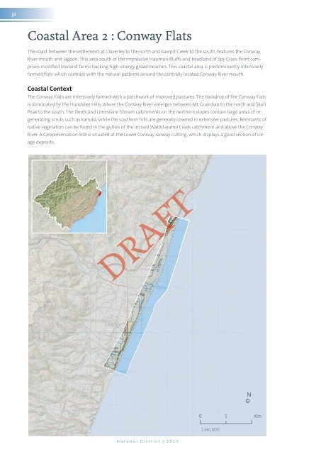
32Coastal Area 2 : Conway FlatsThe coast between the settlement at Claverley to the north and Sawpit Creek to the south, features the ConwayRiver mouth and lagoon. This area south of the impressive Haumuri Bluffs and headland of Spy Glass Point comprisesmodified lowland farms backing high-energy gravel beaches. This coastal area is predominantly intensivelyfarmed flats which contrast with the natural patterns around the centrally located Conway River mouth.Coastal ContextThe Conway Flats are intensively farmed with a patchwork of improved pastures. The backdrop of the Conway Flatsis dominated by the Hundalee Hills, where the Conway River emerges between Mt Guardian to the north and SkullPeak to the south. The Derek and Limestone Stream catchments on the northern slopes contain large areas of regeneratingscrub, such as kanuka, while the southern hills are generally covered in extensive pastures. Remnants ofnative vegetation can be found in the gullies of the incised Waitotaranui Creek catchment and above the ConwayRiver. A Geopreservation Site is situated at the Lower Conway railway cutting, which displays a good section of iceage deposits.AFT° N0 1 Km1:60,000Hurunui District | <strong>2013</strong>