Important Natural Landscapes (Boffa Miskell, 2013)
Important Natural Landscapes (Boffa Miskell, 2013)
Important Natural Landscapes (Boffa Miskell, 2013)
- No tags were found...

Create successful ePaper yourself
Turn your PDF publications into a flip-book with our unique Google optimized e-Paper software.
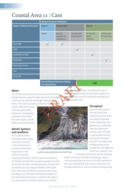
70Coastal Area 11 : Cass<strong>Natural</strong> Character AttributesDegree of <strong>Natural</strong> Character Zone A Zones A & B Zone BWaterAbioticSystems &LandformsPerceptual/experientialTerrestrialBioticSystemsLand Cover& Land UseVery High HighModerate to HighModerateModerate to LowLowVery LowWaterOverall <strong>Natural</strong> Character Ratingfor Coastal AreaThe foreshore of this area consists of narrow sand andshingle beaches covered at high tide which are backedto the west by up to 60 metre high eroding cliffs.Parts of the coast are made up of two tiers of elevatedmarine cliffs and terraces,which are particularlyimpressive. Slumping hasoccurred in the cliffs ofthe lower reaches of KateValley and nearby streams.Abiotic Systemsand LandformThe coastline withinthis area predominantlycomprises sandstonein the hinterland, butan approximately 4kmlong section in thecentre is formed ofunderlying limestone. The Mt. Vulcan rock slide andthe Montserrat earth flow are good examples of earthmovement, the latter one being heavily crevassed withan impressive scarp along its headwall. Both earthflows have been classified as Geopreservation Sites,the latter as an extremely well defined landform ofscientific/educational value. In addition, the coast inthis area contains crab fossils of particular interestHIghin the vicinity of Glenafric. The cliffs each side ofDovedale Stream contain fossils which weather outonto the beach, which has also been identified as aGeopreservation Site.PerceptualSea View and Glenafricare two of the smallsettlements found in theimmediate hinterlandof the coastal area. Thegravel access roads stopnear the settlementsand the coast line itselfis inaccessible from thewest due to the steepsea cliffs. The wider coastof Pegasus Bay can beviewed from the highpointat Mt Cass, located in thehinterland of this area, but the shorelinebelow is obscured. A number of walkways aroundTiromoana Bush provide access from Mt Cass Road tothe coast and Ella Peak with various viewpoints andecological attractions, such as wetlands along the way.DRAFTFTFTHurunui District | <strong>2013</strong>