Comparative analysis of Maritime Spatial Planning ... - Seanergy 2020
Comparative analysis of Maritime Spatial Planning ... - Seanergy 2020
Comparative analysis of Maritime Spatial Planning ... - Seanergy 2020

Create successful ePaper yourself
Turn your PDF publications into a flip-book with our unique Google optimized e-Paper software.
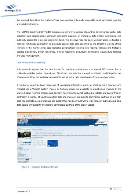
the required data. Once the „cadastre‟ has been updated it is made accessible to all participating partiesand public institutions.The INSPIRE directive (2007/2/EC) represents a driver in a number <strong>of</strong> countries to harmonise spatial datacollection and dissemination, although significant progress on making a data system operational andpublically accessible is not required until 2019. The directive requires each Member State to develop anational web-based application to distribute spatial data sets specified by the Directive, among othersrelevant to the marine zone: oceanographic geographical features, sea regions, habitats and biotopes,species distribution, energy resources, mineral resources, population distribution, aquaculture facilitiesand area management.Data format and accessibilityIt is generally agreed that the best format for maritime spatial data is a layered GIS system that ispublically available and at minimal cost. Significant data sets that are well coordinated and integrated are<strong>of</strong> no use until they are available in a suitable format to the right stakeholders for planning purposes.A number <strong>of</strong> countries have made use <strong>of</strong> web-based interactive maps, for instance both Germany andPortugal use a WebGIS system (Figure 1). Portugal made this available to stakeholders involved in theMarine <strong>Spatial</strong> <strong>Planning</strong> process and Germany has made the portal publically available and barrier free. Incontrast in a number <strong>of</strong> countries certain data are <strong>of</strong>ten only available to commercial partners or at a highcost. For example a comprehensive GIS system that has been built with a wide range <strong>of</strong> publically availabledata sets is only currently available to commercial partners <strong>of</strong> the Crown Estate.Figure 1. Portugal’s WebGIS interfaceDeliverable 2.316 | P a g e