Comparative analysis of Maritime Spatial Planning ... - Seanergy 2020
Comparative analysis of Maritime Spatial Planning ... - Seanergy 2020
Comparative analysis of Maritime Spatial Planning ... - Seanergy 2020
You also want an ePaper? Increase the reach of your titles
YUMPU automatically turns print PDFs into web optimized ePapers that Google loves.
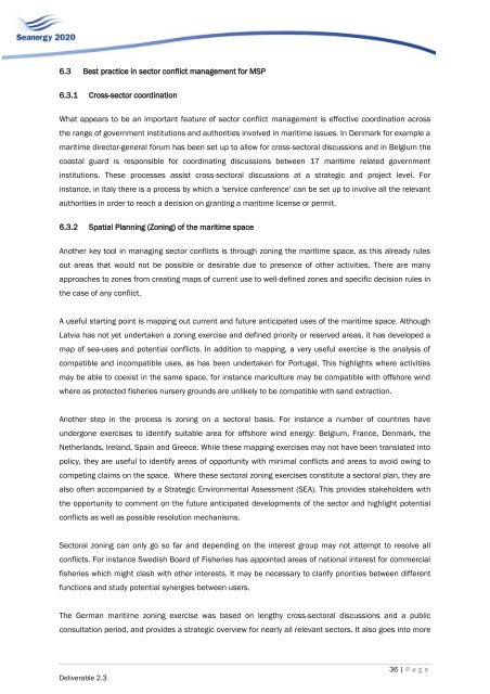
6.3 Best practice in sector conflict management for MSP6.3.1 Cross-sector coordinationWhat appears to be an important feature <strong>of</strong> sector conflict management is effective coordination acrossthe range <strong>of</strong> government institutions and authorities involved in maritime issues. In Denmark for example amaritime director-general forum has been set up to allow for cross-sectoral discussions and in Belgium thecoastal guard is responsible for coordinating discussions between 17 maritime related governmentinstitutions. These processes assist cross-sectoral discussions at a strategic and project level. Forinstance, in Italy there is a process by which a „service conference‟ can be set up to involve all the relevantauthorities in order to reach a decision on granting a maritime license or permit.6.3.2 <strong>Spatial</strong> <strong>Planning</strong> (Zoning) <strong>of</strong> the maritime spaceAnother key tool in managing sector conflicts is through zoning the maritime space, as this already rulesout areas that would not be possible or desirable due to presence <strong>of</strong> other activities. There are manyapproaches to zones from creating maps <strong>of</strong> current use to well-defined zones and specific decision rules inthe case <strong>of</strong> any conflict.A useful starting point is mapping out current and future anticipated uses <strong>of</strong> the maritime space. AlthoughLatvia has not yet undertaken a zoning exercise and defined priority or reserved areas, it has developed amap <strong>of</strong> sea-uses and potential conflicts. In addition to mapping, a very useful exercise is the <strong>analysis</strong> <strong>of</strong>compatible and incompatible uses, as has been undertaken for Portugal. This highlights where activitiesmay be able to coexist in the same space, for instance mariculture may be compatible with <strong>of</strong>fshore windwhere as protected fisheries nursery grounds are unlikely to be compatible with sand extraction.Another step in the process is zoning on a sectoral basis. For instance a number <strong>of</strong> countries haveundergone exercises to identify suitable area for <strong>of</strong>fshore wind energy: Belgium, France, Denmark, theNetherlands, Ireland, Spain and Greece. While these mapping exercises may not have been translated intopolicy, they are useful to identify areas <strong>of</strong> opportunity with minimal conflicts and areas to avoid owing tocompeting claims on the space. Where these sectoral zoning exercises constitute a sectoral plan, they arealso <strong>of</strong>ten accompanied by a Strategic Environmental Assessment (SEA). This provides stakeholders withthe opportunity to comment on the future anticipated developments <strong>of</strong> the sector and highlight potentialconflicts as well as possible resolution mechanisms.Sectoral zoning can only go so far and depending on the interest group may not attempt to resolve allconflicts. For instance Swedish Board <strong>of</strong> Fisheries has appointed areas <strong>of</strong> national interest for commercialfisheries which might clash with other interests. It may be necessary to clarify priorities between differentfunctions and study potential synergies between users.The German maritime zoning exercise was based on lengthy cross-sectoral discussions and a publicconsultation period, and provides a strategic overview for nearly all relevant sectors. It also goes into moreDeliverable 2.336 | P a g e


