Spotlight on Taylor CountyBy: Sybil WillinghamAn arrow head kicked up in a freshlyplowed field is a sudden reminderof the presence of the native peopleswho once lived on the land that is nowTaylor County. It is not hard to imagine thescenes that surrounded them. In some ways,it is much the same today. The fall line thatmarks with a sandy streak that was the seashore divides the county. The northern partis hilly with deep rock formations whilethe southern part is sandy with acrub oakand pine forests. Gopher tortoises burrowin the sand hills. Creeks feed into the FlintRiver and teem with fish. A rare inlandstand of eastern white cedar, exquisitepitcher plants and other rare and endangeredflora and fauna live along the banksof Whitewater Creek and Cedar Creek.When naturalist William Bartram exploredthe area in 1779 he noted the natives that heencountered as well as the plants, animalsand soils of the region.Colonel Benjamin Hawkins wasappointed by George Washington in 1796as Indian agent to all of the tribes east ofthe Mississippi River and South of the OhioRiver. He established a settlement on thenorth side of the Flint River. On the southside of the river was a fort. The combinedarea, called the Agency Reserve, totaled3000 acres and is still visible on the landlot maps as lines drawn at 45-degrees tothe usual land lot north-south orientation.The agency was self-sufficient, with foodplots, orchards, and animal feed lots. Skillsand trades were taught to the Indians. Here,Hawkins entertained travelers, missionariesand tribal leaders. In 1805, the federalgovernment began a road to connect thecities of the east coast with New Orleans.The route, which followed the Lower CreekTrading Path, came through Hawkins’This field of hay promises agood supply of winter feed.Photo by Nancy Payne.agency, crossed the river and headed west.It was called “the federal road” and later theWire Road, for the telegraph wire that wasstrung along the route. The road followspresent day Georgia Highway 208.With more traffic came the desire formore land. The Treaty of Indian Springsceded the area to the government. The Stateof Georgia distributed the newly surveyedland by lottery in 1827. The early settlers ofthe area established small family farms of202 acres. A few plantations later occupiedrich flood plains land along the river andother fertile areas.Churches were soon established bythe faithful. Antioch Baptist Church andCrowell Methodist Church on the northside of the county were founded in the1820s. Other early churches were Bethelneat Butler, and New Hope near Reynolds,and Hays Campground now Union MethodistChurch. Taylor County Camp Groundis the site of an old fashioned camp meetingevery summer. On the grounds are an openair tabernacle, cottages and facilities forthose who come for fellowship and revival.The coming of the railroads broughtmore settlers to the area. Taylor Countywas formed in 1852, taken from parts ofMacon, Marion and Talbot Counties. Itwas named for Mexican War hero PresidentZachary Taylor. Although Reynolds,in the eastern end of the county reservedspace for a county seat, Fifty Mile Stationwas chose because of its central location.It was soon renamed Butler. A fine brickcourthouse was constructed on the squarein the middle of town and served as the seatof local government until 1935 when a new,larger courthouse replaced it. The statelyGreek revival building is the main countyoffice building and courthouse.The residents of Taylor County sawno need to secede from the Union when thequestion came up in 1860. They voted for<strong>AgGeorgia</strong>..Winter 2007
When naturalist William Bartram explored the area in 1779 he noted thenatives that he encountered as well as the plants, animals and soils of the region.the co-operationist delegates to the GeorgiaSecession Convention held in Milledgevillein January of 1861. Never-the-less, whenwar came, they were among the first to volunteerto serve in the Army of the Confederacy.By the time the war ended in April of1865, nearly every able-bodied white manin the county between the ages of 15 and55 had served. Many did not return, buriedin some far-away unknown grave. Most ofthe ones who made it home were missinglimbs or suffered from illness contractedin service. A monument on the courthousesquare was erected in 1911 by the Wallace-Edwards Chapter of the United Daughtersof the Confederacy in memory and honorof the Confederate soldiers from TaylorCounty.As the population grew, communitiessprang up around the county, especiallyclose to the railroads. Once thriving settlements,Charing, Mauk, Rupert, Potterville,and Howard remain as living reminders ofa simpler time. Other communities, likePebble, Fickling Mill, Southland, Crossroadsand Crowell are now only road names.Rural schools were built in the 1930s. Whenthe county schools were consolidated in the1950s, the rural schools were given to clubsformed to accept them for the communities.Of those, only Mauk Schoolhouse isstill owned and used by the club. CrowellSchoolhouse is owned and used by CrowellUnited Methodist Church.A historical marker at the intersectionof the Fall Line Freeway and John B. GordonRoad east of Reynolds tells the story ofBeechwood Plantation. Former ConfederateGenral John B. Gordon who laterserved as Georgia Governor and UnitedStates Senator began acquiring land on theFlint River in 1873. His Beechwood Plantationeventually sprawled to 10,000 acres inTaylor and Macon Counties. Here Gordonexperimented with grafted pecan trees, andraised Texas long horned cattle, paintedponies and goats.A historical markerat the intersection of theFall Line Freewayand John B. Gordon Roadeast of Reynolds tellsthe story of BeechwoodPlantation.Taylor County remains mainly agrarian.Fields of corn, peanuts, soybeans,watermelons and cotton stretch across thesummer landscape. Orchards of peach treesyield their luscious fruit from mid-May tomid-August to be packed and shipped topoints all over the country.Pine trees are planted, harvested andplanted again in a continuing cycle thatproduces pulp for paper and other products.The woods also provide the habitat for wildlife and a profitable sideline for landowners.The population of the county swells duringhunting season as sportsmen pursue thattrophy buck, wild hog or bearded turkey.One thing that western Taylor Countyhas plenty of is sand. It is said that the firstrail car of sand was loaded and sent off as aprank. The young pranksters were surprisedwhen a check came for them in payment forthe sand. This became a successful industrythat has thrived for over 100 years.Silver Dollar Raceway near Reynoldsdraws drag racing fans from all over thesouth-east. Billed as “excitement- a quartermile at a time,” the NHRA quarter mile dragstrip hosts races, car shows and specialevents year-round.Local festivals are great small townfun. The Countryside Festival in Butler inthe fall and the Georgia Strawberry Festivalin Reynolds in the spring are opportunitiesfor local folks to show their good ol’southern hospitality to visitors. But thenthe welcome mat is always out in TaylorCounty where everyone is treated like homefolks. Taylor County today remains mainlyagrarian. Photo by E. Kelly Bond.<strong>AgGeorgia</strong>..Winter 2007
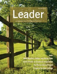
- Page 1 and 2: Inside:Special Annual Report Issue
- Page 3: Table of ContentsThe annual AgGeorg
- Page 7: Fresh Strawberry Cake1st Place Cake
- Page 12 and 13: The Key to YourMortgage FinancingWh
- Page 14 and 15: insured against theft, and where ap
- Page 16 and 17: Cotton:From Field to FabricArticle
- Page 18 and 19: The cotton belt spans the southern
- Page 20 and 21: For each 100 pounds of fiber produc
- Page 22 and 23: 2006 Farm Family of the Year -Broad
- Page 24 and 25: It Was Hogs To Muscadines ForGeorgi
- Page 26 and 27: AgGeorgia Farm Credit -Ag Loans and
- Page 28 and 29: Whether you’re expanding your ope
- Page 30 and 31: AgGeorgia Farm Credit is not only a
- Page 32 and 33: Annual ReportAGGEORGIA FARMAgGeorgi
- Page 34 and 35: Annual ReportAgGeorgia Farm Credit,
- Page 36 and 37: (UNAUDITED)(UNAUDITED)Annual Report
- Page 38 and 39: Annual ReportAgGeorgia Farm Credit,
- Page 40 and 41: Annual ReportAgGeorgia Farm Credit,
- Page 42 and 43: Annual ReportAgGeorgia Farm Credit,
- Page 44 and 45: Annual ReportAgGeorgia Farm Credit,
- Page 46 and 47: Annual ReportAgGeorgia Farm Credit,
- Page 48 and 49: Annual ReportAgGeorgia Farm Credit,
- Page 50 and 51: Annual ReportAgGeorgia Farm Credit,
- Page 52 and 53: Annual ReportAg Georgia Farm Credit
- Page 54 and 55:
Annual ReportAg Georgia Farm Credit
- Page 56 and 57:
Annual ReportAgGeorgia Farm Credit,
- Page 58 and 59:
Annual ReportAgGeorgia Farm Credit,
- Page 60 and 61:
Annual ReportAgGeorgia Farm Credit,
- Page 62 and 63:
Annual ReportAgGeorgia Farm Credit,
- Page 64 and 65:
Annual ReportAgGeorgia Farm Credit,
- Page 66 and 67:
Annual ReportAgGeorgia Farm Credit,
- Page 68:
Office LocationsCartersville1300 Ea