
Create successful ePaper yourself
Turn your PDF publications into a flip-book with our unique Google optimized e-Paper software.
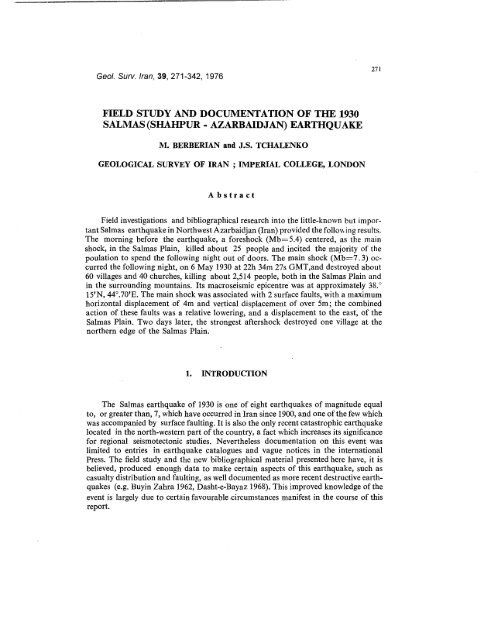
Geol. Surv. Iran, 39, 271-342, 1976271FIELD STUDY AND DOCUMENTATION OF THE 1930SALMAS (SHAHPUR - AZARBAIDJAN) EARTHQUAKEM. BERBERIAN and J.S. TCHALENKOGEOLOGICAL SURVEY OF IRAN ;IMPERIAL COLLEGE, LONDONAbstractField investigations and bibliographical research into the little-known but importantSalmas earthquake in Northwest Azarbaidjan (Iran) provided the follox~ ing results.The morning before the earthquake, a foreshock (Mb=5.4) centered, as the mainshock, in the Salmas Plain, killed about 25 people and incited the majority of thepoulation to spend the following night out of doors. The main shock (Mb=7.3) occurredthe following night, on 6 May 1930 at 22h 34m 27s GMT,an destroyed about60 villages and 40 churches, killing about 2,514 people, both in the Salmas Plain andin ° the surrounding mountains. Its macroseismic epicentre was at approximately 38.15’N, 44°.70’E. The main shock was associated with 2 surface faults, with a maximumhorizontal displacement of 4m and vertical displacement of over 5m; the combinedaction of these faults was a relative lowering, and a dislplacement to the east, of theSalmas Plain. Two days later, the strongest aftershock destroyed one village at thenorthern edge of the Salmas Plain.1. INTRODUCTIONThe Salmas earthquake of 1930 is one of eight earthquakes of magnitude equalto, or greater than, 7, which have occurred in/ran since 1900, and one of the few whichwas accompanied by surface faulting. It is also the only recent catastrophic earthquakelocated in the north-western part of the country, a fact which increases its significancefor regional seismotectonic studies. Nevertheless documentation on this event waslimited to entries in earthquake catalogues and vague notices in the internationalPress. The field study and the new bibliographical material presented here have, it isbelieved, produced enough data to make certain aspects of this earthquake, such ascasualty distribution and faulting, as well documented as more recent destructive earthquakes(e.g. Buyin Zahra 1962, Dasht-e-Bayaz 1968). This improved knowledge of theevent is largely due to certain favourable.circumstances :manifest in the course of thisreport.
272 BERBERIAN AND TCHALENKOThe aim of this report is restricted to a presentation of observations collected onthe earthquake and its immediate effects. No attempt is made to interpret this information,either in terms of the seismicity (historical or modern), or in terms of theregional tectonics, since very little is known, and even less published, On these subjects.The geological mapping of the region, for example, is in progress.The Salmas Plain, the epicentral region of the earthquake, is located to the northwestof Lake Rezaiyeh, and has an area of-about 300kin2 (Fig. 1 and 3). It lies betweenabout 1500m (N,W and S borders) and 1280m, the latter being the average level of thelake which forms its eastern border. The plain is watered by the Zola Chay, which isthe mainstay of its agricultural prosperity. The most important villages are concentratedin the southwest, and many, such as Kohneh Shahr (replaced after the earthquake byTazeh Shahr), were of considerable antiquity (Minorsky,1931).The plain was populatedby Christians of the Gregorian, Nestorian and Chaldean sects from a very early date(S. Hovanes in Ghezelja is thought to have been built in 1007), and at the time of theearthquake, 15 of its villages were either exclusively or partly inhabited by them.The town of Dilman (or Dilmaghan, renamed Shahpur after the earthquake), andvillages in the north and east, had, however, mainly Turkish and Kurdish inhabitants.The mountains bordering the Salmas Plain are much more sparsely populated,mainly by Kurdish people. The highest summit, the Haravil Daghi, is located in thewest on the Turkish frontier; it is a volcano which fed the many Quaternary basaltflows forming the high plateaux between the Dowshivan Su and the Zola Chay (Fig. 3).The much lower Miocene hills in the north, and the metamorphic mountains in thesouth, separate the Salmas Plain respectively from the Khoy and the Rezaiyeh Plains.The mountain villages are small, isolated from each other and from the Plain, and livenearly entirely from wheat cultivation and cattle farming.The method we used in this investigation was to visit each village, graduallydefining the epicentral region, observing ground deformations and ruins of the earthquake,which were often little changed since 1930. In each village as many survivorsas possible were interviewed in their native dialect, i.e. Armenian, Assyrian, Turkish,Kurdish and Farsi. New bibliographical material in the form of newspaper-reportsand private correspondence was used to check and supplement the field results.2.1. General.2. FORESHOCKA moderately strong foreshock, of estimated magnitude Mb---- 5.4 (Karnik, 1969),occurred on 6 May 1930 at 07 h 03m 26s GMT, i.e. about 15½ hours before the mainshock. It caused destruction and some casualties in a small region centered around38 °. 15’N, 44°.75’E, corresponding approximately to the future macroseismic epicentreof the main shock. The foreshock was perceptibl e throughout northwestern Azarbaidjanand southeastern Turkey, and was clearly felt by most inhabitants of the three nearesttowns, Tabriz, Rezaiyeh and Khoy, as well as in Bonab and Maragheh. A large partof the population in the epicentral region spent the night following the foreshock outof doors, and was thus saved when the main shock occurred.
U S S R~ ’~; ~J.U LFAS. Stephanos~" ~ \ ~3RDUBADI/ QUoTUR)KHOYoo38o BA HKALEH5HARAFKHANEHo ]-ABRIZTU JR K E Yo;SahandCMARAGHEH°BONAB37°MIANDUAB°SAUJ BUL,I R A K.~ R A N100 KmFig.1. EpicentraI regions, earthquake ~’aults and main aftershocks.Epicentrai-regions of 6 )~ay 1930 foreshock and main shock arc shaded rcspectively withcross-hatching and vcrtical "hatching. Fault brcacks are shown with.thick black hnelnstrumental epiccntres of main aftcrshocks (see Table 3) are shown’with dots, largest dotM>~ 6, inter~nediatc 5 ~3[-
274 BERBERIAN AND TCHALENKO2.2. Casualties and destruction.The effect of the foreshock on the villages, mainly of adobe construction, is summarizedin Fig. 2. As the event occurred at about 10 a.m. local time, many people wereout, or could escape quickly from their houses, and as a result the number of casualtieswas relatively low.Four localities, Haftavan, Dilman, Kuche Mashk and Kalashan, were severelydamaged and had casualties. In Haftavan, some houses collapsed completely, and orewoman and one child were killed by. a falling wall. The roof of S. Thadeus, a lary, emasonry and kiln-brick church west of Haflavan, collapsed. In Dilman, many houseswere badly damaged, and between 15 and 20 people were killed (Tabriz 8 May, Haratc:h22 and 23 May). In Kuch6 Mashk and Kalashan nearly all the houses were damaged,and one person was killed in each village. This region of maximum destruction is centeredin the region of S. Thadeus, which may be taken as the approximate macroseismicepicentre of the foreshock.In the surrounding villages of Kohneh Shahr, Patehvir, Sarnaq and Payajuk, afew buildings collapsed partially, and most other were fissured. In Kohneh Shahr,damage was said to have been more severe (Tabriz 8 May), but the subsequent departurefrom the village of many of its original inhabitants made it impossible to verifythis information. In other villages such as Malham, Uleh, Khosrova, Drishik, Moghanjik,Sadaghian and Hamzehkandi, most houses were fissured. Further away fro~aathe epicentral region, in Habashi, Akht6khaneh, Yavshanli, Khantakhti, Tamar, Ayanand Senji, only a few isolated walls were fissured.In all the villages mentioned above, and in a few others nearby, the foreshockwas felt strongly enough for most of the inhabitants (with the exception of those ofMalham) to decide to spend the following night out of doors (see Table 1). Outsidethis region however, and especially in the mountains to the north and west, the shockwas felt too lightly to worry the population, which consequently spent the night indoorsand suffered a large number of casualties when the main shock occurred at aboat01.30 a.m. local time. The villages where the foreshock was not felt or heeded wereShekar Yazi, Kanyan, Sheydan, Guladar, Ashnak, Kuzehrash, Kashkavich audAslanik. In the extreme northwest, the shock was apparently not felt by anyone inH ablaran and Borushqalan.3.1. General3. MAIN SHOCKThe main shock occurred during the night which followed the foreshock, on 6May 1930 at 22h 34m 27s GMT (or 7 May 1930 at 01h 34m 27s local time). Its magnitudewas given as 7.2 (Gutenberg and Richter 1954), or 7.4 (B.C.I.S.). About 60 villa[’,eslocated in the Salmas Plain and in the surrounding mountains were destroyed, a:adFig. 2. (Facing page) Foreshock of 6 May 1930. Black circle: severe destruction and fatalities; halfblack circle :some buildings collapsed; circle with diameter: most buildings fissured; bhmkcircle: foreshock not heeded or not felt. The approximate macroseismic epicentrewasS. Thadeus church which was partly destroyed. Heights in metres.
I3a252635
IRA~IANeURBANHOWOAR nSAILABYENGIJEH =~38.25eAQZIARATZOLA
1930SALMAS EARTHQUAKE 275about 40 churches were destroyed or damaged (Tables 1 and 2). Casualties, which occurrednearly exclusively amongst the section of the population which had not heededthe foreshock, amounted to about 2,514 killed (Table 1). Two surface faults were formedwith the earthquake: the first, oriented NW-SE and located at the southern edgeof the Salmas Plain, was about 20km long and displayed a maximum right-lateral movementof 4m and a maximum vertical throw (NE down) of about 5m; the second,oriented NE-SW and located in the western mountains, was over 3km long, leftlateral,and had a vertical throw (NW down) of about lm. A recent recalculationlocated the instrumental epicentre at 38°.22’N, 44°.66’E (Nabavi 1972), which isclose agreement with the centre of the region of maximum destruction (macroseismicepicentre), found in this study to be approximately 38 °. 15’N, 44°.70’E. Hence foreshockand main shock had, to a first approximation, nearly identical epicentres.Outside the epicentral region, Khoy, Qutur, and Sharafkhaneh were slightlydamaged. In Tabriz, the shock caused panic, and part of the population fled the town.In the north, it was felt with intensities between 4 and 6 bals in Julfa (Medvedev, 1953),Nakhichevan, Ordubad, and was even reported as felt in Leninakan and Tiflis. NearJulfa (North Iran), the eastern wall of S.Stephanos developed a vertical central crack(Fig. 4), probably as a result of unequal foundation settlement. In the west the shockwas felt in Bashkaleh and as far as Van in Turkey, and in the south as far as SavejBulaq (Mahabad).3.2. Eyewitness account,The main shock was witnessed by Abel Zayia, a Persian Lazarist of the FrenchMission in Rezaiyeh to investigate the damage in Salmas. The account given refers tothe effects as felt in the southeastern part of the epicentral region, at a point on theRezaiyeh-Dilman road just north of the present-day village of Aliabad, and southof the isolated mountain (marked 1628 in Figs. 2 and 3) which contains a well-knownSassanian bas-relief. The extracts which follow are translated from the French by thepresent authors."At half-past one in the morning we were just in front of the Suratis mountain(bas-relief), one of the car’s headlights broke-down and the driver got out to repairit. Suddenly I felt the car shake and thrown-upwards; it was projected from south tonorth and displaced by 50 cm (Zayia 1930b, is more precise:" it (the car) was projected50cm sideways"). The driver was thrown down onto the ground" (Zayia, 1930a). "Thedriver was lying on the road. I thought that the car was out of control and instinctivelyreached for the brake and ignition key, when I heard a terrible noise: it was the rocksrolling down from the mountain. I quickly got out of the car, but what difficulty toremain standing! Not being able to advance, or go back, we waited for two hours;I looked upwards to see the apparition of the sign of the Son of Man. During this timeFig. 3. (Facing Page) Main shock of 6 May 1930.Village destruction estimated at:$ 75-100% O 25-75°,/o O 0-25°/o O 0°/o * no information avuilabl~Damage to churches:~ destroyed ~ partly destroyed ~ fissured ~,an.damaged"r church destroyed before 1930-- fault-break gchanged thermal spring ...... rockfalllandslide or rockslide w = waterlogging d = springs decreased i = springs increasedHT Haftavan Tepe, DT Drishik Tepe. New (post-1930) villages shown as squares. Heights ilx meters.
276 BERBERIAN AND TCHALENKOTable 1 - :DAMAGE AND CASUALTIES CAUSED BY TIlls3 MAIN SIIOCKAll information was obtained by field survey in 1973, except ST (SamsonTateossian in Itaratch 31 May 1930) ~md AZ (Abel Zayia in Zayia, 1930a,b).Villag e ~ ~ Ear~liquakc ])amagc ~RemarksAkhianAkhtckhanehAlibolaghAqbarzchAqziaratAshnakAslanikAyanBajergehBalghazanBardianBorushqalanBostakabadChahar-SutunChahriq.ChichakDerikDikchDilmanDishivauDrishikGMvanGavilanGhabrabadGhalasarGhdrabaghG tmr a qeshlaghGhezeljaGhezclkandiGonieh11012011027090504020012027018018000i40792400village destroyed ;church standingdestroyeda.bout 50°//0 destroyed,~bout 10°//0 collapseddestroyedcompletely destroyedabout 50(~o collapsednot damagedabout 10°,/o eollapsedslightly damageddestroyedlightly damagedabout 6 °/o collapsedabout 75°/0 collapsedabout 500/0 collapsedvillage destroyed;church mostly collapsednot damagedcompletely destroyedslightly damagedcompletely destroyedslightly damagedcompletely destroygdvillage destroyed;church partly collapsed~bout 30% collapsed;church undamaged1650 slight dajna~e~420 village destroyed;church standing40 about 50% destroyednot .damaged1000170041525011000132not inhabited in19307~nost slept outmost slept outmost slept inmost slept inmost slept outmost slept inmost slept outmost slept outmost slept outmore slept outthan innot inhabited in1930(A.Z)most slept outno* inhabited in1930(A.Z.)most sleptout3 most slep~ ou~0 most slept out3 many slep:~ out
1930 SALMAS EARTHQUAKE 277’continued)Village Ekrthquake ])amage ~cmarksGubaGuladarGulan ,G~lizanGuzikHabashiHablaranHaftavanHNi JafanHamzeh KandiHanikHagviranHasbashiHosseinabadHowdarIssy SuKahrizKaleshanKanyanKashkavichKhandq.ahKhantakhtiKhorkhoraKhosrowaKohneh ShahrKuche MashkKurdranKuzerashLashkaranMarl K~ndiMMhamM~maqanMasdaqanMinasMingolMoghanjikNazirabad1203090~.6909~54090330about 25% collapsedcmnpletely destroyeda few houses collapseddestroyeddestroyed.destroyeddestroyeddestroyed,, including 3of 4 churchesnot damagedcompletelydamageddestroyeddestroyednot damaged360 mostly destroyedlight damage5O180destroyedcompletely destroyed600 very.little damage120 about 15% collapsed?18040280destroyeddestroyeddestroyed,churchesincluding 722902104Odestroyed,churchescompletelydestroyedincludingdestroyed5destroyed~20 destroyedno information327 completely destroyed,including 3 churches6OO destroyednot destroyeddestroyed12018001305% collapsedcompletelycompletelydestroyeddestroyed0 most slept out6 most slpet in032 most slept out35 most slept in4 all slept out (ST016 most slept out2?0not inhaMted in19300~ ?1 some .slept in19 many slept out0 most slept in2 most slept in0 most slept out234 most slept out(ST, AZ)most slept out0 most slept out335 most slept in0 most slept out48 most slept in (ST)85 most slept in0 most slept out2 most slcpt in75 many slept out30 about 60(/o sleptout
278 BERBERIAN AND TCHALENKOecontinued)Village Earthquake Damage RemarksPatehvirPayajukSadaghianSailabSaramerikSarmanava$arnaqSavran~en.jiShekar YaziSheydanSheytanavaShivehShiveh DarrohShurgelShurikSiavanSidanSoltan AhmedSowfiabadSutunrashTamarUlehUrbanVardanYavshanluYengijehZaviehjukZindashtZola113 destroyed,churches including130 destroyed,churchincluding1050 completely destroyed600 partly destroyed960 completely destroyed170 partly destroyed180 village destroyed;churchlapsedmostly col626 completel destroyed;including 2 churches120 completely destroyed960 little damaged90 about 80% destroyed0not damagednot damaged330 about 30% collapsedmoderately damagedlightly damagednot damaged1200 about 20% of tim housescollapsed60 destroyed0660 complete.ly destroyed1200 completely destroyed390? ~noderately damaged480 destroyed420 moderately damaged,many houses standing110 completely destroyed240 destroyed; 1 churchunda~nagedlightly damaged70 destroyed116O1828181512l0111521202501810many slept out(ST, AZ)most slept out(ST)about 50~o sleptoutmost slept outmost slept inmost slept inmost slept outmost slept out(ST)most slept outmost slept inmost slept innot inh,~bitcd1930inmost sleptmost sleptoutoutnot inhabited1930inmost slept outmost slept outmost slept inmost slept outmost sleptoutabout 50% slop1out
1930 SALMAS EARTHQUAKE 279there were seven formidable shocks and more than one thousand weaker ones" (Zayia,1930b).3.3. Casualties and destructionIn 1973 over 60 villages of the epicentral region were studied in the field, andin most of them survivors of the earthquake could be found and irtterviewed. A limitedamount of information was also compiled from existing contemporary accounts andnewspaper reports. The results of this investigation are summarized in figure 3 andTables 1 and 2, and are described in more detail below.Fig. 4.S.Stephanos near Julfa. Located over 100km to the northeast of the epicentral region, theeastern wall of this 16th century church developed a vertical fissure from apex to ground level,probably as a result of uneven foundation settlement.
280 BERBERIAN AND TCHALENKOTab.]e 2 - :EARTHQUAKE DAMAG~ TO .CHURCH]~SN.B. Dates of several churches have not yet been confirmed.Village Church. , Date TypeAkhtekhanehAsdvadzadzin1342, re~. 1891rough stone masonry &. ~:ilnbrick; 3 domesAslanikAyanSarkisAsdvad ~zadzin1886178}sun-driedbrickDerikDrishikGhalasarGharabaghGhezeljaGulizanH aftavanAsdvadzazinSarkisSarkisGevorkHovanesBoghps PetrosSarkisAssyrian ,,Gevork14th century140018061784~1007913th centuryrough stone masonrystone masonry; domedrough stone masonryrough stone masonrystone masonrychapel; stone masonry?sun-dried brickstone masonry; domedBoghoskiln brick;domedAsdvadzazin13thcenturysun-driedbrickThadeus!3th.centurysun-driedbrickHaqviranHodarChahriq(Jarai)SarkisGevork’ Assyrian "1203rough stone masonrY; " woo:den " roof.rough stone masonry; barrelvault roofKalashanHovanessun-dried brick;. " woollen "roofKhosrovaS~rkisGivargisMar ZayaLiba GhuchaIshuBrashemoilMaryMar Yosseb1717sun-dried brick;. ".wooden"roofstone masonrykiln brickkiln brickchapel; sun-dried brick (open)chapel; stone masonrykiln brick
1930 SALMAS EARTGQUAKE 281Approx.dimension}~ffect of earthquake Present state Presen~ population9 × 17 fissuredas in 1930Turkdestroyed before 1930Kurd10 × 1616 × 2410 ’× 1811 × 15roof collapsedbefore 1930mostly collapsepart collapsepart collapseundamagedas in ,~1930(walls standing)as inas inas inas in1930193019301930KurdKurdTurkTurkTurk& Turk10 × 1514. × 22fissureddestroyeddestroyeddestroyedfissured; dome. collapsgd ¯destroyeddestroyed¯destroyed¯destroyed, before 1930destroyed before 1930partly destroyedbefore 1930roof collapsed"as inrebuiltrepaired1930rebuilt in ad.oberebuiltas in 1930in new styleas in 1930,¯ (walls stan~i~g~as in 1930TurkTurkTurk & Kurd &ArmenianTurk & Kurd &ArmenianTurk & Kurd &ArmenianTurk ~ Kurd &ArmenianKurdKurdoKurdK~rd10 × 177 × 1215 x 2510 × 1415 × 20destroyeddestroYedpart collapsedestroyeddestroyedas in 1930 (! wallstands)rebuilt in 1967(in same style)as in 1930rebuilt in .new stylerebuilt in same styleTurkAssyrian,Turk & KurdAssyrian, Turk & KurdAssyrian, Turk & Kurd¯ Assyrian, Turk & Kurddestroyeddestroyed,destroyedrebuiltas in 1930as in 1930Assyrian,Assyrian,Assyrian,Turk & KurdTurk & KurdTurk & Kurd
282 BERBERIAN AND TCHALENKOVillage Church ~ Date TypeKapbk(Kiabik)Asdvadzadzin" wooden " roofKohneh ShahrHagopSarkisHovan~sVararMar Ghoryagh167116711825stone masonry;roof?stone masonrysun-driedbrick" wooden"MalhamZoravar1641stonemasonryGevorkVartan17111724sun-dried brick; fiatsun-dried brick; flatroofroofPatehvirMar YaghuMar YukhanastonemasonryPayajukGevork1751~t0ne m/tsqnry;domedSarmalek "(Sanamcrik)Sarkis1758stmle,masonrySarmanava .rough stone masonry:roo][ woodelI ""SarnaqAsdvadzadzin1625stone maso~i_rySavran(Sureh)Mar KhinahHovanesHovanesMat Mariam12~osun-dri6droofbridk; "sun-rifle0 brickstonestonemasonrymasonrySheytanavaAsdvadzadzin1768~ WO0(]~ roofUleh ’Sarkis" Assyrian "sun-dried brick; " woodea "roofsun-dried brick; domedVardanAsdvadzadzinsun-driedbrick; fiat roofZavichjukPrisha~d.(HazaraPergich)Itovanes189.27sun-driedsun-driedbrick; flat roofbrick
1930 SALMAS EARTGQUAKE 283Approx.dimensionEffeetof earthquakePresent statePresent populationdestroyed before 1930Kurddestroyedrebuiltas a chapelTurk & Kurddestroy eddestroyeddestro.yeddestroyedbefore 1930as in 1930as in 1930rebuiltTurk & KurdTurk & KurdTurk & KurdTurk & Kurd16 × 209 × 147 × 12destroyeddestroyeddestroyedas in 1930 (2 wallsstanding)rebuilt same stylerebuilt in same styleArmenianArmenianArmenian& Kurd& Kurd& Kurd10 × 20destroyeddestroyedin 1918by Turksrebuiltat new locationAssyrianAssyrian& Kurd& Kurd13 × 21destroyedas in 1930Armenian& Turkdestroyeda,s in 1930Turk7 × 17undamagedas in 1930Kurd12 N 2010× 13part collapsepart collapseas in 1930 (3 wallsstanding)repairedTurkTurkdestroyedas in 1930Turk14 × 17destroyedas in 1930Turlwdestroyedrebuiltbrickin san-driedTurkdestroyedas in 1930uninhabiteddestroyedas in 1930Kurddestroyedas in 1930Kurdpart collapse before1930Turk8×10und amagt,das in 1930Kurd & Turkdestroyedas in 1930Kurd & Turk
284 BERBERIAN AND TCHALENKOTwo peculiarities distinguish this earthquake from most other recent destructiveearthquakes in the Middle or Near East. First, as the foreshock was felt and heededby some but not all of the inhabitants, the geographical casualty distribution wasnot a reliable reflection of the local shaking intensity. Thus, casualties were low or nilin some villages near the epicentre which were completely destroyed but in which tilepopulation had slept out of doors; conversely, casualties were relatively high in somevillages near the periphery of the epicentral region where the inhabitants had sleptindoors. Second, on the Salmas Plain there were a number of churches~ which, ewmthough not all of uniform construction, were nevertheless much more resistant thanFig. 5. Site of Khosrova. The destroyed village photographed in 1973.
1930SALMAS EARTHQUAKE 285the usual adobe house. Many of these churches can be seen today in the same conditionas after the earthquake, and they provide a unique means of assessing the severityof the shock near the epicentre.The effect of the earthquake on the villages of the Salmas Plain is described first,followed by a description of the mountain villages and the isolated pocket of damagenear Mamaqan south of the epicentral region.a) Salmas Plain.The region of maximum destruction, located in the southwestern part of the SalmasPlain, is approximately contained in an imaginary triangle with apexes at KohnehFig. 6. S. Givargis (Khosrova). The only one of 20 churches which remained standing in the regionof maximum destruction. Western facade.
286 BERBERIAN AND TCHALENKOShahr, Payajuk and Zaviehjuk (Fig. 3). Here all the houses were levelled to the ground(Fig. 5). The most intense destruction probably occurred near the Kohneh Shahr apexwhere all but one of the 20 churches in the villages of Kohneh Shahr, Savra, Khosrova,Uleh, Malham, Gulizan and Patehvir were destroyed. The exception was Mar Givargisin Khosrova, a large, masonry structure with walls built in the traditional style, i.e.about 1.25m thick, with an outer layer of hewn stone, an inner layer of rough stone andgood cement mortar. The 4 inner pillars and the vaulted roof collapsed, but most ofthe walls, excepting the corners of the building, remained standing (Fig. 6). In Malham,which, with Saramerik, was the only Christian village where most of the inhabitantsFig, 7. S. Zoravar (Malham), Exterior of the southern wall. The eastern wall remained partly ~tandingbut the rest of the building collapsed.
1930SALMAS EARTHQUAKE 287slept indoors and consequently suffered a large number of casualties (see Table),the southern and eastern walls of S. Zoravar (a building similar to Mar Givargis) remainedpartly standing, but the rest of the church collapsed (Fig. 7). All the otherchurches, which included at least 6 masonry and 3 kiln-brick constructions, weretotally destroyed (Figs. 8 to 13). The medieval Miri-Khatun brick tower and the greatmosque of Kohneh Shahr were also destroyed.Fig.8. S.Hovanes (Savra). The church destroyed by the earthquake. Looking northeast.
288 BERBERIAN AND TCHALENKOThe intensity of ground motion in this region of maximum destruction is alsoindicated by the displacement of tombstones in the cemeteries of Khosrova, Haftavanand Malham. These tombstones, sculpted in the local basalt, are generally made oftwo separate pieces, a horizontal slab about 30cm thick and 80 x 185cm in pl.~n,placed on the ground above the grave, and a solid block about 66 cm high and 60 × 160cm in plan, placed on the slab (Fig. 14). The slabs are partly sunk into the grouad,but it is impossible to ascertain so many years after the event whether they movedFig. 9. Liba Ghucha Ishu (Khosrova). Western facade of the church which was destroyed b:g theearthquake and later rebuilt.
1930SALMAS EARTHQUAKE 289relatively to the ground during the earthquake. The upper block however, in mostcases, moved from its original position on the slab. In the Khosrova cemetery, 183cases of movement (about a third of the tombstones) were clear enough to be measured:they showed 104 rotations (74 anti-clockwise and 30 clockwise), 55 N-S translations(40 to the N, 15 to the S) and 28 E-W translations (23 to the E, 5 to the W). Asof the cases of rotation did not seem to be accompanied by any E-W translation, theywere probably due to a N-S or S-N sliding with unequal friction at the slab-rock inter-Fig. 10. S. Sarkis (Uleh). The church destroyed by the earthqua~
290 BERBERIAN AND TCHALENKOface. Examples of tombstone movement are given in figure 15 and their locations areshown in figure 17. A number of tombstones (not included in the above account) werealso tilted sideways, generally to the N or the S and often without any visible displacementof the block on its slab, probably as a result of foundation failure under the slab.The Khosrova cemetery is located about 4km from the earthquake fault, the latterbeing oriented NW-SE and of right-lateral displacement with the NE side downthrown.By an unusual coincidence, Zayia, the eyewitness of the main shock, not only observedthe displaced tombstones in Khosrova the morning after the earthquake, but actuallyFig. 11. $. Vartan (near Mallaam). The church was destroyed by the earthquake and later rebuiltcompletely.
1930 SALMAS EARTHQUAKE 291saw them move again during the principal aftershock of 8 May. "You know the tombstoneof M.Darnis, one of the most massive of all the cemetery; it measures about 2min length, 0.60m in width and 0.75m in height.Well, this enormous stone was projectedabout 0.50m from the south to the north; it is no longer on the grave. The same happenedto most of the other tombstones" (Zayia, 1930b). "Thursday evening at about6 pm, 1 was sitting on Mr. Badul’s tombstone in the (Khosrova) cemetery and wasreciting the rosary to replace the breviary which I hadn’t been able to say, when Ifelt myself being lifted; all the other tombstones creaked. I didn’t even get up butFig. 12.Mar Yaghu (Patehvir), The church, located in the region of maximum destruction,collapsed completely.
292 BERBERIAN AND TCHALENKOSAVRAN S. HovanesKHQSROWA Mar GivargisMALHAM S. ZoravatSAVRAN Mat MariamMALHAM S. Gevork/ \/HAFTAVAN S. GevorkKHOSROWA Liba Ghucha IshuN~KHO SROWA S, SarkisMALHAbi S. Vartan0 1 5 10 15 20 25 33DRISHIK S. SarkisGHARABAGH S. GevorkSARNAO, S. AsvadzazirGHALASAR S. Sat kisGHEZELJA S. HovanesSARNAQ Mar Khin~hPAYAJUK S. GevorkAKHTEKHANEH S. Asvad, z~zinZAVIEJUK S. PrishadFig. 13. Earthquake damage to churches in the Salmas Plain. Features shown in black collapsedduring the earthquake. Ground plans are schematic. See also Table 2 and Kleiss (1969).
1930SALMAS EAR.THQUAKE 293watched the other tombstones being lifted: by about 3cm. The Resurrection of the Deadcame into my mind and onto my lips" (Zayia 1930a).The Malham cemetery,which is crossed by the earthquake fault, contains onlya few tombstones of the type described above, the majority being made of a single piece.Of the few that could be measured, several cases of translation were observed in whichthe upper block was moved in the same direction as the fault side on which it waslocated, i.e. to the E on the north side of the fault, and to the W on the south side ofthe fault (Figs. 16 and 18).13.5 159Fig. 14. Tombstone in Khosrova cemetery. Ground plan and elevation. Dimensions are given in em.
294 BERBERIAN AND TCHALENKOSeveral independent witnesses amongst the survivors of the earthquake, as wellas contemporary written accounts, related that, in the region of maximum destruction,the first shock was felt as an upward motion, and that this was followed immediw;elyby a horizontal shock from W to E and then by another from E to W. In many churches,we observed that the central pillars or colunms and the western facade collapsedtowards the west. Likewise, in many of the less damaged churches in the region eastof the epicentre (described below) only the western wall collapsed, and this al~aysFig. 15. Tombstones in Khosrova cemetery. Examples of lranslation (left) and rotation (right) ofupper block with respect to the base. Note some tilted tombstones in the b ackground.
1930 SALMAS EARTHQUAKE 295to the west. However, as the eastern end of the these churches is usually formed byone or three apses, it is the most resistant regardless of the direction of strong groundmotion. Similar observations must first be obtained from other earthquakes beforeconclusions may be drawn.In the Salmas Plain east of the region described above, but still in the KohnehShahr-Payajuk-Zaviehjuk triangle, the destruction was nearly as severe. In Dilman,the largest settlement of the whole region, it was estimated that about 1,I00 of the18,000 inhabitants were killed, probably including a large number of those who sleptFig. 16. Tombstones in Malham cemetery. Examples of displacement of the upper block with respectto the base.
kFig. 17. Displaced tombsones in Khosrova cemetery. Sketch- plan showing approximate lo:ationof displaced tombstones. Arrows indicate movement of upper block with respect to groundslab; tilted tombstones shown with geological dip symbol. Juxtaposed symbols describeoverall displacement of single tombstones. Tombstones showing no movement, or ambiguouscases, are omitted. Width of cemetery is approximately 150m.
1930 SALMAS EATHQUAKE 297indoors. However, these casualty figures are unreliable, due to problems arising fromthe size of the town; in smaller villages people could remember, sometimes by name,all those who died, while in the larger centres of Dilman and, to a lesser extent, KohnehShahr, the survivors found it difficult to comprehend the catastrophe.All the buildings in the town of Dilman, including the large Agha Mosque, weredestroyed, with the exception of two newly built houses which were still standing, eventhough severely damaged. The town was subsequently rebuilt west of the ruins andrenamed Shahpur. The other villages in the region of maximum destruction not describedso far were Haftavan, Sarnaq, Drishik, Kuch6 Mashk, Kalashan, Zaviehjuk andPayajuk. In Haftavan, two of the three churches were destroyed, the survivor beingNl-ig. 18. Displaced tombstones in Malham cemetery. Only a small number of the tombstones wereof the ’block on slab" type. Symbols are as for Fig.17. Dashed line is approximate boundaryof cemetery which measures about 75m in the N-S direction. Shaded line is earthquake faultscarp with displacement in metres (U; up, D: down).
298 BERBERIAN AND TCHALENKOthe 13th century church of S.Gevork. The central dome of this massive constructioacollapsed and the eastern facade developed diagonal fissures, but otherwise the buildingwas intact (Fig. 19). The nearby school and assembly hall, built in kiln-brick withstone foundation, collapsed (Fig. 20). In Sarnaq, the masonry church of S. Asdvadzadzinpartly survived even though its roof collapsed and thrcc of the four centralpillars and the western facade fell to the west (Fig. 21). A similar church in Drishi?~,S.Sarkis, suffered much the same type of damage (Fig. 22), and the adobe churchKalashan was destroyed, save one wall which remained partly standing (Fig. 23).Fig. 19.S. Gevork (Haftavan). The 13th century church survived the earthquake with minimaldamage. Central aisle, looking east.
1930 SALMAS EARTHQUAKE 299Zaviehjuk is of particular interest as it is situated on the fault at the southern edgeof the Salmas Plain.The village, and the adobe church o f S.Hovanes, were destroyed,but the adobe chapel of S. Prishad remained intact (Fig. 24). The latter is situatedrock, about 500m west of the village and at about the same distance south of the fault.In plan it is nearly square (8 × 10m), and its flat roof is made of poplar beams coveredwith a mud/straw mixture. The only effect of the earthquake that could be detectedwas that the four treetrunk pillars supporting the roof were leaning by about 3 ° to theeast, contrary to the damaged churches north of the fault which were generally leaning,Fgi. 20. Assembly Hall in Haftavan.The ruined wall in the foreground remains from the time of theearthquake. The other wails were rebuilt but the building was not completed.
300 BERBERIAN AND TCHALENKOor had collapsed, to the west. The survival of this building located nearly on the fauiltmay be attributed in part to the fact that it was a compact, quasi-cubic structure, buitton rock and near the southeastern limit of destruction. Even though this does notexplain entirely its exceptional resistance, it does place S. Prishad in the same categoryas other undamaged structures located on, or very near, other earthquake faults(Medvedev, 1953).In Payajuk, about 3km due east of Dilman, destruction was still very severe, killingthe only three inhabitants who slept indoors. The stone masonry church of 1t.Fig. 21. S. Asdvadzadzin (Sarnaq). Eastern wall of the church, which partly survived the earthqt~ake.
1930SALMAS EARTHQUAKE 301Gevork was levelled to the ground, as was the nearby house of the Armenian writerand poet Raft (Figs, 25a). The new village was relocated to the south.The other villages destroyed in the Salmas Plain but located outside the triangleof maximum destruction (Kohneh Shahr-Payajuk-Zaviehjuk) were Moghanjik andSaramerik in the north, Sadaghian, Hamzekhandi, Habashi, Ghezelja, Ghalasar andAtht6khaneh in the east, Minas, Khantakhti and Tamar in the southeast. All thesevillages were destroyed and suffered casualties, but the state of the three masonrychurches of the region in Ghalasar, Akht6khaneh and Ghezelja indicated that theFig. 22. S. Sarkis (Drishik). Eastern apse seen from interior of ruined church. The western facade andmost of the northern wall were completely destroyed.
302 BERBERIAN AND TCHALENKOshaking was here probably less severe. In Ghalasar, the roof of S.Sarkis partly collapsedand the northern wall fell to the north, but the other walls survived at their full height(Fig. 26). This collapse towards the north, also observed for the small parapet wallsurrounding the roof of the church, is exceptional, and may be compared to the dominantnorthward displacement of the tombstones in Khosrova and the northward :shiftof Zayia’s car. The church of S. Asdvadzadzin in Akht6khaneh survived, althoughit was fissured (Fig. 27); it is a 14th century cOnstruction with the traditional doublewall (kiln-brick inside, rough masonry outside), and a roof with three kiln-brick do mes.The northern and eastern walls were fissured, and the interior N-S arches developedFig. 23. S. Hovanes (Kalashan). Only the southern wall (left-hand side) of the adobe church remainedpartly standing after the earthquake.
1930 SALMAS EARTHQUAKE 303cracks near their keystone (Fig. 28). In the nearby village of Ghezelja, S. Hovanesalso survived, though more damaged than S. Asdvadzadzin (Fig. 29). This church,provisionally dated 1007 A.D. from an inscription on the doorway, is a rough masonryconstruction with four pillars supporting a central dome. All four walls were fissureddiagonally, and an important central crack crossed the whole roof from E to W.The minor damage suffered by the three churches in Ghalasar, Akht6khaneh andGhezelja, relative to other churches on the Salmas Plain (with the exception of S.Fig. 24. Prishad (near Zaviehjuk). The chapel located about 500m south of the Salmas Fault wasundamaged after the earthquake.
304 BERBERIAN AND TCHALENKOGevork in Haftavan), leads one to postulate the eastern limit of the epicentral regionin their vicinity. Further east, towards Lake Rezaiyeh, damage decreased very rapidly:Kanyan, Marl Kandi, Shekar Yazi, Soltan Ahmad, Yavshanli, Gharaqesslagh, andAqziarat suffered little and had no casualties. Still further east, S.Gevork in Gharabagh,a church similar in plan and size to S. Hovanes (Ghezalja), showed no signs of earthquakedamage (Fig. 30).Fig. 25. S. Gevork (Payajuk). The church was completely destroyed. Looking south, apse on the lefthandside.
Eig. 25a. Unique photograph illustrating pre- 1930 domestic architecture. All the buildings in this stylew~re destroyed in the earthquake£ of that year, and it can on longer be seen.Fig. 26. S. Sarkis (Ghalasar).Western facade and southern wall. The northern wall collapsed to the north.
306 BERBERIAN AND TCHALENKOb) Mountain regionAbout half the villages damaged or destroyed by the earthquake were situatedin the mountains which surround the Salmas Plain in the north, west and south. However,with the exception of Chahriq on the Zola Chay River, these villages were allsmaller than those of the plain. They were populated then (1930) as they are now,Turks and Kurds, their Christian population having fled in 1918. For convenienceFig. 27. S. Asdvadzadzin (Akht6khaneh). The 14th century church was slightly fissured. Westernfacade and southern wall.
1930 SALMAS EARTHQUAKE 307of description, the region is subdivided into a northern sector east of the DowshivanSu, a western sector between the Dowshivan Su and the Zola Chay, and a southernsector east of the Zola Chay (Fig.. 3).In the north, the villages nearest to the plain were destroyed and had casualties:Vardan (Fig. 31), Ayan (Fig. 32), Ghabrabad, Sheydan, Yengijeh and Lashgaran.Sailab and Howdar were partly destroyed with very few or no causalties, the latterbeing abandoned after the earthquake and re-sited in a more accessible location.Fig. 28. S. Asdvadzadzin (Akhtekhaneh). The main interior damage was a central east-west fissureseen near the keystones. Looking west.
308 BERBERIAN AND TCHALENKOFurther north, Shurik, Urban, Gulan and Chahar Sutun, which were only slightlydamaged, mark the limit of the region of destruction.In the western sector, along the Zola Chay, Zola was destroyed, and most of thehouses in Chahriq collapsed. In the latter village, of the two stone churches one hadbeen destroyed before 1930 and the other collapsed during the earthquake (Fig. 33).Further upstream, Balghazan and Siavan were only partly damaged. North of Zola,a line of villages on the basalt plateau overlooking the Salmas Plain wa~ destroye~tFig. 29. S. Hovanes (Ghezelja). Eastern and northern walls, fissured during the earthquake.
1930SALMAS EARTHQUAKE3O9and had a high proportion of casualties: Kahriz, Kurdran, Aslanik (Fig. 34), andHaqviran. The churches in the last two localities had been destroyed before the earthquake,when the Christians left the region. Along the Dowshivan Su, Nazirabad,Sowfiabad and Derik were completely destroyed and had heavy casualties, and, in thelatter two cases, were relocated. Above the old village of Derik, which had been soldto the Kurds before the earthquake, a small stone masonry chapel, forming part ofFig. 30. S. Gevork (Gharabagh). Southern ~nd western walls. The church, located outside the epicentralregion, was undamaged.
310 BERBERIAN AND TCHALENKOa monastery, collapsed (Fig. 35). A group of villages located further up in the mountains,comprising Guzik, Ashnak (Fig. 36), Hablaran (Fig. 37), Khorkhora, SenjiAlibolagh, was also destroyed.The limits of destruction of this western sector can be approximately traced eastof the Turkey-Iran border. The most distant village to be destroyed was Borunshqalanwhere the casualties were exceptionally heavy because the foreshock had not been felt.Indirect information from Hanik in Turkey would suggest that the village had beenpartly damaged. Further south in Iran, Aqbarzeh and Ghezel Kandi were only abouthalf-destroyed. The villages in the extreme southwest are practically inaccessible dueFig. 31. S. Asdvadzadzin (Vardan).The church in sun-dried brick located at this site was alreadybad repair before the earthquake.
1930 SALMAS EARTHQUAKE 311to the difficulty of the terrain. However, by interviewing some of their inhabitants whohad moved nearer to the Salmas Plain after the earthquake, we could establish thatShiveh Darreh, Shiveh, Dikeh and Haji Jafan were undamaged. In Kashkavich, onlythree houses of 20 collapsed, killing two people, the rest being damaged but standing.The heavy destruction in Kuzerash seems to have been due to some exceptional localcondition (landslide ?).In the southern sector, about one third of Shurgel, located on rock at the south-Fig. 32. S. Asdvadzadzin (Ayan). The northern wall of the adobe church is stillalready in bad repair before the earthquake.standing. It was
312 BERBERIAN AND TCHALENKOeastern end of the earthquake fault, was destroyed, and further along the fault alinementZindasht and Issy Su were only lightly damaged. In the south, Bardian andBostakabad were also lightly damaged, while the adjoining villages of Gonieh, Baiergehand Hosseinabad were unaffected.c) Mamaqan pocket of destructionApart from the main region of destruction ia the Salmas Plain and in the surroundingmountains, isolated pockets of damage occurred in a few regions away from theepicentre. Contemporary newspaper reports mention damage in the Qutur valley southof Khoy, but we were unable to investigate this information. South of the epicer~tralFig. 33. Chahriq site. The village, which was badly damaged in the earthquake, is today abandoned.The two arrows indicate the two ruined churches.
1930SALMAS EARTHQUAKE 313region, 85 people were killed in Mamaqan, which was completely destroyed, eventhough all the surrounding villages (Bajergeh, Hosseinabad, Sidan, Mingol, etc.) wereundamaged. Mamaqan is situated in a loess valley which has a very shallow water table.South of Mamaqan, Sormanava was half-destroyed, but its vaulted church, situatedon rock west of the village, was undamaged (Fig. 38). In the villages of Mamaqanand Sormanavall the inhabitants had slept indoors as the foreshock had been feltonly very lightly, and aftershocks did not increase appreciably the damage causedby the main event.Fig. 34. Aslanik village. Located in the mountains southwest of the Salmas Plain, Aslanik was destroyedby the earthquake.
314 BERBERIAN AND TCHALENK04. FAULTING AND THERMAL SPRING ACTIVITY4.1. GeneralTwo fault-breaks were associated with the earthquake: the first, termed hereSalmas Fault, occurred in a NW-SE direction at the southern edge of the Salma:~Plain; the second, termed Derik Fault, occurred in a NE-SE direction near the mountainvillage of Derik (Fig. 3). Maximum displacements on these faults faults were:Fig. 35. S. Asdvadzadzin (Derik). Only the apse of the small chapel survived the earthquake.
BERBERIAN AND TCHALENKO 315for the Salmas Fault, 4m right-lateral and over 5m vertical (NE downthrown); forthe Derik Fault, left-lateral by an unknown amount, and about lm vertical (NWdownthrown). Both faults were briefly alluded to in contemporary reports and correspondence,for instance in Franssen (1930), Zayia (1930a,b), Brunk (1930) andTabriz and Haratch newspapers; to-day they are still perfectly visible on the groundand on aerial photographs.Related to this faulting, several thermal springs changed their locations or outputs,for example Darmanava Spring (Issy Su) in the southwestern extension of theFig. 36. Ashnak village. Mountain village situated at the western limit of destruction, near the Turkishborder
316 BERBERIAN AND TCHALENKOSalmas Fault and Derik Spring in the southwestern extension of the Derik Fault.new spring, the Zelele Bolaghi (literally, the earthquake spring), appeared on theSalmas Plain and is still responding to-day to local earthquake tremors.4. 2. Salmas FaultThe Salmas Fault is the longer of the two faults, and the one-that produced th~larger displacement. It is formed by two separate en 6chelon segmen.ts ~’efe’l’red to her~Fig. 37. Hablaran village. The village was destroyed and large rockfalls were started by the earthquake.
1930 SALMAS EARTHQUAKE 317as the Akhian segment and the Zaviehjuk segment, the latter probably being the resultof the junction of two other en 6chelon segments (Fig. 39).The Akhian segment starts at the Shurget pass and follows the edge of the mountain,crossing the village of Akhian, and then disappears as it enters the Salmas Plainnear Sarnaq (Figs. 40 and 41). Maximum displacements are 1.5m (NE down).slight curvature of the fault trace when referred to the local topography indicates asteep north dip of the fault plane at depth (Fig. 42). At Akhian the fault trace crossesFig. 38. Sarmanava church. Located near the Mamaqan pocket of destruction, the village of Sar-.manava was half-destroyed, but the church seen here was undamaged.
Fig. 39. Salmas Fault. The trace of the earthquake fault, dashed where uncertain, was drawn in thefield with the help of 1:20,000 aerial photographs. Numbers indicate vertical displacement(NE downthrown) in centimetres; horizontal displacement was right-lateral, but couldmeasured precisely in only one location. Dotted shading is rock outcrop, line shading iscultivated fields, t: travertine cover.
1930 SALMAS EARTHQUAKE 319a stream bed, exposing a shear zone in the underlying metamorphic rocks in whichmany new earthquake fissures can be seen crossing older joints and slickensided planes.A surface travertine cover about Im thick is interrupted at the edge of the fault zone.East of Akhian, and at about 500m from the fault, a short N 160°E fracture zone inthe travertine cover is made of open en 6chelon fissures 20 to 30m long and orientedabout N 140°E, and occasional ridges oriented about N 20°E. This disposition suggestslocal left-lateral shearing, probably conjugate with respect to the Salrnas Fault.Fgi. 40.Salmas Fault, Akhian segment. The eroded fault trace runs at the foot of the mountain,from the lower righthand corner of the photograph to the Shurgel pass in the background.Average vertical displacement (NE, i.e. left side, down) was here about lm. Looking SE.
320 BERBERIAN AND TCHALENKOThe Zaviehjuk segment starts east of the village of Zaviehjuk and crosses its northernoutskirts, striking N 125°E (Fig. 43). Its throw (NE down), about 2m at thelage (Fig. 44), increases in the west to over 5m (Fig. 45), and its strike changes graduallyfrom the original N 125°E to N 105 ° at the Malham cemetery. Up to this locatiorL itis entirely contained in the alluvial fans which originate in the mountains to the south.About half-way between Zaviehjuk and the Malham cemetery two narrow parallelgullies were displaced right-laterally by about 4m. Even though other reliable markersFig. 41. Salmas Fault, Akhian segment. Fault trace east of Akhian. Two eroded scarps can be seen,one on either side of the figure. Looking SE.
1930SALMAS EARTHQUAKE 321for measuring horizontal movement could not be found, the overall trace of thissegment is composed of characteristic, right-lateral scarps oriented at about 20 ° tothe overall strike. The sides of the erosion gullies which have worked their way intothe degraded scarp since 1930 show an undisturbed bedding of the gravel fans, withocasional small fissures parallel to the scarp and dipping north by about 85 ° (Fig. 46).At the Malham cemetery, the fault shows clearly a feature observed at severallocalities, i.e. a narrow graben located immediately at the foot of the degraded scarpFig. 42. Salmas Fault at Akhian. Earthquake fissures are the subvertical features near the pen. Themetamorphic outcrop contains older joints and slickensided planes.
322 BERBERIAN AND TCHALENKO(Fig. 47). This increases the apparent throw from about 2.5m to over 4m, and suggeslsa tensional type of fracturing. Contemporary descriptions of the scarp after the eartttquakealso mention a vertical wall with a deep open crack at its base, and expulsionof water along its trace. West of the cemetery, the fault enters cultivated fields withan apparent throw of about 6m, partly due to a pre-existing topographical step (Fig. 48).It gradually bends back to a N 125°E direction near the Zola Chay river.Fig. 43.Salmas Fault, Zaviehjuk segment. Aerial view of the fault trace (between arrows) passingthrough Zaviehjuk (Z) and the Malham cemetery (M). There are several topographical slepsnorth of, and parallel to, the fault scarp, the most obvious one marking for a short distancethe limit between mountain fans and cultivated fields northwest of Zaviehjuk. North is topof photo; area covered is approximately 4kin2.
1930 SALMAS EARTHQUAKE 323West of the Zola Chay, and up to the Dowshivan su at Zarindarreh, the fault crossesa much flatter topography in a region subject to spring floods. The scarp is rarelyvisible here, but the fault trace is marked by a wide linear depression across the field,along which the cultivation is interrupted. Some witnesses mentioned that the faultcontinued along the valley in the direction of Nazirabad, but field evidence is lackingon this point. However, in the Dar Darreh valley, east of the pre-earthquake locationof Sowfiabad, deep open cracks were observed in a travertine plateau (Fig. 49), similarFig. 44. Salmas Fault, Zaviehjuk segment. Eroded fault scarp west ot Zaveihjuk. The vertical throwis here about 3m (NE, i.e. right side, down). Looking NW.
324 BERBERIAN AND TCHALENKOin appearance but less systematic in pattern to those described east of Akhian. Theorigin of these fracture~is not clear, and tension cracks due to incipient landslides cannotbe altogether discounted.Immediately north of the Zaviehjuk segment, between Zaviehjuk and the ZolaChay, several topographic steps can be observed running approximately parallel to thefault trace. Three such steps can for example be seen between the scarp and Malham(Fig. 43). One of these steps contitutes the present-day boundary between, the irrigatedFig. 45. Salmas Fault, Zaviehjuk segment, Vertical throw is here about 5m. Looking SE.
1930SALMAS EARTHQUAKE 325fields and the mountain fans. These steps are a few metres high and very similar in appearanceto the degraded earthquake fault scarp. Their most likely interpretation isthat they represent previous stages of.subsidence of the Salmas Plain with respect tothe mountains in the south.The Darmanava thermal spring near Issy Su is located precisely in the southeasterncontinuation of the Akhian segment, about 1 lkm beyond the point where theearthquake fault stopped. It is a sulphurous spring at a temperature of 37.5 ° C, usedFig. 46. Salmas Fault, Zaviehjuk segment. F~_ault scarp, here dissected by a post-earthquakerosiongully, is located between the two standing figures. Looking NE.
Fig. 47. Salmas Fault at Malham cemetery. Apparent throw is about 4m. Looking NW.Fig. 48.Salmas Fault, Zaviehjuk segment. The earthquake fault scarp si here superimposed on apre-existing topographical step, with a resulting apparent throw of about 6m. BetweenMalham and the Zola Chay, looking NW.
1930 SALMAS EARTHQUAKE 327for medical purposes, and deposits a whitish carbonate of soda. Its flow decreasedappreciably after the earthquake. About 10kin north of the fault, at the northern footof the isolated hill marked 1628 in Figure 3, a cold (18 ° C) gaseous spring appearedduring the earthquake and was subsequently named Zelzele Bolaghi. It is reported tohave developed a muddy colour after a small shock felt in Shahpur on the 22 June1973. Apparently there was also a hot medicinal spring near Sadaghian, but this wasnot visited by the authors.Fig, 49, Northwestern end of the Salmas Fault, Cracks of possible earthquake origin in travertineformation of the Dar Darreh Valley.
328 BERBERIAN AND TCHALENKO4.3. Derik FaultThe Derik Fault, which, like the Salmas Fault, was associated with the main shock,can be followed to-day from a point just east of the Dowshivan Su to the left bank ofthe Rud Aqbarzeh, and beyond this point, with an offset, along the right bank of theRud Aqbarzeh (Fig. 50). Along its main section between the two rivers it marks thelimit between a crushed amphibolite in the north and a crushed diorite in the south,with occasional pegmatite outcrops along the shear zone. The dip of the geologicalfault is N 75°-80°E, and the vertical earthquake displacement was about lm (NWO arreh0 1 Krn new SOWFIABADSOWFIABADFig. 50.Derik Fault. Trace of earthquake fault from field mapping and 1:20,000 aerial photography.Number indicates vertical displacement in centimetres, U (up), D (down). Dotted line isapproximate southern limit of travertine outcop (t), northern limit being formed by tl’e RudAqbarzeh.
1930SALMAS EARTHQUAKE 329down) (Fig. 51). Suitable markers could not be found to measure horizontal displacements.The overall trace of this section strikes approximately N 45°E, but includesalso a central E-W kink. At its southwestern end, this section stops quite suddenlybefore reaching the Rud Aqbarzeh and no fractures could be found in the samealinement on the opposite (right) bank. However, about 300m further upstream on theright-bank, long cracks were formed parallel to the river in the travertine deposits(Fig. 50). Their overall direction is about N ° E.They mark the edgeof a cli ff alongFig. 51. Derik Fault. Section north of the old village. Vertical displacement is about lm (NW,i. e. right side, down). Looking SW.
330 BERBERIAN AND TCHALENKOwhich travertine was deposited from two springs up to the time of the earthquake in1930 (Fig. 53). At the earthquake these springs ceased, new springs appearing whichare still active to-day in two locations, respectively 200m and 800m further upstrean~.At the first location, eight small springs are alined in a N 15°E direction for about 300rr,and at the second location a larger spring (about 2 D/S) has already deposited since1930 an appreciable amount of travertine (Fig. 54). The temperature of the water(33 ° C) is about 2.5 ° C lower than that of the pre-earthquake springs (Loftus, 1854).Fig. 52. Derik Fault. The earthquake fault trace (white triangle) stops before reaching the river, butearthquake fractures were found in an offset alinement in travertine further upstream (seeFig. 50).
1930SALMAS EARTHQUAKE 331The entire region of the right-bank of the Rud Aqbarzeh is covered by a massive outcropof an older travertine in sub-horizontal deposits. A few thin dykes of the sametravertine cut vertically through these deposits and stand out in the topography (Fig.55). They are oriented in two directions: N 45°E, located in the approximate continuationof the earthquake cracks, and N 5 ° E, roughly parallel to the new spring alinement(Fig. 50).If the entire structure formed by the earthquake fault between the two riversFig. 53. Derik thermal springs. The two craterlets were the main travertine depositing springs whichceased at the 1930 earthquake. Looking N.
332 BERBERIAN AND TCHALENKOand the travertine structures on the right bank of the Aqbarzeh is considered, thesimplest interpretation is that there are three en 6chelon segments in a left - lateraldisposition, the first two being formed by the fault north of Derik and on either sideof the E-W kink, and the third by the earthquake fractures in the travertine nearthe pre-1930 springs. In this interpretation the alinement of new springs and travertinedykes would correspond to the direction of the maximum principal stress of the let~:-lateral deformation.Fig. 54. Derik thermal springs. The white travertine outcrop in the mid-background was depo:;itedafter the earthquake by the main new spring.
1930. SALMAS EARTHQUAKE3335. NON-TECTONIC GROUND EFFECTSBesides the ground deformations of tectonic origin described above, other groundfeatures of secondary origin were also observed (Fig. 3). Many villages in the Sa/masPlain reported waterlogging and flooding, often accompanied by ground fissures. Thesecould be due either to the lowering of the plain and a consequent relative rise of thewater table, or to a liquefaction effect caused by shaking. Mountain springs in twovillages at the edge of the Salmas Plain increased their flow (Tamar and Zaviehjuk);Fig. 55. Derik thermal springs. Older travertine dykes show a thin zone of vertical layering (whitetriangle) transecting the surrounding horizontal layering.
334 BERBERIAN AND TCHALENKOin some of the higher mountain villages springs decreased, and in two cases ceasedaltogether (Alibolagh and Hablaran). Several landslides also occurred, for examplenear Lashgaran (Fig. 56), near Nazirabad and at Drishik Tepe, an archaeologicalmound south of the village of Drishik. Recent excavations at Haftavan Tapeh ~lsorevealed fissures which may be interpreted as incipient landslide cracks (Burney, 1973)(Fig. 57). Largetension cracks resulted from a bedding-plane slip in Eocene conglomeratesaboveAslanik (Fig. 58). Finally, a very large number of rockfalls took place,especially in the Quaternary basalt outcrops along the banks of the Zola Chay and thelower Dowshivan Su.Fig. 56. Earthquake triggered landslides. Small slips (white triangles) near Lashgaran.
1930 SALMAS EARTHQUAKE 3356. AFTERSHOCKSA large number of aftershocks, known both from instrumental recordings andmacroseismic data, followed the main shock and are listed in Table 3. However, onlythe epicentres’of the larger shocks were calculated with sufficient accuracy to give anapproximate idea of their geographical location; these epicentres, plotted in Fig. 1,seem to delineate a wide N-S zone contained between Lake Rezaiyeh and the Turkishfrontier, and extending from Rezaiyeh in the south to Khoy in the north.The largest aftershock (Mb over 6) occurred about 40 hours after the main event,Fig. 57. Haftavan Tapeh. Fracture thought to be of earthquake origin in the archeological dig.
336 BERBERIAN AND TCHALENKOon 8 May 1930 at 15h 35m 28s GMT. Its instrumental epicentre was located soutla ofKhoy in the Tolehi Dagh mountains bordering the northern edge of the Salmas Plain.It caused slight damage in Sharafkhaneh, Khoy and Qutur. In the Salmas Plain,Shekar Yazi was half destroyed and four (?) people were killed. In this village, theforeshock had been felt only very light/y, and the main shock caused no damage.Theaftershock was also strongly felt, but without damage, in the nearby village of Kanyan.In Khosrova, the shock was also stongty fett,~out no further damage seems to haveresulted..Fig. 58. Earthquake triggered bedding-plane slip. Large tension cracks resulting from bedding-planein layered Eocene conglomerate west of Aslanik.
1930SALMAS EARTHQUAKE 3377. CONCLUSIONThe documentation collected during this field investigation, supplemented bycontemporary written accounts, provides a relatively complete picture of the Salmasearthquake, its foreshock and principal aftershock. The main facts are summarizedbelow.A foreshock, of estimated magnitude 5.4, occurred on 6 May 1930 at 07h 03 m26s GMT, preceding the main shock by about 15 ½ hours. Its macroseismic epicentrewas determined at 38 °. 15’N, 44 °. 75~E, and the region of damage was found to havea diameter of about 15km. About 25 people were killed, and Dilman and seven othervillages were damaged. Less than 20km from the epicentre, the shock was felt so lightlythat the inhabitants did not consider it necessary to spend the night out of doors.The main shock occurred during the night of 6 May 1930 at 22h 34m 27s GMTand was assigned a magnitude of between 7.2 and 7.4 The macroseismic epicentre wasdetermined at approximately 38 °. 15’N,44 °, 70~E, i.e. nearly identical to the epicentreof the foreshock. It was felt in Tabriz and in many of the larger towns of Azarbaidjan,and was perceptible as far as Nakhichevan and Tiflis in the USSR. In the epicentralregion it destroyed Dilman and about 60 villages located in the Salmas Plain and in thebordering mountains, in a region measuring approximately 40km E-W and 20kmN-S. About 40 churches, mostly located in the Salmas Plain, were also destroyed ordamaged, and tombstones in three cemeteries were displaced, usually to the north. Thetotal number of people killed was about 2,514, casualties occurring mainly amongstthe part of the population which had not felt, or not heeded, the foreshock. An isolatedpocket of destruction was located at Mamaqan, about 25kin south of the macroseismicepicentre.Faulting occurred in two localities during the main shock: at the southern edgeof the Salmas Plain, in a NW-SE direction, with a right lateral displacement of upto 4m and a vertical displacement of over 5m (NE down); and in the northwest nearDerik, in a NE-SW direction, left-lateral, with the NW side down by about lm. Changesin thermal springs were associated with both faults. The combined result of movementon the two faults was a lowering and a displacement to the east of the Salmas Plain.Many secondary ground deformations were also observed.Aftershocks were most numerous in a broad N-S zone between Lake Rezaiyehand the Turkish frontier. The strongest aftershock occurred about 40 hours after themain event, on 8 May 1930 at 15h 35m 28s GMT, and was centered in the mountainsbordering the Salmas Plain in the northeast. Here one village, Shekar Yazi, undamagedby both foreshock and main shock, was partly destroyed.The fact that a relatively complete picture could be assembled of an earthquakewhich occurred 46 years ago, and about which little was previously known, was dueto exceptional circumstances: the existence of a minority Christian population whichremembered and recorded the event, presence of large buildings (the churches) stillvisible to-day, accurate eyewitness accounts, etc. It confirms however an observationalready made for less well documented early 20th century earthquakes in Iran, thataccurate information concerning these events is still available today in the field (Tchalenkoet al. 1974). The study of these earthquakes is of special importance in cases suchas Salmas for which instrumental determinations may be inaccurate and macroseismicdata virtually non-existent.
338 BERBERIAN AND TCHALENKO8. ACKNOWLEDGEMENTSThe field investigation, undertaken as a Geological Survey of Iran/Imperial College,London joint project (the latter being supported by a N.E.R.C. grant), was greatlyhelped by the hospitality of the inhabitants and local authorities of the region, andin particular by the guidance of several individual survivors of the catastrophe. Among,ltthese were Father Mesrob Minassian, Haji All Kassabi and All Behnia in Shahpur,Megerdich Galostian in Payajuk, Hike Sarvarian in Malham, Hagop Megerdichianin Savran, Yuseb and Ashor Khashilo in Khosrova, Josef Paul Heydari and GivargisYuseb Khosrowabadi in Patehvir and Herand Melikian in Haftavan. Many others,not mentioned here, also provided us with invaluable information in the field. We a::egreatly indebted to Rev. D.V. Panossian, Patriarchal Vicar-General of the ArmenianDiocese in Azarbaidjan, whose vast knowledge of the history of the region clarifiedmany points, and who helped us in the dating of several churches. D. Boghossian andA. Badalian in Tehran, and A.Missakian, G. Miridjian and A. Kardachian in Parishelped us in the bibliographical research, as did the French Ministry of Foreign Affairsin Paris and the French Embassy in Tehran. The Lazarist Mission in Paris providedus with its published reports, even though we have not yet been able to consult itscorrespondence archives.Translation Appendix 1"At the entrance to the Salmas Plain, there is an E-W oriented fissure, three kmslong, Ibllowing the base of the mountain; the southern part of the fissure being about twometers higher than the northern part; this indicating a partial lowering of the plain. Atlocations I had never seen water before, I now found two springs whose water wasdelicious". (Zaiya 1930b.)"At six o’clock in the evening, Orlikana Zendacht and Chorgol were not too tired;but hardly did I begin to descend in the Salmas Plain, that I saw the ground opened up tothe left; on the Aghian and Zivadjouk side, on the slope of the mountain, a deep openingwith a length of 4 kms. The water which previously came out 6meters lower down, isnow coming out above the road .... "(Zayia 1930a)"I traveled all the areas situated between Keuhnachabar and Patavour, the,,~e beinglocalities situated close to the supposed center of the earthquake. Every where the groundis crevassed. According to Mr. Abel, there is an opening which is two meters deep andabout twenty kilometers Iong. I saw a whole field of barley lowered by at least one meter,and one has the impression of walking on moving ground." (Franssen, 26May 1930)"It is to be noted that the fault resulting from this earthquake starts at Arawoul, inthe direction of the lake, therefore from west to east; it measures a length of twenly kms.The depth of the fault is variable, but at certain localities it is more than 2 meters deepwith a width of 3 meters." (Franssen, 8 June 1930)
1930SALMAS EARTHQUAKE 339APPENDIX 1Contemporary Written Accounts Referring ToTectonic Faulting"All lorries have been commandeered for Government relief work, but effortsare hampered by waterlogged ground. The vehicles are unable to approach Salmasas a new rift has formed between Urumyah and Salmas" (The Times, 13 May 1930,quoting a P~euter Despatch from Tehran on 12 May 1930)."A l’entr6e de la Plaine de Salmas, il y a une fente de l’est ~t l’ouest, de trois kilom~tresde long, suivant le bus de la montagne; le c6t6 sud de la fente est environ deuxm~tres plus haut que le c6t6 nord, ce qui indique un surbaissementpartiel de la plaine.Aux endroits ou je n’avais jamais vu de sources, j’en trouvai deux dont l’eau 6taitd61icieuse". (Zayia 1930b. The observation was made the morning after the earthquake)."A six heures du soir, Orlikana Zendacht et Chorgol n’6taient pus tr~s 6prouv6s;mais ~t peine je commencais ~t descendre darts la plaine de Salmas que je voyais la terrefendill6e sur la gauche; du c6t6 d’Aghian et Zivadjouk sur la pente de la montagneun sillon d’environ de profondeur et 4kin de long. Cette plaine a baiss6 de plusieursm~tres; l’eau qui sortait autrefois 6 m~tres plus bus, sort maintenant au-dessus dela route .... "(Zayia 1930a, see above)."J’ai parcouru les r6gions situ~es entre Keuhnachahar et Patavour, locaiit6s voisinesdu centre pr6sum6 du sdisme. Partout la terre est crevass6e. I1 y lh une fente dedeux m~tres de profondeur, sur une longuer d’une vingtaine de kilom~tres, suivantM. Abel. J’ai vu un champ de b16 entier baiss6 d’un m6tre au moins, et on a l’impressionde se promener sur un terrain mouvant."(Franssen writing 1¥om Rezaiyeh on 26 May1930)."I1 est ~ remarquer encore que la faille produite par ce s6isme part de l’Arawoul,dans la direction du lac, doric de l’Ouest ~t l’Est, et mesure jusqu’~t vingt kilom~tres delongueur. La profondeur en est variable; mais,/t certains endroits, elle d6passe 2 metressur 3 de largeur. ’°(Franssen, from Rezaiyeh 8 June 1930)."An mehreren Stellen batten sich im Boden Risse gebildet. Gemessen wurdenSpalten von 40m L~inge, 10-15cm Breite, 15-20cm Tiefe." (Brunk 1930)."The Tabriz," 10 May 1930, quotes a cable of 7 May which mentions that in Dir cracksappered in the mountains. (This presumably should read Derik instead of Dir). Thesame newspaper on 24 May 1930 describes ground fractures as follows :"in the westernpart of Kohneh Shahr there occurred rockfalls and cracks in the mountains. Thesecracks started from Boghaz-e-Zarindarreh and continued to the Kuh-e-Shumal. Thecracks after Chahriq crossed the Aliguli hills, then turned towards the south and QarniYarekh".
340 BERBERIAN AND TCHALENKOAPPEND IX 2Derik Thermal SpringsA description taken from Loftus (1854) of the pre-1930 hot springs which ceasedafter the earthquake and are now no longer active:"The springs are close to the village. They are numerous, though two only haveany great flow of water. These are about 6 yards from each other, and rise from the bettomof irregular-shaped basins, between 4 and 5 feet in depth. The water rises wi:hgreat force in the more northerly basin, at regular intervals, but in the other irregularly,at intervals of 5 or 7 seconds, gurgling from below, and throwing up a strong jet Lothe height of a foot above the surface. The temperature of the two springs is the sar~ e,viz. 96 ° Fahr., indicating a common origin. The water is strongly nitrous and chalybeate.... From the hot springs to the bottom of the ravine is a depth of about 60 feet,a solid mass of travertine; while at three times that height above the springs the olderand altered deposit rests on the slope of the felspathic rock.Other springs flow in small streams from holes in the travertine;they are less salirte,and more strongly chalybeate, while the temperature does not exceed 90 ° or 92 ° Fahr.Above the village is the basin of an extinct spring. The hot springs of Derik aremuch resorted to for every species of complaint to which the Kourd is subject".APPENDIX 3Comparison ofCasualty Figures Obtained From Contemporary Written Accounts and1973 InterviewsVillage Haratch 31 May 1930 I Zayia (1930) Field interview1973GHALASAR 2/79 Armenian 0 (no Arm. leftto-day)HAFTAVAN 4/540 Arm. 2 2 (foreshock)KHOSROVA 34]280 Ass. 34 30 (36)KOHNEH SHAHR 1149 Arm. 150/350 Tur. 370 totalMALHAM 38]294 Arm.+10/33 Kurds. 70 42 (Arm.)PATAVIR 11]113 Ass. 11 13PAYAJUK 3/130 Arm. 2SARNA 4 7 Arm.-[-ll TurkSAVRA 1/26 Arm.+lS0/600 Tur.+Ku. 5 (Arm.)ULEH 7 12 (Tur.)
1930 SALMAS EARTHQUAKE 341APPENDIX 4Summary of Information Collected by Samson Tateossian(Haratch, 31 May 1930). Dispatch dated Tabriz 16 May 1930.GHALASSAR: Population: 17 Armenian families (79 people).Casualties: two killed.39 cattle killed.Village, including church, school, assembly hall and library,Ground fissures.HAFTAVAN: Population: 26 Armenian families (140 people).Casualties: Four killed, 17 injured.Dome and one wall of church collapsed.Chapels S. Boghos and S. Thadeus destroyed.16 cattle killed.Ground fissures with ejection of water.destroyed.KHOSROVA: Population: 280 Assyrians.Casualties: 34 killed.150 cattle killed.K~OHNEH SHAHR: Population: Eight Armenian houses (49 people)+ 350 Turksand Kurds.Casualties: One Armenian killed and 150 Turks and Kurds.1200 cattle killed.Village including church and mosque destroyed.Historical minaret collapsed.MALHAM: Population: 294 Armenians and 33 Kurds.Casualties: 38 Armenians and 10 Kurds.Village, including church and school, destroyed.264 cattle killed. Cemetery sunk. Large ground fissures.PAYAJUK: Population: 26 Armenian families (130 people).Casualties: Three killed.Village and church destroyed.Ground fissures. New springs appeared, then stopped.PATAVIR: Population: 113 Assyrians.Casualties: 11 killed.Ground fissures as in Savran.SAVRAN: Population: Four Armenian families (26 people) and about 600 Turks andKurds.Casualties: One Armenian died and about 150 Turks and Kurds.Village and church destroyed.1000 sheep and 150 cows killed.Small W-E and N-E ground fissures.
342 BERBERIAN AND TCHALENKOREFERENCESB.C.I.S. Bureau Central de S6ismologie, Strasbourg, France.BERBERIAN, M., 1973. The Shahpur (Salmas) destructive earthquake of 6th May 1930. Geol. Surv.Of lran, Sei~motectonic Group, Int. Rep. No. 30, 16p.BRUIqK, R., 1930. Das erdbeben in Persien vom 6 Mai 1930. "Peterm. Geogr. Mitt.", Hefl 11/12289 p.BURNEY, C., 1973. Excavations at Haftavan Tepe, 1971 : Third preliminary report. Iran, 11, p. 153-172.EGHDAM. The Eghdam Newspaper, Tehran (in Far-si).ETELAAT. The Etelaat Newspaper, Tehran (in Farsi).FRANSSEN, P., 1930. Correspondence of the Mission Lazaristes. Rezayeh.GUTENBERG,B, and C.F. RICHTER, 1954. Seismicity of the Earth and Associated Phenomena.2nd ed., "Princeton Univ. Press", USA, 768p.HARATCH. Haratch Newspaper, Paris (in Armenian).KARNIK, V., 1969. Seismicity of the European Area. Part I,D. Ridel Pub. Co. Dordrecht, Holland.KLEISS,W., 1969. Bericht fiber zwei Erkundungsfahrten in Nordwest Iran. "Archaol. Mitteil AusIran", Neue Folge, Band. 2, Berlin.LOFTUS,W., 1854.On the geology of portions of the Turko-Persian frontier and of the districts adjoining."Q.J.GeoL Soc. Lond." 11, p. 247-345.MEDVEDEV, S.V., 1953. Novaya Seismicheskaya Shkala. Trud GeoL Inst. Akad. Nauk SSSR, 12 p.148-154.MINORSUY, V., 1931. Salmas. "The Encyclopedia of Islam",LOFTUS, W., 1854. On the geology of portions of the Turko-Pers’an frontier and of the districtsadjoining. "Q.J. Geo. Soc. Lond". 11, p. 247-345.MEDVEDEV, S.V., 1953. Novaya Seirmicheskaya Shkala. Trud Geo. Inst. Akad. Nauk SSSt’.. 21 p.148-154.MINORSKY, V., 1931. Salmas. "The Encyclopedia of Islam", 4, p.117-118.MASSIS. Massis Calendar. Ed. H.Ajemian, Tabriz (in Armenian).NABAVI, M.S., 1972. Seismicity of Iran. M.Ph. Thesis, Lond. Univ., 276p.TABRIZ. The Tabriz Newspaper, Tabriz (In Farsi).TATEOSSIAN, M., 1930. Article in Haratch 31 May 1930 (in Armenian).TCHALENKO, J.S., and N.N. AMBRASEYS, 1973. Earthquake destruction of adobe villages :in Iran.,4nn.di Geol., XXV (2/3), p. 357-389.TCHALENKO, J.S., BRAUD, J., and M. BERBERIAN, 1974. Discovery of 3 earthquake f~.ults inIran, Nature, 248, p. 661-663.TCHALENKO, J.S., BERBERIAN,M., 1974. The Salmas (Iran) earthquake of May 6th, 1930 Ann.diGeol., 27 (1-2), p. 151-212.ZAYIA,A., 1930a. Lettre de M. Abel Zayia ~t M.Berthounesque, 11 Mai 1930. ~4nn. Mission L~’zariste,95, p. 834-837.ZAYIA, A., 1930b. Les tremblements de terre. Mission Lazaristes et Filles de la Chari~:6, Bill.,8e ann6e,