29.01.2015 Views

PDF COPY - Manuel berberian

PDF COPY - Manuel berberian

PDF COPY - Manuel berberian

SHOW MORE
SHOW LESS

You also want an ePaper? Increase the reach of your titles

YUMPU automatically turns print PDFs into web optimized ePapers that Google loves.

210<br />

Towards a ~’ paleogeography 2<br />

and tectonic evolution of lran<br />

MANUEL BERBERIAN AND G. C. P.K~NG<br />

Department of Earth Sciences, University of Cambridge, Bullard Laboratories,<br />

Madingley Rise, Madingley Road, Cambridge CB3 0EZ, England.<br />

Received February 19, 1980<br />

Revision accepted July 8, 1980<br />

Maps of the paleography of Iran are presented to summarize and review the geological evolution of the Iranian region since late<br />

Precambrian time. On the basis of the data presented in this way reconstructions of the region have been prepared that take<br />

account of the known major movements of continental masses. These reconstructions, which appear at the beginning of the<br />

paper, show some striking features, many of which were poorly appreciated previously in the evolution of the region. They<br />

include the closing of the ’Hercynian Ocean’ by the northward motion of the Central Iranian continental fragment(s), the<br />

apparently simultaneous opening of a new ocean (’the High-Zagros Alpine Ocean’) south of Iran, and the formation of ’small<br />

rift zones of oceanic character’ together with the attenuation of continental crust in Central Iran.<br />

With the disappearance of the Hercynian Ocean, the floor of the High-Zagros Alpine Ocean started to subduct beneath southern<br />

Central lran and apparently disappeared by Late Cretaceous-. Early Paleocene time (65 Ma). From this time the compressional<br />

motion between Arabia and Eurasia has been accommodated in Iran by shortening and thickening of the continental crust. This<br />

crustal thickening is accompanied by a progressive, though eventful, U’ansition from marine to continental conditions over the<br />

whole region.<br />

A striking feature highlighted in this study is the existence of extensive alkaline and calc-alkaline volcanics, which appear to be<br />

unrelated to subduction. The intrusion of these rocks started in Middle Eocene time (45 Ma) and extended to the present. It is clear<br />

that some major fault systems have played a continuous but varied role from the Precambrian until the present, and whatever<br />

controlled the original fold orientation at the onset of continental compression (65 Ma) apparently still controls the orientation<br />

contemporary folding.<br />

On pr~sente des cartes pal6og6ographiques de l’iran pour r6sumer et revoir l’6volution g6ologique de la r6gion iranienne<br />

depuis la fin du Pr6cambrien.En se basant sur des donn6es pr6sent6es de cette fa~on, on a pr6par6 des reconstructions de la r6gion<br />

pour tenir compte des grands mouvements des masses continentales. Cos reconstructions, qui apparaissent au d6but de<br />

l’article, montrent certaines caract6ristiques frappantes dont le rble a 6t6 mal appr6ci6 jusqu’ici dans l’6volution de la r6gion.<br />

Parmi cos caract~ristiques, on note la fermeture de l’"oc6an Hercynien" par le mouvement vet’s le nord du ou des fragments<br />

continentaux du centre de l’Iran, l’ouverture apparemment simultan6e d’un nouvel oc6an ("l’oc6an alpin de High-Zagros") clans<br />

le sud de l’iran et la formation "de petites zones de rift avec des caract~ristiques oc6aniques" avec l’att6nuation de la crofite<br />

continentale du centre de l’Iran.<br />

Avec la disparition de l’oc~an Hercynien, le fond de l’oc~an alpin de High-Zagros a commenc~ sa subduction sous le centre<br />

de l’Iran et apparemment il a disparu au cours du Cr6tac6 sup~rieur-Pal6oc~ne inf6rieur (65 Ma). A partir de ce moment,<br />

mouvement de compression entre 1’ Arabie et l’Eurasie a 6t6 accommod6 en Iran par le r~tr~cissement et l’~palssissement de la<br />

croflte continentale. Cot 6paississement de la crofite accompagnait une transition progressive bien qu’6pisodique des conditions<br />

marines ~ continentalesur route la r6gion.<br />

Une caract6fistique frappante r6sultant de cette 6rude est l’existence sur de grandes 6tendues de rocbes volcaniques alcalines et<br />

calco-alcalines qui semblent n’avoir aucune relation avec la subduction. Cos rocbes apparaissant d~s l’Eoc~ne moyen (45 Ma)<br />

s’~tendent jusqu’~ nos jours. II est clair que certains syst~mes de failles importants ont jou6 un r~le continu mais variable du<br />

Pr6cambfien jusqu’~ maintenant et quel que soit le m6canisme qui a cont616 l’orientation originale des plis depuis le d6but de la<br />

compression continentale (65 Ma), ce m6canisme semble encore contr61er l’orientation des plis actuels.<br />

Can. J. Earth Sci., 18, 210-265 (1981)<br />

[Traduit par le journal]<br />

Introduction<br />

The political boundaries of Iran completely enclose a<br />

short section of the orogenic belts between the Arabian-<br />

Afrifan unit and the Asian block. If the events asso-<br />

~Cambridge Earth Sciences Department Contribution<br />

No. ES 29.<br />

2To Jovan Stocidin, for his vaiuable contribution to the<br />

Iranian geology.<br />

ciated with the closing of Tethys in this area are to be<br />

found in the geological record, they should be reflected<br />

in the tectonic and stratigraphic features of Iran.<br />

New sketch maps of the geological evolution of Iran<br />

inside the gradually closing Tethys are presented here<br />

using the paleocontinental reconstructions of Smith et<br />

al. (1973) and Smith and Briden (19"/7) as a basis.<br />

maps are based primarily on geological data, which are<br />

also presented in a series of conventional paleogeo-<br />

0008-4077/81/020210-56501.00/0<br />

@1981 National Research Council of Canada/Conseil national de recherches du Canada


graphic maps. We present both sets of maps to allow the<br />

significance of the data on which our reconstructions are<br />

based to be easily assessed.<br />

This examination of the paleogeography and the paleotectonics<br />

of the region has clearly excluded some of<br />

the previous reconstructions, which scarcely considered<br />

important geological constraints. Our reconstructions,<br />

which are geometrically as simple as possible, are more<br />

consistent with the available data, but the data are limited<br />

and more work will be required to confirm some of<br />

our suggestions and extend others. In particular, large<br />

strike-slip motions such as those now occurring in Central<br />

Asia and Turkey could have occurred, but are undetectable.<br />

In this study we assume that ophiolites may<br />

represent the site of either a large old ocean or a small<br />

Red Sea type ocean. Evidence to distinguish between<br />

these for our reconstructions comes from large-scale<br />

geometric contraints and not from any known difference<br />

in the field observations of features left by their closure.<br />

Our account of the region, which starts in late Precambrian<br />

time, is divided into two sections. The first<br />

section describes the general evolution of Iran and the<br />

significance of various geological features in its interpretation<br />

and is intended to be an overview that is easy to<br />

read. The second section provides a detailed geological<br />

review and contains the data on which the interpretations<br />

of the first section are based. The major Iranian tectonosedimentary<br />

units together with their characteristics<br />

and the localities cited in the paper are given in Figs. 1<br />

and 2. Correlation charts of the Paleozoic, Mesozoic,<br />

and Tertiary formations, and sedimentary gaps and unconformities<br />

discussed in the text are given in Tables 1<br />

to3.<br />

1--Evolution of the region<br />

I. 1--PRECAMBRIAN<br />

It is not possible at present to produce a paleogeographic<br />

map and continental reconstructions prior to the<br />

Upper Precambrian. However, some features of Iran are<br />

recognizable from this period. These include a possible<br />

fossil island-arc (Chapedony, Posht-e-Badam), late Precambrian<br />

deformation followed by alkali-rift volcanism,<br />

the Hormoz Salt deposits with epicontinental red<br />

elastics, and some acid magmatism. Some major structures<br />

such as the Main Zagros, High Zagros, Chapedony,<br />

Posht-e-Badam, and Nayband faults apparently<br />

formed facies dividers in the Upper Precambrian and<br />

Lower Paleozoic (Figs. 3 and 10; see also Section II. 1).<br />

Like the Arabian craton, the Precambrian basement of<br />

Iran may be the crust from Precambrian calc-alkaline<br />

island arcs (see Section II.1), and if this is so their<br />

cratonization must have taken place prior to the deposition<br />

of the Upper Precambrian - Lower Cambrian salt,<br />

red detritus, and carbonates.<br />

BERBERIAN AND KING 211<br />

The Hormoz Salt was deposited in basins on the<br />

peneplaned Arabian shield during Late Precambrian-<br />

Early Cambrian time. The distribution of these sedimentary<br />

facies suggests that during the Late Precambrian,<br />

Central Iran and Zagros together with the Salt<br />

Ranges of Pakistan and Arabia were all part of the same<br />

landmass and were partly covered by a common shallow<br />

sea (Table 1). The present Main Zagros reverse fault<br />

probably marks the site of a normal fault controlling the<br />

sedimentation (see Fig. 10) and was associated with the<br />

formation of a passive continental margin to the north,<br />

recognizable by the Cambrian (Fig. 3). The Late Precambrian<br />

orogeny (around 850-570 Ma) and its associated<br />

magmatism represent an earlier compressional<br />

phase much before the Hormoz Salt deposition. The<br />

Upper Precambrian acid and basic alkali-volcanics<br />

(Figs. 3 and 10) are subsequent to the Late Precambrian<br />

orogeny and presumably developed during the rifting<br />

that formed the sedimentary basins in which the Hormoz<br />

Salt and the Upper Precambrian - Lower Cambrian<br />

sediments were deposited, and may be associated with<br />

this rifting.<br />

1.2--PALEOZOIC<br />

The first recognizable tectonic event in Iran occurred<br />

near the end of the Paleozoic Era, with the onset of the<br />

Late Paleozoic (Hercynian) orogeny. Prior to this time,<br />

the whole region was a relatively stable continental platform<br />

with epicontinental shelf deposits, and lacked<br />

major magmatism or folding.<br />

After deposition of the Upper Precambrian Hormoz<br />

Salt-dolomite, shallow-water red arkosic sandstones<br />

and shales of Cambrian age were deposited over a wide<br />

area from Arabia in the south to the Alborz mountains<br />

in the north. These deposits also occur in Pakistan,<br />

Afghanistan, and Turkey (Fig. 3; Table 1; Section<br />

II.2a). The red sandstone sedimentation was followed<br />

by the deposition of dolomite, marl, and shale (with salt<br />

pseudomorphs) in shallow sea conditions. The first fully<br />

marine carbonates were deposited in the Middle and<br />

Late Cambrian Epochs, and in the Ordovician or the<br />

Silurian the marine transgression was terminated with<br />

the deposition of sandstone (Table 1).<br />

All of these terrestrial to very shallow marine depositional<br />

environments are consistent with a passive and<br />

continuously connected continental margin at least between<br />

600 and 400 Ma. The fragments of the margin<br />

that we can now identify may not have been in the<br />

positions we suppose in our reconstruction. However,<br />

this would require large strike-slip motion to have occurred<br />

subsequently, for which, as yet, we have no<br />

evidence. During the same period the Asian part of the<br />

Caucasus, south Caspian, and Kopeh Dagh (north of the<br />

Hercynian suture line, not shown in Fig. 3; see Fig. 10)


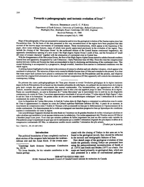
212 CAN. J. EARTH SCI. VOL. 18, 1981<br />

Fie. 1. Iranian major tectono-sedimentary units.<br />

1. Stable areas: Arabian Precambrian platform in the southwest and Turanian Hercynian plate in the northeast. The low<br />

dipping, relatively flat lying beds south and southwest of the Persian Gulf comprise the Arabian shelf over the buried Precambrian<br />

stable shield. 2. Neogene-Quaternary foredeeps, transitional from unfolded forelands to marginal fold zones, with strong late<br />

Alpine subsidence. ZF: Zagros Foredeep in the southwest; KDF: Kopeh Dagh Foredeep in the northeast. 3. Main sector of the<br />

marginal active fold belt peripheral to the stable areas (Zagros and High-Zagros (HZ) in the southwest, and Kopeh Dagh in<br />

northeast). 4. Zabol-Baluch (east Iran) and Makran (southeast Iran) post-ophiolite flysch troughs. Late Tertiary seaward<br />

accretion and landward underthrusting seem to be responsible for the formation of the present Makran ranges. 5. Alborz<br />

Mountains, bordering the southern part of the Caspian Sea. 6. Central Iranian Plateau (Central Iran) lying between the two<br />

marginal active fold belts. In the northwestern part of the country, Central Iran joins the Transcaucasian early Hercynian Median<br />

Mass (TC), the Sevan-Akera ophiolite belt (SV), and the Little Caucasus [A: Armenian (Miskhan-Zangezurian) late Hercynian<br />

belt, with a possible continuation to the Iranian Talesh Mountains (T) along the western part of the Caspian Sea; AA: the<br />

Araxian-Azarbaijanian zone of the Caledonian consolidation, with the Vedi (V) ophiolite belt]. SS: Sanandaj-Sirjan belt,<br />

narrow intracratonic mobile belt (during the Paleozoic Era) and active continental margin (Mesozoic), forming the southern<br />

margin of Central Iran in contact with the Main Zagros reverse fault (MZRF). The belt bears the imprints of several major crustal<br />

upheavals (severe tectonism, magmatism, and metamorphism). The Central Iranian province joins Central Afghanistan in the<br />

east. 7. Postulated Upper Cretaceous High-Zagros-Oman ophiolite-radiolarite (75 Ma) and the Central Iranian ophiolite-


was undergoing calc-alkaline magmatic activity, deformation,<br />

and simultaneous sedimentation. This is completely<br />

different from the sediments of the stable platform<br />

(of Arabia and Iran) in the south. Therefore two<br />

completely different tectonic and sedimentary regimes<br />

are represented (Fig. 10).<br />

Thus there is evidence that in this period, Iran, southeastern<br />

Turkey, Iraq, Syria, and parts of Afghanistan<br />

and Pakistan were connected (via Arabia) to Africa, and<br />

the Hercynian Ocean was to the north. This stratigraphic<br />

evidence is consistent with the paleomagnetic data (discussed<br />

in Section II).<br />

1.2.2--Late Paleozoic and Middle Triassic orogenic<br />

movements<br />

The Late Paleozoic (Hercynian) orogenic belt is presumably<br />

associated with the closure of the ’Hercynian<br />

Ocean’ (we choose to name oceans after the orogenic<br />

episode caused by their closure). The ocean was to the<br />

north of lran (as indicated by the foregoing stratigraphic<br />

evidence). It seems clear that subduction was restricted<br />

to the northern side of the ocean in the Middle East<br />

region and resulted in prolonged deformation, metamorphism,<br />

and magmatism.<br />

The deformation apparently started during Carboniferous<br />

time (about 330 Ma) and finished during the Triassic<br />

Period (about 220 Ma). Most of this deformation<br />

appears to be associated with the northward subduction<br />

and closure of the Hercynian Ocean. Towards the end of<br />

the period Iran apparently moved as one or a few continental<br />

fragments across the Hercynian Ocean, leaving<br />

new oceanic crust behind to form the ’High-Zagros<br />

Alpine Ocean’ in the south (Fig. 4). There is stratigraphic<br />

evidence (continental rift volcanism and sedimentation<br />

consistent with stretching along the Sanandaj-<br />

Sirjan belt; Fig. 11; Section II.2.2b) that Iran and<br />

BERBERIAN AND KING 213<br />

some surrounding countries were becoming detached<br />

from Arabia in Permian time (possibly around 240 Ma).<br />

However, paleomagnetic poles indicate that lran remained<br />

close to Arabia during at least the early part of<br />

this period. The Upper Triassic - Jurassic pelagic sediments<br />

along the active Central Iranian and the passive<br />

Zagros continental margins provide the first sedimentary<br />

evidence for the appearance of a true oceanic environment<br />

(Table 2).<br />

Sometime prior to the Middle Triassic orogenic phase<br />

(210 Ma), the late Paleozoic ophiolites were emplaced<br />

in the north, presumably at the time of the collision of<br />

the continental fragments with Asia (Section II.2.2a).<br />

By Middle to Late Triassic time (200 Ma) a major<br />

difference in sedimentary environment between [ran and<br />

Arabia on either side of the High-Zagros Alpine Ocean<br />

is evident. While marine carbonates continued to be<br />

1.2.l--Early Paleozoic movements (450-370 Ma)<br />

Because of the deficiency of data, no reconstruction is<br />

given for the time of the Early Paleozoic (Caledonian)<br />

movements. The deposition of Upper Silurian (395 Ma)<br />

continental sediments together with the lack of Lower<br />

deposited in a passive environment on the Arabian foreland,<br />

shallow lagoonal coal-beating detrital sediments<br />

Devonian rocks in Central Iran may indicate a Late<br />

Silurian movement (see Section II.2.1), the cause were deposited in Iran (Table 2). Furthermore, these<br />

which is not yet understood.<br />

were apparently continuous with similar deposits in<br />

southern Asia (Kopeh Dagh - Turan) suggesting that<br />

Iran and southern Asia were connected and formed a<br />

single sedimentary province by that time (Fig. 5).<br />

It is therefore concluded that the late Paleozoic - early<br />

Mesozoic phase in Iran and surrounding countries was a<br />

period when continental fragments travelled across the<br />

Hercynian Ocean to become attached to Asia (Fig. 5).<br />

The time taken does not appear to be greater than 40 Ma<br />

and, based on paleomagnetic data and our reconstructions,<br />

the continental fragments covered a distance of<br />

about 4000 km. The necessary rate of movement of I0<br />

cm/year is reasonable, since India split from Africa and<br />

formed parts of the Indian Ocean at a rate of 18 crn/year.<br />

There is some evidence of late Paleozoic low-grade<br />

metamorphism along the Sanandaj-Sirjan belt at a time<br />

when the paleomagnetic data indicate that the High-<br />

Zagros Alpine Ocean had not formed in the south (Section<br />

II.2.2b). This could be interpreted as an error in the<br />

paleomagnetic data, with some subduction occurring on<br />

the southern part of Central Iran along the Sanandaj-<br />

Sirjan belt, prior to the Middle Triassic orogenic movements.<br />

Alternatively it could be associated with the late<br />

Paleozoic closure of the rifts formed in the second Palmrlange<br />

belts (65 Ma), with outcrops indicated in black. The southeastern parts of the Middle Cretaceous (110 Ma) Sevan-Akera<br />

and Vedi ophiolites of the Little Caucasus are shown in the northwestern part of the country. The extensive belts of ophiolites<br />

mark the original zone of convergence between different blocks. The positions of ophiolites are modified by post-emplacement<br />

convergent movements. 8. Major facies dividing basement faults, bordering different tectono-sedimentary units. Contrasting<br />

tectono-sedimentary regimes, belts of ophiolites, and associated oceanic sediments, together with paleogeographicontrasts<br />

along the Main Zagros (MZRF) and the High-Zagros (HZRF) reverse faults in the southwest, and the South Kopeh Dagh fault<br />

(SKDF) in the northeast indicate the existence of old geosutures along these lines. The Chapedony and Posht-e-Badam faults<br />

delineate the possible Precambrian island arc in eastern Cental Iran. SJMF: South Jaz Murian Fault in the southeast. 9. Late<br />

Alpine fold axes. 10. Postulated active subduction zone of Makran in the Gulf of Oman. 11. Province boundary.<br />

(Figure based on Berberian (1980a). Lambert Conformal Conic Projection.)


214 CAN. J. EARTH SCI. VOL. 18, 1981<br />

RG. 2. Localities in Iran cited in the text (Lambert Conformal Conic Projection.)<br />

eozoic extensional phase (Section II.2a.1.2). The absence<br />

the north. The ophiolites and basic and granitic complexes<br />

of any late Paleozoic ophiolites in this belt and<br />

consistency with the paleomagnetic data may support<br />

this second conjucture and we adopt this view.<br />

The Middle Triassic features of Iran are shown in Fig.<br />

of Triassic age exposed along the southeastern<br />

margin of Central Iran (Section II.3a) seem to be remnants<br />

of the crust of the Triassic subduction system of<br />

the northern part of the High-Zagros Alpine Ocean.<br />

5. They include linear metamorphic belts in southwestern<br />

Central Iran (the Sanandaj-Sirjan belt, with its probable<br />

1.3--EARLY ALPINE OROGENIC EVENTS<br />

continuation to the Tauros belt of Turkey and the<br />

Wardak-Nawar zone of Central Afghanistan), and<br />

general compressional phase of folding and mountain<br />

building throughouthe country (Figs. 5 and 13). This<br />

presumably associated with the onset of subduction<br />

along the southern margin of Central Iran, resulting<br />

from the clogging of the Hercynian belt in the north with<br />

continental materials. The onset of the Middle Triassic<br />

events in the southern Central Iranian margin was probably<br />

a direct consequence of the ending of subduction in<br />

The Early Alpine orogenic events lasted from 200 Ma<br />

to around 65 Ma, and apparently represented the period<br />

during which the High-Zagros Alpine Ocean in the<br />

southern region of Iran closed (Figs. 5 and 6). Following<br />

the Middle Triassic compressional phase, the whole<br />

region underwent tensional movements characterized by<br />

the Upper Triassic continental alkali-rift basalts in Central<br />

Iran and the Alborz. A compressional episode occurred<br />

around Late Jurassic - Early Cretaceous time<br />

(140 Ma), at the middle of the period when we suppose


BERBERIANANDKING 215<br />

TABLE 1. Correlation chart of the major Paleozoic rock units, sedimentary gaps (blank areas), and unconformities (indented<br />

lines) in Gondwanian Iran and neighbouring regions. Note that the stable platform shelf deposits are underlain by the alkali-acid<br />

volcano-plutonic complex, which marks the late Precarnbrian’ intracontinental rifting. Data sources cited in the text. The rock<br />

unit symbols used are the same as those used on the paleogeographic maps. H-Z: High-Zagros belt; S-S: Sanandaj-Sirjan belt<br />

the High-Zagros Alpine Ocean to have been closing<br />

(Section 11.4). The cause of this phase is unknown.<br />

During and after the Middle Triassic phase of activity,<br />

andesitic-basaltic volcanism and acid granitic intrusions<br />

formed along the Sanandaj-Sirjan belt (the active<br />

margin of Central Iran; Figs. 5 and 13), and presumably<br />

represents the full establishment of the southern subduction<br />

zone. The arc is partly exposed, being covered with<br />

Jurassic and Cretaceous sediments, which have been<br />

removed by erosion only in a few places. There is a<br />

similar situation in the northern Hercynian belt in the<br />

Kopeh Dagh. Its eastern continuation is completely visible<br />

in northern Afghanistan, but in this case only one<br />

small inlier (Aghdarband) is exposed in Iran (Figs.<br />

and 12).<br />

During the Mesozoic Era two very different environments<br />

existed in the Arabian Zagros foreland and the<br />

Iranian unit attached to Asia. The Arabian foreland is


216<br />

CAN. J. EARTH SCI. VOL. 18, 1981<br />

ATE<br />

PRECAMBRIAN-<br />

CAMBRIAN<br />

FIG. 3. A simplified reconstruction of Iran during Late Precambrian - Cambrian times (570-540 Ma), showing a broad<br />

continuity of epicontinental shelf sedimentary facies over the Arabian-Iranian continental crust (cf. Fig. 10 for the detailed<br />

Iranian tectono-sedimentary data for the same period). The original position of the Central and north Iranian continental<br />

fragments relative to Arabia is not entirely clear, and it is possible to postulate a position adjacent to eastern Arabia. The<br />

Hercynian Ocean is in the north of the Alborz Mountains (south of the Caspian Sea). Lines of latitude and longitude (in Figs. 3<br />

9) only provide approximate information about the orientation in regions where crustal extension or compresssion has taken<br />

place.<br />

1. Oceanic crust area. 2. Continental areas of erosion and non-marine sedimentation. 3. Continental coarse clastics. 4. Zaigun<br />

and Lalun epicontinental-marine red sandstone-shale formation (Lower Cambrian). 5. Precambrian ophiolites of Saudi Arabia.<br />

6. Upper Precambrian alkali granitic intrusions in Iran. 7. Upper Precambrian post-orogenic rhyolitic flows in Iran. The rhyolitic


subject to progressive subsidence and uniform thick<br />

shallow marine sedimentation (Table 2). There are very<br />

striking simple linear facies boundaries parallel to the<br />

old continental margin (Figs. 5 and 14). These were<br />

presumably normal faults formed during extensional<br />

movement at that time.<br />

In the north the sedimentary environment was more<br />

complex, with rapid facies changes and unstable conditions.<br />

There were large areas of shallow sea and small<br />

Red Sea type oceanic basins (the sites of the Central<br />

Iranian narrow ophiolite belts) with a few small land<br />

areas. Presumably these basins and shallow seas were<br />

associated with fragmentation of continental crust during<br />

the period of movement of the continental mass from<br />

Arabia to Asia (Figs. 4 and 5). There appears to be<br />

evidence on which to base speculation about when and<br />

how the Central Iranian narrow oceanic basins formed.<br />

However, the stratigraphic evidence suggests that the<br />

Central Iranian continental fragments were never widely<br />

separated (Tables 1, 2, and 3; Figs. 10 to 17).<br />

1.3.1--Late Cretaceous orogenic phases<br />

The Late Cretaceous Epoch in Iran is characterized by<br />

two episodes of ophiolite emplacement. The emplacement<br />

dates and the associated change of sedimentary<br />

conditions from oceanic to shallow marine are critical,<br />

since they determine the time of ocean closure. Detailed<br />

arguments outlined in Sections II.5.2b and II.5.3b constrain<br />

the dates of these changes together with the High-<br />

Zagros and the Central Iranian ophiolite emplacement to<br />

be nominally around 75 Ma and 65 Ma (Fig. 6; Table 2).<br />

The latter phase was associated with regional metamorphism,<br />

magmatism, and extensive folding and uplift<br />

throughout the country and is taken here to represent the<br />

final closure of the High-Zagros Alpine Ocean. The<br />

’High-Zagros-Oman ophiolite-radiolarite belt,’ which<br />

was emplaced in the form of a thrust stack around 75<br />

Ma, is apparently the remnant of the High-Zagros Alpine<br />

Ocean extending from southeastern Turkey via<br />

High-Zagros to Oman. The ’Central Iranian ophiolitemtlange<br />

belts’ were emplaced around 65 Ma and resulted<br />

from the subsequent closure of the ’small ocean<br />

basins’ created by fragmentation after the separation of<br />

Iran from Arabia. They form a complex system in the<br />

country (Fig. 6). The ’Makran ophiolite-mtlange’<br />

southeastern Iran (Figs. 1, 6, and 14) is not interpretable<br />

as a continental closure, since subduction of ocean crust<br />

BERBERIAN AND ~NG 217<br />

preceded and succeeded its emplacement. It may be<br />

speculated that it was associated with the collision of an<br />

island arc of the eastern High-Zagros Alpine Ocean.<br />

The Sevan-Akera and Vedi ophiolite belts of the Little<br />

Caucasus, which were emplaced around 118-105 Ma,<br />

were the remnants of the western part of the Hercynian<br />

Ocean in the northwest, and presumably were emplaced<br />

during the collision between northwestern Iran and the<br />

Caucasus (see Section 11.5. lc).<br />

The Central Iranian ophiolite-mtlange belts are associated<br />

with glaucophane-schist metamorphism (along<br />

the belt north of the Zagros fault line and in Makran),<br />

and simultaneously the active Central Iranian continental<br />

margin (the Sanandaj-Sirjan belt) was affected by<br />

greenschist metamorphic overprint (see Section<br />

II.5.3b; Figs. 6 and 14). Extensive magmatism<br />

not<br />

found associated with the closure of the internal ocean<br />

basins. This could be because the volcanism is concealed<br />

by later sediments, or because the area of ocean<br />

crust consumed was too small to allow significant volcanic<br />

arcs to become established. The second explanation<br />

is a plausible confirmation of the view that the<br />

internal ophiolites do not represent the remains of the<br />

large ocean basins.<br />

We take the Late Cretaceous events to represent the<br />

disappearance of the oceanic crust between Asia and<br />

Arabia. From this period to the present, all continued<br />

convergence of these plates apparently has been accommodated<br />

by processes that have progressively thickened<br />

and shortened the continental crust and caused its gradual<br />

emergence (Figs. 7 to 9). The compression has<br />

been accompanied by extensive volcanism and various<br />

tectonic episodes, but none have the characteristic of a<br />

closure episode and no ophiolites and pelagic sediments<br />

have been emplaced later than 55 Ma.<br />

1.4----MIDDLE AND LATE ALPIN EVENTS<br />

The Middle Alpine orogenic events started at the<br />

close of the Late Cretaceous movements (65 Ma) and<br />

ended at about 20 Ma. The Late Cretaceous movements<br />

created the main structural features of present-day Iran<br />

(Figs. 6 and 7). During the closure of the High-Zagros<br />

Alpine Ocean in the south, acid plutonic activity took<br />

place in Late Jurassic time (140 Ma) along the southern<br />

margin of Central Iran (the Sanandaj-Sirjan belt; Figs.<br />

and 14). Later plutonic activity and deformation in the<br />

volcanics and the comagmatic alkali granites apparently are the products of post-orogenic rifting. 8. Approximate boundary<br />

between different sedimentary facies. 9. Basement faults (N: Najd left-lateral fault system in Saudi Arabia; Z: Main Zagros and<br />

High-Zagros reverse fault system in Iran; and C: Chapedony fault delineating the western part of a possible Precambrian island<br />

arc in the eastern part of Central Iran). 10. Present continental shorelines.<br />

Principal sources of data: Reconstruction (Mercat6r Projection) is modified from Smith et al. (1973). The Iranian<br />

tectono-sedimentary data are based on our Fig. 10. Data outside Iran come from Abu-Bar and Jackson (1964), Wolfart (1967),<br />

Ketin (1966), Gas and Gibson (1969), Brown (1972), et al. (1974),and Frisch and A1-Shanti (1977).


218 CAN. J. EARTH SCI. VOL. 18, 1981<br />

PERMIAN <br />

DCE<br />

~I0,-’--L--11 -’--~--12 ,"--’--13." .......... IZ,, I~15<br />

FIG. 4. Reconstruction of Iran during the Permian Period (possibly around 240 Ma), showing the detachment of Iran from<br />

Arabia-Zagros following rifting along the High-Zagros and the Sanandaj-Sirjan (SS) belts; formation of the High-Zagros Alpine<br />

Ocean and the Central Iranian narrow Red Sea type oceanic basins; and the consuming of the Hercynian ocean in the north (cf. our<br />

Fig. 11 for the detailed Iranian tectono-sedimentary data for the same period).<br />

1. Oceanic crust area. 2. Continental areas of erosion and non-marine sedimentation. 3. Coarse clastics. 4. Sandstone and<br />

shale. 5. Carbonates with anhydrite. 6. Shallow marine shelf carbonates. 7. Permian-Triassic intrusive rocks. 8. Permian<br />

volcanics along the rifted Sanandaj-Sirjan mobile belt (SS) in the south, and along the Great Caucasus - southern Turan


BERBERIAN AND KING 219<br />

TABLE 2. Correlation chart of the major Mesozoic rock units, sedimentary gaps (blank areas), and unconformities (indented<br />

lines) in Iran, Arabia, and the Little Caucasus (for which the lower part of the section is not complete). The pelagic sediments<br />

the High-Zagros Alpine Ocean (H.Z.A.O.), Sanandaj-Sirjan belt (S-S), Central Iranian narrow oceans (C.I.O.), and<br />

Sevan-Akera (S-A) of the Little Caucasus, are shown by the wavy lines. The arrows indicate the emplacement of the ophiolites<br />

and pelagic sediments as thrust sheets (thick lines with triangles) onto the continental margin<br />

Arabia Zagros H-Z H.Z.A.O. I ST,~q I C.I.O. IC~ntrcal I. Alborz Talesh S-A L.Cauca’s<br />

same region occurred during Late Cretaceous time and is<br />

presumably associated with the final stages of subduction.<br />

During this period, north and west Iran were subject<br />

to little activity, with slight erosion and little deposition<br />

suggesting low relief. After the emplacement of ophiolites<br />

onto the continental margin in Late Cretaceous time,<br />

a major flysch basin formed in east (Zabol-Baluch),<br />

southeast (Makran), and southwest Central Iran (along<br />

the Zagros fault line), and very rapid erosion and deposition<br />

of material took place. The nature of the basement<br />

of these flysch basins could be oceanic crust. The general<br />

environment would appear to be relatively subdued<br />

topography near sea level, except near the flysch basins<br />

where, at the very least, steep scarp slopes would be<br />

needed to provide the rapid erosion to supply the basins<br />

with sediment (Fig. 7). Continental accretion of the<br />

overlying Tertiary flysch deposits by the successive<br />

oceanward movements of the site of the active subduction<br />

zone along southern Makran (Fig. 1) presumably<br />

gave rise to the subduction complex, which has continued<br />

from Late Cretaceous time to the present (Figs.<br />

to 9).<br />

Extensive volcanism, with a wide range of composition,<br />

started in the Eocene Period (50 Ma) and continued<br />

for the rest of the period with the climax in Middle<br />

Eocene time (about 47-42 Ma). Despite their great<br />

thickness (locally up to 6 and 12 km) and wide distribution<br />

(Fig. 7), the volcanics and tufts were formed<br />

within a relatively short time interval. Since the plutonic<br />

eugeosyncline north of the Hercynian subduction zone. 9. Approximate boundary between different sedimentary facies. 10.<br />

Spreading centres. 11. Subduction zone with triangles on the upper plate. 12. Major normal faults activated during the Permian<br />

rifting phase, controlling the sedimentary facies. 13. Reverse faults with bars on the upper plate. 14. Present continental<br />

shorelines. 15. Epigeosyncline orogenic region in the north. SS: Sanandaj-Sirjan rift belt. t.c.m.m.: Transcaucasian Median<br />

Mass.<br />

Principal sources of data: Reconstruction (Mercator Projection) is modified from Smithetal. (1973). The tectono-sedimentary<br />

data within the Iranian boundaries are based on our Fig. 11. Data outside Iran come from Wolfart (1967), Nalvkin and Posner<br />

(1968), Adamia (1968, 1975), Gass and Gibson (1969), Kamen-Kaye (1970), Brown (1972), Belov (1972), et al.<br />

(1977), and Saint-Marc (1978).


220 CaN. J. EARTH SCI. VOL. 18, 1981<br />

RHAETO-<br />

LIAS<br />

:CENTRAL<br />

IRA<br />

/<br />

÷10, "’-’11, ~12,-’-’-13,-’--’-lZ,,-"--"-15 ,"Z, lG, . ........ 17<br />

FI~. 5. Reconstruction of Iran immediately after the Middle Triassic orogenic movements (around 210-190 Ma), showing<br />

collision of Iran with Eurasia in the north by the final closure of the Hercynian ocean, and shifting of the subduction from the north<br />

(Hercynian) to the south (High-Zagros Alpine). Compression with regional metamorphism occurs along the southern active<br />

margin of Central Iran (the Sanandaj-Sirjan belt: SS). The western part of the Hercynian ocean, south of the Pontian-<br />

Transcaucassian island arc (P-Tc), is not closed. Coal-bearing sediments cover south Eurasia and Iran (cf. Figs. 12 and 13 for<br />

detailed Iranian tectono-sedimentary data for the same period).<br />

1. Oceanic crust area. 2. Continental areas of erosion and non-marine sedimentation. 3. Rhaetic-Liassic plant- and


magmatism associated with it would have ceased not<br />

much more than 10 Ma after the end of subduction<br />

(about 65 Ma), with the absorption of the downgoing<br />

slabs, the cause of this extensive ’post-collision’ volcanic<br />

activity is not clear. Because of the wide-ranging<br />

composition of these volcanics (rhyolite, dacite, andesite,<br />

ignimbrite, and basalt) it is difficult to explain them<br />

simply as crustal melts due to rapid uplift and erosion,<br />

and it is necessary at least in part to invoke a lower crust<br />

or mantle source (Section II.6b). Although the nature<br />

this volcanism is enigmatic, volcanism of the same type<br />

continues to the present day (Figs. 17, 18) and is evidently<br />

not related to subduction. It is suggested in the<br />

absence of alternative hypotheses that this volcanism<br />

might be related to processes of crustal shortening or to<br />

strike-slip faulting and sheafing, or to both (see Sections<br />

II.6b, II.Tb, and 11.8). During the period of most active<br />

volcanism Iran was subject to an overall right-lateral<br />

shear and relatively little shortening (comparing Figs.<br />

and 7).<br />

Assuming either of the foregoing mechanisms it is not<br />

clear why the volume of volcanics has diminished with<br />

time. It may be due to changes in the amount of shearing.<br />

Alternatively the source conditions may alter as the<br />

crust thickens or, if volcanoes cease activity when they<br />

reach a maximum height, larger volumes of lava will<br />

erupt when the crust is near sea level than on crust more<br />

than 3000 m above sea level.<br />

The marine carbonate and marl deposition in the narrowing<br />

sedimentary basin of the Zagros continued after<br />

the Late Cretaceous collision (Figs. 6 to 9 and 14 to 17),<br />

with the folded and uplifted Central Iranian active continental<br />

margin (the Sanandaj-Sirjan belt) acting as<br />

barrier between the Central Iranian shallow basins in the<br />

north and the Zagros basin in the south (Figs. 6 to 9).<br />

The late Alpine orogenic events followed continuously<br />

from the Middle Alpine and extended to the present.<br />

Progressively more of Iran became land with separate<br />

mountain-divided narrow basins (Figs. 8 and 9).<br />

Neogene time (10 Ma), continental deposits supplied<br />

from the rising orogenic belts characterize the sedimentation<br />

in Iran (Fig. 9).<br />

BERBERIAN AND KING 221<br />

During the Middle and Late Alpine orogenic movements,<br />

folding and uplift occurred followed by subsidence<br />

in central and northern Iran (Tables 2 and 3). The<br />

episodes of major activity defined in the literature and<br />

discussed in Section II refer to the unconformities associated<br />

with subsidence and marine transgression. Thus,<br />

although the overall relative motion of Arabia and Asia<br />

caused compression and uplift, there are clearly defined<br />

diachronous episodes of subsidence and extension. This<br />

indicates that the tectonic forces were not supplied from<br />

the Asian-Arabian motion alone, and presumably must<br />

have resulted from motions in the upper mantle or lower<br />

crust. However, throughout the period, the major fold<br />

belts grew in size, with fold axes continuing to form<br />

parallel to those initiated during the Late Cretaceous<br />

movements.<br />

1.5--DISCUSSION AND CONCLUSION<br />

Iran and some of the surrounding countries were connected<br />

to Arabia and Africa from the late Precambrian<br />

until the late Paleozoic. At that time these fragments of<br />

continental crust split from Arabia, crossed the Hercynian<br />

Ocean, and collided with the Asian block. During<br />

this passage and the subsequent subduction of ocean<br />

crust to the south of Iran, the continental crust was<br />

stretched. At the time of onset of continental compression<br />

(about 65 Ma) Iran was entirely below sea level and<br />

marine sedimentary conditions prevailed. This is consistent<br />

with the crust being thin. Post-colIisional convergence<br />

could then have resulted in progressive crustal<br />

thickening and shortening by folding, reverse faulting,<br />

and the gradual rise of the mountain belts above sea<br />

level. Redistribution of material laterally by sediment<br />

transport and large-scale strike-slip motion could also<br />

have occurred.<br />

If the Late Cretaceous crust was nominally 20 km<br />

thick and 100 or 200 m below sea level, a compression<br />

by a factor of two would double its thickness to that at<br />

present and account for the present mean elevation of the<br />

Iranian plateau of 2-3 km. This simple view assumes<br />

that thermal changes have not altered the density of the<br />

crust or mantle. The thermal processes associated with<br />

coal-bearing sandstones and shales of the Shemshak Formation with Asiatic flora and fauna covering Iran and southern Eurasia<br />

via Kopeh Dagh belt. 4. Continental clastics with marine intercalations. 5. Sea marginal flats, sabkhas, and shallow marine<br />

deposits. 6. Shallow water marine carbonates and shales. 7. Shallow to moderately deep marine sediments of the Great Caucasus<br />

(miogeosyncline basin). 8. Volcanic arc of Pontian-Transcaucasian (P-Tc). 9. Upper Triassic - Jurassic intrusive rocks.<br />

Upper Triassic - Jurassic andesitic-basaltic volcanic rocks. 11. Approximate boundary between different sedimentary facies.<br />

12. Spreading centres. 13. S ubduction zone with triangles on the upper plate. 14. Reverse faults with bars on the upper plate. 15.<br />

Major normal faults activated during the late Triassic rifting phase. 16. Middle Triassic regional metamorphic rocks along the<br />

active Central Iranian continental margin, the Sanandaj-Sirjan belt (SS). 17. Present continental shorelines. P-Tc:<br />

Pontian-Transcaucasian island arc; C-C: Crimean-Caucasian marginal sea; SS: Sanandaj-Sirjan belt.<br />

Principal sources of data: Reconstruction (Mercator Conformal Projection) is modified from Smith and Briden (1977).<br />

tectono-sedimentary data within the boundaries of Iran are based on our Fig. 13. Data outside Iran come from Vereshchagin and<br />

Ronov (1968), Razvalyayev (1972), and Adamia et al. (1977) for the northwesternmost part, Bein and Gvirtzman (1977),<br />

Biju-Duval et al. (1977) for the westernmost part.


222 CAN. J. EARTH SCI. VOL. 18, 1981<br />

LATE<br />

CRETACEOUS<br />

1-’~10, =11, +12, "---13, -~-I~, "-’--15, ¯ ........ 16<br />

F~o. 6. Reconstruction of Iran during Late Cretaceous time (around 70 Ma), showing emplaced ophiolites along the<br />

Sevan-Akera and Vedi belts of the Little Caucasus (100 Ma), High-Zagros-Oman belt (80-75 Ma), and prior to emplacement<br />

the Makran and the Central Iranian narrow ophiolite belts (65 Ma). During that time most of the country was near sea level. The<br />

Zagros and Kopeh Dagh sedimentary basins have their own separate shallow marine shelf carbonate sedimentation (cf. Fig. 14 for<br />

the detailed Iranian tectono-sedimentary data for the same period).<br />

1. Oceanic crust area. 2. Continental areas of erosion and non-marine sedimentation. 3.Emplaced ophiolite-radiolarite belts<br />

of the High-Zagros-Oman (the former High~Zagros Alpine oceanic crust) and the Sevan-Akera and Vedi (a part of the former<br />

Hercynian oceanic crust). 4. Shallow marine shelf carbonates and shales (Aruma Formation). 5. Neritic to basinal marl<br />

shales (Gurpi Formation) in Zagros. 6. Shallow water anhydritic reef limestone (Tarbur Formation) in Zagros. 7. Upper<br />

Cretaceous flysch. 8. Isolated small intermontane sedimentary basins of Central Iran with marl, shale, and carbonate; tuffs and<br />

volcanics (mainly in the Talesh area). 9. Shallow carbonate shelf deposits in Kopeh Dagh (Kaiat Formation) and its northwestern<br />

continuation (the Great Caucasian miogeosyncline). 10. Chitral island arc, north India, and the Little Caucasian eugeosyncline<br />

northwestern Iran. 11. Cretaceous intrusive rocks. 12. Cretaceous volcanic rocks. 13. Approximate boundary between different<br />

sedimentary facies. 14. Subduction zone with triangles on the upper plate. 15.Reverse faults with bars on the upper plate. 16.<br />

Present continental shore lines.


the post-Cretaceous deformation and the cause of the<br />

Eocene volcanism are not understood; therefore the<br />

foregoing arguments, although consistent with the stratigraphic<br />

evidence, must be treated with caution.<br />

A striking feature of the evolution presented here is<br />

the apparent control of later fold episodes by the structures<br />

formed in the earliest fold episodes. This may be<br />

explained by regarding the early phase as introducing or<br />

reactivating structural anisotropy that later phases have<br />

also been forced to follow. Since these structures are<br />

not everywhere perpendicular to the relative motion<br />

between Arabia and Asia and since this motion has, in<br />

any case, changed direction since Late Cretaceous time,<br />

it follows that structures other than folds must have<br />

played an important role in the deformation.<br />

Many of the major faults have been inherited from<br />

earlier periods. Those that are most easily recognized<br />

formed facies dividers, presumably when acting as normal<br />

faults during tensional, down-warping, and depositional<br />

phases. The Main Zagros, I-Iigh-Zagros, Tabas,<br />

Kuh Banan, Chapedony, Posht-e-Badam, and several<br />

recent faults were probably major bounding normal<br />

faults since late Precambrian time but have operated as<br />

compressional faults during the overall shortening and<br />

crustal thickening of the last 60 Ma.<br />

Particular questions that require further study are the<br />

time of onset of the late Paleozoic subduction in northeastern<br />

Iran, the possibility of the late Paleozoic metamorphism<br />

along the Sanandaj-Sirjan belt, the time and<br />

manner of formation of the Central Iranian narrow ocean<br />

basins (that became the Central Iranian ophiolitem61ange<br />

belts), and the reason for the lack of extensive<br />

exposure of the magmatic arc along the Sanandaj-Sirjan<br />

belt for the late Paleozoic and Middle Triassic events.<br />

Finally a detailed and systematic investigation of the<br />

petrology, the radiometric ages, and the trace- and<br />

major-element composition of the magmatic (including<br />

ophiolites) and metamorphic rocks of the country, together<br />

with paleomagnetic studies for certain crucial<br />

periods and sites, will carry us further towards a true<br />

understanding of the paleogeography and tectonic evolution<br />

of Iran.<br />

II--Review of the geological data<br />

The Iranian plateau extends over a number of continental<br />

fragments welded together along suture zones of<br />

oceanic character. The fragments are delineated by<br />

major boundary faults, which appear to be inherited<br />

from old geological times. Each fragment differs in its<br />

BERBERIAN AND KING 223<br />

sedimentary sequence, nature, and age of magmatism<br />

and metamorphism, and in structural character and intensity<br />

of deformation (Fig. 1). In this section the evolution<br />

and effects of different orogenic phases since Late<br />

Precambrian time are reviewed and discussed separately<br />

for each unit. A brief review of the previous paleogeographic<br />

and tectonic reconstructions of the region is<br />

also included (Section 11.9).<br />

II. I--PRECAMBRIAN<br />

The continental crust of Iran was metamorphosed,<br />

granitized, folded, and faulted during the Late Precambrian<br />

by what is called the Hijaz or Pan African orogeny<br />

(around 960-600 Ma). These metamorphosed rocks,<br />

which are scarcely exposed, form the basement of the<br />

region (Huckriede et al. 1962; Stocklin 1968a, 1974,<br />

1977; Nabavi 1976; Berberian 1976a,b). This orogenic<br />

phase is considered by Brown and Coleman (1972),<br />

A1-Shanti and Mitchell (1976), Greenwood et al. (1975,<br />

1976), Neary et al. (1976), and Frisch and AI-Shanti<br />

(1977) to be an episode of plate collision and arcmagmatism<br />

terminating about 600-550 Ma in Arabia.<br />

Following these movements the Upper Precambrian -<br />

Cambrian Hormoz Salt (Stocklin 1968b, 1972) was deposited<br />

in a basin(s), parts of which now lie along the<br />

north and eastern side of the Arabian Peninsula (Fig.<br />

10).<br />

Since the different orogenic phases recognized in the<br />

crystalline shield of Arabia (Greenwood et al. 1976) are<br />

not recognized in Iran, no detailed correlation can be<br />

made between the basements of Iran and Arabia. Hence<br />

the consolidation of the Iranian basement is not well<br />

understood. The Precambrian Chapedony and Posht-e-<br />

Badam complexes of east Central Iran (Hushmandzadeh<br />

1969; Stocklin 1972; Haghipour 1974, 1977; and<br />

Haghipour et al. 1977), which consist of metagreywacke,<br />

metadiorite, meta-andesite, amphibolite, pyroxenite,<br />

serpentinite, and calc-alkaline intrusive rocks<br />

(Fig. 10) may represent the crust of a Precambrian<br />

calc-alkaline island arc (Berberian and Berberian<br />

1980). The nearly north-south arcuate mountain belts in<br />

east Central Iran may represent the original pattern of<br />

the Precambrian arc belts. Like the Arabian basement,<br />

the island-arc cratonization of the Iranian Precambrian<br />

basement should have taken place prior to the deposition<br />

of the Upper Precambrian - Lower Cambrian Hormoz<br />

Salt and detritic sediments.<br />

Because of subsequent orogenic movements, the few<br />

attempts to date the Iranian basement using mainly<br />

Principal sources of data: Reconstruction (Mercartor Conformal Projection) is modified from Smith and Briden (1977).<br />

tectono-sedimentary data within the boundaries of Iran are based on our Fig. 14. Data outside Iran come from Vereshchagin and<br />

Ronov (1968), and Adamia et al. (1977) for northwesternmost part, Saint-Marc (1978), and Powell (1979) for the north<br />

part.


224 CAN. J. EARTH SCI. VOL. 18, 1981<br />

E OCE NE<br />

I~G. 7. Reconstruction of Iran during Eocene time (55-40 Ma), showing the closure of all oceans, onset of the post-collision<br />

extensive Lutetian (45 Ma) volcanic activity in Central Iran and southern Alborz, and formation of the major flysch troughs<br />

eastern and southeastern Iran. Shallow marine shelf carbonate deposition in the narrowing Zagros and Kopeh Dagh basins is still<br />

noticeable (cf. Fig. 15 for the detailed Iranian tectono-sedimentary data for the same period), The present-day physiographic<br />

features were already shaped by the Late Cretaceous (65 Ma) orogenic movements and were noticeable during the Eocene Epoch.<br />

1. Oceanic crust area. 2. Continental areas of erosion and non-marine sedimentation. 3. Lagoonal and shallow marine<br />

carbonates, marl, and shale with anhydrite and gypsum (Rus and Dammam Formations) on the Arabian shelf. 4. Neritic<br />

basinal marls (Pabdeh Formation) in the Zagros basin. 5. Shallow marine carbonates (Jahrom Formatidn) in Zagros.<br />

Evaporites (Sachun Formation) in Zagros. 7. Paleocene-Eocene flysch deposits. 8. Widespread post-collisional volcanic<br />

activity. 9. Shallow water shelf carbonates of Kopeh Dagh (Chehel Kaman Formation) and its northwestern continuation (the


BERBERIAN AND KING 225<br />

TABLE 3. Correlation chart of the major Tertiary rock units, sedimentary gaps (blank areas), and unconformities (indented lines)<br />

in Arabiand Iran. The Makran and Alborz units are divided into north (n) and south (s), and the Talesh into west (w) and east<br />

S-S Central I. Lut Make’an Zabol-Ba<br />

~b iJrnz ~ TaleShwl$ Caspian KopehD~<br />

÷ ~ ._-..-.:..-~<br />

Rb/Sr total-rock techniques have failed (Crawford<br />

1977), and the Precambrian rocks remain geochronologically<br />

unclassified. At this stage the Precambrian<br />

metamorphic rocks of Iran can only be categorized into<br />

high-grade (amphibolite facies) and low-grade (greenschist<br />

facies) groups (Stocklin 1968a, 1974, 1977;<br />

Hushmandzadeh 1973; Haghipour 1974, 1977).<br />

After the metamorphism of the Precambrian formations<br />

and the establishment of the Arabo-Iranian coherent<br />

platform at the end of the Katangan orogeny (Fig. 3),<br />

the compressional tectonic activity ended with granitic<br />

intrusions and alkali volcanism (Fig. 10). The Upper<br />

Precambrian alkali-enriched Doran granites of Iran<br />

(Stocklin et al. 1964) seem to be equivalents of the 600<br />

Ma Younger Granites of Arabia (Schmidt et al. 1973,<br />

1978; Sillitoe 1979). The Doran granite cuts the Upper<br />

Precambrian low-grade metamorphic rocks of the Kahar<br />

Formation (Stocklin et al. 1964) and is covered by<br />

Lower Cambrian sediments.<br />

Late Precambrian post-orogenic volcanics, which are<br />

partly the extrusive equivalents of the Doran granite,<br />

and are mainly alkali rhyolite, rhyolitic tuff, and quartz<br />

porphyry, form the Gharadash Formation in northwestern<br />

Iran (Stocklin 1972), the Taknar Formation in the<br />

Kashmar region, northeastern Iran (Razaghmanesh<br />

1968), the Rizu-Desu Series (or Esfordi Formation)<br />

......................, v U.R.~.,.~.~., **** k:::--:5:,’""~<br />

~ ~- ~ ~. ~. ~- ~ ~- ~- ~- %* .....<br />

::::::::::::::::::::::::::::::: - ÷ ¯ ~--:.!i<br />

~::-’-’-’:-’-’: ~<br />

- ÷i ::::::::::::::::::::::::::::"::’:’:"<br />

"~ "" .....<br />

-~.’° ,...:<br />

............. .~.-~<br />

t’~÷*’,. ~ ..:._ "~ ............<br />

oo÷, .÷÷, ÷.. ÷÷’ ÷’<br />

I<br />

÷’ ::::::::::::::::::::::::::::<br />

}::::::}::::}i<br />

i Iil<br />

}}}<br />

¯ ....,÷÷o,°~a*’ ..............<br />

~.÷++÷÷++÷~ .÷÷÷÷o÷÷,:i:~r":::i:i:i:!:~![<br />

:::::2:: 2:::2::: ::::::::::::::::::::::::::::<br />

’N<br />

+ ,÷÷÷÷,,÷÷÷~<br />

° ° ’°°*° ° ~ : *°°°...... .-.-,-.-.~v.v ,’:’:’:+~"~’~"v"’ ::::::::::::::::::::::<br />

:::::::::::::::::::::::::::::::::::::::::::::::::::::<br />

¯ ,~... o.o.~...-.......-.t:.............................,<br />

I<br />

~ :-:-:-:-:-:-:-:-:-:<br />

southeastern Central Iran (Huckriede et al. 1962; Forster<br />

et al. 1973), and the Hormoz Formation in Zagros<br />

(Stocklin 1972; Kent 1979). The late Precambrian volcanics<br />

also include some andesite, basalt, and tuff.<br />

These widespread ’post-orogenic’ volcanic rocks,<br />

which overlie the Precambrian metamorphic rocks and<br />

are overlain by the Upper Precambrian - Cambrian<br />

sediments, may indicate the ’stretching’ of the Arabo-<br />

Iranian coherent continental crust during an extensional<br />

phase. This could have been associated with the formation<br />

of the epicontinental platform from Arabia to A1-<br />

borz prior to the deposition of the Upper Precambrian -<br />

Cambrian sediments. Similar post-orogenic rhyolitic<br />

pyroclastic rocks, lavas, and subordinate basaltic volcanics<br />

of alkali affinity have been developed on the<br />

Arabian-Nubian Shield (the Shammar Group) during<br />

663 to 555 Ma (Brown and Coleman 1972; Sillitoe 1979;<br />

Brown and Jackson 1979; Table 1). Although alkali<br />

basalt is a typical member of the rifting magmatism,<br />

extensional tectonics in the continental crust also permits<br />

rapid rise of rhyolites and acid plutons (Bailey<br />

1974; Eichelberger 1978).<br />

During this general rifting and sinking phase of northeastern<br />

Arabia, the Main Zagros, High-Zagros, Nayband,<br />

and some other major faults appear to have acted<br />

as facies dividers separating the main Hormoz evaporitic<br />

Great Caucasian miogeosyncline). 10. Intrusive rocks. 11. Approximate boundary between different sedimentary facies. 12.<br />

Subduction zone, with triangles on the upper plate. 13. Reverse faults, with bars on the upper plate. 14. Present continental<br />

shorelines.<br />

Principal sources of data: Reconstruction (Mercartor Conformal Projection) is modified from Smith and Briden (1977).<br />

tectono-sedimentary data within the boundaries of Iran are based on our Fig. 15. Data outside Iran come from Grossheim and<br />

Khain (1968), Ricou (1974), and Bij u-Duval et al. (1977) for the westernmost part, and Powell (1979) for the north Indian part.


226 CAN. J. EARTH SCI. VOL. 18, 1981<br />

~10, -’-’-’11, -’-’-’-12, " ........ 13, ~14<br />

Re. 8. Reconstruction of Iran during Oligocene-Miocene times (30-20 Ma), showing gradual thickening of the crust, and<br />

decrease of the area of the intermontane basins in Central and northern Iran. The Central Iranian volcanic activity diminishes.<br />

Active flysch-molasse basins occur in the southeast, and gradual narrowing continues in the sedimentary basin of Zagros in the<br />

south (cf. Fig. 16 for the detailed tectono-sedimentary data for the same period).<br />

1. Oceanic crust area. 2. Continental areas of erosion and non-marine sedimentation. 3. Sandy limestone, sandstone, and shale<br />

in Arabia, and platform basins in the Turan plate. 4. Oligocene-Miocene marine carbonates. 5. Red silty marls with subordinate<br />

silty limestone and sandstone in Zagros. 6. Marine flysch-molasse sediments in the Makran basin. 7. Intrusive rocks. 8. Volcanic<br />

rocks. 9. Approximate boundary between different sedimentary facies. 10. Spreading centres. ! 1. Subduction zone, with<br />

triangles on the upper plate. 12. Reverse faults, with bars on the upper plate. 13. Present continental shorelines. 14. Caspian<br />

facies sediments and epigeosyncline orogenic regions in the north.<br />

Principal sources of data: Reconstruction (Mercator Conformal Projection) is modified from Smith and Briden (1977).<br />

tectono-sedimentary data within the boundaries of Iran are based on our Fig. 16. Data outside Iran come from Grossheim and<br />

Khain (1968) and Biju-Duval et al. (1977) for the westernmost part, and Powell (1979) for the Indian part.


BERBERIAN AND KING 227<br />

NEOGENE<br />

/ I<br />

-’-’-’-10, --’--’-- 11 , ""-"12," ........ 13<br />

FIG. 9. Reconstruction of Iran during Middle-Late Neogene time (about 10-4 Ma). Shortening and thickening of the<br />

continental crust has narrowed the intermontane continental basins. Most of Iran was above sea level and the mountain systems<br />

were extensive features. The gradual uplift of the Zagros basin from northeast to southwest is noticeable (cf. Fig. 17 for the<br />

detailed Iranian tectono-sedimentary data). Subduction of the oceanic crust of the Arabian plate beneath the Makran coast was<br />

presumably responsible for the calc-alkaline andesitic volcanism in northern Makran. Seaward accretion and landward<br />

underthrusting of flysch deposits possibly elevated the Makran range of southeast Iran.<br />

1. Oceanic crust area. 2. Continental areas of erosion and non-marine sedimentation. 3. Terrestrial red clastic rocks in Zagros<br />

(Agha Jari Formation), and gypsiferous saliferous red continental deposits in Central and northern Iran. 4. Marine molasse<br />

coastal Makran, southeastern Iran. 5. Marine sediments of Caspian, northern Iran. 6. Intrusive rocks. 7. Volcanic rocks.<br />

8. Approximate boundary between different sedimentary facies, or mountain-basin boundary. 9. Spreading centre in the Red<br />

Sea. 10. Subduction zone, with triangles on the upper plate in Makran, southeastern Iran. 11. Reverse faults, with bars on the<br />

upper plate. 12. Rifting in the Afar region. 13. Present continental shorelines.<br />

Principal sources of data: Reconstruction (Mercator Conformal Projection) is modified from Smith and Briden (1977).<br />

tectono-sedimentary data within the boundaries of Iran are based on our Fig. 17. Data outside Iran come from Biju-Duval et al.<br />

(1977) for the westernmost part.


228 CAN. J. EARTH SCI. VOL. 18, 1981<br />

F~o. 10. Paleogeographic map of Iran during Late Precambrian - Cambrian times (around 600-530 Ma), after the late<br />

Precambdan orogenic movements. Regional fragmentation and rifting of the region were followed by alkali acid volcanism and<br />

transgression of shelf sedimentation. The Upper Precambrian - Lower Cambrian salt deposit and shelf detritus are the most<br />

persistent rock units in the area. Their distribution and broad continuity from Arabia to northern Iran indicate a coherent platform.<br />

The fundamental unity and platform continuity continued to Permian time (cf. Fig. 3 for reconstruction).<br />

1. Known outcrops of the Precambrian basement metamorphic rocks, where the Upper Precambrian- Cambrian sediments are<br />

missing. 2. Upper Precambrian Hormoz Salt basins. The known facies divider faults apparently controlling the Hormoz<br />

sedimentary basins are indicated. The boundary of the Hormoz Salt deposits is identified mostly from its manifestations at surface<br />

and presumably is not the real basin boundary. The salt laterally changes into dolomite. 3. Upper Precambrian - Cambrian<br />

detritus and carbonates (Soltanieh, Lalun, and Zaigun Formations). 4. Known outcrops of the Upper Precambdan - Cambrian<br />

sediments in the areas covered by the Late Precambrian Hormoz Salt. The Upper Precambrian - Lower Cambrian<br />

sediments seem to wedge out towards the Caspian Sea region. No sediments of this age are found in the Central<br />

Iranian ophiolite-m61ange belts (Khoi in the northwest, Doruneh-Joghatai in the northeast, Nain-Baft in Central Iran,<br />

Zabol-Baluch in eastern and Makran in southeastern Iran). 5. Upper Precambrian alkali rhyolite, rhyolitic tuff, and quartz<br />

porphyry, with some alkali basic lava flows (Gharadash-Rizu Formation) indicate the onset of rifting phase. Similar volcanics are<br />

also found from the emergent salt domes of the Zagros fold belt. 6. Upper Precambdan intrusions cutting Precambrian schists and<br />

overlain by Upper Precambrian - Lower Cambrian sediments. Granite, tonalite, gabbro, and diabase, together with Precambrian


asin and the coeval dolomite (Soltanieh) in Central Iran<br />

and the Alborz. Thus, these tectonic lines appear to have<br />

been in existence at least since late Precambrian time<br />

(Fig. 10). The trend of the Main Zagros and High-<br />

Zagros faults is parallel to the northwest-southeast leftlateral<br />

Najd wrench fault system (Brown 1972; Moore<br />

1979), and like them might have developed during the<br />

Najd orogeny (about 560 or 540 Ma).<br />

During Asir (1050 Ma), Hijaz or Pan African (Aqiq<br />

(960 Ma), Ranyah (800 Ma), Yafikh (650-600<br />

and Bishah (550 Ma) orogenies, the rocks of the Arabian<br />

shield were folded and faulted about north-south axes.<br />

These north-south trends were later cross-cut by the<br />

Najd northwest-southeast left-lateral wrench fault system<br />

(540-510 Ma according to Greenwood et al. 1976,<br />

or 560 Ma according to Schmidt et al. 1978), which<br />

affected large parts of the eastern and northern Arabian<br />

Shield. Displacements of more than 100 km took place<br />

in the northwestern part of the fault zone (Schmidt et al.<br />

1973; Greenwood etal. 1976). The northwest-southeast<br />

Najd fault system along the northeastern Arabian shelf<br />

was responsible for rifting and subsidence of the Arabian-Iranian<br />

block during the Late Precambrian, Permian,<br />

and Late Triassic - Jurassic extensional periods.<br />

The northeastern sets of these faults presumably behaved<br />

as multi-role faults at various times: as wrench<br />

faults (during the Najd orogeny), normal faults (Late<br />

Precambrian, Permian, Late Triassic - Jurassic, Cretaceous),<br />

and thrust faults (Late Cretaceous, Plio-Pleistocene,<br />

and Recent; Berberian 1979).<br />

BERBERIAN AND KING 229<br />

Arabia (Huqf Group; Murris 1978) to the Alborz mountains<br />

in the north (Fig. 10; Table 1) and to Central<br />

Afghanistan (Lower Bedak Dolomite (Lapparent 1977;<br />

Termier and Termier 1977)), and Pakistan (Penjab<br />

Saline Series or Salt Range Formation) in the east. This<br />

and the Lower Cambrian shallow sea deposits of the<br />

Zaigun-Lalun red arkosic sandstone - shale Formation<br />

in Zagros (Setudehnia 1975), Central Iran (Huckriede et<br />

al. 1962), and Alborz (Assereto 1963) and its (possibly<br />

time transgressive) equivalents (Table 1), the Saq Sandstone<br />

in Arabia (Steineke et al. 1958; Powers et al.<br />

1966; Powers 1968), Quwiera Sandstone in Jordan<br />

(Quennell 1951; Daniel 1963), Sadan, Kaplander, Cardak<br />

Yalu-Calaktepe in southeastern Turkey (Ketin<br />

1966; Ala and Moss 1979), Tor Petaw Sandstone in<br />

Zargaran, central Afghanistan (Lapparent 1977), and<br />

the Purple Sandstone and Shale in the Salt Range of<br />

Pakistan (Cotter and Khan 1956), suggest that at least<br />

from late Precambrian to late Paleozoic times, Iran was a<br />

part of Gondwanaland and possibly an extension of the<br />

Afro-Arabian continental platform (Stocklin 1968a,b,<br />

1973, 1974, 1977; Nabavi 1976; Berberian 1976a;<br />

Kashfi 1976; see also Figs. 3 and 10). The clastic deposits<br />

were mainly provided by the Precambrian uplifted<br />

granitic and metamorphic highlands in Arabia, Iran, and<br />

other nearby continental areas.<br />

In late Early Cambrian time, widespread dolomite,<br />

marl, and shale with salt pseudomorphs were deposited<br />

in a shallow, shelf-sea (Member 1 of the Mila Formation)<br />

in the Alborz mountains (Stocklin et al. 1964;<br />

Kushan 1973, 1978), in Central Iran (Ruttner et al.<br />

1968), in the Zagros mountains (Harrison 1930; King<br />

1937; Setudehnia 1975), in the Salt Range of Pakistan<br />

(Schindewolf and Seilacher 1955), and in the Himalayas<br />

(Reed 1910). The disappearance of the salt pseudo-<br />

I1.2 PALEOZOIC (570--230 MA)<br />

ll.2a---Gondwanian Iran (Zagros, Central lran (including<br />

Lut), and Alborz)<br />

Following the Late Precambrian (Katangan) orogeny<br />

and the consolidation of the basement, the Precambrian morphs in Middle Cambrian time indicates a steady<br />

craton oflran, Pakistan, central Afghanistan, southeastern<br />

Turkey, and Arabia became a relatively stable continental<br />

platform with epicontinental shelf deposits<br />

(mainly clastics) and lack of major magmatism or folding.<br />

This regime presumably lasted until late Paleozoic<br />

time, although there was some epeirogenic movements<br />

in the Late Silurian - Early Devonian time (Table 1;<br />

Section 11.2.1).<br />

The Upper Precambrian Hormoz Salt and its nonevaporitic<br />

equivalents (Soltanieh Stromatolite Dolomite<br />

in Iran (Stocldin et al. 1964), and Jubaylah Group<br />

in Arabia (Brown and Jackson 1979)) are found from<br />

subsidence of the Cambrian sedimentary basin. By the<br />

beginning of the Late Cambrian Epoch, a fully marine<br />

environment with the deposition of fossiliferous limestones<br />

prevailed (Members 2 to 4 of the Mila Formation,<br />

Middle to Upper Cambrian). During Early Ordovician<br />

time (Member 5 of the Mila Formation) the sediments<br />

changed from marine carbonates to quartzitic sandstone,<br />

suggesting the regression of the sea (Table 1). The<br />

Cambrian of Iran, Pakistan, and north India is marked<br />

by fossils of the Western Pacific (Redlichian) province<br />

(Kobayashi 1972). Trilobite fauna indicate that during<br />

the Middle and Late Cambrian Epochs marine commumetamorphosed<br />

basement rocks, have been found as erratic rock fragments brought up by the Hormoz salt domes in the Zagros<br />

belt. The magmatic activity in the eastern part of Central Iran along the Chapedony and Posht-e-Badam faults seems to be related<br />

to the Precarnbrian island arc cratonization of Iranian basement. 7. Geosynclinal areas in the north.<br />

Principal sources of data: Stocklin (1968b); Keller and Predtechensky (1968); Kent (1970); Brown (1972); Setudehnia<br />

Berberian (1976a,b); Huber (1978); Berberian and Berberian (1980); Berberian (198 I); and all available data from the<br />

cal and Mineral Survey of Iran to 1980. Lambert Conformal Conic Projection.


230 CAN. J. EARTH SCI. VOL. 18, 1981<br />

nication existed between the Eastern Asiatic (Chinese)<br />

region and Iran (Kushan 1973, 1978; Wolfart 1967;<br />

Kobayashi 1972). The Iranian Upper Precambrian<br />

Cambrian sedimentary rocks, which are widespread and<br />

dominant in south, central, and north Iran, apparently<br />

pinch out northward in the northern Alborz mountains.<br />

During early Ordovician time, Arabia (Tabuk Formation<br />

(Powers 1968)), the Zagros (Zard Kuh Formation<br />

(Setudehni 1975; Harrison 1930)), and parts of Central<br />

Iran and Alborz (Lashkarak Formation (Gansser and<br />

Huber 1962)), were covered by marine graptolitebearing<br />

shale deposits (Table 1). Parts of east Iran were<br />

covered by the marine carbonates, marls, and shales of<br />

the Shirgest Formation (Lower to Middle Ordovician;<br />

Ruttner et al. 1968). The rock sequence deposited<br />

during the Paleozoic Era in Iran (Table 1) has all of the<br />

characteristics of a true platform cover (predominance<br />

of pre-Permian terrigenous clastic deposits and Permian<br />

carbonates). They are epicontinental deposits and contain<br />

important sedimentary gaps and thickness and<br />

facies changes indicating repeated epeirogenic movements<br />

or possibly eustatic sea-level changes.<br />

The Paleozoic platform deposits of Central Iran,<br />

which generally lack major magmatism and metamorphism,<br />

were presumably separated by some rift-like<br />

narrow mobile belts (Haghipour and Sabzehei 1975).<br />

These mobile belts, like the Sanandaj-Sirjan (intracontinental)<br />

rifted basin (Fig. 1), were presumably developed<br />

between platform blocks by fragmentation of the<br />

platform along the major old active faults and are characterized<br />

by extensive alkaline continental volcanic<br />

activity and increased subsidence at the end of the<br />

Paleozoic Era (Figs. 11 and 12).<br />

H.2a.l--Paleozoic volcanic activity<br />

Following the Late Precambrian alkali acid volcanism<br />

(discussed in Section II. 1; see also Fig. 10), some<br />

basic to intermediate volcanic rocks appeared in Central<br />

Iran during the Paleozoic Era. Three ’Paleozoic extensional<br />

phases’ are identified within the continental<br />

crust of Iran, which are indicated by tensional faulting,<br />

sedimentation, and volcanism (Table 1). There is<br />

evidence for subduction to explain these volcanics. Extension<br />

and uplift appear to follow each other sequentially.<br />

Folding or other types of compressional deformation<br />

do not occur except in the Late Paleozoic (Hercynian)<br />

phase.<br />

H.2a.l.l--Late Precambrian to Middle Silurian extensionalphase--The<br />

first Early Paleozoic volcanic activity<br />

accompanied normal faulting and stretching of the<br />

continental crust. The start of this phase is marked by<br />

Late Precambrian alkali acid volcanism, with some<br />

basic volcanism (Section II. 1; and Fig. 10), and later<br />

diabase in the Soltanieh Dolomite Formation (see Table<br />

1) in the north Tabas area (Ruttner et al. 1968). An<br />

ignimbritic sequence about 400 m thick (Mohamadabad<br />

ignimbrite) overlies the late Precambrian Gorgan<br />

schists, and is underlain by the Cambrian Lalun sandstone<br />

in the Gorgan area of the northern Alborz, southeast<br />

of the Caspian Sea (Jenny 1977). The Cambrian<br />

basic volcanics occur near the base of the Zaigun Formation<br />

in the Taleqan area and in the Vatan Formation of<br />

the Djam area (Annells et al. 1975; Alavi-Naini 1972);<br />

diabases occur in the Lalun-Zaigun Formation in north<br />

Tabas and Avaj (Ruttner et al. 1968; Bolourchi 1977),<br />

and basic volcanics (olivine basalt, olivine-augitehornblende<br />

dolerite) in the Kalshaneh Formation of the<br />

Tabas region (Ruttner et al. 1968). Ordovician dacite<br />

and andesite volcanics appear in the Maku region of<br />

northwestern Iran (Berberian 1976c, 1977b; Berberian<br />

and Hamdi 1977). About 200 m of thick basic (spilitic)<br />

volcanics appears in the Ordovician Ghelli Formation in<br />

the Ghelli region, northeastern Iran (Afshar-Harb<br />

1979). Some basic volcanics are also observed below<br />

the Ordovician limestone of the Tatavrud area of Talesh<br />

mountain, southwest Caspian Sea (Davies et al. 1972;<br />

Clark et al. 1975). Ordovician olivine basalt, quartz<br />

keratophyre, trachyandesite, and olivine andesite are<br />

reported from the northern Tabas region of Central Iran<br />

(Ruttner et al. 1968). The Soltan Maidan basalts (250-<br />

700 m thick) are developed above the Ordovician and<br />

below the Devonian beds in the Gorgan area of northern<br />

Alborz mountains, and are probably Silurian in age<br />

(Jenny 1977). Silurian spilitic to basaltic (with some<br />

andesitic) lavas and tuffs occur beneath the red Orthoceras<br />

limestone in the Kolur area, southwest Caspian Sea<br />

(Davies et al. 1972; Clark et al. 1975). There are also<br />

Silurian volcanics of the Niur Formation (olivine basalt<br />

at the base of the formation in the northern part of the<br />

Shotori area (Ruttner et al. 1968), basic volcanics at<br />

Ghelli and Robat-e-Gharabil area, northeastern Iran<br />

(Afshar-Harb 1979), dolerite and basalt at the base of the<br />

formation in the Soh area (Zahedi 1973), trachyandesite<br />

in the Torud area (Hushmandzadeh et al. 1978), and<br />

trachyandesite at the top of the formation in the Djam<br />

area (Alavi-Naini 1972)). Ordovician volcanics (Chalki)<br />

have been reported in one section from the western<br />

Zagros in northern Iraq. The Chalki volcanics occur<br />

within and towards the top of the Pirispiki red beds<br />

(Bellen et al. 1959). Unlike the Upper Precambrian<br />

thick alkali volcanics in Central Iran and the Upper<br />

Paleozoic volcanics along the Sanandaj-Sirjan belt, the<br />

Iranian Paleozoic volcanic rocks form a few thin layers<br />

interbedded with sediments (Table 1).<br />

ll.2a. 1.2--Early Devonian and Carboniferous extensional<br />

phase--The known volcanic activity of this phase<br />

is represented by the Lower Devonian basic volcanics in<br />

the Qazvin area (Annels et al. 1975), and the 150m<br />

thick Upper Devonian basalts in Member A of the


Geirud Formation in the Alborz mountains (Assereto<br />

1963; Sieber 1970), in the Khoshyeilagh Formation of<br />

the Jajarm area, northeast Iran (Bozorgnia 1973), in the<br />

Talesh mountains (Davies et al. 1972; Clark et al.<br />

1975), and in the Anarak region in Central Iran (Reyre<br />

and Mohafez 1972). Post-Silurian pre-Carboniferous<br />

basic volcanics under a cover of Permo-Carboniferous<br />

limestone, together with a Lower Carboniferous andesite,<br />

are reported from the Talesh mountains, southwest<br />

of the Caspian Sea (Clark et al. 1975; Table 1). The<br />

Devonian-Carboniferous basalts along the Sanandaj-<br />

Sirjan belt (Berberian and Nogol 1974; Berthier et al.<br />

1974; Berberian 1977a; Alric and Virlogeux 1977) suggest<br />

rifting during this phase. Subsequent closure of the<br />

rift seems to be responsible for the late Paleozoic (Hercynian)<br />

low-grade metamorphism along the belt (see<br />

Section II.2.2b; and Fig. 11).<br />

lI.2a.l.3--Permian-Triassic extensional phase--This<br />

is an important rifting phase which apparently marks the<br />

onset of the opening of the High-Zagros Alpine and the<br />

narrow Central Iranian ocean belts (see Section 11.2.2,<br />

and Figs. 4 and 11). No previous extensional phase left<br />

any evidence of having produced oceanic crust. This<br />

phase is mainly developed along the Sanandaj-Sirjan<br />

belt with basic (basalt, diabase, and some intermediate)<br />

volcanic activity (Thiele et al. 1968; Dimitrijevic 1973;<br />

Berberian and Nogol 1974; Berthier et al. 1974; Berberian<br />

1977a; Alric and Virlogeux 1977; Table 1). Some<br />

Permian andesitic volcanics are reported from the Talesh<br />

mountains of the southwest Caspian Sea (Davies et<br />

al. 1972; Clark et al. 1975). Lower Permian basic volcanics<br />

also occurred in the Dorud and Ruteh Formations<br />

of the Qazvin area (Annells et al. 1975). There is only<br />

one example of basaltic flow of Permian age reported<br />

from the High-Zagros belt, west of Dehbid (Hushmandzadeh<br />

1977).<br />

H.2a.2--Paleozoic paleomagnetic data<br />

The geological observations indicating a coherent<br />

Iranian-Gondwanaland continental landmass during the<br />

late Precambrian to Permian time interval are consistent<br />

with the paleomagnetic results. Paleomagnetic evidence<br />

from the Upper Precambrian rocks and iron ores of the<br />

Central Iranian Bafq area (Becket et al. 1973), from the<br />

Lower Paleozoic rocks of Kuh-e-Gahkom and Surmeh<br />

of the Zagros belt (Burek and Furst 1975), from the<br />

Cambrian Purple Sandstone of the Salt Range of Pakistan<br />

(McElhinny 1970), from the upper Devonian<br />

lower Carboniferous Geirud Formation of the Alborz<br />

mountain in north Iran (Wensink et al. 1978), and from<br />

the Upper Precambrian, Ordovician, and Permian rocks<br />

of Central Iran (Soffel et al. 1975; Sorrel and Forster<br />

1977) show similar virtual geomagnetic poles with those<br />

of Afro-Arabia. This and the widespread similarity of<br />

Paleozoic sedimentation (Table 1) indicate that during<br />

BERBERIAN AND KING 231<br />

the late Precambrian and Paleozoic, Central Iran, the<br />

Alborz in northern Iran, the Salt Ranges of Pakistan in<br />

the east, the Zagros in south Iran, and much of southeastern<br />

Turkey, were parts of Gondwanaland (Fig. 3).<br />

However, they do not eliminate the possibility of large<br />

latitudinal differences.<br />

H.2b--Asiatic northern Iran (Kopeh Dagh belt) during<br />

the Paleozoic Era<br />

There is a major difference between the Paleozoic -<br />

early Mesozoic history of Iran in the south and that of the<br />

Kopeh Dagh and Great Caucasus - Transcaucasian median<br />

mass in the north. In contrast to the Iranian Paleozoic<br />

stable platform-type shelf sedimentation (absence<br />

of granitic intrusion or widespread volcanic activity and<br />

unconformities), an eugeosynclinal regime with widespread<br />

subsidence, uplift, granitization, volcanism, regional<br />

metamorphism, and folding existed in the Caucasus<br />

and Kopeh Dagh during Paleozoic time (Keller<br />

and Predtechensky 1968; Nalvkin and Posner 1968;<br />

Adamia 1968, 1975; Belov 1972; Khain 1975; Adamia<br />

et al. 1977). The geosynclinal regime in the Great<br />

Caucasus began in early Cambrian time. This Paleozoic<br />

geosynclinal basin encompassed the areas of the Front<br />

Range, the Main Range, and the South Slope of the<br />

Great Caucasus. In the north, it was bordered by the<br />

Cherkassy-Kislovodsk uplift and in the south by the<br />

Transcaucasian median mass (Belov 1972). Adamia et<br />

al. (1977) assumed that the axial part of the Tethys<br />

Paleozoic and Mesozoic times ran across the Sevan-<br />

Akera ophiolite belt of the Little Caucasus, northwest of<br />

Iran (Fig. 1).<br />

ll.2.1--Early Paleozoic (Caledonian) movements (450-<br />

390 Ma)<br />

During the Ordovician - early Devonian time interval,<br />

the Caledonian orogeny affected the North Atlantic<br />

region. The Caledonian fold belt in northwestern Europe<br />

originated with the closure of the Caledonian (Iapatus)<br />

Ocean. The Iapatus Ocean, which separated Laurentia<br />

(North America) and Baltica (northern Europe), closed<br />

along the Acadian-Caledonian eugeosynclinal belt of<br />

northern Europe and eastern North America (Dewey<br />

1969; Bird and Dewey 1970; Ziegler et al. 1979). North<br />

America, Greenland, and the Russian platform were united<br />

into a single continental mass, Laurasia. Farther<br />

east, Hamilton (1970) suggested that the Russian plate<br />

and an island arc collided in early Devonian time.<br />

Iran being far from this collision zone suffered only<br />

epeirogenic movements characterized by regional<br />

regression of the Silurian sea (Table 1) and regional<br />

disconformity and some local unconformities (in the<br />

north) at the base of the Middle-Upper Devonian rocks<br />

(Stocklin 1968a; Nabavi 1975, 1976; Berberian 1976a).<br />

The large Silurian--Carboniferous sedimentary gap in<br />

the Zagros (following the Ordovician and (or) lower


232 C~. J. EARTH SCI. VOL. 18, 1981<br />

FIG. 11. Paleogeographic map of Iran during the Permian Period (around 260 Ma). During the Paleozoic Era a broad continuity<br />

of shelf sedimentary facies existed from Arabia to northern Iran. The extensive alkaline basalt-diabase volcanic activity,<br />

thickness, and facies changes, together with flysch-type sediments along the Sanandaj-Sirjan belt (SS) presumably indicate the<br />

fragmentation of the continental crust by rifting. The fundamental unity and platform continuity within Arabo-Iranian crust ends<br />

during this rifting phase and the High-Zagros Alpine Ocean opened along the southwestern edge of the Sanandaj-Sirjan belt (see<br />

Fig.4 for paleoreconstruction). No Permian deposits are found along the High-Zagros-Oman ophiolite-radiolarite belt in<br />

Kermanshah (k) and Neyriz (n) areas of the High-Zagros (HZ), or in the Central Iranian ophiolite-m61ange belts (Sevan-Akera<br />

(SV), Vedi (V), and Khoi, in the northwest, Doruneh-Joghatai in the northeast, Nain-Baft in Central and southern Iran,<br />

Zabol-Baluch and Makran in eastern and southeastern Iran).<br />

1. Known mountains formed during Late Precambrian time and the Late Paleozoic (Hercynian) orogenic movements identified<br />

as areas of erosion and non-marine sedimentation. 2. Transgressive Permian basal sandstone unit (Dorud Formation in Central<br />

and northern Iran; Faraghan Formation in Zagros), together with the main marine carbonates (Ruteh and Nessen Limestone<br />

Formations in Central and northwestern Iran; Gnishik and Khachik Beds in northwestern Iran: Jamal Limestone Formation in<br />

eastern Iran; and Dalan Formation in Zagros; a: organic carbonate reefoidal shelf facies mostly in High-Zagros (HZ), b: restricted<br />

carbonate shelf in Zagros). 3. Near-shore carbonates with clastics in High-Zagros (HZ). 4. Nar Member of the Dalan Formation<br />

in .Zagros,with more than 75 m of evaporites (anhydrite and anhydritic dolomite with oolitic dolomites). 5. Volcano-sedimentary<br />

umt with continental alkaline basaltic flows, diabases, and flysch-type sediments deposited along the Sanandaj-Sirjan


Silurian deposits) is apparently the effect of epeirogenic<br />

movement, which led to a regional regression and general<br />

emergence of the region by Silurian time. Deposition<br />

of thick continental red sandstone and gypsum<br />

(Padeha Formation; Ruttner et al. 1968) during Late<br />

Silurian - Early Devonian time in Central Iran (Table 1)<br />

indicates emergence of the Central Iranian platform.<br />

Subsequent submergence is marked by deposition of the<br />

Middle Devonian carbonates in Central Iran (Sibzar<br />

Dolomite and Bahrain Limestone; Ruttner et al. 1968)<br />

and by the Upper Devonian detritus and carbonates in<br />

the Alborz mountains (Geirud Formation; Assereto<br />

1963, 1966). A Late Silurian unconformity is reported<br />

between the Silurian and Carboniferous rocks from the<br />

Talesh mountains, southwest of the Caspian Sea (Davies<br />

et al. 1972; Clark et al. 1975; see Table 1).<br />

A slightly metamorphosed shale, sandstone, and volcanic<br />

sequence containing Ordovician fauna (Berberian<br />

1976a, 1977a; Berberian and Hamdi 1977) has been<br />

discovered in the metamorphic complex of the north<br />

Maku region of northwestern Iran (previously mapped<br />

as Precambrian by Alavi-Naini and Bolourchi 1973).<br />

They are covered by Lower-Middle Devonian rocks<br />

(Muli Formation), and apparently indicate the effect<br />

the Caledonian or Bretonian movements (435-390 Ma)<br />

in northwestern Iran. Further research is needed to confirm<br />

this possibility. Movement at this time is known to<br />

have caused a greater consolidation of the Araxian zone<br />

of the Little Caucasus (north of Maku; Fig. 1) and the<br />

Great Caucasus (Adamia 1968).<br />

The Lower Devonian basic volcanic activity (Section<br />

II.2a.1.2) indicates the end of the lata Silurian movements,<br />

and initiation of the second extensional phase.<br />

BERBERIAN AND KING 233<br />

Gorodnitskiy 1977; Kanasewich et al. 1978; Zeigler et<br />

al. 1979). Geological evidence (Hamilton 1970)<br />

paleomagnetic evidence (Briden et al. 1974) suggest<br />

that the Siberian landmass existed as a separate continental<br />

unit for much of early Paleozoic time, and that a<br />

major ocean basin was consumed on the site of the Urals<br />

prior to its final disappearance during the Permo-<br />

Triassic interval.<br />

Unlike Appalachian/Hercynian/Uralian orogenic<br />

belts, the late Paleozoic movements in Iran (except in<br />

the Kopeh Dagh, northeastern Iran) generally had the<br />

character of the epeirogenic movements (Stocklin<br />

1968a, 1974, 1977; Berberian 1976a). However, Thiele<br />

et al. (1968) and Berberian (1977a) introduced evidence<br />

of a possible Hercynian metamorphism in the Sanandaj-<br />

Sirjan belt of southwest Central Iran (Fig. 11). The<br />

Middle to Upper Paleozoic volcanogenic sediments in<br />

the Sanandaj-Sirjan belt characterize a narrow belt of<br />

crustal extension, rifting, and spreading of continental<br />

plate along the Main Zagros fault before the late Paleozoic<br />

(Hercynian) movements (Table 1; Figs. 4 and 11).<br />

H.2.2a--Kopeh Dagh - South Caspian - Caucasus<br />

Hercynian belt of Asia<br />

Hercynian orogenic movement is known in the Turan<br />

region of Russia (northeastern Iran), Paropamisus,west<br />

Hindu Kush, north Pamirs, and Tien Shan. There is only<br />

one late Paleozoic metamorphic outcrop at Aghdarband<br />

in the Kopeh Dagh fold belt of northern Iran. This<br />

is separated from Central and northern Iran (eastern<br />

Alborz) by a line of Upper Paleozoic ultrabasic rocks<br />

near Mashhad (Majidi 1978), northeastern Iran (Fig.<br />

11). These have been explained as oceanic crust (Stocklin<br />

1974, 1977), or basic volcanism associated with<br />

narrow intracratonic rifting (Majidi 1978). The Upper<br />

H.2.2wLate Paleozoic movements (327-275 Ma)<br />

Gondwanaland rotated clockwise and collided with Paleozoic ophiolite belt, which is at the northern foot of<br />

Laurasia in Late Carboniferous time. The rotation of the Alborz mountains between the Arabo-Iranian block<br />

these two continents widened the Tethyan Ocean in the in the south and the Kopeh Dagh in the north, is exposed<br />

east, and the collision resulted in the formation of the in Mashhad, northeastern Iran (Majidi 1978) and Talesh<br />

Ouachita, Appalachian (in North America), Mauritanide,<br />

Hercynian (in Europe and Northwest Africa), and Stocklin 1974, 1977; Clark et al. 1975; Fig. 11). Basic-<br />

mountains, southwest Caspian Sea (Davies et al. 1972;<br />

Uralian (between the Baltic and the Angara craton) to-ultrabasic plutonic bodies (gabbro and peridotite) and<br />

orogenies and fold belts. The late Paleozoic (Hercynian) Lower Carboniferous and Permian andesitic volcanics<br />

fold belts of Central Asia developed at the site of the have also been found in the latter zone. This and the late<br />

Paleo-Asian ocean in a collision of the Siberian, East Paleozoic metamorphic rocks could be evidence of the<br />

European, and Chinese continents (Zonenshayn and closure of the Hercynian Ocean (Crawford 1972; Stockintracontinental<br />

rift belt (SS) of south and southwestern margin of Central Iran. Some scattered volcanic activity is reported<br />

southwest of the Caspian Sea. 6. Outcrops of the supposed Late Paleozoic (Hercynian) ophiolites in Mashhad, northeastern Iran<br />

and Talesh, southwest of the Caspian Sea, presumably indicating a southern Kopeh Dagh - south Caspian Hercynian collision.<br />

7. Late Paleozoic granite in northeastern Iran. 8. Supposedly Late Paleozoic (Hercynian) metamorphic rocks. 9. Late Permian<br />

and early Triassic miogeosyncline. 10. Late Permian and early Triassic epigeosyncline orogenic belt.<br />

Principal sources of data: Adamia (1968, 1975); Nalvkin and Posner (1968); Berberian (1976a,b); Huber (1978);<br />

and Kheradpir (1978); Setudehnia (1978); Saint-Marc (1978); Berberian and Berberian (1980); and all available data<br />

Geological and Mineral Survey of l.ran to 1980. Lambert Conformal Conic Projection.


234 CAN. J. EARTH SCI. VOL. 18, 1981<br />

lin 1974, 1977; Stoneley 1974, 1975, and 1976) in<br />

northeastern Iran (Figs. 4 and 5). According to Majidi<br />

(1978) the Devonian--Carboniferous sediments of the<br />

Mashhad area (northeastern Iran) underwent two phases<br />

of metamorphism and deformation (east-west b-lineation<br />

and thrusting). The first phase caused transformation of<br />

sediments into slates, whereas the second phase, mainly<br />

of thermal character, has yielded minerals such as<br />

almandine, staurolite, and feldspar. In the same phase,<br />

ultrabasic rocks were transformed into serpentinites,<br />

basic rocks into amphibolites, and a granitic magma<br />

(granodiorite-tonalite of Mashhad) was formed.<br />

At present the different crystalline basement (Precambrian<br />

in the Arabo-lranian block on the south and Hercynian<br />

in Asia on the north) together with the Upper<br />

Paleozoic ultrabasic rocks along the Masshad - South<br />

Caspian - Talesh line, may represent the line of collision<br />

(Figs. 4, 5, and 11). The Hindu Kush - Tien Shan<br />

northern Pamir Paleozoic ophiolites, deep-sea sediments,<br />

and Hercynian metamorphism and magmatism<br />

(Burtman 1975; Stocklin 1977; Boulin and Bouyx 1977)<br />

could be the eastern continuation of the Iranian Hercynian<br />

ophiolite belt, indicating the Eurasian-Iranian collision<br />

zone. However, paleomagnetic evidence from<br />

Upper Devonian sedimentary ironstones of the Chitral<br />

area of eastern Hindukush, Pakistan (about 120 km<br />

southeast of the supposed Hercynian collision zone)<br />

indicates that the area was already attached to Asia in the<br />

Devonian Period (Klootwijk and Conaghan 1979).<br />

Mgre information, from paleomagnetic, geochronological,<br />

petrochemical, and geologic studies, is needed for<br />

the Iranian Hercynian collision zone before the situation<br />

can be fully assessed.<br />

The metamorphic rocks of the Talesh mountains<br />

(southwest Caspian Sea) are assumed to be of Devonian<br />

age (Davies et al. 1972; Clark et al. 1975). Gneiss and<br />

provided flyschoid sandy argillaceous and coarse-clastic<br />

materials for the Southern Slope geosyncline of the<br />

Major Caucasus (Adamia 1968, 1975). The Visean-<br />

Namurian phase was also responsible for the formation<br />

of the Araxian median mass (Fig. 1), which became<br />

area of erosion during Visean to late Carboniferous time<br />

(Adamia 1968).<br />

The widespread and regional Permian transgression<br />

laid down red clastics, conglomerates with Carboniferous<br />

granitic boulders, volcanics, and molasse facies<br />

rocks in Turan and Kopeh Dagh during the Permian and<br />

Triassic Periods (Volvosky et al. 1966; Stocklin 1974;<br />

Fig. 12). During the Triassic a thick mass of over 1500<br />

m of black dislocated argillites with volcanic lenses<br />

containing Carnian (early Upper Triassic) Habobia were<br />

deposited in the southern part of the Turan Plate (Beznosov<br />

et al. 1978). The Triassic of the Kopeh Dagh in<br />

the Aghdarband area is composed of a thick sequence of<br />

green tuffaceous limestone, conglomerate, red sandstone,<br />

shale, and tuff. According to Seyed-Emami<br />

(1971) the sediments below the Anisian (early Middle<br />

Triassic) nodular limestone are cut by a great number of<br />

dykes, which do not enter the Anisian nodular limestone<br />

itself. The fossiliferous shales above the Aghdarband<br />

coal seams (Oberhauser 1960; Seyed Emami 1971) are<br />

of Late Ladinian - Carnian age (late Middle to Late<br />

Triassic), comparable to the lower part of the Nayband<br />

Formation of Central Iran (Stocklin 1972) and the Ashin<br />

Formation (Davoudzadeh and Seyed-Emami 1972)<br />

the Nakhlak areas of Central Iran. The late Paleozoic<br />

collision zone and the units to the north (Kopeh Dagh<br />

Turan) and south (Central Iran, Lut, Alborz) were later<br />

covered by Liassic coal-bearing continental clastic deposits<br />

(Shemshak or Kashafrud Formation) (Afshar-<br />

Harb 1969, 1979; Madani 1977). This indicates a united<br />

Iranian-Turanian landmass in late Triassic-early Jurassic<br />

time (200-170 Ma) and the end of the late Paleozoic<br />

collision processes in the north (Figs. 5 and 13).<br />

phyllite samples from Qaleh Rudkhaneh of Talesh give<br />

radiometric ages of 382 - 47 and 375 --- 12 Ma (Crawford<br />

1977). This presumably indicates the onset time of<br />

the late Paleozoic (Hercynian) movements in the northern<br />

part of the country, and the Talesh metamorphic Upper Carboniferous sediments have not yet been<br />

H.2.2b---Central Iran during Late Paleozoic time<br />

rocks could be the western continuation of the Mashhad found in Iran (except the Sardar Formation (Table 1)<br />

(northeastern Iran) metamorphic rocks. A possible post- the Tabas area of east Central Iran; Stocklin et al. 1965).<br />

Devonian pre-Permian syenite is reported from Mero Possible late Paleozoic (Hercynian) movements in Central<br />

Ixan are demonstrated by isotopic distttrbances. The<br />

mountain (northwest of Tabriz) and from the Julfa area<br />

northwest of Central Iran (J. Eftekharnezhad, M. 315 -+ 5 Ma (Late Carboniferous) age from a single<br />

Qorashi, and S. Arshadi, personal communication, biotite analysis of the Saghand Precambrian metamorphic<br />

rocks (Crawford 1977) perhaps indicates the late<br />

1979).<br />

The northern part of the Great Caucasus (the Hercynian<br />

Border Zone) was consolidated and folded during alysis of a Precambrian metamorphic rock of the Sag-<br />

Paleozoic movement. From a total-rock and biotite an-<br />

Lower Carboniferous movements (Visean-Namurian, hand area, Crawford (1977) reported an age of 240 -+<br />

330 Ma). In this zone the Lower Jurassic sediments are Ma (Middle to Late Permian). This does not fit with any<br />

transgressive on the Hercynian crystalline basement. orogenic movement in Central Iran.<br />

This zone and the Transcaucasian-Bretonian median The discovery of the lower Paleozoic Trepostomata<br />

mass were areas of erosion during Visean, Namurian, Bryozoan, Devonian pollen and spores, Devonian Hexagonaria,<br />

some crinoid stem fragments and and early Middle Carboniferous time (Fig. 11) and<br />

Blerophon-


BERBERIAN AND KING 235<br />

OFOMAN<br />

6o o<br />

FIG. 12. Paleogeographic map of Iran during Early Triassic time, prior to the Middle Triassic orogenic movements (around<br />

230-220 Ma).<br />

1. Known mountainous regions formed during the Late Precambrian and Late Paleozoic (Hercynian) compressional phases.<br />

2. Triassic clastics and flysch-type deposits (mainly tuffaceous-carbonaceous marine, littoral fine clastics, shale, and sandstones<br />

with basal conglomerate, and subordinate stromatolitic limestone), deposited mainly north of the South Kopeh Dagh fault system<br />

in northeastern Iran, along the southern margin of the Turan plate. 3. Calcareous and tuffaceous sandstone-shale (Alam<br />

Formation, lower member of the Nakhlak Group) in the central part of Central Iran (east of the Nain ophiolite-m61ange belt).<br />

4. Shotori dolomite-limestone Formation, mostly in the eastern part of Central Iran. 5. Elikah limestone-dolomite Formation,<br />

mainly in Alborz and Central Iran. 6. Carbonates with shales and volcanics (mainly basalts with diabases) in the Sanandaj-Sirjan<br />

rift belt (SS). 7. Shelf carbonates of the Khaneh Kat Formation (shallow water dolomite and limestone) in Zagros<br />

High-Zagros belt (HZ). a: erosional limits of the Dashtak Formation. 8. Dashtak Formation, mainly restricted marine to intertidal<br />

sabkha facies of carbonates and evaporites in Zagros (b: erosional limits of evaporite "D" member of the formation, c: erosional<br />

limit of the Sefidar Dolomite member of the formation). 9. Possible Triassic quartzite in the southern Talesh region, southwest of<br />

the Caspian Sea. 10. Triassic volcanics (mainly basaltic and diabasic) along the Sanandaj-Sirjan rift belt, northeast of the Main<br />

Zagros reverse fault.<br />

Principal sources of data: Adamia (1968, 1975); Berberian (1976a,b); Adamia et al. (1977); Huber (1978); Szabo<br />

Kheradpir (1978); and all available data from the Geological and Mineral Survey of Iran to 1980. Lambert Conformal Conic<br />

Projection.


236 CAN. J. EARTH SCI. VOL. 18, 1981<br />

tid gastropods in the Middle Complex metamorphic<br />

rocks of greenschist facies in the Sanandaj-Sirjan belt of<br />

southwest Central Iran (with the present-day east-west<br />

b-lineation) provides a little more evidence of late Paleozoic<br />

movement (Berberian 1977a; Fig. 11). The data<br />

are not conclusive and further work is needed. The<br />

absence of ophiolites may suggest that a significant Hercynian<br />

Ocean never existed in this region. It is possible<br />

that the observed metamorphic features are associated<br />

with the compressional closure of rifts opened in the<br />

second extensional phase of the Paleozoic Era (Section<br />

II.2a. 1.2).<br />

The Lower Permian intermediate-to-basic lava flows<br />

(Section II.2a. 1.3) indicate the end of the late Paleozoic<br />

compressional phase and the start of the third Paleozoic<br />

extensional phase. The regional transgression of the<br />

Permian sea (Figs. 4 and 11) deposited basal sandstone<br />

and thick limestone (Table 1) in Central Iran (south<br />

the northern Hercynian collision line) and in Alborz<br />

(Jamal basal sandstone and limestone in Central Iran,<br />

Dorud basal sandstone and the Ruteh-Nessen-Jamal<br />

limestones in the Alborz (Stocklin 1972), Speckled<br />

Sandstone and Products Limestone Series of the Shahpur<br />

System in the Salt Range of Pakistan (Pascoe 1959),<br />

Wajid Sandstone and Kuff shallow water limestone in<br />

Arabia and Qatar (Powers 1968; see Table i)). Continental<br />

rift volcanism, and calcareous and terrigenous<br />

flysch-type sedimentation with considerable lateral and<br />

vertical facies variations along the Sanandaj-Sirjan belt<br />

during Permian time (Thiele et al. 1968; Dimitrijevic<br />

1973; Berberian and Nogol 1974; see Fig. 11 and Table<br />

1) may reflect rifting of the Central Iranian landmass<br />

from the Zagros-Arabia platform during and (or) after<br />

the Permian transgression. The passage of the Central<br />

Iranian continental fragment(s) from the south to the<br />

north must have taken place prior to the late Paleozoic<br />

ophiolite emplacement along the northern suture line<br />

(Majidi 1978; Davies et al. 1972; Stocklin 1974, 1977;<br />

Clark et al. 1975) and deposition of the Rhaetic-Liassic<br />

coal-bearing Shemshak formation on the Central Iran -<br />

Alborz - Kopeh Dagh (united) continental fragments.<br />

The onset of this passage and therefore opening of the<br />

High-Zagros Alpine Ocean in the south possibly took<br />

place during and (or) after the Permian sedimentation,<br />

but prior to emplacement of the Triassic Sikhoran ophiolite<br />

complex (Sabzehei 1974) along the Central Iranian<br />

active continental margin and the Upper Triassic pelagic<br />

sedimentation (Ricou 1974) in the south (see Sections<br />

II.3b and II. 5.2b).<br />

Paleomagnetic data from Central Iran (Soffel et al.<br />

1975; Soffel and Forster 1977) and from the Helmand<br />

block of Afghanistan (Krumsiek 1976) indicate that Iran<br />

and parts of Central Afghanistan were part of Gondwanaland<br />

during early Permian time. It is interesting to<br />

note that Rivi~re (1934) noticed similarities in the Permian<br />

fauna of the Alborz in north Iran and those of the<br />

Salt Range (Shahpur System) of Pakistan. Paleomagnetic<br />

results from the early Permian Speckled Sandstone<br />

of the Salt Range (Pakistan) agree well with the paleomagnetic<br />

pole position derived from Indian rocks of<br />

about the same age, and give no reason to postulate<br />

relative movements between the Salt Range and Indian<br />

basement since Carboniferous time (Wensink 1975).<br />

H.2.2c--Zagros basin during Late Paleozoic time<br />

Most of the Zagros basin, which emerged during<br />

Upper Ordovician - Lower Silurian movements (around<br />

440 Ma), remained above sea level and underwent erosional<br />

activity until the end of the late Paleozoic (Hercynian)<br />

movements (Table 1). Following this large<br />

middle Paleozoic (Silurian-Carboniferous) sedimentary<br />

gap, the regional shallow marine transgression of Permian<br />

sea with basal coastal clastics (Faraghan Formation),<br />

overlies with a low-angle unconformity the Ordovician<br />

and (or) Silurian rocks (Szabo 1977; Szabo<br />

Kheradpir 1978). The unconformity observed in the<br />

High-Zagros indicates the earliest known activity of the<br />

High-Zagros belt along its northern (Main Zagros) and<br />

the southern (High-Zagros) fault systems (Fig. 11).<br />

Szabo and Kheradpir (1978) defined the High-Zagros<br />

an uplifted belt during Early Permian time, with a major<br />

controlling effect on the sedimentation and facies distribution.<br />

Unlike the Permian basal sandstone of Arabia<br />

(Wajid Sandstone; Powers et al. 1966), no clastics of<br />

glacial origin have been found in Zagros and (or) Central<br />

Iran. This suggests that the late Paleozoic glaciation of<br />

southern Gondwana (Africa, India, and Australia) did<br />

not affect the Iranian continental fragments. Clastic deposits,<br />

which were mainly provided by the south and<br />

central Arabian hinterland and other local highlands,<br />

increase towards central Arabia (Murris 1978), while<br />

shelf carbonates were deposited in Zagros.<br />

Isotopic age-dating of the upper Precambrian volcanics<br />

of the Zagros brought up by salt plugs confirms that<br />

they suffered disturbances around Early Carboniferous<br />

time (340 +-- 15 Ma; Crawford 1977). This seems to<br />

the effect of late Paleozoic movements in Zagros.<br />

During late Paleozoic time, the east-west central<br />

Arabian and Hadhramut arches bordering the Rob al<br />

Khali depression in Arabia and south of the Zagros basin<br />

were formed. The east-west Mardin arch in the Syrian<br />

platform was also formed at the same time (Saint-Marc<br />

1978). During the Permian Period, the Arabian foreland<br />

gradually subsided and the sea transgressed over much<br />

of the area. The Permian Wajid Sandstone (Powers et al.<br />

1966) with clastics of glacial origin (Helal 1965),<br />

the Khuff limestone (Steineke et al. 1958) were deposited<br />

unconformably over the older rocks. This marks a<br />

significant change in sedimentation over the Arabian<br />

foreland from dominantly Paleozoic clastics to Permian,<br />

Mesozoic, and Tertiary carbonates (Powers 1968). Following<br />

the Permian transgression in Arabia, the early


BERBERIAN AND KING 237<br />

58 °<br />

OMAb<br />

FIG. 13. Paleogeographic map oflran during Rhaeto-Liassic time, after the Middle Triassic orogenic movements (around 195<br />

Ma). See Fig. 5 for paleoreconstruction.<br />

1. Known mountainous regions formed during the Late Precambrian, Late Paleozoic, and Middle Triassic orogenic<br />

movements. The central mass and the main trend of the present mountain belts were already formed. 2. Rhaeto-Liassic<br />

continental paralic plant-beating sandstone and shale with coal-seams in Central Iran, Alborz and Kopeh Dagh, indicating a<br />

coherent continental mass after the Middle Triassic orogenic movements, in contrast to the subsiding marine basin of Zagros in<br />

the south. 3. Middle to Upper Jurassic marine carbonates of the Surmeh Formation, with thin shallow-water Liassic shaly unit at<br />

the base (Neyriz Formation) in Zagros subsiding basin. 4. Mainly carbonates and shale in the northwestern segment of the<br />

High-Zagros. 5. Mainly shale and anhydrite with minor carbonates in west Zagros. 6.Upper Triassic - Lower Jurassic volcanic<br />

activity (mainly andesite with some basalts) along the Sanandaj-Sirjan belt (SS), and in northwestern Iran (mainly tuffs<br />

andesites with sandstones and carbonates). 7. Jurassic oceanic sediments, mainly radiolarite along the High-Zagros (HZ),<br />

Sevan-Vedin northwestern Iran (Little Caucasus). Similar sediments were possibly deposited along the Central Iranian Red Sea<br />

type narrow oceanic belts (blank). 8. Triassic - early Jurassic and some Middle or Upper Jurassic calc-alkaline granite,<br />

granodiorite, diorite, and gabbro intrusions exposed at surface. 9. Middle Triassic metamorphic rocks. 10. Little Caucasian<br />

eugeosyncline. 11. Great Caucasian miogeosyncline.<br />

Principal sources of data: Vach6 (1968); Vereschagin and Ronov (1968); Stazhilo-Alekseev et al. (1972); Sborshchikov et al.<br />

(1972); Shevchenko and Rezanov (1976); Berberian (1976a and b); Muratov (1977); Saint-Marc (1978); Setudehnia<br />

Huber (1978); Berberian and Berberian (1980); Berberian (1981); and all available data from the Geological and Mineral<br />

of Iran to 1980. Lambert Conformal Conic Projection.


238 CAN. J. EARTH SCI. VOL. 18, 1981<br />

Triassic was a time of regression under arid conditions<br />

(Murris 1978). Clastic deposits were increased in central<br />

and north Arabia, and the carbonate-evaporite platform<br />

was restricted in the Persian Gulf area and the Zagros<br />

belt. Carbonates of the High-Zagros (Fig. 12) now suggest<br />

an open marine condition along the northern margin<br />

of the Arabian platform. In some regions (i.e., central<br />

Arabia and the Dead Sea) a slight Middle Triassic transgression<br />

is recorded. Furthermore, in both Iraq and the<br />

Dead Sea region, numerous breaks without visible unconformity<br />

are known, of which the one at the end of<br />

Middle Triassic time seems important (Saint-Marc<br />

1978).<br />

II.3---MIDDLE TRIASSIC MOVEMENTS (210-195 MA)<br />

The Mesozoic Era started in Iran without a great<br />

change in structural or sedimentary environment. The<br />

rifting of the Iranian Paleozoic platform and the sedimentary<br />

cycle beginning with Permian transgression<br />

(Section II.2.2b) continued and ended in the Middle<br />

Triassic (Figs. 4, 11, and 12; Tables 1 and 2). At the<br />

stratigraphic boundary of the Middle to early Upper<br />

Triassic rocks (post Landian -pre Norian, 210-195 Ma)<br />

there is evidence of a major compressional phase.<br />

Regional uplift, folding, metamorphism, and erosion<br />

took place and were followed by the formation of a new<br />

sedimentary basin with rapid facies changes. Apparently<br />

the Middle Triassic movements ended the late<br />

Paleozoic oceanic closure between Iran and Turan in<br />

the north and both regions became a united landmass<br />

(Fig. 5).<br />

have been considered minimum values (by a substantial<br />

margin), and a Triassic age of metamorphism has been<br />

favoured for the Barrovian-type assemblages (Watters<br />

and Sabzehei 1970; Ricou 1974).<br />

Petrographic investigations and analysis of mineral<br />

paragenesis of the Sanandaj-Sirjan metamorphic rocks<br />

led to the conclusion that there were two syntectonic<br />

regional metamorphic phases during the middle Triassic<br />

movements. The first phase could be older, and more<br />

work is needed to date and separate the events. The first<br />

phase was Barrovian in type and low grade (lower amphibolite<br />

facies), and the second phase was a retrograde<br />

metamorphism (Sabzehei and Berberian 1972; Ricou<br />

1974; Sabzehei 1974; Alric and Virlogeux 1977).<br />

The Middle Triassic syntectonic metamorphism was<br />

associated with strong isoclinal folding and axial plane<br />

schistosity (Sabzehei and Berberian 1972; Berberian<br />

1977a). The metamorphic rocks are covered transgressively<br />

by non-metamorphic Jurassic volcano-detritus<br />

and flysch-type deposits with basal conglomerate. Compressional<br />

movements that closed the Hercynian Ocean<br />

in the north now created a subduction zone along the<br />

southern margin of Central Iran, with compressional<br />

components along the active margin represented by regional<br />

metamorphism, folding, thrusting (Fig. 5), and<br />

accompanied by acid plutonic and intermediate to basic<br />

volcanic activity (Fig. 13). The Sikhoran basic to ultrabasic<br />

complex of probable Triassic age in the southeastern<br />

segment of the Central Iranian active continental<br />

margin (east of Hajiabad in Fig. 2), represents a sequence<br />

of layered intrusive rocks (dunite, harzburgite,<br />

pyroxenite, gabbro) originating from a basaltic magma<br />

of tholeiitic composition. They produced a hot metamorphic<br />

aureole of pyroxene-hornfels facies and were<br />

covered by the Jurassic sediments (Sabzehei and Berberian<br />

1972; Sabzehei 1974).<br />

H.3a~Central lran during Triassic time<br />

A syntectonic regional metamorphism of greenschist<br />

facies, indicative of ’strong compressional deformation,’<br />

developed along the southern margin of Central<br />

Iran (along the Sanandaj-Sirjan belt), in the Saghand<br />

(Haghipour 1974), and probably Deh Salm (Berberian<br />

1977a) regions of east Central Iran (Fig. 13). The linear<br />

metamorphic belt of the Sanandaj-Sirjan could have<br />

resulted from subducting High-Zagros Alpine oceanic<br />

crust beneath the Central Iranian active continental margin.<br />

The area west of Sirjan (at the southeastern part of<br />

the Sanandaj-Sirjan belt) is characterized by two distinct<br />

The Triassic Sikhoran ultrabasic complex, the upper<br />

Triassic (Carnian-Norian) tuffs, andesitic and basaltic<br />

lava flow in the Abadeh area (Taraz 1974), the Jurassic<br />

andesitic-basaltic lavas and tuffs with some acid volo<br />

canics in Sirjan, Hajiabad, Borujerd, and Deh Bid area,<br />

the late Triassic - Jurassic granitic intrusions all along<br />

The Central Iranian active continental margin (Dimitrijevic<br />

1973; Berberian and Nogol 1974; Berthier et al.<br />

1974; Sabzehei 1974; Alric and Virlogeux 1977),<br />

together with the Jurassic granitic batholith of Shirkuh,<br />

metamorphic regimes. In the immediate vicinity of the and the Upper Jurassic diorites and the Cretaceous<br />

Main Zagros reverse fault line, there is a metamorphic granites-diorites of Alvand (Valizadeh and Cantagrel<br />

belt of thrust slices containing metamorphosed basic and<br />

ultrabasic rocks and widespread Barrovian-type metamorphic<br />

assemblages (Watters and Sabzehei 1970).<br />

Two middle Paleozoic ages (362 + 7 and 404 -+ 8 Ma;<br />

K/Ar biotite) were found using biotite-bearing quartzofeldspathic<br />

gneisses from the Kor-e-Sefid mountain,<br />

west of Sirjan (see Fig. 2 for the location). The ages<br />

1975) could all be considered as arc-type magmatism<br />

along the Sanandaj-Sirjan belt (Berberian and Berberian<br />

1980; Figs. 5 and 13).<br />

The Middle Triassic regional metamorphism in the<br />

Saghand area of east Central Iran (Fig. 13) is characterized<br />

by one metamorphic phase of a low-grade greenschist<br />

facies in Paleozoic-Triassic rocks (with an eastwest<br />

b-lineation and maximum temperature estimated to<br />

have been about 500°C), and retrograde metamorphism


in high-grade Precambrian metamorphic rocks. A new<br />

generation of biotite is formed in the Upper Precambrian<br />

Sefid granite and granodiorite of the Saghand area during<br />

this phase (Haghipour 1974; Haghipour et al. 1977).<br />

Isotopic disturbances around 240 to 190 Ma are observed<br />

by Crawford (1977) in the rhyolite samples from<br />

the Upper Precambrian Gharadash Formation (in Azarbaijan,<br />

northwest Iran), in the Precambrian rhyolites of<br />

the Taknar Formation (in the Kerman area), in the Upper<br />

Precambrian rhyolites of the Rizu Formation (also in the<br />

Kerman area), and in the Precambrian metamorphic<br />

rocks of the Saghand area. These together with disturbances<br />

around 203 + 13 Ma observed by Reyre and<br />

Mohafez (1972) in the Precambrian metamorphic rocks<br />

of the Anarak region are apparently the effect of the<br />

Middle Triassic compressional movement in various<br />

parts of the country. The slaty and phyllitic structures<br />

observed in the upper Paleozoic rocks of the Talesh<br />

mountains (Davies et al. 1972; Clark et al. 1975) seem<br />

to be the result of the same movements in the area<br />

southwest of the Caspian Sea.<br />

Following the Middle Triassic (210-195 Ma) compressional<br />

phase, Central Iran and the Alborz region<br />

underwent tensional movements. The initiation of this<br />

extensional phase is characterized by the Upper Triassic<br />

continental alkali rift basaltic lava flows and melaphyres<br />

preceding the deposition of the Rhaetic-Liassic (200<br />

Ma) coal-bearing continental clastic deposits of the<br />

Shemshak Formation (Assereto 1966) in Central Iran<br />

and Alborz (Fig. 13; Table 2). Two doleritic flows,<br />

about 100 m thick, interbedded in the Upper Triassic<br />

Dolaa Group of Syria (Daniel 1963) presumably belong<br />

to this extensional and rifting phase.<br />

H.3b---Zagros basin during Triassic time<br />

During the Middle Triassic orogenic movements, the<br />

whole country was folded and uplifted, except for the<br />

Zagros basin where the movements were less intense.<br />

The Zagros basin steadily subsided along faults inherited<br />

from Permian time and earlier. The marine carbonate<br />

sedimentary regime persisted throughout Permian<br />

and Early Triassic times (Dalan and Kangan Formation;<br />

Szabo and Kheradpir 1978). Regressive conditions then<br />

occurred in the Middle Triassic Epoch, resulting in the<br />

deposition of the evaporites of the Dashtak Formation,<br />

indicating hot and arid conditions (Fig. 12). The reddish<br />

green shale separating the Permian Dalan Formation<br />

from the Lower Triassic Kangan Formation was first<br />

interpreted as an unconformity by Szabo (1977). This<br />

was later corrected to a temporary cessation in carbonate<br />

deposition (Rosen 1979; Szabo and Kheradpir 1978).<br />

There are still some similarities between the Lower-<br />

Middle Triassic stratigraphic succession of the Abadeh<br />

area in Central Iran (Taraz 1974) and those in the Zagros<br />

basin (Setudehnia 1978), but the Upper Triassic rocks<br />

BERBERIAN AND KING 239<br />

Central Iran show marked differences from those of the<br />

Zagros. The Triassic evaporite and dolomite sequence in<br />

the coastal areas of the Persian Gulf is an extension of<br />

the evaporite basin of Arabia and Iraq (Murris 1978).<br />

Towards the High-Zagros in the northeast, the evaporites<br />

are replaced by dolomites (Setudehnia 1978).<br />

The Middle Triassic movements in the Zagros (Middie-Upper<br />

Triassic unconformity) were not as intense as<br />

the movements in Central Iran. The uplift and erosion<br />

were apparently stronger in the High-Zagros belt (most<br />

of the Triassic and some Upper Permian sediments were<br />

presumably removed from the High-Zagros), while to<br />

the south erosion was less severe.<br />

The Middle Triassic evaporite beds of the Zagros<br />

(anhydrite/dolomite and red shales) are unconformably<br />

overlain by the Liassic terrigenous clastics and transitional<br />

terrigenous-to-open-madne sediments of the<br />

Neyriz Formation. No Upper Triassic beds have been<br />

found in the Zagros so far (Szabo 1977; Szabo and<br />

Kheradpir 1978), probably indicating an apparent drop<br />

in sea level owing to an eustatic sea level change (Murris<br />

1978). The lowest part of the Neyriz Formation (sandstone,<br />

silty shale, limestone, and subordinate coaly<br />

shales in some places; James and Wynd 1965) is roughly<br />

similar to the Shemshak Formation of Central-north<br />

Iran, and represents Liassic shallow water (tidal flat)<br />

sediments. The deposits of coaly shale and carbonized<br />

plant remnants with bauxite pebbles are only found in<br />

the Dopolan area of the High-Zagros (Szabo and Kheradpir<br />

1978). The Central Arabian hinterland and other<br />

elevations such as the Qatar arch (Murris 1978) presumably<br />

provided detrital material for the lower part of<br />

the Neyriz Formation. During the deposition of the<br />

Neyriz Formation, the Zagros basin with marine carbonate<br />

platform sedimentation became established, with<br />

the greatest subsidence being in the northeast, possibly<br />

along several faults (Figs. 5 and 13). Marine carbonate<br />

sedimentation then continued until Miocene time. This<br />

continuous episode of subsidence and sedimentation in<br />

the Zagros marginal basin was possibly an isostatic<br />

adjustment in response to the spreading of the lithosphere<br />

following the Middle Triassic movements. From<br />

Jurassic to Miocene times the subsidence possibly along<br />

inherited faults allowed up to 14 km of sediment (mainly<br />

marine carbonates) to accumulate in the basin. Some of<br />

the faults along which subsidence took place controlled<br />

the sedimentary facies in the Zagros basin. The only<br />

evidence of volcanic activity associated with rifting of<br />

Zagros is a few amygdaloidal basaltic flows of Permian<br />

age in the High-Zagros (Section II.2a. 1.3).<br />

The Middle Triassic movement affected central and<br />

southern Arabia and Oman as well as the area of the<br />

Dead Sea. There the transgressive Jurassic beds are discordant<br />

upon the Triassic beds. This unconformity and<br />

the absence of deposits in central and southern Arabia


240 CAN. J. EARTH SCI. VOL. 18, 1981<br />

appear to be the effect of the Middle Triassic movements,<br />

later extended to west Siberia (Beznosov et al. 1978). In<br />

which presumably led to the emergence of most Middle Jurassic time a marine sedimentary regime<br />

of central and southern Arabia. The unconformity is not overcame the lagoonal-fluviatile environment, and an<br />

reported from northern Arabia and Syria (Powers 1968;<br />

Saint-Marc 1978). Lower Liassic marine deposits have<br />

been reported in Iraq and Oman, and the widespread<br />

Jurassic transgression in Saudi Arabia began with the<br />

deposition of the marine Toarcian Marrat Formation<br />

(Powers 1968). Upper Triassic rocks are believed to<br />

ammonite-beating limestone was laid down. The Liassic<br />

coal and the Jurassic limestones rich in fauna indicate<br />

the position of Iran in an equatorial belt.<br />

Davoudzadeh et al. (1975) inferred another orogenic<br />

phase, of Middle Jurassic age (pre-Middle Bajocian,<br />

around 176 Ma), responsible for the metamorphism of<br />

unconformable on the Middle Triassic in all known the Rhaetic-Liassic sediments of the Mashhad area<br />

localities in Iraq (Bellen et al. 1959).<br />

(northeastern Iran) and the intrusion of the Mashhad<br />

granitic batholith. However, as discussed earlier in Section<br />

II.2.2a), Majidi (1978) related this metamorphic<br />

H.3c--Kopeh Dagh basin during Triassic time<br />

The Kopeh Dagh sedimentary basin was established and magmatic activity to the Hercynian movements. A<br />

after the Middle Triassic orogenic movements, when the Middle Jurassic orogenic phase is therefore questionable.<br />

closing process between Iran and the Turan had apparently<br />

ended (Fig. 5). During Liassic time, the (coherent)<br />

Iranian - Kopeh Dagh - Turanian landmass was (195 to 140 Ma) is indicated by the tholeiitic basaltic<br />

The ’late Triassic - late Jurassic volcanic activity’<br />

covered unconformably by the Shemshak (coal-bearing) lava flow that preceded the deposition of the Rhaetic-<br />

Formation and the unconformity is visible in the<br />

Liassic Shemshak Formation in Central Iran and Alborz,<br />

Aghdarband region of the eastern Kopeh Dagh (Fig. the Middle Jurassic basic volcanics and tuffs at the top of<br />

13). The basal conglomerate contains detdtal rock fragments<br />

of diabase, granite, mica-schist, Triassic sediments<br />

(red quartzose sandstone, tuffs), and basic dykes<br />

(Madani 1977). The Kopeh Dagh basin started sinking<br />

along major longitudinal faults, forming a subsiding<br />

basin in northeast Iran. Afshar-Harb (1979) recognized<br />

four major basement faults (Khorkhud, Nabia, Takal<br />

Kuh, and Maraveh Tappeh), which were active at least<br />

since the Jurassic Period. In most cases the blocks north<br />

of these longitudinal basement faults subsided more than<br />

the blocks on the southern side. The faults changed their<br />

character from normal to reverse during later compressional<br />

phases. Similar cases indicating reversal of fault<br />

motion during tensional and compressional phases are<br />

also documented in Central Iran and Alborz (Berberian<br />

1979, 1980b).<br />

II.4----LATE JURASSIC MOVEMENTS (~ 140 MA)<br />

The period of the Late Jurassic movements is presumably<br />

known to be the time of separation of India<br />

(extrusion of basaltic flows), Australia, and Antarctica<br />

from Africa, and the real opening of the Indian Ocean<br />

(Le Pichon 1968; McElhinny 1970; Veevers et al.<br />

1971; Zonenshayn and Gorodnitskiy 1977). During this<br />

period Iran underwent some compressional movement.<br />

H.4a~Central and north lran during Late Jurassic time<br />

As a result of the Middle Triassic movements, the<br />

sedimentary environment in Central and north Iran<br />

changed from shallow marine to lagoonal-fluviatile<br />

conditions. The latter produced the coal and detrital<br />

sediments of the Rhaetic-Liassic Shemshak Formation.<br />

During the Liassic Stage, Central Iran, the Alborz, and<br />

the Kopeh Dagh were covered by dense forests with<br />

Asiatic flora (Assereto et al. 1968). These were the<br />

source of the coal. The Liassic coal-bearing deposits<br />

the Shemshak Formation in the Ramsar area (Annells et<br />

al. 1975), and the Upper Jurassic basic lavas in the<br />

Lahijan region (Annells et al. 1975). There are two<br />

Upper Jurassic - Lower Cretaceous volcanic series<br />

consisting of diabasic andesites and pyroxene diabase<br />

flow in the Deh Sard region of southeastern Sanandaj-<br />

Sirjan belt (Berberian and Nogol 1974), and the Upper<br />

Jurassic - Lower Cretaceous augite olivine diabasic<br />

flows (melaphyres of the Gypsum-Melaphyre Formation;<br />

Allenbach 1966; Steiger 1966) in the Alborz. Their<br />

stratigraphic position is not clear because of uncertainties<br />

about their real age. The Lower-Middle Jurassic<br />

andesite, dacite, basalt, and rhyolitic tuffs southeast of<br />

the Sanandaj-Sirjan belt (Dimitrijevic 1973; Berberian<br />

and Nogol 1974) could be related to the subduction<br />

zone, but more detailed petrochemical and geochronological<br />

work is needed to understand their relationship.<br />

The late Triassic to late Jurassic tensional regime in<br />

Central Iran and Alborz came to an end during the late<br />

Jurassic (140 Ma) compressional movements. The sea<br />

regressed from many parts of Central and north Iran and<br />

many continental areas emerged (Table 2). The boundary<br />

of the Jurassic and Cretaceous Systems is generally<br />

marked by an unconformity, significant hiatus, or by red<br />

continental detritus (Garedu Red Beds, Ruttner et al.<br />

1968; Bidou Formation, Huber and Stocldin 1954, and<br />

Huckriede et al. 1962; Red Terrestric Formation, Stocklin<br />

1961), and evaporitic sediments (Gypsum-Melaphyre<br />

Formation, Allenbach 1966, and Steiger 1966;<br />

Upper Jurassic Salt Beds, Stocklin 1961). The movements<br />

were accompanied by a few granitic intrusions<br />

(Lut magmatism in east Central Iran; Stocklin et al.<br />

1972; Berberian and Soheili 1973; Berberian 1974,<br />

1977c), lava flows (Gypsum-Melaphyre Formation),<br />

and slight metamorphism in some parts of the country. A


egional greenschist-facies metamorphism in the Tomd<br />

area is thought to be the result of the Late Jurassic<br />

movements (Hushmandzadeh et al. 1978), but there is<br />

not enough evidence at present to prove it.<br />

In the Ardakan area of Central Iran, the Jurassic rocks<br />

are intensely folded, exhibit slaty cleavage, and are cut<br />

by quartz veins. They are unconformably covered by<br />

Cretaceous conglomerate (Haghipour et al. 1977). It<br />

seems that the Upper Precambrian salts of the Ravar area<br />

reached the surface as diapirs during the Late Jurassic<br />

movements (Huber 1978) and were the source for the<br />

Jurassic-Cretaceous evaporites. Evidence of continuous<br />

Jurassic--Cretaceous sedimentation is only found in the<br />

Shal Formation of the Talesh mountains southwest of<br />

the Caspian Sea (Davies et al. 1972; Clark et al. 1975;<br />

Table 2), and in the southeastern part of the Sanandaj-<br />

Sirjan belt in the Calpionella limestone (Dimitrijevic<br />

1973; Berberian and Nogol 1974).<br />

H.4b~Central lranian active continental margin during<br />

Late Jurassic time<br />

The Jurassic rocks of the west Sirjan area along the<br />

Central Iranian active continental margin (the Sanandaj-<br />

Sirjan belt) are affected by an important schistosity,<br />

which is not present in the Orbitolina limestone of Berriasian-Valanginian<br />

age (135 Ma). This may indicate<br />

Late Jurassic tectonic phase (Ricou 1974). The K/Ar<br />

ages of the Abukuma type metamorphic rocks of the area<br />

west of Sirjan (along the Sanandaj-Sirjan belt) range<br />

from 186 to 89 Ma (Watters and Sabzehei 1970). Although<br />

some of the metamorphic rocks are definitely<br />

Middle Triassic (Section II.3a) and Late Cretaceous<br />

(Section II.5.3b) in age, three samples indicate a Late<br />

Jurassic - Early Cretaceous compressional movement<br />

and metamorphism possibly related to subduction zone<br />

processes. Haynes and Reynolds (1980) suggest 170 ---<br />

5 Ma as the date of collision processes including metamorphism<br />

and ophiolite obduction. This is based on one<br />

date for hornblende taken from an amphibolite enclosed<br />

by ultrabasic rocks in the area northeast of Minab (east<br />

of the Minab fault). However, it seems that there is no<br />

disruption in the sedimentation processes of the Zagros<br />

and Central Iran during Middle Jurassic time and that<br />

ophiolite emplacement took place during the Late Cretaceous<br />

Epoch (Sections II.5.2b, II.5.3b). It is possible<br />

that the radiometric age has been disturbed by later<br />

retrograde recrystallization and argon loss.<br />

The upper Paleozoic crustal extension, which led to<br />

the development of continental rifting along the High-<br />

Zagros and the Central Iranian continental margins,<br />

apparently created marginal oceanic crust in late Permian<br />

and Jurassic times. Subsequent pelagic sedimentation<br />

(radiolarite, turbidite, black marl) during Late Triassic<br />

and Jurassic times (Ricou et al. 1977) reflects<br />

passive continental margin subsidence and the full<br />

establishment of the High-Zagros Ocean between the<br />

BERBERIAN AND KING 241<br />

Central Iranian active and the Zagros passive continental<br />

margins. The sedimentary evidence of the continuous<br />

Upper Triassic to Upper Jurassic pelagic deposition<br />

along the subsided continental margins apparently indicates<br />

a long period during which undisturbed ocean floor<br />

existed.<br />

Presumably at the end of the Triassic Period and the<br />

beginning of the Jurassic Period, an ocean extended<br />

through the Great Caucasus (Khain 1977). Deposition<br />

the Jurassic-to-Neocomian (190-140 Ma) radiolarian<br />

cherts and volcanic activity (spilites and diabases) along<br />

the Sevan-Akera ophiolite belt of the Little Caucasus<br />

indicate the existence of oceanic crust during Jurassic<br />

time (Knipper and Sokolov 1974). This ocean seems<br />

be the western part of the Hercynian Ocean (Fig. 5).<br />

During this time the northern slope of the Great Caucasus<br />

was a continental margin of the Atlantic type, the<br />

southern slope a marginal sea, and the northern Transcaucasia<br />

an island arc (Adamia et al. 1977). The period<br />

is known to be marked by a general extension and<br />

subsidence of all tectonic units of the Caucasus.<br />

After the Late Jurassic movements, the two separate<br />

basins of Zagros and Kopeh Dagh continued their subsidence<br />

with marine carbonate deposition.<br />

H.4c--Kopeh Dagh basin during Late Jurassic time<br />

Like the Zagros, the Kopeh Dagh basin started subsiding<br />

in the Jurassic Period, and after deposition of the<br />

Liassic Shemshak (Kashafrud) Formation, the sea deepened<br />

along normal faults depositing the Chaman Bid-<br />

Mozduran Formation (carbonates and marls; Afshar-<br />

Harb 1969, 1979). The fault-controlled subsidence in<br />

the Kopeh Dagh, from Jurassic to Oligocene times, allowed<br />

up to 10 km of sediment to be deposited. The<br />

Jurassic marine carbonates also covered the southern<br />

part of the Turanian plate (Beznosov et al. 1978).<br />

During late Jurassic time, the Kopeh Dagh basin<br />

became shallower, and emergence took place over the<br />

area, producing a continental red unit, the Shurijeh<br />

Formation (Afshar-Harb 1970, 1979). The late Jurassic<br />

regression of the sea laid down red clays and sandstones<br />

of lagoonal and fluvial origin in the southern Turan<br />

(Beznosov et al. 1978). The Jurassic rock units of the<br />

Kopeh Dagh sequence in the south extend to the<br />

Binalud-Aladagh mountains (geographic continuation<br />

of Alborz in east; Fig. 1) and possibly indicate a united<br />

landmass in the north (Central Iran - Alborz - Kopeh<br />

Dagh - Turan plate) with more subsidence in Kopeh<br />

Dagh than in eastern Alborz or Central Iran. The reason<br />

for this ’greater subsidence’ is not clear and no Mesozoic<br />

or Tertiary ophiolite belt is exposed along the southern<br />

part of the Kopeh Dagh to assume a passive continental<br />

margin regime.<br />

H.4d--Zagros basin during Late Jurassic time<br />

Following the deposition of the Neyriz Formation,<br />

marine limestones and marls of the Jurassic - Lower


242 CAN. J. EARTH SCI. VOL. 18, 1981<br />

58 ° 60*<br />

FIG. 14. Paleogeographic map of Iran during Late Cretaceous time (around 65-70 Ma). See Fig. 6 for the paleoreconstruction.<br />

1. Known mountainous region formed during the previous orogenic phases. Area of erosion and non-marine sedimentation.<br />

Note that after the Late Cretaceous orogenic movements, the main physiographic features of Iran were formed. 2. Upper<br />

Cretaceous flysch basins. 3. Late Cretaceous (late Santonian - early Campanian; 80-75 Ma) High-Zagros-Oman<br />

ophiolite-radiolarite belt, with ophiolite outcrops marked in black. Mainly composed of strongly imbricated sheets of<br />

deep water radiolarite, shale, turbidite, and pillow lava series. 4. Post-Maastrichtian-pre-Paleocene (65 Ma) ophiolite-mrtange<br />

of the Makran and the Central Iranian Red Sea type narrow belts, with Maastrichtian pelagic pink limestone, radiolarite, pillow<br />

lavas, and diabase series embodying numeroushallow water olistoliths. The lower part of this series reaches glaucophane-schist<br />

facies. 5. Limestone and marl. 6. Tuffaceous volcanics and impure silty shaly limestone (mainly forming the Little Caucasus<br />

eugeosyncline). 7. Shale and marl. 8. Limestone and marl. 9. Upper Cretaceous flysch with volcanics. 10.Late Maastrichtian<br />

shallow carbonate shelf deposits of Kalat Formation in Kopeh Dagh and the Great Caucasian miogeosyncline. 11. Tarbur<br />

shallow water anhydrite reef limestone. 12. Neritic to basinal marls and shales of the Gurpi Formation. 13. Shallow marine shelf<br />

carbonates of Tayaral limestone with minor shales (Aruma Formation). 14. Cretaceous granite and diorite intrusions exposed<br />

the surface. 15. Upper Cretaceous metamorphic rocks.<br />

Principal sources of data: Milanovsky and Khain (1963); Mina et al. (1967); Vach6 (1968); Vereshchagin and Ronov (1968);<br />

Vogel (1971); Stocklin (1968a, 1977); Sampo (1969); Zakhidov (1972); Stazhilo-Alekseev et al. (1972); Dimitrijevic (1973);


BERBERIAN AND KING 243<br />

Cretaceous Khami Group (James and Wynd 1965) were<br />

laid down in a steadily subsiding basin in the Zagros.<br />

The Jurassic carbonate platform extended from the<br />

High-Zagros to northern central Arabia and the climate<br />

seemed to be more humid than previously (Murris<br />

1978). The late Jurassic movements were of minor<br />

tectonic importance, causing slight and short-lived<br />

marine regression of the sea. This regression laid down a<br />

sheet of anhydrite (Hith Anhydrite) from the Arabian<br />

platform to the present foothills of the Zagros, indicating<br />

an arid climate (Murfis 1978). In the interior of the<br />

Zagros basin, near Shiraz, there was more or less<br />

continuous sedimentation during late Jurassic and early<br />

Cretaceous times (James and Wynd 1965; Setudehnia<br />

1978).<br />

As a result of the late Jurassic movements, the whole<br />

western part of Arabia was uplifted and heavily eroded.<br />

Subsequent movements associated with the reactivation<br />

of faults led to the extrusion of basalts in northwest<br />

Arabia until Albian times (Saint-Marc 1978).<br />

II. 5---CRETACEOUS MOVEMENTS<br />

The Cretaceous System was introduced to Iran by<br />

marine transgression over most of the country. In multibranched<br />

rifts, deep-water sediments, diabasic pillow<br />

lava, and continental slope deposits accumulated. Following<br />

the Lower and Middle Cretaceous marine carbonate<br />

deposits, the whole region underwent strong<br />

deformation towards the end of the Cretaceous Period<br />

(Table 2). The Cretaceous movements are divided here<br />

into three phases: the late Neocomian-Albian (118-105<br />

Ma), late Santonian (77 Ma), and late Maastrichtian<br />

Ma). They were associated with episodic imbrication<br />

and ophiolite-radiolarites were emplaced along the<br />

Sevan-Akera (and Vedi) belt in the Little Caucasus, the<br />

High-Zagros-Oman belt, the Central Iranian belts, and<br />

in the Makran region (Figs. 1, 6, and 14). The Iranian<br />

Mesozoic ophiolites have been explained either as remnants<br />

of a large oceanic crust (Pilger 1971; Takin 1972;<br />

Forster et al. 1972; Ricou 1974; Glennie et al. 1974;<br />

Haynes and McQuillan 1974; Stocklin 1974, 1977;<br />

Stoneley 1974, 1975; Lensch et al. 1975; Pilger and<br />

Rosier 1976; Alavi-Tehrani 1975, 1976, 1977; and<br />

Khain 1977, or as narrow intracratonic Red Sea type<br />

rifts (Sabzehei 1974; Nabavi 1976; Beloussov and<br />

Sholpo 1976; Hushmandzadeh 1977). Stoneley (1974)<br />

and Stocklin (1974) emphasized the existence of two<br />

ophiolite-m61ange belts. Stocklin (1977) divided the<br />

Middle Eastern Cretaceous ophiolite-radiolafite belts<br />

into two subbelts: the southern or outer subbelt (the<br />

’High-Zagros-Oman’ ophiolite-radiolarite in this<br />

study) south of the Main Zagros reverse fault line, and<br />

the northern or inner subbelt (the ’Central Iranian’<br />

separated ophiolite-m61ange belts; Figs. 1 and 14).<br />

H.5.1--Lower Cretaceous movements (118-105 Ma<br />

H.5.1a--The Zagros basin<br />

Despite the continuous Jurassic--Cretaceous marine<br />

carbonate sedimentation in Shiraz and northern Khuzestan<br />

area, the Cretaceous sequence of the Zagros covers<br />

the underlying Jurassic sediments (Surmeh, Hith, or<br />

Gotnia Formations) disconformably (the late Jurassic<br />

disconformity) with deposition of the Fahliyan (Neocomian-Aptian)<br />

and Gadvan (Barremian-Aptian)<br />

marine carbonates over the greater part of the Zagros<br />

(Table 2). In Lorestan and northwest Khuzestan,<br />

Lower Cretaceous grey-black radiolaria-bearing shales<br />

and deep-water argillaceous limestone (Garau Formation)<br />

were deposited disconformably over the Jurassic<br />

Gotnia anhydrite. The basin shallows towards Arabia<br />

(Murris 1978). The siltstone, sandstone, and glauconite<br />

found at the upper part of the Fahliyan Formation, and<br />

the strongly iron-stained sandy and glauconitic sediments<br />

on top of the Dariyan Formation indicate a period<br />

of regression, emergence, and erosion at the end of<br />

Aptian time and an ’Aptial-Albian (105 Ma) disconformity’<br />

in the Fars area (James and Wynd 1965;<br />

Setudehnia 1978; see Table 2). A widespread emergence<br />

is reported from Arabia during Albian time, but<br />

was followed by the Cenomanian Wasia (sandstoneshale)<br />

Formation (Powers 1968).<br />

ll.5.1b---Central Iran during Early Cretaceous time<br />

The Lower Cretaceous rocks in Central Iran are<br />

detrital limestone, reef limestone (Aptian Tiz Kuh<br />

Formation, Stocklin 1972), marl, shale (Biabanak<br />

Shale, Stocklin 1972), and volcanics, frequently intermpted<br />

by conglomerates and red beds. Large sedimentary<br />

gaps and unconformities reflect an unstable sedimentary<br />

environment in Central Iran (Table 2).<br />

lI.5.1c--Little Caucasus (northwest Iran) during<br />

Early Cretaceous time<br />

The extensive Jurassic and Cretaceous volcanics in<br />

the Great and Little Caucasus, northwest Iran, show an<br />

apparently subduction related variation of alkalinity.<br />

The K20/Na20 ratio in comparable rocks north of the<br />

Sevan-Akera ophiolite belt (Pontian-Transcaucasian<br />

island arc) also indicates subduction (Adamia et al.<br />

1977). The Sevan-Akera ocean was consumed during<br />

late Neocomian-Albian time (118-105 Ma; Knipper and<br />

Sokolov 1974; Adamia et al. 1977), when northwestern<br />

Shevchenko and Rezanov (1976); Yegorkina et al. (1976); Berberian (1976a,b); Huber (1978); Saint-Marc (1978);<br />

Setudehnia (1978); Afshar-Harb (1979); Berberian and Berberian (1980); Berberian (1981); and all available data<br />

the Geological and Mineral Survey of Iran to 1980. Lambert Conformal Conic Projection.


244 CAN. J. EARTH SCI. VOL. 18, 1981<br />

Iran apparently collided with the Pontian-Transcaucasian<br />

island arc (Figs. 6 and 14), leaving Jurassic-<br />

Neocomian (190-140 Ma) radiolarites, volcanics, and<br />

ophiolites in the resulting serpentine-m61ange thrust<br />

sheets. The thrust sheets were pushed southwards and<br />

were transgressively overlain by an Albian to Cenoman-<br />

Jan (105-95 Ma) sedimentation (Knipper and Sokolov<br />

1974; see Table 2). Detrital rock fragments of the Sevan<br />

ophiolites have been found in the Cenomanian olistostrome<br />

complex (100 Ma) of the Kylychly area<br />

Armenia (Grigoryev et al. 1975). Subsequent movements<br />

of the Sevan-Akera ophiolite thrust sheets produced<br />

the Lower Senonian (85 Ma) olistostrome complex<br />

and new thrust sheets, which both were transgressively<br />

covered by the Upper Santonian to Upper<br />

Senonian (75-65 Ma) carbonate deposits (Knipper<br />

Sokolov 1974; Beloussov and Sholpo 1976; Khain<br />

1977; see Table 2). Campanian-Maastrichtian calcalkaline<br />

volcanism in the Little Caucasus accompanied<br />

the final oceanic subduction in the Sevan-Akera belt<br />

(Adamia 1975; Adamia et al. 1977; Biju-Duval et al.<br />

1977). Pecherskiy and Tkhoa (1978) believe that<br />

Sevan-Vedi ophiolites of Armenia are autochthonous<br />

and indicated that their virtual paleomagnetic poles are<br />

similar to those of Europe but differ from the African<br />

poles for Late Cretaceous time. They therefore concluded<br />

that the Little Caucasus formed a unit with the<br />

Eurasian continent in Late Cretaceous time.<br />

H.5.1 d--Kopeh Dagh basin during Early Cretaceous<br />

time<br />

A more complete Cretaceous sequence composed of<br />

marine limestone, shale, and marl, with subordinate<br />

detrital sediments was deposited in the subsiding sedimentary<br />

basin of the Kopeh Dagh in northeastern Iran.<br />

The Lower Cretaceous epeirogenic movements caused a<br />

sedimentary hiatus in the western Kopeh Dagh (Table<br />

2). In the east, the Upper Turonian sediments (Abderaz<br />

Formation) were deposited on the lower Cenomanian<br />

rocks of the Aitamir Formation (Afshar-Harb 1979).<br />

11.5.2---Late Turonian (88 Ma) and Late Santonian (77<br />

Ma) movements<br />

H.5.2a--The inner Zagros<br />

The Lower Cretaceous sedimentation in the Fars and<br />

the Khuzestan areas of the Zagros began with a new<br />

transgression of the sea carrying shales and limestone of<br />

the Albian Kazhdomi Formation disconformably over<br />

the top of the Dariyan Formation (Upper Aptian- Lower<br />

Albian disconformity; James and Wynd 1965; see Table<br />

2). The sedimentation continued with the shallow marine<br />

carbonate of the Sarvak Formation (late Albian to<br />

Turonian). Towards coastal Fars and the Persian Gulf<br />

area a shaly unit of Cenomanian age (the northern extension<br />

of Arabian Ahmadi Shale) was developed. There<br />

were regional uplift and a resulting disconformity at the<br />

end of Turonian (88 Ma) time in most parts of the inner<br />

Zagros (Fars and Bandar Abbas area) marked by conglomerates,<br />

breccia, ferruginous materials, and a weathered<br />

zone on top of the Sarvak Formation. In Lorestan,<br />

the deeper water sedimentation continued from Albian<br />

to Turonian times. The Late Turonian movements (88<br />

Ma) reactivated northwest-southeast trends in the<br />

northwest Zagros (Lorestan and northwest Khuzestan),<br />

and northeast-southwest trends (parallel to Oman)<br />

central and southeast Zagros, southeast Khuzestan, and<br />

Fars areas. These trends had existed since Permian and<br />

Triassic times (Setudehnia 1978; James and Wynd<br />

1965). A post-Turonian pre-Campanian Maastrichtian<br />

emergence is also reported from Arabia. Renewed transgression<br />

in Arabia began in the Campanian and reached<br />

a maximum during the Maastdchtian Age (Powers<br />

1968; Murris 1978).<br />

11.5.2b~High-Zagros belt during Late Santonian (77<br />

Ma) time<br />

The High-Zagros Alpine Ocean along the High-Zagros-Oman<br />

belt presumably started opening in the Permian<br />

Period (Sections II.2.2a and b). By Late Triassic-<br />

Jurassic time the High-Zagros basin had subsided by<br />

rifting to the depth of radiolarian chert accumulation,<br />

and oceanic crust was clearly developed. The deposition<br />

of the late Triassic black marls was followed in early<br />

Middle Jurassic to early Cretaceous times by a thick<br />

sequence of red radiolarian cherts, and siliceous limestone<br />

(Ricou 1974) along the High-Zagros-Oman belt<br />

(Figs. 13 and 14, and Table 2). The High-Zagros ophiolite-radiolarite<br />

belt in the Neyriz and the Kermanshah<br />

area (Figs. 6, 13, and 14) is composed of three main<br />

imbricated units (Ricou 1971, 1974, 1975, 1976; Hallam<br />

1976; Ricou et al. 1977; Braud 1978). Like the<br />

Othris mountain in Greece (Smith et al. 1979) and the<br />

Oman mountains (Glennie et al. 1973; Welland and<br />

Mitchell 1977; Glennie 1977; Gealey 1977), these units<br />

are progressively thrust onto the carbonate platform<br />

sediments of the northern Zagros along a series of northeast-dipping<br />

thrust sheets, which transported material<br />

from the northeast (the High-Zagros Alpine Ocean)<br />

the southwest (the continental rocks of the Zagros belt).<br />

These units are (i) the radiolarite-turbidite, (ii)<br />

m61ange (with limestone), and (iii) the ophiolite.<br />

The upper Triassic to lower Cretaceous radiolariteturbidite<br />

unit, which seems to be the equivalent of the<br />

Hawasina allochthonous unit of the Oman and the pelagic<br />

sediments of the Othris continental-margin sequence<br />

(Greece), is the ’lowest and earliest thrust sheet’<br />

above the Coniacian-Santonian (88-80 Ma in Neyriz,<br />

or Santonian in Kermanshah) authochthonous rocks of<br />

the Zagros belt. It comprises radiolarite, turbidite, black<br />

marl, and limestone. The next sheet, the m61ange unit<br />

(similar to the Oman exotics), is mainly composed<br />

tectonically mixed Permian and Triassic limestone, radiolarite,<br />

pillow lava, serpentinite, and some metamor-


phic rocks (in the Kermanshah region only the Bisutun<br />

limestone,which was possibly deposited on oceanic islands<br />

or seamounts, is the representative of this unit).<br />

Finally the ophiolite unit, which is mainly composed of<br />

harzburgite, lherzolite, and gabbro (with some microdiorite<br />

and spilite) forms the highest part of the tectonic<br />

stack. This unit seems to be the equivalent of the Semail<br />

ophiolites of Oman and the Mina Group in the Greek<br />

Othris.<br />

The thrusting order may roughly indicate an ordered<br />

lateral transition from the Zagros continental carbonate<br />

platform in the southwest to the passive continental<br />

margin with pelagic sediments and the oceanic environment<br />

in the northeast (the High-Zagros Alpine<br />

Ocean). The radiolarite-turbidite deposition, which<br />

probably occurred at least in part on oceanic crust during<br />

the tensional and spreading phase of 200-140 Ma,<br />

ceased abruptly in the Cretaceous Period, presumably<br />

because of the effect of the compressional movements<br />

and closing processes of the High-Zagros Alpine Ocean.<br />

During ’Upper Campanian - MaastriChtian (70-65<br />

Ma)’ time, the High-Zagros ophiolite-radiolarite thrust<br />

stack in the Neyriz area is ’unconformably covered’ by<br />

the post-emplacement shallow-water reef limestone of<br />

the Tarbur Formation (Ricou 1974; Table 2). This indicates<br />

that the obduction of the ophiolites along the High-<br />

Zagros belt took place during ’late Santonian - early<br />

Campanian time (80-75 Ma). In the Kermanshah region<br />

(Brand 1978) the High-Zagros ophiolite-radiolarite belt<br />

is unconformably covered by the Paleocene volcanics<br />

and the Eocene shallow-water limestones.<br />

The High-Zagros ophiolite-radiolarite belt has a<br />

sharp tectonic boundary in the north with the adjacent<br />

Mesozoic magmatic arc of the Central Iranian active<br />

continental margin (the Sanandaj-Sirjan belt) and the<br />

Maastrichtian-Paleocene ophiolite-m61ange belt of<br />

south Central Iran (Figs. 1 and 14). Subsequent collision<br />

of Zagros and Central Iran have caused renewed<br />

southwest-directed thrusting of the High-Zagros ophiolite<br />

belt. Owing to lack of detailed work, it is not clear<br />

whether the subophiolite rocks (greenschist to amphibolite<br />

facies) of the High-Zagros, Central Iran, and the<br />

Makran region were metamorphosed during ophiolite<br />

emplacement onto the continental margin (Malpas et al.<br />

1973; Woodcock and Robertson 1977; Jamieson 1980),<br />

or formed by thrusting and related metamorphism within<br />

ocean lithosphere (Spray and Roddick 1980), or are<br />

remnant slices of older metamorphic basement. Ages<br />

found for biotite and muscovite from psammitic layers<br />

in an olistolith in the area 8 km west of Neyriz (High-<br />

Zagros belt) are 98 ± 1.2 Ma (for biotite) and 96 ±<br />

Ma (for muscovite; Haynes and Reynolds 1980) suggesting<br />

late Cretaceous compressional movements and<br />

possibly metamorphism along the High-Zagros belt.<br />

H.5.2c---Central Iran during Late Santonian time<br />

During Late Turonian (88 Ma) and Late Santonian (77<br />

BERBERIAN AND KING 245<br />

Ma) movements, Central Iran was an assembly of continental<br />

fragments and small narrow oceanic or suboceanic<br />

basins, possibly formed by back-arc spreading.<br />

Most parts of Central Iran were below sea level (shallow<br />

seas and shoals) with uneven sedimentation resulting in<br />

rapid facies and thickness changes.<br />

The Mesozoic granitic intrusions along the Sanandaj-<br />

Sirjan belt (which forms a plutonic belt along Central<br />

Iranian continental margin parallel to the High-Zagros-<br />

Oman ophiolite-radiolarite belt; Fig. 14) have been<br />

dated at 144, 80-78, and 75-65 Ma (Valizadeh and<br />

Cantagrel 1975). This presumably represents the magmatic<br />

arc formed during subduction of the High-Zagros<br />

Alpine oceanic crust (Berberian and Berberian 1980).<br />

H.5.2d--Kopeh Dagh basin during Late Turonian<br />

time<br />

Important evidence of a post-Cenomanian pre-Maas-<br />

movement was found in Takal Kuh northwest<br />

trichtian<br />

of Kopeh Dagh by Afshar Harb (1979), where the Kalat<br />

Formation (Maastfichtian) overlies unconformably various<br />

tilted horizons of the Sanganeh (Aptian-Albian)<br />

and the Aitamir Formation (Albian-Senomanian). In the<br />

west central Kopeh Dagh a disconformity is reported on<br />

top of the Abderaz Formation (Upper Turonian - Lower<br />

Senonian) and the base of the Kalat Formation (Table 2).<br />

H.5.3--Late Maasterichtian movements (65 Ma)<br />

H.5.3a--The Zagros basin<br />

The Upper Cretaceous sedimentation in most parts of<br />

the Zagros Basin usually began with neritic carbonates<br />

of the Ilam Formation (Santonian- Lower Campanian).<br />

This was followed by deeper water marls and shales of<br />

the Gurpi Formation (Campanian-Maastrichtian; Table<br />

2). During this period the northwest-southeast trend of<br />

the northwestern Zagros (Lorestan area) extended<br />

through Khuzestan and Fars, and the present Zagros<br />

trend was fully developed and established. At the end of<br />

Maastrichtian time a general regression of the sea created<br />

a major unconformity throughout the Zagros<br />

(James and Wynd 1975; Setudehnia 1978).<br />

The Mesozoic trend along the High-Zagros was destroyed<br />

after the Late Cretaceous collision of the Arabian<br />

and the Central Iranian continental crusts. The<br />

major Late Cretaceous uplift, folding, upthrusting, and<br />

erosion of the High-Zagros orogenic belt and its ophiolite-radiolarites<br />

provided the detrital material of the<br />

Upper Maastrichtian - Paleocene Amiran Flysch (James<br />

and Wynd 1965), which was deposited in a long, linear<br />

trough along the northern part of the Zagros basin (Figs.<br />

14 and 15). The flysch at some localities consists almost<br />

entirely of radiolarite and some ophiolite debris. The<br />

present scattered flysch deposits along the northern margin<br />

of the High-Zagros suggest a seaway from northwest<br />

of Makran along the present Main Zagros reverse fault<br />

line to northwestern Iran. A Late Cretaceous hiatus and


246 CAN. J. EARTH SCI. VOL. 18. 1981<br />

FIG. 15. Paleogeographic map of Iran during Paleocene-Eocene times, after the Late Cretaceous orogenic movements (around<br />

55 to 40 Ma). See Fig.7 for the paleo-reconstruction.<br />

1. Mountainous regions formed during the previous orogenic phases. The main physiographic features were established by this<br />

time. 2. Red clay, sandstone, and siltstone of the Kashkan Formation (a) and marl, gypsum, and dolomite of the Sachun<br />

Formation (b) in Zagros. 3. Widespread post-collisional (Eocene) volcanic activity (with tuffs and shallow water clastics).<br />

Eocene volcanic activity is known from Zagros and Kopeh Dagh marginal sedimentary basins. 4. Paleocene-Eocene flysch<br />

sediments transgressively deposited over the ophiolite belts. 5. Chehel Kaman early-to-middle Eocene shallow shelf carbonates<br />

in the Kopeh Dagh, northeastern Iran, and massive shallow marine carbonates of Jahrom Formation in the Zagros basin,<br />

southwestern Iran (together with the Great Caucasian miogeosyncline). 6. Mixed transitional shallow marine Jahrom carbonates<br />

and neritic-to-basinal Pabdeh marly facies in Zagros. 7. Neritic-to-basinal marls of Pabdeh Formation in Zagros. 8. Lagoonal and<br />

shallow marine carbonates, marl, and shale with anhydrite-gypsum (Radhumma, Rus, and Dammam Formations) on the<br />

Arabian shelf. 9. Shale and graywake facies in northwestern Iran. 10. Eocene and late Eocene - Oligocene granite intrusions<br />

exposed at surface.<br />

Principal sources of data: Milanovsky and Khain (1963); Abu B akr and Jackson (1964); James and Wynd (1965); et al .<br />

(1967); Grossheim and Khain (1968); Stocklin (1968a, 1977); Ahmed (1969); Sampo (1969); et al. (1972);Zakhidov<br />

(1972); Stazhilo-Alekseev et al. (1972); Berberian (1976a,b); Ricou (1976); Huber (1978); Kotanski (1978);<br />

(1978); Afshar-Harb (1979); Berberian and Berberian (1980); Berberian (1981); and all data from the Geological<br />

Mineral Survey of Iran to 1980. Lambert Conformal Conic Projection.


a possible disconformity are reported from Arabia<br />

(Powers 1968).<br />

H.5.3b~Central Iran during Late Maastrichtian time<br />

In the Central Iranian ophiolite-m61ange belts (Khoi,<br />

Nain-Baft, northeastern Zagros line belt, Doruneh-<br />

Joghatay, Zabol-Baluch, and Makran; Fig. 14), the process<br />

of ophiolite emplacement extended until late Maastrichtian<br />

time (Gansser 1960; Sabzehei and Berberian<br />

1972; Stocklin 1974, 1977; Stoneley 1974, 1975; and<br />

Sabzehei 1974). The ophiolite-m61ange is mainly composed<br />

of ultrabasic rocks, diabases, pillow lavas, pelagic<br />

sediments, and metamorphic rocks. Unlike the<br />

High-Zagros ophiolite-radiolarite belt, the pelagic sediments<br />

of the Central Iranian ophiolite-m61ange belt<br />

range in age from ’Upper Turonian to Upper Maastdchtian’<br />

(88-65 Ma; Dimitrijevic 1973). Absence<br />

pre-Cretaceous deep-water sediments along the Central<br />

Iranian ophiolite-m61ange belts does not necessarily indicate<br />

that rifting and deepening to oceanic crust took<br />

place in the Cretaceous Period. The tectonic setting of<br />

the Central Iranian ophiolite-m61ange belts also differs<br />

from those of the High-Zagros. The former belts have<br />

undergone intensive tectonic m61ange deformation, and<br />

no complete and ordered tectonic stack and ophiolite<br />

associations appear to be present. They are ’unconformably’<br />

covered by the ’Paleocene-Eocene’ shallowwater<br />

sediments. The presence of ophiolite-m61ange<br />

and glaucophane-schist detrital fragments in the basal<br />

conglomerate of Paleocene-Eocene age indicates a certain<br />

end to the emplacement of the ophiolite-m61ange<br />

and formation of associated metamorphic rocks, and the<br />

disappearence of ocean crust within Iran. The separated<br />

ophiolite belts in northwest, central, east, and southeast<br />

Iran (Fig. 14) could be the remnants of a narrow and<br />

smaller ocean or Red Sea type rifts developed during the<br />

multibranched rifting following the late Paleozoic and<br />

Middle Triassic compressional movements (Figs. 4 to<br />

and 11 to 14).<br />

During Upper Maastrichtian - Paleocene time, the<br />

rocks of Central Iran underwent strong folding, magmatism,<br />

and uplift, over which the late Paleocene -<br />

Eocene rocks now lie with a pronounced angular unconformity.<br />

During this phase, closure of the rifts of central<br />

and east Iran obducted ophiolites and produced two<br />

phases of the Late Cretaceous metamorphism in the<br />

ophiolite-m61ange belts (Sabzehei and Berberian 1972;<br />

S abzehei 1974): (1) a high-pressure static phase of glaucophane-aegyrine-aragonite-<br />

lawsonite-pumpellyitepectolite-jadeite<br />

facies; and (2) a dynamothermal phase<br />

of albite-epidote-biotite facies.<br />

The Late Cretaceous movements also created a greenschist<br />

metamorphism along the northern segment of the<br />

Sanandaj-Sirjan belt (Berberian 1973; Berberian and<br />

Alavi-Tehrani 1977; Berthier et al. 1974; Fig. 14).<br />

Late Cretaceous (89 + 7 Ma) K/Ar age of the Abukuma<br />

BERBERIANANDKING 247<br />

type metamorphic rocks in the area west of Sirjan (along<br />

the southeastern part of the Sanandaj-Sirjan belt) was<br />

reported by Watters and Sabzehei (1970). 4°Ar/39Ar age<br />

specmam obtained for a biotite from a garnet amphibolite<br />

assemblage of the same area (Kuh-e-Ceghalatun) gave<br />

an age of 87 Ma (Haynes and Reynolds 1980). Although<br />

some of the metamorphic rocks are Middle Triassic and<br />

Late Jurassic in age, the effects of the Late Cretaceous<br />

compressional movementseem to be evident. The Late<br />

Cretaceous orogenic movements were responsible for<br />

the formation of the early High-Zagros-Oman ophiolite-radiolarite<br />

mountain belt, early Alborz ranges,<br />

central-east Iranian ranges (Shotori, Kuh Banan, Anarak),<br />

together with the Soltanieh and Takab mountains<br />

in the northwest. By this time the present physiographic<br />

features of the country were broadly established (Fig.<br />

14).<br />

Based on the difference from the virtual geomagnetic<br />

pole positions for Early to Late Cretaceous and Early<br />

Tertiary times between India and Central Iran, Soffel et<br />

al. (1975) indicated that Central Iran had a much more<br />

northerly position at that time than India.<br />

The "Late Jurassic to Late Cretaceous (140-65 Ma)<br />

volcanic activity" in Central Iran and Alborz is indicated<br />

by the Aptian-Albian alkaline basic lava flows in the Pol<br />

Rud-Alarnkuh region of the Alborz mountains (Annels<br />

et al. 1975), the Maastrichtian basic lava flows (mostly<br />

tholeiitic basaltic andesite with some pillow lava structures)<br />

in Lahijan region, southwest Caspian Sea (Annells<br />

et al. 1975), and the Upper Cretaceous tuffs and<br />

volcanics of the Talesh mountains, southwest of the<br />

Caspian Sea (Clark etal. 1975). The Aptian andesites in<br />

Deh Sard region of the Sanandaj-Sirjan belt (Berberian<br />

and Nogol 1974) could be related to the subduction<br />

process of the High-Zagros Alpine Ocean.<br />

H.5.3c--Zabol-Baluch basin during Late Maastrichtian<br />

time<br />

During the Late Cretaceous movements great masses<br />

of ophiolite-m61ange were emplaced along the Makran<br />

active continental margin of Central Iran in the southern<br />

Lut, apparently due to arc-trench collision and tectonic<br />

accretion at the base of the active trench slope of the<br />

eastern High-Zagros Ocean (Figs. 6 and 14). At the<br />

same time the Zabol-Baluch ophiolite-m61ange was<br />

emplaced along the eastern Lut margin of Central Iran.<br />

A thick sequence of Upper Cretaceous - Paleocene<br />

flysch deposits with submarine volcanics was laid down<br />

in the basins of eastern Iran. The Eocene flysch along the<br />

Zabol-Baluch and the Makran belts unconformably covers<br />

the ophiolite-m61ange sequences. Local intrusions<br />

of the Upper Eocene granodiorite are found (Fig. 15),<br />

and fragments of the same material appear as boulders in<br />

the younger conglomerates of the Zabol-Baluch flysch<br />

basin (Huber 1978).


248 CAN. J. EARTH SCI. VOL. 18, 1981<br />

H.5.3d--Kopeh Dagh basin during Late Maastrichtian<br />

time<br />

Following the Neocomian marine transgression, a<br />

more complete sequence of Cretaceous sediments was<br />

deposited in the Kopeh Dagh basin. Except for some<br />

epeirogenic movements, the continuous sedimentation<br />

in the Cretaceous time suggests a steadily subsiding<br />

basin and a stable marine environment during this<br />

period. In Middle Maastrichtian time, a third regression<br />

started in the Kopeh Dagh (Table 2). The Late Maastrichtian<br />

movements, which produced a regional unconformity<br />

at the base of the Tertiary deposits in Iran,<br />

only caused a short marine regression (the Upper Maastrichtian<br />

Neyzar-Kalat detrital materials and the Paleocene<br />

Pestehleigh Red Beds) associated with a minor<br />

disconformable contact (Table 3). The Paleocene red<br />

sandstone, shales, and gypsiferous mudstones with<br />

intercalations of green shale were deposited in a lowland<br />

area (Afshar-Harb 1970; Huber 1978). The<br />

Jurassic-Cretaceous sediments of the Kopeh Dagh<br />

basin, which also cover the northern part of the Eastern<br />

Alborz mountains (Binalud-Ala Dagh range), suggest<br />

united landmass.<br />

II.6----MIDDLE ALPINE MOVEMENTS (65-22 MA)<br />

There is no evidence for the existence of oceanic crust<br />

following the Late Cretaceous movements. Apparently<br />

by the end of the Mesozoic Era, all of the existing<br />

oceanic crust between Arabia and Asia in the Iranian<br />

region had been consumed. The ophiolites and associated<br />

rocks and glaucophane-schist metamorphic<br />

rocks were emplaced and covered unconformably by<br />

the Paleocene-Eocene shallow-water detrital sediments,<br />

indicating the end of the ophiolite emplacement<br />

and the mrlange process in these regions. Presumably<br />

subsequent convergence resulted in steady thickening of<br />

the continental crust, with a major mountain building<br />

phase around Late Eocene (37 Ma) time, during the<br />

Middle Alpine movements. The onset of the first phase<br />

of the Red Sea rift (30-15 Ma; Girdler and Styles 1974,<br />

1978) corresponds with the uplift of the Kopeh Dagh<br />

region and establishment of the Upper Oligocene marine<br />

limestone basin in Central Iran.<br />

time. However, the interior Fars, northeastern Lorestan,<br />

and Persian Gulf area remained above sea level for most<br />

of the Oligocene Epoch. By late Oligocene time, the sea<br />

covered most areas except northeastern Lorestan, and<br />

carbonates of the Asmari Formation were deposited<br />

(James and Wynd 1965; Nabavi 1971; Setudehnia 1972;<br />

Berberian 1976a; Fig. 16). Gradual narrowing of the<br />

northwest-southeast trending open marine basin of the<br />

Zagros owing to the convergent movements is evident<br />

throughout the Middle Alpine (Figs. 14 to 16).<br />

After deposition of the Lutetian Dammam Formation<br />

(Steineke et al. 1958) on the Arabian platform, there<br />

was a widespread emergence (Table 3). The stratigraphic<br />

sequence above the Lutetian beds consists of a<br />

relatively thin succession of Lower-to-Upper Miocene<br />

and Pliocene sediments (200-300 m), almost entirely<br />

nonmarine in origin (Powers 1968).<br />

H.6b--Central Iran during Middle Alpine time<br />

The Tertiary System in Central Iran has a basal conglomerate<br />

and sandstone resting unconformably upon<br />

older rocks, followed up-section by a widespread volcanogenic<br />

unit consisting mainly of submarine and continental<br />

lava flows (from rhyolite to basalt) and dacitic<br />

tuffs indicative of the most extensive and intense volcanic<br />

activity in the whole geological history of Iran<br />

(Fig. 15; Table 3). The main mountain belts formed<br />

during the Late Cretaceous movements controlled the<br />

volcanogenic sedimentary basins throughout the Eocene<br />

Epoch. Therefore most of the main physiographic features<br />

were established by that time (Fig. 15). Thick<br />

rapidly accumulated terrigenous sediments of flysch<br />

facies were also deposited along the continental<br />

margins and in some basins within the Central Iranian<br />

continent.<br />

The extensive Eocene volcanic activity of Central<br />

Iran was explained by Vialon et al. (1972), Crawford<br />

(1972), Dewey et al. (1973), Forster (1976), Jung et al.<br />

(1976), Alavi-Tehrani (1976), Brookfield (1977),<br />

Farhoudi (1978) to be the result of northeast-dipping<br />

subduction along the Zagros reverse fault, which was<br />

active until Pliocene time, and Nowroozi (1971)<br />

claimed that the subduction activity continued in recent<br />

times. Jung et al. (1976) have postulated magma generation<br />

for the Central Iranian Eocene volcanics at a depth<br />

ll.6a--Zagros basin during Middle Alpine time<br />

Following the Late Cretaceous movements, the Paleocene-Eocene<br />

Pabdeh (neritic to basinal marls and ar-<br />

the Arabian plate underneath Central Iran along the<br />

of about 120 to 150 km resulting from the subduction of<br />

gillaceous limestones) and Jahrom (massive shallow present Zagros fault. However, the timing of the volcanic<br />

activity and the variety of its composition are not<br />

marine carbonates) Formations were deposited (Fig. 15;<br />

Table 3). During the Late Eocene movements (37 Ma), consistent with it being related to the Mesozoic subduction<br />

zone, and the volcanics are not suitably distributed<br />

widespread regression caused the greater part of the<br />

Zagros basin (except for the most central part) relative to the supposed plate margin (Fig. 15). The time<br />

emerge. This regression is marked by the disconformity interval between our supposed collision of the Zagros<br />

at the top of the Jahrom Formation, and was followed with Central Iran (based on the paleogeographic data)<br />

rapidly by a transgression starting in early Oligocene and the onset of the volcanism is about 20 Ma and we do


BERBERIAN AND KING 249<br />

FI~. 16. Paleogeographic map of Iran during Oligocene-Miocene times, after the Late Eocene movements (around 30-15<br />

Ma). See Fig. 8 for paleoreconstruction.<br />

1. Mountainous regions, area of erosion and non-marine sedimentation. 2. Oligocene-Miocene marine carbonates: Qom<br />

Formation in Central Iran; and Asmari back-reefal neritic carbonate facies in Zagros. 3. Sandstone, shale, and back-reef<br />

limestone in the Persian Gulf region. 4. Continental littoral sandstone (Ahwaz sandstone delta). 5. Continental red beds<br />

Central Iran; and Razak red silty marls with subordinate silty limestone and sandstone in Zagros. 6. Flysch-molasse sediments.<br />

7. Molasse (Zeivar Formation and Maikop Series composed of conglomerate, clay, and tuffaceous sandstone) in northwestern<br />

Iran, and Vindobonian marls in the Caspian region. 8. Volcanics in Little Caucasus (northwestern Iran); and in Central Iran<br />

(basalt, andesite, dacite, tuffs). 9. Acidic and basic intrusive rocks exposed at surface (Upper Eocene - Oligocene<br />

Zabol-Baluch, central and south Afghanistan; and Miocene in Central Iran and northern Afghanistan). 10. Platform basins in the<br />

Turan plate (northeastern Iran).<br />

Principal sources of data: Gansser (1955); Milanovsky and Khain (1963); Abu Bakr and Jackson (1964); James and<br />

(1965); Mina et al. (1967); Grossheim and Khain (1968); Sampo (1969); Ahmed (1969); Stazhilo-Alekseev et al. (1972);<br />

Zakhidov (1972); Dimitrijevic (1973); Ricou (1974); Berberian (1976a,b); Shevchenko and Rezanov (1976); et al.<br />

(1977); Kotanski (1978); Huber (1978); Murris (1978); Berberian and Berberian (1980); Berberian (1981); and all the<br />

data from the Geological and Mineral Survey of Iran to 1980. Lambert Conformal Conic Projection.


250 CAN. J. EARTH SCI. VOL. 18, 1981<br />

not believe it to be trench related. A similar substantial<br />

gap between the end of subduction and the beginning of<br />

igneous activity exists in the Old Red Sandstone extrusive<br />

and intrusive activity of the northern British Isles. It<br />

has been suggested that the Lower Old Red Sandstone<br />

volcanics of Scotland and northern England (about 2 km<br />

thick olivine basalt, andesite, dacite, and rhyolite;<br />

Rayner 1967; Groome and Hall 1974; Gandy 1975) were<br />

developed during the major Devonian sinistral wrenchfaulting<br />

movements of the region (Morris 1976) and<br />

may indicate a genetic connection (Leake 1978).<br />

Takin (1972), Milanovskiy (1974), Amidi (1975,<br />

1977), and Conrad et al. (1977) related this volcanism<br />

the melting or mobilization of sialic crustal material<br />

during a rifting process. The widespread volcanic activity<br />

following the high erosion rate of thickened continental<br />

crust during a considerable development of the<br />

Late Cretaceous folding and mountain-building phase<br />

could indicate the rising of the geotherms and onset of<br />

volcanism due to high erosion and peneplanation. However,<br />

the composition of the volcanics, which include<br />

basaltic members as well, does not suggest remobilized<br />

sialic crust being the only process involved. To produce<br />

the basaltic members some of the mobilized material<br />

must be approaching the composition of mantle rocks,<br />

since there is general argumenthat basaltic magma is a<br />

product of partial melting of ultramafic material in the<br />

upper mantle (Presnall 1969; Carmichael et al. 1974;<br />

Ringwood 1975; Yoder 1976; Kushiro 1979). The volcanic<br />

activity cannot easily be ascribed to plumes rising<br />

from hot spots fixed in the deep mantle (Bailey 1977),<br />

since the Iranian crust moved a considerable distance<br />

with respect to the mantle during the volcanic period.<br />

The Eocene period of volcanism in Central Iran was<br />

followed by Late Eocene (37 Ma) movements, represented<br />

by a regional unconformity at the base of the<br />

Oligocene rocks. During this phase the Lut zone in<br />

east-Central Iran underwent uplift (major Lut uplift) and<br />

no Oligocene-Miocene sediments were apparently deposited<br />

(Berberian and Soheili 1973; Berberian 1974,<br />

1977a; see Fig. 16 and Table 3).<br />

The Upper Oligocene transgression of the sea deposited<br />

the Upper Oligocene - Lower Miocene marine<br />

carbonates of the Qom Formation (Bozorgnia 1966)<br />

Central Iran (Fig. 16 and Table 3). No Eocene-Oligocene<br />

deposits were laid down along the northern flank of<br />

the Alborz mountains while the southern part was subsiding<br />

(Figs. 15 and 16). The Upper Oligocene beds rest<br />

unconformably on the Eocene rocks in the Alborz region,<br />

indicating the Late Eocene movements in northern<br />

Iran (Stocklin 1968a; Nabavi 1971; Berberian 1976a).<br />

ll.6c--Zabol-Baluch and Makran flysch basins during<br />

Middle Alpine time<br />

The Late Cretaceous subduction zone of the eastern<br />

High-Zagros Alpine Ocean along the Makran active<br />

margin of southeast Central Iran was shifted southwards<br />

during Eocene time. This created new basins to the south<br />

of the obducted Upper Cretaceous ophiolite-m61ange<br />

zone of the Makran (in the southeast) and to the east<br />

the Zabol-Baluch ophiolites (in the east), in the form<br />

marginal seas, with a branching arm extending along the<br />

northern margin of the High-Zagros (Fig. 15). Olistromatic<br />

flysch deposits with terrigenous and turbulent<br />

clastic rocks from the emergent east-west ophiolitem61ange<br />

source north of the Makran basin, and northsouth<br />

mountains of the Zabol-Baluch east of the Lut,<br />

indicate rapid erosion and sedimentation in an active<br />

tectonic environment during an orogenic period along<br />

the continental margin of the Makran and Lut. In the<br />

Makran the tectonic unrest (oceanwards episodic thrusting)<br />

accompanying the voluminous flysch deposits<br />

gradually shifted the main axes of the Makran basin<br />

towards the south (Huber 1978).<br />

The southwards shifting of the Markan basin axes and<br />

therefore development of younger flysch and molasse in<br />

the south, the northward increase in elevation, and the<br />

formation of the Jaz Murian depression north of the<br />

Makran range, indicate an ’accretionary prism’ from<br />

Early Tertiary time to the present. The prism is presumably<br />

formed on top of the subducting oceanic crust<br />

(eastern part of the High-Zagros Alpine Ocean) with<br />

subsiding ’upper slope or fore-arc basin’ (the Jaz Murian<br />

and Mashkhel depressions) and an "uplifted lower<br />

slope" across which the accreted sediments become<br />

younger towards the trench (Farhoudi and Karig 1977).<br />

The strongly deformed Eocene-Oligocene Lower<br />

Flysch (Falcon 1974) and the Panjgur units (Ahmed<br />

1969) are therefore interpreted as "trench-fill deposits"<br />

forming a narrow ribbon of turbidites at the base of the<br />

continental slope (Farhoudi and Karig 1977).<br />

No rocks older than the Upper Cretaceous ophiolitem61ange<br />

have been recognized underlying the Eocene-<br />

Oligocene Makran flysch. The presence of conglomerates<br />

with serpentine boulders together with exotic blocks<br />

of ophiolite-m61ange in the Lower Flysch (wild flysch),<br />

and the transgression of the lower sandstone and conglomerate<br />

of Eocene flysch over the ophiolite-m61ange<br />

in the Jagin valley and Fanuj area of the Makran (Falcon<br />

1974; Huber 1978) have been used as evidence to<br />

suggest that this flysch basin is floored by ocean crust.<br />

The present Gulf of Oman is assumed to be floored by<br />

oceanic crust (Farhudi and Karig 1977) because of its<br />

depth, the acoustic character and velocity of the basement<br />

(White and Klitgord 1976), the possible easttrending<br />

magnetic anomalies (Taylor 1968), and the<br />

strongly positive Bouguer gravity field (USSR Academy<br />

of Sciences, 1975). A Deep Sea Drilling Project hole<br />

bottomed in Paleocene basalt on the crust of the Gulf of<br />

Oman (Whitmarsh et al. 1974).


The sedimentation of Makran flysch continued until<br />

Oligocene time (Fig. 16). According to Ahmed (1969)<br />

the Oligocene Epoch marked the beginning of the final<br />

regression covering the margins of the Makran basin and<br />

a fundamental change in sedimentation, with an absence<br />

of carbonates and the deposition of thick sandstone and<br />

shale units. It is known that a substantial thickness of<br />

Paleogene and Neogene sediment is present off the<br />

Oman coast, where refraction profiles in the westcentral<br />

Gulf of Oman are interpreted to indicate 3.7 km<br />

of sediments on oceanic crust (Closs et al 1969; Gealey<br />

1977).<br />

Towards the end of the Middle Alpine, the Zabol-<br />

Baluch flysch basin progressively dried up, and the<br />

sediments were folded, thrusted, and uplifted by the end<br />

of the Oligocene Epoch. Absence of Tertiary arcmagmatism<br />

in Makran may indicate a very low angle<br />

descending oceanic crust.<br />

H.6d--Kopeh Dagh basin during Middle Alpine time<br />

In the Kopeh Dagh basin, like the Zagros, Eocene<br />

volcanic rocks are absent, indicating a non-volcanic<br />

basin in which marine sediments were deposited (Fig.<br />

15). In late Paleocene to early Eocene time, the last<br />

marine transgression covered the northern and eastern<br />

part of the Kopeh Dagh basin. The Middle-Upper<br />

Eocene to Lower Oligocene Khangiran Formation<br />

(shale, gypsiferous mudstone with limestone concentrations,<br />

and siltstone) is the youngest shallow marine or<br />

brackish water deposit in the eastern and central Kopeh<br />

Dagh (Afshar Harb 1969, 1979; see Table 3). After the<br />

deposition of the Khangiran Formation the last epeirogenic<br />

movement occurred in late Eocene - early Oligocene<br />

time (37 Ma), uplifting the entire region, and<br />

causing the last regression of the Tertiary sea. The<br />

regression started in late Middle Eocene time, from west<br />

Kopeh Dagh, and reached the east at the end of the late<br />

Eocene or probably in early Oligocene time (Afshar<br />

Harb 1969, 1970, 1979). Therefore the Kopeh Dagh<br />

formed a mountain belt since early-to-middle Oligocene<br />

time (Fig. 16). The post-Lower Oligocene (probably<br />

Miocene) continental red beds (similar to the Upper Red<br />

Formation of Central Iran) conformably overlie the<br />

Khangiran Formation in Sarakhs and Daregaz areas<br />

(Table 3).<br />

II.7--LATE ALPINE MOVEMENTS (


252 CAN. J. EARTH SCI. VOL. 18. 1981<br />

Fie. 17. Paleogeographic map of Iran during Middle-Upper Neoge.ne time after the Late Miocene orogenic movements<br />

(around 5 Ma). See Fig. 9 for paleoreconstruction.<br />

1. Area of erosion. 2. Evaporitic red beds with clastics deposited in extensive and strongly ramifying continental basins in<br />

Central, northwestern, and eastern Iran; terrestrial red clastics (Agha Jari Formation) deposited in Zagros in front of a slowly<br />

rising Zagros mountains. Deposition took place under arid climate and repeated episodic folding. A progressive uplift, flooding,<br />

and thrusting of Zagros belt from northeast towards southwest is noticeable. 3. Neogene lavas and associated tuffs of andesitic,<br />

dacitic, rhyolitic, and basaltic composition. 4. Neogene marine molasse of coastal Makran. 5. Marine brackish sediments of the<br />

Caspian basin (Tortonian-Sarmatian). 6. Intrusive rocks.<br />

Principal sources of data: Abu Bakr and Jackson (1964); Ahmed (1969); Zakhidov i(1972); Berberian (1976a,b);<br />

Schevchenko and Rezanov (1976); Huber (1978); Berberian and Berberian (1980); Berberian (1981); and all available data<br />

Geological and Mineral Survey of Iran to 1980. Lambert Conformal Conic Projection.<br />

volcanics (Fig. 17 and Table 3). In the northern foothills<br />

of the Alborz mountains, Cretaceous and older formations<br />

are unconformably overlain by marine deposits of<br />

Vindobonian-Sarmatian (Middle Miocene; 15-10 Ma)<br />

age. The south Caspian region was subsiding at this time<br />

and the subsidence has continued until the present. Several<br />

thousand metres of marine and continental Mio-<br />

Pliocene molasse of Caspian facies (Cheleken Formation<br />

of the Pliocene (Ognev 1938), Akchagyl Formation<br />

of the Upper Pliocene (3-1.8 Ma; Andrusov 1896), and<br />

Apsheron Formation of the Lower Pleistocene (1.8-0.9<br />

Ma; Barbot de Marny and Simovich 1891)) and Quater-


nary post-orogenic marine beds accumulated in the region<br />

(Smolko 1958; Stocklin 1972). Similar deposits<br />

overlie the Sarmatian (Upper Miocene; 12-10 Ma) beds<br />

with a marked unconformity in Dasht-e-Moghan area of<br />

northwestern Iran (Mostofi and Paran 1964). The Caspian<br />

Neogene beds were folded during the late Pliocene<br />

compressional phases (1.8 Ma).<br />

H.7b.1---Central Iranian Neogene volcanism<br />

Neogene lava flows and associated tuffs of andesitic,<br />

dacititic, and basaltic composition are developed in the<br />

Lut zone (eastern Iran), Azarbaijan (northwestern Iran),<br />

and south of Quchan (northeastern Iran) (Fig. 17).<br />

usually overlie unconformably older volcanic rocks of<br />

Paleogene age. The predominantly Neogene continental<br />

volcanism of Central Iran, which produced a thick sequence<br />

of both lava flows and pyroclastic rocks, culminated<br />

in Pliocene-Pleistocene time with the formation of<br />

large stratovolcanoes, composed mainly of andesite,<br />

dacite, and basalt, and with the intrusion of subvolcanic<br />

intermediate and acidic rocks (Figs. 17 and 18).<br />

There are two radiogenic age determinations (K/Ar)<br />

for the Neogene volcanics of Central Iran. These are<br />

10-11 Ma (Middle-Upper Miocene) from the quartztrachyte<br />

and trachyte lava flows of the Qasr-Dagh stratovolcano<br />

of northwestern Iran (Alberti et al. 1976), and<br />

8-9 Ma (Upper Miocene) from dacitic and rhyolitic<br />

volcanic domes of the Bijar region, northwestern Iran<br />

(Boccaletti et al. 1976-1977). The Upper Miocene (8-9<br />

Ma) high-potassium calc-alkaline phase in Bijar region<br />

(Boccaletti et al. 1976-1977) seems to be the final product<br />

of the calc-alkaline volcanism in Central Iran. Absence<br />

of an active descending lithospheric slab in Central<br />

Iran during the Middle and Late Alpine period (65<br />

Ma to recent) suggests that the gradual shortening and<br />

thickening of the Iranian continental crust may cause<br />

partial melting of the lower crust and upper mantle.<br />

ll.7c--Zabol-Baluch and Makran flysch-molasse basins<br />

during Late Alpine time<br />

In the Makran region the Eocene-Oligocene sedimentation<br />

changed into molasse-type fan and delta deposits<br />

with concurrent uplifting, folding, thrusting, and erosion<br />

of the ophiolite and Lower Flysch range during the<br />

Neogene period (Figs. 16 and 17). The basin axis was<br />

shifted to the south, owing to orogenic movements in<br />

early Miocene time, and caused regression of the sea.<br />

Below and between the delta fans in coastal Makran,<br />

gypsiferous mudstones and marls of Middle Miocene<br />

age were deposited in great thickness in a shallow but<br />

subsiding basin. The absence of carbonates and the<br />

presence of argillaceous sandy detritus suggest a considerable<br />

relief and subaerial erosion of northern mountains<br />

(Ahmed 1969; Falcon 1974; Huber 1978).<br />

Unlike other parts of Iran (except the Zagros basin),<br />

the Makran basin was the site of the continuous deposition<br />

from Oligocene to Miocene times (Fig. 16). The<br />

BERBERIAN AND KING 253<br />

sedimentary environment was neritic at all times in the<br />

Makran basin, and the basin continued to subside as<br />

large amounts of Lower Miocene sediments were deposited.<br />

The sediments formed a wedge thickening seawards<br />

at a rate of 160 m/km to a total thickness of at least<br />

10000 m along the coast of the Arabian Sea (Ahmad<br />

1969). The Miocene Upper Flysch is overlain unconformably<br />

by more than 1 km of Pliocene molassic sediments<br />

(Fig. 17). During Pliocene time the Makran<br />

region together with the whole country suffered folding,<br />

thrusting, and uplift.<br />

The Miocene-Pliocene Upper Flysch of the Makran<br />

(Fig. 17) is interpreted as "trench-slope strata" deposited<br />

in narrow basins between the accretionary ridges (Farhoudi<br />

and Karig 1977). At present, in the Gulf of Oman,<br />

relatively fiat-lying sediments at the northern edge of the<br />

abyssal plain are deformed and accreted to the lowermost<br />

continental slope as a series of northward-dipping<br />

submarine ridges, presumably suggesting that active<br />

subduction of oceanic portions of the Arabian plate<br />

beneath the Makran coast continues (White and Klitgord<br />

1976; White and Ross 1979).<br />

H.7d--Kopeh Dagh during Late Alpine time<br />

Following the conformable deposition of the supposed<br />

Miocene continental red beds over the Eocene -<br />

early Oligocene Khangiran Formation of Kopeh Dagh,<br />

the region was unconformably overlain by Pliocene conglomerates.<br />

As in the Zagros, no important orogenic<br />

movement took place in Kopeh Dagh after Liassic time<br />

(except some minor epeirogenic movements; see Table<br />

2). If the correlative ages of red beds and conglomerates<br />

are correct, the post-red bed, pre-conglomerate orogenic<br />

movement can be dated post Middle Miocene or post<br />

Miocene (Afshar-Harb 1979).<br />

In the western part of the Kopeh Dagh, northeastern<br />

foothills of the Gorgan plain, the Upper Pliocene (3-1.8<br />

Ma) deposits of the Caspian Sea (Akchagyl Formation;<br />

Faridi 1964; Stocklin 1972) rest with visible angular unconformity<br />

over different horizons of Cretaceous rocks<br />

(Afshar-Harb 1979). The folding of the Pliocene conglomerate<br />

and the Upper Pliocene Akchagyl Formation<br />

suggests late Pliocene (1.8 Ma) orogenic phases.<br />

II.8~PLIO-QUATERNARY VOLCANISM IN CENTRAL IRAN<br />

AND ALBORZ<br />

Accompanying the continuous convergence of the<br />

Arabian-Eurasian plates and the thickening and shortening<br />

of the Iranian continental crust, volcanic activity<br />

has continued from early Tertiary time until the present<br />

in Central Iran and Alborz. Neogene volcanism reached<br />

a climax in the Pliocene-Quaternary Periods with the<br />

formation of large volcanic cones of alkaline and calcalkaline<br />

composition. The Quaternary volcanic cones of<br />

Iran were formed during active shortening, but after the<br />

major Plio-Pleistocene (Zagros) orogenic phase (Fig.


254 CAN. J. EARTH SCI. VOL. 18, 1981<br />

¯ ~. QUATERNARY VOLCANISM<br />

CASPIAN<br />

SEA<br />

ALKALINE<br />

CALC-ALKALINE<br />

100 200km /<br />

Fie. 18. Unfolded Quaternary volcanic rocks of Iran formed after the Plio-Pleistocene orogenic movements. By this time the<br />

Iranian plateau reached an average height of about 2-3 km, as a result of continental thickening and shortening following<br />

continental-plate convergence after closing of the High-Zagros Alpine Ocean in Late Cretaceous time. The Late Alpine fold axes<br />

(Berberian 1980) are shown by thin lines, and the elevations of the volcani cones are in metres. Data sources cited in the text.<br />

18). There is no volcanic activity in the Zagros and the<br />

Kopeh Dagh active fold belts of Iran. Some recent<br />

(Plio-Pleistocene) flood basalts cover the Diarbakir<br />

(Dikranagerd) region of Zagros in southern Turkey<br />

where the Zagros active fold belt is in the apex zone of<br />

the impinging Arabian plate and the region seems to be<br />

subject to some lithospheric fragmentation and sideways<br />

motion of the continental blocks.<br />

Dewey and Bird (1970), Crawford (1972),<br />

Dewey el al. (1973) related the young calc-alkaline<br />

volcanism of northwestern Iran to subduction of the<br />

Arabian plate. Jung et al. (1976) have postulated magma<br />

generation for the Damavand volcanic cone in the AIborz<br />

(Fig. 18) at a depth of about 250 km, and related<br />

to Pliocene-Quaternary subduction of the Arabian plate<br />

underneath the Iranian plate. Brousse et al. (1977) proposed<br />

the hypothesis of an oceanic lithosphere, broken<br />

down during the collision of the Arabian and Eurasian<br />

plates, responsible for the formation of the Damavand<br />

volcano. It would be surprising in our view if, after 65<br />

Ma, a single volcanic cone formed 400 km north of the<br />

Zagros line could be related to the Upper Cretaceous<br />

subduction zone.<br />

The recent Iranian volcanic rocks are divided here


into calc-alkaline and alkaline series (Fig. 18). These<br />

volcanics cannot be related to subduction except for the<br />

calc-alkaline rocks of the Baluchestan volcanic arc,<br />

southeastern Iran (Bazman and Taftan volcanics in Fig.<br />

18). The calc-alkaline activity in northwestern Iran<br />

(Sabalan and Ararat, Fig. 18) cannot be associated with<br />

a descending slab, since apparently the collision ended<br />

during Late Cretaceous movements (65 Ma). The continued<br />

existence of alkaline and calc-alkaline volcanism<br />

in the absence of trench tectonics supports our view that<br />

earlier (Middle Eocene to Pliocene) volcanism (Section<br />

II.6b) was also not subduction related, but does not help<br />

in understanding the origin of the magmas.<br />

Various mechanisms for the Plio-Quaternary volcanism<br />

can be suggested. It may have been due to modification<br />

of geothermal gradients owing to uplift and erosion,<br />

or to strike-slip shearing motion created by sideways<br />

movement of fault blocks in response to the continued<br />

convergence of Arabia and Eurasia, or to the existence<br />

of large strike-slip faults which could develop a region<br />

of relative tension at their ends. The suggestion that<br />

strike-slip sheafing processes can relate to volcanism<br />

has been used to account for the Owens Valley volcanics<br />

in California (Pakiser 1960).<br />

Brief descriptions of the major Plio-Quaternary volcanic<br />

rocks of Iran, shown in Fig. 18, follow here.<br />

H.8a~Calc-alkaline series<br />

Three groups are recognized in this series (see also<br />

Fig. 18): (al) "Sabalan" high K calc-alkaline explosive<br />

volcanism, mainly composed of andesite, dacite, and<br />

some rare rhyolite (Alberti and Stolfa 1973; Alberti et<br />

al. 1974, 1975, 1976; Didon and Gemain 1976; Dostal<br />

and Zerbi 1978); (a2) "Ararat and Suphan (Sipan)"<br />

canoes with some lava flows covering northwestern Iran<br />

(Lambert et al. 1974; Innocenti et al. 1976; Bocaletti et<br />

al. 1976-1977); (a3) "Baluchestan Volcanic Arc":<br />

Bazman, Taftan (southeastern Iran), and Soltan (southwestern<br />

Pakistan) volcanics of tholeiitic to rhyodacite<br />

basalts, with isotopic ages of 4 Ma to historic time (for<br />

Bazman). The rocks are similar to island arc calcalkaline<br />

series and are possibly related to the subduction<br />

of the Arabian plate underneath Makran in Oman region<br />

(Girod and Conrad 1976; Conrad etal. 1977; Dupuy and<br />

Dostal 1978; Jacob and Quittmeyer 1979). The Makran<br />

active volcanic arc with a trend of N68°E makes an angle<br />

of 24 ° with the Makran coastal line. This may indicate<br />

that the considerable change in the dip of the shallow<br />

descending oceanic crust does not occur parallel to the<br />

east-west trend of the trench.<br />

H.8b--Alkaline series<br />

Eight groups are recognized in this series (see also<br />

Fig. 18): (bl) "Sahand" volcano in northwestern Iran,<br />

presumably associated with Quaternary northwestsoutheast<br />

trending rifting that was possibly due to<br />

BERBERIAN AND KING 255<br />

doming of the region (Berberian and Arshadi 1977); (b2)<br />

"Tendurak and Nemrut" basanite to alkaline basalts with<br />

some lava flows covering northwestern Iran (Innocenti<br />

etal. 1976; Vossughi-Abedini 1977); (b3) "Damavand"<br />

volcano in Alborz, an olivine trachybasalt to trachyandesite<br />

and trachyte of an early WiJrm (70 000-10000 a)<br />

to Late Holocene (Recent) age, forming a peak 5670<br />

above sea level (Allenbach 1966; Sussli 1976; Brousse<br />

et al. 1977; Vossughi-Abedini 1977); the volcano is<br />

located in a region of the Central Alborz mountains<br />

where the Alborz trends bend from northwest to northeast<br />

(Fig. 18); (b4) "Kamku" olivine plateau basalt<br />

sheets in eastern Iran, situated in a zone where the accretionary<br />

prisms of Eocene flysch of the Zabol-Baluch<br />

tectono-sedimentary unit bends from northwest-southeast<br />

to north-south; (b5) "Aj and Dehaj" dacito-andesite<br />

with "Masahim" pyroclastic hornblende andesite in<br />

south Central Iran (Dimitrijevic 1973), located in a region<br />

between two parallel faults (Shahr Babak in the<br />

southwest and Rafsanjan in the northeast); presumably<br />

the right-lateral motion along these faults could create<br />

some sheafing in the Aj-Masahim block; (b6) "Bijar"<br />

potassic alkali basalts and rhyolites with isotopic ages of<br />

1.3 to 0.5 Ma in west Central Iran (Boccaletti et al.<br />

1976-1977), and "Miandoab" basalts and trachytes,<br />

possibly associated with right-lateral sheafing along a<br />

northwest-southeast fault system due to north-northeast<br />

convergence of Arabia and a greater sideways motion of<br />

the blocks in northwestern Iran; (b7) "Nayband" alkali<br />

basalt (Conrad et al. 1977), formed along the northsouth<br />

Nayband fault in east Central Iran, in a zone<br />

between two en echelon segments of the fault; lateral<br />

stretching in the zone between two en echelon sets of the<br />

Nayband fault may have created a lower pressure region,<br />

which possibly led to this volcanic activity (Fig.<br />

18); and (b8) "Quchan" augite-diopside olivine basalts<br />

in northeastern Iran (Afshar-Harb 1979) along the junction<br />

zone of Kopeh Dagh and Central Iran; development<br />

of a region of relative tension in the southern ends of the<br />

Quchan and Baghan-Germab northwest-southeast<br />

faults, owing to their considerable right-lateral motion,<br />

seems a possible mechanism for the formation of the<br />

Quchan volcanics in this region (Fig. 18).<br />

II.9-~PREVIOUS<br />

RECONSTRUCTIONS<br />

Many workers have published reconstructions that to<br />

a greater or lesser extent concern the Iran region. Some<br />

of these (Dietz and Holden 1970; Smith et al. 1973;<br />

Smith and Briden 1977; Irving 1977, 1979 (for the<br />

absence of Central Iran during the Paleozoic and Mesozoic<br />

Eras); and several others) concentrated on the<br />

large-scale aspects and essentially ignored the details.<br />

Some reconstluctions are profoundly different from<br />

those we present here, presumably because of a lack of<br />

information upon which we based our constructions, or


256 CAN. J. EARTH SCI. VOL. 18, 1981<br />

because of a different interpretation of the same features.<br />

Other authors show an ocean in the Tertiary<br />

Period, but we find no evidence for it (see (7) below).<br />

We overcome problems of crustal area by allowing<br />

crustal thickening and shortening of Iran since Late<br />

Cretaceous time. Reconstructions differing from ours<br />

are classified here into seven groups, as follows:<br />

(1) Late Precambrian and Paleozoic suturing between<br />

Zagros and Central Iran (Irving 1977; and Morel and<br />

Irving 1978).<br />

(2) Deposition of the late Precambrian Hormoz Salt<br />

over an oceanic crust in the Zagros (Haynes and Mc-<br />

Quillan 1974).<br />

(3) Paleozoic and (or) Mesozoic suturing in the<br />

north of Central Iran (Smith 1973; Smith et al. 1973;<br />

Johnson 1973; Argyriadis and Lys 1977; Kanasewich et<br />

al. 1978; and Klootwijk 1979).<br />

(4) Triple division of Iran during the Paleozoic and<br />

(or) Mesozoic Era(s) (Dewey et al. 1973; King 1973;<br />

Krumsiek 1976; Gealey 1977; Kanasewich et al. 1978;<br />

and Ziegler et al. 1979).<br />

(5) Large Mesozoic ocean in the north, and placing<br />

Central Iran in the south (Dewey et al. 1973; Hallam<br />

1973; Robinson 1973; Smith 1973; Smith et al. 1973;<br />

Owen 1976; Thierstein 1976; Irving 1977; Smith and<br />

Briden 1977; Bein and Gvirtzman 1977; Rona and Richardson<br />

1978; Klootwijk 1979; and Seng6r 1979).<br />

(6) Southward subduction underneath the Alborz<br />

mountains during Jurassic and Cretaceous times (Dewey<br />

et al. 1973; and Powell 1979); there is no evidence of<br />

subduction and related arc-magmatism along the Alborz<br />

mountains.<br />

(7) Later closure of the southern ocean (Dewey et al.<br />

1973; Smith 1973; Smith et al. 1973; Forster 1974;<br />

Haynes and McQuillan 1974; Krumsiek 1976; Smith<br />

and Briden 1977; Kanasewich et al. 1978; Klootwijk<br />

1979; Seng/Sr 1979; and Powell 1979).<br />

Finally some authors have published reconstructions<br />

that in many respects and for some periods are substantially<br />

similar to ours. These are: Jell (1974), Zonenshayn<br />

and Gorodnitskiy (1977), and Klootwijk (1979) for<br />

Paleozoic Era; Takin (1972), Vander Voo and French<br />

(1974), Stoneley (1975), Argyriadis and Lys (1977),<br />

and Kanasewich et al. (1978) for the Mesozoic Era; and<br />

Irving (1979) for the Tertiary Period.<br />

IIl---Concluding remarks<br />

This paper attempts to present the results of the many<br />

publications on the geology of Iran such that their significance<br />

is understandable to a reader without specialist<br />

interest in Iran, but an interest in Alpine-Himalayan reconstructions.<br />

A problem in producing reconstructions<br />

arises from the great variations in the reliability of geological<br />

data. For example, some stratigraphic correlations<br />

are obvious, but some are obscure and rely heavily<br />

on the ability of the field geologist. One of us (M. B.) has<br />

worked extensively in the field in Iran, and this paper<br />

necessarily rests to a great extent on his judgement of the<br />

field work of others.<br />

However, despite limitations, geological data provide<br />

a rich source of information on which to base reconstructions.<br />

We can think of a new method of presenting ’error<br />

bars’ on the reconstruction maps, but feel that the reader<br />

must appreciate the great variation of reliability. Instead,<br />

we present conventional paleogeographic maps<br />

and sets of stratigraphic columns which represent the<br />

partly assimilated data, and a text that provides complete<br />

references. This is a poor second-best, but does allow an<br />

energetic reader to check our work.<br />

Acknowledgments<br />

This work was supported by the Department of Earth<br />

Sciences, University of Cambridge, United Kingdom,<br />

and the Geological and Mineral Survey of Iran. We<br />

would like to thank M. P. Coward, D. P. McKenzie, P.<br />

Molnar, R. H. Sibson, A. G. Smith, and N. H. Woodcock,<br />

for critically reading the manuscript and for valuable<br />

discussions. We also wish to thank two anonymous<br />

reviewers for helpful comments and suggestions. Berberian<br />

acknowledges all the help and facilities received<br />

during the last 8 years of field work and research in<br />

Iran from the Geological and Mineral Survey of Iran.<br />

Gratitude is also expressed by Berberian to the Department<br />

of the Armenian Affairs of the Galuste Gulbenkian<br />

Foundation (Lisbon), the British Petroleum, and the<br />

British I.B.M. for donating separate small grants during<br />

the course of this research.<br />

Anu-BAiOt, A. M., and JACKSON, R. O. 1964. Geological<br />

map of Pakistan, 1:2 000000. Geological Survey of Pakistan,<br />

Quetta.<br />

ADAMIA, S. 1968. The pre-Jurassic formations of the Caucasus.<br />

Academy of Sciences of the Georgian SSR, Geological<br />

Institute, Tbilisi, 38 p.<br />

-- 1975. Plate tectonics and the evolution of the Alpine<br />

system: discussion. Geological Society of America Bulletin,<br />

86, pp. 719-720.<br />

A.DAMIA, S. A., LORDKIPANIDZE, M. B., and ZAKARIADZE,<br />

G. S. 1977. Evolution of an active continental margin as<br />

exemplified by the Alpine history of the Caucasus. Tectonophysics,<br />

40(3/4), pp. 183-199.<br />

AFSHAR-HARn, A. 1969. A brief history of geological exploration<br />

and geology of the Sarakhs area and the Khangiran gas<br />

field. Bulletin of the Iranian Petroleum Institute, 37, pp.<br />

86-96, (in Farsi).<br />

-- 1970. Geology of Sarakhs area and Khangiran gas<br />

field. National Iranian Oil Company paper presented at the<br />

8th Session of ECAFE Working Party of Senior Geologists,<br />

Bondung, Indonesia, NIOC, Tehran.<br />

-- 1979. The stratigraphy, tectonics and petroleum<br />

geology of Kopeh Dagh region, northern Iran. Ph.D. thesis,<br />

Petroleum Geology Section, Royal School of Mines,<br />

Imperial College, London, 316 p.


AHMED, S. S. 1969. Tertiary geology of part of south Makran,<br />

Baluchestan, west Pakistan. American Association of Petroleum<br />

Geologists Bulletin, 53(7), pp. 1480-1499.<br />

ALA, M. A., and Moss, B. J. 1979. Comparative petroleum<br />

geology of southeast Turkey and northeast Syria. Journal of<br />

Petroleum Geology, 1(4), pp. 3-27.<br />

ALAVI-NAINI, M. 1972. Etude grologique de la rrgion de<br />

Djam. Geological Survey of Iran, No. 23,288 p.<br />

ALAVI-NAINI, M., and BOLOURCI-II, M. H. 1973. Explanatory<br />

text of the Maku quadrangle map. Geological Survey of<br />

Iran, A1, 44p.<br />

ALAvI-TEHRANI, N. 1975. On the metamorphism in the<br />

ophiolitic rocks in the Sabzevar region (NE-Iran). Proceedings<br />

of Tehran Symposium, Geodynamics of SW Asia.<br />

Geological Survey of Iran, Special Publication, pp. 25-52.<br />

-- 1976. Geology and petrography in the ophiolite range<br />

NW of Sabzenar (Khorassan/Iran) with special regard<br />

metamorphism and genetic relations in an ophiolite suite.<br />

Dissertation der Mathematisch-Naturwissenschaftlichen<br />

Fakultiit der Universit~t Saarlande, 147 p.<br />

-- 1977. Ophiolitic rocks of Sabzevar region. 2nd Iranian<br />

Geological Symposium, Iranian Petroleum Institute,<br />

Tehran, pp. 42-62.<br />

ALBERTI, A. A., and STOLFA, D. 1973. First data on the<br />

Savalan volcano (eastern Azerbaijan, Iran): the upper<br />

series. Rendiconti della Societ~ Italiana di Mineralogia et<br />

Petrologia, 29, pp. 369-385.<br />

ALBERTI, A. A., COMIN-CHIARAMONTI, P., FERRIANI, A.,<br />

and MANZOrqI, M. 1974. Paleomagnetismo di alcune lave<br />

del distretto del Savalan (Azerbaidjan, Iran nordoccidentale).<br />

Memoire della Societii Geologica Italiana,<br />

13(2), pp. 69-72.<br />

ALBERTI, A. m., COMIN-CHIARAMONTI, P., DI BATTISTINI,<br />

G., SIrqIGOI, S., and ZERm, M. 1975. On the magmatism of<br />

the Savalan volcano (north-west Iran). Rendiconti della<br />

Socie~ Italiana di Mineralogia e Petrologia, 31(2), pp.<br />

337-350.<br />

ALBERTI, m. m., COMIN-CHIARAMONTI, P., DI BATTIST1NI,<br />

G., NICOLETTI, M., PETRUCCIANI, C., and SINIGOI, S.<br />

1976. Geochronology of the eastern Azerbaijan volcanic<br />

plateau (north-west Iran). Rendiconti della Societh Italiana<br />

di Mineralogia e Petrologia, 32(2), pp. 579-589.<br />

ALLENBACH, P. 1966. Geologie und Petrographic des Damavand<br />

und seiner umgeburg (Zentral-Elburz), Iran. Mitteilung<br />

Nr. 63, Geologisches Institut, ETH-Ztirich, 114 p.<br />

ALRIC, G., and VIRLOGEUX, D. 1977. Petrographie et<br />

geochimie des roches mrtamorphiques et magmatiques de la<br />

rrgion de Deh Bid-Bawanat, chaine de Sanandaj Sirjan,<br />

Iran. Th~se, 3~me cycle, Universit6 Scientifique et Mrdicale<br />

de Grenoble, France, 239 p.<br />

AL-SnANTI, A. M. S., and MITCHELL, A. H. G. 1976. Late<br />

Precambrian subduction and collision in the A1 Amar-Idsas<br />

region, Arabian Shield, Kingdom of Saudi Arabia. Tectonophysics,<br />

30, pp. T41-T47.<br />

AMIDI, S. M. 1975. Contribution ~t l’rtude stratigraphique,<br />

petrologique et petrochimique des roches magmatiques de la<br />

rrgion Natanz-Nain-Surk (iran central). ThEse, Universit6<br />

Scientifique ,et Mrdicale de Grenoble, France, 316 p.<br />

~ 1977. Etude grologique de la rrgion de Natanz-Surk<br />

(Iran central, stratigraphie et petrologic. Geological Survey<br />

of Iran, 316p.<br />

BERBERIAN AND KING 257<br />

ANDRUSOV, N. I. 1896. On the geological investigations in the<br />

course of the summer 1895 in the government of Baku and<br />

on the eastern littoral of the Caspian. Trudy Imperatskago<br />

Petrogradskayo Obshchestva Estestvirspytatelei. Otdelenie<br />

Geologuja i Mineralogiya, 24, pp. 144, 152-154, (in<br />

Russian).<br />

ANNELL$, R. N., ARTHURTON, R. S., BAZLEY, R. A., and<br />

DAVIES, R. G. 1975. Explanatory text of the Qazvin and<br />

Rasht quadrangles map. Geological Survey of Iran, E3 and<br />

E4, 94p.<br />

ARGYRIADIS, I., and LYS, M. 1977. Sur l’origine des continents<br />

mesozoiques: chaine ouralienne, cassure tethysienne<br />

et cassure ouralo-malgache; pour l’abandon du mythe de la<br />

pangee. 5~me Rgunion Annuelle des Sciences de la Terre,<br />

Rennes 19-22 Avdl 1977 (rgsum6 de communication).<br />

ASSERETO, R. 1963. The Paleozoic formations in Central<br />

Elburz (Iran), preliminary note. Rivista Italiana di Paleontologia<br />

et Stratigrafia, 69, pp. 503-543.<br />

-- 1966. The Jurassic Shemshak Formation in Central<br />

Elburz (Iran). Rivista Italiana di Paleontologia<br />

Stratigrafia, 72(4), pp. 1133-1182.<br />

ASSERETO, R., BARNARD, P. D. W., and FANTINI-SESTINI, N.<br />

1968. Jurassic stratigraphy of Central Elburz (Iran). Rivista<br />

Italiana di Paleontologia e Stratigrafia, 74(1), pp. 3- 21.<br />

BAILEY, D. K. 1974. Continental rifting and alkaline magmatism.<br />

In The alkaline rocks. Edited by H. SCrenson. John<br />

Wiley and Sons, London, pp. 148-159.<br />

~ 1977. Lithosphere control of continental rift magmatism.<br />

Journal of the Geological Society, London, 133, pp.<br />

103-106.<br />

BARaOT DE MARNY, N., and SIMOVlCH, G. 1891. Geological<br />

investigations in the petroliferous region of Binagad on the<br />

peninsula of Apsheron. Geological Materials Caucasus,<br />

2(5), p. 26.<br />

BECI~ER, H., FORSTER, H., and SOFFEL, H. 1973. Central<br />

Iran, a former part of Gondwanaland Paleomagnetic<br />

evidence from Infra Cambrian rocks and iron ores of the<br />

Bafq area, Central Iran. Zeitschrift fur Geophysik, 39, pp.<br />

953-963.<br />

BEIN, A., and GVIRTZMArq, G. 1977. A Mesozoic fossil edge<br />

of the Arabian plate along the Levant coastline and its<br />

bearing on the evolution of the eastern Mediterranean. In<br />

International Symposium on the Structural History of the<br />

Mediterranean Basins, Split (Yugoslavia). Edited by B.<br />

Biju-Duval and L. Montadert. Edition Technip, Pads, pp.<br />

95-110.<br />

BELLEN, R. V. VAN, DUNNINGTON, H. V., WETZEL, R., and<br />

MORTON, D. M. 1959. Lexique Stratigraphique International,<br />

Asie, fascicule 10a (Iraq). Centre National de<br />

Recherche Scientifique, Pads.<br />

BELOUSSOV, V. V., and SHOLI’O, N. V. 1976. Geodynamics<br />

of the eastern part of the Mediterranean Alpine belt.<br />

Tectonophysics, 35, pp. 27-34.<br />

BELOV, A. A. 1972. The Alps, the Balkans and the Greater<br />

Caucasus in the Paleozoic (a comparative analysis of their<br />

tectonic development). International Geology Review,<br />

14(12), pp. 1321-1337.<br />

BERaEmAN, F. 1981. Petrogenesis of Iranian plutons: a study<br />

of the Natanz and Bazman intrusive complexes. Ph.D.<br />

thesis, Cambridge University.<br />

BERBERIAN, F., and BERBEmAN, M. 1980. Tectono-plutonic


258 CAN. J. EARTH SCI. VOL. 18, 1981<br />

episodes in Iran. Inter-Union Commission on Geodynamics,<br />

Working Group 6 volume report (submitted to<br />

American Geophysical Union).<br />

BERBERIAN, M. 1973. Two important deformational and<br />

metamorphic phases in the belt northeast of the Zagros<br />

thrust line (Iran); a brief structural review of the Sanandaj-<br />

Sirjan belt. Geological Survey of Iran, internal report No.<br />

27, 35 p.<br />

-- 1974. Structural history of the Southern Lut Zone<br />

(northern highlands of Jaz Murian Depression-<br />

Baluchestan)----a preliminary field note. Geological Survey<br />

of Iran, internal report, 21 p.<br />

-- 1976a. An explanatory note on the first seismotectonic<br />

map of Iran; a seismotectonic review of the country. In<br />

Contribution to the seismotectonics of lran (Part II). Edited<br />

by M. Berberian. Geological Survey of Iran, No. 39, pp.<br />

7-141.<br />

-- 1976b. Seismotectonic map of Iran, scale<br />

1:2,500,000. In Contribution to the seismotectonics of Iran<br />

(Part II). Edited by M. Berberian. Geological Survey of<br />

Iran, No. 39.<br />

-- 1976c. On the metamorphic rocks of the Maku<br />

quadrangle map; first documented evidence of syntectonic<br />

metamorphism of the Caledonian movements in Iran.<br />

Geological Survey of Iran, internal report, 3 p.<br />

-- 1977a. Three phases of metamorphism in Hajiabad<br />

quadrangle (southeastern extremity of the Sanandaj-Sirjan<br />

structural zone); a paleotectonic discussion. In Contribution<br />

to the seismotectonics of Iran (Part III). Edited by M.<br />

Berberian. Geological Survey of Iran, No. 40, pp. 239-<br />

260.<br />

-- 1977b. A complementary note on report "on metamorphic<br />

rocks of the Maku quadrangle map". Geological<br />

Survey of Iran, internal report, 2 p.<br />

-- 1977c. Against the rigidity of the Lut Block; a<br />

seismotectonic discussion. In Contribution to the seismotectonics<br />

of Iran (Part Ili). Edited by M. Berberian.<br />

Geological Survey of Iran, No. 40, pp. 203-227.<br />

-- 1979. Earthquake faulting and bedding thrust associated<br />

with the Tabas-e-Golshan (Iran) earthquake of September<br />

16, 1978. Bulletin of the Seismological Society of<br />

America, 69(6), pp. 1861-1887.<br />

~ 1980a. Active faulting and tectonics of Iran. Inter-<br />

Union Commission on Geodynamics, Working Group 6<br />

volume report (submitted to American Geophysical Union).<br />

-- 1980b. The Southern Caspian: a compressional<br />

depression floored by a trapped island-arc. Earth and<br />

Planetary Science Letters (submitted).<br />

BERBERIAN, M., and ALAVI-TEHRANI, N., 1977. Structural<br />

analysis of Hamadan metamorphic tectonites; a paleotectonic<br />

discussion. In Contribution to the Seismotectonics of<br />

Iran (Part l/I). Edited by M. Berberian. Geological Survey<br />

of Iran, No. 40, pp. 263-279.<br />

BERBERIAN, M., and ARSHADI, S. 1977. The Shibli rift system<br />

(Sahand region, NW ban). In Contribution to the Seismotectonics<br />

of Iran (Part III). Edited by M. Berberian.<br />

Geological Survey of Iran, No. 40, pp. 229-235.<br />

BERBEVdAN, M., and HAMDI, B. 1977. First discovery of<br />

Ordovician beds and eonodonts in the slightly metamorphosed<br />

rocks of Kuh-e-Agh Baba, Maku quadrangle map,<br />

Azarbaidjan. Geological Survey of Iran, internal report, 7 p.<br />

BERBERIAN, M., and NOGOL, M. 1974. Preliminary explanatory<br />

text of the geology of Deh Sard and Khabr maps with<br />

some remarks on the metamorphic complexes and the<br />

tectonics of the area (two geological maps, 1:100,000, from<br />

the Hajiabad quadrangle map). Geological Survey of Iran,<br />

internal report, 60 p.<br />

BERBERIAN, M., and SOHEILI, M. 1973. Structural history of<br />

central Lut; consolidation of the supposed Lut Block during<br />

the Early Kimmerian orogeny--a preliminary field note.<br />

Geological Survey of Iran, internal report, 17 p.<br />

BERTHIER, F., BILLIAULT, J. P., HALBRONN, B., and<br />

MAURIZOT, P. 1974. l~tude stratigraphique, petrologique et<br />

structurale de la rrgion de Khorramabad (Zagros-Iran).<br />

Th~se, 36me cycle, Universit6 Scientifique et Mrdicale de<br />

Grenoble, France.<br />

BEZNOSOV, N. V., GORBATCHIK, T. N., MIKHAILOVA, I. A.,<br />

and PERGAr~ENT, M. A. 1978. Soviet Union. In The<br />

Phanerozoic geology of the world II, the Mesozoic A.<br />

Edited by M. Moullade and A. E. M. Nairn. Elsevier,<br />

Amsterdam, pp. 5-53.<br />

B1Ju-DUVAL, B., DERCOURT, J., and LE PICHON, X. 1977.<br />

From the Tethys Ocean to the Mediterranean Seas: a plate<br />

tectonic model of the evolution of the western Alpine<br />

System. In International Symposium on the Structural<br />

History of the Mediterranean Basins, Split (Yugoslavia).<br />

Edited by B. Biju-Duval and L. Montadert. Edition Technip,<br />

Paris, pp. 143-164.<br />

BIRD, J. M., and DEWEY, J. F. 1970. Lithosphere platecontinental<br />

margin tectonics and the evolution of the<br />

Appalachian orogen. Geological Society of America Bulletin,<br />

81, pp. 1031-1060.<br />

BIZON, G., BlZON, J. J., and Rlcou, L. E. 1972. l~tude<br />

stratigraphique et palrogrographique des formations Tertiaires<br />

de la rrgion de Neyriz (Fars interne, Zagros Iranien).<br />

Revue de l’Institut Francais du Prtrole et Annales des<br />

Combustibles Liquides, 27(3), pp. 369-405.<br />

BOCCALETTI, M., INNOCENTI, F., MANETTI, P., MAZZUOLI,<br />

R., MOTAMED, A., PASQUARE, G., RADICATI DI BROZOLO,<br />

F., and AMIN SOBHANI, E. 1976-1977. Neogene and<br />

Quaternary volcanism of Bijar area (western Iran). Bulletin<br />

Volcanologique, 40(2) ,, pp. 121 - 132.<br />

BOLOURCHI, M.H. 1977. Etude geologique de la region d’Araj<br />

(NW de l’Iran), stratigraphie et tectonique. Geological<br />

Survey of Iran, No. 45,233 p.<br />

BOULIN, J., and Bouvx, E. 1977. Sutures prri-indiennes<br />

successives et structures d’Afghanistan. Comptes Rendus,<br />

Acadrmie des Sciences, Paris, Srrie D, 284, pp. 795-798.<br />

BOZORGNIA, F. 1966. Qum Formation stratigraphy of the<br />

central basin of Iran and its intercontinental position.<br />

Bulletin of the Iranian Petroleum Institute, 24, pp. 69-75.<br />

1973. Paleozoic foraminiferal biostratigraphy of<br />

central and east Alborz mountains, Iran. National Iranian<br />

Oil Company, Geological Laboratories, No. 4, 158 p.<br />

BRIDEN, J. C., DREWRY, G. E., and SMITH, A. G. 1974.<br />

Phanerozoic equal-area world maps. Journal of Geology,<br />

82, pp. 555-574.<br />

BROOKFIELD, M. E. 1977. The emplacement of giant ophiolite


BERBERIAN AND KING 259<br />

nappes: I. Mesozoic-Cenozoic examples. Tectonophysics,<br />

37, pp. 247-303.<br />

BRAUD, J. 1978. Les principales 6tapes de la formation du<br />

Zagros d’apr~s l’rtude structurale du secteur Kurde (transversale<br />

Jordan). Edited by L. Dubertret. Centre National de la<br />

Recherches Scentifique, Paris, pp. 157-291.<br />

DAVIES, R. G., JONES, C. R., HAMZEPOUR, B., and CLARK,<br />

G. C. 1972. Geology of the Masuleh sheet, l:100,000,<br />

de Kermanshah). Articles, Sommaires, Analyses, northwest Iran. Geological Survey of Iran, No. 24, 1 l0 p.<br />

Correspondances, 4, pp. 3-11.<br />

DAVOUDZADEH, M., AGHANABATI, A., and SHAHRABI, M.<br />

BROUSSE, R., LEFI~VRE, C., MAURY, R. C., MOIN-VAzIRI,<br />

H., and AMINE-SOBHANL E. 1977. Le Damanand: un<br />

volcan shoshonitique de la plaque Iranienne. Comptes<br />

Rendus, Acadrmie des Sciences, Paris, Serie D, 285(2), pp.<br />

131-134.<br />

BROWN, G. F. 1972. Tectonic map of the Arabian Peninsula,<br />

1975. An orogenic phase of Mid-Jurassic age in northeast<br />

Iran (Binalud mountain range). Proceedings of Tehran<br />

Symposium, Geodynamics of SW Asia. Geological Survey<br />

of Iran, Special Publication, pp. 425-427.<br />

DAVOUDZADEH, M., and SEYED-EMAMI, K. 1972. Stratigaphy<br />

of the Triassic Nakhlak Group, Anarak region, central Iran.<br />

1:4,000,000. Arabian Peninsula Series, Map AP-2, Geological Survey of Iran, No. 28, pp. 5-28.<br />

Directorate General of Mineral Resources, Kingdom of<br />

Saudi Arabian, Jiddeh.<br />

BROWN, G. F., and COLEMAN, R. G. 1972. The tectonic<br />

framework of the Arabian Peninsula. 24th International<br />

Geological Congress, Montreal, Section 3, pp. 300-305.<br />

BROWN, G. F., and JACKSON, R. O. 1979. An overview of the<br />

geology of western Arabia. In Evolution and mineralization<br />

of the Arabian-Nubian Shield (volume 1). Edited by S. A.<br />

DEWEY, J. F. 1969. Evolution of the Appalachian/Caledonian<br />

orogen. Nature, 222, pp. 124-129.<br />

DEWEY, J. F., and BIRD, J. M. 1970. Mountain belts and the<br />

new global tectonics. Journal of Geophysical Research, 75,<br />

pp. 2625-2645.<br />

DEWEY, J. F., PITMAN, W. C., RYAN, W. B. F., and BONNIN,<br />

J. 1973. Plate tectonics and the evolution of the Alpine<br />

system. Geological Society of America Bulletin, 84, pp.<br />

Tahoun. Institute of Applied Geology, Pergamon Press 3137-3180.<br />

Ltd., Oxford, No. 3, pp. 3-10.<br />

BUREK, P. J., and FURST, M. 1975. Paleomagnetic implications<br />

of the Lower Paleozoic uplifts (Kuh-e-Gahkum and<br />

Surmeh) in the Zagros mountains, Iran. Proceedings of<br />

Tehran Symposium, Geodynamics of SW Asia, Geological<br />

Survey of Iran (abstract).<br />

BURTMAN, V. S. 1975. Structural geology of Variscan Tien<br />

Shan, USSR. American Journal of Science, 275-A, pp.<br />

157-186.<br />

CAm~tICHAEL, I. S. E., TURNER, F. J., and VERHOOGEN, J.<br />

DIDON, J., and GEMAIN, Y. M. 1976. Le Sabalan, volcan<br />

Plio-Quaternaire de l’Azerbaijan oriental (Iran); l~tude<br />

grologique et petrographique du l’edifice et de son environment<br />

regional. Thrse, 3~me cycle, Universit6 Scientifique<br />

et Mrdicale de Grenoble, France.<br />

DIETZ, R. S., and HOLDEN, J. C. 1970. Reconstruction of<br />

Pangaea: break up and dispersion of continents, Permian to<br />

present. Journal of Geophysical Research, 75, pp. 4939-<br />

4955.<br />

DIMITRIJEVIC, M. D. 1973. Geology of Kerman region.<br />

1974. Igneous petrology. McGraw-Hill Book Company, Geological Survey of Iran, Yu/52, 334 p.<br />

739 p.<br />

DOSTAL, J., and ZERBI, M. 1978. Geochemistry of the Savalan<br />

CLARK, G. C., DAVIES, R. G., HAMZE~’OUR, B., and JONES,<br />

C. R. 1975. Explanatory text of the Bandar-e-Pahlavi<br />

quadrangle map, 1:250,000. Geological Survey of Iran, D3,<br />

198 p.<br />

CLOSS, H., BUN~ENSTOCK, H., and HINZ, K. 1969. Ergebnisse<br />

seismischer untersuchungen in nrrdlichen Arabischen<br />

volcano (northwestern Iran). Chemical Geology, 22(1),<br />

31-42.<br />

DuPuY, C., and DOSTAL, J. 1978. Geochemistry of calcalkaline<br />

volcanic rocks from southeastern Iran (Kuh-e-<br />

Shahsavaran). Journal of Volcanology and Geothermal<br />

Research, 4, pp. 363-373.<br />

Meer, ein Beitrag zur internationalen Indischen Ozean- EICHELBERGER, J. C. 1978. Andesitic volcanism and crustal<br />

Expedition. Meteor Forschung Reihe C-2, pp. 9-28.<br />

CONRAD, G., CONRAD, J., and GIROD, M. 1972. Donnres sur<br />

le volcanisme tertiaire et quaternaire affectant le bloc du<br />

Lout et les monts de Kerman (Iran oriental). Compte Rendu<br />

Sommaire des Srances de la Socirt6 Grologique de France,<br />

36-37, pp. 196-197.<br />

evolution. Nature, 275, pp. 21-27.<br />

FALCON, N.L. 1974. An outline of the geology of the Iranian<br />

Makran. Geographical Journal, 140(2), pp. 284-291.<br />

FARHOUD1, G. 1978. A comparison of Zagros geology to<br />

island arcs. Journal of Geology, 86, pp. 323-334.<br />

FARHOUDI, G., and KA~aG, D. E. 1977. Makran of Iran and<br />

-- 1977. Les formations continentales tertiaires et quaternaires<br />

Pakistan as an active arc system. Geology, 5(11), pp.<br />

du block du Lout (Ira.n): importance du plutonisme<br />

du volcanisme. Mrmoire Hors-Srrie N ° 8 de la Socirt6<br />

Grologique de France, 8, pp. 53-75.<br />

CR.~WFORD, A. R. 1972. Iran, continental drift and plate<br />

tectonics. 24th International Geological Congress, Montreal,<br />

Section 3, pp. 106-112.<br />

664-668.<br />

FAI~DI, Z. 1964. Ostracods in the Plio-Pleistocene sediments<br />

of Gorgan and Mazandaran (northern Iran). Bulletin of the<br />

Iranian Petroleum Institute, 14, pp. 532-535.<br />

FORSTER, H. 1974. Magmentypen und erzlagestatten im Iran.<br />

Geologische Rundschau, 63(1), pp. 276-292.<br />

-- 1977. A summary of isotopic age data for Iran, -- 1976. Continental drift in Iran in relation to the Afar<br />

Pakistan and India. M~moire Hors-Srrie N ° 8 de la Socirt6<br />

Grologique de France, 8, pp. 251-260.<br />

DANIEL, E. J. 1963. Syrie interieur. In Lexique stratigraphique<br />

structures. In Afar between continental and oceanic rifting<br />

(V.II). Edited by A. Pilger and A. Rosier. E. Schweizerbatsche<br />

Verlagsbuchhandlung, Stuttgart, pp. 182-190.<br />

international, VI/I, fascicule 10 cl (Syrie, Liban, FORSTER, H., BACHTIAR, T., and BORUMANDI, H.<br />

1973.


260 CAN. J. EARTH SCI. VOL. 18, 1981<br />

Petrographische detailuntersuchungen im bereich der<br />

eisenerzlagerst~itten yon Bafq/Zentraliran. Zeitschrift der<br />

Deutschen Geologischen Gesellschaft, 124(5), pp. 121-<br />

134.<br />

FORSTER, H., FESELFELDT, K., and KURSTEN, M. 1972.<br />

Magmatic and orogenic evolution of the Central Iranian<br />

volcanic belt. 24th International Geological Congress,<br />

Montreal, Section 2, pp. 198-210.<br />

Fmsca, W., and AL-SHANTI, A. 1977. Ophiolite belts and the<br />

collision of island arcs in the Arabian Shield. Tectonophysics,<br />

43(3/4), pp. 293-306.<br />

GANDY, M. K. 1975. The petrology of the Lower Old Red<br />

Sandstone lavas of the eastern Sidlaw Hills, Perthshire,<br />

Scotland. Journal of Petrology, 16, pp. 189-211.<br />

GANSSER, A. 1955. New aspects of the geology in Central<br />

Iran. Proceedings, 4th World Petroleum Congress, Rome,<br />

Section I/A/5, pp. 280-300.<br />

1960. Ausseralpine ophiolithprobleme. Eclogae<br />

Geologicae Helvetiae, 52(2), pp. 659-680.<br />

GANSSER, A., and HUaER, H. 1962. Geological observations<br />

in Central Elburz, Iran. Schweizerische Mineralogische und<br />

Petrographische Mitteilungen, 42(4), pp. 583-630.<br />

GASS, I. G., and GIaSON, I. L. 1969. Structural evolution of<br />

the rift zones in the Middle East. Nature, 221(5184), pp.<br />

926-930.<br />

GEALEY, W. R. 1977. Ophiolite obduction and geologic<br />

evolution of the Oman mountains and adjacent areas.<br />

Geological Society of America Bulletin, 88, pp. 1183-<br />

1191.<br />

GIRDLER, R. W., and STYLES, P. 1974. Two-stage Red Sea<br />

floor spreading. Nature, 247, pp. 7-11.<br />

-- 1978. Seafloor spreading in the western Gulf of Aden.<br />

Nature, 27, pp. 615-617.<br />

GIROD, M., and CONRAD, G. 1976. Les formation volcaniques<br />

r6centes du sud de l’Iran (Kouh-e-Shahsavaran); donn6es<br />

petrologiques prelimin~ires, implications structurale. Bulletin<br />

Volcanologique, 39(4), pp. 493-511.<br />

GLENNIE, K. W. 1977. Outline of the geology of Oman.<br />

M6moire Hors-S6rie N ° 8 de la Soci6t6 Geologique de<br />

France, 8, pp. 25-31.<br />

GLENNIE, K. W., BOEUF, M. G. A., HUGHES CLARKE, M.<br />

W., MOODY-STUART, M., PILAAR, W. F. H., AND<br />

REINHARDT, B. i. 1973. Late Cretaceous nappes in Oman<br />

Mountains and their geological evolution. American Association<br />

of Petroleum Geologists Bulletin, 57, pp. 5-27.<br />

-- 1974. The geology of Oman Mountains. Verhandelingen<br />

vanhet Koninklijk Nederlands Geologisch-<br />

Mijnbouwkundig Gennootschaap, Deel 31,423 p.<br />

GREENWOOD, W. R., HADLEY, D. G., ANDERSON, R. E.,<br />

FLECK, R. J., and SCHMIDT, D. L. 1975. Late Proterozoic<br />

cratonization in southwestern Saudi Arabia. United States<br />

Geological Survey, Saudi Arabian Project Report 196, 23 p.<br />

-- 1976. Late Proterozoic cratonization in southwestern<br />

Saudi Arabia. Philosophical Transactions of the Royal<br />

Society of London, A.280, pp. 517-527.<br />

GRIGORYEV, V. N., KNIPPER, A. L., and SOKOLOV, S. D.<br />

1975. An Upper Cretaceous olistostrome complex of the<br />

Kylychly syncline (Sevan-Akera zone, Lesser Caucasus).<br />

Sovetskaya Geologiya, 7, pp. 62-73, (English translation<br />

in International Geology Review, 1976, 18(9), pp. 991-<br />

999).<br />

GROOME, D. R., and HALL, A. 1974. The geochemistry of the<br />

Devonian lavas of the northern Lorne plateau, Scotland.<br />

Mineralogical Magazine, 39, pp. 621-640.<br />

GROSSHE|M, V. A., and KHAIN, V. E. (editors) 1968.<br />

Paleotectonic maps of the USSR during Paleogene and<br />

Quaternary. In Atlas of the lithological-paleogeographical<br />

maps of the USSR, IV. Editor-in-chiefA. P. Vinogradov.<br />

Ministry of Geology of the USSR, Academy of Sciences,<br />

Moscow.<br />

HAGHIPOUR, A. 1974. l~tude g6ologique de la r6gion de<br />

Biabanak-Bafq (Iran Central); petrologie et tectonique<br />

socle Precambrien et de sa couverture. Th6se, Universit6<br />

Scientifique e,t M6dicale de Grenoble, France, 403 p.<br />

-- 1977. Etude g6ologique de la r6gion de Brabanak-<br />

Bafq (Iran Central); petrologie et tectonique du socle<br />

Precambrien et de sa couverture. Geological Survey of Iran,<br />

No. 34, 403 p.<br />

HAGHIPOOR, A., and SABZEHEI, M. 1975. The existence of<br />

mobile zones between platform blocks and their structural<br />

character in Iran (abstract). Proceedings of Tehran Symposium,<br />

Geodynamics of S W Asia. Geological Survey of Iran,<br />

Special Publication, pp. 211-214.<br />

HAGHIPOUR, A., VALEH, N., PELISSIER, G., and<br />

DAVOUDZADEH, M. 1977. Explanatory text of the Ardekan<br />

quadrangle map, 1:250,000. Geological Survey of Iran, H8,<br />

l14p.<br />

HALLAM, A. ’1973. A revolution in the earth sciences from<br />

continental drift to plate tectonics. Clarendon Press, Oxford.<br />

-- 1976. Geology and plate tectonics interpretation of the<br />

sediments of the Mesozoic radiolarite-ophiolite complex in<br />

the Neyriz region, southern Iran. Geological Society of<br />

America Bulletin, 87, pp. 47-52.<br />

HAMILTON, W. 1970. The Uralides and the motion of the<br />

Russian and Siberian platforms. Geological Society of<br />

America Bulletin, 81, pp. 2553-2576.<br />

HARRISON, J. V. 1930. The geology of some salt p~ugs in<br />

Laristan, south Persia. Quarterly Journal of the Geological<br />

Society, London, 86, pp. 463-522.<br />

HAYNES, S. J., and McQUILLAN, H. 1974. Evolution of the<br />

Zagros suture zone, southern Iran. Geological Society of<br />

America Bulletin, 85, pp. 739-744.<br />

HAYNES, S. J., and REYNOLDS, P.H. 1980. Early development<br />

of Tethys and Jurassic ophiolite displacement. Nature, 283,<br />

pp. 561-563.<br />

HELAL, H. 1965. On the occurrence and stratigraphic position<br />

of Permo-Carboniferous tillites in Saudi-Arabia. Geologische<br />

Rundschau, 54(1), 193-207.<br />

HUBER, H. 1978. Geological map of I ran, 1:1,000,000, with<br />

explanatory note. National Iranian Oil Company, Exploration<br />

and Production Affairs, Tehran.<br />

HUBER, H. and STOCKLIN, J. 1954. Hodjedk coal survey.<br />

National Iranian Oil Company, internal report 116, 65 p.<br />

HUCKRIEDE, R., KURSTEN, i., and VENZLAFF, H. 1962. Zur<br />

geologie des gebiets zwischen Kerman und Saghand (Iran).<br />

Beihefte zum Geologischen Jahrbuch, 51,197 p.<br />

HUSHMANDZADEH, A. 1969. M6tamorphisme et granitisation


BERBERIAN AND KING 261<br />

du massif Chapedony (Iran central). Th~se, Universit6 KELLER, B. M., and PREDTECHENSKY N. N. (editors) 1968.<br />

Scientifique et M6dicale de Grenoble, France, 242 p.<br />

-- 1973. Precambrian metamorphic episodes in Iran; a<br />

Paleotectonic maps of the USSR during Precambrian to<br />

Silurian. In Atlas of the lithological-paleogeographical<br />

short review. Geological Survey of lran, internal report, maps of the USSR, I. Editor-in-chief A. P. Vinogradov.<br />

20 p.<br />

-- 1977. Ophiolites of south Iran and their genetic<br />

Ministry of Geology of the USSR, Academy of Sciences,<br />

Moscow.<br />

problems. Geological Survey of Iran, internal report, 89 p.<br />

HUSHMANDZADEH, A., ALAVI-NAINI, M.,and HAGHIPOUR,<br />

A. 1978. Geological evolution of Torud area (Precambrian<br />

KENT, P. E. 1970. The salt plugs of the Persian Gulf region.<br />

Leicester Literary and Philosophical Society Transactions,<br />

64, pp. 56-88.<br />

to Recent). Geological Survey of [ran, HS, 138 p., (in -- 1979. The emergent Hormuz salt plugs of southern<br />

Farsi).<br />

[ran. Journal of Petroleum Geology, 2(2), pp. 117-144.<br />

INNOCENTI, F., MAZZUOLI, R., PASQUARE, G., DI BROZOLO, KETIN, I. 1966. Cambrian outcrops in southeastern Turkey<br />

R., and VILLARI, L. 1976. Evolution of the volcanism in the<br />

area of interaction between the Arabian, Anatolian and<br />

Iranian plates (Lake Van, eastern Turkey). Journal<br />

and their comparison with the Cambrian of east [ran.<br />

Bulletin of the Mineral Research and Exploration Institute<br />

of Turkey, 66, pp. 77-89.<br />

Volcanology and Geothermal Research, l, pp. 103-112. KHAIN, V. E. 1975. Structure and main stages in the<br />

IRVING, E. 1977. Drift of the major continental blocks since<br />

the Devonian. Nature, 270, pp. 304-309.<br />

-- 1979. Pole positions and continental drift since the<br />

Devonian. In The Earth: its origin, smmture and evolution.<br />

Edited by M. W. McElhinny. Academic Press, Inc. Ltd.,<br />

London, pp. 567-593.<br />

JACOB, K. H., and QUITMEYER, R. L. 1979. The Makran<br />

region of Pakistan and Iran: trench-arc system with active<br />

plate subduction. In Geodynamics of Pakistan. Edited by<br />

Abul Farah and K. A. De Jong. Geological Survey of<br />

Pakistan, Quetta, pp. 305-317.<br />

JAMES, G. A., and WYND, J. G. 1965. Stratigraphic nomenclature<br />

of Iranian Oil Consortium Agreement area. American<br />

Association of Petroleum Geologists Bulletin, 49(12),<br />

pp. 2182-2245.<br />

JAMIESON, R. A. 1980. Formation of metamorphic aureoles<br />

beneath ophiolites--evidence from the St. Anthony Complex,<br />

Newfoundland. Geology, 8, pp. 150-154.<br />

JELL, P. A. 1974. Faunal provinces and possible planetary<br />

reconstruction of the Middle Cambrian. Journal of Geology,<br />

82, pp. 319-350.<br />

JENNY, J. 1977. Precambdan et Paleozoic inferieur de<br />

l’Elbourz-oriental entre Aliabad et Shahrud, [ran du nordest.<br />

Eclogae Geologicae Helvetiae, 70(3), pp. 761-770.<br />

JOHNSON, G. A. 1973. Closing of the Carboniferous sea in<br />

western Europe. In Implication of continental drift to the<br />

earth sciences. Edited by D. H. Tarling and S. K. Runcorn.<br />

Academic Press Inc. Ltd., London, pp. 843-850.<br />

JUNG, D., KURSTEN, M., and TARAKIAN, M. 1976. Post-<br />

Mesozoic volcanism in Iran and its relation to the subduction<br />

of the Afro-Arabian under the Eurasian plate. In Afar<br />

between continental and oceanic rifting (V.II). Edited by<br />

A.Pilger and A. Rosier. E. Schweizerbatsche Verlagsbuchhandlung,<br />

Stuttgart, pp. 175-181.<br />

KAMEN-KAYE, M. 1970. Geology and productivity of Persian<br />

Gulf synclinorium. American Association of Petroleum<br />

Geologists, 54(12), pp. 2371-2394.<br />

KANASEWICH, E. R., HAVSKOV, J., and EVANS, M. E. 1978.<br />

Plate tectonics in the Phanerozoic. Canadian Journal of<br />

Earth Sciences, 15, pp. 919-955.<br />

KASHVa, M. S. 1976. Plate tectonics and structural evolution of<br />

the Zagros geosyncline, southwestern Iran. Geological<br />

Society of America Bulletin, 87(10), pp. 1486-1490.<br />

tectono-magmatic development of the Caucasus: an attempt<br />

at geodynamic interpretation. American Journal of Science,<br />

275-A, pp. 131-156.<br />

-- 1977. Critical comparison of mobilistic models of<br />

tectonic development of the Caucasus. In International<br />

Symposium on the Structural History of the Mediterranean<br />

Basins, Split (Yugoslavia). Edited by B. Biju-Duval and L.<br />

Montadert. Edition Technip, Paris, pp. 353-362.<br />

KING, L. 1973. An improved reconstruction of Gondwanaland.<br />

In Implication of continental drift to the earth sciences.<br />

Editedby D. H. Tarling and S. H. Runcorn. Academic Press<br />

Inc. Ltd., London, pp. 851-864.<br />

KING, W. B. R. 1937. Cambrian trilobites from Iran (Persia).<br />

Memoirs of the Geological Survey of India, Paleontologia<br />

Indica, Calcutta, 22(9), pp. 1-22.<br />

KLOOTWIJK, C. T. 1979. A review of palaeomagnetic data<br />

from Indo-Paldstani fragment of Gondwanaland. In Geodynamics<br />

of Pakistan. Edited by Abul Farah and K. A.<br />

DeJong. Geological Survey of Pakistan, Quetta, pp. 41-80.<br />

KLOOTVClJK, C. T., and CONAGHAN, P. J. 1979. The extent of<br />

greater India. I. Preliminary palaeomagnetic data from the<br />

Upper Devonian of the eastern Hindukush, Chitral (Pakistan).<br />

Earth and Planetary Science Letters, 42, pp. 167-182.<br />

KNIPPER, A. L., and SOKOLOV, S. D. 1974. Pre-Upper<br />

Senonian tectonic sheets in the Lesser Caucasus. Geotectonics,<br />

6, pp. 357-361.<br />

KOBAYASHI, T. 1972. Three faunal provinces in the early<br />

Cambran. Proceedings of the Japan Academy, 48, pp.<br />

242-247.<br />

KOTANSK1, Z. 1978. The Caucasus, Crimea and their foreland<br />

(Scythian platform), the Black Sea and Caspian Sea. In<br />

Geological Adas of Alpine Europe and adjoining Alpine<br />

areas. Edited by M. Lemoine. Elsevier, pp. 545-576.<br />

KRUMSIEK, K. 1976. Zur bewegung der [ranisch-<br />

Afghanischen platte (palaeomagnetische ergebnisse).<br />

Geologische Rundschau, 65(3), pp. 909-929.<br />

KUSHAN, B. 1973. Stratigraphic und trilobitenfauna in der<br />

Mila-Formation (Mittelkambrium-Tremadoc) im Alborz-<br />

Gebirge (N-Iran). Palaoeotographica-A, 144(4-6),<br />

113-165.<br />

-- 1978. Stratigraphy and trilobite fauna of the Mila<br />

Formation (Middle Cambrian-Trelnadocian) of the Alborz<br />

Range, north [ran. Geological Survey of[ran, No. 46, 79 p.


262 CAN. J. EARTH SCI. VOL. 18, 1981<br />

KUSHIRO, I. 1979. Fractional crystallization of basaltic magma.<br />

In The Evolution of the igneous rocks. Edited by H. S.<br />

Yoder, Jr. Princeton University Press, New Jersey, pp.<br />

171-203.<br />

LAMBERt, R. S. J., HOLLANO, J. G., and OWEN, P. F. 1974.<br />

Chemical petrology of a suite of calc-alkaline lavas from<br />

Mount Ararat, Turkey. Journal of Geology, 82, pp. 419-<br />

438.<br />

LAPPARENT, A. F. DE. 1977. Sur l’fige 6ocambrien et<br />

cambrien de la srrie de Zargaran en Afghanistan Central.<br />

Mrmoire Hors-Srrie N ° 8 de la Socirt6 Gdologique de<br />

France, 8, pp. 19-22.<br />

LEAKE, B. E. 1978. Granite emplacement: The granites of<br />

Ireland and their origin. In Crustal evolution in NW Britain<br />

and adjoining regions. Edited by D. R. Bowes and B. E.<br />

Leake. Geophysical Journal Special Issue, 10, pp. 221-<br />

248.<br />

LENSCH, G., MIHM, A., SADREDINI, E., and VAZIRI-TABAR,<br />

F. 1975. Geology, geochemistry and petrogenesis of the<br />

ophiolitic range north of Sabzevar (Khorassan, Iran).<br />

Proceedings of Tehran Symposium, Geodynamics of SW<br />

Asia. Geological Survey of Iran, Special Publication, pp.<br />

215-248.<br />

LE PICHON, X. 1968. Sea-floor spreading and continental<br />

drift. Journal of Geophysical Research, 73(12), pp. 3661-<br />

3697.<br />

LE PICHON, X., and FRANCHETEAU, J. 1978. A plate-tectonic<br />

analysis of the Red Sea-Gulf of Aden area. Tectonophysics,<br />

46, pp. 369-406.<br />

MADANI, M. 1977. A study of the sedimentology, stratigraphy<br />

and regional geology of the Jurassic rocks of eastern<br />

Kopet-Dagh, NE Iran. Thesis, Petroleum Geology Section,<br />

Imperial College, .London.<br />

MAJIDI, B. 1978. Etude petrostructurale de la rrgion de<br />

Mashhad (I.ran), les probMmes des metamorphites, serpentinites,<br />

et granitoides hercyniens. Thrse, Universit6<br />

Scientifique et Mrdicale de Grenoble, France, 277 p.<br />

MALPAS, J., STEVENS, R. K., and STRONG, D. F. t973.<br />

Amphibolite associated with Newfoundland ophiolite: its<br />

system, Saudi Arabia. Journal of the Geological Society,<br />

London, 136(4), pp. 441-454.<br />

MOREL, P., and IRVING, E. 1978. Tentative paleocontinental<br />

maps for the early Phanerozoic and Proterozoic. Journal of<br />

Geology, 86(5), pp. 535-561.<br />

MORRIS, W. A. 1976. Transcurrent motion determined<br />

palaeomagnetically in the northern Appalachians and Caledonides<br />

and the Acadian orogeny. Canadian Journal of<br />

Earth Sciences, 13, pp. 1236-1243.<br />

MOSTOFI, B., and PARAN, Y. 1964. A reappraisal of the main<br />

sedimentary basins of Iran and their oil prospects. Bulletin<br />

of the Iranian Petroleum Institute, 14, pp. 513-523.<br />

MuRms, R. J. 1978. Hydrocarbon habitat of the Middle East.<br />

Shell International Petroleum Maalschappij B. V., Exploration<br />

and Production, No. 179, 32 p.<br />

NABAVI, M. H. 1971. Review of the geology of Iran.<br />

Geological Survey of Iran, internal report.<br />

-- 1975. Caledonian movements and the Caledonids in<br />

Iran. Proceedings of Tehran Symposium, Geodynamics of<br />

SW Asia. Geological Survey of Iran, Special Publication<br />

(abstract), pp. 21-24.<br />

-- 1976. An introduction to the Iranian geology. Geological<br />

Survey of Iran, 110 p., (in Farsi).<br />

NALVKIN, V. D., and POSNER, V. M. (editors) 1968.<br />

Paleotectonic maps of the USSR during Devonian to<br />

Permian. In Atlas of the lithological-paleogeographical<br />

maps of the USSR, II. Editor-in-chief A. P. Vinogradov.<br />

Ministry of Geology of the USSR, Academy of Sciences,<br />

Moscow.<br />

NEARY, C. R., GASS, I. G., and CAVANAGH, B. J. 1976.<br />

Granitic association of northern Sudan. Geological Society<br />

of America Bulletin, 87, pp. 1501-1512.<br />

NowRoozL A. A. 1971. Seismo-tectonics of the Persian<br />

Plateau, Eastern Turkey, Caucasus and Hindu-Kush regions.<br />

Bulletin of the Seismological Society of America,<br />

61(2), pp. 317-341.<br />

OaERrtAUSER, R. 1960. Foraminiferen und mikrofossi/ien<br />

"incertae sedis" der ladinischen und karuisctten stufe tier<br />

Trias aus den ostalpen und aus Persian. Jahrbuch der<br />

Geologischen Bunderanstalt. Sonderadbruck, 5, pp. 5-46.<br />

OGNEV, V. 1938. Parallelization of the Neogene sediments of<br />

the Turkmenian SSR. Soviet Geology, 8(6), pp. 79-80.<br />

OWEN, H. G. 1976. Continental displacement and expansion<br />

of the Earth during the Mesozoic and Cenozoic. Philosophical<br />

Transactions of the Royal Society of London,<br />

A.281, pp. 223-291.<br />

classification and tectonic significance. Geology, 1(1),<br />

45-47.<br />

MCELHINNY, i. W. 1970. Palaeomagnetism of the Cambrian<br />

Purple Sandstone from the Salt Range, west Pakistan. Earth<br />

and Planetary Science Letters, 8, pp. 149-156.<br />

MILANOVSKIY, YE. YE. 1974. Rift zones of the geologic past<br />

and their associate formations, Report 1. Moskovskogo<br />

PArdSER, L. C. 1960. Transcurrent faulting and volcanism in<br />

Owens valley, California. Bulletin of the Geological Society<br />

of America, 71, pp. 153-160.<br />

Obshchestra Ispytateley Prirody Byulleten Otdelenie PASCOE, E. 1959. A manual of the geology of India and<br />

Geologicheskogo, 49(5), pp. 51-71. (English translation in Burma, I-III. Government of India Press, Calcutta, 2130 p.<br />

International Geology Review, 1976, 18(5), pp. 515-531.) PECHERSKIY, D. M., and TKHOA, N. T. K. 1978.<br />

MILANOVSKY, YE. YE., and KHAIN, V. E. 1963. Geologuicheskoe<br />

stroenie Kavkaza. Ocherki Regionalnoy Geolo-<br />

Late-Cretaceous effusive rocks of Armenia. Izvestiya,<br />

Paleomagnetism of volcanites of the ophiolite series and<br />

gicheskogo, SSR, 8, Moscow University.<br />

Academy of Sciences, USSR, Physics of the Solid Earth,<br />

MINA, P., RAZAGHNIA, M. T., and PARAN, Y. 1967. 14(3), pp. 192-202.<br />

Geological and geophysical studies and exploratory drilling PILGER, A. 1971. Die zietlich-tektonische entwicklung der<br />

of the Iranian continental shelf, Persian Gulf. Proceedings<br />

of the 7th World Petroleum Congress, Mexico, pp. 870-<br />

Iranischen gebirge. Clausthaler<br />

lungen, 8, pp. 27-40.<br />

Geologische Abhand-<br />

903.<br />

MOORE, J. i. 1979. Tectonics of the Najd transcurrent fault<br />

PILGER, A., and ROSLER, A. 1976. The contemporaneous<br />

tectonic events of the Indian Ocean and neighbouring areas.<br />

Abhandlungen der Braunschweigischen Wissenschaftlichen<br />

Gesellschaft, 26, pp. 67-98.<br />

POWELL, C. McA. 1979. A speculative tectonic history of


Pakistan and surroundings: some constraints from the Indian<br />

Ocean. In Geodynamics of Pakistan. Edited by Abul Farah<br />

and K. A. De Jong. Geological Survey of Pakistan, Quetta,<br />

pp. 5-24.<br />

POWERS, R. W. 1968. Saudi Arabia (excluding Arabian<br />

Shield). Lexique Stratigraphique International, III Asie,<br />

Fascicule 10bl, Centre National de la Recherche<br />

Scientifique, 173 p.<br />

POWERS, R. W., RAMIREZ, L. F., REDMOND, C. D., and<br />

ELBERG, JR., E. L. 1966. Geology of the Arabian peninsula:<br />

sedimentary geology of Saudi Arabia. United States Geological<br />

Survey, Professional Paper 560-D, 147 p.<br />

PRESNALL, D. C. 1969. Geometrical analysis of partial fusion.<br />

American Journal of Science, 267, pp. 1178-1194.<br />

QUENNELL, A. i. 1951. The geology and mineral resources<br />

of (former) Trans-Jordan. Colonial Geology and Mineral<br />

Resources, 2(2), pp. 85-115.<br />

RAYNER, D. H. 1967. The stratigraphy of the British Isles.<br />

Cambridge University Press, 453 p.<br />

RAZVALYAYEV, A. V. 1972. Some distinctive aspects of the<br />

structure and geologic history of the western Arabia rift<br />

system. International Geology Review, 14(7), pp. 738-<br />

747.<br />

RAZAGHMANESH, B. 1968. Die Kupfer-blei-zink-erg- lagerstiitten<br />

von Taknar und ihr geologischer rahmen (Nordostban).<br />

Rheinisch-Weslf’~ilische Technische Hochschule,<br />

Aachen, 130 p.<br />

REYRE, D., and MOHAFEZ, S. 1972. A first contribution of the<br />

NIOC-ERAP agreements to the knowledge of Iranian<br />

geology. Edition Technip, Pads, 58 p.<br />

Rlcoo, L. E. 1971. Le croissant ophiolitique pEri-arabe. Une<br />

ceinture de nappes misses en place au CrEtacE sup6rieur.<br />

Revue de GEographie Physique et de GEologie Dynamique,<br />

XIII, pp. 327-350.<br />

-- 1974. L’Evolution gEologique de la region de Neyriz<br />

(Zagros iranien) et l’Evolution structurale des Zagrides.<br />

ThEse d’Etate, UniversitE d’Orsay, France.<br />

-- 1975. L’enracenment des nappes du croissant ophiolitique<br />

p6ri-arabe; correlations avec Taurides et HellEnides.<br />

Proceedings of Tehran Symposium, Geodynamics of SW<br />

Asia. Geological Survey of Iran, Special Publication, pp.<br />

367-388.<br />

-- 1976. l~volution structurale des Zagrides, la region<br />

clef de Neyriz (Zagros iranien). MEmoires de la SociEtE<br />

GEologique de France, Nouvelle SErie-Tome LV, 125, pp.<br />

1-140.<br />

RIcou, L. E., BRAUD, J., and BRUNN, J. H. 1977. Le Zagros.<br />

MEmoire Hors-SErie N ° 8 de la SociEtE GEologique de<br />

France, 8, pp. 33-52.<br />

RINOWOOD, A. E. 1975. Composition and petrology of the<br />

Earth’s mantle. McGraw-Hill Book Company, New York,<br />

618p.<br />

RIVIi~RE, A. 1934. Contribution h l’6tude gEologique de<br />

l’Elbourz (Perse). Revue de GEographie Physique et<br />

GEologie Dynamique, 7(1-2), 194<br />

ROBINSON, P. L. 1973. Paleoclimatology and continental<br />

drift. In Implication of continental drift to the earth sciences.<br />

Editedby D. H. Tarling and S. K. Runcorn. Academic Press<br />

Inc. Ltd., London, pp. 451-476.<br />

RONA, P. A., and RICHARDSON, E. S. 1978. Early Cenozoic<br />

BERBERIAN AND KING 263<br />

global plate reorganization. Earth and Planetary Science<br />

Letters, 40, pp. 1-11.<br />

RONOV, A. B., SESLAVINSrdY, K. B., and KHAIN, V. YE.<br />

1974. Cambrian lithologic associations of the world.<br />

Sovetskaya Geologiya, 12, pp. 10-33. (English translation<br />

in International Geology Review, 1977, 19(4), pp. 373-<br />

394.)<br />

ROSEN, R. N. 1979. Permo-Triassic boundary of Fars -<br />

Persian Gulf area of Iran. Journal of Paleontology, 53(1),<br />

pp. 92-97.<br />

RUTTNER, A., NABAVI, M. H., and HAJIAN, J. 1968. Geology<br />

of the Shirgesht area (Tabas area, East Iran). Geological<br />

Survey of Iran, No. 4, 133 p.<br />

SABZEHEI, i. 1974. Les melange ophiolitiques de la region<br />

de’Esfandagheh. ThEse d’6tate, Universit6 Scientifique et<br />

M6dicale de Grenoble, France, 306 p.<br />

SABZEHEI, M., and BERBERIAN, M. 1972. Preliminary note on<br />

the structural and metamorphic history of the area between<br />

Dowlatabad and Esfandagheh, south-east Central Iran.<br />

Geological Survey of Iran, internal report, 30 p. 1 st Iranian<br />

Geological Symposium, Iranian Petroleum Institute, 1973,<br />

Tehran (abstract).<br />

SAINT-MARC, P. 1978. Arabian Peninsula. In The Phanerozoic<br />

geology of the World II, the Mesozoic A. Edited by M.<br />

Moullade and A. E. M. Naim. Elsevier, pp. 435-446.<br />

SAMPO, i. 1969. Microfacies and microfossils of the Zagros<br />

area, southwestern Iran (from pre-Permian to Miocene). In<br />

International sedimentary petrographical series. Edited by J.<br />

Cuvillier and H. M. E. Schurmann. E. J. Brill, Leiden,<br />

Netherlands, 102 p.<br />

SBORSHCHIKOV, 1. M., DRONOV, V. I., DENIKAEV, SH.SH.,<br />

KAFARSKIY, m. KH., KARAPETOV, S. S., AKHMEDZYANOV,<br />

F. U., KALIMULIN, S. M., SLAVlN, V. I., SONIN, I. I., and<br />

STAZHILO-ALEKSEEV, K. F. 1972. Tectonic map of<br />

Afghanistan. 1:2,500,000. Ministry of Mines and Industries,<br />

Department of Geology and Mines, Kabul, Afghanistan.<br />

SCmNDEWOLF, O. H., and SEILACHER, A. 1955. Beitrage zur<br />

kenntnis des Kambrium in der Salt Range (Pakistan).<br />

Abhandlungen der Mathematisch-Naturwissen-Schaftliche<br />

Klasse. Akademie der Wissenschaften und der Literatur,<br />

Mainz, 10, pp. 257-447.<br />

SCHMIDT, D. L., HADLEY, D. G., and STOESER, D. B. 1978.<br />

Late Proterozoic crustal history in the southern Najd<br />

province, Saudi Arabia (abstract). Precambrian Research,<br />

6, p. A35.<br />

SCHMIDT, D. L., HADLEY, D. G., GREENWOOD, W. R.,<br />

GONZALEZ, L., COLEMAN, R. G., and BROWN, G. F. 1973.<br />

Stratigraphy and tectonism of the southern part of the<br />

Precambrian shield of Saudi Arabia. Mineral Resources<br />

Bulletin, 8, Directorate General of Mineral Resources,<br />

Jiddeh, 13 p.<br />

SENGOR, A. M. C. 1979. Mid-Mesozoic closure of Permo-<br />

Triassic Tethys and its implications. Nature, 279, pp.<br />

590-593.<br />

SETUDEHNIA, m. 1972. Iran du sud-ouest. Lexique Stratigraphique<br />

International HI, Fascicule 9b, Iran. Centre<br />

National de la Researche Scientifique, Pads, pp. 285-376.<br />

1975. The Paleozoic sequence at Zardkuh and<br />

Kuh-e-Dinar. Bulletin of the Iranian Petroleum Institute,<br />

60, pp. 16-33.


264 CAN. J. EARTH SCI. VOL. 18, 1981<br />

~ 1978. The Mesozoic sequence in south-west Iran and<br />

adjacent areas. Journal of Petroleum Geology, 1(1), pp.<br />

3-42.<br />

SEYED-EMAMI, K. 1971. A summary of the Triassic in Iran.<br />

Geological Survey of Iran, No. 20, pp. 41-53.<br />

SHEVCHENKO, V. I., and REZANOV, I. A. 1976. The alpine<br />

stage of development of the Caucasus. Report I (Jurassic<br />

Period). Izvestiya V~sshikh Uchebn~kh Zavedeniy, Geologiya<br />

i Razvedka, 6, pp. 11-19. (English translation in<br />

International Geology Review, 1977, 19(7), pp. 840-847.)<br />

SIEBER, N. 1970. Zur geologie des gebietes siidlich des<br />

Taleghan-tales, Zentral Elburz (Iran). Europ~iische Hochschul<br />

Schrschriften, 19(2), 126<br />

SILLITOE, R. H. 1979. Metallogenic consequences of late<br />

Precambrian suturing in Arabia, Egypt, Sudan and Iran. In<br />

Evolution and mineralization of the Arabian-Nubian Shield<br />

(volume 1). Edited by S. A. Tahoun. Institute of Applied<br />

Geology, 3, pp. 110-120, Pergamon Press Ltd., Oxford.<br />

SMITH, A. G. 1973. The so-called Tethyan ophiolites. In<br />

Implication of continental drift to the earth sciences. Edited<br />

by D. H. Tarling and S. H. Runcorn. Academic Press Inc.<br />

Ltd., London, pp. 977-986.<br />

SMITH, A. G., and BRIDEN, J. C. 1977. Mesozoic and<br />

Cenozoic paleocontinental maps. Cambridge University<br />

Press, 63 p.<br />

SUITH, A. G., BmDEN, J. C., and DREWRY, G. E. 1973.<br />

Phanerozoic world maps. In Organisms and continents<br />

through time. Edited by N. F. Hughes. Paleontology,<br />

Special Paper 12, pp. 1-42.<br />

SuiTrt, A. G., WOODCOCK, N. H., and NAYLOR, M. A. 1979.<br />

The structural evolution of a Mesozoicontinental margin,<br />

Othris mountains, Greece. Journal of the Geological Society,<br />

136(5), pp. 589-603.<br />

SUOLKO, A. 1958. USSR. Lexique stratigraphique international<br />

II, Fasicule 1, Centre National de la Recherche<br />

Scientifique, Paris.<br />

SOFFEL, H. C., and FORSXER, H. G. 1977. Preliminary polar<br />

wander path of Central Iran and Lut Block (abstract). EOS<br />

Transactions, American Geophysical Union, 58 (9), p. 898.<br />

SOFFEL, H., FORSTER, H., and BECKER, H. 1975. Preliminary<br />

polar wander path of Central Iran. Journal of Geophysics<br />

(Zeitschrift fur Geophysik), 41, pp. 541-543,<br />

SPRAY, J. G., and RODDICK, J. C. 980. Petrology and<br />

~°Ar/39Ar geochronology of some Hellenic sub-ophiolite<br />

metamorphic rocks. Contributions to Mineralogy and Petrology,<br />

72, 43-55.<br />

STAZHILO-ALEKSEEV, K. F., DRONOV, V. I., KALIMULIN, S.<br />

M., KAFARSKIY, A.KH., KATCHETKOV, A.YA., MIRZAD,<br />

S. n., SALAH, A. S., SBORSHCHIKOV, I. M., FEOKTISTOV,<br />

V. P. CrluVmOV,V. M., and CHATVAN, M. A. 1972.<br />

Scheme of magmatic complexes of Afghanistan arrangement,<br />

1:2,500,000. Ministry of Mines and Industries,<br />

Department of Geology and Mines, Kabul.<br />

STEIGER, R. 1966. Die geologie der west-Firuzkuh-area<br />

(Zentralelburz/Iran). Mitteilung Geologisches Institut,<br />

ETH-Zurich, 145 p.<br />

STEINEKE, M., BRAMKAMP, R. A., and SANDER, N. J. 1958.<br />

Stratigraphic relations of Arabian Jurassic oil. In Habit of<br />

oil. American Association of Petroleum Geologists Symposium,<br />

pp. 1294-1329.<br />

STOCKLIN, J. 1961. Lagoonal formations and salt domes in<br />

East Iran. Bulletin of the Iranian Petroleum Institute, 3, pp.<br />

29-46.<br />

-- 1968a. Structural history and tectonics of Iran; a<br />

review. American Association of Petroleum Geologists<br />

Bulletin, 52(7), pp. 1229-1258.<br />

~ 1968b. Salt deposits of the Middle East. Geological<br />

Society of America, Special Paper, 88, pp. 157-181.<br />

-- 1972. Iran Central, septentrional et oriental. Lexique<br />

Stratigraphique International, III, Fascicule 9b, Iran, pp.<br />

1-283, Centre National de la Recherche Scientifique, Paris.<br />

-- 1973. Geodynamic problems in lran. In Seminar on<br />

Geodynamics of the Himalayan Region. Edited by H. K.<br />

Gupta. National Geophysical Research Institute, Hyderabad,<br />

pp. 25-30.<br />

-- 1974. Possible ancient continental margins in Iran. In<br />

The geology of continental margins. Edited by C. A. Burk<br />

and C. L. Drake. Springer, New York, pp. 873-887.<br />

1977. Structural correlation of the Alpine ranges<br />

between Iran and Central Asia. Mrmoire Hors-Srrie N ° 8 de<br />

la Socirt6 Grologique de France, 8, pp. 333-353.<br />

STOCKLIN, J., RUTTNER, A., and NABAVI, M. 1964. New data<br />

on the Lower Paleozoic and Pre-Cambrian of north Iran.<br />

Geological Survey of Iran, No. 1, 29 p.<br />

STOCKLIN, J., EFTEKHAR-NEZHAD, J., and HUSHMAND-<br />

ZADEH, A. 1965. Geology of the Shotori Range (Tabas<br />

area, East Iran). Geological Survey of Iran, No. 3, 69 p.<br />

-- 1972. Central Lut reconnaissance, east Iran. Geological<br />

Survey of Iran, No. 22, 62 p.<br />

STONELEY, R. 1974. The evolution of the continental margin<br />

bounding a former southern Tethys. In The geology of<br />

continental margins. Edited by C. A. Burk and C. L.Drake.<br />

Springer, New York, pp. 889-903.<br />

-- 1975. On the origin of ophiolite complexes in the<br />

southern Tethys region. Tectonophysics, 25, pp. 303-322.<br />

~ 1976. On the origin of ophiolite complexes in the<br />

southern Tethys region; Reply. Tectonophysics, 34, pp.<br />

262-265.<br />

SUSSLI, P. E. 1976. The geology of the Lower Haraz Valley<br />

area, Central Alborz, Iran. Geological Survey of Iran, No.<br />

38, 116 p.<br />

SZABO, F. 1977. Permian and Triassic stratigraphy of Fars<br />

area, southwest Iran. 2nd Iranian Geological Symposium,<br />

Iranian Petroleum Institute, Tehran, pp. 308-341.<br />

SZABO, F., and KHERADPIR, A. 1978. Permian and Triassic<br />

stratigraphy, Zagros basin, south-west Iran. Journal of<br />

Petroleum Geology, 1(2), pp. 57-82.<br />

TAKIN, M. 1972. Iranian geology and continental drift in the<br />

Middle East. Nature, 235(5334), pp. 147-150.<br />

TARAZ, H. 1974. Geology of the Surmaq-Deh Bid area,<br />

Abadeh region, Central Iran. Geological Survey of Iran,<br />

No. 37, 148 p.<br />

TAYLOR, P. T. 1968. Interpretation of the north Arabian Sea<br />

aeromagnetic survey. Earth and Planetary Science Letters,<br />

4, pp. 232-236.<br />

TERMIER, H., and TERMIER, G. 1977. l~tude bio-srdimentaire<br />

de Stromatolithes recueillis dans la srrie de Zargaran<br />

(Afghanistan Central). Mrmoire Hors-Srde ° 8dela<br />

Socirt6 Geologique de France, 8, pp. 263-266.<br />

THIELE, O., ALAVI, i., ASSEFI, R., HUSHMANDZADEH, A.,


BERBERIANANDKING 265<br />

SEYED-EMAMI, K., and ZAHEDL M. 1968. Explanatory text<br />

of the Golpaygan quadrangle map, 1:250,000. Geological<br />

Survey of Iran, E7, 24 p. ¯<br />

THIERSTEIN, H. P. 1976. Mesozoi calcareous nannoplankton<br />

WELLAND, M. J. P., and MITCHELL, A. H. G. 1977.<br />

Emplacement of the Oman ophiolite: a mechanism related to<br />

subduction and collision. Geological Society of America<br />

Bulletin, 88, pp. 1081-1088.<br />

biostratigraphy of marine sediments. Marine Micropaleontology,<br />

WENSINK, H. 1975. The palcomagnetism of the Speckled<br />

1, pp. 325-362.<br />

USSR ACADEMY OF SCIENCES. 1975. Geological-geophysical<br />

Sandstones of early Permian age from the Salt Range,<br />

Pakistan. Tectonophysics, 26, pp. 281-292.<br />

atlas of the Indian Ocean (International Indian Ocean WENSINK, H., ZIJDERVELD, J. D. A., and VAREKAMP, J. C.<br />

Expedition). Academy of Sciences of the SSR, Main 1978. Paleomagnetism and ore mineralogy of some basalts<br />

Administration of Geodesy and Cartography, under the of the Geirud Formation of late Devonian - early Carboniferous<br />

age from the southern Alborz, Iran. Earth and<br />

Council of Ministers of the USSR, Moscow. (Published by<br />

UNESCO.)<br />

Planetary Science Letters, 41(4), pp. 441-450.<br />

VACH~, R. 1968. Abriss der geologie und erzlagerstatten yon WHITE, R. S., and KLITOORD, K. 1976. Sediment deformation<br />

and plate tectonics in the Gulf of Oman. Earth and<br />

Aserbeidschan (Iran). Zeitschrift fur Erzbergbau und<br />

Metallhuttenwesen, 21(9), pp. 425-429.<br />

Planetary Science Letters, 32, pp. 199-209.<br />

V^LIZADEH, M. V., and CANT^GI~L, J. M. 1975. Premieres WroTE, R. S., and Ross, D. A. 1979. Tectonics of the western<br />

donn~cs radiom~triques (K-At et Rb-Sr) sur les micas Gulf of Oman. Journal of Geophysical Research, 84(B7),<br />

complexc magmatique du Mont Alvand, pros Hamadan pp. 3479-3489.<br />

(Iran occidental). Comptes Rendus, Academic des Sciences WHrrMARSH, R. B. etal. 1974. Initial reports of the Deep Sea<br />

Paris, S~rie D, 281, pp. I083-I086.<br />

Drilling Project. Government Printing Office, Washington<br />

VAN DER VOO, R., and FRENCH R. B. 1974. Apparent polar DC, No. 23, pp. 809-812.<br />

wandering for the Atlantic-bordering continents: Late Carbonifcrous<br />

to Eocene. Earth Science Reviews, 10, pp. Tethys in vorderasian. Erd61 und Kohle-Erdgar-<br />

WOLFART, R. 1967. Zur entwicklung der Palaozoischen<br />

99-I19.<br />

Petrochemic, Jahrg. 20, NR. 3, pp. 168-180.<br />

VERESHCHAGIN, V. N., and RoNov, A. B. (editors). 1968.<br />

Paleotectonic maps of the USSR during Triassic to Cretaceous.<br />

WOODCOCK, N. H., and ROe~RTSON, A. H. F. 1977. Origins<br />

of some ophiolite-related metamorphic rocks of the Tethyan<br />

In Atlas of the lithological-paleogeographical belt. Geology, $, pp. 373-376.<br />

maps of the USSR, IH. Ed#or-in-chiefA. P. Vinogradov. YEGORK~NA, G. V., SOKOLOVA, I. A., and YEGOROVA, L. M.<br />

Ministry of Geology of the USSR, Academy of Sciences, 1976. Deep-seated structure of Armenian ultrabasic belts.<br />

Moscow.<br />

Sovetskaya Geologiya, 3, pp. 127-134. (English translation<br />

VIALON, P., HUSHMANDZADEH, A., and SABZEHEI, S. 1972.<br />

in International Geology Review, 1977, 19(6), pp.<br />

Proposition d’un mod61e de l’~volution p~trostructural de 647-653.)<br />

quelques montagnes iraniennes, conune une consequence YODRR, H. S., JR. 1976. Generation of basaltic magma.<br />

de la tectonique de plaques. 24th International Geological National Academy of Sciences, Washington, DC. 265 p.<br />

Congress, Montreal, Section 3, pp. 196-208.<br />

ZAHm)I, M. 1973. I~tude g~ol0gique de la r~gion de Sob (w<br />

VOGEL, K. 1971. On the Upper Cretaceous in east Iran and in<br />

west and north Afghanistan. Geological Survey of lran, No.<br />

20, pp. 56-79.<br />

VOLVOVSKY, I. S., GARETZKY, R. G., SHLBZINGRR, A. E.,<br />

and SHtSmM^N, V. I. 1966. Tectonics of the Turanian<br />

plate. Trudy Geologicheskayo Institute Akademiya Nauk<br />

l’Iran Central). Geological Survey of Iran, No. 27, 197 p.<br />

ZAKHIDOV, A. U. 1972. Plafformal phase of evolution and<br />

certain aspects of oil-gas potential of the Kara-Bogaz area.<br />

Sovetskaya Geologiya, 6, pp. 45-48. (English translation<br />

In International Geology Review, 1973, 15(1), pp. 1-11<br />

ZI~GLSit, A. M., SCOT~SS, C. R., MCK~Z~ow, W. S.,<br />

SSSR, Moscow, No. 165,287 p., (in Russian).<br />

JOaNSOS, M. E., and BA~s^c~, R. K.1979. Paleozoic<br />

VOSSUGHI-ABEDINI, M. 1977. Preliminary note on the petrography<br />

and petrology of the Quaternary basic volcanics of Sciences, 7, pp. 473-502.<br />

paleogeography. Annual Review of Earth and Planetary<br />

the Azarbaljan area. Geological Survey of Iran, internalZONIZNSHAYN, L. P., and CK)RODNITSKIY, A. M. 1977.<br />

report, 31 p.<br />

Paleozoic and Mesozoic reconstructions of the continents<br />

W^TTe~S, W. A., and SAezmlm, M. 1970. Preliminary and oceans. Article 2---Late Paleozoic and Mesozoic<br />

report, geology and petrography of the metamorphic and r~constructions. G~omctonics, II, pp. 159-172.<br />

igneous complex of the central part of the Neyriz quadrangle.<br />

Geological Survey of Iran, internal report.

Hooray! Your file is uploaded and ready to be published.

Saved successfully!

Ooh no, something went wrong!