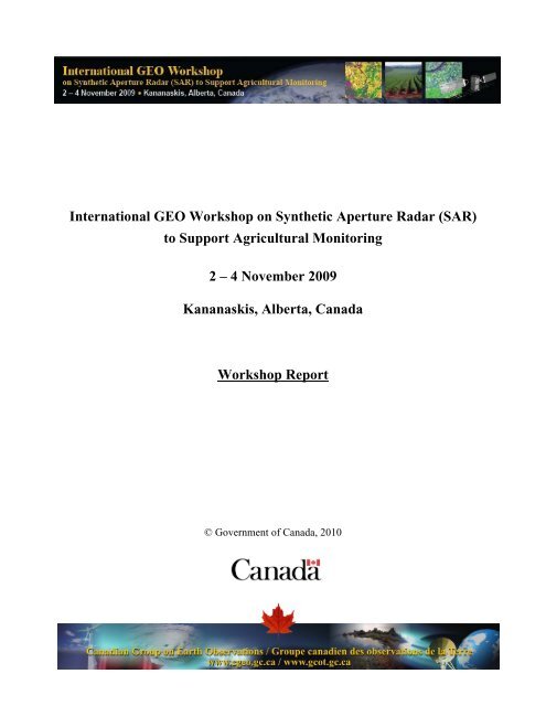
(SAR) to Support Agricultural Monitoring 2 - Group on Earth ...
(SAR) to Support Agricultural Monitoring 2 - Group on Earth ...
(SAR) to Support Agricultural Monitoring 2 - Group on Earth ...

Create successful ePaper yourself
Turn your PDF publications into a flip-book with our unique Google optimized e-Paper software.
Internati<strong>on</strong>al GEO Workshop <strong>on</strong> Synthetic Aperture Radar (<str<strong>on</strong>g>SAR</str<strong>on</strong>g>)<br />
<str<strong>on</strong>g>to</str<strong>on</strong>g> <str<strong>on</strong>g>Support</str<strong>on</strong>g> <str<strong>on</strong>g>Agricultural</str<strong>on</strong>g> M<strong>on</strong>i<str<strong>on</strong>g>to</str<strong>on</strong>g>ring<br />
2 – 4 November 2009<br />
Kananaskis, Alberta, Canada<br />
Workshop Report<br />
© Government of Canada, 2010
Internati<strong>on</strong>al GEO Workshop <strong>on</strong> <str<strong>on</strong>g>SAR</str<strong>on</strong>g> <str<strong>on</strong>g>to</str<strong>on</strong>g> <str<strong>on</strong>g>Support</str<strong>on</strong>g> <str<strong>on</strong>g>Agricultural</str<strong>on</strong>g> M<strong>on</strong>i<str<strong>on</strong>g>to</str<strong>on</strong>g>ring<br />
Executive Summary<br />
The Government of Canada, through the members of the interdepartmental Canadian <str<strong>on</strong>g>Group</str<strong>on</strong>g><br />
<strong>on</strong> <strong>Earth</strong> Observati<strong>on</strong>s (CGEO), coordinated with the internati<strong>on</strong>al GEO Global <str<strong>on</strong>g>Agricultural</str<strong>on</strong>g><br />
M<strong>on</strong>i<str<strong>on</strong>g>to</str<strong>on</strong>g>ring Community of Practice and other sp<strong>on</strong>sors and partners, <str<strong>on</strong>g>to</str<strong>on</strong>g> organize and host the<br />
Internati<strong>on</strong>al GEO Workshop <strong>on</strong> Synthetic Aperture Radar (<str<strong>on</strong>g>SAR</str<strong>on</strong>g>) <str<strong>on</strong>g>to</str<strong>on</strong>g> <str<strong>on</strong>g>Support</str<strong>on</strong>g> <str<strong>on</strong>g>Agricultural</str<strong>on</strong>g><br />
M<strong>on</strong>i<str<strong>on</strong>g>to</str<strong>on</strong>g>ring, which was held in Kananaskis, Alberta, Canada from 2-4 November 2009. The<br />
workshop was preceded by a pre-workshop “by invitati<strong>on</strong>” capacity building training sessi<strong>on</strong><br />
from 31 Oc<str<strong>on</strong>g>to</str<strong>on</strong>g>ber – 1 November.<br />
This workshop brought <str<strong>on</strong>g>to</str<strong>on</strong>g>gether 115 participants from around the world, with some 75 of the<br />
experts also participating in the pre-workshop capacity building training sessi<strong>on</strong>. Pre-training<br />
and post-workshop field trips were c<strong>on</strong>ducted by the University of Calgary and Parks<br />
Canada, and a planning meeting of the GEO Global <str<strong>on</strong>g>Agricultural</str<strong>on</strong>g> M<strong>on</strong>i<str<strong>on</strong>g>to</str<strong>on</strong>g>ring Community of<br />
Practice was held <strong>on</strong> 5 November. The participants included experts and managers who map<br />
agricultural land cover and land use; m<strong>on</strong>i<str<strong>on</strong>g>to</str<strong>on</strong>g>r changes in the agricultural land base; identify<br />
crops and estimate crop area; qualitatively and quantitatively assess crop c<strong>on</strong>diti<strong>on</strong>; and<br />
m<strong>on</strong>i<str<strong>on</strong>g>to</str<strong>on</strong>g>r properties related <str<strong>on</strong>g>to</str<strong>on</strong>g> water availability such as soil moisture.<br />
Funding from the Canadian Internati<strong>on</strong>al Development Agency (CIDA) provided travel and<br />
related expenses for 29 participants from developing countries <str<strong>on</strong>g>to</str<strong>on</strong>g> actively participate in the<br />
training course, workshop and field trips. Additi<strong>on</strong>al pers<strong>on</strong>s were sp<strong>on</strong>sored by GOFC-<br />
GOLD (Global Observati<strong>on</strong> of Forest and Land Cover Dynamics), Agriculture and Agri-<br />
Food Canada, and Envir<strong>on</strong>ment Canada.<br />
The objectives of the workshop were <str<strong>on</strong>g>to</str<strong>on</strong>g> increase understanding and capacity <str<strong>on</strong>g>to</str<strong>on</strong>g> use <str<strong>on</strong>g>SAR</str<strong>on</strong>g> data<br />
for agricultural m<strong>on</strong>i<str<strong>on</strong>g>to</str<strong>on</strong>g>ring, and the identify the needs of the agricultural community <str<strong>on</strong>g>to</str<strong>on</strong>g> space<br />
agencies and others involved in the delivery of <str<strong>on</strong>g>SAR</str<strong>on</strong>g> data and services. The workshop<br />
successfully provided a structure and forum <str<strong>on</strong>g>to</str<strong>on</strong>g> state clearly and str<strong>on</strong>gly the <strong>Earth</strong><br />
observati<strong>on</strong> requirements of the internati<strong>on</strong>al agriculture community and the strategies<br />
needed <str<strong>on</strong>g>to</str<strong>on</strong>g> promote the use of <str<strong>on</strong>g>SAR</str<strong>on</strong>g> for agricultural m<strong>on</strong>i<str<strong>on</strong>g>to</str<strong>on</strong>g>ring, in the c<strong>on</strong>text of science,<br />
research, operati<strong>on</strong>s and capacity. The participants also identified the informati<strong>on</strong> and<br />
operati<strong>on</strong>al needs of the agricultural user community <str<strong>on</strong>g>to</str<strong>on</strong>g> facilitate coordinated access <str<strong>on</strong>g>to</str<strong>on</strong>g> <strong>Earth</strong><br />
observati<strong>on</strong> data.<br />
The breakout groups and the panel discussi<strong>on</strong> identified a number of frequently recurring<br />
priorities and recommendati<strong>on</strong>s, including the need <str<strong>on</strong>g>to</str<strong>on</strong>g>:<br />
1. Organize a <str<strong>on</strong>g>SAR</str<strong>on</strong>g> comp<strong>on</strong>ent of the GEO Global <str<strong>on</strong>g>Agricultural</str<strong>on</strong>g> M<strong>on</strong>i<str<strong>on</strong>g>to</str<strong>on</strong>g>ring<br />
Community of Practice (CoP) and its partners <str<strong>on</strong>g>to</str<strong>on</strong>g> coordinate initiatives related <str<strong>on</strong>g>to</str<strong>on</strong>g><br />
the development of the <str<strong>on</strong>g>Agricultural</str<strong>on</strong>g> M<strong>on</strong>i<str<strong>on</strong>g>to</str<strong>on</strong>g>ring System of Systems.<br />
2. Pressure space agencies and data providers for lower cost <str<strong>on</strong>g>SAR</str<strong>on</strong>g> data and <str<strong>on</strong>g>to</str<strong>on</strong>g><br />
remove restricti<strong>on</strong>s <strong>on</strong> sharing and copying of data.<br />
i
Internati<strong>on</strong>al GEO Workshop <strong>on</strong> <str<strong>on</strong>g>SAR</str<strong>on</strong>g> <str<strong>on</strong>g>to</str<strong>on</strong>g> <str<strong>on</strong>g>Support</str<strong>on</strong>g> <str<strong>on</strong>g>Agricultural</str<strong>on</strong>g> M<strong>on</strong>i<str<strong>on</strong>g>to</str<strong>on</strong>g>ring<br />
3. Use JECAM (GEO Joint Experiment for Crop Area M<strong>on</strong>i<str<strong>on</strong>g>to</str<strong>on</strong>g>ring: Towards<br />
an <str<strong>on</strong>g>Agricultural</str<strong>on</strong>g> M<strong>on</strong>i<str<strong>on</strong>g>to</str<strong>on</strong>g>ring System of Systems) as a mechanism for capacity<br />
building in developing countries.<br />
4. Establish a website portal that includes training <strong>on</strong> <str<strong>on</strong>g>SAR</str<strong>on</strong>g> methods and best<br />
practices for agriculture applicati<strong>on</strong>s, including manuals, glossary of terms, list of<br />
experts, user forums and links <str<strong>on</strong>g>to</str<strong>on</strong>g> <str<strong>on</strong>g>SAR</str<strong>on</strong>g> data providers and other resources.<br />
5. Encourage scientific exchanges, capacity building and training through GEO<br />
organized annual/bi-annual workshops.<br />
6. Establish internati<strong>on</strong>al supersites <str<strong>on</strong>g>to</str<strong>on</strong>g> facilitate research collaborati<strong>on</strong>s.<br />
7. Document and clearly communicate data requirements of the agriculture<br />
community with respect <str<strong>on</strong>g>to</str<strong>on</strong>g>: spatial resoluti<strong>on</strong>; spatial coverage; temporal<br />
revisit/relook; data latency/delivery; and, <str<strong>on</strong>g>SAR</str<strong>on</strong>g> sensor parameters (frequency,<br />
polarizati<strong>on</strong>s, angles). These requirements should be communicated <str<strong>on</strong>g>to</str<strong>on</strong>g> the Space<br />
Agencies.<br />
8. Advocate the importance of data c<strong>on</strong>tinuity policies through future satellite<br />
missi<strong>on</strong>s.<br />
9. Prioritize and coordinate development of training programs and<br />
analysis/applicati<strong>on</strong> <str<strong>on</strong>g>to</str<strong>on</strong>g>ols and make these available <str<strong>on</strong>g>to</str<strong>on</strong>g> developing countries.<br />
The GEO Global <str<strong>on</strong>g>Agricultural</str<strong>on</strong>g> M<strong>on</strong>i<str<strong>on</strong>g>to</str<strong>on</strong>g>ring Community of Practice (CoP) will take the lead <str<strong>on</strong>g>to</str<strong>on</strong>g><br />
incorporate the priorities and recommendati<strong>on</strong>s in<str<strong>on</strong>g>to</str<strong>on</strong>g> upcoming planning exercises in relati<strong>on</strong><br />
<str<strong>on</strong>g>to</str<strong>on</strong>g> the tasks and activities of the GEO work planning process. Also, through the JECAM<br />
initiative, the CoP will coordinate the development of a series of pilot sites around the world<br />
<str<strong>on</strong>g>to</str<strong>on</strong>g> evaluate methods for deriving informati<strong>on</strong> from <strong>Earth</strong> observati<strong>on</strong> sensors, with an<br />
emphasis <strong>on</strong> <str<strong>on</strong>g>SAR</str<strong>on</strong>g> as a key data comp<strong>on</strong>ent of these sites. Outcomes from the workshop and<br />
next steps will be further elaborated as a discussi<strong>on</strong> item at future CoP meetings and<br />
workshops in 2010.<br />
In additi<strong>on</strong>, the peer-reviewed Canadian Journal of Remote Sensing will publish a Special<br />
Issue <strong>on</strong> <str<strong>on</strong>g>Agricultural</str<strong>on</strong>g> M<strong>on</strong>i<str<strong>on</strong>g>to</str<strong>on</strong>g>ring using <str<strong>on</strong>g>SAR</str<strong>on</strong>g> in mid-2010. Papers are solicited from<br />
applicati<strong>on</strong>s of <str<strong>on</strong>g>SAR</str<strong>on</strong>g> and <str<strong>on</strong>g>SAR</str<strong>on</strong>g>/optical integrati<strong>on</strong> <strong>on</strong> the <str<strong>on</strong>g>to</str<strong>on</strong>g>pics covered by this meeting.<br />
The workshop presentati<strong>on</strong>s are available <strong>on</strong>-line at www.cgeo.gc.ca and a CD will be<br />
produced with the PowerPoint presentati<strong>on</strong>s, al<strong>on</strong>g with the other workshop and training<br />
materials and this report. The CD will be sent <str<strong>on</strong>g>to</str<strong>on</strong>g> all attendees as well as <str<strong>on</strong>g>to</str<strong>on</strong>g> others up<strong>on</strong><br />
request. Additi<strong>on</strong>al copies will be made available at future events in which the GEO Global<br />
<str<strong>on</strong>g>Agricultural</str<strong>on</strong>g> M<strong>on</strong>i<str<strong>on</strong>g>to</str<strong>on</strong>g>ring Community of Practice participates.<br />
ii
Internati<strong>on</strong>al GEO Workshop <strong>on</strong> <str<strong>on</strong>g>SAR</str<strong>on</strong>g> <str<strong>on</strong>g>to</str<strong>on</strong>g> <str<strong>on</strong>g>Support</str<strong>on</strong>g> <str<strong>on</strong>g>Agricultural</str<strong>on</strong>g> M<strong>on</strong>i<str<strong>on</strong>g>to</str<strong>on</strong>g>ring<br />
Table of C<strong>on</strong>tents<br />
Executive Summary................................................................................................................. i<br />
Table of C<strong>on</strong>tents ………………………………………………………………………...…iii<br />
List of Figures ………………………………………………………………...……………iv<br />
List of Tables …………………………………………………………………..…………..iv<br />
1. Background ......................................................................................................................1<br />
2. Summary of Meeting Sessi<strong>on</strong>s ........................................................................................3<br />
2.1 Plenary and Keynote Addresses.................................................................................3<br />
2.2 <str<strong>on</strong>g>SAR</str<strong>on</strong>g> Data Providers...................................................................................................7<br />
2.3 <str<strong>on</strong>g>Agricultural</str<strong>on</strong>g> Productivity ...........................................................................................9<br />
2.4 Soil and Water Availability .......................................................................................9<br />
2.5 Land Cover and Land Management.........................................................................10<br />
2.6 Capacity Building Activities and Opportunities......................................................11<br />
3. Breakout Sessi<strong>on</strong>s...........................................................................................................15<br />
3.1 Findings of Pre-workshop Survey ...........................................................................15<br />
3.2 Scientific and Operati<strong>on</strong>al Requirements, Challenges and Strategies .....................17<br />
3.3 Transiti<strong>on</strong>ing from Research <str<strong>on</strong>g>to</str<strong>on</strong>g> Operati<strong>on</strong>al Use and Capacity Building ...............22<br />
4. Panel Discussi<strong>on</strong>.............................................................................................................26<br />
4.1 Space Agency Summary..........................................................................................26<br />
4.2 Value Added Community Summary........................................................................26<br />
4.3 Operati<strong>on</strong>al <str<strong>on</strong>g>Agricultural</str<strong>on</strong>g> M<strong>on</strong>i<str<strong>on</strong>g>to</str<strong>on</strong>g>ring Community Summary ..................................26<br />
4.4 University Researcher Community Summary .........................................................27<br />
4.5 Developing Country Scientists / Users Summary....................................................27<br />
4.6 Overall Workshop Summary ...................................................................................27<br />
5. Recommendati<strong>on</strong>s..........................................................................................................32<br />
6. Acti<strong>on</strong>s & Next Steps .....................................................................................................33<br />
Appendix A – Acknowledgements, Sp<strong>on</strong>sors and Partners ............................................. 34<br />
Appendix B – Agenda .......................................................................................................... 36<br />
Appendix C – Findings of Breakout Sessi<strong>on</strong>s …………………………………………… 42<br />
Appendix D – Alaska Satellite Facility: Data Portal, <str<strong>on</strong>g>SAR</str<strong>on</strong>g> Tools, and <str<strong>on</strong>g>SAR</str<strong>on</strong>g> Training ...43<br />
Appendix E – Workshop Organizing Committee ............................................................. 44<br />
Appendix F – Internati<strong>on</strong>al Technical Committee …………………………………...… 45<br />
Appendix G – List of Poster Presentati<strong>on</strong>s ……………………………………………… 46<br />
Appendix H – List of Participants ……………………………………………………..… 48<br />
Annex 1 – Report <strong>on</strong> Results: Survey <strong>on</strong> <str<strong>on</strong>g>SAR</str<strong>on</strong>g> <str<strong>on</strong>g>to</str<strong>on</strong>g> <str<strong>on</strong>g>Support</str<strong>on</strong>g> <str<strong>on</strong>g>Agricultural</str<strong>on</strong>g> M<strong>on</strong>i<str<strong>on</strong>g>to</str<strong>on</strong>g>ring … 49<br />
iii
Internati<strong>on</strong>al GEO Workshop <strong>on</strong> <str<strong>on</strong>g>SAR</str<strong>on</strong>g> <str<strong>on</strong>g>to</str<strong>on</strong>g> <str<strong>on</strong>g>Support</str<strong>on</strong>g> <str<strong>on</strong>g>Agricultural</str<strong>on</strong>g> M<strong>on</strong>i<str<strong>on</strong>g>to</str<strong>on</strong>g>ring<br />
List of Figures<br />
Figure 1 Growth Stages of a CoP - Where Are We? ...............................................................6<br />
Figure 2 Sample Field Campaign in Argentina .......................................................................8<br />
Figure 3 Scattering Mechanisms............................................................................................10<br />
Figure 4 RADARSAT-2 Fine Quad Mode Scene of Flevoland, Netherlands.......................12<br />
Figure 5 Top Twelve Applicati<strong>on</strong>s of <str<strong>on</strong>g>Agricultural</str<strong>on</strong>g> M<strong>on</strong>i<str<strong>on</strong>g>to</str<strong>on</strong>g>ring Data....................................15<br />
Figure 6 C<strong>on</strong>ceptual Diagram of the <str<strong>on</strong>g>Agricultural</str<strong>on</strong>g> M<strong>on</strong>i<str<strong>on</strong>g>to</str<strong>on</strong>g>ring System of Systems ..............29<br />
Figure 7 Transiti<strong>on</strong>ing Research <str<strong>on</strong>g>to</str<strong>on</strong>g> Operati<strong>on</strong>s .....................................................................30<br />
List of Tables<br />
Table 1 Recommended Approach <str<strong>on</strong>g>to</str<strong>on</strong>g> Breakout Sessi<strong>on</strong>s .......................................................16<br />
Table 2 Recommended Approach for Scientific and Operati<strong>on</strong>al Challenges ......................19<br />
Table 3 Recommended Approach for Transiti<strong>on</strong>ing <str<strong>on</strong>g>to</str<strong>on</strong>g> Operati<strong>on</strong>s and Capacity Building..23<br />
iv
Internati<strong>on</strong>al GEO Workshop <strong>on</strong> <str<strong>on</strong>g>SAR</str<strong>on</strong>g> <str<strong>on</strong>g>to</str<strong>on</strong>g> <str<strong>on</strong>g>Support</str<strong>on</strong>g> <str<strong>on</strong>g>Agricultural</str<strong>on</strong>g> M<strong>on</strong>i<str<strong>on</strong>g>to</str<strong>on</strong>g>ring<br />
1. Background<br />
On 16 – 18 July 2007, the sec<strong>on</strong>d IGOL (Integrated Global Observati<strong>on</strong>s for Land)/ GEO<br />
(<str<strong>on</strong>g>Group</str<strong>on</strong>g> <strong>on</strong> <strong>Earth</strong> Observati<strong>on</strong>s) workshop c<strong>on</strong>vened at the headquarters of the UN Food and<br />
Agriculture Organizati<strong>on</strong> (FAO) in Rome <str<strong>on</strong>g>to</str<strong>on</strong>g> develop a strategy for global agricultural<br />
m<strong>on</strong>i<str<strong>on</strong>g>to</str<strong>on</strong>g>ring in the framework of GEO. At that meeting, the participants representing twentyfive<br />
nati<strong>on</strong>al and internati<strong>on</strong>al organizati<strong>on</strong>s established the ‘GEOSS/IGOL <str<strong>on</strong>g>Agricultural</str<strong>on</strong>g><br />
M<strong>on</strong>i<str<strong>on</strong>g>to</str<strong>on</strong>g>ring Community of Practice’. The workshop reviewed the current state of agricultural<br />
m<strong>on</strong>i<str<strong>on</strong>g>to</str<strong>on</strong>g>ring and revised the GEO worplan <str<strong>on</strong>g>Agricultural</str<strong>on</strong>g> M<strong>on</strong>i<str<strong>on</strong>g>to</str<strong>on</strong>g>ring Task (AG-07-03). A<br />
str<strong>on</strong>g case was made for increased attenti<strong>on</strong> <str<strong>on</strong>g>to</str<strong>on</strong>g> the emerging <str<strong>on</strong>g>SAR</str<strong>on</strong>g> (synthetic aperture radar)<br />
capabilities for agricultural m<strong>on</strong>i<str<strong>on</strong>g>to</str<strong>on</strong>g>ring. There was a perceived need for a community<br />
workshop <str<strong>on</strong>g>to</str<strong>on</strong>g> develop a c<strong>on</strong>sensus <strong>on</strong> current capabilities and the future role of <str<strong>on</strong>g>SAR</str<strong>on</strong>g> data in<br />
the Ag 0703 Task.<br />
In resp<strong>on</strong>se <str<strong>on</strong>g>to</str<strong>on</strong>g> this view, the Canadian <str<strong>on</strong>g>Group</str<strong>on</strong>g> <strong>on</strong> <strong>Earth</strong> Observati<strong>on</strong>s (CGEO) joined with the<br />
Government of Canada and other sp<strong>on</strong>sors <str<strong>on</strong>g>to</str<strong>on</strong>g> organize the Internati<strong>on</strong>al GEO Workshop <strong>on</strong><br />
<str<strong>on</strong>g>SAR</str<strong>on</strong>g> <str<strong>on</strong>g>to</str<strong>on</strong>g> <str<strong>on</strong>g>Support</str<strong>on</strong>g> <str<strong>on</strong>g>Agricultural</str<strong>on</strong>g> M<strong>on</strong>i<str<strong>on</strong>g>to</str<strong>on</strong>g>ring in Kananaskis, Alberta <strong>on</strong> 2 – 4 November 2009.<br />
This workshop purpose was <str<strong>on</strong>g>to</str<strong>on</strong>g> bring <str<strong>on</strong>g>to</str<strong>on</strong>g>gether remote sensing experts and resource managers<br />
who map agricultural land cover and land use; m<strong>on</strong>i<str<strong>on</strong>g>to</str<strong>on</strong>g>r changes in the agricultural land base;<br />
identify crops and estimate crop area; qualitatively and quantitatively assess crop c<strong>on</strong>diti<strong>on</strong>;<br />
and m<strong>on</strong>i<str<strong>on</strong>g>to</str<strong>on</strong>g>r properties related <str<strong>on</strong>g>to</str<strong>on</strong>g> water availability such as soil moisture <str<strong>on</strong>g>to</str<strong>on</strong>g> provide a forum<br />
for discussi<strong>on</strong> of how <str<strong>on</strong>g>to</str<strong>on</strong>g> advance the use of <str<strong>on</strong>g>SAR</str<strong>on</strong>g> for agricultural m<strong>on</strong>i<str<strong>on</strong>g>to</str<strong>on</strong>g>ring.<br />
The workshop was organized <str<strong>on</strong>g>to</str<strong>on</strong>g> identify and communicate the informati<strong>on</strong> and operati<strong>on</strong>al<br />
needs of the agricultural user community <str<strong>on</strong>g>to</str<strong>on</strong>g> facilitate coordinated access <str<strong>on</strong>g>to</str<strong>on</strong>g> <strong>Earth</strong> observati<strong>on</strong><br />
data. A “by invitati<strong>on</strong>” training sessi<strong>on</strong> was organized, targeted <str<strong>on</strong>g>to</str<strong>on</strong>g>wards participants from<br />
developing countries, and it preceded the workshop from 31 Oc<str<strong>on</strong>g>to</str<strong>on</strong>g>ber – 1 November.<br />
The goal of the workshop was <str<strong>on</strong>g>to</str<strong>on</strong>g> state clearly and str<strong>on</strong>gly the <strong>Earth</strong> Observati<strong>on</strong><br />
requirements of the internati<strong>on</strong>al agriculture community and the strategies needed <str<strong>on</strong>g>to</str<strong>on</strong>g> promote<br />
the use of <str<strong>on</strong>g>SAR</str<strong>on</strong>g> for agricultural m<strong>on</strong>i<str<strong>on</strong>g>to</str<strong>on</strong>g>ring, in the c<strong>on</strong>text of science, research, operati<strong>on</strong>s and<br />
capacity.<br />
The specific objectives of the workshop were <str<strong>on</strong>g>to</str<strong>on</strong>g>:<br />
1. Increase understanding of the capabilities of <str<strong>on</strong>g>SAR</str<strong>on</strong>g> for agricultural m<strong>on</strong>i<str<strong>on</strong>g>to</str<strong>on</strong>g>ring;<br />
2. Share best practices with respect <str<strong>on</strong>g>to</str<strong>on</strong>g> processing, analysis and modeling of <str<strong>on</strong>g>SAR</str<strong>on</strong>g><br />
data for agricultural mapping and m<strong>on</strong>i<str<strong>on</strong>g>to</str<strong>on</strong>g>ring;<br />
3. Increase awareness of software <str<strong>on</strong>g>to</str<strong>on</strong>g>ols, applicati<strong>on</strong>s and processes for the effective<br />
use of <str<strong>on</strong>g>SAR</str<strong>on</strong>g> for agricultural m<strong>on</strong>i<str<strong>on</strong>g>to</str<strong>on</strong>g>ring;<br />
4. Build capacity within the agricultural user community <str<strong>on</strong>g>to</str<strong>on</strong>g> exploit <str<strong>on</strong>g>SAR</str<strong>on</strong>g> data,<br />
especially in developing countries; and<br />
1
Internati<strong>on</strong>al GEO Workshop <strong>on</strong> <str<strong>on</strong>g>SAR</str<strong>on</strong>g> <str<strong>on</strong>g>to</str<strong>on</strong>g> <str<strong>on</strong>g>Support</str<strong>on</strong>g> <str<strong>on</strong>g>Agricultural</str<strong>on</strong>g> M<strong>on</strong>i<str<strong>on</strong>g>to</str<strong>on</strong>g>ring<br />
5. Initiate a dialogue <str<strong>on</strong>g>to</str<strong>on</strong>g> identify the needs of the agriculture m<strong>on</strong>i<str<strong>on</strong>g>to</str<strong>on</strong>g>ring community<br />
with <str<strong>on</strong>g>SAR</str<strong>on</strong>g> satellite opera<str<strong>on</strong>g>to</str<strong>on</strong>g>rs and <str<strong>on</strong>g>SAR</str<strong>on</strong>g> applicati<strong>on</strong> software developers.<br />
In preparati<strong>on</strong> for this workshop, a survey was sent out <str<strong>on</strong>g>to</str<strong>on</strong>g> the agricultural m<strong>on</strong>i<str<strong>on</strong>g>to</str<strong>on</strong>g>ring<br />
community. The purpose of this survey was <str<strong>on</strong>g>to</str<strong>on</strong>g> collect the views of the community and<br />
present this <str<strong>on</strong>g>to</str<strong>on</strong>g> the workshop attendees, <str<strong>on</strong>g>to</str<strong>on</strong>g> ‘prime the pump’ and stimulate discussi<strong>on</strong> for<br />
producing effective recommendati<strong>on</strong>s during the workshop. This provided the organizati<strong>on</strong><br />
and technical team the current state of agricultural m<strong>on</strong>i<str<strong>on</strong>g>to</str<strong>on</strong>g>ring, in particular using <str<strong>on</strong>g>SAR</str<strong>on</strong>g> data,<br />
and what the issues are and what acti<strong>on</strong>s could encourage greater use of <str<strong>on</strong>g>SAR</str<strong>on</strong>g> data for<br />
agricultural m<strong>on</strong>i<str<strong>on</strong>g>to</str<strong>on</strong>g>ring.<br />
The workshop agenda is provided in Appendix B, the list of participants in Appendix H, the<br />
survey results are found in the report in Annex 1, and the list of poster presentati<strong>on</strong>s in<br />
Appendix G. The Workshop Organizing Committee and Internati<strong>on</strong>al Technical Team are<br />
listed in Appendices E and F. The findings of the breakout sessi<strong>on</strong>s are available in<br />
Appendix C. Informati<strong>on</strong> about the ASF (Alaska Satellite Facility) Data Portal, <str<strong>on</strong>g>SAR</str<strong>on</strong>g> Tools,<br />
and <str<strong>on</strong>g>SAR</str<strong>on</strong>g> Training is provided in Appendix D.<br />
The workshop presentati<strong>on</strong>s are available <strong>on</strong>-line at:<br />
http://www.cgeo.gc.ca/events-evenements/sar-ros/agenda-ordre-eng.asp<br />
2
Internati<strong>on</strong>al GEO Workshop <strong>on</strong> <str<strong>on</strong>g>SAR</str<strong>on</strong>g> <str<strong>on</strong>g>to</str<strong>on</strong>g> <str<strong>on</strong>g>Support</str<strong>on</strong>g> <str<strong>on</strong>g>Agricultural</str<strong>on</strong>g> M<strong>on</strong>i<str<strong>on</strong>g>to</str<strong>on</strong>g>ring<br />
2. Summary of Meeting Sessi<strong>on</strong>s<br />
2.1 Plenary and Keynote Addresses<br />
Ken Korporal of the CGEO Secretariat opened the workshop by welcoming the participants,<br />
which included more than 115 experts representing 30 countries and seven Canadian<br />
provinces. More than 75 people participated in the weekend training sessi<strong>on</strong> and field trips<br />
led by the Agriculture Canada, the University of Calgary and Parks Canada. He<br />
acknowledged the funding of sp<strong>on</strong>soring organizati<strong>on</strong>s, including the Canadian Internati<strong>on</strong>al<br />
Development Agency (CIDA) who funded 29 participants from developing countries, and<br />
additi<strong>on</strong>al funding <str<strong>on</strong>g>to</str<strong>on</strong>g> speakers from GOFC-GOLD (Global Observati<strong>on</strong> of Forest and Land<br />
Cover Dynamics), Agriculture and Agri-Food Canada, and Envir<strong>on</strong>ment Canada.<br />
Sherman Nels<strong>on</strong> of Agriculture and Agri-Food Canada (AAFC) made welcoming remarks <strong>on</strong><br />
behalf of the Government of Canada. He stated that critical policy decisi<strong>on</strong>s need <str<strong>on</strong>g>to</str<strong>on</strong>g> be<br />
based <strong>on</strong> sound scientific informati<strong>on</strong>, and <strong>Earth</strong> Observati<strong>on</strong> (EO) has a key role in<br />
providing this. He challenged participants <str<strong>on</strong>g>to</str<strong>on</strong>g> find ways <str<strong>on</strong>g>to</str<strong>on</strong>g> increase the number of operati<strong>on</strong>al<br />
applicati<strong>on</strong>s that EO can provide sound scientific informati<strong>on</strong> for the policy community.<br />
Brenda Brindle of Alberta Agriculture and Rural Development welcomed participants <strong>on</strong><br />
behalf of the Government of Alberta. The province exports $ 8 billi<strong>on</strong> (Can.) of agricultural<br />
products annually, and the growing populati<strong>on</strong> is putting pressure <strong>on</strong> agriculture. She<br />
emphasized that coordinated and relevant knowledge is key <str<strong>on</strong>g>to</str<strong>on</strong>g> good management decisi<strong>on</strong>s,<br />
and so m<strong>on</strong>i<str<strong>on</strong>g>to</str<strong>on</strong>g>ring systems are needed.<br />
David Grimes, GEO Principal for Canada and Assistant Deputy Minister at Envir<strong>on</strong>ment<br />
Canada, gave a Canadian perspective of GEO and GEOSS (Global <strong>Earth</strong> Observati<strong>on</strong> System<br />
of Systems). The visi<strong>on</strong> of GEOSS is ‘To realize a future wherein decisi<strong>on</strong>s and acti<strong>on</strong>s for<br />
the benefit of humankind are informed by coordinated, comprehensive and sustained <strong>Earth</strong><br />
observati<strong>on</strong>s and informati<strong>on</strong>’. He provided an overview of GEO and GEOSS and a<br />
descripti<strong>on</strong> of some of the related work being d<strong>on</strong>e both in Canada and abroad.<br />
Anna Pacheco of AAFC presented the workshop overview, objectives and desired outcomes,<br />
opening with a quotati<strong>on</strong> from Dr. Robert H. Goddard: “It is difficult <str<strong>on</strong>g>to</str<strong>on</strong>g> say what is<br />
impossible, for the dream of yesterday is the hope of <str<strong>on</strong>g>to</str<strong>on</strong>g>day and the reality of <str<strong>on</strong>g>to</str<strong>on</strong>g>morrow.” She<br />
observed that the Agriculture community has not yet had a str<strong>on</strong>g and coordinated voice with<br />
respect <str<strong>on</strong>g>to</str<strong>on</strong>g> their EO requirements, and <strong>on</strong>ly through such coordinati<strong>on</strong> that the community can<br />
make the most effective use of existing resources, and influence the next generati<strong>on</strong> of<br />
technologies. She proposed that we must strive <str<strong>on</strong>g>to</str<strong>on</strong>g> get the technology and the methods that<br />
are proven in<str<strong>on</strong>g>to</str<strong>on</strong>g> the hands of the broad agriculture community. This workshop with its<br />
various sessi<strong>on</strong>s will provide <strong>on</strong>e step <str<strong>on</strong>g>to</str<strong>on</strong>g>wards these goals.<br />
3
Internati<strong>on</strong>al GEO Workshop <strong>on</strong> <str<strong>on</strong>g>SAR</str<strong>on</strong>g> <str<strong>on</strong>g>to</str<strong>on</strong>g> <str<strong>on</strong>g>Support</str<strong>on</strong>g> <str<strong>on</strong>g>Agricultural</str<strong>on</strong>g> M<strong>on</strong>i<str<strong>on</strong>g>to</str<strong>on</strong>g>ring<br />
Jai Singh Parihar of Indian Space Applicati<strong>on</strong>s Centre presented the GEO <str<strong>on</strong>g>Agricultural</str<strong>on</strong>g><br />
M<strong>on</strong>i<str<strong>on</strong>g>to</str<strong>on</strong>g>ring Community of Practice. He outlined that the reas<strong>on</strong>s <str<strong>on</strong>g>to</str<strong>on</strong>g> m<strong>on</strong>i<str<strong>on</strong>g>to</str<strong>on</strong>g>r world<br />
agriculture are:<br />
• Early Warning of Harvest Shortfalls or Abundance<br />
• Famine Early Warning for food insecure countries<br />
• Help m<strong>on</strong>i<str<strong>on</strong>g>to</str<strong>on</strong>g>r market supply and demand - Nati<strong>on</strong>al <str<strong>on</strong>g>Agricultural</str<strong>on</strong>g> Producti<strong>on</strong><br />
M<strong>on</strong>i<str<strong>on</strong>g>to</str<strong>on</strong>g>ring (Area Planted, Crop C<strong>on</strong>diti<strong>on</strong>, Yield)<br />
• M<strong>on</strong>i<str<strong>on</strong>g>to</str<strong>on</strong>g>ring of <str<strong>on</strong>g>Agricultural</str<strong>on</strong>g> Land Use Change (Cropland expansi<strong>on</strong>, intensificati<strong>on</strong>,<br />
aband<strong>on</strong>ment, change in crop type and cropping practices).<br />
Dr. Parihar introduced Chris Justice from University of Maryland, Co-Chair of the Global<br />
<str<strong>on</strong>g>Agricultural</str<strong>on</strong>g> M<strong>on</strong>i<str<strong>on</strong>g>to</str<strong>on</strong>g>ring (AG-07-03) task, and Jinl<strong>on</strong>g Fan from the GEO Secretariat who<br />
both made brief remarks.<br />
Dr. Parihar defined Communities of Practice (CoP) as “<str<strong>on</strong>g>Group</str<strong>on</strong>g>s of people who share a<br />
c<strong>on</strong>cern, a set of problems, or a passi<strong>on</strong> about a <str<strong>on</strong>g>to</str<strong>on</strong>g>pic by interacting <strong>on</strong> an <strong>on</strong>going basis”<br />
[Cultivating Communities of Practice, Harvard Business School Press, 2002]. He also<br />
presented the GEO <str<strong>on</strong>g>Agricultural</str<strong>on</strong>g> M<strong>on</strong>i<str<strong>on</strong>g>to</str<strong>on</strong>g>ring Task (Ag 0703); the near term task initiatives<br />
are:<br />
• Initiative 1: A Multi-source Producti<strong>on</strong>, Acreage and Yield (PAY) database<br />
• Initiative 2: Joint Experiments <strong>on</strong> Crop Assessment and M<strong>on</strong>i<str<strong>on</strong>g>to</str<strong>on</strong>g>ring (JECAM)<br />
• Initiative 3: Coordinated Data Initiatives for Global <str<strong>on</strong>g>Agricultural</str<strong>on</strong>g> M<strong>on</strong>i<str<strong>on</strong>g>to</str<strong>on</strong>g>ring<br />
(CDIGAM)<br />
• Initiative 4: GLAMSS Thematic Workshop Series (GTWS)<br />
• Initiative 5: Agriculture and Climate Change (initiative in development).<br />
Dr. Parihar presented the growth stages of a CoP and showed where he thinks this CoP is in<br />
maturity, as indicated by the vertical line in Figure 1.<br />
Bradley Doorn of NASA presented ‘Developing Agriculture M<strong>on</strong>i<str<strong>on</strong>g>to</str<strong>on</strong>g>ring Requirements and<br />
Recognizing the <strong>Earth</strong> Observati<strong>on</strong> Gaps’. He indicated that NASA is giving away high<br />
volumes of data <str<strong>on</strong>g>to</str<strong>on</strong>g> foster discovery that will ultimately lead <str<strong>on</strong>g>to</str<strong>on</strong>g> societal benefits. He proposed<br />
that requirements for the community should be defined by category, including:<br />
• frequency,<br />
• latency,<br />
• accessibility,<br />
• spatial completeness,<br />
• relevance,<br />
• c<strong>on</strong>fidence, and<br />
• l<strong>on</strong>gevity<br />
in how these effect agriculture management and policy decisi<strong>on</strong>s. We must first ask “Why<br />
are the decisi<strong>on</strong>s needed and how are decisi<strong>on</strong>s made now?” He identified requirement gaps<br />
in c<strong>on</strong>fidence, completeness, frequency and relevance, citing examples of the critical<br />
indica<str<strong>on</strong>g>to</str<strong>on</strong>g>rs of vegetati<strong>on</strong> health, soil moisture and vegetati<strong>on</strong> type.<br />
4
Internati<strong>on</strong>al GEO Workshop <strong>on</strong> <str<strong>on</strong>g>SAR</str<strong>on</strong>g> <str<strong>on</strong>g>to</str<strong>on</strong>g> <str<strong>on</strong>g>Support</str<strong>on</strong>g> <str<strong>on</strong>g>Agricultural</str<strong>on</strong>g> M<strong>on</strong>i<str<strong>on</strong>g>to</str<strong>on</strong>g>ring<br />
Brian Brisco (Canada Centre for Remote Sensing, CCRS) presented the state of <str<strong>on</strong>g>SAR</str<strong>on</strong>g> for<br />
agricultural m<strong>on</strong>i<str<strong>on</strong>g>to</str<strong>on</strong>g>ring. He emphasized that no spaceborne <str<strong>on</strong>g>SAR</str<strong>on</strong>g> yet has been designed for<br />
land applicati<strong>on</strong>s, so often the c<strong>on</strong>figurati<strong>on</strong> is sub-optimal for agricultural m<strong>on</strong>i<str<strong>on</strong>g>to</str<strong>on</strong>g>ring. From<br />
a technical perspective, the backscatter from the soil, vegetati<strong>on</strong> and interacti<strong>on</strong> terms are<br />
integrated and this c<strong>on</strong>fuses the interpretati<strong>on</strong> of the satellite measurements; these terms need<br />
<str<strong>on</strong>g>to</str<strong>on</strong>g> be separated by multiple observati<strong>on</strong>s and new technology. Dr. Brisco highlighted the<br />
benefits of multi-frequency, multi-temporal, multi-incidence and multi- polarizati<strong>on</strong><br />
approaches. Adding optical EO data can increase the accuracy dramatically. He presented<br />
the barriers <str<strong>on</strong>g>to</str<strong>on</strong>g> greater operati<strong>on</strong>al adopti<strong>on</strong> of <str<strong>on</strong>g>SAR</str<strong>on</strong>g> and the remaining research and<br />
development (R&D) needs.<br />
5
Loose network<br />
of people with<br />
similar issues<br />
and needs<br />
Potential<br />
Agree <strong>on</strong> a<br />
comm<strong>on</strong><br />
Visi<strong>on</strong> and<br />
Goals<br />
Internati<strong>on</strong>al GEO Workshop <strong>on</strong> <str<strong>on</strong>g>SAR</str<strong>on</strong>g> <str<strong>on</strong>g>to</str<strong>on</strong>g> <str<strong>on</strong>g>Support</str<strong>on</strong>g> <str<strong>on</strong>g>Agricultural</str<strong>on</strong>g> M<strong>on</strong>i<str<strong>on</strong>g>to</str<strong>on</strong>g>ring<br />
Figure 1 Growth Stages of a CoP - Where Are We?<br />
We Are Here<br />
Members<br />
come<br />
<str<strong>on</strong>g>to</str<strong>on</strong>g>gether and<br />
launch a<br />
community<br />
Coalescing<br />
Identify and<br />
prioritize<br />
activities<br />
Engage partner<br />
organizati<strong>on</strong>s<br />
It forms an<br />
identity, takes<br />
charge of its<br />
practice and<br />
grows<br />
Maturing<br />
Set standards,<br />
Implement<br />
system<br />
comp<strong>on</strong>ents<br />
6<br />
The community is<br />
established and<br />
acts as the steward<br />
of its domain<br />
Stewardship<br />
The Ag M<strong>on</strong><br />
System of<br />
Systems is<br />
established and<br />
is operati<strong>on</strong>al<br />
The community<br />
has outlived its<br />
usefulness and<br />
people move <strong>on</strong><br />
?<br />
Legacy<br />
Let go, define<br />
a legacy, and<br />
keep in <str<strong>on</strong>g>to</str<strong>on</strong>g>uch
Internati<strong>on</strong>al GEO Workshop <strong>on</strong> <str<strong>on</strong>g>SAR</str<strong>on</strong>g> <str<strong>on</strong>g>to</str<strong>on</strong>g> <str<strong>on</strong>g>Support</str<strong>on</strong>g> <str<strong>on</strong>g>Agricultural</str<strong>on</strong>g> M<strong>on</strong>i<str<strong>on</strong>g>to</str<strong>on</strong>g>ring<br />
2.2 <str<strong>on</strong>g>SAR</str<strong>on</strong>g> Data Providers<br />
Yves Crevier of Canadian Space Agency (CSA) opened this sessi<strong>on</strong>, which brought <str<strong>on</strong>g>to</str<strong>on</strong>g>gether<br />
space agencies and companies that provide <str<strong>on</strong>g>SAR</str<strong>on</strong>g> data <str<strong>on</strong>g>to</str<strong>on</strong>g> the public. He gave two quotati<strong>on</strong>s,<br />
<str<strong>on</strong>g>to</str<strong>on</strong>g> frame his presentati<strong>on</strong>: “Technology and science are <strong>on</strong>ly as good as our ability <str<strong>on</strong>g>to</str<strong>on</strong>g> use the<br />
informati<strong>on</strong> they provide.”, and “The successes are dependent <strong>on</strong> our ability <str<strong>on</strong>g>to</str<strong>on</strong>g> relay the<br />
informati<strong>on</strong> the final mile <str<strong>on</strong>g>to</str<strong>on</strong>g> the people.” He identified the following opportunities for the<br />
<str<strong>on</strong>g>Agricultural</str<strong>on</strong>g> M<strong>on</strong>i<str<strong>on</strong>g>to</str<strong>on</strong>g>ring CoP as:<br />
• To identify and prioritize the needs of the agriculture m<strong>on</strong>i<str<strong>on</strong>g>to</str<strong>on</strong>g>ring community<br />
• To communicate the informati<strong>on</strong> requirements and operati<strong>on</strong>al needs <str<strong>on</strong>g>to</str<strong>on</strong>g> facilitate<br />
coordinated access <str<strong>on</strong>g>to</str<strong>on</strong>g> EO data.<br />
Similarly, opportunities for the <str<strong>on</strong>g>SAR</str<strong>on</strong>g>-operating space agencies are:<br />
• To open a dialogue with internati<strong>on</strong>al science communities<br />
• To understand the data needs and requirements regarding agriculture m<strong>on</strong>i<str<strong>on</strong>g>to</str<strong>on</strong>g>ring that<br />
can be addressed by <str<strong>on</strong>g>SAR</str<strong>on</strong>g> data products.<br />
The following <str<strong>on</strong>g>SAR</str<strong>on</strong>g> data providers presented the details of their satellites, <str<strong>on</strong>g>SAR</str<strong>on</strong>g> sensors,<br />
agricultural applicati<strong>on</strong>s, and R&D programs:<br />
• Comisión Naci<strong>on</strong>al de Actividades Espaciales (CONAE, Argentina’s Nati<strong>on</strong>al<br />
Commissi<strong>on</strong> <strong>on</strong> Space Activities)<br />
• Canadian Space Agency (CSA)<br />
• Deutsches Zentrum für Luft- und Raumfahrt (DLR, German Aerospace Centre)<br />
• European Space Agency (ESA)<br />
• Japan Aerospace Explorati<strong>on</strong> Agency (JAXA)<br />
• Nati<strong>on</strong>al Aer<strong>on</strong>autics and Space Administrati<strong>on</strong> (NASA)<br />
• MacD<strong>on</strong>ald Dettwiler and Associates Ltd (MDA).<br />
Figure 2 shows typical roughness and vegetati<strong>on</strong> cover from a sample field campaign in<br />
Argentina.<br />
Denis Auger of CSA predicted that 250 EO satellites will be launched over the next ten<br />
years. Malcolm Davids<strong>on</strong> of ESA described the future launch of the Sentinel-1 satellites,<br />
which will be user-driven, and will provide c<strong>on</strong>flict-free operati<strong>on</strong>s. Routine Data Access<br />
will be available at no charge.<br />
During the questi<strong>on</strong> period, it was pointed out that in the next few years, there will be a<br />
number of <str<strong>on</strong>g>SAR</str<strong>on</strong>g> spaceborne sensors at L-band, C-band and X-band, so multi-frequency<br />
technology will be available <str<strong>on</strong>g>to</str<strong>on</strong>g> exploit by the science and user communities. There are still<br />
open science questi<strong>on</strong>s, including how best <str<strong>on</strong>g>to</str<strong>on</strong>g> use multiple frequencies, multiple incidence<br />
angles, polarimetry and multi-temporal acquisiti<strong>on</strong>s for each of the applicati<strong>on</strong>s, such as crop<br />
yield and health, soil moisture and tillage. Providing scientific research <str<strong>on</strong>g>to</str<strong>on</strong>g> resp<strong>on</strong>d <str<strong>on</strong>g>to</str<strong>on</strong>g> these<br />
questi<strong>on</strong>s can help the space agencies <str<strong>on</strong>g>to</str<strong>on</strong>g> meet user needs.<br />
7
High Roughness S1<br />
Low roughness S2<br />
Internati<strong>on</strong>al GEO Workshop <strong>on</strong> <str<strong>on</strong>g>SAR</str<strong>on</strong>g> <str<strong>on</strong>g>to</str<strong>on</strong>g> <str<strong>on</strong>g>Support</str<strong>on</strong>g> <str<strong>on</strong>g>Agricultural</str<strong>on</strong>g> M<strong>on</strong>i<str<strong>on</strong>g>to</str<strong>on</strong>g>ring<br />
Figure 2 Sample Field Campaign in Argentina<br />
Falda del Carmen Córdoba<br />
8<br />
Corn Stubble N4<br />
Wheat N5
Internati<strong>on</strong>al GEO Workshop <strong>on</strong> <str<strong>on</strong>g>SAR</str<strong>on</strong>g> <str<strong>on</strong>g>to</str<strong>on</strong>g> <str<strong>on</strong>g>Support</str<strong>on</strong>g> <str<strong>on</strong>g>Agricultural</str<strong>on</strong>g> M<strong>on</strong>i<str<strong>on</strong>g>to</str<strong>on</strong>g>ring<br />
2.3 <str<strong>on</strong>g>Agricultural</str<strong>on</strong>g> Productivity<br />
The ‘<str<strong>on</strong>g>Agricultural</str<strong>on</strong>g> Productivity’ technical sessi<strong>on</strong> focused <strong>on</strong> internati<strong>on</strong>al research and<br />
development for crop area m<strong>on</strong>i<str<strong>on</strong>g>to</str<strong>on</strong>g>ring. Chakrapani Patnaik (Indian Space Research<br />
Organizati<strong>on</strong>, ISRO) described the rice crop m<strong>on</strong>i<str<strong>on</strong>g>to</str<strong>on</strong>g>ring using <str<strong>on</strong>g>SAR</str<strong>on</strong>g> that has been operati<strong>on</strong>al<br />
in India since 1999. Jim Finnigan (Digital Envir<strong>on</strong>mental Management) described a<br />
dem<strong>on</strong>strati<strong>on</strong> of rice crop m<strong>on</strong>i<str<strong>on</strong>g>to</str<strong>on</strong>g>ring in the Philippines. He showed that using coarser<br />
resoluti<strong>on</strong> data was much more affordable and impacted the accuracy very little. Two key<br />
advantages of remote sensing are that the results are unbiased and a remote sensing based<br />
survey is much faster (at least <strong>on</strong>e order of magnitude faster) than a ground-based survey.<br />
Shao Yun (Institute of Remote Sensing Applicati<strong>on</strong>s, China) presented the use of<br />
polarizati<strong>on</strong> signature analysis <str<strong>on</strong>g>to</str<strong>on</strong>g> discriminate rice crop areas, even in mountainous terrain.<br />
Jins<strong>on</strong>g Chen (H<strong>on</strong>g K<strong>on</strong>g Chinese University) highlighted his work <strong>on</strong> m<strong>on</strong>i<str<strong>on</strong>g>to</str<strong>on</strong>g>ring rice and<br />
sugarcane using ENVISAT-A<str<strong>on</strong>g>SAR</str<strong>on</strong>g> data. Nathan Torbrick (Applied Geosoluti<strong>on</strong>s) outlined<br />
work <strong>on</strong> mapping rice agriculture and calculating Greenhouse Gas emissi<strong>on</strong>s in China and<br />
US.<br />
Jai Singh Parihar (ISRO) dem<strong>on</strong>strated how a wide range of optical and active / passive<br />
microwave sensors can provide a wealth of informati<strong>on</strong>, emphasizing the need for integrati<strong>on</strong><br />
of all of these technologies. He suggested that we need <str<strong>on</strong>g>to</str<strong>on</strong>g> c<strong>on</strong>tinue <str<strong>on</strong>g>to</str<strong>on</strong>g> explore other sensors<br />
which are suitable for other agricultural regi<strong>on</strong>s where other crops are planted.<br />
2.4 Soil and Water Availability<br />
In the ‘Soil and Water Availability’ sessi<strong>on</strong>, scientists dem<strong>on</strong>strated advanced research in<str<strong>on</strong>g>to</str<strong>on</strong>g><br />
techniques for separating the comp<strong>on</strong>ents of the radar backscatter signal arising from the soil<br />
surface, vegetati<strong>on</strong> (volume scattering) and double bounce (from stalks of plants and trunks<br />
of trees), as shown in Figure 3. Soil roughness complicates this situati<strong>on</strong> further. On bare<br />
soil, moisture can be accurately measured with <str<strong>on</strong>g>SAR</str<strong>on</strong>g> (within 5% accuracy). By using L-band<br />
(PAL<str<strong>on</strong>g>SAR</str<strong>on</strong>g>), Francesco Mattia (Istitu<str<strong>on</strong>g>to</str<strong>on</strong>g> di Studi sui Sistemi Intelligenti per l’Au<str<strong>on</strong>g>to</str<strong>on</strong>g>mazi<strong>on</strong>e,<br />
Italy) showed that multi-temporal soil moisture maps underlying cereal crops can be<br />
retrieved from Scan<str<strong>on</strong>g>SAR</str<strong>on</strong>g> images at HH polarizati<strong>on</strong> and a priori informati<strong>on</strong> <strong>on</strong> soil moisture<br />
c<strong>on</strong>tent.<br />
Daniel Sabel (Institute of Pho<str<strong>on</strong>g>to</str<strong>on</strong>g>grammetry and Remote Sensing, Vienna) stated that the<br />
dynamics of soil moisture should be measured frequently, optimally <strong>on</strong> a daily basis, with<br />
spatial resoluti<strong>on</strong> of about 1 km. <str<strong>on</strong>g>SAR</str<strong>on</strong>g> systems have greater spatial resoluti<strong>on</strong> and less<br />
temporal resoluti<strong>on</strong>, while scatterometers have good temporal resoluti<strong>on</strong> but inadequate<br />
spatial resoluti<strong>on</strong>. Soil moisture remote sensing has recently matured from research <str<strong>on</strong>g>to</str<strong>on</strong>g><br />
services; ASCAT soil moisture data are distributed in near-real-time via EUMETCast since<br />
December 2008. The scatterometer method has been successfully transferred <str<strong>on</strong>g>to</str<strong>on</strong>g> the <str<strong>on</strong>g>SAR</str<strong>on</strong>g><br />
domain. The best <str<strong>on</strong>g>SAR</str<strong>on</strong>g> coverage is provided by ENVISAT A<str<strong>on</strong>g>SAR</str<strong>on</strong>g> Global M<strong>on</strong>i<str<strong>on</strong>g>to</str<strong>on</strong>g>ring mode,<br />
and this is used <str<strong>on</strong>g>to</str<strong>on</strong>g> produce Surface Soil Moisture at 1 km resoluti<strong>on</strong>.<br />
9
Internati<strong>on</strong>al GEO Workshop <strong>on</strong> <str<strong>on</strong>g>SAR</str<strong>on</strong>g> <str<strong>on</strong>g>to</str<strong>on</strong>g> <str<strong>on</strong>g>Support</str<strong>on</strong>g> <str<strong>on</strong>g>Agricultural</str<strong>on</strong>g> M<strong>on</strong>i<str<strong>on</strong>g>to</str<strong>on</strong>g>ring<br />
Figure 3 Scattering Mechanisms<br />
Émilie Bériaux (Université catholique de Louvain, Belgium) hightlighted research indicating<br />
that the estimati<strong>on</strong> of soil moisture from <str<strong>on</strong>g>SAR</str<strong>on</strong>g> data allows Leaf Area Index (LAI) estimati<strong>on</strong><br />
from <str<strong>on</strong>g>SAR</str<strong>on</strong>g> data without fields measurements, and the cross-polarizati<strong>on</strong>s have best<br />
performance in LAI estimati<strong>on</strong>. Amine Merzouki (AAFC) assessed the performance of a<br />
number of models and decompositi<strong>on</strong>s for measuring soil moisture from <str<strong>on</strong>g>SAR</str<strong>on</strong>g>. François<br />
Charb<strong>on</strong>neau (CCRS) showed techniques for using polarimetry <str<strong>on</strong>g>to</str<strong>on</strong>g> separate the comp<strong>on</strong>ents<br />
of the backscatter signal and assimilating the soil moisture in<str<strong>on</strong>g>to</str<strong>on</strong>g> hydrogeological models.<br />
2.5 Land Cover and Land Management<br />
The ‘Land Cover and Land Management’ technical sessi<strong>on</strong> provided advanced research <strong>on</strong><br />
crop identificati<strong>on</strong> and crop c<strong>on</strong>diti<strong>on</strong>. Henning Skriver (Technical University of Denmark,<br />
Denmark) presented research <strong>on</strong> the accuracy of crop classificati<strong>on</strong> from different <str<strong>on</strong>g>SAR</str<strong>on</strong>g><br />
modes. He found that:<br />
• L-band and C-band results were comparable.<br />
• Multitemporal acquisiti<strong>on</strong>s are essential especially for n<strong>on</strong>-polarimetric modes<br />
• Polarimetric data may <strong>on</strong>ly need a few acquisiti<strong>on</strong>s.<br />
10
Internati<strong>on</strong>al GEO Workshop <strong>on</strong> <str<strong>on</strong>g>SAR</str<strong>on</strong>g> <str<strong>on</strong>g>to</str<strong>on</strong>g> <str<strong>on</strong>g>Support</str<strong>on</strong>g> <str<strong>on</strong>g>Agricultural</str<strong>on</strong>g> M<strong>on</strong>i<str<strong>on</strong>g>to</str<strong>on</strong>g>ring<br />
Anne Smith (AAFC) described the data collecti<strong>on</strong> for their research project “Investigating<br />
RADARSAT-2 as a Tool for M<strong>on</strong>i<str<strong>on</strong>g>to</str<strong>on</strong>g>ring Grassland in Western Canada”. She proposed that<br />
RADARSAT-2 has potential <str<strong>on</strong>g>to</str<strong>on</strong>g> c<strong>on</strong>tribute <str<strong>on</strong>g>to</str<strong>on</strong>g> two of the project’s three objectives, namely:<br />
• the spatial extent and fragmentati<strong>on</strong> of native grasslands,<br />
• the invasive plant species, leafy spurge, <strong>on</strong> native grasslands.<br />
Carlos Cotlier (Universidad Naci<strong>on</strong>al de Rosario, Argentina) highlighted recent work <strong>on</strong><br />
identifying crops <strong>on</strong> small fields in the urban fringe. He c<strong>on</strong>cluded that Radarsat-2 Ultra<br />
Fine Beam images are optimum for land use detecti<strong>on</strong> of horticulture intensive farming, and<br />
they could detect small plots less than an acre in size. To discriminate the crops, he<br />
recommends using two c<strong>on</strong>secutive Ultra Fine Beam images (24 days apart) with different<br />
polarizati<strong>on</strong>s, (e.g. <strong>on</strong>e HH and the other HV), and creating a color composite image HH-HV<br />
or HH/HV.<br />
Christiane Schmullius (Friedrich-Schiller-University Jena, Germany) presented “Preparing<br />
for Sentinel-1: Operati<strong>on</strong>al Capabilities of C-Band Multi-Resoluti<strong>on</strong> and Multi-Polarized<br />
<str<strong>on</strong>g>SAR</str<strong>on</strong>g> Data for Crop Mapping”. She c<strong>on</strong>cluded that:<br />
• Multitemporal, multipolarized C-Band <str<strong>on</strong>g>SAR</str<strong>on</strong>g>-Data proves very high potential for crop<br />
mapping.<br />
• Optimal polarizati<strong>on</strong>s are HV and VV; HH has less informati<strong>on</strong> c<strong>on</strong>tent.<br />
• Temporal resoluti<strong>on</strong> is more important for crop mapping than geometric resoluti<strong>on</strong>.<br />
She also dem<strong>on</strong>strated that the overall accuracy could be increased <str<strong>on</strong>g>to</str<strong>on</strong>g> 85% by combining the<br />
<str<strong>on</strong>g>SAR</str<strong>on</strong>g> results with Corine Land Cover 2000 using object segments and a majority functi<strong>on</strong> for<br />
allocati<strong>on</strong> of pixels <str<strong>on</strong>g>to</str<strong>on</strong>g> segments.<br />
2.6 Capacity Building Activities and Opportunities<br />
This sessi<strong>on</strong> described specific programs and projects related <str<strong>on</strong>g>to</str<strong>on</strong>g> capacity building and<br />
opportunities for developing countries <str<strong>on</strong>g>to</str<strong>on</strong>g> take advantage of <str<strong>on</strong>g>SAR</str<strong>on</strong>g> technology. Stéphane<br />
Chalifoux (CSA) presented the SOAR (Science and Operati<strong>on</strong>al Applicati<strong>on</strong>s Research)<br />
Program. He challenged the <str<strong>on</strong>g>Agricultural</str<strong>on</strong>g> Community of Practice <str<strong>on</strong>g>to</str<strong>on</strong>g> discuss with CSA such<br />
opportunities as opening a new initiative, implementing a special project (perhaps through<br />
JECAM) or making a general request <str<strong>on</strong>g>to</str<strong>on</strong>g> all space agencies with <str<strong>on</strong>g>SAR</str<strong>on</strong>g> sensors.<br />
R<strong>on</strong> Caves (MDA) described Agri<str<strong>on</strong>g>SAR</str<strong>on</strong>g> 2009, a campaign with the following objectives:<br />
• Simulate Sentinel-1 data products especially in terms of repeat observati<strong>on</strong>, resoluti<strong>on</strong><br />
and polarizati<strong>on</strong>.<br />
• Evaluate the performance of Sentinel-1 for agricultural and land cover products based<br />
<strong>on</strong> dense time series of radar data.<br />
• Evaluate the added value of full and compact polarimetry for the same informati<strong>on</strong><br />
products.<br />
• Develop methodology for the generati<strong>on</strong> and validati<strong>on</strong> of agricultural and land cover<br />
map informati<strong>on</strong> products based <strong>on</strong> C-band radar data.<br />
Data was collected over three diverse agriculture test sites during 2009, and processing is <strong>on</strong>going.<br />
Figure 4 shows a RADARSAT-2 Fine Quad Mode of Flevoland in the Netherlands.<br />
11
Internati<strong>on</strong>al GEO Workshop <strong>on</strong> <str<strong>on</strong>g>SAR</str<strong>on</strong>g> <str<strong>on</strong>g>to</str<strong>on</strong>g> <str<strong>on</strong>g>Support</str<strong>on</strong>g> <str<strong>on</strong>g>Agricultural</str<strong>on</strong>g> M<strong>on</strong>i<str<strong>on</strong>g>to</str<strong>on</strong>g>ring<br />
Figure 4 RADARSAT-2 Fine Quad Mode Scene of Flevoland, Netherlands<br />
Tamuka Magadzire (FEWS-NET, Botswana) described FEWS-NET (Famine Early Warning<br />
Systems Network), which is a USAID-funded project dedicated <str<strong>on</strong>g>to</str<strong>on</strong>g> strengthening the abilities<br />
of countries/ governments and nati<strong>on</strong>al/ regi<strong>on</strong>al organizati<strong>on</strong>s <str<strong>on</strong>g>to</str<strong>on</strong>g> manage threats of food<br />
insecurity and famine through generating and providing informati<strong>on</strong> about food security <str<strong>on</strong>g>to</str<strong>on</strong>g> a<br />
wide range of users. He presented both agricultural m<strong>on</strong>i<str<strong>on</strong>g>to</str<strong>on</strong>g>ring and training/capacity<br />
building activities of FEWS-NET in Africa, central Asia and Central America/Caribbean. He<br />
emphasized a number of less<strong>on</strong>s learned from his training and capacity building experience.<br />
He highlighted approaches that DO NOT work include:<br />
• Providing training that is not based <strong>on</strong> real demand from clients.<br />
12
Internati<strong>on</strong>al GEO Workshop <strong>on</strong> <str<strong>on</strong>g>SAR</str<strong>on</strong>g> <str<strong>on</strong>g>to</str<strong>on</strong>g> <str<strong>on</strong>g>Support</str<strong>on</strong>g> <str<strong>on</strong>g>Agricultural</str<strong>on</strong>g> M<strong>on</strong>i<str<strong>on</strong>g>to</str<strong>on</strong>g>ring<br />
• Providing training without clients having a clear idea of how they want <str<strong>on</strong>g>to</str<strong>on</strong>g> use the<br />
<str<strong>on</strong>g>to</str<strong>on</strong>g>ols or software, or how it fits in<str<strong>on</strong>g>to</str<strong>on</strong>g> the big picture.<br />
• Providing training <str<strong>on</strong>g>to</str<strong>on</strong>g> the wr<strong>on</strong>g pers<strong>on</strong>nel or those who are not going <str<strong>on</strong>g>to</str<strong>on</strong>g> do the work.<br />
• Training <strong>on</strong>ly <strong>on</strong>e pers<strong>on</strong> in the instituti<strong>on</strong>, given the high turnover observed.<br />
• Keeping the training purely technical, and excluding high level management from the<br />
framework of the capacity building.<br />
• Providing training for <str<strong>on</strong>g>to</str<strong>on</strong>g>ols requiring resources that are not available.<br />
He c<strong>on</strong>tinued by saying that approaches that DO work include:<br />
• Push versus Pull: The best training is provided <strong>on</strong> demand; this indicates a real<br />
interest from the instituti<strong>on</strong> or partners receiving the training.<br />
• Practical buy-in: when the instituti<strong>on</strong> puts some resources in<str<strong>on</strong>g>to</str<strong>on</strong>g> the training, it is more<br />
likely that there is a real interest in using the <str<strong>on</strong>g>to</str<strong>on</strong>g>ol.<br />
• Political will: high-level support within the instituti<strong>on</strong> is essential.<br />
• C<strong>on</strong>text: The training needs <str<strong>on</strong>g>to</str<strong>on</strong>g> be embedded within a larger instituti<strong>on</strong>al and<br />
operati<strong>on</strong>al framework so that:<br />
o Trainees and management are made aware of the benefits of the<br />
enhancements.<br />
o New expectati<strong>on</strong>s are set at a managerial level based <strong>on</strong> newly (<str<strong>on</strong>g>to</str<strong>on</strong>g> be)<br />
acquired skills.<br />
o The training enhances existing operating procedures and plans.<br />
o There is greater focus <strong>on</strong> end-<str<strong>on</strong>g>to</str<strong>on</strong>g>-end applicati<strong>on</strong> including processing,<br />
interpretati<strong>on</strong> and analysis.<br />
• Relevance: the pers<strong>on</strong>s that receive the training should be those who are going <str<strong>on</strong>g>to</str<strong>on</strong>g> use<br />
the <str<strong>on</strong>g>to</str<strong>on</strong>g>ols or software inside the instituti<strong>on</strong>s. (Often, regi<strong>on</strong>al training programs do not<br />
result in take-up back home.)<br />
• Independent Training: Providing detailed comprehensive tu<str<strong>on</strong>g>to</str<strong>on</strong>g>rials and manuals that<br />
can be followed by trainees without the presence of the trainer.<br />
• Sustainability: instituti<strong>on</strong>alize the capacity building and training programs, preferably<br />
through educati<strong>on</strong>al instituti<strong>on</strong>s.<br />
• Ensure c<strong>on</strong>tinuity and practical utility of the training:<br />
o Ongoing communicati<strong>on</strong>s between the trainer and the trainees that guarantee a<br />
cycle of informati<strong>on</strong> that is being worked with the <str<strong>on</strong>g>to</str<strong>on</strong>g>ols.<br />
o Follow up the questi<strong>on</strong>s or doubts of the trainees in order not <str<strong>on</strong>g>to</str<strong>on</strong>g> lose their<br />
interest in the <str<strong>on</strong>g>to</str<strong>on</strong>g>ols.<br />
Johns<strong>on</strong> Owaro (Office of the Prime Minister - Government of Uganda) presented<br />
“Developing EO Capacity Building Programmes for Agriculture M<strong>on</strong>i<str<strong>on</strong>g>to</str<strong>on</strong>g>ring”. His<br />
thoughtful and thought-provoking presentati<strong>on</strong> linked GEO plans and aspirati<strong>on</strong>s with the<br />
real needs of developing countries. He showed that a Military Decisi<strong>on</strong> <str<strong>on</strong>g>Support</str<strong>on</strong>g> System has<br />
the following comp<strong>on</strong>ents:<br />
• Identify the problem<br />
• Understand the problem<br />
• Examine courses of acti<strong>on</strong><br />
• Determine course of acti<strong>on</strong><br />
13
Internati<strong>on</strong>al GEO Workshop <strong>on</strong> <str<strong>on</strong>g>SAR</str<strong>on</strong>g> <str<strong>on</strong>g>to</str<strong>on</strong>g> <str<strong>on</strong>g>Support</str<strong>on</strong>g> <str<strong>on</strong>g>Agricultural</str<strong>on</strong>g> M<strong>on</strong>i<str<strong>on</strong>g>to</str<strong>on</strong>g>ring<br />
• Assess capacity <str<strong>on</strong>g>to</str<strong>on</strong>g> deal with the problem<br />
• Fill existing capacity gaps (Train, mobilize resources)<br />
• Execute course of acti<strong>on</strong>.<br />
He suggested that this would a good approach <str<strong>on</strong>g>to</str<strong>on</strong>g> c<strong>on</strong>nect EO R&D (Scientific knowledge)<br />
with local decisi<strong>on</strong> making processes.<br />
14
Internati<strong>on</strong>al GEO Workshop <strong>on</strong> <str<strong>on</strong>g>SAR</str<strong>on</strong>g> <str<strong>on</strong>g>to</str<strong>on</strong>g> <str<strong>on</strong>g>Support</str<strong>on</strong>g> <str<strong>on</strong>g>Agricultural</str<strong>on</strong>g> M<strong>on</strong>i<str<strong>on</strong>g>to</str<strong>on</strong>g>ring<br />
3. Breakout Sessi<strong>on</strong>s<br />
3.1 Findings of Pre-workshop Survey<br />
D<strong>on</strong> Ball (a c<strong>on</strong>sultant and meeting facilita<str<strong>on</strong>g>to</str<strong>on</strong>g>r from DB Geoservices Inc, Canada) presented<br />
the findings from the pre-workshop survey. These findings appear in Annex 1. Roughly half<br />
of the resp<strong>on</strong>dents work at federal governments, and <strong>on</strong>e third at universities. The <str<strong>on</strong>g>to</str<strong>on</strong>g>p twelve<br />
applicati<strong>on</strong>s of <str<strong>on</strong>g>Agricultural</str<strong>on</strong>g> M<strong>on</strong>i<str<strong>on</strong>g>to</str<strong>on</strong>g>ring Data are shown in Figure 5.<br />
Figure 5 Top Twelve Applicati<strong>on</strong>s of <str<strong>on</strong>g>Agricultural</str<strong>on</strong>g> M<strong>on</strong>i<str<strong>on</strong>g>to</str<strong>on</strong>g>ring Data<br />
50<br />
45<br />
40<br />
35<br />
30<br />
25<br />
20<br />
15<br />
10<br />
5<br />
0<br />
Crop Identificati<strong>on</strong><br />
Crop Area<br />
Land Cover<br />
Crop Yield<br />
Land Use<br />
Drought M<strong>on</strong>i<str<strong>on</strong>g>to</str<strong>on</strong>g>ring<br />
Soil Moisture<br />
Crop Health<br />
Flood M<strong>on</strong>i<str<strong>on</strong>g>to</str<strong>on</strong>g>ring<br />
Soil Type<br />
Irrigati<strong>on</strong><br />
Tillage M<strong>on</strong>i<str<strong>on</strong>g>to</str<strong>on</strong>g>ring<br />
Approximately 56% of m<strong>on</strong>i<str<strong>on</strong>g>to</str<strong>on</strong>g>ring applicati<strong>on</strong>s are in the research stage; the remainder is<br />
split evenly between pilot/dem<strong>on</strong>strati<strong>on</strong> and operati<strong>on</strong>s. In answer <str<strong>on</strong>g>to</str<strong>on</strong>g> the questi<strong>on</strong>: “How<br />
important is the use of <str<strong>on</strong>g>SAR</str<strong>on</strong>g> data for your agricultural m<strong>on</strong>i<str<strong>on</strong>g>to</str<strong>on</strong>g>ring applicati<strong>on</strong>s?” 45% replied<br />
‘Increasingly’ and 39% said ‘Critical’. The questi<strong>on</strong>s that were asked about the importance<br />
of fac<str<strong>on</strong>g>to</str<strong>on</strong>g>rs that could encourage greater use of <str<strong>on</strong>g>SAR</str<strong>on</strong>g> data drew resp<strong>on</strong>ses that all of the opti<strong>on</strong>s<br />
provided are important. There was relatively little difference in scores between the most<br />
important and the least important resp<strong>on</strong>ses.<br />
15
Internati<strong>on</strong>al GEO Workshop <strong>on</strong> <str<strong>on</strong>g>SAR</str<strong>on</strong>g> <str<strong>on</strong>g>to</str<strong>on</strong>g> <str<strong>on</strong>g>Support</str<strong>on</strong>g> <str<strong>on</strong>g>Agricultural</str<strong>on</strong>g> M<strong>on</strong>i<str<strong>on</strong>g>to</str<strong>on</strong>g>ring<br />
D<strong>on</strong> Ball then gave instructi<strong>on</strong>s for the breakout sessi<strong>on</strong>s. The discussi<strong>on</strong>s of Scientific and<br />
Operati<strong>on</strong>al issues were combined in<str<strong>on</strong>g>to</str<strong>on</strong>g> <strong>on</strong>e sessi<strong>on</strong> of three hours, while the discussi<strong>on</strong> of<br />
Capacity Building and Transiti<strong>on</strong> <str<strong>on</strong>g>to</str<strong>on</strong>g> Operati<strong>on</strong>s <str<strong>on</strong>g>to</str<strong>on</strong>g>ok place for ninety minutes <strong>on</strong> Wednesday<br />
afterno<strong>on</strong>. The breakout groups were asked <str<strong>on</strong>g>to</str<strong>on</strong>g> fill out Table 1.<br />
Table 1 Recommended Approach <str<strong>on</strong>g>to</str<strong>on</strong>g> Breakout Sessi<strong>on</strong>s<br />
Challenge Soluti<strong>on</strong> Acti<strong>on</strong>/ Next Steps Owner / Lead<br />
(What is discouraging<br />
greater use of <str<strong>on</strong>g>SAR</str<strong>on</strong>g><br />
data)<br />
(High level or<br />
strategic step(s) <str<strong>on</strong>g>to</str<strong>on</strong>g><br />
overcome the<br />
challenge)<br />
(The first few specific<br />
or tactical steps <str<strong>on</strong>g>to</str<strong>on</strong>g><br />
implement the<br />
soluti<strong>on</strong>)<br />
16<br />
(Class of stakeholders<br />
who could undertake<br />
the acti<strong>on</strong>(s) e.g.<br />
governments, data<br />
providers,<br />
universities, …)<br />
In order <str<strong>on</strong>g>to</str<strong>on</strong>g> build a Recommended Approach, the groups were asked <str<strong>on</strong>g>to</str<strong>on</strong>g> identify the key<br />
challenges (fac<str<strong>on</strong>g>to</str<strong>on</strong>g>rs which discourage greater use of <str<strong>on</strong>g>SAR</str<strong>on</strong>g>) and for each challenge what are<br />
the main soluti<strong>on</strong>s (high level or strategic step(s) <str<strong>on</strong>g>to</str<strong>on</strong>g> overcome the challenge) and the main<br />
acti<strong>on</strong>s or next steps (the first few specific or tactical steps <str<strong>on</strong>g>to</str<strong>on</strong>g> implement the soluti<strong>on</strong>). The<br />
groups were also asked, time permitting, for each acti<strong>on</strong> <str<strong>on</strong>g>to</str<strong>on</strong>g> identify recommended owner or<br />
lead (class of stakeholders who could undertake the acti<strong>on</strong>(s) e.g. governments, data<br />
providers, universities, …). The owner / lead was specifically not supposed <str<strong>on</strong>g>to</str<strong>on</strong>g> be an<br />
individual nor a specific organizati<strong>on</strong>, but rather a class of stakeholders.<br />
The breakout groups were divided according <str<strong>on</strong>g>to</str<strong>on</strong>g> <str<strong>on</strong>g>Agricultural</str<strong>on</strong>g> M<strong>on</strong>i<str<strong>on</strong>g>to</str<strong>on</strong>g>ring applicati<strong>on</strong>s:<br />
• Crop Producti<strong>on</strong><br />
• Water Availability<br />
• Land Management.<br />
Workshop participants were given the choice of which applicati<strong>on</strong> category they would like<br />
<str<strong>on</strong>g>to</str<strong>on</strong>g> join. The workshop organizers felt that the groups might c<strong>on</strong>sider different fac<str<strong>on</strong>g>to</str<strong>on</strong>g>rs,<br />
depending <strong>on</strong> which of these applicati<strong>on</strong> categories they related most closely <str<strong>on</strong>g>to</str<strong>on</strong>g>.<br />
To facilitate the process of identifying key challenges/ soluti<strong>on</strong>/ acti<strong>on</strong>s, participants were<br />
provided with the ideas that were included in the survey. <str<strong>on</strong>g>Group</str<strong>on</strong>g>s were encouraged <str<strong>on</strong>g>to</str<strong>on</strong>g> build<br />
these ideas and provide innovative ideas not covered by the survey results.
Internati<strong>on</strong>al GEO Workshop <strong>on</strong> <str<strong>on</strong>g>SAR</str<strong>on</strong>g> <str<strong>on</strong>g>to</str<strong>on</strong>g> <str<strong>on</strong>g>Support</str<strong>on</strong>g> <str<strong>on</strong>g>Agricultural</str<strong>on</strong>g> M<strong>on</strong>i<str<strong>on</strong>g>to</str<strong>on</strong>g>ring<br />
3.2 Scientific and Operati<strong>on</strong>al Requirements, Challenges and<br />
Strategies<br />
This secti<strong>on</strong> summarizes the main findings of the three breakout groups for Scientific and<br />
Operati<strong>on</strong>al Requirements, Challenges and Strategies. Although the three groups were<br />
divided al<strong>on</strong>g applicati<strong>on</strong> lines (Crop Producti<strong>on</strong>, Water Availability, Land Management),<br />
their c<strong>on</strong>clusi<strong>on</strong>s were remarkably c<strong>on</strong>sistent. They further c<strong>on</strong>cluded that the differences<br />
between the challenges, soluti<strong>on</strong>s, acti<strong>on</strong>s and owners for Scientific use and Operati<strong>on</strong>al use<br />
were similar, and should be treated as a universal set of recommendati<strong>on</strong>s. The findings of<br />
the three breakout groups are shown in Appendix C.<br />
The highest priority challenge of the participants was <str<strong>on</strong>g>SAR</str<strong>on</strong>g> Data Access, which had several<br />
aspects:<br />
• Reduced data cost<br />
• Improved data policies (e.g. data access and sharing, data c<strong>on</strong>tinuity)<br />
• Easier data discovery and order process (e.g. global portal)<br />
• Greater access <str<strong>on</strong>g>to</str<strong>on</strong>g> new acquisiti<strong>on</strong>s<br />
• Greater access <str<strong>on</strong>g>to</str<strong>on</strong>g> his<str<strong>on</strong>g>to</str<strong>on</strong>g>rical data archives<br />
• Coordinati<strong>on</strong> <str<strong>on</strong>g>to</str<strong>on</strong>g> existing in-situ data<br />
• Data sharing based <strong>on</strong> internati<strong>on</strong>al standards (e.g. Open Geospatial C<strong>on</strong>sortium or<br />
OGC)<br />
• Access <str<strong>on</strong>g>to</str<strong>on</strong>g> geometrically corrected and ortho-rectified or ready-<str<strong>on</strong>g>to</str<strong>on</strong>g>-use data.<br />
The sec<strong>on</strong>d priority challenge was the Need <str<strong>on</strong>g>to</str<strong>on</strong>g> Reduce the Gap between Research and<br />
Operati<strong>on</strong>al Users. This was manifested in the following forms:<br />
• Integrati<strong>on</strong> of expertise and knowledge domain specific with Remote Sensing (e.g.<br />
soil + hydrology)<br />
• Community awareness of <str<strong>on</strong>g>SAR</str<strong>on</strong>g> data<br />
• Educati<strong>on</strong> and technology transfer<br />
• Development and improved availability of models or methods <str<strong>on</strong>g>to</str<strong>on</strong>g> derive informati<strong>on</strong><br />
from data<br />
• Availability of operati<strong>on</strong>al software.<br />
The third priority challenge was related <str<strong>on</strong>g>to</str<strong>on</strong>g> Satellite C<strong>on</strong>figurati<strong>on</strong>, which had the following<br />
aspects:<br />
• New ‘m<strong>on</strong>i<str<strong>on</strong>g>to</str<strong>on</strong>g>ring focussed’ <str<strong>on</strong>g>SAR</str<strong>on</strong>g> systems optimized for specific applicati<strong>on</strong>s with<br />
improved design of future systems<br />
• Improved spatial (swath) coverage<br />
• Higher spatial (pixel) resoluti<strong>on</strong><br />
• Desired <str<strong>on</strong>g>SAR</str<strong>on</strong>g> frequency (wavelength) available<br />
• Desired <str<strong>on</strong>g>SAR</str<strong>on</strong>g> polarizati<strong>on</strong> available<br />
• Improved revisit/re-look of satellite passes<br />
• Improved timeliness of satellite data access.<br />
17
Internati<strong>on</strong>al GEO Workshop <strong>on</strong> <str<strong>on</strong>g>SAR</str<strong>on</strong>g> <str<strong>on</strong>g>to</str<strong>on</strong>g> <str<strong>on</strong>g>Support</str<strong>on</strong>g> <str<strong>on</strong>g>Agricultural</str<strong>on</strong>g> M<strong>on</strong>i<str<strong>on</strong>g>to</str<strong>on</strong>g>ring<br />
The fourth priority challenge was Policy of Commitment <str<strong>on</strong>g>to</str<strong>on</strong>g> Data C<strong>on</strong>tinuity.<br />
The fifth priority challenge was Tool Development and Research, which had the following<br />
aspects:<br />
• Geospatial data assimilati<strong>on</strong> and integrati<strong>on</strong><br />
• Improved availability of models or methods <str<strong>on</strong>g>to</str<strong>on</strong>g> derive informati<strong>on</strong> from data<br />
• Improved data interoperability or integrati<strong>on</strong><br />
• Global Representati<strong>on</strong> (i.e. lack of research <strong>on</strong> arid regi<strong>on</strong>s)<br />
• Development of backscatter models.<br />
The results of these discussi<strong>on</strong>s are summarized in Table 2. As a first step <strong>on</strong> acting <strong>on</strong> these,<br />
Appendix D provides a list of resources from the Alaska Satellite Facility.<br />
18
Internati<strong>on</strong>al GEO Workshop <strong>on</strong> <str<strong>on</strong>g>SAR</str<strong>on</strong>g> <str<strong>on</strong>g>to</str<strong>on</strong>g> <str<strong>on</strong>g>Support</str<strong>on</strong>g> <str<strong>on</strong>g>Agricultural</str<strong>on</strong>g> M<strong>on</strong>i<str<strong>on</strong>g>to</str<strong>on</strong>g>ring<br />
Table 2 Recommended Approach for Scientific and Operati<strong>on</strong>al Challenges<br />
Challenge Soluti<strong>on</strong>(s) Acti<strong>on</strong>/ Next Steps Owner/ Lead<br />
<str<strong>on</strong>g>SAR</str<strong>on</strong>g> Data Access • Subsidize data <str<strong>on</strong>g>to</str<strong>on</strong>g> enable free /<br />
reduced cost data distributi<strong>on</strong>.<br />
• Data Sharing policy.<br />
• Global database with in-situ data.<br />
• Awareness of existing catalogs.<br />
• Relaxing data policies <strong>on</strong><br />
archived data (EO data has shelf<br />
life, after which data should<br />
simply be made freely available).<br />
• Process his<str<strong>on</strong>g>to</str<strong>on</strong>g>rical data <str<strong>on</strong>g>to</str<strong>on</strong>g> make it<br />
available <str<strong>on</strong>g>to</str<strong>on</strong>g> users.<br />
• Coordinate data procurement <str<strong>on</strong>g>to</str<strong>on</strong>g> take<br />
advantage of ec<strong>on</strong>omies of scale.<br />
• Encourage internati<strong>on</strong>al space agencies<br />
<str<strong>on</strong>g>to</str<strong>on</strong>g> c<strong>on</strong>sider data exchanges <str<strong>on</strong>g>to</str<strong>on</strong>g> meet the<br />
needs of the agriculture community.<br />
• Identify / secure funding <str<strong>on</strong>g>to</str<strong>on</strong>g> pay for data<br />
/ services.<br />
• Look at existing user payment models<br />
and other experience of successful<br />
communities (i.e. weather community).<br />
• User community communicates /<br />
lobbies data needs <str<strong>on</strong>g>to</str<strong>on</strong>g> space agencies.<br />
• Develop a c<strong>on</strong>sensus <strong>on</strong> data policy<br />
needs for agriculture and design a<br />
strategy <str<strong>on</strong>g>to</str<strong>on</strong>g> negotiate liberal data<br />
policies.<br />
• List of 10 URLs of key portals <strong>on</strong> the<br />
GEO web site.<br />
19<br />
• GEO<br />
• Space Agencies<br />
• Operati<strong>on</strong>al centres<br />
• User Gov’t agencies<br />
• <str<strong>on</strong>g>Agricultural</str<strong>on</strong>g> CoP<br />
• Regi<strong>on</strong>al Organizati<strong>on</strong>s<br />
(Agriculture Departments)
Internati<strong>on</strong>al GEO Workshop <strong>on</strong> <str<strong>on</strong>g>SAR</str<strong>on</strong>g> <str<strong>on</strong>g>to</str<strong>on</strong>g> <str<strong>on</strong>g>Support</str<strong>on</strong>g> <str<strong>on</strong>g>Agricultural</str<strong>on</strong>g> M<strong>on</strong>i<str<strong>on</strong>g>to</str<strong>on</strong>g>ring<br />
Challenge Soluti<strong>on</strong>(s) Acti<strong>on</strong>/ Next Steps Owner/ Lead<br />
Need <str<strong>on</strong>g>to</str<strong>on</strong>g> Reduce the<br />
Gap between<br />
Research and<br />
Operati<strong>on</strong>al Users<br />
• Closer interacti<strong>on</strong>s between<br />
research / operati<strong>on</strong>al<br />
communities.<br />
• Financial support for c<strong>on</strong>verting<br />
research in<str<strong>on</strong>g>to</str<strong>on</strong>g> operati<strong>on</strong>s.<br />
• Outreach <str<strong>on</strong>g>to</str<strong>on</strong>g> decisi<strong>on</strong>-makers.<br />
• Access <str<strong>on</strong>g>to</str<strong>on</strong>g> and development of<br />
training courses; <strong>on</strong>line courses /<br />
materials; combinati<strong>on</strong> of<br />
regi<strong>on</strong>al / local workshops;<br />
‘training of trainers’.<br />
• Capacity building in developing<br />
countries (i.e. through JECAM).<br />
• Lobby governments <str<strong>on</strong>g>to</str<strong>on</strong>g> develop policies<br />
<str<strong>on</strong>g>to</str<strong>on</strong>g> transiti<strong>on</strong> research in<str<strong>on</strong>g>to</str<strong>on</strong>g> operati<strong>on</strong>s.<br />
• GEO should disseminate training<br />
opportunities.<br />
• Greater access <str<strong>on</strong>g>to</str<strong>on</strong>g> software.<br />
• Applicati<strong>on</strong>s Outreach Program.<br />
• Establish a website portal that includes<br />
training <strong>on</strong> <str<strong>on</strong>g>SAR</str<strong>on</strong>g> methods and best<br />
practices for agriculture applicati<strong>on</strong>s,<br />
including manuals, glossary of terms,<br />
list of experts, user forums and links <str<strong>on</strong>g>to</str<strong>on</strong>g><br />
<str<strong>on</strong>g>SAR</str<strong>on</strong>g> data providers and other resources.<br />
• Through the GEO web site, provide<br />
links <str<strong>on</strong>g>to</str<strong>on</strong>g> nati<strong>on</strong>al and internati<strong>on</strong>al<br />
announcements of opportunities and<br />
other funding opportunities.<br />
• Enhance scientific exchanges through<br />
annual/bi-annual agriculture workshops.<br />
• Develop an inven<str<strong>on</strong>g>to</str<strong>on</strong>g>ry of internati<strong>on</strong>al<br />
science activities and <str<strong>on</strong>g>SAR</str<strong>on</strong>g> experts.<br />
• Target special journal and book<br />
publicati<strong>on</strong>s <str<strong>on</strong>g>to</str<strong>on</strong>g> disseminate state of the<br />
art science, specific for agriculture.<br />
• Document best practices or approaches<br />
<str<strong>on</strong>g>to</str<strong>on</strong>g> designing area sample frameworks,<br />
data pre-processing and processing,<br />
methods and accuracy assessments<br />
related <str<strong>on</strong>g>to</str<strong>on</strong>g> <str<strong>on</strong>g>SAR</str<strong>on</strong>g> and agriculture.<br />
• Establish internati<strong>on</strong>al super sites <str<strong>on</strong>g>to</str<strong>on</strong>g><br />
facilitate research collaborati<strong>on</strong>s.<br />
20<br />
• D<strong>on</strong>or agencies’<br />
governments<br />
• GEO<br />
• CEOS<br />
• Universities<br />
• UN<br />
• Space Agencies<br />
• Research Instituti<strong>on</strong>s<br />
• JECAM
Internati<strong>on</strong>al GEO Workshop <strong>on</strong> <str<strong>on</strong>g>SAR</str<strong>on</strong>g> <str<strong>on</strong>g>to</str<strong>on</strong>g> <str<strong>on</strong>g>Support</str<strong>on</strong>g> <str<strong>on</strong>g>Agricultural</str<strong>on</strong>g> M<strong>on</strong>i<str<strong>on</strong>g>to</str<strong>on</strong>g>ring<br />
Challenge Soluti<strong>on</strong>(s) Acti<strong>on</strong>/ Next Steps Owner/ Lead<br />
Satellite<br />
C<strong>on</strong>figurati<strong>on</strong><br />
Policy of<br />
Commitment <str<strong>on</strong>g>to</str<strong>on</strong>g> Data<br />
C<strong>on</strong>tinuity<br />
Tool Development<br />
and Research<br />
• Define and Document the<br />
requirements of the agriculture<br />
community with respect <str<strong>on</strong>g>to</str<strong>on</strong>g>:<br />
• Spatial resoluti<strong>on</strong><br />
• Spatial coverage<br />
• Temporal revisit/re-look<br />
• Data latency/delivery<br />
• <str<strong>on</strong>g>SAR</str<strong>on</strong>g> sensor parameters<br />
(frequency, polarizati<strong>on</strong>s,<br />
angles).<br />
• Government & Commercial<br />
engagement, c<strong>on</strong>sidering<br />
developed and developing<br />
countries.<br />
• Represent all the <str<strong>on</strong>g>SAR</str<strong>on</strong>g><br />
Capabilities in the policy (i.e. L-<br />
Band).<br />
• Improved availability of models<br />
or methods <str<strong>on</strong>g>to</str<strong>on</strong>g> derive informati<strong>on</strong><br />
from data (Best Practices re:<br />
potential applicati<strong>on</strong>s of <str<strong>on</strong>g>SAR</str<strong>on</strong>g>).<br />
• Development of widely available<br />
algorithms (e.g. in commercial<br />
packages).<br />
• Provide access <str<strong>on</strong>g>to</str<strong>on</strong>g> <str<strong>on</strong>g>to</str<strong>on</strong>g>olbox<br />
<str<strong>on</strong>g>to</str<strong>on</strong>g>gether with the data.<br />
• Stimulate the development of the<br />
<str<strong>on</strong>g>to</str<strong>on</strong>g>ols and its marketing.<br />
• Promote educati<strong>on</strong>al software.<br />
• End user assessment oriented <str<strong>on</strong>g>to</str<strong>on</strong>g><br />
regi<strong>on</strong>al requirements.<br />
• C<strong>on</strong>stellati<strong>on</strong> approach with operati<strong>on</strong>al<br />
satellites – multi-frequency / multi-res.<br />
• Launch of more satellites.<br />
• Lobby for adequate missi<strong>on</strong> design.<br />
• Define globally-distributed ‘supersites’.<br />
• Experimentati<strong>on</strong> with compact<br />
polarimetry technology.<br />
• Different satellites operating <strong>on</strong> fixedschedule<br />
tasking and flexible-tasking<br />
operati<strong>on</strong>al models.<br />
• End user commitment<br />
• Dem<strong>on</strong>strati<strong>on</strong>s <str<strong>on</strong>g>to</str<strong>on</strong>g> End Users<br />
• More research in developing new, valid<br />
algorithms.<br />
• Create an internati<strong>on</strong>al team <str<strong>on</strong>g>to</str<strong>on</strong>g> assess<br />
interoperability am<strong>on</strong>g sensors and <str<strong>on</strong>g>to</str<strong>on</strong>g><br />
design approaches <str<strong>on</strong>g>to</str<strong>on</strong>g> inter-calibrate<br />
am<strong>on</strong>g sensors.<br />
• Inven<str<strong>on</strong>g>to</str<strong>on</strong>g>ry of training and existing <str<strong>on</strong>g>to</str<strong>on</strong>g>ols.<br />
• Regi<strong>on</strong>al approach, Global initiative<br />
(i.e. multilingual).<br />
21<br />
• Internati<strong>on</strong>al Water<br />
Research Institute<br />
• CGIAR (C<strong>on</strong>sultative<br />
<str<strong>on</strong>g>Group</str<strong>on</strong>g> <strong>on</strong> Internati<strong>on</strong>al<br />
<str<strong>on</strong>g>Agricultural</str<strong>on</strong>g> Research)<br />
• Space Agencies/<br />
Governments<br />
• Soil Community<br />
• Regi<strong>on</strong>al Communities<br />
• CEOS<br />
• JECAM<br />
• GEO<br />
• Ag CoP<br />
• Universities<br />
• GEO<br />
• Space Agencies
Internati<strong>on</strong>al GEO Workshop <strong>on</strong> <str<strong>on</strong>g>SAR</str<strong>on</strong>g> <str<strong>on</strong>g>to</str<strong>on</strong>g> <str<strong>on</strong>g>Support</str<strong>on</strong>g> <str<strong>on</strong>g>Agricultural</str<strong>on</strong>g> M<strong>on</strong>i<str<strong>on</strong>g>to</str<strong>on</strong>g>ring<br />
3.3 Transiti<strong>on</strong>ing from Research <str<strong>on</strong>g>to</str<strong>on</strong>g> Operati<strong>on</strong>al Use and Capacity<br />
Building<br />
This secti<strong>on</strong> summarizes the main findings of the three breakout groups for Transiti<strong>on</strong>ing<br />
from Research <str<strong>on</strong>g>to</str<strong>on</strong>g> Operati<strong>on</strong>al Use and Capacity Building. Again, the findings of the three<br />
breakout groups are shown in Appendix C.<br />
The first priority challenge was <str<strong>on</strong>g>SAR</str<strong>on</strong>g> Data, in particular the following attributes:<br />
• Cost<br />
• Mode of purchase<br />
• In-situ data<br />
• Interoperability.<br />
The sec<strong>on</strong>d priority challenge was Training and Acquiring Knowledge <str<strong>on</strong>g>to</str<strong>on</strong>g> Use the Data<br />
and Understanding the Applicati<strong>on</strong> of the Data. This challenge had the following aspects:<br />
• Cost of training<br />
• Locati<strong>on</strong><br />
• Language<br />
• Relevancy.<br />
The third priority challenge was Tools, including:<br />
• Software <str<strong>on</strong>g>to</str<strong>on</strong>g>ols for different levels of users<br />
• Ease of use of Software <str<strong>on</strong>g>to</str<strong>on</strong>g>ols<br />
• Hardware<br />
• Complementary (field) <str<strong>on</strong>g>to</str<strong>on</strong>g>ols<br />
• Accessing technical support.<br />
The fourth priority challenge was Infrastructure. C<strong>on</strong>siderati<strong>on</strong>s here c<strong>on</strong>sisted of:<br />
• Internet capacity<br />
• Human capacities<br />
• Instituti<strong>on</strong>al capacity.<br />
The fifth priority challenge was Managerial and Political <str<strong>on</strong>g>Support</str<strong>on</strong>g>.<br />
The main Challenges/ Soluti<strong>on</strong>s/ Acti<strong>on</strong>s/ Owners are shown in Table 3.<br />
22
Internati<strong>on</strong>al GEO Workshop <strong>on</strong> <str<strong>on</strong>g>SAR</str<strong>on</strong>g> <str<strong>on</strong>g>to</str<strong>on</strong>g> <str<strong>on</strong>g>Support</str<strong>on</strong>g> <str<strong>on</strong>g>Agricultural</str<strong>on</strong>g> M<strong>on</strong>i<str<strong>on</strong>g>to</str<strong>on</strong>g>ring<br />
Table 3 Recommended Approach for Transiti<strong>on</strong>ing <str<strong>on</strong>g>to</str<strong>on</strong>g> Operati<strong>on</strong>s and Capacity Building<br />
Challenge Soluti<strong>on</strong>(s) Acti<strong>on</strong>/ Next Steps Owner/ Lead<br />
<str<strong>on</strong>g>SAR</str<strong>on</strong>g> Data • Regi<strong>on</strong>al Nodes of receiving<br />
stati<strong>on</strong>s.<br />
• Data buy.<br />
• Network of in-situ data.<br />
• Data standards pro<str<strong>on</strong>g>to</str<strong>on</strong>g>cols.<br />
• Establishing programs that could<br />
provide data <str<strong>on</strong>g>to</str<strong>on</strong>g> developing<br />
countries.<br />
• Augment data for use with free<br />
software.<br />
• Inven<str<strong>on</strong>g>to</str<strong>on</strong>g>ry of various issues.<br />
• Regi<strong>on</strong>al web sites.<br />
• Replicate existing programs (GMES) <str<strong>on</strong>g>to</str<strong>on</strong>g><br />
supply data <str<strong>on</strong>g>to</str<strong>on</strong>g> developing countries.<br />
23<br />
• GEO with Space Agencies<br />
• Agriculture Community of<br />
Practice.<br />
• Development Agencies.
Internati<strong>on</strong>al GEO Workshop <strong>on</strong> <str<strong>on</strong>g>SAR</str<strong>on</strong>g> <str<strong>on</strong>g>to</str<strong>on</strong>g> <str<strong>on</strong>g>Support</str<strong>on</strong>g> <str<strong>on</strong>g>Agricultural</str<strong>on</strong>g> M<strong>on</strong>i<str<strong>on</strong>g>to</str<strong>on</strong>g>ring<br />
Challenge Soluti<strong>on</strong>(s) Acti<strong>on</strong>/ Next Steps Owner/ Lead<br />
Training and<br />
Acquiring<br />
Knowledge <str<strong>on</strong>g>to</str<strong>on</strong>g> Use the<br />
Data and<br />
Understanding the<br />
Applicati<strong>on</strong> of the<br />
Data<br />
• Demo of utility of data<br />
applicati<strong>on</strong>.<br />
• Online training.<br />
• Multi-lingual regi<strong>on</strong>ally<br />
appropriate training.<br />
• Thematically relevant training.<br />
• Use programs similar <str<strong>on</strong>g>to</str<strong>on</strong>g> Canadian<br />
EO Applicati<strong>on</strong> Development<br />
Program.<br />
• Enhance cooperati<strong>on</strong> am<strong>on</strong>g the<br />
data providers, researchers and<br />
user community.<br />
• Invest in universities <str<strong>on</strong>g>to</str<strong>on</strong>g> provide<br />
sustainable training.<br />
• Assessment of training needs.<br />
• Inven<str<strong>on</strong>g>to</str<strong>on</strong>g>ry of training resources and<br />
gaps.<br />
• Development of regi<strong>on</strong>al strategies.<br />
• Keep programs such as SOAR open <strong>on</strong><br />
an <strong>on</strong>-going basis, for example<br />
Terra<str<strong>on</strong>g>SAR</str<strong>on</strong>g>.<br />
• Internati<strong>on</strong>al Symposium <strong>on</strong> Remote<br />
Sensing in Agriculture.<br />
• Identify available funding projects<br />
through internati<strong>on</strong>al development<br />
agencies.<br />
• Develop and implement public outreach<br />
programs in schools and universities.<br />
• Initiate ‘<str<strong>on</strong>g>SAR</str<strong>on</strong>g> Day’ as an educati<strong>on</strong>al<br />
outreach opportunity.<br />
• Multi-media outreach products and<br />
video clips.<br />
• Network of networks.<br />
• Technical & educati<strong>on</strong>al exchange<br />
programs <strong>on</strong> GEO portal.<br />
• Annual forums.<br />
• ‘Train the trainer’ program – use the<br />
Internati<strong>on</strong>al Space University (ISU)<br />
infrastructure.<br />
24<br />
• GEO.<br />
• Universities and research<br />
instituti<strong>on</strong>s.<br />
• Space Agencies.<br />
• Development Agencies.<br />
• Universities.<br />
• User communities.
Internati<strong>on</strong>al GEO Workshop <strong>on</strong> <str<strong>on</strong>g>SAR</str<strong>on</strong>g> <str<strong>on</strong>g>to</str<strong>on</strong>g> <str<strong>on</strong>g>Support</str<strong>on</strong>g> <str<strong>on</strong>g>Agricultural</str<strong>on</strong>g> M<strong>on</strong>i<str<strong>on</strong>g>to</str<strong>on</strong>g>ring<br />
Challenge Soluti<strong>on</strong>(s) Acti<strong>on</strong>/ Next Steps Owner/ Lead<br />
Tools • Grants for purchasing hardware<br />
and software and field <str<strong>on</strong>g>to</str<strong>on</strong>g>ols.<br />
• Open Source software.<br />
• Scientific aid.<br />
• Availability of free software<br />
soluti<strong>on</strong>s.<br />
• Reduced price for universities.<br />
• Develop enhanced <str<strong>on</strong>g>to</str<strong>on</strong>g>ols for data<br />
users.<br />
Infrastructure • Internati<strong>on</strong>al support for Internet<br />
capacities.<br />
• Centres of excellence.<br />
Managerial and<br />
Political <str<strong>on</strong>g>Support</str<strong>on</strong>g><br />
• Training of trainers.<br />
• Develop cost-benefit product <str<strong>on</strong>g>to</str<strong>on</strong>g><br />
inform decisi<strong>on</strong> makers.<br />
• Present the informati<strong>on</strong> products.<br />
• Communicati<strong>on</strong> of the societal<br />
benefits from the scientists/<br />
researchers <str<strong>on</strong>g>to</str<strong>on</strong>g> the decisi<strong>on</strong><br />
makers, funding agencies and<br />
industries (insurance agencies).<br />
• Dem<strong>on</strong>strati<strong>on</strong> of benefits <str<strong>on</strong>g>to</str<strong>on</strong>g><br />
policy makers.<br />
• Assessment of user needs.<br />
• Inven<str<strong>on</strong>g>to</str<strong>on</strong>g>ry of free software.<br />
• Lobby Aid agencies.<br />
• Provide reduced cost for software with<br />
training programs.<br />
• Development agencies sp<strong>on</strong>sor licenses<br />
for software.<br />
25<br />
• Community of Practice<br />
with end users.<br />
• GEO.<br />
• Software developers.<br />
• Space Agencies.<br />
• Development Agencies.<br />
• Analysis of Capacity Gaps. • Community of Practice<br />
with GEO-Capacity.<br />
• Derive dem<strong>on</strong>strati<strong>on</strong> products <str<strong>on</strong>g>to</str<strong>on</strong>g> prove<br />
benefits.<br />
• Share demo products (success s<str<strong>on</strong>g>to</str<strong>on</strong>g>ries)<br />
via ‘Geo Portal’.<br />
• Researchers.<br />
• Developers.<br />
• End-users.<br />
• GEO.
Internati<strong>on</strong>al GEO Workshop <strong>on</strong> <str<strong>on</strong>g>SAR</str<strong>on</strong>g> <str<strong>on</strong>g>to</str<strong>on</strong>g> <str<strong>on</strong>g>Support</str<strong>on</strong>g> <str<strong>on</strong>g>Agricultural</str<strong>on</strong>g> M<strong>on</strong>i<str<strong>on</strong>g>to</str<strong>on</strong>g>ring<br />
4. Panel Discussi<strong>on</strong><br />
A c<strong>on</strong>cluding panel discussi<strong>on</strong> was c<strong>on</strong>vened where several experts representing different<br />
user communities were asked <str<strong>on</strong>g>to</str<strong>on</strong>g> comment <strong>on</strong> the recommendati<strong>on</strong>s. The participants were:<br />
• Space Agencies: Gladys Rodriguez Ortega and Marc Thibeault (CONAE)<br />
• Value Added Community: Trevor Taylor (PCI Geomatics)<br />
• Operati<strong>on</strong>al <str<strong>on</strong>g>Agricultural</str<strong>on</strong>g> M<strong>on</strong>i<str<strong>on</strong>g>to</str<strong>on</strong>g>ring Community: Ian Jarvis (AAFC)<br />
• University Researchers: Christiane Schmullius (Friedrich-Schiller-University Jena,<br />
Germany)<br />
• Developing Country Scientists / Users: El Sayed Hermas (Nati<strong>on</strong>al Authority for<br />
Remote Sensing and Space Sciences, Egypt).<br />
4.1 Space Agency Summary<br />
On behalf of the space agency community, Gladys Rodriguez Ortega and Marc Thibeault<br />
provided the following resp<strong>on</strong>se <str<strong>on</strong>g>to</str<strong>on</strong>g> the recommendati<strong>on</strong>s.<br />
1. CONAE prioritizes the use of the data, especially for users in Argentina.<br />
2. CONAE promotes educati<strong>on</strong>al development, including outreach <str<strong>on</strong>g>to</str<strong>on</strong>g> children at<br />
a young age<br />
3. The EO community needs better coordinati<strong>on</strong> between the Space Agencies, so<br />
that each country can use the data of other countries.<br />
4. Space Agencies also need better coordinati<strong>on</strong> with the <str<strong>on</strong>g>Agricultural</str<strong>on</strong>g> CoP,<br />
suggesting that GEO and CEOS are important and can help in this<br />
coordinati<strong>on</strong>.<br />
5. There is a str<strong>on</strong>g need for a coordinated multi-frequency <str<strong>on</strong>g>SAR</str<strong>on</strong>g> c<strong>on</strong>stellati<strong>on</strong>.<br />
6. More funding is needed for R&D and pilot programs.<br />
4.2 Value Added Community Summary<br />
On behalf of the value-added community (software and <str<strong>on</strong>g>to</str<strong>on</strong>g>ol providers), Trevor Taylor<br />
empasized the following points:<br />
1. PCI is a member of the Strategic Council of the Open Geospatial C<strong>on</strong>sortium<br />
(OGC). The OGC may be relevant <str<strong>on</strong>g>to</str<strong>on</strong>g> the <str<strong>on</strong>g>Agricultural</str<strong>on</strong>g> CoP.<br />
2. We need more accessible, low cost data, which would have the benefits of:<br />
a. Reducing the gap between research and operati<strong>on</strong>s.<br />
b. Deriving informati<strong>on</strong> products like flood maps.<br />
c. Facilitating the flow of informati<strong>on</strong> <str<strong>on</strong>g>to</str<strong>on</strong>g> c<strong>on</strong>sumers.<br />
4.3 Operati<strong>on</strong>al <str<strong>on</strong>g>Agricultural</str<strong>on</strong>g> M<strong>on</strong>i<str<strong>on</strong>g>to</str<strong>on</strong>g>ring Community Summary<br />
26
Internati<strong>on</strong>al GEO Workshop <strong>on</strong> <str<strong>on</strong>g>SAR</str<strong>on</strong>g> <str<strong>on</strong>g>to</str<strong>on</strong>g> <str<strong>on</strong>g>Support</str<strong>on</strong>g> <str<strong>on</strong>g>Agricultural</str<strong>on</strong>g> M<strong>on</strong>i<str<strong>on</strong>g>to</str<strong>on</strong>g>ring<br />
On behalf of the operati<strong>on</strong>al agricultural m<strong>on</strong>i<str<strong>on</strong>g>to</str<strong>on</strong>g>ring community, Ian Jarvis made the<br />
following points:<br />
1. This meeting has identified many issues and acti<strong>on</strong>s, such as satellite<br />
c<strong>on</strong>figurati<strong>on</strong>, gaps in coverage, etc.<br />
2. The greatest challenge is instituti<strong>on</strong>al. In Canada, it is difficult <str<strong>on</strong>g>to</str<strong>on</strong>g> get<br />
sufficient support for operati<strong>on</strong>s. Many acti<strong>on</strong>s are reactive, i.e. a resp<strong>on</strong>se <str<strong>on</strong>g>to</str<strong>on</strong>g><br />
disasters. This <str<strong>on</strong>g>Agricultural</str<strong>on</strong>g> CoP can transform the paradigm <str<strong>on</strong>g>to</str<strong>on</strong>g> be proactive,<br />
such as creating a network of research sites <str<strong>on</strong>g>to</str<strong>on</strong>g> work with users and policy<br />
experts <str<strong>on</strong>g>to</str<strong>on</strong>g> understand user needs.<br />
4.4 University Researcher Community Summary<br />
On behalf of the academic research community, Christiane Schmullius emphasized the<br />
following points:<br />
1. It has been 15 years since the SIR-C/X missi<strong>on</strong>s. The algorithms <str<strong>on</strong>g>to</str<strong>on</strong>g> extract<br />
informati<strong>on</strong> exist but are not readily accessible for operati<strong>on</strong>al users. We are<br />
now in a golden age of <str<strong>on</strong>g>SAR</str<strong>on</strong>g> since the launch of Envisat in 2002 and ALOS in<br />
2006. After 1994, a lot of knowledge was lost, especially in the US. We are<br />
re-inventing the wheel. The knowledge is there; why is it not used?<br />
2. Data is not the issue; we need a body <str<strong>on</strong>g>to</str<strong>on</strong>g> produce interpreted products. A lot of<br />
work remains <str<strong>on</strong>g>to</str<strong>on</strong>g> operati<strong>on</strong>alize the existing knowledge.<br />
During the Q&A period afterward, Brian Brisco added that the basics are known, and the<br />
challenge is how <str<strong>on</strong>g>to</str<strong>on</strong>g> apply them in each domain.<br />
4.5 Developing Country Scientists / Users Summary<br />
On behalf of the developing county scientists and users, El Sayed Hermas outlined that the<br />
existence of data is not the problem, but that we need a strategy for disseminati<strong>on</strong> of data.<br />
The main issues with respect <str<strong>on</strong>g>to</str<strong>on</strong>g> <str<strong>on</strong>g>SAR</str<strong>on</strong>g> usage in developing countries are:<br />
1. Productivity of land and water.<br />
2. Building capacity through infrastructure and training.<br />
He further emphasized, as an example that the Middle East use optical data but not <str<strong>on</strong>g>SAR</str<strong>on</strong>g>,<br />
when <str<strong>on</strong>g>SAR</str<strong>on</strong>g> would provide an ideal technology for this envir<strong>on</strong>ment.<br />
4.6 Overall Workshop Summary<br />
The workshop was c<strong>on</strong>cluded by Chris Justice from the GEO AgCOP. He emphasized that<br />
based <strong>on</strong> the discussi<strong>on</strong>s, <str<strong>on</strong>g>SAR</str<strong>on</strong>g> data are ready for prime-time. The niche where <str<strong>on</strong>g>SAR</str<strong>on</strong>g> is<br />
str<strong>on</strong>gest is spatially: 5 – 20 m resoluti<strong>on</strong>, and temporally: 1 or 2 images every 10 days. He<br />
presented Figure 6, a C<strong>on</strong>ceptual Diagram of the <str<strong>on</strong>g>Agricultural</str<strong>on</strong>g> M<strong>on</strong>i<str<strong>on</strong>g>to</str<strong>on</strong>g>ring System of<br />
Systems. He challenged the Technical Committee <str<strong>on</strong>g>to</str<strong>on</strong>g> refine the diagram <str<strong>on</strong>g>to</str<strong>on</strong>g> include <str<strong>on</strong>g>SAR</str<strong>on</strong>g>.<br />
27
Internati<strong>on</strong>al GEO Workshop <strong>on</strong> <str<strong>on</strong>g>SAR</str<strong>on</strong>g> <str<strong>on</strong>g>to</str<strong>on</strong>g> <str<strong>on</strong>g>Support</str<strong>on</strong>g> <str<strong>on</strong>g>Agricultural</str<strong>on</strong>g> M<strong>on</strong>i<str<strong>on</strong>g>to</str<strong>on</strong>g>ring<br />
He c<strong>on</strong>tinued by saying that current <str<strong>on</strong>g>SAR</str<strong>on</strong>g> data have not reached their full potential in terms of<br />
use and uptake; a number of obstacles have been identified, including costs, data complexity<br />
and software.<br />
There is a need <str<strong>on</strong>g>to</str<strong>on</strong>g> improve the transiti<strong>on</strong> from Research <str<strong>on</strong>g>to</str<strong>on</strong>g> Operati<strong>on</strong>s. Some methods are<br />
ready for operati<strong>on</strong>al use, but documented Best Practices are needed. The gap between<br />
Research and Operati<strong>on</strong>s gap was addressed in the first breakout sessi<strong>on</strong> (see Table 2). He<br />
presented a c<strong>on</strong>ceptual model for transiti<strong>on</strong>ing Research <str<strong>on</strong>g>to</str<strong>on</strong>g> Operati<strong>on</strong>s (Figure 7).<br />
Operati<strong>on</strong>al users have specific needs, including reliable data flows, data c<strong>on</strong>tinuity, and<br />
operati<strong>on</strong>al satellite systems. We are well positi<strong>on</strong>ed in terms of future <str<strong>on</strong>g>SAR</str<strong>on</strong>g> systems that can<br />
provide data c<strong>on</strong>tinuity at present, but affordable, ready-<str<strong>on</strong>g>to</str<strong>on</strong>g>-use (orthorectified etc) data is<br />
needed. The same applies for <str<strong>on</strong>g>to</str<strong>on</strong>g>ols. Chris w<strong>on</strong>dered if users could be charged according <str<strong>on</strong>g>to</str<strong>on</strong>g><br />
the Gross Domestic Product of each country. This could make the data and <str<strong>on</strong>g>to</str<strong>on</strong>g>ols more<br />
affordable for developing countries who need the data as much as developed countries.<br />
Timely data is needed with improved temporal frequency (shorter revisit times).<br />
C<strong>on</strong>stellati<strong>on</strong>s of satellites will address the temporal resoluti<strong>on</strong> issue, and several<br />
c<strong>on</strong>stellati<strong>on</strong>s are planned. The devil is in the detail; interoperable systems and acquisiti<strong>on</strong><br />
strategies must be developed and put in<str<strong>on</strong>g>to</str<strong>on</strong>g> operati<strong>on</strong>.<br />
Instituti<strong>on</strong>al obstacles need <str<strong>on</strong>g>to</str<strong>on</strong>g> be removed. Dr. Justice noted that there is no ‘L’ (for Land) in<br />
NOAA (Nati<strong>on</strong>al Oceanic and Atmospheric Administrati<strong>on</strong>). The US Geological Survey<br />
does not have the budget <str<strong>on</strong>g>to</str<strong>on</strong>g> launch operati<strong>on</strong>al satellites, nor does the US Department of<br />
Agriculture.<br />
There is the need for extensive capacity building <strong>on</strong> the use of <str<strong>on</strong>g>SAR</str<strong>on</strong>g> data; an <strong>on</strong>going training<br />
program is needed (see Table 3 with the results of the last breakout sessi<strong>on</strong>).<br />
Research is identifying interesting new opportunities and applicati<strong>on</strong>s for more multifrequency,<br />
multi-resoluti<strong>on</strong>, multi-polarizati<strong>on</strong>, multi-temporal, multi-incidence angle<br />
experiments, and JECAM has an important role <str<strong>on</strong>g>to</str<strong>on</strong>g> play. Proposals and acquisiti<strong>on</strong> requests<br />
are needed. The GEO Forest Carb<strong>on</strong> Tracking Task has a series of Nati<strong>on</strong>al Dem<strong>on</strong>stra<str<strong>on</strong>g>to</str<strong>on</strong>g>r<br />
countries, and maybe the <str<strong>on</strong>g>Agricultural</str<strong>on</strong>g> Community could define super sites <str<strong>on</strong>g>to</str<strong>on</strong>g> achieve the<br />
same thing.<br />
The Landsat experiment has shown that making data free increases the data use enormously.<br />
He suggested that older archive <str<strong>on</strong>g>SAR</str<strong>on</strong>g> data should be made free <str<strong>on</strong>g>to</str<strong>on</strong>g> stimulate R&D and<br />
develop the market, then data providers could charge for newer data.<br />
28
Internati<strong>on</strong>al GEO Workshop <strong>on</strong> <str<strong>on</strong>g>SAR</str<strong>on</strong>g> <str<strong>on</strong>g>to</str<strong>on</strong>g> <str<strong>on</strong>g>Support</str<strong>on</strong>g> <str<strong>on</strong>g>Agricultural</str<strong>on</strong>g> M<strong>on</strong>i<str<strong>on</strong>g>to</str<strong>on</strong>g>ring<br />
Figure 6 C<strong>on</strong>ceptual Diagram of the <str<strong>on</strong>g>Agricultural</str<strong>on</strong>g> M<strong>on</strong>i<str<strong>on</strong>g>to</str<strong>on</strong>g>ring System of Systems<br />
29
Experimental<br />
RS Systems<br />
e.g. MODIS,<br />
LDCM, EO1, JERS<br />
Internati<strong>on</strong>al GEO Workshop <strong>on</strong> <str<strong>on</strong>g>SAR</str<strong>on</strong>g> <str<strong>on</strong>g>to</str<strong>on</strong>g> <str<strong>on</strong>g>Support</str<strong>on</strong>g> <str<strong>on</strong>g>Agricultural</str<strong>on</strong>g> M<strong>on</strong>i<str<strong>on</strong>g>to</str<strong>on</strong>g>ring<br />
Operati<strong>on</strong>al<br />
RS Systems<br />
e.g. Sentinels, AVHRR,<br />
NPOESS VIIRS,<br />
Figure 7 Transiti<strong>on</strong>ing Research <str<strong>on</strong>g>to</str<strong>on</strong>g> Operati<strong>on</strong>s<br />
Fundamental<br />
and<br />
Global Change Science<br />
User Driven<br />
Research and Development<br />
Operati<strong>on</strong>al Pro<str<strong>on</strong>g>to</str<strong>on</strong>g>typing<br />
30<br />
Peer Review<br />
Publicati<strong>on</strong>s<br />
Operati<strong>on</strong>al Use of the<br />
Data and Informati<strong>on</strong><br />
Products<br />
Resource Management and Policy
Internati<strong>on</strong>al GEO Workshop <strong>on</strong> <str<strong>on</strong>g>SAR</str<strong>on</strong>g> <str<strong>on</strong>g>to</str<strong>on</strong>g> <str<strong>on</strong>g>Support</str<strong>on</strong>g> <str<strong>on</strong>g>Agricultural</str<strong>on</strong>g> M<strong>on</strong>i<str<strong>on</strong>g>to</str<strong>on</strong>g>ring<br />
Dr. Justice emphasized that we need Global Crop Calendars <str<strong>on</strong>g>to</str<strong>on</strong>g> answer the questi<strong>on</strong>: “Where<br />
are the data needed and when?” This informati<strong>on</strong> would lead <str<strong>on</strong>g>to</str<strong>on</strong>g> a global data acquisiti<strong>on</strong><br />
strategy. Then the <str<strong>on</strong>g>Agricultural</str<strong>on</strong>g> M<strong>on</strong>i<str<strong>on</strong>g>to</str<strong>on</strong>g>ring CoP could have a focused planning meeting with<br />
the <str<strong>on</strong>g>SAR</str<strong>on</strong>g> Space Agencies <str<strong>on</strong>g>to</str<strong>on</strong>g> create a coordinated systematic acquisiti<strong>on</strong> strategy. A CEOS<br />
<str<strong>on</strong>g>SAR</str<strong>on</strong>g> focus group is needed similar <str<strong>on</strong>g>to</str<strong>on</strong>g> other CEOS working groups.<br />
The CEOS Land Surface Imaging (LSI) task group should address <str<strong>on</strong>g>SAR</str<strong>on</strong>g> C<strong>on</strong>stellati<strong>on</strong>s. The<br />
timing needs for <str<strong>on</strong>g>Agricultural</str<strong>on</strong>g> M<strong>on</strong>i<str<strong>on</strong>g>to</str<strong>on</strong>g>ring should influence acquisiti<strong>on</strong> planning for Sentinel 1<br />
and 2 and other systems in planning.<br />
Dr. Justice pointed out that large workshops are expensive, but Latin America and Africa<br />
need attenti<strong>on</strong>, and general meetings <strong>on</strong> <str<strong>on</strong>g>Agricultural</str<strong>on</strong>g> M<strong>on</strong>i<str<strong>on</strong>g>to</str<strong>on</strong>g>ring should be c<strong>on</strong>sidered for<br />
2010/2011. He suggested that the CoP should now move <str<strong>on</strong>g>to</str<strong>on</strong>g> more focused thematic smaller<br />
workshops (as discussed in GTWS) <strong>on</strong> aspects of <str<strong>on</strong>g>SAR</str<strong>on</strong>g> in the c<strong>on</strong>text of JECAM. Proposals<br />
for hosting workshops are welcome.<br />
There is a need for <strong>on</strong>going community interacti<strong>on</strong>s through the CoP, in order <str<strong>on</strong>g>to</str<strong>on</strong>g> make a<br />
str<strong>on</strong>ger community voice in GEO. The CoP should implement recommendati<strong>on</strong>s arrived at<br />
by c<strong>on</strong>sensus, and they should lobby decisi<strong>on</strong>-makers. There is a need <str<strong>on</strong>g>to</str<strong>on</strong>g> fully integrate <str<strong>on</strong>g>SAR</str<strong>on</strong>g><br />
practiti<strong>on</strong>ers in<str<strong>on</strong>g>to</str<strong>on</strong>g> the GEO Ag 0703 Task, but he would not recommend a <str<strong>on</strong>g>SAR</str<strong>on</strong>g> CoP.<br />
31
Internati<strong>on</strong>al GEO Workshop <strong>on</strong> <str<strong>on</strong>g>SAR</str<strong>on</strong>g> <str<strong>on</strong>g>to</str<strong>on</strong>g> <str<strong>on</strong>g>Support</str<strong>on</strong>g> <str<strong>on</strong>g>Agricultural</str<strong>on</strong>g> M<strong>on</strong>i<str<strong>on</strong>g>to</str<strong>on</strong>g>ring<br />
5. Recommendati<strong>on</strong>s<br />
Over the course of the workshop, many issues and recommendati<strong>on</strong>s were highlighted, but<br />
several key <strong>on</strong>es were given the highest priority for acti<strong>on</strong> by the partipcants. The<br />
recommendati<strong>on</strong>s that recurred over and over during the breakout groups and the panel<br />
discussi<strong>on</strong> were the following:<br />
1. Organize a <str<strong>on</strong>g>SAR</str<strong>on</strong>g> comp<strong>on</strong>ent of the GEO Global <str<strong>on</strong>g>Agricultural</str<strong>on</strong>g> M<strong>on</strong>i<str<strong>on</strong>g>to</str<strong>on</strong>g>ring<br />
Community of Practice (CoP) and its partners <str<strong>on</strong>g>to</str<strong>on</strong>g> coordinate initiatives related<br />
<str<strong>on</strong>g>to</str<strong>on</strong>g> the development of the <str<strong>on</strong>g>Agricultural</str<strong>on</strong>g> M<strong>on</strong>i<str<strong>on</strong>g>to</str<strong>on</strong>g>ring System of Systems.<br />
2. Pressure space agencies and data providers for lower cost <str<strong>on</strong>g>SAR</str<strong>on</strong>g> data and <str<strong>on</strong>g>to</str<strong>on</strong>g><br />
remove restricti<strong>on</strong>s <strong>on</strong> sharing and copying of data.<br />
3. Use JECAM (GEO Joint Experiment for Crop Area M<strong>on</strong>i<str<strong>on</strong>g>to</str<strong>on</strong>g>ring:<br />
Towards an <str<strong>on</strong>g>Agricultural</str<strong>on</strong>g> M<strong>on</strong>i<str<strong>on</strong>g>to</str<strong>on</strong>g>ring System of Systems) as a mechanism<br />
for capacity building in developing countries.<br />
4. Establish a website portal that includes training <strong>on</strong> <str<strong>on</strong>g>SAR</str<strong>on</strong>g> methods and best<br />
practices for agriculture applicati<strong>on</strong>s, including manuals, glossary of terms,<br />
list of experts, user forums and links <str<strong>on</strong>g>to</str<strong>on</strong>g> <str<strong>on</strong>g>SAR</str<strong>on</strong>g> data providers and other<br />
resources.<br />
5. Encourage scientific exchanges, capacity building and training through<br />
GEO organized annual/bi-annual workshops.<br />
6. Establish internati<strong>on</strong>al supersites <str<strong>on</strong>g>to</str<strong>on</strong>g> facilitate research collaborati<strong>on</strong>s.<br />
7. Document and clearly communicate data requirements of the agriculture<br />
community with respect <str<strong>on</strong>g>to</str<strong>on</strong>g>: spatial resoluti<strong>on</strong>; spatial coverage; temporal<br />
revisit/relook; data latency/delivery; and, <str<strong>on</strong>g>SAR</str<strong>on</strong>g> sensor parameters (frequency,<br />
polarizati<strong>on</strong>s, angles). These requirements should be communicated <str<strong>on</strong>g>to</str<strong>on</strong>g> the<br />
Space Agencies.<br />
8. Advocate the importance of data c<strong>on</strong>tinuity policies through future satellite<br />
missi<strong>on</strong>s.<br />
9. Prioritize and coordinate development of training programs and<br />
analysis/applicati<strong>on</strong> <str<strong>on</strong>g>to</str<strong>on</strong>g>ols and make these available <str<strong>on</strong>g>to</str<strong>on</strong>g> developing countries.<br />
32
Internati<strong>on</strong>al GEO Workshop <strong>on</strong> <str<strong>on</strong>g>SAR</str<strong>on</strong>g> <str<strong>on</strong>g>to</str<strong>on</strong>g> <str<strong>on</strong>g>Support</str<strong>on</strong>g> <str<strong>on</strong>g>Agricultural</str<strong>on</strong>g> M<strong>on</strong>i<str<strong>on</strong>g>to</str<strong>on</strong>g>ring<br />
6. Acti<strong>on</strong>s & Next Steps<br />
The following suggesti<strong>on</strong>s for acti<strong>on</strong>s and next steps were emphasized by the GEO AgCoP.<br />
The Workshop Technical Committee (with Co-Chairs Heather McNairn and Jai Singh<br />
Parihar) should generate the Meeting Report, including an Executive Summary and<br />
Recommendati<strong>on</strong>s. The presentati<strong>on</strong>s from this workshop should be placed <strong>on</strong>-line.<br />
The Canadian Journal of Remote Sensing will publish a Special Issue <strong>on</strong> <str<strong>on</strong>g>Agricultural</str<strong>on</strong>g><br />
M<strong>on</strong>i<str<strong>on</strong>g>to</str<strong>on</strong>g>ring using <str<strong>on</strong>g>SAR</str<strong>on</strong>g>. Papers are solicited from applicati<strong>on</strong>s of <str<strong>on</strong>g>SAR</str<strong>on</strong>g> and <str<strong>on</strong>g>SAR</str<strong>on</strong>g>/optical<br />
integrati<strong>on</strong> <strong>on</strong> the following <str<strong>on</strong>g>to</str<strong>on</strong>g>pics:<br />
• land cover and land use mapping and m<strong>on</strong>i<str<strong>on</strong>g>to</str<strong>on</strong>g>ring<br />
• crop identificati<strong>on</strong> and area estimati<strong>on</strong><br />
• crop c<strong>on</strong>diti<strong>on</strong>, productivity, and yield estimati<strong>on</strong><br />
• estimati<strong>on</strong> of crop biophysical properties<br />
• land management mapping and m<strong>on</strong>i<str<strong>on</strong>g>to</str<strong>on</strong>g>ring<br />
• mapping of soil properties<br />
• soil moisture estimati<strong>on</strong>.<br />
The submissi<strong>on</strong> deadline is 31 January 2010. For submissi<strong>on</strong> instructi<strong>on</strong>s, see<br />
http://pubservices.nrc-cnrc.ca/clients/pdfs/cjrs_instruct_e.pdf<br />
The GEO Secretariat (with Jinl<strong>on</strong>g Fan as the Agriculture Societal Benefit Area (SBA) point<br />
of c<strong>on</strong>tact) should raise the visibility of food security and Agriculture as a critical SBA and<br />
help <str<strong>on</strong>g>to</str<strong>on</strong>g> identify funds for capacity building. This should be a priority for GEO. This will be<br />
discussed at the <str<strong>on</strong>g>Agricultural</str<strong>on</strong>g> Outreach Focus at the GEO Ministerial meeting in Beijing in<br />
2010.<br />
The GEO Ag 0703 Task (with Jai Singh Parihar as Executive Direc<str<strong>on</strong>g>to</str<strong>on</strong>g>r) should:<br />
• Explore <strong>on</strong> line <str<strong>on</strong>g>SAR</str<strong>on</strong>g> tu<str<strong>on</strong>g>to</str<strong>on</strong>g>rials<br />
• Populate the CoP Web Site with <str<strong>on</strong>g>SAR</str<strong>on</strong>g> links, Tools and Methods<br />
• Complete the Best Practices Document.<br />
The Canadian GEO Secretariat and AAFC should pursue the JECAM Coordinati<strong>on</strong> role and<br />
also pursue <strong>on</strong>-line tu<str<strong>on</strong>g>to</str<strong>on</strong>g>rials. A Special Issue <strong>on</strong> Educati<strong>on</strong> and Training in Remote Sensing<br />
is in preparati<strong>on</strong> by Brigitte Lebl<strong>on</strong> at the Unversity of New Brunswick, and she invited<br />
people <str<strong>on</strong>g>to</str<strong>on</strong>g> send her titles of papers for this issue.<br />
33
Internati<strong>on</strong>al GEO Workshop <strong>on</strong> <str<strong>on</strong>g>SAR</str<strong>on</strong>g> <str<strong>on</strong>g>to</str<strong>on</strong>g> <str<strong>on</strong>g>Support</str<strong>on</strong>g> <str<strong>on</strong>g>Agricultural</str<strong>on</strong>g> M<strong>on</strong>i<str<strong>on</strong>g>to</str<strong>on</strong>g>ring<br />
Appendix A – Acknowledgements, Sp<strong>on</strong>sors and Partners<br />
Acknowledgements<br />
The Workshop Organizing Committee wishes <str<strong>on</strong>g>to</str<strong>on</strong>g> acknowledge the positive support and<br />
encouragement received from the Government of Canada departments and agencies which<br />
support the activities and programs of the Canadian <str<strong>on</strong>g>Group</str<strong>on</strong>g> <strong>on</strong> <strong>Earth</strong> Observati<strong>on</strong>s (CGEO).<br />
The success of the workshop, training sessi<strong>on</strong>, field trips, and side meetings would not have<br />
been possible without the c<strong>on</strong>siderable input and support of the many sp<strong>on</strong>sors and partners<br />
listed below – our sincere thanks <str<strong>on</strong>g>to</str<strong>on</strong>g> all. The organizers also acknowledge the role of D<strong>on</strong><br />
Ball, DB Geoservices Inc., in preparing draft versi<strong>on</strong>s of this Workshop Report and the<br />
Report <strong>on</strong> Results of the Survey <strong>on</strong> <str<strong>on</strong>g>SAR</str<strong>on</strong>g> <str<strong>on</strong>g>to</str<strong>on</strong>g> <str<strong>on</strong>g>Support</str<strong>on</strong>g> <str<strong>on</strong>g>Agricultural</str<strong>on</strong>g> M<strong>on</strong>i<str<strong>on</strong>g>to</str<strong>on</strong>g>ring. Special thanks<br />
<str<strong>on</strong>g>to</str<strong>on</strong>g> the Canadian Internati<strong>on</strong>al Development Agency (CIDA) <str<strong>on</strong>g>to</str<strong>on</strong>g> enable the travel of many<br />
sp<strong>on</strong>sored participants.<br />
Most importantly, we thank all of the participants, many of whom travelled under very short<br />
notice from around the globe, for their significant input and c<strong>on</strong>tributi<strong>on</strong>s. If the success of<br />
an event can be measured by the number of pers<strong>on</strong>s still mingling in the meeting room after<br />
the late afterno<strong>on</strong> closing of the Workshop and a l<strong>on</strong>g week of activities – then it was indeed<br />
a successful event!<br />
Sp<strong>on</strong>sors and Partners<br />
Government of Canada Sp<strong>on</strong>sors – Canadian <str<strong>on</strong>g>Group</str<strong>on</strong>g> <strong>on</strong> <strong>Earth</strong> Observati<strong>on</strong>s<br />
Agriculture and Agri-Food Canada<br />
Canadian Space Agency<br />
Envir<strong>on</strong>ment Canada<br />
Fisheries and Oceans Canada<br />
Foreign Affairs and Internati<strong>on</strong>al Trade Canada<br />
Health Canada<br />
Natural Resources Canada<br />
Parks Canada<br />
Statistics Canada<br />
Internati<strong>on</strong>al Partners<br />
GEO Global <str<strong>on</strong>g>Agricultural</str<strong>on</strong>g> M<strong>on</strong>i<str<strong>on</strong>g>to</str<strong>on</strong>g>ring Community of Practice<br />
GOFC-GOLD (Global Observati<strong>on</strong> of Forest and Land Cover Dynamics)<br />
<str<strong>on</strong>g>Group</str<strong>on</strong>g> <strong>on</strong> <strong>Earth</strong> Observati<strong>on</strong>s (GEO Secretariat – Geneva, Switzerland)<br />
34
Internati<strong>on</strong>al GEO Workshop <strong>on</strong> <str<strong>on</strong>g>SAR</str<strong>on</strong>g> <str<strong>on</strong>g>to</str<strong>on</strong>g> <str<strong>on</strong>g>Support</str<strong>on</strong>g> <str<strong>on</strong>g>Agricultural</str<strong>on</strong>g> M<strong>on</strong>i<str<strong>on</strong>g>to</str<strong>on</strong>g>ring<br />
Travel Assistance for Sp<strong>on</strong>sored Participants<br />
Canadian Internati<strong>on</strong>al Development Agency (CIDA)<br />
Agriculture and Agri-Food Canada<br />
Envir<strong>on</strong>ment Canada<br />
GOFC-GOLD (Global Observati<strong>on</strong> of Forest and Land Cover Dynamics)<br />
Development and Delivery of the <str<strong>on</strong>g>SAR</str<strong>on</strong>g> Training Course<br />
Agriculture and Agri-Food Canada<br />
Canada Centre for Remote Sensing, Natural Resources Canada<br />
Indian Space Research Organizati<strong>on</strong><br />
Intermap Technologies<br />
MDA Corporati<strong>on</strong><br />
PCI Geomatics<br />
University of Calgary<br />
University of New Brunswick<br />
Corporate Sp<strong>on</strong>sors<br />
MDA Corporati<strong>on</strong><br />
PCI Geomatics<br />
35
Internati<strong>on</strong>al GEO Workshop <strong>on</strong> <str<strong>on</strong>g>SAR</str<strong>on</strong>g> <str<strong>on</strong>g>to</str<strong>on</strong>g> <str<strong>on</strong>g>Support</str<strong>on</strong>g> <str<strong>on</strong>g>Agricultural</str<strong>on</strong>g> M<strong>on</strong>i<str<strong>on</strong>g>to</str<strong>on</strong>g>ring<br />
Appendix B – Agenda<br />
Workshop Day 1: M<strong>on</strong>day – 2 November (8:30-16:50)<br />
Sessi<strong>on</strong> 1: Plenary and Keynote Addresses<br />
Sessi<strong>on</strong> Chair: Ken Korporal (Canadian GEO Secretariat, Canada)<br />
8:30-8:45: Welcome and Logistics<br />
Ken Korporal (Canadian GEO Secretariat, Canada)<br />
8:45-9:15: Welcoming Remarks<br />
• Government of Canada: Sherman Nels<strong>on</strong> (Agriculture and Agri-<br />
Food Canada, Canada)<br />
• Province of Alberta: Brenda Brindle (Alberta Agriculture and<br />
Rural Development, Canada)<br />
9:15-9:45: GEO and GEOSS – A Canadian Perspective<br />
David Grimes (Envir<strong>on</strong>ment Canada, Canada)<br />
9:45-10:00: Workshop overview, objectives, targeted outcomes<br />
Anna Pacheco (Agriculture and Agri-Food Canada, Canada)<br />
Jai Parihar (Indian Space Applicati<strong>on</strong>s Centre, India)<br />
10:00-10:15: Health Break<br />
10:15-10:45: The GEO <str<strong>on</strong>g>Agricultural</str<strong>on</strong>g> M<strong>on</strong>i<str<strong>on</strong>g>to</str<strong>on</strong>g>ring Community of Practice<br />
Jai Parihar (Indian Space Applicati<strong>on</strong>s Centre, India)<br />
10:45-11:15: Developing Agriculture M<strong>on</strong>i<str<strong>on</strong>g>to</str<strong>on</strong>g>ring Requirements and<br />
Recognizing the <strong>Earth</strong> Observati<strong>on</strong> Gaps<br />
Brad Doorn (Nati<strong>on</strong>al Aer<strong>on</strong>autics and Space Administrati<strong>on</strong>, USA)<br />
11:15-11:45: <str<strong>on</strong>g>SAR</str<strong>on</strong>g> for <str<strong>on</strong>g>Agricultural</str<strong>on</strong>g> M<strong>on</strong>i<str<strong>on</strong>g>to</str<strong>on</strong>g>ring<br />
Brian Brisco (Natural Resources Canada, Canada)<br />
11:45-13:00: Lunch<br />
Sessi<strong>on</strong> 2: <str<strong>on</strong>g>SAR</str<strong>on</strong>g> Data Providers: Overview of satellite sensors, access <str<strong>on</strong>g>to</str<strong>on</strong>g> <str<strong>on</strong>g>SAR</str<strong>on</strong>g><br />
data, <strong>on</strong>-going m<strong>on</strong>i<str<strong>on</strong>g>to</str<strong>on</strong>g>ring initiatives and future <str<strong>on</strong>g>SAR</str<strong>on</strong>g> systems<br />
Sessi<strong>on</strong> Chair: Yves Crevier (Canadian Space Agency, Canada)<br />
13:00-13:05: Introducti<strong>on</strong> and Objectives<br />
Yves Crevier (Canadian Space Agency, Canada)<br />
36
Internati<strong>on</strong>al GEO Workshop <strong>on</strong> <str<strong>on</strong>g>SAR</str<strong>on</strong>g> <str<strong>on</strong>g>to</str<strong>on</strong>g> <str<strong>on</strong>g>Support</str<strong>on</strong>g> <str<strong>on</strong>g>Agricultural</str<strong>on</strong>g> M<strong>on</strong>i<str<strong>on</strong>g>to</str<strong>on</strong>g>ring<br />
13:05-13:30: Comisi<strong>on</strong> Naci<strong>on</strong>al de Actividades Espaciales (CONAE)<br />
Marc Thibeault and Gladys Ortega (Argentina)<br />
3:30-13:55: Canadian Space Agency<br />
Denis Auger (Canada)<br />
13:55-14:20: German Aerospace Centre (DLR)<br />
Achim Roth (Germany)<br />
14:20-14:45: European Space Agency (ESA)<br />
Malcolm Davids<strong>on</strong><br />
14:45-15:10: Japan Aerospace Explorati<strong>on</strong> Agency (JAXA)<br />
Masa<str<strong>on</strong>g>to</str<strong>on</strong>g> Ohki (Japan)<br />
15:10-15:35: MacD<strong>on</strong>ald Dettwiler and Associates Ltd. (MDA)<br />
Gord<strong>on</strong> Staples (Canada)<br />
15:35-15:50: Health Break<br />
Sessi<strong>on</strong> 3: <str<strong>on</strong>g>SAR</str<strong>on</strong>g> <str<strong>on</strong>g>Support</str<strong>on</strong>g>ing <str<strong>on</strong>g>Agricultural</str<strong>on</strong>g> Mapping and M<strong>on</strong>i<str<strong>on</strong>g>to</str<strong>on</strong>g>ring: Case<br />
Studies<br />
Sessi<strong>on</strong> 3a: <str<strong>on</strong>g>Agricultural</str<strong>on</strong>g> Productivity<br />
Sessi<strong>on</strong> Chairs: Yolanda Fernandez-Ord<strong>on</strong>ez (Colegio de<br />
Postgraduados, Mexico) and Jiali Shang (Agriculture and Agri-Food<br />
Canada, Canada)<br />
15:50-16:10: Operati<strong>on</strong>al Rice Crop M<strong>on</strong>i<str<strong>on</strong>g>to</str<strong>on</strong>g>ring Using <str<strong>on</strong>g>SAR</str<strong>on</strong>g><br />
Chakrapani Patnaik (Space Applicati<strong>on</strong>s Centre, ISRO, India)<br />
16:10-16:30: Building an Operati<strong>on</strong>al Rice Mapping Program Using <str<strong>on</strong>g>SAR</str<strong>on</strong>g>: An<br />
Example from the Philippines<br />
Jim Finnigan (Digital Envir<strong>on</strong>mental Management, Canada)<br />
16:30-16:50: Polarizati<strong>on</strong> Signature Analysis of Paddy Rice in Southern China<br />
Shao Yun (Chinese Academy of Sciences, Institute of Remote Sensing<br />
Applicati<strong>on</strong>s, China)<br />
Evening Recepti<strong>on</strong> and Ice Breaker (17:30 – 19:00)<br />
Official Opening of Demo Area and Posters (18:30)<br />
37
Internati<strong>on</strong>al GEO Workshop <strong>on</strong> <str<strong>on</strong>g>SAR</str<strong>on</strong>g> <str<strong>on</strong>g>to</str<strong>on</strong>g> <str<strong>on</strong>g>Support</str<strong>on</strong>g> <str<strong>on</strong>g>Agricultural</str<strong>on</strong>g> M<strong>on</strong>i<str<strong>on</strong>g>to</str<strong>on</strong>g>ring<br />
Workshop Day 2: Tuesday – 3 November (8:30-17:10)<br />
Sessi<strong>on</strong> 3: <str<strong>on</strong>g>SAR</str<strong>on</strong>g> <str<strong>on</strong>g>Support</str<strong>on</strong>g>ing <str<strong>on</strong>g>Agricultural</str<strong>on</strong>g> Mapping and M<strong>on</strong>i<str<strong>on</strong>g>to</str<strong>on</strong>g>ring: Case<br />
Studies<br />
Sessi<strong>on</strong> 3a: <str<strong>on</strong>g>Agricultural</str<strong>on</strong>g> Productivity c<strong>on</strong>tinued<br />
Sessi<strong>on</strong> Chairs: Brigitte Lebl<strong>on</strong> (University of New Brunswick,<br />
Canada) and Carlos Cotlier (Universidad Naci<strong>on</strong>al de Rosario,<br />
Argentina)<br />
8:30-8:55: M<strong>on</strong>i<str<strong>on</strong>g>to</str<strong>on</strong>g>ring Rice and Sugarcane Using ENVISAT-A<str<strong>on</strong>g>SAR</str<strong>on</strong>g> Data<br />
Jins<strong>on</strong>g Chen (Institute of Space and <strong>Earth</strong> Informati<strong>on</strong> Science, H<strong>on</strong>g<br />
K<strong>on</strong>g Chinese University, H<strong>on</strong>g K<strong>on</strong>g)<br />
8:55-9:20: Mapping and M<strong>on</strong>i<str<strong>on</strong>g>to</str<strong>on</strong>g>ring of Rice with Multi-temporal PAL<str<strong>on</strong>g>SAR</str<strong>on</strong>g>:<br />
Developing Spatially and Temporally Explicit Products for Modeling<br />
Methane Emissi<strong>on</strong>s at Regi<strong>on</strong>al <str<strong>on</strong>g>to</str<strong>on</strong>g> Nati<strong>on</strong>al Scales<br />
Nathan Torbick (Applied Geosoluti<strong>on</strong>s, USA)<br />
9:20-9:50: Bey<strong>on</strong>d C-band <str<strong>on</strong>g>SAR</str<strong>on</strong>g> for <str<strong>on</strong>g>Agricultural</str<strong>on</strong>g> M<strong>on</strong>i<str<strong>on</strong>g>to</str<strong>on</strong>g>ring<br />
Jai Parihar (Space Applicati<strong>on</strong>s Centre, ISRO, India)<br />
9:50-10:20: Health Break<br />
Sessi<strong>on</strong> 3b: Soil and Water Availability<br />
Sessi<strong>on</strong> Chairs: Brian Brisco (Natural Resources Canada, Canada) and<br />
Genya Sai<str<strong>on</strong>g>to</str<strong>on</strong>g> (Tohoku University, Japan)<br />
10:20-10:40: Use of Multi-Temporal <str<strong>on</strong>g>SAR</str<strong>on</strong>g> Data for M<strong>on</strong>i<str<strong>on</strong>g>to</str<strong>on</strong>g>ring Soil and Vegetati<strong>on</strong><br />
Parameters over <str<strong>on</strong>g>Agricultural</str<strong>on</strong>g> Surfaces<br />
Francesco Mattia (CNR-ISSIA, Bari, Italy)<br />
10:40-11:00: Soil Moisture M<strong>on</strong>i<str<strong>on</strong>g>to</str<strong>on</strong>g>ring with C-band <str<strong>on</strong>g>SAR</str<strong>on</strong>g> Sensors: Learning<br />
from Operati<strong>on</strong>al Scatterometer Services<br />
Daniel Sabel (Institute of Pho<str<strong>on</strong>g>to</str<strong>on</strong>g>grammetry and Remote Sensing,<br />
Vienna University of Technology, Austria)<br />
11:00-11:20: <str<strong>on</strong>g>Support</str<strong>on</strong>g>ing <str<strong>on</strong>g>Agricultural</str<strong>on</strong>g> Risk Management: An Active Microwave<br />
Approach <str<strong>on</strong>g>to</str<strong>on</strong>g> Identify Soil Moisture Extremes<br />
Amine Merzouki (Agriculture and Agri-Food Canada, Canada)<br />
11:20-11:40: Estimating <str<strong>on</strong>g>to</str<strong>on</strong>g>p soil moisture and analysis of 4 polarizati<strong>on</strong>s in C-band<br />
<str<strong>on</strong>g>SAR</str<strong>on</strong>g> imagery for wide scale maize LAI retrieval from <str<strong>on</strong>g>SAR</str<strong>on</strong>g> data<br />
Emilie Bériaux (Université catholique de Louvain, Faculty of<br />
Bioengineering, Agr<strong>on</strong>omy and Envir<strong>on</strong>ment, Belgium)<br />
38
Internati<strong>on</strong>al GEO Workshop <strong>on</strong> <str<strong>on</strong>g>SAR</str<strong>on</strong>g> <str<strong>on</strong>g>to</str<strong>on</strong>g> <str<strong>on</strong>g>Support</str<strong>on</strong>g> <str<strong>on</strong>g>Agricultural</str<strong>on</strong>g> M<strong>on</strong>i<str<strong>on</strong>g>to</str<strong>on</strong>g>ring<br />
11:40-12:00: Using Fully Polarimetric and Dual-Pol <str<strong>on</strong>g>SAR</str<strong>on</strong>g> for Soil Moisture<br />
Estimati<strong>on</strong> under Vegetated C<strong>on</strong>diti<strong>on</strong><br />
François Charb<strong>on</strong>neau (Natural Resources Canada, Canada Centre for<br />
Remote Sensing, Canada)<br />
12:00-13:30: Lunch Break<br />
Sessi<strong>on</strong> 3c: Land Cover and Land Management<br />
Sessi<strong>on</strong> Chairs: Anna Pacheco (Agriculture and Agri-Food Canada,<br />
Canada) and Roshanak Darvishzadeh (Shahid Beheshti University,<br />
Iran)<br />
13:30-13:50: Accuracy of Crop Classificati<strong>on</strong> from Different <str<strong>on</strong>g>SAR</str<strong>on</strong>g> Modes<br />
Henning Skriver (Technical University of Denmark, Denmark)<br />
13:50-14:10: Investigating RADARSAT-2 as a Tool for M<strong>on</strong>i<str<strong>on</strong>g>to</str<strong>on</strong>g>ring Grassland in<br />
Western Canada<br />
Anne Smith (Agriculture and Agri-Food Canada, Canada)<br />
14:10-14:30: The Use of RADARSAT-2 Ultra Fine Images in Horticulture Intensive<br />
Farming: Detecting Land Use and Crop Discriminati<strong>on</strong><br />
Carlos Cotlier (Universidad Naci<strong>on</strong>al de Rosario, Argentina)<br />
14:30-14:50: Preparing SENTINEL-1: Operati<strong>on</strong>al Capabilities of C- Band Multi-<br />
Resoluti<strong>on</strong> and Multi-Polarized <str<strong>on</strong>g>SAR</str<strong>on</strong>g> Data for Crop Mapping. Results<br />
from the DLR ENVILAND and ESA Radar Cover Projects<br />
Christiane Schmullius (Institute of Geography, University Jena,<br />
Germany)<br />
14:50-15:10: Health Break<br />
Breakout 1: Bridging the Discovery <str<strong>on</strong>g>to</str<strong>on</strong>g> Delivery C<strong>on</strong>tinuum – Technical and<br />
Operati<strong>on</strong>al Requirements, Challenges and Strategies in<br />
Integrating <str<strong>on</strong>g>SAR</str<strong>on</strong>g> in<str<strong>on</strong>g>to</str<strong>on</strong>g> <str<strong>on</strong>g>Agricultural</str<strong>on</strong>g> M<strong>on</strong>i<str<strong>on</strong>g>to</str<strong>on</strong>g>ring<br />
Sessi<strong>on</strong> Chair: D<strong>on</strong> Ball (DB Geoservices Inc, Canada)<br />
15:10-15:40: Presentati<strong>on</strong> of results from pre-workshop survey<br />
D<strong>on</strong> Ball (DB Geoservices Inc, Canada)<br />
15:40-17:10: Breakout <strong>on</strong> the technical and operati<strong>on</strong>al requirements, challenges and<br />
strategies for exploitati<strong>on</strong> of <str<strong>on</strong>g>SAR</str<strong>on</strong>g> in agriculture<br />
• Agriculture Productivity: (Leader- Shao Yun, Chinese Academy<br />
of Sciences; Rapporteur- Tamuka Magadzire, USGS/FEWSNET,<br />
Botswana)<br />
39
Internati<strong>on</strong>al GEO Workshop <strong>on</strong> <str<strong>on</strong>g>SAR</str<strong>on</strong>g> <str<strong>on</strong>g>to</str<strong>on</strong>g> <str<strong>on</strong>g>Support</str<strong>on</strong>g> <str<strong>on</strong>g>Agricultural</str<strong>on</strong>g> M<strong>on</strong>i<str<strong>on</strong>g>to</str<strong>on</strong>g>ring<br />
• Water Availability: (Leader- Brad Doorn, Nati<strong>on</strong>al Aer<strong>on</strong>autics<br />
and Space Administrati<strong>on</strong>, USA; Rapporteur- Estuardo Lira Prera,<br />
USDA-APHIS-IS, Guatemala)<br />
• Land Cover and Land Management: (Leader- Anne Smith,<br />
Agriculture and Agri-Food Canada; Rapporteur- Emil Cherring<str<strong>on</strong>g>to</str<strong>on</strong>g>n,<br />
CATHALAC, Panama)<br />
Special no-host dinner, cultural and networking evening (18:30)<br />
Featured speaker: Robert Sandford (In<str<strong>on</strong>g>to</str<strong>on</strong>g> the Wild: Acts, Accidents & Heroes Who<br />
have Defined Place in the Rockies)<br />
Workshop Day 3: Wednesday – 4 November (8:30-17:00)<br />
8:30-10:00: Breakout 1 (c<strong>on</strong>tinued) <strong>on</strong> the technical and operati<strong>on</strong>al requirements,<br />
challenges and strategies for exploitati<strong>on</strong> of <str<strong>on</strong>g>SAR</str<strong>on</strong>g> in agriculture<br />
10:00-10:30: Health Break<br />
10:30-11:00: Reporting <strong>on</strong> breakout sessi<strong>on</strong><br />
Sessi<strong>on</strong> Chair: D<strong>on</strong> Ball (DB Geoservices Inc, Canada)<br />
Sessi<strong>on</strong> 4: Bridging the Discovery <str<strong>on</strong>g>to</str<strong>on</strong>g> Delivery C<strong>on</strong>tinuum – Capacity<br />
Building Activities and Opportunities<br />
Sessi<strong>on</strong> Chair: Johns<strong>on</strong> Owaro (GEO Capacity Building Programme<br />
Secretariat, Uganda)<br />
11:00-11:20: RADARSAT-2: Science and Operati<strong>on</strong>al Applicati<strong>on</strong>s Research (SOAR)<br />
Program<br />
Stéphane Chalifoux (Canadian Space Agency, Canada)<br />
11:20-11:40: Agri<str<strong>on</strong>g>SAR</str<strong>on</strong>g> 2009 Campaign: Overview, Early Results and Analysis Plan<br />
R<strong>on</strong> Caves (MacD<strong>on</strong>ald Dettwiler and Associates Ltd., Canada)<br />
11:40-12:10: Developing <strong>Earth</strong> Observati<strong>on</strong> Agriculture M<strong>on</strong>i<str<strong>on</strong>g>to</str<strong>on</strong>g>ring Capacity<br />
Building Programs in Developing Countries: Major C<strong>on</strong>siderati<strong>on</strong>s and<br />
Practices<br />
Johns<strong>on</strong> Owaro (GEO Capacity Building Programme Secretariat,<br />
Uganda)<br />
12:10-12:30: Capacity Building in <strong>Earth</strong> Observati<strong>on</strong> Applicati<strong>on</strong>s for <str<strong>on</strong>g>Agricultural</str<strong>on</strong>g><br />
M<strong>on</strong>i<str<strong>on</strong>g>to</str<strong>on</strong>g>ring in Africa and Central America: A FEWSNET Perspective<br />
Tamuka Magadzire (FEWS-NET, Botswana)<br />
40
Internati<strong>on</strong>al GEO Workshop <strong>on</strong> <str<strong>on</strong>g>SAR</str<strong>on</strong>g> <str<strong>on</strong>g>to</str<strong>on</strong>g> <str<strong>on</strong>g>Support</str<strong>on</strong>g> <str<strong>on</strong>g>Agricultural</str<strong>on</strong>g> M<strong>on</strong>i<str<strong>on</strong>g>to</str<strong>on</strong>g>ring<br />
12:30-13:30: Lunch Break<br />
Breakout 2: Bridging the Discovery <str<strong>on</strong>g>to</str<strong>on</strong>g> Delivery C<strong>on</strong>tinuum – Requirements<br />
for Transiti<strong>on</strong>ing From Research <str<strong>on</strong>g>to</str<strong>on</strong>g> Operati<strong>on</strong>al Use and,<br />
Challenges and Strategies in Capacity Building<br />
13:30-15:00: Breakout <strong>on</strong> the requirements for transiti<strong>on</strong>ing from research <str<strong>on</strong>g>to</str<strong>on</strong>g><br />
operati<strong>on</strong>al use, challenges and strategies for exploitati<strong>on</strong> of <str<strong>on</strong>g>SAR</str<strong>on</strong>g> in<br />
agriculture, capacity building<br />
• Agriculture Productivity: (Leader- Brian Brisco, Natural<br />
Resources Canada; Rapporteur- Richard Tswai, ARC-ISCW,<br />
South Africa)<br />
• Water Availability: (Ian Jarvis, Agriculture and Agri-Food<br />
Canada; Rapporteur- ElSayed Hermas, Nati<strong>on</strong>al Authority for<br />
Remote Sensing and Space Sciences, Egypt)<br />
• Land Cover and Land Management: (Leader- Anne Smith,<br />
Agriculture and Agri-Food Canada; Rapporteur- Cynthia Rolli,<br />
CATHALAC, British Virgin Islands)<br />
15:00-15:20: Health Break<br />
15:20-15:50: Reporting <strong>on</strong> Breakout Sessi<strong>on</strong> 2<br />
Sessi<strong>on</strong> 5: Panel Discussi<strong>on</strong><br />
Sessi<strong>on</strong> Chair: Chris Justice (University of Maryland, USA)<br />
15:50-16:20: Strategies for advancing the use of <str<strong>on</strong>g>SAR</str<strong>on</strong>g> for agricultural m<strong>on</strong>i<str<strong>on</strong>g>to</str<strong>on</strong>g>ring;<br />
recommendati<strong>on</strong>s and acti<strong>on</strong>s<br />
Panel members: Gladys Rodriguez Ortega, Marc Thibeault, Trevor<br />
Taylor, Ian Jarvis, Christiane Schmullius, El Sayed Hermas<br />
16:20-16:45: Open discussi<strong>on</strong> <strong>on</strong> the suggested recommendati<strong>on</strong>s and acti<strong>on</strong>s<br />
All attendees<br />
16:45-17:00: Summary, way forward and closing remarks<br />
Chris Justice, Ken Korporal<br />
41
Internati<strong>on</strong>al GEO Workshop <strong>on</strong> <str<strong>on</strong>g>SAR</str<strong>on</strong>g> <str<strong>on</strong>g>to</str<strong>on</strong>g> <str<strong>on</strong>g>Support</str<strong>on</strong>g> <str<strong>on</strong>g>Agricultural</str<strong>on</strong>g> M<strong>on</strong>i<str<strong>on</strong>g>to</str<strong>on</strong>g>ring<br />
Appendix C – Findings of Breakout Sessi<strong>on</strong>s<br />
42
Breakout sessi<strong>on</strong> 1 & 2<br />
Technical and operati<strong>on</strong>al<br />
requirements, challenges and<br />
strategies for exploitati<strong>on</strong> of<br />
<str<strong>on</strong>g>SAR</str<strong>on</strong>g> in agriculture<br />
Agriculture Productivity <str<strong>on</strong>g>Group</str<strong>on</strong>g><br />
Challenges<br />
1. data cost (Science & Operati<strong>on</strong>s, or S+O)<br />
2. gap between research & operati<strong>on</strong>al users (S+O)<br />
– Educati<strong>on</strong> and technology transfer<br />
– Development and improved availability of models or methods <str<strong>on</strong>g>to</str<strong>on</strong>g> derive<br />
informati<strong>on</strong> from data<br />
– Availability of operati<strong>on</strong>al software<br />
3. <str<strong>on</strong>g>SAR</str<strong>on</strong>g> Data (S+O)<br />
– data sharing based <strong>on</strong> internati<strong>on</strong>al standards (OGC etc)<br />
– improved timeliness of satellite data access<br />
– Improved data c<strong>on</strong>tinuity<br />
– Easier data discovery and order process (e.g. global portal) (S+O)<br />
– Access <str<strong>on</strong>g>to</str<strong>on</strong>g> geometrically corrected and ortho-rectified or ready-<str<strong>on</strong>g>to</str<strong>on</strong>g>-use<br />
data (O)<br />
– Better utilizati<strong>on</strong> of archived data and existing systems (S+O)<br />
4. Development<br />
– new ‘m<strong>on</strong>i<str<strong>on</strong>g>to</str<strong>on</strong>g>ring focussed’<str<strong>on</strong>g>SAR</str<strong>on</strong>g> systems optimized for specific<br />
applicati<strong>on</strong>s with improved design of future systems (S+O)<br />
– geospatial data assimilati<strong>on</strong> and integrati<strong>on</strong>
Soluti<strong>on</strong>s/Acti<strong>on</strong>s and Suggested Lead<br />
1. data cost (Science and Operati<strong>on</strong>s)<br />
• Encourage data providers <str<strong>on</strong>g>to</str<strong>on</strong>g> provide access <str<strong>on</strong>g>to</str<strong>on</strong>g> new<br />
and archived data for research projects, at no or<br />
minimal cost (GEO and space agencies)<br />
• Encourage internati<strong>on</strong>al space agencies <str<strong>on</strong>g>to</str<strong>on</strong>g> c<strong>on</strong>sider<br />
data exchanges <str<strong>on</strong>g>to</str<strong>on</strong>g> meet the needs of the agriculture<br />
community (GEO and space agencies)<br />
• Coordinate data procurement <str<strong>on</strong>g>to</str<strong>on</strong>g> take advantage of<br />
ec<strong>on</strong>omies of scale (GEO and space agencies)<br />
Soluti<strong>on</strong>s/Acti<strong>on</strong>s and Suggested Lead<br />
2. gap between research & operati<strong>on</strong>al users (S+O)<br />
•Establish a website portal that includes training <strong>on</strong><br />
<str<strong>on</strong>g>SAR</str<strong>on</strong>g> methods and best practices for agriculture<br />
applicati<strong>on</strong>s, including manuals, glossary of terms,<br />
list of experts, user forums and links <str<strong>on</strong>g>to</str<strong>on</strong>g> <str<strong>on</strong>g>SAR</str<strong>on</strong>g> data<br />
providers and other resources (GEO)<br />
•Through the GEO web site, provide links <str<strong>on</strong>g>to</str<strong>on</strong>g> nati<strong>on</strong>al<br />
and internati<strong>on</strong>al announcements of opportunities<br />
and other funding opportunities (GEO Agriculture<br />
Community of Practice)<br />
•Enhance scientific exchanges through annual/biannual<br />
agriculture Workshops (GEO)
Soluti<strong>on</strong>s/Acti<strong>on</strong>s and Suggested Lead<br />
2. gap between research & operati<strong>on</strong>al users (S+O)<br />
• Develop an inven<str<strong>on</strong>g>to</str<strong>on</strong>g>ry of internati<strong>on</strong>al science activities and<br />
<str<strong>on</strong>g>SAR</str<strong>on</strong>g> experts (Research Instituti<strong>on</strong>s)<br />
• Target special journal and book publicati<strong>on</strong>s <str<strong>on</strong>g>to</str<strong>on</strong>g> disseminate<br />
state of the art science, specific for agriculture (Research<br />
Instituti<strong>on</strong>s)<br />
• Document best practices or approaches <str<strong>on</strong>g>to</str<strong>on</strong>g> designing area<br />
sample frameworks, data pre-processing and processing,<br />
methods and accuracy assessments related <str<strong>on</strong>g>to</str<strong>on</strong>g> <str<strong>on</strong>g>SAR</str<strong>on</strong>g> and<br />
agriculture (GEO and Research Instituti<strong>on</strong>s)<br />
• Develop an agricultural <str<strong>on</strong>g>SAR</str<strong>on</strong>g> data community of practice (GEO)<br />
• Establish internati<strong>on</strong>al super sites <str<strong>on</strong>g>to</str<strong>on</strong>g> facilitate research<br />
collaborati<strong>on</strong>s (JECAM)<br />
Soluti<strong>on</strong>s/Acti<strong>on</strong>s and Suggested Lead<br />
3. <str<strong>on</strong>g>SAR</str<strong>on</strong>g> Data (S+O)<br />
•Develop a c<strong>on</strong>sensus <strong>on</strong> data policy needs<br />
for agriculture and design a strategy <str<strong>on</strong>g>to</str<strong>on</strong>g><br />
negotiate liberal data policies (GEO and<br />
space agencies)<br />
•Create an internati<strong>on</strong>al team <str<strong>on</strong>g>to</str<strong>on</strong>g> assess<br />
interoperability am<strong>on</strong>g sensors and <str<strong>on</strong>g>to</str<strong>on</strong>g><br />
design approaches <str<strong>on</strong>g>to</str<strong>on</strong>g> inter-calibrate am<strong>on</strong>g<br />
sensors (GEO and space agencies)
Soluti<strong>on</strong>s/Acti<strong>on</strong>s and Suggested Lead<br />
4. Development<br />
• Encourage the creati<strong>on</strong> of <str<strong>on</strong>g>SAR</str<strong>on</strong>g> satellite<br />
c<strong>on</strong>stellati<strong>on</strong>s <str<strong>on</strong>g>to</str<strong>on</strong>g> improve data c<strong>on</strong>tinuity, revisit,<br />
provide c<strong>on</strong>sistency and prevent redundancy<br />
(Space agencies)<br />
• Influence existing and new <str<strong>on</strong>g>SAR</str<strong>on</strong>g> sensor<br />
development by documenting the requirements of<br />
the agriculture community with respect <str<strong>on</strong>g>to</str<strong>on</strong>g> Spatial<br />
resoluti<strong>on</strong>, Spatial coverage, Temporal revisit/relook,<br />
Data latency/delivery, <str<strong>on</strong>g>SAR</str<strong>on</strong>g> sensor parameters<br />
(frequency, polarizati<strong>on</strong>s, angles) (Research<br />
instituti<strong>on</strong>s and Space agencies)
SOILS AND WATER AVAILABILITY<br />
Break-out 1 & 2<br />
Science & Operati<strong>on</strong>al Challenges<br />
• Access<br />
– Reduced data cost<br />
– Improved data policies (e.g. data access, data c<strong>on</strong>tinuity)<br />
– Easier data discovery and order process (e.g. global portal)<br />
– Improved timeliness of satellite data access<br />
– Greater access <str<strong>on</strong>g>to</str<strong>on</strong>g> new acquisiti<strong>on</strong>s<br />
– Greater access <str<strong>on</strong>g>to</str<strong>on</strong>g> his<str<strong>on</strong>g>to</str<strong>on</strong>g>rical data archives<br />
– Coordinati<strong>on</strong> <str<strong>on</strong>g>to</str<strong>on</strong>g> existing in-situ data<br />
• Satellite C<strong>on</strong>figurati<strong>on</strong><br />
– Improved spatial (swath) coverage<br />
– Higher spatial (pixel) resoluti<strong>on</strong><br />
– Desired <str<strong>on</strong>g>SAR</str<strong>on</strong>g> frequency (wavelength) available<br />
– Desired <str<strong>on</strong>g>SAR</str<strong>on</strong>g> polarizati<strong>on</strong> available<br />
– Improved revisit/re-look of satellite passes<br />
• Tool Development<br />
– Improved availability of models or methods <str<strong>on</strong>g>to</str<strong>on</strong>g> derive informati<strong>on</strong> from data<br />
– Improved data interoperability or integrati<strong>on</strong><br />
• Policy of commitment <str<strong>on</strong>g>to</str<strong>on</strong>g> data c<strong>on</strong>tinuity<br />
• Reduce gap between research & operati<strong>on</strong>al users<br />
– Integrati<strong>on</strong> of expertise and knowledge domain specific with Remote Sensing (e.g. soil + hydrology)<br />
– Community awareness of <str<strong>on</strong>g>SAR</str<strong>on</strong>g> data<br />
• Research<br />
– Global Representati<strong>on</strong> (i.e. lack of research <strong>on</strong> arid regi<strong>on</strong>s)<br />
– Development of backscatter models
Break-out 1 & 2, Science & Operati<strong>on</strong>al<br />
Challenges (1/2)<br />
Challenge Soluti<strong>on</strong> (s) Acti<strong>on</strong>/<br />
Next Steps<br />
Access<br />
Satellite<br />
C<strong>on</strong>figurati<strong>on</strong><br />
Tool Development<br />
<str<strong>on</strong>g>SAR</str<strong>on</strong>g> Data Buy<br />
Data Sharing policy<br />
More satellites and coordinated data<br />
capture<br />
Global database with the in-situ data<br />
Defining and Documenting the<br />
requirements of the agriculture<br />
community with respect <str<strong>on</strong>g>to</str<strong>on</strong>g>:<br />
Spatial resoluti<strong>on</strong><br />
Spatial coverage<br />
Temporal revisit/re-look<br />
Data latency/delivery<br />
<str<strong>on</strong>g>SAR</str<strong>on</strong>g> sensor parameters (frequency,<br />
polarizati<strong>on</strong>s, angles)<br />
Provide access <str<strong>on</strong>g>to</str<strong>on</strong>g> <str<strong>on</strong>g>to</str<strong>on</strong>g>olbox <str<strong>on</strong>g>to</str<strong>on</strong>g>gether<br />
with the data.<br />
Stimulating the development of the<br />
<str<strong>on</strong>g>to</str<strong>on</strong>g>ols and its marketing.<br />
Promote educati<strong>on</strong>al software<br />
Training comp<strong>on</strong>ent in general and<br />
specific oriented <str<strong>on</strong>g>to</str<strong>on</strong>g> soil and water<br />
applicati<strong>on</strong>s.<br />
Develop end user<br />
community<br />
Use the experience of<br />
successfully communities<br />
(i.e. weather community)<br />
Capacity building <strong>on</strong><br />
developing countries (i.e.<br />
JECAM, SERVIR).<br />
End user assessment<br />
oriented <str<strong>on</strong>g>to</str<strong>on</strong>g> regi<strong>on</strong>al<br />
requirements<br />
Inven<str<strong>on</strong>g>to</str<strong>on</strong>g>ry of training and<br />
existing <str<strong>on</strong>g>to</str<strong>on</strong>g>ols.<br />
Regi<strong>on</strong>al approach, Global<br />
initiative (i.e. multilingual)<br />
Owner/Lead<br />
GEO<br />
Space Agencies<br />
Regi<strong>on</strong>al Organizati<strong>on</strong>s<br />
(Agriculture Departments)<br />
Internati<strong>on</strong>al Water Research<br />
Institute<br />
CGIAR<br />
Space Agencies<br />
Soil Community<br />
Regi<strong>on</strong>al Communities<br />
Universities<br />
All Space Agencies<br />
Break-out 1 & 2, Science & Operati<strong>on</strong>al<br />
Challenges (2/2)<br />
Challenge Soluti<strong>on</strong> (s) Acti<strong>on</strong>/<br />
Next Steps<br />
Policy of<br />
commitment <str<strong>on</strong>g>to</str<strong>on</strong>g><br />
data c<strong>on</strong>tinuity<br />
Reduce gap<br />
between research<br />
& operati<strong>on</strong>al<br />
users<br />
Research<br />
Government + Commercial<br />
engagement, c<strong>on</strong>sidering developed<br />
and developing countries.<br />
Represent all the <str<strong>on</strong>g>SAR</str<strong>on</strong>g> Capabilities in<br />
the policy (i.e. L-Band)<br />
Integrati<strong>on</strong> of expertise and<br />
knowledge domain specific<br />
with Remote Sensing (e.g.<br />
soil + hydrology)<br />
Community awareness of <str<strong>on</strong>g>SAR</str<strong>on</strong>g> data<br />
Training<br />
Improve JECAM experiences.<br />
Stimulate students <str<strong>on</strong>g>to</str<strong>on</strong>g> take <str<strong>on</strong>g>SAR</str<strong>on</strong>g><br />
related careers.<br />
Engage professi<strong>on</strong>al societies.<br />
End user commitment<br />
Dem<strong>on</strong>strati<strong>on</strong>s <str<strong>on</strong>g>to</str<strong>on</strong>g> End<br />
Users<br />
Extensi<strong>on</strong>s Outreach<br />
Program<br />
Promoti<strong>on</strong> at High school<br />
level (similar <str<strong>on</strong>g>to</str<strong>on</strong>g> GIS days)<br />
Look at educati<strong>on</strong>al existing<br />
programs <str<strong>on</strong>g>to</str<strong>on</strong>g> include <str<strong>on</strong>g>SAR</str<strong>on</strong>g>.<br />
Engage EO<br />
Owner/Lead<br />
GEO<br />
UN<br />
Space Agencies<br />
GEO<br />
Universities<br />
3<br />
4
LAND MANAGEMENT<br />
Break-out 1 & 2<br />
Science & Operati<strong>on</strong>al Challenges<br />
Improvements Needed <str<strong>on</strong>g>to</str<strong>on</strong>g> Make Greater Use<br />
of <str<strong>on</strong>g>SAR</str<strong>on</strong>g> Data –Science & Operati<strong>on</strong>al<br />
1. Reduced data cost / Improved data policies (e.g. data sharing)** –<br />
Subsidize data <str<strong>on</strong>g>to</str<strong>on</strong>g> enable free / reduced cost data distributi<strong>on</strong> –<br />
Identify / secure funding <str<strong>on</strong>g>to</str<strong>on</strong>g> pay for data / services; look at existing<br />
user payment models such as in met community; coordinate<br />
exchanges between agencies; User community communicates /<br />
lobbies data needs <str<strong>on</strong>g>to</str<strong>on</strong>g> space agencies –Operati<strong>on</strong>al centers<br />
requiring data, user Govt agencies; Ag CoP (17)<br />
2. Lack of training opportunities (at different levels) and awareness –<br />
Access <str<strong>on</strong>g>to</str<strong>on</strong>g> and development of training courses; <strong>on</strong>line courses /<br />
materials; combinati<strong>on</strong> of regi<strong>on</strong>al / local workshops; ‘training of<br />
trainers’; GEO disseminates training opportunities; greater access <str<strong>on</strong>g>to</str<strong>on</strong>g><br />
software –GEO, CEOS, Universities (12)<br />
3. Improved availability of models or methods <str<strong>on</strong>g>to</str<strong>on</strong>g> derive informati<strong>on</strong><br />
from data (Lack of best practices re: potential applicati<strong>on</strong>s of <str<strong>on</strong>g>SAR</str<strong>on</strong>g>) –<br />
Interoperability between software makers; development of widely<br />
available algorithms (e.g. in commercial packages) more research in<br />
developing new, valid algorithms - Ag CoP, Universities (11)<br />
4. Reduce gap between research & operati<strong>on</strong>al users** –Closer<br />
interacti<strong>on</strong>s between research / operati<strong>on</strong>al communities; financial<br />
support for c<strong>on</strong>verting research in<str<strong>on</strong>g>to</str<strong>on</strong>g> operati<strong>on</strong>s; outreach <str<strong>on</strong>g>to</str<strong>on</strong>g><br />
decisi<strong>on</strong>-makers; development of widely available algorithms (e.g. in<br />
commercial packages) –Lobby govts <str<strong>on</strong>g>to</str<strong>on</strong>g> develop policies <str<strong>on</strong>g>to</str<strong>on</strong>g><br />
transiti<strong>on</strong> research in<str<strong>on</strong>g>to</str<strong>on</strong>g> operati<strong>on</strong>s –D<strong>on</strong>or agencies, Governments<br />
(11)
Improvements Needed <str<strong>on</strong>g>to</str<strong>on</strong>g> Make Greater Use<br />
of <str<strong>on</strong>g>SAR</str<strong>on</strong>g> Data –Science & Operati<strong>on</strong>al<br />
5. Improved revisit/re-look of satellite passes (improved temporal<br />
coverage) –C<strong>on</strong>stellati<strong>on</strong> approach with operati<strong>on</strong>al satellites –<br />
multi-frequency / multi-res –Launch of more satellites –Space<br />
agencies / Governments (8)<br />
6. Accessibility of <str<strong>on</strong>g>SAR</str<strong>on</strong>g> polarizati<strong>on</strong> / frequency–Lobby for adequate<br />
missi<strong>on</strong> design; defining globally-distributed ‘super-sites’<br />
(requirement depends <strong>on</strong> operati<strong>on</strong>al / scientific uses);<br />
experimentati<strong>on</strong> with compact pol technology –CEOS, JECAM (8)<br />
7. Greater access <str<strong>on</strong>g>to</str<strong>on</strong>g> his<str<strong>on</strong>g>to</str<strong>on</strong>g>rical / current data archives - Awareness of<br />
existing catalogs; relaxing data policies <strong>on</strong> archived data (EO data<br />
has shelf life, after which data should simply be made freely<br />
available) –Process his<str<strong>on</strong>g>to</str<strong>on</strong>g>rical data <str<strong>on</strong>g>to</str<strong>on</strong>g> make available <str<strong>on</strong>g>to</str<strong>on</strong>g> users; User<br />
community communicates data needs <str<strong>on</strong>g>to</str<strong>on</strong>g> space agencies; open<br />
announcements of opp. –Ag CoP; Space agencies (4)<br />
8. Greater access <str<strong>on</strong>g>to</str<strong>on</strong>g> new acquisiti<strong>on</strong>s / flexibility in programming<br />
(dependent <strong>on</strong> missi<strong>on</strong> type) –Different satellites operating <strong>on</strong><br />
fixed-schedule tasking and flexible-tasking operati<strong>on</strong>al models –<br />
Launch more satellites; coordinati<strong>on</strong> between space agencies –<br />
CEOS (1) –training, <str<strong>on</strong>g>to</str<strong>on</strong>g>ols, data, etc…<br />
9. Easier data discovery and order process (e.g. global portal) (S) –<br />
Awareness of existing catalogs (e.g. thru GEO) –list of 10 URLs of<br />
key portals –GEO, D<strong>on</strong> Ball (0)<br />
** - Did not categorize based <strong>on</strong> science vs operati<strong>on</strong>s
Breakout sessi<strong>on</strong> 3<br />
Requirements for Transiti<strong>on</strong>ing<br />
from Research <str<strong>on</strong>g>to</str<strong>on</strong>g> Operati<strong>on</strong>al Use,<br />
and Challenges and Strategies for<br />
Capacity Building<br />
Agriculture Productivity <str<strong>on</strong>g>Group</str<strong>on</strong>g><br />
Unfortunately, the file from this sessi<strong>on</strong> was<br />
lost, although the findings were captured in<br />
the meeting notes and reflected in the report.
Breakout sessi<strong>on</strong> 3<br />
Requirements for Transiti<strong>on</strong>ing<br />
from Research <str<strong>on</strong>g>to</str<strong>on</strong>g> Operati<strong>on</strong>al Use,<br />
and Challenges and Strategies for<br />
Capacity Building<br />
Soil & Water Availability <str<strong>on</strong>g>Group</str<strong>on</strong>g><br />
Challenge Soluti<strong>on</strong> Acti<strong>on</strong>/<br />
Infrastructures<br />
•Internet capacity<br />
•Human capacities<br />
•Instituti<strong>on</strong>al<br />
capacity<br />
Data<br />
•Mode of purchase<br />
•Cost<br />
•in situ data<br />
•Data<br />
interoporability<br />
Tools<br />
•Software<br />
•Hardware<br />
•Complementary<br />
<str<strong>on</strong>g>to</str<strong>on</strong>g>ols (Field <str<strong>on</strong>g>to</str<strong>on</strong>g>ols)<br />
•Accessing<br />
technical support<br />
Owner/Lead<br />
Recommended Next Steps Approach<br />
Break-out 3, Capacity Building<br />
•Internati<strong>on</strong>al support<br />
for Internet capacities<br />
•Centre of excellence<br />
•Training of trainers<br />
•Regi<strong>on</strong>al Node of<br />
recieving stati<strong>on</strong>s<br />
•Data buy<br />
•Network of in-situ<br />
data<br />
•Data standards<br />
pro<str<strong>on</strong>g>to</str<strong>on</strong>g>cols<br />
•Grants for<br />
purchasing hardware<br />
and software and<br />
Field <str<strong>on</strong>g>to</str<strong>on</strong>g>ols<br />
•Open Source<br />
software<br />
•Scientific aid<br />
•Analysis of<br />
Capacity gaps<br />
•<br />
•Inven<str<strong>on</strong>g>to</str<strong>on</strong>g>ry of…<br />
various issues<br />
•<br />
•Assessment of<br />
user needs<br />
•Inven<str<strong>on</strong>g>to</str<strong>on</strong>g>ry of free<br />
SW<br />
•Lobby Aid<br />
agencies<br />
•<br />
•Community<br />
ofpractice with the<br />
Geo-Capacity<br />
•GEO with space<br />
agencies<br />
•Community of<br />
practice<br />
•Community<br />
practice with the<br />
end users<br />
•GEO
Challenge<br />
Training<br />
•Cost of training<br />
•Locati<strong>on</strong> of<br />
training<br />
•Langauge<br />
•Relevancy<br />
Soluti<strong>on</strong><br />
•Demo of utllity of<br />
data applicati<strong>on</strong><br />
•Online training<br />
•Mulit-lingual<br />
regi<strong>on</strong>ally appropriate<br />
training<br />
•Thematically relavant<br />
training<br />
•High school levels<br />
through Univ<br />
Acti<strong>on</strong>/<br />
Next Steps<br />
•Assessment of<br />
training needs<br />
•Inven<str<strong>on</strong>g>to</str<strong>on</strong>g>ry of<br />
training resources<br />
and gaps<br />
•Development of<br />
regi<strong>on</strong>al strategies<br />
Owner/Lead<br />
•GEO<br />
•Universities and<br />
research<br />
instituti<strong>on</strong>s
Breakout sessi<strong>on</strong> 3<br />
Requirements for Transiti<strong>on</strong>ing<br />
from Research <str<strong>on</strong>g>to</str<strong>on</strong>g> Operati<strong>on</strong>al Use,<br />
and Challenges and Strategies for<br />
Capacity Building<br />
Land Management <str<strong>on</strong>g>Group</str<strong>on</strong>g><br />
Challenge Soluti<strong>on</strong> Acti<strong>on</strong>/<br />
Next Steps<br />
Acquiring<br />
knowledge <str<strong>on</strong>g>to</str<strong>on</strong>g> use<br />
the data and<br />
understanding the<br />
applicati<strong>on</strong> of the<br />
data<br />
•Commercial,<br />
operati<strong>on</strong>al <str<strong>on</strong>g>to</str<strong>on</strong>g> use or<br />
initiate programs<br />
similar <str<strong>on</strong>g>to</str<strong>on</strong>g> EOADP<br />
•Ability <str<strong>on</strong>g>to</str<strong>on</strong>g> teach<br />
courses with relevant<br />
data, necessary <str<strong>on</strong>g>to</str<strong>on</strong>g><br />
ensure success of the<br />
course<br />
•Enhance cooperati<strong>on</strong><br />
am<strong>on</strong>gst the data<br />
providers and<br />
researchers; user<br />
community<br />
•Funding for<br />
programs; lobbying<br />
•Funding for training,<br />
•Invest in the<br />
universities <str<strong>on</strong>g>to</str<strong>on</strong>g><br />
develop a program <str<strong>on</strong>g>to</str<strong>on</strong>g><br />
provide sustainable<br />
training<br />
•Keep programs<br />
such as SOAR<br />
open <strong>on</strong> an <strong>on</strong>going<br />
basis, for<br />
example Terra<str<strong>on</strong>g>SAR</str<strong>on</strong>g><br />
•Internati<strong>on</strong>al<br />
Symposium <strong>on</strong><br />
remote sensing in<br />
Agriculture<br />
•Identify available<br />
funding projects<br />
through<br />
internati<strong>on</strong>al<br />
developing<br />
agencies<br />
Owner/Lead<br />
•GEO<br />
•Space Agencies<br />
•Development<br />
Agencies<br />
•Universities<br />
•User communities
Challenge Soluti<strong>on</strong> Acti<strong>on</strong>/<br />
Next Steps<br />
Acquiring<br />
knowledge <str<strong>on</strong>g>to</str<strong>on</strong>g> use<br />
the data and<br />
understanding the<br />
applicati<strong>on</strong> of the<br />
data (c<strong>on</strong>tinued)<br />
Cost of Data<br />
•Establishing<br />
programs that could<br />
provide data <str<strong>on</strong>g>to</str<strong>on</strong>g><br />
developing countries<br />
•Augment data for use<br />
with free software<br />
•Develop and<br />
implement public<br />
outreach programs<br />
in schools and<br />
universities<br />
•Initiate ‘<str<strong>on</strong>g>SAR</str<strong>on</strong>g> Day’<br />
as an educati<strong>on</strong>al<br />
outreach<br />
opportunity<br />
•Multi-media<br />
outreach products;<br />
video clips<br />
Replicate existing<br />
programs (GMES)<br />
<str<strong>on</strong>g>to</str<strong>on</strong>g> supply data <str<strong>on</strong>g>to</str<strong>on</strong>g><br />
developing<br />
countries<br />
Challenge Soluti<strong>on</strong> Acti<strong>on</strong>/<br />
Next Steps<br />
Managerial<br />
support/political<br />
support<br />
•Develop cost-benefit<br />
product <str<strong>on</strong>g>to</str<strong>on</strong>g> inform<br />
decisi<strong>on</strong> makers<br />
•Present the<br />
informati<strong>on</strong> product<br />
•Communicati<strong>on</strong> of<br />
the societal benefits<br />
from the<br />
scientists/researchers<br />
<str<strong>on</strong>g>to</str<strong>on</strong>g> the decisi<strong>on</strong><br />
makers and funding<br />
agencies and<br />
industries {insurance<br />
agencies}<br />
•Dem<strong>on</strong>strati<strong>on</strong> of<br />
benefits <str<strong>on</strong>g>to</str<strong>on</strong>g> policy<br />
makers<br />
Derive<br />
dem<strong>on</strong>strati<strong>on</strong><br />
products <str<strong>on</strong>g>to</str<strong>on</strong>g> prove<br />
benefits<br />
Share demo<br />
products (success<br />
s<str<strong>on</strong>g>to</str<strong>on</strong>g>ries) via ‘Geo<br />
Portal’<br />
Owner/Lead<br />
Space and<br />
development<br />
agencies<br />
Owner/Lead<br />
Researchers,<br />
developers, endusers,<br />
GEO
Challenge Soluti<strong>on</strong> Acti<strong>on</strong>/<br />
Next Steps<br />
Software;<br />
availability and ease<br />
of use, different<br />
levels for user’s<br />
•Availability of free<br />
software soluti<strong>on</strong>s<br />
•Reduced price for<br />
universities<br />
•Develop additi<strong>on</strong>al<br />
and enhanced <str<strong>on</strong>g>to</str<strong>on</strong>g>ols<br />
for data users<br />
•Provide reduced<br />
cost for software<br />
with training<br />
programs<br />
•Development<br />
agencies sp<strong>on</strong>sor<br />
licenses for<br />
software<br />
Owner/Lead<br />
•Software<br />
developers<br />
•Space Agencies<br />
•Development<br />
Agencies
Internati<strong>on</strong>al GEO Workshop <strong>on</strong> <str<strong>on</strong>g>SAR</str<strong>on</strong>g> <str<strong>on</strong>g>to</str<strong>on</strong>g> <str<strong>on</strong>g>Support</str<strong>on</strong>g> <str<strong>on</strong>g>Agricultural</str<strong>on</strong>g> M<strong>on</strong>i<str<strong>on</strong>g>to</str<strong>on</strong>g>ring<br />
Appendix D – Alaska Satellite Facility: Data Portal, <str<strong>on</strong>g>SAR</str<strong>on</strong>g><br />
Tools, and <str<strong>on</strong>g>SAR</str<strong>on</strong>g> Training<br />
The Alaska Satellite data portal for data is available at http://www.asf.alaska.edu/<br />
ALOS: Researchers and commercial users in the Americas can access ALOS data (optical<br />
and <str<strong>on</strong>g>SAR</str<strong>on</strong>g>) for any regi<strong>on</strong> in the world. For researchers, all data is $125 US per scene.<br />
Commercial prices depend <strong>on</strong> the product.<br />
JERS-1, ERS-1, ERS-2, AIR<str<strong>on</strong>g>SAR</str<strong>on</strong>g>, RADARSAT-1: U.S. researchers and their<br />
internati<strong>on</strong>al collabora<str<strong>on</strong>g>to</str<strong>on</strong>g>rs may access archival data and new ERS-1data by submitting a<br />
brief proposal. Data will be provided free of charge.<br />
In all cases, users may order <str<strong>on</strong>g>SAR</str<strong>on</strong>g> data in the following modes: Level 0, Single Look<br />
Complex (SLC), or image products.<br />
The MapReady Tool Kit is accessible at<br />
http://www.asf.alaska.edu/sardatacenter/software<str<strong>on</strong>g>to</str<strong>on</strong>g>ols<br />
This <str<strong>on</strong>g>to</str<strong>on</strong>g>ol ingests <str<strong>on</strong>g>SAR</str<strong>on</strong>g> data in its native format, performs terrain correcti<strong>on</strong>, geocodes <str<strong>on</strong>g>to</str<strong>on</strong>g><br />
various map projecti<strong>on</strong>s, and exports products as GeoTIFFs. In additi<strong>on</strong>, MapReady now<br />
supports various polarimetric decompositi<strong>on</strong>s and operates in a complementary way with<br />
Pol<str<strong>on</strong>g>SAR</str<strong>on</strong>g>pro. Specifically, it supports the c<strong>on</strong>versi<strong>on</strong> of Pol<str<strong>on</strong>g>SAR</str<strong>on</strong>g>pro products <str<strong>on</strong>g>to</str<strong>on</strong>g> terraincorrected<br />
GeoTIFFs, permitting its use in GIS.<br />
Pol<str<strong>on</strong>g>SAR</str<strong>on</strong>g>pro can be downloaded from http://earth.esa.int/polsarpro/default.html<br />
ASF offers <str<strong>on</strong>g>SAR</str<strong>on</strong>g> and polarimetry courses:<br />
26 April, 2010: Half-day workshop <strong>on</strong> the polarimetric classificati<strong>on</strong> of land cover at the<br />
ASPRS Meeting in San Diego, California.<br />
June, 2010: Week-l<strong>on</strong>g course <strong>on</strong> <str<strong>on</strong>g>SAR</str<strong>on</strong>g>: Theory and Applicati<strong>on</strong>s, hosted at the University<br />
of Alaska Fairbanks.<br />
<str<strong>on</strong>g>SAR</str<strong>on</strong>g> courses can be organized in resp<strong>on</strong>se <str<strong>on</strong>g>to</str<strong>on</strong>g> request for groups of up <str<strong>on</strong>g>to</str<strong>on</strong>g> 20 students. Cost<br />
is based <strong>on</strong> materials and transportati<strong>on</strong> of instruc<str<strong>on</strong>g>to</str<strong>on</strong>g>r.<br />
43
Internati<strong>on</strong>al GEO Workshop <strong>on</strong> <str<strong>on</strong>g>SAR</str<strong>on</strong>g> <str<strong>on</strong>g>to</str<strong>on</strong>g> <str<strong>on</strong>g>Support</str<strong>on</strong>g> <str<strong>on</strong>g>Agricultural</str<strong>on</strong>g> M<strong>on</strong>i<str<strong>on</strong>g>to</str<strong>on</strong>g>ring<br />
Appendix E – Workshop Organizing Committee<br />
Chair - Kenneth Korporal (CGEO Secretariat)<br />
Michael Brady (Natural Resources Canada)<br />
Brian Brisco (Natural Resources Canada)<br />
Catherine Champagne (Agriculture and Agri-Food Canada)<br />
Jas<strong>on</strong> Duffe (Envir<strong>on</strong>ment Canada)<br />
Greg Gibb<strong>on</strong>s (Agriculture and Agri-Food Canada)<br />
Ian Jarvis (Agriculture and Agri-Food Canada)<br />
John Linn (Canadian Space Agency)<br />
Heather McNairn (Agriculture and Agri-Food Canada)<br />
Erin Naydenov (Natural Resources Canada)<br />
Anna Pacheco (Agriculture and Agri-Food Canada)<br />
Bob Parkins<strong>on</strong> (Agriculture and Agri-Food Canada)<br />
Gord<strong>on</strong> Reichert (Statistics Canada)<br />
Kerri Swail (CGEO Secretariat)<br />
Bliss Tracy (Health Canada)<br />
Grant Wiseman (Agriculture and Agri-Food Canada)<br />
44
Internati<strong>on</strong>al GEO Workshop <strong>on</strong> <str<strong>on</strong>g>SAR</str<strong>on</strong>g> <str<strong>on</strong>g>to</str<strong>on</strong>g> <str<strong>on</strong>g>Support</str<strong>on</strong>g> <str<strong>on</strong>g>Agricultural</str<strong>on</strong>g> M<strong>on</strong>i<str<strong>on</strong>g>to</str<strong>on</strong>g>ring<br />
Appendix F – Internati<strong>on</strong>al Technical Team<br />
Co-Chair - Heather McNairn (Agriculture and Agri-Food Canada)<br />
Co-Chair - Jai Parihar (India Space Applicati<strong>on</strong>s Centre)<br />
Brian Brisco (Natural Resources Canada)<br />
Catherine Champagne (Agriculture and Agri-Food Canada)<br />
Michael Collins (University of Calgary)<br />
Yves Crevier (Canadian Space Agency)<br />
Craig Dobs<strong>on</strong> (Nati<strong>on</strong>al Aer<strong>on</strong>autics and Space Administrati<strong>on</strong>)<br />
Naser El-Sheimy (University of Calgary)<br />
Irena Hajnsek (German Aerospace Centre)<br />
Kenneth Korporal (CGEO Secretariat)<br />
Susan Moran (United States Department of Agriculture)<br />
Rick Mueller (United States Department of Agriculture)<br />
Johns<strong>on</strong> Owaro (Government of Uganda)<br />
Anna Pacheco (Agriculture and Agri-Food Canada)<br />
Genya Sai<str<strong>on</strong>g>to</str<strong>on</strong>g> (Tohoku University)<br />
Bill Salas (Applied GeoSoluti<strong>on</strong>s)<br />
Anne Smith (Agriculture and Agri-Food Canada)<br />
Bliss Tracy (Health Canada)<br />
Zhengwei Yang (United States Department of Agriculture)<br />
Shao Yun (Chinese Academy of Sciences)<br />
45
Internati<strong>on</strong>al GEO Workshop <strong>on</strong> <str<strong>on</strong>g>SAR</str<strong>on</strong>g> <str<strong>on</strong>g>to</str<strong>on</strong>g> <str<strong>on</strong>g>Support</str<strong>on</strong>g> <str<strong>on</strong>g>Agricultural</str<strong>on</strong>g> M<strong>on</strong>i<str<strong>on</strong>g>to</str<strong>on</strong>g>ring<br />
Appendix G – List of Poster Presentati<strong>on</strong>s<br />
46
Internati<strong>on</strong>al GEO Workshop <strong>on</strong> <str<strong>on</strong>g>SAR</str<strong>on</strong>g> <str<strong>on</strong>g>to</str<strong>on</strong>g> <str<strong>on</strong>g>Support</str<strong>on</strong>g> <str<strong>on</strong>g>Agricultural</str<strong>on</strong>g> M<strong>on</strong>i<str<strong>on</strong>g>to</str<strong>on</strong>g>ring<br />
47
Internati<strong>on</strong>al GEO Workshop <strong>on</strong> <str<strong>on</strong>g>SAR</str<strong>on</strong>g> <str<strong>on</strong>g>to</str<strong>on</strong>g> <str<strong>on</strong>g>Support</str<strong>on</strong>g> <str<strong>on</strong>g>Agricultural</str<strong>on</strong>g> M<strong>on</strong>i<str<strong>on</strong>g>to</str<strong>on</strong>g>ring<br />
Appendix H – List of Participants<br />
48
Country<br />
State or<br />
Province<br />
Title Last Name First Name Name <strong>on</strong> Badge Organizati<strong>on</strong> Job Title City<br />
Mr Akanni Adeniran Akanni Adeniran Ministry of Envir<strong>on</strong>ment Scientific Officer Lagos Lagos NIGERIA<br />
Mr Al-Bakri Jawad Jawad Al-Bakri University of Jordan Associate Professor Amman JORDAN<br />
Mr Atwood D<strong>on</strong> D<strong>on</strong> Atwood Alaska Satellite Facility Chief Scientist Fairbanks Alaska USA<br />
Mr Auger Denis Denis Auger Canadian Space Agency St. Hubert Quebec CANADA<br />
Mr Ball D<strong>on</strong> D<strong>on</strong> Ball DB Geoservices Inc President Ottawa Ontario CANADA<br />
Agriculture Financial Services<br />
Risk Analyst Lacombe Alberta CANADA<br />
Corporati<strong>on</strong><br />
University of Maryland Faculty Research Assistant College Park Maryland USA<br />
Mr Basnyat Prakash Prakash Basnyat<br />
Inbal Becker-<br />
Reshef<br />
Ms Becker-Reshef Inbal<br />
BELGIQUE<br />
Brabant<br />
Wall<strong>on</strong><br />
Louvain-la-<br />
Neuve<br />
Mme Beriaux Emilie Emilie Bériaux Universite Catholique de Louvain Assistante de recherche<br />
Mr Brady Michael Michael Brady NRCAN - CFS Executive Direc<str<strong>on</strong>g>to</str<strong>on</strong>g>r GOFC-GOLD Edm<strong>on</strong><str<strong>on</strong>g>to</str<strong>on</strong>g>n Alberta CANADA<br />
Edm<strong>on</strong><str<strong>on</strong>g>to</str<strong>on</strong>g>n Alberta CANADA<br />
Direc<str<strong>on</strong>g>to</str<strong>on</strong>g>r - Envir<strong>on</strong>mental<br />
Stewardship Divisi<strong>on</strong><br />
Alberta Agriculture and Rural<br />
Development<br />
Mrs Brindle Brenda Brenda Brindle<br />
Mr Brisco Brian Brian Brisco CCRS - NRCAN RES Ottawa Ontario CANADA<br />
CANADA<br />
British<br />
Columbia<br />
Mr Caves R<strong>on</strong> R<strong>on</strong> Caves MDA Senior Analyst Richm<strong>on</strong>d<br />
Stephane<br />
Mr Chalifoux Stephane<br />
Canadian Space Agency Manager, RADARSAT-2 Allocati<strong>on</strong> L<strong>on</strong>gueuil Quebec CANADA<br />
Chalifoux<br />
Catherine<br />
Remote Sensing Applicati<strong>on</strong>s<br />
Ms Champagne Catherine<br />
Agriculture and Agri-Food Canada<br />
Ottawa Ontario CANADA<br />
Champagne<br />
Development<br />
Francois<br />
Mr Charb<strong>on</strong>neau Francois<br />
Canada Centre for Remote Sensing Research Scientist Ottawa Ontario CANADA<br />
Charb<strong>on</strong>neau<br />
Saskatche<br />
Ms Chen Chun Chun Chen Digital Envir<strong>on</strong>mental Remote Sensing Specialist Saska<str<strong>on</strong>g>to</str<strong>on</strong>g><strong>on</strong><br />
CANADA<br />
wan<br />
Mr Cherring<str<strong>on</strong>g>to</str<strong>on</strong>g>n Emil Alexander Emil. A Cherring<str<strong>on</strong>g>to</str<strong>on</strong>g>n CATHALAC Senior Scientist Panama PANAMA<br />
Mr Collins Michael Michael Collins University of Calgary Professor Calgary Albet CANADA<br />
Mr Cotlier Carlos Carlos Cotlier Universidad Naci<strong>on</strong>al de Rosario Direc<str<strong>on</strong>g>to</str<strong>on</strong>g>r of Remote Sensing Center Rosario ARGENTINA<br />
<strong>Earth</strong> Observati<strong>on</strong> Applicati<strong>on</strong>s<br />
Mr Crevier Yves Yves Crevier Canadian Space Agency<br />
St. Hubert Quebec CANADA<br />
and Utilizati<strong>on</strong><br />
Soil Moisture Map SAOCOM<br />
Mr Dadamia Danilo Jose Danilo J. Dadamia CONAE<br />
Buenos Aires ARGENTINA<br />
Project<br />
Dr. Roshanak<br />
Mrs Darvishzadeh Roshanak<br />
Shahid Beheshti University Assistant Professor Tehran IRAN<br />
Darvish<br />
Mr Davids<strong>on</strong> Malcolm Malcolm Davids<strong>on</strong> ESA GERMANY<br />
Argentine Nati<strong>on</strong>al Institute of<br />
Buenos<br />
Mr de Abelleyra Diego Diego de Abelleyra Researcher Hurlingham<br />
ARGENTINA<br />
<str<strong>on</strong>g>Agricultural</str<strong>on</strong>g> Technology<br />
Aires<br />
Mr Diaz P<strong>on</strong>ce Alejandro Alejandro Diaz Nati<strong>on</strong>al Water Commissi<strong>on</strong> Geographer Mexico City MEXICO
Country<br />
State or<br />
Province<br />
Title Last Name First Name Name <strong>on</strong> Badge Organizati<strong>on</strong> Job Title City<br />
Mr Doorn Bradley Brad Doorn NASA Program Scientist Washing<str<strong>on</strong>g>to</str<strong>on</strong>g>n DC USA<br />
Mr Duffe Jas<strong>on</strong> Jas<strong>on</strong> Duffe Envir<strong>on</strong>ment Canada Geomatics Specialist Ottawa Ontario CANADA<br />
Mr Ericks<strong>on</strong> Scott Scott Ericks<strong>on</strong> Agriculture and Agri-Food Canada Research Technician Lethbridge Alberta CANADA<br />
Mr Fan Jinl<strong>on</strong>g Jinl<strong>on</strong>g Fan GEO Secretariat Geneva SWITZERLAND<br />
Yolanda<br />
Ms Fernandez-Ord<strong>on</strong>ez Yolanda Fernandez- Colegio de Postgraduados Professor Texcoco MEXICO<br />
Ord<strong>on</strong>ez<br />
Saskatche<br />
Ms Finnigan Carmen Carmen Finnigan Digital Envir<strong>on</strong>mental Remote Sensing Specialist Saska<str<strong>on</strong>g>to</str<strong>on</strong>g><strong>on</strong><br />
CANADA<br />
wan<br />
Saskatche<br />
Mr Finnigan James Jim Finnigan Digital Envir<strong>on</strong>mental President Saska<str<strong>on</strong>g>to</str<strong>on</strong>g><strong>on</strong><br />
CANADA<br />
wan<br />
Mr Flores Rafael Rafael Flores CONAFOR Nati<strong>on</strong>al Forestry Inven<str<strong>on</strong>g>to</str<strong>on</strong>g>ry Zapopan MEXICO<br />
Ms Frank Grace Grace Frank Agriculture and Agri-Food Canada Geomatics Coordina<str<strong>on</strong>g>to</str<strong>on</strong>g>r Summerland BC CANADA<br />
Mr Geng Xiaoyuan Xiaoyuan Geng Agriculture and Agri-Food Canada Soil Scientist Ottawa Ontario CANADA<br />
Mr Gibb<strong>on</strong>s Greg Greg Gibb<strong>on</strong>s Agriculture and Agri-Food Canada GIS <str<strong>on</strong>g>Support</str<strong>on</strong>g> Ottawa Ontario CANADA<br />
Mr Grimes David David Grimes Envir<strong>on</strong>ment Canada Associate Deputy Minister Ottawa Ontario CANADA<br />
Nati<strong>on</strong>al Authority for Remote Sensing Remote Sensing Applicati<strong>on</strong><br />
Mr Hermas ElSayed ElSayed Hermas<br />
Cairo EGYPT<br />
and Space Sciences<br />
Scientist<br />
Agriculture Financial Services<br />
Mr Hildebrand David David Hildebrand Project Manager Lacombe Alberta CANADA<br />
Corporati<strong>on</strong><br />
Indian Head <str<strong>on</strong>g>Agricultural</str<strong>on</strong>g> Research<br />
Saskatche<br />
Mr Holzapfel Chris Chris Holzapfel<br />
Researcher Indian Head<br />
CANADA<br />
Foundati<strong>on</strong><br />
wan<br />
Mr Hou Ming Ming Hou Northwest A&F University Joint-training PhD candidate Ottawa Ontario CHINA<br />
Nati<strong>on</strong>al Institute for Agro-<br />
Dr Ishitsuka Naoki Naoki Ishitsuka<br />
Senior Researcher Ibaraki JAPAN<br />
Envir<strong>on</strong>mental Sciences<br />
Alberta Agriculture and Rural<br />
Mr Itenfisu Daniel Daniel Itenfisu<br />
Drought Modeler Edm<strong>on</strong><str<strong>on</strong>g>to</str<strong>on</strong>g>n Alberta CANADA<br />
Development<br />
Falda del<br />
Mr Izaurralde Jorge Jorge Izaurralde CONAE <str<strong>on</strong>g>SAR</str<strong>on</strong>g> Applicati<strong>on</strong>s (SAOCOM)<br />
Cordoba ARGENTINA<br />
Carmen<br />
Mr Jarvis Ian Ian Jarvis Agriculture and Agri-Food Canada <strong>Earth</strong> Observati<strong>on</strong> Manager Manotick Ontario CANADA<br />
Mr Jer<strong>on</strong>imus Eric Eric Jer<strong>on</strong>imus MDA Federal Geospatial Analyst Rockville Maryland USA<br />
Institute of Space and <strong>Earth</strong><br />
Mr Jins<strong>on</strong>g Chen Chen Jings<strong>on</strong>g<br />
Assistant Professor H<strong>on</strong>g K<strong>on</strong>g H<strong>on</strong>g K<strong>on</strong>g CHINA<br />
Informati<strong>on</strong> Science, CUHK<br />
Dode Bendu Regi<strong>on</strong>al Centre for Training in<br />
Mr Johns<strong>on</strong> Dode<br />
Lecturer Ile-Ife Osun NIGERIA<br />
Johns<strong>on</strong> Aerospace Surveys<br />
Marketing and Product<br />
Mr J<strong>on</strong>es Kevin Kevin J<strong>on</strong>es PCI Geomatics Enterprises<br />
Gatineau Quebec CANADA<br />
Development<br />
Mr Justice Chris Chris Justice University of Maryland Professor College Park Maryland USA<br />
Ms Kasuga Akiko Akiko Kasuga ImageONE Co. Ltd. Sales and Marketing Shinjyuku-ku JAPAN
Country<br />
State or<br />
Province<br />
Title Last Name First Name Name <strong>on</strong> Badge Organizati<strong>on</strong> Job Title City<br />
Mr Korporal Kenneth Ken Korporal Canadian GEO Secretariat Coordina<str<strong>on</strong>g>to</str<strong>on</strong>g>r Ottawa Ontario CANADA<br />
Beira Sofala MOZAMBIQUE<br />
Direc<str<strong>on</strong>g>to</str<strong>on</strong>g>r - Centre for Geographic<br />
Informati<strong>on</strong><br />
Mr Kwesha Dominick Dominick Kwesha Catholic University of Mozambique<br />
Mr Lamparelli Rubens Augus<str<strong>on</strong>g>to</str<strong>on</strong>g> Rubens Lamparelli University of Campinas Researcher Campinas Sao Paolo BRAZIL<br />
Miss Lebl<strong>on</strong> Brigitte Brigitte Lebl<strong>on</strong> UNB Professor Frederic<str<strong>on</strong>g>to</str<strong>on</strong>g>n NB CANADA<br />
Estuardo Lira<br />
Mr Lira Prera Estuardo<br />
USDA-APHIS-IS-Medfly Program GIS Specialist Guatemala GUATEMALA<br />
Prera<br />
Mr Liu Feng Feng Liu Agriculture and Agri-Food Canada Visiting scholar Ottawa Ontario CANADA<br />
Homero<br />
Buenos<br />
Mr Lozza<br />
Homero F. Lozza CONAE System Engineer Ezeiza<br />
ARGENTINA<br />
Fernando<br />
Aires<br />
Tinomutenda<br />
Mr Magadzire<br />
Tamuka Magadzire USGS/FEWSNET Southern Africa Regi<strong>on</strong>al Scientist Gabor<strong>on</strong>e BOTSWANA<br />
Tamuka<br />
Humber<str<strong>on</strong>g>to</str<strong>on</strong>g> Martinez<br />
Mr Martinez Humber<str<strong>on</strong>g>to</str<strong>on</strong>g><br />
SIAP Mexico City MEXICO<br />
Roman<br />
Mr Mattia Francesco Francesco Mattia Nati<strong>on</strong>al Council of Research Research Scientist Bari Ba ITALY<br />
Dr. Alex<br />
Mr Melnitchouck Alex<br />
DynAgra Corp. Senior Research Agr<strong>on</strong>omist Beiseker Alberta CANADA<br />
Melnitchouck<br />
Mr Mercer Bryan Bryan Mercer Intermap Technologies Corp. Chief Scientist Calgary Alberta CANADA<br />
Agriculture and Agri-Food Canada PDF Ottawa Ontario CANADA<br />
Dr. Amine<br />
Merzouki<br />
Rolando<br />
M<strong>on</strong>tenegro<br />
Mr Merzouki Amine<br />
Universidad del Valle de Guatemala Engineer Forester Guatemala GUATEMALA<br />
Mr M<strong>on</strong>tenegro Rolando<br />
Deputy Direc<str<strong>on</strong>g>to</str<strong>on</strong>g>r Almaty KAZAKHSTAN<br />
Nati<strong>on</strong>al Center of Space Researches<br />
and Technologies<br />
Mrs Mura<str<strong>on</strong>g>to</str<strong>on</strong>g>va Nadiya Nadiya Mura<str<strong>on</strong>g>to</str<strong>on</strong>g>va<br />
Mrs Naydenov Erin Erin Naydenov Natural Resources Canada Forest Officer Edm<strong>on</strong><str<strong>on</strong>g>to</str<strong>on</strong>g>n Alberta CANADA<br />
Mr Nels<strong>on</strong> Sherman Sherman Nels<strong>on</strong> Agriculture and Agri-Food Canada Direc<str<strong>on</strong>g>to</str<strong>on</strong>g>r - Agri-Geomatics Ottawa Ontario CANADA<br />
Dr. Nathaniel K.<br />
Mr Newlands Nathaniel<br />
Agriculture and Agri-Food Canada Scientist Lethbridge Alberta CANADA<br />
Newlands<br />
Mr Niang Mohamed M. A Niang Agriculture and Agri-Food Canada Visiteur scientifique Ste-Foy Quebec CANADA<br />
Saskatche<br />
Mr O'Brien Ted Ted O'Brien Envir<strong>on</strong>ment Canada Manager, Nati<strong>on</strong>al Service Office Regina<br />
CANADA<br />
wan<br />
Mr Ohki Masa<str<strong>on</strong>g>to</str<strong>on</strong>g> Masa<str<strong>on</strong>g>to</str<strong>on</strong>g> Ohki JAXA Engineer Tsukuba Ibaraki JAPAN<br />
Kampala Central UGANDA<br />
Coordina<str<strong>on</strong>g>to</str<strong>on</strong>g>r for Disaster<br />
Preparedness<br />
Remote Sensing Research<br />
Specialist<br />
Mr Owaro Johns<strong>on</strong> Johns<strong>on</strong> Owaro Office of the Prime Minister<br />
Ottawa Ontario CANADA<br />
Mrs Pacheco Anna Anna Pacheco Agriculture and Agri-Food Canada<br />
Mr Parihar Jai Jai S. Parihar Space Applicati<strong>on</strong>s Centre (ISRO) Direc<str<strong>on</strong>g>to</str<strong>on</strong>g>r Ahmedabad Gujarat INDIA<br />
Mr Patnaik Chakrapani C. Patnaik Space Applicati<strong>on</strong>s Centre (ISRO) Scientist Ahmedabad Gujarat INDIA<br />
Miss Picoli Michelle Michelle Picoli UNICAMP P.h.D. Student Campinas Sao Paolo BRAZIL
Country<br />
State or<br />
Province<br />
Title Last Name First Name Name <strong>on</strong> Badge Organizati<strong>on</strong> Job Title City<br />
Ms Podest Erika Erika Podest JPL-NASA Scientist Pasadena California USA<br />
Mr Poitevin Jean Jean Poitevin Parks Canada Applied Research Coordina<str<strong>on</strong>g>to</str<strong>on</strong>g>r Gatineau Quebec CANADA<br />
Mr Pomeroy John John Pomeroy University of Saskatchewan Professor Canmore Alberta CANADA<br />
Ottawa Ontario CANADA<br />
Chief, Remote Sensing and<br />
Geospatial Analysis<br />
Mr Reichert Gord<strong>on</strong> Gord<strong>on</strong> Reichert Statistics Canada<br />
Mr Rivera Olivar David Rivera SIAP Pro<str<strong>on</strong>g>to</str<strong>on</strong>g>col Programmer Mexico City MEXICO<br />
CONAE Buenos Aires ARGENTINA<br />
Gladys Rodriquez<br />
Ortega<br />
Mrs Rodriguez Ortega Gladys<br />
Department of Disaster Management Senior Technical Planning<br />
BRITISH VIRGIN<br />
Mrs Rolli Cynthia Cynthia Rolli<br />
MacNamara<br />
(BVI)<br />
Manager<br />
ISLANDS<br />
Mr Rollin Patrick Patrick Rollin Agriculture and Agri-Food Canada G.I.S. Ottawa Ontario CANADA<br />
Mr Romero Martin Martin Romero INIFAP Research Associate Mexico City MEXICO<br />
Gustavo A. Rosal<br />
Mr Rosal Gustavo<br />
Ministerio de Agricultura GIS Analyst Guatemala GUATEMALA<br />
Samayoa<br />
C<strong>on</strong>sejo Naci<strong>on</strong>al de Areas<br />
Tecnico en Sistemas de<br />
Mr Rosales Riveiro Kenset Amaury Kenset Rosales<br />
Guatemala GUATEMALA<br />
Protegiadas<br />
Informaci<strong>on</strong> Geografica<br />
Mr Roth Achim Achim Roth German Aerospace Centre DLR Terra<str<strong>on</strong>g>SAR</str<strong>on</strong>g>-X Science Coordina<str<strong>on</strong>g>to</str<strong>on</strong>g>r Wessling Bavaria GERMANY<br />
Mr Sabel Daniel Daniel Sabel Vienna University of Technology PhD Student Vienna AUSTRIA<br />
Mr Sai<str<strong>on</strong>g>to</str<strong>on</strong>g> Genya Genya Sai<str<strong>on</strong>g>to</str<strong>on</strong>g> Tohoku University Professor Sendai Miyagi JAPAN<br />
Mr Sandford Bob Bob Sandford Canmore Alberta CANADA<br />
Ms Schmullius Christiana Chris Schmullius University of Jena Head of Department Jena Thuringia GERMANY<br />
Ms Shang Jiali Dr. Jiali Shang Agriculture and Agri-Food Canada Remote Sensing Specialist Ottawa Ontario CANADA<br />
Institute of Remote Sensing<br />
Ms Shao Yun Yun Shao<br />
Beijing Chaoyang CHINA<br />
Applicati<strong>on</strong>s, CAS<br />
Mr Skriver Henning Henning Skriver Technical University of Denmark Associate Professor Lyngby DENMARK<br />
Ms Smith Anne Anne Smith Agriculture and Agri-Food Canada Research Scientist Lethbridge Alberta CANADA<br />
CANADA<br />
British<br />
Columbia<br />
Mr Smith Scott Scott Smith Agriculture and Agri-Food Canada Soil Scientist Summerland<br />
Mr Soria-Ruiz Jesus Jesus Soria-Ruiz INIFAP Researcher Zinacantepec MEXICO<br />
Mr Staples Gord<strong>on</strong> Gord<strong>on</strong> Staples MDA Project Manager Richm<strong>on</strong>d BC CANADA<br />
Deputy Direc<str<strong>on</strong>g>to</str<strong>on</strong>g>r of Spatial Data<br />
Mr Sugardiman Ruandha Agung R.A. Sugardiman Ministry of Forestry<br />
Jakarta INDONESIA<br />
Network<br />
Miss Swail Kerri Kerri Swail Canadian GEO Secretariat Program Analyst Ottawa Ontario CANADA<br />
Mr Thibeault Marc Marc Thibeault CONAE Investiga<str<strong>on</strong>g>to</str<strong>on</strong>g>r SAOCOM Project Buenos Aires ARGENTINA<br />
Mr Torbick Nathan Nathan Torbick Applied Geosoluti<strong>on</strong>s Durham NH USA<br />
Mr Tracy Bliss Bliss Tracy Health Canada Head, Radiological Impact Ottawa Ontario CANADA
Country<br />
State or<br />
Province<br />
Title Last Name First Name Name <strong>on</strong> Badge Organizati<strong>on</strong> Job Title City<br />
Richm<strong>on</strong>d Hill Ontario CANADA<br />
Direc<str<strong>on</strong>g>to</str<strong>on</strong>g>r, Strategic Business<br />
Development<br />
Mr Trevor Taylor Trevor Taylor PCI Geomatics Enterprises<br />
Mr Tswai Richard Richard Tswai <str<strong>on</strong>g>Agricultural</str<strong>on</strong>g> Research Council Remote Sensing Researcher Pre<str<strong>on</strong>g>to</str<strong>on</strong>g>ria Gauteng SOUTH AFRICA<br />
British<br />
Mrs Vujanic Gordana Gordana Vujanic MDA Key Account Manager Richm<strong>on</strong>d<br />
CANADA<br />
Columbia<br />
Saskatche<br />
Mr Waldner David David Waldner Agriculture and Agri-Food Canada Agroclimate Data Analyst Regina<br />
CANADA<br />
wan<br />
Mr Wang Xuejun Xuejin Wang State Forestry Administrati<strong>on</strong> Beijing East District CHINA<br />
Mr Wiseman Grant Grant Wiseman Agriculture and Agri-Food Canada Remote Sensing Specialist Winnipeg Mani<str<strong>on</strong>g>to</str<strong>on</strong>g>ba CANADA<br />
Mrs. Wiseman Kylene Kylene Wiseman APEGM Profesi<strong>on</strong>al Geoscientist Winnipeg Mani<str<strong>on</strong>g>to</str<strong>on</strong>g>ba CANADA<br />
Mr Xu Maos<strong>on</strong>g Maos<strong>on</strong>g Xu State Forestry Administrati<strong>on</strong> Beijing East District CHINA<br />
Mr Yanan Yin Yin Yanan ImageONE Co. Ltd. Principal Engineer Shinjyuku-ku JAPAN<br />
David Oscar<br />
Mr Yaws<strong>on</strong> Oscar David<br />
University of Cape Coast Lecturer/Researcher Cape Coast GHANA<br />
Yaws<strong>on</strong>
Internati<strong>on</strong>al GEO Workshop <strong>on</strong> <str<strong>on</strong>g>SAR</str<strong>on</strong>g> <str<strong>on</strong>g>to</str<strong>on</strong>g> <str<strong>on</strong>g>Support</str<strong>on</strong>g> <str<strong>on</strong>g>Agricultural</str<strong>on</strong>g> M<strong>on</strong>i<str<strong>on</strong>g>to</str<strong>on</strong>g>ring<br />
Annex 1 – Report <strong>on</strong> Results: Survey <strong>on</strong> <str<strong>on</strong>g>SAR</str<strong>on</strong>g> <str<strong>on</strong>g>to</str<strong>on</strong>g> <str<strong>on</strong>g>Support</str<strong>on</strong>g><br />
<str<strong>on</strong>g>Agricultural</str<strong>on</strong>g> M<strong>on</strong>i<str<strong>on</strong>g>to</str<strong>on</strong>g>ring<br />
49
Internati<strong>on</strong>al GEO Workshop <strong>on</strong> Synthetic Aperture Radar (<str<strong>on</strong>g>SAR</str<strong>on</strong>g>)<br />
<str<strong>on</strong>g>to</str<strong>on</strong>g> <str<strong>on</strong>g>Support</str<strong>on</strong>g> <str<strong>on</strong>g>Agricultural</str<strong>on</strong>g> M<strong>on</strong>i<str<strong>on</strong>g>to</str<strong>on</strong>g>ring<br />
Report <strong>on</strong> Pre-Workshop Survey<br />
© Government of Canada, 2009
This page intenti<strong>on</strong>ally left blank
Internati<strong>on</strong>al GEO Workshop <strong>on</strong> <str<strong>on</strong>g>SAR</str<strong>on</strong>g> <str<strong>on</strong>g>to</str<strong>on</strong>g> <str<strong>on</strong>g>Support</str<strong>on</strong>g> <str<strong>on</strong>g>Agricultural</str<strong>on</strong>g> M<strong>on</strong>i<str<strong>on</strong>g>to</str<strong>on</strong>g>ring<br />
Executive Summary<br />
The Canadian <str<strong>on</strong>g>Group</str<strong>on</strong>g> <strong>on</strong> <strong>Earth</strong> Observati<strong>on</strong>s (C-GEO) joined with the Government of<br />
Canada and other sp<strong>on</strong>sors <str<strong>on</strong>g>to</str<strong>on</strong>g> organize an Internati<strong>on</strong>al GEO Workshop <strong>on</strong> <str<strong>on</strong>g>SAR</str<strong>on</strong>g><br />
(synthetic aperture radar) <str<strong>on</strong>g>to</str<strong>on</strong>g> <str<strong>on</strong>g>Support</str<strong>on</strong>g> <str<strong>on</strong>g>Agricultural</str<strong>on</strong>g> M<strong>on</strong>i<str<strong>on</strong>g>to</str<strong>on</strong>g>ring in Kananaskis, Alberta <strong>on</strong> 2<br />
– 4 November 2009. This Workshop brought <str<strong>on</strong>g>to</str<strong>on</strong>g>gether remote sensing experts and<br />
resource managers who map agricultural land cover and land use; m<strong>on</strong>i<str<strong>on</strong>g>to</str<strong>on</strong>g>r changes in the<br />
agricultural land base; identify crops and estimate crop area; qualitatively and<br />
quantitatively assess crop c<strong>on</strong>diti<strong>on</strong>; and m<strong>on</strong>i<str<strong>on</strong>g>to</str<strong>on</strong>g>r properties related <str<strong>on</strong>g>to</str<strong>on</strong>g> water availability<br />
such as soil moisture.<br />
The Workshop also identified and communicated the informati<strong>on</strong> and operati<strong>on</strong>al needs<br />
of the agricultural user community <str<strong>on</strong>g>to</str<strong>on</strong>g> facilitate coordinated access <str<strong>on</strong>g>to</str<strong>on</strong>g> <strong>Earth</strong> observati<strong>on</strong><br />
data. A “by invitati<strong>on</strong>” training sessi<strong>on</strong> was organized, targeted <str<strong>on</strong>g>to</str<strong>on</strong>g>wards participants<br />
from developing countries, and it preceded the Workshop from 31 Oc<str<strong>on</strong>g>to</str<strong>on</strong>g>ber – 1<br />
November.<br />
In preparati<strong>on</strong> for this workshop, a survey was sent out <str<strong>on</strong>g>to</str<strong>on</strong>g> the agricultural m<strong>on</strong>i<str<strong>on</strong>g>to</str<strong>on</strong>g>ring<br />
community, including those who planned <str<strong>on</strong>g>to</str<strong>on</strong>g> attend the workshop. The plan was <str<strong>on</strong>g>to</str<strong>on</strong>g> collect<br />
the views of the community and present this <str<strong>on</strong>g>to</str<strong>on</strong>g> the workshop attendees, <str<strong>on</strong>g>to</str<strong>on</strong>g> ‘prime the<br />
pump’ and stimulate discussi<strong>on</strong>. The organizers wanted <str<strong>on</strong>g>to</str<strong>on</strong>g> know the current state of<br />
agricultural m<strong>on</strong>i<str<strong>on</strong>g>to</str<strong>on</strong>g>ring, in particular using <str<strong>on</strong>g>SAR</str<strong>on</strong>g> data, and what the issues were and what<br />
acti<strong>on</strong>s could encourage greater use of <str<strong>on</strong>g>SAR</str<strong>on</strong>g> data for agricultural m<strong>on</strong>i<str<strong>on</strong>g>to</str<strong>on</strong>g>ring. During the<br />
workshop, people were encouraged <str<strong>on</strong>g>to</str<strong>on</strong>g> fill out the survey if they had not d<strong>on</strong>e so already.<br />
This survey provided an important opportunity for stakeholders <str<strong>on</strong>g>to</str<strong>on</strong>g> express their views <strong>on</strong><br />
the priority strategies <str<strong>on</strong>g>to</str<strong>on</strong>g> facilitate greater use of <str<strong>on</strong>g>SAR</str<strong>on</strong>g> by the agriculture community. A<br />
report from the Workshop includes an aggregated summary of these survey results. This<br />
report is widely available and accessible at www.cgeo.gc.ca.<br />
The survey resp<strong>on</strong>ses of the sixty-two resp<strong>on</strong>dents (the <str<strong>on</strong>g>to</str<strong>on</strong>g>tal received as of early<br />
December 2009) have been analyzed and reported in their entirety. This informati<strong>on</strong> was<br />
summarized in presentati<strong>on</strong> form and was presented by the author at the Internati<strong>on</strong>al<br />
GEO Workshop <strong>on</strong> <str<strong>on</strong>g>SAR</str<strong>on</strong>g> for <str<strong>on</strong>g>Agricultural</str<strong>on</strong>g> M<strong>on</strong>i<str<strong>on</strong>g>to</str<strong>on</strong>g>ring.<br />
Report <strong>on</strong> Results: Survey <strong>on</strong> <str<strong>on</strong>g>SAR</str<strong>on</strong>g> <str<strong>on</strong>g>to</str<strong>on</strong>g> <str<strong>on</strong>g>Support</str<strong>on</strong>g> <str<strong>on</strong>g>Agricultural</str<strong>on</strong>g> M<strong>on</strong>i<str<strong>on</strong>g>to</str<strong>on</strong>g>ring – Annex 1 i
Internati<strong>on</strong>al GEO Workshop <strong>on</strong> <str<strong>on</strong>g>SAR</str<strong>on</strong>g> <str<strong>on</strong>g>to</str<strong>on</strong>g> <str<strong>on</strong>g>Support</str<strong>on</strong>g> <str<strong>on</strong>g>Agricultural</str<strong>on</strong>g> M<strong>on</strong>i<str<strong>on</strong>g>to</str<strong>on</strong>g>ring<br />
Acknowledgements<br />
The author would like <str<strong>on</strong>g>to</str<strong>on</strong>g> thank the following individuals who c<strong>on</strong>tributed <str<strong>on</strong>g>to</str<strong>on</strong>g> this report:<br />
Heather McNairn, Anna Pacheco, Catherine Champagne, Ian Jarvis, Kenneth Korporal,<br />
Kerri Swail, Erin Naydenov, Janet Kwan, Paul Briand, Brian Brisco and all of the survey<br />
resp<strong>on</strong>dents.<br />
Report <strong>on</strong> Results: Survey <strong>on</strong> <str<strong>on</strong>g>SAR</str<strong>on</strong>g> <str<strong>on</strong>g>to</str<strong>on</strong>g> <str<strong>on</strong>g>Support</str<strong>on</strong>g> <str<strong>on</strong>g>Agricultural</str<strong>on</strong>g> M<strong>on</strong>i<str<strong>on</strong>g>to</str<strong>on</strong>g>ring – Annex 1 ii
Internati<strong>on</strong>al GEO Workshop <strong>on</strong> <str<strong>on</strong>g>SAR</str<strong>on</strong>g> <str<strong>on</strong>g>to</str<strong>on</strong>g> <str<strong>on</strong>g>Support</str<strong>on</strong>g> <str<strong>on</strong>g>Agricultural</str<strong>on</strong>g> M<strong>on</strong>i<str<strong>on</strong>g>to</str<strong>on</strong>g>ring<br />
Table of C<strong>on</strong>tents<br />
Executive Summary............................................................................................................. i<br />
Acknowledgements............................................................................................................. ii<br />
1. Introducti<strong>on</strong>.................................................................................................................1<br />
2. Methodology............................................................................................................... 2<br />
3. The Resp<strong>on</strong>dents......................................................................................................... 3<br />
4. Current and Planned Use of <str<strong>on</strong>g>Agricultural</str<strong>on</strong>g> M<strong>on</strong>i<str<strong>on</strong>g>to</str<strong>on</strong>g>ring Data........................................ 5<br />
4.1 Current Needs for <str<strong>on</strong>g>Agricultural</str<strong>on</strong>g> Informati<strong>on</strong>....................................................... 5<br />
4.2 Current and Planned Use of <str<strong>on</strong>g>SAR</str<strong>on</strong>g> Data............................................................. 12<br />
4.3 Current and Planned Use of Optical Data......................................................... 14<br />
4.4 Current and Planned Use of In-situ Data .......................................................... 16<br />
4.5 Informati<strong>on</strong> Requirements and Applicati<strong>on</strong> Status........................................... 19<br />
5. Views <strong>on</strong> How <str<strong>on</strong>g>to</str<strong>on</strong>g> Encourage Greater Use of <str<strong>on</strong>g>SAR</str<strong>on</strong>g> Data .......................................... 25<br />
5.1 Encouraging Greater Use of <str<strong>on</strong>g>SAR</str<strong>on</strong>g> Data for <str<strong>on</strong>g>Agricultural</str<strong>on</strong>g> M<strong>on</strong>i<str<strong>on</strong>g>to</str<strong>on</strong>g>ring............... 25<br />
5.2 Encouraging Greater Use of <str<strong>on</strong>g>SAR</str<strong>on</strong>g> Data through Science ................................. 26<br />
5.3 Encouraging Greater Operati<strong>on</strong>al Use of <str<strong>on</strong>g>SAR</str<strong>on</strong>g> Data ........................................ 27<br />
5.4 Encouraging Greater Capacity <str<strong>on</strong>g>to</str<strong>on</strong>g> Use <str<strong>on</strong>g>SAR</str<strong>on</strong>g> Data ............................................. 29<br />
5.5 Other Suggesti<strong>on</strong>s <str<strong>on</strong>g>to</str<strong>on</strong>g> Encourage Greater Use of <str<strong>on</strong>g>SAR</str<strong>on</strong>g> Data............................. 30<br />
5.6 Other Views ...................................................................................................... 31<br />
6. C<strong>on</strong>clusi<strong>on</strong>s............................................................................................................... 33<br />
Annex A – Questi<strong>on</strong>naire<br />
Annex B – Acr<strong>on</strong>yms<br />
List of Tables<br />
Table 1 Number of Survey Resp<strong>on</strong>ses from Each Regi<strong>on</strong> or C<strong>on</strong>tinent and Country ..... 3<br />
Table 2 Research/Operati<strong>on</strong>al Mix for Each M<strong>on</strong>i<str<strong>on</strong>g>to</str<strong>on</strong>g>ring Applicati<strong>on</strong> ............................. 6<br />
Table 3 Current and Planned Use of <str<strong>on</strong>g>SAR</str<strong>on</strong>g> Data.............................................................. 13<br />
Table 4 Current and Planned Use of Optical Data.......................................................... 15<br />
Table 5 Current and Planned Use of In-situ Data........................................................... 16<br />
Table 6 Informati<strong>on</strong> Requirements for Specific M<strong>on</strong>i<str<strong>on</strong>g>to</str<strong>on</strong>g>ring Applicati<strong>on</strong>s..................... 19<br />
Table 7 Fac<str<strong>on</strong>g>to</str<strong>on</strong>g>rs that Encourage Greater Use of <str<strong>on</strong>g>SAR</str<strong>on</strong>g> Data............................................. 25<br />
Table 8 Fac<str<strong>on</strong>g>to</str<strong>on</strong>g>rs that Encourage Greater Use of <str<strong>on</strong>g>SAR</str<strong>on</strong>g> Data Through Science ................ 27<br />
Table 9 Fac<str<strong>on</strong>g>to</str<strong>on</strong>g>rs that Encourage Greater Operati<strong>on</strong>al Use of <str<strong>on</strong>g>SAR</str<strong>on</strong>g> Data......................... 28<br />
Table 10 Fac<str<strong>on</strong>g>to</str<strong>on</strong>g>rs that Encourage Greater Capacity <str<strong>on</strong>g>to</str<strong>on</strong>g> Use <str<strong>on</strong>g>SAR</str<strong>on</strong>g> Data............................ 29<br />
List of Figures<br />
Figure 1 Types of Organizati<strong>on</strong>s Represented.................................................................. 4<br />
Figure 2 Major Applicati<strong>on</strong>s of <str<strong>on</strong>g>Agricultural</str<strong>on</strong>g> M<strong>on</strong>i<str<strong>on</strong>g>to</str<strong>on</strong>g>ring Data ........................................ 5<br />
Figure 3 Spatial Scales of Crop Producti<strong>on</strong> Applicati<strong>on</strong>s ................................................ 7<br />
Figure 4 Temporal Scales of Crop Producti<strong>on</strong> Applicati<strong>on</strong>s............................................ 7<br />
Figure 5 Spatial Scales of Water Availability Applicati<strong>on</strong>s ............................................. 8<br />
Report <strong>on</strong> Results: Survey <strong>on</strong> <str<strong>on</strong>g>SAR</str<strong>on</strong>g> <str<strong>on</strong>g>to</str<strong>on</strong>g> <str<strong>on</strong>g>Support</str<strong>on</strong>g> <str<strong>on</strong>g>Agricultural</str<strong>on</strong>g> M<strong>on</strong>i<str<strong>on</strong>g>to</str<strong>on</strong>g>ring – Annex 1 iii
Internati<strong>on</strong>al GEO Workshop <strong>on</strong> <str<strong>on</strong>g>SAR</str<strong>on</strong>g> <str<strong>on</strong>g>to</str<strong>on</strong>g> <str<strong>on</strong>g>Support</str<strong>on</strong>g> <str<strong>on</strong>g>Agricultural</str<strong>on</strong>g> M<strong>on</strong>i<str<strong>on</strong>g>to</str<strong>on</strong>g>ring<br />
Figure 6 Temporal Scales of Water Availability Applicati<strong>on</strong>s......................................... 9<br />
Figure 7 Spatial Scales of Land Management Applicati<strong>on</strong>s........................................... 10<br />
Figure 8 Temporal Scales of Land Management Applicati<strong>on</strong>s ...................................... 10<br />
Figure 9 Spatial Scales of Ecosystem Health Applicati<strong>on</strong>s............................................ 11<br />
Figure 10 Temporal Scales of Ecosystem Health Applicati<strong>on</strong>s...................................... 11<br />
Figure 11 Approximate Number of <str<strong>on</strong>g>SAR</str<strong>on</strong>g> Scenes Used per Year.................................... 14<br />
Figure 12 Ratio of Applicati<strong>on</strong>s at Varying Stages ........................................................ 23<br />
Figure 13 Importance of <str<strong>on</strong>g>SAR</str<strong>on</strong>g> Data for <str<strong>on</strong>g>Agricultural</str<strong>on</strong>g> M<strong>on</strong>i<str<strong>on</strong>g>to</str<strong>on</strong>g>ring Applicati<strong>on</strong>s ............. 24<br />
Report <strong>on</strong> Results: Survey <strong>on</strong> <str<strong>on</strong>g>SAR</str<strong>on</strong>g> <str<strong>on</strong>g>to</str<strong>on</strong>g> <str<strong>on</strong>g>Support</str<strong>on</strong>g> <str<strong>on</strong>g>Agricultural</str<strong>on</strong>g> M<strong>on</strong>i<str<strong>on</strong>g>to</str<strong>on</strong>g>ring – Annex 1 iv
Internati<strong>on</strong>al GEO Workshop <strong>on</strong> <str<strong>on</strong>g>SAR</str<strong>on</strong>g> <str<strong>on</strong>g>to</str<strong>on</strong>g> <str<strong>on</strong>g>Support</str<strong>on</strong>g> <str<strong>on</strong>g>Agricultural</str<strong>on</strong>g> M<strong>on</strong>i<str<strong>on</strong>g>to</str<strong>on</strong>g>ring<br />
1. Introducti<strong>on</strong><br />
The Canadian <str<strong>on</strong>g>Group</str<strong>on</strong>g> <strong>on</strong> <strong>Earth</strong> Observati<strong>on</strong>s (C-GEO) joined with the Government of<br />
Canada and other sp<strong>on</strong>sors <str<strong>on</strong>g>to</str<strong>on</strong>g> organize an Internati<strong>on</strong>al GEO Workshop <strong>on</strong> <str<strong>on</strong>g>SAR</str<strong>on</strong>g><br />
(synthetic aperture radar) <str<strong>on</strong>g>to</str<strong>on</strong>g> <str<strong>on</strong>g>Support</str<strong>on</strong>g> <str<strong>on</strong>g>Agricultural</str<strong>on</strong>g> M<strong>on</strong>i<str<strong>on</strong>g>to</str<strong>on</strong>g>ring in Kananaskis, Alberta <strong>on</strong> 2<br />
– 4 November 2009. This Workshop brought <str<strong>on</strong>g>to</str<strong>on</strong>g>gether remote sensing experts and<br />
resource managers who map agricultural land cover and land use; m<strong>on</strong>i<str<strong>on</strong>g>to</str<strong>on</strong>g>r changes in the<br />
agricultural land base; identify crops and estimate crop area; qualitatively and<br />
quantitatively assess crop c<strong>on</strong>diti<strong>on</strong>; and m<strong>on</strong>i<str<strong>on</strong>g>to</str<strong>on</strong>g>r properties related <str<strong>on</strong>g>to</str<strong>on</strong>g> water availability<br />
such as soil moisture.<br />
The Workshop also identified and communicated the informati<strong>on</strong> and operati<strong>on</strong>al needs<br />
of the agricultural user community <str<strong>on</strong>g>to</str<strong>on</strong>g> facilitate coordinated access <str<strong>on</strong>g>to</str<strong>on</strong>g> <strong>Earth</strong> observati<strong>on</strong><br />
data. A “by invitati<strong>on</strong>” training sessi<strong>on</strong> was organized, targeted <str<strong>on</strong>g>to</str<strong>on</strong>g>wards participants<br />
from developing countries, and it preceded the Workshop from 31 Oc<str<strong>on</strong>g>to</str<strong>on</strong>g>ber – 1<br />
November.<br />
The goal of the Workshop was <str<strong>on</strong>g>to</str<strong>on</strong>g> state clearly and str<strong>on</strong>gly the <strong>Earth</strong> Observati<strong>on</strong><br />
requirements of the internati<strong>on</strong>al agriculture community and the strategies needed <str<strong>on</strong>g>to</str<strong>on</strong>g><br />
promote the use of <str<strong>on</strong>g>SAR</str<strong>on</strong>g> for agricultural m<strong>on</strong>i<str<strong>on</strong>g>to</str<strong>on</strong>g>ring, in the c<strong>on</strong>text of science, research,<br />
operati<strong>on</strong>s and capacity.<br />
The specific objectives of the Workshop were <str<strong>on</strong>g>to</str<strong>on</strong>g>:<br />
1. Increase understanding of the capabilities of <str<strong>on</strong>g>SAR</str<strong>on</strong>g> for agricultural m<strong>on</strong>i<str<strong>on</strong>g>to</str<strong>on</strong>g>ring;<br />
2. Share best practices with respect <str<strong>on</strong>g>to</str<strong>on</strong>g> processing, analysis and modeling of <str<strong>on</strong>g>SAR</str<strong>on</strong>g><br />
data for agricultural mapping and m<strong>on</strong>i<str<strong>on</strong>g>to</str<strong>on</strong>g>ring;<br />
3. Increase awareness of software <str<strong>on</strong>g>to</str<strong>on</strong>g>ols, applicati<strong>on</strong>s and processes for the effective<br />
use of <str<strong>on</strong>g>SAR</str<strong>on</strong>g> for agricultural m<strong>on</strong>i<str<strong>on</strong>g>to</str<strong>on</strong>g>ring;<br />
4. Build capacity within the agricultural user community <str<strong>on</strong>g>to</str<strong>on</strong>g> exploit <str<strong>on</strong>g>SAR</str<strong>on</strong>g> data,<br />
especially in developing countries; and<br />
5. Initiate a dialogue <str<strong>on</strong>g>to</str<strong>on</strong>g> identify the needs of the agriculture m<strong>on</strong>i<str<strong>on</strong>g>to</str<strong>on</strong>g>ring community<br />
with <str<strong>on</strong>g>SAR</str<strong>on</strong>g> satellite opera<str<strong>on</strong>g>to</str<strong>on</strong>g>rs and <str<strong>on</strong>g>SAR</str<strong>on</strong>g> applicati<strong>on</strong> software developers.<br />
In preparati<strong>on</strong> for this workshop, a survey was sent out <str<strong>on</strong>g>to</str<strong>on</strong>g> the agricultural m<strong>on</strong>i<str<strong>on</strong>g>to</str<strong>on</strong>g>ring<br />
community, including those who planned <str<strong>on</strong>g>to</str<strong>on</strong>g> attend the workshop. The plan was <str<strong>on</strong>g>to</str<strong>on</strong>g> collect<br />
the views of the community and present this <str<strong>on</strong>g>to</str<strong>on</strong>g> the workshop attendees, <str<strong>on</strong>g>to</str<strong>on</strong>g> ‘prime the<br />
pump’ and stimulate discussi<strong>on</strong>. The organizers wanted <str<strong>on</strong>g>to</str<strong>on</strong>g> know the current state of<br />
agricultural m<strong>on</strong>i<str<strong>on</strong>g>to</str<strong>on</strong>g>ring, in particular using <str<strong>on</strong>g>SAR</str<strong>on</strong>g> data, and what the issues were and what<br />
acti<strong>on</strong>s could encourage greater use of <str<strong>on</strong>g>SAR</str<strong>on</strong>g> data for agricultural m<strong>on</strong>i<str<strong>on</strong>g>to</str<strong>on</strong>g>ring. During the<br />
workshop, people were encouraged <str<strong>on</strong>g>to</str<strong>on</strong>g> fill out the survey if they had not d<strong>on</strong>e so already.<br />
This survey provided an important opportunity for stakeholders <str<strong>on</strong>g>to</str<strong>on</strong>g> express their views <strong>on</strong><br />
the priority strategies <str<strong>on</strong>g>to</str<strong>on</strong>g> facilitate greater use of <str<strong>on</strong>g>SAR</str<strong>on</strong>g> by the agriculture community. A<br />
report from the Workshop includes an aggregated summary of these survey results. This<br />
report is widely available and accessible at www.cgeo.gc.ca.<br />
Report <strong>on</strong> Results: Survey <strong>on</strong> <str<strong>on</strong>g>SAR</str<strong>on</strong>g> <str<strong>on</strong>g>to</str<strong>on</strong>g> <str<strong>on</strong>g>Support</str<strong>on</strong>g> <str<strong>on</strong>g>Agricultural</str<strong>on</strong>g> M<strong>on</strong>i<str<strong>on</strong>g>to</str<strong>on</strong>g>ring – Annex 1 1
Internati<strong>on</strong>al GEO Workshop <strong>on</strong> <str<strong>on</strong>g>SAR</str<strong>on</strong>g> <str<strong>on</strong>g>to</str<strong>on</strong>g> <str<strong>on</strong>g>Support</str<strong>on</strong>g> <str<strong>on</strong>g>Agricultural</str<strong>on</strong>g> M<strong>on</strong>i<str<strong>on</strong>g>to</str<strong>on</strong>g>ring<br />
2. Methodology<br />
At the kick-off meeting, the project team discussed the informati<strong>on</strong> requirements, in other<br />
words, what informati<strong>on</strong> we really need <str<strong>on</strong>g>to</str<strong>on</strong>g> get from this survey. Based <strong>on</strong> the<br />
informati<strong>on</strong> requirements, the survey was drafted and discussed within the team. The<br />
survey is provided in Appendix C. The survey was divided in<str<strong>on</strong>g>to</str<strong>on</strong>g> three main secti<strong>on</strong>s:<br />
• Informati<strong>on</strong> about the resp<strong>on</strong>dent, descripti<strong>on</strong> of their organizati<strong>on</strong> and role in the<br />
organizati<strong>on</strong>.<br />
• Current and planned use of agricultural m<strong>on</strong>i<str<strong>on</strong>g>to</str<strong>on</strong>g>ring data: informati<strong>on</strong> needs by<br />
applicati<strong>on</strong>, types and amount of <str<strong>on</strong>g>SAR</str<strong>on</strong>g> data used, types of optical data used, in-situ<br />
data types, technical informati<strong>on</strong> requirements, maturity of m<strong>on</strong>i<str<strong>on</strong>g>to</str<strong>on</strong>g>ring<br />
applicati<strong>on</strong>s and importance of <str<strong>on</strong>g>SAR</str<strong>on</strong>g> data in their m<strong>on</strong>i<str<strong>on</strong>g>to</str<strong>on</strong>g>ring applicati<strong>on</strong>s.<br />
• Views <strong>on</strong> How <str<strong>on</strong>g>to</str<strong>on</strong>g> Encourage Greater Use of <str<strong>on</strong>g>SAR</str<strong>on</strong>g> Data: fac<str<strong>on</strong>g>to</str<strong>on</strong>g>rs that would<br />
encourage greater use of <str<strong>on</strong>g>SAR</str<strong>on</strong>g> data for agricultural m<strong>on</strong>i<str<strong>on</strong>g>to</str<strong>on</strong>g>ring, suggesti<strong>on</strong>s <str<strong>on</strong>g>to</str<strong>on</strong>g><br />
encourage:<br />
o greater use of <str<strong>on</strong>g>SAR</str<strong>on</strong>g> data through science,<br />
o greater operati<strong>on</strong>al use of <str<strong>on</strong>g>SAR</str<strong>on</strong>g> data and<br />
o greater capacity <str<strong>on</strong>g>to</str<strong>on</strong>g> use <str<strong>on</strong>g>SAR</str<strong>on</strong>g> data.<br />
The survey was drafted in a ‘clickable’ format by Agriculture and Agri-Food Canada<br />
(AAFC) in c<strong>on</strong>sultati<strong>on</strong> with the C-GEO. An introducti<strong>on</strong> letter was drafted <str<strong>on</strong>g>to</str<strong>on</strong>g> inform<br />
stakeholders about the survey and entice them <str<strong>on</strong>g>to</str<strong>on</strong>g> send back the filled in survey.<br />
A small sample of stakeholders was asked <str<strong>on</strong>g>to</str<strong>on</strong>g> fill in a ‘test’ versi<strong>on</strong> of the survey. Based<br />
<strong>on</strong> their feedback, the survey was finalized. Then it was translated and e-mailed out with<br />
the introducti<strong>on</strong> letter by the C-GEO office.<br />
The survey was distributed via:<br />
• mailing list,<br />
• the C-GEO web site, and<br />
• the encouragement of regi<strong>on</strong>al agricultural representatives.<br />
The C-GEO office sent out a reminder e-mail <str<strong>on</strong>g>to</str<strong>on</strong>g> the mailing list. In additi<strong>on</strong>, participants<br />
at the workshop were encouraged <str<strong>on</strong>g>to</str<strong>on</strong>g> fill out the survey.<br />
The author drafted a spreadsheet <str<strong>on</strong>g>to</str<strong>on</strong>g> capture survey results such that statistical analysis<br />
could be d<strong>on</strong>e efficiently. Once the questi<strong>on</strong>naire replies came in, they were copied in<str<strong>on</strong>g>to</str<strong>on</strong>g><br />
an analysis spreadsheet by pers<strong>on</strong>nel from the Canadian Forest Service (CFS).<br />
The author then summarized all of the survey results in this report.<br />
Report <strong>on</strong> Results: Survey <strong>on</strong> <str<strong>on</strong>g>SAR</str<strong>on</strong>g> <str<strong>on</strong>g>to</str<strong>on</strong>g> <str<strong>on</strong>g>Support</str<strong>on</strong>g> <str<strong>on</strong>g>Agricultural</str<strong>on</strong>g> M<strong>on</strong>i<str<strong>on</strong>g>to</str<strong>on</strong>g>ring – Annex 1 2
Internati<strong>on</strong>al GEO Workshop <strong>on</strong> <str<strong>on</strong>g>SAR</str<strong>on</strong>g> <str<strong>on</strong>g>to</str<strong>on</strong>g> <str<strong>on</strong>g>Support</str<strong>on</strong>g> <str<strong>on</strong>g>Agricultural</str<strong>on</strong>g> M<strong>on</strong>i<str<strong>on</strong>g>to</str<strong>on</strong>g>ring<br />
3. The Resp<strong>on</strong>dents<br />
This secti<strong>on</strong> describes the sixty-two resp<strong>on</strong>dents (the <str<strong>on</strong>g>to</str<strong>on</strong>g>tal received as of early December<br />
2009) <str<strong>on</strong>g>to</str<strong>on</strong>g> the survey. 26% of them are female and 74% male. The number of survey<br />
resp<strong>on</strong>ses from each country is shown in Table 1.<br />
Table 1 Number of Survey Resp<strong>on</strong>ses from Each Regi<strong>on</strong> or C<strong>on</strong>tinent and Country<br />
Regi<strong>on</strong> or C<strong>on</strong>tinent # of<br />
Resp<strong>on</strong>ses<br />
North America 23 37%<br />
Latin America 8 13%<br />
Asia<br />
Middle East<br />
Europe<br />
Africa<br />
12<br />
3<br />
8<br />
8<br />
% of Country # of<br />
Resp<strong>on</strong>ses<br />
Resp<strong>on</strong>ses<br />
19%<br />
5%<br />
13%<br />
13%<br />
% of<br />
Resp<strong>on</strong>ses<br />
Canada 17 27.4%<br />
USA 6 9.7%<br />
Mexico 1 1.6%<br />
Cuba 1 1.6%<br />
Brazil 2 3.2%<br />
Argentina 3 4.8%<br />
Panama 1 1.6%<br />
China 4 6.5%<br />
Ind<strong>on</strong>esia 1 1.6%<br />
Japan 4 6.5%<br />
India 3 4.8%<br />
Jordan 2 3.2%<br />
Iran 1 1.6%<br />
Austria 1 1.6%<br />
Italy 2 3.2%<br />
Spain 1 1.6%<br />
Switzerland 1 1.6%<br />
Belgium 1 1.6%<br />
Germany 1 1.6%<br />
Albania 1 1.6%<br />
Ghana 1 1.6%<br />
South Africa 2 3.2%<br />
Uganda 1 1.6%<br />
Botswana 1 1.6%<br />
Mozambique 1 1.6%<br />
Nigeria 2 3.2%<br />
The mix of types of organizati<strong>on</strong>s represented is shown in Figure 1. The two largest<br />
types of organizati<strong>on</strong> were federal government at 48% of resp<strong>on</strong>dents and university at<br />
32%.<br />
Report <strong>on</strong> Results: Survey <strong>on</strong> <str<strong>on</strong>g>SAR</str<strong>on</strong>g> <str<strong>on</strong>g>to</str<strong>on</strong>g> <str<strong>on</strong>g>Support</str<strong>on</strong>g> <str<strong>on</strong>g>Agricultural</str<strong>on</strong>g> M<strong>on</strong>i<str<strong>on</strong>g>to</str<strong>on</strong>g>ring – Annex 1 3
Internati<strong>on</strong>al GEO Workshop <strong>on</strong> <str<strong>on</strong>g>SAR</str<strong>on</strong>g> <str<strong>on</strong>g>to</str<strong>on</strong>g> <str<strong>on</strong>g>Support</str<strong>on</strong>g> <str<strong>on</strong>g>Agricultural</str<strong>on</strong>g> M<strong>on</strong>i<str<strong>on</strong>g>to</str<strong>on</strong>g>ring<br />
32%<br />
Figure 1 Types of Organizati<strong>on</strong>s Represented<br />
5% 3%<br />
6%<br />
6%<br />
48%<br />
Internati<strong>on</strong>al<br />
Federal govt<br />
State/prov govt<br />
University<br />
Private sec<str<strong>on</strong>g>to</str<strong>on</strong>g>r<br />
Not-for-profit<br />
Regarding the role in the organizati<strong>on</strong>, 76% indicated ‘Scientist’ and 15% selected<br />
‘Manager’. Some indicated more than <strong>on</strong>e role. The 13% who selected ‘Other’ were:<br />
• PhD student,<br />
• Direc<str<strong>on</strong>g>to</str<strong>on</strong>g>r,<br />
• Analyst,<br />
• Project Manager,<br />
• Post doc<str<strong>on</strong>g>to</str<strong>on</strong>g>ral fellow,<br />
• Lecturer,<br />
• Marketing and Sales,<br />
• Project Management and Product R&D and<br />
• Professor in Remote Sensing.<br />
Report <strong>on</strong> Results: Survey <strong>on</strong> <str<strong>on</strong>g>SAR</str<strong>on</strong>g> <str<strong>on</strong>g>to</str<strong>on</strong>g> <str<strong>on</strong>g>Support</str<strong>on</strong>g> <str<strong>on</strong>g>Agricultural</str<strong>on</strong>g> M<strong>on</strong>i<str<strong>on</strong>g>to</str<strong>on</strong>g>ring – Annex 1 4
Internati<strong>on</strong>al GEO Workshop <strong>on</strong> <str<strong>on</strong>g>SAR</str<strong>on</strong>g> <str<strong>on</strong>g>to</str<strong>on</strong>g> <str<strong>on</strong>g>Support</str<strong>on</strong>g> <str<strong>on</strong>g>Agricultural</str<strong>on</strong>g> M<strong>on</strong>i<str<strong>on</strong>g>to</str<strong>on</strong>g>ring<br />
4. Current and Planned Use of <str<strong>on</strong>g>Agricultural</str<strong>on</strong>g> M<strong>on</strong>i<str<strong>on</strong>g>to</str<strong>on</strong>g>ring<br />
Data<br />
This secti<strong>on</strong> documents the resp<strong>on</strong>ses <str<strong>on</strong>g>to</str<strong>on</strong>g> Secti<strong>on</strong> A of the survey: your current and<br />
planned use of <str<strong>on</strong>g>Agricultural</str<strong>on</strong>g> M<strong>on</strong>i<str<strong>on</strong>g>to</str<strong>on</strong>g>ring Data.<br />
4.1 Current Needs for <str<strong>on</strong>g>Agricultural</str<strong>on</strong>g> Informati<strong>on</strong><br />
This secti<strong>on</strong> describes the resp<strong>on</strong>ses <str<strong>on</strong>g>to</str<strong>on</strong>g> Questi<strong>on</strong> 1: “What are your current needs for<br />
agricultural informati<strong>on</strong>?” The numbers of resp<strong>on</strong>ses for each applicati<strong>on</strong> were<br />
calculated and sorted, and the <str<strong>on</strong>g>to</str<strong>on</strong>g>p twelve applicati<strong>on</strong>s are shown in Figure 2.<br />
Figure 2 Major Applicati<strong>on</strong>s of <str<strong>on</strong>g>Agricultural</str<strong>on</strong>g> M<strong>on</strong>i<str<strong>on</strong>g>to</str<strong>on</strong>g>ring Data<br />
50<br />
45<br />
40<br />
35<br />
30<br />
25<br />
20<br />
15<br />
10<br />
5<br />
0<br />
Crop Identificati<strong>on</strong><br />
Crop Area<br />
Land Cover<br />
Crop Yield<br />
Land Use<br />
Drought M<strong>on</strong>i<str<strong>on</strong>g>to</str<strong>on</strong>g>ring<br />
Soil Moisture<br />
Crop Health<br />
Flood M<strong>on</strong>i<str<strong>on</strong>g>to</str<strong>on</strong>g>ring<br />
Soil Type<br />
Irrigati<strong>on</strong><br />
Tillage M<strong>on</strong>i<str<strong>on</strong>g>to</str<strong>on</strong>g>ring<br />
The mix between Research and Operati<strong>on</strong>al resp<strong>on</strong>ses for each of the m<strong>on</strong>i<str<strong>on</strong>g>to</str<strong>on</strong>g>ring<br />
applicati<strong>on</strong>s is shown in Table 2.<br />
Report <strong>on</strong> Results: Survey <strong>on</strong> <str<strong>on</strong>g>SAR</str<strong>on</strong>g> <str<strong>on</strong>g>to</str<strong>on</strong>g> <str<strong>on</strong>g>Support</str<strong>on</strong>g> <str<strong>on</strong>g>Agricultural</str<strong>on</strong>g> M<strong>on</strong>i<str<strong>on</strong>g>to</str<strong>on</strong>g>ring – Annex 1 5
Internati<strong>on</strong>al GEO Workshop <strong>on</strong> <str<strong>on</strong>g>SAR</str<strong>on</strong>g> <str<strong>on</strong>g>to</str<strong>on</strong>g> <str<strong>on</strong>g>Support</str<strong>on</strong>g> <str<strong>on</strong>g>Agricultural</str<strong>on</strong>g> M<strong>on</strong>i<str<strong>on</strong>g>to</str<strong>on</strong>g>ring<br />
Table 2 Research/Operati<strong>on</strong>al Mix for Each M<strong>on</strong>i<str<strong>on</strong>g>to</str<strong>on</strong>g>ring Applicati<strong>on</strong><br />
Crop Producti<strong>on</strong><br />
Research Operati<strong>on</strong>al<br />
Crop Producti<strong>on</strong><br />
Crop Identificati<strong>on</strong> 54% 46%<br />
Crop Area 51% 49%<br />
Crop Health 63% 38%<br />
Crop Yield 64% 36%<br />
Other<br />
Water Availability<br />
58% 42%<br />
Soil Moisture 73% 27%<br />
Irrigati<strong>on</strong> 56% 44%<br />
Flood M<strong>on</strong>i<str<strong>on</strong>g>to</str<strong>on</strong>g>ring 50% 50%<br />
Soil Trafficability 62% 38%<br />
Drought M<strong>on</strong>i<str<strong>on</strong>g>to</str<strong>on</strong>g>ring 60% 40%<br />
Other<br />
Land Management<br />
33% 67%<br />
Land Cover 54% 46%<br />
Land Use 53% 47%<br />
Soil Type 65% 35%<br />
Tillage M<strong>on</strong>i<str<strong>on</strong>g>to</str<strong>on</strong>g>ring 70% 30%<br />
Crop Residue 80% 20%<br />
Other<br />
Ecosystem Health<br />
80% 20%<br />
Habitat Type 74% 26%<br />
Habitat Diversity 80% 20%<br />
Habitat C<strong>on</strong>nectivity 75% 25%<br />
Water Erosi<strong>on</strong> 68% 32%<br />
Wind Erosi<strong>on</strong> 59% 41%<br />
Salinizati<strong>on</strong> 73% 27%<br />
Desertificati<strong>on</strong> 52% 48%<br />
Other 67% 33%<br />
The spatial scales of the Crop Producti<strong>on</strong> applicati<strong>on</strong>s are shown in Figure 3 and the<br />
temporal scales are shown in Figure 4. Other Crop Producti<strong>on</strong>-related subject areas<br />
included:<br />
• Leaf area index, pigment c<strong>on</strong>tent<br />
• Forecasting health<br />
• Biomass<br />
• Rangeland<br />
• Damage assessment<br />
Report <strong>on</strong> Results: Survey <strong>on</strong> <str<strong>on</strong>g>SAR</str<strong>on</strong>g> <str<strong>on</strong>g>to</str<strong>on</strong>g> <str<strong>on</strong>g>Support</str<strong>on</strong>g> <str<strong>on</strong>g>Agricultural</str<strong>on</strong>g> M<strong>on</strong>i<str<strong>on</strong>g>to</str<strong>on</strong>g>ring – Annex 1 6
Internati<strong>on</strong>al GEO Workshop <strong>on</strong> <str<strong>on</strong>g>SAR</str<strong>on</strong>g> <str<strong>on</strong>g>to</str<strong>on</strong>g> <str<strong>on</strong>g>Support</str<strong>on</strong>g> <str<strong>on</strong>g>Agricultural</str<strong>on</strong>g> M<strong>on</strong>i<str<strong>on</strong>g>to</str<strong>on</strong>g>ring<br />
• Crop development.<br />
Percent<br />
Percent<br />
-<br />
-<br />
50<br />
45<br />
40<br />
35<br />
30<br />
25<br />
20<br />
15<br />
10<br />
5<br />
40<br />
35<br />
30<br />
25<br />
20<br />
15<br />
10<br />
5<br />
Figure 3 Spatial Scales of Crop Producti<strong>on</strong> Applicati<strong>on</strong>s<br />
Int'l<br />
Nati<strong>on</strong>al<br />
State/Prov<br />
Regi<strong>on</strong>al<br />
Report <strong>on</strong> Results: Survey <strong>on</strong> <str<strong>on</strong>g>SAR</str<strong>on</strong>g> <str<strong>on</strong>g>to</str<strong>on</strong>g> <str<strong>on</strong>g>Support</str<strong>on</strong>g> <str<strong>on</strong>g>Agricultural</str<strong>on</strong>g> M<strong>on</strong>i<str<strong>on</strong>g>to</str<strong>on</strong>g>ring – Annex 1 7<br />
Local<br />
Crop Identificati<strong>on</strong> Crop Area Crop Health Crop Yield<br />
Figure 4 Temporal Scales of Crop Producti<strong>on</strong> Applicati<strong>on</strong>s<br />
Field<br />
Daily Weekly M<strong>on</strong>thly Seas<strong>on</strong>ally Annually Decadal<br />
Crop Identificati<strong>on</strong> Crop Area Crop Health Crop Yield
Water Availability<br />
Internati<strong>on</strong>al GEO Workshop <strong>on</strong> <str<strong>on</strong>g>SAR</str<strong>on</strong>g> <str<strong>on</strong>g>to</str<strong>on</strong>g> <str<strong>on</strong>g>Support</str<strong>on</strong>g> <str<strong>on</strong>g>Agricultural</str<strong>on</strong>g> M<strong>on</strong>i<str<strong>on</strong>g>to</str<strong>on</strong>g>ring<br />
The spatial scales of the Water Availability applicati<strong>on</strong>s are shown in Figure 5 and the<br />
temporal scales are shown in Figure 6. Other Water Availability-related subject areas<br />
were Soil Survey and Drought Forecasting.<br />
Percent<br />
-<br />
70<br />
60<br />
50<br />
40<br />
30<br />
20<br />
10<br />
Figure 5 Spatial Scales of Water Availability Applicati<strong>on</strong>s<br />
Int'l<br />
Nati<strong>on</strong>al<br />
State/Prov<br />
Regi<strong>on</strong>al<br />
Report <strong>on</strong> Results: Survey <strong>on</strong> <str<strong>on</strong>g>SAR</str<strong>on</strong>g> <str<strong>on</strong>g>to</str<strong>on</strong>g> <str<strong>on</strong>g>Support</str<strong>on</strong>g> <str<strong>on</strong>g>Agricultural</str<strong>on</strong>g> M<strong>on</strong>i<str<strong>on</strong>g>to</str<strong>on</strong>g>ring – Annex 1 8<br />
Local<br />
Field<br />
Soil Moisture Irrigati<strong>on</strong> Flood M<strong>on</strong>i<str<strong>on</strong>g>to</str<strong>on</strong>g>ring<br />
Soil Trafficability Drought M<strong>on</strong>i<str<strong>on</strong>g>to</str<strong>on</strong>g>ring
Percent<br />
-<br />
40<br />
35<br />
30<br />
25<br />
20<br />
15<br />
10<br />
Internati<strong>on</strong>al GEO Workshop <strong>on</strong> <str<strong>on</strong>g>SAR</str<strong>on</strong>g> <str<strong>on</strong>g>to</str<strong>on</strong>g> <str<strong>on</strong>g>Support</str<strong>on</strong>g> <str<strong>on</strong>g>Agricultural</str<strong>on</strong>g> M<strong>on</strong>i<str<strong>on</strong>g>to</str<strong>on</strong>g>ring<br />
5<br />
Figure 6 Temporal Scales of Water Availability Applicati<strong>on</strong>s<br />
Daily<br />
Weekly<br />
M<strong>on</strong>thly<br />
Seas<strong>on</strong>ally<br />
Annually<br />
Decadal<br />
Soil Moisture Irrigati<strong>on</strong> Flood M<strong>on</strong>i<str<strong>on</strong>g>to</str<strong>on</strong>g>ring<br />
Soil Trafficability Drought M<strong>on</strong>i<str<strong>on</strong>g>to</str<strong>on</strong>g>ring<br />
Land Management<br />
The spatial scales of the Land Management applicati<strong>on</strong>s are shown in Figure 7 and the<br />
temporal scales are shown in Figure 8. Other Land Management-related subject areas<br />
were:<br />
• Soil Survey<br />
• Rangeland<br />
• “Good agricultural and envir<strong>on</strong>mental c<strong>on</strong>diti<strong>on</strong>s” (GAEC)<br />
• Land degradati<strong>on</strong><br />
• Change Detecti<strong>on</strong>.<br />
Report <strong>on</strong> Results: Survey <strong>on</strong> <str<strong>on</strong>g>SAR</str<strong>on</strong>g> <str<strong>on</strong>g>to</str<strong>on</strong>g> <str<strong>on</strong>g>Support</str<strong>on</strong>g> <str<strong>on</strong>g>Agricultural</str<strong>on</strong>g> M<strong>on</strong>i<str<strong>on</strong>g>to</str<strong>on</strong>g>ring – Annex 1 9
Percent<br />
Percent<br />
40<br />
35<br />
30<br />
25<br />
20<br />
15<br />
10<br />
5<br />
-<br />
-<br />
Internati<strong>on</strong>al GEO Workshop <strong>on</strong> <str<strong>on</strong>g>SAR</str<strong>on</strong>g> <str<strong>on</strong>g>to</str<strong>on</strong>g> <str<strong>on</strong>g>Support</str<strong>on</strong>g> <str<strong>on</strong>g>Agricultural</str<strong>on</strong>g> M<strong>on</strong>i<str<strong>on</strong>g>to</str<strong>on</strong>g>ring<br />
Figure 7 Spatial Scales of Land Management Applicati<strong>on</strong>s<br />
Int'l<br />
Nati<strong>on</strong>al<br />
State/Prov<br />
Regi<strong>on</strong>al<br />
Local<br />
Land Cover Land Use Soil Type<br />
Tillage M<strong>on</strong>i<str<strong>on</strong>g>to</str<strong>on</strong>g>ring Crop Residue<br />
45<br />
40<br />
35<br />
30<br />
25<br />
20<br />
15<br />
10<br />
5<br />
Figure 8 Temporal Scales of Land Management Applicati<strong>on</strong>s<br />
Daily<br />
Weekly<br />
M<strong>on</strong>thly<br />
Seas<strong>on</strong>ally<br />
Annually<br />
Land Cover Land Use Soil Type<br />
Tillage M<strong>on</strong>i<str<strong>on</strong>g>to</str<strong>on</strong>g>ring Crop Residue<br />
Report <strong>on</strong> Results: Survey <strong>on</strong> <str<strong>on</strong>g>SAR</str<strong>on</strong>g> <str<strong>on</strong>g>to</str<strong>on</strong>g> <str<strong>on</strong>g>Support</str<strong>on</strong>g> <str<strong>on</strong>g>Agricultural</str<strong>on</strong>g> M<strong>on</strong>i<str<strong>on</strong>g>to</str<strong>on</strong>g>ring – Annex 1 10<br />
Field<br />
Decadal
Ecosystem Health<br />
Internati<strong>on</strong>al GEO Workshop <strong>on</strong> <str<strong>on</strong>g>SAR</str<strong>on</strong>g> <str<strong>on</strong>g>to</str<strong>on</strong>g> <str<strong>on</strong>g>Support</str<strong>on</strong>g> <str<strong>on</strong>g>Agricultural</str<strong>on</strong>g> M<strong>on</strong>i<str<strong>on</strong>g>to</str<strong>on</strong>g>ring<br />
The spatial scales of the Ecosystem Health applicati<strong>on</strong>s are shown in Figure 9 and the<br />
temporal scales are shown in Figure 10. Other Ecosystem Health applicati<strong>on</strong>s were<br />
Suitability Index and Woody Biomass Potential.<br />
Percent<br />
Percent<br />
-<br />
60<br />
50<br />
40<br />
30<br />
20<br />
10<br />
45<br />
40<br />
35<br />
30<br />
25<br />
20<br />
15<br />
10<br />
5<br />
-<br />
Figure 9 Spatial Scales of Ecosystem Health Applicati<strong>on</strong>s<br />
Int'l<br />
Nati<strong>on</strong>al<br />
State/Prov<br />
Regi<strong>on</strong>al<br />
Report <strong>on</strong> Results: Survey <strong>on</strong> <str<strong>on</strong>g>SAR</str<strong>on</strong>g> <str<strong>on</strong>g>to</str<strong>on</strong>g> <str<strong>on</strong>g>Support</str<strong>on</strong>g> <str<strong>on</strong>g>Agricultural</str<strong>on</strong>g> M<strong>on</strong>i<str<strong>on</strong>g>to</str<strong>on</strong>g>ring – Annex 1 11<br />
Local<br />
Habitat Type Habitat Diversity Habitat C<strong>on</strong>nectivity<br />
Water Erosi<strong>on</strong> Wind Erosi<strong>on</strong> Salinizati<strong>on</strong><br />
Desertificati<strong>on</strong><br />
Figure 10 Temporal Scales of Ecosystem Health Applicati<strong>on</strong>s<br />
Daily<br />
Weekly<br />
M<strong>on</strong>thly<br />
Seas<strong>on</strong>ally<br />
Annually<br />
Field<br />
Decadal<br />
Habitat Type Habitat Diversity Habitat C<strong>on</strong>nectivity Water Erosi<strong>on</strong><br />
Wind Erosi<strong>on</strong> Salinizati<strong>on</strong> Desertificati<strong>on</strong>
Internati<strong>on</strong>al GEO Workshop <strong>on</strong> <str<strong>on</strong>g>SAR</str<strong>on</strong>g> <str<strong>on</strong>g>to</str<strong>on</strong>g> <str<strong>on</strong>g>Support</str<strong>on</strong>g> <str<strong>on</strong>g>Agricultural</str<strong>on</strong>g> M<strong>on</strong>i<str<strong>on</strong>g>to</str<strong>on</strong>g>ring<br />
Other informati<strong>on</strong> provided by resp<strong>on</strong>dents <str<strong>on</strong>g>to</str<strong>on</strong>g> help understand their needs for agricultural<br />
m<strong>on</strong>i<str<strong>on</strong>g>to</str<strong>on</strong>g>ring included:<br />
• “<str<strong>on</strong>g>SAR</str<strong>on</strong>g> Derived DEM for whole nati<strong>on</strong>.”<br />
• “<str<strong>on</strong>g>SAR</str<strong>on</strong>g> images are absolutely required for crop growth m<strong>on</strong>i<str<strong>on</strong>g>to</str<strong>on</strong>g>ring due <str<strong>on</strong>g>to</str<strong>on</strong>g> cloud<br />
cover problem in the tropical area.”<br />
• “Informati<strong>on</strong> <str<strong>on</strong>g>to</str<strong>on</strong>g> support climate change, carb<strong>on</strong> account, deforestati<strong>on</strong> etc.<br />
especially in the <str<strong>on</strong>g>Agricultural</str<strong>on</strong>g> / Forest fringe regi<strong>on</strong>s.”<br />
• “RADAR may hold potential for us in quantifying flooded areas.”<br />
• “Our group has used optical remote sensing for over 30 years, and our staff has a<br />
bias for optics. Radar has always been a mystery <str<strong>on</strong>g>to</str<strong>on</strong>g> us and there is a great need<br />
for training and simplified products.”<br />
• “Note <str<strong>on</strong>g>to</str<strong>on</strong>g> clarify selecti<strong>on</strong> of time scales: We are a research organizati<strong>on</strong>. We<br />
work in semiarid lands where preciptiati<strong>on</strong> is important and infrequent. So, our<br />
research is often focused <strong>on</strong> ‘events’. We often need daily informati<strong>on</strong> <str<strong>on</strong>g>to</str<strong>on</strong>g> capture<br />
the event. For example, for water and wind erosi<strong>on</strong>, annual informati<strong>on</strong> would be<br />
great, but daily informati<strong>on</strong> is also required.”<br />
4.2 Current and Planned Use of <str<strong>on</strong>g>SAR</str<strong>on</strong>g> Data<br />
The current and planned use of <str<strong>on</strong>g>SAR</str<strong>on</strong>g> data for each applicati<strong>on</strong> is shown in Table 3. Each<br />
cell of the table shows the number of resp<strong>on</strong>dents who selected this cell. The relative<br />
values of each cell are more important than the absolute numbers.<br />
In the Crop Producti<strong>on</strong> category, the ‘other’ applicati<strong>on</strong>s were Rangeland, Crop<br />
C<strong>on</strong>diti<strong>on</strong> and Crop Development. In ‘Water Availability’, no ‘other’ applicati<strong>on</strong>s were<br />
specified. In the Land Management category, ‘Rangeland’ was specified as the <strong>on</strong>ly<br />
additi<strong>on</strong>al applicati<strong>on</strong>. In ‘Ecosystem Health’, ‘Woody biomass potential’, ‘Coastal’ and<br />
‘Teaching Geology’ were given as additi<strong>on</strong>al applicati<strong>on</strong>s.<br />
The ‘other’ sensors listed were:<br />
• Intermap IF<str<strong>on</strong>g>SAR</str<strong>on</strong>g>,<br />
• ‘Would like <str<strong>on</strong>g>to</str<strong>on</strong>g> use Terra<str<strong>on</strong>g>SAR</str<strong>on</strong>g>-X if available’, and<br />
• ERS.<br />
Report <strong>on</strong> Results: Survey <strong>on</strong> <str<strong>on</strong>g>SAR</str<strong>on</strong>g> <str<strong>on</strong>g>to</str<strong>on</strong>g> <str<strong>on</strong>g>Support</str<strong>on</strong>g> <str<strong>on</strong>g>Agricultural</str<strong>on</strong>g> M<strong>on</strong>i<str<strong>on</strong>g>to</str<strong>on</strong>g>ring – Annex 1 12
M<strong>on</strong>i<str<strong>on</strong>g>to</str<strong>on</strong>g>ring<br />
Applicati<strong>on</strong><br />
Internati<strong>on</strong>al GEO Workshop <strong>on</strong> <str<strong>on</strong>g>SAR</str<strong>on</strong>g> <str<strong>on</strong>g>to</str<strong>on</strong>g> <str<strong>on</strong>g>Support</str<strong>on</strong>g> <str<strong>on</strong>g>Agricultural</str<strong>on</strong>g> M<strong>on</strong>i<str<strong>on</strong>g>to</str<strong>on</strong>g>ring<br />
Currently Use<br />
RADARSAT-1<br />
Plan <str<strong>on</strong>g>to</str<strong>on</strong>g> Use<br />
Table 3 Current and Planned Use of <str<strong>on</strong>g>SAR</str<strong>on</strong>g> Data<br />
Currently Use<br />
RADARSAT-2<br />
Plan <str<strong>on</strong>g>to</str<strong>on</strong>g> Use<br />
Currently Use<br />
Envisat A<str<strong>on</strong>g>SAR</str<strong>on</strong>g><br />
Plan <str<strong>on</strong>g>to</str<strong>on</strong>g> Use<br />
Currently Use<br />
Terra<str<strong>on</strong>g>SAR</str<strong>on</strong>g>-X<br />
Crop Producti<strong>on</strong><br />
Crop Identifica 13 7 16 16 13 7 7 8 10 11 0 8 6 12 3 3<br />
Crop Area 12 10 14 19 13 6 6 12 11 8 1 6 6 10 1 3<br />
Crop Health 4 4 5 11 3 3 3 5 5 5 0 2 4 6 0 3<br />
Crop Yield 4 5 5 17 7 6 4 6 6 7 0 4 5 7 0 1<br />
Other 1 1 4 3 2 2 0 2 1 3 0 1 0 1 1 1<br />
Water Availability<br />
Soil Moisture 9 7 12 16 8 6 5 6 12 8 0 6 6 11 1 2<br />
Irrigati<strong>on</strong> 1 4 1 6 1 2 2 3 1 2 0 3 1 3 0 0<br />
Flood M<strong>on</strong>i<str<strong>on</strong>g>to</str<strong>on</strong>g>r 8 7 9 15 5 6 3 7 6 5 1 7 5 8 0 2<br />
Soil Trafficabi 2 1 2 2 1 1 1 1 0 1 0 1 0 2 0 0<br />
Drought M<strong>on</strong>it 2 4 4 10 3 4 2 3 2 5 0 2 2 6 0 0<br />
Other 0 0 0 0 0 0 0 0 0 0 0 1 0 0 0 0<br />
Land Management<br />
Land Cover 6 7 6 15 5 8 3 6 6 6 0 5 4 8 0 2<br />
Land Use 4 6 4 12 1 6 3 5 4 4 1 4 2 4 0 0<br />
Soil Type 2 5 3 9 0 3 1 4 1 3 0 3 1 4 1 0<br />
Tillage M<strong>on</strong>i<str<strong>on</strong>g>to</str<strong>on</strong>g> 3 5 6 8 3 4 4 8 3 5 0 6 5 8 0 0<br />
Crop Residue 1 5 2 6 1 3 2 6 0 3 0 4 3 4 1 0<br />
Other 0 1 1 0 0 0 0 0 0 0 0 0 0 1 0 0<br />
Ecosystem Health<br />
Habitat Type 1 4 3 4 0 3 1 3 0 1 0 1 1 4 0 0<br />
Habitat Divers 1 3 3 4 0 2 1 3 0 1 0 1 2 4 0 0<br />
Habitat C<strong>on</strong>ne 1 3 2 3 0 2 1 3 0 1 0 1 1 4 0 0<br />
Water Erosi<strong>on</strong> 1 3 2 5 0 3 1 3 0 2 0 2 1 4 0 0<br />
Wind Erosi<strong>on</strong> 1 3 1 3 0 2 1 2 0 2 0 2 1 4 0 0<br />
Salinizati<strong>on</strong> 1 3 3 7 0 3 1 3 1 4 0 3 2 4 0 0<br />
Desertificati<strong>on</strong> 1 4 1 6 0 4 1 6 0 4 0 4 2 5 0 0<br />
Other 1 1 1 3 0 0 0 1 2 0 0 2 2 0 1 0<br />
Plan <str<strong>on</strong>g>to</str<strong>on</strong>g> Use<br />
Currently Use<br />
ALOS PAL<str<strong>on</strong>g>SAR</str<strong>on</strong>g><br />
Plan <str<strong>on</strong>g>to</str<strong>on</strong>g> Use<br />
Report <strong>on</strong> Results: Survey <strong>on</strong> <str<strong>on</strong>g>SAR</str<strong>on</strong>g> <str<strong>on</strong>g>to</str<strong>on</strong>g> <str<strong>on</strong>g>Support</str<strong>on</strong>g> <str<strong>on</strong>g>Agricultural</str<strong>on</strong>g> M<strong>on</strong>i<str<strong>on</strong>g>to</str<strong>on</strong>g>ring – Annex 1 13<br />
Currently Use<br />
Cosmo-Skymed<br />
Plan <str<strong>on</strong>g>to</str<strong>on</strong>g> Use<br />
RISAT<br />
Plan <str<strong>on</strong>g>to</str<strong>on</strong>g> Use<br />
Sentinel-1<br />
Plan <str<strong>on</strong>g>to</str<strong>on</strong>g> Use<br />
Currently Use<br />
Other<br />
Plan <str<strong>on</strong>g>to</str<strong>on</strong>g> Use
Internati<strong>on</strong>al GEO Workshop <strong>on</strong> <str<strong>on</strong>g>SAR</str<strong>on</strong>g> <str<strong>on</strong>g>to</str<strong>on</strong>g> <str<strong>on</strong>g>Support</str<strong>on</strong>g> <str<strong>on</strong>g>Agricultural</str<strong>on</strong>g> M<strong>on</strong>i<str<strong>on</strong>g>to</str<strong>on</strong>g>ring<br />
The answers <str<strong>on</strong>g>to</str<strong>on</strong>g> the questi<strong>on</strong> ‘Approximately how many scenes of <str<strong>on</strong>g>SAR</str<strong>on</strong>g> do you currently<br />
use in <strong>on</strong>e year?’ are shown in Figure 11.<br />
18<br />
16<br />
14<br />
12<br />
10<br />
8<br />
6<br />
4<br />
2<br />
0<br />
Figure 11 Approximate Number of <str<strong>on</strong>g>SAR</str<strong>on</strong>g> Scenes Used per Year<br />
500<br />
4.3 Current and Planned Use of Optical Data<br />
The current and planned use of optical data is shown in Table 4. Again, each cell of the<br />
table shows the number of resp<strong>on</strong>dents who selected this cell and the relative values of<br />
each cell are more important than the absolute numbers.<br />
Report <strong>on</strong> Results: Survey <strong>on</strong> <str<strong>on</strong>g>SAR</str<strong>on</strong>g> <str<strong>on</strong>g>to</str<strong>on</strong>g> <str<strong>on</strong>g>Support</str<strong>on</strong>g> <str<strong>on</strong>g>Agricultural</str<strong>on</strong>g> M<strong>on</strong>i<str<strong>on</strong>g>to</str<strong>on</strong>g>ring – Annex 1 14
M<strong>on</strong>i<str<strong>on</strong>g>to</str<strong>on</strong>g>ring<br />
Applicati<strong>on</strong><br />
Internati<strong>on</strong>al GEO Workshop <strong>on</strong> <str<strong>on</strong>g>SAR</str<strong>on</strong>g> <str<strong>on</strong>g>to</str<strong>on</strong>g> <str<strong>on</strong>g>Support</str<strong>on</strong>g> <str<strong>on</strong>g>Agricultural</str<strong>on</strong>g> M<strong>on</strong>i<str<strong>on</strong>g>to</str<strong>on</strong>g>ring<br />
Currently Use<br />
AVHRR<br />
Table 4 Current and Planned Use of Optical Data<br />
Plan <str<strong>on</strong>g>to</str<strong>on</strong>g> Use<br />
Currently Use<br />
MODIS<br />
Plan <str<strong>on</strong>g>to</str<strong>on</strong>g> Use<br />
Currently Use<br />
MERIS<br />
Plan <str<strong>on</strong>g>to</str<strong>on</strong>g> Use<br />
Currently Use<br />
AWiFS<br />
Plan <str<strong>on</strong>g>to</str<strong>on</strong>g> Use<br />
Currently Use<br />
Landsat<br />
Plan <str<strong>on</strong>g>to</str<strong>on</strong>g> Use<br />
In the Crop Producti<strong>on</strong> category, the ‘other’ applicati<strong>on</strong>s were Rangeland, Background<br />
Informati<strong>on</strong> and Crop Development. In ‘Water Availability’, ‘snow cover’ was specified<br />
in other applicati<strong>on</strong>s. In the Land Management category, ‘Rangeland’ and ‘Change<br />
Detecti<strong>on</strong>’ were specified as additi<strong>on</strong>al applicati<strong>on</strong>s. In ‘Ecosystem Health’, ‘Woody<br />
biomass potential’, ‘Coastal’ and ‘Geology’ were given as additi<strong>on</strong>al applicati<strong>on</strong>s.<br />
The ‘other’ sensors listed were the following. The frequency of each resp<strong>on</strong>se is given in<br />
parentheses.<br />
• ALOS/AVNIR-2 (2),<br />
Currently Use<br />
Plan <str<strong>on</strong>g>to</str<strong>on</strong>g> Use<br />
Currently Use<br />
Plan <str<strong>on</strong>g>to</str<strong>on</strong>g> Use<br />
Currently Use<br />
Crop Producti<strong>on</strong><br />
Crop Identificati<strong>on</strong> 6 4 8 7 0 4 11 8 17 11 12 13 5 4 4 4 3 9 7 7 7 7 6 2<br />
Crop Area 7 4 12 8 3 2 10 7 19 7 11 12 5 4 4 4 2 8 8 7 6 7 5 3<br />
Crop Health 9 6 15 10 0 3 6 6 6 2 6 5 2 1 2 2 1 4 2 4 1 4 4 0<br />
Crop Yield 8 6 15 10 1 3 4 7 9 5 7 6 1 2 1 2 1 5 3 3 1 3 3 0<br />
Other 1 0 1 1 0 2 0 2 3 0 1 1 0 1 0 1 1 1 0 1 0 1 1 0<br />
Water Availability<br />
Soil Moisture 4 2 7 4 0 3 1 2 3 3 2 3 0 1 1 2 1 2 0 2 0 2 2 0<br />
Irrigati<strong>on</strong> 2 2 3 3 0 1 4 2 2 2 0 3 0 1 0 2 0 1 0 1 0 1 1 0<br />
Flood M<strong>on</strong>i<str<strong>on</strong>g>to</str<strong>on</strong>g>ring 5 3 11 6 0 2 3 2 9 5 4 4 1 2 2 3 0 2 1 2 1 2 2 0<br />
Soil Trafficability 2 1 3 1 0 2 0 1 1 0 0 1 0 1 0 2 0 1 0 1 0 1 0 0<br />
Drought M<strong>on</strong>i<str<strong>on</strong>g>to</str<strong>on</strong>g>ring 12 6 19 11 1 3 2 4 4 3 5 4 0 1 1 2 1 1 1 2 1 2 1 0<br />
Other 1 1 1 1 0 0 0 0 0 0 0 0 0 0 0 0 0 0 0 0 0 0 0 0<br />
Land Management<br />
Land Cover 7 2 13 8 4 3 6 8 24 10 9 9 2 2 3 5 2 7 7 7 4 6 3 1<br />
Land Use 5 1 8 6 3 2 3 6 19 9 10 8 3 3 4 6 2 5 6 8 3 7 3 0<br />
Soil Type 3 1 4 5 1 2 0 2 7 3 1 3 0 1 0 2 0 2 2 5 1 4 2 0<br />
Tillage M<strong>on</strong>i<str<strong>on</strong>g>to</str<strong>on</strong>g>ring 2 1 1 2 0 2 0 4 2 1 1 3 0 2 0 2 0 2 0 2 0 2 0 0<br />
Crop Residue 2 1 1 4 0 1 1 5 4 2 2 3 2 2 0 2 0 2 0 2 0 2 0 0<br />
Other 0 0 1 1 0 1 1 1 2 0 0 1 0 0 0 0 0 1 0 0 0 0 1 0<br />
Ecosystem Health<br />
Habitat Type 3 1 3 4 0 2 1 3 7 3 2 5 1 1 0 2 1 3 3 5 2 4 1 0<br />
Habitat Diversity 2 1 2 4 0 2 0 3 5 3 2 4 1 1 0 2 1 3 2 5 2 4 2 0<br />
Habitat C<strong>on</strong>nectivity 2 1 2 4 0 2 1 3 4 2 2 4 0 1 0 2 0 2 2 4 2 4 1 0<br />
Water Erosi<strong>on</strong> 2 1 3 2 0 2 0 2 4 2 0 2 1 1 0 2 0 1 0 1 0 1 0 0<br />
Wind Erosi<strong>on</strong> 2 1 2 2 0 2 0 2 1 1 0 2 0 1 0 2 0 1 0 1 0 1 0 0<br />
Salinizati<strong>on</strong> 1 1 2 1 0 2 0 3 1 0 1 1 1 1 0 2 0 2 0 1 0 1 0 0<br />
Desertificati<strong>on</strong> 6 3 7 5 1 2 0 2 6 3 2 4 1 1 0 2 0 2 1 3 1 3 0 1<br />
Other 1 0 2 0 0 1 0 1 3 1 0 1 0 1 0 1 0 1 0 2 0 2 0 0<br />
SPOT-4/5<br />
Report <strong>on</strong> Results: Survey <strong>on</strong> <str<strong>on</strong>g>SAR</str<strong>on</strong>g> <str<strong>on</strong>g>to</str<strong>on</strong>g> <str<strong>on</strong>g>Support</str<strong>on</strong>g> <str<strong>on</strong>g>Agricultural</str<strong>on</strong>g> M<strong>on</strong>i<str<strong>on</strong>g>to</str<strong>on</strong>g>ring – Annex 1 15<br />
LISS<br />
CEBERS<br />
Plan <str<strong>on</strong>g>to</str<strong>on</strong>g> Use<br />
Currently Use<br />
Rapid-Eye<br />
Plan <str<strong>on</strong>g>to</str<strong>on</strong>g> Use<br />
Currently Use<br />
IKONOS<br />
Plan <str<strong>on</strong>g>to</str<strong>on</strong>g> Use<br />
Currently Use<br />
Quickbird<br />
Plan <str<strong>on</strong>g>to</str<strong>on</strong>g> Use<br />
Other<br />
Currently Use<br />
Plan <str<strong>on</strong>g>to</str<strong>on</strong>g> Use
Internati<strong>on</strong>al GEO Workshop <strong>on</strong> <str<strong>on</strong>g>SAR</str<strong>on</strong>g> <str<strong>on</strong>g>to</str<strong>on</strong>g> <str<strong>on</strong>g>Support</str<strong>on</strong>g> <str<strong>on</strong>g>Agricultural</str<strong>on</strong>g> M<strong>on</strong>i<str<strong>on</strong>g>to</str<strong>on</strong>g>ring<br />
• ASTER (3),<br />
• GeoEye-1 (2),<br />
• Eros B (1),<br />
• Airborne systems (1),<br />
• Feng Yun 1D (CHRPT) (1),<br />
• hyperspectral data (1),<br />
• LiDAR (1),<br />
• GreenSeeker (1) and<br />
• Kompsat (1).<br />
4.4 Current and Planned Use of In-situ Data<br />
The current and planned use of in-situ data is shown in Table 5. The column <strong>on</strong> the right<br />
side c<strong>on</strong>tains a sample of the types of in-situ data. In each applicati<strong>on</strong>, many ‘current’<br />
resp<strong>on</strong>ses were repeated in ‘planned’, but <str<strong>on</strong>g>to</str<strong>on</strong>g> keep the table reas<strong>on</strong>ably brief, the ‘current’<br />
resp<strong>on</strong>ses were not necessarily repeated in the ‘planned’ row. The numbers in<br />
parentheses indicate the frequency of each resp<strong>on</strong>se.<br />
M<strong>on</strong>i<str<strong>on</strong>g>to</str<strong>on</strong>g>ring<br />
Applicati<strong>on</strong><br />
Crop<br />
Producti<strong>on</strong><br />
Crop<br />
Identificati<strong>on</strong><br />
Crop Area<br />
Table 5 Current and Planned Use of In-situ Data<br />
Current /<br />
Planned<br />
#<br />
Resp<strong>on</strong>ses<br />
Sample of Types of In-situ Data<br />
Current 37 Field surveys (28), spectroradiometer (3),<br />
meteorological data (4), crop type (2), GIS data<br />
(1), crop calendar (1), producer records (1),<br />
Nati<strong>on</strong>al <str<strong>on</strong>g>Agricultural</str<strong>on</strong>g> Statistics Service (1),<br />
video & pho<str<strong>on</strong>g>to</str<strong>on</strong>g> (1), administrative data (1), road<br />
side survey (1)<br />
Planned 17 Crop insurance records (1), permanent training<br />
sites (1), DEM (1)<br />
Current 35 Field survey (26), statistical data (4),<br />
meteorological data (3), crop type survey (2),<br />
spectroradiometer (1), GIS data (1), his<str<strong>on</strong>g>to</str<strong>on</strong>g>rical<br />
crop statistics (1), current crop calendar (1),<br />
producer records (1), Corine Land Cover (1),<br />
<str<strong>on</strong>g>to</str<strong>on</strong>g>tal area (1), administrative data (1), video &<br />
pho<str<strong>on</strong>g>to</str<strong>on</strong>g> (1)<br />
Planned 18 Spectropho<str<strong>on</strong>g>to</str<strong>on</strong>g>metric data (1), Real-time<br />
informati<strong>on</strong> from fields (1), his<str<strong>on</strong>g>to</str<strong>on</strong>g>rical maps (1)<br />
Crop Health Current 20 Field surveys (14), meteorological data (7),<br />
spectroradiometer (2), GPS (1), water salinity<br />
measurements (1), crop growth parameters<br />
(1), Leaf Area Index (LAI) (1), biomass (1),<br />
SPAD (chlorophyll) (1), crop growth variables<br />
(1), crop type (1), management practices (1)<br />
Report <strong>on</strong> Results: Survey <strong>on</strong> <str<strong>on</strong>g>SAR</str<strong>on</strong>g> <str<strong>on</strong>g>to</str<strong>on</strong>g> <str<strong>on</strong>g>Support</str<strong>on</strong>g> <str<strong>on</strong>g>Agricultural</str<strong>on</strong>g> M<strong>on</strong>i<str<strong>on</strong>g>to</str<strong>on</strong>g>ring – Annex 1 16
M<strong>on</strong>i<str<strong>on</strong>g>to</str<strong>on</strong>g>ring<br />
Applicati<strong>on</strong><br />
Crop Yield<br />
Other:<br />
Rangeland,<br />
Crop m<strong>on</strong>i<str<strong>on</strong>g>to</str<strong>on</strong>g>ring,<br />
Crop<br />
development<br />
Water<br />
Availability<br />
Soil Moisture<br />
Irrigati<strong>on</strong><br />
Flood<br />
M<strong>on</strong>i<str<strong>on</strong>g>to</str<strong>on</strong>g>ring<br />
Soil Trafficability<br />
Drought<br />
M<strong>on</strong>i<str<strong>on</strong>g>to</str<strong>on</strong>g>ring<br />
Internati<strong>on</strong>al GEO Workshop <strong>on</strong> <str<strong>on</strong>g>SAR</str<strong>on</strong>g> <str<strong>on</strong>g>to</str<strong>on</strong>g> <str<strong>on</strong>g>Support</str<strong>on</strong>g> <str<strong>on</strong>g>Agricultural</str<strong>on</strong>g> M<strong>on</strong>i<str<strong>on</strong>g>to</str<strong>on</strong>g>ring<br />
Other: snow<br />
cover Planned 1<br />
Current / #<br />
Sample of Types of In-situ Data<br />
Planned Resp<strong>on</strong>ses<br />
Planned 13 Permanent validati<strong>on</strong> sites (1),<br />
Spectropho<str<strong>on</strong>g>to</str<strong>on</strong>g>metric data (1)<br />
Current 27 Field surveys (14), meteorological data (9),<br />
his<str<strong>on</strong>g>to</str<strong>on</strong>g>rical crop statistics (4), statistical yield<br />
survey data (3), LAI (3), producti<strong>on</strong> data (3),<br />
soil properties (2), biomass (2), plant height<br />
(1), numbers of plants per metre (1), variety<br />
(1), declivity (1), SPAD (chlorophyll) (1)<br />
Planned 18 Crop biomass - <str<strong>on</strong>g>SAR</str<strong>on</strong>g> relati<strong>on</strong>ship (1), yield gap<br />
potentials (1), varietal behavior (1)<br />
Current 3 Field surveys (3), c<strong>on</strong>fidential databases<br />
supplied by collabora<str<strong>on</strong>g>to</str<strong>on</strong>g>rs (1) , LAI<br />
measurements (1)<br />
Planned 1 Meteorological data (1)<br />
Current 29 Meteorological data (14), field surveys (13),<br />
soil moisture data from moisture probes (3),<br />
soil type and properties (2), theta probe<br />
meaurements (2), soil samples (2), gravimetric<br />
measurement (1), climate data (1), TDRs (1),<br />
mini-trase (1), roughness (1)<br />
Planned 18 Sensor network (2), mes<strong>on</strong>et (1), DEM (1),<br />
slope and runoff models (1)<br />
Current 7 Field surveys (2), gravimetric measurement<br />
(1), soil type and properties (1), climate data<br />
(1), inputs from farmers (1), statistical<br />
agriculture informati<strong>on</strong> (1), meteorological data<br />
(1), administrative data (1)<br />
Planned 5 Sensor network (1)<br />
Current 16 Meteorological data (9), field surveys (4),<br />
gauges and sensors (1), extensive permanent<br />
m<strong>on</strong>i<str<strong>on</strong>g>to</str<strong>on</strong>g>ring instrumentati<strong>on</strong> (1), intensive field<br />
experiments (1), hydrological models (1), GPS<br />
surveys (1), administrative data (1)<br />
Planned 5 In situ sensor network (1)<br />
Current 4 Meteorological data (3)<br />
Planned 3 Field surveys (1)<br />
Current 23 Meteorological data (12), field surveys (12),<br />
intensive field experiments (2), NRT (near realtime)<br />
climatic data (1), inputs from farmers (1),<br />
US Drought M<strong>on</strong>i<str<strong>on</strong>g>to</str<strong>on</strong>g>r (1), extensive permanent<br />
m<strong>on</strong>i<str<strong>on</strong>g>to</str<strong>on</strong>g>ring instrumentati<strong>on</strong> (1), biomass<br />
sampling (1)<br />
Planned 13 Crop status (2), soil moisture (2)<br />
Current 1 Meteorological data (1)<br />
Report <strong>on</strong> Results: Survey <strong>on</strong> <str<strong>on</strong>g>SAR</str<strong>on</strong>g> <str<strong>on</strong>g>to</str<strong>on</strong>g> <str<strong>on</strong>g>Support</str<strong>on</strong>g> <str<strong>on</strong>g>Agricultural</str<strong>on</strong>g> M<strong>on</strong>i<str<strong>on</strong>g>to</str<strong>on</strong>g>ring – Annex 1 17
M<strong>on</strong>i<str<strong>on</strong>g>to</str<strong>on</strong>g>ring<br />
Applicati<strong>on</strong><br />
Land<br />
Management<br />
Land Cover<br />
Land Use<br />
Soil Type<br />
Tillage<br />
M<strong>on</strong>i<str<strong>on</strong>g>to</str<strong>on</strong>g>ring<br />
Internati<strong>on</strong>al GEO Workshop <strong>on</strong> <str<strong>on</strong>g>SAR</str<strong>on</strong>g> <str<strong>on</strong>g>to</str<strong>on</strong>g> <str<strong>on</strong>g>Support</str<strong>on</strong>g> <str<strong>on</strong>g>Agricultural</str<strong>on</strong>g> M<strong>on</strong>i<str<strong>on</strong>g>to</str<strong>on</strong>g>ring<br />
Current /<br />
Planned<br />
#<br />
Resp<strong>on</strong>ses<br />
Sample of Types of In-situ Data<br />
Current 27 Field surveys (21), meteorological data (4),<br />
GPS surveys (2), aerial surveys (2), ancillary<br />
maps (1), crop calendar (1), census data (1),<br />
Corine Land Cover (1), GIS informati<strong>on</strong> (1),<br />
administrative data (1)<br />
Planned 12 Nati<strong>on</strong>al Forest Inven<str<strong>on</strong>g>to</str<strong>on</strong>g>ry (1), remote sensing<br />
derived land maps (1)<br />
Current 24 Field surveys (18), GPS (2), Soil surface<br />
roughness (1), meteorological data (1),<br />
demographic (1), aerial surveys (1), census<br />
data (1), GIS informati<strong>on</strong> (1), administrative<br />
data (1)<br />
Planned 12 Nati<strong>on</strong>al Forest Inven<str<strong>on</strong>g>to</str<strong>on</strong>g>ry (1)<br />
Current 10 Field surveys (4), soil profiles (2), agricultural<br />
census data (1), meteorological data (1)<br />
Planned 7 Sensor network (1)<br />
Current 8 Field surveys (5), meteorological data (3),<br />
surface roughness instruments (pin board) (1),<br />
needle profiler measurements (1)<br />
Planned 6 Laser profiler measurements (2)<br />
Crop Residue Current 8 Field surveys (5), vertical pho<str<strong>on</strong>g>to</str<strong>on</strong>g>graphs (2),<br />
inputs from farmers (1), meteorological data<br />
(1), crop type (1)<br />
Planned 4<br />
Other:<br />
Current 1 Field surveys (1)<br />
rangeland<br />
Ecosystem<br />
Health<br />
Planned 0<br />
Habitat Type Current 7 field surveys (6), meteorological data (1)<br />
Planned 4<br />
Habitat Diversity Current 5 Field surveys (4)<br />
Planned 3 Meteorological data (1)<br />
Habitat<br />
Current 4 Field surveys (3)<br />
C<strong>on</strong>nectivity Planned 3 Meteorological data (1)<br />
Water Erosi<strong>on</strong> Current 7 Field surveys (2), meteorological data (2), soil<br />
data and models (1), extensive permanent<br />
m<strong>on</strong>i<str<strong>on</strong>g>to</str<strong>on</strong>g>ring instrumentati<strong>on</strong> (1), intensive field<br />
experiments (1), GPS surveys (1), census data<br />
(1)<br />
Planned 3<br />
Wind Erosi<strong>on</strong> Current 4 Field surveys (1), meteorological data (1), soil<br />
data and models (1), extensive permanent<br />
m<strong>on</strong>i<str<strong>on</strong>g>to</str<strong>on</strong>g>ring instrumentati<strong>on</strong> (1), intensive field<br />
experiments (1)<br />
Planned 3<br />
Report <strong>on</strong> Results: Survey <strong>on</strong> <str<strong>on</strong>g>SAR</str<strong>on</strong>g> <str<strong>on</strong>g>to</str<strong>on</strong>g> <str<strong>on</strong>g>Support</str<strong>on</strong>g> <str<strong>on</strong>g>Agricultural</str<strong>on</strong>g> M<strong>on</strong>i<str<strong>on</strong>g>to</str<strong>on</strong>g>ring – Annex 1 18
M<strong>on</strong>i<str<strong>on</strong>g>to</str<strong>on</strong>g>ring<br />
Applicati<strong>on</strong><br />
Salinizati<strong>on</strong><br />
Desertificati<strong>on</strong><br />
Other:vegetati<strong>on</strong><br />
biomass, woody<br />
biomass<br />
potential,<br />
coastal<br />
Internati<strong>on</strong>al GEO Workshop <strong>on</strong> <str<strong>on</strong>g>SAR</str<strong>on</strong>g> <str<strong>on</strong>g>to</str<strong>on</strong>g> <str<strong>on</strong>g>Support</str<strong>on</strong>g> <str<strong>on</strong>g>Agricultural</str<strong>on</strong>g> M<strong>on</strong>i<str<strong>on</strong>g>to</str<strong>on</strong>g>ring<br />
Current / #<br />
Sample of Types of In-situ Data<br />
Planned Resp<strong>on</strong>ses<br />
Current 3 Field surveys (2), meteorological (1), water<br />
salinity measurements (1)<br />
Planned 4<br />
Current 10 Field surveys (6), meteorological (2), water<br />
salinity measurements (1), extensive<br />
permanent m<strong>on</strong>i<str<strong>on</strong>g>to</str<strong>on</strong>g>ring instrumentati<strong>on</strong> (1),<br />
intensive field experiments (1), GPS surveys<br />
(1), census data (1)<br />
Planned 4<br />
Current 4 Field surveys (2), meteorological (1), GPS<br />
surveys (1), census data (1)<br />
Planned 2<br />
4.5 Informati<strong>on</strong> Requirements and Applicati<strong>on</strong> Status<br />
A sample of the informati<strong>on</strong> requirements for specific m<strong>on</strong>i<str<strong>on</strong>g>to</str<strong>on</strong>g>ring applicati<strong>on</strong>s are shown<br />
in Table 6. These are the answers <str<strong>on</strong>g>to</str<strong>on</strong>g> Questi<strong>on</strong> 5a. The informati<strong>on</strong> requirements of a<br />
number of resp<strong>on</strong>ses have been reported in each cell. The possible range of resp<strong>on</strong>ses are<br />
shown with the frequency (and %) in each range. The ‘Other’ column shows ‘Other<br />
Informati<strong>on</strong> Requirements’ c<strong>on</strong>tributed by the resp<strong>on</strong>dents.<br />
Table 6 Informati<strong>on</strong> Requirements for Specific M<strong>on</strong>i<str<strong>on</strong>g>to</str<strong>on</strong>g>ring Applicati<strong>on</strong>s<br />
Applicati<strong>on</strong> Product<br />
Accuracy<br />
Crop Area 60-70% :<br />
70-80% : 2 (17%)<br />
80-90% : 6 (50%)<br />
>90% : 4 (34%)<br />
Crop C<strong>on</strong>diti<strong>on</strong> 60-70% :<br />
70-80% :<br />
80-90% :<br />
>90% :<br />
Spatial<br />
resoluti<strong>on</strong>/<br />
mapping unit<br />
500 m :<br />
500 m : 1<br />
(50%)<br />
Frequency of<br />
delivery/<br />
reporting<br />
Daily:<br />
Weekly: 2 (12%)<br />
M<strong>on</strong>thly: 7 (41%)<br />
Seas<strong>on</strong>ally: 6<br />
(35%)<br />
Yearly: 2 (12%)<br />
Decadal:<br />
Daily:<br />
Weekly: 2 (100%)<br />
M<strong>on</strong>thly:<br />
Seas<strong>on</strong>ally:<br />
Yearly:<br />
Decadal:<br />
Timeliness of<br />
delivery/<br />
reporting<br />
1 Day: 3 (21%)<br />
1 Week: 5 (36%)<br />
1 M<strong>on</strong>th: 2 (14%)<br />
1 M<strong>on</strong>th after<br />
harvest: 1 (7%)<br />
1 M<strong>on</strong>th before<br />
harvest: 1 (7%)<br />
1 Seas<strong>on</strong>: 1 (7%)<br />
1 Year: 1 (7%)<br />
1 Day: 1 (100%)<br />
1 Week:<br />
1 M<strong>on</strong>th:<br />
1 Seas<strong>on</strong>:<br />
1 Year:<br />
Other<br />
Sampling<br />
method;<br />
mainly rice;<br />
Report <strong>on</strong> Results: Survey <strong>on</strong> <str<strong>on</strong>g>SAR</str<strong>on</strong>g> <str<strong>on</strong>g>to</str<strong>on</strong>g> <str<strong>on</strong>g>Support</str<strong>on</strong>g> <str<strong>on</strong>g>Agricultural</str<strong>on</strong>g> M<strong>on</strong>i<str<strong>on</strong>g>to</str<strong>on</strong>g>ring – Annex 1 19
Applicati<strong>on</strong> Product<br />
Accuracy<br />
Crop Health 60-70% :<br />
70-80% :<br />
80-90% : 1 (33%)<br />
>90% : 2 (67%)<br />
Crop<br />
Identificati<strong>on</strong><br />
Crop<br />
Producti<strong>on</strong>/Yield<br />
Internati<strong>on</strong>al GEO Workshop <strong>on</strong> <str<strong>on</strong>g>SAR</str<strong>on</strong>g> <str<strong>on</strong>g>to</str<strong>on</strong>g> <str<strong>on</strong>g>Support</str<strong>on</strong>g> <str<strong>on</strong>g>Agricultural</str<strong>on</strong>g> M<strong>on</strong>i<str<strong>on</strong>g>to</str<strong>on</strong>g>ring<br />
60-70% :<br />
70-80% : 1 (17%)<br />
80-90% : 2 (33%)<br />
>90% : 3 (50%)<br />
60-70% :<br />
70-80% : 2 (14%)<br />
80-90% : 9 (64%)<br />
>90% : 3 (21%)<br />
Crop Residue 60-70% :<br />
70-80% :<br />
80-90% : 1<br />
(100%)<br />
>90% :<br />
Crop Stress 60-70% :<br />
70-80% : 1<br />
(100%)<br />
80-90% :<br />
>90% :<br />
Desertificati<strong>on</strong> 60-70% :<br />
70-80% :<br />
80-90% : 1<br />
(100%)<br />
>90% :<br />
Drought<br />
m<strong>on</strong>i<str<strong>on</strong>g>to</str<strong>on</strong>g>ring<br />
60-70% :<br />
70-80% :<br />
80-90% :<br />
>90% :<br />
Spatial<br />
resoluti<strong>on</strong>/<br />
mapping unit<br />
500 m :<br />
500 m : 1<br />
(14%)<br />
500 m : 1<br />
(6%)<br />
500 m :<br />
500 m :<br />
500 m :<br />
500 m : 1<br />
(100%)<br />
Frequency of<br />
delivery/<br />
reporting<br />
Daily:<br />
Weekly: 2 (67%)<br />
M<strong>on</strong>thly: 1 (33%)<br />
Seas<strong>on</strong>ally:<br />
Yearly:<br />
Decadal:<br />
Daily:<br />
Weekly: 2 (25%)<br />
M<strong>on</strong>thly: 1 (13%)<br />
Seas<strong>on</strong>ally: 2<br />
(25%)<br />
Yearly: 3 (38%)<br />
Decadal:<br />
Daily:<br />
Weekly: 6 (32%)<br />
M<strong>on</strong>thly: 5 (26%)<br />
Seas<strong>on</strong>ally: 6<br />
(32%)<br />
Yearly: 2 (11%)<br />
Decadal:<br />
Daily:<br />
Weekly: 1 (100%)<br />
M<strong>on</strong>thly:<br />
Seas<strong>on</strong>ally:<br />
Yearly:<br />
Decadal:<br />
Daily:<br />
Weekly: 1 (25%)<br />
M<strong>on</strong>thly:<br />
Seas<strong>on</strong>ally:<br />
Yearly: 3 (75%)<br />
Decadal:<br />
Daily:<br />
Weekly:<br />
M<strong>on</strong>thly:<br />
Seas<strong>on</strong>ally:<br />
Yearly: 1 (100%)<br />
Decadal:<br />
Daily:<br />
Weekly: 1 (100%)<br />
M<strong>on</strong>thly:<br />
Seas<strong>on</strong>ally:<br />
Yearly:<br />
Decadal:<br />
Timeliness of<br />
delivery/<br />
reporting<br />
1 Day: 1 (25%)<br />
1 Week: 2 (50%)<br />
1 M<strong>on</strong>th:<br />
1 Seas<strong>on</strong>: 1 (25%)<br />
1 Year:<br />
1 Day: 3 (38%)<br />
1 Week:<br />
1 M<strong>on</strong>th (after<br />
harvest): 5 (63%)<br />
1 Seas<strong>on</strong>:<br />
1 Year:<br />
1 Day: 1 (6%)<br />
1 Week: 7 (44%)<br />
1 M<strong>on</strong>th: 1 (6%)<br />
1 M<strong>on</strong>th after<br />
harvest: 1 (6%)<br />
1 M<strong>on</strong>th before<br />
harvest: 3 (19%)<br />
1 Seas<strong>on</strong>: 3 (19%)<br />
1 Year:<br />
1 Day:<br />
1 Week:<br />
1 M<strong>on</strong>th:<br />
1 Seas<strong>on</strong>:<br />
1 Year:<br />
1 Day:<br />
1 Week: 1 (100%)<br />
1 M<strong>on</strong>th (after<br />
harvest):<br />
1 Seas<strong>on</strong>:<br />
1 Year:<br />
1 Day:<br />
1 Week:<br />
1 M<strong>on</strong>th: 1<br />
(100%)<br />
1 Seas<strong>on</strong>:<br />
1 Year:<br />
1 Day:<br />
1 Week:<br />
1 M<strong>on</strong>th (after<br />
harvest):<br />
1 Seas<strong>on</strong>:<br />
1 Year:<br />
Other<br />
Integrated<br />
geospatial<br />
datasets<br />
Mainly rice;<br />
Precisi<strong>on</strong><br />
geocoded and<br />
calibrated data<br />
Sampling<br />
method; Yield<br />
map, or yield<br />
data at field<br />
scale; Full<br />
polarizati<strong>on</strong><br />
Report <strong>on</strong> Results: Survey <strong>on</strong> <str<strong>on</strong>g>SAR</str<strong>on</strong>g> <str<strong>on</strong>g>to</str<strong>on</strong>g> <str<strong>on</strong>g>Support</str<strong>on</strong>g> <str<strong>on</strong>g>Agricultural</str<strong>on</strong>g> M<strong>on</strong>i<str<strong>on</strong>g>to</str<strong>on</strong>g>ring – Annex 1 20
Applicati<strong>on</strong> Product<br />
Accuracy<br />
Ecosystem<br />
health<br />
Flood<br />
m<strong>on</strong>i<str<strong>on</strong>g>to</str<strong>on</strong>g>ring<br />
Land Cover/<br />
Land Use<br />
Land<br />
Management<br />
Internati<strong>on</strong>al GEO Workshop <strong>on</strong> <str<strong>on</strong>g>SAR</str<strong>on</strong>g> <str<strong>on</strong>g>to</str<strong>on</strong>g> <str<strong>on</strong>g>Support</str<strong>on</strong>g> <str<strong>on</strong>g>Agricultural</str<strong>on</strong>g> M<strong>on</strong>i<str<strong>on</strong>g>to</str<strong>on</strong>g>ring<br />
60-70% :<br />
70-80% :<br />
80-90% : 1<br />
(100%)<br />
>90% :<br />
60-70% :<br />
70-80% :<br />
80-90% :<br />
>90% : 1 (100%)<br />
60-70% :<br />
70-80% :<br />
80-90% : 5<br />
(100%)<br />
>90% :<br />
60-70% :<br />
70-80% :<br />
80-90% : 2<br />
(100%)<br />
>90% :<br />
Land Use 60-70% :<br />
70-80% :<br />
80-90% : 2<br />
(100%)<br />
>90% :<br />
Rangeland<br />
health<br />
Rangeland<br />
mapping<br />
60-70% :<br />
70-80% :<br />
80-90% : 1<br />
(100%)<br />
>90% :<br />
60-70% :<br />
70-80% :<br />
80-90% : 1<br />
(100%)<br />
>90% :<br />
Spatial<br />
resoluti<strong>on</strong>/<br />
mapping unit<br />
500 m :<br />
500 m :<br />
500 m :<br />
500 m : 1<br />
(25%)<br />
500 m :<br />
500 m :<br />
500 m :<br />
Frequency of<br />
delivery/<br />
reporting<br />
Daily:<br />
Weekly:<br />
M<strong>on</strong>thly:<br />
Seas<strong>on</strong>ally: 1<br />
(100%)<br />
Yearly:<br />
Decadal:<br />
Daily: 1 (33%)<br />
Weekly:<br />
M<strong>on</strong>thly:<br />
Seas<strong>on</strong>ally: 1<br />
(33%)<br />
Yearly: 1 (33%)<br />
Decadal:<br />
Daily:<br />
Weekly:<br />
M<strong>on</strong>thly: 1 (25%)<br />
Seas<strong>on</strong>ally: 2<br />
(50%)<br />
Yearly: 1 (25%)<br />
Decadal:<br />
Daily:<br />
Weekly:<br />
M<strong>on</strong>thly:<br />
Seas<strong>on</strong>ally: 2<br />
(50%)<br />
Yearly: 2 (50%)<br />
Decadal:<br />
Daily:<br />
Weekly:<br />
M<strong>on</strong>thly:<br />
Seas<strong>on</strong>ally:<br />
Yearly: 4 (100%)<br />
Decadal:<br />
Daily:<br />
Weekly:<br />
M<strong>on</strong>thly:<br />
Seas<strong>on</strong>ally:<br />
Yearly: 1 (100%)<br />
Decadal:<br />
Daily:<br />
Weekly:<br />
M<strong>on</strong>thly:<br />
Seas<strong>on</strong>ally:<br />
Yearly: 1 (100%)<br />
Decadal:<br />
Timeliness of<br />
delivery/<br />
reporting<br />
1 Day:<br />
1 Week:<br />
1 M<strong>on</strong>th (after<br />
harvest):<br />
1 Seas<strong>on</strong>:<br />
1 Year:<br />
1 Day: 1 (100%)<br />
1 Week:<br />
1 M<strong>on</strong>th (after<br />
harvest):<br />
1 Seas<strong>on</strong>:<br />
1 Year:<br />
1 Day:<br />
1 Week:<br />
1 M<strong>on</strong>th (after<br />
harvest): 1 (33%)<br />
1 Seas<strong>on</strong>:<br />
1 Year: 2 (67%)<br />
1 Day:<br />
1 Week:<br />
1 M<strong>on</strong>th (after<br />
harvest):<br />
1 Seas<strong>on</strong>: 1 (33%)<br />
1 Year: 2 (67%)<br />
1 Day:<br />
1 Week:<br />
1 M<strong>on</strong>th: 2 (67%)<br />
1 Seas<strong>on</strong>: 1 (33%)<br />
1 Year:<br />
1 Day:<br />
1 Week:<br />
1 M<strong>on</strong>th :<br />
1 Seas<strong>on</strong>: 1<br />
(100%)<br />
1 Year:<br />
1 Day:<br />
1 Week:<br />
1 M<strong>on</strong>th :<br />
1 Seas<strong>on</strong>: 1<br />
(100%)<br />
1 Year:<br />
Other<br />
Report <strong>on</strong> Results: Survey <strong>on</strong> <str<strong>on</strong>g>SAR</str<strong>on</strong>g> <str<strong>on</strong>g>to</str<strong>on</strong>g> <str<strong>on</strong>g>Support</str<strong>on</strong>g> <str<strong>on</strong>g>Agricultural</str<strong>on</strong>g> M<strong>on</strong>i<str<strong>on</strong>g>to</str<strong>on</strong>g>ring – Annex 1 21
Applicati<strong>on</strong> Product<br />
Accuracy<br />
Rice m<strong>on</strong>i<str<strong>on</strong>g>to</str<strong>on</strong>g>ring 60-70% :<br />
70-80% :<br />
80-90% :<br />
>90% : 2 (100%)<br />
Soil Moisture +/- 10-15% : 4<br />
(33%)<br />
+/- 5-10% : 2<br />
(17%)<br />
+/- 90% :<br />
Soil trafficability 60-70% :<br />
70-80% : 1<br />
(100%)<br />
80-90% :<br />
>90% :<br />
Tillage<br />
m<strong>on</strong>i<str<strong>on</strong>g>to</str<strong>on</strong>g>ring<br />
Water<br />
Availability<br />
Internati<strong>on</strong>al GEO Workshop <strong>on</strong> <str<strong>on</strong>g>SAR</str<strong>on</strong>g> <str<strong>on</strong>g>to</str<strong>on</strong>g> <str<strong>on</strong>g>Support</str<strong>on</strong>g> <str<strong>on</strong>g>Agricultural</str<strong>on</strong>g> M<strong>on</strong>i<str<strong>on</strong>g>to</str<strong>on</strong>g>ring<br />
60-70% :<br />
70-80% : 1 (50%)<br />
80-90% : 1 (50%)<br />
>90% :<br />
60-70% :<br />
70-80% :<br />
80-90% : 1 (50%)<br />
>90% : 1 (50%)<br />
Spatial<br />
resoluti<strong>on</strong>/<br />
mapping unit<br />
500 m :<br />
500 m : 3<br />
(23%)<br />
500 m :<br />
500 m :<br />
500 m :<br />
500 m : 1<br />
(33%)<br />
Frequency of<br />
delivery/<br />
reporting<br />
Daily:<br />
Weekly:<br />
M<strong>on</strong>thly:<br />
Seas<strong>on</strong>ally: 1<br />
(100%)<br />
Yearly:<br />
Decadal:<br />
Daily: 2 (17%)<br />
Weekly: 10 (83%)<br />
M<strong>on</strong>thly:<br />
Seas<strong>on</strong>ally:<br />
Yearly:<br />
Decadal:<br />
Daily:<br />
Weekly:<br />
M<strong>on</strong>thly:<br />
Seas<strong>on</strong>ally:<br />
Yearly:<br />
Decadal:<br />
Daily: 1 (100%)<br />
Weekly:<br />
M<strong>on</strong>thly:<br />
Seas<strong>on</strong>ally:<br />
Yearly:<br />
Decadal:<br />
Daily:<br />
Weekly: 2 (67%)<br />
M<strong>on</strong>thly:<br />
Seas<strong>on</strong>ally:<br />
Yearly: 1 (33%)<br />
Decadal:<br />
Daily:<br />
Weekly: 2 (67%)<br />
M<strong>on</strong>thly:<br />
Seas<strong>on</strong>ally:<br />
Yearly:<br />
Decadal: 1 (33%)<br />
Timeliness of<br />
delivery/<br />
reporting<br />
1 Day:<br />
1 Week:<br />
1 M<strong>on</strong>th (after<br />
harvest):<br />
1 Seas<strong>on</strong>: 1<br />
(100%)<br />
1 Year:<br />
1 Day: 8 (73%)<br />
1 Week: 1 (9%)<br />
1 M<strong>on</strong>th: 2 (18%)<br />
1 Seas<strong>on</strong>:<br />
1 Year:<br />
1 Day:<br />
1 Week:<br />
1 M<strong>on</strong>th (after<br />
harvest):<br />
1 Seas<strong>on</strong>:<br />
1 Year:<br />
1 Day: 1 (100%)<br />
1 Week:<br />
1 M<strong>on</strong>th (after<br />
harvest):<br />
1 Seas<strong>on</strong>:<br />
1 Year:<br />
1 Day:<br />
1 Week:<br />
1 M<strong>on</strong>th :<br />
1 Seas<strong>on</strong>: 1<br />
(100%)<br />
1 Year:<br />
1 Day:<br />
1 Week: 1 (50%)<br />
1 M<strong>on</strong>th :<br />
1 Seas<strong>on</strong>:<br />
1 Year: 1 (50%)<br />
Other<br />
Modelled<br />
inputs/outputs;<br />
comparis<strong>on</strong><br />
with normal<br />
year; Full<br />
polarizati<strong>on</strong><br />
Report <strong>on</strong> Results: Survey <strong>on</strong> <str<strong>on</strong>g>SAR</str<strong>on</strong>g> <str<strong>on</strong>g>to</str<strong>on</strong>g> <str<strong>on</strong>g>Support</str<strong>on</strong>g> <str<strong>on</strong>g>Agricultural</str<strong>on</strong>g> M<strong>on</strong>i<str<strong>on</strong>g>to</str<strong>on</strong>g>ring – Annex 1 22
Internati<strong>on</strong>al GEO Workshop <strong>on</strong> <str<strong>on</strong>g>SAR</str<strong>on</strong>g> <str<strong>on</strong>g>to</str<strong>on</strong>g> <str<strong>on</strong>g>Support</str<strong>on</strong>g> <str<strong>on</strong>g>Agricultural</str<strong>on</strong>g> M<strong>on</strong>i<str<strong>on</strong>g>to</str<strong>on</strong>g>ring<br />
The percentages of m<strong>on</strong>i<str<strong>on</strong>g>to</str<strong>on</strong>g>ring applicati<strong>on</strong>s which are in the Research stage versus<br />
Pilot/Dem<strong>on</strong>strati<strong>on</strong> versus Operati<strong>on</strong>al are shown in Figure 12.<br />
Figure 12 Ratio of Applicati<strong>on</strong>s at Varying Stages<br />
22%<br />
22%<br />
56%<br />
Research<br />
Pilot/demo<br />
Operati<strong>on</strong>al<br />
The percentages of the various levels of importance of <str<strong>on</strong>g>SAR</str<strong>on</strong>g> data for the agricultural<br />
m<strong>on</strong>i<str<strong>on</strong>g>to</str<strong>on</strong>g>ring applicati<strong>on</strong>s are shown in Figure 13.<br />
Report <strong>on</strong> Results: Survey <strong>on</strong> <str<strong>on</strong>g>SAR</str<strong>on</strong>g> <str<strong>on</strong>g>to</str<strong>on</strong>g> <str<strong>on</strong>g>Support</str<strong>on</strong>g> <str<strong>on</strong>g>Agricultural</str<strong>on</strong>g> M<strong>on</strong>i<str<strong>on</strong>g>to</str<strong>on</strong>g>ring – Annex 1 23
Internati<strong>on</strong>al GEO Workshop <strong>on</strong> <str<strong>on</strong>g>SAR</str<strong>on</strong>g> <str<strong>on</strong>g>to</str<strong>on</strong>g> <str<strong>on</strong>g>Support</str<strong>on</strong>g> <str<strong>on</strong>g>Agricultural</str<strong>on</strong>g> M<strong>on</strong>i<str<strong>on</strong>g>to</str<strong>on</strong>g>ring<br />
Figure 13 Importance of <str<strong>on</strong>g>SAR</str<strong>on</strong>g> Data for <str<strong>on</strong>g>Agricultural</str<strong>on</strong>g> M<strong>on</strong>i<str<strong>on</strong>g>to</str<strong>on</strong>g>ring Applicati<strong>on</strong>s<br />
39%<br />
8%<br />
8%<br />
45%<br />
Not important<br />
Somewhat<br />
Increasingly<br />
Critical<br />
Report <strong>on</strong> Results: Survey <strong>on</strong> <str<strong>on</strong>g>SAR</str<strong>on</strong>g> <str<strong>on</strong>g>to</str<strong>on</strong>g> <str<strong>on</strong>g>Support</str<strong>on</strong>g> <str<strong>on</strong>g>Agricultural</str<strong>on</strong>g> M<strong>on</strong>i<str<strong>on</strong>g>to</str<strong>on</strong>g>ring – Annex 1 24
Internati<strong>on</strong>al GEO Workshop <strong>on</strong> <str<strong>on</strong>g>SAR</str<strong>on</strong>g> <str<strong>on</strong>g>to</str<strong>on</strong>g> <str<strong>on</strong>g>Support</str<strong>on</strong>g> <str<strong>on</strong>g>Agricultural</str<strong>on</strong>g> M<strong>on</strong>i<str<strong>on</strong>g>to</str<strong>on</strong>g>ring<br />
5. Views <strong>on</strong> How <str<strong>on</strong>g>to</str<strong>on</strong>g> Encourage Greater Use of <str<strong>on</strong>g>SAR</str<strong>on</strong>g> Data<br />
This secti<strong>on</strong> documents the resp<strong>on</strong>ses <str<strong>on</strong>g>to</str<strong>on</strong>g> Secti<strong>on</strong> B of the survey: Your views <strong>on</strong> how <str<strong>on</strong>g>to</str<strong>on</strong>g><br />
encourage greater use of <str<strong>on</strong>g>SAR</str<strong>on</strong>g> data.<br />
5.1 Encouraging Greater Use of <str<strong>on</strong>g>SAR</str<strong>on</strong>g> Data for <str<strong>on</strong>g>Agricultural</str<strong>on</strong>g><br />
M<strong>on</strong>i<str<strong>on</strong>g>to</str<strong>on</strong>g>ring<br />
Questi<strong>on</strong> 6 asked: “What fac<str<strong>on</strong>g>to</str<strong>on</strong>g>rs encourage the greater use of <str<strong>on</strong>g>SAR</str<strong>on</strong>g> data for your<br />
agricultural m<strong>on</strong>i<str<strong>on</strong>g>to</str<strong>on</strong>g>ring needs? (Rate each from 1 <str<strong>on</strong>g>to</str<strong>on</strong>g> 5 with 1 being least important and 5<br />
being most important.” The replies were multiplied by the weighting fac<str<strong>on</strong>g>to</str<strong>on</strong>g>r (1 – 5) and<br />
the results were added for each resp<strong>on</strong>se. The <str<strong>on</strong>g>to</str<strong>on</strong>g>tals were then sorted <str<strong>on</strong>g>to</str<strong>on</strong>g> show highest<br />
scores first. The result is shown in Table 7.<br />
Table 7 Fac<str<strong>on</strong>g>to</str<strong>on</strong>g>rs that Encourage Greater Use of <str<strong>on</strong>g>SAR</str<strong>on</strong>g> Data<br />
Reduced data cost 264<br />
Improved availability of models or methods <str<strong>on</strong>g>to</str<strong>on</strong>g> derive informati<strong>on</strong><br />
from data 258<br />
Improved knowledge <str<strong>on</strong>g>to</str<strong>on</strong>g> use <str<strong>on</strong>g>SAR</str<strong>on</strong>g> data through training 243<br />
Improved image quality and calibrati<strong>on</strong> 240<br />
Reduced gap between science and operati<strong>on</strong>al users 236<br />
Desired <str<strong>on</strong>g>SAR</str<strong>on</strong>g> frequency (wavelength) available 233<br />
Greater availability of software <str<strong>on</strong>g>to</str<strong>on</strong>g>ols and applicati<strong>on</strong>s 231<br />
Improved timeliness of satellite data access 230<br />
Easier data discovery and order process 230<br />
Desired <str<strong>on</strong>g>SAR</str<strong>on</strong>g> polarizati<strong>on</strong> available 229<br />
Greater access <str<strong>on</strong>g>to</str<strong>on</strong>g> new acquisiti<strong>on</strong>s 229<br />
Improved data policies (e.g. data sharing) 229<br />
Higher spatial (pixel) resoluti<strong>on</strong> 224<br />
Access <str<strong>on</strong>g>to</str<strong>on</strong>g> geometrically corrected or ready-<str<strong>on</strong>g>to</str<strong>on</strong>g>-use data 224<br />
Policy of commitment <str<strong>on</strong>g>to</str<strong>on</strong>g> data c<strong>on</strong>tinuity 222<br />
Greater access <str<strong>on</strong>g>to</str<strong>on</strong>g> applicati<strong>on</strong> specific training 218<br />
Greater availability of expert pers<strong>on</strong>nel 217<br />
Improved revisit/re-look of satellite passes 216<br />
Improved spatial (swath) coverage 211<br />
Improved data interoperability or integrati<strong>on</strong> 204<br />
Greater access <str<strong>on</strong>g>to</str<strong>on</strong>g> his<str<strong>on</strong>g>to</str<strong>on</strong>g>rical data archives 203<br />
Report <strong>on</strong> Results: Survey <strong>on</strong> <str<strong>on</strong>g>SAR</str<strong>on</strong>g> <str<strong>on</strong>g>to</str<strong>on</strong>g> <str<strong>on</strong>g>Support</str<strong>on</strong>g> <str<strong>on</strong>g>Agricultural</str<strong>on</strong>g> M<strong>on</strong>i<str<strong>on</strong>g>to</str<strong>on</strong>g>ring – Annex 1 25
Internati<strong>on</strong>al GEO Workshop <strong>on</strong> <str<strong>on</strong>g>SAR</str<strong>on</strong>g> <str<strong>on</strong>g>to</str<strong>on</strong>g> <str<strong>on</strong>g>Support</str<strong>on</strong>g> <str<strong>on</strong>g>Agricultural</str<strong>on</strong>g> M<strong>on</strong>i<str<strong>on</strong>g>to</str<strong>on</strong>g>ring<br />
Many of the fac<str<strong>on</strong>g>to</str<strong>on</strong>g>rs are clustered with similar scores, and the lowest score is quite high.<br />
It appears that resp<strong>on</strong>dents c<strong>on</strong>sider all of these fac<str<strong>on</strong>g>to</str<strong>on</strong>g>rs <str<strong>on</strong>g>to</str<strong>on</strong>g> be important.<br />
Other fac<str<strong>on</strong>g>to</str<strong>on</strong>g>rs that resp<strong>on</strong>dents added include the following:<br />
• “Deeper signal band (25-50 cm).”<br />
• “Possibility <str<strong>on</strong>g>to</str<strong>on</strong>g> explore S-band <str<strong>on</strong>g>SAR</str<strong>on</strong>g> for agriculture.”<br />
• “<str<strong>on</strong>g>SAR</str<strong>on</strong>g> satellites should be designed for m<strong>on</strong>i<str<strong>on</strong>g>to</str<strong>on</strong>g>ring, i.e. no mode switching, ideally<br />
100 % duty cycle, large swath width.”<br />
• “We have found that measuring parcel areas with VHR <str<strong>on</strong>g>SAR</str<strong>on</strong>g> data was not<br />
accurate enough for the c<strong>on</strong>trol of CAP subsidies. As for the check of land cover<br />
and GAEC, more research is probably needed as we have not yet been fully<br />
c<strong>on</strong>vinced by the use of <str<strong>on</strong>g>SAR</str<strong>on</strong>g> data for such purposes.”<br />
• “(I am) not in the business of agricultural m<strong>on</strong>i<str<strong>on</strong>g>to</str<strong>on</strong>g>ring but generally speaking there<br />
is a need for the development of "killer" applicati<strong>on</strong>s. You may have some in<br />
agriculture but there doesn't seem <str<strong>on</strong>g>to</str<strong>on</strong>g> be any at this point in time in forestry with<br />
the currently available technology.”<br />
• “Operati<strong>on</strong>al software for various applicati<strong>on</strong>s.”<br />
• “Ability <str<strong>on</strong>g>to</str<strong>on</strong>g> record forward scatter also.”<br />
• “Availability of the necessary technical training and applicati<strong>on</strong> projects for<br />
c<strong>on</strong>tinuity of acquired skills.”<br />
• “I also c<strong>on</strong>sider very important the availability of announcements of opportunities<br />
<str<strong>on</strong>g>to</str<strong>on</strong>g> obtain RADAR data for research purposes.”<br />
5.2 Encouraging Greater Use of <str<strong>on</strong>g>SAR</str<strong>on</strong>g> Data through Science<br />
Questi<strong>on</strong> 7 asked: “What suggesti<strong>on</strong>s do you have <str<strong>on</strong>g>to</str<strong>on</strong>g> encourage greater use of <str<strong>on</strong>g>SAR</str<strong>on</strong>g> data<br />
through science? (Rate each from 1 <str<strong>on</strong>g>to</str<strong>on</strong>g> 5 with 1 being least important and 5 being most<br />
important.” Again, the replies were multiplied by the weighting fac<str<strong>on</strong>g>to</str<strong>on</strong>g>r (1 – 5) and the<br />
results were added for each resp<strong>on</strong>se. The <str<strong>on</strong>g>to</str<strong>on</strong>g>tals were then sorted <str<strong>on</strong>g>to</str<strong>on</strong>g> show highest scores<br />
first. The result is shown in Table 8. Again, the scores do not show a wide range,<br />
indicating that while there is a ranking in importance, all of the fac<str<strong>on</strong>g>to</str<strong>on</strong>g>rs were c<strong>on</strong>sidered<br />
important.<br />
Other fac<str<strong>on</strong>g>to</str<strong>on</strong>g>rs that resp<strong>on</strong>dents added include the following:<br />
• “Selecti<strong>on</strong> of the best <str<strong>on</strong>g>SAR</str<strong>on</strong>g> frequency for each commodity (i.e S-band for rice).”<br />
• “Science must come up with accurate, reliable and transferable geophysical<br />
products.”<br />
• “<str<strong>on</strong>g>SAR</str<strong>on</strong>g> is a complex data product. There needs <str<strong>on</strong>g>to</str<strong>on</strong>g> be development of simple<br />
processes <str<strong>on</strong>g>to</str<strong>on</strong>g> extract informati<strong>on</strong> so that it is readily available, reliable, and<br />
understandable <str<strong>on</strong>g>to</str<strong>on</strong>g> users. Visibility of the operati<strong>on</strong>al use of these products needs<br />
<str<strong>on</strong>g>to</str<strong>on</strong>g> be marketed.”<br />
• “Assured regular acquisiti<strong>on</strong> of <str<strong>on</strong>g>SAR</str<strong>on</strong>g> data.”<br />
• “Greater availability of assured data and software.”<br />
Report <strong>on</strong> Results: Survey <strong>on</strong> <str<strong>on</strong>g>SAR</str<strong>on</strong>g> <str<strong>on</strong>g>to</str<strong>on</strong>g> <str<strong>on</strong>g>Support</str<strong>on</strong>g> <str<strong>on</strong>g>Agricultural</str<strong>on</strong>g> M<strong>on</strong>i<str<strong>on</strong>g>to</str<strong>on</strong>g>ring – Annex 1 26
Internati<strong>on</strong>al GEO Workshop <strong>on</strong> <str<strong>on</strong>g>SAR</str<strong>on</strong>g> <str<strong>on</strong>g>to</str<strong>on</strong>g> <str<strong>on</strong>g>Support</str<strong>on</strong>g> <str<strong>on</strong>g>Agricultural</str<strong>on</strong>g> M<strong>on</strong>i<str<strong>on</strong>g>to</str<strong>on</strong>g>ring<br />
• “A community of practice with regular exchange meetings is very important for<br />
knowledge sharing am<strong>on</strong>g key players in the practice.”<br />
Table 8 Fac<str<strong>on</strong>g>to</str<strong>on</strong>g>rs that Encourage Greater Use of <str<strong>on</strong>g>SAR</str<strong>on</strong>g> Data Through Science<br />
Encourage data providers <str<strong>on</strong>g>to</str<strong>on</strong>g> provide access <str<strong>on</strong>g>to</str<strong>on</strong>g> new and<br />
archived data for research projects, at no or minimal cost 274<br />
Establish dem<strong>on</strong>strati<strong>on</strong> projects around agricultural themes<br />
which include both the science and user communities 254<br />
Create a <str<strong>on</strong>g>SAR</str<strong>on</strong>g> training manual for agriculture 251<br />
Establish a website portal which potentially could include<br />
training <strong>on</strong> <str<strong>on</strong>g>SAR</str<strong>on</strong>g> methods and best practice for agriculture<br />
applicati<strong>on</strong>s, glossary of terms, list of experts, user forums<br />
and links <str<strong>on</strong>g>to</str<strong>on</strong>g> <str<strong>on</strong>g>SAR</str<strong>on</strong>g> data providers and other resources 250<br />
Develop an agricultural <str<strong>on</strong>g>SAR</str<strong>on</strong>g> data community of practice 245<br />
Through the GEO web site, provide links <str<strong>on</strong>g>to</str<strong>on</strong>g> nati<strong>on</strong>al and<br />
internati<strong>on</strong>al announcements of opportunities and other<br />
funding opportunities 245<br />
Enhance scientific exchanges through annual/bi-annual<br />
agriculture Workshops 243<br />
Establish internati<strong>on</strong>al super sites <str<strong>on</strong>g>to</str<strong>on</strong>g> facilitate research<br />
collaborati<strong>on</strong>s 233<br />
Use of <strong>on</strong>line <str<strong>on</strong>g>to</str<strong>on</strong>g>ols <str<strong>on</strong>g>to</str<strong>on</strong>g> disseminate informati<strong>on</strong> 233<br />
Develop an inven<str<strong>on</strong>g>to</str<strong>on</strong>g>ry of internati<strong>on</strong>al science activities and<br />
<str<strong>on</strong>g>SAR</str<strong>on</strong>g> experts 231<br />
Target special journal and book publicati<strong>on</strong>s <str<strong>on</strong>g>to</str<strong>on</strong>g> disseminate<br />
state of the art science, specific for agriculture 210<br />
5.3 Encouraging Greater Operati<strong>on</strong>al Use of <str<strong>on</strong>g>SAR</str<strong>on</strong>g> Data<br />
Questi<strong>on</strong> 8 asked: “What suggesti<strong>on</strong>s do you have <str<strong>on</strong>g>to</str<strong>on</strong>g> encourage greater operati<strong>on</strong>al use of<br />
<str<strong>on</strong>g>SAR</str<strong>on</strong>g> data? (Rate each from 1 <str<strong>on</strong>g>to</str<strong>on</strong>g> 5 with 1 being least important and 5 being most<br />
important.” The weighted scores were calculated and sorted as described above. The<br />
result is shown in Table 9.<br />
Other fac<str<strong>on</strong>g>to</str<strong>on</strong>g>rs that resp<strong>on</strong>dents added include the following:<br />
• “UAV-<str<strong>on</strong>g>SAR</str<strong>on</strong>g> should be available in commercial market <str<strong>on</strong>g>to</str<strong>on</strong>g> widen the access <str<strong>on</strong>g>to</str<strong>on</strong>g><br />
airborne <str<strong>on</strong>g>SAR</str<strong>on</strong>g> data.”<br />
• “Suitable data and software may be made available.”<br />
• “Ready <str<strong>on</strong>g>to</str<strong>on</strong>g> use and feed forward data in standard formats.”<br />
Report <strong>on</strong> Results: Survey <strong>on</strong> <str<strong>on</strong>g>SAR</str<strong>on</strong>g> <str<strong>on</strong>g>to</str<strong>on</strong>g> <str<strong>on</strong>g>Support</str<strong>on</strong>g> <str<strong>on</strong>g>Agricultural</str<strong>on</strong>g> M<strong>on</strong>i<str<strong>on</strong>g>to</str<strong>on</strong>g>ring – Annex 1 27
Internati<strong>on</strong>al GEO Workshop <strong>on</strong> <str<strong>on</strong>g>SAR</str<strong>on</strong>g> <str<strong>on</strong>g>to</str<strong>on</strong>g> <str<strong>on</strong>g>Support</str<strong>on</strong>g> <str<strong>on</strong>g>Agricultural</str<strong>on</strong>g> M<strong>on</strong>i<str<strong>on</strong>g>to</str<strong>on</strong>g>ring<br />
• “The last point is the most important! 1 ”<br />
Table 9 Fac<str<strong>on</strong>g>to</str<strong>on</strong>g>rs that Encourage Greater Operati<strong>on</strong>al Use of <str<strong>on</strong>g>SAR</str<strong>on</strong>g> Data<br />
Influence existing and new <str<strong>on</strong>g>SAR</str<strong>on</strong>g> sensor development by<br />
documenting the requirements of the agriculture community<br />
with respect <str<strong>on</strong>g>to</str<strong>on</strong>g>:<br />
• Spatial resoluti<strong>on</strong><br />
• Spatial coverage<br />
• Temporal revisit/re-look<br />
• Data latency/delivery<br />
• <str<strong>on</strong>g>SAR</str<strong>on</strong>g> sensor parameters (frequency, polarizati<strong>on</strong>s, angles) 265<br />
Document best practices or approaches <str<strong>on</strong>g>to</str<strong>on</strong>g> designing area<br />
sample frameworks, data pre-processing and processing,<br />
methods and accuracy assessments related <str<strong>on</strong>g>to</str<strong>on</strong>g> <str<strong>on</strong>g>SAR</str<strong>on</strong>g> and<br />
agriculture 251<br />
Encourage internati<strong>on</strong>al space agencies <str<strong>on</strong>g>to</str<strong>on</strong>g> c<strong>on</strong>sider data<br />
exchanges <str<strong>on</strong>g>to</str<strong>on</strong>g> meet the needs of the agriculture community 246<br />
Develop a c<strong>on</strong>sensus <strong>on</strong> data policy needs for agriculture and<br />
design a strategy <str<strong>on</strong>g>to</str<strong>on</strong>g> negotiate liberal data policies 239<br />
Coordinate data procurement <str<strong>on</strong>g>to</str<strong>on</strong>g> take advantage of ec<strong>on</strong>omies<br />
of scale 221<br />
Create an internati<strong>on</strong>al team <str<strong>on</strong>g>to</str<strong>on</strong>g> assess interoperability am<strong>on</strong>g<br />
sensors and <str<strong>on</strong>g>to</str<strong>on</strong>g> design approaches <str<strong>on</strong>g>to</str<strong>on</strong>g> inter-calibrate am<strong>on</strong>g<br />
sensors 220<br />
Encourage the creati<strong>on</strong> of <str<strong>on</strong>g>SAR</str<strong>on</strong>g> satellite c<strong>on</strong>stellati<strong>on</strong>s <str<strong>on</strong>g>to</str<strong>on</strong>g><br />
improve data c<strong>on</strong>tinuity, revisit, provide c<strong>on</strong>sistency and<br />
prevent redundancy 133<br />
1 However, the last point scored lowest! Some of the surveys that were sent out unfortunately did not allow<br />
the resp<strong>on</strong>dents <str<strong>on</strong>g>to</str<strong>on</strong>g> enter a score for the last row, and this may explain the low score.<br />
Report <strong>on</strong> Results: Survey <strong>on</strong> <str<strong>on</strong>g>SAR</str<strong>on</strong>g> <str<strong>on</strong>g>to</str<strong>on</strong>g> <str<strong>on</strong>g>Support</str<strong>on</strong>g> <str<strong>on</strong>g>Agricultural</str<strong>on</strong>g> M<strong>on</strong>i<str<strong>on</strong>g>to</str<strong>on</strong>g>ring – Annex 1 28
Internati<strong>on</strong>al GEO Workshop <strong>on</strong> <str<strong>on</strong>g>SAR</str<strong>on</strong>g> <str<strong>on</strong>g>to</str<strong>on</strong>g> <str<strong>on</strong>g>Support</str<strong>on</strong>g> <str<strong>on</strong>g>Agricultural</str<strong>on</strong>g> M<strong>on</strong>i<str<strong>on</strong>g>to</str<strong>on</strong>g>ring<br />
5.4 Encouraging Greater Capacity <str<strong>on</strong>g>to</str<strong>on</strong>g> Use <str<strong>on</strong>g>SAR</str<strong>on</strong>g> Data<br />
Questi<strong>on</strong> 9 asked: “What suggesti<strong>on</strong>s do you have <str<strong>on</strong>g>to</str<strong>on</strong>g> encourage greater capacity <str<strong>on</strong>g>to</str<strong>on</strong>g> use<br />
<str<strong>on</strong>g>SAR</str<strong>on</strong>g> data? (Rate each from 1 <str<strong>on</strong>g>to</str<strong>on</strong>g> 5 with 1 being least important and 5 being most<br />
important.” The weighted scores were calculated and sorted as described above. The<br />
result is shown in Table 10.<br />
Table 10 Fac<str<strong>on</strong>g>to</str<strong>on</strong>g>rs that Encourage Greater Capacity <str<strong>on</strong>g>to</str<strong>on</strong>g> Use <str<strong>on</strong>g>SAR</str<strong>on</strong>g> Data<br />
Encourage <str<strong>on</strong>g>SAR</str<strong>on</strong>g> software developers <str<strong>on</strong>g>to</str<strong>on</strong>g> provide software for<br />
educati<strong>on</strong>al purposes at minimal or no cost 261<br />
Encourage <str<strong>on</strong>g>SAR</str<strong>on</strong>g> data providers <str<strong>on</strong>g>to</str<strong>on</strong>g> provide sample data for educati<strong>on</strong>al<br />
purposes so that new users can practice what they have learned 257<br />
Through the GEO <str<strong>on</strong>g>Agricultural</str<strong>on</strong>g> M<strong>on</strong>i<str<strong>on</strong>g>to</str<strong>on</strong>g>ring Community of Practice, build<br />
a network of networks in <str<strong>on</strong>g>SAR</str<strong>on</strong>g> and agriculture <str<strong>on</strong>g>to</str<strong>on</strong>g> coordinate/share<br />
resources and experiences 252<br />
Develop, disseminate and update <str<strong>on</strong>g>SAR</str<strong>on</strong>g> training courses and technical<br />
manuals specifically designed for the agriculture community 251<br />
Develop lecture series <strong>on</strong> <str<strong>on</strong>g>SAR</str<strong>on</strong>g> and agriculture which could be<br />
included in university and college courses 249<br />
Through the GEO <str<strong>on</strong>g>Agricultural</str<strong>on</strong>g> M<strong>on</strong>i<str<strong>on</strong>g>to</str<strong>on</strong>g>ring Community of Practice,<br />
compile list of potential avenues for obtaining funds for infrastructure<br />
development (computers, software, Internet, etc). <str<strong>on</strong>g>to</str<strong>on</strong>g> facilitate greater<br />
use of EO data and capacity building opportunities. 235<br />
Through the internati<strong>on</strong>al GEO website, advertise opportunities for<br />
internships and exchanges with leading <str<strong>on</strong>g>SAR</str<strong>on</strong>g> instituti<strong>on</strong>s 232<br />
Through the GEO <str<strong>on</strong>g>Agricultural</str<strong>on</strong>g> M<strong>on</strong>i<str<strong>on</strong>g>to</str<strong>on</strong>g>ring Community of Practice,<br />
develop user forums <str<strong>on</strong>g>to</str<strong>on</strong>g> drive capacity needs 223<br />
Other fac<str<strong>on</strong>g>to</str<strong>on</strong>g>rs that resp<strong>on</strong>dents added include the following:<br />
• “Reduced data cost.”<br />
• “Low cost <str<strong>on</strong>g>SAR</str<strong>on</strong>g> sensor (data) should be made commercially available in the<br />
market, as easily as the existing COTS optical sensor (data).”<br />
• “We certainly need <str<strong>on</strong>g>to</str<strong>on</strong>g> be trained <strong>on</strong> the operati<strong>on</strong>al use of <str<strong>on</strong>g>SAR</str<strong>on</strong>g> data for<br />
agriculture and large scale land cover mapping in general.”<br />
• “Dem<strong>on</strong>strate operati<strong>on</strong>al use of <str<strong>on</strong>g>SAR</str<strong>on</strong>g> data for crop assessment and m<strong>on</strong>i<str<strong>on</strong>g>to</str<strong>on</strong>g>ring.”<br />
• “Show case operati<strong>on</strong>al ability of <str<strong>on</strong>g>SAR</str<strong>on</strong>g> and availability of a few (images of) free<br />
data <str<strong>on</strong>g>to</str<strong>on</strong>g> new users.”<br />
• “GEO can establish an Internati<strong>on</strong>al digital reposi<str<strong>on</strong>g>to</str<strong>on</strong>g>ry and enable CMS for<br />
updates <strong>on</strong> emerging technologies.”<br />
Report <strong>on</strong> Results: Survey <strong>on</strong> <str<strong>on</strong>g>SAR</str<strong>on</strong>g> <str<strong>on</strong>g>to</str<strong>on</strong>g> <str<strong>on</strong>g>Support</str<strong>on</strong>g> <str<strong>on</strong>g>Agricultural</str<strong>on</strong>g> M<strong>on</strong>i<str<strong>on</strong>g>to</str<strong>on</strong>g>ring – Annex 1 29
Internati<strong>on</strong>al GEO Workshop <strong>on</strong> <str<strong>on</strong>g>SAR</str<strong>on</strong>g> <str<strong>on</strong>g>to</str<strong>on</strong>g> <str<strong>on</strong>g>Support</str<strong>on</strong>g> <str<strong>on</strong>g>Agricultural</str<strong>on</strong>g> M<strong>on</strong>i<str<strong>on</strong>g>to</str<strong>on</strong>g>ring<br />
5.5 Other Suggesti<strong>on</strong>s <str<strong>on</strong>g>to</str<strong>on</strong>g> Encourage Greater Use of <str<strong>on</strong>g>SAR</str<strong>on</strong>g> Data<br />
In answer <str<strong>on</strong>g>to</str<strong>on</strong>g> Questi<strong>on</strong> 10, other suggesti<strong>on</strong>s <str<strong>on</strong>g>to</str<strong>on</strong>g> encourage greater use of <str<strong>on</strong>g>SAR</str<strong>on</strong>g> data<br />
include:<br />
• “Encourage Research & Development with additi<strong>on</strong>al funding <str<strong>on</strong>g>to</str<strong>on</strong>g> University and<br />
Department Research Branch.”<br />
• “Focus <strong>on</strong> funding dem<strong>on</strong>strati<strong>on</strong> related projects.”<br />
• “A price policy should be created <str<strong>on</strong>g>to</str<strong>on</strong>g> differentiate price for retail and bulk image<br />
procurement. <str<strong>on</strong>g>Agricultural</str<strong>on</strong>g> applicati<strong>on</strong>s require bulk images, which should be<br />
given a special discount price compared <str<strong>on</strong>g>to</str<strong>on</strong>g> the retail price. Otherwise, the image<br />
cost will be the barrier for <str<strong>on</strong>g>SAR</str<strong>on</strong>g> applicati<strong>on</strong>s in Agriculture.”<br />
• “Real use of <str<strong>on</strong>g>SAR</str<strong>on</strong>g> data <strong>on</strong>ly starts when mature higher-level products become<br />
readily available. This applies both <str<strong>on</strong>g>to</str<strong>on</strong>g> scientific and commercial applicati<strong>on</strong>s.”<br />
• “Link young researchers or users <str<strong>on</strong>g>to</str<strong>on</strong>g> experienced researchers in joint projects for<br />
men<str<strong>on</strong>g>to</str<strong>on</strong>g>ring, knowledge and skills transfer (particularly North-South joint projects).<br />
Enable users <str<strong>on</strong>g>to</str<strong>on</strong>g> produce relevant operati<strong>on</strong>al products that have multiple uses.”<br />
• “<str<strong>on</strong>g>SAR</str<strong>on</strong>g> data be sold at an affordable price <str<strong>on</strong>g>to</str<strong>on</strong>g> the users.”<br />
• “Disseminate relevant case studies.”<br />
• “Develop applicati<strong>on</strong>-specific dem<strong>on</strong>strati<strong>on</strong> packages (Procedure and S/W<br />
package) and provide sample data free of cost for the area of a user c<strong>on</strong>cerned.”<br />
• “Operati<strong>on</strong>al use of data relies <strong>on</strong> defined products that have dem<strong>on</strong>strated use.<br />
Products must have known delivery times and known prices.”<br />
• “To determine the needs of the users and show examples of how radar can be<br />
used <str<strong>on</strong>g>to</str<strong>on</strong>g> answer those questi<strong>on</strong>s. This informati<strong>on</strong> also needs <str<strong>on</strong>g>to</str<strong>on</strong>g> be provided <str<strong>on</strong>g>to</str<strong>on</strong>g><br />
managers of government departments so they ‘buy’ in<str<strong>on</strong>g>to</str<strong>on</strong>g> EO and radar<br />
technology.”<br />
• “Develop training videos at low cost.”<br />
• “Showing case studies of better accuracy, techniques, data and software would<br />
encourage greater use of <str<strong>on</strong>g>SAR</str<strong>on</strong>g>.”<br />
• “The biggest impediment is cost. If data costs were low (free), the community<br />
would use the data and operati<strong>on</strong>al applicati<strong>on</strong>s would be built.”<br />
• “Involve the media in focusing <strong>on</strong> the importance of <str<strong>on</strong>g>SAR</str<strong>on</strong>g> technologies.”<br />
• “The complexities of the Mathematics and Physics of <str<strong>on</strong>g>SAR</str<strong>on</strong>g> - Target interacti<strong>on</strong>s<br />
should be brought in at a later stage <strong>on</strong>ce the user has an understanding of basic<br />
interacti<strong>on</strong>s. Single polarized multi-temporal <str<strong>on</strong>g>SAR</str<strong>on</strong>g> should be the stepping s<str<strong>on</strong>g>to</str<strong>on</strong>g>ne<br />
followed by dual polarized data. The basics of the <str<strong>on</strong>g>SAR</str<strong>on</strong>g>-agriculture interacti<strong>on</strong> as<br />
a ready reck<strong>on</strong>er could be made available for a given frequency and polarizati<strong>on</strong><br />
at sensor level and geometry and wetness at target level. This may help <str<strong>on</strong>g>to</str<strong>on</strong>g> break<br />
the ice for users. Sec<strong>on</strong>dly, data costs have <str<strong>on</strong>g>to</str<strong>on</strong>g> come down c<strong>on</strong>siderably.”<br />
• “I am working with RADARSAT-2 images thanks <str<strong>on</strong>g>to</str<strong>on</strong>g> the SOAR Program, and<br />
this is providing me and my research team the opportunity of high technology of<br />
very high cost data, <str<strong>on</strong>g>to</str<strong>on</strong>g>tally free. More images for researchers and university<br />
teaching programs are necessary. Remember that our students of <str<strong>on</strong>g>to</str<strong>on</strong>g>day are the<br />
Report <strong>on</strong> Results: Survey <strong>on</strong> <str<strong>on</strong>g>SAR</str<strong>on</strong>g> <str<strong>on</strong>g>to</str<strong>on</strong>g> <str<strong>on</strong>g>Support</str<strong>on</strong>g> <str<strong>on</strong>g>Agricultural</str<strong>on</strong>g> M<strong>on</strong>i<str<strong>on</strong>g>to</str<strong>on</strong>g>ring – Annex 1 30
Internati<strong>on</strong>al GEO Workshop <strong>on</strong> <str<strong>on</strong>g>SAR</str<strong>on</strong>g> <str<strong>on</strong>g>to</str<strong>on</strong>g> <str<strong>on</strong>g>Support</str<strong>on</strong>g> <str<strong>on</strong>g>Agricultural</str<strong>on</strong>g> M<strong>on</strong>i<str<strong>on</strong>g>to</str<strong>on</strong>g>ring<br />
future users of <str<strong>on</strong>g>SAR</str<strong>on</strong>g> images. Very low or no cost images for research in<br />
developing countries should be provided, this should be d<strong>on</strong>e with more seminars<br />
or teaching courses in use of <str<strong>on</strong>g>SAR</str<strong>on</strong>g> images in developing countries. I think that the<br />
GEO <str<strong>on</strong>g>Agricultural</str<strong>on</strong>g> M<strong>on</strong>i<str<strong>on</strong>g>to</str<strong>on</strong>g>ring Community of Practice is an important step in this<br />
way.”<br />
• “Educati<strong>on</strong> and tailor made training courses.”<br />
• “I think the upcoming workshop is a good step but there needs <str<strong>on</strong>g>to</str<strong>on</strong>g> be follow-<strong>on</strong>.”<br />
• “Develop a <str<strong>on</strong>g>SAR</str<strong>on</strong>g> c<strong>on</strong>stellati<strong>on</strong> that produces c<strong>on</strong>tinuous systematic observati<strong>on</strong>s<br />
throughout the growing seas<strong>on</strong>.”<br />
• “Str<strong>on</strong>gly c<strong>on</strong>sider l<strong>on</strong>g term calibrati<strong>on</strong> and validati<strong>on</strong> sites for all agricultural<br />
mapping sensor data in developing countries. Help build functi<strong>on</strong>al networks <strong>on</strong><br />
ground data or in-situ m<strong>on</strong>i<str<strong>on</strong>g>to</str<strong>on</strong>g>ring processes. C<strong>on</strong>sider modeling socio-ec<strong>on</strong>omic<br />
issues <strong>on</strong> operati<strong>on</strong>al product development using <str<strong>on</strong>g>SAR</str<strong>on</strong>g> data.”<br />
• “Increased capacity building through training and availability of <str<strong>on</strong>g>SAR</str<strong>on</strong>g> products<br />
and <str<strong>on</strong>g>to</str<strong>on</strong>g>ols for analysis and interpretati<strong>on</strong>, particularly <str<strong>on</strong>g>to</str<strong>on</strong>g> new users from<br />
developing regi<strong>on</strong>s, will go a l<strong>on</strong>g way <str<strong>on</strong>g>to</str<strong>on</strong>g> encouraging greater use of <str<strong>on</strong>g>SAR</str<strong>on</strong>g> for<br />
<str<strong>on</strong>g>Agricultural</str<strong>on</strong>g> M<strong>on</strong>i<str<strong>on</strong>g>to</str<strong>on</strong>g>ring.”<br />
• “Online training is a key comp<strong>on</strong>ent, particularly for advanced <str<strong>on</strong>g>SAR</str<strong>on</strong>g><br />
(polarimetry/inferometry) - academia should be included!”<br />
• “Focus <strong>on</strong> workshop sessi<strong>on</strong>s <str<strong>on</strong>g>to</str<strong>on</strong>g> run examples. Explore different applicati<strong>on</strong>s; get<br />
people/potential users engaged and involved in thinking about work they do that<br />
could use <str<strong>on</strong>g>SAR</str<strong>on</strong>g> informati<strong>on</strong>.”<br />
5.6 Other Views<br />
In answer <str<strong>on</strong>g>to</str<strong>on</strong>g> Questi<strong>on</strong> 11, other views that are relevant <str<strong>on</strong>g>to</str<strong>on</strong>g> the Internati<strong>on</strong>al GEO<br />
Workshop <strong>on</strong> <str<strong>on</strong>g>SAR</str<strong>on</strong>g> <str<strong>on</strong>g>to</str<strong>on</strong>g> <str<strong>on</strong>g>Support</str<strong>on</strong>g> <str<strong>on</strong>g>Agricultural</str<strong>on</strong>g> M<strong>on</strong>i<str<strong>on</strong>g>to</str<strong>on</strong>g>ring include:<br />
• “Develop databank of standardized/representative values for surface roughness<br />
for different crop or soil c<strong>on</strong>diti<strong>on</strong>s.”<br />
• “Explorati<strong>on</strong> <strong>on</strong> the possibility of a <str<strong>on</strong>g>SAR</str<strong>on</strong>g> payload in a micro-satellite should be<br />
discussed, <str<strong>on</strong>g>to</str<strong>on</strong>g> compete with the existing optic payloads operated in most of the<br />
existing micro-satellites.”<br />
• “<str<strong>on</strong>g>SAR</str<strong>on</strong>g> systems (sensor + ground segment) should be designed <str<strong>on</strong>g>to</str<strong>on</strong>g> allow c<strong>on</strong>tinuous<br />
m<strong>on</strong>i<str<strong>on</strong>g>to</str<strong>on</strong>g>ring, i.e. data flows should be completely au<str<strong>on</strong>g>to</str<strong>on</strong>g>matic. Image ordering,<br />
manual processing, etc. should become a thing of the past.”<br />
• “There is a str<strong>on</strong>g need for c<strong>on</strong>stellati<strong>on</strong> of <str<strong>on</strong>g>SAR</str<strong>on</strong>g> satellites at different frequencies<br />
and different polarizati<strong>on</strong>, incidence angle, high repeat cycle of 5 <str<strong>on</strong>g>to</str<strong>on</strong>g> 10 days).”<br />
• “I would like <str<strong>on</strong>g>to</str<strong>on</strong>g> see an overview of prices of <str<strong>on</strong>g>SAR</str<strong>on</strong>g> data. Should prices be keyed <strong>on</strong><br />
$ per sq km? Or should they be keyed <strong>on</strong> number of polarizati<strong>on</strong>s? Or should they<br />
be keyed <strong>on</strong> what the data is used for?”<br />
• “It is unclear if the desirable extent of <str<strong>on</strong>g>SAR</str<strong>on</strong>g> local / regi<strong>on</strong>al coverage could be<br />
promptly obtained c<strong>on</strong>currently with an event of interest (i.e. hurricane or flood).<br />
Apparently, we need <str<strong>on</strong>g>to</str<strong>on</strong>g> learn more about <str<strong>on</strong>g>SAR</str<strong>on</strong>g> capabilities and methods <str<strong>on</strong>g>to</str<strong>on</strong>g> access<br />
Report <strong>on</strong> Results: Survey <strong>on</strong> <str<strong>on</strong>g>SAR</str<strong>on</strong>g> <str<strong>on</strong>g>to</str<strong>on</strong>g> <str<strong>on</strong>g>Support</str<strong>on</strong>g> <str<strong>on</strong>g>Agricultural</str<strong>on</strong>g> M<strong>on</strong>i<str<strong>on</strong>g>to</str<strong>on</strong>g>ring – Annex 1 31
Internati<strong>on</strong>al GEO Workshop <strong>on</strong> <str<strong>on</strong>g>SAR</str<strong>on</strong>g> <str<strong>on</strong>g>to</str<strong>on</strong>g> <str<strong>on</strong>g>Support</str<strong>on</strong>g> <str<strong>on</strong>g>Agricultural</str<strong>on</strong>g> M<strong>on</strong>i<str<strong>on</strong>g>to</str<strong>on</strong>g>ring<br />
crop losses based <strong>on</strong> <str<strong>on</strong>g>SAR</str<strong>on</strong>g> images taken before and after a specific event that<br />
could be detrimental <str<strong>on</strong>g>to</str<strong>on</strong>g> agricultural crops.”<br />
• “In order <str<strong>on</strong>g>to</str<strong>on</strong>g> make the use of <str<strong>on</strong>g>SAR</str<strong>on</strong>g> data widely operati<strong>on</strong>al, investigati<strong>on</strong> <strong>on</strong> the<br />
use of <str<strong>on</strong>g>SAR</str<strong>on</strong>g> data should be more emphasized in the universities in terms of<br />
educati<strong>on</strong> and research projects.”<br />
• “Greater participati<strong>on</strong> of developing countries needs <str<strong>on</strong>g>to</str<strong>on</strong>g> be emphasized.”<br />
• “The number of researchers working with precisi<strong>on</strong> agriculture and remote<br />
sensing for agriculture in western Canada is very limited. The focus has been<br />
primarily <strong>on</strong> optical data and we have a fair bit of expertise with this, but radar is<br />
attractive because it does not have many of the limitati<strong>on</strong>s that optical data has<br />
such as being affected by atmospheric c<strong>on</strong>diti<strong>on</strong>s and colour. The sensitivity of<br />
<str<strong>on</strong>g>SAR</str<strong>on</strong>g> <str<strong>on</strong>g>to</str<strong>on</strong>g> surface roughness and soil moisture is also of great interest.”<br />
• “Canadian GEO should include academia. NSERC programs should be available<br />
through CGEO.”<br />
• “Much more emphasis in use of SWAT, ecosystem, and other models! More<br />
importantly, with so many models in use, there is a great need <str<strong>on</strong>g>to</str<strong>on</strong>g> find best/most<br />
precise methods and re-engineer models <str<strong>on</strong>g>to</str<strong>on</strong>g> utilize EO data best: funding for intercomparis<strong>on</strong><br />
studies <strong>on</strong> SWAT is needed.”<br />
Report <strong>on</strong> Results: Survey <strong>on</strong> <str<strong>on</strong>g>SAR</str<strong>on</strong>g> <str<strong>on</strong>g>to</str<strong>on</strong>g> <str<strong>on</strong>g>Support</str<strong>on</strong>g> <str<strong>on</strong>g>Agricultural</str<strong>on</strong>g> M<strong>on</strong>i<str<strong>on</strong>g>to</str<strong>on</strong>g>ring – Annex 1 32
Internati<strong>on</strong>al GEO Workshop <strong>on</strong> <str<strong>on</strong>g>SAR</str<strong>on</strong>g> <str<strong>on</strong>g>to</str<strong>on</strong>g> <str<strong>on</strong>g>Support</str<strong>on</strong>g> <str<strong>on</strong>g>Agricultural</str<strong>on</strong>g> M<strong>on</strong>i<str<strong>on</strong>g>to</str<strong>on</strong>g>ring<br />
6. C<strong>on</strong>clusi<strong>on</strong>s<br />
The survey resp<strong>on</strong>ses of the sixty-two resp<strong>on</strong>dents (the <str<strong>on</strong>g>to</str<strong>on</strong>g>tal received as of early<br />
December 2009) have been analyzed and reported in their entirety. This informati<strong>on</strong> was<br />
presented by the author at the Internati<strong>on</strong>al GEO Workshop <strong>on</strong> <str<strong>on</strong>g>SAR</str<strong>on</strong>g> for <str<strong>on</strong>g>Agricultural</str<strong>on</strong>g><br />
M<strong>on</strong>i<str<strong>on</strong>g>to</str<strong>on</strong>g>ring. This informati<strong>on</strong> was also used <str<strong>on</strong>g>to</str<strong>on</strong>g> plan the break-out sessi<strong>on</strong>s and the panel<br />
discussi<strong>on</strong> at the end of the workshop.<br />
Report <strong>on</strong> Results: Survey <strong>on</strong> <str<strong>on</strong>g>SAR</str<strong>on</strong>g> <str<strong>on</strong>g>to</str<strong>on</strong>g> <str<strong>on</strong>g>Support</str<strong>on</strong>g> <str<strong>on</strong>g>Agricultural</str<strong>on</strong>g> M<strong>on</strong>i<str<strong>on</strong>g>to</str<strong>on</strong>g>ring – Annex 1 33
Internati<strong>on</strong>al GEO Workshop <strong>on</strong> <str<strong>on</strong>g>SAR</str<strong>on</strong>g> <str<strong>on</strong>g>to</str<strong>on</strong>g> <str<strong>on</strong>g>Support</str<strong>on</strong>g> <str<strong>on</strong>g>Agricultural</str<strong>on</strong>g> M<strong>on</strong>i<str<strong>on</strong>g>to</str<strong>on</strong>g>ring<br />
Annex A – Questi<strong>on</strong>naire<br />
Survey <strong>on</strong> Synthetic Aperture Radar (<str<strong>on</strong>g>SAR</str<strong>on</strong>g>) <str<strong>on</strong>g>to</str<strong>on</strong>g> <str<strong>on</strong>g>Support</str<strong>on</strong>g> <str<strong>on</strong>g>Agricultural</str<strong>on</strong>g><br />
M<strong>on</strong>i<str<strong>on</strong>g>to</str<strong>on</strong>g>ring<br />
� In preparati<strong>on</strong> for the upcoming Internati<strong>on</strong>al GEO Workshop <strong>on</strong> Synthetic<br />
Aperture Radar (<str<strong>on</strong>g>SAR</str<strong>on</strong>g>) <str<strong>on</strong>g>to</str<strong>on</strong>g> <str<strong>on</strong>g>Support</str<strong>on</strong>g> <str<strong>on</strong>g>Agricultural</str<strong>on</strong>g> M<strong>on</strong>i<str<strong>on</strong>g>to</str<strong>on</strong>g>ring, you are invited <str<strong>on</strong>g>to</str<strong>on</strong>g><br />
complete this survey <strong>on</strong> your views of the use of <str<strong>on</strong>g>SAR</str<strong>on</strong>g> for agricultural applicati<strong>on</strong>s.<br />
Informati<strong>on</strong> about the Workshop can be found at www.cgeo.gc.ca.<br />
� The goal of this Workshop is <str<strong>on</strong>g>to</str<strong>on</strong>g> state clearly and str<strong>on</strong>gly the <strong>Earth</strong> Observati<strong>on</strong><br />
requirements of the internati<strong>on</strong>al agriculture community and the strategies needed<br />
<str<strong>on</strong>g>to</str<strong>on</strong>g> promote the use of <str<strong>on</strong>g>SAR</str<strong>on</strong>g> for agricultural m<strong>on</strong>i<str<strong>on</strong>g>to</str<strong>on</strong>g>ring, in the areas of science,<br />
research, operati<strong>on</strong>s and capacity.<br />
� The findings from this survey will be presented at the Workshop and will form the<br />
starting point for discussi<strong>on</strong>s during Workshop breakout sessi<strong>on</strong>s.<br />
� Whether or not you attend the Workshop, this survey provides an important<br />
opportunity for you <str<strong>on</strong>g>to</str<strong>on</strong>g> express your views <strong>on</strong> the priority strategies <str<strong>on</strong>g>to</str<strong>on</strong>g> facilitate<br />
greater use of <str<strong>on</strong>g>SAR</str<strong>on</strong>g> by the agriculture community. A report from the Workshop will<br />
include a summary of these survey results. This report will be made widely<br />
available at www.cgeo.gc.ca.<br />
� The survey resp<strong>on</strong>se will take approximately 20 minutes, depending <strong>on</strong> how indepth<br />
your resp<strong>on</strong>ses are.<br />
� Please save your completed survey and return <str<strong>on</strong>g>to</str<strong>on</strong>g> cgeo-survey@ec.gc.ca as a file<br />
attachment. If you have any questi<strong>on</strong>s about the survey, please direct them <str<strong>on</strong>g>to</str<strong>on</strong>g><br />
cgeo-survey@ec.gc.ca .<br />
� The study results will be reported <strong>on</strong>ly in the aggregate and your pers<strong>on</strong>al<br />
informati<strong>on</strong> will not be divulged.<br />
� Your participati<strong>on</strong> is important and greatly appreciated.<br />
Resp<strong>on</strong>dent’s Profile<br />
Last Name<br />
First Name<br />
Job Title<br />
Organizati<strong>on</strong><br />
Gender Female Male<br />
Country<br />
Teleph<strong>on</strong>e<br />
E-mail<br />
Report <strong>on</strong> Results: Survey <strong>on</strong> <str<strong>on</strong>g>SAR</str<strong>on</strong>g> <str<strong>on</strong>g>to</str<strong>on</strong>g> <str<strong>on</strong>g>Support</str<strong>on</strong>g> <str<strong>on</strong>g>Agricultural</str<strong>on</strong>g> M<strong>on</strong>i<str<strong>on</strong>g>to</str<strong>on</strong>g>ring – Annex 1
Internati<strong>on</strong>al GEO Workshop <strong>on</strong> <str<strong>on</strong>g>SAR</str<strong>on</strong>g> <str<strong>on</strong>g>to</str<strong>on</strong>g> <str<strong>on</strong>g>Support</str<strong>on</strong>g> <str<strong>on</strong>g>Agricultural</str<strong>on</strong>g> M<strong>on</strong>i<str<strong>on</strong>g>to</str<strong>on</strong>g>ring<br />
Type of Organizati<strong>on</strong>: Internati<strong>on</strong>al Federal Government 2<br />
State/Provincial Government 1 University Private sec<str<strong>on</strong>g>to</str<strong>on</strong>g>r<br />
Not-for-profit Other<br />
Please describe your organizati<strong>on</strong>:<br />
Please describe your role in your organizati<strong>on</strong>:<br />
Scientist Manager Technician Other (specifiy):<br />
2 Includes government owned corporati<strong>on</strong>s or agencies.<br />
Report <strong>on</strong> Results: Survey <strong>on</strong> <str<strong>on</strong>g>SAR</str<strong>on</strong>g> <str<strong>on</strong>g>to</str<strong>on</strong>g> <str<strong>on</strong>g>Support</str<strong>on</strong>g> <str<strong>on</strong>g>Agricultural</str<strong>on</strong>g> M<strong>on</strong>i<str<strong>on</strong>g>to</str<strong>on</strong>g>ring – Annex 1
Internati<strong>on</strong>al GEO Workshop <strong>on</strong> <str<strong>on</strong>g>SAR</str<strong>on</strong>g> <str<strong>on</strong>g>to</str<strong>on</strong>g> <str<strong>on</strong>g>Support</str<strong>on</strong>g> <str<strong>on</strong>g>Agricultural</str<strong>on</strong>g> M<strong>on</strong>i<str<strong>on</strong>g>to</str<strong>on</strong>g>ring<br />
Secti<strong>on</strong> A. Your Current and Planned Use of <str<strong>on</strong>g>Agricultural</str<strong>on</strong>g> M<strong>on</strong>i<str<strong>on</strong>g>to</str<strong>on</strong>g>ring Data<br />
1. What are your current needs for agricultural informati<strong>on</strong>? Please fill in the<br />
following table where applicable.<br />
M<strong>on</strong>i<str<strong>on</strong>g>to</str<strong>on</strong>g>ring<br />
Applicati<strong>on</strong><br />
Crop Producti<strong>on</strong><br />
Crop<br />
Identificati<strong>on</strong><br />
Crop Area<br />
Crop Health<br />
Crop Yield<br />
Other:<br />
Water Availability<br />
Soil Moisture<br />
Irrigati<strong>on</strong><br />
Flood M<strong>on</strong>i<str<strong>on</strong>g>to</str<strong>on</strong>g>ring<br />
Soil Trafficability<br />
Drought<br />
M<strong>on</strong>i<str<strong>on</strong>g>to</str<strong>on</strong>g>ring<br />
Other:<br />
Land Management<br />
Land Cover<br />
Land Use<br />
Soil Type<br />
Tillage<br />
M<strong>on</strong>i<str<strong>on</strong>g>to</str<strong>on</strong>g>ring<br />
Crop Residue<br />
Other:<br />
Ecosystem Health<br />
Habitat Type<br />
Habitat Diversity<br />
Habitat<br />
C<strong>on</strong>nectivity<br />
Water Erosi<strong>on</strong><br />
Wind Erosi<strong>on</strong><br />
Salinizati<strong>on</strong><br />
Desertificati<strong>on</strong><br />
Other:<br />
Research<br />
(mark ‘X’ if<br />
applicable)<br />
Operati<strong>on</strong>al<br />
(mark ‘X’ if<br />
applicable)<br />
Geographic<br />
Locati<strong>on</strong> of<br />
Activity<br />
Spatial Scale<br />
Other informati<strong>on</strong> that may be helpful <str<strong>on</strong>g>to</str<strong>on</strong>g> understand your needs for agricultural<br />
informati<strong>on</strong>:<br />
Report <strong>on</strong> Results: Survey <strong>on</strong> <str<strong>on</strong>g>SAR</str<strong>on</strong>g> <str<strong>on</strong>g>to</str<strong>on</strong>g> <str<strong>on</strong>g>Support</str<strong>on</strong>g> <str<strong>on</strong>g>Agricultural</str<strong>on</strong>g> M<strong>on</strong>i<str<strong>on</strong>g>to</str<strong>on</strong>g>ring – Annex 1<br />
Time Scale
Internati<strong>on</strong>al GEO Workshop <strong>on</strong> <str<strong>on</strong>g>SAR</str<strong>on</strong>g> <str<strong>on</strong>g>to</str<strong>on</strong>g> <str<strong>on</strong>g>Support</str<strong>on</strong>g> <str<strong>on</strong>g>Agricultural</str<strong>on</strong>g> M<strong>on</strong>i<str<strong>on</strong>g>to</str<strong>on</strong>g>ring<br />
2a. What types of <str<strong>on</strong>g>SAR</str<strong>on</strong>g> data do you currently use and do you plan <str<strong>on</strong>g>to</str<strong>on</strong>g> use? Please mark<br />
‘X’ where applicable.<br />
M<strong>on</strong>i<str<strong>on</strong>g>to</str<strong>on</strong>g>ring<br />
Applicati<strong>on</strong><br />
Crop Producti<strong>on</strong><br />
Crop Identificati<strong>on</strong><br />
Crop Area<br />
Crop Health<br />
Crop Yield<br />
Other:<br />
Water Availability<br />
Soil Moisture<br />
Irrigati<strong>on</strong><br />
Flood M<strong>on</strong>i<str<strong>on</strong>g>to</str<strong>on</strong>g>ring<br />
Soil Trafficability<br />
Drought<br />
Other:<br />
Land Management<br />
Land Cover<br />
Land Use<br />
Soil Type<br />
Tillage M<strong>on</strong>i<str<strong>on</strong>g>to</str<strong>on</strong>g>ring<br />
Crop Residue<br />
Other:<br />
Ecosystem Health<br />
Habitat Type<br />
Habitat Diversity<br />
Habitat<br />
Water Erosi<strong>on</strong><br />
Wind Erosi<strong>on</strong><br />
Salinizati<strong>on</strong><br />
Desertificati<strong>on</strong><br />
Other:<br />
RADARSA<br />
T-1<br />
Currently Use<br />
Plan <str<strong>on</strong>g>to</str<strong>on</strong>g> Use<br />
RADARSA<br />
T-2<br />
Currently Use<br />
Plan <str<strong>on</strong>g>to</str<strong>on</strong>g> Use<br />
*Other: Please name the sensor(s):<br />
Enivsat<br />
A<str<strong>on</strong>g>SAR</str<strong>on</strong>g><br />
Currently Use<br />
Plan <str<strong>on</strong>g>to</str<strong>on</strong>g> Use<br />
Terra<str<strong>on</strong>g>SAR</str<strong>on</strong>g>-<br />
X<br />
Currently Use<br />
ALOS<br />
PAL<str<strong>on</strong>g>SAR</str<strong>on</strong>g><br />
Cosmo-<br />
Skymed<br />
RISAT<br />
Sentinel-1<br />
Report <strong>on</strong> Results: Survey <strong>on</strong> <str<strong>on</strong>g>SAR</str<strong>on</strong>g> <str<strong>on</strong>g>to</str<strong>on</strong>g> <str<strong>on</strong>g>Support</str<strong>on</strong>g> <str<strong>on</strong>g>Agricultural</str<strong>on</strong>g> M<strong>on</strong>i<str<strong>on</strong>g>to</str<strong>on</strong>g>ring – Annex 1<br />
Plan <str<strong>on</strong>g>to</str<strong>on</strong>g> Use<br />
Currently Use<br />
Plan <str<strong>on</strong>g>to</str<strong>on</strong>g> Use<br />
Currently Use<br />
Plan <str<strong>on</strong>g>to</str<strong>on</strong>g> Use<br />
Plan <str<strong>on</strong>g>to</str<strong>on</strong>g> Use<br />
Plan <str<strong>on</strong>g>to</str<strong>on</strong>g> Use<br />
Currently Use<br />
Other*<br />
Plan <str<strong>on</strong>g>to</str<strong>on</strong>g> Use
Internati<strong>on</strong>al GEO Workshop <strong>on</strong> <str<strong>on</strong>g>SAR</str<strong>on</strong>g> <str<strong>on</strong>g>to</str<strong>on</strong>g> <str<strong>on</strong>g>Support</str<strong>on</strong>g> <str<strong>on</strong>g>Agricultural</str<strong>on</strong>g> M<strong>on</strong>i<str<strong>on</strong>g>to</str<strong>on</strong>g>ring<br />
2b. Approximately how many scenes of <str<strong>on</strong>g>SAR</str<strong>on</strong>g> do you currently use in <strong>on</strong>e year?<br />
500<br />
3. What types of optical data do you currently use and do you plan <str<strong>on</strong>g>to</str<strong>on</strong>g> use? Please mark<br />
‘X’ where applicable.<br />
M<strong>on</strong>i<str<strong>on</strong>g>to</str<strong>on</strong>g>ring<br />
Applicati<strong>on</strong><br />
Crop Producti<strong>on</strong><br />
Crop<br />
Identificati<strong>on</strong><br />
Crop Area<br />
Crop Health<br />
Crop Yield<br />
Other:<br />
Water Availability<br />
Soil Moisture<br />
Irrigati<strong>on</strong><br />
Flood M<strong>on</strong>i<str<strong>on</strong>g>to</str<strong>on</strong>g>ring<br />
Soil Trafficability<br />
Drought<br />
M<strong>on</strong>i<str<strong>on</strong>g>to</str<strong>on</strong>g>ring<br />
Other:<br />
Land Management<br />
Land Cover<br />
Land Use<br />
Soil Type<br />
Tillage M<strong>on</strong>i<str<strong>on</strong>g>to</str<strong>on</strong>g>ring<br />
Crop Residue<br />
Other:<br />
Ecosystem Health<br />
Habitat Type<br />
Habitat Diversity<br />
Habitat<br />
C<strong>on</strong>nectivity<br />
Water Erosi<strong>on</strong><br />
AVHRR<br />
MODIS<br />
MERIS<br />
AWiFS<br />
Landsat<br />
SPOT-4/5<br />
LISS<br />
CEBERS<br />
Rapid-Eye<br />
IKONOS<br />
Report <strong>on</strong> Results: Survey <strong>on</strong> <str<strong>on</strong>g>SAR</str<strong>on</strong>g> <str<strong>on</strong>g>to</str<strong>on</strong>g> <str<strong>on</strong>g>Support</str<strong>on</strong>g> <str<strong>on</strong>g>Agricultural</str<strong>on</strong>g> M<strong>on</strong>i<str<strong>on</strong>g>to</str<strong>on</strong>g>ring – Annex 1<br />
QuickBird<br />
Other*<br />
Currently Use<br />
Plan <str<strong>on</strong>g>to</str<strong>on</strong>g> Use<br />
Currently Use<br />
Plan <str<strong>on</strong>g>to</str<strong>on</strong>g> Use<br />
Currently Use<br />
Plan <str<strong>on</strong>g>to</str<strong>on</strong>g> Use<br />
Currently Use<br />
Plan <str<strong>on</strong>g>to</str<strong>on</strong>g> Use<br />
Currently Use<br />
Plan <str<strong>on</strong>g>to</str<strong>on</strong>g> Use<br />
Currently Use<br />
Plan <str<strong>on</strong>g>to</str<strong>on</strong>g> Use<br />
Currently Use<br />
Plan <str<strong>on</strong>g>to</str<strong>on</strong>g> Use<br />
Currently Use<br />
Plan <str<strong>on</strong>g>to</str<strong>on</strong>g> Use<br />
Currently Use<br />
Plan <str<strong>on</strong>g>to</str<strong>on</strong>g> Use<br />
Currently Use<br />
Plan <str<strong>on</strong>g>to</str<strong>on</strong>g> Use<br />
Currently Use<br />
Plan <str<strong>on</strong>g>to</str<strong>on</strong>g> Use<br />
Currently Use<br />
Plan <str<strong>on</strong>g>to</str<strong>on</strong>g> Use
M<strong>on</strong>i<str<strong>on</strong>g>to</str<strong>on</strong>g>ring<br />
Applicati<strong>on</strong><br />
Wind Erosi<strong>on</strong><br />
Salinizati<strong>on</strong><br />
Desertificati<strong>on</strong><br />
Other:<br />
Internati<strong>on</strong>al GEO Workshop <strong>on</strong> <str<strong>on</strong>g>SAR</str<strong>on</strong>g> <str<strong>on</strong>g>to</str<strong>on</strong>g> <str<strong>on</strong>g>Support</str<strong>on</strong>g> <str<strong>on</strong>g>Agricultural</str<strong>on</strong>g> M<strong>on</strong>i<str<strong>on</strong>g>to</str<strong>on</strong>g>ring<br />
AVHRR<br />
MODIS<br />
MERIS<br />
*Other: Please name the sensor(s):<br />
AWiFS<br />
Landsat<br />
SPOT-4/5<br />
LISS<br />
CEBERS<br />
Rapid-Eye<br />
IKONOS<br />
Report <strong>on</strong> Results: Survey <strong>on</strong> <str<strong>on</strong>g>SAR</str<strong>on</strong>g> <str<strong>on</strong>g>to</str<strong>on</strong>g> <str<strong>on</strong>g>Support</str<strong>on</strong>g> <str<strong>on</strong>g>Agricultural</str<strong>on</strong>g> M<strong>on</strong>i<str<strong>on</strong>g>to</str<strong>on</strong>g>ring – Annex 1<br />
QuickBird<br />
Other*<br />
Currently Use<br />
Plan <str<strong>on</strong>g>to</str<strong>on</strong>g> Use<br />
Currently Use<br />
Plan <str<strong>on</strong>g>to</str<strong>on</strong>g> Use<br />
Currently Use<br />
Plan <str<strong>on</strong>g>to</str<strong>on</strong>g> Use<br />
Currently Use<br />
Plan <str<strong>on</strong>g>to</str<strong>on</strong>g> Use<br />
Currently Use<br />
Plan <str<strong>on</strong>g>to</str<strong>on</strong>g> Use<br />
Currently Use<br />
Plan <str<strong>on</strong>g>to</str<strong>on</strong>g> Use<br />
Currently Use<br />
Plan <str<strong>on</strong>g>to</str<strong>on</strong>g> Use<br />
Currently Use<br />
Plan <str<strong>on</strong>g>to</str<strong>on</strong>g> Use<br />
Currently Use<br />
Plan <str<strong>on</strong>g>to</str<strong>on</strong>g> Use<br />
Currently Use<br />
Plan <str<strong>on</strong>g>to</str<strong>on</strong>g> Use<br />
Currently Use<br />
Plan <str<strong>on</strong>g>to</str<strong>on</strong>g> Use<br />
Currently Use<br />
Plan <str<strong>on</strong>g>to</str<strong>on</strong>g> Use<br />
4. What types of in situ data (i.e. meteorological data, field surveys etc…) do you<br />
currently use and do you plan <str<strong>on</strong>g>to</str<strong>on</strong>g> use? Please fill in the following table where applicable.<br />
M<strong>on</strong>i<str<strong>on</strong>g>to</str<strong>on</strong>g>ring<br />
Applicati<strong>on</strong><br />
Crop Producti<strong>on</strong><br />
Crop<br />
Identificati<strong>on</strong><br />
Crop Area<br />
Crop Health<br />
Crop Yield<br />
Other:<br />
Water Availability<br />
Soil Moisture<br />
Irrigati<strong>on</strong><br />
Flood M<strong>on</strong>i<str<strong>on</strong>g>to</str<strong>on</strong>g>ring<br />
Soil Trafficability<br />
Drought<br />
M<strong>on</strong>i<str<strong>on</strong>g>to</str<strong>on</strong>g>ring<br />
In-situ Data Currently Used In-situ Data Plan <str<strong>on</strong>g>to</str<strong>on</strong>g> Use
M<strong>on</strong>i<str<strong>on</strong>g>to</str<strong>on</strong>g>ring<br />
Applicati<strong>on</strong><br />
Other:<br />
Land Management<br />
Land Cover<br />
Land Use<br />
Soil Type<br />
Tillage<br />
M<strong>on</strong>i<str<strong>on</strong>g>to</str<strong>on</strong>g>ring<br />
Crop Residue<br />
Other:<br />
Ecosystem Health<br />
Habitat Type<br />
Habitat Diversity<br />
Habitat<br />
C<strong>on</strong>nectivity<br />
Water Erosi<strong>on</strong><br />
Wind Erosi<strong>on</strong><br />
Salinizati<strong>on</strong><br />
Desertificati<strong>on</strong><br />
Other:<br />
Internati<strong>on</strong>al GEO Workshop <strong>on</strong> <str<strong>on</strong>g>SAR</str<strong>on</strong>g> <str<strong>on</strong>g>to</str<strong>on</strong>g> <str<strong>on</strong>g>Support</str<strong>on</strong>g> <str<strong>on</strong>g>Agricultural</str<strong>on</strong>g> M<strong>on</strong>i<str<strong>on</strong>g>to</str<strong>on</strong>g>ring<br />
In-situ Data Currently Used In-situ Data Plan <str<strong>on</strong>g>to</str<strong>on</strong>g> Use<br />
5a. From the m<strong>on</strong>i<str<strong>on</strong>g>to</str<strong>on</strong>g>ring applicati<strong>on</strong>s identified in Questi<strong>on</strong> 1 through 4, what are the<br />
informati<strong>on</strong> requirements for your two priority applicati<strong>on</strong>s?<br />
M<strong>on</strong>i<str<strong>on</strong>g>to</str<strong>on</strong>g>ring applicati<strong>on</strong> 1:<br />
a. Product accuracy:<br />
b. Spatial resoluti<strong>on</strong>/mapping unit:<br />
c. Frequency of informati<strong>on</strong> delivery/reporting:<br />
d. Timeliness of informati<strong>on</strong> delivery/reporting<br />
e. Other informati<strong>on</strong> requirements:<br />
M<strong>on</strong>i<str<strong>on</strong>g>to</str<strong>on</strong>g>ring applicati<strong>on</strong> 2:<br />
a. Product accuracy:<br />
Report <strong>on</strong> Results: Survey <strong>on</strong> <str<strong>on</strong>g>SAR</str<strong>on</strong>g> <str<strong>on</strong>g>to</str<strong>on</strong>g> <str<strong>on</strong>g>Support</str<strong>on</strong>g> <str<strong>on</strong>g>Agricultural</str<strong>on</strong>g> M<strong>on</strong>i<str<strong>on</strong>g>to</str<strong>on</strong>g>ring – Annex 1
Internati<strong>on</strong>al GEO Workshop <strong>on</strong> <str<strong>on</strong>g>SAR</str<strong>on</strong>g> <str<strong>on</strong>g>to</str<strong>on</strong>g> <str<strong>on</strong>g>Support</str<strong>on</strong>g> <str<strong>on</strong>g>Agricultural</str<strong>on</strong>g> M<strong>on</strong>i<str<strong>on</strong>g>to</str<strong>on</strong>g>ring<br />
b. Spatial resoluti<strong>on</strong>/mapping unit:<br />
c. Frequency of informati<strong>on</strong> delivery/reporting:<br />
d. Timeliness of informati<strong>on</strong> delivery/reporting<br />
e. Other informati<strong>on</strong> requirements:<br />
5b. At what stage are your m<strong>on</strong>i<str<strong>on</strong>g>to</str<strong>on</strong>g>ring applicati<strong>on</strong>s? Please select <strong>on</strong>e opti<strong>on</strong> <strong>on</strong>ly for<br />
each m<strong>on</strong>i<str<strong>on</strong>g>to</str<strong>on</strong>g>ring applicati<strong>on</strong>.<br />
M<strong>on</strong>i<str<strong>on</strong>g>to</str<strong>on</strong>g>ring applicati<strong>on</strong> 1:<br />
Research Pilot / Dem<strong>on</strong>strati<strong>on</strong> Operati<strong>on</strong>al<br />
M<strong>on</strong>i<str<strong>on</strong>g>to</str<strong>on</strong>g>ring applicati<strong>on</strong> 2:<br />
Research Pilot / Dem<strong>on</strong>strati<strong>on</strong> Operati<strong>on</strong>al<br />
5c. How important is the use of <str<strong>on</strong>g>SAR</str<strong>on</strong>g> data for your agricultural m<strong>on</strong>i<str<strong>on</strong>g>to</str<strong>on</strong>g>ring applicati<strong>on</strong>s?<br />
Please select <strong>on</strong>e opti<strong>on</strong> <strong>on</strong>ly for each m<strong>on</strong>i<str<strong>on</strong>g>to</str<strong>on</strong>g>ring applicati<strong>on</strong>.<br />
M<strong>on</strong>i<str<strong>on</strong>g>to</str<strong>on</strong>g>ring applicati<strong>on</strong> 1:<br />
Not Important Somewhat Important Increasingly Important Critical<br />
M<strong>on</strong>i<str<strong>on</strong>g>to</str<strong>on</strong>g>ring applicati<strong>on</strong> 2:<br />
Not Important Somewhat Important Increasingly Important Critical<br />
Report <strong>on</strong> Results: Survey <strong>on</strong> <str<strong>on</strong>g>SAR</str<strong>on</strong>g> <str<strong>on</strong>g>to</str<strong>on</strong>g> <str<strong>on</strong>g>Support</str<strong>on</strong>g> <str<strong>on</strong>g>Agricultural</str<strong>on</strong>g> M<strong>on</strong>i<str<strong>on</strong>g>to</str<strong>on</strong>g>ring – Annex 1
Internati<strong>on</strong>al GEO Workshop <strong>on</strong> <str<strong>on</strong>g>SAR</str<strong>on</strong>g> <str<strong>on</strong>g>to</str<strong>on</strong>g> <str<strong>on</strong>g>Support</str<strong>on</strong>g> <str<strong>on</strong>g>Agricultural</str<strong>on</strong>g> M<strong>on</strong>i<str<strong>on</strong>g>to</str<strong>on</strong>g>ring<br />
Secti<strong>on</strong> B. Your Views <strong>on</strong> How <str<strong>on</strong>g>to</str<strong>on</strong>g> Encourage Greater Use of <str<strong>on</strong>g>SAR</str<strong>on</strong>g> Data<br />
6. What fac<str<strong>on</strong>g>to</str<strong>on</strong>g>rs would encourage the greater use of <str<strong>on</strong>g>SAR</str<strong>on</strong>g> data for your agricultural<br />
m<strong>on</strong>i<str<strong>on</strong>g>to</str<strong>on</strong>g>ring needs? (Rate each from 1 <str<strong>on</strong>g>to</str<strong>on</strong>g> 5 by placing ‘X’, with 1 being least important<br />
and 5 being most important)<br />
• Improved spatial (swath) coverage<br />
• Higher spatial (pixel) resoluti<strong>on</strong><br />
• Desired <str<strong>on</strong>g>SAR</str<strong>on</strong>g> frequency (wavelength) available<br />
• Desired <str<strong>on</strong>g>SAR</str<strong>on</strong>g> polarizati<strong>on</strong> available<br />
• Improved timeliness of satellite data access<br />
• Improved revisit/re-look of satellite passes<br />
• Improved availability of models or methods <str<strong>on</strong>g>to</str<strong>on</strong>g><br />
derive informati<strong>on</strong> from data<br />
• Greater access <str<strong>on</strong>g>to</str<strong>on</strong>g> new acquisiti<strong>on</strong>s<br />
• Greater access <str<strong>on</strong>g>to</str<strong>on</strong>g> his<str<strong>on</strong>g>to</str<strong>on</strong>g>rical data archives<br />
• Improved image quality and calibrati<strong>on</strong><br />
• Reduced data cost<br />
• Improved data policies (e.g. data sharing)<br />
• Improved knowledge <str<strong>on</strong>g>to</str<strong>on</strong>g> use <str<strong>on</strong>g>SAR</str<strong>on</strong>g> data through<br />
training<br />
• Greater availability of expert pers<strong>on</strong>nel<br />
• Greater availability of software <str<strong>on</strong>g>to</str<strong>on</strong>g>ols and<br />
applicati<strong>on</strong>s<br />
• Reduce gap between research & operati<strong>on</strong>al<br />
users<br />
• Greater access <str<strong>on</strong>g>to</str<strong>on</strong>g> applicati<strong>on</strong> specific training<br />
• Improved data interoperability or integrati<strong>on</strong><br />
• Access <str<strong>on</strong>g>to</str<strong>on</strong>g> geometrically corrected or ready-<str<strong>on</strong>g>to</str<strong>on</strong>g>use<br />
data<br />
• Easier data discovery and order process (e.g.<br />
global portal)<br />
• Policy of commitment <str<strong>on</strong>g>to</str<strong>on</strong>g> data c<strong>on</strong>tinuity<br />
Please feel free <str<strong>on</strong>g>to</str<strong>on</strong>g> comment further <strong>on</strong> other fac<str<strong>on</strong>g>to</str<strong>on</strong>g>rs:<br />
Least<br />
Important<br />
(1)<br />
2 3 4<br />
Report <strong>on</strong> Results: Survey <strong>on</strong> <str<strong>on</strong>g>SAR</str<strong>on</strong>g> <str<strong>on</strong>g>to</str<strong>on</strong>g> <str<strong>on</strong>g>Support</str<strong>on</strong>g> <str<strong>on</strong>g>Agricultural</str<strong>on</strong>g> M<strong>on</strong>i<str<strong>on</strong>g>to</str<strong>on</strong>g>ring – Annex 1<br />
Most<br />
Important<br />
(5)
Internati<strong>on</strong>al GEO Workshop <strong>on</strong> <str<strong>on</strong>g>SAR</str<strong>on</strong>g> <str<strong>on</strong>g>to</str<strong>on</strong>g> <str<strong>on</strong>g>Support</str<strong>on</strong>g> <str<strong>on</strong>g>Agricultural</str<strong>on</strong>g> M<strong>on</strong>i<str<strong>on</strong>g>to</str<strong>on</strong>g>ring<br />
7. What suggesti<strong>on</strong>s do you have <str<strong>on</strong>g>to</str<strong>on</strong>g> encourage greater use of <str<strong>on</strong>g>SAR</str<strong>on</strong>g> data through<br />
science (rate each from 1 <str<strong>on</strong>g>to</str<strong>on</strong>g> 5 by placing ‘X’, with 1 being least important and 5<br />
being most important)?<br />
• Enhance scientific exchanges through<br />
annual/bi-annual agriculture Workshops<br />
• Develop an agricultural <str<strong>on</strong>g>SAR</str<strong>on</strong>g> data<br />
community of practice<br />
• Target special journal and book<br />
publicati<strong>on</strong>s <str<strong>on</strong>g>to</str<strong>on</strong>g> disseminate state of the art<br />
science, specific for agriculture<br />
• Create a <str<strong>on</strong>g>SAR</str<strong>on</strong>g> training manual for<br />
agriculture<br />
• Establish internati<strong>on</strong>al super sites <str<strong>on</strong>g>to</str<strong>on</strong>g><br />
facilitate research collaborati<strong>on</strong>s<br />
• Develop an inven<str<strong>on</strong>g>to</str<strong>on</strong>g>ry of internati<strong>on</strong>al<br />
science activities and <str<strong>on</strong>g>SAR</str<strong>on</strong>g> experts<br />
• Establish dem<strong>on</strong>strati<strong>on</strong> projects around<br />
agricultural themes which include both the<br />
science and user communities<br />
• Encourage data providers <str<strong>on</strong>g>to</str<strong>on</strong>g> provide<br />
access <str<strong>on</strong>g>to</str<strong>on</strong>g> new and archived data for<br />
research projects, at no or minimal cost<br />
• Through the GEO web site, provide links <str<strong>on</strong>g>to</str<strong>on</strong>g><br />
nati<strong>on</strong>al and internati<strong>on</strong>al announcements<br />
of opportunities and other funding<br />
opportunities<br />
• Establish a website portal that includes<br />
training <strong>on</strong> <str<strong>on</strong>g>SAR</str<strong>on</strong>g> methods and best<br />
practices for agriculture applicati<strong>on</strong>s,<br />
glossary of terms, list of experts, user<br />
forums and links <str<strong>on</strong>g>to</str<strong>on</strong>g> <str<strong>on</strong>g>SAR</str<strong>on</strong>g> data providers and<br />
other resources<br />
• Use of <strong>on</strong>line <str<strong>on</strong>g>to</str<strong>on</strong>g>ols <str<strong>on</strong>g>to</str<strong>on</strong>g> disseminate<br />
informati<strong>on</strong><br />
Please feel free <str<strong>on</strong>g>to</str<strong>on</strong>g> provide other suggesti<strong>on</strong>s:<br />
Least<br />
Important<br />
(1)<br />
2 3 4<br />
Report <strong>on</strong> Results: Survey <strong>on</strong> <str<strong>on</strong>g>SAR</str<strong>on</strong>g> <str<strong>on</strong>g>to</str<strong>on</strong>g> <str<strong>on</strong>g>Support</str<strong>on</strong>g> <str<strong>on</strong>g>Agricultural</str<strong>on</strong>g> M<strong>on</strong>i<str<strong>on</strong>g>to</str<strong>on</strong>g>ring – Annex 1<br />
Most<br />
Important<br />
(5)
Internati<strong>on</strong>al GEO Workshop <strong>on</strong> <str<strong>on</strong>g>SAR</str<strong>on</strong>g> <str<strong>on</strong>g>to</str<strong>on</strong>g> <str<strong>on</strong>g>Support</str<strong>on</strong>g> <str<strong>on</strong>g>Agricultural</str<strong>on</strong>g> M<strong>on</strong>i<str<strong>on</strong>g>to</str<strong>on</strong>g>ring<br />
8. What suggesti<strong>on</strong>s do you have <str<strong>on</strong>g>to</str<strong>on</strong>g> encourage greater operati<strong>on</strong>al use of <str<strong>on</strong>g>SAR</str<strong>on</strong>g><br />
data (rate each from 1 <str<strong>on</strong>g>to</str<strong>on</strong>g> 5 by placing ‘X’, with 1 being least important and 5 being<br />
most important)?<br />
• Coordinate data procurement <str<strong>on</strong>g>to</str<strong>on</strong>g> take<br />
advantage of ec<strong>on</strong>omies of scale<br />
• Develop a c<strong>on</strong>sensus <strong>on</strong> data policy needs<br />
for agriculture and design a strategy <str<strong>on</strong>g>to</str<strong>on</strong>g><br />
negotiate liberal data policies<br />
• Influence existing and new <str<strong>on</strong>g>SAR</str<strong>on</strong>g> sensor<br />
development by documenting the<br />
requirements of the agriculture community<br />
with respect <str<strong>on</strong>g>to</str<strong>on</strong>g>:<br />
� Spatial resoluti<strong>on</strong><br />
� Spatial coverage<br />
� Temporal revisit/re-look<br />
� Data latency/delivery<br />
� <str<strong>on</strong>g>SAR</str<strong>on</strong>g> sensor parameters (frequency,<br />
polarizati<strong>on</strong>s, angles)<br />
• Encourage internati<strong>on</strong>al space agencies <str<strong>on</strong>g>to</str<strong>on</strong>g><br />
c<strong>on</strong>sider data exchanges <str<strong>on</strong>g>to</str<strong>on</strong>g> meet the needs<br />
of the agriculture community<br />
• Document best practices or approaches <str<strong>on</strong>g>to</str<strong>on</strong>g><br />
designing area sample frameworks, data<br />
pre-processing and processing, methods<br />
and accuracy assessments related <str<strong>on</strong>g>to</str<strong>on</strong>g> <str<strong>on</strong>g>SAR</str<strong>on</strong>g><br />
and agriculture<br />
• Create an internati<strong>on</strong>al team <str<strong>on</strong>g>to</str<strong>on</strong>g> assess<br />
interoperability am<strong>on</strong>g sensors and <str<strong>on</strong>g>to</str<strong>on</strong>g><br />
design approaches <str<strong>on</strong>g>to</str<strong>on</strong>g> inter-calibrate am<strong>on</strong>g<br />
sensors<br />
• Encourage the creati<strong>on</strong> of <str<strong>on</strong>g>SAR</str<strong>on</strong>g> satellite<br />
c<strong>on</strong>stellati<strong>on</strong>s <str<strong>on</strong>g>to</str<strong>on</strong>g> improve data c<strong>on</strong>tinuity,<br />
revisit, provide c<strong>on</strong>sistency and prevent<br />
redundancy<br />
Please feel free <str<strong>on</strong>g>to</str<strong>on</strong>g> provide other suggesti<strong>on</strong>s:<br />
Least<br />
Important<br />
(1)<br />
2 3 4<br />
Report <strong>on</strong> Results: Survey <strong>on</strong> <str<strong>on</strong>g>SAR</str<strong>on</strong>g> <str<strong>on</strong>g>to</str<strong>on</strong>g> <str<strong>on</strong>g>Support</str<strong>on</strong>g> <str<strong>on</strong>g>Agricultural</str<strong>on</strong>g> M<strong>on</strong>i<str<strong>on</strong>g>to</str<strong>on</strong>g>ring – Annex 1<br />
Most<br />
Important<br />
(5)
Internati<strong>on</strong>al GEO Workshop <strong>on</strong> <str<strong>on</strong>g>SAR</str<strong>on</strong>g> <str<strong>on</strong>g>to</str<strong>on</strong>g> <str<strong>on</strong>g>Support</str<strong>on</strong>g> <str<strong>on</strong>g>Agricultural</str<strong>on</strong>g> M<strong>on</strong>i<str<strong>on</strong>g>to</str<strong>on</strong>g>ring<br />
9. What suggesti<strong>on</strong>s do you have <str<strong>on</strong>g>to</str<strong>on</strong>g> encourage greater capacity <str<strong>on</strong>g>to</str<strong>on</strong>g> use <str<strong>on</strong>g>SAR</str<strong>on</strong>g> data<br />
(rate each from 1 <str<strong>on</strong>g>to</str<strong>on</strong>g> 5 by placing ‘X’, with 1 being least important and 5 being most<br />
important)?<br />
• Develop, disseminate and update <str<strong>on</strong>g>SAR</str<strong>on</strong>g><br />
training courses and technical manuals<br />
specifically designed for the agriculture<br />
community<br />
• Through the GEO website, advertise<br />
opportunities for internships and<br />
exchanges with leading <str<strong>on</strong>g>SAR</str<strong>on</strong>g> instituti<strong>on</strong>s<br />
• Encourage <str<strong>on</strong>g>SAR</str<strong>on</strong>g> data providers <str<strong>on</strong>g>to</str<strong>on</strong>g><br />
provide sample data for educati<strong>on</strong>al and<br />
research purposes so that new users<br />
can practice what they have learned<br />
• Develop lecture series <strong>on</strong> <str<strong>on</strong>g>SAR</str<strong>on</strong>g> and<br />
agriculture which could be included in<br />
university and college courses<br />
• Encourage <str<strong>on</strong>g>SAR</str<strong>on</strong>g> software developers <str<strong>on</strong>g>to</str<strong>on</strong>g><br />
provide software for educati<strong>on</strong>al<br />
purposes at minimal or no cost<br />
• Through the GEO <str<strong>on</strong>g>Agricultural</str<strong>on</strong>g> M<strong>on</strong>i<str<strong>on</strong>g>to</str<strong>on</strong>g>ring<br />
Community of Practice, build a ‘network<br />
of networks’ in <str<strong>on</strong>g>SAR</str<strong>on</strong>g> and agriculture <str<strong>on</strong>g>to</str<strong>on</strong>g><br />
coordinate/share resources and<br />
experiences<br />
• Through the GEO <str<strong>on</strong>g>Agricultural</str<strong>on</strong>g> M<strong>on</strong>i<str<strong>on</strong>g>to</str<strong>on</strong>g>ring<br />
Community of Practice, compile list of<br />
potential avenues for obtaining funds for<br />
infrastructure development (computers,<br />
software, Internet, etc). <str<strong>on</strong>g>to</str<strong>on</strong>g> facilitate<br />
greater use of <strong>Earth</strong> Observati<strong>on</strong> data<br />
and capacity building opportunities<br />
• Through the GEO <str<strong>on</strong>g>Agricultural</str<strong>on</strong>g> M<strong>on</strong>i<str<strong>on</strong>g>to</str<strong>on</strong>g>ring<br />
Community of Practice, develop user<br />
forums <str<strong>on</strong>g>to</str<strong>on</strong>g> drive capacity needs<br />
Please feel free <str<strong>on</strong>g>to</str<strong>on</strong>g> provide other suggesti<strong>on</strong>s:<br />
Least<br />
Important<br />
(1)<br />
2 3 4<br />
Report <strong>on</strong> Results: Survey <strong>on</strong> <str<strong>on</strong>g>SAR</str<strong>on</strong>g> <str<strong>on</strong>g>to</str<strong>on</strong>g> <str<strong>on</strong>g>Support</str<strong>on</strong>g> <str<strong>on</strong>g>Agricultural</str<strong>on</strong>g> M<strong>on</strong>i<str<strong>on</strong>g>to</str<strong>on</strong>g>ring – Annex 1<br />
Most<br />
Important<br />
(5)
Internati<strong>on</strong>al GEO Workshop <strong>on</strong> <str<strong>on</strong>g>SAR</str<strong>on</strong>g> <str<strong>on</strong>g>to</str<strong>on</strong>g> <str<strong>on</strong>g>Support</str<strong>on</strong>g> <str<strong>on</strong>g>Agricultural</str<strong>on</strong>g> M<strong>on</strong>i<str<strong>on</strong>g>to</str<strong>on</strong>g>ring<br />
10. What other suggesti<strong>on</strong>s do you have <str<strong>on</strong>g>to</str<strong>on</strong>g> encourage greater use of <str<strong>on</strong>g>SAR</str<strong>on</strong>g> for<br />
agricultural m<strong>on</strong>i<str<strong>on</strong>g>to</str<strong>on</strong>g>ring?<br />
11. Do you have other views that are relevant <str<strong>on</strong>g>to</str<strong>on</strong>g> the upcoming Internati<strong>on</strong>al GEO<br />
Workshop <strong>on</strong> Synthetic Aperture Radar <str<strong>on</strong>g>to</str<strong>on</strong>g> <str<strong>on</strong>g>Support</str<strong>on</strong>g> <str<strong>on</strong>g>Agricultural</str<strong>on</strong>g> M<strong>on</strong>i<str<strong>on</strong>g>to</str<strong>on</strong>g>ring, but<br />
are not covered by the survey questi<strong>on</strong>s?<br />
__________<br />
Thank you for your time and c<strong>on</strong>tributi<strong>on</strong> <str<strong>on</strong>g>to</str<strong>on</strong>g> this study.<br />
Report <strong>on</strong> Results: Survey <strong>on</strong> <str<strong>on</strong>g>SAR</str<strong>on</strong>g> <str<strong>on</strong>g>to</str<strong>on</strong>g> <str<strong>on</strong>g>Support</str<strong>on</strong>g> <str<strong>on</strong>g>Agricultural</str<strong>on</strong>g> M<strong>on</strong>i<str<strong>on</strong>g>to</str<strong>on</strong>g>ring – Annex 1
Internati<strong>on</strong>al GEO Workshop <strong>on</strong> <str<strong>on</strong>g>SAR</str<strong>on</strong>g> <str<strong>on</strong>g>to</str<strong>on</strong>g> <str<strong>on</strong>g>Support</str<strong>on</strong>g> <str<strong>on</strong>g>Agricultural</str<strong>on</strong>g> M<strong>on</strong>i<str<strong>on</strong>g>to</str<strong>on</strong>g>ring<br />
Annex B - Acr<strong>on</strong>yms<br />
AAFC Agriculture and Agri-Food Canada<br />
CCRS Canada Centre for Remote Sensing<br />
CFS Canadian Forest Service<br />
C-GEO Canadian <str<strong>on</strong>g>Group</str<strong>on</strong>g> <strong>on</strong> <strong>Earth</strong> Observati<strong>on</strong>s<br />
CSA Canadian Space Agency<br />
EOSD <strong>Earth</strong> Observati<strong>on</strong> for the Sustainable Development of Forests<br />
GOFC-GOLD Global Observati<strong>on</strong> of Forest and Land Cover Dynamics<br />
GRIP Government Related Initiatives Program<br />
IACG Inter Agency Committee <strong>on</strong> Geomatics<br />
ISO Internati<strong>on</strong>al Organizati<strong>on</strong> for Standardizati<strong>on</strong><br />
LAI Leaf Area Index<br />
LCCoP Land Cover Community of Practice<br />
NLWIS Nati<strong>on</strong>al Land and Water Informati<strong>on</strong> Service<br />
NRCan Natural Resources Canada<br />
NRT near real-time<br />
PFRA Prairie Farm Rehabilitati<strong>on</strong> Administrati<strong>on</strong><br />
Report <strong>on</strong> Results: Survey <strong>on</strong> <str<strong>on</strong>g>SAR</str<strong>on</strong>g> <str<strong>on</strong>g>to</str<strong>on</strong>g> <str<strong>on</strong>g>Support</str<strong>on</strong>g> <str<strong>on</strong>g>Agricultural</str<strong>on</strong>g> M<strong>on</strong>i<str<strong>on</strong>g>to</str<strong>on</strong>g>ring – Annex 1