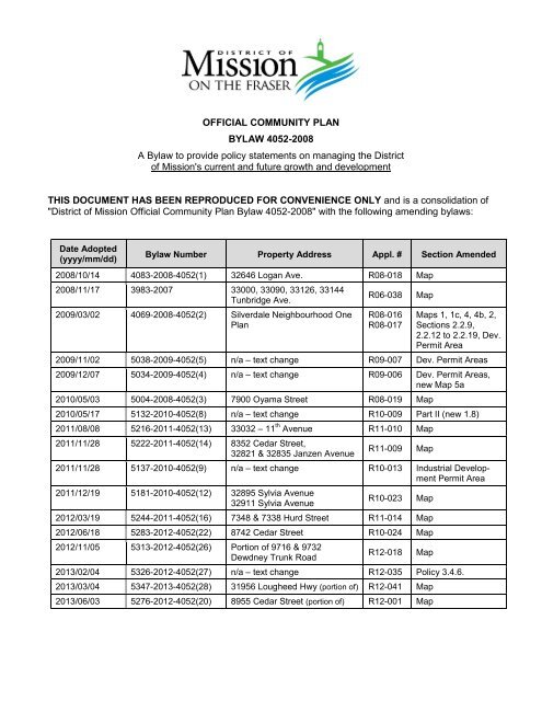
OFFICIAL COMMUNITY PLAN BYLAW 4052 ... - District of Mission
OFFICIAL COMMUNITY PLAN BYLAW 4052 ... - District of Mission
OFFICIAL COMMUNITY PLAN BYLAW 4052 ... - District of Mission

Create successful ePaper yourself
Turn your PDF publications into a flip-book with our unique Google optimized e-Paper software.
<strong>OFFICIAL</strong> <strong>COMMUNITY</strong> <strong>PLAN</strong><strong>BYLAW</strong> <strong>4052</strong>-2008A Bylaw to provide policy statements on managing the <strong>District</strong><strong>of</strong> <strong>Mission</strong>'s current and future growth and developmentTHIS DOCUMENT HAS BEEN REPRODUCED FOR CONVENIENCE ONLY and is a consolidation <strong>of</strong>"<strong>District</strong> <strong>of</strong> <strong>Mission</strong> Official Community Plan Bylaw <strong>4052</strong>-2008" with the following amending bylaws:Date Adopted(yyyy/mm/dd)Bylaw Number Property Address Appl. # Section Amended2008/10/14 4083-2008-<strong>4052</strong>(1) 32646 Logan Ave. R08-018 Map2008/11/17 3983-2007 33000, 33090, 33126, 33144Tunbridge Ave.2009/03/02 4069-2008-<strong>4052</strong>(2) Silverdale Neighbourhood OnePlanR06-038 MapR08-016R08-017Maps 1, 1c, 4, 4b, 2,Sections 2.2.9,2.2.12 to 2.2.19, Dev.Permit Area2009/11/02 5038-2009-<strong>4052</strong>(5) n/a – text change R09-007 Dev. Permit Areas2009/12/07 5034-2009-<strong>4052</strong>(4) n/a – text change R09-006 Dev. Permit Areas,new Map 5a2010/05/03 5004-2008-<strong>4052</strong>(3) 7900 Oyama Street R08-019 Map2010/05/17 5132-2010-<strong>4052</strong>(8) n/a – text change R10-009 Part II (new 1.8)2011/08/08 5216-2011-<strong>4052</strong>(13) 33032 – 11 th Avenue R11-010 Map2011/11/28 5222-2011-<strong>4052</strong>(14) 8352 Cedar Street,32821 & 32835 Janzen AvenueR11-009 Map2011/11/28 5137-2010-<strong>4052</strong>(9) n/a – text change R10-013 Industrial DevelopmentPermit Area2011/12/19 5181-2010-<strong>4052</strong>(12) 32895 Sylvia Avenue32911 Sylvia AvenueR10-023 Map2012/03/19 5244-2011-<strong>4052</strong>(16) 7348 & 7338 Hurd Street R11-014 Map2012/06/18 5283-2012-<strong>4052</strong>(22) 8742 Cedar Street R10-024 Map2012/11/05 5313-2012-<strong>4052</strong>(26) Portion <strong>of</strong> 9716 & 9732Dewdney Trunk RoadR12-018 Map2013/02/04 5326-2012-<strong>4052</strong>(27) n/a – text change R12-035 Policy 3.4.6.2013/03/04 5347-2013-<strong>4052</strong>(28) 31956 Lougheed Hwy (portion <strong>of</strong>) R12-041 Map2013/06/03 5276-2012-<strong>4052</strong>(20) 8955 Cedar Street (portion <strong>of</strong>) R12-001 Map
Date Adopted(yyyy/mm/dd)Bylaw Number Property Address Appl. # Section Amended2013/07/02 5231-2011-<strong>4052</strong>(15) 33009 Sylvia Avenue (portion <strong>of</strong>) R10-035 Map2013/07/02 5268-2012-<strong>4052</strong>(19) Portions <strong>of</strong> 32941, 32957,32971, 32985 Sylvia AvenueR12-002 Map2013/09/23 5278-2012-<strong>4052</strong>(21) 8711 Cedar Street R11-024 MapIndividual copies <strong>of</strong> any <strong>of</strong> the above bylaws are available from the Administration Department <strong>of</strong>the <strong>District</strong> <strong>of</strong> <strong>Mission</strong>. For legal purposes, copies <strong>of</strong> the original bylaws should be obtained.
DISTRICT OF MISSION<strong>OFFICIAL</strong> <strong>COMMUNITY</strong> <strong>PLAN</strong> <strong>BYLAW</strong> <strong>4052</strong>-2008A Bylaw to provide policy statements on managing the <strong>District</strong><strong>of</strong> <strong>Mission</strong>'s current and future growth and developmentWHEREAS under the provisions <strong>of</strong> Section 876 <strong>of</strong> the Local Government Act the Council mayadopt one or more community plans for one or more areas;AND WHEREAS, under the provisions <strong>of</strong> Section 882(1) <strong>of</strong> the Local Government Act, theCouncil must adopt a community plan by bylaw, and, following adoption <strong>of</strong> such bylaw, thecommunity plan is an Official Community Plan;AND WHEREAS the Council has had prepared a community plan, such community planbeing expressed in maps, plans and reports;NOW THEREFORE the Council <strong>of</strong> the <strong>District</strong> <strong>of</strong> <strong>Mission</strong>, in open meeting assembled,ENACTS AS FOLLOWS:This Bylaw may be cited for all purposes as "<strong>District</strong> <strong>of</strong> <strong>Mission</strong> Official Community PlanBylaw <strong>4052</strong>-2008".Schedule "A" attached hereto and forming part <strong>of</strong> this Bylaw is hereby adopted and is theOfficial Community Plan for the <strong>District</strong> <strong>of</strong> <strong>Mission</strong> with the exception <strong>of</strong> those portions notintended to be part <strong>of</strong> the bylaw."<strong>District</strong> <strong>of</strong> <strong>Mission</strong> Official Community Plan Bylaw 3142-1998" and all amendments theretoare hereby repealed.Any bylaw commenced under "<strong>District</strong> <strong>of</strong> <strong>Mission</strong> Official Community Plan Bylaw 3142-1998"prior to the adoption <strong>of</strong> this bylaw, which has received at least two readings as <strong>of</strong> the date <strong>of</strong>adoption <strong>of</strong> this bylaw, is, when adopted, deemed to be conforming to, and adopted under,this bylaw. Any designation reference in any bylaw commenced under "<strong>District</strong> <strong>of</strong> <strong>Mission</strong>Official Community Plan Bylaw 3142-1998" but adopted under this bylaw is deemed to be areference to the corresponding new designation as identified within each such designation.READ A FIRST TIME this 5 th day <strong>of</strong> May, 2008COUNCIL CONSIDERATION OF SECTION 882 OF THELOCAL GOVERNMENT ACT this 16 th day <strong>of</strong> June, 2008PUBLIC HEARING held this 25 th day <strong>of</strong> June, 2008READ A SECOND TIME this 7 th day <strong>of</strong> July, 2008READ A THIRD TIME this 7 th day <strong>of</strong> July, 2008ADOPTED this 28 th day <strong>of</strong> July, 2008original signed by Mayor James AtebeJAMES ATEBE, MAYORoriginal signed by Dennis ClarkDENNIS CLARK, DIRECTOR OFCORPORATE ADMINISTRATION
2T 1.2.12T 1.2.22T 1.6.12T 1.6.22T 1.6.32T 1.6.42T 1.6.52T 1.6.62T 1.6.72T 1.6.82TBackground2TImproving2TStewardship2TDevelopment2TForestTABLE OF CONTENTSPART I – INTRODUCTION1. Plan OverviewSCHEDULE “A”Page2T1.12T 2TProject Overview2T ........................................................................................................................... 12T1. 2T and Scope2T ................................................................................................................. 1Geographic Location ....................................................................................................... 1Fraser Valley Regional <strong>District</strong> and <strong>Mission</strong> ................................................................ 22T1.32T 2TVision and Goals for the Future2T .................................................................................................. 32T1.42T 2TPublic Participation Process and Community Vision2T .............................................................. 42T1.52T 2TConformance with Provincial Law2T ............................................................................................. 82T1.62T 2TPopulation Demographics2T ........................................................................................................... 8Age Composition ............................................................................................................. 8Family and Household Characteristics ......................................................................... 9Diversity and Language .................................................................................................. 9Housing and Affordability ........................................................................................... 10Educational Attainment ................................................................................................ 12Place <strong>of</strong> Work and Transportation to Work ............................................................... 12Labour Force Indicators ................................................................................................ 13Industry ........................................................................................................................... 132T1.72T 2TPopulation Growth2T ..................................................................................................................... 132T1.82T 2TRegional Context Statement2T ...................................................................................................... 142T1.9 Plan Organization ....................................................................................................................... 172T1.10 Land Use Strategy ....................................................................................................................... 19PART II - POLICIES1. Protecting the Natural Environment2T1.12T 2TEnvironmentally Responsible Land Development2T ................................................................ 232T1.2 Protecting Water Resources ....................................................................................................... 272T1.3 2T Air Quality2T ............................................................................................................... 282T1.4 2T <strong>of</strong> Gravel Resources2T ............................................................................................. 302T1.5 Development in the Floodplain ................................................................................................ 312T1.6 2T on Hazard Lands2T ................................................................................................ 322T1.7 2T Lands2T ................................................................................................................................. 331.8 2T2T2T2T2T2T2T2T2T2T2T2T2T2T2T2T2T2T2T2T2T2T2T2T2T2T2T2T2T2T2T2T2T2T2T2T2T2T2T2T2T2T2T2T2T2T2T2T2T2T2T2T2T2T2T2T2T2T2T2T2T2T2T2T2T2T2T2T2T2T2T2T2T2T2T2T2T2T2T2T2T2T2T2T2T2T2T2T2T2T2T2T2T2T2T2T2T2T2T2T2T2T2T2T2T2T2T2T2T2T2T2T2T2T2T2T2T2T2T2T2T2T2T2T2T2T2T2T2T2T2T2T2T2T2T2T2T2T2T2T2T2T2T2T2T2T2T2T2T2T2T2T2T2T2T2T2T2T2T2T2T2T2T2T2T2T2T2T2T2T2T2T2T2T2T2T2T2T2T2T2T2T2T2T2T2T2T2T2T2T2T2T2T2T2T2T2T2T2T2T2T2T2T2T2T2T2T2T2T2T2T2T2T2T2T2T2T2T2T2T2T2T2T2T2T2T2T2T2T2T2T2T2T2T2T2T2T2T2T2T2T2T2T2T2T2T2T2T2T2T2T2T2T2T2T2T2T2T2T2T2T2T2T2T2T2T2T2T2T2T2T2T2T2T2T2T2T2T2T2T2T2T2T2T2T2T2T2T2T2T2T2T2T2T2T2T2T2T2T2T2T2T2T2T2T2T2T2T2T2T2T2T2T2T2T2T2T2T2T2T2T2T2T2T2T2T2T2T2T2T2T2T2T2T2T2T2T2T2T2T2T2T2T2T2T2T2T2T2T2T2T2T2T2T2T2T2T2T2T2T2T2T2T2T2T2T2T2T2T2T2T2T2T2T2T2T2T2T2T2T2T2T2T2T2T2T2T2T2T2T2T2T2T2T2T2T2T2T2T2T2T2T2T2T2T2T2T2T2T2T2T2T2T2T2T2T2T2T2T2T2T2T2T2T2T2T2T2T2T2T2T2T2T2T2T2T2T2T2T2T2T2T2T2T2T2T2T2T2T2T2T2T2T2T2T2T2T2T2T2T2T2T2T2T2T2T2T2T2T2T2T2T2T2T2T2T2T2T2T2T2T2T2T2T2T2T2T2T2T2T2T2T2T2T2T2T2T2T2T2T2T2T2T2T2T2T2T2T2T2T2T2T2T2T2T2T2T2T2T2T2T2T2T2T2T2T2T2T2T2T2T2T2T2T2T2T2T2T2T2T2T2T2T2T2T2T2T2T2T2T2T2T2T2T2T2T2T2T2T2T2T2T2T2T2T2T2T2T2T2T2T2T2T2T2T2T2T2T2T2T2T2T2T2T2T2T2T2T2T2T2T2T2T2T2T2T2T2T2T2T2T2T2T2T2T2T2T2T2T2T2T2T2T2T2T2T2T2T2T2T2T2T2T2T2T2T2T2T2T2T2T2T2T2T2T2T2T2T2T2T2T2T2T2T2T2T2T2T2T2T2T2T2T2T2T2T2T2T2T2T2T2T2T2T2T2T2T2T2T2T2T2T2T2T2T2T2T2T2T2T2T2T2T2T2T2T2T2T2T2T2T2T2T2T2T2T2T2T2T2T2T2T2T2T2T2T2T2T2T2T2T2T2T2T2T2T2T2T2T2T2T2T2T2T2T2T2T2T2T2T2T2T2T2T2T2T2T2T2T2T2T2T2T2T2T2T2T2T2T2T2T2T2T2T2T2T2T2T2T2T2T2T2T2T2T2T2T2T2T2T2T2T2T2T2T2T2T2T2T2T2T2T2T2T2T2T2T2T2T2T2T2T2T2T2T2T2T2T2T2T2T2T2T2T2T2T2T2T2T2T2T2T2T2T2T2T2T2T2T2T2T2T2T2T2T2T2T2T2T2T2T2T2T2T2T2T2T2T2T2T2T2T2T2T2T2T2T2T2T2T2T2T2T2T2T2T2T2T2T2T2T2T2T2T2T2T2T2T2T2T2T2T2T2T2T2T2T2T2T2T2T2T2T2T2T2T2T2T2T2T2T2T2T2T2T2T2T2T2T2T2T2T2T2T2T2T2T2T2T2T2T2T2T2T2T2T2T2T2T2T2T2T2T2T2T2T2T2T2T2T2T2T2T2T2T2T2T2T2T2T2T2T2T2T2T2T2T2T2T2T2T2T2T2T2T2T2T2T2T2T2T2T2T2T2T2T2T2T2T2T2T2T2T2T2T2T2T2T2T2T2T2T2T2T2T2T2T2T2T2T2T2T2T2T2T2T2T2T2T2T2T2T2T2T2T2T2T2T2T2T2T2T2T2T2T2T2T2T2T2T2T2T2T2T2T2T2T2T2T2T2T2T2T2T2T2T2T2T2T2T2T2T2T2T2T2T2T2T2T2T2T2T2T2T2T2T2T2T2T2T2T2T2T2T2T2T2T2T2T2T2T2T2T2T2T2T2T2T2T2T2T2T2T2T2T2T2T2T2T2T2T2T2T2T2T2T2T2T2T2T2T2T2T2T2T2T2T2T2T2T2T2T2T2T2T2T2T2T2T2T2T2T2T2T2T2T2T2T2T2T2T2T2T2T2T2T2T2T2T2T2T2T2T2T2T2T2T2T2T2T2T2T2T2T2T2T2T2T2T2T2T2T2T2T2T2T2T2T2T2T2T2T2T2T2T2T2T2T2T2T2T2T2T2T2T2T2T2T2T2T2T2T2T2T2T2T2T2T2T2T2T2T2T2T2T2T2T2T2T2T2T2T2T2T2T2T2T2T2T2T2T2T2T2T2T2T2T2T2T2T2T2T2T2T2T2T2T2T2T2T2T2T2T2T2T2T2T2T2T2T2T2T2T2T2T2T2T2T2T2T2T2T2T2T2T2T2T2T2T2T2T2T2T2T2T2T2T2T2T2T2T2T2T2T2T2T2T2T2T2T2T2T2T2T2T2T2T2T2T2T2T2T2T2T2T2T2T2T2T2T2T2T2T2T2T2T2T2T2T2T2T2T2T2T2T2T2T2T2T2T2T2T2T2T2T2T2T2T2T2T2T2T2T2T2T2T2T2T2T2T2T2T2T2T2T2T2T2T2T2T2T2T2T2T2T2T2T2T2T2T2T2T2T2T2T2T2T2T2T2T2T2T2T2T2T2T2T2T2T2T2T2T2T2T2T2T2T2T2T2T2T2T2T2T2T2T2T2T2T2T2T2T2T2T2T2T2T2T2T2T2T2T2T2T2T2T2T2T2T2T2T2T2T2T2T2T2T2T2T2T2T2T2T2T2T2T2T2T2T2T2T2T2T2T2T2T2T2T2T2T2T2T2T2T2T2T2T2T2T2T2T2T2T2T2T2T2T2T2T2T2T2T2T2T2T2T2T2T2T2T2T2T2T2T2T2T2T2T2T2T2T2T2T2T2T2T2T2T2T2T2T2T2T2T2T2T2T2T2T2T2T2T2T2T2T2T2T2T2T2T2T2T2T2T2T2T2T2T2T2T2T2T2T2T2T2T2T2T2T2T2T2T2T2T2T2T2T2T2T2T2T2T2T2T2T2T2T2T2T2T2T2T2T2T2T2T2T2T2T2T2T2T2T2T2T2T2T2T2T2T2T2T2T2T2T2T2T2T2T2T2T2T2T2T2T2T2T2T2T2T2T2T2T2T2T2T2T2T2T2T2T2T2T2T2T2T2T2T2T2T2T2T2T2T2T2T2T2T2T2T2T2T2T2T2T2T2T2T2T2T2T2T2T2T2T2T2T2T2T2T2T2T2T2T2T2T2T2T2T2T2T2T2T2T2T2T2T2T2T2T2T2T2T2T2T2T2T2T2T2T2T2T2T2T2T2T2T2T2T2T2T2T2T2T2T2T2T2T2T2T2T2T2T2T2T2T2T2T2T2T2T2T2T2T2T2T2T2T2T2T2T2T2T2T2T2T2T2T2T2T2T2T2T2T2T2T2T2T2T2T2T2T2T2T2T2T2T2T2T2T2T2T2T2T2T2T2T2T2T2T2T2T2T2T2T2T2T2T2T2T2T2T2T2T2T2T2T2T2T2T2T2T2T2T2T2T2T2T2T2T2T2T2T2T2T2T2T2T2T2T2T2T2T2T2T2T2T2T2T2T2T2T2T2T2T2T2T2T2T2T2T2T2T2T2T2T2T2T2T2T2T2T2T2T2T2T2T2T2T2T2T2T2T2T2T2T2T2T2T2T2T2T2T2T2T2T2T2T2T2T2T2T2T2T2T2T2T2T2T2T2T2T2T2T2T2T2T2T2T2T2T2T2T2T2T2T2T2T2T2T2T2T2T2T2T2T2T2T2T2T2T2T2T2T2T2T2T2T2T2T2T2T2T2T2T2T2T2T2T2T2T2T2T2T2T2T2T2T2T2T2T2T2T2T2T2T2T2T2T2T2T2T2T2T2T2T2T2T2T2T2T2T2T2T2T2T2T2T2T2T2T2T2T2T2T2T2T2T2T2T2T2T2T2T2T2T2T2T2T2T2T2T2T2T2T2T2T2T2T2T2T2T2T2T2T2T2T2T2T2T2T2T2T2T2T2T2T2T2T2T2T2T2T2T2T2T2T2T2T2T2T2T2T2T2T2T2T2T2T2T2T2T2T2T2T2T2T2T2T2T2T2T2T2T2T2T2T2T2T2T2T2T2T2T2T2T2T2T2T2T2T2T2T2T2T2T2T2T2T2T2T2T2T2T2T2T2T2T2T2T2T2T2T2T2T2T2T2T2T2T2T2T2T2T2T2T2T2T2T2T2T2T2T2T2T2T2T2T2T2T2T2T2T2T2T2T2T2T2T2T2T2T2T2T2T2T2T2T2T2T2T2T2T2T2T2T2T2T2T2T2T2T2T2T2T2T2T2T2T2T2T2T2T2T2T2T2T2T2T2T2T2T2T2T2T2T2T2T2T2T2T2T2T2T2T2T2T2T2T2T2T2T2T2T2T2T2T2T2T2T2T2T2T2T2T2T2T2T2T2T2T2T2T2T2T2T2T2T2T2T2T2T2T2T2T2T2T2T2T2T2T2T2T2T2T2T2T2T2T2T2T2T2T2T2T2T2T2T2T2T2T2T2T2T2T2T2T2T2T2T2T2T2T2T2T2T2T2T2T2T2T2T2T2T2T2T2T2T2T2T2T2T2T2T2T2T2T2T2T2T2T2T2T2T2T2T2T2T2T2T2T2T2T2T2T2T2T2T2T2T2T2T2T2T2T2T2T2T2T2T2T2T2T2T2T2T2T2T2T2T2T2T2T2T2T2T2T2T2T2T2T2T2T2T2T2T2T2T2T2T2T2T2T2T2T2T2T2T2T2T2T2T2T2T2T2T2T2T2T2T2T2T2T2T2T2T2T2T2T2T2T2T2T2T2T2T2T2T2T2T2T2T2T2T2T2T2T2T2T2T2T2T2T2T2T2T2T2T2T2T2T2T2T2T2T2T2T2T2T2T2T2T2T2T2T2T2T2T2T2T2T2T2T2T2T2T2T2T2T2T2T2T2T2T2T2T2T2T2T2T2T2T2T2T2T2T2T2T2T2T2T2T2T2T2T2T2T2T2T2T2T2T2T2T2T2T2T2T2T2T2T2T2T2T2T2T2T2T2T2T2T2T2T2T2T2T2T2T2T2T2T2T2T2T2T2T2T2T2T2T2T2T2T2T2T2T2T2T2T2T2T2T2T2T2T2T2T2T2T2T2T2T2T2T2T2T2T2T2T2T2T2T2T2T2T2T2T2T2T2T2T2T2T2T2T2T2T2T2T2T2T2T2T2T2T2T2T2T2T2T2T2T2T2T2T2T2T2T2T2T2T2T2T2T2T2T2T2T2T2T2T2T2T2T2T2T2T2T2T2T2T2T2T2T2T2T2T2T2T2T2T2T2T2T2T2T2T2T2T2T2T2T2T2T2T2T2T2T2T2T2T2T2T2T2T2T2T2T2T2T2T2T2T2T2T2T2T2T2T2T2T2T2T2T2T2T2T2T2T2T2T2T2T2T2T2T2T2T2T2T2T2T2T2T2T2T2T2T2T2T2T2T2T2T2T2T2T2T2T2T2T2T2T2T2T2T2T2T2T2T2T2T2T2T2T2T2T2T2T2T2T2T2T2T2T2T2T2T2T2T2T2T2T2T2T2T2T2T2T2T2T2T2T2T2T2T2T2T2T2T2T2T2T2T2T2T2T2T2T2T2T2T2T2T2T2T2T2T2T2T2T2T2T2T2T2T2T2T2T2T2T2T2T2T2T2T2T2T2T2T2T2T2T2T2T2T2T2T2T2T2T2T2T2T2T2T2T2T2T2T2T2T2T2T2T2T2T2T2T2T2T2T2T2T2T2T2T2T2T2T2T2T2T2T2T2T2T2T2T2T2T2T2T2T2T2T2T2T2T2T2T2T2T2T2T2T2T2T2T2T2T2T2T2T2T2T2T2T2T2T2T2T2T2T2T2T2T2T2T2T2T2T2T2T2T2T2T2T2T2T2T2T2T2T2T2T2T2T2T2T2T2T2T2T2T2T2T2T2T2T2T2T2T2T2T2T2T2T2T2T2T2T2T2T2T2T2T2T2T2T2T2T2T2T2T2T2T2T2T2T2T2T2T2T2T2T2T2T2T2T2T2T2T2T2T2T2T2T2T2T2T2T2T2T2T2T2T2T2T2T2T2T2T2T2T2T2T2T2T2T2T2T2T2T2T2T2T2T2T2T2T2T2T2T2T2T2T2T2T2T2T2T2T2T2T2T2T2T2T2T2T2T2T2T2T2T2T2T2T2T2T2T2T2T2T2T2T2T2T2T2T2T2T2T2T2T2T2T2T2T2T2T2T2T2T2T2T2T2T2T2T2T2T2T2T2T2T2T2T2T2T2T2T2T2T2T2T2T2T2T2T2T2T2T2T2T2T2T2T2T2T2T2T2T2T2T2T2T2T2T2T2T2T2T2T2T2T2T2T2T2T2T2T2T2T2T2T2T2T2T2T2T2T2T2T2T2T2T2T2T2T2T2T2T2T2T2T2T2T2T2T2T2T2T2T2T2T2T2T2T2T2T2T2T2T2T2T2T2T2T2T2T2T2T2T2T2T2T2T2T2T2T2T2T2T2T2T2T2T2T2T2T2T2T2T2T2T2T2T2T2T2T2T2T2T2T2T2T2T2T2T2T2T2T2T2T2T2T2T2T2T2T2T2T2T2T2T2T2T2T2T2T2T2T2T2T2T2T2T2T2T2T2T2T2T2T2T2T2T2T2T2T2T2T2T2T2T2T2T2T2T2T2T2T2T2T2T2T2T2T2T2T2T2T2T2T2T2T2T2T2T2T2T2T2T2T2T2T2T2T2T2T2T2T2T2T2T2T2T2T2T2T2T2T2T2T2T2T2T2T2T2T2T2T2T2T2T2T2T2T2T2T2T2T2T2T2T2T2T2T2T2T2T2T2T2T2T2T2T2T2T2T2T2T2T2T2T2T2T2T2T2T2T2T2T2T2T2T2T2T2T2T2T2T2T2T2T2T2T2T2T2T2T2T2T2T2T2T2T2T2T2T2T2T2T2T2T2T2T2T2T2T2T2T2T2T2T2T2T2T2T2T2T2T2T2T2T2T2T2T2T2T2T2T2T2T2T2T2T2T2T2T2T2T2T2T2T2T2T2T2T2T2T2T2T2T2T2T2T2T2T2T2T2T2T2T2T2T2T2T2T2T2T2T2T2T2T2T2T2T2T2T2T2T2T2T2T2T2T2T2T2T2T2T2T2T2T2T2T2T2T2T2T2T2T2T2T2T2T2T2T2T2T2T2T2T2T2T2T2T2T2T2T2T2T2T2T2T2T2T2T2T2T2T2T2T2T2T2T2T2T2T2T2T2T2T2T2T2T2T2T2T2T2T2T2T2T2T2T2T2T2T2T2T2T2T2T2T2T2T2T2T2T2T2T2T2T2T2T2T2T2T2T2T2T2T2T2T2T2T2T2T2T2T2T2T2T2T2T2T2T2T2T2T2T2T2T2T2T2T2T2T2T2T2T2T2T2T2T2T2T2T2T2T2T2T2T2T2T2T2T2T2T2T2T2T2T2T2T2T2T2T2T2T2T2T2T2T2T2T2T2T2T2T2T2T2T2T2T2T2T2T2T2T2T2T2T2T2T2T2T2T2T2T2T2T2T2T2T2T2T2T2T2T2T2T2T2T2T2T2T2T2T2T2T2T2T2T2T2T2T2T2T2T2T2T2T2T2T2T2T2T2T2T2T2T2T2T2T2T2T2T2T2T2T2T2T2T2T2T2T2T2T2T2T2T2T2T2T2T2T2T2T2T2T2T2T2T2T2T2T2T2T2T2T2T2T2T2T2T2T2T2T2T2T2T2T2T2T2T2T2T2T2T2T2T2T2T2T2T2T2T2T2T2T2T2T2T2T2T2T2T2T2T2T2T2T2T2T2T2T2T2T2T2T2T2T2T2T2T2T2T2T2T2T2T2T2T2T2T2T2T2T2T2T2T2T2T2T2T2T2T2T2T2T2T2T2T2T2T2T2T2T2T2T2T2T2T2T2T2T2T2T2T2T2T2T2T2T2T2T2T2T2T2T2T2T2T2T2T2T2T2T2T2T2T2T2T2T2T2T2T2T2T2T2T2T2T2T2T2T2T2T2T2T2T2T2T2T2T2T2T2T2T2T2T2T2T2T2T2T2T2T2T2T2T2T2T2T2T2T2T2T2T2T2T2T2T2T2T2T2T2T2T2T2T2T2T2T2T2T2T2T2T2T2T2T2T2T2T2T2T2T2T2T2T2T2T2T2T2T2T2T2T2T2T2T2T2T2T2T2T2T2T2T2T2T2T2T2T2T2T2T2T2T2T2T2T2T2T2T2T2T2T2T2T2T2T2T2T2T2T2T2T2T2T2T2T2T2T2T2T2T2T2T2T2T2T2T2T2T2T2T2T2T2T2T2T2T2T2T2T2T2T2T2T2T2T2T2T2T2T2T2T2T2T2T2T2T2T2T2T2T2T2T2T2T2T2T2T2T2T2T2T2T2T2T2T2T2T2T2T2T2T2T2T2T2T2T2T2T2T2T2T2T2T2T2T2T2T2T2T2T2T2T2T2T2T2T2T2T2T2T2T2T2T2T2T2T2T2T2T2T2T2T2T2T2T2T2T2T2T2T2T2T2T2T2T2T2T2T2T2T2T2T2T2T2T2T2T2T2T2T2T2T2T2T2T2T2T2T2T2T2T2T2T2T2T2T2T2T2T2T2T2T2T2T2T2T2T2T2T2T2T2T2T2T2T2T2T2T2T2T2T2T2T2T2T2T2T2T2T2T2T2T2T2T2T2T2T2T2T2T2T2T2T2T2T2T2T2T2T2T2T2T2T2T2T2T2T2T2T2T2T2T2T2T2T2T2T2T2T2T2T2T2T2T2T2T2T2T2T2T2T2T2T2T2T2T2T2T2T2T2T2T2T2T2T2T2T2T2T2T2T2T2T2T2T2T2T2T2T2T2T2T2T2T2T2T2T2T2T2T2T2T2T2T2T2T2T2T2T2T2T2T2T2T2T2T2T2T2T2T2T2T2T2T2T2T2T2T2T2T2T2T2T2T2T2T2T2T2T2T2T2T2T2T2T2T2T2T2T2T2T2T2T2T2T2T2T2T2T2T2T2T2T2T2T2T2T2T2T2T2T2T2T2T2T2T2T2T2T2T2T2T2T2T2T2T2T2T2T2T2T2T2T2T2T2T2T2T2T2T2T2T2T2T2T2T2T2T2T2T2T2T2T2T2T2T2T2T2T2T2T2T2T2T2T2T2T2T2T2T2T2T2T2T2T2T2T2T2T2T2T2T2T2T2T2T2T2T2T2T2T2T2T2T2T2T2T2T2T2T2T2T2T2T2T2T2T2T2T2T2T2T2T2T2T2T2T2T2T2T2T2T2T2T2T2T2T2T2T2T2T2T2T2T2T2T2T2T2T2T2T2T2T2T2T2T2T2T2T2T2T2T2T2T2T2T2T2T2T2T2T2T2T2T2T2T2T2T2T2T2T2T2T2T2T2T2T2T2T2T2T2T2T2T2T2T2T2T2T2T2T2T2T2T2T2T2T2T2T2T2T2T2T2T2T2T2T2T2T2T2T2T2T2T2T2T2T2T2T2T2T2T2T2T2T2T2T2T2T2T2T2T2T2T2T2T2T2T2T2T2T2T2T2T2T2T2T2T2T2T2T2T2T2T2T2T2T2T2T2T2T2T2T2T2T2T2T2T2T2T2T2T2T2T2T2T2T2T2T2T2T2T2T2T2T2T2T2T2T2T2T2T2T2T2T2T2T2T2T2T2T2T2T2T2T2T2T2T2T2T2T2T2T2T2T2T2T2T2T2T2T2T2T2T2T2T2T2T2T2T2T2T2T2T2T2T2T2T2T2T2T2T2T2T2T2T2T2T2T2T2T2T2T2T2T2T2T2T2T2T2T2T2T2T2T2T2T2T2T2T2T2T2T2T2T2T2T2T2T2T2T2T2T2T2T2T2T2T2T2T2T2T2T2T2T2T2T2T2T2T2T2T2T2T2T2T2T2T2T2T2T2T2T2T2T2T2T2T2T2T2T2T2T2T2T2T2T2T2T2T2T2T2T2T2T2T2T2T2T2T2T2T2T2T2T2T2T2T2T2T2T2T2T2T2T2T2T2T2T2T2T2T2T2T2T2T2T2T2T2T2T2T2T2T2T2T2T2T2T2T2T2T2T2T2T2T2T2T2T2T2T2T2T2T2T2T2T2T2T2T2T2T2T2T2T2T2T2T2T2T2T2T2T2T2T2T2T2T2T2T2T2T2T2T2T2T2T2T2T2T2T2T2T2T2T2T2T2T2T2T2T2T2T2T2T2T2T2T2T2T2T2T2T2T2T2T2T2T2T2T2T2T2T2T2T2T2T2T2T2T2T2T2T2T2T2T2T2T2T2T2T2T2T2T2T2T2T2T2T2T2T2T2T2T2T2T2T2T2T2T2T2T2T2T2T2T2T2T2T2T2T2T2T2T2T2T2T2T2T2T2T2T2T2T2T2T2T2T2T2T2T2T2T2T2T2T2T2T2T2T2T2T2T2T2T2T2T2T2T2T2T2T2T2T2T2T2T2T2T2T2T2T2T2T2T2T2T2T2T2T2T2T2T2T2T2T2T2T2T2T2T2T2T2T2T2T2T2T2T2T2T2T2T2T2T2T2T2T2T2T2T2T2T2T2T2T2T2T2T2T2T2T2T2T2T2T2T2T2T2T2T2T2T2T2T2T2T2T2T2T2T2T2T2T2T2T2T2T2T2T2T2T2T2T2T2T2T2T2T2T2T2T2T2T2T2T2T2T2T2T2T2T2T2T2T2T2T2T2T2T2T2T2T2T2T2T2T2T2T2T2T2T2T2T2T2T2T2T2T2T2T2T2T2T2T2T2T2T2T2T2T2T2T2T2T2T2T2T2T2T2T2T2T2T2T2T2T2T2T2T2T2T2T2T2T2T2T2T2T2T2T2T2T2T2T2T2T2T2T2T2T2T2T2T2T2T2T2T2T2T2T2T2T2T2T2T2T2T2T2T2T2T2T2T2T2T2T2T2T2T2T2T2T2T2T2T2T2T2T2T2T2T2T2T2T2T2T2T2T2T2T2T2T2T2T2T2T2T2T2T2T2T2T2T2T2T2T2T2T2T2T2T2T2T2T2T2T2T2T2T2T2T2T2T2T2T2T2T2T2T2T2T2T2T2T2T2T2T2T2T2T2T2T2T2T2T2T2T2T2T2T2T2T2T2T2T2T2T2T2T2T2T2T2T2T2T2T2T2T2T2T2T2T2T2T2T2T2T2T2T2T2T2T2T2T2T2T2T2T2T2T2T2T2T2T2T2T2T2T2T2T2T2T2T2T2T2T2T2T2T2T2T2T2T2T2T2T2T2T2T2T2T2T2T2T2T2T2T2T2T2T2T2T2T2T2T2T2T2T2T2T2T2T2T2T2T2T2T2T2T2T2T2T2T2T2T2T2T2T2T2T2T2T2T2T2T2T2T2T2T2T2T2T2T2T2T2T2T2T2T2T2T2T2T2T2T2T2T2T2T2T2T2T2T2T2T2T2T2T2T2T2T2T2T2T2T2T2T2T2T2T2T2T2T2T2T2T2T2T2T2T2T2T2T2T2T2T2T2T2T2T2T2T2T2T2T2T2T2T2T2T2T2T2T2T2T2T2T2T2T2T2T2T2T2T2T2T2T2T2T2T2T2T2T2T2T2T2T2T2T2T2T2T2T2T2T2T2T2T2T2T2T2T2T2T2T2T2T2T2T2T2T2T2T2T2T2T2T2T2T2T2T2T2T2T2T2T2T2T2T2T2T2T2T2T2T2T2T2T2T2T2T2T2T2T2T2T2T2T2T2T2T2T2T2T2T2T2T2T2T2T2T2T2T2T2T2T2T2T2T2T2T2T2T2T2T2T2T2T2T2T2T2T2T2T2T2T2T2T2T2T2T2T2T2T2T2T2T2T2T2T2T2T2T2T2T2T2T2T2T2T2T2T2T2T2T2T2T2T2T2T2T2T2T2T2T2T2T2T2T2T2T2T2T2T2T2T2T2T2T2T2T2T2T2T2T2T2T2T2T2T2T2T2T2T2T2T2T2T2T2T2T2T2T2T2T2T2T2T2T2T2T2T2T2T2T2T2T2T2T2T2T2T2T2T2T2T2T2T2T2T2T2T2T2T2T2T2T2T2T2T2T2T2T2T2T2T2T2T2T2T2T2T2T2T2T2T2T2T2T2T2T2T2T2T2T2T2T2T2T2T2T2T2T2T2T2T2T2T2T2T2T2T2T2T2T2T2T2T2T2T2T2T2T2T2T2T2T2T2T2T2T2T2T2T2T2T2T2T2T2T2T2T2T2T2T2T2T2T2T2T2T2T2T2T2T2T2T2T2T2T2T2T2T2T2T2T2T2T2T2T2T2T2T2T2T2T2T2T2T2T2T2T2T2T2T2T2T2T2T2T2T2T2T2T2T2T2T2T2T2T2T2T2T2T2T2T2T2T2T2T2T2T2T2T2T2T2T2T2T2T2T2T2T2T2T2T2T2T2T2T2T2T2T2T2T2T2T2T2T2T2T2T2T2T2T2T2T2T2T2T2T2T2T2T2T2T2T2T2T2T2T2T2T2T2T2T2T2T2T2T2T2T2T2T2T2T2T2T2T2T2T2T2T2T2T2T2T2T2T2T2T2T2T2T2T2T2T2T2T2T2T2T2T2T2T2T2T2T2T2T2T2T2T2T2T2T2T2T2T2T2T2T2T2T2T2T2T2T2T2T2T2T2T2T2T2T2T2T2T2T2T2T2T2T2T2T2T2T2T2T2T2T2T2T2T2T2T2T2T2T2T2T2T2T2T2T2T2T2T2T2T2T2T2T2T2T2T2T2T2T2T2T2T2T2T2T2T2T2T2T2T2T2T2T2T2T2T2T2T2T2T2T2T2T2T2T2T2T2T2T2T2T2T2T2T2T2T2T2T2T2T2T2T2T2T2T2T2T2T2T2T2T2T2T2T2T2T2T2T2T2T2T2T2T2T2T2T2T2T2T2T2T2T2T2T2T2T2T2T2T2T2T2T2T2T2T2T2T2T2T2T2T2T2T2T2T2T2T2T2T2T2T2T2T2T2T2T2T2T2T2T2T2T2T2T2T2T2T2T2T2T2T2T2T2T2T2T2T2T2T2T2T2T2T2T2T2T2T2T2T2T2T2T2T2T2T2T2T2T2T2T2T2T2T2T2T2T2T2T2T2T2T2T2T2T2T2T2T2T2T2T2T2T2T2T2T2T2T2T2T2T2T2T2T2T2T2T2T2T2T2T2T2T2T2T2T2T2T2T2T2T2T2T2T2T2T2T2T2T2T2T2T2T2T2T2T2T2T2T2T2T2T2T2T2T2T2T2T2T2T2T2T2T2T2T2T2T2T2T2T2T2T2T2T2T2T2T2T2T2T2T2T2T2T2T2T2T2T2T2T2T2T2T2T2T2T2T2T2T2T2T2T2T2T2T2T2T2T2T2T2T2T2T2T2T2T2T2T2T2T2T2T2T2T2T2T2T2T2T2T2T2T2T2T2T2T2T2T2T2T2T2T2T2T2T2T2T2T2T2T2T2T2T2T2T2T2T2T2T2T2T2T2T2T2T2T2T2T2T2T2T2T2T2T2T2T2T2T2T2T2T2T2T2T2T2T2T2T2T2T2T2T2T2T2T2T2T2T2T2T2T2T2T2T2T2T2T2T2T2T2T2T2T2T2T2T2T2T2T2T2T2T2T2T2T2T2T2T2T2T2T2T2T2T2T2T2T2T2T2T2T2T2T2T2T2T2T2T2T2T2T2T2T2T2T2T2T2T2T2T2T2T2T2T2T2T2T2T2T2T2T2T2T2T2T2T2T2T2T2T2T2T2T2T2T2T2T2T2T2T2T2T2T2T2T2T2T2T2T2T2T2T2T2T2T2T2T2T2T2T2T2T2T2T2T2T2T2T2T2T2T2T2T2T2T2T2T2T2T2T2T2T2T2T2T2T2T2T2T2T2T2T2T2T2T2T2T2T2T2T2T2T2T2T2T2T2T2T2T2T2T2T2T2T2T2T2T2T2T2T2T2T2T2T2T2T2T2T2T2T2T2T2T2T2T2T2T2T2T2T2T2T2T2T2T2T2T2T2T2T2T2T2T2T2T2T2T2T2T2T2T2T2T2T2T2T2T2T2T2T2T2T2T2T2T2T2T2T2T2T2T2T2T2T2T2T2T2T2T2T2T2T2T2T2T2T2T2T2T2T2T2T2T2T2T2T2T2T2T2T2T2T2T2T2T2T2T2T2T2T2T2T2T2T2T2T2T2T2T2T2T2T2T2T2T2T2T2T2T2T2T2T2T2T2T2T2T2T2T2T2T2T2T2T2T2T2T2T2T2T2T2T2T2T2T2T2T2T2T2T2T2T2T2T2T2T2T2T2T2T2T2T2T2T2T2T2T2T2T2T2T2T2T2T2T2T2T2T2T2T2T2T2T2T2T2T2T2T2T2T2T2T2T2T2T2T2T2T2T2T2T2T2T2T2T2T2T2T2T2T2T2T2T2T2T2T2T2T2T2T2T2T2T2T2T2T2T2T2T2T2T2T2T2T2T2T2T2T2T2T2T2T2T2T2T2T2T2T2T2T2T2T2T2T2T2T2T2T2T2T2T2T2T2T2T2T2T2T2T2T2T2T2T2T2T2T2T2T2T2T2T2T2T2T2T2T2T2T2T2T2T2T2T2T2T2T2T2T2T2T2T2T2T2T2T2T2T2T2T2T2T2T2T2T2T2T2T2T2T2T2T2T2T2T2T2T2T2T2T2T2T2T2T2T2T2T2T2T2T2T2T2T2T2T2T2T2T2T2T2T2T2T2T2T2T2T2T2T2T2T2T2T2T2T2T2T2T2T2T2T2T2T2T2T2T2T2T2T2T2T2T2T2T2T2T2T2T2T2T2T2T2T2T2T2T2T2T2T2T2T2T2T2T2T2T2T2T2T2T2T2T2T2T2T2T2T2T2T2T2T2T2T2T2T2T2T2T2T2T2T2T2T2T2T2T2T2T2T2T2T2T2T2T2T2T2T2T2T2T2T2T2T2T2T2T2T2T2T2T2T2T2T2T2T2T2T2T2T2T2T2T2T2T2T2T2T2T2T2T2T2T2T2T2T2T2T2T2T2T2T2T2T2T2T2T2T2T2T2T2T2T2T2T2T2T2T2T2T2T2T2T2T2T2T2T2T2T2T2T2TClimate Change and Reducing Greenhouse Gas (GHG) Emissions ................................... 352. Building Liveable Neighbourhoods2.1 Neighbourhood Character ......................................................................................................... 372.2 Planning Areas ............................................................................................................................ 41<strong>District</strong> <strong>of</strong> <strong>Mission</strong>Official Community Plan – adopted July 28, 2008Introductioni
2.3 Housing Choice and Quality ..................................................................................................... 472.4 Infill Residential .......................................................................................................................... 512.5 Affordable, Rental, Seniors and Special Needs Housing ...................................................... 533. Strengthening the Local Economy3.1 Economic Development and Tourism ..................................................................................... 573.2 Commercial Development ......................................................................................................... 623.3 Industrial Development ............................................................................................................. 663.4 Agriculture ................................................................................................................................... 694. Developing the Community Core4.1 A Strong Downtown ................................................................................................................... 734.2 The Waterfront and Commuter Rail Areas ............................................................................. 805. Improving Community Facilities and Services5.1 Parks, Recreation and Open Space ........................................................................................... 885.2 Arts and Culture ......................................................................................................................... 925.3 Heritage ........................................................................................................................................ 955.4 Health Care Services ................................................................................................................... 965.5 Education ..................................................................................................................................... 975.6 Safety and Security ..................................................................................................................... 995.7 Community Involvement ........................................................................................................ 1016. Social Development6.1 Strengthening the Community ............................................................................................... 1027. Enhancing Mobility Choices7.1 An Integrated Transportation System .................................................................................... 1037.2 The Road Network .................................................................................................................... 1047.3 Transit ........................................................................................................................................ 1067.4 Pedestrians ................................................................................................................................. 1087.5 Bicycle System ........................................................................................................................... 1097.6 Multi-Use and Equestrian Trails ............................................................................................. 1108. Providing for Infrastructure8.1 Water Supply ............................................................................................................................. 1128.2 Sewage and Rainwater Management ..................................................................................... 1148.3 Solid Waste Management, Recycling and Hazardous Materials ....................................... 116<strong>District</strong> <strong>of</strong> <strong>Mission</strong>Official Community Plan – adopted July 28, 2008Introductionii
PART III - IMPLEMENTATION1. Implementation, Monitoring and Reporting1.1 Implementation Framework, Roles and Responsibilities ................................................... 1191.2 Official Community Plan - Action Plan ................................................................................. 1221.3 Monitoring, Evaluation and Reporting .................................................................................. 135PART IV – DEVELOPMENT PERMIT AREASDevelopment Permit Area Guidelines Overview ............................................................................. 138Intensive Residential Development Permit Area Guidelines .......................................................... 139Area B - Windebank Creek Development Permit Area .................................................................... 148Area C - Downtown Commercial Expansion Development Permit Area ..................................... 149Area D - Lougheed Highway Corridor Area Development Permit Area ...................................... 153Area E - Lougheed Service Commercial Core Development Permit Area .................................... 156Area F - Downtown Façade Design Development Permit Area ..................................................... 159Area G - Downtown East End Development Permit Area .............................................................. 162Area H - Multi-family Residential Development Permit Area ........................................................ 165Area I - Waterfront <strong>District</strong> Development Permit Area ................................................................... 171Area J - Commuter Rail Redevelopment Permit Area ...................................................................... 173Area K - Industrial Development Permit Area .................................................................................. 174Area L - Cedar Valley Multi-Family Residential Development Permit Area ................................ 181Area M - Cedar Valley Commercial Development Permit Area ..................................................... 185Area O – Silverdale neighbourhood one development permit area ............................................... 190Area P – Fraser River Development Permit Area ............................................................................. 205Area Q - Geotechnical Hazard Lands Development Permit Areas ............................................... 207Other Development Permit Areas ....................................................................................................... 210<strong>District</strong> <strong>of</strong> <strong>Mission</strong>Official Community Plan – adopted July 28, 2008Introductioniii
LIST OF TABLES, FIGURES AND MAPSLIST OF TABLESTable 1: Existing and Projected Housing Stock ................................................................................... 10Table 2: Monthly Housing Payments and Affordability .................................................................... 11Table 3: Education Level <strong>of</strong> Working Age Groups ............................................................................. 12Table 4: Labour Force Indicators ............................................................................................................ 13Table 5: Population Change .................................................................................................................... 13Table 6: Land Use Designation Density ................................................................................................ 22Table 10: Official Community Plan - Action Plan (2006 – 2011) ..................................................... 123LIST OF FIGURESFigure 1: Map <strong>of</strong> the Fraser Valley Regional <strong>District</strong> ............................................................................ 1Figure 2: Map <strong>of</strong> the Fraser Valley Regional <strong>District</strong>’s Topography .................................................. 2Figure 3: Age Composition ....................................................................................................................... 8Figure 4: Median Household Income ...................................................................................................... 9Figure 5: Visible Minority Population ................................................................................................... 10Figure 6: Occupied Owned and Rented Dwellings ............................................................................. 11Figure 7: Mode <strong>of</strong> Transportation to Work .......................................................................................... 12Figure 8: Industry Sectors ....................................................................................................................... 13Figure 9: Projected Population and Percent Change........................................................................... 14Figure 10: Residential and Commercial Building Permits (1996-2004) in <strong>Mission</strong> ......................... 62LIST OF MAPSOCP Map 1Land Use Designations and Neighbourhood Plan AreasOCP Map 1a<strong>Mission</strong> Urban Infill AreaOCP Map 1b Cedar ValleyOCP Map 1c Silverdale Urban Neighbourhood Plan #1OCP Map 2Transportation and Gravel ResourcesOCP Map 3Municipal Services and InfrastructureOCP Map 4Trail Systems MapOCP Map 5Development Permit AreasOCP Map 5aFraser River Development Permit Areas<strong>District</strong> <strong>of</strong> <strong>Mission</strong>Official Community Plan – adopted July 28, 2008Introductioniv
1. <strong>PLAN</strong> OVERVIEW1.1 Project OverviewIn January 2005, the <strong>District</strong> <strong>of</strong> <strong>Mission</strong> began the process <strong>of</strong> updating itsexisting Official Community Plan (OCP), which was adopted by the <strong>District</strong><strong>of</strong> <strong>Mission</strong> Council in February 1999 (Bylaw No. 3142 -1998). The overallobjective <strong>of</strong> updating the OCP, herein referred to as the OCP Update Project,is to update and strengthen the existing policy framework with a view toproviding for the integrated social, economic, and environmental well being<strong>of</strong> the community over the course <strong>of</strong> the planning period (2005 – 2025).The updated OCP provides strategic policy direction that is designed toachieve the community’s vision and goals for the future, as detailed inSection 1.3, Vision and Goals for the Future. The OCP’s policies are thecriteria that form the basis for evaluating new development proposals,rezonings, subdivisions, capital works, other municipal decisions, andcommunity initiatives. The OCP’s policies are linked to actions that can beimplemented over the short and long term – ensuring that policy is turnedinto action in the form <strong>of</strong> municipal and partnership projects and programs.The updated OCP has been designed to act as a user-friendly document thatcan be used on a daily basis by Council, staff and the public to informplanning and land use management decisions. The OCP is also meant to bea resource such that the community’s policies are legible, transparent, andmeaningful to its users.1.2 Background and ScopeFigure 1: Map <strong>of</strong> the Fraser Valley Regional <strong>District</strong>1.2.1 Geographic LocationThe <strong>District</strong> <strong>of</strong> <strong>Mission</strong> has a totalarea <strong>of</strong> 225.78 sq. km and asdepicted in Figure 1: Map <strong>of</strong> theFraser Valley Regional <strong>District</strong>,the <strong>District</strong> is bounded to thenorth by BC Electoral Area F, tothe south by the City <strong>of</strong>Abbotsford, to the east byElectoral Area G, and to the westby Maple Ridge. The communityis conveniently located 70 km east<strong>of</strong> Vancouver, and a 15-minutedrive from the Canada/U.S.border.Source: FVRD website (www.fvrd.bc.ca)<strong>District</strong> <strong>of</strong> <strong>Mission</strong>Official Community Plan – adopted July 28, 2008Introduction1
1.2.2 Fraser Valley Regional <strong>District</strong> and <strong>Mission</strong>The Fraser Valley Regional <strong>District</strong> was formed in 1995 by the amalgamation<strong>of</strong> Central Fraser Valley, Dewdney-Allouette and Fraser Cheam Regional<strong>District</strong>s. The <strong>District</strong> is a partnership <strong>of</strong> local government members,including the Cities <strong>of</strong> Chilliwack and Abbotsford, the <strong>District</strong>s <strong>of</strong> <strong>Mission</strong>,Kent and Hope, the Village <strong>of</strong> Harrison Hot Springs, and eight BC electoralareas (A-H).The Fraser Valley Regional <strong>District</strong> is the third most populous region inBritish Columbia with an estimated 2004 population <strong>of</strong> 260,247 people. Theregion has a history <strong>of</strong> growth, having increased in size by more than 100,000people over the past 20 years 1 . According to Statistics Canada, the FraserValley Regional <strong>District</strong>’s population increased 6.8% between census years1996 and 2001 and continued growth is forecast for the Region.While the Fraser Valley Regional <strong>District</strong> is approximately 14,000 sq. km. insize, over 90% <strong>of</strong> the region’s population resides on less than 1% <strong>of</strong> the landbase. Only a small portion <strong>of</strong> the region is considered suitable fordevelopment due largely to the local topography, Figure 2: Map <strong>of</strong> the FraserValley Regional <strong>District</strong>’s Topography. As such, the region faces extremegrowth pressures that demand growth management and strategic land useplanning.Figure 2: Map <strong>of</strong> the Fraser Valley Regional <strong>District</strong>’s Topography1 Choices for Our Future. Regional Growth Strategy for the Fraser Valley Regional <strong>District</strong>. 2004<strong>District</strong> <strong>of</strong> <strong>Mission</strong>Official Community Plan – adopted July 28, 2008Introduction2
The growth pressures experienced in the Fraser Valley Regional <strong>District</strong> arespread across its member communities, including the <strong>District</strong> <strong>of</strong> <strong>Mission</strong>, asevidenced by the community’s rate <strong>of</strong> population growth. According toStatistics Canada, <strong>Mission</strong> experienced a 2.5% increase in populationbetween 1996 and 2001. <strong>Mission</strong>’s attractive quality <strong>of</strong> life, urban and ruralliving experiences, and spectacular natural setting, continue to act asattractions for newcomers to the community.1.3 Vision and Goals for the FutureLooking ahead to the future, the vision for the <strong>District</strong> <strong>of</strong> <strong>Mission</strong> is asfollows:<strong>Mission</strong> is a healthy community that has a balance <strong>of</strong> residential, commercial, andindustrial land uses, amongst an abundance <strong>of</strong> parkland and natural open space. Itis known as a community-oriented, affordable, and safe community. <strong>Mission</strong> has amix <strong>of</strong> housing types, <strong>of</strong>fering choices to people <strong>of</strong> all incomes, lifestyles, and agegroups. Community neighbourhoods reflect principles <strong>of</strong> sustainable development.The downtown is a vibrant place with a distinct identity that attracts residents andvisitors in search <strong>of</strong> unique shopping and living experiences. The number <strong>of</strong> localindustries and jobs has increased over the years to allow more residents to live andwork in <strong>Mission</strong>. Natural and cultural resources provide recreation and tourismopportunities that have contributed to the attractive quality <strong>of</strong> life and the stronglocal economy.The overall purpose <strong>of</strong> the updated OCP is to provide a policy frameworkthat contributes to the sustainable growth and development <strong>of</strong> <strong>Mission</strong>,while strengthening individual and collective well-being through balancedand integrated actions that are mindful <strong>of</strong> social, cultural, economic, andenvironmental attributes <strong>of</strong> the community.The goals <strong>of</strong> the OCP are designed to reflect the diverse attributes <strong>of</strong> thecommunity, keeping in mind the principles <strong>of</strong> sustainability. The OCP’sgoals are summarized as follows:• To achieve sustainable growth; balancing economic, environmentaland social principles• To increase the number <strong>of</strong> local employment and shoppingopportunities through commercial and industrial development• To manage the natural environment• To develop housing alternatives which reflect the diverse needs <strong>of</strong>the community’s current and future residents• To ensure that development provides public spaces, open spaces,and parkland that contribute to the value <strong>of</strong> the public realm• To enhance transportation choice through the development andenhancement <strong>of</strong> an integrated, multi-modal transportation system<strong>District</strong> <strong>of</strong> <strong>Mission</strong>Official Community Plan – adopted July 28, 2008Introduction3
• To enhance the community’s character and economic well-beingthrough waterfront development and downtown revitalization andsustainable development• To maintain and enhance the quality <strong>of</strong> life that will continue toencourage people to live, work, and visit <strong>Mission</strong>• To involve the public in all stages <strong>of</strong> the development andimplementation <strong>of</strong> the OCP1.4 Public Participation Process and Community VisionAccording to s. 879 (1) <strong>of</strong> the Local Government Act, one or more opportunitiesmust be provided for consultation with persons, organizations andauthorities the local government considers to be affected by an OCP.Recognizing the importance <strong>of</strong> public participation as part <strong>of</strong> the OCPdevelopment process, the <strong>District</strong> <strong>of</strong> <strong>Mission</strong> sought multiple opportunitiesfor community engagement, using a variety <strong>of</strong> public participationtechniques. The insert describes the different methods that were used toengage the public in the plan preparation process.Methods Used to Engage the Public Project Steering Committee Open Houses Public Workshops <strong>District</strong> Website Public Newsletter and Notices Community Questionnaire Media Communications<strong>District</strong> <strong>of</strong> <strong>Mission</strong>Official Community Plan – adopted July 28, 2008Introduction4
• Project Steering CommitteeThe <strong>District</strong> <strong>of</strong> <strong>Mission</strong> Council appointed a Project Steering Committee inJanuary 2005. The Committee was comprised <strong>of</strong> 14 individuals representinga diverse cross-section <strong>of</strong> the community including, representatives fromresidential associations, environmental groups, key agencies, businessorganizations, cultural groups and other stakeholder interest groups.The diversity <strong>of</strong> the Committee allowed for valuable and objective inputtoward the development <strong>of</strong> the updated OCP. Members <strong>of</strong> the Committeeprovided direction to the planning exercise throughout the process andprovided valuable input into the initial drafts <strong>of</strong> OCP policy and the FinalDraft OCP. Committee members participated actively in Project SteeringCommittee meetings, Open Houses and Public Workshops.• <strong>District</strong> <strong>of</strong> <strong>Mission</strong> Website - OCP Update ProjectThe <strong>District</strong> website was populated with information concerning the OCPUpdate Project throughout the process to ensure that citizens <strong>of</strong> <strong>Mission</strong>were kept informed <strong>of</strong> the plan development process. Frequent updates tothe website ensured that the public was notified <strong>of</strong> upcoming events and thatinput received at the Open Houses and Public Workshops were shared withthe public on a timely basis.• Open Houses and Questionnaire – Issues and OpportunitiesThe OCP Project Team held Open Houses on the evening <strong>of</strong> May 12, 2005and during the day on May 14, 2005 at the Stave Falls Elementary School andHeritage Park Secondary School respectively. Members <strong>of</strong> the StantecConsulting team, <strong>Mission</strong>’s planning staff and representatives <strong>of</strong> the ProjectSteering Committee hosted this first set <strong>of</strong> Open Houses with approximately100 members <strong>of</strong> the general public attending.The Open Houses represented an opportunity for local residents to learnabout the OCP Update Project’s planning process and share their ideasregarding issues and opportunities for the future development <strong>of</strong> <strong>Mission</strong>.The public was notified <strong>of</strong> the Open Houses by means <strong>of</strong> the following (aswas the case for all subsequent public participation events):• newspaper advertisements in three local papers - two weeks inadvance and one week in advance• an update on the Project Website• interviews on the project by local newspaper reporters• distribution <strong>of</strong> approximately 5,000 letters to school children to takehome to their parents<strong>District</strong> <strong>of</strong> <strong>Mission</strong>Official Community Plan – adopted July 28, 2008Introduction5
• distribution <strong>of</strong> newsletters to Council, <strong>District</strong> <strong>of</strong> <strong>Mission</strong> staff,stakeholder groups’ and agencies• contact by telephone and/or email <strong>of</strong> stakeholder groups• poster advertisements at business and community locationsthroughout the communityIn order to spark questions and discussion on the public’s vision <strong>of</strong> thefuture, presentation boards were on-site which outlined the existing landuses in the community and presented information and questions on a diverserange <strong>of</strong> issues, including:• population growth• residential development• the downtown, waterfront and commuter rail areas• jobs and industrial development• schools and institutions• parks and open spaces, arts• culture and heritage• the environment, forestry and agriculture• transportation and infrastructureThe series <strong>of</strong> key questions related to these topics were designed to engagethe public with a view to learning about local values, issues andopportunities. These questions were also included in a communityquestionnaire developed to solicit citizens’ opinions. The questionnaire wasdistributed at the Open Houses and posted on the <strong>District</strong>’s project website.The response rate to the questionnaire was not sufficient enough to serve as ascientific representation <strong>of</strong> community perceptions <strong>of</strong> local issues andopportunities. Nonetheless, it provided valuable qualitative data that wasconsidered as part <strong>of</strong> the larger body <strong>of</strong> knowledge that came forwardthrough the public consultation process.• Ideas Workshops – Shaping the OptionsKey stakeholder groups and the general public were invited to participate inPublic Workshops that were held in July 2005. Particular stakeholder groupswere invited to certain workshops because <strong>of</strong> the specialized knowledge andexpertise their members in the topic. The workshops were held in variouslocations in the community, including: Longhouse, <strong>Mission</strong> Library, HeritagePark Secondary School and Silverdale Hall. The “Topic Workshops” focusedon the following issues:• Jobs and Economic Development• Seniors, Aging Population and Persons with Disabilities• Arts, Culture and Heritage• EnvironmentApproximately 25 to 35 people attended each workshop, which lasted threehours. At each <strong>of</strong> these interactive brainstorming sessions, the participants<strong>District</strong> <strong>of</strong> <strong>Mission</strong>Official Community Plan – adopted July 28, 2008Introduction6
divided into small groups to exchange ideas and to respond to a set <strong>of</strong>questions prepared by the OCP Project Team.The small groups had approximately two hours to review and discuss thequestions. Each group had a note-taker to record the answers, a timekeeperto ensure that the group responded to all the questions within two hours,and a reporter to share the group’s findings with all workshop participants.While each reporter presented the highlights <strong>of</strong> their small group sessions,all <strong>of</strong> the participants had the opportunity to <strong>of</strong>fer additional comments.At the workshop, presentation boards, orthographic maps, land use maps,street maps and topic-specific maps were on display. Participants wereencouraged to use the maps to clarify their thoughts and ideas.A “General Public Ideas Workshop” was held at the end <strong>of</strong> the workshopseries to provide an opportunity for citizens to express their ideas on a broadrange <strong>of</strong> issues, some <strong>of</strong> which were not covered in the initial set <strong>of</strong>workshops.Workshops were also conducted with the leadership classes <strong>of</strong> threeSecondary Schools to seek input on youth issues. The Youth Workshopswere an important part <strong>of</strong> the OCP update process because they gave youththe opportunity to share their ideas on <strong>Mission</strong>. At the workshops thestudents formed small groups to discuss the following topic areas consideredto be important to youth: The Downtown; Arts, Culture and Heritage; Parks,Recreation and Open Space; and Transportation and the Environment.During the lunch hour following each Youth Workshop, a booth was set upin the foyer <strong>of</strong> the high school so that the OCP Project Team member couldtalk to the students and ask them to fill out a survey questionnaire.Following this series <strong>of</strong> workshops, the results <strong>of</strong> the sessions were posted onthe OCP Update Project section <strong>of</strong> the <strong>District</strong>’s website.• Open Houses – Draft Objectives, Policies and ActionsOpen Houses were held on the evening <strong>of</strong> October 20, 2005 and during theday on October 22, 2005 at City Hall and Heritage Park Secondary Schoolrespectively, to present some <strong>of</strong> the key, initial objectives, policies andactions emerging from the OCP update process. The same notificationmethods were used as with the May Open Houses. Presentation boardswere on hand to communicate draft objectives, policies, and actions for allsubject areas <strong>of</strong> the OCP. Participants in the workshops engaged indiscussion with members <strong>of</strong> the OCP Update Project team and someparticipants also provided input by way <strong>of</strong> a questionnaire.<strong>District</strong> <strong>of</strong> <strong>Mission</strong>Official Community Plan – adopted July 28, 2008Introduction7
1.5 Conformance with Provincial LawThis document has been designed to address the content requirements <strong>of</strong> theLocal Government Act as specified in s. 877. Specifically, the OCP includes therequisite statements and map designations for the planning area, respectingthe following key items: the approximate location, amount, type and density <strong>of</strong> residentialdevelopment required to meet anticipated housing needs over a period<strong>of</strong> at least five years the approximate location, amount and type <strong>of</strong> present and proposedcommercial, industrial, institutional, agricultural, recreational and publicutility uses the approximate location and area <strong>of</strong> sand and gravel deposits that aresuitable for future sand and gravel extraction restrictions on the use <strong>of</strong> land that is subject to hazardous conditions orthat is environmentally sensitive to development the approximate location and phasing <strong>of</strong> any major road, sewer andwater systems the approximate location and type <strong>of</strong> present and proposed publicfacilities, including schools, parks and waste treatment and disposalsites other matters that may, in respect <strong>of</strong> any plan, be required or authorizedby the ministerThis document has been designed to include housing policies <strong>of</strong> the localgovernment respecting affordable housing, rental housing and special needshousing, as required by section 877 <strong>of</strong> the Local Government Act. It has alsobeen developed to be consistent with the Agricultural Land Reserve Act andthe Regulations and orders <strong>of</strong> the Agricultural Land Commission.1.6 Population Demographics1.6.1 Age CompositionFigure 3: Age CompositionAccording to Statistics Canada (2001 Census),the median age in <strong>Mission</strong> is 36.4 years. Thisrepresents a higher median age thanAbbotsford (35.1 years) and a lower medianage as compared to Maple Ridge (36.7 years),the Fraser Valley Regional <strong>District</strong> (36.6 years),and the Province (38.4 years).As illustrated in Figure 3: Age Composition,the largest age cohort in <strong>Mission</strong> is Age 25 to44 (30.46%), followed by Age 5 to 14 (16.65%).Similarly, the largest age cohort in theSource: Statistics Canada, Census 2001Age 0-4Age 5-14Age 15-19Age 20-24Age 25-44Age 45-54Age 55-64Age 65-74Age 75-84Age 85 and over<strong>District</strong> <strong>of</strong> <strong>Mission</strong>Official Community Plan – adopted July 28, 2008Introduction8
Median Household Income ($)Province is Age 25 to 44 (30.06%). However, the second largest age cohort inthe Province is Age 45 to 54 (15.35%), indicating that <strong>Mission</strong> has a youngerpopulation than the provincial average.Between 1996 and 2001, individuals in the under 15-year age group formedthe largest group <strong>of</strong> movers, both to <strong>Mission</strong> and within it. The parents <strong>of</strong>children in this age group made up the next largest shares <strong>of</strong> both internaland external movers to <strong>Mission</strong> (25 - 34 and 35 - 44 age groups). This patternis indicative <strong>of</strong> families migrating to the region, with over 76% <strong>of</strong> those whomoved to <strong>Mission</strong> between 1996 and 2001 being under the age <strong>of</strong> 45 years.An examination <strong>of</strong> 2003 and projected 2031 populations identifies that thelargest percentage increase is projected to be in the two oldest age groups(Age 55 to 64 and Age 65+), with increases <strong>of</strong> 135% and 210% respectively.While growth is projected in the older segments <strong>of</strong> the population, it isimportant to note that the Age 0 to 14 group is projected to remain as thelargest population group in <strong>Mission</strong> 2 .1.6.2 Family and Household CharacteristicsAccording to Statistics Canada (Census2001), the <strong>District</strong> <strong>of</strong> <strong>Mission</strong> has a total <strong>of</strong>10,705 private households. The communityhas an average household size <strong>of</strong> 3.1persons, as compared to the B.C. averagehousehold size <strong>of</strong> 2.5 persons perhousehold.Figure 4: Median Household IncomeAs illustrated in Figure 4: Median10,000Household Income, <strong>Mission</strong>’s median0household income is $49,905. This incomelevel is higher than Abbotsford’s medianPlacehousehold income ($48,319) and lower thanthat <strong>of</strong> Maple Ridge ($55,632). As compared Source: Statistics Canada, Census 2001to the Fraser Valley Regional <strong>District</strong> andthe Province, <strong>Mission</strong>’s median householdincome is higher by $4,703 and $3,103 respectively.1.6.3 Diversity and LanguageAccording to Statistics Canada (Census 2001), 8.37% <strong>of</strong> <strong>Mission</strong>’s populationis considered a visible minority, whereas 91.65% <strong>of</strong> the population is notconsidered a visible minority or is identified as Aboriginal self-reporting.<strong>Mission</strong>’s visible minority population is considerably lower as compared to60,00050,00040,00030,00020,000<strong>Mission</strong> Abbotsford Maple Ridge FVRD B.C.2 Urban Futures, The Fraser Valley Regional <strong>District</strong>: Population Growth and the Context forManaging Change (Note, the population for <strong>Mission</strong> includes the <strong>District</strong> Municipality <strong>of</strong> <strong>Mission</strong>,Fraser Valley F, G, and local Indian Reserves)<strong>District</strong> <strong>of</strong> <strong>Mission</strong>Official Community Plan – adopted July 28, 2008Introduction9
the Province. 21.62% <strong>of</strong> B.C. population is comprised <strong>of</strong> visible minoritygroups. As illustrated in Figure 5: Visible Minority Population, the largestvisible minority group in <strong>Mission</strong> is South Asian (64.65%), followed by LatinAmerican (9.38%) and Chinese (8.98%).The aboriginal population is higher in <strong>Mission</strong>as compared to the provincial average. 4.87%<strong>of</strong> the community’s population is aboriginal,whereas 4.39% <strong>of</strong> the Province’s population isaboriginal.Figure 5: Visible Minority PopulationIn terms <strong>of</strong> language(s) first learned and stillunderstood, or mother tongue, the majority(86.07%) <strong>of</strong> <strong>Mission</strong> speaks English only. Afurther 1.31% speak French only, 0.15% speakFrench and English, and 12.47% speak OtherLanguages. The latter refers to responses inthe 2001 Census that indicate single responses<strong>of</strong> a non-<strong>of</strong>ficial language and multipleresponses. Multiple responses refer to caseswhere one <strong>of</strong> the languages is either Englishor French, in combination with one non-<strong>of</strong>ficial language. Whereas 12.47%<strong>of</strong> <strong>Mission</strong>’s population speak Other Languages, 25.38% <strong>of</strong> the Provincespeaks Other Languages.1.6.4 Housing and AffordabilityAccording to the most recent census data (2001), <strong>Mission</strong> had a total <strong>of</strong>10,710 dwelling units.As illustrated in Table 1: Existing andProjected Housing Stock, <strong>Mission</strong>’s existinghousing stock is comprised largely <strong>of</strong> singledetached dwellings (74.3%). There has been aslow move toward providing a range <strong>of</strong>housing choice that includes multi-familyresidential units. During the early to mid1980s, less than 100 multi-family residentialdwellings were built in <strong>Mission</strong>. By 2003, thehousing stock contained 1,403 apartments,representing 10.7% <strong>of</strong> the total housing stock.Chinese South AsianBlack FilipinoLatin American Southeast AsianArab West AsianKorean JapaneseVisible minority, n.i.e Multiple visible minoritiesSource: Statistics Canada, Census 2001Table 1: Existing and Projected Housing Stock2003 Housing Stock 2031 ProjectionsHousingTypeSingleDetachedOther GroundOrientedDwellingUnitsPercent <strong>of</strong>TotalDwellingUnits (%)DwellingUnitsPercent <strong>of</strong>totalDwellingUnits (%)PercentChange(2003 to2031) (%)9,743 74.3 17,618 67.8 80.01,971 15.0 3,782 14.5 92.0Apartments 1,403 10.7 4,602 17.9 228.0Between 2003 and 2031, the stock <strong>of</strong> dwellingTotal 13,116units in the community is projected toSource: Urban Futuresincrease two-fold between from 13,116 unitsto 26,003 units – an expansion <strong>of</strong> 98%. In keeping with the currentpredominance <strong>of</strong> single detached units, the largest portion <strong>of</strong> future100.0 26,003 100.0 98.0<strong>District</strong> <strong>of</strong> <strong>Mission</strong>Official Community Plan – adopted July 28, 2008Introduction10
Percent <strong>of</strong> Total Occupied Owned andRented Dwellingsadditions is projected to be single detached units. Of the 2031 total housingstock, 67.8% is projected to be comprised <strong>of</strong> single detached units 3 .The average value <strong>of</strong> a dwelling in <strong>Mission</strong> in March 2006 was $304,182. Thisfigure is lower than the average price <strong>of</strong> a dwelling in all areas <strong>of</strong> the FraserValley Regional <strong>District</strong> ($442,726). <strong>Mission</strong>’s average dwelling price wasalso 17.6 per cent lower than that <strong>of</strong> Abbotsford ($369,167) in March 2006.The source <strong>of</strong> this information was obtained from the MLS Summary, March2006 – Fraser Valley Real Estate Board.Figure 6: Occupied Owned and Rented DwellingsThree quarters <strong>of</strong> dwellings in <strong>Mission</strong> are owneroccupied(74.88%), versus one quarter <strong>of</strong> which arerented (25.12%). As illustrated in Figure 6: OccupiedOwned and Rented Dwellings, the percentage <strong>of</strong>owned dwellings in <strong>Mission</strong> as compared to theFraser Valley Regional <strong>District</strong> and the Province is3.38 and 8.57% higher respectively.908070605040As noted in Section 1.62, Family and Household20Characteristics, the median household income in10<strong>Mission</strong> is $49,905. On monthly basis, this median0household income equates to $4,158.75. Housing isPlacegenerally considered affordable if 30% or less <strong>of</strong> one’sincome is spent on housing costs. Based on <strong>Mission</strong>’smedian household income, an affordable housing cost Source: Statistics Canada, Census 2001is $1,247/month. As illustrated in Table 2: MonthlyHousing Payments and Affordability, <strong>Mission</strong> residents paid an averagemonthly payment <strong>of</strong> $705 on rent. Conversely, an average monthly payment<strong>of</strong> $1,011 was spent per month on occupied dwellings (e.g. mortgagepayments). Based on average monthly payments paid for both rented andoccupied dwellings, housing in <strong>Mission</strong> is considered to be affordable.Table 2: Monthly Housing Payments and AffordabilityAverage Monthly Payments ($)30<strong>Mission</strong> Abbotsford Maple Ridge FVRD B.C.Number <strong>of</strong> owned dwellings Number <strong>of</strong> rented dwellingsRented DwellingsOccupied Dwellings<strong>Mission</strong> 705 1 011Abbotsford 705 966Maple Ridge 783 1 071FVRD688 902B.C.751 904Source: Statistics Canada, Census 20013 Urban Futures, The Fraser Valley Regional <strong>District</strong>: Population Growth and the Context forManaging Change, Part II, 2005.<strong>District</strong> <strong>of</strong> <strong>Mission</strong>Official Community Plan – adopted July 28, 2008Introduction11
Percent (%)1.6.5 Educational AttainmentResidents <strong>of</strong> <strong>Mission</strong> generally have lower than average education levels ascompared to the Province, as illustrated in Table 3: Education Level <strong>of</strong>Working Age Groups.However, <strong>Mission</strong> identifiesas having a higher percentage<strong>of</strong> residents who have sometype <strong>of</strong> trades certificate ordiploma than as generallyseen in the Province. At theuniversity level, a noticeablysmaller percentage <strong>of</strong> <strong>Mission</strong>residents aged 20 – 34 yearsand 35 - 64 years have acertificate, diploma or degreein both age groups than isgenerally observed in the Province.Table 3: Education Level <strong>of</strong> Working Age GroupsEducation Level<strong>Mission</strong>B.C.20-34 years 35-64 years 20-34 years 35-64 yearsLess than Grade 12certificate21.30% 25.50% 14.60% 21.10%High School and somepostsecondary38.50% 26.40% 34.40% 23.40%Trades certificate ordiploma11.60% 20.40% 10.50% 14.30%College certificate ordiploma16.40% 19.10% 17.00% 18.60%University certificate,diploma or degree1.6.6 Place <strong>of</strong> Work and Transportation to Work12.30% 8.70% 23.50% 22.60%Adapted from <strong>Mission</strong> Manufacturing Opportunity Scan (2005). Source: Statistics Canada,Census 2001.According to Statistics Canada’s most recent census data, 8.31% <strong>of</strong> <strong>Mission</strong>’semployed labour force 15 years and over worked at home, as compared to9.1% <strong>of</strong> the Province’s labour force that worked at home.As illustrated in Figure 7: Mode <strong>of</strong> Transportation to Work, the mostcommon mode <strong>of</strong> transportation foremployed persons from <strong>Mission</strong> commutingto/from work was reported as “Car, Truck,90Van, as Driver” (85.26%). This percentage is8070high as compared to the Province, where6074.96% <strong>of</strong> persons are traveling by this same5040mode <strong>of</strong> transportation. Further noted is the30large differential between <strong>Mission</strong> and the2010Province in terms <strong>of</strong> the percentage <strong>of</strong>0persons who walk or bike to work at 3.57%Car, truck,van, as driverand 9.07% respectively. The percentage <strong>of</strong><strong>Mission</strong> residents who walk or bike to workis also lower as compared to Abbotsford(4.72%) and Maple Ridge (4.80%).Figure 7: Mode <strong>of</strong> Transportation to WorkCar, truck,van, aspassengerPublictransitSource: Statistics Canada, Census 2001Walked orbicycledTransportation ModeOthermethod<strong>Mission</strong>B.C.<strong>District</strong> <strong>of</strong> <strong>Mission</strong>Official Community Plan – adopted July 28, 2008Introduction12
Percent <strong>of</strong> Total Experienced LabourForceAgri. & otherresource basedindustriesManufacturing& constructionWholesale &retail tradeFinance &real estateHealth &educationBusinessservicesOtherservices1.6.7 Labour Force IndicatorsAccording to Statistics Canada, theunemployment rate in <strong>Mission</strong> was8.1% in 2001. As illustrated in Table4: Labour Force Indicators, this rateis 0.5% lower than the Fraser ValleyRegional <strong>District</strong>, and 0.4% lowerthan the Province. A comparison <strong>of</strong><strong>Mission</strong>, the Fraser Valley Regional<strong>District</strong>, and the Province revealsthat the unemployment rate ishigher among females versus males.Table 4: Labour Force Indicators<strong>Mission</strong> FVRD B.C.Labour Force IndicatorsTotal Male Female Total Male Female Total Male FemaleEmployment rate 60.8 67.3 54.5 59.4 65.9 53.2 59.6 64.3 55.1Unemployment rate 8.1 6.7 9.6 8.6 8.2 9.0 8.5 9.0 8.0Source: Statistics Canada, Census 20011.6.8 IndustryAs illustrated in Figure 8: Industry Sectors, thegreatest activity in <strong>Mission</strong> is seen in theManufacturing and Construction Industriessector (21.64%), followed by Other Services(19.92%), and Health and Education (16.85)industry sectors. The Fraser Valley Regional<strong>District</strong>’s top three industry sectors mirrorthose <strong>of</strong> <strong>Mission</strong>, with the exception being thatthe Other Services sector leads (20.56%) as themost active sector, followed by Manufacturingand Construction (18.85%), and Health andEducation (16.1%). Similarly, in the Province,the Other Services sector leads (21.06%) as thetop industry sector, however, BusinessServices is the second most active industrysector (19.63%) followed by Health andEducation (16.86%).Figure 8: Industry Sectors2520151050Industry Sectors<strong>Mission</strong> FVRD B.C.Source: Statistics Canada (Census 2001)1.7 Population GrowthAccording to BC Statistics, between 1921 and 2004, <strong>Mission</strong>’spopulation increased from 3,025 persons to just fewer than34,000 persons. This population increase represents anaverage annual growth rate <strong>of</strong> approximately 2.9%.Table 5: Population Change<strong>Mission</strong>’s historical average growth rate is consistent withmore recent growth patterns in the community, as illustrated1996200130,51931,27216.48%2.47%in Table 5: Population Change. According to the 1996 and Source: Statistics Canada2001 census, <strong>Mission</strong> had a population <strong>of</strong> 30,519 persons and 31,272 personsrespectively, representing a 2.47% increase in population. This rate <strong>of</strong>growth is substantially lower as compared to growth seen between censusyears 1991 and 1996. Similar to <strong>Mission</strong>, albeit to a lesser degree, a slow inYearPopulation1991 26,202<strong>Mission</strong>% Change<strong>District</strong> <strong>of</strong> <strong>Mission</strong>Official Community Plan – adopted July 28, 2008Introduction13
growth occurred throughout B.C. with rates <strong>of</strong> growth decreasing from14.85% (1991 to 1996) to 4.9% (1996 to 2001).Since 1996 the B.C. population has increasedby approximately 8%, or 0.87% per year. Overthis same time period, <strong>Mission</strong> has grown at aslower rate – 7%, or 0.75% per year. Whilerecent growth in <strong>Mission</strong> has occurred at aslower pace as compared to the rest <strong>of</strong> theProvince, <strong>Mission</strong> has made great strides inthe past two years (2003 – 2005). This growthis projected to continue as people immigrateto the Province and/or relocate from theVancouver-Lower Mainland area. It ispossible that the <strong>District</strong> <strong>of</strong> <strong>Mission</strong>’spopulation will double over the next 20 years,reaching a population <strong>of</strong> over 60,000 persons.Figure 9: Projected Population and Percent Change96% 31% 19% 44% 30% 24%Source: Statistics Canada and Urban FuturesAccording to population projections by UrbanFutures, <strong>Mission</strong>’s population is expected to increase to 72,534persons by theyear 2031 4 . As illustrated in Figure 9: Projected Population and PercentChange, the community’s rate <strong>of</strong> growth over the next 26 years is notexpected to match that which occurred between 1971 and 1981 at which time<strong>Mission</strong>’s population increased by 96%. Nonetheless, substantial growth isexpected, with a 44% projected increase between 2001 and 2011, followed bylower increase <strong>of</strong> 30% (2011 - 2021) and 24% (2021 – 2031) 5 .807060504030201001971 1981 1991 2001 2011 2021 2031YearPopulation (000)% Change1.8 Regional Context StatementIn 2005, The Fraser Valley Regional <strong>District</strong> adopted a Regional GrowthStrategy, entitled Choices for Our Future, providing a regional growthmanagement framework to ensure a liveable region. The Vision for theRegional Growth Strategy is as follows:“The Fraser Valley Regional <strong>District</strong> will be a network <strong>of</strong> vibrant, distinct, andsustainable communities that accept responsibly managed growth while beingcommitted to protecting the land resource and the natural environment to ensurethat a high quality <strong>of</strong> life is accessible to all”.To address the growth challenges highlighted in Section 1.2.2 Fraser ValleyRegional <strong>District</strong> and <strong>Mission</strong>, the Regional Growth Strategy includes a set <strong>of</strong>growth management goals, which are listed as follows:• Increase Transportation Choice and Efficiency4 The projected population is for the <strong>District</strong> Municipality <strong>of</strong> <strong>Mission</strong>, Fraser Valley F, G and localIndian Reserves.5 Urban Futures, The Fraser Valley Regional <strong>District</strong>: Population Growth and the Context forManaging Change, January 2005.<strong>District</strong> <strong>of</strong> <strong>Mission</strong>Official Community Plan – adopted July 28, 2008Introduction14
• Support and Enhance the Agricultural Sector• Manage Urban Land Responsibility• Develop a Network <strong>of</strong> Sustainable Communities• Protect the Natural Environment and Promote EnvironmentalStewardship• Protect and Manage Rural and Recreational Lands• Achieve Sustainable Economic Growth• Manage Water, Energy Resources and Waste ResponsiblyAccording to s. 866 <strong>of</strong> the Local Government Act, an OCP must include aregional context statement that identifies how the OCP applies in a regionalcontext and relates to the Regional Growth Strategy. As such, the followingdescribes the linkages between the OCP and the Regional Growth Strategy.The Regional Growth Strategy’s goal to “Increase Transportation Choice andEfficiency” is supported by related strategies to increase transportationchoice and efficiency throughout the Fraser Valley Regional <strong>District</strong>. A clearlink is seen between these strategies and the OCP’s goal to “To enhancetransportation choice through the development and enhancement <strong>of</strong> anintegrated, multi-modal transportation system”. Part II, Chapter 6,Enhancing Mobility Choices includes policies to provide a safe, balanced,and integrated transportation system that gives consideration to all modes <strong>of</strong>transportation including, pedestrian circulation, public transit, privatevehicle use, cycling and other transportation alternatives. Transportationefficiencies are encouraged through road network policies. The OCPcontains policies to support the upgrading <strong>of</strong> a down-scaled transportationroute through the waterfront area (from Home Street to the Murray Street /1 st Avenue intersection) using the existing bridge over the CPR tracks, andthe continued expansion <strong>of</strong> the Lougheed Highway on the western end <strong>of</strong><strong>Mission</strong>. The policies also reflect an understanding that as <strong>Mission</strong> continuesto grow and develop, it will become increasingly more important toundertake transit-supportive land use planning and development to achievean efficient transportation system that is balanced with other transportationalternatives; ultimately providing transportation choice to persons <strong>of</strong> allinterests, incomes, and abilities.The Regional Growth Strategy includes a goal to “Support and Enhance theAgricultural Sector” with a view to managing the Fraser Valley Regional<strong>District</strong>’s s agricultural land. The OCP is responsive to this broader, regionalobjective through policies contained in Part II, Chapter 3, Strengthening theLocal Economy. Section 3.4, Agriculture <strong>of</strong> this chapter provides policydirection to protect and enhance land <strong>of</strong> agricultural capability and potential,recognizing that agriculture is an important component <strong>of</strong> <strong>Mission</strong>’s landbase and an important contributor to the total area <strong>of</strong> agricultural land in theprovince.Increase Transportation Choiceand EfficiencySupport and Enhance theAgricultural SectorPart II, Chapter 2, Building Liveable, Sustainable Neighbourhoods alsoresponds to regional objectives through policies that are intended to applythe principles <strong>of</strong> sustainable development by encouraging a wide variety <strong>of</strong><strong>District</strong> <strong>of</strong> <strong>Mission</strong>Official Community Plan – adopted July 28, 2008Introduction15
higher density development forms, infill housing, cluster developments andother innovative housing types. These alternatives translate into moreefficient use <strong>of</strong> land, and in turn, conservation <strong>of</strong> natural resources includingagricultural lands. In this same manner, the policies contained within Part II,Chapter 2 Building Liveable, Sustainable Neighbourhoods respond to theRegional Growth Strategy’s goal <strong>of</strong> “Manage Urban Land Responsibly”. PartII, Chapter 4, Developing the Community Core also responds to regionalobjectives since its policies support an ongoing process <strong>of</strong> Downtownrevitalization and redevelopment in the Commuter Rail and WaterfrontAreas. Coordinated planning and development efforts in these areas areillustrative <strong>of</strong> responsible urban land management and sustainable planning,as exemplified through a long-term vision <strong>of</strong> mixed-use, higher density, andtransit-oriented design.One <strong>of</strong> the Regional Growth Strategy’s goals is to “Develop a Network <strong>of</strong>Sustainable Communities”. <strong>Mission</strong>’s OCP supports this regional goal, asdemonstrated by the statement “The overall purpose <strong>of</strong> the updated OCP is toprovide a policy framework that contributes to the sustainable growth anddevelopment <strong>of</strong> <strong>Mission</strong> …”. The OCP recognizes the value <strong>of</strong> interweavingprinciples <strong>of</strong> sustainability into local policies. The Regional Growth Strategynotes that sustainability will be achieved in part by providing opportunitiesfor residents to live and work in the same community or region. Thisregional goal is particularly relevant given <strong>Mission</strong>’s objective to increase itsindustrial land base to increase opportunities to both live and work in thecommunity, as illustrated in Section 3.3, Industrial Development <strong>of</strong> Part II,Chapter 3, Strengthening the Local Economy.Choices for Our Future identifies “Protect the Natural Environment andPromote Environmental Stewardship” as a goal for the Fraser ValleyRegional <strong>District</strong>. <strong>Mission</strong>’s OCP also recognizes the value <strong>of</strong> environmentalprotection and stewardship, as evidenced by one <strong>of</strong> its overarching goals –“To protect the natural environment”. The OCP’s policies, as seen in Part II,Chapter 1, Protecting the Natural Environment, reflect this goal throughpolicies which support actions including resources management (water, air,gravel, forest), environmentally responsible land development, and land useplanning for floodplain and hazard land areas. It is acknowledged that one<strong>of</strong> <strong>Mission</strong>’s greatest challenges during the course <strong>of</strong> the planning period willbe to accommodate growth in such a way that minimizes the impact on thenatural environment. To address this challenge, the OCP calls for theadoption <strong>of</strong> an overall Environmental Management Approach todevelopment in <strong>Mission</strong>.Manage Urban Land ResponsiblyDevelop a Network <strong>of</strong> SustainableCommunitiesProtect the Natural Environmentand Promote EnvironmentalStewardshipProtect and Manage Rural andRecreational LandsThe Regional Growth Strategy calls for protection <strong>of</strong> the Fraser ValleyRegional <strong>District</strong>’s rural and recreational lands through its goal, “Protect andManage Rural and Recreational Lands”. The OCP reflects this regional goal,as demonstrated in Part II, Chapter 2, Building Liveable Neighbourhoodsand Part II, Chapter 4, Developing the Community Core which includepolicies in support <strong>of</strong> development alternatives (e.g. intensification, infill<strong>District</strong> <strong>of</strong> <strong>Mission</strong>Official Community Plan – adopted July 28, 2008Introduction16
development, cluster development) which reduce the built footprint, ineffect, protecting rural land and creating opportunity for more recreationallands. Part II, Chapter 5, Improving Community Facilities and Servicesprovides policies to support the protection and management <strong>of</strong> recreationallands. Partnerships among <strong>Mission</strong>, the Fraser Valley Regional <strong>District</strong> andother stakeholders, have been, and will continue to be critical to protectingand managing parks, recreational areas and open spaces, and ultimately,improving livability.<strong>Mission</strong> is well situated from an economic development perspective suchthat it is in close proximity to Vancouver and neighbouring GreaterVancouver Regional <strong>District</strong> (GVRD) municipalities, as well as theCanada/U.S. border. One <strong>of</strong> the goals <strong>of</strong> the Regional Growth Strategy is to“Achieve Sustainable Economic Growth”. The OCP echoes this goal andincludes economic development policies in Part II, Chapter 3, Strengtheningthe Local Economy which support the objective <strong>of</strong> achieving a strongeconomy that sustains a diversified balance <strong>of</strong> local and export based jobsand businesses in different sector areas.One <strong>of</strong> the goals <strong>of</strong> Choices for Our Future is “Manage Water, EnergyResources, and Waste Responsibly”. The Regional Growth Strategy statesthat responsible water, energy, and waste management will occur throughpublic awareness, innovation and local solutions, and inter- and intraregionalinfrastructure coordination. Part II, Chapter 6, Enhancing Mobilityand Part II, Chapter 7, Providing for Infrastructure reflect this understandingthrough policies that support public awareness, including the sharing <strong>of</strong> BestManagement Practices, collaborative efforts among different levels <strong>of</strong>government, and policies that support a reduction in energy use through theland use decisions that support transportation alternatives.Achieve Sustainable EconomicGrowthManage Water, EnergyResources, and WasteResponsibly1.9 Plan OrganizationThe <strong>Mission</strong> Official Community Plan is organized into three Parts: Part I -Introduction, Part II - Policies and Part III - Implementation. The Appendixconsists <strong>of</strong> the Development Permit Areas. The different parts <strong>of</strong> the Plan aredescribed below.Part I – IntroductionThe introduction to the Plan provides an overview <strong>of</strong> the Plan Update Projectand the Official Community Plan that resulted from the process. This Partprovides background on the <strong>District</strong> <strong>of</strong> <strong>Mission</strong> and the Fraser ValleyRegional <strong>District</strong>, outlines a Vision for the future development <strong>of</strong> <strong>Mission</strong>and explains the overall goals <strong>of</strong> the new Plan.The public participation process used to engage the public in the preparation<strong>of</strong> this Plan is described and the content requirements <strong>of</strong> Official CommunityPlans, according to the Local Government Act, are defined.<strong>District</strong> <strong>of</strong> <strong>Mission</strong>Official Community Plan – adopted July 28, 2008Introduction17
Part I also presents a demographic overview <strong>of</strong> the <strong>Mission</strong> population anddiscusses population projections for the community, looking forward as faras 2031. The final section includes a regional context statement that identifieshow the <strong>Mission</strong> OCP addresses and complies with the Region’s goals as setout in the Fraser Valley Regional <strong>District</strong>’s Choices for Our Future, thedocument that provides the framework for managing growth across theregion.Part II – PoliciesPart II <strong>of</strong> the Plan is the core <strong>of</strong> the document, outlining the policy directionand strategic actions that will guide the development <strong>of</strong> <strong>Mission</strong> over thenext five years and beyond. There are a total <strong>of</strong> 33 topics covered within thisPart <strong>of</strong> the Plan, organized under the following seven chapter headings:• Protecting the Natural Environment• Building Liveable Neighbourhoods• Strengthening the Local Economy• Developing the Community Core• Improving Community Facilities and Services• Social Development• Enhancing Mobility Choices, and• Providing for InfrastructureWithin these chapters, each topic area is introduced with a brief discussion <strong>of</strong>the topic in terms <strong>of</strong> background information, issues and opportunities. Thisintroductory section is followed by an Objective statement regarding thesubject and a series <strong>of</strong> Policies which outline the recommended strategies,land use development requirements, corporate projects, cooperativeprocesses and other initiatives and actions proposed for that particular topic.The OCP maps are introduced in this Part <strong>of</strong> the Plan as they relate to thevarious policy areas. The maps describe and define the following:OCP Map 1Land Use Designations and Neighbourhood Plan AreasOCP Map 1a<strong>Mission</strong> Urban Infill AreaOCP Map 1b Cedar ValleyOCP Map 1c Silverdale Urban Neighbourhood Plan #1OCP Map 2Transportation and Gravel ResourcesOCP Map 3Municipal Services and InfrastructureOCP Map 4Trail Systems MapOCP Map 5Development Permit AreasThe above-noted maps are incorporated into, and form part <strong>of</strong> the OCP.<strong>District</strong> <strong>of</strong> <strong>Mission</strong>Official Community Plan – adopted July 28, 2008Introduction18
Part III – ImplementationPart III presents a recommended organizational framework to implement thepolicies and initiatives contained in the OCP. The roles and responsibilities<strong>of</strong> the key stakeholder groups, including Council, <strong>District</strong> staff, governmentdepartments, community organizations and the citizens <strong>of</strong> <strong>Mission</strong> arediscussed.An Action Plan is presented in chart form, providing the list <strong>of</strong> key actions tobe accomplished over the five-year period <strong>of</strong> the Plan and beyond. Theseactions, which result from the policies in the Plan, are described in terms <strong>of</strong>whether they are to be acted upon within the short term, the medium term,and the long term or on an ongoing basis. The chart also identifies the<strong>District</strong> department and organizations that will be assigned lead, supportingor partnership roles in undertaking each <strong>of</strong> the actions. It is indicated thatthe timeframes and lead role assignments are initial estimates only and thatthe Action Plan will require ongoing review and adjustment.Finally, Part III presents a framework for monitoring, evaluating andreporting on the achievements <strong>of</strong> the implementation activities identified inthe Action Plan.Appendix – Development Permit AreasThe Appendix presents the policy objectives and rationale for includingDevelopment Permit guidelines in the OCP and contains DevelopmentPermit Area guidelines for 15 development permit categories within <strong>Mission</strong>.The areas covered by the Development Permit Area guidelines are shown onMap 5.1.10 Land Use StrategyLand use designations form an integral part <strong>of</strong> an Official Community Planand are broad guides for permitted land uses. Each land use designationallows certain zones that are permitted within the designation. This section<strong>of</strong> the policy document can be referenced to each <strong>of</strong> the Maps listed aboveand defines what the intent <strong>of</strong> each <strong>of</strong> the land use designation shall be.Generally, and because the <strong>District</strong> <strong>of</strong> <strong>Mission</strong> is a large land mass, the area isdivided into two major regions, Rural and Urban.Rural AreasRural areas include following Official Community Plan Land Usedesignations:• Rural• Rural Residential• Industrial<strong>District</strong> <strong>of</strong> <strong>Mission</strong>Official Community Plan – adopted July 28, 2008Introduction19
Rural and Rural Residential designations, generally, are intended topreserve and enhance a rural, or country-like, lifestyle where lots are larger,servicing is not present (municipal water, sanitary and storm) andagricultural pursuits are encouraged.Urban AreasAs defined in the FVRD’s Regional Growth Strategy for the Fraser ValleyRegional <strong>District</strong> “Choices for our Future”, Urban areas are stated as UrbanGrowth Boundaries. The policy document states,“The Urban Growth Boundary Map represents a long-term policyperspective to guide decision making over the next 20 to 30 years, as <strong>of</strong>April 2004.”The Urban area includes the following Land Use designations in <strong>Mission</strong>’sOfficial Community Plan:• Suburban (where one municipal service is provided)• Urban• Urban Residential• Urban Compact/Multiple Residential• Industrial• Commercial• Downtown Core• Waterfront (including the Commuter Rail Area)Urban areas are intended to provide a land base in which to build completecommunities where a full range <strong>of</strong> services, housing options, shopping andworking opportunities are readily available. The Urban area is generallycharacterized by having full services (municipal water, sanitary and storm)and densities are generally greater than what one would find in the Ruralarea.New Urban areas, including those areas designated as a NeighbourhoodPlan Area, will be required to be planned through a NeighbourhoodPlanning process where a variety <strong>of</strong> land uses may be identified and mighthave a range <strong>of</strong> lot sizes from rural to urban in density, depending on thesite. Additional considerations may include school sites, public facilities andspaces, parks, commercial and/or industrial designations.Neighbourhood Plan AreasNeighbourhood Planning areas take the form <strong>of</strong> many different names andhave different intentions. Currently, there is one neighbourhood plan, CedarValley Comprehensive Development Plan (Map 1b), in place; oneneighbourhood plan underway, Silverdale Neighbourhood #1Neighbourhood Plan (Map 1c); and numerous other areas that will be<strong>District</strong> <strong>of</strong> <strong>Mission</strong>Official Community Plan – adopted July 28, 2008Introduction20
planned within the context <strong>of</strong> a neighbourhood plan area. These areas mayinclude:• Central Core including the Waterfront,• Hatzic/North Hatzic,• Ferndale,• Stave Falls,• Silverdale Urban and Urban Reserve,• Silverdale Community• Silverhill, and• Keystone.Generally, some <strong>of</strong> the Rural areas that have been identified as possibleneighbourhood planning areas can be planned using a Local Area Planprocess where the level <strong>of</strong> detail may not be as involved as a fullNeighbourhood Plan or a Comprehensive Development Plan given itscomparative lower density than Urban areas, where a more comprehensiveplan is required.Other Land Use DesignationsOther Land Use Designations found throughout the <strong>District</strong> <strong>of</strong> <strong>Mission</strong>,whether Rural or Urban, also form part <strong>of</strong> the Official Community Plan.These are as follows:• Public/Institutional• Historical Site• Parks, Recreation and Open Space• Recreation Commercial• Agricultural Land Reserve• Municipal Forest<strong>District</strong> <strong>of</strong> <strong>Mission</strong>Official Community Plan – adopted July 28, 2008Introduction21
Land Use Designations and DensityThe following table provides a guide to minimum and maximum land usedensities to be allowed on the net area <strong>of</strong> developable land. For specificrequirements regarding land use and densities, please refer to the ZoningBylaw.Table 6: Land Use Designation DensityOCP Designation Min. Density Max. Density NotesRURAL AREARural n/a 1 upha (0.4 upa)Rural Residential n/a 1.5 upha (0.6 upa)URBAN AREASuburban n/a 3.0 upha ( 1.2 upa)Urban Residential 7.5 upha (3 upa) 25 upha (10 upa) May require a density bonus provisionUrban Compact Residential 15 upha (6 upa) 30 upha (12 upa) May require a density bonus provisionMultiple Residential 20 upha (8 upa) 135 upha (54 upa) May require a density bonus provisionCommercial n/a 135 upha (54 upa) Density Bonusing may be consideredDowntown Core n/a 272 upha (110 upa) Density Bonusing may be consideredWaterfront (Commuter Rail) n/a 272 upha (110 upa) Density Bonusing may be consideredNote: Through the Neighbourhood Planning process, “Rural” area designations may beplanned within an “Urban” designated area.<strong>District</strong> <strong>of</strong> <strong>Mission</strong>Official Community Plan – adopted July 28, 2008Introduction22
1. PROTECTING THE NATURAL ENVIRONMENT1.1 Environmentally Responsible Land DevelopmentThe <strong>District</strong> <strong>of</strong> <strong>Mission</strong>, as a rapidly growing community is very aware <strong>of</strong> theneed to manage future land development in an environmentally sustainablemanner. The <strong>District</strong> <strong>of</strong> <strong>Mission</strong> works closely with several provincial andfederal agencies and departments to encourage environmentally sustainableplanning and management <strong>of</strong> land. Recent successes in effectiveenvironmental management in <strong>Mission</strong> include:• the Cedar Valley Environmental Management Plan andaccompanying Memorandum <strong>of</strong> Understanding with theDepartment <strong>of</strong> Fisheries and Oceans• the watercourse mapping inventory• municipal property acquisition within the Silverdale CreekParkway Corridor, including innovative acquisition partnershipswith groups such as Ducks Unlimited Canada• the environmental template to be used to guide neighbourhoodplanning, over time, within the Silverdale Urban Residential AreaBeyond responsible environmental stewardship <strong>of</strong> its land base, andretention <strong>of</strong> the community’s natural attributes, <strong>Mission</strong> seeks to maintain itssmall town character as it evolves into a more ‘Complete Community’.Collectively, these aspirations convey the desire <strong>of</strong> <strong>Mission</strong> residents to strivefor a high level <strong>of</strong> environmentally sustainable planning, otherwise knownas ‘smart growth’. To achieve these goals, the <strong>District</strong> will continue with theenvironmental management approaches currently in place and will add anevaluation tool, known as a smart growth checklist, to evaluate growth anddevelopment proposals.Sustainable Development"Sustainable development isdevelopment that meets the needs<strong>of</strong> the present without compromisingthe ability <strong>of</strong> future generations tomeet their own needs."World Commission on Environment andDevelopment (WCED). Our common future.Oxford: Oxford University Press, 1987 p. 43.Where the goals are to:• Maintain environmentalintegrity to ensure the healthand security <strong>of</strong> humancommunities and life-sustainingecosystems.• Ensure social equity to enablethe complete fulfillment <strong>of</strong> allmen and women, development<strong>of</strong> communities and respect fordiversity.• Aim for economic efficiency tocreate an innovative andprosperous economy that isecologically and sociallyresponsibleSmart Growth and the Environmental Development ChecklistThe intent <strong>of</strong> <strong>Mission</strong>’s smart growth checklist is to review growth anddevelopment proposals from the basis <strong>of</strong> whether or not they meet the highenvironmental standards that <strong>Mission</strong> wishes to maintain as it continues togrow and evolve. The checklist provides a guide for developers andlandowners towards achieving sustainable development projects. Thechecklist is a practical tool for evaluating smart growth principles, as set outby Smart Growth BC, that includes:1. mix land uses2. build well designed, compact neighbourhoods3. provide a variety <strong>of</strong> transportation choices4. create diverse, affordable housing options5. encourage growth in existing communities6. preserve open spaces and environmentally sensitive areas7. protect and enhance agriculture lands<strong>District</strong> <strong>of</strong> <strong>Mission</strong>Official Community Plan – adopted July 28, 2008Protecting the Natural Environment23
8. utilize smarter and cheaper infrastructure and green buildings9. foster unique neighbourhood identity10. nurture engaged citizenshipBy using the checklist, the municipality can establish a consistent approachto be followed in reviewing each project that is to be developed within thecommunity. The checklist will assist Council when considering applications.Cedar Valley Environmental Management PlanThrough the adoption <strong>of</strong> the Cedar Valley Environmental Management Planin 1996, the <strong>District</strong> established its first comprehensive environmentalplanning approach to land development. The intent <strong>of</strong> the Plan is to protectand preserve environmentally sensitive area locations as urban developmentoccurs in Cedar Valley. The Plan includes the following objectives:• protect environmentally sensitive areas• enhance opportunities for urban development• achieve agreement on an environmental management approach• create development process efficiencies• achieve commitment from the Department <strong>of</strong> Fisheries and Oceansand the <strong>District</strong> <strong>of</strong> <strong>Mission</strong> to adopt and respect the EnvironmentalManagement PlanThe document was updated in 2005 and a Memorandum <strong>of</strong> Understandingbetween the <strong>District</strong> <strong>of</strong> <strong>Mission</strong> and the Department <strong>of</strong> Fisheries and Oceanswas signed to confirm the commitment to the process.The sustainable development guidelines in the Cedar Valley Plan includedthe following:• identifying developable versus non-developable land and preservingapproximately 1/3 <strong>of</strong> the entire development area for open space,environmental preservation and parks• integrating pedestrian greenways between schools, residential areasand other key community locales• optimizing utility <strong>of</strong> land by using different forms <strong>of</strong> density forsingle family lots as well as varied high density forms <strong>of</strong> residentialprojects• ensuring the integrity <strong>of</strong> the natural environment remains intactSilverdale Urban Residential: Environmental Management ApproachIn 2005 the <strong>District</strong> moved forward with its environmentally responsibledevelopment approach in adopting a comprehensive set <strong>of</strong> sustainabledevelopment policies and guidelines regarding the development <strong>of</strong> theSilverdale Urban Residential Area. The policy requires development in the3400-acre area to proceed on a phased basis, through the approval <strong>of</strong>Neighbourhood Plans.<strong>District</strong> <strong>of</strong> <strong>Mission</strong>Official Community Plan – adopted July 28, 2008Protecting the Natural Environment24
The Neighbourhood Plan preparation process requires ongoing publicconsultation and the extensive, comprehensive environmental, social andeconomic analysis <strong>of</strong> the area to ensure the highest possible environmentalstandards are met. Council’s policy states that the intent <strong>of</strong> the process is to“establish a planning framework that will result in the Silverdale UrbanResidential development representing the most advanced, innovative andliveable planned community within the Lower Mainland area.”The environmental analysis in the Silverdale area is based on acomprehensive watershed approach and prior to commencing aNeighbourhood Plan, the <strong>District</strong> requires an inventory be taken identifyinglocations <strong>of</strong> watercourse areas, headwaters, wildlife corridors and treecanopy cover. The primary objective <strong>of</strong> the environmental managementstudies is to identify and protect Environmentally Sensitive Areas, including:• watercourses and the streamside or riparian areas, and associatedravines• water bodies (lakes, wetlands and marshes) and the associatedforeshore or riparian areas• aquifer recharge areas• rare and endangered vertebrate and plant species• wildlife trees and greenway linkages/wildlife corridorsRequirements <strong>of</strong> the Neighbourhood Plan process include an extensive list <strong>of</strong>environmental mapping, environmental studies and protection plans,background/update reports, land use studies, transportation studies andmunicipal servicing studies. Additional requirements include such studiesas a public consultation communications plan, heritage, culture andarchaeological analyses, a renewable energy technology study, a landscapedesign study, a community-wide feasibility study, a community facilitiesstudy, financial impact studies as well as several other specific assessmentsand studies.The impact <strong>of</strong> growth pressures on the <strong>District</strong>’s natural setting is a seriousconcern to residents. Environmental management efforts will be key t<strong>of</strong>inding a balance between growth and development activities andpreservation and protection <strong>of</strong> the natural environment such that <strong>Mission</strong>can look toward a sustainable future. The following policies are designed tosupport the proactive objective <strong>of</strong> adopting an Environmental ManagementApproach to development in <strong>Mission</strong>.OBJECTIVEAdopt an overall management approach that values the environment whendeveloping in <strong>Mission</strong>.<strong>District</strong> <strong>of</strong> <strong>Mission</strong>Official Community Plan – adopted July 28, 2008Protecting the Natural Environment25
POLICIESCollaborative Approach to Environmental Protection and ManagementPolicy 1.1.1. Coordinate the <strong>District</strong>’s environmental protection andmanagement initiatives with regional, provincial, federal governmentdepartments and agencies.Annual Environmental Management ForumPolicy 1.1.2. Conduct an annual environmental management forum,working with all local environmental stewardships groups, to provide forthe exchange <strong>of</strong> information and the further development <strong>of</strong> communitybased environmental initiatives.Smart Growth Principles and an Environmental Development ChecklistPolicy 1.1.3. Employ smart growth principles and use an environmentaldevelopment checklist to identify strengths and weaknesses in newdevelopments. Through this approach, any new development would beevaluated on a number <strong>of</strong> general criteria to determine if it:• is located near existing infrastructure• increases the range <strong>of</strong> housing options• protects open space, farmland and environmentally sensitive areas• contributes to a mix <strong>of</strong> land uses and/or a well designed, compactneighbourhood• enhances choices for getting around (e.g. walking, cycling, transit)• fosters social interaction and unique neighbourhood identityIdentifying and Mapping Environmental ValuesPolicy 1.1.4. Identify environmental values and map environmentalfeatures in the <strong>District</strong> <strong>of</strong> <strong>Mission</strong> so that this information can be used andrefined for planning processes and for evaluating development proposals. Inparticular, the following environmental features should be mapped:• watercourses including streams, creeks, rivers, wetlands, sloughs,ditches, lakes and groundwater recharge areas, which may comprisefish habitat• known occurrences <strong>of</strong> endangered, threatened or vulnerable aquaticspecies, particularly those listed under the Species at Risk ActCedar Valley Environmental Management PlanPolicy 1.1.5. In the review <strong>of</strong> development applications in the CedarValley area, protect environmentally sensitive areas and manage rainwaterthrough the application <strong>of</strong> <strong>District</strong> Policies and the Cedar ValleyEnvironmental Management Plan, involving:• acquiring and protecting environmentally sensitive areas• acquiring and developing parkland• integration <strong>of</strong> pedestrian greenways• optimizing land use• varying densities for single family and multi-family areas• ensuring the integrity <strong>of</strong> the natural environment remains intact.<strong>District</strong> <strong>of</strong> <strong>Mission</strong>Official Community Plan – adopted July 28, 2008Protecting the Natural Environment26
Silverdale Environmental Management ApproachPolicy 1.1.6. Implement an Environmental Management Approach forthe Silverdale Urban Residential area, through Neighbourhood Plans thatinvolve:• identification <strong>of</strong> environmentally sensitive areas• a comprehensive watershed approach• ongoing public participation• extensive, comprehensive environmental, social and economicanalysis and monitoring.Protection <strong>of</strong> Environmentally Sensitive AreasPolicy 1.1.7. In the review <strong>of</strong> development proposals in EnvironmentallySensitive Areas, apply the <strong>District</strong>’s policies and bylaws regarding:• watercourses, streamside or riparian areas, ravines• water bodies (lakes, wetlands and marshes)• aquifer recharge areas• rare and endangered vertebrate and plant species• wildlife trees and greenway linkages/wildlife corridorsEnergy Efficient Building DesignPolicy 1.1.8.Encourage energy efficient building design.Assessment <strong>of</strong> High Impact IndustryPolicy 1.1.9. Continue to require Environmental Impact Assessments forhigh impact industry.Environmental Education and PartnershipsPolicy 1.1.10. Support environmental education and partnershipsoccurring within the community.1.2 PROTECTING WATER RESOURCES<strong>Mission</strong> is located along the Fraser River – a water resource that has beencentral to the development <strong>of</strong> the community given its industrial legacy. Theriver continues to have an industrial function, but increasingly, it is beingviewed in terms <strong>of</strong> the opportunities it presents for mixed-use residentialand commercial waterfront development. As uses intensify along the FraserRiver, it will become increasingly more important to protect the river and itstributaries through practices such as rainwater management, buffer systems,development control, etc. These resource management practices will protectnatural habitat and help to preserve one <strong>of</strong> the community’s greatest ecotourismand recreation amenities that supports activities such as sturgeonand salmon fishing.The following policies provide for the protection <strong>of</strong> <strong>Mission</strong>’s waterresources, including the Fraser River, but also other surface and groundwater resources in the watershed areas <strong>of</strong> <strong>Mission</strong>.<strong>District</strong> <strong>of</strong> <strong>Mission</strong>Official Community Plan – adopted July 28, 2008Protecting the Natural Environment27
OBJECTIVEProtect the <strong>District</strong>’s water resources and encourage reduction <strong>of</strong> waterconsumption.POLICIESWater Resource ManagementPolicy 1.2.1. Ensure that water resource management initiatives areexplored prior to development so as to preserve watercourses, wetlands,manage groundwater.Rainwater ManagementPolicy 1.2.2. Apply the <strong>District</strong>’s Rainwater Management policy byincorporating best management practice measures into the design <strong>of</strong>subdivisions (e.g. groundwater recharge systems) with the objective tomaintain the mean annual flows in watercourses.Low Impact DevelopmentPolicy 1.2.3. Require new developments to incorporate low impactdevelopment elements to manage rainfall at the source.Water ConservationPolicy 1.2.4. Promote water conservation and develop programs toreduce water consumption.1.3 IMPROVING AIR QUALITYThere are a number <strong>of</strong> factors that contribute to poor air quality includingautomobile emissions, industrial emissions, outdoor burning, etc. Somecontributors to poor air quality are also linked to climate change. In fact,82% <strong>of</strong> human-made greenhouse gas emissions come from energy-relatedcarbon dioxide emissions resulting from petroleum and natural gas. In brief,these emissions are linked to both smog (poor air quality) and climatechange. Clearly, there is a link between local activities, regional air quality,and global climate change. In order to mitigate these impacts a collaborativeapproach is required among different levels <strong>of</strong> government and communitystakeholders across the entire Lower Mainland area, including <strong>Mission</strong>. Thefollowing policies provide direction to improve air quality locally in <strong>Mission</strong>,as well as regionally and globally.<strong>District</strong> <strong>of</strong> <strong>Mission</strong>Official Community Plan – adopted July 28, 2008Protecting the Natural Environment28
OBJECTIVEWork with other levels <strong>of</strong> government, neighbouring jurisdictions,businesses and other stakeholders to improve local and regional airquality through collaborative initiatives and the development <strong>of</strong> a local airquality management program.POLICIESRegional CooperationPolicy 1.3.1 Work in cooperation with the Fraser Valley Regional<strong>District</strong>, the Greater Vancouver Regional <strong>District</strong>, neighbouringmunicipalities, Whatcom County, businesses and other stakeholders tosupport and implement the Fraser Valley Regional <strong>District</strong> Air QualityManagement Plan.Best Practices in <strong>District</strong> OperationsPolicy 1.3.2 Establish and follow ‘best management practices’ for airquality management for <strong>District</strong> operations to reduce the negative air qualityimpacts, and further, examine options to introduce energy efficient systemsin <strong>District</strong> buildings and infrastructure and examine options for usingalternative fuel vehicles for <strong>District</strong> operations.Outdoor BurningPolicy 1.3.3Continue to regulate and manage outdoor burning.Dependence on the AutomobilePolicy 1.3.4 Reduce dependence <strong>of</strong> the automobile by supporting publictransit, transit oriented development (TOD), and alternative transportationmodes.Community Based ProgramsPolicy 1.3.5 Encourage and support community based programs toprevent pollution.New Technologies for IndustryPolicy 1.3.6 Encourage local industry and businesses to investigate andadopt new technologies to reduce air pollution.Air Quality and Tree RetentionPolicy 1.3.7 Recognize the <strong>District</strong>’s Tree Retention/Replanting Programfor its contribution to improving air quality within the municipality.Energy Efficient DevelopmentPolicy 1.3.8 Develop and incorporate energy efficient site designguidelines into the <strong>District</strong>’s development approval process.<strong>District</strong> <strong>of</strong> <strong>Mission</strong>Official Community Plan – adopted July 28, 2008Protecting the Natural Environment29
1.4 STEWARDSHIP OF GRAVEL RESOURCESAggregate (sand, gravel and crushed bedrock) is a non-renewable resource.As such, the development and use <strong>of</strong> aggregate must be carefully planned toensure long-term availability <strong>of</strong> appropriate quality material at reasonablecost and with minimal impacts.There are active commercial gravel pit operations in <strong>Mission</strong>, as identified inMap 2, Transportation System and Gravel Pits. The <strong>District</strong> owns two <strong>of</strong>these operations, one is owned by the Crown, and four operations areprivately owned. In 1997, the estimated production volume wasapproximately 697,866.9 tonnes, representing 5% <strong>of</strong> the Lower Mainland’sdemand for gravel.<strong>Mission</strong>’s gravel production is mostly absorbed by the local market. Whilethere is no anticipated decrease in the demand for aggregate, gravel pitshave a limited lifespan that must be considered. The reclamation and enduse <strong>of</strong> gravel pits is important from a social, economic, and environmentalperspective, and integral to long-term community planning efforts.The following policies provide direction in terms <strong>of</strong> managing graveloperations within the <strong>District</strong> with a view to minimizing short- and longtermimpacts.OBJECTIVEManage gravel operations to minimize their impacts.POLICIESManagement <strong>of</strong> Existing Gravel OperationsPolicy 1.4.1. Continue to manage the technical, safety and environmentalimpacts <strong>of</strong> existing gravel pit operations as well as impacts on adjacentproperties.New or Expanded Gravel PitsPolicy 1.4.2. Evaluate applications for new or expanded gravel pits basedon potential operating impacts upon adjacent residential neighbourhoodsand other land uses, noise levels and traffic impacts on municipal roads.Continuous Rehabilitation <strong>of</strong> Gravel SitesPolicy 1.4.3. Support the continuous rehabilitation <strong>of</strong> gravel extractionsites to reduce the visual impact <strong>of</strong> the operations on the community.Reclamation <strong>of</strong> Gravel SitesPolicy 1.4.4. Support a variety <strong>of</strong> options for the reclamation <strong>of</strong> gravelsites, including conversion to residential, institutional, parkland and/or ruralarea industrial/business use.<strong>District</strong> <strong>of</strong> <strong>Mission</strong>Official Community Plan – adopted July 28, 2008Protecting the Natural Environment30
Aggregate within Agricultural Land ReservePolicy 1.4.5. Identify opportunities for improving the long-term potential<strong>of</strong> land through the reclamation <strong>of</strong> land for agricultural use in cases wheresome or all <strong>of</strong> the aggregate resources have been removed and the topsoillayers in their original layers have been replaced.Regional PlanningPolicy 1.4.6. Continue to collaborate with the FVRD to work toward acoordinated, region-wide plan for aggregates.1.5 DEVELOPMENT IN THE FLOODPLAIN<strong>Mission</strong> is at risk <strong>of</strong> experiencing the detrimental effects <strong>of</strong> natural hazards,including flooding, particularly given its location in relation to the FraserRiver. The largest recorded flood event <strong>of</strong> the Fraser River happened in1894. This flood resulted in residential areas moving “up the hill” and theestablishment <strong>of</strong> a 200-year floodplain boundary. The floodplain area,approximately 400 ha, extends generally in a southerly direction from theLougheed Highway to the Fraser River, as seen on Map 1. Land use areaswithin the floodplain include industrial, the Waterfront Area, the CommuterRail Area, and part <strong>of</strong> the Downtown.After the flood <strong>of</strong> 1948, a major flood control project was established toconstruct dykes elevated and broad enough to withstand the extremely highwater levels along the Fraser River. Despite the existing extensive system <strong>of</strong>dykes and drainage facilities adjacent to the Fraser River, the risk <strong>of</strong> a floodgreater than the 200-year hazard still exists. There is also a risk <strong>of</strong> dykefailure and local flooding behind the local dykes. These events could resultin property damage, including loss to valuable farmland, and loss <strong>of</strong> life.Floodplain management policies, bylaws guidelines and regulations havebeen developed for <strong>Mission</strong> to address the potential health and safety risksfrom flooding. The following polices address floodplain management andhave been developed for <strong>Mission</strong> to address the potential health and safetyrisks from flooding.Efforts to provide for public safety and protection <strong>of</strong> property can beachieved through flood hazard management programs that involve acombination <strong>of</strong> strategic efforts to increase public awareness about floodhazards, establishment <strong>of</strong> floodpro<strong>of</strong>ing standards for new development,local government land use planning, and regulation <strong>of</strong> subdivisionapprovals. The following policies address floodplain management.OBJECTIVEProtect people and property from the risk <strong>of</strong> flooding.<strong>District</strong> <strong>of</strong> <strong>Mission</strong>Official Community Plan – adopted July 28, 2008Protecting the Natural Environment31
POLICIESFloodpro<strong>of</strong>ing New DevelopmentPolicy 1.5.1. Continue to identify floodplain areas that are subject t<strong>of</strong>loodplain requirements, including the 200-year Fraser River floodplain,alluvial fans, creeks, lakes and other watercourses and ensure all newdevelopment within the floodplain is adequately flood pro<strong>of</strong>ed.Floodplain Development RequirementsPolicy 1.5.2 Development on a floodplain shall be in accordance with the<strong>District</strong> <strong>of</strong> <strong>Mission</strong> Floodplain Management Bylaw.Maintaining and Upgrading the Fraser River DykePolicy 1.5.3. Maintain the existing dyke at the Fraser River and determinewhat modifications may be required to mitigate the effects <strong>of</strong> flooding onexisting and future development within the floodplain.Fraser River Development Permit AreaPolicy 1.5.4 Development located within the Fraser River DevelopmentPermit Area, identified on OCP Map 5a, shall meet the requirements <strong>of</strong> theDevelopment Permit Area Guidelines and the <strong>District</strong> <strong>of</strong> <strong>Mission</strong> FloodplainManagement Bylaw.1.6 DEVELOPMENT ON HAZARD LANDS<strong>Mission</strong>’s steep, sloping terrain, heavy rainfall, and the ongoing alteration <strong>of</strong>the natural environment through development activity and industrialactivity, may lead to soil erosion. The effects <strong>of</strong> soil erosion are multi-foldincluding, rapid surface water run<strong>of</strong>f and in turn, flooding (with impacts onagriculture, local economy, etc.), depletion <strong>of</strong> groundwater (with impacts ondrinking water) and landslides. Collectively, these natural hazards pose athreat to health and safety. Planning and development decisions impact theextent to which natural hazards serve as a threat. The following policies aredesigned to manage the risk <strong>of</strong> development on hazardous lands,particularly in steep slope areas.OBJECTIVEManage the risk <strong>of</strong> development on hazardous lands, primarily lands withsteep slopes.<strong>District</strong> <strong>of</strong> <strong>Mission</strong>Official Community Plan – adopted July 28, 2008Protecting the Natural Environment32
POLICIESEvaluation <strong>of</strong> Development on Hazard LandsPolicy 1.6.1. Evaluate development on lands deemed to be dangerousthrough site-specific considerations; where appropriate, require developersto provide a site-specific geotechnical evaluation to ensure proposeddevelopments on hazard lands will not be detrimentally affected.Lands Where Development is ProhibitedPolicy 1.6.2. Development on potentially hazardous lands shall beprohibited where a report from a qualified pr<strong>of</strong>essional has not identified thesite as safe for the use intended.Development on Hazard LandsPolicy 1.6.3. Development on hazardous lands shall meet therequirements <strong>of</strong> the Geotechnical Hazard Lands Development Permit AreaGuidelines.Policy 1.6.4. Prohibit development on lands subject to hazards where areport submitted by a qualified pr<strong>of</strong>essional has not identified the land asbeing safe for the use intended.Rainwater ManagementPolicy 1.6.5. Require all development to deal with rainwatermanagement on site as per the <strong>District</strong>’s “best management practice”requirements to reduce peak flow-related erosion <strong>of</strong> the site or adjacent sites.1.7 FOREST LANDS<strong>Mission</strong> is unique in that it is home to a large Municipal Forest, an area <strong>of</strong>approximately 10,400 ha which covers over 40% <strong>of</strong> the <strong>District</strong>. This naturalresource is an amenity that is unparalleled within Lower Mainlandcommunities.The Municipal Forest is made up <strong>of</strong> municipal and provincial crown-ownedland. The <strong>District</strong> has had a Tree Farm Licence since 1958 and recentlyrenewed it to 2024. Through this licence, harvesting patterns are locallycontrolled and managed. Surplus revenues from the forestry operationaccrue to the municipality and have been directed to various municipalprograms such as arts and culture and the construction <strong>of</strong> a Fire Hall and anew library. The forest industry also creates both direct and indirectemployment opportunities, while supplying local wood manufacturers withraw materials.Further to the economic benefits associated with the Municipal Forest, onecannot underestimate the environmental value <strong>of</strong> the area that provideshabitat to different species <strong>of</strong> flora and fauna. The sheer size andprominence <strong>of</strong> the Municipal Forest provides the community its natural<strong>District</strong> <strong>of</strong> <strong>Mission</strong>Official Community Plan – adopted July 28, 2008Protecting the Natural Environment33
character and also contributes to local sense <strong>of</strong> place. The Municipal Forestalso serves as a recreation amenity. There are over a dozen hiking and multiusetrails, separate trail facilities for horses and mountain bikers, and severallakes and various picnic spots. Other outdoor activities available to thepublic include fishing, forest education and interpretation, and hunting indesignated areas. Recreation activity in the Municipal Forest hasconsistently increased over the past 20 years.The following policies are focused on the preservation and protection <strong>of</strong> theMunicipal Forest, as well as integrated management.OBJECTIVEPreserve and protect the Municipal Forest and manage the integration <strong>of</strong>environmental and recreation uses.POLICIESCollaborative Approach to Forest ManagementPolicy 1.7.1. Coordinate forest management through ongoingcommunication and planning involving the Forestry Department, Ministry<strong>of</strong> Forests and Range, BC Hydro, local residents and the RCMP.Importance <strong>of</strong> the Municipal ForestPolicy 1.7.2. Recognize the importance <strong>of</strong> the Municipal Forest to the<strong>District</strong>; maintain and protect forestry use and logging operations as well asother non-timber resources such as mushrooms.Recreation Use PlansPolicy 1.7.3. Work with the appropriate local organizations as well asprovincial and federal departments to prepare Recreation Use Plans for areassuch as Rolley Lake, the Florence Lake Forestry Road area west <strong>of</strong> Stave Lakeetc.Managing Uncontrolled Access to the ForestPolicy 1.7.4. Work with the appropriate provincial and federaldepartments to reduce the detrimental effects <strong>of</strong> uncontrolled public access<strong>of</strong> the Municipal Forest; develop a recreational management strategy toachieve this objective.Managing Interface Fire HazardPolicy 1.7.5. Define the risk areas for interface fires as HazardousDevelopment Permit Areas, beginning with those adjacent to the MunicipalForest, and identify measures to mitigate those risks as a plan <strong>of</strong> action toimplement the recommendations in the <strong>District</strong> <strong>of</strong> <strong>Mission</strong> CommunityWildfire Protection Plan. Utilize funding provided by the Ministry <strong>of</strong> Forestsand Range through the Community Wildfire Prevention Plan program forthis purpose.<strong>District</strong> <strong>of</strong> <strong>Mission</strong>Official Community Plan – adopted July 28, 2008Protecting the Natural Environment34
Neighbouring JurisdictionsPolicy 1.7.6. Manage the Municipal Forest in a manner that does notadversely impact neighbouring jurisdictions (i.e. Electoral Area ‘F’ <strong>of</strong> theFVRD, Hatzic Valley), and in such a way that allows for ongoingconsultation and collaboration as required.1.8 CLIMATE CHANGE and REDUCING GREENHOUSE GAS(GHG) EMISSIONSClimate change is a global issue, caused by daily activities <strong>of</strong> billions <strong>of</strong>humans - primarily through the consumption <strong>of</strong> fossil fuel energy. The 2007Intergovernmental Panel on Climate Change concluded that observedclimate change trends to date are more likely than not human-caused and theexpectation is that human-caused impact in the future is “virtually certain”.As part <strong>of</strong> its Climate Action Plan, the provincial government enacted theLocal Government (Green Communities) Statutes Amendment Act (alsoknown as Bill 27), in 2008, which amended some key acts including the LocalGovernment Act and Community Charter. One <strong>of</strong> the main components <strong>of</strong>this new legislation is the requirement for local governments to includespecific and measurable targets for reducing GHG emissions in their OfficialCommunity Plans (OCP) by May 31, 2010 along with supporting policies andactions to meet these targets.The <strong>District</strong> <strong>of</strong> <strong>Mission</strong> signed the BC Climate Action Charter in 2008 whichvoluntarily commits the <strong>District</strong> to becoming carbon neutral in terms <strong>of</strong> itscorporate GHG emissions (energy used to operate buildings, vehicle fleet,water and sewer services). Although not required by Bill 27, the <strong>District</strong> isincluding corporate reduction targets in the OCP to demonstrate leadershipwithin the community.The following actions, policies and targets fulfill the requirements <strong>of</strong> Bill 27.OBJECTIVEReduce the <strong>District</strong>’s corporate GHG emissions by 10% over 2008 levels byDecember 31, 2015.Reduce the <strong>District</strong>’s community wide GHG emissions by 20% below 2007levels by December 31, 2020 and by 80% below 2007 levels byDecember 31, 2050.POLICIESActions to Achieve TargetsPolicy 1.8.1. The <strong>District</strong> <strong>of</strong> <strong>Mission</strong> will complete the implementation <strong>of</strong>the Corporate Energy Action Plan and proceed with completing the<strong>District</strong> <strong>of</strong> <strong>Mission</strong>Official Community Plan – adopted July 28, 2008Protecting the Natural Environment35
milestones <strong>of</strong> the Federation <strong>of</strong> Canadian Municipalities’ Partners in ClimateProtection Program.Policy 1.8.2. The <strong>District</strong> <strong>of</strong> <strong>Mission</strong> will complete a Community Energyand Emissions Plan and proceed with completing the milestones <strong>of</strong> theFederation <strong>of</strong> Canadian Municipalities’ Partners in Climate ProtectionProgram.<strong>District</strong> <strong>of</strong> <strong>Mission</strong>Official Community Plan – adopted July 28, 2008Protecting the Natural Environment36
2. BUILDING LIVEABLE NEIGHBOURHOODS2.1 NEIGHBOURHOOD CHARACTERThe <strong>District</strong> <strong>of</strong> <strong>Mission</strong> is blessed with a very wide variety <strong>of</strong> rural, suburbanand urban lifestyle choices, with a broad range <strong>of</strong> housing forms and stylesbeing available to meet the diverse needs <strong>of</strong> the community. Residents haveexpressed a strong appreciation <strong>of</strong> <strong>Mission</strong>’s small town atmosphere and thevariety <strong>of</strong> recreational opportunities available within close proximity.Projected growth in <strong>Mission</strong>’s housing stock over the next three decades asforecasted by The Fraser Valley Regional <strong>District</strong>: Population Growth andthe Context for Managing Change (2005), is based on projections <strong>of</strong> the<strong>Mission</strong> resident population growing to 71,621 by 2031 (approximately adoubling <strong>of</strong> population over this period). While <strong>Mission</strong> is expected to seeits 65 + population grow the most over this period, both absolutely andrelatively (by 210%), the under 15 age group is also expected to growsubstantially, adding 5,833 individuals between 2003 and 2031.The housing projections (See Table 1: Existing and Projected Housing Stockin Part I, Introduction) suggest <strong>Mission</strong>’s housing stock will alsoapproximately double over this period, from 13,116 dwelling units in 2003 to26,003 units in 2031.The projections indicate that single detached units, with an 80% increase, willstill be the dominant housing form, but would make up a slightly smallerpercentage <strong>of</strong> total units in 2031. Other ground oriented (‘young familysuitable’) housing would double in numbers, holding about steady at itscurrent proportionate level. Multi-family units, are forecasted to increase bynearly 230% to become a significantly more important proportion <strong>of</strong> thehousing stock. This would be expected with an aging population.The series <strong>of</strong> residential policies contained in this OCP are a criticalcomponent <strong>of</strong> the effort to ensure that a range <strong>of</strong> housing options willcontinue to be in place for future residents and that high quality housing andneighbourhoods will be built and maintained. The <strong>District</strong> works with theprivate sector in the many facets <strong>of</strong> providing housing for a variety <strong>of</strong> incomelevels, family structures, age groups and lifestyles. This includes providingfor many different housing forms, tenures and densities in a wide array <strong>of</strong>rural, suburban and urban settings.The <strong>District</strong> strives to achieve neighbourhoods that are attractive, safe, havelots <strong>of</strong> green space, good pedestrian and transportation networks and arewell connected to schools, shopping, community facilities, amenities andservices. The policies in this section <strong>of</strong> the Plan are primarily aimed atachieving:<strong>District</strong> <strong>of</strong> <strong>Mission</strong>Official Community Plan – adopted July 28, 2008Building Liveable Neighbourhoods37
an application <strong>of</strong> the principles <strong>of</strong> sustainable development throughencouraging a wide variety <strong>of</strong> higher density development forms, infillhousing, cluster developments and other innovative housing types; andan emphasis on the quality <strong>of</strong> design <strong>of</strong> neighbourhoods, encouragingvaried streetscape designs, preservation <strong>of</strong> the natural environment,convenient pedestrian access, design features which reinforcecommunity identity and social interaction and so forth.OBJECTIVEDevelop liveable, complete, safe, sustainable neighbourhoods with astrong sense <strong>of</strong> community and where the natural environment is highlyvalued and where high quality neighbourhood design, building designand landscape design promotes a wide variety <strong>of</strong> housing choice.POLICIES• DESIGNING WITH NATUREPreserving Natural FeaturesPolicy 2.1.1. Ensure residential developments are planned compatiblywith the natural attributes <strong>of</strong> each site, with the objective <strong>of</strong> preserving andprotecting natural features such as ravines, wetlands, watercourses, naturaltopography <strong>of</strong> the site, views, vistas and mature vegetation.Sustainable Development"Sustainable development isdevelopment that meets the needs<strong>of</strong> the present without compromisingthe ability <strong>of</strong> future generations tomeet their own needs."World Commission on Environment andDevelopment (WCED). Our common future.Oxford: Oxford University Press, 1987 p. 43.Where the goal is to:• Maintain environmentalintegrity to ensure the healthand security <strong>of</strong> humancommunities and life-sustainingecosystems.• Ensure social equity to enablethe complete fulfillment <strong>of</strong> allmen and women, development<strong>of</strong> communities and respect fordiversity.• Aim for economic efficiency tocreate an innovative andprosperous economy that isecologically and sociallyresponsibleRetaining and Replanting TreesPolicy 2.1.2. Ensure new developments provide for the retention <strong>of</strong>significant trees and replanting <strong>of</strong> new trees in accordance with the <strong>District</strong><strong>of</strong> <strong>Mission</strong>’s Tree Retention and Replanting Policy. Where applicable,boulevard street trees are to be provided in addition to the requirements <strong>of</strong>the Tree Retention and Replanting Policy. Lot grading designs shouldincorporate the trees being retained and/or replanted.Energy Efficient Building DesignPolicy 2.1.3. Require proponents <strong>of</strong> residential development projects toconsider energy efficient building design.Permeable Surfaces and Natural LandscapingPolicy 2.1.4. Encourage the use <strong>of</strong> permeable surfaces wherever possible(e.g. prohibit large paved yard areas) and encourage naturescaping (thepractice <strong>of</strong> natural landscaping, or gardening with native plants) on singlefamily and multi-family residential properties.<strong>District</strong> <strong>of</strong> <strong>Mission</strong>Official Community Plan – adopted July 28, 2008Building Liveable Neighbourhoods38
Towards More Sustainable Residential DevelopmentPolicy 2.1.5. Pursue a multi-faceted residential strategy, involving effortsto make more optimal use <strong>of</strong> the dwindling land base, through supportingsuch development forms and initiatives as:higher density forms <strong>of</strong> developmenturban infill developmentsmaller urban lot sizesappropriate massing <strong>of</strong> houses according to lot sizecluster developments to avoid building on steeply sloping lands and toprotect environmentally sensitive landsinnovative and proven package treatment systems for rural area septiceffluent disposalmixed use commercial-residential developments in commercial andindustrial areas• NEIGHBOURHOOD DESIGNMeasures to Reinforce Community IdentityPolicy 2.1.6. Reinforce community identity through a variety <strong>of</strong> meanssuch as: Developing and maintaining varied streetscape design Creating community gathering spaces (e.g. small parks, “villagesquares”) Encouraging community use <strong>of</strong> community centres and local schools Highlighting heritage features through signage, preservation etc. Supporting a range <strong>of</strong> services close by for convenience Providing safe and convenient access within neighbourhoods Providing special signage, gateways and other unique urban designfeaturesPedestrian Linkages within Single Family Residential AreasPolicy 2.1.7. Provide for pedestrian linkages to nearby parks, schools andother community facilities within new single-family residentialdevelopments, where a high degree <strong>of</strong> safety is possible throughinvolvement <strong>of</strong> the RCMP in the design and through using Crime PreventionThrough Environmental Design (CPTED) principles.Design Subdivisions to Respect TopographyPolicy 2.1.8. When cul-de-sacs are necessary due to topography andpedestrian linkages are important, the linkage should be through parklandrather than a narrow pathway.<strong>District</strong> <strong>of</strong> <strong>Mission</strong>Official Community Plan – adopted July 28, 2008Building Liveable Neighbourhoods39
Locate Parkland StrategicallyPolicy 2.1.9. Where possible, locate parkland adjacent to EnvironmentallySensitive Area (ESA’s) to increase protection, adjacent to schools to share theland area or incorporate tot parks as pedestrian links betweenneighbourhoods.Design Features to Enhance Social InteractionPolicy 2.1.10. Encourage design features such as front porches and streetorientation that enhance social interaction and contribute to the ambience <strong>of</strong>the neighbourhood.Improving Streetscapes in Residential NeighbourhoodsPolicy 2.1.11. Ensure residential streetscapes provide for varied housingsetbacks wherever possible, to contribute to the aesthetic quality and interest<strong>of</strong> residential streets.Maintaining Regular Lot ConfigurationsPolicy 2.1.12. Ensure that new residential lots created through subdivisionmaintain regular lot line configurations, wherever feasible.Environmental, Social and Economic Impacts <strong>of</strong> New DevelopmentPolicy 2.1.13. Evaluate new residential development proposals on thebasis <strong>of</strong> their impact to local quality <strong>of</strong> life and the extent they preserve theenvironmental assets <strong>of</strong> the site and contribute to the social and economicwell being <strong>of</strong> the community.Residential Lands Adjacent to Agricultural Land Reserve LandsPolicy 2.1.14. Use a range <strong>of</strong> tools to minimize and mitigate land useconflicts when urban residential development is adjacent to AgriculturalLand Reserve (ALR) lands.<strong>District</strong> <strong>of</strong> <strong>Mission</strong>Official Community Plan – adopted July 28, 2008Building Liveable Neighbourhoods40
2.2 <strong>PLAN</strong>NING AREASIdentified in the section are policies regarding Planning Areas. Areaplanning is an important component in achieving orderly development inany given area and can be defined in two broad terms, NeighbourhoodPlanning and Local Area Planning. Neighbourhood Plans arecomprehensive plans where everything from servicing, road layouts, landuses, densities and design guidelines are planned. Local Area Plans aregenerally, less specific, but look at an area’s development potential andidentifies key planning issues, principles and objectives.The Waterfront and Commuter Rail Area represent a significant opportunityfor <strong>Mission</strong> to achieve urban land intensification for over 50 ha (124 ac) <strong>of</strong>land designated for high-density residential and mixedcommercial/residential uses and industrial uses.Policies are included for the Hatzic/North Hatzic, Cedar Valley andSilverdale areas in this section as these areas have been involved in, or willbe involved in comprehensive Neighbourhood Planning exercises with aparticular focus on environmental planning.Local Area Plans will be considered for other areas such as Stave Falls,Steelhead, Ferndale and Keystone.OBJECTIVEDevelop comprehensive Neighbourhood Plans that place an emphasis onsustainable development and develop Local Area Plans in areas wherecomprehensive Neighbourhood Plans are not needed.POLICIES• HATZIC / NORTH HATZICNeighbourhood Plan for Hatzic and North HatzicPolicy 2.2.1. Consider the preparation <strong>of</strong> a Neighbourhood Plan for theHatzic / North Hatzic areas, involving area residents in the planning process.The Neighbourhood Plan process will address various issues includingresidential land use options, provision for parkland, engineering servicingrequirements, public participation, provision <strong>of</strong> a neighbourhoodcommercial centre, safety and environmental preservation issues. Prior to aNeighbourhood Planning process occurring, the following policies apply todevelopment on an interim basis:New residential development must occur with complete municipalservices in accordance with the Subdivision Control Bylaw standards.<strong>District</strong> <strong>of</strong> <strong>Mission</strong>Official Community Plan – adopted July 28, 2008Building Liveable Neighbourhoods41
Consider subdivision applications that propose lots smaller thantraditional Hatzic lots on a site by site basis.Consider one-storey garden apartments, senior townhouse andretirement village proposals on a site specific basis through the rezoningprocess.• CEDAR VALLEYCedar Valley Comprehensive Development Plan (1996)Policy 2.2.2. Develop the Cedar Valley area generally in accordance withthe principals outlined in the Cedar Valley Comprehensive DevelopmentPlan and the Cedar Valley Environmental Management Plan with land usesas set out on Map 1b.Progress MonitoringPolicy 2.2.3. Undertake a monitoring process for evaluating theimplementation <strong>of</strong> the Cedar Valley Environmental Management Plan.Protection <strong>of</strong> Environmentally Sensitive AreasPolicy 2.2.4. Acquire all areas identified as Environmentally Sensitivethrough purchase or dedication, or by protection by covenant; at the time <strong>of</strong>development, the developer shall compensate for all EnvironmentallySensitive Areas identified for removal as determined by the Cedar ValleyEnvironmental Management Plan.Development Phasing in Cedar ValleyPolicy 2.2.5. Urban development <strong>of</strong> Cedar Valley must occur in a phased,orderly sequence, in accordance with the four development phases identifiedby the Cedar Valley Comprehensive Development Plan. In order for urbandevelopment to move from one phase to the next, Council must approve thecommencement <strong>of</strong> the new phase <strong>of</strong> development, and either one or both <strong>of</strong>the following conditions should be met:75% build-out <strong>of</strong> the allocated dwelling unit density for the subject phasehas occurred75% <strong>of</strong> the residential land use area for the subject phase has beendevelopedDevelopment Outside <strong>of</strong> the Phasing SequencePolicy 2.2.6. Urban development outside an identified phase area mayoccur if such development will remedy failing septic field systems or uponCouncil consideration to adjust phasing boundaries based on a significantcommunity benefit.<strong>District</strong> <strong>of</strong> <strong>Mission</strong>Official Community Plan – adopted July 28, 2008Building Liveable Neighbourhoods42
Urban Residential - Compact Cluster DevelopmentPolicy 2.2.7 The Compact Cluster designation within the Cedar ValleyComprehensive Development Plan is designed to accommodate stratadevelopments that shall manage all rainwater on site. The built form maytake a variety shapes and forms including but not limited to:• Multiple Family Townhouse• Compact Single Family Strata (bare land or traditional)• Compact Single Family Strata with carriage homes and/or grannyflats• SILVERDALESilverdale and Silverdale Community Neighbourhood PlansPolicy 2.2.8. Development in the both the Silverdale and SilverdaleCommunity areas will be initiated through individual Neighbourhood Plans.Applications to commence the Neighbourhood Plan process shall beconsidered based on proposed neighbourhood areas determined as anoutcome <strong>of</strong> the Neighbourhood One process. Development prior tocompletion <strong>of</strong> a Neighbourhood Plan is limited to the densities allowedunder existing zoning or in accordance with existing suburban and ruraldesignations within the OCP.Secondary Planning AreaPolicy 2.2.9. As an outcome <strong>of</strong> the Neighbourhood One process, thefollowing applies to the Secondary Planning Area;• the principles, goals and objectives and many <strong>of</strong> the policies relatingto Silverdale Neighbourhood One;• subject to a review <strong>of</strong> policies respecting neighbourhood planning,property owners in the secondary area can commence the planningprocess by providing or completing studies in accordance Table 7 fortheir subject lands;• property owners are encouraged to consider collaborative effortsencompassing at least a single development precinct incorporatingwatercourses and natural areas as part <strong>of</strong> an application;• where existing studies have not provided sufficient information,further study is required based on the terms <strong>of</strong> reference for theinitial studies, which must be met, except as agreed to by the <strong>District</strong>,based on experience with the initial studies; and• studies applicable to the Secondary Study Area are listed in Table 8,and provide information which is available when consideringdevelopment in the Secondary Area.<strong>District</strong> <strong>of</strong> <strong>Mission</strong>Official Community Plan – adopted July 28, 2008Building Liveable Neighbourhoods43
Table 7 – Studies – Secondary Study AreaStudies Completed for NeighbourhoodOne planning area9.0 Environmental9.019.029.039.059.06Stream Surveys & MappingFisheries AssessmentFisheries Setback ZonesClimate StudiesWater QualityApply toSecondaryStudy Area9.04 Tree Management x Partially9.07 Vegetation and Habitat No9.08 Wildlife No9.09 Special Species Status No9.10 Wildlife Corridors x Partially9.11 Natural Features Plan No9.129.139.149.15Special Status Species PlanEnvironmental Protection PlanEnvironmental Monitoring PlanStewardship11.01 Geotechnical No11.02A Hydro-geological - OverviewX Yes11.02B Hydro-geological - NeighbourhoodLevelNo11.03 Landslide Risk No12.0 Area Wide Transportation X Yes13.0 Transportation Demand Management X Yes14.0 Neighbourhood Transportation x Partially15.0 Bulk Water Supply Yes16.0 Trunk Sewer System x Partially17.0 Integrated Stormwater ManagementPlan - Stage 1X YesIntegrated Stormwater Management Plan- Stage 2x PartiallyIntegrated Stormwater Management Plan -Stage 3x Partially18.0 Slope Analysis & Map x Partially19.0 Archaeological Study Part 2 & 3 X Yes20.0 Park & ESA Acquisition X Yes21.0 Energy Technology X Yes22.0 Stream & Rainfall Monitoring (includedin Environmental Studies)23.0 Water Metering (by <strong>District</strong> policy)24.0 Alternate Standards X Yes25.0 Community League Feasibility X Yes26.0 Projected Retail Demand X Yes27.0 Future Employment Needs X Yes28.0 Leisure & Community Facilities X Yes29.0 Finance/Cost Recovery Strategy X Yes30.0 Landscape Design Strategy x Partially31.0 Housing Market Study X Yes32.0 Geotechnical and EnvironmentalOpportunities & Constraints & MapNoNoNoTable 8 – Additional Studies –Secondary Study AreaOther Studies Relating to Secondary Study AreaDoM MapsContourDrainageOCPEnvironmental BaseMapN1 Primary areaPlanLow resolution, On sitesurveys required for slope,top-<strong>of</strong>-bank, etcGeneral, info in N1p studiesrequires supplementationUse guide, goals & ObjectivesLow resolutionenvironmental assessmentSite specific studies requiredPrinciples, Goals, Objectives,Policies mostly transferable<strong>District</strong> <strong>of</strong> <strong>Mission</strong>Official Community Plan – adopted July 28, 2008Building Liveable Neighbourhoods44
Chance Find ProcedurePolicy 2.2.10. The <strong>District</strong> shall utilize and require the procedure set out inStudy 19.0 Guidelines for Archaeological Chance Find Management forDevelopment Activities at Neighbourhood One, Silverdale, BritishColumbia. <strong>District</strong> Inspectors as well as applicants for any works involvingexcavation shall be provided with and be required to comply with thisprovision. The provision applies to public works and utilities as well asdevelopment and constructionSilverdale Planning AreaPolicy 2.2.11. The area <strong>of</strong> Silverdale designated as “Urban” within theNeighbourhood Planning Area on Map 1c, indicates its potential for futureurban uses including: residential (i.e. single family residential and multiunitresidential), suburban and/or rural residential, neighbourhoodcommercial, employment, institutional, school, parks, recreation, and naturalopen space uses.Policy 2.2.12.Considerations for the next neighbourhood include:• a logical extension <strong>of</strong> adjacent services with appropriate capacities,• utilize drainage watersheds as a boundary where possible t<strong>of</strong>acilitate gravity flows <strong>of</strong> drainage and sanitary sewage, and• incorporate a sufficient area <strong>of</strong> land to support neighbourhoodinfrastructure such as a catchment for an elementary school”.Neighbourhood Planning TriggersPolicy 2.2.13. Neighbourhood Planning in the Silverdale area, as definedon Map 1c, shall not be commenced or considered until the followingprinciples are met:• 75% <strong>of</strong> the property owners within a “planning area” have an“urban” designation, or• 75% <strong>of</strong> the land area within a “planning area” have an “urban”designation, and• Council has, by resolution, endorsed a “planning area” boundarythat considers watershed boundaries and• Council has, by resolution, endorsed commencement <strong>of</strong> theneighbourhood planning process.Public Infrastructure, Parks and Open Space in SilverdalePolicy 2.2.14. All public infrastructure services for water, sanitary sewer,rainwater, roads, parks, public recreation, and natural open space requiredfor urban density development within the Silverdale area shall be paid bythe developer, and located on public land or on property provided by thedeveloper.<strong>District</strong> <strong>of</strong> <strong>Mission</strong>Official Community Plan – adopted July 28, 2008Building Liveable Neighbourhoods45
• SILVERDALE NEIGHBOURHOOD ONESilverdale Neighbourhood One Plan (2008)Policy 2.2.15. Develop the Silverdale Neighbourhood One area generallyin accordance with the principals, goals, objective, policies including therange <strong>of</strong> housing types and densities identified on the Concept Plan outlinedin the Silverdale Neighbourhood One Plan (2008), and with land uses set outon Map 1c.Land Use and DensityPolicy 2.2.16. Within each precinct outlined on Map 1c, the number <strong>of</strong>units <strong>of</strong> an individual dwelling type may vary by a maximum <strong>of</strong> 25% fromthe number in the grey columns <strong>of</strong> Table 9, except where the number <strong>of</strong> adwelling type is between 1 and 20 units, in which case the number <strong>of</strong> unitsmay vary by up to 10 units. The total number <strong>of</strong> dwelling units within eachprecinct may not vary by more than 15% from the total precinct number setout in Table 9.Policy 2.2.17. Notwithstanding Policy 2.2.16., the Country ResidentialPrecinct unit numbers may only vary down from the total number <strong>of</strong> 45 unitsfor the total area <strong>of</strong> all Country Residential Precincts combined.Table 9: Dwelling Unit Counts by Precinct Based on Concept PlanTotalPrecincts Single Family Townhouse Apartment PrecinctJamieson North 80 38 118Jamieson Ridge 104 4 108Hillside 69 0 69Village North 6 112 118Gunn Slopes 169 42 211Promontory 105 20 125Cliffside 18 22 40The Village 0 36 249 285Parkway 84 24 108Olson Knoll 179 74 253Country Residential 45 45Total 859 372 249 148058.0% 25.2% 16.8% 100%Note: The numbers in Table 9 are exclusive <strong>of</strong> secondary dwellings, whichinclude secondary suites, coach houses and garden cottages.TotalPrecincts Single Family Townhouse Apartment PrecinctJamieson North 80 38 118Development Permit AreaJamieson Ridge 104 4 108Policy Hillside 2.2.18. Development within the 69 Silverdale Neighbourhood 0 One69area Village is guided North by a Development Permit Area, 6 which may include 112 guidelinesGunn Slopes 169 42as prescribed by Part 26 Section 919.1 <strong>of</strong> the Local Government Act.118211Promontory 105 20 125Cliffside 18 22 40<strong>District</strong> <strong>of</strong> <strong>Mission</strong>Building Liveable NeighbourhoodsThe Village 0 36 249 285Official Community Plan – adopted July 28, 2008Parkway 84 24 108Olson Knoll 179 74 253Country Residential 29 2946
Policy 2.2.19. The Development Permit requirement may be replaced forIntensive Residential Development where there is a Statutory BuildingScheme registered on Title where the <strong>District</strong> <strong>of</strong> <strong>Mission</strong> determines that theform and character elements outlined in the Development Permit Areaguidelines have been achieved.• CENTRAL CORE DEVELOPMENT AREAOverall Strategy and Plan for the Central AreaPolicy 2.2.12. Facilitate high-density residential development in theDowntown, Commuter Rail and Waterfront Areas in conjunction with anoverall comprehensive development strategy and plan (NeighbourhoodPlan) for the larger central area <strong>of</strong> <strong>Mission</strong>. (cross reference Policies 4.1.10and 4.2.4)• RURAL/RURAL RESIDENTIAL AREASLocal Area Plans for Rural AreasPolicy 2.2.13. Consider the preparation <strong>of</strong> Local Area Plans for the rurallocations <strong>of</strong> Stave Falls, Steelhead, Ferndale and the Keystone areas. TheLocal Area Plan process will address a variety <strong>of</strong> issues including residentialland use options, provision for parkland, engineering servicingrequirements, public participation, safety, interface fire hazards andenvironmental preservation issues.Managing Development ExpectationsPolicy 2.2.14. Servicing adjacent to a property does not automaticallytrigger increased development potential above the current Land Usedesignation.2.3 HOUSING CHOICE AND QUALITY<strong>Mission</strong> has a wide variety <strong>of</strong> Rural, Rural Residential and Suburbancommunities, including the following areas: Hatzic/North Hatzic, IsraelBench, Silverdale Community, Silverdale, Ferndale, Keystone, Silverhill,Stave Falls and Steelhead (see Map 1). Each one <strong>of</strong> these communities isunique and <strong>of</strong>fers a different living experience. Each area presents differentopportunities and challenges.<strong>Mission</strong>’s rural areas have experienced slow but steady growth over the lastfew years and for most areas, with the exception <strong>of</strong> Silverdale, this pace <strong>of</strong>growth is expected to be maintained over the next several years. Some <strong>of</strong> thekey issues that have to be addressed in rural areas include issues related to:appropriate minimum lot sizes for residential developmentproviding for strata cluster development only where extraordinaryenvironmental, topographical and engineering requirements are needed<strong>District</strong> <strong>of</strong> <strong>Mission</strong>Official Community Plan – adopted July 28, 2008Building Liveable Neighbourhoods47
the pressures related to requests for more dense or urbanized forms <strong>of</strong>developmentthe approval <strong>of</strong> second dwellings on rural propertiesarsenic in the water table in a large portion <strong>of</strong> the Ferndale area and thequestion <strong>of</strong> how to bring municipal water to the areaguidelines for allowing private sewage disposal systemsthe need for development to have a proven water supply <strong>of</strong> sufficientquantity and adequate qualitythe need for an interface fire hazard policythe need for guidelines for building housing on sloping landsthe need for Local Area Plans for Rural areas to deal with issues on alocal basis, involving residents in a community public participationprocessIn addition to the Rural, Rural Residential and Suburban areas, the primaryresidential areas in <strong>Mission</strong> are identified as Urban where infrastructure andservices are in place to handle greater densities and where capacity exists forinfill and intensive development that is both economically andenvironmentally viable. It is important to plan for future growth indesignated urban areas to prevent incremental development; it is equallyimportant to encourage compatible intensification <strong>of</strong> developed areas inorder to take advantage <strong>of</strong> existing service capacity, create sustainabledensities, and to reduce the pressure on the urban edge. The urbanresidential fabric should reflect a mix <strong>of</strong> residential densities and integratedneighbourhoods, which provide for a healthy, diverse, complete community.OBJECTIVEProvide for a variety <strong>of</strong> residential lifestyle options in <strong>Mission</strong> throughfacilitating the creation <strong>of</strong> high quality, diversified development in theRural, Rural Residential, Suburban, and Urban areas.POLICIES• RURAL/RURAL RESIDENTIAL AND SUBURBAN AREASMinimum Lot Sizes for Residential AreasPolicy 2.3.1. Rural, Rural Residential and Suburban area provide a largelots housing choice with lot sizes that respect the rural nature <strong>of</strong> the area andmay add additional buffering to environmentally sensitive areas andagricultural lands. In general, larger lot sizes shall be retained in the Ruralarea to support agriculture, Rural Residential designated densities shall bemaintained to support hobby farming and rural lifestyles, and smaller rurallots shall be supported in the Suburban area to provide acreage residentiallifestyle options.<strong>District</strong> <strong>of</strong> <strong>Mission</strong>Official Community Plan – adopted July 28, 2008Building Liveable Neighbourhoods48
Cluster Housing DevelopmentPolicy 2.3.2. Encourage strata cluster housing development withinSuburban Residential, Rural Residential and Rural designated areas whereclustering preserves mature vegetation, environmentally sensitive areas andopen space areas.Secondary Dwelling Units in Rural AreasPolicy 2.3.3. Consider site specific rezoning to provide for a secondarydwelling unit on properties that are designated Rural or Rural Residential.Proven Water Supply in Areas Without Municipal Water ServicePolicy 2.3.4. Ensure that all future residential lots that are subdivided inareas without municipal water are provided with a proven water supply <strong>of</strong>sufficient quantity and adequate quality (Guidelines for Canadian DrinkingWater Quality), before final approval <strong>of</strong> the subdivision.• SINGLE FAMILY RESIDENTIALInnovative Single-Family Residential ProjectsPolicy 2.3.5. Encourage and facilitate innovative single-family residentialdevelopments that incorporate the following types <strong>of</strong> elements:cluster development which preserves special characteristics such asmature vegetation, watercourses/ravines or makes a significantcontribution to a designated parka broad mix <strong>of</strong> residential lot sizes (i.e. including "small lots") withsuperior design management and an appropriate interface with existingneighbourhoodsprovision <strong>of</strong> parkland, trails, walkways, bicycle paths, etc.mixed use development, including local commercial servicesstreetscape enhancements through varied setbacks, high qualitylandscaping, innovations within the road right-<strong>of</strong>-way such as sidewalklocation and consolidation <strong>of</strong> driveway access pointsprovision <strong>of</strong> a detailed building design schemeCompact LotsPolicy 2.3.6. Compact single-family residential lots is considered to be anintensive residential development with the design managed through aDevelopment Permit Area and is to include vehicle access to the propertyfrom a lane.Single-family Residences with Secondary Dwelling UnitPolicy 2.3.7. Consideration will be given to proposals for thedevelopment <strong>of</strong> single-family residences with secondary dwelling units,<strong>District</strong> <strong>of</strong> <strong>Mission</strong>Official Community Plan – adopted July 28, 2008Building Liveable Neighbourhoods49
including secondary suites, coach houses or granny flats, on newdevelopment sites, where development applications shall be evaluated asintensive residential on a site-specific basis.• MULTIPLE FAMILY RESIDENTIALInnovative Multi-Family DevelopmentPolicy 2.3.8. Encourage the use <strong>of</strong> innovative low density multi-familydevelopment for sites which are topographically constrained or containsignificant environmental features; the following requirements are to beapplied to developments in these areas:cluster housing conceptsrowhouse design as fee simple optionnet density <strong>of</strong> approximately 30 to 40 units/ha (12 to 16 units/ac)retention <strong>of</strong> a minimum <strong>of</strong> 15% <strong>of</strong> the site as natural, undeveloped openspace over and above required Environmental Sensitive Area protectionretention <strong>of</strong> all areas <strong>of</strong> the site with a grade exceeding slopes identifiedin the site assessment by a qualified engineer with appropriate expertiseas requiring protection, as natural, undeveloped open space.Multi-Family Residential in Neighbourhood Commercial NodesPolicy 2.3.9. Encourage multi-family residential development adjacent to,or as a component <strong>of</strong>, neighbourhood commercial nodes within the urbanarea, with densities ranging from 30 units/ha (12 units/ac) to 52 units/ha (21units/ac), subject to a development permit process review <strong>of</strong> design, massingand other considerations.High Density Residential in the Core <strong>of</strong> the CommunityPolicy 2.3.10. Encourage higher density residential development andmixed-use commercial/residential development. The approval <strong>of</strong> thesedevelopment proposals are subject to a development permit process review<strong>of</strong> design, massing, public view corridors, public and semi-public spaces,pedestrian access throughout the Downtown, Commuter Rail andWaterfront areas, and other considerations.High-Density Transit-Oriented Commuter Rail NeighbourhoodPolicy 2.3.11. Encourage the development <strong>of</strong> a transit-oriented, highdensityneighbourhood in the Commuter Rail Area that capitalizes on thelocation <strong>of</strong> the West Coast Express Station; encourage development with amix <strong>of</strong> high-density residential, institutional, light industrial/business uses,<strong>of</strong>fice and mixed residential/commercial uses. (cross reference Policies 4.2.7,3.3.11 and 3.3.12)<strong>District</strong> <strong>of</strong> <strong>Mission</strong>Official Community Plan – adopted July 28, 2008Building Liveable Neighbourhoods50
• MIXED USEMixed Use in Commercial and Industrial AreasPolicy 2.3.12. Provide for proposals with mixed-usecommercial/residential use in highway commercial and regional shoppingcentre areas and in industrial/business park areas, evaluating them on a sitespecificbasis as part <strong>of</strong> a site-specific zone review process.2.4 INFILL RESIDENTIALOne <strong>of</strong> the most effective techniques for fighting urban sprawl in acommunity is to pursue as many different forms <strong>of</strong> infill housing and mixedcommercial/residential forms <strong>of</strong> housing as possible. There are a number <strong>of</strong>advantages to encouraging infill development, including:it provides economic efficiencies through using existing infrastructureand servicesit provides more affordable housing choices to young families, andsingle and low income householdsit provides for more interesting and varied urban neighbourhoods, witha broader range <strong>of</strong> housing forms, styles and tenuresif done sensitively, it can provide virtually invisible densification <strong>of</strong>neighbourhoodsit wards <strong>of</strong>f urban sprawl and consequently helps preserve the naturalenvironmentHaving a variety <strong>of</strong> infill housing types in a neighbourhood helps ensuretheir viability over the long term as people can continue to live in the samearea, even if their lifestyle, needs, age or income level changes. This leads tomore sustainable neighbourhoods, in both social and economic terms.The policies in this section address the need for more infill housing optionsfor <strong>Mission</strong> residents and the home building development industry. Theyalso address the need for sensitive guidelines for the integration <strong>of</strong> multi-unitbuildings into existing neighbourhoods in order to ensure compatibility withthe existing housing.Infill housing can be in many forms, including: single-family homes built onsmaller lots; multi-family developments consisting <strong>of</strong> low densitytownhouse, triplex, fourplex, sixplex and apartment buildings designed andbuilt in such a way to be compatible with the existing neighbourhood.In addition to supporting more traditional infill housing forms, the Plan alsosupports such housing forms as coach houses, granny flats, secondary suites,multi-family residential as a component <strong>of</strong> neighbourhood commercial, andmixed-use commercial/residential in highway commercial, regionalshopping centre and industrial/business park areas.<strong>District</strong> <strong>of</strong> <strong>Mission</strong>Official Community Plan – adopted July 28, 2008Building Liveable Neighbourhoods51
OBJECTIVEEncourage a variety <strong>of</strong> infill residential development forms in conjunctionwith the application <strong>of</strong> Smart Growth development principles.POLICIES• SINGLE FAMILY AND MULTI FAMILY RESIDENTIAL INFILLCompatibility Criteria for Infill DevelopmentPolicy 2.4.1. Evaluate proposals for infill residential development, basedupon their degree <strong>of</strong> compatibility with the character <strong>of</strong> the immediateneighbourhood, with particular attention to:The height, size, scale and massing <strong>of</strong> buildingsHarmonious integration <strong>of</strong> the building in terms <strong>of</strong> setbacks, windowplacement, privacy, design and materialsRetention <strong>of</strong> locally significant landscaping and addition <strong>of</strong> newlandscaped areas;The upgrading <strong>of</strong> existing dwellingsManaging Form and CharacterPolicy 2.4.2. All infill development will require a Development Permit tomanage form and character and deal with minor variances that may occurwhen building within a well established neighbourhood.Alternative Forms <strong>of</strong> Infill DevelopmentPolicy 2.4.3. Foster infill development by considering alternative housingdevelopments that are planned compatibly with existing neighbourhoodsand that make optimal use <strong>of</strong> developable land.Secondary Dwelling UnitsPolicy 2.4.4. Encourage secondary dwelling units as a form <strong>of</strong> infillhousing. Secondary dwelling units may be considered on lots that are largeenough to accommodate the following associated elements:On-site parking.Private outside space.Separate entrance that is clearly secondary to the primary dwelling.Scale <strong>of</strong> the secondary dwelling must clearly be ancillary to the primaryuse.<strong>District</strong> <strong>of</strong> <strong>Mission</strong>Official Community Plan – adopted July 28, 2008Building Liveable Neighbourhoods52
2.5 AFFORDABLITY, ACCESSABILITY, RENTAL, SENIORSAND SPECIAL NEEDS HOUSINGThe availability <strong>of</strong> affordable housing in a community is an important factor<strong>of</strong> a community’s quality <strong>of</strong> life. Lack <strong>of</strong> affordable, rental, seniors andspecial needs housing can have a serious impact on the development <strong>of</strong> abalanced community and it can seriously increase the demands placed on acommunity’s social services, facilities and programs.Transportation pressures, lack <strong>of</strong> access to amenities and feelings <strong>of</strong> isolationhave become issues in everyday lives. Lack <strong>of</strong> affordable housing can alsoresult in homelessness. If people can only afford to live in communities farfrom their work or school, it can put stress on other aspects <strong>of</strong> individual andcommunity lives.Economic factors such as housing prices, interest rates and wage levelsimpact housing affordability. In <strong>Mission</strong>, as elsewhere in the LowerMainland, housing prices have increased significantly in the last 15 years,while incomes have generally not kept pace with prices. This has resulted inan affordability problem.Recent data from B.C. Statistics highlights the status <strong>of</strong> many local residents'capability to afford adequate housing. A demographic analysis <strong>of</strong> the localpopulation reveals that in 2001, in the <strong>Mission</strong> Local Health Area, 26.4% <strong>of</strong>local homeowners and 47% <strong>of</strong> renters were deemed to be in an "economichardship" situation, paying more than 30% <strong>of</strong> their income on housing. Thelocal statistics are 27% higher than the provincial average for homeownersand about 6.6% higher for renters. On the other hand, in 2001, 25% <strong>of</strong> thehouseholds in <strong>Mission</strong> were rental, in comparison to 33.7% for the BCaverage.Given this understanding <strong>of</strong> the limited economic capability <strong>of</strong> many localresidents to pay for housing, it becomes obvious that many individuals in<strong>Mission</strong> can be deemed in need <strong>of</strong> some form <strong>of</strong> more affordable housing.Secondary dwelling units (like coach houses, granny flats, and secondarysuites) are important sources <strong>of</strong> rental housing in smaller towns and in ruralareas. They are one <strong>of</strong> the most cost-effective ways <strong>of</strong> providing affordablerental housing in communities where there is a relatively low supply <strong>of</strong>conventional rental housing. At the same time, a secondary dwelling unitalso benefits the homeowner, reducing carrying costs by up to 25%. Oftenthis extra income makes a significant difference in making housing moreaffordable for homeowners, allowing them to stay in their existingneighbourhood.There is definitely a need to provide for many affordable housing choices foryoung families (first time home buyers), single parent families, single personhouseholds, persons with special needs and seniors in particular. Although<strong>District</strong> <strong>of</strong> <strong>Mission</strong>Official Community Plan – adopted July 28, 2008Building Liveable Neighbourhoods53
options are available for the more affluent seniors, low-income seniors havelimited, if any, choice.The policies in this OCP outline the following approaches and strategies toprovide for more affordable, rental and special needs housing:Collaboration amongst local housing organizations and networks, andfunding strategies involving the provincial and federal governmentsResearch and the setting <strong>of</strong> housing targetsSupport infill housing forms, secondary dwelling units, etc.Use housing agreements and density bonusesSupport co-op housing, mixed market/non-market housingEncourage housing that provides for “aging-in-place”Reduce or waived fees for non-market seniors housingFacilitate special needs housing proposalsAdopt guidelines that address issues <strong>of</strong> accessibility <strong>of</strong> housing andneighbourhood design for persons with disabilitiesOBJECTIVEFacilitate the provision <strong>of</strong> affordable, rental, seniors housing and specialneeds housing in a variety <strong>of</strong> types, tenures and price ranges to meet theneeds <strong>of</strong> the community.POLICIES• AFFORDABLE AND RENTAL HOUSINGHousing Choice for Different Lifestyles and Income LevelsPolicy 2.5.1. Encourage the development <strong>of</strong> a variety <strong>of</strong> housing types,tenure, accessibility and cost to provide for a diversity <strong>of</strong> lifestyles andincome levels.Collaborative Approach to Achieving Affordable HousingPolicy 2.5.2. Work collaboratively with local housing organizations andnetworks to develop and implement an affordable housing strategy for<strong>Mission</strong>; Organizations include the Fraser Valley Housing Group, non-pr<strong>of</strong>itgroups, social agencies, community groups, the provincial government(Housing Department <strong>of</strong> the Ministry <strong>of</strong> Forests and Range), federalgovernment (CMHC) and the development industry.Affordable Housing through Innovative Housing FormsPolicy 2.5.3. Facilitate the development <strong>of</strong> affordable, rental and specialneeds housing through supporting multi-family housing developments,small house/small lot housing, secondary suites, duplexes in appropriatelocations, mixed market/non-market housing projects, coach houses, grannyflats and other innovative housing forms.<strong>District</strong> <strong>of</strong> <strong>Mission</strong>Official Community Plan – adopted July 28, 2008Building Liveable Neighbourhoods54
Housing AgreementsPolicy 2.5.4. Encourage the provision <strong>of</strong> affordable, rental and specialneeds housing within multi-family developments through the use <strong>of</strong> housingagreements and the granting <strong>of</strong> density bonuses.Increase Affordable Housing InventoryPolicy 2.5.5. Explore a Housing Legacy Fund approach as a mechanismfor acquiring single family, multiple family and secondary dwelling unit,where development contributes to the Fund and is used to purchase units,and research methods for sustaining a housing inventory that is managed,monitored and maintained by a society or non-pr<strong>of</strong>it organization.Mixed Market/Non-Market Affordable HousingPolicy 2.5.6. Encourage innovative forms <strong>of</strong> affordable housing includingmixed market/non-market housing developments.Affordable Housing Provisions in Neighbourhood PlansPolicy 2.5.7. Incorporate provisions for the development <strong>of</strong> affordable,rental and special needs housing within Neighbourhood Plans as they areprepared for existing and future residential areas.• HOUSING FOR SENIORS AND FOR PERSONS WITHDISABILITIESLocational Criteria for Seniors HousingPolicy 2.5.8. Provide for a broad range <strong>of</strong> housing types and tenures forseniors, to encourage seniors to remain in the community. Encourageseniors housing to be located close to shopping, health services, and transitand community facilities.Variety <strong>of</strong> Seniors HousingPolicy 2.5.9. Promote and encourage a wide variety <strong>of</strong> housing types andprice ranges for seniors housing, including:townhouse designs with master suites and laundry on the ground floorsponsored housing types in condominium and high rise developmentsassisted living facilitiesco-housingsmall lot single family developmentsUniversal AccessPolicy 2.5.10. Develop Universal Access guidelines that list elements thatmust be included in 10% <strong>of</strong> the units in all multiple family developments toensure Universal Access to housing for seniors and persons with disabilities.Aging-In-Place for SeniorsPolicy 2.5.11. Encourage seniors housing that provides for “aging-inplace”(e.g. housing that provides a range <strong>of</strong> services, ‘universal’ housing<strong>District</strong> <strong>of</strong> <strong>Mission</strong>Official Community Plan – adopted July 28, 2008Building Liveable Neighbourhoods55
design that can be readily modified in terms <strong>of</strong> door widths, safety features,etc.).Seniors Housing and Special NeedsPolicy 2.5.12. Encourage seniors housing designed to accommodatepersons with special needs and persons with disabilities.Non-Market Seniors HousingPolicy 2.5.13. Consider incentives for seniors housing rezoningapplications, on a case-specific basis, where community housing goals arebeing met.Designing for Persons with DisabilitiesPolicy 2.5.14. Adopt design guidelines that address issues <strong>of</strong> accessibilityfor persons with disabilities in the design <strong>of</strong> neighbourhoods, buildings,parks, services, amenities and transportation systems and facilities in thecommunity.• SPECIAL NEEDS HOUSINGSpecial Needs HousingPolicy 2.5.15. Develop a strategy for special needs housing, integratingsmaller scale projects into the community, in conjunction with overallcommunity need; housing could include emergency shelters for homelesspersons, emergency transition housing, transition housing, and group homesfor persons with mental and physical disabilities or behavioural problems.The review process for special needs housing proposals will include a publicconsultation process involving local residents.<strong>District</strong> <strong>of</strong> <strong>Mission</strong>Official Community Plan – adopted July 28, 2008Building Liveable Neighbourhoods56
3. STRENGTHENING THE LOCAL ECONOMY3.1 ECONOMIC DEVELOPMENT AND TOURISM<strong>Mission</strong>’s commercial and industrial sectors have seen slow but steadygrowth in recent years, supported by steady growth in the residential sector.The commercial sector has expanded in recent years with the addition <strong>of</strong> theJunction Shopping Centre in 1999, improvements to the <strong>Mission</strong> HillsShopping Centre and the more recent upsurge <strong>of</strong> new, small retail businessesopening in the Downtown core. While <strong>Mission</strong> is constrained by a lack <strong>of</strong>strategically located and serviced industrial land, the development <strong>of</strong> theSilver Creek Business Park in 2005 opened up 15 ha <strong>of</strong> land for a wide range<strong>of</strong> light industrial and business uses.<strong>Mission</strong> has good transportation infrastructure to support the development<strong>of</strong> its commercial and industrial sectors, with direct access to the LougheedHighway, Highway No. 11, and easy access to the Trans Canada Highwayand U.S. Interstate No. 5. It is also supported by the existence <strong>of</strong> theCanadian Pacific Railway, the West Coast Express commuter rail and itsclose proximity to the Abbotsford International Airport.One <strong>of</strong> the most significant opportunities for the strengthening <strong>of</strong> thecommercial and industrial sectors is the potential that exists for development<strong>of</strong> <strong>Mission</strong>’s Waterfront Area as a mixed use residential, commercial,institutional and light industrial area.The municipality has an abundance <strong>of</strong> natural beauty that is conducive tosport fishing, hiking, camping and resort community development amongother tourism development opportunities.<strong>Mission</strong>’s local economy faces a number <strong>of</strong> challenges, including a limitedsupply <strong>of</strong> industrial and business park lands, a shortage <strong>of</strong> local employmentopportunities, issues relating to maintaining a strong downtown and<strong>Mission</strong>’s close proximity to a major regional commercial centre, Abbotsford.Despite these challenges, there is an atmosphere <strong>of</strong> optimism for the future<strong>of</strong> <strong>Mission</strong>’s economy and a number <strong>of</strong> economic initiatives are currentlyunderway.With a view to strengthening local economic development and tapping intothe community’s economic potential, <strong>Mission</strong>’s Economic DevelopmentSelect Committee commissioned a consulting group in 2002 to develop anEconomic Development Strategy. The Strategy identified the followingeconomic development goals and objectives:• Expand the economy into new and growing sectors, as well asdeveloping new opportunities within existing sectors<strong>District</strong> <strong>of</strong> <strong>Mission</strong>Official Community Plan – adopted July 28, 2008Strengthening the Local Economy57
• Create new, long-term quality jobs that provide opportunities for thelocal labour force• Recognize the value <strong>of</strong> the natural environment, heritage andcultural resources in the continued sustainable development <strong>of</strong> thecommunity• Enhance the sense <strong>of</strong> community while preserving the small townlifestyle• Continue efforts to enhance Downtown investment anddevelopment• Maintain and enhance the Quality <strong>of</strong> Life <strong>of</strong> the communityLinked to the aforementioned goals, was an economic development actionplan. This strategic document was developed to focus on economicdevelopment, tourism, and film. In 2003, the Economic Development SelectCommittee hired an Economic Development Officer to implement thestrategy. Central to moving forward with local economic development willbe the implementation <strong>of</strong> the Economic Development Strategy, supportedthrough the land use policies and actions contained herein.One <strong>of</strong> the recommended actions <strong>of</strong> the economic development action planwas to prepare a community marketing strategy. This action wasimplemented in 2004 when an Economic Development Marketing Strategywas developed to direct all future advertising and promotional efforts for theEconomic Development Select Committee. The strategy identified that basedon major activity measures, tourism is a growing industry in <strong>Mission</strong>. It wasfurther noted that the contribution tourism made to total community incomeincreased three-fold between 1991 and 2001. Despite this marked increase intourism-derived community income, the community has “very limited buthigh-quality tourism product which creates the potential to increase tourisminterest in the area …” (Economic Development Marketing Strategy, 2004).Local, nature-based tourist attractions include the Fraser River, Stave Lake,Rolley Lake Provincial Park and the Municipal Forest. Other touristattractions include the <strong>Mission</strong> Raceway Park, Westminster Abbey, theClarke Foundation Theatre, Longhouse, the <strong>Mission</strong> Museum, the <strong>Mission</strong>Music Festival and the Power House at Stave Falls. While these localattractions possess significant tourism appeal, there is a need for moreeffective joint marketing efforts to attract more destination type tourismtraffic to the area.<strong>Mission</strong> has the potential to become the gateway for the “Mighty FraserCountry”, and to become a staging area for a wide range <strong>of</strong> outdoorrecreational pursuits, including sport fishing, boating, camping, hiking,horseback riding and so forth. A strong ecotourism sector could becomplimented by tourism that is directed toward arts, culture, and heritageresources including sites such as the Longhouse.<strong>District</strong> <strong>of</strong> <strong>Mission</strong>Official Community Plan – adopted July 28, 2008Strengthening the Local Economy58
OBJECTIVEAchieve a strong, balanced, economy that supports a diversity <strong>of</strong> local jobsand businesses in all economic sectors.POLICIES• ECONOMIC DEVELOPMENT AND JOBSA Collaborative Approach to Attracting InvestmentPolicy 3.1.1. Coordinate the <strong>District</strong>’s economic development andinvestment attraction initiatives with regional, provincial, federalgovernment departments and agencies, as well as other private sector orinterest based economic development and tourism organizations.Implementing the Economic Development StrategyPolicy 3.1.2. The Economic Development Officer should work with<strong>District</strong> staff, Council, the Economic Development Select Committee andlocal stakeholders to implement the recommendations <strong>of</strong> the <strong>Mission</strong>Economic Development Strategy (2002).Marketing, Business Retention and Business RecruitmentPolicy 3.1.3. Implement the recommendations <strong>of</strong> the EconomicDevelopment Marketing Strategy (2004) and the <strong>District</strong> <strong>of</strong> <strong>Mission</strong>Manufacturing Opportunity Scan (2005) and undertake further research oneconomic development strategies as necessary. Actively pursue follow upaction on marketing and business retention and recruitment activities.Downtown Economic DevelopmentPolicy 3.1.4. The Economic Development Office should maintain as one<strong>of</strong> its primary mandates, the marketing, promotion and economicdevelopment <strong>of</strong> the Downtown and work with all stakeholder groups to helpfoster downtown revitalization.Building on <strong>Mission</strong>’s StrengthsPolicy 3.1.5. Recognize what is “unique” about <strong>Mission</strong> - the natural,heritage, and cultural resources – and build on these assets to guideeconomic development efforts in the community.Retaining Land for Commercial and Industrial UsePolicy 3.1.6. Develop and expand the commercial and industrial tax basein part, through the retention <strong>of</strong> lands designated for commercial andindustrial uses and the designation <strong>of</strong> new areas for commercial andindustrial uses.Creating Local JobsPolicy 3.1.7. Create, maintain, and diversify local, high-value, jobs toachieve a greater balance in the number <strong>of</strong> persons living and working in<strong>District</strong> <strong>of</strong> <strong>Mission</strong>Official Community Plan – adopted July 28, 2008Strengthening the Local Economy59
<strong>Mission</strong> as compared to those who are living in <strong>Mission</strong> and working inother locales.Film Industry PromotionPolicy 3.1.8. Promote <strong>Mission</strong> as a film industry location to grow thissector <strong>of</strong> the local economy. Work with the Fraser Valley Regional <strong>District</strong>and member communities to promote the Fraser Valley Region as a filmindustry location and standardize regional permit processes and fees for thefilm industry activity.• INFRASTRUCTURE FOR ECONOMIC DEVELOPMENTInfrastructure to Support Economic GrowthPolicy 3.1.9. Maintain and enhance municipal water, sewer andtransportation infrastructure in relation to commercial and industrial landsto support economic growth.West Coast Express Commuter Rail ServicePolicy 3.1.10. Actively pursue with West Coast Express a greaterfrequency <strong>of</strong> trips between <strong>Mission</strong> and Vancouver, including weekendservice and two-way travel. (cross reference policy 6.3.3)Residential, Commercial and Industrial in the Commuter Rail AreaPolicy 3.1.11. Build on the presence <strong>of</strong> the West Coast Express byproviding a mix <strong>of</strong> residential, commercial, and light industrial uses in theCommuter Rail Area so as to create a new live-work environment.• TOURISM DEVELOPMENTTourism Development and MarketingPolicy 3.1.12. Work in cooperation with the <strong>Mission</strong> Regional Chamber <strong>of</strong>Commerce Tourism Committee to establish tourism development andmarketing plans to identify, develop and promote tourism opportunities.Coordinate tourism development and marketing activities with theimplementation <strong>of</strong> the Economic Development Strategy and the EconomicDevelopment Marketing Strategy.Local Tourism FeaturesPolicy 3.1.13. Identify existing local tourism features and market them togrow the tourism industry. Build the local tourism industry aroundenvironmental, arts, culture, and heritage resources.Marketing Tourism Opportunities for SeniorsPolicy 3.1.14. Anticipate changing demographics and consider the agingtraveler in tourism development.<strong>District</strong> <strong>of</strong> <strong>Mission</strong>Official Community Plan – adopted July 28, 2008Strengthening the Local Economy60
Ecotourism OpportunitiesPolicy 3.1.15. Create a market niche for <strong>Mission</strong> by developing ecotourismopportunities through partnerships and marketing activities.Regional Tourism MarketsPolicy 3.1.16. Target the regional (Lower Mainland area) and short-haultourism markets, particularly in the area <strong>of</strong> ecotourism.Agri-tourismPolicy 3.1.17. Develop the agri-tourism sector <strong>of</strong> the tourism industrythrough partnerships and marketing activities.Scenic 7 RoutePolicy 3.1.18. Work in collaboration with the communities along HighwayNo. 7 and other tourism organizations to actively promote the “Scenic 7”route as an important tourism destination route.Linking Tourism AttractionsPolicy 3.1.19. Develop a “tourism trail”, as part <strong>of</strong> the proposed <strong>District</strong>widetrail system within <strong>Mission</strong>; provide a special focus on linking theDowntown with a multi-use trail system along the Fraser River, theWaterfront Area, Westminster Abbey, Fraser River Heritage Park,Longhouse site and other places <strong>of</strong> interest.Tourism AccommodationPolicy 3.1.20. Encourage an increase in the number and variety <strong>of</strong> tourismaccommodation businesses in the form <strong>of</strong> hotels, motels, bed and breakfasts,country inns, tourist homes, fishing lodges and cabins, resorts, campgroundsand recreation vehicle (RV) parks.Camping Facilities and RV SitesPolicy 3.1.21. Encourage the development <strong>of</strong> recreation vehicle (RV) parksites in <strong>Mission</strong>. Undertake an inventory <strong>of</strong> potential RV sites in <strong>Mission</strong> andadvertise the availability <strong>of</strong> potential sites to facilitate development. Inaddition, approach the provincial government regarding the potential fordeveloping RV sites and campground facilities within <strong>Mission</strong>.Signage for Tourism AttractionsPolicy 3.1.22. Develop and implement a tourism signage plan to improvewayfinding to tourism attractions.Tourist Information KioskPolicy 3.1.23. Provide a tourist information kiosk in the Downtown toimprove the level <strong>of</strong> visitor service that can be provided.<strong>District</strong> <strong>of</strong> <strong>Mission</strong>Official Community Plan – adopted July 28, 2008Strengthening the Local Economy61
Building PermitValue (in $000s)3.2 COMMERCIAL DEVELOPMENTCommercial lands are found in the Downtown, the Junction ShoppingCentre, <strong>Mission</strong> Hills Shopping Centre, along the Lougheed Highway and inneighbourhood commercial centres adjacent to residential areas throughout<strong>Mission</strong>. The Commuter Rail Development Area and the Waterfront Areaare two areas with major potential for future commercial, mixed-usedevelopment.<strong>Mission</strong>’s retail commercial environment changed markedly in 1999 with thedevelopment <strong>of</strong> the Junction Shopping Centre. While this shopping mall hastaken commercial activity away from the Downtown, it has provided for amore complete range <strong>of</strong> shopping choices for people living in and around<strong>Mission</strong>. The Downtown is presently in the process <strong>of</strong> change anddowntown stakeholders are working hard to re-position the Downtownwithin <strong>Mission</strong>’s overall commercial landscape. (As the Downtown isrecognized as being <strong>of</strong> significant importance to the community, a separatechapter has been devoted to the topic - Chapter 4: Strengthening theCommunity Core.)Business license activity has remained steady over the past seven years. In2004, there were 1,554 licensed businesses in <strong>Mission</strong>, with home-basedbusinesses making up approximately one third <strong>of</strong> the licences in thecommunity. In recent years, investment in the commercial sector has beenmostly in the form <strong>of</strong> retail and service oriented businesses.Due to the steady residential growth <strong>of</strong> recent years, and a change in thecharacter <strong>of</strong> the municipality, with a younger and family orientedpopulation, <strong>Mission</strong> has significant investment opportunities and businessexpansion potential. However, as illustrated in Figure 10: Residential andCommercial Building Permits (1996-2004) in <strong>Mission</strong>, commercialdevelopment has not kept pace with residential development.Figure 10: Residential and Commercial Building Permits (1996-2004) in<strong>Mission</strong>7000060000500004000030000200001000001996 1997 1998 1999 2000 2001 2002 2003 2004YearsResidential Building PermitsCommercial Building PermitsSource: Adapted from the <strong>District</strong> <strong>of</strong> <strong>Mission</strong> community pr<strong>of</strong>ile(www.mission.ca/Page408.aspx) Source: BC Stats<strong>District</strong> <strong>of</strong> <strong>Mission</strong>Official Community Plan – adopted July 28, 2008Strengthening the Local Economy62
Commercial building permits reached a peak in 1999 primarily due to thedevelopment <strong>of</strong> the Junction Shopping Centre. Since its peak in 1999, thevalue <strong>of</strong> commercial building permits has steadily decreased – a decrease <strong>of</strong>approximately 50% over seven years. The gap between residential andcommercial building permits has increased as the value <strong>of</strong> residentialbuilding permits has increased 145% over the same time period. Thecommunity faces the challenge <strong>of</strong> balancing residential growth with that <strong>of</strong>commercial and industrial growth to ensure a more complete community.OBJECTIVEEncourage a wide range <strong>of</strong> commercial businesses and maintain a diversity<strong>of</strong> commercial retail, <strong>of</strong>fice and service sector locations in <strong>Mission</strong> toprovide for local, neighbourhood, community-wide and regional needs.POLICIES• A DIVERSITY OF COMMERCIAL OPPORTUNITIESNeighbourhood Commercial AreasPolicy 3.2.1. Encourage the development <strong>of</strong> neighbourhood commercialcentres that provide for the personal service and daily shopping needs <strong>of</strong>residents in the surrounding neighbourhoods. Discourage service stationsand gas pumps being located in these areas.The Downtown CorePolicy 3.2.2. Encourage the development <strong>of</strong> specialty retail, personalservice commercial, <strong>of</strong>fice, institutional and arts, cultural and tourism uses inthe Downtown that contribute to the rich character and small townatmosphere existing in the area. Encourage commercial uses that cater toregional and community-wide markets and those that serve the needs <strong>of</strong> theneighbouring area residents and the Downtown’s worker population.Highway Commercial and Regional Shopping CentresPolicy 3.2.3. Provide for commercial uses that serve the local and regionalpopulation to locate in regional shopping centre locations and in highwaycommercial areas on a site-by-site basis. Limit strip retail and largewarehouse retail businesses to existing commercial use areas.Office Use LocationsPolicy 3.2.4. Encourage <strong>of</strong>fice uses to locate in the Downtown (preferencefor above street level), Waterfront and Commuter Rail areas while allowingsmall scale <strong>of</strong>fice use in neighbourhood commercial and auto-orientedcommercial areas.Site Coverage <strong>of</strong> Commercial BuildingsPolicy 3.2.5. Require commercial developments to provide as muchsignificant site building coverage as feasible. Encourage commercial<strong>District</strong> <strong>of</strong> <strong>Mission</strong>Official Community Plan – adopted July 28, 2008Strengthening the Local Economy63
developments to provide a minimum building site coverage <strong>of</strong> 30% <strong>of</strong> thesite area, so as to generate enhanced assessed values <strong>of</strong> commercial sites andpositively contribute to municipal tax revenue.Review <strong>of</strong> Mixed Use Commercial / Residential DevelopmentPolicy 3.2.6. Consider mixed commercial/residential use developmentproposals on a site-specific basis through a Comprehensive DevelopmentZone review process.Site Design for Mixed Use DevelopmentPolicy 3.2.7. Require that site design considerations for mixedcommercial/residential use developments address the ‘fit’ <strong>of</strong> the projectwithin its surrounding environment. Site design considerations mustinclude provision for a more liveable community, elements <strong>of</strong> green useableopen space, natural features, pedestrian orientation and other site designfactors.• QUALITY OF DESIGNDesign Review for Achieving a High Standard <strong>of</strong> CommercialDevelopmentPolicy 3.2.8. Require all commercial development proposals within<strong>Mission</strong> to be subject to a Development Permit process for design to achievea high standard <strong>of</strong> site and structure design. Landscaping, signage, parking,amenity features and outside storage plans shall be in accordance withguidelines established for specific development permit areas.Design <strong>of</strong> Commercial Uses in Residential AreasPolicy 3.2.9. Commercial uses in residential areas must incorporatedesign elements <strong>of</strong> building form, character and scale that are compatiblewith the existing neighbourhood, quality site landscaping, vegetativebuffers, limited and aesthetically designed signage, crime prevention designprinciples, and design that is sensitive to the issue <strong>of</strong> light pollution andnoise.Maintain an Attractive and Clean Commercial AreaPolicy 3.2.10. Work with the Communities in Bloom Association, mallowners, the Downtown Business Association, the Chamber <strong>of</strong> Commerceand Adopt-A-Block to develop and implement an overall strategy to addressvisible site litter and pollution, unsightly storage, and inadequatelandscaping.Limits to Commercial SignsPolicy 3.2.11. Encourage commercial signs that are integrated into thearchitectural design <strong>of</strong> the building via the Development Permit process anddiscourage freestanding signs except in the case where multiple tenants existand share one freestanding sign. Limit freestanding signs to onefreestanding sign.<strong>District</strong> <strong>of</strong> <strong>Mission</strong>Official Community Plan – adopted July 28, 2008Strengthening the Local Economy64
Coordination and Design <strong>of</strong> Commercial SignagePolicy 3.2.12. Commercial signage should reflect a coordinated, visuallyaesthetic appearance that does not detract from the use and enjoyment <strong>of</strong>existing and proposed buildings and sites in the surrounding area.• NEIGHBOURHOOD COMMERCIAL AREASIntent <strong>of</strong> Neighbourhood Commercial AreasPolicy 3.2.13. Require Neighbourhood Commercial sites to serve a specificadjacent residential market and to be a land use that is compatible with theresidential character <strong>of</strong> the neighbourhood.Minimum Site Size <strong>of</strong> Neighbourhood Commercial AreasPolicy 3.2.14. Require Neighbourhood Commercial proposals to consist <strong>of</strong>a suitable area to accommodate adequate on-site parking, landscape andamenity areas, safe access and egress, and buffering for adjacent land uses.Design Requirements for Neighbourhood Commercial AreasPolicy 3.2.15. Require Neighbourhood Commercial development toincorporate design elements <strong>of</strong> building form and character that are inkeeping with its neighbourhood, to provide superior site landscaping,screening and buffers for adjacent land uses and to utilize limited andattractive signage. Require these developments to incorporate crimeprevention design considerations and to address associated issues <strong>of</strong> lightnuisance, noise, litter and appropriate operating hours.• HIGHWAY COMMERCIAL AND REGIONAL SHOPPING CENTRESQuality <strong>of</strong> Design in Commercial AreasPolicy 3.2.16. Require developments within the commercial areas tocomply with high standard site, building, landscape and signage design, inaccordance with the Development Permit Guidelines contained in the OCP.Mixed Use in Highway Commercial and Regional Shopping Centre AreasPolicy 3.2.17. While highway commercial and regional shopping centreareas shall be primarily oriented to service commercial uses, proposals formixed-use commercial/residential use will be considered as part <strong>of</strong> aComprehensive Development Zone review process and will be evaluated ona site-specific basis.<strong>District</strong> <strong>of</strong> <strong>Mission</strong>Official Community Plan – adopted July 28, 2008Strengthening the Local Economy65
3.3 INDUSTRIAL DEVELOPMENTApproximately 1.2% (305 ha) <strong>of</strong> <strong>Mission</strong>’s land area is comprised <strong>of</strong>industrial land. These industrial lands are primarily concentrated in thesouthern portion <strong>of</strong> the urban area, along the Lougheed Highway / CanadianPacific Railway corridor and the Keystone and Steelhead areas.Manufacturing is a major industry in <strong>Mission</strong>, generating a significantnumber <strong>of</strong> jobs and contributing to the community’s tax base. There is adiversity <strong>of</strong> products being manufactured in <strong>Mission</strong>, with concentrations inwood and housing products. (See Figure 8: Industry Sectors in Part I,Introduction). Over 41% <strong>of</strong> the manufacturing labour force is employed bythe wood processing industry.Similar to trends seen nationally and across North America, <strong>Mission</strong> is seeingfaster job creation in service sectors rather than in goods-producingindustries like manufacturing. A recent report indicated that the top fivemanufacturers in <strong>Mission</strong> produced over 650 jobs and make up 35% <strong>of</strong> thetotal manufacturing labour force. Given the decline in the manufacturingsector, coupled with the dominance <strong>of</strong> five key manufacturing companies,there is both an opportunity to grow and diversify the manufacturing sectorin <strong>Mission</strong>.A recent report on population growth, the Fraser Valley Regional <strong>District</strong>:Population Growth and the Context for Managing Change, Urban Futures (2005),predicted that <strong>Mission</strong> would see a substantial increase in employmentbetween now and 2031. The report projected that the number <strong>of</strong> jobs wouldincrease by 127%, from the existing 14,454 jobs to 32,754 jobs. In order t<strong>of</strong>ulfill the projected increase in industrial-based jobs over this period, therewill need to be a substantial increase in the amount <strong>of</strong> land designated forindustrial use over the next 25 years.The benefits <strong>of</strong> pursuing industrial development include, but are not limitedto, tax revenue generation, employment creation, and more efficient use <strong>of</strong>land and existing infrastructure through land intensification as opposed tourban sprawl.The <strong>District</strong> <strong>of</strong> <strong>Mission</strong> recently commissioned two studies that focussed onstrategies and actions to attract new industry to <strong>Mission</strong>. Key to movingforward with industrial growth and diversification will be the effortsdevoted to implementing the recommendations from these reports.The <strong>District</strong> <strong>of</strong> <strong>Mission</strong> Economic Development Marketing Strategy report (2004)outlined a five-year marketing strategy and two year promotional plan. Itemphasized the importance <strong>of</strong> creating a community ‘brand’ or uniqueidentity to market the community, identified key markets for promotionalactivity (including tourism, film and non-tourism opportunities) and<strong>District</strong> <strong>of</strong> <strong>Mission</strong>Official Community Plan – adopted July 28, 2008Strengthening the Local Economy66
provided innovative marketing ideas. The report contained a number <strong>of</strong>very specific recommendations on initiatives to undertake within the overallstrategic program.The <strong>District</strong> <strong>of</strong> <strong>Mission</strong> Manufacturing Opportunity Scan (2005) report includeda brief socio-economic overview <strong>of</strong> <strong>Mission</strong>, analyzed the current localmanufacturing pr<strong>of</strong>ile and identified those manufacturing sectors that willbest fit the area and best utilize the community’s strategic assets. The<strong>District</strong>’s Economic Development Office and the Economic DevelopmentSelect Committee <strong>of</strong> Council are currently active in implementing thefindings <strong>of</strong> this report.OBJECTIVEProvide a diverse supply <strong>of</strong> industrial and business park sites in <strong>Mission</strong>to support a wide range <strong>of</strong> industrial activities in order to strengthen thelocal economy and increase employment opportunities for <strong>Mission</strong>residents.POLICIESLand Supply for IndustryPolicy 3.3.1. Encourage a wide range <strong>of</strong> industrial uses and maintain adiversity <strong>of</strong> designated, zoned and serviced industrial and business areas toensure adequate land is available to meet present needs and future demandfor industrial development.Support for Local IndustriesPolicy 3.3.2. Support the retention and expansion <strong>of</strong> local industrialbusinesses as an important component <strong>of</strong> the community's future industrialbase.Promotion <strong>of</strong> Job Intensive IndustriesPolicy 3.3.3. In implementing the recommendations <strong>of</strong> the EconomicDevelopment Marketing Strategy, emphasize promotional efforts onattracting those industries to <strong>Mission</strong> that are job intensive and provide forhigher land use densities. Encourage new types <strong>of</strong> knowledge-based, hightechnology and non-polluting industries to locate in <strong>Mission</strong>.Alternative Locations for New Industrial SitesPolicy 3.3.4. Explore options for developing additional rural industrialand business park sites, giving consideration to alternative methods <strong>of</strong>providing for municipal services including sanitary sewer and water.Undertake an analysis <strong>of</strong> potential alternative locations where large plots <strong>of</strong>land could be developed for this purpose, based on a range <strong>of</strong> locationalcriteria including accessibility and proximity to already built up areas.<strong>District</strong> <strong>of</strong> <strong>Mission</strong>Official Community Plan – adopted July 28, 2008Strengthening the Local Economy67
Campus-style Business ParksPolicy 3.3.5. Develop and promote concepts for new industrial areas suchas high quality, planned campus-style business parks with an emphasis onenvironmental features and attractive amenities.Intensify Underutilized or Vacant Industrial AreasPolicy 3.3.6. Consider incentives for encouraging owners <strong>of</strong> vacant orunderutilized, designated industrial areas in circumstances wheredevelopment <strong>of</strong> the land through the extension <strong>of</strong> services would result inintensified use and substantial economic and employment benefits to themunicipality.Private Sector and Partnership InitiativesPolicy 3.3.7. Encourage industrial development initiatives by the privatesector, initiatives which are innovative and could result in an expandedrange <strong>of</strong> rural, suburban and urban industrial and business park sites.Consider developing partnership arrangements with the private sector toexpedite the provision <strong>of</strong> new industrial sites.Improving the Visual Appearance <strong>of</strong> Industrial AreasPolicy 3.3.8. Develop and implement an overall strategy to addressvisible site litter and pollution, unsightly storage, inadequate landscapingand higher standard site design requirements on industrial sites.Compatibility <strong>of</strong> Industrial UsesPolicy 3.3.9. Ensure the compatibility <strong>of</strong> new industrial developmentwith surrounding land uses in terms <strong>of</strong> such factors as site design, buildingdesign, landscaping, noise, odour and transportation / traffic circulation.Design Review for Industrial DevelopmentPolicy 3.3.10. Ensure all future and expanded industrial developmentscomply with Development Permit Area guidelines for building appearance,site landscaping, signage, outside storage and parking provisions throughthe Development Permit review process.Industrial Development in the Waterfront and Commuter Rail AreasPolicy 3.3.11. Encourage the development <strong>of</strong> a mix <strong>of</strong> medium and highdensityresidential, institutional, retail commercial, <strong>of</strong>fice, mixedresidential/commercial uses as the primary uses in the Waterfront andCommuter Rail Development Areas. Also provide for the development <strong>of</strong>light industrial/business uses in the area, while ensuring compatibility withsurrounding land uses.Guidelines for Industry in the Waterfront and Commuter Rail AreasPolicy 3.3.12. Develop new design, use and location criteria and guidelinesfor industrial uses in the Waterfront and Commuter Rail Areas as part <strong>of</strong>undertaking a Comprehensive Central Area Development Plan for theDowntown, Waterfront and Commuter Rail areas. Encourage mixed-use<strong>District</strong> <strong>of</strong> <strong>Mission</strong>Official Community Plan – adopted July 28, 2008Strengthening the Local Economy68
developments and an intensification <strong>of</strong> site building coverage in these areas(cross reference Policies 2.3.10 and 2.3.11).3.4 AGRICULTUREAgriculture in <strong>Mission</strong> is an important component <strong>of</strong> the community’scharacter and is an important contributor to the local economy. Even thoughonly 3% <strong>of</strong> the local labour force is employed in the agricultural industry,there continues to be a well-grounded understanding <strong>of</strong> the “value <strong>of</strong> naturalcapital” that comes from the working landscape.Today, there are only one or two large working farms in the community,with the rest being smaller farming operations, hobby farms or nurseriesproducing fruits, berries, vegetables or forage crops for beef operations bothwithin and outside <strong>of</strong> the community.Agriculture is protected by several significant pieces <strong>of</strong> provincial legislationincluding the Agricultural Land Commission Act and the Farm PracticesProtection (Right to Farm) Act. The former sets the legislative framework forthe establishment and administration <strong>of</strong> the Agricultural Land Reserve. The<strong>District</strong> <strong>of</strong> <strong>Mission</strong> has been working cooperatively with the AgriculturalLand Commission for a number <strong>of</strong> years to maintain the farming integrity <strong>of</strong>the Agricultural Land Reserve lands in <strong>Mission</strong>.<strong>Mission</strong> has just over 200 parcels <strong>of</strong> land in the Agricultural Land Reserve,totalling approximately 1,018 ha, or 9% <strong>of</strong> the community’s land base. Thisamount <strong>of</strong> Agricultural Land Reserve land is relatively low as compared toother municipalities such as Abbotsford, which has 74% <strong>of</strong> its land area inthe Agricultural Land Reserve.Background on theAgricultural Land ReserveThe Agricultural Land Reservewas established in 1973 tocontrol, manage and preservelands with agriculturalcapability. Since 1973,approximately 5% <strong>of</strong> B.C.'stotal land area has beenplaced in the Agricultural LandReserve.The Agricultural Land Reservecan be thought <strong>of</strong> as aprovincial land use zone inwhich agriculture is recognizedas the priority use. Farming isencouraged and nonagriculturaluses areregulated. The AgriculturalLand Commission mustapprove subdivision and nonfarmuse authority prior tomunicipal review.Agriculture lands in <strong>Mission</strong> are primarily in small, isolated pockets, withthe largest land holding being located on the flats on the western edge <strong>of</strong> theurban area (approximately 285 ha). Of the 1,018 ha <strong>of</strong> Agricultural LandReserve land in <strong>Mission</strong>, 209 parcels (57%) are not farmed and have noimprovement, while 43% have building improvements assessed at a valuegreater than $25,000 on the property.While <strong>Mission</strong> may have a comparatively low supply <strong>of</strong> Agricultural LandReserve land, it is still an important component <strong>of</strong> the <strong>Mission</strong> land base, aswell as an important contributor to the total area <strong>of</strong> agricultural land in theprovince. This is particularly true given the dwindling supply <strong>of</strong> productiveagricultural land and the considerable population growth pressures thatexist, particularly in the Lower Mainland. Most other jurisdictions in NorthAmerica are struggling to have what <strong>Mission</strong> already has – protectedagricultural land. Food security is an important issue that cannot beunderestimated.The Lower Mainlandrepresents 2.7% <strong>of</strong> the totalland area <strong>of</strong> British Columbia.The Lower Mainland isresponsible for over 75% <strong>of</strong>the province’s gross farmreceipts.<strong>District</strong> <strong>of</strong> <strong>Mission</strong>Official Community Plan – adopted July 28, 2008Strengthening the Local Economy69
Economic opportunities for agricultural products should increase in thefuture, along with the increased market that comes from steady populationgrowth in the area. In addition, growth in areas like agri-tourism and agrirecreationare seen as potential opportunities. Lower Mainland communitiesincluding Pitt Meadows and Surrey, as well as the <strong>District</strong> <strong>of</strong> Kent and someVancouver Island communities have recently begun to develop their agritourismsectors.The <strong>District</strong> <strong>of</strong> <strong>Mission</strong> supports the growth and enhancement <strong>of</strong> theagriculture industry. The significance <strong>of</strong> agriculture to a community like<strong>Mission</strong> goes beyond economics and has broader implications for thecommunity’s wildlife habitat, lifestyle, community character, local foodsecurity, and the environment.OBJECTIVEProtect and enhance land with agricultural capability and potential in the<strong>District</strong> <strong>of</strong> <strong>Mission</strong>.POLICIESAgricultural Land Commission RegulationPolicy 3.4.1. All uses and subdivision <strong>of</strong> Agriculture Land Reserve landmust be in accordance with the Agricultural Land Commission Act, regulationsthereto, and orders <strong>of</strong> the Agricultural Land Commission.Support for the Agricultural Land CommissionPolicy 3.4.2. Although not precluding changes, support the AgriculturalLand Commission mandate to maintain the farming integrity <strong>of</strong> landsdesignated as Agriculture Land Reserve land by exploring alternativesbefore supporting changes to the ALR.Collaboration on Regional Agricultural IssuesPolicy 3.4.3. Work with the Agricultural Land Commission to addressagricultural related issues identified in the Fraser Valley regional GrowthStrategy.Uses in the Agricultural Land ReservePolicy 3.4.4. Encourage the provision <strong>of</strong> a full range <strong>of</strong> agricultural andcomplementary uses in the ALR and encourage value-added activities thatcan improve farm viability such as cottage industry businesses.Policy 3.4.5. Preserve contiguous areas <strong>of</strong> agricultural land and avoidseverance by recreation, parks, transportation and utility corridors.Policy 3.4.6. Upon application to subdivide ALR lands, minimum lotsizes should be large enough to provide a broad range <strong>of</strong> agricultural usesand should be at least as large as larger lots in the area. Subdivisions should<strong>District</strong> <strong>of</strong> <strong>Mission</strong>Official Community Plan – adopted July 28, 2008Strengthening the Local Economy70
e designed to accommodate and promote agricultural uses for which theimmediate area is best suited.Land Use Adjacent to Agricultural LandsPolicy 3.4.7. Recognize and protect the needs and activities <strong>of</strong> farmoperations when considering adjacent and nearby land uses.Policy 3.4.8. Encourage adjacent land uses that are compatible withagricultural uses and that promote the principles <strong>of</strong> Smart Growth. Considerthe use <strong>of</strong> disclosure statements (via a restrictive covenant) on titles <strong>of</strong> newdevelopments adjacent to agricultural areas, informing landowners <strong>of</strong> thepossibility <strong>of</strong> noise, dust and odours arising from normal farm practices. Atthe same time, ensure that the impact <strong>of</strong> adjacent development on agriculturelands, such as water run<strong>of</strong>f from uplands, is minimized.Managing Urban / Agricultural Land Use InterfacesPolicy 3.4.9. Discourage urban development abutting Agricultural LandReserve lands, and where necessary, require separation <strong>of</strong> the land uses withsetbacks and landscaped and bermed buffers. Landscaped bufferspecifications are provided through the Agricultural Land Commission.Density Transition Adjacent to Agricultural Land ReservePolicy 3.4.10. Consideration should be given to a density transition whereurban development is proposed adjacent to Agricultural Land Reserveproperty.Recreation Trails and FarmlandPolicy 3.4.11. Where recreation trails pass through agricultural lands,ensure they are designed so as to minimize disruption and other impacts onagricultural activity.Coordinated Action on Agriculture IssuesPolicy 3.4.12. Support public education, awareness, dialogue and input onagricultural issues in <strong>Mission</strong> and work with an agricultural group, the<strong>District</strong> <strong>of</strong> <strong>Mission</strong>Official Community Plan – adopted July 28, 2008Strengthening the Local Economy71
Agricultural Land Commission, the Ministry <strong>of</strong> Agriculture and Lands andthe Fraser Valley Regional <strong>District</strong> to develop strategies and action plans forthe ongoing improvement <strong>of</strong> <strong>Mission</strong>’s agriculture sector.Financial Incentives to Use Underutilized Agricultural LandPolicy 3.4.13. Request that the Ministry <strong>of</strong> Agriculture and Lands take astronger role in providing financial incentives and assistance programs topromote the economic viability <strong>of</strong> farming underutilized agricultural lands.Environmentally Friendly Farming PracticesPolicy 3.4.14. Encourage eco-friendly farming practices through thecoordination <strong>of</strong> farming and environmental protection efforts (e.g. habitatprotection, water use management, drainage management).Policy 3.4.15.Program.Promote participation in the Environmental Farm PlanningAgricultural Heritage and Tourism InitiativesPolicy 3.4.16. Pursue better use <strong>of</strong> vacant and underutilized AgriculturalLand Reserve lands by promoting the integration <strong>of</strong> farming with otherenvironmental, heritage and economic community goals. Promote initiativesrelated to agri-tourism, agriculture heritage preservation and the localprocessing <strong>of</strong> agricultural products.Partnership Opportunities with the University College <strong>of</strong> the Fraser ValleyPolicy 3.4.17. Encourage partnerships with the agricultural community,senior governments and private enterprise to promote the agricultural sector.Agri-tourism is “travel thatcombines agricultural or ruralsettings and products within atourism experience”.Agri-tourism provides visitorswith a range <strong>of</strong> agriculturallybasedexperiences such asfruit and vegetable standshopping (direct farmmarketing), winery, orchard,garden and alpaca tours, farmbasedharvest festivals,farmer's markets and cattledrives.For more information visit the BCAgriTourism Association websiteat: http://www.agritourismbc.org/Policy 3.4.18. Explore partnership opportunities with the UniversityCollege <strong>of</strong> the Fraser Valley to grow the agri-tourism industry.<strong>District</strong> <strong>of</strong> <strong>Mission</strong>Official Community Plan – adopted July 28, 2008Strengthening the Local Economy72
4. DEVELOPING THE <strong>COMMUNITY</strong> CORE4.1 A STRONG DOWNTOWNDowntown <strong>Mission</strong> has a small town, historic character that draws clientelefrom both within the community and, for certain specialty stores, beyond<strong>Mission</strong>’s boundaries. Approximately 100 businesses are located within theDowntown.The Downtown’s main street, 1st Avenue, is characterized by one and twostorey older buildings <strong>of</strong> varying ages and styles and has a mix <strong>of</strong> retailstores, restaurants, <strong>of</strong>fices, financial services and specialty stores. RailwayAvenue’s primary function is to move traffic, but it has service retail, smallspecialty retail and second storey <strong>of</strong>fice space in older buildings, some inneed <strong>of</strong> upgrading.Further to the above uses, there are several institutional uses in theDowntown such as the public library, community archives and museum, aswell as a number <strong>of</strong> social service providers. The Downtown is <strong>Mission</strong>’sfinancial centre, with chartered banks located along 1st Avenue. The post<strong>of</strong>fice and banks have a strong presence and provide a significant draw tothe Downtown.The Downtown, especially 1st Avenue, is a very pedestrian-oriented areawith a high potential for improvement given the human scale <strong>of</strong> itsbuildings, its compact form, its hillside setting and its situation betweenolder residential areas to the north, west and east, and areas with a highpotential for redevelopment to the south.At the present time, the Downtown’s physical environment is generally inneed <strong>of</strong> upgrading. A recent review <strong>of</strong> the Downtown indicated there is nodominant retail theme, anchor tenants, or agglomeration <strong>of</strong> qualitybusinesses to attract shoppers on a regular basis.There has been a relatively high vacancy rate in the Downtown over the lastseveral years. This can be attributed to a combination <strong>of</strong> factors, one <strong>of</strong> themost significant being the competition from large format commercial centressuch as the Junction Shopping Centre and the <strong>Mission</strong> Hills ShoppingCentre. Despite the Downtown’s high vacancy rates in recent years, therehave been a number <strong>of</strong> acquisitions <strong>of</strong> vacant properties in the Downtownwithin the last year and a number <strong>of</strong> new specialty stores opening up,creating a general atmosphere <strong>of</strong> optimism amongst those involved inimproving the Downtown.There are a number <strong>of</strong> groups in <strong>Mission</strong> enthusiastically committed toimproving the Downtown, including the Downtown Business Association,the Chamber <strong>of</strong> Commerce, the <strong>District</strong> <strong>of</strong> <strong>Mission</strong> Downtown Coalition andthe <strong>District</strong> <strong>of</strong> <strong>Mission</strong> Economic Development Office.Downtown revitalization is a key component <strong>of</strong> <strong>Mission</strong>’s overall economicdevelopment efforts. In 2001 the <strong>Mission</strong> Downtown Retail Market Study<strong>District</strong> <strong>of</strong> <strong>Mission</strong>Official Community Plan – adopted July 28, 2008Developing the Community Core73
was commissioned to provide recommendations for the Downtowncommercial core area. The study identified that there should be a focus on“creating a merchandising mix that provides either a unique orcomplementary shopping experience compared to major shopping centrecompetition in the Lower Mainland” (Hume Consulting Corporation andCommercial Marketing Inc., 2001, 35).The 2002 <strong>Mission</strong> Economic Development Strategy also maderecommendations for economic development in the Downtown.The implementation <strong>of</strong> the strategies outlined in both <strong>of</strong> the above studies, aswell as the recommendations contained in the OCP, will be key to the longtermvitality <strong>of</strong> the Downtown.OBJECTIVERecognize the Downtown as the heart <strong>of</strong> the community and support anongoing process <strong>of</strong> improvement to ensure the continued vitality andhistoric character <strong>of</strong> the Downtown and its integration with the waterfrontand commuter rail areas.POLICIES• DOWNTOWN ORGANIZATIONS AND STAKEHOLDERSCollaborative Initiatives for Downtown RevitalizationPolicy 4.1.1. The Economic Development Office will work with theDowntown Business Association, the Chamber <strong>of</strong> Commerce, andDowntown stakeholders to develop collaborative initiatives to create a vitaldowntown. Support public and private reinvestment in the Downtown inrecognition <strong>of</strong> its importance to the community.Partnerships with Key Downtown StakeholdersPolicy 4.1.2. Promote partnership arrangements between the <strong>District</strong> andkey stakeholders to revitalize the Downtown; involve downtown areaemployees in discussions regarding the improvement <strong>of</strong> downtown servicesand facilities.Maintaining the Downtown as a Business Improvement AreaPolicy 4.1.3. Support the <strong>Mission</strong> Downtown Business Association and itscommitment to maintain the Downtown as a Business Improvement Area(BIA). Cooperate with Business Improvement Area British Columbia(BIABC) in its networking, outreach and lobbying efforts on behalf <strong>of</strong>downtown improvement.<strong>District</strong> <strong>of</strong> <strong>Mission</strong>Official Community Plan – adopted July 28, 2008Developing the Community Core74
• DOWNTOWN INITIATIVES AND STRATEGIESTax Incentives for Building Upgrades and New ConstructionPolicy 4.1.4. Encourage and support the upgrading <strong>of</strong> buildings and theconstruction <strong>of</strong> new buildings within the Downtown Business ImprovementArea, using the <strong>District</strong>’s Revitalization Tax Exemption Bylaw as a keymechanism for this purpose.Upgrading <strong>of</strong> StorefrontsPolicy 4.1.5. Encourage the upgrading <strong>of</strong> storefronts in the Downtown;review improvement proposals in accordance with the guidelines containedin the Downtown Façade Design Development Permit Area regulations topreserve the Heritage values <strong>of</strong> the area.High Quality Streetscapes in the Downtown CorePolicy 4.1.6. Develop an updated Downtown Streetscape ImprovementPlan to guide high quality streetscape improvements in the downtown core,building on previous streetscape improvements implemented in the 1990’s;implement through a partnership between business owners, propertyowners and the <strong>District</strong>. Focus design concepts and streetscapeimprovements on Downtown’s main streets and special places, including:• 1st Avenue, between Birch and Murray Streets• 2nd Avenue, between Grand and Horne Streets• Railway Avenue, between Birch and Murray Streets• Welton Street (potential plaza) and the publicparking/Museum/Library area• laneway corridors e.g. between 1st and 2nd AvenuesDesign <strong>of</strong> Downtown EntrancesPolicy 4.1.7. Develop design concepts and implement high qualitylandscaping, tree planting and gateway features on the major access roadsleading into and out <strong>of</strong> the Downtown, namely: 1 st Avenue and RailwayAvenue.Sidewalk Cafés and Sidewalk AdvertisingPolicy 4.1.8. Encourage the use <strong>of</strong> public sidewalks by downtownbusinesses wishing to provide sidewalk cafés, outdoor seating, retaildisplays and portable signs; administer this activity through the <strong>District</strong>’s“Business Use <strong>of</strong> Public Sidewalks in the Downtown Core” policy.Strategic Development <strong>of</strong> the Downtown and Central AreaPolicy 4.1.9. Integrate growth <strong>of</strong> the Downtown with the redevelopment<strong>of</strong> the Commuter Rail and Waterfront areas. Strongly encourageredevelopment in these areas, in a strategic, phased manner.<strong>District</strong> <strong>of</strong> <strong>Mission</strong>Official Community Plan – adopted July 28, 2008Developing the Community Core75
Central Area Comprehensive Development PlanPolicy 4.1.10. Undertake a Central Area Development Plan for theDowntown, Commuter Rail and Waterfront areas. Adopt a new bold visionand future land use concept and design guidelines for the entire central area.Use the OCP policies and the Plans prepared in the 1990s for these areas andthe <strong>Mission</strong> Landing Waterfront Concept Plan prepared in 2006 as afoundation for the new planning process. The emphasis <strong>of</strong> the new Plan is tobe on establishing a new vision for the area, determining financial feasibilityand developing implementation strategies.Cost Benefit <strong>of</strong> Central Area RedevelopmentPolicy 4.1.11. Undertake a cost benefit analysis <strong>of</strong> development options aspart <strong>of</strong> the Central Area Development Plan study process to assess the taxbenefits to be achieved from the redevelopment and to determine how themunicipality could become involved in investing in and supporting theredevelopment initiative.• MARKETING AND PROMOTIONDowntown MarketingPolicy 4.1.12. Develop a program to market the Downtown as the heart <strong>of</strong><strong>Mission</strong>, with the emphasis on the diversity <strong>of</strong> its specialty retail,pr<strong>of</strong>essional <strong>of</strong>fice and residential opportunities.Developing a Niche Market for the DowntownPolicy 4.1.13. Encourage the development <strong>of</strong> a niche retail market in theDowntown that is distinct from competing large format retail located west <strong>of</strong>the Downtown. Involve a number <strong>of</strong> stakeholder groups in this process tore-position the Downtown as a focus <strong>of</strong> specialty shops and services.Marketing and Business Retention and Recruitment ActionsPolicy 4.1.14. Implement the recommendations <strong>of</strong> the <strong>Mission</strong> DowntownRetail Market Study (2001) and the Economic Development Marketing Strategy(2004) and undertake further research on downtown revitalization strategiesas necessary. Actively pursue follow up action on marketing, promotionaland business retention and recruitment activities.Owner Occupied BusinessesPolicy 4.1.15. Encourage the retention and recruitment <strong>of</strong> owner occupiedbusinesses in the Downtown.Absentee LandlordsPolicy 4.1.16. Maintain strong communication ties with absentee landlordsand involve them in improvement plans and initiatives.Special Events and AttractionsPolicy 4.1.17. Support special events, ongoing programs and attractionsthat help sustain the downtown business environment.<strong>District</strong> <strong>of</strong> <strong>Mission</strong>Official Community Plan – adopted July 28, 2008Developing the Community Core76
• DOWNTOWN CHARACTER, USES AND FACILITIESContinuous Street Front RetailPolicy 4.1.18. Provide for continuous street front retail shopping in acompact pedestrian environment in the Downtown, especially in thecommercial core, the three-block stretch between Horne Street and GrandStreet. Encourage the infill <strong>of</strong> vacant sites in the Downtown.Major Offices, Public Administration and Institutional UsesPolicy 4.1.19. Actively encourage the development <strong>of</strong> major <strong>of</strong>fice, publicadministration and institutional uses within or adjacent to the Downtown asthe first location for consideration in the community, provided adequatelysized parcels are available.Offices, Support Services and Educational FacilitiesPolicy 4.1.20. Encourage the location <strong>of</strong> support services in the Downtownin sectors such as education and training, community-based health, socialservices organizations, information based businesses and pr<strong>of</strong>essionalservices.Retail at Ground LevelPolicy 4.1.21. Encourage residential, <strong>of</strong>fice and institutional uses to locateon the upper floors <strong>of</strong> downtown buildings to maintain prime ground levelspace for retail uses.Relocating City Hall to the DowntownPolicy 4.1.22. Explore the option <strong>of</strong> relocating City Hall and other civicfacilities to the Downtown or to the Waterfront Area; consider these optionsas part <strong>of</strong> the process <strong>of</strong> preparing the Central Area ComprehensiveDevelopment Plan.An Arts and Cultural Centre in the DowntownPolicy 4.1.23. Encourage the development <strong>of</strong> a major new Arts andCultural Centre, (which could include a Museum and Art Centre), with thepreferred location being in the Downtown area. On an interim and pilotbasis, explore a temporary art centre in the Downtown for local artists andfor use by <strong>Mission</strong> arts groups.High Density Residential in the DowntownPolicy 4.1.24. Encourage higher density residential development andmixed-use commercial/residential development in appropriate locationswithin the Downtown area. The approval <strong>of</strong> these development proposalswould be subject to a development permit process review <strong>of</strong> design,massing, public view corridors, public spaces, and other considerations.(Cross reference to Policy 2.3.10)<strong>District</strong> <strong>of</strong> <strong>Mission</strong>Official Community Plan – adopted July 28, 2008Developing the Community Core77
• DOWNTOWN IMAGE AND QUALITY OF DESIGNPedestrian Oriented DevelopmentPolicy 4.1.25. Ensure development in the Downtown is pedestrianoriented,compact, and intensively developed.Distinctive Streetscape ElementsPolicy 4.1.26. Encourage the use <strong>of</strong> special street furniture, street paving,street markings, street name signs, light standards, banners, colours andlandscaping to create a distinctive environment and sense <strong>of</strong> place.Historical and Contemporary Themes for Downtown DevelopmentPolicy 4.1.27. Promote historical and contemporary themes to guide theDowntown’s image enhancement program.Acquisition <strong>of</strong> Land for Downtown Open SpacePolicy 4.1.28. Undertake an analysis as to the most appropriate locationsfor a high quality open space, small park or urban plaza in the Downtownarea, in order to provide for a natural public gathering place for Downtownvisitors, tourists and area residents and employees. Acquire land for thepark and develop it, either through <strong>District</strong> funding or through a partnershipwith Downtown stakeholder groups.The Downtown Park ConceptPolicy 4.1.29. Consider a plaza feature in the public right-<strong>of</strong>-way onWelton Street between 1 st and 2 nd Avenues, (a concept recommended in the1990 Downtown <strong>Mission</strong> Concept – A Study <strong>of</strong> Improvement Potential report), asone <strong>of</strong> the open space areas in the Downtown. Consult with the <strong>Mission</strong> ArtsCouncil and other stakeholders.Greening the DowntownPolicy 4.1.30. Improve the aesthetic quality <strong>of</strong> the Downtown through theprovision <strong>of</strong> additional trees and landscaped planters in appropriatelocations. Undertake an inventory <strong>of</strong> street trees and implement infill treeplanting on a staged basis, being careful to coordinate the location <strong>of</strong> treeswith the needs <strong>of</strong> businesses on the street. Consult with stakeholders,including but not limited to, business owners and Communities in Bloom.Transportation Improvements in the DowntownPolicy 4.1.31. In conjunction with the Transportation Master Plan processfor <strong>Mission</strong>, examine the need to improve downtown traffic circulation andto provide for enhanced pedestrian, vehicular, public transit and bikefacilities in the Downtown area; implement any necessary improvements ona systematic, phased basis.Barrier Free Pedestrian AccessPolicy 4.1.32. Identify all necessary improvements to the Downtownpedestrian environment in terms <strong>of</strong> the needs <strong>of</strong> persons with physical, sight<strong>District</strong> <strong>of</strong> <strong>Mission</strong>Official Community Plan – adopted July 28, 2008Developing the Community Core78
or hearing disabilities; implement improvements including curb cuts forbarrier free wheelchair access, auditory and Braille pedestrian signals andother improvements on a systematic, phased basis.Downtown ParkingPolicy 4.1.33. Maintain a public parking system in the Downtown that<strong>of</strong>fers ample on-street parking and affordable <strong>of</strong>f-street parking in safe andvisible locations, with appropriate directional signage to it.A Downtown Public Art ProgramPolicy 4.1.34. Facilitate the display <strong>of</strong> a wide variety <strong>of</strong> public art in theDowntown, with possibilities including the installation <strong>of</strong> displays to exhibitart on a revolving basis, developing a program for private businesses todisplay art, creating a special “artwalk” event, and encouraging artwork,murals, flowers and sculpture on storefronts, sidewalks and in buildingfoyers. Collaborate with the <strong>Mission</strong> Arts Council to develop and implementa Downtown Public Art Program.Design Guidelines for Crime PreventionPolicy 4.1.35. Explore opportunities to improve the safety <strong>of</strong> downtownarea pedestrian routes and open spaces; encourage design that enhancessecurity by applying Crime Prevention Through Environmental Designprinciples.Improved Directional SignagePolicy 4.1.36. Improve directional signage to and within the Downtown t<strong>of</strong>acilitate wayfinding to parking, amenities, and points <strong>of</strong> interest.Special Events and AttractionsPolicy 4.1.37. Actively encourage a variety <strong>of</strong> events and activities to beheld in the Downtown to increase the vibrancy <strong>of</strong> the Downtown; encourageactivities such as the Farmers Market, parades, programmed festivities andthe seasonal use <strong>of</strong> street vendors, buskers and other entertainers. Work incollaboration with local stakeholders to garner community support.• AREAS ADJACENT TO THE DOWNTOWNDiversity in Downtown “Transition Areas”Policy 4.1.38. Encourage the residential and commercial transition areasimmediately adjacent to the Downtown to develop as diverse, high qualityresidential, commercial and mixed-use neighbourhoods with strongphysical, social and cultural links to the Downtown.Business Uses in Homes Adjacent to the DowntownPolicy 4.1.39. Provide for business uses such as retail, <strong>of</strong>fices and restaurantsin existing homes located within one block, or approximately 80 m, <strong>of</strong> thenorthern and western boundaries <strong>of</strong> the Downtown commercial core. Requirethat proposals address site design issues such as signage, parking, façade<strong>District</strong> <strong>of</strong> <strong>Mission</strong>Official Community Plan – adopted July 28, 2008Developing the Community Core79
alterations and function to ensure compatibility with the residential character<strong>of</strong> the neighbourhood.Downtown East Commercial Expansion AreaPolicy 4.1.40. Encourage the Downtown East Expansion Area to developas a primarily commercial area while providing for mixed use commercial /residential development. Developments that provide zero lot line buildingsetbacks, small landscaped and public open space areas and on site parkingare encouraged. The approval <strong>of</strong> development proposals in this area,identified as Area J on Map 5 would be subject to a development permitprocess review <strong>of</strong> design, massing, siting, pedestrian circulation,landscaping, signage and other considerations.Compatibility and High Quality Design in Downtown EastPolicy 4.1.41. Encourage development proposals in the Downtown EastExpansion Area to emphasize high quality design and to respect 1920s and1930s Edwardian design characteristics and mixed-use forms similar toexisting development in the Downtown. Architectural features such as baywindows, pitched ro<strong>of</strong>s, facades with a historic appearance, canopies,awnings, attention to window and storefront design and patio areas in front<strong>of</strong> buildings are encouraged.4.2 THE WATERFRONT AND COMMUTER RAIL AREASThe Downtown is located adjacent to two areas, the Commuter Rail Areaand the Waterfront Area, which have outstanding potential for developmentas high density, mixed use urban neighbourhoods. Recently there has beenconsiderable public interest in capitalizing on the potential <strong>of</strong> these twoareas. At the same time, there has been an atmosphere <strong>of</strong> renewed hope forthe revitalization <strong>of</strong> the Downtown.Given the geographic proximity and interrelatedness <strong>of</strong> the three central cityareas, it will be necessary to coordinate planning and development efforts inthese areas in a comprehensive, phased approach.The Waterfront AreaThe Waterfront Area is a 44.1 ha (109 ac) area extending along the FraserRiver, south <strong>of</strong> the Downtown, Commuter Rail and central industrial areas.The boundaries <strong>of</strong> the area are: the <strong>Mission</strong> Raceway Park on the west, theCP railway tracks on the east, Highway 11 on the north and the Fraser Riveron the south.The area is comprised <strong>of</strong> two general areas, with the CPR north-south railline being the dividing line between a developed, primarilyindustrial/commercial (13.4 ha) area on the east and an undeveloped (30.7ha) area to the west.The potential redevelopment <strong>of</strong> the waterfront has been a longstanding topic<strong>of</strong> interest to <strong>Mission</strong> residents. In 1992, the Waterfront Development Concept<strong>District</strong> <strong>of</strong> <strong>Mission</strong>Official Community Plan – adopted July 28, 2008Developing the Community Core80
Plan, was completed, focussing on the area between the CPR rail line andHorne Street. The Plan called for the development <strong>of</strong> a mixed-waterfrontenvironment focused around an improved Harbour Avenue Park.The Concept Plan identified potential for multifamily residential uses,waterfront retail and services, specialty <strong>of</strong>fice, waterfront oriented industries,marina expansion, waterfront tourist-related uses and possibly small hotel,civic uses and public recreation uses and activities.Despite the significant potential for the Waterfront area to become alandmark area for the <strong>District</strong> <strong>of</strong> <strong>Mission</strong>, there are a number <strong>of</strong> obstaclesthat have to be overcome in this developed area <strong>of</strong> the waterfront beforedevelopment can occur. The area is divided up and encumbered byembankments required for highway, railway and dike purposes and thereare issues around servicing costs, roadway access, floodplain requirementsand fragmented land ownership.Furthermore, a new development vision and implementation strategy isrequired for the waterfront area, which now includes the large 30.7 ha sitewest <strong>of</strong> the CPR tracks.The Commuter Rail AreaThe Commuter Rail Area is a 16.7 ha (41.3 ac) area located in the Fraser Riverfloodplain, bounded on two sides by rail tracks, and on the south side byHighway 11 right-<strong>of</strong>-way. Currently, it is a low intensity, light industrial /commercial area.The <strong>Mission</strong> City Concept Plan and Strategy Plan: Commuter RailDevelopment Area report, which was completed in 1996, recognized theredevelopment opportunities resulting from the potential integration <strong>of</strong> thearea with the Downtown and Waterfront areas. The Plan called for the areato be redeveloped as a high-density residential, mixed-use area, to maximizeon the redevelopment opportunities resulting from the presence <strong>of</strong> the WestCoast Express Commuter train station and the area’s proximity to theDowntown core, the Waterfront Area and the Fraser River.While the concept plan, Development Permit Area guidelines and OCPpolicies continue to provide the direction for residential and mixed-usedevelopment to occur in the area, no such redevelopment has taken place.OBJECTIVEActively encourage the redevelopment <strong>of</strong> the Waterfront and CommuterRail Areas as high-density residential and mixed-use urbanneighbourhoods, with a high quality, heritage sensitive, pedestrianoriented environment and strong connections to the Downtown.<strong>District</strong> <strong>of</strong> <strong>Mission</strong>Official Community Plan – adopted July 28, 2008Developing the Community Core81
POLICIES• WATERFRONT AND COMMUTER RAIL AREA DEVELOPMENTAn Exceptional Waterfront CommunityPolicy 4.2.1. Encourage the development <strong>of</strong> the Waterfront Area as anexceptional, high quality waterfront residential neighbourhood that isconnected with the Commuter Rail and Downtown areas and well integratedwith the overall central urban area <strong>of</strong> <strong>Mission</strong>. The expanded boundaries <strong>of</strong>the Waterfront Area are as follows: the <strong>Mission</strong> Raceway Park on the west,the CP railway tracks on the east, Highway 11 on the north and the FraserRiver on the south.Commuter Rail Area - An Urban Residential NeighbourhoodPolicy 4.2.2. Encourage the development <strong>of</strong> the Commuter Rail Area as atransit oriented urban residential neighbourhood that is connected with theDowntown and the Waterfront areas and well integrated with the overallcentral urban area <strong>of</strong> <strong>Mission</strong>.Land Uses in the Waterfront and Commuter Rail AreasPolicy 4.2.3. Encourage multi-family residential as the preferred type <strong>of</strong>development in the Waterfront and Commuter Rail Areas. Provide for otheruses in the area, including:• commercial uses that cater to area residents, the community at largeand the regional market• mixed residential/commercial• <strong>of</strong>fices• institutional uses,• parks and open space,• light industrial/business uses that are compatible with an urbanresidential neighbourhood• expanded marina uses and possibly a houseboat communityCentral Area Development PlanPolicy 4.2.4. In preparing a Central Area Development Plan for theDowntown, Waterfront and Commuter Rail Areas, use the policies containedin this OCP to inform the Plan as well as the following key reportspreviously prepared for the areas:• the Downtown <strong>Mission</strong> Concept – A Study <strong>of</strong> Improvement Potential(1990) report• the Waterfront Development Concept Plan, <strong>Mission</strong>, B.C. (1992)• the Downtown <strong>Mission</strong> Façade Guidelines (1994) report• the <strong>Mission</strong> City Concept Plan and Strategy Plan: Commuter RailDevelopment Area (1996)• <strong>Mission</strong> Landing Waterfront Concept Plan (2006)<strong>District</strong> <strong>of</strong> <strong>Mission</strong>Official Community Plan – adopted July 28, 2008Developing the Community Core82
Through the new planning process, undertake a major review and update <strong>of</strong>the goals and objectives, development concepts, design guidelines andimplementation strategies as contained in the abovementioned reports.The emphasis <strong>of</strong> the new Plan is to be on implementation strategies, financialfeasibility and the establishment <strong>of</strong> a new bold vision for the area.Variety <strong>of</strong> Multi-Family ResidentialPolicy 4.2.5. Facilitate the provision <strong>of</strong> a variety <strong>of</strong> multi-familyresidential development forms in the Waterfront and Commuter Rail Areas,in terms <strong>of</strong> unit size, price and forms <strong>of</strong> tenure, including social housing.Compatibility <strong>of</strong> Light Industrial UsesPolicy 4.2.6. Permit light industrial uses in the Waterfront and CommuterRail Areas where they are compatible with adjacent existing land uses. Theapproval <strong>of</strong> these proposals would be subject to a development permitprocess review <strong>of</strong> design, massing, siting, parking, pedestrian circulation,landscaping, screening and other considerations.• BUILT FORM AND DESIGN QUALITYHigh Rise Building Forms in the Waterfront and Commuter Rail AreasPolicy 4.2.7. Provide for the intensification <strong>of</strong> land use in the Waterfrontand Commuter Rail Areas in line with Smart Growth principles. Allowbuilding heights to be greater than buildings elsewhere in the municipality,so that these areas will be visually distinctive from the rest <strong>of</strong> themunicipality and provide an urban “skyline” for <strong>Mission</strong>’s waterfront.Siting <strong>of</strong> Buildings to Maintain ViewscapesPolicy 4.2.8. Require high-rise residential buildings in the Waterfront andCommuter Rail Areas to be carefully planned and sited so that theobstruction <strong>of</strong> public views from the Downtown and from public view pointsin residential areas are minimized. To maintain viewscapes to the FraserRiver, staggered building heights from the south to the north areencouraged.Floodpro<strong>of</strong>ing <strong>of</strong> DevelopmentPolicy 4.2.9. As the Waterfront and Commuter Rail Areas fall within thefloodplain, apply all existing municipal floodpro<strong>of</strong>ing requirements on newdevelopment.Pedestrian Oriented Design <strong>of</strong> BuildingsPolicy 4.2.10. Building design in the Waterfront and Commuter Rail Areasshould contribute to the pedestrian orientation <strong>of</strong> the areas throughestablishing a pedestrian scale, through articulated building design atground level and through building façade design that promotes pedestrianinterest.<strong>District</strong> <strong>of</strong> <strong>Mission</strong>Official Community Plan – adopted July 28, 2008Developing the Community Core83
Screening Parking from the StreetPolicy 4.2.11. Where residential structures have at grade parking, requirelandscape buffers on site to screen parking from the street. Screening <strong>of</strong>parking may be achieved by the installation <strong>of</strong> berms and planting or by use<strong>of</strong> a combination <strong>of</strong> screen walls and planting. Extensive landscaping on theremainder <strong>of</strong> residential sites is also encouraged.• THE PUBLIC ENVIRONMENTCreating An Urban Street EnvironmentPolicy 4.2.12. Develop a street environment throughout the Waterfrontand Commuter Rail Areas that is appropriate to an urban residentialneighbourhood, recognizing the streets' role as open space and as vehicleand pedestrian corridors.Maintaining the Original Townsite Street GridPolicy 4.2.13. Take advantage <strong>of</strong> the urban residential scale <strong>of</strong> the original<strong>Mission</strong> townsite street grid in the Waterfront and Commuter Rail Areas, asappropriate redevelopment <strong>of</strong> the areas’ streets is a vital step in creating anew role for these areas.Acquiring and Developing Parks and Public Open SpacePolicy 4.2.14. Secure and develop as much park space and public openspace in the Waterfront and Commuter Rail Areas as can be done in a costeffective manner, as this is needed to complement and support theresidential development <strong>of</strong> these areas.Special Street Elements to Create a Sense <strong>of</strong> PlacePolicy 4.2.15. Encourage the use <strong>of</strong> special paving, street markings, streetfurniture, light standards, street name signs, banners, gateway monumentsand landscaping to create a sense <strong>of</strong> place in the Waterfront and CommuterRail Areas.A Safe Public EnvironmentPolicy 4.2.16. Apply Crime Prevention Through Environmental Design(CPTED) principles to the design <strong>of</strong> the public environment to enhancesecurity for people living, working, and shopping in the Waterfront andCommuter Rail Areas.Landscaping Rail Lines and Major RoadwaysPolicy 4.2.17. Require that transportation corridors be designed andexisting corridors enhances with vegetative buffers and significantlandscaping to minimize or eliminate the visual effects the rail lines and theHighway Bypass that run through the Waterfront and Commuter Rail Areasand incorporate them into the fabric <strong>of</strong> the area.<strong>District</strong> <strong>of</strong> <strong>Mission</strong>Official Community Plan – adopted July 28, 2008Developing the Community Core84
Public Safety and Beautification <strong>of</strong> Railway Rights-<strong>of</strong>-wayPolicy 4.2.18. Request CP Rail to implement improvements to their right<strong>of</strong>-wayand railway track areas in the central area <strong>of</strong> <strong>Mission</strong>, including thefollowing projects:• landscaping and beautification <strong>of</strong> the railway land located oppositeand to the south <strong>of</strong> James and Grand Street.• provision <strong>of</strong> a continuous, linear landscaping and fencing corridoron both sides <strong>of</strong> the CP Rail tracks to ensure public safety.Clean Up <strong>of</strong> Lane CreekPolicy 4.2.19. Approach the Ministry <strong>of</strong> Environment with regard toauthorization and financial assistance in "cleaning up" Lane Creek, which islocated to the immediate south <strong>of</strong> the CP Rail tracks. In addition, approachenvironmental groups to help undertake the clean-up.• PEDESTRIANS, VEHICULAR TRAFFIC AND PARKINGPedestrian Links to the Downtown and Waterfront AreasPolicy 4.2.20. Develop specific pedestrian routes through the CommuterRail Area between the Downtown and the Waterfront areas.Commuter Rail – Waterfront Links that Involve Highway 11Policy 4.2.21. Where opportunity exists to link the Commuter Rail Area tothe Waterfront Area under or at the grade <strong>of</strong> the Highway Bypass, make thepedestrian or road passageway safe and functional for vehicles andpedestrians.Vehicle Access to and from the Downtown and WaterfrontPolicy 4.2.22. Maximize access points and choices for local vehiclecirculation between and within the Commuter Rail Area, the WaterfrontArea and the Downtown.Scaled Down Bypass Through the Waterfront and Commuter Rail AreasPolicy 4.2.23. Request that the Ministry <strong>of</strong> Highways examine thefeasibility <strong>of</strong> alternative routes and scale <strong>of</strong> the “<strong>Mission</strong> Highway Bypass”through the Waterfront and Commuter Rail Areas (cross reference Policy6.2.7), with appropriate connections to the Downtown area and consider alevel crossing <strong>of</strong> the railway. When and if this new bypass option is deemedfeasible, the <strong>District</strong> should acquire the land freed up by the new conceptand use the land as a catalyst to help initiate redevelopment in the area.Full Pedestrian and Vehicle AccessPolicy 4.2.24. When and if the redesigned Highway Bypass route isconstructed, design the project so that full pedestrian and vehicle access toand from the Waterfront and Commuter Rail Areas is incorporated into thedesign.<strong>District</strong> <strong>of</strong> <strong>Mission</strong>Official Community Plan – adopted July 28, 2008Developing the Community Core85
• SPECIFIC COMMUTER RAIL AREA DESIGN CONSIDERATIONSOptions for Upgrading the Pedestrian BridgePolicy 4.2.25. Consider options for upgrading and providing extensions tothe existing pedestrian bridge crossing the railway tracks at the West CoastExpress station that improves the accessibility.Integration <strong>of</strong> the Commuter Rail Station into Multi-Use DevelopmentPolicy 4.2.26. Ensure any comprehensive, multi-use development in theimmediate vicinity <strong>of</strong> the commuter rail station integrates the rail station,including patron parking, into the development.Area Parking RequirementsPolicy 4.2.27. Ensure an ample supply <strong>of</strong> public parking is provided forcommuters within a 5-minute walk <strong>of</strong> the train station and sufficient <strong>of</strong>fstreetparking is provided for all other developments in accordance with theneeds <strong>of</strong> area residents and the requirements <strong>of</strong> the Zoning Bylaw.Reduced Parking Requirements for Transit-Oriented DevelopmentPolicy 4.2.28. Consider a reduced parking requirement for residentialdevelopment in this transit-oriented development area to respond to theanticipated number <strong>of</strong> area residents who will be using the commuter train,and given the proximity to many day to day services, and may own fewervehicles per household on average.• SPECIFIC WATERFRONT AREA DESIGN CONSIDERATIONSThe Waterfront as a Defining Design ElementPolicy 4.2.29. Give special consideration to the waterfront as the definingdesign element <strong>of</strong> the public realm throughout the Waterfront Area. Increasethe community's awareness <strong>of</strong> <strong>Mission</strong>'s historical and current relationshipwith the river through such elements as public art and street furnituredesign, and the design <strong>of</strong> streetscapes and public spaces.Architecture in the Waterfront AreaPolicy 4.2.30. The character <strong>of</strong> built space in the overall development inthe Waterfront Area should reflect a traditional waterfront architectural formto the greatest degree possible. Encourage the use <strong>of</strong> the following designand built form elements:• stained or painted wood for exteriors• cedar shakes and/or shingles as a standard material requirement• timber, painted wood cladding and shed ro<strong>of</strong>s• a mix <strong>of</strong> materials that reflect historic character, and create a sense <strong>of</strong>presence and permanency <strong>of</strong> significant structures used brick andstone• openings punched with strong coloured mullions and window trim<strong>District</strong> <strong>of</strong> <strong>Mission</strong>Official Community Plan – adopted July 28, 2008Developing the Community Core86
• terraced or stepped forms (large terraces and decks) with residentialdevelopmentWeather Protection DesignPolicy 4.2.31. Encourage projecting elements (such as eaves, porches, etc.)on commercial structures in the Waterfront Area. Weather protectionthrough the use <strong>of</strong> projecting canopies and arcades should be provided alongthe north side <strong>of</strong> Harbour Avenue.Public Access to the RiverPolicy 4.2.32. Ensure that public access points, trails and boardwalk areasare provided along the waterfront to allow for the community-wideenjoyment <strong>of</strong> the river and its scenic views.• CURRENT DEVELOPMENT APPROVAL PROCESSESCurrent Design Guidelines for the Waterfront and Commuter Rail AreasPolicy 4.2.33. The approval <strong>of</strong> development proposals in the Waterfrontand Commuter Rail Areas, identified as Areas K and L respectively, on Map5a, will be reviewed in accordance with Development Permit Areaguidelines as to design, massing, siting, pedestrian circulation, landscaping,signage and other considerations.The current design guidelines for these Development Permit Areas areconsistent with and enhanced by guidelines contained in the “WaterfrontDevelopment Concept Plan, <strong>Mission</strong>, B.C. (1992)” and the “<strong>Mission</strong> CityConcept Plan and Strategy Plan: including Commuter Rail DevelopmentArea (1996)” respectively.<strong>District</strong> <strong>of</strong> <strong>Mission</strong>Official Community Plan – adopted July 28, 2008Developing the Community Core87
5. IMPROVING <strong>COMMUNITY</strong> FACILITIES AND SERVICES5.1 PARKS, RECREATION AND OPEN SPACEThe <strong>District</strong> <strong>of</strong> <strong>Mission</strong> is fortunate in that it has an abundant supply <strong>of</strong> highquality parks and recreation facilities, natural open spaces, lakes, rivers,streams, trails and forested areas. These recreation facilities and outdoorrecreation areas provide a full array <strong>of</strong> opportunities for both active (e.g.organized sports activities, hiking, sport fishing) and passive (e.g. natureviewing, walking, resting) recreation pursuits. Overall, the <strong>District</strong>’s parksand recreation resources respond very well to the diverse recreation andleisure needs <strong>of</strong> local residents and visitors to the community.The <strong>District</strong> is supported in providing parks and open spaces by School<strong>District</strong> No. 75, the provincial government, the Fraser Valley Regional<strong>District</strong> and by private interests such as the <strong>Mission</strong> Rod and Gun Club andthe <strong>Mission</strong> Golf and Country Club. Its major community wide parks andrecreation facilities include Centennial Park, <strong>Mission</strong> Rotary Sports Park andthe <strong>Mission</strong> Leisure Centre. <strong>District</strong> level parks and open spaces include theMunicipal Forest, Cascade Falls Regional Park, Matsqui Trail, NeilsonRegional Park, Dewdney Regional Park and Fraser River Regional Park.<strong>Mission</strong> has approximately 1,700 ha <strong>of</strong> municipal and non-municipalparkland, made up <strong>of</strong>:• neighborhood parks, which are designed to accommodate the needs<strong>of</strong> a neighbourhood, typically within a distance <strong>of</strong> four to six blocksor within a 10 minute (480 m) walking radius for all residents• community parks, which provide for the active and passive needs <strong>of</strong>the community at large• sport parks, which serve active recreation needs within the broadercommunity/region and typically include natural resource areas• recreational greenways, which provide non-motorized commuterand recreational needs <strong>of</strong> the community at large• ecological greenbelts, which provide limited public access to areaswith ecological valueThe value that is assigned to parks, recreation facilities, and open spacecannot be underestimated. Much like streets and sidewalks, water andwastewater lines, drainage facilities, police and fire equipment, and othermunicipal facilities and services, parks, recreation facilities, and open spaceare an integral part <strong>of</strong> the municipal infrastructure. As such, an equal level<strong>of</strong> consideration and commitment <strong>of</strong> resources is warranted to ensureacquisition, construction, operation and maintenance, and programmanagement.<strong>District</strong> <strong>of</strong> <strong>Mission</strong>Official Community Plan – adopted July 28, 2008Improving Community Facilities and Services88
It is important to maintain and increase the amount <strong>of</strong> parks and open spacesin <strong>Mission</strong> given the many functions that they provide, including:• aesthetic value• health benefits• natural habitat• respite from the built environment• community gathering places (e.g. for festivals, picnics)• recreational amenities• educational opportunities (e.g. environmental education)• drivers for tourism and local economic developmentIn an effort to strategically plan and coordinate parks, recreation, and culturein <strong>Mission</strong>, the <strong>District</strong> adopted the Parks, Recreation and Culture MasterPlan in 1999. The Master Plan includes a decision-making framework for theplanning and delivery <strong>of</strong> leisure opportunities over a seven-year planningperiod (1999 to 2005).The intent is that the Master Plan should be used as a tool to determineannual priorities and in turn, strategically allocate resources toward parks,recreation, and culture programs and activities. One <strong>of</strong> the keyrecommendations <strong>of</strong> the Master Plan was that there is a need for furtheracquisition and development <strong>of</strong> parks and open spaces in <strong>Mission</strong>. TheMaster Plan further identifies that more emphasis should be placed on parkimprovements rather than land acquisition for parkland. The Master Planalso identifies that a comprehensive plan for a <strong>District</strong>-wide trail systemshould be developed which is currently underway. Proposals for recreationand cultural facilities development are also outlined, along withrecommendations related to the delivery <strong>of</strong> recreation programs.Since this OCP is being developed within the planning period <strong>of</strong> the MasterPlan, it follows that the intent <strong>of</strong> the Master Plan’s findings should beintegrated within the policies and actions contained within this chapter, withupdates made as appropriate.<strong>District</strong> <strong>of</strong> <strong>Mission</strong>Official Community Plan – adopted July 28, 2008Improving Community Facilities and Services89
OBJECTIVEProvide a comprehensive and diverse parks, recreation and open spacesystem to enhance community benefit and liveability in <strong>Mission</strong>.POLICIESRegional Cooperation in Recreation and LeisurePolicy 5.1.1. Coordinate with the School <strong>District</strong>, the provincialgovernment, Fraser Valley Regional <strong>District</strong>, BC Hydro, communityorganizations and private recreation organizations to provide a wide range<strong>of</strong> outdoor recreation and leisure opportunities.Parks Master Plan UpdatePolicy 5.1.2. Update the <strong>District</strong>’s Parks, Recreation and Culture MasterPlan, while involving community members and local organizations in theseprocesses.Acquisition <strong>of</strong> Neighbourhood ParksPolicy 5.1.3. Continue acquisition <strong>of</strong> neighbourhood parks through theapplication <strong>of</strong> the Local Government Act requirements and municipal bylaws.Innovative Methods to Acquire and Develop ParksPolicy 5.1.4. Explore innovative methods to acquire and develop parks inpartnership with developers, School <strong>District</strong> No. 75 and other organizations.Guidelines for Provision <strong>of</strong> ParklandPolicy 5.1.5. Continue to use standards for the provision <strong>of</strong> parkland areaper capita as guidelines rather than strict standards; use a “level <strong>of</strong> service”approach where the amount <strong>of</strong> acceptable parks, facilities and leisureopportunities is tailored to the unique needs <strong>of</strong> each neighbourhood.Parks MaintenancePolicy 5.1.6. Ensure that maintenance management programs for allparks are updated and current.Preservation <strong>of</strong> Views and VistasPolicy 5.1.7. Encourage the preservation <strong>of</strong> natural views and publicvistas and view corridors throughout <strong>Mission</strong>.Appearance <strong>of</strong> Municipal PropertiesPolicy 5.1.8. Ensure the appearance <strong>of</strong> municipal properties is maintainedto a high aesthetic standard; provide funding on an annual basis for thispurpose.<strong>District</strong> <strong>of</strong> <strong>Mission</strong>Official Community Plan – adopted July 28, 2008Improving Community Facilities and Services90
Resident Involvement in ParksPolicy 5.1.9. Involve local residents, community groups and/orassociations in neighbourhood parkland upgrade, parkland developmentprojects, and ongoing stewardship.Supply <strong>of</strong> Athletic PlayfieldsPolicy 5.1.10. Monitor the current supply-demand <strong>of</strong> athletic playfieldsand provide additional playfields or playfield expansion accordingly.<strong>District</strong>-wide Trail System Master PlanPolicy 5.1.11. Implement, on a staged basis, the Trail System Master Planfor the <strong>District</strong>, involving the development <strong>of</strong> trail design guidelines,construction guidelines, inspection and maintenance standards, acomprehensive signage program and priority trail development projects.OCP Map 4 shows the approximate locations <strong>of</strong> possible future trails.Multi-use Trail Along the Fraser RiverPolicy 5.1.12. Continue the acquisition <strong>of</strong> land to allow the eventualdevelopment <strong>of</strong> a multi-use trail system along the Fraser River.Recreational Use Plan for Northwest <strong>Mission</strong>Policy 5.1.13. Continue to work with BC Hydro and the provincialgovernment on the development <strong>of</strong> a Recreational Use Plan for their lands inthe Stave Falls and the general northwest <strong>Mission</strong> areas. Implement the Planon a staged basis.Hayward Lake ParklandPolicy 5.1.14. Request that the province designate part <strong>of</strong> the municipalforest lands adjacent to the east shore <strong>of</strong> Hayward Lake as parkland, in orderto extend the lake park.Stave River BasinPolicy 5.1.15. Explore with the province and other appropriate groups andauthorities the possibility <strong>of</strong> designating the Stave River Basin as anEcological Reserve/Conservation Area to optimize the recreational andeducational value <strong>of</strong> this area.Gift Program for ParksPolicy 5.1.16. Promote a gift program for the receipt <strong>of</strong> donations tosupport parkland acquisition and development; consider initiating Adopt-a-Trail and Adopt-a-Park programs.<strong>District</strong> <strong>of</strong> <strong>Mission</strong>Official Community Plan – adopted July 28, 2008Improving Community Facilities and Services91
5.2 ARTS AND CULTUREMunicipalities are increasingly recognizing the importance <strong>of</strong> arts andcultural activities as contributors to the social and economic health <strong>of</strong> theircommunities. It follows that municipalities are increasingly becominginvolved in the facilitation and delivery <strong>of</strong> arts and cultural services. Somecommunities have commissioned the development <strong>of</strong> arts and culturalpolicies and plans, while others own and operate cultural facilities, includingmuseums, archives, art galleries, instructional spaces, and theatres.The benefits provided by a community’s preservation and support <strong>of</strong> artsand culture include:• establishing community pride• contributing to a sense <strong>of</strong> place• generating tourism interest• contributing to local economic development• enhancing the quality <strong>of</strong> life <strong>of</strong> residentsThe <strong>District</strong> is a notable player in the cultural life <strong>of</strong> the community throughits Parks, Recreation and Culture Department, its programs, and variousfacilities such as the Heritage Park Centre and the Leisure Centre. The<strong>District</strong> also provides financial support to several community culturalorganizations and the Fraser Valley Regional Library. A wide variety <strong>of</strong>organizations participate in the cultural life <strong>of</strong> the community, includingSchool <strong>District</strong> No. 75, the Chamber <strong>of</strong> Commerce and the TouristInformation Centre, <strong>Mission</strong> Arts Council, religious organizations, the notfor-pr<strong>of</strong>itsector, fee-for-service providers, the private sector, etc.The <strong>Mission</strong> Arts Council plays a vital role in the arts, with its goal being “tostimulate, coordinate, educate and assist in the development <strong>of</strong> cultural andcreative activities in the community”. The Arts Council operates the <strong>Mission</strong>Art Gallery, which provides a venue for exhibits by local art groups andindividual artists, and provides a place for special arts and cultural events.In addition to its programs and events, the Arts Council serves as a centralresource and referral agency, and advocates for artists and the arts as awhole. The Arts Council acts as an umbrella organization tosupport member groups, as well as visual and performing artists who inturn, provide performances, lessons, exhibits and opportunities for aspiringartists and members <strong>of</strong> the community to participate in their events.<strong>Mission</strong> is home to an impressive number <strong>of</strong> festivals and special events.These cultural activities take place in the community’s parks and publicspaces as well as in both adapted and purpose-built spaces, including theHeritage Park Centre, <strong>Mission</strong> Art Centre, the Library and the <strong>Mission</strong>Leisure Centre. The Clarke Foundation Theatre, a facility within the Heritage<strong>District</strong> <strong>of</strong> <strong>Mission</strong>Official Community Plan – adopted July 28, 2008Improving Community Facilities and Services92
Park Centre, contributes significantly to enriching the quality <strong>of</strong> life in<strong>Mission</strong>. This 702-seat performing arts theatre is the cultural hub <strong>of</strong> <strong>Mission</strong>,<strong>of</strong>fering a high quality venue for productions by local and visiting artists.Council adopted the Cultural Master Plan in 2002. The Plan was preparedby consultants, with the involvement <strong>of</strong> Council’s Arts and CultureDevelopment Advisory Committee. In adopting the Cultural Master Plan,Council established a comprehensive cultural program consisting <strong>of</strong> 27actions, focussing on:• facilitating arts and cultural initiatives and programs• implementing market research, promotion and communicationsactivities;• providing leadership and adopting cultural policy• making spaces available for arts and cultural activities and exploringnew space alternatives• providing direct financial support and exploring a variety <strong>of</strong>alternatives for providing funding to arts and cultural endeavoursThe OCP policy direction for arts and cultural must be aligned with theCouncil’s Cultural Policy (adopted in 2004) and with the implementationprogram outlined in the Cultural Master Plan. The implementation <strong>of</strong> theactions and initiatives contained in the OCP and related plans and policieswill be important to the continued evolution <strong>of</strong> a strong and vital arts andcultural community in <strong>Mission</strong>.OBJECTIVEEncourage the provision and enhancement <strong>of</strong> a diverse range <strong>of</strong> arts andcultural facilities, services and activities for the enrichment <strong>of</strong> life in<strong>Mission</strong>.POLICIESAn Arts and Cultural CentrePolicy 5.2.1. Consider developing a plan for a major Arts and CulturalCentre, (which will include a Museum and Art Gallery) for the visual andperforming arts, with preference given to a site near the downtown core.Encourage a variety <strong>of</strong> groups to establish a partnership to accomplish thisventure.Cultural Master Plan UpdatePolicy 5.2.2. Implement, monitor and update the <strong>District</strong>’s CulturalPolicy and the Cultural Master Plan recommendations, while involvingcommunity members and arts and cultural organizations in these processes.Economic Contribution <strong>of</strong> Arts and CulturePolicy 5.2.3. Recognize the substantial economic contribution <strong>of</strong> arts andcultural activities to the financial health <strong>of</strong> the community. Pro-actively<strong>District</strong> <strong>of</strong> <strong>Mission</strong>Official Community Plan – adopted July 28, 2008Improving Community Facilities and Services93
promote arts and cultural initiatives and provide designated, sustainedfunding for the arts.Public Art Program and Funding FrameworkPolicy 5.2.4. Develop and implement a Public Art Program, withassociated Council policy, to promote and administer the acquisition <strong>of</strong>public art and its display in public places in <strong>Mission</strong>. Establish a Public ArtReserve Fund and a framework for long-term private sector sponsorshipsand public/private partnerships to fund the acquisition and installation <strong>of</strong>public art.One Percent for Art ProgramPolicy 5.2.5. Consider developing a policy for a ‘1% for Art Program’ as amechanism for implementing a public art program in <strong>Mission</strong>.Public Art in New Development ProjectsPolicy 5.2.6. Encourage developers to provide public art in newdevelopment or redevelopment projects, including infill areas. Developpublic art guidelines for private development to clarify the process that isrequired for public art installations in new private development projects.Maintenance <strong>of</strong> Public ArtPolicy 5.2.7. Develop Public Art Maintenance Policies to ensure thatpublic art installations are maintained over the long-term.Arts and Cultural Programs for Youth and OthersPolicy 5.2.8. Work with School <strong>District</strong> No. 75, community groups andother interested parties to develop arts and cultural programs for the schools,for youth and for others in the community.Cultural TourismPolicy 5.2.9. In conjunction with other parties, promote cultural tourismopportunities in <strong>Mission</strong>, through such means as a signage and brochureprogram, providing information on and direction to artists’ studios, culturalfacilities and other cultural attractions.Multicultural UnderstandingPolicy 5.2.10. Highlight <strong>Mission</strong>’s multicultural character and promoteunderstanding and acceptance amongst all cultures.Intercultural Events and ActivitiesPolicy 5.2.11. Promote activities provided by the range <strong>of</strong> culturalorganizations in the community and continue to celebrate interculturalevents and initiatives.<strong>District</strong> <strong>of</strong> <strong>Mission</strong>Official Community Plan – adopted July 28, 2008Improving Community Facilities and Services94
5.3 HERITAGEA community’s identity is intrinsically tied to its history. Knowledge abouthistory <strong>of</strong> place, and the relationship between a community’s past, present,and future, can enhance people’s attachment to their community andcontribute to sense <strong>of</strong> place.Heritage has typically been defined solely in terms <strong>of</strong> older buildings andtheir association with important people and key events. However, heritageis increasingly being viewed in a more comprehensive way. As such, therange <strong>of</strong> heritage resources can be seen to encompass a wide range <strong>of</strong>buildings such as schools, churches and temples, agricultural and industrialbuildings, homes and stores, landscapes, transportation routes, burial places,and archaeological sites. This broader view is captured within the followingHeritage Strategic Plan Vision for heritage conservation in the <strong>District</strong> <strong>of</strong><strong>Mission</strong>:“<strong>Mission</strong> protects, enhances and restores heritage resources, recognizing the vitalrole <strong>of</strong> past knowledge and the need to promote heritage conservation througheducation. Lifestyle opportunities are created when development respects theaesthetic elements and community values that are integral to the ‘small town charm’qualities that have attracted people to settle here. <strong>Mission</strong> recognizes our collectiveinterest in heritage by balancing infrastructure and regulation with wise use <strong>of</strong> theland and resources.”The degree to which a municipality commits to heritage preservation,interpretation, and celebration is a measure <strong>of</strong> its eagerness to embrace itspast while looking toward its future. The <strong>District</strong> has taken steps to preserveand enhance its heritage through the Downtown Façade Design Guidelines,Downtown revitalization efforts, refurbishment <strong>of</strong> the <strong>Mission</strong> Museum,construction <strong>of</strong> the <strong>Mission</strong> Community Archives, naming municipal streetsto recognize <strong>Mission</strong> pioneers, and renaming the commuter rail station“<strong>Mission</strong> City”. The following policies and actions provide the means forfurther strengthening heritage in the community.OBJECTIVEProtect, preserve, promote and restore <strong>Mission</strong>’s rich heritage andconsiderable historic assets and facilities.POLICIES<strong>Mission</strong> Community Heritage CommissionPolicy 5.3.1. Appoint members to the <strong>Mission</strong> Community HeritageCommission, under an adopted Terms <strong>of</strong> Reference, to be advisory toCouncil on heritage matters and to implement the Heritage Strategic Plan,which is a tool for guiding the Commission’s work plan.<strong>District</strong> <strong>of</strong> <strong>Mission</strong>Official Community Plan – adopted July 28, 2008Improving Community Facilities and Services95
Heritage Strategic PlanGOVERNANCE – Manage and ProtectPolicy 5.3.2 Strengthen our community identity through themanagement <strong>of</strong> heritage resources.Policy 5.3.3activities.Policy 5.3.4Strategic PlanSecure funding sources for heritage conservation-relatedMonitor progress on the implementation <strong>of</strong> the HeritageOPERATIONAL – Research, Inventory and EconomicDevelopmentPolicy 5.3.5 Document key heritage resources in collaboration with localheritage groups.Policy 5.3.6 Develop strong linkages between economic opportunitiesand heritage conservation.PROMOTING - Educate and MarketPolicy 5.3.7 Share knowledge <strong>of</strong> the past through public educationprograms and activities.Policy 5.3.8 Build relationships with community, regional and provincialgroups that will develop appreciation <strong>of</strong> heritage resources.5.4 HEALTH CARE SERVICES<strong>Mission</strong>’s health care services are provided under the auspices <strong>of</strong> the FraserHealth Authority, one <strong>of</strong> six regional health authorities in the provinceestablished by the BC government in 2001. Fraser Health is responsible forproviding hospital care, residential care, home support, home care nursing,public health, environmental health, mental health and addictions services tothe <strong>District</strong> <strong>of</strong> <strong>Mission</strong>.The major health care facility in <strong>Mission</strong> is the <strong>Mission</strong> Memorial Hospital.The Hospital <strong>of</strong>fers around the clock emergency services with its campusalso including the residential care facilities <strong>of</strong> Dogwood and PioneerPavilions and an assisted living complex. A hospice residence is alsoadjacent to the hospital and serves people living in <strong>Mission</strong> and Abbotsford.Further to the services provided at the community hospital, health careservices are also provided at medical <strong>of</strong>fices, group homes for persons withemotional or physical disabilities, and congregate care facilities for seniors.These services are considered minor institutional uses that should be<strong>District</strong> <strong>of</strong> <strong>Mission</strong>Official Community Plan – adopted July 28, 2008Improving Community Facilities and Services96
integrated into the community, either in the Downtown or in residential orother commercial areas.Since <strong>Mission</strong>’s health care needs are under the mandate <strong>of</strong> Fraser Health,the <strong>District</strong> does not have direct jurisdiction over this area <strong>of</strong> thecommunity’s life. The <strong>District</strong>’s role is to work with and help the FraserHealth Authority, providing input and lobbying the Board to maintain ahigh level <strong>of</strong> health care for <strong>Mission</strong> residents.The following provides policy direction to guide the provision <strong>of</strong> health careservices over the short- and long-term.OBJECTIVELiaise with health care providers to help ensure the provision <strong>of</strong> highquality and accessible health care service for <strong>Mission</strong> residents.POLICIESGovernment Cooperation for Health Care ServicesPolicy 5.4.1. Work with health care agencies in the <strong>District</strong> to help ensurehealth services are appropriate to meet the current needs and projecteddemand <strong>of</strong> a growing community. As necessary, encourage other levels <strong>of</strong>government to ensure equity in funding to meet <strong>Mission</strong>’s needs.Health PromotionPolicy 5.4.2. Provide assistance to local organizations involved inproviding health education and information on health care issues in thecommunity.5.5 EDUCATIONIn <strong>Mission</strong> School <strong>District</strong> No. 75, there are 16 elementary schools, foursecondary schools, and a number <strong>of</strong> special programs, including: the <strong>Mission</strong>Home Learners Partnership; Adult Learning Centre; Riverside TradesTraining and Career Centre; and Secondary School Apprenticeship. The<strong>Mission</strong> School <strong>District</strong> also has an Aboriginal Education Department (SewalSi’wes) for the education <strong>of</strong> Aboriginal children in an environment thatrespects and enhances their culture and heritage.All <strong>Mission</strong> school programs are <strong>of</strong>fered in modern, state-<strong>of</strong>-the-art, studentcentered facilities, with six <strong>of</strong> the <strong>District</strong>'s elementary schools being less than15 years old and four <strong>of</strong> the elementary schools having undergone recent,major renovations.There are over 7,000 students registered in <strong>District</strong> <strong>of</strong> <strong>Mission</strong>'s schools, witha teaching staff <strong>of</strong> 450 and a support staff <strong>of</strong> approximately 300. Education isprovided such that it meets the diverse needs <strong>of</strong> students. For example,<strong>District</strong> <strong>of</strong> <strong>Mission</strong>Official Community Plan – adopted July 28, 2008Improving Community Facilities and Services97
elementary level students can begin their education in either a FrenchImmersion or an English language classroom setting. English as a SecondLanguage (ESL) programs are also available to students whose first languageis not English or French. Further to addressing language needs, the schooldistrict also <strong>of</strong>fers a wide variety <strong>of</strong> support services in the areas <strong>of</strong>hospital/homebound instruction, visually impaired and hearing-impairedservices, speech therapy, and learning assistance. The School <strong>District</strong> alsohas a group <strong>of</strong> dedicated staff to focus on First Nations education issues andchildren with special needs.In terms <strong>of</strong> post-secondary education, <strong>Mission</strong> provides close access to anumber <strong>of</strong> facilities. Most central is the <strong>Mission</strong> Campus <strong>of</strong> the UniversityCollege <strong>of</strong> the Fraser Valley. This campus is the result <strong>of</strong> a partnershipamong the <strong>District</strong> <strong>of</strong> <strong>Mission</strong>, School <strong>District</strong> 75, and the College. Otherregional locations are in nearby Abbotsford, Chilliwack, Hope, and Agassiz.<strong>Mission</strong> is also within driving distance to the BC Institute <strong>of</strong> Technology,Simon Fraser University, and the University <strong>of</strong> British Columbia.Several private post-secondary facilities in <strong>Mission</strong> provide job searchservices or skills training to the unemployed and/or underemployed.As a result <strong>of</strong> community partnerships between public institutions andvolunteers, a variety <strong>of</strong> basic literacy initiatives continue to improve the lives<strong>of</strong> <strong>Mission</strong> children and adults through both classroom and individualtutoring.The challenge for the School <strong>District</strong> in planning for new development is thatfuture elementary and secondary school sites are designated in the OCP,however, Ministry funds cannot be allocated for land acquisition until newresidents are in place to increase school enrolment. As a result, this presentschallenges for the School <strong>District</strong> to strategically plan for anticipated growthand future school development.The following policies provide direction in terms <strong>of</strong> educational facilitiesplanning and development, and partnerships.OBJECTIVESupport the provision <strong>of</strong> a wide range <strong>of</strong> educational facilities within<strong>Mission</strong>POLICIESCooperation with School <strong>District</strong> in School Site PlanningPolicy 5.5.1. Continue to work with School <strong>District</strong> No. 75 in planningand developing school sites and facilities to meet current needs andprojected demand.<strong>District</strong> <strong>of</strong> <strong>Mission</strong>Official Community Plan – adopted July 28, 2008Improving Community Facilities and Services98
Integration <strong>of</strong> School Sites with Neighbourhood FacilitiesPolicy 5.5.2. Coordinate the planning and integration <strong>of</strong> school sites withmunicipal neighbourhood parks and shared facilities.Options for Providing School FacilitiesPolicy 5.5.3. Explore innovative options (e.g. private and municipalpartnerships) with School <strong>District</strong> No. 75 to provide for school andrecreational facilities.Community Use <strong>of</strong> SchoolsPolicy 5.5.4. Update the joint use agreement with School <strong>District</strong> No. 75to provide for increased community use <strong>of</strong> schools, school playfields andopen space areas.University College <strong>of</strong> the Fraser ValleyPolicy 5.5.5. Work with the University College <strong>of</strong> the Fraser Valley toassist them in meeting their existing and future needs.Community Approach to LearningPolicy 5.5.6. Develop working partnerships among government,business, social agencies, non-pr<strong>of</strong>it groups, collages and other postsecondaryinstitutions to address the lifelong learning needs <strong>of</strong> <strong>Mission</strong>residents.Educational Facilities in the Central AreaPolicy 5.5.7. Support the location <strong>of</strong> learning facilities, such as colleges,private post-secondary schools, business programs, adult education andother specialized schools, in the Downtown as well as in the Commuter Railand Waterfront areas.5.6 SAFETY AND SECURITYSafety and security services in <strong>Mission</strong> are provided by the RCMP and the<strong>Mission</strong> Fire/Rescue Service. The <strong>Mission</strong> RCMP Municipal Detachmentprovides policing services to the community. The <strong>Mission</strong> Fire/RescueService <strong>of</strong>fers prevention, public education, and emergency responseservices.Further to the above safety and security services, <strong>Mission</strong> also has a Searchand Rescue Team. The Search and Rescue Team provides assistance to theRCMP and other policing agencies; the BC Ambulance Service; municipalfire departments; Provincial Coroner’s Services; municipal, provincial, andfederal agencies; and neighbouring Search and Rescue Teams. Thisassistance is directed toward the search and rescue <strong>of</strong> missing, injured, andtrapped persons, the recovery <strong>of</strong> bodies, and aid during civil emergenciesand natural disasters.<strong>District</strong> <strong>of</strong> <strong>Mission</strong>Official Community Plan – adopted July 28, 2008Improving Community Facilities and Services99
The following policies support the objective <strong>of</strong> providing for the safety andsecurity <strong>of</strong> residents through such activities as providing for infrastructure,supporting partnerships, assisting with education and awareness efforts, andinitiating fire interface planning for rural areas.OBJECTIVEProvide for the safety and security <strong>of</strong> <strong>Mission</strong> residents through effectiveand responsive police, fire protection, fire rescue and emergency services.POLICIESCooperation with the RCMPPolicy 5.6.1. Support the RCMP crime prevention services and initiativesand work with the RCMP to plan their service levels in accordance with thechanging needs <strong>of</strong> the community.Community Partnerships in Crime PreventionPolicy 5.6.2. Support neighbourhood associations in their involvement incrime prevention programs in partnership with the RCMP e.g. Block Watch,Citizens on Patrol and the Auxiliary Constable Program.Crime Prevention Through Environmental DesignPolicy 5.6.3. Use Crime Prevention Through Environmental Design(CPTED) principles in reviewing development proposals and in the designand development <strong>of</strong> public parks, open spaces and facilities.Safe Street LightingPolicy 5.6.4. Ensure street lighting in public places is adequate to providefor public safety and a sense <strong>of</strong> security.Education and Community Awareness ProgramsPolicy 5.6.5. Encourage education and community awareness programsregarding crime prevention, fire prevention and emergency preparedness.Comprehensive Fire Protection ServicesPolicy 5.6.6. Provide fire services through prevention, public educationand emergency response programs.Interface Fire Hazard Plan for Rural and Suburban AreasPolicy 5.6.7. Implement the Interface Fire Hazard Plan prepared toimprove fire prevention and protection in the interface areas between ruraland suburban areas and the forest. Explore opportunities when a municipalstructure is being considered in areas adjacent to forested lands, to build a‘fire smart’ structure as a ‘show home’ example (cross reference Policy 1.7.5).Cooperation with <strong>Mission</strong> Search and Rescue<strong>District</strong> <strong>of</strong> <strong>Mission</strong>Official Community Plan – adopted July 28, 2008Improving Community Facilities and Services100
Policy 5.6.8. Support <strong>Mission</strong> Search and Rescue in their work with theRCMP, municipal Fire Department and other agencies in the search andrescue <strong>of</strong> missing, trapped or injured persons.Emergency Coordination Plan for <strong>Mission</strong>Policy 5.6.9. Work with public safety agencies to ensure emergencycoordination plans are in place and up to date.5.7 <strong>COMMUNITY</strong> INVOLVEMENTCommunity involvement is key to the development and implementation <strong>of</strong>this Official Community Plan. Other municipal projects and initiatives alsorequire the dedicated involvement <strong>of</strong> individuals and groups within <strong>Mission</strong>.This dedication enhances projects and initiatives through the added value <strong>of</strong>local knowledge. The benefit <strong>of</strong> community involvement is that citizens gaina stronger place attachment and feel a sense <strong>of</strong> community pride.The following policies and actions provide direction for increasingcommunity involvement in <strong>District</strong> processes in <strong>Mission</strong>.OBJECTIVEPromote and support individual citizens, neighbourhood associations,select committees and other groups being involved in <strong>District</strong> processes tomaintain a strong sense <strong>of</strong> community in <strong>Mission</strong>.POLICIESUser-friendly Public InformationPolicy 5.7.1. Provide user-friendly materials and readily accessibleinformation to the public on <strong>District</strong> matters.Facilitating Community Involvement in Ongoing ProcessesPolicy 5.7.2. Maintain policy and procedures to facilitate communicationand involvement <strong>of</strong> residents, business people, ratepayers associations andother community-based organizations in ongoing planning and decisionmakingprocesses.Citizen Involvement in Neighbourhood Plans and OCP ImplementationPolicy 5.7.3. Actively promote and encourage public input through avariety <strong>of</strong> means and venues (i. Towns Halls and Information Meetings inthe community) in the preparation <strong>of</strong> Neighbourhood Plans and theimplementation <strong>of</strong> OCP policies.<strong>District</strong> <strong>of</strong> <strong>Mission</strong>Official Community Plan – adopted July 28, 2008Improving Community Facilities and Services101
6. SOCIAL DEVELOPMENT6.1 STRENGTHENING THE <strong>COMMUNITY</strong>OBJECTIVEDevelop and implement a Social Development Plan that identifies andaddresses current social development issues within the community.POLICIESSocial Development PlanPolicy 6.1.1. Develop and implement a Social Development Plan inconjunction with the Social Development Committee that identifies andaddresses current social development issues within the <strong>District</strong> <strong>of</strong> <strong>Mission</strong>.Restorative ResolutionsPolicy 6.1.2. Continue to apply the Restorative Resolution programwhere appropriate.<strong>District</strong> <strong>of</strong> <strong>Mission</strong>Official Community Plan – adopted July 28, 2008Social Development102
7. ENHANCING MOBILITY CHOICES7.1 AN INTEGRATED TRANSPORTATION SYSTEMAn integrated transportation system is one that provides a range <strong>of</strong> linkedtransportation options and services, including vehicular transport and publictransit, as well as safe and efficient means for pedestrians and cyclists tomove throughout the community and beyond to neighbouring communities.Ideally, an integrated transportation system should be designed to cater topersons <strong>of</strong> all interests, incomes, and abilities.<strong>Mission</strong> faces some significant challenges in achieving an integratedtransportation system that reflects the principles <strong>of</strong> sustainable development.These challenges include, but are not limited to, the low-density character <strong>of</strong>existing residential areas, limited existing alternative transportationinfrastructure (e.g. transit and bike lanes), and the need for more localemployment to <strong>of</strong>fset the demand for automobile travel. However,opportunities exist to incorporate sustainability principles into new, majordevelopments such that a range <strong>of</strong> transportation options are provided topeople living and working in these neighbourhoods. Other options includeretr<strong>of</strong>itting existing neighbourhoods with improved transportation networksthat comply with sustainable development criteria.An illustration <strong>of</strong> existing and possible transportation networks is providedin OCP Map 2, Transportation System and Gravel Pits. OCP Map 4, TrailSystems illustrates existing and possible trails in <strong>Mission</strong>. The followingpolicies support the objective to provide a safe, balanced, and integratedtransportation system in the community.OBJECTIVEProvide a safe, balanced and integrated transportation system in <strong>Mission</strong>,giving consideration to all modes <strong>of</strong> transportation – pedestrian, publictransit, private vehicle, bicycle and other alternative modes.POLICIESA Transportation Master PlanPolicy 7.1.1. Prepare a Transportation Master Plan in order to address anumber <strong>of</strong> <strong>District</strong>-wide and area-specific transportation issues. The Plan’sgoal would be to provide for a balanced transportation system that meets theneeds <strong>of</strong> all groups in the community - a system that places an increasingemphasis on environmentally friendly forms <strong>of</strong> mobility. The Plan wouldrequire a comprehensive, strategic, long range planning process, involvingall stakeholder groups and citizens <strong>of</strong> <strong>Mission</strong>.<strong>District</strong> <strong>of</strong> <strong>Mission</strong>Official Community Plan – adopted July 28, 2008Enhancing Mobility Choices103
Transportation and Land UsePolicy 7.1.2. Ensure the coordination <strong>of</strong> land use planning andtransportation, where the role, function and design <strong>of</strong> each roadway isclosely related to the development objectives <strong>of</strong> adjacent land uses. Requirenew major land use development to comply with the Transportation MasterPlan.East-West Transportation Links within <strong>Mission</strong>Policy 7.1.3. In developing the Transportation Master Plan, investigateways to provide improved east-west transportation links (other than theLougheed Highway) within the <strong>District</strong>, especially the urban area.Integrated Transportation SystemPolicy 7.1.4. Develop an integrated transportation system, involving allmodes <strong>of</strong> travel, a system that is clearly marked and easily understood andprovides for the safe and efficient movement <strong>of</strong> goods and people.Alternative Modes <strong>of</strong> TravelPolicy 7.1.5. Support reduced use <strong>of</strong> the automobile and encourage theuse <strong>of</strong> public transit and non-automotive modes <strong>of</strong> transportation such ascycling and walking.Cooperation with the FVRDPolicy 7.1.6. Continue to cooperate with the FVRD to ensure provincialcommitment to transportation improvements in <strong>Mission</strong>.7.2 THE ROAD NETWORK<strong>Mission</strong> is made up <strong>of</strong> a road network system that includes arterial, collectorand local roads. With growth and development in <strong>Mission</strong> has come theneed to increase the capacity <strong>of</strong> the road network, as exemplified through theproposed four-laning <strong>of</strong> the Lougheed Highway.It should be acknowledged that while road infrastructure is favoured bygovernment, more <strong>of</strong>ten than not, building more roads does not eliminatetraffic congestion. Studies show that as soon as additional road capacity iscreated, it is quickly filled. The challenge is to increase the mobility <strong>of</strong>people and goods, while at the same time increasing transportationaccessibility and minimizing the need for new road capacity.Municipalities are moving towards tailoring transportation plans to thespecific needs <strong>of</strong> communities and creating land use patterns that makealternative means <strong>of</strong> transportation an efficient choice. This includescreating adequate densities that support public transit and designing roadwidths and parking requirements to actual use. It also means managing thedemand for roads by placing equal investment in the infrastructure for nonautomobiletransportation such as biking and walking trails.The following provides policy direction related to <strong>Mission</strong>’s road network.<strong>District</strong> <strong>of</strong> <strong>Mission</strong>Official Community Plan – adopted July 28, 2008Enhancing Mobility Choices104
OBJECTIVEProvide an efficient, safe and pleasant road network to meet the existingand future needs <strong>of</strong> the community.POLICIESDevelopment a Road Hierarchy SystemPolicy 7.2.1. Use a system <strong>of</strong> local and collector streets to direct throughtraffic to major roads and minimize traffic flow into residentialneighbourhoods.Land Use Planning to Maximize the Existing Road NetworkPolicy 7.2.2. Encourage infill residential development within urban andnon-urban areas as a means to maximize utilization <strong>of</strong> existing roadnetworks.Traffic Impact Assessments for Major New DevelopmentPolicy 7.2.3. Require proponents <strong>of</strong> major new commercial and multifamilyresidential development proposals to provide a Traffic ImpactAssessment, on a case-by-case basis, depending upon locationalcircumstances.Upgrading <strong>of</strong> Off-Site Road Congestion Prior to DevelopmentPolicy 7.2.4. Consider residential development proposals that wouldplace an undue traffic burden on existing roads as premature until anadequate road plan for upgrading <strong>of</strong> <strong>of</strong>f-site congestion areas isaccomplished.Cooperation Regarding the Regional Transportation SystemPolicy 7.2.5. Work cooperatively with all levels <strong>of</strong> government to ensure<strong>Mission</strong>’s roadway system supports the regional transportation system andthat roadway connections to adjacent communities are developed in concertwith the needs <strong>of</strong> those jurisdictions.Lougheed Highway Four LaningPolicy 7.2.6. Request that the Ministry <strong>of</strong> Transportation assign a highpriority to the continued four laning <strong>of</strong> the Lougheed Highway on thewestern end <strong>of</strong> <strong>Mission</strong>.Distinctive Design Features in the Road SystemPolicy 7.2.7. Give consideration to distinctive road design, boulevardtreatment and beautification features in the road network at special locationsin the community, such as entrances to neighbourhoods, parks areas, touristsites, gateway locations etc. as part <strong>of</strong> the update <strong>of</strong> the TransportationMaster Plan; explore the option <strong>of</strong> introducing roundabouts (“traffic circles”)at appropriate locations in the community.Alternative Roadway Designs for Residential Areas<strong>District</strong> <strong>of</strong> <strong>Mission</strong>Official Community Plan – adopted July 28, 2008Enhancing Mobility Choices105
Policy 7.2.8. Consider alternative roadway design specifications andcross-sections for residential areas as part <strong>of</strong> the update <strong>of</strong> the TransportationMaster Plan, giving consideration to narrower roads and the use <strong>of</strong> differentboulevard and sidewalk treatments.Mitigating Impacts <strong>of</strong> Roads Crossing WatercoursesPolicy 7.2.9. Ensure that in planning for roadways in the vicinity <strong>of</strong>watercourses, the impacts due to road crossings are considered at the earlystage <strong>of</strong> the process to encourage avoidance <strong>of</strong> crossings where possible, orto provide for crossings located in a manner that will result in the leastamount <strong>of</strong> impact on fish habitat.Traffic Calming in Residential AreasPolicy 7.2.10. Implement traffic calming measures to achieve speed andvolume reductions or to control shortcutting traffic in residential areas using<strong>Mission</strong>’s Neighbourhood Traffic Calming Policy and the SubdivisionControl Bylaw.Pedestrian Bicycle AccommodationPolicy 7.2.11. That consideration be given to the accommodation <strong>of</strong> bothpedestrian and bicycle movement in the planning, design and construction<strong>of</strong> roads.Truck TrafficPolicy 7.2.12. That <strong>Mission</strong> monitor truck traffic and ensure trucks usedesignated routes7.3 TRANSITBus service in <strong>Mission</strong> is provided through BC Transit. This service is linkedto neighbouring Abbotsford, providing opportunity for bus travel betweenthe two communities.Since 1995 <strong>Mission</strong>’s transit system has also included the West Coast Expresscommuter rail service. The West Coast Express uses the existing CP Rail linebetween <strong>Mission</strong> and downtown Vancouver to transport commuters to andfrom Vancouver during peak travel periods. Fraser Valley Bus and Charteralso provides service to Vancouver. These two transportation optionsprovide alternatives to those who may be commuting to jobs in Vancouver,thereby decreasing stress on road networks and providing an environmentalbenefit.As <strong>Mission</strong> continues to grow and develop, it will become increasingly moreimportant to plan with transit in mind. The following policies provide thisnecessary direction through transit-supportive land use planning anddevelopment that supports an efficient public transit system.<strong>District</strong> <strong>of</strong> <strong>Mission</strong>Official Community Plan – adopted July 28, 2008Enhancing Mobility Choices106
OBJECTIVESupport a public transit system that provides a convenient alternative tothe automobile; promote transit-supportive land use planning anddevelopment.POLICIESAn Effective, Reliable Transit ServicePolicy 7.3.1. Provide convenient, accessible and reliable transit service forthe residents <strong>of</strong> <strong>Mission</strong> and work with BC Transit and other agencies topromote increased transit ridership.Monitoring Demand for Bus ServicePolicy 7.3.2. Work with the Abbotsford/<strong>Mission</strong> Joint Transit Committeeto monitor the demand for additional bus service. Implement improvementsand changes to transit service in <strong>Mission</strong> as required.West Coast Express Commuter Rail ServicePolicy 7.3.3. Promote the use <strong>of</strong> the West Coast Express as an alternativeto the private automobile for travel between <strong>Mission</strong> and Vancouver; and,encourage the upgrading <strong>of</strong> the West Coast Express commuter rail service toprovide a greater frequency <strong>of</strong> trips, weekend service and two-way travel.(cross reference policy 3.1.10)A Second West Coast Express StationPolicy 7.3.4. Explore opportunities for locating a second West CoastExpress station on the western end <strong>of</strong> <strong>Mission</strong> in conjunction with thepotential development <strong>of</strong> the Southwest <strong>Mission</strong> area.Integration <strong>of</strong> Local Bus Service with West Coast ExpressPolicy 7.3.5. Provide for the ongoing review <strong>of</strong> <strong>Mission</strong>’s bus services toensure the local transit system supports and is integrated with the WestCoast Express commuter rail service.Regional TransitPolicy 7.3.6. Promote regular and reliable bus system links toneighbouring communities such as Abbotsford and Maple Ridge.Transit Oriented DevelopmentPolicy 7.3.7. Support higher density residential development withinwalking distance <strong>of</strong> bus routes and Transit Oriented Development (TOD)projects in the Commuter Rail Development area.<strong>District</strong> <strong>of</strong> <strong>Mission</strong>Official Community Plan – adopted July 28, 2008Enhancing Mobility Choices107
Site Design for Better Public TransitPolicy 7.3.8. Encourage major commercial, industrial and institutionaldevelopments to incorporate site design principles that facilitate efficientpublic transit operation.Improvements to Bus Stop Areas and Transit RoutesPolicy 7.3.9. Implement improvements to the community’s bus stop areasin terms <strong>of</strong> comfort, amenities, design and user information and designand/or improve streets along transit routes so that they are transit-friendly.BC Transit Involvement in PlanningPolicy 7.3.10. Involve BC Transit in the planning process for new urbanareas, to ensure the future needs <strong>of</strong> public transit are accounted for in thedesign <strong>of</strong> the area.7.4 PEDESTRIANSPedestrian activity should be facilitated through land use planning decisionsgiven that it is a valid mode <strong>of</strong> transportation that supports principles <strong>of</strong>sustainability. However, development patterns may hinder rather thanpromote pedestrian activity due to concerns about safety and convenience.The challenge is to address these concerns, promote pedestrian activity, andin turn, healthy living, so as to create more transportation choices for <strong>Mission</strong>residents.Currently, the Municipal Forest <strong>of</strong>fers some opportunity for walking throughits forest trails. However, beyond recreation amenities as provided throughforest trails, there are limited opportunities for pedestrians in <strong>Mission</strong>.Revitalization and redevelopment efforts in the Downtown, Waterfront, andCommuter Rail areas will be effective in creating opportunities for people towalk within and to and from these areas for daily activities such as shoppingor general physical activity. In addition, a trail network that links to thebroader community is proposed in Cedar Valley.The following policies provide direction to encourage walking in a safe,convenient, and pleasant environment.OBJECTIVEEncourage walking within the community and provide for a safe,convenient and pleasant environment for pedestrians.POLICIESProviding Walkable CommunitiesPolicy 7.4.1. Encourage land use development in the <strong>District</strong> thatprovides for mixed land uses and encourages walking over driving.<strong>District</strong> <strong>of</strong> <strong>Mission</strong>Official Community Plan – adopted July 28, 2008Enhancing Mobility Choices108
Constructing New Sidewalks and Walking StripsPolicy 7.4.2. Continue to use the Fifteen Year Capital ExpenditureProgram as the principal mechanism for establishing priorities for theconstruction <strong>of</strong> new sidewalks and walking strips.Pedestrian Routes to Link Major Spaces and FacilitiesPolicy 7.4.3. Encourage the development <strong>of</strong> pedestrian routes to link allmajor open spaces, activity areas, schools and public institutions.Designing for Safe Open Spaces and Pedestrian RoutesPolicy 7.4.4. Use Crime Prevention Through Environmental Design(CPTED) principles in designing open spaces and pedestrian linkagesbetween parks, schools and other community facilities within new singlefamilyresidential developments.Pedestrian Network Design Standards for Persons with DisabilitiesPolicy 7.4.5. Adopt design standards that provide for improvements tothe pedestrian network for persons in wheelchairs and for visually impairedpersons.Pedestrian Route Planning in Land Use PlansPolicy 7.4.6. Incorporate provisions for pedestrian connections andimprovements in the preparation <strong>of</strong> Neighbourhood Plans and othercomprehensive land use planning activities.7.5 BICYCLE SYSTEMThere are mountain biking trails in the Municipal Forest that supportrecreation cyclists’ interests. However, there is no fully connected bicyclesystem in <strong>Mission</strong> which allows people to travel to and from destinations bybike as opposed to more conventional transportation means such as the car.An integrated, connected bicycle trail system would allow travel within<strong>Mission</strong> and beyond to neighbouring communities, providing a practicalmeans <strong>of</strong> transportation but also serving as a recreation amenity.The following policies reflect the community’s objective to support cyclingand work toward a <strong>District</strong>-wide system <strong>of</strong> trails and facilities for the benefit<strong>of</strong> cyclists.OBJECTIVESupport cycling as an important travel mode and work towards acomprehensive, <strong>District</strong>-wide system <strong>of</strong> trails and facilities for cyclists.<strong>District</strong> <strong>of</strong> <strong>Mission</strong>Official Community Plan – adopted July 28, 2008Enhancing Mobility Choices109
POLICIESBicycle Master PlanPolicy 7.5.1. Prepare a Bicycle Master Plan for the <strong>District</strong> to provide forthe development <strong>of</strong> an extensive network <strong>of</strong> on-street and <strong>of</strong>f-street bicycleroutes, bicycle parking and other bicycle facilities throughout thecommunity. Implement improvements to the bicycle system on a stagedbasis.On-Street, Off-Street and Informal Bike RoutesPolicy 7.5.2. Provide for both a designated system <strong>of</strong> on-street and <strong>of</strong>fstreetbicycle routes as well as more informal, recreation-oriented bicycle useon trails, greenways and other rights-<strong>of</strong>-way.Walking and Bicycle Strips in Suburban and Rural AreasPolicy 7.5.3. Construct shared walking and bicycle strips (minimumwidth <strong>of</strong> 1.8 m) within established suburban and rural areas, wherever siteconditions permit.Bicycle Support FacilitiesPolicy 7.5.4. Encourage bicycle support facilities such as bicycle storage,bicycle racks and other facilities at bus exchanges, transit facilities and allmajor commercial, institutional and multi family developments.Coordination with Roadway System ImprovementsPolicy 7.5.5. Coordinate the funding and implementation <strong>of</strong> bicyclefacility improvements with roadway construction or reconstruction work inconjunction with a Bicycle Master Plan.Bicycle System Planning in Land Use PlansPolicy 7.5.6. Incorporate provisions for bicycle route connections in thepreparation <strong>of</strong> Neighbourhood Plans and other comprehensive land useplanning activities.7.6 MULTI-USE AND EQUESTRIAN TRAILSThe Forestry Department maintains ten recreation trails within theMunicipal Forest for the purposes <strong>of</strong> hiking, horseback riding, or mountainbiking. Where trails are specified as "Multi-use", all three activities arepermitted.The following policies provide direction toward achieving the objective <strong>of</strong>maintaining and improving the multi-use and equestrian trails in <strong>Mission</strong>.Part <strong>of</strong> achieving this objective will require the development <strong>of</strong> a TrailSystem Master Plan that builds on the existing system <strong>of</strong> multi-use andequestrian trails.<strong>District</strong> <strong>of</strong> <strong>Mission</strong>Official Community Plan – adopted July 28, 2008Enhancing Mobility Choices110
OBJECTIVEMaintain and improve the multi-use and equestrian trails in themunicipality.POLICIESTrail System Master PlanPolicy 7.6.1. Develop a comprehensive Trail System Master Plan for the<strong>District</strong> to build on the existing system <strong>of</strong> multi-use and equestrian trailsthroughout the rural and suburban areas and to provide for an expanded,integrated and fully connected system; prepare the Plan in partnership withtrail users, the equestrian community and all citizens <strong>of</strong> <strong>Mission</strong>.Trail Inventory and MappingPolicy 7.6.2. As part <strong>of</strong> trail planning, prepare an inventory <strong>of</strong> all trailsand promote the use <strong>of</strong> the trails through making an updated trails mapavailable to the public.Construction and Maintenance <strong>of</strong> Equestrian TrailsPolicy 7.6.3. Work with the local equestrian community in theidentification, construction, maintenance and stewardship <strong>of</strong> equestriantrails within the municipality.<strong>District</strong> <strong>of</strong> <strong>Mission</strong>Official Community Plan – adopted July 28, 2008Enhancing Mobility Choices111
8. PROVIDING FOR INFRASTRUCTURE8.1 WATER SUPPLY<strong>Mission</strong>’s water sources are Cannel Lake and Dickson Lake through theNorrish Creek water supply system. It has been recognized that a thirdwater source will be required by 2012 to accommodate future growth in thecommunity.In total, 30,000 <strong>Mission</strong> residents (approximately 85% <strong>of</strong> the population) haveserviced water. Water services are primarily limited to the urban andsuburban areas. Water is distributed to serviced areas by way <strong>of</strong> 150 km <strong>of</strong>water mains.Most rural areas are not serviced, with the exception <strong>of</strong> residents fronting thetrunk water main along Dewdney Trunk Road and Ainsworth Street to theCannell Lake source. Rural areas that do not have access to a municipalwater supply are serviced with private wells. The <strong>District</strong> regulates theinstallation <strong>of</strong> new wells at the time <strong>of</strong> subdivision approval. Theregulations require that new wells be drilled and tested to ensure a reliablesupply <strong>of</strong> potable water.Today, <strong>Mission</strong> jointly owns the water supply system with the City <strong>of</strong>Abbotsford. Until recently, the primary provider <strong>of</strong> water supply for the<strong>District</strong> <strong>of</strong> <strong>Mission</strong> and the City <strong>of</strong> Abbotsford was the Fraser ValleyRegional <strong>District</strong>. In 2005, the <strong>District</strong> <strong>of</strong> <strong>Mission</strong> and the City <strong>of</strong> Abbotsfordassumed ownership and direct responsibility for the management andoperation <strong>of</strong> the regional Water Supply System. The City <strong>of</strong> Abbotsford isthe operator <strong>of</strong> the water supply system.Under the new agreement, the apportionment <strong>of</strong> costs is based on themetered water usage attributable to each municipality. The <strong>District</strong> and theCity is each separately responsible for financing their respective share <strong>of</strong> thecapital expenditures <strong>of</strong> the system.The <strong>District</strong> <strong>of</strong> <strong>Mission</strong> operates two water systems under permit from theMinistry <strong>of</strong> Health including, the <strong>District</strong> <strong>of</strong> <strong>Mission</strong> Water System and theRuskin Townsite Water System. Water in the former system is treated usingprimary and secondary (chlorination and chloramination) treatmentprocesses. The latter system’s water supply is from Hayward Lake and isdistributed to homes in the Ruskin Townsite and the Ruskin Trailer Court.There are some issues with regard to the quality <strong>of</strong> well water in parts <strong>of</strong> theFerndale area, with the southern portions <strong>of</strong> the area lacking the availability<strong>of</strong> a reliable water supply, given the levels <strong>of</strong> arsenic existing in thegroundwater and associated issues related to drainage (high water table andpoor drainage in certain locales).<strong>District</strong> <strong>of</strong> <strong>Mission</strong>Official Community Plan – adopted July 28, 2008Providing For Infrastructure112
Water supply will be critical to achieving long-term development objectivesand ensuring health and safety. Map 3, Municipal Services andInfrastructure, identifies the location <strong>of</strong> future trunk water mains to supportfuture development. The following provides policy direction for watersupply in <strong>Mission</strong>.OBJECTIVEEnsure a reliable, safe, sustainable water supply and delivery system toprovide high quality potable water.POLICIESDrinking Water QualityPolicy 8.1.1. Support initiatives to ensure water quality is maintainedthrough protection <strong>of</strong> the watershed, multiple barrier treatment, monitoring,and testing <strong>of</strong> water systems.Municipal Water SupplyPolicy 8.1.2. Ensure all Urban, Suburban, Commercial and Industrialareas are supplied with a municipal water supply as part <strong>of</strong> developmentwhere development pays all costs associated with the service.Water in Areas without Municipal Water SupplyPolicy 8.1.3. All lots subdivided in areas without municipal water shallprovide pro<strong>of</strong> <strong>of</strong> a proven water supply <strong>of</strong> sufficient quantity and quality tomeet the Guidelines for Canadian Drinking Water Quality.Minimizing the Impacts <strong>of</strong> Water Supply Servicing on Fish HabitatPolicy 8.1.4. Plan new municipal water supply services in a manner thatavoids, or minimizes, design and operational impacts to fish habitat.Water ConservationPolicy 8.1.5. Encourage water conservation through a variety <strong>of</strong> means,including public education, seasonal water restrictions, and encouraginginnovative solutions.<strong>District</strong> <strong>of</strong> <strong>Mission</strong>Official Community Plan – adopted July 28, 2008Providing For Infrastructure113
8.2 SEWAGE AND RAINWATER MANAGEMENTThe <strong>District</strong> <strong>of</strong> <strong>Mission</strong> operates both a Sanitary Sewer System and a separateRainwater System. This approach, as opposed to a single sewer system, isoptimal as it ensures that combined sewer overflow does not occur duringpeak flow events.The <strong>District</strong> <strong>of</strong> <strong>Mission</strong> operates a collection and trunk main seweragesystem that serves the urbanized areas <strong>of</strong> <strong>Mission</strong>. Most <strong>of</strong> the propertieswithout municipal sewer service use ground disposal systems (i.e. septictanks) however; there are a small number <strong>of</strong> properties that use holding tanksystems.The Sanitary Sewer System services 25,000 residents (approximately 71%) via120 km <strong>of</strong> sewer mains. The majority <strong>of</strong> the sewer system is based on gravityservice. Eight sewage pump stations (including one that is planned) arelocated in areas where gravity service is not practical. All sewer mains flowto a point just downstream from the <strong>Mission</strong> Bridge at the Fraser Riverwhere a sewer trunk main has been laid below the Fraser River. This sewertrunk main carries sewage to the Joint Abbotsford-<strong>Mission</strong> EnvironmentalControl System (J.A.M.E.S.) Sewage Treatment Plant. The Plant providessecondary treatment through bi<strong>of</strong>iltration, secondary clarifications,disinfection and neutralization prior to discharging to the Fraser River.Solids are removed from the liquid stream and pumped into a pasteurizationchamber for bulk treatment prior to entering the digesters. The finished biosolidsare treated to a Class “A” standard under the BC Organic MatterRecycling Regulation. Meeting the Class “A” requirement allows the biosolidsto be mixed with other materials such as sand mulch which can beused unrestricted wherever topsoil or amended soil is needed. TheJ.A.M.E.S. plant has recently begun marketing the product under thetrademark name <strong>of</strong> Val-E-Gro.Until very recently, sewage treatment for the <strong>District</strong> <strong>of</strong> <strong>Mission</strong> and the City<strong>of</strong> Abbotsford was provided by the Fraser Valley Regional <strong>District</strong> andgoverned by the <strong>Mission</strong>-Abbotsford Sewer Board, a committee under theRegional <strong>District</strong>.However, in 2005, the <strong>District</strong> <strong>of</strong> <strong>Mission</strong> and the City <strong>of</strong> Abbotsfordassumed ownership and direct responsibility for the management andoperation <strong>of</strong> the joint Sewage Treatment System. The City <strong>of</strong> Abbotsford isthe designated operator <strong>of</strong> the treatment plant.Under the new agreement, the apportionments <strong>of</strong> costs are based on thesewer flows attributable to each municipality. The <strong>District</strong> and the City areseparately responsible for financing their respective share <strong>of</strong> the capitalexpenditures <strong>of</strong> the sewage system.Further to its Sanitary Sewer System, <strong>Mission</strong> operates a Rainwater System.The system is a combination <strong>of</strong> 85 km <strong>of</strong> storm sewer mains, 170 km <strong>of</strong>roadside ditches, and even more km <strong>of</strong> creeks, streams, and small rivers. The<strong>District</strong> <strong>of</strong> <strong>Mission</strong>Official Community Plan – adopted July 28, 2008Providing For Infrastructure114
entire system is gravity-based with the exception <strong>of</strong> where three dyke pumpstations, operated and maintained by the <strong>District</strong>, pump water during highwater levels caused by the Fraser River Freshet.The storm sewer system serves approximately 65% <strong>of</strong> <strong>Mission</strong>’s developedurban area with the remaining area serviced by an open ditch system.Integrated rainwater management standards guidelines have recently beenestablished.Map 3, Municipal Services and Infrastructure, identifies the location <strong>of</strong>future trunk sanitary sewer and the master drainage plan for areas to bedeveloped. The following policies provide direction in terms <strong>of</strong> sewage andrainwater management for <strong>Mission</strong>.OBJECTIVEMaintain an efficient sewage system and protect life and property fromrainwater flows.POLICIESSanitary Sewer Service for the Urban AreaPolicy 8.2.1. Ensure all Urban area developments are serviced bymunicipal sanitary sewer service.Reviewing Sewer Service for New Urban DevelopmentPolicy 8.2.2. Require the planning for new or expanded urban areas toinclude a review <strong>of</strong> the municipal sanitary sewer service, as part <strong>of</strong> acomprehensive planning process.Preventative MaintenancePolicy 8.2.3. Maintain and improve the existing sewer system throughpreventative maintenance.Sanitary Sewer Service for the Rural AreaPolicy 8.2.4. Where possible, assess the feasibility <strong>of</strong> cross-jurisdictionalagreements to provide sanitary sewer service for <strong>Mission</strong>’s outlying areas.Collaboration with the FVRDPolicy 8.2.5. Collaborate with the FVRD to ensure opportunities forfuture dialogue about infrastructure and servicing.Rainwater Management for New Urban AreasPolicy 8.2.6. Require that a rainwater management plan be preparedprior to the development <strong>of</strong> major new urban areas.Managing the Cumulative Impacts <strong>of</strong> Rainwater Run<strong>of</strong>fPolicy 8.2.7. To prevent adverse environmental effects on the aquaticenvironment due to development, require appropriate planning and<strong>District</strong> <strong>of</strong> <strong>Mission</strong>Official Community Plan – adopted July 28, 2008Providing For Infrastructure115
management <strong>of</strong> rainwater run<strong>of</strong>f. This should be accomplished through twostrategies:a) Require the preparation <strong>of</strong> integrated rainwater management plansfor watersheds prior to the approval <strong>of</strong> major new developments.Such a plan should address anticipated impacts on the aquaticenvironment, including: reductions in base flows, adverse impactson water quality, and increased frequency and magnitude <strong>of</strong> peakflows, in addition to the traditional issues <strong>of</strong> drainage and floodmanagement.b) Encourage implementation <strong>of</strong> mitigation measures to addressimpacts on the aquatic environment due to rainwater run<strong>of</strong>f.Minimizing the Impacts <strong>of</strong> Drainage Services on Fish HabitatPolicy 8.2.8. Plan new sewage and rainwater services in a manner thatwill avoid or minimize design and operational impacts to fish habitat byavoiding alignments within fish habitat areas including watercoursecrossings and riparian areas.Best Management Practices for Rainwater ManagementPolicy 8.2.9. Require all development to deal with rainwatermanagement on site as per the <strong>District</strong>’s “best management practice”requirements.8.3 SOLID WASTE MANAGEMENT, RECYCLING ANDHAZARDOUS MATERIALSThe philosophy behind <strong>Mission</strong>’s waste management programs has been one<strong>of</strong> "user-pay". This philosophy requires that each unit that receives serviceshould pay the full cost <strong>of</strong> that service. The costs for the waste managementprograms are assessed as line items on property tax statements and aredivided into categories based on the program and service level.All single family and duplex units within <strong>Mission</strong>’s urban area receiveweekly "three stream" collection <strong>of</strong> garbage, recyclables, and compostablesthrough a private contractor. Refuse collection service is not provided by themunicipality to multi-family, commercial, or industrial buildings, however,recycling and compost pick-up service is provided to multi-family sites.Through a private contractor, <strong>Mission</strong> operates a landfill site, <strong>Mission</strong>Landfill, which is open to the public and receives all residential garbage. Theexisting landfill site has a projected lifespan <strong>of</strong> 40 to 50 years. Recyclablescollected through residential programs are taken to the Valley Roadrecycling facility in Abbotsford, and compostables are taken to compostingfacilities in Southwest Abbotsford.<strong>District</strong> <strong>of</strong> <strong>Mission</strong>Official Community Plan – adopted July 28, 2008Providing For Infrastructure116
As <strong>Mission</strong> continues to grow, there will be increased pressures on thelandfill sites. As such, it will become increasingly more important to reducewaste as a first priority, and to secondly, divert waste to recycling andcomposting facilities. Increased public participation in existing programswill be critical, in part through public information programs about wastereduction, recycling, and reuse. Construction and demolition wastes, andparticularly land clearing debris, will be major issues that must be dealt with.As per the Solid Waste Management Plan, addressing these issues willrequire multi-party stakeholder meetings to resolve disposal issues andexplore recycling potentials.Further to the issue <strong>of</strong> solid waste management and recycling, <strong>Mission</strong> mustalso consider hazardous materials management. Hazardous materials aresolid or liquid materials involving or exposing one to risk.Hazardous materials are addressed through both provincial and localgovernments. The Ministry <strong>of</strong> Environment is the lead provincial agencythat responds to major hazardous materials incidents. The Ministry’sresponse is guided by the BC Hazardous Material Response Plan (currentlyin draft format). Local government emergency services (fire, police, andambulance) are responsible for operational support, provided expertise andresources are available and the response functions are within their mandate.If needed or requested, the province will provide technical assistance toindustry, local government and/or both, in accordance with the BCHazardous Material Response Plan.Outside <strong>of</strong> the realm <strong>of</strong> major hazardous materials incidents, localgovernments must undertake hazardous materials management activities toprotect health and safety. Best Management Practices that address diverseissues, ranging from business activities such as auto and truck washing,steam cleaning, and detailing to automotive repair, garages, and servicestations, should be communicated to the public to help reduceenvironmental impacts associated with sanitary sewer and rain watercontamination. Communications materials should also be developed toinform residents about Best Management Practices regarding hazardousmaterials storage, disposal, and spills.OBJECTIVEProvide for the community’s needs for solid waste collection and disposaland materials recycling, and provide a number <strong>of</strong> measures to addressissues related to the reduction, storage, and management <strong>of</strong> hazardousmaterials.<strong>District</strong> <strong>of</strong> <strong>Mission</strong>Official Community Plan – adopted July 28, 2008Providing For Infrastructure117
POLICIESWaste Disposal and RecyclingPolicy 8.3.1. Continue to provide for waste disposal and recycling inaccordance with the <strong>District</strong>’s Refuse Collection and Disposal bylaw.Waste Disposal at <strong>Mission</strong>’s Landfill SitePolicy 8.3.2.landfill site.Solid waste management will continue at The <strong>Mission</strong>Coordination in Waste Disposal and Recycling EffortsPolicy 8.3.3. Continue to participate in regional and provincial programsin efforts to achieve targets for waste reduction, re-use, recycling andrecovery.Prohibiting PollutionPolicy 8.3.4. Abide by federal and provincial laws to prohibit thepollution <strong>of</strong> any stream, creek, waterway, watercourse, waterworks, ditch,drain, or sewer, whether or not it is located on private property.Discharge <strong>of</strong> Hazardous MaterialsPolicy 8.3.5.Prohibit the discharge <strong>of</strong> hazardous materials.Municipal Enforcement <strong>of</strong> Hazardous Materials IssuesPolicy 8.3.6. Work with provincial and regional agencies in developingand maintaining municipal strategies, policies, regulations and enforcementprocedures to address issues related to the reduction, storage andmanagement <strong>of</strong> hazardous materials.Public Awareness <strong>of</strong> Hazardous Materials ImpactsPolicy 8.3.7. Work with provincial and regional agencies to help raisepublic awareness <strong>of</strong> the environmental and health impacts associated withdischarging toxic substances into air, land, and water. Develop <strong>District</strong>communications materials to inform residents and business operations aboutmunicipal regulations and recommended Best Management Practicesregarding hazardous materials storage, disposal and spills.<strong>District</strong> <strong>of</strong> <strong>Mission</strong>Official Community Plan – adopted July 28, 2008Providing For Infrastructure118
1. IMPLEMENTATION, MONITORING AND REPORTINGPlans that are effective in achieving their vision, goals, and objectives includean implementation framework that outlines the general strategies, directions,and priorities <strong>of</strong> the community. As such, this OCP contains an Action Planthat provides immediate, high and medium priorities to help realize policiesthrough actionable programs, development activities and other strategicefforts.The purpose <strong>of</strong> this chapter is to integrate the different elements <strong>of</strong> the OCPtogether in such a way as to provide a clear path for strategic decisionmaking.A framework for implementation is provided through an ActionPlan that prioritizes the key action-oriented policies in the OCP andidentifies the <strong>District</strong> departments which are to take the lead role inimplementing the policy.This chapter also identifies processes for monitoring, evaluating andreporting progress on the action items.1.1 IMPLEMENTATION FRAMEWORK, ROLES ANDRESPONSIBILITIESThe implementation <strong>of</strong> <strong>Mission</strong>’s OCP will largely depend upon theresources allocated to the administration <strong>of</strong> the Action Plan and the fundingcommitted to implement the various initiatives outlined in the Action Plan.Implementation also depends upon the cooperation and commitment <strong>of</strong>different stakeholders including Council, <strong>District</strong> staff, governmentdepartments, community organizations and the citizens <strong>of</strong> <strong>Mission</strong>. Theroles and responsibilities <strong>of</strong> these key stakeholder groups are described indetail below.CouncilCouncil will play a central role in the OCP’s implementation program.Specifically, it will:• Approve the action plan contained within this OCP.• Consider funding to implement the projects, studies and programsidentified in the OCP Action Plan. Funding would be approvedthrough the <strong>District</strong>’s budget review process and the Long TermCapital Expenditure Program.• Offer final approval <strong>of</strong> projects/activities and associated costs duringthe budget review process, keeping in mind the need for consistencywith the OCP’s vision, objectives and policies.• Remain current on local issues, concerns, and priorities that affectplanning and development so as to allow informed decision-makingtoward achieving the vision provided for in the OCP.<strong>District</strong> <strong>of</strong> <strong>Mission</strong>Official Community Plan – adopted July 28, 2008Implementation119
• Provide direction to <strong>District</strong> staff with a view to achieving theobjectives <strong>of</strong> the OCP.OCP Staff CommitteeThe <strong>District</strong> should form an OCP Staff Committee to ensure that there is astaff group dedicated to moving forward on implementing the OCP. ThisStaff Committee would be tasked with initiating and coordinating actionover the short term on the basis <strong>of</strong> annual work programs within the 5-yeartimeframe <strong>of</strong> the OCP, and beyond the 5-year time frame with a view to longterm, ongoing implementation.The Staff Committee’s role would be to refine and prioritize the OCP’sAction Plan during the course <strong>of</strong> the planning period. Refinements to theAction Plan could include identifying new ways to implement OCP policies,identifying new partners for the <strong>District</strong> to assist in implementation,identifying sources <strong>of</strong> potential funding, revising timeframes and estimatingcosts. Further to the Action Plan presented in this OCP, the Staff Committeewould be responsible for identifying specific actions for implementation onan ongoing basis. The Committee would be responsible for presenting anannual proposal containing a recommended list <strong>of</strong> programs and actions tobe implemented annually, as well as a prioritized list <strong>of</strong> programs andactions to be implemented over a five-year period.Individual members <strong>of</strong> the OCP Staff Committee would work as a team butat the same time, generally assume specific responsibilities in the areas <strong>of</strong>governance, natural environment, housing, local economy, community core,community facilities and services, and infrastructure. The followingdescribes the different areas <strong>of</strong> responsibility for individual committeemembers:Governance – The primary role <strong>of</strong> the staff person tasked with thegovernance aspect <strong>of</strong> implementation would be to ensure projects areconsistent with the objectives <strong>of</strong> other levels <strong>of</strong> government including theFederal Government, the Province <strong>of</strong> B.C., the Fraser Valley Regional<strong>District</strong>, adjacent local municipalities and School <strong>District</strong> No. 75. Thisindividual would be charged with identifying opportunities tocollaborate on projects that may be jointly funded, constructed, oroperated, and would also be responsible for negotiating amenable termsand agreements, as necessary. The individual would also be responsiblefor communicating with Council regarding tasks requiring its directinvolvement and decision-making powers.Natural Environment – The role <strong>of</strong> the staff person focusing on thenatural environment aspect <strong>of</strong> OCP implementation would be to ensurethat growth and development do not compromise the naturalenvironment and that the community stays focused on natural resourceprotection. The recommendations found within Part II, Chapter 1.0,Protecting the Natural Environment, would fall within the purview <strong>of</strong>this committee member.<strong>District</strong> <strong>of</strong> <strong>Mission</strong>Official Community Plan – adopted July 28, 2008Implementation120
Housing – The staff person focusing on housing would be responsiblefor ensuring that the OCP is implemented to achieve quality housing andneighbourhoods throughout the community and development thatreduces sprawl through such forms as cluster housing and infill housingin already built up areas. This person would also be responsible forencouraging and facilitating actions aimed at providing housing choicefor people <strong>of</strong> all ages, incomes, and abilities. The actions related to theseresponsibilities are identified in Part II, Chapter 2.0, Building LivableNeighbourhoods.Economic Development – This individual, the <strong>District</strong>’s EconomicDevelopment Officer, would play an active role in pursuing projects thatcontribute to the community’s economic development. This personwould coordinate closely with <strong>Mission</strong>’s Economic Development SelectCommittee and local businesses and developers. It is critical that thisperson be aware <strong>of</strong> all other implementation areas so as to ensuremaximum benefit to existing businesses and new investors in thecommunity. The individual would be responsible for implementing theactions related to economic development that are contained in eachchapter <strong>of</strong> this OCP, but specifically, as contained in Part II, Chapter 3,Strengthening the Local Economy.Community Core – The staff person focusing on the community corewould be responsible for the implementation <strong>of</strong> the actions identified inPart II, Chapter 4.0, Developing the Community Core. The communitycore encompasses the Downtown, areas adjacent to the Downtown, theCommuter Rail Area and the Waterfront Area.Community Facilities and Services – The individual responsible forcommunity facilities and services implementation would be responsiblefor projects and improvements related to parks, recreation, and openspace; arts and culture; heritage; health care services; education; safetyand security; and community involvement. The individual would focuson the implementation <strong>of</strong> the recommendations contained within Part II,Chapter 5.0, Improving Community Facilities and Services.Social Development – This staff person would be responsible for socialdevelopment implementation and implementing the Social DevelopmentPlan as mentioned within Part II, Chapter 6.0, Social Development.Infrastructure – This staff person would be responsible for allimprovements or projects dealing with infrastructure includingtransportation, water, sewage, and rainwater as well as solid wastemanagement, recycling, and hazardous materials. This person wouldfocus on the recommended actions in Part II, Chapter 6.0, EnhancingMobility Choices and Part II, Chapter 7.0, Providing for Infrastructure.Citizens <strong>of</strong> <strong>Mission</strong>The citizens <strong>of</strong> <strong>Mission</strong>, along with the OCP Steering Committee members,played a key role in providing input into the OCP through participation in<strong>District</strong> <strong>of</strong> <strong>Mission</strong>Official Community Plan – adopted July 28, 2008Implementation121
Workshops, Open Houses and the Public Hearing. It will be important tohave ongoing public participation in the implementation <strong>of</strong> the OCP. Thisparticipation will come in many forms, from direct involvement inimplementing a specific initiative to providing feedback to Council on theAnnual Progress Reports. Many <strong>of</strong> the specific initiatives recommended inthe OCP will have their own process involving individuals and stakeholdergroups.1.2 <strong>OFFICIAL</strong> <strong>COMMUNITY</strong> <strong>PLAN</strong> - ACTION <strong>PLAN</strong>An Action Plan will be developed that identifies and prioritizes the actionsthat are to be accomplished into three different priorities - immediate, highand medium. Generally, the priority <strong>of</strong> each action item will be attributed toa time frame <strong>of</strong> immediate (1 – 2 years), medium (2-5 years), or medium (5+years and/or ongoing.The timeframes that will be shown on the chart are initial estimates orsuggestions only and will require ongoing adjustment after the Action Plangets underway to recognize the changes that occur in the planningenvironment.To ensure accountability, a lead department is identified that is responsiblefor timely and successful implementation. This lead department maycoordinate with other departments and/or stakeholders to accomplish theaction. Should a Plan Administrator be assigned, he or she would be taskedto work with the lead departments to ensure plan implementation.The list <strong>of</strong> <strong>Mission</strong> departments and possible partners that will be assignedlead, supporting or partnership roles as outlined in the Action Plan, isprovided in the footnote below the first page <strong>of</strong> the chart.<strong>District</strong> <strong>of</strong> <strong>Mission</strong>Official Community Plan – adopted July 28, 2008Implementation122
Table 10: Official Community Plan - Action Plan (2006 – 2011)PolicyKey Action ItemPriority(Immediate,High,Medium)Lead RoleDeliverable orReferenceDocumentPROTECTING THE NATURAL ENVIRONMENTEnvironmentally Responsible Land Development1.1.1 - 1.1.2Conduct an annual environmentalmanagement forum with MOE, DFO, DoMand the PublicHP, EAnnual PublicForum - new1.1.3Develop a Site Assessment sheet thatidentifies significant environmental featuresfor proponents to fill out prior to applicationIPSite AssessmentSheet - new1.1.3Develop a Smart Growth Checklist toevaluate a proposal based on the SmartGrowth PrinciplesIPSmart GrowthChecklist - new1.1.4Develop an Environmental Base Map for theentire <strong>District</strong> <strong>of</strong> <strong>Mission</strong>MP, E,consultantDatabase <strong>of</strong>Environmentaloccurrences - new1.1.5Apply the Cedar Valley EnvironmentalManagement Plan approaches duringdevelopment application reviews for theCedar Valley areaI P, DFO Ongoing1.1.6Implement an Environmental ManagementApproach for the Silverdale UrbanResidential area through NeighbourhoodPlansIP, DFO,GenstarEnvironmental BaseMap to GuideNeighbourhoodPlanning - ongoing1.1.7Apply the <strong>District</strong>’s Policy regardingStreamside Protection Regulations duringreview <strong>of</strong> development with EnvironmentallySensitive Areas.IPZoning Bylaw -ongoing1.1.81.1.91.1.10Develop a Energy and Environmental DesignGuide for builders to referenceDevelop a "High Impact Industry" thresholdPolicy whereby proponents must conduct aEnvironmental Impact AssessmentContinue to listen to environmental groupconcerns and engage the public in allenvironmental decisionsH P, E Energy Guide - newHMP, EP, EEnvironmentalImpact AssessmentPolicy for Industry -newCommunityEnvironmentalCharter - newProtecting Water Resources1.2.1Develop a Policy to manage and protectwater resourcesHP, EWater ResourcePolicy - new1.2.2Apply the <strong>District</strong>’s Rainwater Managementpolicy by developing and incorporating bestmanagement practices into the design <strong>of</strong>subdivisionsHP, ESubdivision andDevelopmentControl Bylaw<strong>District</strong> <strong>of</strong> <strong>Mission</strong>Official Community Plan – adopted July 28, 2008Implementation123
PolicyKey Action ItemPriority(Immediate,High,Medium)Lead RoleDeliverable orReferenceDocument1.2.3Develop low impact development elementsand incorporate them into new developmentsHP, ESubdivision andDevelopmentControl Bylaw1.2.4Promote water conservation and developprograms to reduce water consumptionHP, ESubdivision andDevelopmentControl Bylaw,Smart GrowthChecklistImproving Air Quality1.3.1Support and implement the Fraser ValleyRegional <strong>District</strong> Air Quality ManagementPlanHP, E, FVRD,GVRDFraser ValleyRegional <strong>District</strong>Air QualityManagement Plan1.3.2Establish and follow ‘best managementpractices’ for air quality management for<strong>District</strong> operationsH<strong>District</strong>wideOngoing1.3.3Continue to regulate and manage outdoorburning in the Urban areaHE, FireBylaw 2975-1996Burning Bylaw1.3.4Develop incentives to achieve reduceddependency on the automobile throughprograms such as a "density bonus" program,"community amenity contribution" policy,and other programsH P Policy, Zoning1.3.5Identify community programs where,through a "community amenity contribution"policy, community based programs can beeither started, funded or supportedM P Policy1.3.6Develop incentives to achieve reduced airpollution programs such as a "density bonus"program, "community amenity contribution"policy, and other programsM P, ED Energy Guide - new1.3.7Update the Tree Retention and ReplantingPolicy to ensure the intent <strong>of</strong> the Policy isbeing followed.H<strong>PLAN</strong>.32 - TreeRetention andReplanting Policy1.3.8Develop energy efficient site designguidelines and use the environmentaldevelopment checklist to evaluatedevelopment proposals for energy efficiencyattributes.IP, ESite Assessment,Energy Guide<strong>District</strong> <strong>of</strong> <strong>Mission</strong>Official Community Plan – adopted July 28, 2008Implementation124
PolicyKey Action ItemPriority(Immediate,High,Medium)Lead RoleDeliverable orReferenceDocumentStewardship <strong>of</strong> Gravel Resources1.4.1Monitor existing gravel operations to preventnegative impacts on the environment and/orneighbouring properties.HEAnnual Report toCouncil - ongoing1.4.2Require new gravel pit operations submit amarket demand analysis and develop animpact assessment terms <strong>of</strong> reference forproponents to submit upon applicationHENew Policy forapplication process1.4.3Develop Policy that requires extinct gravelextraction sites to rehabilitate to a natural oruseable state that is a community benefit.HENew Policy -EnvironmentalCharter1.4.4Develop Policy that requires extinct gravelextraction sites to rehabilitate to a natural oruseable state that is a community benefit.HENew Policy -EnvironmentalCharterDevelopment in the Floodplain1.5.1Develop an Environmental Base Map for theentire <strong>District</strong> <strong>of</strong> <strong>Mission</strong> that specificallyidentifies floodplain areas, alluvial fans,creeks, lakes and other water coursesMP, E,consultantDatabase <strong>of</strong>Environmentaloccurrences - new1.5.2Identify all areas within a floodplain as aDevelopment Permit (DP) Area and developDP Guidelines and Standards fordevelopment that adhere to a new FloodplainBylawIP, EDP Area, Guidelineand Standards;Floodplain Bylaw1.5.3Monitor existing and future flood elevationlevels and ensure the dyke system meets orexceeds Provincial elevationsM E OngoingDevelopment on Hazard Lands1.6.1Identify criteria that triggers a DevelopmentPermit Area and develop the Site Assessmentthat will identify evaluation criteria to triggerfurther investigations into sight safetyIPDP Area;Site Assessment1.6.31.6.4Forest Lands1.7.1Define areas as having a greater than 3:1slope as a Development Permit Area.Develop a "best management practice" formanaging rainwater.Develop a communications strategy withdifferent stakeholdersI P Site AssessmentI E NewOngoing<strong>District</strong> <strong>of</strong> <strong>Mission</strong>Official Community Plan – adopted July 28, 2008Implementation125
PolicyKey Action ItemPriority(Immediate,High,Medium)Lead RoleDeliverable orReferenceDocument1.7.3Prepare Recreation Use Plans for Rolley Lake,Florence Lake Forestry Road Area, and thearea west <strong>of</strong> Stave LakeH F, PRC New Studies1.7.4Develop a recreational management strategyto reduce the detrimental effects <strong>of</strong>uncontrolled public access to the MunicipalForestH F, PRC New Study1.7.5Prepare a detailed Interface Fire Hazard Planfor areas adjacent to the Municipal Forest thatidentifies the area a DP area and outlinesguidelines for developmentIF, PRC, PInterface FireHazard Plan,Development Areaand Guidelinesdeveloped.1.7.6Develop a referral protocol for neighbouringprecincts for any activity in the MunicipalForest that is 100m <strong>of</strong> non-Municipal forestareasHF, PRC, PProcessImplementationBUILDING LIVEABLE NEIGHBOURHOODSNeighbourhood Character2.1.1Identify natural attributes <strong>of</strong> a site prior toapplication to manage developmentexpectations.I P Site Assessment2.1.2Review the Tree Retention and ReplantingPolicy with the Lot Grading Policy to ensureas many trees as possible can be retained.IP, ELAN.32 - TreeRetention andReplanting Policy,LAN.39 - LotGrading Policy2.1.3Promote Energy Efficient Buildings bydeveloping a guide for developers and achecklist to assist staff and Council indetermining a threshold to achieve.M P, E Energy Guide2.1.4 - 2.1.13Encourage varied streetscape designs,environmental preservation, design featuresto reinforce community identity and socialinteraction.IP, ESDCB,Development/SmartGrowth Checklist2.1.14Develop an Agriculture Land ReserveDevelopment Permit Area for lands thatdevelop adjacent to the ALRIPDevelopmentPermit Area andGuidelinesNeighbourhood Character2.2.1Develop a Neighbourhood Plan forHatzic/North HatzicM P, E,NeighbourhoodPlan2.2.2 - 2.2.6Monitor and update the Cedar ValleyComprehensive Development Plan.IP,EComprehensiveDevelopment Plan<strong>District</strong> <strong>of</strong> <strong>Mission</strong>Official Community Plan – adopted July 28, 2008Implementation126
PolicyKey Action ItemPriority(Immediate,High,Medium)Lead RoleDeliverable orReferenceDocument2.2.7 - 2.2.10Develop a Neighbourhood Concept Plan forNeighbourhood One <strong>of</strong> the Silverdale AreaIP, E,(consult)NeighbourhoodPlan2.2.9Develop a Neighbourhood Concept Plan forthe Silverdale CommunityHP, ENeighbourhoodPlan2.2.11Develop a Comprehensive DevelopmentPlan and Strategy for the Waterfront Areaand Downtown CoreHP, E(consult)ComprehensiveDevelopment Plan2.2.12Develop a Local Area Plans for Stave Falls,Steelhead, Ferndale, and KeystoneMP, E(consult)Local Area PlansHousing Choice and Quality2.3.2Develop a Policy to manage and clearlyidentify when a strata development will besupported within the Rural, Rural Residentialand Suburban areasIP, EBare Land StrataPolicy2.3.5 - 2.3.12InfillResidential2.4.1-4Encourage varied streetscape designs,environmental preservation, design featuresto reinforce community identity and socialinteraction.Develop an Infill Policy and DevelopmentPermit Guidelines to manage and address theinfill potential.Affordability, Accessibility, Rental, Seniors and Special Needs HousingHIP, EPSDCB,Development,Checklist, SmartGrowth Checklist,Zoning BylawPolicy,DevelopmentPermit Area andGuidelines2.5.3 - 2.5.4Develop and implement an affordablehousing strategy for <strong>Mission</strong>, with targets.Apply for a funding to undertake aconsultant study.HP, MFR,CMHCAffordable HousingStrategy and Policy2.5.5 - 2.5.13Facilitate affordable housing (e.g. secondarysuites, co-op housing, mixed market/nonmarkethousing, 10% <strong>of</strong> large multi-familydevelopments, etc.), through a variety <strong>of</strong>mean including adding incentives todevelopers.IPAffordable HousingStrategy and Policy2.5.14Adopt accessibility guidelines for housing forpersons with disabilities.HP, CDAccessible HousingStrategy and PolicyGuidelines2.5.15Adopt design guidelines for persons withdisabilities in the design <strong>of</strong> neighbourhoods,buildings, parks, amenities, transportationsystems etc.HP, E, PWAccessible HousingStrategy and PolicyGuidelines<strong>District</strong> <strong>of</strong> <strong>Mission</strong>Official Community Plan – adopted July 28, 2008Implementation127
PolicyKey Action ItemPriority(Immediate,High,Medium)Lead RoleDeliverable orReferenceDocumentSTRENGTHENING THE LOCAL ECONOMYEconomic Development and Jobs3.1.1 & 3.1.2Coordinate economic development andinvestment attraction; implement therecommendations <strong>of</strong> the <strong>Mission</strong> EconomicDevelopment Strategy.MED3.1.3Undertake marketing, business retention andbusiness recruitment through implementingrecent marketing and recruitment studies andstrategies.MED3.1.6Retain lands designated for commercial andindustrial uses and designate new areas forcommercial and industrial.MP, EDEmployment LandsStrategy3.1.8Promote <strong>Mission</strong> as a film industry locationand standardize regional permit processesand fees.MED3.1.10Request that West Coast Express increase thefrequency <strong>of</strong> trips, including two-way serviceand weekend service.MED, P3.1.12Establish tourism development andmarketing plans; coordinate tourismdevelopment and marketing activities.MED,ChamberTourismC’ttee3.1.13Market tourism opportunities re: outdoorrecreation, culture, heritage, the agingtraveler, ecotourism, agri-tourism, Scenic 7,camping, etc.MED3.1.19Develop a “tourism trail” as part <strong>of</strong> theproposed <strong>District</strong>-wide trail system.MPRC, PTrails, Parks andBicycleTransportationMaster Plan MasterPlan3.1.21Undertake an inventory <strong>of</strong> potential RV sitesin <strong>Mission</strong> and approach the Province aboutpotential development <strong>of</strong> RV sites.MP, ED3.1.22Develop and implement a tourism signageplan to improve way finding to tourismattractions.MED, PDevelopmentPermit Area andGuidelinesCommercial Development<strong>District</strong> <strong>of</strong> <strong>Mission</strong>Official Community Plan – adopted July 28, 2008Implementation128
PolicyKey Action ItemPriority(Immediate,High,Medium)Lead RoleDeliverable orReferenceDocument3.2.9Develop and implement a strategy to addresslitter, pollution, unsightly storage, etc. andsite design standards on commercial sites.P, (CIB,AAB)Industrial Development3.3.4Explore options and analyze potentiallocations where large plots <strong>of</strong> land could bedeveloped for additional rural industrial andbusiness park sites.HP, EDEmployment LandsStrategy3.3.5Develop and promote concepts for newindustrial areas such as campus-stylebusiness parksHP, EDEmployment LandsStrategy3.3.8Develop and implement a strategy to addresslitter, pollution, unsightly storage, etc. andsite design standards on industrial sites.HP, (CIB,AAB)DevelopmentPermit Area andGuidelines3.3.12Develop new design, use and location criteriaand guidelines for industrial uses in theWaterfront AreasHPDevelopmentPermit Area andGuidelinesAgriculture3.4.8Develop strategies and action plans for theongoing improvement <strong>of</strong> <strong>Mission</strong>’sagriculture sector.MPConsultation withfarming community3.4.10Request financial incentives and assistancefrom the provincial government to promotethe economic viability <strong>of</strong> underutilizedagricultural lands.MP, ED3.4.13Explore partnership opportunities with theUniversity College <strong>of</strong> the Fraser Valley togrow the agri-tourism industryMP, EDDEVELOPING THE <strong>COMMUNITY</strong> COREA Strong Downtown4.1.6Develop an updated Downtown StreetscapeImprovement Plan; implement through apartnership with business and propertyowners.HP, ED, DBA4.1.7Develop design concepts and implement highquality landscaping, tree planting andgateway features on the major Downtownaccess roads.MP, DBADevelopmentPermit Area andGuidelines,DowntownCore/WaterfrontPlan<strong>District</strong> <strong>of</strong> <strong>Mission</strong>Official Community Plan – adopted July 28, 2008Implementation129
PolicyKey Action ItemPriority(Immediate,High,Medium)Lead RoleDeliverable orReferenceDocument4.1.10Undertake a Central Area Development Planfor the Downtown, Commuter Rail andWaterfront Areas; emphasize vision, financesand implementation.HP, CADowntownCore/WaterfrontPlan4.1.11Undertake a cost benefit analysis <strong>of</strong> CentralArea development options to assess taxbenefits and municipal investment/supportopportunities.HP, CA4.1.12 – 4.1.14Develop a program to market the Downtown,with the emphasis on specialty retail, <strong>of</strong>ficesand residential opportunities.MED, DBA4.1.22Explore the option <strong>of</strong> relocating City Hall tothe Downtown or to the Waterfront Area.HP, ED, DBADowntownCore/WaterfrontPlan4.1.23Encourage the development <strong>of</strong> a major newArts and Cultural Centre, preferably in theDowntown.HED, P, MACDowntownCore/WaterfrontPlan4.1.28Determine the most appropriate locations forparks and open space in the Downtown;acquire land for the park and develop it.HP, PRC, EDDowntownCore/WaterfrontPlan4.1.29Consider implementing a plaza feature in thepublic right-<strong>of</strong>-way on Welton StreetHP, PRC, EDowntownCore/WaterfrontPlan4.1.30Provide additional trees and landscapedplanters in the Downtown; undertake aninventory <strong>of</strong> street trees and implement infilltree planting.HP, PRC4.1.31.Develop and implement plans to improvetraffic circulation and enhance pedestrian,vehicular, public transit and bike facilities inthe Downtown.HE, PDowntownCore/WaterfrontPlan4.1.32Identify and implement all necessaryimprovements to the Downtown pedestrianenvironment for persons with disabilities.HE, PDowntownCore/WaterfrontPlan4.1.36Improve directional signage to and within theDowntown.Waterfront and Commuter Rail Area DevelopmentHE, PDevelopmentPermit Area andGuidelines4.2.4Prepare a Central Area Development Plan forthe Downtown, Commuter Rail andWaterfront Areas; emphasize vision, financesand implementation.HPDowntownCore/WaterfrontPlan<strong>District</strong> <strong>of</strong> <strong>Mission</strong>Official Community Plan – adopted July 28, 2008Implementation130
PolicyKey Action ItemPriority(Immediate,High,Medium)Lead RoleDeliverable orReferenceDocument4.2.14Secure and develop park space and publicopen space in the Waterfront and CommuterRail Areas.HPDowntownCore/WaterfrontPlan4.2.18Request CP Rail to implement improvementsto their right-<strong>of</strong>-way and railway track areas.HP, E4.2.19Approach the Ministry <strong>of</strong> Environment re:authorization and funding for "cleaning up"Lane Creek, immediately south <strong>of</strong> the CPtracks.HE4.2.23Request that the Ministry <strong>of</strong> Transportationconstruct a smaller scaled eastern connection<strong>of</strong> the “Highway Bypass”; acquire the landfreed up for waterfront development.IP, E4.2.25Consider options for upgrading andproviding extensions to the existingpedestrian bridge crossing the railway tracks.HP, EIMPROVING <strong>COMMUNITY</strong> FACILITIES AND SERVICESParks, Recreation and Open Space5.1.2Update the Parks, Recreation and CultureMaster Plan.IPRC5.1.3 & 5.1.4Acquire neighbourhood parks and exploreinnovative methods to acquire and developparks, with developers, School <strong>District</strong> No. 75etc.HPRC, P, SD5.1.11Develop and implement a <strong>District</strong>-wide TrailSystem Plan, involving design, constructionand maintenance guidelines, signage, priorityprojects, etc.HPRC, E, P5.1.12Continue the acquisition <strong>of</strong> land to allow thedevelopment <strong>of</strong> a multi-use trail system alongthe Fraser River.HP5.1.13Develop and implement a Recreational UsePlan for BC Hydro and provincial lands in theStave Falls and the general northwest <strong>Mission</strong>areas.HPRC, F, BCHydro,Prov.5.1.14Request that the province designate themunicipal forest lands adjacent to the eastshore <strong>of</strong> Hayward Lake as parkland.HPRC, F,Province<strong>District</strong> <strong>of</strong> <strong>Mission</strong>Official Community Plan – adopted July 28, 2008Implementation131
PolicyKey Action ItemPriority(Immediate,High,Medium)Lead RoleDeliverable orReferenceDocument5.1.15Explore the possibility <strong>of</strong> designating theStave River Basin as an EcologicalReserve/Conservation Area.HF, Province,stakeholders5.1.16Promote a gift program to support parklandacquisition and development. Considerinitiating Adopt-a-Trail and Adopt-a-ParkprogramsHPRCArts and Culture5.2.1Prepare and implement a plan to develop amajor Arts and Cultural Centre for the visualand performing arts, with Downtown as thepreferred site.PRC, P,MAC5.2.2Implement, monitor and update the CulturalPolicy and the Cultural Master Planrecommendations.PRC, MAC5.2.4Develop and implement a Public ArtProgram; establish a Public Art Reserve Fundand a means for private and partnershipfunding <strong>of</strong> artworks.PRC, MAC5.2.5Develop and implement a 1% for ArtProgram where 1% <strong>of</strong> the budget for <strong>District</strong>capital projects is allocated for public art.PRC, CA, E,MAC5.2.6Develop Public Art Guidelines for PrivateDevelopment to clarify the process forinstalling public art in private developmentprojects.PRC, CA, E,MAC5.2.7Develop Public Art Maintenance Policies toensure that public art installations aremaintained over the long-term.PRC, CA, E,MACHeritage5.3.1Develop and implement a HeritageConservation Strategic Plan, involving aheritage inventory and registry, heritagemanagement plan, promotion, etc.P, PRC,MDHS5.3.2Establish a program <strong>of</strong> incentives for theconservation <strong>of</strong> significant heritage buildingsand sites.P, CA,Province,DMHS5.3.3Update the use <strong>of</strong> innovative measures topreserve privately owned heritage buildings.P, PRC,Province,DMHS<strong>District</strong> <strong>of</strong> <strong>Mission</strong>Official Community Plan – adopted July 28, 2008Implementation132
PolicyKey Action ItemPriority(Immediate,High,Medium)Lead RoleDeliverable orReferenceDocumentEducation5.5.3Explore innovative options (e.g. private andmunicipal partnerships) with School <strong>District</strong>No. 75 to provide for school and recreationalfacilities.P, SD5.5.4Update the joint use agreement with School<strong>District</strong> No. 75 regarding the community use<strong>of</strong> schools, school playfields and open spaceareas.P, PRC, SD5.5.6SOCIAL DEVELOPMENTStrengthening the CommunityDevelop a strategy to attract private postsecondarylearning facilities to thecommunity.P, ED6.1.1-2Develop and Implement a SocialDevelopment Plan identifying andaddressing current social development issueswithin the communityISDSocial DevelopmentPlanENHANCING MOBILITY CHOICESAn Integrated Transportation System7.1.1Prepare a Transportation Master Plan toaddress <strong>District</strong>-wide and area-specifictransportation issues.IE, PTransportationMaster PlanThe Road Network7.2.7Request that the Ministry <strong>of</strong> Transportationconstruct a smaller scaled eastern connection<strong>of</strong> the “Highway Bypass” (cross referencepolicy 4.2.23).HE, CA, P7.2.8Request that the Ministry <strong>of</strong> Transportationassign a high priority to the continued fourlaning <strong>of</strong> the Lougheed Highway in western<strong>Mission</strong>.IE, CA, P7.2.9 & 7.2.10Consider distinctive road design andbeautification features for special locations,and alternative roadway designs forresidential areas.HE, P, PWTransportationMaster Plan, RoadHierarchyTransit7.3.2 & 7.3.3Monitor demand for additional bus serviceand implement improvements; ensure serviceis integrated with West Coast Express service.HE, JTS<strong>District</strong> <strong>of</strong> <strong>Mission</strong>Official Community Plan – adopted July 28, 2008Implementation133
PolicyKey Action ItemPriority(Immediate,High,Medium)Lead RoleDeliverable orReferenceDocument7.3.9Implement improvements to the community’sbus stop areas in terms <strong>of</strong> comfort, amenities,design and user information.ME, PWPedestrians7.4.5Adopt design standards that provide forimprovements to the pedestrian network forpersons in wheelchairs and for visuallyimpaired persons.HE, PWSubdivision andDevelopmentControl BylawBicycle System7.5.1Prepare and implement a Bicycle Master Planfor the development <strong>of</strong> a network <strong>of</strong> bicycleroutes, bicycle parking and other bicyclefacilities.IE, PRC, P,PWTrails, Parks andBicycle Trans.Master PlanMulti-Use and Equestrian Trails7.6.17.7.2Develop and implement a <strong>District</strong>-wide TrailSystem Plan, building on the existing system<strong>of</strong> multi-use and equestrian trails.Prepare an inventory <strong>of</strong> all trails and createan updated trails map for use by the public.PROVIDING FOR INFRASTRUCTUREWater SupplyI PRC, E, P,IPRC, PTrails, Parks andBicycle Trans.Master PlanTrails, Parks andBicycle Trans.Master Plan8.1.6Encourage water conservation (e.g. publicawareness, encourage innovative solutions).HE, PSewage and Rainwater Management8.2.3Maintain and improve the existing sewersystem through preventative maintenanceSolid Waste Management, Recycling and Hazardous MaterialsIE, PW8.3.3Participate in regional and provincialprograms to achieve targets for wastereduction, re-use, recycling and recoveryHE8.3.6Develop strategies, policies and enforcementprocedures to address issues related to thereduction, storage and management <strong>of</strong>hazardous materialsHE, FVRD,Province8.3.8Develop communications materials to informresidents and businesses about best practicesfor hazardous materials storage, disposal andspills.HE, P<strong>District</strong> <strong>of</strong> <strong>Mission</strong>Official Community Plan – adopted July 28, 2008Implementation134
*<strong>Mission</strong> Departments: Corporate Administration (CA), Planning (P), Economic Development (ED), Engineering (E),Forestry (F), Parks, Recreation and Culture (PRC), Public Works (PW)*Agencies and Organizations: Abbotsford/<strong>Mission</strong> Joint Transit Committee (JTC), Adopt-a-Block (AAB), AgriculturalLand Commission (ALC), Agricultural Select Committee (ASC), <strong>Mission</strong> Arts Council (MAC), Canadian Mortgage andHousing Corporation (CMHC), Communities in Bloom Association (CIB), Department <strong>of</strong> Fisheries and Oceans (DFO),Downtown Business Association (DBA), Fraser Valley Regional <strong>District</strong> (FVRD), Greater Vancouver Regional <strong>District</strong>(GVRD), Ministry <strong>of</strong> Agriculture and Lands (MAL), Ministry <strong>of</strong> the Environment (MOE), Ministry <strong>of</strong> Forests and Range(MFR), School <strong>District</strong> No. 75 (SD), <strong>District</strong> <strong>of</strong> <strong>Mission</strong> Historical Society (DMHS)1.3 MONITORING, EVALUATION AND REPORTINGThe Action Plan has been developed such that it is possible to monitor theprogress <strong>of</strong> the OCP’s implementation according to predeterminedtimeframes. Key to successful implementation is ongoing monitoring whichmust be evaluated and formally reported, on an annual basis. Therecommended tool for evaluation and reporting is an Annual ProgressReport.The OCP Staff Committee, in consultation with all <strong>District</strong> departments,would be responsible for preparing an Annual Progress Report for submittaland presentation to Council. Requiring that reporting occurs on a regularbasis ensures that the OCP would be consistently monitored and evaluated,while providing a mechanism for identifying minor plan amendments thatmay be required.It is recommended that the presentation <strong>of</strong> the Annual Progress Reportshould be coordinated with the <strong>District</strong>’s annual budgeting process so thatrecommendations can be made available early in the budgeting cycle, andrequests for operating funds, capital improvements and major programs canbe reviewed in light <strong>of</strong> the OCP’s progress.The Annual Progress Report should include proposed amendments thathave come forward during the course <strong>of</strong> the year. In other words, Council,for the most part, should consider proposed amendments to the OCP nomore frequently than once per year. This approach allows proposedamendments to be considered concurrently so that the cumulative effect <strong>of</strong>all amendments on the vision, objectives and policies <strong>of</strong> the OCP may beunderstood. The exception to this approach would apply in the followingcircumstances:• Council’s consideration <strong>of</strong> a rezoning or development application• Council’s enacting another bylaw which would be in conflict withthe OCP• changes being made to other Plans, bylaws and legislation having animpact on the OCP• Council initiating a major update <strong>of</strong> the OCP after a five year periodSince proposed amendments would not be considered by Council morefrequently than once per year, it would be critical for the Plan Administratorto maintain a publicly accessible list <strong>of</strong> proposed amendments that have been<strong>District</strong> <strong>of</strong> <strong>Mission</strong>Official Community Plan – adopted July 28, 2008Implementation135
suggested by <strong>District</strong> staff, the OCP Staff Committee, and local citizens overthe course <strong>of</strong> a one-year period.Council would review and consider the OCP Staff Committee’s AnnualProgress Report at a pre-determined time each year. The Report, as adoptedby Council, would include all applications for proposed amendments, andany proposals for amendments that Council elects to consider during theannual amendment process.A five-year review must be initiated by a pre-determined date on every fifthyear <strong>of</strong> the OCP’s planning period. As part <strong>of</strong> the process to initiate the OCPupdate, the Plan Administrator, with the OCP Staff Committee, wouldundertake an Evaluation Report. The objective <strong>of</strong> the Evaluation Reportwould be to provide perspective on the preceding 5-year period and assessgrowth indicators, evaluate implementation progress, and identify proposedand recommended amendments to the OCP.The following policies are relevant to the Annual Progress Report and to thefive-year review and associated Evaluation Report:OBJECTIVEKeep the OCP current and responsive to change through a five-year reviewprocess, so that the Plan will continue to be a useful decision-making toolfor the benefit <strong>of</strong> Council and staff during the course <strong>of</strong> the planningperiod.POLICIESFive-Year Update <strong>of</strong> the OCPPolicy 9.1.1. Update the OCP every five years in order to be responsive tothe local and regional trends, as well as issues that are highlighted duringongoing monitoring and evaluation.Amending the OCPPolicy 9.1.2. The procedure to amend the OCP shall, in general, only beinitiated by Council, as a result <strong>of</strong>:• amendments resulting from the Annual Progress Report• Council’s consideration <strong>of</strong> a rezoning or development application• Council’s enacting another bylaw which would be in conflict withthe OCP• changes being made to other Plans, bylaws and legislation having animpact on the OCP• Council initiating a major update <strong>of</strong> the OCP after a five year periodReconsideration <strong>of</strong> Applications for OCP AmendmentsPolicy 9.1.4. Applications for OCP amendments that are refused shall notbe reconsidered within 12 months <strong>of</strong> the previous application.Review <strong>of</strong> the Regional Context Statement<strong>District</strong> <strong>of</strong> <strong>Mission</strong>Official Community Plan – adopted July 28, 2008Implementation136
Policy 9.1.5. According to s. 866(4)(c) <strong>of</strong> the Local Government Act, Councilmust review the regional context statement at least once every five yearsafter its latest acceptance by the Fraser Valley Regional <strong>District</strong> board.Process for Proposed Amendments to the Regional Context StatementPolicy 9.1.6. As per the Local Government Act, a proposed amendment tothe regional context statement must be submitted to the Fraser ValleyRegional <strong>District</strong> board. If no amendment to the regional context statementis proposed, the statement must be submitted to the Fraser Valley Regional<strong>District</strong> board for its continued acceptance.<strong>District</strong> <strong>of</strong> <strong>Mission</strong>Official Community Plan – adopted July 28, 2008Implementation137
DEVELOPMENT PERMIT AREASDEVELOPMENT PERMIT AREA GUIDELINES OVERVIEWThe Local Government Act Section 919.1 (1) states that an <strong>of</strong>ficial community planmay designate development permit areas for one or more <strong>of</strong> the following purposes:(a) protection <strong>of</strong> the natural environment, its ecosystems and biologicaldiversity;(b) protection <strong>of</strong> development from hazardous conditions;(c) protection <strong>of</strong> farming;(d) revitalization <strong>of</strong> an area in which a commercial use is permitted;(e) establishment <strong>of</strong> objectives for the form and character <strong>of</strong> intensiveresidential development;(f) establishment <strong>of</strong> objectives for the form and character <strong>of</strong> commercial,industrial or multi-family residential development.Section 919.1(2) states that with respect to areas designated under subsection (1), the<strong>of</strong>ficial community plan must:(a) describe the special conditions or objectives that justify the designation,and(b) specify guidelines respecting the manner by which the special conditionsor objectives will be addressed.<strong>District</strong> <strong>of</strong> <strong>Mission</strong>Official Community Plan – adopted July 28, 2008Development Permit Areas138
INTENSIVE RESIDENTIAL DEVELOPMENT PERMIT AREAGUIDELINES1. CategorySection 919.1(1) (e) <strong>of</strong> the Local Government Act (form and character <strong>of</strong>intensive residential development)2. IntentThe Intensive Residential Development Permit Area is designated toestablish guidelines for the form and character <strong>of</strong> intensive residentialdevelopment by facilitating a higher standard <strong>of</strong> building design,housing alternatives, site compatibility and site aesthetics thatpromote the important qualities <strong>of</strong> a vibrant residentialneighbourhood. The guidelines are intended to reinforce communityidentity <strong>of</strong> single-family residential neighbourhoods.3. ObjectivesTo facilitate a high standard <strong>of</strong> building design, site compatibilityand site aesthetics;To integrate higher density single-family residential developmentinto neighbourhoods in the urban area through the establishment<strong>of</strong> general provisions for building form and character;To minimize the impact <strong>of</strong> new single-family infill residentialdevelopment on existing neighbourhoods;To provide a mix <strong>of</strong> housing forms, choices and affordabilityopportunities for residents in the urban area and at the same timeprovide for more interesting and varied urban neighbourhoods;To provide for a form <strong>of</strong> sustainable development in <strong>Mission</strong>through the economic efficiencies gained by capitalizing onexisting infrastructure and services in the urban area byincreasing single-family residential densities;To provide a neighbourhood environment that focuses onpedestrians and away from an automobile dominated streetscape;andTo incorporate Crime Prevention through Environmental Design(CPTED) principles to provide a safe residential environment.4. ApplicabilityAn Intensive Residential Development Permit is required for allresidential development proposing urban compact, urban clustercompact and urban infill, including all coach house, garden cottage andduplex buildings, within the urban area. Intensive ResidentialDevelopment Permits are applicable to:Compact residential development on lands designated UrbanCompact / Multiple Family on OCP Map 1a and UrbanResidential – Compact on OCP Maps 1b;<strong>District</strong> <strong>of</strong> <strong>Mission</strong>Official Community Plan – adopted July 28, 2008Development Permit Areas139
Cluster residential development on lands designated UrbanCompact - Cluster on OCP Maps 1b;Infill residential development on lands designated UrbanCompact / Multiple Family on OCP Map 1a;Coach house and garden cottage residential buildings on landsdesignated Urban Residential and Urban Compact / MultipleFamily on OCP Map 1a; andDuplex residential buildings on lands designated UrbanResidential and Urban Compact / Multiple Family on OCP Map1a.5. GuidelinesIntensive residential development is expected to maintain a strong singlefamilyneighbourhood character in which individual dwelling unitsare distinguishable from one another. Intensive residentialdevelopment achieves higher density <strong>of</strong> single-family as is seen withthe traditional neighbourhoods north <strong>of</strong> the downtown core.Increased residential density is accomplished through thedevelopment <strong>of</strong> smaller lots with or without coach houses, gardencottages, and through the development <strong>of</strong> duplex housing. This type<strong>of</strong> neighbourhood character <strong>of</strong>fers a range <strong>of</strong> housing types whilereinforcing the relationship <strong>of</strong> the homes to the street.During the review <strong>of</strong> the development permit application, alternativesolutions and designs that meet the general intent <strong>of</strong> the guidelinescan be considered and applied to the intensive residentialdevelopment.1. General Form and Character(a) Buildings should utilize variations in the character <strong>of</strong> ro<strong>of</strong>lines,steep sloping ro<strong>of</strong>lines, gables, hips and dormers. Massingbased on simple, regular shapes with strong, gable ro<strong>of</strong> forms.(b) Garages are to be detached that have access from rear lanes.Where rear lane access is not possible, garages should berecessed behind the front façade <strong>of</strong> the principal dwelling.(c) Dwellings should be ground entry. Basement entry designsmay be considered for dwellings when lane access is notpossible or where topographical constraints exist.(d) To allow for an interesting streetscape, buildings are to havesmall or staggered front yard setbacks.(e) A higher level <strong>of</strong> architectural detail and, where appropriate,landscape treatment should be used to emphasize the primaryentrances. High quality materials and finishes, such as woodand masonry, are encouraged.<strong>District</strong> <strong>of</strong> <strong>Mission</strong>Official Community Plan – adopted July 28, 2008Veranda, elevated entranceand landscape featuresprovide for strong delineationbetween public and privateDevelopment space Permit Areas 140
(f) Strongly defined entries that retain a human scale (i.e. nohigher than one storey) and that relate to the street areencouraged. Extended porches and recessed entries areexamples <strong>of</strong> ways to strengthen the relationship betweenbuilding and the street.(g) Front porches and/or verandas with overhangs and wooddecking with heritage style railings should dominate the front(and side on corner lots) <strong>of</strong> the façade. On corner lots, designarticulation should continue around to exterior side walls.Wraparound porches <strong>of</strong> a functional size such as 1.8 metres (6feet) in width are preferred.(h) Clear delineation <strong>of</strong> public and private space is accomplishedthrough an appropriate scale <strong>of</strong> landscaping and fencing.(i) Coach houses and garden cottages are to be architecturallycompatible with the main structure, particularly where visiblefrom the street.(j) A duplex should fit into the immediate surroundings <strong>of</strong> itslocation and not appear out <strong>of</strong> scale or character to theadjacent homes.(k) Duplexes are to be architecturally designed to avoid a“mirror” image and provide the appearance <strong>of</strong> one singlefamilyhouse.(l) To give the impression <strong>of</strong> similar size and scale to adjacenthomes, the front elevation <strong>of</strong> a duplex can incorporaterecesses, projections and treatments that give the appearance<strong>of</strong> a smaller building in scale with its neighbours.(m) Infill housing must be designed to fit into the immediatesurroundings <strong>of</strong> its location and not appear out <strong>of</strong> scale orcharacter to the adjacent homes. Building massing, scale andheight should complement and not disrupt the rhythm <strong>of</strong>buildings and the overall neighbourhood pattern.A duplex should fit into theimmediate surroundings <strong>of</strong> itslocation and not appear out <strong>of</strong>scale or character to the adjacenthomesDoThisNotThis<strong>District</strong> <strong>of</strong> <strong>Mission</strong>Official Community Plan – adopted July 28, 2008Development Permit Areas141
2. Pervious Surface Retention(a) A variety <strong>of</strong> materials for driveways, walkways and patio areasshould be used to maximize pervious surface area and bedesigned to maximize rainwater infiltration on-site.3. Building Height(a) The height <strong>of</strong> principal single-family dwellings shall not exceedtwo storeys as viewed from the front, unless the third storey isincorporated entirely into the ro<strong>of</strong> form. For secondarydwellings in the form <strong>of</strong> a coach house or garden cottage, themassing shall be secondary to the principal dwelling.PlanView(b) The height <strong>of</strong> infill houses shall not exceed the average height<strong>of</strong> the houses immediately adjacent to ensure complementaryform and character. The incorporation <strong>of</strong> living spaces withinthe ro<strong>of</strong> form is encouraged.4. Parking and Garages(a) Where a lane is provided, access to <strong>of</strong>f-street parking is to beprovided from the lane. Where lanes are not possible, accessfrom the street will be encouraged to combine two driveways <strong>of</strong>adjacent compact lots minimize entry driveways, curb cuts, andto enhance the streetscape <strong>of</strong> the neighbourhood.FrontelevationGarages facing the streetshould be set back fromthe façade <strong>of</strong> the house(b) Garages should not be the dominant housing feature along thestreet. Garage doors should appear to be set into the wallsrather than flush with the exterior wall. A variety <strong>of</strong> compatibledesigns that relate to the particular architectural design selectedshould be used throughout a development project to reducevisual repetition along the street.(c) Two single doors are preferred over one double door.(d) Where lane access is not possible, garages facing the streetshould be distinctly set back from the façade <strong>of</strong> the house.(e) The massing <strong>of</strong> garages should be secondary to the primaryform <strong>of</strong> the home. The design and detailing <strong>of</strong> the garage mustbe consistent with the architectural style <strong>of</strong> the home especiallywhere doors are visible from the street.5. Building OrientationGarage door design and locationaway from the road accentuatesthe residence rather than thegarage<strong>District</strong> <strong>of</strong> <strong>Mission</strong>Official Community Plan – adopted July 28, 2008Development Permit Areas142
(a) All residential buildings are to have their primary façade facingpublic streets, parks, and greenways. Houses on corner lotsrequire special design attention, and as such flanking andcorner side elevations should incorporate variations on wallplanes, substantial ro<strong>of</strong>line between floors, appropriate wallheights, window placement and detailing.(b) Wherever possible, garages are to be located in the rear yard,with front entrances and porches featured as the dominantfeatures seen from the street.(c) For duplex housing, buildings are to be oriented in such a wayto allow for maximum delineation <strong>of</strong> rear yard amenity for eachunit.(d) A duplex building that is located on corner lot must have thetwo dwelling units within the duplex orientated and designedin a way that each front entrance faces a different street.(e) For infill housing, front yard setbacks shall be, on average,similar to those <strong>of</strong> the dwellings immediately adjacent.6. Entries, Porches, and Front Yards(a) Entranceways are to be covered at the first level. Front doors orindividual entries are to be emphasized through the use <strong>of</strong>entry porches or recessed front doors.Effective use <strong>of</strong> separateentrances in a duplex providesfor the appearance <strong>of</strong> a singlefamily dwelling(b) The additions <strong>of</strong> porches/verandas promote neighbourhoodinteraction and provide semi-private outdoor space. Theyshould have a functional depth with some flexibility to projectinto the front-yard setback. Porches and/or verandas are to beraised above the ground and preferably extend across the entirefront <strong>of</strong> the dwelling.(c) Fencing and hedging in the front yard can be used to delineatepublic and semi-private space. Hedging or fences should bekept low, and the latter should be designed to be in keepingwith the architectural character <strong>of</strong> the dwelling.(d) Wood or stone fencing, or a combination <strong>of</strong> the two, isacceptable for front yards while chain link metal fencing is not.Picket, lattice or other similar wood fencing is acceptable, whilesolid fence panels are not.(e) Gates and/or arbours should be consistent with the style <strong>of</strong> thefence.7. Built Form Diversity(a) Diversity <strong>of</strong> building form is encouraged within the same areaon the same street.<strong>District</strong> <strong>of</strong> <strong>Mission</strong>Official Community Plan – adopted July 28, 2008Development Permit Areas143
(b) No street block should have more than two homes with thesame architectural design. Variation can be accomplishedthrough the location <strong>of</strong> porches, ro<strong>of</strong> form, façade articulation,and front elevation design details (i.e. variety in windowproportions, trim, materials, and colour).8. Building Massing9.(a) The massing <strong>of</strong> individual houses or buildings should express astrong clear hierarchy <strong>of</strong> forms. Upper floors that areproportionally smaller than the lower main floors reduce theappearance <strong>of</strong> box-on-box housing forms while allowing forvaried ro<strong>of</strong> forms.(b) Setbacks in the second-storey break-up the appearance <strong>of</strong>longer walls and allow for larger skirt ro<strong>of</strong>s along the side <strong>of</strong> abuilding.(c) Building massing should reflect the character <strong>of</strong> historic homesfound in traditional <strong>District</strong> <strong>of</strong> <strong>Mission</strong> urban neighbourhoods.The massing should incorporate strong pitched ro<strong>of</strong> forms,porches, and/or recessed entries.(d) The scale <strong>of</strong> adjacent buildings should minimize overlookingand shadowing between buildings.Ro<strong>of</strong>Forms(a) Buildings should have strong primary ro<strong>of</strong> forms. Secondaryro<strong>of</strong>s, gables, shed or integrated skirt ro<strong>of</strong>s should beincorporated into the building form to express a clear formalhierarchy and to visually support the primary ro<strong>of</strong> form.<strong>District</strong> <strong>of</strong> <strong>Mission</strong>Official Community Plan – adopted July 28, 2008Development Permit Areas144
Varied ro<strong>of</strong>lines create diverse and interestingstreetscapes(b) Incorporation <strong>of</strong> living spaces within the ro<strong>of</strong> form isencouraged for principal buildings and is required for thedesign <strong>of</strong> coach house buildings.(c) Ro<strong>of</strong> slopes <strong>of</strong> a minimum <strong>of</strong> 7 in 12 are encouraged, withsteeper ro<strong>of</strong>s preferred on dominant and primary ro<strong>of</strong>s.(d) Garage ro<strong>of</strong>s are to complement the ro<strong>of</strong> form <strong>of</strong> the principaldwelling(e) Consideration should be given to ro<strong>of</strong>ing materials that achievean appropriate fit with the building’s structural massing,articulation, and ro<strong>of</strong> forms.10. Building Finishes(a) Recommended exterior finishes include wood, shingle siding,brick and stone. Vinyl siding is acceptable providedthe window trim and exterior outside/inside cornersare finished with wood fascia board.(b) No more than three material finishes are permittedany elevation, with a fourth material being permittedabove the upper storey on gable ends or dormers.(c) Treatments to front elevations should continue aroundcorners to avoid a “pasted-on” appearance.(d) Flashings, gutters and downspouts should beintegrated into the design <strong>of</strong> the home through colour orother methods.Entrance accentuated by detailedtreatment and arched ro<strong>of</strong>linevariation11. Windows(a) Windows are to be visually prominent and are to be articulatedwith color and/or trim. The largest group <strong>of</strong> windows or thosebelonging to the primary living spaces within the buildingshould be <strong>of</strong> a scale that is compatible with the massing andro<strong>of</strong> forms <strong>of</strong> the building.(b) Windows are to be <strong>of</strong> a simple configuration, carefullycomposed to support the massing <strong>of</strong> the buildings. Groupingsin the bays are encouraged.(c) Large horizontal picture windows are discouraged wherevertical or square windows (individual or in groups) arepreferred.<strong>District</strong> <strong>of</strong> <strong>Mission</strong>Official Community Plan – adopted July 28, 2008Development Permit Areas145
(d) Widows can be arranged and <strong>of</strong>fset from neighbours tomaximize privacy.12. Landscaping(a) Fencing on corner lots must be placed in a way that ensuresgood visibility at the corner as well as creates a significantcorner design element by starting the fence behind the sideelevation architectural features.(b) Stamped concrete front walks and driveways should beconsidered to create a unique and distinctive feature forcompact lot development.(c) Ornamental trees and shrubs should be included as part <strong>of</strong> thesite plan. Plantings can be used to create privacy, break upelevations, and used to ensure that compact lot subdivisionshave a consistent and finished look.13. Crime Prevention Through Environmental Design (CPTED)(a) Developers and designers are to consider appropriate safetyand natural surveillance measures (such as lighting design,visual access/surveillance) as per CPTED principles.(b) Homes are to be designed so that primary living areas have aclear view <strong>of</strong> the street, park, and/or greenway.(c) Garages are to be oriented so that they do not completely blockthe view <strong>of</strong> the street or lane.(d) Raised functional porches are to be provided on the streetfacingelevation <strong>of</strong> residences.(e) The first-floor elevation should be set high enough to providea commanding view <strong>of</strong> the street.6. ExemptionClear view <strong>of</strong> streets whilemaintaining privacy for residentsThe following will be exempt from requiring an Intensive ResidentialDevelopment Permit:Excluding coach house and garden cottage, a developmentproposing to construct a new building(s) or an addition to anexisting building(s) less than 111.5 sq. m. will be evaluated bystaff ‘in-house’ to ensure consistence with the intent <strong>of</strong>Development Permit Area Guidelines;Internal renovations not resulting in any change to the externalappearance <strong>of</strong> the building;Site improvements such as landscaping and paving;<strong>District</strong> <strong>of</strong> <strong>Mission</strong>Official Community Plan – adopted July 28, 2008Development Permit Areas146
Subdivision for the purposes <strong>of</strong> lot consolidation, lot lineadjustment, or road widening to <strong>District</strong> <strong>of</strong> <strong>Mission</strong> standards;Exterior building envelope repairs covered under the HomeownerProtection Act, SBC 1998 not resulting in any significant change tothe external appearance <strong>of</strong> the building; andAny servicing work undertaken by or on behalf <strong>of</strong> the <strong>District</strong> <strong>of</strong><strong>Mission</strong>.<strong>District</strong> <strong>of</strong> <strong>Mission</strong>Official Community Plan – adopted July 28, 2008Development Permit Areas147
Area B - WINDEBANK CREEK DEVELOPMENT PERMITAREA1. Category919.1(1)(a) <strong>of</strong> the Local Government Act (protection <strong>of</strong> the naturalenvironmental, its ecosystems and biodiversity)2. IntentWindebank Creek is a spawning ground for salmon and trout. Theassociated adjacent environment, its ecosystems and biologicaldiversity may be at risk <strong>of</strong> damage from uncontrolled development.Consequently, the objective <strong>of</strong> the development permit areadesignation is to regulate the location <strong>of</strong> adjacent development inorder to minimize risk.3. ObjectiveTo protect the spawning area for salmon and trout.4. GuidelinesDevelopment permits issued in the Windebank Creek area, asidentified as Area B on OCP Map 5.1. Alteration <strong>of</strong> the natural drainage <strong>of</strong> the area should beminimized.2. An area 30 m from the top <strong>of</strong> bank adjacent to both sides <strong>of</strong>Windebank Creek will be protected through use <strong>of</strong> tools such as arestrictive covenant at the time <strong>of</strong> development to maintain thenatural environment, its ecosystems and biological diversity.3. Vegetation or trees should be planted or retained in order tocontrol erosion and protect the creek’s water quality.4. Conditions respecting the sequence and timing <strong>of</strong> anyconstruction on subject lands may be specified by provincial andfederal agencies.5. Clustering <strong>of</strong> development on appropriate site locations may beconsidered, provided that the permitted density is maintainedand environmental integrity is preserved.5. ExemptionA development proposing to construct a new building(s) or anaddition to an existing building(s) less than 111.5 sq. m. will beevaluated by staff ‘in-house’ to ensure consistence with the intent <strong>of</strong>Development Permit Area Guidelines and will be exempt fromrequiring a Development Permit.<strong>District</strong> <strong>of</strong> <strong>Mission</strong>Official Community Plan – adopted July 28, 2008Development Permit Areas148
Area C - DOWNTOWN COMMERCIAL EXPANSIONDEVELOPMENT PERMIT AREA1. Category919.1(1)(f) <strong>of</strong> the Local Government Act (form and character)2. IntentAs this area re-develops with a mix <strong>of</strong> commercial and residentialland uses, both in existing structures and new construction, theobjective is to ensure that there is an attractive and seamless linkbetween the existing downtown area and the service commercial area,in a way that incorporates the Edwardian elements from thedowntown and is sympathetic to the scale and character <strong>of</strong> theexisting area. The intent <strong>of</strong> Development Permit Area C is to respondto this stated objective.3. ObjectivesTo ensure that the area develops in an attractive manner; andTo provide an aesthetically pleasing and functional transitionzone between the established downtown commercial core and theservice commercial area to the west.4. GuidelinesThe downtown commercial expansion development permit arearepresents the area to the west <strong>of</strong> the downtown commercial core, asidentified on Area C on OCP Map 5 and is discussed under thefollowing three categories:Commercial policiesMulti-family residentialRenovation or removal <strong>of</strong> existing structure(s)1. Commercial Development Permit Guidelinesa. Development should be pr<strong>of</strong>essionally designed with respect tositing <strong>of</strong> buildings, facades, exterior finish and design to ensure ahigh quality and attractive development that will be compatiblewith, and enhance, the established downtown commercial coreand the service commercial area.b. Building will incorporate 1920’s to 1930’s architectural featuressuch as bayed windows, pitched ro<strong>of</strong>s, historic appearancefacades, canopies, awnings, attention to window and store frontdesign, and patio areas in front <strong>of</strong> buildings.c. Incorporated into architectural design elements will be CrimePrevention through Environmental Design principles.d. Walkways should incorporate weather protection wheneverpossible to ensure convenient public pedestrian access to and<strong>District</strong> <strong>of</strong> <strong>Mission</strong>Official Community Plan – adopted July 28, 2008Development Permit Areas149
from adjacent commercial uses. Provision <strong>of</strong> private parkbenches and rest areas will be encouraged. For security, privatewalkways must be lighted and allow overview from adjacentbuildings.e. A landscaping plan drawn by a pr<strong>of</strong>essional landscape architectwill be submitted as part <strong>of</strong> the development permit application:to enhance and accentuate the appearance <strong>of</strong> thedevelopment;to retaining as many <strong>of</strong> the existing trees as possible;to create interesting views and focal points into and out <strong>of</strong> asite for pedestrians, passing drivers and tenants withinbuildings on the site or adjacent to it through landscapeplanting and screening;to minimize the use <strong>of</strong> asphalt paving on the site through theuse <strong>of</strong> brick and stone pavers and other design elements thatare more aesthetically effective; andto incorporate the use <strong>of</strong> decorative fencing or brick walls inconjunction with landscaping treatment.f. All garbage receptacles, parking, loading and storage areas forcommercial uses are encouraged to be located to the rear <strong>of</strong> theproposed building, or underground, and are to be screened out <strong>of</strong>public view from adjacent roads. The use <strong>of</strong> extensive surfaceparking areas on site is discouraged.g. To achieve integrated character on the development site, signs areencouraged to be designed so that they are compatible withbuildings and the aesthetics <strong>of</strong> the area. Use <strong>of</strong> storefront façadesigns and low level signs with brick columns are preferred. It isrecognized that effective signage and well-done window displayswill greatly contribute to the interest <strong>of</strong> pedestrian movement andaesthetic appeal <strong>of</strong> the area.2. Multi-family Residential Development Permit Guidelinesa. Multi-family housing quality and building design, buildings size,mass and siting must relate to adjacent development and achievea high quality and attractive transition location between thedowntown and service commercial areas.b. The 1920’s to 1930’s Edwardian historic period and architecturalstyle for buildings are encouraged, although planning designconcepts from another period or style may be considered, ifproperly and harmoniously used.c. Attention to the following elements is required:peaked ro<strong>of</strong>s rather than a flat ro<strong>of</strong> design are encouraged;air conditioning units and other utility features on ro<strong>of</strong>sshould be screened from view;<strong>District</strong> <strong>of</strong> <strong>Mission</strong>Official Community Plan – adopted July 28, 2008Development Permit Areas150
multi-family dwelling unit configuration is encouraged totake advantage <strong>of</strong> scenic views, topography, naturalvegetation, and other features;extensive use <strong>of</strong> exterior decks and sun rooms shall beencouraged with all developments;buildings must be designed and screened to minimize noiseand negative visual impact; anddesign and siting attention should also ensure that sunpenetration to pedestrian walkways and adjacent propertiesis maximized.d. Crime Prevention through Environmental Design principles mustbe utilized.e. The use <strong>of</strong> “untreated” concrete as a final building finish will notbe encouraged.f. All buildings should be complementary in form and exteriorfinish color in order for the entire development permit area to behomogeneous:to avoid competing building shapes, or buildings which areobviously out <strong>of</strong> scale and character with their neighbours;to treat each building not as an individual creation, but ratheras a carefully planned addition to the natural setting whichembraces it, taking into consideration the natural character <strong>of</strong>the site and the design <strong>of</strong> adjacent buildings.g. A streetscape must be created by each building integrating withadjacent structures in a way that enhances the naturalsurroundings, while creating interest through complementarydesign.h. All parking for multi-family residential uses will be encouragedto be provided either in the rear <strong>of</strong> the site or underground, andshall be screened out <strong>of</strong> public view as much as feasible.3. Renovation or Removal <strong>of</strong> Existing Structure(s)a. If there is an existing structure on the site, a historic valueassessment is required to accompany an application to re-developthe site.b. If historic value is determined by the assessment, the assessmentreport must be forwarded to the <strong>Mission</strong> Community HeritageCommission for a recommendation regarding the best approachfor preserving the heritage value on the site (pictorial record anddemolition, restoration, density bonus and restoration, or otheroptions). The commission’s recommendation are to be forwardedto Council at the time the application is being considered.c. Where possible and in conjunction with section 4.1 and 4.2 <strong>of</strong> theDevelopment Permit Area C Guidelines, existing structures with<strong>District</strong> <strong>of</strong> <strong>Mission</strong>Official Community Plan – adopted July 28, 2008Development Permit Areas151
a recognized historic value should be incorporated into newdevelopment in a way that maintains the historic integrity andenhances the historic value <strong>of</strong> the site.5. ExemptionsA development proposing to construct a new building(s) or anaddition to an existing building(s) less than 111.5 sq. m. will beevaluated by staff ‘in-house’ to ensure consistence with the intent <strong>of</strong>Development Permit Area Guidelines and will be exempt fromrequiring a Development Permit.<strong>District</strong> <strong>of</strong> <strong>Mission</strong>Official Community Plan – adopted July 28, 2008Development Permit Areas152
Area D - LOUGHEED HIGHWAY CORRIDOR AREADEVELOPMENT PERMIT AREA1. Category919.1(1)(f) <strong>of</strong> the Local Government Act (form and character)2. IntentThis area is an auto dependent commercial development precinctlocated on the north and south sides <strong>of</strong> the Lougheed Highway. Theobjective for the Lougheed Highway Corridor Area is to ensure a highquality and attractive form <strong>of</strong> commercial development, withattention given to streetscape views from the Lougheed Highway.Development Permit Area D has been designated in the OCP torespond to this objective, noting that by encouraging adherence topr<strong>of</strong>essionally designed developments, individual site aesthetics andcontinuity along the highway corridor can be enhanced.3. ObjectivesTo provide for an attractive and continuous development area forcommercial land uses;To encourage a high standard <strong>of</strong> site and building design; andTo coordinate the siting, form and volume <strong>of</strong> commercialdevelopments, and their areas for parking and loading uses,through the efficient use <strong>of</strong> land.4. GuidelinesThe Lougheed Highway Corridor Area is identified as Area D onMap 5.1. Building Form and Character(a) Building form and character must include:a high quality and attractive form <strong>of</strong> commercialdevelopment through pr<strong>of</strong>essional designed developmentsthat enhance individual site aesthetics and continuity alongthe highway corridorattention given to the streetscape viewed from the LougheedHighway.(b) Architectural attention with respect to the siting <strong>of</strong> buildings,facades, exterior finish and ro<strong>of</strong> lines is encouraged.(c) New commercial developments should be designed in harmonywith newly constructed buildings on adjacent sites.(d) The streetscape created from building forms should complementeach other, thereby avoiding monotony, and enhancing thenatural surroundings.<strong>District</strong> <strong>of</strong> <strong>Mission</strong>Official Community Plan – adopted July 28, 2008Development Permit Areas153
(e) Pedestrian linkages between adjacent buildings anddevelopments are encouraged.(f) The use <strong>of</strong> “untreated” concrete as a final building finish shall notbe encouraged, instead exterior finishes that cover such materialsshall be encouraged, together with façade treatment <strong>of</strong> designedbuilding entrances, windows and awnings.(g) Crime Prevention through Environmental Design principles areto be utilized.2. Landscaping(a) To complement high quality building design, attractive outsidevisual appearance <strong>of</strong> commercial developments is to be achievedthrough effective use <strong>of</strong> site landscaping, fencing and screening.(b) Substantial landscaping to new development sites is required.(c) Surface parking lots are encouraged:to be screened as much as possible from streetscape view bygood-quality fencing or landscaping, or a combination <strong>of</strong>both;to have provisions for breaking up large parking areas byseparating parking sites and incorporating internal sitelandscaping attention, raised pedestrian walkways andstrategic siting <strong>of</strong> buildings;to use <strong>of</strong> different forms <strong>of</strong> parking area surface materialssuch as brick and decorative rock work instead <strong>of</strong> solelyrelying upon asphalt; andto interplant the parking area with trees to integrate into theoverall landscaping scheme.(d) At the front property line <strong>of</strong> all commercial sites, provision for alandscaped boulevard is a crucial aspect to include as part <strong>of</strong> asite design plan and should include:deciduous trees <strong>of</strong> a minimum two-inch trunk diameter to beplanted a maximum <strong>of</strong> 15.0 ft apart;tree foliage that will act as a visual buffer to paved areas onsite andefforts to retain <strong>of</strong> existing trees on site.(e) Use <strong>of</strong> hedges, floral displays, lawns with park benches,brickwork fences and screens and ornamental lights isencouraged to be also included in site landscape design.(f) Signage plays another highly visible role in streetscape views.Signage should be architecturally designed, coordinated for sitelocation and placement and complementary to the site buildingdesign.5. Exemption<strong>District</strong> <strong>of</strong> <strong>Mission</strong>Official Community Plan – adopted July 28, 2008Development Permit Areas154
A development proposing to construct a new building(s) or anaddition to an existing building(s) less than 111.5 sq. m. will beevaluated by staff ‘in-house’ to ensure consistence with the intent <strong>of</strong>Development Permit Area Guidelines and will be exempt fromrequiring a Development Permit.<strong>District</strong> <strong>of</strong> <strong>Mission</strong>Official Community Plan – adopted July 28, 2008Development Permit Areas155
Area E - LOUGHEED SERVICE COMMERCIAL COREDEVELOPMENT PERMIT AREA1. Category919.1(1)(f) <strong>of</strong> the Local Government Act (form and character)2. IntentThe subject area is characterized by service commercial uses locatedin the Lougheed Highway area to the west <strong>of</strong> the downtown. Theobjective for this area is to ensure a high quality and attractive form <strong>of</strong>commercial development, with attention to streetscape views fromthe Lougheed Highway, Logan Avenue, Fraser Crescent and adjacentstreets. The guidelines are intended to respond to this objective,noting that by encouraging adherence to pr<strong>of</strong>essionally designeddevelopments, individual site aesthetics and continuity from theadjacent streets can be enhanced.3. ObjectivesTo provide for an aesthetically attractive and continuousdevelopment area for commercial land uses;To encourage a high standard <strong>of</strong> site and building design; andTo coordinate the siting, form and character <strong>of</strong> commercialdevelopments, and their site uses for parking and landscapinguses, through the efficient use <strong>of</strong> the land.4. GuidelinesThe Lougheed Service Commercial Core Area is identified as Area Eon OCP Map 5.1. Building Form and Character(a) While it is recognized that existing commercial developments inthe subject area have already assumed a certain physicalcharacter, new developments have the potential to dictate andassume a new appearance for the area.(b) Building form and character must include designing buildingsthat are pleasant to look at, where architectural design attentionwith respect to the siting <strong>of</strong> buildings, facades, massing, exteriorfinish and ro<strong>of</strong> lines is encouraged and where flat ro<strong>of</strong> lines andblank exterior walls are not encouraged.(c) New commercial developments should be designed in harmonywith existing buildings on adjacent sites.(d) The streetscape created by the building forms should complementeach other, thereby avoiding monotony, but creating a positivevisual impact.<strong>District</strong> <strong>of</strong> <strong>Mission</strong>Official Community Plan – adopted July 28, 2008Development Permit Areas156
(e) Pedestrian linkages between adjacent buildings anddevelopments are encouraged and could include continuousweather protection over pedestrian walkways.(f) In order to promote active pedestrian interest and activity in thisarea, small retail units that are located at grade level areencouraged where visual variety, high quality design, effectivestorefront signage and window displays, and overall attention tobuilding scale in relation to the walking speed <strong>of</strong> pedestrians atstreet level is emphasized.(g) To promote the <strong>of</strong>fice component use <strong>of</strong> this area, buildings <strong>of</strong>two storeys are encouraged and should be architecturallydesigned with attention to varied and articulated facades.(h) The use <strong>of</strong> ‘untreated’ concrete as a final building finish will notbe encouraged; instead, exterior finishes that cover such materialsshould be used together with façade treatment <strong>of</strong> designedbuilding entrances, windows and awnings.(i) Crime Prevention through Environmental Design elements willbe utilized.2. Landscaping(a) To complement high quality building design, attractive visualappearance <strong>of</strong> commercial developments is achieved througheffective use <strong>of</strong> site landscaping, fencing and screening <strong>of</strong> parkingareas.(b) Substantial landscaping is encouraged for each commercial site:to screen parking and paved areas <strong>of</strong> each site from theLougheed Highway and adjacent streets;to increase the amount <strong>of</strong> natural vegetation and shadedareas on each development site; andto finish all properties in a manner that is aestheticallyattractive and reflects the natural “green” character <strong>of</strong><strong>Mission</strong>.(c) At the property lines that abut adjacent streets, provision for aminimum ten foot wide landscaped boulevard is a crucial aspectto include as part <strong>of</strong> the site design plan to serve as a buffer areabetween the adjacent street and the paved area <strong>of</strong> the site.(d) Within the landscaped boulevard, the planting <strong>of</strong> maturedeciduous trees is encouraged at an approximate ratio <strong>of</strong> one treeto every three parking spaces.(e) Use <strong>of</strong> hedges, floral displays, lawns with park benches,brickwork fences, shade areas and ornamental lights isencouraged to be also included in site landscape design.<strong>District</strong> <strong>of</strong> <strong>Mission</strong>Official Community Plan – adopted July 28, 2008Development Permit Areas157
(f) Use <strong>of</strong> focal points such as public art or features such as waterfountains will be considered.(g) Since parking areas will be highly visible from adjacent streets,the design <strong>of</strong> parking areas is encouraged to be attractive andefficient with surface parking lots screened as much as possiblefrom streetscape view by use <strong>of</strong> landscape berms or good-qualityfencing or a combination <strong>of</strong> both.(h) Provision for breaking up large parking areas by having separateparking sites shall be encouraged through the use <strong>of</strong> internal sitelandscaping attention, raised pedestrian walkways and strategicsiting <strong>of</strong> buildings and the integration <strong>of</strong> the overall landscapingscheme on the site, interplanting <strong>of</strong> the parking area with trees.(i) Use <strong>of</strong> different forms <strong>of</strong> parking area and pedestrian walkwaysurface materials such as brick and decorative rock work is anoption for site developments, instead <strong>of</strong> solely relying uponasphalt.5. ExemptionA development proposing to construct a new building(s) or anaddition to an existing building(s) less than 111.5 sq. m. will beevaluated by staff ‘in-house’ to ensure consistence with the intent <strong>of</strong>Development Permit Area Guidelines and will be exempt fromrequiring a Development Permit.<strong>District</strong> <strong>of</strong> <strong>Mission</strong>Official Community Plan – adopted July 28, 2008Development Permit Areas158
Area F - DOWNTOWN FAÇADE DESIGN DEVELOPMENTPERMIT AREA1. Category919.1(1)(d and f) <strong>of</strong> the Local Government Act (downtownrevitalization, and form and character)2. IntentThis area has existing structures, streetscapes and vistas that havesignificant historic importance. It is the historic value <strong>of</strong> elementsfrom the past that gives a community its sense <strong>of</strong> time and place. Theguidelines are intended to ensure that careful regard is given toremaining examples in an effort to protect, restore or at the very leastrecord those authentic elements that are part <strong>of</strong> <strong>Mission</strong>’s heritage.3. ObjectivesTo protect existing historic elements and character through theadoption and implementation <strong>of</strong> the Downtown <strong>Mission</strong> FaçadeDesign Guidelines;To ensure that renovations to existing structures respects theheritage value, character and authentic elements <strong>of</strong> the structure;andTo facilitate the revitalization <strong>of</strong> the downtown core commercialarea through the establishment <strong>of</strong> guidelines for the form andcharacter <strong>of</strong> commercial and residential apartment development.4. GuidelinesThe Downtown Façade Design Area is identified as Area F on OCPMap 5.1. Protect existing examples <strong>of</strong> 1920 and 1930 architecture byretaining those features and existing elements and restoring them,while:providing for an attractive and coordinated development areafor commercial residential apartment land uses;revitalizing the downtown as a commercial area; and,creating a high standard <strong>of</strong> building exterior design reflectingthe 1920’s to 1930’s Edwardian architecture style indigenousto the downtown area.2. Development permit area façade design guidelines (as detailed inThe Downtown <strong>Mission</strong> Façade Design Guidelines are hereinadopted. The guidelines are focused on the elementssummarized below:• façade location;• façade width;• façade height;<strong>District</strong> <strong>of</strong> <strong>Mission</strong>Official Community Plan – adopted July 28, 2008Development Permit Areas159
• ground floor façade elements such as tiling, window patterns andretail entrances;• pedestrian weather protection;• second storey design treatment;• ro<strong>of</strong>s and parapets;• façade materials;• façade colours;• signage;• lighting; and• surface parking lots.3. When an application involves the renovation or removal <strong>of</strong> anexisting structure:(a) If there is an existing structure on the site, a historic valueassessment is required to accompany an application to re-developthe site.(b) If historic value is determined by the assessment, the assessmentreport must be forwarded to the <strong>Mission</strong> Community HeritageCommission for a recommendation regarding the best approachfor preserving the heritage value on the site (pictorial record anddemolition, restoration, density bonus and restoration, or otheroptions). The commission’s recommendations are forwarded toCouncil at the time the application is being considered.(c) Where possible and in conjunction with section 4.1 and 4.2 <strong>of</strong> theDevelopment Permit F, existing structures with a recognizedhistoric value should be incorporated into new development in away that maintains the historic integrity and enhances the historicvalue <strong>of</strong> the site.5. Exemption1. A development proposing to construct a new building(s) or anaddition to an existing building(s) less than 111.5 sq. m. will beevaluated by staff ‘in-house’ to ensure consistence with the intent<strong>of</strong> Development Permit Area Guidelines and will be exempt fromrequiring a Development Permit.2. A Development Permit is not required for minor alterationsincluding and limited to:changes <strong>of</strong> use that conform to the Zoning Bylaw;interior renovations;exterior maintenance requiring only the repair or replacement<strong>of</strong> existing surface materials and colours, provided that thestructures/site does not have identified heritage value asdetermined by the Director <strong>of</strong> Planning;changes to plant material in established landscape areas; and<strong>District</strong> <strong>of</strong> <strong>Mission</strong>Official Community Plan – adopted July 28, 2008Development Permit Areas160
changes to signage, other than free standing signs.<strong>District</strong> <strong>of</strong> <strong>Mission</strong>Official Community Plan – adopted July 28, 2008Development Permit Areas161
Area G - DOWNTOWN EAST END DEVELOPMENT PERMITAREA1. Category919.1(1)(d and f) <strong>of</strong> the Local Government Act (downtownrevitalization, and form and character)2. IntentThe objective is to ensure that as the Downtown East End redevelopswith a mix <strong>of</strong> commercial and residential land uses, both in existingstructures and new construction, with a view to creating an attractiveand seamless link with the existing downtown area by incorporatingEdwardian elements into newly built and renovated commercial andmulti-family residential projects, or restoration <strong>of</strong> existing structureswith recognized heritage value. The Development Permit Area Gguidelines have been developed to respond to this objective.3. ObjectivesTo ensure that renovations to existing structures respects theheritage value, character and authentic elements <strong>of</strong> the structure;To provide for eastward expansion <strong>of</strong> the downtown businessarea;To encourage development to occur in a similar Edwardiandesign and mixed use fashion as the downtown commercial core;To facilitate a high standard <strong>of</strong> site aesthetics and building design;andTo co-ordinate the elements <strong>of</strong> building form and character, andlandscaping within each new development site, and have thesedesign elements integrate with overall development in the area.4. GuidelinesThe Downtown East End Development Permit Area is identified asArea G on OCP Map 5.1. Commercial Development Permit Guidelines(a) Commercial <strong>of</strong>fice, retail, personal service, restaurant and otheruses as defined by Council will predominantly occupy the firststorey area <strong>of</strong> all development proposals.(b) Development design will apply to proposed new and retr<strong>of</strong>ittedbuildings.(c) Building form and character design elements will extend to siting<strong>of</strong> buildings, facades, ro<strong>of</strong> lines and streetscape orientation,distinctive to the 1920’s and 1930’s architectural features asdefined by the Downtown <strong>Mission</strong> Façade Design Guidelines (i.e.The Study) dated May 1994, prepared by Jon Ellis and Associates.<strong>District</strong> <strong>of</strong> <strong>Mission</strong>Official Community Plan – adopted July 28, 2008Development Permit Areas162
(d) Historic façade appearance, canopy and awning weatherprotection for pedestrians, attention to storefront and windowdisplay, and patio areas in front <strong>of</strong> buildings will be encouraged.(e) Convenient public pedestrian access to and from adjacentcommercial properties is encouraged. Provision <strong>of</strong> public parkbenches, rest and shade areas, weather protection and securelighted walkways for pedestrians is further encouraged.(f) The intent <strong>of</strong> landscaping the downtown east expansion area is to‘green’ and provide a more natural environment feature to newdevelopments:by including trees, and screening to complement the buildingdesign and enhance interesting site viewscapes and focalpoints; andby incorporating the use <strong>of</strong> decorative fencing or brick wallsin conjunction with landscaping treatment.(g) Design <strong>of</strong> parking areas should incorporate landscaping detail tominimize obtrusive streetscape views by buffering asphaltparking areas through creative use <strong>of</strong> landscape flower areas,landscape buffers and berms, trees and decorative fencing.(h) Innovative façade designed signs and architecturally featured lowlevel composite signs that complement the form and character <strong>of</strong>buildings is encouraged.(i) Garbage receptacles, loading and storage areas are encouraged tobe located in screened areas, away from public view as much aspossible.(j) Crime Prevention through Environmental Design elements are tobe used.2. Residential Apartment Development Permit Guidelines(a) Apartment residential use within the Downtown East EndExpansion Area must be located on the second storey and above.The mixed use <strong>of</strong> commercial and residential is intended to makenew developments more financially viable.(b) Residential Apartment design will utilize the architecturalfeatures identified in the Downtown <strong>Mission</strong> Façade DesignGuidelines (i.e. The Study) dated May 1994, prepared by Jon Ellisand Associates.(c) Landscaping features are to enhance building design and toscreen parking areas.(d) Use <strong>of</strong> focal elements such as water fountains and public art isencouraged.3. Renovation or Removal <strong>of</strong> Existing Structure(s)<strong>District</strong> <strong>of</strong> <strong>Mission</strong>Official Community Plan – adopted July 28, 2008Development Permit Areas163
(a) If there is an existing structure on the site, a historic valueassessment is required to accompany an application to re-developthe site.(b) If historic value is determined by the assessment, the assessmentreport must be forwarded to the <strong>Mission</strong> Community HeritageCommission for a recommendation regarding the best approachfor preserving the heritage value on the site (pictorial record anddemolition, restoration, density bonus and restoration, or otheroptions). The commission’s recommendations are forwarded toCouncil at the time the application is being considered.(c) Where possible and in conjunction with section 4.1 and 4.2 <strong>of</strong> theDevelopment Permit Area C Guidelines, existing structures witha recognized historic value should be incorporated into newdevelopment in a way that maintains the historic integrity andenhances the historic value <strong>of</strong> the site.5. Exemption1. A development proposing to construct a new building(s) or anaddition to an existing building(s) less than 111.5 sq. m. will beevaluated by staff ‘in-house’ to ensure consistence with the intent<strong>of</strong> Development Permit Area Guidelines and will be exempt fromrequiring a Development Permit.2. A Development Permit is not required for minor alterationsincluding and limited to:changes <strong>of</strong> use that conform to the Zoning Bylaw;interior renovations;exterior maintenance requiring only the repair or replacement<strong>of</strong> existing surface materials and colours, provided that thestructures/site does not have identified heritage value asdetermined by the Director <strong>of</strong> Planning;changes to plant material in established landscape areas; andchanges to signage, other than freestanding signs.<strong>District</strong> <strong>of</strong> <strong>Mission</strong>Official Community Plan – adopted July 28, 2008Development Permit Areas164
Area H - MULTI-FAMILY RESIDENTIAL DEVELOPMENTPERMIT AREA1. Category919.1(1)(f) <strong>of</strong> the Local Government Act (form and character)2. IntentThe subject area is so designated to provide guidelines for the generalform and character <strong>of</strong> multi-family residential development in theUrban Area.Due to the predominant single-family character <strong>of</strong> the urban arealocated south <strong>of</strong> 7th Avenue, effective site selection <strong>of</strong> newmultifamily projects represents the preliminary criteria to evaluate.This Development Permit Area seeks to provide objectives that can beutilized to develop multi-family residential projects in an orderlymanner, and in a fashion that will have as minimal impact uponsingle family uses as possible.The success in developing more multi-family residential uses in thecommunity will be critically dependent upon the sensitivity andcreativity provided to integrate the design, appearance and function<strong>of</strong> projects into the existing single-family neighbourhood. Themassing <strong>of</strong> buildings, exterior design and appearance, orientation tostreet, maintenance <strong>of</strong> views and attention to the physical attributes <strong>of</strong>the adjacent area are essential features to evaluate.The quality <strong>of</strong> landscaping and standards <strong>of</strong> maintenance are veryimportant characteristics in the development <strong>of</strong> new multi-familyresidential projects. The goal is to achieve a superior level <strong>of</strong> siteaesthetics and appearance through high quality landscaping design inthe frontage and perimeter areas <strong>of</strong> the development, in creation <strong>of</strong>open space areas, specific treatment for parking areas and retention <strong>of</strong>existing trees and vegetation.3. ObjectivesTo provide for a large, identifiable area for multi-familydevelopments to locate;To encourage development to occur in a phased siting fashion;To facilitate a high standard <strong>of</strong> site aesthetics and building design;andTo coordinate the integration <strong>of</strong> multifamily developments intoexisting neighbourhood areas through the establishment <strong>of</strong>general provisions for building form and character andlandscaping.4. Guidelines<strong>District</strong> <strong>of</strong> <strong>Mission</strong>Official Community Plan – adopted July 28, 2008Development Permit Areas165
The Multi-family Residential Development Permit Area is identifiedas Area H on OCP Map 5. The area designated for Multi-family InfillResidential Development, within the Development Permit Areawhich distinguishes three sub-areas where these guidelines apply.1. Siting(a) Higher density multi-family projects are especially encouraged inthe areas adjacent to the downtown commercial core and to theeast <strong>of</strong> the commercial area primarily on 2nd and 3rd Avenues.Orientating higher density residential uses on the periphery <strong>of</strong>the commercial core provides views and proximity to downtownuses and transportation amenities for the residents, and a nearbymarket for commercial businesses.(b) The three sub-areas where Multi-family Infill Residential isprovided for are defined as follows:(i) 1st Avenue to 4th Avenue between Murray Street and theCedar Valley Connector (not to exceed 82 dwelling units/ha(33 units/ac));(ii) the area south <strong>of</strong> 7th Avenue between Stave Lake Street andthe western edge <strong>of</strong> the “Urban” boundary (not to exceed 52dwelling units/ha (21 units/ac)); and(iii) on the following main corridor routes in the general areabetween 7th and 14th Avenues – Horne Street, Taulbut Street,Grand Street, Cedar Street, Hurd Street, 7th Avenue, andportions <strong>of</strong> 14th Avenue (up to 40 units/ha (16 units/ac)).(c) Attention to adjacent land uses should be considered in theplanning phase:to minimize the impact upon established single familyresidences; andwhen the adjacent land uses are not residential, to provide forboth physical separation and security for multi-units, as wellas for visual and acoustic privacy.(d) Low density multi-family cluster development proposals will beconsidered on a case-by-case basis on sites throughout the urbanarea that are topographically constrained or contain significantenvironmental features, based upon their compliance with thefollowing provisions:(i) a net density <strong>of</strong> approximately 30 to 40 units/ha (12 to 16units/ac);(ii) retention <strong>of</strong> a minimum <strong>of</strong> 15% <strong>of</strong> the site as natural,undeveloped open space; retention <strong>of</strong> all areas <strong>of</strong> the site witha grade exceeding 30% as natural, undeveloped open space;<strong>District</strong> <strong>of</strong> <strong>Mission</strong>Official Community Plan – adopted July 28, 2008Development Permit Areas166
(iii) sites that are adjacent to, or a component <strong>of</strong>, futureneighbourhood commercial nodes will be encouraged.2. Building Form and Character(a) Design attention and architectural style will be encouraged toprovide attractive ro<strong>of</strong> lines, unobtrusive building height, baywindows, unique building entrance points and limited massing <strong>of</strong>building exteriors in order to ensure that new multi-familydevelopments add to and enhance the existing visual appearance<strong>of</strong> the neighbourhood and to not create excessive disruption <strong>of</strong>the visual character <strong>of</strong> the neighbourhood.(b) Strong individual residential unit identity through smaller designcomponents is encouraged.(c) Multi-family buildings are encouraged to provide a transition tothe character and height <strong>of</strong> adjacent buildings.(d) All flat ro<strong>of</strong>s should have a prominent articulated cornicetreatment.(e) Exterior design should include considerable attention to the typeand quality <strong>of</strong> finishing materials by using brick and stone, andbay windows to create focal points in exterior facades, and byavoiding the use <strong>of</strong> stucco on large extended surfaces that appearflat and uninteresting. Massing and long, uninterrupted blankwalls are not preferred.(f) All multifamily residential developments are encouraged to faceor give the appearance <strong>of</strong> facing the street where:townhouse residential units have their “front door” (i.e.principal public entry) facing the public street; andapartments face their main lobby and entrance, to the publicstreet; andwhere multi-family developments do not directly face thestreet, design appearance to the street may be accomplishedby façade attention to the individual units, by providingpedestrian access to the street and where appropriate, byproviding fences designed with individual unit gates andentrances.(g) Townhouse developments that contain more than four units perstructure and similarly, large apartment projects, should providebuilding façade interruptions, distinctive neighbourhood ro<strong>of</strong>ingcharacteristics and open space landscape treatment breaks toprovide for an aesthetically pleasing and varying streetscapeappearance.(h) Multi-family residential developments should carefully considerthe view impacts <strong>of</strong> the new structures on the existingneighbourhood and the possibility to create additional public andprivate views through the new construction, by limiting building<strong>District</strong> <strong>of</strong> <strong>Mission</strong>Official Community Plan – adopted July 28, 2008Development Permit Areas167
mass and height where it will block significant views fromadjacent buildings, and by linking up new open space to existingopen space on adjacent sites to extend view depth.(i) The livability <strong>of</strong> the new dwelling units with regard to access toviews and sunlight should also be considered in the buildingdesign through utilization <strong>of</strong> staggered building elevations,having all units above grade, and locating landscaped open spacenext to windows and adjacent buildings with limitedopportunities for distant views.(j) Balconies and patios should be designed with attention initially tothe usability <strong>of</strong> the space by the resident and secondly to theoverall design <strong>of</strong> the building to ensure a cohesive, attractiveimage and not a ‘tacked on’ look, by:using recessed or semi-recessed balconies rather thanprojecting balconies;providing adequate storage space within each unit so as notto promote ‘clutter’ on the balcony;finishing the balconies in materials compatible with thoseused for the overall building; anddeveloping a balance between the balcony and buildingfrontage.(k) Integration <strong>of</strong> Crime Prevention through Environmental Designelements into building form and character considerations isnecessary.3. Landscaping(a) Multi-family residential developments will be encouraged toprovide landscaping that creates visual interest and identity.(b) The frontage area <strong>of</strong> new developments should be entirelylandscaped with specific attention to providing a variety <strong>of</strong> plantmaterials and treatments, some <strong>of</strong> which should achievesubstantial size at maturity.(c) The use <strong>of</strong> landscaping pockets <strong>of</strong> vegetation such as floweringshrubs within a well maintained and cut grassed area isencouraged.(d) In side yards, the use <strong>of</strong> decorative brick walkways to designelements such as park benches and formal courtyards areencouraged.(e) Developments should maximize useable open space by creatinglarge contiguous open spaces rather than a series <strong>of</strong> isolatedspaces and open space should also be used as a buffer betweenadjacent buildings when privacy for the residents and access tosunlight are issues.<strong>District</strong> <strong>of</strong> <strong>Mission</strong>Official Community Plan – adopted July 28, 2008Development Permit Areas168
(f) Developments will be encouraged to provide landscaping whichreinforces the neighbourhood character by retaining large healthyand/or significant stands <strong>of</strong> trees on site, to protect or stockpile forreplanting existing shrubs or other landscape features whichwould lend visual continuity to the neighbourhood.(g) Successful site design also extends to blending in parking areas <strong>of</strong>multi-family residential projects into the attractive form andcharacter goals <strong>of</strong> the development.(h) Underground parking for apartment buildings is encouraged,especially near the downtown area, while townhousedevelopments are to provide an enclosed parking space adjacentto each dwelling unit in addition to one other space. Emphasis onvisually screening the parking area from streetscape views andfrom adjacent lots is further encouraged.(i) Parking areas should be screened as much as is feasible fromfrontage and streetscape views through use <strong>of</strong> landscapedhedges, landscape berms, sloped grassed or flower bed areas orby design elements such as brick fences.(j) ‘Viewing’ aisles into the development to maintain site safetyshould be integrated into site screening considerations.(k) Parking areas will also be encouraged to be broken up throughthe interplanting <strong>of</strong> landscaping and decorative brickwork,especially between parking areas <strong>of</strong> adjacent dwelling units.(l) The use <strong>of</strong> alternative construction materials to asphalt such aspaving stones, brick or aggregate concrete is encouraged tocomplement the overall landscape treatment <strong>of</strong> the site.(m) A clear, direct and pleasing pathway system, preferably withdecorative paving materials and landscaping treatment isencouraged to be provided to connect the buildings with parkinglots and the sidewalks in the abutting streets.(n) Fencing for screening purposes should complement the site andbuilding design by being in short lengths and constructed <strong>of</strong>materials similar to the building design or <strong>of</strong> decorativebrickwork. Long, monotonous fencing is not encouraged.(o) The size, height, location and design <strong>of</strong> multifamily project namesigns should be architecturally integrated into the overall design<strong>of</strong> the buildings and landscaping. Similarly refuse containers andareas should be attractively and completely screened withmaterials complementing the project’s fence design, withconsideration given for providing access for collection vehicles.5. ExemptionA development proposing to construct a new building(s) or anaddition to an existing building(s) less than 111.5 sq. m. will beevaluated by staff ‘in-house’ to ensure consistence with the intent <strong>of</strong><strong>District</strong> <strong>of</strong> <strong>Mission</strong>Official Community Plan – adopted July 28, 2008Development Permit Areas169
Development Permit Area Guidelines and will be exempt fromrequiring a Development Permit.<strong>District</strong> <strong>of</strong> <strong>Mission</strong>Official Community Plan – adopted July 28, 2008Development Permit Areas170
Area I - WATERFRONT DISTRICT DEVELOPMENT PERMITAREA1. Category919.1(1)(f) <strong>of</strong> the Local Government Act (form and character)2. Intent<strong>Mission</strong>’s waterfront has the potential to become a significant landmarkarea for the community. The objective is to develop the waterfrontdistrict as a high-density residential and mixed-use urbanneighbourhood, with a high quality, pedestrian oriented environment andstrong connections to the Downtown. To achieve this objective, thesubject area is designated for the establishment <strong>of</strong> guidelines for thegeneral form and character <strong>of</strong> multi-family residential and commercialdevelopment <strong>of</strong> new development in a waterfront character and setting.The character <strong>of</strong> the waterfront area will evolve as re-development occursas determined by the Waterfront Development Concept Plan dated April1992, prepared by Hotson Bakker Architects, Coriolis Consulting Corp.and Hay and Co. (i.e. The Concept Plan).3. ObjectivesTo guide the development and re-development <strong>of</strong> the waterfrontarea through the adoption and implementation <strong>of</strong> by theWaterfront Development Concept Plan dated April 1992,prepared by Hotson Bakker Architects, Coriolis Consulting Corp.and Hay and Co. (i.e. The Concept Plan);To develop the waterfront area with strong linkages to thedowntown, computer rail area and other key destinations; andTo achieve the following objectives from the Concept Plan:- Recognize that this area is <strong>Mission</strong>’s best opportunity forincreased community access to, and enjoyment <strong>of</strong>, the riverand for residential and commercial development in awaterfront setting.- Protect the opportunity for waterfront-oriented public andprivate development in the long term, even if short-termprospects are limited by market, budget and otherconstraints.- Encourage private development, as a means <strong>of</strong> generatinginvestment, employment and tax base in the community.- Increase <strong>Mission</strong>’s ability to attract visitors.- Increase the community’s enjoyment <strong>of</strong> the river and increasethe community’s awareness <strong>of</strong> <strong>Mission</strong>’s historical andcurrent relationship with the river.<strong>District</strong> <strong>of</strong> <strong>Mission</strong>Official Community Plan – adopted July 28, 2008Development Permit Areas171
4. Guidelines- Reinforce the efforts to strengthen <strong>Mission</strong>’s downtown andto strengthen <strong>Mission</strong>’s tourism sector.The Waterfront <strong>District</strong> Development Permit Area is identified asArea I on OCP Map 5.1. The character <strong>of</strong> built space in the overall development shouldreflect a traditional waterfront architectural form to the greatestdegree possible. The use <strong>of</strong> timber, painted wood cladding andshed ro<strong>of</strong>s is encouraged.2. To maintain viewscapes to the Fraser River, staggered buildingheights from the south to the north are encouraged.3. Projecting elements (such as eaves, porches, etc.) are encouragedon commercial structures.4. Weather protection through the use <strong>of</strong> projecting canopies andarcades should be provided along the north side <strong>of</strong> HarbourAvenue.5. The use <strong>of</strong> stained or painted wood for exteriors is encouraged.Openings should be punched with strong coloured mullions andwindow trim.6. Terraced or stepped forms <strong>of</strong> residential development areencouraged with large terraces and decks.7. Where residential structures have at grade parking, landscapebuffers should be provided on site to screen parking from thestreet. Screening <strong>of</strong> parking may be achieved by the installation<strong>of</strong> berms and planting or by use <strong>of</strong> a combination <strong>of</strong> screen wallsand planting. Extensive landscaping on the remainder <strong>of</strong>residential sites is also encouraged.5. ExemptionA development proposing to construct a new building(s) or anaddition to an existing building(s) less than 111.5 sq. m. will beevaluated by staff ‘in-house’ to ensure consistence with the intent <strong>of</strong>Development Permit Area Guidelines and will be exempt fromrequiring a Development Permit.<strong>District</strong> <strong>of</strong> <strong>Mission</strong>Official Community Plan – adopted July 28, 2008Development Permit Areas172
Area J - COMMUTER RAIL REDEVELOPMENT PERMIT AREA1. Category919.1(1)(f) <strong>of</strong> the Local Government Act (form and character)2. IntentThe Commuter Rail Redevelopment Area is planned for redevelopmentfrom a low intensity, light industrial/commercial area to a high-densityresidential, mixed-use area. The presence <strong>of</strong> the West Coast ExpressCommuter train station will largely contribute to this transition. Thesubject area is designated as a Development Permit Area to establishguidelines for the general form and character <strong>of</strong> future residential andcommercial developments within the redevelopment area. The primaryobjective <strong>of</strong> the designation is to encourage a pr<strong>of</strong>essionally designedmixed use form <strong>of</strong> residential and commercial development so as to‘bridge’ and ‘connect’ the downtown area with proposed newdevelopments within the Harbour Avenue waterfront.3. ObjectivesTo encourage a pr<strong>of</strong>essionally designed mixed use area throughthe adoption and implementation <strong>of</strong> the <strong>Mission</strong> City CommuterRail Development Area Concept and Strategy Plan datedFebruary 1996, prepared by Jon Ellis and Associates (i.e.Commuter Rail Development Area Plan).4. GuidelinesThe Commuter Rail Redevelopment Development Permit Area isidentified as Area J on OCP Map 5.1. Create a development plan that is integrated with the <strong>Mission</strong>downtown commercial core and the <strong>Mission</strong> waterfront area inorder to maximize redevelopment opportunities resulting fromthe establishment <strong>of</strong> West Coast Express commuter rail service.2. Maximizing the area’s residential development potential, as wellas its residential livability.3. Encouragement <strong>of</strong> commercial investment opportunities.4. Identifying design considerations for building form and character<strong>of</strong> new developments.5. ExemptionA development proposing to construct a new building(s) or anaddition to an existing building(s) less than 111.5 sq. m. will beevaluated by staff ‘in-house’ to ensure consistence with the intent <strong>of</strong>Development Permit Area Guidelines and will be exempt fromrequiring a Development Permit.<strong>District</strong> <strong>of</strong> <strong>Mission</strong>Official Community Plan – adopted July 28, 2008Development Permit Areas173
Area K - INDUSTRIAL DEVELOPMENT PERMIT AREA1. Category919.1(1)(f) <strong>of</strong> the Local Government Act (form and character <strong>of</strong>industrial development)2. IntentTo achieve a high quality built form for industrial developmentwithin the <strong>District</strong> <strong>of</strong> <strong>Mission</strong>. The Industrial Development PermitArea promotes development design that meets the needs <strong>of</strong> industrythrough attractive design. The site design, aesthetic improvementsand building form will not compromise the function <strong>of</strong> industrialdevelopments. The Industrial Development Permit Area establishesguidelines for the general form and character <strong>of</strong> future industrialdevelopments and expansion <strong>of</strong> existing developments withinindustrial areas.3. ObjectivesTo encourage a high visual design and functional standard <strong>of</strong>industrial development.To improve the street level appearance <strong>of</strong> industrial developmentand encourage business façade recognition.To create industrial developments oriented to pedestrians whilemaintaining efficient vehicle access.To incorporate Crime Prevention Through Environmental Designprinciples to provide a safe industrial environment.To minimize the overall impact <strong>of</strong> new industrial developmentson adjacent industrial and non-industrial uses.To incorporate rainwater management techniques to maximizeonsite rainwater retention.4. ApplicabilityThe Industrial Development Permit Area is identified as all areasdesignated Industrial on OCP Map 1.5. GuidelinesSite Design and PlanningBuildings on corner sites should front both street edges. Thesebuildings should strongly define the corner and exhibit visuallyprominent ‘landmark’ architecture.Buildings on corner sites should also be oriented to the street andlocate the <strong>of</strong>fice/showroom component to the forefront or corner <strong>of</strong>the building with facades that are easily identifiable and visible fromstreets.<strong>District</strong> <strong>of</strong> <strong>Mission</strong>Official Community Plan – adopted July 28, 2008Development Permit Areas174
Overhead service doors and loading bays should be located at theinterior or rear <strong>of</strong> buildings and should not face a street. Service doorsshould be designed to fit with the overall design <strong>of</strong> the building.Most parking should not directly front onto streets and should belocated at the interior or rear <strong>of</strong> the development. All parking readilyvisible from the roadway should be buffered visually by berms,vegetation or low-rise rockwork walls.All development should provide a street presence with entrances andarchitectural interest in building designs fronting public streets.Fundamental design and site planning ideas are summarized in the following standard illustration:All buildings shouldfront the roadway andall corner structuresshould exhibit visuallyprominent architectureParking lots, loading areasand outdoor storage areasshould be located behind orbetween buildingsLimit parking between buildingsand streets; all parking facingstreets should be significantlybuffered‘Active’ ground levels, with publicuses, should face the street and befinished with prominent façadetreatment and glazed windowsMature trees, shrubs, berms andlandscaping should provide invitingentrance and be utilized to screenlarge blank wallsBuilding Form and CharacterAll buildings shall provide an appealing visual appearance usinghigh quality materials, tin or metal buildings will be discouraged inUrban Industrial areas.<strong>District</strong> <strong>of</strong> <strong>Mission</strong>Official Community Plan – adopted July 28, 2008Development Permit Areas175
Ro<strong>of</strong> edge designs should incorporate varying architecturaltreatments, articulation, elevations, textures, colours andimprovements.Design consideration must create an appealing visual relationshipbetween buildings and streetscape. Specific design considerationshould also extend to the <strong>Mission</strong> Bridge, all highway bypasstraffic, trails and commuter rail viewscape corridors.Single story construction is not encouraged on public streetfrontages.All remaining frontage space not utilized by the public should betreated with architectural and/or landscaping features to maintain adefinite and attractive street edge.Ro<strong>of</strong>tops should demonstrate varyingelevations, treatments and colourBuilding faces that front streets and corner locations should bedeveloped with ‘active’ ground floors to create a positive publicimage and identifiable businesses, while promoting a morepedestrian friendly streetscape.Extended blank walls along streets should be avoided; exposedsurfaces <strong>of</strong> buildings are encouraged to be finished with murals,painted grooves or dyed concrete block with varied textures andcolours to improve blank wall surfaces.Main building entries should be located and designed to be clearlyidentified from streets and entry driveways. Include glazing as amajor component <strong>of</strong> street-facing facades.Ro<strong>of</strong>top appurtenances such mechanical units, venting, airconditions, ro<strong>of</strong>top heaters, satellite dishes etc. should be groupedand buffered, to reduce noise and visual intrusion to reduce the visualimpact from surrounding uses. The use <strong>of</strong> lattice work, vegetation orcombination there<strong>of</strong> is encouraged. A sufficient perimeter aroundobjects should be given for maintenance purposes.Where appropriate, all buildings shouldprovide impression <strong>of</strong> two stories with theuse <strong>of</strong> spandrel glassRo<strong>of</strong>top appurtenances should be visuallybuffered with lattice work or vegetationManufactured mobile structures are not deemed as an appropriatebuilding form.Service areas, bay doors, loading docks should be recessed tominimize visual impact as well as conflicts with pedestrians.Lighting and SignageExternal lighting should be used to enhance safety <strong>of</strong> persons on thesite after dark.Pedestrian lighting is encouraged along all pedestrian pathways.Lighting should be designed so as to have no direct source <strong>of</strong> lightvisible from the street or adjacent property. Care should be taken toensure that lighting glare does not pose a nuisance to pedestrians ormotorists.Service bays and loading docks shouldbe recessed while incorporating varyingro<strong>of</strong>lines to create architectural interest<strong>District</strong> <strong>of</strong> <strong>Mission</strong>Official Community Plan – adopted July 28, 2008Development Permit Areas176
External and signage lighting should utilize Light-Emitting Diode(LED) technology where appropriate.Up lighting and down lighting is supported to enhance thearchitectural features <strong>of</strong> the building.Signage is to be architecturally co-ordinated with the overall design <strong>of</strong>the building and should be integrated with the building façadethrough colour and graphic style.In multiple tenant buildings signs should be designed to present aunified appearance and should not significantly differentiate in size.Non-illuminated or directly and indirectly illuminated projectingsigns are encouraged to protrude perpendicularly from the façadewall <strong>of</strong> multi-tenant buildings.Streetside signage for multitenantbuildings should be uniform andarchitecturally coordinated with thebuildingLandscapingAppropriate entrance design and attractive site landscaping at theperimeter <strong>of</strong> the site, especially at the front and toward adjacentstreets, should form an integral part <strong>of</strong> the site development design.Frontage <strong>of</strong> lots will be encouraged to maintain a landscaped areathat utilizes street trees, flowering shrubs and landscaped berms. Adefined and attractive street edge should be the goal <strong>of</strong> alllandscaping along public streets.Larger industrial projects and all prominent corner projects shouldincorporate useable public and private open space, or ‘gathering’areas, into their landscaping designs. The use <strong>of</strong> high qualitylandscaping and functional (seating friendly) cement/rockwork isencouraged to be incorporated within the streetside landscaping.All planted shrubs used for landscaping should incorporate mature,low growing and weather resistant species. The extensive use <strong>of</strong> barkmulch without plantings should be minimized.Landscaping can be incorporated as part <strong>of</strong>the onsite rain water management systemAll vegetation used for landscaping should complement a building’sarchitectural features.Landscaping should screen parking areas and outdoor storage fromstreet view with the use <strong>of</strong> vegetation, berms and low-rise rockworkwalls.Where applicable, trees and landscaping should be used to bufferinterior parking from any barren walls <strong>of</strong> pre-existing neighbouringindustrial buildings.Vegetation or trees should not impede vehicular sight distances fromentrance and exit points.To limit required maintenance, all landscaping should incorporatenative plants and/or drought resistant species and utilize xeri-scapeprinciples. Where practical, the use <strong>of</strong> evergreen and colourful<strong>District</strong> <strong>of</strong> <strong>Mission</strong>Official Community Plan – adopted July 28, 2008Development Permit Areas177
deciduous plantings should be employed to promote seasonalgreenery.In order to encourage energy efficiency and conservation, all treesutilized, at mature height, should not impede winter daylight intobuildings and provide shade in summer.Parking & Loading AreasLoading facilities should be located away from public streets and intothe interior or rear <strong>of</strong> a site.The majority <strong>of</strong> parking and all loading areas should be locatedbetween or to the rear <strong>of</strong> buildings, with access from internalcirculation <strong>of</strong> the site.The strategic use <strong>of</strong> permeable parking pavers at entrances andpedestrian corridors is encouraged to improve surface drainage andto create visual interest within parking areas.Surface area parking should be divided into smaller sections to avoida monotonous appearance. Intermittent use <strong>of</strong> landscaping strips,trees, building edges, pedestrian pathways and pavement treatmentbetween parking stalls will enhance the visual appearance <strong>of</strong>elongated parking areas.Strategic use <strong>of</strong> permeable paversis encouraged throughout parkingareasParking areas adjacent to public roadways should provide low-levellandscaped buffer between the parking and the public realm.Parking areas should facilitate convenient and safe pedestrian accessbetween building entrances, parked cars and sidewalks <strong>of</strong> adjoiningstreets. Features such as distinct paving should be incorporatedwhere appropriate and pedestrian movement should be designed toavoid any obstruction by parked vehicles.Crosswalks should be clearly designated through the use <strong>of</strong> pavementmarkings, stamped concrete, paving stones and signage whereappropriate.Where appropriate, use <strong>of</strong> pavementmarkings, stamped concrete andpaving stones is encouragedUniversal AccessAll parking allocated for mobility challenged people should belocated as close as possible to the main entrance to the building.All pedestrian pathways should be fully accessible to mobilitychallenged people. Sidewalks and pathways should be wide enoughfor wheelchairs and scooters and should include a tactile strip whereappropriate. Gradual slope curb-cuts and curb let-downs should beprovided in appropriate locations to facilitate safe, direct andconvenient access from parking areas.<strong>District</strong> <strong>of</strong> <strong>Mission</strong>Official Community Plan – adopted July 28, 2008Development Permit Areas178
Waste and RecyclingWaste management facilities are to be completely screened bylandscaping vegetation and/or wood fencing and/or by a constructedenclosure with similar features <strong>of</strong> the building for which it serves.Refuse receptacles should be located indoors or within service areasout <strong>of</strong> view from pedestrian access. Garbage and waste materialshould be stored in containers that are weather and animal resistant.Consideration should be given to provide access for large garbagecollection vehicles during site design and waste facilities should bestored at the rear <strong>of</strong> buildings.Recycling and compost containers should be provided as part <strong>of</strong>disposal area facilities. Accordingly, industrial facilities shouldprovide an area applicable to at least four (4) conventional sizeddumpsters to provide for recycling and compost containers.Waste management areas shouldprovide room for recycling andcomposting containersOutdoor StorageOutdoor storage areas are encouraged to be located at the rear or side<strong>of</strong> the building, and designed in an unobtrusive manner.Outdoor storage is encouraged to be minimized, and where present,be visually buffered by landscaped berms, trees and substantial sitelandscaping.Security lighting <strong>of</strong> outdoor storage areas is not to illuminateadjacent or nearby properties to intensity greater than existing streetlights adjacent to nearby impacted sites.Privacy slates may be utilized as screeningalternatives provided they are similar incolour to the building’s façade.Environmental Sustainability Design PrincipalsRainwater Management:New developments are encouraged to maintain pre-developmentrainwater run<strong>of</strong>f conditions where landscaping should be included aspart <strong>of</strong> the onsite rainwater management system.Techniques such as:bioretention areas,rain gardens,infiltration trenches,vegetated swales,directing rainwater from drain pipes into vegetated areas, orWhere appropriate, bioretention areasshould be incorporated into the landscapingand parking designrain barrels for irrigation use later,<strong>District</strong> <strong>of</strong> <strong>Mission</strong>Official Community Plan – adopted July 28, 2008Development Permit Areas179
pervious paving materials, andgreen ro<strong>of</strong>sare all encouraged to be incorporated as part <strong>of</strong> the overall design <strong>of</strong>the site and buildings.Greenhouse Gas Emission Reduction:Developments are encouraged to provide end-<strong>of</strong>-trip facilities such asshowers and lockers within the development for the convenience <strong>of</strong>employees.All buildings should provide exterior bike lock apparatuses andsecure indoor bike storage for employees.Interior <strong>of</strong>fice, public or display areas should have a southernorientation with ample windows for natural light.For industrial developments with multiple tenancies, outdooramenity spaces with lunch benches and southern exposure locatednear the street are encouraged for the convenience <strong>of</strong> employees.Sustainability InitiativesAll industrial proposals must submit a sustainability statement whichprovides an overview <strong>of</strong> sustainability initiatives incorporated withinthe development. Items to be addressed within the statement must beverifiable and relate specifically to:Rainwater Management (Impervious Surface Reduction, greenro<strong>of</strong> treatment, rain barrels or cisterns, etc.)Recycling and Composting FacilitiesWater Use Reduction (Low consumption fixtures, grey watersystems, rainwater recycling, water efficient landscaping etc.)Energy Efficiency (High performance envelopes, low energyconsumption appliances, passive solar gain, renewable energysystems or pre plumbing for solar panels etc.)Materials and Resources (Locally obtained building materials,recycled content, construction waste management etc.)Social Sustainability (End <strong>of</strong> trip facilities, bike storage,landscaped gathering places, light pollution reduction etc.)6. ExemptionA development proposing to construct a new building(s) or anaddition to an existing building(s) less than 111.5 sq. m. and existingsignage alterations will be evaluated by staff ‘in-house’ to ensureconsistence with the intent <strong>of</strong> Development Permit Area Guidelinesand will be exempt from requiring a Development Permit.<strong>District</strong> <strong>of</strong> <strong>Mission</strong>Official Community Plan – adopted July 28, 2008Development Permit Areas180
Area L - CEDAR VALLEY MULTI-FAMILY RESIDENTIALDEVELOPMENT PERMIT AREA1. Category919.1(1)(f) <strong>of</strong> the Local Government Act (form and character)2. IntentCedar Valley is planned as a residential area with extensive parklandand natural areas. To achieve this mix <strong>of</strong> residential andparkland/open spaces, higher densities must be developed. Toachieve the desired built form (e.g. compatible with existingdevelopment, reflective <strong>of</strong> neighbourhood character) the propertiesare designated as a Development Permit Area so that guidelines maybe established. .3. ObjectivesTo encourage a high visual design and functional standard <strong>of</strong>development for higher density residential uses.To maintain a development density that can support adjacentcommercial land uses and the viability <strong>of</strong> infrastructure such aspublic transit.To provide a mix <strong>of</strong> housing forms, choices and affordabilityopportunities for new residents to Cedar Valley.To incorporate Crime Prevention through Environmental Designprinciples to provide a safe residential environment.To minimize the impact <strong>of</strong> new multiple-family residentialdevelopments on existing and proposed other lower-densityhousing forms.To minimize effects on existing natural features andenvironmentally sensitive areas.To create new residential developments that are orientated topedestrians rather than automobile vehicles.4. GuidelinesThe Cedar Valley Multi-Family Development Permit Area isidentified by the following designations as listed on OCP Map 1b –Cedar Valley:TownhouseApartmentsSeniors Congregate1. Siting<strong>District</strong> <strong>of</strong> <strong>Mission</strong>Official Community Plan – adopted July 28, 2008Development Permit Areas181
(a) Buildings are to be sited to preserve and maximize views, toutilize natural light, and to complement the natural landscape.(b) Siting <strong>of</strong> buildings should suit the neighbourhood character andcomplement adjacent developments.(c) Clustering <strong>of</strong> buildings on sites with environmentally sensitive orsignificant natural areas is encouraged.(d) Buildings should be sited to create courtyards, green space areas,child play areas, and other common areas that would not bevisible outside the multi-family complex.(e) Buildings that are more than two storeys in height should be setback further than one and two storey buildings so that thebuildings seem smaller from the street.2. Building Form and Character(a) Building materials, colour and architectural design shouldcomplement the neighbourhood character and existing landscape.(b) A common architectural design theme <strong>of</strong> building form andcharacter is encouraged to be used throughout the residentialproject while emphasizing strong individual unit identitythrough smaller design components.(c) The liveability <strong>of</strong> the new dwelling units with regard to viewsand sunlight should also be considered in the building designthrough utilization <strong>of</strong> staggered building elevations, having allunits above grade, and locating landscaped open space next towindows and adjacent buildings.(d) Small clusters <strong>of</strong> townhouse units are a preferred design fortownhouse development.(e) All multi-family residential developments are encouraged to faceor give the appearance <strong>of</strong> facing the street. This orientationshould contribute to an attractive streetscape view and includesthe building façade, landscaping and fence treatment along thesubject street.(f) Larger apartment buildings and long rows <strong>of</strong> buildings should bebroken up by utilizing design considerations such as varyingbuilding separation, building articulation, breezeways andcourtyards to provide variety, create landscape pockets and toreduce bulk and building massing.(g) Townhouse developments that contain more than four units perstructure should provide building façade interruptions,distinctive neighbourhood ro<strong>of</strong>ing characteristics and open spacelandscape treatment breaks to provide for an aestheticallypleasing and varying streetscape appearance.(h) Building lines and ro<strong>of</strong>lines should be created in a design mannerso as to provide relief <strong>of</strong> monotony.<strong>District</strong> <strong>of</strong> <strong>Mission</strong>Official Community Plan – adopted July 28, 2008Development Permit Areas182
(i) All walls <strong>of</strong> buildings should have detail such as texture,modulating and articulation <strong>of</strong> wall lines, design articulation anduse <strong>of</strong> bay windows.(j) Screening <strong>of</strong> mechanical equipment, especially equipment sitedon ro<strong>of</strong>tops, is encouraged and, wherever possible, integratedinto the architecture <strong>of</strong> the development.(k) Balconies and patios <strong>of</strong> multi-family buildings should bedesigned with attention initially to the usability <strong>of</strong> the space bythe resident and secondly to the overall design <strong>of</strong> the building toensure a cohesive attractive image.(l) Ground entry access (i.e. Front porch and door) is encouraged forall main floor suites. Such entries should have strong individualidentity.(m) Pedestrian linkages are encouraged throughout multi-familydevelopments and to link these developments with each otherand to parks, schools, commercial centres, etc.(n) A clear and direct pathway system, preferably with decorativepaving materials, adequate lighting and landscaping treatmentshould be provided to connect the buildings with parking areas.(o) Design elements such as park benches and formal courtyards areencouraged.(p) Fencing for screening purposes should complement the site andbuilding design by being in short lengths and constructed <strong>of</strong>materials similar to the building design or <strong>of</strong> decorativebrickwork.(q) The size, height, location and design <strong>of</strong> multi-family project namesigns should be architecturally integrated into the overall design<strong>of</strong> the form and character <strong>of</strong> buildings.3. Landscaping(a) Attractive site landscaping must be incorporated into the design<strong>of</strong> all multi-family residential projects.(b) Planning schemes are encouraged to appear as natural as possibleand, wherever feasible, to utilize plant types that maintainexisting wildlife habitat and create new habitat.(c) Natural landscape features between or near unit clusters shouldbe preserved wherever feasible by incorporating open spacebuffers.(d) New development should provide landscaping which reinforcesthe neighbourhood character by retaining large healthy and/orsignificant stands <strong>of</strong> trees on site, to protect or stockpile forreplanting important shrubs or other landscape features whichwould lend visual continuity to the neighbourhood, to duplicateany strong existing area landscape features such as hedges or<strong>District</strong> <strong>of</strong> <strong>Mission</strong>Official Community Plan – adopted July 28, 2008Development Permit Areas183
floral display in the front landscaped area, and to work with thetopography <strong>of</strong> the site and neighbourhood.(e) Retaining walls are encouraged to be terraced as much aspossible.(f) Parking areas should be screened as much as is feasible fromfrontage and streetscape views by landscaped hedges, slopedgrassed or flower bed areas or by design elements such as brickfences. ‘Viewing’ aisles into the development to maintain sitesafety should be integrated into site screening considerations.(g) Parking areas should also be broken up through the interplanting<strong>of</strong> landscaping and decorative brickwork, especially betweenparking areas <strong>of</strong> adjacent dwelling units.(h) Green buffer areas are to be located on each side <strong>of</strong> Cedar Streetand on other arterial roads to provide a green gateway to thecommunity. These buffer areas are encouraged to be at least 6 m.wide, would fall within the frontage <strong>of</strong> private property, and areto have an abundance <strong>of</strong> landscaping primarily comprising <strong>of</strong>street trees and shrubs. The buffer strip area is intended toenhance pedestrian movement within Cedar Valley.(i) Large site parking areas are discouraged; clusters <strong>of</strong> parkingspaces or individual parking spaces with shared driveways areencouraged.(j) Refuse collection, utilities and service areas are encouraged to besited within buildings, underground or provided with anattractive landscape screen or a screen designed to match with thesite’s buildings, with consideration given to providing access forcollection vehicles.5. ExemptionA development proposing to construct a new building(s) or anaddition to an existing building(s) less than 111.5 sq. m. will beevaluated by staff ‘in-house’ to ensure consistence with the intent <strong>of</strong>Development Permit Area Guidelines and will be exempt fromrequiring a Development Permit.<strong>District</strong> <strong>of</strong> <strong>Mission</strong>Official Community Plan – adopted July 28, 2008Development Permit Areas184
Area M - CEDAR VALLEY COMMERCIAL DEVELOPMENTPERMIT AREA1. Category919.1(1)(f) <strong>of</strong> the Local Government Act (form and character)2. IntentThe subject sites are designated as a Development Permit Area for theestablishment <strong>of</strong> design guidelines for the general form and character<strong>of</strong> commercial developments within an urbanized Cedar Valley.Development permit guidelines for siting, building form andcharacter, and landscaping are outlined under the categories <strong>of</strong> localcommercial and village neighbourhood centre commercial.Local Commercial is intended to provide limited grocery services andcould include small retail units such as a video store or c<strong>of</strong>fee shop,and an accessory unit on the second storey.A design concept <strong>of</strong> the Village Neighbourhood Commercial Centre isenvisioned with a mix <strong>of</strong> uses that provides frequently neededservices within an easy walking and driving distance from residentialneighbourhoods and includes multi-family units above the groundfloor commercial. In addition, the Village NeighbourhoodCommercial Centre will create a focal point and meeting place for theneighbourhood it services.3. ObjectivesTo encourage a high standard <strong>of</strong> site and building design;To provide a safe commercial environment by utilizing CrimePrevention through Environmental Design principles;To minimize commercial building site impacts on adjacent landuses, view vistas and natural areas;To maintain the character <strong>of</strong> adjacent residential uses;To prohibit strip mall development;To provide safe and convenient access to commercial buildingsfor motorists, pedestrians and cyclists; andTo establish gathering places and focal points as an integral part<strong>of</strong> the commercial development.4. GuidelinesThe Cedar Valley Commercial Development Permit Area is identifiedby the following designations as listed on OCP Map 1b – CedarValley:Mixed Use Commercial Residential<strong>District</strong> <strong>of</strong> <strong>Mission</strong>Official Community Plan – adopted July 28, 2008Development Permit Areas185
Mixed Use Commercial(a) Siting(i) Buildings are to be sited to preserve and maximize views, toutilize natural light, and to complement the naturallandscape.(ii) Siting <strong>of</strong> buildings should suit the neighbourhood characterand complement adjacent developments.(iii) Site design considerations <strong>of</strong> pedestrian safety and efficientvehicular movement is required.(iv) Buildings should also be sited in a manner that provides safeand attractive pedestrian linkages to other buildings, variousamenities and parks.(v) Buildings should be sited as close to the front and exteriorside property boundaries along roads, to create a communitylandmark and gateway feature, and in such a manner that astreet wall <strong>of</strong> commercial and residential activity frames thefour corners <strong>of</strong> the intersection.(vi) Building form, plazas, or landscaping should be used toannounce major entry points to the commercial development.(vii)Modulation <strong>of</strong> building facades at ground level is encouragedto be provided to enable various street activities such asoutdoor cafes, street entertainment, sidewalk sales and otherpublic amenities.(viii)Corner buildings should be sited in a manner that willencourage pedestrian movement and be oriented to the entirecorner and not to emphasize only one streetscape.(b) Building Form and Character(i) Building form and character, architectural design, materialsand colour should create a unique Cedar Valleyneighbourhood character, complement the existing landscapeand should be sensitive to the rural roots and traditionalimages <strong>of</strong> the community.(ii) Buildings should provide sensitive transitions to adjacentdevelopments and retain unifying elements such as ro<strong>of</strong> lines,style, window patterns and building articulation.(iii) Buildings should provide external visual cues which relate tointerior functions and use. Typically, ground level designdetail should relate to retail and commercial activities, and<strong>District</strong> <strong>of</strong> <strong>Mission</strong>Official Community Plan – adopted July 28, 2008Development Permit Areas186
upper floor design should relate to <strong>of</strong>fice or residentialactivities.(iv) Ground level design treatment should include materials suchas brickwork and generous amounts <strong>of</strong> clear glass to providevisual transitions and connections between indoor andoutdoor activities.(v) Public art is encouraged as a means <strong>of</strong> providing interest,civic identity and community pride.(vi) Overhead protection should be provided over portions <strong>of</strong>sidewalk for weather protections to enhance and encouragepedestrian mobility and they should be individualized bybuilding.(vii) Vertical emphasis on building detail is encouraged todiminish building massing.(viii)Variety in ro<strong>of</strong>lines and cornice treatments is encouraged toadd building form and character design emphasis andcontrast.(ix) Other elements <strong>of</strong> the building form and character pertain toassociated amenities on the site and the manner that theyintegrate into the overall appearance <strong>of</strong> the development.These include attention to:Safe and attractive pedestrian linkages to be provided toconnect the commercial buildings together as well asconnecting the commercial buildings to parking areas,amenities, parks and other activities. These pedestrianlinkages are to also connect the commercial areas to thenearby residential areas.Driveway access should be provided for servicingcommercial buildings. Driveway access <strong>of</strong>f <strong>of</strong> side streetsmay allow all turning movements, while access <strong>of</strong>f <strong>of</strong>Cedar Street shall be restricted to right-in and right-out(no left turns).Parking areas should be sited to the rear or side <strong>of</strong> thecommercial developments whenever possible.Parking area surfaces should be broken-up withlandscaping and use <strong>of</strong> surface materials such as brickand decorative rockwork.Refuse collection, utilities and service areas should bewithin buildings or be provided with a landscape screenor screening which is architecturally compatible toadjacent buildings, with consideration given to providingaccess for collection vehicles.The use <strong>of</strong> commercial signs within Cedar Valley will be<strong>of</strong> superior design, low pr<strong>of</strong>ile and integrated into the<strong>District</strong> <strong>of</strong> <strong>Mission</strong>Official Community Plan – adopted July 28, 2008Development Permit Areas187
esidential character <strong>of</strong> the area. Signs should beincorporated into the building architecture <strong>of</strong> buildingswithout dominating the façade.The commercial building name and date is encouraged tobe integrated within the architecture <strong>of</strong> the building as ameans <strong>of</strong> identity and heritage.(c) Landscaping5. Exemption(i) A pr<strong>of</strong>essionally designed landscape plan shall be submittedas part <strong>of</strong> the development permit application.(ii) The Municipality shall require security to ensure thatlandscaping is installed and maintained for a minimum oneyearperiod to a standard documented in an approvedlandscape plan.(iii) Landscaping should provide shade and enhance visualinterest. Use <strong>of</strong> trees, floral displays, planters, hangingbaskets, benches and ornamental lights are encouraged.(iv) Parking areas should be broken-up through the interplanting<strong>of</strong> landscaping and with use <strong>of</strong> decorative brickwork orrockwork as a surface material.(v) Green buffer areas are to be located on each side <strong>of</strong> CedarStreet and on other arterial roads to provide a green gatewayto the community. These buffer areas are to be at least 6 m.wide, fall within the frontage <strong>of</strong> private property and are tohave an abundance <strong>of</strong> landscaping primarily comprising <strong>of</strong>street trees and shrubs. The buffer area is to enhancepedestrian circulation and movement.A development proposing to construct a new building(s) or an addition toan existing building(s) less than 111.5 sq. m. will be evaluated by staff ‘inhouse’to ensure consistence with the intent <strong>of</strong> Development Permit AreaGuidelines and will be exempt from requiring a Development Permit.<strong>District</strong> <strong>of</strong> <strong>Mission</strong>Official Community Plan – adopted July 28, 2008Development Permit Areas188
Village Neighbourhood Commercial Centre Concept<strong>District</strong> <strong>of</strong> <strong>Mission</strong>Official Community Plan – adopted July 28, 2008Development Permit Areas189
Area O – SILVERDALE NEIGHBOURHOOD ONEDEVELOPMENT PERMIT AREAPART V: DEVELOPMENT PERMIT AREA GUIDELINES17.0 Silverdale Neighbourhood One Development PermitAreaPrinciple: Create a well-designed neighbourhood that promotes a highquality <strong>of</strong> life.17.1 IntroductionThe Local Government Act Section 919.1(1) states that an <strong>of</strong>ficialcommunity plan may designate development permit areas for:• the establishment <strong>of</strong> objectives for the form and character <strong>of</strong>Intensive Residential Development (section 919.1(1) e; and• the establishment <strong>of</strong> objectives for the form and character <strong>of</strong>commercial, industrial or multi-family residential development(section 919.1(1) f ).Section 919.1(2) states that with respect to areas designated undersubsection (1), the <strong>of</strong>ficial community plan must:(a) describe special conditions or objectives that justify thedesignation, and(b) specify guidelines respecting the manner by which the specialconditions or objectives will be addressed.The plan for Neighbourhood One describes a sustainable community thatfits within the local landscape. The quality <strong>of</strong> the design <strong>of</strong> buildings andlandscapes in Silverdale has been highlighted as a very importantconcern. The hillside is visible from Lougheed Highway and other parts<strong>of</strong> <strong>Mission</strong> and beyond. Design that fits with the spectacular naturalsetting and acknowledges the local vernacular is desired. The followingobjectives and design guidelines are intended to guide the work <strong>of</strong>designers in developing submissions for re-zoning and developmentpermits as well as the work <strong>of</strong> <strong>District</strong> Council and Staff when reviewingthese submissions.17.2 Designation as Development Permit AreaAll <strong>of</strong> Neighbourhood One as shown on Map 1 is designated as adevelopment permit area under section 919.1(1)e <strong>of</strong> the Local GovernmentAct to guide the form and character <strong>of</strong> Intensive Residential development<strong>District</strong> <strong>of</strong> <strong>Mission</strong>Official Community Plan – adopted July 28, 2008Development Permit Areas190
and under section 919.1(1) f <strong>of</strong> the Local Government Act to guide the formand character <strong>of</strong> multi-family, and commercial development.Where a development permit is required, it would be a pre-requisite to aBuilding Permit.“Intensive residential” is defined as residential development where:• the building coverage is proposed to be greater than 40% <strong>of</strong> the lotarea6; or• a development is either a Clustered Cottage Residential Use or aClustered Residential Use; or• the area <strong>of</strong> the lot is less than 5,000 square feet; or• a secondary dwelling in an accessory building is proposed; or• a business use in an accessory building is proposed.“Commercial” development is as defined in the <strong>District</strong> <strong>of</strong> <strong>Mission</strong> zoningbylaw.“Multi-family” is defined as development <strong>of</strong> more than one dwelling unitper fee simple or parent lot in townhouse and apartment housing forms.17.2.1 Statutory Building SchemeFurther to section 919(4) <strong>of</strong> the Local Government Act, if the owner entersinto a Section 219 (<strong>of</strong> the Land Title Act) covenant that is acceptable to the<strong>District</strong> <strong>of</strong> <strong>Mission</strong> that establishes an alternative mechanism for meetingthe Development Permit Objectives, then a Development Permit will notbe required for the categories <strong>of</strong> development that the Section 219Covenant provides for.The use <strong>of</strong> a Statutory Building Scheme that harmonizes with thefollowing Development Guidelines is also encouraged for developmentthat does not require a Development Permit.17.2.2 IntentNeighbourhood One is located on a steep hillside which is highly visiblefrom various parts <strong>of</strong> <strong>Mission</strong>. As outlined in the Neighbourhood PlanGoals and Objectives, the <strong>District</strong> <strong>of</strong> <strong>Mission</strong> is interested in ensuring thatdevelopment form and character respects the hillside topography andviews <strong>of</strong> the site while ensuring that buildings and landscapes arevisually attractive and contribute to a highly liveable community.17.2.3 Objectives• To ensure that development is compatible with the naturalsurroundings and hillside form;• To facilitate a high standard <strong>of</strong> building design, site compatibilityand site aesthetics;6 This is not intended to imply that coverage <strong>of</strong> 40% <strong>of</strong> greater will necessarily beallowed in the zoning bylaw.<strong>District</strong> <strong>of</strong> <strong>Mission</strong>Official Community Plan – adopted July 28, 2008Development Permit Areas191
• To provide a mix <strong>of</strong> housing opportunities and building forms;• To ensure a safe urban environment;• To create a neighbourhood that is comfortable and welcoming• for pedestrians.17.3 General Development Guidelines17.3.1 Site Assessment17.3.1.1 Identify significant natural and cultural features on theparcel/lot such as rock outcrops, ridgelines, significant treesand archaeological finds prior to undertaking a site plan inorder to conserve, enhance and memorialize these features <strong>of</strong>the parcel/lot where possible.17.3.2 Building Siting & Orientation17.3.2.1 The primary façade <strong>of</strong> buildings should generally be orientedtowards streets and open spaces to create a sense <strong>of</strong>enclosure, encourage street vitality and provide “eyes on thestreet”.17.3.2.2 Development located at a street terminus shouldacknowledge that position with distinctive architecturalfeatures and orientation <strong>of</strong> entranceways.17.3.3 On-lot Retaining Walls17.3.3.1 Retaining walls should respect the natural character <strong>of</strong> thesite and be designed and constructed in a manner that doesnot dominate the site or surrounding area.17.3.3.2 Retaining walls should be constructed from natural materialssuch as rock and stone as much as possible. Unpatternedconcrete and “Allen” block should be used in moderation andshould be well landscaped if used. Wooden retaining wallsshould be avoided.17.3.3.3 Uninterrupted (non-terraced) stretches <strong>of</strong> retaining wallsshould generally not be greater than 1.5m in height. Plantedterraces should be incorporated wherever possible.<strong>District</strong> <strong>of</strong> <strong>Mission</strong>Official Community Plan – adopted July 28, 2008Development Permit Areas192
17.3.4 Views to the Site17.3.4.1 All development should consider the view <strong>of</strong> the site fromLougheed Highway and ensure that the Neighbourhoodpresents an attractive face from all directions. The appearance<strong>of</strong> solid “walls” <strong>of</strong> buildings on the hillside are to be avoidedoutside the Village Centre.17.3.4.2 Development should take the form <strong>of</strong> distinct “pockets <strong>of</strong>building” that are “woven” into the landscape.Avoid This17.3.5 Sense <strong>of</strong> Arrival17.3.5.1 Distinctive architectural elements and landscape elements aswell as signage should be used at the entry point <strong>of</strong> theneighbourhood and each precinct to signal a sense <strong>of</strong> arrivalor gateway.17.3.6 Fire Hazard17.3.6.1 Design should consider the risk <strong>of</strong> interface fire hazard as setout in the OCP and other appropriate policies.17.3.7 Shadowing, Sunlight and Views17.3.7.1 New development should take reasonable steps to minimizeshadowing on neighbouring or adjacent development.17.3.7.2 Buildings should be sited and oriented to maximize viewsand solar access.17.3.7.3 New projects should take appropriate steps to not blockexisting or anticipated views from other buildings wherepractical.<strong>District</strong> <strong>of</strong> <strong>Mission</strong>Official Community Plan – adopted July 28, 2008Development Permit Areas193
17.3.8 Safety & Security17.3.8.1 Developers and designers are to consider appropriate safetyand natural surveillance measures (such as lighting design,visual access/surveillance) as per CPTED principles.717.3.8.2 Parking areas and entrances to parking structures should bedesigned to allow natural surveillance.17.3.8.3 Development should encourage casual surveillance and “eyeson the street” through placement <strong>of</strong> windows, balconies andstreet-level uses. Avoid blank, windowless walls that do notpermit building occupants to observe the street.17.3.8.4 New development should incorporate landscaping thatmaintains good visibility <strong>of</strong> public areas.17.4 Building Form & Character Guidelines17.4.1 Overall form <strong>of</strong> development17.4.1.1 Buildings and landscapes should contribute to an overall“family” <strong>of</strong> development styles by using similar architecturalelements, styles and materials. This is not intended to resultin “uniformity” but rather in “complementary” development.17.4.1.2 Building forms should respect the topography <strong>of</strong> thelandscape. For example, ro<strong>of</strong> forms should step down thehillside.17.4.1.3 Diversity <strong>of</strong> building form is encouraged within the samearea on the same street. Houses should have variations ontheir expression towards the street, through the location <strong>of</strong>porches, ro<strong>of</strong> form, façade articulation, and front elevationdesign details (i.e. window proportions, trim, material andcolour) are encouraged.17.4.1.4 The incorporation <strong>of</strong> living spaces within the ro<strong>of</strong> form isencouraged.7 Crime Prevention Through Environmental Design (CPTED) is a set <strong>of</strong> designstrategies aimed at improving the safety and feeling <strong>of</strong> safety in built environments.<strong>District</strong> <strong>of</strong> <strong>Mission</strong>Official Community Plan – adopted July 28, 2008Development Permit Areas194
17.4.2 Scale & Massing17.4.2.1 New buildings should provide a sensitive transition to otherbuildings in nearby areas. Abrupt changes to height and scaleshould generally be avoided.17.4.2.2 The visual mass <strong>of</strong> large buildings (such as apartments orcommercial buildings) should be articulated (broken up) toreduce their visual impact.17.4.2.3 Taller buildings should consider the following to reducevisual impact from streets, open spaces, and neighbouringproperty especially on the downhill side:• Upper floors should step back from the base <strong>of</strong> thebuilding to reduce their visual impact and• Ensure basement living spaces have good natural light;• Main storey should be punctuated with porches; and• Upper storey should be contained within the ro<strong>of</strong>structure.17.4.3 Exterior Finish & Architecture Features17.4.3.1 The form, exterior design, and finish <strong>of</strong> buildings andstructures should complement the natural landscape,preferably through the use <strong>of</strong> rich earth tones and naturalmaterials (refer to Section 17.6 – Recommended ColourPalette). Neutral tones including white, light grey or beige areto be avoided as the dominant building colours.17.4.3.2 Articulations that create interesting shadows are encouraged,especially in high visibility locations.17.4.3.3 Ro<strong>of</strong> structures such as chimneys, vents, skylights, HVACequipment, satellite dishes, etc. should be placed with visualconsiderations in mind, particularly views from otherbuildings and public open spaces.17.4.3.4 The use <strong>of</strong> untreated or unfinished concrete, metal, oraluminum as a final building finish is not encouraged.17.4.3.5 Large expanses <strong>of</strong> any one material are not acceptable unlesseffective architectural details are used to break up the visualmonotony.17.4.3.6 All new developments are encouraged to incorporate naturalrock and stone (especially locally sourced rock) as a façadetreatment and as an element in freestanding signage. The<strong>District</strong> <strong>of</strong> <strong>Mission</strong>Official Community Plan – adopted July 28, 2008Development Permit Areas195
exterior finish <strong>of</strong> buildings, excluding ro<strong>of</strong> treatments, isencouraged to be brick, finished concrete, Hardi board,architecturally faced block, cultured stone, wood or modestamounts <strong>of</strong> stucco.17.4.3.7 New buildings should incorporate into the facades, materialsthat give the appearance <strong>of</strong> being substantial to avoid a ‘thinveneer’ look and feel.17.4.3.8 New projects should respond positively to the desirablearchitectural characteristics <strong>of</strong> surrounding buildings to helpnew buildings be more compatible with their neighbours andensure a good fit with existing development using some or all<strong>of</strong> the following strategies:• Similar building articulation, scale and proportions;• Similar or complementary architectural style;• Similar or complementary ro<strong>of</strong> forms and ro<strong>of</strong> lines;• Similar building details including patterning andplacement <strong>of</strong> doors and windows; and• Similar or complementary materials and colour.17.4.3.9 Where building elevations are visible from adjacent roads,ensure these elevations are finished and treated similarly tothe front elevation.17.4.3.10 For corner buildings, articulate the front and exterior sidewalls. Wrap around porches <strong>of</strong> a functional size (i.e. depthgreater than 6 feet) especially when oriented towards a goodview are encouraged for single-detached dwellings.17.4.3.11 Buildings should utilize variations in the character <strong>of</strong>ro<strong>of</strong>lines, sloping ro<strong>of</strong> lines, gables and dormers. However,other interesting ro<strong>of</strong> treatments will be considered.17.4.3.12 A higher level <strong>of</strong> architectural detail and, where appropriate,landscape treatment, should be used to emphasize primaryentrances.17.4.3.13 Flashings and gutters should be integrated into the designthrough colour and material selection.<strong>District</strong> <strong>of</strong> <strong>Mission</strong>Official Community Plan – adopted July 28, 2008Development Permit Areas196
17.4.4 Secondary Dwellings17.4.4.1 Accessory buildings housing secondary dwellings should besimilar in architectural style and secondary in scale to theprimary dwelling.17.4.4.2 Outside private space and parking must be provided that isdedicated to the secondary dwelling.17.4.4.3 Where coach houses are proposed, the dwelling unit must beincorporated within the ro<strong>of</strong>line <strong>of</strong> the building.17.4.4.4 Circulation, Access & Parking Guidelines17.4.5 Parking17.4.5.1 Surface parking areas for commercial and multi-familydevelopments should generally be located at the rear or side<strong>of</strong> buildings.17.4.5.2 Large parking lots should be avoided or broken up withlandscaped islands that incorporate rainwater infiltrationmeasures where appropriate.17.4.5.3 For multi-family and commercial buildings, consider puttingparking under the building. For parking not covered by abuilding or structure, use arbours, trellises and landscapingto help screen views <strong>of</strong> parking lots from the street, publicopen spaces, and significant viewpoints in the community.17.4.5.4 Structured or covered parkades should be integrated within abuilding structure when used. The exterior façade and sitedevelopment <strong>of</strong> these structures should resemble nonparkadebuildings.17.4.5.5 On steeper slopes sites, consider common parking areas closeto the street.17.4.6 Garages17.4.6.1 Detached garages or remote parking areas that reducegrading impacts on the slope and provide easier, safer vehicleaccess are strongly encouraged.17.4.6.2 In the case <strong>of</strong> single-detached dwellings, for garage structuresattached to the main dwelling, it is preferable that garages besetback from the façade <strong>of</strong> the house a minimum <strong>of</strong> 1 metreand given less prominence in the streetscape.<strong>District</strong> <strong>of</strong> <strong>Mission</strong>Official Community Plan – adopted July 28, 2008Development Permit Areas197
17.4.6.3 The massing <strong>of</strong> garages should be secondary to the primaryform <strong>of</strong> the home. The design and detailing <strong>of</strong> the garageshould be consistent with the architectural style <strong>of</strong> the home.17.4.6.4 Garage doors visible from the street are to have the samequality <strong>of</strong> detail, as does the primary building. The use <strong>of</strong>windows and wood in the garage door is encouraged.17.4.6.5 Entry driveways are to be a maximum <strong>of</strong> 5.5 metres in width.17.4.7 Unenclosed Storage17.4.7.1 Where possible, site elements such as storage, shipping andloading areas, transformers and meters, bay doors andgarbage receptacles should be screened from adjacent roadsand developments.17.4.7.2 Unenclosed storage is not permitted in any required front orexterior side yard setback.17.5 Landscape Character Guidelines17.5.1 Landscaping17.5.1.1 All Development Permit applications must provide anacceptable landscape plan created by a design pr<strong>of</strong>essional.17.5.1.2 The external appearance <strong>of</strong> buildings should be s<strong>of</strong>tenedusing plants, shrubs, trees, and where necessary, hardlandscaping treatments such as terraced retaining walls andplanters.17.5.1.3 Plant shrubs and trees in masses and patterns characteristic <strong>of</strong>a natural setting and with the intent <strong>of</strong> encouragingbiodiversity.17.5.1.4 Emphasize building entries with special planting inconjunction with decorative paving and/or lighting.17.5.2 Fences17.5.2.1 No fencing is permitted in the front yards <strong>of</strong> “IntensiveResidential” units.17.5.2.2 Fences in the front yards <strong>of</strong> other building types should bekept low (4 feet in height or less) and should be designed tobe in keeping with the architectural character <strong>of</strong> the dwelling.<strong>District</strong> <strong>of</strong> <strong>Mission</strong>Official Community Plan – adopted July 28, 2008Development Permit Areas198
17.5.2.3 Fences that are open to some light penetration are preferredin all locations.17.5.2.4 Wood or stone fencing or a combination <strong>of</strong> the two isencouraged.17.5.3 Landscape Restoration17.5.3.1 Restore disturbed areas <strong>of</strong> the site intended to become naturalopen space as soon as possible after disturbance.17.5.3.2 Utilize plant material for site restoration and residentiallandscaping that is native to the region and drought resistant.17.5.4 Outdoor Water Conservation17.5.4.1 Employ water-conserving principles and practices in thechoice <strong>of</strong> plant material (“xeriscaping8”)17.5.4.2 Automated, permanent irrigation systems are not encouragedunless it can be demonstrated that they conserve watercompared to hand watering.17.5.4.3 If irrigation systems are used, provide automatic shut-<strong>of</strong>fvalves for irrigation systems to reduce the risk <strong>of</strong> accidentalerosion in the event that a head or pipe breaks.17.6 Recommended Colour Palette17.6.1.1 The following colour palette is recommended as appropriatefor the Silverdale Neighbourhood One area. Reference tospecific manufacturers is for convenience only and does notsuggest that products from other manufacturers cannot beused if similar colours can be achieved.8 “Xeriscaping” refers to plant selection and landscaping that requires little or noartificial irrigation to maintain plants in good health.<strong>District</strong> <strong>of</strong> <strong>Mission</strong>Official Community Plan – adopted July 28, 2008Development Permit Areas199
Silverdale Neighbourhood One – Colour Palette<strong>District</strong> <strong>of</strong> <strong>Mission</strong>Official Community Plan – July 28, 2008Development Permit Areas200
<strong>District</strong> <strong>of</strong> <strong>Mission</strong>Official Community Plan – July 28, 2008Development Permit Areas201
<strong>District</strong> <strong>of</strong> <strong>Mission</strong>Official Community Plan – July 28, 2008Development Permit Areas202
<strong>District</strong> <strong>of</strong> <strong>Mission</strong>Official Community Plan – July 28, 2008Development Permit Areas203
<strong>District</strong> <strong>of</strong> <strong>Mission</strong>Official Community Plan – July 28, 2008Development Permit Areas204
Area P – FRASER RIVER DEVELOPMENT PERMIT AREA1. CategoryThe Fraser River Development Permit Guidelines are established pursuant toSection 919(1)(a) and 919.1(b) and are applicable to the Fraser RiverDevelopment Permit Area shown on Official Community Plan Map 5a.2. IntentEstablish a Fraser River Development Permit Area to ensure that therequirements <strong>of</strong> the Floodplain Management Bylaw are being met and thatany geotechnical reports undertaken as part <strong>of</strong> development will adequatelyaddress the potential hazards <strong>of</strong> the Fraser River.3. ObjectivesTo minimize damage to structures and properties from flooding;To direct development away from land subject to potential river avulsionhazards;To ensure adequate assessment and mitigation <strong>of</strong> river hazards;To allow for suitable land use under hazardous conditions in accordancewith engineering studies; andTo minimize impact <strong>of</strong> development and land alteration on the naturalenvironment, ecosystems and biological diversity.4. ApplicabilityTo achieve the objectives <strong>of</strong> Development Permit Area, the following shallapply to the issuance <strong>of</strong> development permits:a) Activities requiring a Development PermitA Development Permit must be obtained prior to:i) subdivision <strong>of</strong> land;ii) alteration <strong>of</strong> land;iii) construction <strong>of</strong>, addition to, or alteration <strong>of</strong>, a building or structurewithin the development permit area.b) Pursuant to Section 920(11) <strong>of</strong> the Local Government Act, an engineeringstudy prepared by a pr<strong>of</strong>essional engineer with experience in riverengineering may be required. The report shall be certified and statethat the development is safe for the use intended.c) Guidelines for Engineers Reports to meet the Development PermitGuidelinesWhere a geotechnical report is required, each report must:meet the levels deemed acceptable in the <strong>District</strong> <strong>of</strong> <strong>Mission</strong>’sHazard Acceptability Thresholds for Development Permit Approvals by<strong>District</strong> <strong>of</strong> <strong>Mission</strong>Official Community Plan – July 28, 2008Development Permit Areas205
Local Governments;address the requirements in the Assistance to Developers andBuilding Permit Applicants Undertaking Geotechnical Studies handout; andmeet the requirements <strong>of</strong> <strong>District</strong> <strong>of</strong> <strong>Mission</strong> FloodplainManagement Bylaw.5. Exemptionsa) A development permit may not be required for construction <strong>of</strong>,addition to or alteration <strong>of</strong>, a building or structure where:i) the property is protected by a dike, as defined by the <strong>District</strong> <strong>of</strong><strong>Mission</strong> Floodplain Management Bylaw, and the requirements <strong>of</strong>the <strong>District</strong> <strong>of</strong> <strong>Mission</strong> Floodplain Management Bylaw are beingmet;ii) the property is located within the London Avenue LocalExemption Area identified on Official Community Plan Map 5a; oriii) the type <strong>of</strong> construction, addition, or alteration, does not affect, orrelate to, matters <strong>of</strong> health, safety or the protection <strong>of</strong> propertyfrom damage."<strong>District</strong> <strong>of</strong> <strong>Mission</strong>Official Community Plan – July 28, 2008Development Permit Areas206
AREA Q - GEOTECHNICAL HAZARD LANDS DEVELOPMENTPERMIT AREA GUIDELINES1. CategoryThe Geotechnical Hazards Development Permit Area Guidelines areestablished pursuant to Section 919(1)(a) and 919.1(b) <strong>of</strong> the Local GovernmentAct and are applicable to all lands within the <strong>District</strong> <strong>of</strong> <strong>Mission</strong>.2. IntentLands within the <strong>District</strong> <strong>of</strong> <strong>Mission</strong> include a variety <strong>of</strong> land forms, whichhave the potential to create a range <strong>of</strong> different types <strong>of</strong> hazards that mayaffect development. These hazards include but are not limited to: steepslopes, flooding, debris flows, rock fall, liquefactions and debris floods.Pursuant to Section 919 <strong>of</strong> the Local Government Act a municipality maydesignate development permit areas for the purposes <strong>of</strong> protectingdevelopment from hazardous conditions.As this Development Permit Area is established to protect areas fromhazardous conditions, pursuant to Section 920(11) any requirement for a sitespecific geotechnical report must be prepared by an engineer withexperience or training in geotechnical study and geohazard assessments.3. ObjectivesTo minimize damage to people, structures and properties fromgeotechnical hazards, debris floods, debris flows and alluvial fans;To direct development away from land subject to potential hazards;To ensure adequate assessment and mitigation <strong>of</strong> hazards from steepslopes;To allow for land use suitable under hazardous conditions in accordancewith engineering studies; andTo minimize impact <strong>of</strong> development and land alteration on the naturalenvironment, ecosystems and biological diversity.4. ApplicabilityTo achieve the objectives <strong>of</strong> Geotechnical Hazard Land Development PermitArea the following shall apply to the issuance <strong>of</strong> development permits:a) Activities requiring a Development PermitA Development Permit must be obtained prior to:i) subdivision <strong>of</strong> land;ii) alteration <strong>of</strong> land; andiii) construction <strong>of</strong> addition to or alteration <strong>of</strong> a building or structurewithin the development permit area.<strong>District</strong> <strong>of</strong> <strong>Mission</strong>Official Community Plan – July 28, 2008Development Permit Areas207
) Pursuant to Section 920(11) <strong>of</strong> the Local Government Act, a geotechnicalreport prepared by a Pr<strong>of</strong>essional Engineer with experience ingeotechnical study and geohazard assessments may be requiredwhere:5. Guidelinesi) There is a slope greater than 30% within a distance considered tobe influential on the site’s hazard rating, orii) Signs <strong>of</strong> slope instability exist on the property, above or below theproposed development, oriii) Development may be affected by a watercourse and/or an alluvialfan hazard, oriv) The Approving Officer or Building Inspector deem the report isnecessary.a) Where possible development should be sited to avoid hazards. Whereit is impossible or impractical to avoid a hazard, mitigative measuresmay be considered.b) Development permit may vary or supplement a bylaw under Part 26,Division 7 or 11 <strong>of</strong> the Local Government Act provided the variance orsupplement is minor and directly related to, and in accordance with,the objectives <strong>of</strong> the Geotechnical Hazard Lands Development PermitArea.c) Conditions or restrictions may be imposed respecting the uses anddensities permitted in the zoning bylaw, the sequence and timing <strong>of</strong>construction, areas to remain free <strong>of</strong> development, vegetation or treesto be planted or retained, natural drainage to be maintained orenhanced.d) Where the zoning bylaw permits residential use and where thegeotechnical study identifies an acceptable level <strong>of</strong> risk for newconstruction, all new lots created should include suitable buildingsites. Clustering lots away from the hazard area may be approved andthe minimum size <strong>of</strong> parcels <strong>of</strong> land that may be created bysubdivision may be varied by development permit to facilitate theoptimum and safe use <strong>of</strong> the land, provided that the average parcelsize <strong>of</strong> the clustered lots shall not be less than the minimum parcel sizespecified in the zoning bylaw, and provided that each lot is suitable forits intended use.e) Where a geotechnical report is required, each report must:meet the levels <strong>of</strong> safety deemed acceptable in the <strong>District</strong> <strong>of</strong><strong>Mission</strong> Hazard Acceptability Thresholds for Development PermitApprovals by Local Governments;address the requirements in the Assistance to Developers andBuilding Permit Applicants Undertaking Geotechnical Studies handout; and<strong>District</strong> <strong>of</strong> <strong>Mission</strong>Official Community Plan – July 28, 2008Development Permit Areas208
complete as part <strong>of</strong> the assessment and submit “Appendix D” fromGuidelines for Legislated Landslide Assessments for Proposed ResidentialDevelopment in BC (p. 54 & 55).6. Exemptionsa) A development permit may not be required for construction <strong>of</strong>,addition to or alteration <strong>of</strong>, a building or structure where:i) the potential risk <strong>of</strong> any geotechnical hazard which may affect thesite as determined by a pr<strong>of</strong>essional engineer, with experience ortraining in geotechnical study and geohazard assessments, statesin a site specific report that the land is safe for the use intendedand where Acceptability Thresholds for Development Permit Approvalsby Local Governments the Guidelines under Development PermitArea 5(b)(1) have been met, with no conditions.ii) the type <strong>of</strong> construction, addition, or alteration, does not affect, orrelate to, matters <strong>of</strong> health, safety, or the protection <strong>of</strong> propertyfrom damage.<strong>District</strong> <strong>of</strong> <strong>Mission</strong>Official Community Plan – July 28, 2008Development Permit Areas209
OTHER DEVELOPMENT PERMIT AREAS1. Category919.1(1)(f) <strong>of</strong> the Local Government Act (form and character)2. IntentCommercial, industrial, multi-family residential, and mixed use areas aredesignated at key locations as development permit areas given their highvisibility in the community and the need to provide design guidelines for theform and character <strong>of</strong> development. These development areas will maintaina desired level <strong>of</strong> design character for such developments.3. ObjectivesTo encourage a high standard and consistent level <strong>of</strong> site and buildingdesign;To coordinate the siting, form and character <strong>of</strong> developments andlandscaping <strong>of</strong> new developments; andTo minimize effects on existing neighbourhood land uses.4. GuidelinesOther Development Permit Area sites are designated as Development PermitAreas in Schedule 1, “Other Development Permit Areas”. DevelopmentPermit Guidelines accompany each designation in Schedule 1, “OtherDevelopment Permit Areas”.5. ExemptionA development proposing to construct a new building(s) or an addition to anexisting building(s) less than 111.5 sq. m. will be evaluated by staff ‘in-house’to ensure consistence with the intent <strong>of</strong> Development Permit Area Guidelinesand will be exempt from requiring a Development Permit.<strong>District</strong> <strong>of</strong> <strong>Mission</strong>Official Community Plan – July 28, 2008Development Permit Areas210
MAPDESCRIPTIONOF D.P. AREAPERMIT AREANAME AND/ORLOCATIONO. (ii) Southwest corner<strong>of</strong> 7th Avenueand Hurd Street -Mixed Use SiteO (iv)Heritage ParkNeighbourhoodCommercial -11th Avenue andStave Lake StreetSCHEDULE 1, "OTHER DEVELOPMENT PERMIT AREAS" GUIDELINESBUILDINGSITINGOBJECTIVES1. The public visibility <strong>of</strong> thesite is encouraged to beaddressed throughoverall site planning andbuilding design tocommercial and multiunitresidentialdevelopments.2. Building siting objectivesshould consider thefollowing elements:• the need to fit into theneighbourhood;• to display an attractivestreetscape image;• to convey apedestrian friendlycharacter;• to cluster buildingsrather than massingbuildings together.1. An appropriate scale <strong>of</strong>site development isencouraged so as tointegrate successfullyinto the high visibilitylocation <strong>of</strong> the propertyopposite from theHeritage Park Centresite and the adjacentresidential area.2. The orientation <strong>of</strong>commercial buildingsshould respectadjacentneighbourhood viewsand streetscape visualpresentation.3. Buildings areencouraged toincorporateneighbourhoodfriendliness in theircharacter and siting.DEVELOPMENT PERMIT AREA GUIDELINESBUILDINGFORM ANDCHARACTEROBJECTIVES1. The use <strong>of</strong> architectural designfeatures <strong>of</strong> sloping and gablero<strong>of</strong>s, recessed doors, increasedoverhangs for pedestrian weatherprotection, residential stylewindows (mullions, trims) and abuilding character that respectsthe surrounding context <strong>of</strong> thesite is encouraged.2. Design coordination <strong>of</strong> allbuildings on site is encouraged.1. Building form and character isencouraged to be achievedthrough superior architecturalattention to the following:• attractive facade treatment;• substantial pedestrianweather protection;• varied ro<strong>of</strong> lines;• articulated window designand store entry locations;• pedestrian elements such aswidened walkways andbenches;• non-glare lighting;• overall building coordination.2. Blank facade segments onbuildings should be avoided.3. An interesting, attractiveneighbourhood storefrontcharacter for all buildings shouldbe pursued.4. Rear design treatment <strong>of</strong>buildings to adjacent residentialhomes should be addressed.SITELANDSCAPINGOBJECTIVES1. Utilization <strong>of</strong> street trees,landscaped berms, andincreased front, side and rearsetbacks in finished open spaceis encouraged.2. Central green and/or public areais encouraged to be consideredfor the site.3. Internal pedestrian walkways,park benches and shade areasare encouraged to be integratedwithin the landscape design forthe site.4. Landscaping is encouraged toscreen parking and autocirculation <strong>of</strong> the site as much aspossible.1. To promote pedestrianfriendliness <strong>of</strong> the site,attention to the followingconsiderations is encouraged:• easy, safe and designatedwalkway corridors fromadjacent streets tostorefronts;• integration <strong>of</strong> landscapedpublic spaces.2. Comprehensive sitelandscaping should consideruse <strong>of</strong> varied street tree types,landscaped berms to screenparking areas, integration <strong>of</strong>decorative flower areas inopen space pockets, sitelandscaping, focal location toadjacent street intersection,use <strong>of</strong> shade areas andpedestrian benches andoverall landscaping emphasisto lend interesting colour,foliage and image to the site.<strong>District</strong> <strong>of</strong> <strong>Mission</strong>Official Community Plan – adopted July 28, 2008Development Permit Areas211
DEVELOPMENT PERMIT AREA GUIDELINESMAPDESCRIPTIONOF D.P. AREAPERMIT AREANAME AND/ORLOCATIONBUILDINGSITINGOBJECTIVESBUILDINGFORM ANDCHARACTEROBJECTIVESSITELANDSCAPINGOBJECTIVESO (v), O (vii),O (viii), O(ix)Stave Lake Streetand DewdneyTrunk RoadCorner -Commercial,Nelson StreetGolf Course -NeighbourhoodCommercial,Dewdney TrunkRoad andRichards Avenue- Commercial,Steelhead -NeighbourhoodCommercial1. To achieve successfuldevelopment <strong>of</strong> acommercial identity inestablished rural andsuburban residentialneighbourhoods,buildings areencouraged to be sitedin scale with localcontext, to display anattractive streetscapeimage and be reflective<strong>of</strong> the design themeaccomplished withexisting ruralneighbourhoodcommercial sites in theSteelhead area and atClark's General Store inStave Falls.2. Building siting shouldincorporate bothconvenient automobileaccess and pedestrianaccess opportunities.1. Neighbourhood form andcharacter <strong>of</strong> buildings should beconsidered.2. Urban commercial character <strong>of</strong>modern design and substantialsite lighting should be avoided.3. Rustic, country-style andVictorian heritage architecturalforms <strong>of</strong> buildings areencouraged.1. Site landscaping should reflectthe rural or suburban naturalenvironment <strong>of</strong> the property.2. Planting <strong>of</strong> trees, use <strong>of</strong>flowering shrubs and decorativebuffer area to adjacent street isencouraged.3. Wherever feasible, provision <strong>of</strong>public landscaped areas for reststops should be considered.4. Use <strong>of</strong> historical informationkiosks or signboards telling <strong>of</strong>the neighbourhood area isencouraged within public areas.O (vi) Hatzic -LougheedHighwayCommercial1. Redevelopment <strong>of</strong> thisexisting commercialarea should focus onsuccessful integrationwith adjacentneighbourhoodresidential areabuilding characterand LougheedHighway streetscapeexposure by providingcomprehensivebuilding site designreview.2. Buildings should besited in scale with theneighbourhood andprovide convenientautomobile access.1. Coordinated building form andcharacter is desired.2. Clustering <strong>of</strong> buildings withinterconnections <strong>of</strong> public openspaces is encouraged.3. Design attention to compatiblebuilding facades, ro<strong>of</strong>lines,pedestrian weather protection,fenestration, parapet shapes,store entry locations and coloursis encouraged.4. Use <strong>of</strong> blank walls should beavoided.5. Maintenance <strong>of</strong> existingresidential views is encouraged.1. Retention <strong>of</strong> existinglandscaping and trees isencouraged.2. Landscaping adjacent to theLougheed Highway andManson Street should becontinuous and varied.3. Use <strong>of</strong> landscape berms toscreen parking or utilization <strong>of</strong>low dense plantings should beconsidered.4. Significant colour and yearround foliage from landscapingis encouraged.<strong>District</strong> <strong>of</strong> <strong>Mission</strong>Official Community Plan – adopted July 28, 2008Development Permit Areas212
DEVELOPMENT PERMIT AREA GUIDELINESMAPDESCRIPTIONOF D.P. AREAPERMIT AREANAME AND/ORLOCATIONBUILDINGSITINGOBJECTIVESBUILDINGFORM ANDCHARACTEROBJECTIVESSITELANDSCAPINGOBJECTIVESO (x) Clay Street –Keystone AvenueGolf CourseO (xi)O (xii)LougheedHighway andMcLean StreetLougheedHighway andDewdney TrunkRoad1. Buildings areencouraged to besited in scale with theLocal RuralNeighbourhoodCharacter.2. Buildings are todisplay an attractivestreetscape image.1. To achieve successfuldevelopment <strong>of</strong> acommercial identity inan establishedsuburban residentialneighbourhoodadjacent to theLougheed Highway.1. Commercialredevelopment andexpansion within thisarea should focus onsuccessful integrationwith adjacentresidentialneighbourhoodbuilding character andLougheed Highwaystreetscape exposureby providingcomprehensivebuilding site designreview.2. Buildings should besited in scale with theneighbourhood andprovide convenientautomobile access.1. Design coordination <strong>of</strong> buildingson-site is encouraged.2. To limit massing <strong>of</strong> sides <strong>of</strong>buildings, varied designarticulation is encouragedthrough use <strong>of</strong> varying buildingmaterials, windows, recesseddoors and varied ro<strong>of</strong> lines.3. Wherever feasible, buildingsshould be orientated to the street.1. Building form and character isencouraged to be achievedthrough design attention to:• varied building materials;• varied ro<strong>of</strong> lines;• limiting building massing;• emphasis to building entrylocations;• non-glare lighting;• neighbourhood form andcharacter <strong>of</strong> adjacentbuildings.1. Coordinated building form andcharacter is desired.2. Building form and character isencouraged to be achievedthrough design attention to:• Varied building materials;• Varied ro<strong>of</strong> lines;• Limiting building massing;• Emphasis to building entrylocations;• Non-glare lighting;• Neighbourhood form andcharacter <strong>of</strong> adjacentbuildings.1. The Clay Street portion <strong>of</strong> thesite adjacent to the parkingarea is encouraged to belandscaped with plantingssuch as trees, shrubbery andflowering plants.2. Significant colour and yearround foliage fromlandscaping is encouraged.3. Retention <strong>of</strong> existing naturallandscaping and trees isencouraged at otherstreetscape portions <strong>of</strong> theproperty.4. Internal pedestrian pathwaysfrom parking area toclubhouse are encouraged, toincorporate park benches withshade areas.5. Site signage adjacent to ClayStreet entrance should be lowlevel, ground based, non-litand complemented withflowering plants.1. Site landscaping should reflectthe suburban naturalenvironment <strong>of</strong> the property.2. Planting <strong>of</strong> trees, use <strong>of</strong>flowering shrubs, anddecorative buffer area toadjacent street is encouraged.1. Site landscaping should reflectthe suburban naturalenvironment <strong>of</strong> the property.2. Planting <strong>of</strong> trees, use <strong>of</strong>flowering shrubs, anddecorative buffer area toadjacent street is encouraged.<strong>District</strong> <strong>of</strong> <strong>Mission</strong>Official Community Plan – adopted July 28, 2008Development Permit Areas213