- Page 1 and 2: OFFICIAL COMMUNITY PLANBYLAW 4052-2
- Page 3 and 4: DISTRICT OF MISSIONOFFICIAL COMMUNI
- Page 5 and 6: 2.3 Housing Choice and Quality ....
- Page 7: LIST OF TABLES, FIGURES AND MAPSLIS
- Page 11 and 12: • To enhance the community’s ch
- Page 13 and 14: • distribution of newsletters to
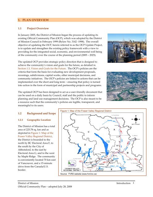
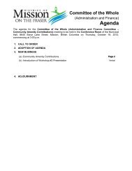
- Page 15 and 16: 1.5 Conformance with Provincial Law
- Page 17 and 18: the Province. 21.62% of B.C. popula
- Page 19 and 20: Percent (%)1.6.5 Educational Attain
- Page 21 and 22: growth occurred throughout B.C. wit
- Page 23 and 24: higher density development forms, i
- Page 25 and 26: Part I also presents a demographic
- Page 27 and 28: Rural and Rural Residential designa
- Page 29 and 30: Land Use Designations and DensityTh
- Page 31 and 32: 8. utilize smarter and cheaper infr
- Page 33 and 34: POLICIESCollaborative Approach to E
- Page 35 and 36: OBJECTIVEProtect the District’s w
- Page 37 and 38: 1.4 STEWARDSHIP OF GRAVEL RESOURCES
- Page 39 and 40: POLICIESFloodproofing New Developme
- Page 41 and 42: character and also contributes to l
- Page 43 and 44: milestones of the Federation of Can
- Page 45 and 46: an application of the principles of
- Page 47 and 48: Locate Parkland StrategicallyPolicy
- Page 49 and 50: Consider subdivision applications t
- Page 51 and 52: Table 7 - Studies - Secondary Study
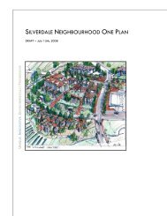
- Page 53 and 54: • SILVERDALE NEIGHBOURHOOD ONESil
- Page 55 and 56: the pressures related to requests f
- Page 57 and 58: including secondary suites, coach h
- Page 59 and 60:
OBJECTIVEEncourage a variety of inf
- Page 61 and 62:
options are available for the more
- Page 63 and 64:
design that can be readily modified
- Page 65 and 66:
• Create new, long-term quality j
- Page 67 and 68:
Mission as compared to those who ar
- Page 69 and 70:
Building PermitValue (in $000s)3.2
- Page 71 and 72:
developments to provide a minimum b
- Page 73 and 74:
3.3 INDUSTRIAL DEVELOPMENTApproxima
- Page 75 and 76:
Campus-style Business ParksPolicy 3
- Page 77 and 78:
Economic opportunities for agricult
- Page 79 and 80:
Agricultural Land Commission, the M
- Page 81 and 82:
was commissioned to provide recomme
- Page 83 and 84:
Central Area Comprehensive Developm
- Page 85 and 86:
• DOWNTOWN IMAGE AND QUALITY OF D
- Page 87 and 88:
alterations and function to ensure
- Page 89 and 90:
POLICIES• WATERFRONT AND COMMUTER
- Page 91 and 92:
Screening Parking from the StreetPo
- Page 93 and 94:
• SPECIFIC COMMUTER RAIL AREA DES
- Page 95 and 96:
5. IMPROVING COMMUNITY FACILITIES A
- Page 97 and 98:
OBJECTIVEProvide a comprehensive an
- Page 99 and 100:
5.2 ARTS AND CULTUREMunicipalities
- Page 101 and 102:
promote arts and cultural initiativ
- Page 103 and 104:
Heritage Strategic PlanGOVERNANCE -
- Page 105 and 106:
elementary level students can begin
- Page 107 and 108:
The following policies support the
- Page 109 and 110:
6. SOCIAL DEVELOPMENT6.1 STRENGTHEN
- Page 111 and 112:
Transportation and Land UsePolicy 7
- Page 113 and 114:
Policy 7.2.8. Consider alternative
- Page 115 and 116:
Site Design for Better Public Trans
- Page 117 and 118:
POLICIESBicycle Master PlanPolicy 7
- Page 119 and 120:
8. PROVIDING FOR INFRASTRUCTURE8.1
- Page 121 and 122:
8.2 SEWAGE AND RAINWATER MANAGEMENT
- Page 123 and 124:
management of rainwater runoff. Thi
- Page 125 and 126:
POLICIESWaste Disposal and Recyclin
- Page 127 and 128:
• Provide direction to District s
- Page 129 and 130:
Workshops, Open Houses and the Publ
- Page 131 and 132:
PolicyKey Action ItemPriority(Immed
- Page 133 and 134:
PolicyKey Action ItemPriority(Immed
- Page 135 and 136:
PolicyKey Action ItemPriority(Immed
- Page 137 and 138:
PolicyKey Action ItemPriority(Immed
- Page 139 and 140:
PolicyKey Action ItemPriority(Immed
- Page 141 and 142:
PolicyKey Action ItemPriority(Immed
- Page 143 and 144:
suggested by District staff, the OC
- Page 145 and 146:
DEVELOPMENT PERMIT AREASDEVELOPMENT
- Page 147 and 148:
Cluster residential development on
- Page 149 and 150:
2. Pervious Surface Retention(a) A
- Page 151 and 152:
(b) No street block should have mor
- Page 153 and 154:
(d) Widows can be arranged and offs
- Page 155 and 156:
Area B - WINDEBANK CREEK DEVELOPMEN
- Page 157 and 158:
from adjacent commercial uses. Prov
- Page 159 and 160:
a recognized historic value should
- Page 161 and 162:
(e) Pedestrian linkages between adj
- Page 163 and 164:
Area E - LOUGHEED SERVICE COMMERCIA
- Page 165 and 166:
(f) Use of focal points such as pub
- Page 167 and 168:
• ground floor façade elements s
- Page 169 and 170:
Area G - DOWNTOWN EAST END DEVELOPM
- Page 171 and 172:
(a) If there is an existing structu
- Page 173 and 174:
The Multi-family Residential Develo
- Page 175 and 176:
mass and height where it will block
- Page 177 and 178:
Development Permit Area Guidelines
- Page 179 and 180:
4. Guidelines- Reinforce the effort
- Page 181 and 182:
Area K - INDUSTRIAL DEVELOPMENT PER
- Page 183 and 184:
Roof edge designs should incorporat
- Page 185 and 186:
deciduous plantings should be emplo
- Page 187 and 188:
pervious paving materials, andgreen
- Page 189 and 190:
(a) Buildings are to be sited to pr
- Page 191 and 192:
floral display in the front landsca
- Page 193 and 194:
Mixed Use Commercial(a) Siting(i) B
- Page 195 and 196:
esidential character of the area. S
- Page 197 and 198:
Area O - SILVERDALE NEIGHBOURHOOD O
- Page 199 and 200:
• To provide a mix of housing opp
- Page 201 and 202:
17.3.8 Safety & Security17.3.8.1 De
- Page 203 and 204:
exterior finish of buildings, exclu
- Page 205 and 206:
17.4.6.3 The massing of garages sho
- Page 207 and 208:
Silverdale Neighbourhood One - Colo
- Page 209 and 210:
District of MissionOfficial Communi
- Page 211 and 212:
District of MissionOfficial Communi
- Page 213 and 214:
Local Governments;address the requi
- Page 215 and 216:
) Pursuant to Section 920(11) of th
- Page 217 and 218:
OTHER DEVELOPMENT PERMIT AREAS1. Ca
- Page 219 and 220:
DEVELOPMENT PERMIT AREA GUIDELINESM