Notice of Preparation - Placer County Government - State of California
Notice of Preparation - Placer County Government - State of California
Notice of Preparation - Placer County Government - State of California

You also want an ePaper? Increase the reach of your titles
YUMPU automatically turns print PDFs into web optimized ePapers that Google loves.
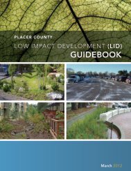
Initial Study & Checklist continuedIf, at any time during construction, a field review by <strong>County</strong> personnel indicates a significant deviation from theproposed grading shown on the Improvement Plans, specifically with regard to slope heights, slope ratios, erosioncontrol, winterization, tree disturbance, and/or pad elevations and configurations, the plans shall be reviewed by theDRC/ESD for a determination <strong>of</strong> substantial conformance to the project approvals prior to any further work proceeding.Failure <strong>of</strong> the DRC/ESD to make a determination <strong>of</strong> substantial conformance may serve as grounds for therevocation/modification <strong>of</strong> the project approval by the appropriate hearing body.MM VI.3 Submit to the Engineering and Surveying Department (ESD), for review and approval, a geotechnicalengineering report produced by a <strong>California</strong> Registered Civil Engineer or Geotechnical Engineer. The report shalladdress and make recommendations on the following:A) Road, pavement, and parking area designB) Structural foundations, including retaining wall design (if applicable)C) Grading practicesD) Erosion/winterizationE) Special problems discovered on-site, (i.e., groundwater, expansive/unstable soils, etc.)F) Slope stabilityOnce approved by the ESD, two copies <strong>of</strong> the final report shall be provided to the ESD and one copy to theBuilding Department for their use. If the soils report indicates the presence <strong>of</strong> critically expansive or other soils problemswhich, if not corrected, may lead to structural defects, a certification <strong>of</strong> completion <strong>of</strong> the requirements <strong>of</strong> the soils reportwill be required for subdivisions, prior to issuance <strong>of</strong> Building Permits. This certification may be completed on a Lot byLot basis or on a Tract basis. This shall be so noted in the CC&Rs and on the Informational Sheet filed with the FinalMap(s). It is the responsibility <strong>of</strong> the developer to provide for engineering inspection and certification that earthwork hasbeen performed in conformity with recommendations contained in the report.Discussion- Item VI-4:There are no identified unique geologic or physical features at this site that may be destroyed, covered or modified.Discussion- Items VI-5,6:This resort project proposal will result in the construction <strong>of</strong> various residential, tourist and commercial buildingstotaling approximately 1,161,148 square feet. The disruption <strong>of</strong> soils on this property increases the risk <strong>of</strong> erosionand creates a potential for contamination <strong>of</strong> stormwater run<strong>of</strong>f with disturbed soils or other pollutants introducedthrough typical grading practices. The construction phase will create significant potential for erosion as disturbedsoil may come in contact with wind or precipitation that could transport sediment to the air and/or adjacentwaterways. Discharge <strong>of</strong> concentrated run<strong>of</strong>f in the post-development condition may also contribute to the erosionpotential impact in the long-term. Erosion potential and water quality impacts are always present and occur whenprotective vegetative cover is removed and soils are disturbed. It is primarily the shaping <strong>of</strong> building pads, gradingfor parking areas, roadways, and trenching for utilities that are responsible for accelerating erosion and degradingwater quality. This disruption <strong>of</strong> soils on the site has the potential to result in significant increases in erosion <strong>of</strong> soilsboth on and <strong>of</strong>f the site. The proposed project’s impacts associated with deposition or soil erosion or changes insiltation will be mitigated to a less than significant level by implementing the following mitigation measures:Mitigation Measures- Items VI-5,6:Refer to text in MM VI.1Refer to text in MM VI.2Refer to text in MM VI.3MM VI.4: Staging Areas: Stockpiling and/or vehicle staging areas shall be identified on the Improvement Plans andlocated as far as practical from existing dwellings and protected resources in the area.MM VI.5 Water quality Best Management Practices (BMPs), shall be designed according to the <strong>California</strong> StormwaterQuality Association Stormwater Best Management Practice Handbooks for Construction, for New Development/Redevelopment, and/or for Industrial and Commercial, (and/or other similar source as approved by the Engineering andSurveying Department (ESD)).Construction (temporary) BMPs for the project include, but are not limited to: Fiber Rolls, Stabilized ConstructionEntrance, Storm Drain Inlet Protection, Silt Fence, cut<strong>of</strong>f trenches, revegetation, soil stabilization, and straw/pineneedle wattles.Storm drainage from on- and <strong>of</strong>f-site impervious surfaces (including roads) shall be collected and routed throughspecially designed catch basins, vegetated swales, vaults, infiltration basins, water quality basins, filters, etc. forentrapment <strong>of</strong> sediment, debris and oils/greases or other identified pollutants, as approved by the ESD. BMPs shall bedesigned at a minimum in accordance with the <strong>Placer</strong> <strong>County</strong> Guidance Document for Volume and Flow-Based SizingPLN=Planning, ESD=Engineering & Surveying Department, EHS=Environmental Health Services, APCD=Air Pollution Control District 9 <strong>of</strong> 21