aretes and py pks.pdf - Richmond School District No. 38
aretes and py pks.pdf - Richmond School District No. 38
aretes and py pks.pdf - Richmond School District No. 38

Create successful ePaper yourself
Turn your PDF publications into a flip-book with our unique Google optimized e-Paper software.
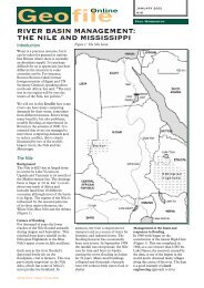
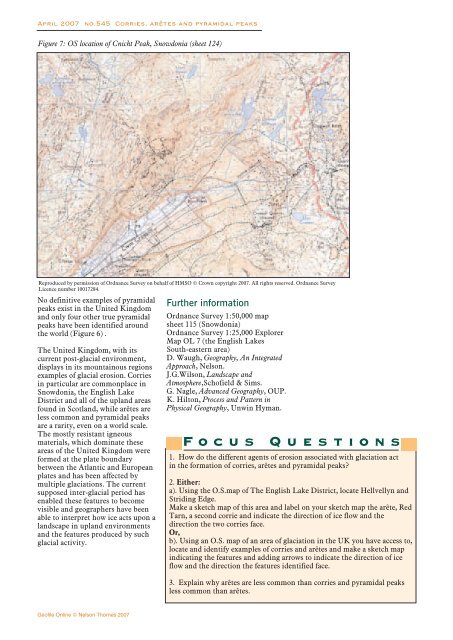
April 2007 no.545 Corries, arêtes <strong>and</strong> <strong>py</strong>ramidal peaksFigure 7: OS location of Cnicht Peak, Snowdonia (sheet 124)Reproduced by permission of Ordnance Survey on behalf of HMSO © Crown co<strong>py</strong>right 2007. All rights reserved. Ordnance SurveyLicence number 10017284.<strong>No</strong> definitive examples of <strong>py</strong>ramidalpeaks exist in the United Kingdom<strong>and</strong> only four other true <strong>py</strong>ramidalpeaks have been identified aroundthe world (Figure 6) .The United Kingdom, with itscurrent post-glacial environment,displays in its mountainous regionsexamples of glacial erosion. Corriesin particular are commonplace inSnowdonia, the English Lake<strong>District</strong> <strong>and</strong> all of the upl<strong>and</strong> areasfound in Scotl<strong>and</strong>, while arêtes areless common <strong>and</strong> <strong>py</strong>ramidal peaksare a rarity, even on a world scale.The mostly resistant igneousmaterials, which dominate theseareas of the United Kingdom wereformed at the plate boundarybetween the Atlantic <strong>and</strong> Europeanplates <strong>and</strong> has been affected bymultiple glaciations. The currentsupposed inter-glacial period hasenabled these features to becomevisible <strong>and</strong> geographers have beenable to interpret how ice acts upon al<strong>and</strong>scape in upl<strong>and</strong> environments<strong>and</strong> the features produced by suchglacial activity.Further informationOrdnance Survey 1:50,000 mapsheet 115 (Snowdonia)Ordnance Survey 1:25,000 ExplorerMap OL 7 (the English LakesSouth-eastern area)D. Waugh, Geography, An IntegratedApproach, Nelson.J.G.Wilson, L<strong>and</strong>scape <strong>and</strong>Atmosphere,Schofield & Sims.G. Nagle, Advanced Geography, OUP.K. Hilton, Process <strong>and</strong> Pattern inPhysical Geography, Unwin Hyman.FocusQuestions1. How do the different agents of erosion associated with glaciation actin the formation of corries, arêtes <strong>and</strong> <strong>py</strong>ramidal peaks?2. Either:a). Using the O.S.map of The English Lake <strong>District</strong>, locate Hellvellyn <strong>and</strong>Striding Edge.Make a sketch map of this area <strong>and</strong> label on your sketch map the arête, RedTarn, a second corrie <strong>and</strong> indicate the direction of ice flow <strong>and</strong> thedirection the two corries face.Or,b). Using an O.S. map of an area of glaciation in the UK you have access to,locate <strong>and</strong> identify examples of corries <strong>and</strong> arêtes <strong>and</strong> make a sketch mapindicating the features <strong>and</strong> adding arrows to indicate the direction of iceflow <strong>and</strong> the direction the features identified face.3. Explain why arêtes are less common than corries <strong>and</strong> <strong>py</strong>ramidal peaksless common than arêtes.Geofile Online © Nelson Thornes 2007