×××ר ×××ס×× - ××××× ×××××××××
×××ר ×××ס×× - ××××× ×××××××××
×××ר ×××ס×× - ××××× ×××××××××
Create successful ePaper yourself
Turn your PDF publications into a flip-book with our unique Google optimized e-Paper software.
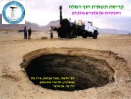
AbstractPotential maps for sinkholes collapse were first published by the Geological Survey of Israel(GSI) in July 2004 following several years of interdisciplinary research with collaboration ofthe Geophysical Institute of Israel. Since their publication, GSI continued with follow-upsurveys, mainly by aerial photographs and some field examinations. Between 2004 andDecember 2008, ~1500 additional sinkholes appeared along the western shore of the Dead Seaand Lynch Strait. All of these sinkholes are located within the "high potential", red-coloredzone in the potential maps, except for 5 sinkholes that developed near Mineral Beach resort(Hatsatson-Darga alluvial fan) within the "low potential" green zone. These observationsimply that the potential maps properly outline the zones of future sinkholes occurrence.The potential levels depicted on the enclosed maps are as follows:High potential zone – Zones of high potential for sinkhole appearance (red in maps),comprising the major conditions for sinkhole formation, namely, (i) presence of a salt layer inthe sub-surface, (ii) decline in the level of the Dead Sea and the associated groundwater. In thesouthern basin, along the evaporation ponds of the Dead Sea Works Ltd. in which water levelrises, the red zone only encircles sinkholes clusters, e.g. the sinkhole sites of Neve Zohar andEn Bokek.Low potential zone – Zones in which the possibility of sinkhole formation is low but cannot beruled out (green in maps). These include areas where the probability of finding a salt layer inthe subsurface can not be ruled out. In the southern basin, where freshwater flow in thesubsurface is limited due to the rising level of the brines in the evaporation ponds, areassuspected of presence of salt layer are also marked in green rather than red as in the northenbasin.The yellow zones in the updated maps are a 25 m buffer zones around the sinkholes. Thesezones are part of the "High Level" zone rather than an independent potential zone as defined inthe previous potential maps. Additional updatings in the present maps include 1) Dead Seacoastline, 2) updated distribution of sinkholes, and 3) new definitions of sinkhole sites. Thepresent mapping is based on the 2004 to which modification were introduced based on newgeological insights and observations as well as additional information acquired from boreholesand aerial photographs. Refinement of the potential areas focused on three areas: 1) Hatsatson-Darga alluvial fan, where new sinkholes appeared in the "green zone", 2) Neve Zohar, basedon new boreholes data and revised geological considerations, and 3) Yeelim alluvial fan, basedon new boreholes data.Updated potential map at a scale of 1:100,000 and three more detailed maps at 1:50,000 areenclosed in this report. These maps are superimposed on rectified aerial photographs taken inMay 2008. It is important to note that refinement of the borders of the potential zones fordevelopment purposes requires detailed local study to establish the lateral extension of the saltlayer at depth.


