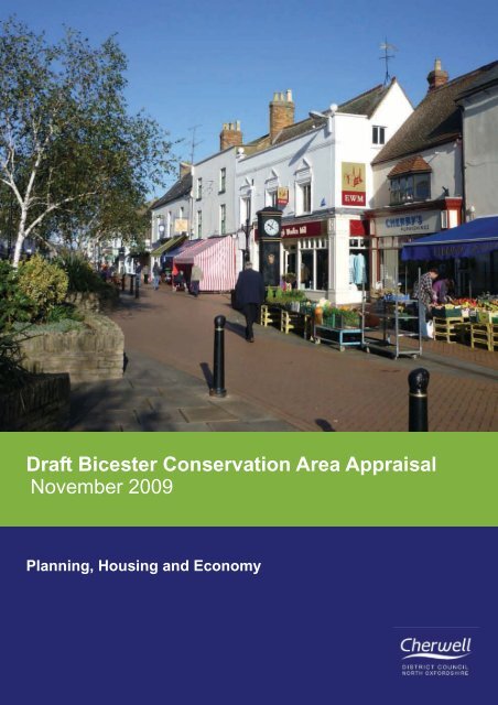
Draft Bicester Conservation Area Appraisal November 2009
Draft Bicester Conservation Area Appraisal November 2009
Draft Bicester Conservation Area Appraisal November 2009

You also want an ePaper? Increase the reach of your titles
YUMPU automatically turns print PDFs into web optimized ePapers that Google loves.
<strong>Draft</strong> <strong>Bicester</strong> <strong>Conservation</strong> <strong>Area</strong> <strong>Appraisal</strong><strong>November</strong> <strong>2009</strong>Planning, Housing and Economy1
Contents1: Introduction and Planning Policy Context2: Location3: Topography and Geology4: Archaeology5: Images and development6: History of <strong>Bicester</strong>7: Architectural History8: Established Character9: Character <strong>Area</strong>s9.1 Kings End9.2 Church Precinct9.3 Causeway9.4 Sheep Street9.5 Lanes and yards9.6 North Street9.7 Chapel Street/Priory Lane9.8 Priory Road/ London Road9.9 Piggy Lane9.10 Manor Farm9.11 <strong>Bicester</strong> House9.12 Garth Park10. Materials and Details11. Management Plan12. <strong>Conservation</strong> <strong>Area</strong> boundary justification13. Effects of <strong>Conservation</strong> <strong>Area</strong> designation14. BibliographyPage34568162124333435373941434547484950515556616364List of FiguresPage1: Location map2: Aerial Plan3: Designations4: Topographical map5: Geological map6: Archaeology7: Development maps8: Historic map of 17539: Historic map of 188710: Historic map of 191311: Historic route structure12: Modern route structure13: Ground floor land use14: Figure Ground plan15: Character <strong>Area</strong>s16: Visual analysis of <strong>Conservation</strong> <strong>Area</strong>17: Unlisted buildings that make a positive contribution3456669131415202024253352532
1. Introduction and Planning Policy Context1.1 This document is an appraisal of thecharacter and appearance of <strong>Bicester</strong><strong>Conservation</strong> <strong>Area</strong> as designated in 1969.The <strong>Conservation</strong> <strong>Area</strong> was reviewed in1992 with an appraisal being produced in1998. This appraisal is an update andreview of the 1998 document. It providesa comprehensive review of the currentcharacter and appearance of <strong>Bicester</strong> andthe <strong>Conservation</strong> <strong>Area</strong>. It also provides abasis for providing informed judgementson <strong>Bicester</strong>’s future conservation andmanagement.1.2 <strong>Conservation</strong> <strong>Area</strong>s were introducedby the Civic Amenities Act of 1967.However, it is the 1990 Act (Section 69)which places a duty upon local planningauthorities to identify areas of specialarchitectural or historic interest throughan appraisal process and to designatethem as <strong>Conservation</strong> <strong>Area</strong>s. Since 1967some 8,000 <strong>Conservation</strong> <strong>Area</strong>s havebeen designated in England, including 58in Cherwell District.1.3 The planning (Listed Buildings and<strong>Conservation</strong> <strong>Area</strong>s) Act 1990 provideslegislation for the protection of thenation’s heritage of buildings and placesof architectural and historic interest, thecharacter or appearance of which it isdesirable to preserve or enhance.1.4 Local planning authorities have a dutyunder the Act to consider boundaryrevisions to their <strong>Conservation</strong> <strong>Area</strong>s‘from time to time’.1.5 This document is based on a standardrecording format derived from advicecontained in documents publishedby English Heritage (2005a). By writing afull <strong>Conservation</strong> <strong>Area</strong> appraisal for <strong>Bicester</strong>,the special character and appearancecan be identified and protected byensuring that any future developmentpreserves or enhances that identifiedspecial character.Figure 1: Location map with <strong>Conservation</strong><strong>Area</strong> boundary3
2. 2. Location2.1 <strong>Bicester</strong> lies 18Km (11 miles) north/northeast of Oxford astride the Oxford toBuckingham Road. The <strong>Conservation</strong><strong>Area</strong> covers the majority of the historicsettlement. Despite <strong>Bicester</strong>’s rapid 20thcentury growth it retains its pre 18thcentury historic core which still acts as thetown’s commercial centre.2.2 Phases of the town’s developmentfrom the burgage plots and old LondonRoad to the railway and 1970s shoppingcentre are clearly visible in the settlementplan. The Garth and <strong>Bicester</strong> House arealso apparent as patches of greenery atthe far east and west of the <strong>Conservation</strong><strong>Area</strong>.Figure 2: Aerial view of the <strong>Conservation</strong> <strong>Area</strong>4
Figure 3 : Designations map5
2. 3. Topography Location and Geology3.1 The town sits on the northern edge ofthe Otmoor lowlands next to the band oflimestone and Cornbrash, which runsnorth-east to south-west across Oxfordshire.The land is flat, rising very gentlyfrom 70m to 80m (approx. 230ft to 260ft)south to north.3.2 The River Bure and its various minortributaries flow north west to south eastthrough the town towards the River Raybut the watercourse is never a significantfeature in the town, being canalised formuch of it length through the developedarea. (Cobham Resource Consultants,1995).110 Landform inMetres aboveOrdnance Datum<strong>Conservation</strong> <strong>Area</strong>Boundary80Water courses7570Figure 4: Contours mapCornbrashForest marbleKellaways ClayKellaways sandLower Oxford Clay,Peterborough memberFigure 5: Geological map6
4. ArchaeologySituated on an ancient route and at a rivercrossing <strong>Bicester</strong> has a wealth ofarchaeological sites.001—Historic core and Saxon settlement areas,St Edburg’s church,Site of St Edburgh’s Augustinian Monastery–founded 1180s, 14th century dovecote,Site of St John’s Chapel associatedwith medieval hospital, Post medieval pits,Cemetery chapel 1861, Post medievalvicarage 16th century, Domestic buildinglisted, Post medieval pits and pottery,Post med bell foundry, Medieval churchyardcross, Medieval manor house,Chapel, Dovecote and fishpond, Medievalcauseway, Post medieval congregationalchurch 1728.002—medieval shrunken settlement andvillage green, site of medieval monasticgrange and manor house, post medievalmanor house on site of monastic grange,medieval settlement remains, AngloSaxon pottery.003—Roman Road, Towcester to Alcester004—Rectangular enclosures, trackways,pottery, coins, brooches, pins—suggestive of villa site.005—Ditched earthwork of unknown date006—Ring ditches of uncertain date,circular barrow007—Ring ditch, cropmarkFigure 6: Archaeological sites7
5. Historical Images & Development5.1 Origins5.1.1 This section provides a brief historyof the development of <strong>Bicester</strong>. A moredetailed account is given in The VictoriaCounty History: A History of Oxfordshire,Vol VI (Lobel,1959). Other key sourcescan be found in the Bibliography.5.1.2 There has been a settlement at ornear <strong>Bicester</strong> since Roman times. In themiddle of the first century AD the Romansestablished and fortified the town ofAlchester at the intersection of AkemanStreet (Cirencester to St Albans) and aroad from Towcester to Dorchester, alocation approximately 1 1/2 kilometressouth of the present town. The 26 acresite was very low lying, necessitatingextensive raising of levels and drainageworks. When the Romans left in the 5thcentury their drainage system collapsedand the site reverted to marsh land. Therehave been several finds of Romano Britishpottery around the site.5.1.3 There is debate about the origin ofthe name of the town. The DomesdayBook 1086 records the town asBernecestre which means ‘the fort of thewarriors’ or ‘of Beorna’ who was believedto be an Anglo-Saxon Warlord. It ispossible that the settlement was a frontiergarrison town for the west Saxons againstthe Mercians. There is no evidence of adefended site, although it was believedlocally that earthworks may have beenfound adjacent to the River Bure atCrockwell. Others cite the Saxon forgranary (bern) and the Latin for town(ceaster) to reflect the market place. Othervariations of the name include Burincester,Burencester, Birini-Castrum, Birincestre,Burincastre. As late as 1757 it was knownas ‘Burchester otherwise BurcesterOtherwise Bissiter’ and in 1793 ‘Burcesterotherwise <strong>Bicester</strong>’, the present spellingonly becoming standard in the nineteenthcentury.John Speeds map of 16058
5.2 Development5.2.2 Tradition has it that the religious5.2.1 The modern settlement evolved fromAnglo-Saxon farmers who settled on theCornbrash, a flaggy type of limestone,either side of a ford over the River Bure andclose to the existing Saxon Minster of StEdburg’s. The first group of farms wereestablished in the vicinity of what becamethe Manor of King’s End followed by a latersettlement on the east side of the Burewhich became the Manor of Market End.The Shamblessettlement at King’s End was founded byBirinus, the seventh century Bishop ofDorchester and subsequently destroyed bythe Danes about 912. The nuns ofMarkyate, Bedfordshire obtained land hereat the beginning of the 13th century andtheir grange and the cottages of theirtenants constituted most of the settlement.By 1316 the Manor was known as King’sEnd and in 1377 a license to grant a threeday annual trade fair was granted.Markyate Priory was dissolved in 1536 byHenry VIII’s First Suppression Act and in1542, ‘the Manor of the nuns place’ wassold into private ownership. In 1584 theManor was conveyed to the Coker family,whose origins were in the west country.<strong>Bicester</strong> House remained in the ownershipof the Coker family for nearly four centuriesuntil the 1970s, during which time the familyplayed a leading role in the life of the town.NNCrockwellManor ofKings EndManor ofMarketEndSite of nuns ofMark Yate PriorySaxon MinsterAugustinianPriorySaxonEarly 15th-16thNNRailway16th –17thFigure 7: Development maps918th –19th
5.2.3 The later settlement on the east ofthe River Bure known as Market End, orBury End throughout the middle ages,was fortified by King Edward the elder.The Saxon Minster is dedicated to StEdburga, his daughter or grand-daughter,who died in 924. The site of the ManorHouse of the Lords of Bury End is notknown. It could have been in or near thesite of the priory, because in 1182 GilbertBassett, the Lord of the Manor, gave landto the Augustians to found a priory.Records suggest that Market End was themore successful settlement. In 1239 acharter was granted to William deLongspee to hold a weekly market; in1252 a license to hold a fair for three dayson and around the feast of St Edburg onthe 18th July was given and in 1441Robert Brooke was granted a Fridaymarket which possibly included a livestockfair. The Priory was never rich and itseffect on the economy of the town waslimited.Aerial photograph taken in 1974 showingMarket Square. The lines of medieval burgageplots are still visible.5.2.4 However the markets sustained acommunity larger than an ordinaryagrarian village and leases of housessuggest a prosperous merchantcommunity in the thirteenth century. Landwas sold by William de Longspee at thattime and two storey houses with cellarsand solars (with-drawing rooms) werebuilt contiguously on long narrow burgageplots along Market End and theCauseway. Although the buildings werereplaced in the 16th and 17th century, themedieval town plan can still be identifiedby the limestone walls of the burgageplots.5.2.5 The success of the market graduallypulled traffic from the old Roman road intoMarket End via Causeway and SheepStreet so that the Old Roman route fellinto disuse. The roads were maintainedby the monks of the Priory because it wasin their interests to have goodcommunications between their scatteredproperties. It is believed that Causewaywas constructed by the monks probablywith a ford and a wooden footbridge forpedestrians across the River Bure.Following the dissolution of the monasterythe roads fell into disrepair.10
Figure 7: Old Photographs1900-1960s <strong>2009</strong>This comparison shows the extent to which Market Square has become dominated by cars and theirassociated signage and clutter. The central listed buildings of no. 46, 48 & 51 look in much better repairand are still occupied by businesses on the ground floor. To the left of the photograph it is clear that arow of houses at the end of Sheep Street have been demolished to be replaced by the HSBC bank andthe Quadrant building.This photograph of Market Hill looks at first glance to display few differences; the same buildings arerecognisable. However the old photograph shows the buildings which have now been demolishedfronting Sheep Street and also the extent to which shop fronts design has changed during the lastcentury. The smaller divided glass and timber framed frontages have been replaced in many places bylarge single glazed panels with bulky and brightly coloured box signs. Awnings have been removedtaking shops back off the pavements and some of the brick buildings have been gentrified with renderand on no. 5 London Road a pediment doorcase.11
Sheep Street is one of the areas that have changed most since the early 1900s. The street hasreturned to a pedestrian dominated space but the open character has been lost by the insertion ofplanters and street furniture. Sheep Street has replaced Market Square as <strong>Bicester</strong>’s commercialfocus. The old photographs show the rows of small traditional shops but many of these buildings havebeen lost and have been replaced with modern frontages in the mid 20th century.In contrast to the changes seen above in Sheep Street, The Causeway has been remarkablyconstant. The road has retained its historically narrow and constricted character and even retainssome of its shop fronts. The last appraisal was written in 1998 when a number of properties were ina poor state of repair, the <strong>2009</strong> photo shows there has been some restoration although a fewbuildings remain vacant..12
Figure 8: Historic map of 1753By 1753 the pattern of medieval streets and spaces in the <strong>Conservation</strong> <strong>Area</strong> that still exist todayhas been established. The surrounding countryside is semi-enclosed with the open areas of<strong>Bicester</strong> Moor and King’s End Mead distinct from the thin strips of individual burgage plots. Thewater mill is visible next to Chapel Street (previously Water Lane) and to the north a piece ofmarshland labelled Gibbet Slade indicates the location of the gallows.13
Figure 9 : Historic map of 1887By 1887 the majority of surrounding land has been inclosed and the railway has arrived in<strong>Bicester</strong>. The main route to London runs through Kings End, Market Square, Sheep Street andLondon Road but Queens Avenue is still an informal path. There are a large number of Inns andHotels along the main route serving the passers-by. The Garth has yet to be built but the site isoccupied by another large dwelling named The Poplars. There are many signs indicative of anactive Victorian town such as smithy’s, weighing machines, gas works and single unit workerscottages lining Chapel Street.14
Figure 10: Historic map of 1913By 1913 the Garth has been built and more housing has appeared at Crockwell, Kings End and PrioryRoad. Queens Avenue is still an unsurfaced lane and remains so until 1938. The cattle market hasrelocated to the east of Sheep Street to a purpose built area. The majority of the town still lies withinthe <strong>Conservation</strong> <strong>Area</strong> boundary at this stage and there is a mix of residential and commercialproperty in the town centre.15
6. History of <strong>Bicester</strong>5.3 History6.1.1 A settlement developed at Crockwellto the north. The name is likely to haveoriginated from ‘the well at the cross’ andalso appears in the context of a WalterCrockwell mentioned in the 1211 Prioryannals. A spring was located at Crockwell,adjacent to the Roman road and flowinginto the River Bure. It was reputed to havemedicinal properties. A hermitage andchapel dedicated to St John the Baptistwas located at Crockwell but a fieldsurvey of 1399 makes it clear that it lay inopen countryside. White Kennett identifieda settlement called Bigenhul betweenCrockwell and Kings End with its ownsmall church of which no trace remains,but others report this as the King’s Endsettlement.6.1..2 Very little remains of the Priory nowbut it is known that the grounds extendedwest from the River Bure to St Edburg’sChurch and south from the Causeway tothe confluence of the two parts of theRiver Bure. Plans have beenreconstructed from documentary evidence(excavations in 1819 and 1968 andbuilding work in 1965) to show a churchsignificantly larger than the parish churchwith lodgings, cloisters, chapter house,dovecote, mills barn and stables. Threegates gave access through the walls fromwhat are now Piggy Lane, Church Laneand Priory Road. The monastery wasnever rich and the Priory has to encloseland and sell jewels in the 14th and 15thcenturies. In 1526 King Henry VIII visitedthe monastery and it was one of the firstto be dissolved by him ten years later.The Priory Church was immediatelydemolished, the cloister buildings weredemolished in 1673 and the grounds laylargely unused until redeveloped in 1965.6.1.3 <strong>Bicester</strong> continued to comprise thetwo townships of King’s End and MarketEnd, never seeking the status of a borough,until the Urban District Council wascreated in 1894. The division between thetwo townships is demonstrated by ahouse which is known both as number 2King’s End and number 28 Church Street.166.1.4 The 16th and 17th centuries wereprosperous times and the town saw muchrebuilding including the use of stone fromthe dissolved Priory. Sheep Streetdeveloped at this time when the livestockmarket outgrew Market Square. Burgageplots extended from Causeway,northwards either side of Sheep Street,bounded on the west by the River Bure.6.1.5 The two townships always shared aparish church however, the Church of St.Edburg, by tradition, was established inthe 7th century; certainly it was inexistence before the Norman Conquestbecause it was a Minster church. Theimportance of the church at <strong>Bicester</strong> isevidenced by the formation of the <strong>Bicester</strong>Deanery comprising 33 churches beforethe end of the 12th century. The existingchurch still incorporates some late Saxonwork but most of the fabric dates from the12th to the 15th centuries.The Church of St. Edburg in the 1880s6.1.6 The 14th and 15th centuries saweconomic decline exacerbated by theBlack Death in 1349, floods in 1412 andpoor harvests.6.1.7 Development at Market End wasencouraged in 1596 when the Earl ofDerby, the Lord of the Manor of MarketEnd, leased parts of the town to 31 of histenants. Shortly afterwards he conveyedthe Manor at an annual rent of one pennyfor 9999 years in trust for these tenants.Further leases led to the town becoming abailiwick where effectively the holderswere granted absolute freehold. Thebailiwick was only extinguished in the 20thcentury by the tenures passing to <strong>Bicester</strong>Urban District Council.
6.1.8 A town house was erected in theMarket Place before 1599 forming part ofthe encroachments in the Market placewhich have survived from this periodwithin the island block numbers 44 to 57Market Square. Projecting from this was awooden arcade known as The Shambles.In 1662 this comprised an upper roomraised on wooden pillars with an outsidestaircase, a clock and bell on the westerngable. It was used for the storage of stallsand market equipment and also, for atime, for the slaughter and sale oflivestock. It was demolished in 1826 byrioting agricultural workers. The MarketSquare also contained a weighbridge, afountain, a guard house, a pillory, stocksand a whipping post (which can now beseen in the entrance hall of the Garth). In1605 it was ruled that no furtherdevelopment would be allowed with in theMarket Square.6.1.9 A block of buildings to the north ofthe existing central block in MarketSquare used to split Market Hill into two,east and west, sections. This was threestorey and restricted vehicles to a narrowopening known as ‘the Narrows’ or ‘theOpening’. The block was demolished in1963 for road widening.6.1.10 Major fires in 1718, 1724 and 1730led to further rebuilding. A serious fire atChapel Street (then Water Lane) in 1728led to an extension of the town northwardsto Crockwell which was called NewBuildings.6.1.11 The main route from the Midlandsto London passed through the town via StJohns Street, Sheep Street, MarketSquare, and Chapel Street. London Roaddid not become the main route until theBletchley to Oxford railway line wasconstructed in 1850. The route of theformer road can still be traced by followingthe line of mature trees south east fromthe end of Chapel Street. There were tollgates at the northern entrance whereTwitchers Alley and Crumps Butts meetNorth Street and also at Pingle Cottage.6.1.12 The latter was replaced after 1850with one at the junction of Launton Roadand London Road. The first post chaiseswere advertised at The Crown Inn in1793. The Great Western Railway linethrough <strong>Bicester</strong>, now served by ChilternRailways, was opened in 1910.6.1.13 King’s End retained a ruralatmosphere compared with thecommercial activity of Market End. Twofarms remained until well into the 20thcentury, Manor Farm and Home Farm,still working until 1955 and the late 1960srespectively. There was a green in front of<strong>Bicester</strong> House until the grounds wereextended in the 1780s. Properties mayhave been demolished at this time andrebuilt along the alignment of the OldRoman Road. The main entrance to<strong>Bicester</strong> House was at the corner ofKing’s End opposite The Fox Hotel. TheOld Roman Road had fallen into disuseand only a field path connected Kings Endto Field Street along its route until QueensAvenue was constructed in 1938. Theundeveloped plot to the north of The FoxHotel is the site of the former Pound.6.1.14 19th century development focusedbeyond the northern end of Sheep Streetat Crockwell. Terraces of small houseswere built fronting North Street and StJohns Street and in alleyways to the side.Many of these have been demolishedincluding Victoria Row, Albert Terrace andLadysmith Terrace on the junction of StJohns Street with Manorsfield and some,including earlier thatched cottages, alongNorth Street. However, others remainadjacent to the Plough Inn, North Streetand off Crumps Butts.6.1.15 At the turn of the century terracedhousing was built speculatively by GeorgeLayton, a prominent townsman, on VictoriaRoad at Bath Terrace, ManchesterTerrace and Newport Terrace at the sametime that the Cattle Market relocated herefrom Sheep Street and at Priory Lane in1890, Priory Road, London Road andField Street.17
6.1.16 In 1863 a drainage scheme wasinitiated starting in Market Square andWater Lane/Chapel Street. In 1891-2 itwas ordered that earth closets should beemptied weekly. In Chapel Streetpreviously these had discharged directlyinto the River Bure. This together withfrequent flooding particularly atCauseway and Chapel Street causedseveral outbreaks of cholera andtyphoid. A Pest House was erected nearPriory Road and later replaced by a feverhospital at Highfield. Piped water arrivedin 1905 and gas supply in 1845. TheRiver Bure was culverted and partiallybuilt over at the Causeway in the 1860s.Electricity was introduced in 1929.6.1.17 There was a decline in thepopulation in the early years of the 20thcentury from the peak figure reached in1891 and this continued until 1918 whenthe population again started to rise albeitfairly slowly until 1945. In 1921 theprincipal employment was still inagriculture while the next largest numberof workpeople were engaged in trade andcommerce. Largely due to the permanentestablishment of the R.A.F Station andlater the Ordnance Depot and otherbusinesses, the pattern of employmenthad by 1945 considerably alteredencouraging a rapid rise in the populationfrom that time.Between 1947 and 1956 over 600 Councilhouses were built along the Bucknell andBuckingham Roads and in new residentialareas such as Lambourne Crescent.These were primarily to house civilianworkers at the Ordnance Depot.6.2 Historical Associations andEvents6.2.1 In the 17th century the town wasoften the headquarters of the contendingarmies in the Civil War. In 1643 the Royalistsand the King stayed a night in thetown on 21 June, possibly at no 17 MarketSquare, and by mid 1644 the Parliamentarianswere in control.6.2.2 The town became well known in the18th and 19th centuries for the quality ofits horse racing, held from 1718, and localhunts, particularly the Warden Hill Huntfrom 1778. <strong>Bicester</strong> Hall and The Garthwere both built as hunting boxes, TheGarth for the Keith-Falconer family, andthis enticed London gentry to the town.The Garth6.2.3 The Coker family, Lords of theManor of Kings End from 1584 played asignificant part in the life of the town, contributingto the well being of its inhabitantsthrough providing land for the erection ofschools etc.6.1.18 <strong>Bicester</strong> continued to expandrapidly, described as the fastest growingtown in Oxfordshire by the South EastRural Towns Partnership. The populationhas risen from 5,512 in 1961 to anestimated 29,000 in 2008 and is projectedto reach 36,098 by the end of 2011.Further growth in likely in the period from2011 to 2026 partly in light of the northwest <strong>Bicester</strong> Eco Town.18RAF <strong>Bicester</strong> airfield in 1935
6.3 Trade, Industrial andAgricultural Interest6.3.1 The development of the market townfrom an agrarian community can becharted. At the beginning of the 17thcentury the settlement was almost entirelydependent on agriculture with fewtradesmen. By 1622 however a travellerdescribed <strong>Bicester</strong> as ‘a very good marketfor all manner of cattle supplied with allkinds of trades’. Analysis of wills of theperiod reveals that tanners, glovers,saddlers, clothiers, weavers, fullers andmaltsters all traded in the town. By the18th century over a quarter of thetownspeople were suppliers of goodsincluding meat, bread, shoes and clothing.By 1851, although agriculture was still thegreatest source of employment in thetown, there were also labourers,carpenters, masons and, amongst thewomen of the poorer classes, lacemakers, dress makers, tailors andmilliners. By the 18th century <strong>Bicester</strong> hasestablished a reputation for rope, lace,baskets, sackcloth and combing wool andplaiting straw.6.3.2 Market End was inclosed in 1758and King’s End in 1793. Until that timeopen fields existed as far as Chestertonand Middleston Stoney. Thomas Williams’1754 map prepared just before theInclosure Act clearly shows the division ofland into furlongs. The agriculturalindustry of the area is varied. The blackdeath affected the town and this, witheconomic decline, poor harvests andfloods, created harsh times. Much landwas uncultivated and sheep farming andland inclosure took over from arablefarming. Market End fields and commonswere finally inclosed in 1757 and KingsEnd in 1794. After inclosure rents trebled.By the 1820s there was severedepression caused by the Napoleonicwars. However by the end of the 19thcentury <strong>Bicester</strong> District was well farmedand the area was noted for its butter andcheese production.Sheep Street in 19106.3.3 Improved communications camewith the construction of turnpikes, theOxford Canal, (with a wharf at LowerHeyford), the London and North WesternRailway line from Bletchley to Oxford in1850 and the Great Western Railwayfollowing in 1910. The industrialrevolution affected <strong>Bicester</strong> less thanmany other towns. The decline of themarket and through coaching traffic in the19th century did not result in ruin, due tothe prosperity which was brought to thetown by the horse races and hunts. Horseraces were initially held at King’s End butlater transferred out of town.Beesley, A. History of <strong>Bicester</strong> (1821),Vol. 15, pg 3619
Figure 11: Historic route structureThis figure shows the importance of Kings End, Causeway, Market Square,Sheep Street and London Road as key routes with a few informal linking pathsleading to the site of the water mill to the south and linking key roads at Marketend and Crockwell.Figure 12 : Modern route structureThe modern map shows the number of residential cul-de-sacs and loopsaround the historic core. The London road no longer runs through the town andQueens Avenue has become the main through route. Sheep Street ispedestrianised and there is no longer a need to access the River Bure.20
7. Architectural History7.1 Very little remains of the Priory complex.The present parish hall may havebeen a tythe barn; the dovecote, whichdates from the late 17th century, maystand on the site of the original; the dwellingnamed The Old Priory is claimed tobe 15th century/early 16th century andthought to have been a guest house orhospice within the Priory, possibly calledThe Bell. Old Place Yard House, now aguest house, is mid/late 16th century incorporatingmedieval elements and wasprobably part of the gatehouse to the Priory.Existing boundary walls run along theroute of the Priory Wall, some of whichare believed to be original.7.2 The Church of St. Edburg is the oldestremaining building in the town. It datesapproximately from the 11th to 14th centuries,was altered in the 15th and 16thcenturies and restored in 1862. It is alarge church with late perpendicular towerand windows in the transepts and chapel.Early details include the 12th century buttressesof the chancel and fragments ofzigzag string course on the north transeptwhich suggests that the original churchwas aisleless. A south aisle was built inthe early 13th century. The east windowof the south chapel by Morris and Co isdated 1866 with Faith, Hope and Charitydesigned by Burne-Jones and tracerylights by Philip Webb.7.3 <strong>Bicester</strong> House dated from the early18th century, incorporating 17th centuryelements. It lies on the site of the ManorHouse of the Nuns of Markyate but theearly house was destroyed by fire. Muchreconstruction took place in the 1780sand again about 1820.7.4 There was much rebuilding in thetown in the 16th and 17th centuries andmany buildings remain from that periodparticularly along Church Street,Causeway and Market Square. Ofparticular interest are the following:-The group 7-13 Church Street, includingThe Six Bells Inn and The Swan Inn havedatestones of 1682, 1676 and 1681.The group of buildings which sit in thecentre of Market Square, No's 46, 48,51,comprise a former substantial town houseof jettied timber frame construction andwith extremely fine mid 17th centurydetails such as Oriel windows withenriched carving, scalloped barge boardsand wood mullioned and transomedwindows. It is likely that the building hasmedieval origins. No. 47 is a strikingbuilding of stucco and rusticated stuccoquoins and a three storied porch with anogee-shaped roof surmounted with a leadball and weather vane with datestone B/IM/1698St Edburg’s ChurchThe Old Vicarage dates from around 1500and was altered and extended probably inthe 18th century and in 1882.21No. 30 Market Square was refronted withchequer brick but has a datestone of 1751and is probably partly earlier.No.34 is a 17th century partially timberframed building containing 17th centuryoak panelled doors which may have beenpart of the adjacent Inn.The Kings Arms dates from the 16th and18th centuries and is a three storiedstucco and rendered building with aVenetian window with oak mullionedwindows fronting London Road.
Home Farmhouse7.5 In the 18th and 19th centuries, MarketHill and Church Street were the fashionableparts of town and the emerging middleclasses built their homes here. Forexample no.4 Market Hill is early 18thcentury date, of 3 storeys with a symmetrical5 window front of chequer brick, partof which is now incorporated into the adjacentsupermarket. No. 1 ClaremontHouse, is a rendered 3 storey buildingwith attic and elaborate timber detailing.No. 5 <strong>Bicester</strong> Hall, is a 3 storey doubledepth plan house with a 5 window front.Further out of town, no. 17 The Hermitageand 17a were originally one dwelling andare of additional interest as the old gaol isattached to no. 17.At Church Street, no. 18 NorthamptonHouse is a mid 18th century house with asymmetrical 4 window front and no. 20The Limes, is a substantial mid 18th century3 storey house with a 5 window front.At King’s End, Oxford House is a substantialearly 18th century house with a hippedslate and plain clay tile roof.Sheep Street looking north227.6 Buildings dating from this period but ofmore modest proportions can be foundfurther along Sheep Street. A notablegroup are no’s 24-30. No. 24 is theearliest, having a datestone is 1689 butthe others are 18th century of renderedlimestone and slate roofs. Further alongThe Bell Inn and adjacent properties no’s86-88 date from the early 18th century,and share a massive brick chimney stack.Manor Farm House and Home Farmhouseat Kings End date from the 17thcentury and both have slated woodenporches with flanking settles.Methodist Church7.7 Following the fire at Chapel Streethouses were cleared and in 1728 theCongregational Chapel was constructed,later extended in the 19th century. It is oflimestone rubble and chequer brick withashlar dressings and round archedwindows with tracery.Other chapels in the town include thechapel built by the Methodists in 1841 inNorth Street, now known as Weyland Hall,with school room added in 1885 and laterextensions of 1892. The early 20thcentury Wesley Hall and Wesley Cottageswere purchased from the UnitedMethodist Free Church members, whobuilt the chapel in 1863. Subsequently anew church was constructed on the northside of Sheep Street and opened in 1927.The Roman Catholic Church of TheImmaculate Conception in Causeway wasconstructed in 1963 in Italianate style.St Edburg’s Hall, London Road, wasdesigned in 1882 by the architect E.G.Bruton.
7.8 There are several school buildings ofnote remaining. The Blue Coat School, socalled because of the uniform of the boys,opened in 1721 possibly in the FreeSchool House adjoining the Church of StEdburg. The building called Bluecoats,now 1 Church Terrace together with theadjoining Tysul House, was remodelled inthe late 18th century but includes interiorpanelling and staircase dating from themid 17th century to around 1700.St Mary's Roman Catholic School wasopened in King’s End in 1883, andexpanded in 1939. In 1998 planningpermission was given to demolish andredevelop the derelict building and the siteis now a health centre.The National School now St Edburg’sPrimary School, was opened in 1858. Itwas designed by the architect ThomasNicholson of Hereford in the gothic style.The primary school will move to SouthWest <strong>Bicester</strong> in the near future and theoriginal school is likely to be converted toresidential use.Some of the largest buildings in the townhave been used for education from time totime, for example Oxford House at King’sEnd was a ladies Collegiate School in the1870s and The Limes, 20 Church Streetwas a similar establishment. <strong>Bicester</strong> Hall,now Hometree House, was used to housethe County Grammar School from 1924and in 1946 this expanded to includeClaremont House, 1 Market Hill.14 Priory Road7.9 Twentieth century buildings whichdisplay architectural features of interestinclude terraced housing at Priory Roadand no’s 36-44 London Road, no’s 6-12Field Street, Bath Terrace, Victoria Road,Priory Terrace, Priory Lane and of lesserinterest Manchester Terrace, NewportTerrace and Victoria Road.Rented houses were built by the <strong>Bicester</strong>Urban District Council at Priory Roadsome of which remain close to theiroriginal appearance. Amidst them, no. 14Priory Road is an individual single storeydwelling influenced by the modernmovement and this retains its originaldesign including the flat roof.Although the town has expanded greatlyduring the second half of the 20th centurythere has not been a corresponding levelof new building with the historic core.Somerfield Supermarket and the CrownWalk Shopping Centre are examples oflate 20th century retailing which havebeen integrated into the historic streetscene with varying degrees of success.East side of Market Square23
8. Established Character8.1 Land UseThe <strong>Conservation</strong> <strong>Area</strong> is based on thehistoric core, which comprises much of thecommercial focus of the town. SheepStreet and Market Square arepredominantly retail with some financialservices, restaurants and cafes. In thethree storey properties on Market Squaremany buildings appear to have residentialuse or financial services on the upperfloors . In Sheep Street where the buildingsare two storey most accommodate storagespace above.NIn several areas back land buildings offSheep Street have been brought intoproductive small scale retail and serviceuse. The Causeway contains a mixture ofretail, restaurant and residential uses buta number of buildings remain vacant.There are also a number of vacant retailunits on North Street, in Wesley Lane andin Crown Walk. At the top of Sheep Streetand in North Street restaurants and take–aways predominate. The remainder of the<strong>Conservation</strong> <strong>Area</strong> is predominantlyresidential.Figure 13: Ground floor Land use plan0 100m<strong>Bicester</strong> is still a vibrant commercial and retail area hosting a weekly market, monthlyfarmers market and annual fair. The development of Crown Walk in the 1980’s reinforcedthe retail offered without harm to the established street pattern. Proposed commercialdevelopment to the west of Sheep Street should further consolidate the commercialcentre.24
8.2 Settlement Pattern<strong>Bicester</strong> is remarkable in that its centralarea retains intact the medieval streetpattern and the relationship of urbanspaces associated with a small markettown despite its extensive 20th centurygrowth. The <strong>Conservation</strong> <strong>Area</strong> covers thecentre of <strong>Bicester</strong> where the developmentof settlement is still discernable. Thebuilding lines within the town centre arecontinuous and very strongly define thepublic realm contrasting with the jaggedirregular form of the rear, generally privateareas. This is particularly noticeable on theeastern side of Sheep Street. Occasionalcarriageway arches and lane openings arethe only breaches of continuity.The parish church, cemetery andassociated uses dominate the area south ofChurch Street; The Garth grounds occupythe south east corner. Old coaching innsoccupy dominant positions, for exampleformer Fox Inn at Kings End and the KingsArms at Market Square. The centreconsists of densely developed plots,particularly along Sheep Street and MarketSquare arising from the historic use ofbackland areas for activities such asbrewing, tanning etc. The commercial reuseof these outbuildings not onlyencourages their good maintenance andstrengthens the range of services the townoffers but increases the permeability of thelinear routes.Figure 14 : Figure ground plan25
8.3 Building type and style<strong>Bicester</strong> contains a diverse range ofbuilding types. The major proportion ofbuildings are cottages and town houses,many of which have been brought intocommercial use, but there are alsoexamples of many other specific buildingtypes including inns, churches, chapels,schools, toll houses, a manor house, anold jail and a purpose built police stationcomplete with cells and a court house themajority of which are no longer in use.Service buildings such as stables, priviesand barns remain, for example, in rearyards off Sheep Street, Causeway andMarket Square. Other building types suchas slaughter houses and dairies alsosurvive to the rear of Sheep Street.However, often, these ancillary structureshave been swept away by more moderndevelopment. This is particularlynoticeable between Sheep Street andManorsfield Road. Although especially tothe rear of Sheep Street the service yardsof the modern commercial uses create asimilar character and atmosphere.The Kings Arms from the London RoadThe Old Fox Inn on Kings EndBarn on Crumps ButtsThe town was never particularly rich andthe bulk of the early historic core ofbuildings consists of two or three storeyvernacular buildings. These ranges aretypically multi-gables e.g. London Roadfrontage of the Kings Arms Public Houseand no's 48-57 Market Square. Classicalinfluences are largely restricted tore-fronting and rebuilding particularlyalong the route of the old London Roadwhere a number of timber frame buildingswere refronted to appear morefashionable. A number of Gothic Revivalbuildings from the 18th and 19th centuriessuch as The Old Court House, StEdburg’s School and St Edburg’s Hallsurvive. The residential areas around thetown centre contain a large number ofVictorian terraces predominantlyconstructed in local brick or those broughtby the new railway.Modern rear service yard from Victoria Road26
8.4 Building Construction, Materialsand ElevationsThe white limestone and blueish greylimestone of the Cornbrash have beenquarried locally at Caversfield andCrockwell and are a characteristic of theolder buildings. The heavy Oxford clayshave also been used for brick making;clay pits east of London Road wereworked until the end of the 19th century.The predominant building material islimestone rubble brought to courses.Years of lime washing has been followedby many buildings being rendered andpainted, sometimes scored to give theappearance of ashlar. From Church Streetto Market Square there are now fewbuildings not rendered. Course squaredlimestone is in evidence in some of themore imposing buildings e.g. The Churchof St Edburg, <strong>Bicester</strong> House, the OldVicarage and on some propertiesconstructed around the mid 19th centurysuch as the former Magistrates CourtHouse and no’s 2 and 4 Church Street.Ashlar is generally restricted to quoinsand window surrounds with the exceptionof the early/mid 19th century building nowoccupied by Barclays Bank which is nowpainted.Some of the earliest buildings are timberframed but are now mainly rendered over.In the early 19th century some buildingswere re-faced in brick, as was the fashion.Commercial premises within thesebuildings tend to have a greater numberof divisions in their shop fronts asstructural support. This is in contrast tothe more modern commercial buildings,particularly those on Sheep Street whichcan have larger expanses of plain glazingdue to the structural support given by theirconcrete construction.By the end of the century most buildingswere entirely constructed in brick as thecheaper and easily obtainable alternativeto stone e.g. at North Street. Thepredominant brick colour is red but yellowand blue engineering bricks are alsofound, often used decoratively as stringcourses and window surrounds e.g. PrioryRoad.Very frequently the bricks are laid inFlemish bond with either the vitrifiedheader or blue header laid alternativelywith red stretchers to create a chequerbond effect e.g. North Street. Early 20thcentury residential terraces have beenconstructed from yellow/buff brick,sometimes with terracotta detailing.Terracotta detailing on Priory RoadSome brick residential properties havebeen altered to insert commercialpremises into the ground floor. This cancreate an unsympathetic front elevation.In contrast, on The Causeway, buildingswhich have been originally constructed asshops maintain the same proportions andmaterials as the adjoining residentialproperties.North Street, the ground floor take away hasreplaced the original bay window, unbalancingthe front elevation.27
8.5 RoofsOriginal roofing materials such as stoneslate or thatch are now little in evidence.Thatch survives on two Church Streetproperties. Combed wheat straw now replacesthe more traditional longstrawthatch on these buildings. Handmade redclay tiles are found in the 16th centuryroofs of the Kings Arms, which fronts LondonRoad, and on properties such as no’s48/51 Market Square. Welsh slate becamea common roofing material particularlyin the 19th century with the introductionof railways; this material is widelyused as a replacement covering togetherwith concrete tiles. Examples of 19th centuryornamental ridge tiles are found atThe Old Court House, Sheep Street andthe Congregational Chapel in ChapelStreet.Historically the earliest chimneys wereconstructed in stone. Examples of earlystone bases with later brick shafts may beseen at the Kings Arms, London Roadwhere several chimneys have unusualdiagonally mounted brick shafts. Brickchimneys predominate from the 18th and19th centuries onwards. A particularlystriking chimney constructed of brick laidat alternating angles. The roofscape inMarket Square also an impressive featureof the <strong>Conservation</strong> <strong>Area</strong>. The variety inheights, materials and design is key to itsspecial character.8.6 Windows, doors and porchesPanelled and plank doors are in evidencein Church Street, Chapel Lane andLondon Road. Notable windows includethe oak mullioned windows in the KingsArms, (London Road range), the Orielwindows on the yard elevation of no’s 48-51 Market Square and the Venetianwindows with original ‘bulls eye’ glass inthe Kings Arms, London Road. Elsewherethe <strong>Conservation</strong> <strong>Area</strong> has goodexamples of sash windows and casementwindows. Stone mullions are found on theOld Priory and the Old Vicarage. Hippedor flat roofed dormer windows are foundon 2 or 3 storey buildings, set well back inthe roof space. Unfortunatelyreplacements in Upvc are diluting much ofthe quality of the area e.g. in North Streetand Chapel Lane. Manor Farm and no. 9Kings End have slated wooden porcheswith flanking settles, but porches are not afeature of the <strong>Conservation</strong> <strong>Area</strong>generally. Staircase turrets are found atno’s 63-67 Sheep Street, no’s 5-7Causeway and no. 44 Market Square.Photographs from the turn of the 20thcentury show shop fronts with elaborateawnings and porches but the majorityhave lost these additions. Many modernshop fronts have recessed entrance doorsrather than projecting over the pavement.The commercial premises on SheepStreet in particular have very openfrontages with wide expanses of glazingto show off the window displays. This is incontrast with the panelled shop fronts onno. 44 and 45 Market Square.The unusual roof and chimney of TheCourtyard CentreShop front to No. 44Varied Market Square roofscape28
8.7 Means of EnclosureMost buildings are built at the back of thepavement and so only the rear curtilagesare enclosed.Limestone rubble walls are a dominantfeature of the <strong>Conservation</strong> <strong>Area</strong>,generally about two metres in height.Capping stones, stone on end, mortar, tileand mortar, and blue or red ridge tile onclay tiles or Stonesfield slates are allfound, the latter in significant proportions.Boundary walls are a major influence inthe character of the area south of KingsEnd/Church Street, in denoting the line ofburgage plots on the east side of SheepStreet and in lining the alleyways such asTwitchers Alley and Crumps Butt. Lowbrick walls with brick gate piers enclosethe front gardens of most of the brickEdwardian terraced housing. Railings andhedges are not a particular feature nowalthough examples of railings remainoutside Lloyds Bank, Sheep Street.Rear courts and yards, accessed througharchways off Sheep Street (e.g. WesleyLane, Evans Yard, Deans Court), havebeen brought back into productive useand add significantly to the specialcharacter of the town.Alleys to Priory LaneEntrance to Deans CourtSome of the most important boundarywalls within the conservation area arethose within the curtilage of listedbuildings such as those to <strong>Bicester</strong>House, The Old Place Yard Guest Houseand the Church of St. Edburg’s. However,there are many unlisted boundary wallswhich make a particularly significantcontribution. These include those of theLittlebury Hotel, Hometree House, PiggyLane, Cemetery Road, Crumps Butts andTwitchers Alley.Railings to properties in London RoadNarrow alleys or lanes running along theback of burgage plots occur at Piggy Laneand Crumps Butts, which links toTwitchers Alley. These are predominantlypedestrian routes and are contained by 2-3m high limestone walls.Side entrance inPriory RoadCrumps Butts alleyway29
8.8 Features of Special InterestA large part of <strong>Bicester</strong>’s special interestrelies on the historic settlement pattern, inparticular the burgage plot widths ofindividual buildings and rear serviceyards . However more specific features ofspecial interest within the <strong>Conservation</strong><strong>Area</strong> include the Church of St Edburg andchurchyard, buildings remaining from thePriory and stone boundary walls. Thereare datestones on The Six Bells Inn(1682) and The Swan Inn (EME 1681)and no’s 9 and 11 Church Street (TNI1676). No 47 Market Square has a fourstorey turret with ogee cupola dated 1698.Sheep Street properties display fireplaques, bay windows and multi-gabledfrontages. The Old Court House and otherhouses retain their boot scrapers.Wrought iron signs remain at the KingsArms, London Road and The Swan,Church Street. There are listed K6telephone kiosks in the Market Square.8.9 Carriageways, pavements, lanes,footpaths and rear yardsTarmacadam has replaced traditionalcarriageway and footway materials almosttotally throughout the central area. Rearservice yards are either limestone hoggin,if in low key use, brick or tarmacadam.Stone kerbs have mainly been replacedby concrete.Sheep Street was surfaced in a mix ofbuff and pale pink brick as part of thepedestrianisation scheme completed in1994. The access to Dean’s Court is alsosurfaced in brick paviours.Remnants of earlier floorscape may befound within some alleyways e.g. stonesetts and pitching under the coachingarch at the Kings Head, stone setts andirregular stone blocks between no’s 17and 18 Market Square and blue squarestable block pavers in the Courtyard,Launton Road.Stone setts at the Kings HeadNo. 47 Market Square with ogee cupolaIrregular stone blocks on Market SquareK6 telephone kiosksPaviours in access to Dean’s Court30
8.10 Trees, hedges and open spaces 8.11 Key viewsThe green spaces with <strong>Bicester</strong> providevaluable relief from the densely built towncentre. Notable areas of greenery areGarth Park, the churchyard and cemeteryand the verge and trees at Kings End.While some trees such as those within theformer grounds of <strong>Bicester</strong> House arecovered by Tree Preservation Orders,trees within <strong>Conservation</strong> <strong>Area</strong>s areoffered some protection through theplanning acts. However, the contributionthat some mature trees without TreePreservation Order protection make to thetownscape is immensely valuable. Somesuch tree groups include those in thechurchyard, in Garth Park, within thegrounds of St Edburg’s House, HometreeHouse and those lining the highway vergeat Kings End.Some of the key views are outlinedbelow:-- from Kings End west to Kings End east- from Kings End east to Church Terraceand St. Edburg’s Church- Causeway to Market Square and to St.Edburg’s ChurchThe Causeway looking west- from Market Square to St. Edburg’sChurch- from Market Hill to The Church of theImmaculate Conception- from Sheep Street to The Kings HeadPublic House- from The Pingle to St. Edburg’s Church- from Church Lane to the dovecote- the setting of <strong>Bicester</strong> House- the setting of The GarthTrees on Kings EndKey views of the <strong>Conservation</strong> <strong>Area</strong> frombeyond its boundary which contribute tothe setting of the <strong>Conservation</strong> <strong>Area</strong>:-- views north-eastwards across the sportsground from the A421 towards the rearcurtilages of Kings End and ChurchTerrace and to the tower of St. Edburg’sChurch. There are no major eyesores withinthe <strong>Conservation</strong> <strong>Area</strong>. However, there aremany individual sites or properties whichdetract from the appearance of the<strong>Conservation</strong> <strong>Area</strong>.Open space at the Garth is a valuable asset King’s End to church King’s End east31
8.12 ThreatsAccommodating the vehicle has had thebiggest single impact on the appearance ofthe <strong>Conservation</strong> <strong>Area</strong>. This includes:- the loss of the burgage plots and senseof enclosure through the construction ofManorsfield Road and adjacent car parks.- the speed and volume of traffic whichsqueezes through the medievaldimensions of the King’s End to MarketSquare route.- the intrusive signage associated withvehicle movement- the erection of barriers and othermeasures to protect pedestrian safety.- parked cars which occupy what couldbe civic spaces.- the dominance of the A421 King’s End,London Road, Launton Road and NorthStreet by traffic.This results in the enjoyment of theconservation area by people living in it,working in it or visiting it, being less than itshould be.The impact of traffic in the <strong>Conservation</strong><strong>Area</strong> has been reduced by thepedestrianisation of Sheep Street but itstill dominates the town. A completeredevelopment of the area betweenSheep Street and Manorsfield Road willprovide a mixed retail, leisure, office andparking facilities and the schememasterplan was noted by CABE as beingwell integrated into the townscape.Terraces of properties of similar designcan be ruined by ad hoc replacement oforiginal windows, e.g. parts of NorthStreet and King’s End, addition of satellitedishes to the front elevation, e.g. BathTerrace, and removal of front boundarywalls, e.g. Field Street.Bath Terrace32No. 30 & 31 Market Square shop frontsThe insertion into historic buildings ofshop fronts and fascias of alien scale,design and materials detracts from thequality of the streetscape. Many suchexamples remain despite several highquality restoration schemes which havetaken place in recent years including theIndependent Chapel in Chapel Street,no.1 Causeway, Adkin’s and A PlanInsurance.North StreetOverhead power lines intrude in many keyviews, most notably when looking westdown King’s End.The number of vacant properties aroundthe town have decreased since the 1998appraisal but they are still found in CrownWalk, North Street, Wesley Lane andCauseway and are detrimental to thecharacter of the streetscape.The River Bure, commonly known asTown Ditch, is not a feature within the<strong>Conservation</strong> <strong>Area</strong>, being either canalisedor built over. Opportunities are beingtaken in redevelopment proposals at BurePlace and Chapel Street to enhance thisas a visual resource.
9. Character <strong>Area</strong>sFigure 8 : Character <strong>Area</strong>sFigure 15: Character areas mapAlthough <strong>Bicester</strong> has a general established character as described In the previous chapter, areas within itdisplay specific characteristics which differentiate them from each other. By dividing the conservation areainto character zones the special interest of the whole can be better understood and protected.33
9.1 Kings EndThis character area includes theimmediate frontage to Kings End andwhere it turns the corner onto the RomanRoad A421.Kings End provides the first in a series ofviews of high quality townscape along theroute Kings End, Church Street,Causeway, Market Square. This is alinear space created by the almostcontinuous southern frontage to KingsEnd, by the walls of <strong>Bicester</strong> House, andreinforced by the line of mature trees onthe north side and those within thegrounds of <strong>Bicester</strong> House. The old FoxPublic House and no. 4-6 Church Streetprovide visual enclosure, gently leadingthe eye around to the next in a successionof views.Heavy traffic on Kings End looking northLooking down Kings End towards the Fox InnThis area includes two listed farmhouses,Home Farmhouse to the south and ManorFarmhouse at the north eastern end of thecharacter area. Both have been wellrestored and the rear service buildings ofManor Farmhouse have been converted.The early 18th century Oxford House is apivotal building that dominates views intoKing’s End from the A421.The atmosphere of the western section isentirely dominated by traffic and theproperties fronting Kings End here aredeteriorating with many displaying uPVCwindows. The houses mostly date fromthe 19th century and are mostly smallterraced properties. This is in contrast withthe high quality streetscape of the easternend which widens briefly before enteringthe Causeway. The properties closer tothe church of St. Edburg have higherquality elevations indicative of the role ofthe street as the main entrance to<strong>Bicester</strong>.Littlebury Hotel looking from Manor Farm34Three storey terraces front onto pavement,most are disfigured by uPVC windows.
9.2 Church PrecinctThis area includes the Church of St.Edburg and cemetery, the Old Vicarage,Church Terrace and those parts of ChurchLane and Church Street which front thechurchyard.This area contains townscape of highquality, including some early 17th centurybuildings, and provides the 2nd and 3rd ofthe sequence of linked views towardsMarket Square. Most of the buildingswithin this area are listed.Moving east, the tower of the church of StEdburg comes into view, dominating thecluster of buildings below, the roadcurving gently between the buildings. Thisview characterises the small market townand suggests a smaller scale settlementthan the present day <strong>Bicester</strong>. Overheadpower lines obtrude into this view.The church dominates this zone largelydue to the presence of mature trees in thechurchyard. These trees make a visuallink across Church Street to thevegetation in the grounds of no. 1 and 2Church Street and contrast with theMarket Square which is treeless. TheRoman Catholic Church and the formerBaptist Chapel contribute to theecclesiastical character. The southernpart of the cemetery relates visually to thePingle and the sounds of children playingboth there and at the adjacent St Edburg’sPrimary School contrast with the sound oftraffic in Church Street. This opentownscape enables views to be enjoyedfrom Pingle Drive of the church towerwhich have remained unspoilt forcenturies. From the churchyard theMarket Square is on a direct line of visionvia Causeway.Views of St Edburg’s primary schoolViews towards the church of St. EdburgChurch Street viewed from the Church of St Edburg showing the Old Courthouse and Police Stationin the centre. This row of buildings have high quality facades indicating that when they were built thiswas the main route to London35
Thatched 22 Church StreetThere are two public houses within thissmall area and both buildings date fromthe 17th century. The area also containsthe one of the two remaining thatchedbuildings within the <strong>Conservation</strong> <strong>Area</strong>,no. 22 Church Street (the other is nearbyat 3 Kings End). No. 24 is an example ofunsympathetic infill which is found acrossthe <strong>Conservation</strong> <strong>Area</strong>. Number 8 ChurchStreet (the Old Magistrate’s Courthouseand county police station) has a cart entrancewith stone setts leading of the mainstreet (see below).Church Street in 1910The same view todayLittle has changed in the view towards thechurch of St Edburg from Church Street.The building frontages remain similar withsingle storey bay extensions to bothpublic houses. The most obvious changeis the narrowing effect of car parking onthe street and the intrusion of overheadpower lines.No. 1-5 Church Lane are brick terracedproperties that contribute to the character ofthe area of brick propertiesThe view towards the Church of St. Edburgfrom Church Lane is one of the key viewswithin the <strong>Conservation</strong> <strong>Area</strong>.36
9.3 Causeway character areaThe Causeway is a historic route whichchannels movement and views from theparish church of St Edburg and the site ofthe old priory to Market Square andthrough the town centre to the old LondonRoad. This indicates the historicimportance of the space which is beliedby its current character and appearance.The Causeway is a bottleneck for trafficwhich enters a one way system fromChurch Street through to the MarketSquare. Bollards have been installed toprotect pedestrians from traffic mountingthe pavements in this narrow stretch ofroad.Although the buildings lining theCauseway are only 2-3 storeys in height,their proximity and strong building linecreates a feeling of enclosure.Traffic bottleneck, looking westOpen section of River BureThe character area has no trees or othervegetation although open canalisedsections of the River Bure can be seen atthe eastern end where the Causewayjoins Chapel Street.Looking east down the Causeway, threestorey buildings at the narrowest point add tothe feeling of enclosureNo. 7 Causeway, timber framed building in poorstate of repair which has inappropriate lightingattached to the front elevation.37
The majority of the buildings are renderedlimestone rubble with timber frames,although some are constructed of localbrick. The brick, 20th century, overlargeNationwide Bank dominates the MarketSquare end of the Causeway while theother buildings on the street date from the16th, 17th and 18th centuries. There aresome impressive examples of early sashwindows, although most are in a poorstate of repair. Many of the buildingsappear to be timber framed with slightlyjettied fronts and parapets disguising thecharacteristic steeply pitched roofs. No. 8is the most obvious and highest qualitytimber framed and jettied 17th centurybuilding on the Causeway and is key toviews within this character area. Thebuilding plays an important role in creatingthe character of the streetscape atpedestrian level.Vacant premises at no. 5 CausewayA surviving shop front at no. 9 CausewayNo. 10 CausewayThe majority of the buildings are in retail,commercial or restaurant use althoughthere are a small number of residentialunits at the western end of the Causeway.Number 10 was once a coaching inn butis now being converted into flats. Wherethe commercial buildings are three storeythere appear to be offices or residentialon the upper floors, whereas the twostorey buildings tend to have storage onthe first floor. A number of buildings havebeen vacant for over 10 years or have avery fast turnover of occupyingbusinesses, particularly those on thesouthern side. This is likely to be a resultof the volume of traffic as well as the lackof available parking.The Causeway has retained some of itshistoric shopfronts with timber panelledstallrisers and pilasters although many arein poor repair. The Causeway characterarea has had some of its rear servicebuildings eroded by development. TheChapel Mews and The Willows are bothdevelopments which have replaced theservice outbuildings once associated withThe Causeway.Jettied no. 8Sash windows on the Causeway38
9.4 Market Square character areaThis character area includes MarketSquare, Market Hill, part of the LondonRoad at the side of the Kings Arms.Market Square is actually not square at allbut a triangular shaped space historicallyused for livestock and general marketsand even the hire of domestic staff. To thewest the Causeway funnels traffic intoMarket Square and round a gyratory oneway system. At the eastern end thepedestrianised Sheep Street branches offto the north while the Old London Roadleads out of town to the south across therailway tracks. This end, known as MarketHill, relates visually to Sheep Street ratherthan Market Square.The space is tightly defined by acontinuous building line of commercialproperties which are predominantly twostorey at the western end and increase inscale at Market Hill.The character of Market Square as thecentre for commercial activity has beenlost to Sheep Street which nowaccommodates the majority of retailactivity within the town and the weeklymarket.There is a strong building line and novegetation, although the young trees onSheep Street can been seen at theeastern end. Although historically thereare no trees in this area the square couldbenefit from the introduction of streettrees as part of the environmentalimprovement39
Although the buildings remain very similar the domination of car parking is clearly visible in comparingthe 1910 and <strong>2009</strong> photographs of Market Square.Glimpses of space to the rear of the buildingsare possible through the coachingarches of the Kings Arms, the entrance tothe Crown Walk shopping centre and thelanes leading off the main square, toDeans Court.Almost all the buildings in this characterarea are listed. An important characteristicof the area is the block of buildings whichstand in the centre of the square to theeast. These are some of the oldest propertiesin <strong>Bicester</strong> and dominate the area.In the early 20th century a similar group offreestanding buildings at the south ofSheep Street were demolished.They were partially replaced by twounlisted structures, number 11, a incongruous1970s flat roofed structure thatprotrudes from the building line and themore impressive brick HSBC bank thatadjoins it.In general the buildings date from the17th, 18th and 19th centuries, with thepreviously mentioned buildings being the20th century additions. Many of the buildingsaround the square have had 20thcentury shop fascias attached and somehave been gutted at ground floor level toaccommodate offices and retail uses.Most buildings are rendered limestonerubble with timber frames although thereare also brick structures and two buildingswith exposed timber frames. There aresome impressive sash windows, somebays visible and also an oriel window onthe central block.At night the footfall is kept up by thenumber of public houses, restaurants, andtakeaways around the Square and onSheep Street and The Causeway. Thetaxi rank and kebab van ensure that thereis activity on Market Square until late intothe night.However the area has lost some of itsvibrancy and character with the transfer ofmarkets to Sheep Street and the volumeof traffic. The square is entirely devoted tovehicle movement and parking. Theamount of traffic has now become one ofthe Market Squares main characteristicswith the area being dominated by vehiclemovement. In general the square has lostits character as a destination or thrivingcentre and now appears to merely form acentral car park.There are plans to bring parts of MarketSquare back to use as a public spacewhich will represent a substantialenhancement to the <strong>Conservation</strong> <strong>Area</strong>.40
9.5 Sheep Street characterSheep Street is effectively the high streetof the town, containing the prime retailoutlets. The street has a continuousfrontage of predominantly 3 storeybuildings.To the east the original burgage plots arestill discernable, although Victoria Roadexposes rear service yards and fringetown centre uses not appropriate forSheep Street such as those associatedwith the motor trade. The burgage plotson the west side of Sheep Street were lostin the construction of Manorsfield Roadand Bure Place car park and are excludedfrom the <strong>Conservation</strong> <strong>Area</strong>.Sheep Street from Market SquarePedestrianisation in 1994 has created arelaxed atmosphere which contrasts withthe vehicle domination of Market Square.It has also increased footfall over prepedestrianisationdays. The land use ispredominantly retail with some evidenceof residential on the second floors. CrownWalk shopping centre occupies the areabehind the building line between SheepStreet and Market Square and althoughthis has disturbed the historic burgageplots in this area, it has extended thecommercial floorspace without damage tothe medieval street pattern. Some breaksin the strong building line remain on thewest side of Sheep Street linking to themajor car park and bus station and in thefuture to the proposed commercialdevelopment. In contrast on the east sidethere are no breaks between MarketSquare and North Street.Sheep Street in 1908 with sheep in pensThe pedestrianised Sheep Street41
The street is wide due to its historic useas a livestock market and is linear,becoming North Street at one end andrunning into Market Square to the south.The gentle curve of the street creates aseries of views, which are further dividedby the raised planters which wereintroduced in the 1990s. This plantinginstalled as part of the pedestrianisationscheme adds vegetation to the street,softening the impact of the paving andhelping to break the space up into smallerareas of more human scale. However itdoes remove some of the characteristicopenness of the street.The continuous frontage is mainly 3storey with some lower 2 storey elementstowards the centre of the street. Themajority of larger and grander buildingsare found at the Market Hill end where theOld Court House and the 20th centuryHSBC bank are dominant in views.There are large numbers of listedproperties lining the street with manytimber framed buildings hidden behindmore modern facades.Shop fronts have been integrated into thebuildings with mixed success. Smallerlocal businesses and charities such asthe Helen & Douglas House generallypresent a more sympathetic naturalfrontage while the generic high streetshops tend towards large areas of blandsignage.The majority of buildings date from the17th,18th and 19th centuries, withoccasional earlier origins and 20th centuryadditions. The 20th century shop fasciasto many of the buildings are detrimental tothe character of the area. As elsewhere inthe study area most buildings arerendered limestone rubble, timber framed,with some brick fronted or brickconstructed buildings. A notable brickbuilding is the 20th century Methodistchurch at the far north of the characterarea which, unusually for Sheep Street isset back behind low brick walls.The varying roof levels of Sheep Streetresulting from a variety of different periodsof development is a key feature in itscharacter.Example of unsympathetic shop front withlarge areas of glazing dominating the frontelevationExample of good shop front with a morehuman scale and constructed of timberEntrances to lanes leading off Sheep Street to service yards or breaking through the frontage tolink with the car park or small businesses behind.42
9.6 Lanes and yards character areaThis character area comprises fourdifferent sections interspersed with theother character zones. Locations includeWesley Lane, Evans Yard, Deans Courtand Crumps Butts although otherunnamed lanes lead off these. Thepermeability that these lanes create in thetown centre is one of the keycharacteristics of this area.The survival of so many rear servicebuildings and their conversion to activecommercial use, particularly on pedestrianlinks to car parks such as Wesley Laneand Deans Court is a very positive featureof the <strong>Conservation</strong> <strong>Area</strong>. Retaining minorhistoric structures and broadening therange of retail offer in the town centre forspecialist or start up businesses.Sympathetic Informal character of Wesley LaneHistorically these back buildings wouldhave been home to many craftsmen andsubsidiary small industries as well as theanimals that would have been usual in thecentre of a market town.To the north Wesley Lane has alwaysbeen vibrant but leases are now comingto an end while in Crumps Butts the areais almost entirely residential.Successful mix of old and new buildings inDeans CourtUnsympathetic hard surfacing on Deans Court43Ceiling of entranceto Deans CourtDoorway on WesleyLane
The buildings are often single storey andthe spaces small scale, complex andintimate compared to Sheep Street.Several of the yards link Sheep Street tocar parking areas and this, together withoutdoor displays and cafes, creates alively character.The accesses from Sheep Street to theseareas adds significantly to the character ofthe town by retaining the historicsettlement pattern. Although few of theoriginal back yard buildings remain thescale mimics those that would have oncestood in these areas. Wesley Lane has aslightly different character with a moreinformal atmosphere created byvegetation in planters and small bedsadjacent to the enclosing buildings. Thestructures here are more historic thanthose in lanes to the south and appear todate from the 18th and 19th centuries.The buildings sit close together giving astrong feeling of enclosure. The entrancesto Deans Court and Evans Yard fromSheep Street are through carriagewayentrances, Deans Court in particular thenwinds, creating deflected views, beforeemerging into very open ground in theform of car parking to the rear.Entrance to lanes along Sheep StreetEntrances to Evans Yard and Deans CourtDeans CourtThe lanes and yards area has an almostcontinuous flow of pedestrians during theday due to forming lines of desirebetween car parking and Sheep Streetshopping. This lively character isenhanced by small cafes and shops liningthe lanes. However at night some lanestake on a slightly threatening nature dueto lack of lighting and therefore could bebetter lit.The entrance to Crumps ButtsThere is very little vegetation in thischaracter area. The buildings span the17th to the 20th century and vary greatlyin style and material, although aselsewhere brick and limestone rubble aremostly used. Render is less prevalent, thesimpler buildings to the rear being morelikely to be lime washed historically.44Aesthetically pleasing enclosed character ofWesley Lane
9.7 North Street character areaThis is the northern entrance to the towncentre, a linear route which leads visuallystraight into Sheep Street. The NorthStreet frontage lacks the coherence ofother streets, because it is composed of avariety of building ages, styles, materialsand uses and it also contains gaps in thefrontage created by vacant plots andminor vehicular accesses.Buildings range from timber framedlimestone rubble cottages at the northernend of North Street to red brick Victorianterraces at the start of Buckingham Roadand Field Street. Some buildings such asThe Plough public house and 31 NorthStreet retain small outbuildings to therear.Buckingham Road vehicle accessTwitchers AlleyIllustration of good and bad shop fronts from the Council Design Guide45
Example of good shop frontExamples of less sympathetic shop frontagesThere are many buildings with commercialuse on the ground floor on North Streetparticularly close to the junction withSheep Street. The shop frontages aremostly unsympathetic additions to historicbuildings. There are a number of emptyproperties and some leases change fairlyregularly due to the peripheral town centrelocation with the lower foot fall this entails.Empty premises in poor repair detract from thestreetscene and impact on surrounding tenantsMasonic HallSome of the buildings display interestingfeatures such as the Masonic Hall whichhas an imposing front elevation. TwitchersAlley provides a link between North Streetand Field Street and is bounded by 2mhigh limestone walls which are mostly in apoor state of repair.There is little greenery visible in thischaracter area apart from glimpses ofback gardens viewed from Twitcher’sAlley. Otherwise the North Street area isdominated by car movement, especially atthe join with Field Street, Banbury Roadand Buckingham Road.Eroded wall on Outbuildings to no. 31Twitcher’s AlleyRoundabout at the junction of North Street46
9.8 Chapel Street/Priory LaneThese two streets are interlinked becauseredevelopment has destroyed the originalplot boundaries and some buildings arevisible from and accessed from bothstreets.The Unmade and informal Priory LanePriory Lane is an unmade lane whichmeanders through the former Priorygrounds. Despite references in the namesof properties there is little remaining of thePriory itself and the lane gives access to adisparate collection of residential andgrouped residential buildings.The informal character is reinforced by thetrees in the grounds of St Edburg’s Houseand views south to The Pingle. The landto the south of Causeway has beenoccupied by new residential propertiessince the last appraisal in 1998. TheWillows development is a significantaddition to the area and althoughconstructed of brick is generic in design.Chapel Mews are also new additionswhich appear to blend into the characterarea more effectively by reflecting thescale and massing of historic buildingsnearby.Chapel Street gives no hint of its formerimportance as the route to London, beingnarrow with a broken frontage whereproperties have been demolished toreveal gaps through to car parks andvacant land. However the refaced brickfronts of some of the properties along thestreet give an indication of its previousrole. The presence of the canalised RiverBure is hardly apparent. There is nocommon theme to the buildings whichrange from 17th/18th century cottages to20th century bungalows, although thePresbyterian chapel recently converted toa restaurant stands out as a building ofparticular interest. An opportunity torestore the broken frontage of bothChapel Street and Priory Lane is providedby the redevelopment of Bryan House bythe Council working in collaboration withthe Registered Social Landlord.Terrace on Chapel Street47 The converted Independent Chapel
9.9 Priory Road/London RoadOther than a cluster of 17th centurybuildings at the corner of Launton Road,this is character area consistspredominantly of turn of the centuryextensions of the town. To the south thisresidential area stretches towards therailway station and further north runsalong the start of Victoria Road.Priory Road is a planned residential streetwith a homogeneity in the use of bricksand a sub-urban character emphasised bysmall front boundary walls and gates. Thecontrast between the closely packedterraces fronting the road with longgardens to the rear and semi-detached20th century homes set within theirgardens to the north gives a insight intoresidential layout fashions of the early-mid20th century. Bath Terrace, Victoria Roadhas a similar character, although manyhouses have seen alterations to frontdoors and windows including theinstallation of uPVC which breaks thevisual rhythm of the terrace.Between London Road and The Garth therecent unsympathetic development ofGarth Court has intruded into views bothfrom and to Garth Park.No.2 Launton Road at the north of thecharacter area is an impressive early 19thcentury building on a trapezoidal plan,which is a pivotal property highlighted byits unusual pink/purple colour.Priory Road looking westLondon Road is a busy route dominatedby traffic and views south to the levelcrossing and employment developmentaround the railway station. The roadcurves south of the junction with LauntonRoad which provides a visual break and asudden entrance into Market Square. Thebuildings are larger than those elsewherein the character area and consist of a mixof detached, semi-detached and, to thesouth, the terrace of 36-44 London Road.This area is also greener with glimpses ofthe trees of Garth Park visible behindhouses in the foreground and maturegardens.Means of enclosure are important withinthis character area with boundary walls ofdifferent heights associated with allresidential properties. The larger buildingson London Road have 1.5-2metre highlimestone walls, while in Priory Road andBath Terrace low brick walls are integralto the character of the street.Greenery in streetscene on London RoadBoundary wall to 23 London Road48
9.9 Piggy LaneThe character of Piggy Lane as anancient route from the west along the rearof the burgage plots to the former Prioryis discernable at its eastern end where itis bounded by 3m high limestone walls onthe north enclosing the historic properties.The openness of this area ensures thatimportant views from the south westtowards the church and the historic coreremain largely intact. Views towards thechurch are glimpsed across the gardenedstrips which lie behind the high wallswhich bound Cemetery Road. The area ofCemetery Road within this character areais very enclosed enhancing its narrowwidth.Cemetery Road looking northTo the east are several 17th and 18thcentury buildings along Cemetery Road.Notably no. 7 where a break in thecontinuous frontage allows a glimpsethrough to an original stable outbuildingwhich remains largely intact. At thesouthern end of Cemetery road, northeast of St Edburg’s School there are anumber of modern bungalows whichalthough not in keeping with the area doallow views over towards the church fromthis point.At the western end of Piggy Lane thereare two 19th century properties (1 & 2Piggy Lane) of some interest which form avisual pivot point to King’s End.However, buildings have been constructedwithin the last twenty yearswhich, to the north, have destroyed theenclosure afforded by the boundary wallsand, to the south, interrupted the opencharacter and relationship of Piggy Lanewith the sports ground and The Pingle.The Gothic Revival St. Edburg’s primaryschool creates a landmark at the southeast end of the character area. The truncatedspire is balanced by the tower of thechurch of St Edburg’s which lies to thenorth east.Piggy Lane looking east towards the churchStable outbuilding to no. 7St Edburg’s primary school49
9.10 Manor FarmA small character area which contains theformer farm house and associated outbuildings which have beensympathetically converted to residentialsince the last appraisal.9.11 <strong>Bicester</strong> HouseThis character area consists of <strong>Bicester</strong>House and grounds including the CoachHouse and Lodge but excluding TheQuadrangle which is outside the<strong>Conservation</strong> <strong>Area</strong>.This submerged agricultural holdingremained a working enterprise untilbeyond the mid 20th century. It still retainsa rural character due to the barns andother outbuildings, and the adjacent treesat <strong>Bicester</strong> House which add greenery tothe area. The land to the north and easthas been developed.The main house dates from the early 18thcentury and is constructed of limestonerubble. It has a distinctive front porch withsettles, a large number of timber sashwindows to the front elevation and is in agood state of repair. It forms a partialvisual stop to the view down Kings Endtowards the town centre.Converted outbuildings to the rearThe house is on the site of the manorhouse of the nuns of Markyate. Thecurrent building dates from the early 18thcentury and has been linked with theCoker family until 1978. When the LondonRoad ran through the town centre<strong>Bicester</strong> House was one of the firstbuildings visible when entering the town.The visual influence of the former manoron the public domain is restricted due tothe screening effect of its boundary wall.The limestone rubble wall rises to 2m andis a prominent feature along King’s Endand Queen’s Avenue. The grounds areprivate but a view of the house may beenjoyed from Coker Close and in winterthrough the gates from King’s End.The mature trees within the grounds, bycontrast, have a significant impact onviews along Queensway and fromManorsfield Road. The extent of thesetting of the former Manor House inlandscaped grounds is now restricted to asmall area at its front.The building is historically of significanceto the town but appears never to haveplayed an important role in thestreetscape.Front elevation50<strong>Bicester</strong> House front elevation
9.12 Garth ParkThis character area contains the westernpart of the Garth grounds, now a publicpark, the main house and also what is nowThe Courtyard Centre north of LauntonRoad.The <strong>Conservation</strong> <strong>Area</strong> boundary wasextended in 1998 to include Garth Park thebuilding and grounds being deemed worthyof preservation and enhancement. Thebuilding itself has a close historicalconnection with the town and its park is wellused by the people of <strong>Bicester</strong>.Band stand and garden seen from southGarth Park is visually fairly self containedoasis of green, and, in summer, colour,bounded by Launton Road and the Oxfordto Bletchley rail line but affected by neither.The entrances to the park are tight andsudden and the impact of the park isrestricted to views of the evergreen treesfrom the north. There is a bandstand to thesouth west which emphasises the role ofthe area as a space for the people of<strong>Bicester</strong>.Boundary wall on Launton RoadThe 2 metre high limestone wall alongLaunton Road encloses Garth Parkcreating a tranquil oasis within butseparating the public open space from themain town centre.Inside the Courtyard CentreThe Garth seen from the south eastThe main house is a <strong>Bicester</strong> landmark andforms the centrepiece of the character area.It is built in an Arts and Crafts style withterracotta detailing and local brick withstone surrounds. The building is currentlyoccupied by <strong>Bicester</strong> Town Council but wasbequeathed to the people of <strong>Bicester</strong> byLord <strong>Bicester</strong> in 1946.51There is a small group of brick andlimestone outbuildings to the north east ofthe Garth which form a courtyard whichadd interest and character to the area.The Courtyard Centre, housed in theformer stables of The Garth, which was ahunting lodge, is similarly inward lookingbut a built form of particular architecturaldetailing and charm. The curving edge ofthe building leads the eye round intoVictoria Road. It is now occupied by aYouth Arts centre which helps create anactive feel to the space.
Figure 16: Visual analysisThe ground means that there is no vantage pointfrom which long distance or wide ranging views maybe obtained. Other than at Manorsfield Road mostviews are framed within the tightly defined buildingline and deflected or stopped by changes in thealignment of the building line. The relationship of thehistoric core with the surrounding area is largelyintact.52Some of the finest views of the church of St. Edburgand the historic core of the <strong>Conservation</strong> <strong>Area</strong> areacross the historic burgage plots and The Pingleand sports ground from the south west. These viewsshow the historic relationship of the church in itssetting which are now not obtainable from otherdirections
Figure 17: Unlisted buildings that make a positive contributionA number of unlisted buildings within the <strong>Conservation</strong> <strong>Area</strong> make a significant positivecontribution to the character and appearance of the <strong>Conservation</strong> <strong>Area</strong>. The retention of unlistedbuildings that make a positive contribution to the <strong>Conservation</strong> <strong>Area</strong> is preferable to demolitionand redevelopment (Planning Policy Guidance PPG 15).Unlisted Buildings making a positive contribution53
3-9 Buckingham Road 6-12 Field Street The Plough public houseWesley Lane buildings 34 North Street Methodist Church 1-8 Henley GardensHSBC bank 12-16 St John’s Street 58 Sheep Street 2-22 Priory RoadThe Fox Inn 1-13 Bath Terrace The Garth 3 Priory LaneThe Courtyard Centre St Edburg’s School 1 & 2 Piggy Lane Manor Farm outbuildings54
10. Materials and Details55
11. Management PlanPolicy contextThe 1990 Planning (Listed Buildings and<strong>Conservation</strong> <strong>Area</strong>s) Act places a duty onlocal planning authorities to formulate andpublish proposals for the preservation andenhancement of its conservation areas. Inline with English Heritage guidance (2005b)<strong>Conservation</strong> <strong>Area</strong> Management Proposalsare to be published as part of the processof area review. The <strong>Conservation</strong> <strong>Area</strong>appraisal document is designed to informplanning decisions, and other actions thatthe Council and/ or property owners withinthe designated area take. Its role is also tosuggest actions that could contribute to theenhancement of the area both by theCouncil, owners and other stakeholders.The main threat to <strong>Bicester</strong> <strong>Conservation</strong><strong>Area</strong> is the cumulative impact ofnumerous alterations, some quite smallin themselves, to the traditional butunlisted buildings within the area. Themost noticeable and damaging changesare evident on the commercial propertiesin the town where unsympatheticchanges have eroded the originalfeatures of historic buildings. Thesechanges include the insertion ofinappropriate shop fronts, rendering oflimestone frontages with cement render,addition of obtrusive lighting,unsympathetic signs and badly installedupper windows. The lack of generalmaintenance and repair of thecommercial properties in the town is alsoa threat to the general aestheticcharacter and appearance of theconservation area.In residential properties thereplacement of traditional windowcasements, usually with uPVC doubleglazing,replacement of original doors,additions such as non-traditionalporches and erection of satellite disheson the front elevations of properties areall changes that threaten the characterand appearance of the conservationarea. Such alterations to unlistedproperties are for the most partpermitted development and therefore donot require planning permission.Despite the pedestrianisation of SheepStreet, traffic is still threatening thecharacter and appearance of sectionsof the <strong>Conservation</strong> <strong>Area</strong>. In particularMarket Square and the Causeway aredominated by vehicles detracting fromthe appearance of the town centre.Unauthorised alterations and additionsare also a cause for concern and areoften detrimental to the appearance of aproperty. Both unsympathetic permitteddevelopment and unauthoriseddevelopment cumulatively result in theerosion of the historic character andappearance of the conservation area.The aim of management proposals isnot to prevent changes but to ensurethat any such changes are not onlysympathetic to the individual property,but sympathetic to the streetscape andenhance the overall character andappearance of the conservation area.The principal policies coveringalterations and development of thehistoric built environment are given inAppendix 1.56
Objective Action Action byProvide information on theimportance of the<strong>Conservation</strong> <strong>Area</strong> to thelocal community.• Publish <strong>Conservation</strong> <strong>Area</strong> appraisaland management plan and makereadily available.• Provide supporting information andguidance via the Council web siteand staff.CDCCDCImprove the quality andamenity value of the publicrealm in <strong>Bicester</strong><strong>Conservation</strong> <strong>Area</strong>.• Consider whether levels and type oftraffic could be re-routed to preventdamage to the historic core.•OCCTraffic dominated Market Square• Encourage OCC’s highwaymaintenance programme toundertake repairs within the<strong>Conservation</strong> <strong>Area</strong> that respect thehistoric materials palette.• Promote the retention of historicpaving materials (e.g. stone setts onMarket Square).CDC and OCCCDC and OCC• Review the level of highwaysignage, its location and necessity toremove street clutter.• Promote the use of a co-ordinatedrange of street furniture toencourage harmony.OCCCDC• Promote the retention andreinstatement of traditional shopfrontages.CDC• Encourage good maintenance ofshop frontages.CDC57
• Promote the harmonisation ofappearance within the individualterraces or pairs of properties, e.g.on Field Street, Buckingham Road,Bath Terrace and on Priory Road.CDC and PropertyOwnerBath Terrace, one of the Victorianterraces in <strong>Bicester</strong>• Encourage the retention of boundarywalls.CDC and PropertyOwnerPiggy Lane characteristic high stone walls• Encourage the sympathetic locationand style of both amenity and privatesecurity lighting to limit light pollution.CDCPreserve and enhancefeatures that contribute tothe character andappearance of <strong>Bicester</strong><strong>Conservation</strong> <strong>Area</strong>.• Encourage appropriate repair andmaintenance of all properties withinthe <strong>Conservation</strong> <strong>Area</strong> by providingadvice to property owners.• Encourage maintenance ofcharacteristic features and detailsthat make a positive contribution tothe character and appearance of theconservation area.• Promote the use of traditionalbuilding and roofing materials andretention of historic details.CDCCDCCDC58
• Encourage owners of historicproperties to replace inappropriatemodern with the appropriatetraditional materials.CDC•uPVC windows are unacceptable onhistoric buildings• Ensure traditional styles of pointingand the use of lime mortar.CDC and PropertyOwnersCDC and PropertyOwners• Promote new alterations andextensions that are sympathetic tothe existing buildings in scale,materials and design.• Promote the enclosure of rearaccess to plots where boundarywalls have been demolished.CDC and PropertyOwnersCDC and PropertyOwners• Require satellite dishes and solarpanels to be located on rearelevations or within rear gardens toprevent visual pollution.CDC and PropertyOwnersOpen land at the Garth• Ensure the retention of importantareas of open land at The Garth,The churchyard and grounds of<strong>Bicester</strong> House.• Encourage the retention of traditionalboundary walls, hedges andgateways.OCC, Town Counciland PropertyOwnersCDC and PropertyOwners59
• Protect positive views into and out ofthe <strong>Conservation</strong> <strong>Area</strong>, in particularfrom the south west.• Preserve the setting of the<strong>Conservation</strong> <strong>Area</strong> as required bythe 1990 Act.• Protect views between key landmarkbuildings in the town (e.g. the Churchof St Edburg and St Edburg’sprimary school)CDC, OCC andProperty OwnersCDCCDCView towards church from south westMonitor planning approvalsto make sure that workspreserve or where possibleenhance the character andappearance of <strong>Bicester</strong><strong>Conservation</strong> <strong>Area</strong>.• Ensure Design and <strong>Conservation</strong>Team involvement in all planningapplications which affect thecharacter and appearance of<strong>Bicester</strong> <strong>Area</strong>.• Promote high quality design incapital environmental improvementschemes.• Ensure that all new developments touse appropriate materials, scale andmassing for the location within thetown.CDCCDCCDCUnauthorised works • Ensure that the PlanningEnforcement team take appropriateaction against unauthorised works inline with the Council’s enforcementpolicy.CDCMonitor the loss and gain ofbuildings within the<strong>Conservation</strong> <strong>Area</strong> throughsurveys, includingphotographic.• Review the building stock at the nextreview of the <strong>Conservation</strong> <strong>Area</strong>, duein 2014.CDC60
Retain important trees andhedgerows and encouragethe planting of appropriatespecies.• Ensure the preservation of importanttrees. All trees have some protectionunder the <strong>Conservation</strong> <strong>Area</strong>designation. The Council’sarboricultural officers will, whereappropriate, make tree preservationorders if a tree that makes a positivecontribution is under threat.CDC• Require appropriate landscapingschemes.• Seek the retention of historic greenspaces of the Garth and the Pingleand encourage their protectionthrough discouraging piecemealerosion.• Encourage the reinstatement of atree lined avenue at Kings EndCDCCDCCDCCreate and maintain arelationship with serviceproviders and otheragencies in order to ensurethat the character andappearance of the<strong>Conservation</strong> <strong>Area</strong> isretained.• Seek to rationalise any streetfurniture and ensure it is in keepingwith the character of the area.• Seek to simplify any new trafficschemes to reduce unnecessaryclutter.• Encourage underground powercables to reduce the visual pollution.• Promote a working relationship with<strong>Bicester</strong> Vision and Town Council toencourage the enhancement of the<strong>Conservation</strong> <strong>Area</strong>.CDC, OCC andTown CouncilCDC and OCCCDC, OCC andservice providersCDC, <strong>Bicester</strong>Vision and TownCouncilReview <strong>Conservation</strong> <strong>Area</strong>boundary and itsarchitectural and/ orhistorical importance.• To be reviewed and amended wherenecessary at the time of the<strong>Conservation</strong> <strong>Area</strong>s next review,due in 2014.CDCThe objectives set out above are specific for<strong>Bicester</strong> <strong>Conservation</strong> <strong>Area</strong>. The Councilwill also continue to apply policy guidance,both generic (Planning Policy Guidance 15:The Historic Environment) and the localsaved policies of the Oxfordshire StructurePlan and the adopted Cherwell Local Plan.to planning and Listed Building Consentapplications and ensure consistent decisionmaking. The policies covering alterations anddevelopment of the historic environment aregiven in Appendix 1.61
12. <strong>Conservation</strong> <strong>Area</strong>boundary JustificationThe <strong>Conservation</strong> <strong>Area</strong> was designatedin 1969 and covers <strong>Bicester</strong>’s historiccore. The 1998 appraisal made a smallrevision to the boundary to includeCrumps Butts. This appraisal hasexamined the boundary but not foundany areas where extension is considerednecessary or justified.The designated area includes mid 20thcentury development that is not, of itself,normally worthy of designation. Howeversince it has been included for over 30years and for the sake of completeness inincluding the entire settlement it is notproposed to de-designate any areas. Theexcluded area to the south remainsoutside the <strong>Conservation</strong> <strong>Area</strong>.62
13. Effects of <strong>Conservation</strong> <strong>Area</strong>designation18.1<strong>Conservation</strong> areas are designated by theCouncil under Section 69 of the Planning(Listed Buildings and <strong>Conservation</strong> <strong>Area</strong>s)Act 1990. There are different planningcontrols in conservation areas and anyoneproposing development should seekadvice from the Department of Planningand Development Services at an earlystage. The main effects of designation areas follows:18.2 Development should preserve orenhance the areaDevelopment should preserve or enhancethe character or appearance of theconservation area, the specialarchitectural or historic interest of which itis desirable to conserve or enhance. Thiswill enable the achievement of higherstandards of design in new developmentsand secure the conservation of existingimportant features and characteristics.Information supporting planningapplications must demonstrate theproposal, and its impact on theconservation area, in sufficient detail toenable a thorough assessment.18.3 Control over demolition of buildings<strong>Conservation</strong> <strong>Area</strong> Consent is requiredfrom the Council, as the Local PlanningAuthority, for the demolition or substantialdemolition of unlisted buildings in theconservation area. Where a building is ofdemonstrable architectural or historicinterest, consent for demolition will onlybe given as a last resort.18.4 Control over treesThe Council must be notified of anyintention to carry out works to fell, lop ortop any tree over 75mm (3 inches approx)in diameter not already the subject of atree preservation order. This provides theCouncil an opportunity to consider makinga tree preservation order. This will providean extra degree of control over the manytrees that are important to the appearanceof the conservation area.18.5 Protection of important open spacesand viewsThere are a number of open spaces withinthe town that it is important to protectbecause they are integral to the characterand appearance of the conservation area.The inclusion of these open spaces in thedesignation of the conservation area isspecifically to ensure that these spacesare preserved.18.6 Control over the demolition ofenclosuresConsent is also required to demolish anymeans of enclosure over 1 metre in heightabutting a ‘highway’ (including a publicfootpath or bridleway), waterway or openspace; or above 2 metres in height in anyother case. This will mean that walls notrelating to listed buildings, that add somuch to the character and appearance ofthe street scene, will be affordedprotection.18.7 Powers to seek repair of unlistedhistoric buildingsThe Council has powers to seek the repairof unlisted (as well as listed) buildings in apoor state of repair where the buildingmakes a valuable contribution to thestreet scene or is of local importance as abuilding type.18.8 Reduced permitted developmentThere are more restrictions on the size ofhouses and industrial extensions that maybe carried out without specific planningpermission. Planning permission is alsorequired for some additional alterations todwellings:• The cladding of the exterior ofbuildings;• The construction of a (dormer) roofextension;• The erection of satellite dishesfronting a highway.63
18.9 Enhancements should preserve andenhance the areaLand use planning policies in the CherwellLocal Plan aim to ensure that specialattention is given to the preservation orenhancement of designated conservationareas, and proposals for newdevelopment will be acceptable if theyassist in the achievement of thatobjective.14. BibliographyBlomfield, J. C., (1884) The History of ThePresent Deanery of <strong>Bicester</strong> Part 2.Cherwell District Council (1995) <strong>Conservation</strong><strong>Area</strong> appraisals procedure.Cobham Resources Consultants (1995)Cherwell District LandscapeAssessment.Dannatt, G. H., (1961) <strong>Bicester</strong> in the 17th and18th centuries.Department of the Environment &Department of National Heritage(1994) Planning Policy Guidance:Planning and the Historic Environment(PPG 15).Dunkin, J., (1816)The History and Antiquities of<strong>Bicester</strong>.English Heritage (1993) <strong>Conservation</strong> <strong>Area</strong>Practice.English Heritage (1993) Street Improvementsin historic areas.English Heritage (1997) <strong>Conservation</strong> <strong>Area</strong><strong>Appraisal</strong>s.English Heritage / CABE (2001) Building incontext: new development in historicareas.English Heritage (2000) Power of Place: thefuture of the historic environment.English Heritage (2005a) Guidance on<strong>Conservation</strong> <strong>Area</strong> <strong>Appraisal</strong>s,consultation document.English Heritage (2005b) Guidance on theManagement of <strong>Conservation</strong> <strong>Area</strong>s,consultation document.English Heritage (2006) Guidance on themanagement of <strong>Conservation</strong> <strong>Area</strong>s.English Heritage (2006) Living buildings ina living landscape.Hedges, S. (1968) <strong>Bicester</strong> Wuz a LittleTown.Hinton, D. A., (1968) <strong>Bicester</strong> Priory.Kennett, W., (1695, 2nd ed. 1818) A Historyof Ambrosden and <strong>Bicester</strong>.Lobel, M. D., (ed) (1959) The VictoriaHistory of the County of Oxford VI,Ploughley Hundred.Morgan, M. J., (1986) <strong>Bicester</strong> In Camera.Munby, J., Rodwell, K. & Turner, H., (1974)Historic Towns of Oxfordshire.Pevsner, N. and Sherwood, J. (1974)Buildings of England: Oxfordshire.Steane, J. M. (1977) Historic <strong>Bicester</strong>.64
Appendix 1 - PoliciesThere are a number of policy documents whichcontain policies pertaining to the historic builtenvironment. The main policies aresummarised in this section. Other policies of amore general nature are also of somerelevance. These are not listed here but canbe found elsewhere in the specific documentsmentioned below.Oxfordshire Structure Plan 2016EN4 The fabric and setting of listed buildingsincluding Blenheim Palace and Park, a WorldHeritage Site, will be preserved and thecharacter or appearance of conservation areasand their settings will be preserved orenhanced. Other elements of the historicenvironment, including historic parks andgardens, battlefields and historic landscapeswill also be protected from harmfuldevelopment.EN6 There will be a presumption in favour ofpreserving in situ nationally and internationallyimportant archaeological remains, whetherscheduled or not, and their settings.Development affecting other archaeologicalremains should include measures to securetheir preservation in situ or where this is notfeasible, their recording or removal to anothersite.Cherwell Local Plan 1996H12 New housing in the rural areas of thedistrict will be permitted within existingsettlements in accordance with policies H13,H14 and H15. Schemes which meet a specificand identified local housing need will bepermitted in accordance with policies H5 andH6.H13 Residential development within thevillages of Adderbury, Ambrosden, Bloxham,Bodicote, Chesterton, Cropredy, Deddington,Finmere, Fringford, Fritwell, Hook Norton,Kirtlington, Launton, Mollington, Steeple Aston,Shenington, Sibford Gower and Sibford Ferriswill be restricted to: (i) infilling; (ii) minordevelopment comprising small groups ofdwellings on sites within the built-up area ofthe settlement; (iii) the conversion of nonresidentialbuildings in accordance with policyH21. In each instance development proposalswill be subject to the other policies in the plan.65H5 Where there is a demonstrable lack ofaffordable housing to meet local needs, theDistrict Council will negotiate with developersto secure an element of affordable housing insubstantial new residential developmentschemes. The District Council will need to besatisfied that such affordable housing: (i) iseconomically viable in terms of its ability tomeet the need identified (ii) will be availableto meet local needs long term through securearrangements being made to restrict theoccupancy of the development (iii) iscompatible with the other policies in this plan.H19 Proposals for the conversion of a ruralbuilding, whose form, bulk and generaldesign is in keeping with its surroundings to adwelling in a location beyond the built-uplimits of a settlement will be favourablyconsidered provided: (i) the building can beconverted without major rebuilding orextension and without inappropriate alterationto its form and character; (ii) the proposalwould not cause significant harm to thecharacter of the countryside or the immediatesetting of the building; (iii) the proposal wouldnot harm the special character and interest ofa building of architectural or historicsignificance; (iv) the proposal meets therequirements of the other policies in the plan.H21 Within settlements the conversion ofsuitable buildings to dwellings will befavourably considered unless conversion to aresidential use would be detrimental to thespecial character and interest of a building ofarchitectural and historic significance. In allinstances proposals will be subject to theother policies in this plan.C18 In determining an application for listedbuilding consent the Council will have specialregard to the desirability of preserving thebuilding or its setting or any features ofspecial architectural or historic interest. TheCouncil will normally only approve internaland external alterations or extensions to alisted building which are minor andsympathetic to the architectural and historiccharacter of the building.
C23 There will be a presumption in favour ofretaining buildings, walls, trees or otherfeatures which make a positive contribution tothe character or appearance of a<strong>Conservation</strong> <strong>Area</strong>.C27 Development proposals in villages will beexpected to respect their historic settlementpattern.C30 Design control will be exercised toensure: (i) that new housing development iscompatible with the appearance, character,layout, scale and density of existing dwellingsin the vicinity; (ii) that any proposal to extendan existing dwelling (in cases where planningpermission is required) is compatible with thescale of the existing dwelling, its curtilage andthe character of the street scene; (iii) that newhousing development or any proposal for theextension (in cases where planningpermission is required) or conversion of anexisting dwelling provides standards ofamenity and privacy acceptable to the localplanning authority.C36 In considering applications in<strong>Conservation</strong> <strong>Area</strong>s the Council will payspecial attention to the desirability ofpreserving or enhancing the character orappearance of the area.Non-statutory Cherwell Local Plan 2011EN34 the council will seek to conserve andenhance the character and appearance of thelandscape through the control of development.Proposals will not be permitted if they would:(i) cause undue visual intrusion into the opencountryside; (ii) cause undue harm toimportant natural landscape features andtopography; (iii) be inconsistent with localcharacter; (iv) harm the setting of settlements,buildings, structures or other landmarkfeatures; (v) harm the historic value of thelandscape.EN35 The Council will seek to retainwoodlands, trees, hedges, ponds, walls andany other features which are important to thecharacter or appearance of the locallandscape as a result of their ecological,historic or amenity value. Proposals whichwould result in the loss of such features willnot be permitted unless their loss can bejustified by appropriate mitigation and/orcompensatory measures to the satisfactionof the Council.66EN39 Development should preserve listedbuildings, their features and settings, andpreserve or enhance the character orappearance of designated <strong>Conservation</strong><strong>Area</strong>s, as defined on the proposals map.Development that conflicts with theseobjectives will not be permitted.EN40 In a <strong>Conservation</strong> <strong>Area</strong>, or an areathat makes an important contribution to itssetting, planning control will be exercised toensure, inter alia, that the character orappearance of the area so designated ispreserved or enhanced. There will be apresumption in favour of retaining buildings,walls, trees or other features which make apositive contribution to the character orappearance of a conservation area. A newdevelopment should understand and respectthe sense of place and architecturallanguage of the existing but should seek toavoid pastiche development except wherethis is shown to be clearly the most appropriate.EN42 Sympathetic consideration will begiven to proposals for the change of use of alisted building, provided that the new useminimises damage to the character, fabric,interior or setting of the building, and doesnot adversely affect the reasons for its statutorylisting.EN43 Proposals that would result in the totalor substantial demolition of a Listed Building,or any significant part of it, will not be permittedin the absence of clear and convincingevidence that the market testing set out inpg15 paragraphs 3.16 to 3.19 has beenthoroughly followed with no success.EN45 Before determination of an applicationfor planning permission requiring thealteration, extension or partial demolition ofa Listed Building, applicants will required toprovide sufficient information to enable anassessment of the likely impact of theproposals on the special architectural orhistoric interest of the structure, its setting orspecial features.
EN47 The Council will promotesustainability of the historic environmentthrough conservation, protection andenhancement of the archaeological heritageand its interpretation and presentation to thepublic. In particular it will: (i) seek to ensurethat scheduled ancient monuments andother unscheduled sites of national andregional importance and their settings arepermanently preserved; (ii) ensure thatdevelopment which could adversely affectsites, structures, landscapes or buildings ofarchaeological interest and their settings willrequire an assessment of the archaeologicalresource through a desk-top study, andwhere appropriate a field evaluation; (iii) notpermit development that would adverselyaffect archaeological remains and theirsettings unless the applicant candemonstrate that the archaeologicalresource will be physically preserved in-situ,or a suitable strategy has been put forwardto mitigate the impact of developmentproposals; (iv) ensure that where physicalpreservation in- situ is neither practical nordesirable and sites are not scheduled or ofnational importance, the developer will beresponsible for making appropriate provisionfor a programme of archaeologicalInvestigation, recording, analysis andpublication that will ensure the site ispreserved by record prior to destruction.Such measures will be secured either by aplanning agreement or by a suitableplanning conditionEN48 Development that would damage thecharacter, appearance, setting or features ofdesigned historic landscapes (parks andgardens) and battlefields will be refused.EN51 In considering applications foradvertisements in <strong>Conservation</strong> <strong>Area</strong>s theCouncil will pay special attention to thedesirability of preserving or enhancing thecharacter or appearance of the area.67
Appendix 2 - Listed BuildingsStation House Approximately 15 Metres NorthWest Of Level Crossing, London Road,(grade II)44, Market Square (II)45 And 52, Market Square (II)46, 48 And 51, Market Square (II)47, Market Square (II)49 And 50, Market Square (II)12, Market Square (II)Thames House 14, Market Square(II)15 And 16, Market Square (II)17, Market Square (II)18, Market Square (II)19, Market Square (II)20, Market Square (II)22 And 23, Market Square (II)24, Market Square (II)25 And 25a, Market Square (II)7 And 8, Market Square (II)5 And 6, Market Square (II)4, Market Square (II)2, Market Square (II)Claremont House 1, Market Square (II)Kings Arms Hotel, London Road (II)39, Market Square (II)38, Market Square (II)37, Market Square (II)Barclays Bank 36, Market Square (II)35, Market Square (II)34, Market Square (II)33, Market Square (II)31, Market Square (II)30, Market Square (II)29 And 29a, Market Square (II)Lairg House 28, Chapel Street, (II)Old Place Yard House (II)Dovecote Approximately 50 Metres South OfOld Place Yard House (II)The Old Priory And Attached Garden Walls (II)Stables Approximately 10 Metres To South OfThe Old Priory (II)Garden Walls Of The Old Priory And BassettLodge (not Included) (II)88, Sheep Street (II)86, Sheep Street (II)Bell Inn 84, Sheep Street (II)40, Sheep Street (II)36 And 38, Sheep Street (II)Emlyn House 28, Sheep Street (II)26, Sheep Street (II)24, Sheep Street (II)20, Sheep Street (II)10, Sheep Street (II)White Hart Inn 4, Sheep Street (II)75, Sheep Street (II)65 And 67, Sheep Street (II)29 And 31, Sheep Street (II)6827, Sheep Street (II)The Old Court House 5, Sheep Street (II)Pair Of K6 Telephone Kiosks, Market Square (II)8, Causeway (II)10, Causeway (II)1, Causeway (II)3, Causeway (II)5, Causeway (II)7, Causeway (II)9 And 11, Causeway (II)13, Causeway (II)23, Causeway (II)25, Causeway (II)27, Causeway (II)29, Causeway (II)<strong>Bicester</strong> Snooker Club, Chapel Street (II)1, Chapel Street (II)1-5, Church Lane (II)2 And 4, Church Street (II)Reynard Cottage 6, Church Street (II)Number 8 Including Former Magistrates Courthouse,Church Street (II)10 And 12, Church Street (II)Northampton House 18, Church Street (II)The Limes 20, Church Street (II)22, Church Street (II)Church Of St Edburg, Church Street (I)War Memorial Approximately 15 Metres NorthWest Of Church Of St Edburg, Church Street (II)Chest Tomb Approximately 20 Metres North OfTower Of Church Of St Edburg, Church Street (II)King Memorial Approximately 12 Metres North OfPorch Of Church Of St Edburg, Church Street (II)Chest Tomb Approximately 10 Metres North OfChancel Of Church Of St Edburg, Church Street(II)Sundial Approximately 22 Metres South OfChurch Of St Edburg, Church Street (II)Kirby Memorial Approximately 14 Metres SouthOf Tower Of Church Of St Edburg, Church Street(II)The Old Vicarage, Church Street (II*)Tysul House 3, Church Street (II)Crick House 5, Church Street (II)Six Bells Inn 7, Church Street (II)9 And 11, Church Street (II)Swan Inn 13, Church Street (II)5 And 7, Field Street (II)6, Kings End (II)The Old Manor House 16, Kings End (II)<strong>Bicester</strong> House, Kings End (II)Wall To Grounds Of <strong>Bicester</strong> House From JunctionWith Queens Avenue To Approximately 150Metres, Kings End (II)
The Fox Inn, Kings End (II)20, Kings End (II)22 And 24, Kings End (II)Stow House 1, Kings End (II)3, Kings End (II)Home Farmhouse, Kings End (II)Stable Approximately 5 Metres To South WestOf Home Farmhouse, Kings End (II)Clifton Villa 11, Kings End (II)Oxford House, Kings End (II)41, 45 And 47, Kings End (II)2, Launton Road (II)Lamsdale Cottage, Launton Road (II)1 And 3, London Road (II)<strong>Bicester</strong> Hall 5, London Road (II)9, London Road (II)The Hermitage And Attached Lock Up 17 And17a, London Road (II)2, London Road (II)4, London Road (II)6, London Road (II)69
Contact DetailsHead of Planning and Affordable Housing PolicyCherwell District CouncilBodicote HouseBodicoteBANBURY OX15 4AAEmail:Planning.policy@cherwell-dc.gov.ukAcknowledgmentsImages used are sourced from the VictoriaCounty History Vol 6, the OxfordshireStudies Library, otherwise they are thecreation of the author.All OS plans reproduced from theOrdnance Survey mapping with thepermission of the Controller of Hermajesty’s Stationary Office © CrownCopyright. Unauthorised reproductioninfringes Crown Copyright and may leadto prosecution or civil proceedings. CherwellDistrict Council License numberLA077518. Historic photographs courtesyof Oxfordshire County Council.70