Draft Bicester Conservation Area Appraisal November 2009
Draft Bicester Conservation Area Appraisal November 2009
Draft Bicester Conservation Area Appraisal November 2009

You also want an ePaper? Increase the reach of your titles
YUMPU automatically turns print PDFs into web optimized ePapers that Google loves.
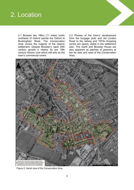
2. 2. Location2.1 <strong>Bicester</strong> lies 18Km (11 miles) north/northeast of Oxford astride the Oxford toBuckingham Road. The <strong>Conservation</strong><strong>Area</strong> covers the majority of the historicsettlement. Despite <strong>Bicester</strong>’s rapid 20thcentury growth it retains its pre 18thcentury historic core which still acts as thetown’s commercial centre.2.2 Phases of the town’s developmentfrom the burgage plots and old LondonRoad to the railway and 1970s shoppingcentre are clearly visible in the settlementplan. The Garth and <strong>Bicester</strong> House arealso apparent as patches of greenery atthe far east and west of the <strong>Conservation</strong><strong>Area</strong>.Figure 2: Aerial view of the <strong>Conservation</strong> <strong>Area</strong>4