Draft Bicester Conservation Area Appraisal November 2009
Draft Bicester Conservation Area Appraisal November 2009
Draft Bicester Conservation Area Appraisal November 2009

You also want an ePaper? Increase the reach of your titles
YUMPU automatically turns print PDFs into web optimized ePapers that Google loves.
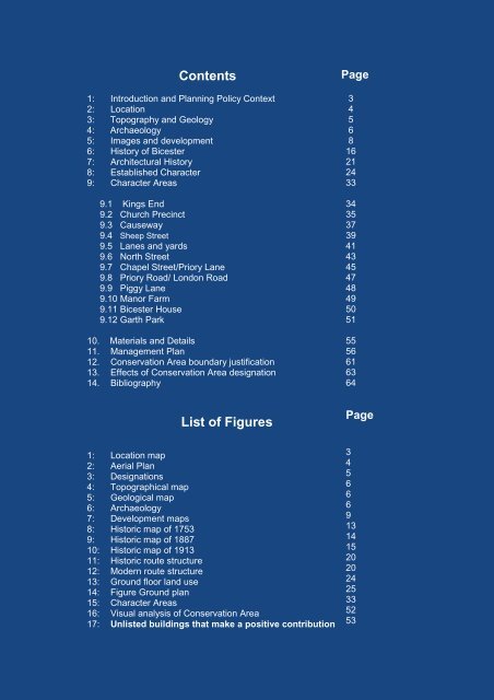
Contents1: Introduction and Planning Policy Context2: Location3: Topography and Geology4: Archaeology5: Images and development6: History of <strong>Bicester</strong>7: Architectural History8: Established Character9: Character <strong>Area</strong>s9.1 Kings End9.2 Church Precinct9.3 Causeway9.4 Sheep Street9.5 Lanes and yards9.6 North Street9.7 Chapel Street/Priory Lane9.8 Priory Road/ London Road9.9 Piggy Lane9.10 Manor Farm9.11 <strong>Bicester</strong> House9.12 Garth Park10. Materials and Details11. Management Plan12. <strong>Conservation</strong> <strong>Area</strong> boundary justification13. Effects of <strong>Conservation</strong> <strong>Area</strong> designation14. BibliographyPage34568162124333435373941434547484950515556616364List of FiguresPage1: Location map2: Aerial Plan3: Designations4: Topographical map5: Geological map6: Archaeology7: Development maps8: Historic map of 17539: Historic map of 188710: Historic map of 191311: Historic route structure12: Modern route structure13: Ground floor land use14: Figure Ground plan15: Character <strong>Area</strong>s16: Visual analysis of <strong>Conservation</strong> <strong>Area</strong>17: Unlisted buildings that make a positive contribution3456669131415202024253352532