Embley
Marine - part 1 (PDF 960 KB) - Rio Tinto Alcan
Marine - part 1 (PDF 960 KB) - Rio Tinto Alcan
- No tags were found...

You also want an ePaper? Increase the reach of your titles
YUMPU automatically turns print PDFs into web optimized ePapers that Google loves.
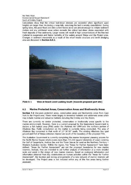
Rio Tinto AlcanEnvironmental Impact StatementSouth of <strong>Embley</strong> ProjectCalculations show that the critical bed-shear stresses are exceeded when significant waveheights are larger than 1m during a neap tide, assuming the bed is weakly consolidated. Duringspring tides, the peak flood and ebb current forces alone are almost enough to initiate sedimentmotion and any additional wave action exceeds the critical bed-shear stress associated withfresh deposits of fine sediments. Larger waves will result in high concentrations of the fine bedmaterial in suspension and higher turbidity of the waters around Weipa and the Project area.Changes in sediment movement as a result of the wharf trestle structure and berth dredgingarea are discussed in Section 6.9.1.Plate 6-1View at Beach Level Looking South (towards proposed port site)6.2 Marine Protected Areas, Conservation Areas and Biodiversity AreasSection 7.2 discusses protected areas, conservation areas and biodiversity areas from CapeYork to the Project area. These relate largely to terrestrial habitats and wilderness areas whichmay include riverine and estuarine habitats including the <strong>Embley</strong> and Hey Rivers.There are currently no similar protected, conservation or biodiversity areas specific to themarine environment. However, there is a current proposal by the Queensland Government todeclare a fish habitat area (FHA) under the Fisheries Act 1994 over the northern portion ofAlbatross Bay. Public consultation on the matter is currently being conducted. The area ofAlbatross Bay concerned is that north of 12° 36' 00" south. The existing Albatross Bay spoilground and Port of Weipa entrance channel are south of the boundary of the proposed FHA.The Australian Government is currently completing the marine bioregional planning process forthe North Marine Region which covers more than 715,000 square kilometres of ocean coveringthe Gulf of Carpentaria, Arafura Sea and the Timor Sea as far west as the Northern TerritoryWestern Australian border. Within the region, five "Areas for Further Assessment" have beendefined. "Areas for Further Assessment" are not the proposed boundaries for new marinereserves. Instead, they are intended to aid further analysis of information at a more detailedscale and assist in the design of new marine reserves. Based on ecological information andinformation obtained from key stakeholders on human activities within the "Areas for FurtherAssessment", the location and zoning arrangements of a new network of marine reserves willbe developed. The Project area is not included within any of the five areas being furtherassessed.Section 6 Marine Page 6-15