Embley
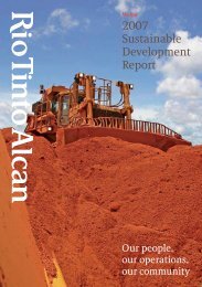
Marine - part 1 (PDF 960 KB) - Rio Tinto Alcan
Marine - part 1 (PDF 960 KB) - Rio Tinto Alcan
- No tags were found...

You also want an ePaper? Increase the reach of your titles
YUMPU automatically turns print PDFs into web optimized ePapers that Google loves.
0 5 10kmSCALE 1:250,000 (at A4)Map Grid of Australia Zone 56Geocentric Datum of Australia 1994Nine MileReef.., I/ Port channel..- ,,,, dredge areaProposedspoil ground ,Cm 010C141Boyd PointSeagrass locationsLEGENDUnconfirmed reef locationsIndicative Reef Classesc, q..... iilliiiiiiiiiiii Hard coral'lirPera HeadSoft coralPe- Thud PointN'Nk,,,,,. Extent of dredge area2006 Aerial PhotographySupplied by client December 2008BathymeteryExtracted from bathy.dwg suppled by client December 2008Conceptual Port Layout and Dredge AreaExtracted from SOK-2231-00001_Q.dwg supplied by client 19/05/2010Indicative Seagrass LocationsIIIQueensland Seagrass Meadows 1984-1988Department of Primary Industries and Fisheries 2002Coastal Habitat Resources Information Systemhttpechnsweb.dpield.gov.au/CHRIS/Pers. Comm. Michael Rasheed, 20100False Pera HeadThis m p incorporates data which isIP INSET-/rON,,i-,---' ,,' .,-e'II1`-.%J. 4rxi,-,..,:-et