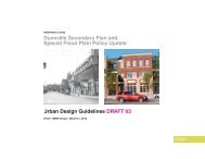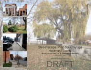
& Special Flood Plain Policy Update
Issues and Options Report - Haldimand County
Issues and Options Report - Haldimand County
- No tags were found...

You also want an ePaper? Increase the reach of your titles
YUMPU automatically turns print PDFs into web optimized ePapers that Google loves.
1.0 INTRODUCTION<br />
1.1 Study Purpose<br />
Haldimand County has initiated the preparation of a Secondary Plan and <strong>Special</strong> <strong>Flood</strong> <strong>Plain</strong> <strong>Policy</strong> <strong>Update</strong> for the community<br />
of Dunnville. This study presents an exciting opportunity for residents and members of the community to identify a solid<br />
framework to plan for the growth and evolution of Dunnville.<br />
The Dunnville Secondary Plan will establish a more detailed policy framework for the Dunnville Secondary Plan area, identify<br />
community-specific issues, and provide policy guidance for resolving these issues. The <strong>Flood</strong> <strong>Plain</strong> <strong>Policy</strong> <strong>Update</strong> includes<br />
the development of recommendations on whether to proceed with an update to the Haldimand County Official Plan <strong>Special</strong><br />
<strong>Flood</strong> <strong>Plain</strong> <strong>Policy</strong> Area policies.<br />
The Issues and Options Report identifies the planning and urban design issues and potential options to be addressed in the<br />
Secondary Plan and <strong>Special</strong> <strong>Flood</strong> <strong>Plain</strong> <strong>Policy</strong> <strong>Update</strong>, including potential redevelopment options for the County-owned<br />
waterfront lands. Furthermore, the Report provides a basis for which new policies will be established to guide Dunnville in<br />
achieving its goals.<br />
1.2 Study Area Description<br />
The Study Area comprises Dunnville’s historic commercial core, the Grand River waterfront and extends east through the<br />
residential area towards the large format retail area at Taylor Road and Broad Street East. Figure 1.1 outlines the Study<br />
Area, which has been divided into two key areas:<br />
1. Secondary Plan Area; and<br />
2. <strong>Flood</strong> <strong>Plain</strong> <strong>Policy</strong> Areas.<br />
The Secondary Plan area is generally bounded by Cedar Street in the west, the former CNR Line in the north, slightly east of<br />
Taylor Road in the east, and Main Street East/North Shore Drive and the Grand River/Front Street in the south.<br />
The County Official Plan divides the flood plain area into 3 distinct policy areas, each containing varying policy regulations to<br />
protect from flood hazards.<br />
DUNNVILLE SECONDARY PLAN AND SPECIAL FLOOD PLAIN POLICY UPDATE: ISSUES AND OPTIONS REPORT | 1