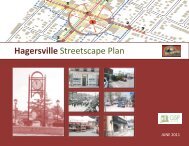
& Special Flood Plain Policy Update
Issues and Options Report - Haldimand County
Issues and Options Report - Haldimand County
- No tags were found...

You also want an ePaper? Increase the reach of your titles
YUMPU automatically turns print PDFs into web optimized ePapers that Google loves.
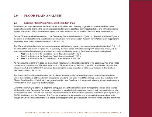
2.0 FLOOD PLAIN ANALYSIS<br />
2.1 Existing <strong>Flood</strong> <strong>Plain</strong> <strong>Policy</strong> and Secondary Plan<br />
Riverine hazard lands exist within the Dunnville Secondary Plan area. <strong>Flood</strong>ing originates from the Grand River under<br />
extreme flow events, this flooding potential is recognized in various past flood plain mapping studies and within the existing<br />
<strong>Special</strong> <strong>Policy</strong> Area (SPA) that addresses a portion of lands within the Secondary Plan area and along the waterfront.<br />
Existing SPA delineation in relationship to the Secondary Plan area is indicated in Figure 2.1. Also indicated in the Figure is<br />
the extent of predicted flooding as outlined on existing Grand River Conservation Authority (GRCA) flood plain mapping for a<br />
Regulatory event (additional details outlined in Section 2.2).<br />
The SPA applicable to Dunnville and currently adopted within County planning documents is contained in Section 2.C.1.11 of<br />
the Official Plan and shown in Figure 2.1. In summary, the three zones within the existing SPA (labeled as Area 1, 2 & 3)<br />
ensure protection of new buildings, structures and major additions by requiring flood-proofing to the following levels:<br />
Area 1: to the level of the Regulatory <strong>Flood</strong> - to an elevation of 179.0 m<br />
Area 2: to the level of the Regulatory <strong>Flood</strong> - to an elevation of 176.5 m<br />
Area 3: to the level of the 100 Year <strong>Flood</strong> - to an elevation of 178.7 m<br />
As indicated, the existing SPA does not extend to all Regulatory flood inundated portions of the Secondary Plan area. Most<br />
notably lands located east of SPA Area 3 and north of SPA Area 2 are not included in an SPA. Additionally, it is clear that<br />
where Areas 1, 2 and 3 of the SPA converge, determining the correct protection level to use will require further analysis<br />
(discussed further in Section 4.1.)<br />
The Provincial <strong>Policy</strong> Statement requires that significant development be excluded from areas prone to flood inundation<br />
unless those areas are addressed within an approved SPA (or a Two-Zone <strong>Flood</strong> <strong>Plain</strong> <strong>Policy</strong>). Areas that lie outside of an<br />
SPA (or Two-Zone <strong>Flood</strong> <strong>Plain</strong> <strong>Policy</strong>) are generally subject to a One-Zone policy approach whereby all new development is<br />
restricted from areas subject to flood inundation.<br />
Given the opportunity to address a larger and contiguous area of historical flood plain development, such as lands located<br />
within the Dunnville Secondary Plan area, consideration is usually given to applying a common policy across the lands – i.e.,<br />
a <strong>Special</strong> <strong>Policy</strong> Area. An SPA sets common rules for development that have been agreed to by the flood plain regulator (i.e.<br />
GRCA), the County and the Province. The Province is party to the agreements, and is ultimately the approval authority<br />
through an Official Plan Amendment. It is based upon recognition of a given additional level of flood risk, with this determined<br />
DUNNVILLE SECONDARY PLAN AND SPECIAL FLOOD PLAIN POLICY UPDATE: ISSUES AND OPTIONS REPORT | 5