Dunnville Secondary Plan - Urban Design Guide - Haldimand County
Dunnville Secondary Plan - Urban Design Guide - Haldimand County
Dunnville Secondary Plan - Urban Design Guide - Haldimand County
- No tags were found...

You also want an ePaper? Increase the reach of your titles
YUMPU automatically turns print PDFs into web optimized ePapers that Google loves.
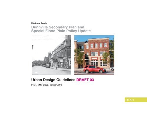
<strong>Haldimand</strong> <strong>County</strong><br />
<strong>Dunnville</strong> <strong>Secondary</strong> <strong>Plan</strong> and<br />
Special Flood Plain Policy Update<br />
<strong>Urban</strong> <strong>Design</strong> <strong>Guide</strong>lines DRAFT 03<br />
DTAH / MMM Group / March 21, 2012
Contents<br />
Acknowledgements / iv<br />
1 / Introduction / 1<br />
2 / <strong>Urban</strong> <strong>Design</strong> Framework / 2<br />
3 / Guiding Principles / 4<br />
3.1 Encourage a Well Integrated, Rich and Varied <strong>Urban</strong> Form / 4<br />
3.2 Redevelop with Appropriate Densities / 5<br />
3.3 Provide Appropriate Transitions to Adjoining Neighbourhoods / 5<br />
3.4 Enhance Community Facilities through Redevelopment / 6<br />
3.5 Demand <strong>Design</strong> Excellence / 7<br />
4 / Built Form <strong>Guide</strong>lines / 8<br />
4.1 Site <strong>Plan</strong> Organization / 8<br />
4.2 Setbacks and Build-To Lines / 9<br />
4.3 Building <strong>Design</strong> / 10<br />
4.4 Building Heights / 12<br />
4.5 Ground Floor Uses / 13<br />
4.6 Building Entrances / 14<br />
4.7 Corners Sites / 15<br />
4.8 Balconies and Projections / 16<br />
4.9 Vehicular Access, Parking and Servicing / 17<br />
5 / Public Realm <strong>Guide</strong>lines / 20<br />
5.1 Develop Complete Streets / 20<br />
5.2 Create Better Parks and Open Spaces / 23<br />
6 / <strong>Guide</strong>lines for Special Areas / 24<br />
6.1 <strong>County</strong>-Owned Waterfront Lands / 24<br />
6.2 Main Street Corridor / 26<br />
6.3 Broad Street Transition Area / 28<br />
6.4 Broad Street and Taylor Road Retail Node / 30<br />
<strong>Urban</strong> <strong>Design</strong> <strong>Guide</strong>lines <strong>Dunnville</strong> <strong>Secondary</strong> <strong>Plan</strong> and Special Flood Plain Policy Update / iii
Acknowledgements<br />
<strong>Haldimand</strong> <strong>County</strong><br />
Mike Evers, Manager, <strong>Plan</strong>ning and Development<br />
Peter Minkiewicz<br />
Tyson Haedrich<br />
Dana Mclean-Daniels<br />
James Goodram<br />
Sheila Wilson<br />
Tim Dickhout<br />
Matthew Davis<br />
Philip Mete<br />
Brandon Hedges<br />
Danielle Mataseje<br />
Fred Natolochny<br />
Consultant Team<br />
MMM Group: Project Lead, <strong>Plan</strong>ning, Facilitation<br />
Chris Tyrrell , Partner-in-Charge, Project Director<br />
Randall Roth, Project Manager, Senior <strong>Plan</strong>ner<br />
Ecoplans: Hydrology+Flood Plain Analysis<br />
Stephen Braun, Senior Water Resources Engineer<br />
DTAH / du Toit Allsopp Hillier: <strong>Urban</strong> <strong>Design</strong><br />
Roger du Toit, Partner-in-Charge<br />
Brent Raymond, Lead <strong>Urban</strong> <strong>Design</strong>er<br />
Chris Veres, <strong>Urban</strong> <strong>Design</strong>er<br />
Cover Images<br />
Chestnut Street (1938).<br />
Credit: Niagara Falls<br />
Public Library<br />
Recent development<br />
in Brampton, ON<br />
demonstrating an<br />
appropriate scale and<br />
character for <strong>Dunnville</strong>.<br />
Credit: Sean Marshall,<br />
Flickr.<br />
iv / <strong>Dunnville</strong> <strong>Secondary</strong> <strong>Plan</strong> and Special Flood Plain Policy Update <strong>Urban</strong> <strong>Design</strong> <strong>Guide</strong>lines
1 / Introduction<br />
<strong>Haldimand</strong> <strong>County</strong> initiated in 2011 the <strong>Dunnville</strong><br />
<strong>Secondary</strong> <strong>Plan</strong> and Special Flood Plain Policy<br />
Areas Update. These urban design guidelines are<br />
a tool to assist the <strong>County</strong> and the residents and<br />
businesses of <strong>Dunnville</strong> achieve a long-term vision.<br />
They will support the Seconary <strong>Plan</strong> effort and build<br />
on and reinforce the direction from the previous<br />
<strong>Haldimand</strong> <strong>County</strong> Streetscape <strong>Plan</strong> and <strong>Urban</strong><br />
<strong>Design</strong> <strong>Guide</strong>lines (2010).<br />
The purpose of these guidelines is to develop a<br />
realistic urban design framework to help direct<br />
change in specific areas of the downtown and<br />
emerging retail commercial growth areas as well<br />
as better connect these two locales. The primary<br />
emphasis is to encourage appropriate urban streetrelated<br />
development with a mix of uses with support<br />
from a high-quality, pedestrian-focused public<br />
realm.<br />
The guidelines are intended to provide direction<br />
rather than prescriptive requirements for the<br />
four defined Special Areas within the <strong>Secondary</strong><br />
<strong>Plan</strong> area. The <strong>County</strong> has the authority to waive<br />
individual guidelines for specific projects if this<br />
would better achieve the design policy objectives<br />
than strict application of the guidelines.<br />
This document is organized into five sections:<br />
• <strong>Urban</strong> <strong>Design</strong> Framework – describes the<br />
overall land use and urban design concept for the<br />
<strong>Secondary</strong> <strong>Plan</strong> Area;<br />
• Guiding Principles – articulates the overall vision<br />
for the physical form and character for the Special<br />
Areas;<br />
• Built Form <strong>Guide</strong>lines – addresses the key<br />
elements regarding the placement and design<br />
of buildings, how they relate to one another and<br />
shape the public realm;<br />
• Public Realm <strong>Guide</strong>lines – addresses the key<br />
elements of the space between buildings—the<br />
streets, parks and open spaces; and<br />
• <strong>Guide</strong>lines for Special Areas – more specifically<br />
suggests the built form and public realm character<br />
and potential form for each of the four special<br />
areas—the <strong>County</strong>-Owned Waterfront Lands,<br />
Main Street Corridor, Broad Street Transition<br />
Area, and the Broad Street and Taylor Road Retail<br />
Node.<br />
<strong>Urban</strong> <strong>Design</strong> <strong>Guide</strong>lines <strong>Dunnville</strong> <strong>Secondary</strong> <strong>Plan</strong> and Special Flood Plain Policy Update / 1
2 / <strong>Urban</strong> <strong>Design</strong> Framework<br />
The <strong>Urban</strong> <strong>Design</strong> Framework (Figure 2.1) illustrates<br />
the overall high level and long-range land use<br />
and urban design concept for the <strong>Secondary</strong> <strong>Plan</strong><br />
area, with particular focus on the built form and<br />
public realm character of the four Special Areas—<br />
Waterfront, Main Street Corridor, Broad Street<br />
Corridor, and the Broad Street/Taylor Road Retail<br />
Node.<br />
Connecting to the River<br />
A long-standing objective for <strong>Dunnville</strong> has been<br />
to extend the downtown towards the Grand River.<br />
New street-related development which may include<br />
retail-at-grade will help to animate Main Street.<br />
Streetscape improvements, expanded public open<br />
space and other amenities will help downtown<br />
become more connected to the river upon which it<br />
was founded.<br />
Making Streets as Places<br />
Broad Street and Main Street will become more<br />
than corridors for vehicles. They will support streetrelated<br />
redevelopment that encourages walking and<br />
cycling. They will become more urban places with<br />
a wide range of activities and amenities like Queen<br />
Street and Chestnut Street today. The streets, public<br />
lanes, and private walkways that connect Broad<br />
Street to Main Street will become more important as<br />
redevelopment takes place.<br />
Creating Landmark Features<br />
A proposed Farmers Market structure and the<br />
eastern entrance features will provide two different<br />
types of visual landmarks and terminus announcing<br />
arrival into <strong>Dunnville</strong>. The Farmers Market will<br />
frame the Main Street frontage and be visible when<br />
approaching from the west, from Queen Street<br />
down the pedestrian lane and Bridge Street, and<br />
will become a welcome gathering place and source<br />
of pride for the community. The eastern entrance<br />
features will be more formal with well-designed<br />
signs and plantings, and provide a balanced<br />
counter point to <strong>Dunnville</strong>’s existing entrance<br />
features from the west.<br />
Encouraging a More Walkable <strong>Dunnville</strong><br />
New pedestrian crossings and the river walk will<br />
encourage greater pedestrian activity. This will<br />
in turn support the existing shops and services<br />
and inspire new businesses to take advantage<br />
of a revitalized downtown. Pedestrian pathways<br />
are encouraged through larger sites to improve<br />
connectivity from Broad Street to Main Street and<br />
the waterfront. New mid-block crossings or new<br />
signalized intersections should be introduced where<br />
current crossings are of great distance apart.<br />
Developing the Retail Node as a Gateway<br />
Rather than the common definition of a gateway<br />
as an object, the entire Broad Street Taylor Road<br />
retail node will become <strong>Dunnville</strong>’s eastern gateway.<br />
High quality built form, site design and public realm<br />
should relate to the character of the main street and<br />
historic commercial core and reinforce the rural<br />
agricultural roots and small town flavour of <strong>Dunnville</strong><br />
and <strong>Haldimand</strong> <strong>County</strong>.<br />
Fostering a More Green <strong>Dunnville</strong><br />
New large canopy street trees, passive stormwater<br />
management techniques, well-planted front yards<br />
and commercial properties—along with a more<br />
inviting pedestrian and cycling environment—will<br />
further the green identity of <strong>Dunnville</strong>.<br />
2 / <strong>Dunnville</strong> <strong>Secondary</strong> <strong>Plan</strong> and Special Flood Plain Policy Update <strong>Urban</strong> <strong>Design</strong> <strong>Guide</strong>lines
Broad Street Transition Area<br />
Historic<br />
Core<br />
Broad Street/Taylor Road Retail Node<br />
Eastern Gateway<br />
Waterfront<br />
Main Street Corridor<br />
Landmarks<br />
Pedestrian Crossing<br />
Primary Pedestrian Connections<br />
Riverwalk<br />
Streetscape Improvements<br />
Figure 2.1: <strong>Urban</strong> <strong>Design</strong> Framework - <strong>Dunnville</strong> <strong>Secondary</strong> <strong>Plan</strong><br />
<strong>Urban</strong> <strong>Design</strong> <strong>Guide</strong>lines <strong>Dunnville</strong> <strong>Secondary</strong> <strong>Plan</strong> and Special Flood Plain Policy Update / 3
3 / Guiding Principles<br />
3.1 Encourage a Well Integrated, Rich and Varied<br />
<strong>Urban</strong> Form<br />
Principle: Redevelopment should include a broad<br />
mix of housing, commercial and employment<br />
uses, focused within the downtown and along the<br />
corridors with transitions down towards the existing<br />
residential neighbourhoods.<br />
With redevelopment comes the opportunity<br />
to define vibrant mixed use and high quality<br />
development—to create places where people will<br />
want to live, work, recreate, shop and spend time.<br />
Redevelopment should incorporate mixed use<br />
projects, new housing, neighbourhood-serving<br />
retail, employment, schools, day care centres, parks<br />
and other amenities to serve the local community.<br />
New development should be compatible with the<br />
existing neighbourhoods and sensitive to their<br />
context. The majority of new buildings should fit<br />
in, not stand out. Special places and locations<br />
will deserve special buildings, but not every site.<br />
Not every new building needs to be a landmark<br />
or symbol. The scale of new development must<br />
balance the intensification objectives with the<br />
protection of adjacent existing neighbourhoods and<br />
the small town character of <strong>Dunnville</strong>. Intensification<br />
can and should improve overall environmental and<br />
community sustainability.<br />
Good urban places balance new with old, support a wide range<br />
of activities and mix of uses, and are well-designed.<br />
4 / <strong>Dunnville</strong> <strong>Secondary</strong> <strong>Plan</strong> and Special Flood Plain Policy Update <strong>Urban</strong> <strong>Design</strong> <strong>Guide</strong>lines
3.2 Redevelop with Appropriate Densities<br />
Principle: Redevelopment densities should meet<br />
Provincial and <strong>County</strong> intensification objectives<br />
while minimizing the impact on existing low-density<br />
residential areas.<br />
Density controls are required to help guide the<br />
intensity and location of redevelopment within the<br />
study area. Density controls are planning tools<br />
used to regulate the size, massing and location<br />
of new buildings. These controls should work in<br />
concert with built form guidelines to limit building<br />
mass adjacent to the existing neighbourhoods, with<br />
greater massing towards the main streets.<br />
The Province established recent planning<br />
intensification targets that were further refined by<br />
the <strong>County</strong>. The <strong>Haldimand</strong> <strong>County</strong> Official <strong>Plan</strong><br />
recommends that intensification should largely take<br />
place within the existing urban areas, with <strong>Dunnville</strong><br />
to accommodate over 500 additional dwelling<br />
units by 2026, 11% of the total <strong>County</strong> growth<br />
over that period. Much of this population growth<br />
will be accommodated in redevelopment areas<br />
such as the Downtown Intensification Area and the<br />
Intensification Corridors along Main Street East and<br />
West.<br />
3.3 Provide Appropriate Transitions to<br />
Adjoining Neighbourhoods<br />
Principle: The interface between redevelopment<br />
sites and neighbourhoods should respect the<br />
character of the residential areas and historic<br />
commercial core and minimize adverse impact by<br />
creating a comfortable transition in the built form<br />
and treatment of the landscape interface with the<br />
public realm.<br />
New buildings should be context sensitive,<br />
respond to the characteristics and features of the<br />
individual sites, and be developed to minimize<br />
the visual impacts of medium to higher density<br />
development on the adjacent low-density residential<br />
neighbourhoods. Building height and scale<br />
should be stepped down towards the low-rise<br />
residential areas by respecting angular planes and<br />
incorporating appropriate setbacks.<br />
<strong>Urban</strong> <strong>Design</strong> <strong>Guide</strong>lines <strong>Dunnville</strong> <strong>Secondary</strong> <strong>Plan</strong> and Special Flood Plain Policy Update / 5
3.4 Enhance Community Facilities through<br />
Redevelopment<br />
Principle: The <strong>County</strong> should encourage<br />
redevelopment to improve the quality and supply of<br />
community facilities and services within <strong>Dunnville</strong>.<br />
A considerable benefit of redevelopment is<br />
the opportunity for the <strong>County</strong> to enhance<br />
community facilities, services and other public<br />
amenities through various mechanisms. Potential<br />
enhancements could include the acquisition of land<br />
for—and the on-going operations and maintenance<br />
of—parks and open space, expansion of waterfront<br />
open space, facilities for public access to the river,<br />
farmers market, streetscape improvements and<br />
infrastructure upgrades.<br />
Dunt ad euip essisl ulputpatet, verosto eros nim eugiamconse<br />
corero ero odolore dunt Dunt ad euip essisl ulputpatet, verosto<br />
eros nim eugiamconse corero ero odolore dunt<br />
New public amenties—such as a new landmark Farmers Market<br />
structure and new waterfront public open space—are a potential<br />
benefit that may result from redevelopment.<br />
6 / <strong>Dunnville</strong> <strong>Secondary</strong> <strong>Plan</strong> and Special Flood Plain Policy Update <strong>Urban</strong> <strong>Design</strong> <strong>Guide</strong>lines
3.5 Demand <strong>Design</strong> Excellence<br />
Principle: The <strong>County</strong> and <strong>Dunnville</strong> should require<br />
excellence in the design of all aspects of the urban<br />
environment: buildings, streets, parks and open<br />
spaces.<br />
As <strong>Dunnville</strong> intensifies, greater demand will be<br />
placed on the built environment. It is critical that all<br />
new projects, whether buildings or public spaces,<br />
be of the highest quality. One of the key goals to<br />
intensification and redevelopment should be to<br />
achieve superb architecture, landscape architecture<br />
and urban design that improves the public realm.<br />
New works should respect and fit within their<br />
context and improve their overall setting.<br />
For the <strong>County</strong> to demand high quality projects is to<br />
recognize the importance of the built environment<br />
to the fundamental economic and competitive<br />
advantage downtown <strong>Dunnville</strong> holds. As growth<br />
occurs so will the need for design excellence. It<br />
does not serve the <strong>County</strong> to accept mediocrity.<br />
Any effort to elevate the importance of design in the<br />
public eye is worthy.<br />
All projects—new residential, commercial or mixed-use buildings,<br />
streetscape, or public open spaces—should demonstrate exceptional design<br />
quality that reinforce and strengthen <strong>Dunnville</strong>’s character and image.<br />
<strong>Urban</strong> <strong>Design</strong> <strong>Guide</strong>lines <strong>Dunnville</strong> <strong>Secondary</strong> <strong>Plan</strong> and Special Flood Plain Policy Update / 7
4 / Built Form <strong>Guide</strong>lines<br />
4.1 Site <strong>Plan</strong> Organization<br />
Principle: The parts of each development, whether<br />
modest or grand, must be laid out to function well,<br />
respect heritage values, and conform to the Official<br />
<strong>Plan</strong>, <strong>Secondary</strong> <strong>Plan</strong>, and other plans approved by<br />
the <strong>County</strong>.<br />
The site plan is the foundation for much of a<br />
project’s design quality. The <strong>County</strong> should expect<br />
proponents to conduct a thorough site analysis<br />
of the proposal, leading to a set of site-specific<br />
intentions or objectives upon which the scheme<br />
and its site organization will be based. These<br />
will cover such aspects as the project’s larger<br />
cultural landscape, environmental sustainability,<br />
microclimate (improving wind, rain, snow, and<br />
sun-shade comfort), <strong>County</strong> parking standards,<br />
minimizing paved surfaces, best green practices,<br />
storm water management, and vehicular, cycling,<br />
and pedestrian circulation linkages of all types to<br />
and through the site. The proponent should share<br />
alternative layouts, and explain the reasoning by<br />
which the proposed solution is derived.<br />
<strong>Guide</strong>lines<br />
• Buildings should be positioned to define and<br />
enhance the pedestrian realm.<br />
• Parking and servicing entrances should not<br />
dominate the street frontage of any development.<br />
• Primary pedestrian entrances should be visible<br />
and easily accessible from the public sidewalk.<br />
• Buildings and other elements should be<br />
organized on a site to respect adjacent land uses<br />
and public open spaces.<br />
A simple illustration demonstrating the different ways to better<br />
organize a retail commerical site.<br />
8 / <strong>Dunnville</strong> <strong>Secondary</strong> <strong>Plan</strong> and Special Flood Plain Policy Update <strong>Urban</strong> <strong>Design</strong> <strong>Guide</strong>lines
4.2 Setbacks and Build-To Lines<br />
Principle: New development should be located<br />
with frontage towards the primary address street to<br />
frame and give shape to the public realm.<br />
<strong>Guide</strong>lines<br />
• New development should be built to the<br />
established setback/build-to line as defined by the<br />
<strong>County</strong> Zoning By-Law and relate to its context<br />
and neighbouring buildings.<br />
• Build-to lines shall generally be 3.5 metres from<br />
the public right-of-way to allow for residential<br />
landscaping and retail commercial uses to make<br />
use of the street frontage for seating and displays.<br />
For retail commercial uses, the primary pedestrian<br />
surface treatment will extend to the building face<br />
to create a more broad and generous boulevard.<br />
Buildings—no matter their use—should have a strong<br />
relationship to their primary frontage street. By locating along a<br />
build-to line the definition of the public realm will become more<br />
clear.<br />
<strong>Urban</strong> <strong>Design</strong> <strong>Guide</strong>lines <strong>Dunnville</strong> <strong>Secondary</strong> <strong>Plan</strong> and Special Flood Plain Policy Update / 9
4.3 Building <strong>Design</strong><br />
Principle: Good urban places should be composed<br />
of many buildings, varied in type and size. New<br />
buildings should help shape the pedestrian realm,<br />
respect existing land uses and incorporate the most<br />
recent advances in sustainable building and sound<br />
community development principles.<br />
<strong>Guide</strong>lines<br />
• Careful consideration of a building’s massing,<br />
articulation of the façade, scale and proportion of<br />
elements, and selection of appropriate building<br />
materials are all essential components of a<br />
building’s contribution to a great public realm.<br />
• At the ground level, the design and scale of<br />
building façades and sidewalks should enhance<br />
the pedestrian experience by being visually<br />
interesting, active, and comfortable.<br />
• <strong>Design</strong> excellence should be evident in all<br />
aspects of building design, including the choice<br />
of materials, proportion and massing, detailing,<br />
colour, lighting, and all other areas of design.<br />
• Permanence, scale and finish of materials<br />
should be appropriate to their use and location,<br />
especially for at-grade elements. A cohesive,<br />
finished appearance should be achieved throughout<br />
the building elevations.<br />
• The scale, articulation, rhythm, proportion,<br />
pattern, colour, texture and materials of buildings<br />
shall be complimentary to adjoining buildings,<br />
existing and new.<br />
• New buildings should be of their time, respond<br />
to their context in a sensitive manner, but not be<br />
nostalgic.<br />
New buildings should strive for design excellence, making<br />
use of traditional materials such as brick, wood and stone,<br />
with pleasing and complimentary proportions to the existing<br />
<strong>Dunnville</strong> character.<br />
10 / <strong>Dunnville</strong> <strong>Secondary</strong> <strong>Plan</strong> and Special Flood Plain Policy Update <strong>Urban</strong> <strong>Design</strong> <strong>Guide</strong>lines
New buildings should respect their heritage context but be of<br />
their own time without being nostalgic. They may reference<br />
traditional forms but not simply imitate.<br />
<strong>Urban</strong> <strong>Design</strong> <strong>Guide</strong>lines <strong>Dunnville</strong> <strong>Secondary</strong> <strong>Plan</strong> and Special Flood Plain Policy Update / 11
4.4 Building Heights<br />
Principle: Most of the redevelopment should be<br />
in low-rise buildings that address the streets and<br />
other public spaces to give shape and a sense of<br />
enclosure to the public realm.<br />
<strong>Guide</strong>lines<br />
• Building height should reflect the importance of<br />
each street.<br />
• New buildings shall be designed with a minimum<br />
street wall height of 2-storeys and a maximum<br />
street wall height of 3 storeys. Stepbacks of 2<br />
metres are required above the third storey.<br />
• Single storey medium and large format<br />
commercial buildings should approximate a<br />
minimum 8- metre or 2-storey building height.<br />
• Within the historic core and Main Street Corridor,<br />
new as-of-right buildings shall not exceed 4<br />
storeys in height.<br />
• Within the historic core, 6-storey residential<br />
apartment buildings are permitted by special<br />
condition per the Official <strong>Plan</strong>. These buildings<br />
will require a 2-metre stepback at 3 storeys and a<br />
2- metre projection zone above the fifth storey.<br />
• In the Broad Street corridor, new as-of-right<br />
buildings shall not exceed 3 storeys in height.<br />
• Building height requirements for <strong>County</strong>-owned<br />
lands will be developed once preferred land use<br />
option is selected.<br />
A minimum 2-storey street wall of continuous or closely<br />
related buildings can provide sufficent enclosure to create a<br />
comfortable pedestrian realm. Other elements such as trees,<br />
decorative street lighting, furnishings and on-street parking<br />
further enrich the space.<br />
12 / <strong>Dunnville</strong> <strong>Secondary</strong> <strong>Plan</strong> and Special Flood Plain Policy Update <strong>Urban</strong> <strong>Design</strong> <strong>Guide</strong>lines
4.5 Ground Floor Uses<br />
Principle: Buildings should have continuous<br />
frontages of grade-related uses with direct access<br />
from public sidewalks. The ground floor shall<br />
incorporate the most public and active uses within<br />
the building to activate the street. Parking shall not<br />
dominate a site’s public frontage. In neighbourhood<br />
retail areas, primarily devote the street level frontage<br />
to entrances, shop windows, or other displays.<br />
<strong>Guide</strong>lines<br />
• Ground floor spaces in all commercial buildings<br />
shall be designed to accommodate a range of<br />
retail uses, future market flexibility and change of<br />
use.<br />
• Retail commercial uses at grade should have a<br />
high degree of transparency with windows for<br />
displays and frequent entrances to animate the<br />
street environment.<br />
• The minimum ground floor height should be<br />
4.5 metres above grade. Within the floodplain,<br />
properties may be required to raise their ground<br />
floor above grade.<br />
• At the ground floor level, any setback zone<br />
shall be treated as an extension of the public<br />
realm, to provide additional outdoor space,<br />
allow for at-grade uses to expand outdoors, and<br />
to encourage street animation. Ground floors<br />
for retail commercial uses shall be universally<br />
accessible, articulated to respond to human scale<br />
and provide good visual connection between<br />
interior spaces and the public realm.<br />
• Encourage the development of publiclyaccessible<br />
open spaces at ground level. Where<br />
feasible, design these open spaces in relation to<br />
local serving retail uses such as cafes and to the<br />
public open space network.<br />
• Residential uses should have grade-related units<br />
directly accessible from the public sidewalk to<br />
animate the street and provide a higher sense of<br />
security and ownership.<br />
Windows at street level with doors accessible from grade<br />
support and encourage a pedestrian friendly retail activity.<br />
<strong>Urban</strong> <strong>Design</strong> <strong>Guide</strong>lines <strong>Dunnville</strong> <strong>Secondary</strong> <strong>Plan</strong> and Special Flood Plain Policy Update / 13
4.6 Building Entrances<br />
Principle: Frontages with commercial uses at grade<br />
should provide barrier-free access from the public<br />
sidewalk. Frontages with residential uses at grade<br />
should have units with direct access from the public<br />
sidewalk.<br />
<strong>Guide</strong>lines<br />
• Retail commercial uses are encouraged at grade<br />
when fronting on main streets. The ground<br />
floor for all buildings in this context shall be<br />
designed with sufficient floor to ceiling heights to<br />
accommodate retail or other commercial uses.<br />
• Ground floor residential units are encouraged<br />
to have their principal entrance from the<br />
neighbourhood streets where feasible. Frequent<br />
residential entries are encouraged to create finegrained,<br />
pedestrian-oriented streets.<br />
• Vehicular access should be appropriately<br />
integrated into the design of the building massing<br />
and public realm, in such a way that it supports<br />
the design concept and does not detract from the<br />
design of the building elevation and the overall<br />
character of the street.<br />
• Where private courtyards and outdoor spaces<br />
are visible from the public realm, consideration<br />
should be given to pedestrian experience and<br />
views from the public realm. These spaces should<br />
expand on and not detract from the pedestrian<br />
experience of the public realm.<br />
• For larger buildings with shared entries, entry<br />
should be through prominent entry lobbies or<br />
central courtyards facing the street. From the<br />
street, these entries and courtyards should<br />
provide visual interest, orientation, and a sense of<br />
invitation.<br />
• Provide multiple entries at street level where<br />
appropriate, if consistent with security and other<br />
concerns.<br />
• Ground floor residential units are encouraged<br />
to have their principal entrance from the<br />
neighbourhood streets where feasible. Frequent<br />
residential entries are encouraged to create finegrained,<br />
pedestrian-oriented streets.<br />
• Parking and service areas should be in the interior<br />
of the blocks and accessed from local streets.<br />
The principle entrance of residential units at grade should be<br />
accessible from the public sidewalk, but set back a sufficent<br />
distance to permit front yards and an appropriate level of<br />
privacy.<br />
14 / <strong>Dunnville</strong> <strong>Secondary</strong> <strong>Plan</strong> and Special Flood Plain Policy Update <strong>Urban</strong> <strong>Design</strong> <strong>Guide</strong>lines
4.7 Corners Sites<br />
Principle: Buildings on corners and in other<br />
prominent locations should have special<br />
architectural treatment and emphasis. Each corner<br />
site is an opportunity to maximize views and<br />
sunlight exposure. To realize this advantage and<br />
encourage architectural variety, each corner should<br />
hold the street wall by building to the street face for<br />
a minimum distance of 15 metres.<br />
<strong>Guide</strong>lines<br />
• Corner buildings should be given special<br />
architectural treatment to make them stand out<br />
from the building pattern along the rest of the<br />
block.<br />
• Encourage buildings on corner sites to locate<br />
their primary entrance at the corner.<br />
An example of a mixed-use building with a subtle yet<br />
appropriate corner treatment.<br />
The <strong>Dunnville</strong> Dominion Public Building is a fine example of how<br />
a building should take advatange of a corner site.<br />
<strong>Urban</strong> <strong>Design</strong> <strong>Guide</strong>lines <strong>Dunnville</strong> <strong>Secondary</strong> <strong>Plan</strong> and Special Flood Plain Policy Update / 15
4.8 Balconies and Projections<br />
Principle: Integrate private balconies, outdoor<br />
terraces and bay windows into the overall form and<br />
design of the buildings.<br />
<strong>Guide</strong>lines<br />
• Balconies and projections should be contained<br />
within the building envelope, extending no more<br />
than 1.5 meters from the primary building face.<br />
• A 2-metre projection zone with a 50% limit is<br />
provided for the top floor of 6-storey apartment<br />
buildings (permitted in the historic core by special<br />
Official <strong>Plan</strong> condition only).<br />
• Entrance canopies, awnings and signage shall<br />
be appropriately scaled, attractive and integrated<br />
into the architecture of the building to contribute a<br />
positive vibrancy to the public realm.<br />
• Building utilities, vents, service meters and<br />
connections shall be minimized on primary street<br />
facades, concealed (within the building or by<br />
landscape elements) and integrated within the<br />
overall design of the building.<br />
Balconies, porches and other elements projected from the<br />
primary building face should be integrated with the overall<br />
form and design of buildings, and not appear to be simply<br />
decorative.<br />
Well-designed signs scaled to the pedestrian should<br />
compliment the building and not dominate the façade.<br />
16 / <strong>Dunnville</strong> <strong>Secondary</strong> <strong>Plan</strong> and Special Flood Plain Policy Update <strong>Urban</strong> <strong>Design</strong> <strong>Guide</strong>lines
4.9 Vehicular Access, Parking and Servicing<br />
Principle: Minimize the impact on the public realm<br />
of vehicular circulation and access routes to parking<br />
and servicing.<br />
<strong>Guide</strong>lines<br />
• Minimize interruptions by vehicular access to<br />
building frontages.<br />
• Avoid residential frontages where the garage is<br />
the dominate feature over other elements such<br />
as the main entrance, front door, porch or stoop.<br />
Residential parking is preferred to the side or rear<br />
of the property.<br />
• Service entries should be screened to provide<br />
a visual buffer and reduce noise impacts on<br />
adjacent neighbourhoods<br />
• Shared rear access lanes and interior service<br />
courts are encouraged.<br />
• To minimize conflicts between vehicles and<br />
pedestrians:<br />
- Vehicular access should be primarily from local<br />
streets, rear service lanes or, on large parcels,<br />
new internal streets;<br />
- Vehicular access should be consolidated to<br />
serve multiple buildings. Shared rear access<br />
lanes and interior service courts should be<br />
encouraged;<br />
- Large land parcels should include a more<br />
refined street network to ensure a high-level of<br />
permeability for public circulation and to encourage<br />
a scale of redevelopment similar to that<br />
of a traditionally sized block; and<br />
- New public streets should meet all municipal<br />
standards and guarantee full public access and<br />
landscaping.<br />
• Surface parking should be minimized and<br />
generally limited wherever possible. Where<br />
surface parking is provided, the main parking area<br />
should be located at the rear or side of buildings<br />
fronting on to the primary address street.<br />
• On-street parking should be provided wherever<br />
possible on the local streets to serve a number of<br />
purposes: to help calm traffic and to supplement<br />
the overall parking supply serving the main streets<br />
and local neighbourhood.<br />
<strong>Urban</strong> <strong>Design</strong> <strong>Guide</strong>lines <strong>Dunnville</strong> <strong>Secondary</strong> <strong>Plan</strong> and Special Flood Plain Policy Update / 17
2m projection 2m projection zone zone<br />
maximum maximum 50% 50% of frontage of of frontage<br />
maximum 6 storey street-related apartment building<br />
maximum 6 storey street-related apartment building<br />
2m stepback 2m stepback<br />
at 3 at storeys at 3 storeys<br />
maximum 4 storey street-related building<br />
maximum 4 storey street-related building<br />
2m stepback 2m stepback<br />
at 3 at storeys at 3 storeys<br />
4 storey street-related building<br />
4 storey street-related building<br />
4.5m 4.5m minimum minimum<br />
ground ground floor floor<br />
to ceiling to to ceiling height height<br />
2m stepback 2m stepback<br />
at 3 at storeys at 3 storeys<br />
residential residential<br />
frontage frontage<br />
landscape landscape<br />
sidewalk<br />
setback 3.5m<br />
setback 3.5m<br />
sidewalk<br />
<br />
<br />
residential residential<br />
frontage frontage<br />
landscape landscape<br />
sidewalk<br />
setback 3.5m<br />
setback 3.5m<br />
sidewalk<br />
<br />
<br />
retail retail commercial commercial<br />
boulevard boulevard<br />
sidewalk<br />
frontage setback 3.5m<br />
setback 3.5m<br />
sidewalk<br />
frontage<br />
<br />
<br />
Apartment Building<br />
Historic Historic Core Core<br />
- This 6-storey building Apartment type Building<br />
is currently permitted by special condition<br />
6-storey Apartment Building<br />
in by the Special by Special Historic Condition Condition Core Only Only<br />
as stated in the Halidmand <strong>County</strong><br />
Offical <strong>Plan</strong><br />
- Maximum 6 storeys with 2-metre step back at 3 storeys to<br />
maintain street wall<br />
- 2-metre projection zone above 5 storeys, with a maximum<br />
projection of 50% of the total facade<br />
- 3.5-metre landscape setback<br />
- Street tree shown planted within the public right-of-way where<br />
feasible<br />
Residential<br />
Historic Historic Core Core and and Main Main Street Street Corridor Corridor<br />
- Maximum 4-storey 4 storeys Residential with Building a 2-metre step back at 3 storeys to<br />
4-storey Residential Building<br />
maintain Stepback the Stepback street at 3rd at at wall 3rd Storey Storey Maintain to to Maintain Street Street Wall Wall<br />
- Grade accessible residential units<br />
- 3.5-metre landscape setback<br />
- Street tree shown planted within the public right-of-way where<br />
feasible<br />
Mixed-Use<br />
Historic Historic Core Core and and Main Main Street Street Corridor Corridor<br />
- Maximum 4-storey 4 storey Mixed-Use mixed-use Building<br />
building with 2-metre step<br />
Maximum 4-storey Mixed-Use Building<br />
back Stepback at Stepback 3 storeys at 3rd at at 3rd Storey Storey maintain Maintain to to Maintain Street streetwall<br />
Street Wall Wall<br />
- Minimum 4.5 metre ground floor to ceiling height<br />
- 3.5-metre boulevard setback<br />
- Street tree shown planted on private property<br />
Figure 4-1: Sections - Built Form and Public Realm<br />
Main Street Corridor<br />
18 / <strong>Dunnville</strong> <strong>Secondary</strong> <strong>Plan</strong> and Special Flood Plain Policy Update <strong>Urban</strong> <strong>Design</strong> <strong>Guide</strong>lines
maximum 3 storey street-related building<br />
maximum 3 storey street-related building<br />
maximum 3 storey street-related building<br />
maximum 3 storey street-related building<br />
maximum 3 storey street-related building<br />
maximum 3 storey street-related building<br />
4.5m minimum 4.5m 4.5m minimum minimum<br />
ground floor ground ground floor floor<br />
to ceiling height to ceiling to ceiling height height<br />
minimum 8-metre single storey<br />
retail commerical building<br />
minimum 8-metre single storey<br />
retail commerical building<br />
minimum 8-metre single storey<br />
retail commerical building<br />
residential<br />
frontage<br />
residential landscape residential landscape landscape<br />
sidewalk sidewalk sidewalk<br />
frontage setback frontage 3.5m setback setback 3.5m 3.5m<br />
<br />
<br />
retail commercial retail commercial<br />
retail boulevard commercial boulevard boulevard<br />
sidewalk sidewalk sidewalk<br />
frontage frontage setback frontage 3.5m setback setback 3.5m 3.5m<br />
<br />
<br />
retail commercial retail commercial<br />
retail boulevard commercial boulevard boulevard<br />
sidewalk sidewalk sidewalk<br />
frontage frontage setback frontage 3.5m setback setback 3.5m 3.5m<br />
<br />
<br />
Residential<br />
- Maximum 3-storey street-related residential<br />
building with grade accessible units<br />
- 3.5-metre landscape setback<br />
- Street tree planted on private property<br />
Broad Street Transition Broad Broad Street Area Street Transition Transition Area Area<br />
Maximum 3-storey Maximum Residential Maximum 3-storey 3-storey Building Residential Residential Building Building<br />
Mixed-Use<br />
- Maximum 3-storey street-related mixed-use<br />
building with retail commercial uses at grade<br />
- 3.5 metre boulevard setback<br />
- Street tree planted on private property<br />
Broad Street Transition Broad Broad Street Area Street Transition Transition Area Area<br />
Maximum 3-storey Maximum Mixed Maximum 3-storey Use Building 3-storey Mixed Mixed Use Building Use Building<br />
Single Storey Retail Commercial<br />
Broad Street and Broad Taylor Broad Street Road Street and Retail Taylor and Node Taylor Road Road Retail Retail Node Node<br />
- Minimum Maximum 8-metre 3-storey Maximum Mixed Maximum (approximate 3-storey Use Building 3-storey Mixed Mixed Use 2 storey) Building Use Building streetrelated<br />
retail commercial use<br />
- 3.5 metre boulevard setback<br />
- Street tree planted on private property<br />
Figure 4-2: Sections - Built Form and Public Realm<br />
Broad Street Transition Area<br />
Figure 4-3: Section - Built Form and Public Realm<br />
Broad Street and Taylor Road Retail Node<br />
<strong>Urban</strong> <strong>Design</strong> <strong>Guide</strong>lines <strong>Dunnville</strong> <strong>Secondary</strong> <strong>Plan</strong> and Special Flood Plain Policy Update / 19
5 / Public Realm <strong>Guide</strong>lines<br />
5.1 Develop Complete Streets<br />
The pedestrian environment refers to the structure,<br />
setting and support for public life in urban settings.<br />
A public realm that is well proportioned, connected,<br />
legible, comfortable, safe and attractive, contributes<br />
to the quality of life for all citizens. Improvements<br />
for pedestrians should focus on increasing space<br />
to support social and retail activities, providing<br />
visual relief in an urban setting, and elevating<br />
environmental quality.<br />
It is often assumed that the main purpose of streets<br />
is to accommodate the movement of vehicles and<br />
to provide for the routing of public utility lines. Most<br />
current standards and criteria for the design of<br />
streets reflect those priorities.<br />
Beyond their utilitarian purposes, streets have many<br />
other, equally important dimensions. Streets are<br />
highly valued civic spaces as settings for public<br />
social life and activity. The best, most popular and<br />
thriving main streets are where there are narrow–<br />
fronted shops and transparent display windows and<br />
entrances, set back sufficiently from the roadway<br />
to allow for canopies, street trees and furniture,<br />
and room for boulevard window shopping, outdoor<br />
eating and merchandizing, as well as the circulation<br />
of passing pedestrians. Parked vehicles at curbside<br />
also help to insulate walkers from moving traffic.<br />
This typifies the historic <strong>Dunnville</strong> downtown.<br />
The best local residential streets are intimate in<br />
scale and detail, allowing residents to live at a<br />
slower pace. Buildings are appropriately designed<br />
and set back further from the roadway with lushly<br />
planted and well-maintained front yards. Traffic<br />
is slower, providing a higher sense of safety for<br />
cyclists and pedestrians.<br />
5.1.1 Create an attractive and effective<br />
pedestrian environment<br />
Streets are public spaces that should be seen<br />
as ‘urban rooms’ with floors, walls, ceilings or<br />
canopies, and furnishings. The quality of this space<br />
relies heavily on the attention given to the design,<br />
landscaping, materials and finishes applied to the<br />
area that is closest to the pedestrian.<br />
<strong>Guide</strong>lines<br />
• Sidewalks should be designed with coherent<br />
street walls, street trees, and other elements that<br />
give enclosure to the street spaces.<br />
• Clear (and possibly subtle) indications should be<br />
provided to delineate between public and private<br />
spaces, in the choice of paving, walls, steps,<br />
materials, plantings, etc.<br />
• Pedestrian scale lighting at appropriate locations<br />
and well-designed street furniture including<br />
benches, garbage receptacles and bicycle<br />
parking facilities should be incorporated into the<br />
design of pedestrian spaces.<br />
20 / <strong>Dunnville</strong> <strong>Secondary</strong> <strong>Plan</strong> and Special Flood Plain Policy Update <strong>Urban</strong> <strong>Design</strong> <strong>Guide</strong>lines
Vibrant main streets should serve as public spaces that allow<br />
for activities to mix and mingle, extending from the interior of<br />
buildings to the outside.<br />
Creating opportunities for retail commercial uses to spill out to<br />
the sidewalk will enliven and enrich the pedestrian experience.<br />
5.1.2 <strong>Design</strong> streets to be safe and<br />
pedestrian friendly<br />
Engineering standards for design of streets<br />
represent critical elements that should significantly<br />
improve how safe a street is and how well it will be<br />
used by pedestrians.<br />
<strong>Guide</strong>lines<br />
• Traffic lanes, intersection geometries, and other<br />
vehicular traffic design standards should be<br />
dimensioned to be consistent with the type and<br />
multi-purpose use of each street.<br />
• A minimum sidewalk width should be designed<br />
to be free of obstacles for safe passage by two<br />
wheelchairs. Sidewalk ramps and reasonable<br />
sidewalk grades for wheelchair accessibility<br />
should be incorporated into the design (per<br />
<strong>Haldimand</strong> <strong>County</strong> standard).<br />
• Underground utilities should be coordinated<br />
and consolidated to ensure operational and<br />
maintenance efficiency and the protection of<br />
undisturbed areas for municipal tree planting.<br />
Sensitive design of the pedestrian environment can greatly<br />
improve both social and recreational activities as well as foster a<br />
sense of community.<br />
<strong>Urban</strong> <strong>Design</strong> <strong>Guide</strong>lines <strong>Dunnville</strong> <strong>Secondary</strong> <strong>Plan</strong> and Special Flood Plain Policy Update / 21
5.1.3 <strong>Design</strong> streets as settings for a<br />
range of opportunities<br />
The best streets are supportive settings for a wide<br />
range of social and recreational activities—places<br />
for sidewalk games, cycling, strolling, walking<br />
the dog, porch sitting, people watching, window<br />
shopping and unplanned social encounters<br />
that make for good gossip, news gathering and<br />
conversation. Residents will often use their place<br />
on the street as a means of personal expression.<br />
Merchants use displays to inform and entice<br />
potential customers. Restaurateurs expand their<br />
seating capacity in the summer months with<br />
outdoor café seating.<br />
Landscape influences pedestrian comfort within<br />
the public realm. Street trees with broad canopies<br />
can normalize local air temperature in the summer<br />
allow for greater sunlight exposure in the winter, and<br />
reduce wind speeds year around.<br />
<strong>Guide</strong>lines<br />
• Allow for on-street parking where possible.<br />
• Provide dedicated marked bicycle lanes where<br />
possible.<br />
• Provide minimum pavement dimensions on<br />
residential streets to encourage low traffic speeds.<br />
• Provide canopy trees on or close to sidewalks for<br />
summer shade.<br />
• Incorporate stoops, porches, terraces, canopies<br />
etc. into the design of buildings to encourage<br />
residents to linger and socialize outside the<br />
entrance to the homes.<br />
• The design of the streets should allow for many<br />
uses of the front yard setback areas, provide<br />
the opportunity for personal presentation, and<br />
perform the transition between the public and<br />
private realms.<br />
The first few metres back from the sidewalk provide the space to<br />
demonstrate the rich character and individuality of a residential<br />
local street.<br />
22 / <strong>Dunnville</strong> <strong>Secondary</strong> <strong>Plan</strong> and Special Flood Plain Policy Update <strong>Urban</strong> <strong>Design</strong> <strong>Guide</strong>lines
5.2 Create Better Parks and Open Spaces<br />
New public parks, promenades, streetscape<br />
improvements and privately owned parkettes should<br />
be combined to form a coherent, publicly accessible<br />
pedestrian and bicycle green space system.<br />
With redevelopment and intensification, resources<br />
available for urban open space become increasingly<br />
scarce. However, this activity should present<br />
the opportunity to contribute to new high-quality<br />
parks, streetscape improvements and recreational<br />
opportunities.<br />
<strong>Guide</strong>lines<br />
• The <strong>County</strong> should develop a detailed<br />
implementation strategy for the <strong>County</strong>-owned<br />
waterfront lands which may include a significant<br />
park space component.<br />
• Introduce a publicly accessible pedestrian path<br />
system or boardwalk along the river’s edge. The<br />
<strong>County</strong> should either establish a formal easement<br />
across privately-owned land where appropriate<br />
or feasible, purchase land, agree to a long-term<br />
lease, or negotiate a land dedication or land<br />
exchange.<br />
Facilities like an amphitheatre designed to accomodate<br />
occasional flooding could host events and bring residents and<br />
visitors closer to the Grand River.<br />
Public access to walk along the river would truly make <strong>Dunnville</strong><br />
feel more like a waterfront community.<br />
New waterfront public open space as an extension of Garfield<br />
Disher Park towards Main Street would be a valuable addition to<br />
<strong>Dunnville</strong>.<br />
<strong>Urban</strong> <strong>Design</strong> <strong>Guide</strong>lines <strong>Dunnville</strong> <strong>Secondary</strong> <strong>Plan</strong> and Special Flood Plain Policy Update / 23
6 / <strong>Guide</strong>lines for Special Areas<br />
6.1 <strong>County</strong>-owned Waterfront Lands<br />
[Text to follow upon final option selection]<br />
24 / <strong>Dunnville</strong> <strong>Secondary</strong> <strong>Plan</strong> and Special Flood Plain Policy Update <strong>Urban</strong> <strong>Design</strong> <strong>Guide</strong>lines
An expanded marina operation with restaurant will invite more activity to the waterfront. This<br />
important public building should reflect an appropriate character for <strong>Dunnville</strong> and perhaps<br />
take on a marine vernacular form with simple materials and detailing.<br />
A new Farmers Market structure should be well-designed,<br />
rooted in rural architectural tradition and serve as a focal point<br />
for the community.<br />
Public access to the river’s edge is a highly important<br />
component for making a strong connection from the downtown<br />
and broader community to the former arena lands.<br />
<strong>Urban</strong> <strong>Design</strong> <strong>Guide</strong>lines <strong>Dunnville</strong> <strong>Secondary</strong> <strong>Plan</strong> and Special Flood Plain Policy Update / 25
6.2 Main Street Corridor<br />
The Main Street Corridor represents a significant<br />
component of <strong>Dunnville</strong>’s waterfront and should<br />
enhance the connection and integration of Main<br />
Street with the historic commercial core and the<br />
<strong>County</strong>-owned waterfront lands. These guidelines<br />
augment the <strong>Haldimand</strong> <strong>County</strong> Streetscape <strong>Plan</strong><br />
and <strong>Urban</strong> <strong>Design</strong> <strong>Guide</strong>lines, and identify more<br />
detailed guidance for Main Street. The intent of<br />
these guidelines is to facilitate a more safe and<br />
aesthetically pleasing area that can accommodate<br />
a greater range of uses and activities. New<br />
development is encouraged to contribute to an<br />
attractive and cohesive streetscape and facilitate a<br />
more inviting and pedestrian friendly environment.<br />
New built form on Main Street and related to the downtown and waterfront should encourage graderelated<br />
retail commercial uses with residential or office above. This clever example in Port Credit,<br />
Mississauga has townhouse units accessible from the rear of the main street frontage.<br />
A mixed-use building type with grade-accessible shops in a<br />
residential form is appropriate for Main Street.<br />
26 / <strong>Dunnville</strong> <strong>Secondary</strong> <strong>Plan</strong> and Special Flood Plain Policy Update <strong>Urban</strong> <strong>Design</strong> <strong>Guide</strong>lines
Built Form<br />
• New development should strongly relate to the<br />
primary address streets, and follow the setback/<br />
build-to line requirements established within these<br />
guidelines and per the <strong>Haldimand</strong> <strong>County</strong> Zoning<br />
By-laws.<br />
• The build-to line shall be 3.5 metres from the<br />
public right-of-way to facilitate outdoor seating<br />
and residential gardens at the street frontage.<br />
• The minimum height for buildings fronting on<br />
Main Street shall be 2 storeys.<br />
• The maximum height for buildings fronting on<br />
Main Street shall be 4 stories, with a 2-metre step<br />
back above 3 storeys.<br />
• Retail commercial uses in mixed used<br />
development will require a minimum ground floor<br />
height of 4.5 metres.<br />
• Residential uses at grade will require units directly<br />
accessible from the public sidewalk to animate<br />
the street and provide a higher sense of security<br />
and ownership.<br />
• New development should provide a welllandscaped<br />
property. Residential uses should<br />
have a well landscaped frontage on Main Street.<br />
• Encourage building design and architectural<br />
styles which reinforce the built form character and<br />
architectural styles of <strong>Dunnville</strong>.<br />
Access and Parking<br />
• Locate driveways to minimize impact on the<br />
pedestrian realm. Consider shared driveways or<br />
rear lane access where appropriate.<br />
• Main surface parking shall be located to the rear<br />
and side of buildings, not between the sidewalk<br />
and the main pedestrian entrance.<br />
• Divide up large expanses of asphalt with space for<br />
planting to provide visual relief and provide shade<br />
during the warmer months.<br />
• Locate primary pedestrian entrances towards<br />
Main Street. Provide direct access from public<br />
sidewalk to building entrance.<br />
• Screen servicing and loading access from the<br />
pedestrian boulevards with fencing or landscape<br />
buffers.<br />
Streetscape<br />
• Introduce new street lighting, street trees and<br />
furnishings as recommended by the <strong>Haldimand</strong><br />
<strong>County</strong> Streetscape <strong>Plan</strong>.<br />
• Introduce on-street parking where possible.<br />
• Introduce dedicated on-street bicycle lanes where<br />
possible.<br />
• Continue to monitor the need for a new controlled<br />
pedestrian crosswalk at the intersection of Bridge<br />
Street and Main Street.<br />
• Improve the north side municipal parking lot with<br />
additional plantings along its frontage and break<br />
up the large expanse of asphalt with planting<br />
beds and canopy trees to provide visual relief and<br />
shade during the warm seasons.<br />
• Ensure consistent sidewalks on both sides of the<br />
street constructed with simple materials.<br />
<strong>Urban</strong> <strong>Design</strong> <strong>Guide</strong>lines <strong>Dunnville</strong> <strong>Secondary</strong> <strong>Plan</strong> and Special Flood Plain Policy Update / 27
6.2 Broad Street Transition Area<br />
Broad Street (Highway 3)—the primary corridor in<br />
<strong>Dunnville</strong> linking the historic commercial core to<br />
the Broad Street and Taylor Road Retail Node—will<br />
likely transition as the community grows. The street<br />
is currently characterized by a mix of residential<br />
and commercial uses and employment uses. These<br />
guidelines will direct the growth and transition of<br />
the corridor towards a more urban and pedestrianoriented<br />
mixed-use place.<br />
Built Form<br />
• New development should strongly relate to the<br />
primary address streets, and follow the setback/<br />
build-to line requirements established within these<br />
guidelines and per the <strong>Haldimand</strong> <strong>County</strong> Zoning<br />
By-laws.<br />
• The build-to line shall be 3.5 metres from the<br />
public right-of-way to facilitate street tree planting<br />
on private property along Broad Street if not<br />
possible to accomodate street tree planting within<br />
the public right-of-way.<br />
• The minimum height for buildings fronting on<br />
Broad Street shall be 2 storeys.<br />
• The maximum height for buildings fronting on<br />
Broad Street shall be 3 storeys.<br />
• Primary pedestrian entrances should be<br />
accessible from the public sidewalk.<br />
• New development should provide a welllandscaped<br />
property.<br />
• Encourage building design and architectural<br />
styles which reinforce the built form character and<br />
architectural styles of <strong>Dunnville</strong>.<br />
Access and Parking<br />
• Locate driveways to minimize impact on the<br />
pedestrian realm. Consider shared driveways or<br />
rear lane access where appropriate.<br />
• Surface parking should be minimized and<br />
generally limited wherever possible. Where<br />
surface parking is provided, the main parking area<br />
should be located at the rear or side of buildings<br />
fronting on to the primary address street.<br />
• Divide up large expanses of asphalt with space for<br />
planting to provide visual relief and provide shade<br />
during the warmer months.<br />
• Locate primary entrances towards Broad Street.<br />
Provide direct pedestrian access from public<br />
sidewalk to building entrance.<br />
• Screen servicing and loading access from the<br />
pedestrian boulevards with fencing or landscape<br />
buffers.<br />
28 / <strong>Dunnville</strong> <strong>Secondary</strong> <strong>Plan</strong> and Special Flood Plain Policy Update <strong>Urban</strong> <strong>Design</strong> <strong>Guide</strong>lines
Streetscape<br />
• Introduce new decorative street lighting and<br />
furnishings to signify the importance of Broad<br />
Street. The fixtures should relate to those found<br />
in the downtown, preferably with an acorn style<br />
luminaire on a black pole with decorative mast<br />
arm.<br />
• New street trees will be required to be planted<br />
on private property as part of redevelopment/<br />
infill projects. The <strong>County</strong> will also investigate<br />
feasibility of opportunities for planting on private<br />
property through a municipal tree planting<br />
program as well as feasibility of planting trees<br />
within the public right-of-way. In all cases street<br />
trees will be planted with sufficient space for<br />
healthy root growth and to achieve large mature<br />
canopies.<br />
• Ensure consistent sidewalks on both sides of the<br />
street constructed with simple materials.<br />
• Introduce additional pedestrian crossings at<br />
main intersections where possible to support a<br />
more pedestrian friendly environment. Preferred<br />
maximum crosswalk spacing is 150 metres.<br />
• Introduce dedicated marked bicycle lanes where<br />
possible.<br />
Elements such as large canopy street trees and decorative<br />
street lights will better connect the eastern gateway to the<br />
downtown along Broad Street.<br />
<strong>Urban</strong> <strong>Design</strong> <strong>Guide</strong>lines <strong>Dunnville</strong> <strong>Secondary</strong> <strong>Plan</strong> and Special Flood Plain Policy Update / 29
6.3 Broad Street and Taylor Road Retail Node<br />
The Broad Street and Taylor Road Retail Node is<br />
located in the eastern portion of the <strong>Secondary</strong><br />
<strong>Plan</strong> Area and accommodates a mix of large format<br />
retail, service commercial, employment uses and<br />
large vacant land parcels. This emerging section<br />
of <strong>Dunnville</strong> should be considered as an important<br />
gateway to the community, with an enhanced level<br />
of building design, site landscape and streetscape.<br />
Its design character should respond to and be<br />
respectful of the historic commercial core and<br />
corridors, and contribute in a positive way to the<br />
overall small town image and structure of <strong>Dunnville</strong>.<br />
The guidelines for the Broad Street and Taylor Road<br />
Retail Node within this document supercede those<br />
for properties currently enforced by the existing<br />
Frank A. Marshall Business Park <strong>Guide</strong>lines.<br />
The Edinburgh Marketplace in Guelph offers a good example<br />
for how properties in the Broad Street-Taylor Road Retail Node<br />
should organize their sites to present a more appropriate<br />
character for <strong>Dunnville</strong>.<br />
30 / <strong>Dunnville</strong> <strong>Secondary</strong> <strong>Plan</strong> and Special Flood Plain Policy Update <strong>Urban</strong> <strong>Design</strong> <strong>Guide</strong>lines
Built Form<br />
• Organize sites to promote future infill<br />
development. Introduce an internal street<br />
and block pattern into large sites to facilitate<br />
intensification over time in an urban way.<br />
• Encourage a wider range of mixed uses within<br />
larger developments.<br />
• Encourage building design and architectural<br />
styles which reinforce the built form character and<br />
architectural styles of <strong>Dunnville</strong>.<br />
• Tree planting, soft landscaping, street furniture<br />
and surfacing material changes should be used to<br />
define, improve and reinforce pedestrian routes.<br />
• Address sustainability through: tree-planting and<br />
soft landscapes that maximize site vegetation<br />
to increase bio-mass and creates comfortable<br />
micro-climates and stormwater drainage systems<br />
that maximize ground water recharge; minimize<br />
mechanical off-site run-off; minimize the need<br />
for irrigation through rain harvesting; maximize<br />
areas of permeable paving or soft landscape.<br />
The <strong>County</strong> will review their current engineering<br />
standards to determine if these design options are<br />
feasible or appropriate.<br />
Access and Parking<br />
• Emphasize the pedestrian experience. Create<br />
linkages and connections between commercial<br />
areas and adjacent neighbourhoods or<br />
communities and provide uninterrupted<br />
pedestrian walkways of a substantial width along<br />
building faces and through parking areas.<br />
• Locate primary entrances towards Broad Street,<br />
Ramsey Drive, Taylor Road and North Shore<br />
Drive. Provide direct pedestrian access from<br />
public sidewalk to building entrances.<br />
• Buildings should frame streets and public open<br />
spaces.<br />
• Surface parking should be minimized and<br />
generally limited wherever possible. Where<br />
surface parking is provided, the main parking area<br />
should be located within the interior of the site<br />
and to the rear and side of buldings.<br />
• Screen servicing and loading access from the<br />
pedestrian boulevards with fencing or landscape<br />
buffers.<br />
<strong>Urban</strong> <strong>Design</strong> <strong>Guide</strong>lines <strong>Dunnville</strong> <strong>Secondary</strong> <strong>Plan</strong> and Special Flood Plain Policy Update / 31
Streetscape<br />
• Extend the new decorative street lighting and<br />
furnishings from the Broad Street Corridor to<br />
the eastern extent of the retail node. The fixtures<br />
should relate to those found in the downtown,<br />
preferably with an acorn style luminaire on a black<br />
pole with decorative mast arm.<br />
• New street trees will be required to be planted<br />
on private property as part of redevelopment/<br />
infill projects. The <strong>County</strong> will also investigate<br />
feasibility of opportunities for planting on private<br />
property through a municipal tree planting<br />
program as well as feasibility of planting trees<br />
within the public right-of-way. In all cases street<br />
trees will be planted with sufficient space for<br />
healthy root growth and to achieve large mature<br />
canopies.<br />
• Ensure consistent sidewalks on both sides of the<br />
street constructed with simple materials.<br />
• Introduce dedicated marked bicycle lanes where<br />
possible.<br />
• Establish a formal feature to announce entry into<br />
<strong>Dunnville</strong>. This feature should include a decorative<br />
sign with extensive plantings, and may include<br />
other elements such as lighting. The location of<br />
the feature should be towards <strong>Dunnville</strong>’s eastern<br />
boundary east of the Broad Street/Taylor Road/<br />
Ramsey Drive intersection and the Broad Street<br />
and North Shore Drive intersection.<br />
An elegant entrance feature located at the eastern limit of the<br />
Broad Street Taylor Road Retail Node will formally announce<br />
arrival in <strong>Dunnville</strong>.<br />
32 / <strong>Dunnville</strong> <strong>Secondary</strong> <strong>Plan</strong> and Special Flood Plain Policy Update <strong>Urban</strong> <strong>Design</strong> <strong>Guide</strong>lines
DTAH / du Toit Allsopp Hillier<br />
50 Park Road<br />
Toronto, Ontario<br />
CANADA M4W 2N5<br />
t. 416.968.9479<br />
www.dtah.com