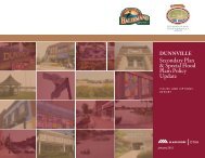
Dunnville Secondary Plan - Urban Design Guide - Haldimand County
Dunnville Secondary Plan - Urban Design Guide - Haldimand County
Dunnville Secondary Plan - Urban Design Guide - Haldimand County
- No tags were found...

Create successful ePaper yourself
Turn your PDF publications into a flip-book with our unique Google optimized e-Paper software.
1 / Introduction<br />
<strong>Haldimand</strong> <strong>County</strong> initiated in 2011 the <strong>Dunnville</strong><br />
<strong>Secondary</strong> <strong>Plan</strong> and Special Flood Plain Policy<br />
Areas Update. These urban design guidelines are<br />
a tool to assist the <strong>County</strong> and the residents and<br />
businesses of <strong>Dunnville</strong> achieve a long-term vision.<br />
They will support the Seconary <strong>Plan</strong> effort and build<br />
on and reinforce the direction from the previous<br />
<strong>Haldimand</strong> <strong>County</strong> Streetscape <strong>Plan</strong> and <strong>Urban</strong><br />
<strong>Design</strong> <strong>Guide</strong>lines (2010).<br />
The purpose of these guidelines is to develop a<br />
realistic urban design framework to help direct<br />
change in specific areas of the downtown and<br />
emerging retail commercial growth areas as well<br />
as better connect these two locales. The primary<br />
emphasis is to encourage appropriate urban streetrelated<br />
development with a mix of uses with support<br />
from a high-quality, pedestrian-focused public<br />
realm.<br />
The guidelines are intended to provide direction<br />
rather than prescriptive requirements for the<br />
four defined Special Areas within the <strong>Secondary</strong><br />
<strong>Plan</strong> area. The <strong>County</strong> has the authority to waive<br />
individual guidelines for specific projects if this<br />
would better achieve the design policy objectives<br />
than strict application of the guidelines.<br />
This document is organized into five sections:<br />
• <strong>Urban</strong> <strong>Design</strong> Framework – describes the<br />
overall land use and urban design concept for the<br />
<strong>Secondary</strong> <strong>Plan</strong> Area;<br />
• Guiding Principles – articulates the overall vision<br />
for the physical form and character for the Special<br />
Areas;<br />
• Built Form <strong>Guide</strong>lines – addresses the key<br />
elements regarding the placement and design<br />
of buildings, how they relate to one another and<br />
shape the public realm;<br />
• Public Realm <strong>Guide</strong>lines – addresses the key<br />
elements of the space between buildings—the<br />
streets, parks and open spaces; and<br />
• <strong>Guide</strong>lines for Special Areas – more specifically<br />
suggests the built form and public realm character<br />
and potential form for each of the four special<br />
areas—the <strong>County</strong>-Owned Waterfront Lands,<br />
Main Street Corridor, Broad Street Transition<br />
Area, and the Broad Street and Taylor Road Retail<br />
Node.<br />
<strong>Urban</strong> <strong>Design</strong> <strong>Guide</strong>lines <strong>Dunnville</strong> <strong>Secondary</strong> <strong>Plan</strong> and Special Flood Plain Policy Update / 1