getting
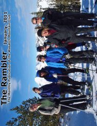
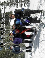
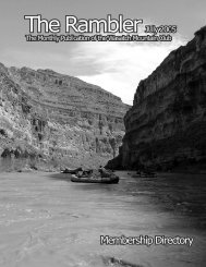
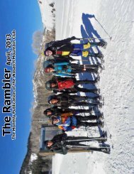
The Rambler - Wasatch Mountain Club
The Rambler - Wasatch Mountain Club
- No tags were found...

Create successful ePaper yourself
Turn your PDF publications into a flip-book with our unique Google optimized e-Paper software.
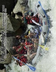
Jun 1 Fri White Water Rafting Middle Fork Salmon River – class IV – 100.0 mi<br />
– Jun 7 Meet: Registration required<br />
Thu<br />
Organizer: Don Urrizaga 435-884-0147 don_urrizaga@yahoo.com<br />
The Middle Fork is a tributary of the Salmon River, which is the main tributary of the Snake River, which in turn<br />
is the main tributary to the Columbia River. The Middle Fork is one hundred miles of whitewater. The nearest<br />
town is Stanley, Idaho. The Middle Fork’s elevation starts at 7,000 feet above sea level and drops down to 3,900<br />
feet. Bear Valley Creek and Marsh Creek converge to form the Middle Fork. The Middle Fork has around a hundred<br />
tributaries; some of the bigger tributaries are Rapid River, Loon Creek and Camas Creek. The Middle Fork<br />
flows through 2,500 square miles of rugged terrain known as the Salmon River Mountains, in which there are<br />
peaks that reach as high as 10,000 feet. Rafting the Middle Fork is only rivaled by the mighty Colorado through<br />
the Grand Canyon. We plan to leave Salt Lake City in the early morning on May 31. We will drive to the put-in<br />
at Boundary Creek, rig boats, camp, and launch on the morning of June 1. We will take seven days to raft to the<br />
take-out at Cache Bar.<br />
Jun 2<br />
Sat<br />
Jun 2<br />
Sat<br />
Jun 3<br />
Sun –<br />
Jun 9<br />
Sat<br />
Hike - Gobblers/ Raymond Via White Fir Pass – msd – 11.0 mi Out & Back – 4000’ ascent – Moderate pace<br />
Meet: 8:30 am at Skyline High School - 3151 E Upland Dr (3760 S)<br />
Organizer: Julie Kilgore 801-244-3323 jk@wasatch-environmental.com<br />
Julie will approach Gobblers and Raymond from the Millcreek side so the pooch can come along. Bring microspikes<br />
and ice axe for the likely snow conditions as we approach these two 10K+ summits.<br />
Road Bike: Elberta To Vernon Out & Back – mod+ – 68.0 mi Out & Back – Moderate pace<br />
Meet: 10:00 am at Elberta Post Office on the corner of US Hwy 6 (15200 S) and UT Hwy 68 (12800 W), Elberta,<br />
UT<br />
Carpool: 8:30 am at Former school parking lot at 230 E Claybourne Ave (2770 S), SLC<br />
Organizer: Robert Turner 801-467-1129 r46turner@gmail.com<br />
We’ll ride from Elberta in Utah County through Eureka and on to Vernon, returning the same way. This is really<br />
nice riding territory. If you haven’t ridden here before, you owe it to yourself to try it. The first part is a stiff<br />
climb of about 9 miles up to Eureka, but from there, we get some downhill and rollers through very scenic,<br />
low-traffic territory all the way to Vernon. On the return, we’ll get a great 9 mile downhill reward from Eureka<br />
back to Elberta. Since this is an out and back, you have lots of options to shorten the climb and ride distance to<br />
suit your taste. There will be small stores in Eureka and Vernon to get snacks and water, etc. If we want, we can<br />
have lunch at a little store in Vernon during the ride or on the drive back in the Saratoga Springs area. This will<br />
be a social ride: ride at your own pace but we will regroup a few times along the way. Bring money for snacks or<br />
lunch.<br />
Kayak/canoe - Muddy Creek • 6 Days – class II<br />
Meet: Registration required<br />
Organizer: Steve Pace 801-363-8190 stephencpace@alum.mit.edu<br />
Self-support Duckie Adventure, 5 nights. It has an uninspiring name yet Muddy Creek forms the deepest canyon<br />
in the San Rafael Swell and for many miles flows through a spectacular gorge of colorful sandstone. Known as<br />
The Chute, the vertical walls here rise for several hundred feet above the streambed, which usually has running<br />
water all year. Except after heavy rain the creek is only a few inches deep and the canyon has no great obstacles.<br />
Put in at I-70 or Lone Tree bridge and takeout near Factory Butte. Contact Steve to register and for actual<br />
dates (depends on water flow).<br />
59