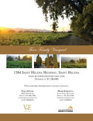
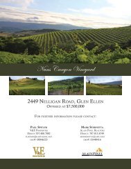
Nuns Canyon Vineyard
Nuns Canyon Vineyard - V&E Properties
Nuns Canyon Vineyard - V&E Properties

You also want an ePaper? Increase the reach of your titles
YUMPU automatically turns print PDFs into web optimized ePapers that Google loves.
Article 64. - SR Scenic Resources Combining District.<br />
http://library.municode.com/HTML/16331/level2/CH26SOC...<br />
such easements in critical scenic landscape units pursuant to general plan Policy OS-2g.<br />
(c) Where development occurs on parcels located both within scenic landscape units and adjacent to<br />
scenic corridors, the more restrictive provisions set forth in this article shall apply.<br />
(d) Additional or varied development may be allowed in designated community separators and scenic<br />
landscape units in accordance with general plan Policies OS-1c, and OS-2c, respectively.<br />
(e) Minor timberland conversions shall be allowed within community separators and scenic landscape<br />
units, subject to compliance with the requirements of this article and Section 2-88-140.<br />
(f) Certain single-family dwelling units and appurtenant structures within the area covered by the Taylor<br />
Mountain/Sonoma Mountain development guidelines shall be subject to Section 26-90-050, as<br />
specified therein. Where the provisions of this section conflict with the provisions of Section<br />
26-90-050, the general plan, or any applicable area plan, the more restrictive provisions shall apply.<br />
(Ord. No. 5132 § 2, 1999: Ord. No. 4985 § 1(d), 1996; Ord. No. 4973 § 12(a), 1996; Ord. No. 4643, 1993.)<br />
Sec. 26-64-030. - Scenic corridors.<br />
The following provisions shall apply to properties along scenic corridors illustrated on Figures OS-5a<br />
through OS-5i, inclusive, of the general plan open space element unless otherwise provided herein:<br />
(a) All structures located within scenic corridors established outside of the urban service area<br />
boundaries shown on Figures LU-5a through LU-5i, inclusive, of the general plan land use<br />
element shall be subject to the setbacks of thirty percent (30%) of the depth of the lot to a<br />
maximum of two hundred feet (200′) from the centerline of the road. Development within the<br />
setback shall be prohibited with the following exceptions, where such uses are allowed by the<br />
base district with which this district is combined:<br />
(b)<br />
(c)<br />
(d)<br />
(e)<br />
(1)<br />
(2)<br />
(3)<br />
(4)<br />
(5)<br />
New barns and similar agricultural support structures which are added to existing farm<br />
complexes provided that such structures proposed within a state scenic highway or<br />
where local design review exists by community choice in an adopted specific or area<br />
plan are subject to design review;<br />
New barns and similar agricultural support structures which do not require a use permit<br />
in this chapter; provided, however, that such structures proposed within a State Scenic<br />
Highway or where local design review exists by community choice in an adopted<br />
specific or area plan are subject to design review;<br />
Maintenance, restoration, reconstruction or minor expansion of existing structures;<br />
Certain telecommunication facilities as provided in Section 26-64-040<br />
Other new structures provided they are subject to design review and<br />
(i) They are associated with existing structures,<br />
(ii) There is no other reasonable location for the structure,<br />
(iii) The location within the setback is necessary for the use, or<br />
(iv) Existing vegetation and topography screen the use;<br />
Compliance with the setback would render the parcel unbuildable;<br />
(6)<br />
(7) Satellite dishes which are not visible from the roadway.<br />
Where the scenic corridor setback provided for in Section 26-64-030(a), conflicts with the<br />
scenic corridor setback along Highway 12 established by Ordinance 1810, the latter shall<br />
apply.<br />
A building setback of twenty feet (20′) shall be applied along the Highway 101 scenic corridor<br />
to properties which are within the urban service area boundaries shown on Figures LU-5b,<br />
-5c, -5e, -5g, and -5h of the general plan land use element, to be reserved for landscaping.<br />
Where development occurs on parcels located both within scenic landscape units and<br />
adjacent to scenic corridors, the more restrictive provisions set forth in this article shall apply.<br />
Building permits within the setback established in Section 26-64-030(a) along Bohemian<br />
Highway between Occidental and Freestone and Bodega Highway between Bodega and<br />
Freestone shall be referred to the county landmarks commission for review and<br />
recommendation.<br />
(Ord. No. 4973 § 12(b), 1996; Ord. No. 4643, 1993.)<br />
2 of 3 10/20/11 10:20 AM