Sonoran Preserve Master Plan - City of Phoenix
Sonoran Preserve Master Plan - City of Phoenix
Sonoran Preserve Master Plan - City of Phoenix

You also want an ePaper? Increase the reach of your titles
YUMPU automatically turns print PDFs into web optimized ePapers that Google loves.
<strong>City</strong> <strong>of</strong> <strong>Phoenix</strong> <strong>Sonoran</strong> <strong>Preserve</strong> <strong>Master</strong> <strong>Plan</strong> HCDE<br />
<strong>Sonoran</strong> <strong>Preserve</strong><br />
<strong>Master</strong> <strong>Plan</strong><br />
An Open Space <strong>Plan</strong> for the <strong>Phoenix</strong> <strong>Sonoran</strong> Desert
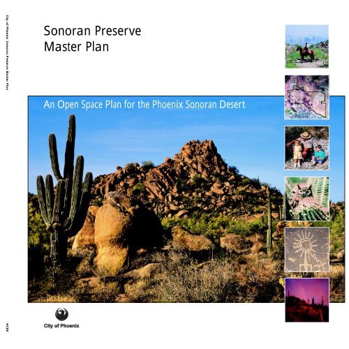
<strong>Sonoran</strong> <strong>Preserve</strong> <strong>Master</strong> <strong>Plan</strong><br />
An Open Space <strong>Plan</strong> for the <strong>Phoenix</strong> <strong>Sonoran</strong> Desert<br />
<strong>City</strong> <strong>of</strong> <strong>Phoenix</strong> Parks, Recreation and Library Department<br />
February 17, 1998<br />
Herberger Center for Design Excellence<br />
Arizona State University
iv<br />
The <strong>City</strong> <strong>of</strong> <strong>Phoenix</strong> prohibits discrimination on the basis <strong>of</strong><br />
race, ethnicity, national origin, sex, religion, age, sexual orientation,<br />
or disability in its services, programs and activities.<br />
Anyone who believes he or she has been discriminated<br />
against may file a complaint with the <strong>City</strong> <strong>of</strong> <strong>Phoenix</strong> Equal<br />
Opportunity Department.<br />
The <strong>City</strong> <strong>of</strong> <strong>Phoenix</strong> does not carry accident insurance to<br />
cover participants. Involvement in any activity is done at<br />
the participant’s own risk.<br />
This pubication can be provided in an alternative format<br />
upon request. Call 602-262-6862 (voice). TDD 602-262-<br />
6713 (parks and recreation) or 602-534-5500 (city operator).<br />
FAX 602-534-3787. E-mail prlrecep@ci.phoenix.az.us<br />
Principal authors: James Burke and Joseph Ewan<br />
Design team: James Burke, Scott Davis, Joseph Ewan,<br />
Audrey Brichetto Morris<br />
Published by:<br />
The Herberger Center for Design Excellence<br />
College <strong>of</strong> Architecture and Environmental Design<br />
Arizona State University, Tempe, AZ 85287-1905<br />
Mary R. Kihl, Ph.D., AICP<br />
Director/Associate Dean for Research<br />
Audrey Brichetto Morris, Editor<br />
Layout by Scott Davis<br />
©1999 <strong>City</strong> <strong>of</strong> <strong>Phoenix</strong> Parks, Recreation and Library<br />
Department. All rights reserved.<br />
Printed in the United States <strong>of</strong> America<br />
<strong>City</strong> <strong>of</strong> <strong>Phoenix</strong><br />
Figure Credits<br />
Ward Brady: cover map, chapter 2 divider, 2.14<br />
Jim Burke: chapter 3 divider, 3.19, 5.4<br />
<strong>City</strong> <strong>of</strong> <strong>Phoenix</strong> Information Technology: 2.13<br />
<strong>City</strong> <strong>of</strong> <strong>Phoenix</strong> Parks, Recreation, and Library Department:<br />
cover owl, 1.1, 1.2, 1.6, 1.7, 1.8, 1.9, 1.11, 1.12, 2.2,<br />
2.3, 2.4, 2.5, 2.12, 2.15, 2.17, 3.4, 3.5, 3.6, 3.7, 3.18,<br />
3.23, 4.1, 4.2, chapter 5 divider, 5.5, 5.7, 5.8, 5.9, 5.10,<br />
5.11<br />
<strong>City</strong> <strong>of</strong> <strong>Phoenix</strong> <strong>Plan</strong>ning Department: 2.1, 4.3, 4.4, 4.5,<br />
4.6, 4.7<br />
Joe Ewan: cover children, cover petroglyph, cover sunset,<br />
1.13, 2.10, 3.14, 3.15, 3.17, 3.22, 3.24, 3.25, 3.26, 3.29,<br />
3.30, 3.31, 3.32, 3.33, 5.1, 5.6, chapter 6 divider<br />
Rebecca Fish Ewan: 2.7, 2.8, 3.9, 3.10, chapter 4 divider,<br />
5.2<br />
Dorothy Gilbert: 1.5<br />
Mark Hughes: 3.34<br />
Landiscor: 2.11, 3.1, 3.2, 3.8, 5.13, 5.14<br />
Maricopa Association <strong>of</strong> Governments: 2.6<br />
Maricopa County Flood Control District: 3.3<br />
Bill Miller: 2.19<br />
Bob Rink: cover landscape, cover horse, 1.10, 2.9, 3.11,<br />
3.12, 3.13, 3.16, 3.27, 3.28, 5.3, 5.12<br />
D. Stevenson: chapter 1 divider<br />
SWCA, Inc.: 3.20, 3.21<br />
Courtesy <strong>of</strong> Dr. Robert Breunig: 1.3<br />
Courtesy <strong>of</strong> Larry Laughlin and the Shemer Art Center: 1.4<br />
Table Credits<br />
<strong>City</strong> <strong>of</strong> <strong>Phoenix</strong> Parks, Recreation, and Library Department:<br />
2.1<br />
<strong>City</strong> <strong>of</strong> <strong>Phoenix</strong> <strong>Plan</strong>ning Department: 4.1, 4.2, 4.3
Contents<br />
Executive Summary............................................................................................................. vi<br />
Introduction ......................................................................................................................... 1<br />
1 Context<br />
A. History <strong>of</strong> Preservation Efforts ..................................................................................... 3<br />
B. Benefits <strong>of</strong> Urban <strong>Preserve</strong>s ......................................................................................... 4<br />
C. <strong>Phoenix</strong> <strong>Sonoran</strong> <strong>Preserve</strong> <strong>Master</strong> <strong>Plan</strong> Study Area ............................................................. 7<br />
D. General Philosophy for the <strong>Sonoran</strong> <strong>Preserve</strong> ...................................................................10<br />
2 <strong>Sonoran</strong> <strong>Preserve</strong> <strong>Plan</strong>ning and Analysis<br />
A. General <strong>Plan</strong> for Peripheral Areas C and D .......................................................................13<br />
B. South Mountain <strong>Master</strong> <strong>Plan</strong> ........................................................................................13<br />
C. Desert <strong>Preserve</strong> Preliminary <strong>Plan</strong> ..................................................................................13<br />
D. North Study Area Concepts and Public Review Process .......................................................14<br />
E. Desert Spaces <strong>Plan</strong> .................................................................................................... 15<br />
F. North <strong>Phoenix</strong> Wash Preservation Boundary Studies ............................................................16<br />
G. Geographic Information Systems and Computer Modeling ...................................................17<br />
H. Visual Analysis ......................................................................................................... 18<br />
I. Wildlife Study ........................................................................................................... 18<br />
3 <strong>Master</strong> <strong>Plan</strong> for the North Study Area<br />
A. Introduction ........................................................................................................... 21<br />
B. Ecological Principles .................................................................................................. 22<br />
C. Landforms .............................................................................................................. 24<br />
D. Public Use .............................................................................................................. 28<br />
E. <strong>Preserve</strong> Ethic ......................................................................................................... 30<br />
4 Acquisition <strong>Plan</strong><br />
A. Introduction ........................................................................................................... 33<br />
B. Real Estate Process .................................................................................................... 33<br />
C. Acquisition Techniques and Financing Options ...................................................................33<br />
D. Acquisition Modeling ................................................................................................. 36<br />
E. Funding Implications ................................................................................................. 38<br />
5 Design Guidelines, Operations, and Management<br />
A. Philosophy.............................................................................................................. 41<br />
B. <strong>Plan</strong> Implementation and Development ...........................................................................41<br />
C. Citizen Involvement .................................................................................................. 42<br />
D. Natural and Cultural Resource Protection .......................................................................42<br />
E. Visitor Experience and Safety .......................................................................................43<br />
F. Required Resources ................................................................................................... 44<br />
6 Conclusion............................................................................................................................ 47<br />
Bibliography ......................................................................................................................... 49<br />
<strong>Sonoran</strong> <strong>Preserve</strong> <strong>Master</strong> <strong>Plan</strong><br />
v
vi<br />
Executive Summary<br />
The <strong>Sonoran</strong> <strong>Preserve</strong> <strong>Master</strong> <strong>Plan</strong> has been prepared by<br />
the <strong>City</strong> <strong>of</strong> <strong>Phoenix</strong> Parks, Recreation and Library Department<br />
(PRLD) in cooperation with the <strong>Phoenix</strong> <strong>Sonoran</strong><br />
<strong>Preserve</strong> Committee. This plan was presented to all interested<br />
<strong>City</strong> <strong>of</strong> <strong>Phoenix</strong> urban village planning committees, as well as<br />
the Environmental Quality Commission, and it received enthusiastic<br />
support. On January 22, 1998, the Parks and Recreation<br />
Board and the <strong>Phoenix</strong> <strong>Sonoran</strong> <strong>Preserve</strong> Committee<br />
both unanimously approved the plan at a joint meeting.<br />
The <strong>City</strong> Council unanimously approved this plan on February<br />
17, 1998. Driving this effort is the fact that we live<br />
amid some <strong>of</strong> the most beautiful and biologically rich desert<br />
in the world and this valuable resource is being threatened<br />
at an increasing rate. With sensitive planning, a commitment<br />
to maintaining our quality <strong>of</strong> life, and quick action, we can<br />
accommodate quality growth and preservation <strong>of</strong> the<br />
<strong>Sonoran</strong> Desert. This <strong>Sonoran</strong> <strong>Preserve</strong> <strong>Master</strong> <strong>Plan</strong> builds<br />
on the Desert <strong>Preserve</strong> Preliminary <strong>Plan</strong> prepared in 1994,<br />
citizen involvement, and a database and ecological inventory<br />
prepared by the Parks, Recreation and Library Department<br />
in conjunction with Arizona State University.<br />
The planning process for the <strong>Sonoran</strong> <strong>Preserve</strong> incorporates<br />
traditional planning techniques (inventory and analysis) with<br />
landscape ecological theory. Past open space preservation<br />
efforts have been primarily designated by only three criteria:<br />
slope, visual prominence, and land ownership. The <strong>Sonoran</strong><br />
<strong>Preserve</strong> <strong>Master</strong> <strong>Plan</strong> attempts to develop a system that functions<br />
biologically—maintaining species diversity and ecological<br />
processes—while providing a recreational resource. We want<br />
to avoid the oversights <strong>of</strong> the past that created “sky islands”<br />
with miles <strong>of</strong> walls separating the mountain preserves from<br />
the greater community and the larger natural environment.<br />
The plan includes approximately 21,500 acres in north <strong>Phoenix</strong>.<br />
Additional lands also recommended for preservation<br />
include 1,000 acres adjacent to South Mountain Park. Several<br />
key goals were used to develop the plan.<br />
Acquire a Diversity <strong>of</strong> Lands<br />
The preservation <strong>of</strong> rich vegetation mosaics will help the desert<br />
flora and fauna survive and flourish. The goal is to contribute<br />
to preserving biodiversity. Lands to be included in the<br />
<strong>Sonoran</strong> <strong>Preserve</strong> should span the spectrum from creosotebush<br />
flats and washes to beautiful saguaro-studded hillsides.<br />
<strong>City</strong> <strong>of</strong> <strong>Phoenix</strong><br />
<strong>Preserve</strong> Natural Hydrological Processes<br />
The water courses or washes are the most biologically diverse<br />
and ecologically significant component <strong>of</strong> the desert<br />
landscape. This goal envisions preserving the floodway (actual<br />
sandy wash from bank to bank), the definable 100-year floodplains,<br />
and sufficient buffers to allow wide enough corridors<br />
for wildlife movement and natural meandering <strong>of</strong> the wash<br />
course to occur over time. This represents a significant<br />
change in development practices and will ensure long-term<br />
preservation <strong>of</strong> washes, expand the land area within the preserve,<br />
and capture a diversity <strong>of</strong> vegetation communities.<br />
Integrate a Preservation Ethic into the Overall Urban Form<br />
Public ownership is only a part <strong>of</strong> the objective. In the broadest<br />
terms, the preserve system should be made up <strong>of</strong> municipal<br />
recreation lands (major mountains, washes, and<br />
transition lands), flood control infrastructures (secondary<br />
and minor washes that could be county owned or privately<br />
held and maintained for nonstructural flood control), trails,<br />
scenic corridors, utility corridors, and privately held natural<br />
open space. This will integrate the desert into the urban<br />
fabric rather than preserve a series <strong>of</strong> isolated remnants <strong>of</strong><br />
natural open space.<br />
Maintain Internal and External Connectivity with the <strong>Sonoran</strong><br />
<strong>Preserve</strong> System<br />
The <strong>Sonoran</strong> <strong>Preserve</strong> should connect with other public open<br />
space; for example, schools, parks, and other municipal lands<br />
that contribute toward preserving the natural environment.<br />
Creating viable connections for the movement <strong>of</strong> people<br />
and wildlife will greatly enhance both the ecological health<br />
<strong>of</strong> the preserve and recreation opportunities for the public.<br />
Lands that contribute to this effort include lands which are<br />
identified for preservation by the Maricopa Association <strong>of</strong><br />
Governments, lands owned or managed by Maricopa County<br />
Parks Department, United States Forest Service, United<br />
States Bureau <strong>of</strong> Land Management, United States Bureau<br />
<strong>of</strong> Reclamation, Flood Control District <strong>of</strong> Maricopa County,<br />
<strong>City</strong> <strong>of</strong> Scottsdale, <strong>City</strong> <strong>of</strong> Peoria, Town <strong>of</strong> Cave Creek, and<br />
Town <strong>of</strong> Carefree.<br />
Eighty percent, or 16,800 acres, <strong>of</strong> the lands recommended<br />
for preservation are owned by the Arizona State Land Department.<br />
Of these lands, approximately 15,000 acres are
within the city limits. These Trust Lands will require acquisition<br />
through the Arizona <strong>Preserve</strong> Initiative. Twenty percent,<br />
or 4,700 acres, are privately held lands. This ratio <strong>of</strong><br />
state trust lands to private lands is approximately equivalent<br />
to the proportion <strong>of</strong> land ownership in the area and not<br />
a function <strong>of</strong> targeting either party. It is recommended that<br />
privately-owned lands targeted for preservation will be acquired<br />
primarily through the development process.<br />
The master plan recommends three major access points that<br />
will include parking, picnicking, outdoor education, and<br />
visitor services. These will be similar in size and scope to<br />
Squaw Peak Park, Dreamy Draw Recreation Area, and North<br />
Mountain Park. An outdoor environmental education center<br />
is planned for one <strong>of</strong> these major gateways. Also recommended<br />
are a minimum <strong>of</strong> eight secondary entry points that<br />
will consist <strong>of</strong> parking lots on the edge <strong>of</strong> the preserve linking<br />
interior trails to the larger community. Multiple neighborhood<br />
access points are recommended to accommodate<br />
and focus walk-in use as well as alleviate congestion and<br />
degradation <strong>of</strong> the minor and secondary access points and<br />
the preserved lands. A detailed trails plan will need to be<br />
prepared in the near future.<br />
This master plan creates a framework for a preserve system<br />
that builds on <strong>Phoenix</strong>’s history <strong>of</strong> setting aside significant<br />
<strong>Sonoran</strong> Desert land for recreation, open space, environmental<br />
education, and preservation <strong>of</strong> native flora and fauna.<br />
The successes and mistakes <strong>of</strong> the past are used as building<br />
blocks for the development <strong>of</strong> this plan and the designation<br />
<strong>of</strong> the preserve boundaries. Changes to existing city ordinances<br />
relating to floodplain management and subdivision development<br />
are recommended to support the goals <strong>of</strong> the plan.<br />
<strong>Sonoran</strong> <strong>Preserve</strong> <strong>Master</strong> <strong>Plan</strong><br />
vii
viii<br />
Contributors<br />
<strong>Phoenix</strong> <strong>City</strong> Council<br />
Skip Rimsza, Mayor<br />
Dave Siebert, Vice Mayor, District 1<br />
Tom Milton, District 2<br />
Peggy A. Bilsten, District 3<br />
Phil Gordon, District 4<br />
John Nelson, District 5<br />
Sal DiCiccio, District 6<br />
Doug Lingner, District 7<br />
Cody Williams, District 8<br />
<strong>Phoenix</strong> Parks and Recreation Board<br />
Florence Eckstein, Chair<br />
Diana Brooks<br />
Kevin B. Demenna<br />
Ed Fox<br />
Penny Howe<br />
Steve Leal<br />
Ramonia Thomas<br />
<strong>Phoenix</strong> <strong>Sonoran</strong> <strong>Preserve</strong> Committee<br />
Kent M. Struckmeyer, Chair<br />
Doreen A. Garrison<br />
Robert Frederiksen<br />
Terry K. Heslin<br />
Jim Holway<br />
Kevin Lockart<br />
Jack Putta<br />
Phil Richards<br />
Donald States<br />
Jean Anderson, ex <strong>of</strong>ficio<br />
Suzanne Rothwell, ex <strong>of</strong>ficio<br />
Kedrick O. Ellison, Term Expired 7/97<br />
Jon B. Fiegen, Term Expired 7/97<br />
Lenore Walters, Term Expired 7/97<br />
<strong>City</strong> Manager’s Office<br />
Frank Fairbanks, <strong>City</strong> Manager<br />
Sheryl Sculley, Assistant <strong>City</strong> Manager<br />
Jack Tevlin, Deputy <strong>City</strong> Manager<br />
<strong>City</strong> <strong>of</strong> <strong>Phoenix</strong><br />
<strong>City</strong> <strong>of</strong> <strong>Phoenix</strong> Parks, Recreation and Library Dept.<br />
James A. Colley, Director<br />
L. B. Scacewater, Assistant Director<br />
Dale Larsen, Assistant Director<br />
James P. Burke, Deputy Director (Principal Author)<br />
Bruce Swanson, Parks Development Administrator<br />
Deborah Barrett, Secretary<br />
Gail Brinkmann, Landscape Architect<br />
Joe Cascio, Landscape Architect<br />
Jim C<strong>of</strong>fman, former PRLD Landscape Architect<br />
Joseph Ewan, Landscape Architect (Principal Author)<br />
Walt Kinsler, Landscape Architect<br />
Terry Newman, Landscape Architect<br />
Ron Young, Senior Drafting Technician<br />
Janet Waibel, Landscape Architect<br />
with assistance from<br />
Arizona State University<br />
School <strong>of</strong> <strong>Plan</strong>ning and Landscape Architecture<br />
Frederick Steiner, Director<br />
Ward Brady, Pr<strong>of</strong>essor<br />
Rebecca Fish Ewan, Assistant Pr<strong>of</strong>essor<br />
Joseph Ewan, Assistant Pr<strong>of</strong>essor<br />
Bill Miller, Associate Pr<strong>of</strong>essor<br />
IT Geographic Information Systems Lab<br />
Jana Fry, Technology Systems Coordinator<br />
Herberger Center for Design Excellence<br />
Mary Kihl, Director<br />
Audrey Brichetto Morris, Editor<br />
Scott Davis, Graduate Research Assistant<br />
<strong>City</strong> <strong>of</strong> <strong>Phoenix</strong> <strong>Plan</strong>ning Dept.<br />
Ray Quay, Assistant Director<br />
Richard Clewis, <strong>Plan</strong>ner<br />
<strong>City</strong> <strong>of</strong> <strong>Phoenix</strong> Information Technology Dept.<br />
Bill Bayham, Deputy Director<br />
Arizona Game and Fish Dept.<br />
Joe Yarchin, Urban Wildlife Specialist<br />
National Park Service<br />
Joe Winfield, Landscape Architect, Rivers, Trails, and<br />
Conservation Assistance Program
Introduction<br />
The <strong>City</strong> <strong>of</strong> <strong>Phoenix</strong> is distinguished by its stunning, instantly<br />
recognizable desert skyline. Our desert mountains and<br />
flatlands captivate visitors and bring perpetual joy to residents<br />
by <strong>of</strong>fering beautiful vistas and invigorating outdoor<br />
adventures. The <strong>Sonoran</strong> <strong>Preserve</strong> <strong>Master</strong> <strong>Plan</strong> sets forth a<br />
blueprint for preserving this special landscape. The plan seeks<br />
to protect the plants and animals that inhabit the <strong>Sonoran</strong><br />
Desert while creating access to these lands for the people<br />
who love them. In two unanimous actions on January 22,<br />
1998, the <strong>City</strong> <strong>of</strong> <strong>Phoenix</strong> Parks and Recreation Board endorsed<br />
this master plan and agreed to ask the <strong>City</strong> Council<br />
to submit an application to the Arizona State Land Department<br />
for the acquisition <strong>of</strong> 15,000 acres under the Arizona<br />
<strong>Preserve</strong>s Initiative. On February 17, 1998, the Council also<br />
voted unanimously to adopt the master plan and to move<br />
forward in acquiring this open space. In doing so, the Council<br />
continues a time-honored precedent for protecting and<br />
preserving desert open space within the city and for ensuring<br />
recreational access for our citizens.<br />
Beginning 75 years ago, <strong>Phoenix</strong> citizens and elected <strong>of</strong>ficials<br />
have taken numerous actions to create the <strong>Phoenix</strong> Mountain<br />
<strong>Preserve</strong>s, South Mountain Park, and other preserved<br />
desert open space. Forward-looking city leaders secured the<br />
16,500-acre centerpiece <strong>of</strong> the preserves—South Mountain<br />
Park—well in advance <strong>of</strong> the neighborhood development<br />
that now encompasses it. In its first year, 1924, some 36,000<br />
people visited the park; in 1997, an estimated three million<br />
visitors accessed the park’s many trails and picnic areas. In<br />
1960 the city was able to secure just 350 precious acres at<br />
the top <strong>of</strong> Camelback Mountain, a landmark that was already<br />
encircled by private homes. Then, in 1972, the public<br />
voted to expand the <strong>Phoenix</strong> Mountain <strong>Preserve</strong>s by<br />
10,500 acres with the addition <strong>of</strong> the North Mountain range.<br />
This addition increased opportunities for the city’s rapidly<br />
growing population to commune with our desert environment.<br />
The <strong>Phoenix</strong> Parks, Recreation and Library Department<br />
staff continues to address open space issues, seeking<br />
to maintain a respectful balance between neighborhood security<br />
and privacy while ensuring public access.<br />
It is now time to prepare for the next stage <strong>of</strong> the city’s<br />
growth, to set forth on the path <strong>of</strong> implementing the <strong>Sonoran</strong><br />
<strong>Preserve</strong> <strong>Master</strong> <strong>Plan</strong>. By creating a process for the identification<br />
and acquisition <strong>of</strong> public open space in advance <strong>of</strong> the<br />
impending development, the plan will serve as a model for<br />
growth that serves the interests <strong>of</strong> neighborhood residents<br />
by providing excellent public access to outdoor spaces.<br />
The Parks and Recreation Board has been privileged to work<br />
with the superb staff <strong>of</strong> the <strong>City</strong> <strong>of</strong> <strong>Phoenix</strong> Parks, Recreation<br />
and Library Department, other city departments, the<br />
citizen members <strong>of</strong> the <strong>Phoenix</strong> <strong>Sonoran</strong> <strong>Preserve</strong> Committee,<br />
Mayor Skip Rimsza, members <strong>of</strong> the <strong>Phoenix</strong> <strong>City</strong><br />
Council, and Arizona State University. Their participation<br />
in the development and support <strong>of</strong> this plan has been invaluable.<br />
We look forward to working toward its realization<br />
for the residents <strong>of</strong> the <strong>City</strong> <strong>of</strong> <strong>Phoenix</strong>—those living here<br />
today and those who will be among us in the decades to come.<br />
Florence Eckstein, Chair<br />
<strong>Phoenix</strong> Parks and Recreation Board<br />
<strong>Sonoran</strong> <strong>Preserve</strong> <strong>Master</strong> <strong>Plan</strong><br />
1
Chapter 1<br />
harmony<br />
A<br />
harmonious relation to<br />
land is more intricate, and <strong>of</strong><br />
more consequence, than the<br />
historians <strong>of</strong> its progress<br />
seem to realize.<br />
Aldo Leopold<br />
A Sand County Almanac, 1949
Context<br />
The <strong>City</strong> <strong>of</strong> <strong>Phoenix</strong> has a long and proud history <strong>of</strong><br />
preserving significant desert open space. In the 1920s,<br />
the Heard family and others persuaded the United States<br />
Congress to sell us South Mountain Park when it was<br />
seven miles outside the city limits. In the 1960s, the <strong>City</strong><br />
acquired the Papago Buttes. Senator Barry Goldwater<br />
and other valley leaders led the way to preserving the<br />
landmark Camelback Mountain. In the 1970s, Margaret<br />
Hance, Dottie Gilbert, Ruth Hamilton, and others convinced<br />
Mayor Driggs to preserve the <strong>Phoenix</strong> Mountains.<br />
That is their legacy—it is now time for our generation<br />
to step forward and establish our legacy in setting aside<br />
the <strong>Sonoran</strong> Valley <strong>Preserve</strong>s for future generations.<br />
Skip Rimsza, Mayor <strong>of</strong> <strong>Phoenix</strong>, 1998<br />
A. History <strong>of</strong> Preservation Efforts<br />
The <strong>Sonoran</strong> Desert environment <strong>of</strong> central and southern<br />
Arizona is our region’s most defining characteristic. The <strong>City</strong><br />
<strong>of</strong> <strong>Phoenix</strong> (COP) has a long tradition <strong>of</strong> preserving large<br />
tracts <strong>of</strong> land with <strong>Sonoran</strong> vegetation, specifically the<br />
paloverde-saguaro communities found on bajadas (coalesced<br />
alluvial fans that form a gently sloped apron around the base<br />
<strong>of</strong> a mountain) and mountain slopes (Figure 1.1).<br />
In 1920, <strong>Phoenix</strong> covered only 5.1 square miles and had a<br />
population <strong>of</strong> 29,033 (Figure 1.2). <strong>City</strong> leaders had a vision<br />
and acquired what they believed to be the last prime recreation<br />
site for picnicking, horseback riding, and hiking near<br />
the city. This desert mountain region, located seven and<br />
three-quarter miles south <strong>of</strong> the city limits, was called the<br />
Salt River Mountains and included the Gila-Guadalupe and<br />
Ma Ha Tuak ranges, with Mount Suppoa as its highest peak<br />
(2,690 feet). Prominent community leaders whose names<br />
we recognize, such as Dobbins, Heard, and Mather, with<br />
the help <strong>of</strong> United States Senator Carl Hayden, encouraged<br />
President Coolidge to sell 13,000 acres to the city for<br />
$17,000. In 1925 the first patent for South Mountain Park<br />
was secured by presidential decree. South Mountain Park,<br />
now 16,500 acres, is the largest municipal park in the country<br />
and is considered by policy a part <strong>of</strong> the <strong>Phoenix</strong> Mountain<br />
<strong>Preserve</strong> System (Parks, Recreation and Library<br />
Department [PRLD] 1989).<br />
In 1935, the National Park Service developed a master plan<br />
for the park with riding and hiking trails, scenic drives, a<br />
museum, picnic areas, and overlooks, all designed with a<br />
rustic regional character. The facilities in the park were primarily<br />
constructed by the Civilian Conservation Corps in<br />
the late 1930s based on this plan. With the 1,200-foot elevation<br />
gain along the five-mile stretch <strong>of</strong> summit road<br />
and 22 miles <strong>of</strong> hiking trails, the park has become increasingly<br />
popular. Visitation has soared from 36,000 a year in<br />
1924 to over 3,000,000 a year in the 1990s (Burke 1997).<br />
In 1989 a new master plan was prepared for South Mountain<br />
Park by P&D Technologies (PRLD 1989).<br />
By 1959 <strong>Phoenix</strong> had expanded to 187 square miles and<br />
had a population <strong>of</strong> 437,000. The city leaders dedicated<br />
themselves to the acquisition <strong>of</strong> 1,100 acres <strong>of</strong> unique landforms<br />
owned by the State <strong>of</strong> Arizona (Figure 1.3). The <strong>City</strong><br />
<strong>of</strong> <strong>Phoenix</strong> acquired the land for $3,529 and began improvements<br />
immediately with $1 million from the 1957 bond<br />
election (PRLD 1996b). They envisioned the development<br />
<strong>of</strong> a premier recreation area, and in 1964 Papago Park was<br />
established. Today, the park contains the <strong>Phoenix</strong> Zoo, the<br />
Desert Botanical Garden, picnic areas, urban fishing lakes,<br />
and one <strong>of</strong> the best affordable golf courses in the country<br />
(Whitten 1996). Visitation exceeds two million annually. In<br />
1997 the PRLD prepared an inventory <strong>of</strong> the park’s past<br />
master plans, historical improvements, cultural resources,<br />
and a calendar <strong>of</strong> annual events (PRLD 1997). In 1998 the<br />
environmental consulting firm SWCA Inc. completed a<br />
wildlife and habitat inventory and in March 1998 the PRLD<br />
completed a master plan that included recommendations<br />
for the future development, management, and operations<br />
<strong>of</strong> Papago Park (PRLD 1998).<br />
<strong>Sonoran</strong> <strong>Preserve</strong> <strong>Master</strong> <strong>Plan</strong><br />
Figure 1.1 South Mountain Park<br />
Figure 1.3 Papago Park circa 1940 Figure 1.2 <strong>Phoenix</strong>, 1920<br />
3<br />
Area: 5.1 Sq. Miles<br />
Population: 29,033<br />
<strong>Phoenix</strong>, 1920<br />
Desert parks<br />
<strong>City</strong> boundary, 1997
Figure 1.6 <strong>Phoenix</strong>, 1970<br />
Figure 1.8 <strong>Phoenix</strong>, 1997<br />
Area: 247.9 Sq. Miles<br />
Population: 584,303<br />
<strong>Phoenix</strong>, 1970<br />
<strong>Phoenix</strong> Mountains<br />
Desert parks<br />
Area: 469.33 Sq. Miles<br />
Population: 1,204,689<br />
<strong>Phoenix</strong>, 1997<br />
Desert parks<br />
4<br />
The late 1960s saw the preservation <strong>of</strong> a regional landmark<br />
when U.S. Senator Barry Goldwater, Lady Bird Johnson,<br />
and other community leaders teamed up to acquire 350 acres<br />
<strong>of</strong> Camelback Mountain (Figure 1.4). The Save Camelback<br />
Foundation promoted the acquisition and preservation <strong>of</strong><br />
land above the 1,800-foot elevation. In 1971 the city acquired<br />
76 acres on the north side <strong>of</strong> Camelback from local<br />
architect Joe Lort for the development <strong>of</strong> a trailhead in Echo<br />
Canyon. The Camelback Summit Trail is the second most<br />
popular trail in the PRLD system with an estimated 350,000<br />
users per year. In the 1980s a second trail access point, Cholla<br />
Trail, was acquired at the east end <strong>of</strong> the mountain.<br />
Figure 1.4 Camelback Mountain circa 1920<br />
On a spring day in 1970, a group <strong>of</strong> valley horsemen took<br />
the <strong>Phoenix</strong> Mayor and <strong>City</strong> Council members on a breakfast<br />
ride in north <strong>Phoenix</strong> to demonstrate the beauty and<br />
potential <strong>of</strong> the <strong>Phoenix</strong> Mountains (Figure 1.5). With development<br />
encroaching up the southern slopes <strong>of</strong> Squaw<br />
Peak, activists were concerned that access for horseback<br />
riding would be lost and that home sites would scar the<br />
ridgelines. After a detailed master plan was completed by<br />
Van Cleeve and Associates in 1971, the <strong>City</strong> Council adopted<br />
Resolution No. 13814 and established the <strong>Phoenix</strong> Mountain<br />
<strong>Preserve</strong> in January 1972 (PRLD 1971). To preserve<br />
the skyline and provide open space and recreation to a growing<br />
city, which now boasted 584,303 people in 248 square<br />
miles (Figure 1.6), 9,700 acres were targeted for acquisition.<br />
Today the 7,500-acre preserve (acquired for over $70<br />
million) includes features such as Shaw Butte, North Mountain,<br />
and Dreamy Draw Recreation Area, which annually<br />
attract 1.5 million visitors to their trails, parks, and picnic<br />
areas. The <strong>Phoenix</strong> Mountain <strong>Preserve</strong> also contains the<br />
Squaw Peak Summit Trail, the most popular summit trail in<br />
the country with over 500,000 hikers per year (Burke 1997).<br />
The <strong>City</strong> <strong>of</strong> <strong>Phoenix</strong> currently operates and maintains over<br />
27,000 acres <strong>of</strong> mountain preserves and desert parks (Figure<br />
1.7), which host many recreational and outdoor activities—<br />
hiking, mountain biking, horseback riding, picnicking, outdoor<br />
education, bird watching, and biological field studies.<br />
Since World War II, the <strong>City</strong> <strong>of</strong> <strong>Phoenix</strong> has been witness to<br />
explosive growth in population and land area. As the city<br />
has expanded, the mountains that once rested on the urban Figure 1.5 Breakfast ride in the North Mountains, 1970<br />
<strong>City</strong> <strong>of</strong> <strong>Phoenix</strong><br />
fringe surrounded by plains <strong>of</strong> creosotebush and bursage<br />
have become isolated. They are now islands <strong>of</strong> <strong>Sonoran</strong><br />
Desert within a sea <strong>of</strong> urban development (Burke 1997).<br />
The city is now nearly 470 square miles and is home to<br />
1,204,689 residents (Figure 1.8). <strong>Phoenix</strong> ranks as the sixth<br />
largest city in the country and has consistently been in the<br />
top ten cities in the nation for rate <strong>of</strong> growth. While the<br />
amount <strong>of</strong> dedicated open space has continually increased<br />
within the city and Maricopa County, the acreage per capita<br />
has decreased (Morrison Institute for Public Policy 1997).<br />
As growth continues, dedication to preserving our most<br />
unique asset, the <strong>Sonoran</strong> Desert, must increase accordingly<br />
if we are to maintain the long-standing tradition <strong>of</strong> desert<br />
preservation that has established our identity and so significantly<br />
affected our quality <strong>of</strong> life.<br />
B. Benefits <strong>of</strong> Urban <strong>Preserve</strong>s<br />
Preservation <strong>of</strong> natural areas within a city can have a pr<strong>of</strong>ound<br />
effect on the entire community. <strong>Preserve</strong>d natural<br />
lands provide visual and emotional relief from the day-to-day<br />
stresses <strong>of</strong> living in an urban setting (Spirn 1984; Hough<br />
1989). Natural areas or preserves provide the necessary space<br />
for passive outdoor recreation and environmental education.<br />
They preserve the indigenous flora and fauna and help<br />
maintain biological diversity, which benefits wildlife and<br />
humans alike. The preservation <strong>of</strong> large natural open space<br />
systems has also been proven to positively affect residential<br />
and commercial property values and development patterns<br />
(Correll et al. 1978; Shaw 1992; Fausold and Lilieholm<br />
1996). Proximity to preserves is also a consideration in corporate<br />
relocation, economic vitality, and tourism. These benefits<br />
can be seen where residential and resort properties<br />
adjacent to the existing mountain preserves are considered<br />
prime locations. The Desert <strong>Preserve</strong> Preliminary <strong>Plan</strong> (PRLD
El Mirage Rd<br />
115th Ave<br />
Happy Valley Rd<br />
Indian School Rd<br />
Thomas Rd<br />
McDowell Rd<br />
Van Buren St<br />
Buckeye Rd<br />
Lower Buckeye Rd<br />
Broadway Rd<br />
Southern Ave<br />
Baseline Rd<br />
Dobbins Rd<br />
0 1 2 3 4 miles<br />
Deer Valley Rd<br />
Union Hills Rd<br />
Bell Rd<br />
Greenway Rd<br />
Thunderbird Rd<br />
Cactus Rd<br />
Peoria Ave<br />
Dunlap Ave<br />
Northern Ave<br />
Bethany Home Rd<br />
Camelback Rd<br />
107th Ave<br />
99th Ave<br />
91st Ave<br />
83rd Ave<br />
Figure 1.7 <strong>City</strong> <strong>of</strong> <strong>Phoenix</strong> parks system<br />
and north and south study areas<br />
75th Ave<br />
Glendale Ave<br />
67th Ave<br />
Grand<br />
Ave<br />
59th Ave<br />
51st Ave<br />
43rd Ave<br />
CAP<br />
27th Ave<br />
19th Ave<br />
7th Ave<br />
Central Ave<br />
7th St<br />
1997 study areas<br />
Parks<br />
Mountain preserves<br />
and desert parks<br />
16th St<br />
24th St<br />
32nd St<br />
40th St<br />
48th St<br />
48th St<br />
56th St<br />
64th St<br />
Scottsdale Rd<br />
Carefree Hwy<br />
Dove Valley Rd<br />
Lone Mountain Rd<br />
Dixiletta Rd<br />
Dynamite Blvd<br />
Jomax Rd<br />
Pinnacle Peak Rd<br />
Beardsley Rd<br />
Bell Rd<br />
Greenway Rd<br />
Thunderbird Rd<br />
Cactus Rd<br />
Shea Blvd<br />
Camelback Rd<br />
Indian School Rd<br />
Thomas Rd<br />
McDowell Rd<br />
Van Buren St<br />
Washington St<br />
University Dr<br />
Broadway Rd<br />
Southern Ave<br />
Baseline Rd<br />
Elliot Rd<br />
Warner Rd<br />
Ray Rd<br />
Chandler Blvd<br />
Pecos Rd<br />
<strong>Sonoran</strong> <strong>Preserve</strong> <strong>Master</strong> <strong>Plan</strong><br />
5
quality<br />
<strong>of</strong> life<br />
A city’s quality <strong>of</strong> life is<br />
more important than purely<br />
business-related factors when<br />
it comes to attracting new<br />
businesses, particularly in the<br />
high-tech and service industries.<br />
6<br />
1994) identified benefits <strong>of</strong> urban preserves which are included<br />
in the following list.<br />
Property Values<br />
According to The Economic Impacts <strong>of</strong> Protecting Rivers, Trails,<br />
and Greenway Corridors, the amenities that open space and<br />
parks provide <strong>of</strong>ten result in greater economic vitality (National<br />
Park Service 1992). The value <strong>of</strong> amenities such as<br />
natural and cultural resource preservation, convenient educational<br />
and recreational opportunities, attractive views, and<br />
wildlife enhancement can be seen in increased real property<br />
values and increased marketability for property located<br />
near open space and parks. Even without doing extensive<br />
local research, it is clear that South Mountain, Camelback<br />
Mountain, the McDowell Mountains, the <strong>Phoenix</strong> Mountains,<br />
and Indian Bend Wash have had positive impacts on<br />
adjacent land values.<br />
Business Relocation and Stability<br />
The Joint Economic Committee <strong>of</strong> the U.S. Congress reports<br />
that a city’s quality <strong>of</strong> life is more important than purely<br />
business-related factors when it comes to attracting new<br />
businesses, particularly in the high-tech and service industries<br />
(National Park Service 1992). Parks and open space<br />
affect quality <strong>of</strong> life issues including convenient access to natural<br />
settings and recreational and cultural opportunities. Corporate<br />
benefits <strong>of</strong> healthy and happy employees are increased<br />
efficiency and decreased health insurance claims.<br />
Commercial Impacts<br />
Open space and parks can provide opportunities for businesses;<br />
locations for filmmaking, television, and advertisements;<br />
and other commercial activities. Areas along a<br />
preserve can provide visitor services including special events,<br />
food, recreational equipment sales and rentals, lodging, and<br />
sales <strong>of</strong> convenience items.<br />
For example, unique <strong>Sonoran</strong> Desert settings are in demand<br />
for a growing film industry. The economic impact <strong>of</strong> film<br />
production in metropolitan <strong>Phoenix</strong> in 1994 was $26.3 million,<br />
in 1995 was $35.8 million, and in 1996 reached a record<br />
$47.1 million (Film Office 1997). The <strong>City</strong> <strong>of</strong> <strong>Phoenix</strong> Motion<br />
Picture Coordinating Office (PRLD 1994) states:<br />
The exposure that <strong>Phoenix</strong> receives from film,<br />
television, and print production not only increases<br />
its visibility to the industry but to the audience as<br />
well. It familiarizes viewers with the Valley, piques<br />
their curiosity, ultimately boosting tourism.<br />
<strong>City</strong> <strong>of</strong> <strong>Phoenix</strong><br />
The interdependent relationship between <strong>Phoenix</strong> area resorts<br />
and hotels and the desert environment is promoted in<br />
nearly every brochure and advertisement. The <strong>Phoenix</strong> preserves<br />
contribute to the outdoor experience <strong>of</strong> visitors. For<br />
example, many local resorts <strong>of</strong>fer horseback riding that is<br />
accommodated on trails within the preserves. According to<br />
the University <strong>of</strong> Arizona Cooperative Extension study, The<br />
Economics <strong>of</strong> the Horse Industry in Arizona, Arizona’s pleasure<br />
horse industry accounts for $196 million in output, $76<br />
million in Arizona income, 4,000 jobs directly, and an additional<br />
2,120 jobs indirectly (Gum et al. 1990).<br />
Tourism<br />
Tourism is the second largest industry in Arizona. Many<br />
economists feel that by 2000, tourism will be the top industry<br />
in the state. Tourists spend $5 billion in the <strong>Phoenix</strong> area<br />
each year with 175,000 local jobs directly related to tourism<br />
(<strong>Phoenix</strong> and Valley <strong>of</strong> the Sun Convention and Visitors<br />
Bureau 1998). Tourists come to <strong>Phoenix</strong> primarily to enjoy<br />
the <strong>Sonoran</strong> Desert, Native American history and culture,<br />
Western history and culture, recreation, and the resort atmosphere.<br />
A desert preserve system <strong>of</strong>fers residents and<br />
visitors recreational activities such as horseback riding and<br />
hiking in an undisturbed area. It preserves the desert ambiance<br />
that has lured so many people to <strong>Phoenix</strong> over the years.<br />
Expenditures by Residents<br />
Leisure time activities, educational pursuits, and recreation<br />
expenditures can account for substantial portions <strong>of</strong> family<br />
spending. This can include educational courses, scientific<br />
study, and recreational pursuits such as special events, walking<br />
or running, hiking, bicycling, photography, equestrian<br />
uses, and driving for pleasure.<br />
Agency Expenditures<br />
The major agencies involved in acquiring and managing land<br />
support the local and regional economy by providing jobs<br />
and purchasing supplies and services to develop, operate,<br />
and maintain parks and related improvements. Numerous<br />
nonpr<strong>of</strong>it and community groups focusing on environmental<br />
quality also affect the economy. Employment generated<br />
by open space programs can be targeted to benefit particular<br />
needs <strong>of</strong> the community, such as youth employment and<br />
opportunities for the physically challenged.<br />
Relief from Population Stress<br />
In Maricopa County, the population is expected to double<br />
from roughly 2.3 million to 4.1 million by 2020. By 2040,
the Valley’s population will be close to 6 million people.<br />
The projection that the population <strong>of</strong> the county will nearly<br />
double by 2020 and triple by 2040 has staggering implications.<br />
Much <strong>of</strong> this growth will take place in the city <strong>of</strong> <strong>Phoenix</strong><br />
(MAG 1997). How <strong>Phoenix</strong> manages this growth will<br />
determine its success or failure. The mountain parks and<br />
preserves are being “loved to death” by the current population.<br />
The <strong>Phoenix</strong> Mountain <strong>Preserve</strong> is an example <strong>of</strong> an urban<br />
preserve that provides urban dwellers much-needed places to<br />
recover from mental fatigue associated with increasingly<br />
urban lifestyles (Kaplan and Kaplan 1989). Additional preserves<br />
need to be set aside to meet the needs <strong>of</strong> the next century.<br />
Recreation, Special Events, and Programs<br />
A substantial and cohesive desert preserve system can <strong>of</strong>fer<br />
a wide range <strong>of</strong> recreational opportunities. Activities such<br />
as bike riding, hiking, and horseback riding would make the<br />
best use <strong>of</strong> a linear, connected open space. Activity areas<br />
can provide desert settings for family outings and picnics.<br />
Environmental Education<br />
Direct contact with nature is the most effective way to nurture<br />
stewardship <strong>of</strong> the land. Perhaps the most important<br />
legacy a desert preserve system can provide is a respect for<br />
the land and living things and a responsibility to be guardians<br />
<strong>of</strong> the land, keeping it for future generations to enjoy.<br />
Wildlife and Vegetation<br />
Urban preserves and corridors provide ecological and environmental<br />
quality. They help maintain biological diversity<br />
on a local scale. <strong>Preserve</strong>s also hold scientific value. If a sound<br />
knowledge base exists, wildlife, vegetation, and other natural<br />
resources can effectively be managed for their multiple<br />
benefits and values.<br />
<strong>Phoenix</strong>’s Reputation for Leadership<br />
Since <strong>Phoenix</strong> won the Carl Bertelsmann Prize for being<br />
one <strong>of</strong> the two best-managed cities in the world, calls and<br />
letters have been coming from governments worldwide,<br />
wanting to know how <strong>Phoenix</strong> works so effectively. The city<br />
must build on this reputation with farsighted land-use plans.<br />
If the city does not look ahead to the long-range benefits <strong>of</strong><br />
preserving pristine or near pristine desert, the future will<br />
hold no more prizes. <strong>Phoenix</strong> should be the premier desert<br />
city, not another example <strong>of</strong> urban sprawl failure.<br />
Sociocultural Benefits<br />
All citizens and visitors would benefit from a better historical<br />
awareness and appreciation <strong>of</strong> our own and past cultures <strong>of</strong> the<br />
<strong>Sonoran</strong> Desert. Throughout the <strong>City</strong> <strong>of</strong> <strong>Phoenix</strong>, significant<br />
prehistoric and historic resources exist. An urban desert<br />
preserve would provide readily accessible opportunities for<br />
family cohesion through outdoor recreational activities and<br />
educational programs. With researched information presented<br />
in programs and interpretive exhibits, the preserve system<br />
has the potential for increasing pride in our local culture.<br />
The benefits <strong>of</strong> desert open space reach beyond those who<br />
live adjacent to or near preserve lands. According to a 1993<br />
Trust for Public Land study addressing open space needs<br />
and opportunities in America’s cities, open space and recreational<br />
resources are increasingly being viewed on a regional<br />
basis. This perspective is crucial for recognizing the significance<br />
<strong>of</strong> large-scale open space systems such as greenways,<br />
watersheds, airsheds, trail systems, flood-prone areas, scenic<br />
corridors, and wildlife corridors. A regional approach<br />
usually benefits core cities, which can share the fiscal strength<br />
<strong>of</strong> their regional partners.<br />
C. <strong>Phoenix</strong> <strong>Sonoran</strong> <strong>Preserve</strong> <strong>Master</strong> <strong>Plan</strong><br />
Study Area<br />
The Desert <strong>Preserve</strong> Preliminary <strong>Plan</strong> (PRLD 1994), a precursor<br />
to the <strong>Sonoran</strong> <strong>Preserve</strong> <strong>Master</strong> <strong>Plan</strong>, focused on two geographic<br />
areas within the city, the North Study Area (NSA) and the<br />
South Study Area (SSA). These areas were selected because<br />
the opportunity to preserve undisturbed desert lands is a<br />
matter <strong>of</strong> urgency in these portions <strong>of</strong> the city. Once fragile<br />
desert lands have been damaged, their restoration is costly<br />
and <strong>of</strong>ten impossible. These two areas represent the least<br />
disturbed desert lands within the city. While properly placed<br />
emphasis is on undisturbed lands, it is important to note that<br />
disturbed lands within the developed areas <strong>of</strong> the city can<br />
make an important contribution to the overall ecological<br />
health and recreational potential <strong>of</strong> the city’s open space<br />
system. Obvious examples include the Salt River and the<br />
canal system, which could both make significant contributions<br />
in creating a connected system <strong>of</strong> currently isolated<br />
islands <strong>of</strong> natural open space as well as providing additional<br />
opportunities for hiking, biking, and walking (Fifield et al.<br />
1990; Cook 1991; MAG 1995). Disturbed lands within the<br />
urban core are not the focus <strong>of</strong> this effort, although it is<br />
recognized that they can play a significant role in protecting<br />
the ecological health <strong>of</strong> the preserve.<br />
Metropolitan <strong>Phoenix</strong> lies within the <strong>Sonoran</strong> Desert, where<br />
ecosystem processes are closely linked to precipitation patterns.<br />
Most vegetation growth occurs in the spring following<br />
winter rains; however, some growth occurs during the sum-<br />
<strong>Sonoran</strong> <strong>Preserve</strong> <strong>Master</strong> <strong>Plan</strong><br />
the most effective way to<br />
stewardship<br />
7<br />
Direct contact with nature is<br />
nurture stewardship <strong>of</strong> the<br />
land. Perhaps the most<br />
important legacy a desert<br />
preserve system can provide is<br />
to teach a respect for the land<br />
and living things and a<br />
responsibility to be guardians<br />
<strong>of</strong> the land, keeping it for<br />
future generations to enjoy.
The Arizona<br />
lush<br />
Upland subdivision<br />
is the most lush and watered<br />
desert scrub in North America.<br />
8<br />
mer monsoon season. These bimodal rainy seasons enable<br />
the land to support diverse and rich plant communities,<br />
making the <strong>Sonoran</strong> Desert the most lush desert in the<br />
world. The <strong>Sonoran</strong> Desert is classified into six categories<br />
defined by natural factors such as temperature, precipitation,<br />
geology, and soils (Shreve 1951; Brown and Lowe 1982).<br />
The majority <strong>of</strong> metropolitan <strong>Phoenix</strong> is located within the<br />
subdivision referred to as the Lower Colorado River Valley<br />
or the microphyllous desert. This area is the largest and most<br />
arid subdivision <strong>of</strong> the <strong>Sonoran</strong> Desert. Low annual precipitation<br />
and high temperatures support relatively sparse<br />
vegetation. The average annual precipitation reported for<br />
the <strong>City</strong> <strong>of</strong> <strong>Phoenix</strong> is 7.51 inches (Sellers et al. 1985). Characteristic<br />
species include blue paloverde (Cercidium floridum),<br />
creosotebush (Larrea tridentata), and bursage (Ambrosia).<br />
South Mountain Park, Camelback Mountain, Squaw Peak,<br />
and the vast majority <strong>of</strong> developed areas within the city are<br />
located within this subdivision.<br />
In contrast, the northern extent <strong>of</strong> the city is located in the<br />
transition zone between the Lower Colorado River Valley<br />
and the Arizona Upland subdivision <strong>of</strong> the <strong>Sonoran</strong> Desert.<br />
The Arizona Upland subdivision is the most lush and watered<br />
desert scrub in North America (Brown 1982). The<br />
nearby town <strong>of</strong> Cave Creek, located adjacent to the northeast<br />
edge <strong>of</strong> the NSA, reports average annual precipitation<br />
<strong>of</strong> 12.25 inches (Sellers et al. 1985). The result <strong>of</strong> this increase<br />
in moisture is an increase in both vegetation diversity<br />
and stature, which enriches the aesthetic and wildlife<br />
habitat value <strong>of</strong> north <strong>Phoenix</strong> (Figures 1.9, 1.10).<br />
South Study Area<br />
Several areas were reviewed for possible inclusion in the<br />
park in order to enhance the ecological health <strong>of</strong> South<br />
Mountain Park, the largest management unit within the<br />
PRLD System. The wash area between the park and the<br />
Western Canal <strong>of</strong>f 35th Avenue and Carver Road, wash and<br />
rock outcrops <strong>of</strong>f 32nd Street and South Mountain Avenue<br />
that provide potential connection to the Highline Canal, and<br />
all <strong>of</strong> the area between the park boundaries and the proposed<br />
South Mountain Freeway alignment (35th to 51st<br />
Avenues) were considered in the Desert <strong>Preserve</strong> Preliminary<br />
<strong>Plan</strong> (PRLD 1994) (Figure 1.11).<br />
North Study Area<br />
The study area for the northern portion <strong>of</strong> the <strong>Phoenix</strong> <strong>Sonoran</strong><br />
<strong>Preserve</strong> <strong>Master</strong> <strong>Plan</strong> is bordered by the <strong>City</strong> <strong>of</strong> Scottsdale,<br />
<strong>City</strong> <strong>of</strong> Peoria, Town <strong>of</strong> Cave Creek, and the Town <strong>of</strong> Care-<br />
<strong>City</strong> <strong>of</strong> <strong>Phoenix</strong><br />
Saguaro/paloverde<br />
communities<br />
Desert parks<br />
Figure 1.9 Saguaro/paloverde communities in the northern portion<br />
<strong>of</strong> the city define the transition from the Lower Colorado River<br />
Valley to the Arizona Upland subdivisions <strong>of</strong> the <strong>Sonoran</strong> Desert<br />
Figure 1.10 Saguaro/paloverde community characteristic <strong>of</strong><br />
Arizona Upland subdivision, near Pyramid Peak
Figure 1.11 South Study Area<br />
67th Ave<br />
Figure 1.12 North Study Area<br />
Baseline Rd<br />
CAP<br />
<strong>City</strong> limits<br />
16th Ave<br />
Areas considered for preserve<br />
South Mountain Park<br />
State land<br />
Deem<br />
Hills<br />
Happy Valley Rd<br />
Pinnacle Peak Rd<br />
<strong>City</strong> limits<br />
Existing parks<br />
Existing open space<br />
Circle Mt Rd<br />
I-17 Black Canyon Fwy<br />
7th Ave<br />
Central Ave<br />
7th St<br />
Desert<br />
Foothills<br />
Pkwy<br />
16th St<br />
South Mountain Park<br />
24th St<br />
24th St<br />
32nd St<br />
Chandler Blvd<br />
32nd St<br />
0 1 2 miles<br />
Carefree Hwy<br />
Cave Buttes<br />
Recreation<br />
Area<br />
CAP<br />
Reach 11<br />
Recreation Area<br />
0 1 2 miles<br />
DESERT<br />
WILLOW<br />
JOHN W.<br />
TEETS<br />
CASHMAN<br />
Tatum Blvd<br />
Warner Rd<br />
Elliot Rd<br />
Ray Rd<br />
Pecos Rd<br />
Cave Creek Rd<br />
48th St<br />
1-10 Freeway<br />
Scottsdale Rd<br />
<strong>Sonoran</strong> <strong>Preserve</strong> <strong>Master</strong> <strong>Plan</strong><br />
The natural beauty <strong>of</strong> our<br />
horizon, our close-in mountain<br />
slopes<br />
substance<br />
and natural areas—this<br />
is the very substance <strong>of</strong> the<br />
natural environment that has<br />
been so instrumental in the<br />
population and economic<br />
growth <strong>of</strong> this region. The<br />
grand scale and rugged<br />
character <strong>of</strong> these mountains<br />
have set our lifestyle,<br />
broadened our perspective,<br />
given us space to breathe, and<br />
freshened our outlook. These<br />
mountains are the plus that<br />
still overweighs the<br />
growing minuses in our<br />
environmental account.<br />
9<br />
<strong>Preserve</strong> advocate<br />
in Luckingham 1989
picturesque<br />
The North Study Area includes<br />
much <strong>of</strong> the picturesque<br />
landscape for which the<br />
<strong>Sonoran</strong> Desert is best known.<br />
10<br />
free. The study area is bounded by the Central Arizona<br />
Project (CAP) Canal on the south, Carefree Highway on<br />
the north, Scottsdale Road on the east, and 67th Avenue on<br />
the west. Also included in the study area is a corridor along<br />
the western edge <strong>of</strong> Interstate 17 (I-17); this corridor ends<br />
at approximately Circle Mountain Road (Figure 1.12).<br />
The NSA includes much <strong>of</strong> the picturesque landscape for<br />
which the <strong>Sonoran</strong> Desert is best known. This relatively<br />
dense vegetation is dominated by creosotebush and bursage.<br />
Other significant species are ironwood (Olneya tesota), foothill<br />
paloverde (Cercidium microphyllum), and saguaro (Carnegiea<br />
gigantea). Wildlife in the area includes birds such as red-tailed<br />
hawk (Buteo jamaicensis), Gila woodpecker (Melanerpes<br />
uropygialis), and cactus wren (Campylorhynchus brunneicapillus);<br />
small mammals such as black-tailed jackrabbit (Lepus<br />
californicus), rock squirrel (Spermophilus variegatus), and<br />
Merriam’s kangaroo rat (Dipodomys merriami); reptiles and amphibians<br />
such as desert tortoise (Gopherus agassizi), Gila monster<br />
(Heloderma suspectum), and Colorado River toad (Bufo<br />
alvarius); and a limited number <strong>of</strong> large mammals such as javelina<br />
(Dycotyles tajacu) and coyote (Canis latrans) (Ewan et al. 1996).<br />
Three large parcels <strong>of</strong> PRLD land already exist within the<br />
NSA. The first, Cave Buttes Recreation Area, is a 2,200acre<br />
flood control facility owned and operated by the Flood<br />
Control District <strong>of</strong> Maricopa County (FCDMC) in cooperation<br />
with the U.S. Army Corps <strong>of</strong> Engineers. The <strong>City</strong> <strong>of</strong><br />
<strong>Phoenix</strong> became the local recreation sponsor in 1996, so<br />
recreation activities are managed by the PRLD. The recreation<br />
area is located at Jomax Road and Cave Creek Road.<br />
The second area is the 640 acres <strong>of</strong> Deem Hills the city acquired<br />
from the U.S. Bureau <strong>of</strong> Land Management (BLM)<br />
in October 1981 through the Recreation and Public Purposes<br />
Act. Deem Hills is located between 35th and 51st<br />
Avenues at Jomax Road. Reach 11 Recreation Area is 1,500<br />
acres owned by the U.S. Bureau <strong>of</strong> Reclamation (BOR). The<br />
primary function for this area is to provide flood protection<br />
for the CAP Canal and the adjacent communities <strong>of</strong><br />
Scottsdale, Paradise Valley, and <strong>Phoenix</strong>. In 1986 the <strong>City</strong> <strong>of</strong><br />
<strong>Phoenix</strong> entered into a recreational land use agreement with<br />
the BOR for public recreation, management, and development<br />
<strong>of</strong> Reach 11. A master plan was approved by the <strong>Phoenix</strong><br />
Parks and Recreation Board in 1987 and 1995.<br />
The PRLD is currently engaged in the process <strong>of</strong> developing<br />
an environmental impact statement and updating the master<br />
plan for approval by the BOR. These three parcels are a beginning<br />
for the open space system in the NSA. All three <strong>of</strong> these<br />
<strong>City</strong> <strong>of</strong> <strong>Phoenix</strong><br />
parcels are classified by the PRLD as desert parks. Cave<br />
Buttes Recreation Area and Reach 11 Recreation Area have<br />
district park components within their boundaries and Deem<br />
Hills has a community park within its southwestern border.<br />
Major washes in the NSA are Cave Creek Wash, running<br />
from the CAP Canal north through the city limits, and Skunk<br />
Creek from Happy Valley Road to Cloud Road. These two<br />
washes are significant xeric-riparian areas and are mostly<br />
undisturbed. Secondary wash corridors include Apache<br />
Wash, Buchanan Wash and its tributaries northwest <strong>of</strong> the<br />
CAP Canal and I-17, Deadman Wash, and the northeastern<br />
tributaries <strong>of</strong> Skunk Creek. The unnamed washes in Tatum<br />
Ranch, Tatum Highlands, and the Desert Ridge communities<br />
that run southwest from Scottsdale to the CAP Canal<br />
are also included in the NSA.<br />
Mountains in the NSA include Union Hills, Deem Hills,<br />
Pyramid Peak, Middle Mountain, Ludden Mountain, and<br />
Hedgepeth Hills. These landforms are typical <strong>of</strong> the basin<br />
and range province. The mountains generally run parallel in<br />
a southeast-to-northwest direction. Between mountains lie<br />
outwash plains. These landforms are relatively low-lying with<br />
the greatest elevation change occurring at Pyramid Peak<br />
(2,283 feet) and the highest point occurring in the Union<br />
Hills near the Carefree Highway (2,461 feet).<br />
The NSA contains two designated growth management<br />
areas—Desert Ridge/Paradise Ridge and the North Black<br />
Canyon Corridor (<strong>Plan</strong>ning Department 1997a, 1997b).<br />
Currently there are few improvements in these areas. The<br />
few residential communities that have begun to develop in<br />
the area are adjacent to or east <strong>of</strong> Cave Creek Road. Two<br />
rezoning applications in the I-17 corridor have been reviewed<br />
and approved in this area. In addition, two power line easements<br />
traverse the NSA. A 69-kilovolt power line runs eastto-west,<br />
south <strong>of</strong> the Happy Valley Road alignment. A<br />
230-kilovolt power line runs northwest-to-southeast from<br />
the intersection <strong>of</strong> Pinnacle Peak and Scottsdale Roads, crossing<br />
the Carefree Highway between 24th and 32nd Streets.<br />
D. General Philosophy for the <strong>Sonoran</strong> <strong>Preserve</strong><br />
Identifying pristine and near pristine desert land throughout<br />
the <strong>City</strong> <strong>of</strong> <strong>Phoenix</strong> presents a challenge because much<br />
<strong>of</strong> the developed portions <strong>of</strong> the city have all but erased any<br />
trace <strong>of</strong> the natural environment. In these areas, restoration<br />
rather than preservation is more appropriate. The low-density<br />
development pattern that has evolved in <strong>Phoenix</strong> provides<br />
an opportunity to reestablish natural areas within the urban<br />
environment (Cook 1991).
However, desert restoration is more costly than preservation<br />
since natural processes alone take decades to reestablish<br />
flora and fauna. Tests done at the Desert Experimental<br />
Range in Utah indicate that once damaged, desert plants<br />
may take 30 years to improve from poor to good condition<br />
and some species never recover (Ginsberg 1976). Because<br />
<strong>of</strong> the inherent value <strong>of</strong> undisturbed <strong>Sonoran</strong> Desert lands<br />
and the costs associated with restoration, the <strong>Sonoran</strong> <strong>Preserve</strong><br />
focuses on the relatively undisturbed land that lies<br />
within the NSA and SSA (Figure 1.13).<br />
Figure 1.13 Undisturbed <strong>Sonoran</strong> Desert, the Union Hills<br />
Growth pressures, urban sprawl, inappropriate use, and air<br />
and water pollution increasingly threaten the remaining<br />
undisturbed areas within the city <strong>of</strong> <strong>Phoenix</strong>. While the 110<br />
square miles <strong>of</strong> the NSA are under development pressure, the<br />
area is still relatively undeveloped. This presents an important<br />
opportunity to identify, plan for, and protect natural areas<br />
prior to development. The lands included in the study area<br />
encourage the preservation and linkage <strong>of</strong> native habitats<br />
and areas <strong>of</strong> physical, cultural, and/or historic value. The<br />
master plan addresses currently annexed areas <strong>of</strong> <strong>Phoenix</strong><br />
and considers significant lands adjacent to the city boundaries.<br />
The preliminary criteria used to define the lands that<br />
should be part <strong>of</strong> the preserve system included:<br />
• Biological and ecological significance<br />
• Scenic quality<br />
• Public recreation, education, or interpretation potential<br />
• Historic, cultural, and/or archaeological significance<br />
• Proximity to existing or potential scenic corridors<br />
• Linkage to mountains and/or planned or existing public<br />
open space<br />
• Sufficient public access via roads or trails<br />
• Unique natural features such as canyons, saguaro stands,<br />
springs, and rock outcrops<br />
• Proximity to existing or planned major or secondary<br />
drainageways<br />
• Adjacent to existing or planned utility corridors and/or<br />
easements<br />
The <strong>Phoenix</strong> <strong>Sonoran</strong> <strong>Preserve</strong> will benefit wildlife, define<br />
the urban setting, positively impact human health and<br />
well-being, and have significant recreational value. It will<br />
also complement the city’s existing Mountain <strong>Preserve</strong> System<br />
and build on its success by adding additional types <strong>of</strong><br />
lands that are <strong>of</strong> ecological significance. Preserving undisturbed<br />
<strong>Sonoran</strong> Desert is the basic premise <strong>of</strong> the master<br />
plan. Preserving a diversity <strong>of</strong> lands in addition to the mountains,<br />
which have long been protected within the <strong>Phoenix</strong><br />
Mountain <strong>Preserve</strong> System, is envisioned to provide a system<br />
<strong>of</strong> unique natural open space that <strong>of</strong>fers the community<br />
tremendous opportunity for outdoor recreation, contact<br />
with the natural environment, and habitat for wildlife.<br />
<strong>Sonoran</strong> <strong>Preserve</strong> <strong>Master</strong> <strong>Plan</strong><br />
The preservation <strong>of</strong><br />
diversity<br />
a diversity <strong>of</strong> lands is<br />
envisioned to provide a system<br />
<strong>of</strong> unique natural open space<br />
that <strong>of</strong>fers the community<br />
tremendous opportunity for<br />
outdoor recreation, contact<br />
with the natural environment,<br />
and habitat for wildlife.<br />
11
Chapter 2<br />
If we are to<br />
create a sustainable world—<br />
one in which we are accountable to the needs<br />
<strong>of</strong> all future generations and all living<br />
creatures—we must recognize that our present<br />
forms <strong>of</strong> agriculture, architecture, engineering,<br />
and technology are deeply flawed. To create<br />
a sustainable world, we must transform these<br />
practices. We must infuse the design <strong>of</strong><br />
products,<br />
ecology<br />
buildings, and landscapes<br />
with a rich and detailed<br />
understanding <strong>of</strong> ecology.<br />
Sim Van der Ryn and<br />
Stuart Cowan, 1996
<strong>Sonoran</strong> <strong>Preserve</strong> <strong>Plan</strong>ning and Analysis<br />
Since 1985, research and planning projects have been conducted<br />
in the north <strong>Phoenix</strong> area. This chapter <strong>of</strong>fers a brief<br />
synopsis <strong>of</strong> the specific studies relevant to preservation.<br />
Discussion <strong>of</strong> these projects is included to illustrate the<br />
depth, intensity, and evolution <strong>of</strong> the <strong>Sonoran</strong> <strong>Preserve</strong> planning<br />
process. Results from the ecological studies have been<br />
used to help select land for inclusion in the preserve. Previous<br />
planning efforts have also contributed by building a<br />
framework for developing the master plan components.<br />
A. General <strong>Plan</strong> for Peripheral Areas C and D<br />
In 1985 four peripheral areas were identified for special study<br />
in the <strong>Phoenix</strong> General <strong>Plan</strong>. Two <strong>of</strong> these areas, designated<br />
as Areas C and D, constitute the 110-square-mile annexed<br />
region <strong>of</strong> north <strong>Phoenix</strong> delineated by the Carefree Highway<br />
to the north, Scottsdale Road to the east, the CAP canal<br />
and Jomax Road to the south, and 67th Avenue to the<br />
west. A general plan was developed for the area in 1987.<br />
The open space and trails plan generally designates mountains<br />
and the 100-year flood zone as areas recommended<br />
for use as public open space. Significant components <strong>of</strong> open<br />
space were identified in the plan including mountains, regional<br />
stormwater retention sites, major washes, desert land,<br />
and archaeological sites (Figure 2.1).<br />
The total open space areas represented approximately<br />
17,500 acres, or 25 percent <strong>of</strong> the total land area (<strong>Plan</strong>ning<br />
Department 1987). The mountains were discussed for incorporation<br />
into the Mountain <strong>Preserve</strong> System. Major<br />
washes were identified as an environmentally fragile resource<br />
appropriate for open space, but when the plan was adopted<br />
including these and other nonmountainous areas was generally<br />
not considered. Instead, washes and low-lying desert<br />
lands with high visual quality were recommended for lowdensity<br />
development rather than incorporation into a preserve<br />
system. Washes were considered primarily for drainage<br />
and for use within a larger trail system (<strong>Plan</strong>ning Department<br />
1987). However, this plan was completed before ecological<br />
inventories and analyses were conducted, so it did<br />
not accommodate for preserving a diversity <strong>of</strong> land types.<br />
B. South Mountain <strong>Master</strong> <strong>Plan</strong><br />
In 1989 the South Mountain Park <strong>Master</strong> <strong>Plan</strong> was prepared by P&D<br />
Technologies for the PRLD. Three primary initiatives were<br />
identified to secure South Mountain Park as a recreational<br />
and natural resource by developing strong programs in restoration,<br />
management, and environmental ethics (PRLD<br />
1989). A 15-year phasing plan was developed as part <strong>of</strong> this<br />
plan. The plan includes restoration <strong>of</strong> all Civilian Conservation<br />
Corps structures, recognizing that they contribute to<br />
the unique character <strong>of</strong> the park as well as <strong>of</strong>fer an opportunity<br />
for interpretation. In addition to restoring historic structures,<br />
revegetation <strong>of</strong> damaged lands within the park is emphasized<br />
over investment in new facilities. The plan also established<br />
a hierarchy for trailheads and a trail system that<br />
adds 37 miles <strong>of</strong> multi-use trails to the 22 miles <strong>of</strong> existing<br />
trails. Priority is placed on rehabilitating the existing trails<br />
prior to new trail construction. To date, much <strong>of</strong> the rehabilitation<br />
has been completed and a new environmental education<br />
center is open.<br />
C. Desert <strong>Preserve</strong> Preliminary <strong>Plan</strong><br />
In 1993 the <strong>City</strong> Council approved a new policy establishing<br />
a desert preserve for the northern growth areas <strong>of</strong> the city.<br />
This policy recommended that a system <strong>of</strong> environmentally<br />
sound open space lands be preserved that would include all<br />
indigenous plant communities and habitat types. This concept<br />
was refined and developed with citizen participation through<br />
the established boards and commissions, as well as committees<br />
established to develop policies on specific issues. The<br />
Desert <strong>Preserve</strong> Citizen Advisory Committee, appointed by<br />
the Parks and Recreation Board, was charged with preparing<br />
a report defining which lands were to be included in the<br />
desert preserve system. The committee submitted a preliminary<br />
plan recommending 11,000 acres <strong>of</strong> primary and secondary<br />
washes, scenic corridors, and utility corridors for the<br />
program (Figure 2.2). The committee did not address mountains<br />
and foothills. These areas were considered the charge<br />
<strong>of</strong> the Mountain <strong>Preserve</strong> Citizens Advisory Committee. The<br />
Desert <strong>Preserve</strong> Preliminary <strong>Plan</strong> was approved by the Parks and<br />
Recreation Board and <strong>City</strong> Council in 1994 (PRLD 1994).<br />
The Parks and Recreation Board designated this new preserve<br />
initiative as the <strong>Phoenix</strong> <strong>Sonoran</strong> <strong>Preserve</strong> System.<br />
The plan was based on initial environmental inventories and<br />
analysis. The PRLD used United States Geological Survey<br />
(USGS) 7.5 minute maps for a base sheet. Maps were prepared<br />
to show slope characteristics at five percent slope intervals,<br />
proposed streets, the general plan for the area, planned trails<br />
and bikeway systems, natural systems and features, and<br />
<strong>Sonoran</strong> <strong>Preserve</strong> <strong>Master</strong> <strong>Plan</strong><br />
Figure 2.1 General <strong>Plan</strong> Peripheral<br />
Areas C and D, 1989<br />
Previous planning efforts have<br />
framework<br />
also contributed by building a<br />
framework for developing the<br />
master plan components.<br />
Figure 2.2 Desert <strong>Preserve</strong> Preliminary<br />
<strong>Plan</strong>, 1994<br />
13
Figure 2.3 Concentrated concept<br />
Figure 2.4 Semiconcentrated concept<br />
Figure 2.5 Dispersed concept<br />
14<br />
potential archaeological sites. Seven categories <strong>of</strong> desert<br />
lands are identified in the preliminary plan: major washes and<br />
floodplains, secondary washes, utility corridors, view corridors,<br />
mountains, open space linkages, and scenic corridors.<br />
The goals developed in the Desert <strong>Preserve</strong> Preliminary <strong>Plan</strong><br />
have been adopted as resolutions into the recreation element<br />
<strong>of</strong> the General <strong>Plan</strong> for <strong>Phoenix</strong> 1985–2000 (<strong>Plan</strong>ning Department<br />
1994). These goals provide the philosophical foundation<br />
<strong>of</strong> the <strong>Sonoran</strong> <strong>Preserve</strong> <strong>Master</strong> <strong>Plan</strong>. These goals are to:<br />
• Connect significant public open spaces, utility corridors,<br />
canals, freeways, and recreation areas already owned or<br />
proposed by city, county, state, or federal agencies<br />
• <strong>Preserve</strong> wildlife corridors and significant desert ecosystems<br />
along drainageways by preserving the natural desert<br />
wash characteristics such as low velocity, sedimentation,<br />
and dispersed flows<br />
• Provide passive recreational opportunities for wildlife<br />
viewing, nature study, picnicking, outdoor interpretation,<br />
and education<br />
• Provide alternative transportation corridors for walking,<br />
commuter and recreational bicycling, and horseback riding<br />
• <strong>Preserve</strong> significant views, cultural resources, and visual<br />
landmarks such as large tree bosques, rock outcroppings,<br />
historic features, and archaeological sites<br />
• Establish management, maintenance, acquisition, and funding<br />
guidelines that respond directly to these increased open<br />
space standards and encourage public/private partnerships<br />
• Encourage, to the greatest extent possible, the inclusion<br />
<strong>of</strong> land and specific sites that allow access for people <strong>of</strong> all<br />
abilities to appreciate and enjoy the <strong>Sonoran</strong> Desert<br />
The work done as part <strong>of</strong> this plan represents a significant<br />
departure from previous planning efforts that considered<br />
the natural environment but focused preserve efforts on<br />
visually prominent lands that were less suitable for development.<br />
The goals listed above demonstrate a desire to balance<br />
aesthetic, social, economic, and ecological concerns.<br />
D. North Study Area Concepts and<br />
Public Review Process<br />
In 1996 the PRLD developed three concepts for the<br />
<strong>Phoenix</strong> <strong>Sonoran</strong> <strong>Preserve</strong> to illustrate several ways that the<br />
approximately 12,000 potential preserve acres in the NSA<br />
could be configured. Since the planning at this point was<br />
conceptual, a precise acreage was not designated. The three<br />
concepts demonstrate a range <strong>of</strong> approaches to open space<br />
acquisition and built onto open space lands already owned<br />
or controlled by the PRLD.<br />
<strong>City</strong> <strong>of</strong> <strong>Phoenix</strong><br />
All three concepts identified major and secondary access<br />
points with the appropriate level <strong>of</strong> development recommended<br />
for each. Development included ramadas, drinking<br />
fountains, parking lots, trailheads with signs, interpretive<br />
signage, and environmental education facilities. There<br />
were three major access points identified—<strong>of</strong>f Jomax Road<br />
in the Cave Buttes Recreation Area; at the base <strong>of</strong> the Union<br />
Hills and intersecting the Apache Wash; and west <strong>of</strong> I-17 north<br />
<strong>of</strong> the Deem Hills. These would provide regional access, have<br />
the focus <strong>of</strong> recreational activities such as picnicking, and<br />
include interpretive centers. There were eight secondary<br />
access points positioned around the preserve to allow for<br />
local parking and trailhead access. Through the development<br />
review process, provision is expected for neighborhood access<br />
points at quarter-mile intervals along the preserve perimeter<br />
to ensure easy access for pedestrians and bicycles.<br />
The three concepts that went through the public review process<br />
were general configurations <strong>of</strong> possible preserve forms.<br />
Concentrated<br />
The concentrated concept contains the preserve in one large<br />
contiguous parcel that maximizes habitat and wildlife benefits<br />
(low perimeter/area ratio). This idea is most analogous<br />
to South Mountain Park, and the area would function<br />
as a regional park. This concept lessens the emphasis on the<br />
recreational access and creates the greatest opportunity for<br />
isolated natural areas. <strong>Preserve</strong> visitors may have to travel<br />
longer distance to get to the preserve (Figure 2.3).<br />
Semiconcentrated<br />
The semiconcentrated concept holds a middle ground between<br />
the other two concepts. It has significant areas set aside<br />
for conservation while allowing for reasonable recreational<br />
access from adjacent developments. All habitat/vegetation<br />
types are included (moderate perimeter/area ratio) (Figure 2.4).<br />
Dispersed<br />
The dispersed concept integrates the preserve into developed<br />
areas, allowing a great number <strong>of</strong> users access from<br />
home and work. This could be called a “backyard approach,”<br />
creating a greater potential for negative impact on wildlife<br />
and habitat (highest perimeter/area ratio) while increasing<br />
neighborhood pedestrian and bicycle access (Figure 2.5).<br />
In November and December 1996, the three concept plans<br />
for the <strong>Sonoran</strong> <strong>Preserve</strong> were presented to the Parks and<br />
Recreation Board, nine village planning committees, and<br />
the Environmental Quality Commission. A presentation for<br />
the <strong>Plan</strong>ning Commission was held on January 8, 1997.
In early December 1996, the PRLD held a coordinating<br />
meeting with representatives from the adjacent Cities <strong>of</strong> Peoria<br />
and Scottsdale, Maricopa Association <strong>of</strong> Governments,<br />
Arizona State Land Department, Arizona Game and Fish,<br />
U.S. Forest Service, U.S. Bureau <strong>of</strong> Land Management,<br />
Flood Control District <strong>of</strong> Maricopa County, and other municipal<br />
parks and recreation departments. The intent <strong>of</strong> the<br />
meeting was to provide an exchange <strong>of</strong> information about<br />
the <strong>Phoenix</strong> plans and to foster long-term cooperation and<br />
coordination with other local open space efforts.<br />
Open lines <strong>of</strong> communication have been maintained with<br />
these organizations as well as with the Towns <strong>of</strong> Cave Creek<br />
and Carefree, Arizona Department <strong>of</strong> Agriculture <strong>Plan</strong>t Services<br />
Division, U.S. Department <strong>of</strong> the Interior Fish and<br />
Wildlife Service, and Desert Foothills Land Trust. In May<br />
and June 1997, the PRLD continued information exchange<br />
efforts with the neighboring cities and organizations. Maintaining<br />
open communication is an ongoing activity.<br />
The three concepts were presented at two open houses hosted<br />
by the PRLD on December 3 and 11, 1996. Notices were<br />
mailed to a list <strong>of</strong> interested citizens, including organizational<br />
contacts for the Mountain Preservation Council, the<br />
Mountaineers, the Sierra Club, the Audubon Society, the<br />
Central Arizona Homebuilders Association, the Realtors<br />
Association, and the Valley Partnership. Although attendance<br />
was light, the 99 questionnaires received have been very useful.<br />
Those in attendance were enthusiastically supportive.<br />
Respondents ranked the three concepts in order <strong>of</strong> preference<br />
from most to least preferred. The concentrated concept<br />
was selected as the most preferred by 61 percent <strong>of</strong><br />
the respondents, followed by the semi-concentrated concept,<br />
selected by 32 percent <strong>of</strong> the respondents as being most<br />
preferred. Only five percent <strong>of</strong> the respondents most preferred<br />
the dispersed concept (Table 2.1). Many <strong>of</strong> the respondents<br />
articulated that preserving the health <strong>of</strong> the<br />
environment should be <strong>of</strong> the utmost importance.<br />
<strong>Master</strong> <strong>Plan</strong> Concepts<br />
Concentrated<br />
Semiconcentrated<br />
Dispersed<br />
1 2<br />
61%<br />
32%<br />
5%<br />
18%<br />
46%<br />
4%<br />
3<br />
5%<br />
1%<br />
60%<br />
No<br />
Response<br />
15%<br />
20%<br />
30%<br />
Ranked in order <strong>of</strong> preference with #1 being most preferred and #3 being least preferred.<br />
Table 2.1 <strong>Master</strong> plan concepts<br />
E. Desert Spaces <strong>Plan</strong><br />
In 1995 the Maricopa Association <strong>of</strong> Governments (MAG)<br />
Regional Council adopted the Desert Spaces plan for the<br />
9,200- square-mile region <strong>of</strong> Maricopa County (Figure 2.6).<br />
In 1996 the <strong>Phoenix</strong> <strong>City</strong> Council adopted the plan. The<br />
concept <strong>of</strong> the plan was to preserve, protect, and enhance<br />
the mountains and foothills, rivers and washes, canals and<br />
cultural sites, upland vegetation, wildlife habitat, and existing<br />
parks and preserves. The intent <strong>of</strong> this plan was to provide a<br />
nonregulatory framework directed toward establishing a<br />
regional open space network (MAG 1995). The plan defines<br />
regionally significant mountains, rivers, washes, and<br />
upland desert. The scale <strong>of</strong> this effort was not specific to<br />
<strong>Phoenix</strong>, but the plan does identify regionally significant<br />
open spaces within the city limits.<br />
Lands identified within the developed portions <strong>of</strong> the city<br />
include the Agua Fria and Salt Rivers and the canal system.<br />
While these lands play an important role in creating an interconnected<br />
network <strong>of</strong> open space, they are almost entirely<br />
disturbed lands and not the focus <strong>of</strong> this planning effort.<br />
However, the PRLD is involved in multiple projects relating<br />
to lands associated with the rivers and the canals, including<br />
habitat restoration along the Salt River, the Tres Rios<br />
project, and several demonstration projects along the canals.<br />
The Desert Spaces plan identifies the following NSA lands for<br />
conservation, and describes them as having outstanding open<br />
space value: Union Hills, Deem Hills, Pyramid Peak, Middle<br />
Mountain, Ludden Mountain, Hedgepeth Hills, Skunk<br />
Creek, and Cave Creek Wash. The majority <strong>of</strong> undeveloped<br />
lands, primarily north <strong>of</strong> Happy Valley Road, not recommended<br />
for conservation in the NSA are identified for retention.<br />
Retention is defined as lands with high open space<br />
value. Several areas adjacent to South Mountain are identified<br />
for conservation and retention, the largest area being<br />
the undeveloped lands south <strong>of</strong> the park boundary and northeast<br />
<strong>of</strong> the Gila River Indian Reservation.<br />
Specific policy recommendations were made for protection<br />
<strong>of</strong> mountains, rivers and washes, upland <strong>Sonoran</strong> Desert,<br />
historic and archaeological sites, canals and trails, and community<br />
buffer zones. The Desert Spaces plan was considered<br />
in developing the <strong>Sonoran</strong> <strong>Preserve</strong> and is a valuable tool<br />
for continuing the PRLD’s commitment to cooperation and<br />
coordination with other local open space efforts. Several <strong>of</strong><br />
the policy recommendations that have a direct relation to<br />
the <strong>Sonoran</strong> <strong>Preserve</strong> are listed below.<br />
<strong>Sonoran</strong> <strong>Preserve</strong> <strong>Master</strong> <strong>Plan</strong><br />
Figure 2.6 Desert Spaces, 1995,<br />
prepared by Design Workshop, Inc.<br />
The intent <strong>of</strong> the meeting was to<br />
provide an exchange <strong>of</strong><br />
information and to foster<br />
long-term cooperation and<br />
coordination with other local<br />
15<br />
open space efforts.
ecosystems<br />
Basing preservation<br />
boundaries on ecosystems<br />
rather than topography or land<br />
ownership is new to <strong>Phoenix</strong>.<br />
16<br />
Discourage Development within the 100-Year Floodplain<br />
This effort will minimize the negative impacts on fragile<br />
xeric-riparian habitats and maximize the protection <strong>of</strong> diverse<br />
natural vegetation associated with washes.<br />
Protect Upland <strong>Sonoran</strong> Desert Vegetation<br />
Areas not protected as open space should be developed sensitively.<br />
For example, mass grading should be discouraged<br />
and the use <strong>of</strong> native plant materials should be required.<br />
Protect Ridge Lines as well as Terrain and Foothills<br />
This effort will protect the pristine character <strong>of</strong> our region<br />
as well as provide buffers for preserved open space, mountain<br />
preserves, and wildlife areas.<br />
In considering landforms, open space was recommended for<br />
conservation above the 12 percent slope. It is important to note<br />
when considering landforms in the entire county, significant<br />
topographic features exist. For example, the White Tank Mountains<br />
rise above the valley floor in excess <strong>of</strong> 2,800 feet. South<br />
Mountain rises over 1,500 feet above the valley floor. However,<br />
caution should be used when considering slope as a limiting<br />
factor. Using a standard slope to determine development<br />
limits does not guarantee that enough <strong>of</strong> a hill or a mountain<br />
will be preserved as significant open space. Slopes in the<br />
NSA are relatively gentle in comparison to all landforms in<br />
Maricopa County. The greatest elevation change in the NSA is<br />
at Pyramid Peak. From valley floor to the highest point is less<br />
than 700 feet. Since Desert Spaces’s 12 percent slope recommendation<br />
took into account landforms throughout the<br />
county, then slope restrictions in the NSA should exceed<br />
MAG’s countywide recommendations to adequately preserve<br />
the area’s mountains, hills, and peaks.<br />
F. North <strong>Phoenix</strong> Wash Preservation<br />
Boundary Studies<br />
In 1996 the <strong>City</strong> <strong>of</strong> <strong>Phoenix</strong> commissioned ASU’s School <strong>of</strong><br />
<strong>Plan</strong>ning and Landscape Architecture (SPLA) and ASU West’s<br />
Life Sciences Program to study Cave Creek Wash, a major<br />
drainage identified in the Desert <strong>Preserve</strong> Preliminary <strong>Plan</strong> and<br />
the Desert Spaces plan. A team <strong>of</strong> ecologists, landscape architects,<br />
and planners worked together to evaluate the plant communities<br />
within and along the wash corridor (Figure 2.7). Based<br />
on field samples <strong>of</strong> the vegetation, the team classified four plant<br />
communities and developed preservation boundary recommendations<br />
that included a mosaic <strong>of</strong> the vegetation types.<br />
Basing preservation boundaries on ecosystems rather than<br />
topography or land ownership is new to <strong>Phoenix</strong>. In the past,<br />
boundaries did not reflect the ecological systems inherent<br />
<strong>City</strong> <strong>of</strong> <strong>Phoenix</strong><br />
Figure 2.7 Faculty and students from the ASU School <strong>of</strong> <strong>Plan</strong>ning<br />
and Landscape Architecture survey vegetation along Skunk Creek<br />
in the landscape and so the impact <strong>of</strong> preserve size, shape,<br />
and constitution on plant and wildlife habitats were not considered<br />
nor well understood. The Cave Creek Wash Preservation<br />
Boundary Study was presented to the <strong>City</strong> Council and the<br />
Parks and Recreation Board in fall 1996 (Ewan et al. 1996).<br />
In 1997, the SPLA continued the study. This phase includes<br />
Apache Wash, Skunk Creek Wash and its tributaries, and<br />
Deadman Wash. This study was completed in November<br />
1998 and complements the Cave Creek Wash report. Within<br />
both reports, the following recommendations were made<br />
and were considered in developing the <strong>Sonoran</strong> <strong>Preserve</strong><br />
plan (Ewan et al. 1996; Ewan and Fish Ewan 1998):<br />
1. <strong>Preserve</strong> as large an area as possible<br />
With the preservation <strong>of</strong> land and habitat, the diversity and<br />
population <strong>of</strong> species increase while the chances <strong>of</strong> their<br />
being decimated by natural or human forces decreases.<br />
2. Minimize isolation and fragmentation <strong>of</strong> habitats<br />
The greater the habitat fragmentation and isolation from<br />
nearby natural areas, the fewer species will be sustained<br />
within the preserve; therefore, minimizing isolation will<br />
help maximize species diversity.<br />
3. Minimize contact with adjacent developed areas<br />
Irregularly shaped preserve boundaries increase native<br />
species contact with developed areas, which can lead to<br />
habitat isolation, fragmentation, and species decline.<br />
4. Maintain a diversity <strong>of</strong> animal habitats and species<br />
Since different animal species require different habitats<br />
and some animals require several plant communities to<br />
survive, preserving plant community diversity can maximize<br />
animal habitat and species diversity.<br />
5. <strong>Preserve</strong> areas representing mosaics <strong>of</strong> vegetation types<br />
Preserving mosaics <strong>of</strong> vegetation types will help maintain<br />
animal species diversity, since many animals require<br />
different vegetation types to survive. The degraded burn<br />
site in the Skunk Creek study area may be an exception.
6. Maintain the cliff areas<br />
The cliffs along the washes provide habitat for a variety<br />
<strong>of</strong> cavity-nesting animals. These areas allow animals to<br />
remain undisturbed (Figure 2.8).<br />
Figure 2.8 Cliffs along Cave Creek Wash<br />
7. Maintain stock tanks and surrounding vegetation<br />
Although the tanks are a cultural artifact and not purely<br />
natural, they function as semiperennial wetlands. Great<br />
blue heron have been observed at tanks in the north <strong>Phoenix</strong><br />
area. The tanks maintain thick bosques <strong>of</strong> mesquite<br />
and stands <strong>of</strong> blue paloverde that provide bird nesting<br />
sites and shade. They could also be used as interpretive<br />
elements for teaching about previous land uses, particularly<br />
cattle grazing (Figure 2.9).<br />
Figure 2.9 Skunk Creek Tank<br />
8. <strong>Preserve</strong> beyond the 100-year flood zone<br />
The Federal Emergency Management Agency–defined<br />
100-year flood zone does not include all vegetation types;<br />
therefore, to maximize species diversity, preservation<br />
boundaries must go beyond the 100-year flood zone. This<br />
would also guarantee all wash edge vegetation would be<br />
preserved. Wash edges contain dense populations <strong>of</strong> large<br />
trees that serve as prime habitat.<br />
9. Prohibit grazing within the preserve<br />
Livestock grazing has changed the vegetation composition<br />
in the area. Native species, such as tobosa, may reestablish<br />
if grazing is discontinued.<br />
10. Maintain the integrity <strong>of</strong> the watershed<br />
The quality <strong>of</strong> the entire watershed can affect flora and<br />
fauna within the preserve; therefore, maximizing preservation<br />
<strong>of</strong> the watershed will lessen the impacts <strong>of</strong> <strong>of</strong>f-site<br />
pollutants flowing into the preserve (Figure 2.10).<br />
Figure 2.10 The effects <strong>of</strong> grazing<br />
G. Geographic Information Systems and<br />
Computer Modeling<br />
The NSA presents a challenge because <strong>of</strong> its scale and the<br />
large amounts <strong>of</strong> graphic and descriptive information that<br />
have been assembled. At 110 square miles, the NSA approaches<br />
the size <strong>of</strong> Tucson, Portland, or Albuquerque. Computer<br />
applications are becoming prevalent and necessary in<br />
planning for such large sites. Since July 1996 the PRLD has<br />
been working with ASU on the Multidisciplinary Initiative<br />
in developing a Geographic Information System (GIS) database<br />
and a modeling program for the NSA (Brady et al. 1998).<br />
The first step <strong>of</strong> this process was to develop a database. The<br />
geographic database is substantially complete. Information<br />
necessary for park and preserve planning was identified and<br />
then developed into a GIS format. The completed themes<br />
<strong>of</strong> information include:<br />
• Aerial map (2.11) • Elevation<br />
• Hillshade analysis (2.12) • Vegetation<br />
• Aspect model (2.13) • Visual quality<br />
• Geology (2.14) • Floodway boundaries<br />
• Slope analysis (2.15) • General plan<br />
• Soil associations (2.16) • Existing land use<br />
• Utility corridors • Archaeological sites<br />
• Village boundaries • LANDSAT imagery<br />
• Existing utilities • Washes<br />
• Digital terrain model • Ownership<br />
<strong>Sonoran</strong> <strong>Preserve</strong> <strong>Master</strong> <strong>Plan</strong><br />
17<br />
watershed<br />
The quality <strong>of</strong> the entire<br />
watershed can affect flora and<br />
fauna within the preserve.<br />
Maximizing preservation <strong>of</strong> the<br />
watershed will lessen the<br />
impacts <strong>of</strong> <strong>of</strong>f-site pollutants<br />
flowing into the preserve.
Figure 2.17 Suitability model<br />
Socio-<br />
Bio-<br />
Physical<br />
cultural<br />
logical<br />
Figure 2.18 Layer cake model<br />
Adapted from Steiner 1991.<br />
=<br />
Socio-<br />
Wildlife<br />
Vegetation<br />
Climate<br />
Hydrology<br />
Soils<br />
Physio-<br />
Geology<br />
cultural<br />
graphy<br />
18<br />
67th Ave<br />
Copyright 1997 Landiscor Inc. All rights reserved<br />
Figure 2.11 Aerial map <strong>of</strong> North Study Area Figure 2.12 Hillshade analysis<br />
The GIS database integrates both graphic and descriptive<br />
information and is a valuable tool that can be updated as<br />
new data becomes available.<br />
A suitability model was developed by the SPLA, the Environmental<br />
Resources program within the SPLA, the <strong>City</strong> <strong>of</strong><br />
<strong>Phoenix</strong> GIS lab within the Information Technology Department,<br />
and the PRLD (Figures 2.17, 2.18). Criteria for<br />
the suitability model were developed by the PRLD. The<br />
model will help inform more subjective preserve planning<br />
methods and will also provide a rich bank <strong>of</strong> ecological data<br />
in a GIS environment, which will be useful in the design<br />
development phase <strong>of</strong> the preserve. The criteria were based<br />
on analyses <strong>of</strong> natural factors, goals developed in the Desert<br />
<strong>Preserve</strong> Preliminary <strong>Plan</strong>, and input received from the PRLD<br />
outreach efforts.<br />
H. Visual Analysis<br />
A visual analysis was compiled for the NSA using the BLM<br />
Visual Resource Management (VRM) system. The BLM VRM<br />
system is an analytic process that quasi-objectively identifies<br />
visual qualities that should be maintained. The visual<br />
analysis ranks areas based on three principles: 1) landscape<br />
character is determined by four visual elements—form, line,<br />
color, and texture; 2) the greater the influence or impact <strong>of</strong><br />
these elements the greater the visual interest; and 3) the<br />
greater the visual interest in the landscape the more aesthetically<br />
pleasing the landscape (PRLD 1995).<br />
The Parks Development Division <strong>of</strong> the PRLD prepared the<br />
inventory and analysis <strong>of</strong> the area. Landscape architects were<br />
assigned sections <strong>of</strong> the study area and spent several days in<br />
<strong>City</strong> <strong>of</strong> <strong>Phoenix</strong><br />
I-17 Black Canyon Fwy<br />
CAP<br />
Carefree Hwy<br />
Cave Creek Rd<br />
Pinnacle Peak Rd<br />
CAP<br />
Scottsdale Rd<br />
67th Ave<br />
Flat<br />
North<br />
Northeast<br />
East<br />
Southeast<br />
South<br />
Southwest<br />
Figure 2.13 Aspect model<br />
CAP<br />
I-17 Black Canyon Fwy<br />
West<br />
Northwest<br />
No data<br />
Carefree Hwy<br />
Cave Creek Rd<br />
Pinnacle Peak Rd<br />
the field driving the few dirt roads, photographing the area,<br />
and noting significant features. The area was also toured on<br />
several occasions by the <strong>Phoenix</strong> <strong>Sonoran</strong> <strong>Preserve</strong> Committee<br />
and their planning subcommittee. These visits and<br />
those conducted by the PRLD, the Arizona State Land Department,<br />
and the primary landowner in the area, provided<br />
a thorough inventory <strong>of</strong> the visually significant features in<br />
the study area. These findings were documented and were<br />
incorporated into a suitability model.<br />
I. Wildlife Study<br />
The ASU SPLA Environmental Resources program is conducting<br />
a wildlife study for the NSA. The study is funded for the<br />
first year <strong>of</strong> a three-year period and includes an inventory<br />
Scottsdale Rd
67th Ave<br />
Figure 2.14 Geology<br />
From Brady et al.’s 1998 intepretation <strong>of</strong> ALRIS data.<br />
67th Ave<br />
Basaltic rock<br />
Granitoid rock<br />
Metavolcanic rock<br />
0–5 percent<br />
5–10 percent<br />
10–15 percent<br />
15–20 percent<br />
I-17 Black Canyon Fwy<br />
I-17 Black Canyon Fwy<br />
20–25 percent<br />
25–30 percent<br />
30+ percent<br />
Desert parks<br />
Figure 2.15 Slope analysis<br />
Surficial deposit<br />
Volcanic rock<br />
Desert parks<br />
Carefree Hwy<br />
Pinnacle Peak Rd<br />
Carefree Hwy<br />
Cave Creek Rd<br />
Pinnacle Peak Rd<br />
CAP<br />
Cave Creek Rd<br />
<strong>of</strong> small and large terrestrial mammals, bats, and avian species<br />
(Figure 2.19). The first phase <strong>of</strong> the study that began in<br />
October 1997 is focused on Cave Creek Wash and Skunk<br />
Creek Wash. The second and third years <strong>of</strong> the study will<br />
consider secondary washes as well as other physiographic<br />
features (e.g., hillsides and creosote bush–bursage flats). The<br />
final report will include information on species composition,<br />
abundance, richness, and diversity. The data will help<br />
inform the continuing refinement <strong>of</strong> the preserve plan as<br />
well as provide baseline data for future evaluation <strong>of</strong> the<br />
ecological health <strong>of</strong> the preserve.<br />
Scottsdale Rd<br />
Antho sandy loam<br />
Antho gravelly sandy loams<br />
Antho-Carrizo-Maripo complex, 0–3% slopes<br />
Antho-Carrizo-Maripo complex, low precipitation<br />
Anthony-Arizo complex<br />
Brios-Carrizo complex, 1–5% slopes<br />
Carefree cobbly clay loam, 1–8% slopes<br />
Carefree-Beardsley complex<br />
Cherioni-Rock outcrop complex, 5–60% slopes<br />
Cipriano very gravelly loam<br />
Contine clay loam<br />
Contine clay<br />
Eba very gravelly loam, 1–8% slopes<br />
Ebon very gravelly loam, 1–8% slopes<br />
Estrella loams<br />
Gachado-Lomitas-Rock outcrop complex, 7–55% slopes<br />
Gila fine sandy loams<br />
Gilman loams<br />
Glenbar loams<br />
Gunsight-Cipriano complex, 1–7% slopes<br />
Gunsight-Rillito complex, 1–25% slopes<br />
Mohall loam<br />
Mohall loam, calcareous solum<br />
Mohall clay loam<br />
Mohall clay loam, calcareous solum<br />
Momoli gravelly sandy loam, 1–5% slopes<br />
Pinaleno–Tres Hermanos complex, 1–10% slopes<br />
Pinamt-Tremant complex, 1–10% slopes<br />
Quilotosa-Vaiva-Rock outcrop complex, 20–65% slopes<br />
Rillito loam, 0–3% slopes<br />
Schenco rock outcrop complex, 25–60% slopes<br />
Suncity-Cipriano complex, 1–7% slopes<br />
Tremant gravelly sandy loams<br />
Tremant gravelly loams<br />
Tremant-Gunsight-Rillito complex, 1–5% slopes<br />
Tremant-Rillito complex<br />
Vado gravelly sandy loam, 1–5% slopes<br />
Vaiva very gravelly loam, 1–20% slopes<br />
Valencia sandy loams<br />
Figure 2.16 Soil associations<br />
Adapted from Brady et al.’s 1998 intepretation <strong>of</strong> ALRIS data.<br />
<strong>Sonoran</strong> <strong>Preserve</strong> <strong>Master</strong> <strong>Plan</strong><br />
Figure 2.19 Kangaroo rat<br />
19
Chapter 3<br />
Public policies for outdoor recreation are<br />
controversial. Equally conscientious citizens<br />
hold opposite views on what is and what should<br />
be done to conserve its resource base. Thus the<br />
Wilderness Society seeks to exclude roads from<br />
the hinterlands, and the Chamber <strong>of</strong> Commerce<br />
to extend them, both in the name <strong>of</strong> recreation.<br />
Such factions commonly name each other with<br />
short ugly names, when, in fact, each is<br />
considering a different component <strong>of</strong> the<br />
recreation process. These components differ<br />
widely in their characteristics or properties. A<br />
given policy<br />
it<br />
may<br />
is<br />
be true<br />
time<br />
for one but false for<br />
another. . . . It seems timely, therefore, to<br />
segregate the components, and to examine the<br />
distinctive characteristics or properties <strong>of</strong> each.<br />
Aldo Leopold<br />
A Sand County Almanac, 1949
<strong>Master</strong> <strong>Plan</strong> for the North Study Area<br />
A. Introduction<br />
The intent <strong>of</strong> this section is to present the fundamental principles<br />
<strong>of</strong> the master plan, delineate the physical configuration,<br />
and identify appropriate uses for the <strong>Sonoran</strong> <strong>Preserve</strong>.<br />
The <strong>City</strong> <strong>of</strong> <strong>Phoenix</strong> has a long and successful history <strong>of</strong><br />
preservation beginning in 1924 with the acquisition <strong>of</strong> South<br />
Mountain Park. On a daily basis, physical and visual access<br />
to large parcels <strong>of</strong> open space positively affects our quality<br />
<strong>of</strong> life. Today, not unlike the 1970s, growth <strong>of</strong> the city has<br />
required that we act to preserve what has drawn many <strong>of</strong> us<br />
to live in the Valley <strong>of</strong> the Sun—the beauty <strong>of</strong> our environment.<br />
In keeping with the tradition <strong>of</strong> preservation, the<br />
magnitude <strong>of</strong> our actions today must be in proportion to<br />
the enormous growth the city has and will continue to experience.<br />
From 1990 to 2020 the valley is projected to attract<br />
two million residents and develop 344 square miles <strong>of</strong><br />
land (MAG 1995). It is in the spirit <strong>of</strong> <strong>Phoenix</strong>’s longstanding<br />
tradition <strong>of</strong> preservation that this master plan for<br />
the <strong>Sonoran</strong> <strong>Preserve</strong> has been developed. It reflects the<br />
recent planning efforts, studies, and scientific research presented<br />
in the previous chapter. In particular, the plan:<br />
• Responds to the Desert <strong>Preserve</strong> Citizens Advisory<br />
Committee’s recommendation to focus on undisturbed<br />
or near-pristine desert land<br />
• Responds to the key resources identified to be preserved in<br />
the Desert <strong>Preserve</strong> Preliminary <strong>Plan</strong>, as well as the inventory<br />
process that began with the advisory committee and continues<br />
today with the wildlife and wash preservation studies<br />
• Responds to the seven goals identified in the Desert <strong>Preserve</strong><br />
Preliminary <strong>Plan</strong><br />
• Incorporates public concerns and comments generated by<br />
the three conceptual plans (concentrated, semiconcentrated,<br />
and dispersed) developed in 1996, which explored how<br />
the preserve could be configured<br />
• Responds to the recommendations and lands identified<br />
for conservation in the Desert Spaces plan developed for<br />
MAG—all lands identified in this plan are included in the<br />
<strong>Sonoran</strong> <strong>Preserve</strong> in an effort to contribute to a regional<br />
open space network that benefits Maricopa County as well<br />
as <strong>City</strong> <strong>of</strong> <strong>Phoenix</strong> residents<br />
• Responds to the recommendations and concepts affecting<br />
the built and natural environment identified in the General<br />
<strong>Plan</strong> for <strong>Phoenix</strong> 1985–2000 and amendments, the Cave Creek<br />
Wash Preservation Boundary Study, and the Findings <strong>of</strong> the North<br />
<strong>Sonoran</strong> Land Use Character Charrette (McCarthey et al. 1995)<br />
• Responds to the GIS suitability model developed by the<br />
<strong>City</strong> <strong>of</strong> <strong>Phoenix</strong> and ASU. This model has been a valuable<br />
tool used to manage the enormous amount <strong>of</strong> data generated<br />
in the planning <strong>of</strong> the NSA<br />
In 1970 the population <strong>of</strong> <strong>Phoenix</strong> was 584,000, and with<br />
the addition <strong>of</strong> the planned <strong>Phoenix</strong> Mountain <strong>Preserve</strong> (Figure<br />
3.1), approximately 81 percent or 34 square miles <strong>of</strong><br />
paloverde-saguaro vegetation communities within the city<br />
limits had been included in the PRLD system in the form <strong>of</strong><br />
desert parks or mountain preserves. This equated to a service<br />
level <strong>of</strong> one square mile <strong>of</strong> desert parks or mountain<br />
preserves per 17,000 residents. Given the 1996 population<br />
<strong>of</strong> 1,168,000, an additional 25,000 acres <strong>of</strong> desert parks<br />
and mountain preserves would be required to have a comparable<br />
service level. Significant areas have already been acquired.<br />
Deem Hills is 640 acres and is recommended for<br />
inclusion in the preserve system (Figure 3.2). Cave Buttes<br />
Recreation Area (2,200 acres; Figure 3.3) and Reach 11<br />
(1,500 acres; Figure 3.4) are both district parks and represent<br />
3,700 acres <strong>of</strong> parks that will be predominantly desert<br />
in character. This indicates an additional 20,660 acres <strong>of</strong><br />
desert parks and mountain preserves would be an appropriate<br />
goal for the <strong>Sonoran</strong> <strong>Preserve</strong> based on the 1996 population.<br />
More important than the number <strong>of</strong> acres is the social<br />
and ecological value <strong>of</strong> the preserve and configuration <strong>of</strong><br />
the lands to be included in the PRLD system.<br />
Figure 3.1 Aerial view <strong>of</strong> the <strong>Phoenix</strong> Mountains<br />
<strong>Sonoran</strong> <strong>Preserve</strong> <strong>Master</strong> <strong>Plan</strong><br />
Figure 3.2 Deem Hills<br />
Figure 3.3 Cave Buttes Recreation Area<br />
Figure 3.4 Reach 11 Recreation Area<br />
21
The plan incorporates<br />
ecological principles regarding<br />
preserve design and ecosystem<br />
health and sustainability. This<br />
will<br />
integrity<br />
enhance the ability to<br />
maximize ecological integrity<br />
and minimize the degradation<br />
<strong>of</strong> the landscape.<br />
22<br />
The <strong>Sonoran</strong> <strong>Preserve</strong> <strong>Plan</strong> includes 21,500 acres in the NSA<br />
(Figure 3.5). This represents 28 percent <strong>of</strong> the 110-squaremile<br />
NSA. Approximately three-quarters, or 16,800 acres,<br />
<strong>of</strong> the lands recommended for preservation are owned by<br />
the Arizona State Land Department. Approximately onequarter,<br />
or 4,700 acres, are privately held lands. This ratio<br />
<strong>of</strong> state trust lands to private lands is approximately equivalent<br />
to the proportion <strong>of</strong> land ownership in the area and not<br />
a function <strong>of</strong> targeting either party (Figure 3.6).<br />
The plan incorporates ecological principles regarding preserve<br />
design and ecosystem health and sustainability. This<br />
will enhance the ability to maximize ecological integrity and<br />
minimize the degradation <strong>of</strong> the landscape. These principles<br />
are briefly discussed in the following section. The plan only<br />
includes new lands in the NSA since specific lands in the<br />
SSA have been identified in the 1994 Desert <strong>Preserve</strong> Preliminary<br />
<strong>Plan</strong>. Figure 3.7 illustrates one <strong>of</strong> the guiding principles<br />
<strong>of</strong> the preserve, connecting the preserve to other significant<br />
open space within and beyond the city limits. Utilizing<br />
existing wash corridors and existing infrastructure corridors<br />
can provide both ecological benefits as well as greater<br />
recreational opportunities for the public.<br />
B. Ecological Principles<br />
The structural pattern <strong>of</strong> landscapes are composed <strong>of</strong> three<br />
types <strong>of</strong> elements which can be found in any urban, rural,<br />
or natural landscape.<br />
Corridor: A strip <strong>of</strong> a particular type that differs from the<br />
adjacent lands on both sides. Corridors can be wide or narrow,<br />
straight or curved, and connected or with gaps (Cook<br />
and van Lier 1994). Examples <strong>of</strong> corridors include a hedge<br />
<strong>of</strong> creosote, a small arroyo, a street, a major wash, or a river.<br />
Patch: A relatively homogeneous nonlinear area that differs<br />
from its surroundings. A patch may be large or small,<br />
rounded or elongated, and smooth or lobed (Dramstad et<br />
al. 1996). Examples <strong>of</strong> patches include a neighborhood park,<br />
a planned community, South Mountain Park, or the entire<br />
Salt River Valley.<br />
Mosaic: The composition and spatial organization <strong>of</strong> components<br />
(Forman 1995). For example, the region where<br />
hillslopes, creosote bush–bursage flats, tanks, wash bottom,<br />
and wash edge meet along Apache Wash is an important area<br />
because its diverse composition <strong>of</strong> vegetation types gives it<br />
both rich wildlife value and high visual interest. It represents<br />
a particularly dynamic landscape mosaic.<br />
<strong>City</strong> <strong>of</strong> <strong>Phoenix</strong><br />
67th Ave<br />
Federal<br />
State<br />
County<br />
<strong>Phoenix</strong><br />
Glendale<br />
Private<br />
I-17 Black Canyon Fwy<br />
Figure 3.6 Land ownership<br />
Connectivity to<br />
Peoria’s open<br />
space, New<br />
River, and<br />
Agua Fria<br />
River<br />
67th Ave<br />
CAP<br />
Connectivity to<br />
Tonto National Forest<br />
I-17 Black Canyon Fwy<br />
Connectivity to<br />
existing open space<br />
<strong>City</strong> <strong>of</strong> Glendale<br />
<strong>City</strong> <strong>of</strong> <strong>Phoenix</strong><br />
Federal<br />
Maricopa County<br />
State <strong>of</strong> Arizona<br />
Natural connectivity<br />
Built connectivity<br />
Figure 3.7 Openspace Connectivity<br />
Cave Creek Rd<br />
Pinnacle Peak Rd<br />
CAP<br />
0 1 2 3 4 miles<br />
Connectivity to<br />
Cave Creek<br />
Recreation Area<br />
Connectivity to<br />
Tonto National Forest,<br />
Town <strong>of</strong> Cave Creek<br />
Pinnacle Peak Rd<br />
CAP<br />
0 1 2 miles<br />
Carefree Hwy.<br />
Carefree Hwy<br />
Scottsdale Rd<br />
Scottsdale Rd<br />
Connectivity to<br />
Scottsdale’s<br />
planned desert<br />
preserve system<br />
Connectivity to CAP<br />
(a major east-west<br />
corridor)
67th Ave<br />
Deadman<br />
Wash<br />
Pyramid<br />
Peak<br />
<strong>Sonoran</strong> <strong>Preserve</strong><br />
Existing open space<br />
Proposed COP Water<br />
Services Dept. facility<br />
Proposed roads<br />
COP limit<br />
New River<br />
CAP canal<br />
Middle<br />
Mtn<br />
Deem<br />
Hills<br />
Figure 3.5 <strong>Sonoran</strong> <strong>Preserve</strong> <strong>Master</strong> <strong>Plan</strong><br />
Skunk Creek Wash<br />
I-17 Black Canyon Fwy<br />
Union<br />
Hills<br />
<strong>Sonoran</strong> <strong>Preserve</strong> Land Ownership and Location<br />
State land within city limits<br />
State land outside city limits<br />
Total State Land<br />
Private land within city limits<br />
Provate land outside city limits<br />
Total Private Land<br />
Apache Wash<br />
0 1 2 miles<br />
Total <strong>Sonoran</strong> <strong>Preserve</strong> Land<br />
Cave Creek Wash<br />
Pinnacle Peak Rd<br />
CAP<br />
Carefree Hwy<br />
Cave Creek Rd<br />
In Acres<br />
14,800<br />
2,000<br />
16,800<br />
2,800<br />
1,900<br />
4,700<br />
Scottsdale Rd<br />
21,500<br />
<strong>Sonoran</strong> <strong>Preserve</strong> <strong>Master</strong> <strong>Plan</strong><br />
23<br />
The deserts should never be<br />
reclaimed. They are the<br />
breathing-spaces <strong>of</strong> the west<br />
forever<br />
and should be preserved<br />
forever.<br />
John Van Dyke<br />
The Desert, 1901
Figure 3.8 Lookout Mountain, now<br />
completely surrounded by development,<br />
illustrates the loss <strong>of</strong> connectivity<br />
Figure 3.9 Cliffs along Skunk Creek<br />
Wash provide valuable locations for<br />
burrowing wildlife<br />
Figure 3.10 Tin Can Tank provides a<br />
unique experience for preserve users and<br />
an important resource for many species<br />
<strong>of</strong> wildlife<br />
24<br />
The following principles for landscape ecological planning<br />
are fundamental to developing the structure and content <strong>of</strong><br />
a preserve with ecological integrity:<br />
1.Hydrologic processes should be maintained<br />
Watercourses should remain unfragmented and corridors<br />
should be as wide as possible.<br />
2.Connectivity <strong>of</strong> patches and corridors should be maintained<br />
This supports wildlife survival and movement (Figure 3.8).<br />
3.Patches should be as large as possible<br />
Patches provide numerous ecological benefits that include<br />
ameliorating microclimates, providing habitat, and absorbing<br />
rainfall. A few large patches should be included in a<br />
preserve system (Forman 1995).<br />
4.Unique and interesting mosaics <strong>of</strong> landforms and vegetation types<br />
should be included in the preserve<br />
The Cave Creek Wash Study identified mosaics as important<br />
physical conditions for wildlife species diversity (Ewan et<br />
al. 1996). They are also visually interesting, which is important<br />
for public use. While mosaics are not marked on<br />
the plan, the principle was considered in selecting land to<br />
be included in the preserve. Examples include the cliffs<br />
along Cave Creek and Skunk Creek and the tanks that are<br />
found throughout the NSA (Figures 3.9, 3.10).<br />
5.Diverse mosaics should be integrated into the developed human<br />
environment<br />
This expands the mobility and available area for wildlife.<br />
It also facilitates contact with nature, which is beneficial<br />
to human ecology.<br />
6.A preserve should be considered at multiple scales<br />
The function and vitality <strong>of</strong> a preserve cannot be sustained<br />
within a vacuum, especially when preserved land is located<br />
in an urban area. For example, at a regional scale,<br />
the preserve’s connectivity to other significant undisturbed<br />
desert lands should be considered (Cook 1991; Cook and<br />
van Lier 1994; Forman 1995).<br />
C. Landforms<br />
Major Washes and Floodplains<br />
Floodways and floodplains for major washes should be included<br />
in the preserve. Floodplains plus buffers should be<br />
recognized as the limit <strong>of</strong> development and define the minimum<br />
boundary for washes identified for preservation. Cave<br />
Creek, Apache Wash, Skunk Creek Wash, and Deadman Wash<br />
should all be part <strong>of</strong> the <strong>Sonoran</strong> <strong>Preserve</strong> system (Figures<br />
3.11, 3.12, 3.13, 3.14). These washes should not be fragmented<br />
and efforts should be made to maintain the natural hydrologic<br />
conditions within the preserve and further upstream.<br />
<strong>City</strong> <strong>of</strong> <strong>Phoenix</strong><br />
The following discussion on the value <strong>of</strong> wash preservation<br />
is included because this is the first extensive effort to preserve<br />
wash systems within the <strong>City</strong> <strong>of</strong> <strong>Phoenix</strong>. Major washes<br />
and floodplains were identified in the Desert <strong>Preserve</strong> Preliminary<br />
<strong>Plan</strong> for inclusion in the preserve. Desert Spaces (MAG<br />
1995), the ASU north area wash studies (Ewan and Fish Ewan<br />
1998; Ewan et al. 1996), and the State Standard for Watercourse<br />
System Sediment Balance (Arizona Department <strong>of</strong> Water<br />
Resources [ADWR] 1996) all recommend against<br />
development within floodplains. Much <strong>of</strong> the lush vegetation<br />
associated with washes lies in the floodplains as well as<br />
on the edges <strong>of</strong> floodways. Natural desert washes and<br />
drainageways provide diverse and abundant plant and animal<br />
life. They act as nesting areas and travel corridors. In the NSA,<br />
land associated with washes <strong>of</strong>ten contains areas with rich<br />
archaeological and historic significance because they were<br />
<strong>of</strong>ten the sites <strong>of</strong> human migration and settlement. While<br />
drainageways and floodways are already regulated in the city<br />
because <strong>of</strong> the potential danger associated with flooding and<br />
storms, floodplains are not afforded the same regulation.<br />
Floodplain boundaries are not fixed and over time a wash<br />
may shift or migrate. This natural process is called lateral<br />
migration. Lateral migration is a commonly observed occurrence<br />
in the southwest where the soils associated with<br />
washes tend to be erodible (ADWR 1996). Erodible soils in<br />
combination with ephemeral and <strong>of</strong>ten violent precipitation<br />
events necessitates the need for buffers where natural<br />
washes are to be preserved. Without a buffer, a wash that<br />
naturally migrates in a developed area can jeopardize private<br />
property. Thus, if wash migration is not considered in<br />
the land planning phase, the eventual and <strong>of</strong>ten necessary<br />
solution is to structurally stabilize the banks <strong>of</strong> the wash.<br />
Once a structural solution is implemented in one portion<br />
<strong>of</strong> a wash, increased velocities result and downstream degradation<br />
<strong>of</strong>ten occurs (ADWR 1996). Channelization<br />
speeds run<strong>of</strong>f, but also increases the peak discharge,<br />
<strong>of</strong>ten necessitating further downstream extension<br />
<strong>of</strong> the artificial channel section. And so each action<br />
creates the need for further construction and more<br />
concrete. (Dunne and Leopold 1978)<br />
To effectively preserve washes, stormwater management<br />
must be considered based on complete hydrologic systems<br />
and not on a site-by-site basis.<br />
Mountains<br />
The mountains in the NSA should be included in the preserve.<br />
The minimum amount <strong>of</strong> land associated with preserving<br />
mountains should be defined by slopes greater than
Figure 3.11 Cave Creek Wash<br />
Figure 3.12 Apache Wash<br />
Figure 3.13 Skunk Creek Wash<br />
Figure 3.14 Tank along Deadman Wash<br />
ten percent. Hills and mountains to be included in the preserve<br />
are identified on the plan and include Union Hills,<br />
Pyramid Peak and its associated hills, and Middle Mountain<br />
(Figures 3.15, 3.16, 3.17). Other mountains that contribute<br />
to the network <strong>of</strong> open space in the area include Buffalo<br />
Ridge, Deem Hills, and Ludden Mountain. These landforms<br />
maintain gradual slopes almost in their entirety, so relying<br />
on steep slopes to limit development as a preservation tool<br />
would be relatively ineffective in this area. Hillside preservation<br />
should be based on the local landscape physiography<br />
rather than standardized hillside development controls.<br />
All <strong>of</strong> the studies mentioned in the previous chapter recommend<br />
preservation <strong>of</strong> the mountains. Whether or not to<br />
preserve mountains is not the issue. How much <strong>of</strong> the mountains<br />
to preserve is the more difficult challenge. Unless the<br />
hillsides and mountains are included in the preserve, they<br />
will eventually become developed. Land adjacent to mountains<br />
is some <strong>of</strong> the most valued land in the Valley for residential<br />
development. Hillside development controls<br />
intended to protect public health, safety, and welfare are<br />
not well designed to accomplish preservation. Traditionally,<br />
mountain preservation has been defined by property lines<br />
and slopes not suitable for development. For large landforms<br />
like South Mountain and the North Mountains, this leaves<br />
substantial land available as open space. For small landforms,<br />
this process leaves small islands <strong>of</strong> limited visual, recreational,<br />
and ecological value.<br />
One approach to defining the limit <strong>of</strong> a mountain is to analyze<br />
surface features, such as vegetation and soil types, associated<br />
with its physiography. Hillside vegetation extends well<br />
below 20 percent slopes—a common limit for hillside development—which<br />
indicates that restricting development<br />
based on slope does not respond to ecological conditions.<br />
An Open Space <strong>Plan</strong> for the <strong>Phoenix</strong> Mountains hypothesized that<br />
“the <strong>Phoenix</strong> Mountains should be preserved as nearly as<br />
possible in their natural state for the enjoyment <strong>of</strong> all the<br />
people and for preservation <strong>of</strong> the special quality <strong>of</strong> <strong>Phoenix</strong><br />
urban life to which they contribute” (PRLD 1971). Since<br />
the 1970s, the city land area has more than doubled; mountain<br />
preservation needs to increase as the city continues to<br />
expand.<br />
Studies done by the PRLD illustrate the amount <strong>of</strong> land that<br />
would be preserved in the Union Hills at various slopes (Figure<br />
3.18). Preserving only the lands above 20 percent slopes<br />
yields a series <strong>of</strong> small disconnected islands. These islands<br />
<strong>Sonoran</strong> <strong>Preserve</strong> <strong>Master</strong> <strong>Plan</strong><br />
Figure 3.15 Union Hills<br />
Figure 3.16 Pyramid Peak<br />
Figure 3.17 Middle Mountain<br />
25
Connected pattern <strong>of</strong> land preserved<br />
at 10% slopes and steeper.<br />
Disconnected pattern <strong>of</strong> land preserved<br />
at 20% slopes and steeper.<br />
Insignificant parcels <strong>of</strong> land preserved<br />
at 30% slopes and steeper.<br />
Figure 3.18 Slope analysis<br />
Figure 3.19 The close proximity <strong>of</strong><br />
Creosote Flats, Apache Wash, the<br />
Union Hills, and Tin Can Tank<br />
provides a rich mosaic <strong>of</strong> vegetation<br />
that is beneficial to wildlife<br />
26<br />
Figure 3.20 North Study Area with <strong>Sonoran</strong> <strong>Preserve</strong><br />
have limited value as open space. Not until the development<br />
is restricted to slopes <strong>of</strong> less than ten percent is a preserve<br />
created in the Union Hills that maintains connectivity.<br />
While limiting development to slopes <strong>of</strong> ten percent or less<br />
will decrease the amount <strong>of</strong> land available for development,<br />
this approach will increase the amount <strong>of</strong> land available for<br />
development that is adjacent to the <strong>Sonoran</strong> <strong>Preserve</strong> as well<br />
as increase the visual, recreational, and ecological value <strong>of</strong> the<br />
lands preserved. Mountains also represent ecological patches<br />
and, as such, would have greater wildlife value if larger parcels<br />
were preserved rather than small fragmented hilltops.<br />
Linkages and Transition Lands<br />
Mountains and washes are two types <strong>of</strong> significant lands identified<br />
for preservation. Landscape ecologists increasingly<br />
stress the need for providing connectivity (Dramstad et al.<br />
1996; Forman 1995; Cook and van Lier 1994). Therefore,<br />
maintaining linkages between different forms is integral to<br />
the health <strong>of</strong> the <strong>Sonoran</strong> <strong>Preserve</strong>.<br />
<strong>City</strong> <strong>of</strong> <strong>Phoenix</strong><br />
The transition area from mountains to creosote bush–<br />
bursage or washes is <strong>of</strong>ten called the bajadas or foothills.<br />
These areas contain a rich diversity <strong>of</strong> flora and fauna. They<br />
are <strong>of</strong>ten the sites <strong>of</strong> the greatest archaeological significance.<br />
Where washes and mountains are in close proximity, these<br />
transition lands have been incorporated into the preserve<br />
(Figure 3.19). Creosote bush–bursage between washes is<br />
another important transition area. As hunting and breeding<br />
grounds, these areas play an important role in the life cycle<br />
<strong>of</strong> many wildlife species. Where washes are separated by<br />
relatively small amounts <strong>of</strong> land, the creosote bush–bursage<br />
flats have been incorporated into the preserve. Other transition<br />
lands include small valleys surrounded by mountains.<br />
These areas <strong>of</strong>fer a unique opportunity for users to be visually<br />
separated from the city. These areas greatly enhance the<br />
visitors’ outdoor experience and where small valleys occur<br />
with significant enclosure, these lands have been incorporated<br />
into the preserve.
Figure 3.21 North Study Area without <strong>Sonoran</strong> <strong>Preserve</strong><br />
Transition lands and linkages contribute to preserving all<br />
types <strong>of</strong> lands present in the NSA. They also <strong>of</strong>fer a greater<br />
diversity <strong>of</strong> terrain, increase the visual interest <strong>of</strong> the preserve,<br />
and provide areas <strong>of</strong> greater accessibility. Not all trail<br />
users want the challenge <strong>of</strong> climbing Squaw Peak—many<br />
prefer more gentle terrain which would be provided in the<br />
transition areas. These zones also <strong>of</strong>fer appropriate locations<br />
for picnic areas, passive play areas, access points, and environmental<br />
education centers.<br />
SWCA, Inc., an environmental consulting firm, worked with<br />
the Parks, Recreation and Library Department to develop two<br />
scenarios that illustrate how the NSA might develop. The<br />
first scenario assumed the <strong>Sonoran</strong> <strong>Preserve</strong> to be in place<br />
while the second scenario was based on open space being<br />
dedicated to the city through typical development practices.<br />
The scenarios are based on land uses and densities from the<br />
General <strong>Plan</strong> for <strong>Phoenix</strong> 1985–2000. Aerial imagery <strong>of</strong> existing<br />
developments within the <strong>City</strong> <strong>of</strong> <strong>Phoenix</strong> are used to<br />
illustrate how growth in the NSA would appear in the future.<br />
Figure 3.20 shows the NSA with the <strong>Sonoran</strong> <strong>Preserve</strong>. The<br />
preserve, shown in green, plays a significant role in defining<br />
the urban and suburban development. Mountains, hillsides, and<br />
washes are preserved as well as the transition and flatlands,<br />
creating a connected and accessible open space system. Recreational<br />
opportunities for the public and habitat requirements<br />
for wildlife are greatly enhanced by the inclusion <strong>of</strong> the diversity<br />
<strong>of</strong> vegetation types and landforms that exist in the area.<br />
Figure 3.21 illustrates how the NSA might develop without<br />
the <strong>Sonoran</strong> <strong>Preserve</strong>. Only the steepest slopes are left undeveloped,<br />
leaving a series <strong>of</strong> small, disconnected peaks <strong>of</strong><br />
open space. The washes are developed to the edge <strong>of</strong> floodways<br />
to maximize the amount <strong>of</strong> land available for development.<br />
Ultimately, many <strong>of</strong> the washes in this scenario would require<br />
concrete lining or other structural flood control measures.<br />
Opportunities to be in a natural desert setting without<br />
the visual impact <strong>of</strong> urban and suburban development<br />
does not exist. Access to open space is limited and trails and<br />
other recreational opportunities is greatly compromised.<br />
<strong>Sonoran</strong> <strong>Preserve</strong> <strong>Master</strong> <strong>Plan</strong><br />
washes are preserved as well<br />
connected<br />
27<br />
Mountains, hillsides, and<br />
as the transition and flatlands,<br />
creating a connected and accessible<br />
open space system.
Figure 3.22 Appropriate preserve uses<br />
provide opportunities for passive recreation,<br />
conservation, and environmental<br />
education<br />
Figure 3.24 Multi-use nonmotorized<br />
trails<br />
Figure 3.25 The existing CAP Canal<br />
provides the opportunity to make<br />
regional trail connections<br />
28<br />
D. Public Use<br />
Appropriate Uses<br />
The <strong>Sonoran</strong> <strong>Preserve</strong> will be available to the entire community<br />
as well as visitors and will provide a broad range <strong>of</strong> functions<br />
for diverse groups <strong>of</strong> users emphasizing passive recreation,<br />
conservation, and environmental education. The following<br />
significant public uses are appropriate within the preserve.<br />
67th Ave<br />
Figure 3.23 Access points<br />
<strong>City</strong> <strong>of</strong> <strong>Phoenix</strong><br />
<strong>Sonoran</strong> <strong>Preserve</strong><br />
Existing open space<br />
Proposed COP Water<br />
Services Dept. facility<br />
Proposed roads<br />
COP limit<br />
CAP Canal<br />
�<br />
I-17 Black Canyon Fwy<br />
�<br />
Proposed major environmental<br />
education center<br />
Proposed secondary environmental<br />
education center<br />
Existing access<br />
Proposed secondary access<br />
Recreational use<br />
Recreational use in the <strong>Sonoran</strong> <strong>Preserve</strong> will be similar to<br />
that <strong>of</strong> the mountain preserves. Uses appropriate for the preserve<br />
include hiking, bicycling, horseback riding, nature studies,<br />
picnicking, children’s playground, sand volleyball, horseshoes,<br />
and other passive recreational activities (Figure 3.22).<br />
Pinnacle Peak Rd<br />
� �<br />
CAP<br />
Carefree Hwy<br />
Cave Creek Rd<br />
Scottsdale Rd<br />
0 1 2 miles
Access<br />
A hierarchy <strong>of</strong> entrance points has been developed to facilitate<br />
access to the <strong>Sonoran</strong> <strong>Preserve</strong>. In addition to facilitating<br />
access, developed entrance points will prevent potential<br />
problems <strong>of</strong> overuse and resource degradation currently experienced<br />
in the <strong>Phoenix</strong> Mountain <strong>Preserve</strong> system by concentrating<br />
access and use to designated areas (3.23).<br />
Three major access areas have been planned for the <strong>Sonoran</strong><br />
<strong>Preserve</strong>. Each site will be approximately 15 acres in size. Programmed<br />
elements may include sand volleyball, horseshoes,<br />
a playground, picnicking (family and group picnicking areas<br />
with ramadas), restrooms, drinking fountains, bicycle parking,<br />
informational signage, trailheads, parking lots, transit<br />
linkages, environmental education facilities, ranger station<br />
with dedicated parking, and interpretive trails, though every<br />
element may not be in every major access area.<br />
A minimum <strong>of</strong> eight secondary access areas are planned for<br />
the <strong>Sonoran</strong> <strong>Preserve</strong>. Each site will be three to five acres.<br />
Programmed elements may include picnicking (family and<br />
group picnicking areas with restrooms and ramadas),<br />
trailheads, parking lots, transit linkages, secondary environmental<br />
education facilities, and ranger station.<br />
Local walk-in trailheads will provide an important link to<br />
the community. Sites should be approximately one-quarter<br />
mile apart. <strong>Plan</strong>ned access for adjacent neighborhoods is<br />
required to avoid trailblazing between major and secondary<br />
access areas. It also encourages nonvehicular access to<br />
trailheads. Programmed elements may include standard<br />
signage, seating, drinking fountains, and bicycle parking.<br />
Trails<br />
Trail use is the number one outdoor recreational activity<br />
for Arizona residents. Trails have a minimal impact on the<br />
natural environment and are relatively inexpensive to build.<br />
The Desert <strong>Preserve</strong> Preliminary <strong>Plan</strong> recommended multi-use<br />
nonmotorized recreational trails to best accommodate hiking,<br />
running, mountain biking, horseback riding, and interpretive<br />
education (Figure 3.24). In the NSA, the natural flow<br />
characteristics <strong>of</strong> the drainage provide an opportunity for<br />
major northeast to southwest trails. Mountains generally<br />
follow a northwest to southeast alignment accommodating<br />
additional trails. These natural features, combined with built<br />
features in the NSA (the CAP Canal and existing utility corridors),<br />
provide a structure for a trails plan (Figures 3.25,<br />
3.26). MAG’s Desert Spaces plan identified several existing<br />
and proposed trails that should be incorporated into the trail<br />
network to provide regional connectivity. Other trails within<br />
the <strong>Sonoran</strong> <strong>Preserve</strong> can then link to this regional system.<br />
A comprehensive trails plan will need to be developed.<br />
Interpretation<br />
The major environmental education center proposed for the<br />
<strong>Sonoran</strong> <strong>Preserve</strong> will be located west <strong>of</strong> Apache Wash. Programmed<br />
elements include indoor and outdoor educational<br />
facilities; interpretive exhibits and demonstration areas to<br />
highlight the ecology, prehistory, and history <strong>of</strong> the area;<br />
permanent and revolving exhibits; interpretive trails; meeting<br />
rooms; restrooms; administrative <strong>of</strong>fices; and parking,<br />
kitchen, and concession areas. The center will be approximately<br />
13,000 square feet on a site about four acres in size. This<br />
center is modeled after the environmental education center<br />
recently constructed at South Mountain Park (Figure 3.27).<br />
Two secondary environmental education facilities are proposed<br />
for the <strong>Sonoran</strong> <strong>Preserve</strong>. Their siting is primarily based on<br />
providing equitable service and access in the preserve as well<br />
as giving consideration to environmental and cultural factors<br />
appropriate for interpretation. These facilities are smaller in<br />
scope than the environmental education center. Programmed<br />
elements would include multi-use meeting rooms, space for<br />
indoor/outdoor exhibits, interpretive trails, restrooms,<br />
parking, and staff <strong>of</strong>fices. These centers will be 1,000 to<br />
4,000 square feet on sites approximately two acres in size.<br />
Interpretive centers provide places for children and adults<br />
to take field trips to learn about the <strong>Sonoran</strong> Desert ecology<br />
(Figure 3.28). Special guided walks and research would enhance<br />
lessons dealing with environmental awareness and conservation,<br />
understanding <strong>of</strong> natural processes and species<br />
diversity, and an understanding and appreciation <strong>of</strong> human dependency<br />
on the natural environment. Local cultural and natural<br />
history would be interpreted through exhibits and activities.<br />
In the NSA many infrastructure improvements are necessary<br />
to support adjacent urban development. Roads, water<br />
transmission mains, and sewer interceptors will need to cross<br />
the preserve in some locations in order to service development.<br />
Crossings should be minimized and, when absolutely<br />
necessary, infrastructure improvements should be combined<br />
into common corridors to minimize disturbance.<br />
Right-<strong>of</strong>-way shall be acquired separately with funds other<br />
than those allocated for preserve acquisition. Where lands<br />
are disturbed in the preserve, restoration costs shall be accommodated<br />
by the responsible party per guidelines provided<br />
by the PRLD.<br />
<strong>Sonoran</strong> <strong>Preserve</strong> <strong>Master</strong> <strong>Plan</strong><br />
Figure 3.26 Existing utility corridors<br />
provide opportunities for regional trail<br />
connections<br />
Figure 3.27 South Mountain Park’s<br />
new environmental education center<br />
Figure 3.28 Park ranger teaching<br />
children about <strong>Sonoran</strong> Desert plants<br />
29
Figure 3.29 Wash corridor lined with<br />
concrete provides minimal benefit as open<br />
space to either wildlife or the public<br />
Figure 3.30 The erosive impact <strong>of</strong> a<br />
structural flood control solution on the<br />
natural vegetation downstream<br />
Figure 3.31 Eminent loss <strong>of</strong> existing<br />
native vegetation along a wash due to<br />
upstream development<br />
30<br />
Inappropriate Uses<br />
Due to their negative impact upon the preserve, many uses<br />
are inappropriate and shall not be allowed within its boundaries.<br />
These uses negatively impact natural resources because<br />
<strong>of</strong> their spacial needs or land use intensity. They include such<br />
elements as large museums, golf courses, recreational vehicle<br />
parks, developed overnight camping, agriculture,<br />
stables, active recreation, mining, grazing, and all-terrain<br />
vehicles. These uses should be prohibited. In addition, uses<br />
or activities already prohibited by city ordinances in parks<br />
and preserves will be prohibited in the <strong>Sonoran</strong> <strong>Preserve</strong>.<br />
Fires, except where designated in picnic areas, cause potential<br />
hazards to people and the preserve. Irrigation ditches<br />
and canals create long continuous barriers within the preserve<br />
and destroy the natural environment. Negative visual<br />
impacts to preserves are caused by communication antennas,<br />
towers, and overhead telecommunication and power<br />
lines—these should be minimized in the preserve.<br />
While these uses are inappropriate within the preserve, some<br />
may be very appropriate for adjacent lands. For example,<br />
when located adjacent to the preserve, golf courses, schools,<br />
and neighborhood and community parks increase the quantity<br />
<strong>of</strong> open space, help preserve views and wildlife corridors,<br />
and provide services to the public that need not be<br />
replicated in the preserve. Appropriately located and designed<br />
residential development can help instill a sense <strong>of</strong><br />
public ownership, create a safer and more secure site, and<br />
allow for integration <strong>of</strong> the desert.<br />
E. <strong>Preserve</strong> Ethic<br />
The boundaries <strong>of</strong> the <strong>Sonoran</strong> <strong>Preserve</strong> need not be the<br />
extent <strong>of</strong> the effort to preserve the natural environment<br />
within <strong>Phoenix</strong>. Historical examples exist that demonstrate<br />
the integration <strong>of</strong> human values with ecological values. For<br />
example: Village Homes in Davis, California; Frederick Law<br />
Olmsted’s Emerald Necklace in Boston; The Woodlands<br />
outside Houston, Texas; Frank Lloyd Wright’s Taliesin West;<br />
and Paolo Soleri’s Cosanti in Paradise Valley. Adjacent land<br />
use practices can contribute to <strong>Phoenix</strong>’s preservation efforts,<br />
particularly with regard to treatment <strong>of</strong> secondary<br />
washes, scenic corridors, and the preserve edge. These resources<br />
were identified in the Desert <strong>Preserve</strong> Preliminary <strong>Plan</strong>.<br />
PRLD will continue to participate in the development review<br />
process and work with Development Services Department<br />
and the <strong>Plan</strong>ning Department to help ensure sensitive<br />
lands outside the preserve are developed appropriately. Specific<br />
recommendations follow.<br />
<strong>City</strong> <strong>of</strong> <strong>Phoenix</strong><br />
Secondary Washes<br />
Washes not included in public ownership can still contribute<br />
to the preserve and are a valuable part <strong>of</strong> the hydrologic<br />
process. Degradation <strong>of</strong> these washes will ultimately have a<br />
negative impact on the major washes included in the preserve<br />
(Figures 3.29, 3.30, 3.31). These smaller washes, when<br />
left in a natural condition, prevent erosion, filter pollutants,<br />
and provide connection to the preserve for humans as<br />
well as wildlife.<br />
Tucson residents have long realized the significance <strong>of</strong><br />
stormwater, and in 1988 began a stormwater management<br />
study. Citizens had concerns about flooding as well as the<br />
preservation <strong>of</strong> natural washes. The city investigated the feasibility<br />
<strong>of</strong> nontraditional solutions—solutions other than the<br />
typical lining <strong>of</strong> wash banks with concrete. Of 77 miles <strong>of</strong><br />
washes surveyed, 98 percent <strong>of</strong> the riparian habitat was recommended<br />
for preservation as naturally vegetated watercourses.<br />
A variety <strong>of</strong> approaches were recommended, but<br />
what is most significant is that the <strong>City</strong> <strong>of</strong> Tucson Department<br />
<strong>of</strong> Transportation has estimated a savings <strong>of</strong> $413 million<br />
over the next 30 years due to a shift from an emphasis<br />
on structural solution to nonstructural solutions (Department<br />
<strong>of</strong> Transportation 1996).<br />
In light <strong>of</strong> this forward-thinking precedent, the following<br />
principles are recommended along secondary washes outside<br />
<strong>of</strong> the preserve:<br />
• Washes should be left in their natural state and buffered<br />
to ensure long-term preservation<br />
• Nonstructural solutions should be considered for their<br />
economic as well as ecological benefits<br />
• Policies or standards should be developed to protect wash<br />
corridors in developed areas<br />
Scenic Corridors<br />
The additional rights-<strong>of</strong>-way, easements, and/or building<br />
setbacks associated with scenic corridors and drives can provide<br />
necessary desert linkages between desert and mountain<br />
preserve areas and other open space. The scenic quality<br />
along roadways <strong>of</strong>ten paints the most memorable image <strong>of</strong> a<br />
city to both residents and visitors. Scenic corridors and drives<br />
are currently proposed for roadways in the NSA.<br />
Cave Creek Road provides an example <strong>of</strong> a linear corridor<br />
that contributes toward desert preservation. In 1992 the<br />
<strong>City</strong> Council approved a general plan text amendment extending<br />
the southern end <strong>of</strong> the Desert Foothills scenic drive<br />
from Pinnacle Peak Road to the northern edge <strong>of</strong> the CAP
Canal. In the same action, it approved a change to the transportation<br />
plan map <strong>of</strong> the General <strong>Plan</strong> Peripheral Areas C and D,<br />
adding a category <strong>of</strong> “Designated Scenic Corridor,” and deemed<br />
Cave Creek Road as such (<strong>Plan</strong>ning Department 1987). The<br />
general plan amendment encourages a 205-foot setback from<br />
the roadway centerline. However, the <strong>City</strong> Council recognized<br />
that this width may not be feasible for all land parcels.<br />
In June 1997, the <strong>City</strong> Council adopted scenic corridor design<br />
policies for the Carefree Highway (<strong>Plan</strong>ning Department<br />
1997c). Pinnacle Peak Road and Scottsdale Road are<br />
also designated scenic corridors per the transportation plan.<br />
Generally, the scenic corridors identified in north <strong>Phoenix</strong><br />
provide a network <strong>of</strong> north-south and east-west corridors.<br />
The scenic corridors as shown in the Desert <strong>Preserve</strong> Preliminary<br />
<strong>Plan</strong> differ somewhat from the transportation plan maps<br />
but match those approved by the Desert View Tri-Villages<br />
<strong>Plan</strong>ning Committee, with the exception <strong>of</strong> one alignment.<br />
The routes approved by the village planning committee include<br />
Tatum Boulevard, existing and proposed extensions<br />
<strong>of</strong> Happy Valley Road, 51st Avenue, Cave Creek Road, and a<br />
section <strong>of</strong> Dixiletta Road.<br />
No established citywide scenic corridor guidelines have been<br />
approved by the <strong>City</strong> Council. To truly integrate scenic drives<br />
into the preserve, these guidelines must be established. The<br />
scenic corridor concept should be expanded to include other<br />
uses such as trail corridors, wildlife habitat, and view<br />
corridors (Figure 3.32).<br />
Adjacent Land Use and Edge Treatment<br />
Dramstad et al. (1996) describe the edge as the outer portion<br />
<strong>of</strong> a patch where the environment differs significantly<br />
from the interior <strong>of</strong> the patch. Considering the preserve as<br />
a patch, the edge will frequently be formed by urban development.<br />
This edge requires careful attention due to the potential<br />
impact adjacent development can have on the health<br />
<strong>of</strong> the preserve. Invasive species can encroach into the preserve<br />
and have a detrimental impact on the native flora and fauna.<br />
Another possible detrimental effect is the edge becoming a<br />
barrier to users and wildlife (Figure 3.33). For users, access<br />
into the preserve should be convenient and readily identifiable<br />
and not obstructed by continuous private development.<br />
This <strong>of</strong>ten occurs where residential lots back up to the open<br />
space edge with no accommodation for public access. Possible<br />
solutions to this scenario include developing streets<br />
that form the edge <strong>of</strong> the preserve, thus providing physical<br />
and visual access. Other solutions could include designing<br />
cul-de-sacs ending at the preserve edge to allow physical<br />
and visual access (Figure 3.34). For wildlife, the edge should<br />
not be abrupt. One method <strong>of</strong> accomplishing this is to use<br />
native vegetation in developments adjacent to the preserve,<br />
thus creating a gradual transition.<br />
The edge <strong>of</strong> the preserve is a critical point <strong>of</strong> interaction<br />
between the built and natural environments and requires<br />
sensitive consideration. In the past, many edges <strong>of</strong> open space<br />
in the Valley have been defined by political, administrative,<br />
or legal boundaries and not the natural factors that motivated<br />
preservation in the first place. Design guidelines need<br />
to be developed for adjacent development and edge treatment.<br />
Roads, Wildlife, and Users<br />
One million vertebrates per day are killed on roads in the<br />
United States. The species affected include deer, wolves, and<br />
bats (Forman 1995). In 1997, road kills within the city <strong>of</strong><br />
<strong>Phoenix</strong> averaged 194 per week. While statistics are not available<br />
differentiating the total domestic from native species,<br />
native wildlife roadkills within the city limits include coyotes,<br />
javelinas, rattlesnakes, and blacktailed jackrabbits.<br />
White-tailed deer, mule deer, and javelina roadkills have been<br />
reported to the Arizona Game and Fish Department along<br />
the <strong>City</strong> <strong>of</strong> <strong>Phoenix</strong> portion <strong>of</strong> the Carefree Highway. Of<br />
the many techniques developed to respond to this problem,<br />
reflectors, mirrors, repellents, various fencing types, lighting,<br />
and wildlife crossing signs all show moderate or no success<br />
(Forman 1995). Underpasses, tunnels, and overpass<br />
designs have been developed and tested for use by animals<br />
in many countries including the United States. The wildlife<br />
friendly underpass solution should be combined with the<br />
need for grade-separated wash crossings and safer pedestrian<br />
crossings.<br />
The physical configuration <strong>of</strong> the plan takes into account<br />
the ecological principles set forth in this chapter as well as<br />
the considerations for public access and appropriate edge<br />
treatment. The 21,500-acre preserve includes hills, washes,<br />
and transition lands representing a contiguous and diverse<br />
area <strong>of</strong> open space. The remainder <strong>of</strong> this document outlines<br />
management and land acquisition strategies necessary<br />
for realizing the plan.<br />
<strong>Sonoran</strong> <strong>Preserve</strong> <strong>Master</strong> <strong>Plan</strong><br />
Figure 3.32 One residential lot on a<br />
hillside can have an enormous negative<br />
visual impact on an entire community<br />
Figure 3.33 Residential development<br />
adjacent to open space can create a<br />
barrier for the public and wildlife<br />
Figure 3.34 For commuters the visual<br />
experience provided by the preserve has<br />
a positive impact on our daily quality<br />
<strong>of</strong> life<br />
31
Chapter 4<br />
Conservation is getting nowhere<br />
because it is incompatible with our<br />
Abrahamic concept <strong>of</strong> land. We abuse land<br />
because we regard it as a commodity belonging<br />
to us. When we see land as a community<br />
to which we belong, we may begin<br />
to use it with love and respect.<br />
There is no other way for land to survive<br />
the impact <strong>of</strong> mechanized man, nor for us to<br />
reap from it the esthetic harvest it is capable,<br />
community<br />
under science, <strong>of</strong> contributing. That land is a<br />
community is the basic concept <strong>of</strong> ecology,<br />
but that land is to be loved and respected<br />
is an extension <strong>of</strong> ethics. That land yields<br />
a cultural harvest is a fact long known,<br />
but latterly <strong>of</strong>ten forgotten.<br />
Aldo Leopold<br />
A Sand County Almanac, 1949
Acquisition <strong>Plan</strong><br />
A. Introduction<br />
This strategic analysis is intended to provide a framework<br />
from which decisions regarding the acquisition <strong>of</strong> land for<br />
desert preserves can be made. This chapter discusses the<br />
various methods <strong>of</strong> acquiring or protecting land for the<br />
<strong>Sonoran</strong> <strong>Preserve</strong>, potential funding sources, estimated<br />
amounts <strong>of</strong> funding available, timing <strong>of</strong> funding sources, and<br />
scenarios that explore the implications <strong>of</strong> different acquisition<br />
strategies. For a more complete discussion <strong>of</strong> this analysis,<br />
see the separate report prepared by the <strong>Plan</strong>ning Department<br />
titled Desert <strong>Preserve</strong> Acquisition Strategic Analysis (DPASA)<br />
(<strong>Plan</strong>ning Department 1998). This analysis refines the issues<br />
presented in the Desert <strong>Preserve</strong> Preliminary <strong>Plan</strong> (PRLD<br />
1994) and provides an outline for the very complex process<br />
<strong>of</strong> acquiring property for preservation.<br />
In developing the DPASA, which focused on the NSA, data<br />
on the land’s physical features, property ownership, development<br />
growth trends, and financing options were all studied.<br />
In order to accomplish this, physical data were mapped<br />
using a GIS. A computer model was developed which could<br />
take the available physical data and, using funding scenarios<br />
and growth assumptions developed by the PRLD and the<br />
<strong>Plan</strong>ning Department, evaluate which land could potentially<br />
be acquired under each alternative. Because time is a critical<br />
factor affecting the opportunity to preserve undisturbed<br />
desert lands, the acquisition computer model was developed<br />
prior to the final development <strong>of</strong> the <strong>Sonoran</strong> <strong>Preserve</strong><br />
<strong>Master</strong> <strong>Plan</strong>. A goal <strong>of</strong> acquiring 25,000 acres within the study<br />
area was used for this analysis. As stated previously, the<br />
<strong>Sonoran</strong> <strong>Preserve</strong> is planned for 21,500 acres.<br />
There are many steps and decision points in the implementation<br />
<strong>of</strong> an ambitious public acquisition effort. This chapter<br />
does not describe every aspect <strong>of</strong> such an effort but provides<br />
a basis for understanding the steps <strong>of</strong> the acquisition<br />
and implementation process.<br />
B. Real Estate Process<br />
Land ownership is an important attribute affecting the preserve<br />
acquisition process. Currently there is significant private<br />
and public property in the NSA. Each type <strong>of</strong> ownership<br />
has its own unique characteristics and restrictions that must<br />
be understood. Private landowners and the Arizona State<br />
Land Department (ASLD) are the two types <strong>of</strong> landowners<br />
<strong>of</strong> principal concern for preserve acquisition.<br />
Private landowners are protected by the United States and<br />
State <strong>of</strong> Arizona Constitutions from takings by local or state<br />
governments. In some cases, private lands can be contributed<br />
to the city through the zoning or site plan review process.<br />
Parcels can also be acquired through a negotiated<br />
purchase or condemnation action at market value. There are<br />
no provisions under state law to acquire privately held lands<br />
for public use other than at market value.<br />
The ASLD owns the majority <strong>of</strong> land in the study area. In the<br />
NSA, the ASLD owns three-quarters <strong>of</strong> the lands proposed<br />
for the <strong>Sonoran</strong> <strong>Preserve</strong> (Figure 4.1). Trust land must be<br />
designated for sale by the land commissioner under one <strong>of</strong><br />
the categories provided for by law, then sold or leased at<br />
market value for the highest and best use. Trust lands cannot<br />
be donated. The recently approved Arizona <strong>Preserve</strong> Initiative<br />
(API) provides a new category for designation <strong>of</strong> land<br />
for disposal, making conservation lands a possible option.<br />
The value <strong>of</strong> land considered suitable for conservation under<br />
the API is still based on market value for highest and best use.<br />
In the SSA, the ASLD owns one section <strong>of</strong> land adjacent to the<br />
south side <strong>of</strong> South Mountain Park. Because this land has<br />
been previously planned for urban development, it is excluded<br />
from consideration under the API. The city could acquire<br />
some <strong>of</strong> this section <strong>of</strong> land during the zoning or site plan<br />
review process. Once a specific parcel is approved for acquisition<br />
by the <strong>Phoenix</strong> <strong>City</strong> Council, the real estate division<br />
will take the lead in the acquisition process. They will handle<br />
preserve acquisitions as they do any other land purchase.<br />
C. Acquisition Techniques and<br />
Financing Options<br />
The Desert <strong>Preserve</strong> Preliminary <strong>Plan</strong> identified a number <strong>of</strong><br />
financing options and acquisition techniques. Building on<br />
that study, the DPASA looked at each option and technique<br />
in more depth. In this analysis, the term acquisition techniques<br />
includes both purchase and protection through government<br />
regulation. Several acquisition techniques, enumerated below,<br />
were considered.<br />
<strong>Sonoran</strong> <strong>Preserve</strong> <strong>Master</strong> <strong>Plan</strong><br />
opportunity<br />
affecting the opportunity to<br />
preserve undisturbed<br />
33<br />
Time is a critical factor<br />
desert lands.
34<br />
67th Ave<br />
Figure 4.1 Land ownership<br />
<strong>City</strong> <strong>of</strong> <strong>Phoenix</strong><br />
I-17 Black Canyon Fwy<br />
0 1 2 3 4 miles<br />
Cave Creek Rd<br />
Pinnacle Peak Rd<br />
CAP<br />
Federal<br />
State<br />
County<br />
<strong>Phoenix</strong><br />
Glendale<br />
Private<br />
Carefree Hwy<br />
Scottsdale Rd
<strong>City</strong> Acquisition Techniques<br />
• Fee simple purchase<br />
• Purchase <strong>of</strong> development rights (PDR)<br />
• Purchase <strong>of</strong> rights-<strong>of</strong>-way/easements<br />
• Leases<br />
• Condemnation/eminent domain<br />
• Donations and gifts<br />
Governmental Regulation Protection Techniques<br />
• Transfer <strong>of</strong> development rights (TDR)<br />
• <strong>Plan</strong>ned community district (PCD)<br />
• <strong>Plan</strong>ned residential district (PRD)<br />
• Hillside ordinance<br />
• Special overlay district<br />
• Design guidelines<br />
• Performance zoning<br />
• Dedications/exactions<br />
The DPASA determined that fee simple purchase and transfer<br />
<strong>of</strong> development rights are the most viable acquisition<br />
techniques.<br />
Fee Simple Purchase<br />
The city uses funds to purchase property available for sale.<br />
The source <strong>of</strong> funds can vary and may include the general<br />
fund, sales tax, bonds, impact fees, grants, or loans. Of these<br />
potential sources, sales tax, bonds, and impact/infrastructure<br />
fees were considered the most relevant due to the scope<br />
<strong>of</strong> acquiring 20,000 to 25,000 acres <strong>of</strong> land.<br />
Transfer <strong>of</strong> Development Rights<br />
Owners are allowed to transfer development (housing units)<br />
permitted by vested zoning to another parcel which has been<br />
designated as suitable to support the increased development.<br />
Arizona state law does not permit TDR in the true sense,<br />
but many communities are finding means for accomplishing<br />
the intent. This can be done through the rezoning process<br />
with two contiguous parcels either under the same ownership<br />
or with two owners jointly filing a rezoning request.<br />
This method does not require funds other than those needed<br />
for city staffing to implement and monitor the program.<br />
Implementation and monitoring <strong>of</strong> TDR programs are<br />
staff-intensive activities. It would take a change in the city<br />
ordinance to do true TDR. If policy changes are made, TDR<br />
has the potential to acquire significantly more preserve lands,<br />
although as densities are transferred, increased densities<br />
result elsewhere. Potential financing options considered in<br />
the DPASA include:<br />
• General purpose taxes<br />
Sales<br />
User<br />
Property<br />
• Bonds<br />
• Impact infrastructure fees<br />
• Grants<br />
• Fund-raising program<br />
• Government coordination<br />
Land exchange<br />
Preferential tax treatment<br />
• Voluntary landowner participation/nonpr<strong>of</strong>its<br />
Conservation easement<br />
Preservation easement<br />
Land trusts<br />
The DPASA determined that three basic public financing<br />
options are available to the <strong>City</strong> <strong>of</strong> <strong>Phoenix</strong>: dedicated sales<br />
tax, general obligation bond funds from property tax, and<br />
desert preservation impact/infrastructure fees.<br />
Sales Tax<br />
Fluctuations in the economy can directly affect voter generosity.<br />
As with bond programs, bringing a sales tax increase<br />
to the voters has risks. A negative public vote on this issue<br />
would be detrimental to the program. Public opinion polling<br />
can lessen but not completely alleviate this concern. Sales<br />
tax increases do not have to be approved by the voters. The<br />
<strong>City</strong> Council can simply vote for a sales tax increase; however,<br />
this may not be politically acceptable. Estimates were<br />
prepared for a 1/10-, 1/4-, and 1/2-cent sales tax. The estimated<br />
annual funds generated would be approximately<br />
$19,000,000; $47,000,000; and $94,000,000, respectively.<br />
Bonding<br />
<strong>Phoenix</strong> voters have generally exhibited a willingness to approve<br />
bond measures. Floating such a bond proposal is not<br />
without risk. A negative public vote on this issue could be<br />
detrimental to the entire program. Risk can be assessed to<br />
some degree by public opinion polling prior to beginning<br />
public discussions <strong>of</strong> the bond. The <strong>City</strong> <strong>of</strong> <strong>Phoenix</strong> has no<br />
available general obligation bonding capacity for property tax–<br />
supported capital improvement programs. It is estimated<br />
that additional capacity will not be available until 2000. Work<br />
should begin sooner to prepare for a successful bond election.<br />
A preliminary capacity analysis prepared by the finance department<br />
in April 1997 showed that the current secondary<br />
property tax rate would support $150 million in property<br />
<strong>Sonoran</strong> <strong>Preserve</strong> <strong>Master</strong> <strong>Plan</strong><br />
Fee simple purchase and<br />
transfer <strong>of</strong> development rights<br />
acquisition<br />
are the most viable<br />
35<br />
acquisition techniques.
The analysis illustrated<br />
that there are a few acquisition<br />
techniques<br />
success<br />
that will be<br />
absolutely vital to the success<br />
<strong>of</strong> this program. A general<br />
purpose sales tax is the only<br />
technique that can readily<br />
achieve the goal <strong>of</strong> acquiring<br />
a significant amount <strong>of</strong> land.<br />
36<br />
tax–supported bonds. Assuming no change in the current<br />
tax rate, there would be approximately $4,400,000 available<br />
for the 2000–2005 Capital Improvement Program (CIP). A<br />
ten-cent property tax rate increase would increase this amount<br />
to $8,900,000. A 20-cent property tax rate increase would<br />
raise the amount to $12,600,000 for the 2000–2005 CIP.<br />
Infrastructure/Impact Fees<br />
Infrastructure fees can be levied on development based on<br />
the use or potential benefit to subject properties. Infrastructure<br />
fees can only be used to pay for impacts directly related<br />
to new development. These development-related fees will<br />
only address approximately 15 percent <strong>of</strong> the total cost <strong>of</strong> a<br />
preserve acquisition program. Preservation would need to<br />
be added to the city infrastructure fee program. Funds made<br />
available through impact fees are dependent on the timing<br />
<strong>of</strong> development.<br />
The analysis illustrated that there are a few acquisition techniques<br />
and funding options that will be absolutely vital to<br />
the success <strong>of</strong> this program due to the goal <strong>of</strong> acquiring a<br />
significant amount <strong>of</strong> land. A general purpose sales tax is<br />
the only technique that can readily achieve this goal itself.<br />
All other techniques are inadequate when considered alone.<br />
Combinations <strong>of</strong> acquisition techniques and financing options<br />
will be the most cost effective way to acquire the large<br />
acreage required to realize the master plan. Secondary<br />
sources such as grants, donations, and exchanges should be<br />
sought or utilized if available. For example, a lease may be<br />
appropriate to hold a property until it can be purchased.<br />
However, this example would add costs to the program.<br />
D. Acquisition Modeling<br />
In order to assess the effectiveness and implications <strong>of</strong> different<br />
acquisition strategies and growth scenarios, a simple<br />
model to simulate the desert preservation land acquisition<br />
process was developed. The Preservation Acquisition Model<br />
(PAM) is a simple goal-seeking model based on a modified<br />
desirability rating and resource allocation. PAM’s basic goal<br />
is to acquire as much highly desirable land for preservation<br />
as possible, while considering specific resource constraints.<br />
PAM is structured to quickly test the allocation <strong>of</strong> resources<br />
resulting from scenarios utilizing different financing options<br />
and acquisition techniques. Risk analysis is then used to assess<br />
and evaluate the results <strong>of</strong> multiple acquisition strategies.<br />
Data Coverages<br />
Potential lands that would be desirable to incorporate into a<br />
<strong>Sonoran</strong> Desert <strong>Preserve</strong> were mapped using the city’s GIS<br />
<strong>City</strong> <strong>of</strong> <strong>Phoenix</strong><br />
and input into the PAM. The natural and existing features<br />
defined in DPASA include: slope, washes, floodways, floodplains,<br />
archaeological sites, and proposed features that included<br />
activity centers and access points.<br />
Each land feature or attribute was given weighting to determine<br />
the priority for acquisition (Table 4.1). Some parcels<br />
may have more than one attribute and, therefore, a higher<br />
cumulative weight. The result <strong>of</strong> this exercise produced a<br />
prioritization <strong>of</strong> parcels for preservation. Other information<br />
used in the analysis included property ownership and<br />
the general plan.<br />
Weighting for Land Features<br />
Property Attribute<br />
Slopes greater than 10%<br />
Slopes greater than 5%<br />
Slopes less than 5%<br />
Major washes<br />
Secondary washes<br />
100-year floodplain<br />
Near-term potential development<br />
Proposed activity center/access point<br />
Archaeological site<br />
Table 4.1 Weighting for land features<br />
Weighting<br />
60<br />
45<br />
30<br />
45<br />
30<br />
15<br />
30<br />
10<br />
10<br />
From this information, the <strong>Plan</strong>ning Department developed<br />
three additional maps for use in the acquisition model. First,<br />
the <strong>Plan</strong>ning Department analyzed the study area and determined<br />
areas where development was likely to occur in<br />
the near-term, intermediate-term, and long-term to derive<br />
a development potential map. Second, development potential<br />
was considered with the desirability <strong>of</strong> specific parcels<br />
to develop a development priority map. Third, the <strong>Plan</strong>ning<br />
Department considered the physical features <strong>of</strong> the land to<br />
generate a preservation priority map.<br />
Growth Assumptions<br />
Two growth scenarios were tested in the DPASA. The current<br />
growth scenario assumed that growth would continue<br />
at about the same rate that has been experienced during the<br />
past several years. Accelerated growth assumed a growth<br />
rate <strong>of</strong> double the current growth rate. The accelerated<br />
growth assumes much <strong>of</strong> the current development south <strong>of</strong><br />
the CAP Canal would move north as land becomes available.<br />
In both cases, the study period extended over 40 years. For<br />
modeling purposes, the 40 years were broken into eight<br />
five-year periods. Several funding sources were incorporated
into the model that included sales tax, bonds, and infrastructure<br />
fees. The sales tax amount used in the model is based<br />
on a 1/10-cent sales tax. The bond amount assumes there<br />
would be no increase in property taxes. The infrastructure<br />
fees were assumed to start in the first period but would not<br />
accumulate a significant amount for acquisition until the<br />
second period.<br />
Land Costs<br />
Monthly sales databases (Kammrath and Associates 1993–<br />
97) were used to determine appropriate land values. The<br />
real estate division was consulted on the variety <strong>of</strong> factors<br />
influencing land values. The most significant factor was development<br />
timing. The value <strong>of</strong> land is typically influenced<br />
by the proximity <strong>of</strong> infrastructure, zoning, and the presence<br />
<strong>of</strong> surrounding development. If any or all <strong>of</strong> these factors<br />
are not in place or not expected in the near future, land<br />
values are low. If all <strong>of</strong> these factors are in place or expected in<br />
the near future, land values are high. With this understanding,<br />
assumptions on land values were developed (Table 4.2).<br />
Land Costs<br />
Projected<br />
Development<br />
Timing<br />
1 to 5 years<br />
5 to 10 years<br />
10 to 15 years<br />
More than 15 years<br />
Table 4.2 Land costs<br />
20- to 100-<br />
Acre<br />
Acquisitions<br />
$45,000/acre<br />
$25,000/acre<br />
$10,000/acre<br />
$10,000/acre<br />
Land Acquisition Modeling Results<br />
The modeling analysis was not intended to be a definitive<br />
prescription for actual acquisition <strong>of</strong> any particular property.<br />
The information is intended to be used to make strategic<br />
decisions and be further refined as additional studies are<br />
completed and more detailed information is available. Two<br />
scenarios, high support and low support, were tested with<br />
the above data and assumptions using accelerated and current<br />
growth assumptions.<br />
The 1/10-cent sales tax for 10 and 20 years acquires more<br />
land in both scenarios, approximately 9,000 to 24,000 acres.<br />
TDR is the next most effective financing option, acquiring<br />
about 2,000 to 6,000 acres. Bonds acquire about 2,000 acres<br />
and infrastructure fees acquire about 1,000 to 2,000 acres,<br />
as they are directly proportional to the amount <strong>of</strong> development<br />
occurring (Table 4.3).<br />
Acquisition Technique Summary<br />
Technique/Fund<br />
Infrastructure Fee<br />
Bonds<br />
TDR<br />
Sales Tax<br />
Cost<br />
(000,000)<br />
$16 to $31<br />
$27 to $36<br />
$40 to $120<br />
$190 to $380<br />
Table 4.3 Acquisition technique summary<br />
Acres<br />
(000)<br />
1.0 to 2.0<br />
1.8 to 3.3<br />
2.0 to 6.0<br />
9.0 to 24.0<br />
The pace <strong>of</strong> development and its location can influence what<br />
land is acquired for preservation. Some property is desirable<br />
for development, some for preservation, while other property<br />
is desirable for both. Where there is competition between<br />
development and preserve acquisition, having the ability to acquire<br />
the property before it becomes considered for development<br />
is essential for highly desirable properties (Figure 4.2).<br />
Risk Analysis<br />
All <strong>of</strong> the acquisition scenarios were compared to determine<br />
which parcels with high preservation value are at the<br />
greatest risk <strong>of</strong> being developed. The acquisition scenarios<br />
were weighted according to an analysis <strong>of</strong> their likelihood<br />
to occur. It is assumed that the current growth scenarios are<br />
more likely to occur as well as the scenarios with a ten-year<br />
sales tax, bond, TDR, and infrastructure fees.<br />
The risk analysis examined how the different scenarios meet<br />
the preservation goals (Figures 4.3, 4.4, 4.5, 4.6). Risk scores<br />
for parcels in each scenario were added together to determine<br />
a final risk score. The scores were then normalized into a 0 to<br />
100 scale (the higher the number the higher the risk that a<br />
parcel will not be acquired). Output from the analysis illustrates<br />
which parcels, desirable for preservation, face the greatest<br />
risk <strong>of</strong> not being acquired for preservation (Figure 4.7).<br />
Three significant results were produced by the risk analysis.<br />
First, areas with imminent development (a <strong>Plan</strong>ned Community<br />
Development has been or probably will soon be filed<br />
with the city to acquire zoning) or that are expected to develop<br />
soon represent the greatest risk for not being acquired<br />
for the preserve. Development could occur in these areas<br />
before a funding source is available to acquire the land.<br />
Second, land with 5 to 10 percent slopes, mountain buffers,<br />
and wash buffers have the next greatest risk <strong>of</strong> not being<br />
acquired. These properties are desirable for future development<br />
as well as preservation. TDRs will have limited success in<br />
these areas for securing land for preservation due to the<br />
development potential <strong>of</strong> these lands.<br />
<strong>Sonoran</strong> <strong>Preserve</strong> <strong>Master</strong> <strong>Plan</strong><br />
competition between<br />
development and preserve<br />
37<br />
Where there is<br />
acquisition, having the ability<br />
to acquire the property<br />
before it becomes considered<br />
for development is<br />
essential for highly<br />
desirable properties.<br />
Figure 4.2 Land lost to development
growth<br />
With faster growth rates,<br />
the need to have readily<br />
available funds increases<br />
because it enables the<br />
purchase <strong>of</strong> land desired for<br />
preservation that might<br />
otherwise be developed.<br />
38<br />
Figure 4.3 Acquisition scenario: fast growth/high support Figure 4.4 Acquisition scenario: fast growth/low support<br />
Third, areas such as major washes (Skunk Creek, Cave Creek,<br />
Deadman, and Apache Washes) and mountaintops (steep<br />
slopes) are almost always acquired for preservation but also<br />
have limited or no development potential.<br />
The highest risk assessment is the result <strong>of</strong> the timing <strong>of</strong><br />
development and availability <strong>of</strong> funding. When development<br />
is occurring faster than acquisition resources become available,<br />
lands desirable for preservation could be lost to development<br />
pressure. The risk analysis identifies potential areas<br />
where special consideration may need to be taken in order<br />
to secure these parcels.<br />
E. Funding Implications<br />
The following conclusions were reached during the course<br />
<strong>of</strong> the acquisition analysis.<br />
Growth rates affect what land can be acquired and in what<br />
manner it is purchased. With faster growth rates, the need to<br />
have readily available funds increases because it enables the<br />
purchase <strong>of</strong> land desired for preservation that might otherwise<br />
be developed. This makes funding techniques that can<br />
be available quickly, such as bonds or sales tax, more critical.<br />
Each <strong>of</strong> the different funding sources provides different opportunities<br />
and constraints. Sales tax and bonds can provide<br />
funds for acquisition earlier in the program. A 1/10-cent<br />
sales tax could acquire approximately 23,000 acres over a<br />
20-year period based on the projections used in the acquisition<br />
analysis. Sales tax produces significantly more funds than<br />
either bonds or impact fees.<br />
<strong>City</strong> <strong>of</strong> <strong>Phoenix</strong><br />
Bond funds could acquire approximately 2,000 acres. Impact<br />
fees only accumulate as the area develops and are directly<br />
proportional to the amount <strong>of</strong> development. Impact<br />
fees could acquire up to 2,000 acres. In order to use impact<br />
fees, a desert preservation category would have to be added<br />
to the existing impact fee program. This would require <strong>City</strong><br />
Council action.<br />
TDR can acquire a significant amount <strong>of</strong> land, but cannot<br />
meet the entire goal by itself. Theoretically, TDR could ultimately<br />
acquire approximately 18,000 acres. However, the<br />
target density <strong>of</strong> 4.44 dwelling units per acre significantly<br />
exceeds the greatest density in any existing village in the<br />
city and is thus unlikely to occur. Under the scenarios used<br />
in this study, TDR acquired a maximum <strong>of</strong> about 10,000<br />
acres. As a primary acquisition technique, TDR can lower<br />
the cost <strong>of</strong> acquiring the preserve. However, densities in the<br />
NSA will increase as will the risk <strong>of</strong> losing some <strong>of</strong> the land<br />
desirable for preservation.<br />
Secondary and alternative funding options, such as grants,<br />
donations, or coordination with other acquisition programs,<br />
should be sought based on their availability. These funds could<br />
be especially useful for unique sites such as those with archaeological<br />
significance or other special characteristics.<br />
Coordinating with the FCDMC for purchasing floodplains<br />
could acquire approximately 3,000 acres for both incorporation<br />
into the preserve and flood control.
Figure 4.5 Acquisition scenario: slow growth/high support Figure 4.6 Acquisition scenario: slow growth/low support<br />
Figure 4.7 Risk analysis<br />
<strong>Sonoran</strong> <strong>Preserve</strong> <strong>Master</strong> <strong>Plan</strong><br />
39<br />
General obligation bonds<br />
Impact fees<br />
Sales tax<br />
Density transfers<br />
Existing public lands<br />
Not developed/acquired<br />
Development
Chapter 5<br />
Acquiring<br />
the preserves was the easy part,<br />
developing community support, approving the<br />
bonds, and buying the land is simple and fun.<br />
manage<br />
Your challenge will be to manage all <strong>of</strong> the<br />
conflicting demands for use <strong>of</strong> the land—<br />
this may not even be possible.<br />
Charles Christiansen to incoming<br />
Parks, Recreation and Library Director<br />
James Colley in 1979
Design Guidelines, Operations, and Management<br />
A. Philosophy<br />
The management philosophy for the <strong>Sonoran</strong> <strong>Preserve</strong> is to<br />
meet the recreational and open space needs <strong>of</strong> residents while<br />
ensuring that the natural and cultural resources are protected<br />
and maintained. Conflicts between resource management<br />
and public use are recognized, but can be minimized with<br />
sound management practices. The <strong>Preserve</strong> System provides<br />
an opportunity to promote an environmental ethic as part<br />
<strong>of</strong> the recreational visitor experience (Figure 5.1).<br />
Figure 5.1 Promote environmental ethics through recreational<br />
experience<br />
To implement this philosophy, the city and community<br />
should develop a partnership to address required resources,<br />
regulations, volunteers, and adjacent development. Special<br />
tasks include:<br />
• Provide the necessary financial and physical resources to<br />
plan, develop, staff, equip, manage, and acquire preserve<br />
lands. To adequately meet the needs <strong>of</strong> preserve users and<br />
protect this valuable resource, operations funding must<br />
be linked to acquisition funding. Figures 5.2 and 5.3 illustrate<br />
the immediate need for protection <strong>of</strong> these resources.<br />
• Enforce rules, regulations, and city ordinances which provide<br />
for the security and protection <strong>of</strong> natural and cultural<br />
resources, visitors, and facilities. Rules and<br />
operational procedures shall be consistent with those <strong>of</strong><br />
the Mountain <strong>Preserve</strong>.<br />
• Expand existing programs that actively enlist the support<br />
and commitment <strong>of</strong> volunteers and educate citizens <strong>of</strong> all<br />
ages on the <strong>Preserve</strong> System, its proper use, and the value<br />
it provides to our society and the environment.<br />
• Ensure that development adjoining the preserve is designed<br />
to complement the objectives <strong>of</strong> the preserve.<br />
B. <strong>Plan</strong> Implementation and Development<br />
The <strong>Plan</strong>ning Department has projected that the NSA may<br />
take more than 40 years to develop. To acquire the entire<br />
<strong>Sonoran</strong> <strong>Preserve</strong> and fully develop facilities could take even<br />
longer. To maintain the quality and consistency expected in<br />
such an ambitious open space preservation effort, design<br />
standards are needed. Consistency and quality <strong>of</strong> facilities<br />
within and adjacent to the preserve should be maintained.<br />
Design Standards and Guidelines<br />
Design guidelines are necessary to establish standards for<br />
the preserve where planning and development is in harmony<br />
with the surrounding natural environment. In addition, these<br />
guidelines should promote water and energy conservation.<br />
For example, the use <strong>of</strong> indigenous plant material should be<br />
required. The general intent <strong>of</strong> design guidelines developed<br />
for the <strong>Sonoran</strong> <strong>Preserve</strong> should be compatible with the goals<br />
identified in the <strong>Sonoran</strong> <strong>Preserve</strong> Preliminary <strong>Plan</strong>. The design<br />
and construction <strong>of</strong> facilities within the preserve <strong>of</strong>fer opportunities<br />
to reinforce as well as demonstrate the dedication<br />
to preservation. The South Mountain Environmental<br />
Education Center illustrates an architectural solution that is<br />
sensitive to our desert environment (Figure 5.4). Proper<br />
orientation, responsible material selection, and sensitivity<br />
to the desert’s aesthetics will all be considered. The following<br />
are currently under development by the PRLD:<br />
• Guidelines for access areas that include major activity areas,<br />
secondary access areas, and local or neighborhood<br />
access trailheads<br />
Figure 5.4 South Mountain Environmental Education Center<br />
<strong>Sonoran</strong> <strong>Preserve</strong> <strong>Master</strong> <strong>Plan</strong><br />
This should be<br />
our challenge in the<br />
future: Can we learn to be<br />
good stewards as opposed to<br />
merely owners and consumers<br />
<strong>of</strong> the environment? To live<br />
creatively, rather than<br />
destructively—this is the<br />
choice <strong>of</strong> each individual as<br />
41<br />
well as<br />
choice<br />
society as a whole.<br />
We must choose<br />
wisely.<br />
Calvin Straub 1983<br />
Figure 5.2 Illegal dumping<br />
Figure 5.3 Trailblazing
The guidance and support <strong>of</strong><br />
many boards, committees,<br />
individuals<br />
foundations, and individuals<br />
has played a significant role in<br />
the success <strong>of</strong> open space<br />
preservation in <strong>Phoenix</strong>.<br />
42<br />
• Guidelines for structures in the preserve to include interpretive<br />
centers, public restrooms, ranger stations,<br />
ramadas, trash enclosures, and accessory buildings<br />
• Guidelines for site features and amenities to include walls<br />
and fences, site furniture, lighting, signage, wildlife observation<br />
areas, and preserve boundary delineation<br />
• Guidelines for recreation facilities to include sand volleyball<br />
courts, horseshoe pits, and playgrounds<br />
• Guidelines for circulation and parking to include multi-use<br />
trails, underpasses and/or overpasses, roadside barriers,<br />
parking lots, horse staging areas, transit facilities, roadways,<br />
bridges, and culvert crossings<br />
• Guidelines for trail planning, design, and management<br />
These guidelines will be used by staff, volunteers, and consultants<br />
in performing any construction or development<br />
project within the preserve.<br />
Adjacent Development Compatibility<br />
The PRLD will promote compatible development and design<br />
adjacent to the <strong>Sonoran</strong> <strong>Preserve</strong>. This will be accomplished<br />
by clearly communicating the preserve’s plan and<br />
goals, encouraging site and development standards that are<br />
compatible with the <strong>Sonoran</strong> <strong>Preserve</strong>, and securing public<br />
access to the preserve as early in the planning process as<br />
possible. This will be accomplished by the following:<br />
• Maintaining good communications with other city departments<br />
and county, state, and federal agencies<br />
• Developing sensitive design guidelines for adjacent development<br />
• Reviewing all adjacent development plans as submitted<br />
to the Development Services Department to ensure compatibility<br />
with preserve goals and plans<br />
• Developing positive working relationships with property<br />
owners adjacent to the preserve<br />
• Monitoring development activities on adjacent or nearby<br />
properties to identify development objectives and to seek<br />
development compatible with the preserve’s goals<br />
C. Citizen Involvement<br />
Many boards, committees, foundations, and individuals provide<br />
guidance and support for the PRLD. These efforts have<br />
historically played a significant role in the success <strong>of</strong> open<br />
space preservation in <strong>Phoenix</strong> and they are and will continue<br />
to be key to the success <strong>of</strong> the <strong>Sonoran</strong> <strong>Preserve</strong> (Figure<br />
5.5). The recommended governance hierarchy follows.<br />
1. Parks and Recreation Board<br />
The Parks and Recreation Board is appointed by the mayor<br />
and <strong>City</strong> Council and has charter authority.<br />
<strong>City</strong> <strong>of</strong> <strong>Phoenix</strong><br />
2. <strong>Phoenix</strong> <strong>Sonoran</strong> <strong>Preserve</strong> Committee<br />
The Parks and Recreation Board appointed the <strong>Phoenix</strong><br />
<strong>Sonoran</strong> <strong>Preserve</strong> Committee to serve as an advisory group<br />
to work with staff and advise the board on issues concerning<br />
the mountain parks and <strong>Sonoran</strong> <strong>Preserve</strong>.<br />
Figure 5.5 Citizen involvement in the preserve<br />
3. Ad Hoc Technical Advisory Group<br />
An ad hoc technical advisory group should be developed to<br />
provide assistance regarding natural resource issues to the<br />
<strong>Phoenix</strong> <strong>Sonoran</strong> <strong>Preserve</strong> Committee and staff responsible<br />
for implementing and managing the preserve. The ad hoc<br />
group would be composed <strong>of</strong> pr<strong>of</strong>essionals from Arizona<br />
Game and Fish Department, Arizona State University, and<br />
federal land management agencies, as well as PRLD staff—<br />
recreation pr<strong>of</strong>essionals, landscape architects, open space<br />
managers, archaeologists.<br />
4. Volunteer Programs<br />
Volunteers are crucial to the <strong>City</strong> <strong>of</strong> <strong>Phoenix</strong> in managing<br />
and operating the preserve system. Volunteers will assist staff<br />
in providing education programs, developing and maintaining<br />
trails, and acting as advocates <strong>of</strong> the <strong>Sonoran</strong> <strong>Preserve</strong><br />
system. Programs currently in place in the <strong>Phoenix</strong> Mountain<br />
<strong>Preserve</strong> system that should be implemented in the<br />
<strong>Sonoran</strong> <strong>Preserve</strong> include the Desert Awareness Program,<br />
<strong>Preserve</strong> Watch, and Ranger Cadets. When appropriate,<br />
additional opportunities and programs should be considered.<br />
D. Natural and Cultural Resource Protection<br />
To effectively manage natural and cultural resources, park<br />
managers must be knowledgeable about those resources and<br />
any changes in their condition. The Cave Creek Wash Preservation<br />
Boundary Study identifies natural elements within the<br />
Cave Creek Wash corridor that need to be monitored<br />
through the management process (Ewan et al. 1996). Park<br />
rangers will be trained to carry out monitoring activities as
part <strong>of</strong> their patrol and maintenance activities (Figure 5.6).<br />
Trail access, facilities, and circulation components <strong>of</strong> the<br />
master plan should be designed to protect resources through<br />
control <strong>of</strong> access and visitor use. The plan recommends areas<br />
which will have access limited to designated trails. These<br />
restricted areas will enhance wildlife and revegetation efforts<br />
by limiting human impact.<br />
Figure 5.6 Management <strong>of</strong> cultural resources<br />
Revegetation/Restoration<br />
A revegetation/restoration plan will be developed and<br />
implemented as time and resources permit. Indigenous<br />
<strong>Sonoran</strong> Desert plant species, as well as plants that may have<br />
been historically present, would be used in all revegetation/<br />
restoration projects.<br />
Wildlife<br />
A study <strong>of</strong> wildlife species using the area will complement<br />
the revegetation efforts as well as provide baseline information<br />
for ongoing monitoring <strong>of</strong> wildlife presence and diversity.<br />
Wildlife management will emphasize the protection and<br />
maintenance <strong>of</strong> vegetation communities and the diversity<br />
<strong>of</strong> animal habitats. Restricted access areas may be established<br />
to further promote the health <strong>of</strong> wildlife.<br />
Cultural Resources<br />
Prehistoric and historic elements in the area should be identified<br />
and categorized for restoration, preservation, or documentation<br />
and removal. Impact to prehistoric and historic<br />
features can be managed through control <strong>of</strong> access points<br />
and visitor activity. Designated trails, signs, and interpretive<br />
efforts are examples <strong>of</strong> ways to protect and enhance the<br />
heritage <strong>of</strong> a site.<br />
Fire Prevention<br />
Fire is a natural, although infrequent, component <strong>of</strong> the<br />
desert ecosystem. The frequency <strong>of</strong> fires in the <strong>Sonoran</strong><br />
Desert has increased. This is due to several factors that include<br />
the proximity to urban and developed areas and increased<br />
fuel loads due to the presence <strong>of</strong> exotic plant species.<br />
All <strong>of</strong> this creates the need to extinguish human-caused<br />
fires quickly (Bureau <strong>of</strong> Indian Affairs et al. no date).<br />
Any fires associated with picnic use are to be restricted to<br />
cooking grates in the activity areas only. All fuels must be<br />
brought in from outside the preserve to prevent the destruction<br />
<strong>of</strong> native vegetation for firewood. Smoking will be limited<br />
to parking lots and activity areas. As in the <strong>Phoenix</strong><br />
Mountain <strong>Preserve</strong>, the PRLD director can prohibit fires or<br />
smoking during periods <strong>of</strong> high fire danger.<br />
E. Visitor Experience and Safety<br />
The mission <strong>of</strong> the PRLD is to provide and maintain a diversity<br />
<strong>of</strong> safe, available, and accessible recreational opportunities<br />
(Figure 5.7).<br />
Figure 5.7 Recreation opportunities for all residents<br />
Visitor Experience<br />
Through facility design and the use <strong>of</strong> signs, the first point<br />
<strong>of</strong> contact will provide visitors with information on the use<br />
and interpretation <strong>of</strong> the desert and the preserve system.<br />
Active recreational uses will be oriented toward major and<br />
secondary activity areas. They are located in areas with the<br />
greatest human disturbance, pre-existing facilities, and acceptable<br />
access to streets or other transportation corridors.<br />
In support <strong>of</strong> the <strong>Sonoran</strong> <strong>Preserve</strong> concept, the development<br />
at these activity areas will include family and group<br />
picnic facilities, trailheads, restrooms, ranger stations, and<br />
interpretive facilities. Active recreation facilities are limited<br />
to playgrounds, horseshoes, and/or sand volleyball. The<br />
identified forms <strong>of</strong> active recreation will only occur if similar<br />
facilities are not available at neighborhood or community<br />
parks within an acceptable radius <strong>of</strong> the activity hub.<br />
Each activity may not be located in each activity area.<br />
<strong>Sonoran</strong> <strong>Preserve</strong> <strong>Master</strong> <strong>Plan</strong><br />
43
Figure 5.9 Mountain biking<br />
Figure 5.10 Hiking<br />
Figure 5.11 Riding<br />
44<br />
Since 1988 the PRLD has addressed the fact that hiking and<br />
walking are two <strong>of</strong> the most popular outdoor recreational<br />
activities in Arizona (PRLD 1988) (Figure 5.8). The <strong>Sonoran</strong><br />
<strong>Preserve</strong> will provide multi-use trails for physical fitness,<br />
communing with nature, and social interaction (Figures 5.9,<br />
5.10, 5.11). Establishing and securing boundaries through<br />
natural and mechanical means will be the first priority for<br />
managing the desert preserve access areas and trail corridors.<br />
Figure 5.8 Hiking in the mountain preserve<br />
Visitor Safety<br />
The park visitor must have a safe park where facilities are in<br />
good repair and not destroyed by vandalism. Control <strong>of</strong><br />
unauthorized activities within the park allows nearby residents<br />
to view the park as a positive neighbor and not a threat.<br />
A combination <strong>of</strong> rules and regulations, signs, interpretive<br />
efforts, volunteer efforts (<strong>Preserve</strong> Watch, Ranger Cadets),<br />
patrols, and visitor contacts by park rangers will provide a<br />
safe, quality outdoor experience (Figure 5.12).<br />
Figure 5.12 New signage standards for preserve system adopted<br />
by PRLD in 1996<br />
Definite hours <strong>of</strong> operation will be established and enforced<br />
for visitor safety as well as security. Other activity hubs may<br />
have hours that reflect policies in mountain preserve use<br />
areas. Park rangers will patrol the desert preserve from<br />
<strong>City</strong> <strong>of</strong> <strong>Phoenix</strong><br />
horseback or mountain bike, on foot, and by marked vehicle.<br />
Visitor education will be the primary focus <strong>of</strong> any regulatory<br />
contact. Regulatory signs and ranger patrols should<br />
be obvious, but not complicate or compromise the desert<br />
preserve experience.<br />
F. Required Resources<br />
Areas with a high level <strong>of</strong> use will require a higher level <strong>of</strong><br />
maintenance than passive natural areas. Maintenance standards<br />
applied to one type <strong>of</strong> area will not necessarily be<br />
applied to another.<br />
It will be necessary to provide staff for security, maintenance,<br />
and interpretive duties at the activity hubs, on the<br />
trail system, and throughout the area for protection and<br />
promotion <strong>of</strong> the resource. Park rangers can perform all<br />
these duties, though it may be more cost effective to assign<br />
certain responsibilities, such as picnic site maintenance, to<br />
groundskeeper positions.<br />
Adequate positions and related equipment (such as patrol<br />
and maintenance vehicles, radios, and uniforms) must be<br />
budgeted for a minimum <strong>of</strong> two shifts per day. Other equipment<br />
and supply needs can be shared with existing units in<br />
the mountain preserve system.<br />
Adequately trained staff, with experience in open space design,<br />
planning, and landscape ecology, should be provided.<br />
Air photos <strong>of</strong> South Mountain Park taken in 1970 and 1990<br />
illustrate the significant change that can take place in a short<br />
period <strong>of</strong> time (Figures 5.13, 5.14). Ongoing monitoring<br />
<strong>of</strong> the ecological health <strong>of</strong> the <strong>Sonoran</strong> <strong>Preserve</strong> and the<br />
existing desert parks and mountain preserves should be provided<br />
to ensure the long-term protection and management<br />
<strong>of</strong> the entire system.<br />
As interpretive demands increase or permanent facilities are<br />
built, specialized staff to provide interpretive programming<br />
and to operate educational centers will be needed, as well<br />
as resources to support the operating component <strong>of</strong> these<br />
services.
Figure 5.13 Eastern edge <strong>of</strong> South Mountain Park, 1970<br />
Figure 5.14 Eastern edge <strong>of</strong> South Mountain Park, 1990<br />
<strong>Sonoran</strong> <strong>Preserve</strong> <strong>Master</strong> <strong>Plan</strong><br />
monitoring<br />
Ongoing monitoring<br />
<strong>of</strong> the ecological health <strong>of</strong><br />
the <strong>Sonoran</strong> <strong>Preserve</strong> and the<br />
existing desert parks and<br />
mountain preserves should be<br />
provided to ensure the<br />
long-term protection and<br />
management <strong>of</strong> the<br />
entire system.<br />
45
46<br />
<strong>City</strong> <strong>of</strong> <strong>Phoenix</strong><br />
Chapter 6<br />
A sense <strong>of</strong> place requires more direct contact<br />
with the natural aspects <strong>of</strong> a place, with soils,<br />
landscape, and wildlife. This sense is lost as we<br />
move down the continuum toward the totalized<br />
urban environment where nature exists in tiny,<br />
isolated fragments by permission only. Said<br />
differently, this is an argument for more urban<br />
parks, summer camps, greenbelts, wilderness<br />
areas, public<br />
experience<br />
seashores. If we must live in an<br />
increasingly urban world, let’s make it one <strong>of</strong><br />
well-designed compact green cities that include<br />
trees, river parks, meandering greenbelts, and<br />
urban farms where people can see, touch, and<br />
experience nature in a variety <strong>of</strong> ways.<br />
David W. Orr<br />
Ecological Literacy, 1992
Conclusion<br />
The <strong>Sonoran</strong> <strong>Preserve</strong> <strong>Master</strong> <strong>Plan</strong> is intended to identify and<br />
guide the acquisition <strong>of</strong> significant desert areas to allow natural<br />
processes to continue and to provide safe, accessible public<br />
recreation for the citizens and visitors <strong>of</strong> <strong>Phoenix</strong>. We<br />
have the opportunity to maintain <strong>Phoenix</strong>’s tradition <strong>of</strong> protecting<br />
fragile and beautiful <strong>Sonoran</strong> Desert lands by building<br />
on the history <strong>of</strong> preservation that began with South<br />
Mountain Park and continued with the <strong>Phoenix</strong> Mountain<br />
<strong>Preserve</strong>s. This document can be as successful and far reaching<br />
in its impact as its predecessor, the 1971 An Open Space<br />
<strong>Plan</strong> for the <strong>Phoenix</strong> Mountains by Van Cleeve and Associates<br />
for the Parks, Recreation and Library Department.<br />
The <strong>Sonoran</strong> <strong>Preserve</strong> <strong>Master</strong> <strong>Plan</strong> is the result <strong>of</strong> over five years<br />
<strong>of</strong> collaborative effort. The <strong>City</strong> <strong>of</strong> <strong>Phoenix</strong> Parks, Recreation<br />
and Library Department has broadened the traditional<br />
park planning process to include an understanding <strong>of</strong> ecological<br />
principles and natural processes. To accomplish this,<br />
original research was required. Field studies <strong>of</strong> wash vegetation<br />
and wildlife and the use <strong>of</strong> GIS technology contributed<br />
toward the ecological inventory <strong>of</strong> the NSA. Arizona<br />
State University has made significant contributions in the<br />
collection, management, and synthesis <strong>of</strong> this information.<br />
The development <strong>of</strong> this plan incorporated the ongoing efforts<br />
<strong>of</strong> various city departments including <strong>Plan</strong>ning, Street<br />
Transportation, and Water Services. The <strong>Sonoran</strong> <strong>Preserve</strong><br />
will enhance future settlement in the <strong>City</strong> <strong>of</strong> <strong>Phoenix</strong> and<br />
elevate the quality <strong>of</strong> life for residents. Ongoing collaboration<br />
and coordination will be required to ensure that maximum<br />
benefit and protection <strong>of</strong> the preserve is realized. The benefits<br />
<strong>of</strong> the <strong>Sonoran</strong> <strong>Preserve</strong> will reach beyond the NSA and<br />
have a positive impact on the entire city and metropolitan<br />
area. The magnitude <strong>of</strong> this impact is a reflection <strong>of</strong> the commitment<br />
and involvement <strong>of</strong> the <strong>City</strong> Council, the <strong>Plan</strong>ning<br />
Commission, the Parks and Recreation Board, the <strong>Sonoran</strong><br />
<strong>Preserve</strong> Citizen Advisory Committee, and others who volunteer<br />
their time, energy, and expertise.<br />
The <strong>Sonoran</strong> <strong>Preserve</strong> <strong>Master</strong> <strong>Plan</strong> identified the configuration<br />
<strong>of</strong> the preserve and appropriate and inappropriate uses. The<br />
plan includes 21,500 acres <strong>of</strong> desert lands that represents<br />
the diversity <strong>of</strong> the <strong>Sonoran</strong> Desert, from species-rich washes to<br />
saguaro-studded hillsides. The lands preserved will provide<br />
a broad range <strong>of</strong> recreational opportunities for diverse groups<br />
<strong>of</strong> users. A hierarchy <strong>of</strong> access points was developed to coordinate<br />
with environmental education facilities. While trails<br />
were considered, no specific trails plan has been developed<br />
for the NSA.<br />
Acquisition<br />
The detailed acquisition strategies indicate a level <strong>of</strong> analysis<br />
that is uncommon in public policy documents. The acquisition<br />
model presented in chapter four allows staff to<br />
consider a number <strong>of</strong> scenarios and adjust preservation and<br />
development priorities or policies accordingly. Like the<br />
<strong>Phoenix</strong> Mountain <strong>Preserve</strong> program, this will be a longterm<br />
effort. The <strong>Sonoran</strong> <strong>Preserve</strong> study area is 130 square<br />
miles and will require several decades to completely develop.<br />
The plan and the tools discussed in this document are<br />
interactive and will allow staff and future councils to adapt<br />
to the city’s constantly changing and dynamic environment.<br />
Tasks required to continue refinement <strong>of</strong> the plan and move<br />
toward its realization and management include:<br />
• Completion and submission <strong>of</strong> an application to the Arizona<br />
State Land Department under the Arizona <strong>Preserve</strong><br />
Initiative for the approximately 15,000 acres <strong>of</strong> State Trust<br />
Land identified in the <strong>Sonoran</strong> <strong>Preserve</strong> <strong>Master</strong> <strong>Plan</strong><br />
• Continued communication with other city departments<br />
and private landowners to ensure acquisition <strong>of</strong> private<br />
lands identified in this plan as they move through the development<br />
process<br />
• Continued coordination and communication with open space<br />
owners and managers within the NSA and outside the city—<br />
fostering long-term cooperation and coordinating integration<br />
<strong>of</strong> the preservation ethic into the overall urban form<br />
will enhance recreational opportunities and facilitate preservation<br />
<strong>of</strong> the biological diversity <strong>of</strong> the <strong>Sonoran</strong> Desert<br />
• Continued coordination with other city departments guiding<br />
growth management plans and the planning and development<br />
<strong>of</strong> infrastructure in the NSA—coordination<br />
<strong>of</strong> the <strong>Sonoran</strong> <strong>Preserve</strong> should be balanced with the need<br />
for infrastructure to provide mutual benefit to both the<br />
developed and undeveloped areas <strong>of</strong> the NSA<br />
• Development <strong>of</strong> design guidelines for all planned improvements<br />
that occur within the <strong>Sonoran</strong> <strong>Preserve</strong>—these<br />
guidelines should embrace the natural environment and can<br />
provide a visible example <strong>of</strong> humans living in harmony<br />
with their environment<br />
<strong>Sonoran</strong> <strong>Preserve</strong> <strong>Master</strong> <strong>Plan</strong><br />
47
48<br />
• Development <strong>of</strong> design guidelines that address all lands<br />
adjacent to the <strong>Sonoran</strong> <strong>Preserve</strong>—careful attention is<br />
needed to balance public access and social equity with environmental<br />
sensitivity and preservation<br />
• Development <strong>of</strong> a trails plan specifically addressing the<br />
lands identified in the <strong>Sonoran</strong> <strong>Preserve</strong>—this plan should<br />
be coordinated with existing and planned trails at both<br />
the local and regional level<br />
• Development <strong>of</strong> trail and preserve management standards<br />
for the entire desert park and preserve system<br />
• Continued collection, evaluation, and synthesis <strong>of</strong> cultural<br />
and ecological information to inform the refinement and<br />
management <strong>of</strong> the <strong>Sonoran</strong> <strong>Preserve</strong><br />
• Identification and provision <strong>of</strong> necessary resources to develop,<br />
staff, manage, and acquire the lands identified in<br />
the <strong>Sonoran</strong> <strong>Preserve</strong> <strong>Master</strong> <strong>Plan</strong>—to adequately meet<br />
the needs <strong>of</strong> preserve users and to protect this valuable<br />
resource operations funding must be linked to acquisition<br />
History shows that the residents <strong>of</strong> <strong>Phoenix</strong> can rise to such<br />
a challenge. They have long been supporters <strong>of</strong> the mountain<br />
preserves and desert parks at the ballot box, as volunteers,<br />
and as stewards <strong>of</strong> the land. The fact that some <strong>of</strong> our<br />
prime neighborhoods are adjacent to desert parks, preserves,<br />
and natural open space attests to the value Phoenicians place<br />
on the <strong>Sonoran</strong> Desert. The tourism and development industry<br />
in the Valley recognizes this and regularly features<br />
parks and preserves when promoting the area. The <strong>Sonoran</strong><br />
<strong>Preserve</strong> <strong>Master</strong> <strong>Plan</strong> is the first step in continuing this legacy<br />
and improving the quality <strong>of</strong> life in the city for future generations.<br />
The benefits <strong>of</strong> the preserve are multifaceted; in<br />
fact, approximately 15,000 acres <strong>of</strong> the proposed preserve<br />
is Arizona State Trust Land currently within the city limits,<br />
and proceeds from the sale <strong>of</strong> these lands will go to the state<br />
education trust. Preserving the desert and supporting education<br />
is a true win/win situation for the community.<br />
The mission <strong>of</strong> the <strong>Phoenix</strong> Parks, Recreation and Library<br />
Department is to enhance the quality <strong>of</strong> life by providing<br />
and maintaining the richness and diversity <strong>of</strong> a safe, available,<br />
accessible, and affordable system <strong>of</strong> parks, recreation,<br />
and libraries. Aldo Leopold cautioned that public policies<br />
were controversial in 1949, the same year his Sand County<br />
Almanac was published. For many Americans, this book articulated<br />
the need for love and respect <strong>of</strong> the natural environment.<br />
Pivotal moments in history are seldom without<br />
controversy, but the opportunity to create our own legacy <strong>of</strong><br />
preservation is within reach. The <strong>Sonoran</strong> <strong>Preserve</strong> <strong>Master</strong> <strong>Plan</strong><br />
will play a prominent role in the fulfillment <strong>of</strong> this mission.<br />
<strong>City</strong> <strong>of</strong> <strong>Phoenix</strong>
Bibliography<br />
Arizona Department <strong>of</strong> Water Resources. 1996. State standard<br />
for watercourse system sediment balance. State standard 5-<br />
96. <strong>Phoenix</strong>: Arizona Department <strong>of</strong> Water Resources.<br />
Arizona State Parks. 1994. Arizona state trails plan: A component<br />
<strong>of</strong> the Arizona statewide comprehensive outdoor recreation<br />
plan. <strong>Phoenix</strong>: Arizona State Parks.<br />
Brady, Ward, Michael Collins, Jana Fry, Jack Gilcrest, William<br />
Miller, Nancy Osborn, and Frederick Steiner. 1998.<br />
A geographic information system application for park planning<br />
in the Desert View Tri-Villages area, <strong>City</strong> <strong>of</strong> <strong>Phoenix</strong>. Report<br />
submitted to Parks, Recreation and Library and<br />
Information Technology Departments, <strong>City</strong> <strong>of</strong> <strong>Phoenix</strong>.<br />
Brown, David E., ed. 1982. Desert plants: Biotic communities<br />
<strong>of</strong> the American Southwest–United States and Mexico. Tucson:<br />
University <strong>of</strong> Arizona.<br />
Brown, David E., and C. H. Lowe. 1982. Introduction. Desert<br />
<strong>Plan</strong>ts 4: 8–16.<br />
Bureau <strong>of</strong> Indian Affairs, Bureau <strong>of</strong> Land Management, Fish<br />
and Wildlife Service, and National Park Service. No date.<br />
Wildfire prevention analysis and planning. Washington, D.C.:<br />
U.S. Department <strong>of</strong> the Interior.<br />
Burke, James. 1997. Recreation on municipal lands: A case<br />
study <strong>of</strong> 73 years <strong>of</strong> <strong>Sonoran</strong> Desert preservation. In<br />
Kim McReynolds, ed. Effects <strong>of</strong> urbanization in the <strong>Sonoran</strong><br />
Desert. Proceedings <strong>of</strong> a symposium held October 8–<br />
10. No city: Society for Range Management, Arizona<br />
Section.<br />
Ciekot, S., C. Hayden, C. Licon, G. Mason, J. McCarthy,<br />
and J. Ploeser. 1995. Desert View Tri-Villages ecological inventory<br />
and analysis. Tempe: School <strong>of</strong> <strong>Plan</strong>ning and Landscape<br />
Architecture, Arizona State University.<br />
Cook, Edward A. 1991. Urban landscape networks: An ecological<br />
planning framework. Landscape Research 16(3):<br />
7–15.<br />
Cook, Edward A., and Hubert N. van Lier, eds. 1994. Landscape<br />
planning and ecological networks. Amsterdam, The<br />
Netherlands: Elsevier Science B. V.<br />
Correll, Mark, Jane H. Lillydahl, and Larry D. Singell. 1978.<br />
The effects <strong>of</strong> greenbelts on residential property values:<br />
Some findings on the political economy <strong>of</strong> open<br />
space. Land Economics 54(2): 207–217.<br />
Department <strong>of</strong> the Interior. Wildfire prevention analysis and<br />
planning. Washington, D.C.: Department <strong>of</strong> the Interior.<br />
Department <strong>of</strong> Transportation. 1995. Final report Tucson<br />
stormwater management study, phase II, stormwater master plan<br />
(task 11). December 15. Tucson, Ariz.: <strong>City</strong> <strong>of</strong> Tucson.<br />
———. 1996. <strong>Plan</strong>ning for a rainy day. Tucson, Ariz.: <strong>City</strong><br />
<strong>of</strong> Tucson.<br />
Desert Preservation Task Force. 1997a. Recommended desert<br />
open space system standards. April. Scottsdale, Ariz.: <strong>City</strong><br />
<strong>of</strong> Scottsdale.<br />
———. 1997b. A strategic plan for a comprehensive <strong>Sonoran</strong><br />
Desert preservation program. April. Scottsdale, Ariz.: <strong>City</strong><br />
<strong>of</strong> Scottsdale.<br />
Dramstad, Wenche E., James D. Olson, and Richard T. T.<br />
Forman. 1996. Landscape ecology principles in landscape<br />
architecture and land-use planning. Washington, D.C.: Island<br />
Press.<br />
Dunne, Thomas, and Luna B. Leopold. 1978. Water in environmental<br />
planning. San Francisco, Calif.: W. H. Freeman<br />
and Company.<br />
Egan, Timothy. 1996. Urban sprawl strains Western states.<br />
The New York Times. First <strong>of</strong> a two-part series titled “Becoming<br />
Los Angeles.” December 29.<br />
Ewan, J. M., R. Fish Ewan, T. Craig, and S. Scheiner. 1996.<br />
Cave Creek Wash preservation boundary study. Tempe:<br />
Herberger Center for Design Excellence, Arizona State<br />
University.<br />
Ewan, J. M., and R. Fish Ewan. 1998. North <strong>Phoenix</strong> Wash<br />
vegetation study. Tempe: Herberger Center for Design<br />
Excellence, Arizona State University.<br />
Fausold, Charles J., and Robert J. Lilieholm. 1996. The economic<br />
value <strong>of</strong> open space: A review and synthesis. Research<br />
Paper WP96CF1. Cambridge, Mass.: Lincoln Institute<br />
<strong>of</strong> Land Policy.<br />
Federal Emergency Management Agency. 1995. Flood insurance<br />
study: Maricopa County, Arizona, and incorporated areas.<br />
Volume 1 <strong>of</strong> 12. Revised: September 30.<br />
Ferranti, Philip, Cecilia Leyva, and Joie Goodkin. 1997. Hiking!<br />
The ultimate natural prescription for health and wellness.<br />
Dubuque, Iowa: Kendall/Hunt Publishing Company.<br />
Fifield, Michael, Madis Pihlak, and Edward Cook. 1990.<br />
Metropolitan canals: A regional design framework. Tempe:<br />
College <strong>of</strong> Archtiecture and Environmental Design,<br />
Arizona State University.<br />
Film Office. 1997. Economic impact <strong>of</strong> film production (fiscal<br />
year). Focus on filming memo dated 15 August. <strong>Phoenix</strong>:<br />
<strong>City</strong> <strong>of</strong> <strong>Phoenix</strong>.<br />
<strong>Sonoran</strong> <strong>Preserve</strong> <strong>Master</strong> <strong>Plan</strong><br />
49
50<br />
Forman, Richard T. T. 1995. Land mosaics: The ecology <strong>of</strong> landscapes<br />
and regions. Cambridge, England: Cambridge University<br />
Press.<br />
Ginsberg, J. 1976. The fragile balance: environmental problems<br />
<strong>of</strong> the California desert. Stanford, Calif.: Stanford Environmental<br />
Law Society.<br />
Gold, Seymour M. 1997. Leisure and sustainable cities. Trends<br />
34(2): 35–39.<br />
Gum, Russell, Tom Archer, Kathy Henry, and Ed Carpenter.<br />
1990. The economics <strong>of</strong> the horse industry in Arizona.<br />
Tucson, Ariz.: Cooperative Extension, College <strong>of</strong> Agricultural<br />
Economics, University <strong>of</strong> Arizona.<br />
Hester, Randolph T. Jr. 1989. Social values in open space<br />
design. Places 6(1): 68–76.<br />
Hester, Randolph T. Jr., Joe Edminston, Ian S. Moore, and<br />
Nova J. Blazej. 1996. Road kill yields big wild: Resolving<br />
cultural and biological diversity conflicts in urban<br />
wilderness. 1996 Annual Meeting Proceedings <strong>of</strong> the American<br />
Society <strong>of</strong> Landscape Architects. Pages 82–85.<br />
Hough, Michael. 1989. <strong>City</strong> form and natural process: Towards a<br />
new urban vernacular. New York: Routledge.<br />
Kammrath and Associates. 1992–97. The property book:<br />
Monthly sales. <strong>Phoenix</strong>, Ariz.: Kammrath and Associates.<br />
Kaplan, Rachel, and Stephen Kaplan. 1989. The experience <strong>of</strong><br />
nature: A psychological perspective. Cambridge, England:<br />
Cambridge University Press.<br />
Labaree, Jonathan M. 1992. How greenways work: A handbook<br />
on ecology. Ipswich, Mass.: National Park Service and<br />
the Quebec-Labrador Foundation’s Atlantic Center for<br />
the Environment.<br />
Laurie, Michael. 1989. Ecology and aesthetics. Places 6(1):<br />
48–51.<br />
Leopold, Aldo. 1949. A sand county almanac and sketches here<br />
and there. New York: Oxford University Press.<br />
LeRoyer, Ann, ed. 1997. Issues forum examines metropolitan<br />
coalitions. Lincoln Institute <strong>of</strong> Land Policy. May.<br />
Luckingham, Bradford. 1989. <strong>Phoenix</strong>: The history <strong>of</strong> a Southwestern<br />
metropolis. Tucson: The University <strong>of</strong> Arizona<br />
Press.<br />
Lyle, John T. 1985. Design for human ecosystems: Landscape, land<br />
use, and natural resources. New York: Van Nostrand<br />
Reinhold.<br />
Maricopa Association <strong>of</strong> Governments. 1995. Desert spaces,<br />
an open space plan for the Maricopa Association <strong>of</strong> Governments.<br />
October 25. <strong>Phoenix</strong>, Ariz.: Maricopa Association<br />
<strong>of</strong> Governments.<br />
———. 1997. Socio-economic projections interim report. <strong>Phoenix</strong>:<br />
Maricopa Association <strong>of</strong> Governments.<br />
McCarthy, J., K. Shetter, and F. Steiner, eds. 1995. Findings<br />
<strong>City</strong> <strong>of</strong> <strong>Phoenix</strong><br />
<strong>of</strong> the North <strong>Sonoran</strong> land use character charrette. Tempe:<br />
Herberger Center for Design Excellence, Arizona State<br />
University.<br />
McHarg, Ian L. 1969. Design with nature. Garden <strong>City</strong>, N.Y.:<br />
Doubleday & Company, Inc.<br />
———. 1997. Natural factors in planning. Journal <strong>of</strong> Soil<br />
and Water Conservation 52(1): 13–17.<br />
McNally, Marcia. 1995. Making big wild. Places 9(3): 38–45.<br />
Morrison Institute for Public Policy. 1997. What matters in<br />
greater <strong>Phoenix</strong>, 1997 indicators <strong>of</strong> our quality <strong>of</strong> life. Tempe:<br />
Morrison Institute for Public Policy, Arizona State University.<br />
National Park Service. 1992. The Economic impacts <strong>of</strong> protecting<br />
rivers, trails, and greenway corridors. Washington, D.C.:<br />
National Park Service.<br />
National Park Service. 1996. Floods, floodplains and folks. Washington,<br />
D.C.: National Park Service.<br />
National Recreation and Park Association and the American<br />
Academy for Park and Recreation Administration. 1995.<br />
Park, recreation, open space and greenway guidelines. Washington,<br />
D.C.: National Recreation and Park Association.<br />
Orr, David W. 1992. Ecological literacy: Education and the transition<br />
to a postmodern world. Albany: State University <strong>of</strong><br />
New York Press.<br />
Parks and Recreation Department. 1998. Pima County mountain<br />
park and natural preserve system: Policy proposal. April<br />
10. Tucson, Ariz.: Pima County.<br />
Parks, Recreation and Library Department. 1971. An open<br />
space plan for the <strong>Phoenix</strong> Mountains. <strong>Phoenix</strong>, Ariz.: <strong>City</strong><br />
<strong>of</strong> <strong>Phoenix</strong>.<br />
———.1988. Parks and Recreation long range plan. June.<br />
<strong>Phoenix</strong>, Ariz.: <strong>City</strong> <strong>of</strong> <strong>Phoenix</strong>.<br />
———.1989. South Mountain Park master plan. April 11.<br />
<strong>Phoenix</strong>, Ariz.: <strong>City</strong> <strong>of</strong> <strong>Phoenix</strong>.<br />
———. 1994. Desert preserve preliminary plan: A vision for the<br />
desert community. December 23. <strong>Phoenix</strong>, Ariz.: <strong>City</strong> <strong>of</strong><br />
<strong>Phoenix</strong>.<br />
———. 1995. <strong>Sonoran</strong> <strong>Preserve</strong> master planning process visual<br />
analysis methodology. November 20. <strong>Phoenix</strong>, Ariz.: <strong>City</strong><br />
<strong>of</strong> <strong>Phoenix</strong>.<br />
———. 1996a. <strong>City</strong> <strong>of</strong> <strong>Phoenix</strong> mountain parks and preserves<br />
sign program. <strong>Phoenix</strong>, Ariz.: <strong>City</strong> <strong>of</strong> <strong>Phoenix</strong>.<br />
———. 1996b. Papago Park: A history <strong>of</strong> Hole-in-the-Rock from<br />
1848 to 1995. August. <strong>Phoenix</strong>, Ariz.: <strong>City</strong> <strong>of</strong> <strong>Phoenix</strong>.<br />
———. 1997. Papago Park inventory. October. <strong>Phoenix</strong>,<br />
Ariz.: <strong>City</strong> <strong>of</strong> <strong>Phoenix</strong>.<br />
———. 1998. Papago Park master plan. March. <strong>Phoenix</strong>,<br />
Ariz.: <strong>City</strong> <strong>of</strong> <strong>Phoenix</strong>.<br />
<strong>Phoenix</strong> and Valley <strong>of</strong> the Sun Convention and Visitors Bu-
eau. 1998. Tourism impact news release. 6 April. <strong>Phoenix</strong>:<br />
<strong>Phoenix</strong> and Valley <strong>of</strong> the Sun Convention and Visitors<br />
Bureau.<br />
<strong>Plan</strong>ning Department. 1987. General plan peripheral areas C<br />
and D. <strong>Phoenix</strong>, Ariz.: <strong>City</strong> <strong>of</strong> <strong>Phoenix</strong>.<br />
———. 1994. General plan for <strong>Phoenix</strong> 1985–2000. <strong>Phoenix</strong>,<br />
Ariz.: <strong>City</strong> <strong>of</strong> <strong>Phoenix</strong>.<br />
———. 1996. Desert View Tri-Villages infrastructure financing<br />
plan. <strong>Phoenix</strong>, Ariz.: <strong>City</strong> <strong>of</strong> <strong>Phoenix</strong>.<br />
———. 1997a. North Black Canyon Corridor concept plan.<br />
September 10. <strong>Phoenix</strong>, Ariz.: <strong>City</strong> <strong>of</strong> <strong>Phoenix</strong>.<br />
———. 1997b. North land use plan. May. <strong>Phoenix</strong>, Ariz.:<br />
<strong>City</strong> <strong>of</strong> <strong>Phoenix</strong>.<br />
———. 1997c. Carefree Highway: Scenic corridor design policies.<br />
<strong>Phoenix</strong>, Ariz.: <strong>City</strong> <strong>of</strong> <strong>Phoenix</strong>.<br />
———. 1998. Desert preserve acquisition strategic analysis.<br />
<strong>Phoenix</strong>, Ariz.: <strong>City</strong> <strong>of</strong> <strong>Phoenix</strong>.<br />
The President’s Council on Sustainable Development. 1996.<br />
Sustainable America: A new consensus for prosperity, opportunity,<br />
and a healthy environment. February. Washington,<br />
D.C.: Government Printing Office.<br />
Sellers, William D., Richard H. Hill, and Margaret<br />
Sanderson-Rae. 1985. Arizona climate: The first hundred<br />
years. Tucson: The University <strong>of</strong> Arizona.<br />
Shaw, Adam. 1992. The value <strong>of</strong> land adjacent to open space.<br />
Englewood, Colo.: Colorado Open Lands.<br />
Shreve, F. 1951. Vegetation and flora <strong>of</strong> the <strong>Sonoran</strong> Desert, volume<br />
I: Vegetation. Washington, D.C.: Carnegie Institution<br />
<strong>of</strong> Washington.<br />
Smith, Daniel S., and Paul Cawood Hellmund, eds. 1993.<br />
Ecology <strong>of</strong> greenways. Minneapolis: University <strong>of</strong> Minnesota<br />
Press.<br />
Spirn, Anne Whiston. 1984. The granite garden: Urban nature<br />
and human design. New York: Basic Books, Inc.<br />
Steiner, Frederick R. 1991. The living landscape: An ecological<br />
approach to landscape planning. New York: McGraw Hill.<br />
Straub, Calvin C. 1983. The man-made environment. Dubuque,<br />
Iowa: Kendall/Hunt.<br />
Trends. 1996. Volume 33, number 2.<br />
Tracy, Tammy, and Hugh Morris. 1997. Crime on rail-trails:<br />
The experience <strong>of</strong> 350 trails. Draft version <strong>of</strong> unpublished<br />
paper.<br />
Turner, Raymond M., and David E. Brown. 1994. <strong>Sonoran</strong><br />
desertscrub. In Biotic communities: Southwestern United<br />
States and northwestern Mexico. Edited by David E. Brown.<br />
Salt Lake <strong>City</strong>: University <strong>of</strong> Utah Press.<br />
USDA Soil Conservation Service. 1986. Soil survey <strong>of</strong> Aguila-<br />
Carefree Area, Parks <strong>of</strong> Maricopa and Pinal Counties, Arizona.<br />
Washington, D.C.: Government Printing Office.<br />
Van der Ryn, Sim, and Stuart Cowan. 1996. Ecological design.<br />
Washington, D.C.: Island Press.<br />
Van Dyke, John C. [1901] 1980. The desert. Salt Lake <strong>City</strong>:<br />
Peregrine Smith, Inc.<br />
Way, Douglas S. 1973. Terrain analysis: A guide to site selection<br />
using aerial photographic interpretation. Stroudsburg, Pa.:<br />
Dowden, Hutchinson, & Ross.<br />
Whitten, Ron. 1996. America’s best golf courses: Everyone<br />
can play. Golf Digest, May, 87–96.<br />
Yates, Richard, and Charity Yates, eds. 1997. 1997–1998<br />
Arizona atlas and data book: An economic, demographic and<br />
political view <strong>of</strong> the Grand Canyon State. Eugene, Oreg.:<br />
Public Sector Information, Inc.<br />
<strong>Sonoran</strong> <strong>Preserve</strong> <strong>Master</strong> <strong>Plan</strong><br />
51