Project Summary - Keane Road Strategic Link - City of Armadale
Project Summary - Keane Road Strategic Link - City of Armadale
Project Summary - Keane Road Strategic Link - City of Armadale
You also want an ePaper? Increase the reach of your titles
YUMPU automatically turns print PDFs into web optimized ePapers that Google loves.
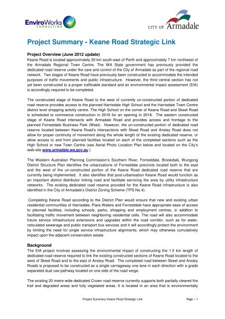
<strong>Project</strong> <strong>Summary</strong> - <strong>Keane</strong> <strong>Road</strong> <strong>Strategic</strong> <strong>Link</strong><br />
<strong>Project</strong> Overview (June 2012 update)<br />
<strong>Keane</strong> <strong>Road</strong> is located approximately 20 km south-east <strong>of</strong> Perth and approximately 7 km northwest <strong>of</strong><br />
the <strong>Armadale</strong> Regional Town Centre. The WA State government has previously provided the<br />
dedicated road reserve under the care and control <strong>of</strong> the <strong>City</strong> <strong>of</strong> <strong>Armadale</strong> as part <strong>of</strong> the regional road<br />
network. Two stages <strong>of</strong> <strong>Keane</strong> <strong>Road</strong> have previously been constructed to accommodate the intended<br />
purposes <strong>of</strong> traffic movements and public infrastructure. However, the third central section has not<br />
yet been constructed to a proper trafficable standard and an environmental impact assessment (EIA)<br />
is accordingly required to be completed.<br />
The constructed stage <strong>of</strong> <strong>Keane</strong> <strong>Road</strong> to the west <strong>of</strong> currently un-constructed portion <strong>of</strong> dedicated<br />
road reserve provides access to the planned Harrisdale High School and the Harrisdale Town Centre<br />
district level shopping activity centre. The High School on the corner <strong>of</strong> <strong>Keane</strong> <strong>Road</strong> and Skeet <strong>Road</strong><br />
is scheduled to commence construction in 2016 for an opening in 2018. The eastern constructed<br />
stage <strong>of</strong> <strong>Keane</strong> <strong>Road</strong> intersects with <strong>Armadale</strong> <strong>Road</strong> and provides access and frontage to the<br />
planned Forrestdale Business Park (West). However, the un-constructed portion <strong>of</strong> dedicated road<br />
reserve located between <strong>Keane</strong> <strong>Road</strong>’s intersections with Skeet <strong>Road</strong> and Anstey <strong>Road</strong> does not<br />
allow for proper continuity <strong>of</strong> movement along the whole length <strong>of</strong> the existing dedicated reserve, or<br />
allow access to and from planned facilities located on each <strong>of</strong> the completed sections such as the<br />
High School or new Town Centre (see Aerial Photo Location Plan below and located on the <strong>City</strong>’s<br />
web-site www.armadale.wa.gov.au ).<br />
The Western Australian Planning Commission’s Southern River, Forrestdale, Brookdale, Wungong<br />
District Structure Plan identifies the urbanizations <strong>of</strong> Forrestdale precincts located both to the east<br />
and the west <strong>of</strong> the un-constructed portion <strong>of</strong> the <strong>Keane</strong> <strong>Road</strong> dedicated road reserve that are<br />
currently being implemented. It also identifies that post-urbanisation <strong>Keane</strong> <strong>Road</strong> would function as<br />
an important district distributor linking road and facilitate servicing the area by utility infrastructure<br />
networks. The existing dedicated road reserve provided for the <strong>Keane</strong> <strong>Road</strong> infrastructure is also<br />
identified in the <strong>City</strong> <strong>of</strong> <strong>Armadale</strong>’s District Zoning Scheme (TPS No.4).<br />
Completing <strong>Keane</strong> <strong>Road</strong> according to the District Plan would ensure that new and existing urban<br />
residential communities <strong>of</strong> Harrisdale, Piara Waters and Forrestdale have appropriate ease <strong>of</strong> access<br />
to planned facilities, including schools, parks, shopping and employment centres, in addition to<br />
facilitating traffic movement between neighboring residential cells. The road will also accommodate<br />
future service infrastructure extensions and upgrades within the road corridor, such as for water,<br />
reticulated sewerage and public transport bus services and it will accordingly protect the environment<br />
by limiting the need for single service infrastructure alignments, which may otherwise cumulatively<br />
impact upon the adjacent conservation estate.<br />
Background<br />
The EIA project involves assessing the environmental impact <strong>of</strong> constructing the 1.5 km length <strong>of</strong><br />
dedicated road reserve required to link the existing constructed sections <strong>of</strong> <strong>Keane</strong> <strong>Road</strong> located to the<br />
west <strong>of</strong> Skeet <strong>Road</strong> and to the east <strong>of</strong> Anstey <strong>Road</strong>. The completed road between Skeet and Anstey<br />
<strong>Road</strong>s is proposed to be constructed as a single carriageway one lane in each direction with a grade<br />
separated dual use pathway located on one side <strong>of</strong> the road verge.<br />
The existing 20 metre wide dedicated Crown road reserve currently supports both partially cleared fire<br />
trail and degraded areas and fully vegetated areas. It is located in an area that is environmentally<br />
<strong>Project</strong> <strong>Summary</strong> <strong>Keane</strong> <strong>Road</strong> <strong>Strategic</strong> <strong>Link</strong> Page | 1
sensitive and supporting natural vegetation, including a portion classified as Conservation Category<br />
Wetland.<br />
In accordance with WA government’s Bush Forever Site Implementation Guideline Practice Notes for<br />
existing dedicated road reserves identified in Town Planning Schemes, the <strong>City</strong> <strong>of</strong> <strong>Armadale</strong> intends<br />
to design and construct the road network serving the rapidly developing residential communities <strong>of</strong><br />
Harrisdale, Piara Waters and Forrestdale, in a way that is sensitive to and which minimizes impacts<br />
on the environment.<br />
Construction <strong>of</strong> the currently non-trafficable section <strong>of</strong> <strong>Keane</strong> <strong>Road</strong> will require the clearing <strong>of</strong><br />
approximately 2 ha <strong>of</strong> existing vegetation from the dedicated road reserve. Through careful alignment,<br />
design and construction the <strong>City</strong> <strong>of</strong> <strong>Armadale</strong> will aim to substantially reduce the amount <strong>of</strong> vegetation<br />
clearing that would otherwise be required for a similar district distributor road. This will be acheived<br />
through a range <strong>of</strong> measures including route selection, utilising previously cleared areas and refining<br />
the alignment to avoid vegetated areas as much as possible. The area <strong>of</strong> native vegetation that will be<br />
required to be cleared for road construction represents less than 1% <strong>of</strong> the 296.4 ha <strong>of</strong> the adjacent<br />
protected bushland area.<br />
The <strong>City</strong> <strong>of</strong> <strong>Armadale</strong> has referred the construction <strong>of</strong> a contiguous trafficable <strong>Keane</strong> <strong>Road</strong> and dual<br />
use pathway identified by the District Structure Plan, District Zoning Scheme and the already provided<br />
dedicated road reserve (connected to the regional road network) to the WA Environmental Protection<br />
Authority (EPA) under Part IV <strong>of</strong> the Environmental Protection Act 1986 (the EP Act) so that the<br />
project can be properly assessed. The <strong>City</strong> is preparing the comprehensive Public Environmental<br />
Review (PER) documentation which the EPA requires for the project.<br />
The <strong>City</strong> also referred the proposal to the Federal Department <strong>of</strong> Sustainability, Environment, Water,<br />
Population and Communities for consideration <strong>of</strong> National Environmental Significance in accordance<br />
with the Environmental Protection and Biodiversity Conservation Act 1999 (EPBC Act) (SEWPaC was<br />
formerly Department <strong>of</strong> Environment, Water Heritage and Arts). The <strong>City</strong>’s referral documentation was<br />
advertised on the SEWPaC website for public notification on 12 August 2009. For further clarification,<br />
please refer to following web-link:<br />
http://www.environment.gov.au/cgibin/epbc/epbc_ap.pl?name=current_referral_detail&proposal_id=5035<br />
Information on the Commonwealth Department <strong>of</strong> SEWPaC’s assessment <strong>of</strong> the project will be<br />
posted separately on the <strong>City</strong>’s website including any information provided on the form <strong>of</strong> assessment<br />
and/or opportunities for public involvement. The WA State EPA and the Commonwealth Department<br />
<strong>of</strong> SEWPaC will carry out separate and independent assessments <strong>of</strong> constructing the last section <strong>of</strong><br />
<strong>Keane</strong> <strong>Road</strong>. The <strong>City</strong> would need to obtain approval under both State and Commonwealth<br />
jurisdictions for implementation <strong>of</strong> road construction works to commence.<br />
If the <strong>City</strong> receives the respective approvals for completion <strong>of</strong> the road from the WA and<br />
Commonwealth Ministers for the Environment, their decisions will also set appropriate environmental<br />
guidelines and conditions to be implemented as part <strong>of</strong> the road’s future construction by the <strong>City</strong> <strong>of</strong><br />
<strong>Armadale</strong>.<br />
To compensate for the approximately 2 ha <strong>of</strong> native vegetation required to be cleared for the last<br />
section <strong>of</strong> <strong>Keane</strong> <strong>Road</strong> the <strong>City</strong> also proposes to implement “Environmental Offset” benefits for the<br />
Forrestdale locality as part <strong>of</strong> the project and in accordance with its principles <strong>of</strong> environmental and<br />
biodiversity management. These will be negotiated with the regulators and land manager agencies<br />
<strong>Project</strong> <strong>Summary</strong> <strong>Keane</strong> <strong>Road</strong> <strong>Strategic</strong> <strong>Link</strong> Page | 2
and may include improvements to the protection and management <strong>of</strong> the adjacent bushland areas<br />
(currently subject to chronic long term degradation caused by <strong>of</strong>f road vehicles and rubbish dumping<br />
activities), reinstatement <strong>of</strong> degraded areas and/or transfer <strong>of</strong> additional areas <strong>of</strong> native vegetation in<br />
the <strong>City</strong> <strong>of</strong> <strong>Armadale</strong> into the conservation estate for long term protection and management for<br />
conservation.<br />
Revision <strong>of</strong> PER Document<br />
A completed draft <strong>of</strong> the PER documentation was sent to the EPA in May 2010. The Office <strong>of</strong> the EPA<br />
(OEPA) reviewed the document and required the <strong>City</strong> to submit further information before the<br />
document could be released to the public for review and comments. In response to OEPA the <strong>City</strong> <strong>of</strong><br />
<strong>Armadale</strong> has accordingly prepared additional studies.<br />
The revised PER document is anticipated to be submitted to the EPA by the end <strong>of</strong> July 2012. The<br />
<strong>City</strong> will request that the EPA release the PER for written public submissions and the EPA will<br />
determine if the documentation is adequate for release to the public for comment and provide details<br />
<strong>of</strong> advertising and notification requirements and timeframes.<br />
Once the period for formal written public submissions has been confirmed by the EPA the <strong>City</strong> <strong>of</strong><br />
<strong>Armadale</strong> will notify key stakeholders and post the date <strong>of</strong> the PER formal public comment period on<br />
its website.<br />
Environmental Studies<br />
The Environmental Impact Assessment will be based on the outcomes and recommendations <strong>of</strong> the<br />
following environmental studies. The relevant environmental study reports will be amended to comply<br />
with the additional requirements advised by the EPA and SEWPaC prior to their release <strong>of</strong> the EIA<br />
documentation into the next written submissions stages <strong>of</strong> the State and Commonwealth assessment<br />
processes.<br />
Study Scope<br />
Flora and Vegetation • Identify and map the distribution <strong>of</strong> any rare or priority flora found<br />
across the proposed development.<br />
• Identify and map the distribution <strong>of</strong> floristic vegetation communities<br />
including any Threatened Ecological Community (TEC) found on the<br />
site.<br />
• Identify any weeds and their distribution across the site.<br />
• Report on the vegetation condition, environmental threats and<br />
protection needed throughout Bush Forever Site 342.<br />
• Determine management strategies for any potential vegetation<br />
impacts identified.<br />
Fauna • Identify and record the location <strong>of</strong> any rare or priority fauna (and/or<br />
significant fauna habitat) found across the proposed development.<br />
• Report on the specially protected fauna, population status, fauna<br />
habitats, environmental threats and protection needed.<br />
• Determine management strategies for any potential fauna impacts<br />
identified.<br />
• Consider local fauna movement in the design <strong>of</strong> the road.<br />
Cultural Heritage • Undertake a desktop review (DIA database search already<br />
conducted) <strong>of</strong> previous Archaeological and Ethnographic consultancy<br />
reports and relevant European sources for previously recorded<br />
heritage sites.<br />
<strong>Project</strong> <strong>Summary</strong> <strong>Keane</strong> <strong>Road</strong> <strong>Strategic</strong> <strong>Link</strong> Page | 3
Study Scope<br />
• Undertake an archaeological and ethnographic survey and consult<br />
with Indigenous representatives.<br />
• Map the location <strong>of</strong> any heritage sites.<br />
• Determine management strategies for any potential cultural heritage<br />
impacts identified.<br />
Noise • Advise on relevant regulatory requirements that must be met.<br />
• Undertake noise prediction to determine likely noise levels and<br />
compare against relevant regulatory requirements.<br />
• Determine management measures to mitigate noise levels if required.<br />
Surface Water,<br />
Wetland/Dampland<br />
Impacts<br />
Acid Sulphate Soils<br />
(ASS)<br />
• Identify the surface flows/catchments relevant to the proposed<br />
development.<br />
• Identify potential impacts <strong>of</strong> the proposed road construction and<br />
operation including changes to surface flows and surface water<br />
quality.<br />
• Discuss potential impacts with the botanist and zoologist engaged to<br />
undertake the environmental impact assessment and determine<br />
potential impacts to wetland/dampland ecology.<br />
• Determine appropriate management measures to mitigate any<br />
potential impacts on the surface water and surrounding wetland/<br />
dampland habitat, including conceptual surface water management<br />
design.<br />
• Identify the presence <strong>of</strong> ASS within the proposed development<br />
• If present, identify and map the distribution <strong>of</strong> any ASS.<br />
• Determine appropriate management measures to mitigate any<br />
potential impacts if present.<br />
Dieback • Identify the presence <strong>of</strong> dieback within the proposed development and<br />
an appropriate surrounding buffer.<br />
• If present, identify and map the distribution <strong>of</strong> any Dieback across the<br />
proposed development area and an appropriate surrounding buffer.<br />
• Determine appropriate management measures to mitigate any<br />
potential impacts <strong>of</strong> the development.<br />
Environmental Management Plans<br />
Environmental Management Plans will be included in the PER as follows:<br />
• Vegetation, Weeds and Rehabilitation<br />
• Dieback<br />
• Fauna<br />
• Fire<br />
• Acid Sulphate Soils<br />
• Surface Water<br />
• Cultural Heritage<br />
• Noise<br />
• Dust<br />
• Spills<br />
• Waste.<br />
Social Impact Assessment<br />
<strong>Project</strong> <strong>Summary</strong> <strong>Keane</strong> <strong>Road</strong> <strong>Strategic</strong> <strong>Link</strong> Page | 4
A social impact assessment will form part <strong>of</strong> the project documentation released for written public<br />
submissions . Social impacts to be assessed and managed include:<br />
• Noise<br />
• Visual amenity<br />
• Dust<br />
• Safety<br />
• Traffic and Transportation<br />
• Cultural Heritage<br />
• Land use<br />
• Community access to Activity Centres and services.<br />
Consultation<br />
The anticipated consultation framework for the project involves the following activities (Note:<br />
information on timelines will be posted on the <strong>City</strong> <strong>of</strong> <strong>Armadale</strong>’s website):<br />
Activity Timeframes<br />
Mail out <strong>of</strong> initial project & contact information to November 2008 (complete)<br />
local residents, stakeholder and interest groups<br />
<strong>Project</strong> <strong>Summary</strong> information placed on website November 2008 (complete)<br />
Stakeholder meetings & EIA Process updates Ongoing<br />
Updates <strong>of</strong> Website EIA Process information Ongoing<br />
Formal Public Review Period When EIA documents are released by<br />
regulatory agencies the public & local<br />
residents, stakeholder & interest groups will<br />
be invited to make formal written submissions<br />
Formal Appeals Period The public also have an opportunity to appeal<br />
the regulator’s assessments at the final stage<br />
<strong>Project</strong> <strong>Summary</strong> <strong>Keane</strong> <strong>Road</strong> <strong>Strategic</strong> <strong>Link</strong> Page | 5
How to get involved<br />
• Join your local residents association, ‘friends’ or land care groups<br />
• Write a letter to the <strong>City</strong> <strong>of</strong> <strong>Armadale</strong><br />
• Write a submission during the public review or appeals period<br />
• Go to www.armadale.wa.gov.au for regular EIA project updates<br />
• Contact the <strong>City</strong> <strong>of</strong> <strong>Armadale</strong> on info@armadale.wa.gov.au<br />
• If you wish to discuss a particular issue contact one <strong>of</strong> the people listed below.<br />
The <strong>City</strong> <strong>of</strong><br />
<strong>Armadale</strong><br />
EnviroWorks<br />
Consulting<br />
Mr. James Robinson Manager <strong>Strategic</strong> 9399 0111<br />
Planning<br />
info@armadale.wa.gov.au<br />
Ms. Laura Todd Director 9221 9500<br />
laura.todd@enviroworks.com.au<br />
<strong>Project</strong> <strong>Summary</strong> <strong>Keane</strong> <strong>Road</strong> <strong>Strategic</strong> <strong>Link</strong> Page | 6


