

BASE_book_RZ_2712_screen

You also want an ePaper? Increase the reach of your titles
YUMPU automatically turns print PDFs into web optimized ePapers that Google loves.
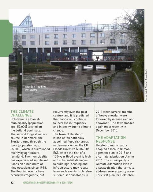
Storåen flooding,<br />
Holstebro<br />
Photos: Jakob Stoktoft Oddershede<br />
The Climate<br />
Challenge<br />
Holstebro is a Danish<br />
municipality (population<br />
app. 57,000) located on<br />
the Jutland peninsula.<br />
The second longest watercourse<br />
in Denmark, the<br />
Storåen, runs through the<br />
town (population app.<br />
35,000), which is surrounded<br />
mainly by agricultural<br />
farmland. The municipality<br />
has experienced significant<br />
floods on a minimum of<br />
nine occasions since 1918.<br />
The flooding events have<br />
occurred irregularly, but<br />
recurrently over the past<br />
century and it is predicted<br />
that floods will continue<br />
to increase in frequency<br />
and intensity due to climate<br />
change.<br />
The town of Holstebro<br />
is one of ten nationally<br />
appointed flood risk areas<br />
in Denmark under the EU<br />
Floods Directive (2007/60/<br />
EC), where the risk of a<br />
100-year flood event is high<br />
and substantial damages<br />
to buildings, housing and<br />
infrastructure may result<br />
from such events. Holstebro<br />
suffered serious floods in<br />
2011 when several months<br />
of heavy snowfall were<br />
followed by intense rain and<br />
snowmelt. The town flooded<br />
again most recently in<br />
December 2015.<br />
The Adaptation<br />
Response<br />
Holstebro municipality<br />
adopted a local risk management<br />
plan in 2015 and<br />
a climate adaptation plan in<br />
2014. The municipality’s<br />
Climate Adaptation Plan is<br />
a strategic plan that aims to<br />
address several policy areas.<br />
This first plan for Holstebro<br />
32 Agriculture & Forestry/Biodiversity & Ecosystem