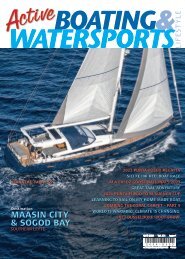
ABW Sept 2018-1

Create successful ePaper yourself
Turn your PDF publications into a flip-book with our unique Google optimized e-Paper software.
the extreme southwest and spills off to the northern<br />
shore of Boac, divides the municipality into two<br />
geographical areas: north and south.<br />
The closest town-to-town reference to Boac is the<br />
municipality of Mogpog which is approximately 5<br />
kilometers. Boac is connected to Mogpog and Gasan<br />
by the Marinduque Circumferential Highway or the<br />
Pan-Marinduque Highway. Two bridges connect<br />
the north and south area of the municipality: the<br />
narrow Tabi Bridge which connects Brgy. Tabi and<br />
Brgy. San Miguel and the said-to-be the longest<br />
bridge in the province, Biglang Awa Bridge (186<br />
m), which connects Brgy. Tampus and Brgy. Bantad.<br />
A narrow minor road connects Boac and Mogpog<br />
via Buliasnin-Nangka Road, and Boac and Gasan via<br />
Duyay-Tapuyan Trail. Boac has a total road network<br />
of 117.61 kilometers. Geopolitically, Boac is divided<br />
into six zones: Poblacion, Riverside, Ilaya I, Ilaya II,<br />
Seaside A and Seaside B. Boac’s geographical centre<br />
is roughly located between the border of Brgy.<br />
Binunga and Brgy. Can-at.<br />
Mogpog and the Paadjao Falls<br />
The township of Mogpog (the name is derived from<br />
the Tagalog word ma-apog which means abundance<br />
of lime, lies a few kilometers from Balanacan port<br />
and has a lot for the visitor to see. Spectacular<br />
views over Balanacan cove and the islands between<br />
Marinduque and Lucena can be seen from the<br />
View Deck which is located by the statue of ‘Ina<br />
61