You also want an ePaper? Increase the reach of your titles
YUMPU automatically turns print PDFs into web optimized ePapers that Google loves.
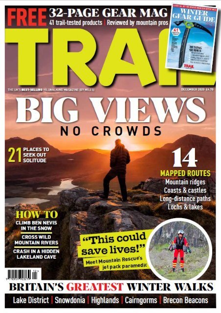
<strong>Trail</strong>, H Bauer Publishing, Media House, Lynch Wood,<br />
Peterborough, PE2 6EA Email trail@bauermedia.co.uk<br />
Prefix all 6-digit phone numbers with 01733<br />
EDITORIAL<br />
01733 468<strong>20</strong>5<br />
Editor Oli Reed<br />
Deputy editor Jenna Maryniak<br />
Art editor Louise Parker<br />
Head of publishing Shane Collins<br />
Senior writer Ben Weeks<br />
Senior editorial assistant Sara Herbert-Mattick<br />
Photographer Tom Bailey<br />
Map illustrator Steve Hall<br />
28<br />
Lakeland pilgri<strong>mag</strong>e<br />
Join us on the trail of two<br />
mountain-dwelling men.<br />
Legends or eccentrics?<br />
You decide!<br />
At the summit area of Dodd,<br />
a fell south-west of Skiddaw,<br />
following in the footsteps<br />
of the Skiddaw Hermit.<br />
TOM BAILEY<br />
CONTENTS<br />
14<br />
MOUNTAIN ROUTES<br />
IN ASSOCIATION WITH<br />
ADVERTISING<br />
Commercial manager Anna Skuse (07887 993990)<br />
anna.skuse@bauermedia.co.uk<br />
Key account manager Joe Sheehan,<br />
joe.sheehan@bauermedia.co.uk<br />
Classified sales Chloe Sharpe,<br />
chloe.sharpe@bauermedia.co.uk<br />
MARKETING<br />
Marketing manager Naivette Bluff (468129)<br />
Direct marketing manager Julie Spires (468164)<br />
Newsstand marketing Samantha Thompson (468128)<br />
PRODUCTION<br />
Print production Colin Robinson (468072)<br />
Ad production leisureads@bauermedia.co.uk (468772)<br />
Printers William Gibbons Distribution Frontline<br />
SUBSCRIPTIONS<br />
To contact us about subscription orders, renewals,<br />
missing issues or any other subscriptions queries,<br />
please email bauer@subscription.co.uk or phone<br />
01858 438884 (UK) or +44 1858 438884 (overseas)<br />
DIGITAL ISSUES<br />
Head of e-publishing Jim Foster<br />
Email: digital<strong>mag</strong>azinesupport@bauermedia.co.uk<br />
BACK ISSUES<br />
To order back issues, please phone 01858 438884 (UK)<br />
or +44 1858 438884 (overseas)<br />
H BAUER PUBLISHING<br />
Managing director Sam Gallimore<br />
Editorial director June Smith-Sheppard<br />
Digital managing director Charlie Calton-Watson<br />
Chief financial officer Bauer Magazine Media<br />
Lisa Hayden<br />
CEO UK Publishing Chris Duncan<br />
President Bauer Media Publishing Rob Munro-Hall<br />
<strong>Trail</strong> is published 13 times a year by H Bauer Publishing.<br />
No part of the <strong>mag</strong>azine may be reproduced in any form in whole or in part, without the<br />
prior permission of Bauer. All material published remains the copyright of Bauer and<br />
we reserve the right to copy or edit any material submitted to the <strong>mag</strong>azine without<br />
further consent. The submission of material (manuscripts or i<strong>mag</strong>es etc) to Bauer,<br />
whether unsolicited or requested, is taken as permission to publish that material in<br />
the <strong>mag</strong>azine, on the associated website, any apps or social media pages affiliated<br />
to the <strong>mag</strong>azine, and any editions of the <strong>mag</strong>azine published by our licensees<br />
elsewhere in the world.<br />
By submitting any material to us you are confirming that the material is your own<br />
original work or that you have permission from the copyright owner to use the<br />
material and to authorise Bauer to use it as described in this paragraph.<br />
You also promise that you have permission from anyone featured or referred to in the<br />
submitted material to it being used by Bauer. If Bauer receives a claim from<br />
a copyright owner or a person featured in any material you have sent us,<br />
we will inform that person that you have granted us permission to use the relevant<br />
material and you will be responsible for paying any amounts due to<br />
the copyright owner or featured person and / or for reimbursing Bauer<br />
for any losses it has suffered as a result.<br />
Please note, we accept no responsibility for unsolicited material which is lost or<br />
da<strong>mag</strong>ed in the post and we do not promise that we will be able to return any material<br />
to you. Finally, while we try to ensure accuracy of your material when we publish it, we<br />
cannot promise to do so. We do not accept any responsibility for any loss or da<strong>mag</strong>e,<br />
however caused, resulting from use of the material<br />
as described in this paragraph.<br />
COMPLAINTS: H Bauer Publishing is a member of the Independent Press Standards<br />
Organisation (www.ipso.co.uk) and endeavours to respond to and resolve your<br />
concerns quickly. Our Editorial Complaints Policy (including full details of how to<br />
contact us about editorial complaints and IPSO’s contact details) can be found at<br />
www.bauermediacomplaints.co.uk. Our email for editorial complaints covered by the<br />
Editorial Complaints Policy is complaints@bauermedia.co.uk<br />
SYNDICATION DEPARTMENT: syndication@bauermedia.co.uk<br />
H Bauer Publishing is a company registered in England and Wales with company<br />
number LP003328, registered address Academic House, 24-28 Oval Road, London,<br />
NW1 7DT. VAT no 918 5617 01<br />
H Bauer Publishing and Bauer Consumer Media Ltd are authorised and regulated by<br />
the FCA (Ref No. 845898) and (Ref No. 710067) © Bauer <strong>20</strong><strong>20</strong><br />
6 Peak of the Month<br />
Highland icon: Suilven<br />
8 Base Camp<br />
Happenings from high places<br />
12 Mountains for the Mind<br />
Mental health – out in the open<br />
14 Nature notes<br />
Mountains by moonlight<br />
16 Out There<br />
Adventure stories from you lot<br />
18 Everest Anywhere<br />
Can you climb 8848m this year?<br />
56 Hot Topic<br />
Grouse moors: For or against?<br />
62 Mountain skills<br />
Top advice from <strong>Trail</strong>’s experts<br />
FEATURES<br />
<strong>20</strong><br />
36<br />
42<br />
Big views, no crowds<br />
Find 21 ways to mountain heaven,<br />
with our round-up of the very best<br />
mountain views the UK has to offer<br />
Lonscale Fell<br />
Hiding in plain sight, within striking<br />
distance of Keswick, this could be<br />
Lakeland’s best ‘secret’ panorama<br />
Mountain rivers<br />
There’s nothing like a cold dunking to<br />
sharpen the senses! Learn from our<br />
mistakes and make your next river<br />
crossing less nerve-shredding<br />
46<br />
weekend hideaway in<br />
the heart of Snowdonia<br />
Mountain<br />
base camp<br />
Discover<br />
this historic<br />
50<br />
GEAR<br />
68 FIRST LOOK<br />
Great value Lomo<br />
trekking poles<br />
70 BIG TEST<br />
The best winter<br />
walking boots<br />
75 GEAR<br />
DISSECTED<br />
Ice grippers<br />
76 HEAD TO HEAD<br />
Down jackets<br />
Rescue on The Ben<br />
We delve into the <strong>Trail</strong> archive for winter ascent<br />
of Ben Nevis’ Ledge Route led by mountaineer<br />
Alan Hinkes, with a shock at the summit<br />
85 Helvellyn, Lake District<br />
87 Ebbor Gorge, Mendip Hills<br />
89 Craster to Beadnell, Northumberland<br />
91 Bynack More & Beg, Cairngorms<br />
93 Ben Venue, Trossachs<br />
95 Tryfan’s Heather Terrace, Snowdonia<br />
ULTIMATE WEEKENDS<br />
97 Brecon Beacons, South Wales<br />
101 Cumbria Way, Lake Districtw<br />
WALKS OF A LIFETIME<br />
105 Carneddau, Snowdonia<br />
BRITAIN’S GREATEST SCRAMBLES<br />
110 Suilven, Assynt<br />
40 SUBSCRIBE TO TRAIL<br />
SAVE OVER £21<br />
4 TRAIL DECEMBER <strong>20</strong><strong>20</strong>
LAKE DISTRICT<br />
LITTLE MAN<br />
SKIDDAW<br />
LONSCALE FELL<br />
SALE HOW<br />
BAKESTALL<br />
BURNT HORSE RIDGE<br />
SKIDDAW HOUSE<br />
STEWART SMITH / ALAMY<br />
HIDING IN<br />
PLAIN SIGHT<br />
Skiddaw is one of Lakeland’s main draws, but hardly anyone notices the<br />
sharp-edged outlier on its craggy eastern flank. Introducing Lonscale Fell...<br />
WORDS SARAH RYAN<br />
Looking up at Skiddaw, the fourth highest hill in England, is like gazing<br />
towards a throne of the gods. The kind of thing Zeus might sit on, if he<br />
were a Cumbrian lad. All long, straight slopes and rounded summits, its<br />
imposition comes from its bulk. There are no razor ridges or needle-sharp<br />
peaks – it is just plain massive. With neighbouring Blencathra, its twin<br />
King of the Northern Lakes, it presides over the fells. But what’s this?<br />
To the east, between these two mammoth mountains, is an acute edge.<br />
A sheer cliff, clear enough to be seen from all the way down on the A66.<br />
It drops as clearly and as smoothly as a tablecloth, sweeping elegantly to the floor.<br />
On pointier hills, this shelf might not be so distinctive but on humpy ol’ Skiddaw<br />
it jumps out a mile. This is Lonscale Fell, one of the seven Wainwrights which<br />
encircle Skiddaw’s summit like orbiting moons, making up the massif. This jutting<br />
ledge, carved between behemoths, offers some of the best views of the Lakes.<br />
When cloud swathes the high summits, the sights that can be seen from this outlier<br />
are some of the best. And how do you get there but trek up a dramatic valley,<br />
climb a sweeping spur, peep into the most remote areas of the Lakes and<br />
walk home into a <strong>mag</strong>nificent view of arrayed mountains and lakes slashed<br />
with silver. All nabbed with four hours on the clock.<br />
<br />
36 TRAIL DECEMBER <strong>20</strong><strong>20</strong> DECEMBER <strong>20</strong><strong>20</strong> TRAIL 37
Looking across to Lonscale<br />
Crags from the lower<br />
flanks of Blease Fell.<br />
LAKE DISTRICT<br />
“THE SUN BEAMS<br />
ACROSS TOPS I’VE NEVER<br />
SEEN OR BOTHERED TO<br />
IMAGINE BEFORE”<br />
Lonscale Fell’s nose<br />
is as well defined as<br />
any model profile.<br />
TOM BAILEY<br />
Our route starts at the car park<br />
between Latrigg (another short jaunt<br />
with brilliant views and gentle grassy<br />
slopes) and Lonscale Fell. To gain<br />
the best views of the crags which give<br />
Lonscale its distinctive, dramatic edge,<br />
we crossed to the Blencathra side of<br />
Glenderaterra Beck. This is the valley<br />
which carves Skiddaw away from<br />
Blencathra. A long deep cleft separating<br />
the two massifs. Glenderaterra splashes<br />
away downhill, its clear, cold waters<br />
daily making that cleft a little deeper.<br />
Ever-changing landscape<br />
We take the higher path that cuts<br />
along the western slopes of Blencathra,<br />
above the burn. The crags shoot up<br />
almost immediately to our left. They<br />
are dark, steep and crumbling. The true<br />
summit of Lonscale Fell stands back<br />
from the edge and out of view.<br />
But the second summit and highest<br />
of the crags, at 703m just 12m below<br />
the summit proper, is perpetually in<br />
view. The crags concertina in folds<br />
of constantly eroding rock. Near the<br />
bottom of the valley, where the burn<br />
has worn away parts of the lower walls,<br />
they fall away in immense landslides,<br />
leaving swathes of open earth.<br />
As time passes, mosses lace the crumbs<br />
together and some of these giant bites are<br />
now covered with a fuzz of pale green.<br />
The story of this valley can be read in<br />
records which are still being written –<br />
those of falling rocks and rain.<br />
You can clamber up these crags,<br />
which stick out like bony ribs. The<br />
east ridge, which skirts the scree slopes<br />
just below the second summit, offers a<br />
relentlessly steep scrabble through loose<br />
rock and heather directly to the top.<br />
If you gobble up painful challenges<br />
like other people consume jelly babies,<br />
then this one is for you.<br />
Burnt Horse ridge<br />
But not for us this time. We want the<br />
sweet remoteness of the far northern<br />
fells, which are all too often ignored. The<br />
Blencathra track crosses the burn near the<br />
head of the valley and joins the Cumbria<br />
Way at a boulder carved with ‘Keswick’<br />
in all caps. Follow it south and, after<br />
the promised town, it will lead you on<br />
a 112km (70 miles) walk through the<br />
entire Lake District, to Ulverston.<br />
It’s a very nice path, made for people<br />
just like us and we abandon it almost<br />
immediately, taking to the tail end of<br />
Burnt Horse ridge. The slope up the<br />
ridge is grassy, insistent and never quite<br />
steep. A cool haze of rain drifts over my<br />
face and bare hands and – tzeep-tzeeptzeep!<br />
– a meadow pipit darts past with<br />
a lazer-sharp call. The ridge begins at<br />
around 400m and, on these easy slopes,<br />
you gain height fast. And when we stop to<br />
look behind we’re greeted with a totally<br />
surprise view – a massif of remote, green<br />
hillside which fills the vision. The sun<br />
beams across tops I have never seen or<br />
bothered to i<strong>mag</strong>ine before. There is not<br />
a road or hamlet anywhere between them.<br />
Kilometres of grass, bracken and heather<br />
are broken only by narrow streams and<br />
barely-there paths. The Cumbria Way<br />
slips between the contours and past<br />
Skiddaw House hostel. At 470m, it’s<br />
the highest hostel in Britain but we’re<br />
quite a way above it already. The clouds<br />
part and a burst of sunlight hits the fells.<br />
Trio of massifs<br />
We are looking into the centre of the<br />
Northern Fells. From here, three valleys<br />
shoot out, separating the three big<br />
massifs: Skiddaw, Blencathra to the<br />
right, and the Caldbeck and Uldale fells<br />
ahead. A giant pie in three big, tasty<br />
chunks. And in front of us is a slice<br />
I’ve never even considered before.<br />
Like on Skiddaw, there are few<br />
compelling edges here, no terrifying<br />
spikes. Wainwright basically describes<br />
them as a gigantic sheep pasture. And<br />
yet, standing in the mizzle and looking<br />
out at these wide hills, as a faint rainbow<br />
appears in the haze, I feel a twitch in my<br />
feet. This is big, unfrequented country.<br />
Wainwright, it seems, felt something<br />
similar, and after his pretty damning<br />
initial assessment acknowledges that:<br />
“Although relatively unexciting in scenic<br />
quality... these hills afford excellent<br />
tramping and an exhilarating freedom to<br />
wander at will”. This is a place to escape.<br />
The quiet side<br />
There is no escaping the climb, however,<br />
and we turn back to the hill we are<br />
already on. I remember that this is part<br />
of Skiddaw, an outlying fell of one of the<br />
most popular hills in the Lake District<br />
and we haven’t seen anyone up here at<br />
all. I can i<strong>mag</strong>ine, as I traipse upwards,<br />
that few people ever visit this side of<br />
the hill. And just as I think it, we find<br />
something else worth visiting.<br />
At the edge of my boots are a few<br />
fronds of heather and below them a long,<br />
rocky drop to a deep bowl. A nameless<br />
stream chucks itself down the slopes,<br />
filling the bowl with marshy green. At<br />
the edge of a shallow corrie, we have<br />
reached the first of the crags that we’ll<br />
follow almost all the way to the top.<br />
Misty mountains<br />
Silver lichen sprawls amid the heather<br />
and luminous moss. It’s damp and cool<br />
and the air is clean. Good for plants and<br />
good for humans. A line of trampled<br />
grass cuts narrowly between the fence<br />
and we follow that fence uphill. It’s the<br />
last pull, and the steepest, taking us<br />
almost directly to the summit. From<br />
there, we should be able to look over to<br />
Skiddaw on one side, Blencathra on the<br />
other, to the unfrequented north and<br />
south to the busy Lakeland heights.<br />
Ah ‘should’, that word which, in the<br />
hills, always comes with a silent ‘if you’re<br />
lucky’. We turn in every direction and<br />
look into the same shifting grey cloud.<br />
Our summit is swathed in mist. It’s a<br />
bare pate of a top and only half the<br />
reason we’re here anyway so we abandon<br />
it, at the top of the crags. Here, the cloud<br />
whips up from the valley below, the<br />
stream a thin streak. Blencathra emerges<br />
for a minute, so big we can only see a<br />
small portion of it, and we turn south to<br />
follow these crags as far as they’ll go.<br />
The gradient is the kind that allows<br />
your feet to fall you home, adding just<br />
enough gravity to help, rarely enough to<br />
tumble. So we chat and trot down until,<br />
after we have given up all hope, there,<br />
emerging quite quickly, is that Lakeland<br />
view. There it finally is.<br />
Classic Lakeland vistas<br />
We can see Helvellyn and the Dodds;<br />
Low, High and Castle Riggs; Derwent<br />
Water gleaming and the jostle of northwestern<br />
hills. The Lake District is laid<br />
out before us and we look out with the<br />
knowledge that some of the highest,<br />
most exciting peaks in the country are<br />
secreted not far away at all. The fading<br />
sunlight casts a warm glow across the<br />
hills and the lakes shine like <strong>mag</strong>nesium.<br />
For a short jaunt, this little fell gives a<br />
lot. And, if the urge takes, you can gobble<br />
the distance from its top to Skiddaw in<br />
an almost straight line north-west. For<br />
us though, it is time to head home.<br />
As we descend the larch turns lemon<br />
yellow, birch trees flicker with golden<br />
leaves, oak trees fade to red. Between<br />
them twists the white line of the River<br />
Greta, flowing into the silver pool of<br />
Derwent Water. We make the car door<br />
almost without breaking stride. T<br />
The green<br />
undulations of<br />
Burnt Horse ridge.<br />
11.5km DISTANCE<br />
832m ASCENT<br />
4hrs ON THE HILL<br />
38 TRAIL DECEMBER <strong>20</strong><strong>20</strong> DECEMBER <strong>20</strong><strong>20</strong> TRAIL 39
MOUNTAINS<br />
FOR<br />
THE MIND<br />
MENTAL HEALTH:<br />
OUT IN THE OPEN<br />
Mountains for the Mind is a <strong>Trail</strong> <strong>mag</strong>azine<br />
campaign that promotes the amazing benefits<br />
of spending time outdoors for your mental health.<br />
HELP US MAKE<br />
A DIFFERENCE<br />
We want to change the way people think and<br />
talk about mental health, and to encourage<br />
everyone to lead an active outdoor lifestyle<br />
JOIN OUR<br />
COMMUNITY<br />
Connect with more than 13,000 passionate<br />
walkers, hikers, backpackers and outdoor<br />
enthusiasts in our Facebook group.<br />
COME ON A<br />
GROUP WALK<br />
Every month we organise free guided<br />
mountain walks, in line with current social<br />
distancing guidelines. Perfect for beginners<br />
and for meeting other like-minded walkers.<br />
FUNDRAISE FOR MENTAL<br />
HEALTH CHARITIES<br />
So far we’ve raised over £10,000 for mental<br />
health charities – find out how you can<br />
help us reach the next milestone.<br />
mountainsforthemind.co.uk<br />
SUPPORTED BY OUR OFFICIAL PARTNERS:<br />
DECEMBER <strong>20</strong><strong>20</strong> TRAIL 115
PLAN<br />
100<br />
YOUR FUTURE<br />
MOUNTAIN<br />
TRIPS!<br />
THE UK’S ULTIMATE MOUNTAIN BUCKET LIST<br />
Hand-picked by the experts at <strong>Trail</strong> <strong>mag</strong>azine, the <strong>Trail</strong> 100 is the definitive<br />
collection of 100 peaks that every hillwalker must climb in their lifetime<br />
INCLUDING…<br />
BEN NEVIS SNOWDON HELVELLYN<br />
SCAFELL PIKE KINDER SCOUT TRYFAN<br />
BUACHAILLE ETIVE MOR BOWFELL SLIOCH<br />
AN TEALLACH CONISTON OLD MAN BEN MACDUI<br />
GREAT GABLE PEN Y FAN INGLEBOROUGH CADAIR IDRIS<br />
BEN HOPE GLYDER FACH CROSS FELL SKIDDAW THE CALF YES TOR<br />
For detailed descriptions of each peak, digital route guides<br />
and a FREE peak bagging chart, go to LFTO.COM/TRAIL100<br />
MAGAZINE
SNOWDONIA<br />
The mighty Snowdon range<br />
in its winter coat, taken just a<br />
few miles down the road from<br />
Pen-y-Gwryd near Capel Curig.<br />
TOM BAILEY<br />
MOUNTAIN BASE CAMPS<br />
PEN-Y-GWRYD<br />
SNOWDONIA<br />
Located just east of the Llanberis Pass, the legendary Pen-y-Gwryd Hotel<br />
is a great base for hillwalkers that’s not only perfectly situated<br />
but also steeped in mountaineering history.<br />
WORDS MATT JONES<br />
The Llanberis Pass cuts across the heart of<br />
northern Snowdonia, dividing Snowdon from<br />
the boulder-strewn Glyderau. It also has a<br />
handily placed car park at Pen-y-Pass, which is the<br />
perfect starting point for an ascent of Wales’ highest<br />
peak. Unfortunately, everyone knows it. Pen-y-Pass<br />
is notoriously busy, and the car park – rammed at<br />
the best of times – hit the headlines for all the wrong<br />
reasons this year, when on the weekends either side of<br />
lockdown, hundreds of people who were unable to nab<br />
a parking space simply left their cars on the road. In<br />
July, things got so bad that Snowdonia National Park<br />
bosses were forced to close the car park entirely, with<br />
a police presence on hand to turn people away.<br />
Fortunately, there is another way. One that doesn’t<br />
entail arriving at 5am just to be sure of a parking<br />
space. The solution? Simply book yourself a cosy room<br />
at the Pen-y-Gwryd Hotel, ideally with a wonderfully<br />
stomach-busting five-course dinner, full Welsh<br />
breakfast the next morning and a walkers’ packed<br />
lunch thrown in too. Then all you need to do is start<br />
planning your memorable mountain weekend, with<br />
zero hassle guaranteed. There’s plenty of walks to pick<br />
from. In addition to Snowdon itself, the whole of the<br />
Glyderau and even Moel Siabod are all in easy reach.<br />
Of course, the Pen-y-Gwryd Hotel offers much<br />
more than its superb location. For anyone with a<br />
love of big mountains, it is a place of pilgri<strong>mag</strong>e.<br />
This hotel, after all, is where the 1953 Everest team,<br />
including Sir Edmund Hillary, stayed while training<br />
for their Himalayan expedition. You can see their<br />
signatures, along with those of many other illustrious<br />
mountaineers, on the ceiling of the Everest Room,<br />
on your left as you walk through the front doors of<br />
the hotel. And behind the bar is the residents’ only<br />
Smoke Room, which features an alcove of fascinating<br />
artefacts brought back from Everest, replete with<br />
everything from oxygen bottles to string vests. <br />
46 TRAIL DECEMBER <strong>20</strong><strong>20</strong> DECEMBER <strong>20</strong><strong>20</strong> TRAIL 47
Walking high on<br />
Moel Siabod.<br />
The Pen-y-Gwryd Hotel,<br />
with Snowdon behind.<br />
IAN NELLIST/ALAMY<br />
Near the summit<br />
of Glyder Fach.<br />
SNOWDONIA<br />
4 great walks from Pen-y-Gwryd<br />
Glyder Fach<br />
& Glyder Fawr<br />
This comparatively quiet route into<br />
the heart of the Glyderau sets out from<br />
behind the Pen-y-Gwryd, making use<br />
of The Miner’s Track that snakes up<br />
the mountainside to reach the rocky,<br />
crested ridge above the pass. Follow it<br />
west to bag the two summits of Glyder<br />
Fach and Glyder Fawr, stopping en<br />
route to pose on the famous Cantilever<br />
Stone and scramble among the shattered<br />
crenellations of Castell y Gwynt. In<br />
high season it will be busy up here, but<br />
given that most walkers come up from<br />
Ogwen, you can soon leave them behind<br />
as you work your way down the broad<br />
shoulder of Glyder Fawr, with fabulous<br />
views towards Crib Goch and the<br />
Snowdon Horseshoe. To your left, look<br />
for the lake of Llyn Cwmffnnon, with<br />
the little-visited minor summit of Moel<br />
Berfedd perched above. The ground<br />
gradually gets boggier as you lose height,<br />
but fortunately the path also becomes<br />
clearer, eventually terminating at the<br />
stile beside the YHA. Then it’s just a case<br />
of crossing the A4086 to the car park<br />
©CROWN COPYRIGHT <strong>20</strong><strong>20</strong> ORDNANCE SURVEY. MEDIA 021/<strong>20</strong><br />
s Snowdon<br />
s Y Lliwedd<br />
s Crib Goch<br />
s Glyder Fawr<br />
1 2 3<br />
4<br />
at Pen-y-Pass and sauntering along the<br />
permissive path beneath the road, back<br />
to the reward of a crisp pint and a hot<br />
bath at the Pen-y-Gwryd.<br />
INSIDER INFO<br />
The Pen-y-Gwryd’s<br />
mountain links extend<br />
far back beyond the 1953<br />
Everest team’s stay there.<br />
It was also the birthplace<br />
of the Climbers Club in<br />
1898, while the legendary<br />
George Mallory spent<br />
a night here in 1914.<br />
The hotel’s guest<br />
bedrooms are named<br />
after each of Snowdonia’s<br />
13 peaks over 3000ft<br />
(910m).The hotel is also<br />
a Mountain Rescue Post,<br />
acknowledged by a plaque<br />
placed outside the main<br />
entrance.<br />
Crib Goch & the<br />
Snowdon Horseshoe<br />
An exposed but exhilarating Grade 1<br />
scramble along arguably the finest and<br />
certainly the most famous ridge route in<br />
Snowdonia, Crib Goch is widely known,<br />
very popular and often frustratingly<br />
busy. All too often you’ll be slowed by<br />
inexperienced walkers shuffling along<br />
the ridge, inch by tortuous inch. This<br />
can reduce what should be a memorable<br />
day out to a grim ‘once and never again’<br />
experience. To avoid this, plan ahead.<br />
Book into the Pen-y-Gwryd midweek,<br />
early on or late in the season. Pray to<br />
the mountain weather gods for a dry,<br />
calm day and get up early or, if you’re<br />
a more experienced scrambler, hold off<br />
until early evening. Fortunately, having<br />
the hotel as a base ensures you can easily<br />
get a good night’s sleep and still be up<br />
with the lark or happily while away<br />
the afternoon hours in the residents’<br />
lounge before setting out for Pen-y-Pass.<br />
From here, follow the Pyg Track until<br />
you reach Bwlch y Moch and look for a<br />
low slate sign marked ‘Crib Goch’. The<br />
initial climb towards the ridge is a little<br />
loose, but you soon get the chance to<br />
put hands on rock. The crossing itself<br />
narrows considerably, forcing you to<br />
stick to the crest, which is by far the<br />
best line to follow. The bravest and most<br />
comfortable ridge walkers just stride<br />
along the top, but most use the crest as a<br />
handrail while moving along just below<br />
The Pen-y-Gwryd’s most<br />
famous owners were<br />
Chris and Jo Briggs. They<br />
were succeeded by their<br />
daughter, Jane, who was<br />
known to upbraid men who<br />
wore their hats inside,<br />
sternly declaring:<br />
“Hats off in the house!”<br />
it on the left-hand side. Don’t forget<br />
to take in the staggering views, which<br />
rank among the best in Britain. Cross<br />
The Pinnacles to reach Bwlch Coch,<br />
then on to Garnedd Ugain before you<br />
reach the trig pillar at Crib-y-Ddysgl<br />
and ultimately, gain the summit of<br />
Snowdon. To complete the horseshoe,<br />
descend south-east from the summit<br />
via Y Lliwedd before following the<br />
path down to Llyn Llydaw, where<br />
you can pick up the Miners’ Track<br />
to return to Pen-y-Pass.<br />
Moel Siabod &<br />
Carnedd y Cribau<br />
The view from the residents’ lounge in the<br />
Pen-y-Gwryd looks out across the manmade<br />
trout lake of Llyn Pen-y-Gwryd<br />
to lonely Moel Siabod, which rears up<br />
proud and distinct, perfectly framed<br />
like a landscape painting. It is an almost<br />
irresistible target for a day walk from the<br />
Pen-y-Gwryd’s doorstep, and although the<br />
route out from here to Siabod’s summit is<br />
often thankless and squelchy, it’s the sort<br />
of thing that you do, as Mallory famously<br />
said, “because it’s there”. The walk<br />
starts from the stile opposite the hotel,<br />
following a faint path that peters out as<br />
you climb to a series of rocky outcrops,<br />
following a tributary of the Nant-y-llys.<br />
It’s a bit of a slog but try to avoid the<br />
boggiest ground – and perhaps take<br />
your mind off your wet feet by looking<br />
across the valley to jaw-dropping views of<br />
Keep an eye, or a nose,<br />
out for the feral goats<br />
who roam the Glyderau.<br />
You’re likely to smell them<br />
before you see them.<br />
Don’t be surprised to find<br />
them perched in some<br />
precarious places, or<br />
atop ladder stiles.<br />
If climbing Snowdon,<br />
look out for the Snowdon<br />
Lily, a rare arctic-alpine<br />
plant with beautiful white<br />
flowers and grass-like<br />
leaves that blooms in late<br />
May and early June. It has<br />
not been found anywhere<br />
outside Snowdonia.<br />
Snowdon. At Bwlch Rhiw’r Ychen, where<br />
four fences converge, cross the stile and<br />
ascend Siabod’s grassy western flanks,<br />
following the fence line that rises above<br />
Llynnau Diwaunydd to Moel Gîd. The<br />
trig pillar that marks the 872m summit<br />
of Moel Siabod – the highest point of the<br />
Moelwynion range – is further on, with<br />
far-reaching views down the spiny ridge<br />
of Daear Ddu. Descend past the summit<br />
shelter along the ridge before heading left<br />
to clamber down to the path back into<br />
Capel Curig. The going gets easier here,<br />
and winds down through forest to emerge<br />
at a footbridge to Plas Y Brenin. From<br />
here, the Snowdon Sherpa S2 bus will take<br />
you back to the Pen-y-Gwryd.<br />
Moel Berfedd<br />
It might seem a little perverse to stay<br />
somewhere within sight of Snowdonia’s<br />
most famous 3000ft peaks and instead<br />
climb a <strong>mini</strong> mountain that is marked on<br />
the Ordnance Survey map at just 482m.<br />
But diminutive Moel Berfedd offers<br />
far more than its modest spot-height<br />
s Glyder Fach<br />
Miner’s Track from PYG<br />
s Moel Berfedd<br />
suggests. It’s easy to plan a short, brisk<br />
circuit straight from the front door of<br />
the Pen-y-Gwryd that climbs quickly to<br />
the summit, loftily perched above Bwlch<br />
y Gwyddel and the busy A4086, before<br />
heading down to Pen-y-Pass and then<br />
picking up the footpath that leads back<br />
to the hotel. Leave the Pen-y-Gwryd and<br />
cross a stile, then pass through a gate to<br />
climb the boggy grass slope. Aim for the<br />
stone wall and then veer right slightly to<br />
negotiate a craggy section before heading<br />
back towards the wall, where there are<br />
some small, murky pools. The summit<br />
of Moel Berfedd is just over the brow, a<br />
unique vantage point that lies at the head<br />
of three valleys. But more impressive are<br />
the hulking Snowdon massif and the dark,<br />
brooding Glyderau. Leave the summit<br />
and follow a rough ridge, dotted with<br />
outcrops and patches of boggy ground.<br />
On a clear day, the glassy waters of Llyn<br />
Cwmffynnon reflect the crags and clouds<br />
above like a giant mirror. Descend to a<br />
col and then pick your way downhill<br />
to the YHA at Pen-y-Pass.<br />
Pen-y-Gwryd<br />
s Moel Siabod<br />
[ Plays y Brenin<br />
GETTING THERE<br />
The Pen-y-Gwryd is located 4 miles west of Capel<br />
Curig on the junction of the A4086 and A498. The<br />
nearest train stations are Bangor mainline station<br />
or Betws-y-Coed. Book a taxi if travelling via<br />
Betws-y-Coed. The Snowdon Sherpa S2, S4<br />
and S6 bus routes also stop at the Pen-y-Gwryd.<br />
WHERE TO EAT, DRINK & SLEEP<br />
n Pen-y-Gwryd Hotel<br />
Well, obviously – but for the full experience book a<br />
room in the main hotel with the shared bathrooms<br />
rather than the newer en-suite rooms. And don’t<br />
miss the three or five course evening meal,<br />
served when the dinner gong sounds.<br />
n Pen-y-Pass YHA<br />
If you can’t stretch to the Pen-y-Gwryd, the YHA<br />
hostel at Pen-y-Pass offers affordable dorm<br />
rooms or private rooms, with Mallory’s Restaurant<br />
and Bar on site, serving food and drink all day.<br />
HOW TO BOOK<br />
Due to COVID-19, at the time of writing the<br />
Pen-y-Gwryd Hotel is only open on Thursday,<br />
Friday and Saturday nights, offering en-suite<br />
rooms with continental breakfast and dinners,<br />
and a limited bar service reserved for hotel<br />
guests. Find more information at pyg.co.uk<br />
To check latest availability and book<br />
accommodation at YHA Pen-y-Pass, see<br />
yha.org.uk/hostel/yha-snowdon-pen-y-pass<br />
48 TRAIL DECEMBER <strong>20</strong><strong>20</strong> DECEMBER <strong>20</strong><strong>20</strong> TRAIL 49
HILL HACKS<br />
SKILLS, TIPS & TRICKS TO GET YOU HIKING LIKE A PRO<br />
[SEASONAL ADVICE]<br />
8 WAYS<br />
TO ADAPT<br />
FOR WINTER<br />
1<br />
Eat more! You’ll be<br />
burning more calories in<br />
the colder temperatures<br />
and, when snow is on the ground,<br />
chugging up hills that would be<br />
a breeze in summer. Take the<br />
opportunity to stock up.<br />
2<br />
Get your winter coat.<br />
You’ll need warmer<br />
insulated layers and<br />
a robust waterproof jacket to<br />
withstand the winter weather<br />
conditions high up. Make sure<br />
they’re up to the job.<br />
■ HAMSTRING STRETCH<br />
With mountain walking comes<br />
strong glutes, calves and quads<br />
and (unfortunately) very tight<br />
hamstrings. Do this stretch after<br />
a big day out while muscles are<br />
still warm to stay limber.<br />
● Standing up, cross the left leg<br />
in front of the right at the knee.<br />
● Slowly bend over, letting your<br />
arms and head hang to the ground.<br />
3<br />
Don’t forget your paws.<br />
Cold hands can be<br />
agonising – get your<br />
glove system right with a pair<br />
of liners, and a pair of insulated<br />
and waterproof gloves to wear<br />
over them. And pack spares!<br />
4<br />
Check snow conditions.<br />
In the Lake District,<br />
fell top assessments<br />
of Helvellyn start in <strong>Dec</strong>ember<br />
and SAIS reports start coming in<br />
more regularly, although they<br />
can start earlier in the year in<br />
places like the Cairngorms.<br />
Check conditions online at<br />
lakedistrictweatherline.co.uk<br />
or sais.gov.uk<br />
5<br />
Charge your headtorch<br />
and keep it in your pack,<br />
along with a spare<br />
battery or powerbank. If it has<br />
the function available, make sure<br />
it’s locked in the 'off' position.<br />
6<br />
Do<br />
a kit check.<br />
Crampons, ice axe and<br />
the know-how to use<br />
● Bend as far as you can until<br />
you feel a stretch along the<br />
back of the right leg.<br />
● Hold it for a minute, dropping<br />
down a little further if you feel<br />
you can after about 30 seconds.<br />
● Slowly stand back up again,<br />
rolling up from the lower spine.<br />
● Cross your legs so that the right<br />
leg is front of the left and repeat.<br />
them are essential in the winter<br />
mountains. Make sure you have<br />
all three before heading out.<br />
7<br />
Plan well. Remember<br />
days will be shorter due<br />
to fading light, and you'll<br />
be slower due to snow and ice.<br />
8<br />
Book a winter skills<br />
course. If you don’t<br />
have the skills or<br />
confidence to go out in winter<br />
without a guide or experienced<br />
pal, book a course now.<br />
■ EXAMINE THE<br />
WORLD AROUND YOU<br />
Count the greens you can see.<br />
You don’t actually need to number<br />
them or do it out loud, but over the<br />
course of a few minutes, see how<br />
many different varieties of the<br />
colour green you can notice. You<br />
may find yourself noticing more<br />
than you think, and in the process<br />
colours may appear more vivid.<br />
Sarah Ryan<br />
Experienced outdoor writer and<br />
qualified Mountain Leader<br />
FIRST AID<br />
BASICS<br />
You’re out on the hill at night and<br />
your pal drops their dinner packet,<br />
spilling hot, wet food over their bare<br />
arm – what’s the first thing you do?<br />
OPTIONS:<br />
A: Save the food! Those are vital calories.<br />
B: Help them clean up and laugh it off,<br />
the dope.<br />
C: Very gently wash it off ASAP, then make a<br />
compress from material soaked in cool water<br />
from your bottle and wrap it over the burn,<br />
refreshing every few minutes to keep it cool.<br />
D: Gently clean it off ASAP and get them to<br />
immerse their arm in a cold stream for <strong>20</strong><br />
minutes, making sure they’re well wrapped<br />
up and otherwise warm.<br />
E: Clean it off ASAP and get busy sterilising<br />
water to use on a compress – it’s more<br />
important that the water is clean.<br />
ANSWER: C is preferable as there is a lower<br />
chance of hypothermia, but D is ok too. The<br />
important things are to remove the heat<br />
source and cool the burn quickly. The injury<br />
will need to be cleaned and dressed, and<br />
the person may need to be evacuated for<br />
treatment.<br />
[GEAR BASICS]<br />
HANDY HANKY<br />
In times of COVID, ‘snot-rocketing’ is not<br />
really on, and tissues have a tendency<br />
to flake and fly away. The answer?<br />
A good ol’ fashioned handkerchief.<br />
YOUR EXPERTS<br />
Ben Weeks<br />
Mountain Leader and<br />
<strong>Trail</strong>’s senior writer<br />
Rob Johnson MIC<br />
International expedition leader<br />
and mountain instructor<br />
[KNOW YOUR ROCKS]<br />
SLATE<br />
What is it? A metamorphic rock<br />
formed from shale or mudstone,<br />
which readily flakes into sheets. It’s<br />
usually light to dark grey, but can be<br />
reddish, purple or green depending<br />
on the minerals that make it up. A<br />
redder colour indicates higher levels<br />
of hematite (iron oxide), for example.<br />
Where? Plentiful in North Wales<br />
and the Lake District. Possibly<br />
most famously in Honister, the<br />
last working slate mine in England.<br />
How slippy? Nightmarishly so. Slate<br />
is infamous among climbers for its<br />
low friction. Fortunately, you’re more<br />
likely to be walking past it than on it.<br />
And another thing In her description<br />
of climbing on slate, Libby Peters<br />
mentions the ‘singing rock’ at<br />
Snowdonia's Dinorwig slate quarry:<br />
a series of holes, each of which rings<br />
out in a different note when hit.<br />
roughly the amount the temperature<br />
2ºC drops for every 300m ascent<br />
■ 5 SIMPLE PACKED LUNCHES<br />
● Tuna + pitta bread + romaine lettuce<br />
+ mayo sachet<br />
● Tattie scones +<br />
cheddar cheese<br />
slices + honey<br />
● Babybel +<br />
oatcakes + apple<br />
● Jerky + fruit + nuts<br />
● Peanut butter + jam + wrap<br />
LEE AVISON / ALAMY*<br />
■ GO BELOW<br />
-274.5m (901ft) is<br />
arguably the lowest<br />
accessible point in<br />
the UK. It is the depth<br />
of Ogof Ffynnon Ddu<br />
(the Cave of the Black<br />
Spring) in south Wales,<br />
the deepest cave<br />
in the UK.<br />
GET TO GRIPS WITH…<br />
NORSE NAMES<br />
Norse place names are less common<br />
than Gaelic or Scots in Scotland but<br />
can still be found in some areas –<br />
particularly in the Northern Isles and<br />
Caithness. Several words with Norse<br />
origin have since been adopted into<br />
Gaelic or Scots, so while their legacy<br />
lives on those words can’t properly<br />
be called Norse. Here are some<br />
of the most common:<br />
-ay (old Norse ey)<br />
Island, as in Eriskay or Islay<br />
Fair, far (old Norse fær)<br />
Sheep<br />
Fell (old Norse fjall)<br />
Rough hill or mountain<br />
Firth (old Norse fjörðr)<br />
Firth, fjord or sea-loch<br />
Ho (old Norse hár)<br />
High, as in The Old Man of Hoy<br />
Hope (old Norse hár)<br />
Bay, as in Ben Hope ‘bay mountain’<br />
Jur (old Norse djúr)<br />
Beast or animal, as in Jura<br />
Kirk (old Norse kirkja)<br />
Church<br />
Ler (old Norse leir)<br />
Mud or clay, as in Lerwick ‘mud bay’<br />
Ness (old Norse nes)<br />
Headland or promontory<br />
Orc (old Norse orkn)<br />
Seal<br />
Strom (old Norse straumr)<br />
Stream, running water<br />
Wick (old Norse vík)<br />
Bay<br />
Keiss (old Norse keis)<br />
Rounded ridge<br />
SAY IT<br />
ð: called ‘eth’, sounds like ‘th’ as in the<br />
þ: called ‘thorn’, sounds like ‘th’<br />
ö: sounds like ‘oo-uh’ or the sound you<br />
make when you inadvertently stand in a<br />
stinking bog, similar to the German ö<br />
62 TRAIL DECEMBER <strong>20</strong><strong>20</strong> DECEMBER <strong>20</strong><strong>20</strong> TRAIL 63<br />
ALAN MAJCHROWICZ / ALAMY*
OUR TOP MOUNTAIN PHOTO SPOTS<br />
An Stac MOIDART WALKED BY Ben Weeks, <strong>Trail</strong> senior writer<br />
Moidart was an area I knew and cared little about. We were<br />
going there to walk some Corbetts – small, stunted hills that<br />
had never grown into Munro status. They sounded boring. I<br />
already knew they’d look dull and uninspiring and, joy of joys, on<br />
this particular day it was my job to capture enticing photographs<br />
worthy of publication in a <strong>Trail</strong> feature. I was not thrilled at the<br />
prospect. But I soon discovered two things: one, I’m an idiot,<br />
because two, Moidart is amazing. As soon as we had gained<br />
some height the views just exploded, increasingly getting better<br />
and better all day until they climaxed in the impossibly picture<br />
perfect summit of An Stac. With the peak’s rocky crest<br />
leading the eye out over the island-studded waters of Loch<br />
Ailort, which in turn lead onwards to the Sound of Arisaig and<br />
the haze-softened outlines of the islands of Muck, Eigg and Rum<br />
beyond, it was a photographer’s dream and a view that had me<br />
begging Moidart’s forgiveness for my ignorant prejudice.<br />
Being able to simply point the camera in the<br />
HIGHLIGHTS<br />
right direction and push the shutter button,<br />
letting the landscape itself do all the hard work.<br />
Watson’s Dodd<br />
LAKE DISTRICT<br />
WALKED BY Oli Reed, <strong>Trail</strong> editor<br />
I actually had to look up the name of Watson’s Dodd before writing<br />
this, because it’s so nondescript that I remember nothing at all<br />
about climbing it. But just look at that view above. The whole of<br />
the south, west and northern Lake District laid out before us,<br />
summits crusted with a fresh dollop of late winter snow,<br />
with more peaks in shot than I’ve ever been able to name.<br />
The view is over the Thirlmere valley, with Watson’s Dodd one<br />
of the long chain of summits north of Helvellyn that make up the<br />
bulky spine of the Eastern Fells. Every time I look at that i<strong>mag</strong>e<br />
I pick out a new mountain. Possibly my favourite photo ever.<br />
HIGHLIGHTS<br />
The second I was allowed to stop posing for that<br />
photo, because my face was frozen solid by wind.<br />
South Ridge SNOWDON<br />
WALKED BY Jenna Maryniak, <strong>Trail</strong> deputy editor<br />
Choosing a favourite photo view is hard! Every moment high on a<br />
mountain has been pretty special in its own right, especially if I’ve been lucky<br />
enough not to be engulfed in mist. A cloud inversion from Buachaille Etive<br />
Beag in winter, the sea and the Cuillin Ridge from Bla Beinn, the lochans from<br />
The Merrick… oh and Assynt in the far north-west, from anywhere. But I<br />
refuse to pick Scotland. Scotland doesn’t even have to try, and boy have I had<br />
to earn those views with a whole day trapped in a car to get there. So, I’m<br />
going to have to say Snowdon. And in particular from the South Ridge. The<br />
pointy arête provides the dramatic foreground, the views take in the<br />
Snowdonian mountains and then go past them right out to sea, and of course<br />
the sights to be seen from the top – well everyone knows about those!<br />
An obvious choice, but there’s a reason Snowdon<br />
HIGHLIGHTS<br />
is Britain’s favourite mountain. For me those views<br />
are hard to beat, especially from the quieter south side.<br />
Sgurr na Stri<br />
ISLE OF SKYE<br />
WALKED BY Sarah Ryan,<br />
<strong>Trail</strong> contributor<br />
Sgurr na Stri looks straight<br />
into our most forbidding mountain range,<br />
tracing all 36-odd peaks on the 12km<br />
Cuillin Ridge. This particular evening,<br />
those sawtoothed peaks were silhouetted<br />
against a soft peach sky, the sun a drop of<br />
gold sinking slowly behind. Loch Coruisk<br />
gleamed pale blue below, catching the<br />
last light of the day. And from the other<br />
side of the mountain, I discovered the<br />
flat blue of the sea and the Rum Cuillin<br />
crowning the horizon; Bla Bheinn and the<br />
pale sweep of Camasunary Bay; and the<br />
rounded humps of the Red Cuillin rust<br />
coloured in the setting sun.<br />
From this peak, really<br />
HIGHLIGHTS<br />
anywhere you look<br />
you can find a great picture.<br />
112 TRAIL DECEMBER <strong>20</strong><strong>20</strong><br />
DECEMBER <strong>20</strong><strong>20</strong> TRAIL 113
MAKE THIS<br />
EXTRA SPECIAL<br />
THOUGHTFUL GIFTS<br />
FOR EVERYONE ON YOUR LIST<br />
Send them a digital subscription for instant access on their<br />
smart device, or choose a print subscription that will be<br />
delivered directly to their door with free UK delivery.<br />
A HUGE<br />
SELECTION<br />
OF MAGAZINE<br />
SUBSCRIPTIONS<br />
MAGICAL<br />
RANGE OF<br />
OFFERS<br />
LET YOUR FAMILY<br />
AND FRIENDS<br />
CHOOSE THEIR OWN<br />
SUBSCRIPTION<br />
GIFT CARD<br />
GIFT CARD<br />
EASILY ORDER FROM THE<br />
COMFORT OF YOUR SOFA<br />
Visit www.great<strong>mag</strong>azines.co.uk/xmas<br />
Call 01858 438884<br />
Give the gift of choice with<br />
a Great Magazines Gift Card<br />
From just £15.99<br />
Calls from a BT landline will cost no more than 4p a minute. Call charges from other landline<br />
providers or mobile phones may vary. Order lines open 8am-7pm Monday to Friday and 8am-4pm<br />
on Saturdays. UK orders only. For overseas orders please phone +44 (0)1858 438828. Calls may be<br />
monitored or recorded for training purposes. Payments can be made by credit/debit card or PayPal.<br />
I<strong>mag</strong>es used have been selected based on the social distancing regulations at the time of printing.


