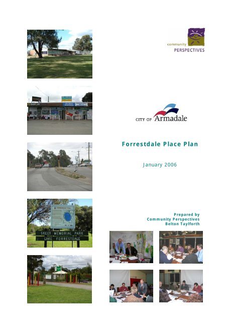
Forrestdale Place Plan - City of Armadale
Forrestdale Place Plan - City of Armadale
Forrestdale Place Plan - City of Armadale

Create successful ePaper yourself
Turn your PDF publications into a flip-book with our unique Google optimized e-Paper software.
<strong>Forrestdale</strong> <strong>Place</strong> <strong>Plan</strong><br />
January 2006<br />
Prepared by<br />
Community Perspectives<br />
Belton Taylforth
CONTENTS<br />
1 INTRODUCTION ......................................................................... 3<br />
1.1 Background ............................................................................... 3<br />
1.2 What is a <strong>Place</strong> <strong>Plan</strong> .................................................................... 3<br />
1.3 Methodology .............................................................................. 4<br />
1.4 <strong>Forrestdale</strong> <strong>Place</strong> Area ................................................................. 4<br />
2 PLACE PLAN CONTEXT................................................................ 6<br />
2.1 Metropolitan Region Scheme ........................................................ 6<br />
2.2 Southern River <strong>Forrestdale</strong> Brookdale Wungong District Structure<br />
<strong>Plan</strong> .......................................................................................... 6<br />
2.3 Local <strong>Plan</strong>ning Strategy ............................................................... 7<br />
2.4 Town <strong>Plan</strong>ning Scheme................................................................ 7<br />
2.5 North <strong>Forrestdale</strong> Structure <strong>Plan</strong> - Stage 1 ..................................... 7<br />
2.6 <strong>Armadale</strong> Redevelopment Authority............................................... 7<br />
2.7 <strong>Forrestdale</strong> Lake Nature Reserve Management <strong>Plan</strong> 2005 ................. 8<br />
3 FORRESTDALE PLACE PLAN........................................................ 9<br />
3.1 People and Community ................................................................ 9<br />
3.1.1 Challenges and Opportunities......................................................9<br />
3.1.2 Vision 2020 ............................................................................ 10<br />
3.1.3 Key Objectives and Actions ....................................................... 10<br />
3.2 Built Environment and Land Uses ................................................ 12<br />
3.2.1 Challenges and Opportunities.................................................... 12<br />
3.2.2 Vision 2020 ............................................................................ 13<br />
3.2.3 Key Objectives and Actions ....................................................... 13<br />
3.3 Traffic and Transport................................................................. 15<br />
3.3.1 Challenges and Opportunities.................................................... 15<br />
3.3.2 Vision 2020 ............................................................................ 16<br />
3.3.3 Key Objectives and Actions ....................................................... 16<br />
3.4 Natural Environment and Parks................................................... 18<br />
3.4.1 Challenges and Opportunities.................................................... 18<br />
3.4.2 Vision 2020 ............................................................................ 19<br />
3.4.3 Key Objectives and Actions ....................................................... 19<br />
3.5 Economy and Employment ......................................................... 21<br />
3.5.1 Challenges and Opportunities.................................................... 21<br />
3.5.2 Vision 2020 ............................................................................ 22<br />
3.5.3 Key Objectives and Actions ....................................................... 22<br />
1
4 FUTURE COMMUNITY INFRASTRUCTURE REQUIREMENTS........ 24<br />
4.1 North <strong>Forrestdale</strong> – Stage 1 Structure <strong>Plan</strong>................................... 24<br />
4.1.1 Public Open Space – Recreation Spaces ...................................... 24<br />
4.1.2 Community Facilities................................................................ 25<br />
4.1.3 Education............................................................................... 25<br />
4.2 Ultimate Community Infrastructure Requirements ......................... 26<br />
4.2.1 Education............................................................................... 27<br />
4.2.2 Child Care .............................................................................. 29<br />
4.2.3 Community and Cultural Centres ............................................... 30<br />
4.2.4 Recreation and Sports.............................................................. 31<br />
4.2.5 Health ................................................................................... 32<br />
4.2.6 Aged Care .............................................................................. 33<br />
5 FORRESTDALE PLACE PROFILE................................................. 35<br />
5.1 People and Community .............................................................. 35<br />
5.1.1 Age and Gender ...................................................................... 35<br />
5.1.2 Households and Family Type ..................................................... 37<br />
5.1.3 Birth <strong>Place</strong>, Language and Religion............................................. 39<br />
5.1.4 Education and Qualification....................................................... 43<br />
5.1.5 Income Levels ........................................................................ 44<br />
5.1.6 Housing Loan Payments and Rent .............................................. 46<br />
5.1.7 Computer Use and Internet Use................................................. 47<br />
5.1.8 Community Infrastructure ........................................................ 48<br />
5.2 Built Environment and Land Uses ................................................ 52<br />
5.2.1 Residential ............................................................................. 52<br />
5.2.2 Commercial and retail .............................................................. 54<br />
5.2.3 Industrial ............................................................................... 54<br />
5.2.4 Rural ..................................................................................... 55<br />
5.2.5 Land use conflicts.................................................................... 55<br />
5.3 Traffic and Transport................................................................. 56<br />
5.3.1 Roads .................................................................................... 56<br />
5.3.2 Public transport....................................................................... 56<br />
5.3.3 Bikeways and footpaths............................................................ 56<br />
5.3.4 Freight routes ......................................................................... 57<br />
5.3.5 Vehicle ownership.................................................................... 57<br />
5.3.6 Method <strong>of</strong> travel...................................................................... 58<br />
5.4 Natural Environment and Parks................................................... 59<br />
5.4.1 Landform ............................................................................... 59<br />
5.4.2 Land resources ....................................................................... 59<br />
5.4.3 Land capability........................................................................ 59<br />
5.4.4 Water resources...................................................................... 59<br />
5.4.5 Vegetation.............................................................................. 61<br />
5.4.6 Parks and Reserves ................................................................. 61<br />
5.5 Economy and Employment ......................................................... 65<br />
5.5.1 Land tenure............................................................................ 65<br />
5.5.2 Local economy ........................................................................ 65<br />
5.5.3 Existing employment patterns ................................................... 65<br />
5.5.4 Education, Research and Development and Employment<br />
Village (ERADE) ...................................................................... 65<br />
6 REFERENCES AND BIBLIOGRAPHY ........................................... 68<br />
2
1 INTRODUCTION<br />
1.1 Background<br />
In July 2005 the <strong>City</strong> <strong>of</strong> <strong>Armadale</strong> commissioned Community Perspectives, in association with Belton<br />
Taylforth, to prepare a <strong>Place</strong> <strong>Plan</strong> for <strong>Forrestdale</strong>. This project is one <strong>of</strong> the <strong>City</strong> <strong>of</strong> <strong>Armadale</strong>’s key<br />
Strategic <strong>Plan</strong> 2005-2009 initiatives and tests ‘<strong>Place</strong> <strong>Plan</strong>ning’ as an approach to improving the social,<br />
economic and environmental quality <strong>of</strong> life <strong>of</strong> local communities in <strong>City</strong> <strong>of</strong> <strong>Armadale</strong>.<br />
<strong>Forrestdale</strong> was selected by the <strong>City</strong> <strong>of</strong> <strong>Armadale</strong> as the ideal ‘pilot’ for testing a place planning approach<br />
for the following reasons:<br />
•<br />
•<br />
•<br />
•<br />
•<br />
•<br />
•<br />
•<br />
•<br />
•<br />
Geographical natural boundaries.<br />
Land use and development pressures and priorities for local planning.<br />
Predominance <strong>of</strong> other projects currently underway or about to commence.<br />
Potential to build the capacity <strong>of</strong> existing service provision and activities to maximise and expand<br />
rather than establishing and creating duplicate provision as development grows.<br />
A proactive community with ability to build and action partnerships with business agencies and<br />
other key stakeholders.<br />
Pressure from residents, groups and businesses to resolve or progress issues within the area.<br />
The <strong>City</strong> <strong>of</strong> <strong>Armadale</strong> identified the following four key objectives <strong>of</strong> the <strong>Forrestdale</strong> <strong>Place</strong> <strong>Plan</strong>:<br />
Promote a common understanding <strong>of</strong> the changes occurring and likely to occur in the locality.<br />
Identify the community’s and other stakeholder’s aspirations for their place.<br />
Establish local priority issues.<br />
Provide a guide for what are the most important local issues to tackle.<br />
1.2 What is a <strong>Place</strong> <strong>Plan</strong><br />
<strong>Place</strong> <strong>Plan</strong>ning is an approach that recognises that all communities have their own unique characteristics,<br />
values, issues, trends and aspirations and that these are best addressed by considering the community<br />
as a whole, embracing and linking all components that form part <strong>of</strong> the built, natural, economic and<br />
social environment. <strong>Place</strong> <strong>Plan</strong>ning shifts the focus <strong>of</strong> the <strong>City</strong> <strong>of</strong> <strong>Armadale</strong>’s organisation from outputs <strong>of</strong><br />
a function to that <strong>of</strong> outcomes in the place.<br />
<strong>Place</strong> <strong>Plan</strong>ning brings together diverse interests and stakeholders in focusing collective resources and<br />
action on a place. With this approach and shared responsibility, it is anticipated that <strong>Place</strong> <strong>Plan</strong>ning will<br />
achieve a better use <strong>of</strong> resources and a more strategic and sustainable way <strong>of</strong> addressing the issues and<br />
priorities <strong>of</strong> local communities.<br />
<strong>Place</strong> <strong>Plan</strong>ning also provides communities with a sense <strong>of</strong> ownership and control over the future <strong>of</strong> a<br />
place and builds the capacity <strong>of</strong> the community to take action and work toward a common vision<br />
A <strong>Place</strong> <strong>Plan</strong> provides a long-range shared vision for the future <strong>of</strong> a place and the objectives and actions<br />
necessary to work toward that vision. A <strong>Place</strong> <strong>Plan</strong> is a ‘living document’ and reflects new actions, as the<br />
original actions are completed and new challenges and opportunities as they emerge over time.<br />
3
1.3 Methodology<br />
The preparation <strong>of</strong> the <strong>Forrestdale</strong> <strong>Place</strong> <strong>Plan</strong> commenced with the production <strong>of</strong> an information brochure<br />
explaining how the <strong>Forrestdale</strong> <strong>Place</strong> <strong>Plan</strong> was going to be undertaken and the avenues for community<br />
involvement. This was delivered to all households in <strong>Forrestdale</strong>, key stakeholders, <strong>City</strong> <strong>of</strong> <strong>Armadale</strong><br />
elected members and staff. A ‘Pr<strong>of</strong>ile <strong>of</strong> the <strong>Place</strong>’ was then compiled to describe the ‘state <strong>of</strong> the place’<br />
and to provide a sound information base for preparing the place plan.<br />
The Pr<strong>of</strong>ile <strong>of</strong> the <strong>Place</strong> was used as the basis <strong>of</strong> the first community workshop, which involved<br />
participants in identify <strong>Forrestdale</strong>’s community values, issues and trends, as well as vision ideas for the<br />
future. The priority ‘challenges and opportunities’ for <strong>Forrestdale</strong> were also developed from this<br />
workshop.<br />
A Community Survey was then undertaken involving all households in <strong>Forrestdale</strong> and the purpose <strong>of</strong> the<br />
survey was to establish if the priority ‘challenges and opportunities’ identified in the first workshop where<br />
representative <strong>of</strong> the views <strong>of</strong> the wider community. The questionnaire was also designed to rate the<br />
level <strong>of</strong> importance respondents perceived applied to each ‘challenge and opportunity’ and to further<br />
identify any other important issues or priorities. Respondents were also asked to rate their perception <strong>of</strong><br />
the quality <strong>of</strong> life in <strong>Forrestdale</strong>.<br />
From the results <strong>of</strong> the Community Survey, the priority challenges and opportunities were revised and<br />
<strong>City</strong> <strong>of</strong> <strong>Armadale</strong> staff were asked to consider what actions might be required to address these priority<br />
‘challenges and opportunities’.<br />
A second community workshop, again involving residents and key stakeholders was designed to consider<br />
and refine each <strong>of</strong> the draft ‘Vision 2020’ statements. Each ‘priority challenge and opportunity’ was then<br />
considered by workshop participants to identity the actions required to address each <strong>of</strong> these challenges<br />
and opportunities. A team <strong>of</strong> <strong>City</strong> <strong>of</strong> <strong>Armadale</strong> staff, with expertise across all the vision focus areas were<br />
on hand to assist workshop groups with this task.<br />
Based on the outcomes <strong>of</strong> the second community workshop, the ‘Vision 2020’ statements were revised<br />
and the priority ‘challenges and opportunities’ were translated into the ‘key objectives’ for the <strong>Forrestdale</strong><br />
<strong>Place</strong> <strong>Plan</strong>. The ‘draft actions’ required to achieve each <strong>of</strong> these ‘key objectives’ were then developed and<br />
submitted to <strong>City</strong> <strong>of</strong> <strong>Armadale</strong> staff as the draft Action <strong>Plan</strong> 2006-2001 for further input and comment,<br />
together with the Draft <strong>Forrestdale</strong> <strong>Place</strong> <strong>Plan</strong> Report. A staff workshop occurred to facilitate this input<br />
and written comments were also received from staff. The <strong>Forrestdale</strong> <strong>Place</strong> <strong>Plan</strong> and the Action <strong>Plan</strong><br />
2006-2011 were then revised.<br />
The revised Action <strong>Plan</strong> 2006-2011 identifies the key objectives and actions and provides a timeline for<br />
each action and an indication <strong>of</strong> the Directorate responsible and the key stakeholders who need to be<br />
involved in each action. This remains a ‘working document’ for the <strong>City</strong> <strong>of</strong> <strong>Armadale</strong> staff to further refine<br />
and develop with costings, budget allocations and further consultation with key stakeholders.<br />
With <strong>Forrestdale</strong>’s population expected to grow from 1,344 to an estimated 24,936, the challenge <strong>of</strong><br />
determining the local, district and regional community infrastructure requirements is well recognised by<br />
the <strong>City</strong> <strong>of</strong> <strong>Armadale</strong>. The project brief also called for an indicative assessment <strong>of</strong> the community<br />
infrastructure requirements likely to be required for the current and future population <strong>of</strong> <strong>Forrestdale</strong>. A<br />
schedule <strong>of</strong> Indicative Community Infrastructure Requirements also forms part <strong>of</strong> the <strong>Forrestdale</strong> <strong>Place</strong><br />
<strong>Plan</strong>.<br />
1.4 <strong>Forrestdale</strong> <strong>Place</strong> Area<br />
The <strong>Forrestdale</strong> <strong>Place</strong> Area essentially covers the entire suburb <strong>of</strong> <strong>Forrestdale</strong>, and covers an area <strong>of</strong> 49.5<br />
square kilometres, making up 9% <strong>of</strong> the entire area <strong>of</strong> the <strong>City</strong> <strong>of</strong> <strong>Armadale</strong>. A portion <strong>of</strong> the <strong>Forrestdale</strong><br />
<strong>Place</strong> Area is also covered by proposals <strong>of</strong> the <strong>Armadale</strong> Redevelopment Authority.<br />
According to the ABS Census 2001, <strong>Forrestdale</strong> has a population <strong>of</strong> 1,352 people and this accounts for<br />
about 3% <strong>of</strong> the <strong>City</strong> <strong>of</strong> <strong>Armadale</strong>’s total population <strong>of</strong> 50,108, which is projected to increase significantly<br />
over the next 25 years. <strong>Forrestdale</strong> will accommodate much <strong>of</strong> this additional population through new<br />
urban development as these population estimates for <strong>Forrestdale</strong> indicate.<br />
2006 2,130 2021 21,405<br />
2011 10,412 2026 23,668<br />
2016 17,282 Ultimate 24,936<br />
2001 Estimated Resident Population<br />
Apportioned from Shrapnel’s MRD Zones<br />
4
Figure 1. Study Area<br />
5
2 PLACE PLAN CONTEXT<br />
The <strong>City</strong> <strong>of</strong> <strong>Armadale</strong> is the level <strong>of</strong> government ‘closest to the people’ <strong>of</strong> <strong>Forrestdale</strong> and is therefore well<br />
placed to identify and understand the community’s values, issues, trends and aspirations for the future.<br />
The <strong>City</strong> <strong>of</strong> <strong>Armadale</strong> is also ideally placed to coordinate local area planning and development and to<br />
facilitate the involvement <strong>of</strong> all relevant government agencies and key stakeholders in the process.<br />
However, the <strong>City</strong> <strong>of</strong> <strong>Armadale</strong> can not achieve the outcomes <strong>of</strong> the <strong>Forrestdale</strong> <strong>Place</strong> <strong>Plan</strong> alone, and the<br />
resources and involvement many government agencies and the local community will need to come<br />
together to do so.<br />
The <strong>Forrestdale</strong> <strong>Place</strong> <strong>Plan</strong> also exists within the <strong>City</strong> <strong>of</strong> <strong>Armadale</strong>’s strategic planning and policy<br />
framework and should also be informed and guided by these key strategic documents:<br />
• Strategic <strong>Plan</strong> 2005-2009<br />
• Disability Access and Inclusion <strong>Plan</strong> 2005-2009<br />
• Recreation Strategic <strong>Plan</strong> 2003<br />
• Seniors <strong>Plan</strong> 2005-2010<br />
The following key planning schemes, structure plans and so on, also provide a strategic context and<br />
guidance to the <strong>Forrestdale</strong> <strong>Place</strong> <strong>Plan</strong>.<br />
2.1 Metropolitan Region Scheme<br />
The Metropolitan Region Scheme (MRS) sets out the broad pattern <strong>of</strong> land use for the Perth Metropolitan<br />
Region. The principles and functions <strong>of</strong> the scheme are to:<br />
• reserve land required for all kinds <strong>of</strong> public purposes and acquire it as necessary<br />
• identify non-reserved land and classify it into zones such as urban, industrial or rural<br />
• control development on reserved and zones land, particularly the issuing <strong>of</strong> decisions on<br />
development applications.<br />
Local government usually has delegated authority to deal with applications for development on zoned<br />
land under the local Town <strong>Plan</strong>ning Scheme. The Western Australian <strong>Plan</strong>ning Commission usually<br />
retains authority to consider development applications for land that is reserved under the MRS, except in<br />
special circumstances.<br />
<strong>Forrestdale</strong> is subject to several zones and reserves. The northern-most portion is zoned Urban with a<br />
small pocket <strong>of</strong> Urban Differed (however this zoning is likely to change as urban development expands in<br />
the area). There is also a small area zoned Urban between <strong>Forrestdale</strong> Lake and <strong>Armadale</strong> Road.<br />
The majority <strong>of</strong> the remainder <strong>of</strong> the place is either zoned Rural or reserved for Parks and Recreation. An<br />
extract <strong>of</strong> the MRS is provided at Appendix A.<br />
2.2 Southern River <strong>Forrestdale</strong> Brookdale Wungong District Structure <strong>Plan</strong><br />
The Western Australian <strong>Plan</strong>ning Commission, in consultation with the <strong>City</strong> <strong>of</strong> <strong>Armadale</strong> and <strong>City</strong> <strong>of</strong><br />
Gosnells, undertook a District Structure <strong>Plan</strong> the broader area during 1999-2001. The final plan was<br />
released in 2001.<br />
This plan provides another level <strong>of</strong> detail and thus a framework for the future development <strong>of</strong> the area,<br />
based on a comprehensive study <strong>of</strong> Opportunities and Constraints. The main features <strong>of</strong> the plan include<br />
the retention <strong>of</strong> large areas <strong>of</strong> Parks and Recreation Reservation, and the expansion <strong>of</strong> urban<br />
development between Ranford and Warton roads and around <strong>Armadale</strong> Road. Two areas have also been<br />
identified for possible future urban development. The Structure <strong>Plan</strong> provides a good basis for the<br />
consideration <strong>of</strong> longer-term development within the <strong>Forrestdale</strong> area.<br />
An extract from the plan is shown at Appendix A.<br />
6
2.3 Local <strong>Plan</strong>ning Strategy<br />
The <strong>City</strong> <strong>of</strong> <strong>Armadale</strong> has recently prepared a Local <strong>Plan</strong>ning Strategy. The stated purpose <strong>of</strong> the<br />
Strategy is as follows:<br />
The Strategy sets out the long-term planning directions for the <strong>City</strong>. In particular it sets<br />
out planning objectives, policy statements and recommended actions associated with<br />
housing, commercial, rural, recreation, transport and environmental and heritage issues<br />
over the next 10 to 15 years. It also provides the rationale for the zones and provisions<br />
in Town <strong>Plan</strong>ning Scheme No 4. The Strategy demonstrates an integrated approach to<br />
planning, including<br />
consideration <strong>of</strong> social, environmental, cultural and economic<br />
aspects. It also provides an opportunity for the community to be involved in planning the<br />
future development <strong>of</strong> the district.<br />
The<br />
strategy identifies five different categories <strong>of</strong> land use within the <strong>Forrestdale</strong> area:<br />
• Developed residential area – adjacent to <strong>Forrestdale</strong><br />
Lake<br />
• Urban Expansion Areas – primarily<br />
north <strong>of</strong> <strong>Armadale</strong> Road<br />
• Employment area – linking<br />
to the <strong>Forrestdale</strong> Industrial Park<br />
• Regional Parks and Recreation Areas – generally align with the existing and proposed MRS Parks<br />
and Recreation areas<br />
• Rural Lifestyle/Landscape Protection<br />
– an extensive area <strong>of</strong> <strong>Forrestdale</strong>.<br />
2.4 Town <strong>Plan</strong>ning Scheme<br />
The <strong>City</strong> <strong>of</strong> <strong>Armadale</strong> is responsible for local planning and development control in all areas apart from<br />
MRS reserves. Development is controlled using a local town<br />
planning scheme that zones and reserves<br />
local<br />
land. The town planning scheme must be consistent with the zoning or reservation <strong>of</strong> land under<br />
the Metropolitan<br />
Region Scheme.<br />
The <strong>City</strong><br />
<strong>of</strong> <strong>Armadale</strong> Town <strong>Plan</strong>ning Scheme No. 4 (TPS) has been advertised for public comment and is<br />
anticipa ted to be formally gazetted later this year. The TPS proposes the zoning <strong>of</strong> the majority <strong>of</strong> the<br />
<strong>Forrestdale</strong><br />
area for various Rural uses. Modifications to the TPS are likely as urban development<br />
progresses in the area.<br />
2.5<br />
North <strong>Forrestdale</strong> Structure <strong>Plan</strong> - Stage 1<br />
The Structure <strong>Plan</strong> has been prepared on behalf <strong>of</strong> relevant landowners to provide a detailed planning<br />
framework for the future subdivision and development <strong>of</strong> the North <strong>Forrestdale</strong> area. The plan is based<br />
on<br />
the Southern River/<strong>Forrestdale</strong>/Brookdale/Wungong District Structure <strong>Plan</strong> and provides the next level<br />
<strong>of</strong> detail that will form the basis <strong>of</strong> future detailed subdivision applications.<br />
An<br />
extract from the plan is provided at Appendix A.<br />
2.6 <strong>Armadale</strong> Redevelopment Authority<br />
The <strong>Armadale</strong> Redevelopment Authority (ARA) was established under the <strong>Armadale</strong> Redevelopment Act<br />
2001 and began operations on 23 March 2002. The key tasks <strong>of</strong> the ARA are to plan, undertake,<br />
promote<br />
and coordinate the<br />
development and redevelopment <strong>of</strong> land in the ARA redevelopment areas.<br />
A portion <strong>of</strong> <strong>Forrestdale</strong>, between Ranford Road and Tonkin Highway, is covered by the ARA<br />
redevelopment area and is anticipated to be developed as the <strong>Forrestdale</strong> Business Park. An extract from<br />
the ARA Strategic <strong>Plan</strong> relating to the <strong>Forrestdale</strong> Business Park is provided at Appendix A.<br />
7
2.7 <strong>Forrestdale</strong> Lake Nature Reserve Management <strong>Plan</strong> 2005<br />
The Department <strong>of</strong> Conservation and Land Management (CALM) have recently prepared a Management<br />
<strong>Plan</strong> for the <strong>Forrestdale</strong><br />
Lake area. The implementation <strong>of</strong> the plan rests largely with CALM and<br />
addresses<br />
a range <strong>of</strong> conservation and cultural values. The key values <strong>of</strong> <strong>Forrestdale</strong> Lake and the<br />
adjoining<br />
reserves, as described by CALM, are as follows:<br />
The outstanding values <strong>of</strong> the planning area are those that contribute to its Ramsar<br />
listing. In its joint listing with Thomsons Lake, <strong>Forrestdale</strong> Lake satisfies three<br />
criteria for nomination to the Ramsar list:<br />
• internationally significant waterbird habitat which regularly supports more<br />
than 1% <strong>of</strong> the individuals <strong>of</strong> the known Australian population <strong>of</strong> the longtoed<br />
stint2;<br />
• it is <strong>of</strong> special value for maintaining the genetic and ecological diversity <strong>of</strong><br />
the region because <strong>of</strong> the qualities and peculiarities <strong>of</strong> its flora and fauna;<br />
and<br />
• it is a particularly good representative <strong>of</strong> a natural<br />
or near-natural wetland,<br />
characteristic <strong>of</strong> those that were once widespread<br />
on the Swan Coastal<br />
Plain.<br />
(Environment Australia 2001)<br />
Other key conservation<br />
values are:<br />
• its significance for the protection <strong>of</strong> rare, threatened and priority<br />
flora and<br />
fauna, and threatened ecological communities (TECs); and<br />
• plant communities representative <strong>of</strong> the eastern side <strong>of</strong> the Swan Coastal<br />
Plain.<br />
<strong>Forrestdale</strong> Lake also has significant cultural values, viz:<br />
• a rich Aboriginal heritage; and<br />
• natural and cultural values close to urban centres that provide<br />
opportunities for nature appreciation and education.<br />
Source: <strong>Forrestdale</strong> Lake Nature Reserve Management <strong>Plan</strong> 2005.<br />
8
3 FORRESTDALE PLACE PLAN<br />
3.1 People and Community<br />
3.1.1 Challenges and Opportunities<br />
• Retaining the strong sense community, stability<br />
and<br />
village lifestyle.<br />
• Improving and<br />
developing community services, facilities,<br />
programs to meet the needs <strong>of</strong> the existing and future<br />
community.<br />
• Promoting well-planned and balanced<br />
growth that<br />
sensi tively<br />
integrates ‘old’ and ‘new’ <strong>Forrestdale</strong>.<br />
• <strong>Plan</strong>ning for the<br />
needs <strong>of</strong> the ageing population.<br />
• Developing recreational, sporting, employment and<br />
training<br />
activities and opportunities for young people.<br />
• Encouraging better access to tertiary education.<br />
• Improving and developing existing sporting facilities.<br />
• Developing more frequent community and cultural events.<br />
9
3.1.2 Vision 2020<br />
In 20 20, <strong>Forrestdale</strong>’s close knit community<br />
and peaceful lifestyle has been preserved by carefully<br />
shaping and managing the urban growth. The people <strong>of</strong> <strong>Forrestdale</strong><br />
not only know their neighbours, but<br />
also know how to come together in sustaining and enhancing the livability <strong>of</strong> the place and enjoy being<br />
part<br />
<strong>of</strong> community life. This sense <strong>of</strong> community has been nurtured and is flourishing in the new<br />
resident ial communities <strong>of</strong> <strong>Forrestdale</strong> and a variety <strong>of</strong> events and festivals give residents a chance to<br />
celebrate the qualities<br />
that make their community special. People <strong>of</strong> all age groups and abilities lead<br />
active<br />
and fulfilling lives and can develop their potential here.<br />
3.1.3<br />
Key Objectives and Actions<br />
1. To preserve and enhance <strong>Forrestdale</strong>’s strong sense <strong>of</strong> community, local identity and peaceful<br />
lifestyle, while sensitively integrating the ‘old’ with the ‘new’ <strong>Forrestdale</strong>.<br />
Actions<br />
• Develop activities, events or initiatives that foster community<br />
interaction and build the capacity<br />
<strong>of</strong> the existing and future communities <strong>of</strong> <strong>Forrestdale</strong> to address local issues, needs and<br />
aspirations.<br />
• Enhance <strong>Forrestdale</strong>’s unique sense <strong>of</strong> identity through public and community art opportunities.<br />
• Identify opportunities and initiatives to preserve, enhance and promote<br />
<strong>Forrestdale</strong>’s heritage.<br />
• Develop initiatives to keep the existing community <strong>of</strong> <strong>Forrestdale</strong> informed about the planning<br />
and development <strong>of</strong> North <strong>Forrestdale</strong> and undertake direct community consultation on issues<br />
that affect existing residents.<br />
2. To plan, improve and develop facilities, services and programs<br />
to cater for the current and<br />
future needs <strong>of</strong> the community<br />
Actions<br />
• Undertake a Community Facilities Needs Assessment to identify the current and future<br />
community, recreational and sporting needs <strong>of</strong> the <strong>Forrestdale</strong> community.<br />
• Subject to the outcomes <strong>of</strong> the Community Facilities Needs Assessment, determine the feasibility<br />
<strong>of</strong> staging options, financial costs and funding opportunities for progressively upgrading facilities<br />
at Alfred Skeet and William Skeet Reserves.<br />
• Assess the feasibility and options for providing a drinking fountain and access to toilets for the<br />
Skate Park.<br />
• Investigate, identify and advocate for ways to improve access to higher education.<br />
• Lobby Australia Post to reinstate a postal box in <strong>Forrestdale</strong>.<br />
• Track and monitor changing community needs and priorities over time.<br />
10
3. To plan for the needs<br />
<strong>of</strong> the ageing population, developing programs, services and housing<br />
options that create the potential for older people to ‘age in place’.<br />
Actions<br />
• Hold a forum to identify the issues and needs <strong>of</strong> <strong>Forrestdale</strong> seniors, in conjunction with<br />
community organisations and key service providers, while also actively engaging seniors in<br />
identifying their needs and aspirations.<br />
• Develop initiatives to address the needs and aspirations <strong>of</strong> seniors in <strong>Forrestdale</strong>, guided by the<br />
<strong>City</strong> <strong>of</strong> <strong>Armadale</strong> Seniors <strong>Plan</strong> 2005-2010.<br />
4. To provide and develop services, facilities<br />
and opportunities necessary for children and<br />
young people to reach their potential<br />
and to live happy, active and meaningful lives in<br />
<strong>Forrestdale</strong>.<br />
Actions<br />
• Hold a forum to identify the issues and needs <strong>of</strong> <strong>Forrestdale</strong> children and young people, in<br />
conjunction with key community organisations and key service providers, while also actively<br />
engaging children and young people in identifying their needs and aspirations<br />
• Develop initiatives to address the needs and aspirations <strong>of</strong> children and young people in<br />
<strong>Forrestdale</strong>.<br />
11
3.2<br />
Built Environment and Land Uses<br />
3.2.1 Challenges<br />
and Opportunities<br />
• Developing<br />
the built environment in a way that respects<br />
and preserves<br />
the natural environment<br />
•<br />
Maintaining a greenbelt around the existing area <strong>of</strong><br />
<strong>Forrestdale</strong><br />
• Preserving rural<br />
land uses<br />
• Sensitively<br />
integrating rural and urban land uses<br />
• Establishing deep sewerage in <strong>Forrestdale</strong><br />
• Retaining existing block sizes<br />
•<br />
Replace and enhance <strong>Forrestdale</strong>’s entry statement<br />
• Increasing the shops and services<br />
• Increasing the range and types <strong>of</strong> housing to cater for<br />
different needs<br />
12
3.2.2 Vision 2020<br />
In 202 0, the built environment <strong>of</strong> <strong>Forrestdale</strong><br />
is flourishing with people-oriented sustainable<br />
neighbourhoods, business, commercial and civic precincts.<br />
A mix<br />
<strong>of</strong> land uses has created a place where<br />
‘everything is here’ and the quality <strong>of</strong> life is high. Balanced and<br />
thoughtful development has preserved<br />
and enhanced the natural environment, while<br />
retaining some semi-rural aspects gives <strong>Forrestdale</strong> a<br />
sense<br />
<strong>of</strong> space. The original large housing blocks <strong>of</strong> <strong>Forrestdale</strong> add to this and a range <strong>of</strong> block sizes and<br />
diff erent styles <strong>of</strong> housing cater for the full range <strong>of</strong> household types, lifecycles and income levels. The<br />
built environment<br />
reflects a distinctive character and local identity and the natural environment has a<br />
strong<br />
presence is every part <strong>of</strong> <strong>Forrestdale</strong>.<br />
3.2.3<br />
Key Objectives and Actions<br />
1. To develop the built environment in a way that preserves and respects the natural<br />
environment, wetland character and country feel <strong>of</strong> <strong>Forrestdale</strong>.<br />
Actions<br />
• Prepare Development Guidelines for the <strong>Forrestdale</strong> area that address building, landscape and<br />
streetscape requirements.<br />
• Retain the existing pattern <strong>of</strong> low-density residential housing in the established <strong>Forrestdale</strong><br />
residential area.<br />
• Maintain and promote a range <strong>of</strong> larger lot sizes around environmentally sensitive areas to<br />
protect these areas from incompatible<br />
development and to provide a contrast to the smaller lot<br />
sizes proposed in North <strong>Forrestdale</strong>.<br />
• Ensure appropriate development setbacks are implemented around<br />
environmentally sensitive<br />
areas, including wetlands.<br />
• Ensure the principles <strong>of</strong> Water Sensitive Urban Design are incorporated into all development<br />
proposals.<br />
2. To retain and foster some semi-rural and nature based land uses while sensitively<br />
integrating a mix <strong>of</strong> residential, commercial and other land uses that support a high quality<br />
<strong>of</strong> life and environment.<br />
Actions<br />
• Ensure incompatible land uses are separated by appropriate<br />
buffer distances.<br />
• Investigate ways <strong>of</strong> retaining and supporting some <strong>of</strong> the existing<br />
semi-rural land uses that gives<br />
<strong>Forrestdale</strong> its ‘rural’ sense <strong>of</strong> identity.<br />
• Assess the feasibility <strong>of</strong> developing <strong>of</strong> nature-based tourism<br />
opportunities <strong>of</strong> the <strong>Forrestdale</strong><br />
area, focussing on <strong>Forrestdale</strong> Lake, in conjunction with CALM.<br />
• Support the ongoing implementation <strong>of</strong> the North <strong>Forrestdale</strong><br />
Structure <strong>Plan</strong>, and in particular<br />
the range <strong>of</strong> residential densities proposed and commercial areas identified.<br />
• Investigate opportunities for mixed use development within the existing <strong>Forrestdale</strong> urban area<br />
to provide a greater variety <strong>of</strong> services to the community and to add to the vibrancy <strong>of</strong> the area.<br />
• Explore and consider options to encourage the redevelopment <strong>of</strong> the existing <strong>Forrestdale</strong> Local<br />
Commercial Centre to improve aesthetics, accessibility and useability.<br />
13
3. To establish deep sewerage in <strong>Forrestdale</strong>.<br />
Actions<br />
• Liaise with CALM to determine if existing traditional septic systems are affecting water quality<br />
within <strong>Forrestdale</strong> Lake.<br />
• Liaise with the Department <strong>of</strong> Health to determine whether the use <strong>of</strong> traditional septic systems<br />
within the existing <strong>Forrestdale</strong> urban area would comply with the requirements <strong>of</strong> the<br />
Government Sewerage Policy.<br />
• Lobby the Water Corporation to expedite the urban infill program to provide deep sewer to<br />
<strong>Forrestdale</strong> due to potential public health and environmental issues.<br />
4.<br />
To retain the current residential block sizes in the existing <strong>Forrestdale</strong> urban area, while<br />
providing a range <strong>of</strong> block sizes and housing types in new residential development.<br />
Actions<br />
• Maintain the current residential coding <strong>of</strong> the existing <strong>Forrestdale</strong> urban area.<br />
• Encourage<br />
a range <strong>of</strong> residential lot sizes in accordance with the residential codings proposed as<br />
part <strong>of</strong> the North <strong>Forrestdale</strong> Structure <strong>Plan</strong>.<br />
5. To create a new entry<br />
statement and attractive streetscaped entrance road into<br />
<strong>Forrestdale</strong>,<br />
reflecting the unique identity and character <strong>of</strong> the place.<br />
Actions<br />
• Reinstate the <strong>Forrestdale</strong> entry statement once road works are complete, considering<br />
opportunities to enhance and beautify this entry statement.<br />
•<br />
•<br />
Prepare a streetscape plan for the entrance road into <strong>Forrestdale</strong>, engaging the community in<br />
the design <strong>of</strong> signage, street furniture, public art opportunities and landscaping as the<br />
streetscape plan is prepared.<br />
Identify new road paving treatments to signify an ‘entrance’ and ‘exit’ <strong>of</strong> <strong>Forrestdale</strong>.<br />
14
3.3 Traffic and Transport<br />
3.3.1<br />
Challenges and Opportunities<br />
• Upgrading and improving the safety <strong>of</strong> the <strong>Armadale</strong> and<br />
Nicholson<br />
Road intersection<br />
• Improving and maintaining road safety as traffic volumes<br />
increases<br />
• Improving the safety on roads, cycleways and footpaths,<br />
providing safer access to and exist from main roads<br />
• Preserving<br />
the environment as new roads are developed<br />
• Completing<br />
the upgrading <strong>of</strong> <strong>Armadale</strong> Road to dual<br />
carriageway<br />
• Screening out traffic noise from <strong>Armadale</strong> Road with<br />
greenery or a wall<br />
• Improving and increase cycleways<br />
• Improving<br />
destinations<br />
public transport frequency, routes and<br />
• Reopening<br />
Forrest Road at Tonkin Highway<br />
•<br />
Providing a pedestrian overpass on <strong>Armadale</strong> Road<br />
• Removing the high kerbing along the north side <strong>of</strong><br />
<strong>Armadale</strong> Road<br />
15
3.3.2 Vision 2020<br />
In 2020, <strong>Forrestdale</strong> is easy to get around with an integrated<br />
network <strong>of</strong> cycleways, footpaths, roads and<br />
p ublic transport connecting to the east, west, north<br />
and south. Cutting edge transport planning and<br />
traffic management measures have minimised the impact <strong>of</strong> major<br />
roads on the residential amenity <strong>of</strong><br />
<strong>Forrestdale</strong>, creating a pedestrian<br />
and bicycle-friendly environment where main and local roads are safe<br />
for<br />
all users. <strong>Forrestdale</strong> is renowned for its eco-friendly and sustainable road networks, with the natural<br />
environment remaining largely untouched in developing the extensive<br />
new road network that both serves<br />
and connects the<br />
many communities that make up <strong>Forrestdale</strong>.<br />
3.3.3<br />
Key Objectives and Actions<br />
1.<br />
2.<br />
To upgrade and improve the safety <strong>of</strong> the <strong>Armadale</strong> and Nicholson Road intersection.<br />
Actions<br />
• Prepare design modifications to the <strong>Armadale</strong> and Nicholson<br />
Road intersection as part <strong>of</strong> the<br />
<strong>Armadale</strong> Road westward extension.<br />
• Investigate temporary<br />
measures to reduce speed and improve safety at the <strong>Armadale</strong> and<br />
Nicholson intersection (traffic signal modifications (including amber warning lights), speed<br />
reductions, improved signage, roundabout, road paving treatments)<br />
To plan and manage increasing traffic in a way that mitigates any negative impacts on the<br />
environment and community, improving the safety and condition <strong>of</strong> roads.<br />
Actions<br />
• <strong>Plan</strong> for and construct new roads to cater for demand, particularly<br />
as new urban areas develop.<br />
• Ensure all<br />
road proposals are subject to environmental assessment (either via EPA processes or<br />
internal <strong>City</strong> <strong>of</strong> <strong>Armadale</strong> assessment).<br />
• Identify, on an ongoing basis, local traffic management and safety issues with the <strong>Forrestdale</strong><br />
community, investigating and developing options to address these issues.<br />
• Investigate the feasibility <strong>of</strong> establishing a pedestrian<br />
overpass over <strong>Armadale</strong> Road linking the<br />
existing <strong>Forrestdale</strong> urban area with development in the north.<br />
• Investigate options and the feasibility <strong>of</strong> ‘boulevarding’<br />
the major roads in <strong>Forrestdale</strong> by, for<br />
example, increasing<br />
footpath widths, establishing trees in the median strip and lowering speed<br />
limits adjacent to urban areas.<br />
• Investigate mechanisms to attenuate traffic noise impact from <strong>Armadale</strong> Road and Tonkin<br />
Highway.<br />
• Investigate road safety impacts <strong>of</strong> the high kerbing along <strong>Armadale</strong> Road in conjunction with<br />
MRWA, with a view to ameliorating negative safety impacts.<br />
16
3. To develop a network <strong>of</strong> cycleways, walk and bridle paths, catering for commuting and<br />
recreational needs.<br />
Actions<br />
• Review the <strong>City</strong> <strong>of</strong> <strong>Armadale</strong> Bike <strong>Plan</strong> in conjunction with the <strong>Forrestdale</strong> Community to ensure<br />
that it meets the needs <strong>of</strong> current and future residents.<br />
• Liaise with CALM with respect to the establishment <strong>of</strong> a network <strong>of</strong> cycle, walk and bridle paths<br />
around <strong>Forrestdale</strong> Lake.<br />
• Ensure that new development in North <strong>Forrestdale</strong> is well<br />
catered for in terms <strong>of</strong> bike and walk<br />
paths.<br />
4. To complete the upgrading <strong>of</strong> <strong>Armadale</strong> Road to dual carriageway<br />
Actions<br />
• Liaise with MRWA and <strong>City</strong> <strong>of</strong> Cockburn to promote the development <strong>of</strong> dual carriageway to the<br />
Kwinana Freeway as soon as possible.<br />
5. To improve<br />
and develop public transport availability, routes, destinations and options.<br />
Actions<br />
• Identify the public transport needs <strong>of</strong> <strong>Forrestdale</strong> in conjunction with the local community.<br />
• Lobby Transperth for additional (existing routes) or new (alternate routes) bus services<br />
to meet<br />
the needs <strong>of</strong> the existing <strong>Forrestdale</strong> urban area.<br />
•<br />
•<br />
Lobby for a future direct connection to the Cockburn Central train station.<br />
Liaise with Transperth to ensure timely provision <strong>of</strong> new bus services to North <strong>Forrestdale</strong> Area.<br />
6. Liaise<br />
with MRWA to investigate the potential <strong>of</strong> re-opening Forrest Road at Tonkin<br />
Highway.<br />
Actions<br />
• Investigate the benefits and constraints <strong>of</strong> reopening Forrest<br />
Road at Tonkin Highway in<br />
conjunction with consultation with MRWA and the <strong>Forrestdale</strong> community.<br />
17
3.4 Natural Environment and Parks<br />
3.4.1 Challenges<br />
and Opportunities<br />
• Stop the dumping <strong>of</strong> rubbish in the environment<br />
• Protecting the ground water<br />
•<br />
Eradicating the spread <strong>of</strong> weeds<br />
• <strong>Plan</strong>ning<br />
and developing sufficient parks and reserves to<br />
meet the existing and future needs <strong>of</strong> the community<br />
• Addressing<br />
the impact and use <strong>of</strong> trail bikes<br />
• Protecting,<br />
conserving and maintaining bushland,<br />
wetlands and green corridors<br />
• Improving<br />
and increasing walk trails<br />
• Promoting<br />
the use <strong>of</strong> native plants in gardening and<br />
public landscaping<br />
•<br />
Implementing the <strong>Forrestdale</strong> Lake Management <strong>Plan</strong><br />
• Constructing<br />
a new boardwalk<br />
to the <strong>Forrestdale</strong> Lake in<br />
an appropriate<br />
location<br />
• Establishing<br />
an Environmental Education Centre near the<br />
<strong>Forrestdale</strong><br />
Lake<br />
18
3.4.2 Vision 2020<br />
In 2020, the natural environment defines <strong>Forrestdale</strong>’s<br />
identity and is central to the enjoyment <strong>of</strong> living<br />
here, with wetlands, open spaces and parks. Even though significant urban development has occurred,<br />
with thoughtful and sustainable planning the natural<br />
environment <strong>of</strong> <strong>Forrestdale</strong> has not been<br />
compromised.<br />
New communities <strong>of</strong> <strong>Forrestdale</strong> provide leading examples <strong>of</strong> sustainable building design,<br />
waste management and water conservation. Green linkages now connect natural environments, parks<br />
and green spaces and great achievements have been made in improving the quality <strong>of</strong> the local flora and<br />
fauna. People<br />
who live here, schools, community groups, businesses and government agencies alike,<br />
work together in protecting and enhancing<br />
the natural environment. <strong>Forrestdale</strong> Lake, as a local icon and<br />
international<br />
recognised wetland is in pristine condition and <strong>of</strong>fers a unique educational experience for all.<br />
3.4.3<br />
Key Objectives and Actions<br />
1. To manage growth and development in a way<br />
that prevents adverse ecological and<br />
environmental impacts<br />
Actions<br />
• Ensure Environmental Conditions associated with North<br />
<strong>Forrestdale</strong> Structure <strong>Plan</strong> are<br />
implemented in a satisfactory<br />
manner.<br />
• Identify areas <strong>of</strong> local environmental significance within <strong>Forrestdale</strong> (to complement the already<br />
identified areas <strong>of</strong> regional, State and International importance).<br />
• Identify and establish appropriate buffers to areas <strong>of</strong> environmental significance.<br />
• Assess all proposals for subdivision and development against<br />
triple bottom line sustainability<br />
criteria.<br />
2.<br />
To plan and develop parks and reserves to meet the existing and future needs <strong>of</strong> the<br />
community.<br />
Actions<br />
• Develop a concept plan for the current and future provision <strong>of</strong> open space areas, facilitating<br />
sustainable and multiple uses such as passive and active recreation, drainage features and<br />
environmental protection.<br />
• Develop and maintain parks and local reserves with quality public facilities to meet the needs <strong>of</strong><br />
the community and to provide a focal point <strong>of</strong> interaction and activity.<br />
• Explore and implement innovative and environmentally sustainable approaches to landscaping<br />
design, construction and water usage.<br />
3.<br />
To protect and enhance bushland, wetlands and green corridors, conserving the native flora<br />
and fauna.<br />
Actions<br />
• Develop an ongoing plan to eradicate weeds for open space areas in <strong>Forrestdale</strong>, with the<br />
involvement and commitment <strong>of</strong> the local community and key stakeholder agencies.<br />
• Investigate and report on the current extent and impact <strong>of</strong> ‘rubbish dumping’ in <strong>Forrestdale</strong>.<br />
• Research and identify the most effective approaches to deter, educate, police and prosecute<br />
‘rubbish dumping’ in <strong>Forrestdale</strong>, using this as a ‘case study’ that can apply to other places<br />
where ‘rubbish dumping’ is an issue.<br />
19
• Identify priorities and develop initiatives in conjunction with the <strong>Forrestdale</strong> community to<br />
revegetate bushland open space areas using species endemic to the area.<br />
• Liaise with landowners <strong>of</strong> areas <strong>of</strong> environmental significance in <strong>Forrestdale</strong> to address how<br />
these areas can be protected and managed.<br />
• Support community-based education programs that address the implications <strong>of</strong> water use and<br />
pollution within the <strong>Forrestdale</strong> area.<br />
• Investigate the current usage <strong>of</strong> trail bikes, vehicle access to bushlands, wetlands and green<br />
corridors and the social and environmental impacts.<br />
• Develop initiatives to reduce the impact <strong>of</strong> vehicle access to bushland, wetlands and green<br />
corridors, while considering the needs <strong>of</strong> trail bike users.<br />
4.<br />
To protect, conserve and enhance <strong>Forrestdale</strong><br />
Lake, promoting awareness and knowledge<br />
about the lake environs.<br />
Actions<br />
• Construct<br />
a new boardwalk to the <strong>Forrestdale</strong> Lake, reviewing the location, design and<br />
construction materials to ensure a permanent feature.<br />
•<br />
•<br />
Liaise with CALM in progressing the implementation <strong>of</strong> the <strong>Forrestdale</strong> Lake Management <strong>Plan</strong>.<br />
5. To encourage<br />
interaction with the natural environment, promoting community awareness<br />
and participation in the protection <strong>of</strong> the environment and environmentally sustainable<br />
practices.<br />
Actions<br />
• Develop, in conjunction with the community, an education program to raise community<br />
awareness <strong>of</strong> the significant environmental features <strong>of</strong> the <strong>Forrestdale</strong> area.<br />
•<br />
Investigate, in conjunction with CALM and the local community, the feasibility <strong>of</strong> establishing an<br />
Environmental Resource Centre based at <strong>Forrestdale</strong> Lake.<br />
Create a ‘sense <strong>of</strong> ownership’ <strong>of</strong> the natural environment by residents <strong>of</strong> <strong>Forrestdale</strong> by<br />
investigating, initiating and supporting methods <strong>of</strong> community-based environmental<br />
management.<br />
20
3.5 Economy and Employment<br />
3.5.1<br />
Challenges and Opportunities<br />
• Retaining<br />
rural businesses<br />
• Supporting<br />
and develop local businesses<br />
• Enco uraging the development <strong>of</strong> the <strong>Forrestdale</strong> Business<br />
Park in a way that achieves a positive outcome for<br />
<strong>Forrestdale</strong><br />
• Establishing<br />
Broadband access for <strong>Forrestdale</strong><br />
• Encouraging<br />
businesses<br />
environmentally based industry and<br />
• Creating more employment and training opportunities,<br />
especially<br />
for young people<br />
• Developing<br />
environmentally safe industry and businesses<br />
• Encouraging development that will strengthen the local<br />
economy and employment<br />
• Developing<br />
a local business directory<br />
21
3.5.2 Vision 2020<br />
In 2020 , <strong>Forrestdale</strong> has a thriving well-balanced<br />
economic base and is a highly desirable place to work<br />
and do business. <strong>Forrestdale</strong> is also a place <strong>of</strong> outstanding educational<br />
opportunities and life long learning<br />
and technology are embraced. With a diversified economy, the economic viability<br />
<strong>of</strong> <strong>Forrestdale</strong> has a<br />
strong foundation. Locally–owned small businesses are nurtured, supported and flourish here, making a<br />
significant contribution to the diverse and stable employment opportunities available in <strong>Forrestdale</strong>.<br />
Actively<br />
targeting companies that <strong>of</strong>fer good employment opportunities, especially for young people, has<br />
also expanded job opportunities. While safeguarded and valued<br />
by residents and businesses alike,<br />
<strong>Forrestdale</strong>’s unique<br />
natural environment has opened up quality tourism, educational and employment<br />
opportunities.<br />
With the combined efforts <strong>of</strong> business, government and community, <strong>Forrestdale</strong> is also<br />
home to a myriad <strong>of</strong> viable and unique environmentally<br />
friendly and sustainable businesses and<br />
enterprises.<br />
3.5.3<br />
Key Objectives and Actions<br />
1. To encourage and support local business, economic and employment development in<br />
<strong>Forrestdale</strong>.<br />
Actions<br />
• Investigate options, benefits and costs for establishing and promoting a directory <strong>of</strong> local<br />
businesses in <strong>Forrestdale</strong>.<br />
• Liaise with the <strong>Armadale</strong> Redevelopment Authority to identify and develop opportunities within<br />
the <strong>Forrestdale</strong> Business Park concept, to generate local employment opportunities, especially<br />
for young people and to build the local economy.<br />
• Encourage a range <strong>of</strong> commercial land uses within appropriately<br />
zoned areas as part <strong>of</strong> the<br />
development <strong>of</strong> North <strong>Forrestdale</strong>.<br />
• Identify ways to encourage and foster ‘home based’ businesses in <strong>Forrestdale</strong>.<br />
2.<br />
To improve and develop education, training and information technology opportunities to<br />
meet the needs <strong>of</strong> the community.<br />
Actions<br />
• Identify the opportunities and constraints involved in achieving broadband access for the<br />
<strong>Forrestdale</strong> community.<br />
• Liaise with <strong>Armadale</strong> TAFE to investigate opportunities to provide local people with educational<br />
opportunities that may be relevant to the <strong>Forrestdale</strong> Business Park.<br />
• Liaise with the <strong>Armadale</strong> Redevelopment Authority, TAFE and proposed industries within the<br />
<strong>Forrestdale</strong> Business Park to identify opportunities for traineeships/apprenticeships for local<br />
young people.<br />
22
3. To encourage the development <strong>of</strong> the <strong>Forrestdale</strong> Business Park in a way that achieves a<br />
posit ive outcome for <strong>Forrestdale</strong>.<br />
Actions<br />
• Investigate and consider ways <strong>of</strong> promoting business and industries that are environmentally<br />
sensitive in <strong>Forrestdale</strong>.<br />
• Encourage the <strong>Armadale</strong> Redevelopment Authority to adopt an environmental and social code <strong>of</strong><br />
practice for industry and business within the <strong>Forrestdale</strong> Business Park.<br />
• Encourage industry and business within the <strong>Forrestdale</strong> Business Park to identify as being a<br />
‘local’ <strong>Forrestdale</strong> business and encourage these local businesses to support the <strong>Forrestdale</strong><br />
Community (sponsorships, community grants etc).<br />
23
4 FUTURE COMMUNITY INFRASTRUCTURE REQUIREMENTS<br />
With <strong>Forrestdale</strong>’s anticipated population growth from 1,344 to an estimated 24,936 people, the <strong>City</strong> <strong>of</strong><br />
<strong>Armadale</strong> included<br />
in the project brief an assessment <strong>of</strong> the community facilities, services and programs<br />
likely to be required to meets the needs <strong>of</strong> this additional population.<br />
Two tasks have been undertaken in this respect, documenting the proposed community facilities to be<br />
provided as identified in the North <strong>Forrestdale</strong> Stage 1 Structure <strong>Plan</strong> and secondly, an assessment <strong>of</strong> the<br />
community facilities, services and programs requirements likely to be generated<br />
from the ultimate<br />
population expect for <strong>Forrestdale</strong>.<br />
4.1<br />
North <strong>Forrestdale</strong> – Stage 1 Structure <strong>Plan</strong><br />
The<br />
North <strong>Forrestdale</strong>-Stage 1 Structure <strong>Plan</strong> has been prepared by a team <strong>of</strong> planning, engineering,<br />
environmental, hydrological and anthropological consultants, in association with the <strong>City</strong> <strong>of</strong> <strong>Armadale</strong> and<br />
the following vision underpins the Structure <strong>Plan</strong>:<br />
“To create a fully integrated urban community providing a broad based and diverse residential,<br />
employment and recreational environment whilst achieving the highest standards in urban design,<br />
environmental performance management and sustainability.”<br />
The Structure <strong>Plan</strong> has been prepared in accordance with Clause 5.8.6 <strong>of</strong> <strong>City</strong> <strong>of</strong> <strong>Armadale</strong> Town <strong>Plan</strong>ning<br />
Scheme No.2 to support subsequent subdivision and development proposals. Encompassing an area <strong>of</strong><br />
452 hectares, 4,500 lots will be developed accommodating a future residential population <strong>of</strong> 11,250. This<br />
will account for almost half <strong>of</strong> <strong>Forrestdale</strong>’s future population growth. The following extracts provide an<br />
indication <strong>of</strong> community facilities to be provided.<br />
4.1.1 Public Open Space – Recreation Spaces<br />
Within the Structure <strong>Plan</strong>, Public Open Space (POS) has been provided on the basis <strong>of</strong> approximately<br />
10% <strong>of</strong> the land for open space recreational requirements and 2%-4%<strong>of</strong> the land for drainage purposes.<br />
The principle function <strong>of</strong> the POS areas is to provide active and passive recreation spaces. The open<br />
space network and interconnected street system also combine to provide a unique and safe pedestrian/<br />
cycling environment. This will be further enhanced by a series <strong>of</strong> circuits within the POS, which will act as<br />
recreation walk/cycle trails. The local system <strong>of</strong> dual use paths and footpaths will be designed at the<br />
subdivision stage.<br />
Within the Structure <strong>Plan</strong> a deficiency <strong>of</strong> formal active open space was identified. In response, larger<br />
active recreational areas have been strategically located adjacent to the Primary Schools allowing for the<br />
joint use <strong>of</strong> playing fields. Other areas <strong>of</strong> POS have also been provided throughout the Structure <strong>Plan</strong><br />
area which are large enough to incorporate informal active/playing areas.<br />
The Carey Baptist College has presented a proposal to provide active recreation in the northern portion <strong>of</strong><br />
the Structure <strong>Plan</strong> area adjacent to its existing school site. It is proposed that adjacent land to the<br />
College is co-acquired by the Structure <strong>Plan</strong> (as an infrastructure item) and that the College then<br />
develops and maintains an active recreation reserve and associated community complex on the land. This<br />
proposal is currently being considered by all stakeholders.<br />
24
4.1.2 Community Facilities<br />
The location <strong>of</strong> community facilities within the Structure <strong>Plan</strong> area will be determined in liaison with the<br />
<strong>City</strong> <strong>of</strong> <strong>Armadale</strong>. The Development Contribution <strong>Plan</strong> which is currently being prepared will fund the<br />
development <strong>of</strong> district level active open space as well as community/sporting<br />
facilities in the North<br />
<strong>Forrestdale</strong><br />
–Stages 1 and 2 Urban Cell. At this stage it is proposed to fund the following items:<br />
• A multipurpose community/sports building within the District Sports Oval proposed on Lot 48<br />
Nicholson Road near the ‘town centre ’<br />
• Contribution towards the construction<br />
(or ongoing maintenance) <strong>of</strong> district level sporting facilities<br />
within an expanded Carey Baptist College landholding<br />
• A multipurpose<br />
facility in the Structure <strong>Plan</strong> South East area<br />
• Contributions towards expanded district facilities associated with the Skeet Ovals adjacent to the<br />
<strong>Forrestdale</strong> townsite and various hard stand sporting facilities and community facilities/buildings<br />
in dispersed locations across the study area<br />
It is envisaged that development within the Structure <strong>Plan</strong> area will generate the need for a substantial<br />
community centre to service the needs <strong>of</strong> the local community. The <strong>City</strong> <strong>of</strong> <strong>Armadale</strong> has indicated their<br />
support to retain the existing homestead on Lot 49 as a Community Centre. Investigations into the<br />
modification <strong>of</strong> the pro posed residential layout on Lot 49 will be undertaken following discussions with the<br />
EPA<br />
regarding the reconsideration and reclassification <strong>of</strong> the CCW designation on the site. If the CCW is<br />
downgraded to reflect recent environmental surveys, the Structure <strong>Plan</strong> will be modified to include the<br />
existing homestead as a Community facility site within an area <strong>of</strong> public open space. It is envisaged that<br />
this process will be undertaken in the next 6 months and will result in a later modification to the<br />
Structure <strong>Plan</strong>.<br />
All<br />
community facilities within the Structure <strong>Plan</strong> area will be located and developed with the aim <strong>of</strong><br />
providing<br />
a shared solution to facilities, and a focal point for local residents<br />
4.1.3 Education<br />
The Structure <strong>Plan</strong> identifies the location <strong>of</strong> two primary school sites and a possible future primary school<br />
site to the south.<br />
The District Structure <strong>Plan</strong> also earmarks a future high school site on land to the east and outside <strong>of</strong> the<br />
Structure <strong>Plan</strong> area.<br />
In addition to the school sites identified in the Structure <strong>Plan</strong>, the Carey Baptist College (Primary/High<br />
School) is located on Wright Road, opposite the Harrisdale Open Space Area in the northern portion <strong>of</strong><br />
the Structure <strong>Plan</strong>.<br />
ERADE<br />
(Education, Research and Development and Employment) Village at the Nicholson Road /Warton<br />
Road intersection, which will provide a diverse range <strong>of</strong> education, employment, retail, commercial and<br />
recreational opportunities. To date some five (5) “incubator research buildings” have been developed<br />
within the ERADE Village.<br />
25
4.2 Ultimate Community Infrastructure Requirements<br />
An assessment <strong>of</strong> the community facilities, services and programs likely to be required by <strong>Forrestdale</strong>’s<br />
ultimate population <strong>of</strong> 24,936 has been undertaken. This has been based on the application <strong>of</strong> a schedule<br />
<strong>of</strong> community infrastructure planning standards and the consideration <strong>of</strong> the existing facilities in<br />
<strong>Forrestdale</strong> and the surrounding areas.<br />
The community<br />
infrastructure planning standards used have been developed by the project consultant,<br />
Community<br />
Perspectives and are based on the planning standards used by government, other agencies<br />
and a culmination <strong>of</strong> extensive research and experience in community infrastructure planning and<br />
benchmarks.<br />
While planning and providing community facilities, services and programs<br />
usually occurs based on the<br />
identified<br />
needs and priorities <strong>of</strong> the given community, in planning for new urban developments, it can be<br />
some years<br />
before lots are released, people start moving into the area and a community develops.<br />
Therefore,<br />
forward planning mechanisms must be engaged to determine the likely community facilities,<br />
services and programs to be generated by new residential communities. The application <strong>of</strong> reliable<br />
community infrastructure standards allows for the future community facility, service and program<br />
requirements to be determined, at least at an indicative level.<br />
This enables sufficient land to be set aside for community purposes such as education, health, recreation<br />
and so on, while also taking into the account the needs <strong>of</strong> particular groups in the population, such as<br />
children, young people and seniors. In turn, the planning and provision <strong>of</strong> community infrastructure<br />
requirements can then be integrated and coordinated with other land use, infrastructure requirements,<br />
urban design elements and environmental<br />
considerations.<br />
At this stage, the identified community infrastructure requirements should be considered as an indicative<br />
start to determining the land requirements and locations <strong>of</strong> these facilities and<br />
services. The next stage <strong>of</strong><br />
community<br />
infrastructure planning should determine the timing and staging <strong>of</strong> community facilities and<br />
services<br />
requirements, in line with projected development fronts and new lots. As more detailed structure<br />
planning proceeds, more<br />
detailed community infrastructure planning can then be undertaken to<br />
determine<br />
the components or design elements <strong>of</strong> particular community purpose sites or facilities.<br />
With well over twenty<br />
government agencies and service providers sharing some responsibility for<br />
planning,<br />
funding or providing community facilities, services and programs, an integrated and holistic<br />
approach to community infrastructure planning is highly recommended. This approach should focus on<br />
bringing together all the relevant community infrastructure agencies, service providers, key stakeholders<br />
and<br />
neighbouring local government authorities (LGA’s), to facilitate a coordinated and collaborative<br />
approach to developing local, district and regional community facilities, services and programs on the<br />
ground.<br />
There<br />
are many benefits that can be achieved from this approach including joint ventures involving<br />
common use <strong>of</strong> facilities, shared costs and land savings. In addition, the many service providers and<br />
facilities within the <strong>Armadale</strong> region that are currently covering <strong>Forrestdale</strong> can start to plan ahead in<br />
expanding their capacity, or in developing alternative service delivery solutions to meet the needs <strong>of</strong> the<br />
future population <strong>of</strong> <strong>Forrestdale</strong>.<br />
While this <strong>Place</strong> <strong>Plan</strong> is for the <strong>Forrestdale</strong> area, this coordinated community infrastructure planning<br />
process should ideally encompass Brookdale and Seville, two neighbouring localities also facing significant<br />
urban development. This will enable far more effective planning and provision <strong>of</strong> district and regional<br />
level community infrastructure. The estimated population growth figures for these three localities are<br />
highlighted below:<br />
2001 2006 2011 2016 2021 2026 ultimate<br />
<strong>Forrestdale</strong> 1,324 2,130 10,416 17,282 21,405 23,668 24,936<br />
Seville 11,790 12,916 14,067 14,430 14,522 14,554 16,017<br />
Brookdale 12,291 13,365 19,024 27,159 34,136 37,996 43,068<br />
2001 Estimated Resident Population<br />
Apportioned from Shrapnel’s MRD Zones<br />
26
Besides generating the need for extensive infrastructure such as new roads, drainage and commercial<br />
centres, this additional population will also generate the need for a wide range <strong>of</strong> community facilities,<br />
services and programs. While land developers clearly have a role to play here, the <strong>City</strong> <strong>of</strong> <strong>Armadale</strong><br />
should investigate models and develop a sound and consistent policy framework for identifying and<br />
determining land developers community infrastructure responsibilities and contributions.<br />
Some<br />
<strong>of</strong> the most awarded new residential developments have recognised the importance <strong>of</strong> providing<br />
timely community facilities, services and programs on the ground in creating liveable, vibrant and<br />
sustainable new communities.<br />
4.2.1 Education<br />
Primary School – Government<br />
Government<br />
primary schools provide pre-primary education and social development for 4-5year olds and<br />
primary school education for 6-12 year olds, Years 1-7.<br />
<strong>Plan</strong>ning Ratio<br />
1 primary school: 1,500 lots<br />
Site Area Required<br />
4ha<br />
<strong>Forrestdale</strong> Requirement<br />
Six primary schools will be required to cater for a population <strong>of</strong> 24,936. One government primary<br />
school already exists which caters for the existing catchment <strong>of</strong> <strong>Forrestdale</strong> and will also cater for<br />
<strong>Forrestdale</strong>’s new population until a primary school is built in the newly developing area. The<br />
Department <strong>of</strong> Education and Training have indicated that the <strong>Forrestdale</strong> Primary School may<br />
require an upgrade or rebuilt. The <strong>Forrestdale</strong> Community Kindergarten Inc provides pre-school<br />
programs and can cater for some additional demand.<br />
High<br />
School – Government<br />
Government high schools provide education for 13-17 year olds, Years 8-12.<br />
<strong>Plan</strong>ning Ratio<br />
1 high school: 3-4 primary schools<br />
Site Area Required<br />
10ha<br />
<strong>Forrestdale</strong> Requirement<br />
One high school site has been located in the District Structure <strong>Plan</strong> which would cater for the<br />
existing population <strong>of</strong> <strong>Forrestdale</strong> (1,344) and Stage 1 (11,250). A second high school site would<br />
more than likely be required to cater for the balance <strong>of</strong> the anticipated population growth <strong>of</strong><br />
12,342.<br />
Primary School – Catholic<br />
Catholic pre-primary and primary school, usually two stream school (1 stream = kindergarten to Year 7)<br />
and collocated with church and presbytery.<br />
<strong>Plan</strong>ning Ratio<br />
1 catholic primary school: 3 government primary schools<br />
Site Area Required<br />
4ha<br />
<strong>Forrestdale</strong> Requirement<br />
Two catholic primary schools<br />
site will be required.<br />
27
High School – Catholic<br />
Catholic high school, four to five stream schools, usually collocated with church and presbytery.<br />
<strong>Plan</strong>ning Ratio<br />
1: 60,000<br />
Site Area Required<br />
8ha<br />
<strong>Forrestdale</strong> Requirement<br />
The ultimate population<br />
<strong>of</strong> <strong>Forrestdale</strong> at 24,939 is below the population threshold for a catholic<br />
high school so a site<br />
is not required. However, taking into account the estimated population <strong>of</strong><br />
Serville and Brookdale, a catholic high school site to service these areas and <strong>Forrestdale</strong> should<br />
be considered in the future.<br />
Primary/High<br />
School – Anglican<br />
Anglica n primary and high school involves the collocation <strong>of</strong> the single stream primary school with four to<br />
five stream high schools. Collocation with the church parish, Anglican Homes services and Anglicare are<br />
also<br />
explored.<br />
<strong>Plan</strong>ning<br />
Ratio<br />
1:<br />
60,000<br />
Site Area Required<br />
12 ha for high school and primary school<br />
10ha for stand alone high schools<br />
<strong>Forrestdale</strong> Requirement<br />
The ultimate population <strong>of</strong> <strong>Forrestdale</strong> at 24,939 is below<br />
the population threshold for an Anglican<br />
primary/high school so a site is not required. However, taking into account the estimated<br />
population <strong>of</strong> Serville and Brookdale, an Anglican primary/high school site to service these areas<br />
and <strong>Forrestdale</strong> should be considered in the future.<br />
Primar y School – other<br />
A number <strong>of</strong> religious and other organisations<br />
also provide primary school education.<br />
TAFE<br />
<strong>Plan</strong>ning Ratio<br />
1: 50, 000<br />
Site Area Required<br />
3ha<br />
<strong>Forrestdale</strong> Requirement<br />
With the existing Carey Baptist Primary School located in <strong>Forrestdale</strong>, a site for ‘primary school<br />
other’ is not required.<br />
Technical and further education campuses, smaller<br />
centres and centres <strong>of</strong> specialisation.<br />
<strong>Plan</strong>ning Ratio<br />
1: 100,000<br />
Site Area Required<br />
15 ha (minimum<br />
desired land area)<br />
Sites mainly already acquired – occasional land purchases where industry driven opportunities<br />
arise<br />
<strong>Forrestdale</strong> Requirement<br />
<strong>Armadale</strong> TAFE would continue to service the <strong>Forrestdale</strong> area and intends having a continued<br />
and expanded presence’s as population growth continues. Education Master <strong>Plan</strong><br />
28
4.2.2 Child Care<br />
Child Care Centres<br />
Child care centres provide<br />
the care <strong>of</strong> 0-6year olds for all or part <strong>of</strong> day in purpose built centres, these<br />
can be up to 120 places and provided by community based organisations or the private sector.<br />
<strong>Plan</strong>ning Ratio<br />
1place: 8 0-5<br />
year olds<br />
Site Area Required<br />
0.03ha - 50 place centre<br />
0.05ha – 120 place centre<br />
<strong>Forrestdale</strong> Requirement<br />
Based on a population estimate <strong>of</strong> 0-5 year olds <strong>of</strong> 1,994 (8%), <strong>Forrestdale</strong> ultimate population<br />
will require 249 child care places. Two or three sites will be required depending the number <strong>of</strong><br />
child care places provided.<br />
Family Day Care<br />
Scheme<br />
Family<br />
Day Care involves the care <strong>of</strong> 0-12year olds, for all or part <strong>of</strong> day in homes <strong>of</strong> licensed caregivers.<br />
Family Day Schemes support and oversee caregivers and requires <strong>of</strong>fice space, which is best<br />
accomm odated in a community centre.<br />
<strong>Plan</strong>ning Ratio<br />
1: 100,000<br />
Site Area Required<br />
Nil<br />
<strong>Forrestdale</strong> Requirement<br />
There is an existing Family Day Care Scheme covering <strong>Forrestdale</strong> that can expand in<br />
encouraging and licensing caregivers in new residential<br />
areas to meet the needs <strong>of</strong> the additional<br />
population.<br />
Out <strong>of</strong> School Care and Vacation Care<br />
Out<br />
<strong>of</strong> school and vacation care programs provide care and activities for school aged children before and<br />
after school hours and in school holiday periods. Care is normally provided in existing community<br />
facilities, childcare centres or schools.<br />
<strong>Plan</strong>ning Ratio<br />
1: 5, 000-10,000 (depends on the capacity <strong>of</strong> each program and venue)<br />
Site Area Required<br />
Nil<br />
<strong>Forrestdale</strong> Requirement<br />
Between 3-5 out <strong>of</strong> school/ vacation care programs are likely to be required and should be<br />
planned in conjunction with the primary school and community centre sites.<br />
29
4.2.3 Community and Cultural Centres<br />
Local Community Centre<br />
Local community centres are multipurpose facilities providing meeting spaces, services and programs for<br />
children and families, leisure and recreation programs, art and cultural activities, youth activities<br />
and<br />
services<br />
and <strong>of</strong>fice space for local services providers. Outreach counselling and health programs and<br />
learning programs can also<br />
be provided.<br />
<strong>Plan</strong>ning<br />
Ratio<br />
1:6,000<br />
Site Area Required<br />
0.3ha<br />
<strong>Forrestdale</strong> Requirement<br />
Four local community centre sites should be provided and if the district community centre can be<br />
positioned for a local community<br />
centre catchment, then three sites will be sufficient. Local<br />
community<br />
centres can be collocated with local sporting grounds, primary school sites or within<br />
the<br />
local commercial or civic centres.<br />
District Community Centre<br />
District level community centres provide<br />
a multi purpose community space for larger community<br />
functions<br />
and programs cultural and arts activities and <strong>of</strong>fice space for community and government<br />
service providers. District community centres can also perform the function <strong>of</strong> a local community centre<br />
for the immediate catchment<br />
area surrounding the centre.<br />
<strong>Plan</strong>ning Ratio<br />
1:25,000<br />
Site Area Required<br />
1ha<br />
<strong>Forrestdale</strong> Requirement<br />
One district community centre will be required which can be collocated with the district level<br />
sporting facilities or commercial precinct.<br />
Public Library<br />
Public libraries provide access to printed,<br />
audio and online information, resources. Flexible learning and<br />
activity<br />
spaces, book clubs and children's programs are also provided.<br />
<strong>Plan</strong>ning Ratio<br />
1.25<br />
books per person<br />
34sqm per 1,000 pop<br />
Site<br />
Area Required<br />
0.3ha<br />
<strong>Forrestdale</strong> Requirement<br />
One library site will be required accommodating 31,170 books which can be collocated with the<br />
district community centre, commercial precinct or high school.<br />
30
Regional Cultural Facility<br />
A regional cultural facility provides venues for performing arts and flexible use space for exhibitions,<br />
workshops and events and <strong>of</strong>fice<br />
space to support booking, technical and administrative staff.<br />
4.2.4<br />
<strong>Plan</strong>ning Ratio<br />
1:50,000<br />
Site<br />
Area Required<br />
1ha<br />
<strong>Forrestdale</strong><br />
Requirement<br />
The ultimate population <strong>of</strong> <strong>Forrestdale</strong><br />
is below the population threshold for a Regional Cultural<br />
Facilities, so a site is not required. However, taking into account the estimated population <strong>of</strong><br />
Serville and Brookdale, a Regional Cultural Facility to service these areas and <strong>Forrestdale</strong> should<br />
be considered in the future.<br />
Recreation and Sports<br />
Neighbourhood<br />
Park<br />
Local neighbourhood parks are set aside<br />
for non-organised recreation and passive activity and should<br />
contain play equipment, shade,<br />
seating, BBQ and a water fountain and should be in 0.5km <strong>of</strong> every<br />
dwelling. Local neighbour parks can stand alone, can be part <strong>of</strong> local sports grounds and ideally should be<br />
part <strong>of</strong> green corridors and within 0.5 kms <strong>of</strong> every dwelling.<br />
<strong>Plan</strong>ning Ratio<br />
1: 2,000<br />
0.25ha: 1,000<br />
Site<br />
Area Required<br />
0.25-0.5ha<br />
<strong>Forrestdale</strong> Requirement<br />
Eleven neighbourhood parks will<br />
be required in addition to exiting parks in <strong>Forrestdale</strong><br />
Local<br />
Sporting Facilities and Open Space<br />
Local sporting facilities<br />
and open space encompass a sports ground (senior) and toilets, change rooms<br />
and a multi use meeting/activity<br />
room. Two hard courts, a skate facility, play equipment, seating, BBQ,<br />
water fountain and public toilets should also be provided.<br />
<strong>Plan</strong>ning Ratio<br />
1: 6,000<br />
Site Area Required<br />
4.5<br />
– 6 ha<br />
<strong>Forrestdale</strong> Requirement<br />
Four local sporting facility and open space sites will be required. One <strong>of</strong> these can be the existing<br />
sporting facilities in <strong>Forrestdale</strong>,<br />
however these will require an upgrade and redevelopment to<br />
cater for additional demand. To reduce the site area required, local sporting facilities and grounds<br />
can be collocated with the primary school, however an upgrade in<br />
the size <strong>of</strong> the oval to a senior<br />
oval would be essential.<br />
31
District Sporting Facilities and Open Space<br />
District level sports grounds and public open space cater for senior sports, changerooms, clubrooms,<br />
practice nets, hard courts and grassed areas for bowls and the like.<br />
<strong>Forrestdale</strong> Requirement<br />
One district sporting facility and open space will be required which can stand alone, be collocated<br />
with the recreation centre, district community centre or high school sites. District sporting<br />
facilities and open space can also be positioned to take up the function <strong>of</strong> a local sporting facility<br />
and open space site for the local<br />
catchment area.<br />
Recreation<br />
centres are multipurpose facilities for indoor sports, fitness, and leisure activities and <strong>of</strong>ten<br />
incorporating a crèche and<br />
café and can also include Aquatic centre.<br />
Site Area<br />
Required<br />
2ha<br />
<strong>Forrestdale</strong> Requirement<br />
While<br />
<strong>Forrestdale</strong>’s ultimate population is estimated to be 24,936, a recreation centre site should<br />
be provided which can stand alone, or be collocated with district level outdoor sports facilities and<br />
open space or a high<br />
school.<br />
Indoor,<br />
outdoor aquatic facilities <strong>of</strong>ten incorporating fitness centre and crèche and are best incorporated<br />
with<br />
a recreation centre.<br />
4.2.5<br />
<strong>Plan</strong>ning Ratio<br />
1:25,000<br />
Site Area Required<br />
10-15ha<br />
Recreation Centre<br />
<strong>Plan</strong>ning Ratio<br />
1:30,000<br />
Aquatic Centre<br />
<strong>Plan</strong>ning Ratio<br />
1:50,000<br />
Site Area Required<br />
1ha<br />
<strong>Forrestdale</strong><br />
Requirement<br />
The ultimate population<br />
<strong>of</strong> <strong>Forrestdale</strong> is below the threshold for an aquatic centre however,<br />
some further<br />
planning should be undertaken on how aquatic facilities should be catered for,<br />
considering<br />
also the future <strong>of</strong> the <strong>Armadale</strong> Aquatic centre.<br />
Health<br />
Hospital<br />
and Health Service<br />
Integrated<br />
facility providing population<br />
health, community health and community based mental health<br />
services.<br />
<strong>Plan</strong>ning Ratio<br />
Not available<br />
Site Area Required<br />
Not available<br />
<strong>Forrestdale</strong> Requirement<br />
<strong>Armadale</strong> Health Service to be catered for future population <strong>of</strong> <strong>Forrestdale</strong>, however the number<br />
<strong>of</strong> beds will need to increase over time, as will the existing community health services which are<br />
preferred by the Health department to be provided at the hospital site.<br />
32
Child Health Service<br />
Child health services provide preventative health care for 0-5 year olds and their families.<br />
<strong>Plan</strong>ning Ratio<br />
1: 1,000 (0-5 year<br />
olds)<br />
Site<br />
Area Required<br />
0.05ha<br />
<strong>Forrestdale</strong> Requirement<br />
Based on a population estimate<br />
<strong>of</strong> 0-5 year olds <strong>of</strong> 1,994 (8%), two child health sites will be<br />
required and can be collocated with a local community centre or school site.<br />
Local Medical<br />
Centre<br />
General<br />
practitioner service integrated with other health and well-being services such physiotherapy,<br />
dental, homeopathy.<br />
4.2.6<br />
<strong>Plan</strong>ning Ratio<br />
1GP: 1200 in practices <strong>of</strong> 3-5 GPs<br />
Site Area Required<br />
0.03ha<br />
<strong>Forrestdale</strong> Requirement<br />
Four local medical<br />
centre sites will be required<br />
Aged Care<br />
Low Care<br />
Facilities<br />
Purpose built facility providing residential care for frail, aged and disabled people requiring personal care<br />
and support with tasks <strong>of</strong> daily living.<br />
<strong>Plan</strong>ning Ratio<br />
0.8 HA (40 places)<br />
Contemporary facilities are from 80-140 places.<br />
Site Area Required<br />
0.8<br />
HA (40 places)<br />
Contemporary facilities<br />
are from 80-140 places.<br />
<strong>Forrestdale</strong> Requirement<br />
Ultimately the population <strong>of</strong> 70+<br />
year olds is likely to be 8% or 1,995 and this would require a 96<br />
place facility. One low care facility site should be provided, allowing a site area <strong>of</strong> 1.3ha. Low care<br />
facilities can be collocated with retirement housing sites and with high level care facilities<br />
High<br />
Care Facilities<br />
High car e facilities are purpose built facilities providing residential care for frail aged and disabled<br />
requiring full time nursing care.<br />
<strong>Plan</strong>ning Ratio<br />
40places:<br />
1,000 people 70 years+<br />
Site Area Required<br />
0.6 Ha (40 places)<br />
<strong>Forrestdale</strong> Requirement<br />
With the estimate population<br />
<strong>of</strong> 70+ year olds, 49 high care places will be required and one high<br />
care facility site should be provided.<br />
33
Retirement Accommodation<br />
Self-contained units for seniors.<br />
<strong>Plan</strong>ning Ratio<br />
1unit: 130 people (60years+)<br />
Site Area Required<br />
150 -200sqm per<br />
unit will vary depending on design and R-Code and common areas<br />
<strong>Forrestdale</strong> Requirement<br />
Given that the population estimate <strong>of</strong> 60+ year olds is likely to be 15% or 3,740, 28 units will be<br />
required. These could be provided in one site at 0.5 - 0.6ha or two sites <strong>of</strong> 14 units.<br />
34
5 FORRESTDALE PLACE PROFILE<br />
5.1<br />
People and Community<br />
5.1.1<br />
Age and Gender<br />
The age pr<strong>of</strong>ile <strong>of</strong> the people living in <strong>Forrestdale</strong> largely indicates that this is an area with fewer<br />
‘babies<br />
and children’, ‘singles and young families’, but more ‘older children and young people’ and ‘ parents with<br />
teenagers’, in comparison with the <strong>City</strong><br />
<strong>of</strong> <strong>Armadale</strong> and the Metropolitan area. While there are more<br />
‘empty nesters’, or people aged 50-59 years old in <strong>Forrestdale</strong> than the <strong>City</strong> <strong>of</strong> <strong>Armadale</strong> and the<br />
Metropolitan<br />
area, <strong>Forrestdale</strong> has a relatively lower proportion <strong>of</strong> seniors.<br />
Table<br />
5.1. Age and Gender <strong>Forrestdale</strong>, 2001<br />
<strong>Forrestdale</strong><br />
<strong>City</strong> <strong>of</strong> <strong>Armadale</strong> Metro<br />
Males Females Persons % % %<br />
0-4 38 35 73 5.4% 7.3% 6.4%<br />
5-9 52 39 91 6.8% 8.2% 6.9%<br />
10-14 63 54 117 8.7% 8.5% 7.2%<br />
15-19 55 62 117 8.7% 8.3% 7.7%<br />
20-24 43 44 87 6.5% 6.5% 7.1%<br />
25-29 37 44 81 6.0% 6.3% 7.0%<br />
30-34 38 43 81 6.0% 6.7% 7.4%<br />
35-39 62 68 130 9.7% 7.2% 7.5%<br />
40-44 57 63 120 8.9% 7.5% 7.7%<br />
45-49 47 56 103 7.7% 7.3% 7.3%<br />
50-54 64 52 116 8.6% 7.3% 6.8%<br />
55-59 41 44 85 6.3% 5.3% 4.9%<br />
60-64 44 14 58 4.3% 4.0% 3.9%<br />
65-69 15 16 31 2.3% 2.9% 3.1%<br />
70-74 15 6 21 1.6% 2.6% 2.9%<br />
75-79 3 14 17 1.3% 1.8% 2.3%<br />
80-84 4 3 7 0.5% 1.1% 1.5%<br />
85-89 0 0 0 0.0% 0.6% 0.9%<br />
90-94 0 0 0 0.0% 0.2% 0.3%<br />
95-99 0 0 0 0.0% 0.0% 0.1%<br />
100 yrs+ 0 0 0 0.0% 0.0% 0.0%<br />
Overseas visitors 3 6 9 0.7% 0.4% 1.1%<br />
Total 681 663 1,344 100.0% 100.0% 100.0%<br />
35
Figure 2. Age and Gender <strong>Forrestdale</strong>, 2001<br />
100 years<br />
and over<br />
95-99<br />
90-94<br />
85-89<br />
80-84<br />
75-79<br />
70-74<br />
65-69<br />
60-64<br />
55-59<br />
50-54<br />
45-49<br />
40-44<br />
35-39<br />
30-34<br />
25-29<br />
20-24<br />
15-19<br />
10-14<br />
5-9<br />
0-4<br />
-80 -60 -40 -20 0 20 40 60 80<br />
Figure 3. Age and Gender <strong>City</strong> <strong>of</strong> <strong>Armadale</strong>, 2001<br />
100 years and over<br />
95-99<br />
90-94<br />
85-89<br />
80-84<br />
75-79<br />
70-74<br />
65-69<br />
60-64<br />
55-59<br />
50-54<br />
45-49<br />
40-44<br />
35-39<br />
30-34<br />
25-29<br />
20-24<br />
15-19<br />
10-14<br />
5-9<br />
0-4<br />
-2500 -2000 -1500 -1000 -500 0 500 1000 1500 2000 2500<br />
36<br />
Females<br />
Males<br />
Females<br />
Males
5.1.2 Households and Family Type<br />
In <strong>Forrestdale</strong> just over 48% <strong>of</strong> people are in a ‘husband or wife’ or ‘partner defacto marriage’<br />
relationship and this is higher than for both the <strong>City</strong> <strong>of</strong> <strong>Armadale</strong> and the metropolitan area. There are<br />
fewer ‘lone parents’, ‘children under 15 years’ and people living alone in <strong>Forrestdale</strong> compared with both<br />
the <strong>City</strong> <strong>of</strong> <strong>Armadale</strong> and the metropolitan area.<br />
‘Couples with children’ are the predominant family type in the <strong>Forrestdale</strong> <strong>Place</strong> area and notably there<br />
are fewer ‘one parent families’ (11%) here compared to the <strong>City</strong> <strong>of</strong> <strong>Armadale</strong> where almost 18% <strong>of</strong><br />
families are ‘one parent families’ and the Metropolitan area where 16% are ‘one parent families’.<br />
While slightly more people in <strong>Forrestdale</strong> are married, compared to the <strong>City</strong> <strong>of</strong> <strong>Armadale</strong> and the<br />
Metropolitan area, the proportion <strong>of</strong> ‘separated’ people living in <strong>Forrestdale</strong> is higher (6%) in comparison<br />
with the <strong>City</strong> <strong>of</strong> <strong>Armadale</strong> (4%) and the metropolitan area (3%). There are fewer people in <strong>Forrestdale</strong><br />
who are widowed and this more than likely reflects the lower aged population in <strong>Forrestdale</strong>.<br />
Table 5.2. Relationship in Household, 2001<br />
<strong>Forrestdale</strong><br />
<strong>City</strong> <strong>of</strong> <strong>Armadale</strong> Metro<br />
Males Females Persons % % %<br />
Husband or wife in registered marriage 276 284 560 41.7% 38.6% 38.6%<br />
Partner in de facto marriage 44 45 89 6.6% 5.9% 5.8%<br />
Lone parent 11 34 45 3.3% 5.1% 4.3%<br />
Child under 15 148 124 272 20.2% 23.6% 20.4%<br />
Dependent student (15-24) 23 36 59 4.4% 4.9% 5.3%<br />
Non-dependent child 65 53 118 8.8% 7.4% 6.2%<br />
Other related individual 11 6 17 1.3% 1.7% 2.1%<br />
Unrelated individual living in family household 9 4 13 1.0% 0.9% 0.8%<br />
Group household member 22 16 38 2.8% 1.8% 3.4%<br />
Lone person 46 31 77 5.7% 7.3% 9.5%<br />
Visitor<br />
(from within Australia) 16 28 44 3.3% 2.5% 2.5%<br />
Overseas visitors 6 6 12 0.9%<br />
0.4% 0.9%<br />
Total<br />
677 667 1,344 100.0% 100.0% 100.0%<br />
Table 5.3. Family Type, 2001<br />
<strong>Forrestdale</strong> <strong>City</strong> <strong>of</strong> <strong>Armadale</strong> Metro<br />
Families(a) % %<br />
%<br />
Couple<br />
family with children 199 52.5% 47.7% 47.3%<br />
Couple family without children 133 35.1% 33.1% 35.2%<br />
One parent family 43 11.3% 17.9% 15.5%<br />
Other family 4 1.1% 1.2% 2.0%<br />
Total<br />
(a) Includes same sex couple families.<br />
379 100.0% 100.0% 100.0%<br />
Table 5.4. Marital Status, 2001<br />
<strong>Forrestdale</strong><br />
<strong>City</strong> <strong>of</strong> <strong>Armadale</strong> Metro<br />
Males Females Persons % % %<br />
Married 278 292 570 52.4% 51.6% 49.9%<br />
Separated 34 29 63 5.8% 4.4% 3.5%<br />
Divorced 36 34 70 6.4% 8.2% 7.8%<br />
Widowed 12 27 39 3.6% 4.8% 5.5%<br />
Never Married 183 163 346 31.8% 31.0% 33.3%<br />
Total 543 545 1,088 100.0% 100.0% 100.0%<br />
37
Figure 4. Marital Status <strong>Forrestdale</strong>, 2001<br />
Never Married<br />
31.8%<br />
Widowed<br />
3.6%<br />
Divorced<br />
6.4%<br />
Separated<br />
5.8%<br />
Figure 5. Family Type <strong>Forrestdale</strong>, 2001<br />
Couple family without children<br />
35.1%<br />
One parent family<br />
11.3%<br />
Other family<br />
1.1%<br />
38<br />
Married<br />
52.4%<br />
Couple family with children<br />
52.5%
5.1.3 Birth <strong>Place</strong>, Language and Religion<br />
The birthplace <strong>of</strong> people living in <strong>Forrestdale</strong> is predominately Australia (72%) compared with 65% for<br />
the <strong>City</strong> <strong>of</strong> <strong>Armadale</strong> and 63% for the Metropolitan area. Notably there are more people born in the<br />
United Kingdom in the <strong>City</strong> <strong>of</strong> <strong>Armadale</strong> (18%) than <strong>Forrestdale</strong> (14%). New Zealand (1.7%) is the next<br />
most common birthplace in <strong>Forrestdale</strong> followed by the Netherlands (1.5%) and Italy (1.0%). Indigenous<br />
people living in <strong>Forrestdale</strong> make up a smaller proportion <strong>of</strong> the population compared to the <strong>City</strong> <strong>of</strong><br />
<strong>Armadale</strong>, but about the same proportion as the Metropolitan area.<br />
In comparison with the Metropolitan area, in particular languages spoken at home, <strong>Forrestdale</strong> has a very<br />
high proportion <strong>of</strong> people who speak English only. In fact, there are only four other language groups<br />
represented in <strong>Forrestdale</strong> which are Italian, Netherlandic, Portuguese and German. In the <strong>City</strong> <strong>of</strong><br />
<strong>Armadale</strong> there are sixteen language groups represented and thirty two in the Metropolitan area.<br />
In both <strong>Forrestdale</strong> and the <strong>City</strong> <strong>of</strong> <strong>Armadale</strong> the predominant religious groups are Anglican and Catholic<br />
and there are very few non-Christian religions represented, particularly in comparison with the<br />
Metropolitan area. Interestingly, <strong>Forrestdale</strong> has a higher proportion <strong>of</strong> people with ‘no religion’ than both<br />
the <strong>City</strong> <strong>of</strong> <strong>Armadale</strong> and the Metropolitan area.<br />
Table 5.5. Birthplace, 2001<br />
<strong>Forrestdale</strong><br />
<strong>City</strong> <strong>of</strong> <strong>Armadale</strong> Metro<br />
Males Females Persons % % %<br />
Australia 496 471 967 72.2% 64.7% 62.9%<br />
Canada 0 3 3 0.2% 0.2% 0.2%<br />
China (excludes SARs & Taiwan Province)(a) 0 3 3 0.2% 0.1% 0.4%<br />
Croatia<br />
0 0 0 0.0% 0.1% 0.4%<br />
Egypt<br />
0 0 0 0.0% 0.1% 0.1%<br />
Fiji<br />
0 0 0 0.0% 0.0% 0.0%<br />
France<br />
0 0 0 0.0% 0.1% 0.1%<br />
Germany<br />
3 3 6 0.4% 0.7% 0.6%<br />
Greece<br />
0 0 0 0.0% 0.0% 0.2%<br />
Hong Kong (SAR <strong>of</strong> China)(a) 0 0<br />
0 0.0% 0.0% 0.3%<br />
India 0 0 0 0.0% 0.6% 0.9%<br />
Indonesia 0 0 0 0.0% 0.1% 0.5%<br />
Ireland 0 3 3 0.2% 0.5% 0.6%<br />
Italy 9 5 14 1.0% 0.8% 1.5%<br />
Korea, Republic <strong>of</strong> (South) 0 0 0 0.0% 0.0% 0.1%<br />
Lebanon 3 0 3 0.2% 0.0% 0.1%<br />
Macedonia, FYROM(b) 0 0 0 0.0% 0.0% 0.2%<br />
Malaysia 0 0 0 0.0% 0.4% 1.2%<br />
Malta 0 0 0 0.0% 0.1% 0.1%<br />
Netherlands 10 10 20 1.5% 1.4% 0.6%<br />
New Zealand 11 12 23 1.7% 2.6% 2.4%<br />
Philippines 0 0 0 0.0% 0.3% 0.3%<br />
Poland 0 0 0 0.0% 0.2% 0.4%<br />
Singapore 0 5 5 0.4% 0.2% 0.7%<br />
South Africa 0 3 3 0.2% 0.6% 1.0%<br />
Sri Lanka 0 0 0 0.0% 0.1% 0.2%<br />
Turkey 0 0 0 0.0% 0.0% 0.1%<br />
United Kingdom(c) 91 92 183 13.7% 18.0% 12.3%<br />
United States <strong>of</strong> America 3 4 7 0.5% 0.3% 0.4%<br />
Viet Nam 0 0 0 0.0% 0.0% 0.7%<br />
Yugoslavia, Federal Republic <strong>of</strong> 0 0 0 0.0% 0.1% 0.3%<br />
Born elsewhere overseas(d) 13 21 34 2.5% 2.1% 4.3%<br />
Not stated 33 27 60 4.5% 5.1% 4.8%<br />
Overseas visitors 0 6 6 0.4% 0.4% 1.1%<br />
Total 672 668 1,340 100.0% 100.0% 100.0%<br />
(a) SAR is an abbreviation <strong>of</strong> 'Special Administrative Region'. SARs comprise 'Hong Kong (SAR <strong>of</strong> China)' and 'Macau (SAR <strong>of</strong> China)'.<br />
(b) FYROM is an abbreviation <strong>of</strong> 'Former Yugoslav Republic <strong>of</strong> Macedonia'.<br />
(c) Includes 'England', 'Scotland', 'Wales', 'Northern Ireland', 'Channel Islands', 'Isle <strong>of</strong> Man', and 'United Kingdom, nfd'.<br />
(d) Includes 'Inadequately described', 'At sea' and 'Not elsewhere classified'.<br />
39
Table 5.6. Languages Spoken, 2001<br />
<strong>Forrestdale</strong><br />
<strong>City</strong> <strong>of</strong> <strong>Armadale</strong> Metro<br />
Males Females Persons % % %<br />
Speaks English only 634 616 1,250 92.7% 89.7% 81.2%<br />
Speaks other language:<br />
Arabic (including Lebanese) 0 0 0 0.0% 0.2% 0.4%<br />
Australian Indigenous Languages<br />
Chinese languages:<br />
0 0 0 0.0% 0.1% 0.0%<br />
Cantonese 0 0 0 0.0% 0.1% 1.1%<br />
Mandarin 0 0 0 0.0% 0.1% 0.8%<br />
Other 0 0 0 0.0% 0.0% 0.2%<br />
Total Chinese 0 0 0 0.0% 0.2% 2.2%<br />
Croatian 0 0 0 0.0% 0.1% 0.5%<br />
French<br />
0 0 0 0.0% 0.2% 0.3%<br />
German<br />
3 0 3 0.2% 0.6% 0.4%<br />
Greek 0 0 0 0.0% 0.1% 0.4%<br />
Hindi 0 0 0 0.0% 0.0% 0.1%<br />
Hungarian<br />
0 0 0 0.0% 0.1% 0.1%<br />
Indonesian 0 0 0 0.0% 0.1% 0.5%<br />
Italian 12 12 24 1.8% 1.1% 2.4%<br />
Japanese 0 0 0 0.0% 0.0% 0.2%<br />
Khmer 0 0 0 0.0% 0.0% 0.1%<br />
Korean 0 0 0 0.0% 0.0% 0.1%<br />
Macedonian 0 0 0 0.0% 0.0% 0.4%<br />
Maltese 0 0 0 0.0% 0.0% 0.0%<br />
Netherlandic 6 6 12 0.9% 0.9% 0.3%<br />
Persian 0 0 0 0.0% 0.0% 0.2%<br />
Polish 0 0 0 0.0% 0.2% 0.5%<br />
Portuguese 3 3 6 0.4% 0.0% 0.3%<br />
Russian 0 0 0 0.0% 0.0% 0.1%<br />
Samoan 0 0 0 0.0% 0.0% 0.0%<br />
Serbian 0 0 0 0.0% 0.1% 0.3%<br />
Sinhalese 0 0 0 0.0% 0.0% 0.1%<br />
South Slavic nfd 0 0 0 0.0% 0.0% 0.1%<br />
Spanish 0 0 0 0.0% 0.2% 0.4%<br />
Tagalog (Filipino) 0 0 0 0.0% 0.2% 0.2%<br />
Tamil 0 0 0 0.0% 0.0% 0.1%<br />
Turkish 0 0 0 0.0% 0.0% 0.1%<br />
Vietnamese 0 0 0 0.0% 0.0% 0.9%<br />
Other(a) 9 9 18 1.3% 1.2% 2.1%<br />
Total 33 30 63 4.7% 5.7% 13.5%<br />
Not stated 13 13 26 1.9% 4.1% 4.2%<br />
Overseas visitors 3 6 9 0.7% 0.4% 1.1%<br />
Total 12,723 12,889 25,612 100.0% 100.0% 100.0%<br />
(a) Includes 'Inadequately described' and 'Non-verbal so described'.<br />
40
Table 5.7. English Pr<strong>of</strong>iciency, 2001<br />
<strong>Forrestdale</strong> <strong>City</strong> <strong>of</strong> <strong>Armadale</strong> Metro<br />
Persons % % %<br />
Speaks English only<br />
Speaks other language and speaks English:<br />
266 85.5% 85.8% 67.4%<br />
Very well or Well 39 12.5% 12.1% 26.1%<br />
Not well or Not at all 6 1.9% 1.4% 5.7%<br />
Not stated(a) 0 0.0% 0.2% 0.3%<br />
Total 45 14.5% 13.6% 32.1%<br />
Not stated(b) 0 0.0% 0.6% 0.4%<br />
Total 311 100.0% 100.0% 100.0<br />
(a) Includes persons whose language spoken at home was stated but pr<strong>of</strong>iciency in English was not stated.<br />
(b) Includes persons where both language spoken at home and pr<strong>of</strong>iciency in English were not stated.<br />
Table 5.8. Religion, 2001<br />
<strong>Forrestdale</strong><br />
<strong>City</strong> <strong>of</strong> <strong>Armadale</strong> Metro<br />
Males Females Persons % % %<br />
Christianity:<br />
Anglican 178 192 370 27.2% 25.1% 21.7%<br />
Baptist 9 8 17 1.3% 2.1% 1.6%<br />
Brethren 0 0 0 0.0% 0.2% 0.1%<br />
Catholic 117 140 257 18.9% 18.0% 25.7%<br />
Churches <strong>of</strong> Christ 3 0 3 0.2% 0.5% 0.5%<br />
Jehovah's Witnesses 0 3 3 0.2% 0.8% 0.5%<br />
Latter Day Saints 0 4 4 0.3% 0.4% 0.3%<br />
Lutheran 3 3 6 0.4% 0.6% 0.6%<br />
Oriental Christian 0 0 0 0.0% 0.0% 0.1%<br />
Orthodox 4 3 7 0.5% 0.3% 1.7%<br />
Presbyterian and Reformed 16 12 28 2.1% 4.6% 2.5%<br />
Salvation Army 3 5 8 0.6% 0.5% 0.3%<br />
Seventh-day Adventist 0 3 3 0.2% 0.4% 0.2%<br />
Uniting Church 24 10 34 2.5% 2.6% 3.9%<br />
Pentecostal 4 4 8 0.6% 1.3% 1.0%<br />
Other Protestant 5 3 8 0.6% 0.5% 0.3%<br />
Other Christian(a) 9 11 20 1.5% 2.3% 1.9%<br />
Christian 375 401 776 57.1% 60.4% 63.0%<br />
Buddhism 4 4 8 0.6% 0.6% 2.1%<br />
Hinduism 0 0 0 0.0% 0.1% 0.3%<br />
Islam 0 0 0 0.0% 0.5% 1.3%<br />
Judaism 0 0 0 0.0% 0.1% 0.4%<br />
Australian Aboriginal Traditional Religions 0 0 0 0% 0.02% 0.0%<br />
Other Religious Groups 3 0 3 0.2% 0.5% 0.6%<br />
Other Religions 7 4 11 0.8% 0.5% 4.7%<br />
No religion(b) 179 148 327 24.1% 22.6% 19.0%<br />
Inadequately described(c) 26 25 51 3.8% 2.8% 2.3%<br />
Not stated 96 89 185 13.6% 12.1% 10.0%<br />
Overseas visitors 3 6 9 0.7% 0.4% 1.1%<br />
Total 686 673 1,359 100.0% 100.0% 100.0%<br />
(a) Includes 'Christian, nfd'.<br />
(b) Includes 'No religion nfd', 'Agnosticism', 'Atheism', 'Humanism' and 'Rationalism'.<br />
(c) Includes 'Religious belief, nfd'.<br />
41
Figure 6. Languages Spoken <strong>Forrestdale</strong>,<br />
2001<br />
Other Languages<br />
3.9%<br />
Portuguese<br />
0.4%<br />
Netherlandic<br />
0.9%<br />
Italian<br />
1.8%<br />
German<br />
0.2%<br />
Figure 7. Languages Spoken <strong>City</strong> <strong>of</strong> <strong>Armadale</strong>, 2001<br />
Italian<br />
1.1%<br />
Other languages<br />
7.2%<br />
Spanish<br />
0.2%<br />
Netherlandic<br />
0.9%<br />
German<br />
0.6%<br />
Chinese Languages<br />
0.2%<br />
42<br />
English<br />
92.8%<br />
English<br />
89.7%
5.1.4 Education and Qualification<br />
The highest level <strong>of</strong> schooling completed is about the same for <strong>Forrestdale</strong> and the <strong>City</strong> <strong>of</strong> <strong>Armadale</strong> with<br />
about 30% <strong>of</strong> people completing Year 12 or equivalent, while 42% <strong>of</strong> people in the Metropolitan area<br />
have done so. In <strong>Forrestdale</strong> some 17% <strong>of</strong> the population attend pre-primary, primary and secondary<br />
school and <strong>of</strong> this group, 4% are enrolled in non-government schools.<br />
<strong>Forrestdale</strong> has a slightly lower proportion <strong>of</strong> people attending an educational institution than in the <strong>City</strong><br />
<strong>of</strong> <strong>Armadale</strong>. A notable difference between <strong>Forrestdale</strong> and the Metropolitan area is that there is a lower<br />
proportion <strong>of</strong> people attending a ‘University or another Tertiary Institution’ in <strong>Forrestdale</strong>. There is also a<br />
slightly higher proportion <strong>of</strong> people attending a ‘Technical or Further Education Institution’ in the <strong>City</strong> <strong>of</strong><br />
<strong>Armadale</strong> and the Metropolitan area compared to <strong>Forrestdale</strong>.<br />
For those people in <strong>Forrestdale</strong> who are studying, ‘engineering and related technologies’ is the most<br />
common field <strong>of</strong> study (12%) and there is a lower portion <strong>of</strong> people studying in this field in both the <strong>City</strong><br />
<strong>of</strong> <strong>Armadale</strong> and the Metropolitan area. The next most common fields <strong>of</strong> study in <strong>Forrestdale</strong> are:<br />
• Management and commerce<br />
• Food, hospitality and personal services<br />
• Health<br />
• Society and culture<br />
• Education<br />
• Architecture and building<br />
• Agriculture, environment and related studies<br />
Table 5.9. Educational Institute Attending, 2001<br />
<strong>Forrestdale</strong> <strong>City</strong> <strong>of</strong> <strong>Armadale</strong> Metro<br />
Persons % % %<br />
Pre-school<br />
Infants/Primary:<br />
26 1.9% 1.6% 1.4%<br />
Government 110 8.1% 8.9% 6.7%<br />
Catholic 13 1.0% 1.1% 1.8%<br />
Other Non Government 14 1.0% 1.5% 1.0%<br />
Total<br />
Secondary:<br />
137 10.1% 11.5% 9.5%<br />
Government 59 4.4% 5.1% 3.8%<br />
Catholic 9 0.7% 0.7% 1.4%<br />
Other Non Government 22 1.6% 1.2% 1.4%<br />
Total<br />
Technical or Further Educational Institution:<br />
90 6.7% 7.0% 6.6%<br />
Full-time 8 0.6% 1.2% 1.2%<br />
Part-time 17 1.3% 1.6% 1.7%<br />
Not stated(a) 0 0.0% 0.0% 0.0%<br />
Total<br />
University or other Tertiary Institution:<br />
25 1.9% 2.9% 2.9%<br />
Full-time 23 1.7% 1.5% 3.4%<br />
Part-time 7 0.5% 0.7% 1.4%<br />
Not stated(a) 0 0.0% 0.0% 0.0%<br />
Total<br />
Other:<br />
30 2.2% 2.2% 4.8%<br />
Full-time 11 0.8% 0.2% 0.2%<br />
Part-time 5 0.4% 0.3% 0.5%<br />
Not stated(a) 0 0.0% 0.0% 0.0%<br />
Total 16 1.2% 0.5% 0.8%<br />
Not attending 983 72.8% 70.0% 68.7%<br />
Not stated(b) 37 2.7% 4.0% 4.2%<br />
Overseas visitors 6 0.4% 0.4% 1.1%<br />
Total 1,350 100.0% 100.0% 100.0%<br />
(a) Includes persons who stated they were attending an educational institution, but did not state whether full-time or part-time.<br />
(b) Includes persons who did not state whether or not they were attending an educational institution.<br />
43
5.1.5 Income Levels<br />
About half <strong>of</strong> the people in <strong>Forrestdale</strong> earn less than $21,000 pa which is similar to the <strong>City</strong> <strong>of</strong> <strong>Armadale</strong>,<br />
however there are more higher income earners in the $41,000 - $78,000+ bracket in <strong>Forrestdale</strong><br />
(13.1%) compared to the <strong>City</strong> <strong>of</strong> <strong>Armadale</strong> (10.8%). <strong>Forrestdale</strong> income patterns are generally similar to<br />
the Metropolitan area with the exception <strong>of</strong> a higher proportion <strong>of</strong> higher income earners in the<br />
Metropolitan<br />
area.<br />
Table 5.10. Weekly Income, 2001<br />
<strong>Forrestdale</strong><br />
<strong>City</strong> <strong>of</strong> <strong>Armadale</strong> Metro<br />
Males Females Persons % % %<br />
Negative/Nil income 40 64 104 10.0% 6.8% 6.8%<br />
$1-$39 0 12 12 1.2% 1.5% 1.6%<br />
$40-$79 3 17 20 1.9% 3.0% 2.6%<br />
$80-$119<br />
10 26 36 3.5% 3.5% 3.2%<br />
$120-$159<br />
18 35 53 5.1% 5.9% 4.9%<br />
$160-$199 42 47 89 8.5% 8.8% 8.3%<br />
Nil- $10, 300 pa 113 201 314 30.1% 29.4% 27.4%<br />
$200-$299 45 77 122 11.7% 12.9% 12.0%<br />
$300-$399 33 63 96 9.2% 9.9% 8.4%<br />
$10,300 - $21,000 pa 78140 218 20.9% 22.8% 20.4%<br />
$400-$499 42 35 77 7.4% 9.0% 7.9%<br />
$500-$599 48 38 86 8.3% 8.3% 7.7%<br />
$21,000 - $31,000 pa 9073 163 15.6% 17.3% 15.6%<br />
$600-$699 40 35 75 7.2% 6.3% 6.0%<br />
$700-$799<br />
37 22 59 5.7% 4.7% 5.1%<br />
$31,000 - $41,500 pa 77 57 134 12.9% 10.9% 11.1%<br />
$800-$999 57 18 75 7.2% 5.8% 7.1%<br />
$41,000 - $52,000 pa 57 18 75 7.2% 5.8% 7.1%<br />
$1,000-$1,499 51 10 61 5.9% 5.0% 6.8%<br />
$52,000 - $78,000 pa 51 1061 5.9% 5.0% 6.8%<br />
$1,500 or more 19 4 23 2.2% 1.7% 3.8%<br />
$78,000 + pa 19 4 23 2.2% 1.7% 3.8%<br />
Not stated 27 24 51 4.9% 6.6% 6.6%<br />
Overseas visitors 0 3 3 0.3% 0.5% 1.2%<br />
Total 512 530 1042 100.0% 100.0% 100.0%<br />
Figure 8. Weekly Income <strong>Forrestdale</strong>, 2001<br />
$10,300 - $21,000 pa<br />
20.9%<br />
$21,000 - $31,000 pa<br />
15.6%<br />
Nil- $10,300 pa<br />
30.1%<br />
44<br />
$31,000 - $41,500 pa<br />
12.9%<br />
Not stated<br />
4.9%<br />
Overseas visitors<br />
0.3%<br />
$41,000 - $52,000 pa<br />
7.2%<br />
$52,000 - $78,000 pa<br />
5.9%<br />
$78,000 + pa<br />
2.2%
Figure 9. Weekly Income <strong>City</strong> <strong>of</strong> <strong>Armadale</strong>, 2001<br />
$10,300 - $21,000 pa<br />
22.8%<br />
$21,000 - $31,000 pa<br />
17.3%<br />
Nil- $10,300 pa<br />
29.4%<br />
$31,000 - $41,500 pa<br />
10.9%<br />
Figure 10. Weekly Income Metropolitan, 2001<br />
$10,300 - $21,000 pa<br />
20.4%<br />
$21,000 - $31,000 pa<br />
15.6%<br />
$31,000 - $41,500 pa<br />
11.1%<br />
45<br />
Nil- $10,300 pa<br />
27.4%<br />
Overseas visitors<br />
0.5%<br />
Overseas visitors<br />
1.2%<br />
$41,000 - $52,000 pa<br />
5.8%<br />
Not stated<br />
6.6%<br />
$41,000 - $52,000 pa<br />
7.1%<br />
Not stated<br />
6.6%<br />
$52,000 - $78,000 pa<br />
5.0%<br />
$78,000 + pa<br />
1.7%<br />
$52,000 - $78,000 pa<br />
6.8%<br />
$78,000 + pa<br />
3.8%
5.1.6 Housing Loan<br />
Payments and Rent<br />
Monthly loan repayments in <strong>Forrestdale</strong> are notably higher than in <strong>City</strong> <strong>of</strong> <strong>Armadale</strong>. While 62.3% <strong>of</strong><br />
monthly loan repayments are under $999pm in <strong>Forrestdale</strong>, in the <strong>City</strong> <strong>of</strong> <strong>Armadale</strong> almost 80% are<br />
under $999pm. At the higher end, 15.2% <strong>of</strong> monthly loan repayments in <strong>Forrestdale</strong> are between $1,400<br />
- $2,000+pm compared with 6.8% for the <strong>City</strong> <strong>of</strong> <strong>Armadale</strong>.<br />
Weekly rent costs are also higher in <strong>Forrestdale</strong> than in the <strong>City</strong> <strong>of</strong> <strong>Armadale</strong> with 52.7% <strong>of</strong> rentals in<br />
<strong>Forrestdale</strong> between $1-149pw, compared to 80.6% for the <strong>City</strong> <strong>of</strong> <strong>Armadale</strong>. At the higher end, 47.3%<br />
<strong>of</strong> rentals in <strong>Forrestdale</strong> are between $150-$299pw compared to 14.9% for the <strong>City</strong> <strong>of</strong> <strong>Armadale</strong>. In<br />
comparison with the Metropolitan area, 4.2% <strong>of</strong> rentals are in the $300 - $500+pw range however, there<br />
are no rentals in <strong>Forrestdale</strong> within this higher range.<br />
Table 5.11. Monthly Housing Loan Repayment, 2001<br />
<strong>Forrestdale</strong><br />
<strong>City</strong> <strong>of</strong> <strong>Armadale</strong> Metro<br />
Dwellings % % %<br />
$1-$199 5 2.5% 2.7% 2.2%<br />
$200-$399 12 5.9% 7.6% 5.6%<br />
$400-$599 26 12.7% 23.5% 13.3%<br />
$1-$599 43 21.1% 33.7% 21.1%<br />
$600-$799 42 20.6% 26.5% 19.2%<br />
$800-$999 42 20.6% 16.4% 18.6%<br />
$600-$999 84 41.2% 42.9% 37.8%<br />
$1,000-$1,199 24 11.8% 7.8% 13.5%<br />
$1,200-$1,399 10 4.9% 3.7% 7.8%<br />
$1,000-$1,399<br />
34 16.7% 11.5% 21.3%<br />
$1,400-$1,599<br />
11 5.4% 2.1% 4.2%<br />
$1,600-$1,799<br />
11 5.4% 1.5% 3.0%<br />
$1,400-$1,799 22 10.8% 3.6%<br />
7.2%<br />
$1,800-$1,999 3 1.5% 0.6%<br />
1.4%<br />
$2,000 or more 6 2.9% 2.6% 6.0%<br />
$1,800 - $2,000+ 9 4.4% 3.2% 7.4%<br />
Not stated 12 5.9% 5.1% 5.1%<br />
Total 204 100.0% 100.0% 100.0%<br />
Table 5.12. Weekly Rent, 2001<br />
<strong>Forrestdale</strong> <strong>City</strong> <strong>of</strong> <strong>Armadale</strong> Metro<br />
Dwellings % % %<br />
$1-$49 0 0.0% 6.6% 5.6%<br />
$50-$99 3 5.5% 16.4% 15.4%<br />
$100-$149 26 47.3% 57.6% 32.9%<br />
$1-$149 29 52.7% 80.6% 53.9%<br />
$150-$199 16 29.1% 12.7% 27.1%<br />
$200-$249 7 12.7% 1.6% 8.4%<br />
$250-$299 3 5.5% 0.6% 3.2%<br />
$150-$299 26 47.3% 14.9% 38.7%<br />
$300-$349 0 0.0% 0.4% 1.4%<br />
$350-$399 0 0.0% 0.0% 0.7%<br />
$400-$499 0 0.0% 0.0% 0.7%<br />
$500 or more 0 0.0% 0.5% 1.3%<br />
$300-$500+<br />
0 0.0% 0.9% 4.2%<br />
Not<br />
stated 0 0.0% 3.6% 3.3%<br />
Total 110 100.0% 100.0% 100.0%<br />
46
5.1.7 Computer Use and Internet Use<br />
In <strong>Forrestdale</strong> 46% <strong>of</strong> people use a computer at home which is higher than for the <strong>City</strong> <strong>of</strong> <strong>Armadale</strong><br />
(41.6%) and about the same as the metropolitan area. More people in <strong>Forrestdale</strong> (33.5%) use the<br />
Internet than in the <strong>City</strong> <strong>of</strong> <strong>Armadale</strong> however, Internet use in both <strong>Forrestdale</strong> and the <strong>City</strong> <strong>of</strong> <strong>Armadale</strong><br />
is significantly lower than that in the Metropolitan area.<br />
Table 5.13. Computer Use, 2001<br />
Uses a computer at home<br />
Does not use a computer at home<br />
<strong>Forrestdale</strong><br />
<strong>City</strong> <strong>of</strong> <strong>Armadale</strong> Metro <strong>Forrestdale</strong><br />
<strong>City</strong> <strong>of</strong> <strong>Armadale</strong> Metro<br />
Persons % % % Persons % % %<br />
0-9 yrs 61 4.6% 4.8% 4.7<br />
99 7.4% 10.0% 8.0<br />
10-14<br />
yrs 87 6.5% 5.5% 5.3 29 2.2% 2.8% 1.8<br />
15-19 yrs 72 5.4% 5.2% 5.5 44 3.3% 3.0% 2.2<br />
20-24 yrs 41 3.1% 2.7% 3.8 46 3.4% 3.6% 3.2<br />
25-34 yrs 76 5.7% 5.3% 7.0 85 6.4% 7.4% 7.0<br />
35-44 yrs 132 9.9% 7.4% 8.5 115 8.6% 6.9% 6.4<br />
45-54 yrs 92 6.9% 6.5% 6.9 125 9.4% 7.8% 6.9<br />
55-64 yrs 42 3.1% 3.0% 3.0 102 7.6% 6.1% 5.6<br />
65-74 yrs 8 0.6% 0.9% 1.0 45 3.4% 4.5% 4.8<br />
75 yrs + 3 0.2% 0.2% 0.3 23 1.7% 3.3% 4.6<br />
Total 614 46.0% 41.6% 46.2 713 53.4% 55.3% 50.4<br />
Table 5.14. Internet Use, 2001<br />
<strong>Forrestdale</strong> <strong>City</strong> <strong>of</strong> <strong>Armadale</strong> Metro<br />
Persons % % %<br />
Used the Internet:<br />
At home 298 22.0% 18.9% 20.9%<br />
At work 58 4.3% 3.5% 5.8%<br />
Elsewhere 35 2.6% 3.6% 4.1%<br />
At home and at work 65 4.8% 4.4% 7.2%<br />
At home and elsewhere 21 1.6% 1.7% 2.5%<br />
At work and elsewhere 0 0.0% 0.1% 0.2%<br />
At home and work and elsewhere<br />
3 0.2% 0.3% 0.6%<br />
Total 480 35.5% 32.4% 41.2%<br />
Did not use the Internet 839 62.0% 63.6% 53.8%<br />
Not stated 25 1.8% 3.6% 3.9%<br />
Overseas visitors 9 0.7% 0.4% 1.1%<br />
Total 1,353 100.0% 100.0% 100.0%<br />
47
5.1.8 Community Infrastructure<br />
Community Infrastructure encompasses the community services, programs and facilities necessary for<br />
the foundation for the human, social and cultural life <strong>of</strong> the <strong>Forrestdale</strong> <strong>Place</strong>.<br />
Children and Families<br />
<strong>Forrestdale</strong> has one <strong>of</strong> the few remaining community based kindergartens which operates adjacent to the<br />
<strong>Forrestdale</strong><br />
Community Hall. The <strong>Forrestdale</strong> Community Kindergarten provides preschool education for<br />
children turning four and five years old and also initiates a variety <strong>of</strong> children and family related activities<br />
and<br />
support programs from time to time. The <strong>Forrestdale</strong> playgroup also operates from here.<br />
There are no child care facilities in <strong>Forrestdale</strong> and parents needing child care or after school care access<br />
these services form outside the area. The Puss in Boots Child Care Centre, located in Brookdale provides<br />
care for children 0-12year old and is the closest to <strong>Forrestdale</strong>. Home based child care can also be<br />
arranged through the Lady Forrest Day Care Scheme, also located in Brookdale.<br />
There are also six child care centres located in <strong>Armadale</strong> which would be convenient for parents in<br />
<strong>Forrestdale</strong> whom might be working in <strong>Armadale</strong>. The <strong>Armadale</strong> Arena also provides vacation care<br />
programs during the school holidays. However, with <strong>Forrestdale</strong>’s limited public transport, children would<br />
need to rely on their parents to access these programs.<br />
There are no family support services operating in <strong>Forrestdale</strong> and families needing these services would<br />
need to travel to <strong>Armadale</strong> where there are a number <strong>of</strong> family or community centres, such as the<br />
<strong>Armadale</strong> Community Family Centre and the Minnnnawarra Community House, which provide counselling,<br />
parenting support and health and wellbeing activities. Relationships Australia also provides counselling to<br />
individuals, couples and families and in located in Forrest road in <strong>Armadale</strong>.<br />
An <strong>of</strong>fice <strong>of</strong> the Department for Community Development is also located in <strong>Armadale</strong> and can provide<br />
referrals for families and children services and assistance and training for families and children.<br />
Centrelink is also located in <strong>Armadale</strong> and provides a range <strong>of</strong> social security payments.<br />
48
Young people<br />
There are no specific services, programs or facilities for young people in <strong>Forrestdale</strong>, with the exception<br />
<strong>of</strong> a skate park located adjacent to the <strong>Forrestdale</strong> Community Hall.<br />
For young people interested in sport there is a good range <strong>of</strong> sporting clubs they can participate in,<br />
however these are generally focused on boys. A Boys and Girls Brigade, which provides a variety <strong>of</strong><br />
indoor and outdoor activities also operates in Brookdale at the Evelyn Gribble Community Centre.<br />
While there are a range <strong>of</strong> resources and activities for young people located in <strong>Armadale</strong> such as the<br />
<strong>Armadale</strong> Gosnells and Districts Youth Resource Centre and the <strong>Armadale</strong> Police and Citizen’s Youth Club,<br />
these<br />
are generally very difficult for young people in <strong>Forrestdale</strong> to access given <strong>Forrestdale</strong>’s isolation<br />
and limited public transport.<br />
Older<br />
People<br />
<strong>Forrestdale</strong> has a relatively low population <strong>of</strong> people aged 60+ years old and there are no services,<br />
programs or facilities located in <strong>Forrestdale</strong> for seniors. The closest seniors centre to <strong>Forrestdale</strong> is the<br />
<strong>Armadale</strong> Kelmscott Seniors Citizen’s Centre which provides a range <strong>of</strong> many activities such as carpet<br />
bowls, art classes, pool and snooker, tennis, singing, darts<br />
and outings. There are also other groups<br />
providing<br />
seniors activities in <strong>Armadale</strong> such as the Happy Club, Notions, the Adventurers Club and the<br />
<strong>Armadale</strong> Over 50’s Club. However, access to these may be difficult for older people without a car.<br />
For more dependent aged people in <strong>Forrestdale</strong>, home help, gardening and home maintenance, transport<br />
and respite care services can be accessed from the <strong>Armadale</strong> Home Help Service. The <strong>Armadale</strong> Aged<br />
Care Assessment team can also provide home visits, hostel/nursing assistance, rehabilitation, day<br />
hospital,<br />
counselling information, continence clinic and home aids. Dale Cottages also<br />
provides hostel and<br />
nursing home care, as well as independent living units<br />
49
Education<br />
<strong>Forrestdale</strong> has a local primary school located in Broome Street, which caters for approximately 200<br />
children. There is no high school in <strong>Forrestdale</strong> and young people from <strong>Forrestdale</strong> generally attend the<br />
<strong>Armadale</strong><br />
Senior High School or the Cecil Andrews Senior High School.<br />
The Carey Baptist College provides a primary and high school in the North <strong>Forrestdale</strong> area.<br />
Vocational education and training is provided at the <strong>Armadale</strong> Campus <strong>of</strong> the Swan TAFE. The University<br />
<strong>of</strong> the Third Age also operates in <strong>Armadale</strong> and the <strong>Armadale</strong>-Kelmscott Adult Literacy program operates<br />
in Brookdale from the Evelyn Gribble Community Centre.<br />
Health<br />
<strong>Forrestdale</strong> is serviced by the <strong>Armadale</strong> Health Service which provides public hospital services,<br />
community health and mental health services. The <strong>Forrestdale</strong> child health centre that was operating<br />
weekly in <strong>Forrestdale</strong> was closed a few years ago. The nearest child health centre to <strong>Forrestdale</strong> is now<br />
the Westfield Child Health Centre.<br />
50
Recreation and Sport<br />
There are two sporting grounds in <strong>Forrestdale</strong>, the Alfred Skeet Oval which caters for soccer and the<br />
William Skeet Oval which caters for cricket, s<strong>of</strong>tball and junior and senior football. Both facilities include a<br />
clubroom and changerooms. The <strong>Forrestdale</strong> Sporting Association is based<br />
at the William Skeet Oval and<br />
provides<br />
social activities, fundraising activities and a licensed bar.<br />
The <strong>Forrestdale</strong> Tennis Club operates from two tennis courts adjacent to the William Skeet Oval and there<br />
is also a public golf course located in Forrestdal e. While there are no other recreation<br />
facilities in<br />
<strong>Forrestdale</strong>,<br />
there is an aquatic centre and a sporting arena located in <strong>Armadale</strong>, catering for basketball,<br />
netball,<br />
soccer, volleyball, roller hockey and gymnasium activities. There is also a full range <strong>of</strong> various<br />
sporting<br />
activities throughout the <strong>Armadale</strong> area.<br />
51
5.2 Built Environment and Land Uses<br />
5.2.1 Residential<br />
, located near the northwest corner <strong>of</strong><br />
orrestdale Lake. It covers an area <strong>of</strong> about 26 hectares. Lot sizes are, on average, about 1000m 2 There is currently only one small residential area within <strong>Forrestdale</strong><br />
F<br />
in<br />
this area.<br />
The broader <strong>Forrestdale</strong> area is subject to the Southern River/ <strong>Forrestdale</strong>/ Brookdale/Wungong District<br />
Structure <strong>Plan</strong> and subsequent Local <strong>Plan</strong>ning Strategy and North <strong>Forrestdale</strong> Structure <strong>Plan</strong> (refer to<br />
Chapter 1 for details). The implementation <strong>of</strong> these plans is likely to see significant residential growth in<br />
the suburb over the next 10-15 years.<br />
The North <strong>Forrestdale</strong> Structure <strong>Plan</strong> area is likely to be developed first as this is where most detailed<br />
planning has occurred to date. The plan covers an area <strong>of</strong> 452 hectares and will result in approximately<br />
4500 new lots being created with an estimated corresponding population increase <strong>of</strong> 11 250.<br />
Development within this area is predominantly single storey with the majority <strong>of</strong> houses being developed<br />
between 1960 and 1980. The following tables provide an indication <strong>of</strong> the housing stock currently<br />
existing within the <strong>Forrestdale</strong> Area, and also provide a comparison to the <strong>City</strong> <strong>of</strong> <strong>Armadale</strong> and the<br />
broader Metropolitan Region.<br />
Table 5.15. Comparison <strong>of</strong> dwelling types, 2001<br />
<strong>Forrestdale</strong> <strong>City</strong> <strong>of</strong> <strong>Armadale</strong> Metro <strong>Forrestdale</strong> <strong>City</strong> <strong>of</strong> <strong>Armadale</strong> Metro<br />
Dwellings % % % Persons % % %<br />
Separate house 468 90.2% 84.6% 71.8% 1,321 98.2% 93.5% 85.2%<br />
Semi-detached, row or terrace house, townhouse etc. with:<br />
One storey 3 0.6% 6.6% 9.4% 12 0.9% 4.3% 6.9%<br />
Two or more storeys 3 0.6% 0.2% 2.6% 6 0.4% 0.2% 2.2%<br />
Total<br />
Flat, unit or apartment:<br />
6 1.2% 6.8% 12.0% 18 1.3% 4.4% 9.1%<br />
In a one or two storey block 3 0.6% 1.5% 4.1% 3 0.2% 0.9% 2.6%<br />
In a three storey block 0 0.0% 0.1% 1.9% 0 0.0% 0.1% 1.2%<br />
In a four or more storey<br />
block 0 0.0% 0.0% 1.6% 0 0.0% 0.0% 1.0%<br />
Attached to a house 0 0.0% 0.2% 0.1% 0 0.0% 0.1% 0.1%<br />
Total<br />
Other dwelling:<br />
3 0.6% 1.8% 7.7% 3 0.2% 1.0% 4.9%<br />
Caravan, cabin, houseboat 0 0.0% 0.5% 0.4% 0 0.0% 0.3% 0.3%<br />
Improvised<br />
home, tent, sleepers out 0 0.0% 0.0% 0.1% 0 0.0% 0.0% 0.0%<br />
House or flat attached to a shop, <strong>of</strong>fice, etc. 0 0.0% 0.1% 0.1% 0 0.0% 0.0% 0.1%<br />
Total 0 0.0% 0.6% 0.5% 0 0.0% 0.4% 0.4%<br />
Not stated 3 0.6% 0.7% 0.5% 3 0.2% 0.7% 0.5%<br />
Unoccupied private dwellings 39 7.5% 5.5% 7.4% n.a.<br />
Total 519 100.0% 100.0% 100.0% 1,345 100.0% 100.0% 100.0%<br />
52
Figure 11. Dwelling Type <strong>Forrestdale</strong>, 2001<br />
Flat, unit or apartment Other dwelling Not stated Unoccupied private dwellings<br />
7.7% 0.5%<br />
0.6%<br />
7.5%<br />
Semi-detached, row or terrace house,<br />
townhouse etc<br />
12.0%<br />
Separate house<br />
90.2%<br />
Figure<br />
12. Dwelling Type Metro, 2001<br />
Other dwelling<br />
0.5%<br />
Flat, unit or apartment<br />
7.7%<br />
Semi-detached, row or terrace house,<br />
townhouse etc<br />
12.0%<br />
Not stated<br />
0.5%<br />
Unoccupied private dwellings<br />
7.4%<br />
Separate house<br />
71.8%<br />
Figure 13. Dwelling Type <strong>City</strong> <strong>of</strong> <strong>Armadale</strong>, 2001<br />
Flat, unit or apartment<br />
7.7%<br />
Semi-detached, row or terrace house,<br />
townhouse etc<br />
12.0%<br />
Other dwelling<br />
0.5%<br />
Not stated<br />
0.7%<br />
Unoccupied private dwellings<br />
5.5%<br />
53<br />
Separate house<br />
84.6%
5.2.2 Commercial and retail<br />
There are currently no commercial or retail centres within the existing urban area <strong>of</strong> <strong>Forrestdale</strong>, however<br />
there is an existing local centre located on the corner <strong>of</strong> <strong>Armadale</strong> and Nicholson roads.<br />
Existing Local Centre<br />
The <strong>City</strong> <strong>of</strong> <strong>Armadale</strong> Local <strong>Plan</strong>ning Strategy proposes a range <strong>of</strong> additional local centres throughout<br />
<strong>Forrestdale</strong>, including one within the exiting residential area. A district centre is also proposed within the<br />
future North <strong>Forrestdale</strong> area.<br />
The <strong>Armadale</strong> <strong>City</strong> Centre is classified as a Strategic Regional Centre and provides a range <strong>of</strong> services<br />
and facilities that can be accessed by <strong>Forrestdale</strong> residents.<br />
5.2.3 Industrial<br />
There is an existing zoned (under TPS 4) Industrial Business area located south <strong>of</strong> Ranford Road within<br />
<strong>Forrestdale</strong>. This area contains about 99 hectares <strong>of</strong> land and is not currently developed.<br />
The <strong>Armadale</strong> Redevelopment Authority in conjunction with Landcorp is also proposing the development<br />
<strong>of</strong> the <strong>Forrestdale</strong> Business Park in the area generally bound by Lake Road, Ranford Road and Tonkin<br />
Highway. The site covers an area <strong>of</strong> about 190 hectares. The objectives <strong>of</strong> development within<br />
this area<br />
are to:<br />
• Facilitating development <strong>of</strong> a 190-ha industrial business park accommodating<br />
a range <strong>of</strong><br />
commercial, mixed business, industrial enterprise and general industrial activity.<br />
• Establishing a strong economic driver for the <strong>Armadale</strong> region that contributes to the<br />
development <strong>of</strong> a sustainable local employment sector.<br />
• Facilitating best practice sustainable industrial design outcomes incorporating high quality urban<br />
form, landscaping, water-sensitive design and energy efficient development principles.<br />
A range <strong>of</strong> lot sizes is being proposed in this area, from 2000m 2 up to 1 hectare. The site will include<br />
provision for a range <strong>of</strong> industrial, warehouse, showroom and related commercial uses.<br />
54
5.2.4 Rural<br />
Rural land currently comprises the majority <strong>of</strong> the <strong>Forrestdale</strong> area. The generally poor soil types have<br />
resulted in limited intensive agricultural and rural-residential activities; however horse agistment and<br />
cattle<br />
grazing are common.<br />
Apart from the North <strong>Forrestdale</strong> area, the majority <strong>of</strong> the suburb will remain zoned for Rural purposes.<br />
The draft Local <strong>Plan</strong>ning Strategy indicates that many areas will be retained for Rural Lifestyle/Landscape<br />
Protection purposes, and this is reflected in the draft Town <strong>Plan</strong>ning Scheme.<br />
There are several areas currently used for Special Residential land uses with lot sizes varying between<br />
2000m 2 and 2 hectares north <strong>of</strong> <strong>Armadale</strong> Road (near Forrest Road). One hectare lots are located south<br />
<strong>of</strong> Ranford Road and larger lots <strong>of</strong> about 4 hectares are located near the intersection <strong>of</strong> <strong>Armadale</strong> and<br />
Nicholson roads. Larger lots <strong>of</strong> about 50 hectares are located in the central area <strong>of</strong> the suburb.<br />
5.2.5 Land use conflicts<br />
The Southern River/<strong>Forrestdale</strong>/Brookdale/Wungong District Structure <strong>Plan</strong> identified a range <strong>of</strong> land use<br />
conflicts that currently exist within the <strong>Forrestdale</strong> area. These conflicts have been addressed in future<br />
planning for the area. A summary <strong>of</strong> these conflicts is shown on the plan in Appendix A.<br />
55
5.3 Traffic and Transport<br />
5.3.1 Roads<br />
Several main roads traverse the <strong>Forrestdale</strong> area. There are also numerous local roads, and several road<br />
reserves<br />
with informal or unconstructed roads.<br />
Significant roads within the area include:<br />
• <strong>Armadale</strong> Road – a primary east-west distributor between South West Highway/Albany Highway<br />
in the east, and the Kwinana Freeway in the west. It also intersects the recently completed<br />
Tonkin Highway extension.<br />
• Ranford Road – A significant east-west District Distributor between <strong>Forrestdale</strong> and the Kwinana<br />
Freeway.<br />
• Nicholson Road – A significant<br />
north-south District Distributor.<br />
• Anstey Road – District Distributor<br />
Dumsday, Dew and Broom streets act as Local Distributors, facilitating access to the existing urban area<br />
adjacent to <strong>Forrestdale</strong> Lake. There are also several Local Access Roads in this area.<br />
A recent extension to Tonkin Highway is aligned along the eastern side <strong>of</strong> <strong>Forrestdale</strong>. This provides<br />
<strong>Forrestdale</strong> with a convenient link to the north.<br />
Apart from the extension to Tonkin Highway, road upgrades that will affect <strong>Forrestdale</strong> include:<br />
• Upgrading <strong>Armadale</strong> Road to dual carriageway between Anstey Road and the Kwinana Freeway<br />
• The extension and realignment <strong>of</strong> Ranford Road alongside the proposed <strong>Forrestdale</strong> Business Park<br />
5.3.2 Public transport<br />
Proposed upgrading <strong>of</strong> <strong>Armadale</strong> Road, <strong>Forrestdale</strong><br />
Public transport to the area is limited with only a single bus service operating to the existing urban area<br />
north <strong>of</strong> <strong>Forrestdale</strong>. There is also a bus route to the north near Ranford Road; however this does not<br />
provide any real benefit to <strong>Forrestdale</strong>. Public transport within the remainder <strong>of</strong> the <strong>Forrestdale</strong> area is<br />
not available. Bus route planning has been undertaken as part <strong>of</strong> the Southern River/ <strong>Forrestdale</strong>/<br />
Brookdale/ Wungong District Structure <strong>Plan</strong>, and proposed routes are shown on the plan in Appendix A.<br />
5.3.3 Bikeways and footpaths<br />
There are several bikepaths/footpaths provided within the existing <strong>Forrestdale</strong> urban area and along a<br />
portion <strong>of</strong> <strong>Armadale</strong> Road. Informal walk tracks are also located around <strong>Forrestdale</strong> Lake. The<br />
remainder <strong>of</strong> the area does not <strong>of</strong>fer these facilities.<br />
56
5.3. 4 Freight routes<br />
A significant volume <strong>of</strong> freight moves via road through the <strong>City</strong> <strong>of</strong> <strong>Armadale</strong> from southern and south-<br />
eastern rural regions <strong>of</strong> Western Australia and increasingly from the southwest and eastern areas (<strong>City</strong> <strong>of</strong><br />
<strong>Armadale</strong>, 2003). Designated freight routes within the <strong>Forrestdale</strong> area are:<br />
5.3.5<br />
• <strong>Armadale</strong> Road<br />
• Nicholson Road<br />
• Tonkin Highway<br />
Vehicle ownership<br />
Individual car ownership<br />
is very high within <strong>Forrestdale</strong>, with the percentage <strong>of</strong> households without cars<br />
significantly lower than both the <strong>City</strong> <strong>of</strong> <strong>Armadale</strong> and Metropolitan Region<br />
averages. Details <strong>of</strong> vehicle<br />
ownership are provided in the following table.<br />
Table 5.16. Vehicle ownership, 2001<br />
<strong>Forrestdale</strong> <strong>City</strong> <strong>of</strong> <strong>Armadale</strong> Metro<br />
Dwellings % %<br />
Number <strong>of</strong> households with no motor vehicles and:<br />
No motorbikes/motor scooters<br />
6 1.3% 5.2% 5.9%<br />
1 motorbike/motor scooter 0 0.0% 0.1% 0.1%<br />
2 or more motorbikes/motor scooters 0 0.0% 0.0% 0.0%<br />
Not stated 3 0.6% 1.5% 1.8%<br />
Total<br />
1 motor<br />
vehicle and:<br />
9 1.9% 6.8% 7.8%<br />
No motorbikes/motor<br />
scooters 36 7.6% 11.0% 11.5%<br />
1 motorbike/motor scooter 5 1.1% 1.4% 1.1%<br />
2 or more motorbikes/motor scooters 3 0.6% 0.2% 0.1%<br />
Not stated 59 12.4% 21.8% 23.2%<br />
Total<br />
2 motor vehicles and:<br />
103<br />
21.7% 34.5% 35.9%<br />
No motorbikes/motor scooters 50 10.5% 11.5% 11.8%<br />
1 motorbike/motor scooter 12 2.5% 1.9% 1.5%<br />
2 or more motorbikes/motor scooters 0 0.0% 0.4% 0.3%<br />
Not stated 121 25.5% 21.7% 22.2%<br />
Total<br />
3 or more motor vehicles and:<br />
183 38.5% 35.5% 35.7%<br />
No motorbikes/motor scooters 46 9.7% 5.3% 4.4%<br />
1 motorbike/motor scooter 11 2.3% 1.4% 0.9%<br />
2 or more motorbikes/motor scooters 3 0.6% 0.5% 0.2%<br />
Not stated 104 21.9% 11.1% 9.3%<br />
Total<br />
Number <strong>of</strong> motor vehicles not stated and:<br />
164 34.5% 18.2% 14.9%<br />
No motorbikes/motor scooters 0 0.0% 0.1% 0.1%<br />
1 motorbike/motor scooter 0 0.0% 0.0% 0.1%<br />
2 or more motorbikes/motor scooters 0 0.0% 0.0% 0.0%<br />
Not stated 16 3.4% 4.9% 5.4%<br />
Total 16 3.4% 5.0% 5.6%<br />
Total 475 100.0% 100.0% 100.0%<br />
57
5.3.6 Method <strong>of</strong> travel<br />
The<br />
following table provides an indication <strong>of</strong> travel methods for <strong>Forrestdale</strong> residents traveling to work.<br />
As would be expected with the relative isolation <strong>of</strong> the area and the limited bus service, car usage and<br />
dependency is high, although comparable to the <strong>City</strong> <strong>of</strong> <strong>Armadale</strong> and metropolitan area.<br />
Table<br />
5.17. Method <strong>of</strong> travel, 2001<br />
<strong>Forrestdale</strong> <strong>City</strong> <strong>of</strong> <strong>Armadale</strong> Metro<br />
Persons % % %<br />
One method only:<br />
Train<br />
0 0.0% 3.2% 1.6%<br />
Bus<br />
3 0.5% 0.5% 3.2%<br />
Ferry 0 0.0% 0.0% 0.0%<br />
Tram 0 0.0% 0.0% 0.0%<br />
Taxi<br />
0 0.0% 0.1% 0.2%<br />
Car, as driver 379 58.6% 63.1% 63.2%<br />
Car, as passenger<br />
28 4.3% 5.7% 5.7%<br />
Truck 37 5.7% 1.9% 1.2%<br />
Motorbike/motor scooter 6 0.9% 0.6% 0.5%<br />
Bicycle 3 0.5% 0.5% 0.9%<br />
Other 3 0.5% 0.6% 0.5%<br />
Walked only 17 2.6% 1.5% 1.8%<br />
Total 476 73.6% 77.7% 78.7%<br />
Two methods: 0.0% 0.0%<br />
Train and Bus 6 0.9% 1.0% 0.9%<br />
Train and other (excluding bus) 4 0.6% 1.6% 1.0%<br />
Bus and other (excluding train) 9 1.4% 0.2% 0.5%<br />
Other two methods 12 1.9% 0.9% 0.8%<br />
Total 31 4.8% 3.7% 3.3%<br />
Three methods: 0.0% 0.0%<br />
Train and other two methods 0 0.0% 0.5% 0.3%<br />
Bus and other two methods (excluding train) 0 0.0% 0.0% 0.0%<br />
Other three methods 0 0.0% 0.0% 0.0%<br />
Total 0 0.0% 0.5% 0.4%<br />
Worked at home 57 8.8% 4.1% 4.1%<br />
Did not go to work 70 10.8% 12.3% 12.1%<br />
Not stated 13 2.0% 1.6% 1.5%<br />
Total 647 100.0% 100.0% 100.0%<br />
58
5.4 Natural Environment and Parks<br />
5.4.1 Landform<br />
<strong>Forrestdale</strong> is located on the eastern portion <strong>of</strong> the Swan Coastal Plain and is predominantly<br />
flat, ranging<br />
from<br />
about 30m AHD near Warton Road to 25m AHD near Nicholson Road and Tonkin Highway.<br />
5.4.2<br />
Land resources<br />
There are three distinct soils types within the <strong>Forrestdale</strong> Area, Bassendean, Beermullah and Southern<br />
River. The Southern River soil type covers the majority <strong>of</strong> the area. It can be characterised as being<br />
made up <strong>of</strong> Aeolian sand, low lying and mostly waterlogged in winter. It has limited fertility for<br />
agriculture and easily denuded by livestock.<br />
5.4.3 Land capability<br />
Land capability assessment considers the specific requirements <strong>of</strong> the land use (e.g. unrestricted rooting<br />
depth or soil water availability) plus the risks <strong>of</strong> degradation associated with the land use (e.g.<br />
susceptibility to phosphorus export or wind erosion).<br />
The land capability <strong>of</strong> the Study Area for a range <strong>of</strong> agricultural land uses has been investigated<br />
previously by Department <strong>of</strong> Agriculture and as part <strong>of</strong> the structure planning process. It has been found<br />
that the rural areas <strong>of</strong> <strong>Forrestdale</strong> and West <strong>Armadale</strong> generally have low to fair land capability factors<br />
for agricultural production and low to very low capability for rural residential development due to the low<br />
lying nature <strong>of</strong> the land, poor drainage, low fertility and poor ability <strong>of</strong> the soils to retain nutrients and to<br />
purify effluent. The area is also constrained by significant infrastructure easements, wetlands and<br />
protection <strong>of</strong> the Jandakot groundwater resource. Land capability restrictions have been addressed and<br />
overcome in places where urban development is proposed.<br />
5.4.4 Water resources<br />
Surface water<br />
Southern River forms a portion <strong>of</strong> the eastern boundary <strong>of</strong> the suburb. Wungong Brook and Neerigen<br />
Brook are just east <strong>of</strong> the suburb and flow into the Southern River.<br />
<strong>Forrestdale</strong> Lake is the major surface water feature in the suburb, although there are several other<br />
wetlands and waterlogged areas in the vicinity. <strong>Forrestdale</strong> Lake is a RAMSAR wetland and is classified<br />
as a permanently inundated basin. The remainder are classified as sumplands or seasonally waterlogged<br />
basins. There is also a Water Corporation main drain connecting <strong>Forrestdale</strong> Lake to the Southern River.<br />
59
Wetland classifications<br />
Management categories for wetlands on the Swan Coastal Plain were developed by Hill et al (1996).<br />
Three categories were identified and these are described in Table 4.1.<br />
Table 4.18 – Wetland categories<br />
Category General<br />
Description<br />
C – Conservation<br />
(incorporates EPA<br />
Bulletin<br />
c<br />
686<br />
Wetlands support a<br />
high level <strong>of</strong><br />
ecological<br />
ategories H and C) attributes<br />
functions.<br />
and<br />
R - Resource Wetlands which<br />
enhancement may have been<br />
(incorporates EPA<br />
partially modified<br />
Bulletin 686 but still support<br />
categories O and R) substantial<br />
ecological<br />
attributes<br />
functions.<br />
and<br />
Management Objectives<br />
Highest priority wetlands. Objective is<br />
preservation <strong>of</strong> wetland attributes and<br />
functions<br />
including:<br />
through various mechanisms<br />
- reservation in national parks, crown reserves<br />
and State owned land,<br />
- protection under Environmental<br />
Policies, and<br />
- wetland covenanting by landowners.<br />
Protection<br />
These are the most valuable wetlands and the<br />
Commission will oppose any activity that may<br />
lead to further loss or degradation. No<br />
development.<br />
Priority wetlands. Ultimate objective is for<br />
management, restoration protection towards<br />
improving their conservation value. These<br />
wetlands have the potential to be restored to<br />
conservation category. This can be achieved<br />
by restoring wetland structure, function and<br />
biodiversity. Protection is recommended<br />
through a number <strong>of</strong> mechanisms.<br />
M - Multiple use Wetlands with few Use, development and management should be<br />
(aligned with EPA<br />
Bulletin 686<br />
category M)<br />
important<br />
ecological<br />
attributes and<br />
functions<br />
remaining.<br />
Source: Water and Rivers Commission, 2001.<br />
considered in the context <strong>of</strong> ecologically<br />
sustainable development and best<br />
management practice catchment planning<br />
through land care. Should be considered in<br />
strategic planning (e.g. drainage, town/land<br />
use planning).<br />
There are significant areas <strong>of</strong> both Conservation and Resource Enhancement category wetlands. These<br />
are shown on the plans at Appendix A.<br />
Groundwater<br />
Groundwater has been investigated by the Water Corporation previously. Groundwater levels in the area<br />
vary from 0 to 3 metres below ground level.<br />
60
5.4.5 Vegetation<br />
Remnant vegetation<br />
The pre-European vegetation patterns in the area coincide closely with the regional soils associations.<br />
Most <strong>of</strong> the central part <strong>of</strong> the study area is within the Southern River vegetation complex. The Southern<br />
River<br />
complex is described as open woodland comprising jarrah, marri and banksias, with flooded gums<br />
and paperbarks<br />
in wetter areas.<br />
The extent <strong>of</strong> remnant vegetation can<br />
be seen from the aerial photography. It is concentrated around<br />
<strong>Forrestdale</strong> Lake and through some <strong>of</strong> the regional Parks and Recreation Reserves.<br />
Bush Forever<br />
Bush Forever is an environmental<br />
strategy that<br />
identifies areas within the Perth Metropolitan Region<br />
that<br />
are considered to contain<br />
remnant vegetation<br />
<strong>of</strong> regional<br />
significance. Recommendations on mechanisms<br />
to protect the remnan t vegetation are provided.<br />
There are five Bush Forever sites within the <strong>Forrestdale</strong> Area. Details<br />
<strong>of</strong> each are as follows:<br />
• Site 345 – <strong>Forrestdale</strong> Lake and Adjacent<br />
Bushland, <strong>Forrestdale</strong><br />
• Site 342 – Anstey/Keane Dampland and Adjacent Bushland,<br />
<strong>Forrestdale</strong><br />
• Site 262 – Piarra Nature Reserve, <strong>Forrestdale</strong> (partly within <strong>Forrestdale</strong>)<br />
• Site 253 – Harrisdale Swamp and Adjacent<br />
Bushland, <strong>Forrestdale</strong><br />
• Site 413 – Balannup Lake and Adjacent Bushland, Southern River/<strong>Forrestdale</strong> (partly within<br />
<strong>Forrestdale</strong>).<br />
The extent <strong>of</strong> each area is shown on the plan at Appendix A.<br />
5.4.6 Parks and Reserves<br />
There are a range <strong>of</strong> recreational opportunities<br />
available in the <strong>Forrestdale</strong> area. Table 5. 2 provides a<br />
comparison between the types and distribution<br />
<strong>of</strong> reserves between different areas within the <strong>City</strong> <strong>of</strong><br />
<strong>Armadale</strong>.<br />
Table 4.19 – Distribution <strong>of</strong> Parks<br />
and Recreation<br />
Reserves<br />
WARD<br />
Roundabouts<br />
&<br />
Street Gardens<br />
Active Major Minor Natural Regional<br />
Reserve Passive Passive Reserve Bushland<br />
Public<br />
Facilities<br />
TOTAL<br />
<strong>Armadale</strong> 0.045 0.00 17 .10 30.18 64.57 757.59 26.78 896.26<br />
<strong>Forrestdale</strong> 0.019 1 6.08 18.13 10.83 28.98 245.00 142.22 461.27<br />
West 0.042 10.77 0. 00 16.77 0.00 0.00 0.00 27.58<br />
<strong>Armadale</strong><br />
Seville 0.026 5.44 51.60 8.26 4.78 0.00 0.00 70.12<br />
Westfield 0.174 15.56 48.60 6.10 7.80 0.00 9.18 87.42<br />
Kelmscott 0.010 24.65 9.31 12.22 27.44 51.23 0.91 125.77<br />
Roleystone 0.00 23.43 20.26 0.87 15.31 15.94 0.00 75.81<br />
TOTAL Ha 0.316 95.93 165.01 85.22 148.87 1069.76 179.10 1744.21<br />
Source: <strong>City</strong> <strong>of</strong> <strong>Armadale</strong> Local <strong>Plan</strong>ning Strategy<br />
61
It can be seen that <strong>Forrestdale</strong> has a significant proportion <strong>of</strong> open space areas within the <strong>City</strong>, however<br />
a large amount <strong>of</strong> this is categorised as Regional Bushland.<br />
The Department <strong>of</strong> Conservation and Land Management manage the <strong>Forrestdale</strong> Lake Nature Reserve.<br />
<strong>Forrestdale</strong> Lake<br />
Pathway around Forrestda le Lake<br />
62
Figure 14. <strong>Forrestdale</strong> Lake – Access and Facilities<br />
(from <strong>Forrestdale</strong> Lake Nature Reserve Management <strong>Plan</strong> 2005, CALM)<br />
63
Figure 15. Aerial photograph <strong>of</strong> Study Area<br />
64
5.5 Economy and Employment<br />
5.5.1 Land tenure<br />
Land tenure within the area is largely freehold with the exception <strong>of</strong> several reserves, the largest <strong>of</strong> which<br />
covers <strong>Forrestdale</strong> Lake and the land to its east. There are also two smaller reserves near Nicholson<br />
road.<br />
5.5.2 Local economy<br />
The <strong>City</strong> <strong>of</strong> <strong>Armadale</strong> Local <strong>Plan</strong>ning Strategy indicates that the <strong>City</strong>’s economy…<br />
…draws on its function as a regional centre, its industrial and other business centres, its tourism<br />
and recreational features, including national parks and heritage sites and its rural living and<br />
agricultural resources. Retailing, industry, business, health and welfare services are important<br />
throughout the <strong>City</strong> and manufacturing, processing and fabrication are significant employment<br />
sectors in the industrial areas.<br />
The relatively isolated and undeveloped nature <strong>of</strong> <strong>Forrestdale</strong> restricts the ability <strong>of</strong> the area to contribute<br />
to the economy <strong>of</strong> the <strong>City</strong>. This is likely to change over time, however, as urban development extends<br />
throughout the North <strong>Forrestdale</strong> area, and more significantly, the <strong>Forrestdale</strong> Business Park is<br />
progressively developed. The business park will provide a centre for a range <strong>of</strong> commercial, mixed<br />
business, industrial enterprise and general industrial activity over an area <strong>of</strong> 190 hectares. It is likely<br />
that the business park will be a significant employment node and draw people from outside the<br />
<strong>Forrestdale</strong> area. It should therefore provide a significant boost to the local economy.<br />
5.5.3 Existing employment patterns<br />
<strong>Forrestdale</strong> has slightly fewer people working full-time and slightly more people working part-time in<br />
comparison with the <strong>City</strong> <strong>of</strong> <strong>Armadale</strong> and the Metropolitan area. The unemployment rate in <strong>Forrestdale</strong><br />
and the <strong>City</strong> <strong>of</strong> <strong>Armadale</strong> is notably higher in comparison to the Metropolitan area.<br />
While the unemployment rate for 15-19 year olds in <strong>Forrestdale</strong> is significantly lower compared with the<br />
<strong>City</strong> <strong>of</strong> <strong>Armadale</strong> and the Metropolitan area, the unemployment rate for 20-24 year olds in <strong>Forrestdale</strong> is<br />
very high with almost 20% <strong>of</strong> this age group unemployed. The unemployment rate for this age group is<br />
considerably lower in the <strong>City</strong> <strong>of</strong> <strong>Armadale</strong> (15%) and the Metropolitan area (12%).<br />
The most common occupation category people in <strong>Forrestdale</strong> are employed in is ‘intermediate clerical,<br />
sales and service workers’ (17.1%) followed by ‘tradespersons and related workers’ (15.5%) and<br />
‘intermediate production and transport workers’ (14.9%). Occupations <strong>of</strong> employment are generally<br />
similar in <strong>Forrestdale</strong> and <strong>City</strong> <strong>of</strong> <strong>Armadale</strong>, however in the Metropolitan area there are more<br />
‘pr<strong>of</strong>essionals’ (19%) and general less trades, labourers and related workers.<br />
5.5.4 Education, Research and Development and Employment Village (ERADE)<br />
ERADE at the Nicholson Road /Warton Road intersection will provide a diverse range <strong>of</strong> education,<br />
employment, retail, commercial and recreational opportunities. To date some five (5) “incubator research<br />
buildings” have been developed within the ERADE Village.<br />
65
Table 5.20. Employment status, 2001<br />
<strong>Forrestdale</strong> <strong>City</strong> <strong>of</strong> <strong>Armadale</strong> Metro <strong>Forrestdale</strong> <strong>City</strong> <strong>of</strong> <strong>Armadale</strong> Metro Not Total Not in<br />
Full-time % % % Part-time % % % Stated (b) Employed Labour Force<br />
15-19 yrs 26 4.0 3.6 2.4 24 3.7 5.1 4.9 3 53 50<br />
20-24 yrs 33 5.1 6.6 6.3 23 3.6 3.3 3.9 3 59 15<br />
25-34 yrs 73 11.4 12.8 15.8 32 5.0 6.0 6.3 3 108 40<br />
35-44 yrs 107 16.6 15.5 16.0 61 9.5 8.0 8.2 8 176 55<br />
45-54 yrs 101 15.7 16.4 15.7 55 8.6 8.1 7.1 3 159 46<br />
55-64 yrs 50 7.8 6.7 5.9 29 4.5 3.6 3.5 3 82 57<br />
65 yrs+ 0 0.0 0.4 0.5 6 0.9 0.7 0.9 0 6 70<br />
Total 390 60.7 62.0<br />
62.6 230 35.8 34.9 34.8 23 643 333<br />
(a) Full-time is defined as having worked 35 hours or more in all jobs during the week prior to Census night.<br />
(b)<br />
Includes employed persons who did not state their hours worked.<br />
(c) Includes persons who did not state their labour force status.<br />
T able 5.21.<br />
Occupation, 2001<br />
<strong>Forrestdale</strong> <strong>City</strong> <strong>of</strong> <strong>Armadale</strong> Metro<br />
Persons % % %<br />
Managers and Administrators<br />
43 6.7% 5.4% 7.1%<br />
Pr<strong>of</strong>essionals 66 10.3% 11.2% 18.8%<br />
Associate Pr<strong>of</strong>essionals 69 10.8% 10.7% 12.7%<br />
Tradespersons and Related Workers 99 15.5% 16.5% 12.7%<br />
Advanced Clerical and Service Workers 31 4.9% 3.4% 4.1%<br />
Intermediate Clerical, Sales and Service Workers 109 17.1% 17.8% 17.5%<br />
Intermediate Production and Transport Workers 95 14.9% 12.3% 7.6%<br />
Elementary Clerical, Sales and Service Workers 44 6.9% 10.5% 10.2%<br />
Labourers and Related Workers 61 9.6% 10.3% 7.6%<br />
Inadequately described<br />
6 0.9% 0.9% 0.8%<br />
Not stated<br />
15 2.4% 1.1% 1.0%<br />
Total 638 100.0% 100.0% 100.0%<br />
Table 5.22. Employment by industry, 2001<br />
<strong>Forrestdale</strong> <strong>City</strong> <strong>of</strong> <strong>Armadale</strong> Metro<br />
Persons % % %<br />
Agriculture, Forestry and Fishing 32 4.7% 1.9% 1.2%<br />
Mining 6 0.9% 1.4%<br />
1.7%<br />
Manufacturing<br />
83 12.1% 14.1% 10.9%<br />
Electricity, Gas and Water Supply 3 0.4% 0.8% 0.8%<br />
Construction 54 7.9% 9.1% 7.3%<br />
Wholesale Trade 60 8.8% 6.5% 5.4%<br />
Retail Trade 86 12.6% 16.9% 15.5%<br />
Accommodation,<br />
Cafes and Restaurants 25 3.6% 2.9%<br />
4.4%<br />
Transport and<br />
Storage 58 8.5% 5.4% 4.0%<br />
Communication<br />
Services 15 2.2% 1.7% 1.7%<br />
Finance and Insurance 16 2.3% 2.1% 3.5%<br />
Property and Business Services 49 7.2% 9.2% 12.4%<br />
Government Administration and Defence 18 2.6% 3.3% 4.2%<br />
Education 44 6.4% 6.1% 7.5%<br />
Health and Community Services 53 7.7% 10.3% 10.4%<br />
Cultural and Recreational Services 32 4.7% 1.8% 2.5%<br />
Personal and Other Services 30 4.4% 4.5% 4.1%<br />
Non-classifiable economic units 12 1.8% 0.8% 0.9%<br />
Not stated 9 1.3% 1.5% 1.5%<br />
Total 685 100% 100% 100%<br />
Table 5.23. Persons unemployed and looking for work, 2001<br />
<strong>Forrestdale</strong> <strong>City</strong> <strong>of</strong> <strong>Armadale</strong> Metro <strong>Forrestdale</strong> <strong>City</strong> <strong>of</strong> <strong>Armadale</strong> Metro Total <strong>Forrestdale</strong> <strong>City</strong> <strong>of</strong> <strong>Armadale</strong> Metro Total<br />
Full-time % % % Part-time % % % Unemployed % % % Labour Force<br />
15-19 yrs 8 1.1 1.4 0.7 0 0.0 0.7 0.7 8 1.1 2.1 1.4 61<br />
20-24 yrs 11 1.6 1.4 1.0 3 0.4 0.2 0.4 14 2.0 1.6 1.4 73<br />
25-34 yrs 10 1.4 1.8 1.4 0 0.0 0.4 0.4 10 1.4 2.2 1.8 118<br />
35-44 yrs 14 2.0 1.3 1.1 3 0.4 0.4 0.4 17 2.4 1.7 1.4 193<br />
45-54 yrs 8 1.1 1.0 0.8 4 0.6 0.2 0.2 12 1.7 1.2 1.1 171<br />
55-64 yrs 3 0.4 0.4 0.4 0 0.0 0.1 0.1 3 0.4 0.6 0.5 85<br />
65 yrs+ 0 0.0 0.0 0.0 0 0.0 0.0 0.0 0 0.0 0.0 0.0 6<br />
Total 54 7.6 7.2 5.4 10 1.4 2.2 2.2 64 9.1 9.4 7.7 707<br />
66
Town <strong>Plan</strong>ning Scheme<br />
The <strong>City</strong> <strong>of</strong> <strong>Armadale</strong> is responsible for local planning and development control in all areas apart from<br />
MRS reserves. Development is controlled using a local town planning scheme that zones and reserves<br />
local land. The town planning scheme must be consistent with the zoning or reservation <strong>of</strong> land under<br />
the Metropolitan Region Scheme.<br />
The <strong>City</strong> <strong>of</strong> <strong>Armadale</strong> Town <strong>Plan</strong>ning Scheme No. 4 (TPS) has been advertised for public comment and is<br />
anticipated to be formally gazetted later this year. The TPS proposes the zoning <strong>of</strong> the majority <strong>of</strong> the<br />
<strong>Forrestdale</strong> area for various Rural uses. Modifications to the TPS are likely as urban development<br />
progresses in the area.<br />
North<br />
<strong>Forrestdale</strong> Structure <strong>Plan</strong> - Stage 1<br />
The Structure <strong>Plan</strong> has been prepared<br />
on behalf <strong>of</strong> relevant landowners to provide a detailed planning<br />
framework<br />
for the future subdivision and development <strong>of</strong> the North <strong>Forrestdale</strong> area. The plan is based<br />
on the Southern River/<strong>Forrestdale</strong>/Brookdale/Wungong District Structure <strong>Plan</strong> and provides the next level<br />
<strong>of</strong> detail that will form the basis <strong>of</strong> future detailed subdivision applications.<br />
An extract from the plan is provided at Appendix A.<br />
<strong>Armadale</strong> Redevelopment Authority<br />
The <strong>Armadale</strong> Redevelopment Authority (ARA) was established under the <strong>Armadale</strong> Redevelopment Act<br />
2001 and began operations on 23 March 2002. The key tasks <strong>of</strong> the ARA are to plan, undertake,<br />
promote and coordinate the development and redevelopment <strong>of</strong> land in the ARA redevelopment areas.<br />
A portion <strong>of</strong> <strong>Forrestdale</strong>, between Ranford Road and Tonkin Highway, is covered by the ARA<br />
redevelopment area and is anticipated to be developed as the <strong>Forrestdale</strong> Business Park. An extract from<br />
the ARA Strategic <strong>Plan</strong> relating to the <strong>Forrestdale</strong> Business Park is provided at Appendix A.<br />
<strong>Forrestdale</strong><br />
Lake Nature Reserve Management <strong>Plan</strong> 2005<br />
The Department <strong>of</strong> Conservation and Land Management<br />
(CALM) have recently prepared a Management<br />
<strong>Plan</strong><br />
for the <strong>Forrestdale</strong> Lake area. The implementation <strong>of</strong> the plan rests largely with CALM and<br />
addresses a range <strong>of</strong> conservation and cultural values. The key values <strong>of</strong> <strong>Forrestdale</strong> Lake and the<br />
adjoining reserves, as described by CALM, are as follows:<br />
The outstanding values <strong>of</strong> the planning area are those that contribute to its Ramsar<br />
listing. In its joint listing with Thomsons Lake, <strong>Forrestdale</strong> Lake satisfies three<br />
criteria for nomination to the Ramsar list:<br />
• internationally significant waterbird habitat which regularly supports more<br />
than 1% <strong>of</strong> the individuals <strong>of</strong> the known Australian population <strong>of</strong> the longtoed<br />
stint2;<br />
• it is <strong>of</strong> special value for maintaining the genetic and ecological diversity <strong>of</strong><br />
the region because <strong>of</strong> the qualities and peculiarities <strong>of</strong> its flora and fauna;<br />
and<br />
• it is a particularly good representative <strong>of</strong> a natural or near-natural wetland,<br />
characteristic <strong>of</strong> those that were once widespread on the Swan Coastal<br />
Plain.<br />
(Environment Australia 2001)<br />
Other key conservation values are:<br />
• its significance for the protection <strong>of</strong> rare, threatened and priority flora and<br />
fauna, and threatened ecological communities (TECs); and<br />
• plant communities representative <strong>of</strong> the eastern side <strong>of</strong> the Swan Coastal<br />
Plain.<br />
<strong>Forrestdale</strong> Lake also has significant cultural values, viz:<br />
• a rich Aboriginal heritage; and<br />
• natural and cultural values close to urban centres that provide<br />
opportunities for nature appreciation and education.<br />
Source: <strong>Forrestdale</strong> Lake Nature Reserve Management <strong>Plan</strong> 2005.<br />
67
6 REFERENCES AND BIBLIOGRAPHY<br />
ABS 2001Census Data<br />
<strong>Armadale</strong> Redevelopment Authority (2004) Concept <strong>Plan</strong> 2004<br />
<strong>City</strong> <strong>of</strong> <strong>Armadale</strong> (2004) Draft Town <strong>Plan</strong>ning Scheme No. 4<br />
<strong>City</strong> <strong>of</strong> <strong>Armadale</strong> (2004) Local <strong>Plan</strong>ning Strategy<br />
Department for <strong>Plan</strong>ning and Infrastructure (2000) Bush Forever<br />
Department for <strong>Plan</strong>ning and Infrastructure (2000)<br />
Southern River/<strong>Forrestdale</strong>/Brookdale/Wungong<br />
District<br />
Structure <strong>Plan</strong><br />
Department <strong>of</strong> Conservation and Land Management (2005) <strong>Forrestdale</strong> Lake Nature Reserve Management<br />
<strong>Plan</strong> 2005<br />
Roberts Day Town <strong>Plan</strong>ning + Design, Chappell & Lambert <strong>Plan</strong>ning Consultants, Development <strong>Plan</strong>ning<br />
Strategies, Dykstra & Associates (2005) North <strong>Forrestdale</strong> - Stage 1 Structure <strong>Plan</strong> Report<br />
68
APPENDIX A<br />
<strong>Plan</strong> Extracts
xvii<br />
District Structure <strong>Plan</strong><br />
FREMANTLE<br />
ROCKINGHAM<br />
0<br />
●<br />
●<br />
●<br />
JOONDALUP<br />
PERTH<br />
●<br />
N<br />
500<br />
●<br />
Metres<br />
●<br />
MIDLAND<br />
ARMADALE<br />
Index to Study Area<br />
1000<br />
Produced by Project Mapping Section,<br />
Geographic and <strong>Plan</strong>ning Information Branch,<br />
Ministry for <strong>Plan</strong>ning, Perth, W.A. Jan. 2001<br />
ntw-map18\metstruct\sr_forrest\dpub99\srf_dsp00_a3.dgn<br />
Cadastral Data supplied by Department<br />
<strong>of</strong> Land Administration, WA.<br />
Source:- AlintaGas (Epic Energy)<br />
- Western Power<br />
- Dept. <strong>of</strong> Environmental Protection<br />
RESCH<br />
P.S.<br />
P.S.<br />
WARTON ROAD<br />
ARMADALE<br />
POSSIBLE FUTURE URBAN DEVELOPMENT<br />
SUBJECT TO STUDY FOR REFINEMENT OF<br />
ENVIRONMENTAL MANAGEMENT AREA<br />
NICHOLSON ROAD<br />
NICHOLSON ROAD<br />
2<br />
P.S.<br />
PRIV<br />
S.H.S.<br />
PRIV<br />
Canine<br />
Association<br />
HALE<br />
WARTON<br />
KEANE<br />
<strong>Forrestdale</strong><br />
Lake<br />
ROWLEY<br />
P.S.<br />
ROAD<br />
HOLMES<br />
ROAD<br />
3<br />
P.S.<br />
OXLEY ROAD<br />
STREET<br />
P.S.<br />
1<br />
S.H.S<br />
RANFORD ROAD<br />
ROAD<br />
GARDEN<br />
SOUTHERN RIVER ROAD<br />
ROAD<br />
Kennel Area<br />
TONKIN<br />
FORREST<br />
TONKIN<br />
POSSIBLE FUTURE<br />
URBAN DEVELOPMENT<br />
ROAD<br />
Septage<br />
Treatment<br />
<strong>Plan</strong>t<br />
HIGHWAY<br />
STREET<br />
Golf<br />
Course<br />
ROAD<br />
P.S.<br />
Wungong<br />
P.S.<br />
Brook<br />
P.S.<br />
Southern<br />
P.S.<br />
Neerigen<br />
P.S.<br />
River<br />
S.H.S<br />
4<br />
HIGHWAY<br />
EIGHTH ROAD<br />
NINTH<br />
WHITELEY<br />
WOLLASTON<br />
AVENUE<br />
Brook<br />
ELEVENTH ROAD<br />
ROAD<br />
P.S.<br />
Wungong<br />
ROWLEY ROAD<br />
WUNGONG<br />
ROAD<br />
LEGEND<br />
PRIV<br />
P.S.<br />
RESCH<br />
S.H.S<br />
2<br />
P.S.<br />
Urban<br />
(Including balance <strong>of</strong> P.O.S.)<br />
Village Centres<br />
Neighbourhood Centres<br />
Mixed Business/Commercial<br />
Light Industrial<br />
Community Facilities<br />
Private School<br />
Public School<br />
Research<br />
Senior High School<br />
Private Recreation<br />
Open Space (Including<br />
drainage corridors)<br />
Rural<br />
Rural Living and<br />
Semi-Rural Living<br />
Parks and Recreation<br />
Reservation<br />
(existing and proposed)<br />
Bush Forever Site<br />
(Subject to adjustment)<br />
Conservation Category<br />
Wetland(Subject<br />
to adjustment)<br />
EPP Wetlands<br />
Walkable Catchment<br />
Gas Pipeline(See text<br />
for buffer distance)<br />
132kV Powerline<br />
330 kV Powerline<br />
Groundwater Protection<br />
Area<br />
<strong>Forrestdale</strong> Lake<br />
Environmental Management<br />
Area (Current)<br />
Balannup Lake<br />
Environmental Management<br />
Area<br />
500m Kennel Area Buffer<br />
Locality Area<br />
Primary Regional Road<br />
Other Regional Road<br />
Railway<br />
Possible Bus Route<br />
Study Area Boundary<br />
ROAD<br />
Brook<br />
WESTERN<br />
SOUTH<br />
HIGHWAY<br />
Executive Summary<br />
SOUTHERN RIVER/FORRESTDALE/BROOKDALE/WUNGONG<br />
DISTRICT STRUCTURE PLAN
FIGURE 10: STRUCTURE PLAN<br />
43<br />
SOURCE: CHAPPELL & LAMBERT
FORRESTDALE BUSINESS PARK<br />
Site Description<br />
The <strong>Forrestdale</strong> Business Park has an area <strong>of</strong> about 190 ha, is<br />
roughly triangular in shape and is bordered on the south by<br />
<strong>Armadale</strong> Road, on the north-west by the proposed Tonkin<br />
Highway extension and on the north-east by Ranford Road.<br />
<strong>Plan</strong>ning<br />
The <strong>City</strong> <strong>of</strong> <strong>Armadale</strong> has undertaken substantial planning for the<br />
<strong>Forrestdale</strong> Business Park Precinct with zoning amendments<br />
finalised under the Metropolitan Region Scheme and the <strong>City</strong>’s<br />
<strong>Plan</strong>ning Scheme. A Structure <strong>Plan</strong> has been adopted by the <strong>City</strong><br />
and is currently awaiting WA <strong>Plan</strong>ning Commission endorsement.<br />
The <strong>Forrestdale</strong> Industrial Business Park Structure <strong>Plan</strong> forms the<br />
basis <strong>of</strong> ARA’s Development Concept for the precinct.<br />
Redevelopment Objectives<br />
• Facilitating development <strong>of</strong> a 190-ha industrial business park<br />
accommodating a range <strong>of</strong> commercial, mixed business,<br />
industrial enterprise and general industrial activity.<br />
• Establishing a strong economic driver for the <strong>Armadale</strong> region<br />
that contributes to the development <strong>of</strong> a sustainable local<br />
employment sector.<br />
• Facilitating best practice sustainable industrial design<br />
outcomes incorporating high quality urban form, landscaping,<br />
water-sensitive design and energy efficient development<br />
principles.<br />
Desired Precinct Character<br />
A robust, efficient and highly functional business park with a high<br />
standard <strong>of</strong> presentation and adherence to sustainability<br />
principles.<br />
Development Concept<br />
The key elements <strong>of</strong> the design concept are:<br />
• Major intersections with Tonkin Highway at Ranford and<br />
<strong>Armadale</strong> Roads and up to seven entrance points from the<br />
surrounding major road system.<br />
• A highly connected and permeable road system allowing ease<br />
<strong>of</strong> access to all lots.<br />
• A range <strong>of</strong> lot sizes from 2000 sq m, suitable for small<br />
businesses, to sites <strong>of</strong> one ha and more for major industries.<br />
• Provision for a range <strong>of</strong> industrial, warehouse, showroom and<br />
related commercial uses.<br />
<strong>Forrestdale</strong> Industrial<br />
Business Park Concept <strong>Plan</strong><br />
Legend:<br />
Indicative land uses<br />
Commercial<br />
Bulky goods<br />
Industrial<br />
ARA Boundary<br />
Notes<br />
1. New Tonkin Highway/<br />
Ranford Road intersection<br />
2. New Tonkin Highway/<br />
<strong>Armadale</strong> Road intersection<br />
3. Modified alignment <strong>of</strong><br />
Ranford Road<br />
4. Southern River<br />
5. Alignment <strong>of</strong> Western Power<br />
easement<br />
6. Stormwater management<br />
incorporated into public<br />
open space<br />
7. Drainage reserves
38<br />
SOUTHERN RIVER/FORRESTDALE/BROOKDALE/WUNGONG<br />
DISTRICT STRUCTURE PLAN<br />
3. Existing Conditions<br />
CLIFTON<br />
ACOURT<br />
ROE<br />
Lukin<br />
Swamp<br />
FRASER<br />
BANNISTER<br />
MASON<br />
WARTON<br />
RANFORD<br />
FORREST<br />
reservoir<br />
Canning Vale<br />
ROAD<br />
WRIGHT<br />
NICHOLSON<br />
ROAD<br />
OXLEY<br />
ROAD<br />
GIBBS ROAD<br />
N<br />
ROAD<br />
ROAD<br />
0 1 2<br />
Kilometres<br />
HIGHWAY<br />
Harrisdale<br />
Swamp<br />
NICHOLSON<br />
COMRIE<br />
FRASER<br />
CAMPBELL<br />
ROAD<br />
BIRNAM<br />
ROAD<br />
drain<br />
Produced by Project Mapping Section,<br />
Geographic & <strong>Plan</strong>ning Information Branch,<br />
Ministry for <strong>Plan</strong>ning, Perth, W.A. Jan. 2001<br />
ntw-map18\ \metstruct\ \sr_forrest\ \srf_tr_f3.6.dgn<br />
Cadastral Data supplied by Department <strong>of</strong><br />
Land Administration, W.A.<br />
Land Use Data supplied by Department <strong>of</strong><br />
Minerals and Energy, W.A.<br />
AMH ERST<br />
ROAD<br />
RO A D<br />
ROAD<br />
NICHOLSON R D<br />
ROAD NORTH<br />
KEANE<br />
HALE<br />
ROWLEY<br />
drain<br />
FURLEY<br />
WARTON<br />
Balannup<br />
Lake<br />
<strong>Forrestdale</strong><br />
Lake<br />
HOLMES<br />
BARRETT ST<br />
ROAD<br />
BA LFOUR<br />
ALLEN<br />
ANSTEY ROAD<br />
ROAD<br />
ST<br />
Birriga<br />
WARTON<br />
STREET<br />
LANDER<br />
ROAD<br />
drain<br />
Drain<br />
FORREST ROAD<br />
SPENCER RD<br />
RIVER<br />
ROAD ROAD<br />
ROAD<br />
ROAD<br />
RANFORD<br />
ROAD<br />
ROAD<br />
ROAD<br />
<strong>Forrestdale</strong><br />
ROAD<br />
Thornlie<br />
Southern River<br />
SOUTHERN<br />
ST<br />
PASSMORE<br />
ROAD<br />
ARMADALE<br />
Southern<br />
Wungong<br />
Drain<br />
Brook<br />
BURSLEM<br />
River<br />
ROAD<br />
ST<br />
FORREST<br />
ROAD<br />
D R<br />
Southern<br />
Gosnells<br />
River<br />
WOLLASTON AVE<br />
Neerigen Brook<br />
Birriga<br />
ROAD<br />
Canning<br />
CHA MPI O N DR<br />
LAKEROAD<br />
<strong>Armadale</strong><br />
ELEVENTH ROAD<br />
Wungong<br />
LEGEND<br />
Westfield<br />
WungongBrook<br />
Drain<br />
Poultry Farm<br />
(500m buffer)<br />
MILLS RD W EST<br />
Piggery (500m buffer)<br />
River<br />
Animal Processing<br />
(500m buffer)<br />
HWY<br />
Feedlots (500m buffer)<br />
ROAD<br />
WUNGONG<br />
RAILWAY<br />
RD<br />
AVE<br />
TONKIN<br />
Waste Disposal Site<br />
(1km buffer)<br />
Wastewater Treatment<br />
Site (1km buffer)<br />
Kennel Area<br />
(500m buffer)<br />
25m ANEF Contour<br />
Study Boundary<br />
Existing Conflicting Land Uses Figure 3.6<br />
ALBANY<br />
WESTERN<br />
HWY<br />
SOUTHHWY<br />
water.<br />
tower
CLIFTON<br />
ACOURT<br />
FRASER<br />
MASON<br />
WARTON<br />
RANFORD<br />
FO REST<br />
ROAD<br />
WRIGHT<br />
NICHOLSON<br />
ROAD<br />
OXLEY<br />
ROAD<br />
GIBBS ROAD<br />
LEGEND<br />
Canning Vale<br />
ROAD<br />
ROAD<br />
Conservation<br />
Dryland<br />
NICHOLSON<br />
COMRIE<br />
FRASER<br />
CAMPBELL<br />
ROAD<br />
BIRNAM<br />
ROAD<br />
AMH ERST<br />
ROAD<br />
ROAD<br />
Sustainable Use - Multiple Use<br />
Not Assessed<br />
NICH<br />
ROAD NORTH<br />
ROAD<br />
ROAD<br />
KEANE<br />
HALE<br />
ROWLEY<br />
THOMAS<br />
FURLEY<br />
WARTON<br />
RANFORD<br />
ROAD<br />
ROAD<br />
HOLMES<br />
BARRETT ST<br />
ROAD<br />
BA LFOUR<br />
ROAD<br />
ANSTEY ROAD<br />
SOUTHERN RIVER/FORRESTDALE/BROOKDALE/WUNGONG<br />
DISTRICT STRUCTURE PLAN<br />
SOUTHERN<br />
ROAD<br />
ST<br />
ALLEN<br />
WARTON<br />
STREET<br />
LANDER<br />
ROAD<br />
RIVER<br />
ROAD ROAD<br />
<strong>Forrestdale</strong><br />
RD<br />
Southern River<br />
ROAD<br />
ST<br />
ROAD<br />
FORREST ROAD<br />
ROAD<br />
PASSMOREST<br />
ARMADALE<br />
FORREST<br />
ROAD<br />
Resource Enhancement<br />
Railway<br />
Study Boundary<br />
WOLLASTON AVE<br />
LAKE<br />
<strong>Armadale</strong><br />
ELEVENTH ROAD<br />
Wungong<br />
3. Existing Conditions<br />
RD<br />
Gosnells<br />
ROAD<br />
ROAD<br />
Westfield<br />
CHA MPI O N DR<br />
S RD<br />
HWY<br />
ROAD<br />
WUNGONG<br />
N<br />
RAILWAY<br />
RD<br />
AVE<br />
W EST<br />
TONKIN<br />
0 1 2<br />
Kilometres<br />
ALBANY<br />
WESTERN<br />
Wetland Management Data supplied by<br />
Water and Rivers Commission, W.A.<br />
HWY<br />
SOUTHHWY<br />
Produced by Project Mapping Section,<br />
Geographic & <strong>Plan</strong>ning Information Branch,<br />
Ministry for <strong>Plan</strong>ning, Perth, W.A. Jan. 2001<br />
ntw-map18\ \metstruct\ \sr_forrest\ \srf_tr_f3.4.dgn<br />
Cadastral Data supplied by Department <strong>of</strong><br />
Land Administration, W.A.<br />
Wetland Management Objectives Figure 3.4<br />
31
Bush Forever Sites – <strong>Forrestdale</strong> Area<br />
<strong>Forrestdale</strong> <strong>Place</strong> <strong>Plan</strong><br />
<strong>City</strong> <strong>of</strong> <strong>Armadale</strong>