proposition 2

You also want an ePaper? Increase the reach of your titles
YUMPU automatically turns print PDFs into web optimized ePapers that Google loves.
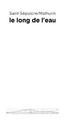
and to recognize the peaks of the Mont-Blanc-
Massif surrounding the square. Sometimes, these
types of maps point out where you are and how far
you are away from places the mapmaker considered
as valuable to add to the map. Information as the
train station of the SNCF, the train station to goi into
the mountains to Mer de Glace, parking lots, public
toilets, musea, and the Tourist Information Center
itself are on the map in the case of the Place de
l’église. A specific selection of information is shared
with the tourist. And even though such maps can
contain a rich collection of cultural, practical and
consumer-orientation information, a lot has been left
behind too. Inevitable for the mapmaker to make the
map easy and straightforward to read and interpret.
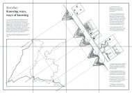
The map on Place de l’église is made from a
different point of view than the maps spatial designers
use for example. (2) But their purpose might be the
same. Namely, to get a better understanding of the
square and its environment. They contain lines for
streets or buildings. Or a line to where a landowner
can build a house, or lines that indicate special
construction concerns like for example, unstable
ground. Coloured surfaces are used to indicate
areas with architectural and heritage quality, natural
or historical quality or risk of inundation etc. Street
-and place names and other pieces of text, a legend