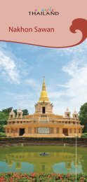
Sukhothai - TourismThailand.org - Tourism Authority of Thailand
Sukhothai - TourismThailand.org - Tourism Authority of Thailand
Sukhothai - TourismThailand.org - Tourism Authority of Thailand

You also want an ePaper? Increase the reach of your titles
YUMPU automatically turns print PDFs into web optimized ePapers that Google loves.
24<br />
standing at 1,160 metres above sea level. It houses the Royal Thai Air<br />
Force’s telecommunication station, which covers an area <strong>of</strong> 25 rai. Khao<br />
Narai boasts a beautifully steep cli�, an ideal recreational spot, where<br />
a panoramic view <strong>of</strong> the area is visible. Tourists can enjoy the city <strong>of</strong><br />
<strong>Sukhothai</strong> and Phitsanulok lit up at night. Khao Phra Mae Ya Peak is<br />
1,200 metres above sea level. It was formerly a meditation ground<br />
for Phra Mae Ya. Khao Phu Ka Peak and Khao Phra Chedi Peak stand<br />
at 1,200 and 1,185 metres above sea level, respectively. From these<br />
peaks, a bird’s-eye view <strong>of</strong> <strong>Sukhothai</strong>’s ancient dam and the city itself<br />
are virtually visible.<br />
Savannah ��� ����������������: Located in the high country <strong>of</strong> the Khao<br />
Luang Range, this savannah covers an area <strong>of</strong> approximately 3,000 rai,<br />
and contains various grasses and herbs.<br />
Sai Ngam���������� : This large banyan tree or Sai, which spreads<br />
its branches into a beautiful canopy, is located along the main Khao<br />
Luang hiking trail. This is an ideal recreational spot.<br />
Plong Nang Nak ��������������: About 320 metres from the banyan<br />
tree is located Plong Nang Nak hole, a 0.5-metre-wide and 1.5-metre-<br />
long vertical natural chimney. The depth is immeasurable. According<br />
to the Northern Chronicles about the myths <strong>of</strong> Phra Ruang, the ruler<br />
was in the Khao Luang range in order to keep the Buddhist precepts.<br />
Herbs and Medicinal Plants ��������� : There are hundreds <strong>of</strong><br />
herbs and medicinal plants in the national park such as prickly leaved<br />
elephants’ foot, Harpullia arborea, Brisbane lily, Sche�era leucantha,<br />
and birch.<br />
Suan Lum or Suan Lumphiniwan���������������������������� : It<br />
is a herbal garden situated at the foot <strong>of</strong> Khao Luang.<br />
The Ramkhamhaeng National Park’s headquarters is located here on<br />
the eastern side <strong>of</strong> Khao Luang.<br />
Pratu Prawattisat or Historical Gates �������������������� :<br />
Situated to the north <strong>of</strong> Suan Lum or the Ramkhamhaeng National<br />
Park’s headquarters is Pratu Pa. To the west is Pratu Makha, which is<br />
located at <strong>Sukhothai</strong>’s outpost town, while to the east is Pratu Plueai<br />
situated at the park’s checkpoint. Last but not least is Prutu Phra Ruang<br />
on the southern end <strong>of</strong> Suan Lum. Legend has it that Phra Ruang came<br />
to �y kites through this gate.<br />
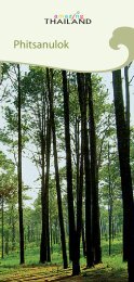
Namtok Sai Rung ���������������<br />
: Situated to the west <strong>of</strong> the Khao<br />
Luang Range, this beautifully renowned waterfall is fed by the sources<br />
on the high country <strong>of</strong> the Khao Phra Chedi Peak and further �ows into<br />
a stream called Khlong Phai Na. Then, it runs southwest and cascades