Sukhothai - TourismThailand.org - Tourism Authority of Thailand
Sukhothai - TourismThailand.org - Tourism Authority of Thailand
Sukhothai - TourismThailand.org - Tourism Authority of Thailand

You also want an ePaper? Increase the reach of your titles
YUMPU automatically turns print PDFs into web optimized ePapers that Google loves.
Suan Luang Phra Ruang Chaloem Phra Kiat or Phra<br />
Ruang Park (Thung Mae Rawing) �������������������������������<br />
��������������<br />
It is located at Mu. 9, Tambon Pa Kum Ko. Originally a large<br />
swamp, this park currently covers 830 rai: 645 rai <strong>of</strong> water, and 185 rai<br />
<strong>of</strong> land. An island <strong>of</strong> scenic beauty, due to its geographical form, this<br />
park marks an ideal recreational area. Various activities include crossing<br />
the old 300-metre wooden bridge and paying homage to the following<br />
idols: Phra Ruang statue at the Phra Ruang’s circle - situated at the<br />
island’s entrance, Kwan Yin statue, and Pu Kok shrine - situated near<br />
the Pa Kum Ko Sub-district Administration Organization. In addition,<br />
tourists can enjoy resting at the pavilions along the path, as well as,<br />
see the picturesque view around the island, mixed cultivation farming<br />
project, which includes paddy farming, horticulture, and poultry<br />
rearing. Furthermore, there is a farmer’s museum housing various<br />
ancient farming equipment and showcasing the traditional lifestyle<br />
<strong>of</strong> <strong>Sukhothai</strong> farmers. Tourists will also �nd a herbal demonstration<br />
garden, sapling nursery, and building selling products <strong>of</strong> <strong>Sukhothai</strong>.<br />
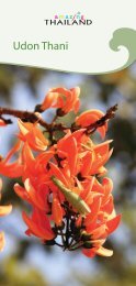
Amphoe Si Satchanalai<br />
Si Satchanalai Historical Park���������������������������������<br />
It is located at Tambon Mueang Kao, a.k.a. Kaeng Luang, which is 11<br />
kilometres o� Amphoe Si Satchanalai towards Amphoe Sawankhalok<br />
or some 550 kilometres from Bangkok. With an area <strong>of</strong> approximately<br />
45.14 square kilometres covering Tambon Si Satchanalai, Tambon<br />
Sarachit, Tambon Nong O, and Tambon Tha Chai, the ancient town <strong>of</strong> Si<br />
Satchanalai, formerly known as Mueang Chaliang, is located within Ban<br />
Phra Prang, Tambon Si Satchanalai. It was renamed during the reign <strong>of</strong><br />
Phra Ruang Dynasty when a new administrative centre was established<br />
to replace Chaliang. Ruins <strong>of</strong> 204 monuments out <strong>of</strong> 215 places have<br />
been discovered within the park. Major places <strong>of</strong> interest include:<br />
Wat Phra Si Rattana Mahathat ���������������������� Also<br />
known as Wat Phra Borommathat Mueang Chaliang or Wat Phra Prang,<br />
Wat Phra Si Rattana Mahathat is situated 3 kilometres outside and to<br />
the southeast <strong>of</strong> the ancient Si Satchanalai’s wall. This large historic<br />
temple complex is a 1 st class royal temple. Important buildings<br />
include the main prang built from blocks <strong>of</strong> laterite covered with lime<br />
plaster. Architectural characteristics <strong>of</strong> the prang tower indicate that<br />
it could be dated to the Ayutthaya period. A staircase in front <strong>of</strong> the<br />
huge prang leads to a relic chamber and the prang’s wall sees faded<br />
mural paintings. In front <strong>of</strong> this reliquary are remains <strong>of</strong> a large wihan<br />
enshrining an image <strong>of</strong> the Buddha subduing Mara. To the right features<br />
29