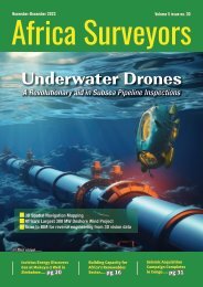
Africa Surveyors November-December 2022 digital issue
Africa Surveyors is Africa’s premier source of Surveying, Mapping and Geospatial news and an envoy of surveying products/service for the Construction, Maritime, Onshore & Offshore energy and exploration, Engineering, Oil and Gas, Agricultural and Mining sectors on new solution based trends and technology for the African market.
Africa Surveyors is Africa’s premier source of Surveying, Mapping and Geospatial news and an envoy of surveying products/service for the Construction, Maritime, Onshore & Offshore energy and exploration, Engineering, Oil and Gas, Agricultural and Mining sectors on new solution based trends and technology for the African market.
You also want an ePaper? Increase the reach of your titles
YUMPU automatically turns print PDFs into web optimized ePapers that Google loves.
GEOSPATIAL
Geospatial
Despite low investment,
geospatial technologies
prove an essential driver of
development in Africa
By Maina Waruru
Despite low government investment
and a lack of legal framework
to guide their use, geospatial
technologies are being applied in a wide
range of fields across Africa, and are proving
to be indispensable tools in the socioeconomic
development of the continent,
according to a recent conference on the topic.
The fifth edition of the Regional Centre for
Mapping of Resources for Development
(RCMRD) International Conference was
held online and in-person in Nairobi, Kenya
between 6-8 September 2022 and explored
the theme of ‘Earth observation services for
resilient social systems’.
“Geospatial technologies are critical in
building resilient social systems and even
more important, in making evidencebased
decisions for the attainment of the
Sustainable Development Goals (SDGs),”
Emmanuel Nkurunziza, director-general
of the RCMRD, tells Equal Times from the
organisation’s base in Nairobi.
The term broadly refers to the state-of-theart
tools used to collect, store and analyse
geographic information. These technologies
include remote sensing, global positioning
systems and geographical information
systems, and are being deployed in a variety
of areas – from humanitarian relief to
agriculture and urban planning – to carry
out tasks such as the mapping of forests,
lakes and other sensitive ecosystems
for biodiversity monitoring, disaster risk
reduction and disaster management.
Where laws allow the use of civilian
unmanned aerial vehicles, commonly known
as drones, they are being used in agriculture
to spray pesticides on farms and rangelands,
one example being the recent locust invasion
in the Horn of Africa. In addition, they have
proved useful in the delivery of essential
supplies such as medicine in remote areas
and in generating critical scientific data
during disasters to support evidence-based
decision making.
“We have witnessed different challenges
as a region, including the recent floods [in
Sudan, Malawi, South Africa, and since the
conference took place, Nigeria]. We have had
problems of drought affecting food security
and triggering water scarcity, and we are
seeing growing urban population pressures.
All of these challenges call on us to intensify
our ability to monitor the Earth so that we are
able to develop mitigation strategies,” says
Nkurunziza, as well as improve the efficient
delivery of services for the betterment of
Africa’s 1.4 billion people.
Crucial and accurate data
Exploring seven thematic areas such as geoinnovation
in health, and smart and green
cities, over 600 conference attendees heard
about the successes and lessons in the use of
Earth observation technologies. For example,
in the area of forest governance, the use
of applications in two forest observatories
dedicated to monitoring the ecosystems of
southern and central Africa are providing
crucial real-time data to help in improved
management of the forests, according to
Robert Nasi, director-general of the Centre for
International Forestry Research (CIFOR) based
in Bogor, Indonesia.
One of the observatories is the East and
Southern Africa Forest Observatory OFESA,
which provides information on trends and
threats to forests in Ethiopia, Kenya, Tanzania,
Mozambique and Uganda for better decisionmaking
management of forest ecosystems.
Led by CIFOR and RCMRD, and funded by the
European Union, the initiative is developing
a governance framework which will allow
participating countries to share, use and
analyse data to address common issues, such
36 November-December issue l 2022 www.africasurveyorsonline.com


