Africa Surveyors November-December issue 2023
Africa Surveyors is Africa’s premier source of Surveying, Mapping and Geospatial news and an envoy of surveying products/service for the Construction, Maritime, Onshore & Offshore energy and exploration, Engineering, Oil and Gas, Agricultural and Mining sectors on new solution based trends and technology for the African market.
Africa Surveyors is Africa’s premier source of Surveying, Mapping and Geospatial news and an envoy of surveying products/service for the Construction, Maritime, Onshore & Offshore energy and exploration, Engineering, Oil and Gas, Agricultural and Mining sectors on new solution based trends and technology for the African market.

You also want an ePaper? Increase the reach of your titles
YUMPU automatically turns print PDFs into web optimized ePapers that Google loves.
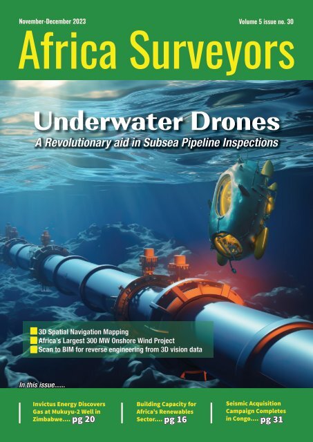
<strong>November</strong>-<strong>December</strong> <strong>2023</strong> Volume 5 <strong>issue</strong> no. 30<br />
<strong>Africa</strong> <strong>Surveyors</strong><br />
Underwater Drones<br />
A Revolutionary aid in Subsea Pipeline Inspections<br />
3D Spatial Navigation Mapping<br />
<strong>Africa</strong>’s Largest 300 MW Onshore Wind Project<br />
Scan to BIM for reverse engineering from 3D vision data<br />
In this <strong>issue</strong>......<br />
Invictus Energy Discovers<br />
Gas at Mukuyu-2 Well in<br />
Zimbabwe....<br />
Building Capacity for<br />
<strong>Africa</strong>’s Renewables<br />
Sector....<br />
Seismic Acquisition<br />
Campaign Completes<br />
in Congo....<br />
pg 20 pg 16 pg 31
AVAILABLE NOW<br />
Survey | Spill Response | Search-and-Rescue | Fire | Security | Offshore Wind | Aquaculture<br />
Sea Machines’ innovation and advanced technology gives vessel owners an operational advantage. Contact us to<br />
schedule a live demonstration and learn how Sea Machines can solve your most persistent challenges on the water.<br />
SEA MACHINES<br />
Request a live demo at<br />
sea-machines.com/contact
Invictus Energy Discovers<br />
Gas at Mukuyu-2 Well in<br />
Zimbabwe....<br />
Building Capacity for<br />
<strong>Africa</strong>’s Renewables<br />
Sector....<br />
Seismic Acquisition<br />
Campaign Completes<br />
in Congo....<br />
Current Issue<br />
In this <strong>issue</strong>, we look<br />
at the Underwater<br />
Drones - A Revolutionary<br />
aid in Subsea Pipeline<br />
Inspections & much<br />
more...enjoy the <strong>issue</strong>!<br />
<strong>November</strong>-<strong>December</strong> <strong>2023</strong> Volume 5 <strong>issue</strong> no. 30<br />
<strong>Africa</strong> <strong>Surveyors</strong><br />
Underwater Drones<br />
A Revolutionary aid in Subsea Pipeline Inspections<br />
3D Spatial Navigation Mapping<br />
<strong>Africa</strong>’s Largest 300 MW Onshore Wind Project<br />
Scan to BIM for reverse engineering from 3D vision data<br />
Contents<br />
22<br />
CONTENTS<br />
30<br />
In this <strong>issue</strong>......<br />
pg 20 pg 16 pg 31<br />
REGULARS<br />
News Briefs 4<br />
33 18<br />
Events 10<br />
Innovation 12<br />
Opinion 18<br />
Safety Tips 36<br />
Director<br />
Augustine M. Rang’ondi<br />
Senior Editor<br />
& Marketing Lead<br />
Dorcas Kang’ereha<br />
COVER STORY<br />
Underwater Drones: A Revolutionary Aid in Subsea Pipeline<br />
Inspections<br />
Writers<br />
Harriet Mkhaye<br />
Irene Joseph<br />
Claudia Mangi<br />
Sales Executives<br />
FEATURES<br />
The Challenge: Building Capacity for <strong>Africa</strong>’s Renewables<br />
Sector<br />
East <strong>Africa</strong><br />
Lydia Kamonya<br />
Caiser Momanyi<br />
Vincent Murono<br />
Sheilah Ing’ayitsa<br />
South <strong>Africa</strong><br />
Paul Nyakeri<br />
Lisa Brown<br />
Sean Masangwanyi<br />
Thembisa Ndlovu<br />
Nigeria<br />
Imelda Njomboro<br />
Uche Maxwel<br />
KICT Team develops scan-to-BIM for reverse engineering<br />
from 3D vision data<br />
The Next Regional Power Play: Invictus Energy Discovers<br />
Gas at Mukuyu-2 Well in Zimbabwe<br />
Unlocking <strong>Africa</strong>’s Untapped Natural Hydrogen Potential<br />
Kuwait expected to award survey and soil investigation<br />
contract in Q2 2024<br />
Sanu Gold Commences Ground Geophysics Program at the<br />
Bantabaye Permit in Guinea, West <strong>Africa</strong><br />
20<br />
Published and<br />
Designed By:<br />
ADVERTISER’S INDEX<br />
Josem Trust House,<br />
3rd Floor, Bunyala Road,<br />
Upper Hill.<br />
P.O. Box 52248-00100,<br />
Nairobi, Kenya.<br />
Sea Machines....................................................................................................................IFC<br />
Caroni.................................................................................................................................IBC<br />
Navvis...............................................................................................................................OBC<br />
Altavec............................................................................................................................pg 17<br />
Forssea Robotics.........................................................................................................pg 32<br />
Euclideon.......................................................................................................................pg 35<br />
Imagenex.......................................................................................................................pg 37<br />
MacArtney.....................................................................................................................pg 38<br />
36<br />
Contact us:<br />
Tel: +254 113 194 740<br />
Email: info@africasurveyorsonline.com<br />
Web: https://africasurveyorsonline.com<br />
The Editor accepts letter and manuscripts for publication from readers all over the world. Include your name and address as a sign of good faith although you may<br />
request your name to be withheld from publication. We can reserve the right to edit any material submitted. Send your letters to: info@africaautomotivenews.com<br />
Disclaimer:<br />
Nailex <strong>Africa</strong> Publishing Ltd makes every effort to ensure the accuracy of the contents of its publications, but no warranty is made to such accuracy<br />
and no responsibility will be borne by the publisher for the consequences of actions based on information so published. Further, opinions expressed<br />
on interviews are not necessarily shared by Nailex <strong>Africa</strong> Publishing Ltd.<br />
www.africasurveyorsonline.com<br />
<strong>November</strong>-<strong>December</strong> <strong>issue</strong> l <strong>2023</strong> 3
NEWS BRIEFS<br />
<strong>Surveyors</strong> oppose government’s plans to<br />
hike land rates<br />
The government of Kenya is seeking<br />
to implement a proposal to hike land<br />
rates and transfer of the National<br />
Land Commission (NLC) functions to the<br />
Lands Ministry. However, the Institution of<br />
<strong>Surveyors</strong> of Kenya (ISK) has opposed this<br />
proposal terming it as punitive to ordinary<br />
citizens while the transfer functions from<br />
the Lands Agency would contravene the<br />
constitution.<br />
Contrary, the World bank is backing up the<br />
land rates and fees increment, saying it will<br />
improve revenue collection by the Ministry of<br />
Lands which is expected to increase the cost<br />
of land by more than 100 times. According to<br />
Eric Nyadimo, the ISK president, the proposals<br />
will have ripple effects on the country’s<br />
economy and would be costly for ordinary<br />
citizens.<br />
“We find that these proposals are very unfair<br />
to members of the public and we reject them.<br />
For instance, we find that Sh2000 for land<br />
search as unfair because the Kenyans already<br />
pay taxes which are supposed to be used to<br />
provide services,” said Eric Nyadimo.<br />
“We are saying why should the government<br />
charge or increase rates when there are<br />
no services for instance having rates<br />
for freehold land yet there is no proper<br />
sewerage or good roads. We are saying rates<br />
should only be based on services that are<br />
being offered,” Adds Mr. Nyadimo.<br />
In his objection, Nyadimo added that, the<br />
proposals to transfer some functions from<br />
NLC such as land valuation, would negate<br />
the gains made on land reforms as the<br />
ministry will get more unchecked powers.<br />
“We are yet to decide on what to do next<br />
should the proposals go through but we<br />
reject these proposals,” he added.<br />
He noted that, although they back the<br />
digitising of land records through the Ardhi<br />
Sasa to improve service delivery, they called<br />
for the creation of a committee involving<br />
professionals and state officials to ensure<br />
proper implementation of the system.<br />
Australian company to start seismic survey<br />
off West Coast in January<br />
At the start of the new year, an<br />
Australian company based in the UK,<br />
Searcher Geodata, plans to begin<br />
a seismic survey for oil and gas reserves off<br />
South <strong>Africa</strong>’s West Coast.<br />
The survey, over 30,000 square kilometres<br />
about 220km offshore between St Helena<br />
Bay and Hondeklip Bay, involves blasting<br />
continuous pulses of sound at 255 decibels<br />
(dB) to create a 3D map of the seafloor and<br />
underlying geology. Decibel charts for human<br />
sound don’t usually go above 150dB, which is<br />
the intensity of fireworks and gunshots, and is<br />
considered painful and dangerous.<br />
The green area is where Searcher Geodata will do its<br />
seismic survey in 2024. Map from consultant’s environmental<br />
assessment report. Image: courtesy<br />
Western Cape High Court by small-scale<br />
fishers and civic rights organisation We Are<br />
South <strong>Africa</strong>ns.<br />
Shelter Afrique<br />
Development Bank<br />
Pioneers Affordable<br />
Housing Credit<br />
Guarantee Program in<br />
Nigeria<br />
Shelter Afrique Development Bank - HQ Image:<br />
Shelter Afrique<br />
Shelter Afrique Development Bank<br />
(ShafDB), a leading Pan-<strong>Africa</strong>n<br />
institution committed to financing<br />
and advancing housing, urban, and related<br />
infrastructure development, is delighted to<br />
announce its innovative Affordable Housing<br />
Credit Guarantee Program in Nigeria, fully<br />
approved by its Board of Directors.<br />
The innovative financing structure has begun<br />
with the first pilot transaction of Naira<br />
three billion (Naira 3 Billion) debt financing<br />
guarantee for Modern Shelter Systems and<br />
Services Limited (“Modern Shelter”) under a<br />
comprehensive affordable housing program.<br />
This groundbreaking initiative, facilitated by<br />
InfraCredit, a triple A (AAA)-rated specialized<br />
infrastructure credit guarantee institution,<br />
aims to develop 370 affordable housing units<br />
in Nasarawa Technology Village, adhering to<br />
the International Finance Corporation’s (IFC)<br />
green building standards, EDGE.<br />
This initiative is part of Shelter Afrique<br />
Development Bank (ShafDB)’s expansive<br />
Naira 200 billion Affordable Housing Credit<br />
Program in Nigeria. Early last year, ShafDB<br />
proceeded with a debut Naira 46 billion bond<br />
issuance in Nigeria’s capital market which was<br />
oversubscribed by 60.7%, reflecting a strong<br />
investor appetite.<br />
According to the Environmental Basic<br />
Assessment Report, sound levels will still be<br />
160dB four kilometres away from the ship.<br />
Searcher tried to start a 3D survey off the<br />
West Coast last year but was halted by<br />
an interdict obtained in March 2022 in the<br />
Then on 20 <strong>December</strong> last year, the<br />
Department of Minerals and Energy<br />
granted environmental approval after<br />
a new application had been lodged<br />
on 1 <strong>November</strong> by a newly appointed<br />
environmental assessment practitioner<br />
(EAP), Environmental Impact Management<br />
Services.<br />
ShafDB’s debut bond issuance lays the ground<br />
for its local currency funding to mitigate<br />
foreign currency risk. Along with ShafDB’s<br />
anchor investment in Housing Solution Fund<br />
(HSF), to address the demand side, we are<br />
closing the loop on de-risking the housing<br />
ecosystem and value-chain.<br />
4 <strong>November</strong>-<strong>December</strong> <strong>issue</strong> l <strong>2023</strong> www.africasurveyorsonline.com
NEWS BRIEFS<br />
ATIDI signs<br />
partnership agreement<br />
to underwrite AMEA<br />
Power’s 20 MW Solar<br />
Project in Uganda<br />
(L-R) ATIDI CEO Manuel Moses and AMEA Power<br />
Senior Director for Project Development Aqueel Bohra<br />
Image: ATIDI<br />
<strong>Africa</strong>n Trade & Investment<br />
Development Insurance, ATIDI,<br />
announced its intent to support the<br />
20 MW Ituka West Nile Uganda Ltd solar<br />
project developed by AMEA Power, a Dubaibased<br />
Independent Power Producer (IPP).<br />
ATIDI will support the project via its Regional<br />
Liquidity Support Facility (RLSF) by providing<br />
payment guarantees for the benefit of the<br />
project on behalf of the Ugandan national<br />
power utility, Uganda Electricity Transmission<br />
Company Limited (UETCL).<br />
China partners with Kenya to boost geospatial<br />
technology cooperation<br />
Supermap International, Chinese<br />
technology firm has signed an<br />
agreement with the Kenya’s<br />
Directorate of Resource Surveys and Remote<br />
Sensing (DRSRS) to enhancing the East<br />
<strong>Africa</strong>n nation’s proficiency in geospatial<br />
technology.<br />
The agreement includes training of over<br />
70 Kenyan government officials, academics<br />
and private sector individuals in advanced<br />
Geographic Information Systems (GIS) over<br />
the course of one year, said Director of<br />
DRSRS Moses Akali.<br />
“The collaboration between DRSRS and<br />
Supermap International seeks to bolster<br />
Kenya’s institutional capacity in utilizing<br />
space-derived products, services and<br />
customized tools for diverse needs in<br />
natural resource management, planning, and<br />
monitoring,” Akali said.<br />
Speaking during the <strong>2023</strong> Supermap GIS<br />
software innovation conference, themed<br />
“GIS Innovations for Rapid Spatial Data<br />
Analysis and 3D Modeling for Sustainable<br />
Development in Kenya and Beyond,” Akali<br />
stressed Kenya’s interest in harnessing<br />
Supermap’s advanced technologies in such<br />
fields as big data, artificial intelligence, 3D<br />
modeling, distributed GIS and cross-platform<br />
GIS, which would enable the country to<br />
develop robust solutions for urban planning,<br />
cadastral mapping, natural resource<br />
management, traffic monitoring and land<br />
valuation planning.<br />
Moreover, Akali said that by integrating<br />
remote sensing data processing and<br />
interpretation capabilities into GIS<br />
technologies, Supermap would facilitate<br />
Kenya’s more efficient application of<br />
geospatial data, which could extend to<br />
areas such as food security, natural disaster<br />
monitoring and management, climate change<br />
and carbon emission control.<br />
Chikunga receives specialised agency<br />
to audit SA’s marine operations<br />
“At ATIDI, we believe in fostering sustainable<br />
development, and one crucial avenue is<br />
supporting IPPs who propel diversification<br />
of <strong>Africa</strong>’s energy mix. Over the past years,<br />
Uganda has demonstrated remarkable strides<br />
in its energy sector, and we are proud to play<br />
a role in this transformative journey. Our<br />
recent collaboration with IPPs in Uganda is<br />
not just about power generation; it’s about<br />
empowering communities, driving economic<br />
growth, and fostering a sustainable future,”<br />
said ATIDI CEO Manuel Moses.<br />
AMEA Power Senior Director for Project<br />
Development Aqueel Bohra saidinvesting<br />
in renewable energy in Uganda was part of<br />
the company’s pledge to deliver sustainable<br />
energy to all.<br />
“We thank ATIDI for their support, which is<br />
crucial for the success of the project. Our solar<br />
project will not only help provide essential<br />
power to homes and industries but will also<br />
drive economic growth, creating jobs, and<br />
safeguarding the environment.”<br />
Transport Minister Sindisiwe<br />
Chikunga has officially welcomed the<br />
International Maritime Organisation<br />
audit team who are in the country to conduct<br />
a mandatory audit under the IMO’s Member<br />
State Audit Scheme (IMSAS).<br />
Speaking at Monday’s opening meeting<br />
in Cape Town, the Minister described the<br />
gathering as a milestone as the country<br />
forges ahead with upholding international<br />
standards and compliance in maritime<br />
operations.<br />
The International Maritime Organisation,<br />
which South <strong>Africa</strong> became a member of in<br />
1995, is a specialised agency of the United<br />
Nations (UN) responsible for regulating and<br />
promoting responsible shipping on a global<br />
scale.<br />
South <strong>Africa</strong>’s participation in the IMO,<br />
enables the country to contribute to the<br />
Image: Courtesy IMO<br />
development of international maritime<br />
policies and standards, mainly related to<br />
maritime safety, pollution prevention and the<br />
welfare of seafarers.<br />
“South <strong>Africa</strong> also benefits from IMO<br />
initiatives that support capacity building,<br />
technical assistance and development in the<br />
maritime sector.”<br />
The IMO’s audit scheme has created a<br />
regulatory framework for the shipping<br />
industry that is fair and effective, universally<br />
adopted and implemented. It also promotes<br />
a safe and secure environment and efficient<br />
and sustainable shipping.<br />
www.africasurveyorsonline.com<br />
<strong>November</strong>-<strong>December</strong> <strong>issue</strong> l <strong>2023</strong> 5
INTERNATIONAL<br />
LiDAR developer and manufacturer<br />
YellowScan and drone manufacturer<br />
DeltaQuad are joining forces once again.<br />
The outcome – more quality 3D mapping<br />
data than ever. The YellowScan Surveyor<br />
Ultra LiDAR system with an embedded<br />
camera is now integrated into DeltaQuad Evo,<br />
bringing 1200 ha of dense point clouds for<br />
professionals worldwide.<br />
Longer quality flight times<br />
Yellowscan and DeltaQuad join forces<br />
The YellowScan Surveyor Ultra OEM is a<br />
new lightweight 360° LiDAR system with a<br />
120° field of view for quality mapping and<br />
surveying. Standing out with high point<br />
density and light weight, it can now be<br />
used to its fullest extent with DeltaQuad<br />
Evo Unmanned Aerial Vehicle (UAV). Evo is<br />
a new-age fixed-wing Vertical Take-off and<br />
Landing (VTOL) UAV for multipurpose longrange<br />
missions. Due to its modularity, Evo<br />
can carry multiple payloads simultaneously,<br />
like the newest YellowScan Surveyor Ultra<br />
OEM with an auxiliary battery. This lets the<br />
Evo fly for up to 225 min, capturing up to<br />
Record 1200 ha of colorized LiDAR coverage Image: DELTAQUAD<br />
100 data points per square meter. Since<br />
the data is processed swiftly and easily<br />
with the YellowScan CloudStation software,<br />
the integration is perfectly suited for large<br />
surveying projects.<br />
Continuous attention to mapping experts<br />
Just earlier this year, both companies<br />
announced Evo becoming the first fixed-wing<br />
eVTOL UAV to integrate YellowScan LiDAR &<br />
RGB systems. Now, Tristan Allouis, cofounder<br />
and CEO of YellowScan, shares the excitement<br />
about the continuation of the collaboration:<br />
“Gradual progress is what empowers<br />
trembling innovations. Integrating the<br />
YellowScan Surveyor Ultra OEM in DeltaQuad<br />
Evo is a small step but opens up the window<br />
of opportunities wider for many mapping and<br />
surveying experts.” Douwe Zeeman, the CEO<br />
of DeltaQuad, adds: “It is a pleasure to see<br />
our products help professionals in different<br />
industries and regions. Now, enabled to fly<br />
longer distances, they can use the benefits of<br />
colorized LiDAR to the maximum.”<br />
Strava releases Flyover, an aerial 3D video look back of all<br />
your GPS activities<br />
Strava, the subscription platform at the<br />
center of connected fitness, announced<br />
a new feature today, Flyover, a 3D video<br />
map rendering with the signature orange<br />
polyline that recreates the athlete’s activities<br />
and inspires new adventures.<br />
The Flyover is a video recap of the activity<br />
from a bird’s eye view, offering Strava<br />
subscribers a different take on their activity.<br />
Starting by zooming into the route, it displays<br />
the signature Strava orange polyline in<br />
motion as the athlete moves throughout the<br />
activity. Flyovers are available for all GPSenabled<br />
activities on the subscriber’s profile,<br />
including past activities.<br />
The new feature is the latest integration<br />
of FATMAP’s mapping technology into the<br />
platform. Along with acquiring the outdoor<br />
adventure platform earlier this year, Strava<br />
has been rolling out additional features for<br />
athletes to enjoy such as winter 3D maps,<br />
maps and route creation, custom waypoints,<br />
route details and photos via the online Route<br />
Builder.<br />
The platform offers a 3D video map rendering of the athlete’s adventure. Images: STRAVA<br />
6 <strong>November</strong>-<strong>December</strong> <strong>issue</strong> l <strong>2023</strong> www.africasurveyorsonline.com
Woolpert Awarded $13M Contract to Collect Bathymetric Lidar Data<br />
for Florida Seafloor Mapping Initiative<br />
INTERNATIONAL<br />
The Florida Department of<br />
Environmental Protection has tasked<br />
Woolpert with acquiring bathymetric<br />
survey data using lidar technologies to<br />
support the Florida Seafloor Mapping<br />
Initiative (FSMI) and its mission to produce<br />
a comprehensive, publicly available, highresolution<br />
seafloor surface model of Florida’s<br />
coastal waters by 2026.<br />
FSMI builds on the efforts of the Florida<br />
Coastal Mapping Program (FCMaP), an<br />
initiative led by federal and Florida state<br />
agencies and other community stakeholders<br />
to facilitate the collection of approximately<br />
171,780 square kilometers of high-resolution<br />
coastal seafloor data from Florida’s shoreline<br />
to the continental shelf.<br />
Once completed, the FSMI dataset is expected<br />
to be merged with existing terrestrial lidar.<br />
The data will be used by federal and Florida<br />
state agencies to help better understand the<br />
state’s coastal vulnerability and hurricane<br />
impacts, evaluate the performance of<br />
restoration projects, and support<br />
ongoing coastal resilience efforts<br />
and flood risk mapping.<br />
Under this task order, Woolpert will<br />
collect 23,418 square kilometers<br />
of bathymetric lidar data off<br />
Florida’s southern coast, including<br />
the Florida Keys and extending<br />
southwest to Dry Tortugas National Park.<br />
Woolpert Program Director Rick Householder<br />
said FSMI will acquire the data in two phases.<br />
Phase I will include the aircraft acquisition<br />
of topographic and bathymetric lidar data up<br />
to 20 meters of depth. Phase II will include<br />
the acquisition of data beyond 20 meters in<br />
depth up to 200 meters using marine vessels<br />
equipped with multibeam sonar.<br />
“The scale and impact of this project is<br />
extraordinary. From helping assess the health<br />
of Florida’s marine habitats to improving<br />
disaster response and resiliency, the amount<br />
of information gained through this initiative<br />
The Florida Department of Environmental<br />
Protection data will be used to help evaluate<br />
the performance of restoration projects and<br />
support coastal resilience efforts. Image:<br />
Courtesy<br />
will have an exponential impact across the<br />
state for decades to come,” Householder said.<br />
“Not only is this data crucial for the future of<br />
protecting Florida’s coastal communities, but<br />
this initiative has the potential to provide a<br />
blueprint on the benefits of seafloor mapping<br />
for all the continental U.S.”<br />
Householder said that the full set of data is<br />
expected to be acquired by May of next year<br />
and delivered in summer 2024. The contract<br />
is currently underway.<br />
Red Sea Global and VAARST collaborate for<br />
advanced marine ecosystem mapping<br />
Red Sea Global (RSG), the multi-project<br />
developer behind the world’s most<br />
ambitious regenerative tourism<br />
destinations, is piloting SubSLAM, an<br />
advanced photogrammetry technology<br />
developed by VAARST, a leader in marine<br />
robotics. This technology is being used<br />
to produce high-resolution, 3D digital<br />
representations of Al Wajh Lagoon’s coral<br />
reefs and vital habitats.<br />
This state-of-the-art system is the<br />
most accurate underwater 3D real-time<br />
measurement system available on the<br />
market. VAARST’s photogrammetry and realtime<br />
intelligent data collection system are<br />
transforming how underwater ecosystems<br />
are mapped and preserved. This marks a first<br />
in Saudi Arabia and is a testament to RSG’s<br />
commitment to sustainable and regenerative<br />
tourism.<br />
SubSLAM’s capabilities enable precise<br />
quantification and identification of corals<br />
and underwater objects using advanced 4K<br />
www.africasurveyorsonline.com<br />
Utilizing SubSLAM’s cutting-edge capabilities, RSG precisely quantifies and identifies corals<br />
and underwater objects Image: Read Sea Global<br />
sensors. This technology guides remotely<br />
operated vehicles in detailed habitat<br />
inspections, comparing current and past<br />
imagery to monitor changes and promote<br />
biodiversity.<br />
This technology also empowers RSG’s<br />
scientists, in collaboration with King<br />
AbdulAziz University in Jeddah, to rapidly<br />
identify and classify marine species without<br />
the arduous task of reviewing hours of<br />
footage. Furthermore, it effectively eliminates<br />
the risk of human error caused by fatigue.<br />
This proactive approach is vital for addressing<br />
challenges like coral bleaching and invasive<br />
species, ensuring the Red Sea’s beauty and<br />
diversity remain intact for visitors.<br />
<strong>November</strong>-<strong>December</strong> <strong>issue</strong> l <strong>2023</strong> 7
EVENTS<br />
Nigeria Sets New Standard in Civil Registration with<br />
Launch of Innovative e-CRVS System<br />
In a landmark event at the State House in Abuja, His Excellency<br />
President Bola Ahmed Tinubu launched the Electronic Civil<br />
Registration and Vital Statistics System (e-CRVS), alongside the<br />
National Geospatial Data Repository and the National Coordination<br />
Committee on CRVS.<br />
This launch, realized through the collaboration of the National<br />
Population Commission (NPC), UNICEF, and Barnksforte Technologies<br />
Limited, marks a decisive step toward enhancing Nigeria’s civil<br />
registration and vital statistics system, underpinning the nation’s<br />
commitment to achieving Sustainable Development Goal 16.9.2 for<br />
legal identity for all.<br />
Speaking on this significant event, the Chairman, National Population<br />
Commission, Hon. Nasir Isa Kwarra, expressed his enthusiasm, saying<br />
“The aim of this high-level event is to emphasize the commitment of<br />
the current government and leadership to strengthen civil registration<br />
data capturing, collation, processing, dissemination and timely access<br />
to vital statistics in the country. It is to accelerate the improved civil<br />
registration and vital statistics systems in Nigeria over a period of<br />
ten years, from <strong>2023</strong> to 2030 in a bid to achieve the Sustainable<br />
Development Goal (SDG):16.9.2 - legal identity for all, including birth<br />
registration”.<br />
“Digitizing civil registration in Nigeria transcends technology; it’s<br />
a pledge to future generations. Now, every child’s existence will be<br />
acknowledged, marking a new era where every significant life event<br />
informs our nation’s development,” expressed Ms. Cristian Munduate,<br />
UNICEF Representative in Nigeria.<br />
This initiative aligns with the United Nations Legal Identity Agenda<br />
and the resolutions of the <strong>Africa</strong>n Ministers’ Conference in Addis Ababa,<br />
advocating for a technological shift in data generation. The strategic<br />
partnership between NPC and UNICEF, complemented by the Public-<br />
Private Partnership with Barnksforte Technologies Limited, is set to<br />
overhaul the registration of vital events, transitioning Nigeria from a<br />
paper-based system to an internationally aligned digital framework.<br />
The newly established CRVS National Coordination Committee is<br />
tasked with steering the e-CRVS system, ensuring Nigeria’s capability<br />
to capture and leverage vital statistics.<br />
Through this transformation, Nigeria is laying the groundwork for<br />
an effective civil registration system, essential for national planning,<br />
policymaking, and achieving the global ambition of legal identity for<br />
all.<br />
8 <strong>November</strong>-<strong>December</strong> <strong>issue</strong> l <strong>2023</strong> www.africasurveyorsonline.com
EVENTS<br />
RCMRD Announces<br />
Winners of its <strong>2023</strong><br />
Map Competition<br />
Images courtesy RCMRD<br />
Dompezodwa Nhlapho receiving EUR 4,000 for her project on<br />
Mapping Invasive Species in Lesotho Wetlands. Image: RCMRD<br />
By Deborah Faboade<br />
The Regional Centre for Mapping of Resources for Development (RCMRD)<br />
has announced the winners of the <strong>2023</strong> RCMRD Map Competition<br />
themed ‘’Environmental and Biodiversity Conservation Efforts to Protect<br />
our Natural Resources’’. The competition aimed to promote the use of maps and<br />
Earth Observation and create awareness of the data-sharing geo-portals and<br />
observatories to allow users to discover GIS datasets and creatively use them to<br />
develop innovative solutions.<br />
The competition recorded participation from 25 <strong>Africa</strong>n countries, including Angola,<br />
Botswana, Burundi, Comoros, Djibouti, Eritrea, Eswatini, Ethiopia, Kenya, Lesotho,<br />
Madagascar, Malawi, Mauritius, Mozambique, Namibia, Rwanda, Seychelles, Somalia,<br />
South <strong>Africa</strong>, South Sudan, Sudan, Tanzania, Uganda, Zambia and Zimbabwe.<br />
The participants competed in the School Category (Per School Award) and the<br />
Professional Category (Individual Award), focusing on initiatives connected to<br />
environmental and biodiversity conservation efforts aimed at safeguarding or<br />
raising awareness about natural resources.<br />
The Per School Award was subdivided into Primary School and Secondary School<br />
categories, with a EUR 2,000 award prize. Tr Adam Khaemba and Tr Patricia Muthusi<br />
(Grade 6 and 8) from the Valley Bridge Primary School in Nairobi, Kenya, emerge<br />
as the Primary School Category winners. Their initiatives centred on “Save the<br />
Environment – Two Sides of a Coin”. While Mombasa and Beatrice Oyange (Grade<br />
9) from Shree Swaminarayan Academy, Kenya, emerged winners in the Secondary<br />
Category. Their initiative centered around the theme “My Tusks are Valuable”.<br />
The Individual Award category was split into two sub-categories, Land Theme and<br />
Marine Theme, with a EUR 2,000 award prize. Frank Anderson from Dar es Salaam,<br />
Tunisia, emerged as the winner for the Land Theme category. His initiative centred<br />
around “Safeguarding Tanzania’s Eastern Arc Mountains Forests”. Julius Ivan from<br />
Kampala, Uganda, emerged as the Marine Theme category winner. His initiative<br />
centred on the “Restoration of the Protection Zone of Lake Nakivaale, Uganda’’.<br />
Dompezodwa Nhlapho from Maseru, Lesotho, emerged as the overall winner, with<br />
an award prize of EUR 4,000. Her initiative centred on “Mapping Invasive Species in<br />
Lesotho Wetlands”.<br />
www.africasurveyorsonline.com<br />
<strong>November</strong>-<strong>December</strong> <strong>issue</strong> l <strong>2023</strong> 9
COVER STORY<br />
Underwater Drones<br />
A Revolutionary aid in Subsea Pipeline Inspections<br />
By Dorcas Kang’ereha<br />
Subsea pipeline reviews are essential in<br />
guaranteeing the submerged framework’s honesty<br />
and security. These inspections have traditionally<br />
been time-consuming, expensive, and necessitated<br />
extensive human resources and specialized equipment. On<br />
the other hand, underwater drones have revolutionized the<br />
process, providing significant advantages in terms of efficiency,<br />
accuracy, and cost-effectiveness.<br />
“Subsea pipeline inspection is critical to the safe transfer of oil<br />
and gas from off-shore rigs to storage and processing facilities<br />
on land. As perhaps the costliest and most widely installed<br />
component in subsea infrastructure, subsea pipelines bear a<br />
high possibility of suffering damage. This could be the result<br />
of anything from equipment failure and corrosion to human<br />
error and natural causes,” says Peter Baker, Senior Product<br />
Manager - Subsea at Advanced Navigation.<br />
“The future of subsea pipeline inspections lies within the<br />
advanced technology of professional underwater drones<br />
that prioritize user-friendly operation, ensuring reliability<br />
in challenging offshore environments. The integration of<br />
underwater drones has emerged as a transformative force<br />
in the oil and gas industry,” adds Mira Nagle, Marketing<br />
Administrator at Oceanbotics Inc.<br />
Underwater drones are changing subsea pipeline inspections<br />
in the following ways.<br />
How underwater drones are beneficial in subsea pipeline<br />
inspections;<br />
1. Enhanced Mobility and Accessibility<br />
Even in challenging environments, underwater drones provide<br />
unparalleled access to subsea pipelines. These drones can<br />
effortlessly navigate through intricate underwater structures,<br />
such as pipelines, thanks to their sophisticated propulsion<br />
systems and precise control mechanisms. Their minimized<br />
size permits them to arrive at bound spaces that would be<br />
difficult to reach by human jumpers, making it conceivable<br />
10 <strong>November</strong>-<strong>December</strong> <strong>issue</strong> l <strong>2023</strong> www.africasurveyorsonline.com
UNDERWATER DRONES<br />
Peter Baker, Senior Product Manager - Subsea<br />
at Advanced Navigation. Image: Advanced<br />
Navigation<br />
to examine every last bit of the pipeline.<br />
According to Mira, underwater drones present<br />
a user-friendly and efficient alternative to<br />
the challenges associated with traditional<br />
inspection methods. “These challenges<br />
include harsh underwater conditions,<br />
unsafe working environments, unreliable<br />
equipment and time-consuming operations,<br />
all of which ultimately result in increased<br />
costs,” she explains. Because of the increased<br />
access, thorough inspections are guaranteed,<br />
identifying potential <strong>issue</strong>s before they<br />
become significant. “The demand for greater<br />
flexibility, maneuverability and scalability is<br />
driving underwater drones, or micro-AUVs,<br />
to become an increasingly popular tool for<br />
inspecting subsea pipelines,” Peter notes.<br />
2. Visual Inspection in Real Time<br />
The ability of underwater drones to capture<br />
high-definition images and videos in real<br />
time is one of their significant advantages.<br />
These drones provide inspectors with a clear<br />
and comprehensive view of the pipeline’s<br />
condition thanks to their powerful cameras<br />
and lights. Using a protection analyzer, the<br />
robot can survey the nature of the pipeline’s<br />
protection, recognizing any weak spots or<br />
harm. This visual inspection in real-time<br />
makes it possible to make quick decisions<br />
and take immediate corrective actions when<br />
needed.<br />
3. Testing That Isn’t Destructive<br />
Underwater drones provide a non-destructive<br />
testing method for subsea pipeline<br />
inspections. The infrastructure’s integrity can<br />
be jeopardized by invasive techniques like<br />
cutting into the pipeline or using intrusive<br />
probes in traditional ways. The traditional<br />
approach of sending a large construction<br />
vessel equipped with a work-class ROV is<br />
inefficient, expensive and labour-intensive,”<br />
observed Peter. “The answer to this challenge<br />
Mira Nagle, Marketing Administrator at<br />
Oceanbotics Inc. Image: Oceanbotics<br />
is smaller vessels that burn little to no fuel,<br />
remove humans from dangerous conditions<br />
and can be deployed on a large scale.<br />
Specifically in the offshore energy sector,<br />
scalability is pivotal to the effectiveness of<br />
any kind of operation,” he recommends. The<br />
risk of further damage to the channel is kept<br />
to a minimum with this non-destructive<br />
method, and the inspection results are<br />
guaranteed to be accurate and dependable.<br />
4. Effortless Data Gathering and<br />
Analysis<br />
Submerged drones smooth out the<br />
information assortment process during subsea<br />
pipeline reviews. Using a protection analyzer,<br />
these robots can accumulate essential<br />
information on the protection honesty<br />
of the pipeline, including estimations of<br />
opposition and protection breakdown voltage.<br />
This information is gathered progressively<br />
and can be examined promptly utilizing<br />
installed handling capacities or sent to a<br />
control station for additional examination.<br />
Underwater drones significantly shorten<br />
the amount of time and effort required for<br />
inspections by automating the processes of<br />
data collection and analysis.<br />
5. Effortless Inspections<br />
Large teams of divers, specialized equipment,<br />
and lengthy deployment times are all<br />
required for traditional subsea pipeline<br />
inspections, which can be prohibitively<br />
expensive. A less expensive alternative<br />
is using underwater drones. With their<br />
independent abilities, these robots kill<br />
the requirement for human jumpers and<br />
decrease functional expenses altogether.<br />
In addition, the capacity to efficiently carry<br />
out inspections in real-time and gather<br />
data reduces downtime and boosts overall<br />
inspection productivity. Peter points out that,<br />
the timely inspection of subsea pipelines is<br />
key to preventing damage such as oil spills<br />
and leakages. Typically, these inspections<br />
require either sending a well-trained human<br />
diver or using large and heavy work-class<br />
ROVs, however both methods have downsides.<br />
The first puts the diver at risk, which becomes<br />
greater the deeper they travel underwater.<br />
The second method remains suited only<br />
to large-scale operations and at suitable<br />
depth. “A common challenge industries face<br />
is when depths and other conditions are<br />
not favourable. For example, as the water<br />
becomes shallower or the environment more<br />
sensitive to larger vessels, complications<br />
arise in getting appropriately sized and<br />
maneuverable equipment into place,” he<br />
defines.<br />
“Additionally, ROVs are costly to build and<br />
maintain, often requiring large, specialised<br />
crews to deploy and retrieve. They are also<br />
limited by the length of their tethers and<br />
the need for constant human supervision,<br />
impacting the frequency and scale of<br />
inspections,” Emphasized Peter.<br />
6. Further developed Well-being<br />
Due to the hazardous nature of the<br />
environment, subsea pipeline inspections<br />
place a high priority on safety. By reducing the<br />
dependence on human divers in potentially<br />
dangerous conditions, underwater drones<br />
significantly enhance safety. “Underwater<br />
drone represents a comprehensive solution<br />
that redefines the efficiency and effectiveness<br />
of subsea inspections,” highlights Mira.<br />
Operators can lessen the dangers of<br />
underwater inspections, such as the dangers<br />
of deep diving, decompression sickness,<br />
and adverse weather. Human operators can<br />
monitor the assessments securely while<br />
maintaining complete control thanks to these<br />
drones’ remote operation.<br />
Conclusion<br />
In conclusion, the improved access, real-time<br />
visual inspection capabilities, non-destructive<br />
testing methods, efficient data collection and<br />
analysis, cost-effectiveness, and increased<br />
safety that underwater drones provide have<br />
revolutionized subsea pipeline inspections.<br />
These drones can inspect the insulation of the<br />
pipeline without causing damage, ensuring<br />
the infrastructure’s integrity. Underwater<br />
drones are becoming increasingly important<br />
in ensuring the safety and dependability of<br />
subsea pipelines as technology advances,<br />
safeguarding our marine ecosystems and<br />
sustaining the global energy supply.<br />
www.africasurveyorsonline.com<br />
<strong>November</strong>-<strong>December</strong> <strong>issue</strong> l <strong>2023</strong> 11
BUILDING TECHNOLOGY<br />
Korea Institute of Civil Engineering and Building Technology<br />
Team develops scan-to-BIM for reverse<br />
engineering from 3D vision data<br />
Researchers at the Korea Institute of Civil Engineering and<br />
Building Technology have developed building scan to BIM<br />
(Building Information Modeling)-based reverse engineering<br />
technology required for 3D geospatial information modeling domains<br />
such as digital twin information modeling.<br />
Scan to BIM-based reverse engineering technology was studied to<br />
prevent errors and rework caused by manual work when modeling<br />
shapes or BIM from 3D scan data. Existing reverse engineering work is<br />
either done based on a lot of manual work or semi-automatically using<br />
expensive overseas software.<br />
KICT Research Fellow Dr. Kang Tae-wook and an international joint<br />
research team (from University of North Florida, Prof Jonghoon Kim;<br />
from Purdue University, Prof Kyubyung Kang; from IUPUI, Prof Dan<br />
Koo; and from The State University of New York, Prof Jongseong Brad<br />
Choi) developed Scan to BIM technology customized for each reverse<br />
engineering purpose based on accumulated 3D vision, deep learning,<br />
and data processing pipeline technologies.<br />
Scan data collected from rovers, drones, lidar, etc. is automatically processed<br />
through the Scan to BIM pipeline to generate the information desired by the user.<br />
This spatial information digitization technology can be used in digital twin-related<br />
services that use spatial information. Credit: Korea Institute of Civil Engineering<br />
and Building Technology(KICT)<br />
This technology automatically segments objects from 3D point cloud<br />
data, extracts shape information, and creates BIM objects. Through this,<br />
information model creation time and rework required for digital twins<br />
can be dramatically reduced.<br />
Productivity analysis cases were presented in a paper published<br />
in Applied Sciences. According to published data, this technology<br />
improves reverse engineering productivity by 23.7 times and improves<br />
the amount of modeling information by 110.21%. Additionally, this<br />
technology can be customized depending on the purpose.<br />
This technology is used for 3D precision map construction, 3D<br />
vectorizing, abnormal pattern detection during construction site safety<br />
management, precise construction management, and 3D digitalization<br />
of spatial information using the location, size, and direction<br />
information of objects required from scanned image data and more. It<br />
can be used as a base technology that can be included in vision-based<br />
robotics and autonomous driving support systems.<br />
This technology provides Scan to BIM Description Language (SBDL)<br />
to connect and assemble tasks. Credit: Korea Institute of Civil<br />
Engineering and Building Technology(KICT)<br />
The developed technology is being tested on-site with a scan reverse<br />
engineering company (BNG Co., Ltd) collaborating with Trimble<br />
Building Point in Korea and overseas partner organizations. In<br />
addition, for the development of the industry, some technologies were<br />
open-sourced and shared on GitHub.<br />
Dr. Kang said, “Currently, Scan to BIM reverse engineering automation<br />
technology is difficult to specialize for each purpose in construction,<br />
and the cost for the AEC (architecture, engineering, and construction)<br />
industry to utilize the technology is also high. The recently developed<br />
Scan to BIM technology will greatly help AEC domestic industrial<br />
competitiveness.”<br />
This R&D project believes that indoor and outdoor scan data can be<br />
used for facility maintenance and operation, construction management,<br />
infrastructure quality inspection, and proptech asset digitization.<br />
Using Scan to BIM automation technology, we can extract the desired<br />
quantities from scan data, which is a simple point data, and obtain<br />
the dimensions of the object quickly. Credit: Korea Institute of Civil<br />
Engineering and Building Technology(KICT)<br />
12 <strong>November</strong>-<strong>December</strong> <strong>issue</strong> l <strong>2023</strong> www.africasurveyorsonline.com
QUANTITY SURVEY<br />
Emerging scholar takes<br />
top honour for pioneering<br />
sustainable housing research<br />
Shedding light on the critical role Quantity <strong>Surveyors</strong> can play in making sustainability affordable. Image: Courtesy<br />
Malcolm Weaich, a young academic researcher at University<br />
of the Witwatersrand, has been honoured with “The Best<br />
Overall Youth U/35 Award” at the 13th South <strong>Africa</strong>n<br />
Council for the Quantity Surveying Profession (SACQSP) International<br />
Research Conference. Weaich was recognised for his research on the<br />
“Willingness of End-Users to Adopt Sustainable Housing in South<br />
<strong>Africa</strong>,” shedding light on the critical role Quantity <strong>Surveyors</strong> can play<br />
in making sustainability affordable.<br />
Weaich expressed humility and gratitude, stating, “I am humbled,<br />
honoured, and thankful to God. Being recognised by the SACQSP is a<br />
testament to the dedication and hard work I’ve invested in my field of<br />
research”, after accepting the award from the President of the SACQSP,<br />
Ms Nosiyabonga Mgudlwa Mongane.<br />
He acknowledged the support from his Head of School, Professor<br />
Samuel Laryea, who encouraged him to join academia and join his<br />
team at the Wits School of Construction Economics and Management<br />
at the University.<br />
“I am thankful to my School and University for encouraging me to<br />
become a researcher for change, and as a young academic researcher, I<br />
hope to inspire others,” said Weaich.<br />
“I wish to advocate that it is the mission of all Quantity <strong>Surveyors</strong> local<br />
and abroad, to make sustainability affordable.”<br />
Weaich’s research, titled Affordability for Sustainability is a Reality,<br />
delves into South <strong>Africa</strong>’s alarming carbon emissions, ranking twelfth<br />
globally, and the financial barriers hindering sustainable living. His<br />
study aims to inform sustainable material adoption by identifying<br />
preferred materials and investment levels among South <strong>Africa</strong>n<br />
end-users providing a novel way to assess what end-users are<br />
willing to pay for, and what Quantity <strong>Surveyors</strong> need to make more<br />
affordable through supply chain management. The research reveals<br />
that affordability is pivotal to the sustainability aspirations of urban<br />
South <strong>Africa</strong>ns across all income brackets. Weaich’s findings advocate<br />
for Quantity <strong>Surveyors</strong>’ expertise in overcoming financial obstacles and<br />
promoting sustainable housing.<br />
Professor Clinton Aigbavboa, Research Chair for Sustainable<br />
Construction Management and Leadership in the Built Environment,<br />
Centre of Excellence, University of Johannesburg, peer-reviewed and<br />
nominated Weaich’s research. The co-authors, Dr Prisca Simbanegavi<br />
and Dr Pride Ndlovu from the University of Witwatersrand, played<br />
essential roles in the study.<br />
Weaich’s paper, still pending full publication, competes in the<br />
conference theme of Digitalisation of the Quantity Surveying Practice:<br />
Towards a Sustainable Profession. The research stood out among 40<br />
publications from institutions across <strong>Africa</strong> and Europe, affirming<br />
Weaich’s pivotal contribution to advancing sustainable practices in<br />
the field of Quantity Surveying. The full paper is anticipated to be<br />
published as a conference proceeding in 2024. Awaiting the release<br />
of the complete paper, Weaich’s presentation is currently available for<br />
viewing and referencing via the ResearchGate online platform.<br />
www.africasurveyorsonline.com<br />
<strong>November</strong>-<strong>December</strong> <strong>issue</strong> l <strong>2023</strong> 13
OPINION<br />
The Challenge: Building Capacity for <strong>Africa</strong>’s<br />
Renewables Sector<br />
By NJ Ayuk<br />
Consider this paradox: Nigeria has<br />
achieved the largest economy in<br />
Sub-Saharan <strong>Africa</strong>, but 45%, or about<br />
85 million, of its residents still live without<br />
electricity. Across Sub-Saharan <strong>Africa</strong>,<br />
that figure looms to 600 million.<br />
I believe renewable energy is part<br />
of the solution to this dilemma —<br />
both in Nigeria and throughout<br />
the sub-continent. But there are<br />
several hurdles to be cleared<br />
before wind, solar, hydrogen,<br />
and other clean energy sources<br />
can provide the same economic<br />
benefits that natural gas — the<br />
other part of the solution —<br />
already offers. One of those<br />
hurdles will be preparing<br />
domestic workforces for<br />
employment and leadership in<br />
the growing renewable energy<br />
sector.<br />
We are seeing movement in that<br />
direction. In Nigeria, for example,<br />
global renewables-promoting<br />
nonprofit, RMI, is providing<br />
technical training in partnership<br />
with four Nigerian energy distribution<br />
companies, two developers, and vocational<br />
training schools such as RMI’s Energy<br />
Transition Academy and the Lagos Energy<br />
Academy. Aimed at producing leaders and<br />
energy entrepreneurs, the Nigerian Cohort<br />
of RMI’s Global Fellowship Program, started<br />
in 2022, uses online learning and in-person<br />
experiences to develop leaders who know<br />
how to produce and employ solar PV, battery<br />
storage, and microgrid technologies.<br />
We will need many, many more efforts like<br />
this for <strong>Africa</strong>ns to fully reap the economic<br />
benefits of our energy transition. For that<br />
to happen, more investment capital must<br />
be attracted for curriculum development, to<br />
NJ Ayuk, Executive Chairman, <strong>Africa</strong>n Energy<br />
Chamber. Image: Courtesy<br />
support training efforts, and to help fledgling<br />
renewable businesses find their footing.<br />
This is a critical topic, one that deserves<br />
attention at the <strong>2023</strong> United Nations Climate<br />
Change Conference (COP28) that is now<br />
underway and beyond.<br />
<strong>Africa</strong> Must be Proactive in<br />
Building Capacity<br />
The International Energy Agency (IEA) has<br />
predicted that 4 million new renewable<br />
energy jobs will be needed in sub-Saharan<br />
<strong>Africa</strong> by 2030 to meet 2050 net-zero goals.<br />
But it is not a given that those positions<br />
will be filled by <strong>Africa</strong>ns, especially if we<br />
rush forward with our transition<br />
from fossil fuels to renewables,<br />
as many wealthy nations and<br />
environmental groups are<br />
demanding.<br />
Currently, there is a<br />
significant shortage of<br />
qualified human resources<br />
— people educated and<br />
prepared to take advantage<br />
of the opportunities<br />
for employment and<br />
entrepreneurship that<br />
renewables offer.<br />
What’s more, only 76,000<br />
renewable energy jobs have<br />
been created in <strong>Africa</strong>, less<br />
than 1% of 10.3 million<br />
globally. That means the vast<br />
majority of <strong>Africa</strong>ns have<br />
absolutely no experience, or<br />
hands-on opportunities to<br />
develop skills, in green energy.<br />
Education is Key<br />
Turning this situation around begins with<br />
investing in and emphasizing the importance<br />
of science, technology, engineering, and math<br />
(STEM) education at all levels in <strong>Africa</strong>.<br />
<strong>Africa</strong>n governments will need to do their<br />
part by driving improvements in all-around<br />
education in science and technology and<br />
green energy vocational programs.<br />
Government policies should also provide<br />
advantages to attract private-sector<br />
visionaries and incentivize public-private<br />
collaborations that foster the education<br />
14 <strong>November</strong>-<strong>December</strong> <strong>issue</strong> l <strong>2023</strong> www.africasurveyorsonline.com
OPINION<br />
Building Capacity for <strong>Africa</strong>’s Renewables Sector. Image: Courtesy<br />
and training of <strong>Africa</strong>ns for career-level,<br />
leadership positions in the renewables<br />
sectors.<br />
<strong>Africa</strong>’s renewable energy sector is growing.<br />
That reality is a mixed blessing because<br />
of the shortage of homegrown, trained<br />
professionals able to create, construct, and<br />
run renewable projects. We do, however,<br />
have anadvantage — our large, youthful<br />
demographic.<br />
Many of our young people need jobs, and<br />
many more soon will. If we can put together<br />
partnerships among governments, learning<br />
facilities, and private industry, we can<br />
train our youth for careers in renewable<br />
technologies that offer them brighter futures.<br />
We should be building on the examples of the<br />
promising educational opportunities that are<br />
available for <strong>Africa</strong>n students who want to<br />
build a career in renewable energy. Here is a<br />
sampling:<br />
• A German-<strong>Africa</strong>n partnership, the Atlas<br />
of Green Hydrogen Generation Potentials<br />
in <strong>Africa</strong>, states, “Green hydrogen offers<br />
a real chance to launch a development<br />
in <strong>Africa</strong> which is driven by <strong>Africa</strong>n<br />
countries themselves.” As part of the<br />
effort, a master’s degree program in<br />
green hydrogen technologies was<br />
begun in 2021. Students from all 15<br />
countries of the Economic Community<br />
of West <strong>Africa</strong>n States (ECOWAS) may<br />
apply. Universities in Cote d’Ivoire, Niger,<br />
Senegal, and Togo host the program.<br />
• Another German government initiative,<br />
Green People’s Energy for <strong>Africa</strong>,<br />
“supports vocation training institutes<br />
and technical universities to offer<br />
new and improved practical training<br />
modules for professionals” as well as<br />
other methods for skills development in<br />
renewable energy technology.<br />
• An EU-US cooperative agreement<br />
supports sub-Saharan <strong>Africa</strong>’s just<br />
transition to green energy. Working at<br />
the regional and national levels, efforts<br />
include empowerment of women in the<br />
sector, knowledge sharing to provide<br />
technical assistance, and the leveraging<br />
of investments by the private sector.<br />
Another Opportunity: Green<br />
Hydrogen<br />
Surveying the renewables horizon, there is<br />
general agreement that decarbonizing all the<br />
world’s economic sectors won’t be possible<br />
without the use of green hydrogen — for<br />
feedstock, fuel cell technology, and electric<br />
vehicles.<br />
The demand for this clean and adaptable fuel,<br />
produced with renewable energy sources,<br />
compounds the need for a trained renewable<br />
energy workforce.<br />
Green hydrogen presents both a large<br />
opportunity and a large challenge for <strong>Africa</strong>n<br />
nations. With its massive area and plentiful<br />
solar and wind resources, <strong>Africa</strong> could<br />
potentially be producing about 10% of the<br />
world’s green hydrogen by 2030. But there is<br />
an “if” attached to that projection.<br />
If <strong>Africa</strong>n states strategize and invest now<br />
to develop a green hydrogen workforce,<br />
they can be ready for the coming wave of<br />
green hydrogen development and utilization.<br />
Hydrogen learning opportunities should be<br />
made available from the high school level<br />
upward as part of comprehensive skills plans<br />
for developing a prepared workforce.<br />
With forethought and smart implementation,<br />
young <strong>Africa</strong>ns can be readied to lead the way<br />
in bringing the benefits of green hydrogen<br />
to their communities. In the process, job<br />
shortages can be mitigated as these young<br />
employees put their skills to work in the<br />
production, storage, and transportation of<br />
green hydrogen.<br />
More <strong>Africa</strong>n countries should be taking<br />
measures to ensure their people and<br />
businesses capitalize on green energy<br />
opportunities. And these must not stop with<br />
education and skills training; we also need<br />
local content measures to help ensure our<br />
residents benefit from renewable power<br />
projects and facilities operations.<br />
www.africasurveyorsonline.com<br />
<strong>November</strong>-<strong>December</strong> <strong>issue</strong> l <strong>2023</strong> 15
OPINION<br />
Image: Courtesy<br />
Ensuring Strong Local Content<br />
Policies<br />
Just as local content rules continue to<br />
function as vital safeguards in <strong>Africa</strong>n oil and<br />
gas operations, they will be tremendously<br />
important in the renewables sector, both for<br />
individuals and for businesses. As I’ve stated<br />
in the past, every nation needs to create<br />
a framework that empowers indigenous<br />
companies to fully capitalize on renewable<br />
energy opportunities.<br />
There are times when power needs may<br />
justify temporary modifications to these<br />
policies. As an example, South <strong>Africa</strong>’s<br />
National Energy Crisis Committee (NECOM),<br />
early this year, relaxed its local content rules<br />
for the construction of solar modules. Easing<br />
local employment requirements from 100%<br />
to 30% for local component production is<br />
meant to facilitate quicker deployment of<br />
solar projects, and hopefully, help alleviate<br />
the country’s crippling power outages.<br />
Power supply levels and other factors show<br />
the need to perform a balancing act when<br />
writing local content rules. Those other<br />
factors include the supply of current local<br />
skilled workers and infrastructure. We don’t<br />
want to discourage developers, so we need<br />
appropriate, tailored local content regulations.<br />
One reasonable approach is the one taken by<br />
Kenya, where guidelines requiring contractors<br />
to formulate a local content plan have been<br />
drafted. These plans must include training,<br />
succession, jobs, technology transfer, R&D,<br />
legal, financial, and insurance <strong>issue</strong>s. This<br />
approach places the “ball” in the “court” of<br />
each project’s contractor, allowing for their<br />
input in local content formulation.<br />
A similar policy has been enacted in<br />
Nigeria. The local content policy is part of<br />
the government’s Electricity Act <strong>2023</strong>. It<br />
requires the Nigerian Electricity Regulatory<br />
Commission (NERC) to provide for local<br />
content participation involving employment,<br />
production, and assembly of components for<br />
solar PV, deep cycle batteries, and the electromechanical<br />
parts of SHP technology, wind<br />
boilers, and some turbines.<br />
The act goes further, requiring contractors,<br />
sub-contractors, and licensees involved in<br />
renewable energy to include local content in<br />
all their related activities.<br />
If widely enacted across the continent, similar<br />
local content rules can work hand-in-hand<br />
with training efforts to ensure <strong>Africa</strong>ns<br />
benefit from renewable energy development<br />
— through employment and the growth of<br />
their economies.<br />
We are seeing promising movement in the<br />
effort to address <strong>Africa</strong>’s skills gap, but we<br />
need many more programs, and we need them<br />
now. <strong>Africa</strong>n countries and energy industry<br />
stakeholders should be doing everything<br />
possible to support these efforts, so <strong>Africa</strong>ns<br />
don’t miss out on renewable energy industry<br />
opportunities.<br />
16 <strong>November</strong>-<strong>December</strong> <strong>issue</strong> l <strong>2023</strong> www.africasurveyorsonline.com
www.africasurveyorsonline.com<br />
September-October <strong>issue</strong> l <strong>2023</strong> 25
INNOVATION<br />
Hydrus:<br />
For Greater Flexibility, Manoeuvrability<br />
and Scalability<br />
Image: NAVIGATION TECHNOLOGIES<br />
By Peter Baker<br />
Subsea pipeline inspection is critical<br />
to the safe transfer of oil and gas<br />
from off-shore rigs to storage and<br />
processing facilities on land. As perhaps<br />
the costliest and most widely installed<br />
component in subsea infrastructure, subsea<br />
pipelines bear a high possibility of suffering<br />
damage. This could be the result of anything<br />
from equipment failure and corrosion to<br />
human error and natural causes.<br />
The timely inspection of subsea pipelines is<br />
key to preventing damage such as oil spills<br />
and leakages. Typically, these inspections<br />
require either sending a well-trained human<br />
diver or using large and heavy work-class<br />
ROVs, however both methods have downsides.<br />
The first puts the diver at risk, which becomes<br />
greater the deeper they travel underwater.<br />
The second method remains suited only<br />
to large-scale operations and at suitable<br />
depth. A common challenge industries face<br />
is when depths and other conditions are<br />
not favourable. For example, as the water<br />
becomes shallower or the environment more<br />
sensitive to larger vessels, complications<br />
arise in getting appropriately sized and<br />
manoeuvrable equipment into place.<br />
Additionally, ROVs are costly to build and<br />
maintain, often requiring large, specialised<br />
crews to deploy and retrieve. They are also<br />
limited by the length of their tethers and<br />
the need for constant human supervision,<br />
impacting the frequency and scale of<br />
inspections.<br />
The demand for greater flexibility,<br />
manoeuvrability and scalability is driving<br />
underwater drones, or micro-AUVs, to become<br />
an increasingly popular tool for inspecting<br />
subsea pipelines. This concept was introduced<br />
to the market when Advanced Navigation<br />
launched Hydrus, a fully autonomous<br />
underwater drone that miniaturised<br />
multiple technologies to enable a drone-like<br />
experience for users underwater.<br />
Weighing in at less than 7kg, Hydrus<br />
is effectively an all-in-one untethered<br />
autonomous solution ready for use directly<br />
out of the box. Capable of being launched<br />
and retrieved by a single person, it alleviates<br />
the need for expensive survey vessels and<br />
highly trained operators. The compactness<br />
and deployability bring simpler logistics,<br />
minimal complexity, reduced downtime<br />
and operational costs. These are important<br />
attributes, given the offshore energy sector<br />
is becoming increasingly aware of the<br />
total carbon emissions of projects and<br />
consequently seeking technologies that can<br />
help reduce footprints.<br />
The traditional approach of sending a<br />
large construction vessel equipped with a<br />
work-class ROV is inefficient, expensive and<br />
labour-intensive. The answer to this challenge<br />
is smaller vessels that burn little to no fuel,<br />
remove humans from dangerous conditions<br />
and can be deployed on a large scale.<br />
Specifically in the offshore energy sector,<br />
scalability is pivotal to the effectiveness of<br />
any kind of operation.<br />
Being fully autonomous, Hydrus can have its<br />
missions pre-planned while on land. Once it<br />
goes underwater, it can repeat missions and<br />
deliver data back without requiring ongoing<br />
human interaction. In the case of a large oil<br />
field, multiple Hydrus units can be deployed<br />
to inspect various sections of the pipeline and<br />
recharge via the docking stations. To assist in<br />
retrieval, the unit has lighting and an onboard<br />
GNSS receiver that can help navigate to the<br />
exact pickup point.<br />
18 <strong>November</strong>-<strong>December</strong> <strong>issue</strong> l <strong>2023</strong> www.africasurveyorsonline.com
INNOVATION<br />
FLYABILITY partners<br />
with FARO, launches a<br />
new ELIOS 3 surveying<br />
payload for centimeter<br />
accuracy in challenging<br />
environments<br />
The LiDAR payload mounted on the Elios 3 Image: FLYABILITY<br />
Flyability, the market leader in<br />
confined-space drones, announces the<br />
launch of a new Surveying Payload<br />
for its Elios 3 drone. The new payload is the<br />
Ouster OS0-128 Rev 7 and will enable safe,<br />
centimeter-accurate scans of hard-to-reach<br />
areas, supporting Flyability’s overall company<br />
mission of keeping people out of hazardous<br />
environments. The payload comes as part of<br />
a bundle including training, reflective targets,<br />
and specialized processing software, FARO<br />
Connect.<br />
The key features of the new payload include<br />
greater precision and accuracy, a wider range,<br />
higher point density, and improved photon<br />
sensitivity. The new LiDAR payload for the<br />
Elios 3 is an alternative to the existing Ouster<br />
OS0-32 Rev 6.2, and targets professionals<br />
seeking survey-grade results in hard-toreach,<br />
inaccessible spaces. The enhanced<br />
features include volumetric measurements<br />
that are accurate to within 1% of terrestrial<br />
laser scans, distance measurements with<br />
centimeter precision, and more detailed point<br />
clouds with sharper definition. In addition,<br />
the Surveying payload is better suited for<br />
symmetrical environments, appealing to<br />
inspectors of wastewater pipes and sewers.<br />
“The new Surveying Payload is a great<br />
step forward in enhancing the data quality<br />
achievable with a drone survey. We’re<br />
especially excited because this is a second<br />
payload for the Elios 3 and supports our<br />
long-term vision of routine drone inspections<br />
with minimal hardware turnover.” - Adrien<br />
Briod, Chief Technical Officer and co-founder<br />
of Flyability.<br />
TrustPoint Announces Strategic<br />
Partnership with SpiderOak<br />
TrustPoint Inc, an aerospace company<br />
dedicated to developing and providing<br />
next-generation GNSS products and services,<br />
proudly announces its strategic partnership with<br />
SpiderOak, a leader in space cybersecurity software.<br />
The collaboration aims to elevate TrustPoint’s GNSS<br />
infrastructure to unparalleled levels of security<br />
through SpiderOak’s OrbitSecure’s Zero-Trust data<br />
exchange software.<br />
The groundbreaking partnership will empower<br />
TrustPoint to implement the first-ever zero-trust,<br />
end-to-end commercial PNT system across all space and ground<br />
segment components. OrbitSecure’s cutting-edge products will secure<br />
all aspects of data storage and transmission, including Queueing and<br />
Messaging for Telemetry, Tracking & Command (TT&C), at the data<br />
level using its patented distributed ledger and key distribution system.<br />
As part of the agreement, SpiderOak will deploy a planned upgrade in<br />
the OrbitSecure platform later in 2024. This upgrade will fortify the<br />
provenance and security of critical data elements contained within<br />
the Positioning, Navigation, and Timing (PNT) service, incorporating<br />
www.africasurveyorsonline.com<br />
Image: SpiderOak<br />
a proprietary authentication system to counter key forms of spoofing<br />
effectively.<br />
“At TrustPoint, we are committed to revolutionizing the GNSS<br />
market, and this partnership with SpiderOak is a significant leap<br />
towards achieving that goal,” said Chris DeMay, Founder and COO of<br />
TrustPoint. “Our end to end implementation of OrbitSecure ensures<br />
unprecedented security for our GNSS system, setting new standards for<br />
cybersecurity, mission resilience, and data reliability.”<br />
<strong>November</strong>-<strong>December</strong> <strong>issue</strong> l <strong>2023</strong> 19
INNOVATION<br />
The SRV-8 Underwater Drone: A Comprehensive<br />
Solution that Redefines the Efficiency and<br />
Effectiveness of Subsea Inspections<br />
By Mira Nagle<br />
The future of subsea pipeline<br />
inspections lies within the advanced<br />
technology of professional underwater<br />
drones. In developing the SRV-8 underwater<br />
drone, the central focus was to enhance<br />
the operator’s experience by prioritizing<br />
user-friendly operation and ensuring the<br />
drone’s reliability in challenging offshore<br />
environments. The integration of underwater<br />
drones, as exemplified by the SRV-8, has<br />
emerged as a transformative force in the oil<br />
and gas industry. The SRV-8 drone presents<br />
a user-friendly and efficient alternative to<br />
the challenges associated with traditional<br />
inspection methods. These challenges include<br />
harsh underwater conditions, unsafe working<br />
environments, unreliable equipment and<br />
time-consuming operations, all of which<br />
ultimately result in increased costs.<br />
The SRV-8 underwater drone distinguishes<br />
itself as a top-tier asset for inspection divers,<br />
offering rapid deployment in just 3 minutes.<br />
Operated using a standard Xbox controller<br />
and the integrated SubNav OS software,<br />
users benefit from a seamless experience<br />
comparable to Apple’s user-friendly interface.<br />
The software design allows effortless<br />
transitions between various views, including<br />
sonar, navigation, and high-definition video<br />
streaming. After completing a mission,<br />
captured data is consolidated into a single file<br />
for convenient mission recording, playback,<br />
and post-analysis. The SRV-8 is more than a<br />
tool; it represents a comprehensive solution<br />
that redefines the efficiency and effectiveness<br />
of subsea inspections.<br />
The SRV-8’s rugged design ensures superior<br />
performance in adverse offshore conditions,<br />
dominating harsh ocean currents using<br />
eight large brushless thrusters. Boasting an<br />
impressive battery life of up to 6 hours and<br />
the convenience of hot-swappable batteries,<br />
the SRV-8 extends mission duration, saving<br />
time and enhancing the safety of inspection<br />
divers. Offering a diverse range of tools,<br />
including sonar, navigation systems, and<br />
grabber arms, the SRV-8 ensures optimal<br />
functionality. These advanced features not<br />
only perfect operations but also contribute<br />
to increased efficiency in subsea pipeline<br />
inspections, creating a safer and cost-effective<br />
solution for offshore professionals and<br />
beyond.<br />
SRV-8 in the offshore field Image: Oceanbotics<br />
SRV-8 Pipeline Inspections. Image: Oceanbotics<br />
20 <strong>November</strong>-<strong>December</strong> <strong>issue</strong> l <strong>2023</strong> www.africasurveyorsonline.com
INNOVATION<br />
Northern Star Resources Unveils Geoscience<br />
Initiative with GeoClerk: Mapping the Path to<br />
Discovery<br />
Northern Star Resources Limited, a leading Australian gold<br />
producer, has undertaken a geoscience initiative to improve<br />
their research capabilities with GeoClerk. In a strategic<br />
move, Northern Star has recently undertaken a monumental task<br />
to recover, digitize, and integrate over 6500 documents from their<br />
extensive repository of internal maps and sections. These crucial<br />
resources, previously languishing in obscurity within sea containers,<br />
abandoned buildings, and map archive rooms, are now being brought<br />
to light. Through their engagement with GeoClerk’s advanced platform,<br />
Northern Star has indexed and made fully searchable this treasure<br />
trove of information, enabling their geoscientists to access critical<br />
data from the company’s library alongside open file geological sources<br />
like WAMEX, Geoscience Australia, ASX announcements, Academia and<br />
the broader internet.<br />
This exciting project signifies Northern Star’s commitment to<br />
optimizing their geoscience research efforts. The integration with<br />
GeoClerk equips them with powerful tools for comprehensive search<br />
and discovery, transforming their geoscience workforce’s capabilities<br />
and fostering collaboration between project teams. Notably,<br />
geoscientists can now explore previously inaccessible historical<br />
Image: Searcher<br />
geology data, allowing for quicker data-driven decision-making for<br />
exploration activities.<br />
Data security and compliance are a core part of this integration,<br />
with GeoClerk ensuring that Northern Star’s proprietary data<br />
remains safeguarded and confidential throughout the indexing and<br />
searchability project. In addition, the seamless integration with<br />
GeoClerk’s Azure AD Single Sign-On (SSO) plugin provides a hasslefree<br />
enterprise authentication and access solution.<br />
Metocean Survey Launched for Floating Offshore<br />
Wind Farm Project<br />
A<br />
joint venture between Salamander, Ørsted, Simply Blue<br />
Group and Subsea 7, has launched floating LiDAR and wave<br />
buoys as part of the metocean campaign for the proposed<br />
floating offshore wind farm project off the north-east of Scotland.<br />
The survey, conducted by Fugro, will run for 12 months and produce<br />
insights that will inform the project’s design, operations, and<br />
maintenance strategy, as well as support the planning application<br />
process.<br />
Two floating SEAWATCH Wind Lidar Buoys and a Wavescan buoy have<br />
been deployed to gather essential meteorological, oceanographic,<br />
and environmental site data. These include wave height, wind<br />
and current speed, and other region-specific metrics, enabling a<br />
comprehensive assessment of the site’s characteristics and seasonal<br />
conditions.<br />
The metocean survey forms part of a series of surveys to be<br />
conducted by Salamander before starting the Environmental Impact<br />
Assessment (EIA) and Habitat Regulations Appraisal (HRA). The<br />
project team aims to submit the necessary consent applications by<br />
early 2024.<br />
Hugh Yendole, Project Development Director at Salamander, said:<br />
www.africasurveyorsonline.com<br />
Image Credit: Salamander<br />
“This is a key step in the development of our pioneering project. As a<br />
stepping-stone development, Salamander will use innovative floating<br />
offshore wind technologies to help Scotland and the UK progress<br />
towards a net-zero future. This survey is crucial in determining the<br />
most appropriate course of action moving forward.<br />
“We are pleased to have Fugro on board for the delivery of the survey,<br />
to aid our understanding of the environmental factors that will<br />
influence the selection of any design or operational features of the<br />
farm.”<br />
<strong>November</strong>-<strong>December</strong> <strong>issue</strong> l <strong>2023</strong> 21
OIL AND GAS<br />
The Next Regional Power Play: Invictus Energy<br />
Discovers Gas at Mukuyu-2 Well in Zimbabwe<br />
The Australian-listed oil and gas company has made a<br />
substantial gas discovery at the Mukuyu-2 well in Zimbabwe,<br />
unlocking newfound opportunities for energy security and<br />
industrialization.<br />
A milestone for both the country and regional energy sector at large,<br />
independent oil and gas company Invictus Energy has announced a gas<br />
discovery at the Mukuyu-2 well in Zimbabwe. The discovery builds on<br />
successful drilling activities conducted at the Mukuyu-1 well in 2022<br />
and has opened up a new resource basin. For the country, the discovery<br />
is poised to unlock a wave of economic benefits while positioning<br />
Zimbabwe as the next major onshore hydrocarbon player.<br />
The Cabora Bassa Project, located in Zimbabwe’s Mashonaland<br />
Province, represents one of the final <strong>Africa</strong>n Rift basins. Invictus Energy<br />
drilled the first well of its upstream campaign in the area – Mukuyu-1<br />
– in 2022, the results of which identified 13 hydrocarbon bearing<br />
zones and a proven working petroleum system in the basin. This was<br />
shortly followed by the drilling of the Mukuyu-2 well, spudded in<br />
Q3, <strong>2023</strong>. With the gas discovery at Mukuyu-2, Invictus Energy will<br />
progress with drilling, having contracted the rig for an additional two<br />
years.<br />
Scott Macmillan, Invictus Energy Managing Director, explained that,<br />
“We have successfully recovered a total of four hydrocarbon samples<br />
from two zones within the Upper Angwa reservoirs. This is the first<br />
Triassic age discovery in sub-Saharan <strong>Africa</strong> and one of the most<br />
significant developments in the oil and gas industry in onshore<br />
southern <strong>Africa</strong> for many decades.”<br />
For a country faced with significant energy deficits and an energy<br />
access rate of 62%, the discovery represents a transformative<br />
opportunity for Zimbabwe. Heavily reliant on imports from<br />
neighboring countries as well as domestic coal to sustain its economy,<br />
natural gas is poised to address this deficit in the country, with<br />
opportunities such as gas-to-power providing much-needed relief<br />
22 <strong>November</strong>-<strong>December</strong> <strong>issue</strong> l <strong>2023</strong> www.africasurveyorsonline.com
OIL AND GAS<br />
to the growing economy. To achieve universal access to electricity as<br />
defined by its national development goals, significant investments will<br />
need to be made towards Zimbabwe’s power infrastructure. Revenue<br />
from gas production will enable the government to redirect capital to<br />
this area as well as other critical segments of the economy.<br />
At the same time, the country is making considerable efforts to<br />
accelerate both an energy transition and industrialization, leveraging<br />
its abundant mineral, manufacturing and workforce capacity to<br />
transform the economy into a regional hub. On the industry side, major<br />
sectors such as farming, forestry, and manufacturing have the potential<br />
to stimulate long-term economic benefits. In order for Zimbabwe<br />
to grow these respective markets, the country will require energy,<br />
with gas poised to serve as a catalyst for economic transformation.<br />
Gas unlocks opportunities through gas-to-petrochemicals and<br />
fertilizer production, strengthening various sectors while opening job<br />
opportunities and beneficiation, thereby supporting socioeconomic<br />
development.<br />
Meanwhile, with the newfound gas, Zimbabwe will not only be in<br />
a position to achieve its development objectives but help address<br />
regional demand for clean energy. Zimbabwe holds the largest<br />
lithium reserves and mines in <strong>Africa</strong>, representing one of the<br />
biggest producers worldwide. The country is also rich in gold, nickel<br />
ore, platinum group metals and diamonds, making the country an<br />
attractive market for investment. As global demand for clean energy<br />
technologies and minerals grows, gas will power Zimbabwe’s mines,<br />
increasing production as well as the country’s contribution to global<br />
markets.<br />
“The <strong>Africa</strong>n Energy Chamber (AEC) commends Invictus Energy for<br />
the company’s ongoing commitment to Zimbabwe and its oil and gas<br />
potential. The discovery marks a milestone for the country and is a<br />
testament to the instrumental role independent oil and gas companies<br />
play in <strong>Africa</strong>’s energy future. This is a great opportunity for Zimbabwe,<br />
with newly discovered gas set to unlock a wave of economic benefits<br />
for the domestic and regional economy. We look forward to the<br />
results of the Mukuyu-2 well and eagerly anticipate the future role<br />
Zimbabwean gas will play in developing and industrializing southern<br />
<strong>Africa</strong>,” stated NJ Ayuk, Executive Chairman of the AEC.<br />
Through gas, Zimbabwe will be able to power homes and mines while<br />
significantly reducing a reliance on imported power. Gas will also<br />
accelerate the country’s transition to cleaner source of fuel, reducing<br />
the reliance on coal-fired power generation and providing muchneeded<br />
fiscal relief. In summary, natural gas is the solution Zimbabwe<br />
needs to economically thrive.<br />
Image: Cristian Martin | Getty Images<br />
www.africasurveyorsonline.com<br />
<strong>November</strong>-<strong>December</strong> <strong>issue</strong> l <strong>2023</strong> 23
GEOLOGY<br />
Interior Department Leaders Affirm<br />
Commitment to Global Conservation, Science<br />
Partnerships in South <strong>Africa</strong> Visit<br />
Assistant Secretary for Insular<br />
and International Affairs<br />
Carmen G. Cantor and U.S.<br />
Geological Survey (USGS) Director David<br />
Applegate wrapped up a week-long trip<br />
to Cape Town, South <strong>Africa</strong>, where they<br />
led the Department of the Interior’s<br />
delegation to the intergovernmental<br />
Group on Earth Observations (GEO)<br />
Ministerial Summit. During the visit, the<br />
leaders highlighted the Department’s<br />
commitments to cooperating with<br />
international partners to tackle the<br />
climate crisis through collaborative<br />
science-based partnerships.<br />
GEO is a partnership of 115 United Nation member governments and<br />
154 non-governmental organizations that work together to advance<br />
broad and open sharing of Earth observations globally and promote<br />
their utilization in decision-making.<br />
At the GEO Ministerial Summit, Assistant Secretary Cantor and Director<br />
Applegate participated in meetings of GEO’s Executive Committee,<br />
plenary sessions, and numerous bilateral meetings with principals<br />
from South <strong>Africa</strong>, Paraguay, the United Kingdom and Australia.<br />
Assistant Secretary Cantor delivered statements on behalf of the<br />
United States that focused on the GEO Global Ecosystems Atlas.<br />
USGS and the National Aeronautics and Space Administration (NASA)<br />
have provided critical and foundational scientific support, including<br />
the development of the initial science vision and framework, for the<br />
Atlas. The United States also endorsed the Cape Town Declaration,<br />
which aspires to advance inclusion and equity across the GEO Work<br />
Programme, as well as increase engagement and capacity building<br />
for the use of Earth observations among nations with an emphasis on<br />
co-design and co-development.<br />
Throughout their participation in the Summit, Assistant Secretary<br />
Cantor and Director Applegate highlighted the Landsat program, a<br />
collaborative program between USGS and NASA that provides the<br />
longest continuous space-based record of Earth’s land in existence.<br />
Since 1972, Landsat satellites have continuously acquired images of<br />
the Earth’s land surface, providing uninterrupted data to help land<br />
managers and policymakers make informed decisions about natural<br />
resources and the environment.<br />
While in Cape Town, Assistant Secretary Cantor met with South <strong>Africa</strong>n<br />
counterparts at Table Mountain National Park (TMNP) to discuss<br />
counter wildlife trafficking efforts and illegal fishing in South <strong>Africa</strong>,<br />
with a focus on the protected lands and surrounding coastal waters.<br />
Interior Department Leaders Affirm Commitment to Global<br />
Conservation, Science Partnerships in South <strong>Africa</strong> Visit.<br />
Image: Courtesy<br />
TMNP is a World Heritage Site and part of the Cape Floral Kingdom,<br />
that includes endemic wildlife found only in TMNP. Mixing of two<br />
ocean currents at the Cape creates a unique environment of marine<br />
biodiversity and is home to three abalone species including Haliotus<br />
midae “Midas.”<br />
Meetings with TMNP personnel as well as the South <strong>Africa</strong>n National<br />
Parks Environmental Crimes Investigators centered on significant<br />
levels of poaching impacting park resources by organized criminal<br />
gangs from surrounding communities with ties to transnational<br />
criminal organizations. Assistant Secretary Cantor affirmed the<br />
United States support via the Department of State and U.S. Fish<br />
and Wildlife Service Wildlife Law Enforcement Attaché stationed at<br />
the U.S. Embassy in Pretoria, who works with counterparts to assist<br />
enforcement efforts on nature crimes in the country and region,<br />
providing investigative support, cross border coordination, criminal<br />
intelligence sharing and capacity building.<br />
In Pretoria, Assistant Secretary Cantor met with U.S. Ambassador to<br />
South <strong>Africa</strong> Reuben E. Brigety II and the U.S. country team regarding<br />
wildlife conservation, the Convention on International Trade in<br />
Endangered Species of Wild Fauna and Flora, counter wildlife<br />
trafficking and the long-standing partnership between the USGS and<br />
the South <strong>Africa</strong>n National Space Agency (SANSA). In addition, the<br />
Assistant Secretary, joined by USGS, FWS and embassy personnel,<br />
visited a Landsat Ground Station in Hartebeesthoek, about 70 km west<br />
of Pretoria, South <strong>Africa</strong>. SANSA has been a Landsat partner for over<br />
40 years, receiving Landsat data since 1981. The U.S. delegation met<br />
with the SANSA Satellite Operations Team to discuss the future of<br />
the Landsat Program, Landsat Next, and the importance of continuing<br />
the historic partnership built with South <strong>Africa</strong> to support Earth<br />
observation science.<br />
24 <strong>November</strong>-<strong>December</strong> <strong>issue</strong> l <strong>2023</strong> www.africasurveyorsonline.com
OIL AND GAS<br />
Eni started the gas<br />
introduction into<br />
Tango FLNG facility,<br />
Republic of Congo<br />
Image: Eni<br />
Eni announces the introduction of gas into the Tango Floating<br />
Liquefied Natural Gas (FLNG) facility moored in Congolese<br />
waters. Gas introduction has been achieved in record time–<br />
only twelve months after the final investment decision.<br />
This is a key milestone for the Congo LNG project, which encompasses<br />
the adoption of new technologies and a strong synergy with existing<br />
producing assets. Following completion of the commissioning phase,<br />
Tango FLNG will produce its first LNG cargo by the first quarter of<br />
2024, placing the Republic of Congo on the list of LNG-producing<br />
countries.<br />
The Tango FLNG facility has a liquefaction capacity of about 1 billion<br />
cubic meters per year (BCMA) and is moored alongside the Excalibur<br />
Floating Storage Unit (FSU), using an innovative configuration called<br />
“split mooring,” implemented here for the first time in a floating LNG<br />
terminal.<br />
Congo LNG will enhance the gas resources of the Marine XII permit<br />
and achieve approximately 4.5 BCMA of plateau gas liquefaction<br />
capacity through phased development and with a target of zero<br />
routine gas flaring. A second FLNG facility with a capacity of about<br />
3.5 BCMA is currently under construction and will begin production in<br />
2025. The entire volume of LNG produced will be marketed by Eni.<br />
Eni has been operating in Congo for 55 years and is the only company<br />
active in the development of the country’s gas resources. Eni currently<br />
supplies gas to the Centrale Électrique du Congo (CEC), which provides<br />
70% of the country’s power generation capacity. Eni is strongly<br />
committed to promoting the nation’s energy transition through several<br />
initiatives, including the Oyo Center of Excellence for Renewable<br />
Energy and Energy Efficiency, which has recently been handed over to<br />
the Ministry of Higher Education, Scientific Research and Technological<br />
Innovation of the Republic of Congo, which will manage it together<br />
with UNIDO (United Nations Industrial Development Organization).<br />
In addition, the company is working on the production of agricultural<br />
raw materials, not in competition with the food supply chain, to be<br />
used as biofuel feedstocks. Moreover, Eni has begun distributing stoves<br />
to local communities, with the goal of reducing biomass consumption<br />
and the emissions associated with combustion.<br />
www.africasurveyorsonline.com<br />
<strong>November</strong>-<strong>December</strong> <strong>issue</strong> l <strong>2023</strong> 25
GEOLOGY<br />
Getech Collaborates with Hy<strong>Africa</strong><br />
to Unlock <strong>Africa</strong>’s Untapped<br />
Natural Hydrogen Potential<br />
Image: Getech<br />
Getech, a world-leading locator of<br />
subsurface resources, has signed<br />
an agreement with LIAG (Leibniz<br />
Institute for Applied Geophysics), a partner<br />
in the Hy<strong>Africa</strong> consortium, to accelerate<br />
the exploration and development of natural<br />
hydrogen resources in <strong>Africa</strong>.<br />
The project aims to discover viable natural<br />
hydrogen (also called white and geological<br />
hydrogen) deposits in Morocco, Mozambique,<br />
South <strong>Africa</strong> and Togo while assessing their<br />
economic and social impact. These findings<br />
will shape strategic plans for harnessing<br />
hydrogen as a sustainable energy source.<br />
Getech will contribute its best-in-class<br />
potential fields data, machine learning<br />
capabilities and geoscience expertise to<br />
support the consortium’s research efforts,<br />
bolstering the project’s ability to identify<br />
promising hydrogen resources.<br />
The 3-year Hy<strong>Africa</strong> project is already<br />
underway, with Getech joining the<br />
geophysical research to contribute its unique<br />
and market-leading subsurface resource<br />
prediction capabilities in the search for<br />
natural hydrogen. The long-term nature of<br />
this collaboration not only enables Getech<br />
to broaden its understanding of natural<br />
hydrogen but also strengthens the company’s<br />
position as a key player in this emerging low<br />
carbon energy source.<br />
Max Brouwers, Getech Chief Business<br />
Development Officer, commented:<br />
“Natural hydrogen is an emerging clean<br />
energy resource with immense potential to<br />
contribute to the global climate challenge,<br />
offering clean power and only water as a<br />
byproduct. We’re excited to work with highly<br />
respected academic institutions on this<br />
important research with the aim of combining<br />
our unique data and expertise with the<br />
latest artificial intelligence techniques to<br />
discover commercial accumulations of natural<br />
hydrogen to help drive the energy transition.”<br />
Dr. Rodolfo Christiansen, Project<br />
Scientist at LIAG, said:<br />
“Getech’s unparalleled subsurface databases<br />
and expertise combined with LIAG’s<br />
knowledge in geophysical exploration<br />
enable us to take a more precise approach<br />
in identifying viable hydrogen resources,<br />
aligning well with our commitment to<br />
renewable energy research across <strong>Africa</strong>.”<br />
26 <strong>November</strong>-<strong>December</strong> <strong>issue</strong> l <strong>2023</strong> www.africasurveyorsonline.com
PGS Completes Congo Vision Extension<br />
PGS has increased regional coverage of its Congo Vision dataset by targeting deepwater open acreage and facilitating an improved<br />
understanding of the prospectivity. The latest phase expands Congo Vision to the south, along strike from significant Angolan fields<br />
in the core of the Congo Fan depocenter.<br />
PGS in partnership with SNPC have completed a fourth phase of reprocessing of the Congo Vision project, adding over 3 900 sq. km<br />
rejuvenated 3D seismic to create a regional dataset, and covering open blocks Marine XIX and Marine XXX.<br />
Final pre- and post-stack deliverables are now available for immediate licensing.<br />
Data Uplift Links Discoveries and Inboard Fields<br />
Congo Vision now comprises a contiguous<br />
volume of nearly 13 000 sq. km broadband<br />
processed KPSDM data across the shelf<br />
and deep water, offshore Congo. Legacy<br />
datasets have been fully reprocessed with<br />
considerable uplift in data quality.<br />
Modern imaging workflows have been used<br />
to create a seamless 3D seismic dataset that<br />
reveals prospectivity in both pre- and postsalt<br />
stratigraphy.<br />
OFFSHORE<br />
Acreage included in the fourth phase of<br />
Congo Vision has previously yielded Upper<br />
to Lower Miocene discoveries, and the<br />
rejuvenated data images inboard Albian<br />
and pre-salt fields. Congo Vision provides<br />
the means to further evaluate exploration<br />
opportunities with confidence, at both play<br />
and prospect level.<br />
The full-stack KPSDM line above illustrates the excellent imaging of pre-salt and complex salt<br />
provided by this dataset. Image: PGS<br />
Image: PGS<br />
www.africasurveyorsonline.com<br />
<strong>November</strong>-<strong>December</strong> <strong>issue</strong> l <strong>2023</strong> 27
ONSHORE<br />
Ethiopia Inks Landmark Deal to Build Horn of <strong>Africa</strong>’s<br />
Largest 300 MW Onshore Wind Project<br />
Ethiopia Inks Landmark Deal to Build Horn of <strong>Africa</strong>’s Largest 300 MW Onshore Wind Project. Image: Courtesy<br />
Ethiopia’s Ministry of Finance and AMEA<br />
POWER Partner build the Horn of<br />
<strong>Africa</strong>’s largest 300 MW onshore wind<br />
power project, which represents a significant<br />
milestone in the country’s renewable energy<br />
sector.<br />
The Finance of Ethiopia announced the<br />
signing of a landmark agreement with AMEA<br />
POWER for the construction of the Aysha<br />
Wind Power Project.<br />
The Aysha wind energy project is poised to<br />
become the largest wind energy project in<br />
the Horn of <strong>Africa</strong> after investing 600 million<br />
USD.<br />
An expansive 18,000-hectar wind farm<br />
located in Ethiopia’s Horn of <strong>Africa</strong> region,<br />
the Aysha Wind Power Project represents<br />
a significant milestone in the country’s<br />
renewable energy sector.<br />
AMEA POWER’s extensive experience in<br />
developing large-scale renewable energy<br />
projects makes it a great partner for this<br />
venture.<br />
The Ministry of Finance said in a joint press<br />
release that the agreement demonstrates<br />
the Ethiopian government’s unwavering<br />
commitment to renewable energy and<br />
dedication to attracting private investment in<br />
the energy sector.<br />
Ethiopian Electric Power (EEP) and the<br />
Ministry of Finance are working together to<br />
harness the region’s abundant wind resources<br />
and generate clean, sustainable electricity<br />
to meet Ethiopia’s growing demand for<br />
electricity.<br />
The Aysha Wind Power Project is projected<br />
to produce approximately 1.22 Tera-Wh of<br />
electricity annually, significantly contributing<br />
to Ethiopia’s power generation capacity.<br />
Furthermore, approximately 2,000 jobs<br />
are expected to be created during the<br />
construction and operations phases,<br />
benefiting the local economy.<br />
Ethiopia’s Minister of Finance, Ahmed Shide<br />
said, “The Aysha wind power project will<br />
be implemented with strong governmentto-government<br />
support by AMEA Power,<br />
prominent private sector player.”<br />
Abebe Gebrehiwot of the PPP Directorate<br />
stated for his part “This project represents<br />
a major stride in our journey towards<br />
increasing clean energy, production, providing<br />
sustainable electricity to our people, and<br />
driving economic growth and job creation in<br />
the region.”<br />
The signing of this agreement with AMEA<br />
POWER marks a significant milestone, the<br />
ministry said.<br />
It demonstrates the Ministry of Finance’s<br />
determination to attract private investments<br />
in the energy sector and increase the share of<br />
renewable e energy in Ethiopia’s power mix.<br />
28 <strong>November</strong>-<strong>December</strong> <strong>issue</strong> l <strong>2023</strong> www.africasurveyorsonline.com
3D MAPPING<br />
ARway.ai Launches Large Scale AI-Powered<br />
3D Spatial Navigation Mapping<br />
ARway.ai (“ARway” or the “Company”)<br />
is an AI powered Augmented Reality<br />
Experience platform with a disruptive<br />
no-code, no beacon spatial computing<br />
solution enabled by visual marker tracking<br />
with centimeter precision announces the<br />
release of Version 2.7, marking a significant<br />
leap forward in its spatial mapping<br />
capabilities.<br />
This latest version introduces a new enhanced<br />
AI-powered process that automates the<br />
creation of 400,000 square feet 3D spatial<br />
maps from 2D floor plans, significantly<br />
improving ARway’s platform performance for<br />
enterprises and developers. The deployment<br />
of this technology at Congohas Airport,<br />
Brazil, and a prominent shopping destination<br />
in South <strong>Africa</strong>, showcases its global<br />
applicability and scalability.<br />
This launch is expected to generate more<br />
revenue for the Company as it is solving the<br />
challenges facing enterprise customers.<br />
The centerpiece of Version 2.7 is the<br />
enhanced capability to transform 2D floor<br />
plans into property and mini-city scale 3D<br />
digital twins, now accommodating spaces<br />
more than 400,000 square feet (37,000<br />
square meters). This breakthrough allows<br />
for the creation of centimeter-precise digital<br />
twins, which can be connected for seamless<br />
navigation across multiple floors and areas,<br />
both indoor and outdoor.<br />
Previously announced feature and<br />
patent<br />
Earlier this year ARway announced it had<br />
filed a provisional patent for 3D Floor Plan<br />
and Digital Twin Generation technology to<br />
create and manage virtual replicas of physical<br />
spaces. This technology is unique in that<br />
it eliminates the complexity and reliance<br />
on expensive hardware and scanners by<br />
ingesting 2D floor plans and architectural<br />
drawings and converting these artifacts into<br />
3D environments.<br />
Complementing these major features, ARway<br />
has introduced several minor yet impactful<br />
enhancements to further streamline the user<br />
experience.<br />
Notable enhancements include:<br />
• Updated Toolbar and Help Modals: A<br />
cleaner toolbar display and helpful<br />
instructional modals make creating with<br />
ARway even more intuitive.<br />
• Upgraded Floor Plan Peg Adjustments:<br />
Creators can manually adjust pegs with<br />
confidence, ensuring precise placement.<br />
• Location Directory Category and<br />
Subcategory Updates: A cleaner UI<br />
for adding and editing categories and<br />
subcategories enhances usability.<br />
• Map Connector Update: Creators can now<br />
edit Map Connector pins from both the<br />
3D and 2D maps with enhanced controls<br />
for multi-map and multi-floor navigation<br />
experiences.<br />
• Large Scale Floor Plan Compatibility<br />
Upgrade: High-resolution floor plans<br />
are now efficiently compressed without<br />
sacrificing clarity on mobile apps<br />
powered by ARwayKit SDK.<br />
These upgrades are targeted towards ARway’s<br />
enterprise business and new SaaS business,<br />
aiming to drive developer adoption and<br />
enhance the total value proposition of the<br />
ARway platform. By democratizing AR features<br />
through the ARwayKit SDK and improving<br />
the platform’s capabilities, ARway is poised to<br />
meet the evolving needs of SMEs, enterprises,<br />
agencies, and XR developers.<br />
The upgrades in Version 2.7 significantly<br />
enhance ARway’s market competitiveness.<br />
By offering a solution that is not only more<br />
powerful but also easier to use, ARway is<br />
positioned to attract a larger customer base.<br />
The automation of 3D map creation and the<br />
expansion of the platform’s capabilities are<br />
key factors in driving the company’s growth<br />
and profitability.<br />
www.africasurveyorsonline.com<br />
<strong>November</strong>-<strong>December</strong> <strong>issue</strong> l <strong>2023</strong> 29
INVESTIGATION SURVEY<br />
Image: Courtesy for illustration purposes<br />
Kuwait expected to award<br />
survey and soil investigation<br />
contract in Q2 2024<br />
Kuwait Petroleum Corporation, is<br />
expected to award Topographic<br />
Survey, Slit Trenching and Soil<br />
Investigation Works contract by the second<br />
quarter of 2024, this is on the request of the<br />
Kuwait Oil Company.<br />
“The request for proposal (RFP) was <strong>issue</strong>d<br />
on 15 October <strong>2023</strong> and the bid submission<br />
deadline is 15 January 2024. The contract is<br />
expected to be awarded by early April 2024,” a<br />
source aware of the project details told Zawya<br />
Projects.<br />
The prequalified bidders comprised of Gulf<br />
Inspection International Co., ITCO Lab Co. for<br />
Soil Testing & Survey, Survey & Test Consult<br />
International (STCI), Wataniya Environmental<br />
Services, Dar Gulf Consult for Engineering<br />
Consultancy, Vision International General<br />
Trading & Contracting Company, National<br />
Petroleum Services Company (NAPESCO),<br />
Naser M. Al Baddah & Partner General<br />
Trading & Contracting Company and INCO<br />
Industrial Labs according to officials from five<br />
companies.<br />
The work involves topographic survey, slit<br />
trenching and soil investigation as and<br />
when required by the Kuwait Oil Company<br />
in field areas and any other location within<br />
the company’s operational areas and the<br />
provision of work which could be reasonably<br />
deemed necessary to carry out the services,<br />
according to the tender documents.<br />
The services include but not limited to site<br />
marking, laboratory testing of concrete and<br />
asphalt, topographic survey, and detection of<br />
underground existing services and submission<br />
of reports and drawings.<br />
The overall project is slated for completion by<br />
end of 2025, the source added.<br />
30 <strong>November</strong>-<strong>December</strong> <strong>issue</strong> l <strong>2023</strong> www.africasurveyorsonline.com
SEISMIC SURVEY<br />
Seismic acquisition campaign. Image: Courtesy<br />
Perenco Congo and Congorep<br />
complete ambitious<br />
seismic campaign<br />
Perenco Congo and Congorep, the<br />
joint venture company between<br />
Perenco and Société Nationale des<br />
Pétroles du Congo (the national petroleum<br />
company of the Republic of Congo, SNPC),<br />
both major players in hydrocarbon production<br />
in the Republic of Congo, are pleased to<br />
confirm they have completed a successful<br />
3D seismic acquisition campaign off the<br />
Congolese coast.<br />
The campaign focused on the Tchibouela<br />
II, Tchendo II, Marine XXVIII and Emeraude<br />
permits, and targeted the geology beneath<br />
the salt layer (pre-salt) located at a depth of<br />
between 2,000 and 3,000 metres. The seismic<br />
campaign was a result of the discovery of<br />
hydrocarbon reservoirs on neighbouring<br />
permits and highlights Perenco Congo<br />
and Congorep’s determination to continue<br />
exploring new oil fields in Congo.<br />
The seismic campaign, which has now<br />
concluded, achieved complete coverage of<br />
the area despite a number of operational<br />
challenges, including working around existing<br />
platforms, significant shipping activity, and<br />
variable weather conditions. The seismic<br />
acquisition vessel was equipped with a cable<br />
array 6,000 metres long, 900 metres wide and<br />
with a rotation radius of 4 kilometres.<br />
Stéphane BARC, General Manager of Perenco<br />
Congo and Congorep, said: “The data collected<br />
during this campaign is now undergoing<br />
processing, after which it is expected to<br />
enable both Perenco Congo and Congorep<br />
to achieve further exploration success in<br />
the region. This campaign demonstrates<br />
Perenco Congo and Congorep’s commitment<br />
to the continued exploration of new oil<br />
opportunities in the Republic of Congo,<br />
while ensuring responsible and sustainable<br />
practices with respect to the marine<br />
environment.”<br />
www.africasurveyorsonline.com<br />
<strong>November</strong>-<strong>December</strong> <strong>issue</strong> l <strong>2023</strong> 31
Inclination Monitoring<br />
Has Never Been<br />
So Easy<br />
Ready-to-use & Service Free Technology<br />
for Marine Construction<br />
V-LOC calculates your assets real-time coordinates<br />
thanks to open-source tags which are affixed to them.<br />
Our technology is embedded inside a calibrated<br />
camera which exists in both air and subsea versions<br />
for highly accurate marine surveys.<br />
32 <strong>November</strong>-<strong>December</strong> <strong>issue</strong> l <strong>2023</strong> www.africasurveyorsonline.com
OFFSHORE<br />
Valaris Lands $519M Drillship Deal<br />
for Búzios Oil Field Development<br />
Valaris Limited, an offshore drilling<br />
company, has announced that it has<br />
been awarded a 1,064-day contract<br />
for drillship VALARIS DS-4 with Petrobras<br />
offshore Brazil following a competitive<br />
bidding process. Based on the firm contract<br />
term, the total contract value is approximately<br />
$519 million, inclusive of mobilization fees<br />
and additional services.<br />
The contract is anticipated to commence<br />
late in the fourth quarter 2024, following<br />
completion of the rig’s current contract<br />
with Petrobras, which is expected to finish<br />
in September 2024. Upon completion of its<br />
current contract, the rig is expected to be<br />
out of service for approximately 90 days to<br />
complete customer-required capital upgrades<br />
prior to commencement of the new contract.<br />
President and Chief Executive Officer Anton<br />
Dibowitz said, “We are delighted to have<br />
secured further work for drillship VALARIS<br />
DS-4 with Petrobras for their upcoming<br />
Buzios program and we look forward to<br />
continuing to partner with Petrobras on their<br />
programs offshore Brazil, a market where<br />
we expect to see continued growth over<br />
the next several years. We have previously<br />
stated that we expect Valaris’ earnings and<br />
cash flow to increase meaningfully as rigs are<br />
recontracted at market rates. This contract<br />
award for VALARIS DS-4 is a great example<br />
of how we are executing on the operating<br />
leverage inherent in our business, with<br />
the rig repricing from a day rate in the low<br />
$200,000s to an effective day rate in the high<br />
$400,000s.”<br />
Image:VALARIS<br />
www.africasurveyorsonline.com<br />
<strong>November</strong>-<strong>December</strong> <strong>issue</strong> l <strong>2023</strong> 33
OFFSHORE<br />
Partnership Agreements Signed with<br />
Energean plc on Moroccan Offshore Licences<br />
Chariot Limited (AIM: CHAR), the <strong>Africa</strong> focused transitional<br />
energy group, is pleased to announce signing Partnership<br />
Agreements with Energean plc group (“Energean”) (LON:<br />
ENOG), on the Lixus Offshore licence (“Lixus”), where the Anchois<br />
gas development project (“Anchois”) is located, and on the Rissana<br />
Offshore licence (“Rissana”) in Morocco.<br />
Partnering Rationale:<br />
• Provides funding for both Chariot and the project through upfront<br />
consideration, deferred consideration and potentially a full carry to<br />
first gas, with Chariot retaining a material stake in the project<br />
• Secures an experienced operator for the development of Anchois<br />
- Energean is a FTSE 250 company with a proven track record in<br />
successfully developing large offshore gas projects<br />
• Accelerates growth from the portfolio, with the potential to<br />
significantly upscale the development and target further exploration<br />
prospectivity in the Lixus and Rissana licences<br />
Project Development:<br />
• Leveraging their combined expertise to co-develop Anchois, the<br />
parties are aligned on the next steps for the project development,<br />
including:<br />
—Drill a further well, in the east of the Anchois field and conduct a<br />
gas flow test in 2024, with rig contract negotiations advanced. Multiobjective<br />
well:<br />
–Evaluate undrilled low-risk deeper sands, to potentially materially<br />
increase the resource base for a development above 1 Tcf<br />
–Optimise development scheme through a production flow test<br />
–Provide a future producer well<br />
¬Expansion of the existing offshore development plan, to<br />
accommodate potentiallysignificantly higher production<br />
¬Finalise ongoing gas sales negotiations with focus on meeting<br />
Moroccan energy needs<br />
• Progress exploration together across Lixus and Rissana, including a<br />
2024 seismic campaign<br />
Key Deal Terms:<br />
• Energean to acquire 45% and 37.5% interests in the Lixus and<br />
Rissana licences respectively, and take operatorship of both licences<br />
• Chariot will retain a 30% and 37.5% interest in Lixus and Rissana<br />
respectively, with ONHYM maintaining a 25% stake in each licence<br />
• Chariot will receive:<br />
— US$10 million payable on completion of the transaction<br />
—US$15 million payable on Final Investment Decision (“FID”)<br />
—US$85 million gross carry including:<br />
•All Lixus costs up to FID, including the additional Anchois well with a<br />
gas flow test<br />
•Planned Rissana seismic acquisition costs separately capped at US$7<br />
million<br />
• Following completion of the Anchois well, Energean will have the<br />
right to acquire a further 10% of Chariot’s equity in the Lixus licence<br />
for:<br />
—US$850 million gross development carry to first gas (including the<br />
Image:Courtesy<br />
34 <strong>November</strong>-<strong>December</strong> <strong>issue</strong> l <strong>2023</strong> www.africasurveyorsonline.com
GEOSPARTIAL<br />
OFFSHORE<br />
activities. US$85m gross The collaboration carry) between electrical devices Mrs Amina and geospatial Benkhadra, General energy Director utilization Office designs, including leaders can Morocco execute and designated its people.” procedures<br />
mapping —US$50 million guarantees 5-year that zero the coupon data gathered isn't just National accurate des and Hydrocarbures for improving et des Mines energy productivity and reducing waste.<br />
significant. convertible loan note with a strike price of commented: “I would like to congratulate Adonis Pouroulis, CEO of Chariot commented:<br />
£20 adjusted down for dividends or issuance both parties on signing this Chasing agreement. sustainability The by “In integrating Energean, environmentally we have secured friendly a partner power with<br />
• of three Cater to the million Growing Energean needs shares, of at the Population<br />
discovery and extensive work sources to date into the has electrical set a matrix proven is track a crucial record thought. of rapidly Geospatial building and<br />
Regarding Chariot’s option <strong>Africa</strong>, on where FID different and frequently challenging an excellent terrains foundation on mapping which the is vital project in identifying delivering ideal this areas kind for of sun-powered offshore development. and wind<br />
present •7% royalty novel payment impediments on Energean’s to maintaining gas electrical can infrastructure,<br />
be developed and this ranches, partnership considering will variables, Energean for example, also shares daylight our view openness that Anchois and<br />
NZ’s new cadastral survey rules take effect<br />
the production job of geospatial revenues mapping excess turns of a base out to be considerably now be instrumental more in financing wind designs. and taking Electrical instruments, and its surrounding through acreage exact monitoring offers significant and<br />
articulated. hurdle on the Through realised satellite gas price symbolism, (post robots, and it through ground-based the next phase. control, We look consistently forward to integrate New upside Zealand’s environmentally potential Cadastral and Survey we friendly are Rules aligned power 2021 with into our the<br />
studies, transportation accurate costs) topographical data is gathered and working integrated alongside Energean existing and lattice, Chariot fostering (CSR plans a more 2021)<br />
moving sustainable came into effect<br />
forward. and on<br />
The eco-accommodating<br />
Monday, 30<br />
new partnership<br />
August 2021, setting the standards on how<br />
with • Energean’s the electrical carry of matrix Chariot’s information. costs is nonrecourse,<br />
comprehensive and has view a coupon that guides of 7% over in planning, the optimizing, and<br />
boundaries. the Anchois field to reality and we are looking<br />
This combination bringing gives the project to first energy gas.” scene.<br />
cadastral is a key surveyors step in bringing define and the describe development land of<br />
a<br />
expanding one year Secured the electrical Overnight infrastructure Financing Rate to satisfy the Mathios growing Rigas, needs CEO of of Energean As <strong>Africa</strong> commented: continues its quick forward<br />
There urbanization will<br />
to<br />
now<br />
continuing<br />
be and a six-month monetary the extensive<br />
transition turn of work events,<br />
the (SOFR), populace. with the carry including interest “This is an exciting step in the the interest next stage in solid of and<br />
period<br />
open<br />
to<br />
undertaken power<br />
25 February<br />
so escalates.<br />
2022,<br />
far to reach The<br />
during<br />
marriage<br />
which<br />
Final Investment of<br />
field work can be undertaken and CSDs<br />
repayable from 50% of Chariot’s future net our development, one that switchgear can only enhance innovations certified with Decision.” geospatial and lodged mapping, under either driven the by old cuttingedge<br />
electrical independent instruments, Rules for arises Cadastral as a groundbreaking Survey 2010 or the answer for<br />
• sales Carry revenues Preventative from the Lixus measures<br />
licence<br />
our position as the pre-eminent<br />
Besides, • Completion integrating of the geospatial transaction mapping is subject with to switchgear natural frameworks<br />
gas producer listed meeting London. these These growing CSR energy 2021.<br />
We are needs. excited The about capacity the next to accurately phase of gather<br />
After 25 February 2022, only CSDs<br />
adds standard to the Moroccan general regulatory unwavering approvals quality of the electrical assets lattice. are particularly <strong>Africa</strong> attractive and break as down we data empowers<br />
certified drilling in<br />
partners which terms of has the<br />
to the pursue<br />
CSR potential 2021<br />
informed<br />
will to both choices,<br />
encounters different ecological circumstances, from understand outrageous the core geological, plan for the future, and be guarantee unlock accepted. significant that electrical additional infrastructure resources isn't and<br />
temperatures Dr Leila Benali, to Minister heavy rainfall, of Energy which Transition can influence the exhibition of simply a utility but an impetus The Landonline<br />
upsize for the progress. website has been<br />
production profile. It is intended<br />
updated to support the capture and<br />
electrical and Sustainable hardware. Development By utilizing commented:<br />
geospatial data to commercial foresee expected and political Conclusion<br />
drivers of the region, validation that this of well surveys will under be used CSR as 2021 a producer as<br />
weaknesses, “This agreement administrators is pivotal for can the carry wider out preventive we measures have a track and record in developing material well well as to when support development the transition commences. period. We<br />
upgrade acreage offshore the versatility Morocco, of the on electrical its Atlantic infrastructure. gas resources prioritised In for Conclusion, the domestic integrating Toitū<br />
retain geospatial Te Whenua<br />
a material mapping Land<br />
stake and Information<br />
in this switchgear basin opening<br />
New Zealand systems and processes have<br />
coast, a key energy asset for the Kingdom. We market and they are a complementary innovations controlled fit with also<br />
by opportunity cutting-edge<br />
been updated where electrical<br />
to support both parties instruments<br />
the new are rules. keen denotes to<br />
• welcome Effectiveness Energean on and these Sustainability<br />
licences as the our broader portfolio, not a least huge the jump potential forward in the optimise Support domain material the of project’s electrical for both fundamentals, infrastructure sets of rules is enable in<br />
The important advantages investments stretch will out contribute past dependability, greatly encompassing<br />
for surplus supply to other <strong>Africa</strong>. markets. This We collaboration look<br />
available<br />
expansion tends during to the and<br />
the continent's undertake<br />
transition extraordinary<br />
further<br />
period:<br />
exploration.<br />
effectiveness to the monetisation and sustainability. of the country’s Geospatial resources mapping forward considers<br />
• Transition details as part of the<br />
to working with difficulties, our partners providing Chariot a pathway We also to look solid, forward effective, to drilling and sustainable<br />
Cadastral Survey Rules 2021 (CSR<br />
on<br />
2021)<br />
our Loukos<br />
improving and to our electrical ambitious matrix energy designs, strategy. ensuring energy and is ONHYM, dispersed and with developing energy an frameworks. outstanding As we Onshore implementation.<br />
embrace licence these which innovative is anticipated trends, we to are<br />
©stock.adobe.com/au/Zerophoto<br />
minimal misfortunes. Furthermore, by leveraging accurate resource data for the on benefit of ready all parties, for a more splendid • commence Cadastral and more Survey in electric early Guidelines 2024.” future for <strong>Africa</strong>.<br />
www.euclideon.com<br />
www.africasurveyorsonline.com<br />
POS ON21 PG 00 Euclideon HPHB.indd 1<br />
<strong>November</strong>-<strong>December</strong> September-October <strong>issue</strong> l l <strong>2023</strong> 23/9/21 11:29<br />
35<br />
am<br />
35
GEOPHYSICS<br />
Sanu Gold Commences Ground<br />
Geophysics Program at the Bantabaye<br />
Permit in Guinea, West <strong>Africa</strong><br />
Sanu Gold Corporation (CSE: SANU; OTCQB: SNGCF) (“Sanu<br />
Gold” or the “Company”) is pleased to announce that a ground<br />
geophysics program has commenced on the Company’s<br />
flagship Bantabaye gold exploration permit (“Bantabaye” or the<br />
“Permit”) in Guinea, West <strong>Africa</strong>. The Permit, which lies on the western<br />
margin of Guinea’s prolific Siguiri Basin, is located approximately 50<br />
kilometres (“km”) south of the multi-million ounce Lefa Gold Mine and<br />
80 km north of the multi-million ounce Bankan Gold Project.<br />
Martin Pawlitschek, President and CEO commented: “The first<br />
geophysics program on our flagship Bantabaye project is now<br />
underway. Geophysical surveys are a rapid and cost-effective method<br />
of obtaining a more robust understanding of the geology, structural<br />
setting, and signature of gold mineralization at Bantabaye, where<br />
initial drilling earlier this year returned up to 11.4 g/t Au over 15 m,<br />
including 41.2 g/t Au over 4 m¹.”<br />
“Within the region, induced polarization has proven to be a particularly<br />
effective geophysical tool in the discovery and delineation of gold<br />
mineralization. The results from this program will form an important<br />
dataset that will be combined with existing drill and surface sampling<br />
datasets to better delineate key targets, with the primary objective<br />
of refining target definition for our next phase of drilling planned for<br />
early 2024.” continued Mr. Pawlitschek.<br />
Program Summary<br />
The ground geophysics program (the “Program”) is being conducted<br />
by SAGAX AFRIQUE of Ouagadougou, Burkina Faso and is planned to<br />
include IP and Ground Mag over the key gold anomalies and structures<br />
identified by termite mound sampling, auger drilling and initial<br />
reverse circulation (“RC”) drilling in the northern portion of the Permit<br />
(“Bantabaye North”).<br />
The Company and its consultants will review the data as it is collected<br />
and make modifications to the Program parameters in the field as<br />
required. It is anticipated that the survey will take 6 to 8 weeks to<br />
complete.<br />
Qualified Person<br />
The scientific and technical information contained in this press release<br />
has been reviewed and approved by Serigne Dieng, Ph.D., M.Sc., a<br />
Member (MAIG) of the Australian Institute of Geoscientists (AIG),<br />
Exploration Manager of the Company and a qualified person within the<br />
meaning of National Instrument 43-101 – Standards of Disclosure for<br />
Mineral Projects.<br />
36 <strong>November</strong>-<strong>December</strong> <strong>issue</strong> l <strong>2023</strong> www.africasurveyorsonline.com
www.africasurveyorsonline.com<br />
<strong>November</strong>-<strong>December</strong> <strong>issue</strong> l <strong>2023</strong> 37<br />
36 September-October <strong>issue</strong> l <strong>2023</strong> www.africasurveyorsonline.com
TrustLink<br />
Metal Shell Connectors<br />
Available worldwide<br />
from stock<br />
Cost saving<br />
modular design<br />
Full ocean depth<br />
capability<br />
Designed and tested<br />
to IEC standards<br />
Interchangeable and<br />
reversible insert<br />
configurations<br />
MacArtney global solutions<br />
Denmark Norway Sweden United Kingdom France<br />
Italy Germany Netherlands USA Canada Brazil<br />
India Singapore China Australia
www.caroni.com.au
SCAN<br />
PROCESS<br />
MODEL<br />
OFFER<br />
WIN<br />
MORE<br />
DISCOVER<br />
NAVVIS<br />
VLX 3<br />
navvis.com/lsp<br />
Authorized reseller