Africa Surveyors September- October Digital issue 2021
Africa Surveyors is Africa’s premier source of Surveying, Mapping and Geospatial news and an envoy of surveying products/service for the Construction, Maritime, Onshore & Offshore energy and exploration, Engineering, Oil and Gas, Agricultural and Mining sectors on new solution based trends and technology for the African market.
Africa Surveyors is Africa’s premier source of Surveying, Mapping and Geospatial news and an envoy of surveying products/service for the Construction, Maritime, Onshore & Offshore energy and exploration, Engineering, Oil and Gas, Agricultural and Mining sectors on new solution based trends and technology for the African market.

You also want an ePaper? Increase the reach of your titles
YUMPU automatically turns print PDFs into web optimized ePapers that Google loves.
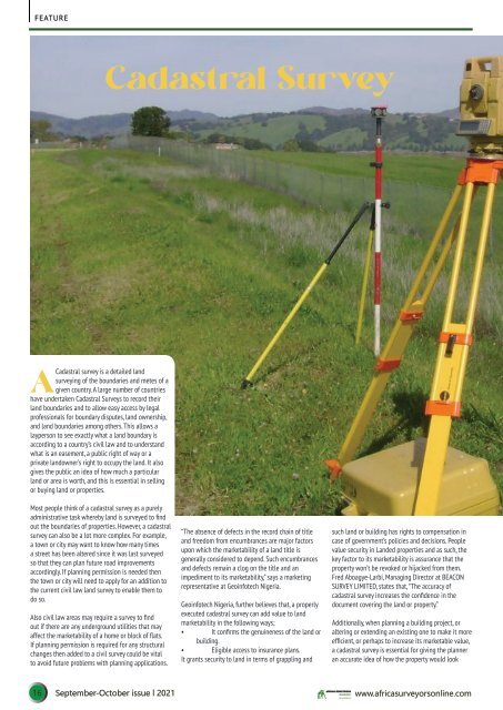
FEATURE<br />
Cadastral Survey<br />
A<br />
Cadastral survey is a detailed land<br />
surveying of the boundaries and metes of a<br />
given country. A large number of countries<br />
have undertaken Cadastral Surveys to record their<br />
land boundaries and to allow easy access by legal<br />
professionals for boundary disputes, land ownership,<br />
and land boundaries among others. This allows a<br />
layperson to see exactly what a land boundary is<br />
according to a country’s civil law and to understand<br />
what is an easement, a public right of way or a<br />
private landowner’s right to occupy the land. It also<br />
gives the public an idea of how much a particular<br />
land or area is worth, and this is essential in selling<br />
or buying land or properties.<br />
Most people think of a cadastral survey as a purely<br />
administrative task whereby land is surveyed to find<br />
out the boundaries of properties. However, a cadastral<br />
survey can also be a lot more complex. For example,<br />
a town or city may want to know how many times<br />
a street has been altered since it was last surveyed<br />
so that they can plan future road improvements<br />
accordingly. If planning permission is needed then<br />
the town or city will need to apply for an addition to<br />
the current civil law land survey to enable them to<br />
do so.<br />
Also civil law areas may require a survey to find<br />
out if there are any underground utilities that may<br />
affect the marketability of a home or block of flats.<br />
If planning permission is required for any structural<br />
changes then added to a civil survey could be vital<br />
to avoid future problems with planning applications.<br />
“The absence of defects in the record chain of title<br />
and freedom from encumbrances are major factors<br />
upon which the marketability of a land title is<br />
generally considered to depend. Such encumbrances<br />
and defects remain a clog on the title and an<br />
impediment to its marketability,” says a marketing<br />
representative at Geoinfotech Nigeria.<br />
Geoinfotech Nigeria, further believes that, a properly<br />
executed cadastral survey can add value to land<br />
marketability in the following ways;<br />
• It confirms the genuineness of the land or<br />
building.<br />
• Eligible access to insurance plans.<br />
It grants security to land in terms of grappling and<br />
such land or building has rights to compensation in<br />
case of government’s policies and decisions. People<br />
value security in Landed properties and as such, the<br />
key factor to its marketability is assurance that the<br />
property won’t be revoked or hijacked from them.<br />
Fred Aboagye-Larbi, Managing Director at BEACON<br />
SURVEY LIMITED, states that, “The accuracy of<br />
cadastral survey increases the confidence in the<br />
document covering the land or property.”<br />
Additionally, when planning a building project, or<br />
altering or extending an existing one to make it more<br />
efficient, or perhaps to increase its marketable value,<br />
a cadastral survey is essential for giving the planner<br />
an accurate idea of how the property would look<br />
16 <strong>September</strong>-<strong>October</strong> <strong>issue</strong> l <strong>2021</strong> www.africasurveyorsonline.com