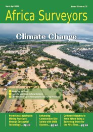
Africa Surveyors September- October Digital issue 2021
Africa Surveyors is Africa’s premier source of Surveying, Mapping and Geospatial news and an envoy of surveying products/service for the Construction, Maritime, Onshore & Offshore energy and exploration, Engineering, Oil and Gas, Agricultural and Mining sectors on new solution based trends and technology for the African market.
Africa Surveyors is Africa’s premier source of Surveying, Mapping and Geospatial news and an envoy of surveying products/service for the Construction, Maritime, Onshore & Offshore energy and exploration, Engineering, Oil and Gas, Agricultural and Mining sectors on new solution based trends and technology for the African market.

Create successful ePaper yourself
Turn your PDF publications into a flip-book with our unique Google optimized e-Paper software.
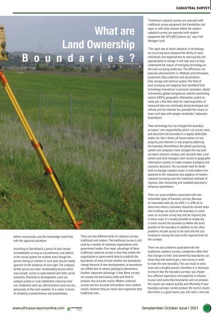
CADASTRAL SURVEY<br />
What are<br />
Land Ownership<br />
B o u n d a r i e s ?<br />
“Traditional cadastral surveys are executed with<br />
traditional survey equipment like theodolites and<br />
tapes or with total stations whilst the modern<br />
cadastral surveys are executed with modern<br />
equipment like GPS,GNSS,drones etc,” says Fred<br />
Aboagye-Larbi.<br />
“The rapid rate at which advances in technology<br />
are occurring have outpaced the ability of many<br />
individuals and organizations to react quickly and<br />
appropriately to change. It will take years to fully<br />
“<br />
understand the impact of emerging technology on<br />
the land surveying profession. The differences are<br />
basically advancements in; Methods and techniques,<br />
Equipment, Data collection and presentation,<br />
Data storage and retrieval system. The field of<br />
land surveying and mapping have benefited from<br />
technology innovations in personal computers, digital<br />
instruments, global navigational satellite positioning<br />
system (GNSS), geographic information system to<br />
name just a few. New tools for rapid acquisition of<br />
measured data are continually being developed and<br />
refined, and the Internet has provided the means to<br />
share such data with people worldwide,” elaborates<br />
Geoinfotech.<br />
before construction, and this knowledge could help<br />
with the approval procedure.<br />
According to Geoinfotech, a parcel of land remain<br />
unmarketable so long as encumbrances and defects<br />
in the record system are evident, even though the<br />
person having an interest in such land may be totally<br />
ignorant of the existence of such right. The company<br />
further points out other marketability factors which<br />
may include; access to road network and other social<br />
amenities, Proximity to development, Land use<br />
category (urban or rural settlement, industrial land<br />
use, residential land use, administrative land use) etc.,<br />
personality of the land marketer of or seller in terms<br />
of reliability, trustworthiness and presentation.<br />
There are two different kinds of cadastral surveys:<br />
traditional and modern. The traditional survey is still<br />
used by a number of voluntary organizations and<br />
government bodies. One major advantage of these<br />
traditional cadastral surveys is that they enable the<br />
organization or government body to establish the<br />
boundaries of areas of land whether the boundaries<br />
change because of new developments, or boundaries<br />
are shifted due to natural geological phenomena.<br />
Another important advantage is that these surveys<br />
are usually not particularly costly and tend to<br />
produce very accurate results. Modern cadastral<br />
surveys are less accurate and produce more random<br />
results; however they are much more expensive than<br />
traditional ones.<br />
“New technology has not changed the boundary<br />
surveyors’ core responsibility, which is to locate, mark,<br />
and document the boundary in a legally defensible<br />
matter, for their clients, all future owners of real<br />
property, and interests in real property adjoining<br />
the boundary. Nonetheless, the global positioning<br />
system and computers have changed the way land<br />
surveyors measure, analyze, and calculate data. Land<br />
owners and land managers have turned to geographic<br />
information systems to make complex ecological and<br />
economic decisions. The increased need for better<br />
tools to manage complex <strong>issue</strong>s in land matters has<br />
spawned to the realization and adoption of modern<br />
cadastral surveying over the traditional methods of<br />
rigorous, time consuming and outdated operations,”<br />
enhances Geoinfotech.<br />
There are some problems associated with nonremovable<br />
types of boundary surveys. Because<br />
of removable walls do not shift; it is difficult to<br />
determine where a boundary should be moved when<br />
new buildings are built on the boundary. In some<br />
cases an accurate survey may still be required, but<br />
in these cases it is usually possible to simply dig<br />
a trench around the boundary to define the exact<br />
position of the boundary. In addition to this other<br />
problems include access to the land and the cost<br />
involved in raising the land to the required level for<br />
the surveyor.<br />
There are also problems associated with the<br />
traditional cadastral surveys. Landowners often find<br />
that changes to their land ownership boundaries can<br />
mean they will need to get a new survey in order<br />
to mark the new boundary. This can result in extra<br />
costs and a lengthy process; therefore it is necessary<br />
to ensure that the boundary surveyor you choose<br />
has sufficient experience and expertise in relation<br />
to your land ownership boundaries and can produce<br />
the results you require quickly and efficiently. If your<br />
boundary surveyor cannot produce the correct results<br />
then there is a good chance you will need a new one.<br />
www.africasurveyorsonline.com<br />
Semptember-<strong>October</strong> <strong>issue</strong> l <strong>2021</strong> 17