Africa Surveyors September-October issue 2023
Africa Surveyors is Africa’s premier source of Surveying, Mapping and Geospatial news and an envoy of surveying products/service for the Construction, Maritime, Onshore & Offshore energy and exploration, Engineering, Oil and Gas, Agricultural and Mining sectors on new solution based trends and technology for the African market.
Africa Surveyors is Africa’s premier source of Surveying, Mapping and Geospatial news and an envoy of surveying products/service for the Construction, Maritime, Onshore & Offshore energy and exploration, Engineering, Oil and Gas, Agricultural and Mining sectors on new solution based trends and technology for the African market.
- TAGS
- marinesurveys
- geospatialmapping
- precisionagriculture
- 3dfusion
- climatechange
- africa
- africasurveyors
- dronesinafrica
- norbitsubsea
- norbitmultibeam
- seismicsurveys
- dronesurveying
- seafloormapping
- offshoresurveys
- quantitysurveyors
- underwaterrobotics
- subseasolutions
- hydographicsurvey
- multibeamandlidar
- gdansk

Create successful ePaper yourself
Turn your PDF publications into a flip-book with our unique Google optimized e-Paper software.
GEOPHYSICAL SURVEY<br />
Fugro supports safe energy<br />
operations in Namibia with<br />
ultra-deep water Geo-data<br />
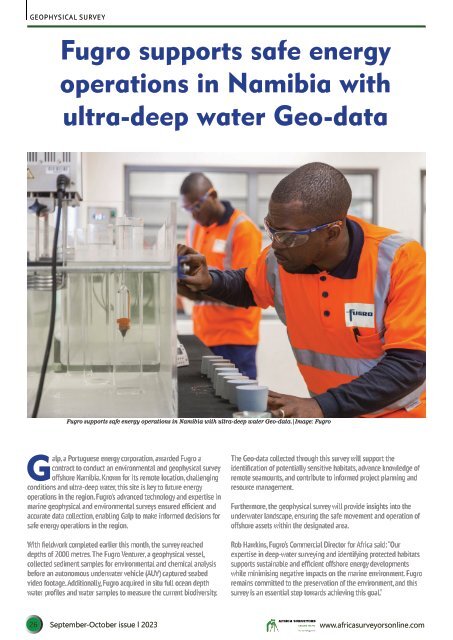
Fugro supports safe energy operations in Namibia with ultra-deep water Geo-data.|Image: Fugro<br />
Galp, a Portuguese energy corporation, awarded Fugro a<br />
contract to conduct an environmental and geophysical survey<br />
offshore Namibia. Known for its remote location, challenging<br />
conditions and ultra-deep water, this site is key to future energy<br />
operations in the region. Fugro's advanced technology and expertise in<br />
marine geophysical and environmental surveys ensured efficient and<br />
accurate data collection, enabling Galp to make informed decisions for<br />
safe energy operations in the region.<br />
With fieldwork completed earlier this month, the survey reached<br />
depths of 2000 metres. The Fugro Venturer, a geophysical vessel,<br />
collected sediment samples for environmental and chemical analysis<br />
before an autonomous underwater vehicle (AUV) captured seabed<br />
video footage. Additionally, Fugro acquired in situ full ocean depth<br />
water profiles and water samples to measure the current biodiversity.<br />
The Geo-data collected through this survey will support the<br />
identification of potentially sensitive habitats, advance knowledge of<br />
remote seamounts, and contribute to informed project planning and<br />
resource management.<br />
Furthermore, the geophysical survey will provide insights into the<br />
underwater landscape, ensuring the safe movement and operation of<br />
offshore assets within the designated area.<br />
Rob Hawkins, Fugro’s Commercial Director for <strong>Africa</strong> said: “Our<br />
expertise in deep-water surveying and identifying protected habitats<br />
supports sustainable and efficient offshore energy developments<br />
while minimising negative impacts on the marine environment. Fugro<br />
remains committed to the preservation of the environment, and this<br />
survey is an essential step towards achieving this goal.”<br />
26 <strong>September</strong>-<strong>October</strong> <strong>issue</strong> l <strong>2023</strong> www.africasurveyorsonline.com