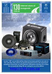
DVD/USB receiver Clarion NX501E with GPS navigation and ...
DVD/USB receiver Clarion NX501E with GPS navigation and ...
DVD/USB receiver Clarion NX501E with GPS navigation and ...

You also want an ePaper? Increase the reach of your titles
YUMPU automatically turns print PDFs into web optimized ePapers that Google loves.
Button Description<br />
4.3.7 Visual guidance settings<br />
Switch between daytime <strong>and</strong> night colour modes or let the software<br />
switch between the two modes automatically a few minutes before<br />
sunrise <strong>and</strong> a few minutes after sunset.<br />
Select the colour scheme used in daytime mode.<br />
Select the colour scheme used in night mode.<br />
Replace the default position marker to one of the 3D vehicle models.<br />
You can select separate icons for different vehicle types selected for<br />
route planning. Separate icons can be used for car, pedestrian <strong>and</strong> the<br />
other vehicles.<br />
Show or suppress 3D l<strong>and</strong>marks, 3D artistic or block representations of<br />
prominent or well-known objects.<br />
Show or suppress 3D city models, 3D artistic or block representation of<br />
full city building data containing actual building size <strong>and</strong> position on the<br />
map.<br />
Turn on or off track log saving, that is, saving the sequence of the<br />
locations your journeys go through.<br />
Select which Places to show on the map while navigating. Too many<br />
Places make the map crowded so it is a good idea too keep as few of<br />
them on the map as possible. For this, you have the possibility to save<br />
different Place visibility sets. You have the following possibilities:<br />
Tap the checkbox to show or hide the Place category.<br />
Tap the name of the Place category to open the list of its<br />
subcategories.<br />
Tap to save the current Place visibility set<br />
or to load a previously saved one. Here you can also revert to<br />
the default visibility settings.<br />
130.com.ua<br />
Settings related to guidance on the map screen can be adjusted here.<br />
The data fields in the corner of the Map screen can be customised.<br />
Tap this button <strong>and</strong> select the values you want to see. The values can<br />
be different when you navigate a route from when you are just cruising<br />
<strong>with</strong>out a given destination. You can select general trip data like your<br />
current speed or the altitude, or route data related to your final<br />
destination or the next waypoint on your route.<br />
Whenever adequate information is available, lane information similar to<br />
the real ones on road signs above the road is displayed at the top of<br />
the map. You can turn this feature on or off.<br />
Autogood products “130”<br />
<strong>NX501E</strong>/NZ501E English 77