History - Russell Family Web Page
History - Russell Family Web Page
History - Russell Family Web Page

Create successful ePaper yourself
Turn your PDF publications into a flip-book with our unique Google optimized e-Paper software.
1<br />
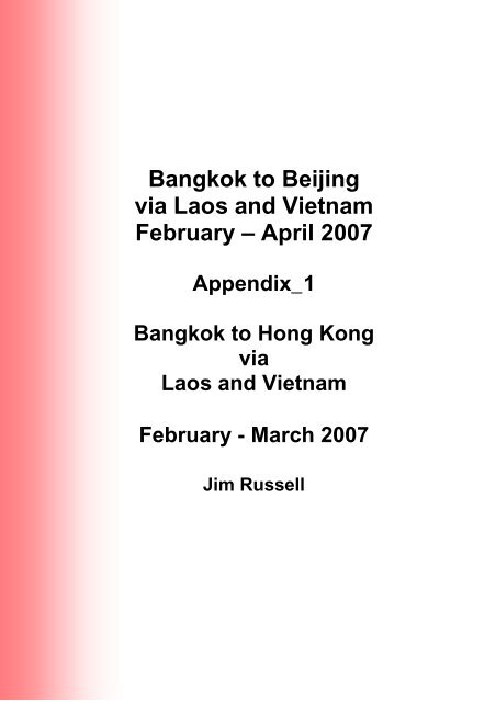
Bangkok to Beijing<br />
via Laos and Vietnam<br />
February – April 2007<br />
Appendix_1<br />
Bangkok to Hong Kong<br />
via<br />
Laos and Vietnam<br />
February - March 2007<br />
Jim <strong>Russell</strong>
Contents<br />
Contents ............................................................................................................ 1<br />
Thailand ......................................................................................................... 5<br />
Thailand – <strong>History</strong> (1)................................................................................ 5<br />
<strong>History</strong> of Thailand........................................................................5<br />
Thailand – <strong>History</strong> (2).............................................................................. 10<br />
Thailand's <strong>History</strong> ....................................................................... 10<br />
Thailand – <strong>History</strong> (3).............................................................................. 14<br />
Thailand's <strong>History</strong> ....................................................................... 14<br />
Thailand – Economy ............................................................................... 16<br />
Economy of Thailand .................................................................. 16<br />
Thailand – Geography............................................................................. 23<br />
Geography of Thailand ............................................................... 23<br />
Bangkok ....................................................................................................... 31<br />
Bangkok ..................................................................................... 31<br />
Bangkok – <strong>History</strong> ...................................................................................... 49<br />
Bangkok – <strong>History</strong> (1).............................................................................. 49<br />
<strong>History</strong> of Bangkok...................................................................... 49<br />
Bangkok – <strong>History</strong> (2).............................................................................. 51<br />
BANGKOK : <strong>History</strong>.................................................................... 51<br />
Bangkok – What Pho .............................................................................. 53<br />
Wat Pho...................................................................................... 53<br />
Bangkok - Wat Pho (2) ............................................................................. 55<br />
A Historical study of Wat Pho...................................................... 55<br />
Bangkok – Wat Ratchanaddaram – Loha Prasat................................... 57<br />
Wat Ratchanaddaram (1)............................................................ 57<br />
Wat Ratchanaddaram (2)............................................................ 57<br />
Chiang Mai ............................................................................................... 59<br />
Chiang Mai – <strong>History</strong>................................................................. 59<br />
A Brief <strong>History</strong>............................................................................. 84<br />
Chang Mai – Wat Prathat Doi Suthep......................................................... 87<br />
Changmai - Wat Prathat Doi Suthep (1) ................................................... 87<br />
Wat Prathat Doi Suthep .............................................................. 87<br />
Chang Mai – Wat Prathat Doi Suthep (2)................................................ 89<br />
Wat Phrathat Doi Suthep ............................................................ 89<br />
Mekong River............................................................................................... 93<br />
Mekong River (1) ...................................................................................... 93<br />
1
2<br />
Mekong ...................................................................................... 93<br />
Mekong River (2) ...................................................................................... 97<br />
Outline of the Mekong River....................................................... 97<br />
Mekong River (3) .................................................................................... 103<br />
The Mekong River.................................................................... 103<br />
Laos – <strong>History</strong>........................................................................................... 108<br />
<strong>History</strong>...................................................................................... 108<br />
<strong>History</strong> Review ......................................................................... 113<br />
Buddhism in Laos..................................................................... 115<br />
Laos – Geography................................................................................. 119<br />
Geography of Laos................................................................... 119<br />
Pak Ou Caves.......................................................................... 125<br />
Luang Prabang ....................................................................................... 127<br />
Luang Prabang......................................................................... 127<br />
Luang Prabang - Royal Palace Museum ................................................ 132<br />
Royal Palace Museum ............................................................. 132<br />
Karst Formations .................................................................................... 134<br />
Karst topography...................................................................... 134<br />
Karst Landscapes .................................................................... 140<br />
Vang Vieng............................................................................................. 155<br />
Vientiane................................................................................................. 156<br />
Vientiane .................................................................................. 157<br />
Vientiane - Pha That Luang .................................................................... 160<br />
Pha That Luang (1) .................................................................. 160<br />
Pha That Luang Temple (2)...................................................... 161<br />
Pha That Luang (3) .................................................................. 162<br />
Vietnam...................................................................................................... 164<br />
Vietnam (1) .............................................................................. 164<br />
Vietnam (2) .............................................................................. 167<br />
Vietnam – <strong>History</strong>.................................................................................. 180<br />
Vietnam <strong>History</strong> (1) .................................................................. 180<br />
<strong>History</strong> of Vietnam (2)............................................................... 183<br />
Vietnam War ............................................................................ 199<br />
Ho Chi Minh trail....................................................................... 231<br />
Targeting Ho Chi Minh Trail...................................................... 249<br />
Hanoi ...................................................................................................... 254<br />
Hanoi ....................................................................................... 254<br />
The <strong>History</strong> of Hanoi's Old Quarter........................................... 262
Hanoi <strong>History</strong>............................................................................ 271<br />
Ha Noi ...................................................................................... 274<br />
Hai Phong............................................................................................... 277<br />
Hai Phong - Portrait of a Port Town .......................................... 277<br />
Halong Bay & Cat Ba National Park ....................................................... 280<br />
Halong Bay............................................................................... 280<br />
Cat Ba Island............................................................................ 282<br />
Lang Son (and Province)........................................................................ 283<br />
Lang Son (1)............................................................................. 283<br />
Lang Son (2)............................................................................. 284<br />
Lang Son (Province).............................................................. 285<br />
China – <strong>History</strong> ..................................................................................... 287<br />
Brief <strong>History</strong> of China................................................................ 287<br />
<strong>History</strong> of China ........................................................................ 293<br />
Timeline of Chinese <strong>History</strong> ...................................................... 312<br />
China - Ethnic Minorities ............................................................................ 323<br />
Dong Ethnic Group ................................................................................. 323<br />
Dong (1) ................................................................................... 323<br />
Dong (2) ................................................................................... 329<br />
Dong Drum Tower .................................................................... 331<br />
Dong Wind and Rain Bridge ..................................................... 331<br />
Hui Ethnic Group .................................................................................... 334<br />
Hui (1)....................................................................................... 334<br />
Hui (2)....................................................................................... 335<br />
Miao Ethnic Group.................................................................................. 337<br />
Miao (1) .................................................................................... 337<br />
Miao (2) .................................................................................... 339<br />
Yao Ethnic Group ................................................................................... 341<br />
Yao (1)...................................................................................... 341<br />
Yao (2)...................................................................................... 348<br />
Zhuang Minority Group........................................................................... 350<br />
Zhuang (1)................................................................................ 350<br />
Zhuang (2)................................................................................ 357<br />
Huashan Cliff Paintings .......................................................................... 360<br />
Huashan Cliff Painting .............................................................. 360<br />
The Mysterious Huashan Cliff Paintings ................................... 362<br />
Marvelous frescoes on the precipices....................................... 364<br />
Liuzhou................................................................................................... 366<br />
3
4<br />
Liuzhou (1) ............................................................................... 366<br />
Liuzhou -- City of the Dragons.................................................. 368<br />
Liuzhou (2) ............................................................................... 370<br />
Liuzhou (3) ............................................................................... 371<br />
Longji – Rice Terraces .......................................................................... 373<br />
Dragon's Backbone Rice Terraces : ......................................... 373<br />
Yangshuo................................................................................. 375<br />
Jian Zhen ................................................................................. 378<br />
Li River (Lijiang) ....................................................................... 380<br />
Lijiang River ............................................................................. 382<br />
Guilin ...................................................................................................... 385<br />
Guilin Travel Guide .................................................................. 385<br />
Guilin........................................................................................ 387<br />
Guilin........................................................................................ 393<br />
Shenzhen ............................................................................................... 395<br />
Shenzhen................................................................................. 395<br />
Hong Kong.............................................................................................. 404<br />
Hong Kong ............................................................................... 404<br />
Stanley, Hong Kong ................................................................. 435<br />
Victoria Peak............................................................................ 439<br />
Stanley Market ......................................................................... 441<br />
Peak Tram ............................................................................... 442<br />
Star Ferry ................................................................................. 445
Thailand<br />
Thailand – <strong>History</strong> (1)<br />
http://en.wikipedia.org/wiki/<strong>History</strong>_of_Thailand<br />
<strong>History</strong> of Thailand<br />
From Wikipedia, the free encyclopedia<br />
This article is part of<br />
the <strong>History</strong> of Thailand series<br />
Early history of Thailand<br />
Sukhothai Kingdom (1238 - 1438)<br />
Ayutthaya Kingdom (1350 - 1767)<br />
* <strong>History</strong> of Thailand:<br />
1768– 1932<br />
1932– 1973<br />
1973–<br />
* Regional <strong>History</strong>:<br />
Dvaravati<br />
Srivijaya (3rd century -1400)<br />
Hariphunchai<br />
Lanna<br />
Nakhon Si Thammarat<br />
<strong>History</strong> of Isan<br />
Sukhothai and Lannathai<br />
Main article: Sukhothai kingdom<br />
Main article: Lannathai<br />
The history of<br />
Thailand begins with<br />
Contents<br />
• 1 Sukhothai and Lannathai<br />
the migration of the<br />
• 2 Ayutthaya<br />
Thais from their<br />
• 3 Thornburi and Bangkok period<br />
ancestoral home in<br />
• 4 Military rule<br />
southern China into<br />
• 5 Democracy<br />
mainland southeast<br />
• 6 See also<br />
asia around the 10th<br />
century AD. Prior to<br />
• 7 References<br />
this Mon, Khmer and Malay kingdoms ruled the region. The Thais<br />
established their own states starting with Sukhothai and then<br />
Ayutthaya kingdom. These states fought each other and were<br />
under constant threat from the Khmers, Burma and Vietnam.<br />
Much later, the European colonial powers threatened in the 19th<br />
and early 20th centuries, but Thailand survived as the only<br />
Southeast Asian state to avoid colonial rule. After the end of the<br />
absolute monarchy in 1932, Thailand endured sixty years of<br />
almost permanent military rule before the establishment of a<br />
democratic system.<br />
Thais date the founding of their nation to the 13th century. According to tradition, Thai chieftains gained<br />
independence from the Khmer Empire at Sukhothai, which was established as a sovereign Kingdom by<br />
Pho Khun Si Indrathit in 1238. The political feature, in Thai, we called 'father governs children' where<br />
everybody could recognise their problems to the king directly; there was a bell in front of the palace for<br />
5
this purpose. The city briefly dominated the area of under King Ramkhamhaeng who established the Thai<br />
alphabet, but after his death it fell into decline and became subject to another emerging Thai state know<br />
as the Ayutthaya kingdom in 1365, which dominated southern and central Thailand until the 1700s.<br />
Another Thai state that coexisted with Sukhothai was the northern state of Lanna. This state emerged in<br />
the same period as Sukhothai, but survived longer. Its independent history ended in 1558, when it fell to<br />
the Burmese; thereafter it was dominated by Burma and Ayutthaya in turn before falling to the army of the<br />
Siamese King Taksin in 1775.<br />
Ayutthaya<br />
Main article: Ayutthaya kingdom<br />
The first ruler of the Kingdom of Ayutthaya, King Ramathibodi I, made two important contributions to Thai<br />
history: the establishment and promotion of Theravada Buddhism as the official religion - to differentiate<br />
his kingdom from the neighbouring Hindu kingdom of Angkor - and the compilation of the Dharmashastra,<br />
a legal code based on Hindu sources and traditional Thai custom. The Dharmashastra remained a tool of<br />
Thai law until late in the 19th century. Beginning with the Portuguese in the 16th century, Ayutthaya had<br />
some contact with the West, but until the 1800s, its relations with neighbouring nations as well as with<br />
India and China, were of primary importance. Ayutthaya dominated a considerable area, ranging from the<br />
Islamic states on the Malay Peninsula to states in northern Thailand. Nonetheless, the Burmese, who had<br />
control of Lanna and had also unified their kingdom under a powerful dynasty, launched several invasion<br />
attempts in the 1750s and 1760s. Finally, in 1767, the Burmese attacked the city and conquered it. The<br />
royal family fled the city where the king died of starvation ten days later. The Ayutthaya royal line had<br />
been extinguished.There is overall 33 kings in this period, including an unofficial.<br />
There were 5 dynasties during Ayutthaya period:<br />
6<br />
• 1.Eu Thong Dynasty which consisting of 3 kings<br />
• 2.Suphanabhumi Dynasty consisting of 13 kings<br />
• 3.Sukhothai Dynasty consisting of 7 kings<br />
• 4.Prasart Thong (Golden Tower) Dynasty consisting of 4 kings<br />
• 5.Bann Plu Dynasty consisting of 6 kings<br />
Thornburi and Bangkok period<br />
Main article: <strong>History</strong> of Thailand (1768-1932)<br />
After more than 400 years of power, in 1767, the Kingdom of Ayutthaya was brought down by invading<br />
Burmese armies, its capital burned, and the territory split. General Taksin managed to reunite the Thai<br />
kingdom from his new capital of Thonburi and declared himself king in 1769. However, Taksin allegedly
ecame mad, and he was deposed, taken prisoner, and executed in 1782. General Chakri succeeded<br />
him in 1782 as Rama I, the first king of the Chakri dynasty. In the same year he founded the new capital<br />
city at Bangkok, across the Chao Phraya river from Thonburi, Taksin's capital. In the 1790s Burma was<br />
defeated and driven out of Siam, as it was now called. Lanna also became free of Burmese occupation,<br />
but the king of a new dynasty was installed in the 1790s was effectively a puppet ruler of the Chakri<br />
monarch.<br />
The heirs of Rama I became increasingly concerned with the threat of European colonialism after British<br />
victories in neighbouring Burma in 1826. The first Thai recognition of Western power in the region was the<br />
Treaty of Amity and Commerce with the United Kingdom in 1826. In 1833, the United States began<br />
diplomatic exchanges with Siam, as Thailand was called until 1939, and again between 1945 and 1949.<br />
However, it was during the later reigns of King Chulalongkorn, and his father King Mongkut, that Thailand<br />
established firm rapprochement with Western powers. It is a widely held view in Thailand that the<br />
diplomatic skills of these monarchs, combined with the modernising reforms of the Thai Government,<br />
made Siam the only country in South and Southeast Asia to avoid European colonisation. This is<br />
reflected in the country's modern name, Prathet Thai or Thai-land, used unofficially between 1939 and<br />
1945 and officially declared on May 11, 1949, in which prathet means "nation" and thai means "free".<br />
The Anglo-Siamese Treaty of 1909 made the modern border between Siam and British Malaya by<br />
securing the Thai authority on the provinces of Pattani, Yala, Narathiwat and Satun, which were<br />
previously part of the semi-independent Malay sultanates of Pattani and Kedah. A series of treaties with<br />
France fixed the country's current eastern border with Laos and Cambodia.<br />
Military rule<br />
Main article: <strong>History</strong> of Thailand (1932-1973)<br />
The Siamese coup d'état of 1932 transformed the Government of Thailand from an absolute to a<br />
constitutional monarchy. King Prajadhipok initially accepted this change but later surrendered the throne<br />
to his ten-year old nephew, Ananda Mahidol. Upon his abdication, King Prajadhipok said that the duty of<br />
a ruler was to reign for the good of the whole people, not for a select few. King Ananda Mahidol (Rama<br />
VIII) died in 1946 under somewhat mysterious circumstances, the official explanation being that he shot<br />
himself by accident while cleaning his gun. He was succeeded by his brother Bhumibol Adulyadej, the<br />
longest reigning king of Thailand, and very popular with the Thais. Although nominally a constitutional<br />
monarchy, Thailand was ruled by a series of military governments, most prominently led by Luang<br />
Phibunsongkhram and Sarit Dhanarajata, interspersed with brief periods of democracy. In 1992 the last<br />
military ruler, Suchinda Kraprayoon, gave up power in the face of massive popular protests, supported by<br />
the king. From 1992 to September 2006, Thailand was a functioning democracy with constitutional<br />
changes of government. However, in September 2006 a coup removed the controversial government led<br />
by the billionaire Thaksin, and the country has been run by the military since.<br />
7
In early January 1941, Thailand invaded French Indochina, beginning the French-Thai War. The Thais<br />
were better equipped than, and outnumbered, the French forces, easily taking Laos. The French<br />
decisively won the naval Battle of Koh Chang.<br />
The Japanese mediated the conflict, and a general armistice was declared on January 28. On May 9 a<br />
peace treaty was signed in Tokyo, with the French being coerced by the Japanese into relinquishing its<br />
hold on the disputed territories.<br />
After the end of World War II, Prime Minister Pridi Phanomyong agreed to return the captured territories<br />
to France, as a condition for admission to the newly created United Nations.<br />
On December 8, 1941, a few hours after the attack on Pearl Harbor, Japan demanded the right to move<br />
troops across Thailand to the Malayan frontier. Japan invaded the country and engaged the Thai army for<br />
six to eight hours before Phibun ordered an armistice. Shortly thereafter Japan was granted free passage,<br />
and on December 21, 1941, Thailand and Japan signed a military alliance with a secret protocol wherein<br />
Tokyo agreed to help Thailand get back territories lost to the British and French colonial powers and<br />
Thailand undertook to assist Japan in her war against the Allies.<br />
After Japan's defeat in 1945, with the help of a group of Thais known as Seri Thai who were supported by<br />
the United States, Thailand was treated as a defeated country by the British and French, although<br />
American support mitigated the Allied terms. Thailand was not occupied by the Allies, but it was forced to<br />
return the territory it had gained to the British and the French. In the post-war period Thailand enjoyed<br />
close relations with the United States, which it saw as a protector from the communist revolutions in<br />
neighbouring countries.<br />
Recently, Thailand also has been an active member in the regional Association of Southeast Asian<br />
Nations (ASEAN), especially after democratic rule was restored in 1992.<br />
Democracy<br />
Main article: <strong>History</strong> of Thailand since 1973<br />
8<br />
This section documents a current event. Information may change rapidly as the event<br />
progresses.<br />
The post-1973 has been marked by a struggle to define the political contours of the state. It was won by<br />
the King and General Prem Tinsulanonda, who favoured a democratic constitutional order.<br />
The post-1973 years has seen a difficult and sometimes bloody transition from military to civilian rule, with<br />
several reversals along the way. The revolution of 1973 inaugurated a brief, unstable period of<br />
democracy, with military rule being reimposed after a bloody right-wing coup in 1976. For most of the
1980s, Thailand was ruled by Prem, a democratically-inclined strongman who restored parliamentary<br />
politics. Thereafter the country remained a democracy apart from a brief period of military rule from 1991<br />
to 1992. The populist Thai Rak Thai party, led by prime minister Thaksin Shinawatra, governed since<br />
2001.<br />
On September 19, 2006, with the prime minister in New York for a meeting of the UN, Army Commanderin-Chief<br />
Lieutenant General Sonthi Boonyaratglin launched a successful coup 'd'etat.<br />
See also<br />
• <strong>History</strong> of Isan<br />
• List of Kings of Thailand<br />
• List of Prime Ministers of Thailand<br />
References<br />
• Thongchai Winichakul. Siam Mapped. University of Hawaii Press, 1984. ISBN 0-8248-<br />
1974-8<br />
• Wyatt, David. Thailand: A Short <strong>History</strong> (2nd edition). Yale University Press, 2003. ISBN<br />
0-300-08475-7<br />
9
Thailand – <strong>History</strong> (2)<br />
http://www.thaiembassy.jp/thailand/e-history.htm<br />
Note: This history omits WWII and the regular military coups in the last 60 years. The most recent being<br />
in September 2006.<br />
Thailand's <strong>History</strong><br />
Early years<br />
The Thais, most historians believe, began migrating from southern China<br />
in the early part of the Christian era. At first they formed a number of citystates<br />
in the northern part of what is present-day Thailand, in places like<br />
Chiang Saen, Chiang Rai and Chiang Mai, but these were never strong<br />
enough to exert much influence outside the immediate region. Gradually<br />
the Thais migrated further south to the broad and fertile central plains,<br />
and expanded their dominance over nearly the entire Indochina Peninsula. Contradictory as it may seem,<br />
however, recent archaeological discoveries around the northeast hamlet of Ban Chiang suggest that the<br />
world's oldest Bronze Age civilization was flourishing in Thailand some 5,000 years ago.<br />
Sukhothai Period(1238-1438)<br />
Sukhothai was the first Thai kingdom. It was founded in 1238 by two Thai governors, Khun Bang Klang<br />
Thao (Sri Inthrathit) and Khun Pha Muang who rebelled against the Khmers; and gave independence to<br />
the region. Sukhothai period was the most flourishing period of Thailand. It gained independence in 1238<br />
and quickly expanded its boundary of influence. Sukhothai period was considered to be a golden age of<br />
Thai culture.<br />
During that time in the history, everybody could say that "There are fish in the<br />
water and rice in the fields". The boundary of Sukhothai stretched from Lampang<br />
in the north to Vientiane, in present day Laos and the south to the Malay<br />
Peninsula. During this time Thai had strong friendship with neighboring countries.<br />
It absorbed elements of various civilizations which they came into contact. Thai<br />
maintained and advanced their culture with China. The potters entered Thai<br />
artistry and extensive trade was established with Cambodia and India.<br />
After the death of Khun Pha Muang in 1279, Ramkhamhaeng King, the third son of Si Inthrahit, ascended<br />
to the throne. Under the Ramkhamhaeng King, Sukhothai had strong friendship with neighboring China.<br />
10
Ramkhamhaeng King organized a writing system which became the<br />
basis for writing and eventually developed to be the modern Thai<br />
alphabet.<br />
Ayutthaya Period(1351-1767)<br />
Ayutthaya, the capital of the Thai<br />
Kingdom was found by U-Thong King<br />
in 1350. Ayutthaya as an island is<br />
formed by the gathering of three rivers,<br />
the Chao Phraya, the Pasak, and the Loburi and surrounded by rice<br />
terraces. It is easy to see why the Ayutthaya area was settled prior to this date since the site offered a<br />
variety of geographical and economic advantages. The Thai kings of<br />
Ayutthaya became powerful in the 14th and 15th centuries, taking over<br />
U-Thong, Lopburi, and Ayutthaya.<br />
King U-Thong and his immediate successors expanded<br />
Ayutthaya's territory, especially northward towards Sukhothai and<br />
eastward towards the Khmer capital of Angkor. The greater size of government could not remain the<br />
same as during the days of King Ramkhamhaeng. The society during the Ayutthaya period was strictly<br />
hierarchical. There were, roughly, three classes of people king at the top of scale. At the bottom of social<br />
scale were commoners and the slaves.<br />
In the early 16th century, the European visited Ayutthaya, and a Portuguese embassy was established in<br />
1511. Portugal's powerful neighbor Spain was the next European nation to arrive in Ayutthaya forward the<br />
end of the 16th century. In he early 17th century they saw the arrival of two northern European, the Dutch<br />
and the British, and France in 1662.<br />
In the mid-16th century, Ayutthaya and the independent kingdom in Chiang Mai was put under the control<br />
of the Burmese, but Thais could regain both of the capitals by the end of the century.<br />
The Burmese invaded Ayutthaya again in 1765. This time Burmese caused much fear to Thais. Burmase<br />
soldiers destroyed everything, including temples, manuscripts, and religious sculpture. After the capital<br />
fell in their hands for two years, the Burmese effectiveness could not further hold the kingdom. Phaya<br />
Taksin, a Thai general, promoted himself to be the king in 1769. He ruled the new capital of Thonburi on<br />
the bank of Chao Phraya River, opposite Bangkok. Thais regained control of their country and thus<br />
scattered themselves to the provinces in the north and central part of Thailand. Taksin eventually turn<br />
himself to be the next Buddha and was dismissed and executed by his ministers who did not approve his<br />
religious values.<br />
Thonburi Period(1767-1782)<br />
11
12<br />
After the fall of Ayudthaya, General Taksin, a general of Aydthaya,<br />
drafted an army of patriots to take revenge for his country. He<br />
successfully chased away the Burmese troops. After the Burmese were<br />
gone, he decided to build a new capital along the Chaopraya river and<br />
named it "Thonburi". King Taksin has reined a peaceful country for over<br />
15 years and extended diplomatic relationship with many countries from<br />
overseas including China. Unfortunately, King Taksin, who devoted his life to protect his beloved country,<br />
was over stressed from the wars and eventually became insane. Thonburi was collapsed because of the<br />
coup in 1782 by General Chakri. King Taksin's achievements have caused prosperity to bestow on him<br />
the epithet "the Great"<br />
Rattanakosin Period (1782-Present)<br />
After Taksin's death, General Chakri became the first king of the Chakri dynasty, Rama I, ruling from<br />
1782 to 1809. His first action as king was to transfer the royal capital across the river from Thonburi to<br />
Bangkok and build the Grand Palace. Rama II (1809-1824) continued the restoration begun by his<br />
predecessor.<br />
King Nang Klao, Rama III (1824-1851) reopened relations with western nations and developed trade with<br />
China. King Mongkut, Rama IV, (1851-1868) of "The King and I" concluded treaties with European<br />
countries, avoided colonialization and established modern Thailand. He made many social and economic<br />
reforms during his reign.<br />
King Chulalongkorn, Rama V (1869-1910) continued his father's<br />
tradition of reform, abolishing slavery and improving the public welfare<br />
and administrative system. Compulsory education and other<br />
educational reforms were introduced by King Vajiravudh, Rama VI<br />
(1910-1925). During the reign of King Prajadhipok, (1925-1935),<br />
Thailand changed from an absolute monarchy to a constitutional monarchy. The king abdicated in 1933<br />
and was succeeded by his nephew, King Ananda Mahidol (1935-1946). The country's name was changed<br />
from Siam to Thailand with the advent of democratic government in 1939.<br />
From absolute monarchy to constitutional monarchy<br />
The politics of Thailand took some significant turn on 24 June 1932 when a<br />
group of young intellectuals, educated abroad and imbued with the concept<br />
of Western democracy, staged a bloodless coup, demanding a change form<br />
absolute to a constitutional monarchy, Determined to avoid any bloodshed,<br />
His Majesty King Prajadhipok (Rama VII) agreed to the abolition of absolute<br />
monarchy and the transfer of power to the constitution-based system of<br />
government as demanded.
To some, this demand was premature, but fortunately with the far-sightedness of King Prajadhipok and<br />
his predecessors in particular King Chulalongkorn the Great (Rama V) and King Vajiravudh (Rama VGI),<br />
Thailand was not unprepared for this transition. While continuing the process launched by the two<br />
previous kings, King Prajadhipok had every intention of accustoming the Thais to the Western system of<br />
constitutional monarchy and had considered the eventuality of altering such form of government to the<br />
people at an appropriate moment. Popular readiness, the King believed, was an important Ingredient to<br />
success for such transition. It was only a matter of waiting for the right time.<br />
On 10 December 1932, His Majesty King Prajadhipok signed Thailand first constitution and thus ended<br />
700 years of Thailand absolute monarchy. Despite the number of successive constitutions that followed in<br />
the span of just over half a century, the basic concepts of constitutional government and monarchy laid<br />
down in the 1932 constitution have remained unaltered.<br />
13
Thailand – <strong>History</strong> (3)<br />
http://www.amazing-thailand.com/<strong>History</strong>.html<br />
Thailand's <strong>History</strong><br />
It is difficult to determine the type of culture which existed in Thailand before the Christian era, since no<br />
written records or chronologies exist but archeological excavations in the area north of Nakorn<br />
14<br />
Ratchasima indicate that there were people living here over 4000 years ago.<br />
However, by the 6th century AD thriving agricultural communities were<br />
established from as far north as Lamphun to Pattani in Southern Thailand.<br />
Theravada Buddhism was flourishing, and probably entered the region around<br />
the 2nd or 3rd centuries BC when Indian missionaries were said to have been<br />
sent to a land called "Suvarnabhumi". (An area comprising Burma, Central<br />
Thailand and Cambodia).<br />
The Dvaravati period, a loose collection of city states, centred around the<br />
Nakhon Pathom area, and lasted until the 11th century when it quickly declined under the political<br />
domination of invading Khmers.<br />
During the 12th century A.D. and is set on top of Phanom Rung Hill in Ta Pek in the Chaloem Phra Khiat<br />
District of Buri Ram province which is the location of a long extinct volcano. Phanom Rung is the original<br />
name and is mentioned in stone inscriptions excavated at the area. It is a religious site dedicated to the<br />
God Shiva, the supreme Hindu deity. It symbolises Mount Kailasa, the heavenly abode of Shiva.<br />
During the 13th century several Thai principalities in the Mekong valley united and took Haripunchai from<br />
the Mons and the Sukhothai area from the Khmers. The Sukhothai kingdom declared its independence in<br />
1238 and quickly began to expand. At its height the kingdom stretched from Nakhon Si Thammarat in the<br />
south to Vientiane in Laos, and Pegu in Burma. Sukhothai is considered by most Thai historians to be the<br />
first true Thai kingdom. King Rham Khamhaeng, the second king of the Sukhothai era, organised a<br />
system of writing which became the basis for modern Thai. He also codified the Thai form of Theravada<br />
Buddhism.<br />
During the 14th and 15th centuries the Thai kings of Ayuthaya became very<br />
powerful and began to expand their kingdom eastward until they took<br />
Angkor from the Khmers in 1431. By the mid-16th century Ayuthaya and the<br />
independent kingdom of Chiang Mai had came under the control of the<br />
Burmese, but the Thais regained control of both areas by the end of the<br />
century.
Burma again invaded Ayuthaya in 1765 and fought a fierce battle with the Thais for two years before<br />
gaining control of the capital. During the process the Burmese destroyed large numbers of manuscripts,<br />
religious sculptures, and many temples.<br />
The Burmese made no further inroads into Thailand and, in 1769, a new Thai capital was established at<br />
Thonburi, on the banks of the Chao Phraya river opposite Bangkok, by general Phya Taksin. The Thais<br />
quickly regained control of their country and began to further unite the provinces in the north and south of<br />
the country.<br />
The Monarchy<br />
In 1782 king Rama I was crowned. He moved the capital across the river to Bangkok, and ruled as the<br />
first king of the Chakri dynasty. In 1809 Rama II, son of Rama I, took the throne and ruled until 1824. King<br />
Rama III (1824-1851) began to develop trade with China and increase domestic agricultural production.<br />
When king Mongkut (Rama IV) took the throne in 1851 he quickly established diplomatic relations with<br />
European nations, while at the same time astutely avoiding colonisation. He also began a period of trade<br />
reform and modernisation of the Thai education system. His son, King Chulalongkorn (Rama V 1868-<br />
1910), continued this tradition with the modernisation of the legal and administrative systems, and the<br />
construction of railways. During his 15 year reign from 1910 to 1925 king Vajiravudha (Rama VI)<br />
introduced compulsory education and other reforms.<br />
In 1925 the brother of king Vajiravudha, king Prajadhipok (Rama VII 1925-1935) ascended the throne.<br />
Seven years later a group of Thai students living in Paris mounted a successful bloodless coup d'etat<br />
which led to the establishment of a constitutional monarchy similar to that which existed in Britain. A key<br />
military leader in the coup, Phibul Songkhram, took power and maintained control until after the end or<br />
WW II. Rama VIII, Ananda Mahidol, became king in 1935 but was assassinated in rather mysterious<br />
circumstances in 1946. He was succeeded by his younger brother Bhumipol Aduldej who became Rama<br />
IX. His Majesty King Bhumipol Adujdej remains on the throne today, and he commands great respect in<br />
both Thailand and throughout the rest of the world.<br />
Government<br />
Today Thailand has a democratic government led by Prime Minister Thaksin Shinawarta. Many changes<br />
are expected over the next few years now the new constitution has be introduced.<br />
Note: This Government was overthrown by a military coup in September 2006<br />
Economy | Festivals | Climate | Language | People| Religions| Food<br />
15
Thailand – Economy<br />
http://en.wikipedia.org/wiki/Economy_of_Thailand<br />
Economy of Thailand<br />
From Wikipedia, the free encyclopedia<br />
16<br />
Economy of Thailand<br />
Currency Thai baht (THB)<br />
Fiscal year 1 October - 30 September<br />
GDP per capita $8,400 (2005 est.)<br />
GDP by sector agriculture (9%), industry (44.3%), services (46.7%) (2004 est.)<br />
Inflation 2.8% (2004 est.)<br />
Pop below poverty<br />
line<br />
10% (2004 est.)<br />
Labour force 35.36 million (2005 est.)<br />
Labour force by<br />
occupation<br />
agriculture (49%), industry (14%), services (37%) (2000 est.)<br />
Unemployment 1.4% (September 2005 est.)<br />
Main industries Automobiles and Automotive parts (11%), Financial Services (9%),<br />
Electric appliances and components (8%), Tourism (6%), cement, auto<br />
manufacturing, heavy and light industries, appliances, computers and parts,<br />
furniture, plastics, textiles and garments, agricultural processing,<br />
beverages, tobacco<br />
Trading Partners<br />
Exports $110.883 billion (2005)<br />
Main partners U.S. 17%, Japan 14.2%, Singapore 7.3%, China 7.1%, Hong Kong 5.4%,<br />
Malaysia 4.8% (2003)<br />
Imports $118.223 billion (2005)<br />
Main Partners Japan 24.1%, U.S. 9.5%, China 8%, Malaysia 6%, Singapore 4.3%,<br />
Taiwan 4.2% (2003)<br />
Public finances<br />
Public debt $81.6 billion (45.8% of GDP Nominal) (Nov. 2005)<br />
External debt $50.4 billion (2004 est.)<br />
Revenues $30.2 billion (2004 est.)<br />
Expenses $31.94 billion, incl. cap. exp. of $5 billion (2004 est.)<br />
Economic aid Since 2002, Thailand is no longer an Economic aid recipient. Thailand<br />
contributed $60 million in economic aid to the neighbouring countries<br />
in 2005.
Contents<br />
The economy of Thailand is export-dependent, with exports<br />
accounting for 60% of GDP. The exchange rate has reached<br />
• 1 Macro-economic trend<br />
37.00/usd (GDP $7.3 trln baht) as of October 26, 2006, for a nominal<br />
• 2 Trade<br />
GDP at market rates of approximately US$ 200 bln. This keeps<br />
• 3 Other statistics<br />
Thailand as the 2nd largest economy in Southeast Asia, after<br />
• 4 See also<br />
Indonesia, a position it has held for many years. Thailand's recovery<br />
• 5 External links<br />
from the 1997-98 Asian financial crisis relied on exports, largely on<br />
external demand from the United States and other foreign markets. The Thaksin government took office<br />
in February 2001 with the intention of stimulating domestic demand and reducing Thailand's reliance on<br />
foreign trade and investment. Since then, the Thaksin administration has refined its economic message,<br />
embracing a "dual track" economic policy that combines domestic stimulus with Thailand's traditional<br />
promotion of open markets and foreign investment. This set of policies are popularly known as<br />
Thaksinomics. Weak export demand held 2001 GDP growth to 1.9%. In 2002-3, however, domestic<br />
stimulus and export revival fuelled a better performance, with real GDP growth at 5.3% and 6.3%<br />
respectively.<br />
Macro-economic trend<br />
This is a chart of trend of gross domestic product of Thailand at market prices estimatedby the<br />
International Monetary Fund with figures in millions of Thai Baht.<br />
Year Gross Domestic Product US Dollar Exchange Inflation Index (2000=100)<br />
1980 662,482 20.47 Baht 41<br />
1985 1,056,496 27.15 Baht 53<br />
1990 2,191,100 25.58 Baht 64<br />
1995 4,186,212 24.91 Baht 81<br />
2000 4,922,731 40.11 Baht 100<br />
2005 6,924,273 41.02 Baht 111<br />
For purchasing power parity comparisons, the US Dollar is exchanged at 12.34 Baht only.<br />
Before the financial crisis, the Thai economy had years of manufacturing-led economic growth--averaging<br />
9.4% for the decade up to 1996. Relatively abundant and inexpensive labour and natural resources, fiscal<br />
conservatism, open foreign investment policies, and encouragement of the private sector underlay the<br />
economic success in the years up to 1997. The economy is essentially a free enterprise system. Certain<br />
services, such as power generation, transportation, and communications, are state-owned and operated,<br />
but the government is considering privatizing them in the wake of the financial crisis.<br />
17
The Royal Thai Government welcomes foreign investment, and investors who are willing to meet certain<br />
requirements can apply for special investment privileges through the Board of Investment. To attract<br />
additional foreign investment, the government has modified its investment regulations.<br />
The organized labour movement remains weak and divided in Thailand; only 3% of the work force is<br />
unionized. In 2000, the State Enterprise Labour Relations Act (SELRA) was passed, giving public sector<br />
employees similar rights to those of private sector workers, including the right to unionize.<br />
Roughly 60% of Thailand's labour force is employed in agriculture. Rice is the country's most important<br />
crop; Thailand is a major exporter in the world rice market. Other agricultural commodities produced in<br />
significant amounts include fish and fishery products, tapioca, rubber, grain, and sugar. Exports of<br />
processed foods such as canned tuna, pineapples, and frozen shrimp are on the rise.<br />
Thailand's increasingly diversified manufacturing sector made the largest contribution to growth during the<br />
economic boom. Industries registering rapid increases in production included computers and electronics,<br />
garments and footwear, furniture, wood products, canned food, toys, plastic products, gems, and jewelry.<br />
High-technology products such as integrated circuits and parts, electrical appliances, and vehicles are<br />
now leading Thailand's strong growth in exports.<br />
Trade<br />
The United States is Thailand's largest export market and second-largest supplier after Japan. While<br />
Thailand's traditional major markets have been North America, Japan, and Europe, economic recovery<br />
among Thailand's regional trading partners has helped Thai export growth (5.8% in 2002). Recovery from<br />
the financial crisis depended heavily on increased exports to the rest of Asia and the United States. Since<br />
2005, the rapid ramp-up in export of automobiles of Japanese makes (esp. Toyota, Nissan, Isuzu) has<br />
helped to dramatically improve the trade balance, with over 1 million cars produced last year. As such,<br />
Thailand has joined the ranks of the world's top ten automobile exporting nations.<br />
Machinery and parts, vehicles, electronic integrated circuits, chemicals, crude oil and fuels, and iron and<br />
steel are among Thailand's principal imports. The recent increase in import levels (4.6% in 2002) reflects<br />
the need to fuel the production of high-technology items and vehicles.<br />
Thailand is a member of the World Trade Organization (WTO) and the Cairns Group of agricultural<br />
exporters. Thailand is part of the ASEAN Free Trade Area (AFTA). Thailand has actively pursued free<br />
trade agreements. A China-Thailand Free Trade Agreement (FTA) commenced in October 2003. This<br />
agreement was limited to agricultural products, with more comprehensive FTA to be agreed by 2010.<br />
Thailand also has a limited Free Trade Agreement with India, which commenced in 2003; and a<br />
comprehensive Australia-Thailand Free Trade Agreement which started 1 January 2005. Thailand started<br />
free trade negotiations with Japan in February 2004, and an in-principle agreement was agreed in<br />
18
September 2005. Negotiations for a US-Thailand Free Trade Agreement are underway, with the fifth<br />
round of meetings held in November 2005.<br />
Tourism contributes significantly to the Thai economy, and the industry has benefited from the Thai baht's<br />
depreciation and Thailand's stability. Tourist arrivals in 2002 (10.9 million) reflected a 7.3% increase from<br />
the previous year (10.1 million).<br />
Bangkok and its environs are the most prosperous part of Thailand, and the infertile northeast is the<br />
poorest. An overriding concern of successive Thai Governments, and a particularly strong focus of the<br />
recently ousted Thaksin government, has been to reduce these regional income differentials, which have<br />
been exacerbated by rapid economic growth in and around Bangkok and the financial crisis. The<br />
government is trying to stimulate provincial economic growth with programs such as the Eastern<br />
Seaboard project and the development of an alternate deep-sea port on Thailand's southern peninsula. It<br />
also is conducting discussions with Malaysia to focus on economic development along the Thai-<br />
Malaysian border.<br />
Although the economy has demonstrated moderate positive growth since 1999, future performance<br />
depends on continued reform of the financial sector, corporate debt restructuring, attracting foreign<br />
investment, and increasing exports. Telecommunications, roadways, electricity generation, and ports<br />
showed increasing strain during the period of sustained economic growth and may pose a future<br />
challenge. Thailand's growing shortage of engineers and skilled technical personnel may limit its future<br />
technological creativity and productivity.<br />
Other statistics<br />
Investment (gross fixed): 22.5% of GDP (Jan - Sep 2004 est.)<br />
Household income or consumption by percentage share:<br />
• lowest 10%: 2.8%<br />
• highest 10%: 32.4% (1998)<br />
Distribution of family income - Gini index: 51.1 (2002)<br />
Agriculture - products: rice, cassava (tapioca), rubber, corn, sugarcane, coconuts, soybeans<br />
Industries: tourism, textiles and garments, agricultural processing, beverages, tobacco, cement, light<br />
manufacturing such as jewelry, electric appliances and components, computers and parts, integrated<br />
circuits, furniture, plastics, world's second-largest tungsten producer, and third-largest tin producer<br />
Industrial production growth rate: 8.2% (2005 est.)<br />
Electricity:<br />
19
20<br />
• production: 118,900 KW·h (2003)<br />
• consumption: 106,100 KW·h (2003)<br />
• exports: 188 KW·h (2002)<br />
• imports: 600 KW·h (2002)<br />
Electricity - production by source:<br />
Oil:<br />
• fossil fuel: 91.3%<br />
• hydro: 6.4%<br />
• other: 2.4% (2001)<br />
• nuclear: 0%<br />
• production: 230,000 barrels per day (35,800 m³/d) (2005 est.)<br />
• consumption: 785,000 barrels per day (125,000 m³/d) (2001 est.)<br />
• exports: NA<br />
• imports: NA<br />
• proved reserves: 583 million barrels (95,000,000 m³) (November 2003)<br />
Natural gas:<br />
• production: 22,280,000,000 m³ (2003 est.)<br />
• consumption: 29,150,000,000 m³ (2003 est.)<br />
• exports: 0 m³ (2001 est.)<br />
• imports: 5,200,000,000 m³; (2001 est.)<br />
• proved reserves: 377,700,000,000 m³ (November 2003)<br />
Current account balance: $-5.901 billion (2005 est.)<br />
Exports - commodities: textiles and footwear, fishery products, rice, rubber, jewelry, automobiles,<br />
computers and electrical appliances lex Imports - commodities: capital goods, intermediate goods and<br />
raw materials, consumer goods, fuels<br />
Reserves of foreign exchange and gold: $51.9 billion (2005)
Exchange rates: baht per US dollar - 40.5348 (2004), 41.4846 (2003), 42.9601 (2002), 44.4319 (2001),<br />
40.1118 (2000)<br />
See also<br />
• Stock Exchange of Thailand<br />
• List of economic geography topics<br />
External links<br />
• http://www.bot.or.th/ - Bank of Thailand<br />
Thailand currency and coinage<br />
Topics Thai baht · Bank of Thailand · Economy of Thailand<br />
Coinage 1 satang · 5 satang · 10 satang · Salung · 2 Salung · ฿ 1 · ฿ 2 · ฿ 5 · ฿ 10<br />
Currency ฿20 · ฿ 50 · ฿ 100 · ฿ 500 · ฿ 1,000<br />
Asia-Pacific Economic Cooperation (APEC)<br />
Australia • Brunei Darussalam • Canada • Chile • People's Republic of China • Hong Kong,<br />
China • Indonesia • Japan • Republic of Korea • Malaysia • Mexico • New Zealand •<br />
Papua New Guinea • Peru • Philippines • Russia • Singapore • Chinese Taipei (Republic of<br />
China) • Thailand • United States • Viet Nam<br />
World Trade Organization (WTO)<br />
Albania • Angola • Antigua and Barbuda • Argentina • Armenia • Australia •<br />
Bahrain, Kingdom of • Bangladesh • Barbados • Belize • Benin • Bolivia • Botswana •<br />
Brazil • Brunei Darussalam • Burkina Faso • Burundi • Cambodia • Cameroon •<br />
Canada • Central African Republic • Chad • Chile • China • Colombia • Congo •<br />
Costa Rica • Cote d'Ivoire • Croatia • Cuba • Democratic Republic of the Congo •<br />
Djibouti • Dominica • Dominican Republic • Ecuador • Egypt • El Salvador •<br />
European Communities1 • Fiji • Former Yugoslav Republic of Macedonia (FYROM) •<br />
Gabon • The Gambia • Georgia • Ghana • Grenada • Guatemala • Guinea •<br />
Guinea Bissau • Guyana • Haiti • Honduras • Hong Kong, China • Iceland • India •<br />
Indonesia • Israel • Jamaica • Japan • Jordan • Kenya • Korea, Republic of • Kuwait •<br />
Kyrgyz Republic • Lesotho • Liechtenstein • Macao, China • Madagascar • Malawi •<br />
Malaysia • Maldives • Mali • Mauritania • Mauritius • Mexico • Moldova • Mongolia •<br />
Morocco • Mozambique • Myanmar • Namibia • Nepal • New Zealand • Nicaragua •<br />
21
22<br />
Niger • Nigeria • Norway • Oman • Pakistan • Panama • Papua New Guinea •<br />
Paraguay • Peru • Philippines • Qatar • Rwanda • Saint Kitts and Nevis • Saint Lucia •<br />
Saint Vincent & the Grenadines • Saudi Arabia • Senegal • Sierra Leone • Singapore •<br />
Solomon Islands • South Africa • Sri Lanka • Suriname • Swaziland • Switzerland •<br />
Separate Customs Territory of Taiwan, Penghu, Kinmen, and Matsu • Tanzania • Thailand •<br />
Togo • Trinidad and Tobago • Tunisia • Turkey • Uganda • United Arab Emirates •<br />
United States of America • Uruguay • Venezuela (Bolivarian Republic of) • Vietnam •<br />
Zambia • Zimbabwe<br />
1 All twenty-seven member states of the European Union are also members of the WTO in their<br />
own right:<br />
Austria • Belgium • Bulgaria • Cyprus • Czech Republic • Denmark • Estonia •<br />
Finland • France • Germany • Greece • Hungary • Ireland • Italy • Latvia • Lithuania •<br />
Luxembourg • Malta • Netherlands (— For the Kingdom in Europe and for the Netherlands Antilles) • Poland •<br />
Portugal • Romania • Slovakia • Slovenia • Spain • Sweden • United Kingdom
Thailand – Geography<br />
http://en.wikipedia.org/wiki/Geography_of_Thailand<br />
Geography of<br />
Thailand<br />
From Wikipedia, the free encyclopedia<br />
Thailand's 514,000 square kilometers lie in the middle of<br />
mainland Southeast Asia. The nation's axial position<br />
influenced many aspects of Thailand's society and<br />
culture—it controls the only land route from Asia to<br />
Malaysia and Singapore.<br />
Geographic coordinates<br />
• 15°00′ N 100°00′ E<br />
<strong>History</strong><br />
Main article: <strong>History</strong> of Thailand<br />
The earliest speakers of the Tai language migrated from<br />
what is now China, following rivers into northern Thailand<br />
and southward to the Mekong and the Chao Phraya<br />
Valley.<br />
The fertile floodplain and tropical monsoon climate,<br />
ideally suited to wet-rice (thamna) cultivation, attracted<br />
settlers to this central area rather than to the marginal<br />
uplands and mountains of the northern region or the<br />
Khorat Plateau to the northeast.<br />
Contents<br />
• 1 Geographic coordinates<br />
• 2 <strong>History</strong><br />
• 3 Boundaries<br />
o 3.1 Land boundaries<br />
o 3.2 Coastline<br />
o 3.3 Maritime claims<br />
o 3.4 Border issues<br />
� 3.4.1 <strong>History</strong><br />
� 3.4.2 Cambodia<br />
� 3.4.3 Laos<br />
� 3.4.4 Malaysia<br />
� 3.4.5 Myanmar<br />
• 4 Area<br />
• 5 Topography and drainage<br />
• 6 Elevation extremes<br />
• 7 Regions<br />
o 7.1 North Thailand<br />
o 7.2 Northeast<br />
o 7.3 Central Thailand<br />
o 7.4 South Thailand<br />
o 7.5 Provinces<br />
• 8 Climate<br />
• 9 Resources and land use<br />
o 9.1 Natural resources<br />
o 9.2 Land use<br />
o 9.3 Irrigated land<br />
• 10 Environmental concerns<br />
o 10.1 Natural hazards<br />
o 10.2 Current environmental<br />
issues<br />
o 10.3 International<br />
•<br />
environmental agreements<br />
11 See also<br />
• 12 References<br />
By the 12th century, a number of loosely connected rice-growing and trading states flourished in the<br />
upper Chao Phraya Valley. Starting in the middle of the 14th century, these central chiefdoms gradually<br />
came under the control of the Ayutthaya kingdom at the southern extremity of the floodplain.<br />
23
Successive capitals, built at various points along the river, became centers of great Thai kingdoms based<br />
on rice cultivation and foreign commerce. Unlike the neighboring Khmer and Burmese, the Thai continued<br />
to look outward across the Gulf of Thailand and the Andaman Sea toward foreign ports of trade.<br />
When European imperialism brought a new phase in Southeast Asian commerce in the late 1800s,<br />
Thailand (known then as Siam) was able to maintain its independence as a buffer zone between Britishcontrolled<br />
Burma to the west and French-dominated Indochina to the east.<br />
Boundaries<br />
Land boundaries<br />
24<br />
• Total: 4 863 km<br />
• Border countries: Myanmar 1 800 km, Cambodia 803 km, Laos 1 754 km, Malaysia 506 km<br />
Coastline<br />
• Total: 3 219 km<br />
Maritime claims<br />
• territorial sea: 12 nm<br />
• exclusive economic zone: 200 nm<br />
• continental shelf: 200-m depth or to the depth of exploitation<br />
Border issues<br />
<strong>History</strong><br />
Thailand shares boundaries with Cambodia, Laos, Malaysia and Myanmar. Although neither China nor<br />
Vietnam border Thailand, the territory of both countries comes within 100 km of Thai territory.<br />
Many parts of Thailand's boundaries followed natural features, such as the Mekong. Most borders had<br />
been stabilized and demarcated in the late 19th and early 20th centuries in accordance with treaties<br />
forced on Thailand and its neighbors by Britain and France. In some areas, however, exact boundaries,<br />
especially along Thailand's eastern borders with Laos and Cambodia, are still in dispute.<br />
Adding to general border tensions were the activities of communist-led insurgents, whose operations had<br />
been of paramount concern to the Thai government and its security forces for several decades. The<br />
problem of communist insurgency was compounded by the activity of what the Thai government labeled<br />
"antistate elements." Often the real source of border problems was ordinary criminals or local merchants<br />
involved in illegal mining, logging, smuggling, and narcotics production and trade.
Cambodia<br />
Disputes with Cambodia after 1950 arose in part from ill-defined boundaries. The most notable case was<br />
a dispute over Prasat Preah Vihear submitted to the International Court of Justice, which ruled in favor of<br />
Cambodia in 1962. During the years that the Cambodian capital, Phnom Penh, was controlled by the<br />
Khmer Rouge regime of Pol Pot (1975 to 1979), the<br />
border disputes continued.<br />
In the early 1980s, the People's Republic of Kampuchea<br />
and its mentor, Vietnam, made an issue of boundaries in<br />
Prachin Buri Province in eastern Thailand.<br />
The Preah Vihear temple remains a source of contention,<br />
with Cambodia accusing Thailand of moving boundary<br />
markers and obstructing access to the temple ruins, and<br />
Thailand, for its part, accusing Cambodia of polluting the<br />
waterways that run through the area and into Thailand.<br />
Cambodian casinos along the frontier and various crossborder<br />
criminal activities are also a security concern.<br />
Laos<br />
Demarcation with Laos is complete except for certain<br />
Mekong islets and complaints of Thai squatters.<br />
Malaysia<br />
In contrast to dealings with Cambodia, which attracted<br />
international attention, boundary disputes with Malaysia<br />
(see Malaysia-Thailand Border) are usually handled more<br />
cooperatively. Continuing mineral exploration and fishing, however, are sources of potential conflict. A 1<br />
km segment at the mouth of the Golok River remained in dispute with Malaysia as of 2004.<br />
Myanmar<br />
Significant differences remain with Myanmar over boundary alignment and the handling of ethnic rebels,<br />
refugees and illegal drug trade, in addition to mineral exploration and fishing rights. Groups in both<br />
countries have expressed concern over the Peoples Republic of China's construction of 13 hydroelectric<br />
dams on the Salween River in Yunnan.<br />
Area<br />
25
26<br />
• Total: 514 000 km²<br />
o Land: 511 770 km²<br />
o Water: 2 230 km²<br />
Thailand uses a unit of land area called the rai, which is 1 600 m².<br />
Topography and drainage<br />
The most conspicuous features of<br />
Thailand's terrain are high mountains,<br />
a central plain, and an upland plateau.<br />
Mountains cover much of northern<br />
Thailand and extend along the<br />
Myanmar border down through the<br />
Kra Isthmus and the Malay Peninsula.<br />
The central plain is a lowland area<br />
drained by the Chao Phraya River and<br />
its tributaries, the country's principal<br />
river system, which feeds into the<br />
delta at the head of the Bay of<br />
Bangkok. The Chao Phraya system<br />
drains about one-third of the nation's<br />
territory. In the northeastern part of<br />
the country the Khorat Plateau, a<br />
region of gently rolling low hills and<br />
shallow lakes, drains into the Mekong<br />
through the Mun River. The Mekong<br />
system empties into the South China<br />
Sea and includes a series of canals<br />
and dams.<br />
Detailed map of Thailand<br />
Together, the Chao Phraya and<br />
Mekong systems sustain Thailand's agricultural economy by supporting wet-rice cultivation and providing<br />
waterways for the transport of goods and people. In contrast, the distinguishing natural features of<br />
peninsular Thailand are long coastlines, offshore islands, and diminishing mangrove swamps.<br />
Elevation extremes<br />
• Lowest point: Gulf of Thailand 0 m<br />
• Highest point: Doi Inthanon 2,576 m
Regions<br />
Landforms and drainage divide the country more or less into four natural regions--the North, the<br />
Northeast, Central, and the South. Although Bangkok geographically is part of the central plain, as the<br />
capital and largest city this metropolitan area may be considered in other respects a separate region.<br />
Each of the four geographical regions differs from the others in population, basic resources, natural<br />
features, and level of social and economic development. The diversity of the regions is in fact the most<br />
pronounced attribute of Thailand's physical setting.<br />
North Thailand<br />
During the winter months in the mountainous North, the temperature is cool enough for the cultivation of<br />
fruits such as lychees and strawberries. These high mountains are incised by steep river valleys and<br />
upland areas that border the central plain. A series of rivers, including the Nan, Ping, Wang, and Yom,<br />
unite in the lowlands to form the Chao Phraya watershed. Traditionally, these natural features made<br />
possible several different types of agriculture, including wet-rice farming in the valleys and shifting<br />
cultivation in the uplands. The forested mountains also promoted a spirit of regional independence.<br />
Forests, including stands of teak and other economically useful hardwoods that once dominated the North<br />
and parts of the Northeast, had diminished by the 1980s to 130,000 km². In 1961 they covered 56 % of<br />
the country, but by the mid-1980s forestland had been reduced to less than 30 % of Thailand's total area.<br />
Northeast<br />
Main article: Isan<br />
The Northeast, with its poor soils, is not favored agriculturally. The region consists mainly of the dry<br />
Khorat Plateau and a few low hills. The short monsoon season brings heavy flooding in the river valleys.<br />
Unlike the more fertile areas of Thailand, the Northeast has a long dry season, and much of the land is<br />
covered by sparse grasses. Mountains ring the plateau on the west and the south, and the Mekong<br />
delineates much of the eastern rim.<br />
Central Thailand<br />
The "heartland", Central Thailand, is a natural self-contained basin often termed "the rice bowl of Asia."<br />
The complex irrigation system developed for wet-rice agriculture in this region provided the necessary<br />
economic support to sustain the development of the Thai state from the 13th century Sukhothai kingdom<br />
to contemporary Bangkok. Here the rather flat unchanging landscape facilitated inland water and road<br />
transport. The fertile area was able to sustain a dense population, 422 persons per square kilometer in<br />
1987, compared with an average of 98 for the country as a whole. The terrain of the region is dominated<br />
by the Chao Phraya and its tributaries and by the cultivated paddy fields. Metropolitan Bangkok, the focal<br />
point of trade, transport, and industrial activity, is situated on the southern edge of the region at the head<br />
of the Gulf of Thailand and includes part of the delta of the Chao Phraya system.<br />
South Thailand<br />
The South, a narrow peninsula, is distinctive in climate, terrain, and resources. Its economy is based on<br />
rice cultivation for subsistence and rubber production for industry. Other sources of income include<br />
27
coconut plantations, tin mining, and tourism, which is particularly lucrative on Phuket Island. Rolling and<br />
mountainous terrain and the absence of large rivers are conspicuous features of the South. North-south<br />
mountain barriers and impenetrable tropical forest caused the early isolation and separate political<br />
development of this region. International access through the Andaman Sea and the Gulf of Thailand<br />
made the South a crossroads for both Theravada Buddhism, centered at Nakhon Si Thammarat, and<br />
Islam, especially in the former Pattani kingdom on the border with Malaysia.<br />
Provinces<br />
Main article: Provinces of Thailand<br />
Thailand's regions are further divided into a total of 73 provinces. The country's provinces have the same<br />
names as their respective capitals.<br />
Climate<br />
28<br />
Seasonal flooding in Thailand and Cambodia<br />
poorly, which limits their agricultural potential.<br />
Thailand has a tropical monsoon<br />
climate; temperatures normally range<br />
from an average annual high of 38 °C<br />
to a low of 19 °C. Southwest monsoons<br />
that arrive between May and July<br />
(except in the South) signal the advent<br />
of the rainy season (ridu fon), which<br />
lasts into October. November and<br />
December mark the onset of the dry<br />
season. Temperatures begin to climb in<br />
January, and a hot sun parches the<br />
landscape. The dry season is shortest<br />
in the South because of the proximity of<br />
the sea to all parts of the Malay<br />
Peninsula. With only minor exceptions,<br />
every area of the country receives<br />
adequate rainfall, but the duration of the<br />
rainy season and the amount of rain<br />
vary substantially from region to region<br />
and with altitude. The Northeast<br />
experiences a long dry season, and its<br />
red, porous (laterite) soils retain water
Resources and land use<br />
Natural resources<br />
• Tin, rubber, natural gas, tungsten, tantalum, timber, lead, fish, gypsum, lignite, fluorite, arable<br />
land<br />
Land use<br />
• Arable land: 34%<br />
Irrigated land<br />
o Permanent crops: 6%<br />
o Permanent pastures: 2%<br />
o Forests and woodland: 26%<br />
o Other: 32% (1993 est.)<br />
• Total: 44,000 km² (1993 est.)<br />
Environmental concerns<br />
Natural hazards<br />
Land subsidence in Bangkok area resulting from the depletion of the water table; droughts (see also 2004<br />
Indian Ocean earthquake).<br />
Current environmental issues<br />
• Air pollution from vehicle emissions<br />
• Water pollution from organic and factory wastes<br />
• Deforestation<br />
• Soil erosion<br />
• Wildlife populations threatened by illegal hunting<br />
International environmental agreements<br />
• Party to: Climate Change, Endangered Species, Hazardous Wastes, Marine Life Conservation,<br />
Nuclear Test Ban, Ozone layer protection, Tropical Timber 83, Tropical Timber 94, Wetlands<br />
• Signed, but not ratified: Biodiversity, Climate Change (Kyoto Protocol), Law of the Sea<br />
See also<br />
• Thailand<br />
• List of islands of Thailand<br />
29
References<br />
30<br />
• This article contains material from the Library of Congress Country Studies, which are United<br />
States government publications in the public domain.<br />
• This article contains material from the CIA World Factbook which, as a U.S. government<br />
publication, is in the public domain.}
Bangkok<br />
http://en.wikipedia.org/wiki/Bangkok<br />
Bangkok<br />
From Wikipedia, the free encyclopedia<br />
The Bangkok Skytrain at sunset on Thanon Narathiwat<br />
Ratcha Nakharin with the Empire Tower in the<br />
background.<br />
Bangkok, known in Thai as Krung Thep<br />
(ก รุ งเ ทพฯ (help·info)), is the capital and largest city of<br />
Thailand, with an official 2000 census population of 6,355,144.<br />
Bangkok is located at 13°45′ N 100°31′ E, on the east bank of the<br />
Chao Phraya River, near the Gulf of Thailand.<br />
Krung Thep has been the proper name of the city for more than two<br />
centuries. Nonetheless, the city's original name of Bangkok, which<br />
now is used locally to refer only to a district of the city, is the name<br />
by which most foreigners know the city. (See <strong>History</strong> and Full Name<br />
below.)<br />
Bangkok<br />
กรุ งเ ทพมหานคร<br />
Area:<br />
Inhabitants:<br />
Pop. density:<br />
Statistics<br />
ISO 3166-2: TH-10<br />
Governor:<br />
1,568.7 km²<br />
Ranked 68th<br />
6,355,144 (2000)<br />
Ranked 1st<br />
4,426 inh./km²<br />
Ranked 1st<br />
Apirak Kosayothin<br />
(since 2004)<br />
Bangkok is the wealthiest and most populated city in Thailand as well as the 22nd most populated city in<br />
the world. Although Bangkok now has roughly 7 million registered inhabitants, the actual population is<br />
much higher, and including commuters from the surrounding areas, may reach an estimated 15 million<br />
people during the day time, making the city one of the most densely populated in the world. Recently, the<br />
value of Bangkok's economic output has matched that of Singapore, making Bangkok a major economic<br />
Map<br />
31
and financial center in Southeast Asia. Bangkok has one of the fastest rates in the world for construction<br />
of high rise buildings.<br />
Contents<br />
• 1 <strong>History</strong><br />
• 2 Full Name<br />
• 3 Economy<br />
The World Meteorological Organization has dubbed<br />
Bangkok the world's hottest large city. The city's wealth of<br />
cultural sites makes it one of the world's most popular<br />
tourist destinations.<br />
•<br />
•<br />
4 Demographics<br />
5 Geography and Climate<br />
<strong>History</strong><br />
o 5.1 Topography and Climate<br />
•<br />
•<br />
•<br />
•<br />
o 5.2 Districts<br />
6 Administration<br />
7 Higher education<br />
8 Tourism<br />
o 8.1 Wats and Palaces<br />
o 8.2 Hotels<br />
o 8.3 Shopping<br />
o 8.4 Nightlife<br />
9 Transportation<br />
o 9.1 Roads<br />
Bangkok began as a small trading center and port<br />
community, called Bang Makok, or "place of olive plums"<br />
(the genus of this fruit is Spondias), serving Ayutthaya,<br />
which was the capital of the nation (then known as Siam)<br />
until it fell to Burma in 1767. A new capital was then<br />
established at Thonburi (now part of Bangkok) on the<br />
west side of the river, before King Rama I built his palace<br />
on the east bank in 1782 and renamed the city Krung<br />
Thep, meaning the "City of Angels". The name Bangkok<br />
(บ าง กอก (help·info)) now refers only to an old<br />
o 9.2 Rail systems<br />
district on the Thonburi side of the river, but continues to<br />
o 9.3 Bus service<br />
be used to refer to the entire city by most foreigners. The<br />
o 9.4 Airports<br />
city has gone through a number of changes under the<br />
• 10 Crime<br />
Chakri Dynasty. It has long been a gateway to Thailand<br />
• 11 Current issues<br />
because of its route which leads to the Gulf of Thailand.<br />
•<br />
o 11.1 2006 Bombs<br />
12 Media<br />
Full Name<br />
• 13 Sister cities<br />
• 14 See also<br />
Krung Thep, or Krung Thep Maha Nakhon (IPA:<br />
• 15 References<br />
[kruŋ tʰ eː p mahaː nakʰ on],<br />
• 16 External links<br />
กรุ งเ ทพมหานคร (help·info)) is the<br />
abbreviation of the city's full ceremonial name Krungthep<br />
Mahanakhon Amonrattanakosin Mahintharayutthaya Mahadilokphop Noppharatratchathani Buriromudomratchaniwet<br />
Mahasathan Amonphiman Awatansathit Sakkathattiya Witsanu Kamprasit<br />
(กรุงเ ทพมหานคร อมรรั ตนโกสินทร์<br />
มหินทรายุธยามหาดิลกภพ นพรัตน์ราชธานี<br />
บ ุ ร ี ร ม ย ์ อ ุ ด ม ร า ช น ิ เ ว ศ น ์ ม ห า ส ถ า น อ ม ร พ ิ ม า น อ ว ต า ร ส ถ ิ ต<br />
ส ั ก ก ะ ท ั ต ต ิ ย ะ ว ิ ษ ณุ ก ร ร ม ป ร ะ ส ิ ท ธ ิ ์ ), (listen (help·info)). This ceremonial<br />
name is composed in combination of two ancient Indian languages, Pali and Sanskrit. According to the<br />
romanisation of these languages, it can actually be written as "Krung-dē vamahā nagara<br />
32
amararatanakosindra mahindrayudhyā mahā tilakabhava navaratanarā jadhā nī purī rā masya<br />
utamarā janivē sana mahā sthā na amaravimā na avatā rasthitya shakrasdattiya<br />
vishnukarmaprasiddhi". It means "The city of angels, the great city, the eternal jewel city, the impregnable<br />
city of God Indra, the grand capital of the world endowed with nine precious gems, the happy city,<br />
abounding in an enormous Royal Palace that resembles the heavenly abode where reigns the<br />
reincarnated god, a city given by Indra and built by Vishnukam".<br />
Local school children are taught the full name, although few can explain its meaning because many of the<br />
words are archaic. Most Thais who do recall the full name do so as a result of its use in a popular song<br />
(ก ร ุ ง เ ท พ ม ห า น ค ร /Krung Thep Mahanakhon by อ ั ส น ี -ว ส ั น ต ์<br />
โ ช ต ิ ก ุ ล /Asanee-Wasan Chotikul 1989) and will often recount it by recalling the song at the same<br />
time, much in the same way that English speakers might sing the alphabet song while reciting the English<br />
alphabet.<br />
The full name of the city is listed by Guinness Book of Records as the world's longest place name. [1]<br />
Economy<br />
Bangkok is the economic center of Thailand, dominating the country's economy and dwarfing other urban<br />
centers. In 2005, it produced a GDP (PPP) of about USD 220 billion, which accounts for 43 percent of the<br />
country's GDP. Its GDP (PPP) per capita is roughly USD 20,000, one of the highest in Southeast Asia.<br />
The Stock Exchange of Thailand is located in Bangkok with over 400 listed companies and combined<br />
market capitalization of about 5 trillion Baht (USD 120 billion) as of 5 January 2006. Due to the large<br />
amount of foreign representation, Thailand has for several years been a mainstay of the Southeast Asian<br />
economy and a key center in Asian business. In the recent Black Tuesday, the SET lost over Bt 800<br />
billion and USD 25 billion, as markets in the Asia-Pacific falling and causing a global impact on December<br />
17, 2006. The loss of market valuation evoked fears of a repeat of the Asian Financial Crisis of 1997.<br />
Bangkok is home to the headquarters of all Thailand's large commercial banks and financial institutions;<br />
18 financial institutions hold at least USD 1 billion in total assets. Their bank deposits totaled<br />
approximately 7 trillion Baht (USD 177 billion) at the end of the third quarter in 2005. Many transnational<br />
companies operate regional headquarters in Bangkok because the cost of operation in the city is less<br />
than in most rival cities in Asia. Thirteen Bangkok-based companies are on the Forbes 2000 list, including<br />
the largest Thai bank, Bangkok Bank, and the country's largest oil/petroleum producer PTT.<br />
Tourism is a significant contributor to Thailand's economy, providing about 5 percent of GDP. Bangkok is<br />
Thailand's principal international gateway, the major transit point, and a destination in its own right.<br />
Income inequality of Bangkok's residents is significant, especially between relatively unskilled lowerincome<br />
immigrants from rural provinces in Thailand and neighboring countries and wealthier government<br />
33
officials, middle class professionals, business elite, and retired foreigners. About 7 percent of Bangkok's<br />
population (excluding illegal immigrants who constitute about 5-8 percent of population) lives below the<br />
poverty line compared to the national average of 9 percent.<br />
Demographics<br />
As of the 2000 census, there were 6,355,144<br />
registered residents in the city. However, this<br />
figure does not take account of the many<br />
unregistered residents and daytime visitors from<br />
the surrounding metropolitan area. More than<br />
50% of Bangkokians have some Chinese<br />
ancestry. [citation needed] Recently, Bangkok has<br />
experienced a large influx of foreign immigrants,<br />
long-term residents, and expatriates. The<br />
number of expatriate executives stood at 65,000<br />
as of Nov, 2005 and additional number is increase in an average of more than 1,800 permits per<br />
month. [citation needed] Long-term foreign residents include 250,000 Chinese (citizens of China), 30,000<br />
Japanese (the largest community in any Asian city outside of Japan), 100,000 Indians (35,000 Sikh) of<br />
whom more than 80% have Thai citizenship, 6,000 Americans, 45,000 Europeans (the second largest<br />
number in any Asian city after Singapore), 15,000 Taiwanese (mostly Han Chinese), 7,000 South<br />
Koreans, 6,000 Nigerians, 8,000 people of Arabic speaking countries, 20,000 Malaysians, and 4,000<br />
Singaporeans. [citation needed] There are approximately 400,000 - 600,000 illegal immigrants from Cambodia,<br />
Myanmar (Burma), Russia, Ukraine, Pakistan, Nigeria, India, Bangladesh, China, and other<br />
countries. [citation needed] 92% of the population are Buddhist. The rest are Muslim (6%), Christian (1%),<br />
Jewish (300 residents), Hindu/Sikh (0.6%), and others. [citation needed] Year Population Year Population<br />
1880 255,000 25. April 1960 2,136,435<br />
1910 365,000 1. April 1970 3,077,361<br />
1. April 1919 437,294 1. April 1980 4,697,071<br />
15. July 1929 713,384 1. April 1990 5,882,411<br />
23. May 1937 890,453 1. April 2000 6,320,174<br />
25. April 1947 1,178,881 1. January 2005 6,642,566<br />
There are some 400 Buddhist temples,<br />
55 mosques, 10 churches, 2 Hindu Temples, 2 synagogues and 1 Sikh gurudwara in Bangkok. [citation needed]<br />
Geography and Climate<br />
Topography and Climate<br />
Bangkok province covers 1,568.7 km², making it the 68th largest province in Thailand. Much of the area is<br />
considered the city of Bangkok therefore making it one of the largest cities in the world. The Chao Phraya<br />
River which stretches 372 km is its main geographical feature along with being Thailands longest river.<br />
The Chao Phraya River basin, the area surrounding Bangkok and nearby provinces are the series of<br />
plains and river deltas that lead into the Bay of Bangkok about 30km south of Bangkok City Center. This<br />
has given rise to Bangkok's name as 'Venice of the East' due to the number of canals and passages that<br />
divide the area into separate patches of land. The city once used these canals which were so plentiful<br />
34
within Bangkok itself as divisions for city districts, however as the city grew in the second half of the 20th<br />
century to enormous extents, the plan was abandoned and a different division was uptaken.<br />
Bangkok lies about 2m above sea<br />
level. This low ground level causes<br />
problems for the protection of the<br />
city against floods during monsoon<br />
season. Often after a downpour,<br />
water in canals and the river<br />
overflow the banks, resulting in<br />
massive floods. The Bangkok<br />
Metropolitan Administration (BMA)<br />
has recently installed higher<br />
planks alongside some canals to<br />
keep water levels from reaching<br />
street level. The Khlong Saen<br />
Long-tail boat on the Chao Phraya river.<br />
Saeb is perhaps one of the cities<br />
most notorious canals, the largest<br />
and most useful especially for commuting into the city. There are however some downsides for Bangkok's<br />
extensive canal routes, the city is rumored to be sinking an average of 2 inches a year as it lies entirely<br />
on a swamp.<br />
Bangkok has a tropical monsoon climate under the Köppen climate classification system. Bangkok is said<br />
to have the highest average temperature of any city in the world.<br />
Month Jan Feb Mar Apr May Jun Jul Aug Sep Oct Nov Dec Year<br />
Avg high °C<br />
(°F)<br />
Avg low temperature<br />
°C<br />
(°F)<br />
Precipitation<br />
centimeters<br />
(inches)<br />
Districts<br />
32.0<br />
(89.6) 32.7<br />
(90.9) 33.7 34.9 34.0 33.1 32.7 32.5 32.3<br />
(92.7) (94.8) (93.2) (91.6) (90.9) (90.5) (90.1) 32.0<br />
(89.6) 31.6<br />
(88.9) 31.3 32.7<br />
(88.3) (90.9)<br />
21.0<br />
(69.8) 23.3<br />
(73.9) 24.9<br />
(76.8)<br />
1<br />
(0.4) 2<br />
(1.1) 3<br />
(1.2)<br />
26.1 25.6 25.4 25.0 24.9 24.6<br />
(79.0) (78.1) (77.7) (77.0) (76.8) (76.3) 24.3<br />
(75.7) 23.1<br />
(73.6) 20.8 24.1<br />
(69.4) (75.4)<br />
7<br />
(2.8)<br />
19<br />
(7.5)<br />
15<br />
(6.0)<br />
source: Weatherbase<br />
15<br />
(6.2)<br />
18<br />
(7.4)<br />
32<br />
(12.6) 23<br />
(9.1) 5<br />
(2.3) 1<br />
(0.4)<br />
145<br />
(57.1)<br />
35
Bangkok has over 50 districts or khets each with a distinct difference in governance however all are under<br />
the control and authority of the Bangkok Metropolitan Administration. Throughout the years, Bangkok has<br />
grown from a city scattered along the river to a metro that spans to as many as 6 provinces. The city's<br />
main business districts and residential areas are ever expanding. The influx of foreigners from Western<br />
countries as immigrants from neighbouring Laos, Myanmar, Cambodia and many other South Asian<br />
countries along with the growth of the Thai people has stemmed hundreds of housing projects around the<br />
metro area, developing communities along the outskirts. Within years, these communities are engulfed by<br />
the greater Bangkok and become another part of this urban jungle.<br />
As the city expanded on the outskirts, the inner city has no where to grow but up. The city has a<br />
registered 1000 skyscrapers and ranks 5th as the worlds tallest city [citation needed] . This does not include<br />
hundreds of new buildings predicted as part of the construction boom in 2007 and the upcoming years.<br />
Areas such as Silom-Sathorn and Asok have for decades been Thailand's business center. During the<br />
90's when Thailand experienced the world's highest growth rates and underwent an economic<br />
transformation. The city went through dramatic changes, the Ratchadaphisek area turned into a business<br />
district which continued the Asok area up north for 5 km. The Sukhumvit area, stretching 15-20 km<br />
gradually turned into a mixed commerce and residential area. Wireless Road and Chitlom are where<br />
some of Bangkok's most expensive land plot exist as well as the most scenic views. Part of the UK<br />
Embassy on the corner of Wireless and Rama I Rd., 9 rai or approximately 14400m² in area, sold for USD<br />
92 million or Bt 3.24 billion and is the most expensive single sale of land in Thai record.<br />
Bangkok's Phra Nakhon district alongside Dusit is where most governmental agencies and ministries<br />
head their offices as well as the most famous tourist attractions due to the age of this particular area. The<br />
area is a no-skyscraper designated zone to preserve the area where some buildings date back as old as<br />
Thailand itself. This part of town is perhaps the most popular to tourists as most notable attractions, the<br />
Grand Palace, Democracy Monument, Giant Swing, Sanam Luang and other venues are located. Thon<br />
Buri also has its fair share of historic monuments mainly located near the river. Wat Arun, Siriraj Hospital,<br />
religious worship sites of Muslims, Christians and Hindu's can also still be found in Thon Buri. Victory<br />
Monument in Bangkok is one of the city's biggest bus destination, although not officially a bus depot, its<br />
grand location in the center of city transits as many as 20 bus lines as well as BTS sky train station.<br />
Bangkoks North and Eastern areas are primarily residential areas for middle class residents of Bangkok.<br />
Whereas the inner city often plays hosts with small cramped apartments and low rises for poor<br />
immigrants, Lad Prao and Sri Nakarin offer residential compounds and town houses. The two areas cover<br />
as much as 100km²-150km² each, they've turned into what is now part of Bangkok City as more suburb<br />
housing developments sprawl further out of the city to the East and North. The West of Bangkok in Thon<br />
Buri is a growing area although not close to the development the North and East has seen, it is catching<br />
up. The Suvarnabhumi Airport in the East is seen as jump start for the eastern expansion of Bangkok as<br />
Don Muang did so for the north. The south of Bangkok which recently merged with Samut Prakan is also<br />
home to the Crocodile Farm.<br />
36
Rajprasong and Siam are without doubt the fore front of Bangkok's shopping scene. With tens of malls<br />
lined up and thousands of street vendors, the area is and has always been the place to go for all sorts of<br />
goods. The newly renovated Central World Plaza intends to serve as a Square to Bangkokians. Just up<br />
the street is Siam, the trendiest and most entertaining area in town, similar to Shinjuku in Tokyo and<br />
Oxford Street and Piccadily Circus in London. The entire Sukhumvit area also serves as a shopping<br />
district for foreigners. The popular Chatuchak Weekend Market up north is where most everyone heads<br />
for cheap, good quality products.<br />
Bangkok's poorest district is spread throughout the city however the most concentrated is just north of the<br />
Port of Bangkok at the turn of the Chao Phraya River. For an area of 10km², Khlong Toei district houses<br />
one of the poorest areas in the country with half built houses and midrises for immigrants and workers<br />
from the Northeast Isan provinces.<br />
Administration<br />
Bangkok is one of two special<br />
administrative areas in Thailand (the<br />
other being Pattaya) in which citizens<br />
vote to choose their Governor, unlike in<br />
Thailand's 75 other provinces<br />
(changwat). In the 2004 governatorial<br />
election Apirak Kosayothin was elected<br />
Governor.<br />
The urban sprawl of the greater<br />
Bangkok Metropolitan Area extends<br />
beyond the borders of Bangkok<br />
Bangkok City Hall<br />
province, spilling into the neighbouring<br />
provinces of Nonthaburi, Samut Prakan,<br />
Pathum Thani, Nakhon Pathom and Samut Sakhon. The province as it is today was created in 1972<br />
when the previous Bangkok province - changwat Phra Nakhon - merged with Thonburi province.<br />
The seal of the city shows the god Indra riding in the clouds on Erawan, a mythological elephant-shaped<br />
creature (sometimes portrayed with three heads). In his hand Indra holds a lightning bolt, which is his<br />
weapon to drive away drought. The seal is based upon a painting done by Prince Naris. The tree symbol<br />
of Bangkok is Ficus benjamina.<br />
Bangkok is subdivided into 50 districts (khet, also sometimes called amphoe as in the other provinces),<br />
which are further subdivided into 154 kwaeng (แ ข ว ง , equivalent to tambon in other provinces). Each<br />
district is managed by a district chief, appointed by the governor. District councils, elected to four-year<br />
terms, serve as advisory bodies to their respective district chiefs.<br />
37
There is also an elected Bangkok Metropolitan Council, which has power over municipal ordinances and<br />
the city's budget. The last elections for local councils in Bangkok were held on 23 July 2006. For details,<br />
please see: Thailand local elections, 2006.<br />
Higher education<br />
There are a large number of both private and public universities located in Bangkok area. The oldest<br />
universities in Thailand are Chulalongkorn University, Thammasat University, Mahidol University,<br />
Kasetsart University and Silpakorn University. Other public and private universities include:<br />
38<br />
• Assumption University<br />
• Bangkok University<br />
• Dhurakijpundit University<br />
• Dusit Thani College<br />
• Kesem Bundit University<br />
• King Mongkut's Institute of Technology Ladkrabang<br />
• King Mongkut's Institute of Technology North Bangkok<br />
• King Mongkut's University of Technology Thonburi<br />
• Mahachulalongkornrajavidyalaya University<br />
• Mahanakorn University of Technology<br />
• Mahamakut Buddhist University<br />
• National Institute of Development Administration<br />
• Ramkhamhaeng University<br />
• Rangsit University<br />
• Ratana Bundit College<br />
• Rajamangala University of Technology<br />
• SAE Institute Bangkok<br />
• Saint John's University<br />
• Siam University
• Srinakharinwirot University<br />
• Sripathum University<br />
• University of the Thai Chamber of Commerce<br />
There are also several "Rajabhat universities", which formerly were part of the teachers college system.<br />
Tourism<br />
Bangkok is considered to be one of the world's top tourist hotspots and is currently Asia's top tourist<br />
destination - the third in the world according to Travel and Leisure magazine. The city boasts some of the<br />
country's most magnificent historical venues such as the Grand Palace. There are numerous projects to<br />
maintain Bangkok's historic sites such as the Rattanakosin area. Bangkok is Thailand's major tourist<br />
gateway and one of the largest in South East Asia. Bangkok has been a city that has lured tourists for a<br />
visit and this has resulted in an unbelievable number foreigners setting up permanent residence in<br />
Bangkok. Many of these Bangkok expatriates have found jobs and have opened businesses in the capital<br />
of the Kingdom of Thailand. Many more have retired here and live a life of ease and enjoyment.<br />
Wats and Palaces<br />
The Bangkok Metropolitan area is home to two capitals, the present, Krung Thep and the short Thon Buri<br />
reign before 1782. There are numerous historical sites on both banks of the Chao Phraya River which<br />
has been the main means of transportation for pre-motor vehicles. The river connects to Wat Arun Wat<br />
Pho is home to the reclining Buddha, a marvel of historical sculpture, a Buddha 46m in length and 15m in<br />
height and made of pure gold.<br />
There are 3 Palaces in Bangkok, the current one which houses the Royal <strong>Family</strong> is Chitralada Palace. It<br />
is a phenomenal landscaping and design piece due to the wonderfully crafted exterior fencing and a 5m<br />
moat around the 1km sq. compound. The King's very own dairy farm and environmental tests are carried<br />
within the confines- his extensive work has helped Thailand's farmers battle hard rains and long droughts<br />
and other environmental issues.<br />
Hotels<br />
The Peninsula Bangkok recently won Travel and Leisure magazines top hotels list, whilst the Oriental<br />
claimed second. The Oriental has previously won world-wide recognition for its magnificent use of land on<br />
the Bangkok side of the Chao Phraya. The Oriental hotel offers a panoramic view from roughly all hotel<br />
rooms of the river scenery. The Shangri-La Bangkok, of the Shangri-La Hotels and Resorts chain, also<br />
claims to have rivalling picture-perfect sets in their rooms. Sukhumvit Road hosts a series of international<br />
chains such as JW Marriot, The Landmark, Intercontinental, Sheraton and many more. Somewhat out of<br />
the center is the Grand Princess Hotel near the administrative area of the city. This 30-story building has<br />
39
its lobby on the 15th floor, presenting the city's massive skyline. The Banyan Tree on Sathon, part of the<br />
Westin Group, one of Bangkok's tallest hotels featured the tallest bar and restaurant in the city, Vertigo,<br />
up until the launch of Sirocco on top of State Tower, 247m up from the bustling street set of Bang Rak.<br />
Perhaps an underrated and less known hotel is the historical Sukhothai hotel, where at the heart of it all,<br />
a corner of peace and tranquility is found.<br />
There are large numbers of cheap hotels however offering comfortable stays scattered throughout the<br />
entire city. Notable is the backpackers paradise of Khao San Road where hotels go as cheap as $5 a<br />
night. Motels are uncommon unlike Western cities, however a fast and growing business is a bed and<br />
breakfast adapted to suit Asian lifestyle. A variety of these small houses can be found in Ploenchit,<br />
Watthana and Klong Toey.<br />
Shopping<br />
Thailand has a variety of shopping experiences from street markets to malls. Tourists have historically<br />
always preferred markets and bazaars to the other forms of shopping. The Chatuchak weekend market is<br />
one of the largest shopping destinations in Bangkok. Water markets are gradually disappearing but<br />
remain strong tourist attractions as many tours are offered through the canals the market is located on.<br />
The huge new shopping complex known as Siam Paragon in Bangkok's city center is one of the biggest<br />
and most luxurious malls in south east Asia; it truly is a Asian marvel. Bangkok also includes over 15<br />
world class malls situated around Bangkok including Fashion Island Rangsit and Future Park.<br />
Nightlife<br />
As with many large cities in developing countries, a large proportion of wealth situated in one area causes<br />
that region to develop quickly. In the case of Thailand, this area is Bangkok. Bangkok, like nearby<br />
Pattaya, is notorious for its prostitute-ridden streets and a-go-go bars and cafes, with Patpong, Soi<br />
Cowboy and Nana Plaza being the main areas catering to tourists. There are, however, many places to<br />
find a relaxing spot and enjoy one of Asia's most diverse cities. Bangkok offers a widely varied nightlife.<br />
There are Westernized clubs and cafes for the rich, and lower-cost bars and pubs that are very popular<br />
with the locals. The city's renowned district of Phra Nakhon is home to one of the world's very first<br />
international streets– Khao San Rd. A walking street, it allows visitors to see the diversity of the world on<br />
one single road where East meets West. Sukhumvit Road boasts some of Asia's most exclusive clubs<br />
and restaurants along the 5 km section between Ekamai and Withayu, with a number of activities<br />
available for the city's thousands of night owls.<br />
Transportation<br />
An elaborate network of canals, known as ' khlongs ', gave the city the nickname "Venice of the East" at a<br />
time when most transportation was done by boat. Today nearly all of the canals have been filled in and<br />
converted into traffic-filled streets. However, many khlongs do still exist with people living along them and<br />
40
Bangkok from the Chao Phraya River at sunset July 2004<br />
markets often being operated<br />
along the banks as well. However<br />
most of the khlongs are severely<br />
polluted with sewage and nearly<br />
everything else. [2] A notable<br />
khlong market is the floating<br />
market in Taling Chan district.<br />
Through downtown Bangkok runs<br />
the Khlong Saen Saeb, which has<br />
a canal-boat service, the most<br />
extensive of which is the Chao<br />
Phraya Express boat run by the<br />
Chao Phraya Express Boat<br />
Co.,Ltd. There are as many as 30<br />
stops along the both banks of the<br />
Saen Saeb khlong. However there are limitations as the further north the boat gets the farther apart are<br />
the stations and this impedes the ability of this water taxi to work as a true mass transit system.<br />
Roads<br />
Several elevated highways, newly rebuilt intersections, and many partially-finished road and rail projects<br />
dot the landscape around Greater Bangkok, but have done little to overcome the notorious traffic jams on<br />
Bangkok's surface roads as private vehicle usage continues to outstrip infrastructure development. Many<br />
city residents complain they spend more than half their waking day on the dusty streets on a open-air city<br />
bus. Bangkok could be known as one of the worst traffic cities in the world but it has built an expressway<br />
or second level road on almost every road in the city center, and there continues to be plans for new<br />
expressways monthly. The government has also tried many times to improve the state of the traffic in the<br />
city center, which can sometimes take 1 hour just to move 1 kilometer.<br />
Rail systems<br />
In 1999 an elevated two-line 'Skytrain' (officially called BTS) metro system was opened. The remains of a<br />
failed elevated railroad project (the Hopewell project) can still be seen all the way from the main railroad<br />
station out towards the Don Mueang airport. Due to the Asian financial crisis the construction was halted<br />
and the concrete pillars were left unused. Locals call them "Hopehenge," Hopeless, or Stonehenge.<br />
After much reluctance and commotion of being unable to deal with possible floods and damp soil, the<br />
subway was finally opened for use in July 2004. The MRT subway system connected the northern train<br />
station of Bang Sue to the Hua Lamphong central railway station near the city center, while also going<br />
through the eastern part of the city. It connects to the BTS system at BTS Stations Mo Chit, Asok, and<br />
Sala Daeng. Many stations have various designs and concepts with many to install retail shops to draw<br />
41
more commuters, the Hua Lampong station under the Central Rail Station also houses the Rail Museum<br />
of Thailand.<br />
42<br />
Political bickering and<br />
profiteering also has stalled<br />
many promised and planned<br />
urban rail projects including<br />
Skytrain and subway<br />
extensions, and projects that<br />
are completed often are very<br />
much delayed.<br />
A new high-speed elevated<br />
railroad called the<br />
Suvarnabhumi Express,<br />
Skytrain approaching Sala Daeng Station<br />
currently under construction,<br />
will link the city with the new Suvarnabhumi Airport. The announced opening date is late 2007, but it is<br />
expected this will be delayed. The Airport Express railway is to be operated by The State Railway of<br />
Thailand. It will provide a 28.5 km link between the new airport and the City Air Terminal (CAT) at<br />
Makkasan with connections to the BTS at Phaya Thai and MRT at Petchburi. There are plans to extend<br />
the line to Don Mueang and Rangsit.<br />
Due to completion within the early stages of 2007, the BTS Silom line extension to Wongwian Yai as well<br />
as the Sukhumvit line to Sumrong. Plans have already been approved for a further extension from Wong<br />
Wian Yai to Bangwah (4.5km), Sumrong to Samut Prakarn (8km), Mochit to Saphan Mai (11.9 km) and<br />
the National Stadium to Phran Nok (7.7km) extension of the Silom line which will include 5 underground<br />
stations in the Rattanakosin area. The State Railway of Thailand (SRT) have also been given the green<br />
light to complete the Dark Red and Light Green lines. Alongside, MRT have also begun construction on 2<br />
new lines, the Purple line from Bang Yai to Bang Sue, the blue line from Hua Lampong to Bang Khae and<br />
Ta Pra. Much of this is in a government effort to reduce Bangkokians from relying on personal vehicles<br />
and the hope of linking the city within 10 years by a ring road of rail systems.<br />
For intercity travel by train, most passengers begin their trips at Hua Lamphong at the southern end of the<br />
Metro. Here, trains connect Bangkok to Malaysia to the south, Chiang Mai and beyond to the north, and<br />
Nong Khai and beyond to the northeast.<br />
Bus service<br />
Virtually all cities and provinces are easily reached by bus from Bangkok. For destinations in the<br />
southwest and the west, buses leave from the Southern Bus Terminal, west of the city. For destinations in<br />
the southeast, such as Pattaya, Ko Samet and Ko Chang, buses leave from the Eastern Bus Terminal, at
Ekkamai, the third-eastern-most stop on the Skytrain. For all destinations north and northeast, the<br />
Northern Bus Terminal at Mo Chit, which can be reached by both the Skytrain and Metro, is the place to<br />
start. Long distance bus service has become safer as drivers are changed and most no longer take<br />
methamphetamines including Ya Baa to stay awake, which often caused excessive speeding and passing<br />
on dangerous undivided roads.<br />
Airports<br />
Bangkok is one of Asia's most important air transport hub, as of 2005 more than 80 airlines served Don<br />
Mueang International Airport (IATA: DMK; ICAO: VTBD) and over 38,000,000 passengers, 160,000 flights<br />
and 700,000 tons of cargo were handled at this airport per year. It was the 18th busiest airport in the<br />
world and 2nd busiest in Asia by passenger volume and the 9th busiest in the world and 4th busiest Asia<br />
in international passenger volume. Don Mueang consistently ranked 19th in the world in cargo traffic, and<br />
7th in the Asia-Pacific region. Don Mueang is considered to be one of the world's oldest international<br />
airports opening in March 1914, making it almost 20 years older than Heathrow. It has 3 terminals and is<br />
located about 30km north from the heart of Bangkok.<br />
On September 28, 2006 Bangkok officially opened Suvarnabhumi Airport (IATA: BKK; ICAO: VTBS)<br />
(pronounced RTGS Suwannaphum, or loosely Su-wan-na-poom), in the Bang Phli district of Samut<br />
Prakan Province. Suvarnabhumi has been one of the most, if not the most anticipated, mega-project in<br />
Thai history. The progress of Suvarnabhumi Airport dates back to the early 1970's when a large plot of<br />
land (8,000 acres, 20,000 rai) was bought. A student uprising in October of the same year prevented<br />
further progress with the development when the military government of Thanom Kittikachom was<br />
subsequently overthrown. After several military coups and the Asian financial crisis of 1997, construction<br />
finally began in 2002, after 5 years of clearing the cobra swamp. Moreover, the military coup d'etat of<br />
September 2006 was to inaugurate the first week of domestic flights.<br />
Suvarnabhumi Airport has been dubbed the 'Pride of Thailand' due to its architecture. Its 2 parallel<br />
runways are connected by the 5 concourses of the main terminal building which is the world's secondlargest<br />
passenger building after Hong Kong's Chep Lap Kok. The airport features a 134 meter-tall control<br />
tower, the tallest in the world and one meter taller than Kuala Lumpur International Airport control tower.<br />
Moreover, the Airports of Thailand Plc. (AoT) have announced another terminal within the airport for lowcost<br />
airlines to accompany 15 million passengers for the growing use of low-cost airliners. This will be<br />
encompassed by phase 2 of the Suvarnabhumi Airport which is expected to begin construction in 3-5<br />
years. In total, the airport hopes to handle as many as 100 million passengers per year.<br />
Don Mueang is now the base of the Royal Thai Air Force (RTaF) and is only used for chartered flights.<br />
Today Suvarnabhumi international airport has won many world records including, the most beautiful<br />
airport in the world, the highest control tower in the world, the largest airport in Asia, the world's largest<br />
single terminal building. By the completion of the second phase it will earn its title as the most efficient<br />
airport in the world, the biggest in the world and probably the busiest airport in south east Asia. Built for<br />
43
many reasons including to serve the ever increasing air traffic coming into the city and to try to regain the<br />
cities title as southeast Asia financial and economic center. It has indeed succeeded halfway and<br />
Bangkok and Singapore are now competing for the spot as the financial and economic heart of SEA.<br />
Crime<br />
Foreign residents and tourists alike complain of widespread scams and blatant price gouging. Elaborate<br />
gem store scams involving earning the trust of a Westerner who is in cooperation with locals have robbed<br />
tourists of thousands of dollars, [3] but overcharging is more of a daily (or hourly) occurrence. Commission<br />
based profiteering is common for restaurants, hotels, and just about anything. Often petty theft<br />
accompanies prostitution and other crime, with many reports of laptops, mobile phones, cash, and other<br />
items of value stolen, and the lack of rule of law and police and business complicity complicate matters,<br />
as well as ubiquitous pawn shops where thieves can sell stolen goods with anonymity. Armed robbery<br />
and violence against tourists is rare but is common among university students, but murder cases<br />
involving tourists and long term foreign residents do occur.<br />
Current issues<br />
Bangkok has long been notorious for its massive traffic jams, which are still a serious problem. The recent<br />
construction of the elevated second-level expressways and of Bangkok Mass Transit System's (BTS)<br />
SkyTrains have eased the problem a little.<br />
Environmental issues such as air pollution, a large part of which is caused by the traffic and dirt left on<br />
streets from construction projects, is also a major problem. Industrial pollution has also contributed to<br />
poor air and water quality. Though sulfur dioxide and ozone levels have fallen substantially, PM<br />
(particulate matter) is still exceeds health standards. There have been efforts to clean up Bangkok's<br />
canals, many of which are dangerously polluted, through biological means - using water hyacinths, a<br />
plant commonly found in the waterways, to cleanse the water of pollutants. [1] However, the large volume<br />
of trash in the canals must be cleaned out by other means. Mold growth is ubiquitous in Bangkok, as the<br />
tropical wet climate makes it grow, and many residents simply ignore it. Rats and cockroaches are<br />
extremely common sightings in Bangkok as trash is not properly put in bins and raw food is dumped onto<br />
ever wet sidewalks all over the city.<br />
As in many other Asian cities, the sale of illegally copied copyright-protected material, mostly software<br />
and DVD movies, is also widespread in Bangkok, but technically illegal. One of the most popular locations<br />
in Bangkok for purchasing unauthorized copies of software is Pantip Plaza. Although many "go through<br />
the motions" attempts have been made at cracking down on illegal copying over the years, as with the<br />
sex industry, police corruption and cooperation have made it largely ineffective and illegal copying of<br />
copyrighted material is still a booming business.<br />
44
Another issue which has given the city a reputation is the sex industry. Prostitution in Thailand is<br />
technically illegal, but can be found all over Bangkok in vast numbers of massage parlors, saunas, parks,<br />
and hourly hotels, serving foreign tourists as well as locals. Organized sex work in Bangkok alone<br />
involves a minimum of many thousand workers, and possibly in the tens of thousands. Though Bangkok<br />
is far more affluent than many areas in Indochina, popular youth culture encourages easy money, paid<br />
sex is seen as a means of acquiring the best of capitalism and life has to offer. Vast numbers of locals fly<br />
to Europe on extended vacations with generally older men. Although in upcountry Thailand prostitution<br />
holds a strong stigma, in Bangkok locals, hotel workers, and officials often turn a blind eye towards such<br />
behavior and allow it to continue to flourish.<br />
2006 Bombs<br />
Main article: 2006 Bangkok Bombings<br />
Bombings reported in Bangkok<br />
On 31 December 2006, and into 1 January 2007, eight bombs exploded in the Bangkok city centre and<br />
adjacent Nonthaburi Province, killing three people and injuring more than three dozen people. All three<br />
fatalities were Thais, while nine of the injured were foreigners. All the bombs went off within<br />
approximately 90 minutes of each other. No group has yet to claim responsibility for the explosions.<br />
At the Victory Monument, a busy hub for public transportation, as many as 20 people were injured in a<br />
powerful blast. The police investigated suspicious packages at a handful of other locations throughout the<br />
capital, some of which turned out to be bombs, and were subsequently disarmed.<br />
The New Year's countdown at Central World Plaza was cancelled, as were New Year's celebrations<br />
throughout the city, and people were urged to return to their homes.<br />
Media<br />
Bangkok has been heralded for decades for the amount of free press coverage in Asia. For long it has<br />
been the breeding ground of American democracy in South East Asia and surely, the statistics show.<br />
There is an average of 4 million readers for more than 25 Bangkok based newspapers. The largest<br />
claiming to be Thai Rath one of the most acclaimed papers in Thailand. Bangkok also has a large<br />
selection of English newspapers, the Bangkok Post arguably the most famous followed by the Nation,<br />
other papers such as the Asian Wall Street Journal and the International Herald Tribune also receive high<br />
numbers of distribution. It is however Thai newspapers whom criticize and dig into politics rather than the<br />
two Thai based English papers. Namely Thai Rath and Daily News who been around longest have more<br />
conservative views towards most governments where as newly established papers after the Thammasat<br />
student uprising have more hardline stances. There are also a number of weekly publications normally<br />
45
published on Fridays that deal with political issues. Other publications such as trendy and lifestyle<br />
magazines are also plentiful, hundreds lines up in bookshops as people go about their interest in<br />
choosing them entitling Thailand as 'readers' country. Magazines has somewhat however taken over the<br />
new generation and youth of the past few decades turning to more Westernized publications handling<br />
with issues such as fashion, the superstar life and glamour. There are large amounts of Paparazzi<br />
magazines and fashion publications especially after the launch of the Bangkok Fashion City project in<br />
2004, since then, the Thai cable operator UBC (United Broadcasting Corporation) has launched a new<br />
Thai fashion channel devoted to Thai fashion as well as their Thai edition of E! Entertainment television.<br />
There are also a large amount of television media in Bangkok, 5 television stations operated by the<br />
government are based in Bangkok whilst the UBC cable operator also headquarters here. They broadcast<br />
a total of 50 channels to viewers with gold edition including many Thai television stations such mtvT, iTV,<br />
6 Sports Channels and Channel V and many more. Above this, there are more than 30 FM radio stations<br />
within the Bangkok Metro vicinity and 50 AM channels including international brands as Virgin Radio.<br />
Radio stations mainly broadcast in Thai although some stations speak English throughout due to the<br />
growing expat population.<br />
There are a variety of ways to enjoy Bangkok through performances, jazzclubs normally line major<br />
districts of town, Victory Monument, the entire Sukhumvit line and in Phra Nakorn, the Bangkok<br />
Playhouse on Petchburi Rd. is a sight to visit, numerous acts and plays take place there. Chalerm Krung<br />
Theater and the National Theater have been in operation since the early 20th century where as the new<br />
Thailand Cultural Center hosts a variety of plays and activities of recent.<br />
The Bangkok Symphony Orchestra gradually earning recognition among international critics and regularly<br />
host performances international as well as locally. There are also a large amount of cafes which host<br />
comedy guests, mainly suited for adults along Rama 9 Rd., many great actors of Thailand have<br />
developed from these night time laugh shops.<br />
Sister cities<br />
Bangkok has a number of sister cities. They are:<br />
46<br />
• Washington, D.C., United States (1962)<br />
• Beijing, China (PRC) (1993)<br />
• Moscow, Russia (1997)<br />
• Manila, Philippines (1997)<br />
• Seoul, South Korea (2006)<br />
• Ankara, Turkey (2006)
See also<br />
• Bangkok Markets<br />
• 2006 Bangkok Bombings<br />
• Bangkok Metropolitan Area<br />
• Don Mueang International Airport<br />
• Suvarnabhumi Airport<br />
• Bangkok Skytrain<br />
• Bangkok Metro<br />
• List of districts in Bangkok<br />
• Media in Thailand<br />
• Buddhist temples in Bangkok<br />
• List of shopping malls in Bangkok<br />
References<br />
1. ^ Bangkok Post, "Maori claims world's longest place name", 1 September 2006<br />
2. ^<br />
http://edition.cnn.com/2003/WORLD/asiapcf/southeast/08/17/thailand.canals.ap/index.ht<br />
ml<br />
3. ^ http://www.angkor.com/2bangkok/2bangkok/Scams/Sapphire.shtml<br />
External links<br />
• Bangkok Metropolitan Administration<br />
• Bangkok travel guide from Wikitravel<br />
• Tourist Authority of Thailand - Bangkok Information<br />
• Bangkok Tourism Division<br />
• About.com tourist information<br />
• Interactive Map of Central Bangkok<br />
• Map of Bangkok Area<br />
• Bangkok <strong>Page</strong>s<br />
47
48<br />
• Images and Photos from Bangkok<br />
• Maps and aerial photos Coordinates: 13.75° 100.517°<br />
o Mapping from Multimap or GlobalGuide or Google Maps<br />
o Aerial image from TerraServer<br />
o Satellite image from WikiMapia
Bangkok – <strong>History</strong><br />
Bangkok – <strong>History</strong> (1)<br />
http://www.asianinfo.org/asianinfo/bangkok/history_of_bangkok.htm<br />
<strong>History</strong> of Bangkok<br />
After Ayutthaya was burned by the Burmese army in 1767, the Thai army established Thonburi, a<br />
community of Bangkok as the new capital. Bangkok was instituted as the new capital in 1782 by king<br />
Chakri, also known by his dynastic name Rama I. After asking Chinese merchants to move to the<br />
Sampeng area, Rama I used the vacated land to build the Temple of the Emerald Buddha (Wat Phra<br />
Kaew). Another thing he did was to give Bangkok a royal name, one that happened to include the title<br />
Krung Thep ("City of Angels"), which was what Ayutthaya had been called.<br />
After being expelled from Thailand in 1688, foreigners started sprinkling into Bangkok. Initially, there<br />
were a few merchants and missionaries in the 1830's, and by 1860 many European countries and North<br />
America had trade treaties with Bangkok.<br />
The King and I, a movie based on King Mongkut, is still banned in Thailand today since many feel it is not<br />
an accurate portrayal of him. King Mongkut (1851-1868), and later on his son King Chulalongkorn (1868-<br />
1910) is responsible for the modernization that has taken place in Thailand. The city's first paved street<br />
was built under his rule and in 1863, his son sustained it by building more city roads, constructing a rail<br />
line to go north as well as adding a tram line.<br />
With the turn of the 20th century, Bangkok began growing even more, with former rural market areas<br />
turning into residential areas. In an effort to promote growth and development in Thonburi, Memorial<br />
Bridge was constructed in 1932 to connect it to Bangkok. Other efforts at modernization included filling in<br />
canals to make more land area and roadways.<br />
The Vietnam War really brought about growth in Thailand with all the money that streamed in and<br />
improvements were made to existing problems, such as widening the road to the Don Muang airport.<br />
World War II and Thailand's "alliance" with Japan caused problems particularly toward the end of the war<br />
with Bangkok being bombed by the Allies.<br />
Increased population and modernization from the 1960s on have caused some problems in Bangkok.<br />
The housing situation is deplorable as there are over 8 million people in Bangkok and a direct result of the<br />
population and modernization explosion is a problem with severe traffic congestion. Some may feel that<br />
the loss of many cultural sections of Bangkok is a high price to pay in the name of modernization,<br />
49
especially since these areas with their markets and inhabitants have disappeared to make way for<br />
shopping centres. Bangkok is now most other modern cities in the world<br />
50
Bangkok – <strong>History</strong> (2)<br />
http://www.thaiwaysmagazine.com/bangkok/bangkok_history.html<br />
BANGKOK : <strong>History</strong><br />
In 1782, after the passing away of King Taksin of Thon Buri, today part of Bangkok located on the west<br />
bank of the Chao Phraya River, Chao Phraya Maha Kasatsuek ascended the throne and was known as<br />
King Buddha Yodfa or Rama I. The King moved the capital to the opposite side of the river known as<br />
Bangkok, and established the Chakri Dynasty.<br />
The main reason for the removal was that<br />
Bangkok had a better location for protection<br />
from foreign invasions as it was separated by<br />
the river from the west bank and also covered a<br />
bigger area. Then canals were dug around the<br />
city starting from the expansion of Banglamphu<br />
and Ong Ang canals to the east. When finished,<br />
the two canals were joined together and linked<br />
A bridge in the area of<br />
the Chao Phraya River at both ends so the city<br />
Rattanakosin Island in 1901.<br />
was surrounded by water and the whole canal<br />
was named "Khlong Rop Krung" meaning the canal round the city. These canals together with other<br />
smaller ones were the source of Bangkok's nickname "Venice of the East".<br />
King Rama I then commanded the construction of the Grand Palace close to the river modeling on the<br />
ancient palace of Ayutthaya with a royal temple, the Emerald Buddha Temple, within the city walls. In<br />
addition, other important government offices were newly built on the east bank. The King gave a very long<br />
name to the capital, i.e. Krung Thep Mahanakhon Bowon Rattanakosin Mahinthrayutthaya<br />
Mahadilokphop Noppharat Ratchathani Burirom Udom Ratchaniwet Mahasathan Amon Phiman Awatan<br />
Sathit Sakkathatiya Witsanukam Prasit. (Later, King Rama IV (1851-1868) changed the word "Bowon" in<br />
the full name into "Amon".) This long name is still a world record, though in normal usage it is shortened<br />
to "Krung Thep".<br />
In the early Rattanakosin period (1782-1851), Bangkok remained a quiet place. It was covered with lush<br />
vegetation and had waterways as its chief routes of transportation. The capital underwent some<br />
development based on Western models in the reign of King Rama IV who ordered road building, canal<br />
digging, ship building, and a reorganization of the Thai army and administration. The great reform<br />
occurred in the reign of King Rama V (1868-1910) who brought the nation into modernization in various<br />
aspects, including administration, education, justice, communications and public health. For the<br />
51
convenience of administration, the country was divided into several monthon, and Bangkok was one of<br />
them.<br />
In 1932, a revolution was staged and the political system was changed into constitutional monarchy.<br />
Bangkok on the east bank known as Krung Thep or Phra Nakhon became a province and Thon Buri on<br />
the west bank became another province. In 1971, the two provinces were merged under the name of<br />
Nakhon Luang Krung Thon Buri or Bangkok-Thon Buri Metropolis. One year later, the form of local<br />
government in the metropolis was reorganized and the province obtained a new name as Krung Thep<br />
Maha Nakhon or popularly called Krung Thep for short. The name is still used among the Thais today as<br />
always, while the foreigners know Krung Thep as Bangkok. It is noteworthy that the name "Bangkok"<br />
formerly referred to a small fishing village which later expanded into communities on both sides of the<br />
Chao Phraya River. It is so named because the village (called bang in Thai) was full of wild olive (called<br />
makok in Thai which was shortened to kok) groves, and the name has been internationally used up to<br />
now.<br />
Bangkok is now a bustling city with a population of some 8 millions as it is the centre of administration,<br />
transportation, business, communications, education, entertainment and all.<br />
52
Bangkok – What Pho<br />
http://en.wikipedia.org/wiki/Wat_Pho<br />
Wat Pho<br />
From Wikipedia, the free encyclopedia<br />
Wat Pho (Thai: ว ั ด โ พ ธ ิ ์ ), also<br />
known as Wat Phra Chetuphon<br />
วัดพระเ ชตุ พน) or The Temple<br />
of the Reclining Buddha, is a Buddhist<br />
temple in Bangkok, Thailand. Its official<br />
name is Wat Phra Chetuphon<br />
Vimolmangklararm Rajwaramahaviharn (Thai<br />
วัดพระเ ชตุ พนวิมลมังค<br />
ลาราม ราชวรมหาวิหาร).<br />
The temple was created as a restoration of<br />
an earlier temple on the same site, Wat<br />
Phodharam, the work beginning in 1788. The<br />
The Reclining Buddha's mother-of-pearl feet<br />
temple was restored and extended in the reign of King Rama III, and was restored again in 1982.<br />
Wat Pho is the largest and oldest wat in Bangkok (with an area of 50 rai, 80,000 square metres), and is<br />
home to more than one thousand Buddha images, more than any other temple in the country, as well as<br />
the largest single Buddha image: the Reclining Buddha (Phra Buddhasaiyas, Thai<br />
พ ร ะ พ ุ ท ธ ไ ส ย า ส น ์ ). Made as part of Rama III's restoration, the Reclining Buddha is forty-six<br />
metres long and fifteen metres high, decorated with gold plating on its body and mother of pearl on its<br />
eyes and the soles of its feet. The latter display 108 auspicious scenes in Chinese and Indian styles.<br />
The temple is also known as the birthplace of traditional Thai massage. Even prior to the temple's<br />
founding, the site was a centre of education for traditional Thai medicine, and statues were created<br />
showing yoga positions. During the Rama III restoration plaques inscribed with medical texts were placed<br />
around the temple, while in 1962 a school for traditional medicine and massage was established.<br />
The Wat Pho complex consists of two walled compounds, bisected by Soi Chetuphon running east-west.<br />
The northern walled compound is where the reclining Buddha and massage school are found. The<br />
southern walled compound, Tukgawee, is a working Buddhist monastery with monks in residence and a<br />
school.<br />
The temple is located at 13°44′ 47″ N, 100°29′ 37″ E, right next to the Grand Palace.<br />
53
Reference<br />
54<br />
• Official site<br />
Retrieved from "http://en.wikipedia.org/wiki/Wat_Pho"<br />
Category: Buddhist temples in Bangkok<br />
Wat Pho Bhudda<br />
The head of the Reclining Buddha
Bangkok - Wat Pho (2)<br />
http://www.watpho.com/<br />
A Historical study of<br />
Wat Pho...<br />
Bangkok, the capital of the Kingdom of Thailand, is<br />
otherwise known as Krung Thep or the City of<br />
Angels. The heart of Bangkok is in the so-called Ko<br />
Rattanakosin area where this ancient city was first<br />
constructed. Much of its historical and cultural<br />
heritage was accumulated in this area, and<br />
subsequent generations have proudly applied their<br />
inherited knowledge for daily life and careers guide-lines through to present time.<br />
Wat Pho, the official name being Wat Phra Chetuphon Vimolmangklararm Rajwaramahaviharn , is a first grade<br />
royal monastery, regarded as the most important one during the reign of King Rama I of the Chakri<br />
Dynasty. The importance of this is due to the King having managed the restoration of Wat Phodharam, an<br />
old monastery from the Ayudhya period, and had it re-established as a royal monastery located near the<br />
Grand Palace. Some ashes of King Rama I were also kept under the pedestal of the principal Buddha<br />
image known as Phra Buddha Deva Patimakorn in the main chapel.<br />
The monastery is located on an area of 20 acres to the south of the Grand Palace, with Thai Wang road<br />
in the north, Sanam Chai road in the east, Setthakan road in the south and Maharat road in the west.<br />
Separated by a tall white wall on Chetuphon road, the monastery has two main quarters : the sacred (or a<br />
chapel section = Buddhavas) and the residential (or the monk's living section = Sangghavas).<br />
It is said in a stone inscription that, after moving to the Grand Palace, King<br />
Phra Buddha Yod Fa The Great (King Rama I) recognized that there were 2<br />
old temples along both sides of the Grand Palace : Wat Salak (Wat Mahatart)<br />
in the north, and Wat Phodharam in the south. He<br />
ordered his noblemen from the department of the<br />
Ten Crafts to restore Wat Phodharam in 1788. This<br />
first restoration took 7 years 5 months and 28 days.<br />
Then there was a celebration in 1801 and the Royal<br />
named it “ Wat Phra Chetuphon<br />
Vimolmangklavas” , which was changed to “ Wat Phra Chetuphon<br />
Vimolmangklararm during the reign of King Rama IV.<br />
55 55
The great restoration, having taken 16 years and 7 months, was done during the reign of King Rama III,<br />
by extending both the South Vihara and West Vihara where the large reclining Buddha image is kept, the<br />
Missakawan Park, Phra Mondob (Library Hall) and teaching-learning hall as they are of today. Although<br />
there was another restoration before the Bangkok Bicentennial Celebration in 1982, no more other major<br />
work has been done on the monastery, except for some minor repairs.<br />
From the by-paths of history in the great restoration during King Rama I and King Rama III, it is said that<br />
all best craftsmen from the Royal Palace, outside the palace, all art work specialists, and the monks<br />
devoted themselves in creating this elaborately decorated monastery. This was done to fulfill the King's<br />
ambition of using this Wat as the centre of Thai arts and knowledge, where descendants can study<br />
indefinitely.<br />
In “ The Ubosot of Wat Pho “ book, Chakrabhand Posayakrit who is a famous artist of Thailand said on<br />
October 10, 1999 “ The fine arts in Wat Pho are a bounteous wealth of knowledge. These enormously<br />
valuable resources can stimulate and enhance youthful enthusiasm for attaining artistic excellence and<br />
distinction.”<br />
Wat Pho is an important landmark in the Rattanakosin area. Visitors can enjoy the beautiful Buddhist fine<br />
arts and the existing Thai intellect which has descended from ancient times, taken as immortal careers<br />
knowledge. The monastery is open daily from 08.00 to 17.00 hrs., with an admission fee of 20 baht.<br />
56
Bangkok – Wat Ratchanaddaram – Loha Prasat<br />
http://en.wikipedia.org/wiki/Wat_Ratchanadda<br />
Wat Ratchanaddaram (1)<br />
From Wikipedia, the free encyclopedia<br />
Wat Ratchanaddaram (Thai: ว ั ด ร า ช น ั ด ด า ร า ม ) is a<br />
buddhist temple located at the intersection between<br />
Ratchadamnoen Klang and Mahachak Road, in Phra Nakhon<br />
district, Bangkok. Meaning Royal Niece, the temple was built to the<br />
order of King Nangklao (Rama III) for Mom Chao Ying Sommanus<br />
Wattanavadi<br />
(หม่อมเจ้าหญิงโสมนัสวัฒนาวดี) 1846.<br />
in<br />
The temple is best known for the Loha Prasat<br />
Loha Prasat<br />
(โ ล ห ะ ป ร า ส า ท ), a one of a kind in structure Thailand. The<br />
pagoda is a replica of the Loha Prasat built in India. It is 36 m high<br />
and has 37 metal spires, signifying the 37 virtues toward<br />
enlightenment. In the past, Loha Prasat was hidden behind an old<br />
movie theatre named Chalerm Thai. The theatre were demolished in 1989 as a project to improve<br />
scenery along Ratchadamnoen Road.<br />
In 2005, the temple was submitted to UNESCO for consideration as a future World Heritage Site.<br />
http://www.geocities.com/RainForest/7153/watratda.htm<br />
Wat Ratchanaddaram (2)<br />
View from Ratchadamnoen Klang Road<br />
The Ordination Hall<br />
This royal temple of third grade, King Rama III built<br />
for his niece, H.R.H.Princess Somanas<br />
Wathanavadi who later became Her Majesty the<br />
Queen Somanas Wathanavadi of King Rama IV<br />
who also later built Wat Sommanat Worawihan to<br />
commemorate her.<br />
Important Buildings in the Temple<br />
57 57
Parallel to the canal, this edifice built in the style of King Rama III's period. There are square pillars all<br />
around it. The gable is decorated with stucco.<br />
The main Buddha image inside is cast of copper, mined at Chanteuk in Nakhon Ratchasima province. It<br />
was placed there in A.D. 1864 by order of King Rama III. King Rama IV gave the name "Phra<br />
Setthamuni" to the image.<br />
58<br />
Loha Prasat - (Metal<br />
Palace)<br />
This is situated<br />
towards the west of the<br />
Ordination Hall and<br />
was begun in the<br />
The entrance and Sara at the East<br />
period of King Rama<br />
III, the roofing was not yet completed. It was repaired during the reigns of<br />
King Rama V and VI. The Prasat has 37 spires representing 37 Dharma<br />
of the Bodhipakya. The stair-case is at the centre with large pillars to<br />
support the shell-wise winding stairs around the pillars to the lower floor<br />
Loha Prasat at the East<br />
and to the top floor where the Mondop stands in the middle. This application of winding stairs to this<br />
Prasat is a European technique adopted by Thai architects.<br />
The significance of this Loha Prasat lies in the fact that it is the first of its kind in Thailand and the third in<br />
the world of Buddhism. It is believed that Nang Wisakha Upasika built the first one to dedicate to the Lord<br />
Buddha at Puppharama as a two-storey building with 1,000 cells. The second one is mentioned in the<br />
Mahawongse, the chronicle of Lanka, as being built by King Dutthagamini 141 B.C. as a nine-storey<br />
building. The difference from the other Loha Prasats lies in the fact that it was not built as a residence for<br />
monks but was as a Chedi.<br />
Apart from the Loha Prasat there is belfry as well-as monastic quarters built of brick and mortar in the<br />
style of King Rama III's period. They are well planned with a path in the middle of the compound which<br />
runs from the corner of the belfry to the bridge. This bridge connects this temple to Wat Thepthidaram.
Chiang Mai<br />
Chiang Mai – <strong>History</strong><br />
http://www.yupparaj.ac.th/webpage/computer/student/topic10/engintro.html<br />
Long ago when nature ruled the world, when streams tumbled off lofty mountain ranges into valleys<br />
covered with thick forests, all life was borne through the mystical powers and forces of nature. From this<br />
mystical source come the stream of human lift and the generation of a culture.<br />
For the people of Lanna, the forest was a fearsome place, a place where things beyond the realm of<br />
human understanding existed. The forest was beyond the power and the laws of the people-a place<br />
where savages, wild animal and evil spirits dwelled. And yet the forest provided sanctuary in times of<br />
trouble as giving birth to new communities. Forest hermits using unseen forces and powerful chieftains<br />
with rewards of treasure enticed the people to clear the jungles and start new settlements.<br />
Building new towns and communities in the midst of the mountainous wilderness was not an easy task.<br />
Virgin jungle, soaring green mountains and rushing streams isolated settlements, forcing them to be selfsufficient<br />
and independent. Fortunately the necessities of life could be easily found in the pristine<br />
environment surrounding them.<br />
Form ancient times, communities were set up along the major rivers. The River Kok gave rise to the<br />
Yonok community of Chiang Saen, the River Ing to the Phu Kam Yao or Phayao community and the River<br />
Ping to Muang Haripunchai and Wiang Tha Kan. Thest cities preceded the founding of Chiang Mai. Even<br />
Chiang Mai itself was built on the remains of former settlements.<br />
In the 12th century, Phaya Mangrai, a capable ruler from Muang Hiran Ngoen Yang, united many of thest<br />
smaller communities and established a larger domain which became known as Yonok. He expanded the<br />
territory to include the Ping River basin and called it Khwaen Ping. Wanting a new administrative centre<br />
for his domain, he founded Chiang Mai - the ‘ new capital’ of the kingdom he call Lanna.<br />
Through many changes that brought periods of prosperity and hardship this ancient city has become the<br />
Chiang Mai that we know today. Though modern Chiang Mai no longer controls a kingdom, it has not lost<br />
its importance or charm. Endowed with natural resources, magnificent scenery and a vivid local culture,<br />
the city has become a centre of tourism as well as a centre of regional importance in education, industry,<br />
communication, commerce and service.<br />
The people of Chiang Mai today are no longer just the khon muang-local Lanna people-made up of the<br />
Lawa, Tai Khoen, Tai Yong, Tai Yon, and Tai Yai. Other ethnic groups have joined; most notable are the<br />
khon Thai from other parts of thailand and the people of the hills referred to as the ‘ hilltribes’ - the<br />
59 59
Hmong, the Mien, the Lahu and the Lisu - who have migrated from the mountains of neighbouring<br />
countries.<br />
Over the centuries the stronger ethnic groups have preserved their traditions while the weaker ones have<br />
adapted. Throung the unbroken succession of generations, all groups have blended and lived together in<br />
peaceful harmony. Each new arrival has brought fresh cultural influences adding to the long history and<br />
culture of the city.<br />
In 700 years of change, the city has seen both a golden age as capital of a powerful inland kingdom and<br />
ravages of war so bad that the people took refuge in jungles leaving only wild animals to roam the streets.<br />
Behind the face of the modern city, traces of this long past can be found in every quarter of the city. The<br />
old moats and battlements tell of the founding of a city; the ancient chedi and broken bricks remain as<br />
records from the ’ s forbears which we may study and learn<br />
http://www.yupparaj.ac.th/webpage/computer/student/topic10/cmeng01.html<br />
60<br />
Opening the Doors of <strong>History</strong><br />
“ …The Lord Indra commanded Lawa Changkaraj to descend by the heavenly Kingdom of Ketubanphot.<br />
Lawa Chiang Lao. The people of Chiang Lao, being without a ruler at that time, appointed him king. Thus<br />
began the dynasty known as Lao…”<br />
The history of the north has come down through legends and myths passed orally from generation to<br />
generation. One such story tells of the celestial being, Lawa Changkaraj, the first ruler of the Lao<br />
Dynasty.
Phaya Lawa Changkaraj lived in Ketubanphot (this may be Doi Tung) and was originally known as Pu<br />
Chao Lao Chok. He was called chok because he had the rare skills needed to produce chok - mattocks -<br />
needed by farmers. Due to his importance in the agricultural cycle, the people of Chiang Lao elevated<br />
Lao Chok to the position of ruler of the city, or chao muang.<br />
From that time on, every ruler in the dynasty he founded had the name “ Lao” placed before his name.<br />
Another legend suggests Pu Chao Lao Chok was a Tai leader who migrated from a region called Khwaen<br />
Chok and was chosen to rule over a place called Wiang Preuksa. Yet whatever his origins, Pu Chao Lao<br />
Chok became a king and appointed his sons to administer various cities such as Chiang Khong, Muang<br />
Yong and Muang Chiang Lao. In this way cities were founded and kingdoms expanded. Lao Khiang, the<br />
fifth ruler of the Lao Dynasty, was to found Muang Ngoen Yang, an important city in the history of Lanna.<br />
Local Chiang Mai legend tells that Lao Khiang discovered a silver-white bodhi tree at Ban Yang Sieo and<br />
so established a principality which was given the name Muang Ngoen Yang - ngoen meaning silver.<br />
The legends tell of kings as leaders of cities - of Lao Ngoen, his son Khun Chom Tham and his grandson,<br />
Khun Chuang. Khun Chuang was an important figure who distinguished himself in battle and became<br />
widely recognised as a hero in the many towns of the region of Sipsong Panna, Ngoen Yang and Phayao.<br />
Following his victory in battle over Muang Ngoen Yang, Khun Chuang sent his son to rule over Muang<br />
Phayao. He then mobilised his forces in an attack on Lan Xang and Muang Kaeo and later became ruler<br />
of Muang Kaeo where he took Nang Ukaeo as his consort. Together they had three sons. The first son<br />
acceded to the throne of Muang Kaeo, the second was sent to rule over Lan Xang and the third to Muang<br />
Nanthaburi. Thus the lineage was spread ensuring that the royal families of the cities were related to one<br />
another. Despite these relationships and the similar ethnic composition of the local people, Khun Chuang<br />
’ s sons were not able to stop the disintegration of the unified city states that came at the end of his<br />
reign. Nevertheless, Muang Ngoen Yang continued to be an important centre for the Tai Yonok.<br />
61 61
http://www.yupparaj.ac.th/webpage/computer/student/topic10/cmeng02.html<br />
62<br />
Founding the Cities<br />
Phaya Mangrai, the 25 th ruler of the Lao Dynasty was the<br />
son of phaya Lao Mang of Ngoen Yang and Nang Thep<br />
Kham Khayai, who was the daughter of the Tai Leu ruler of<br />
Chiang Rung. A charismatic leader, he ascended to the<br />
throne of Ngoen Yang in 1259 determined to reunite the<br />
divided cities and prevent further suffering from the constant<br />
fighting along the border. Phaya Mangrai decided to subdue<br />
the smaller city states by calling all the leaders to come and<br />
pay homage to Ngoen Yang Chiang Saen.<br />
Phaya Mangrai subjugated any city that refused. Once he had successfully brought all the cities in the<br />
Kok River bas8in under his power, he declared it a dominion which he called Khwaen Yon or Yonok.<br />
From there he extended his power to the west and to the south. He decided to move the capital from<br />
Ngoen Yang Chiang saen and established it in the city of Chiang Rai in 1262. Six years later he captured<br />
chiang khong. In 1272 he moved his capital to Fang to seek a place nore suited to the expansion of his<br />
kingdom.<br />
Phaya Mangrai ’ s next move was to come when he learned that the Mon had extended their power<br />
throughout the Ping River basin. The Mon cities of Nakhon Haripunchai and Nakhon Khe Lang under<br />
Phaya Yi Ba and his younger brother Phaya Boekl, served as the centres of administration. A merchant<br />
who had come to trade in Muang Fang also informed Phaya Mangrai that Haripunchai was a prosperous<br />
trading city that served as a major centre by river and by land.<br />
The Legend of Chiang Mai states;<br />
…In that time, many merchants journeyed from Haripunchai to Muang Fang for purpose of trading. Phaya<br />
Mangrai sought knowledge of this city and asked, “ Is the city of Haripunchai rich?” The traders said,<br />
“ Indeed the city of Haripunchai is rich with many merchandises. Men of trade come by land and water<br />
form far places like Muang Yothiya, and the people are prosperous and good.” The king asked of the<br />
merchants, “ Is the ruler of the city also rich with elephants, horses, strong citizenry and city treasures?”<br />
The traders answered and said, “ The ruler of the city is indeed rich with all manner of things and that the<br />
treasures of the city bring happiness and joy to all…”<br />
Inspired by the prospects of greater power, Phaya Mnagrai desired to include these cities in his own<br />
domain. However, the Mon had long been in the region and were well with manpower and weapons. By
comparison, Phaya Mangrai had only just started to establish his kingdom and did not have the military<br />
might re1quired. How could he be victorious?<br />
Phaya Mangrai realised that the use of force would result in his own defeat unless he could under mine<br />
the strength of the city. Thus he decided to send the merchant Ai Fa to cause unrest and sow the seeds<br />
of destruction in the relationship between Phaya Yi Ba and his subjects.<br />
Phaya Mangrai ‘ s plan called for the pretence of punishment by whipping Ai Fa and confiscating his wife<br />
and children, and all his possessions. Then by expelling him from the city, Ai Fa Would go to seek refuge<br />
with Phaya Yi Ba of Haripunchai. There he would seek to win the confidence of the king and his subjects.<br />
Phaya Yi Ba would then give him the power to make decisions and collect taxes for the royal treasury.<br />
Ai Fa succeeded well in his mission, creating discontent among the people by collecting taxes at an<br />
unusually high rate. He conscripted the people to dig irrigation canals and build dams within short periods<br />
of time during the dry season when the earth was dry and hard. These canals were later to become<br />
known as muang khaeng (hard canals), and traces of them can be seen to this doy. Ai Fa further<br />
conscripted labourers to fell trees in the forest and drag the logs across fields where the rice was<br />
maturing in order to build a palace for Phaya Yi Ba. He blamed Phaya Yi Ba for his orders, and so the<br />
people became enraged and wanted to take revenge against Phaya Yi Ba. When discontent filled the city,<br />
Ai Fa saw the opportunity to extol Phaya Mangrai and make the people want Phaya Mangrai to come and<br />
rule. Ai Fa quickly sent a message to Phaya Mangrai who mobilised his forces and, in 1283, easily<br />
conquered Haripunchai. Ai Fa had taken seven years to bring down the city of Haripunchai, which had<br />
survived previously for 618 years.<br />
The Birth of the Wiang Kum Kam<br />
After seizing control of Hiripunchaim, Phaya Mangrai resided there for three years before handing it over<br />
to Ai Fa to control. Haripunchai was too small a city with<br />
little oppoortunity for territorial expansion, and therefore it<br />
was not suited to serve as his new administrative capital.<br />
As an ancient, prosperous city with many the temples of<br />
great renown, it would serve better as a religious centre.<br />
After presenting the city to Ai Fa, Phaya Mangrai first<br />
established his new capital, Muang Cha Wae, to the<br />
northeast of the old city. Regular flooding in the rainy<br />
season, however, forced him to move the capital to a new<br />
site which became known as Wiang Kum Kam.<br />
63 63
Wiang Kum Kam was founded in a shallow, fertile basin where the Ping River flowed. An old community<br />
already existed on the site when Phaya Mangrai chose it for his capital. He ordered moats dug on all four<br />
sides and let the waters of the Raming, as the Ping was then known, flow in. In choosing this location<br />
Phaya Mangrai was influenced by the location of Haripunchai, which was sited next to ariver for<br />
convenience of transportation and trade. Traditionally, the Lao Dynasty preferred to establish their cities<br />
in the low foothills at the base of mountains.<br />
The culture of Haripunchai influenced not just the choice of sites for the caapital but many other aspects<br />
of the Kingdom of Lanna. For example, the Lanna religious script known colloquially as tua muang, was<br />
adapted from the Mon Haripunchai script. The religious architecture was also copied in the construction of<br />
Wat Ku Kham (Wat Chedi Liam), which was based on the style of Wat Ku Kut in Haripunchai.<br />
Wat Ku Kham was equal in importance to Wat Kan Thom(named after Nai Kan Thom, the craftsman who<br />
built the temple) in the city of Wiang Kum Kam. The chedi of Wat Lan Thom, however, was not built in the<br />
style of Haripunchai and reflects the beginnings of a blending of cultures between the different peoples<br />
under Phaya Mangrai. The local ethnic Mon Haripunchai and the Tai Lawa were joined by the Mon<br />
Hongsawadi(Pegu) who had come with Nang Usapaikho, the wife of Phaya Mangrai. These Mon had<br />
followed her when her father, seeking friendship with Phaya Mangrai. In addition, there were also the Tai<br />
Yai of Muang Angwa(Ava), who were goldsmiths and metal workers. From the mixing of these different<br />
cultural origins, the artistic culture of Lanna first began to find its own identity.<br />
Phaya Mangrai resided at Wiang Kum Kam for five years. But this site was also subject to flooding during<br />
the rainy season, causing hardship and difficulty. Thus a search began for a better location, one that<br />
would serve as the permanent capital of the Lanna Kingdom.<br />
http://www.yupparaj.ac.th/webpage/computer/student/topic10/cmeng03.html<br />
64<br />
A Site for the Capital is Discovered<br />
In 1296, Phaya Mangrai discovered an area where the lie<br />
of the land most suited the founding of a new city. The<br />
area that pleased Phaya Mangrai had formerly been the<br />
site of other communities - Wiang Chet Rin, or<br />
Chesathaburi at the base of Doi Suthep, Wiang Nophaburi<br />
on the actual site of the new city and Wiang Suan Dok.<br />
Legend tells that Wiang Nophaburi had been established<br />
by nine wealthy Lawa families. They had erected a tutelary<br />
pillar, known as Sao Inthakhin, on the advice of a forest hermit. The Suwanna Kham Daeng Legend<br />
records that:
“ …The Lord Indra said to the demon, Dig up the sacred pillar and take it to Wiang Nophaburi. No enemy<br />
shall breach the city gates while the people honour it with flowers and rice. The people shall also pay<br />
respect to the two guardian demons. But time passed and the people became negligent in duty and made<br />
the area unclean. The two demons returned the pillar whence it came. Whereupon the city fell into decay<br />
and was oppressed by the enemy and the people suffered much. And suchit was till one mendicant went<br />
in search of help from the Lord Indra. The Lord Indra commanded him, Cast a large pot. Mold a male and<br />
female animal of every kind and place one pair of each type in the pot. Place images of the people of the<br />
hundred and seven languages in the pot and bury it beneath the earth. Above this spot ye shall construct<br />
a tutelary pillar and honour it as the real Inthakhin Pillar. In this way the city shall be free from threat and<br />
misgortune…”<br />
The legend of the Inthakhin Pillar plays an important role in proving the founding of the city of Chiang Mai<br />
and is the origin of the annual tradition held to pay respect to the city pillar. Having founded the new city,<br />
Phaya Mangrai gave it the name Nophaburi Sri Nakhon Ping Chiang Mai. He asked the Lawa of the<br />
history of the Ping area and was advised to pay obeisance to the Inthakin Pillar and to enter the city from<br />
the north. His acceptance of the traditions of the original inhabitants of the area may have influenced him<br />
in adding the name Nophaburi to the name Chiang Mai.<br />
The people believe that the importance of the Inthakhin Pillar was shown more than two centuries later by<br />
the events that led to the loss of the city to the Burmese during the reign of Phra Mekuthi. According to<br />
these beliefs the Burmese were able to conquer the city became Phra Mekuthi forbade his people to pay<br />
respect to the Inthakhin Pillar during his reign.<br />
Chiang Mai - The Blessed City<br />
When looking for a site for his new capital, Phaya Mangrai considered omens that indicated fate as much<br />
as rational concerns of military defence and such. While searching, he would periodically halt and look for<br />
traces of images he had seen in dreams, or manifestations that informed him in some special way of the<br />
advantages or disadvantages of a place.<br />
On one occasion, he came to a forest at the foot of Doi Suthep. While moving in an easterly direction<br />
around a hill, he arrived at a forest grove surrounded by a widening valley. Two white deer, a doe and<br />
fawn, appeared from within the grove and, without display of fear, set upon and drove off the dogs which<br />
the hunters had brought along. Phaya Mangrai saw this as a favourable omen and interpreted it to mean<br />
that a royal mother and child would share the throne. His ministers advised him that the grove had been<br />
the home of many great rulers in the past. Phaya Mangrai was greatly pleased and ordered the city to be<br />
established in that valley with the grove as the navel, or centre, of the city. He then invited his two good<br />
friends, Phaya Ngam Muang of Muang Phayao and Phaya Ruang of Sukhothai, to visit the site and help<br />
with the city planning.<br />
65 65
These three kings had earlier developed good relations which they formalised in 1287 when they took<br />
vows on the banks of the Ing River not to oppress each other. This was already after Phaya Ngam Muang<br />
had made a pact of friendship with Phaya Mangrai forestalling an attack by the latter against Phayao.<br />
That Phaya Ruang(King Ramkhamhaeng) of Sukhothai when they had both studied under the same<br />
master provided the final link of the basis for the three kings to make an alliance. The pact of friendship<br />
between the three kings enabled the Tai to expand their territory and ensured that they did not have to<br />
worry about each other. Inviting his two allies to review the city plan was the same as receiving their<br />
approval to establish the city.<br />
The establishment of the city was based on seven auspicious signs unanimously agreed upon by the<br />
three kings. These were:<br />
One. Two white deer, a doe and fawn, left the forest to the north of the city and came and settled in the<br />
grove where the city was to be established. This was interpreted to mean that people would come in large<br />
numbers to pay their respects.<br />
Two. Both deer had fearlessly attacked and driven off the hunters’ dogs.<br />
Three. While the three kings were inspecting the site for the new city, they saw a white mouse with five<br />
offspring come out of the grove and go into a banyan tree. This tree later became a symbol of the city and<br />
remained so until is was cut down during the reign of King Tilokaraj.<br />
Four. The area to the west of the new city was a high mountain which gradually sloped down to the east.<br />
The high land preventing flooding was seen as auspicious.<br />
Five. From the site of the new city, the waterfall on Doi Suthep could be seen cascading down into the<br />
river. First it flowed north, then turned east from where it wound around to the south before flowing in a<br />
westerly direction encircling Wiang Kum Kam. This was considered fortunate for the people as it provided<br />
water for drinking and other uses.<br />
Six. To the north-east of the grove was a large lake. This was interpreted to mena that rulers from many<br />
different countries would come to pay their respects.<br />
Seven. The Raming(Ping) River flowed from the bathing pond of the Lord Buddha(Ang Salung in Doi<br />
Chiang Dao) and passed by the eastern side of the city.<br />
These traditional beliefs showed how the perception of fate played as much of a role in determining the<br />
site of the city as ration and logic. In rational terms there were several advantages to the siting of the city.<br />
Firstly, its location between the Kok and Ping River basins gave it a good strategic position for<br />
supervising smaller outlying towns. Secondly, its location on the north-south trading route on the Ping<br />
River made it suitable as a centre for trade and commerce. Thirdly, the large area near the Ping River<br />
66
was extremely fertile making it most suitable for a large agricultural community. Finally, the area gently<br />
sloped down from the west to the east and was permanently fed by a stream flowing from Doi Suthep.<br />
This, along with the large lake to the north-east, ensured a good water supply.<br />
With his friends’ approval, King Mangrai founded the new city. The day and time that work on the new<br />
city began (based on authenticated inscriptions stored in Wat Chiang Mun) corresponded with the 12th day of April, 1296. City planning was based on astrological theories recorded in an ancient manuscript<br />
that determined many aspects of the city layout such as the followers, the life spnan, the power, the glory,<br />
the foundations, the fortifications, the assembly points inauspicioous times. Work commenced with the<br />
digging of moats measuring nice wah(one wah = two metres) and the construction of ramparts from the<br />
soil. Digging began at the eastern corner(Chaeng Sri Phum) which was considered most auspicious.<br />
Bricks were made and placed on both sides of the earthen rampart and on top of the wall. Boundary<br />
markers were placed at the four corners. The rectangular shaped walled city was 900 wah wide and 1000<br />
wah long. Together with construction of the king ’ s palace and a market place, the work took a total of<br />
four months to complete. When it was finished, Phaya Mangrai celebrated for three days and nights.<br />
Then, the three kings gave the city the name Nophaburi Sri Nakhon Ping Chiang Mai.<br />
The City Walls, Bastions and Moats<br />
When constructing the city walls, Phaya Mangrai ordered that each of the four city walls have gates<br />
measuring four wah in width. These city gates were restored<br />
in 1801, during the reign of Phra Chao Kawila, and were<br />
rebuilt once again between 1966-1969.<br />
Chiang Mai Gate: The southern gate was originally known as<br />
Pratu Tai Wiang. As it bears the name of the city, corpses<br />
may not be taken out of this gate for fear of placeing a curse<br />
on the city. In the past, the gate marked the start of the route<br />
to Lamphun. The Guardian Spirit of this gate is known as Cheyyaphummo.<br />
Chang Phuak Gate: The northern gate was originally known as Pratu Hua Wiang(head of the city) as it<br />
was believed that the head of the city lay in this direction. At the time of coronations, rulers of Chiang Mai<br />
would enter the city through this gate. During the reign of Phaya Saen Muang Ma, two white elephants<br />
were erected and placed to the north of this gate. The elephant situated in the rear was known as Prab<br />
Chakrawan while the one standing to the fore was known as Prab Muang Marn Muang Yaksha. The<br />
people believed that if respect was paid to Prab Chakrawan at the time of enemy invasion, the enemy<br />
would flee. If, on the other hand, respect was offered to Prab Muang Marn Muang Yaksha, neither demon<br />
nor human could bring harm to the city. These two elephants were regarded as a supreme blessing and<br />
so the gate later became known as Pratu Chang Phuak. The elephant monument, which has remained to<br />
this day, was built by Phaya Saen Muang Ma to honour Ai Ob and Ai Yira who carried him to safety from<br />
67 67
the armies of Sukhothai after a disastrous defeat. The Guardian Spirit of this gate is known as<br />
Khandharakkhito.<br />
Suan Dok Gate: The western gate is so named because it lay close to the flower garden - suan dok in<br />
Thai - of Phra Chao Keu Na Thamikraj. The king later<br />
ordered the construction of a royal monastery within the<br />
grounds of the garden to enshrine relics of the Lord<br />
Buddha which had been brought to Chiang Mai from<br />
Sukhothai by Phra Sumana Thera. This monastery was<br />
given the name Wat Suan Dok. The Guardian Spirit of<br />
this gate is called Surachato.<br />
Tha Phae Gate: The eastern gate opens on to the route<br />
leading to the Ping River. It was originally known as<br />
Pratu Chiang Ruak after a nearby village of the same<br />
name. Originally an outer gate was called Tha Phae<br />
Nok(tha refers to a landing, phae means raft, nok<br />
means outer), probably because there was a landing on the river for traders. The name was later adopted<br />
for the inner gate which became known as Tha Phae Nai. The Guardian Spirit for this gate is Surakkhito.<br />
In addition to the original gates, other city gates were constructed at later dates.<br />
Suan Prung Gate: The second gate in the western part of the southern side of the city is used when<br />
taking corpses from the city to the cremation ground at Hai Ya. Phaya Sam Fang Kaen built this gate<br />
between 1411-1442 so that his mother could enter and exit the city more conveniently. The royal mother,<br />
who had a palace outside the city at Tambon Suan Rae, visited the city each day to supervise the<br />
construction of the Phra Chedi Luang. She would have to go out of her way to enter through the rear<br />
gate(Chiang Mai Gate) , so a new gate was built near her palace. It was later given the name Suan<br />
Prung. The Suan Rae Palace is today the suan Prung Hospital. Evidence of this gate under the name of<br />
Saen Pung Gate first appeared in 1545 during the reign of Maha Thevi Chiraprapha. The meaning of this<br />
name is not known, however. During the reign of Phra Chao Inthravichayanon it was known by the name<br />
Suan Pung Gate. This gate was restored in the year 1801 during the reign of Phra Chao Kawila.<br />
Chang Mai Gate: This gate was originally known by the name Sri Phum Gate and was built between<br />
1442-1487 during the reign of Phaya Tilokaraj. The additional gate was ordered constructed because the<br />
king had built a palace near Chaeng Sri Phum at the urging of a Buddhist monk from Pagan. This monk<br />
had volunteered on behalf of Phra Boromaratchatiraj of Ayutthaya to destroy the banyan tree which was<br />
sacred to the people of Chiang Mai and which was growing near Sri Phum. The monk declared that there<br />
was a sacred spot to the north-east of Chiang Mai, and that a palace for the ruler of the city should be<br />
built at that spot. He said that if there were a large tree growing there, it should be cut down. After the<br />
banyan tree had been felled, the city was faced with unhappiness and suffering. The monk was captured<br />
and dragged into the river. After the palace had been built, the king felt that it was too far to travel through<br />
Tha Phae Gate to the Ping River, so he ordered the construction of another gate. This gate was given the<br />
68
name Sri Phum Gate but was for reasons unknown, later to become known as Chang Moi Gate. There<br />
remains today no evidence of this gate.<br />
Originally none of these six gates were connected with the towns outside the wall because the city was<br />
surrounded by a moat which people crossed with the help of a bamboo bridge. The gates were opened at<br />
dawn and closed at dusk.<br />
The first restorations to the city wall were carried out in<br />
1519 during the reign of Phra Muang Kaeo. At that time, the<br />
wall was widened another two wah by adding bricks<br />
surfaced with mortar. Further restorations were carried out<br />
during the reign of Phra Chao Kawila, who not only repaired<br />
the walls but also ordered bastions to be constructed at<br />
each of the four corners:<br />
Sri Phum Corner: This was originally known as Sahli Phum<br />
which means honour or glory of the city. The banyan tree that used to grow nearby(until it was cut down<br />
in the reign of Phaya Tilokaraj) was considered sacred and it was on this spot that construction of the city<br />
began.<br />
Hua Lin Corner: Hua Lin Means the point where a water channel begins. In the past the water that fed the<br />
moat and the city came from the Huay Kaew stream, which entered the moat at this corner.<br />
Consequently, this corner of the city was called Hua Lin.<br />
Ku Rang Corner: This corner is known as Ku Huang in the<br />
local dialect, which means the place where the relics of<br />
Muen Huang are enshrined. Muen Huang guarded Khun<br />
Krua, a grandson of Phaya Mangrai, while he was held<br />
captive between 1321-1325.<br />
Ka Tam Corner: A ka tam is an implement used for<br />
catching certain types of animals. In former times, the area in this corner of the city was a low lying basin<br />
which caught the water flowing through the moat from Hua Lin to form a small pond where fish gathered.<br />
People used a ka tam to catch fish, which is how it got its name.<br />
Nowadays, the walls of the city have long been demolished and all that remains are the gates and the<br />
four corners or bastions.<br />
Apart from the city walls and the four gates, when work on the new city began, Phaya Mangrai also<br />
constructed a palace at Ban Chiang Man which was known as Wiang Lek. Once the city had been built,<br />
69 69
Phaya Mangrai moved into a palace in the city and the original palace was turned into a monastery called<br />
Wat Chiang Man. Wat Chiang Man is thus recognised as the first monastery constructed in Chiang Mai.<br />
http://www.yupparaj.ac.th/webpage/computer/student/topic10/cmeng04.html<br />
70<br />
The Passing of King Mangrai<br />
After establishing the city of Chiang Mai, Phaya Mangrai ruled over the new capital until he reached the<br />
age of eighty. One day while he was touring the marker place he was struck by a bolt of lightning. His<br />
son, Phaya Chai Songkhram erected a chedi on the spot where his father was<br />
killed.(Some people believe that the ruins of Wat Sadeu Muang in the vicinity of<br />
the Tilokaraj Convention Hall marks that site. Others say that it is marked by<br />
the collapsed chedi which is situated near a bodhi tree behind the royal<br />
residence of Chao Mae Tiphawan Na Chiang Mai. A monument was later built<br />
at the Klang Wiang Intersection as a memorial.)<br />
In founding the city of Chiang Mai, Phaya Mangrai had not just shown himself<br />
to be a great ruler and warrior. He had also proved he was adept at financial<br />
matters when he chose locations suitable for trading and established markets at both Wiang Kum Kam<br />
and Chiang Mai. In matters of jurisdiction, he compiled a book of laws known as the Mangraisart which is<br />
believed to be based on the code of ethics of the Mon of Haripunchai. He also promoted craftsmanship<br />
among his subjects by bringing in accomplished artisans such as silversmiths goldsmiths, blacksmiths,<br />
and metal founders from Pagan.<br />
After the demise of Phaya Mangrai in the year 1311, several other rulers of the Mangrai Dynasty ruled<br />
over the city of Chiang Mai. The first was his son, Phaya Chai Songkhram, who remained in Chiang Mai<br />
for only four months before taking up residence in Chiang Rai. He turned the throne over to his son, Thoa<br />
Saen Phu ’ s younger brother, Chao Khun Khrua, who had been exiled to Muang Nai by Phaya Mangrai,<br />
mobilised his forces and seized the city. He the proceeded to rule over the city without an official<br />
coronation. Thao Saen Phu, meanwhile, sought support from his father in Chiang Rai against Chao Khun<br />
Khrua. Phaya Chai Songkhram of Chiang Rai then ordered another son, Thao Nam Thuam, to suppress<br />
and capture Chao Khun Khrua. This he did. Phaya Chai Songkhram then crowned Thao Nam Thuam<br />
ruler of Chiang Mai and ordered that Chao Khun Khrua be imprisoned in the bastion to the southeast of<br />
the city, where he remained until his death.<br />
After the demise of Phaya Chai Songkhram, phaya Saen Phu ascended to the throne in Chiang Rai and<br />
ruled in place of his father. He sent his son, Phaya Kham Fu, to administer Chiang Mai in his place. In<br />
1327 Phaya Saen Phu ordered the construction of the city of Chiang Saen in the region of Muang Ngoen<br />
Yang to serve as a buffer state in times of enemy attack. He then went to reside at Chiang Saen where<br />
he remained until his death. The centre of administration thus moved to Chiang Saen, and Chiang Mai<br />
became the second city of the kingdom.
Phaya Saen Phu was followed by Phaya Kham Fu, a great grandson of King Mangrai, who succeeded in<br />
seizing and annexing Phayao as part of the Lanna Kingdom. After his death, his son, Phaya Pha Yu,<br />
ascended to the throne andchose not to reside at Chiang Saen bringing the centre of administration back<br />
to Chaing Mai.<br />
Phaya Pha Yu was an ardent supporter of Buddhism and constructed Wat Li Chiang Phra(Wat Phra<br />
Singh) during his reign. He also constructed a chedi in this temple to enshrine the relics of his father,<br />
Phaya Kham Fu. It was Phaya Pha Yu who laid the foundations for the spread of Buddhism which led to<br />
the Golden Age of the Lanna Kingdom.<br />
http://www.yupparaj.ac.th/webpage/computer/student/topic10/cmeng05.html<br />
The Golden Age of Lanna<br />
The Golden Age of Lanna was between 1355-1525 and began with the reign of<br />
Phaya Keu Na, the son of Phaya Pha yu and sixth king of Lanna. He introduced<br />
the Langka Wong sect of Buddhism as practised in Sukhothai by inviting Phra<br />
Sumana Thera to Chiang Mai. In 1373, Phaya Keu Na built Wat Buppharam(Wat<br />
Suan Dok) in the Phayom Forest Grove as a place where the buddhist monk could<br />
spend the rains retreat. The temple then became a centre for the study the<br />
Langka Wong sect.<br />
Phaya Keu Na’ s son, Phaya Saen Muang Ma, ascended to the throne as the<br />
seventh ruler of the Lanna Kingdom upon the death of his father. Phaya Saen<br />
Muang Ma tried to extend his power by attacking Sukhothai when the latter had sought military help<br />
against an attack from Ayutthaya. The forces from Lanna were<br />
defeated, however, with Phaya Saen Muang Ma barely escaping with<br />
the help of two retainers who carried him away. After that, Phaya<br />
Saen Muang Ma did not go into battle again but focused his efforts on<br />
developing Buddhism.<br />
During his reign the phra Buddha Sihing image was brought from<br />
Khamphaeng Phet to be enshrined in Wat Buppharam(Wat Suan<br />
Dok). While the carriage carrying the image was being led to Wat<br />
Buppharam, it stopped in front of Wat Li Chiang Phra and would not<br />
move. Phaya Saen Muang Ma took this as an omen to indicate that<br />
the Phra Buddha Sihing image had chosen its proper home. The<br />
image was thus enshrined in Wat Li Chiang Phra – later to be known<br />
as Wat Phra Singh.<br />
71 71
Phaya Saen Muang Ma also commenced construction of the Phra Chedi Luang, but died before its<br />
completion. Legend tells that the Phra Chedi Luang was built after a group of Chiang Mai traders<br />
returning from Pagan stopped overnight beneath a pipal tree. At midnight a celestial being appeared and<br />
told them that he was Phaya Keu Na. He said that because he had caught many elephants while he was<br />
living, he was destined to be reborn as a celestial being residing in that tree. He further asked the traders<br />
to request Phaya Saen Muang Ma, his son, to construct a stupa in the centre of the city. The stupa should<br />
be tall enough so that it could be seen within a radius of 2000 wah(1 wah = 2 metres). Lustral waters<br />
should then be poured in dedication. If this were done, he would he reborn in the heavenly realm. On<br />
hearing this, Phaya Saen Muang Ma began construction of the Phra Chedi Luang.<br />
Phaya Saen Muang Ma’ s son, Phaya Sam Fang Kaen, was the eighth ruler of the Lanna Kingdom and<br />
ascended to the throne at the age of thirteen. During his reign there was a major battle with the Haw at<br />
Chiang Saen. Phaya Sam Fang Kaen succeeded in defeating the Haw and grove them to the edge of the<br />
Sipsong Panna territory. He then established Muang Yong as a buffer state to intervene against any<br />
future attacks from the Haw.<br />
The Kingdom of Lanna reached its peak during the reign of the ninth ruler, Phaya Tilokaraj(1442-1487),<br />
son of Phaya Sam Fang Kaen. Even though he seized power from his gather, this period is considered<br />
the Golden Age of the Lanna Kingdom because Muang Nan and Nuang Phrae were captured and<br />
annexed to Lanna. The territory was also expanded west to the Shan state and north to Chiang Rung<br />
greatly extending the area ruled over by Lanna.<br />
During the reign of Phaya Tilokaraj Buddhism reached its peak. Many temples such as Wat Photharam<br />
Maha Viharn(Wat Jed Yot), Wat Rachamonthien, Wat Pa Tan, and Wat Pa Daeng Maha Viharn were<br />
constructed during this time. The Eighth Buddhist Council, set up to review the Tripitaka(the vinaya, sutta,<br />
and abhidhamma of the buddhist canon) was held at Wat Photharam Maha Viharn in 1477. The work of<br />
the Council took one year to complete.<br />
72<br />
When Phaya Tilokaraj passed away, he was succeeded by his nephew,<br />
Phaya Yot Chiang Rai. It is said that Phaya Yot Chiang Rai established good<br />
relations with the Haw and even had a foster child of the Haw race. However,<br />
he did nothing for the benefit of the kingdom during his eight year reign, so he<br />
was forced to step down in favour of his son, Phaya Kaeo.<br />
Phaya Kaeo was deeply devoted to buddhism and it was during his reign that<br />
the literature of the Lanna Kingdom flourished. Many Palitexts were<br />
composed by scholary Buddhist monks; among these was the Khamphi Mangkhalatha Thibani by Phra<br />
Siri Mangkhalajan, which is still used for teaching pali. As Phaya Kaeo had no children to succeed him<br />
upon his death, the Court invited Phaya Ket Chesatharaj, a young prince on his mother’ s side, to<br />
ascend the throne.
http://www.yupparaj.ac.th/webpage/computer/student/topic10/cmeng06.html<br />
The Age of Decline<br />
The decline of the Kingdom of Lanna began during the reign of Phaya Ket Chesatharaj(1525-1538) the<br />
twelfth king of the Lanna Kingdom, and continued until it became a vassal state of Burma in the year<br />
1558. Phaya Ket was only a cousin of the previous king and had not resided in Chiang Mai, consequently<br />
he had no power. He was eventually expelled by powerful ministers and sent to rule over a small city. The<br />
ministers then invited Chao Sai Kham, son of Phaya Ket, to ascend to the throne in his place. But he too<br />
was considered a king without virtue who brought trouble and suffering to his people. After ruling over the<br />
city for five years, he was executed and the Court invited Phaya Ket to return and rule over the city a<br />
second time. After only two years, Phaya Ket lost his sanity and was executed at Wat Hua Khuang. His<br />
relics were enshrined in Wat Lok Moli, but only the chedi of this temple remains today.<br />
Following the death of Phaya Ket, a power struggle between the ministers arose with each side<br />
supporting their own candidates. The struggle for succession brought turmoil to the city. The ministers<br />
invited Phra Nang Chiraprapha, daughter of Phaya Ket, to act as temporary ruler pending the arrival Phra<br />
Chai Chesatha, a nephew of Phaya Ket who had been invited by the ministers to travel from Luang<br />
Phabang, capital of the Kingdom of Lan Xang. During the single year of her reign, 1545, a fateful<br />
earthquake destroyed the top of the Phra Chedi Luang and several other chedi. Phra Chai Chesatha, who<br />
was the son of Phra Chao Phothisan of Lan Xang and his consort Phra Nang Yot Kham Thip who was a<br />
daughter of Phaya Ket, took up the throne upon arrival.<br />
Phra Chai Chesatha had ruled over the city for only two years when his father passed away in Luang<br />
Phabang. The outbreak of riots in Lan Xang forced the king to return to repress them. He remained in Lan<br />
Xang without returning to Chiang Mai, leaving Lanna without a ruler for four years.<br />
Before Phra Chai Chesatha left Chiang Mai, he had already decided he would remain in Lan Xang and<br />
not return. Therefore he gathered up as many treasures from Chiang Mai as he could take with him.<br />
Among them was the Phra Kaeo Morakot, the Emerald Buddha, as well as many othe important Buddha<br />
images, religious texts and treatises, and a large number of important monks and scholars.<br />
The Emerald Buddha image which the king took with him on his return to Laos is renowned for its<br />
exquisite beauty and perfection of form. Reliable historical records tell that the image was discovered<br />
after a chedi in a temple in Chiang Rai was struck by lightning in 1434. Installed as the main image in the<br />
viharn, the plaster covering the image cracked and began to peel revealing a green coloured glass<br />
beneath. Chao Muang Chiang Rai reported this matter to Phaya Sam Fang Kaen who ruled over Chiang<br />
Mai at that time. Phaya Sam Fang Kaen decided to ‘ invite’ the imag to Chiang Mai in an elephant<br />
procession. The elephants,however, stubbornly went to Lampang instead, so Phaya Sam Fang Kaen<br />
73 73
ordered that the image be enshrined there in Wat Phra Kaeo Don Tao. The Emerald Buddha remained in<br />
Lampang until 1468 when Phaya Tilokaraj brought it to Chiang Mai and had it enshrined in a niche in<br />
Chedi Luang. Phra Chai Chesatha took the image to Lan Xang in 1546 and enshrined it in a temple in<br />
Luang Phabang.(The image was later moved to Vientiance when the capital was relocated there. During<br />
the reign of Phra Mekuthi, requests by ministers to return the image were refused. In 1778, Phra Chao<br />
Taksin ordered an attack to bring the image to Krung Thonburi. Later, during the reign of King Rama I, the<br />
capital was relocated and a temple named Wat Phra Sri Ratana Satasaram was constructed for the<br />
enshrinement of the image. This temple has today become well known amongst both Thais and<br />
foreigners as Wat Phra Kaeo - the temple of the Emerald Buddha.)<br />
Further turmoil Struck Chiang Mai after Phra Chai Chesatha had returned to Lan Xang. A group of<br />
ministers still loyal to the Mangrai Dynasty invited Phra Mekuthi, a prince from Muang Nai, to ascend to<br />
the throne and rule over Chiang<br />
Mai.<br />
74<br />
Empty Homes, Deserted City<br />
Phra Mekuthi of Muang Nai, a descendant of Phaya Mangrai, ruled over Chiang Mai from 1552-1558 and<br />
was the last ruler of the mangrai Dynasty before sovereignty was lost to Burma. During his reign, Lanna<br />
became weak from oppression. The people felt as though they had become enslaved by the heavy taxes<br />
imposed by court officials. Massive conscription separated husbands from wives. The deterioration of the<br />
city was such that the forces of Phra Chao Burengnong of Burma were able to capture the city within<br />
three days in the year 1558.<br />
The Wat Muen Lan version of the Legend of Chiang Mai attributes this decline to lack of respect for local<br />
traditions. It claims that total disregard for established customs and traditions brought chaos upon the city.<br />
Phra Mekuthi and his ministers originally came from Muang Nai, where different cultural traditions were<br />
observed. The application of these traditions was inauspicious and inappropriate for Lanna. The chronicle<br />
cites nine violations of local traditions.<br />
One. Phra Mekuthi approved expansion of the city and built a new wall around the old city fortifications. In<br />
time this came to be known as Kamphaengdin.<br />
Two. He allowed the Burmese nobility to take corpses out of Chang Phuak gate and west past Suan Dok<br />
gate and Ku Rang corner before cremation. This was considered very inauspicious for the long life of the<br />
city.<br />
Three. Used coffins were brought into the city contrary to tradition.<br />
Four. Cremations took place within the city walls and on the banks of the river contrary to tradition.
Five. People were allowed to draw water from and release water into the Seven Lotus Marsh causing it to<br />
dty up.<br />
Six. Huay Kaew stream was dammed affecting the supply of water to the city.<br />
Seven. Logs were felled day and night and dragged across the fields destroying the water channels that<br />
fed the paddies. Rice farming was disrupted.<br />
Eight. Heavy taxes brought great Hardship.<br />
Nine. Phra Mekuthi forbade the people to pay respect to the tutelary spirits and city pillar thus causing the<br />
city to deteriorate. The Supreme Patriarch asked the king to correct these matters, but it was too late and<br />
the city fell to Burma.<br />
Once Phra Chao Burengnong had captured Chiang Mai, he permitted Phra Mekuthi to continue as ruler.<br />
However, the city was made a vassal state of Burma and as such was required to pay annual tributes of<br />
silver and gold trees. The ruler was also required to travel to Burma at least once a year to pay his<br />
resspects to the king. Special taxes had to be paid as stipulated by Burma and manpower and requisites<br />
had to be made available to Burma in times of war. When Chao Burengnong returned to Hongsawadi he<br />
took Phra Nang Ton Kham, the youngest daughter of Phaya Ket, with him. It is believed that this princess<br />
is the same person as Phra Nang Visudhi Thevi who was sent by Burma to rule over Chiang Mai after<br />
Phra Mekuthi. She was also the mother of Mangnorathacho, a son of Burengnong, who was sent to rule<br />
over Chiang Mai after his mother in the year 1579.<br />
Burma removed Phra Mekuthi from his position as ruler of Chiang Mai in 1572 claiming that he was<br />
planning a rebellion. He was taken to Muang Angwa and was replaced by Phra Nang Visudhi Thevi. She<br />
was the last of the Mangrai Dynasty to rule over the city of Chiang Mai. After her demise, Burma<br />
appointed Mangnorathacho, the son of Burengnong, as the next ruler of Chiang Mai. Following that,<br />
Burmese nobility ruled over the city of Chiang Mai. During the 200 years that Burma occupied Chiang<br />
Mai, there were a total of thirteen Burmese rulers.<br />
During the Burmese occupation, the people of Lanna attempted several rebellions, but they were all<br />
unsuccessful. In 1628 Burma relocated the centre of administration of lanna to Chiang Saen which made<br />
control easier. Chiang Mai became less important and was reduced to provincial status. Between 1727<br />
and 1763 Chiang Mai enjoyed a brief measure of independence due to political turmoil in Burma. A<br />
rebellion was staged under the leadership of Thephasing, but he ruled for a month only before one Ong<br />
Nok seized power and appointed himself as ruler of Chiang Mai taking the name Phra Chao Ong Kham.<br />
Phra Chao Ong Kham was of Lao nobility from Lan Xang and had fled Luang Phabang and ordained as a<br />
Buddhist monk at Wat Suan Dok. Chiang Mai was to enjoy freedom until 1763, four years after Phra<br />
Chao Ong Kham’ s death, when Burma mobilised her forces and recaptured Chiang Mai one more time.<br />
On this occasion, Burma relocated almost all the people of Chiang Mai to Muang Angwa.<br />
75 75
http://www.yupparaj.ac.th/webpage/computer/student/topic10/cmeng07.html<br />
76<br />
The Turning Point in <strong>History</strong><br />
When Chiang Mai lost its sovereignty to Burma in 1763,<br />
the political situation in Lampang was in turmoil for the<br />
ruler of the city had passed away without a successor<br />
having been appointed. Lamphun, which was an<br />
independent state, took advantage of the opportunity to<br />
expand it territorial borders towards Lampang. During<br />
that time, a Buddhist monk known as Tonbun Nayang<br />
attracted so many followers that the Chao of Lamphun<br />
sent Thao Maha Yot to suppress him. Thao Maha Yot<br />
then oppressed the people so heavily with taxation that Pho Chao Thipchang, a former mahout of great<br />
courage, led a group of volunteers to fight and defeat him. In reward Pho Chao Thipchang was chosen as<br />
the ruler of Lampang and given the name of Phraya Su Lawa Leuchai. He began the Chao Jet Ton<br />
lineage which was to play a key role in liberating Chiang Mai from the Burmese.<br />
Phraya Su Lawa Leuchai ruled over Lampang for 27 years until his death. His son, Chao Chai Kaeo,<br />
succeeded him to the throne and had seven sons who were an important force in helping their father to<br />
administer the city. The oldest of these sons was Chao Kawila, one of the most significant figures in the<br />
history of Lanna.<br />
During this period, Burma used Lanna as a base for conscripting recruits and supplies for their wars with<br />
Ayutthaya. Altogether the Burmese conscripted 71 battalions from Chiang Mai to assist in their attacks on<br />
Ayutthaya. The harsh treatment by the Burmese instigated regular rebellions, particularly during the reign<br />
of Po Mayu Nguan. His oppressive policies so displeased Phraya Cha Ban and Chao Kawila that they<br />
waged a battle in the centre of the city in 1771. Lacking sufficient forces and weapons, Phraya Cha Ban<br />
and Chao Kawila were defeated. After their defeat Burma ordered the families of Phraya Cha Ban and<br />
Chao Kawila captured and detained in Krung Angwa. Under severe pressure, Phraya Cha Ban and Chao<br />
Kawila turned to the Siamese for help. That this was an extreme measure is evident from the fact that<br />
Phraya Cha Ban repelled Phra Chao Taksin’ s first attack on Chiang Mai with great force.<br />
The decision made by Phra Cha Ban and Chao Kawila at that time marked an important turning point in<br />
the history of the Kingdom of Lanna. From being a vassal state of Burma, it became a dominion of the<br />
Siamese Thai.<br />
The Burmese controlled Lanna mainly to use Chiang Mai as a military base for attacks from the north on<br />
Krung Sri Ayutthaya. The people were a manpower resource for slavery and conscription that brought
virtual depopulation. During the 200 years that Burma ruled over Chiang Mai, Burmese ministers and<br />
officials maintained a strict control of the city.<br />
The Thais, however, wanted to use Chiang Mai as a buffer state to halt any attacks from Burma on Krung<br />
Thonburi or Krung Rattanakosin. They did not consider using Chiang Mai as a military base for attacks on<br />
Burma, so there is no evidence of officials being sent from the centreal region to rule over Chiang Mai.<br />
Instead, they provided Chiang Mai with munitions and military support in time of attack.<br />
With the defeat of Krung Sri Ayutthaya by the Burmese in 1767, Phra Chao Taksin relocated the people<br />
and established Krung Thonburi as a garrison. He realised the need to drive the Burmese out of Lanna to<br />
prevent them from further attacking Siam. When Phraya Cha Ban and Chao Kawila came seeking<br />
friendship, he saw it as an opportunity to send Thai forces to<br />
suppress the Burmese. Thus, in 1774, Thai forces under the<br />
command of Chao Kawila successfully drove the Burmese out<br />
of Chiang Mai. From that time onwards, Chiang Mai became a<br />
dominion of Siam. Phraya Cha Ban was appointed rule over<br />
Chiang Mai. Chao Kawila was made Phraya Kawila and sent<br />
to rule over Lampang, where he was helped by his six younger<br />
brothers who were appointed officials to assist with the<br />
administration of Lampang.<br />
Burma mobilised its forces several times in an attempt to recapture Chiang Mai, but Phraya Cha Ban<br />
repelled the attacks. Eventually, however, he was so weakened by the lack of forces and supplies that he<br />
withdrew and established himself at Wang Phrao and Lampang. When the Burmese left, he returned and<br />
re-established the city. At the end of the Thonburi period, Phraya Cha Ban passed away and Chiang Mai<br />
became a deserted city. Only Lampang remained as the last refuge in Lanna for the Thais.<br />
When King Rama I ascended the throne and established Bangkok as the new capital, he appointed<br />
Phraya Kawila as ruler of Chiang Mai.<br />
Reviving the City - “ Putting Vegetables in<br />
the Basket and People in the City”<br />
At that time Chiang Mai was deserted. The villages had returned to forest and the fields were overgrown.<br />
It was a place without people - a wilderness for elephants and tigers. Phraya Kawila’ s duty was to<br />
rebuild the city. In 1782, he brought people from Lampang and constructed Wiang Pa Sang as a<br />
temporary settlement while reconstructing Chiang Mai.<br />
77 77
As Chiang Mai had long been a ghost town, Phraya Kawila first had to gather people who had fled to the<br />
jungles and bring them back to Chiang Mai. This period was known as “ putting vegetables in the basket<br />
and people in the city” . He extended the borders of the city state to reach as far as Muang Sat, Muang<br />
Chiang Tung(Kentung), Muang Chiang Rung(Jinghong), Muang Yong and distant provinces to the west of<br />
the Salween River. To repopulate Chiang Mai, Phraya Kawila had to coax and persuade the people of the<br />
outer provinces to move. Those Who agreed went voluntarily to Chiang Mai. If they didi not agree, force<br />
was used. Once a town had been captured, the people were first taken as prisoners of war, but later they<br />
given status as ordinary citizens.<br />
Phraya Kawila brought Tai Yai, Tai Leu, Tai Khoen and Tai Yong from Sipsong Panna to settle in Chiang<br />
Mai. Craftsmen were settled in different parts of the city - such as the Tai Khoen who were settled in the<br />
Wua Lai Road are which was to become renowned for its lacquer and silverware. Those who had no craft<br />
skills were settled outside the city. The Khoen were located in SanPa Tong and San Sai while the Yong<br />
were settled in Lamphun. Phraya Kawila resided at Wiang Pa Sang for fifteen years and was able to reestablish<br />
the new city of Chiang Mai in 1796. Once he had completed his duty of repopulating Chiang<br />
Mai, he moved to reside in the city.<br />
Because of the many different origins of the people who repopulated the city, Chiang Mai became a<br />
community of mixed races. Apart from the original inhabitants and the Tai groups there were also the Kha<br />
and Burmese. Today almost fifty percent of the people livingin Chiang Mai are descendants of the Tai<br />
Leu, Tai Yong and Tai Khoen, while this mix makes up almost 70 percent of the Lamphun populayion.<br />
Each ethnic group originally established itself in communities according to race, but, as the races and<br />
cultures mixed over time, they came to call themselves the khon muang.<br />
This blending of culture was naturally influenced by the two hundred years of Burmese rule over Chiang<br />
Mai. The Burmese had introduced many of their own customs and traditions, artistic styles, beliefs,<br />
fashions and cuisine. Nowadays several religious buildings, such as the chedi at Wat Saen Fang, show<br />
Burmese artistic influence. The custom of tattooing practised among men and ear piercing among women<br />
was adopted from the Burmese as was the custom of ordaining as a novice rather than as a monk.<br />
Phraya Kawila, the first ruler of the Chao Jet Ton Dynasty to rule over Chiang Mai, revived the city and<br />
brought back prosperity making it once again an important centre of adminstration. The Chao Jet Ton<br />
Dynasty further added strength to Chiang Mai for the rulers were related to those of smaller cities such as<br />
Lampang and Lamphun. Well-equipped as a garrison to withstand any attacks by the Burmese, they<br />
repelled further incursions until wars ceased when Burma became a colony of Great Britain in the year<br />
1886.<br />
After Chiang Mai and Lanna had freed itself from the yoke of Burmese rule and had become a dominion<br />
of Siam, Lanna still controlled its own economic, political, social and cultural affairs. The Siamese Thai<br />
showed their respect for the ruler of Chiang Mai by raising him in rank from Chao Muang Chiang Mai to<br />
Phra Chao Chiang Mai. This strengthened the friendship and respect which Lanna had for Siam. Siamese<br />
78
Thai traditions were accepted and adapted for local use in the administration, as well as in local customs,<br />
art and culture.<br />
As a dominion, Chiang Mai had to pay tribute to Siam three times a year- an actwhich acknowledged the<br />
power of Bangkok. If tribute was not made, it would have been considered an act of rebellion. The gifts<br />
had to include one pair of silver and gold trees, each the same size, along with other gifts as deemed<br />
appropriate. In addition, taxes had to be paid annually at a fixed rate. Taxes from tthe principle cities of<br />
Lanna namely Chiang Mai, Phrae, Nan, Lampang and Lamphun included teakwood of an amount<br />
dependant on the size of the city.<br />
In addition to the annual tributes and taxes levied, Bangkok had the right to claim whatever was required,<br />
especially teak, for important ceremonies or the construction of temples and palaces. The central<br />
administration would send gifts in return. At times of war, the dominion was required to assist by sending<br />
military conscripts.<br />
Phra Chao Kawila(1781-1813) ruled over Chiang Mai for 31 years until he died. He was followed by<br />
Phraya Thammalangka(Chao chang Phuak: 1813-1821) a brother of Phra Chao Kawila who had<br />
previously assisted his elder brother as a government official. During his reign he presented King Rama 2<br />
with a white elephant and was rewarded by being elevated to the rank of Phraya Chiang Mai Chang<br />
Phuak and become known by the people as Chao Chang Phuak. The third ruler of Chiang Mai, Phraya<br />
Kham Fan(Chao Luang Sethi:1821-1825) was to only rule for three years.<br />
Phraya Phutthawong(Chao Luang Phaen Din Yen: 1825-1846), the fourth ruler, administered the ctiy<br />
longer than any other ruler. During his reign the city enjoyed peace because Burma was engaged in<br />
battle with the British. It was towards the end of tis reign that Great Britain commenced trade and<br />
requested permission to log teak along the border.<br />
During the reign of Phraya Mahawong(Phra Chao Mahotara Prathet: 1846-1854), the fifth ruler of Chiang<br />
Mai, the logging industry continued to grow until the reign of Chao Kawilorot Suriyawong(Chao Chiwit Ao:<br />
1856-1870), the sixth ruler of Chiang Mai. The growth of the logging industry brought many lawsuits<br />
which resulted in the second major revolution in the history of Lanna. As a result of increased British<br />
interest in the area, Bangkok felt obliged to impose a more centralised administration.<br />
This was to happen during the reign of Chao Inthravichayanon(Chao Luang Ta Khao: 1871-1897), who<br />
was a grandson of Phraya Kham Fan. Chao Inthravichayanon was a very weak ruler, but his wife, Chao<br />
Thep Kraison, a daughter of Phra Chao Kawilorot, was highly skilled in bureaucratic affairs and assisted<br />
him with administration for 13 years. Their daughter Chao Dara Rasami became a consort of King<br />
Chulalongkorn the Great(Rama V), who incorporated Lanna into the Kingdom of Siam. Chao<br />
Inthravichayanon was the last ruler of the dominion. Upon his death in 1896, the central government<br />
annexed Chiang Mai to Siam.<br />
79 79
80<br />
Monthon Phayap<br />
In the nineteenth century Lanna was rich with forests which formerly had no value as there had been no<br />
commercial logging. However this began to change from around 1829 during the reign of King Rama 3,<br />
when Chiang Mai began to have contact with foreigners, especially with the British and those under<br />
British jurisdiction. The British at first wanted to purchase elephants, owen and buffalo but their main<br />
interest eventually became logging. The Bangkok administration allowed the British to enter the region to<br />
conduct logging on a commercial basis.<br />
In those days, the forests belonged to the ruler of the city and anyone wishing to enter the forest for<br />
logging had to first get his permission. Initially Bangkok did not interfere, But as logging continued many<br />
problems arose because there were no fixed regulations relating to concessions and taxes. At the same<br />
time, the rapid arowth of the logging industry resulted in a sharp increase in the value of timber. Struggles<br />
for concessions that overlapped began to occur, bringing a large number of complaints and legal charges.<br />
Unrest grew in border towns and there was an increase in banditry and killings. Many people under the<br />
British crown who were involved in logging with Lanna were murdered. The British Government Sought<br />
help from the central administration in securing the safety of the British.<br />
The central administration feared that if the logging problems were allowed to continue, political problems<br />
would follow. They feared that the British would attempt to take control of the logging business in Lanna,<br />
and that the Northern Cities would not be able to repel them.<br />
The British Government’ s request that the Siamese Government oversee administration in Chiang Mai<br />
required Bangkok to impose centralised contral. In 1873, the Treaty of Chiang Mai was drafted with the<br />
main objective of preventing banditry along the borders near Chiang Mai. The ruler of Chiang Mai was<br />
required to obey the conditions of the treaty and observe the central administration’ s policy on foreign<br />
affairs. At the same time, the British agreed to allow Asians under their jurisdiction to take part in civil<br />
cases held n courts in Chiang Mai. The only condition was that people under British power had to agree.<br />
If an agreement could not be reached, the matter was to be sent to the British Consul in Bangkok or the<br />
British representative in Yong Salin in Burma for a decision. The central administration took contral of all<br />
the forests, allocating a monthly payment for cost of timber and labour to the local rulers.
Following the drafting of the first Treaty of Chiang Mai, the central government sent a rayal commissioner<br />
to oversee the administration and solve problems in each of the three provinces of Chiang Mai, Lampang<br />
and Lamphun. The status of dominion was not terminated, however, for the commissioners lacked full<br />
power in dealing with legal matters. Any legal problems which occurred in Chiang Mai had to be dealt with<br />
in Bangkok. At the same time, the central government had no policy to bring about major changes<br />
because they were afraid there would be a reaction from the Chiang Mai ruler and his followers. The<br />
commissioners merely laid the groundwork for political reform and, to ensure that the ruler did not feel<br />
that he was being oppressed, sought his approval before doing anything.<br />
To remedy deficiencies in the first treaty and satisfy British demands for the Siamese to send fully<br />
empowered officials to take care of matters, the second Treaty of Chiang Mai was drawn up. In this treaty<br />
it was specified that civil and criminal cases against people under British rule had to be heard in<br />
international courts. However, the Consul or Vice Consul had the right to withdraw cases from<br />
international courts and have them tried in Consular Courts when it was deemed appropriate. The British<br />
Government was thus given permission to establish a consulate in Chiang Mai.<br />
In response to increasing western, particularly British, influence in Chiang Mai, the Thais had to introduce<br />
administrative reforms. This they did in the reign of Chao Inthravichayanon. To achieve this, they<br />
established a monthon(circle of administration) by combining all the Lanna city states and making them<br />
part of Siam. The ruler’ s power and influence was gradually reduced until, upon the death of Chao<br />
Inthravichayanon, the Central government fully annexed Chiang Mai to Siam. The next ruler only carried<br />
the title of Chief of State. After losing its status as a city state, Chiang Mai was administered as a<br />
monthon thesaphiban(centre of local administration) with a royal commissioner as governor. The citystates<br />
of Chiang Mai, Lamphun, Lampang, Phrae. Nan and Thoen were collectively made into an<br />
administrative unit called Hua Muang Lao Chiang or Monthon Lao Chiang, so that all the outlying citystates<br />
could be combined as one group. Monthon Lao Chiang was later renamed Monthon Phayap and<br />
extened to include Chiang Rai and Mae Hong Son. To establish national unity, Monthon Phayap later<br />
became part of the central administration. It was considered that the best way to achieve this unity and<br />
establish a feeling of nationalism was through educational reform. Lanna schoolchildren were thus<br />
required to learn the central Thai dialect.<br />
Monthon Phayay became a monthon thesaphiban in 1899 and was administered by a royal resident<br />
commissioner. The local ruler had no direct administrative responsibilities and was merely an honorary<br />
figure. The central administration also began to have a greater role in economic matters. As in other parts<br />
of the country, taxes were collected on land owned by local nobility. As a result, government revenue<br />
increased greatly as most of the land was owned by northern nobility.<br />
The changes were not all smooth, however. People were also affected by the introduction of taxes. Men<br />
of conscription age were required to pay an annual tax of four baht in lieu of being conscripted for labour.<br />
However, even thought they paid the tax, men were still conscripted without pay despite instructions from<br />
bangkok that conscript labour should be paid. The level of suffering rose and the people became very<br />
81 81
dissatisfied with officials from the central administration because they conscripted labour for the<br />
construction of roads and bridges both within and outside the city.<br />
http://www.yupparaj.ac.th/webpage/computer/student/topic10/cmeng08.html<br />
82<br />
The Last of the Chao Muang<br />
At the beginning of 1902 several hundred people protested in Chiang Mai against forced labour. They<br />
refused to construct roads or obey the orders of the government officials, Which resulted in a minor clash.<br />
An uprising also occurred in Muang Phrae when migrant Shans, with the backing of the local rulers and<br />
people, successfully seized the city and killed over twenty officials from the central region.<br />
As a result, the central government sent troops to quell the rebellion and punished the local ruler by<br />
dismissing him frim his position. Government officials from the central region were sent to take over the<br />
entire administration. From that time on the leaders of other provinces accepted the authority of Bangkok<br />
without question.<br />
For their part, Bangkok paid the local rulers a monthly stipend which was paid up until the day of their<br />
death. In this way they were equal to other government officials. Their position was non-hereditary,<br />
however, and upon their death it was not refilled. This resulted in the gradual end of the system of rule by<br />
local lords.<br />
When Chiang Mai became part of Monthon phayap after Chao Inthravichayanon’ s death, there<br />
remained only two living Chao Muang. They were Chao Inthawarorot and Chao Kaeo Naowarat, who<br />
were the sons of Chao Inthravichayanon. Chao Kaeo Naowarat was the last chao muang of Chiang Mai.<br />
Changes came quickly to Chiang Mai beginning with the introducton of a rail service for passengers and<br />
goods between the capital and the provinces. Economic changes were also quick to take place as<br />
produce could be exported from Chiang Mai to the Central Region. Agricultural land for the cultivation of<br />
rice and other cash crops was expanded so that surpluses could be produced for export.<br />
Construction of the northern rail route began after the Shan Rebellion in 1902 and was completed at<br />
cultivati in 1921. After completion of the railway, work commenced on the construction of access roads<br />
linking the railway with various points both within and outside the province. Goods transported from<br />
Bangkok were mostly luxury products such as tiles, glassware, cigarettes and perfume imported from<br />
foreign countries like Great Britain, Germany and Japan. The major export item from the north was rice.<br />
As northern farmers began to grow rice for commercial purposes, cultivation expanded, particularly in<br />
Chiang Mai and Chiang Rai.
Administrative changes began to occur after 1932, when the People’ s Council abolished the monthon<br />
thesaphiban and Monthon Phayap system. In 1933, Chiang Mai became just another province of<br />
Thailand.<br />
83 83
http://www.thaifocus.com/history.htm<br />
A Brief <strong>History</strong><br />
84<br />
Lanna or Lannathai is the given name of a prosperous self<br />
ruling kingdom, once the power base of the whole of Northern<br />
Thailand as well as parts of present day Burma (Myanmar) &<br />
Laos. The title means "Land of a million rice fields'.<br />
The rich culture and history owe much to the influence of Burma<br />
and, to a certain extent Laos. Still found in northern temples is<br />
the script of Lanna, which is probably the original Thai script and<br />
Local family circa 1900 thought to be based on Mon. A similar script is still in use today<br />
by the Shan people. Lanna is completely different from other<br />
provinces of Thailand in cuisine, culture and custom. It is generally acknowledged, throughout Thailand,<br />
that the Northern women are the most beautiful and people friendliest and politest in the country. The<br />
charm and gentleness of the Northerners seldom fail to impress even the most demanding of visitors.<br />
The history of modern Thailand begins 5,000 years ago. The ancestors of today's Thai people lived in<br />
areas of Southern China. Through various migration streams they worked their way south to Thailand,<br />
Burma and Lao. They entered today's Thailand at Chiang Saen (Yonokanagakom) on the southern banks<br />
of the Mae Khong River; this gateway to Siam is known to have been a kingdom as early as 773 A.D.<br />
The mighty Lanna kingdom was founded by King Mengri (1259 - 1317).<br />
He also brought a newly found unity to the North and annexed the Mon<br />
held territory south of Chiang Mai including their capital Lampoon (Hari<br />
Punchai). After the town fell he went in search for a new area to build a<br />
city. He found a well-watered meadow, stocked with game and other wild<br />
animals beside a huge mountain plentiful of waterfalls. Two of his friends<br />
were invited, King Ngarm Muang of Payao and King Rama Kampeng of<br />
Sukothai, to inspect the site and assist in construction to which they<br />
The statue of the three agreed. Each king made a small slit in his wrist and allowed the blood to<br />
kings is set in the heart spill into a silver goblet. When full they drank the contents vowing<br />
of Chiang Mai's old city<br />
everlasting support and co-operation. (There was no war between the<br />
three kingdoms during the reign of these kings.) A monument to these three kings was built and can be<br />
located in the centre of Chiang Mai's old city. The town was built in 1296 and named Nopburi Sri Nakorn<br />
Ping Chiang Mai which was later shortened to Chiang Mai.<br />
Mengri however did not live in Chiang Mai, preferring his own town of Chiang Rai, the then capital of<br />
Lanna. Chiang Mai did not become capital until 1345. His role was that of conqueror. A powerful man, it is
perhaps fitting that he died after being struck by lightning in his 80th year. A shrine was built at the market<br />
where he fell and is found in the centre of Chiang Mai's old city, close to the three kings statue. Other<br />
Northern Kings met with more unusual fates such as King Kampoo who, in 1345, was eaten by a<br />
crocodile while taking a bath and King Muong Keo who passed away after eating a dish of raw horse<br />
meat. Another would be king was trampled to death attempting to rope wild elephants.<br />
The most powerful period of this kingdoms history was during the reign of King Tilorokarat (1548-1580).<br />
Lanna's power began to wane by the end of the 15th century and was repeatedly attacked by Lao and<br />
Burma whose troops and puppet lords occupied the area on many occasions. They introduced their own<br />
styles of food, buildings, costume and culture. Chiang Mai swayed between Burmese and Central Thai<br />
control with intermittent spells of self-government; The Burmese occupied the Lanna region from 1556<br />
until it was finally annexed by Central Thailand in the late 18th century. However their loyalties of the<br />
locals were to themselves and they sided with Thai or Burmese armies at different periods.<br />
Chiang Mai was actually deserted for 15 years (1776-1791) as the result of successive wars. Lampang<br />
was made temporary capital. It was Rama I (of the present Chakri Dynasty) who re-established the city<br />
after several skirmishes with the Burmese. The Thai commander, Kawila, was given the title "Prince of<br />
Chiang Mai" for his valiant efforts. Chiang Mai has remained a part of Thailand (Siam) ever since despite<br />
frequent Burmese raids.<br />
Around this time Chiang Saen was under siege<br />
by Thai forces attempting to starve out the<br />
Burmese occupiers. The Thai army did not<br />
succeed and retreated fearing a Burmese<br />
counter-attack. Meanwhile the residents revolted<br />
slaying the Burmese troops and opening the city<br />
gates for their liberating compatriots to enter.<br />
Rama I ordered the destruction of Chiang Saen in<br />
Typical Lanna market scene mid 19th century<br />
1804 to prevent the Burmese from using it as a<br />
springboard to attack Chiang Mai, he did likewise to the surrounding Shan states towns (now in Burma<br />
and Laos). With Chiang Saen in flames the 23,000 residents were sent to populate Chiang Mai, Lampang<br />
and Nan which is why, even today, the town of Chiang Saen is little more than a village.<br />
Skirmishes, uprising and wars were an integral part of daily life in Lanna during these times and it would<br />
require much more space than we have here to cover many of the past conflicts.<br />
The last ruler of Chiang Mai with Northern connections was Chao Keo Naovarat and a Bangkok<br />
appointed governor replaced him in 1939. A bridge, connecting the east of the city with the old city is<br />
named in his honour.<br />
85 85
Today Northern Thailand is part of the Kingdom of Thailand and ruled from Bangkok.<br />
86
Chang Mai – Wat Prathat Doi Suthep<br />
Changmai - Wat Prathat Doi Suthep (1)<br />
http://thailandforvisitors.com/north/chiangmai/suthep/<br />
Wat Prathat Doi Suthep<br />
The temple of Wat Phra That Doi Suthep is<br />
certainly one of the most important temples in<br />
Chiang Mai, as well as one of the most<br />
revered among all Thais. The temple is a<br />
major pilgrimage destinations during the<br />
important Buddhist holidays of Makha Buja<br />
and Visak. Its importance, as well as its<br />
location, owes much to the legend of its<br />
founding.<br />
According to this legend, a Buddha relic,<br />
More details from around<br />
The sacred chedi of the which some say glowed, magically replicated<br />
1989.<br />
temple from 1987. just before it was about to be enshrined in the<br />
big chedi at Wat Suan Dok. The "cloned" relic was placed on the back of a<br />
sacred white elephant, which was allowed to roam where-ever it wanted.<br />
The elephant eventually climbed to the top of Suthep Mountain, trumpeted three times, turned around<br />
three times, knelt down and died. This was taken as a sign that this was the<br />
spot where the relic wanted to be, so King Ku Na built the original of the chedi<br />
on Doi Suthep at the end of 14th century.<br />
The temple grew and changed in the 600 years<br />
since its founding. In particular, it was extensively<br />
renovated in the economic "boom" years of the<br />
early 1990's. From our admittedly western<br />
viewpoint, a lot of the charm has been lost as<br />
everything was covered in granite and gold.<br />
The chedi in 1999.<br />
However, the temple remains an important sight<br />
that first-time visitors to Chiang Mai shouldn't miss.<br />
The chedi and The chedi sits in a rather small courtyard at the very peak of the mountain.<br />
courtyard after its<br />
The courtyard building sits on a larger plaza containing several buildings as<br />
first big renovation in<br />
1992.<br />
well as a lookout point from which you can see, weather permitting, all of<br />
Chiang Mai and the surrounding plain.<br />
87 87
Among the buildings on the plaza is a small museum displaying old pieces of temple wares as well as<br />
some of the more ancient or unique monetary donations to the temple. Note that before entering the<br />
courtyard containing the chedi, you must remove your shoes. You must also be dressed appropriately,<br />
although the temple can provide some clothing on loan to cover up your naughty knees and slinky<br />
shoulders.<br />
Now for the bad news: To reach the temple itself requires a climb up a naga staircase of 309 steps. For<br />
the faint of heart, there's also a funicular cable-car to the top which has just been re-built after several<br />
fatal crashes. The fare for the new improved funicular is 20 Baht.<br />
At the base of stairs, where cars and motorcycles park, there is a large market of food stalls, jade<br />
factories and endless relentless souvenir sellers.<br />
88
Chang Mai – Wat Prathat Doi Suthep (2)<br />
http://en.wikipedia.org/wiki/Wat_Phrathat_Doi_Suthep<br />
Wat Phrathat Doi Suthep<br />
From Wikipedia, the free encyclopedia<br />
Chedi at Doi Suthep<br />
Wat<br />
• 1 <strong>History</strong><br />
Phrathat<br />
• 1.1 White Elephant Legend<br />
Doi Suthep<br />
• 2 Wat Doi Suthep<br />
is a<br />
• 3 Photo gallery<br />
Buddhist<br />
• 4 References<br />
temple in<br />
• 5 See also<br />
Chiang Mai<br />
province, Thailand. The temple is often referred to as<br />
Doi Suthep although this is actually the name of the<br />
mountain it is located on. The temple is located 15 km<br />
from the city of Chiang Mai and is a sacred site to<br />
many Thai people. From the temple impressive views<br />
of Chiang Mai can be seen and it remains a popular<br />
destination of foreign visitors.<br />
Hist<br />
ory<br />
The original founding of the temple remains a legend and<br />
there are a few varied versions. The temple is said to be<br />
founded in 1383 when the first chedi was built [1] . Over<br />
time the temple has expanded, and been made to look<br />
more extravagant with many more holy shrines added. A<br />
road to the temple was first built in 1935.<br />
White Elephant Legend<br />
Contents<br />
White elephant shrine<br />
According to legend, a monk named Sumanathera from Sukhothai had a dream; in this dream god told<br />
him to go to Pang Cha and look for a relic. Sumanathera ventured to Pang Cha and is said to have found<br />
a bone, which many claim was Buddha's shoulder bone. The relic displayed magical powers; it glowed, it<br />
89 89
was able to vanish, it could move itself and replicate itself. Sumanathera took the relic to King<br />
Dharmmaraja who ruled the Sukhothai.<br />
The eager Dharmmaraja made offerings and hosted a ceremony when Sumanathera arrived. However<br />
the relic displayed no abnormal characteristics, and the king, doubtful of the relic's authenticity, told<br />
Sumanathera to keep it.<br />
However, King Nu Naone of the Lanna Kingdom heard of the relic and offered the monk to take it to him<br />
instead. In 1368 with Dharmmaraja's permission, Sumanathera took the relic to what is now Lamphun, in<br />
northern Thailand. The relic apparently split in two, one piece was the same size, the other was smaller<br />
than the original. The smaller piece of the relic was enshrined at a temple in Suandok. The other piece<br />
was placed by the King on the back of a white elephant which was released in the jungle. The elephant is<br />
said to have climbed up Doi Suthep, at the time called Doi Aoy Chang (Sugar Elephant Mountain),<br />
trumpeted three times before dying at the site. It was interpreted as a sign and King Nu Naone ordered<br />
the construction of a temple at the site.<br />
Wat Doi Suthep<br />
The wat can be reached by road from Chiang Mai. From<br />
the car park, at the temple base visitors can climb 309<br />
steps to reach the pagodas or there is a tram [2] . Entry to<br />
the temple costs 30 thai baht for foreigners (or 50 baht if<br />
you would like a two-way tram ticket included) [3] and is<br />
free for Thai nationals.<br />
Once inside the temple grounds; visitors must take off<br />
their shoes. Visitors must be appropriately dressed. The<br />
Stairs to Wat Doi Suthep<br />
original copper plated chedi is the most holy area of the<br />
temple grounds. Within the site are pagodas, statues, bells and shrines. Aspects of the Wat draw from<br />
both Buddhism and Hinduism. There is a model of the Emerald Buddha and a statue of the Hindu God<br />
Ganesh. Views of Chiang Mai can be seen on the other side of the temple.<br />
Photo gallery<br />
90
Bells at Wat Doi Suthep<br />
A Buddha shrine at Doi Suthep<br />
Wat Doi Suthep<br />
Doi Suthep Temple Entrance<br />
Buddha at Wat Doi Suthep.<br />
Model of Ganesh, Hindu god<br />
91 91
92<br />
Ornate models at Doi Suthep<br />
References<br />
Temple Bell<br />
1. Benjamin Malcolm: Doi Suthep Thailand<br />
2. Thailand for visitors (Tourist site)<br />
3. According to Doi Suthep Tourist Information<br />
• Wat Doi Suthep <strong>Web</strong>site<br />
See also<br />
• Buddhism<br />
• Buddhist temples in Thailand<br />
• Doi Suthep National Park<br />
• Chiang Mai
Mekong River<br />
Mekong River (1)<br />
http://en.wikipedia.org/wiki/Mekong<br />
Mekong<br />
From Wikipedia, the free encyclopedia<br />
extremely difficult.<br />
The Mekong is one of the world's major rivers. It<br />
is the 13th-longest in the world, and the 10thlargest<br />
by volume (discharging 475 km³ of water<br />
annually). Its estimated length is 4,023 km. It<br />
drains an area of 795,000 km²: From Tibet it runs<br />
through China's Yunnan province, Myanmar,<br />
Thailand, Laos, Cambodia and Vietnam. All<br />
except China and Myanmar belong to the<br />
Mekong River Commission. The extreme<br />
seasonal variations in flow and the presence of<br />
rapids and waterfalls have made navigation<br />
Names<br />
• 1 Names<br />
• 2 <strong>History</strong><br />
The Chinese equivalent of the name "Mekong River"<br />
• 3 Phenomena<br />
is Méigō ng Hé (湄公河), although in China for most<br />
• 4 References<br />
of its length (from Qamdo until it leaves the country)<br />
• 5 External links<br />
it is known as the "Lancang River" (澜沧江,<br />
Láncā ng Jiā ng). In Thai it is called Mae Nam<br />
Khong (แ ม ่ น ้ ำ โ ข ง ), in Laotian (ແມ່ນ ້ຳ ຂ ອ ງ ) Mènam Khong, in Cambodian Mékôngk,<br />
and in Vietnamese Cử u Long Giang.<br />
<strong>History</strong><br />
View of the Mekong before sunset<br />
Contents<br />
The difficulty of navigating the river has meant that it has divided, rather than united, the people who live<br />
near it. The earliest known settlements date to 2100 BCE, with Ban Chiang being an excellent example of<br />
that early Iron age culture. The earliest recorded civilisation was the 1st century Indianised-Khmer culture<br />
of Funan, in the Mekong Delta. Excavations at Oc Eo, near modern An Giang, have found coins from as<br />
93 93
far away as the Roman Empire. This was succeeded by the Khmer culture Chenla state by around the<br />
5th century. The Khmer empire of Angkor was the last great Indianized state in the region. From around<br />
the time of the fall of the Khmer empire, the Mekong was the frontline between the emergent states of<br />
Siam and Tonkin (North Vietnam), with Laos and Cambodia, then situated on the coast, torn between<br />
their influence.<br />
94<br />
The first European to encounter the Mekong<br />
was the Portuguese Antonio de Faria in 1540;<br />
a European map of 1563 depicts the river,<br />
although even by then little was known of the<br />
river upstream of the delta. European interest<br />
was sporadic: the Spaniards and Portuguese<br />
mounted some missionary and trade<br />
expeditions, while the Dutch Gerrit van<br />
Wuysthoff led an expedition up the river as far<br />
as Vientiane in 1641-42.<br />
The French took a serious interest in the<br />
region in the mid-19th century, capturing<br />
Saigon, from Vietnamese invaders, in 1861,<br />
and establishing a protectorate over<br />
Cambodia in 1863.<br />
The first systematic exploration began with the<br />
French Mekong Expedition led by Ernest<br />
Doudard de Lagrée and Francis Garnier,<br />
A map of 1715, incorrectly showing the Chao<br />
which ascended the river from its mouth to<br />
Praya river as a branch of the Mekong<br />
Yunnan between 1866 to 1868. Their chief<br />
finding was that the Mekong had too many falls and rapids to ever be useful for navigation. The river's<br />
source was located by Pyotr Kuzmich Kozlov in 1900.<br />
From 1893, the French extended their control of the river into Laos, establishing French Indochina by the<br />
first decade of the 20th century. This lasted until the First and Second Indochina Wars ended French and<br />
American involvement in the region.<br />
After the Vietnam War, the tensions between the U.S.-backed Thai government and the new Communist<br />
governments in the other countries prevented cooperation on use of the river.<br />
Phenomena
Balls of light are observable from time to time rising from the water's surface in the stretch of the river<br />
near Vientiane or Nong Khai. These are sometimes referred to as Naga fireballs. The locals attribute the<br />
phenomenon to Phaya Naga, Mekong Dragons.<br />
According to researchers the river houses more species of giant fish than any world river [1] , most notably<br />
the Giant Mekong Catfish.<br />
The low tide level of the river in Cambodia is lower than the high tide level out at sea, and the flow of the<br />
Mekong inverts with the tides throughout its stretch in Vietnam and up to Phnom Penh. The very flat<br />
Mekong Delta area in Vietnam is thus prone to flooding, especially in the provinces of An Giang and Dong<br />
Thap (Đ ồ ng Tháp), near the Cambodian border.<br />
A Mekong is also a type of alcoholic drink.<br />
References<br />
• Milton Osborne. 1976. River Road to China: The Mekong River Expedition 1866-1873. George<br />
Allen & Unwin.<br />
• Milton Osborne. 2000. The Mekong, Turbulent Past, Uncertain Future Atlantic Monthly Press,<br />
New York. ISBN 0-87113-806-9<br />
• Edward A. Gargan. 2002. The River's Tale. First published by Alfred A. Knopf.<br />
• Fredenburg, P. and B. Hill. 2006. Sharing Rice for Peace and Prosperity in the Greater Mekong<br />
Subregion. Sid Harta Publishers, Victoria. ISBN 1-921206-08-X. pp271.<br />
The members of the French Mekong Expedition of 1866<br />
External links<br />
• Bibliography on Water<br />
Resources and International<br />
Law See Mekong River. Peace<br />
Palace Libray<br />
• Outline of the Mekong River<br />
• Locating the source of the<br />
Mekong<br />
• Institute of Defense and Strategic Studies, Singapore "China in the Mekong River Basin: The<br />
Regional Security Implications of Resource Development on the Lancang Jiang" by Evelyn Goh,<br />
Working Paper No. 69<br />
• Mouth to Source Follow The Mekong, in 360 degree panoramas (QTVR), from the mouth in Viet<br />
Nam to the border with China in Northern Laos. Click the butterfly to launch the QuickTime<br />
95 95
96<br />
presentation - Requires 'flash enabled' in QuickTime advanced preferences if you are using<br />
QuickTime 7 +.<br />
• Multinational Team repeating the French Mekong Expedition of 1866<br />
• NYTimes: The Mysterious Mekong Starts to Reveal Itself<br />
• Musing on the Mekong
Mekong River (2)<br />
http://cantho.cool.ne.jp/mekong/outline/mekong_river_e.html<br />
Outline of the Mekong River<br />
From Tibetan Mountains to the Mekong Delta<br />
3. Basic figure of the Mekong River<br />
3.1.1 Area<br />
3.1.2 Length and inclination<br />
1. Geographic Review<br />
Contents<br />
1. Geographic Review<br />
2. Countries in the Mekong River<br />
basin<br />
The Mekong River is one of the world's 10th<br />
rivers in its river length and has great<br />
influences upon nature and societies of the<br />
Indo-china Peninsula. The name "MEKONG"<br />
originate in Thai language, Mae Nam Khong1) .<br />
The source of the Mekong River is in Tibet<br />
mountains and is called Dza Chu River (River<br />
of Rock). After running through very narrow<br />
valley paralling Yangz Jiang and Salween<br />
River, the Mekong reach to Yung-Nan<br />
Province of China and is called Lancang Jiang<br />
(Turbulent River). Via Golden Triangle, the<br />
crossing of China, Myanmer and Laos<br />
boarder, the Mekong flow into Vientiane Plain.<br />
The term, Lower Mekong means downstream<br />
segment from the point. There are some<br />
notorious rapids for French navigation plan in<br />
colonial period before the Mekong get to<br />
Cambodia, and the last segment is the Mekong Delta in Viet Nam, which distributes grate influeces to<br />
agriculture, especially paddy fields there. According to a sketch on the right, we can see this long river<br />
with some segments hereinafter;<br />
97 97
98<br />
1. Originated from the east edge of Tibet belongs to Yung-Nan Province in China and run<br />
down to the south<br />
2. Run through the border of Laos PDR and Myanmar<br />
3. Continue running to the south and run through the border of Laos PDR and Thailand<br />
4. Take some right tributaries from Thailand and then run into Cambodia<br />
5. Take some right tributaries including Tonlesap River from Great Lake<br />
6. Start breaking up into plural flows and form vast Mekong Delta in Viet Nam and finally run<br />
into the South-China Sea<br />
2. Countries in the Mekong River basin<br />
This complicated flow and relationships between each country have created specific history and<br />
international relationships of the Mekong River, i.e. many kinds of problems or frictions related to<br />
economy and politics among the nations. Therefore this river is often called 'The Danube in Asia' due to<br />
its difficulty as an international river. The history of adjustment began from the Mekong River Committee<br />
that organized under ECAFE of UN in 1957. After the long war period on Indo-China nations, the<br />
committee was reorganized to interim one without Cambodia and then MRC (Mekong River Commission)<br />
undertake the task independently against UN. Present members are Viet Nam, Thailand, Cambodia, and<br />
Laos followed by China and Myanmar as observers. Now their biggest theme is sustainable developing of<br />
the Mekong River. The data2) of each MRC country are below;<br />
Table- Countries in the Mekong River basin<br />
Nations Area (km 2 ) Basin in nation (km 2 ) Ratio<br />
The People's Republic of China 9,597,000 165,000 1.7%<br />
The Union of Myanmar 678,030 24,000 3.5%<br />
The Lao Peoples Democratic<br />
236,725 202,400 85.5%<br />
Republic<br />
The kingdom of Thailand 513,115 184,240 35.9%<br />
Cambodia 181,100 154,730 85.4%<br />
Social Republic of Vietnam 331,700 65,170 19.6%<br />
In Laos and Cambodia, approximately 85% of national area corresponds to the basin of Mekong River,<br />
therefore these countries have pretty deep relationships to the river. Both of capitals, Vientiane and<br />
Phnom Penh have the Mekong River in its central part. Regarding China and Myanmar, the Mekong<br />
River carves not so much part of each country. Thailand has some areas of the Mekong River over the<br />
Kholart highland which located east part of the country. And not only the Mekong Delta but also some<br />
small basin in south-central mountains which run into Cambodia belong to Viet Nam.
These countries constitute the Indo-China Peninsula and at the same time, they have strong interactions<br />
with some regional cooperation like ASEAN. On the viewpoint of nation, the Mekong basin is under the<br />
complex social frameworks which can be reasoned from political system like, social republic, kingdom,<br />
republic, democratic. However, this region has many common points or connections due to same races in<br />
life style and cultures on the backdrop of history over borders of each country.<br />
3. Basic figure of the Mekong River<br />
Here we can see some basic conditions concerning the Mekong River.<br />
Items Value<br />
Catchment Area<br />
Table- Basic figure of the Mekong River<br />
795,500km2 ifrom 'Mekong River - Development and<br />
Environment' Hiroshi Hori j<br />
River Length 4,620km (same above. 4,880km in a report of ADB)<br />
Highest Point 4,968m iat a pass of Tibet, Rupsa la j<br />
Flow Coefficient<br />
Catchment Area<br />
53 iat Crache, Cambodia) the ratio of [max flow in a<br />
year/min flow in a year]<br />
Catchment area of the Mekong Delta is very unstable due to lack of proper survey especially in upstream<br />
mountainous area and in the Mekong Delta of which watershed is obscure. Therefore each documents<br />
has each values on catchment area or other figures like stream length. But we can image its size with<br />
approximately 800,000km2 , nearly double of Japanese land (about 370,000km2 ). Below are the short<br />
comments at several main points of the river.<br />
• Within China<br />
The Mekong River is called Lancang in the region of China and run to the south next to Yanzi-<br />
Jiang River. After going out from Yung-Nan Province of China, the Mekong River reaches<br />
Golden Triangle, which is an intersection of China, Myanmar and Laos border. The upper area<br />
from red dotted line has 165,000km 2 that contains 20 percent of whole catchment area and at<br />
the point of Golden Triangle, its area is 189,000km 2 that equal to half area of Japanese land.<br />
99 99
100<br />
• Midstream<br />
On the premise<br />
that mid-area of<br />
the Mekong Delta<br />
is from Golden<br />
Triangle to the<br />
confluence of<br />
Siem Reup River,<br />
this segment has<br />
580,000km 2 area<br />
without upper<br />
segment of China.<br />
Lower half of this<br />
area from<br />
Vientiane, most<br />
topography in the<br />
catchment area,<br />
especially right<br />
shore (the west<br />
side) might be<br />
classified as plain<br />
and we cannot<br />
ignore some big<br />
branches like Mun<br />
River from<br />
Thailand.<br />
• Mekong<br />
Delta<br />
It is very difficult to<br />
define the strict area<br />
of the Mekong Delta due to its topographical vagueness and the border between the Mekong River and<br />
Saigon River is also unclear especially in rainy season. Generally, at the point of Kompong Cham,<br />
Cambodia is recognized as the top of the Delta but we might be able to understand its top corner at<br />
Phnom Penh like the map here. The area of the Mekong Delta is approximately 49,520km2 .<br />
Table- Area comparing in each segment<br />
Segment Catchment Area Ratio (segment/total area)<br />
Within China 165,000km 2 20.7%<br />
Midstream 580,000km 2 72.9%<br />
Delta 49,520km 2 6.2%<br />
Total 795,500km 2 100%
These above data shows us two characteristics of the Mekong River on the viewpoint of its<br />
shape. One is a fact that the Mekong Delta is not so large as we generally image with the<br />
powerful name, the Mekong Delta. The Delta only occupies 6.2% of the whole basin. Another<br />
is the shape of basin in China. This segment has about 2,000km length of streams that<br />
contain 40 percent of the whole, nevertheless, on the point of catchment area, that only<br />
occupies 20 percent of the whole. It means the shape of basin in upper stream is extremely<br />
slender.<br />
Length and inclination<br />
Below is a sketch of longitudinal figure of the Mekong River. The altitude data at each points was<br />
collected from several sources or was counted backward from its inclination in a span so this is not a rigid<br />
information. However this picture might help you understand the Mekong River's topographical figure.<br />
Figure- Profile image of the Mekong Delta<br />
The last and lowest point is 0m above sea level, and the first and second lower one is Can Tho City and<br />
Long Xuyen City in the Mekong Delta, Viet Nam. These areas on the Delta only have 1.0-3.0m in height<br />
and this values also indicate that the most parts of the Mekong Delta is very vulnerable to the influence of<br />
tide which has some 4.0m differences between flood tide and ebb tide in maximum.<br />
From its origin, Tibet Mountains, to north Yung-Nan Province has an inclination of 1/290. And at the<br />
Luang Prabang Basin, the inclination shows 0.19/1,000 followed by 0.24-0.39/1,000 at the downstream<br />
valley3) . From this segment to Laos, the slope turns gentler little by little and after running through the<br />
Vientiane Plan and Corn Fall located southern Laos, it is no longer make counter line on the map and<br />
finally reaches to the Mekong Delta and the South China Sea.<br />
101 101
• References<br />
1) The Mekong - Turbulent past uncertain future, Milton Osborne, 2000, ALLEN & UNWIN<br />
2) THE MEKONG: The Development and Its Environmental Effects, HORI Hiroshi, KOKON-SHOIN,<br />
Japan, 1996<br />
3) Kasen Kougaku (River Engineering), Sakekawa, Oya, et al., KAJIMA Publishing, Japan, 1996<br />
© AKIRA Yamashita, Department of Environment and Natural Resources Management, Can Tho<br />
University, Vietnam<br />
<strong>Web</strong> site: Mekong Delta in Viet Nam (http://cantho.cool.ne.jp) E-mail to author<br />
102
Mekong River (3)<br />
http://www.abc.net.au/rn/science/ockham/stories/s162033.htm<br />
Radio National<br />
Ockhams Razor<br />
with Robyn Williams<br />
on Sunday 13/08/00<br />
The Mekong River<br />
Summary:<br />
The Mekong is the largest river in South East Asia. Apart from having had a turbulent past, its future is<br />
also threatened.<br />
Transcript:<br />
Robyn Williams: You can tell a lot about the state of a nation by looking at the health of its rivers. I don’ t<br />
know who said that, it was probably me. We in Australia have nothing to be smug about with the Murray<br />
River turned into a saline drip, and the Snowy no more extensive than a geriatric’ s widdle.<br />
The situation in nearby nations is no more encouraging, and that’ s a real worry because rivers are more<br />
than what’ s left between their banks. It’ s the entire catchment you have to think about before you can<br />
get an inkling of the interactions between the waters, the land and the people.<br />
That’ s why Milton Osborne’ s new book is so important. It’ s called ‘ The Mekong: Turbulent Past,<br />
Uncertain Future’ . He’ s done research at the Australian National University and is a consultant on<br />
Asian issues. Milton Osborne.<br />
Milton Osborne: Australians are slowly coming to realise that they have done great damage to their river<br />
systems and that repairing them will be an enormous task. Consider, then, the problems associated with<br />
the health of the Mekong, South East Asia’ s largest river. 4,800 kilometres in length, the Mekong is the<br />
world’ s 12th largest river, flowing through or past six countries, China, Burma, Laos, Thailand,<br />
Cambodia and Vietnam. In terms of the amount of water it discharges into the ocean, the Mekong is the<br />
world’ s 10th largest. With a drainage basin of nearly 800,000 square kilometres, it is, as its name<br />
eloquently translates, ‘ The Mother of the Waters’ for the populations of mainland South East Asia.<br />
103 103
I first saw the Mekong 41 years ago, flying from Saigon to Phnom Penh. Even though this was in April at<br />
the height of the dry season with the river at its lowest level, what I saw through the thick, dusty haze was<br />
a river of enormous size stretching in great serpentine bends into the distance. My experience of large<br />
rivers was limited to having seen the Murray River, and it was clear that what lay beneath the aircraft was<br />
something of a quite different order. In terms of length alone, the Mekong is nearly twice as long as the<br />
Murray.<br />
At that first sighting, I knew little more than the river’ s name. I did not realise that the first scientific<br />
exploration of the river had been undertaken less than a hundred years earlier by a band of intrepid<br />
Frenchmen. Their expedition was an epic endeavour, the equal to the better-known exploration of the<br />
rivers of Africa by men such as Burton and Livingstone. Yet it was not until 1994 that the source of the<br />
Mekong was finally pinpointed in eastern Tibet so that, for the first time, the full course of the river was<br />
known.<br />
Living beside the river, as I did first between 1959 and 1961, gave me a sense of its size and its vital<br />
importance to the people who lived along its banks. Rising and falling as much as 10 metres from dry<br />
season to wet season, the Mekong provides water for irrigation and is a source of fish. Because of the<br />
Mekong, the Vietnamese can grow three crops of rice annually in Vietnam’ s Mekong Delta. And<br />
because of the Mekong, one of nature’ s most striking phenomena takes place in Cambodia.<br />
During the wet season, so much water flows down the Mekong that when it reaches Phnom Penh some<br />
of this water backs up into the Tonle Sap River, which joins the Mekong at Cambodia’ s capital. This<br />
tributary then flows backwards into Cambodia’ s Great Lake, swelling its size to over five times its dry<br />
season area. For a brief moment, at the end of the rainy season, the waters of the Tonle Sap stabilise,<br />
then suddenly, the flow reverses and rushes towards Phnom Penh. As it does, the river carries with it a<br />
huge quantity of fish, fish that have bred in the lake during the wet season. Fish caught in the lake itself or<br />
in the Tonle Sap at the time of its reversal, make up no less than 60% of the Cambodian population’ s<br />
protein intake.<br />
Fish are an essential part of the diet for all the countries bordering the Mekong after it flows out of China.<br />
Yet we are still poorly informed about this resource. It is estimated that there are 1200 different species of<br />
fish indigenous to the Mekong, but knowledge of which are migratory and which are not, is still being<br />
accumulated. What we do know is that where tributaries of the Mekong have been dammed, as<br />
happened on the Mun River in northeastern Thailand in the 1990s, fish catches have declined<br />
dramatically.<br />
Complaints about declining fish catches are now heard frequently in both Vietnam and Cambodia. The<br />
fishermen of the Mekong Delta have no doubt that they are catching smaller numbers than once was the<br />
case. They blame fertiliser run-off, increased irrigation drawing water from the river, and rising salination<br />
as tidal effects reach further up the delta from the South China Sea.<br />
104
I heard the same complaints about falling fish catches in a village on the shores of Cambodia’ s Great<br />
Lake two years ago. At first glance the complaints were puzzling, for there seemed to be fish everywhere.<br />
Large fish were being thrown onto great blocks of ice to be sent to market and piles of small fish were<br />
being shovelled from boats to be processed later into prahok, a fish-based condiment that is an essential<br />
part of Cambodian diet.<br />
Yet this picture of abundance was misleading. The decline in fish catches in the Great Lake and the river<br />
below it may not yet be dramatic, but it is taking place for a variety of reasons. Logging, much of it illegal,<br />
has increased the rate at which sediment is accumulating on the lake’ s floor as topsoil is washed away<br />
during the wet season. Increased agricultural activity has led to deforestation of areas subject to flooding<br />
at high water where much of the annual fish-breeding cycle previously took place. And here too, the<br />
fishermen complain about the negative effects of chemical fertilisers. As one fisherman put it to me, he<br />
didn’ t know how much longer Cambodians could go on quoting their old proverb: ‘ Wherever there’ s<br />
water, there’ s fish.’<br />
So far, so bad. But what makes the Mekong’ s situation different from dozens of other rivers afflicted by<br />
pollution and the multiple effects of increasing populations? The difference has to do with dams, both on<br />
the Mekong itself and on its tributaries.<br />
In the 1950s, plans were conceived to build a series of dams on the Mekong in Laos and Cambodia that<br />
would provide year-round irrigation and cheap hydro power. Through its international aid program<br />
Australia was very much involved in this planning. Engineers from the Snowy Mountains Scheme were<br />
recruited to carry out surveys in Cambodia near the isolated provincial town of Kratie. I have vivid<br />
memories of accompanying the first of these engineers on a preliminary reconnaissance of the river<br />
above Kratie that took us as far as the great Khone Falls on the Lao-Cambodian border in 1960.<br />
These were the days of unbounded enthusiasm for large dams. Little concern was shown for<br />
environmental problems associated with the planned dams, or for the fact that they would have resulted<br />
in large-scale relocation of populations, up to 250,000 in the case of one projected dam in Laos. In the<br />
event, the plans of the 1950s and ‘ 60s never became a reality. The Vietnam War, which engulfed<br />
Cambodia and Laos, saw to that, and for nearly 20 years the possibility of damming the Mekong ceased<br />
to he a matter for discussion.<br />
This, at least, was the case for the countries of South East Asia, but not so for China. While we think of<br />
the Mekong as a South East Asian river, roughly half its course runs through Chinese territory, mostly in<br />
Yunnan Province. In recent decades the area around the provincial capital of Kunming has developed as<br />
an industrial region with an increasing need for electric power. Building dams on the Mekong was seen as<br />
the answer to that need.<br />
105 105
China began its dam building on the Mekong in 1984 at Manwan, in the west of Yunnan province. This<br />
dam was completed in 1993 and is already serving its purpose, providing 1500 megaWatts of power to<br />
the area around Kunming. Compared with some other large dams, such as the Three Gorges Dam being<br />
built on the Yangtze, the social costs associated with Manwan were not huge but nonetheless involved<br />
relocating some 25,000 people.<br />
Construction of another dam, at Dachaoshan downstream from Manwan, began in 1996 and a further two<br />
Chinese dams will be built before 2010. One of these, at Xiaowan, upstream from Manwan, will be an<br />
immense reservoir with an active storage capacity of 990 million cubic metres and a waterhead of 258<br />
metres. It is estimated that its pond will stretch back 169 kilometres from the dam wall. Then after 2010,<br />
there are plans for a further seven or eight Chinese dams on the Mekong.<br />
What will be the effect of these dams? The Chinese have an answer. They say the dams will ‘ even<br />
out’ the flow of the Mekong, so that there will no longer be the marked differences in the river’ s level<br />
during the dry and wet seasons. Even for a lay person such as I am, this goal seems misguided, at best,<br />
and seriously damaging at worst. To take the most obvious, but probably the most serious likely<br />
consequence, such an evening out would dramatically affect the annual flooding of Cambodia’ s Great<br />
Lake. And if the lake does not flood, what will happen to the fish breeding cycle whose importance I<br />
described earlier?<br />
What too, will evening out the river mean for fish breeding in the rest of the river, and for the depositing of<br />
silt along the river’ s banks and flood plains, where horticulture and agriculture support the region’ s<br />
subsistence farmers? The fact that no-one has certain answers to these questions is a cause for deep<br />
concern.<br />
Why then has there been so little international reaction to the dams at Manwan and Dachaoshan and the<br />
planned future cascade of dams which the Chinese say they will build? I believe there are several<br />
reasons. For reasons as much to do with history as with the present, the Mekong is a river that has never<br />
gained a place in the Western imagination in the same way as other great rivers, and for many it is a<br />
name associated with the bad memories of the Vietnam War.<br />
There are some voices that are raised against what is happening in China, particularly the voices of nongovernmental<br />
organisations, but the voices of the governments most affected by what is happening and<br />
what is projected, have been remarkably muted. Senior officials and ministers to whom I spoke about the<br />
Mekong in Laos and Cambodia made clear their worries, but they also made clear their concern not to<br />
offend China, their infinitely larger and more powerful neighbour. In short, we may be seeing a developing<br />
major environmental problem which no-one is able to reverse. When all China’ s dams are in place the<br />
Mekong will continue to flow, but it may be a very different river from that which we know today.<br />
106
Like many other travellers, I treasure my own special memories of the Mekong. What I find striking is how<br />
closely they accord with the memories and reflections of those who travelled on and by it before me. They<br />
too marvelled at the spectacular rush of water over the Khone Falls. And they remarked on the<br />
extraordinary contrasts of the river where it flows wide and deep for long stretches before being suddenly<br />
interrupted by rapids. I have found myself echoing their pleasure in the cool misty mornings of Luang<br />
Prabang and sharing their discomfort in the heat of high summer.<br />
Much of the wildlife described by earlier travellers has disappeared, but the kingfishers that were so often<br />
mentioned in 19th century descriptions are still there, daring down from the trees in a halcyon flash to<br />
pluck a fish from the water. And I have been struck, as have so many before, by the changes in colour of<br />
the waters of the Mekong. In southern Yunnan province the river is a rich orange-red as it runs through<br />
the surrounding laterite hills. Further downstream at low water, it appears dark green. At noon it will be<br />
blue and silver; in the later afternoon a regal purple. Writing about the Mekong more than a hundred<br />
years ago, the French explorer Francis Garnier observed that ‘ Without doubt, no other river, over such a<br />
length, has a more singular or remarkable character.’ Those who travel on and beside the Mekong<br />
today can readily share Garnier’ s sentiments. Whether they will be able to do so in the future is now<br />
open to question.<br />
Robyn Williams: In the meantime, there’ s the book, ‘ The Mekong: Turbulent Past, Uncertain Future’<br />
published by Allen & Unwin. The author is Milton Osborne.<br />
Next week the subject is drugs, the ones from the chemist, and how the manufacturers spend millions<br />
doing research to make new ones. I’ m Robyn Williams.<br />
Guests on this program: Dr. Milton Osborne<br />
Author and Consultant on Asian Issues, Sydney, NSW<br />
Author of the book "The Mekong, Turbulent Past, Uncertain Future",<br />
Publishers: Allen & Unwin<br />
©1998 Australian Broadcasting Corporation<br />
107 107
Laos – <strong>History</strong><br />
http://www.visit-laos.com/sabbaidee/history.htm<br />
<strong>History</strong><br />
The following section is written by Michael Buckley and is reproduced with kind permission from the<br />
Vietnam, Cambodia and Laos Handbook (second edition) published by Moon Publications Inc.<br />
<strong>History</strong> of Laos<br />
by Michael Buckley<br />
For much of its history, Laos has been under the thumb of its neighbors – at various times the<br />
Cambodians, Burmese, Vietnamese, Chinese, and Siamese (Thais). The result is that Laos has<br />
experienced great difficulty in establishing a national identity.<br />
The earliest inhabitants of Laos were migrants from southern China. From the 11th century onward, parts<br />
of Laos fell under the Khmer Empire, and later under Siamese influence from the Sukhothai dynasty. With<br />
the fall of Sukhothai in 1345, the first kingdom of Laos emerged under Fa Ngum, a Lao prince brought up<br />
in the court of Angkor Wat. As the Khmer Empire crumbled, Fa Ngum welded together a new empire,<br />
which he modestly christened ‘ Lan Xang’ – the Land of a Million Elephants. Lan Xang covered the<br />
whole of present-day Laos plus most of Issan (northeast Thailand). Fa Ngum declared himself king of the<br />
realm in 1353. Fa Ngum was unable to subdue the unruly highlanders of the northeast regions; these<br />
remained independent of Lan Xang Rule.<br />
Upon Fa Ngum’ s marriage to a Cambodian princess, the Khmer court gave the Lao king a sacred gold<br />
Buddha called Pra Bang. Fa Ngum made Buddhism the state religion, and Pra Bang became the<br />
protector of the Lao kingdom. Nobility pledged allegiance to the king before the statue. Named after Pra<br />
Bang was the city of Luang Prabang, the cradle of Lao culture and the centre of the Lao state for the next<br />
200 years.<br />
Monarchs of Lan Xang<br />
Fa Ngum’ s son, Samsenthai, who reigned 1373-1416, consolidated the royal administration, developing<br />
Luang Prabang as a trading and religious center. His death was followed by unrest under a swift<br />
succession of lackluster monarchs. Luang Prabang came under increasing threat from incursions by the<br />
Vietnamese and later the Burmese. In 1563, King Settathirat declared Vientiane the capital of Lan Xang,<br />
and built Wat Pra Keo to house the Emerald Buddha, a gift from the king of Ceylon, as a new talisman for<br />
the kingdom. Settathirat is revered as one of the great Lao kings because he protected the nation from<br />
foreign subjugation. When he disappeared in 1574 on a military campaign, the kingdom rapidly declined<br />
108
and was subject to Burmese invasion. There was a quick and lackluster succession of kings after<br />
Settathirat.<br />
King Souligna Vongsa, who ruled 1633-94, brought stability and peace back to the kingdom – a period<br />
regarded as Lan Xang’ s golden age.<br />
Siamese Satellite<br />
When Souligna Vongsa died in 1694 without an heir, the leadership of Lan Xang was contested, and the<br />
nation split into three kingdoms. The area around Vientiane was taken over by Souligna’ s nephew,<br />
supported by the Annamites from northern Vietnam; Souligna’ s grandson controlled the area around<br />
Luang Prabang, while another prince controlled the southern kingdom of Champassak, with Thai backing.<br />
China, Burma, and Vietnam briefly held sway over these kingdoms; bands of Chinese marauders<br />
terrorized the north of the country.<br />
The power of Lan Xang waned; gradually, the Thais extended their influence over most of Laos until it<br />
became a Siamese satellite state. In the 1820s, Vientiane’ s king Anou rebelled against Siamese<br />
interference and attacked the Thais. The Thai response was to sack Vientiane in 1827, razing most of the<br />
city.<br />
Land of the Lotus-Eaters<br />
In the late 19th century, the king of Siam, seeking to keep Thailand free of foreign domination, ceded a<br />
large tract of territory – equivalent of what is now Laos and Cambodia combined – to the French. A<br />
series of treaties released more Lao territories to the French between 1893 and 1907. Former Lao<br />
territories were thus united again, although the three kingdoms founded in the late 17th century remained<br />
in existence, and tribal princes were able to increase their power by collaborating with the French. The<br />
French gave the new protectorate the name Laos, from les Laos, the plural term for the people of Laos.<br />
Laos was a low-key French protectorate, known as the land of the lotus-eaters, where an indolent lifestyle<br />
prevailed. It was too mountainous for plantations, there was little in the way of mining, and the Mekong<br />
was not suitable for commercial navigation. The French built very few roads – the main colonial route<br />
constructed was from Luang Prabang through Vientiane to Savannakhet and the Cambodian frontier. The<br />
French built no higher-education facilities; some half-hearted attempts were made to cultivate rubber and<br />
coffee, but the main export under the French was opium. Only a few hundred French resided in Laos.<br />
They adopted a dissolute lifestyle with Lao or Annamite consorts, and left the running of the place to<br />
Vietnamese civil servants. The king was allowed to remain in Luang Prabang, trade was left to resident<br />
Vietnamese and Chinese, and the Lao carried on farming as they had for hundreds of years.<br />
During the colonial period, administration, health care, and education hardly made any impact or progress<br />
at all. The only significant change for ordinary folk was the presence of obnoxious tax collectors, a<br />
109 109
frequent cause of uprisings. In the lowlands, revolts were quickly put down, but in the highlands of Xieng<br />
Khuang and the Bolovens Plateau, the French had trouble deploying their heavy weaponry. Sometimes a<br />
remission of taxes led to pacification.<br />
The 50-year French sojourn in Laos came to an abrupt end in March 1945, when the Japanese took<br />
control of the government and interned the Vichy French. With the surrender of Japan in August that year,<br />
the Lao Issara (Free Laos) movement declared liberation from the French in September, and set about<br />
establishing an alternative government. The Lao Issara leader was Prince Phetsarath, a nephew of the<br />
king. Other key players in the Lao Issara were his half-brothers, Prince Souvanna Phouma and Prince<br />
Souphanouvong.<br />
King Sisavang Vong sided with the French, and the movement for Lao independence was crushed,<br />
causing Prince Phetsarath and Prince Souvanna Phouma to flee to Thailand. King Sisavang Vong was<br />
crowned constitutional monarch of all Laos in 1946. Meanwhile, the Lao Issara dissolved, and a splinter<br />
group called the Pathet Lao formed a new resistance group based in northeast Laos. The Pathet Lao<br />
were led by Prince Souphanouvong and backed by the Vietminh of North Vietnam. Prince Souvanna<br />
Phouma returned to Vientiane and joined the newly formed Royal Lao Government.<br />
The French granted full sovereignty to Laos in 1953, but the Pathet Lao regarded the royalist government<br />
as Western-dominated. When in 1954 the French made a last stand at Dien Bien Phu, it ended badly,<br />
with a stunning defeat. The weary French started a withdrawal from Indochina; at this point, the US<br />
started supplying the Royal Lao Government with arms.<br />
Civil War Skirmishes<br />
The US-backed Royal Lao Government ruled over a divided country from 1951 to 1954. The Geneva<br />
Conference of July 1954 granted full independence to Laos but did not settle the issue of who would rule.<br />
Prince Souvanna Phouma, a neutralist, operated from Vientiane; in the south, right-wing, pro-US Prince<br />
Boun Oum of Champassak dominated the Pakse area. In the far north, Prince Souphanouvong led the<br />
leftist resistance movement, the Pathet Lao, drawing support from North Vietnam.<br />
In 1959, the Lao king died and was succeeded by his son, Sisavang Vatthana. Over the next few years<br />
there were a number of unsuccessful attempts to set up a coalition government to bring royalists and<br />
communists together. Souvanna Phouma became Prime Minister in 1956 and tried to integrate his halfbrother’<br />
s Pathet Lao forces into a coalition government. That government was toppled in 1958. Fighting<br />
broke out between the Royal Lao Army and the Pathet Lao in 1960; in 1961, a neutral independent<br />
government was set up under Prince Souvanna Phouma, based in Vientiane. A second attempt at a<br />
coalition government floundered in 1962 due to the widening war in Vietnam. The neutralists later joined<br />
forces with the Pathet Lao to oppose forces backed by the US and Thailand.<br />
110
The Dirty War<br />
For the next decade, Laos was plagued by civil war, coups, countercoups, and chaos, and was dragged<br />
headlong into the Vietnam War. Laos became a pawn of the superpowers, with Hmong tribesmen trained<br />
by CIA agents, Thai mercenaries fighting for the Royal Lao government, and the Pathet Lao receiving<br />
help from the Chinese, the Russians, and the Vietminh.<br />
During the Vietnam War, Laos was effectively partitioned into four spheres of influence: the Chinese in<br />
the north, the Vietnamese along the Ho Chi Minh Trail in the east, the Thais in western areas controlled<br />
by the US-backed Royal Lao Government, and the Khmer Rouge operating from parts of the south.<br />
Because of the Ho Chi Minh Trail, Laos was subjected to saturation bombing by aerial raids launched<br />
from Thailand and from within Laos. In this undeclared dirty war, the tonnage of bombs dropped by US<br />
bombers on the northern Lao provinces of Xieng Khuang, Sam Neua, the Phong Saly between 1964 and<br />
1973 exceeded the entire tonnage dropped over Europe by all sides during WWII. It is estimated that US<br />
forces flew almost 600,000 sorties – the equivalent of one bombing run every eight minutes around the<br />
clock for nine years. This air assault was shrouded in secrecy, since under the terms of the Geneva<br />
Accord of 1962 no foreign personnel were supposed to operate on Laotian territory. The Vietminh and the<br />
Chinese also violated Laos’ neutrality with infantry divisions deployed in the north. In the early days of<br />
the bombing, American pilots dressed in civilian clothing flew old planes with Royal Lao markings; Thai<br />
and Hmong pilots were also trained to fly missions.<br />
So confusing did the number of Laotian coups become that the Americans were unsure which Phoumi,<br />
Phuouma, Phoui, Souvanna, or Souvanou was in power at any given time. American journalist Malcolm<br />
Browne described this bewildering era thus:<br />
"Laos was as improbable as the Looking Glass world ruled by the Red Queen, the White Queen and<br />
Alice. Its towns and trackless jungles swarmed with guerillas, communist agents, Special Forces troopers,<br />
armed tribesmen, opium growers, an international corps of mercenaries and sundry camp followers.<br />
Vientiane was awash with the dollars pouring in with the foreigners. The Chinese-owned gold shops<br />
along Samsentai Street did a booming business in twenty-four karat gold bracelets, each weighing five<br />
ounces or more. Customers included pilots of the CIA’ s Air America, French military advisors, Belgian<br />
mercenaries, spooks, assassins and journalists. Foreigners bought gold bracelets on the theory that if<br />
they were shot down or wounded, they could pay for help from tribesmen with gold, the only currency<br />
universally respected in Laos."<br />
Pathet Lao Victory<br />
In 1973, as the US began its strategic withdrawal from Vietnam, the Pathet Lao gained the upper hand,<br />
controlling most of the country’ s provinces. In 1975, with the fall of Saigon and Phnom Penh, opposition<br />
111 111
to the Pathet Lao crumbled. The Pathet Lao took Pakse, Champassak, Savannakhet, and finally<br />
Vientiane without opposition, establishing the Lao People’ s Democratic Republic (Lao PDR).<br />
This section was written by Michael Buckley from the Vietnam, Cambodia and Laos Handbook<br />
112
http://www.laoembassy.com/discover/intro/history.htm<br />
<strong>History</strong> Review<br />
Human beings began living in the present territory of Laos more than 10,000 years ago. Stone tools<br />
implements and skulls discovered in Huaphan and Luang Prabang provinces certify the existence of such<br />
settlements. The giant jars in Xieng Khouang province and stone columns in Huaphan province date from<br />
the Neolithic period. As clearly as the last century B.C. humans in Laos used iron to forge their tools.<br />
The rural community grouping of people slowly formed into muang (townships) between fourth and eight<br />
century on both sides of the Mekong River and along its tributaries.<br />
In 1349-1357, a movement emerged under the command of King Fa Ngoum, a national hero, to group the<br />
muang into a unified Lan Xang Kingdom, the capital of which stood at Xiengdong Xiengthong, now known<br />
as Luang Prabang.<br />
From then on, the Kingdom of Lan xang entered into an era of national defense and construction under<br />
King Fa Ngoum who first introduced Hinayana Buddhism from the Khmer Kingdom into Laos, which is still<br />
the religion professed by the majority of Lao people.<br />
From 1479 to 1570, the Lao people were forced to defend the country against foreign aggressors.<br />
Under the rule of King Setthathirath, the capital was moved from<br />
Xiengdong Xiengthong to Vientiane in 1560. A moated rampart was<br />
built to protect the new capital whose name means the rampart if<br />
sandalwood. King Setthathirath built a shrine to house the Phra Kaeo,<br />
the Emerald Buddha. He also erected the That Luang Stupa, a<br />
venerated religious shrine which is now the symbol of the Lao nation.<br />
In the seventeenth century, under the reign of King Souliyavongsa, the<br />
Kingdom entered its most brilliant era. It was respected by neighboring<br />
King Setthathirath<br />
countries and was reputed in many countries of the world. in 1694, a<br />
Dutch merchant of the East Indian Company, Geritt Van Wuysthoff, and later, two Italian missionaries,<br />
Leria and Marini, visited the Kingdom of Lan Xang. They wrote awed reports on the rich and beautiful<br />
palaces and temples, and the splendid religious ceremonies, saying Vientiane was the most magnificent<br />
city in South East Asia.<br />
At the end of the reign of King Souliyavongsa, the feudal lords of Lan Xang became contenders for the<br />
throne which led to the division of the country into three Kingdoms in 1713: Luang Prabang, Vientiane,<br />
and Champassak. The division created opportunities for new foreign aggressors. The Lao people fought<br />
113 113
elentlessly to recover their national independence, and the most fierce but unsuccessful struggle (1827-<br />
1828) in the Kingdom of Vientiane was led by King Anouvong, now a National Hero. Vientiane was<br />
ransacked completely destroyed by the Siames, with the exception of That Luang and vat Sisaket. The<br />
Emerald Buddha was taken to Bangkok.<br />
In 1893, Laos became a French colony. The Lao people of different ethnic groups under the leadership of<br />
the Communist Party of Indochina, founded in 1930, continued to struggle for the self determination and<br />
independence of Laos as well as that of Vietnam and Cambodia. Lao independence was recognized by<br />
the Geneva Agreement on Indochina in 1954.<br />
Despite the agreement, neo-colonialist stepped into Laos to replace the old. During this time, the ethnic<br />
Lao people suffered enormously. The pain of the people and the destruction of land and property was<br />
beyond physical measure.<br />
Because of the perseverance and struggle of the Lao people, victory after victory was scored until the<br />
people was able to seize power throughout the country, and the Lao People's Democratic Republic was<br />
established on December 2, 1975.<br />
On August 13-15 1991, the sixth session of the People's Supreme Assembly adopted the new and<br />
present Constitution.<br />
114
http://www.buddhanet.net/e-learning/buddhistworld/laos-txt.htm<br />
Buddhism in Laos<br />
Extract from "Buddhism: A <strong>History</strong>" by Noble Ross Reat.<br />
"Laos is a landlocked nation squeezed between Thailand to the west and<br />
Vietnam to the east, and sharing shorter borders with Burma in the northwest<br />
and Cambodia in the south. As its position on the map of southeast Asia might<br />
suggest, Laos is the product of early contacts between the Khmers of Cambodia<br />
and the Thais who eventually established Thailand. As Thai tribes migrated into<br />
the southwest Asian peninsula during the latter half of the first millennium, they<br />
came first down the Mekong river until they encountered the rear guard of the<br />
Khmer tribes who had followed that route before them. Some settled along the<br />
upper reaches of the Mekong, while others resorted to the relatively uninhabited<br />
Chao Phraya, which flows through the heart of present day Thailand, reaching<br />
the sea at Bangkok. The Thai-related people who settled in the upper Mekong<br />
region became the ancestors of the modern day Laos. Landlocked and<br />
surrounded by more powerful cultures, Laos remains the poorest country in<br />
Southeast Asia in every way except for the renowned Lao sense of humour and<br />
fun.<br />
Lao history in fact begins in the 14th century with a risqué event, the seduction<br />
of one of the king's wives by his son Phi Fa, heir apparent to the throne. For his indiscretion, Phi Fa was<br />
banished. He and his son Fa Ngum journeyed south and took up residence in the Khmer royal court at<br />
Angkor. There, Fa Ngum studied under a Theravadin monk,gained favour of the Khmer king, and<br />
eventually married one of his daughters. In about 1350, the king of Angkor provided Fa Ngum with an<br />
army so that he could reassert control over his father's lost inheritance.<br />
By this time, Angkor was in a state of decline, and the political centre of gravity in Thailand had shifted<br />
southward from Sukkhothai to Ayutthaya. Angkor's weakness and this shift in power in Thailand left the<br />
way open for Fa Ngum to establish an independent kingdom, with ties to Angkor, along the upper reaches<br />
of the Mekong river. Fa Ngum's coronation at Luang Phrabang in 1353 marked the beginning of the<br />
historical Laos state. It also established the farthest northern extent of Khmer civilization, since Fa<br />
Ngum's kingdom was modeled on Angkoran precedents even though the Laos are racially related to the<br />
Thais. Furthermore, Fa Ngum invited his Buddhist teacher at the Khmer court to act as his advisor and<br />
chief priest. Under his influence the new kingdom of Laos became firmly Theravadin, as it has remained<br />
to the present day. This Buddhist master brought with him from Angkor a Buddha image known as the<br />
"Phra Bang". This image accounts for the capital's name and like the tooth relic of the Buddha in Sri<br />
Lanka, became the palladium of the kingdom.<br />
115 115
From the very beginning, Laos seems to have been just barely strong enough to maintain a separate<br />
identity in the midst of its more powerful neighbours. This it was able to do only by means of a series of<br />
alliances, concessions and submissions to the Thais, Burmese and finally the Vietnamese. As the<br />
Khmers too were finding out about this time, it was a question of being dominated by the related,<br />
Indianized cultures of Burma and Thailand or by the Vietnamese, who were especially hated because of<br />
their sacking of the Lao capital in 1479. Subservient alliances with Burma and Thailand were undesirable<br />
for Laos, but they had the effect of reinforcing Theravada Buddhism, which became the country's primary<br />
symbol of continuity and identity in the face of its shifting political fortunes.<br />
Because of the relatively weak central government of Laos, Theravada Buddhism became the primary<br />
cement holding together the numerous ethnic groups and inaccessible villages scattered through the<br />
mountainous countryside. According to the Lao model of kingship , the king sat upon the throne not so<br />
much because of divine right as because of his obviously good karma in his previous lives. He was<br />
expected to continue that good karma in this life by supporting the Sangha and promoting Buddhism<br />
through royal construction projects. Pursuing this role, King Visun (r. 1501-20) is remembered as the<br />
prime mover behind the splendour of Luang Phrabang, the first capital of Laos. Actually, Visun brought to<br />
fruition an ambitious Buddhist construction program which had been begun by his two older brothers in<br />
order to repair damage done by the Vietnamese in the previous century. Since they were made of wood,<br />
few examples of these early architectural works survive, but Luang Phrabang remains the site of some of<br />
the most attractive Buddhist monuments and ruins in Southeast Asia.<br />
Visun's grandson Setthathirat (r. 1548-71) occupied the throne in 1548. Soon,<br />
Burmese expansionism forced Setthathriat to form an alliance with the Thais in<br />
1560. The resulting treaty entailed shifting the capital from Luang Phrabang to<br />
Vien Chan, a site closer to the Thai capital at Ayutthaya and more conducive to<br />
trade with and supervision by the Thais. Setthathriat did for Vien Chan what<br />
King Visun had done for Luang Phrabang, carrying out a large-scale Buddhist<br />
construction program.<br />
Remnants of Sutthathriat's works still stand, the most notable being the<br />
hundred-yard square That Luang or "Great Shrine", a temple mountain built in<br />
the Khmer style. Setthathriat also built a second grand temple to house a<br />
precious jade Buddha known as the Phra Keo. This image was the second<br />
palladium of Laos until it was removed to Bangkok by a Thai invading force in<br />
1778. It has remained in Bangkok ever since in the Wat Phra Keo as Thailand's most sacred image. This<br />
same image is also the primary symbol of Lao resentment against Thailand.<br />
In 1778, Thailand conquered the southern kingdom of Vien Chan, asserted control over the northern<br />
kingdom of Luang Phrabang, and removed both the Phra Bang and Phra Keo Buddha images to<br />
Thailand. In 1782, the Thais restored the Vietnamese dynasty as a puppet regime in Vien Chan and<br />
116
eturned the Phra Bang Buddha image. Despite continuing Thai domination of the entirety of Laos, the<br />
country remained divided into a northern and southern kingdom until 1893, when the French blockaded<br />
Bangkok and forced Thailand to cede to France the upper reaches of the Mekong river. The French<br />
protectorate thus established over Laos had little to do with the distribution of the Lao people, many of<br />
whom still resided in Thai territory. The Thais, on the other hand, resented having been deprived of the<br />
most valuable portion of their Laotian holdings. Again, no one was happy with European map-making<br />
when Laos eventually became independent.<br />
Briefly during World War II, Laos was<br />
nominally independent under Japanese<br />
control. After World War II, in 1946,<br />
reassertion of French control in southeast<br />
Asia led directly to the formation of a<br />
communist independence movement under<br />
Ho Chi Minh. The French collapse in<br />
southeast Asia in 1954 led to a coalition<br />
government in which both Lao royalists and<br />
Lao communists were represented. This<br />
coalition quickly collapsed, and Laos, like<br />
Vietnam, entered the 1960's in the throes of a full-scale civil war between communist and pro-western<br />
factions, which were now aided primarily by the United States. After the defeat of American forces in<br />
Vietnam in 1975, the communists quickly gained control in Laos, at about the same time as Pol Pot's<br />
Khumer Rouge gained control in Cambodia. In Laos, however, the transition to communism was not the<br />
nightmare that the Cambodians faced.<br />
In the course of this much more benign transition to communism in Laos, there is little evidence of<br />
significant suppression of Buddhism. Even during the revolution, one of the main propaganda tactics of<br />
the Pathet Lao was to promulgate the compatibility of Buddhism and communism and to enlist the<br />
support of monks for their revolution. While many monks worked against the communists, it is clear also<br />
that many worked actively for them. When the communists came to power, they forbade the giving of<br />
alms to monks, but announced provision of a state-controlled ration of rice for monks. This ration was to<br />
be supplemented by food produced or earned by the monks themselves. Since then, monks have been<br />
required to perform productive roles in the community, primarily their traditional roles as teachers and<br />
healers.<br />
What they teach and the medicine they practice, however, are controlled by a Department of Religious<br />
Affairs, administered by the Ministry of Education. The Department of Religious Affairs has overseen a<br />
program designed to expunge "counter-revoulutionary" and "exploitative" material from the traditional<br />
Buddhism of Laos. Under this program, in addition to teaching Buddhism, monks have a significant<br />
responsibility for teaching literacy and a patriotic, communist version of Lao history. Monks were<br />
117 117
traditionally consulted for the relief of illness, but prior to the communist takeover they administered<br />
primarily blessings and magical amulets. Now they administer traditional herbal medicine and where<br />
possible, western medicine.<br />
The communist reformation of Buddhism, implemented by a panel of respected Lao monks, has been<br />
criticized as repressive by some Thai and expatriate Lao Buddhists. Alternatively, it has been praised by<br />
Lao and Thai reformists as representing a return to a purer Buddhism unencumbered by superstitious<br />
accretions. There can be little doubt, from the standpoint of Theravada doctrine, that traditional herbal<br />
and western medicine are an improvement over the previous practices of performing exorcisms and<br />
selling blessings and magical amulets. It is also evident that the previous catering to traditional Lao spirit<br />
cults and ancestor worship had nothing to do with scriptural Buddhism.<br />
It is not yet clear how extensive revisions of the Buddhist texts themselves may be, or how such revisions<br />
will effect Buddhism in Laos. On the surface, there does not appear to be much material in the Theravada<br />
texts that conflicts with the moderate communism of the Lao regime. Some of the restrictions upon monks<br />
set forth in the Vinaya Pitaka have been abandoned - most notably the prohibition upon working the soil -<br />
but Vinaya rules are not strictly observed by all monks in any Buddhist country in the world. On the whole,<br />
most reports from Laos indicate that Buddhism there thrives in harmony with the communist regime.<br />
Clearly, there is much scope for a revival of the crippled Buddhism of Cambodia with recourse to the<br />
closely related and still healthy Buddhism of Laos. Laos and Cambodia have diplomatic relations going<br />
back to the 14th century, both espouse Theravada Buddhism, and both have lived under communist<br />
regimes."<br />
118
Laos – Geography<br />
http://en.wikipedia.org/wiki/Geography_of_Laos<br />
Geography of Laos<br />
From Wikipedia, the free encyclopedia<br />
Laos is a landlocked nation in Southeast Asia,<br />
northeast of Thailand, west of Vietnam, that<br />
covers 236,800 square kilometers in the center<br />
of the Southeast Asian peninsula, is<br />
surrounded by Myanmar (Burma), Cambodia,<br />
the People's Republic of China, Thailand, and Vietnam. Its location has often made it a buffer between<br />
more powerful neighboring states, as well as a crossroads for trade and communication. Migration and<br />
international conflict have contributed to the present ethnic composition of the country and to the<br />
geographic distribution of its ethnic groups.<br />
Geographic coordinates: 18°00′ N 105°00′ E<br />
Topography<br />
Contents<br />
• 1 Topography<br />
• 2 Climate<br />
• 3 Transportation routes<br />
• 4 Natural resources<br />
• 5 Area and boundaries<br />
• 6 Environmental concerns<br />
• 7 See also<br />
• 8 References<br />
Most of the western border of Laos is demarcated by the Mekong River, which is an important artery for<br />
transportation. The Dong falls at the southern end of the country prevent access to the sea, but cargo<br />
boats travel along the entire length of the Mekong in Laos during most of the year. Smaller power boats<br />
and pirogues provide an important means of transportation on many of the tributaries of the Mekong. The<br />
Mekong has thus not been an obstacle but a facilitator for communication, and the similarities between<br />
Laos and northeast Thai society--same people, same language--reflect the close contact that has existed<br />
across the river for centuries. Also, many Laotians living in the Mekong Valley have relatives and friends<br />
119 119
in Thailand. Prior to the twentieth century, Laotian kingdoms and principalities encompassed areas on<br />
both sides of the Mekong, and Thai control in the late nineteenth century extended to the left bank.<br />
Although the Mekong was established as a border by French colonial forces, travel from one side to the<br />
other has been significantly limited only since the establishment of the Lao People's Democratic Republic<br />
(LPDR, or Laos) in 1975.<br />
The eastern border with Vietnam extends for 2,130 kilometers, mostly along the crest of the Annamite<br />
Chain, and serves as a physical barrier between the Chinese-influenced culture of Vietnam and the<br />
Indianized states of Laos and Thailand. These mountains are sparsely populated by tribal minorities who<br />
traditionally have not acknowledged the border with Vietnam any more than lowland Lao have been<br />
constrained by the 1,754-kilometer Mekong River border with Thailand. Thus, ethnic minority populations<br />
are found on both the Laotian and Vietnamese sides of the frontier. Because of their relative isolation,<br />
contact between these groups and lowland Lao has been mostly confined to trading.<br />
Laos shares its short--only 541<br />
kilometers--southern border with<br />
Cambodia, and ancient Khmer ruins at<br />
Wat Pho and other southern locations<br />
attest to the long history of contact<br />
between the Lao and the Khmer. In the<br />
north, the country is bounded by a<br />
mountainous 423-kilometer border with<br />
China and shares the 235-kilometerlong<br />
Mekong River border with Burma.<br />
The topography of Laos is largely<br />
mountainous, with elevations above<br />
500 meters typically characterized by<br />
steep terrain, narrow river valleys, and<br />
low agricultural potential. This<br />
mountainous landscape extends across<br />
most of the north of the country, except<br />
for the plain of Vientiane and the Plain<br />
of Jars in Xiangkhoang Province. The<br />
southern "panhandle" of the country<br />
Detailed map of Laos<br />
contains large level areas in<br />
Savannakhét and Champasak provinces that are well suited for extensive paddy rice cultivation and<br />
livestock raising. Much of Khammouan Province and the eastern part of all the southern provinces are<br />
mountainous. Together, the alluvial plains and terraces of the Mekong and its tributaries cover only about<br />
20% of the land area.<br />
120
Only about 4% of the total land area is classified as arable. The forested land area has declined<br />
significantly since the 1970s as a result of commercial logging and expanded swidden, or slash-and-burn,<br />
farming.<br />
Climate<br />
Laos has a tropical monsoon climate, with a pronounced rainy season from May through October, a cool<br />
dry season from November through February, and a hot dry season in March and April. Generally,<br />
monsoons occur at the same time across the country, although that time may vary significantly from one<br />
year to the next. Rainfall also varies regionally, with the highest amounts-- 3,700 millimeters annuallyrecorded<br />
on the Bolovens Plateau in Champasak Province. City rainfall stations have recorded that<br />
Savannakhét averages 1,440 millimeters of rain annually; Vientiane receives about 1,700 millimeters, and<br />
Louangphrabang (Luang Prabang) receives about 1,360 millimeters. Rainfall is not always adequate for<br />
rice cultivation, however, and the relatively high average precipitation conceals years where rainfall may<br />
be only half or less of the norm, causing significant declines in rice yields. Such droughts often are<br />
regional, leaving production in other parts of the country unaffected. Temperatures range from highs<br />
around 40°C along the Mekong in March and April to lows of 5°C or less in the uplands of Xiangkhoang<br />
and Phôngsali in January.<br />
Transportation routes<br />
Because of its mountainous topography and lack of development, Laos has few reliable transportation<br />
routes. This inaccessibility has historically limited the ability of any government to maintain a presence in<br />
areas distant from the national or provincial capitals and has limited interchange and communication<br />
among villages and ethnic groups. The Mekong and Nam Ou are the only natural channels suitable for<br />
large-draft boat transportation, and from December through May low water limits the size of the craft that<br />
may be used over many routes. Laotians in lowland villages located on the banks of smaller rivers have<br />
traditionally traveled in pirogues for fishing, trading, and visiting up and down the river for limited<br />
distances. Otherwise, travel is by ox-cart over level terrain or by foot. The steep mountains and lack of<br />
roads have caused upland ethnic groups to rely entirely on pack baskets and horse packing for<br />
transportation.<br />
Natural resources<br />
The road system is not extensive. However, a rudimentary network begun under French colonial rule and<br />
continued from the 1950s has provided an important means of increased intervillage communication,<br />
movement of market goods, and a focus for new settlements. In mid-1994, travel in most areas was<br />
121 121
difficult and expensive, and most Laotians traveled only limited distances, if at all. As a result of ongoing<br />
improvements in the road system during the early 1990s, however, it is expected that in the future<br />
villagers will more easily be able to seek medical care, send children to schools at district centers, and<br />
122<br />
work outside the<br />
village.<br />
Expanding<br />
commercial<br />
exploitation of<br />
forests, plans for<br />
additional<br />
hydroelectric<br />
facilities, foreign<br />
demands for wild<br />
animals and<br />
nonwood forest<br />
products for food<br />
and traditional<br />
medicines, and a<br />
growing population<br />
On November 30, 2001, MODIS captured this image of southeastern Asia. The have brought new<br />
image focuses on the countries of Myanmar, Thailand, Laos, Cambodia, and and increasing<br />
Vietnam, left to right respectively. In eastern Thailand, the brown coloring that attention to the<br />
dominates the center of the image and mimics the country's border with Laos forests. Traditionally,<br />
and Cambodia, speaks of the massive deforestation that occurs in this region. forests have been<br />
One of southeastern Asia's prominent environmental concerns, deforestation has important sources of<br />
played a major role in flooding in the region.<br />
wild foods, herbal<br />
medicines, and timber for house construction. Even into the 1990s, the government viewed the forest as<br />
a valued reserve of natural products for noncommercial household consumption. Government efforts to<br />
preserve valuable hardwoods for commercial extraction have led to measures to prohibit swidden<br />
cultivation throughout the country. Further, government restrictions on clearing forestland for swidden<br />
cropping in the late 1980s, along with attempts to gradually resettle upland swidden farming villages (ban)<br />
to lowland locations suitable for paddy rice cultivation, had significant effects on upland villages.<br />
Traditionally, villages rely on forest products as a food reserve during years of poor rice harvest and as a<br />
regular source of fruits and vegetables. By the 1990s, however, these gathering systems were breaking<br />
down in many areas. At the same time, international concern about environmental degradation and the<br />
loss of many wildlife species unique to Laos has also prompted the government to consider the<br />
implications of these developments.
Natural resources: timber, hydropower, gypsum, tin, gold, gemstones<br />
Land use:<br />
arable land: 3%<br />
permanent crops: 0%<br />
permanent pastures: 3%<br />
forests and woodland: 54%<br />
other: 40% (1993 est.)<br />
Irrigated land: 1,250 km² (1993 est.)<br />
note: rainy season irrigation - 2,169<br />
km²; dry season irrigation - 750 km²<br />
(1998 est.)<br />
Area and boundaries<br />
Area:<br />
total: 236,800 km²<br />
Clear-cut hillside along the Mekong River<br />
land: 230,800 km²<br />
water: 6,000 km²<br />
Area - comparative: slightly larger than Utah<br />
Land boundaries:<br />
total: 5,083 km<br />
border countries: Burma 235 km, Cambodia 541 km, the People's Republic of China 423 km, Thailand<br />
1,754 km, Vietnam 2,130 km<br />
Coastline: 0 km (landlocked)<br />
Maritime claims: none (landlocked)<br />
Elevation extremes:<br />
lowest point: Mekong River 70 m<br />
highest point: Phou Bia 2,817 m<br />
Environmental concerns<br />
Natural hazards: floods, droughts, and blight<br />
Environment - current issues: unexploded ordnance; deforestation; soil erosion; a majority of the<br />
population does not have access to potable water<br />
Environment - international agreements:<br />
party to: Biodiversity, Climate Change, Desertification, Environmental Modification, Law of the Sea,<br />
Nuclear Test Ban, Ozone Layer Protection signed, but not ratified: none of the selected agreements<br />
See also<br />
123 123
124<br />
• Laos<br />
• National Biodiversity Conservation Areas<br />
References<br />
• This article contains material from the Library of Congress Country Studies, which are United<br />
States government publications in the public domain.
Pak Ou Caves<br />
http://www.laos.co.uk/PakOu.html<br />
People have been climbing into the Pak Ou caves, high above the Mekong some 25km from Luang<br />
Prabang, for maybe a couple of thousand years.<br />
They were used for the worship of the river spirit until Buddhism spread into Laos along the southern<br />
route from India.<br />
And gradually, over the 60 decades, more than 4,000 Buddha images – mostly the standing Buddha of<br />
the Luang Prabang style – have been placed in them.<br />
There are two caves in a striking limestone cliff where the Nam Ou river meets the Mekong.<br />
The lower and smaller, called Tham Ting, is open to the light some 50ft above the river; but the higher<br />
cave, Tham Phum, is deep and impenetrably black without a torch.<br />
Most people get to the Pak Ou caves by river from Luang Prabang and make an easy landing at a little<br />
jetty under Tham Ting.<br />
But others brave the land route – though a new road is making it far easier for jumbo (open taxis) and<br />
passengers alike.<br />
The jumbo will take you to a small village on the opposite bank, a dozen or two wooden houses raised off<br />
the ground, a handful of watchful but friendly villagers.<br />
A brief walk takes you to the edge of the village ... with a view across the river that is worth the journey on<br />
its own.<br />
Below, local lads wait with their small boats to ferry Pak Ou pilgrims across to the caves, returning later to<br />
pick you up for the return journey.<br />
As you climb to Tham Ting, you realise that it is more a shrine than a cave: there is a place to kneel<br />
before the biggest Buddha images, maybe to light a candle or burn some incense.<br />
And there are walkways to get you closer to the accumulated images, some of which silhouette against<br />
the bright light of the Mekong, and the often-seen fortune-telling sticks – though you will need someone<br />
to read the prediction to you if you cannot understand Laotian.<br />
125 125
A path against the face of the cliff leads up to Tham Phum, and although the outside is nothing much in<br />
comparison with Tham Ting, the cave holds the vast majority of the 4,000 Buddha images.<br />
There, as you descend into the blackness, you will jostle with visitors from half a dozen countries but<br />
Laotians and Thais are likely to be in the majority.<br />
By the time you reach the part of the cave where the images are located, both in a main cavern and in<br />
passages off, the engulfing blackness defeats everything except a flashlight.<br />
You find yourself stumbling and staring briefly as a light or a camera flash illuminates the massed ranks of<br />
the images.<br />
Oddly, the smaller Tham Ting offers the most inspiring experience. Its Buddhist serenity, between the<br />
waves of tourist boats, blends into the naturalness of the Mekong, the grey Asian sky, the greenery on the<br />
far bank.<br />
There, then, you can feel why thousands of generations have stood where you are standing ...<br />
126
Luang Prabang<br />
http://en.wikipedia.org/wiki/Luang_Prabang<br />
Luang Prabang<br />
From Wikipedia, the free encyclopedia<br />
Luang Prabang, or Louangphrabang, is a city in<br />
Laos; it was formerly the capital of a kingdom of<br />
the same name. The city of Luang Prabang is<br />
located in north central Laos, on the Mekong<br />
River about 425 km north of Vientiane. It has a<br />
population of about 22,000.<br />
Until the communist takeover in 1975, it was<br />
the royal capital, the seat of the kingdom of<br />
Laos. Today it is a UNESCO World Heritage<br />
Site. The city is the capital of the<br />
Louangphrabang Province.<br />
<strong>History</strong><br />
Muang Sua was the old name of Luang<br />
Prabang following its conquest in 698 A.D. by a Tai prince, Khun Lo, who seized his opportunity when<br />
Nan-chao was engaged elsewhere. Khun Lo had been awarded the town by his father, Khun Borom, who<br />
is associated with the Lao legend of the creation of the world, which the Lao share with the Shan and<br />
other peoples of the region. Khun Lo established a dynasty whose fifteen rulers reigned over an<br />
independent Muang Sua for the better part of a century.<br />
Contents<br />
• 1 <strong>History</strong><br />
• 2 Monarchs of Luang Prabang<br />
• 3 Sights<br />
• 4 Transportation<br />
• 5 Miscellaneous<br />
• 6 See also<br />
• 7 External links<br />
In the second half of the 8th century, Nan-chao intervened<br />
frequently in the affairs of the principalities of the middle<br />
Mekong Valley, resulting in the occupation of Muang Sua in<br />
709. Nan-chao princes or administrators replaced the<br />
aristocracy of Tai overlords. Dates of the occupation are not<br />
known, but it probably ended well before the northward<br />
expansion of the Khmer empire under Indravarman I (r. 877-89)<br />
and extended as far as the territories of Sipsong Panna on the<br />
upper Mekong.<br />
127 127
In the meantime, the Khmers founded an outpost at Xay Fong near Vientiane, and Champa expanded<br />
again in southern Laos, maintaining its presence on the banks of the Mekong until 1070. Chanthaphanit,<br />
the local ruler of Xay Fong, moved north to Muang<br />
Sua and was accepted peacefully as ruler after the<br />
departure of the Nan-chao administrators.<br />
Chanthaphanit and his son had long reigns, during<br />
which the town became known by the Tai name Xieng<br />
Dong Xieng Thong. The dynasty eventually became<br />
involved in the squabbles of a number of principalities.<br />
Khun Chuang, a warlike ruler who may have been a<br />
Kammu (alternate spellings include Khamu and Khmu)<br />
tribesman, extended his territory as a result of the<br />
warring of these principalities and probably ruled from<br />
1128 to 1169. Under Khun Chuang, a single family<br />
ruled over a far-flung territory and reinstituted the<br />
Siamese administrative system of the 7th century. At<br />
some point, Theravada Buddhism was subsumed by<br />
Mahayana Buddhism.<br />
Haw Kham, the former royal palace in<br />
Xieng Dong Xieng Thong experienced a brief period of<br />
Luang Prabang, now a museum<br />
Khmer suzerainty under Jayavarman VII from 1185 to<br />
1191. By 1180 the Sipsong Panna had regained their independence from the Khmers, however, and in<br />
1238 an internal uprising in the Khmer outpost of Sukhodaya expelled the Khmer overlords.<br />
Xieng Dong Xieng Thong in 1353 became the capital of Lan Xang. The capital was moved in 1560 by<br />
King Setthathirath I to Vien Chang, which remains the capital today.<br />
In 1707, Lan Xang fell apart and Luang Prabang became the capital of the independent Luang Prabang<br />
kingdom. When France annexed Laos, the French recognized Luang Prabang as the royal residence of<br />
Laos. Eventually, the ruler of Luang Prabang bacame synonymous with the figurehead of the French<br />
Protectorate of Laos. When Laos achieved independence, the king of Luang Prabang, Sisavang Vong,<br />
became the head of state for the Kingdom of Laos.<br />
128
Monarchs of Luang Prabang<br />
• Khun Lo, warlord who founded the city<br />
Buddhist Temple at Haw Kham (Royal Palace) complex.<br />
Sights<br />
king of the whole country<br />
• Kuang Si Falls<br />
• Phu Si<br />
• Royal Palace Museum (Haw Kham)<br />
• Wat Aham<br />
• Wat Mai Suwannaphumaham<br />
• Wat Manorom<br />
• Wat That Luang<br />
• Wat Wisunarat<br />
• Wat Xieng Muan<br />
• Wat Xieng Thong<br />
Transportation<br />
• Fa Ngum, prince of Luang<br />
Prabang who founded Lan<br />
129 129<br />
Xang<br />
• Oun Kham, king who ruled<br />
under the French<br />
• Kham Souk (Zakarine), king<br />
who ruled under the French<br />
and who pushed for<br />
independence<br />
Luang Prabang is served by Luang Prabang International Airport with non-stop flights to<br />
• Laos: Phongsaly, Vientiane, Xieng Khuang<br />
• Sisavang Vong, king under<br />
the French, and when<br />
France granted Laos<br />
independence, he became
130<br />
• Thailand: Bangkok, Chiang Mai<br />
• Cambodia: Siem Reap<br />
• Vietnam: Ha Noi<br />
Luang Prabang is linked by road to:<br />
• Route 13: Vang Vieng and Vientiane<br />
• Route 1: Muang Xay<br />
Now there is a new kind of boat to Luang Phabang from Houy Xai 1 day delux boat. Boat leave every<br />
Friday and Tuesday. The boat take only 8.30 hours from Houy Xai to Luang Phabang. you guys can<br />
check it out at chiangsaenriverhill.com.<br />
Luangphabang seen from right bank of Mekong (montage)<br />
The Mekong is an important transportation link. Huay Xai, upriver near the Thai border, can be reached<br />
by slow boat in two days, typically with a stop at Pakbeng.<br />
Miscellaneous<br />
The late folk singer Dave Van Ronk named his infamous and sardonic anti-war song Luang Prabang.[1]<br />
Matt Harding, from the Internet phenomenon "Where the Hell is Matt?," danced in Luang Prabang for his<br />
second travel video, seen here at [2].<br />
China has recently allowed its citizens to travel more freely to Laos. As such, Chinese tourists are<br />
expected to account for 25% of the total number of visitors to Laos (up from only a few percent) in 2006.<br />
Pressures to modernize tourist infrastructure, particularly to cater to package tourism, are expected to<br />
significantly impact Luang Prabang and other culturally significant Laotian cities and sites. [3]
See also<br />
• Phra Bang<br />
• Xieng Keo<br />
• Pak Ou Caves<br />
• Emerald Buddha<br />
External links<br />
• Luang Prabang travel guide from Wikitravel<br />
• http://whc.unesco.org/pg.cfm?cid=31&id_site=479<br />
Coordinates: 19°53′ N 102°08′ E<br />
131 131
Luang Prabang - Royal Palace Museum<br />
http://en.wikipedia.org/wiki/Royal_Palace_Museum<br />
Royal Palace Museum<br />
From Wikipedia, the free encyclopedia<br />
132<br />
The Royal Palace in Luang Prabang<br />
The Royal Palace (official name "Haw Kham") in Luang Prabang, Laos was built in 1904 during the<br />
French colonial era for King Sisavang Vong and his family. The site for the palace was chosen so that<br />
official visitors to Luang Prabang could disembark from their river voyages directly below the palace and<br />
be received there. After the death of King Sisavang Vong, the crown Prince Savang Vatthana and his<br />
family were the last to occupy the grounds. In 1975, the monarchy was overthrown by the communists<br />
and the Royal <strong>Family</strong> were taken to re-education camps. The palace was then converted into a museum.<br />
The building<br />
The architecture of the building has a mixed of traditional Lao motifs and French Beaux Arts styles, and<br />
has been laid out in a double-cruciform shape with the entrance on one side of the lower crossbar. The
steps to the entrance are made of Italian marble. There are a variety of royal religious objects on display<br />
in the large entrance hall.<br />
On the right of the entrance is the King's reception room, where busts of the Lao monarchy are displayed<br />
along with two large gilded and lacquered Ramayana screens, crafted by the local artisan Thit Tanh. The<br />
room's walls are covered with murals that depict scenes from traditional Lao lifestyles, painted in 1930 by<br />
a French artist, Alix de Fauntereau. Each of the walls is intended to be viewed at a different time of day,<br />
depending on the light that enters the windows on one side of the room, which matches the time the day<br />
depicted.<br />
In the right front corner room of the Palace, which opens to the outside, is a collection of the palace's<br />
most prized art, including the Phra Bang, cast of a gold, silver and bronze alloy. This Buddha stands at<br />
83cm tall and weighs around 50kg. Legend has it that the statue was made around the 1st century in Sri<br />
Lanka and was later presented to the Khemer King Phaya Sirichantha, who then gave it to King Fa Ngum<br />
in 1359 as a Lao Buddhist leader. The Siamese twice took the image to Thailand in 1779 and 1827, but it<br />
was returned to Laos by King Mongkut in 1867. There are rumours that the one on display is a copy and<br />
the original is stored in Vientiane or Moscow. It is said the real one had gold leaf over the eyes and a hole<br />
drilled through one of its ankle. Also in the room are another Buddha, engraved with large elephant tusks,<br />
and three beautiful saew mâi khán (embroidered silk screens with religious imagery) that were crafted by<br />
the Queen.<br />
On the left of the entrance hall, the secretary's reception room is filled with paintings, silver and china that<br />
have been presented to Laos as diplomatic gifts from Myanmar, Cambodia, Thailand, Poland, Hungary,<br />
Russia, Japan, Vietnam, China, Nepal, USA, Canada and Australia. These objects are grouped by<br />
"socialist" and "capitalist" countries.<br />
The next room to the left was once the Queen's reception room. Large royal portraits of King Sisavang<br />
Vatthana, Queen Khumphoui and Crown Prince Cong Savang, painted by Russian artist Ilya Glazunov in<br />
1967, are hung on the walls. Also displayed are friendship flags from China and Vietnam and replica's of<br />
sculpture from New Delhi's Indian National Museum.<br />
In the far rooms are the royal family's bedrooms and living quarters. The bedrooms have been preserved<br />
as they were in 1975 when the king departed. There is a dining hall and a room that contain royal seals<br />
and medals.<br />
The throne room contains the Crown Jewels of Laos.<br />
External links<br />
• Asia for Visitors information<br />
133 133
Karst Formations<br />
http://en.wikipedia.org/wiki/Karst<br />
Karst topography<br />
From Wikipedia, the free encyclopedia<br />
134<br />
A karst landscape<br />
Karst topography is a three-dimensional landscape shaped by<br />
the dissolution of a soluble layer or layers of bedrock, usually<br />
carbonate rock such as limestone or dolomite. These<br />
landscapes display distinctive surface features and<br />
underground drainages, and in some examples there may be<br />
little or no surface drainage. Some areas of karst topography,<br />
such as southern Missouri and northern Arkansas in the USA,<br />
are underlain by thousands of caves.<br />
Different terms for karst topography exist in other languages -<br />
for example, yanrong in Chinese and tsingy in Malagasy - a<br />
notable exception being English [verification needed] Contents<br />
• 1 Chemistry of karst landscapes<br />
• 2 Karst formations<br />
• 3 Water drainage and problems<br />
• 4 Pseudokarst<br />
• 5 Partial list of karst areas<br />
• 5.1 Africa<br />
• 5.2 Asia<br />
• 5.3 Caribbean<br />
• 5.4 Europe<br />
• 5.5 North America<br />
. The<br />
• 5.6 Oceania<br />
international community has settled on karst, the German<br />
• 6 See also<br />
name for Kras, a region in Slovenia partially extending into<br />
•<br />
•<br />
7 References<br />
8 External links<br />
Italy where it is called Carso and where the first scientific<br />
research of a karst topography was made. The name has<br />
Paleoeuropean origin (karra - stone) and in antiquity it used to be Carusardius. From 1177 the Slovenian<br />
form grast has been known and from 1230 the Croatian kras.<br />
Chemistry of karst landscapes
Karst landforms are generally the result of mildly acidic water acting on soluble bedrock such as<br />
limestone or dolostone. The carbonic acid that causes these features is formed as rain passes through<br />
the atmosphere picking up CO2, which dissolves in the water. Once the rain reaches the ground, it may<br />
pass through soil that may provide further CO2 to form a weak carbonic acid solution: H2O + CO2 →<br />
H2CO3. Recent studies of sulphates in karst waters suggests sulphuric and hydrosulphuric acid may also<br />
play an important role in karst formation.<br />
This mildly acidic water begins to dissolve<br />
the surface and any fractures or bedding<br />
planes in the limestone bedrock. Over<br />
time these fractures enlarge as the<br />
bedrock continues to dissolve. Openings<br />
in the rock increase in size, and an<br />
underground drainage system begins to<br />
develop, allowing more water to pass<br />
through and accelerating the formation of<br />
underground karst features.<br />
Karst lake (Doberdo' del Lago, Italy), from<br />
underground water springing into a depression. This<br />
Somewhat less common than this<br />
lake has no surface inlet or outlet.<br />
limestone karst is gypsum karst, where<br />
the solubility of the mineral gypsum<br />
provides many similar structures to the dissolution and redeposition of calcium carbonate.<br />
Karst formations<br />
Surface karst.<br />
The karstification of a landscape may<br />
result in a variety of large or small scale<br />
features both on the surface and beneath.<br />
On exposed surfaces, small features may<br />
include flutes, runnels, clints and grikes,<br />
collectively called karren or lapiez.<br />
Medium-sized surface features may<br />
include sinkholes or dolines (closed<br />
basins), vertical shafts, disappearing<br />
streams, and reappearing springs. Largescale<br />
features may include limestone<br />
pavements, poljes and blind valleys.<br />
135 135
Mature karst landscapes, where more bedrock has been removed than remains, may result in karst<br />
towers or haystack/eggbox landscapes. Beneath the surface, complex underground drainage systems<br />
(such as karst aquifers) and extensive caves and cavern systems may form.<br />
Erosion along limestone shores, notably in the tropics, produces karst topography that includes a sharp<br />
makatea surface above the normal reach of the sea and undercuts that are mostly the result of biological<br />
activity or bioerosion at or a little above mean sea level. Some of the most dramatic of these formations<br />
can be seen in Thailand's Phangnga Bay and Halong Bay in Vietnam.<br />
Calcium carbonate dissolved into water may precipitate out where the water discharges some of its<br />
dissolved carbon dioxide. Rivers which emerge from springs may produce tufa terraces, consisting of<br />
layers of calcite deposited over extended periods of time. In caves, a variety of features collectively called<br />
speleothems are formed by deposition of calcium carbonate and other dissolved minerals.<br />
Karst river on its way can disappears underground a number of times and springs again at different<br />
places, usually under a different name (like Ljubljanica, the river of seven names)<br />
Water drainage and problems<br />
Farming in karst areas must take into account the lack of surface water. The soils may be fertile enough,<br />
and rainfall may be adequate, but rainwater quickly moves through the crevices into the ground,<br />
sometimes leaving the surface soil parched between rains.<br />
Water supplies from wells in karst topography may be unsafe, as the water may have run unimpeded<br />
from a sinkhole in a cattle pasture, through a cave and to the well, bypassing the normal filtering that<br />
occurs in a porous aquifer. Karst formations are cavernous and therefore have high rates of permeability,<br />
resulting in reduced opportunity for contaminants to be filtered out.<br />
Groundwater in karst areas is just as easily polluted as surface streams. Sinkholes have often been used<br />
as farmstead or community trash dumps. Overloaded or malfunctioning septic tanks in karst landscapes<br />
may dump raw sewage directly into underground channels.<br />
The karst topography itself also poses some difficuties for human inhabitants. Sinkholes can develop<br />
gradually as surface openings enlarge, but quite often progressive erosion is unseen and the roof of an<br />
underground cavern suddenly collapses. Such events have swallowed homes, cattle, cars, and farm<br />
machinery.<br />
The Driftless Area National Wildlife Refuge in Iowa protects Discus macclintocki, a species of ice age<br />
snail surviving in air chilled by flowing over buried karst ice formations.<br />
136
The Witch's Finger stalagmite in<br />
Carlsbad Caverns<br />
Asia<br />
Pseudokarst<br />
Pseudokarst refers to landscape features that are similar in<br />
form or appearance to karst features, but are created by<br />
different mechanisms. Examples include lava caves and<br />
granite tors (for example Labertouche Cave in Victoria,<br />
Australia), and paleocollapse features.<br />
Partial list of karst areas<br />
Africa<br />
• Anjajavy Forest, western Madagascar<br />
• Ankarana Reserve, Madagascar<br />
• Madagascar<br />
Madagascar<br />
dry deciduous forests, western<br />
• Tsingy de Bemaraha Strict<br />
Madagascar<br />
Nature Reserve,<br />
• The Stone Forest (Yunnan Province, China)<br />
• Area around Guilin and Yangshuo in Guangxi Zhuang Autonomous Region, China<br />
• Ofra region, Israel.<br />
• Akiyoshi plateau, Japan.<br />
• El Nido, Palawan, The Philippines<br />
• Sagada, Mountain Province, The Philippines<br />
• Bohol, The Philippines<br />
• Negros and Gigante Islands, Negros Oriental, The Philippines<br />
• Vang Vieng, Laos<br />
• Gunung Mulu National Park Malaysia<br />
• Krabi region, Thailand<br />
• Phangnga Bay Area, Southern Thailand<br />
• Halong Bay, Vietnam<br />
• Phong Nha- Ke Bang, Vietnam<br />
Caribbean<br />
• Los Haitises National Park, Dominican Republic<br />
• Cockpit Country, a region in Jamaica<br />
137 137
138<br />
• Limestone mountains of northwestern Puerto Rico<br />
• Viñales Valley, Cuba<br />
Europe<br />
• The Herzegovina region of Bosnia-Herzegovina<br />
• The regions of Dalmatia, Lika, Gorski kotar, Kvarner and the islands in Croatia<br />
• The Moravian Karst<br />
• The Apuseni Mountains, Romania<br />
• Slovak Paradise and Slovak Karst [1], Slovakia<br />
• The region of Inner Carniola in Slovenia<br />
• Kras, a plateau in southwestern Slovenia and northeastern Italy<br />
• Murge, in Apulia and Basilicata, southern Italy<br />
Source of the river Loue, a karst spring.<br />
Brecon Beacons National Park, Wales<br />
• Hönnetal at Balve, Germany<br />
• The Picos de Europa and Basque<br />
mountains, northern Spain<br />
• El Torcal de Antequera nature<br />
preserve, southern Spain<br />
• The White Peak of the Peak District,<br />
UK, around Matlock, Castleton, and<br />
Thor's Cave<br />
• Yorkshire Dales (including Malham<br />
Cove), England<br />
• The Burren (Co.Clare, Ireland)<br />
• Assynt, SE Skye and near Kentallen<br />
in Scotland<br />
• The limestone region of the Southern<br />
• The "Ares de l'Anie, in the southernmost part of Barétous valley, South-West of France<br />
North America<br />
• The Nahanni region in the Northwest Territories, Canada<br />
• Monkman Provincial Park in the Northern Rockies, Canada<br />
• The Viñales Valley in Cuba<br />
• The Cenotes of the Yucatan Peninsula, Mexico<br />
• Huntsville, Alabama, and the North Alabama Region, U.S.A.<br />
• Coulee Region in the American Midwest, U.S.A.<br />
• The Florida peninsula, U.S.A.<br />
• Mammoth Cave area and Bluegrass region of Kentucky, U.S.A.
• Southeastern Minnesota, U.S.A.<br />
• The Ozark Plateau of Missouri and Arkansas, U.S.A.<br />
• The Karst forest in Puerto Rico, U.S.A.<br />
• The Cumberland Plateau in Middle Tennessee, U.S.A.<br />
• The Hill Country of Texas, U.S.A.<br />
• Central Pennsylvania<br />
• Presque Isle County near and around Rogers City in northern Michigan<br />
• The campus of the University of California, Santa Cruz<br />
• The Shenandoah Valley of Virginia<br />
Oceania<br />
• Jenolan Caves, New South Wales, Australia<br />
• Waitomo, Oparara regions of New Zealand<br />
• The Nakanai Mountains, East New Britain, Papua New Guinea<br />
See also<br />
• Karst field<br />
• Glaciokarst<br />
• Speleothem<br />
• Speleology<br />
• Foiba<br />
• Limestone pavement<br />
References<br />
Jennings, J.N. Karst MIT Press 1971<br />
External links<br />
• Speleogenesis and Karst Aquifers - a large glossary of Karst related terms.<br />
• Acta Carsologica - research papers and reviews in all the fields related to karst.<br />
• Karst Almighty - photos of surface karst.<br />
139 139
140<br />
Geography & Geology<br />
http://www.istrianet.org/istria/geography/geology/karst-description.htm<br />
Karst Landscapes<br />
Bare Karst | Covered Karst | Doline or sink | Dry Valley | Karren | Karst Cave | Karst Lake | Karst Spring |<br />
Losing Stream | Natural Bridge | Polje | Ponor | Speleothems | Tower Karst | Vorfluter<br />
Karst is a geological phenomenon that was first described in Slovenia. This area is called Carso, Kras or<br />
Karst, which means rocky place. Since then all areas with a similar geological situation are called Karst<br />
Areas. In the geographical sense, karst is an arid, stony and infertile territory near Trieste which became<br />
known for its extensive and characteristic erosional phenomena and its beautiful stalactitic caves, the<br />
result of subterranean erosion. In its geological use the term karst has been extended to cover all areas<br />
with similar "karstic" formations and underground watercourses - i.e. in Croatia, the islands and the<br />
coastal regions.<br />
The type of erosional forms which the karst takes, depends on many variables:<br />
The mechanical structure and chemical composition of the rock. Common rocks for karst areas all over<br />
the world are -
Limestone (calcium carbonate CaCO3)<br />
Dolomite (magnesium calcium carbonate CaMg2CO6)<br />
Gypsum (CaSO4 + H2O)<br />
The local climate and temperature range.<br />
The amount of rainfall.<br />
The amount of vegetation -<br />
Exposed, unmantled, uncovered or Bare Karst<br />
Mantled or Covered Karst<br />
The uplift and downlift of the rocks and the hydrogeological situation.<br />
The basic aspects of karst areas are soluble bedrock, cracks and water. The rain water is able to dissolve<br />
small amounts of rock and carry them away. Most rocks are not permeable to water, but sediments have<br />
horizontal layers. Additionally, during times of uplift and downlift, the layers got mostly vertical cracks.<br />
When water follows the cracks, it dissolves the rock and forms caves and caverns. A more detailed<br />
description is given in an article written by the Missouri Geological Society in the following excerpt from<br />
their article "Missouri Caves, Karst, and Springs":<br />
Karst is formed when rainwater picks up carbon dioxide from the air, and dead plant debris in the soil,<br />
then percolates through cracks dissolving the rock. The bedrock becomes saturated with water at some<br />
level, and dissolving continues as the water moves sideways along bedding planes (horizontal cracks<br />
between rock layers) and joints (or fractures) in the rock itself. These conduits enlarge over time, and<br />
move the water, via a combination of gravity and hydraulic pressure, further enlarging the conduits<br />
through a combination of solution and abrasion of water on the surrounding rock.<br />
Eventually, much of this water under pressure reaches the surface of the land as a spring. A spring may<br />
emerge high on a cliff, at the base of one, or even forced upward from below the level of the surrounding<br />
surface streams, depending on nature of the surrounding rock, and the altitude of the groundwater level,<br />
with respect to the base level of the controlling stream in a drainage area. Often in Missouri, springs have<br />
little relationship to surface drainage, because so much of our water movement is actually groundwater<br />
movement. In some areas of the Ozarks, more than 70% of all water goes underground via karst<br />
processes.<br />
As groundwater levels in an area drop, more and more of the underground passage becomes air filled.<br />
When it is sufficiently air filled, springs become cave entrances, passable by humans. Other voids never<br />
develop a natural opening, and are intersected by drilling, notably of wells looking for water. At this point,<br />
due to changes in chemical equilibrium underground, the resulting caves begin to fill with dissolved<br />
mineral, called cave deposits or speleothems. Caves may refill with water or continue to dry out, or even<br />
cycle several times as water levels change.<br />
141 141
Erosion continues underground, and eventually a cave hollows enough for the roof to thin, and the cave<br />
collapses. Such cave collapse may actually unroof the cave if it is near enough to the surface, or simply<br />
form a slump in the level of the land. In either example, a sink[hole] forms. Natural bridges and tunnels<br />
can be formed as resistant remnants of a cave collapse, or independently, if a block of bedrock becomes<br />
cut off from the main land mass, and it is hollowed out by wind, ice wedging, and rain.<br />
Many karst areas have poor soil, and do not retain water easily, allowing it to go directly underground.<br />
Sinks also act as "swallow holes" for rainwater; some sinks take water under certain conditions, and<br />
resurge it at others. These reversible sinks, called estavelles, are among the curiosities of karst. Some<br />
springs in the Ozarks are periodic, or "ebb and flow" springs, whose discharge can be measured to rise<br />
and fall independent of local rainfall. Many theories, but no one knows why, for sure. Another oddity of<br />
Missouri karst is the karst window, where one may look into a cave or water filled sink below, but getting<br />
down there is another matter entirely.<br />
Karst makes for beautiful scenery, but it is very vulnerable to groundwater pollution, due to ease of water<br />
flow. Natural filtration is nearly non-existent in karst. To make matters worse, the use of cave conduits as<br />
natural sewer lines, and sinkholes as garbage dumps in small towns and rural areas puts the local<br />
drinking water supplies at risk. It is only recently that these problems are being addressed. Urban<br />
expansion in karst areas often means the building of houses on land which cannot support them and<br />
problems with septic tanks, underground pipeline breaks and landfills.<br />
How a karstic landscape develops<br />
Although the various karstic processes can take place relatively rapidly, karst formation is a longcontinued<br />
operation, the destructive effects of which have been by no means halted by sporadic<br />
programs of reforestation and landscape protection.<br />
Rainwater finds its way through the cracks and crevices typical of porous limestones into the underlying<br />
rock, and the carbon dioxide contained in the water converts the solid limestone (calcium carbonate) by a<br />
chemical process into dissolved bicarbonate. The dissolved substance is then washed away, and as a<br />
result the original hair-line cracks in the rock are steadily enlarged and widened. This then produces a<br />
pattern of clefts and ridges, usually running parallel to one another. When a large area is covered with<br />
formations of this kind it is known as a karrenfeld or "pavement".<br />
The rainwater can now penetrate even deeper into the ground, forming cavities by the chemical process<br />
of corrosion and filling them. Then, when the water begins to flow through these underground cavities, it<br />
continues its destructive action in breaking down and carrying away the rock by the mechanical process<br />
of erosion.<br />
142
The water accumulating under the surface forms watercourses and currents in the same way as water on<br />
the surface. Recent research has shown, however, that the direction and speed of flow are not determine<br />
solely by gradients. in a system of linked cavities, crevices and channels pressure can build up, forming<br />
"pressure dams" which can occasionally cause water to flow uphill.<br />
In this way subsurface watercourses develop consisting of caverns, passages and conduits; and the<br />
faster the water flows the deeper it cuts its way down. When an underground cavern is not completely<br />
filled with water the process of stalactite formation may begin, depending on the rate at which water<br />
percolates through the roof of the cavern. If the land above the cavern is covered with woodland the flow<br />
of water with a high carbon dioxide content is much stronger than under pastureland or a completely bare<br />
surface.<br />
Features of Karst Areas<br />
Bare Karst | Covered Karst | Doline or sink | Dry Valley | Karren | Karst Cave | Karst Lake | Karst Spring |<br />
Losing Stream | Natural Bridge | Polje | Ponor | Speleothems | Tower Karst | Vorfluter<br />
Definitions [expand]:<br />
A spring is a natural resurgence of groundwater, usually along a hillside or from a valley floor.<br />
A cave is an airfilled underground void, large enough to be examined in some way by man.<br />
A doline, sinkhole or sink is a collapsed portion of bedrock above a void. Sinks may be a sheer vertical<br />
opening into a cave, or a shallow depression of many acres.<br />
A losing stream is one with a bed with allows water to flow directly into the groundwater system.<br />
A natural bridge or tunnel is a void beneath still standing bedrock, usually of short extent, and allowing<br />
human passage from one end to the other, at least part of the time. A natural bridge is somewhat shorter<br />
than a tunnel, and is more inclined to be air filled than partly water filled.<br />
A polje is a large closed depression draining underground, with a flat floor across which there may be an<br />
intermittent or perennial stream.<br />
Bare Karst<br />
English: Open karst<br />
German: Nackter Karst (r)<br />
143 143
Spanish: karst (m) expuesto; karst (m) desnudo<br />
French: karst barré (m+adj); karst nu (m+adj)<br />
Italian: Carso nudo?<br />
Portuguese: afloramento; carste desnudo; carste exposto<br />
Romanian:<br />
Geologists call areas as bare karst because of the lack of vegetation. The bare karst has no rivers and no<br />
trees, but the flora is often very interesting. In most cases the bare karst is an artificial landscape, created<br />
by men. When the area gets riverless because of the low ground water table, a natural vegetation of<br />
forest is able to keep the former state. But as soon as this difficult situation is disturbed by mankind, an<br />
irreversible process starts which leads to the bare karst condition.<br />
Uncovered karst is found on islands and the immediate coastal area of Croatia. The hills and hillsides,<br />
now bare, were not always without vegetation. The present barrenness has been brought about by<br />
uncontrolled deforestation, the destruction of large areas of woodland to provide firewood, by the failure<br />
to replant trees, and the use of the treeless land as grazing for sheep and goats, and with all the<br />
consequences in the form of erosion that then followed. In Slovenia this process began more than 2000<br />
years ago when the Romans started to use the enormous trees as masts for their ships. From this point<br />
of view, the landscape is a remain of the wars against Carthage. It was also furthered by the Venetians<br />
who needed timber for their large fleets and the piles on which their city was<br />
built.<br />
Impressive Bare Karst areas in Europe include:<br />
The Triestine and Dinarian Karst in Italy and Slovenia, a single karst area<br />
divided into two parts by a political border.<br />
Burren in Ireland.<br />
Gottesackerplateau in Germany.<br />
Covered Karst<br />
This form of karst is found mainly in the coastal hinterland. Here the limestone rock has often been<br />
overlaid by the products of its own weathering and decomposition, and the karstic processes have then<br />
144
continued under the covering of humus. With sufficient rain, trees can grow - oak to about 2600 ft/ 800 m,<br />
then conifers to 5900 ft/1800 m, occasionally even higher.<br />
Pictured right: The entrance to Š kocjanske Jame in Slovenia is located in a green dolina, a few hundred<br />
meters from Š kocjan. An artificial tunnel at the bottom leads to therear end of the cave. Photo by ©<br />
Jochen Duckeck<br />
In covered Karst, the vegetation covers the limestone. This has two important effects on the geology:<br />
The vegetation produces CO2 in the earth, which fastens the corrosion (dissolution) of limestone. The<br />
growth of caves is faster than in bare karst. On the other hand, the vegetation covers the limestone from<br />
the air, so there is much less erosion depending on weather, e.g., in covered karst no frost erosion<br />
appears.<br />
It is rather difficult to see if a certain area is a karst region when it is a covered Karst area. But if you know<br />
the signs, it is easy to recognize with the following questions:<br />
Are there caves?<br />
Are limestone or dolostone rocks visible, maybe exposted at the valley of a river?<br />
Are there many springs around? (This one is not a sure sign, but a good hint)<br />
Are there any rivers? Large areas without rivers are always some sort of Karst. You will often be able to<br />
spot riverless areas on a good map.<br />
Karst areas have a typical soil and vegetation. There is no ground water, so there will be no vegetation<br />
that depends on it. The soil may regularily dry, so the vegetation will be used to this and be able to store<br />
some water.<br />
The soil is formed by the residuals of limestone dissolution, which are silt minerals. If there is any iron in<br />
the limestone, which is rather common, the soil will first have the colour of the iron oxide. But there are<br />
two different chemical reactions, depending on the temperature. In tropical and subtropical climates, the<br />
colour is red (terra rossa). In colder climates the colour is beige, a very typical yellowish brown.<br />
Doline - Dolina - Sink - Sinkhole - Cenote - Swallow Hole - Ponor<br />
A sinkhole or sink is a collapsed portion of bedrock above a void. Sinks may be a sheer vertical opening<br />
into a cave, or a shallow depression of many acres. In karst areas, a doline, sink or sinkhole is a closed<br />
depression draining underground. It can be cylindrical, conical, bowl-shaped or dish-shaped. The<br />
diameter ranges from a few to many hundreds of metres. The name doline comes from dolina, the<br />
145 145
Slovenian word for this very common feature. So this was originally a Slovenian slang word. There are<br />
two different mechanisms for the forming of dolines:<br />
solution<br />
The corrosive solution of limestone by rainwater is very high in the area fo crack, allowing the water to run<br />
into the rock. This normally forms the bowlshaped type of dolines.<br />
The solution produces large amouts of clay (depending on the pureness of the limestone). This clay is<br />
water resistant and sometimes plugs the drainage, so little lakes of rain water can sometimes be found in<br />
dolines, a rare thing in waterless karst areas.<br />
collapse<br />
When a cave grows, there may be a point where the roof of a cavern is not stable enough. This results in<br />
(several) collapses that shape the roof like a dome. This process runs out, when the shape is able to hold<br />
the weight of overlying rocks.<br />
If the impact of this collapse reaches the surface, if the overlying layers are too thin. The ceiling collapses<br />
and a doline is formed. The doline is often a natural entrance to the cave.<br />
A ponor or swallow hole swallows the water of a stream or lake.<br />
Sinkholes in Istria<br />
146<br />
A vegetable patch between Trviz and<br />
Beram/Vermo.<br />
[Where are the cenote in Istria?]<br />
A cenote is a partly water-filled, wall-sided doline. It is<br />
formed by the collapse of a cave which is (today, not<br />
necessarily at the time of the collapse) filled with water.<br />
This sort of doline is very common in Yucatan, México,<br />
where a large cave system with many entrances is filled<br />
with water. The system was formed during the ice ages,<br />
when the surface of the sea was 100 m lower than<br />
today. When the glaciers melted and the sea level rose,<br />
the caves were filled with water.<br />
Valleys without a surface stream are very common in karst areas. They were formed in two ways:<br />
In times before the water table was too deep, the water drained on the surface.
A soccer field near Vizinada.<br />
During the Ice Ages, the ground was frozen for several<br />
meters below the surface. Summer was too short to melt<br />
it this deep. But the frozen ground is water resistant, all<br />
cracks are filled with ice. So the drainage happened on<br />
the surface.<br />
Dry Valley<br />
Karren - Lapies - Limestone Pavements<br />
Karren are minor forms of karst due to solution of rock on the surface or underground. The name Karren<br />
is German, originally it described this feature in the German and Austrian Alps, where exist large karst<br />
areas with Karren.<br />
Karren can be found on any kind of surface. They are formed when water runs down a slope dissolving<br />
the rock. Thus karren can be found on any soluble rock like limestone, dolomite or gypsum. Karren<br />
always show how the water flows, they run down the slope in the same path as the water. They get<br />
deeper and deeper. Sometimes only thin limestone walls, a few centimeter thick, remain.<br />
Very similar dissolution effects produce limestone pavements. They look very similar to karren, but<br />
normally they are formed along a crack in the limestone. In this case the water enters the crack and does<br />
not stay on the surface. The dissolution continues inside the crack, which gets wider and wider.<br />
Large limestone surfaces get cut into pavements. The number, position and direction of the clefts<br />
depends on the cracks of the limestone. Often the cracks, formed by tectonic forces, run in very few<br />
directions. Each direction shows one stage in the tectonic history of the limestone. Limestone with two<br />
main directions of cracks, with an angel of about 90° in between, makes the typical limestone pavement<br />
which looks like an enormous chess board.<br />
Karst Lake<br />
At first look, karst lakes look like any other lake, but there often is something special with such lakes.<br />
There may be no visible stream flowing in, or none flowing out of the lake. Sometimes there is neither.<br />
Those lakes tend to grow and shrink. The water level rises in spring, when the snow melts or after heavy<br />
rains. The level falls in dry periods. Some of those lakes disappear completely. Then they are called<br />
seasonal lakes, as they only exist in some seasons.<br />
The explanation of all this strange behavour are caves. The lake is fed by springs below the water level<br />
and emptied by swallow holes, also below the water level. Often the same cave works as spring and<br />
swallow hole, depending on the season. Another way to interpret this situation, is to say, the lake is a<br />
147 147
part of the ground water. The surface of the lake is the water table. When the water table in the hills<br />
around a depression rises above the ground of the depression, it is filled with water. When the ground<br />
water lowers, the lake dries up.<br />
It is pretty difficult to decide, if a lake is true karst lake. The geological examination is very difficult and for<br />
some lakes the oppinions differ. Missing rivers in and out of the lake, are visible on a map, and give a first<br />
hint. Not all seasonal lakes are karst lakes but this is a second hint. And of course the existence of karst<br />
around the lake is necessary.<br />
Cerknisko Jezero in Slovenija is a Karst Lake. [Was Č epić lake/lago d'Arsa a karst lake?]<br />
Karst Spring<br />
A spring is a natural resurgence of groundwater, usually along a hillside or from a valley floor. Springs in<br />
karst areas differ from normal springs: they normally have a much higher production, as they are just the<br />
end of a waterfilled caves system. Also they are highly dependent on the weather. Every rain and, of<br />
course, the snow melting leads to increasing production. Karst springs regularly fall dry in dry periods in<br />
the summer! On the other hand, the water quality is often poor! Both effects have the same reason: the<br />
water flows rather fast through cave systems, there is not enough time for micro organisms to clean the<br />
water. So karst springs are not a good source for water supply.<br />
An intermitting spring is a spring that falls dry several times or most of the year. In most cases this<br />
springs are situated above, but near to the groundwater table. As the groundwater table moves inside the<br />
rock over the year, it sometimes reaches the spring and the water starts to flow. As very wet years often<br />
resulted in crop failure, the production of some wells were counted as a bad omen. The Hungerbrunnen<br />
(famine well) in Germany is an example.<br />
[Where are the karst springs in Istria?]<br />
Losing Stream<br />
A losing stream is one with a bed, which allows water to flow directly<br />
into the groundwater system. A very famous losing stream in Germany<br />
is the Danube. The Danube-spring is located in the Schwarzwald<br />
(Black Forest), from where the Danube flows to the east. Near<br />
Immendingen and again near Fridingen swallow holes in the bed of the<br />
river make the river loose some water. In dry years, the Danube gets<br />
completely dry and is reactivated several kilometers away by some<br />
tributaries. The water reappears in the Aachtopf.<br />
Natural Bridge or Tunnel<br />
148
This term refers to a natural arch, bridge or tunnel which is a void beneath still standing bedrock, usually<br />
of short extent, and allowing human passage from one end to the other, at least part of the time.<br />
A natural arch is an arch of rock formed by erosion (weathering). A natural bridge a bridge of rock<br />
spanning a ravine or valley and formed by erosion. A tunnel is a nearly horizontal cave open at both<br />
ends, fairly straight and uniform in cross-section.<br />
Pictured right: Veliki naravni most, a natural bridge in the Rakov National Park near Postojna, Slovenia.<br />
Photo by © Jochen Duckeck<br />
A natural bridge is somewhat shorter than a tunnel. There are two different types of natural<br />
bridges/arches depending on their formation. The following explanation focuses on the second type of<br />
natural bridges:<br />
Natural bridges and arches - like in Arches NP in USA - are formed by multiple erosive processes, like<br />
fluvial erosion (flowing water, rivers), frost erosion and wind erosion. They may be formed in not soluble<br />
rocks like basalt or sandstone, but also in limestone.<br />
Natural bridges and tunnels in karst areas are the ruins of caves.<br />
In large cave systems collapses are very common. Very often they result in<br />
domes that are optimal to stand the pressure of the overlaying rocks.<br />
Sometimes the caves are large and very near to the surface, so the ceilling<br />
gets too thin and collapses. As erosion goes on, the collapsed rooms are<br />
widened to small valley with a river, the former subterranean river. The<br />
valleys grow larger, the connecting cave remains get shorter. Sometimes the<br />
remaining caves are short enough, to see the other end and the next valley.<br />
This may be the time to call them tunnel.<br />
Examples of Natural Bridges:<br />
Veliki naravni most (photograph above, right) in Rakov Š kocjan Nature<br />
Reserve near Postojna, Slovenia.<br />
Polje<br />
A polje is a large closed depression draining underground, with a flat floor across which there may be an<br />
intermittent or perennial stream. The polje may be liable to flood and become a lake, and its floor makes a<br />
sharp break with parts of surrounding slopes.<br />
149 149
Pictured right: The end of the Rakov Polje in Rakov National Park near Postonja, Slovenia. The river<br />
flows down the narrow valley and enters a cave. It is possible to visit the first part of the cave, but the rest<br />
is not even explored by speleologists. Some divers explored only a short part of it, then the river became<br />
too deep. Photograph © Jochen Duckeck.<br />
Polje is the Slovenian word for "field", which means the flat and very fertile ground of the valleys in<br />
Slovenia. In the area around Postojna many valleys show the same characteristics:<br />
The valleys are rather small, a few hundred meters wide and up to one or two kilometers long.<br />
The sides of the valleys are rather steep.<br />
Most valleys have a stream flowing from one end to the other.<br />
The stream enters the valley in a karst spring, often the entrance to a cave.<br />
The stream leaves the valley in a Ponor or the entrance to a cave.<br />
And last but not least: the valley has a flat and very fertile ground.<br />
This typical form of a Polje is easy to explain, when the way they were formed is clear. The karst area is<br />
drained underground by caves. If the caves are rather near to the surface and rather big too, sometimes<br />
the roof collapses and forms a dolina. The stream tht flows through the cave now flows through the Doline<br />
and [data missing].<br />
Tower Karst - Cockpit Karst - Cone Karst<br />
English: Tower karst, cockpit karst; conical karst; kegel karst; polygonal karst<br />
German: Turmkarst (r), Kegelkarst (r)<br />
Spanish: Karst de torres, kárst cónico (m)<br />
Hungarian: Toronykarszt. kúpkarszt<br />
Italian: Carso (sm) a torri, carso (sm) a coni; carso (sm) poligonale<br />
Portuguese: Carste em torre, cárste cônico<br />
150
Romanian: Carst (n) de turnuri, carst (n) conic<br />
This category has a spectacular variety of karst landscape, dominated by steep or vertical sided<br />
limestone towers (karst towers) or cones. The towers originate as residual cones and are then steepened<br />
by water table undercutting from surrounding alluviated plains.<br />
Tower karst, cone karst and cockpit karst are different but rather similar forms of this kind of landscape.<br />
There are two different explanations for this kind of landscape, both explaining a certain aspect of the<br />
geology. In reality, it seems to be a combination of both:<br />
Tower Karst is typically interpreted as a karst area in a very late stage of development. To explain this we<br />
first need a sort of chronology of karst development:<br />
Limestone reaches the surface and gets subject to weathering.<br />
Ground water starts with the solution of limestone and forms first caves. A lower drainage system around<br />
the limestone area is necessary for the secons stage: the rivers and lakes leave the surface, drainage of<br />
the whole area is underground. This is the "typical" stage of a karst area, which we know well from<br />
moderate climate zones.<br />
The limestone caves get bigger and bigger and start to collapse. Cave systems are marked at the surface<br />
by daisy chains of dolines. Dolines merge and form poljes.<br />
The cave systems are more or less collapsed. The former poljes grew and grew until they are all<br />
connected and again form a net of subaerial valles draining the area. The former limestone plateau is cut<br />
into isolated limestone islands.<br />
The formation of the towers is a combination of tectonic uplift and tropical karst erosion. Tectonic uplift<br />
matched by karst erosion increases tower heights, as the solution is bigger in the valleys. If uplift is too<br />
slow, the towers are dissoluted and shrink, if it exceeds erosional surface lowering, the towers are raised<br />
to hillside locations and the landscape is rejuvenated to form a new generation of dolines and cone karst.<br />
Cone and tower karst exist only in sub tropic and tropic climate zones. Both typically exist in in areas with<br />
tectonic uplift. In many areas the towers are full of inactive caves at (multiple) higher levels, and with<br />
active caves through their bases. There may be alluvial plains between the towers and flat-floored<br />
depressions within them.<br />
Cockpit karst is the beginning of the development. After cave systems developed, grew and collapsed,<br />
the former caves form huge valleys and the limestone inbetween remains as hills.<br />
151 151
Cone karst is the more common and less spectacular form of this landscapes with steep limestone hills,<br />
residual cones, typically covered by rain forest.<br />
Tower karst is the spectacular form with 30-300m high towers with vertical or overhanging sides. The<br />
walls are typically bare rock, as the walls are too steep for vegetation.<br />
Tower karst occurs throughout southeast Asia. By far the most extensive and best developed tower karst<br />
is in the Guangxi province of southern China. This is the ultimate development of tower karst, in which the<br />
residual hills have very steep to overhanging slopes. Other famous areas of tower karst are Vietnam,<br />
Thailand and Malaysia. Cone karst occurs in Cuba, Madagaskar and Puerto Rico.<br />
Very common is submerged tower karst on the coast of Thailand and in the Chinese Sea. The towers<br />
form steep limestone islands in the sea, sometimes with donlines inside that form salt water lakes with<br />
steep walls. This spectacular landscape was used as location for many movies. Most famous examples<br />
are:<br />
In the James Bond movies -Man with the Golden Gun (imdb) - the solar panels coming out of a karst<br />
tower<br />
Tomorrow Never Dies (imdb).<br />
The Beach with Leonardo DiCaprio ( imdb).<br />
Karst Caves<br />
A cave is an airfilled underground void, large enough to be examined in some way by man. While there<br />
are caves in other kinds of rock besides limestone, dolomite and gypsum, they do not have karst features<br />
and therefore are not karstic caves.<br />
[expand]<br />
Typical features of karst areas are:<br />
No water on the surface, water oozes away and flows in subterranean rivers.<br />
Large springs, often with rapidly changing amout of water, depending on the weather.<br />
Dolines or sinkholes.<br />
Karst lakes which have no connection to rivers on the surface.<br />
152
Dry valleys which were formed when the rivers were still on the surface, before the karst developed.<br />
Speleothems - Karstic Cave Formations<br />
[expand here]<br />
The term dripstone is applied to a variety of different formations:<br />
Water dripping from the roof of a cavern may form calcium "icicles" or stalactites, or it may build up<br />
stalagmites on the floor of the cavern. When stalactites hanging from the roof join up with stalagmites<br />
growing upward from the floor and then increase in thickness they form columns known as stalagnates.<br />
Another type of formation which creates a particularly striking effect in illuminated caverns consists of the<br />
sinter curtains formed by water trickling from an overhanging rock face. This can produce canopy-like<br />
formations. like those to be seen in the Postojna caves.<br />
The shape taken by the dripstone formations depends on a variety of factors, including the calcium<br />
content of the water, the amount of evaporation in the cavern and the direction of air movement. They are<br />
given their colouring by traces of metallic salts dissolved in the water.<br />
The formations in caves which have been open to the public for a century or more often lack the brilliance<br />
of colour found in more recently discovered caves. This is because in the past the caves were frequently<br />
illuminated by torches, bundles of burning straw or oil lamps, and soot deposits have dulled the colours.<br />
[insert a story or two about lights]<br />
Not infrequently the roof of an underground cavern will fall in, producing a depression like a bomb crater,<br />
known as a doline (sink, swallowhole), which may sometimes reach a diameter of as much as 1100<br />
yd/1000 m. Adjoining dolines occasionally coalesce, forming what is known as an uvala. Stili larger<br />
depressions, sometimes covering many square miles and usually surrounded by hills, are known as<br />
poljes ("fields") .<br />
Dolines usually provide good agricultural land, since fertile alluvial soil tends to accumulate in them.<br />
Poljes with a flat floor, making them particularly suitable for agricultural use, commonly acquire a cover of<br />
reddish clay-like soil (terra rossa) deposited by the percolating water.<br />
Poljes (Karstic fields)<br />
Typical features of poljes are their disappearing rivers. These usually emerge at the edge of a polje and<br />
after flowing for some distance disappear into the ground again. After heavy rain, normally occurring at<br />
153 153
the end of winter, the cavities in the ground may not be able to absorb all the water immediately. This<br />
then forms a lake, which may end by covering the whole area of the polje. The peasants therefore always<br />
have their houses at the edges of a polje, and if there is a heavy early rainfall in autumn must make haste<br />
to get the harvest in before it is covered by the rising flood-water. The passing summer tourist may be<br />
surprised to see small boats lying about among dry cornfields; but these serve a useful purpose when the<br />
poljes quickly turn into lakes after heavy rain.<br />
A peculiarity of karstic country is the absence of rivers of any length. Along the whole length of the<br />
Croatian Adriatic coast only a few above-ground rivers of any size reach the sea - the Dragonja, Mirna<br />
and Raš a in Istria, the Krka and Č ikola at Š ibenik, the Cetina at Omi and the Neretva in the Opuzen<br />
delta. The water which seeps into the ground re-emerges at the foot of the hills in the form of large karstic<br />
springs.<br />
In the extensive karstic region large numbers of caves have been formed by the erosion of water-soluble<br />
rock. The total number of caves can only be estimated, but is certainly over 10,000. In Slovenia alone -<br />
where the exploration of caves has been most actively pursued - there are more than 3,500, mostly in<br />
Triassic, Jurassic and Cretaceous limestones.<br />
Examples of Karstic Areas and Caves<br />
The most famous complex of caves is the Postojna Caves (Postoinska Jama) in present-day Slovenia<br />
along the subterranean course of the River Pivka, with a number of connected caves, the Otoš ka Jama,<br />
Crna Jama, Magdalenska Jama and Pivka Jama. After pursuing a course which has not yet been traced<br />
the Pivka reappears in the Planinska Jama, where it is joined by the River Rak, which has also followed<br />
an underground course, passing through the Zadnja Jama and Tkalca Jama (Weaver's Cave). To the<br />
east of Postojna is the beautiful Kirž na Jama. (See list of show caves in Slovenia.)<br />
The Triestine and Dinarian Karst in Italy and Slovenia are, in fact, only one karst area - a large limestone<br />
plateau divided into two parts by the political border. The caves in Slovenija and the caves in Italy are<br />
connected. Around Trieste are the Š kocjan Caves which belong to the Reka-Rimavo river system. These<br />
caves are traversed by the River Reka, with a number of other caves branching off them. Two notable<br />
caves in this region are Grotta Gigante and San Giovanni d'Antro. Southwest of Divač a are the Divaš ka<br />
Jama and Vilenica Jama (Fairy Cave), still explored, and to the Southeast is the Dimnice Jama (Cave of<br />
Mist).<br />
In Croatian Istrian, the town of Pazin is situated on the rim of a gorge (the foiba of Pazin), into which the<br />
little River Pazinski Potok disappears and which is a typical karstic feature. This tremendous hole in the<br />
ground, Pazinska Jama, is said to have inspired Dante's vision of the entrance to the Inferno in his Divine<br />
Comedy. Both the subterranean caverns and the castle in Pazin, now housing the Ethnographic Museum,<br />
154
are described by Jules Verne in his novel, Mathias Sandorf . A well-known karstic cave of recent<br />
discovery is Baredine Jama, near Poreč .<br />
The most famous cave in Lower Carniola is the Taborska Jama (Tabor Cave), with the Ledenica Jama as<br />
an antechamber.<br />
An impressive example of karstic landscape can also be seen near Dubrovnik. In the neighbourhood of<br />
the little Moslem town of Trebinje is the Popovo Polje, more than 35 miles/60 km long, which fills up with<br />
water every September.<br />
*Shown on original text as Yugoslavia.<br />
Bibliography:<br />
Baedeker's Yugoslavia, translated from the German original, Prentice Hall Press, printed in Great Britain<br />
by Jarrold & Sons. Ltd. (Norwich, c. 1987), p. 99-101, 229, 262.<br />
A Karst Primer<br />
Show Caves of the World - Karst and affiliated pages © Jochen Duckeck.<br />
Photographs of Sinkholes in Istria - Mirko Gabler.<br />
Vang Vieng<br />
http://en.wikipedia.org/wiki/Vang_Vieng<br />
From Wikipedia, the free encyclopedia<br />
The lagoon, near the Tham Phou Kham cave<br />
Vang Vieng is a town in the People's Democratic<br />
Republic of Lao, located in Vientiane Province.<br />
The population is around 25,000.<br />
Town history<br />
One of the main features of the town is a long<br />
mostly unused airfield runway parallel to the river.<br />
It was used during the Vietnam War by the Air<br />
America's planes. The now disused airstrip in<br />
Vang Vieng was then called "Lima site 6".<br />
155 155
Laos has the dubious honour of being the most bombed country in history. There are still many areas of<br />
the country, mainly in the east along Ho Chi Minh Trail and in the north-east that are dangerous to walk<br />
through due to many remaining landmines, and it is not uncommon for farmers, their families, and their<br />
livestock to tread on an old, yet still active mine. The town started to grow in the 1980s, due to the influx<br />
of backpackers.<br />
Vang Vieng today<br />
Vang Vieng today is mainly a backpacker town. The<br />
main street is littered with guest houses, bars,<br />
restaurants, internet cafes and tour agencies.<br />
Almost all the restaurants have large televisions<br />
playing American sitcoms (usually Friends), and<br />
recent films on a rotational basis. One of the main<br />
attraction of the town is inner tubing on the river.<br />
Whilst floating downriver there are several places to<br />
stop, mostly small family-owned bars or just simply<br />
The Nam Song River at the Lao town of<br />
an enterprising local with a bucket filled with ice cold<br />
Vang Vieng, with a typical karst geological<br />
feature at the back ground<br />
bottles of Beer Lao, and also several good spots for<br />
jumping into the river from the bank or a speciallyconstructed<br />
bridge. During the wet season, the river can be a series of raging rapids, but during the dry<br />
season, some of it is little more than a trickle.<br />
The market is located five kilometers north of the town selling Lao textiles, household items and several<br />
stalls selling dubious foodstuffs. It is possible for stalls to sell bats, squirrels, monkeys, rats, mice and<br />
other animals as food. In the town there is a wat that is notable in looking rundown and keeping its<br />
valuables chained behind a door. The town is situated on the main north-south highway from Luang<br />
Prabang to the capital, Vientiane.<br />
But the real attractions of the area are the scenery, the limestone hills and the numerous caves and<br />
caverns. Perhaps the most interesting is the Tham Phu Kham cave, half an hour's spine-compacting ride<br />
away from Vang Vieng by tuk-tuk or rented motorbike.<br />
External links<br />
• Wikitravel's travel guide to Vang Vieng: [1]<br />
• Tubing the Nam Xang: [2]<br />
Coordinates: 18°56′<br />
Vientiane<br />
N 102°27′ E<br />
156
http://en.wikipedia.org/wiki/Vientiane<br />
Vientiane<br />
From Wikipedia, the free encyclopedia<br />
This article is about the city. For other administrative entities see Vientiane Prefecture and Vientiane<br />
Province.<br />
Vientiane (vyen ty天n, Lao ວ ຽ ງ ຈ ັ ນ Viangchan) is the capital city of Laos, situated in the Mekong<br />
Valley. The estimated population of the city is 200,000 (2005) while the number of people living in the<br />
Vientiane metropolitan area (the entire Vientiane Prefecture and parts of Vientiane Province) is believed<br />
to be over 730,000. Vientiane is located at 17°58' North, 102°36' East (17.9667, 102.6). [1]<br />
Contents<br />
• 1 Administration<br />
• 2 Geography<br />
• 3 <strong>History</strong><br />
• 3.1 Origin of the name<br />
• 4 Sights<br />
• 5 Colleges and universities<br />
• 6 Transportation<br />
• 7 See also<br />
• 8 External links<br />
• Sisattanak<br />
• Xaysetha<br />
Geography<br />
Administration<br />
Vientiane is located in and is the capital of the Vientiane Prefecture<br />
(kampheng nakhon Vientiane). There is also the Vientiane Province<br />
— the prefecture was split off from the province in 1989.<br />
Vientiane city comprises the following districts:<br />
• Chantabuly<br />
• Hadxaifong<br />
• Sikhottabong<br />
Vientiane is situated on a sweeping bend on the<br />
Mekong river, which forms the border with<br />
Thailand at this point.<br />
<strong>History</strong><br />
The great Laotian epic, the Phra Lak Phra Lam, Pha That Luang - The Golden Stupa, national<br />
claims that Prince Thattaradtha founded the city<br />
symbol of Laos, at sunset<br />
when he left the legendary Lao kingdom of Muong<br />
Inthapatha Maha Nakhone because he was denied the throne in favor of his younger brother.<br />
157 157
Thattaradtha originally founded a city called Maha Thani Si Phan Phao on the western banks of the<br />
Mekong River; this city was told to have later become today's Udon Thani, Thailand. One day, a seven-<br />
headed Naga told Thattaradtha to start a new city on the eastern bank of the river opposite Maha Thani<br />
Si Phan Phao. The prince called this city Chanthabuly Si Sattanakhanahud; which was told to be the<br />
predecessor of modern Vientiane.<br />
Contrary to the Phra Lak Phra Lam, most historians believe Vientiane was an early Khmer settlement<br />
centered around a Hindu temple, which the Pha That Luang would later replace. In the 11th and 12th<br />
centuries, the time when the Lao and Thai people are believed to have entered Southeast Asia from<br />
Southern China, the few remaining Khmers in the area were either killed, removed, or assimilated into the<br />
Lao civilization, which would soon overtake the area.<br />
In 1354, when Fa Ngum founded the kingdom of Lan Xang, Vientiane became an important<br />
administrative city, even though it was not made the capital. King Setthathirath officially established it as<br />
the capital of Lan Xang in 1560. When Lan Xang fell<br />
apart in 1707, it became an independent kingdom.<br />
In 1779, it was conquered by the Siamese general<br />
Phraya Chakri and made a vassal of Siam.<br />
158<br />
When King Anouvong raised an unsuccessful<br />
rebellion, it was obliterated by Siamese armies in<br />
1827. It eventually passed to French rule in 1893. It<br />
became the capital of the French protectorate of<br />
Laos in 1899.<br />
Origin of the name<br />
The name of the city is derived from Pā li, the<br />
literary language of Theravada Buddhism, and its<br />
original meaning was "The king's grove of<br />
sandalwood", this tree being prized for its fragrance<br />
Monk repainting a naga (mythical dragon) at<br />
in classical India. It is also believed that the original<br />
Pha That Luang<br />
name of Vientiane (Viangchan) means "City of the<br />
Moon" in the native Lao language. Modern Lao pronunciation and orthography do not clearly reflect the<br />
Pali etymology. The romanized spelling "Vientiane" is of French origin, and reflects the difficulty the<br />
French had in pronouncing the hard "ch" syllable of the Lao word; a common English-based spelling is<br />
"Viangchan", or occasionally "Wiangchan".<br />
Sights
The national memorial, Patuxay, was built on the<br />
capital's main north-south avenue in the 1960s to<br />
celebrate the independence struggle.<br />
• Wat Sok Pa Luang<br />
• Buddha Park<br />
• Haw Phra Kaew<br />
• Lao National Museum<br />
• Patuxay<br />
• Pha That Luang<br />
• Talat Sao Morning Market<br />
• That Dam<br />
• Wat Ong Teu Mahawihan<br />
• Wat Si Muang<br />
• Wat Si Saket<br />
Vientiane is home to a few of Laos' only bowling alleys and mosques. There are many upper-class hotels<br />
in Vientiane.<br />
Colleges and universities<br />
• National University of Laos<br />
Transportation<br />
The Thai-Lao Friendship Bridge, built in the 1990s, crosses the river a few miles downstream of the city to<br />
Nong Khai in Thailand, and is the major crossing between the two countries. Rails for an international<br />
railway link run on to the bridge, but service terminates several kilometers south of the river on the Thai<br />
side.<br />
Vientiane is served by the Wattay International Airport.<br />
See also<br />
• Country of Laos<br />
• Kingdom of Lan Xang<br />
• Mekong River<br />
• Wikipedians in Vientiane<br />
External links<br />
• Vientiane travel guide from Wikitravel<br />
159 159
160<br />
• Pictures of Vientiane on Flickr<br />
• Map of Vientiane<br />
• Vientiane photos year 2006<br />
Coordinates: 17°58′ N 102°36′ E<br />
Vientiane - Pha That Luang<br />
http://en.wikipedia.org/wiki/Pha_That_Luang<br />
Pha That Luang (1)<br />
From Wikipedia, the free encyclopedia<br />
Pha That Luang<br />
Pha That Luang (T-had Lu-uang) (Great Stupa in<br />
Laos) is a Buddhist temple in Vientiane, Laos. It was<br />
built in the 16th century on the ruins of an earlier<br />
13th century Khmer temple, which the Lao believe<br />
was in turn built on a 3rd century Indian temple built<br />
by Buddhist missionaries from the Mauryan Empire<br />
who were sent by the Emperor Ashoka. [citation needed]<br />
Relics of The Buddha are said to be contained here.<br />
Pha That Luang was destroyed by the Thai invasion<br />
in the 19th century, then later restored to its original<br />
design. The architecture of the temple includes<br />
many references to Lao culture and identity, and so<br />
has become a symbol of Lao nationalism.
http://www.panasia.net/photo/laos/vientiane/phathatluang/<br />
Pha That Luang Temple (2)<br />
Craig Raskin<br />
In 1560, King Setthathirat (King Chaichettha in Thai) moved the capital of Lan Xang from Luang Prabang<br />
to it's current location at Vientiane. After moving the capital, the King built two primary temples in the city.<br />
Haw Pha Kaew Temple and Pha That Luang Temple.<br />
Pha That Luang Temple was originally built on the ruins of a 13th century Khmer Temple. Like the rest of<br />
Vientiane, Pha That Luang was destroyed in 1828 by the Siamese Military. Pha That Luang was finally<br />
restored in the early 1900s by the new rulers, the French. The restoration was badly done and a second<br />
restoration was performed in the 1930s which restored it to it's original design.<br />
That Luang holds a special meaning in Laos since it has come to be the symbol of the Lao nation. Even<br />
before the communist revolution, the Lao King would travel to the temple from Luang Prabang to attend<br />
the yearly That Luang Festival. Prior to the overthrow of the Monarchy in 1975, the national symbol of<br />
Laos was the three-headed elephant representing the Lao Royal <strong>Family</strong>. This was changed to the<br />
hammer and sickle after the communist revolution. In 1991, the symbol again changed to Pha That Luang<br />
temple.<br />
This change took place at a time of crisis for the Lao government. Communism around the world was<br />
crumbling and Pha That Luang was again seen as a strong symbol that could bring the Lao people<br />
together. In the words of the Vice Minister of Information, 'That Luang recalls for us the grandeur of Laos,<br />
it was built at the height of Lane Xang... Destroyed and pillaged several times in the past centuries, each<br />
time it has been rebuilt to its initial speldour with love and patience by the Lao people. It symbolizes the<br />
preseverance and the generosity of the Lao people.' In a country that has had a very unstable past, Pha<br />
That Luang represents one of the few constants.<br />
161 161
http://www.trekearth.com/gallery/Asia/Laos/photo331824.htm<br />
Pha That Luang (3)<br />
Pha That Luang (The Great Stupa or Sacred Reliquary) is the most significant symbol of both the<br />
Buddhist religion and of Lao sovereignty, or Laos' most important and spectacular monument. It is<br />
thought that missionaries from the court of Ashoka in India first erected a shrine here to enclose a<br />
breastbone of the Buddha in the 3rd century BC. It was built to hold a piece of the breastbone of the<br />
Buddha. The earliest physical remains of a religious structure on this site, however, seem to date from a<br />
Khmer monastery around the 12th century. In 1560, King Setthathirat moved his capital of Lan Xang from<br />
Luang Prabang to Vientiane and built two primary temples in the city: Haw Pha Kaew Temple and Pha<br />
That Luang Temple. Construction of That Luang began in 1566. Actually, Pha That Luang Temple was<br />
originally built on the ruins of a 13th century Khmer Temple. Like the rest of Vientiane, it was destroyed in<br />
1828 by the Siamese Military. Covered in gold leaf, it has repeatedly been plundered by Burmese,<br />
Siamese and Chinese. A Siamese invasion in 1828 led to massive destruction of the capital and virtual<br />
abandonment of That Luang. The restoration was badly done and a 2nd restoration was performed in the<br />
1930s which restored it to its original design, based on the detailed drawings from the late 1860s by the<br />
talented French architect and explorer Louis Delaporte.<br />
That Luang holds a special meaning in Laos since it has come to be the symbol of the Lao nation. Even<br />
in the past, the King would travel to the temple from Luang Prabang to attend the yearly That Luang<br />
Festival. Prior to the overthrow of the Monarchy in 1975, the national symbol of Laos was the threeheaded<br />
elephant representing the Lao Royal <strong>Family</strong>. This was changed to the hammer and sickle after<br />
the communist revolution. In 1991, the symbol again changed to Pha That Luang temple.<br />
Destroyed and pillaged several times in the past centuries, each time it has been rebuilt to its initial<br />
splendor with love and patience by the Lao people. It symbolizes the perseverance and the generosity of<br />
the Lao people. In a country with such an unstable past, Pha That Luang represents one of the few<br />
constants.<br />
Pha That Luang consists of pointed stupas with a large central stupa. A cloister, added by King Anouvong<br />
in the early 19th century as a defense against invasion, has thick high-walls with tiny windows. Each level<br />
of the monument has different architectural features based on Buddhist doctrine. The first level is a<br />
square base on which the monument sits. There are also four arched prayer gates, one on each side,<br />
with short stairways leading up to and beyond them to the second level. The second level is surrounded<br />
by 120 lotus petals. There are 288 siimaa on this level, as well as 30 small stupas symbolizing the 30<br />
Buddhist perfections beginning with alms-giving and ending with equanimity.<br />
Arched gates lead to the next level. The tall central stupa, which has a brick core that has been stuccoed<br />
over, is supported here by a bowl-shaped base reminiscent of India's first Buddhist stupa at Sanchi. At<br />
162
the top of this mound the superstructure, surrounded by lotus petals, begins. The curvilinear, four-sided<br />
spire resembles an elongated lotus bud and is said to symbolize growth of a lotus from a seed in a muddy<br />
lake bottom to a bloom over the lake's surface, a metaphor for human advancement from ignorance to<br />
enlightenment in Buddhism. The stupa is crowned by a stylized banana flower and parasol; the entire<br />
structure that was re-gilded in 1995.<br />
While walking around the perfectly square monument, each different angle gives you a different view. The<br />
sun plays a game of sunrays and shadows. It almost feels like a light show being played before your eye.<br />
163 163
Vietnam<br />
http://www.geographia.com/vietnam/<br />
Vietnam (1)<br />
Exploring Vietnam | Asia Homepage | The World<br />
Although many westerners still imagine Vietnam through the lens of war, it is in reality a country filled with<br />
captivating natural beauty and tranquil village life. Its highlands and rainforest regions, far from being<br />
devastated, continue to yield new species and team with exotic wildlife. Its islands and beaches are<br />
among the finest in all of Southeast Asia, and its cuisine is very possibly the most delicious you will ever<br />
find. Over two decades have passed since Vietnam was officially united, and in that time it has done a<br />
remarkable job of healing its wounds. Today, this gracious and graceful country is an<br />
164<br />
outstanding travel destination.<br />
Location, Geography, & Climate<br />
Shaped like an elongated S, Vietnam stretches the length of the<br />
Indochinese Peninsula and covers a surface area of 128,000<br />
square miles--making it roughly the size of Italy or, in the U.S., New<br />
Mexico. China lies to the north, Laos and Cambodia to the west,<br />
and the South China Sea to the east.<br />
Topographically, Vietnam is a verdant tapestry of soaring<br />
mountains, fertile deltas, primeval forests inhabited by exotic fauna,<br />
sinuous rivers, mysterious caves, otherworldly rock formations, and<br />
heavenly waterfalls and beaches. Beyond nature, the curious and<br />
open-minded visitor will find in Vietnam a feast of culture and<br />
history.<br />
For convenience, the country can be thought of as comprising three unique areas:<br />
north, central, and south. The north is known for its alpine peaks, the Red River<br />
Delta, the plains of Cao Bang and Vinh Yen, enchanting Halong Bay, and historic Hanoi, as well as for<br />
the diversity of its ethnolinguistic minorities.<br />
Central Vietnam, also home to many ethnic minorities, is characterized by high temperate plateaus rich<br />
in volcanic soil and by spectacular beaches, dunes, and lagoons. It is also the location of the ancient<br />
imperial city of Hue. In the South, visitors encounter modern life in Ho Chi Minh City (formerly Saigon)<br />
and the fertile alluvial delta of the Mekong River. Vietnam's territory also encompasses a large continental<br />
shelf and thousands of archipelagic islands.<br />
Vietnam's climate is as complex as its topography. Although the country lies entirely within the tropics, its<br />
diverse range of latitude, altitude, and weather patterns produces enormous climatic variation. North
Vietnam, like China, has two basic seasons: a cold, humid winter from November to April, and a warm,<br />
wet summer for the remainder of the year. Summer temperatures average around 70 degrees Fahrenheit<br />
(about 22 C), with occasional typhoons to keep things exciting. The northern provinces of Central<br />
Vietnam share the climate of the North, while the southern provinces share the tropical weather of the<br />
South. South Vietnam is generally warm, the hottest months being March through May, when<br />
temperatures rise into the mid-90's (low-30's C). This is also the dry season in the south, followed by the<br />
April-October monsoon season.<br />
<strong>History</strong><br />
Legend has it that Vietnam's origin lay in the harmonious union of lac Long Quan, King of the Sea, and<br />
Au Co, Princess of the Mountains. Real life was not so paradisical, as Vietnam's early history--like its<br />
recent history--is characterized by a nearly continuous struggle for autonomy. First came an entire<br />
millenium of Chinese domination, which was finally thrown off in the 9th century. External control was<br />
imposed once again in the 19th century, when Vietnam was occupied by the French.<br />
French rule lasted until WWII, when the country was invaded by Japan. At the war's end the<br />
predominantly Communist Viet Minh, which had led the resistance movement against the Japanese,<br />
declared the country's independence. The French Indochina War ensued, until France admitted defeat in<br />
1954, and the Geneva Accords left Vietnam divided into a Communist north and an anti-Communist<br />
south. By this time the U.S. had replaced the French as the primary sponsor of the anti-Communist<br />
government. Tension between north and south mounted over the next few years, until in 1964 full scale<br />
war erupted. The conflict lasted for the next eight years, and involved hundreds of thousands of troops<br />
from the U.S. and other countries. In 1973 a cease-fire agreement allowed the U.S. the opportunity to<br />
withdraw its troops, and in 1975 the southern capital of Saigon fell to the North Vietnamese. An extended<br />
period of political repression followed, prompting massive emigration from the country. In 1991, with the<br />
fall of Communism and the end of the Cold War, many<br />
western powers re-established diplomatic and trade<br />
relations with Vietnam. The last country to do so, in<br />
1995, was the U.S.<br />
Vietnamese Culture<br />
The richness of Vietnam's origins is evident throughout<br />
its culture. Spiritual life in Vietnam is a grand panoply of<br />
belief systems, including Confucianism, Taoism,<br />
Buddhism, Christianity, and Tam Giao (literally 'triple<br />
religion'), which is a blend of Taoism, popular Chinese<br />
beliefs, and ancient Vietnamese animism.<br />
165 165
The most important festival of the year is Tet, a week-long event in late January or early February that<br />
heralds the new lunar year and the advent of spring. Celebration consists of both raucous festivity<br />
(fireworks, drums, gongs) and quiet meditation. In addition to Tet, there are about twenty other traditional<br />
and religious festivals each year.<br />
Vietnamese architecture expresses a graceful aesthetic of natural balance and harmony that is evident in<br />
any of the country's vast numbers of historic temples and monasteries. The pre-eminent architectural<br />
form is the pagoda, a tower comprised of a series of stepped pyramidal structures and frequently adorned<br />
with lavish carvings and painted ornamentation. Generally speaking, the pagoda form symbolizes the<br />
human desire to bridge the gap between the constraints of earthly existence and the perfection of<br />
heavenly forces. Pagodas are found in every province of Vietnam. One of the most treasured is the Thien<br />
Mu Pagoda in Hue, founded in 1601 and completed more than two hundred years later. In North Vietnam,<br />
the pagodas that serve as the shrines and temples of the Son La mountains are especially worth visiting.<br />
In South Vietnam, the Giac Lam Pagoda of Ho Chi Minh City is considered to be the city's oldest and is<br />
notable as well for its many richly-carved jackwood statues.<br />
As a language, Vietnamese is exceptionally flexible and lyrical, and poetry plays a strong role in both<br />
literature and the performing arts. Folk art, which flourished before French colonization, has experienced<br />
a resurgence in beautiful woodcuts, village painting, and block printing. Vietnamese lacquer art, another<br />
traditional medium, is commonly held to be the most original and sophisticated in the world. Music, dance,<br />
and puppetry, including the uniquely Vietnamese water puppetry, are also mainstays of the country's<br />
culture.<br />
Although rice is the foundation of the Vietnamese diet, the country's cuisine is anything but bland. Deeply<br />
influenced by the national cuisines of France, China, and Thailand, Vietnamese cooking is highly<br />
innovative and makes extensive use of fresh herbs, including lemon grass, basil, coriander, parsley, laksa<br />
leaf, lime, and chili. Soup is served at almost every meal, and snacks include spring rolls and rice<br />
pancakes. The national condiment is nuoc mam, a piquant fermented fish sauce served with every meal.<br />
Indigenous tropical fruits include bananas, pineapples, coconuts, lychees, melons, mandarin oranges,<br />
grapes, and exotic varieties like the three-seeded cherry and the green dragon fruit.<br />
People<br />
Today there are about 75 million people in Vietnam. Eighty percent of these are ethnic Vietnamese, while<br />
the remaining twenty percent comprises more than fifty separate ethnic groups. About seven million of<br />
these ethnic minorities are members of the hill tribes or montagnards (French for mountain people),<br />
making their homes and livelihoods in the spectacular mountains of the north and central highlands.<br />
Among the many languages spoken in Vietnam are Vietnamese, Chinese, English, French, and Russian.<br />
166
Cộ ng Hòa Xã Hộ i Chủ Nghĩ a Việ t Nam<br />
Socialist Republic of Vietnam<br />
http://en.wikipedia.org/wiki/Vietnam<br />
Vietnam (2)<br />
From Wikipedia, the free encyclopedia<br />
Flag Coat of arms<br />
Vietnam (Vietnamese: Việ t Nam),<br />
Motto: Độc lập – Tự do – Hạnh phúc<br />
(Independence, freedom, happiness)<br />
officially the Socialist Republic of Vietnam<br />
is a nation in Southeast Asia. It borders<br />
Anthem: Tiến Quân Ca<br />
the People's Republic of China to the<br />
north, Laos to the northwest and<br />
Capital<br />
Hanoi<br />
21°2′N 105°51′E<br />
Cambodia to the southwest. To the<br />
country's east lies the South China Sea.<br />
With a population of approximately 84<br />
million, Vietnam is one of the most<br />
densely populated nations in Southeast<br />
Asia.<br />
Largest city Ho Chi Minh City<br />
Official languages Vietnamese<br />
<strong>History</strong><br />
Government Socialist republic Main article: <strong>History</strong> of Vietnam<br />
Pre-dynastic Era<br />
The Vietnamese legend tells that the<br />
Vietnamese people of various tribes were<br />
born outside the womb following the<br />
marriage of Lạ c Long Quân (Dragon<br />
Chief) and Âu Cơ (the Fairy).<br />
However, most Vietnamese historians<br />
consider the Dong Son civilization that<br />
covered much of Southeast Asia to be the<br />
beginning of Vietnam's history. In 208<br />
BCE a<br />
Qin Dynasty general named Triệ u Đ à<br />
established a state called Nam Việ t<br />
which encompassed southern China and<br />
the Red River Delta. The historical<br />
significance of the original Nam Việ t<br />
remains controversial because some historians consider it a Chinese occupation while others believe it<br />
1<br />
- General Secretary Nông Đức Mạnh<br />
- President Nguyễn Minh Triết<br />
- Prime Minister Nguyễn Tấn Dũng<br />
Independence<br />
- Declared<br />
- Recognized<br />
Area<br />
- Total<br />
From France<br />
September 2, 1945<br />
1954<br />
331,689 km²<br />
128,065 sq mi<br />
(65th)<br />
- Water (%) 1.3<br />
Population<br />
- July 2005 estimate 84,238,000 (13th)<br />
- 1999 census 76,323,173<br />
- Density<br />
253/km²<br />
655/sq mi<br />
(46th)<br />
GDP (PPP) 2005 estimate<br />
- Total $251.8 billion (36th)<br />
- Per capita $3,025 (123rd)<br />
Currency đồng (₫) (VND)<br />
1. According to the official name and its 1992 Constitution<br />
167 167
was an independent era. For most of the period from 111 BCE to the early 10th century CE, Vietnam was<br />
Contents<br />
under the rule of successive Chinese dynasties. Sporadic<br />
• 1 <strong>History</strong><br />
independence movements were attempted, but were<br />
o 1.1 Pre-dynastic Era<br />
quickly suppressed by Chinese forces.<br />
o 1.2 Dynastic Era<br />
o 1.3 French Colonialism<br />
o 1.4 Vietnam War<br />
Dynastic Era<br />
o 1.5 Post War<br />
In 939 CE the Vietnamese defeated Chinese forces at the<br />
• 2 Government and politics<br />
Bạ ch Đ ằ ng River and gained independence after 10<br />
• 3 Administrative Divisions<br />
centuries under Chinese control. They gained complete<br />
• 4 Geography and climate<br />
autonomy a century later. During the rule of the Trầ n<br />
• 5 Economy<br />
Dynasty, Dai Viet defeated three Mongol attempts of<br />
• 6 Transportation<br />
invasion by the Yuan Dynasty. Three times with massive<br />
• 7 Demographics<br />
troops as well as careful preparation for their attacks but<br />
o 7.1 Population<br />
three times in the row the Mongols were totally swept out<br />
o 7.2 Languages<br />
of Dai Viet. Incidentally, the final battle in which<br />
o 7.3 Religions<br />
Vietnamese general Tran Hung Dao defeated most of<br />
o 7.4 Education<br />
Mongolian forces was held again at Bạ ch Đ ằ ng River<br />
• 8 Culture<br />
like his ancestors nearly 300 years before. Feudalism in<br />
o 8.1 Media<br />
Vietnam reached its zenith in the Lê Dynasty of the 15th<br />
• 9 International rankings<br />
century, especially during the reign of Emperor Le Thanh<br />
• 10 See also<br />
Tong. Between the 11th and 18th centuries, the<br />
• 11 References<br />
Vietnamese expanded southward in a process known as<br />
• 12 External links<br />
nam tiế n (southward expansion). They eventually<br />
o 12.1 Government<br />
conquered the kingdom of Champa and much of the<br />
o 12.2 Media<br />
Khmer Empire.<br />
�<br />
�<br />
12.2.1 State-run<br />
12.2.2 Non state-run<br />
French Colonialism<br />
o 12.3 Overviews<br />
o 12.4 Images<br />
Vietnam's independence ended in the mid-19th century<br />
AD, when the country was colonized by the French<br />
Empire. The French administration enacted significant political and cultural changes to Vietnamese<br />
society. A Western-style system of modern education was developed, and Christianity was introduced in<br />
Vietnamese society. Developing a plantation economy to promote the exports of tobacco, indigo, tea and<br />
coffee, the French largely ignored increasing calls for self-government and civil rights. A nationalist<br />
political movement soon emerged, and its young leader Ho Chi Minh led its call for independence to the<br />
League of Nations. However, the French maintained dominant control of their colonies until World War II,<br />
when the Japanese war in the Pacific triggered the invasion of Indochina. The natural resources of<br />
Vietnam were exploited for the purposes of Japan's military campaigns into Burma, the Malay Peninsula<br />
and India. In the final years of the war, a forceful nationalist insurgency emerged under Ho Chi Minh,<br />
committed to independence and communism. Following the defeat of Japan, nationalist forces fought<br />
168
French colonial forces in the First Indochina War that lasted from 1945 to 1954. The French suffered a<br />
major defeat at the Battle of Dien Bien Phu and shortly afterwards withdrew from the country. The<br />
countries that fought the Vietnam War divided the country at the 17th parallel into North Vietnam and<br />
South Vietnam during the Geneva Accords<br />
Vietnam War<br />
Main article: Vietnam War<br />
The communist-held North Vietnam was opposed by the United States for its proximity to the Soviet<br />
Union and the People's Republic of China. Disagreements soon emerged over the organizing of elections<br />
and reunification, and the U.S. began increasing its contribution of military advisors even as Sovietsupplied<br />
arms and munitions<br />
strengthened communist<br />
forces. The controversial<br />
attack on U.S. ships in the<br />
Gulf of Tonkin triggered a<br />
U.S. military assault on North<br />
Vietnamese military<br />
installations and the<br />
deployment of more than<br />
500,000 troops into South<br />
Battle of Bach Dang river. Silk painting by Năng Hi n.<br />
Vietnam. U.S. forces were<br />
soon embroiled in a vicious guerrilla war with the Viet Cong, the South Vietnamese communist militia.<br />
North Vietnamese forces unsuccessfully attempted to overrun the South during the 1968 Tet Offensive<br />
and the war soon spread into neighboring Laos and Cambodia. With casualties mounting, the U.S. began<br />
transferring combat roles to the South Vietnamese military in a process known as Vietnamization. The<br />
effort had mixed results, but with US support the South Vietnamese were able to hold their own. The<br />
Paris Peace Accords on January 27, 1973 formally recognized the sovereignty of both sides. Under the<br />
terms of the accords all American combat troops were withdrawn by March 29, 1973. Limited fighting<br />
continued, but all major fighting ended until the North once again invaded in strength and overpowered<br />
the South on April 30, 1975. South Vietnam briefly became the Republic of South Vietnam, a puppet state<br />
under military occupation by North Vietnam, before being officially reunified with the North under<br />
Communist rule as the Socialist Republic of Vietnam on July 2, 1976.<br />
Post War<br />
Upon taking control, the Vietnamese communists banned other political parties, arrested suspects<br />
believed to have collaborated with the U.S. and embarked on a mass campaign of collectivization of<br />
farms and factories. Reconstruction of the war-ravaged country was slow and serious humanitarian and<br />
economic problems confronted the communist regime. In 1978, the Vietnamese Army invaded Cambodia<br />
169 169
to remove their erstwhile allies, the Khmer Rouge, from power. This action worsened relations with China,<br />
which launched a brief incursion into northern Vietnam in 1979. This conflict caused Vietnam to rely even<br />
more heavily on Soviet economic and military aid.<br />
In a historic shift in 1986, the Communist Party of Vietnam implemented free-market reforms known as<br />
Đổ i Mới (Renovation). With the authority of the state remaining unchallenged, private ownership of<br />
farms and companies, deregulation and foreign investment were encouraged. The economy of Vietnam<br />
has achieved rapid growth in agricultural and industrial production, construction and housing, exports and<br />
foreign investment. However, the power of the Communist Party of Vietnam over all organs of<br />
government remains firm.<br />
Government and politics<br />
More information on politics and government of Vietnam can be found at Politics of Vietnam, the main<br />
article in the Politics and government of Vietnam series.<br />
The Socialist Republic of Vietnam is a single-party state. A new state constitution was approved in April<br />
1992, replacing the 1975 version. The central role of the Communist Party was reasserted in all organs of<br />
government, politics and society. Only political organizations affiliated or endorsed by the Communist<br />
Party are permitted to contest elections. These include the Vietnamese Fatherland Front, workers and<br />
trade unionist parties. Although the state remains officially committed to socialism as its defining creed,<br />
the ideology's importance has substantially diminished since the 1990s. The President of Vietnam is the<br />
titular head of state and the nominal commander in chief of the military of Vietnam, chairing the Council<br />
on National Defense and Security. The Prime Minister of Vietnam is the head of government, presiding<br />
over a council of ministers composing of 3 deputy prime ministers and the heads of 26 ministries and<br />
commissions.<br />
The National Assembly of Vietnam is the unicameral legislature of the government, composed of 498<br />
members. It is superior to both the executive and judicial branches. All members of the council of<br />
ministers are derived from the National Assembly. The Supreme People's Court of Vietnam, which is the<br />
highest court of appeal in the nation is also answerable to the National Assembly. Beneath the Supreme<br />
People's Court stand the provincial municipal courts and the local courts. Military courts are also a<br />
powerful branch of the judiciary with special jurisdiction in matters of national security. All organs of<br />
Vietnam's government are largely controlled by the Communist Party. Most government appointees are<br />
members of the party. The General Secretary of the Communist Party is perhaps one of the most<br />
important political leaders in the nation, controlling the party's national organization, state appointments<br />
and setting policy.<br />
The Vietnam People's Army is the official name for the three military services of Vietnam, which is<br />
organized on the lines of China's People's Liberation Army. The VPA is further subdivided into the<br />
170
Vietnamese People's Ground Forces (including Strategic Rear Forces and Border Defense Forces), the<br />
Vietnam People's Navy, the Vietnam People's Air Force and the coast guard. Through Vietnam's recent<br />
history, the VPA has actively been involved in Vietnam's workforce to develop the economy of Vietnam, in<br />
order to coordinate national defense and the economy. The VPA is involved in such areas as industry,<br />
agriculture, forestry, fishery and telecommunications. The total strength of the VPA is close to 500,000<br />
soldiers. The government also organizes and maintains provincial militias and police forces. The role of<br />
the military in public life has steadily weakened since the 1980s.<br />
Administrative Divisions<br />
Main article: Provinces of Vietnam<br />
The capital of Vietnam is Hanoi (it had served as the<br />
capital of North Vietnam), and the largest and most<br />
populous city is the Ho Chi Minh City (formerly known<br />
as Saigon). Vietnam is subdivided into 64 provinces,<br />
which are further subdivided into districts and<br />
municipalities. Provincial governments are expected to<br />
be subordinate to the central government. Often, the<br />
Vietnamese government groups the various provinces<br />
into eight regions: Northwest, Northeast, Red River<br />
Delta, North Central Coast, South Central Coast,<br />
Central Highland, Southeast, Mekong River Delta.<br />
Geography and climate<br />
Main article: Geography of Vietnam<br />
Vietnam extends approximately 331,688 square km<br />
(128,066 sq mi) in area. The area of the country<br />
running along its international boundaries is 4,639 km<br />
(2,883 mi). The topography consists of hills and<br />
densely forested mountains, with level land covering no<br />
more than 20%. Mountains account for 40% of the<br />
area, with smaller hills accounting for 40% and tropical<br />
Map of Vietnam<br />
forests 42%. The northern part of the country consists<br />
mostly of highlands and the Red River Delta. Phan Xi<br />
Pă ng, located in Lào Cai province, is the highest mountain in Vietnam at 3,143 m (10,312 ft). The south<br />
is divided into coastal lowlands, Annamite Chain peaks, extensive forests, and poor soil. Comprising 5<br />
171 171
elatively flat plateaus of basalt soil, the highlands account for 16% of the country's arable land and 22%<br />
of its total forested land.<br />
The delta of the Red River (also known as the Sông Hồ ng), is a flat, triangular region of 3,000 square<br />
kilometers, is smaller but more intensely developed and more densely populated than the Mekong River<br />
Delta. Once an inlet of the Gulf of Tonkin, it has been filled in by the enormous alluvial deposits of the<br />
rivers over a period of millennia, and it advances one hundred meters into the Gulf annually. The Mekong<br />
delta, covering about 40,000 square kilometers, is a low-level plain not more than three meters above sea<br />
level at any point and criss-crossed by a maze of canals and rivers. So much sediment is carried by the<br />
Mekong's various branches and tributaries that the delta advances sixty to eighty meters into the sea<br />
every year.<br />
Vietnam has a tropical monsoon climate, with humidity averaging 84 % throughout the year. However,<br />
because of differences in latitude and the marked variety of topographical relief, the climate tends to vary<br />
considerably from place to place. During the winter or dry season, extending roughly from November to<br />
April, the monsoon winds usually blow from the northeast along the China coast and across the Gulf of<br />
Tonkin, picking up considerable moisture; consequently the winter season in most parts of the country is<br />
dry only by comparison with the rainy or summer season. The average annual temperature is generally<br />
higher in the plains than in the mountains and plateaus.<br />
Economy<br />
Main article: Economy of Vietnam<br />
The Vietnam War destroyed much of the economy of Vietnam. Upon taking power, the Government<br />
created a command economy in the nation. Collectivization of farms, factories and economic capital was<br />
implemented, and millions of people were put to work in government programs. For many decades,<br />
Vietnam's economy was plagued with inefficiency and corruption in state programs, poor quality and<br />
underproduction and restrictions on economic activities and trade. It also suffered from the trade embargo<br />
from the United States and most of Europe after the Vietnam War. Subsequently, the trade partners of<br />
the Communist blocs began to erode. In 1986, the Sixth Party Congress introduced significant economic<br />
reforms with market economy elements as part of a broad economic reform package called "đ ổi mới"<br />
(Renovation). Private ownership was encouraged in industries, commerce and agriculture. On one hand,<br />
Vietnam achieved around 8% annual GDP growth from 1990 to 1997 and continued at around 7% from<br />
2000 to 2005, making it the world's second-fastest growing economy. Simultaneously, foreign investment<br />
grew three-fold and domestic savings quintupled. Manufacturing, information technology and high-tech<br />
industries form a large and fast-growing part of the national economy.<br />
172
Vietnam is still a relatively poor country with GDP of US$251.8 billion (est., 2004). This translates to<br />
~US$3000 per capita. Inflation rate was<br />
estimated at 14% per year in 2004. The<br />
spending power of the public has noticeably<br />
increased. As a result of several land reform<br />
measures, Vietnam is now the largest<br />
producer of cashew nuts with a one-third<br />
global share and second-largest rice<br />
exporter in the world. Vietnam has the<br />
highest percent of land use for permanent<br />
crops, 6.93%, of any nation in the Greater<br />
Mekong Subregion. Besides rice, key<br />
exports are coffee, tea, rubber, and fishery<br />
products. However, agriculture's share of<br />
Halong Bay, Vietnam's world natural heritage<br />
economic output has declined, falling as a share of GDP from 42% in 1989 to 26% in 1999, as production<br />
in other sectors of the economy has risen. Urban unemployment has been rising steadily in recent years<br />
due to high numbers of migration from the countryside to the cities, while rural unemployment is already<br />
at critical levels. Among other steps taken in the process of transitioning to a market economy, Vietnam in<br />
July 2006 updated its intellectual property legislation to comply with TRIPS. Vietnam was accepted into<br />
the WTO on November 7, 2006. Vietnam's chief trading partners include Japan, Australia, ASEAN<br />
countries, the U.S. and Western European nations.<br />
Transportation<br />
Main article: Transportation in Vietnam<br />
The modern transport network of Vietnam was<br />
originally developed under French rule for the<br />
purpose of raw materials harvesting, and<br />
reconstructed and extensively modernized<br />
following the Vietnam War. The railways are the<br />
most popular form of transportation in the<br />
country. Viet Nam’s road system includes:<br />
national roads administered by the central level;<br />
provincial roads managed by the provincial<br />
level, district roads managed by the district<br />
Hai Van Pass.<br />
level, urban roads managed by cities and<br />
towns: and commune roads managed by the commune level.Bicycles, motorcycles and public bus<br />
services remain the most popular form of road transport in Vietnam's cities, towns and villages. Traffic<br />
173 173
congestion is a serious problem in Hanoi and Ho Chi Minh City as the city's roads struggle to cope with<br />
the booming numbers of automobiles. There are also more than 17,000 kilometers of navigable<br />
waterways, which play a significant role in rural life owing to the extensive network of rivers in Vietnam.<br />
The nation has 7 developed ports and harbours at Cam Ranh, Da Nang, Hai Phong, Ho Chi Minh City,<br />
Hong Gai, Qui Nhon and Nha Trang.<br />
Demographics<br />
Main article: Demographics of Vietnam<br />
Population<br />
Main article: Ethnic groups in Vietnam<br />
The 1999 census estimates the population of Vietnam to be 76.3 million, and recent estimates place the<br />
figure beyond 84 million. Vietnamese people form the largest ethnic group, and are also called Viet or<br />
Kinh. Their population is concentrated in the alluvial deltas and coastal plains of the country. A<br />
homogenous social group, the Kinh exert influence on national life through their control of political and<br />
economic affairs and their role as purveyors of the dominant culture. By contrast, most ethnic minorities<br />
such as the Muong, a closely related ethnic of the Kinh, are found mostly in the highlands that cover twothirds<br />
of the national territory . The Hoa (ethnic Chinese) and Khmer Krom are mainly lowlanders.<br />
Languages<br />
Main article: Vietnamese language<br />
According to official figures, 86.2% of the population speak Vietnamese as a native language. In its early<br />
history, Vietnamese writing used Chinese characters. In the 13th century, the Vietnamese developed their<br />
own set of characters called Chữ nôm. The celebrated epic Đ oạ n trư ờ ng tân thanh (Truyệ n Kiề u or<br />
The Tale of Kieu) by Nguyễ n Du was written in Chữ nôm. During the French colonial period, Quố c<br />
ngữ , the romanised Vietnamese alphabet representation of spoken Vietnamese which was developed<br />
collectivly by several Portuguese missionaries, became popular and brought literacy to the masses.<br />
Various other languages are spoken by the several minority groups in Vietnam. The most spoken of these<br />
languages are: Tày, Mư ờ ng, Khmer, Chinese, Nùng, H'Mông. The French language, a legacy of<br />
colonial rule, is still spoken by some older Vietnamese as a second language but is losing its popularity.<br />
Russian — and to a much lesser extent Czech or Polish — is often known among those whose families<br />
had ties with the Soviet bloc. In recent years, Chinese, Japanese and English have become the most<br />
popular foreign languages, with English study being obligatory in most schools.<br />
Religions<br />
174
For much of Vietnamese history, Mahayana Buddhism, Taoism and Confucianism have strongly<br />
influenced the religious and cultural life of the people. According to the 1999 census, 80.8% of<br />
Vietnamese subscribe to no religion. Christianity was introduced by French colonists, and to a lesser<br />
extent during the presence of American forces. There is a substantial following of Roman Catholicism and<br />
Protestantism amongst the Cao Đ ài, and Hoa Hao communities. The largest Protestant churches are the<br />
Evangelical Church of Vietnam and the Montagnard Evangelical Church. Membership of Sunni and Bashi<br />
Islam is usually accredited to the ethnic Cham minority, but there are also a few ethnic Vietnamese<br />
adherents of Islam in the southwest. Vietnamese government has been criticized for its religion violations.<br />
However, due to recent improvements in liberty of religion the United States government no longer<br />
considers Vietnam a Country of Particular Concern.<br />
Education<br />
Main article: Education in Vietnam<br />
In a temple in Vietnam<br />
Main article: Culture of Vietnam<br />
Vietnam has an extensive state-controlled network of<br />
schools, colleges and universities. General education in<br />
Vietnam is imparted in 5 categories: pre-primary<br />
(Kindergarten), primary schools, intermediate schools, high<br />
schools and colleges. Courses are taught mainly in<br />
Vietnamese. A large number of public schools have been<br />
organized across cities, towns and villages with the<br />
purpose of raising the national literacy rate. There are a<br />
large number of specialist colleges, established to develop<br />
a diverse and skilled national workforce. A large number of<br />
Vietnam's most acclaimed universities are based in Ho Chi<br />
Minh City and Hanoi. Facing serious crises, Vietnam's<br />
education system is under a holistic reform launched by the<br />
government.<br />
Culture<br />
Over thousands of years, the culture of Vietnam has been strongly influenced by neighbouring China.<br />
Due to Vietnam's long association with China, Vietnamese culture remains strongly Confucian with its<br />
emphasis on familial duty. Education is highly valued. Historically, passing the imperial Mandarin exams<br />
was the only means for Vietnamese people to socially advance themselves.<br />
175 175
In the socialist era, the cultural life of Vietnam has been deeply influenced by government-controlled<br />
media and the cultural influences of socialist programs. For many decades, foreign cultural influences<br />
were shunned and emphasis placed on appreciating and sharing the culture of communist nations such<br />
as the Soviet Union, China, Cuba and others. Since the 1990s, Vietnam has seen a greater exposure to<br />
Southeast Asian, European and American culture and media.<br />
The traditional female costume called "Áo Dài" is worn in special occasions such as weddings or Lunar<br />
New Year celebration or festivals. Áo Dài was once worn by both genders but today it is worn mainly by<br />
females.<br />
Vietnamese cuisine uses very little oil and many vegetables. The main dishes are often based on rice,<br />
soy sauce, and fish sauce. Its characteristic flavors are sweet (sugar), spicy (serrano peppers), sour<br />
(lime), umami (fish sauce), and flavored by a variety of mint and basil.<br />
Vietnamese music is slightly different according to three regions: Bắ c or North, Trung or Central, and<br />
Nam or South. Northern classical music is Vietnam's oldest and is traditionally more formal. Vietnamese<br />
classical music can be traced to the Mongol invasions, when the Vietnamese captured a Chinese opera<br />
troupe. Central classical music shows the influences of Champa culture with its melancholic melodies.<br />
Southern music exudes a lively laissez-faire attitude.<br />
176<br />
Football is the most popular sport in<br />
Vietnam. Sports and games such as<br />
badminton, tennis, ping pong and chess<br />
are also popular with large segments of the<br />
population. Baseball, introduced during<br />
American presence in Vietnam, has also<br />
gained some popularity. The (expatriate<br />
Vietnamese) community forms a prominent<br />
part of Vietnamese cultural life, introducing<br />
Western sports, films, music and other<br />
cultural activities in the nation.<br />
Vietnam is home to a small film industry, but the works from its counterparts in Hong Kong, France, the<br />
U.S. enjoy greater popularity and circulation.<br />
Media<br />
The Hanoi Opera House.<br />
The Voice of Vietnam is the official state-run radio broadcasting services that cover the nation. Vietnam<br />
Television is the sole state-run television broadcasting company. As Vietnam moved toward a free-market<br />
economy with its doi moi measures, the government has relied on the print media to keep the public
informed about its policies. The measure has had the effect of almost doubling the numbers of<br />
newspapers and magazines since 1996. Vietnam is putting considerable effort into modernization and<br />
expansion of its telecommunication system, but its performance continues to lag behind that of its more<br />
modern neighbors.<br />
International rankings<br />
Organisation Survey Ranking<br />
Heritage Foundation/The<br />
Index of Economic Freedom 142 out of 157<br />
Wall Street Journal<br />
The Economist<br />
Reporters Without Borders<br />
Worldwide Quality-of-life Index,<br />
61 out of 111<br />
2005<br />
Worldwide Press Freedom<br />
155 out of 167<br />
Index<br />
Transparency International Corruption Perceptions Index 111 out of 163<br />
United Nations<br />
Human Development Index 109 out of 177<br />
Development Programme<br />
World Economic Forum Global Competitiveness Report 77 out of 125<br />
References<br />
• Herring, George C. America's Longest War: The United States and Vietnam, 1950-1975 (4th ed<br />
2001), most widely used short history.<br />
• Jahn GC. 2006. The Dream is not yet over. In: P. Fredenburg P, Hill B, editors. Sharing rice for<br />
peace and prosperity in the Greater Mekong Subregion. Victoria,(Australia): Sid Harta Publishers.<br />
p 237-240<br />
• Karrnow, Stanley. Vietnam: A <strong>History</strong>. Penguin (Non-Classics); 2nd edition (June 1, 1997). ISBN<br />
0-14-026547-3<br />
• McMahon, Robert J. Major Problems in the <strong>History</strong> of the Vietnam War: Documents and Essays<br />
(1995) textbook<br />
• Tucker, Spencer. ed. Encyclopedia of the Vietnam War (1998) 3 vol. reference set; also onevolume<br />
abridgement (2001)<br />
External links<br />
Government<br />
• Portal of the Government of Vietnam<br />
177 177
178<br />
• Communist Party of Vietnam<br />
• National Assembly: the Vietnamese legislative body<br />
• General Statistics Office<br />
• Ministry of Foreign Affairs<br />
Media<br />
State-run<br />
• Dang cong san Vietnam<br />
• Voice of Vietnam: State radio broadcaster<br />
• Vietnam Television: State television broadcaster<br />
• Vietnam News Agency: Official state news agency<br />
• Nhân Dân (The People): Official Communist Party newspaper<br />
• Quân đ ộ i Nhân Dân: Newspaper of the People's Army<br />
• Vietnam Net: Largest Vietnamese portal, run by the government-owned Vietnam Post and<br />
Telecommunication Corporation<br />
• Hà Nộ i Mớ i (New Hanoi): run by the Hanoi Communist Party (Vietnamese)<br />
• Sài Gòn Giả i Phóng (Liberated Saigon): run by the Ho Chi Minh City Communist Party<br />
Non state-run<br />
While all media in Vietnam must be sponsored by a Communist Party organization and be registered with<br />
the government, the following media sources have less government control than others.<br />
• VnExpress: Popular online newspaper (Vietnamese)<br />
• Tuổ i Trẻ (Youth): Daily newspaper with highest circulation, affiliated with the Ho Chi Minh<br />
Communist Youth Organization of Ho Chi Minh City (Vietnamese)<br />
• Thanh Niên (Youth): Major daily newspaper, affiliated with the Vietnam National Youth Federation<br />
• Lao Đ ộ ng (Labour): Major daily newspaper, affiliated with the Vietnam General Confederation of<br />
Labour (the sole labour union in Vietnam) (Vietnamese)<br />
• Tiề n Phong (Vanguard): Major daily newspaper, affiliated with the Ho Chi Minh Communist<br />
Youth organization (Vietnamese)<br />
• Vietnam Economic Times - for foreign investors<br />
Overviews<br />
• BBC - Country profile: Vietnam<br />
• CIA World Factbook - Vietnam<br />
• Encyclopaedia Britannica - Vietnam
• Open Directory Project - Vietnam directory category<br />
• US State Department - Vietnam includes Background Notes, Country Study and major reports<br />
• US Library of Congress - Country Study: Vietnam<br />
• Information about Vietnam: from the Vietnamese Ministry of Foreign Affair<br />
Images<br />
• Vietnam Photography: More than 20.000 photos of Vietnam<br />
• Photos of Vietnam<br />
• Articles/Photos of Vietnam<br />
• Images from Vietnam<br />
• Vietnam Gallery<br />
179 179
Vietnam – <strong>History</strong><br />
http://www.tosercohanoi.com/webplus/viewer.asp?pgid=5&aid=128<br />
Vietnam <strong>History</strong> (1)<br />
180<br />
In 2000 BC, before the first history was recorded in writings, there had been<br />
already among people the legends and mythology about the origin of mankind<br />
and stories about the beginning of formation of Viet nation from HUNG<br />
VUONG. These are stories on HONG BANG dynasty, on offspring of dragon<br />
and fairy, bag of hundred eggs, eighteen kings of Hung Vuong dynasty, Son<br />
Tinh - Thuy Tinh's conflict, Thanh Giong's victory over An foreign aggressors,<br />
folk of betel and areca nuts, "banh chung banh day", watermelon. All these<br />
legends together can be regarded as a folk history comprising mythology characteristic as well as core of<br />
history in memory and tradition through many ages of people. Most of history of a nation of the world, with<br />
or without writing, is penetrated with treasure of folk and legends.<br />
At the beginning of the Bronze Age, the Viet tribe groups had settled down in the North and in the north of<br />
Central Vietnam. There were about 15 groups of Lac Viet tribesmen living mainly in the northern highland<br />
and delta and a dozen Au Viet groups of tribesmen living in Viet Bac, the northern region of old Vietnam.<br />
At that time, the two ethnic tribes of the Lac Viet and Au Viet lived together in many areas with other<br />
inhabitants. Due to the increasing need to control floods, fight against invaders, and exchange culture and<br />
economy, these tribes living near each other tended to gather together and integrate into a larger mixed<br />
group. Among these Lac Viet tribes was the Van Lang, which was the most powerful tribe. The leader of<br />
this tribe joined all the Lac Viet tribes together to found Van Lang Nation, addressing himself as Hung<br />
King. The next generations followed in their father’ s footsteps and kept this appellation. Based on<br />
historical documents, researchers correlatively delineated the location of Van Lang Nation to the present<br />
day regions of North and north of Central Vietnam, as well as the south of present-day Kwangsi (China).<br />
The Van Lang Nation approximately lasted from the beginning of the first millennium B.C. to the 3rd<br />
century B.C.<br />
In 221 BC, Tan Thuy Hoang, King of Tan (China), invaded the land of the Viet tribes. Thuc Phan, the<br />
leader of the alliance of Au-Viet tribes was respected as the chief of the resistance war against the Tan<br />
enemy that later, in 208 BC, was forced to withdraw. With his imposing power, Thuc Phan nominated<br />
himself as King An Duong Vuong and founded Au Lac Nation with groups of Lac Viet and Au Viet tribes.<br />
In 179 BC, Trieu Da, King of Nam Viet (China), invaded Au Lac country. The resistance of An Duong<br />
Vuong failed soon after this invasion. As a result, the northern feudalist took turns dominating the country<br />
over the next seven centuries, establishing their harsh regime in the country and dividing the country into<br />
administrative regions and districts with unfamiliar names. However, the country’ s name of Au Lac could<br />
not be erased from the people’ s minds in their everyday life.
In the spring of 542, Ly Bi rose up in arms and swept away the Chinese administration, liberating the<br />
territory. He declared himself King of Van Xuan Kingdom in February 544, acknowledging the national<br />
superiority complex of the independent spirits to live in eternal peace. However, the existence of Ly Bi’ s<br />
administration was very brief. He was defeated by the Chinese imperial army, and the country returned to<br />
feudal Chinese domination again in 602. The name Van Xuan was restored only after the victory over the<br />
Han army at the Bach Dang River led by General Ngo Quyen in 938. This victory marked the end of the<br />
Chinese domination period in Vietnam.<br />
In 968, Dinh Bo Linh defeated the twelve lords and unified the country. He declared himself King and<br />
named the country Dai Co Viet. This name remained throughout the Dinh dynasty (868-979), Pre-Le<br />
dynasty (980-1009) and the beginning of Ly dynasty (1010-1053).<br />
In 1054, a flaming bright star appeared in the sky for many days, which was considered a good omen. As<br />
a result, the Ly King changed the name of the country to Dai Viet. This name remained until the end of<br />
Tran dynasty.<br />
In March 1400, Ho Quy Ly usurped the throne of King Tran Thieu De, founded the Ho dynasty and<br />
changed the country’ s name to Dai Ngu, meaning peace in the ancient language. This name only lasted<br />
for very short time, until April 1407, when the Minh enemy invaded Dai Ngu and defeated the Ho dynasty.<br />
After 10 years of resistance against the Ming occupation (1418-1427), Le Loi had achieved a victorious<br />
triumph. In 1428, Le Loi declared himself King of Le dynasty and changed the name of the country back<br />
to Dai Viet. At this time, the territory of Vietnam had expanded to the region of present-day Hue. The<br />
name Dai Viet remained under the Le dynasty (1428-1787) and the Tay Son dynasty (1788-1810).<br />
In 1802, Nguyen Anh claimed his coronation to become the first Nguyen King, starting the Nguyen<br />
dynasty and changing the country’ s name to Viet Nam. This name was officially recognized in many<br />
diplomatic missions in 1804. However, the words "Viet Nam" had already appeared very early in history.<br />
In the 14th century, there was a book of code entitled "Viet Nam The Chi", edited by Doctor Ho Tong<br />
Thoc. In the book by scholar Nguyen Trai entitled "Du Dia Chi" at the beginning of 15th century, the<br />
words "Viet Nam" were repeated several times. Doctor Trinh Nguyen Binh Khiem (1491-1585) had written<br />
on the first page of his work "Trinh Tien Sinh Quoc Ngu" the following: "... Viet Nam have constructed its<br />
foundation..." The words "Viet Nam" were also found in some carved stelae of the 16th - 17th century in<br />
Bao Lam Pagoda, Haiphong (1558), in Cam Lo Pagoda, Ha Tay (1590), in Phuc Thanh Pagoda, Bac<br />
Ninh (1664), etc. In particular, in the first sentence on the stele Thuy Mon Dinh (1670) at the landmark on<br />
the border at Lang Son, it was written: "This is the gateway of Viet Nam that guards the northern<br />
frontiers..." In terms of meaning, there are many theories that prove the words "Viet Nam" are created by<br />
combining two racial and geographic elements, which is understood as "Viet people from the south".<br />
181 181
During the reign of King Minh Mang (1820-1840), the name of the country was changed to Dai Nam, but<br />
Viet Nam was still widely used in many literary works, civil business affairs, and social relations.<br />
Following the triumph of the August Revolution on August 19th 1945, which had entirely swept away<br />
Vietnamese feudal and French colonial oppression and began a new era in the country, President Ho Chi<br />
Minh proclaimed the nation’ s independence and the national name Democratic Republic of Vietnam<br />
was born on September 2nd 1945. Although Vietnam suffered from war and separation in the following 30<br />
years, the sacred words "Viet Nam" were very popularly used from the north to the south, and were<br />
deeply imprinted in the hearts of the Vietnamese people.<br />
Following the liberation of Southern Vietnam on April 30 1975, the entire country of Vietnam was<br />
completely unified. In the first meeting of the national assembly of the unified Vietnam on July 2nd 1976,<br />
the assembly decided to name the country The Socialist Republic of Vietnam. The constitution of 1980,<br />
and 1992, continued its affirmation of the country’ s official name, legally and actually.<br />
182
http://en.wikipedia.org/wiki/<strong>History</strong>_of_Vietnam<br />
<strong>History</strong> of Vietnam (2)<br />
From Wikipedia, the free encyclopedia<br />
<strong>History</strong> of Vietnam series<br />
The neutrality of this article is disputed.<br />
Please see the discussion on the talk page.<br />
Hồng Bàng | Hung Lords<br />
An Dương Vương (257–207 BC)<br />
Triệu Dynasty (207–110 BC)<br />
First Chinese domination (110<br />
BC–AD 40)<br />
<strong>History</strong> of Vietnam, according to Vietnamese legends, dates back<br />
The Trưng Sisters' revolt (40–43)<br />
Second Chinese domination (43–<br />
more than 4,000 years. The only reliable sources, however, 544)<br />
indicated the Vietnamese or their country's history roughly dates to Lý Nam Đế (544–548)<br />
2700 years ago. For most of the period from 111 BC to early 10th<br />
century, it was under the direct rule of successive dynasties from<br />
Lý Thiên Bảo (548)<br />
Triệu Việt Vương (548–570)<br />
Latter Hau Lý Nam Đế (571–602)<br />
China. Vietnam regained autonomy in 939 AD, and complete Third Chinese domination (602–<br />
independence a century later. While for much of its history, 906)<br />
Vietnam remained a tributary state to the much larger neighbor --<br />
China, it repelled repeated attempts by China to make it once again<br />
The Khuc family (906–923)<br />
Ngô Dynasty (939–967)<br />
Đinh Dynasty (968–980)<br />
part of the Middle Kingdom empire, including the three invasions by Anterior Lê Dynasty (980–1009)<br />
the Mongols during the Yuan Dynasty, when China was under Lý Dynasty (1009–1225)<br />
Mongolian rule. But ruler at the time, Tran Nhan Tong (Trầ n Nhân<br />
Trần Dynasty (1225–1400)<br />
Tông), would eventually diplomatically submit as a tributary of the<br />
Hồ Dynasty (1400–1406)<br />
Fourth Chinese domination<br />
Yuan to avoid further conflicts. The independent period temporarily (1406–1427)<br />
ended in mid-19th century, when the country was colonized by Later Lê Dynasty (1428–1527)<br />
France. During WWII, Japan expelled the French to occupy<br />
Vietnam. After the war, France attempted to re-establish its colonial<br />
Mạc Dynasty (1527–1532)<br />
Trịnh Lords (1533–1789)<br />
Nguyễn Lords (1558–1775)<br />
rule but ultimately failed. The Geneva Accords partitioned the Tây Sơn Dynasty (1778–1802)<br />
country in two with a promise of democratic election to reunite the Nguyễn Dynasty (1802–1945)<br />
country.<br />
Democratic Republic of Vietnam<br />
(1945–1976)(North)<br />
State of Vietnam (1949–<br />
That election never took place, but gave way, depending on one's 1955)(South)<br />
perspective, to a civil war, or another battle field of then ongoing<br />
Republic of Vietnam (1955–1975)<br />
(South)<br />
global ideological conflict,The Cold War -- the Vietnam War. During<br />
Republic of South Vietnam (1969–<br />
this time,the North was supported by the People's Republic of 1976) (South)<br />
China and the Soviet Union, while the South was supported by the<br />
Vietnam<br />
(Second Indochina War)<br />
War<br />
United States. After millions of Vietnamese deaths, and the Socialist Republic of Vietnam<br />
American withdrawal from Vietnam in March 1973, the war ended<br />
with the capture of Saigon by the North in April 1975. Due to then<br />
(1976–Present)<br />
heightened ongoing ideological and economic conflicts of The Cold War, and its invasion of Cambodia,<br />
183 183
Vietnam remained internationally isolated and politically oppressed. In 1986, the Communist Party of<br />
Vietnam changed its economic policy and started to move towards reform of the private sector similar to<br />
that seen in China. Since the mid-eighties Vietnam has enjoyed some economic growth and reduction in<br />
political repression though reports of corruption in the country have also risen.<br />
Origins<br />
According to Vietnamese myths, the first Vietnamese descended from the dragon lord Lac Long Quan<br />
(Lạ c Long Quân) and the heavenly spirit Au Co (Âu Cơ ). Lac Long Quan and Au Co had 100 sons<br />
before they splitted (50 went with their mother to the sea and 49 with their father up to the mountains) and<br />
the eldest one became the first in the lines of early Vietnamese kings, collectively known as Hung kings<br />
(Hung Vuong: Hùng Vư ơ ng). Under the Hung kings, the civilization that would later become Viet Nam<br />
was called Van Lang (Vă n Lang). The people of Van Lang were known as the Lac Viet (Lạc Việ t)<br />
people. By the 3rd century BC, another Viet group, the Au Viet (Âu Việ t), emigrated from present<br />
southern China to the Red River delta and mixed with the indigenous Van Lang population. In 258 BC, a<br />
new kingdom from the union of the Âu Việ t and the Lạ c Việ t called Au Lac (Âu Lạ c) was formed by<br />
Thuc Phan (Thụ c Phán) in North Vietnam after he had defeated the last Hung ruler. Thuc Phan<br />
proclaimed himself king (An Duong Vuong:An Dư ơ ng Vư ơ ng).<br />
Contents<br />
In 208 BC, during the chaos caused by the misrule of<br />
• 1 Origins<br />
the Second Qin Emperor (Tầ n Nhị Thế /Qin Er Shi),<br />
• 2 Early Independence<br />
Au Lac was subdued by local warlord in deep south<br />
• 3 Dynastic Period<br />
China -- Trieu Da (Triệ u Đ à: Zhao Tuo). Trieu Da went<br />
• 4 The Changing Names<br />
on to proclaim himself king, then styled himself emperor<br />
• 5 Colonization<br />
of NanYue (Nam Việ t/Nan Yue) to rival the emperor of<br />
• 6 Post World War II Period<br />
Han who ruled over central China after Han's founder<br />
• 7 Aftermath of the Vietnam War and<br />
Reunification<br />
Liu Bang had defeated Xiang Yu.<br />
• 8 Cambodia and the Sino-<br />
Some Vietnamese considered this period under Trieu's<br />
Vietnamese War<br />
rule a Chinese domination, because Trieu Da was a<br />
• 9 1980s<br />
former Qin general who defeated An Duong Vuong to<br />
• 10 Reforms<br />
established his rule over the territory that is now<br />
• 11 References<br />
Northern Vietnam. Yet others consider it an era of<br />
• 12 See also<br />
independence, because the Trieu family ruled Nam Viet<br />
• 13 External links<br />
were assimilated with the locals, and they ruled<br />
independently of what then constituted as China (Han<br />
dynasty) until 111 BC, when the Han troops invaded Nam Viet, and incorporated its territory into the Han<br />
empire, including what is now part of Northern Vietnam turned into Giao Chi (Giao Chỉ<br />
commandary.<br />
/Jiaozhi)<br />
184
Although without independence, Northern Vietnam remained relatively autonomous during Trieu's and at<br />
the beginning of Han's rule, as native nobles, known as Lac Hau, Lac Tuong (Lạ c Hầ u, Lạ c Tư ớ ng)<br />
remained in charge of local administration. However, at the end of Western Han, as waves of exiles from<br />
warring central plain flooded to the Red River Delta, the Chinese started to exert stronger grip on local<br />
administration and accelerated sinification. This resulted in heightened tension as natives and native<br />
nobles' resentment to losing their properties, influence, as well as cultural identity to those new-comers<br />
began to build.<br />
In 40 AD, under a particularly harsh rule of Grand Administrator To Dinh (Tô Đ ị nh:Su Ding:蘇定), the<br />
Trung Sisters successfully led an uprising to drive off the Chinese, briefly regained independence. In 41<br />
AD, Emperor Quang Vu (Quang Vũ : Emperor Guangwu of Han) sent his famed general Ma Vien (Mã<br />
Việ n: Ma Yuan) to crush the revolt. After 2 years of bitter fighting, Ma Vien prevailed. Native nobles were<br />
thoroughly purged.<br />
Nearly 200 years later, another woman -- Trieu Thi Trinh (Triệ u Thị Trinh), and her brother, Trieu Quoc<br />
Dat (Triệ u Quố c Đ ạ t), led another uprise against the Chinese. This revolt was quickly suppressed.<br />
The Trungs' and Trieus' stories indicated that early Vietnamese civilizations was perhaps largely<br />
matriarchal, where it was easy for women to assume the leading position and mobilize people.<br />
Much of northern Vietnam (from the Red River<br />
delta down to about the region of modern<br />
Thanh Hóa province) was incorporated into<br />
the Chinese prefecture/commandery of<br />
Jiaozhi, or Giao Chỉ , through much of the<br />
Battle of Bach Dang river. Silk painting by Năng<br />
Han dynasty and the period of the Three<br />
Kingdoms. Jiaozhi (with its capital settled<br />
around in modern Bắ c Ninh province)<br />
Hi n.<br />
became a flourishing port receiving goods<br />
from the southern seas. "<strong>History</strong> of Later Han"<br />
(Hou Hanshu:Hậ u Hán Thư ) recorded that in 166 CE the first envoy from the Roman Empire to China<br />
arrived by this route, and merchants were soon to follow. The 3rd century "Tales of Wei" (Weilue:Ngụ y<br />
Lụ c) mentioned a "water route" (that is, the Red River) from Jiaozhi into what is now southern Yunnan.<br />
From there goods were taken overland to the rest of China via the regions of modern Kunming and<br />
Chengdu.<br />
In the period between the beginning of the Age of Fragmentation to the end of Tang, several revolts took<br />
place, such as those of Li Bon (Lý Bôn), his lieutenant Trieu Quang Phuc (Triệ u Quang Phụ c), Mai<br />
Thuc Loan (Mai Thúc Loan), Phung Hung (Phùng Hư ng). All of them succeeded to various degree but<br />
ultimately failed.<br />
185 185
186<br />
Early Independence<br />
In 939 AD, the Vietnamese finally threw off<br />
Chinese domination. By winning the Battle of<br />
Bach Dang River (938), Ngo Quyen (Ngô Quyề n)<br />
effectively ended Chinese influence in Vietnam.<br />
Upon Ngo Quyen's untimely death resulted in the<br />
country's first succession crisis. Regent and Ngo<br />
Quyen's brother-in-law Duong Tam Kha (Dư ơ ng<br />
Tam Kha) usurped the throne from heir-apparent<br />
Ngo Xuong Ngap (Ngô Xư ơ ng Ngậ p), who fled<br />
into hiding. The country gradually descended into<br />
its first major civil war, The upheavals of Twelve<br />
warlords, which only ended 2 decades later when<br />
the fraction led by Dinh Bo Linh (Đ inh Bộ Lĩ nh)<br />
was able to defeat the others. Dinh founded Dinh<br />
Dynasty, proclaimed himself Emperor of Dai Co<br />
Viet (Đạ i Cồ Việt), with his capital located in<br />
Hoa Lu (Hoa Lư , modern day Ninh Bình).<br />
South East Asia circa 1100 C.E. Dai-Viet<br />
After Dinh Bo Linh and his eldest son, Dinh Lien,<br />
lands in blue.<br />
were assassinated by an eunuch, his lone<br />
surviving son -- the 6-year-old Dinh Toan assumed the throne. Taking advantage of the situation, Chinese<br />
Song troops prepared to invade. Under the shadow of this threat, the court's Supreme Commander of all<br />
Armed Forces, acting Regent, who was also lover of Empress Duong, Dinh Toan's mother, Le Hoan<br />
staged a coup d'etat and took the throne, founding Former Le Dynasty. Le Hoan proceeded to defeat<br />
Song invaders, killing Song commander Hou Renbao (Hầ u Nhân Bả o), ending the threat. Song-Viet<br />
relation normalized soon afterwards.<br />
Dynastic Period<br />
For the third successive time, succession proved a problem that prematurely ended another dynasty. Le<br />
Hoan's death resulted in infighting for the throne amongst his sons. The eventual winner, Le Long Dinh<br />
(Lê Long Đ ĩ nh), then died soon thereafter. The General of the Imperial Guards, Ly Cong Uan (Lý Công<br />
Uẩ n) took advantage of the situation to seize the throne, and founded the Lý Dynasty. This marks the<br />
beginning of a golden era in Vietnamese history.<br />
When the Lê emperor Lê Long Đ ĩ nh died in his twenties, a court general named Lý Công Uẩ n took the<br />
chance to take over the throne and founded the Lý dynasty. This event is regarded as the beginning of a
golden era in Vietnamese history, with great dynasties following one another. Lý Công Uẩ n (commonly<br />
called Lý Thái Tổ - Lý the Founding Emperor) changed the country's name to Đ ạ i Việ t, established the<br />
capital in present-day Hanoi and called it Thă ng Long (Ascending Dragon) under the pretext of seeing a<br />
dragon when he was touring the area. As with other dynasties in Vietnamese history, the Lý had many<br />
wars with the Chinese, most notably when Lý troops under command of the eunuch-turned-general Lý<br />
Thư ờ ng Kiệ t fought against the invasion of the Sung empire, he eventually attacked some southern<br />
Chinese citadels to destroy the suppliment of the Sung troops,then later defeated this army at the battle<br />
by Như Nguyệ t river (commonly Cầ u river), now in Bắ c Ninh province (about 40km from the current<br />
capital, Hanoi).<br />
During the late Lý era, a court official named Trầ n Thủ Đ ộ became powerful. He forced the emperor<br />
Lý Huệ Tông to become a Buddhist monk and set Lý Chiêu Hoàng, Huệ Tông's young daughter, to<br />
become the empress. Trầ n Thủ Đ ộ then arranged the marriage of Chiêu Hoàng to his nephew Trầ n<br />
Cả nh and the transfer of the throne between the two. Thus ended the Lý dynasty and started the Trầ n<br />
dynasty.<br />
During the Trầ n dynasty, Đ ạ i Việ t was under attacks three times by the Mongols, who had occupied<br />
China and were ruling as the Yuan dynasty (see First Yuan Mongol Invasion (1284-85) and Second Yuan<br />
Mongol Invasion (1287-88)). It was during this period that Vietnamese nationalism began to form, as the<br />
Trầ n used the so-called "Đ ông A spirit" to mobilize people to fight against Mongol invaders. According to<br />
Vietnamese pronunciation of Chinese characters, the word "Trầ n" consists of the two words "Đ ông" and<br />
"A". Using this propaganda combined with guerilla warfare tactics, Trầ n troops stopped all three Yuan<br />
invasions. The Yuan-Trầ n war reached its climax when Yuan navy was decimated at the battle of Bạ ch<br />
Đ ằ ng river. Trầ n troops, with the noble lord Trầ n Hư ng Đ ạ o as commander-in-chief, used the exact<br />
same tactics as Ngô Quyề n had used centuries before, at the exact same site, to defeat northern<br />
invaders. Trầ n Hư ng Đ ạ o, whose real name was Trầ n Quố c Tuấ n, is regarded as the national hero<br />
and a major figure in Vietnamese history's lineup of great military strategists.<br />
It was also during this period that the Trầ n kings waged many wars against the southern kingdom of<br />
Chiêm Thành (Champa), continuing the Viets' long history of southern expansion (known as Nam Tiế n)<br />
that had begun shortly after gaining independence from China. However, they encountered strong<br />
resistance from the Chams, and Champa troops led by their king Chế Bồ ng Nga (Binasuor) even<br />
sacked Đ ạ i Việ t's capital Thă ng Long in 1372 and again in 1377.<br />
The Trầ n dynasty was in turn overthrown by one of its own court officials, Hồ Quý Ly. Hồ Quý Ly also<br />
forced the last Trầ n emperor to resign to a pagoda and assumed the throne in 1400. He changed the<br />
country name to Đ ạ i Ngu and moved the capital to Tây Đ ô (Western Capital, now Thanh Hóa). Thă ng<br />
Long was renamed Đ ông Đ ô (Eastern Capital). Although widely blamed as the person who disrupted the<br />
Trầ n dynasty and let the country fall under the rule of the Chinese Ming dynasty, Hồ Quý Ly's reign<br />
actually saw a lot of progressive, ambitious reforms, including free education, the adoption of Nôm<br />
187 187
characters for writing official documents, and land reform. He ceded the throne to his son, Hồ Hán<br />
Thư ơ ng, in 1401 and assumed the title Thái Thư ợ ng Hoàng (The Highest Father Emperor).<br />
In 1407, Ming troops sacked Tây Đ ô and captured Hồ Quý Ly and Hồ Hán Thư ơ ng. The Hồ dynasty<br />
came to an end after mere 7 years.<br />
188<br />
Lê Lợ i waged a guerilla war against the Ming for over a<br />
decade from the forest of Lam Sơ n (Thanh Hóa<br />
province). After many defeats, he finally gathered<br />
momentum and was able to launch a siege at Đ ông<br />
Quan (now Hanoi), the site of the Ming administration.<br />
The Ming emperor sent a reinforcement force to rescue,<br />
but Lê Lợ i staged an ambush and killed the general, Liu<br />
Shan. Ming's troops at Đ ông Quan surrendered. In<br />
1428, Lê Lợ i ascended to the throne and the Hậ u Lê<br />
dynasty (Posterior Lê) began.<br />
In 1471, Lê troops led by the great emperor Lê Thánh<br />
Tông invaded Champa, captured its capital Vijaya and<br />
killed or enslaved the city's residents. This event<br />
effectively ended the long conflict between the<br />
Vietnamese and Cham kingdoms. It initiated the<br />
dispersal of the Cham people across southeast Asia.<br />
Map of Vietnam showing the conquest of<br />
the south (the Nam Tien).<br />
With the kingdom of Champa mostly destroyed and the<br />
Cham people exiled or suppressed, Vietnamese<br />
colonization of what is now central Vietnam proceeded<br />
without substantial resistance. However, despite<br />
becoming greatly outnumbered by Kinh settlers and the integration of formerly Cham territory into the<br />
Vietnamese nation, populations of Cham nevertheless remained in Vietnam and now comprise one of the<br />
minority peoples of modern Vietnam. (The modern city of Huế , founded in 1600 lies close to where the<br />
Champa capital of Indrapura once stood).<br />
The Lê dynasty was overthrown by a general named Mac Dang Dung (Viet: Mạ c Đ ă ng Dung) in 1527.<br />
He killed the Lê emperor and set himself as king, starting the Mạ c dynasty. After ruling for two years,<br />
Mạ c Đ ă ng Dung adopted Hồ Quý Ly's practice and ceded the throne to his son, Mạ c Đ ă ng Doanh,<br />
and himself become Thái Thư ợ ng Hoàng. Nguyen Kim (Viet: Nguyễ n Kim), a former official in the Lê<br />
court, set up a Lê prince as the emperor Lê Trang Tông and rebelled against the Mạ c. A civil war<br />
ensued.
Nguyễ n Kim's side was winning the war, and he controlled the southern part Vietnam, leaving only the<br />
area around the capital Đ ông Kinh (Hanoi) and to the north under Mạ c control. When Nguyễ n Kim was<br />
assassinated in 1545, military power fell into the hand of his son-in-law, Trinh Khiem (Viet: Trị nh Kiể m).<br />
The civil war between Lê and Mạ c dynasties largely ended in 1592, when the army of Trị nh Tùng<br />
conquered Hanoi and executed the Mạ c emperor Mạ c Mậ u Hợ p. Survivors of the Mạ c royal family<br />
fled to the mountains in the province of Cao Bằ ng and continued to rule there until 1667 when Trị nh<br />
Tạ c conquered this last bit of Mạ c territory.<br />
After Trinh Khiem assumed power from Nguyễ n Kim,<br />
the oldest son, Nguyễ n Uông was poisoned and died.<br />
Some 15 years later, Trinh Khiem gave the younger son,<br />
Nguyễ n Hoàng rulership of the southern provinces<br />
(then called Quãng Nam). He governed the south<br />
effectively while Trinh Khiem and then Trị nh Tùng<br />
carried on the war against the Mạ c. Nguyễ n Hoàng<br />
sent money and soldiers north to help the war but<br />
gradually he became more and more independent. In<br />
the year 1600, Nguyễ n Hoàng declared himself Lord<br />
(Vư ơ ng) and refused to send more money or soldiers<br />
to the court in Hanoi. He also moved his capital to a new<br />
place, Phu Xuan (Viet: Phú Xuân, modern-day Huế ).<br />
Trị nh Tùng effectively ignored the actions of his uncle.<br />
Nguyễ n Hoàng died in 1613 having ruled the south for<br />
55 years. He was succeeded by his 6th son Nguyễ n<br />
Phúc Nguyên who likewise refused to acknowledge the<br />
rulership of the Court in Hanoi.<br />
Map of Vietnam showing (roughly) the areas When Trị nh Tùng died in 1623 he was succeeded by<br />
controlled by the Trị nh, Nguyễ n, Mac, and his son Trị nh Tráng who ordered Nguyễ n Phúc<br />
Champa about the year 1640<br />
Nguyên to submit to his authority. The order was<br />
refused, twice. In 1627, Trị<br />
south to conquer what had become an independent territory.<br />
nh Tráng sent his army<br />
The Trị nh-Nguyễ n War lasted from 1627 till 1672. The Trị nh army staged at least seven different<br />
offensives all of which failed to capture Phú Xuân. For a time, starting in 1651, the Nguyễ n themselves<br />
went on the offensive and conquered parts of Trị nh territory. However, the Trị nh, under a new leader,<br />
Trị nh Tạ c, forced the Nguyễ n back by 1655. After one last offensive in 1672, Trị nh Tạ c agreed to a<br />
truce with the Nguyễ n Lord Nguyễ n Phúc Tân. The country was effectively divided in two and the<br />
Trị nh and the Nguyễ n did not fight for the next 100 years.<br />
189 189
190<br />
Meanwhile, the Nguyễ n Lords continued the<br />
southward expansion by conquest of the<br />
various Khmer territories in the Mekong delta,<br />
and by the end of their rule had brought<br />
Vietnam's territory to almost present-day<br />
One of the earliest Western maps of Vietnam,<br />
shape. Similar to the defeat of Champa,<br />
Vietnamese military victories in these territories<br />
initiated the large-scale colonization of what is<br />
now southern Vietnam by Kinh settlers in an<br />
area previously populated mainly by Khmers.<br />
Those who remained in the territories settled<br />
by the Vietnamese settlers became the Khmer<br />
published in 1651 by Alexandre de Rhodes(north is<br />
Krom minority of modern Vietnam and have<br />
oriented to the right)<br />
maintained a distinct ethnic identity, despite<br />
substantial intermarriage with Vietnamese and widespread adoption of the Vietnamese language and<br />
cultural influence.<br />
In 1771, the Tay Son (Viet: Tây Sơ n) rebellion broke out in Bình Đ ị nh province, which was under the<br />
control of the Nguyễ n. Leaders of this rebellion were three brothers named Nguyễ n but they were not<br />
related to the Nguyễ n lords. The three brothers were remarkably successful. By 1776, the Tây Sơ n had<br />
occupied all of the Nguyễ n Lord's land and killed (almost) the entire royal family. The surviving prince<br />
Nguyen Anh (Viet: Nguyễ n Phúc Ánh) fled to Siam, and managed to obtain the support of the Siamese<br />
king. Nguyễ n Ánh came back with Siamese troops in an attempt to regain power, but he was defeated at<br />
Rạ ch Gầ m and Xoài Mút by the Tây Sơ n army. Nguyễ n Ánh fled Vietnam, but he did not give up.<br />
The Tây Sơ n army (西山) under Nguyen Hue (Viet: Nguyễ n Huệ ) marched north in 1786 to fight the<br />
Trị nh Lord, Trị nh Khả i. The Trị nh army refused to even fight Nguyễ n Huệ (he had great<br />
popularity), Trị nh Khả i committed suicide. The Tây Sơ n army captured the capital in less than two<br />
months. The last Lê emperor, Lê Chiêu Thố ng, fled to China and petitioned the Chinese Emperor for<br />
help. The Qing emperor Qianlong supplied Lê Chiêu Thố ng with a massive army to regain his throne<br />
from the usurper. Nguyễ n Huệ proclaimed himself Emperor with the name Quang Trung and his army<br />
defeated Qing troops in a sudden attack during the New Year (Tế t) just outside Hanoi. During his reign,<br />
Quang Trung enacted many good reforms but he died in 1792, at the age of 40.<br />
After Quang Trung's death, the Tây Sơ n court became unstable as the remaining brothers fought against<br />
each other and against the people who were loyal to Nguyễ n Huệ 's infant son. Nguyễ n Ánh, the last<br />
Nguyễ n Lord, managed to obtain some help from France and in 1800, his small army captured the Tây<br />
Sơ n citadel Quy Nhơ n. One year later, he occupied Phú Xuân, the Tây Sơ n capital. Nguyễn Ánh<br />
finally won the war in 1802, when he besieged Thă ng Long (Hanoi) and executed Nguyễ n Huệ 's son,<br />
Nguyễ n Quang Toả n, along with many Tây Sơ n generals and officials. Nguyễ n Ánh ascended the
throne and chose the name Gia Long. Gia is for Gia Đ ị nh, the old name of Saigon; Long is for Thă ng<br />
Long, the old name of Hanoi. Hence Gia Long implies the unification of the country. The Nguyễ n dynasty<br />
lasted until Bả o Đ ạ i's abdication in 1945.<br />
The modern name of Vietnam is known officially came under the Emperor Gia Long's reign, but recently<br />
historians have found that this name has been existed in older books in which Vietnamese called their<br />
country name Vietnam. In 1802, he asked the Manchu Chinese emperor for permission to rename the<br />
country, from An Nam to Nam Việ t. To prevent any confusion of Gia Long's kingdom with Triệ u Đ à's<br />
ancient kingdom, the Chinese emperor reversed the order of the two words to Việ t Nam.<br />
There were over ten recognizable dynasties in Vietnam's history. Some are not considered official, such<br />
as the Southern and Northern Dynasties, and the Tây Sơ n dynasty.<br />
Almost all Vietnamese dynasties are named after the ruler's family name, unlike the Chinese dynasties,<br />
whose names are an attribute chosen by the first emperors.<br />
See also: List of Vietnamese dynasties<br />
The Changing Names<br />
During the period of Chinese domination, Vietnam was called An Nam (安南) by Chinese rulers (means<br />
Pacified South in expectation of China). When Vietnam broke free, it was called Đ ạ i Cồ Việ t (大瞿越),<br />
Đ ạ i Ngu or Đ ạ i Việ t (大越). In 1802, Emperor Gia Long requested the Qing Empire to allow his<br />
country to be known as Nam Việ t (南越). To prevent confusion with Triệ u Đ à's ancient kingdom, the<br />
Qing Manchu Chinese Emperor reversed the two words to Việ t Nam. In 1838, during the Nguyễ n<br />
Dynasty, the nation's name was changed temporarily to Đ ạ i Nam (大南). During the French colonization,<br />
Vietnam was divided into: Tonkin (Bắ c Kỳ or North Vietnam), Annam (Trung Kỳ or Central Vietnam),<br />
and Cochin China (Nam Kỳ or South Vietnam).<br />
Colonization<br />
France's involvement can be traced to Alexandre de Rhodes, a Jesuit priest who converted many<br />
Vietnamese to Catholicism in the early 1600s. Rhodes improved on earlier works by Portuguese<br />
missionaries and developed the Vietnamese romanized alphabet Quố c Ngữ . It was another priest,<br />
Pierre-Joseph Pigneaux de Béhaine, who intertwined Vietnam's and France's destinies. By the late<br />
1700s, Vietnam was in turmoil. For the last 150 years, two noble families had partitioned and ruled the<br />
country. The Nguyễ n Lords ruled the South and the Trị nh Lords ruled the North. The two fought a long<br />
war against each other starting in 1627. The war ended with no change to the borders in 1673. For the<br />
next 100 years, the Trị nh tried to administer a peaceful but rather stagnant state in the north, while the<br />
Nguyễ n embarked on a major expansion of their lands south into Champa and then Cambodia. By 1770,<br />
191 191
the Nguyễ n Lords had doubled the size of the territory they controlled but at the cost of three major wars<br />
with Cambodia and Siam over the last 50 years.<br />
Starting in 1771, the Tay Son (Viet: Tây Sơ n) brothers, Nguyễ n Vă n Nhạ c, Nguyễ n Vă n Lữ , and<br />
Nguyen Van Hue (Viet: Nguyễ n Vă n Huệ ) fought a savage war against the Nguyễ n Lords in southern<br />
Vietnam. Many peasants had become tired of the corruption and tyranny of both the Trị nh and Nguyễ n<br />
officials and eagerly joined the uprising of the Tây Sơ n, who enacted social reforms in the lands they<br />
captured. In 1776, the Tây Sơ n army captured Saigon and killed nearly the entire Nguyễ n family, all<br />
except for Nguyen Phuc Anh (Viet: Nguyễ n Phúc Ánh). As a result of the victory, Nguyễ n Vă n Nhạ c<br />
declared himself king of the south.<br />
192<br />
But Nguyễ n Phúc Ánh was not beaten. He made a deal with the<br />
former enemies of the Nguyễ n, the King of Siam, and a largely<br />
Siamese army and navy attacked the south in 1782. The war lasted<br />
for some years before the Tây Sơ n defeated Nguyễ n Ánh and his<br />
Siamese allies.<br />
Flag of Colonial Annam<br />
In 1786, with Nguyễ n Ánh defeated, Nguyễ n Vă n Huệ marched<br />
north with an army. The Royal army refused to even fight Huệ and<br />
the Trị nh Lord ended up killing himself. The last Emperor of the Lê dynasty, Lê Chiêu Thố ng, then<br />
went to the Qing Manchu Chinese emperor and asked for troops to put down this pesant rebellion. The<br />
Chinese agreed and sent an army south. In 1787, the Manchu army captured Hanoi and reinstalled the<br />
Lê King and a Trị nh Lord. A few months later Nguyễ n Vă n Huệ fought the Chinese near present day<br />
Hanoi and won a major victory in a surprise attack during the Tế t holiday (The same tactic would be<br />
used centuries later by Võ Nguyên Giáp in 1968). After declaring himself King (Quang Trung), Nguyễ n<br />
Huệ died mysteriously at the age of 40, leaving a young son as his successor. The surviving Tây Sơ n<br />
brothers began to fight with each other and Huệ 's son, as each claimed rule over all of Vietnam.<br />
Taking sides with Nguyễ n Ánh, Pigneaux sailed to France with Nguyễ n Ánh's youngest son. At Louis<br />
XVI's court, Pigneaux brokered the Little Treaty of Versailles, which promised French military aid in return<br />
for Vietnamese concessions. The French Revolution intervened and Pigneaux's ambition seemed for<br />
naught. Undaunted, Pigneaux went to the French territory of Pondicherry, India. He secured two ships, a<br />
regiment of Indian troops, and a handful of volunteers and returned to Vietnam in 1788. One of<br />
Pigneaux's volunteers, Jean-Marie Dayot, reorganized Nguyễ n Ánh's navy along European lines and<br />
defeated the Tây Sơ n navy at Quy Nhơ n in 1792. A few years later, Nguyễ n Ánh's forces captured<br />
Saigon. Pigneaux died in Saigon in 1799. Another volunteer, Victor Olivier de Puymanel would later build<br />
the Gia Đ ị nh fort in central Saigon.<br />
As a result of the Tây Sơ n internal conflicts, and due to his own skills as a leader, Nguyễ n Ánh was able<br />
to defeate the Tây Sơ n brothers in turn. In his final campaign he captured and killed Nguyễ n Vă n
Huệ 's son and conquered Hanoi in 1802. With all of Vietnam under his control, Nguyễ n Phúc Ánh<br />
proclaimed himself Emperor Gia Long.<br />
Gia Long also tolerated Catholicism. However he and his successors were staunch Confucians and<br />
admirers of China, not of France. His successors, Ming Mạ ng and Tự Đ ứ c, brutally suppressed<br />
Catholicism and attempted to undo French influence. Tens of thousands of Vietnamese and foreign-born<br />
Christians were massacred during this period, an act which provoked the Catholic nations of Europe to<br />
retaliate. An adherence to Confucianism during this time also meant that the Emperors refused to allow<br />
any modernization or technological advancement. When conflict came, as a result of this isolationist<br />
policy, the Vietnamese were completely out-matched.<br />
Under the orders of Napoleon III of France, the landing of French forces in the port of Đà Nẵng in<br />
August 1858, heralded the beginning of the colonial occupation which was to last almost a century.<br />
France assumed sovereignty over Annam and Tonkin after the Franco-Chinese War (1884-1885). French<br />
Indochina was formed in October 1887 from Annam, Tonkin, Cochin China, and the Khmer Republic;<br />
Laos was added in 1893.<br />
With the death of Tự Đ ứ c in 1883, a succession of Emperors were quickly elevated and just as quickly<br />
deposed. The teenage Emperor Hàm Nghi left the Imperial Palace of Huế in 1885 and started the Cầ n<br />
Vư ơ ng, or "Aid the King", movement. Hàm Nghi asked the people to rally with him to resist the French.<br />
He was captured in 1888 and exiled to French Algeria. A former mandarin Phan Đ ình Phùng continued<br />
the Cầ n Vư ơ ng movement until his death in 1895.<br />
In 1905 Vietnamese resistance centered on the intellectual, Phan Bộ i Châu. Phan Bộ i Châu looked to<br />
Japan, which had modernized itself and was practically alone among Asian nations to resist colonization.<br />
With Prince Cư ờ ng Đ ể , Phan Bộ i Châu started two organizations in Japan: Duy Tân Hộ i and Việ t<br />
Nam Công Hiế n Hộ i. Due to French pressure, Japan deported Phan Bộ i Châu to China. Witnessing<br />
Sun Yat-Sen's 1911 nationalist revolution, Phan Bộ i Châu was inspired to create the Vietnam Quang<br />
Phục Hội movement in Guangzhou. From 1914 to 1917, he was imprisoned by Yuan Shikai's counterrevolutionary<br />
government. In 1925, he was captured by French agents in Shanghai and spirited to<br />
Vietnam. Due to his popularity, Phan Bộ i Châu was spared from execution and placed under house<br />
arrest, until his death in 1940.<br />
In 1940, Japan, coinciding with their ally Germany's invasion of France -- invaded Indochina. Keeping the<br />
German-controlled Vichy French colonial administration in place, the Japanese ruled from behind the<br />
scenes in parallel. As far as the Vietnamese were concerned, this was a double-puppet government. The<br />
symbolic Emperor Bả o Đ ạ i collaborated with the Japanese, just as he had with the French, causing no<br />
trouble and ensuring his lifestyle could continue.<br />
193 193
Meanwhile, in 1941 Hồ Chí Minh, a trained Communist revolutionary, returned to Vietnam and joined the<br />
Việ t Minh, which means "Vietnamese Allied." Hồ was a founding member of the French Communist<br />
Party in the 1920s in Paris. He spent many years in Moscow and participated in the International<br />
Comintern. At the direction of Moscow, he first convinced everybody of his patriotic intention and<br />
absorbed the various Vietnamese revolutionist groups into the Việ t Minh. In order to win trust he de-<br />
emphasised his Communist ties by dissolving the Indochinese Communist Party, which he had created in<br />
Hong Kong in 1930.<br />
Post World War II Period<br />
Main article: Vietnam War<br />
In 1945, due to a combination of Japanese exploitation and poor weather, a famine broke out in Tonkin<br />
killing approximately 2 million. The Việ t Minh arranged a massive relief effort and won over many people.<br />
In northern Vietnam, the Japanese surrendered to the Chinese Nationalists. The Việ t Minh organized the<br />
"August Revolution" uprisings across the country. At the beginning of a new future, Emperor Bả o Ðạ i<br />
was happy to abdicate on August 25, 1945 and surrender his power to the Việ t Minh, of which Hồ Chí<br />
Minh was the leader. In order to gain popularity, Hồ made Bả o Ðạ i "supreme advisor" to the Việ t<br />
Minh-led government in Hanoi, which asserted independence on September 2. In 1946 Vietnam gained<br />
its first constitution and a new name, the Democratic Republic of Vietnam (DRV).<br />
In southern Vietnam, the Japanese surrendered to British forces. The British supported the Free French<br />
forces in fighting the Việ t Minh, the armed religious Cao Ðài and Hòa Hả o sects, and the Bình Xuyên<br />
organized crime group for power. In 1948, France tried to regain control over Vietnam. The French reinstalled<br />
Bả o Ðạ i as head of state of "the State of Vietnam," which comprised central and southern<br />
Vietnam. The First Indochina War lasted until 1954, with the French being defeated at the Battle of Ðiệ n<br />
Biên Phủ .<br />
After World War II, the United States and the USSR entered into the Cold War, with both sides<br />
determined to expand their influence over the globe. The Korean War broke out between the North<br />
Koreans, supported by China and the USSR, and the Republic of Korea, supported by the US and allied<br />
nations. Initially the conflict was limited to North Korea, the Republic of Korea, and US military forces.<br />
However, when General Douglas MacArthur penetrated deep into North Korea, the Chinese flooded the<br />
country with an enormous army. The Korean War would have deep implications for the American<br />
involvement in Vietnam.<br />
The United States became strongly opposed to Hồ Chí Minh, who had now re-asserted the dominance<br />
of the Vietnamese Communist Party within the Việ t Minh in 1950. In the South of the same year, the<br />
government of Bả o Ðạ i gained recognition by the United States and the United Kingdom.<br />
194
The Geneva Conference of 1954 ended France's colonial presence in Vietnam and temporarily<br />
partitioned the country into 2 states at the 17th parallel (pending unification on the basis of internationally<br />
supervised free elections). The US installed Ngô Ðình Diệ m as Prime Minister of South Vietnam with<br />
Bả o Ðạ i as the king of a constitutional monarchy. While Diệ m was trying to settle the differences<br />
between the armed groups in the South, Bả o Ðạ i was persuaded to reduce his power. Diệ m used a<br />
referendum in 1955 to depose the former Emperor and declare himself as President of the Republic of<br />
Vietnam (South Vietnam). The Republic of Vietnam was proclaimed in Saigon on October 22, 1955.<br />
Also in 1954, former Vietminh forces above the 17th parallel created the Democratic Republic of Vietnam<br />
which was a Communist State under Hồ Chí Minh. The government was much more stable than its<br />
Southern counterpart due to political experience and a dependable army which had weathered the First<br />
Indochina War.<br />
South Vietnamese who opposed Diệ m's rule and desired the reunification of Vietnam under the Hanoi<br />
government of Hồ Chí Minh organized the National Liberation Front, better known as the Việ t Cộ ng.<br />
Supported and later directed by the Vietnam People's Army (PAVN) in the North, they would launch<br />
guerrilla attacks in the South against Army of the Republic of Vietnam (ARVN) military targets and, later,<br />
American troops.<br />
The Geneva Accords had promised elections to determine a national government for a unified Vietnam.<br />
However, only France and the North Vietnamese government (Democratic Republic of Vietnam) had<br />
signed the document. The United States and the Saigon government refused to abide by the agreement,<br />
fearing that Hồ Chí Minh would readily win the election due to his popularity. The result was the "Second<br />
Indochina War," known as the "Vietnam War" in the West and the "American War" in Vietnam. The war<br />
reached its height in 1966, when President Lyndon Johnson ordered 500,000 American troops into South<br />
Vietnam. Fearing the Chinese would directly enter the war with a massive army, as had occurred when<br />
U.S.-led United Nations forces approached the Chinese border during the Korean War, American ground<br />
troops were forbidden to enter North Vietnam.<br />
The massive 1968 Tế t Offensive by Communist forces was a military defeat for the Việ t Cộ ng but a<br />
stunning political victory, as it led many American people to view the war as unwinnable. President<br />
Richard Nixon entered office with a pledge to end the war "with honor." He normalized US relations with<br />
China in 1972 (Sino-American relations) and entered into Détente with the USSR. With the Paris Peace<br />
Agreement of 1973, American military forces withdrew from Vietnam. Despite the peace treaty, the North<br />
continued the war, and defeated the South in April 1975. In 1976, Vietnam was officially reunited under<br />
the current Vietnamese government as The Socialist Republic of Vietnam.<br />
Aftermath of the Vietnam War and Reunification<br />
195 195
After April 30th, 1975, an exodus of several hundred thousand Vietnamese fled the country either by sea<br />
or overland through Cambodia. They settled in refugee camps in Thailand, Malaysia, Hong Kong, the<br />
Philippines and Indonesia. Some were picked up by US Navy ships, sent to Guam, and eventually settled<br />
in the United States, Canada, France, Australia or in various European nations. Others were robbed,<br />
raped, or killed by pirates in the South China Seas. Others still faced attacked by cruel weather, shark<br />
attacks, or died of starvation. Many lived in makeshift refugee encampments for years. While most were<br />
resettled to other countries within 5 years, others languished in these camps for over a decade. Some<br />
refugees were deported back to Vietnam. The last of the refugee camps was closed in 2005.<br />
Nguyễ n Ngọ c Ngạ n, a novelist and a popular host of the video music program Paris by Night,<br />
exemplifies these Boat People's experience. A former sailor in the South Vietnamese Navy, he was sent<br />
to a "re-education" camp for 3 years and nearly died from disease. He was released from the camp and<br />
ordered to report to a new economic zone labor camp in the jungle. Instead, he with his wife and 4 year<br />
old son, boarded a fishing vessel crammed with over a hundred other refugees. After a week at sea, the<br />
boat capsized off the coast of Malaysia, killing his wife and son. Nguyễ n Ngọ c Ngạ n wrote about this<br />
ordeal in his first novel in a Malaysian refugee camp, titled Nhữ ng Ngư ờ i Đ àn Bà Còn Ở Lạ i, or The<br />
Women Left Behind.<br />
Debate about the significance of the Vietnam War continues to this day: whether the war was an internal<br />
civil war or a proxy war; whether the Vietnam War disproved the Domino Theory or that the war mitigated<br />
the consequences of the fallen domino, Vietnam; whether the rise of the Khmer Rouge in Cambodia and<br />
the resulting genocide, is a direct result of the Vietnam War or not; whether if Nixon had avoided the<br />
Watergate scandal, he would have prevented the fall of Saigon or he had intended to abandon Vietnam<br />
all along.<br />
Cambodia and the Sino-Vietnamese War<br />
In late 1978, following repeated raids by the Chinese-supported Pol Pot regime into Vietnamese territory<br />
and the massacre of ethnic Vietnamese and Khmer people in Cambodia, Vietnam sent troops to help<br />
Cambodia against Pol Pot. In early 1979 China invaded Vietnam in retaliation. The Sino-Vietnamese War<br />
was brief, but casualties were high on both sides. In late 1989 Vietnam withdrew its troops from<br />
Cambodia.<br />
1980s<br />
Vietnam's third constitution, based on that of the USSR, was written in 1980.<br />
Through the 1980s, Vietnam received nearly $3 billion a year in economic and military aid from the Soviet<br />
Union and conducted most of its trade with the USSR and other Council for Mutual Economic Assistance<br />
(COMECON) countries.<br />
196
Reforms<br />
In 1986 Vietnam, under a new leader Nguyễn Vă n Linh, abandoned its attempt to maintain a purely<br />
Communist political philosophy. Many restrictions on private enterprise were lifted, and the education<br />
system was liberalised. In 1995 Vietnam joined the Association of Southeast Asian Nations (ASEAN). A<br />
stock exchange opened in 2000. The Soviet collapse also deprived Vietnam of economic assistance from<br />
its former ally, and its government soon began mending relations with the US, its former enemy. In 1994,<br />
the US effectively ended the embargo and the two countries finally established normal diplomatic & trade<br />
relations in 1995. The embargo of Vietnam began in 1964 for North Vietnam and extended to all of<br />
Vietnam in 1975. Thirty years later, its ending marked the beginning of Vietnam joining the economic and<br />
political sphere of South East Asian nations.<br />
Vietnam is a nation in transition from its Communist past. It is still a one-party state (with minimal<br />
separation of powers). Journalism and political dissent are still strictly controlled, with all media owned by<br />
the government.Some dissidents were arrested for sending emails abroad, criticizing the government .<br />
The Unified Buddhist Church of Vietnam and a groups ethnic minority Protestant people in the northern<br />
and central highlands (Tây Nguyên) who want to secede are also suppressed, the Vietnamese<br />
government claims this is a result of their political involvement rather than their religious beliefs. In<br />
September 2004, the US State Department designated Vietnam a “ Country of Particular Concern”<br />
because of Vietnam’ s “ particularly severe violations of religious freedom” , but the preciseness in<br />
detail of this designation is questionable. In 2006, however, improvement on religious freedom in Vietnam<br />
was acknowledged by the United State government with the removal of the country from the list of<br />
Country of Particular Concern [1]. In June 2004, Japan announced that it would link its aid to Vietnam<br />
with Vietnam's respect for human rights. Japan's aid to Vietnam has risen steadily over the last decade.<br />
Vietnam is growing fast economically (GDP doubled every ten years in the last two decades) and<br />
adopting a transparent, decentralized governing style to further reduce poverty. The poverty ratio in<br />
Vietnam has fallen rapidily (58% in 1993 to 29% in 2002, according to UNDP's data [2]). It is still however<br />
relatively poor country. In a list of 177 countries, Vietnam's Human Development Index climbed from<br />
being 120 in 1995 to 108 in 2005 [3]. Export grows strongly (20% per year), emphasizing on producing<br />
cheap goods for Western markets. Vietnam becomes a member of the WTO (World Trade Organization)<br />
in 2006.<br />
References<br />
• Hill, John E. 2003. "Annotated Translation of the Chapter on the Western Regions according to<br />
the Hou Hanshu." 2nd Draft Edition.[4]<br />
• Hill, John E. 2004. The Peoples of the West from the Weilue 魏略 by Yu Huan 魚豢: A Third<br />
Century Chinese Account Composed between 239 and 265 CE. Draft annotated English<br />
translation. [5]<br />
197 197
198<br />
• Mesny, William. 1884. Tungking. Noronha & Co., Hong Kong.<br />
• Nguyễ n Khắ c Việ n 1999. Vietnam - A Long <strong>History</strong>. Hanoi, Thế Giớ i Publishers.<br />
• Stevens, Keith. 1996. "A Jersey Adventurer in China: Gun Runner, Customs Officer, and<br />
Business Entrepreneur and General in the Chinese Imperial Army. 1842-1919." Journal of the<br />
Hong Kong Branch of the Royal Asiatic Society. Vol. 32 (1992). Published in 1996.<br />
• Francis Fitzgerald. 1972. Fire in the Lake: The Vietnamese and Americans in Vietnam. Little,<br />
Brown and Company.<br />
• Hung, Hoang Duy. 2005. A Common Quest for Vietnam's Future. Viet Long Publishing.<br />
• The Office of the United Nations High Commissioner for Refugees. 2000. The State of The<br />
World's Refugees 2000: Fifty Years of Humanitarian Action - Chapter 4: Flight from Indochina<br />
(PDF). [6]<br />
• Lê Vă n Hư u & Ngô Sĩ Liên. Đ ạ i Việ t Sử Ký Toàn Thư .<br />
See also<br />
• Prime Minister of Vietnam<br />
External links<br />
• Viet Nam's Early <strong>History</strong> & Legends by C.N. Le (Asian Nation - The Landscape of Asian America)<br />
• Tungking by William Mesny<br />
• Pre-Colonial Vietnam by Ernest Bolt (University of Richmond)<br />
• Human Rights in Vietnam 2006 (Human Rights Watch)<br />
• French IndoChina Entry in a 1910 Catholic Encyclopedia about Indochina (New Advent).<br />
• Virtual Vietnam Archive Exhaustive collection of Vietnam related documents (Texas Tech<br />
University)<br />
• Geneva Accords of 1954 Text of the 1954 Accords by Vincent Ferraro (Mount Holyoke College)<br />
• Vietnam Dragons and Legends Vietnamese history and culture by Dang Tuan.<br />
• Indochina - <strong>History</strong> links for French involvement in Indochina, casahistoria.net<br />
• Vietnam - <strong>History</strong> links for US involvement in Indochina, casahistoria.net<br />
• Early <strong>History</strong> of Vietnam - Origin of Vietnam name<br />
• The American War: the U.S. in Vietnam - a Pinky Show online documentary video that includes a<br />
brief history of Vietnam
http://en.wikipedia.org/wiki/Vietnam_War<br />
Vietnam War<br />
From Wikipedia, the free encyclopedia<br />
Editing of this article by unregistered or newly registered users is currently disabled.<br />
Such users may discuss changes, request unprotection, login, or create an account.<br />
This article or section may contain original research or unverified claims.<br />
Please help Wikipedia by adding references. See the talk page for details.<br />
This article primarily concerns the Second Indochina War. For the earlier 1946-1954 conflict between<br />
France and the Viet Minh, see First Indochina War.<br />
Vietnam War<br />
Part of the Cold War<br />
Viet Cong base camp after an attack<br />
Date 1959 [1] – April 30, 1975<br />
Location Southeast Asia<br />
Peace treaty providing for<br />
U.S. disengagement in<br />
1973<br />
Political and strategic<br />
Result defeat for the U.S.<br />
Military victory of the<br />
Democratic Republic of<br />
Vietnam over Republic of<br />
Vietnam forces in 1975<br />
Cold War escalation and<br />
Casus belli<br />
nationalism.<br />
Territorial<br />
Reunification of Vietnam.<br />
changes<br />
The Vietnam War was a military conflict in present day<br />
Vietnam occurring from 1959 to April 30, 1975. The<br />
conflict was a successful effort by the Democratic Republic<br />
of Vietnam (DRV or North Vietnam) and the indigenous<br />
National Front for the Liberation of South Vietnam, (also<br />
known as the Việ t Cộ ng, or more informally as the<br />
"Charlie", "VC" or "Cong") to unify Vietnam as a<br />
communist state, defeating the South Vietnamese<br />
Republic of Vietnam (RVN). To some degree the Vietnam<br />
War was a "proxy war," one of several between the U.S.<br />
and its Western allies supporting the RVN and the Soviet<br />
Union and the People's Republic of China supporting the<br />
DRV, and is therefore often considered part of the Cold<br />
War.<br />
The chief cause of the war was the failure of Vietnamese<br />
nationalists, in the form of the Viet Minh, to gain control of<br />
southern Vietnam both during and after their struggle for<br />
independence from France in the First Indochina War of<br />
1946-1954.<br />
199 199
Republic of<br />
Vietnam<br />
United States<br />
of America<br />
Republic of<br />
Korea<br />
Thailand<br />
Australia<br />
New Zealand<br />
The<br />
Philippines<br />
The U.S., in particular, deployed large numbers<br />
of military personnel to South Vietnam. U.S.<br />
military advisors first became involved in<br />
Vietnam as early as 1950, when they began to<br />
assist French colonial forces. In 1956, these<br />
advisors assumed full responsibility for training<br />
the Army of the Republic of Vietnam or ARVN.<br />
Large numbers of American combat troops<br />
began to arrive in 1965 and the last left the<br />
country in 1973. [2]<br />
200<br />
Combatants<br />
Strength<br />
Democratic<br />
Republic of<br />
Vietnam<br />
National Front<br />
for the Liberation<br />
of South Vietnam<br />
People’s<br />
Republic of China<br />
Democratic<br />
People's Republic<br />
of Korea<br />
~1,200,000 (1968) ~520,000 (1968)<br />
RVN<br />
dead: 230,000<br />
wounded: 300,000<br />
U.S.<br />
dead: 58,209<br />
wounded: 153,303<br />
R.O.K.<br />
dead: 5,000<br />
wounded: 11,000<br />
Australia<br />
dead: 512<br />
wounded: 2400*<br />
New Zealand<br />
dead: 37<br />
wounded: 187<br />
Casualties<br />
D.R.V./N.L.F.<br />
dead: 600,000*<br />
wounded: 600,000*<br />
PRC<br />
dead: 1100<br />
wounded: 4200<br />
Civilian dead (total Vietnamese):<br />
1,000,000*<br />
(* = approximations, see Notes below)<br />
Contents<br />
• 1 Background<br />
o 1.1 <strong>History</strong> to 1949<br />
o 1.2 Exit of the French, 1950-1955<br />
• 2 The Diem era, 1955-1963<br />
o 2.1 The Winston Churchill of Asia<br />
o 2.2 Coup and assassinations<br />
• 3 Escalation and Americanization, 1963-1968<br />
o 3.1 Gulf of Tonkin and the<br />
Westmoreland expansion<br />
o 3.2 Operation Rolling Thunder, 1965-<br />
1968<br />
o 3.3 The Big Build-Up<br />
o 3.4 Search and destroy<br />
o 3.5 The Ho Chi Minh Trail<br />
o 3.6 The Tet Offensive<br />
o 3.7 Paris peace talks<br />
• 4 Vietnamization and American withdrawal,<br />
1969-1974<br />
o 4.1 Richard Nixon searches for peace<br />
with honor<br />
o 4.2 Operation Menu and the<br />
Cambodian incursion, 1969-1970<br />
o 4.3 Lam Son 719<br />
o 4.4 The Easter Offensive<br />
o 4.5 U.S. presidential election of 1972<br />
and Operation Linebacker II<br />
o 4.6 Return to Paris<br />
• 5 South Vietnam stands alone, 1974 – 1975<br />
o 5.1 Total U.S. withdrawal<br />
o 5.2 Campaign 275<br />
o 5.3 Final North Vietnamese offensive<br />
o 5.4 Fall of Saigon<br />
• 6 Aftermath<br />
• 7 Other countries' involvement<br />
o 7.1 Soviet Union<br />
o 7.2 People's Republic of China<br />
o 7.3 Republic of Korea<br />
o 7.4 Democratic People's Republic of<br />
Korea<br />
o 7.5 Australia and New Zealand<br />
o 7.6 Thailand<br />
o 7.7 Canada<br />
• 8 Use of chemical defoliants<br />
• 9 Notes<br />
o 9.1 Casualties<br />
o 9.2 Names for the conflict<br />
• 10 See also<br />
• 11 Lists<br />
• 12 Footnotes<br />
• 13 Bibliography<br />
• 14 Primary sources<br />
• 15 External links<br />
• 16 Further reading
At various stages the conflict involved clashes between small units patrolling the mountains and jungles,<br />
guerrilla attacks in the villages and cities, and finally, large-scale conventional battles. U.S. aircraft also<br />
conducted substantial aerial bombing campaigns, targeting both logistical networks and the cities and<br />
transportation arteries of North Vietnam. Large quantities of chemical defoliants were also sprayed from<br />
the air in an effort to reduce the cover available to enemy combatants.<br />
The Vietnam War was finally concluded on 30 April 1975, with the fall<br />
of the South Vietnamese capital of Saigon to North Vietnamese forces.<br />
The war claimed perhaps 2-2.5 million Southeast Asian lives, a large<br />
number of whom were civilians.<br />
Background<br />
Main articles: <strong>History</strong> of Vietnam, Second World War, Decolonization,<br />
and The United States and the Vietnam War#Background<br />
<strong>History</strong> to 1949<br />
From 110 BC to 938 AD (with the exception of brief periods), much of<br />
present-day Vietnam, especially the northern half, was part of China.<br />
After gaining independence, Vietnam went through a history of<br />
resisting outside aggression. The French gained control of Indochina<br />
during a series of colonial wars beginning in the 1840s and lasting<br />
through the 1880s. At the post-World War I negotiations that led to the<br />
signing of the Treaty of Versailles in 1919, Hồ Chí Minh requested<br />
that a delegation of Vietnamese be admitted in order to work toward<br />
obtaining independence for the Indochinese colonies. His request was<br />
rejected, and Indochina's status as a colony of France remained<br />
unchanged.<br />
During the Second World War, the government of Vichy France<br />
cooperated with Imperial Japanese forces sent to occupy Indochina.<br />
Vietnam was under de facto Japanese administrative control, although<br />
the French continued to serve as official administrators until 1944. Hồ Chi Minh returned to Vietnam and<br />
formed a resistance group called the "League for the Independence of Vietnam" (better known as the Viet<br />
Minh) to oppose the Japanese in the north [3] Vietnam War<br />
Ap Bac – Binh Gia –<br />
Song Be – Dong Xoai –<br />
Ia Drang – Hastings –<br />
A Shau – Long Tan –<br />
Attleboro – Cedar Falls –<br />
Tra Binh Dong – Junction<br />
City – Hill 881 –<br />
Ong Thanh – Dak To –<br />
1st Tet – Khe Sanh –<br />
1st Saigon – Hue –<br />
Lang Vei – Lima Site 85 –<br />
Kham Duc – Dewey<br />
Canyon – 2nd Tet –<br />
Hamburger Hill – Binh Ba –<br />
Cambodia – FSB Ripcord –<br />
Lam Son 719 – Ban Dong –<br />
FSB Mary Ann –<br />
Easter '72 – Loc Ninh –<br />
An Loc – Kontum –<br />
Phuoc Long –<br />
Ho Chi Minh –<br />
Buon Me Thuot –<br />
Xuan Loc – 2nd Saigon –<br />
Rolling Thunder –<br />
Barrell Roll –<br />
Pony Express –<br />
Steel Tiger – Tiger Hound –<br />
Tailwind –<br />
Commando Hunt –<br />
Linebacker I –<br />
Linebacker II – Chenla I –<br />
Chenla II – SS Mayagüez<br />
. He was aided by teams deployed by the U.S. Office of<br />
Strategic Services (the precursor of the Central Intelligence Agency). These teams worked behind enemy<br />
lines in Indochina giving support to indigenous resistance groups. In 1944, the Japanese overthrew the<br />
French administration and humiliated its colonial officials in front of the Vietnamese population. The<br />
Japanese then began to encourage nationalist activity among the Vietnamese and, late in the war,<br />
granted Vietnam nominal independence.<br />
201 201
After the war and following the Japanese surrender, Vietnamese nationalists, communists, and other<br />
groups hoped to finally take control of the country.<br />
The Japanese army in Indochina assisted the Viet<br />
Minh — Hồ 's resistance army — and other<br />
Vietnamese independence groups by imprisoning<br />
French officials and soldiers and handing over<br />
public buildings to the Vietnamese. On 2<br />
September 1945, Hồ Chí Minh declared<br />
independence from France and proclaimed the<br />
formation of a new Vietnamese government under<br />
his leadership. In his exultant speech before a<br />
huge audience in Hanoi, he cited the U.S.<br />
Declaration of Independence and a band played<br />
"The Star Spangled Banner." Hồ , who had been<br />
a member of the Third Communist International<br />
since the early 1920s, hoped that the Americans<br />
would ally themselves with a Vietnamese<br />
nationalist movement, communist or otherwise. He<br />
Ho Chi Minh<br />
based this hope on speeches by U.S. President<br />
Franklin D. Roosevelt, who opposed a revival of<br />
European colonialism after World War II. Roosevelt, however, had moderated his position after the British<br />
— who wanted to keep their own colonies — objected.<br />
The new Vietnamese government only lasted a few days, however, since it had been decided by the<br />
Allies at the Potsdam Conference that Vietnam would be jointly occupied by Nationalist Chinese and<br />
British forces who would supervise the Japanese surrender and repatriation. [4] The Chinese army arrived<br />
in Vietnam from north only a few days after Hồ 's declaration of independence and took over areas north<br />
of the 16th parallel. The British arrived in the south in October and supervised both the surrender and<br />
departure of the Japanese army from Indochina. With these actions, the government of Hồ Chí Minh<br />
effectively ceased to exist. In the South, the French prevailed upon the British to turn control of the region<br />
back over to them.<br />
French officials, when released from Japanese prisons at the end of September 1945, took matters into<br />
their own hands in some areas. In the north, The French negotiated with both the Nationalist government<br />
of China and the Viet Minh. By agreeing to give up Shanghai and its other concessions in China, the<br />
French persuaded the Chinese to allow them to return to northern Vietnam and negotiate with the Viet<br />
Minh. Hồ agreed to allow French forces to land outside of the capital,Hanoi, while France agreed to<br />
recognize an independent Vietnam within the new French Union. In the meantime, Hồ took advantage of<br />
this period of negotiations to liquidate competing nationalist groups in the north. After negotiations with<br />
202
Hồ collapsed over the possibility of his forming a government within the French Union in December<br />
1946, the French bombarded Haiphong, killing thousands and then entered Hanoi. Ho and the Việ t Minh<br />
fled into the mountainous north to begin an insurgency, marking the beginning of the First Indochina War.<br />
After the defeat of the Nationalist Chinese by the Communists in the Chinese Civil War, Premier Mao<br />
Zedong was able to provide direct military assistance to the Viet Minh. By this method, Viet Minh obtained<br />
more modern weapons, supplies, and the expertise necessary to transform themselves into a more<br />
conventional military force.<br />
Exit of the French, 1950-1955<br />
Main article: First Indochina War<br />
Further information: International Control Commission , The United States and the Vietnam<br />
War#Timeline: Harry S. Truman and the Vietnam War (1945 — 1953), and The United States and the<br />
Vietnam War#Timeline: Dwight D. Eisenhower and the Vietnam War (1953 — 1961)<br />
In the meantime, the U.S. was supplying its French allies with military aid. The outbreak of the Korean<br />
Conflict in 1950 changed everything for the Americans. Seen from Washington, what had been a colonial<br />
war in Indochina became another example of expansive world-wide communism, directed by the<br />
Kremlin. [5] In 1950, the U.S. Military Assistance and Advisory Group (MAAG) arrived to screen French<br />
requests for aid, advise on strategy, and train Vietnamese soldiers. [6] In 1956, MAAG assumed<br />
responsibility for training the Vietnamese army. [7] By 1954, the U.S. had given 300,000 small arms and<br />
machine guns, and one billion dollars to support the French military effort [8] and was shouldering at least<br />
80 percent of its cost.<br />
The Viet Minh eventually handed the French a<br />
major military defeat at Ðiệ n Biên Phủ on 7 May<br />
1954 and the French public and government had<br />
had enough. At the Geneva Conference the French<br />
government negotiated a peace agreement with<br />
the Viet Minh which allowed the French to leave<br />
Indochina and granted all three of its colonies,<br />
Cambodia, Laos, and Vietnam their independence.<br />
However, Vietnam was temporarily partitioned at<br />
the 17th parallel, above which the Viet Minh<br />
established a socialist state, the Democratic<br />
Four power talks: Geneva, 1954<br />
Republic of Vietnam and below which a noncommunist<br />
state was established under the Emperor Bả o Đ ạ i. Bao Dai's Prime Minister, Ngo Dinh<br />
Diem, shortly thereafter removed him from power, and established himself as President of the new<br />
Republic of Vietnam.<br />
203 203
The Diem era, 1955-1963<br />
Main article: Ngo Dinh Diem<br />
The Winston Churchill of Asia<br />
As dictated by the Geneva Accords of 1954, the partition of Vietnam was meant to be only temporary,<br />
pending free elections for a national leadership. The agreement stipulated that the two military zones,<br />
which were separated by a temporary demarcation line (which eventually became the Demilitarized Zone,<br />
or DMZ), "should not in any way be interpreted as constituting a political or territorial boundary," and<br />
specifically stated that elections would be held in July 1956. However, the Diem government refused to<br />
enter into negotiations to hold the stipulated elections, encouraged by U.S. unwillingness to allow a<br />
certain communist victory in an all-Vietnam election. Questions were also raised about the legitimacy of<br />
any election held in the communist-run North. The U.S.-supported government of South Vietnam justified<br />
its refusal to comply with the Geneva Accords by virtue of the fact it had not signed them.<br />
Diem was an unlikely prospect to lead the Vietnamese people. A devout Roman Catholic, he was aloof,<br />
closed-minded, and trusted only the members of his immediate family. For the U.S., however, he was a<br />
godsend. He was fervently anti-communist and was untainted by any connection to the French. He was<br />
the only prominent Vietnamese nationalist who could claim both attributes. In April and June of 1955,<br />
Diem (against U.S. advice) cleared the decks of any political opposition by launching military operations<br />
against the Cao Dai religious sect, the Buddhist Hoa Hao, and the Binh Xuyen organized crime group<br />
(which was allied with the secret police and some army elements).<br />
204<br />
Surprisingly, Diem was successful, gaining from his<br />
surprised American sponsors the nickname of "the Winston<br />
Churchill of Asia." Later in the year Diem organized an<br />
election for president and a legislature, and wrote a<br />
constitution. In the election (which he might have won<br />
legally) Diem received 98.2 percent of the vote, raising the<br />
eyebrows of even his American supporters.<br />
Beginning in the summer of 1955, he launched a 'Denounce<br />
the Communists' campaign, during which communists and<br />
other anti-government elements were arrested, imprisoned<br />
or executed. During this period refugees and regroupees<br />
moved across the demarcation line in both directions. It was<br />
estimated that around 52,000 Vietnamese civilians moved from south to north, while 450,000 were air- or<br />
boat-lifted from north to south. [9]<br />
President Eisenhower and Secretary<br />
of State John Foster Dulles greet<br />
President Ngo Dinh Diem in<br />
Washington
As opposition to Diem's rule in South Vietnam grew, a low-level insurgency began to take shape there in<br />
1957, conducted mainly by Viet Minh cadres who had remained in the south and had hidden caches of<br />
weapons in case unification failed to take place through elections. In late 1956 one of the leading<br />
communists in the south, Lê Duẩ n, returned to Hanoi to urge that the Vietnam Workers' Party take a<br />
firmer stand on national reunification, but Hanoi hesitated in launching a full-scale military struggle.<br />
Finally, in January 1959, under pressure from southern cadres who were being successfully targeted by<br />
Diem's secret police, the north's Central Committee of the Party issued a secret resolution authorizing the<br />
use of armed struggle in the South.<br />
On 12 December 1960, under instruction from Hanoi, southern communists established the National<br />
Front for the Liberation of South Vietnam in order to overthrow the government of the south. The NLF was<br />
made up of two distinct groups: South Vietnamese intellectuals who opposed the government and were<br />
nationalists; and communists who had remained in the south after the partition and regrouping of 1954 as<br />
well as those who had since come from the north. While there were many non-communist members of<br />
the NLF, they were subject to the control of the party cadres and increasingly side-lined as the conflict<br />
continued; they did, however, enable the NLF to portray itself as a primarily nationalist, rather than<br />
communist, movement.<br />
Coup and assassinations<br />
See also: The United States and the Vietnam War#Timeline: John F. Kennedy and Vietnam (1961) —<br />
(1963) and The United States and the Vietnam War#Kennedy and Vietnam<br />
Some policy-makers in Washington began to believe that Diem was incapable of defeating the<br />
communists, and some even feared that he might make a deal with Ho Chi Minh. During the summer of<br />
1963 administration officials began discussing the possibility of a regime change in Saigon. The State<br />
Department was generally in favor of encouraging a coup while the Pentagon and CIA were more alert to<br />
the destabilizing consequences of such a coup and wanted to continue applying pressure to Diem to<br />
make political changes.<br />
Chief among the proposed changes was the removal of his younger brother Ngo Dinh Nhu from all of his<br />
positions of power. Nhu was in charge of South Vietnam's secret police and was seen as the man behind<br />
the Buddhist repression. As Diem's most powerful advisor, Nhu (along with his wife) had become a hated<br />
figure in South Vietnam, and one whose continued influence was unacceptable to all members of the<br />
Kennedy administration. Eventually, the administration determined that Diem was unwilling to further<br />
modify his policies and the decision was made to remove U.S. support from the regime. This choice was<br />
was made jointly by the State Department, Pentagon, National Security Council, and the CIA. President<br />
Kennedy agreed with the consensus.<br />
205 205
206<br />
In November 1963, the U.S. embassy in Saigon<br />
communicated through the CIA to the military officers<br />
that made up the conspiracy that the U.S. would not<br />
oppose the removal of Diem. The president was<br />
overthrown by the military and executed along with his<br />
brother on November 2, 1963. After the coup, Kennedy<br />
appeared to be genuinely shocked and dismayed by<br />
the murders. Top CIA officials were baffled that<br />
Kennedy didn't understand that this was a possible<br />
outcome.<br />
Chaos ensued in the security and defense systems of<br />
South Vietnam and, once again, Hanoi took advantage<br />
of the situation to increase its support for the<br />
insurgents in the south. South Vietnam now entered a<br />
period of extreme political instability, as one military<br />
South Vietnam, Military Regions, 1967<br />
junta replaced another in quick succession. Ironically,<br />
Kennedy was himself assassinated on November 22,<br />
1963 just three weeks after Diệ m. He was automatically succeeded by Vice-President Lyndon B.<br />
Johnson, who declared on 24 November that the U.S. would continue its support of the South<br />
Vietnamese. During this period, the U.S. military involvement in South Vietnam dramatically increased<br />
and the 'Americanization' of the war began.<br />
The Saigon governments, and their new-found Western allies, portrayed their military actions as simply a<br />
defense against the use of armed violence to effect political change. At a geopolitical level, the conflict<br />
was conducted in order to deter what was then perceived as expansive global communism emanating<br />
from Moscow and Beijing, which had been a keystone of Western foreign policy since the late 1940s. The<br />
Cold War paradigms of containment and the domino theory were in their heyday and framed many of the<br />
arguments on the issue of Vietnam. As far as the North Vietnamese and the NLF were concerned, the<br />
conflict was a struggle to reunite the nation and to repel foreign aggressors and neo-colonialists -<br />
battlecries that were a virtual repeat of those of the war against the French.<br />
Escalation and Americanization, 1963-1968<br />
Main article: The United States and the Vietnam War#Americanization<br />
See also: Opposition to the Vietnam War<br />
Gulf of Tonkin and the Westmoreland expansion
Main articles: Gulf of Tonkin Incident and Military Assistance Command, Vietnam Studies and<br />
Observations Group<br />
On 27 July 1964 5,000 additional military advisors were ordered to South Vietnam, bringing the total US<br />
troop level to 21,000. Shortly thereafter an incident occured off the coast of North Vietnam that was<br />
destined to escalate the conflict to new levels and lead to the full Americanization of the war. On the<br />
evening of August 4 1964, the destroyer U.S.S. Maddox was conducting an electronic intelligence<br />
gathering mission four miles off the North Vietnamese coast when it was attacked by three torpedo boats<br />
of the North Vietnamese navy. Maddox was joined by aircraft from the aircraft-carrier U.S.S. Ticonderoga,<br />
and in the ensuing fire-fight they damaged two of the Vietnamese boats and disabled another. After being<br />
joined by another destroyer, the C. Turner Joy, both ships returned to ‘ fly the flag’ in what the US<br />
claimed were international waters. On the morning of the 4th, the Maddox reported the presence of<br />
hostile boats and believed that an attack might be imminent. By the evening, both ships believed they had<br />
been attacked by many North Vietnamese vessels, although it now appears that no such attack actually<br />
took place. [10]<br />
There was rampant confusion in<br />
Washington, but the incident was seen by<br />
the administration as the perfect<br />
opportunity to present Congress with "a<br />
pre-dated declaration of war" [citation needed] ,<br />
by using the incident as an opportunity to<br />
strengthen weakening morale in South<br />
Vietnam through reprisal attacks by the<br />
U.S. on the North Vietnam. Even before<br />
'confirmation' of the phantom attack had<br />
been received in Washington, President<br />
Johnson decided that an attack could not<br />
go unanswered. Just before midnight he<br />
appeared on television and announced<br />
that retaliatory strikes were underway<br />
against North Vietnamese port and oil<br />
facilities. Unfortunately, neither Congress nor the American people were going to learn the whole story<br />
about the events in the Gulf of Tonkin until the publication of the Pentagon Papers in 1969. It was on the<br />
basis of the administration's assertions that the attacks were "unprovoked aggression" on the part of<br />
North Vietnam, that the U.S. Congress approved the Southeast Asia Resolution (also known as the Gulf<br />
of Tonkin Resolution) on 7 August. The law gave the president broad powers to conduct military<br />
operations without an actual declaration of war. The resolution passed unanimously in the House of<br />
Representatives and was opposed in the Senate by only two members. [11]<br />
Commandant of the Marine Corps Wallace Greene (l),<br />
III MAF commander General Robert Cushman(c), and<br />
General Westmoreland (r)<br />
207 207
In a televised address, President Johnson argued that "the challenge that we face in Southeast Asia<br />
today is the same challenge that we have faced with courage and that we have met with strength in<br />
Greece and Turkey, in Berlin and Korea, in Lebanon and in Cuba." [citation needed] National Security Council<br />
members, including Secretary of Defense McNamara, Secretary of State Dean Rusk, and General<br />
Maxwell Taylor, agreed on 28 November to recommend that Johnson adopt a plan for a two-stage<br />
escalation of the bombing of North Vietnam.<br />
Operation Rolling Thunder, 1965-1968<br />
Main article: Operation Rolling Thunder<br />
208<br />
In February 1965, a U.S. air base at Pleiku, in the Central<br />
Highlands, was attacked twice by the NLF, resulting in the<br />
deaths of over a dozen U.S. personnel. These guerilla<br />
attacks prompted the administration to order retaliatory air<br />
strikes (Operation Flaming Dart) against North Vietnam. It<br />
was as though the administration had just been awaiting<br />
such an opportunity. National Security Advisor McGeorge<br />
Bundy stated that "the incident at Pleiku was like a<br />
streetcar - you had to jump on board when it came<br />
along." [citation needed]<br />
Operation Rolling Thunder was the code name given to a<br />
sustained strategic bombing campaign targeted against<br />
North Vietnam by aircraft of the U.S. Air Force and Navy<br />
that was inaugurated on 2 March 1965. Its original purpose<br />
was bolster the morale of the South Vietnamese and to serve as a signaling device to Hanoi. U.S.<br />
airpower would act as a method of "strategic persuasion," deterring the North politically by the fear of<br />
continued or increased bombardment. Rolling Thunder gradually escalated in intensity, with aircraft<br />
striking only carefully selected targets. When that did not work, its goals were altered to destroying the will<br />
of the North to fight by destroying the nation's industrial base, transportation network, and its (continually<br />
increasing) air defenses. After more than a million sorties were flown and three-quarters of a million tons<br />
of bombs were dropped, Rolling Thunder was ended on 11 November 1968. [12] U.S. F-105 aircraft dropping bombs.<br />
Other aerial campaigns<br />
(Operation Commando Hunt) were directed to counter the flow of men and supplies down the Hồ Chí<br />
Minh Trail.<br />
The Big Build-Up
President Johnson had already appointed General William C. Westmoreland to succeed Paul D. Harkins<br />
as Commander of MACV in June 1964. Under Westmoreland, the expansion of American troop strength<br />
in Vietnam took place. American forces rose from 16,000 during 1964 to more than 553,000 by 1969.<br />
With the U.S. decision to escalate its involvement, ANZUS Pact allies Australia and New Zealand agreed<br />
to contribute troops and material to the conflict. They were quickly joined by the Republic of Korea<br />
(second only to the Americans in troop strength), Thailand, and the Philippines. The U.S. paid for<br />
(through aid dollars) and logistically supplied all of the allied forces. Meanwhile, political affairs in Saigon<br />
were finally settling down (at least as far as the Americans were concerned). On 14 February the most<br />
recent military junta, the National Leadership Committee, installed Air Vice-Marshal Nguyen Cao Ky as<br />
prime minister. In 1966, the junta selected General Nguyen Van Thieu to run for president with Ky on the<br />
ballot as the vice-presidential candidate in the 1967 election. The best thing that can be said about the<br />
election of 1967 was that it was held. Thieu and Ky were elected and would remain in office for the<br />
duration. In the presidential election of 1971, Thieu ran for the presidency unopposed. With the<br />
installation of the Thieu and Ky government (the Second Republic), the U.S. finally had a legitimate<br />
government in Saigon with which to deal.<br />
With the advent of Rolling Thunder, American airbases and facilities would have to be constructed and<br />
manned for the aerial effort, and the defense of those bases would not be entrusted to the South<br />
Vietnamese. So, on 8 March 1965, 3,500 United States Marines came ashore at Da Nang as the first<br />
U.S. combat troops in South Vietnam, adding to the 25,000 U.S. military advisers already in place. On 5<br />
May the 173d Airborne Brigade became the first U.S. Army ground unit committed to the conflict in South<br />
Vietnam. On 18 August, Operation Starlite began as the first major U.S. ground operation, destroying a<br />
NLF stronghold in Quả ng Ngãi Province. The NLF Cong learned from their defeat and subsequently tried<br />
to avoid fighting an American-style ground war by reverting to small-unit guerrilla operations.<br />
The North Vietnamese had already sent regular army units to southern Vietnam beginning in late 1964.<br />
Some officials in Hanoi had favored an immediate invasion of the south, and a plan was developed to use<br />
PAVN units to split southern Vietnam in half through the Central Highlands. The two imported adversaries<br />
first faced one another during Operation Silver Bayonet, better known as the Battle of the Ia Drang.<br />
During the savage fighting that took place, both sides learned lessons. The North Vietnamese, who had<br />
taken horrendous casualties, began to adapt to the overwhelming American superiority in airmobility,<br />
supporting arms, and close air support. The Americans learned that the Vietnam People's Army<br />
(VPA/PAVN) (which was basically a light infantry force) was not a rag-tag band of guerrillas, but was<br />
instead a highly-disciplined, proficient force and one which was extremely well motivated.<br />
Search and destroy<br />
On 27 November 1965, the Pentagon declared that if the major operations needed to neutralize North<br />
Vietnamese and NLF forces were to succeed, U.S. troop levels in South Vietnam would have to be<br />
increased from 120,000 to 400,000. In a series of meetings between Westmoreland and the president<br />
held in Honolulu in February 1966, Westmoreland argued that the U.S. presence had succeeded in<br />
209 209
preventing the immediate defeat of the South Vietnamese government, but that more troops would be<br />
necessary if systematic offensive operations were to be conducted.<br />
As a result of the Honolulu conference, President Johnson authorized an increase in troop strength to<br />
429,000 by August 1966. The large increase in troops enabled MACV to carry out numerous operations<br />
that grew in size and complexity during the next two years. For U.S. troops participating in these<br />
operations (Masher/White Wing, Attleboro, Cedar Falls, Junction City and dozens of others) the war<br />
boiled down to hard marching through difficult terrain and weather that was alternately murderously hot<br />
and bone-chillingly cold and wet. Hours and days passed in excruciating repetition and boredom that was<br />
punctuated by adrenaline-pumping minutes of sheer terror when contact was made with the enemy. It<br />
was the PAVN/NLF, however, that actually<br />
controlled the pace of the war. Fighting only when<br />
they believed that they had the upper hand and<br />
then disappearing when the Americans and/or<br />
ARVN brought their superiority in numbers and<br />
firepower to bear. Hanoi, utilizing the Ho Chi Minh<br />
and Sihanouk Trails, matched the U.S. at every<br />
point of the escalation, funneling manpower and<br />
supplies to the southern battlefields.<br />
Vietnam War#Interdiction campaigns<br />
210<br />
U.S. bombs NLF positions in 1965<br />
The Ho Chi Minh Trail<br />
Main articles: Ho Chi Minh trail and Sihanouk Trail<br />
Further information: The United States and the<br />
North Vietnam received foreign military aid shipments through its ports and rail system. This materiel (and<br />
PAVN manpower) was then shuttled south down the logistical corridor called by the Americans the Ho<br />
Chi Minh Trail (the Truong Son Strategic Supply Route to the North Vietnamese). At the end of an<br />
arduous journey the men and supplies entered South Vietnam's border areas. Complicating matters, the<br />
Trail system ran for most of its length through the neighboring neutral nations of Laos and Cambodia. It<br />
was impossible to block the infiltration of men and supplies from the north without bombing or invading<br />
those countries. Beginning in December 1964, however, the U.S. began a covert aerial interdiction<br />
campaign in Laos that would continue until the end of the conflict in 1973.<br />
Laos and Cambodia also had their own indigenous communist insurgencies to deal with. In Laos, the<br />
North Vietnamese-supported Pathet Lao carried on a see-saw struggle with the Royal Lao armed forces.<br />
These regular government forces were supported by CIA-sponsored Hmong army of General Vang Pao<br />
and by the bombs of the U.S. Air Force. In Cambodia Prince Norodom Sihanouk maintained a delicate<br />
political balancing act both domestically and between eastern and western powers. Believing that the
triumph of communism in Vietnam was inevitable, he made a deal with the Chinese in 1965 that allowed<br />
North Vietnamese forces to establish permanent bases in his country and to use the port of Sihanoukville<br />
for delivery of military supplies in exchange for payments and a proportion of the arms. In the meantime,<br />
the Hồ Chí Minh Trail was steadily improved<br />
and expanded and became the logistical<br />
jugular vein for communist forces fighting in the<br />
south.<br />
The Tet Offensive<br />
Main article: Tet Offensive<br />
Late in 1967, Westmoreland said that it was<br />
conceivable that in two years or less U.S.<br />
forces could be phased out of the war, turning<br />
over more and more of the fighting to the<br />
ARVN [13]<br />
On 30 January 1968, PAVN and NLF forces<br />
broke the truce that accompanied the annual<br />
Lunar New Year (Tet) holiday and mounted<br />
their largest offensive thus far in the conflict in<br />
hopes of sparking a "General Uprising" among<br />
the South Vietnamese. These forces, ranging in<br />
size from small groups to entire regiments,<br />
attacked nearly every city and major military<br />
The Ho Chi Minh Trail, 1967<br />
installation in South Vietnam. The Americans<br />
and South Vietnamese, initially surprised by the scope and scale of the offensive, quickly responded and<br />
inflicted severe casualties on their enemy (the NLF was essentially eliminated as a fighting force, the<br />
places of the dead within its ranks were increasingly filled by North Vietnamese).<br />
However, the psychological impact of the Tet Offensive effectively ended the political career of Lyndon<br />
Johnson. On 11 March, Senator Eugene McCarthy won 42 percent of the vote in the Democratic New<br />
Hampshire Primary. Although Johnson was not on the ballot, commentators viewed this as a defeat for<br />
the president. Shortly thereafter, Senator Robert Kennedy announced his intention to seek the<br />
Democratic nomination for the 1968 presidential election. On 31 March, in a speech that took America<br />
and the world by surprise, Johnson announced that "I shall not seek, and I will not accept the nomination<br />
of my party for another term as your president" and pledged himself to devoting the rest of his term in<br />
office to the search for peace in Vietnam (Text and audio of speech) . Johnson announced that he was limiting<br />
bombing of<br />
211 211
General Nguyen Ngoc Loan summarily executes<br />
an NLF officer in Saigon during the Tet<br />
Offensive.<br />
212<br />
North Vietnam to just north of the DMZ, and that<br />
U.S. representatives were prepared to meet with<br />
North Vietnamese counterparts in any suitable place<br />
"to discuss the means to bring this ugly war to an<br />
end." A few days later, much to Johnson's surprise,<br />
Hanoi agreed to contacts between the two sides. On<br />
13 May, what would become known as the Paris<br />
peace talks began. [14]<br />
Paris peace talks<br />
Main article: Paris Peace Accords<br />
On 12 October 1967, Secretary of State Dean Rusk had declared that proposals in the U.S. Congress for<br />
peace initiatives with Hanoi were futile due to the DRV's repeated refusals to negotiate. The position of<br />
Hanoi was simply that the U.S. should evacuate South Vietnam and leave Vietnamese affairs to the<br />
Vietnamese. In the wake of the Tet Offensive, Lyndon finally seemed to realize the predicament that his<br />
policies had led to. Neither the strategic "carrot and stick" approach of Rolling Thunder nor the attritional<br />
stalemate in the ground war had solved the problem in Vietnam. His chief concern then became getting<br />
Hanoi participate in serious negotiations.<br />
U.S. and DRV negotiators met in Paris<br />
on 10 May 1968 for the opening<br />
session of the peace talks. The DRV<br />
delegation was headed by Xuan Thuy,<br />
while his American counterpart was<br />
U.S. ambassador-at-large Averell<br />
Harriman. For five months, however,<br />
the negotiations stalled as neither<br />
Hanoi nor Washington was willing to<br />
Vietnamese children flee an ARVN napalm strike<br />
give ground that would allow full<br />
negotiations to begin; Hanoi insisted on a total cessation of the bombing of North Vietnam, while<br />
Washington demanded a reciprocal de-escalation of North Vietnamese military activities in South<br />
Vietnam. Matters were further complicated by the fact that delegations from the NLF and South<br />
Vietnamese government would also be participating.<br />
Neither gave way until late in October when Johnson issued preliminary orders to halt the bombing of<br />
North Vietnam (which ended on 11 November). Johnson's vice-president, and the Democratic Party's<br />
nominee in the U.S. presidential election, Hubert H. Humphrey, had managed to close a large lead held<br />
by the Republican candidate, Richard M. Nixon, partly by breaking with Johnson in September and calling
for an end to the bombing of North Vietnam. Humphrey was further boosted by the apparent<br />
breakthrough in Paris. Nixon feared that this lead would be sufficient to give electoral victory to<br />
Humphrey. Using an intermediary, Nixon encouraged South Vietnamese President Thieu to stay away<br />
from the talks by promising that Saigon would get a better deal under a Nixon presidency. Thieu obliged,<br />
and Nixon went on to win the election by a narrow margin. By the time President Johnson left office,<br />
about all that had been agreed in Paris was the shape of the negotiating table.<br />
Vietnamization and American withdrawal, 1969-1974<br />
Main article: Vietnamization<br />
Richard Nixon searches for peace with honor<br />
Nixon had continuously campaigned under the slogan that he "had a plan to end the Vietnam War."<br />
Unfortunately, no such plan existed and the American commitment would continue for another five years.<br />
The goal of the American military effort was now to buy time, gradually build up the strength of the South<br />
Vietnamese armed forces, and to re-equip them with modern weapons so that they could defend their<br />
nation on their own. This policy became the cornerstone of the so-called "Nixon Doctrine". As applied to<br />
Vietnam, it was labelled "Vietnamization".<br />
One of Nixon's main foreign policy goals had<br />
been the achievement of a breakthrough in U.S.<br />
relations with China and the Soviet Union. An<br />
avowed anti-communist since early in his<br />
political career, Nixon could make diplomatic<br />
overtures to the communists without being<br />
accused of being "soft." The result of his<br />
President Johnson in conversation with Chairman<br />
overtures was an era of détente that led to<br />
of the Joint Chiefs of Staff Earle Wheeler (l)<br />
nuclear arms reductions by the U.S. and Soviet<br />
and General Creighton Abrams (r)<br />
Union and the beginning of a dialogue with<br />
China. In this context, Nixon viewed Vietnam as simply another limited conflict forming part of the larger<br />
tapestry of superpower relations; however, he was still doggedly determined to preserve South Vietnam<br />
until such time as he could not be blamed for what he saw as its inevitable collapse (or a "decent<br />
interval," as it was known). To this end he and his National Security Advisor Henry Kissinger employed<br />
Chinese and Soviet foreign policy gambits to successfully defuse some of the anti-war opposition at home<br />
and secured movement at the negotiating table in Paris.<br />
China and the Soviet Union had been the principal backers of Hanoi's effort through large-scale military<br />
and financial aid. The two communist superpowers had competed with one another to prove their<br />
"fraternal socialist links" with the regime in Hanoi. The North Vietnamese had become adept at playing<br />
213 213
the two nations off against one another. Even with Nixon's rapprochement, their support of Hanoi would<br />
increase significantly in the years leading up to the U.S. departure in 1973, enabling the North<br />
Vietnamese to mount full-scale conventional offensives against the south, complete with tanks, heavy<br />
artillery, and the most modern surface-to-air missiles (SAMS).<br />
Operation Menu and the Cambodian incursion, 1969-1970<br />
Main articles: Operation Menu, Cambodian Incursion, Sihanouk Trail, and Cambodian Civil War<br />
By 1969 the policy of non-alignment and neutrality had worn thin for Prince Sihanouk. Due to pressures<br />
from the right in Cambodia, the prince began a shift from the pro-left position he had assumed in 1965-<br />
1966. He began to make overtures for normalized relations with the U.S. and created a Government of<br />
National Salvation with the assistance of the pro-American General Lon Nol. Seeing a shift in the prince's<br />
position, President Nixon ordered the launching of a top-secret bombing campaign, targeted at the<br />
PAVN/NLF Base Areas and sanctuaries along Cambodia's eastern border. The massive B-52 strikes<br />
(Operation Menu) deluged Cambodia for 14 months and delivered approximately 2,756,941 tons of<br />
bombs, more than the total tonnage that the Allies dropped "during all of World War II, including the<br />
bombs that struck Hiroshima and Nagasaki." According to historians Ben Kiernan and Taylor Owen,<br />
"Cambodia may well be the most heavily bombed country in history."[2]<br />
On 18 March 1970, Sihanouk, who was out of<br />
the country on a state visit, was deposed by a<br />
vote of the National Assembly and replaced by<br />
Lon Nol. Cambodia's ports were immediately<br />
closed to North Vietnamese military supplies<br />
and the government demanded that the PAVN<br />
be removed from the border areas. Taking<br />
advantage of the situation, Nixon ordered a<br />
military incursion into Cambodia by U.S. and<br />
President Nixon explains the expansion of the war ARVN troops in order to both destroy<br />
into Cambodia<br />
PAVN/NLF sanctuaries bordering South<br />
Vietnam and to buy time for the U.S. withdrawal. During the Cambodian Incursion, U.S. and South<br />
Vietnamese forces discovered and removed or destroyed a huge logistical and intelligence haul in<br />
Cambodia.<br />
There were two tragic and unintended effects of the Cambodian incursion: First, it pushed the PAVN<br />
deeper into Cambodia, which destabilized the country. Second, it forced the North Vietnamese to openly<br />
support its despised allies, the Khmer Rouge and allowed them to extend their power. During the<br />
incursion, South Vietnamese troops had gone on a rampage, in sharp contrast to the exemplary<br />
behaviour that had been displayed by the communists, further increasing support for their cause.<br />
214
Sihanouk remained in China, where he established and headed a government in exile, throwing his<br />
personal support behind the Khmer Rouge, the North Vietnamese, and the Pathet Lao.<br />
Lam Son 719<br />
Main article: Operation Lam Son 719<br />
In 1971 the U.S. authorized the ARVN to carry out an offensive operation aimed at cutting the Ho Chi<br />
Minh Trail in southeastern Laos. Besides attacking the PAVN logistical system (which would buy time for<br />
the U.S. withdrawal) the incursion would be a significant test of Vietnamization. Backed by U.S. air and<br />
artillery support (American troops were forbidden to enter Laos), the ARVN moved across the border<br />
along Route 9, utilizing the abandoned Marine outpost of Khe Sanh as a jumping-off point. At first, the<br />
incursion went well, but unlike the Cambodian operation of 1970, the PAVN decided to stand and fight,<br />
finally mustering around 60,000 men on the battlefield.<br />
The North Vietnamese first struck the flanks of the ARVN column, smashed its outposts, and then moved<br />
in on the main ARVN force. Unlike previous encounters during the conflict, the PAVN fielded armoured<br />
formations, heavy artillery, and large amounts of the latest anti-aircraft artillery. After two months of<br />
savage fighting, the ARVN retreated back across the border, closely pursued by the North Vietnamese.<br />
One half of the invasion forces was killed or captured during the operation. Worse than that,<br />
Vietnamization was seen as an obvious failure.<br />
On 18 August, Australia and New Zealand decided to withdraw their troops from the conflict. The total<br />
number of U.S. forces in South Vietnam dropped to 196,700 on 29 October 1971, the lowest level since<br />
January 1966. On 12 November 1971, Nixon set a 1 February 1972 deadline to remove another 45,000<br />
troops.<br />
The Easter Offensive<br />
Main articles: Easter Offensive and Operation Linebacker<br />
Vietnamization received another severe test in the spring of 1972 when the North Vietnamese launched a<br />
massive conventional offensive across the DMZ. Beginning 30 March, the Easter Offensive (known as the<br />
Nguyen Hue Offensive to the North Vietnamese) quickly overran the three northernmost provinces of<br />
South Vietnam, including the provincial capital of Quang Tri City. PAVN forces then drove south toward<br />
Hue.<br />
Early in April the PAVN opened two additional operations. The first, a three-division thrust supported by<br />
tanks and heavy artillery, came out of Cambodia on 5 April. The PAVN seized Loc Ninh and advanced<br />
toward the provincial capital of An Loc in Binh Long Province. The second, launched from the tri-border<br />
215 215
egion into the Central Highlands, seized a complex of ARVN outposts near Dak To and then advanced<br />
toward Kontum, threatening to split South Vietnam in two.<br />
The U.S. countered with a buildup of American airpower to support ARVN defensive operations and to<br />
conduct Operation Linebacker, the first bombing of North Vietnam since the bombing halt of 1968. The<br />
PAVN attacks against Hue, An Loc, and Kontum were contained and the ARVN launched a<br />
counteroffensive in May to retake the lost northern provinces. On 10 September, the South Vietnamese<br />
flag once again flew over the Citadel of Quang Tri City, but the ARVN offensive then ran out of steam,<br />
conceding the rest of the occupied territory to the North Vietnamese. South Vietnam had countered the<br />
heaviest attack since Tet, but it was very evident that it was totally dependent on U.S. airpower for its<br />
survival. Meanwhile, the withdrawal of American troops, who now numbered less than 100,000 at the<br />
beginning of the year, was continued as scheduled. By June only six infantry battalions remained. On 12<br />
August, the last American ground combat troops left the country.<br />
U.S. presidential election of 1972 and Operation Linebacker II<br />
Main articles: Operation Linebacker II and United States presidential election, 1972<br />
During the run-up to the 1972 presidential<br />
election, the war was again a major issue. An<br />
antiwar Democrat, George McGovern, ran<br />
against President Nixon. The president ended<br />
Operation Linebacker on 22 October after an<br />
agreement had been reached between the U.S.<br />
and North Vietnamese negotiators. The head of<br />
the U.S. negotiating team, Henry Kissinger,<br />
declared that "peace is at hand" shortly before<br />
election day, dealing a death blow to<br />
McGovern's already doomed campaign.<br />
The Nguyen Hue Offensive, 1972<br />
Kissinger had not, however, counted on the<br />
intransigence of South Vietnamese President<br />
Thieu, who refused to accept the agreement<br />
and demanded some 90 changes. These the<br />
North Vietnamese refused to accept, and Nixon<br />
was not inclined to put too much pressure on<br />
Thieu just before the election, even though his<br />
victory was all but assured. The mood between<br />
the U.S. and DRV further turned sour when<br />
Hanoi went public with the details of the agreement. The Nixon Administration claimed that North<br />
Vietnamese negotiators had used the pronouncement as an opportunity to embarrass the president and<br />
to weaken the United States. White House Press Secretary Ron Ziegler on 30 November told the press<br />
216
that there would be no more public announcements concerning U.S. troop withdrawals from Vietnam due<br />
to the fact that force levels were then down to 27,000.<br />
Due to Thieu's unhappiness with the agreement, primarily the stipulation that North Vietnamese troops<br />
could remain "in place" on South Vietnamese soil, the negotiations in Paris stalled as the North<br />
Vietnamese refused to accept Thieu's changes, and retaliated with amendments of their own. To<br />
reassure Thieu of American resolve, Nixon ordered a massive bombing campaign against North Vietnam<br />
using B-52s and tactical aircraft in Operation Linebacker II, which began on 18 December with large raids<br />
against both Hanoi and Haiphong. Nixon justified his actions by blaming the impasse in negotiations on<br />
the North Vietnamese, causing one commentator to describe his actions as "War by tantrum." Although<br />
this heavy bombing campaign caused protests, both domestically and internationally, and despite<br />
significant aircraft losses over North Vietnam, Nixon continued the operation until 29 December. Nixon<br />
also exerted pressure on Thieu to accept the new terms of the agreement.<br />
Return to Paris<br />
Further information: International Commission of Control and Supervision<br />
On 15 January 1973, citing progress in peace negotiations, Nixon announced the suspension of all<br />
offensive actions against North Vietnam, to be followed by a unilateral withdrawal of all U.S. troops. The<br />
Paris Peace Accords on 'Ending the War and Restoring Peace in Vietnam' were signed on 27 January,<br />
officially ending direct U.S. involvement in the Vietnam War.<br />
The agreement called for the withdrawal of all<br />
U.S. personnel and an exchange of prisoners<br />
of war. Within South Vietnam, a cease-fire<br />
was declared (to be overseen by a multinational,<br />
1,160-man International Control<br />
Commission force) and both ARVN and<br />
PAVN/NLF forces would remain in control of<br />
the areas they then occupied, effectively<br />
partitioning South Vietnam. Both sides<br />
pledged to work toward a compromise political<br />
Le Duc Tho and Henry Kissinger (third and fourth<br />
solution, possibly resulting in a coalition<br />
from the left respectively)<br />
government. In order to maximize the area<br />
under their control both sides in South Vietnam almost immediately engaged in land-grabbing military<br />
operations, which turned into flashpoints. The signing of the Accords was the main motivation for the<br />
awarding of the 1973 Nobel Peace Prize to Henry Kissinger and to leading North Vietnamese negotiator<br />
Le Duc Tho. A separate cease-fire had been installed in Laos in February. Five days before the signing of<br />
the agreement in Paris, Lyndon Johnson, under whose leadership America had entered the conflict, died.<br />
217 217
The first U.S. prisoners of war were released by North Vietnam on 11 February, and all U.S. military<br />
personnel were ordered to leave South Vietnam by 29 March. As an inducement for Thieu's government<br />
to sign the agreement, Nixon had promised that the U.S. would provide financial and limited military<br />
support (in the form of air strikes) so that the south could continue to defend itself. But Nixon was fighting<br />
for his political life in the growing Watergate Scandal and facing an increasingly hostile Congress that<br />
held the power of the purse. The president was able to exert little influence on a hostile public long sick of<br />
the Vietnam War.<br />
Thus, Nixon was unable to fulfill his promises to Thieu. Economic aid continued (after being cut nearly in<br />
half), but most of it was siphoned off by corrupt officials in the South Vietnamese government, and little<br />
actually went to the military effort. [citation needed] At the same time, aid to North Vietnam from the Soviet<br />
Union increased. With the U.S. no longer heavily involved, both the U.S. and the Soviet Union no longer<br />
saw the war as significant to their relations. The balance of power shifted decisively in North Vietnam's<br />
favor, and the north subsequently launched a major military offensive against the south.<br />
South Vietnam stands alone, 1974 – 1975<br />
Total U.S. withdrawal<br />
Further information: Watergate scandal<br />
In December 1974, the Democratic majority in Congress passed the Foreign Assistance Act of 1974,<br />
which cut off all military funding to the South Vietnamese government and made unenforceable the peace<br />
terms negotiated by Nixon. Nixon, threatened with impeachment because of Watergate, had resigned his<br />
office. Gerald R. Ford, Nixon's vice-president stepped in to finish his term. The new president vetoed the<br />
Foreign Assistance Act, but his veto was overridden by Congress.<br />
By 1975, the South Vietnamese Army stood alone against the well-organized, highly determined, and<br />
foreign-funded North Vietnamese. Within South Vietnam, there was increasing chaos. The withdrawal of<br />
the American military had compromised an economy that had thrived largely due to U.S. financial support<br />
and the presence of large numbers of U.S. troops. Along with the rest of the non-oil exporting world,<br />
South Vietnam suffered economically from the oil price shocks caused by the Arab oil embargo and a<br />
subsequent global economic downturn.<br />
Between the signing of the 1973 Paris Peace Accord and late 1974 both antagonists had been satisfied<br />
with minor land-grabbing operations. The North Vietnamese, however, were growing impatient with the<br />
Thieu regime, which remained intransigent as to the called-for national reunification. Hanoi also remained<br />
wary that the U.S. would, once again, support its former ally if larger operations were undertaken.<br />
218
By late 1974, the Politburo in Hanoi gave its permission for a limited VPA offensive out of Cambodia into<br />
Phuoc Long Province that would solve a local logistical problem, determine how Saigon forces would<br />
react, and determine if the U.S. would indeed return to the fray. In December and January the offensive<br />
took place, Phuoc Long Province fell to the VPA, and the American air power did not return. The speed of<br />
this success forced the Politburo to reassess the situation. It was decided that operations in the Central<br />
highlands would be turned over to General Van Tien Dung and that Pleiku should be seized, if possible.<br />
Before he left for the south, General Van was addressed by First Party Secretary Le Duan: "Never have<br />
we had military and political conditions so perfect or a strategic advantage so great as we have now." [15]<br />
Campaign 275<br />
On 10 March 1975, the General Dung launched Campaign 275, a limited offensive into the Central<br />
Highlands supported by tanks and heavy artillery. The target was Ban Me Thuot, in Darlac Province. If the<br />
town could be taken, the provincial capital at Pleiku and the route to the coast would be exposed for a<br />
planned campaign in 1976. The ARVN proved no match for the onslaught and its forces collapsed on 11<br />
March. Once again, Hanoi was surprised by the speed of their success. Van now urged the Politburo to<br />
allow him to seize Pleiku immediately and then turn his attention to Kontum. There would be two months<br />
of good campaigning weather until the onset of the monsoon, so why not take advantage of the situation?<br />
President Thieu, fearful that the bulk of his forces would be cut off in the northern provinces and Central<br />
Highlands, decided to redeploy those troops southward in what he declared to be a "lighten the top and<br />
keep the bottom" strategy. But the withdrawal of the northern forces soon turned into a bloody retreat as<br />
the VPA suddenly attacked from the north. While ARVN forces tried to redeploy, splintered elements in<br />
the Central Highlands fought desperately against the North Vietnamese. ARVN General Phu abandoned<br />
the cities of Pleiku and Kontum and retreated toward the coast in what became known as the "column of<br />
tears". As the ARVN retreated, civilian refugees mixed in with them. Due to already-destroyed roads and<br />
bridges, Phu's column slowed down as the North Vietnamese closed in. As the exodus staggered down<br />
the mountains to the coast, it was shelled incessantly by the VPA and, by 1 April it ceased to exist.<br />
On 20 March, Thieu reversed himself and ordered that Hue, Vietnam's third-largest city, be held at all<br />
costs. But as the North Vietnamese attacked, panic ensued and ARVN resistance collapsed. On 22<br />
March, the VPA opened a siege against Hue. Civilians jammed into the airport and docks hoping for<br />
escape. Some even swam into the ocean to reach boats and barges. The ARVN were routed along with<br />
the civilians, and some South Vietnamese soldiers shot civilians just to make room for a passageway for<br />
their retreat. On 31 March, after a three-day fight, Hue fell. As resistance in Hue collapsed, North<br />
Vietnamese rockets rained down on Da Nang and its airport. By the 28 March, 35,000 VPA troops were<br />
poised to attack in the suburbs. By the 30th, 100,000 leaderless ARVN troops surrendered as the VPA<br />
marched victoriously through Da Nang. With the fall of the city, the defense of the Central Highlands and<br />
northern provinces collapsed.<br />
Final North Vietnamese offensive<br />
219 219
Main article: Ho Chi Minh Campaign<br />
With the northern half of the country under their control, the Politburo ordered General Van to seize the<br />
opportunity for a final offensive against Saigon. The operational plan for the Ho Chi Minh Campaign<br />
called for capturing Saigon before 1 May, thereby beating the onset of the monsoon and preventing the<br />
redeployment and regroupment of ARVN forces to defend the capital. Northern forces, their morale<br />
boosted by their recent victories, rolled on, taking Nha Trang, Cam Ranh, and Da Lat.<br />
On 7 April, three North Vietnamese divisions attacked Xuan-loc, 40 miles east of Saigon, where they met<br />
fierce resistance from the ARVN 18th Infantry Division. For two bloody weeks, severe fighting raged as<br />
the ARVN defenders, in a last-ditch effort, tried desperately to save South Vietnam from conquest. By 21<br />
April, however, the exhausted garrison had surrendered. A bitter and tearful President Thiệ u resigned<br />
his office on the same day, declaring that the Americans had betrayed South Vietnam. He left for Taiwan<br />
on 25 April, leaving control of his doomed nation to General Duong Van Minh. By that time, North<br />
Vietnamese tanks had reached Bien Hoa and turned towards Saigon, clashing with occasional isolated<br />
ARVN units along the way.<br />
By the end of April, the weakened South Vietnamese military had collapsed on all fronts. On the 27th,<br />
100,000 North Vietnamese troops encircled Saigon, which was defended by only about 30,000 ARVN<br />
troops. In order to increase panic and disorder in the city, the VPA began shelling the airport and<br />
eventually forced its closure. With the air exit closed, large numbers of civilians who might otherwise have<br />
fled the city found that they had no way out. On 29 April, the U.S. launched Operation Frequent Wind,<br />
arguably the largest helicopter evacuation in history.<br />
Fall of Saigon<br />
220<br />
Main articles: Fall of Saigon and Operation Frequent<br />
Wind<br />
Chaos, unrest, and panic ensued as hysterical South<br />
Vietnamese officials and civilians scrambled to leave<br />
Saigon before it was too late. American helicopters<br />
began evacuating both U.S. and South Vietnamese<br />
citizens from the U.S. embassy. The evacuations had<br />
Vietnamese civilians scramble to board an been delayed until the last possible moment due to<br />
Air America helicopter during Operation U.S. Ambassador Graham Martin's belief that Saigon<br />
Frequent Wind<br />
could be held and that a political settlement was still<br />
possible. The evacuations began in an atmosphere of<br />
desperation as hysterical crowds of Vietnamese vied for the limited number of seats available on the<br />
departing helicopters. Martin pleaded with the U.S. government to send $700 million in emergency aid to
South Vietnam in order to bolster the Saigon regime's ability to fight and mobilize fresh military units, but it<br />
was to no avail.<br />
In the U.S., South Vietnam was now perceived as doomed. President Ford had given a televised speech<br />
on 23 April declaring the end of both the Vietnam War and of all U.S. aid to the Saigon regime. The<br />
helicopter evacuations continued day and night as North Vietnamese tanks breached the defenses on the<br />
outskirts of the city. In the early morning hours of 30 April, the last U.S. Marines evacuated the embassy<br />
roof by helicopter as civilians poured over the embassy perimeter and swarmed onto its grounds.<br />
On that day, VPA troops overcame all resistance, quickly capturing the U.S. embassy, the South<br />
Vietnamese government army garrison, the police headquarters, radio station, presidential palace, and<br />
other vital facilities. The presidential palace was captured and the NLF flag waved victoriously over it.<br />
Thieu's successor, President Dư ơ ng Vă n Minh attempted to surrender Saigon, but VPA Colonel Búi<br />
Tín informed him that he did not have anything to surrender. Minh then issued his last command, ordering<br />
all South Vietnamese troops to lay down their arms.<br />
Aftermath<br />
Main articles: Mayaguez Incident, Socialist Republic of Vietnam, Democratic Kampuchea, and Third<br />
Indochina War<br />
The last official American military action in Southeast Asia occurred on 15 May 1975, when 18 Marine<br />
and airmen were killed during a rescue operation known as the Mayagüez incident involving a skirmish<br />
with the Khmer Rouge on an island off the Cambodian coast. The names of those men are listed on the<br />
last panel of the Vietnam Veterans Memorial.<br />
By 12 April, the Khmer Rouge had entered the Cambodian capital ao Phnom Penh. Only hours before<br />
their arrival, the U.S. had launched Operation Eagle Pull, an evacuation similar to Frequent Wind. U.S.<br />
Ambassador John G. Dean boarded a Marine helicopter and left the city. The communist victory plunged<br />
the nation into darkness as the cities and towns were forcibly evacuated, their inhabitants herded into the<br />
countryside to begin the construction of a Maoist paradise in Democratic Kampuchea.<br />
Both of the Vietnams were united 2 July 1976 to form the new Socialist Republic of Vietnam and Saigon<br />
was renamed Ho Chi Minh City in honor of the former president of North Vietnam. Hundreds of thousands<br />
of supporters of the South Vietnamese government were rounded up and sent to reeducation camps. The<br />
new regime considered these supporters to be American collaborators and traitors.<br />
North Vietnam followed up its southern victory by first making Laos a virtual puppet state. Socialist<br />
fraternalism did not last long. The Khmer Rouge, who had historical territorial ambitions in Vietnam,<br />
began a series of border incursions that finally led to a Vietnamese invasion. The VPA onslaught<br />
221 221
overthrew Pol Pot's murderous regime and a pro-Vietnamese government was installed (see Third<br />
Indochina War). The U.S. did not recognise the new government of Cambodia, and, along with the United<br />
Nations, continued to consider the Khmer Rouge (perpetrators of the greatest genocide since the Second<br />
world War) as their ally. In 1979 the Chinese, furious with the Vietnamese for eliminating their Khmer<br />
Rouge allies, launched an invasion of Vietnam's northern provinces. After fighting to a stalemate, the<br />
Chinese withdrew.<br />
Other countries' involvement<br />
Soviet Union<br />
The Soviet Union supplied North Vietnam with medical supplies, arms, tanks, planes, helicopters, artillery,<br />
ground-air missiles and other military equipment. Hundreds of military advisors were sent to train the<br />
Vietnamese army. Soviet pilots acted as training cadre and many have flown combat missions as<br />
"volunteers". Fewer than a dozen Soviet citizens lost their lives in this conflict.<br />
People's Republic of China<br />
The People's Republic of China's involvement in the Vietnam War began in the summer of 1962, when<br />
Mao Zedong agreed to supply Hanoi with 90,000 rifles and guns free of charge. After the launch of<br />
Operation Rolling Thunder, China sent engineering battalions and supporting anti-aircraft units to North<br />
Vietnam to repair the damage caused by American bombing, build roads, railroads and to perform other<br />
engineering works. This freed North Vietnamese army units to go to the South. Between 1965 and 1970<br />
over 320,000 Chinese soldiers served in North Vietnam; the peak year was 1967 when 170,000 were<br />
serving there. In April 2006, an event was held in Vietnam to honor the almost 1100 Chinese soldiers who<br />
were killed in the Vietnam War; a further 4200 were injured.<br />
Republic of Korea<br />
South Korea's military represented the second largest contingent of foreign troops in South Vietnam.<br />
South Korea dispatched its first troops beginning in 1964. Large combat battalions began arriving a year<br />
later. A total of approximately 300,000 South Korean soldiers were sent to Vietnam. As with the United<br />
States, soldiers served one year, and then were replaced with new soldiers, from 1964 until 1973. The<br />
maximum number of South Korean troops in Vietnam at any one time was 50,000. More than 5,000<br />
South Koreans were killed and 11,000 were injured in the war.<br />
Democratic People's Republic of Korea<br />
As a result of a decision of the Korean Workers' Party in October 1966, in early 1967, the Democratic<br />
People's Republic of Korea (DPRK/North Korea) sent a fighter squadron to North Vietnam to back up the<br />
North Vietnamese 921st and 923rd fighter squadrons defending Hanoi. They stayed through 1968, and<br />
222
200 pilots were reported to have served. [16] In addition, at least two anti-aircraft artillery regiments were<br />
sent as well. North Korea also sent weapons, ammunition and two million sets of uniforms to their<br />
comrades in North Vietnam. [17] Kim Il Sung is reported to have told his pilots to "fight in the war as if the<br />
Vietnamese sky were their own".<br />
Australia and New Zealand<br />
Main article: Military history of Australia during the Vietnam War<br />
As U.S. allies under the ANZUS Treaty, Australia<br />
and New Zealand sent ground troops to Vietnam.<br />
Both nations had gained valuable experience in<br />
counterinsurgency and jungle warfare during the<br />
Malayan Emergency. Geographically close to<br />
Asia, they subscribed to the Domino Theory of<br />
communist expansion and felt that their national<br />
security would be threatened if communism<br />
spread further in Southeast Asia. Australia's peak<br />
New Zealand forces with Viet Cong prisoners<br />
commitment was 7,672 combat troops, New<br />
during the Vietnam War<br />
Zealand's 552 and most of these soldiers served<br />
in the 1st Australian Task Force which was based in Phuoc Tuy Province. Australia re-introduced<br />
conscription to expand its army in the face of significant public opposition to the war. Like the U.S.,<br />
Australia began by sending advisers to Vietnam, the number of which rose steadily until 1965, when<br />
combat troops were committed. New Zealand began by sending a detachment of engineers and an<br />
artillery battery, then started sending special forces and regular infantry. Several Australian and New<br />
Zealand units were awarded U.S. unit citations for their service in South Vietnam.<br />
Thailand<br />
Thai Army formations, including the "Queen's Cobra" battalion saw action in South Vietnam between<br />
1965 and 1971. Thai forces saw much more action in the covert war in Laos between 1964 and 1972.<br />
There, Thai regular formations were heavily outnumbered by the irregular "volunteers" of the CIAsponsored<br />
Police Aerial Reconnaissance Units or PARU, who carried out reconnaissance activities on<br />
the western side of the Ho Chi Minh Trail. The activities of these personnel remain one of the great<br />
unknown stories of the Southeast Asian conflict.<br />
Canada<br />
Most Canadians who served in the Vietnam War were members of the United States military with<br />
estimated numbers ranging from 2,500 to 3,000. Most became U.S/ citizens upon returning from Vietnam<br />
or were dual citizens prior to joining the military. [21]<br />
223 223
Use of chemical defoliants<br />
One of the most controversial aspects (and certainly the longest lasting in its effects) of the U.S. military<br />
effort in Southeast Asia was the wide-spread use of herbicides, which were utilized to remove plant cover<br />
from large areas. These chemicals continue to change the landscape, cause diseases, and poison the<br />
food-chain in the areas where they were sprayed.<br />
Early in the American effort, the U.S. military decided that, since PAVN/NLF activities were being hidden<br />
by triple-canopy jungle and undergrowth, a useful first step might be to "defoliate" areas, especially those<br />
surrounding base camps (both large and small) in what became known as Operation Ranch Hand.<br />
Corporations like Dow and Monsanto were given the task of developing herbicides for this purpose. The<br />
defoliants (which were distributed in drums marked with color-coded bands) included Agent Pink, Agent<br />
Green, Agent Purple, Agent Blue, Agent White, and, most famously, the dioxin-contaminated Agent<br />
Orange. About 12 million gallons of Agent Orange were sprayed over Southeast Asia during the<br />
American commitment. A prime area of Ranch Hand operations was in the Mekong Delta, where the U.S.<br />
Navy patrol boats were vulnerable to attack from the undergrowth at the water's edge.<br />
In 1961-1962, the Kennedy administration authorized the use of chemical weapons to destroy rice crops.<br />
Between 1961 and 1967, the U.S. Air Force sprayed 20 million U.S. gallons (76,000 m³) of concentrated<br />
herbicides over 6 million acres (24,000 km²) of crops and trees, affecting an estimated 13 percent of<br />
South Vietnam's land. In 1997, an article published by the Wall Street Journal reported that up to half a<br />
million children were born with dioxin-related deformities, and that the birth defects in southern Vietnam<br />
were fourfold those in the north. The use of chemical defoliants may have been contrary to international<br />
rules of war at the time. A 1967 study by the Agronomy Section of the Japanese Science Council<br />
concluded that 3.8 million acres (15,000 km²) of foliage had been destroyed, possibly also leading to the<br />
deaths of 1,000 peasants and 13,000 pieces of livestock.<br />
As of 2006, the Vietnamese government estimates that there are over 4,000,000 victims of dioxin<br />
poisoning in Vietnam, although the United States government denies any conclusive scientific links<br />
between Agent Orange and the Vietnamese victims of dioxin poisoning. In some areas of southern<br />
Vietnam dioxin levels remain at over 100 times the accepted international standard. [22]<br />
The U.S. Veterans Administration has listed prostate cancer, respiratory cancers, multiple myeloma, type<br />
II diabetes, Hodgkin’ s disease, non-Hodgkin’ s lymphoma, soft tissue sarcoma, chloracne, porphyria<br />
cutanea tarda, peripheral neuropathy, and spina bifida in children of veterans exposed to Agent Orange<br />
as possible side effects of their parent's exposure to the herbicides. [citation needed] Although there has been<br />
much discussion over whether the use of these defoliants constituted a violation of the laws of war, it<br />
must be noted that the defoliants were not considered weapons, since exposure to them did not lead to<br />
immediate death or even incapacitation.<br />
224
Notes<br />
Casualties<br />
Even today the number of those killed, military and civilian,<br />
in the period covered (1959-1975) is open to debate and<br />
uncertainty. To illustrate the problem, below are three<br />
reference works by three or more authors listing casualty<br />
figures. What is remarkable about them is that the only<br />
ones that seem to match are the ones that must be, at<br />
U.S. aircraft spraying chemical best, approximations. None of the figures include the<br />
defoliants in South Vietnam<br />
members of South Vietnamese forces killed in the final<br />
campaign. Nor do they include the Royal Lao Armed<br />
Forces, thousands of Laotian and Thai irregulars, or Laotian civilians who all perished in that peculiar<br />
conflict. They do not include the tens of thousands of Cambodians killed during the civil war or the<br />
estimated one and one-half to two million that perished in the genocide that followed Khmer Rouge<br />
victory<br />
1. Harry G. Summers, The Vietnam War Almanac. Novato CA: Presidio Press, 1985.<br />
U.S. killed in action, died of wounds, died of other causes, missing and declared dead - 57,690. South<br />
Vietnamese military killed - 243,748. Republic of Korea killed - 4,407. Australia and New Zealand<br />
(combined) - 469. Thailand - 351. The Vietnam People's Army and NLF (combined) - 666,000. North<br />
Vietnamese civilian fatalities - 65,000. South Vietnamese civilian dead - 300,000.<br />
2. Marc Leepson, ed, <strong>Web</strong>ster's New World Dictionary of the Vietnam War. New York: Simon and<br />
Schuster, 1999.<br />
U.S. killed in action, etc. - 58,159. South Vietnamese military - 224,000. Republic of Korea, Australia,<br />
New Zealand, and Thailand - not listed. DRV military - not listed. DRV civilians - 65,000. South<br />
Vietnamese civilians - 300,000.<br />
3. Edward Doyle, Samuel Lipsman, et al, Setting the Stage. Boston: Boston Publishing Company, 1981.<br />
U.S. - 57,605. South Vietnamese military - 220,357. Republic of Korea, Australia, New Zealand, and<br />
Thailand - not listed. DRV and NLF deaths - 444,000. Combined DRV and RVN civilian deaths -587,000.<br />
A fourth Source, John Rowe's Vietnam: The Australian Experience. Sydney: Time-Life Books Australia,<br />
1987, gives a figure of 496 Australians killed in action or died of wounds.<br />
Names for the conflict<br />
Various names have been applied to the conflict and these have shifted over time, although Vietnam War<br />
is the most commonly used title in English. It has been variously called the Second Indochina War, the<br />
225 225
Vietnam Conflict, the Vietnam War, and, in Vietnamese, Chiế n tranh Việ t Nam (The Vietnam War) or<br />
Kháng chiế n chố ng Mỹ (Resistance War Against America).<br />
226<br />
1. Second Indochina War: places the conflict into context with other distinctive, but related, and<br />
contiguous conflicts in Southeast Asia. Vietnam, Laos, and Cambodia are seen as the<br />
battlegrounds of a larger Indochinese conflict that began at the end of World War II and lasted<br />
until communist victory in 1975. This conflict can be viewed in terms of the demise of colonialism<br />
and its after-effects during the Cold War.<br />
2. Vietnam Conflict: largely a U.S. designation, it acknowledges that the U.S. Congress never<br />
declared war on North Vietnam. Legally, the President used his constitutional discretion -<br />
supplemented by supportive resolutions in Congress - to conduct what was said to be a "police<br />
action".<br />
3. Vietnam War: the most commonly-used designation in English, it suggests that the location of the<br />
war was exclusively within the borders of North and South Vietnam, failing to recognize its wider<br />
context.<br />
4. Resistance War Against the Americans to Save the Nation: the term favored by North Vietnam<br />
See also<br />
(and after North Vietnam's victory over South Vietnam, by Vietnam as a whole); it is more of a<br />
slogan than a name, and its meaning is self-evident. Its usage has been abolished in recent<br />
years as the communist government of Vietnam seeks better relations with the U.S. Official<br />
Vietnamese publications now refer to the conflict generically as "Chiến tranh Việt Nam"<br />
(Vietnam War).<br />
• <strong>History</strong> of Vietnam<br />
• <strong>History</strong> of Laos<br />
• <strong>History</strong> of Cambodia<br />
• Democratic Kampuchea<br />
• Socialist Republic of Vietnam<br />
• Vietnam People's Army<br />
• Army of the Republic of Vietnam<br />
• Vietnam War casualties<br />
• Phoenix Program<br />
• Tiger Force<br />
• Opposition to the Vietnam War<br />
• Vietnam Veterans Against the War<br />
• Winter Soldier Investigation<br />
• Canada and the Vietnam War<br />
• Military history of the United States<br />
• Cold War
Lists<br />
• Military history<br />
• United States Air Force In South Vietnam<br />
• United States Air Force In Thailand<br />
• Weapons of the Vietnam War<br />
• Aircraft losses of the Vietnam War<br />
• Cu Chi tunnels<br />
• Prisoner-of-war camp<br />
• Military Assistance Command, Vietnam Studies and Observations Group<br />
• Operation Bolo<br />
Main article: Vietnam War (lists)<br />
• Major Operations during the Vietnam War<br />
• Major Battles during the Vietnam War<br />
• Major bombing campaigns<br />
• Common Military Medals<br />
• Anti-War publications<br />
Footnotes<br />
1. ^ There was a slow build-up to this war from 1954 onwards, with different parties joining<br />
combat at various stages; however, the Hanoi Politburo did not make the decision to go<br />
to war in the South until 1959<br />
2. ^ Herring, America's Longest War<br />
3. ^ Sexton, Michael "War for the Asking" 1981<br />
4. ^ Karnow, Stanley. Vietnam: A <strong>History</strong> (1983, revised 1991). Viking Press. p.163<br />
5. ^ Pentagon Papers, Gravel Edition, Chapter 2, 'U.S. Involvement in the Franco-Viet Minh<br />
War', p. 54<br />
6. ^ Herring, George C.:"America's Longest War", p.18<br />
7. ^ Herring, George C.:"America's Longest War", p.56<br />
8. ^ (Zinn, "A People's <strong>History</strong> of the United States", p. 471)<br />
9. ^ John Prados, 'The Numbers Game: How Many Vietnamese Fled South In 1954?', The<br />
VVA Veteran, January/February 2005; accessed 2006-11-02[1]<br />
227 227
228<br />
10. ^ Robert McNamara et al, Argument Without End: In Search of Answers to the Vietnam<br />
Tragedy, pp. 166-167<br />
11. ^ Ibid.<br />
12. ^ Earl L. Tilford, Setup: What the Air Force did in Vietnam and Why. Maxwell Air Force<br />
Base AL: Air University Press, 1991, p. 89.<br />
13. ^ The New York Times, "The 'Wobble on the War on Capitol Hill," 17 Dec 1967<br />
14. ^ R.K. Brigham, Guerrilla Diplomacy: the NLF's foreign relations and the Vietnam War,<br />
pp.. 76-7<br />
15. ^ Clark Dougan, David Fulgham, et al, The Fall of the South. Boston: Boston Publishing<br />
Company, 1985, p. 22.<br />
16. ^ http://www.atimes.com/atimes/Korea/HH18Dg02.html<br />
17. ^ Merle Pribbenow, 'The 'Ology War: technology and ideology in the defense of Hanoi,<br />
1967' Journal of Military <strong>History</strong> 67:1 (2003) p. 183<br />
18. ^ Gluck, Caroline. "N Korea admits Vietnam war role", BBC News, 7 July, 2001.<br />
Retrieved on 2006-10-19.<br />
19. ^ "North Korea fought in Vietnam War", BBC News, 31 March, 2000. Retrieved on 2006-<br />
10-19.<br />
20. ^ "North Korea honours Vietnam war dead", BBC News, 12 July, 2001. Retrieved on<br />
2006-10-19.<br />
21. ^ Canadians in Vietnam<br />
22. ^ Anthony Failoa. "'In Vietnam, Old Foes Take Aim at War's Toxic Legacy'", 'Washington<br />
Post'. Retrieved on 2006-11-13.<br />
Bibliography<br />
• Anderson, David L. Columbia Guide to the Vietnam War (2004)<br />
• Duiker, William J. The Communist Road to Power in Vietnam (1996)<br />
• Hammond, William. Public Affairs: The Military and the Media, 1962-1968 (1987); Public Affairs:<br />
The Military and the Media, 1968-1973 (1995). full-scale history of the war by U.S. Army; much<br />
broader than title suggests.
• Herring, George C. America's Longest War: The United States and Vietnam, 1950-1975 (4th ed<br />
2001), most widely used short history.<br />
• Hitchens, Christopher. The Vietnam Syndrome<br />
• Karnow, Stanley. Vietnam: A <strong>History</strong> (1983), popular history; strong on Saigon's plans.<br />
• Kutler, Stanley ed. Encyclopedia of the Vietnam War (1996)<br />
• Lewy, Guenter. America in Vietnam (1978), defends U.S. actions<br />
• McMahon, Robert J. Major Problems in the <strong>History</strong> of the Vietnam War: Documents and Essays<br />
(1995) textbook<br />
• McNamara, Robert, James Blight, Robert Brigham, Thomas Biersteker, Herbert Schandler,<br />
Argument Without End: In Search of Answers to the Vietnam Tragedy, (Public Affairs, 1999)<br />
• Moise, Edwin E. Historical Dictionary of the Vietnam War (2002)<br />
• Moss, George D. Vietnam (4th ed 2002) textbook<br />
• Moyar, Mark. Triumph Forsaken: The Vietnam War, 1954-1965, (Cambridge University Press;<br />
412 pages; 2006). A revisionist history that challenges the notion that U.S. involvement in<br />
Vietnam was misguided; defends the validity of the domino theory and disputes the notion that<br />
Ho Chi Minh was, at heart, a nationalist who would eventually turn against his Communist<br />
Chinese allies.<br />
• Palmer, Bruce. The Twenty-Five Year War (1984), narrative military history by a senior U.S.<br />
general<br />
• Schulzinger, Robert D. A Time for War: The United States and Vietnam, 1941-1975 (1997).<br />
• Spector, Ronald. After Tet: The Bloodiest Year in Vietnam (1992), very broad coverage of 1968<br />
• Tucker, Spencer. ed. Encyclopedia of the Vietnam War (1998) 3 vol. reference set; also one-<br />
volume abridgement (2001)<br />
Primary sources<br />
• McMahon, Robert J. Major Problems in the <strong>History</strong> of the Vietnam War: Documents and Essays<br />
(1995) textbook<br />
• Kim A. O'Connell, ed. Primary Source Accounts of the Vietnam War (2006)<br />
• McCain, John. Faith of My Fathers: A <strong>Family</strong> Memoir (1999) the Senator was a POW<br />
• Marshall, Kathryn. In the Combat Zone: An Oral <strong>History</strong> of American Women in Vietnam, 1966-<br />
1975 (1987)<br />
229 229
230<br />
• Myers, Thomas. Walking Point: American Narratives of Vietnam (1988)<br />
• Major General Spurgeon Neel. Medical Support of the U.S. Army in Vietnam 1965-1970<br />
(Department of the Army 1991) official medical history; online complete text<br />
• Tang, Truong Nhu. A Vietcong Memoir (1985), revealing account by senior NLF official<br />
• Terry, Wallace, ed. Bloods: An Oral <strong>History</strong> of the Vietnam War by Black Veterans (1984)<br />
• The Pentagon Papers (Gravel ed. 5 vol 1971); combination of narrative and secret documents<br />
compiled by Pentagon. excerpts<br />
• U.S. Department of State. Foreign Relations of the United States (multivolume collection of<br />
official secret documents) vol 1: 1964; vol 2: 1965; vol 3: 1965; vol 4: 1966;<br />
External links<br />
Further information: Vietnam War (lists)#External links<br />
• Vietnam war timelinevery comprehensive timeline of the Vietnam War<br />
• Leo Durocher's Vietnam joke on The Munsters<br />
• Vietnam War Bibliography covers online and published resources<br />
• China Vietnam War Chronology<br />
• Russia Vietnam War Chronology<br />
• USA Vietnam War Chronology<br />
• Vietnam Vietnam War Chronology<br />
• U.S. Casualty Statistics<br />
• The Effects of Vietnamization on the Republic of Vietnam's Armed Forces, 1969-1972<br />
• The American War: the U.S. in Vietnam - a Pinky Show online video<br />
Further reading<br />
Further information: Vietnam War (lists)#Further reading<br />
Further information: Vietnam War (lists)#Fiction<br />
Further information: Vietnam War (lists)#Non-fiction<br />
Further information: Vietnam War (lists)#<strong>History</strong> texts
http://en.wikipedia.org/wiki/Ho_Chi_Minh_Trail<br />
Ho Chi Minh trail<br />
From Wikipedia, the free encyclopedia<br />
Contents<br />
• 1 Origins, 1959-1965<br />
• 2 Interdiction and Expansion, 1965-1968<br />
• 3 Commando Hunt, 1968-1970<br />
• 4 Road to Victory, 1971-1975<br />
• 5 Notes<br />
• 6 References<br />
The Ho Chi Minh trail was a logistical system that ran<br />
from the Democratic Republic of Vietnam (DRV) to<br />
the Republic of Vietnam through the neighboring<br />
countries of Laos and Cambodia. The system<br />
provided support, in the form of manpower and<br />
materiel, to the National Liberation Front (NLF, also<br />
known as the Viet Cong) and the People's Army of Vietnam (PAVN) during the Vietnam Conflict (1960-<br />
1975). The Trail was not a single route, but rather a complex maze of truck routes, paths for foot and<br />
bicycle traffic, and river transportation<br />
systems. The name, taken from North<br />
Ho Chi Minh Trail<br />
Vietnamese president Ho Chi Minh, is of<br />
American origin. Within Vietnam, it was<br />
Southern Laos<br />
called the Truong Son Strategic Supply<br />
Route, after the mountain range in Central<br />
Vietnam. [1]<br />
Origins, 1959-1965<br />
Main article: First Indochina War<br />
Parts of what became the Ho Chi Minh<br />
Trail had existed for centuries as primitive<br />
foot paths that facilitated trade in the<br />
region. The area through which the system<br />
meandered was among the most rugged in<br />
Southeast Asia: a sparsely-populated<br />
region of rugged mountains (1,500-8,000<br />
feet), triple-canopy jungle and dense<br />
primeval rainforests. During the First<br />
Indochina War the Vietminh maintained<br />
north/south communication utilizing this<br />
system of trails and paths.<br />
North Vietnamese trucks on the way south<br />
Type Logistical system<br />
Built 1959-1975<br />
Controlled by People's Army of Vietnam<br />
Garrison 5,000-60,000<br />
Commanders<br />
Battles/wars<br />
Senior Colonel Vo Bam, Major General<br />
Phan Trong Tue, Senior Colonel Dong Sy<br />
Nguyen, Major General Hoang The Thien<br />
Operation Barrell Roll<br />
Operation Steel Tiger<br />
Operation Tiger Hound<br />
Operation Commando Hunt<br />
Cambodian Incursion<br />
Operation Lam Son 719<br />
231 231
When armed conflict heated up between the NLF and the southern regime of Ngo Dinh Diem in 1959,<br />
Hanoi dispatched the newly-established 559th Transportation Group, under the command of Colonel<br />
(later General) Vo Bam, south in order to improve and maintain the system in its bid for a unified<br />
Vietnam. [2] Originally, the North Vietnamese effort concentrated on infiltration across and immediately<br />
below the Demilitarized Zone that separated the two Vietnams. [3]<br />
As early as May 1958 PAVN and Pathet Lao forces had seized the transportation hub at Tchepone, on<br />
Laotian Route 9. [4] This had been accomplished due to the results of elections in May that had brought a<br />
right-wing government to power, its increasing dependence on US military and economic aid, and an<br />
increasingly antagonistic attitude toward the DRV. [5] The 559th Group then "flipped" its line of<br />
communications to the western side of the Truong Son Mountains. [6] By the following year the 559th had<br />
a complement of 6,000 personnel in two regiments, the 70th and 71st. [7]<br />
232<br />
The Ho Chi Minh Trail, 1967<br />
This figure does not include combat<br />
troops in security roles or DRV and<br />
Laotian civilian laborers. In the early<br />
days of the conflict the Trail was used<br />
strictly for the infiltration of manpower.<br />
This was due to the fact that North<br />
Vietnam could supply its southern<br />
allies much more efficiently by sea. [8]<br />
After the initiation of US naval<br />
interdiction efforts in coastal waters<br />
Operation Market Time, the Trail had<br />
to do double duty. Materiel sent down<br />
from the DRV was stored in caches in<br />
the border regions that were soon<br />
retitled Base Areas, which in turn<br />
became sanctuaries for NLF and North<br />
Vietnamese forces seeking respite and<br />
resupply after conducting operations<br />
within South Vietnam.<br />
There were five large Base Areas<br />
(BAs) in the panhandle of Laos (see<br />
map). BA 604 was the main logistical<br />
center during the Vietnam Conflict;<br />
from there, the coordination and<br />
distribution of men and supplies into<br />
South Vietnamese Military Region I
(MR 1) and BAs further south was accomplished. BA 611 facilitated transport from BA 604 to BA 609 and<br />
the supply convoys moving in either direction. It also fed fuel and ammunition to BA 607 and on into<br />
South Vietnam's Ashau Valley. BA 612 was used for support of the B-3 Front in the Central Highlands of<br />
South Vietnam. BA 614, between Chavane, Laos and Kham Duc, South Vietnam was used primarily for<br />
the transport of men and materiel into MR 2 and to the B-3 Front. BA 609 was important due to a fine<br />
road network that made it possible to transport supplies during the rainy season. [9]<br />
The popular conception of the DRV logistical arrangements on the Trail sometimes borders on the<br />
romantic. The image of barefoot hordes pushing heavily-loaded bicycles, driving oxcarts, or acting as<br />
human pack animals, moving hundreds of tons of supplies in this manner was quickly supplanted by<br />
trucks (especially Soviet, Chinese, or Eastern Bloc models), which quickly replaced the human as the<br />
main method of supply transportation. As early as December 1961, the 3rd Truck Transportation Group of<br />
the General Rear Services Department had become the first motor transport unit fielded by the PAVN<br />
work the Trail and the use of motor transport quickly escalated. [10]<br />
Two types of units served under the 559th Group, Binh Trams and commo-liaison units. A Binh Tram was<br />
the equivalent of a regimental logistical headquarters and was responsible for securing a particular<br />
section of the network. While separate units were tasked with security, engineer, and signal functions, a<br />
Binh Tram provided the logistical necessities. Usually located one days march from one another, commoliaison<br />
units were responsible for providing food, housing, medical care, and guides to the next waystation.<br />
By April 1965, command of the 559th Group devolved upon General Phan Trong Tue. He<br />
commanded 24,000 men in six truck transportation battalions, two bicycle transportation battalions, a boat<br />
transportation battalion, eight engineer battalions, and 45 commo-liaison stations. The motto of the 559th<br />
became "Build roads to advance, Fight the enemy to travel." [11]<br />
The system developed into an intricate maze of 18-foot wide dirt roads (paved with gravel and corduroyed<br />
in some areas), foot and bicycle paths, and truck parks. There were numerous supply bunkers, storage<br />
areas, barracks, hospitals, and command and control facilities. All of this was concealed from aerial<br />
observation by an intricate system of natural and man-made camouflage that was constantly expanded<br />
and replaced. By 1973, trucks could drive the entire length of the Trail without emerging from the canopy<br />
except to ford streams or cross them on crude bridges built beneath the surface of the water. [12]<br />
The weather in southeastern Laos came to play a large role both in the supply effort and in eventual<br />
US/South Vietnamese efforts to interdict it. The southwest monsoon, (commonly called the rainy season)<br />
from mid-May to mid-September, brought heavy precipitation (70 percent of 150 inches per year). The<br />
sky was usually overcast and the temperatures were high. The northwest monsoon, (the dry season),<br />
from mid-October to mid-March was relatively drier and with lower temperatures. Since the road network<br />
within the Trail system was generally dirt, the bulk of supply transportation (and the military efforts that<br />
they supported) were conducted during the dry season. Eventually, the road and path network was<br />
233 233
supplemented by intense river transportation, which allowed large quantities of supplies to be moved<br />
even during the rainy season.<br />
Interdiction and Expansion, 1965-1968<br />
Main articles: Operation Barrell Roll, Operation Steel Tiger, Operation Tiger Hound, Operation Rolling<br />
Thunder, and Sihanouk Trail<br />
234<br />
During 1961 US intelligence analysts<br />
estimated that 5,843 enemy infiltrators<br />
(actually 4,000) had moved south on<br />
the Trail; in 1962 12,675 (actually<br />
5,300); in 1963 7,693 (actually 4,700);<br />
and in 1964 12,424. [13] The supply<br />
capacity of the Trail reached 20 to 30<br />
tons per day in 1964 and it was<br />
estimated by the US that 12,000<br />
(actually 9,000) North Vietnamese<br />
regulars had reached South Vietnam<br />
that year. [14]<br />
By 1965 the US command in Saigon<br />
estimated that PAVN/NLF supply<br />
requirements for their southern forces<br />
amounted to 234 tons of all supplies<br />
per day and that 195 tons were moving<br />
through Laos. [15] Yet US Defense<br />
Intelligence Agency analysts concluded<br />
that during the 1965 Laotian dry season<br />
the enemy was moving 30 trucks per<br />
day (90 tons) over the Trail, far above<br />
the Saigon estimate. [16] PAVN troops on the Trail (photo taken by a SOG recon<br />
team)<br />
This<br />
demonstrates one of the key issues when discussing the DRV effort and US attempts to halt it. At best,<br />
the Americans had only estimates of what its enemy was capable of doing and its various intelligence<br />
collection agencies often conflicted with one another. Thanks to improvements to the Trail system<br />
(including opening new routes that would connect to the Sihanouk Trail in Cambodia), the amount of<br />
supplies transported during 1965 almost equalled the combined total for the previous five years.<br />
By 1965 interdiction of the Trail system had become one of the top American priorities, but operations<br />
against it were complicated by the limited forces available at the time and by the "neutrality" of Laos. The
endless intracacies of Laotian affairs and American and North Vietnamese interference in them led to a<br />
mutual policy of each ignoring the other, at least in the public eye. [17] This did not, however, prevent both<br />
sides from violating the neutrality of Laos; the North Vietnamese by protecting and expanding their supply<br />
conduit and by supporting their Pathet Lao allies; the Americans by building and supporting a CIA-backed<br />
clandestine army to fight the communists and by bombing the Trail incessantly. [18]<br />
Barrell Roll/Steel Tiger/Tiger Hound Areas of Operations<br />
On 14 December 1964 US Air Force<br />
Operation Barrell Roll had carried<br />
out the first systematic bombardment<br />
of the Trail in Laos. [19] On 20 March<br />
1965, after the initiation of Operation<br />
Rolling Thunder against North<br />
Vietnam, President Lyndon B.<br />
Johnson gave approval for a<br />
corresponding escalation against the<br />
Trail. [20] Barrell Roll would continue<br />
in northeastern Laos while the<br />
southern panhandle was bombed in<br />
Operation Steel Tiger. [21] By midyear<br />
the number of sorties being<br />
flown had grown from 20 to 1,000<br />
per month. In January 1965, the US<br />
command in Saigon requested<br />
control over bombing operations in<br />
the areas of Laos adjacent to South<br />
Vietnam's five northernmost<br />
provinces, claiming that the area<br />
was part of the "extended<br />
battlefield." [22]<br />
This request was granted by the<br />
Joint Chiefs of Staff and the area<br />
came under the auspices of<br />
Operation Tiger Hound. [23] Political<br />
complications were not all that hampered aerial operations. The seasonal monsoons that effected the<br />
supply operations on the Trail also hampered the interdiction effort. These efforts were also complicated<br />
by morning fog and overcast and by the smoke and haze produced by the slash and burn agriculture<br />
practiced by the indigenous population.<br />
235 235
During 1968 the US Air Force undertook two experimental operations that it hoped would exacerbate the<br />
worst parts of the weather patterns mentioned above. Project Popeye was an attempt to indefinitely<br />
extend the rainy monsoon weather over the Trail by cloud seeding. Testing on the project began in<br />
September above the Kong River watershead that ran through the Steel Tiger and Tiger Hound areas.<br />
Clouds were seeded by air with silver iodide smoke and then activated by launching a fuse fired from a<br />
flare pistol. 56 tests were conducted by October and 85 percent were judged to be successful. President<br />
Johnson then gave authorization for the program, which lasted until July 1972. [24]<br />
Testing on Project Commando Lava began on 17 May. Scientists from Dow Chemical had created a<br />
chemical concoction that, when mixed with rainwater, destabilized the materials that made up soil and<br />
created mud. There was a great deal of enthusiasm from the military and civilian participants in the<br />
program, who claimed they were there to "make mud, not war." [25] The results were disheartening, in<br />
some areas it worked and in others it did not, depending on the makeup of the soil.<br />
On the ground, the CIA and the Royal Laotian Army had initially been given the responsibility of stopping,<br />
slowing, or, at the very least, observing the enemy's infiltration effort. Within Laos the agency had initiated<br />
Project Pincushion in 1962 for those very purposes. [26] This operation later evolved into Project Hardnose,<br />
in which CIA-backed Laotian irregular reconnaissance team operations took place. [27] In October 1965,<br />
General William Westmoreland, the American commander in South Vietnam, received authorization to<br />
launch a US military cross-border recon effort. On 18 November the first mission was launched "across<br />
the fence" and into Laos by the highly secret Military Assistance Command, Vietnam Studies and<br />
Observations Group (SOG). [28] This was the beginning of an ever-expanding reconnaissance effort by<br />
SOG that would continue until disbandment of the organization in 1972. Another weapon in the American<br />
arsenal was unleashed upon the Trail on 10 December, when the first B-52 bomber strike (Arc Light) in<br />
Laos took place. [29]<br />
A commonly occurring historical perspective concerning the interdiction effort tends to support the<br />
campaigns (regardless of their failure to halt or slow infiltration) due to the enemy materiel and manpower<br />
that it tied down in Laos and Cambodia. This viewpoint even pervades some official US government<br />
histories of the conflict. For example (and there are several more) John Schlight, in his A War Too Long,<br />
has this to say about the VPA's logistical apparatus:<br />
236<br />
"This sustained effort, requiring the full-time activities of tens of thousands of soldiers, who might<br />
otherwise have been fighting in South Vietnam, seems proof positive that the bombing of the Ho<br />
Chi Minh Trail had disrupted the North Vietnamese war effort." [30]<br />
Yet, the same historians would not consider the immense logistical effort fielded by the US to sustain its<br />
military in South Vietnam as a waste of manpower and resources, even if only one American soldier in<br />
four assigned to South Vietnam served in the combat arms. [31]
Despite the best anti-infiltration efforts of the US, the estimated total of PAVN infiltrators for 1966 was<br />
between 58,000 and 90,000 men, including at least five full enemy regiments. [32] A June DIA estimate<br />
credited PAVN with 600 miles of truckable roads within the corridor, at least 200 miles of which were<br />
good enough for year-round use. [33] 1967 saw a change in command of the 559th Group as Senior<br />
Colonel Dong Sy Nguyen assumed command. In comparison to the above DIA estimate, by the end of<br />
the year the North Vietnamese had completed 2,959 kilometers of vehicle capable roads, including 275<br />
kilometers of main roads, 576 kilometers of bypasses, and 450 entry roads and storage areas. [34]<br />
It was also discovered by US intelligence that the enemy was utilizing the Kong and Bang Fai Rivers to<br />
facilitate food, fuel, and munitions shipments by loading the materiel into half-filled steel drums and then<br />
launching them into the rivers. The later were collected downstream by systems of nets and booms.<br />
Unknown to the Americans the enemy had also begun to transport and store more than 81,000 tons of<br />
supplies "to be utilized in a future offensive." [35] That "future offensive" was launched during the Tet<br />
holiday of 1968, and to prepare for it, 200,000 North Vietnamese troops, including seven infantry<br />
regiments and twenty independent battalions made the trip south. [36]<br />
Commando Hunt, 1968-1970<br />
Main articles: Operation Commando Hunt and Operation Igloo White<br />
In the wake of the Tet Offensive, the North<br />
Vietnamese showed signs of expanding<br />
and modernizing their logistical effort. The<br />
number of supply and maintenance<br />
personnel had fallen, mainly due to<br />
increased utilization of motor/river<br />
transportation and use of mechanized<br />
construction equipment. The CIA estimated<br />
during the year that the 559th Group was<br />
using 20 bulldozers, 11 road graders, three<br />
rock crushers, and two steamrollers for<br />
maintenance and new road construction. [37]<br />
As many as 43,000 North Vietnamese or Laotians (most of whom were pressed into service) were also<br />
engaged in operating, improving, or extending the Trail system. [38] The rain of ordnance that fell upon the<br />
Trail peaked in 1969, when 433,000 tons fell on Laos. [39] This was made possible by the close-out of<br />
Operation Rolling Thunder and the commencement of Operation Commando Hunt in November 1968. US<br />
aircraft were freed for interdiction missions and as many as 500 per day were flying the crowded skies<br />
over Laos. By the end of the year, bombing missions over southern Laos had climbed 300 percent, from<br />
4,700 sorties in October to 12,800 in November. [40]<br />
B-52 strike in Laos<br />
237 237
This round-the-clock aerial effort was directed by Operation Igloo White, run out of Nakhon Phanom,<br />
Thailand. It was composed of three parts: strings of air-dropped acoustic and seismic sensors collected<br />
intelligence on the Trail; computers at the Intelligence Collection Center (ICS) in Thailand collated the<br />
information and predicted convoy paths and speeds; and an airborne relay and control aircraft that<br />
received the signals from the sensors and routed aircraft to targets as directed by the ISC. [41] This effort<br />
was supported by SOG recon teams, who besides carrying out recon, wiretap, and bomb damage<br />
assessment missions for Commando Hunt also hand-emplaced sensors for Igloo White.<br />
238<br />
One shocking discovery made by American<br />
intelligence analysts during late 1968 was the<br />
uncovering of a petroleum pipeline running<br />
southwest from the DRV port of Vinh. [42] By<br />
early 1969 the pipeline had crossed the<br />
Laotian frontier and, by 1970, reached the<br />
approaches to the Ashau Valley in South<br />
Vietnam. The plastic pipeline, assisted by<br />
numerous small pumping stations, managed<br />
to transfer diesel fuel, gasoline, and kerosene<br />
all through the same pipe. Thanks to the<br />
efforts of the PAVN 592nd Pipelaying<br />
Regiment, the number of pipelines entering<br />
Laos would increase to six by 1970. [43]<br />
The 559th Group was made the equivalent of<br />
a Military Region during 1970 and was once<br />
again placed under the command of General<br />
Dong Sy Nguyen. Under his leadership the<br />
unit was reorganized into five divisional headquarters, the 470th, 471st, 472nd, 473rd, and the 571st. The<br />
group consisted of four truck transportation regiments, two petroleum pipeline regiments, three antiaircraft<br />
artillery (AAA) regiments, eight engineer regiments, and the 968th Infantry Division. By the close<br />
of the year, the 559th was running 27 Binh Trams that transported 40,000 tons of supplies with a 3.4<br />
percent loss rate during the year. [44]<br />
Ho Chi Minh Trail, 1970.<br />
These supplies traveled in convoys from the DRV in relays, with trucks shuttling from only one waystation<br />
to the next. The vehicles were then unloaded and reloaded onto "fresh" trucks at each station. If a<br />
truck was disabled or destroyed, it was replaced from the assets of the next northern station and so on<br />
until it was replaced by a new one in the DRV itself. Eventually, the last commo-liaison station in Laos or
Cambodia was reached and the vehicles were unloaded. The supplies were then either cached, loaded<br />
onto watercraft, or man-portered into South Vietnam.<br />
Due to the increased effectiveness of<br />
Commando Hunt, North Vietnamese<br />
transportation units usually took to<br />
the roads only at dusk with the peak<br />
in traffic coming in the early hours of<br />
the morning. As American aircraft<br />
came on station, traffic would<br />
subside until just before dawn, when<br />
the gunships and night bombers<br />
returned to their bases. The trucks<br />
then began rolling again, reaching<br />
another peak in traffic around 0600<br />
as drivers hurried to get into truck<br />
parks before sunrise and the arrival<br />
of the morning waves of fighter<br />
bombers. [45] By the last phase of<br />
Commando Hunt (October 1970-<br />
April 1972) the average daily number<br />
of US aircraft flying interdiction<br />
missions included 182 attack<br />
fighters, 13 fixed wing gunships, and<br />
21 B-52s. [46]<br />
PAVN also responded to the<br />
American air threat by the increased<br />
utilization of heavy concentrations of<br />
anti-aircraft artillery. By 1968 this<br />
was mainly composed of 37-mm and<br />
57-mm radar-controlled weapons. The next year, 85 and 100-mm guns appeared, and by the end of<br />
Commando Hunt, over 1,500 guns defended the Trail system. [47]<br />
Evolution of PAVN anti-aircraft weapons. 1965-1972.<br />
Of all the weapons systems utilized against the Trail, according to the official North Vietnamese history of<br />
the conflict, the AC-130 Spectre fixed-wing gunship was the most formidable adversary. The Spectres<br />
"established control over and successfully suppressed, to a certain extent at least, our nighttime supply<br />
operations." [48] The history claimed that allied aircraft destroyed 4,000 trucks during the 1970-71 dry<br />
season, of which the C-130s alone destroyed 2,432. [49] A countermeasure to the Spectre was not long in<br />
coming, however. On 29 March 1972 a Spectre was shot down on a night mission by a surface-to-air<br />
239 239
SAM-7 missile near Tchepone. [50] This was the first American aircraft shot down by a SAM in Laos. PAVN<br />
also responded to US nighttime bombing by building the 1,000 kilometer-long Road K or the "Green<br />
Road" from north of Lum Bum to lower Laos.<br />
During Commando Hunt IV (30 April through 9 October 1971), US, South Vietnamese, and Laotian forces<br />
began to feel the North Vietnamese reaction to the coup of General Lon Nol in Cambodia and the closure<br />
of the port of Sihanoukville to its supply shipments. [51] As early as 1969 PAVN, perhaps anticipating the<br />
loss of its southern supply line, began its largest logistical effort of the confilct. [52] The Laotian towns of<br />
Attopeu and Saravane, at the foot of the Bolovens Plateau were seized by the North Vietnamese in 1970,<br />
opening the length of the Kong River system into Cambodia. PAVN also created the 470th Transportation<br />
Group to manage the flow of men and supplies to the new battlefields in Cambodia. [53] This new<br />
"Liberation Route" turned west from the Trail at Muong May, at the southern end of Laos, and paralled the<br />
Kong River into Cambodia.<br />
Eventually this new route extended past Siem Prang and reached the Mekong River near Stung Treng,<br />
Cambodia. [54] During 1971 PAVN took Paksong and advanced to Pakse, at the heart of the Bolovens<br />
Plateau. The following year, Khong Sedone fell to the North Vietnamese. PAVN also continued a<br />
campaign to clear the eastern flank of the Trail that had begun in 1968. In that year, US Special Forces<br />
camps at Khe Sanh and Kham Duc (both utilized by SOG as forward operations bases for its<br />
reconnaissance effort against the Trail) had either been abandoned or overrun. [55] In 1970, the same fate<br />
befell another camp at Dak Seang. What had once been a 20-mile wide supply corridor now stretched for<br />
90 miles from east to west.<br />
Road to Victory, 1971-1975<br />
Main articles: Operation Lam Son 719, Easter Offensive, and Ho Chi Minh Campaign<br />
240<br />
Operation Lam Son 719<br />
In early February 1971, 16,000 (later<br />
20,000) South Vietnamese troops<br />
rolled across the Laotian border<br />
along Route 9 and headed for the<br />
VPA logistical center at Tchepone.<br />
Operation Lam Son 719, the longsought<br />
assault on the Ho Chi Minh<br />
Trail system itself and the ultimate<br />
test of the American policy of<br />
Vietnamization, had begun. [56]<br />
Unfortunately, US forces (with the<br />
exception of air support, artillery fire,<br />
and helicopter aviation units) were
prohibited by law from participation in the invasion. [57] At first the operation went well, with little resistance<br />
from the North Vietnamese. By the beginning of March, however, the situation had begun to change.<br />
Hanoi had made the decision to stand and fight and it began to muster forces that would eventually<br />
number 60,000 men, outnumbering its adversary by almost three to one. [58]<br />
The fighting that erupted in southeastern Laos was unlike any yet seen in the Vietnam Conflict, since the<br />
PAVN abandoned its old tactics and launched a conventional counterattack. The North Vietnamese first<br />
launched massed infantry attacks supported by armor and heavy artillery to crush South Vietnamese<br />
positions on the flanks of the main advance. Coordinated anti-aircraft fire made tactical air support and<br />
resupply difficult and costly, as the loss of 108 helicopters shot down and 618 others damaged can<br />
attest. [59] The North Vietnamese then began to squeeze in on the main line of the advance.<br />
Although a heliborne assault managed to seize Tchepone, it was a Phyrric victory, since the South<br />
Vietnamese could only hold the town for a short period before being withdrawn due to attacks on the main<br />
column. The only way the invasion force managed to extricate itself from Laos was through the massive<br />
application of American airpower. By 25 March it was all over. The last South Vietnamese troops<br />
recrossed the border, closely followed by their enemy. As a test of Vietnamization, Lam Son 719 had<br />
been an abject failure. Approximately one half of the invasion force was lost on the operation. [60] Although<br />
the South Vietnamese troops had fought well, they were poorly led. Even worse, their elite Ranger and<br />
Airborne elements had been decimated.<br />
Although Lam Son 719 had been a bloody debacle for the allied cause, it had managed to postpone a<br />
planned VPA offensive against northern South Vietnam for one year. By the spring of 1972 it was again<br />
obvious to the Americans and South Vietnamese that their enemy was planning a major offensive, but<br />
when and were? The answer came on 30 March when 30,000 PAVN troops, supported by more than 300<br />
tanks crossed the border and invaded Military Region I. The Nguyen Hue Offensive (known to the<br />
Americans as the Easter Offensive) was under way. [61] As South Vietnamese forces were on the verge of<br />
collapse, President Richard M. Nixon responded by cranking up the American aerial assault (due to the<br />
withdrawal of US aviation units from Southeast Asia, squadrons were flown into South Vietnam from<br />
Japan and the US itself). Regardless, the effort failed to halt the fall of Quang Tri City on 2 May,<br />
seemingly sealing the fate of the four northernmost provinces. Due to the adoption of a conventional<br />
offensive (and the logistical effort needed to support it), the VPA placed itself squarely in the sights of<br />
American air power and casualties were staggering.<br />
The situation was complicated for the Americans by the launching of two smaller attacks by PAVN; the<br />
first aimed to seize Kontum, in the Central Highlands, and threatened to cut South Vietnam in two; the<br />
second prompted a series of savage battles in and around the provincial capital of An Loc. A total of 14<br />
North Vietnamese divisions were now committed to the offensive. On 13 May the South Vietnamese<br />
241 241
launched a counteroffensive with four divisions backed by massive US air support. By the 17th, Quang Tri<br />
City was retaken, but the South Vietnamese military then quickly ran out of steam. After fierce combat,<br />
the PAVN thrusts against Kontum and An Loc were contained. During these operations North Vietnamese<br />
suffered approximately 100,000 casualties while the South Vietnamese lost 30,000 men killed in the<br />
fighting. [62] The seizure of territory within South Vietnam itself, however, allowed the North Veitnamese to<br />
extend the Trail across the Laos border and into that country.<br />
The signing of the Paris Peace Accord seemed to bring the conflict in Southeast Asia to an end. The last<br />
American forces (and all their aircraft) departed; both the North and South Vietnamese were to maintain<br />
control in the areas under their influence; and negotiations between the two nations, possibly leading to a<br />
coalition government and unification, were to take place. [63] It was not to be. Jockying for control of more<br />
territory, both sides flagrantly violated the cease-fire and open hostilities began anew.<br />
The PAVN logistical system was, by 1973,<br />
a trail in name only. It generally consisted<br />
of a two-lane paved (with crushed<br />
limestone and gravel) highway that ran<br />
from the mountain passes of North<br />
Vietnam to the Chu Pong Massif in South<br />
Vietnam. By the next year it was possible<br />
to travel a completely paved four-lane<br />
route from the Central Highlands all the<br />
way to Tay Ninh Province, northwest of<br />
Saigon. The single oil pipeline that had<br />
once terminated near the Ashau Valley<br />
now consisted of four lines (the largest<br />
eight inches in diameter) and extended<br />
south all the way to Loc Ninh. [64] In July<br />
the 259th Group was redesignated the<br />
Truong Son Command, the regimental<br />
sectors were converted to divisions, and<br />
the binh trams were designated as<br />
regiments. By late 1974 forces under the<br />
new command included AAA Division 377,<br />
Transportation Division 571, Engineering<br />
Division 473, the 968th Infantry Division, and sectoral divisions 470, 471, and 472. [65] The Nguyen Hue Offensive, 1972.<br />
Command devolved<br />
upon Major General Hoang The Thien.<br />
In December 1975 the first phase of a limited PAVN offensive in South Vietnam began. [66] Its success<br />
inspired Hanoi to try for an expanded, but still limited, offensive to improve its bargaining position. [67] In<br />
242
March, General Van Tien Dung launched Campaign 275, the immediate success of which prompted the<br />
general to push Hanoi for a final all-out offensive to take all of South Vietnam. [68] After a bloody but<br />
ineffective attempt to halt the offensive, Saigon fell to North Vietnamese forces on 30 April. The Second<br />
Indochina War was over.<br />
Notes<br />
1. ^ Military <strong>History</strong> Institute of Vietnam, Victory in Vietnam: The Official <strong>History</strong> of the<br />
People's Army of Vietnam, 1954-1975. Trans. by Merle Pribbenow, Lawerence KS:<br />
University of Kansas Press, 2002, p. 28.<br />
2. ^ John Morocco, Rain of Fire, Boston: Boston Publishing Company, 1985, p. 26.<br />
3. ^ Bernard C. Nalty The War Against Trucks: Aerial Interdiction in Southern laos, 1968-<br />
1972. Washington DC: Air Force <strong>History</strong> and Museums Program, 2005, pps. 3-4.<br />
4. ^ John Prados, The Blood Road, New York: John Wiley and Sons, 1998, p. 24.<br />
5. ^ For a succinct overview of Laotian affairs in the late 1950s and early 1960's see Arnold<br />
Issacs, Gordon Hardy, MacAlister Brown, et al., Pawns of War. Boston: Boston<br />
Publishing Company, 1987, pps. 8-70.<br />
6. ^ Prados, p. 15. .<br />
7. ^ Victory in Vietnam, p. 88.<br />
8. ^ In 1959 the DRV created Transportation Group 759, equipped with 20 steel-hulled<br />
vessels to carry out just such infiltration. Victory in Vietnam, p. 88.<br />
9. ^ Brig. Gen. Soutchay Vongsavanh, RLG Operations and Activities in the Laotian<br />
Panhandle. Washington DC: US Army Center of Military <strong>History</strong>, 1980, p. 12.<br />
10. ^ Victory in Vietnam, p. 127.<br />
11. ^ Victory in Vietnam, p. 170.<br />
12. ^ Nalty, p. 295.<br />
13. ^ Jacob Van Staaveren, Interdiction in Southern Laos, 1960-1968. Washington DC:<br />
Center for Air Force <strong>History</strong>, 1993, Appendix5. Actual figures from Prados, p. 45.<br />
14. ^ Victory in Vietnam, p. 88.<br />
15. ^ Van Staaveren, p. 97<br />
243 243
244<br />
16. ^ Van Staaveren, p. 104.<br />
17. ^ See Nina S. Adams and Alfred McCoy, eds., Laos: War and Revolution, New York:<br />
1970 and Atrhur J, Dommen, Conflict in Laos: the Politics of Neutralization, New York:<br />
1971.<br />
18. ^ Two of the best works on the bizarre covert war in Laos are Kenneth Conboy with<br />
James Morrison, Shadow War. Boulder CO: Paladin Press, 1995 and Roger Warner,<br />
Shooting at the Moon. South Royalton VT: Steerforth Press, 1996.<br />
19. ^ Van Staaveren, p. 44.<br />
20. ^ Morocco, p. 27.<br />
21. ^ Van Staaveren, p. 59. Steel Tiger was only one of several escalatory actions approved<br />
under NSAM 328.<br />
22. ^ Van Staaveren, p. 100.<br />
23. ^ Morocco, pps. 27-28.<br />
24. ^ Van Staaveren, pps. 226-228.<br />
25. ^ Van Staaveren, pps. 236-239.<br />
26. ^ Conboy, pps. 85-91.<br />
27. ^ Conboy, pps. 115-122.<br />
28. ^ Military Assistance Command, Vietnam Command <strong>History</strong> 1965, Annex N, p. 16.<br />
29. ^ Prados, p. 158.<br />
30. ^ John Schlight, A War Too Long: The USAF in Southeast Asia, 1961-1975. Washington<br />
DC: Air Force <strong>History</strong> and Museums Program, 1996, p. 56.<br />
31. ^ Edward Doyle, Samuel Lipsman, et al, America Takes Over, 1965-1967. Boston:<br />
Boston Publishing Company, 1982, pps. 18-19.<br />
32. ^ Prados, p. 182.<br />
33. ^ Edward Doyle, Samuel Lipsman, and Terrence Maitland, The North. Boston: Boston<br />
Publishing Company, 1986, p. 46.<br />
34. ^ Joint Chiefs of Staff, MACSOG Documentation Study, Appendix D, pps. 293-294.
35. ^ Victory in Vietnam, p. 208.<br />
36. ^ Doyle, Lipsman, and Maitland, p. 46.<br />
37. ^ Prados, p. 193.<br />
38. ^ Nalty, p. 37.<br />
39. ^ Prados, p. 303.<br />
40. ^ Earl H. Tilford, Setup: What the Air Force did in Vietnam and Why. Maxwell Air Force<br />
Base, AL: Air University Press, 1991, p. 173.<br />
41. ^ For a discussion of the evolution of the system see Van Staaveren, pps. 255-283.<br />
42. ^ Prados, pps 339-340.<br />
43. ^ Victory in Vietnam, 392.<br />
44. ^ Victory in Vietnam, p. 261.<br />
45. ^ Nalty, p. 218.<br />
46. ^ Herman L. Gilster, The Air War in Southeast Asia: Case Studies of Selected<br />
Campaigns. Maxwell Air Force Base, AL: Air University Press, 1993, p. 21.<br />
47. ^ Prados, p. 313.<br />
48. ^ Victory in Vietnam, p. 261.<br />
49. ^ Victory in Vietnam, p. 262. One interesting aspect of the interdiction effort was that the<br />
task of personnel interdiction was abandoned by early 1969. The sensor system was not<br />
sophisticated enough to detect enemy personnel, so the effort was given up until the<br />
advent of Operation Island Tree in late 1971.<br />
50. ^ Prados, p. 369.<br />
51. ^ For a description of the coup and its ramifications see William Shawcross, Sideshow:<br />
Kissinger, Nixon, and the Destruction of Cambodia. New York: Washington Square<br />
Books, 1979, pps. 112-127.<br />
52. ^ Gilster, p. 20.<br />
53. ^ Prados, p. 191<br />
54. ^ Victory in Vietnam, p. 382.<br />
245 245
246<br />
55. ^ The little known fall of Kham Duc, arguably the worst American defeat of the Vietnam<br />
Conflict, put paid to the claim that "the US won every battle."<br />
56. ^ The best single-volume work on the incursion remains Maj. Gen. Nguyen Duy Hinh,<br />
Lam Son 719. Washington DC: US Army Center of Military <strong>History</strong>, 1979. See also<br />
Prados, pps. 317-361.<br />
57. ^ For American participation in the effort see Keith W. Nolan, Into Laos, Novato CA:<br />
Presidio Press, 1986.<br />
58. ^ David Fulghum, Terrence Maitland, et al, South Vietnam on Trial, Boston: Boston<br />
Publishing Company, 1984, p. 75.<br />
59. ^ Nolan, p. 358.<br />
60. ^ Nolan, p. 359.<br />
61. ^ The best single volume on the PAVN invasion remains Dale Andrade's Trial By Fire,<br />
New York: Hippocrene Books, 1995.<br />
62. ^ Fulghum and Maitland, p. 183.<br />
63. ^ Samuel Lipsman, Stephen Weiss, et al. The False Peace, Boston: Boston Publishing<br />
Company, 1985, pps. 6-32.<br />
64. ^ Prados, p. 371<br />
65. ^ Marc Leepson, ed., <strong>Web</strong>ster's New World Dictionary of the Vietnam War. New York:<br />
Simon & Schuster Macmillan, 1999, p. 508.<br />
66. ^ The most detailed account of this period is still Frank Snepp, Decent Interval, New<br />
York: Random House, 1977. See also Clark Dougan David Fulghum, et al, The Fall of<br />
the South, Boston: Boston Publishing Company, 1985.<br />
67. ^ Snepp, 133-135.<br />
68. ^ Snepp, 225.<br />
References<br />
Unpublished government documents<br />
• U.S. Military Assistance Command, Vietnam Studies and Observations Group, Annex N,<br />
Command <strong>History</strong> 1965. Saigon, 1966.<br />
Published government documents
• Gilster, Herman L. The Air War in Southeast Asia: Case Studies of Selected Campaigns. Maxwell<br />
Air Force Base: AL, Air University Press, 1993.<br />
• Military <strong>History</strong> Institute of Vietnam. Victory in Vietnam: The Official <strong>History</strong> of the People's Army<br />
of Vietnam, 1954-1975. Trans Merle L. Pribbenow. Lawerence KS: University of Kansas Press,<br />
2002.<br />
• Nalty, Bernard C. The War Against Trucks, Aerial Interdiction in Southern Laos, 1968-1972.<br />
Washington DC: US Air Force <strong>History</strong> and Museums Program, 2005.<br />
• Ngo, Lt. Gen. Quang Truong, The Easter Offensive of 1972. Washington DC: US Army Center of<br />
Military <strong>History</strong>, 1984.<br />
• Nguyen, Maj. Gen. Duy Hinh, Lam Son 719. Washington DC: US Army Center of Military <strong>History</strong>,<br />
1979.<br />
• Tranh, Brig. Gen. Dinh Tho, The Cambodian Incursion. Washington DC: US Army Center of<br />
Military <strong>History</strong>, 1979.<br />
• Tilford, Earl H., Setup: What the Air Force did in Vietnam and Why. Maxwell Air Force Base, AL:<br />
Air University Press, 1991.<br />
• Van Staaveren, Jacob. Interdiction in Southern Laos, 1960-1968. Washington DC: Center for Air<br />
Force <strong>History</strong>, 1993.<br />
• Vongsavanh, Brig. Gen. Soutchay RLG Military Operations and Activities in the Laotian<br />
Panhandle. Washington DC: US Army Center of Military <strong>History</strong>, 1980.<br />
Secondary sources<br />
• Andrade, Dale. Trial by Fire: The 1972 Easter Offensive, America's Last Vietnam Battle, New<br />
York: Hippocrene Books, 1995.<br />
• Brown, McAlister, Gordon Hardy, and Arnold Isaacs. Pawns of War. Boston: Boston Publishing<br />
Company, 1987.<br />
• Conboy, Kenneth with James Morrison. Shadow War. Boulder CO: Paladin Press, 1995.<br />
• Dougan, Carl, David Fulghum, et al. The Fall of the South. Boston: Boston Publishing Company,<br />
1985.<br />
• Doyle, Edward, Samuel Lipsman, and Terrence Maitland et al. The North. Boston: Boston<br />
Publishing Company, 1986.<br />
• Fulghum, David, Terrence Maitland, et al. South Vietnam on Trial. Boston: Boston Publishing<br />
Company, 1984.<br />
247 247
248<br />
• Lipsman, Samuel, Steven Weiss, et al. The False Peace. Boston: Boston Publishing Company,<br />
1985.<br />
• Littauer, Raphael and Norman Uphoff, eds, The Air War in Indochina. Boston: Beacon Press,<br />
1972.<br />
• Morocco John. Rain of Fire, Air War, 1969-1973, Boston: Boston Publishing Company, 1985.<br />
• Nolan, Keith W. Into Laos: The Story of Dewey Canyon II/Lam Son 719, Vietnam 1971. Novato<br />
CA: Presidio Press, 1986.<br />
• Prados, John. The Blood Road: The Ho Chi Minh Trail and the Vietnam War, New York: John<br />
Wiley and Sons, 1998.<br />
• Shawcross, William. Sideshow: Kissinger, Nixon, and the Destruction of Cambodia. New York:<br />
Washington Square Books, 1979.<br />
• Snepp, Frank. Decent Interval. New York: Random House, 1977.
http://www.nautilus.org/VietnamFOIA/background/HoChiMinhTrail.html<br />
Targeting Ho Chi Minh Trail<br />
The Ho Chi Minh trail, known within Vietnam as the "Truong Son Strategic Supply Route," was an<br />
elaborate system of mountain and jungle trails linking North Vietnam to its allies in the South Vietnam,<br />
Cambodia, and Laos. During the Vietnam War, it served as the primary artery for moving troops, vehicles,<br />
and supplies. Comprising more than twelve thousand miles of roads and paths through some of the<br />
world's harshest geography, it was a vital gateway linking a divided nation.<br />
The road network extended from Mu Gia Pass in the north, southward along the heavily forested western<br />
slopes of Laos, before entering South Vietnam at the northwestern end of the Plei Trap Valley -- the<br />
"Valley of Tears" -- and points south. It was kept in good condition by 300,000 full-time workers and<br />
almost as many part-time farmers, many of whose bodies fill the 72 Vietnamese military cemeteries that<br />
testify to the trail's devastating human toll.<br />
The trail's history as a line of communication dates back to World War II, when Viet Minh bands trekked<br />
the same paths. During the war against the United States, the existing footpaths developed into a highly<br />
organized infiltration route for men and supplies. Although the North Vietnamese made limited use of<br />
waterways and pipelines, this labyrinth of roads and trails remained throughout the war the heart of their<br />
logistic system. As military historian John Prados has pointed out, whereas supplies, ammunition, and<br />
weapons could be sent South by boat, "only overland was it possible for men and women to head South<br />
and join in combat."<br />
Despite Hanoi's attempts to keep the details of its overland infiltration network a secret, by 1960, US<br />
knowledge of the route was widespread enough that it became a subject of intelligence predictions. An<br />
August 23, 1960 CIA report noted increases in support from the North of the Southern insurgency, citing<br />
heightened movement of senior cadres and military supplies such as communications equipment heading<br />
south through Laos and Cambodia. Before the year's end, American military planners were advising the<br />
Diem government that it had to gain "firmer control of its frontiers," to prevent further infiltration by the Viet<br />
Cong into South Vietnam.<br />
249 249
A September 1966 intelligence study estimated that during the October-November 1965 period, the Ho<br />
Chi Minh trail had been disgorging 4500 enemy troops per month and 300 tons of supplies per day.<br />
Roadwatch reports and photo reconnaissance verified increased North Vietnamese buildup along the<br />
lines of communication from the North into Laos and South Vietnam, revealing new unnumbered roads<br />
under construction in the Laotian Panhandle, heading southward.<br />
THE AIR POWER DEBATE<br />
At the earliest stages of major US involvement in Vietnam, military strategists recognized that North<br />
Vietnam's ability to use the Ho Chi Minh Trail to re-supply their forces in the south had to be curtailed. In<br />
reviewing their options, their thoughts turned to air power as a means of disrupting the North Vietnamese<br />
communications network and forcing Hanoi to enter into serious negotiations for peace with minimal risk<br />
to American personnel. Another objective, advocated by officials such as McGeorge Bundy, Johnson's<br />
national security advisor, was to "bolster South Vietnamese morale and reaffirm the credibility of the<br />
American commitment to resist revolutionary activity in the Third World."<br />
Although the aims of the bombing campaign were widely shared, there was much debate over the timing,<br />
method, and intensity of the bombing. Robert A. Pape, a military historian who has written extensively on<br />
the theory and practice of airpower, identified three competing strategies that were current in 1966: the<br />
Civilian strategy, the Air Force strategy, and the Army strategy.<br />
As described by Pape, American proponents of the Civilian strategy believed that North Vietnam could be<br />
coerced by gradually increasing threats to its population and economy. This approach called for a limited<br />
bombing campaign, characterized by a gradual increase in force, mounting pressure on industry, carefully<br />
orchestrated acceleration of tempo, and the promise of inevitable and ultimate destruction.<br />
Key advocates of the strategy-who included Defense Secretary Robert McNamara, Deputy National<br />
Security Advisor Walt W. Rostow, and Assistant Secretary of State William Bundy- believed that<br />
subjecting the North Vietnamese industrial economy to gradually increasing risk would create a powerful<br />
incentive for Hanoi to curtail its support for the insurgency to ensure the survival of its nascent industrial<br />
economy. For the civilian leadership, nuclear weapons were only useful to threaten the Vietnamese and<br />
their Chinese and Soviet allies, and to hedge against Chinese intervention.<br />
In contrast to the civilian plan, the Air Force strategy was not just to threaten, but to destroy, the North's<br />
industrial base. Proponents such as General Curtis E. Le May, then Air Force Chief of Staff, and his<br />
successor General John P. McConnell believed that the destruction of North Vietnam's industrial war<br />
potential would wreak havoc on the country's political and social fabric. Their goal was to obliterate all<br />
industrial and major transportation targets as quickly as possible, to sink the morale of the military and to<br />
sow fear among the people. For this strategy, the military wanted relief from politically-imposed "no<br />
bombing" zones, not extra firepower to attack such targets derived from nuclear weapons. There was low-<br />
250
level discussion of using nuclear weapons to attack the dykes north of Hanoi in late 1966, but this loose<br />
talk never made it into formal evaluation, according to one participant at the time.<br />
The Army strategy focused on undermining Hanoi's support for the southern insurgency by limiting the<br />
flow of men and equipment to the south. Joint Chiefs of Staff Chairman General Earle G. Wheeler, Army<br />
Chief of Staff General Harold K. Johnson, and other supporters of the plan wanted to thwart the North<br />
Vietnamese ability to succeed on the battlefields of the South by reducing the rate of delivery of support<br />
to the Viet Cong below their minimum sustaining level. This counter-insurgency strategy had the most to<br />
gain from employing tactical nuclear weapons. In many respects, the JASON study took the Army<br />
strategy as its point of reference.<br />
The upshot of the debate was to convince the Johnson administration to initiate a major series of<br />
bombing campaigns against North Vietnam known as Rolling Thunder (2 March 1965-31 October 1968).<br />
The first phase of the air campaign, carried out in spring-summer 1965, followed the lenient, gradual<br />
civilian model and focused on a list of fixed military and transportation targets, one of the most important<br />
of which was a 33.3-square mile region known as the Mu Gia pass.<br />
US BOMBING OF THE MU GIA PASS<br />
The Mu Gia pass, a gap in the Truong Son (Annamite) Mountains that formed North Vietnam's border<br />
with Laos, is one of two northern entry points to the Ho Chi Minh trail. To the east, the pass is flanked by<br />
a peak of 6,600 feet and on the Laotian side to the west, with a series of mountains in the 4000-4500 foot<br />
range. Mu Gia crosses the cordillera at slightly under 1400 feet, making it one of the few passable spots<br />
along the rugged Truong Son range. Mu Gia was strategically located some 75 miles as the crow flies<br />
from the border of South Vietnam; 80 miles from Tchepone, the site of an airfield with a 4000-foot-by-65foot<br />
runway; 100 miles from the Ban Houei Sane border area, and some 250 miles from vital supply<br />
points in the Central Highlands.<br />
Because of its geographic and strategic importance, Mu Gia became a focus of numerous intelligencegathering<br />
missions by "tiger teams" of agents or commandos whose mission it was to penetrate North<br />
Vietnam and come up with new data on the trail. By the spring of 1964, the Pentagon was carrying out<br />
active target studies, including specific lists of Trail targets and notations of how many sorties would be<br />
required to neutralize them. For the Mu Gia pass, the JCS estimated in 1964 that 14 aircraft sorties would<br />
be sufficient to neutralize the area. This estimate proved to be highly optimistic.<br />
Navy planes from the USS Coral Sea made the first interdiction strike on the Mu Gia Pass on February<br />
28, 1965. There were 10 Navy A-1H Skyraiders and 14 A-4c Skyhawks, accompanied by two photo<br />
planes. The planes dropped bombs that ranged from 500 to 2000 pounds, some set to detonate as long<br />
as six days later. The following week, US interdiction targets again included Mu Gia and on March 21,<br />
planes from the carrier Hancock struck the Laotian side of the pass. In the summer of 1965, the pass<br />
251 251
once more appeared on the list of bombing targets. On July 16 and 17, F-105 fighter-bombers dropped<br />
18,000 pounds of munitions on Mu Gia.<br />
Mu Gia and other strategic spots along the Ho Chi Minh trail became a struggle between American<br />
attempts to shut down the supply route and Vietnamese ones to keep them going. Defending the route<br />
was a core of committed laborers, who protected the trail by making it physically hard to bomb. Over the<br />
short term, this meant that the trail was maintained by guerrilla warfare standards, composed of narrow<br />
passageways -- ranging from a mere six to eight feet wide. Although this limited the transfer of supplies to<br />
pack animals and bicycles, it made the area a more difficult target for bombing. Over the long term, Hanoi<br />
made preparations for widening parts of the trail to accommodate guns and trucks, which eventually<br />
increased the systems supply capacity and allowed the North Vietnamese to respond militarily to US<br />
aircraft.<br />
The bombing of Mu Gia continued through the winter, spring, and summer of 1966. According to a May 6,<br />
1966 Time magazine article, during one week-long series of sorties, Guam-based B-52s unloaded 300<br />
tons of high explosives on the pass. The attacks continued through December 1966, maximum-effort<br />
strikes using thirty or more huge bombers. It became a very bloody business, and a very considerable<br />
number of US aircraft went down along the Trail. According to several POW-MIA sites, between 1965 and<br />
1971, 43 American airmen were shot down over the Mu Gia pass alone.<br />
ROLLING THUNDER AND THE NUCLEAR OPTION<br />
Despite the hundreds of thousands of tons of bombs that were dropped on Mu Gia and other strategic<br />
sections of the Ho Chi Minh trail, the Rolling Thunder campaign begun in March 1965 failed in its<br />
interdiction objectives for reasons that are still debated by military historians. As early as the summer of<br />
1966, internal review and mounting congressional and public pressure to find coercive leverage over<br />
North Vietnam led to a reevaluation of the bombing strategy.<br />
It was against this backdrop of frustration over the inability to interdict the Trail that the possibility of<br />
employing nuclear weapons was discussed in Pentagon circles. The JASON study was a response to this<br />
loose talk and, although it did not specifically focus on Mu Gia pass, it did analyze interdiction of the Ho<br />
Chi Minh trail, including nuclear attacks on bottlenecks such as Mu Gia pass.<br />
The JASONs argued that tactical nuclear weapons (TNW) would be most effective in stopping the enemy<br />
from moving "large masses of men in concentrated formations," against fixed and accurately located<br />
targets like bridges, airfields, and missile sites -- conditions that were radically different from those that<br />
existed along the Ho Chi Minh trail.<br />
Moreover, although they conceded that the use of TNW for interdiction of lines of communication in North<br />
Vietnam could be effective under certain circumstances, they determined that it would have required a<br />
252
"huge number of weapons." Using evidence from a RAND targeting study, which indicated that one TNW<br />
equaled on average about 12 non-nuclear attack sorties, they estimated that a completely nuclear Rolling<br />
Thunder campaign would have required about 3000 TNW per year. They concluded that such an attack<br />
would eventually result in a stalemate, "with the enemy forces retiring into the forests and the US nuclear<br />
bombardment running into the law of diminishing returns."<br />
The JASONs did address the use of TNW to interdict passes in a generic fashion. They stated:<br />
"TNW can be used for interdiction of passes and trails, independently of tree blowdown…Effects of blast,<br />
heat, and fire will only be felt by men who happen to be on the trails at the time of the burst; these effects<br />
are subject to [certain troop target] limitations. In conclusion, it appears that the interdiction of passes and<br />
trails by TNW can be effective only against massive enemy movements on a short time scale, but not<br />
against dispersed movements extending over many months or years."<br />
Balancing the moderate strategic advantages against what they characterized as the "catastrophic"<br />
political effects of TNW in Southeast Asia, the authors of the study concluded that the military advantages<br />
of unilateral use of nuclear weapons "are not overwhelming enough to ensure termination of the war, and<br />
they are therefore heavily outweighed by the disadvantages of eventual bilateral use."<br />
Tactical Nuclear Weapons in 1966<br />
Sources:<br />
F. J. Dyson, R. Gomer, S. Weinberg, S.C. Wright, Study S-266: Tactical Nuclear Weapons in Southeast<br />
Asia (Institute for Defense Analyses, JASON Division, March 1967).<br />
Mark Clodfelter, The Limits of Air Power: The American Bombing of North Vietnam (New York: The Free<br />
Press, 1989).<br />
Robert A. Pape, Bombing to Win: Air Power and Coercion in War (Ithaca: Cornell University Press, 1996).<br />
John Prados, The Blood Road: The Ho Chi Minh Trail and the Vietnam War ((New York: John Wiley and<br />
Sons, 1999).<br />
Captain Melvin F. Porter, HQ PACAF Directorate, Tactical Evaluation, CHECO Division Report: Tiger<br />
Hound: 6 Sept. 66. Reprinted by Dalley Book Service (Christiansburg, VA), p. 2.<br />
Time, May 6, 1966, p. 16.<br />
USAF AC-119 Gunships: The Ho Chi Minh Trail<br />
John Francis O'Grady, United States Air Force<br />
Scott Winston McIntire, Lieutenant-Colonel, United States Air Force<br />
Photo of the Ho Chi Minh Trail<br />
USAF photo of trucks using the Mu Gia pass<br />
253 253
Hanoi<br />
http://en.wikipedia.org/wiki/Hanoi<br />
Hanoi<br />
From Wikipedia, the free encyclopedia<br />
The Temple of Literature - Logo of<br />
Hanoi<br />
Hanoi (Vietnamese: Hà Nộ i) pronunciation (help·info), Name<br />
estimated population 3,058,000(2004), is the capital of Vietnam.<br />
Name: Hà Nội<br />
From 1010 until 1802, it was the political center of an<br />
Meaning: River Interior<br />
independent Vietnam with a few brief interruptions. It was<br />
eclipsed by Huế during the Nguyen Dynasty as the capital of<br />
Founding<br />
Year:<br />
1010<br />
Vietnam, but served as the capital of French Indochina from<br />
Geography<br />
1887 to 1945. From 1945 to 1976, it was the capital of North<br />
Vietnam.<br />
Region:<br />
Coordinates:<br />
Southeast Asia<br />
21°2'N, 105°51'E<br />
(21.0333, 105.85)<br />
The city is located on the right bank of the Red River. Hanoi is Time Zone: UTC +7<br />
located at 21°2' North, 105°51' East (21.0333, 105.85), 1,760 km<br />
(1,094 mi) north of Ho Chi Minh City (formerly Saigon). [2]<br />
Area: 921 km²<br />
Contents<br />
• 1 <strong>History</strong><br />
• 2 Geography<br />
o 2.1 Districts<br />
o 2.2 Climate<br />
• 3 Education<br />
• 4 Places of interest<br />
• 5 Population<br />
• 6 Transportation<br />
• 7 Economy<br />
• 8 Health care and other facilities<br />
• 9 Photos of Hanoi<br />
• 10 External links<br />
<strong>History</strong><br />
The area around modern Hanoi has been inhabited for at least People<br />
3000 years BC. One of the first known permanent settlements is<br />
the Co Loa citadel founded around 200 BC.<br />
Population:<br />
3,145,300 (As of 2005<br />
[1])<br />
Density: 3,348/km²<br />
Through history, Hanoi was known by many names. During<br />
Chinese domination of Vietnam, it was known as Long Bien,<br />
Ethnicities: Kinh, Hoa<br />
254
Tố ng Bình and later Long Đ ỗ . In 866, it was turned into a citadel and was named Đ ạ i La.<br />
Hoàn Ki m Lake in the center of Hanoi, with the<br />
streets of the old town in the background (1999)<br />
Đ ông Đ ô (Eastern Capital).<br />
In 1010, Lý Thái Tổ , the first ruler of the Lý<br />
Dynasty (Triề u Lý), moved the capital of Đ ạ i<br />
Việ t (the Great Viet, then the name of<br />
Vietnam) to the site of the Đ ạ i La Citadel.<br />
Claiming to have seen a dragon ascending the<br />
Red River, he renamed it Thă ng Long<br />
(Ascending dragon)—a name still used<br />
poetically to this day. It remained the capital of<br />
Vietnam until 1397, when the capital was<br />
moved to Thanh Hóa, also known as Tây Đ ô<br />
(Western Capital). Thă ng Long then became<br />
In 1408, Vietnam was invaded by Chinese troops from the Ming Dynasty and Đ ông Đ ô was renamed<br />
Đ ông Quan (Eastern Gateway) by the Chinese. In 1428, Vietnam was liberated from Chinese rule by Lê<br />
Lợ i, the founder of the Le Dynasty (Triề u Lê ) and Dông Quan was renamed Đ ông Kinh (Eastern<br />
Capital—the name known to Europeans as Tonkin; and the same characters used for Tokyo). During the<br />
Tây Son Dynasty, it was named Bắ c Thành (Northern Citadel).<br />
In 1802, when the Nguyễ n Dynasty (Triề u Nguyễ n) was established and then moved the capital down<br />
to present-day Huế , it was renamed Thă ng Long. However, the second syllable of the toponym is<br />
actually a homonym of the word long, and so, actually suggests "to flourish" as opposed to "dragon".<br />
Therefore the name would be translated roughly to to ascend and flourish. In 1831 the Nguyen Dynasty<br />
renamed it Hà Nộ i (which can be translated as around the bend of the river or River Interior) . Hanoi was<br />
occupied by the French in 1873 and passed to them ten years later. It became the capital of French<br />
Indochina after 1887.<br />
The city was occupied by the Japanese in 1940, and liberated in 1945, when it became the seat of<br />
Vietnam's government. From late 1946 to early 1947, it was the scene of heavy fighting between the<br />
French and Viet Minh forces. At that point, the city became the capital of an independent North Vietnam.<br />
During the Vietnam War Hanoi's transportation facilities were disrupted by the bombing of bridges and<br />
railways, which were, however, promptly repaired. Following the end of the war, Hanoi became the capital<br />
of all Vietnam when North and South Vietnam were reunited on July 2, 1976.<br />
In 2004, during site surveys for construction of a new parliament house, the remnant of a massive 900<br />
years old citadel was discovered in central Hanoi, near the site of Ba Dinh square.<br />
255 255
Geography<br />
Districts<br />
Hanoi comprises of eight inner districts of Ba Đ ình, Cầ u Giấ y, Đ ố ng Đ a, Hoàn Kiế m, Hai Bà Trư ng,<br />
Hoàng Mai, Long Biên, Tây Hồ and Thanh Xuân, and five outer districts of Đ ông Anh, Gia Lâm, Từ<br />
Liêm, Thanh Trì and Sóc Sơ n.<br />
Climate<br />
Hanoi experiences the typical climate of northern Vietnam, where summers are hot and humid, and<br />
winters are relatively cool and dry. The summer months from May to September receive the majority of<br />
rainfall in the year (1,682 mm rainfall/ year). The winter months from November to March are relatively<br />
dry, although spring then often brings light rains. The minimum winter temperature in Hanoi can dip as<br />
low as 6– 7°C (43°F), while summer can get as hot as 38– 40 (100-104°F). Central heating is not<br />
common in Hanoi, and wind chills may make one feel rather cold in winter.[3]<br />
Education<br />
Hanoi, as the capital of Indochina, was home to the first western-style universities in Indochina, including:<br />
Hanoi Medical College (1902), Indochina University (1904), and École Supérieure des Beaux-Arts de<br />
L'Indochine (1925).<br />
Hanoi is the largest center of education in Vietnam. Admissions to undergraduate study are through<br />
entrance examinations, which are conducted annually and open for everyone in the country. The majority<br />
of universities in Hanoi are public, although in recent years a few private universities have started their<br />
operation.Because most of the national universities are located in Hanoi (and Ho Chi Minh City), students<br />
from other provinces wishing to enter university often travel to Hanoi for the annual entrance examination.<br />
Such events often take place in June/July, when a large number of students and their families converge<br />
on the city for a few weeks around the examimation period. In recent years, these entrant exams have<br />
been centrally set by the ministry of education, but the passmarks are decided independently by each<br />
university.Pre-tertiary schools in Hanoi mainly serve their local districts. Education is equivalent to the K–<br />
12 system in the US, with elementary school between grades 1 and 5, middle school (or junior high)<br />
between grades 6 and 9, and high school from grades 10 to 12.Some pre-tertiary schools might have a<br />
few selective classes for students with higher entry scores, with a stronger emphasis on subjects such as<br />
mathematics or sciences. In addition, some schools are designated as selective where admissions are<br />
also by entrant examination on the subjects of specialization. A few major universities in Hanoi also run a<br />
limited number of high-school and middle-school classes out of their Hanoi campuses for gifted students<br />
256
in subjects such as mathematics, chemistry, physics, information technology, linguistics, biology, and<br />
other social science and humanity subjects.<br />
Places of interest<br />
Ba Dinh square<br />
As the capital of Vietnam for almost a thousand years, Hanoi is considered to be the cultural center of<br />
Vietnam, where every dynasty has left behind their imprint. Even though some relics have not survived<br />
through wars and time, the city still has many interesting cultural and historic monuments for visitors and<br />
residents alike.<br />
Some of the prominent places are: The Temple of Literature (Vă n Miế u), site of the oldest university in<br />
Vietnam; One Pillar Pagoda (Chùa Mộ t Cộ t); Flag Tower of Hanoi (Cộ t cờ Hà Nộ i); The Old Quarter<br />
and Hoàn Kiế m<br />
Hanoi is also home to a number of museums, including the Vietnamese National <strong>History</strong> Museum, the<br />
National Museum of Ethnology, the National Museum of Fine Arts and the Revolution Museum .<br />
Hanoi opera house<br />
The Old Quarter, near the scenic Hoan Kiem<br />
lake, has the original street layout and<br />
architecture of the old Hanoi. At the beginning of<br />
20th century, the city consisted of only about 36<br />
streets, most of which are now part of the old<br />
quarter. Each street then comprised of merchant<br />
and household specialized in a particular trade,<br />
such as silk traders, jewellery, etc. The street<br />
names nowadays still reflect these<br />
specializations, although few of them remain<br />
exclusively in their original commerce. The area<br />
is in general famous for its small artisans and<br />
257 257
merchants, including many silk shops. Local cuisine specialties as well as several clubs and bars can be<br />
found here also. A night market in the heart of the district opens for business every Friday, Saturday, and<br />
Sunday evening with a variety of clothing, souvenirs, and food.<br />
258<br />
West Lake (Hồ Tây) is a popular place for people<br />
to hang out. It is the largest lake in Hanoi, and<br />
there are many temples to visit in the area. There<br />
are small boats for hire, and a floating restaurant<br />
which has been operating for a couple of decades.<br />
Population<br />
Hanoi's population is constantly growing, a<br />
The Temple of Literature , main entry<br />
reflection of the fact that the city is both a major<br />
metropolitan area of Northern Vietnam, and also<br />
the country's political centre. This population<br />
growth also puts a lot of pressure onto the infrastructure, some of which is antiquated and dates back<br />
from the early 20th century.<br />
When you talk to Hanoians, they will concede that most people you meet in Hanoi these days are from<br />
somewhere else. If you define a native Hanoian as someone who has been here for three generations or<br />
more, that number is likely to be very small as compared to the overall population of the city. Even in the<br />
Old Quarter, where commerce started hundreds years ago and was mostly a family business, many of<br />
the street-front stores nowadays are owned by merchants and retailers from other provinces. The original<br />
owner family may have either rented out the store and moved to live further inside the house, or just<br />
moved out of the neighbourhood altogether. The pace of change has especially escalated after the<br />
abandonment of central-planing economic policies, and the loosening of the district-based household<br />
registrar system.<br />
The considerate and genteel nature of Hanoians is occasionally quoted in idioms and literature, which<br />
may appear as annoyingly snobbish. In reality, they are a reflection of a past where Hanoi is the<br />
convergent point for much of the country's talents in arts and education. They are also a reflection of a<br />
system heavily entrenched in Confucian values where modesty and consideration of others were<br />
regarded with a higher priority than one's self. As the opening up of the economy has brought in other<br />
pressures on people's daily life, advocates for traditional social and family values are in many ways<br />
helping to counter an "everyone for himself" mentality.<br />
Transportation
Motor scooters dominate the roads in the<br />
Old Quarter<br />
Hanoi is served by Noi Bai International Airport,<br />
located in the Soc Son District, approximately 40 km<br />
(25 miles) north of Hanoi. Noi Bai is the only<br />
international airport for the northern regions of<br />
Vietnam. Direct daily flights are available to other<br />
cities in Vietnam, Asia, Australia, and Europe.<br />
Flights to and from the Americas usually involve a<br />
transit. The airport has recently been rebuilt with<br />
modern facilities.<br />
There are two main highways linking the airport and<br />
city. The route to the city via Thang Long Bridge is<br />
more direct than Highway 1, which runs along the<br />
outskirts of the city. The main highways are shared<br />
by cars, motor scooters, with separate lanes by the<br />
side for bicycles. Taxis are plentiful and usually have<br />
trip meters, although it is also common to agree on<br />
the trip price before taking a taxi from airport to the<br />
city center. Tourists also sometimes tour the city on<br />
Cyclos especially in the Old Quarter.<br />
Hanoi is also the origin departure point for many train routes in the country. The Union Express (tàu<br />
Thố ng Nhấ t) runs from Hanoi to Ho Chi Minh City from Hanoi station (formerly Hang Co station), with<br />
stops at cities and provinces along the line. Trains also depart Hanoi frequently for Hai Phong and other<br />
northern cities.<br />
The main means of transport within the city are motobikes, buses, taxis, and bicycles. Motobikes remain<br />
the most common way to move around the city, due to their flexibility in navigating small streets, lack of<br />
parking spaces for cars, and also being more fuel economic than automobiles. The number of private<br />
cars are however rising every year, and traffic at peak hours can be very heavy at main intersections.<br />
Public buses run on many routes and fare can be purchased on the bus. For short trips, "xe ôm" (literally,<br />
"hug vehicle") motorcycle taxis are available where the passenger sits at the rear of a motobike and the<br />
driver will take you to your destination. A taxi is more convenient for longer trips, and if you do not wish to<br />
travel in open air.<br />
Economy<br />
259 259
Though representing only 3.6 percent of the country's population and 0.3 percent of the national territory,<br />
Hanoi contributes 8 percent to the national GDP and 45 percent of the Red River Delta's economy.<br />
Industrial production in the city has experienced a rapid boom since the 1990s, with average annual<br />
growth of 19.1 percent from 1991– 95, 15.9 percent from 1996– 2000, and 20.9 percent during 2001–<br />
2003. In addition to eight existing industrial parks, Hanoi is building five new large-scale industrial parks<br />
and 16 small- and medium-sized industrial clusters. The non-state economic sector is expanding fast,<br />
with more than 25,000 businesses currently operating under the Enterprise Law.<br />
Trade is another strong sector of the city. In 2003, Hanoi had 2,000 businesses engaged in foreign trade,<br />
having established ties with 161 countries and territories. The city's export value grew by an average 11.6<br />
percent each year from 1996– 2000 and 9.1 percent during 2001– 2003. The economic structure also<br />
underwent important shifts, with tourism, finance, and banking now playing an increasingly important role.<br />
Agriculture, previously a pillar in Hanoi's economy, has striven to reform itself, introducing new high-yield<br />
plant varieties and livestock, and applying modern farming techniques.<br />
Together with economic growth, Hanoi's appearance has also changed significantly, especially in recent<br />
years. Infrastructure is constantly being upgraded, with new roads and an improved public transportation<br />
system. The rate of telephone users was 30 per 100 people in 2003. New urban areas are growing<br />
rapidly, with 1.5 million square metres of housing constructed during 1996– 2000 and 1.3 million square<br />
metres built in 2003 alone.<br />
Social services have been developed in both scale and quality. The public healthcare network has been<br />
strengthened, ensuring at least one doctor for each commune and ward. Thanks to these<br />
accomplishments, Hanoi has the highest development index in the country. Movements such as raising<br />
donations for poor people or promoting a "cultural lifestyle", have received support from local people and<br />
been maintained.<br />
Health care and other facilities<br />
The following medical facilities are located in Hanoi:<br />
• Bach Mai Hospital<br />
• Viet Duc Hospital<br />
• Saint Paul Hospital<br />
• 108 Hospital<br />
• L'Hôpital Français De Hanoï<br />
• Hanoi Dental Clinic<br />
• Hanoi <strong>Family</strong> Medical Practice<br />
• International SOS Clinic<br />
• 19-8 Hospital<br />
260
External links<br />
• Official Site of Hanoi Government<br />
• Hanoi: Yesterday and Today : Photos of Hanoi by amateurs<br />
• Living in Hanoi: Expat and Travel guide<br />
• Hanoi at goruma (german)<br />
• Hanoi Corner : Forum of people who love Hanoi<br />
• Vietscape Travel: Hanoi<br />
• 2006 Vietnam Travel Guide - Hanoi<br />
• Hanoi travel guide from Wikitravel<br />
• New Hanoian Expat guide and message board<br />
• Hoan Kiem lake photo gallery<br />
Vietnam<br />
3Regions of Vietnam<br />
Northwest | Northeast | Red River Delta | North Central Coast | South Central Coast | Central<br />
Highlands | Southeast | Mekong River Delta<br />
Province-level cities<br />
Cầ n Thơ | Đ à Nẵ ng | Hả i Phòng | Hà Nộ i | Hồ Chí Minh City<br />
Provinces<br />
An Giang | Bắ c Giang | Bắ c Cạ n | Bạ c Liêu | Bắ c Ninh | Bà Rị a-Vũ ng Tàu | Bế n Tre | Bình<br />
Đị nh | Bình Dư ơ ng | Bình Phư ớ c | Bình Thuậ n | Cà Mau | Cao Bằ ng | Đ ắ k Lắ k | Đ ắ k<br />
Nông | Đ iệ n Biên | Đ ồ ng Nai | Đ ồ ng Tháp | Gia Lai | Hà Giang | Hả i Dư ơ ng | Hà Nam | Hà<br />
Tây | Hà Tĩ nh | Hòa Bình | Hậ u Giang | Hư ng Yên | Khánh Hòa | Kiên Giang | Kon Tum | Lai<br />
Châu | Lâm Đ ồ ng | Lạ ng Sơ n | Lào Cai | Long An | Nam Đ ị nh | Nghệ An | Ninh Bình | Ninh<br />
Thuậ n | Phú Thọ | Phú Yên | Quả ng Bình | Quả ng Nam | Quả ng Ngãi | Quả ng Ninh | Quả ng<br />
Trị | Sóc Tră ng | Sơ n La | Tây Ninh | Thái Bình | Thái Nguyên | Thanh Hóa | Thừ a Thiên-Huế |<br />
Tiề n Giang | Trà Vinh | Tuyên Quang | Vĩ nh Long | Vĩ nh Phúc | Yên Bái<br />
261 261
http://www.queencafe.com.vn/<strong>History</strong>/Hanoioldquarter.htm<br />
Copyright (c) 1994, 1995 Barbara Cohen. All rights reserved. The following story may not be republished or redistributed, in whole or in part,<br />
without the prior written consent of Global Directions Incorporated. This story first appeared in the Sep/Oct 1994 issue of Destination:Vietnam<br />
The <strong>History</strong> of Hanoi's Old Quarter<br />
262<br />
by Barbara Cohen<br />
magazine.<br />
The history of Hanoi's Old Quarter spans 2000 years. It lies between the Returned Sword Lake to the<br />
South and the Long Bien Bridge to the North. The former city rampart, now called Tran Nhat Duat Street,<br />
marks its East border and the citadel wall on Ly Nam De Street its West. Present-day Hanoi ('Inside the<br />
Riverbend') was once a turtle and alligator-infested swamp, then a cluster of villages made up of houses<br />
on stilts. The villages were unified by Chinese administrators who built ramparts around their<br />
headquarters and called the area "Dominated Annam." In the late tenth century the Vietnamese attained<br />
independence from the Chinese. King Ly Thai To made the city his capital in 1010 and gave it the name<br />
Thang Long ('Soaring Dragon'.)<br />
According to legend, the King began rebuilding the former Chinese palace, but the walls tumbled down.<br />
While he prayed to the local earth god, a white horse emerged from the temple and galloped West. The<br />
King decided to build his citadel walls along the traces of its hoof prints and declared the white horse the<br />
city's guardian. The White Horse (Bach Ma) Pagoda on Hang Buom Street still pays homage to that<br />
guardian.<br />
In early the thirteenth century guilds evolved from the collection of tiny workshop villages which clustered<br />
around the walled palace to satisfy the court's demand for the highest quality products. Artisan guilds<br />
worked and lived together developing systems for the transport merchandise from the village of
manufacture to the designated streets in the business quarter which sells it. The Commercial city was<br />
ideally located between the Palace and the transportation capabilities of the river. A market was at the<br />
onetime confluence of the To Lich and Red Rivers (the ancient market Dong Xuan, still stands and<br />
remains an active market today.) Skilled crafts people migrated there to fill that need.<br />
A majority of the street names here start with Hang, which means merchandise or shop. The guild streets<br />
were named for their product or location. For example, skilled silversmiths from Hai Hung province now<br />
occupy Hang Bac Street one of the most ancient streets in all Vietnam.<br />
Each guild had its own patron saint to which many local temples are dedicated. Hang Bong Street has<br />
five such temples.<br />
Because inhabitants of each street came from the same village and performed the same craft, streets<br />
developed a homogeneous look. Commoners' homes, evolved out of market stalls before streets ever<br />
came into existence. Because shops were taxed by the width of frontage on the market, storage and<br />
living space moved to the rear. They developed into the long and narrow houses, called tube houses.<br />
Although the area is often called the 36 old streets, there may have actually been more. Some believe<br />
that the number 36 came from the Fifteenth century when there might have been 36 guilds. Others<br />
attribute the name "36" to a more abstract concept. The number 9 in Asia represents "plenty." Nine times<br />
4 (the four directions) would make 36 which means simply: many.<br />
By the seventeenth century the city was protected by 16 gates which were locked at night by heavy<br />
wooden doors. The Quan Chuong gate built in 1744 still stands at the end of Hang Chieu street. At the<br />
end of the eighteenth century, the Nguyen Dynasty set up its capital in Hue. Thang Long, renamed Hanoi,<br />
lost its political power but retained its economic vitality. The citadel of Hanoi was reconstructed and<br />
remains the western boundary of the Old Quarter.<br />
By the late nineteenth century, Hanoi once again became a political center, now of the French<br />
Indochinese Union. South of the Lake, native buildings were razed to make way for the cream-colored<br />
colonial offices and villas whose shutters and doors were invariably green, Rivers and ponds were filled<br />
as health measures against mosquitoes and to increase available land. North of the lake the maze of<br />
narrow alleys continued to grow haphazardly. After the French withdrawal in 1954, Hanoi became the<br />
capital of the Democratic Republic of Vietnam and socialist austerity prevailed. During the American War<br />
resources were devoted to fighting and the Old Quarter hardly changed. In 1972 when the city was<br />
bombed, buildings were destroyed in the Kim Lien district but the commercial quarter remained intact.<br />
The Old Quarter is precious legacy of Hanoi's ancient past, but the area is challenged by rapid changes.<br />
Today handicraft production is being increasingly replaced by restaurants, repair shops, and tailors. Craft<br />
263 263
workers constitute only 9% of the population. Traders make up 40%. As the population increases,<br />
historically important buildings have become living spaces, schools or shops.<br />
At the same time, since the policy of economic openness policy of 1987 a dramatic building boom has<br />
begun, threatening the charm of the district. Multi-story buildings are going up which use out-of-place<br />
finishing techniques and designs. Local, national, and international agencies are formulating plans to<br />
preserve the historic ambiance of the Old Quarter.<br />
264<br />
Hanoi's Old Quarter: the 36 streets<br />
by Barbara Cohen<br />
As the oldest continuously developed area of Vietnam, Hanoi’ s Old Quarter has a history that spans<br />
2,000 years and represents the eternal soul of the city. Located between the Lake of the Restored Sword,<br />
the Long Bien Bridge, a former city rampart, and a citadel wall, the Old Quarter started as a snake and<br />
alligator-infested swamp. It later evolved into a cluster of villages made up of houses on stilts, and was<br />
unified by Chinese administrators who built ramparts around their headquarters. The area was named<br />
"Dominated Annam" or "Protected South" by the Chinese.<br />
In the early 13th century, the collection of tiny workshop villages which clustered around the palace walls<br />
evolved into craft cooperatives, or guilds.<br />
The Old Quarter began to acquire its reputation as a crafts area when the Vietnamese attained<br />
independence in the 11th century and King Ly Thai To built his palace there. In the early 13th century, the<br />
collection of tiny workshop villages which clustered around the palace walls evolved into craft<br />
cooperatives, or guilds. Skilled craftsmen migrated to the Quarter, and artisan guilds were formed by<br />
craftsmen originating from the same village and performing similar services. Members of the guilds<br />
worked and lived together, creating a cooperative system for transporting merchandise to the designated<br />
streets in the business quarter.<br />
Because inhabitants of each street came from the same village, streets developed a homogeneous look.<br />
Commoners’ homes evolved out of market stalls, before streets were formed. Because storekeepers<br />
were taxed according to the width of their storefront, storage and living space moved to the rear of the<br />
buildings. Consequently, the long and narrow buildings were called "tube houses." Typical measurements<br />
for such houses are 3 meters wide by 60 meters long.<br />
The Old Quarter has a rich religious heritage. When the craftsmen moved from outlying villages into the<br />
capital, they brought with them their religious practices. They transferred their temples, pagodas and<br />
communal houses to their new location. Each guild has one or two religious structures and honors its own<br />
patron saint or founder. Therefore, on each street in the Old Quarter there is at least one temple. Now,
many of the old temples in the Old Quarter have been transformed into shops and living quarters, but<br />
some of the old buildings’ religious roots can still be recognized by the architecture of their roofs.<br />
Although the old section of Hanoi is often called the "36 Old Streets," there are more than 36 actual<br />
streets. Some researchers believe that the number 36 came from the 15th century when there might have<br />
been 36 guild locations, which were workshop areas, not streets. When streets were later developed, the<br />
guild names were applied to the streets. Others attribute the 36 to a more abstract concept. The number<br />
nine in Asia represents the concept of "plenty." Nine times the four directions makes 36, which simply<br />
means "many." There are now more than 70 streets in the area.<br />
Some streets have achieved fame by their inclusion in popular guidebooks. Han Gai Street offers silk<br />
clothing ready-made and tailored, embroidery, and silver products. Hang Quat, the street that formerly<br />
sold silk and feather fans, now stuns the visitor by its brilliantly colored funeral and festival flags and<br />
religious objects and clothing. To Thinh Street connects the above two and is still the wood turner’ s<br />
street. Hang Ma glimmers with shiny paper products, such as gift wrappings, wedding decorations and<br />
miniature paper objects to burn for the dead. Lan Ong Street is a sensual delight of textures and smells<br />
emanating from the sacks of herbal medicinal products: leaves, roots, barks, and powders.<br />
Let us turn now to nine of the lesser known streets in the Old Quarter that possess a unique character<br />
worth exploring.<br />
Hang Bac Street<br />
A majority of the street names in the Old Quarter start with the word hang. Hang means merchandise or<br />
shop. The guild streets were named for their product, service or location. Hang Bac, one of the oldest<br />
streets in Vietnam, dates from at least the 13th century. Bac means silver, and appropriately, this street<br />
started as a silver ingot factory under the reign of Le Thanh Tong (1469-1497). Village people, called the<br />
"Trau Khe silver casters," were brought into the capital to cast silver bars and coins. After a ceremony to<br />
transfer their craft from their village of Trau Khe to Hanoi, they set up two temples to honor the founders<br />
of their craft. At one communal house, the silver was molten and poured into molds. At the other<br />
communal house, the molds were further processed for delivery to the Prime Minister. The crafters went<br />
to great lengths to keep their methods secret to avoid counterfeit products.<br />
At the turn of the 18th century, the street took on more varied functions. In addition to the casting of silver<br />
ingots, the street attracted more jewelry makers and money exchangers. Money exchangers thrived,<br />
since in the old days, paper money was not used. Instead, currency consisted of bronze and zinc coins<br />
and silver ingots. When merchants needed a large amount of money for business transactions, they<br />
would exchange the heavy metal bars on Hang Bac. During the French time it was called "Exchange<br />
Street." Although paper currency was later used, the word for it included the word bac.<br />
265 265
Hang Bac also has jewelers of different types: engravers, smelters, polishers, and gold-leaf makers. The<br />
first jewelry makers were the Dong Cac guild, which settled during the Le dynasty (1428-1788). They<br />
founded a temple dedicated to three brothers who learned their art in China in the 6th century, and who<br />
are considered the patron saints of the Vietnamese jewelry making profession.<br />
There are several famous buildings on this street. In the communal house on Hang Bac, there is a stone<br />
stele, built in 1783, telling about a Mandarin who forcibly took over the communal house. The locals took<br />
him to court and won back their building. The Dung Tho Temple is dedicated to Chu Bi, a Taoist deity. At<br />
the end of the French colonial period, this temple had been named Truong Ca, after a person who<br />
watched over the temple and served the best noodle soup. One building on this street is the pride of<br />
contemporary history-the Chuong Vang (Golden Bell) Theater, which still hosts traditional Vietnamese<br />
theater performances. The former traditional-venue theater, the To Nhu (Quang Lac) Theater built in the<br />
1920s, also is on this street but has been transformed into apartments.<br />
Hang Be Street<br />
In the mid-19th century, the guild of bamboo raft makers was located on this street outside the My Loc<br />
gate, one of the many sturdy gates to the city. The cai mang raft consisted of 12 to 15 large bamboo<br />
poles lashed together by strips of green bamboo bark. Their anterior was slightly raised by heating the<br />
wood, and the aft was rigged with three quadrangular sails made of coarse linen dyed with extracts of<br />
sweet potato skins.<br />
Bamboo rafts were sensible for Hanoi’ s shallow rivers, lakes and swamps, which can not provide solid<br />
anchorage or natural shelter from storms. The flat design better weathered the seasonal typhoons that<br />
lash the northern part of Vietnam, and is better adapted to coastal and river fishing. The bamboo poles<br />
from which the rafts were constructed were sold one block east on Hang Tre Street.<br />
Cau Go Street<br />
Meaning "Wooden Bridge," Cau Go Street is located one block north of the Lake of the Restored Sword,<br />
and was in fact the location of a wooden bridge. About 150 years ago, the bridge crossed a thin stream of<br />
water connecting the Thai Cuc Lake with the Lake of the Restored Sword. Dyers from the neighboring<br />
Silk Street set out their silk to dry or bleached their fabric beside the bridge. Under the French occupation,<br />
the lake and stream were filled as health measures and to increase buildable land. The little wooden<br />
bridge became a regular street.<br />
On the edge of the lake, women in wide brimmed hats once sold armfuls of flowers to the French for a<br />
few coins. Today a flower market exists where the Cau Go alley intersects with the main street. Other<br />
historical sites on Cau Go are the secret headquarters and hiding place of the 1930-45 "Love the<br />
Country" resistance movement.<br />
266
Cau Go today is a commercial street specializing in women’ s accessories.<br />
Hang Dao Street<br />
This street is one of Vietnam’ s oldest streets. It serves as a main axis running from north to south,<br />
cutting the Old Quarter in half. In the French Colonial time, Hang Dao Street was a center for the trading<br />
of silk products. On the first and sixth days of the lunar month, there were fairs for the sale of silk items.<br />
Shops also sold other types of fabric such as gauze, brocade, crepe, and muslin. Almost all the non-silk<br />
products were white.<br />
In the beginning of the 15th century, this street was the location of the silk dyer guild from the Hai Hung<br />
Province, which specialized in a deep pink dye. Dao, the name of the street, refers to the pink of apricot<br />
blossoms, which are symbolic of the Vietnamese Lunar New Year. The demand for this special color was<br />
so high that the fabric had to be dyed at other locations as well.<br />
Hang Thiec is the street of tinsmiths. The craftsmen originally produced small tin cone-shaped tips which<br />
were used to preserve the shape of the traditional conical hats<br />
By the 18th century, the dye colors diversified. In the 18th-century work Notes About the Capital, the<br />
author wrote that "Hang Dao guild does dying work. It dyes red as the color of blood, black as Chinese<br />
ink, and other beautiful colors."<br />
In the 19th century, Hang Dao was lined by about 100 houses, of which only 10 or so were constructed of<br />
bricks. The rest were of thatch. On the side of the street alongside the now filled-in Hang Dao Lake, the<br />
foundations of the houses have visibly sunk lower than the road.<br />
By the turn of this century, Indian textile merchants opened shops for trading silk and wool products<br />
imported from the West. This street now specializes in ready-made clothing.<br />
Dong Xuan Street / Market Street<br />
This street originally belonged to two villages-the even numbered houses were occupied by the Nhiem<br />
Trung village, and the odd numbered houses were occupied by the Hau Tuc village.<br />
The Dong Xuan market, Vietnam’ s oldest and largest market, occupies half of the street.<br />
River networks formed the economic hub of Hanoi by providing a system of waterways which fed the city<br />
and markets. Located at the confluence of the To Lich and Red Rivers, the Dong Xuan market was once<br />
one of the busiest urban areas in Southeast Asia.<br />
The French required merchants to bring their goods inside the fenced perimeter of the market in order to<br />
facilitate tax collections. When the number of merchants swelled, the market was enlarged. In 1889, a<br />
267 267
structure was built over it, and five gates were built leading to it. Each of the five market gates was used<br />
only for specified goods. In 1992, the market was renovated and a new facade erected.<br />
Hang Mam Street<br />
Hang Mam is the union of two old streets: an eastern offshoot called Hang Trung and the original Hang<br />
Mam. The name is derived from the various kinds of mam, or fish sauces, that are produced and sold<br />
here, as well as other sea products. The street was originally on the riverside, close to the day’ s catch.<br />
Nuoc mam, or fish sauce, is made from fish that are too small to be sold individually which are placed in<br />
clay vats with water and salt. Boiled water is poured over the fish and weights are placed on top of the<br />
mixture to compress it. The concoction distills for days, and the result is a clear amber juice that is rich in<br />
protein, vitamins and minerals. With aging, the fierce ammoniac odors of the fish become mellow, and like<br />
brandy, the flavor improves. The first pressing, which is the clearest and purest, is called nuoc mam nhi,<br />
or prime. The sauce was stored in barrels made on adjacent Hang Thung Street.<br />
In the 1940s, new specialties appeared on the street. A small ceramics industry appeared along with<br />
those of memorial stone etching, coffin, and tombstone manufacturers.<br />
Ma May Street<br />
This street also is a union of two old streets. Hang May sold rattan products, and Hang Ma sold sacred<br />
joss (paper replicas of money, clothing, even stereo sets) to burn for the dead. Ma is burned in front of the<br />
altar of ancestors accompanied by prayers. Around the turn of the century, the streets became one: Ma<br />
May.<br />
On the edge of the lake, women in wide brimmed hats once sold armfuls of flowers to the French for a<br />
few coins.<br />
In the French time, this street was called "Black Flag Street" because the soldier Luu Vinh Phuc had his<br />
headquarters here. Luu was the leader of the Black Flags, a bandit unit operating around Hanoi in the late<br />
19th century. They were essentially pirates who made a living robbing villagers and merchants. In the<br />
1880s, the Black Flags cooperated with the Vietnamese Imperial Forces to resist the French who were<br />
attempting to gain military control of Hanoi.<br />
In the middle of the street is the Huong Tuong temple, established in 1450, which honors Nguyen Trung<br />
Ngan (1289-1370), a governor of Thang Long, the former name of Hanoi.<br />
Hang Thiec Street<br />
268
Hang Thiec is the street of tinsmiths. The craftsmen originally produced small tin cone-shaped tips which<br />
were used to preserve the shape of the traditional conical hats. A neighboring street, Hang Non, made<br />
the hats, and both streets comprised the Yen No hamlet.<br />
Hang Thiec Street also produced oil lamps, candle sticks, and opium boxes. Tin shops sold mirrors,<br />
which they still do today, along with sheet metal, zinc, and glass. The street echoes busily with the<br />
clanging of hammers against the sheet metal. Workers spread out on the sidewalk shaping metal storage<br />
boxes and other objects to custom order.<br />
Hang Thung Street<br />
In the old days, on this block inside the Dong Yen gate, barrels were manufactured. The barrels were<br />
used for storing and carrying water and fish sauce. The communal house and the temple of the barrel<br />
makers’ guild is located at 22 Hang Thung, but is hidden behind newer buildings. The street is shaded<br />
by the leaves of the xoan tree which has a fluffy cream colored cluster flower and bright red berries. The<br />
tree has various English names: Margosa, Bead, or China Berry tree. In May, the tiny flowers fall to the<br />
ground like yellow confetti. The furrowed bark is often scraped off by local residents, who dry and boil it to<br />
make a medicinal infusion as a vermifuge.<br />
The Old Quarter is a precious legacy of Hanoi’ s ancient past, but the area is challenged by rapid<br />
changes.<br />
Today, handicraft production is increasingly replaced by restaurants, repair shops, and mini hotels.<br />
Historic buildings have become mass living spaces and schools as the population increases. Craft<br />
workers now constitute nine percent of the neighborhood. Traders make up 40 percent.<br />
With the new economic policies, a dramatic building boom has begun, threatening the charm of the<br />
district. Local, national, and international agencies are now formulating plans to preserve the historic<br />
ambiance of the Old Quarter.<br />
269 269
Street Name: Description:<br />
1 - Bat Dan Wooden Bowls<br />
2 - Bat Su China Bowls<br />
3 - Cha Ca Roasted Fish<br />
4 - Chan Cam String Instruments<br />
5 - Cho Gao Rice Market<br />
6 - Gia Ngu Fishermen<br />
7 - Hai Tuong Sandals<br />
8 - Hang Bac Silversmiths<br />
9 - Hang Be Rafts<br />
10 -Hang Bo Basket<br />
11 -Hang Bong Cotton<br />
12 -Hang Buom Sails<br />
13 -Hang But Brushes<br />
14 -Hang Ca Fish<br />
15 -Hang Can Scales<br />
16 -Hang Chai Bottles<br />
17 -Hang Chi Threads<br />
18 -Hang Chieu Mats<br />
19 -Hang Chinh Jars<br />
20 -Hang Cot Bamboo Latices<br />
21 -Hang Da Leather<br />
22 -Hang Dao (Silk) Dyer<br />
23 -Hang Dau Beans<br />
24 -Hang Dau Oils<br />
25 -Hang Dieu Pipes<br />
26 -Hang Dong Copper<br />
27 -Hang Duong Sugar<br />
28 -Hang Ga Chicken<br />
29 -Hang Gai Hemp<br />
30 -Hang Giay Paper<br />
31 -Hang Giay Shoes<br />
32 -Hang Hanh Onions<br />
33 -Hang Hom Cases<br />
34 -Hang Huong Incense<br />
35 -Hang Khay Trays<br />
36 -Hang Khoai Sweet Potatoe<br />
37 -Hang Luoc Comb<br />
38 -Hang Ma Votive papers<br />
39 -Hang Mam Pickled Fish<br />
40 -Hang Manh Bamboo-screens<br />
41 -Hang Muoi Salt<br />
42 -Hang Ngang Transversal Street<br />
43 -Hang Non Hats<br />
44 -Hang Phen Alum<br />
45 -Hang Quat Fans<br />
46 -Hang Ruoi Clam Worms<br />
47 -Hang Than Charcoal<br />
48 -Hang Thiec Tin<br />
49 -Hang Thung Barrel<br />
50 -Hang Tre Bamboo<br />
51 -Hang Trong Drum<br />
52 -Hang Vai Cloth<br />
53 -Lo Ren Blacksmiths<br />
54 -Lo Su Coffins<br />
55 -Ma May Rattan<br />
56 -Ngo Gach Bricks<br />
57 -Thuoc Bac Herbal Medicine<br />
270<br />
Meaning of the 36 streets<br />
(just old name but in fact more than there)<br />
by Barbara Cohen
http://uk.holidaysguide.yahoo.com/p-travelguide-86832-hanoi_history-i<br />
Hanoi <strong>History</strong><br />
Hanoi's personality combines the charming candor of a schoolgirl, the hardworking grit of a mechanic and<br />
the wisdom of a great aunt. It is a city in transition. Squashed between karaoke bars and travelers' cafes,<br />
elements of its French colonial past inject the city with the character of a provincial town. Over the course<br />
of the country's soap opera-like history, Hanoi has for the most part functioned as the nation's capital.<br />
Though smaller and less modern than Ho Chi Minh City, Hanoi bursts with a determined energy that<br />
speaks of its historical and political significance.<br />
Inhabited since the Neolithic period, Hanoi, enjoyed power and prestige at an early stage in Vietnam's<br />
entangled past. In A.D. 1010 King Ly Thai To, known as Hanoi's founding father, established the site as<br />
the capital of the first Vietnamese dynasty independent from the Chinese. According to folklore, when the<br />
king stepped onto the riverbank a golden dragon flew toward the heavens, hence the original name<br />
Thang Long, City of the Soaring Dragon. Hanoi became home to the pulse of administrative activities and<br />
to the nation's first university, the Temple of Literature, a graceful complex of courtyards and small<br />
buildings. It remains a well-preserved example of the serenity and architecture of a bygone life.<br />
Other remnants of dynastic life are sprinkled throughout the city. Guided by the principles of geometry, Ly<br />
Thai To and his successors chose auspicious locations to construct temples and palaces. Emperor Ly<br />
Thai Tong built the One Pillar Pagoda in 1049 (subsequently destroyed by the French in 1954, just before<br />
they were forced out of the city, and then rebuilt by the new government) as a gesture of gratitude to<br />
Quan The Am Bo Tat, the Goddess of Mercy, for granting him a son. The 13th century spawned Hanoi's<br />
Old Quarter, a conundrum of winding alley-sized streets, each known for specific merchandise.<br />
Freedom from China did not equate with tranquility. Centuries of civil strife, dynastic turnovers and border<br />
struggles with China ensued. Hanoi lost its status as capital in 1802 when Emperor Gia Long, founder of<br />
the Nguyen Dynasty, captured the city and united the northern territory with the centrally located Hue,<br />
which became the new national capital. During the 1830s, the city, under its present name Ha Noi, which<br />
means city within the river's bend, was relegated to a provincial capital.<br />
In the mid-19th century, the French eyed Indochina as a land ripe for commercial, patriotic, strategic and<br />
religious expansion and beginning in 1848 launched a series of haphazard attacks on Vietnam. In 1872<br />
Jean Dupuis, a French merchant, captured the Hanoi Citadel, which now functions as a military base.<br />
After a decade of instability, the French troops seized Hanoi. One year later France forced the North to<br />
accept the status of a French protectorate.<br />
In 1887 Hanoi functioned as the center of government for the French Indochinese Union, which effectively<br />
snatched Vietnamese independence. Today, yellow facades, tree-lined boulevards and grand<br />
271 271
administrative offices provide visible reminders of the French influence. The colonial villas of the old<br />
French Quarter are now home to embassies, upscale hotels and restaurants. The Hanoi Opera House<br />
offers a vision from this past.<br />
Vietnamese resistance to the French rule spurred uprisings, poisoning attempts and patriotic publications.<br />
The Communists, with their empathy for the peasants' frustrations with unequal land distribution, emerged<br />
as the most successful of anti-colonialists. After the Japanese defeat in 1945, Ho Chi Minh's Communist<br />
forces proclaimed the Democratic Republic of Vietnam in Hanoi's Ba Dinh Square, which still serves as<br />
an arena for national events and hosts visitors to the Ho Chi Minh Mausoleum and the President Palace<br />
Memorial Site. Ho's declaration sparked violent confrontations with the French. Eight years of guerilla<br />
warfare culminated in the eventual victory over the French at Dien Bien Phu in 1954.<br />
The next day, the Geneva Agreement provided for the temporary partition of the Communist North and<br />
the anti-Communist, US-supported South, to be reunified in 1956 following general elections. Hanoi,<br />
under the strict rule of Ho Chi Minh, reassumed its status as capital of the territory north of the 17th<br />
parallel.<br />
The elections were not held and hostilities ignited a full-scale war, known as the American War, in which<br />
US troops backed the anti-communists. The Maison Centrale, the infamous "Hanoi Hilton," served as a<br />
vast prison complex during the war. Built by the French in 1896, the sprawling complex now houses a<br />
museum, which provocatively displays the history of the American War.<br />
During the US bombardments of North Vietnam from March 1965 to October 1968, the authorities<br />
evacuated 75 percent of Hanoi's population and much of the city's buildings suffered damage. In 1973,<br />
the United States withdrew. Three years later the victorious communist forces established the Socialist<br />
Republic of Vietnam, reuniting the North and South with Hanoi as the national capital. Tributes, both<br />
audio and visual, to Ho Chi Minh saturate the city. In the mornings, loud speakers blast songs singing<br />
praise to the former leader, and busts, posters and banners scattered throughout the city pay tribute. The<br />
massive Ho Chi Minh Mausoleum and the Museum of Vietnamese Revolution offer glimpses of Uncle<br />
Ho's resounding influence even decades later.<br />
Almost all the damage incurred during the American War has been repaired. During the decades<br />
following the war, Hanoi and much of the north have been ruled under a very stringent police state.<br />
Vietnam began opening its economy in the mid-1980s, a period marked by the liberalization of foreign<br />
investment laws and the promotion of tourism. A recent trade deal with the U.S. is expected to open the<br />
way for normal trade relations between the former enemies for the first time since the Vietnam War.<br />
Evidence of the increasing foreign influence marks the city. Supermarkets stock Pringles potato chips, the<br />
youth pack Internet cafes and the tunes of ringing mobile phones are beginning to drown out the cackle of<br />
272
the city's loud speakers broadcasting government messages about social evils. Hanoi tentatively jerks<br />
toward the modern world.<br />
Text by Abigail Walch Photo by Jared Cahners<br />
273 273
http://www.vietnamembassy-usa.org/learn_about_vietnam/geography/ha_noi/<br />
Ha Noi<br />
Capital of Vietnam<br />
Area: Over 913 square km<br />
Population: 3.3 million (1.3 million in the inner part and 2 million in the suburbs of the city)<br />
<strong>History</strong><br />
For many centuries B.C, the Hanoi area was made by the Hung Kings the capital. At present, vestiges of<br />
the Co Loa citadel are found. This is the ancient capital's fortification of King An Duong Vuong, built in the<br />
third century B.C. In the 10th century, Vietnam gained independence after over 1000 years under the rule<br />
of the northern aggressors. In 1010, King Le Thai To moved the then capital from the inaccessible Hoa Lu<br />
area to the Dai La Citadel (present day Hanoi) as the latter was more convenient for production and<br />
trade. The King named the new capital "Thang Long", meaning "the soaring dragon" which, according to<br />
legend, was seen flying up from the citadel by the King and considered by himself as a good omen of<br />
prosperity. Nowadays, one may see in Hanoi architectural projects built in that time such as One-Pillar<br />
pagoda, Tran Vu temple, ancient university of Quoc Tu Giam-Van Mieu.<br />
By the end of the 14th century, the Le dynasty weakened. Ho Quy Ly usurped the throne and moved the<br />
capital to Thanh Hoa, called "Tay Do" (the capital in the West). The old capital Thang Long was called the<br />
Dong Do citadel (the citadel in the East).<br />
At the beginning of the 15th century, the national hero Le Loi defeated foreign aggressors and gave<br />
Thang Long Back the capital status with the new name of "Dong Kinh". Later, Western traders coming to<br />
Vietnam pronounced Dong Kinh as Tonkin or Tonquin which meant the whole North of Vietnam.<br />
The remembrance of Le Loi's victory is connected with Hoan Kiem lake (Restored Sword) located in the<br />
centre of Hanoi. Legend has it that after the victory, Le Loi traveled by boat on the lake. A golden tortoise<br />
emerged from water surface and claimed back sword believed to have been given by God to Le Loi to<br />
resist the enemy.<br />
At the beginning of the 16th century under the Mac Dynasty Dong Kinh regained the Thang Long name.<br />
At the beginning of the 19th century, the Nguyen Dynasty moved the capital to Hue. Thang Long<br />
remained the capital of the Northern provinces.<br />
In 1831, the Minh Mang King of the Nguyen Dynasty established Hanoi Province including Thang Long<br />
and some surrounding districts. The word Hanoi means "the land between rivers".<br />
274
At the end of the 19 century Hanoi was occupied by the French and it became a colonial city for over half<br />
a century.<br />
In August, 1945, Vietnam regained independence. On September 2, 1945 a mass meeting was held at<br />
Ba Dinh square. President Ho Chi Minh read the Declaration of Independence promulgating the<br />
foundation of the Democratic Republic of Vietnam. Ha Noi was made the capital of independent Vietnam.<br />
In 1946, Hanoi was once again occupied by the French. At the end of 1954, the French army was<br />
defeated and withdrew from Vietnam but the country was divided into two parts. Hanoi was the capital of<br />
the North. Many industrial zones, factories, schools, enterprises, hospitals and theatres were built,<br />
making Hanoi a political, economic and cultural centre of the North.<br />
In 1965, Hanoi was seriously damaged by American bombardments.<br />
On April 30, 1975 Vietnam was fully liberated. In 1976 the newly elected National Assembly recognized<br />
Hanoi as the capital of the independent and reunited country of Vietnam. Since then, Hanoi has quickly<br />
developed into a political, economic and cultural centre of the whole country.<br />
Administrative Zones<br />
Present day Hanoi comprises 7 inner districts and 5 suburban districts. Nevertheless, districts may be<br />
increased in number as the capital is developing fast together with the country. The 7 inner districts of<br />
Hanoi are:<br />
• Hoan Kiem district: This is a trade, cultural and administrative centre. The Municipal People's<br />
Committee, the Central Bank and important state offices are located in this district. It also<br />
includes theatres, railway stations, markets and busy commercial streets. Two bridges link Hoan<br />
Kiem district with the other side of the Red River.<br />
Hoan Kiem Lake in the centre of the district is considered the heart of the capital. Its ancient streets still<br />
keep deep imprints of Hanoi's millenary history, therefore they should be protected as historical relics.<br />
• Ba Dinh district: Ba Dinh district is located South of West Lake, a zone where many highest state<br />
bodies and diplomatic offices are situated. The Mausoleum and Museum of Ho Chi Minh and the<br />
Hanoi old citadel are also located in this district. The Western part of this district is being<br />
reconstructed through large projects.<br />
• Hai Ba Trung district is situated of Hoan Kiem lake including trade and administrative zones. It is<br />
now developing southwards, covering some industrial and population localities between the<br />
National Road 1 A and the Red river.<br />
275 275
276<br />
• Dong Da district. This is a Southwest expanded part of the city including many common living<br />
quarters, colleges, hospitals and factories built in the 1960s and 1970s. Large transport routes<br />
and multi-storey buildings are now under construction in this district and in the Southern part of<br />
Dong Da lake.<br />
The districts of Tay Ho, Thanh Xuan and Cau Giay have recently been formed on the territory of the old<br />
districts and precincts to satisfy the development demands of the city. In these new districts, the<br />
construction tempo has increased on the Basis of the better planning.<br />
The suburban districts of Tu Liem and Thanh Tri are located in the South of the city; Dong Anh and Soc<br />
Son districts are in the North; and Gia Lam districts are in the East. Formerly, these districts were<br />
agricultural areas, providing the capital with food and vegetables. At present, new factories, industrial and<br />
export processing zones are being established in this district.<br />
Geography and Climate<br />
Hanoi, the capital of Vietnam, is located at 20? 25' latitude North and 105? 30' longitude East in the plains<br />
of North Vietnam, where there are many rivers flowing Eastwards to the sea. This is a convenient<br />
transport cluster for all the Northern provinces. The climate is tropical and is affected by monsoons. There<br />
are four seasons in Hanoi:<br />
• Spring, from February to April; average temperature is from 15? to 20? C (59 ? -68? F), drizzle is<br />
frequent with wet weather. This is the season of the Lunar New Year holiday and many folk<br />
festivals.<br />
• Summer, from May to August; average temperature is from 30? to 36? C (86 ? -97? F). There is<br />
a lot of rain and sunshine.<br />
• Autumn, from September to November; average temperature is 25? to 36? C (75? - 97? F). It is<br />
cool, clear and dry. This is the best season in Hanoi, but is short, lasting no more than 50-60<br />
days.<br />
• Winter, from December to January; the temperature is the lowest, from 10? to 15? C (48? -59?<br />
F). The weather is cloudy and wet. The monsoons cause many phases of cold. The annual<br />
average rainfall in Hanoi is 1800 mm.<br />
In the past, many rivers flowed through Hanoi, but they changed their currents from time to time, therefore<br />
the ground is mainly deposited alluvium and there are many lakes. These rivers and lakes give Hanoi a<br />
natural beauty. In the flood season, the water level of the largest rivers flowing through Hanoi (the Red<br />
River, the Duong, Nhue, Day Rivers) rises high. So from ancient times, the Vietnamese people have built<br />
thousands of kilometres of dykes by the river banks. Nowadays, in the city, some sections of the ancient<br />
dykes have become traffic roads.
Hai Phong<br />
http://www.vnviews.com/vietnam-travel-misc/haiphong/Hai-Phong-Portrait-of-a-Port-Town-2.php<br />
Hai Phong - Portrait of a Port Town<br />
Evenings in Hai Phong are lit with fountains and bubble over with couples and families. The streets stay<br />
open late so that boutiques welcome passersby while fresh fruit stands dot the sidewalk with blenders<br />
and tall glasses of cool fruit shakes. Hai Phong is a port town that lies on the northern coast of Vietnam,<br />
approximately 100 KM north of Hanoi. It preserves the quaint colonial charm of its past while making a<br />
name for itself in modern architecture.<br />
"Hai Phong" in Chinese means sea defense, and in fact this sea-side<br />
metropolis has served as a port city for several centuries, being the primary<br />
seaport of Vietnam's northern region. In the mid-nineteenth century, when the<br />
French invaded Vietnam, they claimed Hai Phong as their main navel base in<br />
Indochina; it is currently the nation's third most populous city.<br />
Despite having been a frequent wartime target, Hai Phong has retained much of its bygone colonial<br />
charm, while continuing to press forward at a remarkable pace. "Hai Phong leads as one of the foremost<br />
industrialized and modern regions in the country," reads a recent government decree, "with promise to<br />
become a fully industrialized, civilized and modern metropolis before the year 2020". And the kinds of<br />
changes that the city has witnessed over the past decade have been proof to such potential.<br />
Traces of Hai Phong's colonial past nestle in the city's wide, breezy lanes and<br />
along major streets where buildings like the courthouse and the city opera loom<br />
with tall windows and boxy balconies. Many of the city's former colonial homes<br />
have been modified over the past two decades, but the ground floors still stand<br />
inside elaborate iron gates, and columns dominate within the structure of the<br />
buildings. Entire lanes branching from the main road that once housed massive private homes have since<br />
been split into smaller houses for rent.<br />
The city's nostalgic architecture is further enhanced by its abundance of<br />
trees. Hai Phong is famous for it "hoa phuong", or Phoenix flower, which<br />
blooms brilliantly red from canopied trees, scattering down onto the streets<br />
against schoolgirl?s traditional white Ao Dai dresses. Fewer phoenix trees<br />
now stand in Hai Phong than they used to, but in their place are tamarind, and more recently Bang Lang<br />
trees (lagerstroemia), while coast Do Son, 30 kilometers to the East, rolls with green pine hills and sand<br />
born coconut trees.<br />
277 277
The northern edge of Hai Phong city is split by the Cua Cam River, where the Hai Phong Port is located.<br />
To the west is the brand-new Binh Bridge, whose cables cross the river in measured arches. South of Hai<br />
Phong Port lies the city's center, where the river used to curve through it before the French regime turned<br />
the skinny flow of water into a long path of parks, between Tran Hung Dao road and Tran Phu Road.<br />
running perpendicular to the Cua Cam River, this long pathway now houses five major squares and three<br />
new fountains (at the Flag tower Open garden, Le Chan Garden and Nguyen Van Troi Garden), a lofty<br />
statue of ancient war heroine Le Chan, and the opera house, now adorned with the red banners and<br />
raised flags of the Party.<br />
Intersecting the parkway is Dien Bien Phu, where colonial architecture reigns on both sides of this wide<br />
boulevard. At number 65 is the Hai Phong Museum, long painted a raspberry-rose hue and still in its<br />
colonial angled form with tall, arched windows and gothic gates built after weapons from the middle Ages.<br />
Erected in 1919, the museum holds 14 exhibition rooms covering 9 main<br />
subjects.<br />
Just south of the opera house is the Co Dao Market ("Missionary's Market"),<br />
along Tran Nhat Duat. Fruit stands, donuts, rice noodles, Chinese parties,<br />
fresh jellyfish, grilled squid, and crab spring rolls can be found all down Tran Nhat Duat, which is towered<br />
over by an out-of-service mosque, all four corners of which are anchored by four individual towers topped<br />
with crescent moons. This area was once a Muslim marketplace, while the former mosque is now used as<br />
a publishing house. Its square frame, arched windows, and tear-dropped tower tops impressively blend<br />
colonial and Oriental architecture.<br />
Like the city's industry and infrastructure, Hai Phong's architecture also<br />
plunges forward into new and noteworthy projects, in the form of houses as<br />
well as in larger community buildings. Most notable of all is the Viet Cultural<br />
Park, a stadium and commercial center with a capacity to hold 8 to 10<br />
thousand visitors, on the road to Do Son (10 Pham van Dong road). This<br />
stunning glass and steel monument arches sharply in the shape of a boat, seeming to float over the flat<br />
landscape before arriving at the hilly coast. One of Vietnam's largest and most carefully designed pieces<br />
of architecture, the Viet Cultural Park was built in 2003, designed by Hanoi native Nguyen tien Thuan. Mr.<br />
Thuan's model was selected from over 50 different designs entered in a competition.<br />
"Thus project was chosen unanimously", writes the selection committee for the<br />
Viet Cultural Park. "The image of a boat in a port city leaves a powerful<br />
impression. It carries with it the very unique trait that has built the base of Hai<br />
Phong's economy, differing it from other cities across the country." Other<br />
projects continue to sprout around the city, including the new medical<br />
university, restorations of the Opera house, the Bing Bridge, and the Tien Phong bookstore (built in lat<br />
2005), covering 600 m2 of land on Lach Tray Road.<br />
278
Hai Phong's architectural legacy continues to steer its way into new waters, preserving the treasures of its<br />
past while setting the foundations for a promising future.<br />
279 279
Halong Bay & Cat Ba National Park<br />
http://en.wikipedia.org/wiki/Ha_Long_Bay<br />
Halong Bay<br />
From Wikipedia, the free encyclopedia<br />
Halong Bay is a body of water of approximately 1,500 square kilometres in north Vietnam with a 120<br />
kilometre coastline, in the Gulf of Tonkin near the border with China, and 170 kilometres east of Hanoi.<br />
"Vị nh Hạ Long" — Halong Bay — means "Bay of the Descending Dragon" in the Vietnamese<br />
language. Hạ means "descending" and Long means "dragon" in Sino-Vietnamese.<br />
The bay consists of a dense cluster of 1,969<br />
limestone monolithic islands, each topped with<br />
thick jungle vegetation, which rise<br />
Ha Long Bay, October 2003<br />
spectacularly from the ocean. Several of the<br />
islands are hollow, with enormous caves. Hang<br />
Đ ầ u Gỗ (Wooden stakes Cave) is the<br />
largest grotto in the Halong area. French<br />
tourists visited in the late 19th century, and<br />
named the cave Grotte des Merveilles. Its<br />
three large chambers contain large numerous<br />
stalactites and stalagmites (as well as 19th<br />
century French graffiti). There are two bigger islands, Tuan Chau and Cat Ba, that have permanent<br />
inhabitants. Both of them have tourist facilities, including hotels and beaches. There are a number of<br />
wonderful beaches on the smaller islands.<br />
Some of the islands support floating villages of fishermen, who ply the shallow waters for 200 species of<br />
fish and 450 different kinds of mollusks. Many of the islands have acquired their names as a result of<br />
interpretation of their unusual shapes: such names include Voi Islet (elephant), Ga Choi Islet (fighting<br />
cock), and Mai Nha Islet (roof). 989 of the islands have been given names. Birds and animals including<br />
bantams, antelopes, monkeys, and iguanas also live on some of the islands.<br />
The bay was World Heritage listed by UNESCO at the 18th meeting of the Committee of the World<br />
Heritages of UNESCO (in Thailand on December 17th, 1994). It is one of Vietnam's most popular tourist<br />
destinations.<br />
280
Local legend says that long ago when the Vietnamese were fighting Chinese invaders, the gods sent a<br />
family of dragons to help defend the land. This family of dragons descended upon what is now Ha Long<br />
Bay (hence the name "Bay of Descending Dragons") and began spitting out jewels and jade. These<br />
jewels turned into the islands and islets dotting the bay, linking together to form barriers against the<br />
invaders. The people kept their land safe and formed what later became the country of Vietnam.<br />
<strong>History</strong> shows that Halong Bay has been the setting for local naval battles against Vietnam's coastal<br />
neighbours. On three occasions in the labyrinth of channels in Bach Dang river near the islands the<br />
Vietnamese army stopped the Chinese from landing. In 1288 General Tran Hung Dao stopped Mongol<br />
ships from sailing up the nearby Bach Dang River by placing steel-tipped wooden stakes at high tide,<br />
sinking the Mongol Dubhai Khan's fleet.<br />
During the Vietnam War, many of the channels<br />
between the islands were heavily mined by the<br />
navy of the United States, some of which pose a<br />
threat to shipping to this day. On October 8th,<br />
2006 it was featured on the Amazing Race 10.<br />
The surrounding land region of Halong City is rich<br />
with high grade coal deposits (anthracite), and is<br />
operated by the Vietnamese government.<br />
In the 2000 James Bond film "Tomorrow Never Dies", James and Wai Lin attempt to chase down Elliot<br />
Carver played by Jonathan Pryce in the Halong Bay area.<br />
External links<br />
The Kissing Rocks<br />
• Ha Long Bay photo gallery from Vietnam-culture.com<br />
• The Official <strong>Web</strong>site of Halong Bay - World Heritage<br />
• <strong>Web</strong>site of Halong Bay Tourism<br />
• Cruise in Halong Bay<br />
• View a short video on Google Maps<br />
• Overnight cruise in Halong Bay on boutique junk<br />
• Best site of Halong Bay Vietnam<br />
281 281
http://en.wikipedia.org/wiki/Cat_ba_island<br />
Cat Ba Island<br />
From Wikipedia, the free encyclopedia<br />
Cat Ba is an island of approximately 140 sq.km in Halong Bay, Northern Vietnam. It is commonly used as<br />
an overnight hotel stop on inexpensive package tours to Halong Bay run by travel agents from Hanoi.<br />
Cat Ba is the largest island in the Bay<br />
and approximately half of its area is<br />
covered by a National Park, which is<br />
home to the highly endangered Cat<br />
Ba langur. This golden-headed langur<br />
is rarely seen, as fewer than 100<br />
specimens are thought to survive in<br />
the wild, although it is the subject of a<br />
well-organised conservation<br />
programme. The Park covers both<br />
land and marine areas and has a high<br />
Cat Ba town, showing the limestone hills behind the<br />
biodiversity, although it is at risk from<br />
waterfront strip<br />
too rapid an increase in tourism. Other<br />
mammals in the Park include civet cats and oriental giant squirrels.<br />
Many tour operators include an option of trekking in the National Park or canoeing on three-day tours;<br />
shorter tours generally only stay overnight in the small town of Cat Ba (population about 8,000) or on<br />
boats moored in Cai Beo bay, about 2km away from Cat Ba town. Cat Ba itself is attractively situated<br />
around a bay teeming with small boats, many of which belong to pearl or shrimp farmers, and can<br />
become very busy at weekends and during public holidays. The promenade has illuminations and a large<br />
fountain which only plays after dark; it is backed by a strip of cheap hotels and bars, but dominated by the<br />
wooded limestone hills behind. The island is a national park of Vietnam and was recognized by UNESCO<br />
in Dec.2004 the Bioshpere reserve of the world.<br />
282
Lang Son (and Province)<br />
http://en.wikipedia.org/wiki/Lang_Son<br />
Lang Son (1)<br />
From Wikipedia, the free encyclopedia<br />
Lạ ng Sơ n, pronunciation (help·info) a city in far northern Vietnam, is the capital of Lang Son Province. It<br />
is accessible by road and rail from Hanoi, the Vietnamese capital.<br />
<strong>History</strong><br />
Serving due to its geography as China's gateway to Vietnam, the city and its ancient citadel have been in<br />
the path of many invasions, and were the site of three French defeats during the colonial era. Occupied<br />
by Qing forces during the military build-up that preceded the Sino-French War, the city was occupied by<br />
France during the Sino-French War in January 1885. However, the brigade there conducted a hasty<br />
retreat after a failed attack through Zhennan Pass into China; the "retreat from Lang Son" became the<br />
most controversial aspect of the war and led to the fall of the Jules Ferry ministry in France.<br />
French Colonial forces clashed with the Japanese 5th Division in the Battle of Lang Son during the<br />
Japanese Indochina Expedition in September, 1940. The French were again compelled to retreat hastily.<br />
After the end of the Pacific War, the French colonial army established a permanent garrison there, which<br />
was captured in 1950 during Vo Nguyen Giap's offensive against the French border forts, considered a<br />
turning point in the Indochina War.<br />
The city was the center of fighting during the Sino-Vietnamese War of 1979, and sustained extensive<br />
damage.<br />
See also<br />
• Battle of Zhennan Pass (1885)<br />
• Pingxiang<br />
283 283
http://www.asia-planet.net/vietnam/langson.htm<br />
Lang Son (2)<br />
Since the old time, many beautiful images about Lang Son such as Vong Phu Mountain, Tam Thanh<br />
pagoda, Ky Lua street, etc. have entered into poems and literatures and imprinted on the mind of the<br />
Vietnamese people. Although being a mountain province located on the Sino-Vietnamese border over a<br />
stretch of 253km, the distance between Lang Son and Ha Noi is only 154km by road. In addition the<br />
railway Ha Noi - Lang Son is fast and convenient. Lang Son town situated on the left bank of Ky Cung<br />
river on the height of 500m.The distance between Lang Son and Dong Dang town is 14km. The Sino-<br />
Vietnamese border is only 3km from Dong Dang.<br />
DONG KINH MARKET AND KY LUA MARKET<br />
Famous markets in the town.<br />
TAM THANH GROTTOES<br />
Tam Thanh Grottoes in Lang Son town consists of three caves Nhat Thanh, Nhi Thanh and Tam Thanh.<br />
The most famous is Tam Thanh, which located on the western end of Ky Lua street, inside the chain of<br />
mountains, which have the shape of an elephant herd crouching on the grassy field. The Tam Thanh<br />
cave lies in the middle of the mountain, the entrance of the cave faces east with the height of 8m. There<br />
are 30 stone steps making up the way leading to the cave. On the right side wall of the cave there<br />
remains a poem carved deep into the stone. The poem was written by Ngo Thi Si (18th century) while he<br />
was stationed in Lang Son as the commander of the Lang Son military post. The poem praises the<br />
amazing beauty of Tam Thanh grotto: " the limpid spring flows over hundreds of rock-top as if it is talking.<br />
Turn back to the mountain to see the Vong Phu (awaiting one's husband)."<br />
VONG PHU MOUNTAIN (LADY TO THI)<br />
To the northwest of the Tam Thanh grotto is Vong Phu mountain or Lady To Thi. There is a high<br />
mountain peak resembling a woman with a baby in her hands looking towards the far sky. The stone<br />
therefore called Lady To Thi, the name of a character in the legend about Lady To Thi waiting for her<br />
husband.<br />
284
http://www.vietnamtourism.com/e_pages/Tourist/destination.asp?mt=8425&uid=1230<br />
Lang Son (Province)<br />
Geography<br />
Area: 8,305.2 sq. km<br />
Population: 731,700 habitants (2004)<br />
Capital: Lang Son City.<br />
Lang Son<br />
Districts: Trang Dinh, Van Lang, Van Quan, Binh Gia, Bac Son, Huu Lung, Chi<br />
Lang, Cao Loc, Loc Binh, Dinh Lap.<br />
Ethnic groups: Viet (Kinh), Tay, Nung, Dao...<br />
Lang Son is a frontier mountainous province in the North-East of<br />
Vietnam. It shares border with Cao Bang Province on the south, Bac<br />
Giang Province on the north, Guangxi (China) on the east, Quang<br />
Ninh Province on the north-east and Bac Kan, Thai Nguyen provinces<br />
on the west.<br />
Mountains and hills cover over 80% of the province’ s total area. The complex network of rivers makes a<br />
good condition for agriculture. Main rivers that run through the province are: Ky Cung, Ba Thin, Bac<br />
Giang, Bac Khe, Thuong, Hoa, and Trung rivers.<br />
Lang Son has two international border gates including Dong Dang railway border gate and Huu Nghi road<br />
border gate, two national border gates such as Chi Ma (in Loc Binh District) and Binh Nghi (in Trang Dinh<br />
District)... So Lang Son has an important strategic position in the North-East of Vietnam.<br />
The climate is cool and temperate. Annual average temperature is 21.5ºC. Annual average rainfall is from<br />
1200mm to 1600mm.<br />
Tourism and Economy<br />
Lang Son has potentiality of mineral, forestry, tourism and trading.<br />
Star aniseed (hoa hoi) is a specialty. The province is proud of many<br />
culture and historical vestiges. They are Rampart of Mac Dynasty,<br />
Doan Citadel Vestige, Chi Lang Defile, Ky Cung and Bac Le temples.<br />
Apart of these, Ky Lua Market, To Thi and Mau Son mountains, Tam Thanh, and Nhi Thanh grottoes also<br />
285 285
attract many visitors every year. Especially, lots of people come to Ky Lua and Tam Thanh markets to<br />
shopping because the goods are abundant and cheap.<br />
Coming to there, tourists are interesting in Ky Lua or Long Tong<br />
traditional festivals. They would like to taste special dishes: roast duck,<br />
roast pig, Mau Son wine and lam rice.<br />
Transportation<br />
Lang Son is 154km from Hanoi, 60km from Thai Nguyen, 48km from<br />
Quang Ninh, 55km from Cao Bang, 73km from Bac Kan.<br />
Road: National highway routes on the territory of Lang Son province:<br />
286<br />
• No.1A: It departs from Huu Nghi Quan (Friendship Gate) and runs through Lang Son Province to<br />
Hanoi.<br />
• No.1B: between Lang Son and Thai Nguyen.<br />
• No.4B: between Lang Son and Cao Bang.<br />
• No.4A: from Lang Son to Mong Cai Town of Quang Ninh Province via Tien Yen Townlet.<br />
• No.31: between Dinh Lap and Bac Giang<br />
• No.279: Binh Gia of Lang Son Province to Bac Kan.<br />
Train: Hanoi-China international railway line with over 100km runs through Lang Son.
China – <strong>History</strong><br />
http://www.china-travel-golden-route.com/history_of_China.html<br />
Brief <strong>History</strong> of China<br />
I’ m going to walk you through the 5,000 years brief history of China, from a traveler’ s perspective.<br />
Most of the sights you see along the golden route are tightly bound with China history. When I travel, I<br />
always take notes to refresh my memory after the tour. I hope this page will save you time in taking notes.<br />
I have summarized the things you are going to see along the golden route. I then present them in the<br />
format of brief history of China.<br />
This page serves as a quick reference guide. If you have questions about when, who, where and what,<br />
you can come to this page for a quick answer. Of course I have included some important and critical<br />
events in the history of China.<br />
Let me make a note before I start. Xian used to be called Changan in the olden days. Beijing also has<br />
other names. I write Xian and Beijing throughout my website just to keep a consistency.<br />
Ready? Let’ s start.<br />
Pre-dynastic China<br />
200,000 – 700,000 years from now<br />
• Beijing Man, unearthed in 1927, southwest of Beijing at Zhoukoudian. It is one of the<br />
oldest Stone Age sites found in China. Significant usage of fire was found.<br />
6,000 – 10,000 years from now<br />
• Banpo Neolithic Village located at the rural area of Xian. It has distinct features of a<br />
matriarchal society. People at this stage could only recognise their mother and were<br />
unable to identify their father.<br />
Ancient China<br />
Around 2070 BC - Xia Dynasty<br />
• Xiayu was famous for solving China’<br />
disaster through now.<br />
s flooding problem. However flooding remained a major<br />
• This was a verbal period in China history.<br />
287 287
288<br />
• People at this stage had names only. <strong>Family</strong> names were not widely used.<br />
16th – 11th Century BC - Shang Dynasty<br />
• The oldest Chinese inscriptions so called Oracle Script existed in late Shang<br />
Dynasty around 1200 BC.<br />
• Archaeological findings show that people of Shang did a lot trades. Even<br />
nowadays we call businessman or traders ‘ shangren’ .<br />
11th Century – 771 BC - West Zhou Dynasty, founded by the Ji <strong>Family</strong><br />
• The allied emperor of Zhou assigned territories to state emperors as a defense to the central<br />
kingdom.<br />
• Chinese rulers implied Feudalism since then.<br />
• Great Wall was built to defend against foreign tribes beyond the northern frontier by various state<br />
emperors. Xiongnu was the most strong and threatening tribe.<br />
• Building of Li Palace (Huaqing Chi), the hot spring resort in Xian.<br />
770 – 476 BC - East Zhou Dynasty – Spring & Autumn Period<br />
• Emperor Zhouyouwang made a fool of state emperors by lighting false signal fire on Li Mountain,<br />
Xian. Zhou Dynasty hence declined.<br />
• Spring & Autumn Period was named after a book in the same name written by Confucius about<br />
China history of this period.<br />
• State emperors fought against each other without respecting the allied emperor of Zhou.<br />
475 – 221 BC - East Zhou Dynasty – Warring States Period<br />
• Only seven warring states managed to survive through this period. Qi, Chu, Yan, Han, Zhao, Wei,<br />
Qin were generally similar in power.<br />
• Warring States Period was the most prosperous period in terms of sociology, psychology, warfare<br />
strategies etc. ever in the history of China.<br />
• People competed to sell their ideas to various emperors with a hope to save people from hot<br />
waters.<br />
• There was no sense of loyalty. People worked for whomever state emperor who bought their<br />
thoughts.<br />
Middle Ages China<br />
221 BC - Qin Dynasty, founded by the Ying <strong>Family</strong>
• The first united empire in the history of China. Capital city Xianyang, nearby Xian.<br />
• Qin Shi Huang (First Qin Emperor) implemented a central-powered government. Imperialism<br />
started in China.<br />
• Standardization of Chinese characters and measurements.<br />
• Massive building of the Great Wall.<br />
• Qin Shi Huang built the Terra Cotta Army and his Royal Mausoleum nearby<br />
Li Mountain, Xian.<br />
206 BC – 220 AD - West Han Dynasty, founded by the Liu <strong>Family</strong><br />
• Liu Bang conquers China after a five-year war with Chu leader Xiangyu.<br />
Capital city Xian.<br />
• Building of Xian city and the Xian City Wall. (202 BC)<br />
• Restoring of the Great Wall.<br />
• Wudi (King of Military) suppressed all thoughts and retained only Confucious' (134 BC).<br />
Confucianism hence governed the thoughts of Chinese for 2,000 years.<br />
• Wudi was the Emperor’ s royal title. His name was Liu Che. Starting from Han Dynasty, Chinese<br />
rulers and their family members had royal titles.<br />
220 – 280 - East Han Dynasty - Three Kingdom Period (Wei, Shu, Wu)<br />
• Han Emperor existed in name only. Prime Minister Cao Cao was the effective ruler.<br />
• The famous novel The Three Kingdoms (written in Ming Dynasty) is still a best-selling book<br />
281 – 617<br />
nowadays.<br />
• Jin Dynasty conquered the three kingdoms, however lasted short. China was in disorder, though<br />
there were some short periods of unity and peace. The five foreign tribes beyond the northern<br />
frontier invaded mainland China. Period of Five Dynasties and Ten Kingdoms lasted over 200<br />
years. The chaotic period was ended by Sui Dynasty, however also lasted short.<br />
618 – 907 - Tang Dynasty, founded by the Li <strong>Family</strong><br />
• An extremely strong empire ever in the history of China. Capital City Xian.<br />
• Chinese literature and poem made brilliant achievements. The Three Hundred<br />
Tang Poems is still a best-selling book nowadays.<br />
• In mid Tang Dynasty, Wu Zetian took over the throne from the Li <strong>Family</strong> for a<br />
short period. She became the first and only female king ever in China history.<br />
289 289
290<br />
• Tang Dynasty was so strong and left Chinese with sweet memories. Even nowadays, Tangren<br />
means Chinese. Tangrenjie means China Town.<br />
• Building of the Wild Goose Pagoda (701), Drum Tower and Bell Tower. (652).<br />
960 - 1279 - Song Dynasty, founded by the Zhao <strong>Family</strong><br />
• A generally weak empire staffed with civilian scholar-officials. The military king implied such<br />
strategy in order not to be threatened by his military staff.<br />
• The life span of Song was a matter of defending against foreign tribes. They have the most<br />
foreign invasions among all dynasties ever in the history of China. Major foreign invasion came<br />
from Xixia, Liao, Jin and Mongolian. Song emperors were forced to move their capital city from<br />
Kaifeng to Hangzhou.<br />
1279 – 1368 - Yuan Dynasty, founded by Mongolian, Khan <strong>Family</strong><br />
• Kublai Khan was the first foreign ruler ever in China history. He suppressed his rivals and<br />
expanded China’ s territory from the Pacific to the Black Sea.<br />
• China had her largest territory ever in history.<br />
• Beijing became a capital city (1279) for the first time.<br />
1368 – 1644 - Ming Dynasty, founded by the Zhu <strong>Family</strong><br />
• Capital city Beijing. Ming Dynasty was actually end up in hands of so called Robbers. Li Zicheng<br />
shook up the empire and created opportunity for the foreign tribe Nuzhen to invade China.<br />
• Restoring of the Great Wall.<br />
• Building of Forbidden City (1420), Temple of Heaven (1420) and Ming Tombs (1409-1644).<br />
Modern China<br />
1644 – 1911 - Qing Dynasty, founded by Nuzhen, Ai Xin Jue Luo <strong>Family</strong><br />
1842<br />
• Capital city Beijing.<br />
• Nuzhen was the second foreign tribe ever ruled in China.<br />
• The kings of Kangxi, Yongzheng & Qianlong brought around 150 years of peace to China.<br />
• Empress Dowager Cixi governed China for half a century in late Qing Dynasty.<br />
• Building of the Summer Palace by Empress Dowager Cixi (1888).<br />
• Opium War between China and the Great Britain. China was defeated and signed the Treaty of<br />
Nanking.
1911<br />
• Hong Kong became a British Colony under the Treaty of Nanking.<br />
• Revolution lead by Dr. Sun Yat Sen overthrown Qing Dynasty - end of Imperialism in China.<br />
• Establishment of Republic of China (ROC). Capital city Nanking.<br />
• Following the collapse of the Qing Dynasty, China was in chaos. Communism began to grow in<br />
China.<br />
Recent China<br />
1925<br />
• Forbidden City became a museum.<br />
1927 - 1937<br />
• Ten-year civil war between Kuomintang (KMT, lead by Chiang Kai Shek) and Chinese<br />
Communist Party (CCP, lead by Mao Zedong).<br />
Dec 12, 1936<br />
• Xian Incident - Chiang Kai Shek agreed to go hand in hand with the CCP to form a united front<br />
against Japanese.<br />
January, 1937<br />
• Generalissimo Chiang Kai Shek & Madame Soong May Ling named Person of Year by Time.<br />
July 7, 1937<br />
• Lugouqiao Incident – China started her eight-year defending war against Japanese invasion.<br />
April 23, 1949<br />
• Chiang Kai Shek relocated ROC to Taiwan. Capital city Taipei.<br />
October 1, 1949<br />
1974<br />
1987<br />
• Establishment of People’ s Republic of China (PRC). Capital city Beijing. Mao Zedong<br />
was the first Chairman. Inaugural ceremony held at Tiananmen Square.<br />
• Discovery of the Terra Cotta Warriors and Horses in Xian.<br />
• UNESCO listed the Great Wall and Forbidden City as World Cultural Heritages.<br />
July 1, 1997<br />
• Hong Kong returned to the sovereignty of China.<br />
291 291
292<br />
• China history since then has two new terms: Hong Kong Special Administrative Region (HKSAR)<br />
June, 1998<br />
and One Country Two Systems.<br />
• US President Bill Clinton visited China. Cities visited included Xian, Beijing, Shanghai, Guilin and<br />
Dec 20, 1999<br />
2003<br />
2008<br />
Hong Kong.<br />
• Macau returned to the sovereignty of China and became the second SAR.<br />
• UNESCO listed the Ming Tombs as a World Cultural Heritage.<br />
• Beijing hosts the Summer Olympics.<br />
• Hong Kong assists to host the Equestrian portion of it.<br />
Anna's Notes<br />
This brief history of China is actually a summary of the sights along the golden route. Please refer to a<br />
formal history book if you are interested in the history of China.
http://en.wikipedia.org/wiki/<strong>History</strong>_of_China<br />
<strong>History</strong> of China<br />
From Wikipedia, the free encyclopedia<br />
<strong>History</strong> of China<br />
3 Sovereigns & 5 Emperors<br />
Xia Dynasty<br />
Shang Dynasty<br />
Western Zhou<br />
Spring &<br />
Mainland China, Taiwan, Hong Kong and countries<br />
Autumn<br />
Warring<br />
Eastern<br />
Zhou<br />
Zhou<br />
linked to Chinese cultural and political history.<br />
States<br />
Qin Dynasty<br />
Western Han<br />
The history of China is detailed by historical records dating as far back Xin<br />
as 16th century BC. China is one of the world's oldest continuous Eastern Han<br />
Three Kingdoms<br />
civilizations. Turtle shells with markings reminiscent of ancient Chinese<br />
Western Jin<br />
Han<br />
writing from the Shang Dynasty (商朝) have been carbon dated to Sixteen Eastern Jin<br />
around 1500 BC. These records suggest that the origins of Chinese<br />
Kingdoms Jin<br />
Southern & Northern Dynasties<br />
civilization started with city-states in the Yellow River valley. The year<br />
Sui Dynasty<br />
221 BC is commonly used as the date when China became unified Tang Dynasty<br />
(interrupted by Second Zhou)<br />
under a large kingdom or empire. Successive dynasties developed<br />
5 Dynasties &<br />
systems of bureaucratic control that would allow the Emperor of China<br />
Kingdoms<br />
Liao<br />
to control the large territory that would become known today as China.<br />
Northern<br />
Song<br />
Jin<br />
The forced imposition of a common system of writing by the Qin<br />
Dynasty (秦) Emperor in the 3rd century BC and the development of a<br />
state ideology based on Confucianism in the 2nd century BC, marked<br />
the foundation of what is now termed the Chinese civilization.<br />
10<br />
Politically, China is said to have alternated between periods of political<br />
unity and disunity, to be occasionally conquered by external groups of<br />
people, some eventually being assimilated into the Chinese population.<br />
Cultural and political influences from many parts of Asia, carried by<br />
successive waves of immigration and extensive expansion and<br />
assimilation, merged to create the image of Chinese culture today.<br />
Western<br />
Song<br />
Southern<br />
Xia Song<br />
Yuan Dynasty<br />
Ming Dynasty<br />
Qing Dynasty<br />
Republic of China<br />
People's Republic<br />
China<br />
1949-1976<br />
1976-1989<br />
1989-2002<br />
of<br />
Republic<br />
of China<br />
(Taiwan)<br />
2002-present<br />
Timeline of Chinese history<br />
Dynasties in Chinese history<br />
Military history of China<br />
Naval history of China<br />
From hunter-gatherers to farmers<br />
293 293
What is now China was inhabited, possibly more than a million years ago, by Homo erectus. The<br />
archaeological site of Xihoudu (西侯渡) in Shanxi Province is the earliest record of use of fire by Homo<br />
erectus, which is dated 1.8 million years ago. The excavations at Yuanmou and later Lantian show early<br />
habitation. Perhaps the most famous specimen of Homo erectus found in China is the so-called Peking<br />
Man (北京人) found in 1923. Two pottery pieces were unearthed at Liyuzui Cave in Liuzhou, Guangxi<br />
(广西) Province dated 16,500 and 19,000 BC.[1] Early evidence for proto-Chinese millet agriculture is<br />
carbon-dated to about 7,000 BC, and associated with the Jiahu (贾湖) site, which is also the earliest site<br />
of playable music instruments, earliest stage of Chinese language writing system (still under debate) and<br />
earliest wine production in world. Jiahu is the early stage of Peiligang culture (裴李崗文化) of Xinzheng<br />
county (新鄭縣), Henan (河南省), of which only 5% has been excavated as of 2006. With agriculture<br />
came increased population, the ability to store and redistribute crops, and to support specialist craftsmen<br />
and administrators. In late Neolithic times, the Huang He (黃河) valley began to establish itself as a<br />
cultural center, where the first villages were founded; the most archaeologically significant of those was<br />
found at Banpo (半坡), Xi'an (西安).<br />
294<br />
Prehistory<br />
Contents<br />
• 1 From hunter-gatherers to farmers<br />
• 2 Prehistory<br />
� 2.1 3 Sovereigns & 5 Emperors<br />
The early history of China is<br />
• 3 Ancient history<br />
complicated by the lack of a written<br />
o 3.1 Xia Dynasty<br />
o 3.2 Shang Dynasty<br />
o 3.3 Zhou Dynasty<br />
language during this period<br />
coupled with the existence of<br />
o 3.4 Spring and Autumn Period<br />
o 3.5 Warring States Period<br />
documents from later time periods<br />
• 4 Qin Dynasty: The Beginning of Imperial China<br />
attempting to describe events that<br />
•<br />
•<br />
•<br />
5 Han Dynasty: A period of prosperity<br />
6 The Jin Period<br />
7 Sui Dynasty: Reunification<br />
occurred several centuries before.<br />
The problem in some sense stems<br />
• 8 Tang Dynasty: Return to prosperity<br />
from centuries of introspection on<br />
•<br />
•<br />
9 The Five Dynasties and Ten Kingdoms<br />
10 Political Division: Liao, Song, Western Xia, Jin, Mongols<br />
the part of the Chinese people<br />
• 11 Mongols and the Yuan Dynasty<br />
which has blurred the distinction<br />
•<br />
•<br />
12 Ming Dynasty: Revival of Han rule<br />
13 Qing Dynasty<br />
between fact and fiction in regards<br />
• 14 Modern Era<br />
to this early history. By 7000 BC,<br />
•<br />
•<br />
•<br />
15 The Republic of China<br />
16 The Present<br />
17 See also<br />
the Chinese were farming millet,<br />
giving rise to the Jiahu culture.<br />
• 18 References<br />
Later Yangshao culture was<br />
•<br />
•<br />
19 Further study<br />
20 External links<br />
superseded by the Longshan<br />
culture around 2500 BC.<br />
Archaeological sites such as Sanxingdui (三星堆) and Erlitou (二里頭) show evidence of a Bronze Age<br />
civilization in China. The earlist bronze knife was found at Majiayao (马家窑) in Qinhai province dated<br />
3000BC.
3 Sovereigns & 5 Emperors<br />
Main article: Three August Ones and Five Emperors<br />
The earliest comprehensive history of China, the Historical Records (史記) by Sima Qian (司馬遷), a<br />
renowned Chinese historiographer of the 2nd century BC and the Bamboo Annals, begins perhaps about<br />
2800BC, with an account of the Five Emperors (三皇五帝). These rulers were semi-mythical sage-kings<br />
and moral exemplars, and one of them, the Yellow Emperor (黃帝), is said to be the ancestor of the<br />
Chinese people.<br />
Sima Qian relates that the system of inherited rulership was established during the following early period<br />
called the Xia Dynasty (夏朝), and that this model was perpetuated in the recorded Shang (商) and Zhou<br />
(周) dynasties. It is during this period of the Three Dynasties (Chinese: 三代; pinyin: sā ndài) that the<br />
historical China begins to appear.<br />
Ancient history<br />
Xia Dynasty<br />
Main article: Xia Dynasty<br />
Sima Qian and Bamboo Annals(竹书纪年)'s account dates the founding of the Xia Dynasty (夏朝) to<br />
4,200 years ago, but this date has not been corroborated.<br />
There were 17 kings of 14 generations during Xia Dynasty from Yu the Great to Jie of Xia according to<br />
Sima Qian and other records in the later Qin Dynasty.<br />
The Shang and Zhou people had existed with Xia Dynasty since the beginning of Xia. They were Xia’ s<br />
State (诸侯). The exact time length of the Xia Dynasty is hard to define now, but mainly focused on two<br />
options, either 431 years or 471 years.<br />
Most Chinese archaeologists connect the Xia to excavations at Erlitou in central Henan province, where a<br />
bronze smelter from around 2000 BC was unearthed. Early markings from this period, found on pottery<br />
and shells, have been alleged to be ancestors of modern Chinese characters. Proof of Xia's existence still<br />
requires further archaeological discovery. With few clear written records match the Shang oracle bones or<br />
the Zhou bronze vessel writings, the Xia era remains poorly understood. Most modern knowledge about<br />
the Xia dynasty is speculation based on what is known about later periods.<br />
295 295
296<br />
Shang Dynasty<br />
Main article: Shang Dynasty<br />
The earliest discovered written record of China's past dates<br />
from the Shang Dynasty (商朝) in perhaps the 13th century<br />
BC, and takes the form of inscriptions of divination records<br />
on the bones or shells of animals—the so-called oracle<br />
bones (甲骨文). Archaeological findings providing evidence<br />
for the existence of the Shang Dynasty, c 1600– 1046 BC is<br />
divided into two sets. The first set, from the earlier Shang<br />
period (c 1600– 1300 BC) comes from sources at Erligang<br />
(二里崗), Zhengzhou (鄭州) and Shangcheng. The second<br />
Bronze container found at Erlitou set, from the later Shang or Yin (殷) period, consists of a<br />
site, the Xia palace<br />
large body of oracle bone writings. Anyang (安陽) in modern<br />
day Henan has been confirmed as the last of the nine<br />
capitals of the Shang (c 1300– 1046 BC). There were 31 kings from Tang of Shang to King Zhou of<br />
Shang of Shang Dynasty and it is the longest dynasty in Chinese history.<br />
Chinese historians living in later periods were accustomed<br />
to the notion of one dynasty succeeding another, but the<br />
actual political situation in early China is known to have<br />
been much more complicated. Hence, as some scholars of<br />
China suggest, the Xia and the Shang can possibly refer to<br />
political entities that existed concurrently, just as the early<br />
Zhou (successor state of the Shang), is known to have<br />
existed at the same time as the Shang.<br />
Simuwu Ding of Later Shang Dynasty.<br />
Written records found at Anyang confirm the existence of<br />
the Shang dynasty. However, Western scholars are often<br />
hesitant to associate settlements contemporaneous with the<br />
Anyang settlement with the Shang dynasty. For example,<br />
Height 133cm, long 110cm, wide 79cm, archaeological findings at Sanxingdui suggest a<br />
weigh 832.84kg. the largest discovered technologically advanced civilization culturally unlike<br />
bronze piece dated Shang Dynasty in the Anyang. The evidence is unconclusive in proving how far<br />
world. Made by Wu Ding of Shang for his the Shang realm extended from Anyang. The leading<br />
mother. Unearthed at Anyang<br />
hypothesis is that Anyang, ruled by the same Shang in the<br />
official history, coexisted and traded with numerous other culturally diverse settlements in the area that is<br />
now referred to as China proper.
Zhou Dynasty<br />
Main article: Zhou Dynasty<br />
By the end of the 2nd millennium BC, the Zhou Dynasty (周朝) began to emerge in the Yellow River<br />
valley, overrunning the Shang. The Zhou appeared to have begun their rule under a semi-feudal system.<br />
The Zhou were a people who lived west of Shang, and the Zhou leader had been appointed "Western<br />
Protector" by the Shang. The ruler of the Zhou, King Wu, with the assistance of his uncle, the Duke of<br />
Zhou, as regent managed to defeat the Shang at the Battle of Muye. The king of Zhou at this time<br />
invoked the concept of the Mandate of Heaven to legitimize his rule, a concept that would be influential<br />
for almost every successive dynasty. The Zhou initially moved their capital west to an area near modern<br />
Xi'an, near the Yellow River, but they would preside over a series of expansions into the Yangtze River<br />
valley. This would be the first of many population migrations from north to south in Chinese history.<br />
Spring and Autumn Period<br />
Main article: Spring and Autumn Period<br />
In the 8th century BC, power became decentralized during<br />
the Spring and Autumn Period (春秋時代), named after the<br />
influential Spring and Autumn Annals. In this period, local<br />
military leaders used by the Zhou began to assert their<br />
power and vie for hegemony. The situation was aggravated<br />
by the invasion of other peoples from the northwest, such<br />
as the Qin, forcing the Zhou to move their capital east to<br />
Luoyang. This marks the second large phase of the Zhou<br />
dynasty: the Eastern Zhou. In each of the hundreds of<br />
states that eventually arose, local strongmen held most of<br />
Remnants of advanced, stratified the political power and continued their subservience to the<br />
societies dating back to the Shang Zhou kings in name only. Local leaders for instance started<br />
period have been found in the Yellow<br />
using royal titles for themselves. The Hundred Schools of<br />
River Valley.<br />
Thought (諸子百家) of Chinese philosophy blossomed<br />
during this period, and such influential intellectual movements as Confucianism (儒家), Taoism (道家),<br />
Legalism (法家) and Mohism (墨家) were founded, partly in response to the changing political world. The<br />
Spring and Autumn Period is marked by a falling apart of the central Zhou power. China now consists of<br />
hundreds of states, some only as large as a village with a fort.<br />
Warring States Period<br />
Main article: Warring States Period<br />
297 297
After further political consolidation, seven prominent states remained by the end of 5th century BC, and<br />
the years in which these few states battled each other is known as the Warring States Period (戰國時代).<br />
Though there remained a nominal Zhou king until 256 BC, he was largely a figurehead and held little real<br />
power. As neighboring territories of these warring states, including areas of modern Sichuan (四川)and<br />
Liaoning (遼寧), were annexed, they were governed under the new local administrative system of<br />
commandery and prefecture (郡縣). This system had been in use since the Spring and Autumn Period<br />
and parts can still be seen in the modern system of Sheng & Xian (province and county, 省縣). The final<br />
expansion in this period began during the reign of Ying Zheng (嬴政), the king of Qin. His unification of<br />
the other six powers, and further annexations in the modern regions of Zhejiang (浙江), Fujian (福建),<br />
Guangdong (廣東) and Guangxi (廣西) in 214 BC enabled him to proclaim himself the First Emperor (Qin<br />
Shi Huangdi, 秦始皇帝).<br />
Qin Dynasty: The Beginning of Imperial China<br />
Main article: Qin Dynasty<br />
Historians often refer to the period from Qin Dynasty to the end of Qing Dynasty as imperial China.<br />
Though the unified reign of the Qin (秦) Emperor lasted only twelve years, he managed to subdue great<br />
parts of what constitutes the core of the Han Chinese homeland and to unite them under a tightly<br />
centralized Legalist government seated at Xianyang (咸陽)(in modern Xi'an). The doctrine of legalism that<br />
guided the Qin emphasized strict adherence to a legal code and the absolute power of the emperor. This<br />
philosophy, while very effective for expanding the empire in a military fashion, proved unworkable for<br />
governing it in peace time. The Qin presided over the brutal silencing of political opposition, including the<br />
event known as the burning and burying of scholars. This would be the impetus behind the later Han<br />
Synthesis incorporating the more moderate schools of political governance.<br />
The Qin Dynasty is well known for beginning the Great Wall of China, which was later augmented and<br />
enhanced during the Ming Dynasty (明朝). The other major contributions of the Qin included unifying the<br />
legal code, written language, and currency of China after the tribulations of the Spring and Autumn and<br />
Warring States Periods. Even something as basic as the length of axles for carts had to be made uniform<br />
to ensure a viable trading system throughout the empire. [2]<br />
Han Dynasty: A period of prosperity<br />
Main article: Han Dynasty<br />
The Han Dynasty (漢朝) emerged in 202 BC. It was the first dynasty to embrace the philosophy of<br />
Confucianism, which became the ideological underpinning of all regimes until the end of imperial China.<br />
Under the Han Dynasty, China made great advances in many areas of the arts and sciences. Emperor<br />
298
Wu (Han Wudi 漢武帝) consolidated and extended the Chinese empire by pushing back the Xiongnu<br />
(匈奴) (sometimes identified with the Huns) into the steppes of<br />
modern Inner Mongolia (內蒙古), wresting from them the modern<br />
areas of Gansu (甘肅), Ningxia (寧夏) and Qinghai (青海). This<br />
enabled the first opening of trading connections between China and<br />
the West, the Silk Road (絲綢之路).<br />
Nevertheless, land acquisitions by elite families gradually drained<br />
the tax base. In AD 9, the usurper Wang Mang (王莽) founded the<br />
short-lived Xin ("New") Dynasty (新朝) and started an extensive<br />
program of land and other economic reforms. These programs,<br />
however, were never supported by the land-holding families, for they<br />
favored the peasant and lesser gentry, and the instability they<br />
produced brought on chaos and uprisings.<br />
Emperor Guangwu (光武帝) reinstated the Han Dynasty with the<br />
support of land-holding and merchant families at Luoyang (洛陽),<br />
east of Xi'an. This new era would be termed the Eastern Han<br />
The first emperor of China, Dynasty (東漢). Han power declined again amidst land acquisitions,<br />
Qin Shi Huang.<br />
invasions, and feuding between consort clans and eunuchs. The<br />
Yellow Turban Rebellion (黃巾之亂) broke out in 184, ushering in an era of warlords. In the ensuing<br />
turmoil, three states tried to gain predominance in the Period of the Three Kingdoms (三國). This time<br />
period has been greatly romanticized in works such as Romance of the Three Kingdoms (三國演義).<br />
The Jin Period<br />
Main article: Jìn Dynasty (265-420)<br />
Though three groups were reunited temporarily in 278 by the Jin Dynasty, the contemporary non-Han<br />
Chinese (Wu Hu, 五胡) ethnic groups controlled much of the country in the early 4th century and<br />
provoked large-scale Han Chinese migrations to south of the Chang Jiang. In 303 the Di people rebelled<br />
and later captured Chengdu, establishing the state of Cheng Han. Under Liu Yuan the Xiongnu rebelled<br />
near today's Linfen County and established the state of Han Zhao. His successor Liu Cong captured and<br />
executed the last two Western Jin emperors. Sixteen kingdoms is a plethora of short-lived non-Chinese<br />
dynasties that from 303 came to rule the whole or parts of northern China. Many ethnic groups were<br />
involved, including ancestors of the Turks, the Mongolians, and the Tibetans. Most of these nomadic<br />
peoples, relatively few in number, had to some extent been Sinicized long before their ascent to power. In<br />
fact, some of them, notably the Ch'iang and the Xiong-nu, had already since late Han times been allowed<br />
to live in the frontier regions within the Great Wall.<br />
299 299
Sui Dynasty: Reunification<br />
Main article: Sui Dynasty<br />
The Sui Dynasty (隋朝), which managed to reunite the country in 589 after nearly four centuries of<br />
political fragmentation at which time the north and south had developed independently, played a role<br />
more important than its length of existence would suggest. In the same way that the Qin rulers of the 3rd<br />
century BC had unified China after the Warring States Period, so the Sui brought China together again<br />
and set up many institutions that were to be adopted by their successors, the Tang. Like the Qin,<br />
however, the Sui overstrained their resources and fell. And also as in the case of the Qin, traditional<br />
history has judged the Sui somewhat unfairly; it has stressed the harshness of the Sui regime and the<br />
megalomania of its second emperor, giving very little credit for its many positive achievements.<br />
Tang Dynasty: Return to prosperity<br />
300<br />
Main article: Tang<br />
Dynasty<br />
On June 18, 618,<br />
Gaozu (唐高祖) took<br />
the throne, and the<br />
Tang Dynasty (唐朝)<br />
was established,<br />
opening a new age of<br />
prosperity and<br />
innovations in arts and<br />
technology.<br />
Buddhism, which had<br />
gradually been<br />
A Chinese Tang Dynasty tri-colored glaze porcelain horse (ca. 700 CE).<br />
established in China<br />
from the first century, became the predominant religion and was adopted by the royal family and many of<br />
the common people.<br />
Chang'an (長安) (modern Xi'an), the national capital, is thought to have been the world's biggest city at<br />
the time. The Tang and the Han are often referred to as the most prosperous periods of Chinese history.<br />
The Tang, like the Han, kept the trade routes open to the west and south and there was extensive trade<br />
with distant foreign countries and many foreign merchants settled in China.
From about 860 the Tang Dynasty began to decline due to a series of rebellions within China itself, and in<br />
the previously subject Kingdom of Nanzhao (南詔) to the south. One of the warlords, Huang Chao (黃巢),<br />
captured Guangzhou (廣州) in 879, killing most of the 200,000 inhabitants including most of the large<br />
colony of foreign merchant families there. In late 880 Luoyang surrendered to him and on 5 January, 881<br />
he conquered Changan. The emperor Xizong (唐僖宗) fled to Chengdu and Huang established a new<br />
temporary regime, which was eventually destroyed by Tang forces. However, another time of political<br />
chaos followed.<br />
The Five Dynasties and Ten Kingdoms<br />
Main article: Five Dynasties and Ten Kingdoms Period<br />
The period of political disunity between the Tang and the Song, known as the Five Dynasties and Ten<br />
Kingdoms Period (五代十国), lasted little more than half a century, from 907 to 960. During this brief era,<br />
when China was in all respects a multistate system, five regimes succeeded one another rapidly in<br />
control of the old Imperial heartland in northern China. During this same time, 10 more stable regimes<br />
occupied sections of southern and western China, so the period is also referred to as that of the Ten<br />
Kingdoms (十国).<br />
Political Division: Liao, Song, Western Xia, Jin, Mongols<br />
Main article: Song Dynasty<br />
In 960, the Song Dynasty (960-1279) (宋朝) gained power over most of China and established its capital<br />
in Kaifeng (汴京/開封), starting a period of economic prosperity, while the Khitan Liao Dynasty<br />
(契丹族遼國) ruled over Manchuria and eastern Mongolia. In 1115 the Jurchen Jin Dynasty (1115-1234)<br />
(女真族金國) emerged to prominence, annihilating the Liao Dynasty in 10 years. It also took power over<br />
northern China and Kaifeng from the Song Dynasty, which moved its capital to Hangzhou (杭州). The<br />
Southern Song Dynasty also suffered the humiliation of having to acknowledge the Jin Dynasty as formal<br />
overlords. In the ensuing years China was divided between the Song Dynasty, the Jin Dynasty, and the<br />
Tangut Western Xia (西夏). Southern Song experienced a period of great technological development<br />
which can be explained in part by the military pressure that it felt from the north.<br />
Mongols and the Yuan Dynasty<br />
Main article: Yuan Dynasty<br />
The Jin Empire was defeated by the Mongols, who then proceeded to defeat the Southern Song in a long<br />
and bloody war, the first war where firearms played an important role. During the era after the war, later<br />
301 301
called the Pax Mongolica, adventurous Westerners such as Marco Polo travelled all the way to China and<br />
brought the first reports of its wonders to Europe. In China, the Mongols were divided between those who<br />
wanted to remain based in the steppes and those who wished to adopt the customs of Han Chinese.<br />
Kublai Khan (忽必烈/元世祖), grandson of Genghis Khan (成吉思汗), wanting to adopt Han Chinese<br />
customs, established the Yuan Dynasty (元朝). This was the first dynasty to rule the whole of China from<br />
Beijing (北京) as the capital. Beijing had been ceded to Liao in AD 938 with the 16 Prefectures of Yan<br />
Yun (燕雲十六州). Before that, it had been the capital of the Jin, who did not rule all of China.<br />
Ming Dynasty: Revival of Han rule<br />
Main article: Ming Dynasty<br />
(1368-1644)<br />
302<br />
There was strong sentiment, among the<br />
populace, against the rule of the "foreigner"<br />
(known as Dázi 韃子), which finally led to<br />
peasant revolts. The Mongolians were pushed<br />
back to the steppes and replaced by the Ming<br />
Dynasty (明朝) in 1368.<br />
During Mongol rule, the population had<br />
dropped by 40 percent, to an estimated 60<br />
million. Two centuries later, it had doubled.<br />
Urbanization thus increased as the population<br />
grew and as the division of labor grew more<br />
complex. Large urban centers, such as<br />
Nanjing and Beijing, also contributed to the<br />
growth of private industry. In particular, smallscale<br />
industries grew up, often specializing in<br />
paper, silk, cotton, and porcelain goods. For<br />
1580s foreign relations of the Ming Empire<br />
the most part, however, relatively small urban<br />
(shown in blue)<br />
centers with markets proliferated around the<br />
country. Town markets mainly traded food, with some necessary manufactures such as pins or oil.<br />
Despite the xenophobia and intellectual introspection characteristic of the increasingly popular new<br />
school of neo-Confucianism, China under the early Ming Dynasty was not isolated. Foreign trade and<br />
other contacts with the outside world, particularly Japan (倭國), increased considerably. Chinese<br />
merchants explored all of the Indian Ocean, reaching East Africa with the voyages of Zheng He (鄭和,<br />
original name Ma Sanbao 馬三保).
Zhu Yuanzhang (朱元璋) or (Hong-wu, 洪武皇帝/明太祖), the founder of the dynasty, laid the foundations<br />
for a state interested less in commerce and more in extracting revenues from the agricultural sector.<br />
Perhaps because of the Emperor's background as a peasant, the Ming economic system emphasized<br />
agriculture, unlike that of the Song and the Mongolian Dynasties, which relied on traders and merchants<br />
for revenue. Neo-feudal landholdings of the Song and Mongol periods were expropriated by the Ming<br />
rulers. Great landed estates were confiscated by the government, fragmented, and rented out. Private<br />
slavery was forbidden. Consequently, after the death of Emperor Yong-le (永樂皇帝/明成祖), independent<br />
peasant landholders predominated in Chinese agriculture. These laws might have paved the way to<br />
removing the worst of the poverty during the previous regimes. The laws against the merchants and the<br />
restrictions under which the craftsmen worked remained essentially as they had been under the Song, but<br />
now the remnants of the older foreign merchant class also fell under these new Ming laws. Their influence<br />
quickly dwindled.<br />
The dynasty had a strong and complex central government that unified and controlled the empire. The<br />
emperor's role became more autocratic, although Zhu Yuanzhang necessarily continued to use what he<br />
called the "Grand Secretaries" to assist with the immense paperwork of the bureaucracy, including<br />
memorials (petitions and recommendations to the throne), imperial edicts in reply, reports of various<br />
kinds, and tax records. It was this same bureaucracy that later prevented the Ming government from<br />
being able to adapt to changes in society, and eventually led to its decline.<br />
Emperor Yong-le strenuously tried to extend China's influence beyond its borders by demanding other<br />
rulers send ambassadors to China to present tribute. A large navy was built, including four-masted ships<br />
displacing 1,500 tons. A standing army of 1 million troops (some estimate as many as 1.9 million) was<br />
created. The Chinese armies conquered Annam (安南) while the Chinese fleet sailed the China seas and<br />
the Indian Ocean, cruising as far as the east coast of Africa. The Chinese gained influence over<br />
Turkestan. Several maritime Asian nations sent envoys with tribute for the Chinese emperor.<br />
Domestically, the Grand Canal was expanded, and proved to be a stimulus to domestic trade. Over<br />
100,000 tons of iron per year were produced. Many books were printed using movable type. The imperial<br />
palace in Beijing's Forbidden City reached its current splendor. The Ming period seems to have been one<br />
of China's most prosperous. It was also during these centuries that the potential of south China came to<br />
be fully exploited. New crops were widely cultivated, and industries such as those producing porcelain<br />
and textiles flourished.<br />
During the Ming dynasty was the last construction on the Great Wall. While the Great Wall had been built<br />
in earlier times, most of what is seen today was either built or repaired by the Ming. The brick and granite<br />
work was enlarged, the watch towers were redesigned, and cannons were placed along its length.<br />
Qing Dynasty<br />
303 303
Main article: Qing Dynasty<br />
The Qing Dynasty (清朝, 1644– 1911) was founded after the defeat of the Ming, the last Han Chinese<br />
dynasty, by the Manchus (滿族). The Manchus were formerly known as the Jurchen and invaded from the<br />
north in the late seventeenth century. Even though the Manchus started out as alien conquerors, they<br />
quickly adopted the Confucian norms of traditional Chinese government. They eventually ruled in the<br />
manner of traditional native dynasties.<br />
The Manchus enforced a 'queue order' forcing the Han Chinese to adopt the Manchu queue and Manchustyle<br />
clothing. The Manchus had a special hair style: the "queue". They cut hair off the front of their heads<br />
and made the remaining hair into a long pigtail. The traditional Chinese clothing, or Hanfu (漢服) was also<br />
replaced by Manchu-style clothing. Qipao (bannermen dress, 旗袍) and Tangzhuang (唐裝), usually<br />
regarded as traditional Chinese clothing nowadays, are actually Manchu-style clothing. The penalty for<br />
not complying was death.<br />
Emperor Kangxi (康熙皇帝/清聖祖) ordered the creation of the most complete dictionary of Chinese<br />
characters ever put together at the time. Under Emperor Qianlong, the compilation of a catalogue of the<br />
important works on Chinese culture was made.<br />
The Manchus set up the "Eight Banners" system (八旗制度) in an attempt to avoid being assimilated into<br />
Chinese society. The "Eight Banners" were military institutions, set up to provide a structure with which<br />
the Manchu "bannermen" were meant to identify. Banner membership was to be based on traditional<br />
Manchu skills such as archery, horsemanship, and frugality. In addition, they were encouraged to use the<br />
Manchu language, rather than Chinese. Bannermen were given economic and legal privileges in Chinese<br />
cities.<br />
Over the next half-century, the Manchus consolidated control of some areas originally under the Ming,<br />
including Yunnan (雲南). They also stretched their sphere of influence over Xinjiang (新疆), Tibet (西藏)<br />
and Mongolia (蒙古).<br />
During the 19th century, Qing control weakened. China suffered massive social strife, economic<br />
stagnation, and Western penetration and influence. Britain's desire to continue its opium trade with China<br />
collided with imperial edicts prohibiting the addictive drug, and the First Opium War (鴉片戰爭) erupted in<br />
1840. Britain and other Western powers, including the United States, thereupon forcibly occupied<br />
"concessions" and gained special commercial privileges. Hong Kong (香港) was ceded to Britain in 1842<br />
under the Treaty of Nanking (南京條約). In addition, the Taiping Rebellion (太平天國) (1851-1864) and the<br />
Boxer Rebellion (義和團之亂) occurred in this century. In many ways the rebellions and the treaties the<br />
Qing were forced to sign with the imperialist powers are symptomatic of the inability of the Chinese<br />
government to respond adequately to the challenging conditions facing China in the 19th century.<br />
304
Modern Era<br />
The two Opium wars and the opium trade were costly outcomes for the Qing dynasty and the Chinese<br />
people. The Qing imperial treasury was declared bankrupt twice arising from indemnities incurred in the<br />
Opium wars and the large outflow of silver due to the opium trade (in tens of billions of ounces). China<br />
suffered two extreme famines exactly twenty years after each opium war in the 1860s and 1880s, and the<br />
Qing imperial dynasty was ineffective in helping the population. Socially these events had a profound<br />
impact as it challenged the hegemony that the Chinese had enjoyed in Asia for centuries. As a result, the<br />
country was in a state of turmoil.<br />
A large rebellion, the Taiping Rebellion, involved around a third of China falling under control of the<br />
Taiping Tianguo, a quasi-Christian religious movement led by the "Heavenly King" Hong Xiuquan. Only<br />
after fourteen years were the Taipings finally crushed - the Taiping army was destroyed in the Third Battle<br />
of Nanking in 1864. In total between twenty million and fifty million lives were lost, making it the second<br />
deadliest war in human history.<br />
The Qing officials were slow to adopt modernity and suspicious of social and technological advances that<br />
they viewed as a threat to their absolute control over China. As an example, gunpowder had been widely<br />
used by the army of the Song and Ming Dynasties, then was forbidden by the Qing rulers after they took<br />
over China. [citation needed] Therefore, the dynasty was ill-equipped to handle the Western encroachment.<br />
Western powers did intervene militarily to quell domestic chaos, such as the Taiping Rebellion and the<br />
anti-imperialist Boxer Rebellion (義和團起義). General Gordon, later killed in the siege of Khartoum,<br />
Sudan, was often credited with having saved the Qing dynasty from the Taiping insurrection.<br />
By the 1860s, the Qing Dynasty had put down the rebellions at enormous cost and loss of life. This<br />
undermined the credibility of the Qing regime and, spearheaded by local initiatives by provincial leaders<br />
and gentry, contributed to the rise of warlordism in China. The Qing Dynasty under the Emperor Guangxu<br />
(光緒皇帝/清德宗) proceeded to deal with the problem of modernization through the Self-Strengthening<br />
Movement (自強運動). However, between 1898 and 1908 the Empress Dowager Cixi had the reformist<br />
Guangxu imprisoned for being 'mentally disabled'. The Empress Dowager (慈禧太后), with the help of<br />
conservatives, initiated a military coup, effectively removed the young Emperor from power, and<br />
overturned most of the more radical reforms. He died one day before the death of the Empress Dowager<br />
(some believe Guangxu was poisoned by Cixi). Official corruption, cynicism, and imperial family quarrels<br />
made most of the military reforms useless. As a result, the Qing's "New Armies" were soundly defeated in<br />
the Sino-French War (1883-1885) and the Sino-Japanese War (1894-1895).<br />
At the start of the 20th century, the Boxer Rebellion threatened northern China. This was a conservative<br />
anti-imperialist movement that sought to return China to old ways. The Empress Dowager, probably<br />
seeking to ensure her continued grip on power, sided with the Boxers when they advanced on Beijing. In<br />
response the Eight-Nation Alliance invaded China. Consisting of British, Japanese, Russian, Italian,<br />
305 305
German, French, US and Austrian troops, the alliance defeated the Boxers and demanded further<br />
concessions from the Qing government.<br />
The Republic of China<br />
Main article: <strong>History</strong> of the Republic of China<br />
Frustrated by the Qing court's resistance to reform and by China's weakness, young officials, military<br />
officers, and students—inspired by the revolutionary ideas of Sun Yat-sen (孫中山) —began to advocate<br />
the overthrow of the Qing Dynasty and creation of a republic. A revolutionary military uprising, the<br />
Wuchang Uprising, began on October 10, 1911 in Wuhan (武漢). The provisional government of the<br />
Republic of China (中華民國) was formed in Nanjing on March 12, 1912 with Sun Yat-sen as President,<br />
but Sun was forced to turn power over to Yuan Shikai (袁世凱) who commanded the New Army and was<br />
Prime Minister under the Qing government, as part of the agreement to let the last Qing monarch<br />
abdicate (a decision he would later regret). Yuan Shikai proceeded in the next few years to abolish the<br />
national and provincial assemblies and declared himself emperor in 1915. Yuan's imperial ambitions were<br />
fiercely opposed by his subordinates, and faced with the prospect of rebellion, Yuan abdicated and died<br />
shortly after in 1916, leaving a power vacuum in China. His death left the republican government all but<br />
shattered, ushering in the era of the "warlords" when China was ruled by shifting coalitions of competing<br />
provincial military leaders.<br />
A little noticed event (to the rest of the world) in 1919 would have long-term repercussions for the rest of<br />
Chinese history in the 20th century. This was the May Fourth Movement (五四運動). This movement<br />
began as a response to the insult imposed on China by the Treaty of Versailles ending World War I but<br />
became a protest movement about the domestic situation in China. The discrediting of liberal Western<br />
philosophy amongst Chinese intellectuals was followed by the adoption of more radical lines of thought.<br />
This in turn planted the seeds for the irreconcilable conflict between the left and right in China that would<br />
dominate Chinese history for the rest of the century.<br />
In the 1920s, Sun Yat-Sen established a revolutionary base in south China, and set out to unite the<br />
fragmented nation. With Soviet assistance, he entered into an alliance with the fledgling Communist Party<br />
of China (CPC, 中國共產黨). After Sun's death from cancer in 1925, one of his protégés, Chiang Kai-shek<br />
(蔣介石), seized control of the Kuomintang (Nationalist Party or KMT, 國民黨) and succeeded in bringing<br />
most of south and central China under its rule in a military campaign known as the Northern Expedition<br />
(北伐). Having defeated the warlords in south and central China by military force, Chiang was able to<br />
secure the nominal allegiance of the warlords in the North. In 1927, Chiang turned on the CPC and<br />
relentlessly chased the CPC armies and its leaders from their bases in southern and eastern China. In<br />
1934, driven from their mountain bases such as the Chinese Soviet Republic (中華蘇維埃共和國), the<br />
CPC forces embarked on the Long March (長征) across China's most desolate terrain to the northwest,<br />
where they established a guerrilla base at Yan'an in Shanxi Province (陝西省延安市).<br />
306
During the Long March, the communists reorganized under a new leader, Mao Zedong (Mao Tse-tung,<br />
毛澤東). The bitter struggle between the KMT and the CPC continued, openly or clandestinely, through<br />
the 14-year long Japanese invasion (1931-1945), even though the two parties nominally formed a united<br />
front to oppose the Japanese invaders in 1937, during the Sino-Japanese War (1937-1945) portion of<br />
World War II. The war between the two parties resumed following the Japanese defeat in 1945. By 1949,<br />
the CPC occupied most of the country. (see Chinese Civil War)<br />
Chiang Kai-shek fled with the remnants of his government to Taiwan in 1949 and his Nationalist Party<br />
would control the island as well as a few neighboring islands until democratic elections in the late 1990's.<br />
Since then the political status of Taiwan has always been under dispute.<br />
The Present<br />
Main article: <strong>History</strong> of the People's Republic of China<br />
With the proclamation of the People's Republic of China (PRC) (中華人民共和國) on October 1, 1949,<br />
China was divided once again, into the People's Republic of China (PRC) on the mainland and the<br />
Republic of China (ROC) on Taiwan and several outlying islands of Fujian (福建省), with the two<br />
governments each regarding itself as the one true government of China and denouncing the other as<br />
illegitimate. Since the 1990s, the ROC has been pushing to gain international recognition, while the<br />
People's Republic of China vehemently opposes foreign involvement, and insists that foreign relations not<br />
deviate from the One-China policy.<br />
See also: People's Republic of China and political status of Taiwan.<br />
See also<br />
• China as an emerging superpower<br />
• Chinese sovereign, for titles and naming conventions of Chinese rulers.<br />
• Chinese historiography, for an article on scholarship influenced by post-modernism and<br />
periodization.<br />
• Dynasties in Chinese history, for dates and links to more information on their histories and<br />
emperors.<br />
• <strong>History</strong> of Hong Kong<br />
• <strong>History</strong> of Macau<br />
• <strong>History</strong> of Taiwan<br />
• <strong>History</strong> of traditional Chinese medicine<br />
• List of China-related topics, for a collection of articles on China.<br />
• List of Chinese rebellions<br />
• List of past Chinese ethnic groups, for information on non-Han Chinese peoples in Chinese<br />
history.<br />
307 307
308<br />
• List of Neolithic cultures of China<br />
• List of tributaries of Imperial China<br />
• Military history of China<br />
• Timeline of Chinese history, for a chronological list of major events and figures.<br />
• Table of Chinese monarchs, for a very long list of the rulers of China.<br />
• Xia Shang Zhou Chronology Project<br />
References<br />
From hunter-gatherers to farmers<br />
• The Discovery of Early Pottery in China, by Zhang Chi, Department of Archaeology, Peking<br />
Prehistory<br />
University, China.[3]<br />
• Discovery of residue from fermented beverage consumed up to 9,000 years ago in Jiahu, Henan<br />
Han Dynasty<br />
Province, China. By Dr. Patrick E McGovern, University of Pennsylvania archaeochemist and<br />
colleagues from China, Great Britain and Germany.<br />
• de Crespigny, Rafe. 1977. The Ch’ iang Barbarians and the Empire of Han: A Study in Frontier<br />
Policy. Papers on Far Eastern <strong>History</strong> 16, Australian National University. Canberra.<br />
• de Crespigny, Rafe. 1984. Northern Frontier. The Policies and Strategies of the Later Han<br />
Empire. Rafe de Crespigny. 1984. Faculty of Asian Studies, Australian National University.<br />
Canberra.<br />
• de Crespigny, Rafe. 1989. "South China under the Later Han Dynasty" (Chapter One from<br />
Generals of the South: the Foundation and early history of the Three Kingdoms state of Wu by<br />
Rafe de Crespigny, in Asian Studies Monographs, New Series No. 16 Faculty of Asian Studies,<br />
The Australian National University, Canberra 1989)[4]<br />
• de Crespigny, Rafe. 1996. "Later Han Military Administration: An Outline of the Military<br />
Administration of the Later Han Empire." Rafe de Crespigny. Based on the Introduction to<br />
Emperor Huan and Emperor Ling being the Chronicle of Later Han for the years 189 to 220 AD<br />
as recorded in Chapters 59 to 69 of the Zizhi tongjian of Sima Guang, translated and annotated<br />
by Rafe de Crespigny and originally published in the Asian Studies Monographs, New Series No.<br />
21, Faculty of Asian Studies, The Australian National University, Canberra 1996. [5]<br />
• Dubs, Homer H. 1938. The <strong>History</strong> of the Former Han Dynasty by Pan Ku. Vol. One. Baltimore.<br />
Waverly Press, Inc.<br />
• Dubs, Homer H. 1944. The <strong>History</strong> of the Former Han Dynasty by Pan Ku. Vol. Two. Baltimore.<br />
Waverly Press, Inc.
• Dubs, Homer H. 1955. The <strong>History</strong> of the Former Han Dynasty by Pan Ku. Vol. Three. Ithaca,<br />
New York. Spoken Languages Services, Inc.<br />
• Hill, John E. 2004. The Western Regions according to the Hou Hanshu. Draft annotated English<br />
translation.[6]<br />
• Hill, John E. 2004. The Peoples of the West from the Weilue ?? by Yu Huan ??: A Third Century<br />
Chinese Account Composed between AD 239 and 265. Draft annotated English translation. [7]<br />
• Hirth, Friedrich. 1875. China and the Roman Orient. Shanghai and Hong Kong. Unchanged<br />
reprint. Chicago, Ares Publishers, 1975.<br />
• Hulsewé, A. F. P. and Loewe, M. A. N. 1979. China in Central Asia: The Early Stage 125 BC –<br />
AD 23: an annotated translation of chapters 61 and 96 of the <strong>History</strong> of the Former Han Dynasty.<br />
Leiden: E. J. Brill.<br />
• Twitchett, Denis and Loewe, Michael, eds. 1986. The Cambridge <strong>History</strong> of China. Volume I. The<br />
Ch’ in and Han Empires, 221 BC – AD 220. Cambridge University Press.<br />
Jin, the Sixteen Kingdoms, and the Northern and Southern Dynasties<br />
• de Crespigny, Rafe. 1991. "The Three Kingdoms and Western Jin: A <strong>History</strong> of China in the Third<br />
Century AD." East Asian <strong>History</strong>, no. 1 [June 1991], pp. 1-36, & no. 2 [December 1991], pp. 143-<br />
164. Australian National University, Canberra. [8]<br />
• Miller, Andrew. 1959. Accounts of Western Nations in the <strong>History</strong> of the Northern Chou Dynasty.<br />
Sui Dynasty<br />
University of California Press.<br />
• Wright, Arthur F. 1978. The Sui Dynasty: The Unification of China. AD 581-617. Alfred A. Knopf,<br />
Tang Dynasty<br />
New York. ISBN 0-394-49187-4 ; 0-394-32332-7 (pbk).<br />
• Benn, Charles. 2002. China's Golden Age: Everyday Life in the Tang Dynasty. Oxford University<br />
Press. ISBN 0-19-517665-0.<br />
• Pelliot, Paul. 1904. "Deux itinéraires de Chine en Inde à la fin du VIII e siècle." BEFEO 4 (1904),<br />
pp. 131-413.<br />
• Schafer, Edward H. 1963. The Golden Peaches of Samarkand: A study of T’ ang Exotics.<br />
University of California Press. Berkeley and Los Angeles. 1st paperback edition. 1985. ISBN 0-<br />
520-05462-8.<br />
• Schafer, Edward H. 1967. The Vermilion Bird: T’ ang Images of the South. University of<br />
California Press, Berkeley and Los Angeles. Reprint 1985. ISBN 0-520-05462-8.<br />
309 309
310<br />
• Shaffer, Lynda Norene. 1996. Maritime Southeast Asia to 1500. Armonk, New York, M.E. Sharpe,<br />
Inc. ISBN 1-56324-144-7.<br />
• Wang, Zhenping. 1991. "T’ ang Maritime Trade Administration." Wang Zhenping. Asia Major,<br />
Third Series, Vol. IV, 1991, pp. 7-38.<br />
Song Dynasty, the Liao and the Jin<br />
• Shiba, Yoshinobu. 1970. Commerce and Society in Sung China. Originally published in Japanese<br />
Ming Dynasty<br />
as So-dai sho-gyo--shi kenkyu-. Tokyo, Kazama shobo-, 1968. Yoshinobu Shiba. Translation by<br />
Mark Elvin, Centre for Chinese Studies, University of Michigan.<br />
• Duyvendak, J.J.L. China’ s Discovery of Africa (London: Probsthain, 1949)<br />
• Sung, Ying-hsing. 1637. T’ ien kung k’ ai wu. Published as Chinese Technology in the<br />
seventeenth century. Translated and annotated by E-tu Zen Sun and Shiou-chuan Sun. 1996.<br />
Mineola. New York. Dover Publications.<br />
Further study<br />
• Giles, Herbert Allen. The Civilization of China. Project Gutenburg e-text. A general history,<br />
originally published around 1911.<br />
• Giles, Herbert Allen. China and the Manchus. Project Gutenburg e-text. Covers the Qing<br />
(Manchu) dynasty, published shortly after the fall of the dynasty, around 1912.<br />
• Laufer, Berthold. 1912. JADE: A Study in Chinese Archaeology & Religion. Reprint: Dover<br />
Publications, New York. 1974.<br />
• Korotayev A., Malkov A., Khaltourina D. Introduction to Social Macrodynamics: Secular Cycles<br />
and Millennial Trends. Moscow: URSS, 2006. ISBN 5-484-00559-0 [9] (Chapter 2: Historical<br />
Population Dynamics in China).<br />
• Hammond, Kenneth J. From Yao to Mao: 5000 Years of Chinese <strong>History</strong>. The Teaching<br />
Company, 2004. (A lecture on DVD.)<br />
External links<br />
• China Chronology World <strong>History</strong> Database<br />
• Ancient Asian World<strong>History</strong>, culture and archaeology of the ancient Asian continent. Many<br />
articles and pictures<br />
• A universal guide for China studies<br />
• Chinese <strong>History</strong> Forum<br />
• <strong>History</strong> Forum - Discuss Chinese history at <strong>History</strong> Forum's Asian <strong>History</strong> section<br />
• Chinese Siege Warfare - Mechanical Artillery and Siege Weapons of Antiquity - An Illustrated<br />
<strong>History</strong> bought to you by <strong>History</strong> Forum<br />
• A Simplified <strong>History</strong> of China
• - Ancient China Great research site for kids<br />
• Yin Yu Tang: A Chinese Home Explore the historical contents of domestic architecture during the<br />
Qing dynasty and its pertinence to Chinese heritage and historical culture.<br />
• Early Medieval China is a journal devoted to academic scholarship relating to the period roughly<br />
between the end of the Han and beginning of the Tang eras.<br />
311 311
http://en.wikipedia.org/wiki/Timeline_of_Chinese_history<br />
Timeline of Chinese <strong>History</strong><br />
From Wikipedia, the free encyclopedia<br />
Contents<br />
312<br />
• 1 Ancient China<br />
• 2 Imperial China<br />
• 3 Modern China<br />
• 4 See also<br />
• 5 External links<br />
Ancient China<br />
Note: dates prior to 841 BC are provisional and subject to dispute.<br />
Date Ruling entity Emperor Events<br />
2500<br />
BC<br />
2205<br />
BC<br />
1806<br />
BC<br />
1523<br />
BC<br />
1122<br />
BC<br />
1027<br />
BC<br />
781 BC<br />
771 BC<br />
Three August Ones and Five<br />
Emperors<br />
Xia Dynasty<br />
Shang Dynasty<br />
King Wu of<br />
Zhou<br />
You<br />
This period is part of the Chinese<br />
mythology<br />
First records of Chinese<br />
characters<br />
End of Western Zhou<br />
770 BC Beginning of Eastern Zhou<br />
722 BC<br />
720 BC<br />
619 BC<br />
632 BC<br />
Zhou Dynasty<br />
Ping<br />
Xiang<br />
Spring and Autumn Period<br />
Other<br />
people/events<br />
Battle of Chengpu
651 BC<br />
551 BC Lao Zi<br />
551 BC<br />
481 BC<br />
479 BC<br />
475 BC<br />
Confucius<br />
314 BC<br />
Warring States Period<br />
260 BC Nan<br />
Battle of Changping<br />
256 BC<br />
Imperial China<br />
Date Ruling entity Emperor Events<br />
255<br />
BC<br />
246<br />
BC<br />
221<br />
BC<br />
210<br />
BC<br />
209<br />
BC<br />
207<br />
BC<br />
206<br />
BC<br />
205<br />
BC<br />
202<br />
BC<br />
195<br />
BC<br />
6 CE<br />
9<br />
Qin Dynasty<br />
Han Dynasty<br />
(Western Han)<br />
Qin Shi<br />
Huang<br />
Qin Er Shi<br />
Ziying<br />
Han Gao Zu<br />
Ruzi<br />
Xin Dynasty Wang Mang<br />
Warring States Period<br />
Unification of China<br />
Burial of the Terracotta Army<br />
Chu-Han contention<br />
Other<br />
people/events<br />
Start of<br />
construction of the<br />
Great Wall<br />
Battle of Jingxing<br />
313 313
23<br />
25<br />
88<br />
314<br />
Gengshi<br />
105 He<br />
Cai Lun invents paper<br />
106<br />
168<br />
Shang<br />
184 Han Dynasty Ling Yellow Turban Rebellion<br />
(Eastern Han)<br />
189<br />
King of<br />
Hongnong<br />
191 Battle of Jieqiao<br />
200 Xian Battle of Guandu<br />
208 Battle of Changban Battle of Red Cliffs<br />
220<br />
222 Battle of Yiling<br />
225<br />
Cao Pi (Wei) Zhuge Liang's Southern Campaign<br />
230<br />
234<br />
Three<br />
Kingdoms<br />
Liu Bei<br />
(Shu)<br />
Sun Quan<br />
(Wu)<br />
Battle of Wuzhang Plain<br />
250 Introduction of Buddhism in China<br />
252<br />
265<br />
274<br />
290<br />
291<br />
304<br />
306<br />
307<br />
372<br />
Wu<br />
Hui<br />
War of the Eight<br />
Princes<br />
383 Xiaowu<br />
Battle of Fei River<br />
396<br />
Jin Dynasty<br />
Sixteen Kingdoms<br />
(Han Zhao, Later Zhao, Cheng Han, Former Liang,<br />
Later Liang, Northern Liang, Western Liáng, Southern<br />
Liang, Former Yan, Later Yan, Northern Yan,<br />
Southern Yan, Former Qin, Later Qin, Western Qin,<br />
Xia)
419<br />
420<br />
Gong<br />
439 Southern and<br />
Northern<br />
475 Dynasties<br />
Bodhidharma arrives in China<br />
589<br />
581<br />
618<br />
627<br />
635<br />
649<br />
650<br />
684<br />
705<br />
712<br />
Sui Dynasty<br />
Li Shi Min<br />
Wu Ze Tian<br />
751 Xuanzong Battle of Talas<br />
756<br />
763<br />
845<br />
907<br />
960<br />
1127<br />
Tang Dynasty<br />
Five<br />
Dynasties<br />
and Ten<br />
Kingdoms<br />
First Christian missionaries arrive in China: Nestorian<br />
monks from Asia Minor and Persia, building Daqin<br />
Pagoda.<br />
The Records of the Tang Dynasty describes a<br />
landmark visit to China by Saad ibn Abi Waqqas (ra),<br />
one of the companions of Prophet Muhammad, in 650<br />
C.E. This event is considered to be the birth of Islam<br />
in China.<br />
An Lushan Rebellion<br />
Mass persecution of Buddhism<br />
1214 Battle of Beijing<br />
1255<br />
1260<br />
1271<br />
1273<br />
Song Dynasty<br />
Yuan Dynasty<br />
Kublai Khan<br />
End of Northern Song / Beginning of Southern Song<br />
Jingkang Incident: Sacking of Kaifeng by the<br />
Jurchens, capturing a pair of father-son emperors.<br />
Battle of Xiangyang<br />
Voyages of Marco<br />
Polo<br />
315 315
1279 Battle of Yamen<br />
1289 Franciscan friars begin mission work in China<br />
1294<br />
1295<br />
1368<br />
1398<br />
1399<br />
1402<br />
1403<br />
316<br />
Hongwu<br />
Jianwen<br />
1405<br />
Yongle<br />
1406 Construction of the Forbidden City begins<br />
1424<br />
1425<br />
1426<br />
1433<br />
1435<br />
Hongxi<br />
Xuande<br />
1449 Battle of Tumu Fortress<br />
1506<br />
1516 Zhengde First Portuguese settlement in Macau<br />
1521<br />
1522<br />
1556 Jiajing Shaanxi Earthquake. 850,000 casualties<br />
1566<br />
1573<br />
1582 Jesuits begin mission work in China<br />
1616 Wanli Nurhaci founds the Qing Dynasty in Manchuria<br />
1619 Battle of Sarhu<br />
1620<br />
Taichang<br />
Tianqi<br />
1627 First Manchu invasion of Korea<br />
Chongzhen<br />
1637<br />
Ming Dynasty<br />
Second Manchu invasion of Korea<br />
Voyages of Zheng<br />
He
1644<br />
1661<br />
1662<br />
1674<br />
1680<br />
Shunzhi<br />
Revolt of the Three Feudatories<br />
1683<br />
Kangxi<br />
1689 Treaty of Nerchinsk<br />
1711<br />
The British East India Company establishes a trading<br />
post in Guangzhou<br />
1716 Publication of the Kangxi dictionary<br />
1722<br />
1723<br />
1735<br />
1755<br />
1790<br />
Yongzheng<br />
Ten Great Campaigns<br />
1793 Lord Macartney, first British envoy to Beijing<br />
1796<br />
1814<br />
1820<br />
1821<br />
1839<br />
1842<br />
1850<br />
1851<br />
1854<br />
1856<br />
1858<br />
1860<br />
1861<br />
1862<br />
Qing Dynasty<br />
Qianlong<br />
Jiaqing<br />
Daoguang<br />
Xianfeng<br />
Tongzhi<br />
First recorded Chinese convert to Western<br />
Christianity (the Nestorian form was long-established<br />
in China)<br />
First Opium War<br />
Taiping Rebellion<br />
Second Opium War<br />
First Portuguese<br />
governor in Macau<br />
Treaty of Nanjing<br />
Treaty of Aigun<br />
Treaties of Tianjin<br />
Beijing Convention<br />
317 317
1874<br />
1875<br />
1876 Chefoo Convention<br />
1884<br />
1885<br />
318<br />
Franco-Chinese War<br />
Battle of Foochow<br />
1894 Battle of Yalu River<br />
1895<br />
Guangxu<br />
First Sino-Japanese War<br />
Treaty of<br />
Shimonoseki<br />
1898 Hundred Days' Reform<br />
1900 Boxer Rebellion<br />
1901 Boxer Protocol<br />
1908<br />
1911<br />
Modern China<br />
Date Ruling<br />
entity<br />
Puyi<br />
Coup by Empress<br />
Dowager Cixi<br />
Xinhai Revolution Wuchang Uprising<br />
Head of State Events Other people/events<br />
1912 Republic of<br />
Xinhai Revolution<br />
China Sun Yat Sen<br />
1913<br />
1915<br />
Yuan Shikai<br />
Japan's Twenty-One Demands<br />
1919 May Fourth Movement<br />
1921<br />
1926<br />
1927<br />
1928<br />
1931<br />
1932<br />
1934<br />
Chiang Kai-<br />
Shek<br />
Lin Sen<br />
Foundation of the Communist Party of<br />
China<br />
Northern Expedition<br />
Chinese Soviet Republic<br />
Kuomintang-Communist split<br />
Nanchang Uprising<br />
Jinan Incident<br />
Mukden Incident<br />
Japan declares Manchukuo in<br />
Manchuria, independent from<br />
China
1935<br />
Long March<br />
1936 Xian incident<br />
1937<br />
Japan establishes the<br />
Mengjiang<br />
Marco Polo Bridge Incident<br />
Battle of Pingxingguan<br />
Battle of Nanjing<br />
Nanking Massacre<br />
1938 Battle of Tai'erzhuang<br />
1939 Battle of Changsha (1939)<br />
1940<br />
Second Sino-Japanese War<br />
Hundred Regiments Offensive<br />
1941 Battle of Changsha (1941)<br />
1942 Battle of Changsha (1942)<br />
1943<br />
1944 Battle of Changsha (1944)<br />
1945<br />
Chiang Kai-<br />
1947 Shek<br />
February 28 Incident<br />
1949 Kuomintang retreats to Taiwan<br />
1971<br />
1975<br />
1978<br />
1979<br />
1988<br />
Yen Chia-jin<br />
Chiang Ching-<br />
Kuo<br />
The PRC replaces the ROC as a<br />
permanent member of the UN Security<br />
Council<br />
Taiwan Relations Act passed by the<br />
United States Congress<br />
1996 Lee Teng-hui Third Taiwan Strait Crisis<br />
2000<br />
2002<br />
Chen Shui-bian<br />
ROC Presidential Election 2000<br />
Chen Shui-bian's Four Noes and One<br />
Without<br />
Accession to World Trade<br />
Organization<br />
The nationalist government is<br />
one of the founding members<br />
of the UN<br />
ROC Presidential Election<br />
1996<br />
319 319
2003 SARS outbreak<br />
2004<br />
Date Ruling<br />
entity<br />
320<br />
ROC Presidential Election 2004<br />
Head of State Events Other people/events<br />
1949<br />
People's<br />
Republic<br />
China<br />
of<br />
Founding of the People's Republic of<br />
China<br />
1950 Battle of Chosin Reservoir<br />
1951 PLA enters Tibet<br />
1953<br />
1956<br />
1957<br />
1958<br />
1959<br />
1960<br />
1961<br />
Hundred Flowers campaign<br />
Great Leap Forward<br />
Sino-Soviet split<br />
1962<br />
Mao Zedong<br />
Sino-Indian War<br />
1964<br />
State Council decrees it is acceptable<br />
to abbreviate most characters listed in<br />
the Plan for Character Simplification<br />
Korean War<br />
Three Years of Natural<br />
Disasters<br />
The PRC detonates its first<br />
atomic bomb<br />
1966 The Little Red Book<br />
1969<br />
Cultural Revolution<br />
Opening of the first line of the<br />
Beijing Subway: 17 stations<br />
1970<br />
1971<br />
1972<br />
First satellite launch, using Long<br />
March rocket<br />
The PRC replaces the ROC as a<br />
permanent member of the UN Security<br />
Council<br />
Richard Nixon visits China. Shanghai<br />
Communiqué<br />
1974 Discovery of the Terracotta Army<br />
1976<br />
Four Modernizations<br />
1977<br />
Hua Guofeng of<br />
Deng Xiaoping<br />
Period<br />
Beijing Spring<br />
1978 Start of Chinese economic reforms<br />
1979<br />
One-child policy<br />
USA and PRC establish full diplomatic<br />
relations<br />
Henry Kissinger secretly visits<br />
Beijing<br />
Tiananmen incident following<br />
the death of Zhou Enlai<br />
Democracy Wall Movement<br />
Visit of Deng Xiaoping to<br />
Washington, D.C.
Border-war with Vietnam<br />
Deng Xiaoping's Four cardinal<br />
principles<br />
1980 First Special Economic Zones Trial of the Gang of Four<br />
1981<br />
1984<br />
Hu Yaobang of<br />
Deng Xiaoping<br />
Period<br />
Margaret Thatcher in China, signs<br />
Sino-British Joint Declaration, to<br />
handover of Hong Kong to the PRC in<br />
1997<br />
1987<br />
1989<br />
Zhao Ziyang of<br />
Deng Xiaoping<br />
Period<br />
Tiananmen Square protests of 1989<br />
1991 First McDonald's restaurant in Beijing<br />
1996 Third Taiwan Strait Crisis<br />
1997<br />
Jiang Zemin of<br />
Hong Kong handover, becomes a<br />
Special Administrative Region<br />
1999 Deng Xiaoping<br />
Period<br />
Macau handover<br />
The PRC passes Japan as the country<br />
2000<br />
with which the USA has the largest<br />
trade deficit<br />
2001<br />
2002<br />
Accession to World Trade<br />
Organization<br />
16th Party Congress<br />
2003 SARS outbreak<br />
2004<br />
See also<br />
• <strong>History</strong> of China<br />
Hu Jintao<br />
• <strong>History</strong> of the People's Republic of China<br />
• <strong>History</strong> of the Republic of China<br />
• Chinese sovereign<br />
• List of tributaries of Imperial China<br />
• Dynasties in Chinese history<br />
• Table of Chinese monarchs (very long)<br />
• Timeline of the Three Kingdoms period<br />
• Timeline of Taiwanese history<br />
• Timeline of Hong Kong history<br />
Death of Deng Xiaoping<br />
Beijing elected to hold the<br />
2008 Summer Olympics<br />
Shenzhou 5, PRC's first<br />
manned space mission<br />
Jiang Zemin retires from his<br />
post as Chairman of the<br />
Central Military Commission<br />
321 321
322<br />
• Xia Shang Zhou Chronology Project<br />
External links<br />
• Comparative timeline of Chinese, Japanese and Korean historical events (in Japanese)<br />
• Chinese <strong>History</strong> and Dynasties
China - Ethnic Minorities<br />
There are 55 Ethnic Minority Groups in China. The Han Chinese are the most populous, constituting<br />
about 92% of the population.<br />
Dong Ethnic Group<br />
http://library.thinkquest.org/05aug/01780/chinese-ethnic-group/dong.htm<br />
Dong (1)<br />
Introduction<br />
There is a popular misconception among the peoples of Western nations that<br />
the inhabitants of the PRC are all alike. Having in mind that the country<br />
covers some 9,596,960 square km it is clear that this cannot be true. Just like<br />
in Europe and continental America, there are many diverse ethnic groups.<br />
The largest or majority group in China is the Han, numbering about 990<br />
million. The people who constitute the Dong ethnic group number about 2.5<br />
million.<br />
Geographical Distribution<br />
Descended from the Tuoyue, a branch of the Baiyue tribe, the Dong originally<br />
dwelt in what is now Guangxi Province of Southern China, where many live today. However, over the<br />
centuries the Dong have moved into the neighbouring Guizhou and Hunan Provinces.<br />
<strong>History</strong><br />
At the time of the Qin and Han dynasties (221 B.C.-A.D. 220) there lived many tribes in what is presentday<br />
Guangdong and Guangxi. The Dong people, descendants of one of these tribes, lived in a slave<br />
society at that time. Slavery gradually gave way to a feudal society in the Tang Dynasty (618-907).<br />
Agriculture developed rapidly during the Qing Dynasty (1644-1911) in the Dong areas in southeast<br />
Guizhou and southwest Hunan provinces. Rice production went up with improved irrigation facilities. And<br />
self-employed artisans made their appearance in Dong towns. Markets came into existence in some<br />
bigger towns or county seats, and many big feudal landowners also began to do business. After the<br />
Opium War of 1840-42, the Dong people were further impoverished due to exploitation by imperialists,<br />
Qing officials, landlords and usurers.<br />
323 323
The Dongs, who had all along fought against their oppressors, started to struggle more actively for their<br />
own emancipation after the founding of the Chinese Communist Party in 1921. They served as guides<br />
and supplied grain to the Chinese Red Army when it marched through the area during its Long March in<br />
the mid-1930s. In 1949, guerilla units organized by the Dong, Miao, Han, Zhuang and Yao nationalities<br />
fought shoulder to shoulder with regular People's Liberation Army forces to liberate the county seat of<br />
Longsheng.<br />
Economy<br />
This is a largely agrarian community and the farms, which include paddies, produce wheat, millet, maize<br />
and sweet potatoes. A special strain of rice is grown, one which has a sticky constituency when cooked.<br />
Other important cash crops are cotton, tobacco, rape and soybean. Forestry forms another important<br />
aspect of the economy of the region. Situated some 300 km above the Tropic of Cancer, the area enjoys<br />
a mild climate with an annual rainfall of some 1,200 mm. This supports a wide range of timber including<br />
fir. The Tung Tree (Aleurites fordii) is widely grown for the oil it produces. Tung oil is resistant to both<br />
acids and alkalis and can be used in the manufacture of quick drying varnishes (lacquer) and as a<br />
waterproofing agent. Other forest products include cardamom husks, cassia twigs, plantain seeds,<br />
mangosteen and quinine, all of which are vital to traditional Chinese medicine.<br />
The other important crop is tea. The green tea for which China is famed is produced from the camellia<br />
sinensis sometimes called the Thea sinensis, a shrub of the genus Theaceae. The conditions in the south<br />
of China are ideal for growing tea and speciality teas are produced.<br />
The high rainfall and the mountainous nature of the landscape give rise to innumerable watercourses.<br />
The rivers provide a means of transport and also a goodly supply of fish. Pisciculture or fish farming has<br />
become a feature of the region.<br />
Animal husbandry includes water buffalo, used in the paddy fields, sheep and cattle, poultry and ducks.<br />
Goats are reared on the hillsides and mountain areas.<br />
Crafts<br />
The abundance of timber has meant that wood is the predominant material for construction. Living as<br />
they do by rivers, the Dong has had the need for bridges to provide links between their farms and<br />
communities. Bridge building has become a feature and as a protection from the elements, the bridges<br />
are covered, some even having pavilions built upon them. Such bridges are called 'wind and rain' bridges<br />
and are beautifully carved with patterns and designs including images of mountains and rivers, animals<br />
and flowering plants. These elaborate structures are prime examples of Chinese art and the architectural<br />
use of timber. One of the most famous of these bridges is the Chengyang Wind and Rain Bridge in<br />
Guangxi Province.<br />
324
The traditional centre piece of the Dong village is a drum tower. Built entirely of timber without the aid of<br />
metal nails or screws, these towers are in the form of pagodas which may be from three to ten storeys in<br />
height. To the front of the tower, there will be an open square which serves as a meeting place for the<br />
villagers. Here they will celebrate special occasions, holidays and festivals with singing and dancing. The<br />
square is also a place in which the community will gather to discuss affairs which affect the community.<br />
To all intents and purposes, the drum tower will be the 'town hall' and focal point of the village.<br />
By comparison with these communal structures, the individual houses are much less elaborate affairs.<br />
Built from pine wood they are two, sometimes three storeys high. The upper floors serve as living space<br />
for the family while the ground floor will be used to provide shelter for the animals.<br />
Not least amongst crafts is the production of home spun cloth which is also hand dyed in popular shades<br />
of green, blue and purple.<br />
Fashion<br />
For the women, the home spun cloth will be made into tight trousers and high shouldered blouses with<br />
large silver or pearly buttons. Knee length blouses with buttoned fronts and narrow sleeves worn with an<br />
apron are also popular. Other styles include short pleated skirts with waistbands worn over leggings and<br />
side buttoned, loose sleeved blouses with a skirt to below the knee, again worn with an apron. White as<br />
well as the green, blue and purple already mention is favorite colors for women's clothes. On important<br />
occasions the women will wear many stranded chokers, necklaces, bracelets, rings and earrings as well<br />
as silver ornaments of finely decorated designs. They will also wrap their heads and legs in scarves and<br />
wear their hair wound up into coils.<br />
The men favor short jackets which are buttoned in front. In the mountain regions to the south, they wear<br />
collar less shirts and turbans.<br />
Diet<br />
The majority of Dong people will have three meals a day but some will take four. The staple diet includes<br />
rice, corn, wheat and sweet potatoes which will be supplemented with meat, poultry and fish. A national<br />
speciality is oil-tea. When entertaining guests, the host will always offer oil-tea and it is considered<br />
insulting if the guest consumes less than three bowls. When the guest has had sufficient tea this is<br />
signified by the placing of the chop sticks across the bowl. Failure to do this will mean the oil-tea bowl will<br />
be refilled ad infinitum!<br />
There is no western name for this concoction as it is very much a local dish. To prepare oil-tea, the host<br />
will fry a quantity of leaf tea and then add water and boil it into a thick salty soup adding puffed rice,<br />
soybeans, fried peanuts, chopped green onions (i.e. shallots or scallions) and a quantity of lean meat.<br />
The resultant gruel satisfies both hunger and thirst.<br />
325 325
Religion<br />
Since ancient times, the Dong have worshipped both Gods and Ghosts. Especial reverence is given to<br />
their female ancestor goddess "sama", their Grandma Goddess. Under the influence of the Han culture a<br />
ethnic group of the Dong have converted to Buddhism.<br />
Social Life<br />
The Dong are accomplished singers and believe that "songs nourish the soul as food nourishes the<br />
body." Music and song has been an important means by which these people have been able to express<br />
themselves. The lack of a written language has meant that stories and knowledge has been handed on<br />
from one generation to another in song.<br />
The songs can be divided into several kinds of which "Grand Song" is the most famous. The form covers<br />
a wide range of subjects and is performed by both male and female trained singers. In performance, the<br />
singers join in multi part harmony. The lead singer will be either a tenor or soprano with a chorus<br />
providing a harmonious backing, weaving the various parts of the song together. Dong opera is based on<br />
Grand Song and is enriched by the various melodies which are drawn from the different areas in which<br />
the people live. The style has survived with great popularity since it was created during the Qing Dynasty<br />
(1644 - 1911) by the leading Dong artist Wu Wuweica.<br />
The favorite instrument is the Lusheng. This is a pipe wind instrument into which a reed has been<br />
introduced and originated during the Shang Dynasty more than 3,000 years ago. The principal of the<br />
sheng reed has been adopted in Western musical instruments such as the pipe organ, accordion and<br />
harmonica. The Lusheng has been developed into a fairly sophisticated form by several generations of<br />
Dong musicians. The Lusheng dance originated as a religious rite held prior to spring ploughing and in<br />
which prayers were offered up for fine weather and a good harvest. This has since developed into a<br />
popular entertainment in which up to a hundred performers will dance to the music they play on the<br />
instrument.<br />
Another social past time is watching bullfights. The Gai days, which are celebrated during the February<br />
and August of the traditional Chinese calendar, are times when bullfighting festivals are held. Special<br />
celebrations are also held during the Spring Festival, Ox Worship Festival, New Harvest Festival, Pure<br />
Brightness Festival, Huapao Festival, Tasting the New Grain Festival, the Dragon Boat Festival as well as<br />
on a number of other minor holidays.<br />
Customs and Habits<br />
The Dongs live in villages of 20-30 households located near streams. There are also large villages of 700<br />
households. Their houses, built of fir wood, are usually two or three stories high. Those located on steep<br />
326
slopes or riverbanks stand on stilts; people live on the upper floors, and the ground floor is reserved for<br />
domestic animals and firewood. In the old days, landlords and rich peasants dwelled in big houses with<br />
engraved beams and painted columns. Paths inside a village are paved with gravel, and there are<br />
fishponds in most villages. One lavish feature of Dong villages are the drum towers. Meetings and<br />
celebrations are held in front of these towers, and the Dong people gather there to dance and make<br />
merry on New Year's Day. The drum tower of Gaozhen Village in Guizhou Province is especially<br />
elaborate. Standing 13 stories high, it is decorated with carved dragons, phoenixes, flowers and birds.<br />
Equally spectacular is folk architecture that goes into the construction of bridges. Wood, stone arches,<br />
stone slabs and bamboo are all used in erecting bridges. The roofed bridges which the Dongs have<br />
dubbed "wind and rain" bridges are best-known for their unique architectural style. The Chengyang "Wind<br />
and Rain" Bridge in Sanjiang is 165 meters long, 10 meters across and 10 to 20 meters above the water.<br />
Roofed with tiles engraved with flowers, it has on its sides five large pagoda-like, multi-tier pavilions<br />
beautifully decorated with carvings. It is a covered walkway with railings and benches for people to sit on<br />
and enjoy the scenes around.<br />
A typical Dong diet consists mainly of rice. In the mountainous areas, glutinous rice is eaten with peppers<br />
and pickled vegetables. Home-woven cloth is used to make traditional Dong clothing; finer cloth and silks<br />
are used for decoration or for making festival costumes. Machine-woven cloth printed black and purple or<br />
blue is becoming more popular.<br />
Men usually wear short jackets with front buttons. In the mountainous localities in the south, they wear<br />
collarless skirts and turbans. The females are dressed in skirts or trousers with beautifully embroidered<br />
hems. Women wrap their legs and heads in scarves, and wear their hair in a coil.<br />
Many popular legends and poems, covering a wide spectrum of themes, have been handed down by the<br />
Dongs from generation to generation. Their lyrics tend to be very enthusiastic, while narrative poems are<br />
subtle and indirect, allusive and profound. Songs and dances are important aspects of Dong community<br />
life. Adults teach traditional songs to children, and young men sing them.<br />
Prior to 1949, the feudal patriarchal family was the basic social unit. Women were on the lowest rung of<br />
the social ladder, and they were even forbidden to touch sacrificial objects. Girls lived separately on the<br />
upper floors allowing no men to visit them. After marriage, women were given a little share of "female<br />
land" for private farming. Monogamy was and is practiced. Childless couples were allowed to adopt sons,<br />
and only men were entitled to inherit family property.<br />
A newlywed woman continued to live with her own parents. She went to her husband's home only on<br />
holidays and on special occasions. She would go to live with her husband permanently after giving birth<br />
to her first child.<br />
327 327
Dong funeral rituals are similar to those of the Hans, but in Congjiang the deceased is put in a coffin<br />
which is put outdoors unburied. Before the founding of the People’ s Republic of China, funeral<br />
ceremonies were very elaborate and wasteful. They have been much simplified since 1949. The Dongs<br />
believe in ancestor worship and revere many gods and spirits. They have special reverence for a "saint<br />
mother" for whom altars and temples have been erected in the villages.<br />
The Dongs have many festivals -- Spring Festival, Worshipping Ox Festival, New Harvest Festival, Pure<br />
Brightness Festival and Dragon Boat Festival.<br />
Post-mid-20th Century Period<br />
A momentous event in Dong history took place on August 19, 1951 when the Longsheng Autonomous<br />
County of the Dong, Zhuang, Miao and Yao peoples was founded. This was followed by the setting up of<br />
the Sanjiang Dong Autonomous County in Guangxi, the Tongdao Dong Autonomous County in Hunan,<br />
the Miao-Dong Autonomous Prefecture in southeastern Guizhou, and the Xinhuang Dong Autonomous<br />
County in Hunan.<br />
The establishment of autonomous counties enhanced relations between various ethnic groups and<br />
eliminated misunderstanding, mistrust and discord sowed by the ruling class between the Dongs and<br />
other ethnic minorities. In Congjiang County, Guizhou, the Dongs n one village once warred against the<br />
Miaos in another for the possession of a brook. The people of the two villages remained hostile to each<br />
other for over a century until the dispute was resolved through negotiations after the setting up of the<br />
Miao-Dong Autonomous Prefecture. They have been living in harmony since.<br />
Another eventful change in Dong life is the carrying out of the agrarian reform, which put an end to feudal<br />
oppression under which members of this ethnic group had been groaning for centuries.<br />
The Dongs who were ruled and never ruled have their own people holding posts in the governments of<br />
the autonomous counties. Dong cadres in Guangxi number 2,950, and those in Hunan 3,040. Many Dong<br />
women, who had no political status formerly, now hold responsible government posts at the county or<br />
prefectural levels.<br />
Achievements have also been made in many other fields in the post-1949 period. With the opening of<br />
schools, all children between 7 and 10 in Longping village, for example, are attending classes. Malaria<br />
and other diseases, which used to take a heavy toll of lives, have by and large been eliminated, thanks to<br />
improved health care and the disappearance of witch doctors. There was no industry in the Dong areas<br />
formerly. Today, small factories are turning out farm implements, chemical fertilizer, cement, paper and<br />
other products. Electricity generated by small power installations drives irrigation pumps and light homes<br />
in many Dong villages.<br />
328
http://www.travelchinaguide.com/intro/nationality/dong/index.htm<br />
Dong (2)<br />
The Dong ethnic minority lives primarily in the border regions between Guizhou, Hunan and Hubei<br />
Provinces, and it was during the Tang Dynasty (618-907), that this minority separated from the mixed<br />
minority 'Bai Yue', naming themselves Dong. Now their population is 2,960,293. Their language is a<br />
branch of Zhuang-Dong Group of the Sino-Tibetan phylum though many of them also speak Chinese.<br />
Economy and Crafts:<br />
The Dong people work on agriculture, forestry and the industrial arts. The women are adept at spinning<br />
and embroidering and on the brocade; they like to embroider patterns of animals, plants, wares, and even<br />
legends. Most of their clothes are self made in color of blue,<br />
black, white and purple. They are also skilled in the arts of<br />
painting, engraving and the casting of ornate silver work.<br />
Religion:<br />
The Dong people's beliefs remain original, believing all things<br />
have spirits and gods - of land, water, ox, and the spirit of<br />
ancestors, etc. Every time there is natural disaster or disease,<br />
the Dong people will think devils are responsible and ask a<br />
wizard to ward them off.<br />
Food:<br />
The staple food of the Dong ethnic minority is rice, millet, corn, wheat sorghum and glutinous rice. Oil tea<br />
is their favorite drink, which can also be their breakfast, whose ingredients include peanuts, sesame,<br />
soybean, tea leaves, and so on. A custom related to it is that, a guest is usually treated to a bowl of oil tea<br />
and a single chopstick; when he finishes drinking and does not return the chopstick, hosts will consider<br />
the bowl is not enough and replenish the bowl. Dong people also like pickled and acidic foods.<br />
Architecture:<br />
Dong people must be very proud of their artistic contribution to architecture. Wind and Rain Bridge, and<br />
Drum Tower , are well renowned for the elaborate structural design.<br />
Festivals:<br />
329 329
Like the Han, the Dong has New Year's Day, Mid Autumn Day, and Dragon Boat Festivals along with<br />
their own, unique festivals:<br />
Dongnian Festival - on the first day of the eleventh lunar month people will celebrate for a harvest. They<br />
make Ziba (cooked glutinous rice pounded into paste), chicken, and pickled carps.<br />
New Rice Tasting Festival - when the early rice is ripe, all the families pick and cook some, and worship<br />
ancestors after which, wonderful bullfighting activities will take place.<br />
Sisters Festival - on the eighth day of the fourth lunar month, married women must return their parents'<br />
family and enjoy a merry time with their sisters. Together, they make Ziba and will take some to their<br />
husbands' family.<br />
330
http://www.travelchinaguide.com/attraction/guangxi/sanjiang/mapang.htm<br />
Dong Drum Tower<br />
The Dong minority group, one of the 55 Chinese ethnic minorities, mostly live around the borderlands<br />
between Guizhou, Guangxi and Hunan Provinces. The numerous drum towers which are built in the<br />
center of the Dong villages are the keys to understand the culture of the Dong group. Usually, the drum<br />
tower-constructed of wood and built without nails-is the largest multi-story pagoda-like building in the<br />
village.<br />
Of the approximately 160 drum towers which still exist in the region around Sanjiang County of Guangxi<br />
Province, the Mapang Drum Tower is the most famous. It is located in Mapang Village, 28 kilometers<br />
(over 17 miles) away from Sanjiang County. The original Mapang Drum Tower was constructed during<br />
the Qing Dynasty (1644-1911) and over the years has been damaged by fire several times. It was rebuilt<br />
in 1943.<br />
The Mapang Drum Tower, whose base is 169 square meters (about 0.04 acres), possesses all the typical<br />
architectural features of Dong drum towers. The tower has nine upturned eaves, and each eave is carved<br />
with flowers, grass, fish, birds, and characters. As soon as you enter the Mapang Drum Tower, you will<br />
see four indoor pillars made of fir that extend all the way to the top floor. Surrounding the four pillars are a<br />
group of twelve mid-sized pillars symbolizing prosperity for the village during the twelve months of the<br />
year. Upstairs on the second floor, you will see the most important and precious object in the Drum<br />
Tower- a large skin drum that gives Drum Towers their name. The drum is used to summon the villagers<br />
if something urgent happens in the village.<br />
Ordinarily, the tower is a place for the villagers to relax, hold ceremonies, greet guests, and do some<br />
recreation activities. But it is also used as a meeting room to discuss the important issues of the village.<br />
During festivals, the villagers will gather together in front of the Mapang Drum Tower, singing, dancing<br />
and performing on the lusheng, which is a reed pipe wind instrument used by the Miao, Yao, and Dong<br />
Nationalities.<br />
http://www.travelchinaguide.com/attraction/guangxi/sanjiang/winds_rain.htm<br />
Dong Wind and Rain Bridge<br />
Dongzu has a long history; it has a culture, which is simple and glorious. The Dong people are passionate<br />
with strong feelings. Dong stockade villages are special and different from other places; most of the Dong<br />
stockade villages were built either side of rivers or brooks, and so people lived opposite each other<br />
331 331
across the water. Corridors and kiosks were built above the bridges; the bridges were not only used and<br />
still today for people passing but also to avoid the wind and rain. So they are called Wind and Rain<br />
Bridge.<br />
San Jiang is located at the connecting point North of Guangxi, Hunan and Guizhou; it is an autonomous<br />
region mainly consisting mainly of Dongzu, which makes up for more than 54% of the people of the whole<br />
of the county.<br />
Although it itself is not very special, San Jiang has marvellous scenery in the Dong stockade villages. The<br />
most famous thing about San Jiang is the Chengyang Bridge so as to make it to be famous. Chengyang<br />
Bridge is constructed above the Linxi River of San Jiang County.<br />
Chengyang Bridge is also called Yongji Bridge or Panlong Bridge. It was built in 1916, and it is the best<br />
one among the wind and rain bridges in Dong stockade villages. At present, it is the largest wind and rain<br />
bridge also it is the crystal of Dong people's wisdom; it is one of the artistic precious things of Chinese<br />
wood architectures.<br />
332<br />
This bridge is made of wood and stone, making it a large<br />
bridge stretching across the Linxi River, having 5 stonemade<br />
large columns. Fir and wood board cover the surface<br />
of the bridge. Moreover, the bridge is 64.4 meters long, 3.4<br />
meters wide and 10.6 meters high.<br />
Both sides of the bridge are inlayed with railing, so the<br />
whole bridge looks like a long corridor; in the bridge, there<br />
are 5 tower-like kiosks with many horns. The brims of the<br />
kiosks rise like stretching wings; the pilaster, tile brims and carved flower and pictures are magnificent.<br />
The whole bridge is grand, like a brilliant rainbow, the most amazing thing in its construction is that no<br />
nails were used in the building of the whole bridge; pieces<br />
of wood in the bridge are closely jointed. Long stools were<br />
set up on both sides of the bridge for people to rest. From<br />
the stools where people sat you could see the Linxi River<br />
windingly flow; on both sides of the river it was full of tea<br />
forest and green woods on the sloping hills. Also you could<br />
see that the peasants were working in the plantations;<br />
there is also a reservoir on one side of the river.<br />
A poem and the name of the bridge were engraved at one end of the bridge, they were written by one of<br />
the most famous poets of our country-Guo Moruo in 1965.
The unusual finished Wind and Rain Bridge, high and grand drum tower, the local houses with special<br />
styles, and the green hills and green water make up elegant pictures of traditions. Chengyang is not only<br />
famous for the wind and rain bridges, but also the Chengyang Eight Stockade Villages, which is the soul<br />
of Dongzu's culture.<br />
On the hillsides beside the Chengyang Wind and Rain Bridge, there are many huge mill wheels; you can<br />
hear the voice of the slowly running non-stop water turning around the wheels. On the hillsides beside the<br />
river, there are many layers of Dong Diaojiao Lou. By living here, you will feel the Dong's customs and<br />
Dong's local cultures.<br />
333 333
Hui Ethnic Group<br />
http://library.thinkquest.org/05aug/01780/chinese-ethnic-group/hui.htm<br />
Hui (1)<br />
The Hui ethnic group, with a total population of about 8.6 million is one of<br />
China's largest ethnic groups. This group is mainly distributed in Ningxia,<br />
Gansu, Henan, Hebei, Qinghai, Shandong, Yunnan, Xinjiang, Liaoning<br />
and Anhui provinces. The largest residential area is the Ningxia Hui<br />
Autonomous Region. The "Hui ethnic group" is the shortened form of<br />
"Huihui ethnic group". In the early years of the 13th century countless<br />
Islamite from Middle Asia, Persia and Arabia migrated voluntarily or<br />
compulsorily into China.<br />
This occurred when Mongolian troops made western expeditions. As<br />
artisans, tradesmen, scholars, officials and religious leaders, they spread<br />
to many parts of the country and settled down mainly to livestock breeding. These people, who are also<br />
called Huis or Huihuis because of their religious beliefs, were identical with Huihe people in Anxi in<br />
present Xinjiang and are part of the ancestors of today's Huis.<br />
The Hui people took Chinese as their common language. During their long history, the Hui people, aided<br />
by the Han people, accumulated great wealth. This wealth changed Ningxia into a region of abundance.<br />
The Hui people specialize in trade. Traditional items of trade are jewelry, jade and bullion.<br />
The Huis and the Hans wear very similar clothing. The major difference is their distinctive headgear. Hui<br />
men traditionally wear a white skullcap and the women often wear a veil, keeping their faces covered.<br />
The religion of the Huis is Islam. Moslems pray and hold religion activities in a mosque. The mosque is<br />
also a symbol of Hui architecture. Islam has had a great impact on the political and economic systems of<br />
the Hui society. In daily life, an infant will to be given a Hui name by an imam soon after birth; an imam<br />
must witness wedding ceremonies; and, after death, the deceased must be cleaned with water, wrapped<br />
in a white cloth and buried promptly without a coffin in the presence of an imam who presides over the<br />
ceremony.<br />
The Hui eat rice and wheat as staples, along with beef, mutton, chicken, fish and various vegetables.<br />
Other types of meat such as horse, donkey, mule, dog and other ferocious birds and animals, as well as<br />
animals, which have died, are forbidden. Pork is especially forbidden.<br />
The main festivals of the Hui nationality are the Kaizhai Festival, Corban Festival and Almsgiving Festival.<br />
334
http://www.travelchinaguide.com/intro/nationality/hui/index.htm<br />
Hui (2)<br />
Distribution and population:<br />
The Hui ethnic minority is descended from the Arabic and Persian merchants who came to China during<br />
the 7th century. With a population of 643,238, the majority of the group lives in the Ningxia Hui<br />
Autonomous Region. However, there are Hui living in almost all the provinces and cities of China.<br />
Belief:<br />
Most of the Hui people are Muslim and there is typically a mosque in each community. The Imam led the<br />
religious activities and their sutra is Alcoran.<br />
Language:<br />
Chinese is the native language of the Hui for both the spoken and written language. In addition, they<br />
retain some of the Arabic and Persian words.<br />
Customs:<br />
Islamism has played a vital role in the development of the<br />
Hui ethnic minority. In fact, the religious thought has<br />
influenced them in all walks of life, ranging from etiquettes<br />
of living, dining, and marriage to funeral customs.<br />
The living customs differ from the other ethnic groups. For<br />
example, marriage outside the Hui group is not<br />
encouraged. In the event a Hui wants to marry a non-Hui,<br />
the non-Hui youth must understand and respect the Hui culture as well as convert to Islamism, or the<br />
marriage will be denied. For the marriage feast, there are usually 8 to 12 dishes. The even number of<br />
dishes is important as it symbolizes that the new couple will be a pair permanently.<br />
Funerals of Hui people are simple, but there are many taboos which must be avoided. For example, they<br />
do not wail, as that will be regarded as the complaint or hatred for the dead.<br />
The Hui live a puritanical life. They do not like to joke nor do they describe things with food. Smoking,<br />
drinking and gambling are frowned upon and young people are not permitted to sit with the elder<br />
335 335
members of the group. Use of a fortune teller to predict the future is prohibited. The Hui also obey many<br />
rituals. For example, before meals, they must wash their hands with fluid water. Also, they avoid sitting or<br />
stepping on any threshold, for it is said Muharmmad used the threshold as his pillow.<br />
Food and Food Culture:<br />
The cuisine of the Hui is diverse and varies from region to region. If you visit the Hui people, you will be<br />
served a wide variety of distinctive food. Hui people living in the Ningxia Hui Autonomous Region prefer<br />
food with flour; in Gansu and Qinghai, they favor wheat, corn, barley, and potatoes. Gaiwan Tea contains<br />
not only with tea, but also many other nutritious ingredients such as longan, jujube, sesame, sugar candy,<br />
and medlar. Pigeons are considered a 'divine bird' that may be eaten only under certain circumstances.<br />
For example, a pigeon are fed to the sick as a tonic, but only after it is approved by the Imam. Hui are<br />
generally forbidden to eat the meat of pigs, dogs, horses, donkeys, mules as well as the blood of animals.<br />
Moreover, if people of other nationalities use a pot or dish to hold pork, then Hui people will not use or<br />
touch the dish.<br />
Visiting guests receive infused tea and are served fruits or home-made cakes. All the family members will<br />
come to greet their guests, and, if the guest is from afar, he will be seen off even out of the Hui people's<br />
village.<br />
Festivals:<br />
The primary Hui festivals are Lesser Bairam (Kaizhai Festival), Corban, and Shengji Festival.<br />
During the entire ninth month of to the Hui calendar, men older than 12 and women older than 9 will fast,<br />
which means they cannot eat anything from sunrise to sunset. Lesser Bairam is celebrated on the first<br />
day of the tenth month and lasts three days. Relatives and friends are served choice beef and mutton,<br />
and fired cakes which are their favorite food.<br />
Corban Festival is on the tenth day of the last month. The morning of the festival, they do not eat<br />
breakfast. After attending the mosque, they kill oxen and then share them with the poor families and<br />
relatives. Selling of the oxen is not permitted on this day.<br />
Hua'er is a form of folklore among Hui people, especially prevalent in Ningxia, Gansu and Qinghai. During<br />
festivals and the sixth month of the year, there is a pageant and people sing joyfully for six days.<br />
336
Miao Ethnic Group<br />
http://library.thinkquest.org/05aug/01780/chinese-ethnic-group/miao.htm<br />
Miao (1)<br />
The Miao ethnic group has a population of about 8 million, mainly scattered in<br />
Guizhou, Hunan, Yunnan, Sichuan, Guangxi, Hubei and Hainan provinces.<br />
The Miao's ancestry can be traced back to the "Chiyou" tribe, a tribe in the<br />
primitive society in the Central Plains. During the Shang and Zhou dynasties, the<br />
Miao's ancestors began to construct their kingdom in the lower reaches of the<br />
Yangtze River. Later, they gradually migrated to the southern part of China. (today<br />
Hunan, Guizhou, Yunnan, Hainan, Guangxi and other provinces)<br />
The Miao ethnic group has its own language which belongs to the Miao-Yao<br />
Austronesian of Chinese-Tibetan Phylum. The Miao people used to have their own<br />
character, but now it is lost. At the beginning of the 20th century, the Miao people<br />
invented a kind of phonetics character named "Old Miao Character". Now Chinese is widely used by the<br />
Miao people.<br />
The Miao people used to believe in many gods and worship their ancestors or dragons. Now some of<br />
them believe in the Catholic or Christian religion.<br />
Much of the Miao area is hilly or mountainous, and is drained by several big rivers. Due to a mild climate<br />
and sufficient rainfall, major crops here include wheat, paddy rice, maize, potatoes, Chinese sorghum,<br />
beans, rape, peanuts, tobacco, ramie, sugar cane, cotton, oil-tea camellia and tung tree.<br />
In southeast Guizhou, west Hunan, Rongshui in Guangxi and on Hainan Island, the Miao eat rice, maize,<br />
sweet potatoes and millet as staple foods.<br />
In northwest Guizhou, Sichuan and northeast Yunnan, they mainly eat maize, potatoes, buckwheat and<br />
oats.<br />
The clothing of the Miao ethnic group is various and colorful. In northwest Guizhou and northeast<br />
Yunnan, Miao men usually wear linen jackets with colorful designs, and drape woolen blankets with<br />
geometric patterns over their shoulders. In other areas, men wear short jackets buttoned down the front<br />
or to the left, long trousers with wide belts and long black scarves. In winter, men usually wear extra cloth<br />
leggings known as puttees. Women's clothing varies even from village to village. In west Hunan and<br />
northeast Guizhou, women wear jackets buttoned on the right and trousers, with decorations embroidered<br />
337 337
on collars, sleeves and trouser legs. In other areas, women wear high-collared short jackets and full or<br />
half-length pleated skirts. They also wear various kinds of silver jewelry on festive occasions.<br />
The Miao people are fond of singing and dancing. Their songs are very pleasant, rhyming and affecting<br />
and with a very deep emotional content. The Miao's dances include the lusheng dance, drum dance and<br />
bench dance. Lushen is the favorite musical instrument of Miao people. In addition, flutes, copper drum,<br />
mouth organs, xiao (a vertical bamboo flute) and suona horn are popular with the Miao people.<br />
Miao people in different places celebrate different festivals. In many areas, the Miao people have Dragon<br />
Boat Festival, Flower Mountain Festival (May 5), Tasting New Rice Festival (between June and July),<br />
Pure Brightness Festival and the Beginning of Autumn Festival. In Yunnan, "Stepping over Flower<br />
Mountains" is a popular festivity for the Miao. Childless couples use the occasion to repeat vows to the<br />
god of fertility and young people sing love song in antiphonal style to select a sweetheart.<br />
Autumn Fair: As a traditional festival, the Autumn Fair is held at the beginning of autumn every year. On<br />
this occasion, people of both sexes and all ages exchange festival greetings as they meet each other<br />
along the way.<br />
Activities such as swing, ladder climbing, dragon dances and lion dances would be held during this<br />
festival.<br />
338
http://www.travelchinaguide.com/intro/nationality/miao/index.htm<br />
Miao (2)<br />
Distribution and Population:<br />
The Miao ethnic minority has a population of 8,940,116 which is larger<br />
than most of minority groups in China. After immigration in a long<br />
history, today they live mainly in Guizhou, Yunnan, Hunan, Hubei,<br />
Hainan Provinces and the Guangxi Zhuang Autonomous Prefecture.<br />
They are divided into several branches, such as Black Hmong, White<br />
Hmong, Striped Hmong, etc.<br />
Language:<br />
The Miao language, which belongs to the Miao-Yao group of the Sino-<br />
Tibetan phylum, has developed into three dialects: the dialect of western<br />
Hunan Province, the one of eastern Guizhou Province and<br />
the one of ChuanQianDian (Sichuan, Guizhou and<br />
Yunnan). Due to a long time living with the Han and other<br />
people, they can also speak the Chinese, Dong and<br />
Zhuang languages. They have been writing their own Miao<br />
language based on Latin since 1956.<br />
Religion:<br />
The Miao people believe that everything in nature has a spirit, which incombination are mighty enough to<br />
control their lives. Every time there are disasters, they will invite a wizard to perform ceremonies designed<br />
to drive out the devil ghost. They worship their ancestors so much that memorial ceremonies are very<br />
grand. Sacrifices such as wine, meat, and glutinous rice are costly. Some Miao also believe in<br />
Catholicism or other Christian religions.<br />
Food and Food Culture:<br />
The staple food of the Miao ethnic minority is rice. Other<br />
dishes are meat and acidic soups. Pickled vegetables, hot<br />
seasonings and home-made wine are common at the<br />
table. Glutinous rice becomes a must during festivals and<br />
celebrations.<br />
339 339
Crafts:<br />
The Miao people are very skilled at handicrafts, such as embroidering, weaving, paper-cutting, batik, and<br />
jewelry casting. The Miao embroidery and silver jewelry are delicate and beautiful. From hats, collars, and<br />
cuffs to skirts and baby carriers, the patterns on their clothes are extremely colorful, complicated but with<br />
clean lines. Girls of around seven will learn embroidering from mothers and sisters, and when they<br />
become teenagers, they are quite deft.<br />
Clothes:<br />
Clothes of the Miao ethnic minority are diverse across regions. Men wear short coats and trousers, while<br />
women decorate themselves with very dainty and dazzling skirts and jewels. On their skirts, there are<br />
many patterns taking themes from life such as flowers, birds, etc. One of the most attractive, pleated<br />
skirts has as many as forty layers!<br />
Festivals:<br />
Divided by regions, the Miao people celebrate their<br />
festivals at different times, but they all have many, like the<br />
Dragon Boat Festival, the Huashan Festival, the Pure<br />
Brightness and the New Rice Tasting Festival (Chixin Jie).<br />
Among these, the Miao Spring Festival is the most<br />
important one that is held during the lunar ninth to the<br />
eleventh month.<br />
The New Rice Tasting Festival is worth mentioning. To<br />
express their gratitude for the harvest, they will stream the<br />
newly ripe rice, brew wine with new rice, cook dishes with newly-picked vegetables and freshly caught<br />
fish.<br />
The Lusheng dance is a unique musical performance of the Miao ethnic minority during nearly every<br />
celebration. While playing the lusheng, a kind of wind instrument, they dance in demanding patterns, and<br />
sing to each other.<br />
340
Yao Ethnic Group<br />
http://library.thinkquest.org/05aug/01780/chinese-ethnic-group/yao.htm<br />
Yao (1)<br />
The Yao ethnic group, with a population of 2.13 million, is mainly scattered in the mountain areas in<br />
Guangxi Zhuang Autonomous Region, Hunan, Yunnan, Guangdong, Guizhou and Jiangxi provinces.<br />
Historically, these people have been known as Mian, Jinmen, Bunu,<br />
Lajia and Bingduoyou, etc. The Yao's ancestry can be traced back to the<br />
Wuling tribe that lived near Changsha (Hunan Province) during the Qin<br />
and Han periods. Sharing the same origins, the Yao have had a close<br />
relationship with the Miao ethnic group from ancient times. During the<br />
Shang and Zhou dynasties, the Yao's forebears began to establish a<br />
kingdom along the lower reaches of the Yangtze River. During the Sui<br />
Dynasty (581- 618), they separated from the Miao to become known as<br />
Moyao. It was during the Ming and Qing periods that the Yao ethnic<br />
group gradually migrated to Hunan, Guizhou, Yunnan, Guangxi and<br />
other provinces.<br />
Actually, the Yao ethnic group consists of hundreds of smaller ethnic subgroups. It is estimated that are<br />
about 300 Yao subgroups living in China, with differing traditional costumes and dialects. Therefore, the<br />
Yao ethnic group has many names including Panyao, Shanziyao, Guoshanyao, Pindiyao and Baikuyao.<br />
After the founding of the PRC in 1949, the name "Yao" was officially adopted.<br />
The ethnic group has its own language which belongs to the Yao branch of Chinese-Tibetan phylum. Due<br />
to the dispersal over a wide area there are local dialects that show considerable variations. Some fifty per<br />
cent speak the Yao language but others use either Miao or Dong languages. As a result of close contacts<br />
with the Han and Zhuang people, many Yaos are also familiar with the Han and Zhuang languages. Yao<br />
does not appear in a written form, so there is a wide use of written Chinese.<br />
Their occupations are dictated by the areas in which they live so most Yao people engage in agriculture.<br />
Others are engaged in the cultivation of sustainable forests or are hunters. They are also especially<br />
skilled in embroidery, weaving and dyeing.<br />
Yao people have three meals per day. Rice, corn, sweet potato and murphies make up their staple food.<br />
Daily vegetables include soybean, radish, bamboo shoot, agaric and etc. Alcoholic drinks and tobacco<br />
are quite popular. For those who live in northern Guangxi province, "oil tea" is a kind of daily necessity<br />
and often serves as lunch on some occasions. There are dietary taboos that mean dog, cat and snake<br />
341 341
meat are forbidden. For those who observe the folk religion known as Miluotuo, meat from the sow and<br />
glede are prohibited.<br />
The Yao people retain a unique style of costume and adornment with certain variations depending upon<br />
their residential location.<br />
The men wear jackets that may be buttoned in the middle or to the left. The jacket is normally belted.<br />
There are various preferences when it comes to trousers. Some are long and are worn so that they touch<br />
the instep, while others are of a short, knee length style. These clothes will be either blue or black in<br />
color. However, in places such as Nandan County in Guangxi province, men often wear white knee length<br />
knickerbockers.<br />
Compared with the clothing of their menfolk, the women have more variety. Beautiful embroidered<br />
patterns adorn their collars, cuffs and the bottoms of their long trousers. Some Yao women like to wear<br />
short collarless jackets together with pleated skirts of different colors and lengths. Some adopt kneelength<br />
upper clothes with buttons down the front, which are hitched up with a long belt, to go with short or<br />
long trousers.<br />
Both the men and women cover their heads with a black or red scarf. Yao men have long hair. They will<br />
coil their hair up and wrap it with a piece of red, black or blue cloth and topped with several pheasant<br />
feathers. Some women wear knitted turbans of white cotton or wool. The turbans are tied in a great many<br />
different forms, including the pagoda, flat-top, helmet, curving-eaves and silver-hairpin styles. Yao women<br />
favor jewellery. They often decorate their upper clothes with a silver plate and wear silver bracelets,<br />
earrings, necklaces, and neck rings. Sometimes, even the men wear silver ornaments.<br />
Yao people cherish a magnificent oral literary tradition. The content of their songs is very rich and some<br />
having been passed down from generation to generation. Yao people use the song to recount their<br />
history, tell legends about the creation of heaven and the earth, express their feelings, ask meaningful<br />
questions or tell humorous stories. Traditionally, young couples express their love for each other through<br />
songs. Singing has become an indispensable part of the Yao way of life.<br />
In addition, Yao people also beat a long drum to celebrate a good harvest and worship their ancestors.<br />
Made of Yanzhi wood, these drums, measuring about 85 cm, are thin in the middle and stout on both<br />
ends. Some are decorated with flowers, birds, dragons and phoenix patterns and some have bells at the<br />
ends and in the middle. These long drums can take several forms, of these the Yellow Mud Drum is most<br />
famous. As its name implies, it is made by smearing yellow slurry onto its sides. Sonorous and mellow,<br />
when it is beaten, the sounds can be heard several miles away.<br />
Besides these drums, gongs, the suona horn (a woodwind instrument) and a long waist drum, are all<br />
unique musical instruments of the Yao ethnic group.<br />
342
The Yao worship a number of gods and highly venerate their ancestors, while some have adopted<br />
Chinese religions and customs.<br />
Most of the Yao festivals relate to their religious practices. As with other aspects of their lives, there are<br />
local differences but there are common celebrations such as the Spring Festival, the Land God Festival,<br />
the Pure Brightness Festival, Danu Festival and Panwang Festival.<br />
<strong>History</strong><br />
Called the "savage Wuling tribes" some 2,000 years ago, the Yao ancestors lived around Changsha,<br />
capital of today's Hunan Province. Two or three centuries later, they were renamed the "Moyao." One of<br />
China's foremost ancient poets, Du Fu (712-770), once wrote: "The Moyaos shoot wild geese; with bows<br />
made from mulberry trees."<br />
As time went on, historical accounts about the Yaos increased, showing growing ties between the Yao<br />
and the Han people. In the Song Dynasty (960-1279), agriculture and handicrafts developed considerably<br />
in the Yao areas, such that forged iron knives, indigo-dyed cloth and crossbow weaving machines<br />
became reputed Yao products. At that time, the Yaos in Hunan were raising cattle and using iron farm<br />
tools on fields rented from Han landlords.<br />
During the Ming and Qing dynasties (1368-1911), farm cattle and iron tools spread among the Yaos in<br />
Guangxi and Guangdong, who developed paddy fields and planted different kinds of crops on hillsides.<br />
They dug ditches and built troughs to draw water from springs for daily use and irrigation. Sideline<br />
occupations such as hunting, collecting medical herbs, making charcoal and weaving were pursued side<br />
by side with agriculture.<br />
Before the founding of the People's Republic, the Yao economy could be divided into three types:<br />
The first and most common type, with agriculture as the base and forestry and other sideline occupations<br />
affiliated, was concentrated in places blessed with fine natural conditions and the greatest influence of the<br />
Hans. Here farming methods and social relations very much resembled those of the Han and Zhuang<br />
ethnic groups.<br />
The second type was centered on forestry, with agriculture as a sideline. A few landlords monopolized all<br />
the forests and hillside fields, while the foresters and farmers had to pay taxes and rents no matter<br />
whether they went ploughing, hunting or fishing, built their houses, buried their dead, collected wild fruits<br />
and herbs, drank from mountain streams or even walked on the mountains. When the poor opened up<br />
wasteland, for instance, they had to plant saplings between their crops. As soon as the saplings grew into<br />
trees, they were paid to the landlords as rent. These exactions caused many Yaos to be continually<br />
wandering from place to place.<br />
343 343
The third type, engaged in by a tiny percentage of the Yao population, was the primitive "slash-and-burn"<br />
cultivation. Although most land was owned by Han and Zhuang landlords, the Yao farmers had some of<br />
their own. In such cases, the land belonged to ancient communes, each formed by less than 20 families<br />
descended from the same ancestor. The families in a commune worked together and shared the products<br />
equally.<br />
The Yaos practiced an interesting form of primitive cooperation called "singing-while-digging." This can<br />
still be seen in Guangxi today. At times of spring ploughing, 20 to 30 households work together for one<br />
household after another until all their fields are ploughed and sown. While the group is working, a young<br />
man stands out in the fields, beating a drum and leading the singing. Everyone sings after him.<br />
Today hunting remains an important part of Yao life. On the one hand, it provides them with a greater<br />
variety of food; on the other, it prevents their crops and forests from being damaged by too many wild<br />
animals. After hunting, the bag is divided equally among the hunters. Sometimes portions are given to the<br />
children carried on the elders' backs, but the hunter who caught the animal is awarded a double portion.<br />
Sometimes, part of the bag is put aside for the aged people back in the villages.<br />
For nearly 1,000 years before this century, most Yaos were ruled by hereditary headmen. The headmen<br />
obeyed the central government, which was always dominated by the Han or other large ethnic groups.<br />
After the Kuomintang took power early in this century, it pursued a system similar to the previous one,<br />
which meant rule through puppet Yao headmen and "divide and rule." These policies incited endless<br />
conflicts among the Yaos and caused them a great deal of hardship. It was not until the birth of New<br />
China that the Yaos realized equality with other ethnic groups as well as among themselves.<br />
Customs and Habits<br />
The Yaos have such unique life styles that the various communities are quite different from each other.<br />
According to the Book of the Later Han Dynasty (25-220), the ancient Yaos "liked five-colored clothes."<br />
Later historical records said that the Yaos were "barefoot and colorfully dressed."<br />
In modern times, the Yao costumes maintain their diversity. Men wear jackets buttond in the middle or to<br />
the left, and usually belted. Some men like trousers long enough to touch their insteps; some prefer<br />
shorts akin to knee breechs. Men's dress is mainly in blue or black. However, in places such as Nandan<br />
County in Guangxi, most men wear white knee-length knickerbockers. Men in Liannan County,<br />
Guangdong Province, mostly curl their long hair into a bun, which they wrap with a piece of red cloth and<br />
top with several pheasant feathers.<br />
Women's dress varies more. Some Yao women fancy short collarless jackets, cloth belts and skirts either<br />
long or short; some choose knee-length jackets buttoned in the middle, belts with both ends drooping and<br />
either long or short slacks; some have their collars, sleeves and trouser legs embroidered with beautiful<br />
344
patterns. In addition to the silver medals decorating their jackets, many Yao women wear silver bracelets,<br />
earrings, necklets and hairpins.<br />
Rice, corn, sweet potatoes and taros make up their staple food. Common vegetables include peppers,<br />
pumpkins and soybeans. Alcoholic drinks and tobacco are quite popular. In northern Guangxi, a daily<br />
necessity is "oily tea." The tealeaves are fried in oil, then boiled into a thick, salty soup and mixed with<br />
puffed rice or soybeans. The oily tea serves as lunch on some occasions. Another favorite dish is "pickled<br />
birds." The cleaned birds are blended with salt and rice flour, then sealed into airtight pots. Beef, mutton<br />
and other meat are also pickled this way and considered a banquet delicacy. Many Yaos think it taboo to<br />
eat dog meat. If they do eat it, they do the cooking outside the house.<br />
A typical Yao house is a rectangular wood-and-bamboo structure with usually three rooms -- the sitting<br />
room in the middle, the bedrooms on both sides. A cooking stove is set in a corner of each bedroom.<br />
Some hillside houses are two-storied, the upper story being the sitting room and bedrooms, the lower<br />
story stables.<br />
For those families who have a bathroom built next to the house, a bath in the evening is an everyday<br />
must, even in severe winters.<br />
The Yaos have intriguing marriage customs. With antiphonal singing as a major means of courting,<br />
youngsters choose lovers by themselves and get married with the consent of the parents on both sides.<br />
However, the bridegroom's family used to have to pay a sizeable amount of silver dollars and pork as<br />
betrothal gifts to the bride's family. Some men who could not afford the gifts had to live and work in the<br />
bride's families and were often looked down upon.<br />
In old Yao families, the mother's brothers had a decisive say in crucial family matters and enjoyed lots of<br />
other privileges. In several counties in Guangxi, for example, the daughters of the father's sisters were<br />
obliged to marry the sons of the mother's brothers. If other marriage partners were proposed the betrothal<br />
gifts had to be paid to the mother's brothers. This, perhaps, was a remnant of matrilineal society.<br />
Festivals take place one after another in the Yao communities, at a rate of about once a month. Although<br />
festive customs alter from place to place, there are common celebrations such as the Spring Festival, the<br />
Land God Festival, the Pure Brightness Festival, "Danu" Festival and "Shuawang" Festival. The "Danu"<br />
Festival, celebrated in the Yao Autonomous County of Duan in Guangxi, is said to commemorate ancient<br />
battles. The "Shuawang" Festival, held every three or five years in the tenth month by the lunar calendar,<br />
provides the young people with a golden opportunity for courtship.<br />
The Yaos worshipped a plethora of gods, and their ancestors. Their belief in "Panhu," the dog spirit,<br />
revealed a vestige of totemism. Yao communities used to hold lavish rites every few years to chant<br />
scriptures and offer sacrifices to their ancestors and gods. In some communities, a solemn ceremony was<br />
345 345
performed when a boy entered manhood. Legend has it that at the ceremony he had to jump from a<br />
three-meter-high platform, climb a pole tied with sharp knives, walk on hot bricks and dip a bare hand into<br />
boiling oil. Only after going through these tests could he get married and take part in formal social<br />
activities.<br />
With growing scientific and cultural knowledge, the Yaos have, on their own initiative, discarded irrational<br />
customs and habits during recent decades, while preserving healthy ones.<br />
The Yaos cherish a magnificent oral literary tradition. As mentioned above, singing forms an<br />
indispensable part of their life. When a group of people are opening up wasteland, one or two selected<br />
persons stand aside, beating drums and singing to enliven the work. Young males and females often sing<br />
in antiphonal tones all through the night. Extremely rich in content, some of the folk songs are beautiful<br />
love songs, others recount the history of the Yao people, add to the joyous atmosphere at weddings,<br />
synchronize working movements, tell legends about the creation of heaven and the earth, ask meaningful<br />
questions with each other or tell humorous stories. In many of them, the words have been passed down<br />
from generation to generation.<br />
Besides drums, gongs and the suona horn (a woodwind instrument), the long waist drum, another<br />
traditional musical instrument, is unique to the Yaos. It was said to have been popular early in the Song<br />
Dynasty (1127-1279). The revived waist drum dance has been frequently performed both in China and<br />
abroad since the 1950s.<br />
The Yaos are expert weavers, dyers and embroiderers. In the Han Dynasty (206 B.C.-A.D.220), they<br />
wove with fabrics made from tree bark and dyed it with grass seeds. In the Song Dynasty, they developed<br />
delicate designs dyed on white cloth with indigo and beeswax. The product became famous all over the<br />
country later.<br />
Post-1949 Life<br />
The Yaos have an age-old revolutionary tradition. As early as the Han Dynasty, they fought feudal<br />
imperial oppression. During the Tang and Song dynasties, they waged more rebellions against their Han<br />
rulers. Still later, in the 15 years from 1316 to 1331, they launched more than 40 uprisings. The largest<br />
revolt lasted for a century from 1371. The frightened Ming (1368-1644) emperors had to send three huge<br />
armies to conquer the rebels.<br />
The famous Taiping Rebellion, led by Hong Xiuquan in the 1850s against the Qing (1644-1911) feudal<br />
bureaucrats, received effective support from the Yaos. Many Yao people joined the Taiping army and<br />
were known for their bravery.<br />
346
The Yaos played an active role in China's new democratic revolution which finally led to the founding of<br />
the People's Republic. The Yao Autonomous County of Bama in Guangxi today used to be the base area<br />
of the 7th Red Army commanded by Deng Xiaoping in the 1930s.<br />
Democratic reforms were carried out after 1949 according to the different characteristics of the three<br />
types of Yao economy. The reforms abolished the feudal exploitation system and enhanced the progress<br />
of agriculture, forestry, animal husbandry and other forms of production.<br />
Meanwhile, autonomous localities were gradually formed for the Yaos.<br />
In August 1951, when a central government delegation visited Guangxi, it helped the local government<br />
set up Longsheng Autonomous County, the first one for the Yaos. From 1952 to 1963, eight Yao<br />
autonomous counties appeared, and over 200 autonomous townships covered smaller Yao communities.<br />
The policy of regional autonomy enabled the Yaos to be their own masters, ending the history of<br />
discrimination and starting an era of national equality and unity.<br />
Local autonomous governments have made successful efforts to improve the people's lives. The Yao<br />
Autonomous County of Duan in Guangxi is a fine example. There the Yaos live in karst valleys. The soil is<br />
stony, erosive and dry. An old saying went that "the mountains start burning after three fine days; the<br />
valleys get flooded after a heavy rain." Now the saying is nothing more than history, as the government<br />
has helped remove the jeopardy of droughts and floods by building tunnels, dams and reservoirs.<br />
Before 1949, the Yao area only had a few handicraft workshops. But now, there are many medium- and<br />
small-sized power plants and factories making farm machines, processing timber, and making chemicals<br />
and cement.<br />
In the early 1950s, few Yao people had any education, but today, schools can be found in all villages.<br />
Almost every child of school age gets elementary and secondary education. Some elite students go on to<br />
colleges.<br />
In the old days, the Yaos never knew such a thing as a hospital. As a result, pestilence haunted the<br />
region. Now, government-trained Yao doctors and nurses work in hospitals or clinics in every Yao county,<br />
township and village. Epidemics such as smallpox and cholera have been eliminated. With the people's<br />
health well protected, the Yao population has doubled since the founding of the People's Republic.<br />
347 347
http://www.travelchinaguide.com/intro/nationality/yao/index.htm<br />
Yao (2)<br />
With a population of 2,637,421 in the year 2000, the Yao ethnic minority is a typical nationality living in the<br />
mountainous regions of the southern part of China. Their main habitats are Hunan, Yunnan, Guangdong,<br />
Guizhou, and Jiangxi together with Guangxi Zhuang Autonomous Prefecture. They are divided into<br />
several branches, such as Baiku Yao (the Yao people who wear white trousers), Hong Yao (the Yao<br />
people who favor red clothes), and so on.<br />
Similar to the other 54 ethnic groups of China, the Yao ethnic minority<br />
has its unique religious and cultural characteristics.<br />
Language:<br />
The Yao language belongs to the Miao-Yao sub-group of the Sino-<br />
Tibetan language family. Most of the Yao people speak the Yao<br />
language, some speak a language similar to the Miao language, and a<br />
few even use the Zhuang and Dong languages. Their language differs<br />
so much between regions that people from different areas have difficulty<br />
communicating with each other. They can also speak Han and Zhuang<br />
languages. As to the Yao language's written characters, there are no<br />
unique ones. Han and Zhuang characters are used.<br />
Religion:<br />
The Yao people living in different regions have differing beliefs. Some of them worship nature, some<br />
idolize their ancestors, and some adore the totem. Taoism (one of the accepted Chinese religions) also<br />
plays an important role in the life of the Yao people, which<br />
includes the following of sacrificial ceremonies. Some Yao<br />
people believe in wizardry.<br />
Food:<br />
The staple foods of the Yao people are rice, corn and<br />
potatoes. Most of the meat in their diet comes from their<br />
own domestic livestock and from wild animals that the men<br />
hunt. Teas and homemade wines are their favorite drinks.<br />
348
As the Yao people are very hospitable and polite, they entertain guests with their palatable food and<br />
refined wines and insist that seniors be seated in the seat of honor.<br />
Crafts:<br />
The Yao people are master at handicrafts. These crafts not only come in many variations, but also have<br />
special meanings. The ones they are most proud of are batik, sculpture, painting, and printing and dying.<br />
Clothes:<br />
Clothes of the Yao ethnic group differ according to the regions where they live. However, their clothes are<br />
mainly made of blue cloth with various pictorial designs on the fabric. Men wear short shirts without<br />
collars, and trousers or pants with the lower part wrapped. Women wear trousers, short skirts or pleated<br />
skirts decorated with unique embroidery. Also their special hair adornments are dazzling and attractive.<br />
Festivals:<br />
The Yao minority group holds many festivals, with at least one a month. Among the grand festivals,<br />
Panwang festival and Danu festival are the ones most worth mentioning. The former is held either every<br />
year, or every three to five years to express their reverence for their earliest known ancestor, Panwang.<br />
During this festival, everyone dresses themselves in their finest clothing and festively sings and dances to<br />
heart's content. Danu festival is held especially for the Yao people living in Guangxi Province to<br />
commemorate their grandmothers. The Zhuang people nearby together with the Yao people celebrate<br />
this festival by brewing fragrant wines and sing the melodious songs along with playing a timbal beating<br />
game.<br />
Other culture and arts of the Yao ethnic minority are also worth appreciating, such as the ballads and<br />
legends with rich content and multiple styles that depict the nation's history, glorify the hard revolutions, or<br />
express their sweet love, with their distinctive music and songs as tambourine dance and timbal dance.<br />
All in all, the moralities of diligence, faithfulness, hospitality, and braveness have been handed down from<br />
generation to generation among the Yao ethnic minority, and have become the representative<br />
characteristics of the Yao people.<br />
349 349
Zhuang Minority Group<br />
http://library.thinkquest.org/05aug/01780/chinese-ethnic-group/zhuang.htm<br />
Zhuang (1)<br />
The Zhuang, with a population of about 18 million, are the largest ethnic group group in China. Most of<br />
the Zhuang people live in compact communities in the Zhuang Autonomous Region in Guangxi, with the<br />
rest scattered throughout Yunnan, Guangdong, Guizhou and Hunan provinces.<br />
The ancestors of the Zhuang were a branch of the ancient "Baiyue" people, who lived in south China. The<br />
Zhuang ethnic group has its own language, which belongs to the Zhuang-Dai branch of Zhuang-Dong<br />
Austronesian, part of the Sino-Tibetan family of languages. Although the language has its own<br />
characters, they are underdeveloped and dated. Chinese was widely used among the Zhuang people<br />
until 1955, when a writing system based on the Latin alphabet was created by the Zhuang, with the help<br />
of central government.<br />
The Zhuang region enjoys a mild climate and abundant rainfall, which supports tropical and subtropical<br />
crops such as rice, yam, corn, sugar cane, bananas, longan, litchis, pineapples, shaddock and mangos.<br />
Rice and corn make up the Zhuangs' staple diet, with pork, beef, mutton, and poultry the popular meat<br />
consumed.<br />
Zhuang people mostly worship nature and their ancestors, with only a small ethnic group Christian.<br />
Although today there is no obvious difference in the contemporary clothing of Zhuang and Han, the<br />
traditional Zhuang costume, worn on special occasions, is unique in its style. Zhuang women wear<br />
collarless, embroidered and trimmed jackets buttoned to the left together with baggy trousers,<br />
embroidered belts and shoes, and pleated skirts. They often bind their heads with black cloth. Men wear<br />
long collarless clothes or short shirts, long trousers with girdles on, bind their heads with cloth, and wear<br />
cloth shoes.<br />
Zhuang people are adept at singing and dancing. Common musical instruments include the suona<br />
(Chinese cornet), bronze drum, cymbal, gong, sheng (Chinese wind pipe), xiao (vertical bamboo flute), di<br />
(Chinese flute) and huqin (a stringed instrument made of horse bones). Zhuang dances are characterized<br />
by distinct themes, forceful and nimble steps, jocular and humorous gestures and realistic emotions. The<br />
Timbal, a kind of ceremonial utensil representing power and fortune and also a sacred musical<br />
instrument, is especially favored by all Zhuangs.<br />
Zhuang brocade, which is the most famous of the Zhuang crafts, is colorful and durable. It is used in the<br />
manufacture of carpets, aprons, satchels, headbands and girdles.<br />
350
The traditional festivals of Zhuang include: the Devil Festival, the Ox Soul Festival, and the Singing<br />
Festival (on the Third of the Third lunar Month). The Devil Festival, which falls on July 14 on the lunar<br />
calendar (usually in August on the Gregorian calendar), is an important occasion, second only to the<br />
Spring Festival. On that day, families prepare chicken, duck and five-colored glutinous rice to be offered<br />
as sacrifices to ancestors and spirits.<br />
The Ox Soul Festival is on the 8th of the fourth lunar month. It is said that this day is the birthday of the<br />
King of Oxen, so oxen are relieved of their yokes and the animals are washed and put out to pasture with<br />
abundant water and grass. The people sing folksongs and feed the oxen with steamed black rice. The Ox<br />
soul Festival demonstrates the people's care for their farm cattle and their anticipation of a bumper<br />
harvest.<br />
<strong>History</strong><br />
"Zhuang" was one of the names the ancestors of the ethnic group gave themselves. The term was first<br />
recorded some 1,000 years ago, in the Song Dynasty. The Zhuangs used to call themselves by at least a<br />
dozen other names, too.<br />
The Zhuang areas first came under the administration of China's central authority 2,000 years ago. In 221<br />
B.C., the First Emperor of Qin, China's first feudal emperor to unify the country, conquered the area and<br />
established three prefectures there. The emperor had the Lingqu Canal built to facilitate irrigation. He also<br />
started a project to move people from other places to the area, strengthening its political, economic and<br />
cultural ties with the central-south part of the country.<br />
In the centuries that followed, a number of powerful clans emerged in this area, who owned vast tracts of<br />
land and numerous slaves and servants. Still later, during the Tang and Song dynasties, social and<br />
economic development was such that irrigated rice paddies, farm cattle, iron, copper and spinning and<br />
weaving spread far and wide.<br />
However, the Zhuang area still lagged behind central China economically. Quite a number of places<br />
retained the primitive mode of production, including slash-and-burn cultivation and hunting. The dominant<br />
social system was feudal serfdom and people were classified into three strata: hereditary landowners,<br />
tenant farmers and house slaves. The system was eliminated during the Qing Dynasty (1644-1911), the<br />
last feudal monarchy in China.<br />
Administratively, most of the Zhuang area was governed by the headmen system all through the over<br />
1,000 years from the Tang to Qing dynasties. Backed by the central authorities, the local headmen<br />
oppressed and exploited the Zhuangs, forcing them into hundreds of uprisings.<br />
351 351
In 1851, the Taiping Revolution, the biggest of peasant uprisings in Chinese history, broke out in this<br />
area. Thousands of Zhuangs joined the Taiping Army, forming its spine in its march to the north. Many of<br />
them became important leaders of the army and the Heavenly Kingdom of Taiping.<br />
Inhabiting China's southern frontier areas, the Zhuangs have played an important role in defending the<br />
country's territory. In the 1070s, they repulsed the Annamese aggressors; in the middle 16th century, they<br />
beat back the invading Japanese pirates.<br />
Towards the end of the 19th century, French troops that had occupied south Vietnam pushed northward<br />
and invaded China. People of Zhuang and Han nationalities in Guangxi formed the Black Banner Army<br />
and trounced the French invaders near Hanoi in 1873. They again routed the French at Hanoi in 1882.<br />
When the French invaders made new incursions into China in 1885, the local Zhuang and Han people<br />
helped the Chinese army win a crucial victory at Zhennanguan, a pass on the Sino-Vietnamese border.<br />
The Zhuangs also made great contributions to the Revolution of 1911, China's first democratic revolution<br />
led by Dr. Sun Yat-sen. Many Zhuangs became key members of the Tong Meng Hui, an organization Dr.<br />
Sun formed to advance his revolutionary cause.<br />
Culture<br />
The Zhuang language belongs to the Chinese-Tibetan language family. Ancient Zhuang characters<br />
appeared in the South Song Dynasty (1127-1279), but never got popularized. So, the Zhuangs wrote in<br />
the Han script until 1955, when the central government helped them create a writing system based on the<br />
Latin alphabet. The Romanized script has been used in books, magazines and newspapers.<br />
The Zhuang ethnic group's ancient culture and art are not only rich and colorful but also outstanding with<br />
their indigenous characteristics. For example, 2,000-year-old frescoes have been found at more than 50<br />
spots on the precipices hanging over the Zuojiang River running through southwest Guangxi. The best<br />
known of them is the Huashan fresco in Ningming County which is over 100 meters long and 40 meters<br />
wide, featuring 1,300 figures. Drawn in rugged and vigorous lines, it reflects the life of the Zhuangs'<br />
ancestors.<br />
Bronze drum, a special relic of minority groups in central south and southwest China, dates back well<br />
over two millennia. Guangxi alone has unearthed more than 500 of such drums, which are in different<br />
designs and sizes. The largest exceeds one meter in diameter and the heaviest weighs over half a ton<br />
while the lightest several dozen kilograms. The tops and sides of the drums are decorated with designs<br />
done in relief.<br />
352
However, explanations are diverse in so far as the use of these drums is concerned. Some people<br />
believe that they were meant for military music, others argue that they were for folk music, and still others<br />
think they were for religious rites or to symbolize power and wealth.<br />
Zhuang brocade is a splendid handicraft which originated in the Tang Dynasty (618-907). Woven in<br />
beautiful designs with natural cotton warp and dyed velour weft, the brocade is excellent for making quilt<br />
covers, table-clothes, braces, aprons and handbags. Winning national fame during the Ming and Qing<br />
dynasties (1368-1911), Zhuang brocade has been steadily improved and at least 40 new designs have<br />
been developed in the past few decades.<br />
Legends, fairy tales, stories and ballads frame the folk literature of the Zhuangs who have also been<br />
reputed for their singing. Sweet songs can be heard wherever you go in the Zhuang area.<br />
Extemporaneous melodies and lyrics and clever use of metaphors, riddles and cross-examinations add<br />
charm to their songs. It is said that, in the Tang Dynasty, a Zhuang woman singer called Third Sister Liu<br />
became known not just for her beautiful singing but especially for the courageous exposure in her songs<br />
of the crudeness of local tyrants. Today her name is a household word throughout China thanks to a<br />
successful film about her made in the 1950s.<br />
In the old days, every Zhuang community held its regular songfests at given venues. On those occasions,<br />
young people from nearby villages would come together in their holiday best to meet each other and<br />
choose their lovers through songs.<br />
Common Zhuang musical instruments include suona (Chinese cornet), bronze drum, cymbal, gong,<br />
sheng (Chinese wind pipe), xiao (vertical bamboo flute), di (Chinese flute) and huqin (a stringed<br />
instrument) made of horse bones.<br />
Zhuang dances are characterized by distinct themes, forceful and nimble steps, jocular and humorous<br />
gestures and true-to-life emotions. The Rice-Husking Dance, Silk-Ball Dance, Shrimp-Catching Dance,<br />
Tea-Picking Dance, Shoulder-Pole Dance and Bronze-Drum Dance not only vividly depict the Zhuangs'<br />
life and work, but also display their straightforward, unbending nature.<br />
Yet what combines the Zhuangs' folk literature, music, dance and other forms of art is the Zhuang Opera,<br />
which first originated from religious rites in the Tang Dynasty.<br />
Customs and Habits<br />
Most Zhuangs now live in one-story houses the same as the Hans. But some have kept their traditional<br />
two-story structures with the upper story serving as the living quarters and the lower as stables and<br />
storerooms. The old housing style, they think, suits the mountainous terrain and the humid climate.<br />
353 353
Contemporary Zhuang clothing is in general close to the wear of the Han people. But traditional dresses<br />
remain in many places or are worn for special occasions. In northwest Guangxi, for instance, elderly<br />
women like collarless, embroidered and trimmed jackets buttoned to the left together with baggy trousers,<br />
embroidered belts and shoes and pleated skirts. They fancy silver ornaments. Women of southwest<br />
Guangxi prefer collarless, left-buttoned jackets, square kerchieves and loose trousers -- all in black.<br />
Tattoo used to be an ancient Zhuang custom. A great writer of Tang Dynasty, Liu Zongyuan, mentioned it<br />
in his writings. Chewing betel nuts is a habit still popular among some Zhuang women. In places such as<br />
southwest Guangxi, betel nuts are a treat to guests.<br />
Rice and corn make up the Zhuangs' staple food, and glutinous rice is particularly favored by those in<br />
south Guangxi.<br />
The Zhuangs are monogamous. But they have a strange custom -- the wife stays away from the<br />
husband's home after marriage. At the wedding, the bride is taken to the bridegroom's home by a dozen<br />
girls of the same generation. She returns to live with her parents the next day and visits her husband only<br />
occasionally during holidays or the busy farming seasons. The woman will move permanently to the<br />
man's home two or three years later. This convention, which often impairs the harmony between husband<br />
and wife, has been going out of existence.<br />
While sharing many festivals with the Hans, the Zhuangs have three red-letter days of their own: the Devil<br />
Festival, the Cattle Soul Festival and the Feasting Festival. The Devil Festival, which falls on July 14 on<br />
the lunar calendar (usually in August on the Gregorian calendar), is an important occasion next only to<br />
the Spring Festival. On that day, every family would prepare chicken, duck and five-colored glutinous rice<br />
to be offered as sacrifices to ancestors and ghosts.<br />
The Cattle Soul Festival usually follows the spring ploughing, when every family would carry a basketful<br />
of steamed five-colored glutinous rice and a bundle of fresh grass to the cattle pen. After a brief sacrificial<br />
rite, they would feed the cattle with the grass and half of the rice. They believe that the cattle have lost<br />
their souls because of the whipping during the spring ploughing and that the ritual would call back the lost<br />
souls.<br />
The Feasting Festival is celebrated only by people who live near the Sino-Vietnamese border. Legend<br />
has it that a group of Zhuang soldiers, having repulsed the French invaders in the late 19th century,<br />
returned in late January and missed the Spring Festival. To pay tribute to them and celebrate the victory,<br />
their neighbors prepared a sumptuous feast for them.<br />
The Zhuangs are polytheists, worshipping among other things giant rocks, old trees, high mountains,<br />
land, dragons, snakes, birds and ancestors. Taoism has also had a deep influence on the Zhuangs since<br />
the Tang Dynasty. In the old days, there were semi-professional Taoist priests in the countryside, and<br />
354
eligious rites cost a lot of money. Foreign missionaries came to the area in the 19th and early 20th<br />
centuries, but their influence was limited to cities and towns.<br />
Development After 1949<br />
Land reforms began in the Zhuang area immediately after the founding of the People's Republic. Land<br />
was confiscated from evil landlords and distributed among the poor peasants. Later producers'<br />
cooperatives were formed while the socialist transformation of handicrafts and private industry and<br />
commerce was carried out.<br />
Starting from 1952, the policy of regional ethnic autonomy was implemented in the area. At first, a<br />
Zhuang autonomous region was set up in the western part of Guangxi, which was enlarged to cover the<br />
whole of Guangxi and renamed the Guangxi Zhuang Autonomous Region in 1958. Shortly afterwards, the<br />
Wenshan Zhuang-Miao Autonomous Prefecture was established in Yunnan Province and the Lianshan<br />
Zhuang-Yao Autonomous County in Guangdong Province. According to statistics tabulated in 1984, there<br />
were more than 207,208 Zhuang government employees at various levels in Guangxi, making up onethird<br />
of the total number in the region. The case in Wenshan Prefecture and Lianshan County was about<br />
the same.<br />
The Zhuang area is basically agricultural, but before 1949 the local people never had enough to eat<br />
despite their hard work and the favorable natural conditions. By 1983, they had raised grain output by 158<br />
per cent thanks to improved field management and the 500,000 water conservancy projects built since<br />
liberation.<br />
Forestry in the Zhuang area has grown even more rapidly, with timber output 150 times what it was<br />
before 1949.<br />
The rapid growth of agriculture and forestry has contributed to the development of modern industry, which<br />
started from scratch after liberation in 1949. In the early 1980s, Guangxi annually produced 4,400 tractors<br />
and 3,600 farm lorries.<br />
In transportation, highways now reach every township in the region, railway mileage has almost<br />
quadrupled and shipping services have been opened on the main rivers.<br />
Education and medical services have also taken on a new look. There were three colleges in Guangxi in<br />
the early 1950s but higher education was still beyond the reach of the minority groups because of their<br />
lack of elementary and secondary education. Today the autonomous region has over 20 universities and<br />
colleges, and the Guangxi Ethnic Institute alone has turned out over dozens of thousands minority<br />
graduates, half of whom were Zhuangs. Elementary and middle schools have increased in large numbers<br />
so as to enroll all school age children.<br />
355 355
In the past, the Zhuangs had such a shortage of medical services that for generations they suffered from<br />
infectious or contagious diseases like cholera, smallpox, snail fever and malaria. The incidence of<br />
malaria, for example, exceeded 90 per cent. Now these diseases have almost been eliminated since<br />
hospitals cover all cities, counties and townships, and every village has its clinic.<br />
356
http://www.travelchinaguide.com/intro/nationality/zhuang/index.htm<br />
Zhuang (2)<br />
Population and Distribution:<br />
With a population of about 16,178,811, the Zhuang ethnic minority is the largest minority group in China<br />
with a long history and glorious culture. Over 90 percent of<br />
the Zhuang people live in Guangxi Zhuang Autonomous<br />
Region. The rest of the Zhuang people reside in Yunnan,<br />
Guangdong, Guizhou and Hunan Provinces.<br />
Language and Character:<br />
The Zhuang ethnic minority has a language of its own that<br />
belongs to the Zhuang-Dai branch of Zhuang-Dong<br />
Austronesian (an austronesian belongs to the Sino-Tibetan family of languages). The language is divided<br />
into two dialects although they have few differences.<br />
Chinese characters were used before 1955 for writing, however since 1957, a writing system based on<br />
the Latin alphabet has been created with the help of the Chinese government. The Latin alphabet has<br />
been adopted to publish many books. Since then, the Zhuang ethnic minority has had their own<br />
language. In the year of 1982, the Zhuang language was revised and has been greatly used among the<br />
Zhuang people.<br />
Belief:<br />
Since the ancient times, the Zhuang people have had numerous kinds of beliefs. They believe in the<br />
propagation, the totem, and their ancestors. Now, most of them are polytheists, believing the power of<br />
many inanimate things in nature, such as giant trees, high mountains, cavity, the earth, the sun, water<br />
and so on. Sacrifice activities are usually held because of their beliefs of being blessed by the divinity and<br />
to prevent all kinds of disasters.<br />
Food and Food Culture:<br />
The Zhuang people's primary products are tropical and subtropical crops such as rice and corn due to the<br />
mild climate and abundant rainfall. The people eat all kinds of meat, including beef, mutton, pork and<br />
chicken, etc. The vegetables of their daily life are of various kinds. Poached and pickled vegetables are<br />
the favored ones.<br />
357 357
The Zhuang people are so hospitable that any guests are honored by the whole village. Wine is a must<br />
when treating the guests. Guests are shown a unique way of drinking each others wine in the spoon by<br />
crossing each other's arms. The elder person is shown respect by nobody eating before him or her.<br />
Clothes:<br />
The style of clothing that the Zhuang people wear differs according to different areas. There is little<br />
difference for the men's wear, in comparison with the Han people's style. The Zhuang women however,<br />
have numerous styles. For example, the women living in the northwest Guangxi usually wear the<br />
collarless, embroidered jackets buttoned to the left along with loose and wide trousers, or pleated skirts<br />
and embroidered belts. The women from the southwest Guangxi prefer collarless jackets buttoned to the<br />
left with black square headbands on the head and loose trousers. Most of them complement their outfits<br />
with silver ornaments.<br />
Crafts:<br />
Like some other ethnic group women, the Zhuang women are skilled at weaving and embroidering. These<br />
women have a great reputation for the distinctive designs of cotton woven yarn brocade they make in<br />
colorful velour. Zhuang brocade is renowned for its color, luster, durability and the wide range of use.<br />
Another skill such as dying with wax is also popular. You can appreciate the excellent skills used in<br />
handcrafting carpets, aprons, bed covers, waistbands, tablecloth and curtains as a beautiful purchase for<br />
homes all over the world. Now, Zhuang brocade is not only a wonderful handicraft favored by the people<br />
in China but also has won international fame and enjoys a large market both at home and abroad.<br />
Festivals:<br />
Besides sharing similar festivals with the Han, the Zhuang<br />
minority has its unique ones including: the Devil Festival,<br />
the Ox Soul Festival, and the Singing Festival.<br />
The Devil Festival, held on July 14th of the lunar month, is<br />
regarded as an occasion second to the Spring Festival.<br />
The day before the Devil Festival, every family does a<br />
thorough house cleaning and makes special preparations<br />
of outfits used in the sacrifice. On that day, duck, pork and<br />
good wines along with some candies and fruits must be<br />
offered in order to show great respect to their ancestors.<br />
The Ox Soul Festival held on April 8th of the lunar month is to celebrate the birthday of the king of oxen<br />
and to show their love and respect to the ox, therefore, each ox is relieved from their yokes and free from<br />
plowing. People give the ox a bath accompanied with beating drums. Parents of a family feed the ox with<br />
358
five-colored glutinous rice, while singing folksongs. It is a festival that represents their great hope for a<br />
good harvest.<br />
The Singing Festival is a traditional occasion which was held before 1940 to visit graves of the ancestors.<br />
Now it has become a grand sentimental occasion using songs for their expression. On that day, after<br />
sacrificing Liu Sanjie (a Zhuang minority girl good at singing), the Zhuang people will sing to each other to<br />
challenge each other not only the song itself but also wit. Lyrics are usually improvisational and humorous<br />
that makes every one burst into laughter. It is also a perfect day for the young men to express their love<br />
to the girls by singing, so it is also reputed as the Valentine's Day of the Zhuang ethnic minority.<br />
Other Culture:<br />
Other cultures such as frescoes and bronze drums are also of splendid fame.<br />
The Zhuang minority's frescoes carved on the steep cliffs are of extreme Zhuang characteristics. Figures,<br />
beasts and some other patterns carved 2,000 years ago will make everyone appreciate the image of the<br />
Zhuang's ancestors and the superb technique.<br />
The bronze drum used both in sacrifice and festivals, delivers a special culture of the Zhuang ethnic<br />
minority. On the top and sides of the drums, the sun, frogs, dragon, dancing women and other patterns<br />
are decorated. It is a great revelation of their worship to the sun and frog. Nowadays, the bronze drum<br />
has become an indispensable musical instrument for the festivals.<br />
359 359
Huashan Cliff Paintings<br />
http://english.cri.cn/725/2005/10/09/202@23648.htm<br />
Huashan Cliff Painting<br />
A long time ago, a farmer accidentally found some small human figure designs on the steep cliffs by the<br />
Zuojiang River...<br />
The Huashan Cliff Painting is located in the Guangxi<br />
Zhuang Autonomous Region and covers several counties<br />
including Ningming, Longzhou, Congzuo, Fusui, etc.<br />
The painting is engraved on a lime cliff along the riverbanks<br />
of the Longjiang and Mingjiang rivers. Altogether there are<br />
60 paintings depicting 1,770 human figures engraved by<br />
the ancient Zhuang people. The largest painting is 44<br />
meters wide and 170 meters long with bright umber colors<br />
and uninhibited lines. Altogether there are 1,300 human<br />
figures; the tallest (which is rare for its large scale), reaches<br />
three meters, and the smallest, 30 cm. Some of the figures<br />
resemble warriors, while others are like chiefs and<br />
generals, brandishing swords and riding steeds; some are<br />
dancing. There are also bronze drums, dogs and horses<br />
among them. The themes are of great value to the study of<br />
ancient local cultures.<br />
A long time ago, a farmer in Ningming County, accidentally found some small human figure designs on<br />
the steep cliffs by the Zuojiang River. The figures were very vivid, with some seemingly running and some<br />
dancing. The farmer was astonished by his discovery and immediately ran away. It turned out to be a<br />
monumental work of arts.<br />
360<br />
Since then, the local of Zhuang minority people called<br />
the painted cliff "Pay Laiz", which means "Colorful<br />
Rocks" in Chinese. In fact, what was discovered in<br />
Guangxi has gone far beyond the imagination of the<br />
people. There were more than 70 places of rock<br />
paintings, 5 in Ningming County, 21 in Longzhou<br />
County, 1 in Daxin County, 28 in Congzuo City and 18<br />
in Fusui County, extending for more than 200
kilometers, covering more than 60 mountains. Up till today, more than 4,000 pictures have been<br />
discovered. As the rock painting groups are very much the same in shapes, styles and strokes, they are<br />
called "Huashan Cliff Paintings" by researchers.<br />
Of these discoveries, the rock painting in Ningming County is the largest in scale and the most numerous<br />
in images and the most magnificent in sight.<br />
The shocking rock paintings are on the rock of cliffs of the mountain on the eastern bank of Mingjiang, a<br />
tributary of Zuojiang River. The cliff wall seemingly looks down on the river from about more than 120<br />
meters from the foot of the mountain, with the lowest part being about 10 meters and about 172-210<br />
meters in width for an area of more than 8000 square meters. There are 111 groups of paintings, with<br />
1,900 images, including figures, animals, bronze drums, knives, swords, bells, boats and roads.<br />
Crossing the river, there is an open space, the best<br />
place to view the rock paintings.<br />
How to get there (Source:<br />
ctrip.com):<br />
Nanning to Ningming<br />
By Train: Take the train No.5517 (Nanning to<br />
Pingxiang, departing from Nanning at 7:58 am) and<br />
get off at the Ningming station after about a three hours' journey. (The same train will return to Nanning<br />
on the same day and depart from the Ningming station at 4:10 pm).<br />
By Bus: Hourly buses from Nanning to Pingxiang are available from 8:00 to 18:00 every day at the<br />
Nanning Bus Station.<br />
Ningming to Huashan<br />
By Ship: Take the ships run by travel companies (¥35) or private boats (¥80) at the Tuolongqiao Pier<br />
(200 meters away from the railway station).<br />
361 361
http://www.gxtravel.com/ReadArt.asp?Art_ID=279<br />
The Mysterious Huashan Cliff Paintings<br />
The Huashan (Flowery Mountain) Cliff Paintings in the southwest of Guangxi are a major attraction in the<br />
region.<br />
The paintings on the Huashan Cliff are found on a pyramidal rock hill located on the east bank of the<br />
Mingjiang River, about 25 kilometers from the county town of Ningming. The cliff facing the river is ashen<br />
in color, and as steep as if some deity has chopped off its surface with a sharp hatchet. On the cliff, at a<br />
height of about 40 meters from the water level, there is a group of fabulous paintings not only grandiose<br />
in scale but also rich in content. The pictures cover an area 125 meters broad and 44 meters high, all<br />
done in a red dye. The dye, having undergone some 2,000 years, is still well preserved without any<br />
fading. There are about 1,300 figures, which can still be seen clearly. The tallest human figure is about<br />
five meters in stature, whereas the smallest is in the region of 30 centimeters. The figures are seen<br />
involved in different activities, some dancing, some leaping, some riding an animal, some brandishing a<br />
knife, some holding a shield, some carrying objects, and so on??all very vivid in depiction.<br />
When It Was Done--the Mystery<br />
It remains a mystery when these art works were created.<br />
One of the Zhuang tales, "Mengka's Revolt", seems to relate<br />
to their origin.<br />
The story tells that Mengka, a Zhuang youth with<br />
superhuman strength, tried to revolt against the king. Since<br />
he did not have troops of his own, he began to draw them on<br />
paper. It was believed that the soldiers and horses he drew<br />
would. After 100 days, come to life. Unfortunately, by the<br />
99th day, his mother slipped into his room and opened a chest to see what was kept inside. The soldiers<br />
and horses Mengka had drawn all of a sudden flew away. Because they were not yet mature, they were<br />
362
attracted by the pull of the cliff and got stuck onto it. It was in this way that they became the paintings on<br />
Huashan Cliff.<br />
Regarding the actual date of the paintings, some believe it should be between the late Spring and<br />
Autumn Period (770-476 B.C.) and the Western Han Dynasty (206B.C.-A.D.24).<br />
How It Was Done—Incredible<br />
Tourists, as they stand in front of the perilous and inaccessible cliff marveling at the ancient paintings<br />
cannot help wondering how the figures were so miraculously painted onto the rocks steep and high<br />
above. Some suggest that bamboo scaffolding was put up at the foot of the cliff to allow the artists to<br />
climb upwards; others imagine that they were painted from a boat when the water level of the river was<br />
higher than it is now. However, these conjectures are challenged. It is possible to put up a scaffold to<br />
reach the lower part of the paintings, but it is next to impossible to put up scaffolding reaching the higher<br />
part. And watermarks left on the cliffs of the Zuojiang River rarely have reached even the bottom line of<br />
the paintings; the flooding theory is also refuted.<br />
Historical records about burials in cliff-side caves might hold the key to the mystery. In addition, in ancient<br />
times there was also a means of access to the middle of a cliff??by planting pegs into the rock and laying<br />
planks of wood on the supports. In the proximity of the paintings, in fact, indented holes consistent with<br />
this kind of hanging path have been found. The ancient artists might have used them.<br />
The Contents--Still Controversial<br />
What is the subject of the Huashan paintings? The continued studies and research of scholars have<br />
come up with several different hypotheses: hunting scenes of the primitive society; a sacrifice to please<br />
the God of the Water; a ceremony to inspire the warriors before the Zhuang ancestors set for a battle;<br />
and a celebration to commemorate victory in war. There is even the conjecture that the paintings are<br />
groups of linguistic signs marking the transition from the picture to the pictogram. However, none of these<br />
is yet firmly established as a convincing explanation.<br />
One scholar studying the paintings put forward an interesting hypothesis: The paintings are in effect a<br />
series of episodes. The first group represents a procession being gathered. The second group depicts a<br />
scene in which warriors are selected. The third group depicts the troops being trained and, in due course,<br />
gathering together for the pre-combat encouragement ceremony. The last episode is the triumphant<br />
celebration with men and women dancing.<br />
363 363
http://www.kepu.net.cn/english/nationalitymse/zhu/200312240080.html<br />
Marvelous frescoes on the precipices<br />
On the banks of the long Zoujiang River stand strangely shaped mountains and precipices. Mountains<br />
reflect themselves in the water, forming marvelous natural scenery. In 1956, just on these dangerous<br />
precipices, people found many pictures in dark red, featuring human, animals, bronze drums and boats<br />
etc.--- Huashan fresco. These pictures are roughly drawn, half-hidden, with crude lines. After seeing<br />
them, many scholars were full of praises, "Who wielded giant pens and composed such great works? It<br />
must be the nature." "Marvelous drawing skills, rare in the world. Standing in the rain and wind for years,<br />
they remain fresh as ever."<br />
364<br />
Huashan fresco is distributed in seven counties,<br />
Ningming, Pingxiang, Longzhou, Chongzuo, Futuo,<br />
Daxin, and Tiandeng among the river basin of the<br />
Zuojiang River and its branches Mingjiang River,<br />
Heishuihe River, and Shuikouhe River. So far, 183 spots<br />
with 287 picture groups have been found in 84 places.<br />
This giant gallery, extending over 200 kilometers, with the<br />
sky as the roof and the mountains as the screen, is rare in<br />
the world both in scale and quantity.<br />
Especially in Huashan Mountain in Ningming County, on<br />
the 200-meter-wide, 40-meter-high precipices hanging<br />
over the river there remain bright and colorful pictures,<br />
more than 1,800 of which are still intelligible. Due to its<br />
grand size, people use the mountain name to call all the<br />
frescos nearby --- Huashan fresco.<br />
The main subjects of Huasan fresco are human beings,<br />
animals and instruments, listed in the descending order. Human figures are front-faced or sided, yet all<br />
with upright hands and bowing elbows, two parting feet in a half squat posture. The height ranges<br />
between 3 m to 30 cm. Animals are mostly dogs and as well as a small number of birds. Instruments<br />
include round-head knives, long swords, clocks, drums, bells, and masks, etc. The basic arrangement of<br />
a picture is like this: a high front-faced man carrying a sword on the waist in the middle, with other figures,<br />
animals, and utensils orderly around it. These frescos are painted but not drawn, therefore it is hard to<br />
distinguish the countenances; yet the lines are rugged, vigorous, simple but vivid. According to a relevant<br />
scientific assessment in 1986, these pictures appeared between the Spring and Autumn period, the<br />
Warring States and the Eastern Han Dynasty. They are the valuable cultural heritage of Zhuang's<br />
ancestors Luoyue people.
Concerning the content of Huashan frescos, scholars hold diverse explanations. Some think the pictures<br />
unfold the scenes of victory celebration by the soldiers back from the battlefield. Others think they depict<br />
the guardian god of Zhuang Nationality - Frog God and the grand ceremony held in his name. Anyway,<br />
Huasan fresco fully embodies the brilliant painting skills and creativity of Zhuang's ancestors and provides<br />
us important materials for studying the history and culture of the Zhuang Nationality.<br />
365 365
Liuzhou<br />
http://en.wikipedia.org/wiki/Liuzhou<br />
Liuzhou (1)<br />
From Wikipedia, the free encyclopedia<br />
366<br />
Liuzhou (Chinese: 柳州; pinyin: Liǔ zhō u; Wade-Giles:<br />
Liuchow) is a prefecture-level city in north-central<br />
Guangxi Zhuang Autonomous Region, in southern China.<br />
Population: 1.4 million. Area: 5,250 km².<br />
Geography<br />
Liuzhou is located on the banks of the winding Liu River,<br />
approximately 255 km away from Nanning, the provincial<br />
capital. Liuzhou is 3,535 kilometres from Beijing, 2,033 km from Shanghai and 727 km from Hong Kong.<br />
Liuzhou is the first city that the Liu River passes. Therefore, the water here is very clear. Swimming in the<br />
river is a tradition of the city.<br />
<strong>History</strong><br />
Liuzhou enjoys a long history of more than 2100 years. The city was founded in 111 B.C. when it was<br />
known as Tanzhong. In 742 A.D. is became kown as Longcheng (Dragon City), before finally changing to<br />
Liuzhou in 1736. Liuzhou is a famous historic and cultural city designated by the State Council. The most<br />
famous historic figure is Liu Zongyuan (773-819), who was a poet and politician in the Tang Dynasty and<br />
died in Liuzhou.<br />
Contents<br />
• 1 Geography<br />
• 2 <strong>History</strong><br />
• 3 Economy<br />
• 4 Tourism<br />
• 5 Quotes<br />
• 6 Sister cities<br />
• 7 Miscellaneous<br />
• 8 External links<br />
Quotes<br />
Economy<br />
It is the second largest city in Guangxi and the province's industrial center.<br />
According to statistics issued by Liuzhou government, in 2002, the city’ s<br />
GDP was 28.64 billion Yuan.<br />
Tourism<br />
Liuzhou appears in the Chinese saying<br />
As with much of Guangxi, the landscape around Liuzhou is a mix of rolling<br />
hills, mountain peaks, caves and karst scenery. It is an ideal base for<br />
exploring the minority villages in the area.
Born in Suzhou, live in Hangzhou, eat in Guangzhou, die in Liuzhou<br />
because of the local lanmu wood coffins, which are said to preserve the body after death. Guangzhou's<br />
"Cantonese" cuisine is famous worldwide, and Hangzhou is known for its prosperity and the beauty of its<br />
location. Suzhou is reputed to have the most beautiful people in China, so the line is sometimes given as<br />
"Marry in Suzhou...".<br />
http://en.wikipedia.org/wiki/Battle_of_Guilin-Liuzhou<br />
Battle of Guilin-Liuzhou<br />
From Wikipedia, the free encyclopedia<br />
The Battle of Guilin-Liuzhou (Traditional Chinese: 桂柳會戰; Simplified Chinese: 桂柳会战; pinyin: Gùilǐ u<br />
Huìzhàn), also known as the Battle of Guiliu was one of the 22 major engagements between the National<br />
Revolutionary Army and Imperial Japanese Army during the Second Sino-Japanese War.<br />
This battle was the third of the three-part Battle of Henan-Hunan-Guangxi, also known as Operation<br />
Ichigo. As part of the said Operation, a major aim of this attack was to connect the pieces of Japaneseheld<br />
territory, and also, to destroy airbases in the area which were housing USAAF aircraft.<br />
In August, after battles in Hunan and Guangdong, the 11th and 23rd Armies of the IJA launched attacks<br />
towards Guilin and Liuzhou, respectively. The NRA troops defending the area were mainly the remnants<br />
from the Battle of Hengyang, and therefore, only 20,000 troops were at Guilin on 1 November when the<br />
Japanese started their attack on the city. After 10 days of intense fighting, the Japanese occupied Guilin,<br />
and on the same day entered Liuzhou as well. Fighting continued sporadically as Chinese forces made<br />
their retreat, and on 24 November the Japanese were in control of 75 counties in Guangxi, roughly 2/3 its<br />
area, and is said to have killed 215,000 civilians in reprisal and during crossfire, wounding more than<br />
431,000.<br />
367 367
http://www.china.org.cn/english/TCC/42346.htm<br />
Liuzhou -- City of the Dragons<br />
Liuzhou, located by the Liujiang River in the central part of the Guangxi Zhuang Autonomous Region, has<br />
convenient land and water communications and is a newly developing industrial city. It is rich in natural<br />
resources.<br />
A legend says that during the Northern and Southern Dynasties (420-589), eight dragons emerged from<br />
the Liujiang River, and ever since the place has been called the "city of the Dragons."<br />
Liuzhou's climate is warm and pleasant, and there are many good places for sightseeing-the winding<br />
Liujiang River looking like a floating jade belt, the towering crags of Fish Peak Hill (Ma'anshan), and<br />
Goose Hill (Eshan).<br />
Many valuable archaeological finds have been unearthed in Liuzhou, and it has become an important<br />
place for pale anthropological studies.<br />
Marquis Liu Park (Liuhougongyuan)<br />
Located in the city proper, Marquis Liu Park occupies an area of 260,000 square meters. A temple was<br />
built here to commemorate the outstanding literary achievements of Liu Zongyuan (773-819), a renowned<br />
man of letters of the Tang Dynasty who was dismissed from his official post in the central government<br />
and demoted to be the magistrate of Liuzhou because of his reformist ideas. A tomb containing Liu<br />
Zongyuan's clothes can also be visited in the park.<br />
Fish Peak Hill Park<br />
This park is in the southern part of Liuzhou and features such scenic spots as Fish Peak Hill<br />
(Yufengshan), Carp Peak (Liyufeng), and Little Dragon Pool (Xiaolongtan). Fish Peak Hill is connected<br />
with a beautiful legend, which says that Third Sister Liu, a beautiful girl and a good singer, ran away from<br />
the evil landlord Mo Huairen and was carried by the current of the Liujiang River down to Liuzhou, where<br />
she was saved by a fisherman and later fell in love with a young man. Unfortunately, Liu was caught<br />
again by Mo Huairen's men, who threw her into Little Dragon Pool. This time she was saved by a fish<br />
goddess who jumped out of the water and carried her up to the sky, while another fish goddess flew over<br />
and took Mo Huairen in her arms and then turned into a hill with the evil man underneath -- the hill called<br />
Fish Peak Hill today. The top of the hill affords a marvelous view of the city of Liuzhou and the beautiful<br />
Liujiang River.<br />
Dule Cave<br />
368
Situated in the southern suburbs of Liuzhou, this limestone cave with its fantastically shaped stalactites<br />
and stalagmites was formed more than a million years ago, like Seven-Star Cave and Reed Flute Cave in<br />
Guilin. At one place on the ceiling of the cave, there is a small hole through which the sky can be seen, as<br />
from a deep well. Legend has it that the cave was inhabited by yet another fish goddess who leaped out<br />
of the cave through the ceiling, leaving a hole in it, when she heard that Third Sister Liu was in trouble.<br />
Dule Cave is very deep, with many twisted passages and many smaller caves within it. The oddly shaped<br />
rocks and the gurgling of underground streams give and cave an eerie atmosphere.<br />
Site of Liujiang Man<br />
In September 1958, a fossilized human skull was found in a cave sixteen kilometers southeast of<br />
Liuzhou. The fossil was named Liujiang Man by the Institute of Vertebrate Paleontology and Pale<br />
anthropology of the Chinese Academy of Sciences. Lijiang Man, who lived fifty thousand years ago, is the<br />
earliest trace of modern Homo sapiens found to date in China and Southeast Asia.<br />
369 369
http://www.gxtravel.com/Culture/ReadIntroduction.asp?City=Liuzhou<br />
Liuzhou (2)<br />
Clear Rivers and Green Hills<br />
Editor:Shelton Lu<br />
People & Culture LIUZHOU Introduction<br />
People | Language | Religions | Cooking & Recipes | Festivals | Music | Musical Instruments | Art & Craft<br />
Introduction<br />
Liuzhou, also named Dragon City, situated in the middle of Guangxi, 140 kilometers away from the south<br />
of Guilin (connected with expressway), the ancient city with a history of over 2,100 years is excellent<br />
national tour city and famous historical & cultural city, it also is traffic hub in Guangxi.<br />
Typical karst cave landscape forms attractive clear mountains and clean water and twisted peak in<br />
Liuzhou. Liujiang River embracing the city being full of twists and turns, with fantastic peak around the<br />
city, the whole city is like a giant natural landscape.<br />
There are manu scenic spots in Liuzhou, Liuzhou Temple in the mermory of Liu Zongyuan, famour writer<br />
and politician and Cloth Tomb, Yufenshan Hill with Liu Sanjie (third sister Liu), the legendary fairy singer<br />
who taught and sang folksong to the people and who ascenden into heaven on the back of an angel fish.<br />
Longtan scenic spot with beautiful and Miao, Yao, Dong and Zhuang Minority Nationality customs and<br />
fantastic Dule Cave etc. Liuzhou has only one fantastic stone park in China-Jianpan Hill Fantastic Garden<br />
and many speciallized fine stone hall. Liuzhou is also the hometown of the ancient men Liujiang Man and<br />
White Lotus Cave Man.<br />
Rongshui, Sanjiang and Jinxiu Counties of Liuzhou prefecture is the tourism area of minority ethnic<br />
folkore in Guangxi. Unique life cutoms and colorful nationality ethic folklore make you fresh and forget<br />
home.<br />
370
http://www.gxtravel.com/Citys/ReadArt.asp?City=liuzhou<br />
Liuzhou (3)<br />
A City of Mountains and Waters<br />
Editor:Shelton Organization:NOTC-Shelton China Travel Online<br />
When people talk about the most beautiful<br />
cities of the Guangxi Zhuang Autonomous<br />
Region, they would not forget to mention<br />
Liuzhou and give it a credit next only to Guilin.<br />
Liuzhou is located in the interior of Guangxi.<br />
To its southeast are spectacular jagged<br />
mountain peaks and to the northwest, rolling<br />
hills. The clear Liujiang River, like a green<br />
jade belt, encircles the downtown area,<br />
forming a pot-shaped peninsula, hence its nickname - Dragon City.<br />
A panoramic view from atop Yufeng Peak on the southern bank of Liujiang River reveals that the entire<br />
city is a gigantic circle, with the mountains, river and urban architecture forming an enormous threedimensional<br />
painting.<br />
The history of Liuzhou began as early as 40,000-50,000 years ago. Liujiang Man, with distinct features of<br />
the primitive Mongols, was discovered here. During the Han Dynasty (206B.C.-A.D.220), Liuzhou was<br />
made into a county and the city was built. In the early days of the Tang Dynasty (618-907), Liuzhou was<br />
made into a prefecture, but it was not until 634 that the name Liuzhou came into being. Through the later<br />
dynasties of Song, Yuan, Ming and Qing, Liuzhou served as the site of the prefecture government. Now,<br />
Liuzhou city is under the direct administration of the government of the Guangxi Zhuang Autonomous<br />
Region. It is also the largest industrial city and an important communications hub in Gangxi.<br />
Liu Zongyuan and Third Sister Liu<br />
Liu hou's fame was enhanced by the venerable Liu Zongyuan, a Tang-dynasty poet who was considered<br />
as one of the "Eight Literary Masters in the Tang and Song Dynasties". Liu served as governor of Liuzhou<br />
for four years until he died. Liu Zongyuan accomplished many good deeds for the local folks, and they<br />
held him in high esteem. Proof of this respect is evident in the many landmarks built in his honor in the<br />
city.<br />
371 371
Another celebrated figure in Liuzhou is Third Sister Liu, a mastersinger. Although possibly not genuine,<br />
the legendary stories about Third Sister Liu greatly influenced the people of Liuzhou. Nowadays, local<br />
people still commemorate the beloved singer by holding folk singing contests every year.<br />
Limestone Landscape Attractions<br />
The city entertains visitors with many scenic spots. Yufeng Peak, a sheer structure, resembles a standing<br />
fish, while Ma'an Hill in the distance domination Liuzhou's skies. The whole area south of the city<br />
captivates visitors with its karst scenery; unusual, rugged limestone formations of abrupt peaks and<br />
underground caverns.<br />
Dalongtan Park, occupying 533 hectares of land four kilometers from the downtown, is another attraction.<br />
Sheer limestone peaks surround the quiet crystal-clear waters of Longtan Lake, their images vividly<br />
reflected in the water. A clear underground river disgorges its water into the lake year round.<br />
Further south of Dalongtan Park, 12 kilometers from the downtown area. Is Double Mountain Scenic<br />
Area, where 46-limestone underground cavern of various size are found.<br />
372
Longji – Rice Terraces<br />
http://www.travelchinaguide.com/attraction/guangxi/longsheng/dragon.htm<br />
Dragon's Backbone Rice Terraces :<br />
Located approximately 27 kilometers (about 16 miles) southeast of Longsheng County, a vast region of<br />
rice terraces stretches layer upon layer, coiling around from the base of Longji (the dragon's backbone)<br />
Mountain to its summit. This is the most amazing terrace<br />
in China, the Dragon's Backbone Rice Terraces.<br />
Construction of the terraces began in the Yuan Dynasty<br />
(1271-1368), and continued until the early Qing Dynasty<br />
(1644-1911) when construction was completed. The<br />
Dragon's Backbone Rice Terraces are the culmination of<br />
both the profound wisdom and strenuous labor of the<br />
Zhuang people.<br />
Now, the Dragon's Backbone Rice Terraces covers an area of 66 square kilometers (about 16308 acres)<br />
and spans an altitude between 300 meters (about 984 feet) and 1100 meters (about 3608 feet). It is said,<br />
'Where there is soil, there is a terrace', be it in the valley, with swift flowing river to the mountains summit<br />
with its swirling cloud cover, or from bordering verdant forest to the cliff walls. Even though the Dragon's<br />
Backbone Rice Terraces is large, it is made up of numerous patches no more than 1 mu (it is a traditional<br />
unit of area in China, currently call shimu) (about 0.16 acres). The smaller ones like snails while the<br />
bigger one like towers. The outline is very smooth with gradients between 26 degrees and 35 degrees.<br />
The Dragon's Backbone Rice Terraces is a beautiful natural picture. The linked together rice terraces vary<br />
from season to season. In spring, the water is irrigated into the fields and the terraces look like great<br />
chains or ribbons hung on the hillsides. When the onset of summer, green waves rush continuously down<br />
the mountainside from the heaven. The theme of autumn is the harvest, with the mountainside decorated<br />
with the gold of ripened millet. Coming into winter, the whole mountain will be covered with white snow,<br />
just like dragons playing with water.<br />
As well as its amazing scenery, Longji is also the area to visit to experience Chinas ethnic minorities'<br />
culture. The Zhuang and the Yao nationalities live here, though mainly it is the Zhuang people. The<br />
women dress in unique and colorful costumes, singing and dancing. Guests also can join in with them to<br />
enjoy the original Zhuang life and culture, and even stay with local families enjoying both the Longji tea<br />
and the Longji wine.<br />
373 373
374
http://en.wikipedia.org/wiki/Yangshuo<br />
Yangshuo<br />
From Wikipedia, the free encyclopedia<br />
• 1 Layout<br />
Yangshuo (Simplified Chinese: 阳朔; Traditional Chinese: 陽朔;<br />
• 2 Activities<br />
pinyin: Yángshuò) is a small town in Guilin, Guangxi Province,<br />
• 3 Rock climbing in Yangshuo<br />
China, and the seat of Yangshuo County. Surrounded by<br />
• 4 Cycling and Mountain Biking<br />
towering karst peaks, bordered on one side by the Lijiang River<br />
• 5 Landmarks<br />
(漓江) it is easily accessible by bus or by boat from nearby<br />
Guilin. Over the years, it has become extremely popular with<br />
• 6 External links<br />
foreign backpackers as a place to unwind. Nowadays, it is rare to visit this city without finding throngs of<br />
local and foreign tourists. Yangshuo was visited by US President Bill Clinton on his visit to China.<br />
The town of Yangshuo from a<br />
nearby karst peak. The Li river can<br />
be seen in the background. The<br />
visible pollution exists at most<br />
times.<br />
Layout<br />
The town borders the Li river on one side, and is situated on<br />
a small plain between a number of karst peaks. Two main<br />
roads run away from the water and form the central part of<br />
the town, Chinese Street (die gui lu) and West Street (西街, xi<br />
jie). Most foreign-oriented businesses, such as hostels,<br />
hotels, rock climbing companies, restaurants and<br />
entertainment venues, are situated on West Street or the<br />
pedestrian only Xian Qian Street which runs between<br />
Chinese and West Street.<br />
Activities<br />
Contents<br />
Visitors to Yangshuo often swim in the Li river or the cleaner Yu Long (Dragon River), climb one of the<br />
many nearby karst peaks, hire a bicycle for a cycling trip through the karst scenery or simply relax in the<br />
town itself, which is largely devoid of vehicular traffic. Additionally, there is a butterfly cave near the town<br />
and a number of cave systems. Yangshuo is also China's foremost venue for rock climbing, with around<br />
200 bolted routes and several companies offering guiding and equipment hire. With mountain biking and<br />
kayaking becoming more popular, Yangshuo is becoming an adventure sports centre as well as a stop on<br />
the traveller's trail.<br />
375 375
Most of the original culture of the town has been absorbed into the tourist industry. For example, you can<br />
"rent" a fisherman with cormorants to watch him go fishing with them. You can also "rent" local women, in<br />
traditional ethnic dress, to pose for photographs.<br />
376<br />
position in China<br />
Rock climbing in Yangshuo<br />
Rock climbing in Yangshuo was first put on<br />
the map by American climber Todd Skinner<br />
who visited in 1992 establishing a number<br />
of classic lines such as "Moonwalker"<br />
which traverses the famous Moon Hill arch.<br />
Much of recent climbing history has been<br />
influenced by the establishment of the<br />
Australian owned company Chinaclimb in<br />
2001. Other companies that have<br />
contributed include Karstclimber, X-Climber<br />
and Spiderman Climbing,<br />
There are around 200 routes documented in the current edition of the Paul Collis Yangshuo climbing<br />
guidebook, a number that continues to grow almost daily. The majority of these routes have been<br />
established by visiting foreign climbers or expatriates residing close by. While most routes are single-pitch<br />
bolted sport climbing routes, a growing amount of multi-pitch sport routes are beginning to appear as<br />
climbers venture above the first hanger. There is also great potential for traditional climbing.<br />
There are numerous locations to climb around the Yangshuo region, with most easily accessible either by<br />
hiring a bicycle, public bus or taxi-van. The most famous of these crags is Moon Hill with several 5.13<br />
graded lines first climbed by American Todd Skinner in 1992. Other crags of note include Low Mountain,<br />
Twin Gates, Baby Frog, Bamboo Grove and Wine Bottle cliff. All of these are well documented in Paul<br />
Collis' guidebook available in most climbing shops in Yangshuo.<br />
Cycling and Mountain Biking<br />
Most visitors to Yangshuo spend at least some time exploring the surrounding area by bicycle. Because it<br />
is still a small place in spite of the rapid tourism development, Yangshuo is one of the only major tourist<br />
destinations in the country from which real rural China is easily accessible. Within minutes of the town<br />
centre by bike, tourists can find themselves practically lost amongst karst peaks and paddy fields. Bike<br />
rental is available from numerous touts on the side of the main streets.<br />
Apart from the main highways to Guilin and Lipu, the countless roads and dirt tracks in the Yangshuo<br />
area are quiet, making them ideal for cycling.
In 2005, Australian-owned cycling tour company Bike Asia opened a base in Yangshuo, and has since<br />
started to develop the area for mountain biking and cycle touring, with the addition of western standard<br />
mountain bike hire, guided tour services and bike trail maps.<br />
Landmarks<br />
• Lijiang River<br />
• Moon Hill<br />
External links<br />
An Australian has been living in Yangshuo for several years now and has set up a website with<br />
information on Yangshuo and tries to keep it up to date as often as possible. You can also contact him for<br />
more specific information. The website is www.yangers.com<br />
• Yangshuo photo gallery<br />
• Yangshuo panorama photo<br />
• Yangshuo travel guide from Wikitravel<br />
• Yangshuo Cycling Information<br />
377 377
Jian Zhen<br />
http://www.mountainsongs.net/temple_.php?id=602<br />
Also called the 法凈寺 Fajingsi. large Buddhist complex at the north end of Slender West Lake in<br />
Yangzhou.<br />
Daming Temple, on the top of the Shugang Hill in the northwestern suburbs of Yangzhou, began to be<br />
built in the northwestern suburbs of Yangzhou, began to be built in the 5th century when Emperor Song<br />
Xiaowu of the Southern Dynasty (420-589) reigned. It was renamed "Qiling Monastery" in the Sui Dynasty<br />
(581 - 618) due to a cognominal pagoda built in it and Fajing Monastery in the Qing Dynasty when<br />
Emperor Qianlong was in power. After 1980, it's name reverted to Daming Temple.<br />
During its long history of more than 1500 years, it was destroyed and rebuilt many times and was leveled<br />
down to its foundations during the Taiping Rebellion. The present structure dates from 1934.<br />
Qiling Pagoda was originally built during the Sui Dynasty. It was nine storied and was a quite imposing<br />
structure. Famous poets Libai, Bai Juyi, Liu Yuxi and other poets visited here several times and<br />
composed poems to praise it. In 1993, with funds allocated by the government, a restoration project<br />
began and was completed in 1996. The new pagoda has nine layers with a height of 70 meters.<br />
Daming Monastery is where the Tang Dynasty (618-907AD) monk Jianzhen studied and became abbot of<br />
the temple. Jianzhen played a role in the development of Buddhism in Japan. He tried to reach Japan five<br />
times but failed. Finally, on the sixth attempt he succeeded in crossing the seas. There he preached and<br />
taught until his death. He is buried in the Toshodaiji Temple in Nara. In 1973 a memorial hall was built at<br />
the northeastern corner of the Daming Temple honoring Jianzhen and commemorating the renewed<br />
friendship between China and Japan.<br />
"During the golden years (between the 7th-8th centuries) of the Tang Dynasty (618-907), Japan sent<br />
various envoys -- including students, monks, and scholars as well as knowledgeable intellectuals -- to<br />
China by sea many times.<br />
Chinese envoys also sailed to Japan for cultural exchanges, among whom Monk Jian Zhen made the<br />
most significant contributions in the history of Sino-Japanese cultural exchanges.<br />
Surnamed Chunyu, Jian Zhen was born in 688 in today's Yangzhou City of East China's Jiangsu<br />
Province. He began to study Buddhism at age 14 in Yangzhou's Dayun Temple. Under the guidance of<br />
his teacher, Jian Zhen became well versed not only in Buddhism, but also in literature, art, medicine, and<br />
architecture.<br />
In 713, Jian Zhen, who by that time had become a renowned Buddhism master, went back to Yangzhou<br />
to preach Buddhism, attracting a following of around 40,000. Besides, he also organized the transcription<br />
of over 33,000 rolls of scriptures, and designed more than 80 temples and monasteries. Many Japanese<br />
monks studying Buddhism in China highly admired him.<br />
In 742, two Japanese monks studying Buddhism in China made a special trip to Yangzhou to invite Jian<br />
Zhen to do missionary work in Japan, which was also the wish of the Japanese Government.The next<br />
year, Jian Zhen, then 55, together with some of his disciples and some artisans, started off for Japan by<br />
sea。<br />
During the next ten or so years, they made six attempts to cross the sea, but almost all ended in failure<br />
due either to governmental interference or natural disasters.<br />
In the fifth attempt in 748, the fatigue and hardship endured during the long journey on land and at sea<br />
inflicted a heavy toll on them. (They were blown to Hainan Island and had to work their way back overland<br />
to Yangzhou.) Jian Zhen became blind after this trip, while Eiei, one of the Japanese monks<br />
accompanying him, died of disease. Still, JianZhen's determination to go to Japan remained firm.<br />
378
Undeterred by his blindness, Jian Zhen made the sixth attempt five years later at the age of 66. On<br />
October 19, 753, he left from Longxing Temple in Yangzhou and started off for Japan from Huangsipu in<br />
Suzhou (in East China's Jiangsu Province) on a ship of the Japanese envoys to China. On December 20,<br />
the determined blind monk finally reached Japan by following the Ryukuan Island chain up to Kyushu.<br />
When Jian Zhen and his entourage arrived in Nara, the capital of Japan, they were welcomed by the<br />
Japanese Emperor.<br />
Jian Zhen lived in Japan for ten years until his death in 763 at the age of 76 in Nara. Jian Zhen passed<br />
away in Japan's Toshodai Temple, where a sitting statue of him is still well kept.<br />
During his ten-year stay in Japan, he not only preached Buddhism but also imparted his knowledge about<br />
Chinese medicine,language,literature,architecture,sculpture, calligraphy, and printing to the<br />
Japanese people, thereby contributing greatly to the cultural exchanges and development between China<br />
and Japan.<br />
Entrusted by Jian Zhen's disciples, a famous writer of the Nara Era (710-784) wrote a book, which<br />
recorded the hardships of Jian Zhen's six attempts to cross the sea, enabling later generations to<br />
understand both China and Japan's shipbuilding and navigation technologies during the Tang Dynasty."<br />
379 379
Li River (Lijiang)<br />
http://www.chinatravel.com/china-travel-guides/china-attractions/china-top/li-river.shtml<br />
Li River (Lijiang)<br />
The Li River (Lijiang) scenic area, totaling 83 km in length, is situated in Guilin City of Guangxi Zhuang<br />
Autonomous Region. Hanyu vividly described the enchanting beauty of the Lijiang River in his poem: The<br />
River looks like a blue silk ribbon, and the mountains resemble emerald hairpins".<br />
Posted Monday, November 10, 2003<br />
Li River, situated in Guilin City of Guangxi Zhuang Autonomous Region,is a bright pearl on the list of<br />
China's tourist attractions and it is the highlight of sightseeing tour in Guilin.The 83-km-long waterway<br />
from Guilin to Yangshuo is the masterpiece of Li River, decorated with rolling hills, steep cliffs, fantastic<br />
caves, leisurely boats and lined bamboos which is just like enjoying a melodious symphony. Hanyu vividly<br />
described the enchanting beauty of the Lijiang River in his poem: The River looks like a blue silk ribbon,<br />
and the mountains resemble emerald hairpins".<br />
The poetic and picturesque Li River originates in Mountain Cat at Xinan county in the northeast of Guilin.<br />
It winds and meanders its way for 170 kilometers, passing through Guilin, Yangshuo to the outlet of<br />
Gongchen river in Pingle county. Li River, according to its different scenes, may be divided into three<br />
sections:Guilin to Ox Gorge,Ox Gorge to Water-Dropping Village and Water-Dropping Village to<br />
Yangshuo.<br />
Along the river, the rolling peaks, steep cliffs, green hills and clear water constitute a fascinating hundredmile<br />
pictures gallery. The crystal clear Li River is located amid precipitous peaks hung with waterfalls.<br />
Among poems singing the praise of its beauty are these tow lines: "He who travels in Guilin hills finds<br />
himself in a fairyland", and "He who sails along the Li River finds himself boating in a sweet dream."<br />
The most beautiful scenes of Guilin scenery are found along the Li-River.The hills beyond hills with their<br />
reflections in the crystal water are like fairy land, the green bamboo greets you all the way along the river<br />
in the breeze; the water buffaloes eating grass casually; the ducks swimming along the river; the<br />
fisherman fishing or catnapping on the bamboo rafts with his cormorants resting peacefully next to him,<br />
it's God dotted landscape. "Serenity" is a word poet tried to describe, "story-book-mountains" is kids say<br />
about the hills. Chinese traditional paintings are what Chinese artists have being trying to depict the<br />
scenery for thousands of years. But the natural beauty of the Li-River is indeed beyond any descriptions,<br />
you have to be there to see with your own eyes and to feel with your own heart.<br />
380
The Li River is famous for its beauty of four unique: verdant mountains, fragrant waters, mysterious<br />
grottoes, and exquisite rocks. Along the river, there are deep pools, dangerous shoals, murmuring<br />
springs, and roaring waterfalls. Going downstream in a tourist boat, one can enjoy spectacular views of<br />
crowded towering peaks along the riverbanks, waterfalls suspending over forests of rocks, and their<br />
crashing sprays upon jutting rocks. What one marvels at most is the Picture Cliff. It's endowed by nature's<br />
uncanny workmanship, with a smooth flat surface. Seen from a distant boat, due to the interplay of<br />
various shades of brilliant colors upon it, the surface looked as if painted with a picture of faintly<br />
discernible 9 houses. On the crest of the peak, poised a colossal "steed", rearing its head and neighing,<br />
while by its side two "Colts" were grazing. One can see " The Avant-garde Horse" on the summit of Yuwei<br />
Peak and "The Horse Falling Behind" on Mahuang Mountain.<br />
The Lijiang River with crystal-clear waters twists and turns between magnificent and beautiful mountains.<br />
Its banks are covered with lush bamboo and luxuriantly green woods. Luohan Mountain, Chaoban<br />
Mountain, Wuzhi Mountain and Luosi Mountain rise up from under the waters. What a splendid scenery<br />
they present.<br />
381 381
http://en.wikipedia.org/wiki/Lijiang_River<br />
Lijiang River<br />
From Wikipedia, the free encyclopedia<br />
382<br />
Lijiang near Guilin in Guangxi<br />
The Li River<br />
Lijiang River (2005-07-24)<br />
The Li River or Li Jiang (Chinese: 漓江, pinyin: Lí<br />
Jiā ng) is a river in Guangxi Province, China. (Also<br />
see the Li River disambiguation page.) The Li River<br />
originates in the Mao'er Mountains in Xing'an county<br />
and flows through Guilin, Yangshuo and Pingle,<br />
down into the Xi Jiang, the western tributary of Pearl<br />
River in Wuzhou, its course of 437 kilometers is<br />
flanked by green hills. Cormorant fishing is often<br />
associated with Lijiang river. Its unique hillsides was<br />
often make a comparison for their similar shape and<br />
geographical structure with Halong Bay, Vietnam. [1]<br />
Li River scenery<br />
Along the 100-kilometer stretch of the Li River,<br />
mountain peaks rise into the sky. It is one of China's<br />
most famous scenic areas.<br />
1. Reed-Flute Rock: a limestone cave with a<br />
large number of stalactites, stalagmites,<br />
stalacto-stalagmites,<br />
cave corals.<br />
rocky curtains, and<br />
2. Seven-Star Park: the largest park in Guilin.<br />
3. Mountain of Splendid Hues: a mountain<br />
consisting of many layers of variously<br />
colored rocks.<br />
4. Elephant-Trunk Hill: a hill that looks like a<br />
giant elephant drinking water with its trunk. It<br />
is symbol of the city of Guilin.<br />
5. Lingqu Canal: dug in 214 BC, is one of the<br />
three big water conservation projects of
ancient China and the oldest existing canal in the world.<br />
6. Other attractions include: Duxiu Peak, Nanxi Park, the Taohua River, the Giant Banyan, and the<br />
Huashan-Lijiang National Folklore Park.<br />
The imagery of the Li River is featured on the 20 yuan note (see photo).<br />
Lijiang is also a city in the Yunnan province of China.<br />
Gallery of Li River<br />
Elephant Trunk Hill, the symbol of Guilin<br />
20 Yuan note and its inspiration<br />
383 383
384
Guilin<br />
http://www.chinahighlights.com/guilin/index.htm<br />
Guilin Travel Guide<br />
"I have visited more than 80 countries and over a hundred<br />
cities. I have found that no city can surpass the beauty of<br />
Guilin."<br />
"Guilin is really a bright pearl in China."<br />
-- Former US President Nixon<br />
Guilin is regarded in China as the country's most picturesque<br />
city. Two crystal-clear rivers meander through the city, which<br />
is encircled by mountains with unusual & bizarre rock formations and caves.<br />
Two crustal movements of the earth took place about 200 and 180 million years ago thrusting the<br />
limestone sediments out of the sea bottom. They were forced upwards more than 200 meters to the<br />
surface. This karst formation was moulded through many years of erosion by the wind and rain to became<br />
the hills and rocks with unusual shapes . There are many complete karst (Limestone sites), which are of<br />
high scientific value and tourist value.<br />
Guilin is in subtropical and monsoon zone with warm and moist climate.The altitude is 140-160 meters.<br />
All this makes Guilin a unique natural experience for the visitor.<br />
Guilin is named after the fragrance of osmanthus tree and saw its first inhabitants in Qin Dynasty over<br />
2,000 years ago. Guilin prospered and flourished in Tang, Song, Ming and Qing under patronage from<br />
succeeding Emperors.<br />
It is currently home to ethnic 12 nationalities with a total population of 1,260,000 in the city and<br />
surrounding area.<br />
Guilin 's reputation as one of the worlds most a beautiful places has become established over hundreds<br />
of years and ranks second on China list of the 10 best tourist destinations.<br />
Location<br />
Guilin is located 109°E longitude and 24° N latitude in the northeast of Guangxi Zhuang Autonomous<br />
Region. The Guilin Government area covers an area of 4,195 square kilometers. It is in a basin<br />
385 385
surrounded by the Yuecheng Range , Ocean Hill, Jiaqiao Range and Tianping Hill. Guilin is located<br />
almost due west of Hong Kong and about 1 hour by air.<br />
The Li River meanders through Guilin from north to south. Most of Guilin city lies on the western bank of<br />
the Li River.<br />
The main artery is Zhongshan Lu, which runs roughly parallel to the river on its western side. At the<br />
southern end of this street is Guilin Railway Station. Zhoangshan Lu is a rapidly developing stretch of<br />
tourist class hotels and retail shops.<br />
The city center is dominated by the central square which is surrounded by a number of good hotels,<br />
shopping precincts and commercial buildings.<br />
Guilin is built around its two rivers and 4 lakes that are inter-connected. Many distinctive bridges<br />
crisscross the waterways.<br />
Those who enjoy walking can spend many hours wandering the beautiful river and lakes make Guilin<br />
what it is.<br />
http://www.chinahighlights.com/guilin/history/index.htm<br />
A Brief <strong>History</strong> of Guilin<br />
Guilin has a long history, dating back to over 2,000 thousand<br />
years ago. It was first established by the Emperor<br />
Qinshihuang (the First Emperor in China’ s imperial history<br />
whose Terra Cotta Army Museum is among the best-known<br />
sights in China). Guilin’ s good location near the junction of<br />
two waterways connecting the South and Central China made<br />
it a significant historical city. Guilin began to develop as a<br />
political and cultural center in the Three-Kingdom Period<br />
when it served as the capital of the Shi’ an Shire(a kind of<br />
administrative unit used in China’ s ancient Qin an d Han Dynasties more than 2,000 years ago). Guilin<br />
flourished during the Tang Dynasty when it became a big city with great halls and huge city walls. Guilin<br />
was the capital of today’ s Guangxi and Hainan Inland provinces during the Song Dynasty. Guilin had its<br />
political heyday during the Ming Dynasty when generations of Jing JIang Princes ruled here. Their palace<br />
is well preserved and is now the site of one of the campuses of the Guangxi Normal University. It served<br />
as the capital city of Guangxi Province until the founding of the People’ s Republic of China in 1949<br />
when it was replaced by Nanning. Guilin has become a a city renowned for its beauty and tourist<br />
attractions and enjoys great fame throughout China and internationally.<br />
386
http://en.wikipedia.org/wiki/Guilin<br />
Guilin<br />
From Wikipedia, the free encyclopedia<br />
position of Guilin in Guangxi<br />
reputed by many Chinese to be the "finest under heaven".<br />
<strong>History</strong><br />
In 314 BC, a small<br />
settlement was<br />
established along<br />
the banks of the Li<br />
River.<br />
In 111 BC, during<br />
the reign of<br />
Emperor Wu of the<br />
Han Dynasty, Shi<br />
Guilin in Guangxi<br />
An County was<br />
established, which could be regarded as the beginning of the city.<br />
In 507 AD, the town was renamed Guizhou.<br />
Guilin (Chinese: 桂林; pinyin: Guìlín;<br />
Wade-Giles: Kuei-lin, Postal map<br />
spelling: Kweilin; Zhuang: Gveilinz) is<br />
one of China's most picturesque cities,<br />
with a population of 670,000, situated<br />
in the northeast of the Guangxi Zhuang<br />
Autonomous Region of the People's<br />
Republic of China on the west bank of<br />
the Lijiang River (also called the Li<br />
River). Its name means "forest of<br />
Sweet Osmanthus", owing to the large<br />
number of fragrant Sweet Osmanthus<br />
trees located in the city. Its scenery is<br />
Contents<br />
• 1 <strong>History</strong><br />
• 2 Physical Setting<br />
• 3 Administrative divisions<br />
• 4 People<br />
• 5 Climate<br />
• 6 Economy<br />
• 7 Colleges and universities<br />
o 7.1 Public<br />
• 8 Attractions<br />
• 9 Cuisine<br />
• 10 Trivia<br />
• 11 Quotes<br />
• 12 Additional Images<br />
• 13 External links<br />
• 14 See also<br />
387 387
388<br />
Guilin prospered in the Tang and Song dynasties but<br />
remained a county. The city was also a nexus between<br />
the central government and the southwest border, and it<br />
was where regular armies were placed to guard that<br />
border. Canals were built through the city so that food<br />
supplies could be directly transported from the foodproductive<br />
Yangtze plain to the farthest southwestern<br />
point of the empire.<br />
During the Ming Dynasty, Guilin became the capital city,<br />
Guangxi in China<br />
due to its immense role in the province. In 1914,<br />
Nanning replaced Guilin as the provincial capital.<br />
In 1921, Guilin became one of the headquarters of the Northern Expeditionary Army led by Dr. Sun Yatsen.<br />
In 1940, the city acquired its present name. In 1981, this ancient city was listed by the State Council as<br />
one of the four cities (the other three being Beijing, Hangzhou and Suzhou) where the protection of<br />
historical and cultural heritage, as well as natural scenery, should be treated as a priority project.<br />
Li River<br />
Administrative divisions<br />
Guilin administers 17 county-level divisions:<br />
Physical Setting<br />
• Area: 27,809 km²<br />
• Subtropical region<br />
• Typical karst formation<br />
• Mountains: Diecai Hill (叠彩山), Elephant<br />
Trunk Hill (象鼻山), Seven-Star Cave<br />
(七星岩), Wave-Subduing Hill (伏波山),<br />
Lipu Mountains and Yaoshan Mountains<br />
• Rivers: Li Jiang (漓江 [1])<br />
• Five city districts: Xiufeng Qu (秀峰区), Xiangshan Qu (象山区), Diecai Qu (叠彩区), Qixing Qu<br />
(七星区), Yanshan Qu (雁山区).<br />
• Ten counties: Lingui County (临桂), Yangshuo County (阳朔), Lingchuan County (灵川), Xing'an<br />
County (兴安), Quanzhou County (全州), Yongfu County (永福), Ziyuan County (资源), Guanyang<br />
County (灌阳), Pingle County (平乐), Lipu County (荔浦).
• Two autonomous counties: Gongcheng Yao Autonomous County (恭城瑶族自治县), Longsheng<br />
Autonomous County (龙胜各族自治县).<br />
Elephant Trunk Hill, the Symbol of Guilin<br />
People<br />
• Population: 1.34 million<br />
• Urban population: 600,000<br />
• Ethnic groups: Zhuang, Yao,<br />
Climate<br />
Hui, Miao, Han and Dong<br />
• Damp monsoon climate<br />
• Warm and rainy<br />
• Plenty of sunshine and clear<br />
division of the four seasons<br />
• Average temperature: 19°C annually<br />
• The best season for traveling is autumn. Spring<br />
warm winters<br />
is too much rain; summer is a little bit too hot;<br />
there is not much water in Li River in winter.<br />
Economy<br />
• The GDP per capita was ¥15775 (ca.<br />
US$1910) in 2003, ranked no. 125 among 659<br />
Chinese cities.<br />
• Local industry: pharmaceutical goods, tires,<br />
machinery, fertilizer, silk, perfume, wine, tea,<br />
cinnamon, herbal medicine<br />
Map of Guilin.<br />
• Local agricultural products: Shatian Pomelo,<br />
summer orange, fructus momordicae, ginkgo, moon persimmon, Lipu Tara, Sanhua Alcohol,<br />
pepper sauce, fermented bean curd, Guilin Rice Noodle, water chestnut, grain, fish and dried<br />
bean milk cream in tight rolls<br />
Colleges and universities<br />
Public<br />
• Guangxi Normal University (广西师范大学)<br />
389 389
390<br />
• Guilin Medical College (桂林医学院)<br />
• Guilin Institute of Technology (桂林工学院)<br />
• Guilin University of Electronic Technology (桂林电子科技大学)<br />
Note: Institutions without full-time bachelor programs are not listed.<br />
Attractions<br />
Reed Flute Cave, Reed Flute Park,<br />
some of Guillin's best scenery<br />
• Nanxi Hill<br />
• Erlang Gorge<br />
• Huangbu (Yellow Cloth) Beach<br />
• Moon Hill<br />
Cuisine<br />
The Jingjiang Princes City is a royal complex dating from the<br />
Ming Dynasty that lies near the center of modern Guilin.<br />
Other scenic spots around Guilin include:<br />
• Seven Star Park<br />
• Seven-Star Cave and Ludi (Reed-Flute) Cave<br />
• Camel Mountain and Elephant Trunk Hill<br />
• Piled Festoon Hill<br />
• Crescent Hill<br />
• Fubo Hill<br />
Guilin cuisine is known for its snacks and the use of spices, especially chili. The famous Guilin chili<br />
sauce, Guìlín làjiā ojiàng (桂林; used widely in cooking by locals) [2], is made of fresh chili, garlic and<br />
fermented soya beans. Guilin rice noodle (Guìlín mĭ fĕ n 桂林米粉) has been the local breakfast staple<br />
since the Qin dynasty and is renowned for its delicate taste. Legend has it that when Qin troops suffering<br />
from diarrhea entered this region, a cook created the Guilin rice noodles for the army because they had<br />
trouble eating the local food. Specifically, the local specialty is horse meat noodles, but you can order it<br />
without the horse meat. Zongzi (zòngzi 粽子, glutinous rice and mung bean paste wrapped by bamboo or<br />
banana leaves) [3] is another popular delicacy in Guilin.<br />
Trivia<br />
• Many scenes from The Painted Veil (2006 film), adapted from the 1925 W. Somerset Maugham<br />
novel The Painted Veil were filmed in here.<br />
Quotes<br />
"I often sent pictures of the hills of Guilin which I painted to friends back home, but few believed<br />
what they saw."<br />
- Fan Chengda (Chinese Song Dynasty scholar)
"Guilin’ s scenery is best among all under heaven."<br />
- popular Chinese saying<br />
Additional Images<br />
Guilin Scenery<br />
Guilin landscapes<br />
Pagodas in Guilin<br />
Songs and Performances in Guilin<br />
Seven Star Park<br />
Distant view of Guilin<br />
Panorama of Guilin<br />
Pagodas in Fir Lake in downtown Guilin<br />
391 391
External links<br />
392<br />
• Guilin Map<br />
• Guilin travel guide from Wikitravel<br />
• 300 photos from Guilin and<br />
Surroundings (Longsheng, Yangshuo, Li<br />
Fluss)<br />
See also<br />
• Shenmue<br />
• Chinese wine<br />
• Li Zongren<br />
• Transportation in Macau<br />
• Bai Chongxi<br />
• Sister City: Nishikatsura Town (西桂町),<br />
Japan
http://www.dragonair.com.tw/icms/servlet/template?series=16&article=58&lang=eng<br />
Guilin<br />
Introduction<br />
Guilin has a rich historical heritage. One of the three prefectures<br />
(Nanhai, Guilin, Xiang) established in the south by the First Emperor<br />
of Qin, Guilin became important for its geographical advantage of<br />
"reaching the sea in the south and adjoining the Central Plains in the<br />
north". Today, Guilin is one of northern Guangxi's most important<br />
political, economic, cultural and technological centres.<br />
Geographically, the city is known for its limestone formations and<br />
strangely shaped peaks, which draw tourists from all over the world.<br />
Local attractions<br />
What to see<br />
• Seven-star Cave, on the east bank of the Li River, is the largest of its kind in Guilin, and has three<br />
layers. The middle layer is open to the public and comprises six "scenic spots". Its narrowest path<br />
is barely wide enough for one person.<br />
• Reed Flute Cave, northwest of Guilin, derives its name from the reeds growing near the cave<br />
which are used to make fine flutes. Formerly an ancient underground canal, this "Palace of<br />
Natural Art" contains 83 well-kept stone engravings completed in different dynasties, providing<br />
fascinating information for those studying China's culture and history.<br />
• Solitary Beauty Hill, rising majestically, presents a magnificent view, which fully justifies its<br />
reputation as the "Pillar of the Southern Heaven". It houses over 160 stone carvings, each of<br />
them a masterpiece.<br />
• Peach Blossom River, previously known as the Yang River, is the best known tributary of the Li<br />
River. Its narrow course, with its "nine turns and eighteen bends", zigzags across the river plain<br />
and the autumn moon shining on its waters looks especially poetic.<br />
• The Li River Ethnic Culture Park lies along the Li River. It<br />
showcases the culture, art, folk customs, performance arts and<br />
culinary traditions of Guangxi's ethnic minorities, such as the Miao,<br />
Yao, Dong and Zhuang people.<br />
• The Li River's water is especially clear and its banks are lined with<br />
fantastic peaks. On a boat ride from Guilin to Yangshuo, deep<br />
pools, rough shoals, bubbling streams and cascading waterfalls will provide non-stop visual<br />
delight.<br />
393 393
394<br />
• Ling Canal, northeast of Guilin, is perhaps the best-kept ancient irrigation project in the world.<br />
Built some 2,000 years ago, it links up two major river systems: the Yangzi and the Pearl, making<br />
it a transportation hub between the Central Plains and South China. The idyllic scenery along the<br />
Ling Canal and the large number of archaeological sites has made it a key tourist destination.<br />
• Longsheng Longji Rice Terraces, 103 km from the city, were first constructed in the Yuan<br />
dynasty. The plots snake from the foot of the hill right to the top: the biggest measures less than<br />
one acre, and the smaller ones are barely enough to accommodate two or three rows of<br />
seedlings. Winding round the hillside, the terraces are a truly lovely sight.
Shenzhen<br />
http://en.wikipedia.org/wiki/Shenzhen<br />
Shenzhen<br />
From Wikipedia, the free encyclopedia<br />
Shenzhen (Sham Chun or Shamchun in old Major Nationalities Han Chinese<br />
documents) is a sub-provincial city of Guangdong County-level<br />
province in southern China, located at the border with divisions<br />
6<br />
the Hong Kong Special Administrative Region. Township-level Special Economic<br />
Shenzhen is a center of foreign investment and since divisions<br />
Zone<br />
the late 1970s has been one of the fastest growing Area Code<br />
cities in the world. It is also the busiest port in China. In<br />
755<br />
the past two decades, outsiders have invested more than $30 billion in Shenzhen for building factories<br />
and forming joint ventures.<br />
<strong>History</strong><br />
(Shē nzhèn)<br />
Administration Type Sub-provincial city<br />
Area<br />
2020 km² (780 sq.<br />
miles)<br />
Population 6.0 million (2004)<br />
GDP ¥493.7 billion<br />
Contents<br />
The one-time fishing village of Shenzhen, singled out by late<br />
Shenzhen<br />
Chinese: 深圳<br />
Chinese paramount leader<br />
Deng Xiaoping, is the first<br />
of the Special Economic<br />
Mandarin<br />
Zones (SEZ) in China. It<br />
Hanyu Pinyin: was originally established<br />
in 1979 due to its<br />
proximity to Hong Kong,<br />
then a prosperous British<br />
colony. The SEZ was<br />
created to be an<br />
experimental ground of<br />
capitalism in "socialism<br />
with Chinese<br />
characteristics." The location was chosen to attract industrial<br />
investments from Hong Kong since the two places share the<br />
same language, dialect and culture. The concept proved to be a great success, propelling the further<br />
opening up of China and continuous economic reform. Shenzhen eventually became one of the largest<br />
cities in the Pearl River Delta region, which has become one of the economic powerhouses of China as<br />
well as the largest manufacturing base in the world.<br />
Shēnzhèn<br />
• 1 <strong>History</strong><br />
• 2 Administration<br />
•<br />
•<br />
•<br />
3 Geography<br />
4 Demographics<br />
5 Economy<br />
• 6 Shenzhen Stock Exchange<br />
• 7 Integration with Hong Kong<br />
Cantonese<br />
• 8 Port<br />
Jyutping: sam1 zan3<br />
• 9 Transportation<br />
Yale: sām jan<br />
•<br />
•<br />
10 Tourist attractions<br />
11 Colleges and universities<br />
Hakka romanization: cim1 zun4<br />
• 12 Sister Cities<br />
Literal meaning: deep<br />
• 13 Overseas Representative<br />
drains<br />
Offices<br />
• 14 See also<br />
• 15 External links<br />
395 395
Shenzhen, formerly known as Bao'an County (宝安县), was promoted to prefecture level, directly<br />
governed by Guangdong province, in November 1979. In May 1980, Shenzhen was formally nominated<br />
as a 'special economic zone', the first one of its kind in China. It was given the right of provincial-level<br />
economic administration in November 1988.<br />
396<br />
Shenzhen is the earliest of the five special<br />
economic zones in China. Deng Xiaoping is<br />
usually credited with the opening up of<br />
economic revival in China, often epitomized<br />
with the city of Shenzhen, which profited the<br />
most from the first legacies of Deng.<br />
Administration<br />
Shenzhen Municipality comprises six<br />
districts: Luohu (罗湖), Futian (福田),<br />
Construction work in Shenzhen<br />
Nanshan (南山), Yantian (盐田), Bao'an<br />
(宝安), and Longgang (龙岗). The Special<br />
Economic Zone comprises Luohu, Futian, Nanshan, and Yantian but not Bao'an and Longgang.<br />
Located in the centre of the SEZ and adjacent to Hong Kong, Luohu is the financial and trading centre. It<br />
covers an area of 78.89 km². Futian, where the Municipal Government is situated, is at the heart of the<br />
SEZ and covers an area of 78.04 km². Covering an area of 164.29 km², Nanshan is the centre for hightech<br />
industries and it is situated in the west of the SEZ. Outside the SEZ, Bao'an (712.92 km²) and<br />
Longgang (844.07 km²) are located to the north-west and north-east of Shenzhen respectively. Yantian<br />
(75.68 km²) is known for logistics. Yantian Port is the second largest deepwater container terminal in<br />
China and fourth largest in the world.<br />
Geography<br />
The boomtown of Shenzhen is located in the Pearl River Delta. The municipality covers an area of 2,020<br />
km2 (780 sq. miles) including urban and rural areas, with a population of thirteen million. Shenzhen is a<br />
sub-tropical maritime region, with frequent tropical cyclones in summer and early autumn, with an<br />
average temperature of 22.4°C year-round (72°F) although daytime temperatures can exceed 35°C.<br />
It is located 160 km south of the provincial capital Guangzhou, 70 km south of the industrial city of<br />
Dongguan. To the northwest, resort city Zhuhai is a 200 km away. It is located on the border with the<br />
Hong Kong SAR across the Sham Chun River and Sha Tau Kok River.
Demographics<br />
Shenzhen has seen its population and activity develop rapidly since the establishment of the SEZ. With<br />
its official population listed at around nine million, but estimated at a total population of seventeen million<br />
in metropolitan and its peripheral areas in 2005, Shenzhen has been the fastest growing city in China for<br />
the past thirty years, and likely to be the most rapidly evolving city in the world. But one problem with such<br />
a rampant growth of population is the accompanied problem of people without hukou (with 70% of that<br />
number being residents without a permanent hukou), most "old" Shenzhenese felt that the practice of<br />
freeing the city to inland is making it less competitive with other Chinese cities. Among the reasons for<br />
this development is the cost of labour, which is substantially lower than in neighbouring Hong Kong.<br />
There had been migrantion into southern Guangdong and what is now Shenzhen since the Southern<br />
Song Dynasty (1127-1279 A.D.) but the numbers increased dramatically since Shenzhen was established<br />
in the 1980s. In Guangdong, it is the only city where Mandarin is mostly spoken, with migrants from all<br />
over China. At present, the average age in Shenzhen is less than 30. Among the total, 8.49 percent are<br />
between the age of 0 and 14, 88.41 percent between the age of 15 and 59, one-fifth between 20 and 24<br />
and 1.22 percent are aged 65 or above.<br />
The population structure polarizes into two opposing extremes: densely populated intellectuals with a high<br />
level of education, and migrant workers with poor education. [1]<br />
According to the Hong Kong General Chamber of Commerce, in 2002, 7,200 Hong Kong residents<br />
commuted daily to Shenzhen for work, and 2,200 students from Shenzhen commuted to school in Hong<br />
Kong. Though neighbouring each other, daily commuters still need to pass through customs and<br />
immigration checkpoints as travel between the SEZ and the Hong Kong Special Administrative Region<br />
(SAR) is restricted.<br />
China relaxed travel restrictions to allow individuals from southern cities of Guangzhou and Shenzhen, as<br />
well as Beijing and Shanghai, to visit Hong Kong in late July 2003. Previously, mainland travellers could<br />
only visit the city as part of tour groups. (See Individual Visit Scheme)<br />
Immigration into Shenzhen from the Chinese interior is heavily restricted by the hukou system. One<br />
consequence is that just outside of Shenzhen there are large towns which consist of a large number of<br />
migrants from the Chinese interior who attempt to enter the city.<br />
Economy<br />
In 2001, the working population reached 3.3 million. Though the secondary sector of industry had the<br />
largest share (1.85 million in 2001, increased by 5.5%), the tertiary sector of industry is growing fast (1.44<br />
million in 2001, increased by 11.6%). Shenzhen's GDP totaled CNY 492.69 billion in 2005, up by 15<br />
397 397
percent over the previous year. Its economy grew by 16.3 percent yearly from 2001 to 2005 on average.<br />
The proportion of the three industries to the aggregate of GDP was 0.3:51.6:48.1 in 2004 and<br />
0.2:52.4:47.4 in 2005. The proportion of the tertiary industry to GDP was down by 0.7 percent [2].<br />
Shenzhen is in the top ranks among mainland Chinese cities in terms of comprehensive economic power.<br />
It ranked the fourth in GDP among mainland Chinese cities in 2001, while it ranked the top in capitation<br />
GDP during the same period. Its import and export volumes have been first for the last nine consecutive<br />
years. It is the second in terms of industrial output. For five consecutive years, its internal revenue within<br />
local budget ranks third. It also comes the third in the actual use of foreign capital. [3]<br />
398<br />
Shenzhen is also a major manufacturing<br />
center in China. One highrise a day and<br />
one boulevard every three days is one<br />
famous line referring to Shenzhen in the<br />
1990s. With 13 buildings at over 200 meters<br />
tall, including the Shun Hing Square (the<br />
8th tallest building in the world), Shenzhen<br />
is a marvel of lights after sunset. [4]<br />
Shenzhen is home to some of China's most<br />
successful high-tech companies, such as<br />
Shenzhen reflection showing Shun Hing Square in<br />
center<br />
Huawei and ZTE. A number of foreign IT<br />
companies also have facilities in the city -<br />
Foxconn has a manufacturing plant based in Shenzhen where they make most of the iPods and laptops<br />
for Apple Computer. It appears to be shipping a large majority of the new Intel based machines at this<br />
stage. Shenzhen City Commercial Bank is also based in the city.<br />
Shenzhen Stock Exchange<br />
The Shenzhen Stock Exchange (the SSE) is a mutualized national stock exchange under the China<br />
Securities Regulatory Commission (the CSRC) that provides a venue for securities trading. A broad<br />
spectrum of market participants, including 540 listed companies, 35 million registered investors and 177<br />
exchange members, create the market. Here buying and selling orders are matched in a fair, open and<br />
orderly market, through an automated system to create the best possible prices based on price-time<br />
priority.<br />
Since its creation in 1990, the SSE has blossomed into a market of great competitive edges in the<br />
country, with a market capitalization around RMB 1 trillion (US$ 122 billion). On a daily basis, around<br />
600,000 deals, valued US$ 807 million, trade on the SSE.
China securities market is undergoing fundamental changes. The implementation of the new Securities<br />
Law, Company Law, self-innovation strategy as well as the development of non-tradable share reform<br />
embodies enormous opportunities to the market. Adhering to the principle of "Regulation, Innovation,<br />
Cultivation and Service", the SSE will continue to maintain its focus on developing the Small and Medium<br />
Enterprises Board, while seeking for a tier market. [5]<br />
The initial public offering (IPO) activity in Shenzhen stock exchange was suspended from September<br />
2000 as the Chinese government pondered merging its bourses into a single exchange in Shanghai and<br />
launch a Nasdaq-style second board in Shenzhen aimed at private and technology companies.<br />
Integration with Hong Kong<br />
Many visitors that cross the Hong Kong SAR/mainland China border to Shenzhen go for the shopping,<br />
where goods and services are supposedly far cheaper than those in Hong Kong. However, without<br />
coming prepared knowing the prices of specific items the goods may end up being far more expensive<br />
than in Hong Kong while others are only marginally cheaper, even after a long phase of negotiating. The<br />
lack of a price differential and inconvenience may make it better off buying in Hong Kong. [citation needed]<br />
The shopping mall most visited by tourists is Lo Wu Commercial City, situated close to the railway station.<br />
This contains an overwhelming array of beauty parlours and stores selling clothes, handbags, fabric,<br />
jewellery and electrical goods as well as many vendors of pirated software, DVDs, counterfeit goods and<br />
mobile phones. With the number of tourists, it is also a popular location for prostitution, drugs,<br />
pickpockets and begging. However, Hua Qiang Bei (North of Huang Qiang Road) is the real mega<br />
shopping area favored by locals.<br />
As of 2005, a modern subway links Lo Wu with most of Shenzhen along its east-west axis.<br />
Port<br />
Situated in the Pearl River Delta in China’ s Guangdong Province, Shenzhen Port is adjacent to HK. The<br />
city’ s 260km coastline is divided by the Kowloon Peninsula into two halves, the eastern and the<br />
western. Shenzhen’ s western port area lies to the east of Lingdingyang in the Pearl River Estuary and<br />
possesses a deep water harbor with superb natural shelters. It is about 20 sea miles from Hong Kong to<br />
the south and 60 sea miles from Guangzhou to the north. By passing Pearl River system, the western<br />
port area is connected with the cities and counties in Pearl River Delta networks; by passing On See Dun<br />
waterway, it extends all ports both at home and abroad. The eastern port area lies north of Dapeng Bay<br />
where the harbor is wide and calm and is regarded as the best natural harbor in South China.<br />
Shenzhen handled a record number of containers in 2005, ranking as the world's fourth-busiest port, after<br />
rising trade increased cargo shipments through the southern Chinese city. Hutchison Whampoa Ltd,<br />
399 399
China Merchants Holdings (International) Co and other operators of the port handled 16.2 million<br />
standard 20-foot boxes last year, a 19 per cent increase.<br />
Investors in Shenzhen are expanding to take advantage of rising volume. Hong Kong-based Hutchison,<br />
the world's biggest port operator, and its mainland Chinese partner plan to add six berths at Yantian by<br />
2010, bringing the total to 15. China Merchants, a State-controlled port manager, said on January 6 it will<br />
increase its investment in a container terminal in Shenzhen's Mawan. The company also plans to pay its<br />
parent company HK$2.07 billion (US$265 million) for land at Shekou to expand its cargo business.<br />
Yantian International Container Terminals, Chiwan Container Terminals, Shekou Container Terminals,<br />
China Merchants Port and Shenzhen Haixing (Mawan port) are the major port terminals in Shenzhen.<br />
Transportation<br />
Shenzhen can be reached by air, train, sea or road.<br />
Shenzhen Airport is 35km from central Shenzhen and connects the city with many other parts of China,<br />
as well as some international destinations. It is normally cheaper for people based in Hong Kong to fly to<br />
Mainland Chinese destinations from Shenzhen than from Hong Kong, and it is usually cheaper for those<br />
based in southern Mainland China to fly out of Hong Kong to international destinations. Shenzhen airport<br />
is conveniently connected by coach directly to Hong Kong airport for a fee of ¥200 or HK$200. The airport<br />
is connected to the city by an airport bus route 330 which terminates at Hualian Dasha in Shennan Zhong<br />
Lu. Other city buses also connect with the airport, but some only turn round at the roundabout outside<br />
leaving passengers with a long walk.<br />
Shenzhen Railway Station is located at the junction of Jianshe Lu, Heping Lu and Renmin Nan Lu and<br />
provides links to different parts of China. There are frequent trains to Guangzhou, plus long-distance<br />
trains to Beijing, Jiujiang, Maoming, Shantou and other destinations. The train journey from Hong Kong's<br />
Kowloon Tong KCR station to Lo Wu's border crossing takes approximately 40 minutes at a cost of (in<br />
September 2003) HK$33, or HK$66 for first class. Trains run every 3-8 minutes from 5:30am to 12:00pm<br />
and the border crossing is open daily from 6:30am to midnight.<br />
Although the immigration laws recently changed, most Europeans will still need to apply for a visa, which<br />
can be obtained for 160Yuan at the border crossing. UK citizens can apply at the border for 450Yuan.<br />
The application process takes up to 20 minutes upon which a 7 day visitor's visa restricted to the<br />
Shenzen area is issued. Please note that as of mid 2006, American citizens are no longer allowed visaon-demand<br />
at the border and will have to obtain one prior to going to Shenzhen: 450 HKD for a single<br />
entry, 590 HKD for a double entry. Japanese people do not need to apply for a visa.<br />
400
There is another railway station located in Nanshan District, Shenzhen Xi, which is used for a small<br />
number of long distance trains, such as the one to Hefei.<br />
Since February 2003, the road border crossing with Hong Kong at Huanggang has been open 24 hours a<br />
day. The journey can be made by private vehicle or by bus. A shuttle bus connects it with the Lok Ma<br />
Chau Public Transport Interchange on the other side of the border.<br />
A metro system opened on 27th December 2004. It has two lines, one from Luohu (Lo Wu & Shenzhen<br />
railway stations) to Window of the World, and the other from Huanggang to a point further north. For<br />
details, please refer to the article about Shenzhen Metro.<br />
Taxis are metered and come in three colours. Red taxis may travel anywhere, green ones are restricted<br />
to outside the SEZ, and yellow ones are restricted to inside the SEZ.<br />
Shenzhen is also connected by fast ferries linking Shekou, on the west edge of the SEZ with Zhuhai,<br />
Macau, Hong Kong International Airport, Kowloon and Hong Kong Island.<br />
Tourist attractions<br />
Although Shenzhen enjoys a good reputation for shopping and travel, some Hong Kong citizens are<br />
concerned about the relatively high crime rate in Shenzhen. Reports of businessmen and tourists being<br />
robbed and kidnapped in Shenzhen are not uncommon in Hong Kong newspapers.<br />
Shenzhen's major tourist attractions include the Chinese Folk Culture Villages, the Window of the World,<br />
Happy Valley, Splendid China and the Safari Park in Nanshan district, the Dameisha Promenade and<br />
Xiaomeisha Beach Resort in Yantian district, Zhongying Street, Xianhu Lake Botanical Garden, and the<br />
Minsk World. The city also offers free admission to a number of public parks including the Lianhuashan<br />
Park, Lizhi Park and Wutongshan Park. Shenzhen is famous for the great variety of cuisines that its<br />
numerous restaurants provide.<br />
Most tourists, however, choose to stay in a largely expatriate residential community called Shekou, home<br />
to a large confiscated (on drug smuggling charges) French cruise liner cemented into the ground.<br />
See the Shenzhen travel guide on the Wikitravel site for further details.<br />
Colleges and universities<br />
• Shenzhen University<br />
• Shenzhen Polytechnic<br />
• Shenzhen Institute of Information Technology<br />
401 401
Shenzhen is the candidate of People's Republic of China for the organization of the 2011 Summer<br />
Universiade.<br />
Sister Cities<br />
402<br />
• Houston, United States March 1986<br />
• Brisbane, Australia June 1992.<br />
• Poznań , Poland July 1993<br />
• Nuremberg, Germany May 1997<br />
• Johor Bahru, Malaysia July 2006<br />
Overseas Representative Offices<br />
The Shenzhen City Government, and the Shenzhen Bureau of Trade and Industry maintain offices<br />
overseas to promote trade and investment in Shenzhen. This makes Shenzhen very unique in that it is<br />
the only major Chinese city which stations full-time representatives overseas. This effort has served to<br />
attract major investment projects, and also has helped Shenzhen-based companies go global by<br />
providing free assistance and government support.<br />
• North American Representative Office of Shenzhen (Los Angeles)<br />
• European Representive Office of Shenzhen (Nuremberg)<br />
• Japan Representative Office of Shenzhen (Tokyo)<br />
• Additional offices planned for New York, Brisbane, Frankfurt, and Moscow (late 2007)<br />
See also<br />
• Economy of the People's Republic of China<br />
• Political divisions of China<br />
• Sham Chun River (also Shenzhen River)<br />
• Shenzhen Jianlibao<br />
External links<br />
• North American Representative Office of Shenzhen (NAROS) - Based in Los Angeles, provides<br />
free information and assistance to North American companies looking to do business in<br />
Shenzhen.<br />
• Shenzhen Government Online<br />
• Shenzhen News Net (English)<br />
• Shenzhen Travel Guide<br />
• Classifieds and Community Portal - for Internationals in Shenzhen
• Shenzhen Airport<br />
• Shenzhen High Tech professionals<br />
• Shenzhen Daily - News<br />
• China Medical University<br />
403 403
Hong Kong<br />
http://en.wikipedia.org/wiki/Hong_Kong<br />
Hong Kong<br />
From Wikipedia, the free encyclopedia<br />
The Hong Kong Special Administrative<br />
Region of the People's Republic of<br />
China (Traditional Chinese:<br />
中華人民共和國香港特別行政區<br />
[pronunciation]) is one of the two<br />
special administrative regions (SARs)<br />
of the People's Republic of China<br />
(PRC), the other being Macau. The<br />
territory, comprising over 260 islands,<br />
is commonly known as Hong Kong<br />
(Chinese:), but was often written<br />
Hongkong in older English texts. The<br />
Hong Kong Government officially<br />
changed the name of Hongkong to<br />
Hong Kong on 3 September 1926. [1] In<br />
Chinese, it means "The Fragrant<br />
Harbor," and it has also been called<br />
"The Pearl of the Orient," "The<br />
Gateway to the East."<br />
Hong Kong is situated on the eastern<br />
banks of the Pearl River Delta on the<br />
southeastern coast of the People's<br />
Republic of China, facing the South<br />
China Sea in the south and bordering<br />
Guangdong Province in the north.<br />
Boasting the world's most liberal<br />
economy [2] and being a global centre of<br />
finance and trade, Hong Kong is<br />
China's richest region in terms of GDP<br />
per capita and gross metropolitan<br />
product figures.<br />
404<br />
Hong Kong Special Administrative Region<br />
of the People's Republic of China<br />
Flag Emblem<br />
Anthem: March of the Volunteers<br />
(national anthem of the People's Republic of China)<br />
none<br />
Historically, the capital of Hong Kong territory was<br />
Capital<br />
Victoria City; government headquarters are<br />
located in the Central and Western District.<br />
22°17′N 114°08′E<br />
Most populated district Sha Tin District<br />
Official languages<br />
Government<br />
· Chinese (Cantonese de facto)<br />
· English<br />
- Chief Executive<br />
Establishment<br />
Donald Tsang<br />
- Occupied by the UK January 25, 1841<br />
- Crown colony of the<br />
August 29, 1842<br />
UK<br />
- Occupied by Japan December 25, 1941<br />
- Crown colony of the<br />
August 30, 1945<br />
UK<br />
- SAR of the PRC<br />
Area<br />
July 1, 1997<br />
- Total<br />
1,104 km² (not ranked)<br />
426.4 sq mi<br />
- Water (%)<br />
Population<br />
4.6<br />
- 2005 estimate 7,041,000 (99th)<br />
- 2001 census 6,708,389<br />
- Density<br />
6,294.65/km²<br />
16,469.6/sq mi<br />
(3rd)<br />
GDP (PPP) 2005 estimate<br />
- Total $254.2 billion (40th)<br />
- Per capita $37,400 (2006)<br />
HDI (2004) 0.927 (high) (22nd)<br />
Currency Hong Kong dollar (HKD)<br />
Time zone HKT (UTC+8)<br />
Internet TLD .hk<br />
Calling code +852 (01 from Macau)
Contents<br />
Hong Kong was a British colony from 1842 until the People's<br />
Republic of China resumed the exercise of sovereignty in 1997. It<br />
• 1 <strong>History</strong><br />
is governed as a special administrative region under the Basic<br />
• 2 Politics and government Law of Hong Kong, the territory's constitution. Under the terms of<br />
• 3 Legal system and judiciary the Sino-British Joint Declaration and Basic Law, Hong Kong will<br />
• 4 Geography<br />
retain a relatively high degree of autonomy until at least 2047, fifty<br />
• 5 Climate<br />
years after the transfer of sovereignty. Under China's "One<br />
• 6 Administrative divisions Country, Two Systems" policy, Hong Kong maintains its own legal<br />
• 7 Economy<br />
system, currency, customs policy, cultural delegation,<br />
• 8 Demographics<br />
international sport teams, and immigration laws while the PRC<br />
• 9 Education<br />
represents the territory in diplomatic and military affairs.<br />
•<br />
•<br />
10 Culture<br />
11 Religion<br />
5Hong Kong Portal<br />
•<br />
•<br />
12 Architecture<br />
13 Transport<br />
<strong>History</strong><br />
• 14 Military<br />
• 15 International rankings Main article: <strong>History</strong> of Hong Kong<br />
• 16 References<br />
• 17 Footnotes<br />
The area now known as Hong Kong became an important trading<br />
• 18 See also<br />
region and a significant strategic location for the Chinese<br />
• 19 External links<br />
mainland during the Tang and Song dynasties. These populated<br />
• 19.1 Tourism<br />
townships or villages had never been collectively known as Hong<br />
• 19.2 Government<br />
Kong before the British administration. The area began to attract<br />
• 19.3 Television<br />
the attention of China and the rest of the world again in the 19th<br />
• 19.4 Radio<br />
century, when it was ceded to Britain after the Opium Wars. Hong<br />
• 19.5 Newspapers<br />
Kong's earliest recorded non-Asian visitor was the Portuguese<br />
• 19.6 Magazines<br />
mariner Jorge Álvares who arrived in 1513. Álvares began trading<br />
• 19.7 Blogs<br />
with the Chinese, and the Portuguese continued to make periodic<br />
• 19.8 Maps<br />
trade stops at various locations along the coast.<br />
• 19.9 Photos<br />
• 19.10 Guides and directories<br />
Tea, silk, and other Asian luxury goods were introduced in<br />
Europe by the Portuguese, and by the mid-18th century these<br />
items were in high demand, particularly tea. The British, to redress their net outflow of payments to China<br />
for tea and to force China to conduct relations like other states, invaded China, winning the First Opium<br />
War in 1841. During the war, Hong Kong Island was first occupied by the British, and then formally ceded<br />
by the Qing Dynasty of China in 1842 under the Treaty of Nanking.<br />
405 405
A waterfall off the Chinese coast where foreign<br />
ships obtained fresh water. Near the waterfall,<br />
a settlement named Hong Kong Village (香港村)<br />
provided the origins to the name Hong Kong.<br />
recruited in 1862, markedly improving relations.<br />
406<br />
Hong Kong became a crown colony in 1843 with<br />
the first urban settlement named Victoria City.<br />
The Kowloon Peninsula south of Boundary<br />
Street and Stonecutter's Island was ceded to the<br />
British in perpetuity in 1860 under the<br />
Convention of Peking after China's defeat in the<br />
Second Opium War. Expansive adjacent lands<br />
to the north, known as the New Territories<br />
(including New Kowloon and Lantau Island),<br />
were then leased by Britain from China for 99<br />
years, from 1 July 1898 to 30 June 1997. For<br />
the first 20 years there was little contact<br />
between the European and Chinese<br />
communities. The first specially-recruited Hong<br />
Kong civil servants to be taught Cantonese were<br />
Hong Kong in late 19th century as a bustling trading post at the edge of<br />
the British Empire.<br />
Hong Kong entered a dark age during the Japanese Occupation of World War II, which lasted for three<br />
years and eight months after British and Canadian defenders were routed in an invasion that begun on 8<br />
December 1941. Many Hong Kongers were executed by the Japanese army during the war. There was a<br />
significant resistance movement most notably on Lantau Island. After their defeat by the Allied forces, the<br />
Japanese surrendered the territory on 15 August 1945. Hong Kong quickly re-opened and welcomed a<br />
mass migration of Chinese refugees in 1949, many of whom were desperately escaping the newly-formed<br />
Communist government in China. Some of these refugees were capitalists and wealthy professionals,
those deemed as class enemies of communism. Their migration helped Hong Kong acquire a pool of<br />
entrepreneurial talent which, in turn, planted the seeds for the territory's budding capitalist system.<br />
Hong Kong had been a trade port ever<br />
since the British occupation, but its<br />
position as an entrepôt declined greatly<br />
after the United Nations ordered a trade<br />
embargo against the People's Republic of<br />
China during the Korean War. Many of<br />
Hong Kong's businesses had relied on<br />
trade with China and were forced to adapt<br />
to the loss of trade under the embargo. As<br />
1950s Hong Kong skyline witnessing the prelude to<br />
a result, a textile and manufacturing<br />
the city's impending "economic miracle".<br />
industry was established, taking<br />
advantage of a new pool of workers from China willing to work for low wages.<br />
During this period, the economy grew extremely rapidly, deeming what many observers described as an<br />
"economic miracle". Towards the 1970s, Hong Kong's economy began to move away from the textile and<br />
manufacturing industry and began to emphasize development of its financial and banking sector. Leading<br />
to even greater growth, Hong Kong quickly<br />
became one of the wealthiest cities in the world.<br />
Its position as an entrepôt was revived when the<br />
Open Door Policy was adopted by the PRC in the<br />
late-1970s under Deng Xiaoping reopening China<br />
to international trade. Further trade with mainland<br />
China was facilitated when Shenzhen, a city north<br />
of Hong Kong, was converted into a capitalist hub<br />
and declared a Special Economic Zone in 1979.<br />
Japanese troops march in Hong Kong after Ever since, Shenzhen has served as a vital<br />
the British surrender the territory on partner in Hong Kong's economic development<br />
Christmas Day, 1941. The Japanese and helping to integrate Hong Kong into China's<br />
occupation lasts almost four years.<br />
burgeoning market economy.<br />
In the 1980s, with the lease on the New Territories running out, the British government, led by Margaret<br />
Thatcher, decided to negotiate the question of the sovereignty of Hong Kong. Although the British were<br />
only legally required to transfer the New Territories to the PRC under the Treaty of Nanking and the<br />
Convention of Peking, Whitehall decided that maintaining a rump colony would not be worthwhile — the<br />
majority of Hong Kong's land was in the New Territories, and failure to return the entire colony would<br />
undoubtedly have generated political friction between the UK and PRC. Furthermore, many believed it<br />
was impractical and logistically impossible for Hong Kong to be dissected, with its industrial base in the<br />
407 407
New Terrorities returning to the PRC while its commercial base on Hong Kong island retained by the<br />
British.<br />
Pursuant to an agreement known as the Sino-<br />
British Joint Declaration, signed by the<br />
People's Republic of China and the United<br />
Kingdom on 19 December 1984, the whole<br />
territory of Hong Kong under British colonial<br />
rule became the Hong Kong Special<br />
Colonial flag of Hong Kong before 1 July 1997,<br />
Administrative Region of the PRC on 1 July<br />
1997. In the Joint Declaration, the PRC<br />
based on the British Blue Ensign, like many promised that under the "One Country, Two<br />
British colonial flags<br />
Systems" policy proposed by Deng Xiaoping,<br />
the socialist economic system in mainland<br />
China would not be practiced in Hong Kong, and Hong Kong's previous capitalist system and lifestyle<br />
would remain unchanged for at least 50 years, until 2047. Hong Kong would enjoy a high degree of<br />
autonomy in all matters except diplomatic affairs and national defence.<br />
The Joint Declaration came into particular focus in June 1989 when the PRC applied deadly force against<br />
pro-democracy demonstrators in Tiananmen Square and elsewhere in Beijing. The loss of life in the<br />
Chinese capital provoked literally millions of Hong Kongers to protest openly in the streets. Concern over<br />
Hong Kong's future led to a decline in the stock market, general disquiet amongst the populace and a<br />
wave of migration to overseas destinations, particularly Canada and Australia.<br />
Delegates from Great Britian and China gather on 30<br />
June 1997 in an elaborate handover ceremony<br />
signifying the end of over 150 years of British colonial<br />
rule in Hong Kong.<br />
408<br />
Administration of Hong Kong was<br />
transferred to the PRC at midnight on 1<br />
July 1997, with the last governor, Chris<br />
Patten, leaving on the royal yacht.<br />
Patten's successor, shipping tycoon<br />
Tung Chee Hwa, was handpicked by<br />
Beijing and sworn in as the territory's<br />
first Chinese leader. Soon after the<br />
handover in July, land values in Hong<br />
Kong collapsed substantially and<br />
expedited the burst of the bubble<br />
economy, as part of the Asian financial<br />
crisis. This was exacerbated by Tung<br />
Chee Hwa's unsubstantiated pledge to<br />
supply 85,000 new flats annually [2];
which essentially manipulated the region's real-estate prices. In some areas, land values fell by over half;<br />
and the Hang Seng Index fell by over 1,500 points on 28 October 1997, losing 22.8% of its value in a<br />
week.<br />
On 6 July 1998, Hong Kong's new international airport opened after six years of construction priced at<br />
$20 billion. Built on an artificially created island in Chek Lap Kok, the airport, the Tsing Ma Bridge and a<br />
subway line connecting the airport to the rest of the city were together billed as the most expensive public<br />
project in history. Despite logistical problems during its first few months of operation, the airport today is<br />
considered one of the world's finest according to Skytrax magazine. The airport replaced the aging and<br />
overcrowded Kai Tak airport where aircraft famously made rooftop landings over dense skyscrapers in<br />
Kowloon.<br />
Hong Kong was hit badly by the outbreak of the SARS virus beginning in mid-March through the summer<br />
of 2003. This exacerbated the region's economic problems, especially in the effect that it had on travel to<br />
and from Hong Kong.<br />
On 1 July the same year, half a million people marched in the largest protest rally ever aimed at the<br />
government of Hong Kong, voicing concerns about a proposed anti-subversion bill that would have<br />
eroded freedom of the press, of religion and of association arising from Article 23 of the Hong Kong Basic<br />
Law, as well as dissatisfaction with the poor state of the economy. Regina Ip, then Secretary for Security,<br />
and Antony Leung, then Financial Secretary, were forced to leave office in 2003 under public pressure<br />
(though Antony Leung left office for reason unrelated to the SARS and Article 23 crisis, he gave in to<br />
public pressure after his involvement in the Lexusgate scandal).<br />
On 10 March 2005, Tung Chee Hwa submitted his<br />
resignation as Chief Executive of Hong Kong. Although<br />
Hong Kong's Basic Law permitted him to serve another<br />
three years, many suspected Beijing forced Tung to resign<br />
due to widespread public disapproval and his perceived<br />
lacklustre leadership. Donald Tsang, the Chief Secretary<br />
for Administration of Hong Kong, served as Acting Chief<br />
Executive until 25 May, when he, too, resigned to take part<br />
in the campaign for the new Chief Executive election.<br />
An evening in Central, Hong Kong's<br />
financial district. Within a lifetime, Following an interim government headed by Henry Tang,<br />
Hong Kong has matured from a Tsang was elected as Chief Executive.<br />
provincial colonial outpost to an<br />
ultramodern global capital of trade and<br />
On 12 September 2005, Hong Kong Disneyland finally<br />
finance.<br />
opened to the public on Lantau Island with jubilant fanfare<br />
after six years of planning and construction. Many believed the park would attract increased tourism<br />
dollars to Hong Kong and cement the city's status as a world class metropolis. However, many criticised<br />
409 409
the government's decision to subsidise part of the $3.5 billion construction price tag, the park's lower-<br />
than-expected attendance and poor park management.<br />
Politics and government<br />
410<br />
More information on politics and government of Hong Kong can be found at<br />
Politics of Hong Kong, the main article in the Politics and government of Hong<br />
Kong series.<br />
Pursuant to Basic Law, Hong Kong's constitutional document, the local Hong<br />
Kong government retains sovereignty over the territory except in areas of<br />
national defence and foreign relations. Only the Chief Executive, Hong Kong's<br />
Current Chief head of state, is appointed by Beijing. All other functionaries of the government,<br />
Executive Donald including members the executive and legislative branch, are either appointed by<br />
Tsang<br />
the Chief Executive (directly or by proxy) or elected by voters. In theory, this<br />
arrangement guarantees Hong Kong is governed almost independently of the PRC and can retain its<br />
unique cultural, legal and economic infrastructure. In practice, however, some have accused Beijing of<br />
excess intrusion into Hong Kong domestic affairs beyond levels permitted under Basic Law.<br />
Laws in Hong Kong are enacted only by approval of the Chief Executive and majority consent from the 60<br />
seat Legislative Council of Hong Kong, or Legco. Despite the often said undemocratic nature of Hong<br />
Kong's government, half of Legco's seats are elected under universal suffrage with the other half selected<br />
by functional constituencies consisting of trade unions and special interests. Basic Law guarantees that<br />
all seats will eventually be elected under universal suffrage.<br />
The Legislative Council of Hong Kong<br />
The office of the Chief Executive is currently held<br />
by Donald Tsang after his election on 16 June<br />
2005 by an electoral committee appointed by<br />
Beijing [3] . Before the 1997 handover, Tsang had<br />
held the post of Chief Secretary for<br />
Administration under British rule. He was<br />
elevated to his current post on 24 June 2005 and<br />
is scheduled to complete the remaining portion of<br />
Tung Chee Hwa's last term which ends on 30<br />
June 2007 in accordance to the interpretation of<br />
Annex I and Article 46 by the Standing<br />
Committee of the National People's Congress.<br />
The election of a new Chief Executive by the 852-member Election Committee was expected to be held<br />
on 10 July 2005. On 16 June 2005, Donald Tsang was acclaimed the winner as the only candidate<br />
securing the required 100 nominations from members of the election committee. Tung Chee Hwa, the first
Chief Executive, assumed office on 1 July 1997, following his election by a 400-member electoral college.<br />
For the second five-year term of the Chief Executive which began in July 2002, Tung was the only<br />
nominated candidate and therefore acclaimed.<br />
The PRC set up a Provisional Legislative Council (PLC) in 1996 just before the handover, where it moved<br />
to Hong Kong to have its meetings after the handover. It reverted some laws passed by the colonial<br />
Legislative Council, which was formed by means of universal suffrage since 1995. The PLC passed some<br />
new laws, such as the Public Order Ordinance, [4] which required permission from police to hold a<br />
demonstration where the number of people who<br />
participates exceeds 30. Legislative Council<br />
elections were held on 24 May 1998, on 10<br />
September 2000 and again on 12 September<br />
2004, with the next election scheduled for 2008.<br />
According to the Basic Law, Hong Kong's "miniconstitution",<br />
the present third term of the<br />
Legislative Council has 25 seats directly elected<br />
from geographical constituencies and 30 seats<br />
elected from functional constituencies. The<br />
1998, 2000 and 2004 Legislative Council<br />
The Government House in Central where the elections were seen as free, open, and widely<br />
Chief Executive resides.<br />
contested, despite discontent among mainly<br />
'pro-democratic' politicians, who contended that<br />
the functional constituency elections and the Election Committee elections (for 1998 and 2000) were<br />
undemocratic, as they consider that the electorate for these seats is too narrow.<br />
The civil service of Hong Kong maintains its quality and neutrality following its tradition in the colonial<br />
times, operating without discernible direction from Beijing. Many government and administrative<br />
operations are located in Central on Hong Kong Island near the historical location of Victoria City, the site<br />
of the original British settlements.<br />
The right of abode issue sparked debates in 1999, while the controversy over Hong Kong Basic Law<br />
Article 23 was the focus of politics in Hong Kong between 2002 and 2003, culminating in a peaceful mass<br />
demonstration (over 500,000 demonstrators) on 1 July 2003, after which the government still tried to pass<br />
the law to the Legislative Council. But one of the major pro-government parties refused to vote for<br />
passing the bill. Thus the government found that the bill could not be passed. So it shelved [5] the drafted<br />
law [6] brought forth by Article 23. The focus of controversies shifted to the issue of universal suffrage<br />
towards the end of 2003 and in 2004, which was the slogan of another mass demonstration on 1 July<br />
2004 [7][8][9] .<br />
411 411
On 24 September 2005, 25 Hong Kong prodemocracy<br />
Legco members, some of whom were<br />
previously labelled as traitors by Beijing after the<br />
1989 Tiananmen Square crackdown and barred<br />
from entering the mainland, crossed the border into<br />
the southern province of Guangdong, following an<br />
unprecedented invitation by the PRC. [10] The<br />
invitation was generally regarded as one of the<br />
greatest goodwill gestures from the PRC to the<br />
Hong Kong democrats since the Tiananmen Square<br />
Political activity common in Central. Despite<br />
widespread fears Beijing would crackdown on massacre.<br />
civil liberties after the handover, rights to<br />
free speech and public assembly has not On 4 December 2005, a demonstration was<br />
diminished in post-1997 Hong Kong.<br />
organised by the Civil Human Rights Front and prodemocracy<br />
lawmakers to demand a timetable for<br />
universal suffrage to be included in political reform proposals for the 2007 and 2008 elections for the<br />
Chief Executive and the Legislative Council respectively. The turnout was reported to be 63,000 by the<br />
police, and at least 250,000 by the organisers. The proposals would have doubled the size of the election<br />
committee (from 800 members to 1,600) and added ten seats to the Legislative Council (5 geographic<br />
and 5 functional seats for district councillors). On 22 December 2005, the reforms, proposed by the Chief<br />
Executive of Hong Kong, Donald Tsang, were defeated by the pro-democracy camp after they failed to<br />
reach the necessary two-third threshold with 34 votes in favour and 24 opposed. In the wake of the<br />
defeat, China and the Chief Executive have indicated that reforms will not be possible until the 2012<br />
elections. The defeat also did little to blunt Tsang's popularity, with his approval ratings only dropping<br />
from 82 to 79% in the wake of the vote.<br />
[citation<br />
needed]<br />
Although Hong Kong is not an independent country, it retains its own delegation in international<br />
organizations such as the Asia-Pacific Economic Cooperation and the Olympic Games (although it<br />
changed its name from "Hong Kong" to "Hong Kong, China" after 1997). Hong Kong also participates in<br />
international events by including a delegate with the PRC's representative group.<br />
Legal system and judiciary<br />
In contrast to mainland China's civil law system, Hong Kong continues to follow the common law tradition<br />
established by British colonial rule. Article 84 of the Basic Law of Hong Kong allows Hong Kong's courts<br />
to refer to decisions (precedents) rendered by courts of other common law jurisdictions. Articles 82 and<br />
92 allow invite judges from other common law jurisdictions to participate in proceedings of Hong Kong's<br />
Court of Final Appeal and sit as Hong Kong judges.<br />
412
The Court of Final Appeal in Central<br />
Structurally, Hong Kong's court system consists of<br />
the Court of Final Appeal which replaced the<br />
Judicial Committee of the Privy Council, the High<br />
Court, which is made up of the Court of Appeal and<br />
the Court of First Instance, and the District Court,<br />
which includes the <strong>Family</strong> Court. Other adjudicative<br />
bodies include the Lands Tribunal, the Magistrates'<br />
Courts, the Juvenile Court, the Coroner's Court, the<br />
Labour Tribunal, the Small Claims Tribunal, and<br />
the Obscene Articles Tribunal, which is responsible<br />
for classifying non-video pornography to be circulated in Hong Kong. Justices of the Court of Final Appeal<br />
are appointed by Hong Kong's Chief Executive.<br />
The Basic Law of Hong Kong is subject to<br />
interpretation by the Standing Committee of the<br />
National People's Congress (NPC:SC) and this<br />
power has been invoked three times: the right of<br />
abode issue, an interpretation regarding post-2008<br />
election procedures, and an interpretation<br />
An assembly of Hong Kong judges<br />
regarding the length of the term of the Chief<br />
Executive.<br />
As in England, lawyers in Hong Kong are classified as either barristers or solicitors, where one can<br />
choose to practice as either one but not<br />
both (but it is possible to switch from<br />
one to another and vice versa). The<br />
vast majority of lawyers are solicitors,<br />
who are licensed and regulated by the<br />
Law Society of Hong Kong. Barristers,<br />
on the other hand, are licensed and<br />
regulated by the Hong Kong Bar<br />
Association. Only barristers are allowed<br />
to appear in the Court of Final Appeal<br />
and the High Court. Just as the<br />
common law system is maintained, so<br />
are British courtroom customs such as<br />
Inside an aviary at the central Hong Kong Park. Despite the wearing of robes and wigs by both<br />
the territory's reputation of being overurbanized, the<br />
judges and lawyers.<br />
city has been ranked among Asia's greenest.<br />
Geography<br />
413 413
Main articles: Geography of Hong Kong and Ecology of Hong Kong<br />
414<br />
General map of Hong Kong<br />
Hong Kong primarily consists of<br />
Hong Kong Island, Lantau Island,<br />
Kowloon and the New Territories<br />
(see map below). The Kowloon<br />
Peninsula is attached to the New<br />
Territories to the north, and the<br />
New Territories spans northwards<br />
eventually connecting with<br />
mainland China across the Sham<br />
Chun River (Shenzhen River). In<br />
total, Hong Kong encompasses a<br />
collection of 262 islands in the<br />
South China Sea, of which Lantau<br />
is the largest. Hong Kong Island is<br />
the second largest island and the<br />
most populated. Ap Lei Chau is<br />
the most densely populated island<br />
in the world.<br />
The name "Hong Kong", literally meaning "fragrant harbour", is derived from the area around present-day<br />
Aberdeen and Wong Chuk Hang on Hong Kong Island where fragrant trees were once abundant and<br />
widely exported. The narrow body of water separating Hong Kong Island and Kowloon Peninsula, Victoria<br />
Harbour, is one of the deepest natural maritime ports in the world.<br />
Despite Hong Kong's reputation of being intensely urbanized, the territory has been called one of the<br />
greenest cities in Asia. [11] . Most of the territory remains undeveloped as the terrain is mostly hilly to<br />
mountainous with steep slopes. Of the territory's 1,104 square kilometres (426 square miles), less than<br />
25% is developed. The remaining land is remarkably green with about 40% of landmass reserved as<br />
country parks and nature reserves [12] . Most of the territory's urban development exists on Kowloon<br />
peninsula, along the northern shores of Hong Kong island and in scattered settlements thoroughout the<br />
New Territories.<br />
Hong Kong's long, irregular and curvaceous coastline also affords the territory with many bays, rivers and<br />
beaches. Despite the territory's extensive wooded and ocean setting, environmental awareness is<br />
growing as Hong Kong's air ranks as one of the most polluted. Approximately 70– 80% of the city's smog<br />
originate from other parts of the Pearl River Delta.<br />
Hong Kong is 60 kilometres (37 miles) east of Macau on the opposite side of the Pearl River Delta and<br />
borders the city of Shenzhen in Guangdong Province to the north. The highest point in the territory is Tai
Mo Shan, at a height of 958 metres (3,142 ft). Lowlands exist in the northwestern part of the New<br />
Territories.<br />
Climate<br />
Main article: Climate of Hong Kong<br />
Hong Kong's climate is subtropical and prone to monsoons. It is cooler and dry in the wintertime which<br />
lasts from around January to March, and is hot, humid and rainy from spring through summer. It is warm,<br />
sunny, and dry in autumn. Hong Kong occasionally has typhoons in the summer and early autumn. The<br />
ecology of Hong Kong is mostly affected by the results of climatic changes. Hong Kong's climate is<br />
seasonal due to alternating wind direction between winter and summer. Hong Kong has been geologically<br />
stable for millions of years, though landslides are common especially after rain. Flora and fauna in Hong<br />
Kong are altered by climatic change, sea level alternation and human impact.<br />
The highest recorded temperature [13] in Hong Kong is<br />
36.1°C (97°F) while the lowest recorded temperature is<br />
0.0°C (32°F). The average temperature in the coldest<br />
month, January, is 15.8°C (61°F) while the average<br />
The government funded Hong Kong<br />
temperature in the hottest month, July, is 28.8°C (82°F).<br />
Observatory provides meteorological<br />
forecasting, typhoon warnings and The territory is situated south of the Tropic of Cancer<br />
geophysical surveys for the territory.<br />
which is approximate to Hawaii in latitude. In winter,<br />
strong and cold winds generate from the north cool the<br />
city; in the summer, the wind's direction reverses and brings the warm and humid air in from the south.<br />
This climate can support a tropical rainforest.<br />
Weather averages for Hong Kong SAR, China<br />
Month Jan Feb Mar Apr May Jun Jul Aug Sep Oct Nov Dec Year<br />
Avg high °C 19 19 22 25 28 30 32 32 31 28 24 21 n/a<br />
Avg low °C 14 15 17 21 24 26 27 27 26 24 19 16 n/a<br />
Avg high °F 67 67 71 77 83 86 89 89 87 83 76 70 n/a<br />
Avg low °F 58 59 63 69 75 79 81 81 79 75 76 60 n/a<br />
Precipitation (mm) 27 43 73 140 285 399 363 376 297 119 38 25 n/a<br />
Precipitation (in) 1.1 1.7 2.9 5.5 11.2 15.7 14.3 14.8 11.7 4.7 1.5 1.0 n/a<br />
Source: Weather.com [14] Dec 23, 2006<br />
Administrative divisions<br />
Main article: Districts of Hong Kong<br />
415 415
Hong Kong consists of 18 administrative districts:<br />
The New Territories<br />
416<br />
1. Islands<br />
2. Kwai Tsing (Kwai Chung and Tsing Yi)<br />
3. North<br />
4. Sai Kung<br />
18 districts of the Hong Kong Special Administrative Region<br />
Tsim Sha Tsui and Mong Kok)<br />
Hong Kong Island<br />
15. Central and Western<br />
16. Eastern<br />
17. Southern<br />
18. Wan Chai<br />
5. Sha Tin<br />
6. Tai Po<br />
7. Tsuen Wan<br />
8. Tuen Mun<br />
9. Yuen Long<br />
Kowloon<br />
10. Kowloon City<br />
11. Kwun Tong<br />
12. Sham Shui Po<br />
13. Wong Tai Sin<br />
14. Yau Tsim Mong (Yau Ma Tei,<br />
There are several cities and towns within Hong Kong, the largest of which include Kowloon, Victoria<br />
(Hong Kong Island), Tseun Wan New Town, and Sha Tin New Town. These entities, however, are not<br />
granted any formal administrative status and are either administered as parts of districts (e.g. Sha Tin<br />
New Town) or divided up amongst districts (e.g. Tsuen Wan New Town and Kowloon).
Economy<br />
Hong Kong banknotes<br />
Main article: Economy of Hong Kong<br />
Hong Kong's economy is considered a model<br />
of capitalism for its devotion to free trade, low<br />
taxes and government non-intervention. Nobel<br />
prize economist Milton Friedman frequently<br />
referred to Hong Kong when defending the<br />
merits of a free market system, a system that<br />
many believe vaulted Hong Kong from being a<br />
third-world shantytown to an international<br />
financial capital within a few decades.<br />
Today, Hong Kong is the world's 11th largest<br />
trading entity and 13th largest banking<br />
centre. [15] . Hong Kong surged past New York in 2006 to become the world's second most popular place<br />
— after London — for companies to float new stock listings. [16] Hong Kong coins<br />
According to the Index of Economic<br />
Freedom and the Economic Freedom of the World Report, it is<br />
the freest economy on Earth. Hong Kong is a rich city with a<br />
GDP per capita surpassing most Western nations'. To put in<br />
perspective Hong Kong's economic strength, its closest<br />
Chinese rival, Shanghai, has a GDP of ¥46,586 (ca. US$<br />
5,620) per capita in 2003, ranked no. 13 among all 659<br />
Chinese cities. Hong Kong on the other hand, possessed an<br />
unparalleled GDP of ¥310,021 (ca. US$ 37,400), ranked #1 in<br />
Asia. It has one of the world's most and is a major international<br />
centre of finance and trade. The dominant presence of<br />
international trade is reflected in the number of consulates in<br />
the territory: as of December 2006, 114 countries maintained<br />
consulates or consulates-general in Hong Kong, more than<br />
any other city in the world. (Even New York City, host of the<br />
United Nations, has only 104 consulates.)<br />
2 International Finance Centre,<br />
Hong Kong<br />
The objective of Hong Kong's monetary policy is to maintain<br />
currency stability. Given the highly externally-oriented nature of the economy, this objective was further<br />
defined as a stable external value for the Hong Kong dollar in terms of a linked exchange rate against the<br />
417 417
US dollar at the rate of approximately HK$7.80 to one United States dollar until 2005, when it was<br />
allowed to trade within a band of HK$7.75– $7.85.<br />
Hong Kong has limited natural resources, and most food and raw materials must be imported. In fact,<br />
imports and exports (including re-exports) exceed the GDP of Hong Kong. Hong Kong has extensive<br />
trade and investment ties with the People's Republic of China which existed even before the handover on<br />
1 July 1997. These ties and its autonomous status enable it to be the middleman between the Republic of<br />
China on Taiwan and the mainland. Flights, investment, and trade from Taiwan go through Hong Kong to<br />
get to the mainland. The service sector represented 86.5% of the GDP in 2001. [17] The territory, with a<br />
highly sophisticated banking sector and good communication links, hosts the Asian headquarters of many<br />
multinational corporations.<br />
At USD $37,400 [3] in 2006, the real per capita GDP of Hong Kong is somewhat higher than that of the<br />
four big economies of western Europe which is around USD $30,000. Growth averaged a strong 8.9% per<br />
annum in real terms in the 1970s and 7.2% p.a. in the 1980s. As the economy shifted to services<br />
(manufacturing currently accounts for just 4% of GDP), growth slowed to 2.7% p.a. in the 1990s, including<br />
a 5.3% decline in 1998, due to the Asian financial crisis' impact on demand in the region. Growth since<br />
2000 has averaged 5.2% p.a. amid strong deflation.<br />
The economy rebounded rapidly, growing by 10% in 2000. A worldwide<br />
global downturn and the Severe Acute Respiratory Syndrome<br />
(SARS) outbreak reduced economic growth to 2.3% in 2003.<br />
Thereafter, a boom in tourism from the mainland because of China's<br />
easing of travel restrictions, a return of consumer confidence, and a<br />
Hong Kong Disneyland Logo<br />
solid rise in exports resulted in the resumption of strong growth in<br />
late 2003 and 2004, with growth averaging 6.5% in the first half of 2005. To further increase economic cooperation<br />
between Hong Kong and the mainland, the<br />
Individual Visit Scheme was started on 28 July 2003,<br />
which allows travellers from some cities in mainland China<br />
to visit Hong Kong without an accompanying tour group.<br />
As a result, the tourism industry in Hong Kong is booming<br />
due to an exponential increase in the number of visitors<br />
from mainland China. The upsurge is also boosted by the<br />
recent opening of Hong Kong Disneyland Resort.<br />
A revival in both external and domestic demand led to a<br />
strong upswing in growth in 2004, surging to 8.2% for the<br />
Hong Kong Disneyland during a year. The domestic sector completely shrugged off its<br />
fireworks display<br />
earlier sluggishness, and the general weakness of the<br />
Hong Kong dollar, when included with the still modest cost and price pressures in Hong Kong, has<br />
418
esulted in a strengthening in Hong Kong's external price competitiveness. In addition, Hong Kong's 68-<br />
month-long deflationary spiral, the longest and<br />
highest deflation [18] according to Guinness<br />
World Records, ended in mid-2004, with<br />
consumer price inflation hovering at near zero<br />
levels.<br />
Along with Singapore, South Korea and<br />
Taiwan, Hong Kong's fast-paced<br />
industrialisation earned it a place as one of the<br />
four original East Asian Tigers.<br />
Sai Yeung Choi Street South in Mong Kok<br />
(Broadway), a popular shopping street<br />
Hong Kong enjoys low rates of both personal<br />
and corporate taxation. Concerned at the territory's narrow tax base and the government's overdependence<br />
on tax revenue from property transactions, the government is consulting the public on the<br />
proposed introduction of a Goods and Services Tax (GST). Initial popular reaction has been largely<br />
unfavourable, primarily because of concerns that it will impose an undue burden on the poorer members<br />
of society, and may also harm Hong Kong's attractiveness as a tourist destination.<br />
Further information: Employment in Hong Kong<br />
1989 postage stamps commemorating<br />
the racial, cultural and occupational<br />
diversity of Hong Kong.<br />
Demographics<br />
Main article: Demographics of Hong Kong<br />
Main article: Immigration to Hong Kong<br />
The population of Hong Kong increased sharply<br />
throughout the 1990s reaching 6.9 million in 2006. About<br />
96% of Hong Kong's population are of Chinese descent,<br />
the majority of which are Cantonese with ethnic groups<br />
such as the Hakka and Teochew also substantially<br />
represented. Cantonese, a Chinese dialect commonly<br />
spoken in southern China, is Hong Kong's official dialect<br />
and spoken by an overwhelming majority of the local<br />
population. English is also an official language of Hong<br />
Kong and is widely spoken and used at the workplace by<br />
more than a third of the population. Signs displaying both<br />
Chinese and English are extremely common throughout<br />
the territory. Since the 1997 handover, new groups of<br />
mainland China immigrants have increased the ethnic<br />
419 419
diversity of the territory and intensified the usage of Mandarin, the official Chinese dialect of mainland<br />
China. With Hong Kong's integration into the mainland economy, Mandarin speakers have become<br />
increasingly sought out by local employers.<br />
The remaining 4% of the population is composed of non-ethnic Chinese forming a highly visible group<br />
(see Lan Kwai Fong and Tai-Pan) despite their smaller numbers. Among these is a significant South<br />
Asian population, mostly Indians, Pakistanis and Nepalis with some of them born in Hong Kong and<br />
speaking fluent Cantonese although few are also literate in Chinese. Some Nepalis residing in Hong<br />
Kong are Gurkhas who, along with their families and descendants, chose to remain after their military and<br />
civil service to Britain. In addition, over 15,000 Vietnamese landing in Hong Kong as refugees have<br />
become permanent residents.<br />
Approximately 130,000 Filipinos work in Hong Kong as domestic helpers, commonly referred to locally as<br />
amahs, or feiyung. A smaller cadre of domestic workers originate from Indonesia. On Sundays and public<br />
holidays, tens of thousands of these non-Chinese workers, majority of whom are female, gather in public<br />
places to socialise and attend religious services mostly in Central (mainly Filipinos), Victoria Park (mainly<br />
Indonesians) and Tsimshatsui. There are also a large number of Europeans, North Americans,<br />
Australians, Japanese, and Koreans working in Hong Kong's commercial and financial sector, many of<br />
whom live in Mid-Levels, an upscale section of the city popular amongst expatriates. The top three pointsof-origin<br />
for foreigners in Hong Kong are the Philippines (132,770), Indonesia (95,460), and the United<br />
States (31,330).<br />
Considered as a dependency, Hong Kong is one of the most densely populated countries/dependencies<br />
in the world, with an overall density of more than 6,200 people per km². Hong Kong has a fertility rate of<br />
0.95 children per woman, [19] one of the lowest in the world and far below the 2.1 children per woman<br />
required to sustain the current population. However, population in Hong Kong continues to grow due to<br />
the influx of immigrants from mainland China<br />
numbering approximately 45,000 per year.<br />
A view of Central, Admiralty and Mid-Levels<br />
displaying high density residential towers<br />
common in large sections of densely populated<br />
Hong Kong.<br />
420<br />
Hong Kong's population is very unevenly<br />
distributed. It has an extremely dense urban<br />
core, normally associated with "the city (市區)",<br />
consisting of Kowloon and the north of Hong<br />
Kong Island, which is Central and Western<br />
District, Wan Chai District, Eastern District, Yau<br />
Tsim Mong District, Kowloon City District, Sham<br />
Shui Po District, Wong Tai Sin District, and<br />
Kwun Tong District. The rest, however, is<br />
relatively sparsely populated, although millions<br />
of residents live there.
Main article: New immigrants in Hong Kong<br />
Education<br />
Main article: Education in Hong Kong<br />
A former British colony, Hong Kong's education system is<br />
roughly based upon that of the United Kingdom, and in<br />
particular, the system used in England. At the higher<br />
education levels, both British and American systems exist.<br />
The University of Hong Kong(HKU), being the oldest<br />
institution of tertiary education in the territory, has<br />
traditionally been based on the British model but has<br />
switched to the American model in recent years. Second<br />
to HKU in terms of history, the Chinese University of Hong<br />
Hong Kong University of Science and<br />
Kong(CUHK) follows the American model with a<br />
Technology<br />
characteristically British college system. The Hong Kong<br />
University of Science and Technology(HKUST) was established on the American model of higher<br />
education. There are nine public universities in Hong Kong, and a number of private higher institutions.<br />
Hong Kong's public schools are operated by the Education and Manpower Bureau of the Government of<br />
the Hong Kong Special Administrative Region. [20]<br />
The system features a non-compulsory three-year<br />
kindergarten, followed by a compulsory six-year primary<br />
education, three-year junior secondary education; a noncompulsory<br />
two-year senior secondary education leading to<br />
the Hong Kong Certificate of Education Examinations and a<br />
two-year matriculation course leading to the Hong Kong<br />
Advanced Level Examinations. A new “ 3+3+4” senior<br />
secondary curriculum, consisting of a three-year junior<br />
secondary, three-year senior secondary and four-year<br />
Hong Kong Polytechnic University<br />
undergraduate academic system, will be implemented from<br />
2009 onwards. There are also tertiary institutions offering various Bachelor's, Master's, and Doctoral<br />
degrees, other higher diplomas, and associate degree courses.<br />
Most comprehensive schools in Hong Kong fall under three categories: government schools (rare),<br />
subsidised schools and private schools. Subsidised schools are by far the most common type, and<br />
include government-aided and grant schools, run by charitable organisations often with religious<br />
affiliations (mostly Christian, but Buddhist, Taoist, Islamic and Confucian as well). Meanwhile, private<br />
421 421
schools, often run by Christian organisations, have admissions based on academic merit rather than on<br />
financial resources. Outside this system are the schools under the Direct Subsidy Scheme (DSS) and<br />
private international schools.<br />
Culture<br />
See also: Sport in Hong Kong<br />
A statue on the Avenue of<br />
Stars, a tribute to Hong Kong<br />
cinema.<br />
On Queen's Road Central outside Lan Kwai Fong. Hong<br />
Kong culture is often referred to as a marriage<br />
between East and West, a tight cultural and bilingual<br />
arrangement evident throughout the territory.<br />
free performances of Peking opera.<br />
422<br />
Hong Kong is frequently described as a city where East meets<br />
West, a meeting reflected in its economic infrastructure,<br />
education, legal system and street culture. On one street corner,<br />
there may be traditional Chinese shops selling Chinese herbal<br />
medicine, Buddhist paraphernalia or bowls of synthetic shark fin<br />
soup. But around the next, one may find theatres showing the<br />
latest Hollywood blockbuster, a British-style pub, a Catholic<br />
Church or Ronald McDonald inviting passer-bys to a Big Mac.<br />
The territory's official language is Chinese and English; signs in<br />
both languages are omnipresent throughout Hong Kong. The<br />
government, police and most workplaces and stores conduct<br />
business bilingually. British rule may have ended a decade ago<br />
but Western culture is deeply ingrained in Hong Kong and<br />
coexists seamlessly with traditional philosophy and practices of<br />
the Orient.<br />
Hong Kong has an active nightlife<br />
centred on two major entertainment<br />
districts, Lan Kwai Fong (Central) and<br />
Wan Chai. Both areas are frequented by<br />
expatriates and locals alike. For a more<br />
quiet evening, a trip to Victoria Peak<br />
offers a spectacular view of the city.<br />
There is also a promenade along the<br />
Tsim Sha Tsui waterfront, which is<br />
popular among young Chinese couples.<br />
Shopping, a form of entertainment for the<br />
people of Hong Kong, is even done at<br />
nighttime as evident in the Temple Street<br />
Night Market where one can also catch
The city's cosmopolitan flavour can also be seen in the wide variety of cuisines available. While different<br />
varieties of Chinese selections, especially seafood, are most popular, there are also many European,<br />
American, Japanese, Korean, and other restaurants. Ethnic dishes served in cha chaan teng and dai pai<br />
dong are also popular. The people of Hong Kong take their food seriously and many top chefs make their<br />
way to the city to show off their talents to these discerning diners.<br />
While Hong Kong is a global centre of trade, perhaps the city's most famous export is its entertainment<br />
industry, particularly in the martial arts genre. Several top-notch Hollywood performers originate from<br />
Hong Kong cinema -- Bruce Lee, Chow Yun-Fat, Jackie Chan, Michelle Yeoh, Jet Li and Leslie Cheung,<br />
to name a few. Behind the camera, Hong Kong filmmakers<br />
have also struck fortune in Hollywood such as John Woo,<br />
Wong Kar-wai, Tsui Hark and martial arts choreographers<br />
who have designed fight scenes in the Matrix trilogy, Kill<br />
Bill and Crouching Tiger, Hidden Dragon. Back in Hong<br />
Kong, several homegrown films have also gained<br />
international recognition such as Chungking Express,<br />
Infernal Affairs, Shaolin Soccer, Rumble in the Bronx and<br />
In the Mood for Love. Acclaimed filmmaker Quentin<br />
Tarantino has said he's strongly influenced by Hong Kong<br />
Bruce Lee battles Chuck Norris in Way action cinema.<br />
of the Dragon. Lee is arguably Hong<br />
Kong's first major entertainment<br />
The Hong Kong government also supports cultural<br />
export.<br />
institutions such as the Hong Kong Heritage Museum,<br />
Hong Kong Museum of Art, the Hong Kong Academy for Performing Arts and the Hong Kong<br />
Philharmonic Orchestra. Furthermore, the government's Leisure and Cultural Services Department also<br />
subsidizes and sponsors the bringing of international performers to Hong Kong.<br />
General Holidays and Festivals<br />
Date English Name Chinese Name Remarks<br />
Every Sunday Sundays 所有星期日<br />
January 1<br />
1st day of 1st<br />
moon (Lunar)<br />
2nd day of 1st<br />
moon (Lunar)<br />
3rd day of 1st<br />
moon (Lunar)<br />
April 5 (April 4<br />
on leap years)<br />
The first day of January<br />
(New Year's Day)<br />
一月一日 (元旦)<br />
Lunar New Year's Day 農曆年初一<br />
The second day of the<br />
Lunar New Year<br />
The third day of the Lunar<br />
New Year<br />
農曆年初二<br />
農曆年初三<br />
Ching Ming Festival 清明節<br />
Good Friday 耶穌受難節<br />
The day following Good<br />
Friday<br />
耶穌受難節翌日<br />
Usually in late January or early February<br />
Most important holiday<br />
About 15 days after Vernal Equinox<br />
Day for paying respect to the deceased<br />
423 423
424<br />
Easter Monday 復活節星期一<br />
May 1 Labour Day 勞動節<br />
8th day of 4th<br />
moon (Lunar)<br />
5th day of 5th<br />
moon (Lunar)<br />
July 1<br />
16th day of 8th<br />
moon (Lunar)<br />
The Buddha's Birthday 佛誕<br />
Dragon Boat Festival (Tuen<br />
Ng Festival)<br />
Hong Kong Special<br />
Administrative Region<br />
Establishment Day<br />
The day following the Mid-<br />
Autumn Festival<br />
端午節<br />
香港特別行政區成立紀念日<br />
中秋節翌日<br />
Usually in May<br />
New holiday established in 1998; general<br />
not statutory<br />
Usually in June<br />
Day for patriotic remembrance, eating<br />
cakes and dragon boat races<br />
Usually in September<br />
Important autumn holiday for harvest and<br />
family gathering with eating of moon<br />
cakes and moon sightseeing<br />
October 1 PRC's National Day 國慶日 Usually two days: Oct 1 and 2<br />
9th day of 9th<br />
moon (Lunar)<br />
December 21 or<br />
December 22<br />
Chung Yeung Festival 重陽節<br />
Dong Zhi (Winter solstice<br />
Festival)<br />
December 25 Christmas Day 聖誕節<br />
December 26<br />
The first weekday after<br />
Christmas Day<br />
Reference: General Holidays Ordinance<br />
Religion<br />
Main article: Religion in Hong Kong<br />
The Tian Tan Buddha on Lantau, Hong<br />
Kong, the tallest bronze buddha in the<br />
world and a symbol of the faith's<br />
influence in the territory and amongst the<br />
Chinese worldwide.<br />
Usually in October<br />
Day for honouring the elderly, the<br />
deceased and for climbing mountains<br />
冬至 not an official holiday<br />
聖誕節後第一個周日 Also called Boxing Day<br />
Hong Kong enjoys a high degree of religious freedom,<br />
a right enshrined and protected through its<br />
constitutional document, the Basic Law. The majority<br />
of Hong Kong's population, as in Mainland China,<br />
practice a folk version of Buddhism. A sizable<br />
Christian community of around 500,000 exists, forming<br />
about 10% of the total population; roughly equally<br />
divided between Catholics and Protestants. There are<br />
also around 200,000 followers each of authentic<br />
Buddhism and Taoism. Apart from the major religions,<br />
there are also a significant number of followers of<br />
other religions, including an estimated 3,000 Jews and<br />
a number of Muslims, Hindus, Sikhs and Bahá'ís.<br />
Apart from offering religious instructions, many major<br />
religious bodies have established schools and<br />
provided social welfare facilities.
Hong Kong's religious beliefs are tied to the region's early role as a fishing community. Tin Hau, the<br />
protector of seafarers, has been honoured with several temples throughout Hong Kong for at least 300<br />
years. Hung Shing, another protector of seafarers, has also been honoured for centuries. Hongkongers,<br />
especially elder generations, visit Taoist or Buddhist temples to appease the deities and, usually, to<br />
request compassion, good health or good fortune. Gifts of food, and in particular fruit, are presented, and<br />
incense and paper offerings are burnt in respect.<br />
With the transfer of Hong Kong to the PRC, there were significant concerns over religious freedom in<br />
Hong Kong. So far, this has proved mostly unfounded. Despite the banning of the Falun Gong movement<br />
by Beijing in 1999, adherents are still free to practice in Hong Kong. Similarly, the Catholic Church freely<br />
appoints its own bishops in Hong Kong, unlike on mainland China where the only approved 'Catholic'<br />
institution is the Chinese Patriotic Catholic Association where bishops and priests are appointed by<br />
Beijing (though there is also an unofficial and illegal part of the Catholic church that maintains contact with<br />
the Vatican). A significant issue in the normalisation of ties between the PRC and the Vatican is Beijing's<br />
insistence that the Vatican drops its diplomatic ties with the ROC.<br />
Architecture<br />
Main article: Architecture of Hong Kong<br />
Due to the creative destruction so endemic to<br />
Hong Kong over the past 50 years, few<br />
historical buildings remain in Hong Kong.<br />
Instead the city has become a centre for<br />
modern architecture, especially in and<br />
around Central. The tall business buildings of<br />
Central comprise the skyline along the coast<br />
of the Victoria Harbour, which is one of Hong<br />
Kong's famous tourist attractions. In<br />
Kowloon, which once included the<br />
The Peak Tower at Victoria Peak<br />
anarchistic settlement called the Kowloon<br />
Walled City, strict height restrictions were in<br />
force until Kai Tak Airport closed in 1998, but<br />
these restrictions have now been lifted, and several new skyscrapers in Kowloon are being planned.<br />
425 425
426<br />
Hong Kong's best-known building is arguably Ieoh Ming Pei's<br />
Bank of China Tower, completed in 1990 and now Hong Kong's<br />
third tallest skyscraper. The building attracted heated<br />
controversy from the start, as its sharp angles were said to cast<br />
negative feng shui energy into the heart of Hong Kong.<br />
Predating the Bank of China Tower, another well-known<br />
structure is the HSBC Headquarters Building, finished in 1985.<br />
It was built on the site of Hong Kong's first skyscraper, which<br />
was finished in 1935 and was the subject of a bitter heritage<br />
conservation struggle in the late 1970s. Both banks' buildings<br />
are featured on many of Hong Kong's banknotes.<br />
The tallest building in Hong Kong is the International Finance<br />
Centre 2. One of the largest construction projects in Hong Kong<br />
The Bank of China Tower at dusk.<br />
and the world was the new Hong Kong International Airport on<br />
Chek Lap Kok near Lantau, a huge land reclamation project linked to the centre of Hong Kong by the<br />
Lantau Link, which features three new major bridges: Tsing Ma, the world's sixth largest suspension<br />
bridge; Kap Shui Mun, the world's longest cable-stayed bridge carrying both road and railway traffic; and<br />
Ting Kau, the world's first major four-span cable-stayed bridge.<br />
Particularly notable about Hong Kong's skyline and streetscape is the omnipresence of public housing<br />
estates, which began as a squatter resettlement program in the 1950s, and now houses close to 50% of<br />
the population. These estates have evolved from seven-storey walk-up apartments with public toilets and<br />
minimal amenities, allocated on a basis of 24 square feet per adult, half of that for a child, to high-quality<br />
high-rises. The public rental program has been supplemented with a government-subsidized Home<br />
Ownership Scheme.<br />
Transport<br />
Main article: Transport in Hong Kong<br />
Panorama of Hong Kong Island from Kowloon.
Hong Kong International Airport<br />
Hong Kong has a highly developed and sophisticated<br />
transport network, encompassing both public and private<br />
transport. The Octopus card stored value smart card<br />
payment system can be used to pay for fares on almost all<br />
railways, buses and ferries in Hong Kong. The Octopus<br />
card uses RFID (Radio Frequency Identification) to allow<br />
users to scan their card without taking it out of their wallet<br />
or bag. All parking meters in Hong Kong accept payment<br />
by Octopus card only, and Octopus card payment can be<br />
made at various car parks.<br />
Hong Kong is dominated by steep, hilly<br />
terrain, and sometimes unusual methods of<br />
transport have been devised to ease<br />
movement up and down the slopes. For<br />
example, the Peak Tram has provided<br />
vertical rail transport between Central and<br />
Victoria Peak since 1888 by steeply<br />
ascending the side of a mountain. In Central<br />
and Western district there is an extensive<br />
Double-decker bus in Hong Kong<br />
system of escalators and moving sidewalks,<br />
including the longest outdoor covered escalator system in the world, the Mid-levels Escalator. And on<br />
Lantau Island, the newly constructed Ngong Ping Skyrail service traverses over dense mountainous<br />
terrain with aerial cable cars to link Tung Chung Town Centre with Ngong Ping.<br />
Hong Kong has several different modes of<br />
public rail transport. The two metro systems for<br />
the city are the MTR (Mass Transit Railway)<br />
and KCR which acts as a link between Hong<br />
Kong and mainland China (KCR also operates<br />
a light rail system in northwest New Territories).<br />
These are operated by the MTR Corporation<br />
Limited and the Kowloon-Canton Railway<br />
Large crowd waits at a bus stop in a city where<br />
the vast majority of residents rely on public<br />
transport.<br />
Corporation respectively. The tramway system<br />
covers the northern parts of Hong Kong Island<br />
and is the only tram system in the world run<br />
exclusively by double deckers.<br />
Five separate companies operate franchised<br />
public bus services in Hong Kong. Double-decker buses were introduced to Hong Kong in 1949. They are<br />
427 427
now used almost exclusively in Hong Kong, just as in Dublin and the United Kingdom. However, single-<br />
decker buses remain in use for routes with lower demand or roads with lower carrying capacity. Such<br />
single-decker buses are mainly used on Lantau Island and for overnight services. Most normal franchised<br />
bus routes in Hong Kong operate until 1 am. Public light buses run the length and breadth of Hong Kong,<br />
through areas where standard bus lines cannot reach or do not reach as frequently, quickly, or directly.<br />
Taxis are also widely used throughout Hong Kong. 99% of taxis in Hong Kong run on liquefied petroleum<br />
gas; the rest are still diesel operated.<br />
Most ferry services are provided by licensed ferry<br />
operators serving outlying islands, new towns, across<br />
The MTR, or the Mass Transit<br />
Victoria Harbour, Macau and cities in mainland China. The<br />
Railway, Hong Kong's subway network<br />
oldest service, the legendary Star Ferry, operates four<br />
lines between Kowloon and Hong Kong Island and has<br />
provided cost-effective transport for over a century. Popular with tourists desiring a panoramic view of<br />
Hong Kong's skyline and harbour, many Hong Kongers consider the Star Ferry as one of the city's most<br />
treasured cultural icons. Additionally, 78 "kai-to" ferries are licensed to serve remote coastal settlements.<br />
Hong Kong has one active international airport, known as Hong Kong International Airport located at<br />
Chek Lap Kok. This replaced the famous Kai Tak Airport located in Kowloon in 1998. After high-profile<br />
delays in the cargo systems in the first few months, the airport now serves as a transport hub for<br />
Southeast Asia, and as the hub for Cathay Pacific Airways, Dragonair, Air Hong Kong, Oasis Hong Kong<br />
Airlines, Hong Kong Airlines and Hong Kong Express. Additionally, both Hong Kong International Airport<br />
and Cathay Pacific Airways have been voted best in the world, in the airport and airline criteria<br />
respectively, by Skytrax from 2001 to 2005. Hong Kong International Airport served more than 36 million<br />
passengers in the year 2004, and increased to over 40 million passengers in 2005.<br />
Access to the airport includes 'Airport Express', 'CityFlyers' and 'Airbuses'. These services connect the<br />
airport to the rest of Hong Kong. The Airport Express zooms passengers to Central on Hong Kong Island<br />
in just 23 minutes. The recent opening of Sunny Bay Station of the MTR allows easy access to the<br />
Disneyland Resort.<br />
While the traffic in mainland China drives on the right, Hong Kong still maintains its own road rules, with<br />
traffic continuing to drive on the left. There are about 517,000 registered vehicles in Hong Kong, 64% of<br />
which are privately owned passenger cars. As a metropolis for luxury in Asia, Hong Kong is world famous<br />
for having the most Rolls-Royce cars per capita in the world. [21] Note that the Hong Kong highway code<br />
uses the same road sign system as Great Britain whereas the Chinese system is different.<br />
Military<br />
428
Main article: Military of Hong Kong<br />
Hong Kong has never had its own military forces<br />
because it has never been a sovereign state, except<br />
voluntary auxiliary force like The Royal Hong Kong<br />
Regiment (The Volunteers). All defence matters have<br />
been dependent on the state which controls Hong Kong.<br />
Before the British handover to PRC sovereignty, defence<br />
were provided by the British military, who stationed<br />
soldiers in barracks throughout Hong Kong, including the<br />
British Forces Overseas Hong Kong. Its finance was<br />
supported by the Hong Kong Government.<br />
The People's Republic of China Central People's<br />
The headquarters of the People's<br />
Government (CPG) assumed sovereignty over Hong<br />
Liberation Army Hong Kong Garrison Kong on 1 July 1997 and stationed a garrison of the<br />
(former Prince of Wales Building)<br />
People's Liberation Army (PLA) to manage its defence<br />
affairs. Although the garrison has little practical military<br />
value, the stationing of the PLA troops in Hong Kong is a significant symbol of the PRC government's<br />
assumption of sovereignty over Hong Kong.<br />
According to Hong Kong's Basic Law, military forces stationed in Hong Kong shall not interfere with local<br />
civil affairs; the Hong Kong Government shall remain responsible for the maintenance of public order. The<br />
Hong Kong Garrison, composed of ground, naval, and air forces, is under the command of the Chinese<br />
Central Military Commission. The garrison subsequently opened its barracks on Stonecutters Island and<br />
Stanley to the public to promote understanding and trust between the troops and residents.<br />
Under British rule, ethnic Chinese Hong Kong residents (and other Hong Kong residents) were able to<br />
join the British Forces Overseas Hong Kong. However, since the handover in 1997, no Hong Kong<br />
resident is allowed to join the PLA.<br />
International rankings<br />
Table of Hong Kong International Rankings<br />
Date Context Organization Ranking Note<br />
429 429
2001-<br />
World's Best Airports<br />
05<br />
Skytrax<br />
1/155<br />
countries<br />
Ranked 1st out of 155 countries<br />
2002- Ranking of Container Ports of the AAPA World<br />
04 World<br />
Rankings<br />
Port<br />
1/10 ports<br />
Ranked 1st out of 50 largest ports in<br />
the world<br />
2002 Ranking of IQ University of Ulster<br />
1/185<br />
countries<br />
Ranked 1st out of 185 countries<br />
2005 Networked Readiness Index (NRI) World Economic Forum 11/115<br />
countries<br />
Ranked 11th out of 115 countries<br />
6th Annual Global e-Government<br />
2006 Global e-Government<br />
Study (Brown University)<br />
20/198<br />
Countries<br />
Ranked 20th out of 198 countries<br />
Annual Worldwide Press Freedom Reporters<br />
2006<br />
Index 2006<br />
borders<br />
without 59/168<br />
Countries<br />
Ranked 59th out of 168 countries<br />
2006 Corruption Perceptions Index<br />
Transparency<br />
International<br />
15/163<br />
Countries<br />
Ranked 15th out of 163 countries<br />
2006 Index of Economic Freedom<br />
Heritage Foundation/The<br />
1/157<br />
Wall Street Journal:<br />
Countries<br />
2006<br />
Ranked 1st out of 157 Countries for<br />
11 years in a row.<br />
2005 Worldwide quality-of-life index The Economist<br />
18/111<br />
Countries<br />
Ranked 18th out of 111 countries<br />
World Competitiveness Yearbook<br />
2006 IMD International<br />
2006<br />
2/61<br />
Economies<br />
Ranked 2nd out of 61 economies<br />
(countries and regions)<br />
Emporis<br />
2006 World City's Skyline/Skyscrapers<br />
Committee (EDC)<br />
Ranked #1 out of all the major cities<br />
Data 1/100 Major<br />
in the World. This listing ranks cities<br />
cities<br />
by the visual impact of their skylines.<br />
2006<br />
Global Competitiveness Report -<br />
Growth Competitiveness Index World Economic Forum<br />
Ranking<br />
11/125<br />
Countries<br />
Ranked 11th out of 125 countries<br />
2006 World's Best Airports Skytrax<br />
2/155<br />
countries<br />
Ranked 2nd out of 155 countries<br />
Business Competitiveness Index -<br />
2006 World Economic Forum<br />
BCI<br />
10/121<br />
countries<br />
Ranked 10th out of 121 countries<br />
2006 Human Development Index - HDI United Nations<br />
22/177<br />
countries<br />
Ranked 22nd out of 177 countries<br />
2006 Access Index (p.19)<br />
FedEx: The Power of<br />
1/75<br />
Access - 2006 Access<br />
Countries<br />
Index<br />
Ranked 1st out of 75 countries<br />
References<br />
430<br />
• A <strong>History</strong> of Hong Kong(Third Edition). Frank Welsh. HarperCollins. 1 October 1998. 624 pages.<br />
ISBN 1-56836-002-9.<br />
• Mathematical Modelling of Hong Kong Political and Economical Development. Derek Lam.<br />
Guangzhou Academic Press. 18 February 1986. 23 pages. ISBN 9384263349.<br />
• Hong Kong's <strong>History</strong>: State and Society Under Colonial Rule (Asia's Transformations). Tak-Wing<br />
Ngo. Routledge. 1 August 1999. 205 pages. ISBN 0-415-20868-8.<br />
• The Cinema of Hong Kong: <strong>History</strong>, Arts, Identity. Poshek Fu, David Deser. Cambridge University<br />
Press. 25 March 2002. 346 pages. ISBN 0-521-77602-3.<br />
• A Modern <strong>History</strong> of Hong Kong. Steve Tsang. I.B. Tauris. 14 May 2004. 356 pages. ISBN 1-<br />
86064-184-9.<br />
• An Outline <strong>History</strong> of Hong Kong. Liu Shuyong. 291 pages. ISBN 7-119-01946-5.
• Forts and Pirates - A <strong>History</strong> of Hong Kong. Hong Kong <strong>History</strong> Society. Hyperion Books.<br />
December 1990. ISBN 962-7489-01-8.<br />
Footnotes<br />
This article contains Chinese text.<br />
Without proper rendering support, you may see question marks, boxes,<br />
or other symbols instead of Chinese characters.<br />
1. ^ Hongkong Government Gazette, Notification 479, 3 September 1926<br />
2. ^ Summary Economic Freedom Rating 2004 (Economic Freedom of the World - Annual<br />
report 2006 on page 13 or 9 of 23) (English). The Fraser Institute, Canada. Retrieved on<br />
2007-01-08.<br />
3. ^ "Donald Tsang set to be HK leader", BBC News, 15 June 2005. Retrieved 14 May<br />
2006.<br />
4. ^ Hong Kong Public Order Ordinance, World Corporal Punishment Research, February<br />
2000. Retrieved 14 May 2006.<br />
5. ^ Presentation to Legislative Council on Right of Abode Issue INACTIVE 27 May 2006<br />
6. ^ "Right of Abode in HKSAR — Verification of Eligibility for Permanent Identity Card",<br />
The Government of the Hong Kong Special Administrative Region — Immigration<br />
Department, last revision: 1 May 2006. Retrieved 27 May 2006.<br />
7. ^ Hong Kong Government may delay universal suffrage INACTIVE 27 May 2006<br />
8. ^ "Hong Kong: Calls for Universal Suffrage Unabated", T-Salon, 20 October 2004.<br />
Retrieved 27 May 2006.<br />
9. ^ Third annual report by the European Commission on the Hong Kong Special<br />
Administrative Region<br />
10. ^ "Hong Kong democrats visit China", ABC News Online, September 25, 2005.<br />
Retrieved May 27, 2006.<br />
11. ^ "Chief Executive pledges a clean, green, world-class city", Hong Kong Trader,<br />
November 2001. Retrieved 27 May 2006.<br />
12. ^ "Hong Kong Hiking Tours", The Hong Kong Tourism Board's Hiking page. Retrieved 18<br />
June 2006.<br />
13. ^ "Extreme temperatures around the world", mherrera.org. Retrieved 27 May 2006.<br />
431 431
432<br />
14. ^ Monthly Averages for Hong Kong, China - weather.com (English). Retrieved on Dec<br />
23, 2006.<br />
15. ^ "About Hong Kong", Government Information Centre<br />
16. ^ "[1]", Hong Kong surpasses New York in IPOs<br />
17. ^ "Hong Kong Country Commercial Guide inc Macau 2004: Economic Trends",<br />
Strategis, 24 July 2003. Retrieved 27 May 2006.<br />
18. ^ Guinness World Records: Lowest Inflation INACTIVE 27 May 2006<br />
19. ^ "Hong Kong Total fertility rate", Index Mundi. Retrieved 27 May 2006<br />
20. ^ Education for Non-Chinese Speaking Children<br />
21. ^<br />
http://www.investhk.gov.hk/<strong>Page</strong>Control/ShowDynamic.aspx?act=newsdetail&newsid=2<br />
73<br />
While the names of most cities of the PRC are romanised into English using Pinyin, the official English<br />
name is Hong Kong rather than Xiā nggǎ ng. See Pronunciation of "Hong Kong" for details.<br />
See also<br />
<strong>History</strong> First Opium War | Sino-British Joint Declaration | One Country, Two Systems | 1967 riots<br />
| Japanese Occupation | Battle of Hong Kong<br />
Geography Climate | Ecology | Country parks and conservation | Marine Parks | Public parks and<br />
gardens | Harbours | Channels | Beaches | Rivers | Reservoirs | Lakes | Bays | Islands<br />
and peninsulas | Mountains and peaks | Administrative divisions | Cities and towns |<br />
Areas | Villages | Buildings and structures<br />
Politics Basic Law | Sino-British Joint Declaration | One Country, Two Systems | Political parties<br />
(DAB, Democratic Party, Liberal Party) | Elections | Foreign relations | Judiciary | Military |<br />
Legislative Council | Districts | District Council | Government | Departments and agencies<br />
Public services Education | Health and Welfare | Police | Fire services | Others<br />
Culture Hong Kong English | Cinema | Cuisine | Cantopop | Tea culture | Media | Music | Opera |<br />
Languages | Museums | Philharmonic Orchestra | Jockey Club | Hong Kong Sevens |<br />
General holidays | Celebrities<br />
Economy Banks | Companies | Hong Kong dollar | Stock Exchange<br />
Tourism Disneyland | Landmarks and tourist attractions
Transport Airport | Port | Ferries | Rail | Taxis | Buses | Public light buses | Major roads<br />
Others Communications | Honours system | Representative football team | Current events in<br />
Hong Kong<br />
External links<br />
Find more information on Hong Kong by searching Wikipedia's sister projects:<br />
• Wikia has a wiki about: Hong Kong<br />
• Hong Kong travel guide from Wikitravel<br />
• WikiSatellite view of Hong Kong at WikiMapia<br />
• CIA - The World Factbook — Hong Kong<br />
Tourism<br />
• Hong Kong Tourism Board<br />
• Official Hong Kong Immigration Department Visa Information<br />
• Synotrip - daily updated info about Hong Kong<br />
Government<br />
• GovHK, the new one-stop portal of the HKSAR Government<br />
• Hong Kong SAR Government, the official government site<br />
• Hong Kong Immigration Department - HKSAR Passport<br />
• District Councils, the official district councils site<br />
• Hong Kong Fact Sheets (quick facts about Hong Kong)<br />
• Hong Kong Legislative Council, the site of the legislative body<br />
• Discover Hong Kong, the official site of the Hong Kong Tourism Board<br />
• GoHK, the Home Affairs Department site for local tourists<br />
• List of Graded Historical Buildings in Hong Kong - 6 Jan 2007 from the Antiquities and<br />
Monuments Office<br />
• List of Declared Monuments in Hong Kong - 3 March 2006 from the Antiquities and Monuments<br />
Office<br />
Television<br />
• TVB, the biggest TV company<br />
• ATV, one of two free TV broadcasters<br />
• Cable TV, the biggest paid cable provider in Hong Kong<br />
• Now TV - [IPTV] provider<br />
433 433
Radio<br />
434<br />
• Radio Television of Hong Kong - public broadcaster<br />
• Hong Kong Commercial Radio - largest commercial broadcaster<br />
Newspapers<br />
• Oriental Daily - Biggest Chinese newspaper in terms of circulation<br />
• Apple Daily - Second best selling Chinese newspaper<br />
• Ming Pao - Reputable Chinese newspaper<br />
• Hong Kong Economic Times - Largest Chinese Financial Newspaper<br />
• South China Morning Post - Largest English newspaper<br />
• Metro Newspaper, Hong Kong edition<br />
• The Standard - English-language business newspaper<br />
Magazines<br />
• Next Magazine, a popular Chinese language entertainment and lifestyle magazine<br />
• BC Magazine, HK Magazine - English language entertainment magazine targeted at expatriates<br />
Blogs<br />
• Hong Kong Blogs, a list of all the main blogs in Hong Kong<br />
Maps<br />
• CentaMap<br />
• Google HK Map combines Google satellite maps with CentaMap<br />
Photos<br />
• Flickr - photos tagged with Hong Kong<br />
• Global Photos - gallery of Hong Kong photos<br />
• UnRealHongKong - Hong Kong historical photos<br />
• Hong Kong 1949-55 in photos and video clips<br />
• DVD's of Hong Kong 1949 - 1960<br />
Guides and directories<br />
• HK Outdoors - about Hong Kong's countryside<br />
• Uncover China - search directory
http://en.wikipedia.org/wiki/Stanley,_Hong_Kong<br />
Stanley, Hong Kong<br />
From Wikipedia, the free encyclopedia<br />
Stanley<br />
Stanley is a town and a tourist attraction in Hong Kong, China. It is<br />
Chinese: 赤柱<br />
a peninsula on the southeastern part of Hong Kong Island. It is east<br />
of Repulse Bay and west of Shek O, adjacent to Chung Hom Kok.<br />
Mandarin<br />
Hanyu Pinyin: Chìzhù<br />
Administratively, it is part of the Southern District.<br />
The proper Chek Chue refers to the village town but Stanley<br />
Cantonese<br />
generally refers to all the surrounding areas of the peninsula after<br />
IPA:<br />
Jyutping:<br />
[ts k33<br />
ts y33]<br />
tsek3 tsyu3<br />
the beginning of British rule and native Cantonese name Chek<br />
Chue became synonym to Stanley.<br />
Name<br />
Literal meaning: "Bandit's<br />
post"<br />
"red<br />
pillar"<br />
or<br />
There are two possible origins of the<br />
name "Chek Chue".<br />
Contents<br />
1 Name<br />
2 <strong>History</strong><br />
3 Places of Interest<br />
Legend has it that the notorious pirate Cheung Po Tsai was active in Stanley.<br />
That is why the district became known in Chinese as Chek Chue (賊柱 local<br />
dialect for Bandit's Post). There was once a Cheung Po Tsai Cave near the Tin<br />
Hau Temple west of Stanley, but the cave was filled in the early 1950s.<br />
3.1 Stanley Market<br />
3.2 Stanley Main Street<br />
3.3 Stanley's beaches<br />
3.4 Murray House<br />
3.5 Stanley Plaza<br />
The original Chinese name of the village was believed to be based on a big tall<br />
cotton tree (Bombax malabaricum, Bombax ceiba 木棉樹) often covered with<br />
bright red blossoms at the time, hence red pillar (赤柱) in Hakka language.<br />
3.6 Others<br />
4 Transport<br />
4.1 Bus<br />
4.2 Minibus<br />
It was given an English<br />
name based on Lord<br />
5 See also<br />
Stanley, 19th-century British Secretary of State for<br />
War and the Colonies.<br />
<strong>History</strong><br />
After the annexation of Hong Kong in 1842, the British<br />
made Stanley the administrative centre temporarily,<br />
Stanley Peninsula<br />
before moving to the newly founded Victoria<br />
City(present day Central)on the north of Hong Kong Island.<br />
435 435
Stanley was the location where the British garrison in Hong Kong was defeated by the advancing<br />
Japanese troops in December 1941. Stanley Fort, the former British barracks in Stanley, is now occupied<br />
by the People's Liberation Army, following the handover of Hong Kong to the People's Republic of China<br />
in 1997.<br />
436<br />
Places of Interest<br />
Stanley Market<br />
Stanley Market, a large open-air marketplace, has<br />
become well known for its bargains in clothing -<br />
particularly silk garments and traditional Chinese dress<br />
- as well as toys, ornaments, luggage, souvenirs, and<br />
Chinese arts and crafts. It is a popular destination for<br />
both tourists and locals alike. People are drawn here by<br />
Stanley<br />
the cheap goods that would usually fetch a much<br />
higher price elsewhere. In addition to several Chinese<br />
restaurants and Dai_pai_dong's, Stanley Market now also boasts its own small Hagen-Dazs shop.<br />
Stanley Main Street<br />
Stanley is renowned for its many bars and restaurants<br />
on its waterfront along Stanley Main Street where<br />
visitors can enjoy a variety of different foods (including<br />
French, Italian, American, Indian and Thai) or relax<br />
with a beer and soak up the friendly atmosphere in<br />
one of its bars, such as the Smugglers Inn - an English<br />
styled pub that's very popular with both tourists and<br />
expats.<br />
To the west of Stanley Main Street, past the<br />
Stanley Market<br />
amphitheatre in Stanley Plaza is the Tin Hau Temple<br />
(Temple of the Queen of Heaven). Built by Cheung Po Tsai in 1767, it is one of the oldest temples in<br />
Hong Kong.<br />
Stanley's beaches<br />
Stanley is famous for its two beaches: Stanley Main Beach, located on the eastern side of the peninsular,<br />
and St. Stephen's Beach, on the western side. Both beaches are sandy and have areas designed for<br />
barbecues. Like many beaches in Hong Kong, they also have netted perimeters to protect swimmers from<br />
sharks.
The larger of the two beaches - Stanley Main Beach, which is also popular with windsurfers, hosts the<br />
Stanley Dragon Boat Championships each year in June to celebrate the Tuen Ng Festival.<br />
(See official website for Stanley Dragon Boat Championships)<br />
Murray House<br />
Main article: Murray House<br />
Once a government building in Central, it was<br />
dismantled in 1982 to make way for new<br />
buildings. The facade was stored in a warehouse<br />
after the building was dismantled, and the facade<br />
was rebuilt in Stanley in 1998. It was open to the<br />
Stanley Main Beach<br />
public in 1999. It houses several restaurants and<br />
the Hong Kong Maritime Museum (see below).<br />
When it was rebuilt, the ink used to label the pieces had washed off, and when they had finished<br />
constructing the building, they had six columns left over. These columns now stand outside the building.<br />
Currently the bottom floor of Murray House is home to the Hong Kong Maritime Museum. The museum<br />
has over 500 exhibits from ancient pottery and shipping goods to interactive games for all ages. It<br />
celebrates all of Hong Kong seafaring history for the<br />
ancient Hakka people to the British Colonial Navy to<br />
the giant container ships which grace the waters of<br />
Hong Kong today.<br />
the Hong Kong International School band.<br />
Others<br />
Murray House<br />
Stanley Plaza<br />
• The Hong Kong Correctional Services Museum is located in Stanley.<br />
Adjacent to Murray House, opened in 2001, it includes<br />
a shopping arcade and a community theatre. It is<br />
owned by The Link REIT. Every Christmas Stanley<br />
Plaza hosts a free concert in the ampitheatre put on by<br />
437 437
438<br />
• The Old Stanley Police Station, built in 1859 is a declared monument of Hong Kong.Today it<br />
retains the original architecture, but inside it contains a Welcome Supermarket.<br />
• The Stanley Municipal Building opened over summer 2006. It houses some government offices, a<br />
medium sized library containing both English and Chinese books and several recreational rooms<br />
such as basketball and badminton courts. There is also a very pleasant "garden zone" on the roof<br />
of the building with an outstanding view of Stanley Harbour.<br />
• St. Stephen's College is also based in Stanley, providing secondary level education for over one<br />
hundred years. One of the most notable parts of its history was when, during the Japanese<br />
Occupation of Hong Kong, the school campus was used as an internment camp. The college,<br />
and its counterpart primary preparatory school, both have boarding facilities - a rarity in Hong<br />
Kong.<br />
• Currently the waterfront is undergoing a redevelopment program to create a boardwalk and pier<br />
in front of Murray House and Stanley Main Street. It is expected to be completed in early 2007.<br />
Transport<br />
Stanley is served by Repulse Bay Road and Tai Tam Road. It is extremely easy to reach with several<br />
buses that go back and forth from all over Hong Kong. In addition to the many buses Stanley is also<br />
served by a taxi stand, which is almost always full of taxis awaiting customers.<br />
See also<br />
• Beaches of Hong Kong<br />
• List of buildings, sites and areas in Hong Kong<br />
• Strolling Around Stanley Market<br />
• Hong Kong Disciplined Services (Correctional Services)
http://en.wikipedia.org/wiki/Victoria_Peak<br />
Victoria Peak<br />
From Wikipedia, the free encyclopedia<br />
Coordinates: 22°16′ 31.69″ N, 114°8′ 37.78″ E<br />
Victoria Peak (Chinese: 太平山頂 [See also<br />
the alternative Chinese names]) is a mountain<br />
in Hong Kong, China. It is also known as The<br />
Peak locally , and Mount Austin in some maps<br />
or documents. The mountain is located in the<br />
southwestern part of the Hong Kong Island.<br />
With an altitude of 552 m, it is the highest<br />
mountain on the island and the 11th highest in<br />
the entire territory of Hong Kong.<br />
The view of Hong Kong, Kowloon and Victoria<br />
With about six million visitors every year, the<br />
Harbour from the top of Victoria Peak in Hong<br />
Peak is the biggest tourist attraction in Hong<br />
Kong Island<br />
Kong. It offers spectacular views of the city<br />
and bay. One can see the Kowloon Peninsula from the Peak Tower at Victoria Gap.<br />
It is home to a wealth of bird life, most prominently the Black kite, and also to an amazing array of<br />
butterflies. To the local social life of Hong Kong it offers many semi-secluded park benches that on a<br />
sunny day are favourite spots for young romantic couples.<br />
The Peak area, covering the Peak, Victoria Gap, Mount Kellet, Jardine's Corner, Mount Gough, Plantation<br />
Road, is also home to some of Hong Kong's wealthiest residents.<br />
Contents<br />
• 2 Peak Tower<br />
• 3 Restaurants<br />
• 4 Transportation<br />
• 5 See also<br />
• 6 External links<br />
Peak Tower<br />
The Peak Tower is located at Victoria Gap, and houses the upper terminus of<br />
the Peak Tram (22°16′ 16.59″ N, 114°8′ 59.86″ E). It is not located at the<br />
top of Victoria Peak, but at an elevation of 396 m. Because the architects<br />
sought a design which would be prominent on the skyline but would not<br />
interrupt the natural line of the hills, they chose a site in a dip along the line of<br />
the hills, and restricted the tower's height to 428 m above sea level.<br />
439 439
The Peak Tower was designed by the British architect Terry Farrell. It has seven floors with a total area of<br />
10,400 m² (112,000 ft²) in a wok shape. There is a viewing platform on the third floor.<br />
In 1997 Peak Tower was redeveloped with new attractions including Ripley's Believe It or Not!<br />
Odditorium, Hong Kong's Historical Adventure (a journey through scenes of the Hong Kong's early<br />
history, and the first computer-operated entertainment ride in Hong Kong), Madame Tussaud's (a branch<br />
of London's famous wax museum) and the Peak Explorer Motion Simulator. The Peak Tower also houses<br />
many gift shops selling Chinese arts and crafts, cosmetics, books, and other souvenirs. There is also a<br />
popular Park'n'Shop supermarket for locals in the<br />
area. The Peak Tower was remodeled again in<br />
2006 and a few more shops and attractions were<br />
added. [[]]<br />
440<br />
Restaurants<br />
There are several restaurants on Victoria Peak.<br />
The Peak Lookout Restaurant originally was a<br />
rooming house and working area for British<br />
The Peak Tower in 2007.<br />
engineers working on the Peak Tramway. In 1901 it<br />
was rebuilt to become a stopping area for private or public sedan chairs. The facility was rebuilt as a<br />
restaurant in 1947.<br />
Other restaurants include Bubba Gump, Kyo Hachi, Tien Yi, Pearl on the Peak, Burger King and Eating<br />
Plus .<br />
The Peak Tower<br />
• List of places named after Queen Victoria<br />
Transportation<br />
The Peak Tram is a funicular railway that<br />
provides access to the Peak and surrounding<br />
areas. The Peak is also accessible by public<br />
bus, by taxi or private car, or on foot.<br />
See also<br />
• List of mountains, peaks and hills in<br />
Hong Kong<br />
• List of buildings, sites and areas in<br />
Hong Kong<br />
• Tourism in Hong Kong
External links<br />
• The Peak Hong Kong Official site<br />
• http://www.hkta.org/sightseeing/hkisland_central.html<br />
• http://www.peninsula.com/highlights/peak/tower.html<br />
• The Peak to undergo facelift (Chinese)<br />
http://en.wikipedia.org/wiki/Stanley_Market<br />
Stanley Market<br />
From Wikipedia, the free encyclopedia<br />
Stanley Market is a street market in<br />
Stanley on Hong Kong Island, Hong Kong.<br />
The street is a typical example of a<br />
traditional old open-air market in Hong<br />
Kong and has since become a major<br />
tourist attraction, well known for its<br />
Stanley Market<br />
out of Chek Chu Tsuen, a village nearby.<br />
bargains. Many of the stalls or shops in<br />
Stanley Market sell Hong Kong souvenirs<br />
as well as clothing - particularly silk<br />
garments and traditional Chinese dress -<br />
toys, ornaments, luggage, souvenirs, and<br />
Chinese arts and crafts. The market grew<br />
There are several small Chinese restaurants in the marketplace and a small old Dai pai dong, one of the<br />
few left in Hong Kong.<br />
The nearby Stanley Main Street boasts many larger restaurants, both Western and Chinese and is a<br />
popular spot to see and be seen on the weekends.<br />
441 441
http://en.wikipedia.org/wiki/Peak_Tram<br />
Peak Tram<br />
From Wikipedia, the free encyclopedia<br />
442<br />
The Peak Tramway (Traditional Chinese:<br />
山頂纜車) is a funicular railway in Hong Kong,<br />
which carries both tourists and residents to the<br />
upper levels of Hong Kong Island. It provides<br />
the most direct route and offers good views<br />
over the harbour and skyscrapers of Hong<br />
Kong.<br />
Route<br />
The Peak Tram<br />
The Peak Tram runs from the Central and Mid-<br />
Level area by St. John's Building to Victoria Peak, and it has four request stops in between to serve local<br />
residents. The track is about 1,365 metres long and the tram takes seven minutes to reach The Peak.<br />
The lower terminus station is located in Central on Garden Road. The original building was rebuilt into St.<br />
John's Building, with the tram terminus at the ground level. The upper terminus is located as part of the<br />
Peak Tower complex at Victoria Gap.<br />
Contents<br />
Stations<br />
• 1 Route<br />
• 2 Stations There are only two full stations on the Peak Tram route, the rest are<br />
• 3 <strong>History</strong> intermediate stations:<br />
• 4 Technology<br />
• 4.1 Fleet Data • Cotton Tree Drive Terminal (St. John's Building): A full station at the<br />
• 5 See also<br />
bottom end of the route.<br />
• 6 External link<br />
• Kennedy Road: An intermediate station (consists of concrete steps and<br />
shelter) and named for former Governor Arthur Edward Kennedy<br />
• Macdonnell Road: An intermediate station (consists of steps and shelter) and named for former<br />
Governor Richard Graves MacDonnell<br />
• May Road: An intermediate station (consists of steps and shelter) and named for former<br />
Governor Francis Henry May<br />
• Barker Road: An intermediate station (consists of steps and shelter) and named for Lieutenant<br />
General G. D. Barker, the commander of the British Forces in Hong Kong
• Peak Terminal: A full station at<br />
<strong>History</strong><br />
the top end of the route.<br />
•<br />
The Peak Tram first opened for public<br />
service in 1888, at which time it used a<br />
static steam engine to power the haulage<br />
cable. In 1926 the steam engine was<br />
replaced by an electric motor. In 1989<br />
the system was comprehensively rebuilt,<br />
• The Peak Tram, Kennedy Road Station<br />
with new track, a computerized control<br />
system and new two-car trams with a<br />
capacity of 120 passengers per tram. It was first used only for residents of Victoria Peak.<br />
Technology<br />
Fleet Data<br />
• First Generation cars (1888) - wooden car<br />
• Third Generation cars (1956) - all metal<br />
• Gangloff 2X2 cars (1989) - Von Roll Transport System of Switzerland<br />
See also<br />
Commencing the climb<br />
• Transportation in Hong Kong<br />
• Tourism in Hong Kong<br />
The Peak Tram is quick and safe since the<br />
tram is computer-controlled with an<br />
automatic system check on all safety devices<br />
before its journey begins. It is<br />
environmentally friendly as well due to its<br />
microprocessor-controlled electric drive<br />
system.<br />
At the track's steepest point, the cars run at<br />
an incline of 27 degrees. Few self-powered<br />
vehicles can climb such steep incline if not<br />
pulled by a cable.<br />
The rail gauge the Peak Tram is using is<br />
1520 mm (5 ft).<br />
443 443
444<br />
• List of buildings and structures in Hong Kong<br />
External link<br />
• http://www.thepeak.com.hk
Star Ferry<br />
http://en.wikipedia.org/wiki/Star_Ferry<br />
Star Ferry<br />
From Wikipedia, the free encyclopedia<br />
The Star Ferry is a passenger ferry service operator in Hong Kong, China. Its principal routes carry<br />
passengers across the Victoria Harbour, between Hong Kong Island and Kowloon. The company has<br />
been operating since the late 1880s. It was founded by Parsee Dorabjee Nowrojee as the Kowloon Ferry<br />
Company in 1888 and renamed it to Star Ferry in 1898. The name was inspired by his love of Alfred Lord<br />
Tennyson's poem "Crossing the Bar", whose first line was Sunset and evening star, and one clear call for<br />
me!<br />
The fleet of twelve ferries operates four routes across the harbour, carrying over 70,000 passengers a<br />
day, or 26 million a year. Even though there are now other ways to cross the harbour (by MTR and road<br />
tunnels), the Star Ferry continues to provide an efficient, popular and inexpensive mode of crossing the<br />
harbour. The company's main route runs between Central and Tsim Sha Tsui, which is what most people<br />
mean by "the Star Ferry" in common parlance. This route is also popular with tourists, and has become<br />
one of the icons of Hong Kong heritage in the eyes of tourists. From the ferry, one can take in the famous<br />
view of the harbour and the Hong Kong skyline.<br />
Contents<br />
Ferry routes and fares<br />
• 1 Ferry routes and fares The Star Ferry operates the following cross-harbour routes:<br />
• 2 <strong>History</strong><br />
• Central to Tsim Sha Tsui: HK$1.7 for the lower deck, HK$2.2<br />
• 3 Fleet<br />
for the upper deck<br />
• 4 Piers<br />
• 5 Image gallery<br />
• Wan Chai to Tsim Sha Tsui: HK$2.2<br />
• 6 Connections<br />
• Central to Hung Hom: HK$5.3<br />
• 7 See also<br />
• 8 References<br />
• Wan Chai to Hung Hom: HK$5.3<br />
• 9 External links<br />
• Harbour Tour: a tourist cruise, making an indirect, circular<br />
route to all the stops, namely Tsim Sha Tsui, Central, Wan Chai, and Hung Hom. <strong>Web</strong>site: [1]<br />
<strong>History</strong><br />
• In 1966, a fare increase of 10 cents of the ferry sparked the 1966 Hong Kong Riots.<br />
• Until the opening of the Cross Harbour Tunnel in 1972, the Star Ferry was the main means of<br />
public transportation between Hong Kong Island and the Kowloon side.<br />
445 445
Name<br />
The Star Ferry makes a "star turn" in the 1950s film The World of Suzie Wong. In the beginning of the<br />
film, Robert Lomax (played by William Holden) debarks from the USS President Harrison (an old<br />
American President Line transpacific passenger vessel) and takes the Star Ferry to Hong Kong Island,<br />
and on the ferry meets Suzie Wong (played by Nancy Kwan), who scorns his attentions as unwanted.<br />
446<br />
Year<br />
Built<br />
Morning Star<br />
1965<br />
(曉星號)<br />
Day Star<br />
1964<br />
(晨星號)<br />
Night Star<br />
1963<br />
(夜星號)<br />
Star Ferry Fleet<br />
Builder Seats Notes<br />
Hong Kong & Whampoa<br />
576<br />
Shipyard<br />
Hong Kong & Whampoa<br />
576<br />
Shipyard<br />
Hong Kong & Whampoa<br />
576<br />
Shipyard<br />
Electric Star<br />
1933 retired<br />
(電星號)<br />
Golden Star<br />
1989<br />
(金星號)<br />
World Star<br />
1989<br />
(世星號)<br />
Celestial Star<br />
1956<br />
(天星號)<br />
Twinkling Star<br />
1964<br />
(熒星號)<br />
Silver Star<br />
1965<br />
(銀星號)<br />
Glowing Star<br />
(耀星號)<br />
Northern Star<br />
1959<br />
(北星號)<br />
Meridian Star<br />
1958<br />
(午星號)<br />
Solar Star<br />
1958<br />
(日星號)<br />
Shining Star<br />
1964<br />
(輝星號)<br />
Wang Tak Engineering &<br />
762<br />
Shipbuilding Ltd<br />
Wang Tak Engineering &<br />
762<br />
Shipbuilding Ltd<br />
named for original Kowloon Ferry Company's<br />
Morning Star (1888)<br />
named for original Kowloon Ferry Company's<br />
Night Star<br />
Hong Kong & Whampoa<br />
576 currently the oldest vessel in service<br />
Shipyard<br />
Hong Kong & Whampoa<br />
576<br />
Shipyard<br />
Hong Kong & Whampoa<br />
576<br />
Shipyard<br />
Hong Kong Shipyard 288<br />
Hong Kong & Whampoa<br />
576<br />
Shipyard<br />
Hong Kong & Whampoa<br />
576<br />
Shipyard<br />
Hong Kong & Whampoa<br />
576<br />
Shipyard<br />
Hong Kong & Whampoa<br />
576<br />
Shipyard<br />
Kowloon tug boat<br />
ex-British Army vessel delivered to Star Ferry<br />
in 2001 and its rental was ceased in 2005<br />
now used for the Star Ferry Harbour Tour (top<br />
sections were opened up)
The ferry itself is completely recognizable, and the layout of the pier where William Holden debarks in<br />
Kowloon is familiar to the resident or denizen of Tsim Sha Tsui, but missing are the giant shopping malls<br />
of today.<br />
On November 11, 2006, the end of an era was marked when the third generation pier in Central, the<br />
Edinburgh Place Ferry Pier, ended its mission, along with the big clock tower. The pier will be demolished<br />
to make way for reclamation.<br />
Fleet<br />
There are currently 8 ships in the Star fleet with average age of the fleet at 44 years:<br />
Piers<br />
• Star Ferry Pier, Central at Central<br />
District<br />
o First Generation (1890) at<br />
junction of Ice House Street<br />
and Connaught Road<br />
Central<br />
o Second Generation (1912)<br />
at Pedder Street, the<br />
present site of Jardine<br />
Meridian Star of Hong Kong Star Ferry<br />
House<br />
o Third Generation (1957)<br />
•<br />
near Edinburgh Place<br />
o Fourth Generation (2006) (Pier 7 and 8 of Central Ferry Piers) at Man Kwong Street<br />
o Star Ferry Pier at Tsim Sha Tsui (1957)<br />
Hung Hom Pier<br />
• Wan Chai Pier<br />
Connections<br />
• Taxicabs of Hong Kong<br />
See also<br />
• Transportation in Hong Kong<br />
• List of buildings, sites and areas in Hong Kong<br />
• Hong Kong & Kowloon Ferry<br />
External links<br />
447 447
448<br />
• Official website<br />
• Star Ferry Video<br />
• Guy Photo Collection - Star Ferry Sub-page<br />
• Save the Star Ferry Pier and the Clock Tower<br />
• Project SEE<br />
• Documentary on the Star Ferry Protest<br />
• A love song piece remixed as a "Tribute to Star Ferry Clock Tower" (The End)<br />
• What Hong Kong Star Ferry’ s Tragic End Exposes
449