

Etude stratigraphique, pétrographique et diagénétique des grès d ...
Etude stratigraphique, pétrographique et diagénétique des grès d ...
Etude stratigraphique, pétrographique et diagénétique des grès d ...

You also want an ePaper? Increase the reach of your titles
YUMPU automatically turns print PDFs into web optimized ePapers that Google loves.
tel-00534181, version 1 - 9 Nov 2010<br />
Chapter III<br />
(c)<br />
(a) (b)<br />
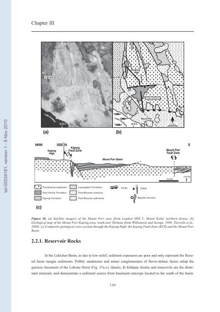
Figure 36. (a) Satellite imagery of the Mount Porr area (from Landsat MSS 5; Mount Kulal, northern Kenya. (b)<br />
Geological map of the Mount Porr-Kajong area, south-east Turkana (from Williamson and Savage, 1986; Tiercelin <strong>et</strong> al.,<br />
2004). (c) Composite geological cross-section through the Kajong High, the Kajong Fault Zone (KFZ) and the Mount Porr<br />
Basin.<br />
2.2.1. Reservoir Rocks<br />
In the Lokichar Basin, as due to low relief, sediment exposures are poor and only represent the flexural<br />
basin margin sediments. Pebbly sandstones and minor conglomerates of fluvio-deltaic facies onlap the<br />
gneissic basement of the Lokone Horst (Fig. 37a-c). Quartz, K-feldspar, biotite and muscovite are the dominant<br />
minerals, and demonstrate a sediment source from basement outcrops located to the south of the basin.<br />
110


