Cultural Landscape Report for Charlestown Navy Yard, Boston
Cultural Landscape Report for Charlestown Navy Yard, Boston
Cultural Landscape Report for Charlestown Navy Yard, Boston

Create successful ePaper yourself
Turn your PDF publications into a flip-book with our unique Google optimized e-Paper software.
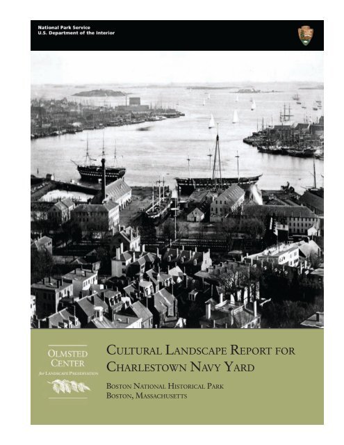
CULTURAL LANDSCAPE REPORT FOR<br />
CHARLESTOWN NAVY YARD<br />
BOSTON NATIONAL HISTORICAL PARK<br />
BOSTON, MASSACHUSETTS
“…all who visit the<br />
<strong>Yard</strong> are familiar<br />
with the great elms<br />
that make leafy<br />
arches over the main<br />
entrance way.”<br />
<strong>Boston</strong> Globe, 1929<br />
CULTURAL LANDSCAPE REPORT<br />
FOR<br />
CHARLESTOWN NAVY YARD<br />
BOSTON NATIONAL HISTORICAL PARK<br />
<strong>Boston</strong>, Massachusetts<br />
INTRODUCTION<br />
____________________________________________________________<br />
SITE HISTORY<br />
____________________________________________________________<br />
EXISTING CONDITIONS<br />
____________________________________________________________<br />
ANALYSIS OF SIGNIFICANCE AND INTEGRITY<br />
____________________________________________________________<br />
TREATMENT<br />
Prepared by<br />
Christopher Stevens<br />
Margie Coffin Brown<br />
Ryan Reedy<br />
Patrick Eleey<br />
National Park Service, <strong>Boston</strong>, Massachusetts, 2005
CULTURAL LANDSCAPE REPORT FOR CHARLESTOWN NAVY YARD<br />
The Olmsted Center <strong>for</strong> <strong>Landscape</strong> Preservation promotes the stewardship of significant landscapes through<br />
research, planning, and sustainable preservation maintenance. The Center accomplishes its mission in collaboration<br />
with a network of partners including national parks, universities, government agencies, and private nonprofit<br />
organizations. Techniques and principles of preservation practice are made available through training and<br />
publications. Founded at the Frederick Law Olmsted National Historic Site, the Center perpetuates the tradition of<br />
the Olmsted firms and Frederick Law Olmsted’s lifelong commitment to people, parks, and public spaces.<br />
Olmsted Center <strong>for</strong> <strong>Landscape</strong> Preservation<br />
email: FRLA_olmsted_center@nps.gov<br />
web: www.nps.gov/oclp/<br />
Publication Credits: In<strong>for</strong>mation in this publication may be copied and used with the condition that full credit be<br />
given to authors and publisher. Appropriate citations and bibliographic credits should be made <strong>for</strong> each use.<br />
Graphics may not be reproduced without the permission of the owners noted in the captions.<br />
Cover Photo: An 1870s view of the waterfront from the Bunker Hill Monument (From the Society <strong>for</strong> the<br />
Preservation of New England Antiquities, SPNEA 12426B).<br />
ii
TABLE OF CONTENTS<br />
LIST OF FIGURES, TABLES, AND PLANS IV<br />
ACKNOWLEDGMENTS X<br />
INTRODUCTION 1<br />
SITE HISTORY 11<br />
1. Settlement of <strong>Charlestown</strong> and War <strong>for</strong> Independence, 1630-1800 12<br />
2. Establishment of the <strong>Navy</strong> <strong>Yard</strong>, 1800-1828 19<br />
3. Development of the <strong>Yard</strong>, 1828-1869 35<br />
4. Post Civil War, 1869-1898 55<br />
5. Revival of the <strong>Yard</strong> and World War I, 1898-1934 71<br />
6. Works Progress Administration and World War II, 1934-1945 105<br />
7. Cold War Era, 1945-1974 123<br />
8. <strong>Yard</strong> Closure and National Historical Park, 1974-Present 145<br />
EXISTING CONDITIONS 157<br />
ANALYSIS OF SIGNIFICANCE AND INTEGRITY 199<br />
TREATMENT 227<br />
BIBLIOGRAPHY 263<br />
APPENDICES 269<br />
iii
CULTURAL LANDSCAPE REPORT FOR CHARLESTOWN NAVY YARD<br />
LIST OF FIGURES<br />
iv<br />
LIST OF FIGURES, TABLES, AND PLANS<br />
1 <strong>Charlestown</strong> <strong>Navy</strong> <strong>Yard</strong> boundary and major precincts, 2004. 6<br />
1.1 The land<strong>for</strong>ms of <strong>Charlestown</strong> Neck and <strong>Boston</strong> in 1630 and 2001. 13<br />
1.2 An early view of <strong>Charlestown</strong>, Bunker Hill, Breeds Hill, and Moultons Hill. 14<br />
1.3 Map of Bunker Hill, Breeds Hill, Town Hill, and Moultons Hill, 1775. 15<br />
1.4 Maps of the British invasion of <strong>Charlestown</strong> with landing sites near Moulton’s and Bunker Hills, 1775. 17<br />
1.5 Northwest view of part of <strong>Charlestown</strong> proposed <strong>for</strong> the United States Dock and <strong>Navy</strong> <strong>Yard</strong>, 1800. 17<br />
1.6 Historical base map showing roads, property ownership, structures, fences, and the waterline, c. 1800. 18<br />
2.1 Map of the yard by Peter Tufts, 1801. 21<br />
2.2 Carleton Osgood’s drawing of the three tracts of the <strong>Charlestown</strong> <strong>Navy</strong> <strong>Yard</strong>, 1802. 22<br />
2.3 Historical Base Map of the yard, c. 1812. 24<br />
2.4 Map of <strong>Charlestown</strong> by Peter Tufts, Jr., 1818. 28<br />
2.5 1823 bird’s eye view of the yard as interpreted by V.K. Spicer in 1904. 29<br />
2.6 Historical Base Map of the yard, c. 1823. 29<br />
2.7 Painting of the <strong>Charlestown</strong> <strong>Navy</strong> <strong>Yard</strong>, c. 1823. 32<br />
2.8 Engraving derived from a c. 1823 painting of the <strong>Charlestown</strong> <strong>Navy</strong> <strong>Yard</strong>. 32<br />
3.1 Plan of the yard showing existing conditions and proposed additions, 1828. 36<br />
3.2 Plan <strong>for</strong> the <strong>Charlestown</strong> <strong>Navy</strong> <strong>Yard</strong>, 1840. 36<br />
3.3 1846 map of <strong>Boston</strong> superimposed with the 1828 master plan of the yard. 38<br />
3.4 Historical Base Map of the yard, c. 1834. 38<br />
3.5 Engraving from of Dry Dock 1, c. 1859. 40<br />
3.6 Engraving of the Commandant’s House and gardens, c. 1852. 42<br />
3.7 View of the yard from the exterior looking east along First Avenue and the waterfront, 1850s. 42<br />
3.8 View looking northwest across the elm-lined parade ground, 1856. 43<br />
3.9 The Marine Barracks and Parade Ground, 1856. 43<br />
3.10 Ropewalk, 1852. 44<br />
3.11 Engraving of the launch of the Merrimack. 46<br />
3.12 Buildings 22 and 24, Dry Dock 1, the Shears in the distance, and the Shiphouse, 1870. 47<br />
3.13 Muster House, c. 1870. 48<br />
3.14 Cannon and Shot Parks in the shipyard mall (recreation area) of the yard, 1874. 49<br />
3.15 Shot park between First and Second Avenues, c. 1865. 50<br />
3.16 Shot park, c. 1870. 50<br />
3.17 Shell House and guns, c. 1870. 51<br />
3.18 Gun park, c. 1870. 51<br />
3.19 Anchors stored on the west end of the lower yard, c. 1870. 51<br />
3.20 1866 bird's eye view of the <strong>Navy</strong> <strong>Yard</strong> as interpreted by V.K. Spicer in 1904. 52<br />
3.21 Plan of yard, 1862. 53<br />
4.1 View of yard and <strong>Boston</strong> Harbor, 1870s. 59<br />
4.2 View of the head of Dry Dock 1, 1872. 60<br />
4.3 View north of the yard from East <strong>Boston</strong>, c. 1874. 60<br />
4.4 Commandant’s House (Quarters G), 1871. 60
4.5 Officers Quarters (Building 265), 1882. 61<br />
4.6 Eastern end of Gun Park, 1874. 61<br />
4.7 View east of Gate 1, 1874. 62<br />
4.8 Plan of the yard, 1874. 62<br />
4.9 Gun park and base of flagpole, c. 1872. 63<br />
4.10 Gun park and trees along Second Avenue, c. 1874. 63<br />
4.11 Gun park with Main (Second) Avenue elms and Marine Barracks in background, c. 1874. 64<br />
4.12 View southeast recently installed granite block pavers at near the base of Pier 1, 1890s. 64<br />
4.13 The Commandant’s Office (Building 29), 1874. 65<br />
4.14 View of "Flirtation Walk,” c. 1890. 65<br />
4.15 View of Anchor Park, c. 1890. 65<br />
4.16 Plan <strong>for</strong> the yard, 1897. 66<br />
5.1 Second Avenue repaving project, 1904. 73<br />
5.2 Paving of First Avenue by the Officer’s Quarters (Building 265), 1903. 74<br />
5.3 Construction of the Conduit (Structure 280) and repaving of First Avenue, 1902. 74<br />
5.4 Brick paving of First Avenue, 1903. 75<br />
5.5 First Avenue after paving c. 1903. 75<br />
5.6 A gathering in the <strong>for</strong>mer gun park, 1904. 76<br />
5.7 First Avenue at Fourth Street, 1902. 76<br />
5.8 Dry Dock Engine House (Building 22) and granite block paving and rail lines, 1902. 77<br />
5.9 Resurfacing Lincoln Avenue, 1902. 77<br />
5.10 Granite Belgian block paving between the Storehouse and <strong>Navy</strong> Store (Buildings 4 and 5), 1903. 78<br />
5.11 Railway construction along the south side of the <strong>Navy</strong> Store (Building 5), 1902. 78<br />
5.12 Surface improvements to the roads on the east and north sides of the <strong>Navy</strong> Store (Building 5), 1918. 79<br />
5.13 Dry Dock 2 under construction, 1904. 81<br />
5.14 Installation of additional crane and rail tracks by the northeast corner of Dry Dock 2, 1904. 81<br />
5.15 The <strong>for</strong>ty-ton portal crane and its twenty-foot gauge tracks around Dry Dock 2, 1910. 82<br />
5.16 Plan <strong>for</strong> the yard, 1902-03. 82<br />
5.17 North and east sides of the relocated Pitch House (Building 10), 1901. 83<br />
5.18 Pier 1 under construction, 1902. 83<br />
5.19 The enormous 1904 Coaling Plant (Building 109) on Pier 1, 1911. 84<br />
5.20 The Coaling Plant (Building 109), 1912. 84<br />
5.21 Differing paving materials on either side of the Carpenter’s Shop (Building 24), 1900. 85<br />
5.22 The Scale House (Building 19), c. 1919 and 1933. 85<br />
5.23 The Commandant’s House (Quarters G), c. 1910. 87<br />
5.24 The south side of the Commandant’s House (Quarters G), 1901. 87<br />
5.25 The Bunker Hill Day parade along Chelsea Street, 1914. 88<br />
5.26 Main Gate (Building 97), 1915. 88<br />
5.27 Marine Barracks (Quarters H-I-K), 1902. 89<br />
5.28 The Shell House (Building 32), 1902-1910. 89<br />
5.29 The Muster House (Building 31), 1904. 90<br />
5.30 Plan <strong>for</strong> the yard, 1914. 91<br />
5.31 Plan <strong>for</strong> the yard, 1934. 92<br />
5.32 Aerial photograph of the yard, c. 1921. 92<br />
5.33 The east and south facades of the <strong>Navy</strong> Store (Building 5), 1921. 95<br />
5.34 Dry Dock 2 with rail crane. 95<br />
v
CULTURAL LANDSCAPE REPORT FOR CHARLESTOWN NAVY YARD<br />
5.35 Southwest view of Pier 1, 1921. 96<br />
5.36 The Dry Dock Engine House (Building 22), 1921. 97<br />
5.37 The <strong>for</strong>mer Chapel (Building 23), 1921. 97<br />
5.38 The Lighting Plant (Building 28), 1921. 98<br />
5.39 Pier 3, 1930. 98<br />
5.40 USS Constitution sits in Dry Dock 1 during its restoration, 1929. 99<br />
5.41 The Commandant’s barn or tool storage (Building 20), 1921. 99<br />
5.42 The Stable (Building 21) and Greenhouse, 1921. 100<br />
5.43 The Officers Quarters (Building 265), 1921. 100<br />
5.44 The Commandant’s Office (Building 32, the <strong>for</strong>mer Shell House), 1920s. 101<br />
5.45 Muster House (Building 31) porch, 1920s. 101<br />
5.46 The Commandant’s House (Quarters G), c. 1930. 101<br />
5.47 The south facade of the Commandant’s House (Quarters G), 1934. 102<br />
5.48 Removal of the granite boundary wall between the Ropewalk and Chelsea Street, 1929. 102<br />
5.49 Gate 4 and the new concrete posts and wrought iron fence, 1929. 103<br />
6.1 WPA repairs and improvements to the north façade of the <strong>Navy</strong> Store (Building 5), 1937. 109<br />
6.2 Area paved by WPA and crews <strong>Navy</strong> Exchange Service Station (Building 194), 1936. 109<br />
6.3 The new <strong>Navy</strong> Exchange Service Station (Building 194) on Pier 1, 1937. 110<br />
6.4 A portal crane, 1940. 110<br />
6.5 A locomotive crane, 1940. 111<br />
6.6 The Commandant’s House, 1936. 111<br />
6.7 WPA crews constructing the kitchen and butler’s pantry on the Commandant’s House, 1938. 112<br />
6.8 The Commandant’s House new kitchen and butler’s pantry east wing, 1938. 112<br />
6.9 The Commandant’s House west yard and boundary wall, 1942. 113<br />
6.10 The Commandant’s House west yard and boundary wall, 1942. 113<br />
6.11 The completed Garage and Chauffeur’s Quarters (Building 1), 1936. 114<br />
6.12 The Marine Corps Administration Building (Building 136), 1937. 114<br />
6.13 WPA crews improving the tennis courts, 1937. 115<br />
6.14 Tennis courts improved by WPA, 1937. 115<br />
6.15 Aerial photograph of the yard, 1945. 116<br />
6.16 Looking west down Henley Street, 1937. 117<br />
6.17 Plan <strong>for</strong> the yard, 1946. 117<br />
6.18 Plan of the multi-site <strong>Boston</strong> Naval Shipyard during World War II. 118<br />
7.1 <strong>Yard</strong>-manufactured dielock chain stored in piles, 1943. 129<br />
7.2 The modernization and enlargement of existing structures as recorded in 1957. 129<br />
7.3 The pedestrian Gate 4 looking into the yard from Chelsea Street, 1977. 130<br />
7.4 The Chelsea Street trolley tracks by Gate 4, 1977. 130<br />
7.5 The west and south facades of the Storehouse (Building 4) and the <strong>Navy</strong> Store (Building 5), 1955. 131<br />
7.6 The west and south facades of the Storehouse (Building 4) and the <strong>Navy</strong> Store (Building 5), 1974. 131<br />
7.7 Aerial view of a parking lot outside the <strong>Yard</strong>’s western wall, between Gates 1 and 2, 1954. 132<br />
7.8 Gate 1 Gatehouse (Building 267) constructed in 1959. 132<br />
7.9 USS Constitution parking area south of Gate 1, 1955 and 1959. 133<br />
7.10 Aerial photographs of the yard, 1966. 134<br />
7.11 The parking area had increased with the demolition of several buildings outside the yard, 1974. 135<br />
7.12 The congested yard, hemmed in by the Mystic and Charles Rivers and <strong>Charlestown</strong>, 1945. 136<br />
7.13 Commandant’s House, c. 1966. 136<br />
vi
7.14 Officers Quarters (Building 265), 1948. 137<br />
7.15 Marine Barracks (Building I), driveway, and Parade Ground, 1974. 137<br />
7.16 Anchor in the Shipyard Mall (recreation area) by First Avenue and Fourth Street, 1967. 138<br />
7.17 Flagpole, Reviewing Stand, and War Memorial (Structures 242, 260, and 279), 1957 and 1974. 138<br />
7.18 Plan <strong>for</strong> the yard, 1973. 139<br />
8.1 <strong>Charlestown</strong> <strong>Navy</strong> <strong>Yard</strong> plan, 1980. 152<br />
8.2 View looking east on Second Avenue, 1974. 152<br />
8.3 The Muster House (Building 31) at the intersection of Second Avenue and Fifth Street, c. 1977. 153<br />
8.4 The Muster House (Buildings 31) and the Dispensary (Building 120), 1977. 153<br />
8.5 One of First Avenue’s few historic trees neat the Dry Dock Engine House (Building 22), 1975. 154<br />
8.6 The pedestrian Gate 4 be<strong>for</strong>e Fifth Street was extended to Chelsea Street, 1977. 154<br />
8.7 The pedestrian Gate 4 be<strong>for</strong>e Fifth Street was extended, 1977. 155<br />
8.8 The Marine Corps Administration Building (Building 136), 1974. 155<br />
8.9 Temporary Storage Building (Building 198), 1977. 156<br />
8.10 Fourth Street paving with yellow bricks and wood blocks, 2002. 156<br />
9.1 The south elevation of the Commandant’s House (Quarters G) and landscape terracing, 2002. 169<br />
9.2 The semicircular boundary wall north of the Commandant’s House, 2002 and 2005. 169<br />
9.3 Spatial organization of the park portion of the <strong>Charlestown</strong> <strong>Navy</strong> <strong>Yard</strong>, 2004. 170<br />
9.4 Outside Gate 1 looking into the park, 2003. 171<br />
9.5 Area surrounding Gate 1, 2003. 171<br />
9.6 The broad view south from First Avenue toward Pier 1, 2003. 171<br />
9.7 Pier 1 looking north, 2003. 172<br />
9.8 Dry Dock 1 and the SS Nobska looking south with Pier 1 and the <strong>Boston</strong> skyline to the right, 2003. 172<br />
9.9 The USS Constitution Museum courtyard and connector, 2002. 173<br />
9.10 The courtyards on the west (left) and east (right) sides of the Marine Barracks (Building I), 2002. 173<br />
9.11 Parking on Pier 1, 2003. 174<br />
9.12 Pier 1 with rails, historic granite paving, supply piles, and bollards, 2003. 174<br />
9.13 Baxter Road parking, 2002. 174<br />
9.14 Buildings, structures, and fencing along Baxter Road, 2002. 175<br />
9.15 Pier 3 in deteriorated condition, 2003. 175<br />
9.16 Fourth Street looking northeast, 2003. 176<br />
9.17 Fifth Street from First Avenue to its intersection with Chelsea Street, 2002. 176<br />
9.18 The pedestrian entrance at Second Avenue looking east toward the BRA portion of the yard, 2002. 177<br />
9.19 The park’s vehicular entrance on First Avenue near the intersection with Fifth Street, 2005. 177<br />
9.20 The brick walkway between the Commandant’s House (Quarters G) steps and Second Avenue, 2002. 178<br />
9.21 The walks that connect the main walk to areas on either side of the Commandant’s House, 2002. 178<br />
9.22 The Commandant's House driveway, 2002. 179<br />
9.23 Concrete walk connecting First and Second Avenues (left) and the Officers Quarters, 2003. 179<br />
9.24 Second Avenue and Officers Quarters’ individual yards and Gate 2, 2002. 179<br />
9.25 Explosives Bunker (Building 272) at the end of Pier 1, 2003. 180<br />
9.26 Dry Dock 1 caisson, 2003. 180<br />
9.27 Pier 3 with Building 24, Crane # 30, and Dry Dock 1, 2003. 181<br />
9.28 Pier 3 from Pier 2 with one of the cranes, 2002. 181<br />
9.29 Pier 3’s floodlight towers (right) are typical of those installed throughout the yard in the 1960s, 2002. 182<br />
9.30 West elevation of Pier 2 showing the USS Constitution Temporary Storage Shed, 2002. 182<br />
9.31 Dry Dock 2 looking north, 2002. 183<br />
vii
CULTURAL LANDSCAPE REPORT FOR CHARLESTOWN NAVY YARD<br />
9.32 Shipyard Mall and Marine Barracks from First Avenue, 2003. 183<br />
9.33 Playing Courts (Structure 236), 2002. 184<br />
9.34 Reviewing Stand (Structure 260), 2003. 184<br />
9.35 The yard’s granite block boundary wall northwest of the Commandant’s House, 2003. 185<br />
9.36 Security and safety features protect USS Constitution and guide visitors, 2005. 185<br />
9.37 NPS Kiosk, wooden steps, and trash cans at USS Cassin Young on Pier 1, 2003. 186<br />
9.38 Explosives Bunker (Building 272), Saluting Battery (Structure 261), and gangway on Pier 1, 2002. 186<br />
9.39 Synthetic lumber post-and-pale fence surrounding Dry Dock 1, 2002. 187<br />
9.40 View west along First Avenue, 2003. 187<br />
9.41 An installation of masts is displayed south of First Avenue north of Dry Dock 1 and Pier 1, 2003. 188<br />
9.42 Baxter Road, the USS Constitution Museum courtyard, and the Carpenter’s Shop, 2003. 188<br />
9.43 First Avenue and the northwest corner of Dry Dock 2, 2003. 189<br />
9.44 The Reviewing Stand and anchor display areas of the Shipyard Mall, 2002. 189<br />
9.45 The top of the Parade Ground in south of the main entrance to the Marine Barracks, 2003. 190<br />
9.46 Southwestern corner of the Shipyard Mall at the intersection of Third Street with First Avenue, 2002. 190<br />
9.47 Commandant's House front lawn, 2002. 191<br />
9.48 The Commandant’s House driveway entrance off Second Avenue, 2002. 191<br />
9.49 Trees growing along the Commandant’s House driveway, 2003. 192<br />
9.50 The Bunker Hill Monument is visible from many parts or the yard especially the waterfront, 2003. 192<br />
9.51 The Tobin Bridge dominates many yard views including this one from Dry Dock 2, 2002. 193<br />
10.1 Southeast corner of the Commandant’s House grounds, 1930s and 2004. 206<br />
10.2 The Marine Barracks terraces, 1923 and 2002. 208<br />
10.3 The Shipyard Mall’s open space at the core of the <strong>Charlestown</strong> <strong>Navy</strong> <strong>Yard</strong>. 211<br />
10.4 The Marine Barracks and Parade Ground. 211<br />
10.5 The area west of the Shell House (Building 32), 1920s and 2004. 212<br />
10.6 Second Avenue turf, 1920s and 2004. 218<br />
10.7 Trees of Flirtation Walk. 220<br />
10.8 Young street trees growing along Second Avenue, 1920s. 220<br />
LIST OF TABLES<br />
1 The eight chapters of the Site History section, chapters 1-7. 3<br />
5.1 List of plants added to the <strong>Boston</strong> <strong>Navy</strong> <strong>Yard</strong> in 1929. 94<br />
10.1 Summary of landscape integrity <strong>for</strong> <strong>Charlestown</strong> <strong>Navy</strong> <strong>Yard</strong> 206<br />
10.2 Summary of landscape characteristics and features <strong>for</strong> the <strong>Charlestown</strong> <strong>Navy</strong> <strong>Yard</strong> 222<br />
LIST OF PLANS<br />
2.9 Period Plan 1828 33<br />
2.10 Period Plan 1828 Vegetation Plan 34<br />
4.17 Period Plan 1898 68<br />
4.18 Period Plan 1898 Vegetation Plan 69<br />
4.19 Period Plan 1898 Legend 70<br />
6.19 Period Plan 1945 120<br />
viii
6.20 Period Plan 1945 Vegetation Plan 121<br />
6.21 Period Plan 1945 Legend 122<br />
7.19 Period Plan 1974 141<br />
7.20 Period Plan 1974 Vegetation Plan 142<br />
7.21 Period Plan 1974 Enlarged Vegetation Plan 143<br />
7.22 Period Plan 1974 Legend 144<br />
9.52 Existing Conditions 2004 195<br />
9.53 Existing Conditions 2004 Vegetation Plan 196<br />
9.54 Existing Conditions 2004 Enlarged Vegetation Plan 197<br />
9.55 Existing Conditions 2004 Legend 198<br />
11.1 Treatment Plan Zones 2004 259<br />
11.2 Treatment Plan Upper <strong>Yard</strong> Enlargement 2004 260<br />
11.3 Treatment Plan Waterfront Enlargement 2004 261<br />
11.4 Treatment Plan - USS Constitution Location Alternatives 262<br />
ix
CULTURAL LANDSCAPE REPORT FOR CHARLESTOWN NAVY YARD<br />
x<br />
ACKNOWLEDGMENTS<br />
This report was a collaborative ef<strong>for</strong>t of the staff at the Olmsted Center <strong>for</strong> <strong>Landscape</strong> Preservation and the <strong>Boston</strong><br />
National Historical Park. At the Olmsted Center, Chris Stevens, Margie Coffin Brown (Project Lead), and Patrick<br />
Eleey compiled the site history using primary and secondary historical documents at the <strong>Boston</strong> National Historical<br />
Park archives. Chris Stevens prepared the existing conditions section. Chris Stevens and Margie Coffin Brown<br />
prepared the analysis and treatment sections of the report. Ryan Reedy and Chris Stevens prepared the period<br />
plans, the existing conditions plans, and treatment plans <strong>for</strong> the document. Robert Page, Charles Pepper, and David<br />
Uschold provided overall project guidance, and Lauren Meier and Jeff Killion reviewed the draft document.<br />
At <strong>Boston</strong> National Historical Park, Superintendent Terry Savage and Ruth Raphael provided overall project<br />
guidance. Ruth Raphael also coordinated a series of very in<strong>for</strong>mative and dynamic charrettes, which aided in<br />
identifying key treatment issues and alternative solutions. Steve Carlson provided tremendous assistance drawing<br />
from his concurrent work on the revised Historic Resource Study. Steve Carlson and Ruth Raphael benefited the<br />
project greatly with comprehensive reviews of the drafts. Phil Hunt, Marcy Beitel, Gene Gabriel and Tom O’Neil<br />
provided input on site conditions and issues. Former <strong>Navy</strong> <strong>Yard</strong> employee and park maintenance supervisor Dave<br />
Rose walked the site with the authors and provided in<strong>for</strong>mation on its recent history. The compilation of an<br />
extensive amount of in<strong>for</strong>mation about the <strong>Charlestown</strong> <strong>Navy</strong> <strong>Yard</strong> would not have been possible without the<br />
dedication of the park staff to preserving the legacy of the <strong>Navy</strong> <strong>Yard</strong>.
<strong>Charlestown</strong> <strong>Navy</strong> <strong>Yard</strong>, <strong>Boston</strong> National Historical Park, c. 2000 (NPS).<br />
INTRODUCTION<br />
MANAGEMENT SUMMARY<br />
HISTORICAL OVERVIEW<br />
SCOPE OF WORK METHODOLOGY<br />
DESCRIPTION OF STUDY BOUNDARIES<br />
SUMMARY OF FINDINGS<br />
INTRODUCTION<br />
page 1
CULTURAL LANDSCAPE REPORT FOR CHARLESTOWN NAVY YARD<br />
page 2<br />
MANAGEMENT SUMMARY<br />
In the early 1800s the <strong>Charlestown</strong> <strong>Navy</strong> <strong>Yard</strong>, later known as the <strong>Boston</strong> <strong>Navy</strong> <strong>Yard</strong> and <strong>Boston</strong> Naval Shipyard,<br />
was one of the busiest naval yards in the country, employing up to 500 mechanics, laborers, and others in the<br />
building, repairing, and equipping of vessels. A half century later, after the Civil War, the yard languished and was<br />
almost closed, until the Spanish-American War and World War I once again increased yard activity. In its peak<br />
years of production during World War II, the yard employed over 50,000 men and women, who worked at a<br />
"frantic pace" to build, repair, and outfit ships <strong>for</strong> overseas. After the war, the strategic importance of the naval fleet<br />
waned, and in the 1970s, officials divided the yard into two parcels transferring one to the National Park Service<br />
(NPS) and the other to the <strong>Boston</strong> Redevelopment Authority (BRA). Today, the yard retains many historic<br />
buildings, structures, and landscape elements that reflect its 174-year role in the creation and growth of the U.S.<br />
<strong>Navy</strong>. The yard is designated a National Historical Landmark and listed on the National Register of Historic Places,<br />
though documentation has not been <strong>for</strong>mally completed. Serving as home <strong>for</strong> the <strong>Navy</strong>'s oldest commissioned<br />
warship, USS Constitution, the yard is a place to celebrate and explore United States maritime history.<br />
The purpose of this cultural landscape report is to thoroughly examine and document the physical development of<br />
the thirty-acre portion of the <strong>Charlestown</strong> <strong>Navy</strong> <strong>Yard</strong> that is owned and managed by the National Park Service.<br />
The report describes the evolution of the landscape from its establishment as a navy yard in 1800 until its closure in<br />
1974 as well as changes during the period of National Park Service (NPS) management from 1974 to present. This<br />
site history is followed by a description of the current condition of the property and an analysis of historical<br />
significance and integrity. This includes an evaluation of the yard’s historic and contemporary landscape<br />
characteristics, such as changes in spatial organization, circulation, and vegetation. With an understanding of the<br />
historical fabric, the report then presents treatment issues and recommendations related to security, accessibility,<br />
paved surfaces, trees, lawn areas, lighting, and other site features. This study provides the documentation needed to<br />
guide management of cultural landscape resources as well as direct long-term planning ef<strong>for</strong>ts. In addition, the<br />
report will aid in future documentation <strong>for</strong> review by the Massachusetts State Historic Preservation Officer <strong>for</strong><br />
compliance with Section 106 of the National Historic Preservation Act, and contribute in<strong>for</strong>mation needed <strong>for</strong> an<br />
environmental assessment and the public community review process.<br />
This report has been prepared in advance of several NPS construction projects and in response to security issues.<br />
Upcoming projects that will necessitate landscape alterations include a new visitor center in the <strong>Navy</strong> Store<br />
(Building 5) and relocation of park headquarters to the Paint Shop (Building 125). Other scheduled projects include<br />
repairs to the Commandant’s House (Quarters G), Carpenter Shop (Building 24), Dry Dock 1, and the Marine<br />
Barracks (Building I). Also scheduled <strong>for</strong> rehabilitation are the Forge Shop (Building 105) and the Ropewalk<br />
(Building 58), which are located in the one hundred-acre parcel of the yard that is now owned by the <strong>Boston</strong><br />
Redevelopment Authority. Detailed study of the <strong>Boston</strong> Redevelopment Authority’s portion of the yard is not<br />
included in this report. The report does however address recent and pressing concerns related to national security.<br />
Active-duty and civilian U.S. <strong>Navy</strong> personnel stationed within the NPS portion of the yard provide public programs<br />
and maintain USS Constitution. To address issues raised by the construction projects and security concerns, the<br />
park sponsored a series of public workshops to identify issues and solutions. A summary of issues related to the<br />
cultural landscape is incorporated into the Treatment section of this report.<br />
The cultural landscape report was developed in conjunction with several associated projects underway at the<br />
<strong>Charlestown</strong> <strong>Navy</strong> <strong>Yard</strong>. A historic resource study (HRS), currently in draft, examines in detail the significance of<br />
the yard’s historical resources, both in the NPS and <strong>Boston</strong> Redevelopment Authority portions of the yard. This<br />
CLR has expanded on and superseded a <strong>for</strong>mer chapter in the draft historic resource study entitled, “<strong>Landscape</strong><br />
Overview.” It provides greater detail on the landscape features within the designated study area and will be
INTRODUCTION<br />
referenced by the HRS. The HRS recommends a future CLR be completed <strong>for</strong> the remainder of the yard where the<br />
NPS has gained oversight responsibilities with land transfers subsequent to the 1974 establishment of the park. Two<br />
other recent studies are referenced several times in this report, a pavement study completed in 1995 and a lighting<br />
study completed in 1997. Earlier studies that also pertain to the development of the cultural landscape report<br />
include: the park’s statement <strong>for</strong> management and general management plan (1980, revised 1987); various historic<br />
structure reports <strong>for</strong> buildings and structures (1980s-1990s); and the historic grounds management report (1985).<br />
HISTORICAL OVERVIEW<br />
The Site History section, chapters 1-8, describes the evolution of the <strong>Charlestown</strong> <strong>Navy</strong> <strong>Yard</strong> landscape in eight<br />
periods based on major political, technological, and social change as outlined below in Table 1. Chapters 2-7 span<br />
the yard’s 174-year period of significance, 1800-1974. Chapters 2, 4, and 7 each also represent one of the nine<br />
subperiods of significance as proposed within the Analysis of Significance and Integrity section, chapter 10. Chapters<br />
3, 5, and 6 each encompass two of the nine proposed subperiods of significance.<br />
Table 1. The eight chapters of the Site History section, chapters 1-8.<br />
Title Period Description<br />
1. Settlement of <strong>Charlestown</strong> 1630 - 1800 From Native American inhabitation of the area, through<br />
and War <strong>for</strong> Independence<br />
settlement of the <strong>Charlestown</strong> peninsula by the<br />
Massachusetts Bay Company, and the War <strong>for</strong><br />
Independence.<br />
2. Establishment of the <strong>Navy</strong> <strong>Yard</strong> 1800-1828* From the establishment of the <strong>Navy</strong> <strong>Yard</strong> through the early<br />
1820s.<br />
3. Development of the <strong>Yard</strong> 1828 - 1869** From implementation of a master plan, the transition to<br />
steam-powered vessels, and the Civil War.<br />
4. Post Civil War 1869 - 1898* From a period of relatively little activity, through the <strong>Navy</strong><br />
Appropriations Act of 1890, and the partial modernization<br />
of the yard to build, repair, and outfit steel ships leading to<br />
the authorization of Dry Dock 2 in 1898.<br />
5. Revival of the <strong>Yard</strong> and World 1898- 1934** From the outbreak of the Spanish-American War through<br />
War I<br />
World War I, a post-war period of modernization, and<br />
subsequent inactivity.<br />
6. Works Progress Administration 1934 - 1945** From the improvements made by the WPA, through a<br />
and World War II<br />
period of shipbuilding and expansion during World War II.<br />
7. Cold War Era 1945 - 1974* From the end of World War II, through the Korean and<br />
Vietnam Wars and the Cold War until the yard’s closure.<br />
8. <strong>Yard</strong> Closure and National 1974 - Present From the transfer of the yard to the National Park Service<br />
Historical Park<br />
and <strong>Boston</strong> Redevelopment Authority to the present.<br />
*Chapter represents one of the nine subperiods of significance <strong>for</strong> the <strong>Charlestown</strong> <strong>Navy</strong> <strong>Yard</strong> as proposed in chapter 10.<br />
**Chapter encompasses two of the nine subperiods of significance <strong>for</strong> the <strong>Charlestown</strong> <strong>Navy</strong> <strong>Yard</strong> as proposed in chapter 10.<br />
The <strong>Charlestown</strong> <strong>Navy</strong> <strong>Yard</strong> is one of the six original yards established by the U.S. <strong>Navy</strong> in 1800. The yard was a<br />
center <strong>for</strong> building, refitting, and servicing ships, and a manufacturing site <strong>for</strong> several essential products <strong>for</strong> the<br />
<strong>Navy</strong>, most notably rope in the nineteenth century and die-lock chain in the twentieth century. During the Colonial<br />
period, the site was at the base of a sparsely populated drumlin and field east of the town center, known as<br />
Moulton’s Hill and Moulton’s Point Field, and bounded by a marsh and tidal flats. During the War <strong>for</strong><br />
page 3
CULTURAL LANDSCAPE REPORT FOR CHARLESTOWN NAVY YARD<br />
Independence, the shoreline within the future yard site contained two landing points <strong>for</strong> British troops on 17 June<br />
1775 during the Battle of Bunker Hill. Once the colony achieved independence, the decimated center of<br />
<strong>Charlestown</strong> was rebuilt farther to the west than the original site. In 1800 the U.S. <strong>Navy</strong> began to acquire pasture<br />
and marshland to the east. Construction of the first buildings in the yard was largely dictated by the natural<br />
topography of the land and tidal shoreline.<br />
Early development of the yard was concentrated on the western portion of the parcel, at the foot of Breed’s Hill and<br />
edge of the marsh, which served as a timber basin. The Commandant’s House (Quarters G), Marine Barracks<br />
(Building I), and <strong>Navy</strong> Store (Building 5) were among the earliest structures. Haphazard development occurred in<br />
the central and eastern portions of the yard where areas were designated <strong>for</strong> use by the U.S. Army and U.S. Treasury<br />
Department. Beginning in 1816, the commandant of the yard and site engineers began to address landscape<br />
improvements and overall site organization. Street trees, fruit trees, a gun and cannon park, and parade ground<br />
created a campus-like setting in the western portion of the upper yard in front of the Commandant’s House<br />
(Quarters G).<br />
A legislative requirement <strong>for</strong> a master plan in 1828 resulted in a classical grid pattern imposed on the yard’s irregular<br />
developments. By mid-century, new structures, improved roads, and the associated filling, dredging, and regrading,<br />
adhered to the grid, creating a more unified appearance to the yard, which was even more pronounced with the<br />
construction of a granite block boundary wall in 1824. At the close of the Civil War, the yard had tripled in size but<br />
lacked a logical organization. Sail making lofts operated next to steam-power plants, wood storage sheds stood next<br />
to iron plating factories. Cannon, shot, and anchor parks contained obsolete materials that had been destined <strong>for</strong><br />
ships. In the 1880s, the yard operations shifted from the construction and repair of ships to the manufacturing of<br />
supplies, including rope, sail, chain, and anchors. During this period, many buildings associated with ship<br />
construction fell into disrepair or were dismantled, including partially-built vessels.<br />
Following nearly thirty years of minimal activity, yard operations gained momentum during and after the Spanish-<br />
American War in 1898 and further intensified when American troops entered World War I in 1917. Shipways <strong>for</strong><br />
steel vessels replaced wooden shiphouses; gas and oil tanks replaced coal storage facilities; and electric lights<br />
replaced gas. Construction of a second, larger dry dock, a marine railway, and extension of the bulkhead line into<br />
the harbor allowed the yard to repair and outfit both large and small ships. Seventeen trade shops supplied some<br />
450 vessels between 1917 and 1918, with an average of fifty ships a day arriving and departing from the yard.<br />
Once again, yard activities diminished after World War I, but certain changes were vital to keep abreast of major<br />
innovations. Adapting from wind to steam to oil-powered vessels and from wood to iron to steel construction<br />
required constant changes to the yard's industrial landscape. During the Great Depression, federal relief programs<br />
established by President Franklin D. Roosevelt trans<strong>for</strong>med the yard into a modern shipbuilding facility. After sixty<br />
years of supply manufacturing, <strong>Charlestown</strong> built its first modern warship, a destroyer, in 1931, with thirteen<br />
additional destroyers built over the next six years. While some portions of the yard changed dramatically, the<br />
upper, western end of the yard retained a residential character with brick buildings, tree-lined streets, ornamental<br />
shrubs, and a central flagpole and bandstand area. During the late 1930s, some 1,400 workers employed through the<br />
Works Progress Administration completed many projects in the yard, including the replacement of the porches and<br />
addition of a kitchen wing on the Commandant’s House (Quarters G), new porches and stair towers on the Marine<br />
Barracks (Building I), improvements to tennis courts, paving of streets, pier improvements, and interior<br />
reconstruction of the <strong>Navy</strong> Store (Building 5).<br />
Construction more than doubled in the 1940s with the outbreak of World War II. Known as the “destroyer yard,”<br />
the yard also produced escort vessels (commonly known as destroyer escorts), landing ships, barracks ships,<br />
submarines, and many smaller vessels. An estimated 6,000 vessels were built, repaired, overhauled, converted, or<br />
page 4
INTRODUCTION<br />
outfitted between 1939 and 1945. A work <strong>for</strong>ce of 50,000, including some 7,700 women and 2,300 African<br />
Americans, worked around the clock in three eight-hour shifts. Be<strong>for</strong>e and during World War II, new buildings<br />
filled a large portion of the remaining open ceremonial and recreational space in the yard, both in the residential<br />
area and the <strong>for</strong>mer timber basin area east of Dry Dock 2. Most notable was the dominating World War II<br />
Temporary Storage Building (Building 198), erected between the Marine Barracks (Building I) and the Dry Dock<br />
Engine House (Building 22).<br />
After the war, production slowed and the yard shifted its facilities to sonar and radar technology. In the 1960s, the<br />
yard also outfitted vessels with missiles, antisubmarine warfare devices, and conducted fleet rehabilitation and<br />
modernization overhauls to extend the usefulness of the <strong>Navy</strong>’s aging and dwindling fleet. By the early 1970s, work<br />
was greatly diminished and closure was imminent. The Marine Railway and Ropewalk (Building 58) were closed in<br />
1971 and the entire yard was officially closed on 1 July 1974. When closed, the yard was divided into two parcels,<br />
with approximately 100 acres transferred to the <strong>Boston</strong> Redevelopment Authority and the rest to the National Park<br />
Service. Additional parcels not owned by the <strong>Navy</strong>, including the Hoosac Stores, were subsequently transferred to<br />
or acquired by the NPS, increasing the NPS portion of the yard to some thirty acres. 1<br />
Under National Park Service management, numerous features were altered, removed, or added to improve<br />
circulation and facilitate park operations. The Marine Corps Administration Building (Building 136), World War II<br />
Temporary Storage Building (Building 198), Transportation Garage (Building 204), and the Marine Railway were<br />
removed. In the early 1980s, Gate 4 and Fifth Street were expanded to accommodate vehicle traffic. The associated<br />
construction of the Chelsea-Water Street Connector required the relocation of the boundary wall, which resulted in<br />
a loss of open space along the front and side lawns of the Commandant’s House (Quarters G). Numerous buildings<br />
were rehabilitated <strong>for</strong> new uses, including the Dry Dock Engine House (Building 22) as the USS Constitution<br />
Museum and the Pitch House (Building 10) as a restaurant. Despite the many changes, clusters of notable<br />
nineteenth and twentieth-century buildings remain, as well as industrial structures including piers, dry docks, light<br />
towers, grit hoppers, and portal cranes. The site is also home to USS Constitution and USS Cassin Young. The park’s<br />
General Management Plan <strong>for</strong> the <strong>Charlestown</strong> <strong>Navy</strong> <strong>Yard</strong> (revised 1987) states that all surface areas and structures<br />
within the National Historical Park will be included in a “historic zone.”<br />
SCOPE OF WORK AND METHODOLOGY<br />
This report was completed in 2005. Research was conducted at a cursory level, relying on many of the existing<br />
studies completed at the yard. The CLR consists of four major sections: Site History; Existing Conditions; Analysis of<br />
Significance and Integrity with a summary of landscape characteristics and features; and Treatment with guidelines<br />
and recommendations. The Site History section is divided into chapters based on national trends or major changes<br />
in the yard, either due to changes in technology, funding initiatives, or wartime needs. The Existing Conditions<br />
section provides a description of extant landscape characteristics and features. The Analysis of Significance and<br />
Integrity section reviews the current site documentation with respect to the National Register of Historic Places,<br />
examines the integrity of landscape characteristics, and lists contributing characteristics and features, including<br />
natural features, spatial organization, circulation, structures, vegetation, and small-scale features. The Treatment<br />
section describes four treatment alternatives, preservation, rehabilitation, restoration, and reconstruction, and the<br />
justification <strong>for</strong> the selected treatment, rehabilitation. Guiding principles and specific recommendations are paired<br />
1<br />
The 1973 yard plan (399-155) indicates the following: hard land – 83.9 acres, water – 46.07 acres, total 129.97 acres, plus Marine Corps land<br />
– 1.34 acres, <strong>for</strong> a total of 131.31 acres. Steve Carlson, correspondence, 18 July 2002.<br />
page 5
CULTURAL LANDSCAPE REPORT FOR CHARLESTOWN NAVY YARD<br />
with current issues facing the yard, with some design concepts and details as parameters <strong>for</strong> design and<br />
construction.<br />
ORIENTATION<br />
Throughout the report, geographic references follow the <strong>Navy</strong>’s practice in considering that First Avenue ran true<br />
east to west and not northeast to southwest. This usage, which <strong>Boston</strong> NHP has continued in developing<br />
construction drawings <strong>for</strong> work within the yard, simplifies the geographical orientation and allows <strong>for</strong> consistency<br />
between contemporary and historic plans. To further aid in the description of structures and landscape features,<br />
the yard is divided into three general areas: the waterfront south of First Avenue, including the piers; the upper<br />
yard, including the western residential area; and the lower yard, including the central marsh, manufacturing area,<br />
and the eastern residential area (Figure 1). Aspects that encompass the entire yard, including circulation and the<br />
boundary wall, are addressed under separate headings. This report concentrates on the western end of the<br />
waterfront and upper yard, which represents the NPS portion of the property, but often describes major changes in<br />
other parts of the yard. Many features outside of the study area, particularly along the waterfront were linked by<br />
function and require some explanation beyond the study area. In an ef<strong>for</strong>t to provide consistency throughout the<br />
report, in<strong>for</strong>mation is presented chronologically in the site history section and by landscape characteristics and area<br />
in the existing conditions and analysis of significance and integrity sections.<br />
Figure 1. <strong>Charlestown</strong> <strong>Navy</strong> <strong>Yard</strong>, <strong>Boston</strong> National Historical Park, 2004, illustrating the park unit’s boundary and major precincts<br />
(NPS).<br />
page 6
YARD AND STREET NAMES<br />
INTRODUCTION<br />
Known variously as the <strong>Boston</strong> <strong>Navy</strong> <strong>Yard</strong> or <strong>Charlestown</strong> <strong>Navy</strong> <strong>Yard</strong> throughout its history, the yard officially<br />
became the <strong>Boston</strong> Naval Shipyard in 1945, shortly after the end of World War II. When starting in World War I,<br />
the yard acquired additional storage, docking, and repair facilities in South <strong>Boston</strong>, East <strong>Boston</strong>, and Chelsea, the<br />
<strong>Charlestown</strong> yard was referred to as the “main yard.” When the property became a national park site, Congress<br />
designated it as <strong>Charlestown</strong> <strong>Navy</strong> <strong>Yard</strong>. 2 The naval operations that continue within the <strong>Charlestown</strong> <strong>Navy</strong> <strong>Yard</strong><br />
are known as the Naval Historical Center Detachment <strong>Boston</strong>’s Maintenance & Repair Facility. In this report the<br />
site is referred to as the <strong>Charlestown</strong> <strong>Navy</strong> <strong>Yard</strong>, or simply the “yard.”<br />
Some of the surrounding streets names have changed since their seventeenth and eighteenth century origins.<br />
Chelsea Street was previously known as the Salem Turnpike, and the first road to the site was referred to as the<br />
“Lane to the Brickyards.” Early roads that led to Gates 1 and 2 of the yard—Water, Wapping, and Henley Streets—<br />
were subsequently eliminated and replaced by Constitution Road, which approaches Gate 1 along the <strong>for</strong>mer<br />
alignment of Water Street. Within the yard, the first road extended east from Henley Street and was known as New<br />
Road until it became Main Avenue in 1857. In the 1860s when railroad tracks were introduced to the yard, the<br />
waterfront road became the principal street called First Avenue, and Main Avenue became Second Avenue. In the<br />
1870s, the <strong>Navy</strong> assigned letters to the avenue names with First Avenue being Avenue E and Second Avenue being<br />
Avenue D. In 1902, to aid in yard organization, the <strong>Navy</strong> officially named roads running east-west as “Avenues” in<br />
numerical order from south to north, and roads running north-south as “Streets” in numerical order from west to<br />
east. 3<br />
BUILDING, STRUCTURE, AND PIER NAMES<br />
Beginning in the late 1860s, the <strong>Navy</strong> assigned a number or letter to each building, structure, and pier.<br />
Un<strong>for</strong>tunately, during major periods of development of the yard, such as in 1900 and the 1940s, some renumbering<br />
occurred. Similarly, building functions changed resulting in new descriptive names, such as the Dry Dock Engine<br />
House that now serves as the USS Constitution Museum (Building 22). In this report the descriptive name of the<br />
building or structure is paired with its numerical name in parenthesis to minimize confusion, e.g., the Paint Shop<br />
(Building 125). Appendix 1 lists the proper names, numbers, and locations of buildings and structures referenced in<br />
this report. Military documents typically capitalize the names of buildings, such as Dry Dock 1 and the<br />
Commandant’s House (Quarters G). In keeping with this tradition, most building and major structure names are<br />
capitalized in this report.<br />
The earliest piers were termed “wharves” and the two located at the western end of the yard were known as White’s<br />
Wharf and Shear Wharf. In the early 1900s, when the <strong>Navy</strong> extended the bulkhead line further into the harbor,<br />
many of the wharves were extended and thereafter referred to as piers. The piers are numbered from one to eleven,<br />
with Pier 1 on the western end of the yard. When closed in 1974, there were three dry docks in the yard, known as<br />
Dry Docks 1, 2, and 5. Dry Docks 3 and 4 were located in the South <strong>Boston</strong> Annex, which was active during World<br />
War II.<br />
For more in<strong>for</strong>mation on names, refer to Carlson, HRS, 2, f3.<br />
For more in<strong>for</strong>mation on building numbers and street names, refer to Carlson, HRS, 11, f17.<br />
2<br />
3<br />
page 7
CULTURAL LANDSCAPE REPORT FOR CHARLESTOWN NAVY YARD<br />
page 8<br />
DESCRIPTION OF STUDY BOUNDARIES<br />
This study focuses on the land owned by the National Park Service that was part of the <strong>Charlestown</strong> <strong>Navy</strong> <strong>Yard</strong>.<br />
The study does not include the Hoosac Stores area because it is a separate National Register district of local and<br />
regional significance and was never part of the <strong>Charlestown</strong> <strong>Navy</strong> <strong>Yard</strong> (see Figure 1). The study area includes the<br />
waterfront Piers 1, 2, and 3, though only a portion of Pier 3 is in the park. The history of both Dry Docks 1 and 2 is<br />
examined, though Dry Dock 2 is outside of the park. In the upper yard, the study includes the area surrounded by<br />
the boundary wall from Gate 1 to Gate 4, and Fifth Street, as well as the block between Fifth and Sixth Street that<br />
contains the <strong>for</strong>mer Shell House now used by the <strong>Boston</strong> Marine Society (Building 32).<br />
SUMMARY OF FINDINGS<br />
In November 1966, the US Secretary of the Interior designated the <strong>Boston</strong> Naval Shipyard as a National Historic<br />
Landmark under the National Historic Preservation Act (NHPA). This designation also automatically placed the<br />
yard on the National Register, which had been created a month earlier by the NHPA. The nomination noted that<br />
“…the <strong>Boston</strong> Naval Shipyard…has been found to possess exceptional value in commemorating or illustrating the<br />
history of the United States…” 4<br />
In 1978, the National Park Service prepared a National Register Nomination Form<br />
to document the landmark. The <strong>for</strong>m was submitted to the National Register Office but never <strong>for</strong>mally accepted.<br />
This draft document found the <strong>Charlestown</strong> <strong>Navy</strong> <strong>Yard</strong> to be eligible under National Register Criteria A, C and D.<br />
A Historic Resource Study was completed by Edwin C. Bearss and Frederick R. Black in 1984 and 1988 occupying<br />
three parts and five volumes. These volumes focus on the history of the site and focus on naval operations and ships<br />
built in the yard. They do not address surviving resources, significance, or treatment. A revised Historic Resource<br />
Study (HRS) is currently in draft, which seeks to document and assess the cultural resources and determine primary<br />
and secondary periods of significance <strong>for</strong> the yard. The draft recommends that revised National Register <strong>for</strong>ms be<br />
prepared and that all four criteria (A,B,C,D) are applicable to the yard. The revised HRS also addresses the period<br />
of 1974 to 2000, when many changes were made in the yard.<br />
The period of significance of the <strong>Charlestown</strong> <strong>Navy</strong> <strong>Yard</strong> extends from the yard’s establishment in 1800 to its<br />
deactivation in 1974 when the yard became part of <strong>Boston</strong> National Historical Park. 5 The 1978 draft National<br />
Register Nomination Form applies four primary themes to evaluate all extant buildings and features of the yard:<br />
History of the American <strong>Navy</strong> (Military); History of Technology (Engineering); History of Social and Worker<br />
Movements (Politics/Government); and History of American Architectural Design and Planning (Architecture).<br />
Both the draft National Register Nomination Form and draft Historic Resource Study ascribes national significance<br />
to the property, one of the six original United States <strong>Navy</strong> <strong>Yard</strong>s, under Criterion A <strong>for</strong> its association with 174 years<br />
of the U.S. <strong>Navy</strong>’s war and peacetime ef<strong>for</strong>ts.6 Additionally, the property is significant under Criterion B <strong>for</strong> its<br />
association to significant figures including naval officers and other individuals involved with the yard’s architecture,<br />
engineering, and technology. The property is also significant under Criterion C <strong>for</strong> its distinctive historic<br />
residences, manufacturing facilities, piers, and dry docks as well as associated open space critical to the yard’s<br />
4<br />
National Survey of Historic Sites and Buildings, “<strong>Boston</strong> Naval Shipyard, Massachusetts,” October 10, 1966, enclosed in Howard R.<br />
Stagner to Paul H. Nitze, Secretary of the <strong>Navy</strong>, Nov. 15, 1966, <strong>Boston</strong> Naval Shipyard NHL Reference File, Division of <strong>Cultural</strong><br />
Resources, <strong>Boston</strong> NHP.<br />
5<br />
The <strong>Charlestown</strong> <strong>Navy</strong> <strong>Yard</strong> also includes the site of the British landing during their 17 June 1775 attack on the colonial <strong>for</strong>tifications<br />
built on Breeds Hill, later known as the Battle of Bunker Hill. This event falls outside of the yard’s 1800-1974 period of significance and is<br />
more associated with the program of the Bunker Hill Monument unit of <strong>Boston</strong> National Historical Park.<br />
6<br />
National Register of Historic Places Nomination Form, The Historic Resources of the <strong>Boston</strong> Naval Shipyard, <strong>Charlestown</strong> <strong>Navy</strong> <strong>Yard</strong>.<br />
Partial Inventory: Historic and Architectural Resources by Edwin C. Bearrs, Historian, Peter J. Snell, Historical Architect, NPS, Denver<br />
Service Center, May 1978, page one, Significance Section.
INTRODUCTION<br />
operation. Much of the yard’s grid, open space, and buildings can be attributed to the planning and design of<br />
Laommi Baldwin, Alexander Parris, and Joseph Billings among others while engineers such as Baldwin created<br />
structural feats such as Dry Dock 1. Additional significance is ascribed under Criterion D <strong>for</strong> the potential of the<br />
property’s buildings and structures to yield important historical in<strong>for</strong>mation. The archeological resources<br />
associated with the yard are significant, but beyond the scope of this study.<br />
<strong>Boston</strong> National Historical Park’s <strong>Charlestown</strong> <strong>Navy</strong> <strong>Yard</strong> includes the administrative and ceremonial center of the<br />
yard with many nineteenth-century buildings. Today’s <strong>Navy</strong> <strong>Yard</strong> represents an amalgam of technology and<br />
building and landscape styles and ideals. In order to evaluate integrity, the 174-year long period of significance has<br />
been divided into nine subperiods, slight variations of those identified by the draft HRS. Expectedly the landscape<br />
of the most recent subperiod, 1945-1974 Cold War Era, possesses the highest integrity.<br />
Although the site retains many nineteenth-century landscape characteristics and features, the landscape does not<br />
retain overall integrity <strong>for</strong> the nineteenth-century subperiods. Yet the intent of the yard’s overall plan and building<br />
scale, largely influenced by Loammi Baldwin, Alexander Parris, and other early yard architects and engineers is still<br />
strongly expressed. World Wars I &II necessitated intense additions that compromised the yard’s park-like<br />
character. By the latter war, few street trees remained much like today. After World War II, the <strong>Navy</strong> removed<br />
many of the stockpiles needed <strong>for</strong> the war ef<strong>for</strong>t. The park and BRA later removed much of the World War II era<br />
buildings and structures and reconfigured some streets. These actions removed some evidence of this subperiod’s<br />
design, materials, and feeling. The setting surrounding the park changed during the twentieth century and<br />
continued to change once the <strong>Navy</strong> left and the park <strong>for</strong>med. The setting today reflects these changes made during<br />
the last half of the twentieth century.<br />
The park’s General Management Plan (GMP) (revised 1987) states that “…the <strong>Navy</strong> <strong>Yard</strong>’s appearance will be<br />
managed to reflect the final period of <strong>Navy</strong> occupancy dating to 1974.” 7<br />
The plan defines a “Preservation Subzone”<br />
<strong>for</strong> the majority of the NPS property, which calls <strong>for</strong> the “preservation and maintenance of the twentieth-century<br />
industrial character of the yard as it existed in 1973 prior to transfer to the National Park Service.” While this<br />
approach has been accepted <strong>for</strong> over a decade, it has become increasingly untenable <strong>for</strong> several reasons. First, there<br />
is the need to look at the integrity and significance of the yard within its broader historical and material culture<br />
contexts. The draft HRS provides a broader perspective on the significance of the yard. With this study, the park<br />
will be able highlight a broader range of significant aspects of the <strong>Yard</strong>’s history. Second, as new issues arise and<br />
changes are necessary, the preservation to 1973-74 becomes less feasible. The yard has already been substantially<br />
altered since the park was established. These major physical alterations, paired with a philosophical reexamination<br />
of the yard’s significance, require a new treatment approach <strong>for</strong> the yard. A third reason to reconsider the<br />
treatment approach <strong>for</strong> the yard is the redefinition of appropriate treatments. The Secretary of the Interior’s<br />
Standards <strong>for</strong> the Treatment of Historic Properties (rev 1992) provide clearer distinctions between a preservation<br />
and rehabilitation treatment. Likewise, the GMP guidelines were prepared at a time when the concept of the<br />
cultural landscape was barely considered. The present conditions, with a loss of historic small-scale features,<br />
historic vegetation, and lack of visitor amenities are partially due to the lack of a guiding document <strong>for</strong> the<br />
landscape and associated treatment recommendations.<br />
This CLR presents rehabilitation as the treatment approach, which is a departure from the preservation<br />
recommendations of the outdated GMP above. Rehabilitation as opposed to preservation has become the park’s<br />
preferred alternative in recent years as it allows <strong>for</strong> the preservation of historic characteristics and features while<br />
accommodating necessary change in the yard. Preservation focuses on the maintenance and repair of existing<br />
historic materials and retention of a property’s <strong>for</strong>m as it has evolved over time. This approach would prescribe the<br />
7<br />
Final Revised General Management Plan, Volume II, <strong>Boston</strong> national Historical Park, <strong>Charlestown</strong> <strong>Navy</strong> <strong>Yard</strong>, <strong>Boston</strong>, MA, February<br />
1987.<br />
page 9
CULTURAL LANDSCAPE REPORT FOR CHARLESTOWN NAVY YARD<br />
maintenance and repair of the site as it currently exists, and would allow existing features to be replaced in kind, yet<br />
would not permit the addition of new features. A preservation strategy would no longer reflect the historic<br />
landscape since there have been many changes since the park was established. The park’s GMP specifies<br />
preservation to the 1973-74 appearance. However, as pointed out in the park’s draft HRS, the park is “no longer<br />
preserving the industrial character present in 1973, but a cleaned up version of what the yard once was.” Entire<br />
buildings and structures have been removed and roadways altered. Due to the urban nature of the site, multiple<br />
users, security needs, and other issues, a preservation approach is too restrictive and does not allow <strong>for</strong> the<br />
alterations and additions necessary <strong>for</strong> compatible uses. In addition, it is impossible to restore the yard’s landscape<br />
to a specific subperiod without destroying earlier or subsequent layers. Rehabilitation acknowledges the need to<br />
meet continuing or changing uses through alterations or new additions while retaining the property’s historic<br />
character. It allows <strong>for</strong> repairs or alterations of the cultural landscape, and <strong>for</strong> improving the utility and/or function<br />
of landscape features. It is used to make an efficient, compatible use while preserving those portions or features of<br />
the site that contribute to defining its historical significance. These changes would best serve management goals <strong>for</strong><br />
continued visitor use. There<strong>for</strong>e, the most sound treatment approach <strong>for</strong> the <strong>Charlestown</strong> <strong>Navy</strong> <strong>Yard</strong> site is<br />
rehabilitation.<br />
This CLR provides treatment guidelines and recommendations described that seek to embrace the yard’s 174-year<br />
period of significance as well as multiple historical themes and to best serve management goals <strong>for</strong> continued visitor<br />
use. Currently, several issues challenge the park’s management and interpretation of the cultural landscape. The<br />
<strong>Charlestown</strong> <strong>Navy</strong> <strong>Yard</strong> must solve complex problems with respect to security, visitor experience, facilities<br />
maintenance, and accessibility. Design treatments and cultural landscape management should focus on the<br />
preservation, integration, and interpretation of features remaining from all significant historic periods as a way to<br />
enhance visitor understanding of the complexity and continuity of the yard.<br />
When rehabilitation treatment actions are completed, treatment actions should be documented as an update to the<br />
Park’s <strong>Landscape</strong> Preservation Maintenance Plan. Thereafter, maintenance activities affecting landscape treatment<br />
should continue to be documented as work is per<strong>for</strong>med to maintain an ongoing record of physical changes made<br />
to the site. Completion of a CLR <strong>for</strong> <strong>Charlestown</strong> <strong>Navy</strong> <strong>Yard</strong>'s lower yard (PMIS 16796) would contribute to the<br />
preservation of this area and to holistic treatment <strong>for</strong> the entire yard. This area largely held by the BRA also<br />
includes buildings within the park’s legislative boundary (Buildings 58, 60, and 105 and 107).<br />
page 10
SITE HISTORY 1. 1630-1800<br />
1850s View of the <strong>Charlestown</strong> <strong>Navy</strong> <strong>Yard</strong> from the exterior looking east along First Avenue, <strong>Boston</strong> National Historical Park (Gleason’s<br />
Pictorial Drawing Room Companion, November 29, 1857, BOSTS 8635).<br />
SITE HISTORY<br />
1. SETTLEMENT OF CHARLESTOWN AND WAR FOR INDEPENDENCE, 1630-1800<br />
2. ESTABLISHMENT OF THE NAVY YARD, 1800-1828<br />
3. DEVELOPMENT OF THE YARD, 1828-1869<br />
EARLY NINETEENTH-CENTURY GROWTH, 1828-1853<br />
DEVELOPMENT IN THE AGE OF STEAM, 1853-1869<br />
4. POST CIVIL WAR, 1869-1898<br />
5. REVIVAL OF THE YARD AND WORLD WAR I, 1898-1934<br />
YARD RESURRECTED, 1898-1920<br />
THE STAGNANT 1920S, 1920-1934<br />
6. WORKS PROGRESS ADMINISTRATION AND WORLD WAR II, 1934-1945<br />
7. COLD WAR ERA, 1945-1974<br />
8. YARD CLOSURE AND NATIONAL HISTORICAL PARK, 1974-PRESENT<br />
page 11
CULTURAL LANDSCAPE REPORT FOR CHARLESTOWN NAVY YARD<br />
PREHISTORY<br />
page 12<br />
1. SETTLEMENT OF CHARLESTOWN AND<br />
WAR FOR INDEPENDENCE, PRE 1630 – 1800<br />
When glacial ice covered New England nearly 12,000 years ago, the <strong>Boston</strong> Basin, a geological depression bounded<br />
by an escarpment to the north and west, was a hilly plain cut by rivers and streams and colonized by various plant<br />
and animal species. Within the basin, advancing glaciers <strong>for</strong>med drumlins—elongated masses of till shaped into<br />
smooth-sloped hills—that characterize the landscape of the <strong>Charlestown</strong> area (Figure 1.1). Five to eight thousand<br />
years later, Paleo-Indian populations and their descendants occupied the region, settling primarily along major river<br />
basins. In the late sixteenth century, members of the Algonquin linguistic group occupied the area that later became<br />
<strong>Charlestown</strong>. The Algonquin called it Mishaumut or Mishawum, translated as “Great Spring,” bounded by the<br />
Mystic and Charles Rivers, then the Mistick and Mishaum. 1 These individuals were possibly part of the Massachuset<br />
or Pawtucket Tribes, some of the first Native Americans to come in contact with European explorers in the early<br />
1600s. 2 Coastal tribes were also the first to be heavily exposed to European diseases, particularly small pox, that<br />
afflicted entire villages in 1616 and 1619. Many New England colonial settlements were built on the sites of<br />
decimated Native American villages, requiring little ef<strong>for</strong>t to claim and clear the land. 3 While it is likely that Native<br />
Americans hunted and occupied the land within the present <strong>Charlestown</strong> <strong>Navy</strong> <strong>Yard</strong>, prehistoric archeological sites<br />
have only been located west of the property. Subsequent development of the yard property may have destroyed<br />
many sites. 4<br />
1<br />
Wood, 123-4 and Henry Herbert Edes, “<strong>Charlestown</strong> in the Colonial Period,” in Justin Winsor, The Memorial History of <strong>Boston</strong>, Including<br />
Suffolk County, Massachusetts, 1630-1880 (<strong>Boston</strong>: James Osgood and Company, 1881), 383, 387 (f3).<br />
2<br />
According to seventeenth century town records, Aberginian Indians inhabited the area north of the Charles River Edes in Winsor.<br />
During his second visit to <strong>Boston</strong> Harbor in 1608, Samuel Champlain anchored between <strong>Charlestown</strong> and Noddle’s Island (later East<br />
<strong>Boston</strong>) and described the indigenous peoples and the cultivation that they practiced. ”Along the shore there is a great deal of land<br />
cleared up and planted with Indian corn. The country is very pleasant and agreeable, and there is no lack of fine trees….As we continue<br />
our course, large numbers came to us in canoes from the island and mainland” M. F. Sweetser, King’s Handbook of <strong>Boston</strong> Harbor<br />
(Cambridge, MA: Moses King, 1888) Sweetser, 260.<br />
3<br />
Cronon, Changes in the Land (NY: Hill and Wang, 1983) 90.<br />
4<br />
Carlson, 9.
Figure 1.1: The dark shaded areas represent the land<strong>for</strong>ms of<br />
<strong>Charlestown</strong> Neck and <strong>Boston</strong> in 1630, while the white areas represent<br />
the current land after centuries of fill (Mapping <strong>Boston</strong> 2001; 16).<br />
EUROPEAN SETTLEMENT OF CHARLESTOWN<br />
SITE HISTORY 1. 1630-1800<br />
Members of the Massachusetts Bay Company arrived at <strong>Charlestown</strong> or “Cherton” in 1629, when about one<br />
hundred persons relocated from Salem under the leadership of Frances Higginson. 5 Seventeenth-century town<br />
records relate that a small company “traveled the woods…and lighted of a place situate and lying on the north side<br />
of Charles River, full of Indians called Aberginians…by whose free consent they settled about the hill of the same<br />
place, by the said natives called Mishawum.” The Company’s engineer, Thomas Graves, proceeded to "model and<br />
layout the <strong>for</strong>m of the town, with streets about the hill." Each inhabitant was allocated a two-acre lot to plant upon,<br />
and “all were to fence in common.” 6 The southern-most hill, the smallest of four drumlins on the peninsula, was<br />
selected as the center of the settlement and named “Town Hill,” rising at the confluence of the Charles and Mystic<br />
Rivers, where there was deep anchorage. To the west, a narrow isthmus, known as the “Neck,” connected the<br />
peninsula to abundant inland <strong>for</strong>ests and farmland. The three other hills were subsequently named Bunkers,<br />
Breeds, and Moultons Hills. Moultons (or, Mortons) Hill, a drumlin originally thirty-five to <strong>for</strong>ty feet in elevation,<br />
rose from the easterly portion of a field, known as Moultons Point Field, that would later become part of the<br />
<strong>Charlestown</strong> <strong>Navy</strong> <strong>Yard</strong> (Figure 1.2). The settlers measured out properties, built stone fences to establish the<br />
boundary markers, enclosed a common, and erected a "Great House" on Town Hill. On July 4, 1629, King Charles<br />
of England chartered the settlement as an independent town, and “<strong>Charlestown</strong>” became his namesake. 7<br />
Upon his arrival to <strong>Charlestown</strong> in 1630, John Winthrop, the designated Governor of the Massachusetts Bay<br />
Colony, noted “some wigwams and one house.” He selected <strong>Charlestown</strong> as the seat of government and occupied<br />
the “Great House” with several of the patentees, while “the multitude set up cottages, booths, and tents about the<br />
Town Hill.” 8 After two months of persistent sickness, scarce food, and inadequate fresh water, Winthrop and many<br />
5<br />
Thomas Wal<strong>for</strong>d established the first English settlement in <strong>Charlestown</strong> in about 1625. Wal<strong>for</strong>d relocated from Wessagusset (now part<br />
of North Weymouth), which had been settled by the Robert Georges Company and subsequently abandoned. Wal<strong>for</strong>d’s episcopal tenets<br />
would eventually lead to his departure from <strong>Charlestown</strong> upon the arrival of Puritans of the Massachusetts Bay Company.<br />
6<br />
Edes in Winsor, 385.<br />
7<br />
<strong>Charlestown</strong> originally included what is now Malden, Woburn, Stoneham, Burlington, and Somerville and parts of what is now<br />
Med<strong>for</strong>d, Cambridge and Reading. From Heli Meltsner, Bonnie Marxer, and Sarah Zimmerman. “National Register of Historic Places<br />
Inventory-Nomination Form, Monument Square Historic District.” (October 1985) 8:1.<br />
8<br />
Edes in Winsor, 386.<br />
page 13
CULTURAL LANDSCAPE REPORT FOR CHARLESTOWN NAVY YARD<br />
colonists moved to the Shawmut peninsula, that was renamed <strong>Boston</strong>. The following year the General Court<br />
inaugurated a ferry between <strong>Boston</strong> and <strong>Charlestown</strong>. Those who remained in <strong>Charlestown</strong> began to realize<br />
Graves’ town plan around Town Hill, that became “a large market-place near the water side built round with<br />
houses, comely and fair, <strong>for</strong>th of which there issues two streets orderly built with some very fair houses, beautified<br />
with pleasant orchards and gardens.” 9 One of the earliest orders of <strong>Charlestown</strong> provided <strong>for</strong> a great “Cornfield”<br />
on the east side of Town Hill, embracing all of the land between Main Street and the Mystic River and the three<br />
hills—Bunkers, Breeds, and Moultons. This cornfield may have included land that became the <strong>Charlestown</strong> <strong>Navy</strong><br />
<strong>Yard</strong>. The earliest roads were “the Country Road” (later Main Street) towards <strong>Charlestown</strong> Neck and the<br />
“Crooked-lane” (later Bow Street) that encircled Town Hill. 10 A small cart path likely led to Moultons Point.<br />
Figure 1.2: A view from <strong>Boston</strong> of the Town Hill settlement in <strong>Charlestown</strong> (<strong>for</strong>eground); the neck that connected to the<br />
mainland (far left); the three drumlins (left to right)--Bunker Hill, Breeds Hill, and Moultons Hill; and Moultons Point<br />
(far right), that later became the <strong>Charlestown</strong> <strong>Navy</strong> <strong>Yard</strong> (Frothingham 1859; 12).<br />
SEAPORT DEVELOPMENT<br />
The sheltered location of <strong>Boston</strong>’s inner harbor provided good anchorage and deep channels to support the<br />
Massachusetts Colony’s early maritime economy. By the eighteenth century, the <strong>Charlestown</strong> settlement emerged<br />
as a thriving community founded upon several shipyards and merchants, who engaged primarily in commerce and<br />
trade with the West Indies and Europe. <strong>Charlestown</strong> listed 412 voters who agreed to pave portions of public streets<br />
and to construct an almshouse. Along the main streets and waterfront, occupants constructed about 400 buildings,<br />
including houses, shops, a marketplace, and shipyards precipitating the town’s trans<strong>for</strong>mation into a bustling<br />
seaport. 11 An inland road, ranging from sixteen to thirty feet wide, extended from the <strong>Charlestown</strong> Neck across the<br />
upland hayfields and pastures from Bunker Hill to Moultons Point. Farmhouses lay along the roads backed by<br />
fields and pastures, clearly demarcated with post-and-rail fences. With the exception of trees along the main roads,<br />
most of the peninsula’s timber had long since been harvested, leaving open views to <strong>Boston</strong>, Noddles Island (later<br />
East <strong>Boston</strong>), and Chelsea (Figure 1.3). The Moultons Point section of <strong>Charlestown</strong> was largely open pasture and<br />
marsh fronting on tidal flats at the confluence of the Charles and Mystic Rivers at the inner limit of <strong>Boston</strong> Harbor.<br />
Only a couple of buildings stood on the extreme west corner of what became the <strong>Charlestown</strong> <strong>Navy</strong> <strong>Yard</strong>. 12<br />
Eighteenth-century town records indicate that James Russell built a dry dock near Harris’ Wharf, not far from the<br />
present location of the <strong>Charlestown</strong> <strong>Navy</strong> <strong>Yard</strong> and Samuel Henley purchased a portion of the town’s common. 13<br />
The War <strong>for</strong> Independence, however, resulted in a dramatic alteration of the <strong>Charlestown</strong> landscape.<br />
9<br />
Edes in Winsor, 383-400.<br />
10<br />
Richard Frothingham, History of the Siege of <strong>Boston</strong> (NY: Da Capo Press) 93.<br />
11<br />
Frothingham, 48.<br />
12<br />
Bearss, <strong>Charlestown</strong> <strong>Navy</strong> <strong>Yard</strong>, 1800-1842, 2: 1075, 1077, 1081. Throughout this section, geographic references follow the <strong>Navy</strong>’s practice<br />
in considering that First Avenue ran true east to west and not northeast to southwest. This usage, which <strong>Boston</strong> NHP has continued in<br />
developing construction drawings <strong>for</strong> work within the yard, simplifies the geographical orientation and allows <strong>for</strong> consistency between<br />
contemporary and historic plans.<br />
13<br />
Frothingham, 181, 210, 264, 325-26 and “<strong>Boston</strong>, and its Environs in 1775.”<br />
page 14
SITE HISTORY 1. 1630-1800<br />
Figure 1.3: 1775 map showing Bunker Hill (A), Breeds Hill (B), Town Hill (C), and Moultons Hill (top right). The “Country Road,”<br />
later Main Street, extends from the Neck, southeast to Town Hill. The “Crooked Lane,” later Bow Street, encircles Town Hill.<br />
Three lanes extended east from Town Hill to Moultons Point, that later became the “Lane to Brickyards” (later Chelsea Street),<br />
Wapping Street, and Battery (Water) Street. Meeting (Henley) Street is not shown. The government later established the yard<br />
along the shoreline below Moulton’s Hill, east of Breeds Hill, encompassing what was once a pasture and marsh (American<br />
Memory, The Library of Congress National Digital Library, http://lcweb.loc.gov/rr/geogmap/gmpage.html).<br />
WAR FOR INDEPENDENCE<br />
By the Revolutionary era, <strong>Charlestown</strong>’s prosperous seaport was hampered only by British rule and taxation. In<br />
June of 1774, the British-imposed <strong>Boston</strong> Port Bill effectively shut down <strong>Charlestown</strong>, suspending maritime trade,<br />
precipitating economic decline, and spurring <strong>Charlestown</strong> delegates to bear an active part in patriotic councils. On<br />
18 April 1775, Paul Revere landed along the <strong>Charlestown</strong> shore, at a point now at the western end of the yard, and<br />
began his ride to Lexington to bring news of British General Gage’s dispatch of troops to destroy the rebel stores in<br />
Concord. The next day, <strong>Charlestown</strong> was the scene of intense excitement and confusion as the British Regulars<br />
retreated to the peninsula and occupied Bunker Hill. Many of the town’s 3,000 inhabitants fled after Gage notified<br />
the <strong>Charlestown</strong> selectmen that he would order his ships in <strong>Boston</strong> Harbor to fire on the town if American troops<br />
entered the peninsula. The population further dwindled to less than 200 after a general order on 6 May 1775<br />
prohibited all traffic through <strong>Boston</strong>. American troops began to <strong>for</strong>tify Breed’s Hill on the eve of 17 June 1775. At<br />
dawn, Gage kept his word, ordering British artillery on Copp’s Hill in <strong>Boston</strong> to open fire on <strong>Charlestown</strong>. By midafternoon,<br />
nearly 3,000 British troops marched from two landing sites at Moultons Point toward the American<br />
redoubt, and the Battle of Bunker Hill ensued. <strong>Charlestown</strong> burned in a great fire, ignited in part by the shells<br />
thrown from <strong>Boston</strong> (Figure 1.4). The British Annual Register later reported the town’s fate:<br />
<strong>Charlestown</strong> was large, handsome, and well built, both in respect to its public and private edifices; it contained about four<br />
hundred houses, and had the greatest trade of any port in the province, except <strong>Boston</strong>…It is now in ruins. 14<br />
14<br />
Frothingham, 334, 344, 368.<br />
page 15
CULTURAL LANDSCAPE REPORT FOR CHARLESTOWN NAVY YARD<br />
No known physical elements remain from Revere’s landing, the British landing sites, or the battle within the yard.<br />
Revere’s approximate landing site is marked with a plaque west of Pier 1 along the waterfront and the British landing<br />
sites are marked with plaques on Buildings 5 and 105. 15 After the war, <strong>Charlestown</strong> residents returned “to repair<br />
their waste places” and rebuilt the town center largely to the west of the <strong>for</strong>mer center, in a location considered<br />
easier to defend. Legislative acts in 1781 and 1790 provided <strong>for</strong> “widening and amending the Streets, Lanes, and<br />
Squares, in that part of the Town which was lately laid waste by Fire” and clearing the ruins, particularly around the<br />
market place. New structures were built along Water (Battery) and Henley (Meeting) Streets, that branched off<br />
from the crooked lanes leading eastward from Town Hill towards Moultons Point. Later Wapping Street cut<br />
between the two streets. In 1785, there were 151 buildings and nearly 1,000 residents on the <strong>Charlestown</strong> peninsula.<br />
SUMMARY<br />
By 1800, the town contained 349 buildings and 2,750 residents, of whom some of the most prominent occupied<br />
“well-cared-<strong>for</strong> estates, surrounded by green fields stretching away as far as the eye can see,” on the slopes of<br />
Breed’s Hill. 16 Merchants, shipbuilders, manufacturing industries, and farmers resumed their businesses in the<br />
Moultons Point vicinity. On the lower part of the ridge, along the “lane to the brick yards” were several houses, a<br />
brewery, Samuel Ferrin’s brickyard, and the ropewalk established by Joseph Burton and Benjamin Gray in 1794. A<br />
second ropewalk extended from another portion of the “lane” (on what was to become Chelsea Street), north of<br />
Henley Street, to the rear of the Tufts and Breed estates. 17<br />
A watercolor painted in 1800 depicts the land that became<br />
the yard (Figure 1.5). A great lawn stretched from a large, Federal style mansion towards the “lane.” The lawn<br />
contained trees that may have represented an orchard. Only three small buildings, situated on the portion of John<br />
Harris’ tract between Henley and Water Streets, occupied the flats below the “lane.” A dam, together with a “sluice<br />
or drain” roughly in line with western portion of the “lane,” drained marshland to create Ebenezer Breed’s “Dam<br />
Pasture.” Post-and-rail fences, running to low-tide mark along the Charles River, delineated the boundaries of<br />
pastures held by four additional property owners in the area of Moulton’s Point (Figure 1.6).<br />
15<br />
The landing sites are considered defining features of the Bunker Hill Battlefield in the American Battlefield Protection Program survey.<br />
Carlson, 9.<br />
16<br />
Frothingham, 16, 22-24.<br />
17<br />
Timothy T. Sawyer, Old <strong>Charlestown</strong>: Historical Biographical, Reminiscent (<strong>Boston</strong>: J. H. West, Co., 1902) 171-81.<br />
page 16
SITE HISTORY 1. 1630-1800<br />
Figure 1.4: Left: Digitally enhanced map depicting the British invasion of <strong>Charlestown</strong> from <strong>Boston</strong> in 1775 (John Humphrey map).<br />
Right: Digitally enhanced map of 1775 British landing sites near Moulton’s and Bunker Hills (Peter Force map, American Memory,<br />
The Library of Congress National Digital Library, http://lcweb.loc.gov/rr/geogmap/gmpage.html).<br />
Figure 1.5: A painting by D. Roynerd dated March 1800 and entitled “A Northwest view of that part of<br />
<strong>Charlestown</strong> proposed <strong>for</strong> the United States Dock and <strong>Navy</strong> <strong>Yard</strong>. Taken in a Boat on the Water at highwater.”<br />
The right portion of the image became the center of the <strong>Charlestown</strong> <strong>Navy</strong> <strong>Yard</strong> and the pasture fences<br />
remained <strong>for</strong> several years (National Archives, RG 45, March 1800 and in Bearss 1984; 1075).<br />
page 17
CULTURAL LANDSCAPE REPORT FOR CHARLESTOWN NAVY YARD<br />
Figure 1.6: Digitally enhanced Historical Base Map showing roads, property ownership, structures, fences, and the waterline in c. 1800.<br />
Current park boundary is outlined at the left (National Park Service, Denver Service Center, in Bearss 1984; 1059).<br />
page 18
2. ESTABLISHMENT OF THE NAVY YARD, 1800 – 1828<br />
SITE HISTORY 2. 1800-1828<br />
For the American colonies, independence meant the loss of protection once af<strong>for</strong>ded by Britain’s powerful navy. In<br />
1793, North African pirates raided eleven American vessels, prompting Congress to enact legislation authorizing the<br />
construction, equipping, and manning of six frigates, establishing the foundation of the Unites States <strong>Navy</strong>. Private<br />
commercial yards built the frigates and in 1797, shortly after the USS Constitution slid down the ways at Hartt’s <strong>Yard</strong><br />
near Copp’s Hill in <strong>Boston</strong>, President John Adams established a separate <strong>Navy</strong> Department. First Secretary of the<br />
<strong>Navy</strong> Benjamin Stoddert recommended naval expansion and the establishment of public shipyards to confront<br />
French threats to American neutral shipping. 1<br />
In early 1800 Naval Constructor Joshua Humphreys visited New England in order to evaluate potential dock sites.<br />
While <strong>Charlestown</strong> and Noddles Island sites were considered, Humphreys concluded that Newport, Rhode Island<br />
was the best dry-dock location, citing such favorable characteristics as “capacity of harbor, depth of water, use of<br />
tide, expense in building docks, prices of land, facility of navigation, and capability of defense.” 2 <strong>Charlestown</strong><br />
residents, disappointed by Humphreys’ rejection, convened a seven-member committee to confer with landowners<br />
identified in Humphreys’ report and to appoint a spokesman, Dr. Aaron Putnam, to plead the town’s cause to<br />
officials in the federal capital at Philadelphia. Putnam met with President Adams in April and challenged<br />
Humphreys’ criticism of <strong>Boston</strong> Harbor. Adams agreed that the <strong>Charlestown</strong> site should be designated one of the<br />
six yards, with the others located in Portsmouth, New Hampshire; New York; Philadelphia; Washington, D.C.; and<br />
Norfolk, Virginia. Beginning in May of 1800, Putman acquired a 24½-acre tract determined by Humphreys as<br />
sufficient <strong>for</strong> both a building yard and dock. 3 For the next three decades, the yard sporadically expanded,<br />
languished, and reorganized according to strategic and political deliberations, or in response to the immediate<br />
demands of war. 4<br />
SITE ACQUISITION<br />
The site selected <strong>for</strong> the yard included Moultons Point Field, the adjacent marsh area, a portion of Moultons Hill,<br />
and extensive tidal flats. After their first acquisition dated 26 August 1800, the <strong>Navy</strong> eventually purchased about ten<br />
tracts of land. 5 These tracts included Ebenezer Breed’s “Point Pasture,” “Dam Pasture,” and “Marsh” <strong>for</strong> which the<br />
United States agreed to maintain the ditch and dam. Breed retained his upland pastures and the <strong>Navy</strong> agreed to<br />
erect fences along the new boundary. 6 The <strong>Navy</strong> also acquired pasture parcels bounded by post and rail fences<br />
from William Calder, Richard Boyeston, Catherine Henley, and Aaron Putnam, a marsh parcel from John Larkin,<br />
and several small building lots from John Harris, Aaron Putnam, Samuel Swan, and Nathaniel Gorham’s heirs.<br />
EARLY ROADS AND YARD LAYOUT<br />
In January 1801, residents at a <strong>Charlestown</strong> town meeting voted that “the roads & streets leading into and through<br />
the lands purchased by the United States <strong>for</strong> the <strong>Navy</strong> and dock yard, be granted or exchange in such manner as will<br />
accommodate the United States without injury to the town, or the inhabitants of the vicinity.” Four <strong>Charlestown</strong><br />
roads traversed the property. Battery (Water) Street ran eastward along the Charles River, terminating at the edge<br />
1<br />
Bearss, 2-4.<br />
2<br />
Bearss, 7-9.<br />
3<br />
Bearss, 12, 15-18.<br />
4<br />
Carlson, 3, Kenneth J. Hagan, In Peace and War, and Hagan, This People’s <strong>Navy</strong>: The Making of American Sea Power (New York: Free<br />
Press, 1992).<br />
5<br />
Carlson, 3.<br />
6<br />
Bearss, 24.<br />
page 19
CULTURAL LANDSCAPE REPORT FOR CHARLESTOWN NAVY YARD<br />
of the Harris tract at a point near the landing site of British rein<strong>for</strong>cements in 1775 (now in the vicinity of Building 5).<br />
Meeting (Henley) Street cut diagonally southeastward, terminating at the same point. The “Lane to Brick <strong>Yard</strong>s”<br />
led from the Training Field to the brick yards, running along the southern boundary of Aaron Putnam’s residential<br />
parcel and roughly in line with Ebenezer Breed’s dam, be<strong>for</strong>e turning northward and exiting the property near the<br />
dam. Finally, Proprietor’s Way, an extension of the lane to the brick yards, ran through pastureland at the eastern<br />
end of Moultons Point, ending in the vicinity of Breed’s “Point Pasture.” The town conveyed these four roads to<br />
the United States <strong>for</strong> exclusive use and authorized the selectmen to alter “the road leading from the Training field to<br />
the brick yards, by an exchange of land” with the <strong>Navy</strong>. This <strong>for</strong>ty-foot-wide alternative road later became the<br />
Salem Turnpike and then Chelsea Street. 7 Three years later Congress authorized the <strong>Navy</strong> to convey title to the<br />
proprietors of the Salem Turnpike and Chelsea Bridge Corporation a triangular tract at the western corner of the<br />
<strong>Charlestown</strong> <strong>Navy</strong> <strong>Yard</strong> that the corporation agreed to maintain as public highway.<br />
In June 1801, Captain Samuel Nicholson became superintendent of the <strong>Charlestown</strong> <strong>Navy</strong> <strong>Yard</strong>. The <strong>Navy</strong> directed<br />
Nicholson to remove and preserve materials from the “old navy yard” [Hartt’s] in <strong>Boston</strong> to the <strong>Charlestown</strong> <strong>Navy</strong><br />
<strong>Yard</strong> and to review and certify repairs needed to United States ships in port. 8 An 1801 map shows the initial<br />
configuration of building yards and dry docks envisioned <strong>for</strong> the yard (Figure 2.1). In late 1801, Congress requested a<br />
plan of each navy yard in the nation. The required plan <strong>for</strong> <strong>Charlestown</strong>, completed by Carleton Osgood in 1802,<br />
divided the grounds into three tracts, which were defined as a waterfront area, a residential and workshop area in<br />
the upper yard, and a pasture area in the lower yard (Figure 2.2). The waterfront area, comprised of the 9¾-acre<br />
basin of marshland bounded on the south by a wharf, stored most timber received at the yard. The upper yard, a<br />
nine-acre area north and west of the “bason,” contained storage structures, housing, and shops. Construction and<br />
repair materials, as well as cannon, shot, iron, and ballast were stored in this area. Oxen purchased <strong>for</strong> the yard<br />
were also pastured here. The lower yard, the land north and east of the basin, served as pasturage <strong>for</strong> public oxen. 9<br />
The layout of these areas was irregular and likely based on the natural topography of the land and access to the<br />
water channel without extensive filling or dredging. The division of functions was indicative of an organization that<br />
remained consistent <strong>for</strong> the next 170 years.<br />
7<br />
Bearss, 26.<br />
8<br />
During the two years of site selection and land acquisition at <strong>Charlestown</strong> <strong>Navy</strong> <strong>Yard</strong>, a change in naval policy, prompted by the<br />
ratification of the Paris Convention and the subsequent end of hostilities with France, temporarily staid development at the nation’s navy<br />
yards. On the day be<strong>for</strong>e he left office in March 1801, Adams signed an order calling <strong>for</strong> the reduction of the naval establishment. The<br />
administration of President Thomas Jefferson, however, re-focused attention on the <strong>Navy</strong> and authorized construction of vessels of war<br />
in response to continued pirate raids to the American merchant fleet in the Mediterranean.<br />
9<br />
Bearss, 41-43.<br />
page 20
SITE HISTORY 2. 1800-1828<br />
Figure 2.1: Digitally enhanced map of the yard by Peter Tufts in 1801 showing proposed building yards, dry docks, and timber wharves.<br />
Current park boundary is outlined (BOSTS-13494 from the National Archives).<br />
page 21
CULTURAL LANDSCAPE REPORT FOR CHARLESTOWN NAVY YARD<br />
Figure 2.2: Digitally enhanced Carleton Osgood’s 1802 drawing of the three tracts of the <strong>Charlestown</strong> <strong>Navy</strong> <strong>Yard</strong>. Current park<br />
boundary is outlined (From the National Archives in Bearss, 1081).<br />
WATERFRONT AREA<br />
One of the first waterfront structures built in the center of the yard, was a cobb wharf “<strong>for</strong> keeping the masts, yard,<br />
timbers, etc. in a state of preservation.” The wharf consisted of timber cribs with stone ballast and held timbers<br />
underwater to slow deterioration. A canal between the wharf and the Charles River facilitated movement of<br />
materials. In its first two years, the yard served more as a supply depot than a shipyard since all other construction<br />
was postponed and the <strong>Navy</strong> rented wharves in <strong>Boston</strong> to repair its vessels. 10<br />
The building program <strong>for</strong> the yard began in earnest in January 1802. When a Congressional investigation reviewed<br />
the naval program and concluded that the yards at <strong>Charlestown</strong> and Norfolk were the most eligible <strong>for</strong> receiving<br />
and repairing ships. Necessary improvements to the <strong>Charlestown</strong> yard included the construction of sheds <strong>for</strong><br />
storage of oak and pine timbers, a blacksmith shop, carpenter shop, and a temporary navy store. 11 In the vicinity of<br />
these buildings the U.S. Marine Corps took possession of a lime shed on the <strong>for</strong>mer Harris tract to construct<br />
rudimentary barracks <strong>for</strong> the Marine Guard. 12 None of these original structures remain.<br />
10<br />
Carlson, 11; Bearss, 32-33, 34; Mary Jane Brady and Merrill Ann Wilson, Historic Structure <strong>Report</strong>, Pier 1 and 2, Volume 1, Denver Service<br />
Center, National Park Service, January 1982, 8.<br />
11<br />
Although Naval Agent Samuel Brown was to proceed immediately with construction of a three-story storehouse and to submit a plan <strong>for</strong><br />
the wharf to senior naval officers <strong>for</strong> review, fragmentary evidence precludes detailed description of early improvements. Bearss, 34-35,<br />
47.<br />
12<br />
Bearss, 49, 75-76.<br />
page 22
UPPER YARD<br />
SITE HISTORY 2. 1800-1828<br />
In 1804, the <strong>Navy</strong> selected the highest point in the yard <strong>for</strong> a residence of the superintendent of the yard, <strong>for</strong>mally<br />
known as the Commandant's House (Quarters G). Completed in 1805, the three-story brick structure was built “on<br />
the most convenient place on the public ground and upon substantial scale” and designed to face Chelsea Street, but<br />
also included a back porch and walkway that led directly to the waterfront. In response to Superintendent Samuel<br />
Nicholson’s request <strong>for</strong> a garden, the <strong>Navy</strong> approved plans <strong>for</strong> the enclosure of a “small piece of ground contiguous<br />
[west of] to the House to be built <strong>for</strong> the Superintendent <strong>for</strong> a garden,” but denied his request <strong>for</strong> a barn or stable to<br />
shelter four cows, two horses, and a chaise <strong>for</strong> his family as well as two or three yoke of public oxen. A small barn<br />
was eventually approved and built southeast of the house (Building 20), but a larger stable was not added until the<br />
1820s. 13<br />
In June 1810 the Marine Corps selected a site <strong>for</strong> a new barracks, east of the Commandant’s House and south of the<br />
Salem Turnpike. This was the first portion of the Marine Barracks that later became “Quarters H-I-K.” 14 Plans<br />
included excavation of a portion of the hill to the east of the Commandant’s House, designs <strong>for</strong> a garden southeast<br />
of the barracks, two wells, and diversion of turnpike drainage through a drain near the fence. Constructed largely<br />
by the Marines themselves, it consisted of a single-story central section containing enlisted men’s barracks and<br />
three-story wings at each end housing officers. 15 Marine Corps Commandant Franklin Wharton’s correspondence<br />
also suggests that the ground fronting the barracks had been graded. During the following year, Wharton gave<br />
instructions <strong>for</strong> the laying out of a parade ground, including a provision <strong>for</strong> a “Lane or Alley between the<br />
Commanding Officer’s garden & the Stables of the Commodore <strong>for</strong> the <strong>for</strong>mer & latter to use.” Wharton requested<br />
a board fence, rather than post and rail, to enclose the barracks and parade ground. Upon completion of the project<br />
in early August, Nicholson complained that the Marines’ parade ground, extending 305 feet along the fronts facing<br />
the turnpike and the river, was “absolutely spoiling the <strong>Navy</strong> <strong>Yard</strong>,” but Paul Hamilton, who succeeded Smith as<br />
Secretary of the <strong>Navy</strong>, chose not to intercede (Figure 2.3). 16<br />
LOWER YARD<br />
In 1802, the U.S. Treasury Department assumed control of a five-acre section of the <strong>Charlestown</strong> <strong>Navy</strong> <strong>Yard</strong> <strong>for</strong> a<br />
marine hospital. During the latter half of the year the boundary was established at the north, or lower, end of the<br />
yard and the area surrounding the building was designated the hospital grounds. To protect <strong>Boston</strong> Harbor, the<br />
Army built an earthen half-moon battery, with eight gun plat<strong>for</strong>ms resting on stone foundations and armed with<br />
ten-pound guns, in the lower yard in 1809 on the current site of the Sheet Metal Shop (Building 103). The War<br />
13<br />
Bearss, I, p. 58,89,341.<br />
14<br />
The Marine Barracks is considered to be the oldest Marine Barracks building in the United States. Carlson, 12. Quarters H-I-K has<br />
been called Building I since the 1920s.<br />
15<br />
Over the years, this structure has undergone considerable modifications. In 1870 the original central portion was demolished and<br />
replaced by a three-story building. Congress appropriated funds <strong>for</strong> further alterations in fiscal year 1890, and in fiscal year 1898<br />
authorized the addition of an additional story to the structure. By 1902, it achieved its present four-story configuration. The final major<br />
modification came in 1941, when the Works Progress Administration added the fireproof stair towers and present porches. When the yard<br />
assigned alphabetical designations to quarters in the 1870s, the barracks itself became Quarters I while the two wings were designated as<br />
Quarters H and Quarters K; these designations last appear on yard site plans in 1919. Thereafter, the two wings are shown as Quarters 1<br />
(Commanding Officer) and 2 (Junior Officers), with each floor of the latter being assigned a lowercase letter suffix. Carlson, 12; G. Rodger<br />
Evans, Historic Structure <strong>Report</strong>, Marine Barracks (Bldg. I), <strong>Charlestown</strong> <strong>Navy</strong> <strong>Yard</strong>: Architectural Data, <strong>Boston</strong> National Historical<br />
Park, <strong>Charlestown</strong>, Massachusetts (draft; Denver: Denver Service Center, 1978), TIC 457/D36; Public Law 114, 50th Cong., 2nd sess., Mar.<br />
2, 1889, Public Law 128, 54th Cong., 2nd sess., Mar. 3, 1897, in Woodbury Pulsifer, comp., <strong>Navy</strong> Yearbook: Compilation of Annual Naval<br />
Appropriation Laws From 1883 to 1912, Senate Doc. No. 955, 62nd Cong., 3rd sess. (Washington: Govt. Printing Office, 1912), p. 102, 273. In<br />
1837 and 1838 yard and Marine Corps officials considered relocating the barracks to a site on the opposite side of the Salem Turnpike<br />
(Chelsea Street), but nothing came of this plan. See Bearss, <strong>Charlestown</strong> <strong>Navy</strong> <strong>Yard</strong>, 1800-1842, 1036-1037.<br />
16<br />
Bearss, 82-84, 89-91.<br />
page 23
CULTURAL LANDSCAPE REPORT FOR CHARLESTOWN NAVY YARD<br />
Department secured permission <strong>for</strong> the construction of two supporting structures: a Powder Magazine and Gun<br />
House. 17 Responsibility <strong>for</strong> the Powder Magazine and Gun House was shared between the Army and the <strong>Navy</strong>. 18<br />
BOUNDARY FENCE<br />
Hamilton authorized the yard’s second commandant, William Bainbridge to establish a boundary <strong>for</strong> the land at the<br />
eastern end of the yard allotted to the War Department in 1809 and then “erect a substantial enclosure around that<br />
part” belonging to the <strong>Navy</strong>. Bainbridge proposed an access road extending southward from the Salem Turnpike to<br />
the Army Laboratory. In addition, a picket fence beginning at the turnpike and running south to the east line of the<br />
magazine fence and on to the harbor line would parallel the Marine Hospital fence and demarcate the boundary.<br />
Shortly after completion of the enclosure in late June, Hamilton directed Bainbridge to erect a “temporary<br />
fence…running from the <strong>for</strong>t in a direct line to the turnpike” in order to keep the battery and other structures<br />
occupied by the Army distinct from those belonging to the <strong>Navy</strong>. 19<br />
Figure 2.3: Digitally enhanced Historical Base Map of the yard in c. 1812 showing the Commandant’s House, Marine<br />
Barracks, storage buildings, blacksmith shop, cobb wharf, half-moon battery (center), hospital grounds and War Department<br />
buildings (upper right). Current park boundary is outlined (NPS, DSC, 1984 in Bearss, 1063).<br />
17<br />
The two-story brick Powder Magazine, divided between army and naval stores and surrounded by a fence twenty-five feet from the<br />
structure, was constructed 200 yards north of the half-moon battery and a hundred yards south of the Salem Turnpike. The two-story<br />
brick Gun House was located nearby, between the magazine and the five-acre Marine Hospital tract. Bearss, 66-67.<br />
18<br />
Carlson, 13.<br />
19<br />
Bearss, 109-11.<br />
page 24
WAR OF 1812 AND AFTERMATH<br />
SITE HISTORY 2. 1800-1828<br />
In April 1812, as relations with Great Britain deteriorated, Bainbridge wrote to Secretary Hamilton of the yard’s<br />
neglected condition and noted that fences and wooden buildings were in disrepair. Among the yard’s buildings,<br />
Bainbridge listed: “one old wooden building,” providing office and storage space and “scarcely worth keeping on<br />
the grounds;” a “very old small structure nearly in ruins” occupied by the boatswain and purser; two one-story<br />
frame sheds under which timber <strong>for</strong> a 74-gun ship was stored; a blacksmith shop housed in an old frame building; a<br />
carpenter shop; a stone landing about twelve feet in width and elevated about three feet from the beach surface; a<br />
cobb wharf, fourteen feet-wide and three hundred feet-long, that <strong>for</strong>med a dam <strong>for</strong> the timber basin; and temporary<br />
fences in “ruins.” 20 Bainbridge later complained that he had found <strong>Charlestown</strong> <strong>Navy</strong> <strong>Yard</strong>:<br />
...in a state of perfect chaos. The public property in a state of ruin and decay; the establishment, then of twelve years standing,<br />
af<strong>for</strong>ded no advantage or facility <strong>for</strong> naval purposes; a boat could not approach at certain periods of the tide within five<br />
hundred feet of the shore—a few temporary wooden buildings were all it contained except the commandant’s house and the<br />
Marine barracks, unenclosed, it was even exposed to the inroads of the cattle from [the] highway. 21<br />
President James Madison declared war with Britain on 12 June 1812 and shortly thereafter discovered the<br />
inadequacies of the American armed <strong>for</strong>ces. The tiny U.S. <strong>Navy</strong> fought briefly be<strong>for</strong>e the British blockade bottled<br />
up its warships <strong>for</strong> the duration of the war. Early successes, using small, fast frigates and sloops-of-war, prompted<br />
Congress to authorize six new frigates and six sloops-of-war. In addition, Congress authorized four 74-gun ships<br />
<strong>for</strong> shoreline defense. Between 1813 and 1822, the hulls of three of these ships (Independence, Vermont, and Virginia)<br />
were laid down at <strong>Charlestown</strong>.<br />
WATERFRONT<br />
During the War of 1812, minimal repairs and improvements were undertaken at <strong>Charlestown</strong>. Secretary of the <strong>Navy</strong><br />
William Jones authorized construction of a wharf faced with stone and a shipbuilding way <strong>for</strong> a 74-gun ship. The<br />
wharf, a nearby new Blacksmith shop, and a <strong>Navy</strong> Store (Building 5) were constructed during the summer and<br />
autumn of 1813. Bainbridge, after learning that the Portsmouth yard intended to erect a shelter to protect workmen<br />
from bad weather during construction of a gun ship, submitted a similar plan <strong>for</strong> a shiphouse in <strong>Charlestown</strong><br />
(Figure 2.4). Construction of the Shiphouse, a large barn-like structure erected over the shipbuilding way on the<br />
site of the present Pier 1, commenced immediately upon approval of the plan in September. 22 This shiphouse and<br />
subsequent shiphouses dominated the <strong>Charlestown</strong> <strong>Navy</strong> <strong>Yard</strong> waterfront <strong>for</strong> the rest of the century.<br />
During the War of 1812 the <strong>for</strong>midable threat posed by British naval power gave rise to security concerns <strong>for</strong> the<br />
yard and, in particular, <strong>for</strong> the safety of the gun ship under construction. Guards, gun batteries, and cannon were<br />
installed to protect the yard’s entrance from the British. 23 Around the time that Bainbridge ordered the <strong>for</strong>tification<br />
of the <strong>Charlestown</strong> <strong>Navy</strong> <strong>Yard</strong>, the British consented to direct peace negotiations at Ghent and signed a treaty at the<br />
end of 1814. A period of retrenchment followed the cessation of hostilities with Great Britain and, consequently, the<br />
modest program of wartime improvements to the <strong>Charlestown</strong> physical plant came to a grinding halt. Several ships<br />
and vessels were ordered to <strong>Charlestown</strong> <strong>Navy</strong> <strong>Yard</strong> <strong>for</strong> repairs and placed “in ordinary” [in storage]. Soon their<br />
outfitting, armament, stores, and ballast began to fill the empty spaces throughout the yard. Prominent along the<br />
20<br />
In 1811 Secretary of the <strong>Navy</strong> Paul Hamilton approved Agent Johnnot’s request <strong>for</strong> authority to construct a building slip at the<br />
southwestern end of the cobb wharf. Bearss, 69.<br />
21<br />
Bearss, 99, 101-03, 181.<br />
22<br />
Bearss, 146.<br />
23<br />
Bearss, 147-48, 150.<br />
page 25
CULTURAL LANDSCAPE REPORT FOR CHARLESTOWN NAVY YARD<br />
waterfront was the USS Constitution, which was in ordinary after the War of 1812. The ship was subsequently<br />
repaired, armed, and provisioned be<strong>for</strong>e putting out to sea again in 1821. 24<br />
The first vessel, completed and christened USS Independence, slid down the ways into the Charles River with a<br />
“federal salute” from USS Constitution on 22 June 1814. However, construction on Vermont and Virginia slowed<br />
after critics questioned the 74’s strategic value and the two unfinished vessels remained effectively in ordinary in the<br />
yard. 25 A violent windstorm in July 1814 destroyed the Independence shiphouse. Bainbridge salvaged ironwork and<br />
planking and used these materials <strong>for</strong> construction of a pile wharf in front of the blacksmith shop. In 1816,<br />
Commandant Isaac Hull, <strong>Charlestown</strong> <strong>Navy</strong> <strong>Yard</strong>’s newly-appointed superintendent, proposed major<br />
improvements to the yard but was only authorized to carry out minor work. Most yard improvements were<br />
directed towards enhancing production along the waterfront. Upon receiving orders to prepare the yard <strong>for</strong><br />
construction of a 74-gun ship-of-the-line and a 44-gun frigate, Superintendent Hull directed the clearing and repair<br />
of the shipbuilding way in April 1817. Construction of a new shiphouse, known as Shiphouse 1 (later known as<br />
Shiphouse G or Building 71) began in the autumn of the same year and was completed in 1818 to house the USS<br />
Vermont. Workmen installed a permanent pair of shears, <strong>for</strong> raising masts, at the head of the pile wharf near the<br />
shiphouse. 26 Thereafter the wharf was known as the Shear Wharf and eventually became part of Pier 1.<br />
Two additional shiphouses, built in 1820 and 1824, provided additional building sites. Shiphouse 2 (later known as<br />
Shiphouse H or Building 68), located between a new timber dock and new wharf, housed construction of the 44gun<br />
frigate Cumberland. Shiphouse 3 (later known as Shiphouse I) stood just to the east and contained the 74-gun<br />
Virginia. A causeway, “piled and built,” connected a waterfont smithy and Shiphouse 2 (Figures 2.5-6). 27<br />
Shiphouses served as the primary location <strong>for</strong> shipwork until 1827 when the <strong>Charlestown</strong> <strong>Navy</strong> <strong>Yard</strong> was selected as<br />
one of two sites <strong>for</strong> a dry dock (later known as Dry Dock 1), with the other in Norfolk. Excavation began to the east<br />
of the stone Shear Wharf and Shiphouse 1, at the site of the old saluting battery and the “new” timber dock. 28 The<br />
<strong>Navy</strong>'s Chief Engineer, Laommi Baldwin supervised construction of the dry dock, with Captain Alexander Parris as<br />
the assistant engineer.<br />
Laommi Baldwin, Jr. (1780–1838) a lawyer, author, and engineer, is heralded as “the father of civil engineering in<br />
America.” He built Fort Strong on Long Island in <strong>Boston</strong> Harbor, executed the design of the Bunker Hill<br />
monument as proposed by Horatio Greenough, and was City Engineer <strong>for</strong> <strong>Boston</strong>. He was responsible <strong>for</strong><br />
preparing master plans <strong>for</strong> all the nation’s navy yards. Alexander Parris (1780–1852) was a <strong>Boston</strong> architect and<br />
engineer who designed in the Neoclassical style and was associated with the famed <strong>Boston</strong> architect Charles<br />
Bulfinch during his early career. He worked <strong>for</strong> the U. S. <strong>Navy</strong> in <strong>Charlestown</strong> <strong>Navy</strong> <strong>Yard</strong> from 1825 to the 1840s<br />
where he designed and oversaw construction of some of the most substantial engineering and manufacturing<br />
facilities in the yard, including Dry Dock 1, the Ropewalk (Building 58), boundary wall, sea walls, manufacturing<br />
buildings, and much of the manufacturing equipment installed during his tenure. Parris also designed the Quincy<br />
Market buildings and St. Paul’s Church in <strong>Boston</strong> in the 1820s, and the “Church of Presidents” in Quincy.<br />
24<br />
Bearrs, 161, 207-09, 306-29.<br />
25<br />
Bearss, 120-21, 125-26, 131-33, 138-39 and Handbook, 16-18.<br />
26<br />
Bearss, 284-85, 333, 355.<br />
27<br />
Bearss, 214, 337, 362-63.<br />
28<br />
Carlson, 3.<br />
page 26
UPPER YARD<br />
SITE HISTORY 2. 1800-1828<br />
During the summer of 1817, the <strong>Navy</strong> built a combination guardhouse and two-story brick Porter’s Quarters<br />
(Quarters A) at the Main Gate at Water Street and relocated a frame building to be used as quarters <strong>for</strong> the gunner.<br />
Superintendent Hull acquired a tract of the Harris estate in order to rid the yard of the “perpetual nuisance” of<br />
“shops and houses.” The 5,186-foot lot, near the yard’s South Gate, was conveyed in turn to the United States at fair<br />
market price. 29 Hull commenced relocation of the yard’s fences, “throwing them back so as to enlarge the area of<br />
the yard, and <strong>for</strong>m it nearly an oblong square” (Figure 2.6). 30 In 1818 a Timber Shed (Building 1), constructed<br />
between the commandant’s garden and Henley Street, replaced the temporary shed on the site of the original navy<br />
store, which had been destroyed by an 1815 fire.<br />
Hull’s improvements included the construction of fences and some landscaping in front of the Commandant’s<br />
House. Laborers established a gunpark to store armament. Carronades—short muzzle-loading ordnance similar to<br />
those on the USS Constitution—lined “the fence <strong>for</strong>ming the northwest line of the yard, in front of the<br />
Commandant’s House.” Laborers also planted two rows of young Lombardy poplars extending from the house’s<br />
south porch, along the walkway to the new road, “Maine Avenue,” later called “Second Avenue.” 31 They also<br />
regraded, improved, and ornamented other portions of the yard. A work crew dug a well and opened a trench <strong>for</strong><br />
an aqueduct supplied by a natural spring. 32 To tend the landscape, Hull requested the authority to hire a man to care<br />
<strong>for</strong> “the public garden, fences and trees and public grounds.” 33<br />
In the early 1820s, the <strong>Navy</strong> expanded beyond the old Harris tract at the western end of the yard and claimed several<br />
inholdings. In 1820, temporary sheds were built along the new western boundary to shelter pine planks, beams, and<br />
ledges. In 1823, under the direction of Bainbridge, laborers set out 200 to 300 elms as shade trees in the yard. 34<br />
Three years later an unspecified number of fruit trees were planted to enhance the yard’s landscape, which had<br />
begun to take on a more integrated appearance. 35 In 1824 Alexander Parris designed a granite block boundary wall<br />
that defined the boundary of the upper yard from the <strong>Navy</strong> Store (Building 5) to and along the Salem Turnpike.<br />
Parris also designed a granite Carriage House or Stable (Building 21) to the northeast of the Commandant’s House<br />
<strong>for</strong> Commandant Crane. The thirty-by-twenty-foot building, with a roof height of twelve feet was flush with and<br />
joined to the wall. Later, the building also served as a watchhouse <strong>for</strong> the Marine Guards. Adjacent to the structure,<br />
an area was designated as a “carriage yard” <strong>for</strong> the cleaning and harnessing of horses. 36<br />
LOWER YARD<br />
In 1821, the Army surrendered its reservation in the lower yard, including a brick storehouse (the <strong>for</strong>mer laboratory),<br />
the magazine, and an isolated wharf, in exchange <strong>for</strong> storage facilities in the <strong>for</strong>mer blacksmith shop and a small<br />
frame structure. Four years later, the Treasury Department agreed to relinquish the Marine hospital reservation to<br />
the <strong>Navy</strong>, allowing the <strong>Navy</strong> to expand eastward beyond the yard’s central marsh. 37 Following the transfer of the<br />
Marine Hospital back to the <strong>Navy</strong>, the existing structures were demolished and a new four-unit rowhouse built <strong>for</strong><br />
the officers. This Lower Officer's Quarters (Quarters L-M-N-O/Building 266) was built of brick and completed in<br />
1826. Six years later a comparable structure was built at the western end of the upper yard.<br />
29<br />
Bearss, 256-57, 260-61, 330, 337-39.<br />
30<br />
Bearss, 333.<br />
31<br />
Preble, 114.<br />
32<br />
Bearss, 330-33.<br />
33<br />
Brockway and Todisco, 6.<br />
34<br />
Bearss, 491-92.<br />
35<br />
Bearss, 451, 491-92.<br />
36<br />
Brockway and Todisco, 6.<br />
37<br />
Bearss, 351, 353.<br />
page 27
CULTURAL LANDSCAPE REPORT FOR CHARLESTOWN NAVY YARD<br />
In 1828, workers replaced the old saluting battery with a new gun battery in the lower yard. 38 During the following<br />
year contractors, after leveling the turnpike, began to work in the lower yard adjacent to the wall and used the spoil<br />
to fill the marsh east of the Marine Barracks. 39 Contractors also leveled the two-acre knoll near the magazine, dug<br />
several fresh-water wells, and used excavated gravel as fill in the marsh fronting the <strong>for</strong>mer War Department<br />
reservation and <strong>for</strong> the new building ways. Construction plans <strong>for</strong> this area marked out “two large roads…to pass<br />
from the two extremes at the least possible distance.” 40 One road was constructed between the new building ways,<br />
effectively linking the two ends of the yard. This would later be named First Avenue.<br />
Figure 2.4: Map of <strong>Charlestown</strong> by Peter Tufts, Jr. in 1818, shows the <strong>Navy</strong> <strong>Yard</strong> and surrounding streets. A few of the yard’s<br />
structures are indicated including Buildings 5, 6, 7, the Commandant’s House, Marine Barracks, a timbershed, and the<br />
Blacksmith's Shop. At the lower end of the yard (upper right), the Marine Hospital and other buildings are shown (<strong>Boston</strong> NHP<br />
Archives).<br />
38<br />
39<br />
The <strong>Navy</strong>’s first iron carriages were added at the end of 1831. Bearrs, 491, 522, 600.<br />
Bearss, 595, 619.<br />
Bearss, 359.<br />
40<br />
page 28
Figure 2.5: 1823 bird’s eye view of the yard as interpreted by V.K. Spicer in 1904 (BOSTS-8871).<br />
SITE HISTORY 2. 1800-1828<br />
Figure 2.6: Digitally enhanced Historical Base Map of the yard c. 1823 showing the growing residential campus, the dispersed<br />
wharves and shiphouses, and relatively undeveloped central portion of the yard (NPS, DSC, 1984 in Bearss, 1065).<br />
page 29
CULTURAL LANDSCAPE REPORT FOR CHARLESTOWN NAVY YARD<br />
BOUNDARY WALL AND GATES<br />
In November 1819, Superintendent Hull proposed a wall to enclose the most valuable parts of the yard, reminding<br />
the Board of Naval Commissioners that the wooden fences had been standing <strong>for</strong> eight years and would soon<br />
require replacement. Several Irish laborers were hired to repair existing fences after the Board failed to respond to<br />
Hull’s request, limiting improvements to immediate construction needs.<br />
In 1823, Bainbridge directed laborers to construct a spruce-post picket fence paralleling the Salem Turnpike.<br />
Shortly thereafter the land side of the yard became clearly defined, when the wood fences were replaced with a<br />
granite wall from Water Street to and then along the Salem Turnpike (Chelsea Street) to the Mystic River.<br />
Construction of the wall began in 1824 and was to both deter trespassers (and naval deserters) and protect the yard<br />
from fire spreading into it from adjoining areas. 41 With the approval of the owners of the Salem Turnpike, the <strong>Navy</strong><br />
straightened the northern boundary of the yard and completed the boundary wall in October 1826. Designed by<br />
Alexander Parris, the wall curved into the corners of the Commandant’s House, allowing access to the outside<br />
without passing through the yard and incorporated portions of the brick wall enclosing the Marine Barracks’<br />
stable. 42<br />
In early 1825, the Board of Naval Commissioners approved plans and estimates submitted by Alexander Parris <strong>for</strong><br />
gates and iron fencing <strong>for</strong> the granite boundary wall. The designs included a floor plan <strong>for</strong> the granite Carriage<br />
House or Stable (Building 21) incorporated along its northern elevation into the wall. Parris designed the Stable’s<br />
hip roof to be flush with the top of the granite wall to make it invisible from the turnpike. A high stone fence,<br />
extending from the stable to the corner of the Commandant’s House, divided the stable yard from the garden and<br />
provided a “covered way from the House to the Privy.” In July of 1825, the Board ordered Binney to include an<br />
additional set of gates through the wall, to provide access to the commanding officer’s wing of the Marine Barracks.<br />
Delays in leveling the hill be<strong>for</strong>e the Commandant’s House postponed installation of the ironwork and gates until<br />
January 1826. The commissioners authorized the paving of a five-foot walkway outside of the yard, beginning on a<br />
line parallel with the road “leading to Mr. Tufft’s and extending east to the gate entering the Marine quarters.”<br />
Commandant William Crane reported the stone wall, with the exception of a twelve-foot passageway, was<br />
completed in October 1826. 43 Around this time, Major Wainwright of the Marines notified Crane that he planned to<br />
erect a high brick wall on the east side of the Stable (Building 21) to extend from the Marine Barracks to the wall<br />
along the road in order to improve security. 44<br />
Specifications <strong>for</strong> the boundary wall foundation trench required, “well filled with clinkers and cinders three feet<br />
deep from the surface of the ground & three feet thick,” and <strong>for</strong> a substantial granite wall around 2,400 feet long,<br />
nine feet high (exclusive of the capping), and twenty inches thick at the capping. Foundations paralleling the<br />
commandant’s garden were to be raised to the level of the turnpike, with those in the low, wet section of the yard<br />
rein<strong>for</strong>ced with piling or cobbing. A culvert, two bricks in thickness, was designed to drain water from under the<br />
wall, in the “low area.” 45 These specifications clearly communicated the <strong>Navy</strong>’s intent to demarcate the yard’s<br />
boundaries and to effect both a physical and visual separation of the public property from contiguous civilian<br />
parcels. 46<br />
41<br />
The “great fire” on 25 August 1835 left the yard relatively unscathed. Bearss, 782.<br />
42<br />
Carlson, 18; Bearss, <strong>Charlestown</strong> <strong>Navy</strong> <strong>Yard</strong>, 1800-1842, 1:450-469; Lalande L. Keeshan, Historic Structure <strong>Report</strong>, <strong>Navy</strong> <strong>Yard</strong> Granite<br />
Wall, <strong>Charlestown</strong> <strong>Navy</strong> <strong>Yard</strong>, <strong>Boston</strong> National Historical Park, <strong>Boston</strong>, Massachusetts (draft; <strong>Boston</strong>: <strong>Boston</strong> National Historical Park,<br />
1981), TIC 457/D6081<br />
43<br />
Bearss, 466-68, 471-72.<br />
44<br />
Bearss, 475-78.<br />
45<br />
Bearss, 460-62.<br />
46<br />
As the internal and external boundaries of the yard’s existing residential complex took on a certain fixity with completion of brick and<br />
stone walls, a second campus was under development in the lower yard. In April 1825, the <strong>Navy</strong> <strong>for</strong>mally took ownership of the Marine<br />
Hospital from the Department of the Treasury. The Board approved Binney’s proposal <strong>for</strong> demolition of the old building and<br />
page 30
REQUEST FOR A MASTER PLAN<br />
SITE HISTORY 2. 1800-1828<br />
Until 1827, improvements to the country’s navy yards had been made without adherence to a master plan. In March<br />
1827, Congress directed the President to “cause the navy yards of the United States to be thoroughly examined, and<br />
plans to be prepared … <strong>for</strong> the improvement of the same.” A board of three senior naval officers was set up to carry<br />
out the project, and Massachusetts native Colonel Loammi Baldwin was named the board’s chief engineer <strong>for</strong> all<br />
naval yards to assist the board in their surveys, and in preparing the plans. 47 In <strong>Charlestown</strong>, Alexander Parris, the<br />
yard's assistant engineer and architect, would be responsible <strong>for</strong> implementation of the plan. 48<br />
SUMMARY<br />
By 1828, development of the <strong>Charlestown</strong> facility remained fairly limited. The yard consisted of two clusters of<br />
structures separated by an expanse of open space, with a creek and the surrounding tidal marsh. The appearance of<br />
the yard at this time is partially conveyed in c. 1823-1830s graphics and period plans (Figures 2.7-8). The yard<br />
occupied a valuable parcel of waterfront property at the confluence of the Charles and Mystic Rivers and was<br />
surrounded by fine country estates bounded by picket fences. Within the yard, the Commandant’s House occupied<br />
the highest point of land. The yard contained pasture, several brick structures interspersed with temporary storage<br />
sheds, and workshops. Overall, the low wooden structures and two and three-story Federal style brick buildings<br />
were of a relatively modest scale, including the Marine Barracks (Quarters H-I-K) and the <strong>Navy</strong> Store (Building 5).<br />
Below, by the waterfront, a new stone-faced wharf and timber dock extended naval operations into the Charles<br />
River, though most of the yard was still bounded by tidal flats. Three wooden shiphouses towered over the low<br />
structures and sheds near the shore. Three earthen roads traversed the property from east to west. North of the<br />
Commandant’s house and outside of the yard’s new boundary wall, portions of the <strong>for</strong>mer “Lane to Brickyards”<br />
became part of the Salem Turnpike, later known as Chelsea Street. A smaller road within the yard was the extension<br />
of Henley Street that ran just below and south of the Commandant’s House and was known as the new road or<br />
Main Avenue. From this road, paths and cart roads led down to the wharf area. A third, less defined road extended<br />
east from the intersection of Wapping and Water Streets. Trees, including elms and fruit trees, and gardens<br />
beautified the upper eastern corner of the yard surrounding the Commandant’s House. Fast-growing Lombardy<br />
poplars, planted in 1816, now defined a walk from the Commandant’s House to the waterfront. The 200-300 elms<br />
planted in 1823 were still quite small. A boundary wall provided a sense of unity <strong>for</strong> the yard though buildings were<br />
in disparate clusters. Clearly, an overall plan was needed.<br />
construction of residential quarters using salvaged materials. During construction, Crane requested several additions to the building<br />
plans <strong>for</strong> the four residences, including two shared wells and oak pumps, four sheds, privies, and pantries, and fences to enclose each<br />
yard. The quarters were completed in August 1826. Bearss, 462-63.<br />
47<br />
Mary Jane Brady and Christopher J. Foster, Inc., Historic Structure <strong>Report</strong>, Dry Dock 1, <strong>Charlestown</strong> <strong>Navy</strong> <strong>Yard</strong>: Architectural Data,<br />
<strong>Boston</strong> National Historical Park, Massachusetts (draft; Denver: Denver Service Center, 1980), TIC 457/D6059, 47.<br />
48<br />
It is unclear whether Parris drafted the plan as his name does not appear on the drawings. Carlson, 19.<br />
page 31
CULTURAL LANDSCAPE REPORT FOR CHARLESTOWN NAVY YARD<br />
Figure 2.7: View of the <strong>Charlestown</strong> <strong>Navy</strong> <strong>Yard</strong>, showing the Commandant’s House (Quarters G) and the Marine Barracks<br />
(Quarters H-I-K). The painting is attributed to the wife of then Lieutenant James Armstrong, who was stationed at the yard<br />
and probably dates to c.1823. The painting is in the custody of the U.S. Naval Academy Museum. 49 The fence shown<br />
in the <strong>for</strong>eground would have been close to tidal flats along the Charles River (BOSTS 9179).<br />
Figure 2.8: Engraving derived from a c. 1823 painting (Figure 2.8 above) (BOSTS-9179).<br />
49<br />
Bearss, 1086.<br />
page 32
3. DEVELOPMENT OF THE YARD, 1828 - 1869<br />
SITE HISTORY 3. 1828-1869<br />
From 1828 onward, a master plan guided yard construction, though physical improvements were often delayed or<br />
outdated by the time they were constructed. Throughout the mid 1800s, the nation flourished with the<br />
development of steam power and iron construction, including an expanding network of railroads <strong>for</strong> overland<br />
transport. Yet the <strong>Navy</strong> struggled to modernize, due to both its senior staff of seasoned sailors and the lack of<br />
modern repair and coaling facilities particularly in the Pacific ports. The <strong>Navy</strong> relied on its East Coast facilities until<br />
the 1850s, when expansionist interests and the Mexican-American War resulted in the establishment of the Mare<br />
Island <strong>Navy</strong> <strong>Yard</strong> in Cali<strong>for</strong>nia. To effectively manage and expand each yard, the <strong>Navy</strong> sought “industrial<br />
specialization” <strong>for</strong> each yard. Activity at the <strong>Charlestown</strong> <strong>Navy</strong> <strong>Yard</strong> increased dramatically be<strong>for</strong>e and during the<br />
Civil War, calling greater attention to the yard’s technological shortcomings, many of which would not be<br />
addressed until the turn of the century.<br />
EARLY NINETEENTH-CENTURY GROWTH, 1828-1853<br />
On 11 August 1828, the Board of Naval Commissioners approved the master plan <strong>for</strong> the yard, as mandated in the<br />
1827 legislation. It was to be used <strong>for</strong> reference “whenever improvements” were authorized and on no occasion was<br />
it to be “deviated” from without written instructions from the naval commissioners. 1 Under the supervision of the<br />
<strong>Navy</strong>’s Chief Engineer Loammi Baldwin, the Assistant Engineer and Architect Alexander Parris oversaw<br />
implementation of the plan. Modeled after Britain’s royal navy yards, the plan established the spatial organization<br />
of the yard, imposing a classical grid of streets, with five broad avenues running west to east and seven cross streets<br />
(Figures 3.1 and 3.2). Like the development of the city beyond the yard, the grid responded to the increasing density<br />
of urban development along the waterfront and required extensive earthmoving and filling over the next century.<br />
The 1828 plan also reflected the current naval technology of wooden sailing ships. It proposed many timber sheds,<br />
including numerous “stores” <strong>for</strong> rigging, sails, and “articles belonging to ships in ordinary;” a timber dock; a wet<br />
basin; three additional dry docks <strong>for</strong> ship repair; saw and block mills; and, most notably, a rope-manufacturing<br />
complex. The manufacturing facilities <strong>for</strong> sails and rope reflected the <strong>Navy</strong>’s interest in industrial specialization <strong>for</strong><br />
each of its yards. Most new structures were proposed <strong>for</strong> the lower yard, with improvements throughout the yard<br />
to meet evolving needs of the <strong>Navy</strong>. 2<br />
In 1845 deteriorating relations with Mexico spurred increased repair and outfitting activities at <strong>Charlestown</strong>,<br />
although the eighteen-month conflict—consisting principally of land engagements—had only limited impact on the<br />
yard. <strong>Charlestown</strong> <strong>Navy</strong> <strong>Yard</strong> worked on ten ships engaged during the Mexican-American War. At the end of<br />
hostilities in 1848, the last all sail-powered warship launched at <strong>Charlestown</strong> <strong>Navy</strong> <strong>Yard</strong>, the Vermont, slid down the<br />
ways to a “vast concourse of people and the firing of cannons,” but never saw service as a commissioned warship. 3<br />
Shortly thereafter the <strong>Navy</strong> dismantled Shiphouse G, which had housed the Vermont <strong>for</strong> over <strong>for</strong>ty years.<br />
1<br />
Bearss, 507. The Board of Naval Commissioners was established in 1815 and eliminated in 1842 and replaced with five bureaus. Black and<br />
Bearss, 9.<br />
2<br />
Bearss, 507,586; Carlson, 3.<br />
3<br />
Handbook, 18.<br />
page 35
CULTURAL LANDSCAPE REPORT FOR CHARLESTOWN NAVY YARD<br />
Figure 3.1: Digitally enhanced plan of the yard showing existing conditions and proposed additions, 1828. Current<br />
park boundary is outlined (from Prebble, 1875).<br />
Figure 3.2: Digitally enhanced plan <strong>for</strong> the <strong>Charlestown</strong> <strong>Navy</strong> <strong>Yard</strong> prepared in 1840. The double row of dots indicates<br />
elm trees planned <strong>for</strong> Main (Second) Avenue. The original plan omitted extant structures identified <strong>for</strong> removal in the<br />
master plan and was color-coded to differentiate the structures that were built from those proposed but not yet built.<br />
Current park boundary is outlined (<strong>Boston</strong> National Historical Park).<br />
page 36
ROADS AND UTILITIES<br />
SITE HISTORY 3. 1828-1869<br />
In the 1828 master plan, Second Avenue, running along an earlier east-west main roadbed, served as the major axis<br />
and the baseline <strong>for</strong> measurements in the yard. The plan called <strong>for</strong> an “avenue with paved road thirty-feet wide and<br />
a foot walk fifteen-feet wide on each side.” The plan also included a network of canals, basins, and dry docks that<br />
were never constructed. 4 In the 1840s and 1850s the <strong>Navy</strong> proposed the extension of railroad tracks into the yard<br />
from the Fitchburg Railroad line’s current <strong>Charlestown</strong> Branch spur that terminated at the western edge of the yard<br />
(Figure 3.3 -4). 5 Although the rail connection would facilitate movement of raw materials to manufacturing<br />
facilities, the delivery of coal, and outfitting of ships, rails were not installed in the yard until the Civil War.<br />
In the late 1840s, Main (Second) Avenue was graded, graveled, drained by gutters, and later paved along its entire<br />
length. 6 Shortly thereafter, the road leading from the Main Gate, described as the frontage road, which later became<br />
First Avenue was paved in 1851. “Paving bricks” were also set on the sidewalk along the outside of the boundary<br />
wall, Water Street, the area adjacent to the Main Gate, and “220 feet of sidewalk between the Commandant’s<br />
Quarters and the corner of the yard and Chelsea Street at the stables.” 7 Ten years later, the <strong>Navy</strong> contributed to the<br />
cost of paving Wapping Street from the yard to Henley Street. 8<br />
Coal was of increasing importance to the <strong>Navy</strong> in the early 1840s as a source of power <strong>for</strong> the yard’s physical plant as<br />
well as auxiliary power <strong>for</strong> ships. The <strong>Navy</strong> erected several coal sheds in the winter of 1844 to 1845, including one<br />
near the Dry Dock on the lot east of the Carpenter’s Shop (Building 24). Other improvements contributed to the<br />
changing landscape. Natural gas, introduced into the yard in 1856, illuminated three converted oil lamps and three<br />
new lights at the end of each shiphouse, extending working hours and the yard’s productive capacity. 9<br />
4<br />
1828 “Plan of the <strong>Navy</strong> <strong>Yard</strong> at <strong>Charlestown</strong>, Mass.”<br />
5<br />
“A representative of the Fitchburg Railroad estimated the cost of constructing 1,800 feet of track from the coal house to the end of the<br />
Pier No. 65 at $3,840.” Black and Bearss, 28.<br />
6<br />
Bearss and Black, 67, 75, 80.<br />
7<br />
Bearss and Black, 57-58.<br />
8<br />
Bearss and Black, 128.<br />
9<br />
Bearss and Black, 118.<br />
page 37
CULTURAL LANDSCAPE REPORT FOR CHARLESTOWN NAVY YARD<br />
Figure 3.3: A portion of an 1846 map of <strong>Boston</strong> showing the <strong>Charlestown</strong> Branch rail lines terminating just west of the <strong>Navy</strong> <strong>Yard</strong>.<br />
The 1828 master plan was superimposed on the map (From Mapping <strong>Boston</strong>, 2001; 123).<br />
Figure 3.4: Digitally enhanced Historical Base Map of the yard c. 1834 showing the beginnings of First and Second Avenues and<br />
several new structures in the upper and lower portions of the yard. Current park boundary is outlined (NPS DSC, in Bearss, 1071).<br />
page 38
WATERFRONT<br />
SITE HISTORY 3. 1828-1869<br />
Even be<strong>for</strong>e the issuance of master plans <strong>for</strong> the various navy yards, the <strong>Navy</strong> received appropriations <strong>for</strong> the<br />
construction of two granite dry docks, one in <strong>Charlestown</strong> and the other at the Norfolk yard. At <strong>Charlestown</strong>, the<br />
work was completed under the supervision of Loammi Baldwin, with Alexander Parris as assistant engineer (Figure<br />
3.5). 10 With Dry Dock 1 under construction in the late 1820s and completed in 1833, waterfront structures in the<br />
vicinity were added and reorganized to accommodate new operations in this portion of the yard. 11 Parris designed<br />
the Dry Dock Pumphouse (Building 22), completed in 1832, which served the dry dock until 1905 when a new pump<br />
house (Building 123) was built <strong>for</strong> both Dry Docks 1 and 2. Just six years after completion, Dry Dock 1 barely held<br />
Fulton II, the <strong>Navy</strong>’s “first” steam-propelled warship, <strong>for</strong>ecasting the need <strong>for</strong> the extension of the dry dock.<br />
While construction of Dry Dock 1 greatly expanded the yard’s ship repair and building capacity, other<br />
improvements reflected the <strong>Navy</strong>’s ambivalence between wind and steam technology. By the late 1830s the<br />
Philadelphia yard began construction of steam-powered vessels, including two steam-powered paddlewheelers and<br />
the first steam-powered, iron-hulled, screw-propelled vessel, the Princeton. Meanwhile at the <strong>Charlestown</strong> yard,<br />
orders to produce four sailing frigates necessitated construction of a fourth shiphouse. Shiphouse 39, later named<br />
Building 73, was built in the lower yard to the east of Shiphouse G (Building 71) and completed in 1842. Workers laid<br />
the wooden keel of the Bainbridge, while six other wooden-hulled sailing vessels laid in ordinary at the yard. 12<br />
Within the growing technological disparities amongst the navy’s yards, <strong>Charlestown</strong> remained a facility <strong>for</strong> the<br />
repair and construction of wooden sailing ships, and continued to store and ship provisions to overseas squadrons.<br />
Despite a lack of equipment to service metal hulls and machinery, <strong>Charlestown</strong> ranked among the <strong>Navy</strong>’s three<br />
most important yards in the 1840s. 13 Requirements to build, outfit, and repair larger ships required increased<br />
docking capacity. In the early 1840s, only the Shear Wharf could support ships with a deep draft, thus two<br />
additional wharves, Nos. 65 and 66 were constructed at the eastern end of the lower yard, near Shiphouses I and 39<br />
to berth large ships. Small buildings were added to the wharves, including coal houses and a pitch house, which<br />
would later be replaced with larger, more permanent structures.<br />
During the Mexican-American War, the yard’s expanded role in repairs necessitated emergency plant<br />
improvements along the waterfront, including the erection of two workshops, a timber shed, brick barn, and frame<br />
coalhouse. 14 After the war, a period of naval retrenchment ensued as Congress and the nation turned its attentions<br />
to the West and to the slavery question. While only two ships were built at <strong>Charlestown</strong> <strong>Navy</strong> <strong>Yard</strong> during this<br />
period, the Dry Dock experienced greater usage after the <strong>Navy</strong> permitted docking of nonpublic vessels, including<br />
coppering of renowned clipper ships built in East <strong>Boston</strong>. Timber basins, used to store and season building and<br />
repair materials, remained a persistent reminder of the <strong>Navy</strong>’s tenuous hold on obsolescent sailing technologies.<br />
The yard assumed a more integrated appearance—as materials excavated from the lower yard filled some of these<br />
basins and extended the yard toward the edge of the Charles River tidal flats. Massive wooden shiphouses<br />
dominated Charles River skyline, while the Bunker Hill monument, completed in 1842, towered over the yard’s<br />
northern viewshed. Laying beside the wharves in the early 1850s, the ship-of-the-line Ohio served as a receiving ship<br />
10<br />
Davis, Hatch, and Wright, “Alexander Parris,” 3, 19. In addition to work <strong>for</strong> the <strong>Navy</strong> at the <strong>Charlestown</strong> <strong>Navy</strong> <strong>Yard</strong>, Parris was<br />
involved with the Chelsea Naval Hospital across the Mystic River from <strong>Charlestown</strong>. He also had an involvement with the Army at the<br />
Watertown Arsenal. One of the last projects Parris completed was a portfolio of plans showing yard improvements in the 1830s. See<br />
Alexander Parris, Plans of Buildings and Machinery Erected in the <strong>Navy</strong> <strong>Yard</strong>, <strong>Boston</strong>, 1830 to 1840, Microcopy T1023 (Washington:<br />
National Archives, 1967).<br />
11<br />
American Society of Civil Engineers web page, History & Heritage of Civil Engineering: Landmarks and<br />
Historic Works: Domestic Landmarks: Massachusetts,<br />
[http://www.asce.org/history/landmarks/massachusetts.html], accessed Aug. 9, 2001.<br />
12<br />
Bearss, 569, 807, 940 and Bearss and Black, 4-5, 15, 26-27.<br />
13<br />
Bearss and Black, 7.<br />
14<br />
Bearss and Black, 19, 35-36, 49-50.<br />
page 39
CULTURAL LANDSCAPE REPORT FOR CHARLESTOWN NAVY YARD<br />
<strong>for</strong> the yard, providing sailors with temporary housing between assignments or whose ships were in the yard <strong>for</strong><br />
repair work.<br />
Between 1847 and 1849, the <strong>Navy</strong> built a long granite building, the Carpenters & Joiners Shop (Building 34), south of<br />
First Avenue and east of Dry Dock 1. The granite structure helped define the grid proposed in the 1828 plan. In 1852,<br />
work began on the Pitch House and Oakum Loft (Building 10), which was located on the Shear Wharf, west of the<br />
ship-way remaining from Shiphouse G. Completed in 1853, the fifty by thirty five-foot, two-story brick building,<br />
rested on piles driven into the peat muck, allowing the yard to expand waterfront operations further into the<br />
harbor.<br />
Figure 3.5: Engraving from c. 1859 of Dry Dock 1, which was completed in 1833. Staging<br />
installed in the dry dock allowed workers to work on the hull of USS Constellation at two levels<br />
from Gleason’s Pictorial Drawing-Room Companion (BOSTS 10721).<br />
UPPER YARD<br />
The 1828 master plan embraced trees as an integral element and proposed an alleé along the Main Avenue across the<br />
entire yard (see Figures 3.1 and 3.2). In the upper yard, Commandant Jesse D. Elliott, 1833 to 1835, authorized several<br />
aesthetic improvements, including the setting out of trees, the beautification of Main (Second) Avenue, and the<br />
laying out of stone runners in the enlarged gun park. In 1839 a local newspaper article praised the “spacious avenue,<br />
which runs the…length of the yard, bordered with young and thriving elms.” 15 Comparable to the rowhouse built at<br />
the eastern end of the yard in the 1820s, the <strong>Navy</strong> built the larger five-unit Upper Quarters (Quarters B-C-D-E-<br />
F/Building 265) in 1833. With front doors facing east, the building enclosed the western end of the yard, creating a<br />
campus quadrangle between the Commandant’s House (Quarters G), Marine Barracks (Quarters H-I-K), <strong>Navy</strong><br />
Store (Building 5) and Dry Dock Engine House (Building 22). 16 In the center of the upper yard, post-and-rail fences<br />
defined gun, shot, and anchor parks in between what would become First and Second Avenues, creating a space<br />
that was both ceremonial and functional <strong>for</strong> storage.<br />
Bearss, 716, 949.<br />
Since the 1920s, the Marine Barracks has been called Building I instead of Quarters H-I-K.<br />
15<br />
16<br />
page 40
SITE HISTORY 3. 1828-1869<br />
The grounds around the Commandant’s House changed according to the interests of the commandant and his<br />
family. Commandant John Nicholson, the yard’s ninth commandant who served between 1842 and 1845, built a<br />
greenhouse on the grounds. Constructed without authorization, the structure was subsequently dismantled in the<br />
1860s. 17 Several years later a new greenhouse structure was built onto the back of the Stable (Building 21). An<br />
engraving of the Commandant’s House in Gleason’s Pictorial Drawing-Room Companion portrays the variety and<br />
density of vegetation surrounding the building after nearly fifty years of occupation by about ten commandants<br />
(Figure 3.6). Some time be<strong>for</strong>e 1852, an arbor was constructed over the walkway leading to the waterfront. Several<br />
fence styles, including wood and wrought iron, defined other walkways and garden areas. Historian Lucinda<br />
Brockway notes “the garden is densely planted with what appear to be many varieties of ornamental plants; the<br />
slope at the rear [south side] of the house is covered in shrubbery.” 18<br />
The yard stockpiled nearly 40,000 cannonballs, which were stacked in pyramids on oak planks in the shot park.<br />
Confronted with the shifting of the planks and the subsequent damage of the cannonballs, each pyramid was set on<br />
a stone foundation of sufficient depth to “be beyond the reach of frost.” Above ground, the foundation was brick<br />
bordered with “a plate of cast iron four inches wide and one and a half inch thick” with the face sloped to shed rain.<br />
Brick and granite runners later replaced oak planking in the shot park. In 1849, the Commandant indicated the balls<br />
would be stacked in <strong>for</strong>ty pyramids of one thousand balls each, or twenty beds of two thousand balls <strong>for</strong> a cost<br />
savings. 19 The Commandant also directed the installation of tracks in the gun park to serve as wheel runners (Figure<br />
3.7). 20<br />
The emphasis on yard improvements suggests the relatively quiet period at the yard following the Mexican-<br />
American War. The character of the yard is captured in an 1851 article in Gleason’s Pictorial. Gleason’s notes the<br />
yard’s physical plant included “three ship-houses and slips <strong>for</strong> building vessels under cover….two large storehouses<br />
200 feet by 60 feet built of Quincy Granite…four timbersheds of 450 feet in length, in which are<br />
stowed…frames of live oak <strong>for</strong> sixteen ships of various rates…and the blockmaker’s shop with its improved and<br />
beautiful machinery.” Other notable features were the “magnificent park <strong>for</strong> heavy cannon…with its seven or eight<br />
hundred pieces of the largest caliber…the shot park, with many thousand balls piled in the neatest manner, and an<br />
anchor park, in which there are the largest anchors <strong>for</strong> men-of-war.” The yard is described as “laid out into streets<br />
and avenues, which are either paved or graveled, and bordered with elms, maples, or ornamental trees, af<strong>for</strong>ding<br />
one of the most beautiful promenades in this part of the country (see Figure 3.7).” 21<br />
In front of the Marine Barracks, “fatigue parties” were ordered to regrade the parade grounds in order to drain rain<br />
water away from buildings. To accomplish this, the crew installed a paved gutter and cesspool. 22 The Marine<br />
Barracks and setting were described in Gleason’s Pictorial as follows:<br />
[The barracks are] capable of accommodating a large body of Marines, although at present the establishment is reduced to<br />
comparatively few. There are but thirty Marines quartered there at present, sufficient <strong>for</strong> the duties of the well-regulated<br />
establishment. The place of the parade is the prettiest enclosures to be found anywhere, and in the shade of beautiful elms,<br />
af<strong>for</strong>ds a very pleasant retreat <strong>for</strong> the leg-wary sentries during the relief from duty, on the hot days of summer (Figures 3.8-9). 23<br />
The Gleason’s Pictorial article alludes to the trans<strong>for</strong>mation of the yard’s landscape during the second quarter of the<br />
nineteenth century, as the young trees planted in the early 1800s matured. 24 Set along a classical grid, the yard had<br />
17<br />
Preble, 371.<br />
18<br />
Brockway and Todisco, 8-9.<br />
19<br />
A photograph of cannon balls in 1865 shows stacks contain approximately 700 balls.<br />
20<br />
Bears and Black, 79-80.<br />
21<br />
Quoted in Bearss and Black, 65.<br />
22<br />
Bearss and Black, 88.<br />
23<br />
Quoted in Bearss and Black, 88.<br />
24<br />
Twenty four trees died in the winter of 1859 to 1860 and were subsequently replaced. Bearss and Black, 128.<br />
page 41
CULTURAL LANDSCAPE REPORT FOR CHARLESTOWN NAVY YARD<br />
taken on a more organized appearance. Views to the east down First and Second Avenues captured Parris’<br />
monumental building designs of finely dressed granite, which conveyed a sense of purpose and permanence. The<br />
harmony of the new buildings, trees, lights, and fences communicated the yard’s emerging institutional identity,<br />
while specialized <strong>for</strong>ms proclaimed the yard’s productive roles.<br />
Figure 3.6: Engraving of the Commandant’s House and gardens,<br />
c. 1852 from Gleason’s Pictorial Drawing Room Companion. Note the<br />
garden fence and elm tree in the <strong>for</strong>eground along Main (Second)<br />
Avenue (BOSTS-9180).<br />
Figure 3.7: 1850s view of the yard from the exterior looking east along First Avenue and the<br />
waterfront. Visible to the north (left) is the gun park with rows of cannon set upon stone<br />
runners and Main (Second) Avenue. Elm trees line the avenues (From Gleason’s Pictorial<br />
Drawing Room Companion, November 29, 1857, BOSTS 8635).<br />
page 42
Figure 3.8: An 1856 view looking northwest across the elm-lined parade ground. Cannons and<br />
pipe-and-chain fencing line the edge of the parade ground that faced the waterfront. In the<br />
distance, a wooden-board fence separates the yard around the Commandant’s House. From<br />
Gleason’s Pictorial Drawing Room Companion.<br />
Figure 3.9: The Marine Barracks (right) consisted of a single-story central section with three-story<br />
wings in 1856. Elms shaded the parade ground which changed grade at the eastern end just<br />
be<strong>for</strong>e a vegetable garden to the southeast (BOSTS-9218).<br />
SITE HISTORY 3. 1828-1869<br />
page 43
CULTURAL LANDSCAPE REPORT FOR CHARLESTOWN NAVY YARD<br />
LOWER YARD<br />
Spanning the upper and lower yards along the northern boundary wall, the granite Ropewalk (Building 58)<br />
completed in 1837 represented <strong>Charlestown</strong> <strong>Navy</strong> <strong>Yard</strong>’s new manufacturing capacity. Parris designed the <strong>Navy</strong>’s<br />
only ropemaking facility, a complex that included a quarter-mile rope “laying” area running the length of the<br />
building. 25 The <strong>Charlestown</strong> <strong>Navy</strong> <strong>Yard</strong> had been chosen as the site of a ropewalk intended to supply the needs of<br />
the entire <strong>Navy</strong> <strong>for</strong> a number of reasons: <strong>Boston</strong> was one of the leading ports trading in hemp, the raw material <strong>for</strong><br />
rope; the area had a number of commercial ropewalks from which the necessary skilled workers could be drawn;<br />
and the area was a major center of innovation in the textile industry (Figure 3.10). 26 Construction of the ropewalk<br />
required regrading the eastern edge of the parade ground in front of the Marine Barracks as seen in later images. 27<br />
At the east end of the Ropewalk—near a Timber Shed (Building 75) built in 1831—several buildings supplied the<br />
ropemaking facility. In association with the Ropewalk, a Hemp House (Building 62) built in 1837 contained raw<br />
materials, a Tar House (Building 60) built in 1838 provided a location to coat the rope with preservative tar. A<br />
Storehouse (Building 34) built in 1837 may have been used <strong>for</strong> rope storage. A Coal House (Building 79) added in<br />
1852 supplied the steam-powered machinery in the Ropewalk and was enlarged six years later to become the Engine<br />
House.<br />
Figure 3.10: Ropewalk (Building 58) designed by Alexander Parris and completed in 1837, from<br />
Gleason’s Pictorial Drawing Room Companion, 1852.<br />
25<br />
The importance of the Ropewalk to the <strong>Navy</strong> <strong>Yard</strong>, especially in the latter half of the 19th century, cannot be understated. As will be<br />
discussed below, during the 1880s the <strong>Navy</strong> embarked on a policy of reducing its shore establishment, a policy that led to the virtual<br />
closing of the <strong>Charlestown</strong> <strong>Navy</strong> <strong>Yard</strong> as a ship repair facility. While there were other factors involved, the primary reason that the yard<br />
was not closed completely at that time was the value of the Ropewalk.<br />
26<br />
Carlson, 18. Louis P. Hutchins, Work, Culture, and Resistance to Mechanization in the American Rope Making Industry, 1830-1850<br />
(typescript; 1999), TIC 457/D6300, p. 34-36; Diana S. Waite, Historical Study of the <strong>Charlestown</strong> <strong>Navy</strong> <strong>Yard</strong> Ropewalk and Tar House<br />
(draft, May 1991), TIC 457/D6306, chap. 3, p. 3-5 .<br />
27<br />
Bearss, 91 and Handbook, 17, 19.<br />
page 44
BOUNDARY WALL<br />
SITE HISTORY 3. 1828-1869<br />
In the mid 1840s, the <strong>Navy</strong> extended the boundary wall toward the tide water mark, near Shiphouse G, at the<br />
western edge of the yard and from the masthouse to the east quay wall at the opposite end. This completed the<br />
enclosure of the naval installation from the growing commercial district just beyond its boundaries. The <strong>Navy</strong><br />
opened an entrance near the lower quarters to facilitate traffic at the yard’s eastern end, allowing naval personnel<br />
more direct access to the Chelsea Bridge. 28 The substantial wall that surrounded the property clearly imposed both<br />
a physical and visual separation from the surrounding town, whose burgeoning economy edged toward the <strong>Navy</strong>’s<br />
installation. Outside of the yard, <strong>Charlestown</strong>’s ice export trade flourished, trade activities enlivened the wharves<br />
that ranged along Water Street, and the rail line that whisked goods from the port inland to the <strong>Boston</strong> & Lowell<br />
Railroad. Inside the wall, the yard’s ornamented promenade probably offered a cloistered haven from<br />
<strong>Charlestown</strong>’s teeming industrial landscape.<br />
DEVELOPMENT IN THE AGE OF STEAM, 1853-1869<br />
After the Mexican-American War, the <strong>Navy</strong> stood indecisively at a technological crossroads, subject to the<br />
vicissitudes of American <strong>for</strong>eign relations and domestic crises. In 1853, the <strong>Navy</strong> had seventy available ships, many<br />
of which had languished at the nation’s navy yards under the Democratic Party’s opposition to naval expansion.<br />
Between 1852 and 1855, <strong>Charlestown</strong>’s repair work, limited to ten <strong>Navy</strong> vessels, reflected the increased competition<br />
from docking and repair facilities at Portsmouth, New York, Pensacola, and Norfolk. 29 Yet, <strong>Charlestown</strong> benefited<br />
from a change in the nation’s political landscape. In 1853, President Franklin Pierce adopted a vigorous expansionist<br />
<strong>for</strong>eign policy that, together with continued domestic territorial expansion, required modernization of the aging<br />
<strong>Navy</strong> and the nation’s outdated naval yards. Congress appropriated funds <strong>for</strong> construction of six steam-powered,<br />
screw-driven frigates. Within two years the steam frigate Merrimack was launched from one of the yard’s<br />
shiphouses (Figure 3.11). The frigate Cumberland, returned to <strong>Charlestown</strong> and was cut down to a 28-gun sloop-ofwar<br />
that reflected a mid-century trend towards smaller naval vessels. 30 Congressional support <strong>for</strong> naval construction<br />
resulted in a quarter of a million dollars <strong>for</strong> new structures and improvements at the <strong>Charlestown</strong> facility. 31<br />
At the outset of the American Civil War, the volume of activity at the yard exceeded that of any previous period,<br />
including repair of twenty ships—many of them powered by steam—and construction of the steam-propeller<br />
sloops-of-war Hart<strong>for</strong>d and Narrangansett (in Shiphouses H and 39 respectively). In 1861, when the seceding<br />
Southern states adopted a constitution <strong>for</strong> the Confederated States of America, yard activity peaked once again to<br />
meet war-time needs. Between 1861 and 1865, the yard constructed seventeen new vessels, outfitted and launched<br />
twenty-three additional vessels constructed at private yards, converted <strong>for</strong>ty-three vessels, and repaired between<br />
100 and 130 vessels. To carry out this work, yard employment increased to almost 5,000 workers by 1864. 32 At the<br />
end of the Civil War, the Union had accumulated a fleet of more than 600 vessels. 33 Since the Confederacy was able<br />
to build and acquire ships in England <strong>for</strong> use as either commerce raiders or blockade runners, the Union <strong>Navy</strong><br />
faced a <strong>for</strong>midable fleet and adopted two tactics. Large vessels were needed to establish blockades <strong>for</strong> major ports<br />
along the Atlantic and Gulf Coasts and smaller boats were needed to take control of ports along major inland<br />
rivers. 34 The five types of vessels built or outfitted in <strong>Charlestown</strong> included cruisers, steam sloops-of-war, ironclad<br />
28<br />
Bearss and Black, 5, 21, 22.<br />
29<br />
Bearss and Black, 89, 100.<br />
30<br />
Handbook, 29, 31.<br />
31<br />
Bearss and Black, 89.<br />
32<br />
Bearss and Black, 167.<br />
33<br />
Bearss and Black, 150.<br />
34<br />
Hagan, This People’s <strong>Navy</strong>, 167.<br />
page 45
CULTURAL LANDSCAPE REPORT FOR CHARLESTOWN NAVY YARD<br />
monitors, small gunboats, and double-end sidewheeler gunboats. The Monadnock, a double-turreted ironclad<br />
considered the “best monitor afloat” and five double-ended sidewheelers, were destined <strong>for</strong> the Union’s “Brownwater”<br />
<strong>Navy</strong> on the shallow rivers of the South. 35<br />
Figure 3.11: Engraving of the launch of the Merrimack with a<br />
shiphouse in the background (far left). The Merrimack was later<br />
converted by the Confederacy in to the armor-covered Virginia<br />
(BOSTS 11979).<br />
RAILROAD LINES AND UTILITIES<br />
The construction of a railroad system <strong>for</strong> the yard was an important addition during the Civil War, which became<br />
operational in November 1865. The Fitchburg Railroad extended the <strong>Charlestown</strong> Branch Railroad, running along<br />
Water Street, into the yard primarily <strong>for</strong> munitions delivery. 36 This allowed the yard not only to move materials<br />
more easily within the yard but also to receive shipments from suppliers by rail. By 1869, the yard had 1,417 yards of<br />
rail trackage, including spurs to the wharves and the Machine Shop (Building 42). 37 Paving projects along the Main<br />
Avenue and between the timber sheds increased plant efficiency. During the war, the <strong>Navy</strong> ceased using well water<br />
and connected to the <strong>Boston</strong> water system supplied by Cochituate Waterworks and installed thirty-six hydrants<br />
throughout the yard. The yard also installed a connection to the Mystic River as a contingency source.<br />
WATERFRONT<br />
A changing of the architectural guard roughly coincided with <strong>Charlestown</strong>’s financial windfall. Following the<br />
completion of the 1840 portfolio, Parris was only hired on a project basis to supervise certain jobs, while the Naval<br />
Constructor, Samuel Pook, supervised civil engineering work in the yard. In 1852 Parris died and was succeeded by<br />
Joseph Billings. At first Billings continued to design within the classical vocabulary of his predecessor. Parris<br />
favored granite and Billings favored brick. With increased appropriations between 1852 and 1855, Billings oversaw<br />
construction of the enormous Machine Shop complex (Building 42) with a 240-foot chimney, which would<br />
dominate the waterfront when completed in 1859. Construction of Billings’ quadrangular design <strong>for</strong> Building 42, on<br />
the site of the <strong>for</strong>mer blacksmith’s shop, provided space in a machine shop, foundry, and smithy <strong>for</strong> vital activities in<br />
35<br />
Handbook, 36, 42.<br />
36<br />
The railroad track system was originally installed <strong>for</strong> horse drawn cars. Ann Booth and Edward Henson, “National Register<br />
Nomination: Hoosac Stores 1 & 2; Hoosac Stores 3,” (1983), Item Number 8, 1.<br />
37<br />
Bearss and Black, 193-97.<br />
page 46
SITE HISTORY 3. 1828-1869<br />
the <strong>Navy</strong>’s conversion from wind to steam power. The new complex represented the most dramatic program of<br />
plant expansion since completion of the Dry Dock and Ropewalk in the 1830s and, moreover, the <strong>Navy</strong>’s<br />
technological revolution. The brick structure was larger in scale than any previous construction. It was fitting that<br />
this emblem of the <strong>Navy</strong>’s growing commitment to steam power rested on fill over a portion of the central timber<br />
basin. 38 In 1857 silting near the shoreline, increasingly more acute with tidal flat reclamation, led the yard to acquire<br />
a dredge to deepen the Charles and Mystic Rivers where they fronted the yard.<br />
During the Civil War, much of the <strong>Navy</strong>’s construction program reflected the immediate needs of the Union ef<strong>for</strong>t,<br />
but there <strong>Navy</strong> made some permanent improvements to the <strong>Charlestown</strong> <strong>Navy</strong> <strong>Yard</strong> during this period. In 1863,<br />
Congress authorized payment to the owners of White’s Wharf, and the yard took possession of the 2.3-acre<br />
property at the boundary along its western shoreline. Increased production and the use of steam technology<br />
demanded certain immediate infrastructural improvements. Dry Dock 1 was extended, adding 65 feet to a floor<br />
length of 368 feet, and an overall length of 393 feet. Coal was stock piled along the waterfront in many locations<br />
since the yard still lacked an internal rail system until 1865. The new Machine Shop (Building 42) served as the hub<br />
of operations (Figure 3.12).<br />
Figure 3.12: Buildings 22 and 24, Dry Dock 1, the Shears in the distance, and the Shiphouse in 1870<br />
(from <strong>Boston</strong> <strong>Navy</strong> <strong>Yard</strong> News, 10 February 1945).<br />
UPPER YARD<br />
Joseph Billings maintained his office in the Muster House (Building 31), an unusual structure he built between 1852<br />
and 1854. Commandant Francis Gregory requested a plan <strong>for</strong> the Muster House “similar to the one in New York.”<br />
The octagonal brick building, with a surrounding porch, served as the civilian workers’ mustering post (Figure<br />
3.13). 39 More importantly, the stylistic departure evident in the Muster House paralleled a trans<strong>for</strong>mation in the<br />
yard’s industrial landscape during Billings’ tenure as chief architect and civil engineer. Soon after daily musters<br />
were moved to the new Muster House, yard workmen requested a new gate in the yard wall <strong>for</strong> convenience. In<br />
1853, Gate 4 was opened along Chelsea Street and a guardhouse established at the west end of the Ropewalk<br />
(Building 58) in order to accommodate the growing stream of workers.<br />
Civil War activities demanded expedient measures in plant development; temporary buildings, hastily erected and<br />
often unnoted in yard records, housed additional tools and stores. These temporary structures, together with large<br />
quantities of accumulated stores, probably gave the yard a cluttered appearance. The shot park was expanded to<br />
include the site of the anchor park across from the Marine Barracks, and anchor storage was temporarily<br />
38 Bearss and Black, 89, 111.<br />
39 Between Fifth and Sixth Streets, the block with the Muster House (Building 31) is owned by the <strong>Boston</strong> Redevelopment Authority and<br />
the block with the Shell House occupied by the <strong>Boston</strong> Marine Society is within the National Park Service portion of the yard.<br />
page 47
CULTURAL LANDSCAPE REPORT FOR CHARLESTOWN NAVY YARD<br />
transferred to an area south of Building 5 (Figures 3.14 through 3.19). 40 The replacement of twenty-four dead trees<br />
enhanced the yard’s appearance. 41<br />
Figure 3.13: A c. 1870 view of the Muster House<br />
(Building 31) constructed between 1852 and 1854. The<br />
photograph also shows post-and-chain fence, post-and-rail<br />
fence, wooden boardwalks, and cobble-lined street drains<br />
and granite block paving. A third floor was added in 1871<br />
(BOSTS 9315).<br />
40<br />
Edwin Bearss and Peter J. Snell, “National Register Nomination: The Historic Resources of the <strong>Charlestown</strong> <strong>Navy</strong> <strong>Yard</strong>,” (1978) Item<br />
Number 7a, 28.<br />
41<br />
Bearss and Black, 112, 125-26, 128 and Black, 47.<br />
page 48
SITE HISTORY 3. 1828-1869<br />
Figure 3.14: The gun and shot parks in the shipyard mall (recreation area) of the yard, 1874. Tree-lined First Avenue is in the<br />
<strong>for</strong>eground, and tree-lined (elms) Second Avenue is to the north in the background. The Officers Quarters (Building 265) is to the west<br />
(left) behind the flagpole in the park (BOSTS-nhf150).<br />
page 49
CULTURAL LANDSCAPE REPORT FOR CHARLESTOWN NAVY YARD<br />
Figure 3.15: Circa 1865 view facing northwest of the shot park between First and<br />
Second Avenues with elms fronting the remainder of the parade ground and<br />
Marine Barracks. Each pyramid contains approximately 700 cannonballs. After<br />
the Civil War, the <strong>Navy</strong> stored excess armament in the gun and shot parks<br />
(BOSTS-8875).<br />
Figure 3.16: View west of shot park with Officers Quarters visible in distance, c. 1870. Note the tree-lined paths and post and rail<br />
fence (left: Hawes 269 and right: from Portsmouth Naval Shipyard Archives).<br />
page 50
Figure 3.17: Shell House and guns, c. 1870 (from Portsmouth Naval<br />
Shipyard Archives).<br />
Figure 3.18: View east of the gun park with Buildings 32, 36, 42 and 22 in<br />
the distance and the 240-foot chimney of Building 42, c. 1870 (from<br />
Portsmouth Naval Shipyard Archives).<br />
Figure 3.19: Anchors were stored on the west end of the lower yard,<br />
c. 1870 (from Portsmouth Naval Shipyard Archives).<br />
SITE HISTORY 3. 1828-1869<br />
page 51
CULTURAL LANDSCAPE REPORT FOR CHARLESTOWN NAVY YARD<br />
SUMMARY<br />
The wartime ef<strong>for</strong>ts at the <strong>Charlestown</strong> <strong>Navy</strong> <strong>Yard</strong> contributed to the industrial base of the <strong>Navy</strong>. Yet, following a<br />
precedent set at the conclusion of earlier military campaigns, the end of the Civil War signaled a similar decline in<br />
plant expansion at yard. Even be<strong>for</strong>e the Confederate surrender at Appomatox, Secretary of the <strong>Navy</strong> Gideon<br />
Welles began a partial demobilization of the naval fleet. By 1865, he had sold half of the <strong>Navy</strong>’s 671 ships, mostly the<br />
converted merchant vessels used in blockades. Demobilization activities at <strong>Charlestown</strong> included off-loading of<br />
supplies from ships and subsequent auctioning of accumulated stores, the sale of many vessels, a decline in new<br />
construction and ship repair, and reduction of the work<strong>for</strong>ce. Secretary Welles articulated a plan of “rigid<br />
economy,” a trend that continued until the early 1880s. At the same time Welles advocated <strong>for</strong> a modern, metalhulled,<br />
steam-powered <strong>Navy</strong>, together with naval facilities capable of building and maintaining such a fleet. The<br />
manufacture of cordage, sails, and other canvas goods continued at <strong>Charlestown</strong>, albeit at reduced rates of<br />
production. 42<br />
As the yard approached its seventieth year, it portrayed both an ordered and stately appearance with its paved<br />
avenues and mature elm and maple trees, and its extensive long buildings of granite and brick, capped by the<br />
Machine Shop’s 240-foot tower (Figures 3.20 and 3.21). The yard embraced modern amenities including paved<br />
streets and sidewalks, a pipe-fed municipal water system, gas lighting, and a network of rail lines. Upon closer<br />
inspection, the yard likely had a more cluttered appearance, with numerous temporary buildings and large<br />
quantities of stores and materials piled along the waterfront and around manufacturing buildings. Excess<br />
armament was stored in gun and shot parks located south of the parade ground, between First and Second<br />
Avenues. 43 Numerous vessels lay in ordinary, either unlaunched, unfinished, uncommissioned, or out of<br />
commission. 44 Un<strong>for</strong>tunately, this neglect increased over the next decade.<br />
Figure 3.20: 1866 bird's eye view of the <strong>Navy</strong> <strong>Yard</strong> as interpreted by V.K. Spicer in 1904 (BOSTS 8871).<br />
Bearss and Black, 180, 210.<br />
Handbook, 29, 31.<br />
Bearss and Black, 178.<br />
42<br />
43<br />
44<br />
page 52
Figure 3.21: 1862 plan of the yard showing proposed rail lines, which were partially installed in 1865 (<strong>Boston</strong> NHP).<br />
SITE HISTORY 3. 1828-1869<br />
page 53
CULTURAL LANDSCAPE REPORT FOR CHARLESTOWN NAVY YARD<br />
page 54
4. POST CIVIL WAR, 1869 - 1898<br />
SITE HISTORY 4. 1869-1898<br />
A radical shift in post Civil War priorities, including the diversion of funding to reconstruction programs,<br />
diminished naval activities during the 1870s and contributed to the neglect of the naval yards across the country.<br />
While European navies pursued new technologies, the U.S. <strong>Navy</strong> largely eschewed steam power and iron hulls <strong>for</strong><br />
traditional wooden-hulled vessels. In 1874, <strong>Charlestown</strong> was annexed to <strong>Boston</strong>. In the mid 1870s, Alfred Thayer<br />
Mahan, who later became an influential writer on naval strategy, was appointed as the senior aide to the<br />
commandant at the <strong>Boston</strong> <strong>Navy</strong> <strong>Yard</strong>. While in this post, he resided in one of the yard’s officers quarters and in<br />
1875 wrote “there is little doubt that the <strong>Navy</strong> is rapidly getting into a deplorable condition, as that the fault lies<br />
largely with our present Secretary.” Mahan’s criticisms also pointed out corruption at the yard and in the <strong>Navy</strong> at<br />
large which crippled this branch of the service during the presidency of Ulysses Grant. 1 The <strong>Navy</strong> continued to<br />
decline in the late 1870s during the presidency of Ruther<strong>for</strong>d Hayes when the U.S. Congress limited naval<br />
expenditures. Congress reduced the fleet from over 600 vessels during the Civil War down to 139 ships, with only<br />
50 in commission.<br />
POSTWAR DECLINE, 1882 APPROPRIATIONS, AND MANUFACTURING<br />
By 1870, the <strong>Charlestown</strong> <strong>Navy</strong> <strong>Yard</strong> had tripled its original size of 24.5 acres, mostly through three decades of<br />
expansion over tidal flats beyond the granite quay. 2 Most of the buildings rested on driven wood pilings and the<br />
filled land was leveled, giving the yard a fairly even topography. During a general period of naval decline that lasted<br />
through the 1880s, the yard survived as an important manufacturing and repair facility, but with personnel<br />
reductions, the yard’s facilities deteriorated. Unlike the extensive yard additions in previous decades, the <strong>Navy</strong><br />
removed many small and temporary structures. 3 The <strong>Navy</strong>, however, did construct nine new buildings during the<br />
1870s, four of which were temporary structures. In 1874, <strong>Charlestown</strong> launched the wooden-hulled screw sloop<br />
Vandalia and the experimental iron-hulled torpedo vessel Intrepid. These concurrent launchings reflected the<br />
<strong>Navy</strong>’s “lukewarm and indecisive response to changing naval technology.” 4<br />
In the 1880s, a combination of political, technological, and intellectual changes in Europe influenced American<br />
Naval policies, and ultimately affected the <strong>Boston</strong> <strong>Navy</strong> <strong>Yard</strong>. Acting upon the recommendations of Secretary of<br />
the <strong>Navy</strong> William Chandler and Chairman of the Naval Advisory Board Rear Admiral Robert Shufeldt, the House<br />
Naval Affairs Committee called attention to the deterioration of the U.S. <strong>Navy</strong> and rallied support <strong>for</strong> re<strong>for</strong>m. 5<br />
The<br />
<strong>Navy</strong> Appropriations Act of 1882 made provisions <strong>for</strong> construction of modern ships of war. These steel cruisers,<br />
known as the “ABC” vessels, comprised the initial core of a “New <strong>Navy</strong>” constructed to meet the challenge of<br />
European sea power. For <strong>Charlestown</strong>, the immediate effect of the new construction campaign was devastating.<br />
The same legislation that authorized the “New <strong>Navy</strong>” established new criteria limiting funds <strong>for</strong> the repair of sailpowered<br />
vessels, effectively suspending repair and construction duties at four naval yards, including <strong>Charlestown</strong>.<br />
Further economizing stripped equipment from the <strong>Charlestown</strong> yard in order to free funds <strong>for</strong> the new<br />
construction initiative.<br />
In June 1883, Secretary Chandler ordered all work at the yard suspended except <strong>for</strong> the manufacturing of rope and<br />
sails. In December 1886, Chandler’s successor, William C. Whitney, decreed that as of February 1, 1887, the yard<br />
1<br />
Bearss and Black, 279-80.<br />
2<br />
Filling and seawall construction increased the dry land area to 85.3 acres. Carlson, 17.<br />
3<br />
Bearss and Black, 281.<br />
4<br />
Handbook, 37-39.<br />
5<br />
Hagan, 185-6.<br />
page 55
CULTURAL LANDSCAPE REPORT FOR CHARLESTOWN NAVY YARD<br />
would be used “as a permanent, general manufacturing yard <strong>for</strong> articles of equipment.” 6 By 1890, the yard had<br />
become the only naval shipyard producing rope, chain, anchors, and sails. The Department of Equipment remained<br />
the largest single employer in the yard; supplying the general needs of the <strong>Navy</strong> and generating steady—though<br />
limited—activity in the lower yard. Though some public figures advocated sale of the yard, it was retained in<br />
reserve, to be activated in the event of national emergency. Consequently, the dry dock, wharves, and other critical<br />
facilities were ostensibly maintained in a serviceable condition necessary <strong>for</strong> reactivation. The yard acquired no<br />
new industrial, storage, administrative, or residential buildings in the late 1880s. During this time workmen<br />
removed nine buildings, mostly decayed wooden sheds. 7 The yard would remained obsolescent until the 1890s<br />
when Alfred Thayer Mahan’s influential book on naval strategy, The Influence of Sea Power upon History, cast a new<br />
light. 8<br />
CIRCULATION AND UTILITIES<br />
The installation of railroad lines beginning in 1865 signaled a shift in both circulation and technology, one in which<br />
First Avenue served as the major axis of supply and production. In 1877, the yard’s civil engineer reported a general<br />
state of disrepair in which “Roads, walks, gutters and drains need a complete overhauling.” Wharves, cranes, scales,<br />
tracks, and water and gas works required repairs, but the yard would mark time without major improvements <strong>for</strong><br />
much of the remainder of the century. 9<br />
Most of the yard’s roadways were unpaved, with the exception of portions of Main (Second) Avenue. In 1891, yard<br />
workers replaced the cobblestones between the <strong>Navy</strong> Store (Building 5) and the Dry Dock Engine House (Building<br />
22), along the roadway fronting the gun park. This granite block paving was extended along Main Avenue to the<br />
Anchor Shop (Building 40) in 1893. Reconstruction of the yard’s railway track system proceeded from the yard<br />
entrance to the head of Dry Dock 2 (authorized in 1898) and from the Shear Wharf to the Sawmill (Building 67). 10<br />
Rehabilitation of the yard’s water system included excavation and replacement of old mains, cleaning the reservoir<br />
near the Timber Shed (Building 75), and installation and repairs of pipes, hydrants, and fixtures between 1889 and<br />
1892. In 1895, the yard’s sewage system connected to the Metropolitan Intercepting Sewer, transporting waste<br />
previously discharged into the harbor near the Chelsea Bridge to sewage outfalls at Moon and Deer Islands.<br />
Electric lights, powered by the Lighting Plant (Building 28), replaced gas illumination in the yard. By the middle of<br />
the decade, all wharves had been repaired and rendered serviceable, with the exception of the thoroughly decayed<br />
and irreparable Wharf 4.<br />
WATERFRONT<br />
In 1870, the <strong>Navy</strong> built a fourth Shiphouse (Building 92) between Wharves 1 and 2 in the vicinity of the yard’s <strong>for</strong>mer<br />
first shiphouse. The new Shiphouse housed the construction of the first iron-hulled vessel, the torpedo ram<br />
Intrepid, though the Shiphouse itself was considered outdated and torn down twenty years later. Four wharves<br />
extended into the harbor, providing the yard with nearly one thousand feet of docking space. 11 Constantly battered<br />
by waves, changing tides, and wind, the wooden wharves and many waterfront structures required extensive<br />
maintenance and repairs, which the <strong>Navy</strong> struggled to keep up with (Figure 4.1).<br />
6<br />
General Order No. 356, Dec. 18, 1886, quoted in Black and Bearss, <strong>Charlestown</strong> <strong>Navy</strong> <strong>Yard</strong>, 1842-1890, p. 372.<br />
7<br />
Bearss and Black, 350-51, 355-56 and Handbook, 45, 50.<br />
8<br />
Hagan, 190.<br />
9<br />
Bearss and Black, 281, 295 and Handbook, 39.<br />
10<br />
The new track system, which utilized locomotive-driven railroad cars, was again improved in 1902 and 1937.<br />
11<br />
Bearss and Black, 236.<br />
page 56
SITE HISTORY 4. 1869-1898<br />
By 1880, the yard’s physical plant reflected the <strong>Navy</strong>’s technological limbo having had few improvements since the<br />
1850s. A coaling wharf to service steamers and a new rolling mill <strong>for</strong> iron plate coexisted with the large sail loft and<br />
wet timber dock that served the <strong>Navy</strong>’s wooden sailing vessels. Though the yard had greater capacity with rail lines,<br />
four shiphouses, and two building ways, oxen still pulled timber from docks to the sawmill (Figure 4.2). The<br />
waterfront remained relatively unchanged from the late 1860s until the turn of the century, when the timber dock<br />
was replaced with a second dry dock. The Machine Shop (Building 42) on the <strong>for</strong>mer site of the 1820s blacksmith<br />
shop, prevailed over the waterfront with a 240-foot smokestack as a visible reminder of the <strong>Navy</strong>’s incipient<br />
transition from wind to steam power (Figure 4.3). The steam frigate USS Wabash arrived at the yard in 1875 and<br />
eventually replaced USS Ohio as the yard’s receiving ship until 1912.<br />
In the 1880s, the yard’s shoreline illustrated the facility’s marginal role in new naval construction. Four vessels<br />
remained unfinished on the ways and four more remained in ordinary, provoking an 1882 newspaper article’s<br />
reference to the <strong>Charlestown</strong> waterfront as “Rotten Row.” In 1884, when the <strong>Navy</strong> ordered the sale of vessels in<br />
ordinary, workers dismantled the nearly completed ship-of-the-line Virginia, stored on building ways in Shiphouse<br />
I since 1824, as well as two wooden steam ships and a monitor constructed during the Civil War. 12<br />
Between 1883 and 1897, the <strong>Navy</strong> used the Dry Dock five times <strong>for</strong> naval repairs, marking an all-time low in repair<br />
work at the yard. Though private firms contracted use of the facility <strong>for</strong> repair work, the Dry Dock remained in<br />
disuse <strong>for</strong> long periods of time, including a nearly two-year interval between May 1884 and March 1886.<br />
In 1890, the <strong>Navy</strong> directed the largest of the three “ABC” vessels, the steel cruiser Chicago, to <strong>Charlestown</strong> <strong>for</strong><br />
repair, but later turned it away from the inadequate and deteriorating Dry Dock. During the previous year, newly<br />
appointed Secretary of the <strong>Navy</strong> Benjamin T. Tracy had observed the “tumble down condition of navy-yard<br />
property.” Most buildings were in need of repair, the deteriorated Dry Dock was only marginally functional, and<br />
most of the yard’s thoroughfares remained unpaved and seasonally unserviceable. Only one of the six wharves was<br />
in good repair and lacked a crane or shears capable of handling heavy weights. While many of the stone buildings<br />
were repairable, the yard was largely “unsightly and unhealthy.” 13<br />
A bright sight amongst the dilapidated shoreline was USS Constitution, which in 1897 was towed to <strong>Boston</strong> to<br />
celebrate her centennial, decommissioned, and permanently berthed at the yard. After clearing the <strong>Boston</strong> Roads in<br />
July 1798, USS Constitution had entered nearly fifty years of active duty be<strong>for</strong>e technological change rendered her<br />
obsolescent. During the remainder of the century she fulfilled various ancillary roles, serving as a school ship, a<br />
training ship, and finally a receiving ship be<strong>for</strong>e returning to her homeport. Though rebuilt in 1906 and 1907, she<br />
remained laid up at <strong>Charlestown</strong> and destined largely <strong>for</strong> a ceremonial function.<br />
UPPER YARD<br />
During the 1870s and 1880s, the yard was open to visitors every day but Sunday. Residents of <strong>Charlestown</strong> came to<br />
picnic, walk along the elm-lined streets, and admire the gardens of the commandant, which were popular <strong>for</strong> their<br />
selection of ornamental trees and shrubs, flower beds, and winding paths. Both First and Second Avenues were<br />
lined with mature elm trees planted as early as 1823. 14 From the back porch, facing the waterfront, the steps of the<br />
Commandant’s House (Quarters G) descended past a row of fruit trees, then under the arbor constructed during<br />
the 1850s. The arbor was covered with dense vines, possibly grapes. A walkway to the east was lined with a short<br />
section of wood fence painted white, with round widely spaced pickets. In the eastern lawn, a circular garden bed<br />
was filled with herbaceous plants. In the center, a tall post supported a bird house (Figure 4.4).<br />
Bearss and Black, 322, 335 and Handbook, 45-46, 50.<br />
Bearss and Black, 376, Black 23, 41-42, 44, and Handbook, 45, 50.<br />
Brockway and Todisco, 3-4.<br />
12<br />
13<br />
14<br />
page 57
CULTURAL LANDSCAPE REPORT FOR CHARLESTOWN NAVY YARD<br />
The most noteworthy construction in the upper yard in 1873 was the yard’s new Scale House (Building 19), used <strong>for</strong><br />
weighing wagons. The <strong>Navy</strong> built the weighing facility just south of the first gun park (by the present flagpole). 15<br />
<strong>Navy</strong> plats identified gardens near the Officers Quarters (Building 265) and Commandant’s House (Quarters G) and<br />
mature trees lined First and Second Avenues (Figure 4.5, 4.6, and 4.7). The enclosed parade ground in front of the<br />
Marine Barracks (Quarters H-I-K) and the adjacent shot and gun parks preserved verdant open space. 16<br />
Awnings graced the <strong>for</strong>mer Shell House (Building 32), converted <strong>for</strong> use as the Commandant’s Office, and a tennis<br />
court replaced the adjoining shot park. An alleé lined “Flirtation Walk,” the boardwalk that ran along the south<br />
wall of the Ropewalk (Building 58). Two narrow strips of lawn, which supported the alleé, separated the<br />
promenade from the building and the adjoining anchor park (Figures 4.8 and 4.9). 17<br />
LOWER YARD<br />
Three temporary wood sheds (Buildings 81, 82, and 83) and four industrial shops, including the Iron Platters Shop<br />
(Buildings 25, 52, 61, and 66) were built in the central and eastern portions of the yard. Granite-faced buildings lined<br />
the gridded streets in the central yard’s <strong>for</strong>mer open marshland provided storage space <strong>for</strong> materials associated with<br />
the wood-hulled sailing fleet.<br />
By the end of 1890, Commodore Alfred Thayer Mahan’s advocated <strong>for</strong> vigorous maritime commerce and <strong>for</strong> the<br />
creation of a great United States battle fleet second to none. Congress authorized the nation’s first full-sized<br />
battleships and an appropriation of $152,000 <strong>for</strong> new machine tools and modernization of the yard. 18<br />
Initial<br />
improvements pertaining to the yard’s mission to repair modern war ships centered upon outfitting and refitting<br />
shops, including repairs to the Machine Shop and Boiler House (Buildings 42 and 43), the installation of new<br />
equipment, and the conversion of the Timber Bending Mill/Shipfitters Shop (Building 66) into an iron plate shop.<br />
The yard continued the production of both fiber and wire rope and sails. 19<br />
Under Whitney’s orders, the production<br />
of anchors and anchor chain was shifted to <strong>Boston</strong>. Anchor chain would become the yard’s major industrial activity<br />
in the twentieth century. While the capacity of the yard to serve the modern <strong>Navy</strong> expanded, “progress improving<br />
the plant of the <strong>Boston</strong> <strong>Navy</strong> <strong>Yard</strong> in the 1890s proved to be faltering, frequently incomplete, and sometimes<br />
temporary.” 20<br />
SUMMARY<br />
The late-nineteenth century was a period of inactivity <strong>for</strong> the yard and a time <strong>for</strong> redefining its role with respect to<br />
other naval yards. The yard’s operations were hampered by the <strong>Navy</strong>’s slow transition from wood and sails to steel<br />
and steam. By 1898, the <strong>Navy</strong>’s ef<strong>for</strong>ts to divest itself of outdated infrastructure were clearly visible. The <strong>Navy</strong> razed<br />
nearly a dozen wooden buildings, including the recently-built Shiphouse (Building 92) and the Commandant’s<br />
Office (Building 29). Over burdened with costly naval facilities across the country, the functions of the yard shifted<br />
to manufacturing <strong>for</strong> rope, chain, anchors, and sails.<br />
Walled off from <strong>Charlestown</strong>, the yard’s inactivity contrasted with the commercial and residential growth of<br />
<strong>Charlestown</strong>, now a part of <strong>Boston</strong>. With few improvements, the upper yard and waterfront retained much of its<br />
15<br />
This first Scale House, located south of the first gun park near the present flagpole, was later replaced by the current Scale House<br />
(Building 19) in 1919. It is pictured in Figures 5.3-5. Bearss and Black, 236 and Handbook, 17.<br />
16<br />
Since the 1920s, Quarters H-I-K has been called Building I.<br />
17<br />
Black, 54.<br />
18<br />
Hagan, 192; Black 41-49.<br />
19<br />
Black, 49, 51-52, 98-99.<br />
20<br />
Black, 61.<br />
page 58
SITE HISTORY 4. 1869-1898<br />
character from the Civil War era. The extant trees continued to grow and provide shade in the upper yard around<br />
the gun park and in the lower yard along Flirtation Walk. Mature elms and other tree species arched over the yard’s<br />
oldest buildings such as the Commandant’s House, Marine Barracks, Officers Quarters, and <strong>Navy</strong> Store (Quarters<br />
G, Quarters H-I-K, Building 265, and Building 5). The <strong>Navy</strong> surfaced roads and industrial portions of the yard with<br />
granite block pavers and cobblestone sidedrains. Planks were used <strong>for</strong> sidewalks and around piers. Rail lines<br />
redefined circulation within the yard, though oxen were still used to move materials. Conversion of ceremonial<br />
spaces into recreational spaces or utilitarian functions, such as the conversion of a portion of the shot park into a<br />
tennis court, started a trend that would continue into the twentieth century (Figures 4.10 through 4.16). Most of the<br />
masted ships that once dominated the viewshed of the yard were scrapped. Only USS Constitution remained as an<br />
enduring symbol of the first century of the <strong>Navy</strong>. Like during previous periods, war-time needs soon revitalized the<br />
yard.<br />
Figure 4.1: An 1870s view of the waterfront from the Bunker Hill Monument. Note the gun park and alleé along Second Avenue.<br />
(From the Society <strong>for</strong> the Preservation of New England Antiquities, SPNEA 12426B).<br />
page 59
CULTURAL LANDSCAPE REPORT FOR CHARLESTOWN NAVY YARD<br />
Figure 4.2: View north of the head of Dry Dock 1 in 1872 looking towards the gun park and Bunker Hill Monument. Mature trees<br />
lining First and Second Avenues obscure all but the roof of the Commandant’s House. Oxen, used to haul timbers, stand by the dry<br />
dock (BOSTS-8880).<br />
Figure 4.3: C. 1874 view north of the yard from East <strong>Boston</strong>. From west (left) to east, buildings include the Smithy<br />
with multiple chimneys (removed in 1875), the Carpenters Shop (Building 24), Dry Dock Pump House (Building 22) with<br />
a large chimney, the Tinners and Plumbers Shop (Building 28), the long arched wall of the yard’s battery, with the<br />
flagpole and Magazine (Building 48), and Bunker Hill Monument behind it. In the center is the Machine Shop, Foundry<br />
and Smithery (Building 42) with its 240-foot smokestack and several temporary waterfront sheds in front of it. Three<br />
Shiphouses (Buildings 68, 71, and 73) are visible to the right and in the water, USS Wabash, the yard’s receiving<br />
ship (BOSTS-8639).<br />
Figure 4.4: Commandant’s House (Quarters G) in 1871.<br />
Note the garden, fruit trees, and bird house (BOSTS-9181).<br />
page 60
Figure 4.5: Officers Quarters (Building 265) in 1882 with elm<br />
trees (BOSTS-15782).<br />
Figure 4.6: Shell House (Building 32) Storehouse (Building 34), Gun Sighting Shed<br />
(Building 35), and Ordnance Store (Building 39) at eastern end of the gun park with trees<br />
along First Avenue, 1874 (BOSTS-9339).<br />
SITE HISTORY 4. 1869-1898<br />
page 61
CULTURAL LANDSCAPE REPORT FOR CHARLESTOWN NAVY YARD<br />
Figure 4.7: View east of Gate 1 in 1874 showing the new<br />
granite and iron gateposts with the older wooden picket<br />
fence remaining. The roads, surfaced with granite pavers,<br />
are in disrepair (BOSTS-8940).<br />
Figure 4.8: Digitally enhanced plan of the yard in 1874 showing the Shiphouse (Building 92) built in the 1870s and demolished in the<br />
1890s between Wharves 1 and 2. Current park boundary is outlined (Prebble, 1875).<br />
page 62
Figure 4.9: The gun park and base of flagpole, c. 1872, with Joiners Shop and Paint Loft<br />
(Building 36) and Dry Dock Engine House (Building 22) in the background (BOSTS-8880).<br />
Figure 4.10: The gun park and trees along Second Avenue, c. 1874. Note<br />
The post and raol fence and the tree-lined Main (Second) Avenue<br />
(BOSTS-8880).<br />
SITE HISTORY 4. 1869-1898<br />
page 63
CULTURAL LANDSCAPE REPORT FOR CHARLESTOWN NAVY YARD<br />
Figure 4. 11: The gun park with Main (Second) Avenue elms and Marine Barracks in<br />
background, c. 1874 (BOSTS-9219).<br />
Figure 4.12: View southeast in the 1890s of a cannon ball laden cart rolling over recently<br />
installed granite block pavers. Dry Dock 1 and the Carpenter Shop (Building 24) are<br />
visible in the background (BOSTS-8788).<br />
page 64
Figure 4.13: The Commandant’s Office (Building 29) in 1874. Note the elm trees along Main (Second)<br />
Avenue (From Prebble, 1875).<br />
SITE HISTORY 4. 1869-1898<br />
Figures 4.14 and 4.15: Left: C. 1890 view of "Flirtation Walk,” a promenade lined with elm trees along the Ropewalk (Building 58)<br />
with the anchor park to the right. Right: C. 1890 view of anchors in the anchor park, manufactured in the yard, each braced with<br />
two notched boards (BOSTS-9512 and BOSTS-8872).<br />
page 65
CULTURAL LANDSCAPE REPORT FOR CHARLESTOWN NAVY YARD<br />
Figure 4.16: Digitally enhanced plan <strong>for</strong> the yard, 1897 (BOSTS-9048).<br />
page 66
SITE HISTORY 4. 1869-1898<br />
page 67
5. REVIVAL OF THE YARD AND WORLD WAR I, 1898-1934<br />
SITE HISTORY 5. 1898-1934<br />
Between the years 1898 and 1931, the <strong>Boston</strong> <strong>Navy</strong> <strong>Yard</strong> underwent expansion and modernization in response to the<br />
Spanish-American War, World War I, and the mounting tension in Europe. The conversion to steam engines then<br />
to diesel, changes in defense technology, and new ship designs necessitated new facilities and larger docking areas.<br />
Major changes in the physical plant included the construction of Dry Dock 2, addition of some eighty buildings in<br />
the yard, and the extension and reconfiguration of the piers. America had emerged as a world power following the<br />
Spanish American War. With the acquisition of colonial possessions, the U.S. needed a strong navy equal or<br />
superior to those of the two major European naval powers, Britain and Germany, as well as that of Japan.<br />
Technological changes were motivated in large part by innovations in Europe. In the early 1900s, the British<br />
launched the large battleship, HMS Dreadnought, which was 490 feet long, with large guns, and a maximum speed<br />
of 21.5 knots. American development is exemplified by the design of the South Carolina class battleships and by<br />
Theodore Roosevelt’s dispatch of the Great White Fleet on its around-the-world cruise. Later the potential threat<br />
of German Unterseeboots or “U-boats” prompted the U.S. <strong>Navy</strong> to invest in destroyers to escort cargo vessels and<br />
troop ships through perilous waters. In the early 1900s, the yard repaired and commissioned destroyers and<br />
submarines built at other yards. 1 <strong>Yard</strong> activity lessened during the 1920s as the nation shifted its attention to private<br />
enterprise and business. By the 1930s, the yard resumed its role in shipbuilding and built destroyers in an ef<strong>for</strong>t to<br />
keep apace with the world’s other naval powers.<br />
YARD RESURRECTED, 1898-1920<br />
In April 1898, the United States declared war on Spain to end Spanish control of Guam and the Philippine Islands<br />
and bolster Cuban independence. The war, which required naval fleets in both the Caribbean and Pacific, was onesided<br />
and effectively ended three months later but had a broad impact on the United States. The naval campaign<br />
during the Spanish-American War increased repair activities at the <strong>Boston</strong> <strong>Navy</strong> <strong>Yard</strong> and marked an enduring<br />
expansion in the size and diversity of the yard’s work<strong>for</strong>ce. During this brief military contest, the yard per<strong>for</strong>med<br />
more work than in the entire previous decade and the civilian work<strong>for</strong>ce grew from 500 to 1,500 workers. 2<br />
War<br />
work at the yard generally involved the conversion of civilian vessels to military use and the repair and<br />
decommissioning of naval craft at the end of the conflict. Expansion and improvement of the <strong>Boston</strong> <strong>Navy</strong> <strong>Yard</strong><br />
continued into the next decade, as the war underscored the need <strong>for</strong> a larger fleet and additional docking space. 3<br />
Upon the August 1914 outbreak of World War I in Europe, President Woodrow Wilson proclaimed American<br />
neutrality. The yard adhered to neutrality policies, while at the same time expanding operations, repairing and<br />
outfitting private vessels, and increasing storage facilities <strong>for</strong> provisions. Eager to reactivate the yard’s shipbuilding<br />
program, a “Build-a-Ship-at-<strong>Boston</strong>” campaign was supported by yard personnel, the <strong>Boston</strong> <strong>Navy</strong> District Office,<br />
and the <strong>Boston</strong> community. Ef<strong>for</strong>ts were successful and on 19 February 1914, the <strong>Navy</strong> Department assigned the<br />
construction of a supply ship to the yard. The project, which had been won by the yard in competition with<br />
proposals from private shipbuilders, led to major improvements in the yard’s shipways. Improvements included<br />
four large hammerhead cranes that would visually dominate the yard’s skyline until demolished by the <strong>Navy</strong><br />
following the yard’s closure in the 1970s. The yard laid the 423-foot steel keel in May 1915 and thirteen months later<br />
launched the yard’s largest ship and the <strong>Navy</strong>’s first refrigerated supply ship, the USS Bridge. 4<br />
1<br />
Black, 164.<br />
2<br />
Black, 301 and Handbook, 51.<br />
3<br />
Black, 165.<br />
4<br />
Stephen P. Carlson, “USS Bridge: <strong>Boston</strong> <strong>Navy</strong> <strong>Yard</strong>’s First Major Steel Vessel,” The Broadside/<strong>Boston</strong> National Historical Park (No. 3,<br />
1998), 12.; Black, 364-66.<br />
page 71
CULTURAL LANDSCAPE REPORT FOR CHARLESTOWN NAVY YARD<br />
Reversing his neutral stance, President Wilson proclaimed the battle cry <strong>for</strong> “incomparably the greatest navy in the<br />
world.” 5 The entrance of the United States into World War I in the spring of 1917 brought about a considerable<br />
increase in work at the yard, which was once again closed to the public. Employment in the yard grew from 2,500 at<br />
the end of 1915 to 4,500 shortly after the nation officially entered the war to a high of 12,844 in February 1919. 6<br />
During World War I the yard repaired existing warships and <strong>Navy</strong> auxiliaries, outfitted and commissioned new<br />
vessels, and converted merchant vessels <strong>for</strong> the war. 7 Following a 1916 Congressional authorization to increase<br />
shipbuilding, including 285 destroyers, the <strong>Navy</strong> acquired a number of new sites and facilities to enhance the ability<br />
of private yards to carry out these contracts and subcontracts. In October 1917, Congress authorized development<br />
of the United States Destroyer and Submarine Base in Squantum at the mouth of the Neponset River in <strong>Boston</strong><br />
Harbor. Completed in May 1918, the plant was owned by the <strong>Navy</strong> and operated by Bethlehem Steel until the<br />
cessation of construction activities in May 1920. 8 A similar plant was established at Bethlehem Steel’s Fore River<br />
Shipyard in Quincy. Both plants delivered destroyers to the main yard in <strong>Charlestown</strong> <strong>for</strong> outfitting and<br />
commissioning.<br />
In 1919, <strong>Boston</strong> <strong>Navy</strong> <strong>Yard</strong> annexed Lockwood’s Basin, a waterfront property in East <strong>Boston</strong> comprised of five<br />
buildings, a marine railway, and a single pier that served as a base <strong>for</strong> small boats during World War I. During the<br />
same year the Commonwealth Dock (later, Naval Dry Dock), a 1,000-foot dry dock on state-owned land in South<br />
<strong>Boston</strong>, was completed. This dock, which could accommodate state-of-the-art battleships (those completed after<br />
1910), was at the time the nation’s largest dry dock. The <strong>Navy</strong> increased the docking capacity of the <strong>Boston</strong> <strong>Navy</strong><br />
<strong>Yard</strong> with acquisition of the dock in 1920, which became the core of the <strong>Boston</strong> <strong>Navy</strong> <strong>Yard</strong>’s annex at South<br />
<strong>Boston</strong>. 9<br />
ROADS, RAILS, AND UTILITIES<br />
Improvements to the yard’s circulation systems were necessary to meet both the increasing demands of modern<br />
naval design and the administration’s appeal <strong>for</strong> scientific management principles and maximal production (Figures<br />
5.1 through 5.12). A more rational system of nomenclature, surface paving, and railroad tracks facilitated traffic<br />
among the sites of increasingly integrated modes of production. In 1902, the yard assigned numbers to its twentyfive<br />
thoroughfares and designated the east-west roadways as “avenues” and north-south roads as “streets.”<br />
Between 1902 and 1904, the <strong>Navy</strong> replaced the paving along Second Avenue with a wood block surface with<br />
cobblestone gutters to provide a quiet road surface near the Commandant’s House (Quarters G), reportedly so<br />
traffic noise would not interfere with the commandant’s wife’s sleep (Figure 5.1). The <strong>Navy</strong> also constructed the<br />
Conduit (Structure 280), an underground utility tunnel topped by a concrete sidewalk, along the north side of First<br />
Avenue in 1902 (Figures 5.2-7). 10 As part of this construction project, the <strong>Navy</strong> widened and paved First Avenue with<br />
granite Belgian blocks and brick (the section of First Avenue from Gate 1 to Third Street was brick). 11 The <strong>Navy</strong><br />
paved Sixth Street with granite cobblestones in 1905. The administration experimented with other paving materials<br />
including brick, bituminous concrete, and granite and granolithic paving throughout the yard during the years<br />
leading up to World War I. For example, brick paving was used <strong>for</strong> First Avenue and granite paving <strong>for</strong> the western<br />
edge of Pier 1. 12<br />
5<br />
Hagan, 204.<br />
6<br />
Black, 336.<br />
7<br />
Black, 354.<br />
8<br />
Designated the United States Destroyer and Submarine Base, Squantum, Massachusetts, the plant served as a storage depot until 1924,<br />
when the inoperative facility was leased to a private party. Black, 370-71, 377.<br />
9<br />
Black, 205, 377-78.<br />
10<br />
Carlson, 48. The Conduit was later extended along other streets in the yard, including Fifth Street south of First Avenue (parts of this<br />
tunnel were demolished when the USS Constitution Museum Connector and South Courtyard were built in the mid-1990s).<br />
11<br />
Lucinda Brockway and Patrice Todisco, <strong>Charlestown</strong> <strong>Navy</strong> <strong>Yard</strong>, Historic Grounds Management <strong>Report</strong>, 1985, 22.<br />
12<br />
Black, 197, 220-28 and <strong>Charlestown</strong> <strong>Navy</strong> <strong>Yard</strong>: Historic Pavement Study (1995), 9-10.<br />
page 72
SITE HISTORY 5. 1898-1934<br />
The railroad allowed <strong>for</strong> the delivery of modern construction materials from across the country. 13 By 1910, a new rail<br />
system replaced the yard’s antiquated, 1860s flat-type track, extending service along the full-length of all but two<br />
piers (Piers 7 and 10), to the shipbuilding ways between the Electric Supply and Shipfitter’s Shop (Buildings 103 and<br />
104), and into several industrial and storage buildings. The new rails supported the yard’s two locomotives, thirteen<br />
dump cars <strong>for</strong> coal, six flat cars, seven ash cars, four general purpose dump cars, and two general purpose<br />
gondolas. 14<br />
During the early 1900s, the yard switched from gas to electric lighting. In addition, approximately <strong>for</strong>ty telephones<br />
were installed throughout the yard. Many of the photographs in this chapter show overhead utility lines. Most of<br />
these lines were eventually routed through the utility corridor that ran under First Avenue.<br />
Figure 5.1: Second Avenue repaving project in 1904. Quiet woodblocks paved the street with<br />
cobblestone side gutters. Note the mature elm trees lining the road (BOSTS-8656).<br />
13<br />
Scott Jacobs, Alain Guitian, and Childs Engineering Corporation, Historic Structure <strong>Report</strong>, Architectural Data Section: The Railroad<br />
Tracks, <strong>Charlestown</strong> <strong>Navy</strong> <strong>Yard</strong>, <strong>Boston</strong> National Historical Park, <strong>Charlestown</strong>, Massachusetts (Denver: National Park Service, 1983),<br />
TIC 457/D2127. The evolutionary drawings in this report cover only tracks in the NPS portion of the <strong>Navy</strong> <strong>Yard</strong>.<br />
14<br />
Black, 212-13.<br />
page 73
CULTURAL LANDSCAPE REPORT FOR CHARLESTOWN NAVY YARD<br />
Figure 5.2: Paving of First Avenue by the Officer’s Quarters (Building 265) in 1903. Note the mature<br />
elm trees and the Main Gate (Building 97) on the left (BOSTS-9168).<br />
Figure 5.3: Construction of the Conduit (Structure 280) and repaving of First Avenue in 1902. Note<br />
the flagpole in the gun park (left center). Trees along the north side of First Avenue have been<br />
removed <strong>for</strong> the project (BOSTS-8654-3).<br />
page 74
Figure 5.4: Brick paving of First Avenue in 1903 looking east. The sidewalk slabs to the left cover<br />
the newly completed Conduit (Structure 280). Note the flagpole and the gun park to the left and<br />
the mature trees to the right. Utility lines and poles marked the road (BOSTS-8654).<br />
Figure 5.5: First Avenue after paving c. 1903. The concrete sidewalk covers<br />
the new Conduit (Structure 280). Note the gutter to the left and the flagpole<br />
in the <strong>for</strong>mer gun park. Utility poles and lines run down the middle of the<br />
avenue, and elm trees still line the south side of the street (BOSTS-8654).<br />
SITE HISTORY 5. 1898-1934<br />
page 75
CULTURAL LANDSCAPE REPORT FOR CHARLESTOWN NAVY YARD<br />
Figure 5.6: 1904 gathering in the <strong>for</strong>mer gun park. The newly completed sidewalk and Conduit (Structure 280) along<br />
First Avenue are visible at the bottom. The Commandant’s Tool Storage Barn (Building 20) and the Marine Barracks<br />
(Quarters H-I-K) are visible in the background behind the elm trees lining Second Avenue (BOSTS-9221).<br />
Figure 5.7: First Avenue at Fourth Street in 1902 be<strong>for</strong>e repaving. The gun park is to the<br />
left, and the Dry Dock Engine House (Building 22) is to the right.<br />
page 76
Figure 5.8: Dry Dock Engine House (Building 22) showing granite block paving and rail lines in<br />
September 1902 (BOSTS-9288).<br />
Figure 5.9: Resurfacing Lincoln Avenue and First Street between Hoosac Stores (left) and the<br />
Storehouse (Building 4) (right) in 1902 with either Belgian block or brick. An additional Storehouse<br />
(Building 3), demolished in 1906, is in the center (BOSTS-9251).<br />
SITE HISTORY 5. 1898-1934<br />
page 77
CULTURAL LANDSCAPE REPORT FOR CHARLESTOWN NAVY YARD<br />
Figures 5.10: Granite Belgian block paving between the Storehouse and <strong>Navy</strong> Store (Buildings 4<br />
and 5) on the left and the railway in 1903 looking east (BOSTS-9256).<br />
Figure 5.11: Railway construction along the south side of the <strong>Navy</strong> Store (Building 5) in 1902<br />
looking west (BOSTS-9252).<br />
page 78
Figure 5.12: In 1918, surface improvements were made to the roads on the east and north sides of the <strong>Navy</strong> Store<br />
(Building 5) including paving around the base of the horse chestnut tree (BOSTS-9257).<br />
WATERFRONT<br />
SITE HISTORY 5. 1898-1934<br />
At the outset of the Spanish-American War, safety and security concerns prompted the commandant to close the<br />
yard to the public. When reopened in 1901, major changes were in progress. The Fiscal Year 1899 Appropriations<br />
Act funded construction of four timber dry docks at the yards in <strong>Boston</strong>, Portsmouth, Philadelphia, and Mare<br />
Island in Cali<strong>for</strong>nia. Congress authorized the Secretary of the <strong>Navy</strong> to construct one of these structures of granite<br />
or concrete faced with granite. Secretary John D. Long selected <strong>Boston</strong> as the site of construction of the granite dry<br />
dock, designed to supplement the docking capacity of the existing 1833 dry dock (redesignated Dry Dock 1).<br />
Completed in 1905, the yard’s new 750-foot Dry Dock 2 was built on the <strong>for</strong>mer site of Timber Dock 91 and a<br />
portion of the Wet Basin (Figure 5.13). A substantial amount of fill removed during construction was used to fill the<br />
remainder of the basin, which later became a recreation field. Over 11,200 blocks, comprising 21,500 cubic yards of<br />
granite <strong>for</strong> the new dry dock came from both a quarry of extremely dense granite in North Conway, New<br />
Hampshire and from the yard’s old granite sea wall. 15<br />
The largest single construction project undertaken at the yard,<br />
the new dry dock allowed the yard to service and refit the largest battleships in the <strong>Navy</strong>’s modern fleet. Between<br />
1904 and 1905, 20-foot gauge tracks <strong>for</strong> 40-ton traveling portal cranes were installed from Dry Dock 1 to Dry Dock 2,<br />
running along both sides of the docks (Figures 5.14-15). Between 1904 and 1905, the <strong>Navy</strong> relocated the <strong>for</strong>mer<br />
Chapel (Building 23) to the east of the Dry Dock Engine House and the Carpenter’s Shop (Buildings 22 and 24) and<br />
removed the southern three bays of the Tin Shop (Building 28) in order to connect the tracks between the two dry<br />
docks. At the lower eastern corner of the new dry dock, the <strong>Navy</strong> constructed a Pumphouse (Building 123) <strong>for</strong> Dry<br />
Docks 1 and 2 in 1905. Dry Dock 1 was fully repaired in 1907 and 1908. A steel caisson, still in use today, replaced the<br />
1833 caisson in Dry Dock 1.<br />
In 1901, the War Department laid down a new pier and bulkhead line further into the harbor that constituted a new<br />
waterfront boundary <strong>for</strong> the yard. Following its acceptance by state and municipal authorities, the <strong>Navy</strong> extended<br />
the existing piers and constructed five new piers, named 3, 4, 4-A, 5 and 6, in an area absent of piers be<strong>for</strong>e 1900.<br />
Two of these wharves, Nos. 3 and 4, each sixty-feet-wide, were added to either side of the entrance of the new Dry<br />
Dock 2. Increased wharfage, through new construction and extensions, necessitated the institution of a new<br />
numbering system <strong>for</strong> piers in 1900 (Figure 5.16). 16 By 1914, the yard possessed nine industrial piers and one lightusage<br />
pier, Pier 10, to access the yard’s receiving ship, the Wabash. Nine cranes operated along the piers. 17 Much of<br />
the waterfront was paved with granite blocks at this time (Figures 5.17 & 21).<br />
Black, 197, 200.<br />
Black, 143, 207.<br />
Black, 207.<br />
15<br />
16<br />
17<br />
page 79
CULTURAL LANDSCAPE REPORT FOR CHARLESTOWN NAVY YARD<br />
The most dramatic alterations took place at the western end of the waterfront. Unlike the other wood decked piers,<br />
Pier 1 was designed with a solid core to support a massive new coal facility. The old coaling wharf (Whites Wharf)<br />
and the Shear Wharf were extended to <strong>for</strong>m one pier. Piles were driven thirty feet into the water and concrete piers<br />
were poured and topped with concrete arches with <strong>for</strong>ty-foot spans. The rear of the arches was backed with<br />
concrete curtains to contain fill. Construction of Pier 1 required removal of the western end of the yard boundary<br />
wall, the Fire Apparatus House (Building 6), the Coal Shed (Building 7), and a shipbuilding slip. Buildings retained<br />
during the work included the Storehouse, <strong>Navy</strong> Store, Foundry, (Buildings 4, 5, and 16) and the Pitch House<br />
(Building 10) which the <strong>Navy</strong> moved several feet to the east (Figure 5.17). A small Boathouse (Building 94) was also<br />
retained but shortened and later removed in 1904. The large shears at the end of the <strong>for</strong>mer Shear Wharf were<br />
moved to another pier but subsequently removed by 1908. Just to the west of the new Pier 1, the <strong>Navy</strong> shared a slip<br />
known as the “Fitchburg Slip” with the Fitchburg Railroad Company, who owned the abutting Hoosac Pier. As<br />
shown on the 1902-03 map of the yard, the slip held USS Constitution during this period.<br />
When Pier 1 was complete, the <strong>Navy</strong> built an enormous new Coaling Plant (Building 109) (Figures 5.18-20). 18<br />
Completed in 1904, the concrete and corrugated iron structure covered an area of 75 by 420 feet on the east side of<br />
the pier. The structure was capable of storing 12,500 tons of coal, but difficult access <strong>for</strong> ships and the transition to<br />
fuel would render the facility obsolete within twenty years. The <strong>Navy</strong> also erected a wireless (radio) tower on Pier 1<br />
in 1912 northwest of Building 10 which became the Wireless Station (see Figure 5.35).<br />
Between Dry Docks 1 and 2, the <strong>Navy</strong> built a new Pitch House (Building 110) in 1901, a Latrine (Building 124) in 1904,<br />
and the Paint Shop (Building 125) in 1903-1906. Completion of the Paint Shop was delayed by the 1905 construction<br />
of an eight-foot diameter subsurface culvert that ran from Dry Dock 1, under Dry Dock 2, to the Pump House<br />
(Building 123). 19<br />
The <strong>Navy</strong> relocated the Pitch House in 1918 from west of the Paint Shop to its current location just<br />
north of it in connection with the building of the Marine Railway. Nearby, the Carpenter’s Shop (Building 24)<br />
suffered its second and more severe fire in 1910 and was totally reconstructed within four years. 20<br />
Figure 5.21 depicts<br />
the Carpenter’s Shop in 1900 following its first fire.<br />
Between 1915 and 1919, the <strong>Navy</strong> constructed thirty-six new buildings in the yard, though seven were temporary and<br />
two-thirds were storage facilities in the lower yard. In contrast the <strong>Navy</strong> only constructed two buildings between<br />
1920 and 1934. The <strong>Navy</strong> also further extended the bulkhead line in 1918, though war-time production took<br />
precedent over pier extensions. As with earlier wars, many yard improvements were proposed during World War I<br />
but carried out after the armistice in November 1918. During the war, the <strong>Navy</strong> worked on many small vessels <strong>for</strong><br />
use as harbor patrol craft, minesweepers, and <strong>for</strong> anti-submarine activities. The <strong>Navy</strong> proposed a marine railway to<br />
more easily service smaller ships of up to 2,000 tons. 21 Work began in early 1918, when the <strong>Navy</strong> awarded a contract<br />
to the <strong>Boston</strong> firm, Crandall Engineering Co. to build the railway immediately east of Pier 2, with its machinery<br />
housed in the Carpenter’s Shop (Building 24). The railway’s timber cradle was unlike the typical steel construction<br />
at other <strong>Navy</strong> yards. The railway became operational on 2 June 1919, when it lifted the Coast Guard cutter<br />
Ossippee. 22 From 1918 to 1919, yard workers constructed a new brick Scale House (Building 19) just east of the<br />
preexisting structure and north of the Dry Dock Engine House (Building 22) (Figure 5.22).<br />
18<br />
Brady, Historic Structure <strong>Report</strong>, Pier 1 and 2; Bruce Craig, Building 109 Historical Survey Section (Apr. 1978), TIC 457/D6038.<br />
19<br />
This culvert completed in August 1905 remains today, although it is sealed at both ends.<br />
20<br />
Black, 213, Carlson, 48.<br />
21<br />
Originally designated “Dry Dock No. 3,” the railway was renumbered No. 4 after the <strong>Navy</strong> acquired a dry dock at its South <strong>Boston</strong><br />
annex, and redesignated “Marine Railway No. 11” during World War II. Handbook, 57, Black 372-75.<br />
22<br />
Carlson, 56, 59; Black, 373; U.S. <strong>Navy</strong> Bureau of <strong>Yard</strong>s and Docks, Activities of the Bureau of <strong>Yard</strong>s and Docks, 1917-1918, p. 211-214; Mary<br />
Jane Brady and Crandall Dry Dock Engineers, Inc., Historic Structure <strong>Report</strong>, Marine Railway No. 11, Architectural Data Section,<br />
<strong>Charlestown</strong> <strong>Navy</strong> <strong>Yard</strong>, <strong>Boston</strong> National Historical Park, <strong>Boston</strong>, Massachusetts (Denver: Denver Service Center, National Park Service,<br />
1982), TIC 457/D1879, p. 2-9, 21-23. The facility became known as Marine Railway No. 11 after the acquisition of the Chelsea Annex during<br />
World War II, since that site housed two railways, designated as Marine Railways No. 12 and No. 13 by the <strong>Navy</strong>. See U.S. <strong>Navy</strong> Bureau of<br />
<strong>Yard</strong>s and Docks, [Ship Repair Facilities], Jan. 1, 1944, 2, 4. James L. Crandall was a leading engineer in the field, and his expertise was<br />
employed by the <strong>Navy</strong> <strong>for</strong> all of the railways built in this time period.<br />
page 80
Figure 5.13: Dry Dock 2 under construction in 1904, showing the dramatic trans<strong>for</strong>mation of<br />
this portion of the yard (BOSTS-8808).<br />
Figure 5.14: Improvements to the yard in 1904 included installing additional crane and rail<br />
tracks as seen from the northeast corner of Dry Dock 2. In the distance are the tennis courts,<br />
Muster House (Building 31), and Commandant’s Office (Building 32), while trees obscure the<br />
Marine Barracks (Quarters H-I-K) (BOSTS-8656).<br />
SITE HISTORY 5. 1898-1934<br />
page 81
CULTURAL LANDSCAPE REPORT FOR CHARLESTOWN NAVY YARD<br />
Figure 5.15: 1910 views of the <strong>for</strong>ty-ton portal crane and its twenty-foot gauge tracks as well as railroad tracks around Dry Dock 2<br />
(BOSTS-8810b).<br />
Figure 5.16: Digitally enhanced plan <strong>for</strong> the yard in 1902-03 showing the new bulkhead line with the existing piers extended, Dry<br />
Dock 2 under construction, and relocation of Buildings 10. Current park boundary is outlined (Courtesy of <strong>Boston</strong> NHP Archives).<br />
page 82
Figure 5.17: North and east sides of the relocated Pitch House (Building 10), 1901. Then used as a<br />
paint shop, with granite pavers in <strong>for</strong>eground, stone cobble paving around building, and the new<br />
Coaling Plant (Building 109) in the background (BOSTS-9270).<br />
Figure 5.18: Pier 1 under construction in 1902 with the <strong>Navy</strong> Store (Building 5) to the left north of<br />
the Pitch House (Building 10) in the center right (BOSTS-9807 or 9808).<br />
SITE HISTORY 5. 1898-1934<br />
page 83
CULTURAL LANDSCAPE REPORT FOR CHARLESTOWN NAVY YARD<br />
Figure 5.19: 1911 view of the enormous new Coaling Plant (Building 109)<br />
completed in 1904 on Pier 1 (BOSTS-9807,9808).<br />
Figure 5.20: 1912 view of the Coaling Plant (Building 109) in operation with a<br />
rail line and one of the yard’s thirteen dump cars <strong>for</strong> coal in the <strong>for</strong>eground<br />
(BOSTS-9807,9808).<br />
page 84
SITE HISTORY 5. 1898-1934<br />
Figure 5.21: In 1900 circulation materials differed on either side of the Carpenter’s Shop (Building 24). Left, granite paving against<br />
the west façade facing Dry Dock 1. Right, a wooden boardwalk paralleled the building’s east façade and Dry Dock 2. The cleared<br />
area between the building and the boardwalk is Fifth Street (now covered by a WWII building addition). The soaring smokestack of<br />
the Dry Dock Engine House (Building 22) can be seen in the background (BOSTS-9298).<br />
Figure 5.22: Left: The Scale House (Building 19) shortly after its relocation and construction (1918-1919), flanked by two of the yards’<br />
many elm trees. First Avenue is in the <strong>for</strong>eground and the Dry Dock Engine House (Building 22) is in the background. Right: The<br />
Scale House (Building 19) and rail scales in 1933. The Dry Dock Engine House (Building 22) is to the left and Gate 1 is in the<br />
background through the arching canopy of elm trees. Note the young spruce trees planted east of the Scale House (BOSTS-9280 and<br />
9281-8133).<br />
UPPER YARD<br />
The gardens around the Commandant’s House (Quarters G) contrasted with the industrial character of the piers<br />
below. An elaborate arbor and a gated wooden fence backed by shrubs separated the commandant’s yard from<br />
Main Avenue and a nearby guardhouse at the turn of the century (Figures 5.23-24). 23 Only a few trees were located<br />
on the south and west sides of the house, allowing <strong>for</strong> views to the yard and waterfront. In contrast, a grove of<br />
deciduous trees clustered on the north side of the house, just inside the boundary wall, provided a screen from<br />
Chelsea Street (Figure 5.25). By 1911, the <strong>Navy</strong> had constructed the west driveway that curved from Second Avenue<br />
to a loop by the house's west facade.<br />
23<br />
The term “arbor” is used here because the structure also provided a sheltered walkway. The latticework may also be referred to as a<br />
“trellis” that is supporting the vines.<br />
page 85
CULTURAL LANDSCAPE REPORT FOR CHARLESTOWN NAVY YARD<br />
Of the <strong>for</strong>ty new buildings added to the yard between 1899 and 1914, only two were added to the upper yard north of<br />
First Avenue and west of Sixth Street, though several others received additions. In 1903, the <strong>Navy</strong> erected an elegant<br />
new brick and stone Main Gate (Building 97) (Figure 5.26). 24 In 1909, the <strong>Navy</strong> demolished the small one-story<br />
structure at the east end of the Marine Barracks parade ground that had served as the USMC Officer-of-the-Day’s<br />
Quarters (Building 30) and constructed a new three-story Marine Corps Administration Building (Building 136) in<br />
its place. The <strong>Navy</strong> enlarged the Marine Barracks (Building I) throughout the twentieth century (Figure 5.27). 25 In<br />
1910, the <strong>Navy</strong> enlarged the Commandant’s Office (Building 32), located in the <strong>for</strong>mer Shell House at this time<br />
(Figure 5.28).<br />
By expanding the yard’s piers further into the harbor, the <strong>Navy</strong> was able to preserve open spaces <strong>for</strong> recreation and<br />
ceremonial purposes in the upper yard. By the early 1900s, many trees planted nearly a century earlier declined and<br />
required replacement, thus the rows of trees along First and Second Avenues were a mix of mature and newly<br />
planted trees. The <strong>Navy</strong> dismantled the gun park and either scrapped the cannon or half-sunk them in the ground<br />
as bollards around the dry docks and in the upper yard. The flagpole was retained along the walk that extended<br />
from the Commandant’s House (Quarters G) down to the waterfront. In 1903, the <strong>Navy</strong> built the Wireless<br />
Telegraph Station (Building 129) near the corner of First Avenue and Third Street. In 1904, the <strong>Navy</strong> completed<br />
landscaping the <strong>for</strong>mer gun park. 26<br />
Four tennis courts, shown on the 1914 plan <strong>for</strong> the yard, covered a <strong>for</strong>mer<br />
portion of the shot park behind the Commandant’s Office (Building 32) adjacent to the Muster House (Building 31)<br />
(Figures 5.28-29). Residents of the yard flooded the courts in the winter to enjoy ice skating.<br />
In 1917, the <strong>Navy</strong> constructed a new Bandstand (Building 163) along Second Avenue, across from the Commandant’s<br />
House (Quarters G). Half-buried cannons, topped with cannonballs were placed beside the bandstand. A large elm<br />
shaded the bandstand and a young tree was planted along the road, presumably to replace a mature street tree that<br />
had been removed (see Figure 5.40).<br />
Be<strong>for</strong>e and during World War I, James Downes served as the gardener <strong>for</strong> Commandant William Rush. Downes<br />
tended the grounds around the Commandant’s House, which included a small vegetable garden and ornamental<br />
flower beds with geraniums, primroses, tulips, gladiolas, roses, and snapdragons. Downes also supervised a larger<br />
garden in Hingham at the Ammunition Depot, which provided fresh vegetables <strong>for</strong> the Commandant’s household.<br />
In 1918, Commandant Rush directed the planting of eighteen European or silver lindens along Second Avenue by<br />
the Commandant’s House. 27<br />
24<br />
U.S. Bureau of <strong>Yard</strong>s and Docks, Specification No. 1192 <strong>for</strong> New Gate House, Building No. 97, at the United States <strong>Navy</strong> <strong>Yard</strong>, <strong>Boston</strong>,<br />
Mass. (Oct. 1901), Record Group 1, Public Works Dept., Design Division (Code 440), Completed Design Projects, Building 97, NPS<br />
Catalog No. BOSTS-13347, Box 76.<br />
25<br />
The Marine Barracks was called Quarters H-I-K prior to the 1920s and Building I since then.<br />
26<br />
Annual <strong>Report</strong> of the Civil Engineer <strong>for</strong> FY 1905, <strong>Charlestown</strong> <strong>Navy</strong> <strong>Yard</strong>, <strong>Boston</strong> National Historical Park.<br />
27<br />
Micholet, 7-18, 49-50.<br />
page 86
Figure 5.23: The Commandant’s House (Quarters G), c.1910, showing<br />
arbor, wooden fence and gate, guardhouse, electric and gas lights.<br />
There are no trees to the south or east of the house (BOSTS-14957).<br />
Figure 5.24: The south side of the Commandant’s House (Quarters G) in 1901<br />
showing the arbor without vines, the wooden fence along Second Avenue,<br />
guardhouse and guard (BOSTS-9182).<br />
SITE HISTORY 5. 1898-1934<br />
page 87
CULTURAL LANDSCAPE REPORT FOR CHARLESTOWN NAVY YARD<br />
Figure 5.25: The Bunker Hill Day parade along Chelsea Street in 1914, showing the perimeter wall<br />
and Commandant’s House (Quarters G). A row of trees screens the front of the house from the<br />
street. An ornamental shrub is visible at the southwest corner of the house, but there are no trees<br />
or vines on the west side of the house. A wrought iron fence in front of the house allows direct<br />
but secured access from Chelsea Street (BOSTS-10085).<br />
Figure 5.26: Main Gate (Building 97) on 26 November 1915. Built in 1903, it was demolished in 1958<br />
to improve truck access (BOSTS-8943).<br />
page 88
Figure 5.27: Marine Barracks (Quarters H-I-K) in 1902 with fourth floor addition to the central<br />
portion of the building (BOSTS-9220).<br />
Figure 5.28: The Shell House (Building 32) between 1902 and 1910, then used as the Commandant’s<br />
Office with tennis courts behind (BOSTS-9323).<br />
SITE HISTORY 5. 1898-1934<br />
page 89
CULTURAL LANDSCAPE REPORT FOR CHARLESTOWN NAVY YARD<br />
Figure 5.29: The Muster House (Building 31) in 1904 showing mature elm trees and lawn within the<br />
yard, with tennis courts in the background. (BOSTS-9316 da508).<br />
LOWER YARD<br />
Most buildings added to the lower yard in the early 1900s, often brick over steel framing with a granite base and<br />
slate roofs, were probably designed by the Bureau of <strong>Yard</strong>s and Docks in Washington. The <strong>Navy</strong> constructed<br />
similar buildings at other <strong>Navy</strong> yards. 28 To make way <strong>for</strong> the new buildings, the <strong>Navy</strong> demolished the remaining<br />
wooden shiphouses and many of the less substantial nineteenth-century structures. The new “factory” buildings<br />
introduced a new standard of height and massing to the eastern end of the yard. With a few exceptions, the yard<br />
retained the grid pattern (Figure 5.30). The <strong>Navy</strong> constructed the Public Works Shop and the Forge Shop<br />
(Buildings 107 and 105) between 1904 and 1905.<br />
A notable structure that impacted the entire yard was the 1904 <strong>Yard</strong>s & Docks Power Plant (Building 108). This<br />
building became the Central Power Plant in 1905 following legislation to consolidate the individual power plants<br />
previously established under each of the yard bureaus. The central plant provided greater power <strong>for</strong> the machine<br />
tools as well as increased lighting in the shops and on the piers.<br />
28 For example, compare the design of the Metal Workers’ Shop (Building 106) at the <strong>Charlestown</strong> <strong>Navy</strong> <strong>Yard</strong> with the Forge Shop<br />
(Building 6) at the Charleston (S.C.) <strong>Navy</strong> <strong>Yard</strong> and the Machine Shop (Building 66) at the Puget Sound <strong>Navy</strong> <strong>Yard</strong>. See Jim McNeil,<br />
Charleston’s <strong>Navy</strong> <strong>Yard</strong>: A Picture History (Charleston, S.C.: Coker Craft Press, 1985), p. 45; Louise M. Reh and Helen Lou Ross, Nipsic to<br />
Nimitz: A Centennial History of Puget Sound Naval Shipyard (Bremerton, Wash.: Olympic Peninsula Chapter, Federally Employed<br />
Women, 1991), p. 20.<br />
page 90
Figure 5.30: Digitally enhanced plan <strong>for</strong> the yard in 1914. Current park boundary is outlined (Courtesy of <strong>Boston</strong> NHP).<br />
THE STAGNANT 1920S, 1920-1934<br />
SITE HISTORY 5. 1898-1934<br />
By the 1920s, the <strong>Navy</strong> and its yards declined as the nation shifted its attention to private enterprise and business.<br />
The Five-Power Naval Treaty, negotiated in 1921-22, set limits on new ship construction and fleet size, including a<br />
ten-year moratorium on capital ship construction. 29<br />
The decreased work, together with the diversion of much of<br />
the American fleet to the West Coast in response to tension with Japan, further reduced activities at the main yard.<br />
After the launching of the destroyer tender Whitney in 1924, construction work at <strong>Charlestown</strong> halted <strong>for</strong> the<br />
remainder of the decade. Repair work was largely limited to naval battleships and some passenger liners. Fiscal<br />
austerity limited both improvements to and maintenance of the yard’s buildings, facilities, and grounds (Figures<br />
5.31-32).<br />
29<br />
The treaty was negotiated between the United States, Great Britain, Japan, Italy, and France. Black, 425.<br />
page 91
CULTURAL LANDSCAPE REPORT FOR CHARLESTOWN NAVY YARD<br />
Figure 5.31: Digitally enhanced plan <strong>for</strong> the yard in 1934. Current park boundary is outlined (Courtesy <strong>Boston</strong> NHP).<br />
Figure 5.32: Aerial photograph of the yard c. 1921 showing 29 battleships, cruisers, destroyers, and submarines docked <strong>for</strong><br />
maintenance and repair. USS Constitution is shown east of Dry Dock 2 at the left. Note the trees at the Commandant’s House (upper<br />
left) and along Second Avenue and the <strong>for</strong>mer Flirtation Walk south of the Ropewalk (Building 58) (top center) (National Geographic<br />
Society Image Collection, Photograph by Hamilton Maxwell).<br />
page 92
WATERFRONT<br />
SITE HISTORY 5. 1898-1934<br />
During the 1920s, only two new buildings a Pump House and the Electric Substation (Buildings 191 and 192) were<br />
erected in the waterfront. While some important new machinery was installed in several shops, improvements to<br />
the main yard’s physical plant were limited to completion of the Marine Railway, repairs to some of the piers, the<br />
installation of a crane on Pier 2, reconstruction of the Machine Shop (Building 42), and small paving projects at the<br />
intersection of First Avenue and Ninth Street and at Dry Dock 2 (Figures 5.33-39) 30 In addition, several small,<br />
temporary structures erected at the main yard during the war ef<strong>for</strong>t were transferred to the South <strong>Boston</strong> Annex. 31<br />
In June 1927, USS Constitution entered Dry Dock 1 (Figure 5.40). During a three-year restoration process, the<br />
venerable ship attracted a large number of visitors to the waterfront. 32 An athletic field and two concrete tennis<br />
courts occupied the area between the Machine Shop (Building 42) and Dry Dock 2 that had previously<br />
accommodated storage facilities.<br />
The <strong>Navy</strong> assigned the construction of two destroyers to the main yard in September 1931 thereby resurrecting the<br />
shipbuilding facility. For the remainder of the decade, the yard received orders under the annual naval<br />
construction programs <strong>for</strong> pairs of ships. During this period, the <strong>Navy</strong> used Dry Dock 2 as a construction basin<br />
rather than a repair area. The <strong>Navy</strong> “floated” ships built here by having the dock flooded rather than launching<br />
them in the traditional way by sliding them down inclined ways into the water.<br />
The built industrial landscape of the waterfront did not contain much vegetation. Pier 1 contained a panel of lawn<br />
with trees or shrubs just to the south of the <strong>Navy</strong> Store (Building 5).<br />
UPPER YARD<br />
A 1921 collection of photographs documented the appearance of the upper yard (Figures 5.41-47). In the 1920s,<br />
William Otis, who was trained as civil engineer, served as the gardener <strong>for</strong> Rush’s successor, Rear Admiral Phillip<br />
Andrews. Historian Micholet writes, “Otis carried out an ambitious program of grounds beautification including<br />
the planting of flowers, shrubs, and trees. His assistant was William Donnell, a <strong>for</strong>mer cavalryman noted <strong>for</strong> his<br />
ability to handle men and direct work.” Together, with the assistance of three men, they planted apple and pear<br />
trees in the Commandant’s parcel and tended a vegetable garden on the west side of the house. They also tended<br />
lattices supporting shrubs of Dorothy Perkins roses. 33<br />
A description of the yard in a July 1929 newspaper article<br />
highlights the vegetation in the yard. “All who visit the <strong>Yard</strong> are familiar with the great elms that make leafy arches<br />
above the main entranceway.” 34<br />
The article listed vegetation added to the yard by Otis and Donnell (Table 5.1),<br />
although some of the quantities seem greatly exaggerated.<br />
By the late 1920s, the arbor, fence, and guardhouse were gone from the commandant’s grounds and a privet hedge<br />
separated the commandant’s gardens from Second Avenue. The <strong>Navy</strong> removed the Commandant’s Tool Storage<br />
Barn (Building 20) from the southeast lawn during the 1920s and replaced it in 1929 with the smaller Garage<br />
(Building 245) linked to Second Avenue with the <strong>for</strong>mer barn’s driveway. This structure probably served as a car<br />
garage too.<br />
The lavish attention expended on the yard grounds was short lived, and by 1930, features had begun to disappear<br />
(Figure 5.46). The arbor, small garden fences, perimeter fence, and guardhouse were removed, and instead, a privet<br />
hedge defined the edge of the property. Most of the fruit trees along the south façade were removed, though few<br />
30<br />
Black, 396, 401-03.<br />
31<br />
Black, 402-05, 429-31 and Handbook, 57.<br />
32<br />
Black, 433.<br />
33<br />
Micholet, 50.<br />
34<br />
<strong>Boston</strong> Globe, 28 July 1929.<br />
page 93
CULTURAL LANDSCAPE REPORT FOR CHARLESTOWN NAVY YARD<br />
remained in the lawn area near the driveway. Ornamental shrubs remained along the south façade and scattered<br />
about the lawn. Extensive herbaceous beds remained along both sides of the walkway between the house and<br />
Second Avenue (Figure 5.47). Views to the waterfront were enhanced by the removal of overhead wires and<br />
telephone poles earlier in the century. A new style of electrical lights was introduced both along the Commandant’s<br />
walkway and along Second Avenue. Mature elms began to succumb to Dutch elm disease, leaving gaps along the<br />
avenues <strong>for</strong> replacements with alternative tree species.<br />
Table 5.1. List of plants added to the <strong>Boston</strong> <strong>Navy</strong> <strong>Yard</strong> in 1929. Some of the quantities appear to be too large.<br />
COMMON NAME SCIENTIFIC NAME NO. COMMON NAME SCIENTIFIC NAME NO.<br />
TREES SHRUBS<br />
Mountain ash Sorbus aucuparia 1 Rose of Sharon Hibiscus syriacus 3<br />
Common ash Fraxinus americana 25 Barberry Berberis sp. 4<br />
Birch Betula sp. 1 Bladder senna Cassia sp. 3<br />
Catalpa Catalpa speciosa 2 American hazelnut Corylus americana or avellana 3<br />
Washington<br />
Crataegus phaenopyrum 18 Corchorus ?<br />
Corchorus capsularis (tropical herb) 7<br />
hawthorn<br />
(a globe flower)<br />
Chinese elm Ulmus parviflora 3 Red flowering dogwood Cornus florida ‘Rubra’ 102<br />
Black walnut Juglans nigra 4 Slender deutzia Deutzia gracilis 2<br />
Japanese flowering<br />
crabapples<br />
Malus floribunda 3 Euonymus Euonymus sp. 2<br />
Maple Acer sp. 17 Forsythia Forsythia sp. 103<br />
Oak Quercus sp. 9 Snowball hydrangea Hydrangea arborescens 9<br />
Pine Pinus sp. 600 Winterberry Ilex verticillata 2<br />
Poplar Populus sp. 9 Lilac Syringa vulgaris 3<br />
Spruce Picea sp. 338 Bush honeysuckle Lonicera tatarica 10<br />
Apple Malus sp. 16 Mock orange Philadelphus coronarius 12<br />
Pear Pyrus sp. 6 Privet Ligustrum sp. 55<br />
Purple-leaved plum Prunus cerasifera ‘Atropurpurea’ 8<br />
PERENNIALS White kerria Kerria sp. 4<br />
Phlox Phlox sp. 75 Sumac Rhus sp. 5<br />
Polemonium Polemonium sp. 15 Buckthorn Rhamnus sp. 2<br />
Heuchera Heuchera sp. 20 Garland spirea Spiraea x arguta 8<br />
Globe flower Trollius europaeus 15 American elder Sambucus canadensis 2<br />
Iris Iris sp. 100 Snowberry Symphoricarpos rivularis 4<br />
Japanese ivy Ampelopsis tricuspidata 10 Japanese tree lilacs Syringa reticulata 2<br />
Philodendron Philodendron sp.<br />
(not hardy to northeast)<br />
2 Fragrant viburnum Viburnum carlesii 5<br />
Weigela Weigela sp. 98<br />
LOWER YARD<br />
Since the 1880s, the main yard had been the primary chain manufacturing facility used by the <strong>Navy</strong>. Prior to the<br />
early 1910s, chain was hand-<strong>for</strong>ged from wrought iron bars produced in the yard’s rolling mill. In the period<br />
between 1912 and 1914, the yard introduced mechanized steam hammers to eliminate some of the tedious handwelding<br />
process. The steam hammers sped up the <strong>for</strong>ming and bending of bar stock which was then welded into<br />
links. Production of cast steel chain began in 1918. When it was adopted as the <strong>Navy</strong> standard in 1921, the Norfolk<br />
<strong>Navy</strong> <strong>Yard</strong> was designated as the sole production facility. Then in 1926, civilian personnel at the <strong>Boston</strong> <strong>Navy</strong> <strong>Yard</strong><br />
developed the die-lock chain making process and began producing chain <strong>for</strong> the <strong>Navy</strong> that by 1936, superseded<br />
cast-steel chain <strong>for</strong> all sizes. This innovation restored the yard’s chain shop to its <strong>for</strong>mer prominence as a<br />
manufacturing facility. 35<br />
With further refinements, die-lock chain became the standard anchor chain <strong>for</strong> the <strong>Navy</strong><br />
in 1928. Made in sizes up to 3-3/8 inch diameter <strong>for</strong> use on battleships, manufactured chain was stockpiled in several<br />
areas along the waterfront.<br />
35<br />
Black, 435-36 and Handbook, 60.<br />
page 94
SITE HISTORY 5. 1898-1934<br />
In 1929, the <strong>Navy</strong> demolished a quarter-mile section of the yard’s boundary wall paralleling the Ropewalk (Building<br />
58) and replaced it with a wrought iron fence with concrete posts (Figures 5.48-49). 36 Circa 1930, the <strong>Navy</strong> removed<br />
the Muster House (Building 31) porch.<br />
Figure 5.33: The east and south facades of the <strong>Navy</strong> Store (Building 5)<br />
in 1921. Note the painted exterior (BOSTS-9309-5835).<br />
Figure 5.34: Dry Dock 2 with rail crane (BOSTS-9690).<br />
36<br />
Carlson, 19.<br />
page 95
CULTURAL LANDSCAPE REPORT FOR CHARLESTOWN NAVY YARD<br />
Figure 5.35: 1921 southwest view of Pier 1 with the Pitch House (Building 10) in the center and the<br />
Coal Storage & Handling Plant (Building 109) just behind. Note the Dry Dock 1 stairs in the lower<br />
left and the orderly lay down space and wireless radio mast at center right (BOSTS-9258).<br />
Figure 5.36: The Dry Dock Engine House (Building 22) in 1921 surrounded by granite paving<br />
(BOSTS-9285).<br />
page 96
Figure 5.37: The <strong>for</strong>mer Chapel (Building 23) in 1921 (BOSTS-9296).<br />
Figure 5.38: The Lighting Plant (Building 28) in 1921 (BOSTS-9296).<br />
Figure 5.39: 1930 view of Pier 3 (BOSTS-8711).<br />
SITE HISTORY 5. 1898-1934<br />
page 97
CULTURAL LANDSCAPE REPORT FOR CHARLESTOWN NAVY YARD<br />
Figure 5.40: USS Constitution sits in Dry Dock 1 during its restoration in the late 1920s. The Bunker Hill<br />
Monument rises in the distance with the Commandant’s House (Quarters G) with awnings and two grand<br />
staircases is in the background left of the dock with the Bandstand and flagpole in the shipyard mall.<br />
Many trees line the mall and the avenues. The Dry Dock Engine House (Building 22) is right (east) of the<br />
dock’s head. Note the temporary crane tracks along the west side (BOSTS-10748).<br />
Figure 5.41: The Commandant’s barn or tool storage (Building 20) in 1921. The<br />
shrubs are likely lilacs, and the trees in the background are likely lindens<br />
(BOSTS-9271das163).<br />
page 98
Figure 5.42: The Stable (Building 21) and Greenhouse in 1921. The yard’s granite boundary wall is<br />
incorporated into the north façade of the building, and the large building in the background was<br />
located on the north side of Chelsea Street (BOSTS-9284).<br />
Figure 5.43: The Officers Quarters (Building 265) in 1921 showing a replacement tree where a large<br />
elm once stood (see center of Figure 5.2). A pin oak grows there today (BOSTS-9164).<br />
SITE HISTORY 5. 1898-1934<br />
page 99
CULTURAL LANDSCAPE REPORT FOR CHARLESTOWN NAVY YARD<br />
Figures 5.44: 1920s views of the Commandant’s Office (Building 32, the <strong>for</strong>mer Shell House). The photograph on the left<br />
shows the west façade embellished with flower boxes and awnings. On the right is a longer view of the same building<br />
elevation with three adjacent tennis courts (BOSTS-9324).<br />
Figure 5.45: Muster House (Building 31) porch in the 1920s, brick paving,<br />
tennis court and view of a ship in Dry Dock 2 (BOSTS-14516).<br />
Figure 5.46: The Commandant’s House (Quarters G) in c. 1930. The<br />
arbor, guardhouse, and wooden fence along Second Avenue are gone,<br />
and a privet hedge defines the property. An electric light post is visible<br />
southeast of the Garage (Building 245) that replaced the Tool Storage<br />
Barn (Building 20) (BOSTS-9183).<br />
page 100
Figure 5.47: The south facade of the Commandant’s House (Quarters G) as it appeared in 1934, just<br />
be<strong>for</strong>e WPA work enclosed the main floor porch (HABS photo (MA-2-10), LC HABS, MASS,13-CHAR,2-2).<br />
HABS, MASS, 13-CHAR, 2-2).<br />
Figure 5.48: Removal of the rubble-filled granite boundary wall between the Ropewalk (Building 58)<br />
and Chelsea Street in 1929 (BOSTS-8951).<br />
SITE HISTORY 5. 1898-1934<br />
page 101
CULTURAL LANDSCAPE REPORT FOR CHARLESTOWN NAVY YARD<br />
Figure 5.49: Gate 4 after the <strong>Navy</strong> replaced the granite boundary wall along the Ropewalk<br />
(Building 58) with concrete posts and wrought iron fence in 1929 (BOSTS-8951).<br />
SUMMARY<br />
Between the Spanish-American War and the outset of World War I, a relatively short period in the yard’s history,<br />
demolition and construction projects dramatically altered the operations and scale of the yard, particularly with the<br />
extension of the piers to the new bulkhead line and the construction of Dry Dock 2. New crane and train lines,<br />
improved road surfaces, an enlarged coaling plant, and a central power plant all represented the technological<br />
readiness of the new <strong>Navy</strong>. Between 1898 and 1915, some fifty new buildings both replaced outmoded facilities and<br />
filled many voids in the grid of the 1828 master plan, particularly along the waterfront and the lower yard. 37<br />
Between the United States 1917 entry into World War I and 1921, the yard added some <strong>for</strong>ty-eight new structures.<br />
Nearly two-thirds of these were temporary, filling what had been open space. However, during this period the<br />
Lower <strong>Yard</strong> received its first high rise, the ten-story General Storehouse (Building 149), while the waterfront saw<br />
changes with the construction of the Marine Railway and the demolition of the landmark chimney during the<br />
reconstruction of the Machine Shop and Foundry (Building 42).<br />
After World War I, the 1922-1932 period of federal naval retrenchment marked little change on the physical plant.<br />
The <strong>Navy</strong> did not extend piers to the new 1918 bulkhead line, erected only two new buildings, and eliminated or<br />
moved more than one dozen temporary and portable buildings. The <strong>Navy</strong> made little changes to road surfaces,<br />
although inspection maps and paving plans were completed. The increasing presence of automobiles and trucks<br />
resulted in extensive asphalt paving and street tree removal by the end of the decade. Pier 1, cleared of all but one of<br />
the small structures associated with the <strong>for</strong>mer Coal Storage and Handling Plant (Building 109), provided space <strong>for</strong><br />
chain storage. Recreational facilities, primarily tennis courts filled open areas in the upper yard and east of Dry<br />
37<br />
New construction <strong>for</strong> non-industrial use included a main gate and entrance house (Building 97) at Gate No. 1, a two-story dispensary<br />
(No. 120) near the western end of the Ropewalk (Building 58), an administration building <strong>for</strong> the Marine Corps (Building 136) on the<br />
southwest corner of the parade ground, and Quarters P in the lower yard. Black, 229.<br />
page 102
SITE HISTORY 5. 1898-1934<br />
Dock 2. The installation of double rail tracks on many of the piers and increasing number of cranes promised a<br />
larger industrial role in the future. 38<br />
38<br />
Black, Notes to “Chart No. 4,” (n.p.).<br />
page 103
CULTURAL LANDSCAPE REPORT FOR CHARLESTOWN NAVY YARD<br />
page 104
6. WORKS PROGRESS ADMINISTRATION AND<br />
WORLD WAR II, 1934-1945<br />
SITE HISTORY 6. 1934-1945<br />
During the years preceding World War II, the <strong>Boston</strong> <strong>Navy</strong> <strong>Yard</strong> was trans<strong>for</strong>med from a repair facility to a<br />
shipbuilding yard. Responding to growing threats of expansionism by both Japan and Germany in 1934, Congress<br />
authorized additional naval construction. With the passage of the Vinson-Trammel Act, Congress further<br />
committed to the expansion of the fleet. This reverse of naval policy brought swift and significant changes to the<br />
<strong>Boston</strong> <strong>Navy</strong> <strong>Yard</strong>. Later that year USS MacDonough, a modern destroyer incorporating sixty years of<br />
technological advances and the first warship built at <strong>Charlestown</strong> since 1874, “floated” from Dry Dock 1. The <strong>Navy</strong><br />
issued a policy statement that explicitly established the main yard’s primary function as destroyer production and<br />
its secondary function as manufacture of cordage and anchor chain. For the remainder of the 1930s, the yard<br />
benefited tremendously from the nation’s naval expansion program. 1<br />
YARD IMPROVEMENTS AND SHIP PRODUCTION<br />
As part of federal ef<strong>for</strong>ts to bring the nation out of the Great Depression, the yard facilities were modernized<br />
through the Works Progress Administration (WPA). Between 1936 and 1942, WPA projects included paving streets,<br />
installing new equipment, and reconditioning or expanding buildings. For example, in November 1938 the yard<br />
employed 1,406 WPA workers to initiate wartime expansion of <strong>Charlestown</strong>’s physical plant. 2 Most of the yard’s<br />
shade trees were lost to this expansion.<br />
With the outbreak of World War II in Europe in 1939, <strong>Charlestown</strong>’s construction program accelerated and the<br />
yard became known as the “destroyer yard.” 3 The yard prepared eighteen World War I-era four-stacker destroyers<br />
<strong>for</strong> transfer to Great Britain under the 1940 destroyers-<strong>for</strong>-bases agreement. 4 At this time the yard’s Public Works<br />
Officer reported most of the <strong>Charlestown</strong> or “main yard” buildings and industrial facilities in good condition, and<br />
several important additions underway. United States’ entry into the war following the 1941 Japanese raid on Pearl<br />
Harbor intensified mobilization activities at <strong>Boston</strong> <strong>Navy</strong> <strong>Yard</strong>. During the war ef<strong>for</strong>t the yard constructed almost<br />
300 vessels, repaired or overhauled more than 3,000, converted 74, and outfitted 1,100. 5<br />
CIRCULATION<br />
In the late 1930s, WPA crews paved most of the streets in the yard with asphalt and many trees were cut down to<br />
allow <strong>for</strong> street widening. The increasing number of automobiles and trucks and the need <strong>for</strong> parking redefined<br />
much of the yard’s open space as parking or loading areas. Fragments of green space were retained around<br />
buildings such as the Officers Quarters (Building 265), the Commandant’s House (Quarters G), and the Marine<br />
Barracks (Building I). The purchase of diesel locomotives to replace steam-powered engines led to the<br />
modernization of the yard’s railroad system.<br />
1<br />
Black, 500-01.<br />
2<br />
Black, 475-76 and Handbook, 65.<br />
3<br />
Handbook, 63-65.<br />
4<br />
Handbook, 65.<br />
5<br />
Handbook, 65-66, 74-75. Carlson, 41.<br />
page 105
CULTURAL LANDSCAPE REPORT FOR CHARLESTOWN NAVY YARD<br />
WATERFRONT<br />
Between 1933 and 1940, the main yard produced fourteen destroyers in the dry docks following the 1934 precedent<br />
in which most keels were laid in Dry Dock 2 and hauled to Dry Dock 1 <strong>for</strong> completion. The main yard constructed<br />
two other ships during this period on the shipbuilding ways. With both dry docks given over to construction work,<br />
ships in <strong>for</strong> repair were floated into a large cradle and hauled up the tracks of the yard’s marine railway or taken to<br />
the South <strong>Boston</strong> dry dock. <strong>Charlestown</strong>’s accelerating construction program revealed the yard’s deficiencies,<br />
including the lack of proper shipbuilding ways that relegated construction to its dry docks. Many of the shops and<br />
other buildings had insufficient space, poor layouts, outdated equipment, and suffered from neglect.<br />
WPA projects in the waterfront area included the complete interior reconstruction of the <strong>Navy</strong> Store (Building 5),<br />
reconditioning of the Storehouse (Building 4), remodeling of the Dry Dock Engine House (Building 22), which<br />
housed tinsmiths and shipwrights, and extensive paving (Figures 6.1-2). At the head of Pier 1, south of the <strong>Navy</strong><br />
Store (Building 5) and near the <strong>for</strong>mer lawn area, WPA labor constructed the “<strong>Navy</strong> Exchange Service Station”<br />
(Building 194) in the vicinity of the <strong>for</strong>mer lawn area (Figures 6.2-3). The gas station was later expanded to include a<br />
service bay and served the yard’s needs until its removal in the 1970s. To assist in the management of increased<br />
water traffic, the Pier 1 Substation (Building 109), the last remnant of the old Coal Storage & Handling Plant, was<br />
enlarged in 1942 and again two years later to provide office space <strong>for</strong> the yard’s harbormaster.<br />
In 1937, Pier 1, the Marine Railway, Dry Dock 1, and Dry Dock 2 all received repair work. The <strong>Navy</strong> made extensive<br />
changes along the waterfront east of Dry Dock 2. Between 1937 and 1939, the WPA erected a new Pipe Shop<br />
(Building 195) on what had been open space used as athletic fields between Dry Dock 2 and the Machine Shop<br />
(Building 42). During World War II, Piers 5 and 10 were enlarged, Pier 7 eliminated, Pier 11 constructed, and two<br />
new shipways, Nos. 2 and 3, came into service in 1941. Thereafter, new construction ceased at Dry Docks 1 and 2. 6<br />
Shipway 3 evolved into a shipbuilding dry dock, which was designated Dry Dock 5 in 1944. 7<br />
Wharfage increased<br />
with the extension of Piers 4, 7, 6, and 9 to the 1918 bulkhead line, and a new Pier 5 replaced 4-A. 8<br />
Many buildings<br />
along the waterfront were removed to make way <strong>for</strong> new construction. The yard purchased portal and locomotive<br />
cranes to operate along the piers and dry docks (Figures 6.4-5). Three of the portal cranes from the American Hoist<br />
and Derrick Company in use during World War II, Nos. 30 (63), 62, and 65 remain today. Eventually, eleven piers<br />
and twenty-one cranes were in service.<br />
UPPER YARD<br />
WPA projects in the upper yard included replacement of the rear porches of the Officers Quarters (Building 246)<br />
and the construction of a new sun porch on the south façade of the Commandant’s House (Quarters G) along with<br />
an addition containing a new brick kitchen and butler’s pantry (Figures 6.6-8). 1930’s photographs show the south<br />
grounds with carefully maintained flower beds on both the lawn and along the central path. Some traces of the<br />
Victorian shrub and tree remain, but the plantings were less dense by this time.<br />
Access to the house changed during World War II. In 1941, due to security concerns, the <strong>Navy</strong> filled in the gate in<br />
front of the Commandant’s House (Quarters G) with granite blocks and mortar atop a concrete footing. At this<br />
time the exedra walls in front of the house were cut down to half height. With no access to Chelsea Street, the west<br />
6<br />
Of the 173 vessels constructed at <strong>Charlestown</strong>’s shipbuilding facilities between 1933 and 1954, only 24 (DDs, LSDs, and LSTs) were<br />
constructed in Dry Docks 1 and 2. The remaining 86 percent were constructed at facilities in the lower yard. While repairs of battleships,<br />
carriers, cruisers, and other large ships were undertaken at the South <strong>Boston</strong> Annex, a large number of smaller craft went to the dry docks<br />
in the main yard. Black, 528-30, 601, 626.<br />
7<br />
The structure, located just east of Pier No. 10, was redesignated Dry Dock 5 in 1944.<br />
8<br />
Black, 530, 532-34.<br />
page 106
SITE HISTORY 6. 1934-1945<br />
side entrance on the basement level gained prominence with access to the west driveway from Second Avenue<br />
(Figures 6.9 and 6.10). During World War II, a large water tank was buried beneath the Commandant’s House front<br />
lawn southwest of the house, and another water tank was installed beneath the Marine Barracks (Building I) Parade<br />
Ground. The Commandant’s House served as the home <strong>for</strong> the yard’s commandant and family until 1945, when the<br />
functions of yard commandant and commandant of the First Naval District were separated. For the next thirty<br />
years the district commandant occupied the house. The shipyard’s commandant was relocated to Quarters P in the<br />
eastern end of the yard. 9<br />
To the west of the Commandant’s House, the WPA built the Garage and Chauffeur’s Quarters in 1936 (Figure 6.11)<br />
with the Quarters B-F Garages (Building 269) to the north. These new structures along with the new drive to the<br />
Commandant’s House reduced the green space associated with this corner of the yard. In 1941, with the opening of<br />
Gate 2, a gatehouse was added to Garage and Chauffeur’s Quarters which then became Building 1 with the razing of<br />
the existing Building 1. WPA workers added fireproof stair towers and open porches to the Marine Barracks<br />
(Building I). The WPA crews also enlarged the south end of the Marine Corps Administration Building (Building<br />
136), which was later demolished in the 1970s (Figure 6.12). Similarly the WPA improved the tennis courts in front of<br />
the Marine Barracks but their work was subsequently obliterated in 1940 with the construction of a three-story,<br />
wood-frame Temporary Storage Structure (Building 198) (Figure 6.13-15). This building also housed Women<br />
Accepted <strong>for</strong> Volunteer Emergency Service (WAVES) during the war. The <strong>Navy</strong> constructed three new tennis<br />
courts in 1946 in the area south of the Commandant’s House (Quarters G) between First and Second Avenues and<br />
Third and Fourth Streets.<br />
The industrial labor <strong>for</strong>ce at <strong>Charlestown</strong> yard and its three annexes expanded from 4,000 workers at the beginning<br />
of the war to about 50,000 in 1943, including over 7,000 women workers. Women comprised from fifteen to twenty<br />
percent of the work<strong>for</strong>ce, though they were prohibited from positions that required boarding commissioned ships.<br />
More than 2,300 African American workers represented a smaller proportion of the work<strong>for</strong>ce, after an executive<br />
order banned racial discrimination and increased employment opportunities in defense industries. This larger,<br />
diversified work<strong>for</strong>ce required certain alterations, including additional gender-segregated lockers and lavatories.<br />
To help cope with the increasing stream of applicants, the <strong>Navy</strong> enlarged the pedestrian Gate 4 in 1942 and added a<br />
ramp and turnstiles to direct access to time clocks. 10 The <strong>Navy</strong> removed twenty feet from the western end of the<br />
Ropewalk (Building 58) to make way <strong>for</strong> the expansion. The <strong>Navy</strong> also added a two-story wooden structure to the<br />
west end of the Ropewalk (Building 58) with a direct entrance to Chelsea Street so that applicants did not need to<br />
enter secure areas of the yard to process papers. In order to facilitate increased vehicle traffic, a portion of the<br />
granite wall was removed at Henley Street to create Gate 2. Thereafter, traffic entered along Water Street through<br />
Gate 1 and exited the yard through Gate 2.<br />
There were other hasty ef<strong>for</strong>ts to accommodate the yard’s wartime responsibilities. In 1942, just outside Gate 2, the<br />
<strong>Navy</strong> acquired a garage built in 1927 to serve as the Garage and Transportation Office (Building 204). This building<br />
was just on the other side of the wall of the recently WPA rebuilt Garage and Chauffeur’s Quarters (Building 1)<br />
(Figure 6.16). The <strong>Navy</strong> also acquired an additional parcel outside of the boundary wall between Gates 1 and 2 in<br />
order to remove the existing building, Riordan’s Stables, constructed against the wall.<br />
LOWER YARD<br />
Between 1941 and 1944, approximately twelve new buildings were constructed in the lower yard, including the<br />
second General Storehouse (Building 109) which replaced Buildings 76 and 77. Expansion of the Muster House,<br />
9<br />
Carlson, 22 and f.62.<br />
Black, 532, 559, 572, 594 and Handbook, 65.<br />
10<br />
page 107
CULTURAL LANDSCAPE REPORT FOR CHARLESTOWN NAVY YARD<br />
Central Power Plant, and the Dispensary (Buildings 31, 108, and 120) eliminated Flirtation Walk, the tree-lined<br />
boardwalk that led from Gate 4 to the lower officers’ quarters. Some of Flirtation Walk’s trees persisted into the<br />
1950s though (Figure 6.15). As temporary structures and building extensions intruded upon secondary streets and<br />
avenues, the main unit seemed to have reached its maximal capacity. Crowding at the main yard, together with its<br />
limited anchorage, led to an aggressive program of external plant expansion, particularly at the South <strong>Boston</strong><br />
Annex. Structural improvements at South <strong>Boston</strong> Annex included construction of twenty-five new buildings and<br />
expansion of docking capacity to service large warships. Additional quarters <strong>for</strong> crews of destroyers of the North<br />
Atlantic patrol supplemented those at Frazier Barracks in the main yard. In addition, the <strong>Navy</strong> retook possession of<br />
Lockwood’s Basin facilities (leased in 1934 to the Bureau of Marine Fisheries of the Commonwealth of<br />
Massachusetts) and developed the U.S. Naval Fuel Annex in the Orient Heights section of East <strong>Boston</strong>. 11<br />
SUMMARY<br />
Following the war’s end, the <strong>Boston</strong> <strong>Navy</strong> <strong>Yard</strong>’s multi-site facility was designated the <strong>Boston</strong> Naval Shipyard<br />
beginning in November 1945 and remained busy converting troop transports, deactivating ships, and completing<br />
ship construction (Figures 6.17-18). The demobilization of the fleet included mothballing several vessels, as well as<br />
completion of construction, repairs, and outfitting, and preparation of some vessels <strong>for</strong> scrapping. Demobilization<br />
and the paring of the civilian labor <strong>for</strong>ce dictated removal of surplus equipment, material, and supplies, including<br />
excess cranes, trucks and passenger cars and stockpiled shipbuilding materials in the immediate post-war years. In<br />
addition, the yard became responsible <strong>for</strong> maintenance and security of local deactivated facilities, including<br />
Hingham’s Bethlehem shipyard, renamed the U.S. Naval Storehouse in Hingham. 12<br />
At its peak of activity during World War II, the <strong>Charlestown</strong> yard appeared congested and chaotic. Most of the<br />
roads had been quickly and efficiently paved with bituminous concrete and asphalt by WPA work crews.<br />
Antiquated buildings that had been upgraded by the WPA were overshadowed by new multi-story industrial<br />
buildings—constructed of brick, steel, and concrete—which replaced much of the yard’s open, recreational space.<br />
The creation of Gate 2 and greater use of Gate 4 increased the amount of vehicular and pedestrian traffic in the<br />
upper yard. New construction extended onto nonessential streets, and temporary or semi-permanent frame<br />
structures filled pockets of open space between the larger buildings (Figure 6.18). Large overhead cranes and<br />
construction equipment prevailed along the waterfront, replacing the <strong>for</strong>mer shiphouses as both the dominant<br />
visual element and symbol of naval technology along the shoreline. The <strong>Navy</strong> removed mature elms to allow <strong>for</strong><br />
street widening or because they had succumbed to Dutch elm disease. Although the <strong>Navy</strong> installed replacement<br />
trees, the yard lost its pleasant park-like setting that had attracted tourists and city residents. Wartime security and<br />
production took precedence of aesthetic considerations.<br />
Black, 534, 536-38.<br />
Black, 637-40, 642, 662 and Handbook, 71.<br />
11<br />
12<br />
page 108
Figure 6.1: WPA repairs and improvements to the north façade of the <strong>Navy</strong> Store<br />
(Building 5) in 1937. First Avenue and Third Street are paved with brick, and a mature horse<br />
chestnut tree stands northeast of the building.<br />
Figure 6.2: Area paved by WPA and crews <strong>Navy</strong> Exchange Service Station (Building 194) in<br />
1936 (BOSTS-15755).<br />
SITE HISTORY 6. 1934-1945<br />
page 109
CULTURAL LANDSCAPE REPORT FOR CHARLESTOWN NAVY YARD<br />
Figure 6.3: The new <strong>Navy</strong> Exchange Service Station (Building 194) on Pier 1 in 1937<br />
(BOSTS-15755).<br />
Figure 6.4: A portal crane in 1940 (BOSTS-15673).<br />
page 110
Figure 6.5: A locomotive crane in 1940 (BOSTS-15673).<br />
Figure 6.6: The Commandant’s House (Quarters G) in 1936 during construction of the new<br />
sun porch. Note the garden beds along the walkway (BOSTS-9185).<br />
SITE HISTORY 6. 1934-1945<br />
page 111
CULTURAL LANDSCAPE REPORT FOR CHARLESTOWN NAVY YARD<br />
Figure 6.7: WPA crews constructing the kitchen and butler’s pantry on the east<br />
side of the Commandant’s House (Quarters G) in 1938. The Stable (Building 21)<br />
and attached greenhouse are in the background (BOSTS-9185).<br />
Figure 6.8: The Commandant’s House (Quarters G) new kitchen and<br />
butler’s pantry east wing in 1938 (BOSTS-9185).<br />
page 112
Figure 6.9: The Commandant’s House (Quarters G) west yard and boundary wall in 1942<br />
(BOSTS-9187).<br />
Figure 6.10: The Commandant’s House (Quarters G) west yard and boundary wall in 1942<br />
(BOSTS-9187).<br />
SITE HISTORY 6. 1934-1945<br />
page 113
CULTURAL LANDSCAPE REPORT FOR CHARLESTOWN NAVY YARD<br />
Figure 6.11: The completed Garage and Chauffeur’s Quarters (Building 1) in 1936<br />
(BOSTS-9250).<br />
Figure 6.12: The Marine Corps Administration Building (Building 136) in 1937 after being<br />
enlarged to the south by the WPA (BOSTS-9883).<br />
page 114
Figure 6.13: WPA crews improving the tennis courts in 1937 (Future site of the Temporary<br />
Storage Building (Building 198)) (BOSTS-1660).<br />
Figure 6.14: Tennis courts improved by WPA in 1937 (BOSTS-15660).<br />
SITE HISTORY 6. 1934-1945<br />
page 115
CULTURAL LANDSCAPE REPORT FOR CHARLESTOWN NAVY YARD<br />
Figure 6.15: Aerial photograph of the yard in 1945 showing the impact of the Temporary Storage Building (Building 198) (highlighted with<br />
a dashed line) on the upper yard. Note trees along First and Second Avenues in the upper yard and along the <strong>for</strong>mer Flirtation Walk south<br />
of the Ropewalk (Building 58) (BOSTS-8615).<br />
page 116
Figure 6.16: Looking west down Henley Street in 1937, showing the Transportation Office<br />
(Building 204) outside the wall and the original Building 1 inside the wall, lower right. This<br />
section of wall was removed to create Gate 2, and the original Building 1 was replaced by a<br />
gatehouse addition to the WPA Garage and Chauffeur's Quarters (new Building 1). Riordan<br />
Stables on the left was demolished during World War II (BOSTS-9155).<br />
Figure 6.17: Plan of the yard in 1946 showing the extended bulkhead line, and the congested post-war yard, including<br />
the Temporary Storage Building (Building 198) and the Transportation Office (Building 204) in the upper yard and<br />
<strong>Navy</strong> Exchange Service (Building 194) on Pier 1. The current park boundary is outlined (<strong>Boston</strong> National Historical Park).<br />
SITE HISTORY 6. 1934-1945<br />
page 117
CULTURAL LANDSCAPE REPORT FOR CHARLESTOWN NAVY YARD<br />
Figure 6.18: Plan of the multi-site <strong>Boston</strong> Naval Shipyard during World War II (<strong>Boston</strong><br />
National Historical Park).<br />
page 118
SITE HISTORY 6. 1934-1945<br />
page 119
7. COLD WAR ERA, 1945-1974<br />
SITE HISTORY 7. 1945-1974<br />
The post-war years followed earlier precedents of personnel and production cuts. Yet, unlike previous post-war<br />
lulls, the likelihood of yard closure increasingly overshadowed yard improvements. Changes in the yard’s<br />
landscape were minimal with the exception of repairs and removals, particularly <strong>for</strong> waterfront facilities. The<br />
United States’ status as a global power prompted repairs in the late 1940s. An emerging rivalry with the Soviet<br />
Union required military preparedness, placing unusual peacetime demands on the nation’s navy yards. Though the<br />
<strong>Charlestown</strong> plant revealed numerous deficiencies, the Cold War debate over the size and character of the<br />
American military establishment precluded a significant program of improvements. 1 In 1947, the <strong>Navy</strong>’s Bureau of<br />
Ships defined <strong>Boston</strong> Naval Shipyard’s main mission as the construction, docking, overhaul, and alteration of<br />
smaller commissioned warships, a definition later modified to include vessels “up to aircraft carriers.” During the<br />
following year, yard administrators developed a long-range plan, referred to as the 1948 master plan, <strong>for</strong><br />
development in preparation <strong>for</strong> future global conflicts. 2 The yard continued to manufacture items <strong>for</strong> the <strong>Navy</strong>,<br />
including large anchor chain <strong>for</strong> a new class of super carriers (Figure 7.1). In addition, the yard served as a repair<br />
center <strong>for</strong> electronic equipment. In 1950, the yard initiated a major conversion program, upgrading radar and sonar<br />
systems with a laboratory and techniques that were later adopted at other naval repair stations. 3<br />
During the early 1950s, the commitment of American <strong>for</strong>ces and aid to Asia (South Korea, the Formosa Straits, and<br />
Indo-China) necessitated activation of reserve fleet vessels and conversion or new construction of other ships.<br />
<strong>Boston</strong> Naval Shipyard per<strong>for</strong>med most of its ship work—limited largely to activation and conversion—at its<br />
<strong>Charlestown</strong> facilities, but few of the plant’s deficiencies identified in the 1948 master plan had been addressed with<br />
a limited program of improvements. 4 A shortage of space and funding largely dictated the modernization and<br />
enlargement of existing structures, rather than construction of new facilities (Figure 7.2). In the mid 1950s, the yard<br />
laid down the keel of the LST Suffolk County, its only postwar construction and the last vessel built at the<br />
<strong>Charlestown</strong> yard. The yard also converted the destroyer Gyatt into the world’s first guided missile destroyer. 5<br />
In 1964, Secretary of Defense Robert McNamara cited preliminary studies of excess capacity and high costs at<br />
government navy yards as justification <strong>for</strong> closure of some facilities. The <strong>Navy</strong> invested little <strong>for</strong> maintenance and<br />
modernization of the main yard facilities and closed inefficient or superfluous bases. In November, the US <strong>Navy</strong><br />
Department announced intentions to close shipyards and selected the New York Naval Shipyard and the repair<br />
facility at San Diego in this first round of deactivation. 6 Escalating costs <strong>for</strong> American <strong>for</strong>ces in Vietnam <strong>for</strong>ced the<br />
Department of the Defense to adopt stringent fiscal measures later in the decade, including reduction of the naval<br />
fleet. The resulting decline in the number of destroyers severely reduced <strong>Boston</strong> Naval Shipyard’s repair program. 7<br />
A preliminary evaluation of <strong>Boston</strong> Naval Shipyard, conducted between 1966 and 1968, noted the yard’s inefficient<br />
layout and general facilities and later recommended consolidation and relocation of operations to a modernized<br />
South <strong>Boston</strong> plant. A portion of the “E” Street Annex at South <strong>Boston</strong> was declared excess to operations and<br />
transferred to Massachusetts Port Authority in 1969. The rest of this annex was disposed of during the 1970s. The<br />
consolidation plan was never funded, and in 1972, the idea was abandoned in favor of modernizing the <strong>Charlestown</strong><br />
1 Black, 635.<br />
2 During the first post-war decade ship work at the <strong>Boston</strong> Naval Shipyard included repair and preservation of decommissioned and<br />
inactivated ship in the <strong>Boston</strong> Group of the Atlantic Reserve Fleet, primarily at South <strong>Boston</strong> facilities. The yard per<strong>for</strong>med 1,050<br />
overhauls, 13 conversions, 1,199 dry-dockings, and shipwork on 33 vessels as part of Congressionally-authorized program of peacetime<br />
military aid. Black, 710-11, 717.<br />
3 Black, 708 and Handbook, 71.<br />
4<br />
Black, 726-27.<br />
5<br />
Handbook, 72, 77.<br />
6<br />
Handbook, 72.<br />
7<br />
Black, 731, 749, 804-05.<br />
page 123
CULTURAL LANDSCAPE REPORT FOR CHARLESTOWN NAVY YARD<br />
yard. However, modernization never came to fruition because of the decision to include the yard on the 1973 list of<br />
naval facilities to be closed.<br />
A new direction <strong>for</strong> the flagging <strong>Charlestown</strong> yard was marked by the designation of the <strong>Boston</strong> Naval Shipyard as a<br />
National Historic Landmark in 1966 as described below. 8<br />
page 124<br />
The <strong>Boston</strong> Naval Shipyard is one of the Nation’s oldest, and <strong>for</strong> over 150 years has built, repaired and serviced naval vessels.<br />
The installation introduced the use of shelters <strong>for</strong> shipways, erected one of the Nation’s first drydocks [sic], and pioneered in<br />
modern ship construction. She also manufactured all of the <strong>Navy</strong>’s rope <strong>for</strong> over a century.<br />
The <strong>Boston</strong> Redevelopment Authority and National Park Service (NPS) prepared plans <strong>for</strong> management of the<br />
older portion of the <strong>Charlestown</strong> yard as an historic park. 9 Following the <strong>Navy</strong>’s plans to consolidate the yard to<br />
the South <strong>Boston</strong> plant, a 1971 study of the <strong>Boston</strong> Naval Shipyard commissioned by the <strong>Boston</strong> Redevelopment<br />
Authority called <strong>for</strong> a mixed-use plan, consisting of a naval park, museum and tourist facilities. Another 1971 study<br />
completed by the NPS proposed that the western portion of the yard be incorporated into a larger <strong>Boston</strong> National<br />
Historic Sites park, comprised of a number of Revolutionary War-era sites in and around <strong>Boston</strong>. In 1973, following<br />
a recommendation by the <strong>Navy</strong> that a portion of the yard be administered by the NPS in a partnership to protect<br />
USS Constitution, the NPS proposed a boundary <strong>for</strong> the park that encompassed the western portion of the yard. In<br />
this way the ship could remain in <strong>Charlestown</strong>.<br />
CIRCULATION<br />
Most pedestrians entered the yard through Gate 4 on Chelsea Street after arriving on trolley or by foot (Figures 7.3-<br />
4). Turnstiles at this gate slowed the steady stream of workers, so security workers could inspect them coming and<br />
going. 10 Some pedestrians also entered the yard through Gate 1 where they parked nearby. By the 1950s, many<br />
workers owned cars and yard operations depended on trucking and less on rail transport (Figures 7.5-9). To<br />
expedite truck access, the <strong>Navy</strong> demolished the 1903 Main Gate (Building 97) in 1958 and erected a new modern<br />
Gatehouse (Building 267) (Figure 7.8). The <strong>Navy</strong> had also discussed extending Bunker Hill Street through the Rope<br />
Walk to the Central Power Plant (Building 108) to improve truck traffic but decided against it. At this time, the <strong>Navy</strong><br />
paved over the wood block paving on Second Avenue with bituminous concrete. 11 Throughout the yard, open space<br />
was used to park vehicles to accommodate seventy-five percent of the yard’s workers who commuted to the yard.<br />
In the 1960s, parking also covered much of the area just outside of the boundary wall between Gates 1 and 2, near<br />
the Hoosac Stores, which was no longer used by the railway company but leased as warehouse space (Figure 7.9).<br />
Parking spaces were limited, though, and regulated with parking permits. Permits allowed parking along First and<br />
Second Avenues and immediately surrounding many of the buildings. 12<br />
Cleanliness was one of the major campaigns waged in the post-World War II period, and the <strong>Navy</strong> installed square<br />
yellow trash receptacles along the yard’s roads and walkways and near building entrances. The design of the trash<br />
receptacles was heralded in the shipyard newspaper and was the focal point of numerous “Keep Your Shipyard<br />
Clean” cartoons in the paper, many of which were drawn by nationally significant African-American artist Allan<br />
Rohan Crite.<br />
8<br />
National Survey of Historic Sites and Buildings, “<strong>Boston</strong> Naval Shipyard, Massachusetts,” Oct. 10, 1966, enclosed in Howard R. Stagner<br />
to Paul H. Nitze, Nov. 15, 1966, <strong>Boston</strong> Naval Shipyard NHL Reference File, Division of <strong>Cultural</strong> Resources, <strong>Boston</strong> NHP.<br />
9<br />
Black, 815.<br />
10<br />
Rose, 2003.<br />
11<br />
Historic Pavement Study, 17.<br />
12<br />
Rose, 2003.
SITE HISTORY 7. 1945-1974<br />
During the 1950s, <strong>Boston</strong> journalist William Schofield suggested linking historic sites in the City of <strong>Boston</strong>, so<br />
visitors and residents could find them more easily. Mayor John Hynes agreed, and plywood signs were created to<br />
direct visitors to the sites. By 1958, the Freedom Trail and The Freedom Trail Foundation were created, and a red<br />
line was painted to connect most of the sixteen selected sites. In 1955, the <strong>Navy</strong> constructed a visitor parking area<br />
<strong>for</strong> USS Constitution between the Storehouse (Building 4) and the Hoosac Stores. 13 A concrete wall with two curtain<br />
gates marked the visitor entrance to the lot and the yard. The project eliminated First Street.<br />
Construction of the Mystic River Bridge (opened in 1950) presented a visual barrier, separating the yard from<br />
<strong>Charlestown</strong> to a greater degree than the yard’s perimeter wall. With the bridge’s disruption of Chelsea Street’s<br />
traffic flow, many workers began to park on Chelsea Street and under the bridge itself. The increase in roads,<br />
connectors, and parking areas marked a dramatic increase in asphalt surfacing (Figures 7.10-11).<br />
WATERFRONT<br />
A modest program of improvements enabled the <strong>Charlestown</strong> yard to service the post-war <strong>Navy</strong>. With the<br />
exceptions of Piers 1 and 5, all of the yard’s wharves were constructed of light timber on wood piling supports,<br />
structures incapable of sustaining the weight of mobile cranes. 14 In 1948, the Commonwealth of Massachusetts drew<br />
a new pier and bulkhead line. The wharves in the lower yard were renumbered, accordingly. Outward portions of<br />
Dry Docks 1 and 2 were reconstructed, and Dock 1 was extended to a length of 404 feet. In 1947 and 1948, the <strong>Navy</strong><br />
installed a saluting battery (Structure 261), a pair of three-inch salute guns on a concrete plat<strong>for</strong>m, and constructed<br />
an Explosives Bunker (Building 272) at the end of Pier 1.<br />
In the early 1950s, involvement in the Korean War required the yard to take vessels out of reserve and retrofit them<br />
<strong>for</strong> continued service. The <strong>Navy</strong> installed electronic devices, including radar and sonar. The <strong>Navy</strong> also installed<br />
guided missiles into ships in place of guns to counter new threats from aircraft and submarines. Propeller and sonar<br />
pits were added to Dry Dock 1, and the wooden Piers 4, 6, 7, and 11 were all replaced by new concrete piers (Figure<br />
7.12). 15 The Pitch House (Building 10) was expanded to accommodate a sonar test tank. 16<br />
The <strong>Navy</strong> constructed the large Grit Hopper (Building 259) on Pier 1 in 1952-1953. The <strong>Navy</strong> added a second,<br />
smaller Grit Hopper (Building 273) in 1962-1963. Trucks supplied the abrasive grit to the yard’s hoppers. The grit<br />
was in turn pumped by hose to Dry Dock 1 to sandblast steel ships.<br />
In 1956, the <strong>Navy</strong> converted the water tank below the Commandant’s House (Quarters G) front lawn into a Fuel Oil<br />
Tank (Structure 220). Pipelines connected the tank to Pier 1 and the Power Plant (Building 108) as the <strong>Navy</strong><br />
converted if from coal to oil burning facility. 17<br />
The transducer facility, one division of the electronics shop, was relocated from the Pitch House (Building 10) to the<br />
South <strong>Boston</strong> Annex in 1958. In 1958, the “K” Street Annex, adjacent to South <strong>Boston</strong> Annex, was sold as surplus.<br />
The Bureau of Ships ordered inactivation of the South <strong>Boston</strong> Annex, although its implementation was delayed<br />
until completion of repairs to Dry Dock 2 at the main yard in <strong>Charlestown</strong>. However, Dry Dock 3 in South <strong>Boston</strong><br />
remained open <strong>for</strong> ship work on carriers until closure of the entire yard. The East <strong>Boston</strong> Fuel Annex ceased<br />
operations and was placed in maintenance status two years later. 18<br />
13<br />
Carlson, 149.<br />
14<br />
The absence of connecting trackage isolated Dry Dock 5’s portal cranes, while Pier 11 lacked cranes and tracks. Black, 669-71.<br />
15<br />
In response to the heightened activity during the Korean War, pier improvement resumed in 1955 with the replacement of Piers 4, 6, 7,<br />
and 11. Pier 11 was improved to accommodate aircraft carriers. The steel and concrete structures were completed several years later, as<br />
were repairs to the quay walls near Piers 5, 6, and 7. Black, 664-65, 667, 676-78. Carlson, 17.<br />
16<br />
Carlson, 126.<br />
17<br />
Carlson, 149.<br />
18<br />
Black, 746, 748.<br />
page 125
CULTURAL LANDSCAPE REPORT FOR CHARLESTOWN NAVY YARD<br />
A large portion of the yard’s open space was used <strong>for</strong> parking. The only vegetation retained at the west end of the<br />
waterfront, was a small planting around the <strong>Navy</strong> Store (Building 5). The area just north of the Dry Dock Engine<br />
House (Building 22) near the Scale House (Building 19) was surfaced with gravel, (an area that is now grass lawn).<br />
Keel blocks, made of concrete and rein<strong>for</strong>ced by steel, were a common site around the waterfront. The <strong>Navy</strong> used<br />
the blocks to hold ship keels upright in the dry docks, to test and balance cranes, and to block motor vehicles <strong>for</strong><br />
security. 19<br />
During the 1960s, yard activities included outfitting vessels, missile and antisubmarine warfare (ASW) conversions,<br />
and Fleet Rehabilitation and Modernization (FRAM) overhauls that ranged from brief dockings to extensive<br />
operations. Floodlights installed on building roofs and towers provided illumination <strong>for</strong> Dry Dock 2. Completed<br />
pier improvements included installation of track on Pier 4 and its integration with tracks on Piers 5, 6, and 7 into a<br />
system connected to twenty-foot wide crane tracks serving Dry Docks 1 and 2. Additional minor construction<br />
included several industrial service buildings on Piers 4, 6, and 7, fire pump houses, garages, and other small<br />
structures. 20<br />
The 1960s also brought an appreciation of the yard’s historic heritage. In 1961, the <strong>Navy</strong> placed a bronze plaque in<br />
front of the Commandant’s House (Quarters G) along Second Avenue. The freestanding plaque was placed in a<br />
recessed nook within the flat stone retaining wall along the house’s front lawn and sidewalk. It listed all of the<br />
yard’s commandants. In 1966, the Secretary of the Interior designated the <strong>Boston</strong> Naval Shipyard as a National<br />
Historic Landmark, and the <strong>Navy</strong> installed the landmark plaque on a marble base near the Finger Pier. The plaque<br />
and base was moved to the west side of Pier 1 during the 1970s. 21<br />
The <strong>Navy</strong> sandblasted the Officers’ Club (Building 5, <strong>for</strong>mer <strong>Navy</strong> Store) in 1960 to remove the paint from its brick<br />
walls, and in 1972, the <strong>Navy</strong> installed a large picture window to the south side. 22 The entrance to the building on the<br />
east facade was covered at this time with a blue and yellow canvas awning. 23<br />
In 1970, the yard’s docking officer evaluated Marine Railway No. 11 as unusable. The <strong>Navy</strong> closed main yard’s<br />
Marine Railway and Ropewalk (Building 58) in 1971. The <strong>Navy</strong> also ordered closure of the Forge Shop (Building<br />
105), transferring foundry work to the Philadelphia shipyard as part of a consolidation plan <strong>for</strong> the East Coast. 24<br />
Only five new structures were erected between 1963 and 1973, including an Electrical Substations (Building 276) and<br />
a Sand Hopper (Building 273) on Pier 1. 25<br />
USS Constitution berthed at Pier 1 attracted an increasing number of tourists. The <strong>Navy</strong> operated a small souvenir<br />
sales trailer in USS Constitution visitor parking area between the Storehouse (Building 4) and the Hoosac Stores. In<br />
1969, the <strong>Navy</strong> converted the first floor of the Storehouse (Building 4) into public restrooms. 26 In 1972, USS<br />
Constitution Museum Foundation was <strong>for</strong>med and the non-profit took over souvenir sales. 27 The same year, the<br />
<strong>Navy</strong> added an exterior plat<strong>for</strong>m to the Pitch House (Building 10) on Pier 1 so visitors could observe USS<br />
Constitution while it was in Dry Dock 1 <strong>for</strong> rehabilitation. Building 10 served as the first USS Constitution Museum.<br />
A chain link fence line path led visitors from the visitor parking area across Pier 1 to Building 10 preventing public<br />
access to other parts of the yard.<br />
19<br />
Rose, 2003.<br />
20<br />
Black, 759, Chart No. 6 [n.p.].<br />
21<br />
Carlson, 149.<br />
22<br />
Carlson, 142.<br />
23<br />
Rose, 2003.<br />
24<br />
Black, 746, 756, 807, 810.<br />
25<br />
). At the eastern end of the waterfront, Shipways 1 and 2 were converted to parking lots with waste material filling the slip portions of the<br />
ways. Black, 755, Chart No. 7, [n.p.].<br />
26<br />
Carlson, 142.<br />
27<br />
Carlson, 52.<br />
page 126
UPPER YARD<br />
SITE HISTORY 7. 1945-1974<br />
In 1951, Shipyard Commander Pleasant D. Gold Jr. described the site as a “densely congested area of buildings and<br />
facilities, hemmed in by the Mystic and Charles Rivers on three sides and the overhead Mystic River Expressway on<br />
the fourth side” (Figure 7.12). 28 The Muster House (Building 31), having been stripped of its porch c. 1930, looked<br />
even more stark by the close of the 1950s after hurricanes had destroyed many of the remaining trees along Second<br />
Avenue in the upper and lower yards. Now virtually no vegetation surrounded this building or its neighbors, the<br />
Marine Administration Building, the Temporary Storehouse, and the Shell House (Buildings 136, 198, and 32). At<br />
this time, yard employees parked their cars on angle against each of the buildings further adding to the cramped<br />
conditions.<br />
One respite to the loss of vegetation was the Commandant’s gardens. Admiral John L. McCrea, who relocated from<br />
the Hawaiian Islands and resided in the house in the early 1950s, lived off the land as much as was possible in an<br />
urban setting. His gardener, Tom Little, tended a garden plot on the western side of the grounds and used the<br />
greenhouse <strong>for</strong> growing flowers. Fences surrounded the garden and separated the pen, where Little raised chickens<br />
and turkeys <strong>for</strong> the commandant’s table. In 1958, site improvements and additional landscape work was completed<br />
on the grounds.<br />
Rear Admiral Joseph H. Wellings, who resided in the house beginning in 1962, was very interested in the gardens. In<br />
an interview Wellings related, “In addition to several small spruce trees, I improved considerably the landscaping to<br />
the south of the Commandant’s House. I also improved the landscaping all around the immediate building, and in<br />
the general garden area.” The spruce trees planted by Wellings flourished and eventually obscured the house<br />
(Figure 7.13). 29 Wellings’ vegetable garden was located in the southwest lawn behind the current rose garden. The<br />
Wellings family filled the greenhouse and sun porch with plants and also used the vegetable garden, but was<br />
discouraged by the urban soot and grime that coated the flowers and vegetables. 30 The greenhouse was in poor<br />
repair, and Wellings had it removed in 1963. 31 Overall the Commandant’s grounds, the most planted portion of the<br />
yard, were <strong>for</strong>mal but not showy. 32<br />
Manard Spekin, who worked at the yard from 1941 to 1975 and continued <strong>for</strong> two years with the NPS from 1976 to<br />
1977, provided another description of the grounds. Spekin, who worked as a contract coordinator, recalled in a 1985<br />
interview, that an outside contractor cared <strong>for</strong> most of the trees and shrubs in the yard. He remembered a small<br />
vegetable garden near Second Avenue next to the fence that was tended by the Admiral’s steward. NPS employees<br />
installed a larger vegetable garden in the late 1970s and maintained it until the early 1980s. Spekin described flower<br />
beds along the walkway between the house and Second Avenue filled with tulips in massed groups of color in the<br />
spring. “These bulbs were then pulled out and given to <strong>Navy</strong> <strong>Yard</strong> employees, then the beds were filled with red<br />
geraniums – I remember 350 geraniums at one time – which stayed until the fall when they were given away and the<br />
tulips were planted be<strong>for</strong>e winter.” 33 When the last resident, Admiral Roy D. Snyder, departed in 1976, the<br />
Commandant’s grounds were documented with photographs showing lush and mature vegetation through out the<br />
site, including azaleas and rhododendrons. The boundary wall was covered with Virginia creeper (Parthenocissus<br />
quinquefolia) and shaded by tree-of-heaven (Ailanthus altissima).<br />
Vegetation also highlighted the grounds of the Officers Quarters (Building 265) and the Marine Barracks (Building<br />
I) (Figure 7.14). In 1964, the 1.35-acre parcel encompassing the Marine Barracks (Building I), the parade ground, and<br />
28<br />
Black, 669.<br />
29<br />
Brockway and Todisco, 11-12.<br />
30<br />
Micholet, 50-51.<br />
31<br />
Carlson, 142.<br />
32<br />
Rose, 2003.<br />
33<br />
Brockway and Todisco, 12.<br />
page 127
CULTURAL LANDSCAPE REPORT FOR CHARLESTOWN NAVY YARD<br />
the Marine Corps Administration Building (Building 136) was transferred to the Marine Corps then returned to the<br />
<strong>Navy</strong> just be<strong>for</strong>e the yard closure in 1974(Figure 7.15). 34 In the 1970s, the Marine Barracks (Building I) had a training<br />
yard in front of the building, and a climbing rope on a metal support is all that remains. 35 Marines had to climb that<br />
rope to the top each day if they wanted to earn breakfast. 36 There were stairs cut into the concrete retaining wall<br />
along the Parade Ground at this time linking it to Second Avenue.<br />
During World War II, the <strong>Navy</strong> removed the Bandstand (Building 163) located southeast of the Second Avenue and<br />
Third Street intersection in the shipyard mall (recreation area). After this time, the <strong>Navy</strong> constructed a wooden<br />
reviewing stand (Structure 260) around the base of Flagpole (Structure 242) facing First Avenue on the southwest<br />
corner of the mall (Figure 7.16). There had been a flagpole in the same location since the early-nineteenth century<br />
marking the site of many yard ceremonies. 1957 design drawings show a proposed expansion of the reviewing stand<br />
with the addition of trees, shrubs and groundcover. In 1959, the wooden reviewing stand was replaced with a new<br />
concrete terrace with an aluminum post and chain railing. At this time, a granite slab with the bronze War<br />
Memorial (Structure 279) was moved from a traffic island in the middle of First Avenue and relocated on the<br />
sidewalk in front of the new Reviewing Stand (Structure 260). 37 The Commandant often addressed yard workers<br />
from the plat<strong>for</strong>m. The traffic island, removed in 1959 to better facilitate truck transportation, had also contained a<br />
large anchor and was surrounded by a metal post and chain fence (Figure 7.17). By 1962, the <strong>Navy</strong> substantially<br />
regraded the area and added a concrete walk. 38 The area north of the flagpole near Second Avenue was used as a<br />
baseball field during this period and included a backstop. The <strong>Navy</strong> had constructed three new tennis courts in<br />
1946 east of the flagpole and Reviewing Stand (Structure 260).<br />
SUMMARY<br />
As the yard prepared <strong>for</strong> closure in 1974, its abandoned physical plant reflected the end of an era <strong>for</strong> the US <strong>Navy</strong><br />
and the promise <strong>for</strong> a bright future as a park and redeveloped residential and commercial community. After several<br />
in depth studies, the western portion of the yard was delineated as a park (Figure 7.18).<br />
While the more industrial waterfront was cluttered with materials such as stockpiles, cranes, light towers, and keel<br />
blocks, the upper yard reflected two centuries of meticulous care. An assortment of lawn, ornamental shrubs, and<br />
shade trees (some dating to the nineteenth century) surrounded the Commandant’s House (Quarters G) and<br />
Officers Quarters (Building 265) along with several beds <strong>for</strong> herbaceous flowers and vegetables. Important symbols<br />
of the <strong>Navy</strong>’s presence remained in good condition, including the Flagpole, Reviewing Stand, and War Memorial<br />
(Structures 242, 260, and 279). The surrounding Shipyard Mall (recreation area) also reflected the <strong>Navy</strong>’s presence<br />
with its tennis courts and shade trees. As reflected in the <strong>Navy</strong>’s 174 years of records, annual work plans, and<br />
requests <strong>for</strong> maintenance funds, the yard required an enormous amount of upkeep, which would now become the<br />
responsibility of the National Park Service and <strong>Boston</strong> Redevelopment Authority.<br />
34<br />
Carlson, 14 and f 28.<br />
35<br />
Brockway and Todisco, 15.<br />
36<br />
Rose, 2003.<br />
37<br />
The Reviewing Stand (Structure 260) was officially referred to as “Bandstand” by the <strong>Navy</strong>.<br />
38<br />
BOSTS-13437-1957 and BOSTS 13437-1962.<br />
page 128
Figure 7.1: <strong>Yard</strong>-manufactured dielock chain stored in piles, 1943 (BOSTS-9669).<br />
SITE HISTORY 7. 1945-1974<br />
Figure 7.2: A shortage of space and funding favored the modernization and enlargement of existing structures, rather than<br />
construction of new facilities as recorded in 1957. Current park boundary is outlined (<strong>Boston</strong> National Historical Park).<br />
page 129
CULTURAL LANDSCAPE REPORT FOR CHARLESTOWN NAVY YARD<br />
Figure 7.3: The pedestrian Gate 4 looking into the yard from Chelsea Street in 1977. The Muster<br />
House (Building 31) is to the left, the Temporary Storehouse (Building 198) is in the center, and the<br />
Marine Corps Administration Building (Building 136) is to the right (HAER photo).<br />
Figure 7.4: The Chelsea Street trolley tracks, the Ropewalk (Building 58) wooden second-story<br />
addition, and pedestrian Gate 4 in 1977 (HAER photo).<br />
page 130
Figure 7.5: The west and south facades of the Storehouse (Building 4) and the <strong>Navy</strong> Store (Building 5) in 1955. Pier 1 is to<br />
the right. The Police Booth, used to screen cars, sits in the corner of the two buildings. Vehicles on Lincoln Avenue are<br />
leaving the yard by the “out” gate between the Storehouse (Building 4) and the Hoosac Stores (BOSTS-15714).<br />
Figure 7.6: The west and south facades of the Storehouse (Building 4) and the <strong>Navy</strong> Store (Building 5) in 1974. The<br />
Police Booth adjacent to the Storehouse (Building 4) and the chain link fence and gate that ran between Building 4<br />
and the northeast corner of Pier 1 are gone. The “in” gate is visible to the left of Building 4 (BOSTS-8869).<br />
SITE HISTORY 7. 1945-1974<br />
page 131
CULTURAL LANDSCAPE REPORT FOR CHARLESTOWN NAVY YARD<br />
Figure 7.7: An October 1954 aerial view of a parking lot outside the <strong>Yard</strong>’s western wall, between Gates 1 and 2. The Officers<br />
Quarters (Building 265) are seen at the top of the image, and Gate 1 (Building 97) is in the upper left attached to the Storehouse<br />
(Building 4) (BOSTS-8665).<br />
Figure 7.8: Gate 1 Gatehouse (Building 267) constructed in 1959 (BOSTS-8949das163a).<br />
page 132
SITE HISTORY 7. 1945-1974<br />
Figure 7.9: USS Constitution parking area south of Gate 1. Left: 1955 view of the construction looking northwest as seen<br />
from Pier 1. Right: 1959 view from First Avenue looking southeast. The Storehouse (Building 4) is left of the gate, and the<br />
Hoosac Stores are to the right (<strong>Boston</strong> Naval Shipyard News and BOSTS-15655).<br />
page 133
CULTURAL LANDSCAPE REPORT FOR CHARLESTOWN NAVY YARD<br />
Figure 7.10: Aerial photographs in 1966 showing Mystic River Bridge along the northern<br />
boundary of the yard (<strong>Boston</strong> NHP).<br />
page 134
SITE HISTORY 7. 1945-1974<br />
Figure 7.11: By 1974, the parking area had increased with the demolition of several buildings outside the yard. The Mystic River<br />
Bridge and Central Artery connector is on the left, and the Hoosac Stores building is on the right. The northern boundary wall<br />
remains in its original configuration, and the white, cube-shaped Transportation Garage (Building 204) still stands west of the<br />
Commandant’s House (Quarters G) (BOSTS-8874, 8674).<br />
page 135
CULTURAL LANDSCAPE REPORT FOR CHARLESTOWN NAVY YARD<br />
Figure 7.12. The densely congested yard, hemmed in by the Mystic and Charles Rivers on three sides and <strong>Charlestown</strong> on the fourth<br />
side as seen in July 1945. The only trees are located in the upper yard mainly at the Commandant’s House (Quarters and along First<br />
and Second Avenues by the Shipyard Mall (recreation area). Some trees remain along the <strong>for</strong>mer Flirtation Walk south of the<br />
Ropewalk (Building 58) (BOSTS-8615-1073).<br />
Figure 7.13: Commandant’s House, c. 1966. Note the large spruce trees (BOSTS-9192).<br />
page 136
Figure 7.14: Officers Quarters (Building 265) in 1948. Hedges line the front walkways and a horse chestnut<br />
tree grows along Third Street. A large elm tree grows south of the building along First Avenue (BOSTS-9167).<br />
Figure 7.15: Marine Barracks (Building I), driveway, and Parade Ground, 1974. Note the privet hedges<br />
and the linden trees to the left (BOSTS-9228).<br />
SITE HISTORY 7. 1945-1974<br />
page 137
CULTURAL LANDSCAPE REPORT FOR CHARLESTOWN NAVY YARD<br />
Figure 7.16: Anchor in the Shipyard Mall (recreation area) by First Avenue and Fourth Street<br />
in 1967. One of the tennis courts, Second Avenue, and the Marine Barracks (Building I) are<br />
in the background (BOSTS-7553).<br />
Figure 7.17: Flagpole, Reviewing Stand, and War Memorial (Structures 242, 260, and 279). The Flagpole has historically been<br />
the center of yard ceremonies. Left: November 1957 funeral procession of Adm. William V. Pratt passes between the<br />
flagpole and the First Avenue traffic island bearing the war memorial and an anchor. Right: The <strong>for</strong>mal disestablishment of<br />
the <strong>Boston</strong> Naval Shipyard on July 1, 1974. The War Memorial stands on the sidewalk at the base of the stand and the<br />
flagpole (BOSTS-7543 & 7617).<br />
page 138
Figure 7.18: 1973 plan from the yard’s annual report. Current park boundary is outlined (<strong>Boston</strong> National Historical Park).<br />
SITE HISTORY 7. 1945-1974<br />
page 139
CULTURAL LANDSCAPE REPORT FOR CHARLESTOWN NAVY YARD<br />
page 140
8. YARD CLOSURE AND NATIONAL HISTORICAL PARK,<br />
1974 - 2004<br />
SITE HISTORY 8. 1974-2004<br />
On 16 April 1973, the yard commander, Captain R.L. Arthur, announced the closure of the <strong>Boston</strong> Naval Shipyard.<br />
All fleet servicing and manufacturing operations ceased as of 31 December. A <strong>for</strong>mal disestablishment ceremony at<br />
the main yard’s flagpole on 1 July 1974 marked the official closure. At the time of closure, the main yard comprised<br />
approximately 131 acres (83.9 land acres, 46.07 water, and 1.34 marine railway). Ten piers extended into the harbor,<br />
and industrial buildings and structures, cranes, dry docks, slips, and residential and administrative quarters<br />
stretched from the waterfront to the yard’s boundary at Chelsea Street.<br />
NATIONAL PARK SERVICE<br />
On 1 October 1974, President Gerald Ford signed the <strong>Boston</strong> National Historical Park Act of 1974. This legislation<br />
authorized the establishment of <strong>Boston</strong> National Historical Park, a unit of the National Park System. The park was<br />
not a single, contiguous piece of property. Rather, it was a collection of seven sites in downtown <strong>Boston</strong> and<br />
<strong>Charlestown</strong>, the purpose of which was to “preserve <strong>for</strong> the benefit and inspiration of the people of the United<br />
States … certain historic structures and properties of exceptional national significance … associated with the<br />
American Revolution and the founding and growth of the United States.” 1 The seventh site listed in the park’s<br />
legislation was the main yard, now referred to by its original name, <strong>Charlestown</strong> <strong>Navy</strong> <strong>Yard</strong>. The act defined the<br />
yard “to include the United States Ship Constitution” and approximately thirty acres at the west end. It also<br />
authorized the National Park Service (NPS) to enter into written agreements with the <strong>Navy</strong> to “permit the<br />
continued use of any such buildings and facilities as the Secretary of the Interior determines to be necessary <strong>for</strong> the<br />
preservation and maintenance of the Constitution.” 2<br />
In July 1976, the <strong>Navy</strong> <strong>for</strong>mally established the USS Constitution Maintenance & Repair Group to oversee continued<br />
maintenance of the ship. Originally attached to the Supervisor of Shipbuilding, Conversion, and Repair, <strong>Boston</strong>, it<br />
became part of the new Naval Historical Center Detachment, <strong>Boston</strong>, on its creation in 1991. 3 By that time, plans<br />
were well underway to dry dock the ship <strong>for</strong> a twelve- to fifteen-month inspection and repair period in preparation<br />
<strong>for</strong> her bicentennial in 1997. USS Constitution entered Dry Dock 1 in September 1992, immediately after her<br />
participation in Sail <strong>Boston</strong> 1992, the city’s celebration of the 500th anniversary of Christopher Columbus’ voyage in<br />
1492. 4 The U.S. <strong>Navy</strong> continues to be an integral presence at the yard with sailors living here while caring <strong>for</strong> USS<br />
Constitution.<br />
The <strong>Charlestown</strong> <strong>Navy</strong> <strong>Yard</strong> was ultimately divided into four separate parcels in 1976 (Figure 8.1). This division<br />
greatly affected the subsequent treatment of the yard, as well as determining the fate of individual buildings and<br />
structures. The NPS acquired one parcel, which became a unit of <strong>Boston</strong> National Historic Park (BNHP). The<br />
thirty-acre contiguous parcel, which comprised the <strong>Charlestown</strong> Unit of the new historical park, consisted of the<br />
old administrative and ceremonial center of the <strong>Navy</strong> <strong>Yard</strong>, including the Commandant’s House (Quarters G) and<br />
the Marine Barracks (Building I), as well as Piers 1 and 2, Dry Dock 1, and USS Constitution. 5 The remaining three<br />
parcels were acquired and managed by the <strong>Boston</strong> Redevelopment Authority (BRA). These included the Historic<br />
Monument, Public Park, and New Development Areas. The Public Park Area included Piers 3 and 4, Dry Dock 2,<br />
and the Pipe and Shipfitting Shops (Building 195). The Historic Monument Area encompassed the northeastern<br />
quarter of the yard north of First Avenue. This area was defined as high intensity to include major public<br />
1<br />
<strong>Boston</strong> National Historical Park Act of 1974, Public Law 93-431, Oct. 1, 1974, § 2 (a), 88 Stat. 1184.<br />
2<br />
Ibid., § 2 (d).<br />
3<br />
Martin, Tyrone, A Most Fortunate Ship, p. 365, 371.<br />
4<br />
“USS Constitution Enters Dry Dock 1,” The Broadside/<strong>Boston</strong> National Historical Park (Autumn 1992), p. 3.<br />
5<br />
For maintenance of the USS Constitution, the NPS authorized the <strong>Navy</strong> continued use of the yard’s facilities.<br />
page 145
CULTURAL LANDSCAPE REPORT FOR CHARLESTOWN NAVY YARD<br />
attractions, retail and commercial uses, and housing and related services. The New Development Area, the largest<br />
of the three parcels, consisted of many of the existing piers (#5-11) and buildings in the southeastern quarter of the<br />
yard. This highly desirable area with its harbor views was defined to include housing and hotels and retail and<br />
commercial space.<br />
A boundary enlargement report completed by the NPS Denver Service Center in December of 1978 noted<br />
historically “exceptional” and “primary” resources outside the park boundary, apparently in an ef<strong>for</strong>t to stem the<br />
tide of extensive alterations to the yard. 6 In 1976, the <strong>Navy</strong> had removed the caisson of Dry Dock 2 and flooded the<br />
structure be<strong>for</strong>e transferring the dock to the BRA. The boundary report objected to the flooding of the dry dock,<br />
stating that it would, among other things, cause damage to building foundations and utility tunnels south of First<br />
Avenue. 7 During the 1980s, subsequent Congressional legislation amended the original boundary by adding four<br />
buildings outside park boundaries to BNHP; the Ropewalk (Buildings 58), the Tar House (Building 60), the Chain<br />
Forge (Building 105), and the Public Works Shop (Building 107). 8 These buildings, now part of the park’s<br />
noncontiguous legislative boundary, remain officially in BRA ownership except <strong>for</strong> Building 107, which has been<br />
deeded back to the United States as part of an exchange of real property.<br />
In 1980, the <strong>Charlestown</strong> <strong>Navy</strong> <strong>Yard</strong> General Management Plan (GMP) identified several structures <strong>for</strong> adaptive<br />
reuse to provide visitor services; the Shell House (Building 32) <strong>for</strong> orientation, the <strong>Navy</strong> Store (Building 5) as an<br />
activity center with food service concessions, the Pitch House (Building 10) as the main interpretive center, and the<br />
Commandant’s House (Quarters G), the Marine Barracks (Building I), the Ropewalk (Building 58), and the Chain<br />
Forge (Building 105) as theme museums.<br />
By the mid-1980s, the park recognized that many of the GMP goals were unrealistic or had been made unworkable<br />
by other developments. Thus in mid-1986, the park revised the GMP, and following public review, approved the<br />
plan in March 1987. 9 The revision scaled back many of the original plans, revised the preservation zoning to allow<br />
<strong>for</strong> the development of visitor amenities, and adjusted the locations of facilities. The plan shifted the proposed food<br />
service to the Pitch House (Building 10) and the yard’s interpretive center to the Paint Shop (Building 125). The Shell<br />
House (Building 32) remained as the offices and museum of the <strong>Boston</strong> Marine Society. To fund yard development,<br />
the plan promoted reliance on private partnerships rather than on Congressional appropriations. The updated<br />
GMP scrapped plans <strong>for</strong> developing the entire Ropewalk (Building 58) and Chain Forge (Building 105) into<br />
museums, instead encouraging commercial redevelopment through either the NPS Historic Leasing Program or the<br />
<strong>Boston</strong> Redevelopment Authority with space reserved <strong>for</strong> major exhibit components.<br />
CIRCULATION<br />
Early park and BRA planning documents call <strong>for</strong> visual easements to protect axial views that survive from the<br />
historical building pattern of the yard. Most of these views follow historic circulation routes that traverse the yard.<br />
Historic American Engineering Record (HAER) photographs taken in 1977 document the yard’s historic buildings<br />
6<br />
Exceptional were buildings 34, 42, 58, 60, 62, 75, 79, 105 and Shipway 1. Primary were buildings 31, 33, 36, 38, 39, 40, 42, 96, 103, 106, 107,<br />
108, 114, 120, 123, 143, 149, 150, 195 (already demolished), 197, 199, 222, 264, 266 (LMNO), 268 (ash silo), Dry Docks 2 and 5, Shipway 2, Piers<br />
3 and 11 (or wharf 11), all crane and railroad tracks, and a construction area around Shipway 1. Boundary Enlargement <strong>Report</strong>: <strong>Charlestown</strong><br />
<strong>Navy</strong> <strong>Yard</strong>. (Denver: Denver Service Center, National Park Service, 1978), 43-44.<br />
7<br />
Boundary Enlargement <strong>Report</strong>: <strong>Charlestown</strong> <strong>Navy</strong> <strong>Yard</strong>, 43-46.<br />
8<br />
Deed, <strong>Boston</strong> Redevelopment Authority to United States of America, Feb. 7, 1985 (Suffolk Deeds, Book 11511, p. 200), Quitclaim Deed of<br />
Easement, United States of America to <strong>Boston</strong> Redevelopment Authority, Feb. 8, 1985 (Suffolk Deeds, Book 11511, p. 202), Quitclaim Deed<br />
of Easement, United States of America to <strong>Boston</strong> Redevelopment Authority, Dec. 4, 1985 (Suffolk Deeds, book 12092, p. 300), Deed of<br />
Release, United States of America to <strong>Boston</strong> Redevelopment Authority, Portion of Parcel No. 1, Historic Monument Parcel, <strong>Charlestown</strong><br />
Section, <strong>Boston</strong>, Massachusetts, Aug. 20, 1982 (Suffolk Deeds, Book 11511, p. 195), <strong>Boston</strong> NHP Deed No. 7, Deed Files, Division of <strong>Cultural</strong><br />
Resources, <strong>Boston</strong> NHP.<br />
9<br />
<strong>Boston</strong> National Historical Park, Final Revised General Management Plan/Volume II, <strong>Boston</strong> National Historical Park, <strong>Charlestown</strong> <strong>Navy</strong><br />
<strong>Yard</strong> (<strong>Boston</strong>: <strong>Boston</strong> National Historical Park, 1987), TIC 457/D6175A.<br />
page 146
SITE HISTORY 8. 1974-2004<br />
while inadvertently providing a snapshot of the conditions at the yard. In general, few changes had been made since<br />
the yard’s closure. Photographs show that the streets were completely paved to the facades of buildings, with few<br />
sidewalks and almost no curbing (Figures 8.2-8.7). Railroad and crane tracks were extant, as were numerous chain<br />
link fences.<br />
The most significant post-World War II changes to the circulation system at the yard occurred in the early 1980s.<br />
Construction of the Mystic River Bridge had made Chelsea Street dead end, making it little more than a cobbled<br />
driveway <strong>for</strong> yard workers. <strong>Charlestown</strong> planners realized the need <strong>for</strong> reviving the street, and in 1980-1981, they<br />
built the Chelsea-Water Street connector and paved Chelsea Street with asphalt. This project necessitated shifting<br />
much of the yard’s granite boundary wall further south especially near the Commandant’s House (Quarters G). The<br />
granite wall was split into five sections, which were moved intact to their new locations and reassembled. The<br />
Transportation Garage (Building 204) was also razed <strong>for</strong> this project with parts of its concrete wall remaining<br />
attached to the relocated boundary wall. At the same time, access to the BRA portion of the yard was greatly<br />
enhanced by the addition of vehicular access through Gate 4 and the expansion of Fifth Street. This project<br />
required the demolition of the Marine Corps Administration Building and the Temporary Storehouse (Buildings 136<br />
and 198) which were within or bordered the NPS portion of the yard (Figures 8.8 and 8.9). The concrete pedestrian<br />
gateway was shifted east to make way <strong>for</strong> the road bed, and the retaining wall along the Marine Barrack’s Parade<br />
Ground was extended. The NPS made other minor changes to curbs and lighting to accommodate accessibility and<br />
safety issues. The NPS converted Gates 1 and 2 from vehicular into pedestrian only, and the Scale House (Building<br />
19) became the main entry to the park.<br />
A repaving project in 1999 and 2000 included all of the public streets within the park. In making changes to improve<br />
accessibility <strong>for</strong> visitors, the NPS utilized the results of the 1995 <strong>Charlestown</strong> <strong>Navy</strong> <strong>Yard</strong> Historic Pavement Study.<br />
The study showed that historically a number of materials had been used to pave the yard and that most of these<br />
were lifted or subsequently covered with concrete and asphalt. 10<br />
The preferred alternative in the plan involved<br />
treatment of the Freedom Trail (brick), First Avenue (brick) beginning at Gate 1, 3rd Street (mainly yellow brick),<br />
4th Street (brick and wood block), and Pier 1 edging (granite) (Figure 8.10). The preferred alternative <strong>for</strong> First<br />
Avenue and Pier 1 was abandoned in favor of asphalt <strong>for</strong> cost reasons. However, when much of Pier 1’s historic<br />
granite paving (including strips of granite block paving in the center of the pier and along the west side) was<br />
discovered to be largely intact, it was retained uncovered. Remaining areas to be addressed with the study included<br />
the treatment or removal of some of the railroad tracks on Pier 1, which were considered a hazard to pedestrians.<br />
Rubber crossing pads were to be laid on the tip of exposed crane rails to avoid tripping. Also on Pier 1, traffic and<br />
parking were reconfigured away from USS Constitution. The plan also called <strong>for</strong> resurfacing of the concrete deck<br />
and stabilization of the end. 11 By 2002, Fourth Street’s wood blocks, dimensioned like standard brick pavers and<br />
laid in a running bond pattern, had failed. The impervious concrete layer under the wood collected rainwater<br />
causing the blocks to float out of place. 12 Historically the wood block paving in the upper yard was laid atop a<br />
pervious base. The park repaved this section of Fourth Street with asphalt.<br />
In response to the 11 September 2001 terrorist attacks on the United States, the NPS placed jersey barriers around<br />
USS Constitution to prevent vehicles from approaching too closely. The Jersey barriers here and elsewhere were<br />
replaced with new movable steel bollards and chains in 2004. In 2003, the NPS installed an arm gate to the Scale<br />
House (Building 19) gate on First Avenue and added two-lane pop-up barriers (Structure 285) here. A small modern<br />
10<br />
Archeological work conducted <strong>for</strong> the project indicated that historic material still existed on Pier 1, First Avenue, and 3rd and 4th<br />
streets.<br />
11<br />
Archetype Architecture, Inc., “<strong>Charlestown</strong> <strong>Navy</strong> <strong>Yard</strong> Historic Pavement Study.” (<strong>Boston</strong>: Prepared <strong>for</strong> National Park Service,<br />
September 1, 1995), 2-3.<br />
12<br />
Rose, 2003.<br />
page 147
CULTURAL LANDSCAPE REPORT FOR CHARLESTOWN NAVY YARD<br />
Guard Booth (Structure 288), reminiscent of the guard houses that have historically been located at the gates, was<br />
installed in 2004 to allow close supervision of the barrier controls.<br />
WATERFRONT<br />
During the late 1970s, many buildings along the waterfront had small, semi-permanent mid-twentieth century<br />
additions, which partially obscured the original nineteenth-century grid pattern of the yard. These additions<br />
consisted mainly of sheds, small connecting buildings, storehouses, substations, and service buildings. Railroad,<br />
hammerhead, and portal cranes, grit hoppers, and large incandescent spotlight fixtures on steel towers towered<br />
over the piers and waterfront. Street lighting consisted of florescent, incandescent, and mercury vapor types. The<br />
<strong>Navy</strong> signage on many of the buildings was still present.<br />
The private, non-profit USS Constitution Museum opened in 1976 in the <strong>for</strong>mer Dry Dock Engine House (Building<br />
22). In 1978, USS Cassin Young, a WWII destroyer, was permanently berthed at Pier 2. In 1993, the USS<br />
Constitution Museum expanded with the construction of a connector to the <strong>for</strong>mer Tin Shop (Building 28). 13 The<br />
expansion took place incrementally with the Tin Shop (Building 28) rehabilitated in 1996 and the final landscaping<br />
competed in 1997. The NPS replaced a gravel area adjacent to the USS Constitution Museum (Building 22) with<br />
turf. In 1989, the NPS converted the Pitch House (Building 10) into a food service building offering concessions.<br />
During the 1970s, the NPS added a wooden post and rail fence around Dry Dock 1 <strong>for</strong> safety reasons. This fence<br />
was replaced during the 1990s with a synthetic lumber fence with the materials donated by the manufacturer. The<br />
original pipe and chain fence still stands to the inside of this newer barrier along the edge of the dock.<br />
During the 1980s, the BRA established the public Shipyard Park surrounding and to the east of Dry Dock 2. The<br />
BRA also removed the outer end of Pier 3 and established an MBTA water shuttle at Pier 4.<br />
Pier 1 was rehabilitated in 1980. In the following years, the <strong>Navy</strong> rehabilitated Finger Pier, and the park began<br />
rehabilitating Pier 2 but stopped the work in 1987 due to environmental concerns allowing the end of the pier to<br />
deteriorate.<br />
In 1986, USS Cassin Young was designated a National Historic Landmark, as the park sought to interpret the role<br />
played by the <strong>Charlestown</strong> <strong>Navy</strong> <strong>Yard</strong> in World War II.<br />
The same year, a Memorandum of Agreement (MOA) cleared the way <strong>for</strong> demolition of the nearly collapsed<br />
Marine Railway superstructure on Pier 2, although some portions were retained <strong>for</strong> later interpretation of the site.<br />
The park removed about half of the superstructure in 1987, and the Army Corps of Engineers removed the rest in<br />
1995.<br />
The 1990 Master Plan <strong>for</strong> the <strong>Yard</strong>’s End proposed a Korean War Veterans Memorial <strong>for</strong> the public Shipyard Park<br />
to commemorate the armed services commitment to democracy and South Korea. This memorial was realized in<br />
1993 and is now part of the BRA’s 13-acre park that includes the permanently flooded Dry Dock 2.<br />
The USS Constitution Museum installed five flagpoles at the head of the Dry Dock in 1990 under a Section 106<br />
action with an annual review option. The installation was intended to be a one-year temporary experiment meant<br />
to attract people to the museum. The Section 106 files show that in 1992, although there was no evidence that the<br />
flags increased visitation, the park considered allowing the poles to remain “on an indefinite basis pending the<br />
preparation and implementation of a “<strong>Cultural</strong> <strong>Landscape</strong> Treatment Plan” <strong>for</strong> the yard. The merits of the flagpoles<br />
have not been reevaluated, and they remained in 2004.<br />
13<br />
Carlson, 157. The substation area of Building 22 became the theater.<br />
page 148
SITE HISTORY 8. 1974-2004<br />
Snow plows had damaged the yard’s landmark plaque’s marble base on the west side of Pier 1. In 1999, the NPS<br />
demolished the base and moved the plaque to the Reviewing Stand (Structure 260). 14<br />
UPPER YARD<br />
The upper yard’s <strong>for</strong>mal landscaping was limited to the Commandant’s House (Quarters G), Marine Barracks<br />
(Building I), the Officers Quarters (Building 265). NPS employees continued to maintain the Commandant’s<br />
vegetable garden <strong>for</strong> their own use until lead was discovered in the soil during the early 1980s. The Chelsea-Water<br />
Street Connector project of 1980-1981 resulted in the relocation of the northwestern boundary wall of the yard to<br />
the south, eliminating open space in front and sides of the Commandant’s House. As a result, the NPS relocated the<br />
Garden Shed (Building 245) to its original location and shortened a path. The NPS removed much of the plants<br />
from the north side of the house and the northwest corner of the grounds transplanting some elsewhere including a<br />
Japanese maple, two honeysuckles, and seven azaleas. 15 The NPS removed other plants permanently including elms,<br />
honeysuckles, maples, oaks, apples, cherries, and trees of heaven. A hedge of Dorothy Perkins roses was removed<br />
from the edge of the driveway and another established along a wooden lattice fence running parallel to Second<br />
Avenue southwest of the house by this time. The park late removed the fence. Between 1985 and 2002, the NPS<br />
replaced two large blue spruce trees planted in 1962 from the front lawn, and replaced them with a dwarf variety of<br />
Blue Spruce. As of 2004, some historic yard light fixtures still stood in the yard including a simple crook neck<br />
lamppost by the Commandant’s House (Quarters G) driveway. It is typical of the twentieth-century lamps made in<br />
the yard shops. 16<br />
Additional period alterations involved “beautification” of the Parade Ground, the lawn bordered by a privet hedge<br />
between the Marine Barracks (Building I) and First Avenue. Sometime between 1976 and 1985, the NPS removed<br />
most of the training equipment from the Parade Ground (Building I). The NPS also planted a yew hedge in the spot<br />
where the Marine Corps Administration Building (Building 136) had stood and planted turf on the site of the<br />
demolished Temporary Storage Building (Building 198). In 1984, the yard to the east of the barracks was<br />
landscaped. 17 In 1985, the garden in the yard to the west of the barracks, was overgrown and neglected, but by 2004,<br />
it was well maintained with a lawn surrounded by a border of ornamental shrubs and perennials.<br />
When the NPS acquired part of the yard, the area around the Scale House (Building 19) on First Avenue was planted<br />
with trees and arborvitae shrubs. This planting still survived by 1985, but as of 2004, only one red oak stood east of<br />
the building. The NPS has made few changes to the recreation area (shipyard mall). By 1978, the NPS removed the<br />
backstop and baseball field at the northwestern end of the recreation area and made changes to the plantings in the<br />
vicinity of the Officer’s Quarters (Building 265). 18<br />
LOWER YARD<br />
One of the first BRA contracts established early in the 1970s entailed the removal of many post nineteenth-century<br />
buildings and structures. This contract was aesthetically rather than historically driven. The World War II wooden<br />
addition at the west end of the Ropewalk (Building 58) was removed and the “original” roofline was restored<br />
14<br />
Carlson, 169. The Reviewing Stand (Structure 260) was officially referred to as “Bandstand” by the <strong>Navy</strong>.<br />
15<br />
Historic Grounds Management Plan, 51.<br />
16<br />
Rose, 2003.<br />
17<br />
Historic Grounds Management Plan, 84.<br />
18<br />
Lucinda A. Brockway and Patrice A. Todisco, “<strong>Charlestown</strong> <strong>Navy</strong> <strong>Yard</strong>: Historic Grounds Management <strong>Report</strong>.” (Document prepared<br />
September, 1985. On file at the Northeast Museum Services Center, National Park Service BOST-S.025 CRBIB#400284).<br />
page 149
CULTURAL LANDSCAPE REPORT FOR CHARLESTOWN NAVY YARD<br />
without the appropriate skylights. 19 Within the lower yard, three of the noncontiguous BNHP buildings (owned by<br />
the BRA) have remained vacant awaiting rehabilitation and reuse; the Ropewalk (Building 58), the Tar House<br />
(Building 60), and the Chain Forge (Building 105). Another noncontiguous building owned by the park, the Public<br />
Works Shop (Building 107) contains BNHP administrative offices as well as the NPS public works department<br />
facilities. Now housing the park’s maintenance operations, the building has resumed its historic function. Although<br />
plans were drawn up in 1980 and 1981 to consolidate park offices on the second floor of the Public Works Shop<br />
(Building 107), they were never implemented. Instead, in the mid-1980s, the Maintenance Division occupied offices<br />
at the east end of that floor. Between 1988 and 1990, the remainder of the second floor became the park’s curatorial<br />
storage facility and offices <strong>for</strong> the <strong>Cultural</strong> Resources Division. Improvements were made to Gate 5, and a new<br />
vehicular gate, Gate 6, was constructed requiring the demolition of a wing of Building 114.<br />
The Fifth Street project of 1980-1981, included demolition of the World War II addition to the Muster House<br />
(Building 31). At this time the octagonal Muster House porch was reconstructed having been removed c. 1930.<br />
The 1990 Master Plan <strong>for</strong> the <strong>Yard</strong>’s End proposed that Flirtation Walk be restored with the replanting of an alleé of<br />
Dutch-elm-disease resistant hybrid elm tress to replace those that once graced this promenade. This proposal has<br />
not been realized, but as of 2004, the BRA and NPS were working on guidelines to replace the historic walk with a<br />
“reminiscent” one that can incorporate the NPS laydown space and the last remaining railroad tracks in the lower<br />
yard. Second Avenue has been rehabilitated in the lower yard as the Second Avenue Pedestrian Mall. The BRA<br />
repaved the route with Belgian Blocks and replaced the sidewalks, gutters, and curbing. The BRA also planted an<br />
alleé of honey locust trees to suggest the elm trees that historically lined the avenue.<br />
SUMMARY<br />
The landscape of the <strong>Charlestown</strong> <strong>Navy</strong> <strong>Yard</strong> Unit of <strong>Boston</strong> National Historical Park has not changed<br />
dramatically since becoming a park in 1974. As a guardian, the park service has maintained the yard’s diverse<br />
resources remaining from its 174 years of service under the U.S. <strong>Navy</strong>.<br />
Construction of the Chelsea-Water Street Connector in 1980-81 necessitated the relocation of much of the yard’s<br />
granite boundary wall to the south reducing the size of the Commandant’s House (Quarters G) grounds. The<br />
project ultimately enhanced circulation within the yard with the Fifth Street expansion project. The park<br />
resurfaced its roads and much of its piers two decades later. Shortly after these improvements, the park tightened<br />
security along these routes with gates and barriers to protect against acts of terrorism.<br />
The USS Constitution Museum was developed privately in the Dry Dock Engine House and the Tin Shop<br />
(Buildings 22 and 28) with its associated landscape during its first three decades. During this time the park<br />
maintained the landscaped grounds of the upper yard much as they had been during the close of the US <strong>Navy</strong>’s<br />
tenure. With the razing of the Temporary Storehouse (Building 198), the park restored the open space of the<br />
Shipyard Mall’s (recreation area) to pre-World War II levels.<br />
Pier 1 has remained the center of tourism <strong>for</strong> the yard, with USS Constitution and USS Cassin Young berthed here.<br />
The park and U.S. <strong>Navy</strong> maintains piles of ship-related materials on the pier as has been done historically. With the<br />
resurfacing project at the turn of the century, the park exposed historic granite paving in the center of the pier and<br />
along the western edge by USS Constitution.<br />
19<br />
It is clear that the addition, while not architecturally in keeping with the rest of the structure, would today be seen as significant and<br />
retained because it was the employment and training office established to accommodate the vast increase in the number of workers to<br />
meet the needs of World War II, one of the most significant periods in the yard’s history.<br />
page 150
SITE HISTORY 8. 1974-2004<br />
The <strong>Boston</strong> Redevelopment Authority (BRA) has reinvigorated its waterfront portion of the yard with residential<br />
and commercial development and with the public Shipyard Park along Dry Dock 2, although parts of the latter seem<br />
neglected and underutilized. The BRA also revitalized part of the lower yard with institutional development and the<br />
Second Avenue Pedestrian Mall. Parts of the Historic Monument Area though including the Ropewalk, Tar House,<br />
and Chain Forge (Buildings 58, 60, and 105) have languished with little activity except <strong>for</strong> stabilization. The<br />
proposed rehabilitation of Flirtation Walk would enhance this area.<br />
page 151
CULTURAL LANDSCAPE REPORT FOR CHARLESTOWN NAVY YARD<br />
Figure 8.1: <strong>Charlestown</strong> <strong>Navy</strong> <strong>Yard</strong> plan showing National Park Service property (dashed lines) and <strong>Boston</strong> Redevelopment Authority<br />
property (dotted lines). The three noncontiguous properties that are included in the park’s legislative boundary are highlighted in<br />
gray and include the Ropewalk (Building 58), the Tar House (Building 60), and the Chain Forge (Building 105) (General Development<br />
Plan, 1980).<br />
Figure 8.2: View looking east on Second Avenue in 1974 (BOSTS-8671).<br />
page 152
Figure 8.3: View of the Muster House (Building 31) without its porch at the intersection of Second<br />
Avenue and Fifth Street. The World War II addition (behind) and the Marine Corps Administration<br />
Building (Building 136) would soon be razed (BOSTS-8671).<br />
Figure 8.4: The Muster House (Buildings 31) and the Dispensary (Building 120)<br />
in 1977 be<strong>for</strong>e the porch was restored to the <strong>for</strong>mer (HAER MA-90-119).<br />
SITE HISTORY 8. 1974-2004<br />
page 153
CULTURAL LANDSCAPE REPORT FOR CHARLESTOWN NAVY YARD<br />
Figure 8.5: 1975 view of one of First Avenue’s few remaining historic trees at the northwest corner of the Dry Dock<br />
Engine House (Building 22). Courtesy <strong>Boston</strong> National Historic Park (BOSTS-9290).<br />
Figure 8.6: The pedestrian Gate 4 in 1977 be<strong>for</strong>e Fifth Street was extended to Chelsea Street. Note the concrete gate<br />
structure to the left (west) side (with the 2 square windows) be<strong>for</strong>e it was moved to the right (east) side<br />
(HAER MA-90-113).<br />
page 154
Figure 8.7: The pedestrian Gate 4 in 1977 be<strong>for</strong>e Fifth Street was extended and the concrete gate to the right<br />
(west) was relocated to the left (east) (HAER MA-90-114).<br />
Figure 8.8: 1974 view of Marine Corps Administration Building (Building 136), built in 1909, enlarged in 1937,<br />
and demolished in 1979 to make way <strong>for</strong> Fifth Street improvements (BOSTS-8671).<br />
SITE HISTORY 8. 1974-2004<br />
page 155
CULTURAL LANDSCAPE REPORT FOR CHARLESTOWN NAVY YARD<br />
Figure 8.9: Temporary Storage Building (Building 198) in 1977 prior to demolition with the Shell House<br />
(Building 32) to the east and Muster House (Building 31) to the north. The Bunker Hill Monument is in the<br />
background, and First Avenue is in the <strong>for</strong>eground (HAER-MA-90-117).<br />
Figure 8.10: Fourth Street paving with yellow bricks on the southern half of the street separated from the<br />
wood blocks on the northern half of the street by a strip of granite (OCLP, 2002)<br />
page 156
<strong>Charlestown</strong> <strong>Navy</strong> <strong>Yard</strong>, <strong>Boston</strong> National Historical Park, 2004 (NPS Unigrid).<br />
EXISTING<br />
CONDITIONS<br />
GENERAL DESCRIPTION<br />
LANDSCAPE CHARACTERISTICS AND FEATURES<br />
EXISTING CONDITIONS<br />
page 157
CULTURAL LANDSCAPE REPORT FOR CHARLESTOWN NAVY YARD<br />
page 158<br />
EXISTING CONDTIONS<br />
This section of the cultural landscape report (CLR) describes the existing conditions of the National Park Service<br />
(NPS)-owned portion of the <strong>Charlestown</strong> <strong>Navy</strong> <strong>Yard</strong> recorded with photographs, text, and a plan from January<br />
2002 to the September 2003. The first part of this section provides a general description of the existing landscape.<br />
The second part describes landscape characteristics and features <strong>for</strong> the waterfront and the upper yard as defined<br />
by the park service’s A Guide to <strong>Cultural</strong> <strong>Landscape</strong> <strong>Report</strong>s. <strong>Landscape</strong> characteristics are divided into thirteen<br />
categories under which individual associated features can be grouped. For example, the landscape characteristic,<br />
small scale features, may include such features as a keel block, bollard, and bench. All characteristics are not always<br />
present in any one landscape. Though not part of the NPS-owned property, this study also includes the area<br />
immediately around Dry Dock 2. For each landscape characteristic, this report describes areas beginning with Gate<br />
1, moving counter-clockwise along the waterfront to the upper yard, and ending with the Officers Quarters<br />
(Building 265) and Gate 2.<br />
GENERAL DESCRIPTION<br />
The <strong>Charlestown</strong> <strong>Navy</strong> <strong>Yard</strong> is located in <strong>Charlestown</strong>, Massachusetts at the confluence of the Charles and the<br />
Mystic Rivers at the head of <strong>Boston</strong> Harbor. This location offers a protected marine setting with a deep shipping<br />
channel. Once a tidal marsh, the waterfront is now bounded by piers and granite seawalls over extensive fill. The<br />
topography of the yard is nearly level with a rise in the land near the Commandant’s House (Quarters G) and the<br />
Marine Barracks (Building I) where concrete retaining walls provide level areas. Beyond the boundary wall of the<br />
yard, the land ascends more steeply to Breed’s Hill.<br />
The park occupies approximately thirty acres of the original 130-acre yard, and the <strong>Boston</strong> Redevelopment<br />
Authority (BRA) owns the remainder, which is not documented in this report, except <strong>for</strong> Dry Dock 2. The park is<br />
bounded to the south by the Charles River, to the west/northwest by a portion of Constitution Road, land bordering<br />
Chelsea Street, and the Hoosac Stores, to the north/northeast by Chelsea Street, and to the east by Fifth Street, Sixth<br />
Street, and Dry Dock 2. The park includes the administrative, ceremonial, and housing units of the <strong>Navy</strong> and<br />
Marines that support USS Constitution.<br />
A grid of streets organizes the park spatially with First Avenue as the primary east-west artery bisecting the site.<br />
Second Avenue parallels First Avenue to the north. Both are open to vehicles within the NHP, but only First<br />
Avenue permits access from outside the park boundary. Most of the numbered streets preserve the grid first<br />
proposed in 1828, and are secondary circulation routes that connect the major avenues and meld into the piers.<br />
Sidewalks line most streets and avenues. The streets and sidewalks consist of a variety of materials, including<br />
bituminous paving, concrete, granite brick, and wood. Bituminous material is most widely used <strong>for</strong> paving streets<br />
and piers and concrete is most often used <strong>for</strong> sidewalks. Granite blocks, cut to varying dimensions, are used<br />
throughout the park <strong>for</strong> both vehicular and pedestrian surfaces, and much of the curbing is granite. Brick is widely<br />
used in the park <strong>for</strong> utilitarian and decorative purposes. The range of styles includes standard pavers, roman<br />
(narrower, longer profile) pavers, and yellow pavers. Wood decking covers portions of some of the piers.<br />
First Avenue has historically separated industrial and institutional use to the south (the waterfront) and residential<br />
use to the north (the upper yard). Brick, granite, and wood are the primary construction materials <strong>for</strong> the yard’s<br />
buildings and structures. None of the buildings are more than four stories tall. The park’s waterfront includes Gate<br />
1, the Storehouse (Building 4), <strong>Navy</strong> Store (Building 5, proposed Visitor Center), Restaurant (Building 10, <strong>for</strong>mer<br />
Pitch House), the USS Constitution Museum (Buildings 22, <strong>for</strong>mer Dry Dock Engine House and 28, <strong>for</strong>mer Tin
EXISTING CONDITIONS<br />
Shop), Carpenter’s Shop (Building 24), Waterfront Office (Building 109), and Paint Shop (Building 125). These<br />
buildings are located along Pier 1, Dry Dock 1, Pier 2, Pier 3, and Dry Dock 2 where expansive paved open areas<br />
support marine-related activities and visitor circulation. The granite and wooden piers are built on reclaimed<br />
marshland. Wooden utility sheds, temporary metal or synthetic shelters, supply piles, and a network of rail and<br />
crane tracks cover the piers. Three cranes and two grit hoppers also remain. Pier 1 provides much open space with<br />
visitors gathering here to board either USS Constitution or USS Cassin Young or to visit the USS Constitution<br />
Museum. The scale, structure, and spacing of buildings are lighter in the residential upper yard. This area includes<br />
Gate 4, Officers Quarters (Building 265), Commandant’s House (Quarters G), and Marine Barracks (Building I).<br />
These buildings surround lawns, gardens, the Parade Ground, Playing Courts (Structure 236), and the Reviewing<br />
Stand (Structure 260)/War Memorial (Structure 279). 1<br />
Many features and details contribute to the yard’s character including historic marine and military relics,<br />
memorials, visitor amenities, signs, and security devices. Few plants grow in the industrial waterfront area, while<br />
the upper yard has a park or campus-like feel with expansive lawns, shade trees, hedges, and gardens. Historically,<br />
plantings such as alleés covered the yard unifying the two areas.<br />
From the park, there are views south and west across the harbor to downtown <strong>Boston</strong> and the Leonard P. Zakim<br />
Bunker Hill Bridge. The Bunker Hill Monument is visible to the north from the waterfront. The Mystic River<br />
(Tobin) Bridge is also part of many northern views. To the east, long broad views extend down the straight First<br />
and Second Avenues. USS Constitution and cranes dominate the skyline when viewing the park from <strong>Boston</strong> or the<br />
water.<br />
NATURAL SYSTEMS AND FEATURES/TOPOGRAPHY<br />
LANDSCAPE CHARACTERISTICS AND FEATURES<br />
The <strong>Charlestown</strong> <strong>Navy</strong> <strong>Yard</strong> is located at the confluence of the Charles and the Mystic Rivers at the head of <strong>Boston</strong><br />
Harbor. This location offers a protected marine setting with a deep shipping channel. Once a tidal marsh, the<br />
waterfront is now bounded by piers and seawalls over extensive fill.<br />
The topography of the yard is nearly level with a rise in the land near the Commandant’s House (Quarters G) and<br />
the Marine Barracks (Building I). The Commandant’s House sits on the highest point of the yard, and the<br />
surrounding grounds are <strong>for</strong>mally terraced with earthen banks (Figure 9.1). The semicircular section of wall north<br />
of the house retains fill making the <strong>for</strong>mer entrance area even with Chelsea Street (Figure 9.2). In front of the<br />
Marine Barracks (Building I), the level Parade Ground is maintained with a retaining wall along Second Avenue and<br />
part of the drive. Beyond the boundary wall of the yard, the land ascends more steeply to Breed’s Hill.<br />
SPATIAL ORGANIZATION/LAND USE<br />
The park occupies approximately thirty acres of the original 130-acre yard. The park is bounded to the south by the<br />
Charles River, to the west/northwest by a portion of Constitution Road, land bordering Chelsea Street, and the<br />
Hoosac Stores, to the north/northeast by Chelsea Street, and to the east by Fifth Street, Sixth Street, and Dry Dock<br />
2.<br />
1<br />
The Reviewing Stand (Structure 260) was officially referred to as “Bandstand” by the <strong>Navy</strong>.<br />
page 159
CULTURAL LANDSCAPE REPORT FOR CHARLESTOWN NAVY YARD<br />
The National Park Service-owned portion of the <strong>Charlestown</strong> <strong>Navy</strong> <strong>Yard</strong> is organized by a grid of streets, with<br />
avenues running east to west and streets north to south (Figure 9.3). The waterfront is located south of First<br />
Avenue and includes the piers and dry docks, and the upper yard is located north of the avenue and includes<br />
residential and ceremonial areas. Large residential buildings surround the open gardens, Shipyard Mall, and Parade<br />
Ground of the upper yard to the east and north. The openness of the upper yard projects across First Avenue onto<br />
the waterfront like fingers where industrial buildings and features line the piers.<br />
The main entrance to the yard, Gate 1, is located at the west end of First Avenue, and the buildings lining this<br />
portion of First Avenue make this threshold a corridor (Figures 9.4-5). Southeast of Gate 1, Pier 1 projects south into<br />
the harbor and covers approximately six acres. This open area has little shelter from the wind or sun and combined<br />
with large crowds and inadequate seating can be inhospitable. A few buildings and structures and many piles of<br />
industrial material are scattered across the pier. USS Constitution is berthed on the west side of the pier and USS<br />
Cassin Young on the east (Figures 9.6-7). A small finger pier is located to the west of USS Constitution. Located<br />
between Piers 1 and 2, Dry Dock 1 measures 398 feet in length and 30 feet deep (Figure 9.8). Designated a National<br />
Historic Civil Engineering Landmark by the American Society of Civil Engineers, Dry Dock 1 is poorly maintained.<br />
The dock has leaks, and generally looks to be in a state of disrepair. The numerous supply piles surrounding the<br />
dock and the ship resting on keel blocks in the dock provide the area with a congested industrial feel. Adjacent to<br />
Dry Dock 1, large industrial buildings anchor the northern end of Piers 2 and 3. An open courtyard is located on the<br />
south side of the breezeway connecting the buildings of the USS Constitution Museum (Buildings 28 and 22) (Figure<br />
9.9). Both piers are open around this building cluster and at their southern ends. Dry Dock 2, east of Pier 3, extends<br />
750 feet into the harbor. With the dock flooded, there are two wide-open planes, the decking and the internal water<br />
surface.<br />
Across First Avenue from Dry Dock 1, the Shipyard Mall or recreation area (the <strong>for</strong>mer gun and shot parks)<br />
composes the central strip of the park. The area is bordered by Second Avenue on the north, First Avenue on the<br />
south, Fifth Street on the east, and Third Street on the west. It is bisected by Fourth Street in the middle. This area<br />
is open <strong>for</strong> recreation as it has traditionally been. The eastern portion, nestled between Fourth and Fifth Streets, is a<br />
flat expanse of turf within the concrete foundation of <strong>for</strong>mer Building 198. The western portion, located between<br />
Third and Fourth Streets, houses fenced tennis courts to the north and a basketball court to the south. Tree-shaded<br />
lawns mark the southeastern corner and the western half by Third Street.<br />
Gate 4 is located north of the Shipyard Mall at the intersection of Fifth Avenue and Chelsea Street. This corridor to<br />
the park is open passing between low retaining walls. The Marine Barracks (Building I) and the Parade Ground are<br />
just west of Gate 4 and Fifth Street. The main façade of the barracks is oriented to the south, facing the vast open<br />
Parade Ground, a historic part of the yard landscape. Smaller, more intimate spaces are adjacent to both the east<br />
and west sides of the building (Figure 9.10). The shadier area to the east is narrow, and the sunnier space on the<br />
west is elevated a few feet from the surrounding barracks grounds. West of the barracks, the Commandant’s House<br />
area includes the house, <strong>for</strong>mer garages, lawns, gardens, carriage house, and shed. The house sits on the highest<br />
ground and faces south. The original front entrance to the house on the Chelsea Street side is obscured from view<br />
and unused because of the wall that surrounds the yard. The symmetry of the south side of the house mimics the<br />
symmetry of the landscape. The front (south) porch covers a terrace below. The grounds are terraced down from<br />
the house with trees enclosing some areas and open lawn and beds in other areas. The Marine Barracks (Building<br />
I), the Commandant’s House (Quarters G), and the Officers Quarters (Building 265) surround the Shipyard Mall.<br />
The Officers quarters are located west of the Shipyard Mall, southwest of the Commandant’s House, and north of<br />
Gate 1. The quarters include five connected brick townhouses with front and back yards. The front yards are open<br />
lawn enclosed with a few large trees, and the back yards are fenced like enclosed courtyards.<br />
page 160
CIRCULATION<br />
EXISTING CONDITIONS<br />
First Avenue is the primary east-west artery bisecting the yard. Second Avenue parallels First Avenue to the north.<br />
Both are open to vehicles within the NHP, but only First Avenue permits access from outside the park boundary.<br />
First and Second avenues are paved with bituminous material. Second Avenue is lined with concrete sidewalks on<br />
both sides and First Avenue only on its north side. First Avenue’s sidewalk conceals the historic utility tunnel<br />
beneath. Parking lines most of Second Avenue. Most of the numbered streets preserve the grid first proposed in<br />
1828, and are secondary circulation routes that connect the major avenues and meld into the piers. Sidewalks line<br />
most streets and avenues.<br />
The streets and sidewalks consist of a variety of materials, including bituminous paving, concrete, granite brick, and<br />
wood. Bituminous material is most widely used <strong>for</strong> paving streets and piers and concrete is most often used <strong>for</strong><br />
sidewalks. Granite blocks, cut to varying dimensions, are used throughout the park <strong>for</strong> both vehicular and<br />
pedestrian surfaces. Much of the curbing is granite, although First Avenue’s curbing is concrete. Brick is widely<br />
used in the park <strong>for</strong> utilitarian and decorative purposes. The range of styles includes standard pavers, roman<br />
(narrower, longer profile) pavers, and yellow pavers. Wood decking covers portions of some of the piers.<br />
Gate 1 is a primary entrance <strong>for</strong> visitors arriving at the park via the Freedom Trail, the current visitor center on<br />
Constitution Road (outside the park’s boundary), or from parking facilities to the west, along Constitution Road.<br />
Most pedestrians who live or work in the yard use this gate to commute to downtown <strong>Boston</strong>. The gate is typically<br />
closed to vehicular traffic and only opened occasionally <strong>for</strong> service vehicles. Unlike some of the piers, the road and<br />
sidewalk are clearly defined (the Freedom Trail travels down the center of the street). First Avenue is paved with<br />
bituminous material and the sidewalks are concrete with six-inch granite curbs. Two out-of-service curtain gates<br />
marked “in” and “out” stand southwest of Gate 1 by the <strong>for</strong>mer USS Constitution visitor’s parking lot.<br />
Lincoln Avenue runs along the northern edge of Pier 1 from the railroad gate to Third Street. Third Street runs from<br />
Second Avenue to the end of the pier. Much of Pier 1 is used <strong>for</strong> parking (Figure 9.11). Traffic lanes are not well<br />
demarcated and there are no designated walkways <strong>for</strong> pedestrians. Railroad tracks run through the pavement with<br />
flangeways filled to reduce tripping hazards. The variety of paving material reflects different periods of the <strong>Navy</strong>’s<br />
use of the pier. Asphalt has predominated since the 1950s. Historic granite block paving has been exposed along the<br />
western edge by USS Constitution and in the center of the pier along with areas of brick paving. West of USS<br />
Constitution, a fence blocks pedestrian access to the Finger Pier. The eastern side of the pier, along Dry Dock 1, has<br />
taken on the <strong>for</strong>m of a storage yard and is difficult to maneuver (Figure 9.12). The southern tip of the pier is<br />
bordered by a concrete deck supported by stone piers. There is no sidewalk on the south side of First Avenue<br />
between the proposed Visitor Center (Building 5, the <strong>for</strong>mer <strong>Navy</strong> Store) and the USS Constitution Museum<br />
(Building 22, the <strong>for</strong>mer Dry Dock Engine House).<br />
The area surrounding Dry Dock 1 is paved with bituminous material near First Avenue. At the head of the dock<br />
outside the post-and-pale fence, the paving is composed of concrete scored with a grid pattern. Metal grating<br />
covers the plat<strong>for</strong>m inside the fence. The length of the dock is cluttered with industrial debris on both sides. Crane<br />
tracks surround the dock, and the road along the east side of the dock is referred to as Dry Dock 1 East. Steps lead<br />
to a wooden footbridge that crosses the dock’s caisson, connecting Piers 1 and 2.<br />
Directional signs are absent near the USS Constitution Museum (Buildings 22 and 28), and pedestrians and vehicles<br />
(mostly service oriented) share the area. A brick walk leads from the breezeway connecting the museum buildings<br />
to the main walk paralleling First Avenue. An accessibility ramp rises south from the northwestern corner of the<br />
building until it meets the steps at the west façade’s double doors. Here a brick sidewalk and granite curb run above<br />
the roadbed.<br />
page 161
CULTURAL LANDSCAPE REPORT FOR CHARLESTOWN NAVY YARD<br />
Baxter Road travels east of the museum along the western side of Dry Dock 2, passing through two restricted<br />
parking areas and ending at Pier 3 (Figure 9.13). There is perpendicular parking along much of this road. East/west<br />
circulation south of the USS Constitution Museum is controlled by fences located between the buildings (see Figure<br />
9.14). The area south of the museum is paved with bituminous material and off-limits to visitors <strong>for</strong> safety reasons.<br />
Some historic granite pavers are exposed northwest of and along the edge of Building 24. Steel plates cover a sink<br />
hole at the bulkhead near the capstan house. Pier 2 consists of wood decking on wood pilings and is in poor<br />
condition with only pilings remaining at its southern tip. Most of Pier 3 is paved with bituminous material, and a<br />
chain link fence blocks access to severely deteriorated southern half of Pier 3 (Figure 9.15). Failure of the bulkhead<br />
has contributed to its poor condition.<br />
Dry Dock 2 is bordered to the west by Baxter Road, to the east by Terry Ring Way (Sixth Street), and to the north by<br />
First Avenue. Piers 3 and 4 flank its opening. There is a wide expanse of brick paving between the avenue and the<br />
wood decking that surrounds the dock. The twenty-foot gauge tracks that surround the dock are in-filled with<br />
wooden decking. This area is designed <strong>for</strong> pedestrian use, and many yard visitors arrive from <strong>Boston</strong> via water<br />
shuttles that stop at the southeastern end of the Dock.<br />
The Shipyard Mall or recreation area, north of Dry Dock 1, is bordered by Second Avenue on the north, First<br />
Avenue on the south, Fifth Street on the east, and Third Street on the west. It is bisected by Fourth Street in the<br />
middle. Fourth Street: is mostly paved with bituminous material except <strong>for</strong> a small section paved with yellow bricks.<br />
Granite blocks provide curbing on the east and west sides (Figure 9.16). There are two concrete paths, a<br />
northeast/southwest transverse from the corner of First Avenue and Third Street and a north/south dogleg between<br />
the Reviewing Stand (Structure 260) and Second Avenue.<br />
Gate 4 at the intersection of Chelsea Street and Fifth Street serves as one of the main entry points <strong>for</strong> vehicles<br />
entering the yard (Figure 9.17). Fifth Street is paved with bituminous material and lined with concrete sidewalks of<br />
uneven width. The wider walk on the east side has more lampposts than the one on the west. Crosswalks are<br />
located at First and Second Avenues. The NPS gate at the intersection of Fifth Street and Second Avenue is closed<br />
to vehicular traffic, <strong>for</strong>tified with keel blocks (Figure 9.18). Vehicles entering the NPS portion of the yard at the<br />
intersection of First Avenue and Fifth Street are subject to search at the NPS-staffed security checkpoint located at<br />
the Scale House (Building 19). An arm gate and pop-up barriers (Structure 285) restrict the flow of traffic past this<br />
checkpoint (Figure 9.19). A small modern Guard Booth allows close supervision of the barrier controls. Movable<br />
steel bollards prohibit vehicles from circumventing the security check by restricting vehicular access to the old rail<br />
bed. A brick walkway parallels the avenue and the cinder rail bed, and pedestrians may pass the Scale House Gate<br />
without restriction. The added security features are the result of the 11 September 2001 terrorist attacks on the<br />
United States.<br />
A one-way, semicircular drive separates the Marine Barracks (Building I) from the Parade Ground. Wide enough to<br />
permit parallel parking on its right side, the bituminous drive enters on the east side, travels counter-clockwise, and<br />
exits to Second Avenue on the west. A concrete sidewalk on its outside edge borders the drive. A walkway parallels<br />
this drive and branches off on the east and west sides of the barracks to two small courtyard gardens.<br />
The original front entrance to the Commandant’s House (Quarters G) is on the Chelsea Street side; obscured from<br />
view and unused because of the wall that surrounds the yard. A central brick walkway incorporating brick gutters<br />
leads directly from Second Avenue to the south façade, the current front of the house (Figure 9.20). Two short<br />
flights of steps climb the change in grade of approximately five feet at the head of the walkway. A landing leads to<br />
two longer flight of steps, which rise opposite each other to the second floor porch. The brick path diverges, the<br />
east branch leads to the carriage house, while the west branch leads to the arcade (Figure 9.21). A brick walkway<br />
borders the lawn east of the Commandant’s House. Concrete steps ascend the slope, and the path continues past a<br />
page 162
EXISTING CONDITIONS<br />
white-painted wooden arbor to the carriage house in the rear and a brick patio by the eastern section of the curved<br />
stone wall.<br />
The Commandant’s House asphalt entry drive climbs from Second Avenue southwest of the house and ends at a<br />
turn-around near the west door (Figure 9.22). A flight of steps leads from the turn-around to the north (<strong>for</strong>mer<br />
front) door (see Figure 9.2). Another driveway from Second Avenue serves Buildings 1 and 269 west of the<br />
Commandant’s House grounds and is separated by a concrete retaining wall. An asphalt walkway from Second<br />
Avenue parallels this wall and the western hedge and then curves east where it joins with the Commandant’s House<br />
driveway turn-around.<br />
A smaller network of concrete paths connects units of the Officer’s Quarters (Building 265) with the street and one<br />
another. A flight of steps leads from each front door to a concrete front walk that terminates at Third Street, which<br />
is lined with granite curbing and paved in a running bond pattern with historic yellow bricks (Figure 9.23). Another<br />
concrete walk at the base of the steps runs perpendicularly to the front walks and connects First Avenue (south)<br />
with Second Avenue (north). Gate 2, located at the western end of Second Avenue, is closed to vehicular and<br />
pedestrian use (Figure 9.24). The iron gates are blocked with three keel blocks.<br />
BUILDINGS AND STRUCTURES<br />
A small modern, metal, brick, and glass Gatehouse (Building 267) stands along the north side of First Avenue at Gate<br />
1. Pier 1 has three buildings and many structures and utilities. The pier includes the future Visitor Center (Building<br />
5, <strong>for</strong>mer <strong>Navy</strong> Stores), Food Concession (Building 10, <strong>for</strong>mer Pitch House), and Waterfront Office (Building 109)<br />
The first two buildings are typical nineteenth-century brick structures, while the latter is a cementitious/asbestos<br />
shingle covered wooden building. Two of the most identifiable structures are the metal grit hoppers which were<br />
used to hold sand or other abrasive materials needed <strong>for</strong> sandblasting vessels in the dry dock. Old steam lines,<br />
which bisect the pier, are raised several feet above the ground and are located south of the Restaurant (Building 10).<br />
Some, but not all, of the rail and crane tracks remain, looping around the pier. The Explosives Bunker (Building<br />
272), located at the far end of the pier, has a flat façade with yellow and black warning stripes and is covered with<br />
earth and grass (Figure 9.25). USS Constitution, a <strong>for</strong>ty-four-gun wooden frigate constructed between 1794 and 1797,<br />
is docked along the pier’s northwestern side. A wooden plat<strong>for</strong>m with an aluminum pier stand, gangway, and<br />
mechanical chair lift lead allow visitors access to the ship. USS Cassin Young, a World War II era steel destroyer, is<br />
docked along the pier’s southeastern side. A small wooden NPS kiosk stands near the ship’s gangway, and the USS<br />
Cassin Young Workshop, a portable gray shed, sits on the pier north of the ship.<br />
Several boats, dinghies, and tenders lie in and around Dry Dock 1. Most notable is the SS Nobska, a 1925 steamer<br />
that has been in the dock <strong>for</strong> repair since 1996. Funding from its owner the New England Steamship Foundation<br />
(NESF) has dwindled and repairs to the ship no longer continue. In 2004, the park and U.S. <strong>Navy</strong> ordered that the<br />
steamer be removed from the dry dock or scrapped. Rail and crane tracks are set within the bituminous paving. A<br />
steel caisson holds back harbor water on the south (Figure 9:26).<br />
Piers 2 and 3 are the only park structures that extend outward of the sea wall. The landward base of the piers retains<br />
its industrial character with several large buildings including the USS Constitution Museum, the Carpenter’s Shop,<br />
the Pitch House, the Latrine, and the Paint Shop (Buildings 28, 24, 110, 124, and 125), crane and train tracks, cranes,<br />
and floodlights. One of the cranes, Portal Crane #30, stands near a temporary shed on the west side of the<br />
Carpenter’s Shop (Building 24) (Figure 9.27). Another crane is sited between Buildings 28 and 124, and a third is<br />
located toward the southern end of the pier along Dry Dock 2 (Figure 9.28). Three floodlight towers are spaced<br />
approximately 175 feet apart west of Baxter Road (Figure 9.29). The <strong>Navy</strong> occupies and operates the Carpenter’s<br />
Shop (Building 24) under an agreement with the NPS. The building houses the Naval Historical Center<br />
page 163
CULTURAL LANDSCAPE REPORT FOR CHARLESTOWN NAVY YARD<br />
Detachment <strong>for</strong> <strong>Boston</strong> and a maintenance facility that supports USS Constitution. The adjacent Paint Shop<br />
(Building 125) houses the park’s exhibit, “Serving the Fleet.” This exhibit is no longer open to the public and will be<br />
moved to visitor center proposed <strong>for</strong> Building 5. The remnants of the Marine Railway (chains, rails, runners, etc.)<br />
are located west of Building 125 and are in poor condition. A wooden stairway spans the landward end. The USS<br />
Constitution Temporary Storage Shed sits in the middle of Pier 2 and is used <strong>for</strong> storage by the <strong>Navy</strong> (Figure 9.30).<br />
In severe disrepair, with more than 3,000 square feet of decking missing completely, the end of Pier 2 is impassable.<br />
Pilings are all that remain.<br />
Dry Dock 2 is constructed of granite and extends 750 feet. The <strong>Navy</strong> relocated the caisson to Portsmouth and<br />
thereby permanently flooded the structure in 1976 be<strong>for</strong>e transferring it to the <strong>Boston</strong> Redevelopment Authority<br />
(Figure 9.31). Twenty-foot gauge crane tracks parallel the dock, and a crane is located on the east side, toward the<br />
end of Pier 3.<br />
Within the Shipyard Mall, a level playing field is supported by a concrete retaining wall along First Avenue between<br />
Fourth and Fifth Streets (Figure 9.32). A smaller terrace bordered with granite blocks provides an interval between<br />
the playing field and Fourth Street. These retaining walls are the foundation remnants of the Temporary Storage<br />
Building (Building 198). The middle section of the Shipyard Mall, between Third and Fourth Streets contains the<br />
Playing Courts (Structure 236) introduced in 1946 and enclosed by a chain link fence (Figure 9.33). The Reviewing<br />
Stand (Structure 260) is a small concrete plat<strong>for</strong>m enclosed by pipe-and-chain on its east and west sides, is located<br />
in the western end of the area along First Street (Figure 9.34). The War Memorial (Structure 279) is a freestanding<br />
stone monument located directly in front of the Reviewing Stand.<br />
A concrete gateway marks the pedestrian gate east of Fifth Street at the intersection with Chelsea Street. The yard’s<br />
stone boundary wall turns the corner at Fifth Street and runs south along Fifth Street just past the Marine Barracks<br />
(Building I). Here the boundary becomes a wrought iron fence with vertical members and continues to the south<br />
side of First Avenue. The fence is punctuated by pedestrian and vehicular gates with brick gate posts at both First<br />
and Second Avenues. The Scale House (Building 19) and a Guard Booth (Structure 288) watch over the pop-up<br />
security barriers (structure 285)of the park’s main gate near the intersection of First Avenue and Fifth Street.<br />
There have been many alterations to the brick Marine Barracks (Building I), one of the oldest buildings at the yard.<br />
It is now a four-story building that houses the NPS’ Northeast Museum Services Center, seasonal housing <strong>for</strong> park<br />
rangers, and the administrative office <strong>for</strong> <strong>Boston</strong> National Historic Park. A concrete retaining wall lines the south<br />
and east edges of the Parade Ground. The Commandant’s House (Quarters G) area includes the house, <strong>for</strong>mer<br />
Garage (Building 245), and Carriage House (Building 21). The original Chelsea Street entrance is obscured from<br />
view and unused because of the stone wall that surrounds the yard (Figure 9.35). Some remnants of the curved<br />
portion of the original wall are visible above several cubic yards of fill. The <strong>for</strong>mer Garage (Building 245) borders<br />
the lawn to the east, and the stone Carriage House (Building 21) sits northeast of the house and is structurally part of<br />
the boundary wall. The Officers Quarters Five Bay Garage (Building 269) and the <strong>for</strong>mer Garage and Chauffeur’s<br />
Quarters (Building 1, now the park’s grounds maintenance shop) are located west of the house grounds. These<br />
buildings are the last complete WPA structures to survive in the yard.<br />
The Officers Quarters (Building 265) area includes five east-facing, contiguous brick townhouses divided by party<br />
walls. Between the fenced rear yards of the Officers Quarters and the granite boundary wall, the path of the <strong>for</strong>mer<br />
Second Street (abandoned mid-1950s) is now grass covered and enclosed by stockade fencing at both ends. The<br />
southern end of the boundary wall here incorporates the brick wall of the <strong>for</strong>mer Quarters A. The exterior portion<br />
of the boundary wall between Gate 2’s small brick gatehouse (part of Building 1) and Chelsea Street is concrete, a<br />
remnant wall of the <strong>for</strong>mer Transportation Garage (Building 204). The granite block wall continues along Chelsea<br />
Street topped with a chain link fence. The granite wall is only one course high topped with a capstone and chain<br />
page 164
EXISTING CONDITIONS<br />
link fence east of the Commandant’s House (Quarters G). Granite Pillars with iron gates, now blocked with other<br />
fencing, compose the gates to the Marine Barracks (Building I). The north section of the barracks, the <strong>for</strong>mer<br />
stable, is incorporated into the wall. East of Gate 4 and Fifth Street, a steel picket fence with concrete posts parallels<br />
the Ropewalk (Building 58), having replaced the original granite wall in 1929.<br />
Three additional buildings included within the park’s legislative boundaries, but owned by the BRA are the<br />
Ropewalk (Building 58), the Tar House (Building 60), and the Chain Forge (Building 105). The first two,<br />
symmetrically arranged long granite block buildings used <strong>for</strong> manufacturing rope, await rehabilitation and reuse.<br />
The third building used <strong>for</strong> making the historic die-lock chain, a large brick building, also awaits rehabilitation. The<br />
noncontiguous Public Works Shop (Building 107), another large brick building, is owned by the NPS and contains<br />
BNHP <strong>Cultural</strong> Resources and Maintenance Division offices and shops.<br />
SMALL SCALE FEATURES<br />
Several small-scale features mark the western side of the yard, particularly outside of Gate 1 including signs, keel<br />
blocks, and anchors. Keel blocks are utilized as barriers at the gate. An NPS sign outside the gate identifies the<br />
park, while another reminds visitors to visit the USS Constitution Museum. A dumpster, anchor, and keel block<br />
stand against the two metal curtain gates and wall that separates the Storehouse (Building 4) and the Hoosac Stores.<br />
Near the curtain gates, a bronze wayside proclaims the home of USS Constitution, and within the parking area<br />
behind the gates, there are a drinking fountain and a winch <strong>for</strong> moving USS Constitution. An anchor marks the<br />
entrance to the USS Constitution offices in the addition at the west end of Building 5. HVAC condensers<br />
surrounded by a brick wall and railroad track bollards are located nearby. A 1930s bronze plaque on the east end of<br />
the south side of Building 5 marks the point where the British rein<strong>for</strong>cements landed during the Battle of Bunker<br />
Hill. Two anchors flank the entrance to the finger pier just west of USS Constitution, and a chain link fence blocks<br />
it.<br />
Pier 1 contains many small scale features. Several boats are stored seasonally on the northern end of the pier. Other<br />
marine-related features include cleats, bollards, anchors, keel blocks, chain, and two lifesaving rings. The bollards<br />
and cleats can be found along both sides of the pier. Several piles of ship repair related materials, such as live oak<br />
lumber or masts, clutter the central part of the pier. One of the grit hoppers supports an industrial safety sign<br />
directing workers to ‘play it safe’ and ‘wear safety shoes.’ There is an outside covered seating area north of Food<br />
Concession (Building 10). Security and safety features protect USS Constitution and guide visitors including<br />
moveable steel bollards with chain, bicycle fencing, a Visitor Screening (Structure 287) area, and Guard Booth<br />
(Structure 286)(Figure 9.36). Waysides are located near USS Constitution and USS Cassin Young. A wooden NPS<br />
visitor kiosk and wooden steps mark the entrance to USS Cassin Young, and nearby yellow trash receptacles are<br />
labeled with the request to “Keep Your Shipyard Clean” (Figure 9.37). Floodlights dating to World War II remain<br />
on the Waterfront Office (Building 109). Historically, the saluting battery was located on the southern end of the<br />
pier near the Explosives Bunker (Building 272). A monument to USS <strong>Boston</strong> and two pieces of artillery now occupy<br />
the site (Figure 9.38). There is a large park sign at this end oriented such that it may be read from the water.<br />
Dry Dock 1 is surrounded by a recently built post-and-pale fence. The posts are wooden and the rails and palings<br />
are grey recycled plastic timbers (Figure 9.39). The original pipe-and-chain railing, painted yellow and set in the<br />
granite coping, is located just inside this new barrier. The Portable Steel Shed (Building M-37) and the frame of the<br />
<strong>Navy</strong> M&R work tent are currently stored at the bottom of the dock. There are five flagpoles and two outdated<br />
waysides that describe the restoration of the SS Nobska at the head of the dock (Figure 9.40). A historic concrete<br />
light pole stands among the flagpoles. An exhibit of old masts is displayed horizontally and parallel to First Avenue.<br />
The accompanying wayside is poorly located, often going unnoticed (Figure 9.41).<br />
page 165
CULTURAL LANDSCAPE REPORT FOR CHARLESTOWN NAVY YARD<br />
Portable steel bollards prohibit vehicles from circumventing the security check on First Avenue by the Scale House<br />
(Building 19) by restricting vehicular access to the old rail bed.<br />
A capstan, historic cannon, and wooden barrel trash receptacle stand to the right of the USS Constitution<br />
Museum’s (Building 22) main door (west façade). An iron fence borders the courtyard on the south side of the<br />
connector between the USS Constitution Museum buildings (Buildings 22 and 28). The courtyard contains benches<br />
and lighting. The paving material is “memorial” brick with donor descriptions. Another courtyard, enclosed by<br />
iron fence and brick posts is attached to the east side of Building 28 and stores an anchor and cannon (Figure 9.42).<br />
Crook-neck lampposts provide illumination in the courtyard. Bollards shield utility trans<strong>for</strong>mers and condensers<br />
from vehicles on the south side of Building 22.<br />
As one travels south toward Piers 2 and 3, the amount of industrial equipment and supplies increases. Capstans<br />
appear to be the only historic small scale features. Non-historic features include line, timber, and unused/discarded<br />
<strong>Navy</strong> material. There are no interpretive waysides in this area between Dry Docks 1 and 2. Small-scale features<br />
along Baxter Road include anchors, bollards, hydrants, and traffic signs. Bollards line the northern end of the road.<br />
A concrete base supports a large capstan next to an anchor along the road by the Carpenter’s Shop (Building 24).<br />
East/west circulation is controlled south of the museum with a high chain link fence between the Pitch House<br />
(Building 110) and the Carpenter’s Shop (Building 24) and an iron fence between the Latrine (Building 124) and the<br />
USS Constitution Museum (Building 28). There are no small scale features on Piers 2 and 3, and fencing blocks<br />
access to their deteriorating ends.<br />
Metal bollards line the edge of First Avenue at the northern end of Dry Dock 2, and two large granite circles are set<br />
into the paving, each displaying a large anchor (Figure 9.43). A pipe-and-chain railing, set in the granite coping,<br />
lines the dock. A row of black crookneck lampposts borders the outside of the rail. Benches are symmetrically<br />
placed on both sides of the dock in groups of four. They are constructed of metal ends connected by wooden slats.<br />
A trash receptacle is included in each grouping.<br />
In the Shipyard Mall, two anchors are mounted in the parcel at the corner of Fourth Street and First Avenue. A<br />
bench and wayside are nearby (Figure 9.44). The Reviewing Stand (Structure 260) and the War Memorial<br />
(Structure 279) are to the west of the chain-link fenced Playing Courts (Structure 236). Within the Reviewing Stand,<br />
a bronze plaque and Flag Pole (Structure 242) stand between the two flights of steps that lead from First Avenue,<br />
and a pipe-and-chain railing lines the terrace. Benches are sited in the shade. A cannon and stack of shot are<br />
exhibited just west of the memorial, while several benches and trash receptacles are sited nearby on First Avenue.<br />
Fifth Street is lined with lamppost standards. Keel blocks and a fence block traffic access to Second Avenue at its<br />
intersection with Fifth Street.<br />
There are a few small scale features in front of the Marine Barracks (Building I). A long exercise rope hangs<br />
between two pipes in the northwest corner of the Parade Ground. East of the rope and opposite the barracks’s<br />
main entrance, a small flagstone-paved pad holds a bench and a brass bell hanging from the Torii Gate (Structure<br />
282) (Figure 9.45). Utility covers lie flush in the turf on the south side of the Parade Ground, and two concrete<br />
plinths that once held cannon are located at the Second Avenue corners. The area east of the barracks contains an<br />
outdoor table and chairs, a moveable barbecue grill and a hammock, and the space on the west is host to picnic<br />
tables and a built-in barbecue in the northwest corner.<br />
Two large mounted cannon balls mark the pedestrian walkway to the Commandant’s House (Quarters G) from<br />
Second Avenue. Weep holes in the front of the stair cheekwall conduct runoff from the upper landings into the<br />
gutters lining either side of the walkway. Exposed valves and pipes along the southern side of the lawn are<br />
associated with the Underground Fuel Tank (Structure 220) buried beneath the lawn. A shallow, brick-lined pit<br />
with an unknown purpose lies near the center of the lawn. The Officers Quarters’ (Building 265) back yards are<br />
page 166
EXISTING CONDITIONS<br />
bounded on the north and south by a wooden stockade fence. The iron gates of Gate 2 at the western end of<br />
Second Avenue are blocked with three keel blocks.<br />
VEGETATION<br />
The yard’s waterfront has very little vegetation. Ivy covers the yard’s stone boundary wall outside Gate 1.<br />
Ornamental trees and shrubs including yews and crabapples are located along the perimeter of the parking lot<br />
between the Storehouse (Building 4) and the Hoosac Stores. Yews mark the entrance to the Finger Pier. The<br />
Explosives Bunker (Building 272) at the end of Pier 1 is covered with earth and grass. Dry Dock 1 and Pier 2 support<br />
no vegetation except <strong>for</strong> weeds growing on the structure. Pier 3 also has weeds at the southern end of the structure.<br />
The USS Constitution Museum’s (Buildings 22 and 28) courtyard contains turf and ornamental plants and is<br />
bordered by turf on its north side.<br />
The section of the Shipyard Mall from Third Street east to the Playing Courts (Structure 236) is well-maintained turf<br />
with a few trees (Figure 9.46). The manicured lawn is bisected by a diagonal path. There are large trees along the<br />
perimeter of the lawn. Areas to the south and east of the basketball court are planted with turf and shade trees and<br />
provide a shady respite from the surrounding open areas. A level area of turf occupies the section between Fourth<br />
and Fifth Streets. A few pin oaks grow along Fifth Street near Gate 4.<br />
The Marine Barracks (Building I) Parade Ground consists of level, well-maintained turf with evergreen trees<br />
located in the corners. There is a hedge planted along the top of the retaining wall adjacent to Second Avenue.<br />
Square-pruned yews flank the small memorial area at the top of the Parade Ground in front of the barrack’s main<br />
entrance. Ivy covers the wall and fence to the north and a hedge supplements the boundary. A small retaining wall<br />
on the west and north hold beds planted with ornamental vegetation in a more intimate garden.<br />
A privet hedge runs the full width of the Commandant’s House (Quarters G) property along Second Avenue, with a<br />
curved section of yew hedge above the <strong>Yard</strong> Commandants Plaque (Structure 270). The brick walkway between the<br />
building steps and Second Avenue is flanked by four rectangular beds, two on each side of the walkway, containing<br />
herbaceous plant material and separated by compact blue spruce. A flowering dogwood is planted on each side of<br />
the main walkway at the base of the house terrace providing a visual anchor (Figure 9.47). Ornamental trees and<br />
shrubs serve as foundation plantings at the top of the slope. A privet hedge borders the lawn east of the<br />
Commandant’s House. The lawn on the west side extends west to the drive and north to the stone boundary wall.<br />
The only vegetation on the north side of the Commandant’s House is a foundation planting of azalea. Weeping<br />
hemlock flank the drive entrance and an American holly grows in the center of the turn-around (Figure 9.48). A<br />
hedge of arborvitae along the western edge of the property effectively screens the Officers Quarters Five Bay<br />
Garages (Structure 269) and the Garage and Chauffeur’s Quarters (Building 1), now the park’s grounds maintenance<br />
shop (Figure 9.49).<br />
At the Officers Quarters (Building 265), foundation plantings of <strong>for</strong>sythia flank each set of steps, and there are large<br />
trees line Third Street. The front yards are panels of turf, while the back yards have private, individual courtyard<br />
gardens tended by the residents. Bounded on the north and south by a stockade fence, a common area of grass (the<br />
<strong>for</strong>mer Second Street) extends between the back yards and along the boundary wall. There are shrubs and planting<br />
beds along the boundary wall.<br />
VIEWS AND VISTAS<br />
The view east from Gate 1 includes a long expanse of asphalt extending across the yard, and a partial view of the<br />
façade of the USS Constitution Museum (Building 22) with the BRA-owned portion of the yard in the distance. As<br />
page 167
CULTURAL LANDSCAPE REPORT FOR CHARLESTOWN NAVY YARD<br />
visitors progress east along First Avenue, they can see the Bunker Hill Monument, the Leonard P. Zakim Bunker<br />
Hill Bridge, and USS Constitution. Pier 1, Dry Dock 1, and Pier 2 provide better views of these landmarks in addition<br />
to views of <strong>Boston</strong> Harbor and downtown <strong>Boston</strong> (Figure 9.50). The yard buildings owned by the <strong>Boston</strong><br />
Redevelopment Authority are visible to the east from the park. The view from the Scale House gate into the NPS<br />
portion of the yard, down First Avenue, includes the <strong>Navy</strong> Store (Building 5) and a distant view of Gate 1. The<br />
Mystic River (Tobin) Bridge dominates many northern views from the yard’s waterfront and upper yard areas<br />
(Figure 9.51).<br />
The Shipyard Mall provides views of the upper yard buildings, the piers and dry docks, <strong>Boston</strong> Harbor, cranes, USS<br />
Constitution, and downtown <strong>Boston</strong>. The view from Gate 4, down Fifth Street, includes cranes, Dry Dock 2, and the<br />
harbor beyond. From the buildings of the upper yard, there are views of the cranes on the piers, USS Constitution,<br />
the harbor, and downtown <strong>Boston</strong>. The view from Gate 2, down Second Avenue, includes lawn areas bounded by<br />
hedges and street trees.<br />
page 168
Figure 9.1: The south elevation of the Commandant’s House (Quarters G) and landscape terracing (OCLP, 2002).<br />
Figure 9.2: The change in grade between the inside (left images) and outside (right images) of the eastern (top images) and<br />
western (bottom images) portions of the old boundary wall where it curves toward the <strong>for</strong>mer front (north) door of the<br />
Commandant’s House (Quarters G) <strong>for</strong>ming a semicircle. A staircase negotiates the western portion, bottom left (OCLP,<br />
2002 and 2005).<br />
EXISTING CONDITIONS<br />
page 169
CULTURAL LANDSCAPE REPORT FOR CHARLESTOWN NAVY YARD<br />
Figure 9.3: Spatial organization of the park portion of the <strong>Charlestown</strong> <strong>Navy</strong> <strong>Yard</strong>, 2004 (NPS Unigrid).<br />
page 170
EXISTING CONDITIONS<br />
Figure 9.4: Outside Gate 1 looking into the park. Note the park sign, brick-marked Freedom Trail in the pavement,<br />
Gatehouse (Building 267), “Gate 1” sign, and keel blocks. The park sign is very similar to the one that faces the harbor from<br />
the end of Pier 1 (OCLP, 2003).<br />
Figure 9.5: Outside Gate 1 looking south toward the curtain gate and USS Constitution (left). Inside Gate 1 looking west<br />
(right). The Freedom Trail is visible in both images (OCLP 2003).<br />
Figure 9.6: The broad view south from First Avenue toward Pier 1. USS Constitution is at the left by Building 5 with the<br />
<strong>Boston</strong> skyline across the harbor. The Grit Hoppers are in the center, and USS Cassin Young is to the left in the distance<br />
(OCLP, 2003).<br />
page 171
CULTURAL LANDSCAPE REPORT FOR CHARLESTOWN NAVY YARD<br />
Figure 9.7: Pier 1 looking north. From left to right, Building 109, USS Constitution, Building 5, Building 10, USS Cassin<br />
Young Workshop (M-40), USS Cassin Young. Note the exposed granite cobbles in the center of the pier (OCLP, 2003).<br />
Figure 9.8: Dry Dock 1 and the SS Nobska looking south with Pier 1 and the <strong>Boston</strong> skyline to the right. The ship rests on<br />
keel blocks and is stabilized by the vertical shoring (OCLP, 2003).<br />
page 172
Figure 9.9: The south elevation of the USS Constitution Museum (Building 22) (right) with the courtyard and connector<br />
connecting it with Building 28. Note the crook-neck lamps typical of historic ones manufactured at the yard (OCLP, 2002).<br />
Figure 9.10: View of the courtyards on the west (left) and east (right) sides of the Marine Barracks (Building I) (OCLP, 2002).<br />
EXISTING CONDITIONS<br />
page 173
CULTURAL LANDSCAPE REPORT FOR CHARLESTOWN NAVY YARD<br />
Figure 9.11: Parking on Pier 1. Note the rails, historic granite paving, elevated steam pipes, and USS Cassin Young<br />
(OCLP, 2003).<br />
Figure 9.12: Pier 1 looking southwest showing rails, historic granite paving, supply piles, bollards, and Building 10 (left)<br />
and northwest showing rails, historic granite paving, supply piles, USS Constituiton, Grit Hoppers, and Building 5 (right).<br />
(OCLP, 2003).<br />
Figures 9.13: View north between Buildings 24 and 110 with Baxter Road left of the parked cars (left). Granite curbing<br />
separates the parking area from pedestrian traffic. View south from the same location (right). A large capstan rests atop<br />
a concrete base next to the anchor (OCLP, 2002).<br />
page 174
EXISTING CONDITIONS<br />
Figure 9.14: A high chain link fence runs between Buildings 110 and 24 (left), while an iron fence with brick posts runs from<br />
Building 124 to 28 (right). The bottom part of a floodlight tower is seen in the image on the left. A crane is visible on the<br />
right (OCLP, 2002).<br />
Figure 9.15: This image of Pier 3 shows its deteriorated condition. Pilings are all that remain of the end of Pier 2 (right)<br />
(OCLP, 2003).<br />
page 175
CULTURAL LANDSCAPE REPORT FOR CHARLESTOWN NAVY YARD<br />
Figures 9.16: Fourth Street looking northeast. The <strong>for</strong>mer Building 198 foundation acts as a retaining wall <strong>for</strong> part of the<br />
Shipyard Mall. The Muster House and Mystic River (Tobin) Bridge are in the background (OCLP, 2003).<br />
Figure 9.17: Fifth Street from First Avenue to its intersection with Chelsea Street. Keel blocks, left, prevent vehicular access<br />
through the gate at Second Avenue. The Marine Barracks (Building I) is to the left, the Mystic River (Tobin) Bridge is<br />
straight ahead, and the Ropewalk (Building 58) and Muster House (Building 31) are to the right (OCLP, 2002).<br />
page 176
Figure 9.18: The pedestrian entrance at Second Avenue looking east toward the BRA portion of the yard. An iron gate,<br />
keel blocks and a dumpster prevent vehicular use (OCLP, 2002).<br />
Figure 9.19: View east of the park’s main vehicular entrance on First Avenue near the intersection with Fifth Street. From<br />
left to right: the pop-up barriers, the new Guard Booth, the Scale House (Building 19), and the moveable steel bollards<br />
along the brick pedestrian walkway. The Muster House (Building 31) is at the far left and the USS Constitution Museum<br />
(Building 22) is to the far right (OCLP, 2005).<br />
EXISTING CONDITIONS<br />
page 177
CULTURAL LANDSCAPE REPORT FOR CHARLESTOWN NAVY YARD<br />
Figures 9.20: The brick walkway between the Commandant’s House (Quarters G) steps and Second Avenue is flanked by two<br />
garden beds separated by evergreen trees (left). A yew hedge (top, right) runs the full width of the property along Second<br />
Avenue, bowing in near a memorial plaque. Weep holes in the foot of the stair cheekwall (center, right) conduct runoff from<br />
the upper landings into the gutters(bottom, right) lining either side of the walkway (OCLP, 2002).<br />
Figures 9.21: View of west (left) and east (right) walks that connect the main walk to areas on either side of the<br />
Commandant’s House (Quarters G). A glimpse of the terrace under the porch can be seen on the left (OCLP, 2002).<br />
page 178
EXISTING CONDITIONS<br />
Figure 9.22: The turnaround at the head of the driveway circles an American holly (left). <strong>Boston</strong> Ivy covers the wall and a<br />
portion of the house. The main porch and its open passage beneath are seen beyond the trees. Large trees and ornamental<br />
plantings line the driveway as it curves from the house to Second Avenue (right) (OCLP, 2002).<br />
Figure 9.23: A concrete walk connects First and Second Avenues (left) and the Officers Quarters’ main entrances. Bunker Hill<br />
Monument is visible in the distance. Perpendicular walks (right) also connect the front of the quarters with Third Street<br />
(OCLP, 2003).<br />
Figure 9.24: Second Avenue and Officers Quarters’ individual yards enclosed by brick walls and <strong>for</strong>mer Second Street<br />
enclosed with stockade fence (left). The masts of USS Constitution are visible over Building 5. Keelblocks prevent use of<br />
Gate 2 (right) (OCLP, 2002).<br />
page 179
CULTURAL LANDSCAPE REPORT FOR CHARLESTOWN NAVY YARD<br />
Figure 9.25: Explosives Bunker (Building 272) at the end of Pier 1. USS Cassin Young is to the left (OCLP, 2003).<br />
Figure 9.26: Dry Dock 1 caisson with the Leonard P. Zakim Bunker Hill Bridge and USS Constitution in the background<br />
(OCLP, 2003).<br />
page 180
Figure 9.27: Pier 3 with Building 24, the <strong>Navy</strong>’s USS Constitution maintenance shop, on the left. Crane # 30 is in the center,<br />
and Dry Dock 1 is to the right. A temporary shed between the building and crane provides additional workspace <strong>for</strong> the<br />
facility (OCLP, 2003).<br />
EXISTING CONDITIONS<br />
Figure 9.28: Pier 3 from Pier 2 with one of the cranes. Part of the pier is closed due to severe deterioration. The large<br />
building in the background is Flagship Wharf condominiums, part of the parcel administered by the <strong>Boston</strong> Redevelopment<br />
Authority (OCLP, 2002).<br />
page 181
CULTURAL LANDSCAPE REPORT FOR CHARLESTOWN NAVY YARD<br />
Figure 9.29: Pier 3’s floodlight towers (right) are typical of<br />
those installed throughout the yard in the 1960s. Dry<br />
Dock 2 and a crane are on the left, Baxter Road is in the<br />
center, and Buildings 125 and 24 are on the right (OCLP,<br />
2002).<br />
Figure 9.30: West elevation of the southern portion of Pier 2 showing the long USS Constitution Temporary Storage Shed,<br />
(OCLP, 2002).<br />
page 182
Figures 9.31: Dry Dock 2 looking north. Floodlight towers and cranes are next to the Carpernter’s Shop<br />
(Building 24). The Muster House is at the head of the dock, and the Mystic River (Tobin) Bridge and Bunker<br />
Hill Monument is in the background (OCLP, 2002).<br />
Figure 9.32: A level playing field is supported by a retaining wall along First Avenue (right). A smaller terrace<br />
bordered with granite blocks provides an interval between the playing field and Fourth Street. The retaining<br />
walls are foundation remnants of the World War II Temporary Storage Building (Building 198). A small corner<br />
parklet with a wayside, bench, and anchors is locared across Fourth Street south of the tennis courts (left).<br />
The Marine Barracks (Building I) and the Mystic River (Tobin) Bridge are visible in the background (OCLP,<br />
2003).<br />
EXISTING CONDITIONS<br />
page 183
CULTURAL LANDSCAPE REPORT FOR CHARLESTOWN NAVY YARD<br />
Figure 9.33: Two tennis courts are laid end-to-end, paralleling Second Avenue. The basketball court is to the south, along<br />
First Avenue. The masts of USS Constitution and buildings of downtown <strong>Boston</strong> are seen in the distance (OCLP, 2002).<br />
Figure 9.34: A pipe-and-chain railing and flagpole no. 242 define the concrete terrace of the Reviewing Stand (Structure<br />
260) (left- view west, right- view east). A cannon and stack of shot are displayed west of the stand, and benches sit along<br />
First Avenue (OCLP, 2003).<br />
page 184
Figure 9.35: The yard’s granite block boundary wall northwest of the Commandant’s House (Quarters G). The concrete<br />
footings were poured during the relocation of the wall in 1981-82 (OCLP, 2003).<br />
EXISTING CONDITIONS<br />
Figure 9.36: Security and safety features protect USS Constitution and guide visitors including moveable steel bollards with<br />
chain, bicycle fencing, and Visitor Screening (Structure 287) (left) and Guard Booth (Structure 286) (right <strong>for</strong>eground) (OCLP,<br />
2005).<br />
page 185
CULTURAL LANDSCAPE REPORT FOR CHARLESTOWN NAVY YARD<br />
Figure 9.37: NPS Kiosk, wooden steps, and “Keep Your Shipyard Clean” trash cans at USS Cassin Young on Pier 1 (OCLP,<br />
2003).<br />
Figure 9.38: Explosives Bunker (Building 272), two pieces of artillery (saluting battery), gangway, “Keep Your Shipyard<br />
Clean” trash can, benches, bollards, USS <strong>Boston</strong> memorial (bell), and lifesaving ring at the end of Pier 1 with <strong>Boston</strong> in the<br />
distance. The plaque on the memorial reads “From 1776 to tomorrow, dedicated to all shipmates who served on the seven<br />
vessels named USS <strong>Boston</strong>, July 2001…” (OCLP, 2002).<br />
page 186
Figures 9.39: Synthetic material is used to create a post-and-pale fence around Dry Dock 1. The pipe-and-chain railing that<br />
also surrounds the dock is just inside this fence (OCLP, 2002).<br />
EXISTING CONDITIONS<br />
Figure 9.40: View west along First Avenue with USS Constitution, the Leonard P. Zakim Bunker Hill Bridge, the <strong>Navy</strong><br />
Stores (Building 5), and the Officers Quarters (Building 265) in the background. The head of Dry Dock 1 with outdated<br />
waysides describing the restoration of the SS Nobska and flagpoles is to the left, the Freedom trail and a capstan are in the<br />
center, and a mast display and the Flagpole No. 242 are to the right (OCLP, 2003).<br />
page 187
CULTURAL LANDSCAPE REPORT FOR CHARLESTOWN NAVY YARD<br />
Figure 9.41: An installation of masts is displayed south of First Avenue north of Dry Dock 1 and Pier 1. The<br />
accompanying wayside is poorly located between masts, is difficult to read, and often unnoticed. The masts<br />
are surrounded by historic brick paving and rails. The <strong>Navy</strong> Stores (Building 5), the Leonard P. Zakim Bunker<br />
Hill Bridge, the Officers Quarters (Building 265), the Reviewing Stand (Structure 260)/War Memorial<br />
(Structure 279), and the Playing Courts (Structure 236) are in the background (OCLP, 2003).<br />
Figure 9.42: Baxter Road, the USS Constitution Museum (Building 28) courtyard,, and the Carpenter’s Shop<br />
(Building 24) (OCLP, 2003).<br />
page 188
Figure 9.43: The northwest corner of Dry Dock 2 showing<br />
First Avenue, the pipe-and chain fence, one of the two<br />
anchors resting on granite blocks set within brick paving,<br />
and typical bench and trash receptacles. Crane tracks lead<br />
to the crane at the southern end of the dock. To the right,<br />
crook neck lamps and bollards line the dock along Baxter<br />
Road (OCLP, 2003).<br />
Figure 9.44: Left – The Reviewing Stand (Structure 260) and War Memorial (Structure 279) “Dedicated to the men of the<br />
<strong>Boston</strong> Naval Shipyard who made the supreme sacrifice in defense of their country in all wars. 1800-1950.” Flagpole No.<br />
242 stands in the middle. Several small-scale features near the memorial include trash receptacles, waysides, and benches.<br />
Right - A small shaded area with a bench facing the rear of a wayside is adjacent to the Playing Courts (Structure 236) and<br />
Fourth Street in the Shipyard Mall. Two large anchors are on display (OCLP, 2002).<br />
EXISTING CONDITIONS<br />
page 189
CULTURAL LANDSCAPE REPORT FOR CHARLESTOWN NAVY YARD<br />
Figure 9.45: The top of the Parade Ground in south of the main entrance to the Marine Barracks (Building I). Torii<br />
Gate (Structure 282) with bell and a bench sit on a flagstone terrace flanked by yews (OCLP, 2003).<br />
Figures 9.46: Southwestern corner of the Shipyard Mall at the intersection of Third Street with First Avenue.<br />
The manicured lawn is bisected by a diagonal path, and surrounded by shade trees (OCLP, 2002).<br />
page 190
Figure 9.47: Dogwoods provide a visual anchor at the base of the slope on which the Commandant’s House<br />
sits. The trees in the background line the driveway up to the house. Part of the submerged fuel tank is seen<br />
in the lawn, on the leftside of the image, just behind the young shrub on the far side of the main walk. The<br />
north end of Officers Quarters (Building 265) is seen in the background of the image, on the left. (OCLP, 2002).<br />
Figure 9.48: Weeping hemlocks flank the Commandant’s House (Quarters G) driveway entrance off<br />
Second Avenue. The yard’s granite boundary wall is in the background (OCLP, 2002).<br />
EXISTING CONDITIONS<br />
page 191
CULTURAL LANDSCAPE REPORT FOR CHARLESTOWN NAVY YARD<br />
Figure 9.49: Trees grow along the Commandant’s House (Quarters G) driveway. The yard’s granite<br />
boundary wall is to the right and an arborvitae hedge screens a park maintenance facility in the<br />
background (OCLP, 2003).<br />
Figure 9.50: The Bunker Hill Monument is visible from many parts or the yard especially the waterfront. Here<br />
a historic cautionary safety sign is mounted on a grit hopper with Bunker Hill in the background of the<br />
laydown (storage) space west of Dry Dock 1. The edge of the Outside Seating Area (Structure 284) is to the<br />
left (OCLP, 2003).<br />
page 192
Figure 9.51: The Mystic River (Tobin) Bridge dominates many yard views including this one from Dry Dock 2<br />
(OCLP, 2002).<br />
EXISTING CONDITIONS<br />
page 193
CULTURAL LANDSCAPE REPORT FOR CHARLESTOWN NAVY YARD<br />
page 194
ANALYSIS OF SIGNIFICANCE AND INTEGRITY<br />
<strong>Charlestown</strong> <strong>Navy</strong> <strong>Yard</strong>, <strong>Boston</strong> National Historical Park. Clockwise from top left: 1874 View of Gate 1, First Avenue, and Building 5<br />
from exterior of yard (BOSTS-8940); current view of Gate 1 from exterior of yard (OCLP, 2003;. current view of Commandant’s House<br />
(Quarters G)(OCLP, 2003); and Commandant’s House in 1901 (BOSTS 9182).<br />
ANALYSIS OF<br />
SIGNIFICANCE AND<br />
INTEGRITY<br />
ANALYSIS SUMMARY<br />
SIGNIFICANCE<br />
EVALUATION OF INTEGRITY<br />
EVALUATION OF LANDSCAPE CHARACTERISTICS AND FEATURES<br />
page 199
CULTURAL LANDSCAPE REPORT FOR CHARLESTOWN NAVY YARD<br />
page 200<br />
ANALYSIS OF SIGNIFICANCE AND INTEGRITY<br />
This chapter provides an analysis of the historical significance of the <strong>Charlestown</strong> <strong>Navy</strong> <strong>Yard</strong> and an evaluation of<br />
integrity of the physical character of the landscape. The analysis is based on criteria developed by the National<br />
Register of Historic Places, which lists properties significant to our country’s history and prehistory. The analysis<br />
reviews the current National Register status, identifies inconsistencies and potential new areas of significance, and<br />
reviews areas of significance in accordance with National Register criteria and related historical contexts. 1 The<br />
evaluation portion of the chapter examines the physical integrity of extant landscape characteristics and features,<br />
such as vegetation, views, and circulation, with respect to the site’s historical appearance and identifies which<br />
contribute or do not contribute to the site’s historical significance.<br />
ANALYSIS SUMMARY<br />
The analysis of the areas of significance is based upon the concurrent Historic Resource Study, in draft in 2004 and<br />
nearly complete. This document recommends that the park be considered significant under National Register<br />
criteria A, B, C and D <strong>for</strong> the period of 1800-1974 in the areas of naval and military history and associated social<br />
movements, technological innovations, distinctive architecture, and remarkable engineered features. Several<br />
notable naval officers, architects and engineers are included as well as the physical evidence of their work. In<br />
addition, the property contains many archeological resources. The integrity of individual resources in the <strong>Navy</strong><br />
<strong>Yard</strong> varies. Yet as a whole, the yard retains integrity of location, association, setting, design, materials,<br />
workmanship, and feeling, especially with respect to the National Historic Landmark criteria regarding its<br />
association with “events that have made a significant contribution to, and are identified with, or that outstandingly<br />
represent, the broad national patterns of United States history from which an understanding and appreciation of<br />
those patterns may be gained.” 2<br />
The evaluation section calls out the multitude of characteristics and features that<br />
contribute to the historic character of the property. The buildings and structures, already documented through the<br />
List of Classified Structures, are described here in the context of the landscape setting. Thus the spatial<br />
organization of the yard, the circulation throughout the yard and between individual structures, the vegetation,<br />
views, and small scale features are evaluated to provide a holistic description and a comprehensive list of<br />
characteristics and features that contribute to the historic property. Those features that do not contribute to the<br />
significance are also listed, but <strong>for</strong> the most part, these do not detract from the historic setting.<br />
1<br />
The National Register of Historic Places Program determines a historic property’s significance in American history through a process of<br />
identification and evaluation. Historic significance may be present in districts, sites, buildings, structures, and objects that possess<br />
integrity of location, design, setting, materials, workmanship, feeling or association and which meet at least one of the following National<br />
Register criteria:<br />
A. That are associated with events that have made a significant contribution to the broad patterns of history; or<br />
B. That are associated with the lives of persons significant in our past; or<br />
C. That embody the distinctive characteristics of a type, period, or method of construction, or that represent the work of a master, or that<br />
possess high artistic values, or that represent a significant and distinguishable entity who’s components may lack individual distinction; or<br />
D. That has yielded or may be likely to yield in<strong>for</strong>mation in prehistory or history.<br />
2<br />
National Register Bulletin 16, Guidelines <strong>for</strong> Completing National Register of Historic Places Forms - Part A. How to Complete the<br />
National Register Form (Washington: National Register Branch, Interagency Resources Division, National Park Service, US Dept. of the<br />
Interior, 1991), Appendix V:I.
NATIONAL REGISTER STATUS 3<br />
SIGNIFICANCE<br />
ANALYSIS OF SIGNIFICANCE AND INTEGRITY<br />
In November 1966, the U.S. Secretary of the Interior designated the <strong>Boston</strong> Naval Shipyard as a National Historic<br />
Landmark. This designation also automatically placed the yard on the National Register of Historic Places, a<br />
program established under the authority of the National Historic Preservation Act of 1966 (NHPA). The National<br />
Landmark nomination noted that “…the <strong>Boston</strong> Naval Shipyard…has been found to possess exceptional value in<br />
commemorating or illustrating the history of the United States…” 4 In 1978, the National Park Service prepared a<br />
National Register Nomination Form to document the property. The <strong>for</strong>m was submitted to the National Register<br />
Office but never <strong>for</strong>mally accepted. This draft document found the <strong>Charlestown</strong> <strong>Navy</strong> <strong>Yard</strong> to be eligible under<br />
National Register Criteria A, C and D. The park’s 2004 draft Historic Resource Study recommends that revised<br />
National Register <strong>for</strong>ms be prepared and that all four criteria (A,B,C,D) are applicable to the yard. The<br />
<strong>Charlestown</strong> <strong>Navy</strong> <strong>Yard</strong> has never been evaluated within the context of a military/industrial complex nor examined<br />
in the context of contemporary navy yards.<br />
Since the 1978 nomination <strong>for</strong>m, most of the park’s alterations have not diminished the yard’s integrity, while a few<br />
actions have. The park’s General Management Plan states that “…the <strong>Navy</strong> <strong>Yard</strong>’s appearance will be managed to<br />
reflect the final period of <strong>Navy</strong> occupancy dating to 1974.” 5 The yard has been substantially altered since the<br />
Historic American Engineering Record (HAER) photographs were taken in 1977. The demolition of certain<br />
buildings and additions, the neglect of structures such as the Marine Railway, the reconfiguration of some streets,<br />
and the reintroduction of some street trees illustrate a few of the changes. Yet the design intent—guided by the<br />
yard’s overall plan and building scale and largely influenced by Loammi Baldwin, Alexander Parris and other early<br />
yard architects and engineers—is still strongly expressed.<br />
A Historic Resource Study was completed by Edwin C. Bearss and Frederick R. Black in 1984 and 1988, which is<br />
presented in three parts and contained in five volumes. These volumes focus on the history of the site and focus on<br />
naval operations and ships built in the yard. They do not address surviving resources, significance, or treatment. A<br />
revised Historic Resource Study (HRS) is currently in draft, which seeks to document and assess the cultural<br />
resources and determine primary and secondary periods of significance <strong>for</strong> the yard. The revised HRS also<br />
addresses the period of 1974 to 2000, when many changes were made in the yard. This analysis will draw from the<br />
both the 1980s and most recent studies as they pertain to significance of the landscape characteristics and features.<br />
PERIOD OF SIGNIFICANCE 6<br />
The period of significance of the <strong>Charlestown</strong> <strong>Navy</strong> <strong>Yard</strong> extends from the yard’s establishment in 1800 to its<br />
deactivation in 1974 when the yard became part of <strong>Boston</strong> National Historical Park. 7 The 2004 draft Historic<br />
Resource Study defines the significance of the <strong>Navy</strong> <strong>Yard</strong> as follows:<br />
3<br />
Much of the content of this section was developed from the tables in the 2003 draft of the Historic Resource Study (HRS) Chapter 3<br />
Overview of <strong>Landscape</strong> History.<br />
4<br />
National Survey of Historic Sites and Buildings, “<strong>Boston</strong> Naval Shipyard, Massachusetts,” October 10, 1966, enclosed in Howard R.<br />
Stagner to Paul H. Nitze, Secretary of the <strong>Navy</strong>, Nov. 15, 1966, <strong>Boston</strong> Naval Shipyard NHL Reference File, Division of <strong>Cultural</strong><br />
Resources, <strong>Boston</strong> NHP.<br />
5<br />
Final Revised General Management Plan, Volume II, <strong>Boston</strong> national Historical Park, <strong>Charlestown</strong> <strong>Navy</strong> <strong>Yard</strong>, <strong>Boston</strong>, MA, February<br />
1987.<br />
6<br />
Much of the content of this section was developed from the tables in the 2003 draft of the Historic Resource Study (HRS) Chapter 3<br />
Overview of <strong>Landscape</strong> History.<br />
page 201
CULTURAL LANDSCAPE REPORT FOR CHARLESTOWN NAVY YARD<br />
page 202<br />
The <strong>Charlestown</strong> <strong>Navy</strong> <strong>Yard</strong> is significant <strong>for</strong> its role in the construction, repair, and servicing of vessels of the United States<br />
<strong>Navy</strong> <strong>for</strong> the entire period of its existence from 1800 to 1974. It is also significant as the site of one of the first two naval dry<br />
docks in the United States, the location of the <strong>Navy</strong>’s only ropewalk, and <strong>for</strong> technical innovations such as die-lock chain. The<br />
yard evolved throughout its history to meet changing needs and naval technologies, and the current site contains resources<br />
from all periods of its existence. The yard also contains two of the landing sites <strong>for</strong> British <strong>for</strong>ces involved in the Battle of<br />
Bunker Hill. Although much of the current acreage of the yard is filled land, there is a potential that portions of the yard may<br />
contain archeological resources related to Native American and colonial use of the area prior to its purchase by the federal<br />
government as well as those related to its use by the <strong>Navy</strong>. The yard is also associated with several historically significant naval<br />
officers, as well as with a number of individuals who are significant in the fields of architecture and civil engineering. 8<br />
Both the 2004 draft Historic Resource Study and 1978 draft nomination cite four primary themes to evaluate all<br />
extant buildings and features of the yard:<br />
1. History of the American <strong>Navy</strong><br />
2. History of Technology<br />
3. History of Social and Worker Movements<br />
4. History of American Architectural Design and Planning<br />
These four themes are evident in National Register Criteria A, B, C, and D. Both documents ascribe national<br />
significance to the <strong>Charlestown</strong> <strong>Navy</strong> <strong>Yard</strong>—one of the six original United States <strong>Navy</strong> <strong>Yard</strong>s—under Criterion A<br />
<strong>for</strong> its association with 174 years of the U.S. <strong>Navy</strong>’s war and peacetime ef<strong>for</strong>ts. 9<br />
Additionally, the property is<br />
significant under Criterion B <strong>for</strong> its association to significant figures including naval officers and other individuals<br />
involved with the yard’s architecture, engineering, and technology. The property is also significant under Criterion<br />
C <strong>for</strong> its distinctive historic residences, manufacturing facilities, piers, and dry docks as well as associated open<br />
space critical to the yard’s operation. Much of the yard’s grid, open space, and buildings can be attributed to the<br />
planning and design of Loammi Baldwin, Alexander Parris, and Joseph Billings among others while engineers such<br />
as Baldwin created structural feats such as Dry Dock 1. Additional significance is ascribed under Criterion D <strong>for</strong> the<br />
potential of the property’s buildings and structures to yield important historical in<strong>for</strong>mation. The archeological<br />
resources associated with the yard are significant, but beyond the scope of this study.<br />
AREAS OF SIGNIFICANCE<br />
As part of the cultural landscape analysis, the primary themes and areas of significance listed above <strong>for</strong> the property<br />
are highlighted in the nine subperiods below. 10 With a 174-year long period of significance divided into these nine<br />
subperiods, today’s <strong>Navy</strong> <strong>Yard</strong> represents an amalgam of building styles, technological innovations, and landscape<br />
features and spaces, all which reflect evolving ideals and functional needs.<br />
7<br />
The <strong>Charlestown</strong> <strong>Navy</strong> <strong>Yard</strong> also includes the site of the British landing during their 17 June 1775 attack on the colonial <strong>for</strong>tifications<br />
built on Breeds Hill, later known as the Battle of Bunker Hill. This event falls outside of the yard’s 1800-1974 period of significance and is<br />
more associated with the program of the Bunker Hill Monument unit of <strong>Boston</strong> National Historical Park.<br />
8<br />
Statement of significance from Chapter 1, draft Historic Resource Study (Carlson, 2005).<br />
9<br />
National Register of Historic Places Nomination Form, The Historic Resources of the <strong>Boston</strong> Naval Shipyard, <strong>Charlestown</strong> <strong>Navy</strong> <strong>Yard</strong>.<br />
Partial Inventory: Historic and Architectural Resources by Edwin C. Bearrs, Historian, Peter J. Snell, Historical Architect, NPS, Denver<br />
Service Center, May 1978, page one, Significance Section.<br />
10<br />
The nine subperiods of the 1800-1974 period of significance above are slight variations of those identified by the draft Historic Resource<br />
Study (Carlson, 2004).
1. 1800-1828 Establishment of the <strong>Navy</strong> <strong>Yard</strong><br />
ANALYSIS OF SIGNIFICANCE AND INTEGRITY<br />
This subperiod reflects the 1800 founding of the <strong>Charlestown</strong> <strong>Navy</strong> <strong>Yard</strong> that followed the establishment of the U.S.<br />
<strong>Navy</strong> in 1798. Following the initial development, the early yard increased production during the War of 1812 and<br />
witnessed the start of shipbuilding. By 1828, the <strong>Navy</strong> removed both the Army and Marine Hospital reservations <strong>for</strong><br />
yard expansion. The <strong>Navy</strong> constructed the Commandant’s House (Quarters G), portions of the Marine Barracks<br />
(Building I), and the <strong>Navy</strong> Storehouse (Building 5) during this time. These buildings and the spatial relationships<br />
created by their placement with respect to each other are still evident.<br />
2. 1828-1853 Early Nineteenth-century Growth<br />
Loammi Baldwin’s 1828 master plan guided the yard’s growth during the second quarter of the nineteenth century<br />
and beyond with its tree-shaded east-west avenues and north-south streets and large rectangular buildings. The<br />
<strong>Navy</strong> built many granite buildings designed by Alexander Parris and Samuel Pook. Major shipbuilding and<br />
technological advances included the first covered ways or year-round shiphouses in the country. Parris’s Ropewalk<br />
(Building 58) and Baldwin’s Dry Dock 1 are two examples of state of the art engineering and industrial masterworks.<br />
In 1852, the <strong>Navy</strong> appointed Joseph Billings as the yard’s first permanent civil engineer. The circulation system,<br />
building massing, several distinctive buildings, and Dry Dock 1 are still evident.<br />
3. 1853-1869 Development in the Age of Steam<br />
During this subperiod the yard adapted as the <strong>Navy</strong> evolved from wind and wood to steam and iron with new<br />
facilities that serviced the modernizing fleet. The yard’s civil engineer, Joseph Billings, continued to design within<br />
the classical vocabulary of his predecessor, Alexander Parris, as the yard began to handle steam-powered vessels.<br />
The Civil War brought ironclad vessels and railroad tracks into the yard. The optimistic 1869 master plan marked<br />
the end of this period of growth, which followed with a time of relative inactivity. While core structures and<br />
ceremonial spaces were retained, a new layer of infrastructure was introduced to the yard including rail lines and a<br />
water distribution system. Larger vessels necessitated the extension of Dry Dock 1. The Muster House, designed by<br />
Joseph Billings, ushered in a new design style in the yard.<br />
4. 1869-1898 Post Civil War<br />
The end of the Civil War brought inactivity and ef<strong>for</strong>ts to close the yard during the 1880s. The 1890 <strong>Navy</strong><br />
Appropriations Act led to partial modernization of the yard to build, repair, and outfit steel ships. With the<br />
beginning of the Spanish American War in 1898, the <strong>Navy</strong> authorized the construction of Dry Dock 2. This massive<br />
engineering project contrasted with the relatively calm ceremonial core of the yard, which was graced with an<br />
abundance of mature elms and other shade trees. Some of these trees are still evident, others have been replaced in<br />
kind, but most elms were subsequently lost to Dutch Elm Disease.<br />
5. 1898-1920 <strong>Yard</strong> Resurrected<br />
The Spanish American War and World War I further encouraged the <strong>Navy</strong> to continue the major modernization<br />
campaign begun with the 1890 <strong>Navy</strong> Appropriations Act. This subperiod reflects the start of steel shipbuilding and<br />
the yard’s primary role in supplying and outfitting vessels. The <strong>Navy</strong> <strong>Yard</strong> began to expand to South <strong>Boston</strong> at this<br />
time. The completion of Dry Dock 2, the addition of crane and train rails, added asphalt road surfaces and parking<br />
areas, the presence of cranes enhanced the industrial appearance of the yard’s waterfront as is still evident. The<br />
introduction of tennis courts to the ceremonial core altered the use of the central ceremonial area, as is still evident.<br />
page 203
CULTURAL LANDSCAPE REPORT FOR CHARLESTOWN NAVY YARD<br />
6. 1920-1934 The Stagnant 1920s<br />
This subperiod reflects an inactive time in the yard and the beginning of the Great Depression. In 1926, yard<br />
workers invented dielock chain which all <strong>Navy</strong> ships soon began to use. The <strong>Navy</strong> only produced the chain here at<br />
the Chain Forge (Building 105). This production rein<strong>for</strong>ced the value of the yard as a manufacturing and supply<br />
center <strong>for</strong> the <strong>Navy</strong>. The stock piles of rope and chain are not currently evident.<br />
7. 1934-1939 The <strong>Yard</strong> Revitalized<br />
This subperiod began with the first government orders <strong>for</strong> destroyer construction and the Works Progress<br />
Administration (WPA) modernization of the yard and closes with the outbreak of World War II. The WPA<br />
renovated many of the yard’s buildings during this time and many street trees were removed to allow <strong>for</strong> road<br />
widening and paving. The Garage and Chauffeur's Quarters (Building 1), the sunporch on the Commandant’s<br />
House, as well as the added kitchen and butler’s pantry date to this period.<br />
8. 1939-1945 World War II<br />
With World War II on the horizon and a declaration of national emergency in 1939, the <strong>Navy</strong> revived shipbuilding<br />
with the yard building many of the escort vessels and tank-landing ships used in the war. The <strong>Navy</strong> constructed<br />
numerous new facilities, increased its numbers of workers (especially female and minority), and established large<br />
stockpiles <strong>for</strong> building and supply distribution. The <strong>Navy</strong> developed the South <strong>Boston</strong> Annex during the war and<br />
redesignated the yard as the <strong>Boston</strong> Naval Shipyard. The <strong>Navy</strong> constructed many new buildings and additions<br />
during this time. However, one of the largest structures built within the park area, the Temporary Storehouse<br />
(Building 198), was subsequently removed as were the enormous stockpiles of supplies and the many temporary<br />
structures.<br />
9. 1945-1974 Cold War Era<br />
Following World War II, through the Korean and Vietnam Wars, until its closing in 1974, the yard played a major<br />
role during the Cold War in developing missiles, radar, and sonar systems. The yard outfitted many ships during<br />
this time, and the 1950s was particularly a time of modernization. Features still evident from this period include<br />
additional asphalt paving, the light towers, grit hoppers, explosives bunker, and saluting battery.<br />
page 204<br />
EVALUATION OF LANDSCAPE INTEGRITY<br />
Integrity is the ability of a property to convey its historic identity or the extent to which a property evokes its<br />
appearance during a particular historic period, usually the period of significance. While evaluation of integrity is<br />
often a subjective judgment, it must be grounded in an understanding of a property’s physical features and how they<br />
relate to its significance. The National Register identifies seven aspects of integrity. 11 Retention of these qualities is<br />
essential <strong>for</strong> a property to convey its significance, though all seven qualities need not be present to convey a sense of<br />
past time and place.<br />
11 Location is the place where the historic property was constructed or the historic event occurred. Design is the combination of elements<br />
that create the <strong>for</strong>m, plan, space, structure and style of a property. Setting is the physical environment of a historic property. Materials<br />
are the physical elements of a particular period, which include plant materials, paving and other landscape features. Workmanship<br />
includes the physical evidence of the crafts of a particular period. Feeling is a property’s expression of the aesthetic or historic sense of a<br />
particular period. Association is the direct link between an important historic event or person and a historic property.
ANALYSIS OF SIGNIFICANCE AND INTEGRITY<br />
<strong>Boston</strong> National Historical Park’s <strong>Charlestown</strong> <strong>Navy</strong> <strong>Yard</strong> includes the administrative and ceremonial center of the<br />
yard with many nineteenth-century buildings. The landscape presents a long history, 1800-1974, and reflects many<br />
different periods of the <strong>Navy</strong>’s and park’s presence. Table 10.1 summarizes the yard’s landscape integrity. It is<br />
impossible to restore the yard’s landscape to a specific subperiod without destroying earlier or subsequent layers.<br />
Using the seven aspects of integrity, the site does not retain integrity of the nineteenth-century <strong>Navy</strong> <strong>Yard</strong><br />
landscape but does retain integrity of much of the twentieth century landscapes (Table 1.5). For the nineteenthcentury<br />
subperiods of significance, the integrity of the location, design, and association of the <strong>Navy</strong> <strong>Yard</strong> landscape<br />
remains, but evidence of the setting, materials, workmanship, and feeling have been lost to subsequent development<br />
of the site and surrounding area. The yard’s landscape reflects the early to mid-nineteenth century planning<br />
(design) of Loammi Baldwin, Alexander Parris, and Joseph Billings with its grid of avenues and streets and massing<br />
of buildings. Most of the yard’s street trees have been lost however, while much of the yard has been paved with<br />
asphalt. Meanwhile the bulkhead has shifted further and further south into the harbor as the yard expanded. With<br />
naval modernization, ship and yard materials and workmanship have changed. The upper yard, a subzone within<br />
the park, retains integrity of materials and feeling associated with the nineteenth-century landscape at the Officers<br />
Quarters, Commandant’s House, and Marine Barracks (Building 265, Quarters G, and Building I). Here trees,<br />
shrubs, and lawn evoke the historic scene. The Shipyard Mall, however, was historically covered with shot and<br />
guns, but is now open <strong>for</strong> recreation. The integrity of archeological resources should be considered, but is beyond<br />
the scope of this report.<br />
For much of the twentieth-century subperiods, the site retains integrity with respect to location, design, setting,<br />
materials, workmanship, and association. World Wars I & II necessitated intense additions that compromised the<br />
yard’s park-like character. By the end of World War II, few street trees remained much like today. Aspects of<br />
integrity that are slightly compromised include design, setting, materials, and feeling. After World War II, the <strong>Navy</strong><br />
removed many of the stockpiles needed <strong>for</strong> the war ef<strong>for</strong>t. The park and BRA later removed some of the World<br />
War II era buildings and structures. These actions removed some evidence of this subperiod’s design, materials,<br />
and feeling. The setting surrounding the park changed during the twentieth century and continued to change once<br />
the <strong>Navy</strong> left and the park <strong>for</strong>med. The setting reflects these changes made during the last half of the twentieth<br />
century.<br />
page 205
CULTURAL LANDSCAPE REPORT FOR CHARLESTOWN NAVY YARD<br />
Table 10.1: Summary of <strong>Landscape</strong> Integrity <strong>for</strong> <strong>Charlestown</strong> <strong>Navy</strong> <strong>Yard</strong>.<br />
Sub-Periods of Significance Overall Location Design Setting Materials Workmanship Feeling Association<br />
1800-1828<br />
Establishment of the <strong>Navy</strong> <strong>Yard</strong><br />
1828-1853<br />
Early Nineteenth- Century Growth<br />
1853-1869<br />
Development in the Age of Steam<br />
1869-1898<br />
Post Civil War<br />
1898-1920<br />
<strong>Yard</strong> Resurrected<br />
1920-1934<br />
The Stagnant 1920s<br />
1934-1939<br />
The <strong>Yard</strong> Revitalized<br />
1939-1945<br />
World War II<br />
1945-1974<br />
Cold War Era<br />
1800-1974<br />
The <strong>Navy</strong> <strong>Yard</strong><br />
page 206<br />
No Yes No No No No No Yes<br />
No Yes Yes<br />
(Baldwin,Parris,<br />
and Billings)<br />
No Yes Yes<br />
(Bllings)<br />
No No No No Yes<br />
No No No No Yes<br />
No Yes Yes No No No No Yes<br />
No Yes Yes No No No No Yes<br />
Yes Yes Yes No Yes Yes No Yes<br />
Yes Yes Yes Yes Yes Yes No Yes<br />
Yes<br />
Yes No<br />
(layer removed)<br />
Yes No<br />
(layer<br />
removed)<br />
Yes No Yes<br />
Yes Yes Yes Yes Yes Yes Yes Yes<br />
Yes Yes Yes Yes Yes Yes Yes Yes<br />
Figure 10.1: The southeast corner of the Commandant’s House grounds during<br />
the 1930s (top) and currently (bottom). This landscape, virtually unchanged <strong>for</strong><br />
the past seventy years, and other landscapes of the upper yard possess integrity<br />
with respect to the nineteenth-century appearance of the yard.
EVALUATION OF LANDSCAPE CHARACTERISTICS AND FEATURES 12<br />
ANALYSIS OF SIGNIFICANCE AND INTEGRITY<br />
This section explores the landscape characteristics and features of the <strong>Navy</strong> <strong>Yard</strong>. <strong>Cultural</strong> landscape<br />
characteristics include tangible and intangible evidence of the activities and habits of the people who occupied,<br />
developed, used and shaped the landscape and provide a basic analytical framework of themes within the broader<br />
categories of processes and physical <strong>for</strong>ms. <strong>Landscape</strong> characteristics addressed include natural systems and<br />
features/topography, spatial organization/land use, circulation, buildings and structures, small-scale features,<br />
vegetation, and views and vistas. While archeological sites are considered important components of the landscape,<br />
it is assumed that these resources are addressed in other studies. The evaluation includes a brief description of the<br />
characteristics historic and existing condition, as well as a determination regarding the contribution of each existing<br />
characteristic or feature to the significance of the landscape as a whole. Characteristics or features defined as<br />
“contributing” are those that were present in the historic landscape that survive or are those which are<br />
replacements of historic features. The narrative description is followed by a table of landscape characteristics and<br />
individual features (Table 10.2) noting whether they contribute or do not contribute to the physical character of the<br />
historic <strong>Navy</strong> <strong>Yard</strong>. Contributing characteristics and features should be retained in order to preserve the character<br />
of the yard. Guidelines <strong>for</strong> treatment are described in the next chapter.<br />
NATURAL SYSTEMS & FEATURES/TOPOGRAPHY<br />
Historic Condition: Members of the Massachusetts Bay Company established the <strong>Charlestown</strong> settlement in 1629<br />
on the peninsula bounded by the confluence of the Mystic and Charles Rivers with <strong>Boston</strong> Harbor. The town was<br />
surrounded by extensive tidal flats, and a small inlet from the Charles River fed a five-acre marsh. Ebenezer Breed’s<br />
dam created pastureland to the north of the bounded wetland. <strong>Charlestown</strong>’s location offered a protected marine<br />
setting with a deep shipping channel in the <strong>Boston</strong> Harbor.<br />
Early in the nineteenth century with the establishment of the <strong>Charlestown</strong> <strong>Navy</strong> <strong>Yard</strong> here, the land in front of the<br />
Marine Barracks (Building I) was graded to create a parade ground, the Salem Turnpike was graded in front of the<br />
Commandant’s House (Quarters G), and a hill was leveled in the lower yard. A natural creek flowed through the<br />
marshland of the <strong>for</strong>mer Breed’s dam pasture. The fate of the dam is uncertain. Cobb wharf was constructed in the<br />
tidal flats below the dam, creating a timber dock. A canal led through the Charles River tidal flats to this dock, and a<br />
causeway and dike were constructed along the creek at the northern edge of the dock. The causeway connected the<br />
new blacksmith shop and Shiphouse No.2.<br />
The surrounding tidal flats limited boat access at low tide. Throughout the nineteenth century, the <strong>Navy</strong> filled the<br />
wetlands, channelized the creek, built a drainage system, and extended the shoreline with pilings, quays, and fill.<br />
These actions tripled the size of the <strong>Navy</strong> <strong>Yard</strong>. A culvert was designed to drain water from under the stone<br />
boundary wall in “low areas” of the yard. Filled marshland in the lower yard extended the shoreline behind the<br />
causeway. The <strong>Navy</strong> also dredged the harbor to increase the depth of the boat slips to the dry docks. During the<br />
late-nineteenth century, pipes were laid <strong>for</strong> water distribution system first from the Cochituate Waterworks and<br />
later from the Mystic Waterworks. By the turn of the twentieth century, the water mains were replaced, and<br />
hydrants and fixtures were installed with connection to the metropolitan sewage system. The <strong>Navy</strong> <strong>Yard</strong> had<br />
become decidedly industrial. The <strong>Navy</strong> filled in some shipways with waste to create parking lots after World War II<br />
and continued to extend the piers further into the harbor until the <strong>Navy</strong> <strong>Yard</strong> closed in 1974.<br />
12<br />
Much of the content of this section was developed from the tables in the 2003 draft of the Historic Resource Study (HRS) Chapter 3<br />
Overview of <strong>Landscape</strong> History.<br />
page 207
CULTURAL LANDSCAPE REPORT FOR CHARLESTOWN NAVY YARD<br />
Existing Condition: The <strong>Charlestown</strong> <strong>Navy</strong> <strong>Yard</strong> is located on the southeast tip of the <strong>Charlestown</strong> Peninsula<br />
located at the confluence of two rivers, the Charles and the Mystic, at the innermost part of <strong>Boston</strong> Harbor. The<br />
waterfront is bounded by piers and granite seawalls over extensive fill. The topography of the yard is nearly level<br />
with a rise in the land near the Commandant’s House (Quarters G) and the Marine Barracks (Building I). The<br />
Marine Barracks Parade Ground is held level with retaining walls on three sides. Beyond the boundary wall of the<br />
yard, the land ascends more steeply to Breed’s Hill. The <strong>Navy</strong> <strong>Yard</strong> is largely industrial and covered with structures<br />
and paving. With the exception of the rivers and harbor, there are no visible natural features.<br />
Evaluation: Once a tidal marsh, the <strong>Navy</strong> filled in the wetlands, channelized and culverted the drainage, and bound<br />
the waterfront with piers and granite seawalls over extensive fill. The <strong>Navy</strong> graded portions of the upper yard <strong>for</strong><br />
gardens, recreation, and the parade ground. The yard’s physiography remains as it was during much of the <strong>Navy</strong>’s<br />
operations and at its closure in 1974. Without its natural features (the Charles and Mystic Rivers and the <strong>Boston</strong><br />
Harbor), the <strong>Navy</strong> <strong>Yard</strong> would have been sited elsewhere. Thus, the location of the yard at the confluence of the<br />
rivers, the pilings, quays, and fill, and the multiple terraces within the yard stepping down to the waterfront all<br />
continue to contribute to the yard’s character.<br />
Figure 10.2: The Marine Barracks terraces. West side terrace and Parade Ground<br />
in 1923 (top) and west side terrace garden in 2002 (bottom).<br />
page 208
SPATIAL ORGANIZATION/LAND USE<br />
ANALYSIS OF SIGNIFICANCE AND INTEGRITY<br />
Historic Condition: The <strong>Navy</strong> <strong>Yard</strong> was sited east of the town of <strong>Charlestown</strong> on open land. During the<br />
seventeenth and eighteenth centuries, the <strong>Charlestown</strong> settlement consisted of pasturage surrounded by residential<br />
and some rope-manufacturing parcels. When the <strong>Navy</strong> <strong>Yard</strong> was established in 1800, some of the purchased land<br />
remained residential and pastoral, but the developed land became institutional, used <strong>for</strong> manufacturing, military<br />
housing, and defense. The early <strong>Navy</strong> <strong>Yard</strong> contained an institutional complex at the eastern end (lower yard) that<br />
included a Marine hospital, Army storehouse, powder magazine, barracks and quarters. The western end of the<br />
yard contained two clusters, a residential grouping of buildings and structures along the yard’s northern boundary<br />
(upper yard) and a manufacturing cluster in the region below the fence and stretching to the shoreline (waterfront).<br />
A timber dock predominated over the central portion of the yard, which remained as relatively open pasturage <strong>for</strong><br />
public oxen with the exception of a brick-making complex and the army’s earthen half-moon battery at the flood<br />
tide mark near the basin canal. By 1822, the <strong>Charlestown</strong> <strong>Navy</strong> <strong>Yard</strong> included eighty-four acres of land and <strong>for</strong>ty-six<br />
acres of water and was bounded on the east and south by the confluence of the Mystic and Charles Rivers with the<br />
<strong>Boston</strong> Harbor and on the west and north by a granite wall along Water and Chelsea Streets.<br />
In 1827, a master plan was designed by architect Loammi Baldwin patterned after classical city grids and the royal<br />
navy yards of Europe. The plan only called <strong>for</strong> one road, what is now Second Avenue, and called <strong>for</strong> internal canals<br />
that were never built. From this plan, the yard has evolved into five broad east to west avenues and seven north to<br />
south streets. The master plan further bolstered the yard’s compartmentalization with the upper yard (northwest)<br />
being residential, ceremonial, and park like, the lower yard (northeast) hosting production and manufacturing, and<br />
the waterfront (south of First Avenue) servicing ships directly. The lower yard and waterfront areas contained<br />
predominantly large rectangular buildings arranged parallel to the grid.<br />
By 1830, a gun and shot park occupied the area between Third and Fifth Streets and First and Second Avenues in the<br />
upper yard. Here the <strong>Navy</strong> stored the equipment and supplies in a beautifully ordered fashion. Later the area<br />
became part of the Shipyard Mall, an open space recreation area shaded with trees. This space visually adjoined the<br />
Marine Barracks Parade Ground and provided the yard a park core used <strong>for</strong> recreation, drilling, ceremonies, and<br />
storage. The areas various tennis courts have even been frozen over in the winters <strong>for</strong> ice-skating.<br />
Throughout the nineteenth century, as the <strong>Navy</strong> <strong>Yard</strong> expanded, the residential and pastoral lands were developed<br />
with increased manufacturing operations that produced rope, chain, anchors and sails. In addition to<br />
manufacturing, the <strong>Navy</strong> <strong>Yard</strong>’s other emphasis was on ship repairs. Shipbuilding facilities were developed in the<br />
lower yard. The Army and Marine hospital reservations were surrendered to the <strong>Navy</strong>, and the lower yard was<br />
developed primarily <strong>for</strong> manufacturing (shiphouses, mast shop, and timber sheds), although a small residential<br />
enclave (officers’ quarters) fronted Salem Turnpike near the Chelsea Bridge. The <strong>Navy</strong> <strong>Yard</strong> continued to expand<br />
with added manufacturing and ship repair buildings and structures until the late-nineteenth century, when these<br />
facilities were reduced.<br />
The twentieth century brought an increased number of workshops and ongoing use of manufacturing and ship<br />
repair facilities. With World Wars I and II during the first half of the century, the emphasis on ship repairs was<br />
expanded to include destroyer construction; overhaul, conversion, and outfitting <strong>for</strong> military use; and embarkation.<br />
Supply manufacturing, particularly chain and rope, remained important as did continued officer residential use.<br />
During this period, tourism increased with USS Constitution docked at the yard since 1897.<br />
For World War I ef<strong>for</strong>ts, the <strong>Navy</strong> increased the number of temporary structures associated with supplies and<br />
increased the size of structures associated with the movement of steel ships and parts. During World War II, the<br />
<strong>Navy</strong> <strong>Yard</strong> was “built out” to capacity with additional buildings and structures, resulting in lost open spaces and<br />
page 209
CULTURAL LANDSCAPE REPORT FOR CHARLESTOWN NAVY YARD<br />
infringing upon the grid and the domestic area of officers housing. Many of these buildings and structures were<br />
removed after the war.<br />
After World War II, the <strong>Navy</strong> <strong>Yard</strong>’s mission included construction, docking, overhaul, and alteration of ships <strong>for</strong><br />
defense as well as continued officers’ residential use. The <strong>Navy</strong> <strong>Yard</strong> also served as a repair center <strong>for</strong> electronic<br />
equipment, a sonar laboratory, and a manufacturing site <strong>for</strong> large anchor chain. In the decades after the war, the<br />
<strong>Navy</strong> <strong>Yard</strong>’s layout was determined to be inefficient and plans were made to consolidate and relocate operations at<br />
a modernized South <strong>Boston</strong> plant. These plans were never implemented, and the yard closed in 1974. The <strong>Navy</strong><br />
<strong>Yard</strong> was designated a National Historic Landmark and placed on the National Register of Historic Places in 1966.<br />
<strong>Boston</strong> National Historical Park has made few changes to the spatial organization of the park portion of the yard<br />
since assuming control on January 1, 1976. The biggest impact resulted from the Chelsea-Water Street connector<br />
and Fifth Street extension projects of 1980-1981. The northwestern portion of the boundary wall was shifted south<br />
reducing the size of Commandant’s House grounds, and the large World War II era Temporary Storehouse<br />
(Building 198) was razed returning open space to the Shipyard Mall.<br />
Existing Condition: The entire <strong>Charlestown</strong> <strong>Navy</strong> <strong>Yard</strong> consists of 129.5 acres, while the <strong>Boston</strong> National<br />
Historical Park portion consists of about 30 acres. The park portion includes the upper yard and the western part<br />
of the waterfront. The <strong>Boston</strong> Redevelopment Authority (BRA) controls the lower yard which contains the<br />
Historic Monument Area and the eastern part of the waterfront that includes the Shipyard Park and the New<br />
Development Area. A grid of streets defines the spatial organization of the yard. First Avenue separates commercial<br />
and residential use within the park. Open spaces fronts the Officer’s Quarters, Commandant’s House and Marine<br />
Barracks (Building 265, Quarters G, and Building I), and support both active and passive recreational uses. Below<br />
First Avenue are predominantly large rectangular buildings, including Buildings 4, 5, 10, 22, 24, 28, 109 and 125, which<br />
are used <strong>for</strong> industrial and institutional purposes. Expansive paved open areas support marine-related activities and<br />
visitor circulation. Pier 1, the largest pier in the park’s portion of the yard, provides the largest open space. It is here<br />
that most visitors gather to board either USS Constitution or USS Cassin Young, or to visit the Constitution Museum.<br />
Evaluation: While the <strong>Navy</strong> <strong>Yard</strong> has grown substantially since its 1800 inception, the spatial organization remains<br />
and contributes to the yard’s historic character. Loammi Baldwin’s grid has guided the yard’s development <strong>for</strong><br />
almost two centuries. The yard has maintained its characteristic zones (upper yard, lower yard, and waterfront)<br />
with the open Shipyard Mall at the core. The circulation and building grid pattern, building scale and massing,<br />
compartmentalization and zoning of the yard, and key spatial characteristics such as the Shipyard Mall contribute<br />
to the character of the historic property.<br />
page 210
ANALYSIS OF SIGNIFICANCE AND INTEGRITY<br />
Figure 10.3: The Shipyard Mall’s open space at the core of the <strong>Charlestown</strong> <strong>Navy</strong> <strong>Yard</strong> serving as a military park, ceremonial space,<br />
and recreation yard.<br />
Figure 10.4: The open and flat Marine Barracks Parade Ground used <strong>for</strong> drilling<br />
exercises has changed little over time, while the building has changed greatly.<br />
page 211
CULTURAL LANDSCAPE REPORT FOR CHARLESTOWN NAVY YARD<br />
Figure 10.5: The tennis courts west of the Shell House (Building 32) in 1921-29<br />
(top) with the building’s addition and plaza in the same space today (bottom).<br />
This was the location of the World War II era Temporary Storehouse<br />
(Building 198) demolished by the park in 1979.<br />
CIRCULATION<br />
Historic Condition: During the time of <strong>Charlestown</strong>’s seventeenth and eighteenth-century settlement, four of the<br />
town’s roads traversed the future <strong>Navy</strong> <strong>Yard</strong> property. When the <strong>Navy</strong> <strong>Yard</strong> was established, a <strong>for</strong>ty-foot-wide<br />
alternative road was constructed, rerouting <strong>Charlestown</strong>’s “lane to brickyards,” later Chelsea Street, along the<br />
northern boundary of the yard. Central Avenue passed along the southern boundary of the Commandant’s<br />
complex. A road followed the causeway along the northern edge of timber dock. A road led from Chelsea Street to<br />
the magazine. During this period, portions of the <strong>Navy</strong> <strong>Yard</strong> remained unfenced, open to foot traffic and animal<br />
intrusions.<br />
In 1827, architect Loammi Baldwin developed the yard’s master plan patterned after classical city grids and the royal<br />
navy yards of Europe. The plan included broad east to west and north to south routes. Alexander Parris designed<br />
the granite block boundary wall that separated the yard from the surrounding community. As the <strong>Navy</strong> <strong>Yard</strong><br />
developed during the first half of the nineteenth century, the main gate (with a guard house and a porter’s quarters)<br />
stood at Water Street. The <strong>Navy</strong> built a new eastward road that connected the two building clusters and Central<br />
Avenue and Water Street. This road extended to a new wharf in the lower yard, and a small spur cut along a sand<br />
and clay embankment to the new blacksmith shop. During the last half of the nineteenth century, regional railroad<br />
lines linked to the <strong>Navy</strong> <strong>Yard</strong> <strong>for</strong> deliveries. The <strong>Navy</strong> paved Main (Second) Avenue with granite blocks to improve<br />
transport within <strong>Navy</strong> <strong>Yard</strong>, but most roads remained unpaved.<br />
At the turn of the twentieth century, new crane tracks were placed around Dry Docks 1 and 2. Some small marine<br />
railroad tracks were removed. The twenty-five roads within the yard were named in 1902 with east-west routes as<br />
“avenues” and north-south routes as “streets.” World War I ef<strong>for</strong>ts brought new railroad system tracks. Increasing<br />
page 212
ANALYSIS OF SIGNIFICANCE AND INTEGRITY<br />
use of automobiles also necessitated parking areas and improved road surfaces on First Avenue and Ninth Street.<br />
During the Great Depression, the WPA completed paving projects around the yard, and a portion of the granite wall<br />
surrounding the <strong>Navy</strong> <strong>Yard</strong> was removed to improve traffic flow. World War II brought circulation patterns altered<br />
by tightened security. Most roads were paved with bituminous concrete and asphalt at this time.<br />
During the next few decades, construction of the Mystic River (Tobin) Bridge increased the <strong>Navy</strong> <strong>Yard</strong>’s separation<br />
from <strong>Charlestown</strong>. The existing crane track system was expanded to service newly rebuilt Piers 4, 6, 7, and 11. The<br />
Marine Railway closed in 1971, because of its poor physical condition and inability to handle modern naval vessels.<br />
The numbers of automobile-commuting workers increased, so Shipways #1 and #2 were filled with waste and<br />
converted to parking lots.<br />
The Chelsea-Water Street connector and Fifth Street extension projects of 1980-81 altered the circulation pattern.<br />
Construction of the connector between the Mystic River (Tobin) Bridge and the Central Artery (Fitzgerald<br />
Expressway) in the 1950s had made Chelsea Street dead end, but by 1981, the street was reconnected with Water<br />
Street. Fifth Street was extended to intersect with Chelsea Street at this time, and a new vehicular gate was created<br />
at Gate 4. For the first time, Gate 1 and First Avenue ceased to be the primary vehicular entrance to the yard.<br />
Existing Condition: First Avenue serves as the primary artery of the yard, bisecting the 130-acre site as it runs eastwest.<br />
Second Avenue is north of and parallels First Avenue. Both are open to vehicles within the park, but only<br />
First Avenue permits access from outside the park boundary. Most of the numbered streets preserve the grid first<br />
proposed in 1828, and are secondary circulation routes that connect the major avenues. Below First Avenue, they<br />
meld into the piers. Sidewalks along most streets and avenues permit pedestrian use, though there is no sidewalk<br />
on the south side of First Avenue between the Constitution Museum (Building 28) and the proposed Visitor Center<br />
(Building 5). A smaller network of paths connects units in Officer’s Row (Building 265) with the street and one<br />
another. Paths around the Commandant’s House function similarly.<br />
The streets and sidewalks consist of a variety of materials, including bituminous paving, brick, concrete, granite and<br />
wood. Of these, bituminous material is by far the most widely used <strong>for</strong> paving streets and piers. Most of the<br />
sidewalks throughout the high traffic areas of the park are concrete.<br />
Granite is cut to varying dimensions are used throughout the park. Blocks provide paving material <strong>for</strong> both<br />
vehicular and pedestrian surfaces such as the western edge and southern central portion of Pier 1 and along the<br />
western edge of Building 24. As a design element, they serve as a grade-level base <strong>for</strong> the display of large anchors at<br />
the head of Dry Dock 2. Much of the yard’s curbing is granite, but concrete curbing borders First Avenue. Brick is<br />
widely used throughout the park <strong>for</strong> utilitarian and decorative purposes, paving Third and a portion of Fourth<br />
Streets. A significant amount is used at the head of Dry Dock, around the Constitution Museum (Buildings 22 and<br />
28), and the Commandant’s House. The range of styles includes standard pavers, roman (narrower, longer profile)<br />
pavers and yellow pavers. Wood is used <strong>for</strong> the boardwalks along Dry Dock 2, decking near concessions and on<br />
some piers, and <strong>for</strong> the construction of utility covers at some junctions of rail lines.<br />
Evaluation: The circulation pattern at the <strong>Navy</strong> <strong>Yard</strong> has changed little since the development of Baldwin’s grid<br />
during the nineteenth century and contributes greatly to the yard’s character. Specifically, First Avenue, Second<br />
Avenue, Third Street, Fourth Street, a portion of Fifth Street, Sixth Street, and Baxter Road contribute to the<br />
historic character of the property. Chelsea Street also contributes to the historic setting of the property, although it<br />
is now substantially wider than it was during the historic period. Sidewalks and walkways continue to traverse the<br />
open areas of the upper yard including the Shipyard Mall and Commandant’s House grounds and contribute to the<br />
character of the property. The historic driveways and associated gates still lead from Second Avenue to the<br />
Commandant’s House (Quarters G) and to the Marine Barracks (Building I). The grid of avenues and streets are<br />
mostly paved with asphalt now as they were when the yard closed in 1974. The paving work done in 1999-2000 and<br />
page 213
CULTURAL LANDSCAPE REPORT FOR CHARLESTOWN NAVY YARD<br />
in 2003-2004 exposed many of the extant underlying granite and brick surfaces. With minor exceptions, historic<br />
railroad tracks and crane tracks remain and contribute to the historic character of the property, but the flangeways<br />
have been paved <strong>for</strong> pedestrian safety. Most of the Marine Railway tracks have been removed from the waterfront,<br />
but the crane tracks remain.<br />
One of the greatest changes to the yard’s circulation has been the expansion of the Gate 4 pedestrian gate into the<br />
main vehicular access and the reduction of the <strong>for</strong>mer main gate, Gate 1, into just a pedestrian gate. Another change<br />
near Gates 1 and 2 is the redesign of Constitution Road area, which does not contribute to the historic character of<br />
the site. Despite these changes in use, the location, setting, association, materials, and feeling remain intact <strong>for</strong> three<br />
of the gates. Gates 1, 2, and 4, and the Marine Barracks gates contribute to the character of the property. Another<br />
gate, which led to the Commandant’s House from Chelsea Street, was closed in the 1920s and sealed with a wall in<br />
the 1980s, and thus no longer contributes to the historic character of the property.<br />
BUILDINGS AND STRUCTURES<br />
Historic Condition: Be<strong>for</strong>e the <strong>Navy</strong> <strong>Yard</strong> was established, several residences and Breed’s and Gorham’s ropewalk<br />
complexes were located north of the future boundary and the road to the brickyards, and several small buildings<br />
covered John Harris’ ¾-acre triangular plot near the waterfront, between Henley and Water Streets. Early <strong>Navy</strong><br />
<strong>Yard</strong> buildings included the brick Commandant’s House, Powder Magazine, and Gunhouse. Wooden buildings<br />
included the Marine Barracks, offices, storehouses, and artisan’s shops, as well as the Shiphouse, Timber Shed,<br />
Blacksmith Shop, and Marine Hospital. Structures included the Pile Wharf (below the Blacksmith Shop) and the<br />
army’s earthen half-moon battery (near Timber Basin). The Guard’s Fort Breastworks were constructed <strong>for</strong> the<br />
War of 1812 near the Chelsea Bridge in the lower yard.<br />
By the mid-nineteenth century, the <strong>Navy</strong> <strong>Yard</strong> contained approximately sixty buildings including the Officers<br />
Quarters, the Drydock Engine House, the Ropewalk, workshops, and timber sheds. New structures included a<br />
boundary wall, a dry dock, shiphouses, launching ways, and a wharf (the extended and rebuilt army arsenal wharf).<br />
Alexander Parris designed the yard’s granite boundary wall built between 1824 and 1826. It originally extended from<br />
the Chelsea Street Bridge to the Main Gate on Water Street. Dry Dock 1, built 1827-34, was one of the earliest<br />
structures of its kind in the United States and was designated as a National Historic Civil Engineering Landmark by<br />
the American Society of Civil Engineers in 1977. 13 The Ropewalk, designed by Alexander Parris and built 1834-38, is<br />
this country’s only surviving ropewalk not significantly altered or moved from its original site. The 1,360 feet long<br />
building produced the U.S. <strong>Navy</strong>’s rope <strong>for</strong> 132 years.<br />
During the last half of the nineteenth century, new buildings included the octagonal civilian workers' Muster<br />
House, a machine shop complex, a shiphouse, as well as several temporary buildings constructed <strong>for</strong> the Civil War.<br />
New structures included a dry dock extension, a new saluting battery, and an ordnance quay. A tennis court was<br />
added in place of the shot park, and the decommissioned USS Constitution was permanently berthed at the <strong>Navy</strong><br />
<strong>Yard</strong>. Over twenty dilapidated or outdated buildings were removed, including Shiphouse No. 92, seven storage<br />
sheds, the Commandant’s Office (No. 29), the Steam Chest (No. 86), and nine others mostly including decayed<br />
wood sheds. Some existing buildings were upgraded or converted including a new four-boiler pumping facility in<br />
Building No. 22.<br />
Forty new buildings including a large construction and repair complex (Buildings Nos. 104-106), workshops, a paint<br />
shop, an electric power station, and a coaling plant were built at the turn-of-the-century. Other buildings were<br />
relocated or demolished. New structures included the 750-foot Dry Dock #2, piers, and extensions to existing<br />
13<br />
American Society of Civil Engineers web page, History & Heritage of Civil Engineering: Landmarks and<br />
HistoricWorks:DomesticLandmarks:Massachusetts [http://www.asce.org/history/landmarks/massachusetts.html], accessed Aug. 9, 2001.<br />
page 214
ANALYSIS OF SIGNIFICANCE AND INTEGRITY<br />
piers. The wood caisson <strong>for</strong> Dry Dock #1 was replaced with one built of steel. USS Constitution was restored in<br />
1907.<br />
World War I preparations brought approximately thirty-six new buildings, most <strong>for</strong> temporary storage space,<br />
including the General Storehouse, as well as Buildings Nos. 149, 153, 165, and 187. New structures included an oil<br />
storage tank, a battery charging station, an acetylene plant, a locomotive shed, and a crane shed. At this time, the<br />
<strong>Navy</strong> <strong>Yard</strong>’s rail system consisted of four locomotive cranes, two locomotives, thirteen coal cars, six flat cars, seven<br />
ash cars, four dump cars, and two gondola cars.<br />
Many temporary buildings from WWI were demolished in the 1920s. During the era of the New Deal and World<br />
War II, many new buildings were constructed including a seven-story machinist and electrical shop, a pipe and<br />
shipfitters shop, and an addition to the Ropewalk <strong>for</strong> administrative use. Piers were extended, and new shipways<br />
and facilities associated with the construction of destroyers and other types of warships were constructed. The<br />
tennis court was replaced with a three-story, wood frame temporary structure. Immediately after the war, surplus<br />
structures were removed including cranes, passenger cars, and stockpiled materials.<br />
During the Cold War, new buildings included industrial service buildings and garages. New structures were added<br />
to accommodate larger ships and new technologies including longer and stronger steel and concrete piers, light<br />
towers, fire pump houses, electrical substations, a sand hopper, an extension of Dry Dock #1, and other small<br />
structures. The Ropewalk closed in 1971.<br />
As part of the Fifth Street extension project of 1980-81, the park demolished the World War II era Temporary<br />
Storehouse (Building 198) and the Marine Corps Administration Building (Building 136). Within the <strong>Boston</strong><br />
Development Authority’s areas of the yard, most twentieth-century buildings were razed, while most of the<br />
nineteenth and early-twentieth century buildings were retained and adapted <strong>for</strong> reuse with all later additions<br />
removed.<br />
Existing Condition: In 1994, as part of the List of Classified Structures (LCS) inventory, the research team made a<br />
first ef<strong>for</strong>t to itemize contributing resources <strong>for</strong> the <strong>for</strong>mer shipyard. Contributing resources identified included 25<br />
buildings, 2 objects (plaques), and 18 structures. The structures identified included crane and railroad tracks, grit<br />
hoppers, flood light towers, gates, the granite wall, piers, an underground oil tank, water storage reservoir, Dry<br />
Dock #1, three portal cranes, and USS Constitution. In a memorandum dated January 30, 1995, the State Historic<br />
Preservation Officer concurred with the list of contributing resources identified by the LCS team, however, they<br />
also noted that the streets that are part of the Parris [Baldwin] plan should contribute as a single structural system.<br />
Brick, granite, and wood are the primary construction materials <strong>for</strong> the buildings and structures in the yard.<br />
Building density reflects original use and is greatest in the industrial areas south of First Avenue and east of Pier 1.<br />
Density is lighter in the residential areas of the yard north of First Avenue (the upper yard). Most of these buildings<br />
are located toward the perimeter of the yard, constructed of brick, and have large amounts of vegetated open space<br />
nearby. Here concrete retaining walls provide level areas including the Marine Barracks Parade Ground.<br />
Granite and wood members hold back the sea and raise the piers above reclaimed marshland. There are wooden<br />
utility sheds constructed on some piers, as well as temporary shelters constructed of metal and synthetic fabric. A<br />
network of rail and crane tracks weave throughout the yard, connecting dry docks, piers and inland manufacturing<br />
and storage buildings. Three cranes and two grit hoppers are located on the piers. Five flagpoles erected in 1990 by<br />
the USS Constitution Museum stand in a row at the head of Dry Dock 1. These were installed to attract visitors to<br />
the museum.<br />
Evaluation: The yard’s buildings within <strong>Boston</strong> National Historical Park reflect the historical development of the<br />
yard and reflect the Federal, Classical, and Georgian styles of the nineteenth century and contribute to the yard’s<br />
page 215
CULTURAL LANDSCAPE REPORT FOR CHARLESTOWN NAVY YARD<br />
historic character. Within the National Park Service property, most of the prominent buildings remain with the<br />
exception of the Main Gate (Building 97), the Temporary Storehouse (Building 198), and the Marine Corps<br />
Administration (Building 136). The five flag poles added near the Constitution Museum and recent temporary<br />
structures added <strong>for</strong> yard security do not contribute to the historic character of the yard. 14<br />
SMALL SCALE FEATURES<br />
Historic Condition: Be<strong>for</strong>e the <strong>Navy</strong> <strong>Yard</strong> was established, post-and-rail fences bounded many of the town’s plots.<br />
Fenced plots included one at the western end of the future <strong>Navy</strong> <strong>Yard</strong>, between Henley Street and the lane to the<br />
brickyards, and two at the eastern end, Ebenezer Breed’s marsh and “point pasture” near Moulton’s Point. Fences<br />
also enclosed three pastures south of “proprietor’s way” belonging to Catherine Henley, Richard Boyeston, and<br />
William Calder. Post-and-rail and board fences surrounded the Commandant’s House and gardens and the Marine<br />
Barracks complex in the early <strong>Navy</strong> <strong>Yard</strong>. The Marine Barracks grounds also contained two wells. Picket fence<br />
lined the Salem Turnpike at the <strong>Navy</strong> <strong>Yard</strong>’s northern boundary, and wood fences enclosed the yards of the<br />
Officer’s Quarters in the lower yard. Wells were located in the vicinity of the Officer’s Quarters. As the <strong>Navy</strong> <strong>Yard</strong><br />
developed into the mid-nineteenth century, Alexander Parris’s granite wall surrounded the outer boundary. Iron<br />
gates marked many of the openings including at the semicircular-walled entrance and the stable of the<br />
Commandant’s House. The completion of Dry Dock 1 in 1833 was noted with a dedication inscription on the granite<br />
blocks inside its head, “Commenced on 10 July 1827, John Q. Adams President of the United States, Samuel L.<br />
Southard Secretary of the <strong>Navy</strong>, Authorized by the nineteenth Congress. Opened 24 June 1833, Andrew Jackson<br />
President of the United States, Levi Woodbury Secretary of the <strong>Navy</strong>, Loammi Baldwin Engineer.” Many piles of<br />
wooden ship building and repair materials were scattered around the <strong>Navy</strong> <strong>Yard</strong> especially along the piers, and<br />
masting shears were located at the head of the Pile Wharf. Bollards, capstans, and keel blocks surrounded the piers<br />
and dry docks. Stores of shot, guns, and anchors were stockpiled in beautifully ordered rows and piles in parks in<br />
the upper yard between the residential areas and the waterfront.<br />
During the last half of the nineteenth century, the installation of natural gas lights at the shiphouses extended work<br />
hours. By the close of the century, electric lights powered by a lighting plant in Building 28 replaced the gas lights.<br />
Some of these lights were ornate, but most were simple crookneck fixtures manufactured in the yard. At this time, a<br />
wooden picket fence surrounded the Commandant’s House grounds. An elaborate arbor and octagonal<br />
guardhouse marked the gate on Second Avenue. An ornate, two-story birdhouse rose above the south lawn on a<br />
pole. A low, iron pipe fence protected areas of lawn and street trees from foot traffic in the area of the Muster<br />
House.<br />
In 1929, an iron picket fence replaced the eastern portion of the granite boundary wall to the ropewalk to allow<br />
more light into the facility. World War II brought enormous amounts of materials to the <strong>Navy</strong> <strong>Yard</strong>, but the surplus<br />
was removed after the war. A pedestrian ramp, turnstiles, and time clocks were constructed at Gate 4 to handle the<br />
massive increase of employees. When the Central Power Plant (Building 108) from a coal to an oil burning facility,<br />
pipes were installed from the storage tank beneath the Commandant’s House grounds, along Pier 1, to the plant.<br />
During the last few decades that the <strong>Navy</strong> <strong>Yard</strong> operated, new light towers were constructed, and floodlights were<br />
installed on roofs and towers to illuminate Dry Dock 2. The square yellow trash receptacles were installed around<br />
14<br />
The five flag poles at the head of the Dry Dock were installed in 1990 under a Section 106 action as a one-year temporary experiment to<br />
attract visitors to the museum. Section 106 files show that in 1992, although there was no evidence that the flags increased visitation, the<br />
park considered allowing the poles to remain “on an indefinite basis pending the preparation and implementation of a <strong>Cultural</strong><br />
<strong>Landscape</strong> Treatment Plan <strong>for</strong> the yard.<br />
page 216
ANALYSIS OF SIGNIFICANCE AND INTEGRITY<br />
the yard with the message “Keep Your Shipyard Clean.” A Shinto Torii Gate was installed in front of the Marine<br />
Barracks (Building I) to face the Parade Ground. Various plaques honoring the yard’s history were mounted<br />
around the site over the years.<br />
Existing Condition: Small-scale features relate to visitor amenities, circulation, signs, and marine, military, and<br />
security functions. The few amenities, benches and picnic tables, are confined to the USS Constitution Museum, the<br />
Shipyard Mall (recreation area), Dry Dock 2, the west side of Building 32, and the east side of Building 10. Examples<br />
of historic anchors, guns, and chain are also displayed at some of these locations. Bronze plaques located around<br />
the yard denote historical events or people associated with the facility. Signs include directional, identification,<br />
traffic, and workplace safety in<strong>for</strong>mation. Marine and industrial related features include capstans, bollards, cleats,<br />
hydrants, lifesaving stations, masts, chain, rope, and utilities and are found on the piers. Pier 1 still contains many<br />
piles of shipbuilding materials such as live oak timber. The above-ground steam pipes still line the center of the<br />
pier. The dedication inscription still marks the inside of Dry Dock 1’s head, although it is deteriorating. Many<br />
features relate to public safety needs in the wake of the events that occurred on 11 September 2001. Currently, a<br />
series of concrete Jersey barriers and bicycle fencing cordon off USS Constitution and Buildings 4 and 5. Jersey<br />
barriers and pop-up vehicular barriers are used at the vehicular entrance on Fifth Street to control traffic into the<br />
park. Keel blocks, which are found throughout the site, are utilized as barriers at Gate 1 and near the Scale House<br />
(Building 19). In 2004, the park replaced jersey barriers and keel blocks in many locations with new movable steel<br />
bollards and chains.<br />
Evaluation: The <strong>Charlestown</strong> <strong>Navy</strong> <strong>Yard</strong> Unit of <strong>Boston</strong> National Historical Park retains many small-scale features<br />
that contribute to its historic character as a U.S. <strong>Navy</strong> facility (1800-1974) including capstans, bollards, keel blocks,<br />
steam pipes, and shipbuilding supply pipes. Notable small scale features that contribute to the historic character of<br />
the property include the safety sign on the Grit Hopper, the Shinto Torii Gate, and several plaques. The gun, shot,<br />
and anchor parks stored numerous supplies during the nineteenth century, but were removed by the turn of the<br />
twentieth century. A few samples of these supplies still delight visitors in tourism areas, while many more are in<br />
storage at the yard. These cannons, shot piles, anchors, and the historic ship mast contribute to the character of the<br />
historic landscape. The yellow trashcans with the slogan, “Keep Your Shipyard Clean” also contribute to the<br />
historic character of the property. Some small-scale amenities have been added since the site became a park to<br />
facilitate tourism and <strong>for</strong> security and do not contribute to the historic character, including benches and<br />
interpretive signs.<br />
page 217
CULTURAL LANDSCAPE REPORT FOR CHARLESTOWN NAVY YARD<br />
Figure 10.6: Low pipe-fencing protected the turf in front of the Muster House<br />
(Building 31) during the 1920s (top), but no fence exists today and the turf is<br />
showing wear.<br />
page 218
VEGETATION<br />
ANALYSIS OF SIGNIFICANCE AND INTEGRITY<br />
Historic Condition: When the <strong>Navy</strong> <strong>Yard</strong> was established, eelgrass and other marsh grasses covered the tidal flats<br />
and wetlands, and grasses covered the pastures. Ornamental trees like the Lombardy poplars grew on Putnam’s<br />
property that fronted the lane just north of the <strong>Navy</strong> <strong>Yard</strong>’s boundary.<br />
The <strong>Navy</strong> planted 200-300 elm trees and an unspecified number of fruit trees during the first half of the nineteenth<br />
century. After the Baldwin plan of 1828, the <strong>Navy</strong> lined new avenues with elms, maples, and ornamental trees. The<br />
Commandant’s House grounds were well manicured with shade and fruit trees, ornamental shrubs, and flowers.<br />
The Commandant also kept a vegetable garden southwest of the house. The Marine Barracks level, turf Parade<br />
Ground provided green and open space <strong>for</strong> the drilling of soldiers, while a vegetable garden to the southeast<br />
provided food. Large trees shaded and hedges lined the front lawn of the Officers Quarters (Building 265), while<br />
the back yards provided garden space. During the last half of the nineteenth century, the <strong>Navy</strong> maintained the<br />
yard’s street trees, replaced them as needed, and planted an alleé of trees along Flirtation Walk, the boardwalk just<br />
south of the Ropewalk. The yard was very much a park, and residents and visitors delighted in its beauty.<br />
Unabated building construction during World Wars I and II led to the loss of open, planted spaces. Dutch Elm<br />
Disease and hurricanes of the 1950s decimated the few remaining trees along the avenues and Flirtation Walk. The<br />
<strong>Navy</strong> maintained the park character surrounding the Commandant’s House, Officers Quarters, and Marine<br />
Barracks (Quarters G and Buildings 265 and I). With the removal of the shot and guns from the Shipyard Mall at the<br />
turn of the twentieth century, this turf-covered and tree-shaded area provided recreation space to the yard’s<br />
residents. Ornamental plantings enhanced the development of parking near tourist amenities near Gate 1 by the<br />
1960s. Historically, the piers had no vegetation except <strong>for</strong> the grass covered Explosives Bunker at the end of Pier 1.<br />
Existing Condition: Ornamental plantings and turf are located outside the wall at Gate 1 which serves as a drop<br />
off/pick up site <strong>for</strong> visitors. A few medium-sized pin oaks are located at the opposite entrance at Fifth Street. There<br />
are several ornamental trees in the residential areas north of First Avenue. The grounds around the Commandant’s<br />
House contain ornamental trees and shrubs, perimeter hedges, and beds of herbaceous plants along the main walk.<br />
The yards in front of the Officer’s Quarters are turf with mature trees and <strong>for</strong>sythia as a foundation planting in front<br />
of each house. Small individual courtyard gardens are located behind the Officer’s Quarters. Other turf areas<br />
surround the war memorial plaza to fallen yard workers and cover the parade ground in front of the Marine<br />
Barracks (Building I). Trees shade the western end of the Shipyard Mall, while the eastern end is covered with turf.<br />
There are few street trees along First and Second Avenues in the park. The <strong>Boston</strong> Redevelopment Authority<br />
(BRA) planted an alleé of trees along the Second Avenue Pedestrian Mall. Very little vegetation grows south of First<br />
Avenue. At the end of Pier 1 is a grass-covered Explosives Bunker. Ornamental plantings are located near USS<br />
Constitution and finger pier, and along the perimeter of the parking area between the Hoosac Stores and Building 4.<br />
All other vegetation below First Avenue is weedy material.<br />
Evaluation: Much of the upper yard’s vegetation contributes to the yard’s historic character. The lawns, trees,<br />
shrubs, and hedges of the Officers Quarters, Commandant’s House, Marine Barracks, and Shipyard Mall in the<br />
upper yard evoke a sense of this area’s historic park character. First and Second Avenues lack the grand street trees<br />
that once arched over them. The historic core of the yard, the upper yard’s open, turf-covered space continues to<br />
provide recreational space to residents and visitors alike. The waterfront historically did not support much<br />
vegetation south of First Avenue.<br />
page 219
CULTURAL LANDSCAPE REPORT FOR CHARLESTOWN NAVY YARD<br />
Figure 10.7: The elm trees lining Flirtation Walk (top) are still visible in the 1945 aerial photograph<br />
(bottom). Many street trees still shaded First and Second Avenues in 1945 too.<br />
Figure 10.8: Young street trees growing along Second Avenue during the 1920s.<br />
page 220
VIEWS AND VISTAS<br />
ANALYSIS OF SIGNIFICANCE AND INTEGRITY<br />
Historic Condition: Prior to the <strong>Navy</strong> <strong>Yard</strong>, the waterfront views were relatively unobstructed with few built<br />
features between the yard’s northern boundary and the shoreline. With the establishment of the yard, the views<br />
remained relatively unobstructed with only a few intrusions by single-story structures and the three-story <strong>Navy</strong><br />
Store. As the yard developed during the first half of the nineteenth century, residents and workers enjoyed<br />
significant views northwest of the new Bunker Hill Monument and south of the harbor. Shade trees and buildings<br />
partially obscured southeast views. During the last half of the century, these views became blocked with the<br />
construction of increasingly large buildings such as the machine shop with its large stack. Once USS Constitution<br />
was berthed at the <strong>Navy</strong> <strong>Yard</strong>, it became a significant part of many views. Views remained relatively unaltered until<br />
World War II when building density and height increased to up to seven stories high. Construction of the Mystic<br />
River (Tobin) Bridge after the war further restricted views.<br />
Existing Condition: From the yard, there are views south and west to the inner harbor, downtown <strong>Boston</strong> and the<br />
Leonard P. Zakim Bunker Hill Bridge. To the north, the Bunker Hill Monument is visible from Piers 1 and 2. To the<br />
east are long broad views down the straight First and Second Avenues. Looking into the yard from the waterfront,<br />
USS Constitution and cranes are the dominant visual elements. The view east from Gate 1 includes a long expanse of<br />
asphalt extending across the yard, and a partial view of the façade of the Constitution Museum (Building 22) with<br />
the BRA-owned portion of the yard in the distance. The view from Gate 2, down Second Avenue, includes lawn<br />
areas bounded by hedges and street trees. The view from Gate 4, down Fifth Street, includes cranes, Dry Dock 2,<br />
and the inner harbor beyond. The view from the Scale House entrance into the yard, down First Avenue, includes<br />
Building 5 and a distant view of Gate 1.<br />
Evaluation: Historic views and vistas of and from the <strong>Navy</strong> <strong>Yard</strong> remain and contribute to its historic character.<br />
Waterfront views remain the most significant given the site’s role in American history. There are more open views<br />
of the water now than during much of the twentieth century due to the removal of the large World War II era<br />
building 198, many temporary structures, most of the street trees, and the lack of large numbers of berthed ships.<br />
The Mystic River (Tobin) Bridge looms over the northern vistas, but it was constructed during the yard’s period of<br />
significance. The upper yard, with its park character and historic buildings, still creates and frames many historic<br />
vistas including the views from the Commandant’s House and from the Marine Barracks to <strong>Boston</strong> Harbor, to the<br />
USS Constitution, and industrial waterfront area. Other notable views within the yard include the view of the<br />
Commandants House, Marine Barracks, Officers Quarters, Views down First and Second Avenues, views from<br />
Gates 1, 2, and 4. Significant views from the waterfront include views to Downtown <strong>Boston</strong>, Bunker Hill<br />
Monument, the Mystic River Expressway, and views to the upper yard. A detailed list of contributing<br />
characteristics and features is provided on the following pages.<br />
page 221
CULTURAL LANDSCAPE REPORT FOR CHARLESTOWN NAVY YARD<br />
Table 10.2: Summary of <strong>Landscape</strong> Characteristics and Features <strong>for</strong> the <strong>Charlestown</strong> <strong>Navy</strong> <strong>Yard</strong>. 15<br />
CHARACTERISTIC/FEATURE STATUS COMMENTS<br />
Natural Systems &<br />
Features/Topography<br />
Sited at point between the Charles and<br />
Mystic Rivers facing <strong>Boston</strong> Harbor<br />
Contributing Unchanged since yard’s founding in 1800<br />
Pilings, Quays, and Fill (Over marsh and<br />
tidal areas)<br />
Contributing <strong>Yard</strong> triples from its original size during the nineteenth century<br />
Upper <strong>Yard</strong> Hill (Commandant’s House &<br />
Marine Barracks)<br />
Contributing Most prominent location since the yard’s inception<br />
Commandant’s House Terrace Contributing Emphasizes the house and separates garden rooms<br />
Marine Barracks Parade Ground Contributing Graded level in early nineteenth century<br />
Marine Barracks Side Garden Terraces Contributing 1945-1974<br />
Spatial Organization<br />
Grid Circulation Pattern Contributing 1828 Baldwin Plan (broad east to west avenues and north to<br />
south streets)<br />
Compartmentalization of the <strong>Yard</strong> Contributing Upper <strong>Yard</strong> (residential, ceremonial, recreation, park), Lower<br />
<strong>Yard</strong> (manufacturing, commercial, BRA Historic Monument<br />
Area), Waterfront (ship/marine servicing, tourism, BRA New<br />
Development Area and Shipyard Park)<br />
Building Massing Contributing Predominantly large, rectangular buildings parallel with the<br />
grid (lower yard and waterfront)<br />
Shipyard Mall Contributing Open space between the upper yard and waterfront<br />
Circulation<br />
Grid Circulation Pattern Contributing 1828 Baldwin Plan (broad east to west avenues and north to<br />
south streets)<br />
First Avenue Contributing Major twentieth-century axis of supply and production<br />
Second Avenue Contributing Major nineteenth-century east to west axis<br />
Third Street Contributing Brick and wood block historically, now brick<br />
Fourth Street Contributing Brick and wood block historically, now brick and asphalt<br />
Fifth Street Contributing Extended to Chelsea Street 1980-81. The street did not extend<br />
to Chelsea Street from 1800-1974; it was a pedestrian route.<br />
Converted to a brick courtyard between Buildings 22 and 28<br />
Sixth Street Contributing<br />
Baxter Road Contributing<br />
Constitution Road Non-Contributing Post 1974<br />
Chelsea Street Contributing Reconnected to Water Street 1980-81 (<strong>for</strong>mer Salem Turnpike)<br />
Pier 1 Contributing Open, access to USS Constitution and USS Cassin Young<br />
Pier 2 Contributing Much closed now <strong>for</strong> safety and/or security<br />
Pier 3 Contributing Much closed now <strong>for</strong> safety and/or security<br />
Gate 1 Contributing early 1800s<br />
Gate 2 Contributing early 1940-41<br />
Gate 4 Contributing 1853, Pedestrian gate until 1980-81, now also vehicular<br />
Commandant’s House Gate Non-Contributing Historic boundary wall had curved to an iron gate until the<br />
semicircular walls were lowered and the wall built in place of<br />
the fence along Chelsea Street in front of the house in 1940-41<br />
Marine Barracks Gates Contributing Locked, front Chelsea Street<br />
Pedestrian Gate, Second Avenue Non-Contributing Installed during 1980-81 extension of Fifth Street<br />
Marine Barracks Circular Drive Contributing Twentieth century-present<br />
Commandant’s House Drive Contributing Twentieth century-present<br />
Rail Tracks Contributing Nineteenth century-present<br />
Crane Tracks Contributing Twentieth century-present<br />
Officers Quarters Walkways Contributing Nineteenth century-present<br />
Commandant’s House Walkways Contributing Nineteenth century-present<br />
Freedom Trail Non-Contributing 1950s-present<br />
Buildings and Structures<br />
Predominantly rectangular buildings Contributing 1827-Present<br />
15<br />
National Register of Historic Places Inventory Nomination Form, The Historic Resources of the <strong>Charlestown</strong> <strong>Navy</strong> <strong>Yard</strong>. Partial<br />
Inventory; Historic and Architectural Resources.<br />
page 222
ANALYSIS OF SIGNIFICANCE AND INTEGRITY<br />
arranged parallel to grid<br />
<strong>Navy</strong> <strong>Yard</strong> Boundary Wall Contributing 1824-26, Alexander Parris, sections replaced with iron fence –<br />
1830s, 1929<br />
Gatehouse (Gate 1) (267) Contributing 1959<br />
<strong>Navy</strong> Storehouse (5) Contributing 1815-16<br />
Storehouse (4) Contributing 1827<br />
Finger Pier Contributing<br />
Pier 1 Contributing 1813, <strong>for</strong>mer site of Shiphouse G (1813-1848), enlarged to<br />
become Sheer Wharf, <strong>for</strong>mer site of Shiphouse 72 (1875-94),<br />
current bulkhead (1901-05)<br />
USS Constitution Contributing 1797, contributing as example of ship associated with the yard<br />
and NHL <strong>for</strong> reasons unrelated to the yard<br />
USS Cassin Young Contributing 1943, contributing as example of ship associated with the yard<br />
and NHL <strong>for</strong> reasons unrelated to the yard<br />
USS Cassin Young Workshop (M-40) Non-Contributing 1992, built <strong>for</strong> 1992-1995 drydocking of USS Constitution<br />
Substation (M-1) Contributing c.1944, west of Building 109.<br />
Storage Shed (M-41) Non-Contributing 1992, west of Building 109.<br />
Pitch House and Oakum Loft (10) Contributing 1853, moved 1900, 1948 north addition<br />
Pilot House (Waterfront Office) (109) Contributing 1930, expanded until 1944<br />
Saluting Battery (261) Contributing 1940s<br />
Explosives Bunker (272) Contributing 1947<br />
Grit Hoppers (259 & 273) Contributing 1952 and 1962<br />
Scale House (19) Contributing 1918<br />
Dry Dock 1 Contributing 1827-33, Loammi Baldwin<br />
Portable Steel Shed (M-37) Contributing c.1923, currently sitting in the bottom of Dry Dock 1; located<br />
south of Building 125 prior to that.<br />
Pier 2 Contributing 1905 replaced Wharf 3; the ‘Pile Wharf’ in 1827, enlarged 1854<br />
Marine Railway Contributing 1918, James L. Crandall<br />
Cranes Contributing WWII<br />
Crane Tracks Contributing 1905<br />
Pier 3 Contributing 1903-05<br />
Dry Dock Engine House (USS<br />
Constitution Museum) (22)<br />
Contributing 1832, Alexander Parris<br />
Carpenter’s Shop (24) Contributing 1847, Samuel Pook<br />
Steam Shed (M-42) Contributing South of Building 24<br />
Tinners Shop (USS Constitution<br />
Museum)(28)<br />
Contributing 1849-50<br />
Lead Shop (110) Contributing 1907<br />
Paint Shop (125) Contributing 1905<br />
Light Towers (238-240) Contributing 1951, banks of incandescent and mercury vapor lights later<br />
replaced in 1960s<br />
Dry Dock 2 (BRA) Contributing 1898-1905, O’Brien and Sheehan, <strong>for</strong>mer site of Timber Dock 91<br />
Muster House (BRA) (31) Contributing 1852-54, Joseph Billings<br />
Shell House (<strong>Boston</strong> Marine Society) (32) Contributing 1857, Joseph Billings<br />
Ropewalk (BRA)(58) Contributing 1834-38, Alexander Parris<br />
Tar House (BRA) (60) Contributing 1836-37, Alexander Parris<br />
Chain Forge (BRA) (105) Contributing 1904-05<br />
Public Works Maintenance Shop (NPS<br />
Maintenance Shop) (107)<br />
Contributing 1903-04<br />
Gate 4 gate (244) Contributing 1929, shifted to east 1980-81<br />
Marine Barracks (Building I) Contributing 1810, altered 1862, 1900, 1940s<br />
Marine Barracks Parade Ground<br />
Retaining Walls<br />
Contributing WWII<br />
Commandant’s House (Quarters G) Contributing 1805-09, Style of Bullfinch<br />
Stable (21) Contributing 1823, Alexander Parris<br />
Garage (Garden Shed) (245) Contributing Former location of Barn (Building 20)<br />
Garage and Chauffeur’s Quarters (1) Contributing 1936, 1941, site of Tank Shed<br />
Five Bay Garage (269) Contributing 1936, 1941<br />
Officers Quarters (265) Contributing 1833<br />
Storage Tanks (220 & 221) Contributing 220 first water, later converted to oil beneath Commandant’s<br />
House grounds; 221 water beneath Marine Barracks Parade<br />
Ground<br />
Reviewing Stand (260) Contributing 1959, expansion of WWII structure<br />
Flagpole (242) Contributing WWII, flagpole here since the 1830s<br />
Playing Courts (236) Contributing 1946<br />
Utility Conduit (280) Contributing 1905, Beneath First Avenue Sidewalk<br />
Main Gate (97) N.A. 1909, razed 1958, contributed<br />
Temporary Storehouse (198) N.A. WWII, razed 1980-81, contributed<br />
page 223
CULTURAL LANDSCAPE REPORT FOR CHARLESTOWN NAVY YARD<br />
Temporary Storehouse Foundation Contributing WWII<br />
Marine Corps Administration (136) N.A. 1909, expanded 1936, razed 1980-81, contributed<br />
Five Flag poles by Constitution Museum Non-Contributing Added in association with Constitution Museum<br />
Security Structures Non-Contributing Added <strong>for</strong> security after September 2001<br />
Small Scale Features<br />
Capstans Contributing 1800-1974, Piers and Dry Docks<br />
Bollards Contributing 1800-1974, Piers and Dry Docks<br />
Keel Blocks Contributing 1800-1974, Piers and Dry Docks, security<br />
Aboveground Steam Pipes Contributing 1958<br />
Shipbuilding Supply Piles Contributing Pier 1<br />
Safety Sign on Grit Hopper Contributing Pier 1, relocated from Building 36 by NPS<br />
USS <strong>Boston</strong> Memorial Contributing Pier 1<br />
Dry Dock 1 Dedication Inscription Contributing 1833, inside head of Dry Dock 1<br />
Dry Dock 1 Concrete Lamppost Contributing<br />
Dry Dock 1 Flagpoles Non-Contributing 1990, five at head of Dry Dock 1<br />
Shinto Torii Gate (282) Contributing 1950s, Marine Barracks Parade Ground<br />
War Memorial Plaque (279) Contributing 1959, moved from traffic island to adjacent Reviewing Stand<br />
Commandant’s House Concrete Planters Contributing South stairs<br />
Commandant’s House Iron Railing Contributing North stairs<br />
<strong>Yard</strong> Commandants Plaque (270) Contributing 1950s, along Second Avenue south of Commandant’s House<br />
British Landing Site Plaque Contributing<br />
Ship Mast Contributing First Avenue by Dry Dock 1<br />
Cannons Contributing<br />
Shot Contributing<br />
Anchors Contributing<br />
Chain Contributing<br />
Benches Non-Contributing<br />
Trash Cans Contributing Square yellow cans; part of “Keep Your Shipyard Clean” major<br />
post-WWII yard campaign<br />
Interpretive / Park Signs Non-Contributing<br />
Vegetation<br />
Curtain Gate Parking Trees and Shrubs Contributing<br />
Finger Pier Shrubs Contributing<br />
Gate 1 Vegetation Contributing<br />
Pier One Explosives Bunker Grass Contributing<br />
USS Constitution Museum Vegetation Non-Contributing Planting postdates the period of significance<br />
Shell House (32) Street Trees Contributing<br />
Shell House (32) Rose Bushes Non-Contributing Site of Tennis Courts and Temporary Storehouse (198)<br />
Shell House (32) Flower Beds Non-Contributing Site of Tennis Courts and Temporary Storehouse (198)<br />
Fifth Avenue Extended Pin Oaks Contributing<br />
Marine Barracks Eastern Garden (yews,<br />
lawn)<br />
Contributing<br />
Marine Barracks Parade Ground Lawn Contributing<br />
Marine Barracks Parade Ground Hedge Contributing<br />
Marine Barracks Western Garden<br />
(Ornamental trees and shrubs and lawn)<br />
Contributing<br />
Commandant’s House Trees Contributing<br />
Commandant’s House Shrubs Contributing<br />
Commandant’s House Lawn Contributing<br />
Commandant’s House Hedge Contributing<br />
Commandant’s House Flowers (bulbs,<br />
annuals, and perennials)<br />
Contributing<br />
Officers Quarters (265) Trees Contributing<br />
Officers Quarters (265) Shrubs Contributing<br />
Officers Quarters (265) Lawn Contributing<br />
Shipyard Mall Trees Contributing<br />
Shipyard Mall Shrubs Contributing<br />
Shipyard Mall Lawn Contributing<br />
Views and Vistas<br />
View from Commandant’s House to<br />
<strong>Boston</strong> Harbor<br />
View from Commandant’s House to USS<br />
Constitution<br />
page 224<br />
Contributing<br />
Contributing
View from Marine Barracks to <strong>Boston</strong><br />
Harbor<br />
Contributing<br />
View from Marine Barracks to USS<br />
Constitution<br />
Contributing<br />
View of Commandant’s House from yard Contributing<br />
View of Marine Barracks from yard Contributing<br />
View down First Avenue Contributing<br />
View down Second Avenue Contributing<br />
View From Gate 1 Contributing<br />
View From Gate 4 Contributing<br />
View from Waterfront to Downtown<br />
<strong>Boston</strong><br />
Contributing<br />
View from Waterfront to Bunker Hill<br />
Monument<br />
Contributing<br />
View of Mystic River ( Tobin) Bridge Contributing<br />
View of <strong>Yard</strong> from Waterfront Contributing<br />
ANALYSIS OF SIGNIFICANCE AND INTEGRITY<br />
page 225
CULTURAL LANDSCAPE REPORT FOR CHARLESTOWN NAVY YARD<br />
page 226
TREATMENT<br />
National Park Service boundary, Marine Barracks, and Commandant’s House of the <strong>Charlestown</strong> <strong>Navy</strong> <strong>Yard</strong> as seen from the <strong>Boston</strong><br />
Redevelopment Authority’s (BRA) Second Avenue Pedestrian Mall (OCLP, 2003).<br />
TREATMENT<br />
HISTORY OF LANDSCAPE TREATMENT APPROACHES<br />
TREATMENT ALTERNATIVES AND IMPLICATIONS<br />
PREFERRED TREATMENT ALTERNATIVE - REHABILITATION<br />
SITE PRINCIPLES FOR LANDSCAPE TREATMENT<br />
GUIDELINES FOR AREAS WITHIN THE LANDSCAPE<br />
TREATMENT GUIDELINES AND RECOMMENDATIONS<br />
FUTUTRE ALTERNATIVES TO BE DECIDED<br />
CONCLUSIONS AND RECOMMENDATIONS FOR FURTHER WORK<br />
Page 227
CULTURAL LANDSCAPE REPORT FOR CHARLESTOWN NAVY YARD<br />
page 228<br />
TREATMENT<br />
According to National Park Service policy, the <strong>Cultural</strong> <strong>Landscape</strong> <strong>Report</strong> (CLR) serves as the primary supporting<br />
document guiding the treatment of a cultural landscape, and is required be<strong>for</strong>e a major intervention. The treatment<br />
goal <strong>for</strong> the <strong>Charlestown</strong> <strong>Navy</strong> <strong>Yard</strong> is to ensure that the site’s complex historic character is retained with the parklike<br />
Upper <strong>Yard</strong> and the industrial waterfront, while allowing <strong>for</strong> tight security and visitor access. With a period of<br />
significance spanning 174 years, proper treatment is critical to enhancing interpretation <strong>for</strong> visitors. Improving<br />
visitor access and amenities is also important. This chapter describes treatment alternatives and implications, the<br />
history of treatment approaches, and provides guidelines and recommendations <strong>for</strong> site rehabilitation, which as<br />
described further below is the site’s preferred alternative. The overall goal is to rein<strong>for</strong>ce the National Park<br />
Service’s tradition and philosophical basis <strong>for</strong> the sound stewardship of cultural landscapes as outlined in National<br />
Park Service Director’s Order 28: <strong>Cultural</strong> Resource Management Guideline (1997) and the Secretary of the Interior’s<br />
Standards <strong>for</strong> the Treatment of Historic Properties (Rev. 1992).<br />
HISTORY OF LANDSCAPE TREATMENT APPROACHES<br />
The draft 1978 National Register documentation defines the significance of the <strong>Navy</strong> <strong>Yard</strong> as follows:<br />
<strong>Boston</strong> Naval Shipyard is nationally significant in illustrating the naval and industrial history of the United States. The shipyard’s 174year<br />
history and its buildings exemplify the industrial/technological revolution that established the United States as an industrial<br />
society and political world leader and the US <strong>Navy</strong> as the world’s greatest naval power. In addition, the <strong>Boston</strong> yard has retained<br />
more of its architectural components-and hence its continuity-than other major naval facilities, and it there<strong>for</strong>e documents the full<br />
scope of this 174-year history. 1<br />
As expanded upon in the Historic Resource Study (draft 2004), the yard:<br />
….is also significant as the site of one of the first two naval dry docks in the United States, the location of the <strong>Navy</strong>’s only ropewalk,<br />
and <strong>for</strong> technical innovations such as die-lock chain….The yard also contains two of the landing sites <strong>for</strong> British <strong>for</strong>ces involved in<br />
the Battle of Bunker Hill…”<br />
Despite the yard’s long and multi-faceted period of significance, the park’s General Management Plan (GMP)<br />
(revised 1987) states that “…the <strong>Navy</strong> <strong>Yard</strong>’s appearance will be managed to reflect the final period of <strong>Navy</strong><br />
occupancy dating to 1974.” 2 The plan defines a “Preservation Subzone” <strong>for</strong> the majority of the NPS property, which<br />
calls <strong>for</strong> the “preservation and maintenance of the twentieth-century industrial character of the yard as it existed in<br />
1973 prior to transfer to the National Park Service.” While this approach has been accepted <strong>for</strong> over a decade, it has<br />
become increasingly untenable <strong>for</strong> several reasons. First, there is the need to look at the integrity and significance of<br />
the yard within its broader historical and material culture contexts. A Historic Resource Study (draft 2004) is near<br />
completion and provides a broader perspective on the significance of the yard. With this study, the park will be able<br />
highlight a broader range of significant aspects of the <strong>Yard</strong>’s history. Second, as new issues arise and changes are<br />
necessary, the preservation to 1973-74 becomes less feasible. The yard has already been substantially altered since<br />
the park was established, as reflected by the comparison of 1970s photographs with those of today. The demolition<br />
of buildings, the decay of structures such as the Marine Railway, and the reconfiguration of Fifth Street illustrate a<br />
few of the changes. These major physical alterations, paired with a philosophical reexamination of the yard’s<br />
significance, require a new treatment approach <strong>for</strong> the yard. A third reason to reconsider the treatment approach<br />
<strong>for</strong> the yard is the redefinition of appropriate treatments. The Secretary of the Interior’s Standards <strong>for</strong> the<br />
Treatment of Historic Properties (rev 1992) provide clearer distinctions between a preservation and rehabilitation
TREATMENT<br />
treatment as will be examined in the next section. Likewise, the GMP guidelines were prepared at a time when the<br />
concept of the cultural landscape was barely considered. The present conditions, with a loss of historic small-scale<br />
features, historic vegetation, and lack of visitor amenities are partially due to the lack of a guiding document <strong>for</strong> the<br />
landscape and associated treatment recommendations. This document will provide treatment recommendations<br />
that embrace the historic significance of the yard across its entire history.<br />
TREATMENT ALTERNATIVES AND IMPLICATIONS<br />
The Secretary of the Interior has specified standards <strong>for</strong> four distinct, but interrelated, approaches to the treatment<br />
of historic properties. These alternative treatment approaches and their implications at <strong>Charlestown</strong> <strong>Navy</strong> <strong>Yard</strong> are<br />
described below.<br />
Preservation focuses on the maintenance and repair of existing historic materials and retention of a property’s <strong>for</strong>m<br />
as it has evolved over time. This approach would prescribe the maintenance and repair of the site as it currently<br />
exists, and would allow existing features to be replaced in kind, yet would not permit the addition of new features.<br />
A preservation strategy would no longer reflect the historic landscape since there have been many changes since the<br />
park was established. The park’s General Management Plan (revised 1987) specifies preservation to the 1973-74<br />
appearance. However, as pointed out in the park’s Historic Resource Study (draft, 2004) the park is “no longer<br />
preserving the industrial character present in 1973, but a cleaned up version of what the yard once was.” Entire<br />
buildings and structures have been removed and roadways altered. Due to the urban nature of the site, multiple<br />
users, security needs, and other issues that will be discussed in the next section, a preservation approach is too<br />
restrictive and does not allow <strong>for</strong> the alterations and additions necessary <strong>for</strong> compatible uses.<br />
Restoration is undertaken to depict a property at a particular time in its history, while removing evidence of other<br />
periods. This approach would require depiction of the site at a certain date or period of time. The period of<br />
significance of 1800-1974 would imply restoration of the site to its circa 1973-74 appearance. A restoration strategy<br />
would require the rebuilding of Building 198, the removal of the post-1974 alterations to 5 th<br />
Street and Gate 4, the<br />
rebuilding of the Marine Railway and numerous other projects. Clearly, restoration is not a feasible alternative.<br />
Reconstruction recreates vanished or non-surviving portions of a property <strong>for</strong> historic purposes. This approach<br />
would only be appropriate if the site had been destroyed or if the earlier landscapes of the <strong>Charlestown</strong> <strong>Navy</strong> <strong>Yard</strong><br />
were determined so significant that their re-creation was critical to the park’s interpretive mission. Rarely selected,<br />
reconstruction is not considered a feasible option <strong>for</strong> this site.<br />
Rehabilitation acknowledges the need to meet continuing or changing uses through alterations or new additions<br />
while retaining the property’s historic character. It allows <strong>for</strong> repairs or alterations of the cultural landscape, and<br />
<strong>for</strong> improving the utility and/or function of landscape features. It is used to make an efficient, compatible use while<br />
preserving those portions or features of the site that contribute to defining its historical significance. These changes<br />
would best serve management goals <strong>for</strong> continued visitor use. There<strong>for</strong>e, the most sound treatment approach <strong>for</strong><br />
the <strong>Charlestown</strong> <strong>Navy</strong> <strong>Yard</strong> site is rehabilitation.<br />
Page 229
CULTURAL LANDSCAPE REPORT FOR CHARLESTOWN NAVY YARD<br />
Table 11.1: Existing <strong>Charlestown</strong> <strong>Navy</strong> <strong>Yard</strong> treatment related documents:<br />
1985 <strong>Charlestown</strong> <strong>Navy</strong> <strong>Yard</strong>: Historic Grounds Management <strong>Report</strong>, Lucinda A. Brockway and Patrice A. Todisco<br />
1987 Final Revised General Management Plan/Volume II, <strong>Boston</strong> National Historical Park, National Park Service<br />
1995 <strong>Charlestown</strong> <strong>Navy</strong> <strong>Yard</strong> Historic Pavement Study, Archetype Architecture, Inc.<br />
1995 The Freedom Trail Foundation <strong>for</strong> a Renewed Vision, Dixon, David and Goody, Clancy & Associates<br />
1996 The Freedom Trail A Framework <strong>for</strong> the Future, Dixon, David and Goody, Clancy & Associates<br />
1997 Master Lighting Plan & Guidelines, <strong>Charlestown</strong> <strong>Navy</strong> <strong>Yard</strong>, Archetype Architecture, Peter Coxe, and Carol R. Johnson, Inc.<br />
2002 Long-Range Interpretive Plan, <strong>Boston</strong> National Historical Park, Harpers Ferry Center, National Park Service<br />
2004<br />
draft<br />
page 230<br />
Historic Resource Study <strong>Charlestown</strong> <strong>Navy</strong> <strong>Yard</strong>, Stephen P. Carlson with contributions by Jane Carolan, National Park Service.<br />
PREFERRED TREATMENT ALTERNATIVE - REHABILITATION<br />
The CLR recommends rehabilitation as the treatment approach <strong>for</strong> the <strong>Charlestown</strong> <strong>Navy</strong> <strong>Yard</strong> unit of <strong>Boston</strong><br />
National Historical Park as it allows <strong>for</strong> the preservation of historic characteristics and features while<br />
accommodating necessary change in the yard. The Secretary of the Interior defines rehabilitation as the act or<br />
process of making possible a compatible use <strong>for</strong> a property through repair, alterations, and additions while<br />
preserving those portions or features which convey its historical, cultural, or architectural values. Treatment<br />
guidelines and recommendations set <strong>for</strong>th seek to embrace the yard’s 174-year period of significance as well as<br />
multiple historical themes. These treatment recommendations often support recommendations made through<br />
other studies of the yard such as the 1885 Historic Grounds Management <strong>Report</strong> or 1995 Historic Pavement Study (see<br />
Table 11.1). A treatment plan illustrates the rehabilitation measures recommended in this chapter (Figures 11.1-4).<br />
However, be<strong>for</strong>e providing treatment recommendations, several important issues currently facing the yard are<br />
described.<br />
LANDSCAPE TREATMENT ISSUES<br />
It is essential to understand the unique challenges facing the park be<strong>for</strong>e defining treatment guidelines. Currently,<br />
several issues challenge the park’s management and interpretation of the cultural landscape. The <strong>Charlestown</strong><br />
<strong>Navy</strong> <strong>Yard</strong> must solve complex problems with respect to security, visitor experience, facilities maintenance, and<br />
accessibility.<br />
1. SECURITY AND THE LANDSCAPE SETTING<br />
Security is a very important issue at the <strong>Navy</strong> <strong>Yard</strong>. The events of September 11, 2001 necessitate a higher level of<br />
security <strong>for</strong> USS Constitution, a national icon, resident active <strong>Navy</strong> personnel, naval housing, as well as other park<br />
resources and staff. The closure of the yard after September 11th <strong>for</strong> several days precipitated a number of concerns<br />
related to the viability of park concessions, the park leasing program, parking, pedestrian circulation and the<br />
location of <strong>Navy</strong> operations. As reflected in the park’s enabling legislation, the <strong>Navy</strong> serves a vital role in the<br />
preservation and maintenance of USS Constitution. 3<br />
The park’s General Management Plan, prepared in 1980 and<br />
revised in 1987 addresses the role of the US <strong>Navy</strong> and the importance of security. Issues that relate directly to the<br />
landscape are described in further detail.
a. Un<strong>for</strong>eseen closure of the park <strong>for</strong> security reasons, need <strong>for</strong> isolated security zones, and need to<br />
separate NPS visitor services and <strong>Navy</strong> operations.<br />
TREATMENT<br />
Immediate closure of the site <strong>for</strong> an undetermined amount of time has a detrimental effect on visitation and<br />
commerce. When the site is at highest alert (completely off limits to visitors), park cooperators and concessioners<br />
lose revenue. Even the possibility of a site-wide shutdown causes problems and should be eliminated (e.g. attendees<br />
to events scheduled at the Commandant’s House must be guaranteed admission).<br />
USS Constitution is a national icon that requires a high level of protection against potential terrorism. Similarly the<br />
active-duty U. S. <strong>Navy</strong> personnel residential areas and USS Cassin Young need to be secured against potential<br />
terrorist acts. While this protection is needed from land, air, and water approaches, this study focuses on measures<br />
that can be implemented to improve land security.<br />
Alternatives: Develop Security Zones – Increase security in some areas while still permitting visitor use. Site<br />
functions and structures requiring the highest level of security should be aggregated in one corner of the yard, such<br />
as at the ends of Piers 1 and 2. This may be accomplished by moving USS Constitution to the eastern end of Pier 1<br />
where USS Cassin Young is currently berthed (moving USS Cassin Young to the other side of Pier 1). By moving USS<br />
Constitution to the outer end of Pier 1, a high level of security can be implemented. A barrier can be constructed<br />
across the lower ends of Pier 1 and 2 with a designated entry. This entry can be guarded and visitors can be screened<br />
be<strong>for</strong>e boarding USS Constitution.<br />
The current location of US <strong>Navy</strong> residences in Buildings 4 and 5 is difficult to secure due to the close proximity of<br />
Constitution Road and the highway going over the Tobin Bridge. The future use of the building as a visitor center,<br />
with over one million people passing through a year, will be difficult to secure. The shared use of <strong>Navy</strong> residences<br />
and public facilities also presents an undesired safety risk to park staff and visitors.<br />
The US <strong>Navy</strong> residences should be moved a secure setting outside of the <strong>Charlestown</strong> <strong>Navy</strong> <strong>Yard</strong> or relocated to<br />
the end of Pier 1, near the proposed new location of USS Constitution. <strong>Navy</strong> offices or personnel could also be<br />
placed in Building 109, which is currently used by NPS staff, but could be vacated when Building 125 becomes the<br />
park’s central headquarters. A new addition or building could also be constructed on Pier 1 in the <strong>for</strong>mer location<br />
of the Central Power Plant (Building 108).<br />
A temporary alternative may be to designate Second Avenue as a primary pedestrian thoroughfare rather than First<br />
Avenue. This street is further removed from security-sensitive resources than First Avenue and requires minor<br />
alteration to established circulation routes.<br />
An integrated security plan should be developed with adjacent areas including the BRA parcel, Massport pier, and<br />
<strong>Charlestown</strong> community. Similarly an “Eyes and Ears Program” is needed to encourage park staff, concession staff,<br />
and community members to be more aware of potential security concerns and to notify security staff. Related to<br />
this ef<strong>for</strong>t, landscape functions should be carefully designed to enhance normal activities, such as appropriate<br />
locations <strong>for</strong> photography, circulation between facilities, clearly defined restricted access areas, seating areas,<br />
security screening areas, etc.<br />
b. Need <strong>for</strong> security barriers<br />
To direct vehicles and pedestrians and conduct effective security screening, walls, fences, gates, and barriers are<br />
needed. In many areas of the <strong>Navy</strong> <strong>Yard</strong>, the security barriers need to be movable to allow <strong>for</strong> reconfiguration<br />
around a designated security area and should not require ground disturbance <strong>for</strong> installation. Following the<br />
terrorist attacks of September 11, 2001, concrete jersey barriers and keel blocks were utilized to secure the park gates<br />
and USS Constitution. Gradually the park has been replacing these unattractive barriers with a more aesthetically-<br />
Page 231
CULTURAL LANDSCAPE REPORT FOR CHARLESTOWN NAVY YARD<br />
pleasing choice. Many portable steel barriers that resemble large ship bollards were installed in 2004 enhancing the<br />
historic setting while protecting the yard. These barriers can be connected with steel chain to create an impervious<br />
fence. The new portable barriers do not disturb the ground and may be reconfigured based on the park's security<br />
needs. Like these new "bollards", any future barriers should be selected or designed with historic precedents in<br />
mind to protect the yard's historic character.<br />
c. Need <strong>for</strong> two tour bus-drop and loading locations, one inside and one outside the yard <strong>for</strong> security<br />
reasons.<br />
Prior to the events of September 11, 2001 tour buses entered the yard and parked on the asphalt area of Pier 1. While<br />
convenient, this arrangement created an undefined and potentially unsafe mix of bus and pedestrian traffic. Buses<br />
are now prohibited from the NPS portion of the <strong>Navy</strong> <strong>Yard</strong> <strong>for</strong> security reasons. While this situation may change,<br />
the long-range configuration of the yard needs to accommodate two bus drop locations, one within the park and<br />
one outside, either on Constitution Road or on First Avenue near the Scale House.<br />
d. Need to have security clearance <strong>for</strong> visiting ships<br />
During the summer, Pier 1 serves as a docking facility <strong>for</strong> visiting ships. While this program is likely to be reduced<br />
due to security concerns after events of September 11, 2001, it is still a viable part of the site’s programs. Switching<br />
the location of USS Cassin Young and USS Constitution will reduce the length of wharf space available. The docking<br />
area should be within the zone of the highest level of security. Completion of Pier 2 rehabilitation (reconstruction)<br />
would provide additional berthing space <strong>for</strong> visiting ships within the secure area.<br />
e. Need <strong>for</strong> adequate lighting <strong>for</strong> safety and security<br />
An important component of improved security <strong>for</strong> the <strong>Navy</strong> <strong>Yard</strong> is an improved lighting and surveillance system.<br />
A lighting study was completed in 1997. With the events of September 11, 2001, this study should be reexamined and<br />
updated.<br />
2. VISITOR EXPERIENCE, INFORMATION AND FLOW<br />
When the <strong>Navy</strong> <strong>Yard</strong> was first designated a National Park, a small visitor contact station and theater area was<br />
opened in the east end of Building 5. In 1997, the visitor center was relocated from Building 5 to the Bunker Hill<br />
Pavilion, owned by Massport. Contact with park visitors dropped dramatically with this location outside of the<br />
core of the park, from 350,000 to 200,000 visitors. NPS Line Item Construction funding has been requested in the<br />
FY 2006 NPS budget to convert the ground floor of Building 5 to a visitor center. This would provide a central<br />
location <strong>for</strong> park visitor orientation and park visitor facilities. This LIC project as well as the concurrent<br />
development of a Long Range Interpretive Plan and the CLR will serve as an opportunity to address many related<br />
site issues.<br />
a. Upon arrival, need <strong>for</strong> visitors to receive orientation both to the <strong>Navy</strong> <strong>Yard</strong> and <strong>Charlestown</strong>, as well as<br />
historical in<strong>for</strong>mation.<br />
Most visitors arrive at the <strong>Navy</strong> <strong>Yard</strong> by tour bus, by commuter boat from another <strong>Boston</strong> wharf, or by walking<br />
along the Freedom Trail. Upon arrival, visitors need orientation to the yard so that they can make the most of their<br />
visit. They also need orientation to <strong>Charlestown</strong> in order to decide where to go next, either Bunker Hill<br />
Monument, downtown <strong>Boston</strong>, or elsewhere. While in the yard, visitors need in<strong>for</strong>mation about the significance of<br />
the place and its people, including its long history as an active naval shipyard. While orientation and historical<br />
page 232
in<strong>for</strong>mation will be concentrated at the visitor center, delivery of this in<strong>for</strong>mation can begin in the landscape as<br />
visitors enter the park.<br />
TREATMENT<br />
b. Need to provide a menu of options <strong>for</strong> visitors and tour groups upon arrival, including boarding tickets.<br />
Explain multiple periods of <strong>Navy</strong> <strong>Yard</strong> history, and use signs and different media <strong>for</strong> conveying in<strong>for</strong>mation.<br />
Closely associated with the need <strong>for</strong> orientation and in<strong>for</strong>mation, is the need to provide visitors with a sequence of<br />
activities and multiple levels of in<strong>for</strong>mation within the yard. A menu of options is necessary <strong>for</strong> visitors that have<br />
one hour or several hours to spend in the yard. Similarly, a range of audiences needs to be addressed including<br />
children of different ages, multiple languages, and visitors with a high-level interest in naval history. Ideally, visitors<br />
would gain an understanding of history, size and contents of the entire 130-acre, how it evolved over many periods<br />
of change, and its context with respect to other <strong>Navy</strong> <strong>Yard</strong>s.<br />
With the heightened security screening measures necessary be<strong>for</strong>e boarding USS Constitution, a time ticketing<br />
system will be instituted during the busy spring and summer months. Visitors can receive a ticket <strong>for</strong> boarding USS<br />
Constitution or can be in<strong>for</strong>med that the day’s tours are full. This will require a ticket distribution location and a<br />
menu of activities available to visitors while they are waiting <strong>for</strong> their boarding time. In addition to visiting the<br />
Constitution Museum and USS Cassin Young, visitors should be encouraged to tour the yard with multilingual<br />
options such as signs, waysides, brochures, or electronic “wands”.<br />
Teachers that want to tie the <strong>Navy</strong> <strong>Yard</strong> history into their curriculum might want to focus on a particular period or<br />
on a particular technology, such as the War of 1812 or the dry dock or ropemaking operations. In this respect they<br />
could seek objects, structures, and places within the yard that reflect a particular period or technology.<br />
c. Need to interpret the adaptive reuse of yard<br />
The yard is not simply a <strong>for</strong>mer shipyard, but has been adaptively reused to become a vital part of the <strong>Charlestown</strong><br />
district of <strong>Boston</strong>. When the <strong>Navy</strong> <strong>Yard</strong> closed in 1974, three scenarios were possible, abandonment, demolition, or<br />
reuse. The present activity of the yard reflects the successful reuse of many of its buildings, piers and spaces <strong>for</strong><br />
residential, institutional, and commemorative purposes. This is an important chapter in the history of the yard that<br />
should be incorporated into park interpretation and the visitor experience.<br />
d. Need to look at the environmental impacts to the site and incorporate remediation, conservation, and<br />
sustainability practices into the <strong>Navy</strong> <strong>Yard</strong> structures and landscape.<br />
Associated with the issue of adaptive reuse is the need to examine environmental impacts to the site and the<br />
potential <strong>for</strong> remediation. All of the original wetlands have been filled and the water flowing through the site is<br />
contained in underground pipes. During earlier periods of the yards history there were many more trees and<br />
surfaces with vegetation. Most surfaces are now paved, contributing to global warming and creating and<br />
inhospitable environment. Some structures were hastily built to meet wartime needs and are inefficient in both<br />
winter heating and summer cooling. There are limited buffers and shade around the buildings. In short, there are<br />
many opportunities <strong>for</strong> environmental remediation, conservation, and sustainability. Alternatives need to consider<br />
the suitability <strong>for</strong> historic structures within a historic landscape.<br />
e. Need to accommodate chaos of school groups in spring<br />
In the spring, many schools in the region visit the <strong>Charlestown</strong> <strong>Navy</strong> <strong>Yard</strong>. The Constitution Museum requires<br />
group reservations, but no reservation system is necessary elsewhere in the park, and several buses are likely to<br />
appear in the late morning and depart in the early afternoon. When several large groups appear, all of the park’s<br />
facilities are quickly filled, requiring groups to wait in line to board USS Constitution. Other groups assemble<br />
Page 233
CULTURAL LANDSCAPE REPORT FOR CHARLESTOWN NAVY YARD<br />
around the yard to eat their lunches. Because the current visitor center is not centrally located, a smaller percentage<br />
of the groups enter the pavilion.<br />
Alternatives: Ideally, the groups would be dispersed so that each group completed a sequence of activities without<br />
overwhelming one location. A centrally located visitor center and timed tickets to board the USS Constitution<br />
should help alleviate this situation. A series of options should be provided to direct groups through a sequence of<br />
activities in a staggered time frame. While the ships, museum, and visitor center are the most desired destinations, a<br />
series of areas within the landscape should be identified to highlight other aspects of naval history.<br />
There is a need <strong>for</strong> several outdoor gathering spaces and outdoor waiting areas near the visitor center, museum,<br />
tour boat landing, and ships that include shade and com<strong>for</strong>table places <strong>for</strong> people to sit and rest. When visitors<br />
arrive at the <strong>Navy</strong> <strong>Yard</strong>, they are typically seeking a place to rest, eat, drink, use the facilities, and opportunities <strong>for</strong><br />
taking pictures, shopping, and learning about the ships and the yard. Similarly, when school groups arrive, their<br />
leaders must accomplish three tasks: keep the group together; ensure their com<strong>for</strong>t; and present opportunities <strong>for</strong><br />
learning. While most of these needs are met by the NPS operated Pavilion, USS Constitution Museum, the food<br />
concession in Building 10, and the ships; there is a greater need <strong>for</strong> outdoor spaces <strong>for</strong> resting and gathering. On a<br />
hot summer day or a cold windy winter day, visitors need shade and com<strong>for</strong>table places to sit and rest, both indoors<br />
and outdoors. In the BRA portions of the yard, several seating areas have been installed. However, within the park,<br />
options are very limited. During the summer, shaded seating is available near Building 10, where the food<br />
concession is located. Space is limited however, and visually appears to be available only <strong>for</strong> those purchasing food.<br />
During the winter there are no seats in alcoves that face south and are protected from the wind.<br />
f. The visitor center needs an entrance and an exit<br />
To enhance security and maximize the available space on the ground floor of Building 5, the visitor center has been<br />
designed as part of a NPS Line Item Construction project with one entrance and an exit. The existing main<br />
entrance on the east facade will be retained, but because this is the narrow end of the building with an internal<br />
stairway, the space is not large enough to serve as both an entrance and an exit. This east facade faces the entrance<br />
to USS Constitution Museum and is centrally located in the yard. The façade will require a sign and other symbols<br />
that indicate it is the visitor center entrance. The area also currently lacks an outdoor seating area and shade to<br />
accommodate large groups.<br />
3. ACCESSIBILITY<br />
The park seeks to provide maximum accessibility to park resources. Several major building rehabilitation projects<br />
are in progress to improve accessibility of buildings in accordance with the Americans with Disabilities Act (ADA)<br />
Guidelines. While much of the landscape, particularly the pier area, is accessible there are several areas where<br />
curbs, steps, or narrow paths present barriers. The treatment recommendations identify these barriers and<br />
recommend solutions.<br />
4. UNDERUTILIZED PARK AREAS<br />
There are several areas within the park that are not used to their full potential. This will become more of an issue as<br />
the <strong>Charlestown</strong> <strong>Navy</strong> <strong>Yard</strong> visitation grows, building use increases, and the surrounding community increases in<br />
density. Many areas in the park could be enriched with the addition of historic features such as cannon, anchors,<br />
rope, die-lock chain, and other materials associated with significant periods in the yard’s history. Many<br />
underutilized areas offer tremendous potential, as evidenced by the success of the Harbor Walk along the<br />
waterfront. Examples of areas with potential <strong>for</strong> rehabilitation include Pier 2, which could provide additional space<br />
page 234
TREATMENT<br />
<strong>for</strong> ship berths, programs and displays, and the <strong>for</strong>mer site of Building 198, which could provide additional space <strong>for</strong><br />
visitor seating and shade as well as programs and displays.<br />
5. MAINTENANCE CONSIDERATIONS<br />
The industrial and urban character of the <strong>Charlestown</strong> <strong>Navy</strong> <strong>Yard</strong> present <strong>for</strong>midable maintenance challenges.<br />
Maintenance of the site must address everything from storm wave damage along the piers, vandalism of cannonballs<br />
and site furnishings, to deadheading roses at the Commandants House gardens. Visitors include the daily<br />
pedestrians that commute through the park to the crowds that arrive to view the tall ships. <strong>Landscape</strong> rehabilitation<br />
recommendations must take into account the many demands on the maintenance staff and the durability to<br />
withstand urban use.<br />
6. SUSTAINABILITY AND LEED CRITERIA<br />
A key component of building projects and when applicable, landscape projects in the <strong>Charlestown</strong> <strong>Navy</strong> <strong>Yard</strong> is<br />
sustainability. The US Green Building Council’s Leadership in Energy and Environmental Design (LEED) Building<br />
Rating System serves as a framework to discuss methods <strong>for</strong> improving each project’s sustainability in terms of<br />
environmental impact, energy efficiency, occupant com<strong>for</strong>t, and associated criteria. The National Park Service now<br />
mandates that buildings meet the LEED Rating certification program by achieving at least 26 points of the 64-point<br />
rating system. Of the 64 points possible, at least 16 points can be earned by sustainable site design, such as storm<br />
water management and reduced heat islands, and water efficient landscaping. Ideally, actions taken will both<br />
preserve the yard's historic landscape and gain LEED points <strong>for</strong> sustainability (see Appendix 2 <strong>for</strong> greater detail).<br />
SITE PRINCIPLES FOR LANDSCAPE TREATMENT<br />
Site principles provide a cohesive rehabilitation approach <strong>for</strong> recognizing the yard’s historic landscape character.<br />
These overarching principles are followed by more specific Treatment Guidelines and Recommendations which<br />
address design and functional issues, then specific needs and considerations or appropriate courses of actions <strong>for</strong><br />
features. 4<br />
The <strong>Charlestown</strong> <strong>Navy</strong> <strong>Yard</strong> landscape has changed dramatically since its establishment in 1800. Yet the intent of<br />
the yard’s overall plan and building scale, largely influenced by the 1828 Master Plan, Joseph Billings, and Alexander<br />
Parris, is still strongly expressed. The principles summarized below reflect the most important landscape<br />
characteristics or essence of the <strong>Charlestown</strong> <strong>Navy</strong> <strong>Yard</strong> historic landscape and help ensure careful evaluation of<br />
proposed modifications and impacts prior to making any physical change. These principles are based on the<br />
Secretary of the Interior’s Standards <strong>for</strong> the Treatment of Historic Properties, and apply to a rehabilitation strategy.<br />
1) Much of the yard’s cultural landscape continues to be used as it was historically as a shipyard (supporting USS<br />
Constitution, USS Cassin Young, and visiting ships), and it has been given a new or adaptive use as a park that<br />
maximizes the retention of historic materials, features, spaces, and spatial relationships.<br />
2) Each cultural landscape is recognized as a physical record of its time, place and use. Changes that create a false<br />
sense of historical development, such as adding conjectural features from other landscapes, are not undertaken.<br />
Work needed to stabilize, consolidate, and conserve historic materials use physically and visually compatible<br />
materials, identifiable upon close inspection, and properly documented <strong>for</strong> future research.<br />
Page 235
CULTURAL LANDSCAPE REPORT FOR CHARLESTOWN NAVY YARD<br />
3) Deteriorated historic features are repaired rather than replaced. Where the severity of deterioration requires<br />
repair or replacement of a historic feature, the new feature matches the old in design, color, texture, and where<br />
possible materials. Repair or replacement of missing features is substantiated by archeological, documentary, or<br />
physical evidence.<br />
4) Additions, alterations, or related construction do not destroy historic materials, features, and spatial relationships<br />
that characterize the cultural landscape. New work is differentiated from the old and is compatible with the historic<br />
materials, features, size, scale and proportion, and massing of the landscape.<br />
page 236<br />
GUIDELINES FOR AREAS WITHIN THE LANDSCAPE<br />
To facilitate application of the rehabilitation guidelines and to represent different subperiods of the site’s 174-year<br />
period of significance, the landscape can be divided into three different zones (Figure 11.1). The concept of<br />
character areas and management zoning can be used to support the objectives of the 2002 Long-Range Interpretive<br />
Plan (LRIP). Historical objects can be used as devices to associate zones with history and to maintain links across<br />
the different zones. With rehabilitation, the historic and unique characteristics and features of each zone will be<br />
preserved, while select and compatible changes may be made to enhance the modern use of each zone.<br />
1) Historic-Residential Zone, Modern-NPS Functions<br />
The upper yard, which contains the Commandant’s House, Marine Barracks, and Officers Quarters historically<br />
supported some of the administrative and residential uses in the yard and continues to serve these purposes today.<br />
This zone also contains the Marine Barracks Parade Ground, which adds a distinctive military overlay.<br />
Topographically above and physically divided by First Avenue, the change in elevation, diversity of trees and<br />
ornamental vegetation, and well-tended hedges and lawns create a domestic setting which differs in character from<br />
the industrial pier area. Located in the core of this area and frequently used <strong>for</strong> special functions, the<br />
Commandant’s House offers an exceptional opportunity to experience the historic domestic setting of the yard’s<br />
Commandant.<br />
2) Historic-Ceremonial, Modern-Visitor Use and Interpretation<br />
The Shipyard Mall, <strong>for</strong>merly the gun and shot parks, Building 5, which will serve as the new <strong>Charlestown</strong> <strong>Navy</strong> <strong>Yard</strong><br />
Visitor’s Center, and USS Constitution Museum are all located along First Avenue which is the primary pedestrian<br />
corridor through the park. Historically, displays of military armament, dedication ceremonies, bandstand<br />
per<strong>for</strong>mances, and even the closing ceremony <strong>for</strong> the yard have all taken place along this corridor. These activities<br />
continue to take place, but much of the physical fabric associated with these uses has disappeared. Located in the<br />
center of the park, this area is ideal <strong>for</strong> congregational spaces and visitor orientation and interpretation.<br />
3) Historic-Industrial, Modern-Visitor Use & <strong>Navy</strong><br />
The Waterfront area has historically been the industrial heart of the <strong>Navy</strong> <strong>Yard</strong>. Here ships were built, repaired,<br />
and berthed. The area includes Piers 1 and 2 and Dry Dock I. The waterfront buildings and other landscape<br />
features such as rails, cranes, and supply piles serviced the industrial activity. Today USS Constitution and USS<br />
Cassin Young are berthed here with the <strong>for</strong>mer operated by active-duty US <strong>Navy</strong> personnel, so the security is high.<br />
The ships and the waterfront draw the most visitors within the yard. Concessions are offered in Building 10. The<br />
open space here also hosts various public events.
TREATMENT GUIDELINES AND RECOMMENDATIONS<br />
TREATMENT<br />
This section is organized by key issues, landscape characteristics and features. Relevant conditions and issues are<br />
described, and then rehabilitative guidelines serving as design parameters are provided to ensure future actions are<br />
sensitive to the historic character. Problems unique to each feature are described and followed with general<br />
treatment recommendations. These solutions or actions improve feature conditions and respond to adaptive use<br />
needs. Possible future actions are presented and discussed at the end of this section. The guidelines and<br />
recommendations presented below are keyed to the Treatment Plans (Figures 11.2 and 11.3). The issues and<br />
conditions are described with some historical background.<br />
VISITOR SERVICES<br />
Add or enhance outdoor congregational space<br />
Visiting school groups, bus tours, and individual visitors require space to congregate in the shade <strong>for</strong> relaxation or<br />
to receive orientation. Currently the yard has no areas specifically designated <strong>for</strong> this purpose and lacks adequate<br />
space <strong>for</strong> large or multiple groups. Historically the ceremonial Shipyard Mall, the area bounded by First and<br />
Second Avenues and Third and Fifth Streets, has contained the shot and gun parks, reviewing plat<strong>for</strong>ms, playing<br />
fields/courts, bandstands, and parklets. Currently, school groups tend to gather on the lawn between the Playing<br />
Courts and Third Street. The parklet southeast of the Playing Courts that includes a large shade tree, two anchors, a<br />
wayside, and a bench provides a small area of respite, but it is inadequate <strong>for</strong> large groups. Other spaces may be<br />
designed <strong>for</strong> the Shipyard Mall or elsewhere in the yard such as Pier 1 that will meet the needs of larger groups with<br />
shade and seating.<br />
Design visitor amenities (seating, vegetation, canopies, drinking fountains)<br />
With the development of Building 5 into the new <strong>Navy</strong> <strong>Yard</strong> Visitor Center, visitor amenities may be added to the<br />
surrounding areas including beside the new entrance on the east façade along Third Street, the new exit on the<br />
south façade along Lincoln Avenue, and in the existing parking lot between Building 4 and the Hoosac Stores. The<br />
Harbor Walk gate is located near the latter area. The development will increase foot traffic at all of these areas, and<br />
a sensitive design will orient visitors while providing them respite. Currently these spaces are paved with asphalt<br />
with no amenities. Historically these spaces were bustling with yard automobile and rail traffic as well as parking.<br />
Enhance & increase transportation connections to <strong>Boston</strong> & <strong>Charlestown</strong><br />
The park is planning to replace the leaking ferry barge located at the southern tip of Pier 1 to handle planned<br />
increased ferry traffic from <strong>Boston</strong>. Depending on the ultimate location of USS Constitution, the new landing barge<br />
may be located at the southern tip of Pier 1 again or at Finger Pier near the new visitor center. Currently the main<br />
ferry access to the yard is via the MBTA ferry that operates between Pier 4 and Long Wharf in <strong>Boston</strong>. Improved<br />
signage here would help to direct visitors from Pier 4 to the park. Improved signage at the yard’s gates and bus<br />
drop-off sites would also help direct visitors to and from the park. In addition, new parking lots may be proposed<br />
to alleviate projected increased parking needs. The redevelopment of buildings within the park <strong>for</strong> the historic<br />
leasing program and planned construction within the BRA portion of the yard will both increase traffic as well as<br />
remove some existing parking spaces.<br />
Page 237
CULTURAL LANDSCAPE REPORT FOR CHARLESTOWN NAVY YARD<br />
Establish new CNY Visitor Center & Reevaluate location of naval housing in Building 5<br />
The planned development of the ground level of Building 5 into the new <strong>Charlestown</strong> <strong>Navy</strong> <strong>Yard</strong> Visitor Center<br />
poses some challenges. The resulting juxtaposition of increased public visitation on the ground floor with existing<br />
naval housing and offices on the upper floors creates security risks. Visitors to the center should be screened be<strong>for</strong>e<br />
entering, the naval presence should be moved to a more secure location in the yard, or the security of the upper<br />
floors should be enhanced. The proposed visitor center entrance is located on the east façade, and since most<br />
visitors enter the yard through Gate 1 to the west, orientation may be required to guide them here. The proposed<br />
exit on the south façade will lead visitors to the current location of USS Constitution. Building 5, a <strong>for</strong>mer<br />
storehouse and one of the original yard buildings, offers excellent views of USS Constitution, Pier 1, and the <strong>Boston</strong><br />
skyline.<br />
Establish tents, potted plants, flag poles, & banners <strong>for</strong> visitor shelter or orientation<br />
Highly visited areas of the yard such as Pier 1 lack shade, shelter, and visitor orientation. Historically, the<br />
Waterfront lacked such amenities with its highly industrial character, but their careful introduction would<br />
contribute greatly to the visitor experience. A tent plat<strong>for</strong>m has already been established north of Building 10, but<br />
other tent plat<strong>for</strong>ms may be established. The new tour boat landing project <strong>for</strong> Pier 1 also includes a waiting shelter<br />
<strong>for</strong> passengers. Potted plants, such as upright juniper (Juniperus spp.) or arborvitae (Thuja spp.), may be used as a<br />
portable windscreen and to provide some shade. Flag poles and banners may be installed to provide visitor<br />
orientation or to represent the nautical history of the yard.<br />
Improve & increase yard’s signage & interpretive waysides<br />
Currently the yard lacks signage and effective waysides. The GMP suggests keeping wayside signing discreet and to<br />
use publications more. <strong>Yard</strong> signage could be derived from the historical signing scheme employed by the <strong>Navy</strong><br />
while attempting to minimize the visual intrusion and reduce the potential adverse effect on this national historic<br />
district. Including historic photographs taken from a similar vantage point will greatly enhance the waysides. The<br />
signage should be designed as a system with the other local NPS sites in mind as suggested by the park’s Long Range<br />
Interpretive Plan. The sites of <strong>Boston</strong> National Historical Park and <strong>Boston</strong> African American National Historic Site<br />
are dispersed throughout downtown <strong>Boston</strong> and in <strong>Boston</strong>’s densely populated urban neighborhoods. It is often<br />
difficult <strong>for</strong> visitors to find the various sites and there is much conflicting in<strong>for</strong>mation offered by many different<br />
agencies and private organizations. A unified signage and in<strong>for</strong>mation system would help to establish a National<br />
Park Service identity with the public and would provide clear, concise, and consistent communication to visitors in<br />
order to improve the quality of the park experience. New signage should comply with new sign guidelines being<br />
developed by NPS through Harpers Ferry Center. New signs may integrate with existing Freedom Trail and Black<br />
Heritage Trail signs to avoid sign proliferation.<br />
Interpretive waysides should not be confined to the NPS area; there should be a consistent system of interpretive<br />
waysides through the entire yard. While the bulk of visitors will never venture much further out of the main park<br />
area than the Pier 4 water shuttle dock, there will be visitors who want to experience the entire yard, especially if<br />
Harbor Walk is completed through the yard. The BRA and the NPS have previously discussed such a common<br />
signage system, and the BRA retains some obligations to accomplish interpretive work.<br />
Increase public access in Upper <strong>Yard</strong><br />
The NPS increased the security of the yard following the September 11 terrorist attacks of 2001. Much of this<br />
security is intended to protect USS Constitution and her associated US <strong>Navy</strong> personnel, but the changes have<br />
page 238
TREATMENT<br />
restricted public access in the Upper <strong>Yard</strong> as well. At night and under a high threat level, pedestrian access is<br />
prohibited. Be<strong>for</strong>e the NPS acquired the yard in 1974, visitors could visit USS Constitution more freely, while access<br />
to the rest of the yard was greatly restricted. If USS Constitution, her associated US <strong>Navy</strong> personnel, or both are<br />
relocated to a more secure location further from the Upper <strong>Yard</strong>, public access to the upper yard could be eased.<br />
Gates 1 and 2 could be reopened to control automobile/emergency vehicle traffic, and the Harbor Walk gate could<br />
be reopened <strong>for</strong> pedestrian access. Increased public visitation may result. The park safety committee has<br />
recommended that Gate 2 be configured so that it will function as the alternative emergency vehicle access/exit in<br />
case the First Ave./Fifth St. gate is blocked.<br />
Interpret British Landing Site<br />
Two bronze plaques dating to at least the 1930s, one in the yard and the other on Building 105, denote the site of the<br />
British landing during their 17 June 1775 attack on the colonial <strong>for</strong>tifications built on Breeds Hill, later known as the<br />
Battle of Bunker Hill. This event falls outside of the yard’s 1800-1974 period of significance and is more associated<br />
with the program of the Bunker Hill Monument unit of <strong>Boston</strong> National Historical Park. It may be interpreted in<br />
order to link the yard site with this and the other units of the park. The interpretation of the landing should reflect<br />
that the landings occurred along the entire original shoreline of the yard. A wayside with a map or one of the<br />
contemporary engravings showing the landing may be appropriate.<br />
Interpret Commandant’s & their roles at Commandant’s House & Grounds<br />
Currently the <strong>Yard</strong> Commandants Plaque (Structure 270) memorializes all of the yard’s commandants and should<br />
be preserved. The historical roles of the Commandants are not interpreted, however. The Commandant’s House<br />
and Grounds are excellent tools to use <strong>for</strong> this interpretation. Commandants not only lived in the house, but also<br />
entertained many dignitaries there including President John Quincy Adams. The house and grounds represent the<br />
influence of many different Commandants and may tell a story of the yard’s evolution.<br />
Interpret Marine Guard at Barracks & Parade Ground<br />
The historic role of the Marine Guard is currently not interpreted at the yard. Here the US Marines had coexisted<br />
with the US <strong>Navy</strong> almost since the yard’s establishment, and the Marine Barracks and Parade Ground are two of the<br />
oldest features (although years of additions obscure the oldest portions of the building). The Marines provided<br />
security to the yard while living, drilling, and training here. A wayside could interpret the remaining exercise<br />
equipment, the Barracks and the Parade Ground using nineteenth and twentieth-century historic engravings and<br />
photographs.<br />
Interpret Paul Revere Landing Site<br />
On 18 April 1775, Paul Revere landed along the <strong>Charlestown</strong> shore, at a point now at the western end of the yard, and<br />
began his ride to Lexington to bring news of British General Gage’s dispatch of troops to destroy the rebel stores in<br />
Concord. The landing is currently interpreted with a wayside; however, due to security concerns, this area between<br />
the Harbor Walk and USS Constitution is currently inaccessible to visitors. This event falls outside of the yard’s<br />
1800-1974 period of significance and is more associated with the program of the Bunker Hill Monument unit of<br />
<strong>Boston</strong> National Historical Park. It may be interpreted in order to link the yard site with this and the other units of<br />
the park.<br />
Page 239
CULTURAL LANDSCAPE REPORT FOR CHARLESTOWN NAVY YARD<br />
Maintain appropriate ship in Dry Dock 1 <strong>for</strong> interpretation<br />
Dry Dock 1 is difficult to interpret without a ship docked; however, an occupied dock may pose difficulties. The SS<br />
Nobska, a 1925 steamer, has been in the dock <strong>for</strong> repair since 1996. Funding from its owner the New England<br />
Steamship Foundation (NESF) has dwindled and repairs to the ship no longer continue. In 2004, the park and US<br />
<strong>Navy</strong> ordered that the steamer be removed from the dry dock or scrapped. Having a ship in the dock limits the<br />
ability to respond to an emergency situation with USS Constitution, since, even if the ship in the dock was floatable,<br />
it would take a week to undock a vessel, reset the dock <strong>for</strong> another ship, and then bring it into the dock.<br />
Furthermore, USS Constitution has to enter Dry Dock 1 every fifteen years <strong>for</strong> routine servicing.<br />
It may be wise to only dock US <strong>Navy</strong> or NPS vessels, such as USS Constitution, USS Cassin Young, and Salem<br />
Maritime National Historic Site's Friendship, here during routine or emergency maintenance so that the park may<br />
have more control and avoid the problems associated with the privately-owned SS Nobska. Indeed, the loan<br />
agreement <strong>for</strong> USS Cassin Young specifies that it is <strong>for</strong> display in the dock other than when USS Constitution needs<br />
the dock. While the presence of a ship in Dry Dock 1 greatly enhances the interpretation of the yard as an industrial<br />
facility, it is not good preservation practice <strong>for</strong> a ship to be supported on keel blocks and various <strong>for</strong>ms of bracing<br />
<strong>for</strong> an extended period unless there is absolutely no intention of removing and refloating the vessel.<br />
Maintain use of Pier 1’s open space <strong>for</strong> public events<br />
Pier 1 has been used <strong>for</strong> numerous public events since the NPS acquired the yard in 1974. For example, the <strong>Boston</strong><br />
Opera Company staged the musical “South Pacific” here <strong>for</strong> a series of free per<strong>for</strong>mances during the summer of<br />
2003. Pier 1’s open space, historic structures, and ships along with the <strong>Boston</strong> Harbor and skyline in the background<br />
make this an ideal location. High security is required on Pier 1 <strong>for</strong> both USS Constitution and its naval detachment.<br />
Historically Pier 1 bustled with industrial activity, and supply piles and lay down space cluttered its surface.<br />
Maintain USS Constitution Museum<br />
USS Constitution Museum, established in 1976, plays a critical role at the park, and should be maintained within the<br />
park. It brings to life the stories of the individuals who authorized, built, served on and preserved USS Constitution.<br />
Through hands-on exhibits, displays of historic artifacts, computer simulated re-enactments, and public<br />
programming, the Museum strives to make a personal connection to the American past and the heritage of USS<br />
Constitution. This non-profit institution currently charges no admission fee. It is housed in the <strong>for</strong>mer Dry Dock<br />
Engine House (Building 22) and the <strong>for</strong>mer Tin Shop (Building 28). During times of higher terrorist threat levels,<br />
increased security is detrimental to the museum operation since their income is dependent on visitor donations, gift<br />
shop sales, and special events.<br />
Relate USS Constitution and USS Cassin Young to the <strong>Navy</strong> yard through interpretation<br />
These two ships are currently berthed along Pier 1, but their association with the yard could be better interpreted.<br />
Supply piles and lay down space near the ships may be set up as interpretive vignettes to teach about the ships’<br />
active operations and the role of the yard in servicing the fleet. For example, one of the cranes may be parked near<br />
USS Cassin Young with one gun removed from the ship and placed on the pier to demonstrate servicing. Another<br />
vignette may have piles of what the sailors would use onboard either ship such as personal effects, food stores, etc.<br />
located in piles near the appropriate ship as if it was about to set out to sea. These comparative vignettes would help<br />
visitors better understand the evolution of the <strong>Navy</strong> and the yard. This treatment approach is consistent with the<br />
recommendations of the draft USS Cassin Young Historic Furnishings <strong>Report</strong>, which recommends interpreting the<br />
ship during its 1958 overhaul period, when the 40 mm guns that the NPS reinstalled in 1980 were removed. The<br />
page 240
<strong>Navy</strong> has concerns with having anything including supply piles or interpretive displays located too close to USS<br />
Constitution, because of its need to regularly service the ship with a crane.<br />
Relocate the “Serving the Fleet” exhibit to a more visited yard location<br />
TREATMENT<br />
The yard’s old Paint Shop (Building 125) houses the “Serving the Fleet” exhibit which is open during the summer <strong>for</strong><br />
special tours. Through a far-ranging collection of artifacts, original documents, and images, the exhibit tells the yard’s<br />
story - from the 25-acre storage facility of 1800 to the sprawling repair, maintenance, and conversion yard of post-World<br />
War II period. Visitation to this exhibit is low with its current location. The exhibit will be redesigned and relocated to<br />
Building 5 as part of the line item construction project currently requested in the FY 2006 NPS budget.<br />
CIRCULATION<br />
Preserve the city grid pattern of broad avenues & streets<br />
The yards grid of broad east to west avenues and north to south streets are one of the yard’s most important<br />
character-defining features and should be preserved. The grid can be attributed to the mid-nineteenth century<br />
planning and design of Loammi Baldwin among others. It was inspired by the classical city grids and the royal navy<br />
yards of Europe.<br />
Encourage off-site bus parking<br />
There is no bus parking within the park, and the existing drop off locations (on Constitution Road outside of Gate 1<br />
and on First Avenue near the Scale House) only allow <strong>for</strong> temporary parking or idling. There is some designated<br />
parking along Chelsea Street just north of the yard, but due to the complaints of local residents regarding the noise<br />
and smell of idling buses, much of it has been removed. Chelsea Street, however, is still signed <strong>for</strong> tour bus parking<br />
and there is little en<strong>for</strong>cement. Many buses continue to park there <strong>for</strong> free rather than in the off-site parking lot at<br />
the Moran Terminal that charges money. There may be potential <strong>for</strong> developing an additional parking lot<br />
elsewhere in or near the yard. Perhaps a shuttle bus could also be established to transport people from the lot to<br />
various points within the yard and back again. Prior to the events of September 11, 2001, tour buses entered the yard<br />
and parked on the asphalt area of Pier 1. While convenient, this arrangement created an undefined and potentially<br />
unsafe mix of bus and pedestrian traffic. Public buses are now prohibited from the NPS portion of the <strong>Navy</strong> <strong>Yard</strong><br />
<strong>for</strong> security reasons.<br />
Improve ADA accessibility across the yard<br />
Much of the yard’s pedestrian walkways are not ADA accessible. Many walkways have stairs and lack curb-cuts<br />
onto the streets and avenues. Sensitively designed ramps or switchbacks may be added at key locations to improve<br />
the accessibility.<br />
Reopen Harbor Walk<br />
The gate from the Harbor Walk to the <strong>Charlestown</strong> <strong>Navy</strong> <strong>Yard</strong> was closed following the terrorist attacks of<br />
September 11, 2001. If USS Constitution and crew were relocated to a more secure location, the gate may be<br />
reopened. The pedestrian HarborWalk was created by the BRA and winds through the city's waterfront<br />
neighborhoods and downtown district, stretching from Chelsea Creek to the Neponset River, through East <strong>Boston</strong>,<br />
<strong>Charlestown</strong>, North End, Downtown, South <strong>Boston</strong> and Dorchester. The HarborWalk was designed to connect<br />
the public to a clean and restored <strong>Boston</strong> Harbor and to link the water's edge to the city's open space system. If USS<br />
Page 241
CULTURAL LANDSCAPE REPORT FOR CHARLESTOWN NAVY YARD<br />
Constitution and crew were relocated to the end of Pier 1, the scenic Harbor Walk route around the edge of the pier<br />
would have to be re-routed northward.<br />
Replace ferry landing barge & locate at southern tip of Pier 1 or at Finger Pier depending on final location<br />
<strong>for</strong> USS Constitution<br />
A new ferry landing is planned <strong>for</strong> the end of Pier 1 to replace the leaking barge that is there now. It will have an<br />
accessible ramp like Pier 4’s and will be moveable, not permanently affixed. It will accommodate ten-foot tides and<br />
encourage increased water transportation. There will be a small covered waiting shelter on the pier near the top of<br />
the ramp. If USS Constitution is relocated to the southern end of Pier 1, the ferry landing may be installed at Finger<br />
Pier to avoid increased security. There ferries could deliver visitors directly to the Visitor Center.<br />
Reconstruct Flirtation Walk incorporating & preserving existing rail tracks<br />
The historic Flirtation Walk ran along the south side of the Ropewalk (Building 58). This boardwalk, replaced by a<br />
granolithic walkway by early 1900s, was lined with an alleé of elm trees. Twentieth-century rails and World War II<br />
building expansions obliterated much of the walkway, and there are no remnants today. The area has become<br />
critical laydown space <strong>for</strong> the park storage. The building additions have since been removed, but many of the rails<br />
remain. These rails are the only historic rails that remain in the lower yard. Any reconstruction of Flirtation Walk<br />
will need to preserve and incorporate the historic rail tracks and laydown space, and thus will differ from the<br />
original. A sensitive design may be consistent with the recommended rehabilitation treatment <strong>for</strong> the yard.<br />
Reconstruct traffic island to direct visitors c. 1945<br />
The broad, asphalt-paved area where Pier 1 meets First Avenue is unappealing and potentially unsafe <strong>for</strong> visitors<br />
negotiating traffic. Historically there had been a traffic island here, but it was removed in 1959 to better facilitate<br />
truck transportation. The island contained a large anchor and was surrounded by a metal post and chain fence.<br />
The island also housed the War Memorial (Structure 279), be<strong>for</strong>e it was moved to the base of the Reviewing Stand<br />
(Structure 260) in 1959. Enough historic photographs exist to reconstruct the island according to the Secretary's<br />
Standards, but since the War Memorial was relocated within the period of significance, it will not be returned to its<br />
original location. As part of rehabilitative treatment, a new island that differs from the original may be constructed<br />
to help visitors negotiate the traffic, while orienting them from Gate 1 to the east entrance of the proposed new<br />
Visitor Center in Building 5.<br />
Enhance mast display area<br />
The park has installed a walkway along the mast display area at the head of Dry Dock 1, but the circulation may be<br />
improved <strong>for</strong> visitor safety. The mast display area acts as a traffic island keeping people from walking on the street.<br />
The displayed historic masts provide visual interest, but their wayside may be improved.<br />
Proposed ADA entrance & elevator, Commandant's House<br />
The park is currently planning to improve access to the Commandant’s House by making the west entrance ADA<br />
compliant and by adding an elevator tower to the west façade. The updated entrance will be accessible via the<br />
driveway turnabout. The rehabilitative design will be sensitive to the building’s historic character.<br />
page 242
Connect & widen Commandant’s House walkway to driveway <strong>for</strong> ADA accessibility while maintaining<br />
character<br />
TREATMENT<br />
The western branch of the brick walkway to the Commandant’s House may be widened and extended with an ADA<br />
compliant switchback to lead to the driveway turnabout and the new ADA compliant entrance. Currently this<br />
branch dead ends in the lawn. The running bond pattern should be preserved and continued with the additions.<br />
Shift crosswalk, reconstruct walkway connection with ADA accessible ramps & flush curbs c. 1898 and<br />
Remove walkway and replace with sod<br />
Align the Commandant’s House brick walkway, the Second Avenue Crosswalk, and the walkway to the reviewing<br />
plat<strong>for</strong>m <strong>for</strong> a strong visual connection. Replace the concrete step at the southern end of the Commandant’s brick<br />
walkway with an ADA compliant ramp while preserving the surrounding bricks and concrete surrounds with<br />
cannon balls. Create a curb cut here at Second Avenue and realign the crosswalk with the reviewing plat<strong>for</strong>m.<br />
Remove the nonlinear portions of the concrete walkway in the Shipyard Mall and its steps and replace them with a<br />
straight walkway and ramp. The route from the Commandant’s House across Second Avenue and the Shipyard<br />
Mall to First Avenue was historically aligned in a straight continuous path from the nineteenth century until the<br />
mid-twentieth century. In 1917 an octagonal Bandstand (Structure 163) was constructed in the middle of this route.<br />
The <strong>Navy</strong> removed the bandstand during World War II.<br />
Preserve driveways<br />
The Commandant’s House grounds include two asphalt driveways that should be preserved. The oldest driveway<br />
leads from Second Avenue to the 1929 Garden Shed (Building 245). Its appearance has changed little since its<br />
construction. The newer driveway was constructed to the west during the early 1940s and leads from Second<br />
Avenue to the western entrance to the house were it ends in a turnabout.<br />
Preserve Marine Barracks driveway loop & Parade Ground<br />
The Marine Barracks Parade Ground and surrounding driveway loop should be preserved. The grass-covered<br />
Parade Ground dates to 1810. The general configuration of the driveway dates to the late-nineteenth century. The<br />
current configuration represents its appearance at the closure of the yard in 1974 with some additional changes<br />
made in 1999-2000 with increased curvature to facilitate emergency vehicle access. Two historic concrete pads in<br />
the southwest and southeast corners of the Parade Ground that once held cannon should be rehabilitated and<br />
appropriate cannon reinstalled.<br />
Reconstruct Marine Barracks Parade Ground walkway & restore stairs c. 1898 & Establish crosswalk<br />
If the park has a need as part of rehabilitation, a sidewalk may be reconstructed from the front door of the Marine<br />
Barracks, south across the Parade Ground, and along the east side of Fourth Street to welcome visitors. A walkway<br />
crossed the Parade Ground here during the late-nineteenth century until the construction of the Underground<br />
Water Storage Tank (Structure 521) during World War II. The walkway will have to circle the Shinto Torii Gate<br />
(Structure 282), so the surrounding yews and benches may have to be removed. Stairs may be replaced through the<br />
retaining wall along the south side of the parade ground if the position of the Underground Water Storage Tank<br />
allows.<br />
Page 243
CULTURAL LANDSCAPE REPORT FOR CHARLESTOWN NAVY YARD<br />
Preserve Officers Quarters orderly walkways & front lawns<br />
The orthogonal walkways that lead to the front doors of the Officers Quarters (Building 265) date to the nineteenth<br />
century and should be preserved. Currently they are paved with concrete. These walkways frame the rectangular<br />
front lawns of the quarters.<br />
PAVEMENTS<br />
Maintain asphalt paving c. 1974<br />
Asphalt surfaces are extensive within the yard and should be maintained within their 1974 levels unless the use of an<br />
earlier paving material is warranted. By 1974, most of the yard’s surfaces were covered with bituminous concrete<br />
and asphalt. Care should be taken to match the consistency and color when replacing; although no new asphalt will<br />
exactly match the surrounding area until the black has faded with weathering. The use of reddish colored aggregate<br />
should be avoided in new asphalt.<br />
Maintain concrete paving c. 1974<br />
Maintain concrete sidewalks throughout the yard within their 1974 levels replacing only when conditions pose<br />
safety hazards. Any new sidewalks should be identical to existing ones in material and scoring pattern.<br />
Preserve granite curbing through out yard<br />
Preserve granite curbing throughout the yard and set all newly installed granite curb in line with existing curb.<br />
Preserve granite paving<br />
Preserve and maintain exposed historic granite paving throughout the yard. Much of the yard was paved with<br />
granite by the turn of the twentieth century. For example, Pier 1 was paved with granite blocks in 1901, following its<br />
1901 reconstruction, and its shape today reflects this period. Beginning in the 1950s much of the yard was paved with<br />
asphalt, but some areas remained exposed or have since been exposed.<br />
Preserve historic brick paving on Third & Fourth St. and elsewhere<br />
Preserve and maintain exposed brick paving throughout the yard. Much of the yard was paved with brick early in<br />
the twentieth century. Third Street and part of Fourth are paved with yellow bricks. The park attempted to replace<br />
wood block paving on Fourth Street, but used a concrete underlay that trapped water causing the wood blocks to<br />
float. The NPS the removed the blocks and paved the street with asphalt, but yellow bricks would be more<br />
appropriate. While the 1995 historic pavement study suggested repaving First Avenue from Gate 1 to Fifth Street in<br />
brick, the loss of integrity of what brick survived under the asphalt and cost considerations led to the suggestion<br />
being rejected<br />
Repair & preserve brick terrace<br />
The brick terrace south of the Commandant’s House near the arcade is in poor condition. Bricks are loose, and the<br />
edges are eroding. It should be repaired and preserved.<br />
page 244
LIGHTING<br />
Uplight cranes, light towers, ships, buildings <strong>for</strong> security & aesthetics<br />
TREATMENT<br />
Currently much of the <strong>Navy</strong> <strong>Yard</strong> is dark at night. Uplighting vertical features, as recommended in the 1997 lighting<br />
master plan, would increase security and provide visual interest <strong>for</strong> visitors, neighbors, and passing motorists.<br />
Cranes, light towers, ships, and building facades may be lit from below nightly.<br />
FENCING, WALLS, AND GATES<br />
Preserve semicircular retaining walls north of the Commandant's House<br />
The remaining portions of the semicircular retaining wall north of the Commandant’s House front entrance should<br />
be preserved. The original curved walls were reduced to their current height when the gate was blocked up in 1940-<br />
41. Portions of the west wall were removed in 1980-81 to allow <strong>for</strong> both the shifting of the boundary wall <strong>for</strong> the<br />
Chelsea-Water Street connector project and <strong>for</strong> access to the area north of the house. Alexander Parris designed<br />
the original granite block boundary wall that defined the boundary of the upper yard from the <strong>Navy</strong> Store (Building<br />
5) to and along the Salem Turnpike (now Chelsea Street) in 1824. The wall, constructed in 1826, curved into the<br />
corners of the Commandant’s House as an exedra, allowing visitors access to the outside without having to pass<br />
through the yard. The remnants of this wall should be preserved.<br />
Preserve granite boundary wall<br />
The 1826 granite boundary wall that encloses the west and north sides of the yard is a very significant landscape<br />
feature and should be preserved. A portion of the west wall is attached to the remains of one of Building 204's<br />
concrete walls. Some northern portions of the wall were relocated south to make room <strong>for</strong> the Chelsea-Water<br />
Street connector project of 1981. Although many sections of the wall are no longer in their original location, they<br />
contribute greatly to the historic character of the yard. Alexander Parris designed the original granite block<br />
boundary wall that defined the boundary of the upper yard from the <strong>Navy</strong> Store (Building 5) to and along the Salem<br />
Turnpike (now Chelsea Street) in 1824.<br />
Redesign Gates 1, 2, and 4 and the First Ave./Fifth St. and Harbor Walk Gates; Enhance Gate 1 <strong>for</strong> better<br />
visitor orientation, Reopen Gate 2 to pedestrians, & Enhance Gate 4 and the First Ave./Fifth St. Gate <strong>for</strong><br />
better visitor orientation<br />
The gates to the yard either block out access completely or do not provide clear orientation to visitors. Open gates<br />
with better orientation such as signage, kiosks, or rangers would improve pedestrian circulation within the yard and<br />
would make the yard more welcoming to visitors. Gates 1 and 2 are now closed, locked, and blocked by keel blocks;<br />
however, Gate 1 is open to pedestrians. The keel block barrier protects the yard from terrorists but also prevents<br />
emergency and delivery vehicles from entering the yard from the west side. The park safety committee has<br />
recommended that the barriers at Gate 2 be reconfigured to allow it to function as the emergency access/exit. Gates<br />
1 and 2 were only used sparingly <strong>for</strong> vehicle access be<strong>for</strong>e the terrorist attacks of September 11, 2001 when they were<br />
generally left in the open position. The Harbor Walk gate (<strong>for</strong>merly the railroad gate or Lincoln Avenue gate) has<br />
also been closed and locked since 2001. Existing chain link gates and fences are deteriorated and are inadequate to<br />
provide security <strong>for</strong> the <strong>Navy</strong> <strong>Yard</strong> and USS Constitution, which is berthed near Gate 1 and the Harbor Walk gate.<br />
Carol R. Johnson Associates, Inc. has prepared designs <strong>for</strong> the park to replace Gates 1 and 2 and the Harbor Walk<br />
Gate with steel picket gates and fence but currently no funding is available to implement the project. If USS<br />
Constitution is relocated to a more secure location within the yard, the locked gates could be reopened at least on a<br />
Page 245
CULTURAL LANDSCAPE REPORT FOR CHARLESTOWN NAVY YARD<br />
limited basis. Gate 4 and the First Ave./Fifth Street Gate are the only vehicular gates that remain open to traffic, but<br />
they offer little orientation to visitors.<br />
Reopen curtain gates<br />
The two 1955 curtain gates adjacent to Gate 1 in the <strong>Charlestown</strong> <strong>Navy</strong> <strong>Yard</strong> do not operate properly due to general<br />
deterioration over time and accidental damage to one of the gates. These gates have been opened in the past <strong>for</strong><br />
special events to allow large numbers of visitors unimpeded access to USS Constitution and Pier 1 and <strong>for</strong> emergency<br />
access to the site if necessary. The park plans to install two new gates and upgrade their operation to electrical<br />
controls instead of the present hand mechanical operation. Replacement of these curtain gates will improve access<br />
and egress <strong>for</strong> the <strong>Yard</strong> thereby protecting the safety of visitors and employees.<br />
BUILDINGS AND STRUCTURES<br />
Maintain tennis/basketball courts in serviceable condition<br />
Maintain the tennis courts (Structure 236) in serviceable condition as suggested by the GMP. These courts were<br />
constructed in 1946 to replace the nineteenth-century courts lost in the construction of the Temporary Storehouse<br />
(Building 198) during World War II. One of the existing courts has been converted into a basketball court. The<br />
Shipyard Mall has had playing courts since the late-nineteenth century, and they contribute to its historic character.<br />
Preserve & maintain concrete utility tunnel along north side of First Ave.<br />
The <strong>Navy</strong> constructed the Conduit (Structure 280), an underground utility tunnel topped by a concrete sidewalk,<br />
along the north side of First Avenue in 1902. This tunnel still carries utilities and should be preserved and<br />
maintained.<br />
Preserve cranes<br />
The remaining three cranes and their tracks are an important landscape characteristic and should be preserved.<br />
The cranes are a strong visual ink to the yards industrial past and are important keys to interpreting the Dry Docks.<br />
The <strong>Navy</strong> first installed the 20-foot gauge tracks and 40-ton traveling portal cranes along both sides of the Dry<br />
Docks 1 and 2 between 1904 and 1905.<br />
Preserve Dry Dock 1, caisson, & dedication inscription and replace non-historic safety fence with a less<br />
obtrusive design<br />
Dry Dock 1 has been designated a National Historic Civil Engineering Landmark by the American Society of Civil<br />
Engineers and should be preserved. Dry Dock 1 is poorly maintained. The dock leaks, and generally looks to be in a<br />
state of disrepair. There is a line item construction project in the five year plan to rehabilitate Dry Dock 1. The dock<br />
is 398 feet long and 30 feet deep. Dry Dock 1 was completed in 1833 under the supervision of Loammi Baldwin, with<br />
Alexander Parris as assistant engineer. The dedication inscription at the head is also poorly maintained and should<br />
be preserved. The inscription states: “Commenced on 10 July 1827, John Q. Adams President of the United States,<br />
Samuel L. Southard Secretary of the <strong>Navy</strong>, Authorized by the nineteenth Congress. Opened 24 June 1833, Andrew<br />
Jackson President of the United States, Levi Woodbury Secretary of the <strong>Navy</strong>, Loammi Baldwin Engineer.”<br />
During the 1970s, the NPS added a wooden post and rail safety fence around Dry Dock 1. This fence was replaced<br />
during the 1990s with a synthetic lumber fence with the materials donated by the manufacturer. This fence is<br />
obtrusive to the views of Dry Dock and 1 and obscures the historic pipe and chain fence that still stands to the inside<br />
page 246
TREATMENT<br />
of this newer barrier along the edge of the dock. The safety fence may be replaced with tension cable railing or<br />
fencing (see Appendix 3). The slender and unobtrusive horizontal cables and hardware profiles do not impair views<br />
and are yet strong, durable and low maintenance. This industrial character and horizontal lines of this fence will<br />
complement the historic post and chain fence, and its modern style will prevent it from being mistaken <strong>for</strong> a historic<br />
feature.<br />
Preserve piers & bulkheads (Pier 1 c. 1901)<br />
The piers and bulkheads represent their configuration at the close of the yard in 1974 and should be preserved. The<br />
<strong>Navy</strong> reconstructed Pier 1 in 1901, and its shape today reflects this period. The southern end of Pier 2 is in poor<br />
condition and is crumbling. The park plans to reconstruct Pier 2.<br />
Preserve remnants of Marine Railway <strong>for</strong> interpretation with waysides<br />
The remnants of the 1919 Marine Railway should be preserved and interpreted with waysides. The railway’s timber<br />
cradle was unlike the typical steel construction at other navy yards. The Marine Railway had fallen into such<br />
disrepair by the time the NPS acquired the yard that it was dismantled. In 1986, a Memorandum of Agreement<br />
(MOA) cleared the way <strong>for</strong> demolition of the nearly collapsed Marine Railway superstructure on Pier 2, although<br />
some portions were retained <strong>for</strong> later interpretation of the site. The 1987 GMP estimated that it would cost four to<br />
six million dollars to reconstruct. The GMP also suggested reconstructing just a part of the structure or interpreting<br />
it with a model and waysides. The <strong>Navy</strong> completed the Marine Railway in 1919 to more easily service smaller ships<br />
of up to 2,000 tons. Work began in early 1918, when the <strong>Navy</strong> awarded a contract to the <strong>Boston</strong> firm, Crandall<br />
Engineering Co., to build the railway, which was located immediately east of Pier 2, with its machinery housed in the<br />
Carpenter’s Shop (Building 24).<br />
Preserve sand & grit hoppers<br />
The <strong>Navy</strong> constructed the large Grit Hopper (Building 259) on Pier 1 in 1952-1953 and the smaller Grit Hopper<br />
(Building 273) in 1962-1963. Trucks supplied the abrasive grit to the yard’s hoppers. The grit was in turn pumped by<br />
hose to Dry Dock 1 to sandblast steel ships. These two structures should be preserved.<br />
Preserve steam lines<br />
The above ground steam lines located on Pier 1 distributed steam from the yard's Central Power Plant (Building 108)<br />
and represent the utilities present at the close of the yard in 1974. These landscape features should be preserved.<br />
Preserve underground water & fuel tanks & related structures<br />
During World War II, a large water tank was buried beneath the Commandant’s House front lawn southwest of the<br />
house (Structure 220), and another water tank was installed beneath the Marine Barracks Parade Ground (Structure<br />
221). Both ensured pure drinking water during emergency conditions. In 1956, the <strong>Navy</strong> converted Structure 220<br />
into a fuel oil tank. Pipelines connected the tank to the Power Plant (Building 108) as the <strong>Navy</strong> converted if from a<br />
coal to an oil-burning facility. The Army Corps cleaned and filled the oil tank in the mid-1990s. Both structures and<br />
their associated above-ground components should be preserved.<br />
Preserve USS Cassin Young to interpret WWII & 1950s role of the <strong>Navy</strong> <strong>Yard</strong>, location subject to change<br />
USS Cassin Young, a 1943 destroyer typical of those built and serviced at the yard during and after World War II, was<br />
permanently berthed at Pier 2 in 1978. USS Cassin Young is a National Historic Landmark that the park uses to<br />
interpret the role played by the <strong>Charlestown</strong> <strong>Navy</strong> <strong>Yard</strong> in World War II. In accordance with the recommendations<br />
Page 247
CULTURAL LANDSCAPE REPORT FOR CHARLESTOWN NAVY YARD<br />
of the recent historic furnishings report, the park should preserve this vessel and enhance the interpretation of the<br />
yards 1950s role in servicing ships with new vignettes, waysides, and appropriate lay down space and supply piles. A<br />
crane may be utilized with the vignette. The ship may be relocated if USS Constitution is ever relocated <strong>for</strong> security<br />
reasons.<br />
Preserve USS Constitution, location subject to change<br />
USS Constitution is nationally significant, is considered a national icon, and must be preserved. The founding<br />
legislation that established <strong>Boston</strong> National Historical Park (Public Law 93-432) states that “the <strong>Charlestown</strong> <strong>Navy</strong><br />
<strong>Yard</strong> shall include the United States Ship Constitution” and that the park will “permit the continued use of any such<br />
buildings and facilities as the Secretary of the Interior determines to be necessary <strong>for</strong> the preservation and<br />
maintenance” of the ship. USS Constitution, built in 797 and the US <strong>Navy</strong>’s oldest commissioned warship, has been<br />
berthed at the <strong>Charlestown</strong> <strong>Navy</strong> <strong>Yard</strong> since 1897. Active-duty and civilian US <strong>Navy</strong> personnel stationed within the<br />
NPS portion of the yard provide public programs and maintain USS Constitution. The location of this ship is subject<br />
to change given security and environmental concerns (see Future Alternatives section below).<br />
Preserve movable shed near USS Cassin Young<br />
The USS Cassin Young Workshop (M-40) on Pier 1 was constructed in 1992 but is representative the sheds that<br />
were common at the yard during the mid-twentieth century and should be preserved. It is built on top of a wooden<br />
palate and can be moved by <strong>for</strong>klift or crane. This shed is used <strong>for</strong> USS Cassin Young maintenance operations.<br />
Rehabilitate Building 125 <strong>for</strong> park functions or historic leasing<br />
The park is planning to rehabilitate the Paint Shop (Building 125) with a line item construction project that will<br />
involve stabilization of the exterior, finishes and utility work, and installation of an elevator. In this way it will be<br />
stabilized <strong>for</strong> future use and may be leased privately as part of the historic leasing program. The building,<br />
constructed 1905-1907, currently houses the “Serving the Fleet” exhibit at the park. The exhibit is to be relocated to<br />
the new visitor center in Building 5.<br />
Rehabilitate Hoosac Stores <strong>for</strong> park functions or historic leasing<br />
The United States <strong>Navy</strong> listed the <strong>Boston</strong> Naval Shipyard as a National Historic Landmark under the 1935 National<br />
Historic Sites Act. With the enactment of the National Historic Preservation Act in 1966, all National Historic<br />
Landmarks were placed on the National Register of Historic Places. Hoosac Stores is located within the current<br />
park boundary, but it is not part of the historic landmark, as it was never owned by the <strong>Navy</strong>. It is separately listed<br />
on the National Register as possessing state and local significance and should be preserved. The park will lease the<br />
building <strong>for</strong> private development through the historic leasing program.<br />
Stabilize & reconstruct Pier 2 visiting ships<br />
The southern end of Pier 2 is in poor condition and is crumbling. The park plans to stabilize and reconstruct Pier 2<br />
with a line item construction project. The pier will be used to berth visiting ships, and its reconstruction may drive<br />
future development of that area of the yard.<br />
page 248
SMALL SCALE FEATURES<br />
Preserve bollards, capstans, lamp posts, & hydrants<br />
TREATMENT<br />
Steel bollards have been historically placed within the yard to fasten mooring or to protect buildings or other<br />
features such as hydrants from industrial traffic. Often bollards were created from upended railroad rail or cannon.<br />
Bollards contribute greatly to the yard's historic character. Capstans, too, have been historically been placed within<br />
the yard and should be preserved. Not as plentiful as bollards, capstans contain a rotating shaft that can wind or<br />
unwind mooring guiding ships into dock. Missing shelters <strong>for</strong> capstans such as Capstan 1 and Capstan 3 by Dry<br />
Dock 1 should be replaced. Other small scale features such as lamp posts, hydrants, cleats, bits, and various utility<br />
lines that run along the edge of Pier 1 should be preserved. These small scale features, when appropriate, should be<br />
painted in historic colors in compliance with <strong>Navy</strong> standards or yard practices in effect at the time of the yard's<br />
closure (NAVFAC P-309, Color <strong>for</strong> Naval Shore Facilities, Jan. 1971 ed.).<br />
Maintain practice of solid green, white-edged crosswalks<br />
It is <strong>Navy</strong> <strong>Yard</strong> practice to paint crosswalks solid green with white edging. This practice should be maintained<br />
within the park portion and encouraged within the BRA portion of the yard in place of the <strong>Boston</strong> Transportation<br />
Department's standard ladder design.<br />
Maintain orderly laydown spaces on Pier 1<br />
The park has spent some ef<strong>for</strong>t to more closely define and manage laydown spaces. Orderly piles of material<br />
relating to the ships should be maintained and preferably interpreted while and random piles of excess material<br />
should be discouraged. Traditionally much of Pier 1 has been used <strong>for</strong> lay down space <strong>for</strong> ship supplies and building<br />
materials. These ever-changing piles are not only critical to the ships docked there but also contribute greatly to<br />
their interpretation. This treatment approach is consistent with the recommendations of the draft USS Cassin<br />
Young Historic Furnishings <strong>Report</strong>, which recommends interpreting the ship during its 1958 overhaul period. The<br />
<strong>Navy</strong>, however, has concerns with having anything including supply piles or interpretive displays located too close<br />
to USS Constitution, because of its need to regularly service the ship with a crane. Historically hoses carried grit<br />
and sand from the hoppers to Dry Dock 1 <strong>for</strong> sandblasting, so the park should keep an area of Pier 1 clear between<br />
the structures. Keeping as much of Pier 1 as open as possible provides the flexibility <strong>for</strong> use of the area <strong>for</strong> special<br />
events, etc. The area north of Building 10 is most suited <strong>for</strong> laydown space rather than creating islands of materials<br />
around the yard.<br />
Preserve & reproduce “Keep Your Shipyard Clean” trash cans around the yard<br />
Since the early 1950s, the <strong>Navy</strong> used yellow, rectangular metal trash cans stenciled with the slogan “Keep Your<br />
Shipyard Clean.” Many of these cans remain in the yard today and should be preserved. Missing cans could be<br />
reproduced and replaced in both the park and BRA sections of the yard as a common character-defining feature.<br />
Preserve anchor parklet<br />
Two anchors have been displayed in the parklet located at the southeast corner of the tennis courts since the midtwentieth<br />
century. Kids enjoy climbing on the anchors while adults rest on the nearby bench. This space should be<br />
preserved. In total, the park has four large US <strong>Navy</strong> anchors, all painted US <strong>Navy</strong> gray. The other two anchors<br />
should be displayed elsewhere in the yard, perhaps in a traffic island as was done historically, near USS Cassin<br />
Young, or in a new gathering space.<br />
Page 249
CULTURAL LANDSCAPE REPORT FOR CHARLESTOWN NAVY YARD<br />
Preserve historic yard signs<br />
The yard's historic signage, such as building numbers, street signs, the yellow and black utility location signs<br />
stenciled on buildings, specific signs (e.g., "Parking <strong>for</strong> Quarters Occupants"), and safety signs should be conserved<br />
and preserved. The signs give visitors a better understanding of the industrial working character of the yard. The<br />
park has several original safety signs from the <strong>Charlestown</strong> <strong>Navy</strong> <strong>Yard</strong>. Safety signage was a prominent feature of<br />
the working <strong>Navy</strong> <strong>Yard</strong>, an industrial facility with many safety hazards <strong>for</strong> workers. These signs, painted on<br />
plywood, still hang in outdoor locations and thus are subject to the detrimental impact of the marine environment.<br />
The largest sign also has mechanized parts which have stopped working.<br />
Preserve keel blocks & supply piles in & around Dry Dock 1<br />
Historically, concrete keel blocks and supply piles would have been located in and around the working Dry Dock 1.<br />
Some keel blocks and supply piles remain near Dry Dock 1 today and should be preserved or maintained. Many<br />
keel blocks are now used at the yard’s gates <strong>for</strong> security. As these blocks are replaced with portable new barriers<br />
that resemble ship bollards or new gates, the historic keel blocks should be returned to the Dry Dock 1 area.<br />
Preserve light towers<br />
The <strong>Navy</strong> constructed light towers by 1951 to illuminate Dry Dock 2 to allow twenty-four hour ship building or<br />
repair operations. The tall banks of incandescent and mercury vapor lights that remain today are probably 1960s'<br />
replacements and should be preserved.<br />
Preserve physical training bar & rope<br />
The Marine Barracks Parade Ground has historically been used <strong>for</strong> the drilling and training of Marines. By the<br />
1960s or early 1970s, the Marines had installed some physical training equipment. A climbing rope on a metal<br />
support in the northwest corner of the Parade Ground is all that remains and should be preserved. According to<br />
tradition, Marines had to climb that rope to the top each day if they wanted to earn breakfast.<br />
Preserve rail & crane tracks<br />
The <strong>Navy</strong> began installing rail lines as early as 1865. The <strong>Navy</strong> updated the rail system and added crane tracks early<br />
in the twentieth century. The network of tracks is an integral part of the yard’s landscape and should be preserved.<br />
The tracks may pose a tripping hazard <strong>for</strong> visitors, but the park has minimized the hazard in key locations using<br />
asphalt paving or rubber pads without concealing the tracks or eliminating their function. The BRA has also used<br />
boardwalks effectively in this same way.<br />
Preserve Reviewing Stand, memorial, & flagpole & interpret yard ceremonies<br />
In 1959, the <strong>Navy</strong> constructed the current Reviewing Stand (Structure 260), the concrete terrace with an aluminum<br />
post and chain railing that exists today. At this time, a granite slab with the bronze War Memorial (Structure 279)<br />
was moved from a traffic island in the middle of First Avenue and relocated on the sidewalk in front of the new<br />
reviewing stand. The concrete plat<strong>for</strong>m replaced an earlier wooden reviewing stand around the base of Flagpole<br />
(Structure 242). There had been a flagpole in the same location since the early-nineteenth century marking the site<br />
of many yard ceremonies. The Commandant often addressed yard workers from the plat<strong>for</strong>m, and it, along with<br />
the memorial and flagpole, should be preserved. This is an ideal location to interpret yard ceremonies.<br />
page 250
Preserve Torii Gate, Remove benches, & Taxus shrubs <strong>for</strong> historic walkway c. 1898<br />
TREATMENT<br />
The Marines installed the Shinto Torii Gate (Structure 282) in front of the Marine Barracks during the 1950s. The<br />
gate with its brass bell should be preserved. If the sidewalk from the front door of the Marine Barracks, south<br />
across the Parade Ground, to Second Avenue, is ever reconstructed, the non-historic yews and benches<br />
surrounding the gate may be removed. Currently the yews mask a non-historic gas meter.<br />
Rehabilitate Gun Park & design wayside signs at historic viewpoints & Remove Building 198 foundation &<br />
re-grade<br />
Historically much of the Shipyard Mall contained the shot park and the gun park. Rehabilitating elements of these<br />
parks would contribute greatly to the interpretation of the yard. Waysides showing photos of the parks could be<br />
installed at historic viewpoints. The foundation of <strong>for</strong>mer Building 198 could be removed and the lawn regraded to<br />
house the new installation. Currently the Building 198 foundation walls and the lawn’s grade pose a safety risk to<br />
visitors. The remaining foundation is on the List of Classified Structures (LCS), which adds a compliance step to its<br />
removal. The foundation continued into the grass lawn across Fifth Street west of Building 32. This area is also part<br />
of the Shipyard Mall, and should be treated consistently with lawn and waysides or displays. The continuation of<br />
the gun park would connect and draw visitors to the <strong>Boston</strong> Marine Society's exhibits in Building 32. The five<br />
annual flower beds here do not contribute to the historic character and may be removed.<br />
The park has seven large nineteenth-century naval cannon. Several more cannon are still mounted muzzle-down in<br />
the yard as bollards. Those cannon bollards outside of park boundaries are the property of the Naval Historical<br />
Center (NHC) and must be returned to them if they are ever removed. The NHC has traditionally placed such<br />
items on loan to the NPS. All cannon will require considerable conservation (rust removal and repainting) prior to<br />
installing them in the yard. The park only has a few cannonballs that are stacked and welded (to prevent theft and<br />
vandalism). This pyramid is located near the Reviewing Stand in the Shipyard Mall. The park will have to obtain<br />
shot elsewhere in order to rehabilitate any part Shot Park.<br />
In order to protect the relics and to simplify grass cutting, the shot and guns could be mounted similarly to the way<br />
they were historically. The <strong>Navy</strong> had installed stone runners, rectangular slabs of granite, in neat rows in the gun<br />
park during the 1830s to hold the guns. Confronted with the shifting of the planks and the subsequent damage of<br />
the cannonballs, each shot pyramid was set on a stone foundation of sufficient depth to “be beyond the reach of<br />
frost.” Above ground, the foundation was brick bordered with “a plate of cast iron four inches wide and one and a<br />
half inch thick” with the face sloped to shed rain. Tracks served as wheel runners. In the mid-nineteenth century,<br />
shot was stacked in <strong>for</strong>ty pyramids of one thousand balls each, or twenty beds of two thousand balls <strong>for</strong> a cost<br />
savings. At any given time, the yard stockpiled nearly 40,000 cannonballs.<br />
Replace awning c. 1974<br />
From the 1960s through c. 1985, the main entrance to the Officers’ Club (Building 5, <strong>for</strong>mer <strong>Navy</strong> Store) was<br />
sheltered by a pale green canvas awning with a white end. This entrance on the building’s east façade will be the<br />
entrance to the proposed new visitor’s center. The awning may be replaced if shelter is needed; however,<br />
replacement may not be feasible with the proposed alterations to the entrance under the visitor center project.<br />
Maintain Dry Dock 1 flagpoles<br />
Five non-historic flagpoles erected in 1990 by the USS Constitution Museum stand in a row at the head of Dry Dock<br />
1. These were installed under a Section 106 action as a one-year temporary experiment to attract visitors to the<br />
Page 251
CULTURAL LANDSCAPE REPORT FOR CHARLESTOWN NAVY YARD<br />
museum. Although there is no evidence that the flags increased visitation, the flagpoles do not detract from the<br />
historical character of the yard and may remain indefinitely.<br />
VIEWS<br />
Preserve views of harbor, <strong>Boston</strong> skyline, Bunker Hill Monument, & across Shipyard Mall & Piers<br />
Historic views and vistas of and from the <strong>Navy</strong> <strong>Yard</strong> remain and contribute to its historic character and should be<br />
preserved. Waterfront views remain the most significant given the site’s role in American history. The Mystic River<br />
(Tobin) Bridge looms over the northern vistas, but it was constructed during the yard’s period of significance. The<br />
upper yard, with its park character and historic buildings, still creates and frames many historic vistas.<br />
There are more open views of the water now than during much of the twentieth century. Many of the larger World<br />
War II era buildings have been removed, and most of the street trees and berthed ships are gone. Reintroduction of<br />
the street trees will again affect many of the views. Currently a large Norway maple in the Shipyard Mall blocks the<br />
view to USS Constitution and the harbor from the terrace of the Commandant’s House, though views are clear from<br />
the upper floors and roof deck. Trees historically were a significant part of the views and should be preserved or<br />
replanted.<br />
VEGETATION (see Appendix 4 <strong>for</strong> planting recommendations)<br />
Design permanent small bollards & tree planting <strong>for</strong> security<br />
The area immediately surrounding the Scale House (Building 19) gate on First Avenue requires extra security to<br />
prevent vehicles from driving around the gate via the sidewalks and railway. Moveable or mounted bollards as well<br />
as tree plantings would eliminate this security risk. The bollards would provide security until the trees mature, at<br />
which time, the bollards could be removed. Historically an alleé of trees such American elms lined First Avenue.<br />
See Figure 5.22.<br />
Preserve & replace in-kind all plantings dating to 1974 & be<strong>for</strong>e<br />
The plantings that existed in 1974 provided a snapshot of the yard’s vegetation at the close of the 174-year period of<br />
significance and represent an amalgam of the yard’s history. The GMP calls <strong>for</strong> this collection of plants to be<br />
preserved or replaced in-kind.<br />
Preserve east & west Marine Barracks garden plantings c. 1974<br />
The plantings of the twentieth-century gardens to the east and west of the Marine Barracks should be preserved to c. 1974,<br />
the close of the yard’s 174-year period of significance. The east garden’s upright yew shrubs may be replaced with Hick’s<br />
yew (Taxus x media ‘Hicksii’) specimens as needed.<br />
Preserve Officers Quarters backyards with flexibility to meet contemporary needs of residents<br />
The Officers Quarters (Building 265) backyards have historically been private spaces <strong>for</strong> the residents of the<br />
individual Quarters, Quarters B-F. These yards once contained many trees and shrubs, but modern maintenance<br />
has led to the removal of most. Each residence has a small fenced backyard that is primarily brick paving with small<br />
planting beds. West of the individual yards, a lawn covers the remnants of Second Street, abandoned following the<br />
page 252
TREATMENT<br />
demolition of Quarters A in the mid-1950s. Many shrubs grow within this common backyard. These private spaces<br />
should be preserved while still meeting the contemporary needs of the quarters’ tenants.<br />
Preserve privet hedges throughout<br />
By the early-twentieth century, privet hedges were common around the yard including the Commandant’s House<br />
grounds and the Parade Ground where they still border Second Avenue today. These and other historic hedges<br />
should be preserved and maintained here and elsewhere.<br />
Reestablish canopy trees along wall c. 1974<br />
By the late-nineteenth century, a few canopy trees grew along the inside of the yard’s boundary wall along Chelsea<br />
Street. Some of these trees were tree of heaven (Ailanthus altissima), a popular ornamental at the time but now<br />
considered an invasive plant. As these trees reached maturity, their canopies screened the Mystic River (Tobin)<br />
Bridge from view, but their roots threatened the structural integrity of the wall. Green ash (Fraxinus pennsylvania)<br />
cultivars such as ‘Summit’, ‘Paltmore’ or ‘Marshalls Seedless’ could be substituted to reestablish these plantings.<br />
Appropriately-sized tree wells would help protect the wall from the roots. If the trees ever become too large, they<br />
could be removed and replaced at that time. See Figures 6.9-10, 7.4, & 8.6.<br />
Reestablish street trees along Upper <strong>Yard</strong> roads where appropriate<br />
Street trees have been an important part of the yard since the early nineteenth century and should be replanted<br />
where appropriate. In the 1820s, an alleé of trees flanked Main Avenue (now Second Avenue) and an alleé of<br />
lombardy poplars (Populus nigra ‘Italica’) lined the walkway from the Commandants house to the outer edge of the<br />
gun park. Later in the nineteenth century, America elms (Ulmus americana) lined First and Second Avenues and<br />
Fourth Street. As these trees reached life expectancy or were lost to Dutch elm disease during the mid-twentieth<br />
century, the <strong>Navy</strong> replaced many of them with oak trees. These replacement trees did not last long due to hurricane<br />
damage or maintenance issues.<br />
Replacement trees should be two to four inches in caliper at time of planting and should be spaced twenty feet<br />
apart. Recommended salt and wind tolerant replacements <strong>for</strong> the elm trees include a Dutch elm disease resistant<br />
cultivar (Ulmus americana ‘new harmony’), hackberry (Celtis occidentalis), pin oak (Quercus palustris ‘Crownright’),<br />
red oak (Quercus rubra), and American mountain ash (Sorbus americana). Hackberry trees provide an interesting<br />
alternative given their traditional use in US military yards. See Figures 3.1-2, 3.14-16, 4.1-2, 4.6, 4.10-11, 5.1-2, & 5.5-7.<br />
Preserve planting density at commandant’s grounds and tree lined driveway c. 1974<br />
The GMP recommended that planting density of the Commandant’s House grounds be preserved to c. 1974, the close of<br />
the yard’s 174-year period of significance. Many individual plants have come and gone within the grounds, but the<br />
planting density changed little throughout the twentieth century. Historic photographs from the 1920s and 1930s reflect a<br />
scene that is very similar to that of today.<br />
Plant new ornamental tree & shrubs at Commandant's House<br />
Historically, ornamental shrubs marked the north and south terraces of the Commandant’s House. Many of these<br />
shrubs have died or been removed and may be replaced. Recommended replacement shrubs include bigleaf<br />
hydrangea (Hydrangea macrophylla), panicle hydrangea (Hydrangea paniculata), <strong>for</strong>sythia (Forsythia x intermedia),<br />
lilac (Syringa vularis), rhododendron (Rhododendron spp.), yew (Taxus spp.), Juniperus chinensis ‘Pfitzeriana,’ and<br />
roses (Rosa spp.). Ornamental trees also grew on the north terrace within the exedra walls but have been lost. This<br />
terrace was reduced in size with the relocation of the northern boundary wall during the early 1980s. There is still<br />
Page 253
CULTURAL LANDSCAPE REPORT FOR CHARLESTOWN NAVY YARD<br />
room <strong>for</strong> one small replacement ornamental tree northeast of the north entrance. See Figures 4.4, 5.25, 5.46-47, 6.6,<br />
and 6.10.<br />
Preserve annual plant beds<br />
Flower beds of annuals and bulbs lined the walkway from the Commandant’s House to Second Avenue <strong>for</strong> most of<br />
the twentieth century. The four beds that remain today should be preserved.<br />
Preserve or replace in kind arborvitae hedge<br />
The <strong>Navy</strong> planted the arborvitae (Thuja occidentalis) hedge shortly following World War II to screen the Garage<br />
and Chauffeur’s Quarters and Five Bay Garage (Buildings 1 and 269) from the Commandant’s House grounds. By<br />
the turn of the twenty-first century, this hedge had reached maturity and had suffered winter damage. The park cut<br />
off the top half of each plant. With proper pruning, the park may preserve the existing hedge or replace it in-kind<br />
with new arborvitae plantings.<br />
Restore climbing roses to the trellis<br />
The trellis attached to the stairs of the Commandant’s House addition built by the CCC has supported climbing<br />
roses since the last Commandant lived there at least. The roses there now are in poor condition and may be<br />
rejuvenated with proper pruning and training or may be replaced. One appropriate replacement is the climbing<br />
polyantha rose, ‘Cecile Brunner,’ nicknamed 'The Sweetheart Rose.’ One of the healthiest and long-lived roses, it<br />
climbs fifteen to twenty feet. This Old Garden Rose is almost thornless and repeatedly produces large clusters of<br />
very small, perfectly shaped pink blooms.<br />
Replace Tilia americana c. 1974<br />
The GMP calls <strong>for</strong> plants present in 1974 to be preserved or replaced in-kind. An American linden (Tilia americana)<br />
grew along Fourth Street east of the tennis courts in 1974 and has since been removed. It may be replaced with a<br />
two to four inch caliper specimen. See Figure 7.16 & 1985 Historic Grounds Management <strong>Report</strong> - Area 4 July 14,<br />
1978 plan.<br />
Replace two Aesculus hippocastanum c. 1974<br />
The GMP calls <strong>for</strong> plants present in 1974 to be preserved or replaced in-kind. Two horse chestnut trees (Aesculus<br />
hippocastanum) have been removed from the Officers Quarters (Building 265) front lawn, specifically one in front of<br />
Quarters D and one in front of Quarters E. These may be replaced with a two to four inch caliper specimens. If a<br />
smaller species is desired, red horse chestnut trees (Aesculus x carnea ‘Britotii’) may be substituted. This smaller size<br />
cultivar matures at thirty feet in height. See Historic Grounds Management <strong>Report</strong> - Area 5 July 14, 1978 plan.<br />
Replant Aesculus hippocastanum & expand shrub planting c. 1898, 1945, & 1974<br />
Historically two horse chestnut trees (Aesculus hippocastanum) flanked the eastern entrance of Building 5. These may be<br />
replaced with a two to four inch caliper specimens. If a smaller species is desired, red horse chestnut trees (Aesculus<br />
x carnea ‘Britotii’) may be substituted. This smaller size cultivar matures at thirty feet in height. The shrub bed here may<br />
also be expanded <strong>for</strong> the trees. Arrowwood viburnum (Viburnum dentatum) would be an ideal replacement shrub.<br />
Replace Ulmus americana c. 1945<br />
A large American elm (Ulmus americana) grew southeast of the Officer Quarters (Building 265) as late as 1945. This<br />
remnant of an early alleé arched across First Avenue. It may be replaced with a two to four inch caliper specimen.<br />
page 254
TREATMENT<br />
Replacements <strong>for</strong> the elm tree include a Dutch elm disease resistant cultivar (Ulmus americana ‘new harmony’) or<br />
hackberry (Celtis occidentalis). Hackberry trees provide an interesting alternative given their traditional use in US<br />
military yards. See Figures 5.11-12 & 6.1.<br />
Replace Ulmus americana c. 1974<br />
The GMP calls <strong>for</strong> plants present in 1974 to be preserved or replaced in-kind. An American elm (Ulmus americana)<br />
grew along Fourth Street east of the anchor parklet in 1974 and has since been removed. It may be replaced with a<br />
two to four inch caliper specimen. Replacements <strong>for</strong> the elm tree include a Dutch elm disease resistant cultivar<br />
(Ulmus americana ‘new harmony’) or hackberry (Celtis occidentalis). Hackberry trees provide an interesting<br />
alternative given their traditional use in US military yards. See Historic Grounds Management <strong>Report</strong> - Area 4 July<br />
14, 1978 plan.<br />
FUTURE ALTERNATIVES TO BE DECIDED<br />
This section explores the complexities of key decisions to be made at the <strong>Charlestown</strong> <strong>Navy</strong> <strong>Yard</strong> in conjunction<br />
with the US <strong>Navy</strong> and <strong>Boston</strong> National Historical Park. The most important decision hinges on the permanent<br />
location of USS Constitution. The security of this national icon is of heightened importance since the September 11,<br />
2001 terrorist attacks. Environmental considerations such as tidal action are also a factor in determining the ship’s<br />
location. USS Cassin Young is not considered an icon, and thus its permanent location is more flexible. The<br />
ultimate permanent location of USS Constitution will affect all aspects of the <strong>Charlestown</strong> <strong>Navy</strong> <strong>Yard</strong> from<br />
circulation to public access. At the most recent <strong>Charlestown</strong> <strong>Navy</strong> <strong>Yard</strong> design charette on November 30, 2004,<br />
seven possible permanent locations were identified and discussed in terms of the 300-foot stand-off distance<br />
recommended by the Department of Homeland Security (Figure 11.4). There are advantages and disadvantages to<br />
each location which are briefly discussed here.<br />
A. Maintain present location the northern end of Pier 1 on the west side directly south of Building 5<br />
The current location has been evaluated to be the best from an environmental standpoint according to a report<br />
mentioned during the 2004 charette by Richard Whelan of the Naval Historical Center, Detachment <strong>Boston</strong>.<br />
<strong>Report</strong>edly, here at the closest location to the Charles River, the tidal action is most reduced. The calmer<br />
conditions pose reduced wear and tear on the ship’s hull. Here, too, the ship is most protected from water-borne<br />
terrorism. However, the ship is close to the Massport Pier and Constitution Road and thus does not meet the<br />
minimum 300-feet “stand-off” distance.<br />
B. Shift to the southern end of Pier 1 on the west side<br />
Here she would be somewhat easier to secure by land. The ship would be located safely away from Constitution<br />
Road but would still be within 300 feet of Massport Pier. The <strong>Navy</strong> could screen visitors at some boundary across<br />
Pier 1. This boundary could march north with increased security levels or retreat south during safer times.<br />
C. Relocate to the site of USS Cassin Young<br />
Here she would be easier to secure by land. The <strong>Navy</strong> could screen visitors at some boundary across Pier 1. This<br />
boundary could march north with increased security levels or retreat south during safer times. During the 2004<br />
charette, Richard Whelan raised concerns about the environmental effects of this location as well as the<br />
vulnerability to waterborne attacks.<br />
Page 255
CULTURAL LANDSCAPE REPORT FOR CHARLESTOWN NAVY YARD<br />
D. Relocate to Dry Dock 1<br />
This option is definitely not a permanent option, since USS Constitution’s hull must remain submerged to protect<br />
her structural integrity. In addition, Dry Dock 1 should not be permanently flooded to protect the integrity of the<br />
yard’s structures. If the dry dock was flooded, the tidal action would wreak havoc on the ship. However, USS<br />
Constitution must go into the dry dock every fifteen years <strong>for</strong> maintenance and repairs. Dry Dock 1 must also be<br />
periodically available to service USS Cassin Young and other vessels.<br />
E. Relocate to the west side of a stabilized/reconstructed Pier 2<br />
Here she would be easier to secure by land, and USS Constitution Museum would have a more direct connection to<br />
the ship than at its current location. During the 2004 charette, Richard Whelan raised concerns about the<br />
environmental effects of this location as well as the vulnerability to waterborne attacks. In addition, as long as<br />
Building 24 functions as a maintenance shop, there will be safety concerns about visitors walking down the east side<br />
of Dry Dock 1.<br />
F. Relocate to the east side of a stabilized/reconstructed Pier 2<br />
Here she would be easier to secure by land, and here USS Constitution Museum would have a more direct<br />
connection to the ship than at its current location. During the 2004 charette, Richard Whelan raised concerns<br />
about the environmental effects of this location as well as the vulnerability to waterborne attacks. In addition, as<br />
long as Building 24 functions as a maintenance shop, there will be safety concerns about visitors walking down the<br />
east side of Dry Dock 1.<br />
G. Relocate to the west side of a stabilized/reconstructed Pier 3 (if ever acquired from the BRA by the NPS)<br />
Here USS Constitution Museum could be linked with connections via its east doors and Baxter Road, but the ship<br />
would be more susceptible to land-based threats from Pier 4 or the Shipyard Park. This option is unrealistic given<br />
that the BRA is unlikely to obtain the funding to rebuild the pier, and it is unlikely that the BRA would ever transfer<br />
the Pier to the NPS. USS Constitution will never be berthed on a non-federally owned pier.<br />
page 256<br />
CONCLUSIONS AND RECOMMENDATIONS FOR FURTHER WORK<br />
Through each of the yard’s historic subperiods, the <strong>Navy</strong> en<strong>for</strong>ced the land use patterns and overall landscape<br />
organization of the previous era, providing a cultural landscape with a relatively high level of integrity. Design<br />
treatments and cultural landscape management should focus on the integration and interpretation of features<br />
remaining from all significant historic periods as a way to enhance visitor understanding of the complexity and<br />
continuity of the yard <strong>for</strong> 174 years of use. The CLR recommends rehabilitation as the treatment approach as it<br />
allows <strong>for</strong> the repair, alterations, and additions necessary to accommodate change in the yard while retaining the<br />
property’s historic character.<br />
Currently, several issues challenge the park’s management and interpretation of the cultural landscape. The<br />
<strong>Charlestown</strong> <strong>Navy</strong> <strong>Yard</strong> must solve complex problems with respect to security, visitor experience, facilities<br />
maintenance, and accessibility. Treatment guidelines and recommendations described here and depicted in the<br />
treatment plans (Figures 11.2-3) seek to embrace the yard’s 174-year period of significance as well as multiple<br />
historical themes and to best serve management goals <strong>for</strong> continued visitor use.
TREATMENT<br />
When rehabilitation treatment actions are completed, treatment actions should be documented as an update to the<br />
Park’s <strong>Landscape</strong> Preservation Maintenance Plan. Thereafter, maintenance activities affecting landscape treatment<br />
should continue to be documented as work is per<strong>for</strong>med to maintain an ongoing record of physical changes made<br />
to the site. Completion of a CLR <strong>for</strong> <strong>Charlestown</strong> <strong>Navy</strong> <strong>Yard</strong>'s lower yard (PMIS 16796) would contribute to the<br />
preservation of this area and to holistic treatment <strong>for</strong> the entire yard. This area largely held by the BRA also<br />
includes buildings within the park’s legislative boundary (Buildings 58, 60, and 105 and 107).<br />
Page 257
CULTURAL LANDSCAPE REPORT FOR CHARLESTOWN NAVY YARD<br />
1<br />
National Register of Historic Places Nomination Form, the Historic Resources of the <strong>Boston</strong> Naval Shipyard, <strong>Charlestown</strong> <strong>Navy</strong> <strong>Yard</strong>.<br />
Partial Inventory: Historic and Architectural Resources by Edwin C. Bearrs, Historian, Peter J. Snell, Historical Architect, NPS, Denver<br />
Service Center, may 1978, page one, Significance Section.<br />
2<br />
Final Revised General Management Plan, Volume II, <strong>Boston</strong> national Historical Park, <strong>Charlestown</strong> <strong>Navy</strong> <strong>Yard</strong>, <strong>Boston</strong>, MA, February<br />
1987.<br />
3<br />
“All right, title, and interest in the Federal properties and improvement included herein shall be transferred to the Secretary of the<br />
Interior: Provided, that he may, by written agreement with the Secretary of the <strong>Navy</strong>, permit the continued use of any such buildings and<br />
facilities as the Secretary of the Interior determines necessary <strong>for</strong> the preservation and maintenance of the Constitution, which agreement<br />
shall provide that the Department of the <strong>Navy</strong> shall transfer to the Department of the Interior funds sufficient to cover the costs<br />
attributable to the functions and services which are provided by the Department of the Interior.” Public Law 93-431, October 1, 1974.<br />
4<br />
Findings are based on site visits and condition assessments, as well as discussions with park staff. This work was conducted between<br />
2003 and 2004.<br />
page 258
USS Constitution at <strong>Charlestown</strong> <strong>Navy</strong> <strong>Yard</strong>, <strong>Boston</strong> National Historical Park, 2003 (OCLP).<br />
BIBLIOGRAPHY<br />
PRIMARY SOURCES<br />
SECONDARY SOURCES<br />
INTERNET SITES<br />
INTERVIEW SOURCES<br />
BIBLIOGRAPHY<br />
page 263
CULTURAL LANDSCAPE REPORT FOR CHARLESTOWN NAVY YARD<br />
PRIMARY SOURCES<br />
Annual <strong>Report</strong> of the Civil Engineer <strong>for</strong> FY 1905, <strong>Charlestown</strong> <strong>Navy</strong> <strong>Yard</strong>, <strong>Boston</strong> National Historical Park.<br />
<strong>Boston</strong> Globe. <strong>Boston</strong>, MA. July 28, 1929.<br />
<strong>Boston</strong> Naval Shipyard News. Vol. 10, no. 25 (Dec. 15, 1945)-vol. 38, no. 19 (Mar. 15, 1974).<br />
<strong>Boston</strong> <strong>Navy</strong> <strong>Yard</strong> News. Vol. 1, no. 1 (Jan. 10, 1936)-vol. 10, no. 24 (Dec. 1, 1945).<br />
Deeds: <strong>Boston</strong> Redevelopment Authority to United States of America, Feb. 7, 1985 (Suffolk Deeds, Book 11511, p. 200);<br />
Quitclaim Deed of Easement, United States of America to <strong>Boston</strong> Redevelopment Authority, Feb. 8, 1985 (Suffolk<br />
Deeds, Book 11511, p. 202); Quitclaim Deed of Easement, United States of America to <strong>Boston</strong> Redevelopment<br />
Authority, Dec. 4, 1985 (Suffolk Deeds, book 12092, p. 300); Deed of Release, United States of America to <strong>Boston</strong><br />
Redevelopment Authority, Portion of Parcel No. 1, Historic Monument Parcel, <strong>Charlestown</strong> Section, <strong>Boston</strong>,<br />
Massachusetts, Aug. 20, 1982 (Suffolk Deeds, Book 11511, p. 195); <strong>Boston</strong> NHP Deed No. 7, Deed Files, Division of<br />
<strong>Cultural</strong> Resources, <strong>Boston</strong> NHP.<br />
Gleason’s Pictorial Drawing-Room Companion, 1852.<br />
Parris, Alexander. Plans of Buildings and Machinery Erected in the <strong>Navy</strong> <strong>Yard</strong>, <strong>Boston</strong>, 1830 to 1840 [microcopy].<br />
Microcopy T1023. Washington: National Archives, 1967.<br />
Planning Department. <strong>Charlestown</strong> Naval Shipyard Historic Park Proposal (revised). <strong>Charlestown</strong> Naval Shipyard Re-Use<br />
Study, <strong>Report</strong> III: Historic Park Proposal. Aug. 1971 (1975 rev.). [TIC 457/D6001A]<br />
Records of the <strong>Boston</strong> Naval Shipyard. Record Group 1. Records of the <strong>Boston</strong> Naval Shipyard. Archival Collection,<br />
<strong>Boston</strong> National Historical Park. For a description of these records, which include architectural plans and<br />
photographs, see Finding Aid <strong>for</strong> the Records of the <strong>Boston</strong> Naval Shipyard, Record Group 1 (typescript; March<br />
1991).<br />
Sawyer, Timothy T. Old <strong>Charlestown</strong>: Historical Biographical, Reminiscent. <strong>Boston</strong>: J.H. West Co., 1902.<br />
U.S. Laws:<br />
page 264<br />
An Act to Improve the Administration of the Historic Sites, Buildings and Antiquities Act of 1935 (49 Stat. 666). Public<br />
Law 96-344. Sept. 8, 1980.<br />
<strong>Boston</strong> National Historical Park Act of 1974. Public Law 93-431. Oct. 1, 1974.<br />
National Parks and Recreation Act of 1978. Public Law 95-625. Nov. 10, 1978.<br />
U.S. <strong>Navy</strong> Bureau of <strong>Yard</strong>s and Docks. Activities of the Bureau of <strong>Yard</strong>s and Docks, <strong>Navy</strong> Department, World War, 1917-1918.<br />
Washington: Govt. Printing Office, 1921.<br />
U.S. <strong>Navy</strong> Bureau of <strong>Yard</strong>s and Docks. Federal Owned Real Estate Under the Control of the <strong>Navy</strong> Department.<br />
Washington: U.S. Govt. Printing Office, 1937.<br />
U.S. <strong>Navy</strong> Bureau of <strong>Yard</strong>s and Docks. Ship Repair Facilities. Washington: Govt. Printing Office, Jan. 1, 1944.<br />
U.S. <strong>Navy</strong> Bureau of <strong>Yard</strong>s and Docks. Specification No. 1192 <strong>for</strong> New Gate House, Building No. 97, at the United States <strong>Navy</strong><br />
<strong>Yard</strong>, <strong>Boston</strong>, Mass. Washington: Govt. Printing Office, Oct. 1901.<br />
U.S. <strong>Navy</strong>. Letter from the Secretary of the <strong>Navy</strong>, Transmitting … the <strong>Report</strong> of the Commission on <strong>Navy</strong>-<strong>Yard</strong>s. Dec. 1, 1883.<br />
House Ex. Doc. No. 55, 48th Cong., 1st sess. Washington: Govt. Printing Office, 1884.
SECONDARY SOURCES<br />
BIBLIOGRAPHY<br />
Albee, Peggy A. The Commandant’s House: Historic Structure <strong>Report</strong>, <strong>Charlestown</strong> <strong>Navy</strong> <strong>Yard</strong>, <strong>Boston</strong> National Historical<br />
Park, <strong>Boston</strong>, Massachusetts. Draft. <strong>Boston</strong>: <strong>Cultural</strong> Resources Center, North Atlantic Region, 1990. [TIC<br />
457/D6314]<br />
Archetype Architecture, Inc. <strong>Charlestown</strong> <strong>Navy</strong> <strong>Yard</strong> Historic Pavement Study. National Park Service: North Atlantic<br />
Region, September 1, 1995.<br />
Archetype Architecture, Inc., Peter Coxe, and Carol R. Johnson, Inc. Master Lighting Plan and Guidelines, <strong>Charlestown</strong><br />
<strong>Navy</strong> <strong>Yard</strong>, <strong>Boston</strong> National Historical Park. National Park Service: North Atlantic Region, 1997.<br />
Bearss, Edwin C. Historic Resource Study: <strong>Charlestown</strong> <strong>Navy</strong> <strong>Yard</strong>, 1800-1842. 2 vols. <strong>Boston</strong>: National Park Service,<br />
<strong>Boston</strong> National Historical Park, October 1984. [TIC 457/D26]<br />
Bearss, Edwin C. and Peter J. Snell. National Register of Historic Places Nomination: The Historic Resources of the<br />
<strong>Charlestown</strong> <strong>Navy</strong> <strong>Yard</strong>. Partial Inventory: Historic and Architectural Resources. National Park Service, Denver<br />
Service Center, May 1978.<br />
Birnbaum, Charles A. with Christine Capella Peters. The Secretary of the Interior’s Standards <strong>for</strong> the Treatment of<br />
Historic Properties with Guidelines <strong>for</strong> the Treatment of <strong>Cultural</strong> <strong>Landscape</strong>s. U.S. Department of the Interior,<br />
National Park Service, Washington, D.C. 1996.<br />
Black, Frederick R. <strong>Charlestown</strong> <strong>Navy</strong> <strong>Yard</strong>, 1890-1973. <strong>Cultural</strong> Resources Management Study No. 20. 2 vols. <strong>Boston</strong>:<br />
<strong>Boston</strong> National Historical Park, 1988. [TIC 457/D6162A]<br />
Black, Frederick R. and Edwin C. Bearss. The <strong>Charlestown</strong> <strong>Navy</strong> <strong>Yard</strong>, 1842-1890. <strong>Boston</strong>: U.S. Department of the Interior,<br />
National Park Service, <strong>Boston</strong> National Historical Park, 1993.<br />
Booth, Ann and Edward Henson. National Register Nomination: Hoosac Stores 1 & 2; Hoosac Stores 3. <strong>Boston</strong>: National<br />
Park Service, <strong>Boston</strong> National Historical Park, March 1983.<br />
Boundary Enlargement <strong>Report</strong>, <strong>Charlestown</strong> <strong>Navy</strong> <strong>Yard</strong>, <strong>Boston</strong> National Historical Park. Denver Service Center. Dec. 1978.<br />
[TIC 457/D1302A]<br />
Brady, Mary Jane, and Christopher J. Foster, Inc. Historic Structure <strong>Report</strong>, Dry Dock 1, <strong>Charlestown</strong> <strong>Navy</strong> <strong>Yard</strong>:<br />
Architectural Data, <strong>Boston</strong> National Historical Park, Massachusetts. Draft. Denver: Denver Service Center, 1980.<br />
[TIC 457/D6059]<br />
Brady, Mary Jane, and Crandall Dry Dock Engineers, Inc. Historic Structure <strong>Report</strong>, Marine Railway No. 11, Architectural<br />
Data Section, <strong>Charlestown</strong> <strong>Navy</strong> <strong>Yard</strong>, <strong>Boston</strong> National Historical Park, <strong>Boston</strong>, Massachusetts. Denver: Denver<br />
Service Center, National Park Service, 1982. [TIC 457/D1879]<br />
Brady, Mary Jane and Merrill Ann Wilson. Historic Structure <strong>Report</strong>, Architectural Data Section, Pier 1 and 2, <strong>Charlestown</strong><br />
<strong>Navy</strong> <strong>Yard</strong>, <strong>Boston</strong> National Historic Park, Massachusetts: Volume I, Historical Background. Denver: Denver<br />
Service Center, 1982. [TIC 457/D1842]<br />
Brockway, Lucinda A. and Patrice A. Todisco. <strong>Charlestown</strong> <strong>Navy</strong> <strong>Yard</strong>: Historic Grounds Management <strong>Report</strong>. <strong>Boston</strong>:<br />
<strong>Boston</strong> National Historic Park, September 1985.<br />
Carlson, Stephen P. with contributions by Jane Carolan, Historic Resource Study <strong>Charlestown</strong> <strong>Navy</strong> <strong>Yard</strong>, <strong>Boston</strong> National<br />
Historical Park, National Park Service, draft 2003.<br />
Carlson, Stephen P. USS Bridge: <strong>Boston</strong> <strong>Navy</strong> <strong>Yard</strong>’s First Major Steel Vessel. The Broadside/<strong>Boston</strong> National Historical<br />
Park No. 3, 1998.<br />
<strong>Charlestown</strong> <strong>Navy</strong> <strong>Yard</strong>, <strong>Boston</strong> National Historical Park: General Management Plan, Volume II. Denver: National Park<br />
Service, 1980. [TIC 457/1553A]<br />
page 265
CULTURAL LANDSCAPE REPORT FOR CHARLESTOWN NAVY YARD<br />
<strong>Charlestown</strong> <strong>Navy</strong> <strong>Yard</strong>, <strong>Boston</strong> National Historical Park, Final Revised General Management Plan/Volume II. <strong>Boston</strong>:<br />
National Park Service, 1987. [TIC 457/D6175A]<br />
Craig, Bruce. Building 109 Historical Survey Section. Apr. 1978. [TIC 457/D6038]<br />
Cronon, William. Changes in the Land. New York: Hill and Wang, 1983.<br />
Davis, Helen W., Edward M. Hatch, and David G. Wright. Alexander Parris: Innovator in Naval Facility Architecture, IA:<br />
The Journal of the Society <strong>for</strong> Industrial Archeology, vol. 2, no. 1. 1976.<br />
Edes, Henry Herbert. <strong>Charlestown</strong> in the Colonial Period, in Justin Winsor, The Memorial History of <strong>Boston</strong>, Including<br />
Suffolk County, Massachusetts, 1630-1880. <strong>Boston</strong>: James R. Osgood and Company, 1881.<br />
Evans, G. Rodger. Historic Structure <strong>Report</strong>, Marine Barracks (Bldg. I), <strong>Charlestown</strong> <strong>Navy</strong> <strong>Yard</strong>: Architectural Data, <strong>Boston</strong><br />
National Historical Park, <strong>Charlestown</strong>, Massachusetts. Draft. Denver: Denver Service Center, 1978. [TIC<br />
457/D36]<br />
Frothingham, Richard. History of the Siege of <strong>Boston</strong>. <strong>Boston</strong>: Charles C. Little and James Brown, 1851.<br />
Hagan, Kenneth J. This People’s <strong>Navy</strong>: The Making of American Sea Power. New York: Free Press, 1992.<br />
Hutchins, Louis P. Work, Culture, and Resistance to Mechanization in the American Rope Making Industry, 1830-1850.<br />
Typescript; 1999. [TIC 457/D6300]<br />
In Peace and War: Interpretations of American Naval History, 1775-1984. 2nd ed. Westport, Ct.: Greenwood Press, 1985.<br />
Jacobs, Scott, Alain Guitian, and Childs Engineering Corporation. Historic Structure <strong>Report</strong>, Architectural Data Section:<br />
The Railroad Tracks, <strong>Charlestown</strong> <strong>Navy</strong> <strong>Yard</strong>, <strong>Boston</strong> National Historical Park, <strong>Charlestown</strong>, Massachusetts.<br />
Denver: National Park Service, 1983. [TIC 457/D2127]<br />
Keeshan, Lalande L. Historic Structure <strong>Report</strong>, <strong>Navy</strong> <strong>Yard</strong> Granite Wall, <strong>Charlestown</strong> <strong>Navy</strong> <strong>Yard</strong>, <strong>Boston</strong> National<br />
Historical Park, <strong>Boston</strong>, Massachusetts. Draft. <strong>Boston</strong>: <strong>Boston</strong> National Historical Park, 1981. [TIC 457/D6081]<br />
Krieger, Alex, David Cobb, and Amy Turner (eds.). Mapping <strong>Boston</strong>, Cambridge, MA: MIT Press, 2001.<br />
Martin, Tyrone G. A Most Fortunate Ship: A Narrative History of Old Ironsides. Rev. ed. Annapolis: Naval Institute Press,<br />
1997.<br />
McNeil, Jim. Charleston’s <strong>Navy</strong> <strong>Yard</strong>: A Picture History. Charleston, S.C.: Coker Craft Press, 1985.<br />
Meltsner, Heli; Bonnie Marxer; and Sarah Zimmerman. National Register of Historic Places Inventory-Nomination Form,<br />
Monument Square Historic District. October 1985.<br />
Micholet, Margaret A. Public Place, Private Home: A Social History of the Commandant’s House at the <strong>Charlestown</strong> <strong>Navy</strong><br />
<strong>Yard</strong>, 1805-1974. <strong>Boston</strong>: <strong>Boston</strong> National Historical Park, 1986. [TIC 457/D6156A]<br />
National Survey of Historic Sites and Buildings, <strong>Boston</strong> Naval Shipyard, Massachusetts, October 10, 1966, enclosed in<br />
Howard R. Stagner to Paul H. Nitze, Secretary of the <strong>Navy</strong>, Nov. 15, 1966, <strong>Boston</strong> Naval Shipyard NHL Reference<br />
File, Division of <strong>Cultural</strong> Resources, <strong>Boston</strong> NHP.<br />
Preble, George Henry. History of the <strong>Boston</strong> <strong>Navy</strong> <strong>Yard</strong>, 1797-1874 [microcopy]. <strong>Boston</strong>, 1875. Microcopy M118.<br />
Washington: National Archives, 1967.<br />
Pulsifer, Woodbury. <strong>Navy</strong> Yearbook: Compilation of Annual Naval Appropriations Laws From 1883 to 1912. Senate Doc.<br />
No. 955, 62nd Cong., 3rd sess. Washington: Govt. Printing Office, 1912.<br />
Reh, Louise M., and Helen Lou Ross. Nipsic to Nimitz: A Centennial History of Puget Sound Naval Shipyard. Bremerton,<br />
WA.: Olympic Peninsula Chapter, Federally Employed Women, 1991.<br />
Sweetser, M.F., King’s Handbook of <strong>Boston</strong> Harbor. <strong>Boston</strong>: Houghton Mifflin and Company, 1882.<br />
page 266
BIBLIOGRAPHY<br />
U.S. National Park Service. Division of Publications. <strong>Charlestown</strong> <strong>Navy</strong> <strong>Yard</strong>, <strong>Boston</strong> National Historical Park, <strong>Boston</strong>,<br />
Massachusetts. Official National Park Handbook 152. Washington: U.S. Dept. of the Interior, 1995.<br />
USS Constitution Enters Dry Dock 1. The Broadside/<strong>Boston</strong> National Historical Park. Autumn 1992.<br />
Waite, Diana S. Historical Study of the <strong>Charlestown</strong> <strong>Navy</strong> <strong>Yard</strong> Ropewalk and Tar House. Draft. <strong>Boston</strong>: <strong>Boston</strong> NHP,<br />
May 1991. [TIC 457/D6306]<br />
INTERNET SITES<br />
American Memory, The Library of Congress National Digital Library, http://lcweb.loc.gov/rr/geogmap/gmpage.html.<br />
American Society of Civil Engineers. History & Heritage of Civil Engineering: Landmarks and Historic Works: Domestic<br />
Landmarks: Massachusetts. [http://www.asce.org/history/landmarks/massachusetts.html]<br />
<strong>Boston</strong> National Historical Park. Ships Built by the <strong>Charlestown</strong> <strong>Navy</strong> <strong>Yard</strong>, 1814-1957. [http://www.nps.gov/bost/<br />
bostship.htm]<br />
Naval Historical Center. Naval Historical Center. [http://www.history/navy.mil/]<br />
Otton, Patrick. USS Constitution Rehabilitation and Restoration. Mar. 1997. [http://www.history.navy. mil/constitution/restore.htm]<br />
INTERVIEW SOURCES<br />
Interview with Dave Rose, retired NPS and US <strong>Navy</strong> employee, <strong>Boston</strong> National Historical<br />
Park/<strong>Charlestown</strong> <strong>Navy</strong> <strong>Yard</strong>, Olmsted Center <strong>for</strong> <strong>Landscape</strong> Preservation, July 9, 2003.<br />
page 267
CULTURAL LANDSCAPE REPORT FOR CHARLESTOWN NAVY YARD<br />
page 268
APPENDIX 1<br />
Proper place names and numbers recorded in the <strong>Charlestown</strong> <strong>Navy</strong> <strong>Yard</strong> CLR - arranged alphabetically.<br />
Anchor Shop Building 40<br />
Anchorage (<strong>for</strong>mer Electric Supply) Building 103<br />
Bandstand (razed) Building 163<br />
Boathouse Building 94<br />
<strong>Boston</strong> Naval Shipyard 1945-1974 (Encompasses the multiple yards)<br />
<strong>Boston</strong> <strong>Navy</strong> <strong>Yard</strong> 1874-1945<br />
C&R Foundry Building 16<br />
Carpenter's Shop (Now Naval Historical Center<br />
Detachment <strong>Boston</strong>’s Maintenance & Repair Facility)<br />
Building 24<br />
Central Power Plant Building 108<br />
Chain Forge Shop Building 105<br />
Chapel Building 23<br />
<strong>Charlestown</strong> <strong>Navy</strong> <strong>Yard</strong> 1800-present<br />
Coal House Building 79<br />
Coal Sheds Building 7<br />
Coal Storage & Handling Plant (razed 1930) Building 109<br />
Commandant’s House Quarters G<br />
Commandant’s Office<br />
Cranes<br />
Building 29<br />
Dispensary<br />
Dry Dock 1<br />
Dry Dock 2<br />
Building 120<br />
Dry Dock Engine House (Now part of USS Constitution<br />
Museum<br />
Building 22<br />
Electric Substation Building 192<br />
Electric Substation Building 274<br />
Electric Substation Building 275<br />
Electric Substation Building 276<br />
Explosives Bunker<br />
Finger Pier<br />
Building 272<br />
Fire Apparatus House Building 6<br />
Flagpole (First Ave. at War Memorial and Reviewing<br />
Stand)<br />
Structure 242<br />
Pitch House and Oakum Loft (now Food Concessions) Building 10<br />
Garage and Chauffeur’s Quarters Building 1<br />
Garage(NPS Garden Shed) Building 245<br />
Gate 1 (Main Gate)<br />
Gate 2<br />
Gate 3<br />
Gate 4<br />
Building 97<br />
Gatehouse (Gate 1)<br />
Gatehouse 2<br />
Building 267<br />
Grit Hopper<br />
Guardhouse (south of Commandant’s House)<br />
Structure 259<br />
Guard Booth (<strong>for</strong> USS Constitution) Structure 286<br />
Hemp House<br />
Hoosac Stores<br />
Building 62<br />
Joiners Shop and Paint Loft Building 36<br />
Latrine Building 124<br />
Lead Shop Building 110<br />
Light Towers Structures 238-240<br />
Live Oak Shed Building 2<br />
main yard 1917-1974 (just the <strong>Charlestown</strong> portion)<br />
Marine Barracks Building I (Quarters H-I-K be<strong>for</strong>e 1920s)<br />
Marine Barracks Torii Gate (Marine Barracks Parade<br />
Ground)<br />
Structure 282<br />
Marine Corps Administration Building<br />
Marine Railway<br />
Building 136<br />
Masthouse Building 85<br />
MBTA Bus Shelter (Chelsea St.) Structure 283<br />
Muster House Building 31<br />
<strong>Navy</strong> Exchange Service Station (Gas Station) Building 194<br />
APPENDIX<br />
page 269
CULTURAL LANDSCAPE REPORT FOR CHARLESTOWN NAVY YARD<br />
page 270<br />
<strong>Navy</strong> Store Building 5<br />
NPS Guard Booth (First Ave.) Structure 288<br />
Officers Quarters (Captains' Row) Building 265 (Quarters B,C,D,E,F)<br />
Officers Quarters A Quarters A<br />
Officers Quarters Five Bay Garage Building 269<br />
Outside Seating Structure (North of Building 10) Structure 284<br />
Oxygen Tank Facility Building 277<br />
Paint Shop<br />
Pier 1<br />
Pier 2<br />
Pier 3<br />
Pier 4<br />
Pier 4-A<br />
Pier 5<br />
Pier 6<br />
Pier 7<br />
Pier 10<br />
Building 125<br />
Pipe and Shipfitting Shops Building 195<br />
Playing Courts (<strong>for</strong>mer Tennis Courts) Structure 236<br />
Portable Steel Shed M-37<br />
Public Works Shop Building 107<br />
Pump House Building 191<br />
Pumphouse Building 123<br />
Reviewing Stand (First Ave.) (Officially referred to as<br />
“Bandstand” by the <strong>Navy</strong>, but this CLR uses “Reviewing<br />
Stand” to reflect its use and to prevent confusion with<br />
Bandstand (Building 163).<br />
Structure 260<br />
Ropewalk Building 58<br />
Saluting Battery Structure 261<br />
Sand Hopper Structure 273<br />
Sawmill Building 67<br />
Scale House Building 19<br />
Security Barricades (First Ave.)<br />
Shear Wharf<br />
Structure 285<br />
Shell House (<strong>Boston</strong> Marine Society, <strong>for</strong>mer<br />
Commandant’s Office )<br />
Building 32<br />
Ship Repair Shop (<strong>for</strong>mer Shipfitter’s Shop)<br />
Shiphouse 39<br />
Shiphouse 68<br />
Shiphouse 71<br />
Shiphouse 73<br />
Shiphouse G<br />
Shiphouse H<br />
Shiphouse I<br />
Building 104<br />
Smithery (Now Machine Shop) Building 42<br />
Stable Building 21<br />
Steam Line (Third St./Pier 1) Structure 281<br />
Steam Shed M-42<br />
Storage Shed (Third St. adjacent to Building M-1) M-41<br />
Storehouse Building 34<br />
Storehouse Building 3<br />
Storehouse Building 4<br />
Substation M-1<br />
Tar House Building 60<br />
Temporary Storehouse (World War II) Building 198<br />
Timber Shed Building 75<br />
Tin Shop ( Now part of USS Constitution Museum) Building 28<br />
Tool Storage Barn (razed & replaced by Garden Shed 245) Building 20<br />
Transportation Garage Building 204<br />
USMC Officer-of-the-Day’s Quarters Building 30<br />
Underground Storage Tanks Structures 220 and 221<br />
Underground Utility Tunnel (“Conduit”) (First Ave.)<br />
USS Cassin Young<br />
Structure 280<br />
USS Cassin Young Workshop (Pier 1 East)<br />
USS Constitution<br />
M-40<br />
Visitor Screening ( <strong>for</strong> USS Constitution, Pier 1) Structure 287<br />
War Memorial (First Ave. at Reviewing Stand) Structure 279<br />
Pilot House (Now Waterfront Office) Building 109
Wharf 1<br />
Wharf 2<br />
Wharf 4<br />
<strong>Yard</strong> Commandant’s Plaque Structure 270<br />
Numbered buildings and structures recorded in the <strong>Charlestown</strong> <strong>Navy</strong> <strong>Yard</strong> CLR - arranged numerically.<br />
Officers Quarters A Quarters A<br />
Commandant’s House Quarters G<br />
Marine Barracks Building I (Quarters H-I-K be<strong>for</strong>e 1920s)<br />
Substation M-1<br />
Portable Steel Shed M-37<br />
USS Cassin Young Workshop (Pier 1 East) M-40<br />
Storage Shed (Third St. adjacent to Building M-1) M-41<br />
Steam Shed M-42<br />
Garage and Chauffeur’s Quarters Building 1<br />
Live Oak Shed Building 2<br />
Storehouse Building 3<br />
Storehouse Building 4<br />
<strong>Navy</strong> Store Building 5<br />
Fire Apparatus House Building 6<br />
Coal Sheds Building 7<br />
Pitch House and Oakum Loft (now Food Concessions) Building 10<br />
C&R Foundry Building 16<br />
Scale House Building 19<br />
Tool Storage Barn (razed & replaced by Garage 245) Building 20<br />
Stable Building 21<br />
Dry Dock Engine House (Now part of USS Constitution<br />
Museum<br />
Building 22<br />
Chapel Building 23<br />
Carpenter’s Shop (Now Naval Historical Center<br />
Detachment <strong>Boston</strong>’s Maintenance & Repair Facility<br />
Building 24<br />
Tin Shop ( Now part of USS Constitution Museum) Building 28<br />
Commandant’s Office Building 29<br />
USMC Officer-of-the-Day’s Quarters Building 30<br />
Muster House Building 31<br />
Shell House (<strong>Boston</strong> Marine Society, <strong>for</strong>mer<br />
Commandant’s Office )<br />
Building 32<br />
Storehouse Building 34<br />
Joiners Shop and Paint Loft Building 36<br />
Smithery (now Machine Shop) Building 42<br />
Ropewalk Building 58<br />
Tar House Building 60<br />
Hemp House Building 62<br />
Sawmill Building 67<br />
Timber Shed Building 75<br />
Coal House Building 79<br />
Masthouse Building 85<br />
Boathouse Building 94<br />
Gate 1 (Main Gate) Building 97<br />
Ship Repair Shop (<strong>for</strong>mer Shipfitter’s Shop) Building 104<br />
Chain Forge Shop Building 105<br />
Public Works Shop Building 107<br />
Central Power Plant Building 108<br />
Coal Storage & Handling Plant (razed 1930) Building 109<br />
Pilot House (Now Waterfront Office) Building 109<br />
Lead Shop Building 110<br />
Dispensary Building 120<br />
Pumphouse Building 123<br />
Latrine Building 124<br />
Paint Shop Building 125<br />
Marine Corps Administration Building Building 136<br />
Bandstand (razed) Building 163<br />
Pump House Building 191<br />
Electric Substation Building 192<br />
APPENDIX<br />
page 271
CULTURAL LANDSCAPE REPORT FOR CHARLESTOWN NAVY YARD<br />
page 272<br />
<strong>Navy</strong> Exchange Service Station (Gas Station) Building 194<br />
Pipe and Shipfitting Shops Building 195<br />
Temporary Storehouse (World War II) Building 198<br />
Transportation Garage Building 204<br />
Underground Storage Tanks Structures 220 and 221<br />
Playing Courts (<strong>for</strong>mer Tennis Courts) Structure 236<br />
Light Towers Structures 238-240<br />
Flagpole (First Ave. at War Memorial and Reviewing<br />
Stand)<br />
Structure 242<br />
Garage(NPS Garden Shed) Building 245<br />
Grit Hopper Structure 259<br />
Reviewing Stand (First Ave.) (Officially referred to as<br />
“Bandstand” by the <strong>Navy</strong>, but this CLR uses “Reviewing<br />
Stand” to reflect its use and to prevent confusion with<br />
Bandstand (Building 163).<br />
Structure 260<br />
Saluting Battery Structure 261<br />
Officers Quarters Building 265 (Quarters B,C,D,E,F)<br />
Gatehouse (Gate 1) Building 267<br />
Officers Quarters Five Bay Garage Building 269<br />
<strong>Yard</strong> Commandant’s Plaque Structure 270<br />
Explosives Bunker Building 272<br />
Sand Hopper Structure 273<br />
Electric Substation Building 274<br />
Electric Substation Building 275<br />
Electric Substation Building 276<br />
Oxygen Tank Facility Building 277<br />
War Memorial (First Ave. at Reviewing Stand) Structure 279<br />
Underground Utility Tunnel (“Conduit”) (First Ave.) Structure 280<br />
Steam Line (Third St./Pier 1) Structure 281<br />
Marine Barracks Torii Gate (Marine Barracks Parade<br />
Ground)<br />
Structure 282<br />
MBTA Bus Shelter (Chelsea St.) Structure 283<br />
Outside Seating Structure (North of Building 10) Structure 284<br />
Security Barricades (First Ave.) Structure 285<br />
Guard Booth (<strong>for</strong> USS Constitution, Lincoln Ave.) Structure 286<br />
Visitor Screening ( <strong>for</strong> USS Constitution, Pier 1) Structure 287<br />
NPS Guard Booth (First Ave.) Structure 288
SUSTAINABILITY AND LEED CRITERIA<br />
APPENDIX 2<br />
APPENDIX<br />
A key component of building projects and when applicable, landscape projects in the <strong>Charlestown</strong> <strong>Navy</strong> <strong>Yard</strong> is<br />
sustainability. The US Green Building Council’s Leadership in Energy and Environmental Design (LEED) Building<br />
Rating System serves as a framework to discuss methods <strong>for</strong> improving each project’s sustainability in terms of<br />
environmental impact, energy efficiency, occupant com<strong>for</strong>t, and associated criteria. The National Park Service now<br />
mandates that buildings meet the LEED Rating certification program by achieving at least 26 points of the 64-point<br />
rating system. Of the 64 points possible, at least 16 points can be earned by sustainable site design, such as storm<br />
water management and reduced heat islands, and water efficient landscaping. Ideally, actions taken will both<br />
preserve the yard's historic landscape and gain LEED points <strong>for</strong> sustainability.<br />
LEED Ratings that apply to the landscape.<br />
Points Credit Category Credit Title<br />
Sustainable Sites (SS)<br />
0 SS Prerequisite 1 Erosion and Sedimentation Control<br />
1 SS Credit 1 Site Selection<br />
1 SS Credit 2 Urban Redevelopment<br />
1 SS Credit 3 Brownfield Redevelopment<br />
1 SS Credit 4.1 Alternative Transportation, Locate Near Public Transportation<br />
1 SS Credit 4.2 Alternative Transportation, Bicycle Storage & Changing Rooms<br />
1 SS Credit 4.3 Alternative Transportation, Alternative Fuel Refueling Stations<br />
1 SS Credit 4.4 Alternative Transportation, Minimum or No New Parking<br />
1 SS Credit 5.1 Reduced Site Disturbance, Protect or Restore Open Space<br />
1 SS Credit 5.2 Reduced Site Disturbance, Reduce Footprint & Increase Open Space<br />
1 SS Credit 6.1 Storm water Management, No Net Increase or 25% Decrease<br />
1 SS Credit 6.2 Storm water Management, Treatment Systems<br />
1 SS Credit 7.1 <strong>Landscape</strong> & Exterior Design to Reduce Heat Islands, Site Surfaces<br />
1 SS Credit 7.2 <strong>Landscape</strong> & Exterior Design to Reduce Heat Islands, Roof Surfaces<br />
1 SS Credit 8 Light Pollution Reduction<br />
14 Subtotal Points<br />
Possible<br />
Water Efficiency<br />
(WE)<br />
1 WE Credit 1.1 Water Efficient Landscaping, Reduce by 50%<br />
1 WE Credit 1.2 Water Efficient Landscaping, Reduce Additional 50% or No Irrigation<br />
1 WE Credit 2 Innovative Wastewater Technologies<br />
1 WE Credit 3.1 Water Use Reduction, 20% Reduction<br />
1 WE Credit 3.2 Water Use Reduction, Additional 10% Reduction<br />
5 Subtotal Points<br />
Possible<br />
page 273
CULTURAL LANDSCAPE REPORT FOR CHARLESTOWN NAVY YARD<br />
a. Sustainable Sites Prerequisite 1, Erosion and Sedimentation Control<br />
No credit is available <strong>for</strong> this condition, but it is a necessary prerequisite that all site work should be contained with<br />
erosion and sediment barriers to prevent sedimentation from flowing into storm drains and the harbor. There<br />
should also be minimal airborne dust and particulate matter that would contribute to air pollution.<br />
b. Sustainable Sites Credit 1, Site Selection<br />
To achieve this credit the park should adopt a holistic approach to site improvements <strong>for</strong> optimal results,<br />
considering historic preservation in conjunction with sustainability. Development within the floodplain is<br />
discouraged under this credit; however, some historic structures were built within the 100-year floodplain. Ideally,<br />
site improvements should be implemented recognizing that the potential <strong>for</strong> flooding exists and thus minimize the<br />
potential <strong>for</strong> damage.<br />
c. Sustainable Sites Credit 2, Urban Redevelopment<br />
A credit is gained <strong>for</strong> site improvements that create an environment that is com<strong>for</strong>table and safe. For example,<br />
seating areas should be shaded and open to breezes in the summer, but sheltered from wind in the winter. Safety<br />
issues are addressed in detail in the next section.<br />
d. Sustainable Sites Credit 3, Brownfield Redevelopment<br />
For a credit, the park may investigate systems <strong>for</strong> cleansing any polluted site soils or storm water sediment be<strong>for</strong>e it<br />
leaves the site either by storm drains or by direct flow into <strong>Boston</strong> Harbor.<br />
e. Sustainable Sites Credits 4.1, 4.2, 4.3, and 4.4, Alternative Transportation<br />
Four credits are possible if the park promotes use of nearby public transportation, provides bicycle storage and<br />
changing rooms, provides alternative fuel refueling stations, and minimizes or retains the number of parking spaces.<br />
By use of signs, brochures, and park staff, visitors can be in<strong>for</strong>med about their options with respect to public<br />
transportation by subway, water shuttle, or bus. Bicycle racks will be located within the park in appropriate<br />
locations. Alternatives <strong>for</strong> minimizing or retaining the number of parking spaces within the yard may also be<br />
addressed. Options include preferred parking <strong>for</strong> staff that carpool, park bicycles with baskets, and small fuelefficient<br />
maintenance vehicles <strong>for</strong> transport within the park.<br />
Tour buses are an efficient means of bringing large groups to the park. With heightened security, the park will need<br />
to identify desirable locations <strong>for</strong> tour buses to load and unload passengers, as well as park.<br />
A separate, but related issue is the use of low-emission, reduced-noise mowing and leaf-blowing equipment or other<br />
alternatives that create no or less air and noise pollution.<br />
f. Sustainable Sites Credit 5.1 and 5.2, Reduced Site Disturbance<br />
To gain two credits, the project should 1) protect or restore open space and 2) reduce the building footprint and<br />
increase open space. These credits may not be possible <strong>for</strong> a historic property. Certainly the footprint of a historic<br />
building can not be reduced and damage historic fabric. Whether the historic landscape can be altered to<br />
reintroduce open space elements, e.g. trees that were present in earlier historic periods needs to be addressed.<br />
page 274
g. Sustainable Sites Credit 6.1 and 6.2, Storm water Management<br />
These credits require no net increase or a 25% decrease in storm water flow or enhanced treatment systems. A<br />
storm water management plan is needed to ensure there is no net increase in the rate or quantity of storm water<br />
runoff from the existing conditions to those after site work.<br />
APPENDIX<br />
Forest conditions and meadow grasses absorb storm water better than turf grass; however, these types of plantings<br />
are not in keeping with the historical appearance of the yard. If such plantings are possible, such as in <strong>for</strong>mer<br />
garden areas, they may be considered.<br />
The soil can be aerated to increase porosity. Rainwater can be collected <strong>for</strong> irrigation. Gray water can be used <strong>for</strong><br />
irrigation. One alternative is to restore a portion of the site's <strong>for</strong>mer wetlands, since wetlands are more porous.<br />
However, the site has been filled and modified so extensively that this would be difficult.<br />
h. Sustainable Sites Credits 7.1 and 7.2, <strong>Landscape</strong> & Exterior Design to Reduce Heat Islands<br />
To gain two credits, the site should reduce the heat reflectance of site and roof surfaces. As with credits <strong>for</strong> site<br />
disturbances, actions need to be considered with respect to their impact on the historical integrity of the yard.<br />
Depending on color and composition, paving surfaces have different ALBEDO reflectance ratings. Once<br />
consideration is to reduce the ALBEDO ratings of the site’s surfaces, particularly if historic surfaces have lower<br />
ratings.<br />
Parking and the associated asphalt surfaces are extensive within the yard. One consideration is to concentrate<br />
parking on the pier areas, where vegetation is less likely to survive and restore lawn and tree plantings within the<br />
upper yard along First and Second Avenues.<br />
Determine whether any buildings within the park <strong>for</strong>merly had trees planted on the southeast, south, or southwest<br />
sides that provided shade and thus building cooling in the summer, particularly the Commandants House.<br />
i. Sustainable Sites Credit 8, Light Pollution Reduction<br />
For one credit, lighting should provide a safe nighttime environment, without creating excessive light pollution. A<br />
safely lit area does not need to be exceptionally bright, but rather minimize contrast between light and dark areas.<br />
Contrast ratios should be considered.<br />
j. Water Efficiency Credits 1.1 and 1.2, Water Efficient Landscaping<br />
To gain one credit the park needs to reduce water use by fifty percent. To gain a second credit, the park needs to<br />
reduce irrigation by an additional fifty percent or have no irrigation. Considerations include installing moisture<br />
sensors, collecting water in the historic cistern, collecting rainwater, or using gray water.<br />
k. Energy and Atmosphere Credits<br />
There are several LEED credits <strong>for</strong> optimizing energy per<strong>for</strong>mance and using renewable energy. Some actions<br />
could result in the introduction of new elements to the yard, such as wind or solar power. These elements would<br />
need to be evaluated <strong>for</strong> their impact on the historic scene. As an industrial landscape that was historically cluttered<br />
with technological devices, it is likely that such features could be easily mitigated.<br />
page 275
CULTURAL LANDSCAPE REPORT FOR CHARLESTOWN NAVY YARD<br />
TENSION CABLE RAILING OR FENCING 1<br />
page 276<br />
APPENDIX 3<br />
Tension cable railing or fencing provides security with transparency and would be ideal <strong>for</strong> Dry Dock 1. The<br />
slender and unobtrusive horizontal cables and hardware profiles do not impair views and are yet strong, durable<br />
and low maintenance. Cable assemblies include cables, turnbuckles, terminals, and fixed ends. The stainless steel<br />
cable assemblies are available in 1/8" or 3/16" or 1/4" thicknesses. Of course, views are less obstructed with thinner<br />
cables assemblies.<br />
Post and railing frame systems are available in either steel or aluminum with a wide range of standard and custom<br />
powder coat finishes and a variety of cap rail design options. All posts and vertical supports should be spaced a<br />
maximum of three to four feet apart. Cables should be spaced a maximum of three inches apart.<br />
The assemblies are laced horizontally through holes drilled in the intermediate posts of the railing frame and then<br />
tensioned at opposite end posts with turnbuckles. To ensure proper tensioning, straight runs of cable should<br />
include a tension adjustment fitting about every fifty feet, and runs with bends or corners should have a tension<br />
adjustment fitting about every <strong>for</strong>ty feet or after every second corner bend.<br />
Building codes vary by city and county, so be<strong>for</strong>e starting the project consult the local building department <strong>for</strong><br />
requirements on using and installing cable railings. Local codes often guide support spacing, cable spacing, and<br />
tension. Cable is movable and code often specifies that a 4" (some have 5 or 6") sphere can not pass through any<br />
spot on the railing.<br />
Examples of tension cable fencing. Left: schematic drawing; Right: unobstructed views of a harbor<br />
through a fence (Feeney Gateway, http://www.cablerail.com/index_2.html).<br />
1<br />
Feeney Gateway, Wire Rope & Rigging, 2603 Union Street, Oakland, CA 94607-2423, http://www.cablerail.com/index_2.html
Exameedglkjgkjkldjlkdsfjdlg'ldhgfdgdfgdf<br />
APPENDIX<br />
Example of a tension cable fence with double corner posts and no foot rail (Feeney Gateway, http://www.cablerail.com/index_2.html).<br />
Example of a tension cable fence with a single corner post and a foot rail (Feeney Gateway, http://www.cablerail.com/index_2.html).<br />
page 277
CULTURAL LANDSCAPE REPORT FOR CHARLESTOWN NAVY YARD<br />
page 278<br />
APPENDIX 4<br />
GENERAL RECOMMENDATIONS FOR TREE PLANTING<br />
1. Whenever possible select planting sites that are 3½ feet back from the face of the curb, 5 feet from underground<br />
utility lines, 1o feet from power poles.<br />
2. Expose the trunk flare on each balled and burlapped tree be<strong>for</strong>e the planting site is dug so that the depth of the<br />
planting site can be properly measured.<br />
3. The proper depth of the planting site is equal to the distance measured from the bottom of the trunk flare to the<br />
bottom of the root ball. The trunk flare and top of root ball should be at grade.<br />
4. Dig the space at least three times the diameter of the root ball. Break up compacted soil, Sides of planting space<br />
should not be packed. Leave bottom of planting space firm.<br />
5. Tree should always be moved by the root ball, never by the trunk.<br />
6. Position tree in the center if the planting site.<br />
7. All wire baskets shall be cut and removed down to the bottom of the planting site.<br />
8. All strings, burlap or plastic must be removed from the planting site, exposing the root ball.<br />
9. Prune any dead, crushed, or girdling (encircling) roots that are viable. Do not remove soil from the root ball to<br />
inspect the roots unless specifically instructed to.<br />
10. Back fill the planting site with soil, watering as you fill to firmly set tree and eliminate air pockets.<br />
11. Removed any tree wrap (tape, string, etc.) that may be on the trunk.<br />
12. Tree that are over 6’ tall or have a diameter greater than 1” should be staked.<br />
13. Build a 3 foot tree well encircling the base of the tree (around the root ball). This will help direct water to the<br />
roots and not to the loose soil of the planting site.<br />
14. Apply a light coating of mulch (approximately 2”) within the tree well, to moderate soil moisture and<br />
temperature where the roots are located.<br />
15. Prune only dead and damaged branches at time of planting<br />
16. Deeply water newly planted tree regularly through the first growing season, twice a week. Generally speaking,<br />
rainfall will not proved adequate moisture until after several growing seasons.<br />
17. If applicable- Remove stakes and wrapping after 1 year unless site is extremely windy. Do not stake longer than 2<br />
years.<br />
18. Prune tree while young to maintain shape and size beginning in the second growing season.<br />
REPLANTING IN DECAYED STUMP/PROMOTING STUMP DECOMPOSITION<br />
1. Flush cut the tree trunk as close to the ground as possible.<br />
2. Remove as much remaining bark from the stump as possible.<br />
3. Drill a series of holes into the stump (3/4 to 1" in diameter, 6 inches deep, and 2-3 inches apart).<br />
4. Fill holes with a mixture of 1 part screened compost, 1 part screened topsoil, and 1 part slow release organic highnitrogen<br />
fertilizer such as feather-meal or cottonseed-meal.<br />
5. Keep stump moistened during dry periods.<br />
6. Re-fill holes as needed with compost/soil/nitrogen mix.<br />
7. Within 24-36 months, stump should be adequately decayed to remove remaining material with hand tools.<br />
8. When the stump has decayed to the point that it can be broken apart easily with a shovel, it will support new<br />
growth.<br />
9. Choose a smaller replacement specimen with a root ball that will fit in the deteriorated stump.
10. Break up what remains of the stump with a spade to make room <strong>for</strong> the root ball and soil.<br />
11. Plant root ball high in the stump and mound soil around it.<br />
URBAN PLANTING CONSIDERATIONS<br />
APPENDIX<br />
Backfilling with soil dug from the planting hole is preferable to mixing the soil with large amounts of amendments<br />
but the addition of an organic soil amendment may be called <strong>for</strong> if the existing soil is of excessively poor quality.<br />
Alternatively, quality topsoil similar in texture to existing soil may be used as backfill. Do not pack the soil so firmly<br />
as to drive out all the fine air spaces. Water the soil halfway through the backfill process and allow it to drain, when<br />
the water has drained away, resume backfilling and water again thoroughly. If watering is difficult, a saucer near the<br />
outer edge of the hole can be dug to retain water.<br />
RECOMMENDATIONS FOR CONTAINER GROWN PLANTS<br />
Follow general planting recommendations taking the following modifications into account:<br />
1. To remove the plant from the container, turn the pot on its side and gently tap the container until the root system<br />
slides out. Once the plant is removed from the pot plant immediately as allowing it to dry out can easily damage the<br />
plant<br />
Free up the root ends and loosen some of the outer container media. This will enable the roots to come in direct<br />
contact with the new backfill soil.<br />
2. Most plants will only require a gentle loosening up of the roots in the outer one-half inch of the ball, but if the<br />
roots appear more severely matted, it may be necessary to use a knife or small hand rake to open them up.<br />
3. As with a balled and bur lapped plant it is preferable to backfill with soil from the planting hole rather than using<br />
heavily amended soils. Because container growing mixes tend to dry out more easily however, we recommend that<br />
where the surrounding soil is very sandy or gravelly, reasonable topsoil be mixed with the backfill to aid in water<br />
retention and prevent the container mix from drying out.<br />
4. Because of the different soil structures of the root ball, the backfill and the existing soil, water will have a difficult<br />
time moving into the root system from the surrounding soil during the first growing season. It is critical there<strong>for</strong>e<br />
that the container grown plant be mulched with a 2-4” layer of shredded pine or organic mulch and watered at least<br />
once weekly during the first growing season.<br />
page 279
OLMSTED CENTER FOR LANDSCAPE PRESERVATION<br />
email: FRLA_olmsted_center@nps.gov<br />
web: www.nps.gov/oclp/