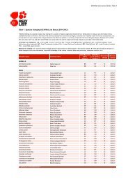
IUCN Red List Guidelines - The IUCN Red List of Threatened Species
IUCN Red List Guidelines - The IUCN Red List of Threatened Species
IUCN Red List Guidelines - The IUCN Red List of Threatened Species

Create successful ePaper yourself
Turn your PDF publications into a flip-book with our unique Google optimized e-Paper software.
<strong>Red</strong> <strong>List</strong> <strong>Guidelines</strong> 38<br />
reference scale is not a geometric multiple <strong>of</strong> the scale <strong>of</strong> the original estimate, it is necessary<br />
to calculate an area-area curve, as shown in Figure 4.3, and interpolate an estimate <strong>of</strong> AOO<br />
at the reference scale. This can be done mathematically by calculating a scale correction<br />
factor (C) from the slope <strong>of</strong> the area-area curve as follows (in all equations below, "log"<br />
means logarithm to base 10):<br />
C = log(AOO2/AOO1) / log(Ag2/Ag1)<br />
(equation 4.2)<br />
where AOO1<br />
is the estimated area occupied from grids <strong>of</strong> area Ag1, a size close to, but<br />
smaller than the reference scale, and AOO2 is the estimated area occupied from grids <strong>of</strong> area<br />
Ag2, a size close to, but larger than the reference scale. An estimate <strong>of</strong> AOOR at the<br />
reference scale, AgR,<br />
may thus be calculated by rearranging equation 2 as follows:<br />
AOOR<br />
= AOO1*10 C*log(AgR / Ag1 ) , or AOOR = AOO2*10 C*log(AgR / Ag2 )<br />
(equation<br />
4.3)<br />
In the example shown in Figure 4.3, estimates <strong>of</strong> AOO from 1x1 km and 4x4 km grids may<br />
be used to verify the estimate AOO at the reference scale <strong>of</strong> 2x2 km as follows:<br />
C = log(48/10) / log(16/1) = 0.566, and using equation 4.3 with this value <strong>of</strong> C, the<br />
AOO estimate at the larger scale (AOO2=48), and the grid sizes at the larger and reference<br />
scales (AgR=4; Ag2=16),<br />
the AOO estimate at the reference scale is calculated as:<br />
0.566*log(4/16) 2<br />
AOO = 48 * 10 = 22 km<br />
Note that this estimate differs slightly from the true value obtained from grid counting and<br />
equation 1 (24 km 2<br />
) because the slope <strong>of</strong> the area-area curve is not exactly constant between<br />
the measurement scales <strong>of</strong> 1x1 km and 4x4 km.<br />
Example: Scaling Down<br />
Scaling down estimates <strong>of</strong> AOO is more difficult than scaling up because there is no<br />
quantitative information about grid occupancy at scales finer than the reference scale. Scaling<br />
therefore requires extrapolation, rather than interpolation <strong>of</strong> the area-area curve. Kunin<br />
(1998) and He and Gaston (2000) suggest mathematical methods for this. A simple approach<br />
is to apply equation 4.3 using an approximated value <strong>of</strong> C.<br />
An approximation <strong>of</strong> C may be derived by calculating it at coarser scales, as suggested by<br />
Kunin (1998). For example, to estimate AOO at 2x2 km when the finest resolution <strong>of</strong><br />
available data is at 4x4 km, we could calculate C from estimates at 4x4 km and 8x8 km as<br />
follows.<br />
C = log(64/48) / log(64/16) = 0.208<br />
However, this approach assumes that the slope <strong>of</strong> the area-area curve is constant, which is<br />
unlikely to hold for many taxa across a moderate range <strong>of</strong> scales. In this case, AOO at 2x2<br />
km is overestimated because C was underestimated.<br />
AOO = 48 * 10 0.208*log(4/16) = 36 km 2<br />
.<br />
While mathematical extrapolation may give some guidance in estimating C, there may be<br />
qualitative information about the dispersal ability, habitat specificity and landscape patterns<br />
that could also provide guidance. Table 4.1 gives some guidance on how these factors may