

ALPMON FINAL REPORT - ARC systems research
ALPMON FINAL REPORT - ARC systems research
ALPMON FINAL REPORT - ARC systems research

You also want an ePaper? Increase the reach of your titles
YUMPU automatically turns print PDFs into web optimized ePapers that Google loves.
Contract ENV4-CT96-0359 <strong>ALPMON</strong><br />
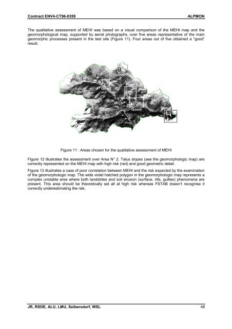
The qualitative assessment of MEHI was based on a visual comparison of the MEHI map and the<br />
geomorphological map, supported by aerial photographs, over five areas representative of the main<br />
geomorphic processes present in the test site (Figure 11). Four areas out of five obtained a “good”<br />
result.<br />
2<br />
Good<br />
1<br />
Good<br />
JR, RSDE, ALU, LMU, Seibersdorf, WSL 48<br />
Poor<br />
3<br />
4<br />
Good<br />
Good<br />
5<br />
Figure 11 : Areas chosen for the qualitative assessment of MEHI<br />
Figure 12 illustrates the assessment over Area N° 2. Talus slopes (see the geomorphologic map) are<br />
correctly represented on the MEHI map with high risk (red) and good geometric detail.<br />
Figure 13 illustrates a case of poor correlation between MEHI and the risk expected by the examination<br />
of the geomorphologic map. The wide violet hatched polygon in the geomorphologic map represents a<br />
complex unstable area where both landslides and soil erosion (surface, rills, gullies) phenomena are<br />
present. This area should be theoretically set all at high risk whereas FSTAB doesn’t recognise it<br />
correctly underestimating the risk.

