aus dem MARUM und dem Fachbereich Geowissenschaften der ...
aus dem MARUM und dem Fachbereich Geowissenschaften der ...
aus dem MARUM und dem Fachbereich Geowissenschaften der ...

Create successful ePaper yourself
Turn your PDF publications into a flip-book with our unique Google optimized e-Paper software.
<strong>aus</strong> <strong>dem</strong> <strong>MARUM</strong> <strong>und</strong> <strong>dem</strong> <strong>Fachbereich</strong><br />
<strong>Geowissenschaften</strong> <strong>der</strong> Universität Bremen<br />
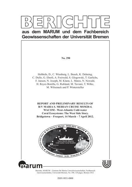
No. 290<br />
Hebbeln, D., C. Wienberg, L. Beuck, K. Dehning,<br />
C. Dullo, G. Eberli, A. Freiwald, S. Glogowski, T. Garlichs,<br />
F. Jansen, N. Joseph, M. Klann, L. Matos, N. Nowald,<br />
H. Reyes Bonilla, G. Ruhland, M. Taviani, T. Wilke,<br />
M. Wilsenack and P. Wintersteller<br />
REPORT AND PRELIMINARY RESULTS OF<br />
R/V MARIA S. MERIAN CRUISE MSM20-4.<br />
WACOM - West-Atlantic Cold-water<br />
Coral Ecosystems: The West Side Story.<br />
Bridgetown – Freeport, 14 March – 7 April 2012.<br />
The West Side Story<br />
R/V Maria S. Merian · MSM 20/4 · WACOM<br />
Trans-North Atlantic<br />
Cold-water Coral Studies<br />
Bahamas<br />
Barbados<br />
Berichte, <strong>MARUM</strong> – Zentrum für Marine Umweltwissenschaften, <strong>Fachbereich</strong><br />
<strong>Geowissenschaften</strong>, Universität Bremen, No. 290, 120 pages, Bremen 2012<br />
ISSN 0931-0800<br />
W-Atlantic Cold-water Corals
The "Berichte <strong>aus</strong> <strong>dem</strong> <strong>MARUM</strong> <strong>und</strong> <strong>dem</strong> <strong>Fachbereich</strong> <strong>Geowissenschaften</strong>" are produced at irregular intervals<br />
by the Department of Geosciences, Bremen University and by <strong>MARUM</strong> – Center for Marine Environmental<br />
Sciences. They serve for the publication of cruise, project and technical reports.<br />
Reports can be or<strong>der</strong>ed from:<br />
Monika Bachur<br />
<strong>MARUM</strong> – Zentrum für Marine Umweltwissenschaften<br />
Universität Bremen<br />
Postfach 330 440<br />
D 28334 BREMEN<br />
Phone: (49) 421 218-65516<br />
Fax: (49) 421 218-65515<br />
e-mail: MBachur@uni-bremen.de<br />
Reports can also be downloaded from:<br />
http://nbn-resolving.de/urn:nbn:de:gbv:46-<strong>MARUM</strong>9<br />
Citation:<br />
Hebbeln, D., Wienberg, C. and cruise participants<br />
Report and preliminary results of R/V Maria S. Merian cruise MSM20-4. WACOM – West-Atlantic Cold-water<br />
Corals Ecosystems: The West Side Story. Bridgetown – Freeport, 14 March – 7 April 2012.<br />
Berichte, <strong>MARUM</strong> – Zentrum für Marine Umweltwissenschaften, <strong>Fachbereich</strong> <strong>Geowissenschaften</strong>, Universität<br />
Bremen, No. 290, 120 pages. Bremen, 2012. ISSN 0931-0800.<br />
ISSN 0931-0800
MARIA S. MERIAN-Berichte 20-4<br />
West-Atlantic Cold-Water Coral Ecosystems:<br />
The West Side Story<br />
Cruise No. 20, Leg 4<br />
14.3.2012 – 7.4.2012, Bridgetown (Barbados) – Freeport (Bahamas)<br />
Dierk Hebbeln, Claudia Wienberg, Lydia Beuck, Kl<strong>aus</strong> Dehning,<br />
Wolf-Christian Dullo, Gregor Eberli, André Freiwald, Silke Glogowski,<br />
Thorsten Garlichs, Friedhelm Jansen, Nina Joseph, Marco Klann, Lelia Matos,<br />
Nicolas Nowald, Hector Reyes, Götz Ruhland, Marco Taviani, Thomas Wilke,<br />
Maik Wilsenack, Paul Wintersteller<br />
Editorial Assistance:<br />
Senatskommission für Ozeanographie <strong>der</strong> Deutschen Forschungsgemeinschaft<br />
<strong>MARUM</strong> – Zentrum für Marine Umweltwissenschaften <strong>der</strong> Universität Bremen<br />
Leitstelle Deutsche Forschungsschiffe<br />
Institut für Meeresk<strong>und</strong>e <strong>der</strong> Universität Hamburg<br />
2012
MARIA S. MERIAN-Berichte, Cruise 20, Leg 4, Bridgetown – Freeport, 14.3.2012 – 7.4.2012<br />
Table of Contents Page<br />
1 Summary .................................................................................................................................. 1<br />
2 Participants ............................................................................................................................... 2<br />
3 Research Program .................................................................................................................... 2<br />
4 Narrative of the Cruise ............................................................................................................ 4<br />
5 Methodology and Instrumentation ........................................................................................... 9<br />
5.1 Marine Aerosol Network - Microtops II ......................................................................... 9<br />
5.2 Un<strong>der</strong>way Hydroacoustics ............................................................................................ 10<br />
5.2.1 Attributed sensors (navigation, motion data, so<strong>und</strong> velocity) .......................... 10<br />
5.2.2 USBL POSIDONIA .......................................................................................... 11<br />
5.2.3 Multibeam echoso<strong>und</strong>er (MBES) ..................................................................... 11<br />
5.2.4 ATLAS PARASOUND .................................................................................... 12<br />
5.2.5 Acoustic Doppler Current Profiler (ADCP) ..................................................... 12<br />
5.3 Hydrography with CTD and Water Sampler ............................................................... 12<br />
5.3.1 Objectives ......................................................................................................... 12<br />
5.3.2 Sampling and methods ...................................................................................... 13<br />
5.3.3 Shipboard Analyses .......................................................................................... 13<br />
5.3.3.1 Seawater Oxygen Analyses ............................................................. 13<br />
5.4 Sediment Sampling Gear and Sample Treatment ......................................................... 14<br />
5.4.1 Grab Sampler......................................................................................................... 14<br />
5.4.2 Box Corer ............................................................................................................. 14<br />
5.4.3 Gravity Corer ........................................................................................................ 15<br />
5.5. <strong>MARUM</strong>-CHEROKEE ROV ....................................................................................... 15<br />
6 Preliminary Results by Region ............................................................................................... 16<br />
6.1 The North-eastern Slope of the Campeche Bank off the Yucatan Peninsula ............... 16<br />
6.1.1 Campeche Bank: Overview .............................................................................. 16<br />
6.1.2 Campeche Bank: The Water Column Structure ................................................ 17<br />
6.1.3 Campeche Bank: Bathymetry and Sub-Seafloor Structures ............................. 18<br />
6.1.4 Campeche Bank: ROV Observations................................................................ 20<br />
6.1.5 Campeche Bank: Sediment Sampling .............................................................. 24<br />
6.2 The West-Florida Slope ................................................................................................ 25<br />
6.2.1 The West-Florida Slope: Overview .................................................................. 25<br />
6.2.2 The West-Florida Slope: The Water Column Structure ................................... 26<br />
6.2.3 The West-Florida Slope: Bathymetry and Sub-Seafloor Structures ................. 28<br />
6.2.4 The West-Florida Slope: ROV Observations ................................................... 29<br />
6.2.5 The West-Florida Slope: Sediment Sampling .................................................. 32<br />
6.3 The Southwest-Florida Slope ....................................................................................... 33<br />
6.3.1 The Southwest-Florida Slope: Overview .......................................................... 33<br />
6.3.2 The Southwest -Florida Slope: The Water Column Structure .......................... 34<br />
6.3.3 The Southwest -Florida Slope: Bathymetry and Sub-Seafloor Structures ........ 34<br />
6.3.4 The Southwest -Florida Slope: ROV Observations .......................................... 34<br />
6.3.5 The Southwest -Florida Slope: Sediment Sampling ........................................ 35
MARIA S. MERIAN-Berichte, Cruise 20, Leg 4, Bridgetown – Freeport, 14.3.2012 – 7.4.2012<br />
6.4 The Bimini Slope .......................................................................................................... 36<br />
6.4.1 The Bimini Slope: Overview ............................................................................ 36<br />
6.4.2 The Bimini Slope: The Water Column Structure ............................................. 37<br />
6.4.3 The Bimini Slope: Bathymetry and Sub-Seafloor Structures ........................... 37<br />
6.4.4 The Bimini Slope: ROV Observations ............................................................. 38<br />
6.4.5 The Bimini Slope: Sediment Sampling ........................................................... 40<br />
6.5 The Slope of the Great Bahama Bank .......................................................................... 40<br />
6.5.1 Great Bahama Bank Overview ......................................................................... 40<br />
6.5.2 Great Bahama Bank: The Water Column Structure ......................................... 41<br />
6.5.3 Great Bahama Bank: Bathymetry and Sub-Seafloor Structures ....................... 43<br />
6.5.4 Great Bahama Bank: ROV Observations ......................................................... 43<br />
6.5.5 Great Bahama Bank: Sediment Sampling ....................................................... 45<br />
7 Station List MSM20-4 .......................................................................................................... 46<br />
8 Data and Sample Storage and Availability ............................................................................ 50<br />
9 Acknowledgements ............................................................................................................... 51<br />
10 References ............................................................................................................................. 51<br />
Appendix 1: Specifications and Settings for Hydroacoustic Measurements ....................................<br />
Appendix 2: List and Detailed Descriptions of Box Corer Samples ................................................<br />
Appendix 3: List and Detailed Descriptions of Grab Samples .........................................................<br />
Appendix 4: List of Gravity Cores and Detailed Descriptions of Sieved Parts of Cores GeoB<br />
16339-1 and GeoB 16360-1 ........................................................................................<br />
Appendix 5: Preliminary report on mollusks and azooxanthellate corals ........................................
MARIA S. MERIAN-Berichte, Cruise 20, Leg 4, Bridgetown – Freetport, 14.3.2012 – 7.4.2012 1<br />
1 Summary<br />
Leg MSM 20-4 focussed on the investigation of cold-water coral (CWC) ecosystems in the West<br />
Atlantic Ocean (Gulf of Mexico, Florida Straits) with special emphasis on their distribution,<br />
appearance, faunal assemblage and vitality <strong>und</strong>er present and past (glacial) conditions. The<br />
overarching objective was to identify the main physical and biological factors that are important<br />
in controlling CWC occurrence. Based on detailed mapping with the shipboard multibeam<br />
echoso<strong>und</strong>er and PARASOUND systems, five working areas were selected for detailed studies:<br />
(1) Campeche Bank (NE Yucatan Peninsula), (2) West-Florida Slope, (3) Southwest-Florida<br />
Slope, (4) Bimini Slope, and (5) Great Bahama Bank Slope. During 17 dives with the Bremen<br />
ROV CHEROKEE (<strong>MARUM</strong>) a detailed characterisation of the existing facies and fauna was<br />
conducted on these selected CWC occurrences. Moreover, a total of 49 CTD profiles were<br />
measured comprising single casts and three so-called Yoyo-CTDs with repeated casts over 13<br />
hours covering one complete tidal cycle complemented by bottom water samples at all sites will<br />
help to assess the recent environment of the CWC. Finally, a series of grab samples, box cores<br />
and gravity cores (total core recovery: ~60 core metres) will enable to study the development of<br />
CWC ecosystems in the West Atlantic <strong>und</strong>er changing environmental conditions, e.g., over<br />
glacial-interglacial cycles.<br />
The results of the expedition will contribute to the international TRACES initiative (Trans-<br />
Atlantic Coral Ecosystem Studies) which aims to compare the coral ecosystems of the West<br />
Atlantic with the well-known CWC sites of the East Atlantic with respect to their recent situation<br />
and a potential linkage between both occurrences regarding their temporal development during<br />
the last glacial-interglacial cycle.<br />
Zusammenfassung<br />
Im Mittelpunkt des Fahrtabschnittes MSM 20-4 stand die Untersuchung von Kaltwasserkorallen<br />
(KWK)-Ökosystemen im West-Atlantik (Golf von Mexiko, Florida Straße). Dabei lag das<br />
Hauptaugenmerk auf <strong>der</strong> Erfassung <strong>der</strong> Verteilung, <strong>dem</strong> Erscheinungsbild, <strong>der</strong> Faunenvergesellschaftung<br />
<strong>und</strong> <strong>dem</strong> Zustand dieser Ökosysteme unter heutigen <strong>und</strong> vergangenen (glazialen)<br />
Bedingungen. Nach eingehen<strong>der</strong> Vermessungen mit den bordeigenen Fächerecholotsystemen <strong>und</strong><br />
PARASOUND wurden insgesamt fünf Teilarbeitsgebiete für detaillierte Studien <strong>aus</strong>gewählt: (1)<br />
Campeche Bank (NO Yukatan Halbinsel), (2) West-Florida Slope, (3) Southwest-Florida Slope,<br />
(4) Bimini Slope <strong>und</strong> (5) Great Bahama Bank Slope. Im Zuge von 17 Tauchgängen mit <strong>dem</strong><br />
Bremer ROV CHEROKEE (<strong>MARUM</strong>) konnten detaillierte Fazies- <strong>und</strong> Faunen-Charakterisierungen<br />
durchgeführt werden. Zusätzlich wurden insgesamt 49 CTD-Profile gemessen (einzelne<br />
Messungen <strong>und</strong> sog. 13 St<strong>und</strong>en andauernde JoJo-CTDs) sowie Bodenwasserproben genommen,<br />
die helfen werden die heutige Umwelt dieser Ökosysteme zu erfassen. Schließlich werden<br />
Greiferproben, Kastengreifer <strong>und</strong> Schwerelotkerne (Kerngewinn: ~60 m) dazu dienen, die<br />
Entwicklung <strong>der</strong> west-atlantischen KWK über den letzten Glazial-Interglazial-Zyklus zu<br />
rekonstruieren <strong>und</strong> mit Klima-gesteuerten Verän<strong>der</strong>ungen <strong>der</strong> Umweltbedingungen zu korrelieren.<br />
Die Ergebnisse <strong>der</strong> Fahrt werden zur internationalen TRACES-Initiative (Trans-Atlantic Coral<br />
Ecosystem Studies) beitragen, die zum Ziel hat KWK-Ökosysteme des West-Atlantiks mit den in<br />
den letzten Jahren sehr intensiv erforschten Vorkommen des Ost-Atlantiks auf Gemeinsamkeiten<br />
zu untersuchen <strong>und</strong> mögliche Verknüpfungen zwischen beiden atlantischen Systemen zu<br />
erfassen.
2<br />
2 Participants<br />
MARIA S. MERIAN-Berichte, Cruise 20, Leg 4, Bridgetown – Freeport, 14.3.2012 – 7.4.2012<br />
Name Discipline Institution<br />
Hebbeln, Dierk Marine Geology / Chief Scientist <strong>MARUM</strong><br />
Wienberg, Claudia Marine Geology <strong>MARUM</strong><br />
Matos Branco, Lelia Marine Geology <strong>MARUM</strong><br />
Dehning, Kl<strong>aus</strong> Marine Geology <strong>MARUM</strong><br />
Klann, Marco Marine Geology <strong>MARUM</strong><br />
Nowald, Nicolas ROV <strong>MARUM</strong><br />
Ruhland, Götz ROV <strong>MARUM</strong><br />
Wintersteller, Paul Marine Geology <strong>MARUM</strong><br />
Freiwald, André Geobiology SAM<br />
Beuck, Lydia Geobiology SAM<br />
Joseph, Nina Geobiology SAM<br />
Wilsenack, Maik Geobiology SAM<br />
Dullo, Wolf-Christian Hydrography GEOMAR<br />
Glogowski, Silke Hydrography GEOMAR<br />
Garlichs, Thorsten Hydrography GEOMAR<br />
Jansen, Friedhelm Meteorology MPI-HH<br />
Reyes, Hector Marine Biology UABCS<br />
Eberli, Gregor Marine Geology RSMAS<br />
Taviani, Marco Marine Biology ISMAR-CNR<br />
Wilke, Thomas Journalism BdW<br />
<strong>MARUM</strong> Zentrum für Marine Umweltwissenschaften, Universität Bremen<br />
SAM Senckenberg am Meer, Wilhelmshaven<br />
GEOMAR Helmholtz-Zentrum für Ozeanforschung, Kiel<br />
MPI-HH Max Planck Institut für Meteorologie, Hamburg<br />
UABCS Universidad Autónoma de Baja California Sur, La Paz, Mexico<br />
RSMAS Rosenstiel School for Marine Sciences, University of Miami, USA<br />
ISMAR-CNR Institute of Marine Sciences, National Research Council, Bologna, Italy<br />
BdW Bild <strong>der</strong> Wissenschaft, Lübeck<br />
3 Research Program<br />
Cold-water corals (CWC) are the nuclei of unique and important ecosystems of the bathyal zone.<br />
The importance of CWC is highlighted in their role in creating biodiversity hotspots, in their<br />
worldwide distribution, and in their capability to build large calcareous seabed structures (reefs,<br />
mo<strong>und</strong>s) of several kilometres in length and >300 m in height.<br />
Though CWC are widespread on both sides of the North Atlantic Ocean, they have not been<br />
studied at a basin-scale. Most research to date has been relatively small-scale and focused on<br />
specific sites. Knowledge about potential links between the East and West Atlantic CWC<br />
ecosystems is rather limited. Moreover, information about the faunal assemblages as well as the<br />
genetic and biogeographical relationship between both provinces is completely lacking. And<br />
finally, in particular for the West Atlantic Ocean coral ages (radiocarbon and/or Uranium-series
MARIA S. MERIAN-Berichte, Cruise 20, Leg 4, Bridgetown – Freeport, 15.3.2012 – 7.4.2012 3<br />
datings) being mandatory for a reconstruction of the development of CWC ecosystems during<br />
the last glacial-interglacial-cycle in relation to climate-induced environmental changes are not<br />
available so far.<br />
Leg MSM 20-4 aimed to study CWC ecosystems across a transect from the partly enclosed<br />
Gulf of Mexico to the "open" West Atlantic Ocean with respect to their distribution, appearance,<br />
faunal assemblage and vitality <strong>und</strong>er present and past (glacial) conditions, and to identify the<br />
main physical and biological factors that are important in controlling CWC occurrence. The<br />
overarching objective was a trans-North Atlantic basin-scale study to compare the West Atlantic<br />
CWC occurrences with the well-known CWC ecosystems of the East Atlantic Ocean with<br />
respect to their recent situation and a potential linkage between both occurrences regarding their<br />
temporal development during the last glacial-interglacial cycle. Thus, for this expedition the<br />
following three core questions have been formulated:<br />
1) How divers are CWC as well as the structure and composition of the entire CWC ecosystems<br />
in the western Atlantic?<br />
2) How did the CWC ecosystems in the western Atlantic develop <strong>und</strong>er varying climate forcing,<br />
as e.g. over the last glacial-interglacial-cycle?<br />
3) Which similarities and/or differences exist between the CWC ecosystems in the western and<br />
in the eastern North Atlantic today and during their past long-term development?<br />
Campeche<br />
Bank<br />
W‐Florida<br />
Slope<br />
Florida<br />
Straits<br />
Fig. 3.1 Track chart of R/V MARIA S. MERIAN Cruise MSM 20-4.<br />
To answer these questions various target areas in the western Atlantic have been selected to<br />
be investigated during Leg MSM 20-4 (see Fig. 3.1). These comprised "potential" CWC mo<strong>und</strong>s<br />
along the Campeche Bank (Yucatan Peninsula) and the West Florida Slope within the Gulf of<br />
Mexico, and reported CWC occurrences in the Florida Straits. For all working sites station work<br />
started with a detailed hydro-acoustic mapping (multibeam echoso<strong>und</strong>er, PARASOUND; in case
4<br />
MARIA S. MERIAN-Berichte, Cruise 20, Leg 4, Bridgetown – Freeport, 14.3.2012 – 7.4.2012<br />
appropriate data did not exist for the selected study sites). These data formed the base for<br />
planning optimised ROV dives. Extended video surveys with the ROV CHEROKEE were used to<br />
characterise the facies and fauna, and even more important here, to identify most suited coring<br />
sites. Based on this information, positions have been defined to accomplish a dedicated sampling<br />
(gravity cores, box cores, grabs, and water samples) and monitoring (CTD) programme within or<br />
in the direct vicinity of the observed CWC ecosystems. During previous expeditions this<br />
approach has already been proven to be very successful in sampling CWC material and data of<br />
their surro<strong>und</strong>ing environment.<br />
4 Narrative of the Cruise<br />
S<strong>und</strong>ay, March 11, 2012 and Monday, March 12, 2012 ◊ During the day the R/V MARIA S.<br />
MERIAN arrived in Bridgetown (Barbados). A first group of MSM 20-4 scientist visited the<br />
vessel to welcome the scientists of the former cruise (MSM 20-3; chief scientist: S. Mulitza,<br />
<strong>MARUM</strong>), to have an exchange with the scientific crew about the equipment to be left on board,<br />
and to coordinate the unloading of the two containers send from Bremen to Barbados with<br />
additional equipment for cruise MSM 20-4. The next day was spent with the installation of the<br />
various laboratories on board, the ROV and other scientific equipment.<br />
Tuesday, March 13, 2012 ◊ In the morning, all 20 scientists and technicians arrived on board<br />
the R/V MARIA S. MERIAN. Unfortunately, the departure to the first working area off Mexico,<br />
initially scheduled for the 14 th of March, had to be postponed for two reasons. Firstly, during the<br />
former expedition (MSM 20-3) some severe problems occurred with the multibeam echoso<strong>und</strong>er<br />
system (MBES) EM120 making an exchange of some hardware parts necessary. Therefore, a<br />
service technician of the KONGSBERG company was send from Oslo (Norway) to Bridgetown<br />
(Barbados) to fix the problem. Secondly, the scientists on board were still lacking visa required<br />
by the Mexican authorities to work in Mexican waters. Thus, it was necessary to send one<br />
scientist to the next Mexican embassy located in Port-of-Spain (Trinidad) for getting the visa for<br />
all participants.<br />
Wednesday, March 14, 2012 and Thursday, March 15, 2012 ◊ In the early morning, one of<br />
the MSM 20-4 participants was flying to Trinidad to get the visa from the local Mexican<br />
embassy. In the meanwhile, it came out that the spare parts necessary to repair the MBES<br />
EM120 were sent to Venezuela and had to be re-sent to Barbados. Fortunately, the spare parts<br />
arrived on board at lunch time and the KONGSBERG technician could start with the<br />
replacement of the spare parts. In the evening, the R/V MARIA S. MERIAN left the port of<br />
Bridgetown and anchored in the roadstead off the port. The next day was used for several<br />
meetings between the individual scientists and technicians to discuss sampling procedures and<br />
gear deployments in detail. Moreover, the KONGSBERG technician finished to repair the<br />
MBES EM120 and left the vessel in the afternoon. After dinner, the colleague on duty with<br />
getting the visa from Trinidad arrived back on board, and at aro<strong>und</strong> 18.30 the vessel started to set<br />
sail to the first working area off Mexico (Campeche Bank).<br />
Friday, March 16, 2012 to Tuesday, March, 20 2012 ◊ During our transit we passed<br />
~1,600 nm, thereby crossing the Caribbean Sea from SE to NW. During the five days of transit<br />
we used the time for a series of scientific presentations to inform each other about former and<br />
on-going studies on CWC on both sides of the Atlantic Ocean carried out by the institutes<br />
involved in this cruise (ISMAR-CNR: M. Taviani; RSMAS: G. Eberli; UABCS: H. Reyes Bonilla;
MARIA S. MERIAN-Berichte, Cruise 20, Leg 4, Bridgetown – Freeport, 15.3.2012 – 7.4.2012 5<br />
MPI Hamburg: F. Jansen; SaM: A. Freiwald; GEOMAR: C. Dullo; <strong>MARUM</strong>: D. Hebbeln). In<br />
addition, on S<strong>und</strong>ay we interrupted our transit for ~4 hours to do a test station (GeoB 16301) for<br />
the CTD and the ROV CHEROKEE. On Tuesday, the vessel stopped for a second time to deploy<br />
the depressor of the ROV in or<strong>der</strong> to test the positioning system POSIDONIA (GeoB 16302).<br />
Wednesday, March 21, 2012 ◊ In the morning, we eventually arrived Mexican waters<br />
(Yucatan peninsula) and started station work with a CTD cast down to a water depth of 1,100 m<br />
(GeoB 16303). We continued our work with MBES and PARASOUND mapping (GeoB 16304)<br />
along the eastern slope of the Campeche Bank heading towards our first "potential" CWC site in<br />
water depths of 500-600 m along the NE Campeche Bank. This area was initially mapped in 2009<br />
during R/V METEOR cruise M78-1 (chief scientist: J. Schönfeld, GEOMAR) revealing<br />
conspicuous seabed structures up to 40-m-high, which strongly resemble CWC mo<strong>und</strong>s along the<br />
NE Atlantic margin, however, any gro<strong>und</strong>truthing was lacking. Evaluating the origin of these<br />
seabed elevations by ROV video observation and sediment sampling was the first target of cruise<br />
MSM 20-4. In the evening, we arrived the area, accomplished another CTD cast (GeoB 16305),<br />
and continued mapping (GeoB 16306) to get an adequate bathymetric map to plan an ROV dive.<br />
Thursday, March 22, 2012 ◊ During mapping, we discovered 25-m-high NW-SE-elongated<br />
seabed structures in water depths between 550 and 600 m along the slope of the Campeche Bank.<br />
These structures were the first target for an ROV dive (GeoB 16307). The video observation<br />
revealed that these structures are covered by live and dead CWC framework. However, due to<br />
strong bottom currents, it was not possible to sample the CWC by the ROV. Nevertheless, after<br />
recovery of the ROV, we discovered some live and dead branches of Lophelia entangled in the<br />
ROV's depressor weight. We continued station work with sediment sampling with the box corer.<br />
Whereas two box cores yielded only few sediment with fossil coral framework (GeoB 16308,<br />
16309), a third box corer recovered muddy sediments dispersed by coral rubble (GeoB 16310-1).<br />
A gravity core, taken from the same position, was filled over the top (GeoB 16310-2). However,<br />
a second attempt with a 12-m-long core barrel yielded a coral-bearing sediment core with a total<br />
recovery of 10.60 m (GeoB 16310-3). During the night, we continued mapping (GeoB 16311) in<br />
the northern part of the working area and again discovered numerous ridge structures.<br />
Friday, March 23, 2012 ◊ In the morning, we deployed the ROV (GeoB 16312) and<br />
observed that all ridge tops are colonised by live CWC, whereas the ridge troughs are dominated<br />
by muddy sediments and coral rubble. We selected one ridge structure for sampling with the box<br />
and gravity corers (GeoB 16313). One attempt to collect a so-called "off-mo<strong>und</strong>" sediment core<br />
(barren of any coral fragments to get a continuous sedimentary record for palaeo-environmental<br />
reconstructions) failed (GeoB 16314), a further attempt to obtain such a core was postponed to<br />
the next day. A last sampling target for this day was a crater-like structure which has been<br />
discovered during mapping eastward of the coral ridges in a water depth of ~620 m.<br />
Unfortunately, sampling with the box corer failed (GeoB 16315) as the corer tilted on the<br />
seafloor and had to be recovered upside down as the cable of the winch got entangled with the<br />
frame of the box corer. However, the deck's crew and technicians together managed to recover<br />
the corer safe back on board and the corer revealed just minor damage which could be repaired<br />
until the next day. During the night, a so-called Yoyo-CTD was conducted (GeoB 16316) during<br />
which the CTD was repeatedly lowered over a period of 13 hours to obtain changes in physical<br />
parameters of the water column during a full tidal cycle.<br />
Saturday, March 24, 2012 ◊ We started the day with an ROV dive (GeoB 16317) in the<br />
northern, slightly shallower (450-550 m) part of the Campeche area. As during the dives before,
6<br />
MARIA S. MERIAN-Berichte, Cruise 20, Leg 4, Bridgetown – Freeport, 14.3.2012 – 7.4.2012<br />
we crossed several ridges with very steep flanks. Again, all ridges are covered by ab<strong>und</strong>ant dead<br />
and live CWC framework whereas the troughs in between the ridges are characterised by strongly<br />
bioturbated muddy sediments. Due to some problems with the ROV's electronics we had to abort<br />
the dive. On deck, the ROV technicians immediately started to solve the problem and repaired the<br />
system before the end of the day. The second half of the day was spent with sediment sampling.<br />
One coral-bearing sediment core (GeoB 16318) was collected from the top area of one of the<br />
northernmost ridge structures observed during the last ROV dive. In a muddy area in between the<br />
observed coral ridges, a box core as well as a gravity corer (recovery: ~8 m) also revealed layers of<br />
coral rubble (GeoB 16319). To obtain an off-mo<strong>und</strong> core from this area, we sampled typical drift<br />
sediments with a box corer and with a gravity corer with the latter yielding a recovery of 4.3 m<br />
(GeoB 16320). In the evening, we again tried to sample the crater-like structure which had already<br />
been visited the evening before. This time, we fixed a POSIDONIA transpon<strong>der</strong> above the box<br />
corer to sample this structure as accurate as possible. This successful attempt revealed sediments<br />
interspersed with ab<strong>und</strong>ant fossil CWC framework with partly very thick and large Lophelia<br />
skeletons (GeoB 16321). The few remaining hours in the area were used to finalise the bathymetric<br />
map of the Campeche coral province (GeoB 16322).<br />
S<strong>und</strong>ay, March 25, 2012 ◊ During the night, we started our transit to the next working area:<br />
the West-Florida Slope in the eastern Gulf of Mexico. After dinner, we arrived in the area and<br />
started with two CTD casts (GeoB 16323 & 16324) continued by mapping (GeoB 16325).<br />
Monday, March 26, 2012 ◊ In the morning, we started work with an ROV dive (GeoB<br />
16326). We observed massive rocky outcrops which are covered by ab<strong>und</strong>ant fossil CWC. After<br />
lunch, the dive had to be aborted again due to technical problems with the ROV electronics.<br />
Therefore, we continued station work with a series of six grab samples (GeoB 16327-16332)<br />
which revealed sandy sediments with few coral rubble and rocks colonised by various<br />
organisms. In the evening, we intended to continue our sampling programme with two gravity<br />
cores, but due to a serious technical problem with one of the cranes of R/V MARIA S. MERIAN<br />
this attempt had to be postponed. Instead, we proceeded mapping of the area (GeoB 16333).<br />
Tuesday, March 27, 2012 ◊ During the next ROV dive (GeoB 16334) we crossed two up to<br />
25-m-high mo<strong>und</strong>-like seabed structures being situated slightly to the south of the previous ROV<br />
dive. In water depths between 520 and 490 m their SE flanks are covered by coral rubble<br />
becoming more ab<strong>und</strong>ant and larger uphill, before in the top areas large colonies of (partly live)<br />
Lophelia and Enallopsammia become ab<strong>und</strong>ant being associated with a highly diverse fauna.<br />
The NW flanks are characterised by coral rubble, outcrops of carbonate rocks and soft sediments<br />
(from their upper to lower flanks). Several attempts to sample these structures with the box corer<br />
and with the grab (GeoB 16335-16337) revealed very few coral rubble and sandy sediments.<br />
Two gravity cores collected from two other mo<strong>und</strong>-like structures, discovered during mapping in<br />
the area, just revealed sandy sediments (GeoB 16338-16339). During the night, a Yoyo-CTD<br />
station (GeoB 16340) was conducted in the West-Florida Slope area with repeated casts over 13<br />
hours on the same position covering one tidal cycle.<br />
Wednesday, March 28, 2012 ◊ In the morning station work was continued with an ROV<br />
dive (GeoB 16341). As during the two dives before, we observed massive hardgro<strong>und</strong>s covered<br />
with few coral rubble. After recovery of the ROV, we continued with two grab samples (GeoB<br />
16342 & 16343) collected from a small ridge structure, of which one was successful and<br />
revealed sandy sediments and coral rubble. Station work along the West-Florida Slope was
MARIA S. MERIAN-Berichte, Cruise 20, Leg 4, Bridgetown – Freeport, 15.3.2012 – 7.4.2012 7<br />
finished with a CTD cast down to a water depth of 1,000 m water depth (GeoB 16344) before we<br />
left the area heading towards our next working area off southwest Florida.<br />
Thursday, March 29, 2012 ◊ We arrived the Southwest-Florida Slope aro<strong>und</strong> midnight and<br />
started with a CTD cast down to a water depth of ~1,300 m (GeoB 16345) continued by mapping<br />
(GeoB 16346). Based on the mapping data, we selected an area for our first ROV dive in this<br />
working area (GeoB 16347). On a W-E-transect we crossed extended fields with sandy<br />
sediments showing signs of strong bioturbation, outcropping hardgro<strong>und</strong>s, and fields with<br />
boul<strong>der</strong>s. Octocorals and few living Lophelia colonise these boul<strong>der</strong>s at their north-western side<br />
facing the main current direction. At the easternmost part of the dive, a spectacular steep and<br />
terrace-like escarpment of 50 m in height arose showing massive accumulations of coral rubble<br />
at the base and being colonised by ab<strong>und</strong>ant Lophelia and a highly diverse associated fauna.<br />
After video observation, four attempts to sample the coral rubble field at the base of the<br />
escarpment failed (GeoB 16348). Station work was continued by mapping (GeoB 16349).<br />
Friday, March 30, 2012, to Saturday, March 31, 2012 ◊ Directly after breakfast, we<br />
deployed the ROV (GeoB 16350) to survey an area being located slightly further south to the<br />
previous dive. We observed extended fields with soft sediments (most probably sand) and fields<br />
with rocky outcrops, pebbles, boul<strong>der</strong>s, blocks and crusts. Scleractinian corals were rather scarce<br />
in this area, just two times we observed fields with coral rubble, and at one place we fo<strong>und</strong><br />
metre-sized colonies of living Lophelia. Coring a drift sediment body (north of the area surveyed<br />
during the ROV dive) failed as the corer tilted at the seabed (GeoB 16351), most probably<br />
bec<strong>aus</strong>e of sandy sediments (as fo<strong>und</strong> in the core catcher). We continued sampling with three<br />
grabs of which one grab was empty (GeoB 16352), and two revealed rocks (GeoB 16353) and<br />
sandy sediments (GeoB 16354). After sampling, we continued mapping to finalise the<br />
bathymetric map of the Southwest-Florida Slope (GeoB 16355), before we started our transit to<br />
the next working areas off the Bahamas.<br />
S<strong>und</strong>ay, April 1, 2012 ◊ Before we could start station work in Bahamian waters, we had to<br />
clear customs in front of Bimini. This was done by lunchtime. Afterwards, we headed towards<br />
the NW of Bimini, where we did a first CTD cast down to a water depth of 760 m (GeoB 16356)<br />
continued by a short bathymetric survey (GeoB 16357) to get a preliminary map of the Bimini<br />
Slope and to prepare a first ROV dive in this area. We selected an up to 100-m-high mo<strong>und</strong><br />
structure, which resembles a coral mo<strong>und</strong> (tentatively named "Wienberg" mo<strong>und</strong>). During<br />
deployment of the ROV, very strong southerly currents forced the vehicle to the north of this<br />
structure making it impossible to study it. However, during the dive we crossed some other low<br />
relief seabed structures which were partly covered by coral rubble and even a few living corals<br />
were observed (GeoB 16358). Afterwards we tried to sample the Wienberg mo<strong>und</strong>. The first<br />
gravity core just revealed few coral rubble and lithified sediment in the core catcher (GeoB<br />
16359). Also the second coring attempt partly failed as the core tube bent (GeoB 16360).<br />
However, we recovered ~2 m of a coral-bearing core, and even the core top could be recovered<br />
as a bulk sample revealing ab<strong>und</strong>ant Lophelia fragments. During the night, we continued to map<br />
the area west of Bimini (GeoB 16361).<br />
Monday, April 2, 2012 ◊ Station work again started with the deployment of the ROV (GeoB<br />
16362). This time we started further upslope and had no problems to reach the seabed as the<br />
currents were much weaker compared to the day before. The target of this ROV dive was a series<br />
of ridge and mo<strong>und</strong> structures in water depths between 450 and 520 m. We crossed an area with
8<br />
MARIA S. MERIAN-Berichte, Cruise 20, Leg 4, Bridgetown – Freeport, 14.3.2012 – 7.4.2012<br />
a somehow chaotic morphology with flat plains made up of soft sediments and steep escarpments<br />
(up to 15 m high) in between which are colonised by a highly diverse sponge fauna and<br />
various soft corals. Coral rubble and live scleractinians are rather scarce. We continued station<br />
work with sediment sampling and selected an area that showed a huge package of stratified<br />
sediments in the PARASOUND data to collect a so-called off-mo<strong>und</strong> core for palaeoceanographic<br />
studies. We started sampling with a grab to make sure that the sediment is suitable to<br />
sample it with the gravity corer. As the grab recovered muddy sediments (GeoB 16363-1), we<br />
continued with gravity coring. The first attempt with a 6-m-long core barrel over-penetrated<br />
(GeoB 16363-2), therefore we deployed a 12-m-long core barrel and recovered impressive<br />
10.3 m of sediment material (GeoB 16363-3). The last sampling target for the day was a mo<strong>und</strong>like<br />
structure in >800 m water depth which had the potential to be a coral mo<strong>und</strong>. However, just<br />
1.6 m of sandy sediments without any coral fragments were recovered (GeoB 16364). During the<br />
night, we finished mapping in the area (GeoB 16365) and headed further to the south to our last<br />
working area west of the Great Bahama Bank.<br />
Tuesday, April 3, 2012 ◊ During our first ROV dive along the Great Bahama Bank Slope, we<br />
crossed conspicuous mo<strong>und</strong>-like seabed structures covered by ab<strong>und</strong>ant coral rubble (GeoB<br />
16366). Unfortunately, the dive had to be aborted already after 2 hours of observation again due<br />
to technical problems with the ROV. We continued with a CTD cast down to a water depth of<br />
660 m (GeoB 16367). Three positions were selected for sediment sampling where coral rubble<br />
was observed during the ROV dive. Two box cores were obtained (GeoB 16367-2, 16368-1)<br />
both filled with Enallopsammia rubble. Gravity cores taken at the same positions (GeoB 16368-<br />
2, 16369) showed limited recoveries with 0.5-2.3 m containing coral fragments. Four further<br />
attempts to sample sediments with the box corer from a twin-peaked mo<strong>und</strong> (introduced by<br />
Correa et al., 2011) failed due to technical problems with the release of the box corer (GeoB<br />
16370 &16371). Instead, we continued mapping in the area (GeoB 16372) that lasted until the<br />
next morning.<br />
Wednesday, 04. April 2012 ◊ This day we started with two subsequent ROV dives crossing<br />
two large seabed structures (GeoB 16373 & 16374). During the dives, we observed the following<br />
facies from the base to the top of both mo<strong>und</strong>s: coral rubble, dead coral framework, and<br />
ab<strong>und</strong>ant large live colonies of Lophelia and Madrepora. One of the observed mo<strong>und</strong>s ("Mount<br />
Gay") was selected for sampling. Three box cores collected at its base (GeoB 16375) and at its<br />
lower (GeoB 16376) and middle flanks (GeoB 16377) revealed coral rubble embedded in a<br />
sandy matrix. Three gravity cores collected at the same (flank) sites (GeoB 16377 & 16378) and<br />
at the mo<strong>und</strong>'s top (GeoB 16379) showed recoveries between 1.2 and 5.6 m containing coral<br />
fragments. Two attempts to collect box cores from the top of the mo<strong>und</strong> failed as the corer did<br />
not release due to mechanical problems. The night was again spent with mapping (GeoB 16380).<br />
Thursday, 05. April 2012 ◊ We started the day with another ROV dive (GeoB 16381). As<br />
the day before, we crossed two pronounced mo<strong>und</strong> structures which were again covered by<br />
ab<strong>und</strong>ant coral rubble (Enallopsammia and Lophelia) whereas live scleractinian corals were<br />
rather scarce. Again, one mo<strong>und</strong> was selected for sediment sampling at its top and northern<br />
flank. However, box and gravity cores (GeoB 16382) just showed limited sediment recoveries<br />
although they contained ab<strong>und</strong>ant coral rubble. The coring of the mo<strong>und</strong>'s flank (GeoB 16383)<br />
even partly failed as the tube bent and just 0.8 m of coral-bearing sediment was recovered, most<br />
probably due to the existence of lithified sediment, as fo<strong>und</strong> in the core catcher. These
MARIA S. MERIAN-Berichte, Cruise 20, Leg 4, Bridgetown – Freeport, 15.3.2012 – 7.4.2012 9<br />
observations indicate that the mo<strong>und</strong> structures fo<strong>und</strong> off Great Bahama Bank are pre-existing<br />
structures overgrown by corals rather than structures build-up by corals. An area situated north<br />
of the "coral" mo<strong>und</strong>s and characterised by stratified sediments was selected to obtain an offmo<strong>und</strong><br />
core for palaeoceanographic studies for this area (GeoB16384). Unfortunately, the core<br />
slightly over-penetrated and the top 20-cm of the core were lost. The very last coring attempt<br />
during cruise MSM20-4 was dedicated to sample once again site GeoB 16377, but this time<br />
equipped with a longer 12-m-long core barrel. However, the attempt to retrieve a very long<br />
sediment record from this structure failed and a core with a recovery of only 1.37 m was<br />
obtained (GeoB 16385). During the night, the third Yoyo-CTD station was conducted (GeoB<br />
16386) running for 13 hours at the same position.<br />
Friday, April 6, 2012, to Saturday, April 7, 2012 ◊ On Friday morning, the first attempt to<br />
dive with the ROV (GeoB 16387) had to be aborted due to strong currents. For a second attempt<br />
(GeoB 16388), we chose a starting point further to the south and eventually started our<br />
observations as planned at the mo<strong>und</strong>'s base running uphill. We observed large fields with coral<br />
rubble associated with various live soft corals. The dive ended within an extended field of soft<br />
sediments covered by an astonishing huge number of dead large echinoids and bivalve shells.<br />
After recovery of the ROV, we finished our work during cruise MSM20-4 with a last<br />
bathymetric survey (GeoB 16389) to complete the map for the Great Bahama Bank CWC area.<br />
Afterwards, the scientific crew started to de-install the equipment from the laboratories and to<br />
load the containers. On Saturday morning, R/V MARIA S. MERIAN arrived in Freeport, where<br />
immediately all MSM20-4 containers were unloaded.<br />
It is worth to mention here that during the entire cruise we had almost perfect weather<br />
conditions with low winds (
10<br />
MARIA S. MERIAN-Berichte, Cruise 20, Leg 4, Bridgetown – Freeport, 14.3.2012 – 7.4.2012<br />
is processed and analysed by NASA and distributed into the network already on a daily base. As<br />
expected the weather conditions during this cruise were excellent to perform several cloud-free<br />
time series of aerosol properties. The area observed during cruise MSM 20-4 is currently <strong>und</strong>ersampled,<br />
therefore, this contribution is extremely valuable for the MAN project. The links are:<br />
http://aeronet.gsfc.nasa.gov/new_web/maritime_aerosol_network.html<br />
http://aeronet.gsfc.nasa.gov/new_web/cruises_new/Merian_12_0.html<br />
http://aeronet.gsfc.nasa.gov/new_web/KML/Merian_12_0_daily_lev15.kml.<br />
Fig. 5.1<br />
Photograph showing the handheld sun photo-meter for spectral measurements of<br />
the direct solar radiation was applied during MSM 20-4.<br />
Overall the data collection was excellent, in total 22 day of measurements. The aerosol optical<br />
depth AOD was stable within 0.1-0.2 range at wavelength 500 nm (average ~0.15) which is<br />
higher than over typical remote oceanic areas (~0.07). Influence of the continental sources and<br />
possible dust transport from Africa might be responsible for that. Spectral dependence<br />
(characterized by the Angstrom parameter alpha) varied generally between 0.7 on March 19 and<br />
1.7 on March 27 being on average near 1.0 most of the time. This is an indicative of mainly fine<br />
mode aerosol contribution into AOD, however, on a number of occasions when alpha was less<br />
than 1.0 indicating the presence of the coarse aerosol fraction was noticeable.<br />
5.2 Un<strong>der</strong>way Hydroacoustics<br />
(Paul Wintersteller, Gregor Eberli)<br />
5.2.1 Attributed sensors (navigation, motion data, so<strong>und</strong> velocity)<br />
The ship’s best determined position was calculated by the SEAPATH 200 Inertial Navigation<br />
System (INS). Motion data (roll, pitch, heave) as well as heading and Differential Global<br />
Positioning System (DGPS) information was generated by the SEAPATH 200 in combination with<br />
the motion reference unit (MRU) 5, and delivered to all hydroacoustic devices applied during<br />
MSM20-4. When using a SEAPATH 200 INS, the internal coordinate system contains lever arms<br />
between DGPS and the MRU, which is commonly the position of the reference point. This<br />
information is important to all devices using the SEAPATH 200 since offsets between transducers<br />
and sensors like DGPS or motion sensor refer to the formal center of gravity, the so-called<br />
reference point (see Appendix 1 for MSM 20-4 settings of SEAPATH 200). The DGPS failed a<br />
couple of times in delivering accurate position for several minutes. On April 2 nd , the SEAPATH<br />
200 failed and needed a restart that produced a gap for about 20 minutes. We observed these<br />
problems already on former R/V MARIA S. MERIAN cruises within the Gulf of Mexico.<br />
Surface so<strong>und</strong> velocity (SSV) is usually been taken in real-time with a SSV-probe mounted<br />
next to the transducers of the multibeam echoso<strong>und</strong>ers (MBES). Due to a malfunction the probe<br />
could not be used. SSV as well as so<strong>und</strong> velocity profiles (SVP) through the water column have<br />
been extracted from CTD data.
MARIA S. MERIAN-Berichte, Cruise 20, Leg 4, Bridgetown – Freeport, 15.3.2012 – 7.4.2012<br />
5.2.2 USBL POSIDONIA<br />
IXSEA’s POSIDONIA 6000 is an ultra-short baseline (USBL) <strong>und</strong>erwater navigation that was<br />
used during ROV dives and for one of the box corer stations. The moon-pool mounted antennas<br />
require a calibration and a proper SVP. Most recent calibrations for the system were done in<br />
2009 (MSM13-4) and 2010 (MSM15-2). Although the SEAPATH 200 is delivering DGPS and<br />
motion sensor data, just GPS-information is used for the USBL bec<strong>aus</strong>e POSIDONIA 6000 has<br />
its own motion sensor. The motion sensor, IXSEAS OCTANS in a wet pot, is mounted directly<br />
above the four antennas. SVP has been updated for every area of investigation or whenever<br />
changes in surface so<strong>und</strong> velocity appear to be higher than 3 m s -1 (see Appendix 1 for settings<br />
of POSIDONIA during MSM 20-4).<br />
5.2.3 Multibeam Echoso<strong>und</strong>er (MBES)<br />
Seabed mapping during MSM20-4 was performed with two devices, the ship’s hull-mounted<br />
KONGSBERG EM120 deep-water MBES (12kHz) and the moon-pool mounted KONGSBERG<br />
EM1002 that is a shallow- to medium-water MBES (95kHz). The EM120 has a depth range of<br />
20 to 11,000 m, while the depth range of the EM1002 is 2 to 1,000 m but achieves a much higher<br />
depth resolution of 2-8 cm, depending on the pulse lengths (0.2-2 ms).<br />
On R/V MARIA S. MERIAN, the EM120's footprint of a single beam is limited to 2° by 2°.<br />
The angular coverage sector is up to 150°. EM120 has 191 beams per ping, while the EM1002<br />
has 111 beams per ping. Achievable swath width on a flat bottom is up to 5 times the water<br />
depth dependent on the character of the seafloor. The angular coverage sector and beam pointing<br />
angles are set to vary automatically with depth according to achievable coverage. This<br />
maximizes the number of usable beams. The beam spacing is equidistant to equiangular. All<br />
settings applied for the two MBES systems during MSM 20-4 are listed in Appendix 1. For<br />
reasonable hydroacoustic recording a proper SVP is essential. Thus, several CTD’s were taken<br />
during the cruise (see Chapter 5.3). In every survey region at least 1-2 SVP’s were calculated<br />
based on the SEABIRD CTD measurements (Fig. 5.2). The SVPs have been applied to EM120<br />
and EM1002 right after the data were collected. The SVPs show a wide variability over the<br />
entire water column, documenting that the precision of the seabed bathymetry map relies on a<br />
SVP in each survey area.<br />
Fig. 5.2<br />
So<strong>und</strong> velocity profiles (SVP) calculated from CTD data.<br />
11
12<br />
MARIA S. MERIAN-Berichte, Cruise 20, Leg 4, Bridgetown – Freeport, 14.3.2012 – 7.4.2012<br />
The EM120 delivered reliable data. However, the EM1002 data had less artifacts and a far<br />
higher precision in the survey region’s water depth range of 400-800 m. The very good results of<br />
EM1002 are first and foremost a matter of frequency (95kHz versus 12kHz). In addition, the<br />
transducers' semicircular geometry with a radius of 45 cm on the EM1002 has a particular<br />
influence regarding the beam-forming. A roll offset error is visible in both MBES. The values<br />
are about 0.14 for EM1002 and about 0.21 for EM120. Bec<strong>aus</strong>e there is an uncertainty of about<br />
30% of the mentioned values we expect other offset errors such as pitch or yaw, which will be<br />
addressed in the shore-based post processing. The open-source software MB-System version 5.3.1<br />
(Caress & Chaynes, 1996) and GMT version 4.3.1 (Wessel & Smith, 1995) were used for<br />
bathymetric data processing, editing and evaluation. ESRI ArcGIS version 10 is inserted to create<br />
maps and a sustainable spatial data management.<br />
5.2.4 ATLAS PARASOUND<br />
The ship’s hull-mounted sub-bottom profiler ATLAS PARASOUND (type PARASOUND P70,<br />
rated for 11,000 metres) utilises the parametric effect to generate a very low secondary frequency<br />
signal by emitting two primary signals of higher frequencies. Similar to the MBES<br />
measurements, also for the PARASOUND surveys actually measured SVPs were applied for all<br />
survey regions.<br />
The equipment failed about 12 times during the cruise. Restarts were usually necessary after<br />
station work, regardless whether the system was running during station work or not. The system<br />
reacts very sensitive when losing the system depth, even for a short time. On April 2 nd , the<br />
DGPS failed and had to be restarted. These events are recorded in the MBES/PS event-protocol.<br />
Primary high and secondary low frequencies are recorded as raw-format (*.asd) as well as ps3<br />
and SeGY formats. Every survey region is split into subfol<strong>der</strong>s according to the frequencies<br />
(PHF, SLF). SeNT, a program developed by H. Keil (Univ. of Bremen), has been used for post<br />
processing (see Appendix 1 for specifications and settings applied to the PARASOUND system<br />
during MSM 20-4).<br />
5.2.5 Acoustic Doppler Current Profiler (ADCP)<br />
Data were recorded from the shipboard "Acoustic Doppler Current Profiler" (ADCP), the RDI<br />
Ocean Surveyor 75kHz. The system is fully operational and requires minimal operator interference.<br />
Data were acquired using the RDI software VMDAS (Vessel-Mount Data Acquisition).<br />
The OS 75 operating parameters used during MSM20-4 were 128 depth bins of 5 m bin size.<br />
Further settings can be fo<strong>und</strong> in the settings file, next to the data. To aid decisions in terms of<br />
recovery and deployment of the ROV a water-current prediction was made from the long<br />
average plots of 60 minutes (see Appendix 1 for settings of the ADCP during MSM 20-4).<br />
5.3 Hydrography with CTD and Water Sampler<br />
5.3.1 Objectives<br />
(Christian Dullo, Thorsten Garlichs, Silke Glogowski)<br />
The major objective for the Conductivity-Temperature-Depth (CTD) measurements during cruise<br />
MSM 20-4 was to determine general water mass characteristics and the influence of physical<br />
parameters of water masses bathing (living) CWC in the Strait of Yucatan (Campeche Bank), on the
MARIA S. MERIAN-Berichte, Cruise 20, Leg 4, Bridgetown – Freeport, 15.3.2012 – 7.4.2012<br />
West- to Southwest-Florida Slope, in the Florida Straits and along the Great Bahama Bank.<br />
Moreover, we wanted to get an overview of the variability of water masses in the ultimate vicinity of<br />
these CWC habitats in space (locally-regionally) and time (tidal cycles). Bottom water samples were<br />
taken at all localities to get an overview of the geochemical characteristics of these water masses. In<br />
addition, so<strong>und</strong> velocity data were provided for hydroacoustic mapping (see chapter 5.2.3).<br />
5.3.2 Sampling and methods<br />
The CTD profiler used during MSM 20-4 was a Seabird "SBE 9 plus" <strong>und</strong>erwater unit and a<br />
Seabird "SBE 11plus V2" deck unit. Additionally, it was equipped with two dissolved oxygen<br />
sensors, a chlorophyll-a sensor and a Seabird bottle release unit including a rosette water sampler.<br />
For the analysis and interpretation of the measurements, the downcast raw data were processed<br />
with "SBE Data Processing" software. For the visualisation of the data we used "Ocean Data View<br />
(mp-Version 3.3.2)". Measured O2 values were verified by using the Winkler titration method<br />
(Winkler, 1888). We performed single casts, one transect, and three Yoyo-CTDs with repeated casts<br />
over 13 hours covering one complete tidal cycle. A total of 49 CTD profiles were measured during<br />
the cruise. In addition, we received bottom water samples collected during the ROV dives in close<br />
vicinity to living CWC.<br />
5.3.3 Shipboard Analyses<br />
5.3.3.1 Seawater Oxygen Analyses<br />
The measurements of the CTD oxygen sensors were validated on board with water samples by<br />
iodometric WINKLER-Titration after Grasshoff (1983). The measurements were performed on<br />
all 49 CTD casts. Water samples were taken during upcasts only. When a designated sampler<br />
bottle was released, the oxygen sensor readings were noted and later compared to the titration<br />
results. Immediately after collection, the water samples were filled into volume-calibrated<br />
WINKLER-bottles. Two parallel samples were taken, and we paid particular attention of not<br />
having any air in the WINKLER-bottles. The oxygen was fixed with 0.5 cm 3 manganese-IIchloride<br />
and 0.5 cm 3 alkaline iodide. Then the bottles were shaken and stored cool for several<br />
hours. Before titration, the manganese hydroxide was solved with 1 cm 3 H2SO4 (9M) and the<br />
bottles were shaken again. The samples were each transferred into a 250 ml beaker, where they<br />
were titrated with 0.02 M sodium thiosulfate until the solution turned into yellow. After adding<br />
1 cm 3 of zinc iodide solution, the titration was continued until the blue colour of the sample<br />
disappeared. The factor of the thiosulfate solution was determined with a standard, which was<br />
performed after each CTD station. The oxygen content was calculated from the thiosulfate<br />
consumption by using the following standard formula:<br />
O2 = (a * f * 0.112 * 103) / (b-1) [ml/l]<br />
where a is the consumption of thiosulfate solution [ml], b is the volume of the WINKLER bottle<br />
[ml], and f is the factor of the thiosulfate solution. A total number of 42 titrations were performed.<br />
The oxygen contents range from 5.14 to 2.42 ml/l. The accuracy of our titrations is 0.5%, which is<br />
in the range of values reported in the literature (0.06 to 0.89 %; Furuya & Harda, 1995). The two<br />
oxygen sensors of the CTD, however, recorded different oxygen contents at shallow depths (
14<br />
MARIA S. MERIAN-Berichte, Cruise 20, Leg 4, Bridgetown – Freeport, 14.3.2012 – 7.4.2012<br />
5.4 Sediment Sampling Gear and Sample Treatment<br />
Fig. 5.3<br />
WINKLER calibration of the two oxygen sensors, showing a<br />
great offset in shallower water depths between sensor 1 and<br />
sensor 2.<br />
(Claudia Wienberg, Dierk Hebbeln, Kl<strong>aus</strong> Dehning, Marco Klann, Maik Wilsenack,<br />
Nina Joseph, Lelia Matos, Hector Reyes, Marco Taviani)<br />
5.4.1 Grab Sampler<br />
For qualitative samples of surface sediments and benthic fauna a Van-Veen-type grab sampler was<br />
deployed at a total of 20 stations, of which 13 deployments (65%) were successful. The grab<br />
samples were photographed and the sediment and faunal composition briefly described. Living<br />
fauna was fixed in 95% ethanol or seawater (6-8°C). The entire sample was washed through sieves<br />
of 5 mm, 2 mm, 1 mm, and 0.5 mm mesh sizes and dried. The sieving residue meta data were<br />
documented on board within the "SaM-Archive" data base. The sieving residue itself will be stored at<br />
SaM in Wilhelmshaven, and provided on <strong>dem</strong>and for further taxonomical analyses.<br />
5.4.2 Box Corer<br />
A giant box corer was the main sampling tool for <strong>und</strong>isturbed surface sediments during R/V<br />
MARIA S. MERIAN cruise MSM 20-4. The box corer had a diameter of 50x50 cm and a height of<br />
55 cm. The box corer was deployed at a total of 25 stations, of which 15 deployments were<br />
successful (60%), although 6 of them were disturbed or comprised very small samples, thus standard<br />
sampling was not possible. Ten deployments did not release or the box was empty. The following<br />
standard sub-sampling scheme was conducted on each successfully recovered box core:<br />
a) Rinsing of the super-standing water to sample the living fauna. Water sampling (GEOMAR).<br />
b) Photography and description of the sediment surface and column.<br />
c) Collecting of living fauna and fixation in 95% ethanol or seawater (6-8°C).<br />
d) Surface sediment sampling (0-1 cm; defined volume of 50 cm 3 ) for further grain size<br />
(<strong>MARUM</strong>) and foraminifera analyses (SaM).<br />
e) Sampling of the sediment column by 2 archive cores (12 cm in diameter) (<strong>MARUM</strong>, SaM).<br />
f) Sampling of bulk sediments (SaM, RSMAS, UABCS).<br />
g) Sieving of the remaining sediment column over four sieves of 5 mm, 2 mm, 1 mm and 0.5 mm<br />
mesh size to collect corals fragments, shells and shell debris. Fragments were dried, living<br />
organisms fixed in 95% ethanol or seawater (6-8°C). These samples will be used for component<br />
analyses and taxonomic studies. Living CWC fragments will be used for genetic studies (SaM),<br />
fossil coral fragments will be used for geochemical (GEOMAR) and dating analyses (<strong>MARUM</strong>).
MARIA S. MERIAN-Berichte, Cruise 20, Leg 4, Bridgetown – Freeport, 15.3.2012 – 7.4.2012<br />
h) Documentation of the sieving residue meta data within the "SaM-Archive" data base. The sieving<br />
residue itself will be stored at SaM in Wilhelmshaven, and provided on <strong>dem</strong>and for further<br />
taxonomical analyses.<br />
5.5.3 Gravity Corer<br />
A gravity corer with a pipe length of 6 or 12 m and a weight of 1.6 tons was applied to recover<br />
long sediment sequences. Imprints of the manufacturer along the plastic liners were used to retain<br />
the orientation of the core. Once on board, the sediment core was cut into 1-m-sections, closed<br />
with caps on both ends and labelled according to a standard scheme (Fig. 5.4).<br />
During MSM20-4, the gravity corer was used at 24 stations (16x equipped with 6-m- and 8x<br />
with a 12-m-long core barrel). Seventeen coring attempts were successful (70%) with sediment<br />
recoveries between 0.53 and 10.60 m resulting in total core recovery of 61.76 m. One off-mo<strong>und</strong><br />
core (GeoB 16320-2) was opened on board, described and photographed. The remaining offmo<strong>und</strong><br />
cores (GeoB 16363-3, GeoB 16384-1) and all coral-bearing sediment cores will be opened<br />
back in the institute. The latter will be scanned by computer tomography before opening. All<br />
sediment cores collected during cruise MSM20-4 will be transported to Bremen and stored in the<br />
<strong>MARUM</strong> core repository at the University of Bremen. The sediment cores will be opened,<br />
described, and photo-scanned, and further analyses will be done after the cruise at the home<br />
laboratories of the participating institutes.<br />
Fig. 5.4 The core segments were closed with caps on both ends and labelled according to a standard scheme for<br />
GeoB cores of the <strong>MARUM</strong>.<br />
5.5. <strong>MARUM</strong>-CHEROKEE ROV<br />
(ROV-Team: Nico Nowald, Götz Ruhland, Kl<strong>aus</strong> Dehning, Maik Wilsenack, Marco<br />
Klann; Observations: André Freiwald, Lydia Beuck, Claudia Wienberg, Dierk Hebbeln)<br />
The <strong>MARUM</strong>-CHEROKEE is a 1,000 m depth rated, mid-size inspection class ROV, manufactured<br />
by Sub-Atlantic, Aberdeen. It is operated by <strong>MARUM</strong> since 2001 and was adapted and improved for<br />
scientific use. The ROV has already been deployed on 24 expeditions with a total of 123 dives.<br />
System description - The ROV system consists of three major components: the vehicle, the<br />
winch, and the topside control unit.<br />
Vehicle - Vehicle dimensions are 130 x 90 x 90 cm and the total weight in air is 450 kg. The<br />
system is electrically propelled by four axial thrusters and power consumption is aro<strong>und</strong> 12 kW.<br />
Three 230 VAC dimmable LEDs, provide a total light power of 1500 W. For scientific<br />
observation, three cameras are installed on the ROV. The main camera is a Tritech Typhoon<br />
15
16<br />
MARIA S. MERIAN-Berichte, Cruise 20, Leg 4, Bridgetown – Freeport, 14.3.2012 – 7.4.2012<br />
PAL colour zoom camera, mounted on a Pan & Tilt unit. One static DSPL Multisea Cam is<br />
overlooking the area directly in front of the ROV, and still images are taken using a<br />
KONGSBERG OE-14 5 Megapixel camera, also mounted on the vehicle´s Pan & Tilt unit. The<br />
Pan & Tilt unit is additionally equipped with a pair of lasers for size measurements of objects on<br />
the seafloor (distance between laser points: 16.5 cm). For obstacle detection, a Tritech Seaking<br />
dual frequency sonar is mounted on the port side of the vehicle. It displays an acoustical real<br />
time image on the topside sonar PC. The sonar operates at 325/675Hz with a maximum scanning<br />
range of 300 m. Navigational devices such as compass, altimeter and depth sensor are parts of<br />
the basic sensor package on board the ROV. Two serial links are available on the vehicle in<br />
or<strong>der</strong> to connect external sensors. The Hydro-Lek HLK-EH-5 is a non-proportional, 5-function<br />
manipulator, powered and controlled by a combined hydraulic pressure pump and 6 station valve<br />
pack. Operating pressure is 130 bar and lifting capacity is 25kg. Part of the hydraulic system is<br />
the toolbox, which is used for storing samples and/or mounting sampling tools.<br />
Winch - The spooling winch is an MPD, Aberdeen custom design winch, carrying approx.<br />
1000 m umbilical. Overall weight of the winch, including the umbilical, is 1.8t. The supply cable<br />
(umbilical) contains 20 electrical conductors providing electrical power and telemetry. One<br />
Multimode fibre is used for 4 x video and 4 x RS232 serial channels.<br />
Topside Control Unit (TCU) - The TCU consists of three cases, that are placed in the ship´s<br />
laboratory. Two cases are equipped with monitors to display the vehicles camera signals, the<br />
navigation and sonar software. The third case is a 19” rack that contains PCs, video recor<strong>der</strong>s,<br />
control and monitoring panels.<br />
Deployments - During cruise MSM 20-4, 16 scientific and one test dive were carried out with<br />
the <strong>MARUM</strong>-CHEROKEE ROV. The system was operating in water depths between 500 and<br />
700 m and spent 45 hours on the seafloor for video observation and sampling. During bottom<br />
time, videos and minifilm framegrabs of the two main cameras were recorded, resulting in 90<br />
hours of video footage and more than 300,000 single framegrabs. A total of 81 seafloor samples<br />
such as living corals and coral rubble were collected with the vehicles manipulator. The still<br />
image camera acquired a total of 1,408 high resolution pictures.<br />
6 Preliminary Results by Region<br />
6.1 The North-eastern Slope of the Campeche Bank off the Yucatan Peninsula<br />
6.1.1 Campeche Bank: Overview<br />
(Dierk Hebbeln)<br />
In 1979, a report about findings of CWC from the margin of the Campeche Bank, NW of the<br />
Mexican Yucatan peninsula, was published (Cairns, 1979) describing the occurrence of the<br />
CWC Madrepora oculata based on a single dredge haul. In 2009, R/V METEOR visited this area<br />
and discovered conspicuous “mo<strong>und</strong>-like” structures at the seafloor (Hübscher et al. 2010,<br />
Schönfeld et al., 2011), that occur in water depths between 500 and 600 m and reach heights of<br />
up to 40 m. It has been speculated that these might be CWC mo<strong>und</strong>s, but no gro<strong>und</strong>truthing was<br />
available. This information stimulated the survey conducted during this cruise.<br />
Situated at the edge of the Yucatan Channel, this working area is characterised by high<br />
current velocities of up to 3 kn making ROV operations as well as most sampling gear operations<br />
a challenging task. Although the manoeuvrability of the ROV was limited while being at the
MARIA S. MERIAN-Berichte, Cruise 20, Leg 4, Bridgetown – Freeport, 15.3.2012 – 7.4.2012<br />
seafloor – as to expect <strong>und</strong>er such vigorous current conditions – high quality video material<br />
could be recorded, showing an amazing CWC ecosystem. The detailed MBES mapping reveal<br />
that these CWC ecosystems are developed on V-shaped ridges - rather than on mo<strong>und</strong>s - that<br />
stretch over several h<strong>und</strong>reds of metres (Fig. 6.1). The ridges are embedded between a steep<br />
slope towards the Campeche Bank in the west and a major drift sediment body in the east (as<br />
already described by Hübscher et al., 2010). They follow the main current direction towards the<br />
NW. In addition, a second orientation becomes evident with ridges stretching towards the NE.<br />
Often both directions are merged thereby forming the V-shaped ridges pointing with the tip to<br />
the NW. During the ROV dives, it has been observed that the morphology of these ridges is<br />
mostly rather steep with differences between ridge crests and bases of up to 30 m. Living corals<br />
occur at the highest parts, followed downslope by a zone of coral rubble and by plain soft<br />
sediments in the lower parts of the ridges and in between them. An overview map of the<br />
Campeche Bank working area with all the sampling stations is given in Fig. 6.1.<br />
Fig. 6.1 Overview map of the Campeche Bank working area showing all sampling sites and ROV dive tracks<br />
(GeoB station Numbers are indicated) conducted during cruise MSM20-4.<br />
6.1.2. Campeche Bank: The Water Column Structure<br />
(Christian Dullo, Thorsten Garlichs, Silke Glogowski)<br />
In the Yucatan Strait (GeoB 16303), the uppermost 70 m of the water column is characterized by<br />
the occurrence of relatively fresh water with salinities less than 35.89. This shallow water mass<br />
is called Caribbean Water (CW) and believed to be a mixture of the Amazon and Orinoco River<br />
outflow, as well as North Atlantic surface water. A salinity maximum (about 36.9) between 100<br />
to 135 m has been measured and is characteristic for the Subtropical Un<strong>der</strong> Water (SUW). This<br />
water mass is formed in the central tropical Atlantic, where evaporation exceeds precipitation. It<br />
17
18<br />
MARIA S. MERIAN-Berichte, Cruise 20, Leg 4, Bridgetown – Freeport, 14.3.2012 – 7.4.2012<br />
is fo<strong>und</strong> almost in the entire Caribbean region. Further below, aro<strong>und</strong> a water depth of 725 m, a<br />
salinity minimum of 34.9 is fo<strong>und</strong>. It is attributed to the Antarctic Intermediate Water (AAIW)<br />
that is characterized by its low salinity and high oxygen-content. (Fig. 6.2)<br />
Living corals on the Campeche Bank were fo<strong>und</strong> in water depths aro<strong>und</strong> 560 m. The density<br />
of the surro<strong>und</strong>ing water mass measures 27.29 kg.m -3 , which is 0.06 sigma theta units below the<br />
density envelope being characteristic for flourishing Lophelia reefs along the East Atlantic<br />
margin. It is interesting to note that higher densities occur on the Campeche Bank in shallower<br />
depths in comparison to the Yucatan Strait (Fig. 6.2).<br />
A Yoyo-CTD covering a complete tidal cycle was performed on a site with living CWC. The<br />
data shows extremely small variations, which mainly occurred in water depth between 200 and<br />
400 m but not in the bottom waters. We believe that the strong currents with speeds up to 170 cm<br />
sec -1 measured in the Yucatan Strait (Gyory et al. 2005) obscure any tidal signal.<br />
Campeche Bank<br />
Fig. 6.2<br />
Water mass structure of the Yucatan Channel and NE<br />
Campeche Bank. Shown is a Temperature (potential<br />
temperature Tpot)-Salinity plot from station GeoB 16316<br />
(Yoyo-CTD) and GeoB 16303 also indicating the density<br />
(�) of the water. CW Caribbean Water, SUW Subtropical<br />
Un<strong>der</strong>water, AAIW Antarctic Intermediate Water.<br />
6.1.3 Campeche Bank: Bathymetry and Sub-Seafloor Structures<br />
(Gregor Eberli, Paul Wintersteller, Dierk Hebbeln)<br />
The Campeche Bank consists of an active shallow-water area and a northern shelf that is the<br />
submerged remnant of a larger bank that drowned in the Mid-Cretaceous (Schlager, 1981). The<br />
submerged area is bo<strong>und</strong> to the north and east by the Campeche Escarpment (Schlager, 1991).<br />
The working area is located on this deep shelf.<br />
While approaching the working area from the Yucatan Straits, bathymetry and sub-bottom<br />
profile were recorded in a transect across the submerged shelf. The average water depth of the<br />
recorded transect is aro<strong>und</strong> 400 m. The sub-bottom profiles display dipping reflections that are<br />
often truncated at the water-sediment interface. Similar truncations are also observed further<br />
down the section. In some areas the seafloor has a knobby appearance formed by 5-10 m high,<br />
coalesced hills that might be low-relief CWC mo<strong>und</strong>s (Fig. 6.3). The 180 km 2 bathymetry map<br />
of the working area displays three distinct morphologies (Fig. 6.4). The western portion is a<br />
nearly flat area in ~450 m water depth (Fig. 6.4). A distinct edge separates this flat area from a
MARIA S. MERIAN-Berichte, Cruise 20, Leg 4, Bridgetown – Freeport, 15.3.2012 – 7.4.2012<br />
gently sloping surface to the east. The first 3-5 km of the dipping slope east of the edge are<br />
covered by 20-40 m high, linear and steep-sided ridges that vary in length between 500-1000 m<br />
and trend in two directions; one is from NNE-SSW and the other NNW-SSE. The ridges often<br />
start at the same point, producing a series of V-shaped ridge sets. CWC form these ridges and<br />
ridge sets (see below). Interspersed between the ridges are smooth sediment bodies of 1-2 km<br />
diameter with similar thickness as the ridges (Fig. 6.5). These sediment bodies are steep-sided<br />
and often form a moat between the ridges (Fig. 6.6). Further to the east, the ridges give way to<br />
the smooth sediment cover that gently dips eastward.<br />
Fig. 6.3 PARASOUND profile across portion of the shelf north of Campeche Bank displaying eastward<br />
dipping seismic reflections that are truncated close to the sediment water interface. The unconformity<br />
is masked by extensive small transparent mo<strong>und</strong>s.<br />
Fig. 6.4 Oblique view (towards the north) of the Campeche Bank working area displaying the near flat<br />
submerged shelf and shelf edge with the adjacent slope that is covered by coral mo<strong>und</strong>s and further<br />
down-slope by fine-grained sediment. Inset A is a coral ridge location visited by the ROV and sampled.<br />
Inset B shows the two holes within the sediment cover that were sampled with the giant box corer.<br />
The PARASOUND data display a different seismic facies for each of the three morphologies<br />
(Fig. 6.5). The flat area is characterized by a strong top reflection(s) and a mostly transparent<br />
seismic facies below. It reflects the cemented nature of this part of the shelf. The strong<br />
reflection can be followed <strong>und</strong>erneath the sediment bodies and the ridges of the sloping area,<br />
19
20<br />
MARIA S. MERIAN-Berichte, Cruise 20, Leg 4, Bridgetown – Freeport, 14.3.2012 – 7.4.2012<br />
indicating that it is the base of the coral mo<strong>und</strong>s. The ridges show little to no internal layering<br />
and are often transparent. The lack of a strong top reflection indicates little or no cementation of<br />
the R/V MARIA S. MERIAN mo<strong>und</strong>s. The mo<strong>und</strong>ed external geometry and a series of<br />
continuous seismic reflections of sediment bodies between and east of the mo<strong>und</strong>s show<br />
characteristics of drift deposits (Hübscher et al., 2010).<br />
Fig. 6.5<br />
PARASOUND dip profile across the<br />
Campeche Bank shelf edge and the<br />
adjacent slope illustrating the seismic<br />
facies of hard shelf strata, the CWC<br />
mo<strong>und</strong>s and the drift sediment.<br />
Fig. 6.6<br />
Portion of a PARASOUND strike line through<br />
the CWC mo<strong>und</strong> ridges and the interspersed<br />
sediment bodies. The mo<strong>und</strong>s are seismically<br />
chaotic to transparent. The sediment bodies are<br />
also mo<strong>und</strong>-like with steep sides that lead into<br />
a moat.<br />
In summary, the seismic and bathymetry data reveal that the investigated CWC mo<strong>und</strong> field on<br />
the Campeche Bank has its fo<strong>und</strong>ation on a cemented slope of unknown age. It developed<br />
between and west of drift deposits. CWC mo<strong>und</strong> growth in the field is bidirectional that result in<br />
a series of V-shaped ridge sets. Approximately 50 km 2 of the mo<strong>und</strong> field was mapped but the<br />
northern and southern limits are not known.<br />
6.1.4 Campeche Bank: ROV Observations<br />
(André Freiwald, Lydia Beuck, Claudia Wienberg, Dierk Hebbeln, Nico Nowald,<br />
Götz Ruhland)<br />
The CWC mo<strong>und</strong>s in this area were selected as the prime target for three ROV dives in this area:<br />
GeoB 16307, 16312 and 16317 (Fig. 6.1). These dives revealed that individual mo<strong>und</strong>s gently
MARIA S. MERIAN-Berichte, Cruise 20, Leg 4, Bridgetown – Freeport, 15.3.2012 – 7.4.2012<br />
emerge from the mud-draped seabed and become increasingly denser littered with pale-brown<br />
stained coral branches upslope. The coral fragments represent broken branches of<br />
Enallopsammia prof<strong>und</strong>a colonies, locally admixed with Lophelia pertusa fragments (Fig. 6.7a).<br />
Dislocated Enallopsammia colonies, partly alive in the upper 10 cm of the colony, drape the<br />
midslope flanks of the mo<strong>und</strong>s (Fig. 6.7b).<br />
Fig. 6.7 A Lower mo<strong>und</strong> flank with dispersed fragments of E. prof<strong>und</strong>a. B Displaced but still alive colony of<br />
E. prof<strong>und</strong>a. C-E Mo<strong>und</strong> tops with a characteristic dense colonization of L. pertusa forma<br />
brachycephala. Note the hexactinellid sponges in C. F Arcuate E. prof<strong>und</strong>a thicket on a low-relief<br />
mo<strong>und</strong> or sediment drift body.<br />
Colonies of E. prof<strong>und</strong>a merge to dense thickets but they hardly form rigid frameworks as<br />
their branches grow in all directions and secondary fusion with adjacent branches was not<br />
observed. This open-spaced growth habit (Fig. 6.8a) facilitates the disintegration of individual<br />
branches into saltstick-like fragments. The near summit areas and the summits of the mo<strong>und</strong>s are<br />
dominated by L. pertusa (Fig. 6.7c-e). The coral thicket framework can attain heights of up to<br />
0.5 m and the living zone of the colonies is 20-30 cm thick (Fig. 6.8b).<br />
21
22<br />
MARIA S. MERIAN-Berichte, Cruise 20, Leg 4, Bridgetown – Freeport, 14.3.2012 – 7.4.2012<br />
Fig. 6.8 A Ensemble of the fragile E. prof<strong>und</strong>a and the brachycephala morphotype of L. pertusa. B Live and<br />
dead coral framework with Aphrocallistes sp. and E. picta. C Colony of the common isidid coral. D<br />
Sampling of a dead isidid stem with dead Lophelia framework. E Sudden facies change from the flat<br />
mud plain to the steeply inclined coral mo<strong>und</strong> facies. F Outcropping carbonate crusts on the lower<br />
current-exposed flank of a coral mo<strong>und</strong>.<br />
Mobile organisms use the living zone as an elevated feeding area to have a better access to the<br />
by-passing plankton food. Organisms following this strategy are stalkless crinoids (see Fig.<br />
6.8a), the squat lobster Eumunida picta (Fig. 6.8b) and Bathynectes longispina. Gracilechinus<br />
sp. again was observed as a common grazer on living corals. Preferably on the mo<strong>und</strong> tops, the<br />
dead and exposed coral framework is colonized by Aphrocallistes sp. (Fig. 6.8b) and several<br />
other sponges. Locally, isidid colonies use the same niche (Fig. 6.8c-d).<br />
As for E. prof<strong>und</strong>a also L. pertusa shows an open-spaced growth habit. The branches are<br />
thickly calcified with individual corallite lengths of 2.5-3.5 cm, a morphotype for which the term<br />
brachycephala (Fig. 6.8a) was introduced by Cairns (1979) and which is characteristic for – at
MARIA S. MERIAN-Berichte, Cruise 20, Leg 4, Bridgetown – Freeport, 15.3.2012 – 7.4.2012<br />
least – the northern Gulf of Mexico (Brooke & Young 2009). Some low-relief mo<strong>und</strong>s are<br />
colonized by arcuate galleries of E. prof<strong>und</strong>a colonies (Fig. 6.7f). It is possible that these<br />
structures represent sedimentary drift bodies which formed leeward of larger coral mo<strong>und</strong>s and<br />
the coral took advantage of the antecedent topography to settle on their preferred elevated<br />
positions. The slope inclination of the rhomboid-shaped coral mo<strong>und</strong>s is with 35 to 45° relatively<br />
steep (Fig. 6.8e). One coral mo<strong>und</strong> flank shows exhumed carbonate crusts with irregular upper<br />
and lower surfaces (Fig. 6.8f). All in all, the seabed facies and coral habitats resemble those from<br />
the previous dive. The coral mo<strong>und</strong>s locally show a series of furrows and coral-covered ridges<br />
on top of the mo<strong>und</strong> flanks (Fig. 6.9a).<br />
Fig. 6.9 A View on a ridge-and-furrow system on the flanks of some coral mo<strong>und</strong>s. B Perciform fish swimming<br />
between the coral colonies. C Grazing of living corals by Gracilechinus sp. D Aphrocallistes sp. infested<br />
by a yellow actiniarian. E Large isopod (17 cm long) on the mud plain. F Chaunax suttkusi lying on the<br />
mud seabed.<br />
23
24<br />
MARIA S. MERIAN-Berichte, Cruise 20, Leg 4, Bridgetown – Freeport, 14.3.2012 – 7.4.2012<br />
The coral-associated community is quite diverse in the smaller macrofauna scale. We observed<br />
several species of hexactinellid sponges, including Aphrocallistes sp. and many terebratulid<br />
brachiopods attached to the dead coral framework. We encountered many Aphrocallistes sp. that<br />
are densely colonized by a yellow actiniarian (Fig. 6.9d). Such a hexactinellid sponge-actiniaria<br />
interaction has been observed in the Rockall Bank and Porcupine Bank coral mo<strong>und</strong>s as well. In<br />
places, isidid octocorals occur in small groups near the summit of some MSCs. Gorgonian corals<br />
are extremely rare. Other cnidarians are hydroids, actinoscyphid fly-trap anemones, isidid bamboo<br />
corals and solitary scleractinian corals. Bryozoans form a major component of the attached fauna.<br />
Crustose anemones seem to compete successfully with living L. pertusa. The motile coral<br />
community consists of squat lobsters (among them Eumunida picta and Bathynectes longispina),<br />
sea urchins (Gracilechinus sp., Cidaris sp.), asteroids (rare) and crinoids (rare). Grazing of living<br />
corals by Gracilechinus sp. is also a common biologic interaction in this dive area (Fig. 6.9c). The<br />
corallivore muricid Coralliophila richardi was fo<strong>und</strong> and sampled in situ grazing on the biofilm<br />
<strong>und</strong>erneath the coral tissue zone. Only few fishes were encountered within or close to the coral<br />
framework, among them a bythidid, a red-coloured fish and a spiny eel. More common in the coral<br />
framework are Helicolenus dactylopterus and Nettenchelys exoria. Perciform fishes, probably<br />
belonging to the Caproidae swim aro<strong>und</strong> some coral colonies (Fig. 6.9b). Apparently, only few<br />
tube-forming eunicids were detected or collected in the coral habitat. This is in great contrast to the<br />
NE Atlantic coral sites. The seabed between the mo<strong>und</strong>s is made of bioturbated muddy sand rich in<br />
pelagic components such as planktonic foraminifers and pteropods. The fine-grained deposits are<br />
mottled by tube-forming polychaete fields, by large astrorhizid foraminifers and by various sorts of<br />
crustacean burrows. Lebensspuren, probably of gastropods are common in places. Of particular<br />
interest is the observation of an about 18-cm-long isopod that tries to escape from the ROV (Fig.<br />
6.9e). Cerianthids (different species), pennatulaceans and stalked hexactinellid sponges stick out of<br />
the mud seabed as suspension-fee<strong>der</strong> (Fig. 6.10b). Amongst the fishes, Laemonema sp., Chaunax<br />
suttkusi (Fig. 6.9d), Nezumia sp., a Rajidae (Fig. 6.10a) and other yet not identified species were<br />
frequently encountered lying on the seabed or swimming close over it.<br />
Fig. 6.10 A Sandy mud with an unstalked crinoid and Nezumia sp. B A stalked hextactinellid sponge<br />
safeguarded by a decapod crab.<br />
6.1.5 Campeche Bank: Sediment Sampling<br />
(Claudia Wienberg, Dierk Hebbeln, Nina Joseph, Lelia Matos, Hector Reyes, Marco<br />
Taviani, Kl<strong>aus</strong> Dehning, Marco Klann, Maik Wilsenack)<br />
The individual box cores collected from the CWC mo<strong>und</strong>s and ridges largely consist of olivebrownish-greyish<br />
pteropod foraminiferal ooze and ab<strong>und</strong>ant CWC fragments (GeoB 16308-16310,
MARIA S. MERIAN-Berichte, Cruise 20, Leg 4, Bridgetown – Freeport, 15.3.2012 – 7.4.2012<br />
16313). The live fauna fo<strong>und</strong> in these box cores comprises crinoids, polychaetes, sponges,<br />
bryozoans, barnacles (attached to corals), brachiopods, echinoids, hydroids, foraminifera, and<br />
decapods. The fossil remnants comprise scaphopods, pteropods, gastropods, and bivalves. Two<br />
off-mo<strong>und</strong> box cores (GeoB 16319, 16320) revealed a similar overall sediment composition<br />
(pteropod foraminiferal ooze), however, with a much reduced living and fossil fauna.<br />
A peculiar feature detected on the detailed bathymetric map was a set of two "crater-like"<br />
structures slightly deeper than the belt of CWC mo<strong>und</strong>s (Fig. 6.4). Due to the almost perfect<br />
circular structure of the central depressions of these structures encircled by a rim it has been<br />
speculated that they might represent a kind of seep structure. However, detailed PARASOUND<br />
imaging revealed that layered sediments continue beneath these structures and that they do not<br />
have any roots. POSIDONIA-controlled box core sampling of one of the central depressions<br />
(GeoB 16321) revealed a common regional hemipelagic sediment matrix with ab<strong>und</strong>ant CWC<br />
fragments. The observation that these fragments are the most abraded encountered in this region,<br />
might imply that these structures represent fossil CWC mo<strong>und</strong>s, possibly related to a lower sea<br />
level in the past. Detailed descriptions of all box cores collected are given in Appendix 2.<br />
For reconstructing the long-term development of CWC in the Campeche Bank area, three<br />
gravity cores were taken from the ridges with all of them containing ab<strong>und</strong>ant CWC fragments.<br />
The first site (GeoB 16310) was sampled twice as the first attempt with a 6-m-long core barrel<br />
suffered from significant over-penetration. During a second attempt using a 12-m-long core<br />
barrel a 10.6-m-long record was recovered. Two other cores resulted in 2.5-m (GeoB 16313) and<br />
4.7-m-long (GeoB 16318) records of coral-bearing sediments. It needs to be noted that core<br />
GeoB 16313 penetrated much deeper into the sediment. However, regarding the rope tension<br />
record it appeared that a large part of the core has been lost when the corer was pulled out of the<br />
sea floor, probably bec<strong>aus</strong>e the sediment column disrupted beneath a semi-lithified horizon,<br />
which forms the lowest part of the retrieved record. Overall, the mo<strong>und</strong>s along the Campeche<br />
Bank appear to represent typical coral mo<strong>und</strong>s formed by CWC fragments embedded in a matrix<br />
of hemipelagic sediments.<br />
In addition, three so-called off-mo<strong>und</strong> cores were taken to retrieve <strong>und</strong>isturbed palaeoceanographic<br />
records to reconstruct regional palaeo-environmental changes in the past that might have<br />
controlled CWC development. The first site (GeoB 16319) was chosen in a “pool” between coral<br />
ridges. There a 7.9-m-long core was collected, however, which also contained individual layers<br />
of coral rubble. The second off-mo<strong>und</strong> site (GeoB 16320) was located on the sediment drift just<br />
downslope of the coral ridges. The 4.4 m record revealed a rather fine grained white to light gray<br />
sediment matrix, mixed with varying amounts of foraminifera.<br />
6.2 The West-Florida Slope<br />
6.2.1 The West-Florida Slope: Overview<br />
(Dierk Hebbeln)<br />
For the West-Florida slope the existence of fossil CWC build-ups in water depths of ~500 m has<br />
been described by Newton et al. (1987), although their conclusion is based on one single dredge<br />
haul showing ab<strong>und</strong>ant fossil CWC fragments but no living specimens. During R/V METEOR<br />
cruise M78-1, a TV-sledge survey also revealed the occurrence of living CWC growing on a rocky<br />
surface, probably resulting from a major landslide (Hübscher et al., 2010).The MBES bathymetry<br />
map established during cruise MSM 20-4 revealed a number of mo<strong>und</strong> and ridge structures in the<br />
25
26<br />
MARIA S. MERIAN-Berichte, Cruise 20, Leg 4, Bridgetown – Freeport, 14.3.2012 – 7.4.2012<br />
area with heights of 10-20 m (Fig. 6.11). Similar to the TV-sledge observations by Hübscher et al.<br />
(2010), the ROV observations accomplished during cruise MSM20-4 revealed that (partly<br />
massive) carbonate rocks form a major element of these structures (see e.g. Fig. 6.16). The entire<br />
area lies beneath a major escarpment 50-70 m in height (similar to the situation off Yucatan) and it<br />
appears that at least some of these seabed structures are related to major landslides possibly<br />
originating from the escarpment. This interpretation is supported by PARASOUND data indicating<br />
the continuation of layered sediments beneath these structures.<br />
Also on these structures vital CWC ecosystem were common. Not a single observed structure<br />
was barren of living CWC. At all visited sites these were accompanied by substantial amounts of<br />
coral rubble. Again, the living CWC ecosystem was always concentrated on the highest parts of<br />
the individual structures. Between the individual structures the mostly rather plain seabed was<br />
composed of rather coarse, sandy sediments. However, towards the major escarpment the CWC<br />
vanished although seemingly well suited living conditions exist there, especially along the<br />
exposed rocky escarpment. An overview about this working area with all sampling stations is<br />
given in Fig. 6.11.<br />
Fig. 6.11 Overview map of the West-Florida Slope working area showing all sampling sites and ROV dive<br />
tracks (GeoB station numbers are indicated) conducted during cruise MSM20-4. Slightly dipping flat<br />
strata at approximately 550 m water are eroded off along a rugged cliff of approximately 70 m height.<br />
West of the cliff the morphology steepens and in the inclined slope steep canyons run perpendicular to<br />
the shelf edge towards the Florida Escarpment further down slope.<br />
6.2.2. The West-Florida Slope: The Water Column Structure<br />
(Christian Dullo, Thorsten Garlichs, Silke Glogowski)<br />
Off West-Florida the uppermost part of the water column down to 80 m comprises the shallow<br />
water mass of the Florida Shelf Surface Water (FSSW) with the lowest salinities aro<strong>und</strong> 34.14<br />
shallower than 50-60 m. This water mass is characterised and influenced by the occurrence of
MARIA S. MERIAN-Berichte, Cruise 20, Leg 4, Bridgetown – Freeport, 15.3.2012 – 7.4.2012<br />
relatively fresh water inflow of the Mississippi Water. Below 84 m (GeoB16322) salinities<br />
increase indicating the onset of the Subtropical Un<strong>der</strong>water (SUW). In a water depth of 110-120<br />
m, a small step in reduced salinities of lowest 36.44 is fo<strong>und</strong>. This feature was described as a<br />
result of shelf break processes (He & Weissberg, 2003). The salinity maximum in the water<br />
column from 120-160 m ranges between 36.72 and 36.87 and is characteristic for the Subtropical<br />
Un<strong>der</strong>water (SUW) which reaches up north into the Gulf of Mexico. At water depths of 620-700<br />
m, a salinity minimum of 34.90 is fo<strong>und</strong>. This is attributed to the Antarctic Intermediate Water<br />
(AAIW) that is characterised by its low salinity, its higher oxygen content, and its relatively cool<br />
temperature (Fig. 6.12).<br />
Fig. 6.12<br />
Water mass structure of the West- and SW-Florida Slope.<br />
Shown is a Temperature (potential temperature Tpot)-<br />
Salinity plot also indicating the density (�) of the water<br />
from stations GeoB 16340 (Yoyo-CTD), 16322, and<br />
16323 off West-Florida, and stations GeoB 16344 and<br />
16345 off SW-Florida. FSSW Florida Shelf Surface<br />
Water, SUW Subtropical Un<strong>der</strong>water, AAIW Antarctic<br />
Intermediate Water.<br />
Fig. 6.13<br />
Station GeoB 16340 Yoyo-CTD from 27. 3. to 28.<br />
3.2012. All times are in EDT = UTC +5. At this<br />
locality the reduced temperatures during „high<br />
tide“ are clearly shown. Also we observed the<br />
increased oxygen value right through the deeper<br />
oxygen-rich water of SUW and the AAIW. The<br />
tidal cycle indicated in the lowest graph refers to<br />
Gasparilla, Florida.<br />
27
28<br />
MARIA S. MERIAN-Berichte, Cruise 20, Leg 4, Bridgetown – Freeport, 14.3.2012 – 7.4.2012<br />
Additionally, on the West-Florida Slope we performed a Yoyo-CTD on the site of living<br />
CWC (GeoB 16340) with repeated casts over 13 hours on the same position covering one tidal<br />
cycle from low tide to low tide. The tides off West-Florida exhibit an asymmetrical pattern. The<br />
results show distinct variations in almost all physical parameters (Fig. 6.13). We present<br />
variations in oxygen (ml/l) and potential temperature (°C) indicating cooler and better<br />
oxygenated waters during high tide between 23:00 and 3:00 EDT = UTC + 5.<br />
6.2.3 The West-Florida Slope: Bathymetry and Sub-Seafloor Structures<br />
(Gregor Eberli, Paul Wintersteller, Dierk Hebbeln)<br />
The two working areas off Florida are situated on the horizontally layered but broken shelf edge<br />
of the Florida Shelf between the steep canyons that lead to the Florida Escarpment. The Florida<br />
Escarpment forms an impressive 3,000 m high near vertical cliff that exposes Cretaceous and<br />
Tertiary strata (Paull et al., 1990). The escarpment developed from a steep platform margin and<br />
the corrosive forces of brines seeping out of the base that dissolve the overlying strata, which<br />
c<strong>aus</strong>es margin collapse and retreat (Corso et al., 1988; Paull et al., 1984). Adjacent to these brine<br />
seeps faunal communities exist that are similar to vent communities (Paull et al., 1991).<br />
The West-Florida working area was selected from coordinates provided on a map by Newton et<br />
al. (1987). It is located in ~450-600 m water depth just east of upwards narrowing canyons leading<br />
into more flat-laying strata. In many places these strata broke off and slid down over the<br />
escarpment leaving behind long, irregular cliffs of 50-70 m height (Figure 6.11).<br />
In front of the cliff steep-sided, high-relief features are observed, which produce diffraction<br />
hyperbolas on the PARASOUND data. Pockets of soft sediment are interspersed between these<br />
high-relief features and sediment often covers the top of the cliffs (Fig. 6.14). This seismic image<br />
is reminiscent of the coral ridges and sediment bodies on the Campeche Bank slope. However,<br />
ROV observations revealed that these features are boul<strong>der</strong>s and rocks occasionally colonised by<br />
corals, sponges and other marine life.<br />
Fig. 6.14<br />
PARASOUND line across the cliff<br />
in the West-Florida working area.<br />
The near-vertical cliff cuts into<br />
layered strata of unknown age. The<br />
high-relief features with diffraction<br />
hyperbolas above and in front of the<br />
cliff are boul<strong>der</strong>s and rocks.<br />
In search for coral mo<strong>und</strong>s an exploratory survey to the northern bo<strong>und</strong>ary of the permit area<br />
was conducted along the 500 m contour. After stepping up over a cliff of 50 m, the seascape<br />
along the contour was smooth and the spikes besides the centre line of the EM120 multibeam<br />
data combined with the PARASOUND reflection pattern indicate a soft sediment cover.
MARIA S. MERIAN-Berichte, Cruise 20, Leg 4, Bridgetown – Freeport, 15.3.2012 – 7.4.2012<br />
Consequently the course was deviated to the west towards the escarpment but again the<br />
bathymetry map displayed no mo<strong>und</strong> structures but an impressive canyon above the escarpment.<br />
As a result the area surro<strong>und</strong>ing the first coral findings were mapped in detail.<br />
During the transect to the second working area, which was approximately 100 km south,<br />
Multibeam and PARASOUND sub-bottom profiler data were collected. They document a<br />
seascape of cliffs and canyons and little sediment cover (Fig. 6.15). The cliffs have a similar<br />
morphological expression as the one in the northern working area with irregular edges and<br />
heights aro<strong>und</strong> 50+ m. They occur on several levels of the strata, indicating a repeated erosional<br />
process at the edge of the Florida shelf.<br />
Fig. 6.15 PARASOUND profile through the rugged area off West-Florida. The layered strata of the Florida<br />
shelf is eroded off by slope failure that leaves behind steep-sided remnants. Boul<strong>der</strong> and rocks<br />
accumulate next the vertical cliffs and mo<strong>der</strong>n sediment is perched on some of the ledges.<br />
6.2.4 The West-Florida Slope: ROV Observations<br />
(André Freiwald, Lydia Beuck, Claudia Wienberg, Dierk Hebbeln, Nico Nowald,<br />
Götz Ruhland)<br />
Numerous 5 to 10-m-high elevations and E-W-facing ridges stretch perpendicular from a 40-mhigh<br />
escarpment (as e.g. seen in Fig. 6.14), suggesting downward transport of rocks and boul<strong>der</strong>s<br />
from the hanging wall of the escarpment (see Fig. 6.11). Two ROV dives focussedg on these<br />
elevations in front of the escarpment at 520-500 m depth (GeoB 16326, 16334), whereas dive<br />
GeoB 16341 investigated the escarpment itself (Fig. 6.11).<br />
The seabed beneath the escarpment is covered by a mixture of muddy to pure sand. The soft<br />
sediment is intensely bioturbated by fish and crustacean burrows. Locally, areas of weakly<br />
rippled sand with pteropod accumulations in the ripple troughs are present. The sedimentdwelling<br />
community consists of cerianthids, solitary scleractinian corals and denser patches of<br />
astrorhizid foraminifer threads. Remains of seagrass are present but in low proportions. The<br />
benthic mobile fauna consists of galatheid crustaceans, Chaceon fenneri and several shrimp<br />
species. The <strong>dem</strong>ersal fish community encountered comprise of Polymixia lowei, Prionotus sp.,<br />
Ophichthus sp. (Fig. 6.16a), Merluccius sp., Chaunax suttkusi and a rajiid. The rugged seabed<br />
topography seen in the PARASOUND data (Fig. 6.14 and 6.15) is made of boul<strong>der</strong> fields<br />
consisting of several types of carbonate rocks such as arenaceous foraminifer packstones.<br />
Apparently, the boul<strong>der</strong>s <strong>der</strong>ive from the upslope escarpment and most likely represent a major<br />
slope failure. The seabed between the 5 to 10-m-high boul<strong>der</strong> ridges consists of sand and the<br />
corresponding soft bottom community as described above. The boul<strong>der</strong> substrate is utilised by<br />
29
30<br />
MARIA S. MERIAN-Berichte, Cruise 20, Leg 4, Bridgetown – Freeport, 14.3.2012 – 7.4.2012<br />
larger hormatid anemones (Fig. 6.16b), stylasterids (Fig. 6.16b), several antipatharian species<br />
(incl. the spiral curled Stichopathes sp (Fig. 6.16b). White gorgonians (probably Eunicella sp.)<br />
and the characteristic Plumarella sp. are also present (Fig. 6.16c). Sponges are quite diverse but<br />
mostly with small and often thin crustose growth forms. Most prominent is Aphrocallistes sp.,<br />
often fouled by the yellow actiniarian (Fig. 6.16d). Dead Lophelia framework and small rubble<br />
areas start at 512 m water depth and on the top of the boul<strong>der</strong> ridges occasional large L. pertusa<br />
framework with a living fringe can be seen (Fig. 6.16e). Helicolenus dactylopterus shows a<br />
preference for the boul<strong>der</strong> fields.<br />
Fig. 6.16 A The snake eel Ophichthus sp. on the bioturbated sand facies. B Characteristic colonization of hard<br />
substrate in the boul<strong>der</strong> facies by anemones, stylasterids and Stichopathes sp. whip corals and white<br />
Eunicella sp. gorgonians. C Wi<strong>der</strong> view on the strewn boul<strong>der</strong> facies with locally dense epilithic<br />
colonization. D An in situ dead Lophelia framework is utilized as habitat for a diverse community with<br />
Aphrocallistes sp., gorgonians (Acanthogorgia sp., Eunicella sp.) and solitary corals (orange spots) as<br />
the most prominent ones. E Huge L. pertusa framework with a living fringe of corals. F Outcropping<br />
rocks with ledges and overhangs are colonized by L. pertusa, sponges and hormatid anemones.
MARIA S. MERIAN-Berichte, Cruise 20, Leg 4, Bridgetown – Freeport, 15.3.2012 – 7.4.2012<br />
Closer to the big escarpment larger rock outcrops with stratified sedimentary units occur. The<br />
vertical rock walls show scattered colonies of live and dead L. pertusa and sponges (Fig. 6.16f).<br />
Some of these boul<strong>der</strong>s of carbonate origin show signs of dissolution and intense bioerosion.<br />
Over larger areas, the seabed is diagenetically hardened with boul<strong>der</strong>s strewn over it (Fig. 6.17a).<br />
The topographic highs turned out to be displaced boul<strong>der</strong> fields or olisthostromes densely<br />
overlain by coral rubble and dead coral framework (Fig. 6.17b, e-f).<br />
Fig. 6.17 A Carbonate hardgro<strong>und</strong> with a carbonate boul<strong>der</strong> on top. The boul<strong>der</strong> is colonized by Anthomastus<br />
sp. (red) and by the white Eunicella sp. colonies. B Dense colonization of dead Lophelia framework<br />
by sponges, Bathypsammia sp. (orange), the feathery Plumarella sp. and by a Stylaster sp. colony. C<br />
The single living E. prof<strong>und</strong>a colony encountered on this dive. The four collected coralliophilids<br />
<strong>der</strong>ive from this stock. D The fragile and open-spaced growth form of L. pertusa with E. picta resting<br />
on it. E Base of a 10-m-high topographic elevation with outcropping crusts, boul<strong>der</strong>s or rocks as<br />
basement which are covered by coral rubble or framework. F Towards the top the proportion of living<br />
corals increases towards the current-exposed flanks. Note Nettenchelys exoria hiding in the coral<br />
framework.<br />
31
32<br />
MARIA S. MERIAN-Berichte, Cruise 20, Leg 4, Bridgetown – Freeport, 14.3.2012 – 7.4.2012<br />
Towards the summits of each elevation and the current exposed north-western flanks living<br />
corals became increasingly present. The majority of the living colonies are made up by L. pertusa<br />
with both morphotypes, the thickly calcified and the fragile one (Fig. 6.17d, f). One E. prof<strong>und</strong>a<br />
colony with reddish tissue was discovered (Fig. 6.17c). This colony contains four coralliophilid<br />
gastropods, one Coralliophila richardi and three large Coralliophila sp. The sessile megafauna<br />
consist of Anthomastus sp. (Fig. 6.17a), Eunicella sp. (Fig. 6.17a), Stylaster sp. (Fig. 6.17b),<br />
Plumarella sp. (Fig. 6.17b), sponges, and several antipatharian species. The most common solitary<br />
coral is a Bathypsammia (Fig. 6.17b). In almost every case observed, the large Leiopathes sp.<br />
colonies house a pair of Bellottia-type fishes. The mobile fauna consists of sea urchins, goniasterid<br />
starfisches, crinoids, ophiurids, Chaceon fenneri, Eumunida picta, galatheids. The escarpment<br />
itself shows stratified rock outcrops and is terraced due to the different competence of rock<br />
properties. Interestingly no major settlement of Lophelia or Enallopsammia was detected on the<br />
escarpment, nor on the flat plateau-like shelf edge platform on top. All in all, the CWC have not<br />
developed a self-sustained topographic relief as seen on the Campeche Bank. Instead, the corals<br />
are present as part of the common hardsubstrate fringing community on boul<strong>der</strong>s and rocks.<br />
6.2.5 The West-Florida Slope: Sediment Sampling<br />
(Claudia Wienberg, Dierk Hebbeln, Nina Joseph, Lelia Matos, Hector Reyes, Marco<br />
Taviani, Kl<strong>aus</strong> Dehning, Marco Klann, Maik Wilsenack)<br />
As the West-Florida Slope working area represents a merely erosive setting it was rather difficult<br />
to get appropriate sampling material by conventional instruments. The living CWC ecosystems<br />
are located on slumped material that was mainly made up by carbonate rocks (possibly Miocene<br />
in age). Six grab sampler were deployed along a PARASOUND transect indicating several sea<br />
floor elevations (GeoB 16327-16332). Except of site GeoB 16331, where a few rocky pebbles<br />
with some living fauna (solitary corals, ophiurids, serpulids, and sponges) were collected, the<br />
remaining grab samples were made up of foraminiferal sand containing occasional live fauna<br />
(crustaceans, isopods, polychaetes, and ophiurids) and foraminiferal and pteropod shells.<br />
Two attempts to obtain box cores from a coral rubble field observed during an ROV dive<br />
resulted in only one sample (GeoB 16335) containing occasional coral rubble with two different<br />
types of sediment: (a) foraminiferal sand, and (b) white nannoplankton ooze that probably<br />
<strong>und</strong>erlies a thin veneer of the sandy sediment. Two other grab samples from a coral rubble site<br />
detected during an ROV dive also revealed foraminiferal sand with some coral rubble (GeoB<br />
16336, 16337). Especially at the second site a rich live fauna was recovered comprising<br />
octocorals, echinoids, ophiurids, sponges, barnacles, polychaetes, and decapod crabs. A final<br />
grab sample was taken from a small ridge in ~620 m water depth (GeoB 16342). Collecting<br />
some coral rubble in a foraminiferal sand matrix, this grab extended the regional depth window<br />
for the occurrence of coral rubble. Detailed descriptions of all box cores and grab samples<br />
collected are given in Appendices A2 and A3.<br />
As no build-ups formed by CWC exist in this area, gravity coring was restricted to two drift<br />
sediment bodies to obtain off-mo<strong>und</strong> cores. At the first site (GeoB 16338) the sediments<br />
consist of sand which resulted in a rather limited recovery of 1.2 m. At the second site (GeoB<br />
16339) the situation was similar with only a bulk sediment sample having been recovered (see<br />
description in Appendix 4). These data <strong>und</strong>erline the erosive nature of the sedimentary setting<br />
in this region.
MARIA S. MERIAN-Berichte, Cruise 20, Leg 4, Bridgetown – Freeport, 15.3.2012 – 7.4.2012<br />
6.3 The Southwest-Florida Slope<br />
6.3.1 The Southwest-Florida Slope: Overview<br />
(Dierk Hebbeln)<br />
Although no previous information on the occurrence of CWC existed for the Southwest-Florida<br />
Slope working area, the overall setting appeared to be promising. Comparable to the northerly<br />
West-Florida site this area is also characterised by rocky landslide deposits. Surprisingly, the<br />
overall density of benthic live was rather low compared to the other working areas. Nevertheless,<br />
during two ROV dives few small-scaled “oases” with ab<strong>und</strong>ant live CWC were discovered<br />
surro<strong>und</strong>ed by ab<strong>und</strong>ant coral rubble. Why the occurrence of live CWC is limited to few distinct<br />
small patches although the environmental conditions are seemingly very similar in much more<br />
extended areas is still an open question. An overview map of the working area showing all<br />
sampling stations is given in Figs. 6.18 and 6.19.<br />
33<br />
Fig. 6.18<br />
Overview map of the northern<br />
part of the Southwest-Florida<br />
Slope working area showing all<br />
sampling sites (GeoB station<br />
numbers are indicated) and the<br />
track of ROV dive GeoB<br />
16347-1conducted during<br />
cruise MSM20-4. Note the<br />
conspicuous main tabular<br />
erosional remnant.<br />
Fig. 6.19<br />
Overview map of the southern<br />
part of the Southwest-Florida<br />
Slope area showing all<br />
sampling sites (GeoB station<br />
numbers are indicated) and the<br />
track of ROV dive GeoB<br />
16350-1 conducted during<br />
cruise MSM20-4. A series of<br />
cliffs at several stratigraphic<br />
levels occur above steep<br />
canyons that lead down to the<br />
escarpment.
34<br />
MARIA S. MERIAN-Berichte, Cruise 20, Leg 4, Bridgetown – Freeport, 14.3.2012 – 7.4.2012<br />
6.3.2. The Southwest-Florida Slope: The Water Column Structure<br />
(Christian Dullo, Thorsten Garlichs, Silke Glogowski)<br />
Only one CTD cast (GeoB16345) has been conducted in the Southwest-Florida Slope region.<br />
The results are very similar to those obtained further north in the West-Florida Slope working<br />
area (see chapter 6.2.2). The northern stations exhibit slightly cooler surface water temperatures<br />
in contrast to station GeoB16345-1 (Fig. 6.12). Below 84 m (GeoB16322-1) and 87 m<br />
(GeoB16345-1) respectively, salinities indicate the onset of the Subtropical Un<strong>der</strong>water (SUW).<br />
Further below in the water column there is no difference between these working areas.<br />
6.3.3 The Southwest-Florida Slope: Bathymetry and Sub-Seafloor Structures<br />
(Gregor Eberli, Paul Wintersteller, Dierk Hebbeln)<br />
Still working within the reach of the Florida escarpment (see chapter 6.2.3), two sites were<br />
visited in the Southwest-Florida Slope working area. Both are in the morphologic setting<br />
characterised by cliffs in water depths ranging from 500-600 m. Compared to the West-Florida<br />
Slope, these southern areas are situated closer to the steep slope and canyons, and the cliffdissected<br />
strata is more rugged with multiple cliffs. The northern site is located near a tabular,<br />
erosional remnant that is about 5 x 4 km that is surro<strong>und</strong>ed on all sides by a 50-m-high cliff. A<br />
narrow cliff north of the remnant was inspected by the ROV and documented living CWC (Fig.<br />
6.18). The second site is situated 16 km further to the south and comprises a north trending cliff<br />
that runs oblique to the margin (Fig. 6.19).<br />
6.3.4 The Southwest-Florida Slope: ROV Observations<br />
(André Freiwald, Lydia Beuck, Claudia Wienberg, Dierk Hebbeln, Nico Nowald,<br />
Götz Ruhland)<br />
The slope studied off Southwest-Florida shows seabed features typical for a carbonate platform<br />
affected by a former karstic environment and being object to downslope mass wasting transport<br />
(Figs. 6.18 and 6.19). Over a distance of less than 3 km, the slope descends from 380 to about<br />
850 m. Two ROV dives (GeoB 16347, 16350) were carried out in depths between 577 and 464<br />
m, where “mo<strong>und</strong>-like” structures with heights of up to 10 m are present.<br />
The ROV dives showed relatively coarse arenaceous sand areas, locally becoming finer grained.<br />
The mobile sediment is heavily bioturbated by fish and crustaceans. Upslope carbonate boul<strong>der</strong>s<br />
and half-buried rock slabs increasingly dominate the seabed character. Close-ups of these<br />
carbonate rocks show intense dissolution and bioerosion patterns (Fig. 6.20a) and it may well be<br />
that these carbonates represent fossil hardgro<strong>und</strong>s. The "mo<strong>und</strong>-like" structures turned out to be<br />
elongated piles of ro<strong>und</strong>ed to sub-ro<strong>und</strong>ed boul<strong>der</strong>s which strongly resemble rockfall deposits in<br />
the mountains (Fig. 6.20b-c). Despite the great availability of suitable hard substrates for sessile<br />
organisms, the colonisation density is rather low. Few octocorals (incl. gorgonians and the soft<br />
coral Anthomastus agassizi), antipatharians and sponges occur, but most boul<strong>der</strong> surfaces remain<br />
unexploited by the megafauna. As in the previous study site off West-Florida, no CWC mo<strong>und</strong>s or<br />
other major build-ups formed by CWC were detected. Few patches of dead and live Lophelia were<br />
detected in 532 to 493 m water depth (Fig. 6.20c), thus concentrate at the 500 m depth level. The<br />
carbonate escarpment is terraced and shows larger caves and overhangs and the flattened slope<br />
regions are covered by a several cm-thick crust that is structured by shrinkage cracks (Fig. 6.20d).
MARIA S. MERIAN-Berichte, Cruise 20, Leg 4, Bridgetown – Freeport, 15.3.2012 – 7.4.2012<br />
Fig. 6.20 A Carbonate rock alterated by dissolution and bioerosion. B Overview on a boul<strong>der</strong> pile representing a<br />
rockfall. C The same but colonized by L. pertusa. D Carbonate crusts structured by shrinkage cracks<br />
with a displaced rocky slab from further upslope.<br />
6.3.5 The Southwest-Florida Slope: Sediment Sampling<br />
(Claudia Wienberg, Dierk Hebbeln, Nina Joseph, Lelia Matos, Hector Reyes, Marco<br />
Taviani, Kl<strong>aus</strong> Dehning, Marco Klann, Maik Wilsenack)<br />
Being still in an area largely characterised by slumped rocks, the possibilities of successful<br />
sampling off Southwest-Florida were rather limited. During ROV observation at the first<br />
northern study area only one field with ab<strong>und</strong>ant coral rubble was detected. Subsequently, this<br />
site was selected for sampling using the grab sampler being the only appropriate sampling device<br />
in such rugged terrain. However, due to rather strong currents and a target area of only a few tens<br />
of square metres in size all four attempts at site GeoB 16348 resulted in limited sampling<br />
material. Only few carbonate rocks and small coral fragments, and some sandy sediment was<br />
collected.<br />
The following day revealed similar results: three attempts to get grab samples from the<br />
southern site off Southwest-Florida yielded only two stones colonised by some live fauna (GeoB<br />
16353) accompanied by sandy sediments and one single coral fragment (GeoB 16354). Detailed<br />
descriptions of all grab samples collected are given in Appendix 3.<br />
The MBES and PARASOUND data indicated one region off Southwest-Florida that appeared<br />
to be a drift sediment body. One attempt to obtain a gravity core from this area failed (GeoB<br />
16351) as the core barrel could not penetrate the sediments and toppled over - most likely<br />
bec<strong>aus</strong>e of a rather hard seabed surface.<br />
35
36<br />
6.4 The Bimini Slope<br />
MARIA S. MERIAN-Berichte, Cruise 20, Leg 4, Bridgetown – Freeport, 14.3.2012 – 7.4.2012<br />
6.4.1 The Bimini Slope: Overview<br />
(Dierk Hebbeln)<br />
The two working areas studied in Bahamian waters during cruise MSM20-4 are situated on the<br />
western slope of the Great Bahama Bank with the northern Bimini Slope being part of it. In this<br />
region, bathymetric surveys have already been conducted in 2005 by our US partners with an<br />
Autonomous Un<strong>der</strong>water Vehicle (Grasmueck et al. 2006; Correa et al., 2011) and in 2010 by the<br />
French R/V LE SUROIT (Mul<strong>der</strong> et al., in press). Both mapping campaigns revealed a huge<br />
amount of mo<strong>und</strong>-like structures at the sea floor (Mul<strong>der</strong> et al., in press). In addition, CWC have<br />
been frequently encountered along this margin (e.g. Correa et al., 2011). Consequently, especially<br />
for the area WNW from Bimini, these structures have been interpreted as "coral mo<strong>und</strong>s" (G.<br />
Eberli, pers. comm.), however, any gro<strong>und</strong>truthing was lacking so far.<br />
An ROV dive conducted along the Bimini Slope (GeoB 16358; see Fig. 6.21) revealed that bare<br />
rocks form an integral part of these mo<strong>und</strong>s. Therefore, the available bathymetric information of<br />
the Great Bahama Bank Slope area can also be interpreted as a large slump area with the observed<br />
rocks being (parts of) olisthostromes. Nevertheless, during ROV observations occasional live<br />
CWC colonies were detected to colonise these rocky hard substrates. It appeared that their fossil<br />
remains partly accumulated to typical "CWC mo<strong>und</strong> sediments" – fine hemipelagic sediments with<br />
ab<strong>und</strong>ant coral rubble. Indeed, from an ~100-m-high structure, tentatively termed "Wienberg<br />
mo<strong>und</strong>", a >2-m-long typical "coral mo<strong>und</strong>" record containing ab<strong>und</strong>ant Lophelia fragments could<br />
be retrieved. Further upslope an additional "mo<strong>und</strong>-field" was studied during a second ROV dive<br />
(GeoB 16362). There, a similar setting dominated by slumped rocks was fo<strong>und</strong> colonised by a vital<br />
sponge-dominated fauna, whereas occasional CWC were detected in water depths of ~480 m. An<br />
overview map of this working area showing all sampling stations is given in Fig. 6.21.<br />
Wienberg mo<strong>und</strong><br />
Fig. 6.21 Overview map of the Bimini Slope working area showing all sampling sites (GeoB station numbers<br />
are indicated) and ROV dive tracks conducted during cruise MSM20-4.
MARIA S. MERIAN-Berichte, Cruise 20, Leg 4, Bridgetown – Freeport, 15.3.2012 – 7.4.2012<br />
6.4.2. The Bimini Slope: The Water Column Structure<br />
(Christian Dullo, Silke Glogowski, Thorsten Garlichs)<br />
Off Bimini only one CTD station was performed (GeoB 16356). The upper 70 m of the water<br />
column are obtained by Florida Current Surface Water (FCSW) with the lowest salinities aro<strong>und</strong><br />
36.14 in water depth of 70 m (see Fig. 6.26). Here, the FCSW is typically influenced by the<br />
Antilles Current. Below 152 m follows the Subtropical Un<strong>der</strong>water (SUW; salinity: 36.90).<br />
Decreasing salinities towards the deep (minimum salinity in 748 m water depth: 34.94) mark the<br />
lower portion of the SUW that is already influenced by the Antarctic Intermediate Water<br />
(AAIW), although this water mass was not clearly identified in this station. For a comparison<br />
with the following CTD station in the next working area slightly further south, the Great Bahama<br />
Bank area, see chapter 6.5.2.<br />
6.4.3 The Bimini Slope: Bathymetry and Sub-Seafloor Structures<br />
(Gregor Eberli, Paul Wintersteller, Dierk Hebbeln)<br />
The mo<strong>der</strong>n slope of the western Great Bahama Bank (incl. the northern Bimini Slope) is the last<br />
one of a series of prograding clinoforms that advanced the platform margin more than 25 km<br />
towards the west during the last 12 Myr (Eberli & Ginsburg, 1987; Anselmetti et al., 2000). The<br />
mo<strong>der</strong>n slope receives large amounts of fine-grained sediment with up to 90 m accumulation<br />
during the Holocene (Wilber et al., 1990) but the ol<strong>der</strong> strata also contain ab<strong>und</strong>ant calcareous<br />
turbidites and slump units (Betzler et al., 1999). The recently obtained MBES bathymetry map of<br />
Mul<strong>der</strong> et al. (in press) documents that large-scale slope failures and mass transport complexes<br />
occur along the mo<strong>der</strong>n carbonate slope. During cruise MSM20-4 it could be <strong>dem</strong>onstrated that<br />
these erosional products are the core of the numerous mo<strong>und</strong> structures observed in the MBES<br />
data and formerly be interpreted as CWC mo<strong>und</strong>s. Two ROV dives along the Bimini Slope<br />
revealed that these mo<strong>und</strong>s are sparsely covered by CWC or even nearly barren of any CWC<br />
colonisation and that these mo<strong>und</strong>s (at least most of them) are most probably not formed by coral<br />
fragments and hemipelagic sediments (see chapter 6.5).<br />
North of Bimini the slope is dissected by a series of shallow canyons that originate in a 30km-long<br />
array of scars at the upper slope in a water depth of ~450 m (Fig 6.22). The canyons<br />
run west down slope and bend slightly to the south. Numerous mo<strong>und</strong> structures with heights<br />
of >100 m were fo<strong>und</strong> at the canyons' mouth and along the canyons' flanks. Three different sites<br />
were defined for detailed studies within this 30x30-km-sized Bimini Slope region (Fig. 6.22).<br />
The first site is located close the toe-of-slope including a 100-m-high mo<strong>und</strong> named<br />
“Wienberg mo<strong>und</strong>”. The second area is characterised by a cluster of mo<strong>und</strong>s at the confluence<br />
of three canyons and is situated in the middle of the entire canyon system. However, this site<br />
was not investigated by sampling as ROV dives in sites 1 and 3 revealed that the mo<strong>und</strong>s as<br />
large boul<strong>der</strong>s with scarce or no coral coverage. The third site comprises the upper end of the<br />
canyons below the erosional scar.<br />
The MBES bathymetry map acquired on board R/V MARIA S. MERIAN illustrates the slope<br />
with its large anastomosing canyon system in great detail (Fig. 6.21). The canyons are bifurcating<br />
and at the lower slope they bend to the south. Large mo<strong>und</strong>ed features of the "Mul<strong>der</strong><br />
map" (Fig. 6.22) are here recognizable as blocks and boul<strong>der</strong>s. The entire system seems to have<br />
very little fine-grained off-bank transported sediment that is smothering mo<strong>und</strong>ed features<br />
37
38<br />
MARIA S. MERIAN-Berichte, Cruise 20, Leg 4, Bridgetown – Freeport, 14.3.2012 – 7.4.2012<br />
further south (Correa et al., 2011). This lack of layered sediments is also documented by the<br />
PARASOUND profiles (an example from site 2 is shown in Fig. 6.23; see Fig. 6.22 for location).<br />
Fig. 6.22 Overview bathymetry map of the Bimini slope working area modified from Mul<strong>der</strong> et al. (in press)<br />
displaying the channels and numerous mo<strong>und</strong>s along the Bimini Slope. ROV dives and sampling were<br />
solely conducted in sites 1 and 3.<br />
Fig. 6.23 PARASOUND profile in the middle slope site 2 off north Bimini (see Fig. 6.22) displaying numerous<br />
steep-sided mo<strong>und</strong>s on the rocky channelised slope.<br />
6.4.4 The Bimini Slope: ROV Observations<br />
(André Freiwald, Lydia Beuck, Claudia Wienberg, Dierk Hebbeln, Nico Nowald,<br />
Götz Ruhland)<br />
The study site off Bimini is located at the confluence of a canyon system higher upslope and the<br />
multibeam map shows evidence of slope failures and mass transport but also for some mo<strong>und</strong>s<br />
which were supposed to be coral mo<strong>und</strong>s (Fig. 6.21). Two ROV dives have been conducted off<br />
Bimini. ROV dive GeoB 16358 went over seabed accentuated by low-relief slope failure deposits
MARIA S. MERIAN-Berichte, Cruise 20, Leg 4, Bridgetown – Freeport, 15.3.2012 – 7.4.2012<br />
in 753-697 m water depth. The track of ROV dive GeoB 16362 was directed higher upslope in<br />
527-439 m and crossed several prominent ridge and “mo<strong>und</strong>” structures (Fig. 6.21). The ROV dive<br />
GeoB 16358 went over a series of low-relief NE-SW striking mass transported sedimentary bodies<br />
and it became evident that these structures are distal expressions of slope failure processes. More<br />
prominent ridge-like bodies were pierced with larger, m-sized carbonate rocks which locally<br />
provide substrate for larger Lophelia and Enallopsammia colonies (Fig. 6.24a). The strong bottom<br />
current regime created impressive moats at the base of these displaced rock slabs (Fig. 6.24b-c).<br />
The general flat seabed shows a high variability from pteropod-ooze, sometimes forming dunes<br />
and larger ripples to indurated cemented crusts littered with fossil coral rubble, dispersed live<br />
Lophelia and other colonial corals and sponges (Fig. 6.24d). Other prominent members of the<br />
megafauna were stylasterids (Fig. 6.24c), gorgonians, isidids, and antipatharians.<br />
Fig. 6.24 A Colony of L. pertusa competing with encrusting octocorals. B Displaced carbonate slab with currentgenerated<br />
moat. C Detail of the same slab showing the moat and a larger stylasterid colony. D Indurated<br />
seabed provides habitat for sponges and dispersed Enallopsammia and Lophelia colonies. Note the<br />
gorgonocephalid brittle star. E Current-exposed flank of a displaced rock with dense aggregation of cupshaped<br />
sponges. F Indurated crusts stabilize the mobile fine-grained carbonate ooze and serves a<br />
substrate for sponges.<br />
39
40<br />
MARIA S. MERIAN-Berichte, Cruise 20, Leg 4, Bridgetown – Freeport, 14.3.2012 – 7.4.2012<br />
The ROV dive GeoB 16362 was laid out in a more upslope position compared to the previous<br />
one. Several mo<strong>und</strong>ed structures were crossed during this dive and the multibeam bathymetry<br />
indicated that these mo<strong>und</strong>s were elements of E-W striking 0.5-1-km-long ridges. Gro<strong>und</strong>truthing<br />
with ROV yielded evidence that none of the mo<strong>und</strong>-like structures are coral carbonate mo<strong>und</strong>s but<br />
instead, these ridges are impressive mass transported sediment bodies packed with olistoliths in<br />
places. Living scleractinian colonies were sparse while dead coral rubble is more common in<br />
places (Fig. 6.24d and f). The most prominent elements of the megafauna are masses of probably<br />
lithistid sponges (Fig. 6.24e) on the current exposed parts of displaced rocks. The edges of these<br />
current-exposed elevations show dense aggregations of octocoral colonies aligned against the<br />
current to effectively filter plankton organisms. Very prominent are cemented crusts on the seabed<br />
surface acting as substrate for a diverse community (Fig. 6.24f).<br />
6.4.5 The Bimini Slope: Sediment Sampling<br />
(Claudia Wienberg, Dierk Hebbeln, Nina Joseph, Lelia Matos, Hector Reyes, Marco<br />
Taviani, Kl<strong>aus</strong> Dehning, Marco Klann, Maik Wilsenack)<br />
Due to the rocky nature of the mo<strong>und</strong> settings, no box coring was conducted in the Bimini Slope<br />
area. In addition, as the strong currents mostly did not allow to use the grab sampler, only one<br />
grab sample from an off-mo<strong>und</strong> setting was retrieved. In this off-mo<strong>und</strong> setting, a white<br />
nannofossil-foraminifera-pteropod ooze with ponded sea grass leaves was recovered (GeoB<br />
16363, see Appendix 3). At the same site a gravity corer equipped with a 6-m-long core barrel<br />
suffered from over-penetration, whereas a second attempt with a 12-m-long core barrel yielded a<br />
recovery of 10.3 m. Beside the off-mo<strong>und</strong> site, three potential CWC sites were selected for<br />
gravity coring. Two attempts were performed at "Wienberg mo<strong>und</strong>". The first corer lowered to<br />
the lower northern flank penetrated well into the sediment (GeoB 16359). However, the inner<br />
plastic core barrel was blocked by a piece of lithified carbonaceous sediment resulting in a rather<br />
disappointing core recovery of one small piece of this lithified sediment and very few coral<br />
fragments. The second corer hit the middle southern flank of “Wienberg mo<strong>und</strong>”. Although the<br />
core barrel bent, this coring attempt was quite successful as >2 m of coral-bearing sediments<br />
could be recovered (GeoB 16360; see Appendix 4). A final gravity core was collected from the<br />
deeper part (830 m water depth) of the Florida Straits where roughly N-S trending ridges were<br />
consi<strong>der</strong>ed as potential CWC sites. Here, a 1.6-m-long sediment core with no obvious coral<br />
content was collected (GeoB 16364). However, only the analyses at the home laboratory will<br />
finally reveal if this core indeed contains no coral fragments.<br />
6.5 The Slope of the Great Bahama Bank<br />
6.5.1 Great Bahama Bank Overview<br />
(Dierk Hebbeln)<br />
Up to 50-m-high mo<strong>und</strong>-like structures in the Great Bahma Bank area were documented in seismic<br />
lines by Anselmetti et al. (2000). These structures seem to be rooted on a seismic sequence<br />
bo<strong>und</strong>ary that has been dated to ~0.6 Myr indicating that the structures had their onset during the<br />
Middle Pleistocene to Holocene (Eberli et al., 2002). A recent study revealed a general lack of<br />
correlation between prevailing bottom current direction and mo<strong>und</strong> morphology as well as current<br />
strength and mo<strong>und</strong> size Correa et al., 2011), which is in contrast to findings from the NE Atlantic,
MARIA S. MERIAN-Berichte, Cruise 20, Leg 4, Bridgetown – Freeport, 15.3.2012 – 7.4.2012<br />
where "real" CWC mo<strong>und</strong>s show a clear current-controlled growth pattern. However, ROV dives<br />
carried out during MSM 20-4 (Fig. 6.25) showed that also in this area the mo<strong>und</strong>-like seabed<br />
structures largely originate from slump-related rocks. Though, coring results reveal that these<br />
rocks are at least covered by 1-2 m of coral-bearing sediments.<br />
northern mo<strong>und</strong><br />
Twin Peaks mo<strong>und</strong><br />
Mount Gay<br />
small mo<strong>und</strong><br />
Fig. 6.25 Overview of the Great Bahama Bank working area showing all sampling sites (GeoB station numbers<br />
are indicated) and ROV dive tracks conducted during cruise MSM20-4. The map displays mo<strong>und</strong><br />
structures in a field of slightly divergent ridges and depressions that are reminiscent of a flow pattern. To<br />
the west a scar of 50 m in height separates this area from a soft sediment slope (in ochre) with regularly<br />
spaced furrows. The yellow line gives the position of the PARASOUND profile shown in Fig. 6.27.<br />
Therefore, it is assumed that the mo<strong>und</strong> structures fo<strong>und</strong> along the Great Bahama Bank most<br />
likely result from slump deposits exhibiting a rocky core that defines the overall morphology and<br />
explains the lack of correlation between mo<strong>und</strong> orientation/size and bottom current regime (see<br />
above). Interestingly, also the inter-mo<strong>und</strong> areas, although having a largely smooth appearance<br />
in the MBES data, are often covered by metre-sized boul<strong>der</strong>s. Strong bottom currents are<br />
indicated by e.g. gravel pavements and current ripples. Hemipelagic mud was only fo<strong>und</strong> in<br />
sediment samples collected from the mo<strong>und</strong> structures where those fine-grained sediments have<br />
been deposited in between the fossil coral framework. The ROV observations revealed that the<br />
occurrence of living CWC (i.e. CWC ecosystems) is today limited to a water depth of
42<br />
MARIA S. MERIAN-Berichte, Cruise 20, Leg 4, Bridgetown – Freeport, 14.3.2012 – 7.4.2012<br />
is quite similar to the previous working area in the north, the Bimini Slope (GeoB 16356). The<br />
uppermost part of the water column comprises the shallow water mass of the Florida Current<br />
Surface Water (FCSW). At the Bimini Slope station this water mass is identified by the lowest<br />
salinities of ~36.14 in a water depth of 70 m and at the southern Great Bahama Bank station by<br />
36.18 in 56 m water depth. This water mass is characterised and influenced by the occurrence of<br />
the inflow of the Antilles Current.<br />
Fig. 6.2<br />
Water mass structure of the Bimini Slope (GeoB 16356)<br />
and off the Great Bahama Bank (GeoB 16367) in the<br />
Straits of Florida. Shown is a Temperature (potential<br />
temperature Tpot)-Salinity plot also indicating the<br />
density (�) of the water from these stations. FCSW<br />
Florida Current Surface Water, SUW Subtropical<br />
Un<strong>der</strong>water, AAIW Antarctic Intermediate Water.<br />
The onset of the Subtropical Un<strong>der</strong>water (SUW) occurs in 152 m water depth at the<br />
Bimini Slope (36.90) and in 175 m depth (36.90) at the southern Great Bahama Bank station.<br />
The minimum salinities have been measured between in 748 m (34.94) at the Bimini Slope<br />
station and in 673 m (35.01) at the southern station. The reduction in salinity indicates the<br />
lower part of Subtropical Un<strong>der</strong> Water (SUW). This indicates the influence of the Antarctic<br />
Intermediate Water (AAIW), which has not been definitely identified. The lower SUW is<br />
characterized by this low salinity, higher oxygen content, and relatively cool temperatures<br />
(Fig. 6.26).<br />
During ROV operations substantial amounts of living CWC in the Great Bahama Bank area<br />
were only fo<strong>und</strong> in water depths shallower than ~630 m. In contrast, along the Bimini Slope<br />
living CWC were also observed as deep as ~720 m. The isopycnal of 27.0 kg m -3 occurs at the<br />
Bimini Slope in a water depth of 535 m while it is slightly shallower off the Great Bahama<br />
Bank in a water depth of 515 m. It is interesting to note that the isopycnal of the 27.0 kg m -3<br />
occurs in deeper water depths within the Straits of Florida in comparison to the West-Florida<br />
Slope (27 kg m -3 in 349 m water depth).<br />
Additionally, we performed a Yoyo-CTD about 1 nm north of GeoB16367 comprising 14<br />
casts. With the Yoyo-CTD no dynamics in oxygen content were observed. Throughout the<br />
tidal cycle studied, the oxygen values remained constant at 2.66 ml/l. Only slight differences<br />
occurred in the bottom temperature with 9.21°C during high tide and 8.96°C during low tide<br />
and in salinity respectively (35.06 low tide; 35.26 high tide).
MARIA S. MERIAN-Berichte, Cruise 20, Leg 4, Bridgetown – Freeport, 15.3.2012 – 7.4.2012<br />
6.5.3 Great Bahama Bank Bathymetry and Sub-Seafloor Structures<br />
(Gregor Eberli, Paul Wintersteller, Dierk Hebbeln)<br />
The Great Bahama Bank working area is located about 100 km south of the Bimini Slope area<br />
and includes "AUV Site 1" introduced by Correa et al. (2011). The mo<strong>und</strong> structures in this area<br />
are located on and in between a series of low relief ridges that have a divergent pattern (Fig.<br />
6.25). The mo<strong>und</strong>s are highly variable in size and orientation. The ridges end up slope (to the<br />
east) at a 50 m high step in the slope that can be followed over 10s of kilometres. In contrast to<br />
the Bimini slope area, this working area often exhibits a soft sediment cover (Fig. 6.27).<br />
Fig. 6.27 PARASOUND profile in the upslope position of the Bimini slope working area displaying the dual<br />
system of layered fine-grained sediment partly covering the steep mo<strong>und</strong>s and the hard surface with<br />
solitary individual mo<strong>und</strong>s that are transparent and have diffraction hyperbolas.<br />
As a result many of the mo<strong>und</strong>s in this area have a moat at their base. Nevertheless the<br />
distribution of the mo<strong>und</strong>s is reminiscent of a boul<strong>der</strong> field that is partly buried by finer-grained<br />
sediment. The depressions in between have a striation perpendicular to the up slope scare while<br />
the sediments are aligned in a N-S direction. This indicates a decoupled depositional process of<br />
the coarse and fine sediments. The coarse fraction is clearly related to down slope mass gravity<br />
flows, while the fine-grained portion is deposited as a contourite.<br />
6.5.4 Great Bahama Bank ROV Observations<br />
(André Freiwald, Lydia Beuck, Claudia Wienberg, Dierk Hebbeln, Nico Nowald,<br />
Götz Ruhland)<br />
Gro<strong>und</strong>truthing along the slope west of the Great Bahama Bank was performed with six ROV<br />
dives (Fig. 6.25), most of them in the deeper mo<strong>und</strong> area between 700-600 m (GeoB 16366,<br />
16373, 16374, 16381). Two dives surveyed the shallower ridge apron closer to the escarpment,<br />
where an isolated mo<strong>und</strong> pierces out (GeoB 16387, 16388). The emphasis was on deciphering<br />
43
44<br />
MARIA S. MERIAN-Berichte, Cruise 20, Leg 4, Bridgetown – Freeport, 14.3.2012 – 7.4.2012<br />
the origin of the large mo<strong>und</strong> structures which are common in the 700-600 m depth interval. The<br />
flat seabed between the mo<strong>und</strong>s is muddy to sandy while indurated crusts are only developed<br />
locally (Fig. 6.28d). Approaching the individual mo<strong>und</strong>s encountered here from the southern,<br />
current-exposed flank shows an intense presence of coral rubble and dead if not fossil coral<br />
framework dominated by Lophelia, Enallopsammia and Madrepora (Fig. 6.28a-b).<br />
Fig. 6.28 A Gorgonian on dead coral framework being <strong>und</strong>er pressure by a brittle star aggregation. B Small<br />
stylasterid colonies on coral rubble. C Vivid and diverse community on top of a mo<strong>und</strong> with corals<br />
and sponges. D Cemented and <strong>und</strong>erwashed crusts. E Purple octocoral grazed by large euryalid brittle<br />
stars. F Graveyard of irregular sea urchins and bivalves.<br />
Particularly near the current-exposed mo<strong>und</strong> bases, displaced rock slabs were visible. These<br />
slabs are the results of slope failures and rockfalls from the escarpment further upslope and may<br />
form the ecologic fo<strong>und</strong>ation to stimulate the framework-constructing corals to settle. Towards<br />
the summits of the mo<strong>und</strong>s, the density and thickness of the dead and living coral framework<br />
becomes more intense. In the dead framework and rubble habitats, larger colonies of gorgonians<br />
(Fig. 6.28a) and stylasterid meadows prevail (Fig. 6.28b). The summits, especially when exposed<br />
to the current, harbour impressive coral thickets and large accumulations of Aphrocallistes,
MARIA S. MERIAN-Berichte, Cruise 20, Leg 4, Bridgetown – Freeport, 15.3.2012 – 7.4.2012<br />
astrophorid sponges (Fig. 6.28c) and several species of stalked crinoids. The low-relief ridged<br />
and almost flattened off-mo<strong>und</strong> seabed shows locally cemented crusts (Fig. 6.28d) which might<br />
be outwashed, weak ripple areas of calcareous ooze and sand but also boul<strong>der</strong> fields. The latter<br />
serve as substrate for purple octorals (Fig. 6.28e) and large antipatharian colonies, again each<br />
one housing a pair of bellotid fishes. Interestingly, in this region the CWC showed a distinct,<br />
though temporarily variable, depth zonation. During ROV dives GeoB 16373 ("Mount Gay")<br />
and 16374 "flourishing" coral gardens (Fig. 6.28c) have been observed on the visited mo<strong>und</strong><br />
summits in depths shallower than 610-620 m. In contrast, during ROV dive GeoB 16381 the<br />
summit of the visited mo<strong>und</strong> only reached up as high as 650 m and it was entirely covered by<br />
huge amounts of dead coral framework. This observation clearly points to a temporal<br />
development of the CWC distribution in this region.<br />
Also the two ROV dives higher up on the slope (GeoB 16387, 16388) over the flanks of an<br />
isolated mo<strong>und</strong> in 586-547 m depth shows no coral mo<strong>und</strong> but instead a displaced olistolith that<br />
is draped locally by coral framework. On ROV dive GeoB 16388 several graveyards with masses<br />
of sea urchin coronas and masses of bivalve shells were encountered at the base of the mo<strong>und</strong>ed<br />
structure (Fig. 6.28f). Among the collected shells, lucinid bivalves have been identified which<br />
may indicate seepage in this area. Other indications for seepage (of whatever origin) were noted<br />
on dive GeoB 16374 at 626 m water depth, when we spotted flurry water passing by.<br />
It is most likely the case that a two-fold history explains the presence of clustered and often<br />
E-W aligned mo<strong>und</strong>s: first the slope failure and mass transport of rock slabs from the platform<br />
perpendicular to the slope (E-W), second, the post-failure colonisation and mo<strong>und</strong> growth by<br />
corals. This also would explain the highly variable mo<strong>und</strong> morphology of individual mo<strong>und</strong>s<br />
which are not current controlled but primarily controlled in their shape by the random<br />
accumulation of displaced rock slabs.<br />
6.5.5 Great Bahama Bank Sediment Sampling<br />
(Claudia Wienberg, Dierk Hebbeln, Nina Joseph, Lelia Matos, Hector Reyes, Marco<br />
Taviani, Kl<strong>aus</strong> Dehning, Marco Klann, Maik Wilsenack)<br />
Three mo<strong>und</strong> structures were successfully sampled in the Great Bahama Bank region, all<br />
belonging to the deep mo<strong>und</strong> area between 700-600 m water depth observed during various<br />
ROV dives (GeoB 16366, 16373, 16374, 16381). The first southernmost sampling site of this<br />
area comprised a rather small mo<strong>und</strong> structure (situated slightly south of Mount Gay, see Fig.<br />
6.25). Two box cores collected from 660 m (GeoB 16367) and from 667 m (GeoB 16368) water<br />
depth revealed quite different recoveries. Whereas GeoB 16367 consisted of Enallopsammia<br />
rubble within a light grey muddy foraminifera-pteropod matrix, GeoB 16368 was made up by a<br />
pale brown foraminifera-pteropod ooze with very few coral fragments. Both cores contained<br />
scarce to no living fauna.<br />
Slightly to the north, we selected one larger mo<strong>und</strong> structure for intense sampling (Mount<br />
Gay, 79°21.25’W, 24°33.60’N; Fig. 6.25). This mo<strong>und</strong> was sampled with a series of box cores<br />
and gravity cores (see below) covering its base, lower and middle slopes, and its top. The mo<strong>und</strong><br />
base (GeoB 16375) and the lower slope (GeoB 16376) consisted of a pale brown muddy<br />
sediment, whereby only the box core from the mo<strong>und</strong> base contained a larger amount of coral<br />
rubble. No obvious living macrofauna was recognized. The mid-slope core (GeoB 16377) was<br />
washed out, however, some pale brown muddy sediment remained in the box. This was<br />
45
46<br />
MARIA S. MERIAN-Berichte, Cruise 20, Leg 4, Bridgetown – Freeport, 14.3.2012 – 7.4.2012<br />
accompanied by some coral rubble and some live fauna: Aphrocallistes settled by anemones, an<br />
ophiurid and even a piece of living L. pertusa. According to the ROV data of dive GeoB 16381,<br />
the northernmost mo<strong>und</strong> sampled in this area (see Fig. 6.25) was covered by ab<strong>und</strong>ant coral<br />
rubble, but was lacking any living CWC ecosystems. Box core GeoB 16382, collected from its<br />
top plateau, revealed Enallopsammia-dominated coral rubble embedded in a pale brown muddy<br />
sediment matrix accompanied by a diverse living fauna (crinoids, ophiurids, echinoids, decapod<br />
crabs, octocorals, polychaetes, sponges and anemones). Detailed descriptions of all box corers<br />
collected are given in Appendix 2.<br />
Gravity coring focused on the same mo<strong>und</strong> structures. Two gravity cores collected from the<br />
southernmost small mo<strong>und</strong> structure showed recoveries of 2.3 m (GeoB 16369, same position as<br />
box corer GeoB 16367) with coral rubble at its surface and 0.5 m (GeoB 16368) completely<br />
filled with coral rubble. Gravity cores collected from Mount Gay revealed an overall good<br />
recovery. Only the core from the lower slope (GeoB 16378) resulted in a “banana”, nevertheless<br />
it contained 1.3 m of ab<strong>und</strong>ant coral rubble. The two cores collected from the mid-slope (GeoB<br />
16377) and the top of the mo<strong>und</strong> (GeoB 16379) recovered more than 5 m of coral rubble within<br />
a hemipelagic sediment matrix. Actually, site GeoB 16377 yielded a maximum core length of 5.7<br />
m obtained with a 6-m-long core barrel. A second attempt with a 12-m-long core barrel at the<br />
same site (GeoB 16385) unfortunately failed and yielded only a short record (1.3 m). The two<br />
cores collected from the northernmost mo<strong>und</strong> yielded short records of coral-bearing sediments<br />
with a recovery of 1.1 m (GeoB 16382) and 0.8 m (GeoB 16383), respectively. Both gravity<br />
cores penetrated easily through the sediments, however, failed to penetrate deeper most probably<br />
due to an overall sediment thickness of less than 1.5 m that drape this mo<strong>und</strong>.<br />
Overall, gravity coring on the Great Bahama Bank mo<strong>und</strong>s gave the impression that the rocky<br />
outcrops, observed during ROV dives and assumed to form the core of these mo<strong>und</strong>s, are in most<br />
places only covered by a rather thin (
MARIA S. MERIAN-Berichte, Cruise 20, Leg 4, Bridgetown – Freeport, 15.3.2012 – 7.4.2012<br />
Station No. Device Date Time Latitude Longitude Water Reco- Remarks<br />
GeoB MSM20<br />
(2012) (UTC) (°N) (°W) Depth (m) very (m)<br />
16306-1 092-1<br />
MBES+PS 22.03. 06:37 23°52.371<br />
end 22.03. 11:49 23°51.160<br />
87°13.865<br />
87°07.590<br />
532<br />
649<br />
16307-1 093-1<br />
ROV 22.03.<br />
end 22.03.<br />
13:51<br />
16:20<br />
23°40.829<br />
23°50.485<br />
87°10.031<br />
87°10.714<br />
547<br />
577<br />
dive #2, 1 sample; strong<br />
currents<br />
16308-1 094-1 BC 22.03. 18:02 23°50.121 87°10.484 565
48<br />
MARIA S. MERIAN-Berichte, Cruise 20, Leg 4, Bridgetown – Freeport, 14.3.2012 – 7.4.2012<br />
Station No. Device Date Time Latitude Longitude Water Reco- Remarks<br />
GeoB MSM20<br />
(2012) (UTC) (°N) (°W) Depth (m) very (m)<br />
16328-1 114-1 Grab 26.03. 19:08 26°23.852 84°46.390 515 bulk sandy sediments<br />
16329-1 115-1 Grab 26.03. 19:56 26°23.657 84.46.323 513 bulk sandy sediments<br />
16330-1 116-1 Grab 26.03. 20:50 26°23.467 84°46.256 512 bulk sandy sediments<br />
16331-1 117-1 Grab 26.03. 21:44 26°23.631 84°46.296 510 bulk<br />
few carbonatic rocks,<br />
sponges, Anthomastos<br />
16331-2 117-2 Grab 26.03. 22:24 26°23.630 84°46.296 510 bulk rocks with antipatharian<br />
16332-1 118-1 Grab 26.03. 23:23 26°23.077 84°46.129 506 bulk sandy sediments<br />
16333-1 119-1<br />
MBES+PS 27.03. 03:06 26°26.238<br />
end 27.03. 12:21 26°20.140<br />
84°47.089<br />
84°45.530<br />
509<br />
518<br />
16334-1 120-1<br />
ROV 27.03.<br />
end 27.03.<br />
13:19<br />
15:26<br />
26°20.177<br />
26°20.195<br />
84°45.564<br />
84°45.492<br />
519<br />
508<br />
dive #6, 6 samples<br />
16335-1 121-1 BC 27.03. 16:38 26°20.197 84°45.590 509 ./. not released<br />
16335-2 121-2 BC 27.03. 17:07 26°20.196 84°45.589 508 bulk few sediment, coral rubble<br />
16336-1 122-1 Grab 27.03. 18:09 26°20.206 84°45.488 498 bulk few coral rubble<br />
16337-1 123-1 Grab 27.03. 18:52 26°20.223 84°45.588 508 ./. not released<br />
16337-2 123-2 Grab 27.03. 19:26 26°20.222 84°45.588 507 bulk coral rubble<br />
16337-3 123-3 BC 27.03. 20:13 26°20.244 84°45.588 509 bulk very few coral rubble<br />
16338-1 124-1 GC (6m) 27.03. 21:16 26°22.314 84°45.850 480 1.21 sandy sediments<br />
16339-1 125-1 GC (6m) 27.03. 22:26 26°25.225 84°46.225 500 bulk sandy sediments<br />
16340-1 126-1 CTD+WS 27.03. 23:58 26°20.193 84°45.587 519<br />
16340-2 126-2 CTD+WS 28.03. 00:58 26°20.194 84°45.588 520<br />
16340-3 126-3 CTD+WS 28.03. 01:58 26°20.184 84°45.587 521<br />
16340-4 126-4 CTD+WS 28.03. 02:57 26°20.194 84°45.587 520<br />
16340-5 126-5 CTD+WS 28.03. 03:58 26°20.195 84°45.587 521<br />
16340-6<br />
16340-7<br />
16340-8<br />
126-6<br />
126-7<br />
126-8<br />
CTD+WS 28.03.<br />
CTD+WS 28.03.<br />
CTD+WS 28.03.<br />
04:49<br />
05:57<br />
06:57<br />
26°20.195<br />
26°20.197<br />
26°20.194<br />
84°45.588<br />
84°45.588<br />
84°45.586<br />
521<br />
520<br />
520<br />
Yoyo-CTD for 12 hours;<br />
water sampling<br />
16340-9 126-9 CTD+WS 28.03. 07:49 26°20.193 84°45.588 520<br />
16340-10 126-10 CTD+WS 28.03. 08:58 26°20.198 84°45.587 520<br />
16340-11 126-11 CTD+WS 28.03. 10:04 26°20.194 84°45.588 520<br />
16340-12 126-12 CTD+WS 28.03. 10:58 26°20.194 84°45.588 520<br />
16340-13 126-13 CTD+WS 28.03. 11:58 26°20.193 84°45.589 520<br />
16341-1 127-1<br />
ROV 28.03.<br />
end 28.03.<br />
13:28<br />
16:13<br />
26°18.673<br />
26°19.218<br />
84°44.359<br />
84°44.388<br />
449<br />
409<br />
dive #7, 5 samples<br />
16342-1 128-1 Grab 28.03. 17:34 26°20.475 84°46.742 629 bulk sand and coral rubble<br />
16343-1 129-1 Grab 28.03. 18:28 26°20.559 84°46.775 631 ./. empty<br />
16344-1 130-1 CTD+WS 28.03. 21:28 26°12.012 84°47.305 1002<br />
Southwest-Florida Slope<br />
16345-1 131-1 CTD+WS 29.03. 04:52 25°14.991 84°32.017 1274<br />
16346-1 132-1<br />
MBES+PS 29.03. 06:06 25°14.999<br />
end 29.03. 11:54 25°13.724<br />
84°31.997<br />
84°26.098<br />
510<br />
545<br />
16347-1 133-1<br />
ROV 29.03.<br />
end 29.03.<br />
13:13<br />
18:13<br />
25°16.060<br />
25°16.513<br />
84°26.951<br />
84°26.413<br />
568<br />
429<br />
dive #8; 10 samples<br />
16348-1 134-1 Grab 29.03. 19:09 25°16.529 84°26.491 413 bulk<br />
two rocks (~10 cm in<br />
diameter)<br />
16348-2 134-2 Grab 29.03. 19:43 25°16.529 84°26.489 413 bulk very few small coral rubble<br />
16348-3 134-3 Grab 29.03. 20:25 25°16.533 84°26.485 411 bulk<br />
very few sand and very<br />
few small coral rubble<br />
16348-4 134-4 Grab 29.03. 21:02 25°16.531 84°26.477 411 ./. empty<br />
16349-1 135-1<br />
MBES+PS 29.03. 21:37 25°16.370<br />
end 30.03. 12:39 24°57.600<br />
84°26.661<br />
84°17.350<br />
502<br />
500<br />
16350-1 136-1<br />
ROV 30.03. 13:08 24°57.581<br />
end 30.03. 18:20 24°58.517<br />
84°17.359<br />
84°17.932<br />
487<br />
472<br />
dive #9, 7 samples<br />
16351-1 137-1 GC (6m) 30.03. 19:30 24°59.051 84°18.342 478 ./.<br />
empty, some sand in the<br />
core catcher<br />
16352-1 138-1 Grab 30.03. 20:24 24°58.636 84°18.102 468 ./. empty, a bit of sand
MARIA S. MERIAN-Berichte, Cruise 20, Leg 4, Bridgetown – Freeport, 15.3.2012 – 7.4.2012<br />
Station No. Device Date Time Latitude Longitude Water Reco- Remarks<br />
GeoB MSM20<br />
(2012) (UTC) (°N) (°W) Depth (m) very (m)<br />
16353-1 139-1 Grab 30.03. 21:14 24°58.428 84°17.916 458 bulk rocks (20x30 cm)<br />
16354-1 140-1 Grab 30.03. 22:08 24°58.163 84°17.972 471 bulk sandy sediments<br />
16355-1 141-1<br />
MBES+PS 30.03. 22:50 24°58.741<br />
end 31.03. 01:01 25°56.400<br />
84°17.522<br />
84°16.920<br />
462<br />
463<br />
Bimini Slope<br />
16356-1 142-1 CTD+WS 01.04. 17:35 25°49.500 79°27.999 766<br />
16357-1 143-1<br />
MBES+PS 01.04. 18:14 25°49.500<br />
end 01.04. 19:17 25°51.950<br />
79°28.000<br />
79°27.300<br />
766<br />
744<br />
16356-1 142-1 CTD+WS 01.04. 17:35 25°49.500 79°27.999 766<br />
16357-1 143-1<br />
MBES+PS 01.04. 18:14 25°49.500<br />
end 01.04. 19:17 25°51.950<br />
79°28.000<br />
79°27.300<br />
766<br />
744<br />
16358-1 144-1<br />
ROV 01.04.<br />
end 01.04.<br />
21:38<br />
23:18<br />
25°52.520<br />
25°53.685<br />
79°27.905<br />
79°27.885<br />
750<br />
695<br />
dive #10, no samples;<br />
strong currents!<br />
few corals and lithified<br />
16359-1 145-1 GC (6m) 02.04. 00:48 25°51.940 79°27.974 734 bulk sediment in core catcher<br />
(Wienberg mo<strong>und</strong>)<br />
coral-bearing core; core<br />
16360-1 146-1 GC (6m) 02.04. 01:41 25°51.810 79°27.972 700 2.00 bent, top disturbed<br />
(Wienberg mo<strong>und</strong>)<br />
16361-1 147-1<br />
MBES+PS 02.04. 02:12 25°51.930<br />
end 02.04. 11:33 25°58.680<br />
79°28.424<br />
79°17.180<br />
747<br />
430<br />
16362-1 148-1<br />
ROV 02.04. 13:15 25°55.690 79°18.642 514<br />
end 02.04. 18:27 25°57.244 79°18.579 520<br />
dive #11, 16 samples<br />
16363-1 149-1 Grab 02.04. 19:37 25°55.492 79°17.542 465 bulk slightly sandy mud<br />
off-mo<strong>und</strong> core, over-<br />
16363-2 149-2 GC (6m) 02.04. 20:21 25°55.493 79°17.542 465 5.69 penetration, top is lost<br />
(~30-40 cm)<br />
16363-3 149-3 GC (12m) 02.04. 21:39 25°55.490 79°17.540 465 10.27 off-mo<strong>und</strong> core<br />
16364-1 151-1 GC (6m) 03.04. 01:21 25°42.931 79°32.356 830 1.60 sandy sediments<br />
16365-1 152-1<br />
MBES+PS 03.04. 01:47 25°43.269 79°32.309 834<br />
end 03.04. 12:38 24°33.000 79°21.050 663<br />
Great Bahama Bank Slope<br />
ROV 03.04. 14:03 24°33.120 79°21.081 673 dive #12, 5 samples; dive<br />
16366-1 153-1<br />
end 03.04. 15:54 24°33.559 79°21.060 648<br />
aborted due to technical<br />
problems<br />
16367-1 154-1 CTD+WS 03.04. 17:16 24°33.194 79°21.059 661<br />
16367-2 154-2 BC 03.04. 17:58 24°33.193 79°21.058 660 0.29 Enallopsammia rubble, mud<br />
16368-1 155-1 BC 03.04. 18:47 24°33.227 79°21.062 663 0.47 Enallopsammia rubble, mud<br />
16368-2 155-2 GC (6m) 03.04. 19:40 24°33.214 79°21.060 661 0.53 coral-bearing core<br />
16369-1 156-1 GC (6m) 03.04. 20:32 24°33.193 79°21.058 660 2.29<br />
same position as 16367,<br />
corals at the top<br />
16370-1 157-1 BC 03.04. 21:57 24°35.791 79°21.241 629 ./. not released (Twin Peaks)<br />
16370-2 157-2 BC 03.04. 23:01 24°35.806 79°21.248 636 ./. not released (Twin Peaks)<br />
16371-1 158-1 BC 03.04. 23:59 24°35.799 79°21.170 619 ./. not released (Twin Peaks)<br />
16371-2 158-2 BC 04.04. 00:40 24°35.748 79°21.170 608 ./. empty (Twin Peaks)<br />
16372-1 159-1<br />
16373-1 160-1<br />
16374-1 160-5<br />
MBES+PS 04.04. 01:10 24°35.758 79°21.191 615<br />
end 04.04. 12:18 24°33.340 79°21.330 685<br />
ROV 04.04. 13:01 24°33.511 79°21.316 682<br />
end 04.04. 14:18 24°34.749 79°21.139 610<br />
ROV 04.04. 15:53 24°33.730 79°19.804 654<br />
end 04.04. 17:54 24°34.376 79°19.876 660<br />
16375-1 161-1 BC 04.04. 19:09 24°33.524 79°21.297 677 bulk<br />
16376-1 162-1 BC 04.04. 19:56 24°33.564 79°21.230 673 0.21<br />
dive #13, 3 samples<br />
dive #14, 6 samples<br />
49<br />
foraminifera-pteropod sand<br />
with coral rubble (Mount<br />
Gay base)<br />
ab<strong>und</strong>ant, large Lophelia<br />
rubble (Mount Gay flank)
50<br />
MARIA S. MERIAN-Berichte, Cruise 20, Leg 4, Bridgetown – Freeport, 14.3.2012 – 7.4.2012<br />
Station No. Device Date Time Latitude Longitude Water Reco- Remarks<br />
GeoB MSM20<br />
(2012) (UTC) (°N) (°W) Depth (m) very (m)<br />
16377-1 163-1 BC 04.04. 20:41 24°33.624 79°21.212 641 bulk<br />
few coral fragments, live<br />
Aphrocallistes<br />
coral-bearing core; same<br />
16377-2 163-2 GC (6m) 04.04. 21:27 24°33.625 79°21.212 635 5.65 position as 16385 (Mount<br />
Gay flank)<br />
coral-bearing core; same<br />
16378-1 164-1 GC (6m) 04.04. 22:34 24°33.570 79°21.231 673 1.24<br />
position as 16376, tube<br />
bent, Lophelia fragments in<br />
the weight of the corer<br />
coral-bearing core; top<br />
16379-1 165-1 GC (6m) 04.04. 23:56 24°33.638 79°21.199 634 5.01 (~20cm) as bulk sample<br />
(Mount Gay top)<br />
16379-2 165-2 BC 05.04. 00:54 24°33.636 79°21.200 622 ./. not released<br />
16379-3 165-3 BC 05.04. 01:28 24°33.636 79°21.200 623 ./. not released<br />
16380-1 166-1<br />
MBES+PS 05.04. 02:14 24°33.491<br />
end 05.04. 11:00 24°37.105<br />
79°21.125<br />
79°21.029<br />
676<br />
687<br />
16381-1 167-1<br />
ROV 05.04.<br />
end 05.04.<br />
13:09<br />
16:20<br />
24°36.855<br />
24°37.771<br />
79°20.845<br />
79°20.719<br />
695<br />
694<br />
dive #15, 7 samples<br />
16382-1 168-1 BC 05.04. 17:40 24°37.425 79°20.711 658 0.28 coral rubble<br />
16382-2 168-2 GC (6m) 05.04. 18:26 24°37.424 79°20.702 663 1.09 coral-bearing core<br />
coral-bearing core; tube<br />
16383-1 169-1 GC (6m) 05.04. 19:21 24°37.536 79°20.750 669 0.78 bent, lithified sediment at<br />
the base<br />
16384-1 170-1 GC (6m) 05.04. 20:25 24°38.580 79°17.698 633 5.73<br />
off-mo<strong>und</strong> core; over-penetrated,<br />
top is lost (~20cm)<br />
16385-1 171-1 GC (12m) 05.04. 22:09 24°33.620 79°21.220 655 1.32<br />
coral-bearing core; same<br />
position as<br />
16386-1 172-1 CTD+WS 05.04. 23:01 24°33.507 79°21.225 678<br />
16386-2 172-2 CTD+WS 06.04. 00:01 24°33.508 79°21.225 679<br />
16386-3 172-3 CTD+WS 06.04. 01:00 24°33.508 79°21.224 678<br />
16386-4 172-4 CTD+WS 06.04. 02:00 24°33.507 79°21.225 678<br />
16386-5 172-5 CTD+WS 06.04. 03:00 24°33.508 79°21.224 678<br />
16386-6 172-6 CTD+WS 06.04. 04:01 24°33.508 79°21.225 678<br />
Yoyo-CTD for 12 hours;<br />
16386-7 172-7 CTD+WS 06.04. 05:01 24°33.508 79°21.225 677<br />
water sampling<br />
16386-8 172-8 CTD+WS 06.04. 06:00 24°33.506 79°21.224 678<br />
16386-9 172-9 CTD+WS 06.04. 07:00 24°33.509 79°21.224 678<br />
16386-10 172-10 CTD+WS 06.04. 07:59 24°33.506 79°21.226 678<br />
16386-11 172-11 CTD+WS 06.04. 09:00 24°33.505 79°21.226 678<br />
16386-12 172-12 CTD+WS 06.04. 10:00 24°33.507 79°21.224 678<br />
16386-13 172-13 CTD+WS 06.04. 10:59 24°33.506 79°21.226 678<br />
16386-14 172-14 CTD+WS 06.04. 12:00 24°33.505 79°21.227 678<br />
16387-1 173-1<br />
ROV 06.04.<br />
end 06.04.<br />
13:45<br />
14:03<br />
24°35.780<br />
24°35.737<br />
79°16.583<br />
79°16.605<br />
560<br />
561<br />
dive #16, no samples;<br />
aborted, strong currents<br />
16388-1 173-2<br />
ROV 06.04.<br />
end 06.04.<br />
15:17<br />
16:44<br />
24°35.593<br />
24°35.705<br />
79°16.790<br />
79°16.933<br />
572<br />
583<br />
dive #17, 5 samples<br />
16389-1 174-1<br />
MBES+PS 06.04. 18:18 24°35.712<br />
end 06.04. 19:47 24°36.020<br />
79°17.942<br />
79°21.564<br />
613<br />
691<br />
MBES+PS: Multibeam Echoso<strong>und</strong>er (EM120 & 1002), PARASOUND<br />
CTD+WS: CTD and rosette water sampler<br />
BC: 50*50 cm box corer<br />
GC: Gravity corer equipped with either 6-m or 12-m-long core barrel<br />
Grab: Van-Veen-type grab sampler<br />
ROV: Remotely Operated Vehicle<br />
8 Data and Sample Storage and Availability<br />
A Cruise Summary Report (CSR) was compiled and submitted to DOD (Deutsches<br />
Ozeanographisches Datenzentrum), BSH (B<strong>und</strong>esamt für Seeschiffahrt <strong>und</strong> Hydrographie),
MARIA S. MERIAN-Berichte, Cruise 20, Leg 4, Bridgetown – Freeport, 15.3.2012 – 7.4.2012<br />
Hamburg, immediately after the cruise. A final station list was transferred to PANGAEA. The<br />
cruise was performed within the Exclusive Economic Zones of Mexico, the USA and the<br />
Bahamas. No formal request for data was made by the respective authorities, except a sample<br />
sharing request from Mexico and the request for final cruise reports from Mexico and the USA.<br />
All data will be transferred to the PANGAEA database as soon as they are available and<br />
quality checked, generally within 2-3 years (by June 2015), depending on data type and progress<br />
of sample analysis. The following compilation names the scientists who are responsible for<br />
access to the different data and sample sets.<br />
Aerosol data - The collected data is processed and analysed by NASA and distributed into a<br />
network freely available via http://aeronet.gsfc.nasa.gov/new_web/maritime_aerosol_network.html<br />
or http://aeronet.gsfc.nasa.gov/new_web/cruises_new/Merian_12_0.html.<br />
Hydrography - CTD data are held at the GEOMAR (Kiel) and will be analysed by the group<br />
of Prof. Dr. C. Dullo.<br />
Hydroacoustics - MBES (EM 120 & EM 1002), PARASOUND and ADCP data are held at<br />
<strong>MARUM</strong> (Bremen) (Prof. Dr. D. Hebbeln, P. Wintersteller). A copy of these data sets was given<br />
to the University of Miami (USA) (Prof. Dr. G. Eberli). In addition, the MBES data were<br />
forwarded to the BSH.<br />
Zoobenthos - Samples and data are held at Senckenberg am Meer (Wilhelmshaven) (Prof. Dr.<br />
A. Freiwald) and will be analysed in cooperation with the DZMB (Deutsches Zentrum für<br />
Marine Biodiversitätsforschung, Wilhelmshaven).<br />
Sediments – All sediment cores and samples will be stored at the <strong>MARUM</strong> core repository in<br />
Bremen (Prof. Dr. D. Hebbeln, Dr. C. Wienberg).<br />
Seafloor imaging - Photo and video footage obtained by the ROV are held at the <strong>MARUM</strong> in<br />
Bremen (Dr. C. Wienberg) and at Senckenberg am Meer in Wilhelmshaven (Dr. L. Beuck).<br />
9 Acknowledgements<br />
The Scientific Shipboard Party aboard R/V MARIA S. MERIAN cruise MSM 20-4 gratefully<br />
acknowledges the friendly and professional cooperation and very efficient technical assistance of<br />
Captain Friedhelm von Staa, his officers and crew who substantially contributed to the overall<br />
scientific success of this cruise. Greatly acknowledged are the efforts from the German<br />
Diplomatique Corps in the German Embassies in Mexico City and in Port of Spain, in the<br />
German Honorary Consulates in Bridgetown and in Nassau and in the Foreign Office in Berlin.<br />
Finally we thank the German Science Fo<strong>und</strong>ation (DFG) for providing ship time on R/V MARIA<br />
S. MERIAN to investigate the CWC ecosystems off Yucatan and aro<strong>und</strong> Florida.<br />
10 References<br />
Anselmetti, F.S., Eberli, G.P. and Ding, Z.D., 2000. From the Great Bahama Bank into the<br />
Straits of Florida: A margin architecture controlled by sea-level fluctuations and ocean<br />
currents. Geol. Soc. Am. Bull., 112, 829–844.<br />
Betzler, C., Reijmer J.J. G, Bernet, K., Eberli, G.P, Anselmetti, F.S. (1999) Sedimentary patterns<br />
and geometries of the Bahamian outer carbonate ramp (Miocene and lower Pliocene, Great<br />
Bahama Bank). Sedimentology 46, 1127-1145.<br />
Brooke, S., Young, C.M., 2009. In situ measurement of survival and growth of Lophelia pertusa<br />
in the northern Gulf of Mexico. Mar. Ecol. Prog. Ser. 397,153-161<br />
51
52<br />
MARIA S. MERIAN-Berichte, Cruise 20, Leg 4, Bridgetown – Freeport, 14.3.2012 – 7.4.2012<br />
Caress, D. W., Chayes, D. N., 1996. Improved processing of Hydrosweep DS Multibeam Data<br />
on the R/V Maurice Ewing. Mar. Geophys. Res. 18, 631-650.<br />
Cairns, S., 1979. The deep-water Scleractinia of the Caribbean Sea and adjacent waters. Stud<br />
Fauna Curaçao 57, 1-341.<br />
Correa, T. B.S., Grasmueck, M., Eberli, G.P., Reed, J., Verwer, K., Purkis, S., 2011. Variability<br />
of Cold-Water Coral Mo<strong>und</strong>s in a High Sediment Input and Tidal Current Regime, Straits of<br />
Florida. Sedimentology, on line, 1 – 27, doi:10.1111/j.1365-3091.2011.01306.x<br />
Corso, W., Buffler, R.T., Austin, J.A., 1988. Erosion of the Southern Florida Escarpment. In:<br />
Bally, A.W. (Ed.), AAPG Atlas of Seismic Stratigraphy, 2, AAPG Studies in Geology 27, pp.<br />
149-151.<br />
Eberli, G.P., Anselmetti, F.S., Kroon, D., Sato, T., Wright, J.D., 2002. The chronostratigraphic<br />
significance of seismic reflections along the Bahamas transect. Mar. Geol. 185, 1–17.<br />
Eberli, G.P., Ginsburg, R.N., 1987. Segmentation and coalescence of Cenozoic carbonate<br />
platforms, northwestern Great Bahama Bank. Geology 15, 75-79.<br />
Furuya, K., Harada, K., 1995. An automated precise Winkler titration for determining dissolved<br />
oxygen on board ship. Journal of Oceanography 51, 375-383.<br />
Grasmueck, M., Eberli, G.P., Viggiano, D.A., Correa, T., Rathwell, G., Luo J., 2006.<br />
Autonomous <strong>und</strong>erwater vehicle (AUV) mapping reveals coral mo<strong>und</strong> distribution,<br />
morphology, and oceanography in deep water of the Straits of Florida. Geophys. Res. Lett.<br />
33, L23616, doi:10.1029/2006GL027734.<br />
Grasshoff, K., 1983. Determination of oxygen. In: Grasshoff, K., Ehrhardt. M., Kremling, K.<br />
(Eds.), Methods of seawater analysis. Verlag Chemie Weinheim, New York, pp. 61-72.<br />
Gyory, J., Mariano, A.J., Ryan, E.H., 2005. “The Yucatan Current” Ocean Surface Currents.<br />
World wide web article, accessed March 2005. Available on-line at:<br />
http://oceancurrents.rsmas.miami.edu/caribbean/yucatan.html<br />
He, R., Weissberg, R.H., 2003. A Loop Current intrusion case study on the West Florida Shelf.<br />
Journal of Physical Oceanography 33, 465-477.<br />
Hübscher, C., Dullo, C., Flögel, S., Titschak, J., Schönfeld, J., 2010. Contourite drift evolution<br />
and related coral growth in the eastern Gulf of Mexico and its gateways. Int. J. Earth Sci.<br />
(Geol. R<strong>und</strong>sch.) 99, S191–S206.<br />
Mul<strong>der</strong>, T, Ducassou, E., Eberli, G.P., Hanquiez, V., Gonthier, Kindler, P., Fournier, F.,<br />
Leonifde, P., Billeaud, I., Marsset, B., E., Reijmer, J.J.G., Bondu, C., Joussiaume, R.,<br />
Pakiades, M., 2012. Morphology and sedimentary processes along a carbonate slope.<br />
Example of the Great Bahama Bank. In press, Geology.<br />
Newton, C.R., Mullins, H.T., Gardulski, A.F., Hine, A.C., Dix, G.R., 1987. Coral mo<strong>und</strong>s on the<br />
West Florida slope: Unanswered questions regarding the development of deep-water banks.<br />
Palaios 2, 359-367.<br />
Paull, C.K., Hecker, B., Commeau, R., Freeman-Lynde, R., Neumann, A.C., Corso, W., Golubic,<br />
S., Hook, J., Sikes, E., Curray J., 1984. Biological communities at the Florida Escarpment<br />
resemble hydrothermal vent taxa. Science 226, 965-967.<br />
Paull, C.K., Chanton, J., Martens, C., Fullagar, P., Neumann, A.C., Coston, J, 1991. Seawater<br />
circulation through the flank of the Florida Platform: evidence and implications. Mar. Geol.<br />
102, 265-279.
MARIA S. MERIAN-Berichte, Cruise 20, Leg 4, Bridgetown – Freeport, 15.3.2012 – 7.4.2012<br />
Paull, C.K., Freeman-Lynde, R., Bralower, T., Gar<strong>dem</strong>al, J., Neumann, A.C., D’Argenio, B.,<br />
Marsella, E., 1990. Geology of the strata exposed on the Florida Escarpment. Mar. Geol. 91,<br />
177-194.<br />
Schlager, W., 1981. The paradox of drowned reefs and carbonate platforms. Geol. Soc. Amer.<br />
Bull. 92, 197-211.<br />
Schlager, W., 1991. Depositional bias and environmental change - important factors in sequence<br />
stratigraphy. Sed. Geol. 70, 109-130.<br />
Schönfeld et al., 2011. Surface and Intermediate Water hydrography, planktonic and benthic<br />
biota in the Caribbean Sea – Climate, Bio and Geosphere linkages (OPOKA). Cruise Report<br />
of R/V METEOR cruise M78-1 (http://www.dfg-ozean.de/en/berichte/fs_meteor/m_78/).<br />
Wessel, P., Smith W.H.F., 1998. New, improved version of Generic Mapping Tools released,<br />
EOS Trans. Amer. Geophys. U. 79 (47), 579.<br />
Wilber, R.J., Milliman, J.D., Halley, R.B. 1990. Accumulation of bank-top sediment on<br />
the western slope of Great Bahama Bank: Rapid progradation of a carbonate megabank.<br />
Geology 18, 970-974.<br />
53
APPENDIX 1<br />
Specifications and Settings applied for Hydroacoustic Measurements during MSM 20‐4<br />
Settings applied for SEAPATH 200<br />
SEAPATH 200 Vendor: KONGSBERG SeaTex AS<br />
1. GPS Type 2 single‐frequency, 12‐channel GPS receivers<br />
2. Accuracy Position: 0.7 ‐ 1.5 m (with RTK 0.05‐0.15 m)<br />
3. In combination with MRU5 Velocity: 0.03‐0.07 m/s<br />
Roll, Pitch: 0.03°<br />
True heading: 0.075°<br />
Heave: 0.05 m<br />
4. Sampling frequency Up to 100 Hz<br />
Settings applied for POSIDONIA<br />
POSIDONIA 6000 (USBL) Vendor: IXSEA (now IXBLUE)<br />
1. Frequency Transmit 08 – 14 kHz<br />
2. Frequency Receive 14 – 18 kHz<br />
3. Accuracy 0.2 – 0.3% of the slant range<br />
4. Max. depth 6,000 m<br />
5. Operating distance 8,000 m<br />
6. Export NMEA – telegram ($PTSAG…)<br />
Offsets applied for POSIDONIA<br />
Acoustic array to reference coordinates<br />
Longitudinal offset: 12.832 m Yaw: 0.22°<br />
Transverse offset: 0.88 m Roll: 0.08°<br />
Vertical offset: 8.5 m Pitch: 0.24°<br />
Draft: 7.4 m<br />
Settings applied for EM120 MBES<br />
Max. angle (deg) 60° / 60° Port / Starboard<br />
Angular coverage mode Auto<br />
Beam spacing Eqdist<br />
Pitch stabilisation Yes<br />
Yaw stabilisation Yes (re. mean heading) Medium heading filter<br />
Pulse lengths 2/5 ms Depth related, according to Ping mode: Auto<br />
Range sampling rate 2 kHz (37 cm)<br />
Settings applied for EM1002 MBES<br />
Max. angle (deg) 60° / 60° Port / Starboard<br />
Angular coverage mode Auto<br />
Beam spacing Eqdist<br />
Yaw stabilisation Yes (re. mean heading) Medium heading filter
MARIA S. MERIAN, MSM20‐4, Bridgetown – Freeport, 14.3.2012 – 7.4.2012 Appendix 1 ‐ 2<br />
Settings applied for PARASOUND<br />
PARASOUND P70<br />
(PS)<br />
Specifications Max. Transmission Power 70 kW<br />
Max. penetration 200 m<br />
Prim./Sec. (Parametric)<br />
Transmision Source level<br />
245 dB / 206 dB<br />
Beam width PHF 4.0° / 4.5° (18 kHz)<br />
Beam Width SLF 4.5° / 5.0°<br />
Acquisition settings C‐Mean / C‐Keel 1508‐1518 / 1537‐1539 m/s<br />
Desired Bottom Penetration 50 – 80 m<br />
System Depth Source Changes: PHF/EM120/SLF<br />
Transmission Sequence Single pulse<br />
Max. Transmission Voltage 160 V / 120 V in shallow waters<br />
Pulse Type / Length / Shape Cont. wave / 250 ms / Rectangular<br />
Desired PHF Frequency 18 kHz<br />
Desired SLF Frequency 4 kHz<br />
Receiver Band Width<br />
Output Sample Rate SLF / PHF<br />
66% of 12.2 kHz Sample Rate<br />
Receiver A,mmplification<br />
Manual Gain PHF<br />
+15 dB / ‐35 dB in shallow waters<br />
Survey Settings Common Survey Speed 8 kn / 12 kn during transit<br />
Settings applied for ADCP (MSM20‐4_ADCP75_5m.txt)<br />
;-----------------------------------------------------------------------------\<br />
; ADCP Command File for use with VmDas software.<br />
;<br />
; ADCP type: 75 Khz Ocean Surveyor<br />
; Setup name: Merian<br />
; Setup type: 5m depth resolution, high accuracy profile (broadband)<br />
;<br />
; NOTE: Any line beginning with a semicolon in the first<br />
; column is treated as a comment and is ignored by<br />
; the VmDas software.<br />
;<br />
; NOTE: This file is best viewed with a fixed-point font (eg. courier).<br />
;----------------------------------------------------------------------------/<br />
; Restore factory default settings in the ADCP<br />
cr1<br />
; Set the data collection baud rate to 57600 bps,<br />
; no parity, one stop bit, 8 data bits<br />
; NOTE: VmDas sends baud rate change command after all other commands in<br />
; this file, so that it is not made permanent by a CK command.<br />
cb711<br />
; Disable single-ping bottom track<br />
BP000
MARIA S. MERIAN, MSM20‐4, Bridgetown – Freeport, 14.3.2012 – 7.4.2012 Appendix 1 ‐ 3<br />
; Disable narrowband Pings profile mode<br />
NP000<br />
; Set for broadband profile mode, single-ping ensembles (WP),<br />
; one h<strong>und</strong>red twenty-eight (WN) 5 meter bins (WS), 2.5 meter blanking distance (WF)<br />
WP001<br />
WN128<br />
WS0500<br />
WF250<br />
; Output velocity, correlation, echo intensity, percent good<br />
WD111100000<br />
; Ping as fast as possible<br />
TP000000<br />
; Set to calculate speed-of-so<strong>und</strong>, no depth sensor,<br />
; external synchro heading sensor, use internal<br />
; transducer temperature<br />
EZ1020001<br />
; Output beam data (rotations are done in software)<br />
EX00000<br />
; Set transducer depth to 6.0 meters<br />
ED00060<br />
; Save this setup to non-volatile memory in the ADCP<br />
CK<br />
Settings applied for ADCP (MSM20‐4_ADCP75_5m.ini)<br />
BeamAngleSrc(0:auto,1:man)=0<br />
ManualBeamAngle=30<br />
HeadingSource(0:adcp,1:navHDT,2:navHDG,3:navPRDID,4:manual)=3<br />
NMEAPortForHeadingSource=2<br />
ManualHeading=0<br />
TiltSource(0:adcp,1:nav,2:man)=1<br />
NMEAPortForTiltSource=2<br />
ManualPitch=0<br />
ManualRoll=0<br />
SensorConfigSrc(0:PRfixed,1:Pfixed,2:auto)=2<br />
ConcavitySource(0:convex,1:concave,2:auto)=2<br />
UpDownSource(0:dn,1:up,2:auto)=2<br />
EnableHeadingCorrections=FALSE<br />
SinCorrectionAmplitudeCoefficient=0<br />
SinCorrectionPhaseCoefficient=0<br />
MagneticOffsetEV=0<br />
BackupMagneticOffsetEV=0<br />
AlignmentOffsetEA=48.23<br />
EnableVelocityScaling=FALSE<br />
VelocityScaleFactorForBTVelocities(unitless)=1<br />
VelocityScaleFactorForProfileAndWTVelocities(unitless)=1
MARIA S. MERIAN, MSM20‐4, Bridgetown – Freeport, 14.3.2012 – 7.4.2012 Appendix 1 ‐ 4<br />
EnableTiltAlignmentErrorCorrection=TRUE<br />
TiltAlignmentHeadingCorr(deg)=0<br />
EAOptionSource=TRUE<br />
TiltAlignmentPitchCorr(deg)=0<br />
TiltAlignmentRollCorr(deg)=0<br />
[2nd Band Transformation Options]<br />
EnableVelocityScaling=FALSE<br />
VelocityScaleFactorForProfileVelocities(unitless)=1<br />
[Backup HPR NMEA Source Options]<br />
EnableBackupHeadingSource=FALSE<br />
BackupHeadingSource(0:adcp,1:navHDT,2:navHDG,3:navPRDID,4:manual,5:PASHR,6:PASHR,ATT,7<br />
:PASHR,AT2)=0<br />
NMEAPortForBackupHeadingSource=-1<br />
BackupManualHeading=0<br />
EnableBackupTiltSource=FALSE<br />
BackupTiltSource(0:adcp,1:nav,2:man,3:PASHR,4:PASHR,ATT,5:PASHR,AT2)=0<br />
NMEAPortForBackupTiltSource=-1<br />
BackupManualPitch=0<br />
BackupManualRoll=0<br />
[Ship Pos Vel NMEA Source Options]<br />
EnableGGASource=TRUE<br />
NmeaPortForGGASource=3<br />
EnableGGABackupSource=FALSE<br />
NmeaPortForGGABackupSource=-1<br />
EnableVTGSource=TRUE<br />
NmeaPortForVTGSource=3<br />
EnableTVGBackupSource=FALSE<br />
NmeaPortForVTGBackupSource=-1<br />
[Averaging Options]<br />
AvgMethod(0:time,1:dist)=0<br />
FirstAvgTime=60<br />
SecondAvgTime=300<br />
FirstAvgDistance=500<br />
SecondAvgDistance=5000<br />
EnableRefLayerAvg=FALSE<br />
RefLayerStartBin=3<br />
RefLayerEndBin=10<br />
[Reference Velocity Options]<br />
RefVelSelect(0:none,1:BT,2:WT,3:LYR,4:NDP,5:NAP,6:NSPD)=1<br />
VelRefLayerStartBin=3<br />
VelRefLayerEndBin=5<br />
RefVelUnitVel(0:mm/s,1:m/s,2:knots,3:ft/s)=1<br />
RefVelUnitDepth(0:m,1:cm,2:ft)=0<br />
[User Exit Options]<br />
UserWinAdcpEnable=TRUE<br />
UserWinAdcpPath=C:\Programme\RD Instruments\WinAdcp\WinAdcp.exe<br />
UserWinAdcpUpdateInterval(sec)=10<br />
UserWinAdcpFileType(0:enr,1:enx,2:sta,3:lta)=3<br />
UserAdcpScreening=FALSE<br />
UserNavScreening=FALSE<br />
UserTransform=FALSE<br />
[Shiptrack Options]<br />
ShipTrack1Source(0:Nav;1:BT;2:WT;3:Layer)=0<br />
ShipTrack2Source(0:Nav;1:BT;2:WT;3:Layer)=1<br />
ShipTrack1RedStickEnable=FALSE<br />
ShipTrack1GreenStickEnable=FALSE
MARIA S. MERIAN, MSM20‐4, Bridgetown – Freeport, 14.3.2012 – 7.4.2012 Appendix 1 ‐ 5<br />
ShipTrack1BlueStickEnable=FALSE<br />
ShipTrack2RedStickEnable=FALSE<br />
ShipTrack2GreenStickEnable=FALSE<br />
ShipTrack2BlueStickEnable=FALSE<br />
ShipTrack1RedBin=1<br />
ShipTrack1GreenBin=2<br />
ShipTrack1BlueBin=3<br />
ShipTrack2RedBin=1<br />
ShipTrack2GreenBin=2<br />
ShipTrack2BlueBin=3<br />
ShipTrack1DisplaySelect(0:Lat/Lon;1:Distance)=0<br />
ShipTrack2DisplaySelect(0:Lat/Lon;1:Distance)=0<br />
ShipTrack1WaterLayerStartBin=3<br />
ShipTrack1WaterLayerEndBin=5<br />
ShipTrack2WaterLayerStartBin=3<br />
ShipTrack2WaterLayerEndBin=5<br />
ShipTrackDistanceUnit=0<br />
[Narrow Band Shiptrack Options]<br />
RadioBtnSelForShipPosition1DataType=1<br />
RadioBtnSelForShipPosition2DataType=1<br />
ShipTrack1RedStickEnable=TRUE<br />
ShipTrack1GreenStickEnable=FALSE<br />
ShipTrack1BlueStickEnable=FALSE<br />
ShipTrack2RedStickEnable=TRUE<br />
ShipTrack2GreenStickEnable=FALSE<br />
ShipTrack2BlueStickEnable=FALSE<br />
ShipTrack1RedBin=1<br />
ShipTrack1GreenBin=2<br />
ShipTrack1BlueBin=3<br />
ShipTrack2RedBin=1<br />
ShipTrack2GreenBin=2<br />
ShipTrack2BlueBin=3<br />
[ADCP Setup Options]<br />
SetProfileParameters=TRUE<br />
NumberOfBins=128<br />
BinSize(meters)=5<br />
BlankDistance(meters)=2.5<br />
TransducerDepth(meters)=6<br />
SetBTEnable(0:SendBPCmd,1:Don'tSendBPCmd)=TRUE<br />
ADCPSetupMethod(0:Options,1:CommandFile)=1<br />
BtmTrkEnable(0:SendBP0,1:SendBP1)=1<br />
MaxRange(meters)=1000<br />
SetHdgSensorType=TRUE<br />
HdgSensorType(0:internal,1:external)=1<br />
SetTiltSensorType=TRUE<br />
TiltSensorType(0:internal,1:external)=1<br />
SetProcessingMode=TRUE<br />
BandwidthType(0:Wide,1:Narrow)=1<br />
ADCPTimeBetweenEnsemblesSel=1<br />
ADCPTimeBetweenEnsembles=1
APPENDIX 2<br />
List and Description of Box Cores collected during R/V MARIA S. MERIAN cruise MSM20‐4<br />
Campeche Bank<br />
GeoB‐ID Lat (N) Lon (W) Depth remarks dominant archive surface *bulk<br />
species core° sample° sample<br />
16308‐1 23°50.121' 87°10.484' 565 m disturbed Enallopsammia ‐/‐ 1x 3x<br />
16309‐1 23°49.731' 87°10.319' 578m only few corals Lophelia ‐/‐ ‐/‐ ‐/‐<br />
16310‐1 23°29.443' 87°10.217' 566m 32cm recovery Enallopsammia 2x 2x 3x<br />
16313‐1 23°52.367' 87°12.373' 525m 31cm recovery Lophelia 2x 2x 4x<br />
16319‐2 23°51.636' 87°12.069' 578m 42cm recovery mollusks 2x 5x<br />
16320‐1 23°50.309' 87°09.009' 625m 40cm recovery few corals 2x 2x 4x<br />
16321‐1 23°50.009' 87°08.027' 640m 41cm recovery Enallopsammia<br />
Lophelia<br />
2x 2x 4x<br />
West‐Florida Slope<br />
GeoB‐ID Lat (N) Lon (W) Depth remarks dominant archive surface *bulk<br />
species core° sample° sample<br />
16335‐2 26°20.193' 84°45.589' 508m disturbed Enallopsammia<br />
Lophelia<br />
‐/‐ ‐/‐ 2x<br />
16337‐3 26°20.244' 84°45.588' 509m only few corals Lophelia ‐/‐ ‐/‐ ‐/‐<br />
Great Bahama Bank<br />
GeoB‐ID Lat (N) Lon (W) Depth remarks dominant archive surface *bulk<br />
species core° sample° sample<br />
16367‐2 24°33.193' 79°21.058' 660m 22cm recovery Enallopsammia 1x 2x 4x<br />
16368‐1 24°33.227' 79°21.062' 663m 47cm recovery Enallopsammia 2x 2x 4x<br />
16375‐1 24°33.524' 79°21.297' 677m disturbed Enallopsammia<br />
Lophelia<br />
‐/‐ ‐/‐ 3x<br />
16376‐1 24°33.564' 79°21.230' 673m disturbed Lophelia 1x 2x 3x<br />
16377‐1 24°33.624' 79°21.212' 641m only few corals Lophelia ‐/‐ ‐/‐ ‐/‐<br />
16382‐1 24°37.425' 79°20.711' 658m 28cm recovery Enallopsammia 2x 2x 3x<br />
°archive cores and surface sample for <strong>MARUM</strong> (C. Wienberg), SaM (N. Joseph)<br />
*bulk samples for SaM (A. Freiwald), RSMAS (G. Eberli), UABCS (H. Reyes Bonilla), ISMAR (M. Taviani)
MARIA S. MERIAN, MSM20‐4, Bridgetown – Freeport, 14.3.2012 – 7.4.2012 Appendix 2 ‐ 2<br />
GeoB ‐ ID Merian ‐ ID Latitude (N) Longitude (W) Water depth (m)<br />
163 08 ‐ 1 MSM020 094 ‐ 1 23° 50.121' 87° 10.484' 565<br />
Campeche Bank<br />
Sediment surface (photo) Sediment surface<br />
Sediment column (photo)<br />
Lithology Muddy pteropod‐foraminiferan‐ooze.<br />
Colour 5Y6/2 light olive grey.<br />
Structure Surface disturbed.<br />
Living fauna Crinoids, sponges, bryozoans, barnacles<br />
attached to corals, decapod, terebratulid<br />
brachiopod, „other“ brachiopod.<br />
Constituents Large coral fragments, serpulid<br />
polychaete, pteropods, scaphopods,<br />
bivalves, gastropods (Trochidae:<br />
Calliostominae).<br />
Surface<br />
samples<br />
SaM 50cm 3 (Ethanol)<br />
Sediment column<br />
Lithology & Not completely filled, just little sediment<br />
Sublayers with fossil corals & shells.<br />
Colour ‐/‐<br />
Living fauna ‐/‐<br />
Constituents Skeletal carbonate sediment. Hash fraction<br />
is mostly dead scleractinian coral (often<br />
encrusted by bryozoans); important<br />
bioerosion. Sandy coarse fraction is mainly<br />
mollusks (holoplanktonic and benthic),<br />
with subordinate brachiopods, bryozoans,<br />
scleractinians, fish sagittal otoliths,<br />
echinoid frags, large benthic forams.<br />
Sandy fine fraction is dominantly<br />
calcareous forams with subordinate<br />
mollusks and ostracods.<br />
Preservation: by large the carbonate<br />
fraction is not fresh, with ± intense<br />
decalcification of many components; the<br />
freshest component is thecosomatous<br />
pteropods (partim), brachiopods (cf<br />
Terebratulina) and gastropods.<br />
The possible explanation for this post‐<br />
mortem dissolution are maceration<br />
processes within organic rich mud (as<br />
testified by the occasional presence of<br />
thiotrophic bivalves of family Thyasiridae).<br />
Bioturbation ‐/‐<br />
Archive cores ‐/‐<br />
Bulk samples SaM, RSMAS, UABCS.
MARIA S. MERIAN, MSM20‐4, Bridgetown – Freeport, 14.3.2012 – 7.4.2012 Appendix 2 ‐ 3<br />
>5mm >2mm >63µm<br />
Coral rubble<br />
Gastropods: „Calliostoma“ s.l.<br />
Species list<br />
Coral<br />
Sieved material<br />
Pelagics. Thecosomata pteropods: Limacina bulimoides, Heliconoides inflata, Styliola subula, Creseis<br />
acicula, Clio pyramidata, Cuvierina atlantica, Cavolinia inflexa, C. longirostris, C. Uncinata, Diacria<br />
quadridentata, D. trispinosa, Peracle sp.; Heteropoda: Atlanta sp; Janthinidae: Janthina sp.; Others:<br />
Litiopa melanostoma<br />
Benthics. Mollusca (Gastropoda) Anatoma sp., Cornisepta acuminata, Seguenzia sp., “Calliostoma” sp.,<br />
Benthonellania sp., Granulina sp., Conoidea spp., Ovulacteon meeckii; (Bivalvia) Nucula sp., Bentharca<br />
asperula, Tindaria sp., Thyasiridae sp., Myonera paucistriata<br />
Cnidaria (Scleractinia) Lophelia pertusa, Trochopsammia inf<strong>und</strong>ibulum, Enallopsammia prof<strong>und</strong>a
MARIA S. MERIAN, MSM20‐4, Bridgetown – Freeport, 14.3.2012 – 7.4.2012 Appendix 2 ‐ 4<br />
GeoB ‐ ID Merian ‐ ID Latitude (N) Longitude (W) Water depth (m)<br />
163 09 ‐ 1 MSM020 095 ‐ 1 23° 49.731' 87° 10.319' 578<br />
Campeche Bank<br />
Sediment surface (photo)<br />
Sediment surface<br />
Sediment column (photo)<br />
>5mm<br />
Dead corals: Lophelia pertusa<br />
Lithology Virtually no sediments, only few corals.<br />
Colour ‐/‐<br />
Structure ‐/‐<br />
Living fauna ‐/‐<br />
Constituents Only a few coral fragments, decapods,<br />
sponge.<br />
Morphology ‐/‐<br />
Surface<br />
samples<br />
‐/‐<br />
Lithology & ‐/‐<br />
Sublayers<br />
Colour ‐/‐<br />
Structure ‐/‐<br />
Living fauna ‐/‐<br />
Constituents ‐/‐<br />
Bioturbation ‐/‐<br />
Archive cores ‐/‐<br />
Bulk samples ‐/‐<br />
Sediment column<br />
Sieved material
MARIA S. MERIAN, MSM20‐4, Bridgetown – Freeport, 14.3.2012 – 7.4.2012 Appendix 2 ‐ 5<br />
GeoB ‐ ID Merian ‐ ID Latitude (N) Longitude (W) Water depth (m)<br />
163 10 ‐ 1 MSM020 096 ‐ 1 23° 29.443' 87° 10.217' 566<br />
Campeche Bank<br />
Sediment surface (photo)<br />
Sediment surface<br />
Lithology Mud with biogenic sand, pteropod‐<br />
foraminiferan‐ooze.<br />
Colour 2.5Y 5/2 greyish brown.<br />
Structure Patches with coarser carbonate sand.<br />
Living fauna Terebratulid brachiopod, echinoid,<br />
sponges, hydroids.<br />
Constituents Large terebratulid brachiopod, coral<br />
fragments of Dendrophyllia,<br />
Enallopsammia, polychaete,<br />
scaphopods, pteropods, seaweed<br />
(phaenerogamic).<br />
Morphology Upper part elevated with ab<strong>und</strong>ant<br />
corals, depression in the lower part<br />
with less coral fragments.<br />
Surface<br />
samples<br />
<strong>MARUM</strong> 50cm 3<br />
SaM 50cm 3 (Ethanol)<br />
Sediment column (photo) Sediment column<br />
Lithology &<br />
Sublayers<br />
Surface layer ~5cm,<br />
5‐15 cm,<br />
15‐32 cm (bottom).<br />
Colour 2.5Y6/2 (5‐32cm).<br />
Structure Holes from coral fragments, sediment<br />
finer and stiffer than at the surface.<br />
Living fauna ‐/‐<br />
Constituents Coral fragments.<br />
Bioturbation ‐/‐<br />
Archive cores <strong>MARUM</strong>, SaM.<br />
Bulk samples SaM, RSMAS, UABCS.
MARIA S. MERIAN, MSM20‐4, Bridgetown – Freeport, 14.3.2012 – 7.4.2012 Appendix 2 ‐ 6<br />
>5mm >2mm >1mm<br />
Coral rubble – surface layer Surface layer<br />
5 to 15 cm<br />
5 to 15 cm<br />
15cm to bottom 15 cm to bottom<br />
>2mm<br />
Surface selection<br />
Species list<br />
Brachiopoda<br />
Surface layer<br />
5 to 15 cm<br />
15 cm to bottom<br />
General selection<br />
Pteropoda<br />
Sieved material<br />
Benthics. Cnidaria (Scleractinia) Lophelia pertusa, Trochopsammia inf<strong>und</strong>ibulum, Enallopsammia<br />
prof<strong>und</strong>a, Anomocora sp. (?)
MARIA S. MERIAN, MSM20‐4, Bridgetown – Freeport, 14.3.2012 – 7.4.2012 Appendix 2 ‐ 7<br />
GeoB ‐ ID Merian ‐ ID Latitude (N) Longitude (W) Water depth (m)<br />
163 13 ‐ 1 MSM020 099 ‐ 1 23° 52.367´ 87° 12.373´ 525<br />
Campeche Bank<br />
Sediment surface (photo) Sediment surface<br />
Sediment column (photo)<br />
Lithology Coral hash, muddy globigerina‐ooze.<br />
Colour 2.5Y6/3 light yellowish brown.<br />
Structure<br />
Living fauna Crinoids, polychaete tubes,<br />
sponge (on the mud).<br />
Constituents Coral fragments, scaphopods, ab<strong>und</strong>ant<br />
polychaete tubes, pellets from small<br />
decapods.<br />
Morphology Irregular topography with small<br />
depressions and elevations.<br />
Surface<br />
samples<br />
Lithology &<br />
Sublayers<br />
<strong>MARUM</strong> 50cm 3<br />
SaM 50cm 3 (Ethanol)<br />
Surface layer ~2cm<br />
2‐31cm (bottom).<br />
Colour 5Y6/2 light olive gray.<br />
Sediment column<br />
Structure Tilted surface: higher on the right<br />
(31cm) than on the left side (29cm).<br />
Living fauna None.<br />
Constituents Coral fragments at ~15‐31 cm.<br />
Coarse sandy fraction contains<br />
pteropods, benthic forams, benthic<br />
mollusks (gastropods, bivalves,<br />
scaphopods), serpulids, brachiopods,<br />
echinoid spines.<br />
Fine sand is a foram ooze, with<br />
planktonic and benthic forams, benthic<br />
mollusks, ostracods.<br />
Bioturbation Some burrows.<br />
Archive cores <strong>MARUM</strong>, SaM.<br />
Bulk samples SaM, RSMAS, UABCS, ISMAR.
MARIA S. MERIAN, MSM20‐4, Bridgetown – Freeport, 14.3.2012 – 7.4.2012 Appendix 2 ‐ 8<br />
>5mm >2mm >1mm<br />
Coral rubble<br />
Species list<br />
Sieved material<br />
Pelagics. Thecosomata pteropods: Limacina bulimoides, Styliola subula, Creseis acicula, Clio<br />
pyramidata, Cuvierina atlantica, Cavolinia inflexa, C. uncinata, Diacria quadridentata, D. trispinosa,<br />
Peracle sp.<br />
Benthics. Mollusca (Gastropoda) Fissurisepta acuminata, Seguenzia sp., Strobiligera sp., Mitrella sp.,<br />
Hyalina sp., Conoidea spp., Ringicula nitida, Acteon sp; (Bivalvia) Bentharca asperula, Limopsis aurita;<br />
(Scaphopoda) Dentalium sp., Cadulus sp.<br />
Cnidaria (Scleractinia) Lophelia pertusa, Trochopsammia inf<strong>und</strong>ibulum, Enallopsammia prof<strong>und</strong>a,<br />
Javania cailleti, Cyathoceros squiresi, Coenosmilia sp., Anomocora sp. (?)
MARIA S. MERIAN, MSM20‐4, Bridgetown – Freeport, 14.3.2012 – 7.4.2012 Appendix 2 ‐ 9<br />
GeoB ‐ ID Merian ‐ ID Latitude (N) Longitude (W) Water depth (m)<br />
163 19 ‐ 2 MSM020 105 ‐ 2 23° 51.636' 87° 12.069' 578<br />
Campeche Bank<br />
Sediment surface (photo) Sediment surface<br />
Sediment column (photo)<br />
Lithology Muddy foram ooze.<br />
Colour 5Y6/3 pale olive.<br />
Structure ‐/‐<br />
Living fauna Polychaete tubes, astrorhizid forams.<br />
Constituents Pteropods, gastropods.<br />
Morphology Surface depressions in the upper right,<br />
lower left and right corners.<br />
Surface<br />
samples<br />
Lithology &<br />
Sublayers<br />
<strong>MARUM</strong> 50cm 3<br />
SaM 50cm 3 (Ethanol)<br />
Surface layer ~3cm,<br />
3‐42cm (bottom).<br />
Colour 5Y6/2 light olive grey.<br />
Structure ‐/‐<br />
Sediment column<br />
Living fauna Polychaete, bivalve (Limatula).<br />
Constituents Sandy coarse fraction is mainly molluscs<br />
(holoplanktonic and benthic), with<br />
subordinate brachiopods, bryozoans,<br />
scleractinians, fish sagittal otoliths,<br />
echinoid frags, large benthic forams.<br />
Sandy fine fraction is dominantly<br />
calcareous forams, with subordinate<br />
pteropods, benthic mollusks, ostracods.<br />
Preservation: by large the carbonate<br />
fraction is not fresh, with ± intense<br />
decalcification of many components.<br />
Bioturbation High ‐ many burrows all through the<br />
box depth.<br />
Archive cores <strong>MARUM</strong>, SaM.<br />
Bulk samples SaM, RSMAS, UABCS, ISMAR,<br />
extra burrow content sample.
MARIA S. MERIAN, MSM20‐4, Bridgetown – Freeport, 14.3.2012 – 7.4.2012 Appendix 2 ‐ 10<br />
>5mm >2mm >1mm<br />
3cm to bottom<br />
Selection of carbonate skeletal<br />
components, including echinoid<br />
spines, pteropods and others<br />
Species list<br />
3cm to bottom<br />
Selected solitary corals (incl.<br />
Deltocyathus and Cyathoseras)<br />
Surface layer<br />
3cm to bottom<br />
Sieved material<br />
Side of box (bulk): foraminiferan‐<br />
pteropod ooze<br />
Pelagics. Thecosomatous pteropods: Limacina bulimoides, L. inflata, Heliconoides inflata, Creseis<br />
acicula, Styliola subula, Hyalocylis striata, Clio pyramidata, Cuvierina atlantica, Diacria trispinosa, D.<br />
quadridentata, Cavolinia gibbosa, C. tridentata, C. uncinata, Peracle sp.; Heteropoda: Atlanta spp.;<br />
Janthinidae: Janthina sp., others: Litiopa melanostoma<br />
Benthics. Mollusca (Gastropoda) Scissurella sp., Cornisepta acuminata, Seguenzia sp., Mirachelus sp.,<br />
Ancistrobasis sp., Solariellinae sp.; Benthonellania sp., Thalassa sp., Euspira sp., Cerithiopsis<br />
sigsbeanum, Epitoniidae sp., Marginellidae sp., Mangelia exculpta, Drilliola loprestiana, Conacea spp.<br />
(various species), Ringicula nitida, Acteocina sp., Acteon sp., Crenilabium sp.; (Bivalvia) Nucula sp.,<br />
Ennucula sp., Yoldiella sp., Bentharca asperula, Bathyarca glomerula, B. pectunculoides, Limopsis aurita,<br />
L. sp., Cyclopecten sp., Pectinidae sp., Propeamussium sp., Limatula sp., Thyasiridae sp., Myrtea sp.,<br />
Cuspidaria sp., Cardiomya perrostrata, Myonera paucistriata, Verticordia sp.; (Scaphopoda) Dentalium<br />
sp., Cadulus sp. (Bivalvia) Nucula sp., Ennucula sp., Yoldiella sp., Bentharca asperula, Bathyarca<br />
glomerula, B. pectunculoides, Limopsis aurita, Limopsis sp., Cyclopecten sp., Pectinidae sp.,<br />
Propeamussium sp., Limatula sp., Thyasiridae sp., Myrtea sp., Cuspidaria sp., Cardiomya perrostrata,<br />
Myonera paucistriata, Verticordia sp.; (Scaphopoda) Dentalium sp., Cadulus sp.<br />
Cnidaria (Scleractinia) Stenocyathus vermiformis, Delthocyathus italicus, Trochopsammia inf<strong>und</strong>ibulum,<br />
Fungiacyathus symmetricus, Lophelia pertusa, Enallopsammia prof<strong>und</strong>a
MARIA S. MERIAN, MSM20‐4, Bridgetown – Freeport, 14.3.2012 – 7.4.2012 Appendix 2 ‐ 11<br />
GeoB ‐ ID Merian ‐ ID Latitude (N) Longitude (W) Water depth (m)<br />
163 20 ‐ 1 MSM020 106 ‐ 1 23° 50.309' 87° 09.009' 625<br />
Campeche Bank<br />
Sediment surface (photo) Sediment surface<br />
Lithology Mud with coarse grains.<br />
Colour 2.5Y6/3 light yellowish brown.<br />
Structure ‐/‐<br />
Living fauna Many astrorhizid forams, worm tubes.<br />
Constituents Pteropods, (planktonic) forams.<br />
Morphology Small ripple in the middle, just next to a<br />
small channel on the lower right<br />
corner; areas with coarser sediment.<br />
Surface<br />
samples<br />
<strong>MARUM</strong> 50cm 3<br />
SaM 50cm 3 (Ethanol)<br />
Sediment column (photo) Sediment column<br />
Lithology &<br />
Sublayers<br />
Surface layer ~3cm,<br />
3‐40cm (bottom).<br />
Colour 5Y6/2 light olive grey.<br />
Structure (crack on photo appeared only once the<br />
box was opened)<br />
Living fauna ‐/‐<br />
Constituents Fine mud, slightly sandy.<br />
Bioturbation Some worm burrows.<br />
Archive cores <strong>MARUM</strong>, SaM<br />
Bulk samples SaM, RSMAS, UABCS, ISMAR
MARIA S. MERIAN, MSM20‐4, Bridgetown – Freeport, 14.3.2012 – 7.4.2012 Appendix 2 ‐ 12<br />
>5mm >2mm >1mm<br />
3cm to bottom<br />
Solitary corals (Deltacyathus<br />
mosleyi), 3 cm to bottom<br />
Scaphella sp., a gastropod<br />
(family Volutidae)<br />
Species list<br />
Surface<br />
Surface<br />
3 cm to bottom:<br />
foram‐pteropod ooze<br />
Pelagics. Thecosomata pteropods: Limacina bulimoides, L. helicoides, Peracle sp.<br />
Sieved material<br />
Benthics. Mollusca (Gastropoda) Epitoniidae sp., Scaphella sp.<br />
Cnidaria (Scleractinia) Deltocyathus italicus, D. mosleyi, Fungiacyathus symmetricus, Lophelia pertusa,<br />
Enallopsammia prof<strong>und</strong>a
MARIA S. MERIAN, MSM20‐4, Bridgetown – Freeport, 14.3.2012 – 7.4.2012 Appendix 2 ‐ 13<br />
GeoB ‐ ID Merian ‐ ID Latitude (N) Longitude (W) Water depth (m)<br />
163 21 ‐ 1 MSM020 107 ‐ 1 23° 50.009' 87° 08.027' 640<br />
Campeche Bank<br />
Sediment surface (photo) Sediment surface<br />
Sediment column (photo)<br />
Lithology Fine mud with some forams.<br />
Colour 2.5Y6/3 light yellowish brown.<br />
Structure Depression in the lower left part.<br />
Living fauna Astrorhizid forams, large soft worm<br />
tubes.<br />
Constituents Brachiopods, pteropods: Euclio<br />
pyramidata and Cuvierina atlantica,<br />
coral fragments.<br />
Morphology ‐/‐<br />
Surface<br />
samples<br />
Lithology &<br />
Sublayers<br />
<strong>MARUM</strong> 50cm 3<br />
SaM 50cm 3 (Ethanol)<br />
Sediment column<br />
Surface layer ~3cm,<br />
3‐41cm (bottom) of fine muddy clay.<br />
Colour 5Y6/2 light olive grey.<br />
Structure Surface tilted: 37cm on lower left area;<br />
41cm on right.<br />
(some compaction on archive cores due<br />
to softer sediment and breaking of<br />
coral framework)<br />
Living fauna ‐/‐<br />
Constituents Some coral hash in the lower part.<br />
Sandy coarse fraction is mainly<br />
molluscs (holoplanktonic and benthic),<br />
with subordinate brachiopods,<br />
scleractinians, bryozoans, fish sagittal<br />
otoliths, echinoid frags, large benthic<br />
forams, bryozoans.<br />
Sandy fine fraction is dominantly<br />
calcareous forams, with subordinate<br />
pteropods, benthic mollusks, ostracods.<br />
Preservation: by large the carbonate<br />
fraction is not fresh, with ± intense<br />
decalcification of many components.<br />
Bioturbation ‐/‐<br />
Archive cores <strong>MARUM</strong>, SaM<br />
Bulk samples SaM, RSMAS, UABCS, ISMAR
MARIA S. MERIAN, MSM20‐4, Bridgetown – Freeport, 14.3.2012 – 7.4.2012 Appendix 2 ‐ 14<br />
>5mm >2mm >1mm<br />
Surface Surface<br />
3 cm to bottom<br />
Brachiopoda<br />
Bioeroded coral<br />
Species list<br />
3 cm to bottom<br />
Surface<br />
3 cm to bottom<br />
Sieved material<br />
Pelagics. Thecosomata pteropods: Limacina bulimoides, L. inflata, Heliconoides inflata, Creseis acicula,<br />
Styliola subula, Hyalocylis striata, Clio pyramidata, Cuvierina atlantica, Diacria trispinosa, D.<br />
quadridentata, Cavolinia gibbosa, C. tridentata, C. uncinata, Peracle sp.; Heteropoda: Atlanta spp.<br />
Benthics. Mollusca (Gastropoda) Scissurella sp., Anatoma sp., Fissurisepta acuminata, Rissoidae sp.,<br />
Thalassa sp., Cerithiella sp., Epitonium sp., Iphitus sp., Epitoniidae sp., Cancellariidae sp., Aliceia sp.,<br />
Pleurotomella packardi, Conoidea spp. (various species), Turbonilla sp., Eulimella sp.; (Bivalvia)<br />
Ennucula sp., Yoldiella spp., Bathyarca sp., Dacrydium sp., Thyasiridae sp.; (Scaphopoda) Dentalium sp.;<br />
(Polyplacophora) Leptochiton? sp.<br />
Cnidaria (Scleractinia) Lophelia pertusa, Enallopsammia prof<strong>und</strong>a
MARIA S. MERIAN, MSM20‐4, Bridgetown – Freeport, 14.3.2012 – 7.4.2012 Appendix 2 ‐ 15<br />
GeoB ‐ ID Merian ‐ ID Latitude (N) Longitude (W) Water depth (m)<br />
163 35 ‐ 2 MSM020 121 ‐ 2 26° 20.196' 84° 45.589' 508<br />
West‐Florida Slope<br />
Sediment surface (photo)<br />
Sediment surface<br />
Sediment column (photo)<br />
Lithology (1) Coarse carbonate skeletal hash and<br />
sand and (2) nanno‐Globigerina ooze.<br />
Colour (1) 2.5Y6/2 light brownish gray,<br />
(2) 2.5Y8/1 white.<br />
Structure Heavily disturbed sediment. Two types<br />
of sediment (see lithology). Coal piece.<br />
Living fauna Sponge, gastropods (Cirsonella),<br />
bivalves (Limopsis).<br />
Constituents Coral rubble (degraded scleractinians),<br />
pteropods, serpulids, echinoid spines,<br />
planktonic forams (e.g. G. ruber).<br />
Morphology ‐/‐<br />
Surface<br />
samples<br />
‐/‐<br />
Lithology & Not enough sediment.<br />
Sublayers<br />
Colour ‐/‐<br />
Structure ‐/‐<br />
Living fauna ‐/‐<br />
Sediment column<br />
Constituents Fine sandy fraction (>63 μm):<br />
Globigerina ooze (ab<strong>und</strong>ant small<br />
Globigerinids), with subordinate<br />
pteropods (e.g. C. acicula), benthic<br />
forams, ostracods.<br />
Fine sandy fraction (>1 mm): planktonic<br />
and benthic forams, ab<strong>und</strong>ant<br />
carbonate debris (from corals, forams<br />
etc.), benthic mollusks.<br />
Coarse fraction is coral hash (colonial<br />
and solitary), carbonate bioclastic rocks<br />
and clumps, decapod claws, stylasterids,<br />
terebratulid brachiopods, gastropods<br />
(„Calliostoma“ sp.), bivalves (Limids,<br />
Bentharca), echinoids (spines, shell<br />
whole and frags, include Cidariidae),<br />
bryozoans.<br />
Bioturbation ‐/‐<br />
Archive cores ‐/‐<br />
Bulk samples SaM, UABCS
MARIA S. MERIAN, MSM20‐4, Bridgetown – Freeport, 14.3.2012 – 7.4.2012 Appendix 2 ‐ 16<br />
>5mm >2mm >1mm<br />
Species list<br />
Sieved material<br />
Pelagics. Thecosomata pteropods: Heliconoides inflata, Creseis acicula, Styliola subula, Clio pyramidata,<br />
Cuvierina atlantica, Diacria trispinosa, D. quadridentata, Cavolina longirostris, C. gibbosa, C. tridentata,<br />
C. uncinata, C. inflexa; Heteropoda: Atlanta sp.<br />
Benthics. Mollusca (Gastropoda) Anatoma sp., Zeidora bigelowi, Emarginula sp., Rimula sp., Cornisepta<br />
acuminata, Diodora sp., Calliotropis sp., Calliostomatinae sp., Cirsonella sp.(also alive), Homalopoma<br />
albidum, Pedicularia decussata, Cerithiella sp, Strobiligera sp., Claviscala sp., Epitoniidae spp., Trivia<br />
sp., Naticidae sp. (only predatory holes on bivalves), Pterynotus sp., Coralliophila cf richardi, Mitrella<br />
sp., Hyalina sp., Conacea spp., Mathilda sp., Turbonilla sp., Acteon sp., Ovulacteon meeckii, Ringicula<br />
nitida; (Bivalvia) Nucula sp., Yoldiella sp., Bentharca asperula, Bathyarca sp., Limopsis sp. (also alive),<br />
Propeamussium sp., Lima sp., Acesta sp., Heteranomia sp.<br />
Cnidaria (Scleractinia) Bathypsammia fallosocialis, Tethocyathus variabilis, Placotrochides fusca (?),<br />
Lophelia pertusa, Enallopsammia prof<strong>und</strong>a, Schyzocyathus fissilis, Tetocyathys cylindraceus (?)
MARIA S. MERIAN, MSM20‐4, Bridgetown – Freeport, 14.3.2012 – 7.4.2012 Appendix 2 ‐ 17<br />
GeoB ‐ ID Merian ‐ ID Latitude (N) Longitude (W) Water depth (m)<br />
163 37 ‐ 3 MSM020 123 ‐ 3 26° 20.244' 84° 45.588' 509<br />
West‐Florida Slope<br />
Sediment surface (photo)<br />
Sediment surface<br />
Sediment column (photo)<br />
Lithology ‐/‐<br />
Colour ‐/‐<br />
Structure Only some coral fragments were<br />
obtained.<br />
Living fauna Porifera (sponges)<br />
Constituents Coral fragments, bivalve shells, solitary<br />
corals<br />
Morphology ‐/‐<br />
Surface<br />
samples<br />
‐/‐<br />
Lithology & ‐/‐<br />
Sublayers<br />
Colour ‐/‐<br />
Structure ‐/‐<br />
Living fauna ‐/‐<br />
Constituents ‐/‐<br />
Bioturbation ‐/‐<br />
Archive cores ‐/‐<br />
Bulk<br />
subsamples<br />
‐/‐<br />
Sediment column
MARIA S. MERIAN, MSM20‐4, Bridgetown – Freeport, 14.3.2012 – 7.4.2012 Appendix 2 ‐ 18<br />
GeoB ‐ ID Merian ‐ ID Latitude (N) Longitude (W) Water depth (m)<br />
163 67 ‐ 2 MSM020 154 ‐ 2 24° 33.193' 79° 21.058' 660<br />
Great Bahama Bank<br />
Sediment surface (photo) Sediment surface<br />
Sediment column (photo)<br />
Obs.: Archive core with few centimetres of<br />
compaction.<br />
Lithology Coral hash within muddy globigerina‐<br />
pteropod matrix.<br />
Colour 2.5Y7/1 light gray.<br />
Structure Surface disturbed and tilted to the front<br />
of the box.<br />
Living fauna ‐/‐<br />
Constituents Coarse fraction is scleractinian coral<br />
(Enallopsammia) hash, with sub‐ordinate<br />
other skeletal components.<br />
Sandy fraction (>1mm) a fresh<br />
globigerina‐pteropod ooze, with<br />
subordinate benthic forams, otoliths,<br />
serpulids, benthic mollusks (bivalves and<br />
gastropods), ostracods, barnacles,<br />
echinoid spines.<br />
Coarse sandy fraction: Benthic mollusks<br />
(gastropods and bivalves), pteropods,<br />
heteropods, bryozoans, serpulids,<br />
barnacles, echinoid spines and tests,<br />
cephalopod beaks.<br />
Morphology ‐/‐<br />
Surface<br />
samples<br />
Lithology &<br />
Sublayers<br />
<strong>MARUM</strong> 50cm 3 , SaM 50cm 3 (Ethanol)<br />
Sediment column<br />
Upper layer of 3cm. Layer 3‐33cm paler<br />
white. Only 22cm recovery on the front<br />
of box.<br />
Colour 2.5Y8/1 white.<br />
Structure Large burrow within the box – seen<br />
through crack on the sediment.<br />
Living fauna ‐/‐<br />
Constituents Coarse fraction is scleractinian coral<br />
(Enallopsammia) hash, with sub‐ordinate<br />
other skeletal components (gastropods,<br />
bivalves).<br />
Sandy fraction (>1mm) a fresh globi‐<br />
gerina‐pteropod (mainly acicular Styliola<br />
and Creseis) ooze, with sub‐ordinate<br />
benthic forams (incl. Hyrrokin), otoliths,<br />
serpulids, benthic mollusks (bivalves and<br />
gastropods), ostracods, barnacles,<br />
echinoid spines.<br />
Coarse sandy fraction: Benthic mollusks
MARIA S. MERIAN, MSM20‐4, Bridgetown – Freeport, 14.3.2012 – 7.4.2012 Appendix 2 ‐ 19<br />
Bioturbation ‐/‐<br />
Archive cores <strong>MARUM</strong><br />
Bulk<br />
subsamples<br />
>5mm >2mm >1mm<br />
3cm to bottom<br />
3cm to bottom selection<br />
Species list<br />
3cm to bottom<br />
(gastropods and bivalves), pteropods,<br />
heteropods, serpulids, barnacles,<br />
Isididae, bryozoans, echinoid spines and<br />
tests, cephalopod beaks. Enallopsammia<br />
reef.<br />
SaM, RSMAS, UABCS, ISMAR<br />
3cm to bottom<br />
>63 µm (bulk) surface<br />
Sieved material<br />
Pelagics. Thecosomata pteropods: Limacina bulimoides, L. inflata, Heliconoides inflata, Creseis acicula,<br />
Styliola subula, Hyalocylis striata, Clio pyramidata, Cuvierina atlantica, Diacria trispinosa, D.<br />
quadridentata, Cavolinia gibbosa, C. inflexa, C. tridentata, C. uncinata, Peracle trichanta, spp.;<br />
Heteropoda: Atlanta spp.; Janthinidae: Janthina sp.; others: Litiopa melanostoma<br />
Benthics. Mollusca (Gastropoda) Anatoma sp., Diodora sp., Seguenzia sp., Cirsonella sp., Rissoidae sp.,<br />
Benthonellania sp., Strobiligera sp., Epitoniidae sp., Coralliophila richardi, Granulina sp., Mangelia<br />
exculpta, Conoidea spp.; (Bivalvia) Brevinucula sp., Yoldiella spp., Malletia sp., Bathyarca<br />
pectunculoides, Dacrydium sp., Pectinidae sp, Limidae (cf Acesta sp.), Thyasiridae sp.; (Scaphopoda)<br />
Dentalium sp. Cadulus sp.<br />
Cnidaria (Scleractinia) Javania cailleti, Enallopsammia prof<strong>und</strong>a, Bathypsammia fallosocialis,<br />
Bathypsammia tintinnabulum, Trochopsammia inf<strong>und</strong>ibulum, Caryophyllia polygona, Flabellid<br />
unidentified
MARIA S. MERIAN, MSM20‐4, Bridgetown – Freeport, 14.3.2012 – 7.4.2012 Appendix 2 ‐ 20<br />
GeoB ‐ ID Merian ‐ ID Latitude (N) Longitude (W) Water depth (m)<br />
163 68 ‐ 1 MSM020 155 ‐ 1 24° 33.227' 79° 21.062' 663<br />
Great Bahama Bank<br />
Sediment surface (photo) Sediment surface<br />
Sediment column (photo)<br />
Lithology Muddy foram‐pteropod ooze, coral<br />
rubble below.<br />
Colour 2.5Y8/2 pale brown.<br />
Structure Surface slightly tilted.<br />
Living fauna Astrorhizid forams, bivalves (Ennucula,<br />
Limopsis).<br />
Constituents Pteropods (ab<strong>und</strong>ant), echinoid<br />
fragment, bryozoans.<br />
Morphology ‐/‐<br />
Surface<br />
samples<br />
Lithology &<br />
Sublayers<br />
<strong>MARUM</strong> 50cm 3<br />
SaM 50cm 3 (Ethanol)<br />
Surface layer ~3cm,<br />
3‐47cm (bottom).<br />
Colour 2.5Y8/1 white.<br />
Sediment column<br />
Structure Bottom layer of (more sticky) mud with<br />
some coarse sand: similar components<br />
as surface, forams.<br />
Living fauna ‐/‐<br />
Constituents Coarse fraction (>5 mm) pteropods,<br />
heteropods, benthic mollusks<br />
(gastropods, bivalves, scaphopods),<br />
spatangid frags, echinoid tests,<br />
barnacles, colonial and solitary<br />
scleractinian corals, Isididae, sponges,<br />
brachiopods.<br />
Coarse sand: pteropods, barnacles,<br />
terebratulid brachiopods.<br />
Enallopsammia reef.<br />
Bioturbation Some burrows.<br />
Archive cores <strong>MARUM</strong>, SaM<br />
Bulk samples SaM, RSMAS, UABCS, ISMAR
MARIA S. MERIAN, MSM20‐4, Bridgetown – Freeport, 14.3.2012 – 7.4.2012 Appendix 2 ‐ 21<br />
>5mm >2mm >1mm<br />
Surface<br />
Surface<br />
3cm to bottom 3cm to bottom<br />
Species list<br />
3cm to bottom<br />
Sieved material<br />
Pelagics. Thecosomata pteropods: Limacina helicina, L. bulimoides, Heliconoides inflata, Creseis<br />
acicula,C. virgula, Styliola subula, Hyalocylis striata, Clio pyramidata, C. cuspidata, C. polita, C. recurva,<br />
Cuvierina atlantica, Diacria trispinosa, D. quadridentata, Cavolina longirostris, C. gibbosa, C. tridentata,<br />
C. uncinata, C. inflexa, Peracle reticulata, P. bispinosa, P. tricantha Heteropoda: Atlanta peronii, A. spp.;<br />
Carinaria sp., Janthinidae: Janthina sp., Others: Litiopa melanostoma<br />
Benthics. Mollusca (Gastropoda) Anatoma sp., Rimula sp., Solariella lubrica, Solariellidae spp.,<br />
Microgaza rotella, Cirsonella sp., Benthonellania sp., Tonnacea sp., Eulimidae sp., Babelomurex<br />
deburghiae, Marginella? cf watsoni, Conoidea spp., Scaphella sp., Acteon sp., Ringicula nitida; (Bivalvia)<br />
Ennucula sp. (also alive), Tindaria sp., Bentharca asperula, Bathyarca glomerula, Limopsis aurita (also<br />
alive), Acesta sp., Thyasira sp., Euciroa elengatissima, Cuspidaria sp.; (Scaphopoda) Dentalium sp.,<br />
Cadulus sp.<br />
Cnidaria (Scleractinia) Javania cailleti, Enallopsammia prof<strong>und</strong>a, Trochopsammia inf<strong>und</strong>ibulum,<br />
Deltocyathus mosleyi, Bathypsammia fallosocialis, Thecopasmmia socialis, Cyathoceras squiresi<br />
Stylasterid corals
MARIA S. MERIAN, MSM20‐4, Bridgetown – Freeport, 14.3.2012 – 7.4.2012 Appendix 2 ‐ 22<br />
GeoB ‐ ID Merian ‐ ID Latitude (N) Longitude (W) Water depth (m)<br />
163 75 ‐ 1 MSM020 161 ‐ 1 24° 33.524' 79° 21.297' 677<br />
Great Bahama Bank<br />
Sediment surface (photo) Sediment surface<br />
Lithology Shelly muddy foram‐pteropod coarse<br />
skeletal carbonate sand, coral rubble.<br />
Colour 2.5Y8/2 pale brown (top),<br />
5Y7/2 light gray (lower area).<br />
Structure Washed out: only few sediment and<br />
coral rubble.<br />
Living fauna Astrorhizid forams on corals,<br />
polychaetes.<br />
Constituents Pteropods (different kinds), coral<br />
fragments.<br />
Morphology ‐/‐<br />
Surface<br />
samples<br />
>5mm >2mm >1mm<br />
Coral rubble<br />
Coral rubble<br />
Species list<br />
Ooze<br />
‐/‐<br />
>63µm<br />
Sieved material<br />
Benthics. Mollusca (Gastropoda) Scissurella sp., Solariella spp., Naticidae sp., Epitoniidae sp., Tonnacea<br />
sp., Nassarius sp., Mathilda sp., Ringicula nitida; (Bivalvia)<br />
Cnidaria (Scleractinia) Lophelia pertusa<br />
Stylasterid corals.
MARIA S. MERIAN, MSM20‐4, Bridgetown – Freeport, 14.3.2012 – 7.4.2012 Appendix 2 ‐ 23<br />
GeoB ‐ ID Merian ‐ ID Latitude (N) Longitude (W) Water depth (m)<br />
163 76 ‐ 1 MSM020 162 ‐ 1 24° 33.564' 79° 21.230' 673<br />
Great Bahama Bank<br />
Sediment surface (photo) Sediment surface<br />
Sediment column (photo)<br />
Lithology Muddy foram ooze, coral rubble.<br />
Colour 2.5Y7/3 pale brown.<br />
Structure Surface disturbed – fell off on the front<br />
area of the box.<br />
Living fauna Astrorhizid forams.<br />
Constituents Pteropods, polychaete tubes,<br />
scaphopod.<br />
Morphology ‐/‐<br />
Surface<br />
samples<br />
Lithology &<br />
Sublayers<br />
Colour 5Y7/2<br />
<strong>MARUM</strong> 50cm 3<br />
SaM 50cm 3 (Ethanol)<br />
Sediment column<br />
Surface layer ~2cm,<br />
2‐21cm: mud with fine and coarse sand<br />
grains.<br />
Structure From aro<strong>und</strong> 7cm to bottom: many<br />
buried coral fragments.<br />
Living fauna ‐/‐<br />
Constituents Coarse fraction is coral rubble, with<br />
benthic mollusks (gastropods),<br />
brachiopods, echinoid frags, sponges.<br />
Coarse sand fraction contains<br />
pteropods (very fresh) benthic<br />
mollusks, solitary corals, colonial coral<br />
frags, benthic forams (including cf<br />
Hyrrokin), serpulids, sponges.<br />
Fine sand is foram ooze, with<br />
planktonic and benthic forams,<br />
pteropods.<br />
Bioturbation ‐/‐<br />
Archive cores <strong>MARUM</strong><br />
Bulk samples SaM, RSMAS, UABCS
MARIA S. MERIAN, MSM20‐4, Bridgetown – Freeport, 14.3.2012 – 7.4.2012 Appendix 2 ‐ 24<br />
>5mm >2mm >1mm<br />
2 cm to bottom 2 cm to bottom<br />
Species list<br />
2 cm to bottom<br />
Sieved material<br />
Pelagics. Thecosomata pteropods: Creseis acicula, Cuvierina atlantica, Cavolinia tridentata, Peracle sp.,<br />
and many more; Heteropoda: Atlanta sp.; Carinaria sp.<br />
Benthics. Mollusca (Gastropoda) Rimula sp., Diodora sp., Calliostomatinae sp., Homalopoma albidum,<br />
Trochidae sp., Solariellinae spp., Pedicularia decussata, Benthonellania sp., Iphitus cf robertsi, ?Iphitus<br />
sp., Epitoniidae sp., Strobiligera sp., Hyalina sp., Conoidea spp., Mathilda sp., Ovulacteon meeckii,<br />
Ringicula nitida; Laona sp.; (Bivalvia) Bentharca asperula, Cuspidaria sp.; (Scaphopoda) Dentalium sp.,<br />
Cadulus sp.<br />
Cnidaria (Scleractinia) Madrepora oculata, Lophelia pertusa, Enallosammia prof<strong>und</strong>a, Thecopsammia<br />
socialis, Thecopsammia inf<strong>und</strong>ibulum, Javania cailleti, Bathypsammia tintinnabulum, Bathypsammia<br />
fallosocialis, Cyathoceras squiresi, Caryophyllia cornuformis, Caryophyllia paucipalata, Deltocyathus<br />
mosleyi, Stenocyathus vermiformis, Thalamophyllia gombergi<br />
Stylasterid corals
MARIA S. MERIAN, MSM20‐4, Bridgetown – Freeport, 14.3.2012 – 7.4.2012 Appendix 2 ‐ 25<br />
GeoB ‐ ID Merian ‐ ID Latitude (N) Longitude (W) Water depth (m)<br />
163 77 ‐ 1 MSM020 163 ‐ 1 24° 33.624' 79° 21.212' 641<br />
Great Bahama Bank<br />
Sediment surface (photo) Sediment surface<br />
Sediment column (photo)<br />
>5mm<br />
Species list<br />
Lithology Muddy foram ooze, coral rubble.<br />
Colour 2.5Y8/3 pale brown.<br />
Structure Little sediment recovery.<br />
Living fauna Sponge (Aphrocallistes), anemones<br />
living coral, brittle star, copepod.<br />
Constituents Coral fragments (Enallopsammia,<br />
Lophelia), sponges, pteropods, large<br />
benthic forams, planktonic forams.<br />
Morphology ‐/‐<br />
Surface<br />
samples<br />
‐/‐<br />
Lithology & ‐/‐<br />
Sublayers<br />
Colour ‐/‐<br />
Structure ‐/‐<br />
Living fauna ‐/‐<br />
Sediment column<br />
Constituents Coarse fraction is coral hash made up<br />
by degraded and brown‐stained<br />
colonial corals, with sponge frames.<br />
Fine sand is a foram ooze.<br />
Bioturbation ‐/‐<br />
Archive cores ‐/‐<br />
Bulk samples ‐/‐<br />
Sieved material<br />
Benthics. Cnidaria (Scleractinia) Lophelia pertusa, Enallopsammia prof<strong>und</strong>a, Deltocyathus mosleyi,<br />
Deltocyathus pourtalesi (?)
MARIA S. MERIAN, MSM20‐4, Bridgetown – Freeport, 14.3.2012 – 7.4.2012 Appendix 2 ‐ 26<br />
GeoB ‐ ID Merian ‐ ID Latitude (N) Longitude (W) Water depth (m)<br />
163 82 ‐ 1 MSM020 168 ‐ 1 24° 37.425' 79° 20.711' 658<br />
Great Bahama Bank<br />
Sediment surface (photo)<br />
Sediment surface<br />
Sediment column (photo)<br />
Lithology Coral hash (Enallopsammia) and muddy<br />
foram‐pteropod ooze matrix.<br />
Colour 2.5Y7/3 pale brown.<br />
Structure Elevation with coral rubble on top.<br />
Living fauna Crinoids (ab<strong>und</strong>ant), crustaceans<br />
(shrimps), decapods (white one and<br />
hermit‐crab using coral polyp),<br />
ophiurids, octocorals, polychaetes,<br />
sponges, anemones, astrorhizid forams,<br />
echinoids.<br />
Constituents Coarse fraction is degraded often<br />
brown‐stained coral hash, terebratulid<br />
brachiopods, echinoids, serpulids,<br />
mollusks. Coarse sand fraction contains<br />
colonial coral fragments, solitary<br />
corals, benthic mollusks, pteropods,<br />
benthic forams (includes cf Hyrrokin)<br />
stylasterids, brachiopods, serpulids,<br />
echinoid spines, bryozoans.<br />
Morphology ‐/‐<br />
Surface<br />
samples<br />
Lithology &<br />
Sublayers<br />
<strong>MARUM</strong> 50cm 3<br />
SaM 50cm 3<br />
Sediment column<br />
Surface layer: ~8cm,<br />
2 nd layer: 8‐11cm (mud with ro<strong>und</strong>ed<br />
sand grains, pteropods and<br />
planktonic forams),<br />
3 rd layer: 11‐20cm (more muddy, less<br />
sand content),<br />
4 th layer: 20‐28cm (bottom) (mud<br />
with coarser sand than 2 nd layer).<br />
Colour 2 nd and 4 th layers: 5Y8/1 white,<br />
3 rd layer: 2.5Y8/2 pale brown.<br />
Structure ‐/‐<br />
Living fauna ‐/‐<br />
Constituents Coral rubble.<br />
Bioturbation Burrows.<br />
Archive cores <strong>MARUM</strong>, SaM<br />
Bulk<br />
subsamples<br />
SaM, RSMAS, UABCS
MARIA S. MERIAN, MSM20‐4, Bridgetown – Freeport, 14.3.2012 – 7.4.2012 Appendix 2 ‐ 27<br />
>5mm >2mm >1mm<br />
0‐8cm 0‐8cm 0‐8cm<br />
8‐11cm 8‐11cm 8‐11cm<br />
11‐20cm 11‐20cm 11‐20cm<br />
20cm‐bottom 20cm‐bottom 20cm‐bottom<br />
Outside the BC Outside the BC Outside the BC<br />
Sieved material<br />
Species list<br />
Pelagics. Thecosomata pteropods: Limacina bulimoides, L. helicoides, Styliola subula, Creseis acicula,<br />
Clio pyramidata, Cuvierina atlantica, Cavolinia spp. Diacria spp., Peracle sp.<br />
Benthics. Mollusca (Gastropoda) Anatoma sp., Homalopoma albidum, Pedicularia decussata,<br />
Strobiligera sp., Epitoniidae sp., Mitrella sp., Mangelia serga, Architectonicidae sp., Mathilda sp.;<br />
(Bivalvia) Limopsis aurita, Cuspidaria sp.<br />
Cnidaria (Scleractinia) Deltocyathus mosleyi, Stenocyathus vermiformis, Cyathoceras squiresi,<br />
Enallopsammia prof<strong>und</strong>a, Javania cailleti. Stylasterid corals.
APPENDIX 3<br />
List and Description of Grab Samples collected during R/V MARIA S. MERIAN cruise MSM20‐4<br />
GeoB‐ID Lat (N) Lon (W) Depth remarks dominant coral<br />
West‐Florida Slope<br />
bulk<br />
species<br />
sample*<br />
16327‐1 26°24.047' 84°46.456' 501m few sediment rare corals 2x<br />
16328‐1 26°23.852' 84°46.390' 515m few sediment no corals 2x<br />
16329‐1 26°23.657' 84°46.323' 513m few sediment no corals 2x<br />
16330‐1 26°23.467' 84°46.256' 512m few sediment solitary corals 2x<br />
16331‐1 26°23.631' 84°46.296' 520m rocks and clasts no corals ‐/‐<br />
16331‐2 26°23.630' 84°46.296' 510m rocks & clasts no corals ‐/‐<br />
16332‐1 26°23.077' 84°46.129' 506m few sediment rare corals 2x<br />
16335‐2° 26°20.196' 84°45.589' 508m few sediment & corals Lophelia ‐/‐<br />
16336‐1 26°20.206' 84°45.488' 498m only coral rubble Lophelia ‐/‐<br />
16337‐2 26°20.222' 84°45.588' 507m few sediment & corals Lophelia 2x<br />
16342‐1 26°20.475' 84°46.742' 629m<br />
°no description & photo available<br />
sediment & corals Lophelia,<br />
Enallopsammia<br />
2x<br />
Southwest‐Florida Slope<br />
GeoB‐ID Lat (N) Lon (W) Depth remarks dominant coral bulk<br />
species<br />
sample*<br />
16348‐1 25°16.529' 84°26.491' 412m carbonate rocks no corals ‐/‐<br />
16348‐2 25°16.529' 84°26.489' 413m sediment & rare corals Lophelia ‐/‐<br />
16348‐3 25°16.533' 84°26.485' 411m sediment & rare corals Lophelia,<br />
Enallopsammia<br />
‐/‐<br />
16348‐4 25°16.531' 84°26.477' 411m very few sediment no corals ‐/‐<br />
16352‐1 24°58.636' 84°18.102' 468m few sediment no corals ‐/‐<br />
16353‐1 24°58.428' 84°17.916' 458m rocks no corals ‐/‐<br />
16354‐1 24°58.163' 84°17.972' 471m<br />
°plus surface sample for SaM (N. Joseph)<br />
sediment & rare corals Lophelia 2x°<br />
Bimini Slope<br />
GeoB‐ID Lat (N) Lon (W) Depth remarks dominant coral bulk<br />
species<br />
sample*<br />
16363‐1 25°55.492' 79°17.542' 465m sediment & rare corals solitary corals 2x<br />
*bulk samples for SaM (A. Freiwald), ISMAR (M. Taviani)
MARIA S. MERIAN, MSM20‐4, Bridgetown – Freeport, 14.3.2012 – 7.4.2012 Appendix 3 ‐ 2<br />
GeoB ‐ ID Merian ‐ ID Latitude (N) Longitude (W) Water depth (m)<br />
163 27 ‐ 1 MSM020 113 ‐ 1 26° 24.047' 84° 46.456' 501<br />
West‐Florida Slope<br />
Sediment (photo) Description<br />
Lithology Coarse sand (globigerina ooze) with<br />
reddish grains (possibly forams) and<br />
carbonate rock clasts.<br />
Colour 2.5Y6/3 light yellowish brown.<br />
Structure Grab had mostly water and some<br />
sediment.<br />
Living fauna Decapod, crustracean (not decapod).<br />
Constituents<br />
Morphology<br />
Bulk samples SaM, ISMAR<br />
>2mm >2mm >1mm<br />
Species list<br />
Fine sandy fraction (>63 μm) is a<br />
globigerina ooze, planktonic forams<br />
absolutely dominant (Orbulina,<br />
globigerinids, globorotaliids), with<br />
subordinate pteropods, echinoid spines,<br />
ostracods, benthic forams (including<br />
agglutinated), benthic mollusks<br />
fragments.<br />
Coarse sandy fraction (little material) fish<br />
sagittal otoliths (ab<strong>und</strong>ant but somewhat<br />
decalcified), Thecosomatous pteropods<br />
(seldom fresh), benthic forams<br />
(including agglutinated), benthic<br />
molluscs, Polychaete tubes and rare<br />
scleractinian corals; carbonate rock<br />
clumps.<br />
Sieved material<br />
Pelagics. Thecosomata pteropods: Heliconoides inflata, Creseis acicula, Clio pyramidata, Cuvierina<br />
atlantica, D. quadridentata, Cavolinia longirostris, C. uncinata; Heteropoda: Atlanta sp<br />
Benthics. Mollusca: (Gastropoda) „Euchelus“ sp, Cirsonella sp., Conacea sp., „Odostomia“ sp., (Bivalvia)<br />
Limopsis sp., Thyasiridae sp.; (Scaphopoda) Cadulus sp.<br />
Cnidaria (Scleractinia) Bathypsammia fallosocialis, Schyzocyathus fissilis
MARIA S. MERIAN, MSM20‐4, Bridgetown – Freeport, 14.3.2012 – 7.4.2012 Appendix 3 ‐ 3<br />
GeoB ‐ ID Merian ‐ ID Latitude (N) Longitude (W) Water depth (m)<br />
163 28 ‐ 1 MSM020 114 ‐ 1 26° 23.852' 84° 46.390' 515<br />
West‐Florida Slope<br />
Sediment (photo) Description<br />
>1mm >63µm<br />
Species list<br />
Lithology Coarse sand with planktonic forams<br />
(globigerina ooze) and red grains.<br />
Colour 5Y6/3 pale olive.<br />
Structure Grab had mostly water and some<br />
sediment.<br />
Living fauna Decapod (krill), isopod, polychaete<br />
(inside tube), asteroid.<br />
Constituents Fine sandy fraction (>63 μm) is a<br />
globigerina ooze, planktonic forams<br />
absolutely dominant (Orbulina,<br />
globigerinids, globorotaliids) with<br />
subordinate benthic forams, pteropods,<br />
ostracods, otoliths, benthic mollusks,<br />
echinoids.<br />
Coarse sandy fraction (little material) fish<br />
sagittal otoliths (somewhat decalcified),<br />
Thecosomatous pteropods (seldom<br />
fresh),echinoid spines, benthic molluscs,<br />
carbonate rock clumps.<br />
Bulk samples SaM, ISMAR<br />
Pelagics. Thecosomata pteropods: Creseis acicula, Clio pyramidata, Cuvierina atlantica<br />
Sieved material<br />
Benthics. Mollusca: (Gastropoda) „Odostomia“ sp., (Bivalvia) Ennucula sp., Ledella sp.; (Scaphopoda)<br />
Cadulus sp.
MARIA S. MERIAN, MSM20‐4, Bridgetown – Freeport, 14.3.2012 – 7.4.2012 Appendix 3 ‐ 4<br />
GeoB ‐ ID Merian ‐ ID Latitude (N) Longitude (W) Water depth (m)<br />
163 29 ‐ 1 MSM020 115 ‐ 1 26° 23.657' 84° 46.323' 513<br />
West‐Florida Slope<br />
Sediment (photo) Description<br />
Lithology Carbonate sand with planktonic forams<br />
(globigerina ooze).<br />
Colour 2.5Y6/3 light yellowish brown.<br />
Structure Grab had mostly water and some<br />
sediment.<br />
Living fauna Decapod (crab), isopod, polychaete,<br />
astrorhizid forams.<br />
Constituents Fine sandy fraction (>63 μm) is a<br />
globigerina ooze, planktonic forams<br />
absolutely dominant (Orbulina,<br />
globigerinids, globorotaliids) with<br />
subordinate benthic forams, pteropods<br />
(e.g. H. inflata), heteropods (Atlanta),<br />
ostracods, otoliths, benthic mollusks,<br />
echinoid spines, sponge spicules.<br />
Bulk samples SaM, ISMAR<br />
>5mm >2mm >63µm<br />
Selection<br />
Species list<br />
>1mm<br />
Sieved material<br />
Pelagics. Thecosomata pteropods: Heliconoides inflata, Creseis acicula, Clio pyramidata, C. cuspidata,<br />
Cuvierina atlantica, Diacria trispinosa, D. quadridentata, Cavolinia gibbosa, C. tridentata; Heteropoda:<br />
Atlanta spp.<br />
Benthics. Mollusca (Gastropoda) Rimula sp., Cirsonella sp., Benthonellania acuminata, Marginellidae<br />
sp., Conacea spp., Odostomia sp.; (Bivalvia) Nucula sp., Ennucula sp., Limopsis sp., Pleuromeris sp.;<br />
(Scaphopoda) Cadulus sp.
MARIA S. MERIAN, MSM20‐4, Bridgetown – Freeport, 14.3.2012 – 7.4.2012 Appendix 3 ‐ 5<br />
GeoB ‐ ID Merian ‐ ID Latitude (N) Longitude (W) Water depth (m)<br />
163 30 ‐ 1 MSM020 116 ‐ 1 26° 23.467' 84° 46.256' 512<br />
West‐Florida Slope<br />
Sediment (photo) Description<br />
Lithology Coarse carbonate sand with planktonic<br />
forams (globigerina ooze) and sub‐<br />
ordinate pteropods and other skeletal<br />
carbonates, carbonate rock clumps.<br />
Colour 5Y5/3 olive.<br />
Structure Grab had mostly water and some<br />
sediment (same as GeoB16329‐1).<br />
Living fauna Decapod (krill) ?, ophiurid, polychaetes,<br />
bivalves (Ennucula sp.).<br />
Constituents Fine sandy fraction (>63 μm) is a<br />
globigerina ooze, planktonic forams<br />
absolutely dominant (Orbulina, globi‐<br />
gerinids, globorotaliids ) with sub‐ordinate<br />
benthic forams, pteropods (H. inflata),<br />
ostracods, otoliths, barnacles.<br />
Presence of glauconitic minerals in the<br />
form of grains or infilled planktonic foram<br />
tests.<br />
Coarse sandy fraction (little material) fish<br />
sagittal otoliths (somewhat decalcified),<br />
Thecosomatous pteropods (seldom fresh),<br />
benthic molluscs, carbonate rock clumps.<br />
Bulk samples SaM, ISMAR<br />
>2mm >2mm >1mm<br />
Species list<br />
Sieved material<br />
Pelagics. Thecosomata pteropods: Heliconoides inflata, Creseis acicula, Styliola subula, Clio pyramidata,<br />
Cuvierina atlantica, Diacria trispinosa, D. quadridentata, Cavolina longirostris; others: Litiopa<br />
melanostoma<br />
Benthics. Mollusca (Gastropoda) Seguenzia sp., Calliotropis (Solaricida) sp., Cirsonella sp.,<br />
Benthonellania acuticostata, Conacea spp., Chrysallida sp.; (Bivalvia) Nucula sp., Ennucula sp. (also<br />
alive), Bentharca asperula, Bathyarca pectunculoides, B. cf philippiana, Limopsis sp., Propeamussium<br />
sp., Cuspidaria sp.<br />
Cnidaria (Scleractinia) Schyzocyathus fissilis
MARIA S. MERIAN, MSM20‐4, Bridgetown – Freeport, 14.3.2012 – 7.4.2012 Appendix 3 ‐ 6<br />
GeoB ‐ ID Merian ‐ ID Latitude (N) Longitude (W) Water depth (m)<br />
163 31 ‐ 1 MSM020 117 ‐ 1 26° 23.631' 84° 46.296' 510<br />
West‐Florida Slope<br />
Sediment (photo)<br />
Description<br />
>5mm<br />
Lithology Several large clasts, carbonate rocks.<br />
Colour n.a.<br />
Structure Grab contained only clasts and rocks.<br />
Living fauna Sponges, red soft coral.<br />
Constituents ‐/‐<br />
Bulk samples ‐/‐<br />
Sieved material
MARIA S. MERIAN, MSM20‐4, Bridgetown – Freeport, 14.3.2012 – 7.4.2012 Appendix 3 ‐ 7<br />
GeoB ‐ ID Merian ‐ ID Latitude (N) Longitude (W) Water depth (m)<br />
163 31 ‐ 2 MSM020 117 ‐ 2 26° 23.630' 84° 46.296' 510<br />
West‐Florida Slope<br />
Sediment (photo)<br />
Description<br />
>5mm<br />
Lithology Several large blocks, packstones, stone<br />
with solitary coral, carbonate rocks.<br />
Colour n.a.<br />
Structure Grab contained only blocks, stones and<br />
rocks.<br />
Living fauna Solitary coral, ophiurid, serpulids.<br />
Constituents ‐/‐<br />
Bulk samples ‐/‐<br />
Sieved material
MARIA S. MERIAN, MSM20‐4, Bridgetown – Freeport, 14.3.2012 – 7.4.2012 Appendix 3 ‐ 8<br />
GeoB ‐ ID Merian ‐ ID Latitude (N) Longitude (W) Water depth (m)<br />
163 32 ‐ 1 MSM020 118 ‐ 1 26° 23.077' 84° 46.129' 506<br />
West‐Florida Slope<br />
Sediment (photo) Description<br />
>2mm >1mm<br />
Species list<br />
Lithology Coarse carbonate skeletal sand<br />
(globigerina ooze).<br />
Colour 2.5Y5/3 light olive brown.<br />
Structure Grab had mostly water and some<br />
sediment.<br />
Living fauna Decapod (crab), polychaetes, shrimp,<br />
astrorhizid forams<br />
Constituents Fine sandy fraction (>63 μm) is a<br />
globigerina ooze, planktonic forams<br />
absolutely dominant (Orbulina,<br />
globigerinids, globorotaliids) with<br />
subordinate benthic forams, pteropods,<br />
benthic mollusks, echinoid<br />
spines,ostracods, otoliths.<br />
Presence of glauconitic minerals in the<br />
form of grains.<br />
Unknown “balls” covered with sediment.<br />
Bulk samples SaM, ISMAR<br />
Sieved material<br />
Pelagics. Thecosomata pteropods: Creseis acicula, Styliola subula, Hyalocylis striata, Clio pyramidata,<br />
Cuvierina atlantica, Diacria trispinosa, D. quadridentata, Cavolinia uncinata; Heteropoda: Atlanta sp.<br />
Benthics. (Gastropoda) Scissurella sp., Cirsonella sp., (Bivalvia) Yoldiella sp., Neilonella sp., Bentharca<br />
asperula, Bathyarca pectunculoides, Limatula sp., Thyasiridae sp.<br />
Cnidaria (Scleractinia) Fungiacyathus symmetricus, Peponocyathus folliculus
MARIA S. MERIAN, MSM20‐4, Bridgetown – Freeport, 14.3.2012 – 7.4.2012 Appendix 3 ‐ 9<br />
GeoB ‐ ID Merian ‐ ID Latitude (N) Longitude (W) Water depth (m)<br />
163 36 ‐ 1 MSM020 122 ‐ 1 26° 20.206' 84° 45.488' 498<br />
West‐Florida Slope<br />
Sediment surface (photo)<br />
Sediment surface<br />
>5mm<br />
Lithology ‐/‐<br />
Colour ‐/‐<br />
Structure Only coral fragments.<br />
Living fauna Sponges, parasitic foram (?).<br />
Constituents Coral fragments (Lophelia), serpulids.<br />
Bulk samples ‐/‐<br />
Sieved material
MARIA S. MERIAN, MSM20‐4, Bridgetown – Freeport, 14.3.2012 – 7.4.2012 Appendix 3 ‐ 10<br />
GeoB ‐ ID Merian ‐ ID Latitude (N) Longitude (W) Water depth (m)<br />
163 37 ‐ 2 MSM020 123 ‐ 2 26° 20.222' 84° 45.588' 507<br />
West‐Florida Slope<br />
Sediment (photo) Description<br />
Lithology Carbonate sand (foram ooze).<br />
Colour 2.5Y6/2 light brownish gray.<br />
Structure Coral rubble with live organisms and<br />
some sand.<br />
Living fauna Octocoral, asteroids, ophiurids, sponges,<br />
barnacles, polychaetes, decapods,<br />
gastropods (Cirsonella)<br />
Constituents Coarse fraction is coral hash made up by<br />
degraded and brown‐stained colonial<br />
corals, with sponge frames.<br />
Coarse sand fraction is coral debris<br />
(mostly degraded and stained), solitary<br />
corals, benthic mollusks (gastropods and<br />
bivalves), echinid spines, serpulids, fish<br />
sagittal otoliths, brachiopods, barnacles,<br />
sponges.<br />
Fine sandy fraction (>63 μm) is a<br />
globigerina ooze, planktonic forams<br />
absolutely dominant (Orbulina,<br />
globigerinids, globorotaliids ) with<br />
subordinate benthic forams, pteropods<br />
(H. inflata, C. acicula), ostracods,<br />
otoliths, barnacles, benthic mollusks,<br />
echinoids, brachiopods.<br />
Bulk samples SaM, ISMAR<br />
>5mm >2mm >1mm<br />
Species list<br />
Pelagics. Thecosomata pteropods: usual species<br />
Sieved material<br />
Benthics. Mollusca (Gastropoda) Anatoma sp., Cornisepta acuminata, Solariellinae sp., Cirsonella sp.<br />
(also alive), Thalassa sp., Eulima sp., Hyalina sp., Architectonicidae sp., Ovulacteon meeckii; (Bivalvia)<br />
Nuculidae sp., Bentharca asperula, Limopsis sp.<br />
Cnidaria (Scleractinia) Bathypsammia fallosocialis, Lophelia pertusa
MARIA S. MERIAN, MSM20‐4, Bridgetown – Freeport, 14.3.2012 – 7.4.2012 Appendix 3 ‐ 11<br />
GeoB ‐ ID Merian ‐ ID Latitude (N) Longitude (W) Water depth (m)<br />
163 42 ‐ 1 MSM020 128 ‐ 1 26° 20.475' 84° 46.742' 629<br />
West‐Florida Slope<br />
Sediment (photo) Description<br />
Lithology Carbonate skeletal hash and sand<br />
(globigerina ooze).<br />
Colour 2.5Y5/3 light olive brown.<br />
Structure Not observable (washed sediment).<br />
Living fauna Octocorals, astrorhizid forams,<br />
polychaetes.<br />
Constituents Hash fraction: coral rubble. Fine sandy<br />
fraction (>63 μm) is a globigerina ooze,<br />
planktonic forams absolutely dominant<br />
(Orbulina, globigerinids – incl. G. ruber<br />
white and pink‐ globorotaliids), with<br />
subordinate benthic forams, pteropods,<br />
benthic mollusks, otoliths (somewhat<br />
decalcified), ostracods, meroplanktonic<br />
larval shells, barnacles, sponge spicules.<br />
Coarse sandy fraction: Thecosomatous<br />
pteropods, degraded coral debris, fish<br />
sagittal otoliths, heteropods, benthic<br />
forams (incl. arenaceous), benthic<br />
mollusks, polychaete tubes, barnacles,<br />
brachiopods.<br />
Bulk samples SaM, ISMAR.<br />
>5mm >2mm >1mm<br />
Species list<br />
Sieved material<br />
Pelagics. Thecosomata pteropods: Limacina bulimoides, L. inflata, Heliconoides inflata, Creseis acicula,<br />
Styliola subula, Hyalocylis striata, Clio pyramidata, Cuvierina atlantica, Diacria trispinosa, D. quadridentata,<br />
Cavolinia gibbosa, C. tridentata, C. uncinata, Peracle sp.; Heteropoda: Atlanta spp.; others: Litiopa<br />
melanostoma<br />
Benthics. Mollusca (Gastropoda) Scissurella sp., Cornisepta acuminata, Seguenzia sp., Ancistrobasis sp.,<br />
Solariellinae sp.; Cirsonella sp., Benthonellania sp., Thalassa sp., Naticidae sp. (only predatory holes on<br />
barnacles), Epitoniidae sp., Marginellidae sp., Conacea spp (various species); (Bivalvia) Ennucula sp., Yoldiella<br />
sp., Bathyarca pectunculoides, Limopsis sp., Nuculana sp., Limatula sp., Thyasiridae sp.; (Scaphopoda)<br />
Dentalium sp., Cadulus sp.<br />
Cnidaria (Scleractinia) Bathypsammia fallosocialis, Enallopsammia prof<strong>und</strong>a, Lophelia pertusa
MARIA S. MERIAN, MSM20‐4, Bridgetown – Freeport, 14.3.2012 – 7.4.2012 Appendix 3 ‐ 12<br />
GeoB ‐ ID Merian ‐ ID Latitude (N) Longitude (W) Water depth (m)<br />
163 48 ‐ 1 MSM020 134 ‐ 1 25° 16.529' 84° 26.491' 413<br />
Southwest‐Florida Slope<br />
Sediment (photo)<br />
Description<br />
Lithology Only two carbonate rocks.<br />
Colour ‐/‐<br />
Structure ‐/‐<br />
Living fauna Bivalve (Bentharca), coral polyps (new<br />
recruits), astrorhizid forams, sponges.<br />
Constituents Agglutinated worm tube (with forams).<br />
Bulk samples ‐/‐
MARIA S. MERIAN, MSM20‐4, Bridgetown – Freeport, 14.3.2012 – 7.4.2012 Appendix 3 ‐ 13<br />
GeoB ‐ ID Merian ‐ ID Latitude (N) Longitude (W) Water depth (m)<br />
163 48 ‐ 2 MSM020 134 ‐ 2 25° 16.529' 84° 26.489' 413<br />
Southwest‐Florida Slope<br />
Sediment (photo) Description<br />
Bulk<br />
Species list<br />
Lithology Coral and other skeletal carbonate hash<br />
and minor globigerina‐ooze.<br />
Colour ‐/‐<br />
Structure Only fragments of coral rubble – virtually<br />
no sediment.<br />
Living fauna Astrorhizid foram, sponges.<br />
Constituents Coral rubble: skeletal hash with highly<br />
degraded scleractinian corals, bivalves,<br />
terebratulid brachiopods.<br />
Sandy fraction: predominantly a foram<br />
ooze, mostly not fresh but worn and<br />
stained, with planktonic forams, benthic<br />
forams (including milliolids), ostracods,<br />
otoliths, bivalve and gastropod shells,<br />
pteropods (fresh), echinoid spines and<br />
frags, brachiopods, serpulids.<br />
Bulk samples ‐/‐<br />
Sieved material<br />
Pelagics. Thecosomata pteropods: Heliconoides inflata, Creseis acicula, Styliola subula, Clio pyramidata,<br />
Cavolinia gibbosa<br />
Benthics. Mollusca (Gastropoda) Emarginula sp., Strobiligera sp., Mitrella sp., Hyalina sp., Microdrillia<br />
sp.; (Bivalvia) Bentharca asperula<br />
Cnidaria (Scleractinia) Lophelia pertusa, Bathypsammia fallosocialis
MARIA S. MERIAN, MSM20‐4, Bridgetown – Freeport, 14.3.2012 – 7.4.2012 Appendix 3 ‐ 14<br />
GeoB ‐ ID Merian ‐ ID Latitude (N) Longitude (W) Water depth (m)<br />
163 48 ‐ 3 MSM020 134 ‐ 3 25° 16.533' 84° 26.485' 411<br />
Southwest‐Florida Slope<br />
Sediment (photo)<br />
Description<br />
Bulk<br />
Species list<br />
Lithology Coarse carbonate sand. One larger<br />
carbonate clast.<br />
Colour ‐/‐<br />
Structure ‐/‐<br />
Living fauna Octocoral, solitary coral.<br />
Constituents Coarse hash fraction contains highly<br />
degraded and brown stained coral and<br />
other skeletal carbonates, plus carbonate<br />
rock and fragments.<br />
Coarse sand fraction contains<br />
thecosomatous pteropods (mostly fresh),<br />
benthic mollusks, scleractinian corals<br />
(including branching and solitary),<br />
otoliths, stylasterids, brachiopods,<br />
echino<strong>der</strong>m parts and frags, benthic<br />
forams, barnacles, serpulid tubes,<br />
bryozoans, sponges.<br />
Fine fraction is a globigerina ooze, with<br />
subordinate pteropods, benthic forams,<br />
ostracods, otoliths.<br />
Bulk samples ‐/‐<br />
Sieved material<br />
Pelagics. Thecosomata pteropods: Limacina helicina, L. bulimoides, Heliconoides inflata, Creseis acicula,<br />
C. virgula, Styliola subula, Hyalocylis striata, Clio pyramidata, C. cuspidata, Cuvierina atlantica, Diacria<br />
trispinosa, D. quadridentata, Cavolina longirostris, C. tridentata, C. uncinata, C. inflexa, Peracle spp.;<br />
Heteropoda: Atlanta peronii, A. spp.; Others: Litiopa melanostoma<br />
Benthics. Mollusca (Gastropoda) Anatoma sp., Zeidora bigelowi, Rimula sp., Cornisepta acuminata,<br />
Cocculinidae sp., Pedicularia decussata, Strobiligera sp., Hyalina sp., Granulina sp., Drilliola loprestiana,<br />
Philinidae sp.; (Bivalvia) Yoldiella spp., Bentharca asperula, Bathyarca sp., Limopsis sp., Dacrydium sp.,<br />
Cyclopecten sp., Acesta? sp. (juv.), Cardiomya sp.<br />
Cnidaria (Scleractinia) Bathypsammia fallosocialis, Enallopsammia prof<strong>und</strong>a, Lophelia pertusa,<br />
Stenocyathus vermiformis, Sphenotrochus sp. cf S. lindstroemi. ‐ Stylasterid corals
MARIA S. MERIAN, MSM20‐4, Bridgetown – Freeport, 14.3.2012 – 7.4.2012 Appendix 3 ‐ 15<br />
GeoB ‐ ID Merian ‐ ID Latitude (N) Longitude (W) Water depth (m)<br />
163 48 ‐ 4 MSM020 134 ‐ 4 25° 16.531' 84° 26.477' 411<br />
Southwest‐Florida Slope<br />
Sediment (photo)<br />
Description<br />
Bulk<br />
Species list<br />
Lithology Little sand and degraded coral fragments<br />
Colour ‐/‐<br />
Structure<br />
Living fauna<br />
Constituents Some highly degraded coral rubble,<br />
bioeroded and brown‐patinated.<br />
Bulk samples ‐/‐<br />
Pelagics. Thecosomata pteropods: Creseis acicula, Cavolinia uncinata<br />
Sandy fraction is planktonic forma ooze<br />
(mainly globorotaliids and globogerinids)<br />
plus some thecosomatous pteropods.<br />
Sieved material
MARIA S. MERIAN, MSM20‐4, Bridgetown – Freeport, 14.3.2012 – 7.4.2012 Appendix 3 ‐ 16<br />
GeoB ‐ ID Merian ‐ ID Latitude (N) Longitude (W) Water depth (m)<br />
163 52 ‐ 1 MSM020 138 ‐ 1 24° 58.636' 84° 18.102' 468<br />
Southwest‐Florida Slope<br />
Sediment (photo)<br />
Description<br />
>1mm<br />
Species list<br />
Lithology Coarse carbonate sand (foram ooze).<br />
Colour ‐/‐<br />
Structure Very little sediment recovered. Mostly<br />
water.<br />
Living fauna ‐/‐<br />
Constituents Fine sandy fraction (>63 μm) is a<br />
globigerina ooze, planktonic forams<br />
absolutely dominant (Orbulina,<br />
globigerinids, globorotaliids) with<br />
subordinate benthic forams, pteropods,<br />
ostracods.<br />
Bulk samples ‐/‐<br />
Pelagics. Thecosomata pteropods: Styliola subula, Creseis acicula plus indet. frgts.<br />
Sieved material
MARIA S. MERIAN, MSM20‐4, Bridgetown – Freeport, 14.3.2012 – 7.4.2012 Appendix 3 ‐ 17<br />
GeoB ‐ ID Merian ‐ ID Latitude (N) Longitude (W) Water depth (m)<br />
163 53 ‐ 1 MSM020 139 ‐ 1 24° 58.428' 84° 17.916' 458<br />
Southwest‐Florida Slope<br />
Sediment (photo)<br />
Description<br />
Bulk<br />
Species list<br />
Lithology Some coarse carbonate sand (foram<br />
ooze), shell debris and two relatively<br />
large carbonate sandstone rocks plus<br />
fine‐grained carbonate rock clumps.<br />
Colour ‐/‐<br />
Structure ‐/‐<br />
Living fauna Sponges, ophiurid, gastropod,<br />
polychaetes, octocorals, astrorhizid<br />
forams.<br />
Constituents Fine sandy fraction (>63 μm) is a foram<br />
ooze, planktonic forams absolutely<br />
dominant (Orbulina, globigerinids,<br />
globorotaliids ) with subordinate<br />
pteropods, and ostracods<br />
Coarse sandy fraction: degraded<br />
scleractinian corals (at times dark‐<br />
stained), Isididae calcareous internodes,<br />
brachiopods, fish sagittal otoliths,<br />
echinoid frgts, benthic forams (including<br />
miliolids), Polychaete tubes, barnacle<br />
plates, pteropods, benthic mollusks,<br />
sponges.<br />
Carbonate rock fragments.<br />
Bulk samples ‐/‐<br />
Sieved material<br />
Pelagics. Thecosomata pteropods: Heliconoides inflata, Styliola subula, Clio pyramidata, C. cuspidata,<br />
Cuvierina atlantica, Cavolinia uncinata; others: Litiopa melanostoma<br />
Benthics. Mollusca (Gastropoda) Eulimidae sp.; (Bivalvia) Yoldiella sp.
MARIA S. MERIAN, MSM20‐4, Bridgetown – Freeport, 14.3.2012 – 7.4.2012 Appendix 3 ‐ 18<br />
GeoB ‐ ID Merian ‐ ID Latitude (N) Longitude (W) Water depth (m)<br />
163 54 ‐ 1 MSM020 140 ‐ 1 24° 58.163' 84° 17.972' 471<br />
Southwest‐Florida Slope<br />
Sediment (photo) Description<br />
Lithology Coarse carbonate skeletal hash and sand<br />
(foram ooze) with some muddy matrix,<br />
carbonate sandstone clumps.<br />
Colour 5Y7/2 light gray.<br />
Structure ‐/‐<br />
Living fauna Polychaetes, astrorhizid forams.<br />
Constituents Fine sandy fraction (>63 μm) is a<br />
globigerina ooze, planktonic forams<br />
absolutely dominant (Orbulina,<br />
globigerinids, globorotaliids), with<br />
subordinate benthic forams, pteropods,<br />
benthic mollusks, otoliths (somewhat<br />
decalcified), ostracods, meroplanktonic<br />
larval shells, sponge spicules, carbonate<br />
rock fragts.<br />
Presence of glauconitic minerals in the<br />
form of grains or infilled formas tests<br />
(globigerinids >Orbulina >Globorotalia), as<br />
well as silicified/phosphatized? grains.<br />
Coarse sandy fraction (little material): fish<br />
sagittal otoliths (ab<strong>und</strong>ant but somewhat<br />
decalcified), thecosomatous pteropods<br />
(seldom fresh), benthic forams, benthic<br />
molluscs, polychaete tubes, echinoids<br />
(incl. Cidaridae), barnacles, Elasmobranch<br />
(shark) tooth, carbonate rock clumps, coal<br />
frags.<br />
Hash fraction: scleractinian coral debris,<br />
degraded (incl. Lophelia), bivalves,<br />
spatangoid shell frags, carbonate<br />
sandstone clasts up to 5 cm.<br />
Surface SaM<br />
sample<br />
Bulk sample SaM, ISMAR
MARIA S. MERIAN, MSM20‐4, Bridgetown – Freeport, 14.3.2012 – 7.4.2012 Appendix 3 ‐ 19<br />
GeoB ‐ ID Merian ‐ ID Latitude (N) Longitude (W) Water depth (m)<br />
163 54 ‐ 1 MSM020 140 ‐ 1 24° 58.163' 84° 17.972' 471<br />
Southwest‐Florida Slope<br />
Sieved material<br />
>5mm >2mm<br />
>1mm >63µm (surface bulk)<br />
Species list<br />
Pelagics. Thecosomata pteropods: Heliconoides inflata, Creseis acicula, Styliola subula, Hyalocylis<br />
striata, Clio pyramidata, C. cuspidata, Cuvierina atlantica, Diacria trispinosa, D. quadridentata, Cavolinia<br />
gibbosa, C. tridentata; Heteropoda: Atlanta spp.<br />
Benthics. Mollusca (Gastropoda) Anatoma sp., Cornisepta acuminata, Seguenzia sp., Ancistrobasis sp.,<br />
Solariella lubrica, Solariella (Solaticida) sp., Cirsonella sp., Rissoidae sp., Benthonellania acuminata,<br />
Thalassa sp., Cerithiella sp., Epitoniidae sp., Marginellidae sp., Hyalina sp., Granulina sp., Conacea spp.<br />
(various species), Acteon sp., Crenilabium sp., Ringicula nitida; (Bivalvia) Brevinucula verrilli, Yoldiella<br />
sp., Bathyarca glomerula, B. cf philippiana, Limopsis cf aurita, Limopsis sp., Nuculana sp.,<br />
Propeamussium sp., Limatula sp., Montacutidae sp., Astartidae sp., Thyasiridae sp., Lucinidae sp, Abra<br />
sp., Mytilopsis leucophaeta (reworked), Haliris cf fischeriana, Policordia sp., Cuspidaria spp., Cardiomya<br />
sp., Myonera sp.<br />
Cnidaria (Scleractinia) Delthocyathus calcar, Fungiacyathus pusillus, Fungiacyathus symmetricus,<br />
Lophelia pertusa
MARIA S. MERIAN, MSM20‐4, Bridgetown – Freeport, 14.3.2012 – 7.4.2012 Appendix 3 ‐ 20<br />
GeoB ‐ ID Merian ‐ ID Latitude (N) Longitude (W) Water depth (m)<br />
163 63 ‐ 1 MSM020 149 ‐ 1 25° 55.492' 79° 17.542' 465<br />
Bimini Slope<br />
Sediment (photo) Description<br />
Lithology Carbonate mud (nanno‐globigerina‐<br />
pteropod ooze), with ponded seagrass<br />
leaves.<br />
Colour 5Y8/2 pale yellow.<br />
Structure Grab full of sediment.<br />
Living fauna Crustacean (shrimp), polychaetes,<br />
bivalves (Nucula sp., Thyasiridae sp.),<br />
gastropods.<br />
Constituents Coarse fraction (>5mm) contains a few<br />
spatangid shell remains, bivalve<br />
(Lucinidae sp.), gastropod frag, decapod<br />
frag, ponded seagrass leaves.<br />
Coarse sandy fraction (> 1 mm) is a<br />
pteropod ooze (very fresh, diverse and<br />
still transparent tests), plus benthic<br />
mollusks (bivalves, scaphopods),<br />
barnacle plates (Lepas?), otoliths,<br />
serpulids tubes, polychaete ooze‐coated<br />
tubes.<br />
Sandy fraction (> 63 μm) is a globigerina‐<br />
pteropod ooze (very fresh, diverse and<br />
still transparent planktonic foram and<br />
pteropod tests), benthic mollusks<br />
(gastropods, bivalves, scaphopods),<br />
benthic forams (including agglutinated<br />
and arenaceous), echino<strong>der</strong>m frags and<br />
spines, solitary scleractinian corals,<br />
ostracods, serpulids.<br />
Some contamination from shallow water<br />
sources suggested by shelf taxa (i.a.,<br />
Rissoina spp.).<br />
Bulk samples SaM, ISMAR
MARIA S. MERIAN, MSM20‐4, Bridgetown – Freeport, 14.3.2012 – 7.4.2012 Appendix 3 ‐ 21<br />
GeoB ‐ ID Merian ‐ ID Latitude (N) Longitude (W) Water depth (m)<br />
163 63 ‐ 1 MSM020 149 ‐ 1 25° 55.492' 79° 17.542' 465<br />
Bimini Slope<br />
Sieved material<br />
>5mm >2mm<br />
>1mm >63µm (bulk fraction)<br />
Species list<br />
Pelagics. Thecosomata pteropods: Limacina helicina, L. bulimoides, Heliconoides inflata, Creseis<br />
acicula,C. virgula, Styliola subula, Hyalocylis striata, Clio pyramidata, Cuvierina atlantica, Diacria<br />
trispinosa, D. quadridentata, Cavolina longirostris, C. gibbosa, C. tridentata, C. uncinata, C. inflexa,<br />
Peracle reticulata, P. P. tricantha, P. sp.; Heteropoda: Atlanta peronii, A. spp.<br />
Benthics. Mollusca (Gastropoda) Benthonellania acuticostata, Rissoina spp., Eulimidae sp., Granulina<br />
sp., Pleurotomella sp., Conacea spp. (various species), Philine sp., Cylichna spp., Volvulella sp.; (Bivalvia)<br />
Nucula sp. (also alive), Brevinucula sp., Yoldiella sp., Bentharca asperula, Musculus sp., Amygdalum cf.<br />
politum, Propeamussium sp., Myrtea sp., Thyasiridae sp. (also alive), Abra sp.; (Scaphopoda) Cadulus<br />
spp. (4 species)<br />
Cnidaria (Scleractinia) Delthocyathus calcar, Fungiacyathus pusillus, Fungiacyathus symmetricus
APPENDIX 4<br />
List of Gravity Cores collected during R/V MARIA S. MERIAN cruise MSM20‐4<br />
Campeche Bank<br />
GeoB‐ID Lat (N) Lon (W) Depth Recovery Coral content Remarks<br />
16310‐2 23°49.443' 87°10.217' 565m 5.01m X (throughout) over‐penetrated, core top<br />
(~2m) is lost<br />
16310‐3 23°49.450' 87°10.220' 573m 10.60m X (throughout) ‐<br />
16313‐3 23°52.365' 87°12.373' 553m 2.51m X (throughout) lithified sediment in CC°<br />
16318‐1 23°51.399' 87°12.160' 556m 4.73m X (throughout) ‐<br />
16319‐3 23°51.642' 87°12.080' 579m 7.95m X (as layers) ‐<br />
16320‐2 23°50.305' 87°09.003' 626m 4.39m off‐mo<strong>und</strong> core ‐<br />
West‐Florida Slope<br />
GeoB‐ID Lat (N) Lon (W) Depth Recovery Coral content Remarks<br />
16338‐1 26°22.314' 84°45.850' 480m 1.21m none sandy sediments (!)<br />
16339‐1 26°25.225' 84°46.225' 500m bulk none sandy sediments in CC° and<br />
lower part of liner (not<br />
completely filled) (sieved)*<br />
Bimini Slope<br />
GeoB‐ID Lat (N) Lon (W) Depth Recovery Coral content Remarks<br />
16359‐1 25°51.940' 79°27.974' 734m bulk X few corals, lithified sediment,<br />
rocks in CC°<br />
16360‐1 25°51.810' 79°27.972' 700m 2.00m X (throughout, Wienberg mo<strong>und</strong>; tube<br />
mainly Lophelia) bended, top disturbed sampled<br />
as two bulk samples (upper &<br />
lower top, sieved)*<br />
16363‐2 25°55.493' 79°17.542' 465m 5.69m off‐mo<strong>und</strong> core over‐penetrated, core top (~30‐<br />
40cm) is lost<br />
16363‐3 25°55.490' 79°17.540' 465m 10.27m off‐mo<strong>und</strong> core ‐<br />
16364‐1 25°42.931' 79°32.356' 830m 1.60m none sandy sediments (!)<br />
Great Bahama Bank<br />
GeoB‐ID Lat (N) Lon (W) Depth Recovery Coral content Remarks<br />
16368‐2 24°33.214' 79°21.060' 661m 0.53m X (throughout) ‐<br />
16369‐1 24°33.193' 79°21.058' 660m 2.29m X (just at the top) same position as 16367 (BC)<br />
16377‐2 24°33.625' 79°21.212' 635m 5.65m X (throughout) Mo<strong>und</strong> A, upper flank<br />
16378‐1 24°33.570' 79°21.231' 673m 1.24m X (throughout) Mo<strong>und</strong> A, lower flank; tube<br />
bended, top disturbed<br />
16379‐1 24°33.638' 79°21.199' 634m 5.01m X (throughout) Mo<strong>und</strong> A, top; top (~20cm) as<br />
bulk sample (sieved)<br />
16382‐2 24°37.424' 79°20.702' 663m 1.09m X (throughout) Mo<strong>und</strong> D, top<br />
16383‐1 24°37.536' 79°20.750' 669m 0.78m X (throughout) Mo<strong>und</strong> D, N‐flank; tube ben‐ded,<br />
lithified sediment in CC°<br />
16384‐1 24°38.580' 79°17.698' 633m 5.73m off‐mo<strong>und</strong> core over‐penetrated, core top<br />
(~20cm) is lost<br />
16385‐1 24°33.620' 79°21.220' 655m<br />
° CC: core catcher<br />
1.32m X (throughout) same position as 16377 (BC)<br />
* sieved sediment material was analysed for its components
MARIA S. MERIAN, MSM20‐4, Bridgetown – Freeport, 14.3.2012 – 7.4.2012 Appendix 4 ‐ 2<br />
Description of the sieved upper and lower core top part and the core catcher content of<br />
gravity core GeoB 16360‐1 (Bimini Slope; "Wienberg" mo<strong>und</strong>) by M. Taviani and H. Reyes<br />
NOTE: The sediment recovered from the core top and the core catcher of gravity core GeoB 16360‐1 is<br />
generally described as a Lophelia coral hash within a nanno‐globigerina‐pteropod ooze matrix, with a<br />
relevant skeletal carbonate benthic component. The sediments were washed over a sieve pile whose<br />
smallest mesh was > 63μm, the residues were examined for their components (see below).<br />
(A) Upper core top:<br />
General description<br />
Foram‐pteropod ooze; most aragonitic shells and tests appear dull‐white in color and fragile<br />
(incipient diagenesis, dissolution)<br />
Sand fraction. Skeletal assemblage taxonomically diverse; planktonic forams predominant, followed<br />
by pteropods, benthic mollusks (gastropods and bivalves, rare scaphopods), serpulids, scleractinian<br />
corals, benthic forams (include cf Hyrrokin), brachiopods, echinoid spines, otoliths, bryozoans,<br />
cephalopod beaks, sponges.<br />
Species list<br />
Pelagics. Thecosomata pteropods: Limacina helicina, L. bulimoides, Heliconoides inflata, Creseis<br />
acicula, C. virgula, Styliola subula, Hyalocylis striata, Clio pyramidata, C. cuspidata, C. recurva,<br />
Cuvierina atlantica, Diacria trispinosa, D. quadridentata, Cavolina longirostris, C. tridentata, C.<br />
uncinata, C. inflexa, Peracle reticulata, P. tricantha, P. sp.; Heteropoda: Atlanta peronii, A. spp.;<br />
Janthinidae: Janthina sp., Others: Litiopa melanostoma<br />
Benthics. Mollusca (Gastropoda) Anatoma sp., Trochidae sp., Rissooidae sp., Pedicularia decussata,<br />
Strobiligera sp., Mitrella sp. (one alive), Hyalina sp., Marginellidae sp., Granulina sp.; (Bivalvia)<br />
Nucula sp., Dacridium sp., Pectinidae sp., Thyasira sp., Thyasiridae sp., Cuspidaria sp.; (Scaphopoda)<br />
Cadulus sp.<br />
Cnidaria (Scleractinia) Lophelia pertusa, Enallopsammia cf prof<strong>und</strong>a, Javania cailleti, Bathypsammia<br />
fallosocialis<br />
(B) Lower core top:<br />
General description<br />
Foram‐pteropod ooze; most aragonitic shells and tests appear dull‐white in color and fragile<br />
(incipient diagenesis, dissolution)<br />
Sand fraction. Skeletal assemblage taxonomically diverse; planktonic forams predominant, followed<br />
by pteropods, benthic mollusks (gastropods and bivalves), serpulids, scleractinian corals, stylasterid<br />
corals, benthic forams (include cf Hyrrokin), brachiopods, echinoid spines and shells, otoliths,<br />
bryozoans.<br />
Species list<br />
Pelagics. Thecosomata pteropods: Limacina helicina, L. bulimoides, Heliconoides inflata, Creseis<br />
acicula, C. virgula, Styliola subula, Hyalocylis striata, Clio pyramidata, Diacria trispinosa, D.<br />
quadridentata, Cavolina longirostris, C. tridentata, C. uncinata, C. inflexa, P. tricantha, P. sp.;<br />
Heteropoda: Atlanta peronii, A. spp.<br />
Benthics. Mollusca (Gastropoda) Trochidae sp., Homalopoma albidum, Rissoidae sp., Strobiligera<br />
sp., Mitrella sp. , Conoidea sp.; (Bivalvia) Nucula sp., Thyasira sp., Thyasiridae sp., Cuspidaria sp.<br />
Cnidaria (Scleractinia) Lophelia pertusa, Enallopsammia cf prof<strong>und</strong>a, Javania cailleti, Bathypsammia<br />
fallosocialis, Placotrochides frusta
MARIA S. MERIAN, MSM20‐4, Bridgetown – Freeport, 14.3.2012 – 7.4.2012 Appendix 4 ‐ 3<br />
(C) Core catcher:<br />
General description<br />
Scleractinian coral hash (Lophelia) with foram‐pteropod ooze matrix; most aragonitic shells and tests<br />
appear dull‐white in color and fragile (incipient diagenesis, dissolution)<br />
Sand fraction. Skeletal assemblage taxonomically diverse; acicular pteropods (Creseis > Styliola) and<br />
planktonic forams (Orbulina > globigerinids) predominant, followed by, benthic mollusks<br />
(gastropods), serpulids, scleractinian corals, benthic forams (include cf Hyrrokin and miliolids),<br />
brachiopods, Isididae, echinoid spines, otoliths, barnacles, bryozoans, sponges.<br />
Species list<br />
Pelagics. Thecosomata pteropods: Limacina helicina, L. bulimoides, Heliconoides inflata, Creseis<br />
acicula, C. virgula, Styliola subula, Hyalocylis striata, Diacria trispinosa, D. quadridentata, Peracle<br />
spp.; Heteropoda: Atlanta peronii, A. spp.<br />
Benthics. Mollusca (Gastropoda) Trochidae sp., Epitoniidae sp., Strobiligera sp., Mitrella sp. ,<br />
Marginellidae sp.<br />
Cnidaria (Scleractinia) Lophelia pertusa<br />
Description of the sieved bulk sediment of gravity core GeoB 16339‐1 (West‐Florida Slope)<br />
by M. Taviani and H. Reyes<br />
NOTE: After washing over a 63‐μm‐sieve, residual sediment is a globigerina‐pteropod ooze, relatively<br />
fresh (see below).<br />
(A) Bulk sediment:<br />
General description<br />
Components are planktonic forams (Orbulina, globigerinids > globorotaliids), pteropods, benthic<br />
mollusks (gastropods, bivalves, scaphopods), benthic forams, ostracods, solitary corals, fish<br />
vertebrae, shark tooth, cephalopod beaks<br />
Species list<br />
Pelagics. Thecosomata pteropods: Limacina helicina, L. bulimoides, Heliconoides inflata, Creseis<br />
acicula, C. virgula, Styliola subula, Hyalocylis striata<br />
Benthics. Mollusca (Gastropoda) Seguenzia sp., Scissurella sp., Anatoma sp., Cirsonella sp.,<br />
Cerithiella sp., Epitoniidae sp., Mitrella sp., Conoidea spp., Pyrunculus sp., Ringicula sp.; (Bivalvia)<br />
Brevinucula sp., Ennucula sp.,Yoldiella spp., Bentharca asperula, Bathyarca pectunculoids, Dacrydium<br />
sp., Thyasiridae sp., Verticordia sp.; (Scaphopoda) Cadulus sp.<br />
Cnidaria (Scleractinia) Deltocyathys italicus
APPENDIX 5<br />
A) Preliminary report on mollusks collected during R/V MARIA S. MERIAN cruise MSM20‐4<br />
by Marco Taviani<br />
General<br />
Mollusks were fo<strong>und</strong> in all sampling stations, representing one of the most relevant component of<br />
carbonate skeletal sediments (> 63μm, and especially in the fraction between 1‐5 mm) in terms of<br />
quantity and diversity. Furthermore, they represent one of the most conspicuous source of skeletal<br />
aragonite, subordinate only to colonial scleractinian corals when these are present. Beside the local<br />
bottom production by benthic species, the total bottom sediment is also fed by the aragonitic shell rain<br />
shed by pelagic mollusks, primarily thecosomatous pteropods (Limacina, Creseis, Styliola, Cuvierina,<br />
Cavolinia, Diacria, Peracle etc.), followed by heteropods (Atlanta), janthinids (Janthina) and Sargassum‐<br />
snails (Litiopa). Ecologically, most benthic production appears to happen in situ as documented by the<br />
bathymetric consistency between the mollusk bathyal assemblages and resulting skeletal populations,<br />
with negligible if any contamination from shallower shelfal carbonate factories (a few cases observed off<br />
Bahamas).<br />
A conservative estimate brings to as many as ca. 100 identified species, which is a significant figure for<br />
bathyal settings as the one explored during Wacon cruise, also in consi<strong>der</strong>ation that most bottom<br />
stations were centred in a rather narrow bathymetric range (400‐800). Taxonomic differences and<br />
similarities are noticed when comparing the molluscs identified in the various sub‐areas of the Gulf of<br />
Mexico (see list and work in progress). The same concept applies also by comparing these western<br />
Atlantic assemblages with their eastern Atlantic counterparts. Regarding gastropods, the families most<br />
represented and diverse in our samples are Fissurellidae (with typical bathyal representatives suc as<br />
Fissurisepta, Rimula, Zeidora and subordinately Emarginula and Diodora). Trochidae were also ab<strong>und</strong>ant<br />
(Solariellinae, etc.), as for Seguenziidae, and Epitoniidae. Among bivalves, the most ab<strong>und</strong>ant were<br />
protobranchs, arcids, thyasirids and cuspidariids. Scaphopods were consistently fo<strong>und</strong> in most samples<br />
(Dentalium, Cadulus) while polyplacophorans (chitons) were exceedingly rare. However, a very few<br />
mollusks have been fo<strong>und</strong> alive, documenting a slow process of post‐mortem shell accumulation.<br />
In terms of coral mo<strong>und</strong> construction, this aspect is important when consi<strong>der</strong>ing that is precisely the<br />
skeletal carbonate production provides the material ultimately controlling mo<strong>und</strong> growth. This is in<br />
striking difference with most cases observable in the eastern Atlantic whose cold water coral mo<strong>und</strong>s<br />
are mostly siliciclastic‐influenced.<br />
Beside molluscs and scleractinian corals (when present), other macrobenthic organisms contribute to the<br />
carbonate sedimentation, most of them calcitic. The most relevant are (terebratulid) brachiopods,<br />
echinoids, barnacles, ostracods, serpulids, stylasterids. Finally, a modest but ubiquitous source of skeletal<br />
coarse particle is provided by the nektonic domain through the addition of aragonitic fish otoliths.<br />
Cold‐water corals and mollusks<br />
By large, the mollusks (and in general all benthic groups) fo<strong>und</strong> in and aro<strong>und</strong> deep water coral sites are<br />
not uniquely related to scleractinians. An exception is provided by some epitoniid and coralliophiline
MARIA S. MERIAN, MSM20‐4, Bridgetown – Freeport, 14.3.2012 – 7.4.2012 Appendix 5 ‐ 2<br />
gastropods. Members in such groupsn are all known to be predatory upon cnidarians. Our samples<br />
documented a high diversity of Epitoniidae, among which the occurrence of Iphitus, a genus thus far<br />
only recorded from cdw sites, ectoparasitic over scleractinians. It occurs in only two stations, and<br />
appears to be Iphitus robertsi described from cold‐water corals in the Gulf of Mexico off Louisiana,<br />
together with a second unidentified Iphitus species.<br />
A remarkable contribution from this cruise to explore the relationships between cwc and predatory<br />
gastropods was the finding of the amphiatlantic coralliophiline Coralliophila richardi, both alive or as<br />
empty shell. Originally described from this region as C. lactuca it has been later synonimized with C.<br />
richardi from the eastern Atlantic. This remarkable predator is equipped with a planktotrophic larval<br />
stage that may ensure a long survival in the current, thus travelling long distances. The presence of this<br />
gastropod on cold‐water corals of both sides of the Atlantic is therefore interesting to investigate for the<br />
general issue of coral banks connectivity. Another coralliophiline species (Coralliophila sp.) has been<br />
fo<strong>und</strong> on live coral in association with C. lactuca. One single coral colony was fo<strong>und</strong> infested by 7<br />
individuals of these species, a unique case in the deep water domain.<br />
Corals, lucinids and rocks<br />
A ROV sample collected from a mo<strong>und</strong>‐like seabed structure off Great Bahama resulted in a fine<br />
sediment containing numerous valves and some articulated shells of the chemosymbiotic bivalve<br />
Lucinoma, in strict adjacency with cold‐water coral and Acesta bivalves.<br />
In the recent past, the bottom has been clearly reducing to accommodate these peculiar bivalves.<br />
Interestingly enough, a carbonate chalk from "Mount Gay" in this same area shares many traits with the<br />
situation described above, being a pelagic chalk, embedding pteropods and bivalves resembling lucinids.<br />
The interplay of chemosynthetic habitats (the reducing sediment), deep water coral growth and<br />
submarine lithification calls for a further exploration of this area in the future.<br />
B) Preliminary report on azooxanthellate corals collected during R/V MARIA S. MERIAN cruise<br />
MSM20‐4<br />
by Héctor Reyes‐Bonilla<br />
As a result of this cruise, there was a total of 31 nominal species of deep‐water corals fo<strong>und</strong> in the 89<br />
samples (incl. box cores, grabs, gravity cores and ROV collections). Of these, 22 identifications were<br />
positive, but for the remain<strong>der</strong> 9 there are doubts at species level bec<strong>aus</strong>e the material was scarce<br />
(sometimes a single specimen was collected), or the diagnostic characters were lost or partially eroded.<br />
The full listing and region of occurrence of each coral are presented in Table A.<br />
Six of the 31 species fo<strong>und</strong> had their geographic range extended. For three of them Thalamophyllia<br />
gombergi, Thecopsammia inf<strong>und</strong>ibulum and Caryophyllia zopyros, the change was minimum as the first<br />
two were reported in South Florida and the last one at Cuba, and we observed them at the Bahama<br />
Bank and at Campeche (T. inf<strong>und</strong>ibulum). However the other three (Caryophyllia paucipalata,<br />
Placotrochides frustum and Sphenotrochus lindstromi are distributed in the Lesser Antilles and were<br />
seen this time at the Bahamas and Florida (Table A).
MARIA S. MERIAN, MSM20‐4, Bridgetown – Freeport, 14.3.2012 – 7.4.2012 Appendix 5 ‐ 3<br />
About the coral assemblage, from the list it can be observed that the area with highest species richness<br />
was the Bahamas Bank with 21, while South Florida produced only 5 different corals in 11 samples (Fig.<br />
1). The relation species/samples was also highest in the Bahamas, both at the Bimini and Grand Bank<br />
regions (Fig. 2), remarking the highest regional diversity there. However, the richness we observed is far<br />
from that recognized for the study areas. According to Dawson (Coral Reefs 21: 27‐40. 2001), in the<br />
eastern Gulf of Mexico (including both the Campeche Bank and Western Florida) there were 45 reported<br />
deep‐water coral species, while for the Bahamas there were 64, and for South and east Florida there<br />
were 53. The numbers obtained in the expedition are quite inferior (19 species in the gulf, 42% of the<br />
total reported; 25 in Bahamas, 39%; and only 5 in South Florida, 9%). The large difference was expected<br />
and is explained as a consequence of the relatively small area sampled in the cruise.<br />
Figure 1. Species richness and number of samples conducted at each study region.<br />
Figure 2. Proportion of the number of species fo<strong>und</strong> in relation to the number of samples.<br />
To evaluate the quality of the sampling effort, a curve of the expected values was traced using the total<br />
number of species fo<strong>und</strong> in the study regions (N=5). The graph (Fig. 3) shows no asymptote, indicating a<br />
high probability of occurrence of more species in the area and depth interval than fo<strong>und</strong>. This argument<br />
was confirmed with a series of non parametric tests on the completeness of the inventory (Fig. 4), that<br />
showed an expected total richness of 39.02 + 3.97 (average and standard error), this is 8 species more<br />
than we reported in Table A.<br />
89
MARIA S. MERIAN, MSM20‐4, Bridgetown – Freeport, 14.3.2012 – 7.4.2012 Appendix 5 ‐ 4<br />
Figure 3. Cumulative curve of expected species richness according to the sampling effort (regions; average and<br />
standard deviation values).<br />
Figure 4. Results of six non parametric tests on the completeness of the regional coral species inventory.<br />
Figure 5. Non metric dimensional scaling showing relative similarity among azooxanthellate assemblages in the<br />
study region, and the group that was statistically robust. The black lines represent the most possibly connected<br />
areas, according with a minimum span tree.
MARIA S. MERIAN, MSM20‐4, Bridgetown – Freeport, 14.3.2012 – 7.4.2012 Appendix 5 ‐ 5<br />
Comparing the coral composition among regions (Fig. 5), a nMDS shows that the assemblages from the<br />
Gulf of Mexico (Campeche Bank and Western Florida) form a single group and are more similar among<br />
them that the ones of the Bahamas; also, that South Florida represents a bridge among the two major<br />
areas. In addition, although the stress of the graph was low (0.05) and validates the groups, an ANOSIM<br />
test indicated no significant difference in composition (global R= 0.833, p= 0.11). It can be concluded<br />
that the five visited regions share a common deep‐water coral fauna, although relatively important<br />
differences occur, marked by the number of species that are exclusive of each major region (Fig. 6).<br />
Figure 6. Number of species that appeared only in one of the major study regions, or in both of them.
MARIA S. MERIAN, MSM20‐4, Bridgetown – Freeport, 14.3.2012 – 7.4.2012 Appendix 5 ‐ 6<br />
Table A<br />
Species list of corals fo<strong>und</strong> during the cruise. Doubtful identifications signaled with an asterisk. Their occurrence in the major regions visited or in both of<br />
them, is indicated with gray tones.<br />
Species Campeche W‐Florida SW‐Florida Bimini Great Present in the Present in the Present in<br />
Bank<br />
Slope<br />
Slope<br />
Slope<br />
Anomocora fec<strong>und</strong>a (*) 1 0 0 0 1<br />
Bathypsammia fallosocialis 0 1 1 1 1<br />
Bathypsammia tintinnabulum 0 0 0 1 1<br />
Caryophyllia cornuformis (*) 0 0 0 0 1<br />
Caryophyllia paucipalata 0 0 0 1 1<br />
Caryophyllia polygona (*) 0 0 0 0 1<br />
Caryophyllia zopyros (*) 0 0 0 0 1<br />
Coenosmilia arbuscula (*) 1 0 0 1 0<br />
Cyathoceras squiresi 1 1 0 1 1<br />
Deltocyathus calcar 0 0 0 1 0<br />
Deltocyathus eccentricus (*) 0 0 0 0 1<br />
Deltocyathus italicus 1 1 0 0 1<br />
Deltocyathus mosleyi 0 0 0 1 1<br />
Enallopsammia prof<strong>und</strong>a 1 1 1 1 1<br />
Fungiacyathus pusillus (*) 0 0 0 1 0<br />
Bahama<br />
Fungiacyathus symmetricus 1 1 0 1 1<br />
Gulf of Mexico<br />
Bahamas<br />
both regions
MARIA S. MERIAN, MSM20‐4, Bridgetown – Freeport, 14.3.2012 – 7.4.2012 Appendix 5 ‐ 7<br />
Continues Table A...<br />
Species Campeche<br />
Bank<br />
W‐Florida<br />
Slope<br />
SW‐Florida<br />
Slope<br />
Bimini<br />
Slope<br />
Javania cailleti 1 0 0 1 1<br />
Lophelia pertusa 1 1 1 1 1<br />
Madrepora oculata 0 0 0 1 1<br />
Peponocyathus stimpsoni 0 1 0 0 0<br />
Peponocyathus folliculus 1 1 0 0 0<br />
Placotrochides frustum 0 1 0 1 0<br />
Pourtalocyathus hispidus 0 1 0 0 1<br />
Schyzocyathus fissilis 1 1 0 0 0<br />
Sphenotrochus lindstromi (*) 0 1 1 0 0<br />
Stenocyathus vermiformis 1 1 1 1 1<br />
Tetocyathus cylindraeus 0 1 0 0 0<br />
Tetocyathus variabilis 0 1 0 0 0<br />
Thalamophyllia gombergi (*) 0 0 0 0 1<br />
Thecopsammia inf<strong>und</strong>ibulum 1 0 0 0 1<br />
Thecopsammia socialis 0 0 0 0 1<br />
Great<br />
Bahama<br />
Present in the<br />
Gulf of Mexico<br />
Present in the<br />
Bahamas<br />
Present in<br />
both regions<br />
TOTAL 12 15 5 15 21 19 25 13
Publications of this series:<br />
No. 1 Wefer, G., E. Suess and cruise participants<br />
Bericht über die POLARSTERN-Fahrt ANT IV/2, Rio de Janeiro - Punta Arenas, 6.11. - 1.12.1985.<br />
60 pages, Bremen, 1986.<br />
No. 2 Hoffmann, G.<br />
Holozänstratigraphie <strong>und</strong> Küstenlinienverlagerung an <strong>der</strong> andalusischen Mittelmeerküste.<br />
173 pages, Bremen, 1988. (out of print)<br />
No. 3 Wefer, G. and cruise participants<br />
Bericht über die METEOR-Fahrt M 6/6, Libreville - Las Palmas, 18.2. - 23.3.1988.<br />
97 pages, Bremen, 1988.<br />
No. 4 Wefer, G., G.F. Lutze, T.J. Müller, O. Pfannkuche, W. Schenke, G. Siedler, W. Zenk<br />
Kurzbericht über die METEOR-Expedition No. 6, Hamburg - Hamburg, 28.10.1987 - 19.5.1988.<br />
29 pages, Bremen, 1988. (out of print)<br />
No. 5 Fischer, G.<br />
Stabile Kohlenstoff-Isotope in partikulärer organischer Substanz <strong>aus</strong> <strong>dem</strong> Südpolarmeer<br />
(Atlantischer Sektor). 161 pages, Bremen, 1989.<br />
No. 6 Berger, W.H. and G. Wefer<br />
Partikelfluß <strong>und</strong> Kohlenstoffkreislauf im Ozean.<br />
Bericht <strong>und</strong> Kurzfassungen über den Workshop vom 3.-4. Juli 1989 in Bremen.<br />
57 pages, Bremen, 1989.<br />
No. 7 Wefer, G. and cruise participants<br />
Bericht über die METEOR - Fahrt M 9/4, Dakar - Santa Cruz, 19.2. - 16.3.1989.<br />
103 pages, Bremen, 1989.<br />
No. 8 Kölling, M.<br />
Modellierung geochemischer Prozesse im Sickerwasser <strong>und</strong> Gr<strong>und</strong>wasser.<br />
135 pages, Bremen, 1990.<br />
No. 9 Heinze, P.-M.<br />
Das Auftriebsgeschehen vor Peru im Spätquartär. 204 pages, Bremen, 1990. (out of print)<br />
No. 10 Willems, H., G. Wefer, M. Rinski, B. Donner, H.-J. Bellmann, L. Eißmann, A. Müller,<br />
B.W. Flemming, H.-C. Höfle, J. Merkt, H. Streif, G. Hertweck, H. Kuntze, J. Schwaar,<br />
W. Schäfer, M.-G. Schulz, F. Grube, B. Menke<br />
Beiträge zur Geologie <strong>und</strong> Paläontologie Norddeutschlands: Exkursionsführer.<br />
202 pages, Bremen, 1990.<br />
No. 11 Wefer, G. and cruise participants<br />
Bericht über die METEOR-Fahrt M 12/1, Kapstadt - Funchal, 13.3.1990 - 14.4.1990.<br />
66 pages, Bremen, 1990.<br />
No. 12 Dahmke, A., H.D. Schulz, A. Kölling, F. Kracht, A. Lücke<br />
Schwermetallspuren <strong>und</strong> geochemische Gleichgewichte zwischen Porenlösung <strong>und</strong> Sediment<br />
im Wesermündungsgebiet. BMFT-Projekt MFU 0562, Abschlußbericht. 121 pages, Bremen, 1991.<br />
No. 13 Rostek, F.<br />
Physikalische Strukturen von Tiefseesedimenten des Südatlantiks <strong>und</strong> ihre Erfassung in<br />
Echolotregistrierungen. 209 pages, Bremen, 1991.<br />
No. 14 Baumann, M.<br />
Die Ablagerung von Tschernobyl-Radiocäsium in <strong>der</strong> Norwegischen See <strong>und</strong> in <strong>der</strong> Nordsee.<br />
133 pages, Bremen, 1991. (out of print)<br />
No. 15 Kölling, A.<br />
Frühdiagenetische Prozesse <strong>und</strong> Stoff-Flüsse in marinen <strong>und</strong> ästuarinen Sedimenten.<br />
140 pages, Bremen, 1991.<br />
No. 16 SFB 261 (ed.)<br />
1. Kolloquium des Son<strong>der</strong>forschungsbereichs 261 <strong>der</strong> Universität Bremen (14.Juni 1991):<br />
Der Südatlantik im Spätquartär: Rekonstruktion von Stoffh<strong>aus</strong>halt <strong>und</strong> Stromsystemen.<br />
Kurzfassungen <strong>der</strong> Vorträge <strong>und</strong> Poster. 66 pages, Bremen, 1991.<br />
No. 17 Pätzold, J. and cruise participants<br />
Bericht <strong>und</strong> erste Ergebnisse über die METEOR-Fahrt M 15/2, Rio de Janeiro - Vitoria,<br />
18.1. - 7.2.1991. 46 pages, Bremen, 1993.<br />
No. 18 Wefer, G. and cruise participants<br />
Bericht <strong>und</strong> erste Ergebnisse über die METEOR-Fahrt M 16/1, Pointe Noire - Recife,<br />
27.3. - 25.4.1991. 120 pages, Bremen, 1991.<br />
No. 19 Schulz, H.D. and cruise participants<br />
Bericht <strong>und</strong> erste Ergebnisse über die METEOR-Fahrt M 16/2, Recife - Belem, 28.4. - 20.5.1991.<br />
149 pages, Bremen, 1991.
No. 20 Berner, H.<br />
Mechanismen <strong>der</strong> Sedimentbildung in <strong>der</strong> Fram-Straße, im Arktischen Ozean <strong>und</strong> in <strong>der</strong><br />
Norwegischen See. 167 pages, Bremen, 1991.<br />
No. 21 Schnei<strong>der</strong>, R.<br />
Spätquartäre Produktivitätsän<strong>der</strong>ungen im östlichen Angola-Becken: Reaktion auf Variationen<br />
im Passat-Monsun-Windsystem <strong>und</strong> in <strong>der</strong> Advektion des Benguela-Küstenstroms.<br />
198 pages, Bremen, 1991. (out of print)<br />
No. 22 Hebbeln, D.<br />
Spätquartäre Stratigraphie <strong>und</strong> Paläozeanographie in <strong>der</strong> Fram-Straße. 174 pages, Bremen, 1991.<br />
No. 23 Lücke, A.<br />
Umsetzungsprozesse organischer Substanz während <strong>der</strong> Frühdiagenese in ästuarinen Sedimenten.<br />
137 pages, Bremen, 1991.<br />
No. 24 Wefer, G. and cruise participants<br />
Bericht <strong>und</strong> erste Ergebnisse <strong>der</strong> METEOR-Fahrt M 20/1, Bremen - Abidjan, 18.11.- 22.12.1991.<br />
74 pages, Bremen, 1992.<br />
No. 25 Schulz, H.D. and cruise participants<br />
Bericht <strong>und</strong> erste Ergebnisse <strong>der</strong> METEOR-Fahrt M 20/2, Abidjan - Dakar, 27.12.1991 - 3.2.1992.<br />
173 pages, Bremen, 1992.<br />
No. 26 Gingele, F.<br />
Zur klimaabhängigen Bildung biogener <strong>und</strong> terrigener Sedimente <strong>und</strong> ihrer Verän<strong>der</strong>ung durch die<br />
Frühdiagenese im zentralen <strong>und</strong> östlichen Südatlantik. 202 pages, Bremen, 1992.<br />
No. 27 Bickert, T.<br />
Rekonstruktion <strong>der</strong> spätquartären Bodenwasserzirkulation im östlichen Südatlantik über stabile<br />
Isotope benthischer Foraminiferen. 205 pages, Bremen, 1992. (out of print)<br />
No. 28 Schmidt, H.<br />
Der Benguela-Strom im Bereich des Walfisch-Rückens im Spätquartär. 172 pages, Bremen, 1992.<br />
No. 29 Meinecke, G.<br />
Spätquartäre Oberflächenwassertemperaturen im östlichen äquatorialen Atlantik.<br />
181 pages, Bremen, 1992.<br />
No. 30 Bathmann, U., U. Bleil, A. Dahmke, P. Müller, A. Nehrkorn, E.-M. Nöthig, M. Olesch,<br />
J. Pätzold, H.D. Schulz, V. Smetacek, V. Spieß, G. Wefer, H. Willems<br />
Bericht des Graduierten Kollegs. Stoff-Flüsse in marinen Geosystemen.<br />
Berichtszeitraum Oktober 1990 - Dezember 1992. 396 pages, Bremen, 1992.<br />
No. 31 Damm, E.<br />
Frühdiagenetische Verteilung von Schwermetallen in Schlicksedimenten <strong>der</strong> westlichen Ostsee.<br />
115 pages, Bremen, 1992.<br />
No. 32 Antia, E.E.<br />
Sedimentology, Morphodynamics and Facies Association of a mesotidal Barrier Island<br />
Shoreface (Spiekeroog, Southern North Sea). 370 pages, Bremen, 1993.<br />
No. 33 Duinker, J. and G. Wefer (ed.)<br />
Bericht über den 1. JGOFS-Workshop. 1./2. Dezember 1992 in Bremen. 83 pages, Bremen, 1993.<br />
No. 34 Kasten, S.<br />
Die Verteilung von Schwermetallen in den Sedimenten eines stadtbremischen Hafenbeckens.<br />
103 pages, Bremen, 1993.<br />
No. 35 Spieß, V.<br />
Digitale Sedimentographie. Neue Wege zu einer hochauflösenden Akustostratigraphie.<br />
199 pages, Bremen, 1993.<br />
No. 36 Schinzel, U.<br />
Laborversuche zu frühdiagenetischen Reaktionen von Eisen (III) - Oxidhydraten in<br />
marinen Sedimenten.189 pages, Bremen, 1993.<br />
No. 37 Sieger, R.<br />
CoTAM - ein Modell zur Modellierung des Schwermetalltransports in Gr<strong>und</strong>wasserleitern.<br />
56 pages, Bremen, 1993. (out of print)<br />
No. 38 Willems, H. (ed.)<br />
Geoscientific Investigations in the Tethyan Himalayas. 183 pages, Bremen, 1993.<br />
No. 39 Hamer, K.<br />
Entwicklung von Laborversuchen als Gr<strong>und</strong>lage für die Modellierung des Transportverhaltens<br />
von Arsenat, Blei, Cadmium <strong>und</strong> Kupfer in wassergesättigten Säulen. 147 pages, Bremen, 1993.<br />
No. 40 Sieger, R.<br />
Modellierung des Stofftransports in porösen Medien unter Ankopplung kinetisch gesteuerter<br />
Sorptions- <strong>und</strong> Redoxprozesse sowie thermischer Gleichgewichte. 158 pages, Bremen, 1993.
No. 41 Thießen, W.<br />
Magnetische Eigenschaften von Sedimenten des östlichen Südatlantiks <strong>und</strong> ihre<br />
paläozeanographische Relevanz. 170 pages, Bremen, 1993.<br />
No. 42 Spieß, V. and cruise participants<br />
Report and preliminary results of METEOR-Cruise M 23/1, Kapstadt - Rio de Janeiro, 4.-25.2.1993.<br />
139 pages, Bremen, 1994.<br />
No. 43 Bleil, U. and cruise participants<br />
Report and preliminary results of METEOR-Cruise M 23/2, Rio de Janeiro - Recife, 27.2.-19.3.1993<br />
133 pages, Bremen, 1994.<br />
No. 44 Wefer, G. and cruise participants<br />
Report and preliminary results of METEOR-Cruise M 23/3, Recife - Las Palmas, 21.3. - 12.4.1993<br />
71 pages, Bremen, 1994.<br />
No. 45 Giese, M. and G. Wefer (ed.)<br />
Bericht über den 2. JGOFS-Workshop. 18../19. November 1993 in Bremen.<br />
93 pages, Bremen, 1994.<br />
No. 46 Balzer, W. and cruise participants<br />
Report and preliminary results of METEOR-Cruise M 22/1, Hamburg - Recife, 22.9. - 21.10.1992.<br />
24 pages, Bremen, 1994.<br />
No. 47 Stax, R.<br />
Zyklische Sedimentation von organischem Kohlenstoff in <strong>der</strong> Japan See: Anzeiger für<br />
Än<strong>der</strong>ungen von Paläoozeanographie <strong>und</strong> Paläoklima im Spätkänozoikum.<br />
150 pages, Bremen, 1994.<br />
No. 48 Skowronek, F.<br />
Frühdiagenetische Stoff-Flüsse gelöster Schwermetalle an <strong>der</strong> Oberfläche von Sedimenten<br />
des Weser Ästuares. 107 pages, Bremen, 1994.<br />
No. 49 Dersch-Hansmann, M.<br />
Zur Klimaentwicklung in Ostasien während <strong>der</strong> letzten 5 Millionen Jahre:<br />
Terrigener Sedimenteintrag in die Japan See (ODP Ausfahrt 128). 149 pages, Bremen, 1994.<br />
No. 50 Zabel, M.<br />
Frühdiagenetische Stoff-Flüsse in Oberflächen-Sedimenten des äquatorialen <strong>und</strong><br />
östlichen Südatlantik. 129 pages, Bremen, 1994.<br />
No. 51 Bleil, U. and cruise participants<br />
Report and preliminary results of SONNE-Cruise SO 86, Buenos Aires - Capetown, 22.4. - 31.5.93<br />
116 pages, Bremen, 1994.<br />
No. 52 Symposium: The South Atlantic: Present and Past Circulation.<br />
Bremen, Germany, 15 - 19 August 1994. Abstracts. 167 pages, Bremen, 1994.<br />
No. 53 Kretzmann, U.B.<br />
57Fe-Mössbauer-Spektroskopie an Sedimenten - Möglichkeiten <strong>und</strong> Grenzen.<br />
183 pages, Bremen, 1994.<br />
No. 54 Bachmann, M.<br />
Die Karbonatrampe von Organyà im oberen Oberapt <strong>und</strong> unteren Unteralb (NE-Spanien,<br />
Prov. Lerida): Fazies, Zyklo- <strong>und</strong> Sequenzstratigraphie. 147 pages, Bremen, 1994. (out of print)<br />
No. 55 Kemle-von Mücke, S.<br />
Oberflächenwasserstruktur <strong>und</strong> -zirkulation des Südostatlantiks im Spätquartär.<br />
151 pages, Bremen, 1994.<br />
No. 56 Petermann, H.<br />
Magnetotaktische Bakterien <strong>und</strong> ihre Magnetosome in Oberflächensedimenten des Südatlantiks.<br />
134 pages, Bremen, 1994.<br />
No. 57 Mulitza, S.<br />
Spätquartäre Variationen <strong>der</strong> oberflächennahen Hydrographie im westlichen äquatorialen Atlantik.<br />
97 pages, Bremen, 1994.<br />
No. 58 Segl, M. and cruise participants<br />
Report and preliminary results of METEOR-Cruise M 29/1, Buenos-Aires - Montevideo,<br />
17.6. - 13.7.1994<br />
94 pages, Bremen, 1994.<br />
No. 59 Bleil, U. and cruise participants<br />
Report and preliminary results of METEOR-Cruise M 29/2, Montevideo - Rio de Janiero<br />
15.7. - 8.8.1994. 153 pages, Bremen, 1994.<br />
No. 60 Henrich, R. and cruise participants<br />
Report and preliminary results of METEOR-Cruise M 29/3, Rio de Janeiro - Las Palmas<br />
11.8. - 5.9.1994. Bremen, 1994. (out of print)
No. 61 Sagemann, J.<br />
Saisonale Variationen von Porenwasserprofilen, Nährstoff-Flüssen <strong>und</strong> Reaktionen<br />
in intertidalen Sedimenten des Weser-Ästuars. 110 pages, Bremen, 1994. (out of print)<br />
No. 62 Giese, M. and G. Wefer<br />
Bericht über den 3. JGOFS-Workshop. 5./6. Dezember 1994 in Bremen.<br />
84 pages, Bremen, 1995.<br />
No. 63 Mann, U.<br />
Genese kretazischer Schwarzschiefer in Kolumbien: Globale vs. regionale/lokale Prozesse.<br />
153 pages, Bremen, 1995. (out of print)<br />
No. 64 Willems, H., Wan X., Yin J., Dongdui L., Liu G., S. Dürr, K.-U. Gräfe<br />
The Mesozoic development of the N-Indian passive margin and of the Xigaze Forearc Basin in<br />
southern Tibet, China. – Excursion Guide to IGCP 362 Working-Group Meeting<br />
"Integrated Stratigraphy". 113 pages, Bremen, 1995. (out of print)<br />
No. 65 Hünken, U.<br />
Liefergebiets - Charakterisierung proterozoischer Goldseifen in Ghana anhand von<br />
Fluideinschluß - Untersuchungen. 270 pages, Bremen, 1995.<br />
No. 66 Nyandwi, N.<br />
The Nature of the Sediment Distribution Patterns in ther Spiekeroog Backbarrier Area,<br />
the East Frisian Islands. 162 pages, Bremen, 1995.<br />
No. 67 Isenbeck-Schröter, M.<br />
Transportverhalten von Schwermetallkationen <strong>und</strong> Oxoanionen in wassergesättigten Sanden.<br />
- Laborversuche in Säulen <strong>und</strong> ihre Modellierung -. 182 pages, Bremen, 1995.<br />
No. 68 Hebbeln, D. and cruise participants<br />
Report and preliminary results of SONNE-Cruise SO 102, Valparaiso - Valparaiso, 95.<br />
134 pages, Bremen, 1995.<br />
No. 69 Willems, H. (Sprecher), U.Bathmann, U. Bleil, T. v. Dobeneck, K. Herterich, B.B. Jorgensen,<br />
E.-M. Nöthig, M. Olesch, J. Pätzold, H.D. Schulz, V. Smetacek, V. Speiß. G. Wefer<br />
Bericht des Graduierten-Kollegs Stoff-Flüsse in marine Geosystemen.<br />
Berichtszeitraum Januar 1993 - Dezember 1995. 45 & 468 pages, Bremen, 1995.<br />
No. 70 Giese, M. and G. Wefer<br />
Bericht über den 4. JGOFS-Workshop. 20./21. November 1995 in Bremen. 60 pages, Bremen, 1996.<br />
(out of print)<br />
No. 71 Meggers, H.<br />
Pliozän-quartäre Karbonatsedimentation <strong>und</strong> Paläozeanographie des Nordatlantiks <strong>und</strong><br />
des Europäischen Nordmeeres - Hinweise <strong>aus</strong> planktischen Foraminiferengemeinschaften.<br />
143 pages, Bremen, 1996. (out of print)<br />
No. 72 Teske, A.<br />
Phylogenetische <strong>und</strong> ökologische Untersuchungen an Bakterien des oxidativen <strong>und</strong> reduktiven<br />
marinen Schwefelkreislaufs mittels ribosomaler RNA. 220 pages, Bremen, 1996. (out of print)<br />
No. 73 An<strong>der</strong>sen, N.<br />
Biogeochemische Charakterisierung von Sinkstoffen <strong>und</strong> Sedimenten <strong>aus</strong> ostatlantischen<br />
Produktions-Systemen mit Hilfe von Biomarkern. 215 pages, Bremen, 1996.<br />
No. 74 Treppke, U.<br />
Saisonalität im Diatomeen- <strong>und</strong> Silikoflagellatenfluß im östlichen tropischen <strong>und</strong> subtropischen<br />
Atlantik. 200 pages, Bremen, 1996.<br />
No. 75 Schüring, J.<br />
Die Verwendung von Steinkohlebergematerialien im Deponiebau im Hinblick auf die<br />
Pyritverwitterung <strong>und</strong> die Eignung als geochemische Barriere. 110 pages, Bremen, 1996.<br />
No. 76 Pätzold, J. and cruise participants<br />
Report and preliminary results of VICTOR HENSEN cruise JOPS II, Leg 6,<br />
Fortaleza - Recife, 10.3. - 26.3. 1995 and Leg 8, Vítoria - Vítoria, 10.4. - 23.4.1995.<br />
87 pages, Bremen, 1996.<br />
No. 77 Bleil, U. and cruise participants<br />
Report and preliminary results of METEOR-Cruise M 34/1, Cape Town - Walvis Bay, 3.-26.1.1996.<br />
129 pages, Bremen, 1996.<br />
No. 78 Schulz, H.D. and cruise participants<br />
Report and preliminary results of METEOR-Cruise M 34/2, Walvis Bay - Walvis Bay, 29.1.-18.2.96<br />
133 pages, Bremen, 1996.<br />
No. 79 Wefer, G. and cruise participants<br />
Report and preliminary results of METEOR-Cruise M 34/3, Walvis Bay - Recife, 21.2.-17.3.1996.<br />
168 pages, Bremen, 1996.
No. 80 Fischer, G. and cruise participants<br />
Report and preliminary results of METEOR-Cruise M 34/4, Recife - Bridgetown, 19.3.-15.4.1996.<br />
105 pages, Bremen, 1996.<br />
No. 81 Kulbrok, F.<br />
Biostratigraphie, Fazies <strong>und</strong> Sequenzstratigraphie einer Karbonatrampe in den Schichten <strong>der</strong><br />
Oberkreide <strong>und</strong> des Alttertiärs Nordost-Ägyptens (Eastern Desert, N’Golf von Suez, Sinai).<br />
153 pages, Bremen, 1996.<br />
No. 82 Kasten, S.<br />
Early Diagenetic Metal Enrichments in Marine Sediments as Documents of Nonsteady-State<br />
Depositional Conditions. Bremen, 1996.<br />
No. 83 Holmes, M.E.<br />
Reconstruction of Surface Ocean Nitrate Utilization in the Southeast Atlantic Ocean Based<br />
on Stable Nitrogen Isotopes. 113 pages, Bremen, 1996.<br />
No. 84 Rühlemann, C.<br />
Akkumulation von Carbonat <strong>und</strong> organischem Kohlenstoff im tropischen Atlantik:<br />
Spätquartäre Produktivitäts-Variationen <strong>und</strong> ihre Steuerungsmechanismen. 139 pages, Bremen, 1996.<br />
No. 85 Ratmeyer, V.<br />
Untersuchungen zum Eintrag <strong>und</strong> Transport lithogener <strong>und</strong> organischer partikulärer Substanz<br />
im östlichen subtropischen Nordatlantik. 154 pages, Bremen, 1996.<br />
No. 86 Cepek, M.<br />
Zeitliche <strong>und</strong> räumliche Variationen von Coccolithophoriden-Gemeinschaften im subtropischen<br />
Ost-Atlantik: Untersuchungen an Plankton, Sinkstoffen <strong>und</strong> Sedimenten. 156 pages, Bremen, 1996.<br />
No. 87 Otto, S.<br />
Die Bedeutung von gelöstem organischen Kohlenstoff (DOC) für den Kohlenstofffluß im Ozean.<br />
150 pages, Bremen, 1996.<br />
No. 88 Hensen, C.<br />
Frühdiagenetische Prozesse <strong>und</strong> Quantifizierung benthischer Stoff-Flüsse in Oberflächensedimenten<br />
des Südatlantiks. 132 pages, Bremen, 1996.<br />
No. 89 Giese, M. and G. Wefer<br />
Bericht über den 5. JGOFS-Workshop. 27./28. November 1996 in Bremen. 73 pages, Bremen, 1997.<br />
No. 90 Wefer, G. and cruise participants<br />
Report and preliminary results of METEOR-Cruise M 37/1, Lisbon - Las Palmas, 4.-23.12.1996.<br />
79 pages, Bremen, 1997.<br />
No. 91 Isenbeck-Schröter, M., E. Bedbur, M. Kofod, B. König, T. Schramm & G. Mattheß<br />
Occurrence of Pesticide Residues in Water - Assessment of the Current Situation in Selected<br />
EU Countries. 65 pages, Bremen 1997.<br />
No. 92 Kühn, M.<br />
Geochemische Folgereaktionen bei <strong>der</strong> hydrogeothermalen Energiegewinnung. 129 pages, Bremen 1997.<br />
No. 93 Determann, S. & K. Herterich<br />
JGOFS-A6 “Daten <strong>und</strong> Modelle”: Sammlung JGOFS-relevanter Modelle in Deutschland.<br />
26 pages, Bremen, 1997.<br />
No. 94 Fischer, G. and cruise participants<br />
Report and preliminary results of METEOR-Cruise M 38/1, Las Palmas - Recife, 25.1.-1.3.1997,<br />
with Appendix: Core Descriptions from METEOR Cruise M 37/1. Bremen, 1997.<br />
No. 95 Bleil, U. and cruise participants<br />
Report and preliminary results of METEOR-Cruise M 38/2, Recife - Las Palmas, 4.3.-14.4.1997.<br />
126 pages, Bremen, 1997.<br />
No. 96 Neuer, S. and cruise participants<br />
Report and preliminary results of VICTOR HENSEN-Cruise 96/1. Bremen, 1997.<br />
No. 97 Villinger, H. and cruise participants<br />
Fahrtbericht SO 111, 20.8. - 16.9.1996. 115 pages, Bremen, 1997.<br />
No. 98 Lüning, S.<br />
Late Cretaceous - Early Tertiary sequence stratigraphy, paleoecology and geodynamics<br />
of Eastern Sinai, Egypt. 218 pages, Bremen, 1997.<br />
No. 99 Haese, R.R.<br />
Beschreibung <strong>und</strong> Quantifizierung frühdiagenetischer Reaktionen des Eisens in Sedimenten<br />
des Südatlantiks. 118 pages, Bremen, 1997.
No. 100 Lührte, R. von<br />
Verwertung von Bremer Baggergut als Material zur Oberflächenabdichtung von Deponien -<br />
Geochemisches Langzeitverhalten <strong>und</strong> Schwermetall-Mobilität (Cd, Cu, Ni, Pb, Zn). Bremen, 1997.<br />
No. 101 Ebert, M.<br />
Der Einfluß des Redoxmilieus auf die Mobilität von Chrom im durchströmten Aquifer.<br />
135 pages, Bremen, 1997.<br />
No. 102 Krögel, F.<br />
Einfluß von Viskosität <strong>und</strong> Dichte des Seewassers auf Transport <strong>und</strong> Ablagerung von<br />
Wattsedimenten (Langeooger Rückseitenwatt, südliche Nordsee). 168 pages, Bremen, 1997.<br />
No. 103 Kerntopf, B.<br />
Dinoflagellate Distribution Patterns and Preservation in the Equatorial Atlantic and<br />
Offshore North-West Africa. 137 pages, Bremen, 1997.<br />
No. 104 Breitzke, M.<br />
Elastische Wellen<strong>aus</strong>breitung in marinen Sedimenten - Neue Entwicklungen <strong>der</strong> Ultraschall<br />
Sedimentphysik <strong>und</strong> Sedimentechographie. 298 pages, Bremen, 1997.<br />
No. 105 Marchant, M.<br />
Rezente <strong>und</strong> spätquartäre Sedimentation planktischer Foraminiferen im Peru-Chile Strom.<br />
115 pages, Bremen, 1997.<br />
No. 106 Habicht, K.S.<br />
Sulfur isotope fractionation in marine sediments and bacterial cultures.<br />
125 pages, Bremen, 1997.<br />
No. 107 Hamer, K., R.v. Lührte, G. Becker, T. Felis, S. Keffel, B. Strotmann, C. Waschkowitz,<br />
M. Kölling, M. Isenbeck-Schröter, H.D. Schulz<br />
Endbericht zum Forschungsvorhaben 060 des Landes Bremen: Baggergut <strong>der</strong> Hafengruppe<br />
Bremen-Stadt: Modelluntersuchungen zur Schwermetallmobilität <strong>und</strong> Möglichkeiten <strong>der</strong><br />
Verwertung von Hafenschlick <strong>aus</strong> Bremischen Häfen. 98 pages, Bremen, 1997.<br />
No. 108 Greeff, O.W.<br />
Entwicklung <strong>und</strong> Erprobung eines benthischen Lan<strong>der</strong>systemes zur in situ-Bestimmung von<br />
Sulfatreduktionsraten mariner Sedimente. 121 pages, Bremen, 1997.<br />
No. 109 Pätzold, M. <strong>und</strong> G. Wefer<br />
Bericht über den 6. JGOFS-Workshop am 4./5.12.1997 in Bremen. Im Anhang:<br />
Publikationen zum deutschen Beitrag zur Joint Global Ocean Flux Study (JGOFS), Stand 1/1998.<br />
122 pages, Bremen, 1998.<br />
No. 110 Landenberger, H.<br />
CoTReM, ein Multi-Komponenten Transport- <strong>und</strong> Reaktions-Modell. 142 pages, Bremen, 1998.<br />
No. 111 Villinger, H. <strong>und</strong> Fahrtteilnehmer<br />
Fahrtbericht SO 124, 4.10. - 16.10.199. 90 pages, Bremen, 1997.<br />
No. 112 Gietl, R.<br />
Biostratigraphie <strong>und</strong> Sedimentationsmuster einer nordostägyptischen Karbonatrampe unter<br />
Berücksichtigung <strong>der</strong> Alveolinen-Faunen. 142 pages, Bremen, 1998.<br />
No. 113 Ziebis, W.<br />
The Impact of the Thalassinidean Shrimp Callianassa truncata on the Geochemistry of permeable,<br />
coastal Sediments. 158 pages, Bremen 1998.<br />
No. 114 Schulz, H.D. and cruise participants<br />
Report and preliminary results of METEOR-Cruise M 41/1, Málaga - Libreville, 13.2.-15.3.1998.<br />
Bremen, 1998.<br />
No. 115 Völker, D.J.<br />
Untersuchungen an strömungsbeeinflußten Sedimentationsmustern im Südozean. Interpretation<br />
sedimentechographischer Daten <strong>und</strong> numerische Modellierung. 152 pages, Bremen, 1998.<br />
No. 116 Schlünz, B.<br />
Riverine Organic Carbon Input into the Ocean in Relation to Late Quaternary Climate Change.<br />
136 pages, Bremen, 1998.<br />
No. 117 Kuhnert, H.<br />
Aufzeichnug des Klimas vor West<strong>aus</strong>tralien in stabilen Isotopen in Korallenskeletten.<br />
109 pages, Bremen, 1998.<br />
No. 118 Kirst, G.<br />
Rekonstruktion von Oberflächenwassertemperaturen im östlichen Südatlantik anhand von<br />
Alkenonen. 130 pages, Bremen, 1998.<br />
No. 119 Dürkoop, A.<br />
Der Brasil-Strom im Spätquartär: Rekonstruktion <strong>der</strong> oberflächennahen Hydrographie<br />
während <strong>der</strong> letzten 400 000 Jahre. 121 pages, Bremen, 1998.
No. 120 Lamy, F.<br />
Spätquartäre Variationen des terrigenen Sedimenteintrags entlang des chilenischen Konti-<br />
nentalhangs als Abbild von Klimavariabilität im Milanković- <strong>und</strong> Sub-Milanković-Zeitbereich.<br />
141 pages, Bremen, 1998.<br />
No. 121 Neuer, S. and cruise participants<br />
Report and preliminary results of POSEIDON-Cruise Pos 237/2, Vigo – Las Palmas,<br />
18.3.-31.3.1998. 39 pages, Bremen, 1998<br />
No. 122 Romero, O.E.<br />
Marine planktonic diatoms from the tropical and equatorial Atlantic: temporal flux patterns and the<br />
sediment record. 205 pages, Bremen, 1998.<br />
No. 123 Spiess, V. <strong>und</strong> Fahrtteilnehmer<br />
Report and preliminary results of RV SONNE Cruise 125, Cochin – Chittagong,<br />
17.10.-17.11.1997. 128 pages, Bremen, 1998.<br />
No. 124 Arz, H.W.<br />
Dokumentation von kurzfristigen Klimaschwankungen des Spätquartärs in Sedimenten des<br />
westlichen äquatorialen Atlantiks. 96 pages, Bremen, 1998.<br />
No. 125 Wolff, T.<br />
Mixed layer characteristics in the equatorial Atlantic during the late Quaternary as deduced from<br />
planktonic foraminifera. 132 pages, Bremen, 1998.<br />
No. 126 Dittert, N.<br />
Late Quaternary Planktic Foraminifera Assemblages in the South Atlantic Ocean:<br />
Quantitative Determination and Preservational Aspects. 165 pages, Bremen, 1998.<br />
No. 127 Höll, C.<br />
Kalkige <strong>und</strong> organisch-wandige Dinoflagellaten-Zysten in Spätquartären Sedimenten des<br />
tropischen Atlantiks <strong>und</strong> ihre palökologische Auswertbarkeit. 121 pages, Bremen, 1998.<br />
No. 128 Hencke, J.<br />
Redoxreaktionen im Gr<strong>und</strong>wasser: Etablierung <strong>und</strong> Verlagerung von Reaktionsfronten <strong>und</strong> ihre<br />
Bedeutung für die Spurenelement-Mobilität. 122 pages, Bremen 1998.<br />
No. 129 Pätzold, J. and cruise participants<br />
Report and preliminary results of METEOR-Cruise M 41/3, Vítoria, Brasil – Salvador de Bahia,<br />
Brasil, 18.4. - 15.5.1998. Bremen, 1999.<br />
No. 130 Fischer, G. and cruise participants<br />
Report and preliminary results of METEOR-Cruise M 41/4, Salvador de Bahia, Brasil –<br />
Las Palmas, Spain, 18.5. – 13.6.1998. Bremen, 1999.<br />
No. 131 Schlünz, B. <strong>und</strong> G. Wefer<br />
Bericht über den 7. JGOFS-Workshop am 3. <strong>und</strong> 4.12.1998 in Bremen. Im Anhang:<br />
Publikationen zum deutschen Beitrag zur Joint Global Ocean Flux Study (JGOFS), Stand 1/ 1999.<br />
100 pages, Bremen, 1999.<br />
No. 132 Wefer, G. and cruise participants<br />
Report and preliminary results of METEOR-Cruise M 42/4, Las Palmas - Las Palmas - Viena do<br />
Castelo; 26.09.1998 - 26.10.1998. 104 pages, Bremen, 1999.<br />
No. 133 Felis, T.<br />
Climate and ocean variability reconstructed from stable isotope records of mo<strong>der</strong>n subtropical corals<br />
(Northern Red Sea). 111 pages, Bremen, 1999.<br />
No. 134 Draschba , S.<br />
North Atlantic climate variability recorded in reef corals from Bermuda. 108 pages, Bremen, 1999.<br />
No. 135 Schmie<strong>der</strong>, F.<br />
Magnetic Cyclostratigraphy of South Atlantic Sediments. 82 pages, Bremen, 1999.<br />
No. 136 Rieß, W.<br />
In situ measurements of respiration and mineralisation processes – Interaction between fauna and<br />
geochemical fluxes at active interfaces. 68 pages, Bremen, 1999.<br />
No. 137 Devey, C.W. and cruise participants<br />
Report and shipboard results from METEOR-cruise M 41/2, Libreville – Vitoria, 18.3. – 15.4.98.<br />
59 pages, Bremen, 1999.<br />
No. 138 Wenzhöfer, F.<br />
Biogeochemical processes at the sediment water interface and quantification of metabolically driven<br />
calcite dissolution in deep sea sediments. 103 pages, Bremen, 1999.<br />
No. 139 Klump, J.<br />
Biogenic barite as a proxy of paleoproductivity variations in the Southern Peru-Chile Current.<br />
107 pages, Bremen, 1999.
No. 140 Huber, R.<br />
Carbonate sedimentation in the northern Northatlantic since the late pliocene. 103 pages, Bremen, 1999.<br />
No. 141 Schulz, H.<br />
Nitrate-storing sulfur bacteria in sediments of coastal upwelling. 94 pages, Bremen, 1999.<br />
No. 142 Mai, S.<br />
Die Sedimentverteilung im Wattenmeer: ein Simulationsmodell. 114 pages, Bremen, 1999.<br />
No. 143 Neuer, S. and cruise participants<br />
Report and preliminary results of Poseidon Cruise 248, Las Palmas - Las Palmas, 15.2.-26.2.1999.<br />
45 pages, Bremen, 1999.<br />
No. 144 Weber, A.<br />
Schwefelkreislauf in marinen Sedimenten <strong>und</strong> Messung von in situ Sulfatreduktionsraten. 122 pages,<br />
Bremen, 1999.<br />
No. 145 Hadeler, A.<br />
Sorptionsreaktionen im Gr<strong>und</strong>wasser: Unterschiedliche Aspekte bei <strong>der</strong> Modellierung des<br />
Transportverhaltens von Zink. 122 pages, 1999.<br />
No. 146 Dierßen, H.<br />
Zum Kreislauf <strong>aus</strong>gewählter Spurenmetalle im Südatlantik: Vertikaltransport <strong>und</strong> Wechselwirkung<br />
zwischen Partikeln <strong>und</strong> Lösung. 167 pages, Bremen, 1999.<br />
No. 147 Zühlsdorff, L.<br />
High resolution multi-frequency seismic surveys at the Eastern Juan de Fuca Ridge Flank and the<br />
Cascadia Margin – Evidence for thermally and tectonically driven fluid upflow in marine<br />
sediments. 118 pages, Bremen 1999.<br />
No. 148 Kinkel, H.<br />
Living and late Quaternary Coccolithophores in the equatorial Atlantic Ocean: response of distribution<br />
and productivity patterns to changing surface water circulation. 183 pages, Bremen, 2000.<br />
No. 149 Pätzold, J. and cruise participants<br />
Report and preliminary results of METEOR Cruise M 44/3, Aqaba (Jordan) - Safaga (Egypt) – Dubá<br />
(Saudi Arabia) – Suez (Egypt) - Haifa (Israel), 12.3.-26.3.-2.4.-4.4.1999. 135 pages, Bremen, 2000.<br />
No. 150 Schlünz, B. and G. Wefer<br />
Bericht über den 8. JGOFS-Workshop am 2. <strong>und</strong> 3.12.1999 in Bremen. Im Anhang:<br />
Publikationen zum deutschen Beitrag zur Joint Global Ocean Flux Study (JGOFS), Stand 1/ 2000.<br />
95 pages, Bremen, 2000.<br />
No. 151 Schnack, K.<br />
Biostratigraphie <strong>und</strong> fazielle Entwicklung in <strong>der</strong> Oberkreide <strong>und</strong> im Alttertiär im Bereich <strong>der</strong><br />
Kharga Schwelle, Westliche Wüste, SW-Ägypten. 142 pages, Bremen, 2000.<br />
No. 152 Karwath, B.<br />
Ecological studies on living and fossil calcareous dinoflagellates of the equatorial and tropical Atlantic<br />
Ocean. 175 pages, Bremen, 2000.<br />
No. 153 Moustafa, Y.<br />
Paleoclimatic reconstructions of the Northern Red Sea during the Holocene inferred from stable<br />
isotope records of mo<strong>der</strong>n and fossil corals and molluscs. 102 pages, Bremen, 2000.<br />
No. 154 Villinger, H. and cruise participants<br />
Report and preliminary results of SONNE-cruise 145-1 Balboa – Talcahuana, 21.12.1999 –<br />
28.01.2000. 147 pages, Bremen, 2000.<br />
No. 155 Rusch, A.<br />
Dynamik <strong>der</strong> Feinfraktion im Oberflächenhorizont permeabler Schelfsedimente. 102 pages,<br />
Bremen, 2000.<br />
No. 156 Moos, C.<br />
Reconstruction of upwelling intensity and paleo-nutrient gradients in the northwest Arabian Sea<br />
<strong>der</strong>ived from stable carbon and oxygen isotopes of planktic foraminifera. 103 pages, Bremen, 2000.<br />
No. 157 Xu, W.<br />
Mass physical sediment properties and trends in a Wadden Sea tidal basin. 127 pages, Bremen, 2000.<br />
No. 158 Meinecke, G. and cruise participants<br />
Report and preliminary results of METEOR Cruise M 45/1, Malaga (Spain) - Lissabon (Portugal),<br />
19.05. - 08.06.1999. 39 pages, Bremen, 2000.<br />
No. 159 Vink, A.<br />
Reconstruction of recent and late Quaternary surface water masses of the western subtropical<br />
Atlantic Ocean based on calcareous and organic-walled dinoflagellate cysts. 160 pages, Bremen, 2000.<br />
No. 160 Willems, H. (Sprecher), U. Bleil, R. Henrich, K. Herterich, B.B. Jørgensen, H.-J. Kuß,<br />
M. Olesch, H.D. Schulz,V. Spieß, G. Wefer<br />
Abschlußbericht des Graduierten-Kollegs Stoff-Flüsse in marine Geosystemen.<br />
Zusammenfassung <strong>und</strong> Berichtszeitraum Januar 1996 - Dezember 2000. 340 pages, Bremen, 2000.
No. 161 Sprengel, C.<br />
Untersuchungen zur Sedimentation <strong>und</strong> Ökologie von Coccolithophoriden im Bereich <strong>der</strong> Kanarischen<br />
Inseln: Saisonale Flussmuster <strong>und</strong> Karbonatexport. 165 pages, Bremen, 2000.<br />
No. 162 Donner, B. and G. Wefer<br />
Bericht über den JGOFS-Workshop am 18.-21.9.2000 in Bremen: Biogeochemical Cycles: German<br />
Contributions to the International Joint Global Ocean Flux Study. 87 pages, Bremen, 2000.<br />
No. 163 Neuer, S. and cruise participants<br />
Report and preliminary results of Meteor Cruise M 45/5, Bremen – Las Palmas, October 1 –<br />
November 3, 1999. 93 pages, Bremen, 2000.<br />
No. 164 Devey, C. and cruise participants<br />
Report and preliminary results of Sonne Cruise SO 145/2, Talcahuano (Chile) - Arica (Chile),<br />
February 4 – February 29, 2000. 63 pages, Bremen, 2000.<br />
No. 165 Freudenthal, T.<br />
Reconstruction of productivity gradients in the Canary Islands region off Morocco by means of sinking<br />
particles and sediments. 147 pages, Bremen, 2000.<br />
No. 166 Adler, M.<br />
Modeling of one-dimensional transport in porous media with respect to simultaneous geochemical<br />
reactions in CoTReM. 147 pages, Bremen, 2000.<br />
No. 167 Santamarina Cuneo, P.<br />
Fluxes of suspended particulate matter through a tidal inlet of the East Frisian Wadden Sea<br />
(southern North Sea). 91 pages, Bremen, 2000.<br />
No. 168 Benthien, A.<br />
Effects of CO2 and nutrient concentration on the stable carbon isotope composition of C37:2 alkenones<br />
in sediments of the South Atlantic Ocean. 104 pages, Bremen, 2001.<br />
No. 169 Lavik, G.<br />
Nitrogen isotopes of sinking matter and sediments in the South Atlantic. 140 pages, Bremen, 2001.<br />
No. 170 Budziak, D.<br />
Late Quaternary monsoonal climate and related variations in paleoproductivity and alkenone-<strong>der</strong>ived<br />
sea-surface temperatures in the western Arabian Sea. 114 pages, Bremen, 2001.<br />
No. 171 Gerhardt, S.<br />
Late Quaternary water mass variability <strong>der</strong>ived from the pteropod preservation state in sediments of the<br />
western South Atlantic Ocean and the Caribbean Sea. 109 pages, Bremen, 2001.<br />
No. 172 Bleil, U. and cruise participants<br />
Report and preliminary results of Meteor Cruise M 46/3, Montevideo (Uruguay) – Mar del Plata<br />
(Argentina), January 4 – February 7, 2000. Bremen, 2001.<br />
No. 173 Wefer, G. and cruise participants<br />
Report and preliminary results of Meteor Cruise M 46/4, Mar del Plata (Argentina) – Salvador da<br />
Bahia (Brazil), February 10 – March 13, 2000. With partial results of METEOR cruise M 46/2.<br />
136 pages, Bremen, 2001.<br />
No. 174 Schulz, H.D. and cruise participants<br />
Report and preliminary results of Meteor Cruise M 46/2, Recife (Brazil) – Montevideo (Uruguay),<br />
December 2 – December 29, 1999. 107 pages, Bremen, 2001.<br />
No. 175 Schmidt, A.<br />
Magnetic mineral fluxes in the Quaternary South Atlantic: Implications for the paleoenvironment.<br />
97 pages, Bremen, 2001.<br />
No. 176 Bruhns, P.<br />
Crystal chemical characterization of heavy metal incorporation in brick burning processes.<br />
93 pages, Bremen, 2001.<br />
No. 177 Karius, V.<br />
Baggergut <strong>der</strong> Hafengruppe Bremen-Stadt in <strong>der</strong> Ziegelherstellung. 131 pages, Bremen, 2001.<br />
No. 178 Adegbie, A. T.<br />
Reconstruction of paleoenvironmental conditions in Equatorial Atlantic and the Gulf of Guinea Basins<br />
for the last 245,000 years. 113 pages, Bremen, 2001.<br />
No. 179 Spieß, V. and cruise participants<br />
Report and preliminary results of R/V Sonne Cruise SO 149, Victoria - Victoria, 16.8. - 16.9.2000.<br />
100 pages, Bremen, 2001.<br />
No. 180 Kim, J.-H.<br />
Reconstruction of past sea-surface temperatures in the eastern South Atlantic and the eastern South<br />
Pacific across Termination I based on the Alkenone Method. 114 pages, Bremen, 2001.
No. 181 von Lom-Keil, H.<br />
Sedimentary waves on the Namibian continental margin and in the Argentine Basin – Bottom flow<br />
reconstructions based on high resolution echoso<strong>und</strong>er data. 126 pages, Bremen, 2001.<br />
No. 182 Hebbeln, D. and cruise participants<br />
PUCK: Report and preliminary results of R/V Sonne Cruise SO 156, Valparaiso (Chile) - Talcahuano<br />
(Chile), March 29 - May 14, 2001. 195 pages, Bremen, 2001.<br />
No. 183 Wendler, J.<br />
Reconstruction of astronomically-forced cyclic and abrupt paleoecological changes in the Upper<br />
Cretaceous Boreal Realm based on calcareous dinoflagellate cysts. 149 pages, Bremen, 2001.<br />
No. 184 Volbers, A.<br />
Planktic foraminifera as paleoceanographic indicators: production, preservation, and reconstruction of<br />
upwelling intensity. Implications from late Quaternary South Atlantic sediments. 122 pages,<br />
Bremen, 2001.<br />
No. 185 Bleil, U. and cruise participants<br />
Report and preliminary results of R/V METEOR Cruise M 49/3, Montevideo (Uruguay) - Salvador<br />
(Brasil), March 9 - April 1, 2001. 99 pages, Bremen, 2001.<br />
No. 186 Scheibner, C.<br />
Architecture of a carbonate platform-to-basin transition on a structural high (Campanian-early Eocene,<br />
Eastern Desert, Egypt) – classical and modelling approaches combined. 173 pages, Bremen, 2001.<br />
No. 187 Schnei<strong>der</strong>, S.<br />
Quartäre Schwankungen in Strömungsintensität <strong>und</strong> Produktivität als Abbild <strong>der</strong> Wassermassen-<br />
Variabilität im äquatorialen Atlantik (ODP Sites 959 <strong>und</strong> 663): Ergebnisse <strong>aus</strong> Siltkorn-Analysen.<br />
134 pages, Bremen, 2001.<br />
No. 188 Uliana, E.<br />
Late Quaternary biogenic opal sedimentation in diatom assemblages in Kongo Fan sediments. 96<br />
pages, Bremen, 2002.<br />
No. 189 Esper, O.<br />
Reconstruction of Recent and Late Quaternary oceanographic conditions in the eastern South Atlantic<br />
Ocean based on calcareous- and organic-walled dinoflagellate cysts. 130 pages, Bremen, 2001.<br />
No. 190 Wendler, I.<br />
Production and preservation of calcareous dinoflagellate cysts in the mo<strong>der</strong>n Arabian Sea. 117 pages,<br />
Bremen, 2002.<br />
No. 191 Bauer, J.<br />
Late Cenomanian – Santonian carbonate platform evolution of Sinai (Egypt): stratigraphy, facies, and<br />
sequence architecture. 178 pages, Bremen, 2002.<br />
No. 192 Hildebrand-Habel, T.<br />
Die Entwicklung kalkiger Dinoflagellaten im Südatlantik seit <strong>der</strong> höheren Oberkreide. 152 pages,<br />
Bremen, 2002.<br />
No. 193 Hecht, H.<br />
Sauerstoff-Optopoden zur Quantifizierung von Pyritverwitterungsprozessen im Labor- <strong>und</strong> Langzeit-in-<br />
situ-Einsatz. Entwicklung - Anwendung – Modellierung. 130 pages, Bremen, 2002.<br />
No. 194 Fischer, G. and cruise participants<br />
Report and Preliminary Results of RV METEOR-Cruise M49/4, Salvador da Bahia – Halifax,<br />
4.4.-5.5.2001. 84 pages, Bremen, 2002.<br />
No. 195 Gröger, M.<br />
Deep-water circulation in the western equatorial Atlantic: inferences from carbonate preservation<br />
studies and silt grain-size analysis. 95 pages, Bremen, 2002.<br />
No. 196 Meinecke,G. and cruise participants<br />
Report of RV POSEIDON Cruise POS 271, Las Palmas - Las Palmas, 19.3.-29.3.2001. 19 pages,<br />
Bremen, 2002.<br />
No. 197 Meggers, H. and cruise participants<br />
Report of RV POSEIDON Cruise POS 272, Las Palmas - Las Palmas, 1.4.-14.4.2001. 19 pages,<br />
Bremen, 2002. (out of print)<br />
No. 198 Gräfe, K.-U.<br />
Stratigraphische Korrelation <strong>und</strong> Steuerungsfaktoren Sedimentärer Zyklen in <strong>aus</strong>gewählten Borealen<br />
<strong>und</strong> Tethyalen Becken des Cenoman/Turon (Oberkreide) Europas <strong>und</strong> Nordwestafrikas. 197 pages,<br />
Bremen, 2002.<br />
No. 199 Jahn, B.<br />
Mid to Late Pleistocene Variations of Marine Productivity in and Terrigenous Input to the Southeast<br />
Atlantic. 97 pages, Bremen, 2002.<br />
No. 200 Al-Rousan, S.<br />
Ocean and climate history recorded in stable isotopes of coral and foraminifers from the northern Gulf<br />
of Aqaba. 116 pages, Bremen, 2002.
No. 201 Azouzi, B.<br />
Regionalisierung hydraulischer <strong>und</strong> hydrogeochemischer Daten mit geostatistischen Methoden.<br />
108 pages, Bremen, 2002.<br />
No. 202 Spieß, V. and cruise participants<br />
Report and preliminary results of METEOR Cruise M 47/3, Libreville (Gabun) - Walvis Bay<br />
(Namibia), 01.06 - 03.07.2000. 70 pages, Bremen 2002.<br />
No. 203 Spieß, V. and cruise participants<br />
Report and preliminary results of METEOR Cruise M 49/2, Montevideo (Uruguay) - Montevideo,<br />
13.02 - 07.03.2001. 84 pages, Bremen 2002.<br />
No. 204 Mollenhauer, G.<br />
Organic carbon accumulation in the South Atlantic Ocean: Sedimentary processes and<br />
glacial/interglacial Budgets. 139 pages, Bremen 2002.<br />
No. 205 Spieß, V. and cruise participants<br />
Report and preliminary results of METEOR Cruise M49/1, Cape Town (South Africa) - Montevideo<br />
(Uruguay), 04.01.2001 - 10.02.2001. 57 pages, Bremen, 2003.<br />
No. 206 Meier, K.J.S.<br />
Calcareous dinoflagellates from the Mediterranean Sea: taxonomy, ecology and palaeoenvironmental<br />
application. 126 pages, Bremen, 2003.<br />
No. 207 Rakic, S.<br />
Untersuchungen zur Polymorphie <strong>und</strong> Kristallchemie von Silikaten <strong>der</strong> Zusammensetzung Me2Si2O5<br />
(Me:Na, K). 139 pages, Bremen, 2003.<br />
No. 208 Pfeifer, K.<br />
Auswirkungen frühdiagenetischer Prozesse auf Calcit- <strong>und</strong> Barytgehalte in marinen Oberflächen-<br />
sedimenten. 110 pages, Bremen, 2003.<br />
No. 209 Heuer, V.<br />
Spurenelemente in Sedimenten des Südatlantik. Primärer Eintrag <strong>und</strong> frühdiagenetische Überprägung.<br />
136 pages, Bremen, 2003.<br />
No. 210 Streng, M.<br />
Phylogenetic Aspects and Taxonomy of Calcareous Dinoflagellates. 157 pages, Bremen 2003.<br />
No. 211 Boeckel, B.<br />
Present and past coccolith assemblages in the South Atlantic: implications for species ecology,<br />
carbonate contribution and palaeoceanographic applicability. 157 pages, Bremen, 2003.<br />
No. 212 Precht, E.<br />
Advective interfacial exchange in permeable sediments driven by surface gravity waves and its<br />
ecological consequences. 131 pages, Bremen, 2003.<br />
No. 213 Frenz, M.<br />
Grain-size composition of Quaternary South Atlantic sediments and its paleoceanographic significance.<br />
123 pages, Bremen, 2003.<br />
No. 214 Meggers, H. and cruise participants<br />
Report and preliminary results of METEOR Cruise M 53/1, Limassol - Las Palmas – Mindelo,<br />
30.03.2002 - 03.05.2002. 81 pages, Bremen, 2003.<br />
No. 215 Schulz, H.D. and cruise participants<br />
Report and preliminary results of METEOR Cruise M 58/1, Dakar – Las Palmas, 15.04..2003 –<br />
12.05.2003. Bremen, 2003.<br />
No. 216 Schnei<strong>der</strong>, R. and cruise participants<br />
Report and preliminary results of METEOR Cruise M 57/1, Cape Town – Walvis Bay, 20.01. –<br />
08.02.2003. 123 pages, Bremen, 2003.<br />
No. 217 Kallmeyer, J.<br />
Sulfate reduction in the deep Biosphere. 157 pages, Bremen, 2003.<br />
No. 218 Røy, H.<br />
Dynamic Structure and Function of the Diffusive Bo<strong>und</strong>ary Layer at the Seafloor. 149 pages,<br />
Bremen, 2003.<br />
No. 219 Pätzold, J., C. Hübscher and cruise participants<br />
Report and preliminary results of METEOR Cruise M 52/2&3, Istanbul – Limassol – Limassol,<br />
04.02. – 27.03.2002. Bremen, 2003.<br />
No. 220 Zabel, M. and cruise participants<br />
Report and preliminary results of METEOR Cruise M 57/2, Walvis Bay – Walvis Bay, 11.02. –<br />
12.03.2003. 136 pages, Bremen 2003.<br />
No. 221 Salem, M.<br />
Geophysical investigations of submarine prolongations of alluvial fans on the western side of the Gulf<br />
of Aqaba-Red Sea. 100 pages, Bremen, 2003.
No. 222 Tilch, E.<br />
Oszillation von Wattflächen <strong>und</strong> <strong>der</strong>en fossiles Erhaltungspotential (Spiekerooger Rückseitenwatt,<br />
südliche Nordsee). 137 pages, Bremen, 2003.<br />
No. 223 Frisch, U. and F. Kockel<br />
Der Bremen-Knoten im Strukturnetz Nordwest-Deutschlands. Stratigraphie, Paläogeographie,<br />
Strukturgeologie. 379 pages, Bremen, 2004.<br />
No. 224 Kolonic, S.<br />
Mechanisms and biogeochemical implications of Cenomanian/Turonian black shale formation in North<br />
Africa: An integrated geochemical, millennial-scale study from the Tarfaya-LaAyoune Basin in SW<br />
Morocco. 174 pages, Bremen, 2004. Report online available only.<br />
No. 225 Panteleit, B.<br />
Geochemische Prozesse in <strong>der</strong> Salz- Süßwasser Übergangszone. 106 pages, Bremen, 2004.<br />
No. 226 Seiter, K.<br />
Regionalisierung <strong>und</strong> Quantifizierung benthischer Mineralisationsprozesse. 135 pages, Bremen, 2004.<br />
No. 227 Bleil, U. and cruise participants<br />
Report and preliminary results of METEOR Cruise M 58/2, Las Palmas – Las Palmas (Canary Islands,<br />
Spain), 15.05. – 08.06.2003. 123 pages, Bremen, 2004.<br />
No. 228 Kopf, A. and cruise participants<br />
Report and preliminary results of SONNE Cruise SO175, Miami - Bremerhaven, 12.11 - 30.12.2003.<br />
218 pages, Bremen, 2004.<br />
No. 229 Fabian, M.<br />
Near Surface Tilt and Pore Pressure Changes Induced by Pumping in Multi-Layered Poroelastic Half-<br />
Spaces. 121 pages, Bremen, 2004.<br />
No. 230 Segl, M. , and cruise participants<br />
Report and preliminary results of POSEIDON cruise 304 Galway – Lisbon, 5. – 22. Oct. 2004.<br />
27 pages, Bremen 2004<br />
No. 231 Meinecke, G. and cruise participants<br />
Report and preliminary results of POSEIDON Cruise 296, Las Palmas – Las Palmas, 04.04 –<br />
14.04.2003. 42 pages, Bremen 2005.<br />
No. 232 Meinecke, G. and cruise participants<br />
Report and preliminary results of POSEIDON Cruise 310, Las Palmas – Las Palmas, 12.04 –<br />
26.04.2004. 49 pages, Bremen 2005.<br />
No. 233 Meinecke, G. and cruise participants<br />
Report and preliminary results of METEOR Cruise 58/3, Las Palmas - Ponta Delgada, 11.06 -<br />
24.06.2003. 50 pages, Bremen 2005.<br />
No. 234 Feseker, T.<br />
Numerical Studies on Gro<strong>und</strong>water Flow in Coastal Aquifers. 219 pages. Bremen 2004.<br />
No. 235 Sahling, H. and cruise participants<br />
Report and preliminary results of R/V POSEIDON Cruise P317/4, Istanbul-Istanbul ,<br />
16 October - 4 November<br />
2004. 92 pages, Bremen 2004.<br />
No. 236 Meinecke, G. <strong>und</strong> Fahrtteilnehmer<br />
Report and preliminary results of POSEIDON Cruise 305, Las Palmas (Spain) - Lisbon (Portugal),<br />
October 28th – November 6th, 2004. 43 pages, Bremen 2005.<br />
No. 237 Ruhland, G. and cruise participants<br />
Report and preliminary results of POSEIDON Cruise 319, Las Palmas (Spain) - Las Palmas (Spain),<br />
December 6th – December 17th, 2004. 50 pages, Bremen 2005.<br />
No. 238 Chang, T.S.<br />
Dynamics of fine-grained sediments and stratigraphic evolution of a back-barrier tidal basin of the<br />
German Wadden Sea (southern North Sea). 102 pages, Bremen 2005.<br />
No. 239 Lager, T.<br />
Predicting the source strength of recycling materials within the scope of a seepage water prognosis by<br />
means of standardized laboratory methods. 141 pages, Bremen 2005.<br />
No. 240 Meinecke, G.<br />
DOLAN - Operationelle Datenübertragung im Ozean <strong>und</strong> Laterales Akustisches Netzwerk in <strong>der</strong><br />
Tiefsee. Abschlußbericht. 42 pages, Bremen 2005.<br />
No. 241 Guasti, E.<br />
Early Paleogene environmental turnover in the southern Tethys as recorded by foraminiferal and<br />
organic-walled dinoflagellate cysts assemblages. 203 pages, Bremen 2005.<br />
No. 242 Riedinger, N.<br />
Preservation and diagenetic overprint of geochemical and geophysical signals in ocean margin<br />
sediments related to depositional dynamics. 91 pages, Bremen 2005.
No. 243 Ruhland, G. and cruise participants<br />
Report and preliminary results of POSEIDON cruise 320, Las Palmas (Spain) - Las Palmas (Spain),<br />
March 08th - March 18th, 2005. 57 pages, Bremen 2005.<br />
No. 244 Inthorn, M.<br />
Lateral particle transport in nepheloid layers – a key factor for organic matter distribution and quality<br />
in the Benguela high-productivity area. 127 pages, Bremen, 2006.<br />
No. 245 Aspetsberger, F.<br />
Benthic carbon turnover in continental slope and deep sea sediments: importance of organic matter<br />
quality at different time scales. 136 pages, Bremen, 2006.<br />
No. 246 Hebbeln, D. and cruise participants<br />
Report and preliminary results of RV SONNE Cruise SO-184, PABESIA, Durban (South Africa) –<br />
Cilacap (Indonesia) – Darwin (Australia), July 08th - September 13th, 2005. 142 pages, Bremen 2006.<br />
No. 247 Ratmeyer, V. and cruise participants<br />
Report and preliminary results of RV METEOR Cruise M61/3. Development of Carbonate Mo<strong>und</strong>s<br />
on the Celtic Continental Margin, Northeast Atlantic. Cork (Ireland) – Ponta Delgada (Portugal),<br />
04.06. – 21.06.2004. 64 pages, Bremen 2006.<br />
No. 248 Wien, K.<br />
Element Stratigraphy and Age Models for Pelagites and Gravity Mass Flow Deposits based on<br />
Shipboard XRF Analysis. 100 pages, Bremen 2006.<br />
No. 249 Krastel, S. and cruise participants<br />
Report and preliminary results of RV METEOR Cruise M65/2, Dakar - Las Palmas, 04.07. –<br />
26.07.2005. 185 pages, Bremen 2006.<br />
No. 250 Heil, G.M.N.<br />
Abrupt Climate Shifts in the Western Tropical to Subtropical Atlantic Region during the Last Glacial.<br />
121 pages, Bremen 2006.<br />
No. 251 Ruhland, G. and cruise participants<br />
Report and preliminary results of POSEIDON Cruise 330, Las Palmas – Las Palmas, November 21th<br />
– December 03rd, 2005. 48 pages, Bremen 2006.<br />
No. 252 Mulitza , S. and cruise participants<br />
Report and preliminary results of METEOR Cruise M65/1, Dakar – Dakar, 11.06.- 1.07.2005.<br />
149 pages, Bremen 2006.<br />
No. 253 Kopf, A. and cruise participants<br />
Report and preliminary results of POSEIDON Cruise P336, Heraklion - Heraklion, 28.04. –<br />
17.05.2006. 127 pages, Bremen, 2006.<br />
No. 254 Wefer, G. and cruise participants<br />
Report and preliminary results of R/V METEOR Cruise M65/3, Las Palmas - Las Palmas (Spain),<br />
July 31st - August 10th, 2005. 24 pages, Bremen 2006.<br />
No. 255 Hanebuth, T.J.J. and cruise participants<br />
Report and first results of the POSEIDON Cruise P342 GALIOMAR, Vigo – Lisboa (Portugal),<br />
August 19th – September 06th, 2006. Distribution Pattern, Residence Times and Export of Sediments<br />
on the Pleistocene/Holocene Galician Shelf (NW Iberian Peninsula). 203 pages, Bremen, 2007.<br />
No. 256 Ahke, A.<br />
Composition of molecular organic matter pools, pigments and proteins, in Benguela upwelling and Arctic<br />
Sediments. 192 pages, Bremen 2007.<br />
No. 257 Becker, V.<br />
Seeper - Ein Modell für die Praxis <strong>der</strong> Sickerwasserprognose. 170 pages, Bremen 2007.<br />
No. 258 Ruhland, G. and cruise participants<br />
Report and preliminary results of Poseidon cruise 333, Las Palmas (Spain) – Las Palmas (Spain),<br />
March 1st – March 10th, 2006. 32 pages, Bremen 2007.<br />
No. 259 Fischer, G., G. Ruhland and cruise participants<br />
Report and preliminary results of Poseidon cruise 344, leg 1 and leg 2, Las Palmas (Spain) –<br />
Las Palmas (Spain),<br />
Oct. 20th –Nov 2nd & Nov. 4th – Nov 13th, 2006. 46 pages, Bremen 2007.<br />
No. 260 Westphal, H. and cruise participants<br />
Report and preliminary results of Poseidon cruise 346, MACUMA. Las Palmas (Spain) – Las Palmas<br />
(Spain), 28.12.2006 – 15.1.2007. 49 pages, Bremen 2007.<br />
No. 261 Bohrmann, G., T. Pape, and cruise participants<br />
Report and preliminary results of R/V METEOR Cruise M72/3, Istanbul – Trabzon – Istanbul,<br />
March 17th – April 23rd, 2007. Marine gas hydrates of the Eastern Black Sea. 130 pages, Bremen 2007.<br />
No. 262 Bohrmann, G., and cruise participants<br />
Report and preliminary results of R/V METEOR Cruise M70/3, Iraklion – Iraklion, 21 November –<br />
8 December 2006. Cold Seeps of the Anaximan<strong>der</strong> Mountains / Eastern Mediterranean. 75 pages,<br />
Bremen 2008.
No. 263 Bohrmann, G., Spiess, V., and cruise participants<br />
Report and preliminary results of R/V Meteor Cruise M67/2a and 2b, Balboa -- Tampico -- Bridgetown,<br />
15 March -- 24 April, 2006. Fluid seepage in the Gulf of Mexico. Bremen 2008.<br />
No. 264 Kopf, A., and cruise participants<br />
Report and preliminary results of Meteor Cruise M73/1: LIMA-LAMO (Ligurian Margin Landslide<br />
Measurements & Observatory), Cadiz, 22.07.2007 – Genoa, 11.08.2007. 170 pages, Bremen 2008.<br />
No. 265 Hebbeln, D., and cruise participants<br />
Report and preliminary results of RV Pelagia Cruise 64PE284. Cold-water Corals in the Gulf of Cádiz<br />
and on Coral Patch Seamount (NE Atlantic). Portimão - Portimão, 18.02. - 09.03.2008. 90 pages,<br />
Bremen 2008.<br />
No. 266 Bohrmann, G. and cruise participants<br />
Report and preliminary results of R/V Meteor Cruise M74/3, Fujairah – Male, 30 October - 28 November,<br />
2007. Cold Seeps of the Makran subduction zone (Continental margin of Pakistan). 161 pages,<br />
Bremen 2008.<br />
No. 267 Sachs, O.<br />
Benthic organic carbon fluxes in the Southern Ocean: Regional differences and links to surface primary<br />
production and carbon export. 143 pages, Bremen, 2008.<br />
No. 268 Zonneveld, K. and cruise participants<br />
Report and preliminary results of R/V POSEIDON Cruise P339, Piräus - Messina, 16 June - 2 July 2006.<br />
CAPPUCCINO - Calabrian and Adriatic palaeoproductivity and climatic variability in the last two<br />
millenia. 61 pages, Bremen, 2008.<br />
No. 269 Ruhland, G. and cruise participants<br />
Report and preliminary results of R/V POSEIDON Cruise P360, Las Palmas (Spain) - Las Palmas (Spain),<br />
Oct. 29th - Nov. 6th, 2007. 27 pages, Bremen, 2008.<br />
No. 270 Ruhland, G., G. Fischer and cruise participants<br />
Report and preliminary results of R/V POSEIDON Cruise 365 (Leg 1+2). Leg 1: Las Palmas - Las Palmas,<br />
13.4. - 16.4.2008. Leg 2: Las Palmas - Las Palmas, 18.4. - 29.4.2008. 40 pages, Bremen, 2009.<br />
No. 271 Kopf, A. and cruise participants<br />
Report and preliminary results of R/V POSEIDON Cruise P386: NAIL (Nice Airport Landslide), La Seyne<br />
sur Mer, 20.06.2009 – La Seyne sur Mer, 06.07.2009. 161 pages, Bremen, 2009.<br />
No. 272 Freudenthal, T., G. Fischer and cruise participants<br />
Report and preliminary results of Maria S. Merian Cruise MSM04/4 a & b, Las Palmas (Spain) –<br />
Las Palmas (Spain), Feb 27th – Mar 16th & Mar 19th – Apr 1st, 2007. 117 pages, Bremen 2009.<br />
No. 273 Hebbeln, D., C. Wienberg, L. Beuck, A. Freiwald, P. Wintersteller and cruise participants<br />
Report and preliminary results of R/V POSEIDON Cruise POS 385 "Cold-Water Corals of the Alboran Sea<br />
(western Mediterranean Sea)", Faro - Toulon, May 29 - June 16, 2009. 79 pages, Bremen 2009.<br />
No. 274 Zonneveld, K. and cruise participants<br />
Report and preliminary results of R/V Poseidon Cruises P 366-1 and P 366-2, Las Palmas - Las Palmas -<br />
Vigo, 03 -19 May 2008 and 22 -30 May 2008. PERGAMOM Proxy Education and Research cruise off<br />
Galicai, Morocco and Mauretania. 47 pages, Bremen 2010.<br />
No. 275 Wienberg, C. and cruise participants<br />
Report and preliminary results of RV POSEIDON cruise POS400 "CORICON - Cold-water corals along the<br />
Irish continental margin", Vigo - Cork, June 29 - July 15 2010. 46 pages, Bremen 2010.<br />
No. 276 Villinger, H. and cruise participants<br />
Report and preliminary results of R/V Sonne Cruise SO 207, Cal<strong>der</strong>a-Cal<strong>der</strong>a, 21 June -13 July, 2010.<br />
SeamountFlux: Efficient cooling in young oceanic crust c<strong>aus</strong>ed by circulation of seawater through seamounts<br />
(Guatemala Basin, East Pacific Ocean). 161 pages, Bremen 2010.<br />
No. 277 Fischer, G. and cruise participants<br />
Report and preliminary results of RV POSEIDON Cruise POS 396, Las Palmas - Las Palmas (Spain),<br />
24 February - 8 March 2010. 22 pages, Bremen 2011.<br />
No. 278 Bohrmann, G. and cruise participants<br />
Report and preliminary results of RV MARIA S. MERIAN Cruise MSM 15/2, Istanbul (Turkey) – Piraeus<br />
(Greece), 10 May - 2 June 2010. Origin and structure of methane, gas hydrates and fluid flows in the Black<br />
Sea. 130 pages, Bremen 2011.<br />
No. 279 Hebbeln, D. and cruise participants<br />
Report and preliminary results of RV SONNE Cruise SO-211, Valparaíso - Valparaíso, 2 November –<br />
29 November 2010. ChiMeBo. Bremen 2011.<br />
No. 280 Bach, W. and cruise participants<br />
Report and preliminary results of RV SONNE Cruise SO 216, Townsville (Australia) - Makassar<br />
(Indonesia), June 14 – July 23, 2011. BAMBUS, Back-Arc Manus Basin Un<strong>der</strong>water Solfataras.<br />
87 pages, Bremen 2011.
No. 281 Bohrmann, G. and cruise participants<br />
Report and preliminary results of RV METEOR Cruise M84/2, Istanbul – Istanbul, 26 February –<br />
02 April, 2011. Origin and Distribution of Methane and Methane Hydrates in the Black Sea.<br />
164 pages, Bremen 2011.<br />
No. 282 Zonneveld, K. and cruise participants<br />
Report and preliminary results of R/V POSEIDON Cruise P398, Las Palmas – Lissabon, 1 – 16 April 2010.<br />
PAPOCA, Production and preservation of organic carbon in relationship to dust input and nepheloid layers in<br />
the upwelling area off NW Africa. 33 pages, Bremen 2011.<br />
No. 283 Hanebuth, T. J. J. and cruise participants<br />
Report and preliminary results of RV METEOR Cruise M84/4, GALIOMAR III, Vigo – Vigo, 1st – 28th<br />
May, 2011. 139 pages, Bremen 2012.<br />
No. 284 Kopf, A. and cruise participants<br />
Report and preliminary results of RV POSEIDON Cruise P410: MUDFLOW (Mud volcanism, Faulting and<br />
Fluid Flow on the Mediterranean Ridge Accretionary Complex), Heraklion / Greece, 12.03.2011 – Taranto /<br />
Italy, 01.04.2011. 128 pages, Bremen 2012.<br />
No. 285 Krastel, S., G. Wefer and cruise participants<br />
Report and preliminary results of RV METEOR Cruise M78/3. Sediment transport off Uruguay and<br />
Argentina: From the shelf to the deep sea. 19.05.2009 – 06.07.2009, Montevideo (Uruguay) – Montevideo<br />
(Uruguay). 79 pages, Bremen 2012.<br />
No. 286 Kopf, A. and cruise participants<br />
Report and preliminary results of RV POSEIDON Cruise P429. MEDFLUIDS: Slope Stability, Mud<br />
volcanism, Faulting and Fluid Flow in the Eastern Mediterranean Sea (Cretan Sea, Mediterranean Ridge) and<br />
Ligurian Margin (Nice slope), Heraklion / Greece, 22.03.2012 – La Seyne sur Mer / France, 06.04.2012.<br />
80 pages, Bremen 2012.<br />
No. 287 Fischer, G. and cruise participants<br />
Report and preliminary results of RV POSEIDON Cruise P425. Las Palmas – Las Palmas, 16.01.2012 –<br />
30.01.2012. 32 pages, Bremen 2012.<br />
No. 288 Mohtadi, M. and cruise participants<br />
Report and preliminary results of RV SONNE Cruise SO 221. INVERS. Hong Kong – Hong Kong,<br />
17.05.2012 – 07.06.2012. 168 pages, Bremen 2012.<br />
No. 289 Mohtadi, M. and cruise participants<br />
Report and preliminary results of RV SONNE Cruise SO 223T. TransGeoBiOc. Pusan – Suva, 09.09.2012 –<br />
08.10.2012. 47 pages, Bremen 2012.<br />
No. 290 Hebbeln, D., Wienberg, C. and cruise participants<br />
Report and preliminary results of R/V Maria S. Merian cruise MSM20-4. WACOM – West-Atlantic Coldwater<br />
Coral Ecosystems: The West Side Story. Bridgetown – Freeport, 14 March – 7 April 2012. 120 pages,<br />
Bremen 2012.